Embed Size (px)
Citation preview
introduction
1

This page intentionally left blank.
1in
tr
od
uc
tio
n
City of San Marcos General Plan | Introduction | Page 1-1
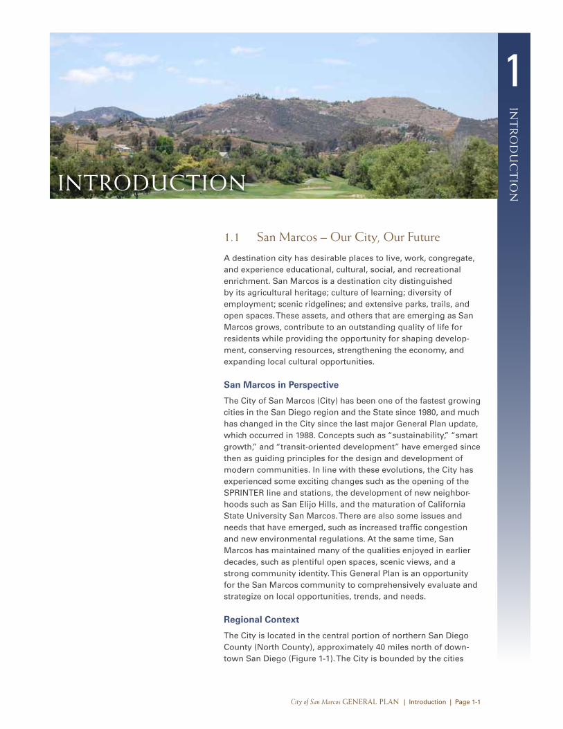
1.1 San Marcos – our city, our Future
A destination city has desirable places to live, work, congregate, and experience educational, cultural, social, and recreational enrichment. San Marcos is a destination city distinguished by its agricultural heritage; culture of learning; diversity of employment; scenic ridgelines; and extensive parks, trails, and open spaces. These assets, and others that are emerging as San Marcos grows, contribute to an outstanding quality of life for residents while providing the opportunity for shaping develop-ment, conserving resources, strengthening the economy, and expanding local cultural opportunities.
San Marcos in Perspective
The City of San Marcos (City) has been one of the fastest growing cities in the San Diego region and the State since 1980, and much has changed in the City since the last major General Plan update, which occurred in 1988. Concepts such as “sustainability,” “smart growth,” and “transit-oriented development” have emerged since then as guiding principles for the design and development of modern communities. In line with these evolutions, the City has experienced some exciting changes such as the opening of the SPRINTER line and stations, the development of new neighbor-hoods such as San Elijo Hills, and the maturation of California State University San Marcos. There are also some issues and needs that have emerged, such as increased traffic congestion and new environmental regulations. At the same time, San Marcos has maintained many of the qualities enjoyed in earlier decades, such as plentiful open spaces, scenic views, and a strong community identity. This General Plan is an opportunity for the San Marcos community to comprehensively evaluate and strategize on local opportunities, trends, and needs.
Regional Context
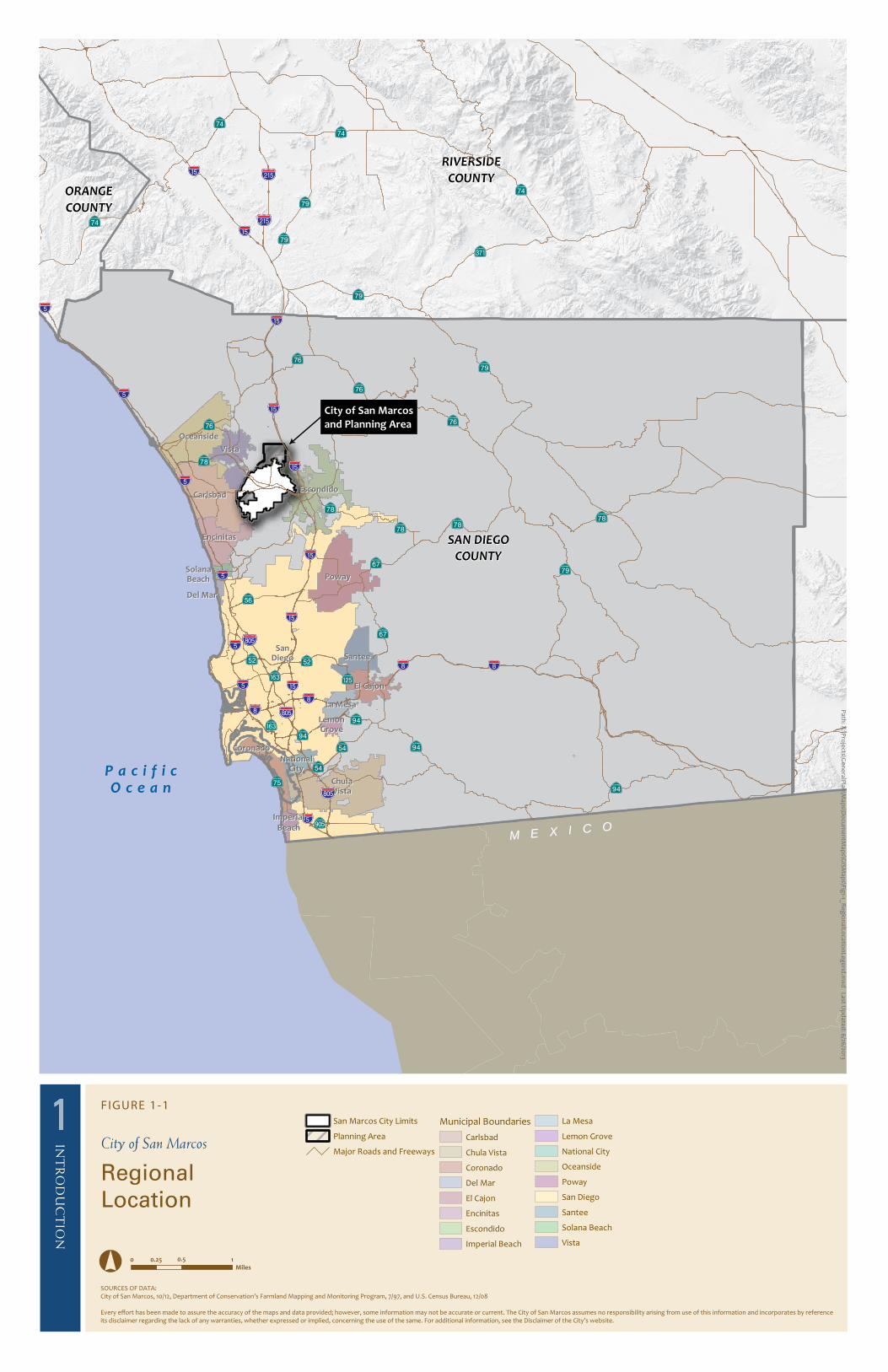
The City is located in the central portion of northern San Diego County (North County), approximately 40 miles north of down-town San Diego (Figure 1-1). The City is bounded by the cities
introduction
1
int
ro
du
ct
ion
City of San Marcos General Plan | Introduction | Page 1-2
of Vista and Carlsbad to the west, the City of Escondido to the east, and unincorporated areas within the County of San Diego to the north and south. Regional access to the City is provided by State Route 78, an east/west highway that links Interstate 5 with Interstate 15, which provide north/south access. Access to and from the City is also provided by the SPRINTER, a com-muter light rail system that connects San Marcos to neighboring jurisdictions. There are no public or private airports located within City boundaries; however, the McClellan-Palomar Airport is located approximately 2.5 miles west of the City within the city of Carlsbad.
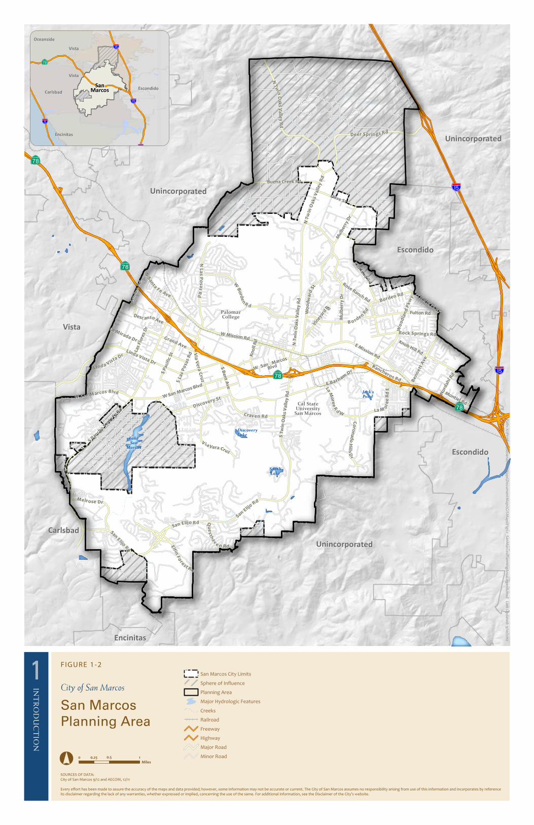
Planning Area
The planning area for San Marcos encompasses the corporate City limits and portions of the County of San Diego’s unincorpo-rated land within the City’s Sphere of Influence (SOI) (Figure 1-2). In total, the planning area encompasses approximately 21,162 acres (33.06 square miles), including approximately 15,579 acres (24.3 square miles) within the City’s corporate limits and 5,586 acres (8.73 square miles) of unincorporated land within the City’s SOI (Table 1-1). See Table 1-2 for population trends and Table 1-3 for housing characteristics.
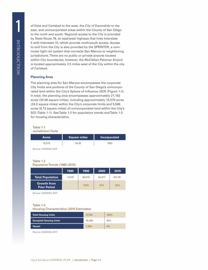
Table 1-1 Jurisdiction Facts
Acres Square miles Incorporated
15,579 24.30 1963
Source: SANDAG 2011
Table 1-2 Population Trends (1980–2010)
1980 1990 2000 2010
Total Population 17,479 38,974 54,977 83,781
Growth from Prior Period
123% 41% 52%
Source: SANDAG 2011
Table 1-3 Housing Characteristics (2010 Estimates)
Total Housing Units 27,744 100%
Occupied Housing Units 26,490 95%
Vacant 1,254 5%
Source: SANDAG 2011
!"a$
!"a$
!"a$
!"̂$
!"̂$
A̧E
EncinitasEncinitas
OceansideOceanside
CarlsbadCarlsbad
VistaVista
EscondidoEscondido
VistaVista
SanSanMarcosMarcos
LA
ND
US
E A
ND
11
INT
RO
DU
CT
ION
FIGURE 1-1
City of San Marcos
RegionalLocation
Miles10.50.250
Pa
th: X
:\Pro
jects\G
en
era
lPla
n\M
ap
s\Fin
alG
P20
1209
\GP
La
nd
Use
.mx
d L
ast U
pd
ate
d: 8
/30
/20
12
SOURCES OF DATA:City of San Marcos, 10/12, Department of Conservation’s Farmland Mapping and Monitoring Program, 7/97, and U.S. Census Bureau, 12/08
Every effort has been made to assure the accuracy of the maps and data provided; however, some information may not be accurate or current. The City of San Marcos assumes no responsibility arising from use of this information and incorporates by reference its disclaimer regarding the lack of any warranties, whether expressed or implied, concerning the use of the same. For additional information, see the Disclaimer of the City’s website.
RIVERSIDE
COUNTYORANGE
COUNTY
SAN DIEGO
COUNTY
!"̂$
?pE
AòE
%&s(
?pEAËE
!"_$
AËE
AËE
A²E
AgE!"̂$
%&s(
!"a$
!"_$?nE
?tE
!"a$A¦E
A̧E
A³E
A³E
!"a$
!"̂$
!"̂$
!"a$
!"̂$%&s(
!"_$
A¦E
A̧EA̧E
A³E
A³E
A¹E
!"̂$
A¹E
A̧E
AäE
?nE
A̧E
!"_$
AËE
%&h(
%&h(
A¹E
A¹E
!"a$
!"a$
!"a$
!"a$
AgE
A¹E!"̂$
A±E
A±EA±E
A±E
AñE
CarlsbadCarlsbad
El CajonEl Cajon
EncinitasEncinitas
ImperialImperial
BeachBeach
La MesaLa Mesa
LemonLemonGroveGrove
NationalNationalCityCity
PowayPoway
SanteeSantee
VistaVista
EscondidoEscondido
OceansideOceanside
ChulaChulaVistaVista
CoronadoCoronado
Del MarDel Mar
SolanaSolanaBeachBeach
SanSanDiegoDiego
M E X I C OM E X I C O
;
City of San Marcos
and Planning Area
P a c i f i cO c e a n
Path: X:\Projects\GeneralPlan\M
aps\Docum
entMaps\G
ISMaps\Fig1-1_R
egionalLocationLegend.mxd Last U
pdated: 6/26/2013
San Marcos City Limits
Planning Area
Major Roads and Freeways
Municipal Boundaries
Carlsbad
Chula Vista
Coronado
Del Mar
El Cajon
Encinitas
Escondido
Imperial Beach
La Mesa
Lemon Grove
National City
Oceanside
Poway
San Diego
Santee
Solana Beach
Vista

1
int
ro
du
ct
ion
City of San Marcos General Plan | Introduction | Page 1-4
This page intentionally left blank.
WWoo
oodd
ll aann
dd PP
kkww
yy
LLaa MMoo
rreeee
RR
dd WW
EE BB aa rr hh aa mm DD
rr
DDeesscc aannssoo AAvvee
E Mission Rd
E Mission Rd
W Mission RdW Mission Rd
BB oo rr dd ee nn RRdd
SS aa nn EE ll ii jj oo RR dd
Fulton RdFulton Rd
Las
Flo
res
Dr
Las
Flo
res
Dr
Montiel Rd
Montiel Rd
SSmm
ii llaa
xx RR
dd
GG rraanndd AAvvee
DD iiss cc oo vv ee rr yy SS tt
RRoossee RRaanncchh RRddEl Norte Pkwy
El Norte Pkwy
BB oo rr dd ee nn RR dd
EEllffiinn
FFoo
rreesstt RRdd
Olive StOlive St
SS SS
aannttaa FF ee AAvvee
N N L L
a as s P P
o os sa a
ss RRdd
Viney
ard R
d
Viney
ard R
d
NN TT
wwii nn
OOaa
kkss
VVaa
ll llee
yy RR
dd
CC rraavv ee nn RR dd
LLiinnddaa VV iissttaa DD rr
WWoo
oodd
wwaa
rr dd SS
tt
QQu u
e ess
tthhaa
vv
ee nn RR dd
NNoo
rr ddaa
hhll RR
dd
LLaa MM
oorr
eeee
RRdd
EE
DD ee ee rr SS pp rr ii nn gg ss RR dd
NN TT
wwiinn
OOa a
k ks s V V
a al ll le e
y y R R
d d
WW BB
oorrdd
eenn RR dd
Buena Creek RdBuena Creek RdSS
LLaa
ss PP
ooss aa
ss RR
dd
S T
win
Oa
ks
Va
lle
y R
d
S T
win
Oa
ks
Va
lle
y R
d
RRiicchh
llaanndd RR
dd
MM eellrr oo ss ee DD rr
Kn
oll
Rd
Kn
oll
Rd
Mu
lber
ry D
r
Mu
lber
ry D
r
S P
acif
ic S
t
S P
acif
ic S
t
C Coo
rroonn
aadd
oo HH
i il ll ls s DDrr
S B
en
t Ave
S B
en
t Ave
RR oo cc kk SS pp rr iinn gg ss RR dd
Knob Hill Rd
Knob Hill Rd
!"a$
A̧E
VViiaa
VVee
rraa CC
rruuzz
VV iiaa VV eerraa CCrruuzz
SSaann EElliijjoo RRdd
SS aa nn EEll ii jj
oo RR dd
WW SS aa nn MM aa rr cc oo ss BBllvvddW San Marcos Blvd
W San Marcos Blvd
WW SS aann MM aarrcc ooss
BBll vvdd
S Ranch
o Santa
Fe R
d
S Ranch
o Santa
Fe R
d
LLaa MMiirraaddaa DD rr
LL ii nn dd aa VVii ss tt aa DD rr
NN TT
wwii nn
OOaa
kkss
VVaa
ll llee
yy RR
dd
Mu
lbe
rry
Dr
Mu
lbe
rry
Dr
BBee
nnnn
eett tt
AAvv
ee
RRaanncchheerrooss RRddA̧E
A̧E
A̧E
!"a$
PalomarPalomarCollegeCollege
Cal StateCal StateUniversityUniversity
San MarcosSan Marcos
DiscoveryDiscoveryLakeLake
Jack’sJack’sPondPond
LakeLakeSanSan
MarcosMarcos
SouthSouthLakeLake
CarlsbadCarlsbad
VistaVista
EscondidoEscondido
EscondidoEscondido
UnincorporatedUnincorporated
UnincorporatedUnincorporated
UnincorporatedUnincorporated
EncinitasEncinitas
!"a$
!"a$
!"a$
!"̂$
!"̂$
A̧E
EncinitasEncinitas
OceansideOceanside
CarlsbadCarlsbad
VistaVista
EscondidoEscondido
VistaVista
SanSanMarcosMarcos
LA
ND
US
E A
ND
11
INT
RO
DU
CT
ION
FIGURE 1-2
City of San Marcos
San MarcosPlanning Area
Miles10.50.250
Path
: X:\P
roje
cts\Ge
ne
ralP
lan\M
ap
s\Do
cum
en
tMa
ps\G
ISM
ap
s\Fig1-2_S
an
Ma
rcosP
lann
ing
Are
aLeg
en
d.m
xd
Last U
pd
ated
: 9/10
/2012
San Marcos City Limits
Sphere of Influence
Planning Area
Major Hydrologic Features
Creeks
Railroad
Freeway
Highway
Major Road
Minor Road
SOURCES OF DATA:City of San Marcos 9/12 and AECOM, 12/11
Every effort has been made to assure the accuracy of the maps and data provided; however, some information may not be accurate or current. The City of San Marcos assumes no responsibility arising from use of this information and incorporates by reference its disclaimer regarding the lack of any warranties, whether expressed or implied, concerning the use of the same. For additional information, see the Disclaimer of the City’s website.
1
int
ro
du
ct
ion
City of San Marcos General Plan | Introduction | Page 1-6
This page intentionally left blank.
1in
tr
od
uc
tio
n
City of San Marcos General Plan | Introduction | Page 1-7
Brief History of the City
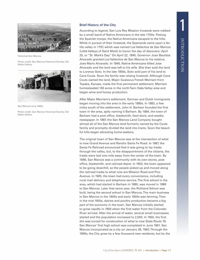
According to legend, San Luis Rey Mission livestock were robbed by a small band of Native Americans in the late 1700s. Fleeing the Spanish troops, the Native Americans escaped to the hills. While in pursuit of their livestock, the Spaniards came upon a fer-tile valley in 1797, which was named Los Vallecitos de San Marcos (Little Valleys of Saint Mark) to honor the day of discovery: April 25, or “St. Mark’s Day.” On April 22, 1840, Governor Juan Bautista Alvarado granted Los Vallecitos de San Marcos to his relative, Jose Mario Alvarado. In 1846, Native Americans killed Jose Alvarado and the land was left to his wife. She then sold the land to Lorenzo Soto. In the late 1850s, Soto sold part of his land to Cave Couts. Soon his family was raising livestock. Although Cave Couts owned the land, Major Gustavus French Merriam from Topeka, Kansas, made the first permanent settlement. Merriam homesteaded 160 acres in the north Twin Oaks Valley area and began wine and honey production.
After Major Merriam’s settlement, German and Dutch immigrants began moving into the area in the early 1880s. In 1883, a few miles south of the settlement, John H. Barham founded the first town in the area, aptly naming it Barham. By 1884, the town of Barham had a post office, blacksmith, feed store, and weekly newspaper. In 1887, the San Marcos Land Company bought almost all of the San Marcos land formerly owned by the Couts family and promptly divided the land into tracts. Soon the beauti-ful hills began attracting home-seekers.
The original town of San Marcos was at the intersection of what is now Grand Avenue and Rancho Santa Fe Road. In 1887, the Santa Fe Railroad announced that it was going to lay tracks through the valley, but, to the disappointment of the citizens, the tracks were laid one mile away from the center of the town. By 1896, San Marcos was a community with its own stores, post office, blacksmith, and railroad depot. In 1903, the town appeared to be going downhill, so the people picked up and moved along the railroad tracks to what now are Mission Road and Pico Avenue. In 1905, the town had every convenience, including rural mail delivery and telephone service. The first school in the area, which had started in Barham in 1880, was moved in 1889 to San Marcos. Later that same year, the Richland School was built, being the second school in San Marcos. The main business in San Marcos in the 1800s and early 1900s was farming. Then in the mid-1900s, dairies and poultry production became a big part of the economy in the town. San Marcos initially started to grow rapidly in 1956 when the first water from the Colorado River arrived. After the arrival of water, several small businesses started and the population increased to 2,500. In 1950, the first dirt was turned for construction of what is now State Route 78. San Marcos’ first high school was completed in June 1961. San Marcos incorporated as a city on January 28, 1963. Through the 1960s, the City grew by a few thousand new residents, but by the
Historical San Marcos
Photo credit: San Marcos Historical Society, Ted Wade Gallery
San Marcos circa 1940s
Photo credit: San Marcos Historical Society, Ted Wade Gallery
1
int
ro
du
ct
ion
City of San Marcos General Plan | Introduction | Page 1-8
1970s, San Marcos was flourishing as the third fastest-growing city in the state, with a population of 17,479 by 1980. Between the years of 1980 and 1990, San Marcos more than doubled its popu-lation to 38,974. By 2010, the population of the City had grown to 83,781, a 52% growth from the 2000 population (see Table 1-2).
Along with more people came the need for more schools. The City now has 11 elementary schools, an English-Learner Academy, 3 middle schools, and 3 high schools. San Marcos also has one charter school and one adult school. Higher education has become a benchmark for the City, as the home to Palomar Community College, California State University San Marcos (CSUSM), and several private higher education institutes special-izing in the high technology and medical fields.
Careful planning for growth begins with the City’s General Plan. It serves as the guiding document for achieving the community’s vision for the future.
What is a General Plan?
A general plan sets forth a city’s long-range planning policies that reflect the aspirations and values of residents, land own-ers, businesses, and organizations within the community. City councils and planning commissions rely on the general plan in considering land use and planning-related decisions, and city staff use the general plan day-to-day in administering land use and development activities. Citizens may reference the general plan to understand the city’s approach to development, protect-ing resources, and upholding community values.
A general plan is a legal document, and much of its content, such as background data, analysis, maps, and exhibits, is established by statutory requirements. California law requires every city and county to prepare and adopt a comprehensive long-range general plan to form the basis for zoning, subdivision, and public works actions.
A general plan is considered comprehensive because it ad-dresses a wide range of issues that affect a city such as the physical development of the jurisdiction or economic and social concerns that can affect the overall quality of life. A general plan is considered “long-term” because it looks 20 years or more into the future. Each jurisdiction can establish a time horizon that best fits its individual needs. The State General Plan Guidelines recommend that general plans be updated every 5 to 10 years to ensure that they remain relevant and reflect local physical and demographic changes, and broader changes in culture and technology.
Modern San Marcos boasts a beautiful Civic Center (top) and vibrant activity centers (bot-tom).
Photo credit: City of San Marcos
1in
tr
od
uc
tio
n
City of San Marcos General Plan | Introduction | Page 1-9
Seven specific “Elements” in California planning law are mandatory for inclusion in general plans: Land Use, Housing, Circulation, Conservation, Open Space, Noise, and Safety. These issues directly affect the community’s neighborhoods and quality of life. A local jurisdiction may adopt a general plan in the format that best fits its unique circumstances. In doing so, the jurisdiction must ensure that the general plan and its component parts comprise an integrated, internally consistent, and compat-ible statement of development policies and implementation programs to achieve its vision. The San Marcos General Plan is intended to guide the community and decision makers in prioritizing issues related to land use, capital improvements, and budgeting. City actions and programs related to issues addressed in the General Plan must be consistent with the General Plan.
Shaping the General Plan—General Plan Development and Community Participation
In Fall 2009, the City kicked off a comprehensive update of its General Plan. At the heart of the update was an extensive public involvement process. The San Marcos City Council established a comprehensive public participation program to develop a General Plan that truly reflects the vision of the community. For the General Plan to clarify a long-range vision, establish policy guidelines for addressing growth and development, and maintain the desirable qualities of the City, it must reflect the values, priorities, and concerns of San Marcos residents, land and busi-ness owners, and other stakeholders. Ensuring effective public involvement in the update process is a critical component, and one of the keys to developing a successful General Plan.
The General Plan public participation program included a series of public workshops, a telephone survey, youth program, news-letters, a project website, and a project phone line. In addition, the City Council established a General Plan Advisory Committee (GPAC) composed of a cross-section of community members to provide feedback to the General Plan team. Through these efforts, the community’s input was solicited at key steps in the process, and the policy framework of the General Plan reflects the priori-ties, needs, and aspirations of the community. Each aspect of the public participation program is discussed in the following paragraphs.
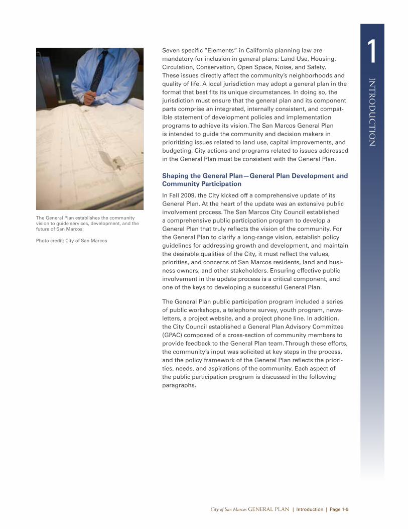
The General Plan establishes the community vision to guide services, development, and the future of San Marcos.
Photo credit: City of San Marcos
1
int
ro
du
ct
ion
City of San Marcos General Plan | Introduction | Page 1-10
General Plan Advisory Committee
The GPAC was appointed by the City Council on October 13, 2009. The GPAC played an important role in the public participa-tion process for the General Plan update. The GPAC consisted of a diverse group of community representatives such as residents, local employment and commerce leaders, youth members and older adults, and Palomar Community College and CSUSM appointees.
The mission of the GPAC was to assist the General Plan team with the following:
• engaging the community in the General Plan update process;
• listening to community ideas and input on alternative approaches for the General Plan and Zoning Ordinance;
• evaluating land use and mobility alternative approaches; and
• making recommendations on the updated General Plan and Zoning Ordinance to address future challenges.
All meetings were open to the public and announced on the City’s website.
Public Workshops
As part of the General Plan update process, the City hosted a three-part series of public workshops beginning in late 2009. Outreach for these meetings involved newsletters and post cards mailed to all San Marcos residents, local newspaper coverage, and the City’s General Plan website. The first public workshop series allowed participants to discuss and provide feedback on goals for the future of San Marcos, ultimately forming the community’s vision for San Marcos, or the Guiding Themes. The second series of workshops focused on obtaining input and feedback on a set of sustainable land use alternatives presented in April 2010. Based on feedback received from the public and the GPAC during the second workshop series, the project team created a set of refined land use alternatives to present at the third series of workshops, held in September 2010. Participants attending all workshops were encouraged to provide written comments, which played an integral role in the development of the General Plan.
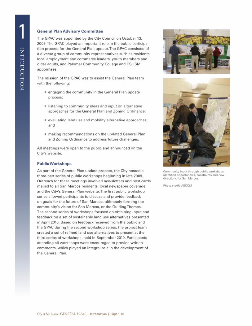
Community input through public workshops identified opportunities, constraints and new directions for San Marcos.
Photo credit: AECOM
1in
tr
od
uc
tio
n
City of San Marcos General Plan | Introduction | Page 1-11
Youth Workshop
To hear the hopes, aspirations, and perspectives from some of the younger residents of San Marcos, a youth City planning mini-workshop was held as part of the Adventure Day Camp program on November 16, 2009. Approximately 40 local children ages 5 through 8 participated in the mini-workshop.
The objectives of the youth City planning workshop were as follows:
• educate local children about the different types of places that make up cities;
• provide an introduction to city planning;
• collect input on what local children would like San Marcos to be like in the future; and
• assemble the children’s input.
During the initial part of the workshop, the children were intro-duced to the concept of cities, city planning, and city planners. They then participated in a “Perfect City” drawing activity. The children drew their perfect city and also responded to the phrase, “My Perfect City is a place where…”. For the second activity, the children were given a “My City” card and were encouraged to write answers to the phrase “Ideas to improve San Marcos.” The Perfect City drawings and the My City cards were mounted on boards and displayed at all four locations of public workshop #1.
Newsletters/Public Notifications
The City used a series of newsletters to inform residents about the General Plan update and opportunities for input. The newslet-ters also served as an invitation to the public workshops. The first newsletter was sent to every household in the City. The second newsletter was sent to households that indicated an interest in receiving General Plan process updates and residents within proximity to any of the areas identified for land use change as part of the General Plan update.
In addition to the General Plan newsletters, the City also publishes the San Marcos 360 newsletter three times a year to update residents and business owners on important issues and other timely community news. The San Marcos 360 newsletter is distributed via mail to every residence and business in San Marcos, totaling a distribution of more than 30,000 copies. Since the initiation of the General Plan update process in 2009, the City has published seven San Marcos 360 newsletters, all of which included an article about the General Plan update.
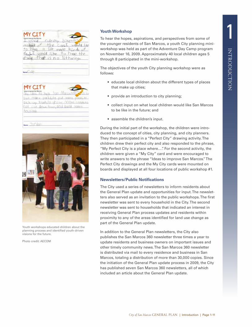
Youth workshops educated children about the planning process and identified youth-driven visions for the future.
Photo credit: AECOM
1
int
ro
du
ct
ion
City of San Marcos General Plan | Introduction | Page 1-12
Community Telephone Survey
To ensure that the General Plan update reflects the values, priorities, and concerns of all residents in San Marcos, including those who were unable to participate in workshops or meetings, the City commissioned a research firm to design and conduct a community survey to produce objective, statistically reliable measures of resident opinions on a number of issues to be addressed in the General Plan update. The survey results were combined with the information gathered through public work-shop series #1, the youth program, and initial GPAC meetings to help inform the creation of the Guiding Themes. A total of 400 randomly selected adult residents who are registered to vote in San Marcos participated in the survey November 6–12, 2009.
Website
Since the General Plan update process began, a dedicated website served as a one-stop clearinghouse for information. The website included a document library with up-to-date General Plan documents, public workshop summaries, GPAC meeting agendas and materials, and a comment form that has generated hundreds of questions and suggestions.
Other Outreach Efforts
In addition to the activities discussed above, City staff made efforts to include community members in the General Plan update process by being present at community events such as local street fairs. In addition, maps and other materials have been on display at the City of San Marcos Developmental Services Department, which is open to the public and staffed during weekdays. City staff also reached out to different segments of the community that expressed interest in the update process, providing focused General Plan presentations to the City’s active industrial community, community members residing in the El Dorado Mobile Home Park and Palomar Estates Mobile Home Park, and members of the Palomar Pomerado Health Club.
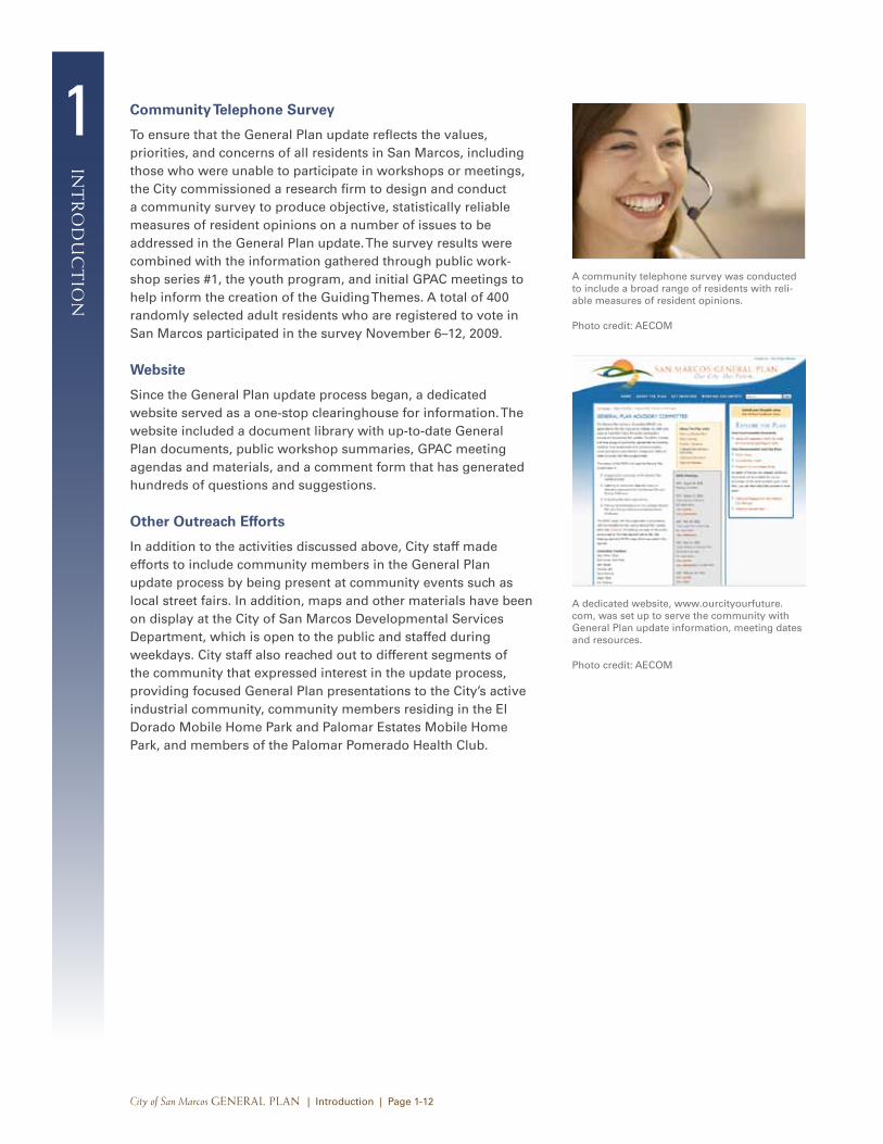
A community telephone survey was conducted to include a broad range of residents with reli-able measures of resident opinions.
Photo credit: AECOM
A dedicated website, www.ourcityourfuture.com, was set up to serve the community with General Plan update information, meeting dates and resources.
Photo credit: AECOM
1in
tr
od
uc
tio
n
City of San Marcos General Plan | Introduction | Page 1-13
1.2 Guiding themes
The community raised a range of issues and ideas during the outreach activities described above. This section synthesizes the input received from the public workshop #1 series, the commu-nity telephone survey, the youth program, and GPAC meetings into a set of Guiding Themes that encapsulate the community’s desires and visions for the City’s future. The Guiding Themes provide a framework for the General Plan by serving as a basis for policy formulation and planning programs. They also helped to direct the investigation of opportunities and challenges during the planning process, and served as a yardstick for evaluating the suitability of land use and mobility alternatives.
The Guiding Themes identified expand on the concept of creating a great destination city while appreciating and respecting the assets San Marcos already possesses. The Guiding Themes for the San Marcos General Plan are provided below. Their ordering is not indicative of priority or importance.
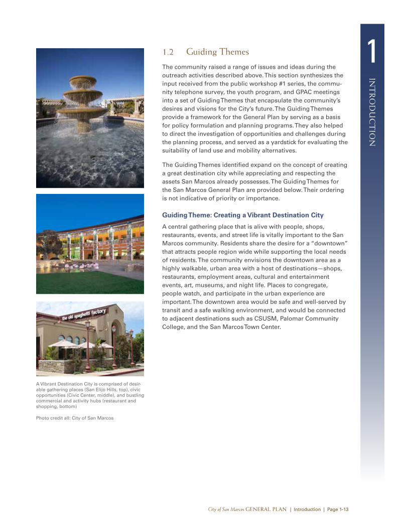
Guiding Theme: Creating a Vibrant Destination City
A central gathering place that is alive with people, shops, restaurants, events, and street life is vitally important to the San Marcos community. Residents share the desire for a “downtown” that attracts people region wide while supporting the local needs of residents. The community envisions the downtown area as a highly walkable, urban area with a host of destinations—shops, restaurants, employment areas, cultural and entertainment events, art, museums, and night life. Places to congregate, people watch, and participate in the urban experience are important. The downtown area would be safe and well-served by transit and a safe walking environment, and would be connected to adjacent destinations such as CSUSM, Palomar Community College, and the San Marcos Town Center.
A Vibrant Destination City is comprised of desir-able gathering places (San Elijo Hills, top), civic opportunities (Civic Center, middle), and bustling commercial and activity hubs (restaurant and shopping, bottom)
Photo credit all: City of San Marcos
1
int
ro
du
ct
ion
City of San Marcos General Plan | Introduction | Page 1-14
Guiding Theme: A Strong Local Economy and Employment Base
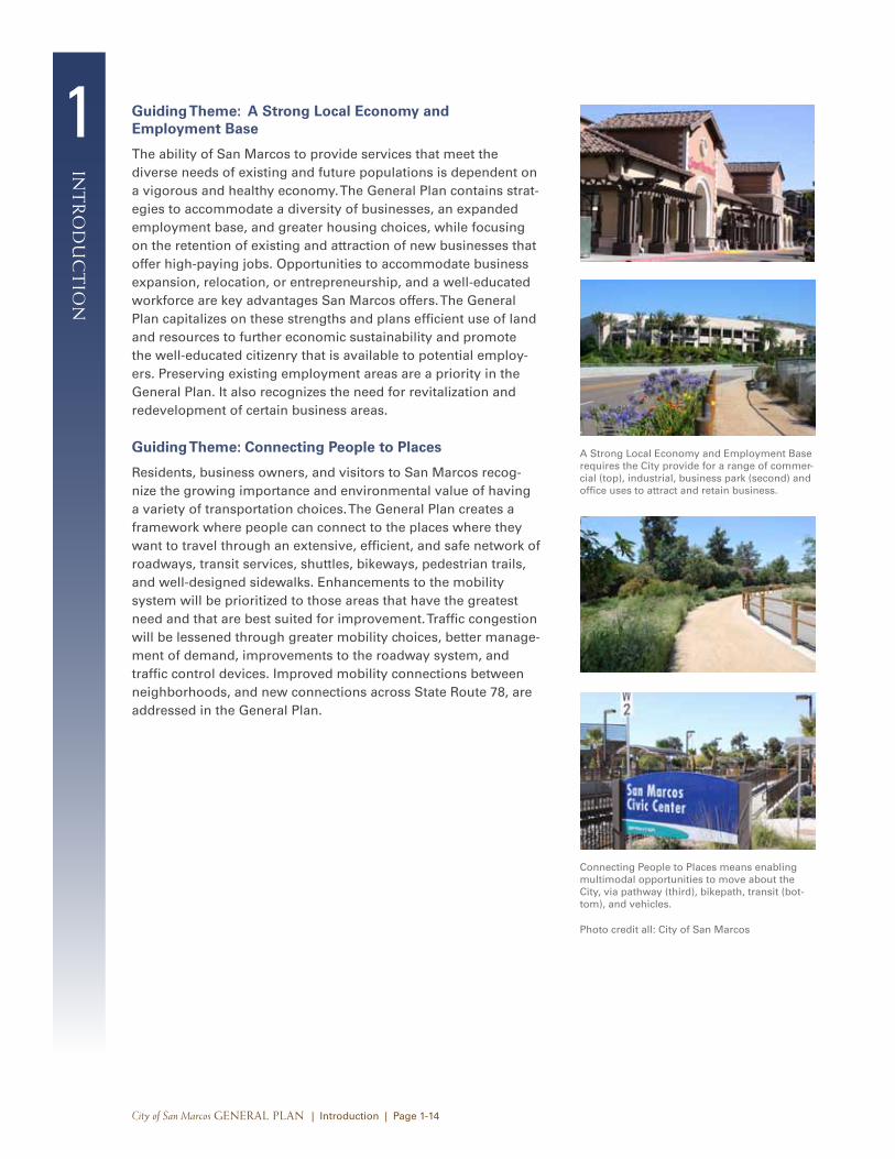
The ability of San Marcos to provide services that meet the diverse needs of existing and future populations is dependent on a vigorous and healthy economy. The General Plan contains strat-egies to accommodate a diversity of businesses, an expanded employment base, and greater housing choices, while focusing on the retention of existing and attraction of new businesses that offer high-paying jobs. Opportunities to accommodate business expansion, relocation, or entrepreneurship, and a well-educated workforce are key advantages San Marcos offers. The General Plan capitalizes on these strengths and plans efficient use of land and resources to further economic sustainability and promote the well-educated citizenry that is available to potential employ-ers. Preserving existing employment areas are a priority in the General Plan. It also recognizes the need for revitalization and redevelopment of certain business areas.
Guiding Theme: Connecting People to Places
Residents, business owners, and visitors to San Marcos recog-nize the growing importance and environmental value of having a variety of transportation choices. The General Plan creates a framework where people can connect to the places where they want to travel through an extensive, efficient, and safe network of roadways, transit services, shuttles, bikeways, pedestrian trails, and well-designed sidewalks. Enhancements to the mobility system will be prioritized to those areas that have the greatest need and that are best suited for improvement. Traffic congestion will be lessened through greater mobility choices, better manage-ment of demand, improvements to the roadway system, and traffic control devices. Improved mobility connections between neighborhoods, and new connections across State Route 78, are addressed in the General Plan.
A Strong Local Economy and Employment Base requires the City provide for a range of commer-cial (top), industrial, business park (second) and office uses to attract and retain business.
Connecting People to Places means enabling multimodal opportunities to move about the City, via pathway (third), bikepath, transit (bot-tom), and vehicles.
Photo credit all: City of San Marcos
1in
tr
od
uc
tio
n
City of San Marcos General Plan | Introduction | Page 1-15
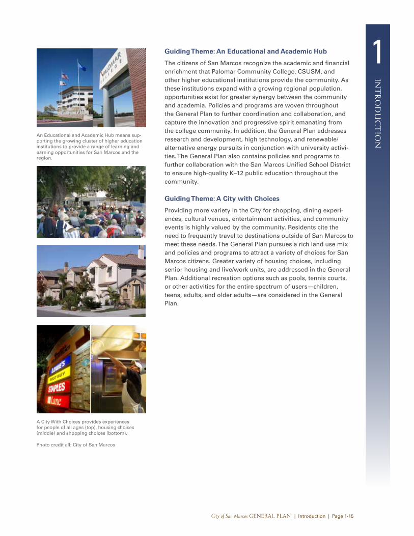
Guiding Theme: An Educational and Academic Hub
The citizens of San Marcos recognize the academic and financial enrichment that Palomar Community College, CSUSM, and other higher educational institutions provide the community. As these institutions expand with a growing regional population, opportunities exist for greater synergy between the community and academia. Policies and programs are woven throughout the General Plan to further coordination and collaboration, and capture the innovation and progressive spirit emanating from the college community. In addition, the General Plan addresses research and development, high technology, and renewable/alternative energy pursuits in conjunction with university activi-ties. The General Plan also contains policies and programs to further collaboration with the San Marcos Unified School District to ensure high-quality K–12 public education throughout the community.
Guiding Theme: A City with Choices
Providing more variety in the City for shopping, dining experi-ences, cultural venues, entertainment activities, and community events is highly valued by the community. Residents cite the need to frequently travel to destinations outside of San Marcos to meet these needs. The General Plan pursues a rich land use mix and policies and programs to attract a variety of choices for San Marcos citizens. Greater variety of housing choices, including senior housing and live/work units, are addressed in the General Plan. Additional recreation options such as pools, tennis courts, or other activities for the entire spectrum of users—children, teens, adults, and older adults—are considered in the General Plan.
An Educational and Academic Hub means sup-porting the growing cluster of higher education institutions to provide a range of learning and earning opportunities for San Marcos and the region.
A City With Choices provides experiences for people of all ages (top), housing choices (middle) and shopping choices (bottom).
Photo credit all: City of San Marcos
1
int
ro
du
ct
ion
City of San Marcos General Plan | Introduction | Page 1-16
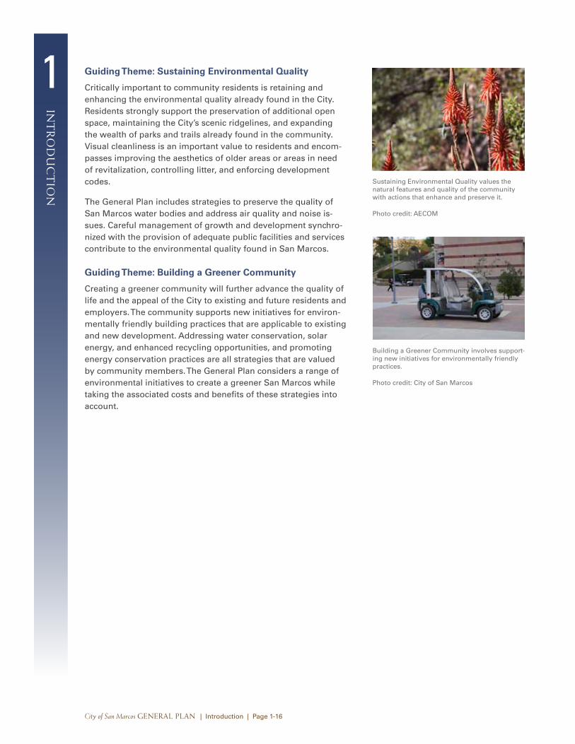
Guiding Theme: Sustaining Environmental Quality
Critically important to community residents is retaining and enhancing the environmental quality already found in the City. Residents strongly support the preservation of additional open space, maintaining the City’s scenic ridgelines, and expanding the wealth of parks and trails already found in the community. Visual cleanliness is an important value to residents and encom-passes improving the aesthetics of older areas or areas in need of revitalization, controlling litter, and enforcing development codes.
The General Plan includes strategies to preserve the quality of San Marcos water bodies and address air quality and noise is-sues. Careful management of growth and development synchro-nized with the provision of adequate public facilities and services contribute to the environmental quality found in San Marcos.
Guiding Theme: Building a Greener Community
Creating a greener community will further advance the quality of life and the appeal of the City to existing and future residents and employers. The community supports new initiatives for environ-mentally friendly building practices that are applicable to existing and new development. Addressing water conservation, solar energy, and enhanced recycling opportunities, and promoting energy conservation practices are all strategies that are valued by community members. The General Plan considers a range of environmental initiatives to create a greener San Marcos while taking the associated costs and benefits of these strategies into account.
Sustaining Environmental Quality values the natural features and quality of the community with actions that enhance and preserve it.
Photo credit: AECOM
Building a Greener Community involves support-ing new initiatives for environmentally friendly practices.
Photo credit: City of San Marcos
1in
tr
od
uc
tio
n
City of San Marcos General Plan | Introduction | Page 1-17
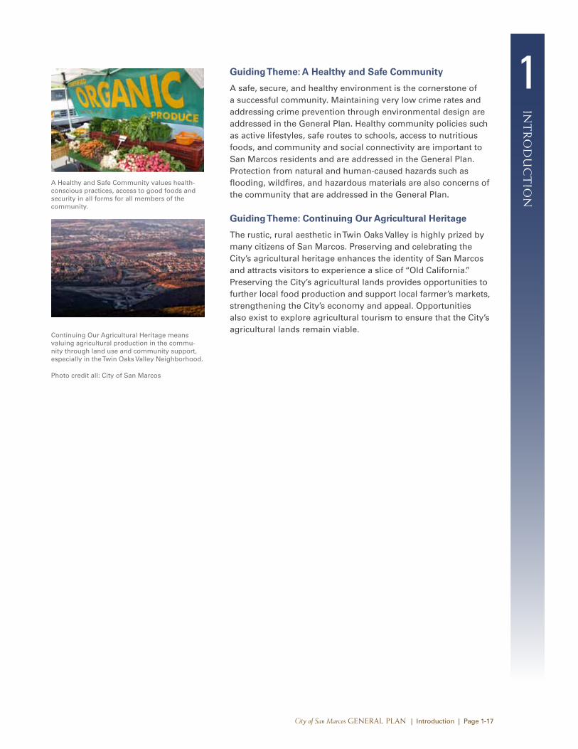
Guiding Theme: A Healthy and Safe Community
A safe, secure, and healthy environment is the cornerstone of a successful community. Maintaining very low crime rates and addressing crime prevention through environmental design are addressed in the General Plan. Healthy community policies such as active lifestyles, safe routes to schools, access to nutritious foods, and community and social connectivity are important to San Marcos residents and are addressed in the General Plan. Protection from natural and human-caused hazards such as flooding, wildfires, and hazardous materials are also concerns of the community that are addressed in the General Plan.
Guiding Theme: Continuing Our Agricultural Heritage
The rustic, rural aesthetic in Twin Oaks Valley is highly prized by many citizens of San Marcos. Preserving and celebrating the City’s agricultural heritage enhances the identity of San Marcos and attracts visitors to experience a slice of “Old California.” Preserving the City’s agricultural lands provides opportunities to further local food production and support local farmer’s markets, strengthening the City’s economy and appeal. Opportunities also exist to explore agricultural tourism to ensure that the City’s agricultural lands remain viable.
A Healthy and Safe Community values health-conscious practices, access to good foods and security in all forms for all members of the community.
Continuing Our Agricultural Heritage means valuing agricultural production in the commu-nity through land use and community support, especially in the Twin Oaks Valley Neighborhood.
Photo credit all: City of San Marcos
1
int
ro
du
ct
ion
City of San Marcos General Plan | Introduction | Page 1-18
1.3 next Steps for San Marcos
Planning a Sustainable Community
Sustainability is defined as the ability to “meet the needs of the present without compromising the ability of future generations to meet their own needs.” The three components of a sustainable community are a prosperous economy, a quality environment, and social equality.
Sustainability is a global issue of increasing urgency. San Marcos has the ability to become more environmentally sustainable by reducing its ecological footprint. The City is committed to making decisions and carrying out actions that promote all three sustainability concepts. Sustainability is reflected throughout this General Plan and is the basis for many of the policies and pro-grams included in the Implementation Plan (addressed below).
Next Steps Toward a Sustainable San Marcos
Creating and maintaining a sustainable community will require incorporating sustainable principles into the City’s everyday actions and decisions, monitoring progress, and adapting to changing conditions and new information. The General Plan has incorporated sustainable principles into every Element; therefore, decisions that are consistent with the goals and policies of the General Plan will advance the overarching goal of sustainability.
Individual decisions and actions that the City takes are not ex-pected to equally balance the three components of sustainability. Instead, the combination of decision-making consistent with the General Plan and implementing actions identified in the General Plan will, through time, result in a balanced and sustainable City. Partnerships and ongoing communication are critical tools for achieving a sustainable San Marcos. Residents, businesses, com-munity groups, schools, and other organizations all need to be engaged and actively participate in the effort to create a socially, environmentally, and economically healthy community.
The City will be an effective leader and partner in sustainability efforts. Participation in larger scale sustainability efforts is critical because local environmental, economic, and social issues cannot be separated from their broader regional, national, and global context. The General Plan promotes the development of strong working relationships between the City and other entities, such as the San Diego Association of Governments (SANDAG), San Diego County, CSUSM, San Marcos Unified School District, local businesses, nonprofit organizations, and other government agen-cies, to accomplish San Marcos’s sustainability goals.
1in
tr
od
uc
tio
n
City of San Marcos General Plan | Introduction | Page 1-19
The City’s local goals for sustainability will exist alongside sustainability and emissions reduction goals and laws of federal, state, and local agencies, including local utilities. Far from exist-ing in isolation, the City’s goals will be implemented as part of a web of inter-related activities, many of them outside of the City’s influence. So while the City’s own goals are to provide clear long-term direction, the shorter term implementing programs must be adaptable to the changing economic, environmental, and political climate, and to the influence of activities being managed by other agencies.
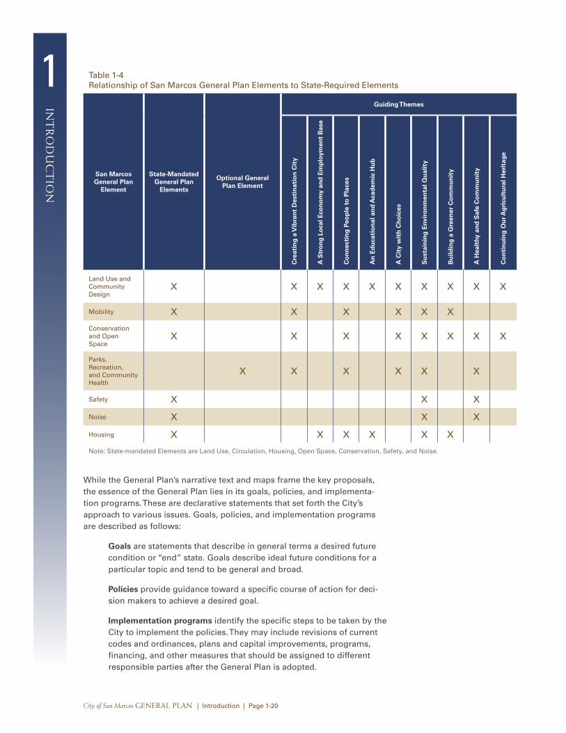
Navigating the General Plan
The San Marcos General Plan includes this Introduction, seven General Plan Elements, a General Plan Implementation Plan, a description of related plans and programs, and a glossary of terms that are used throughout this General Plan.
General Plan Content and Structure
Although certain general plan elements are required of all juris-dictions in California, the content of the San Marcos General Plan represents the local values of residents, the business community, and public officials manifested in the community-driven Guiding Themes—namely, promoting San Marcos as a destination City thriving with high-quality sustainable development; a positive business environment with a strong employment base; and a City with interconnected spaces with well-maintained parks, open spaces, and natural resources.
To address these values, the San Marcos General Plan is orga-nized into the following elements:
• Land Use and Community Design
• Mobility
• Conservation and Open Space
• Parks, Recreation, and Community Health
• Safety
• Noise
• Housing
The San Marcos General Plan combines related topics required by state law, and provides a separate, optional Element pertain-ing to parks, recreation, and community health. The result is a concise, easy-to-read, and usable document that reflects the community’s desire to attain its vision. Table 1-4 provides the relationship between San Marcos General Plan Elements and the State-required General Plan Elements.
1
int
ro
du
ct
ion
City of San Marcos General Plan | Introduction | Page 1-20
Table 1-4 Relationship of San Marcos General Plan Elements to State-Required Elements
San Marcos General Plan
Element
State-Mandated General Plan
Elements
Optional General Plan Element
Guiding Themes
Cre
atin
g a
Vib
ran
t D
esti
nat
ion
Cit
y
A S
tro
ng
Lo
cal E
con
om
y an
d E
mp
loym
ent
Bas
e
Co
nn
ecti
ng
Peo
ple
to
Pla
ces
An
Ed
uca
tio
nal
an
d A
cad
emic
Hu
b
A C
ity
wit
h C
ho
ices
Su
stai
nin
g E
nvir
on
men
tal Q
ual
ity
Bu
ildin
g a
Gre
ener
Co
mm
un
ity
A H
ealt
hy a
nd
Saf
e C
om
mu
nit
y
Co
nti
nu
ing
Ou
r Ag
ricu
ltu
ral H
erit
age
Land Use and Community Design
X X X X X X X X X X
Mobility X X X X X X
Conservation and Open Space
X X X X X X X X
Parks, Recreation, and Community Health
X X X X X X
Safety X X X
Noise X X X
Housing X X X X X X
Note: State-mandated Elements are Land Use, Circulation, Housing, Open Space, Conservation, Safety, and Noise.
While the General Plan’s narrative text and maps frame the key proposals, the essence of the General Plan lies in its goals, policies, and implementa-tion programs. These are declarative statements that set forth the City’s approach to various issues. Goals, policies, and implementation programs are described as follows:
Goals are statements that describe in general terms a desired future condition or “end” state. Goals describe ideal future conditions for a particular topic and tend to be general and broad.
Policies provide guidance toward a specific course of action for deci-sion makers to achieve a desired goal.
Implementation programs identify the specific steps to be taken by the City to implement the policies. They may include revisions of current codes and ordinances, plans and capital improvements, programs, financing, and other measures that should be assigned to different responsible parties after the General Plan is adopted.
1in
tr
od
uc
tio
n
City of San Marcos General Plan | Introduction | Page 1-21
The General Plan is a dynamic document. State law allows local governments to amend the mandatory elements of the General Plan up to four times per calendar year. As time passes after a number of such amendments, the City may find it desirable to revise portions of the General Plan text to reflect the land use map changes or other changing circumstances or philosophies. The City should comprehensively review its General Plan every five years to determine whether it is still in step with community values and physical and economic conditions.
Organization of the General Plan
The organization of the General Plan allows users to find topics or sections that interest them and to quickly review City policies. Policies throughout all Elements are interrelated and should be examined comprehensively and considered together when making planning decisions.
The seven General Plan Elements are generally organized in a similar format. Each Element identifies related goals and policies, and contains an Introduction, Background, and Plan section, as described below. In addition, the General Plan Implementation Program provides a course of action for the City to implement to ensure that the overall direction provided by the goals and poli-cies set forth in the General Plan is translated from general terms into specific actions. The issues addressed in each Element often overlap. Each Element is organized using the following sections:
Introduction. This section indicates the purpose of each Element and how it will help the City achieve its vision for the community as articulated through the Guiding Themes.
Background. This section provides existing conditions and/or the environmental setting particular to that Element topic. This information provides the rationale and the content for the Plan section.
Plan. The Plan section is composed of issues, goals, and policies. It describes issues and concerns expressed by the community, City staff, and the City Council. The issues and concerns are also reflective of the Guiding Themes. The goals and policies section sets both broad and specific direction for the future of the City based on the identified issues and concerns.
The San Marcos General Plan also contains the following appendices, which are integral parts of the General Plan:
Implementation Plan. The Implementation Plan follows the Elements and identifies the specific actions that will achieve the goals, policies, and plans identified in each element. The Implementation Program is an important part
1
int
ro
du
ct
ion
City of San Marcos General Plan | Introduction | Page 1-22
of the City’s biannual budgeting process. In preparation for each budgeting cycle, each City department actively reviews the General Plan and Implementation Program when determining what major plans and projects will be proposed for consideration by the City Council.
Related Plans and Programs. This section identifies plans and programs related to the General Plan and its applica-tion and administration.
Glossary. This section provides definitions for technical terms used throughout the General Plan.
Focus Area and Specific Plan Summary. This section provides a synopsis of Focus Areas and Specific Plans referenced throughout the General Plan.
General Plan Element Relationships
Each of the San Marcos General Plan Elements is intrinsically related to one another in various ways. The following paragraphs describe the connections between the Elements and how they are woven together to create an integrated, holistic plan.
Land Use and Community Design Element
The Land Use and Community Design Element is considered the “umbrella” element of the General Plan, encompassing issues and policies that are considered interconnected with other Elements. For example, land use policies within the City have a direct bearing on the local street system identified in the Mobility Element. Issues and needs identified in the Housing Element have led to an emphasis on providing options for some additional affordable housing within the community as a compo-nent of future development options for vacant and underutilized properties within the City. The Land Use Element also designates areas to be used as open spaces and areas for conservation and preservation of natural resources. Goals and policies on the preservation and maintenance of these areas are also addressed in the Conservation and Open Space Element and the Parks, Recreation, and Community Health Element. Implementation of goals and policies related to air quality and greenhouse gas emissions discussed in the Conservation and Open Space Element depends, in part, on consistency with the Land Use and Mobility Elements.
1in
tr
od
uc
tio
n
City of San Marcos General Plan | Introduction | Page 1-23
To comply with noise-level requirements, land use designations are determined in tandem with noise contour maps in the Noise Element. Provisions are made in the Noise Element to allow higher noise levels within the mixed-use environments promoted in the Land Use Element. To mitigate or avoid damage and injury from natural and human-caused hazards, hazards maps in the Safety Element must also be consistent with the Land Use and Community Design Element. Infrastructure and community facili-ties discussed in the Land Use and Community Design Element are most closely related to the Housing Element, as it relies on available infrastructure to guide new housing to suitable sites.
Mobility Element
Land use and mobility issues are closely related. The develop-ment potential, within the Focus Areas and vacant or under-utilized properties throughout the planning area, identified in the Land Use and Community Design Element is the basis for the future multi-modal network identified in Mobility Element. The transportation policies found in the Mobility Element are directly linked to the programs and policies developed in the Noise Element. Transportation facilities are largely responsible for excessive noise levels in certain locations in the community. Projected noise distribution, depicted as noise contours in the Noise Element, is corollary to the Mobility Plan. Policies and plans contained in the Noise Element are largely based on the Mobility Element and are aimed to minimize the effects of transportation noise on current and planned land uses.
Conservation and Open Space Element
The Conservation and Open Space Element overlaps with provisions found in the Land Use and Community Design, Parks, Recreation and Community Health, and Safety Elements. However, this Element differs by being oriented almost exclu-sively toward natural resources, air quality, and greenhouse gas emissions. Land use patterns created and maintained by policies in the Land Use and Community Design Element directly influ-ence the generation of air pollutants and greenhouse gases. The conservation component contains goals and policies that further the protection and maintenance of the resources in San Marcos. These resources include water, soils, biological resources, miner-als, and other natural resources that should be considered to prevent wasteful exploitation, degradation, and destruction.
1
int
ro
du
ct
ion
City of San Marcos General Plan | Introduction | Page 1-24
Parks, Recreation, and Community Health Element
The Parks, Recreation, and Community Health Element is most closely related to the Land Use and Community Design Element, as it identifies desired future uses for all lands within the City. Such uses include parks, recreational facilities, and public and privately owned open spaces to meet the needs of existing and future generations. The Mobility Element relates to the Parks, Recreation, and Community Health Element, as it identifies trails and establishes community connections, often through and to local parks and recreational facilities.
Safety Element
The Safety Element identifies areas prone to natural hazards, which must be considered in the designation of land uses in the Land Use and Community Design Element. For example, proposed land uses must comply with the land use compatibility standards contained in this Element for various types of hazards. Traffic-calming goals and policies in the Mobility Element may have implications for emergency response, and recom-mendations for evacuation and emergency access routes in the Safety Element affect the Mobility Element. The Open Space and Conservation Element is also linked to the Safety Element, because open space zones and allowable uses are often related to hazard-prone locations. For example, areas prone to landslide hazards are often set aside as open space because their steep slopes limit other uses.
Noise Element
The Noise Element includes policies and programs that affect implementation of the Land Use and Community Design Element as it relates to both noise sources and noise-sensitive uses. The noise contours and land use compatibility standards contained in the Noise Element should be used when evaluating planning and development decisions directed by the Land Use Element.
The Noise Element also relates to the Mobility Element, because primary noise sources in San Marcos are freeways, arterial roadways, and railways. Policies in the Noise Element mitigate excessive noise along transportation routes. Similarly, Noise Element policies relate to the Housing Element by directing new housing development to appropriate sites away from sources of excessive noise and requiring that design features be incorpo-rated to ensure acceptable indoor and outdoor noise levels.
1in
tr
od
uc
tio
n
City of San Marcos General Plan | Introduction | Page 1-25
Housing Element
The Housing Element most closely relates to the Land Use and Community Design Element, and is consistent with all Elements of the General Plan. Development policies contained in the Land Use and Community Design Element, which establishes the loca-tion, type, density, and distribution of local land uses including housing, most directly relate to the Housing Element. The policies and priorities of both the Housing and Land Use and Community Design Elements have been carefully balanced to maintain internal consistency. Hazards, the natural environment, parks and recreation, and infrastructure considerations discussed in detail in the Safety Element; Conservation and Open Space Element; Parks, Recreation, and Community Health Element; and Land Use and Community Design Element are addressed in the Housing Element, specifically in the context of potential constraints to future residential development.
Documents Related to the General Plan
The San Marcos General Plan is the basis for land use and other municipal decisions. The General Plan itself is not a regulation, but, rather, implementation of the General Plan relies on tools such as the zoning ordinance, subdivision ordinance, design review, capital improvement program, and a variety of special purpose ordinances and programs that are spelled out in the General Plan’s implementing actions. As implementing actions are carried out, ongoing collaboration is essential with com-munity organizations, residents, property owners, businesses, institutions, and other stakeholders.
In accordance with California law and the City of San Marcos Charter, the City’s Zoning Ordinance and other implementation measures must be consistent with the General Plan. Concurrent with this General Plan update, the Zoning Ordinance will be updated to ensure consistency between these two important City documents.
As required by the California Environmental Quality Act (CEQA), an Environmental Impact Report (EIR) has been prepared for the San Marcos General Plan in accordance with the CEQA Statutes and Guidelines. The EIR is a separate document that describes environmental conditions in the City, assesses the possible effects that future development pursuant to the General Plan will have, identifies actions that will be undertaken to reduce these impacts, and evaluates the comparative impacts of alternatives to the General Plan. Many of the policies and programs in the General Plan serve as mitigation for potential impacts. The document is a “program-level” EIR, meaning that it examines the general nature of impacts at a Citywide or planning area scale. The contents of the EIR help determine the appropriate level of environmental review that should be performed when subsequent projects are proposed.
1
int
ro
du
ct
ion
City of San Marcos General Plan | Introduction | Page 1-26
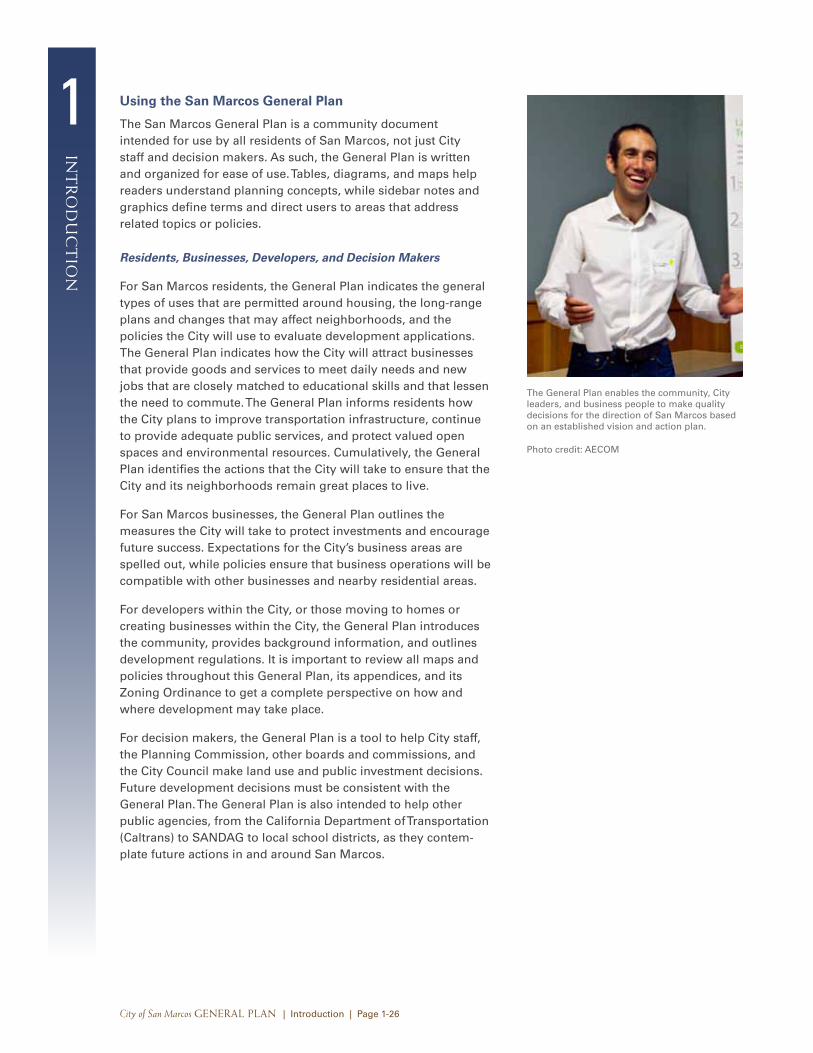
Using the San Marcos General Plan
The San Marcos General Plan is a community document intended for use by all residents of San Marcos, not just City staff and decision makers. As such, the General Plan is written and organized for ease of use. Tables, diagrams, and maps help readers understand planning concepts, while sidebar notes and graphics define terms and direct users to areas that address related topics or policies.
Residents, Businesses, Developers, and Decision Makers
For San Marcos residents, the General Plan indicates the general types of uses that are permitted around housing, the long-range plans and changes that may affect neighborhoods, and the policies the City will use to evaluate development applications. The General Plan indicates how the City will attract businesses that provide goods and services to meet daily needs and new jobs that are closely matched to educational skills and that lessen the need to commute. The General Plan informs residents how the City plans to improve transportation infrastructure, continue to provide adequate public services, and protect valued open spaces and environmental resources. Cumulatively, the General Plan identifies the actions that the City will take to ensure that the City and its neighborhoods remain great places to live.
For San Marcos businesses, the General Plan outlines the measures the City will take to protect investments and encourage future success. Expectations for the City’s business areas are spelled out, while policies ensure that business operations will be compatible with other businesses and nearby residential areas.
For developers within the City, or those moving to homes or creating businesses within the City, the General Plan introduces the community, provides background information, and outlines development regulations. It is important to review all maps and policies throughout this General Plan, its appendices, and its Zoning Ordinance to get a complete perspective on how and where development may take place.
For decision makers, the General Plan is a tool to help City staff, the Planning Commission, other boards and commissions, and the City Council make land use and public investment decisions. Future development decisions must be consistent with the General Plan. The General Plan is also intended to help other public agencies, from the California Department of Transportation (Caltrans) to SANDAG to local school districts, as they contem-plate future actions in and around San Marcos.
The General Plan enables the community, City leaders, and business people to make quality decisions for the direction of San Marcos based on an established vision and action plan.
Photo credit: AECOM


