Embed Size (px)
Citation preview

11. Cartography and GIS
LEGISLATIVE FRAMEWORK AND IMPLEMENTATION ISSUES
FOR SPATIAL DATA INFRASTRUCTURE DEVELOPMENT
IN WESTERN BALKANS REGION
Prof. Dr. Željko Bačić
Dr. Vesna Poslončec-Petrić
Faculty of Geodesy, University of Zagreb, Croatia
ABSTRACT
Adopted in year 2007 the European’s Union directive on Infrastructure for Spatial
Information in European Community (INSPIRE) has defined legislative frame for
establishment of national and European Spatial Data Infrastructures (SDI). Regardless
to the fact that this directive is obligatory only for EU member states, it becomes also
legislative frame for other non-EU countries. In this context, at the same time when
INSPIRE directive has been adopted, countries in the Western Balkans region have
started with development and implementation of national legislations introducing
provisions about national SDI (NSDI). This development has been promoted by
national mapping and cadastre authorities (NMCA) in respective countries and had
definitely a national character. Due to the level of economic development and since
there was no adoption obligation of INSPIRE directive for countries in the Western
Balkans the steps in SDI development and their dynamics differ from development in
European Union.
Relying on own initiative in development of NSDI in respective countries, national
NMCA’s had to search for optimal ways building their national SDI’s. Those
developments were supported through the bilateral cooperation with donor countries,
World Bank and EU projects, but, at the same time it was strongly influenced by
developments in the region, especially after regional cooperation on cadastre and SDI
has been established in year 2008. Established regional cooperation was especially
productive in field of NSDI legislation adoption and institutional development speeding
up the whole process.
The aspects and range of the legislative efforts in the region, as well as its repercussion
on SDI development, is the subject of this paper. Several issues are in the focus of
investigation. The impact of adopted legislations with emphasis on the implemented
solutions, conformity with INSPIRE directive, relevancy of international and regional
cooperation on dynamics of implementation and relevancy of raising public awareness
about the NSDI and its benefits to society.
Keywords: NSDI, Western Balkans, legislative framework, implementation
13th International Multidisciplinary Scientific GeoConference SGEM 2013
INTRODUCTION
Today become commonly accepted that the concept of organizational and technical
measures for collection, organization, dissemination and usage of publicly created
spatial information known as SDI is introduced by definition of legislative framework,
either through one special law or as a part of some other act. For the countries which are
member of European Union, the INSPIRE directive [3] is umbrella act which has been
transposed in national legislations usually by national SDI law. This development is
very recent due to the fact that INSPIRE was adopted in 2007. The Western Balkan
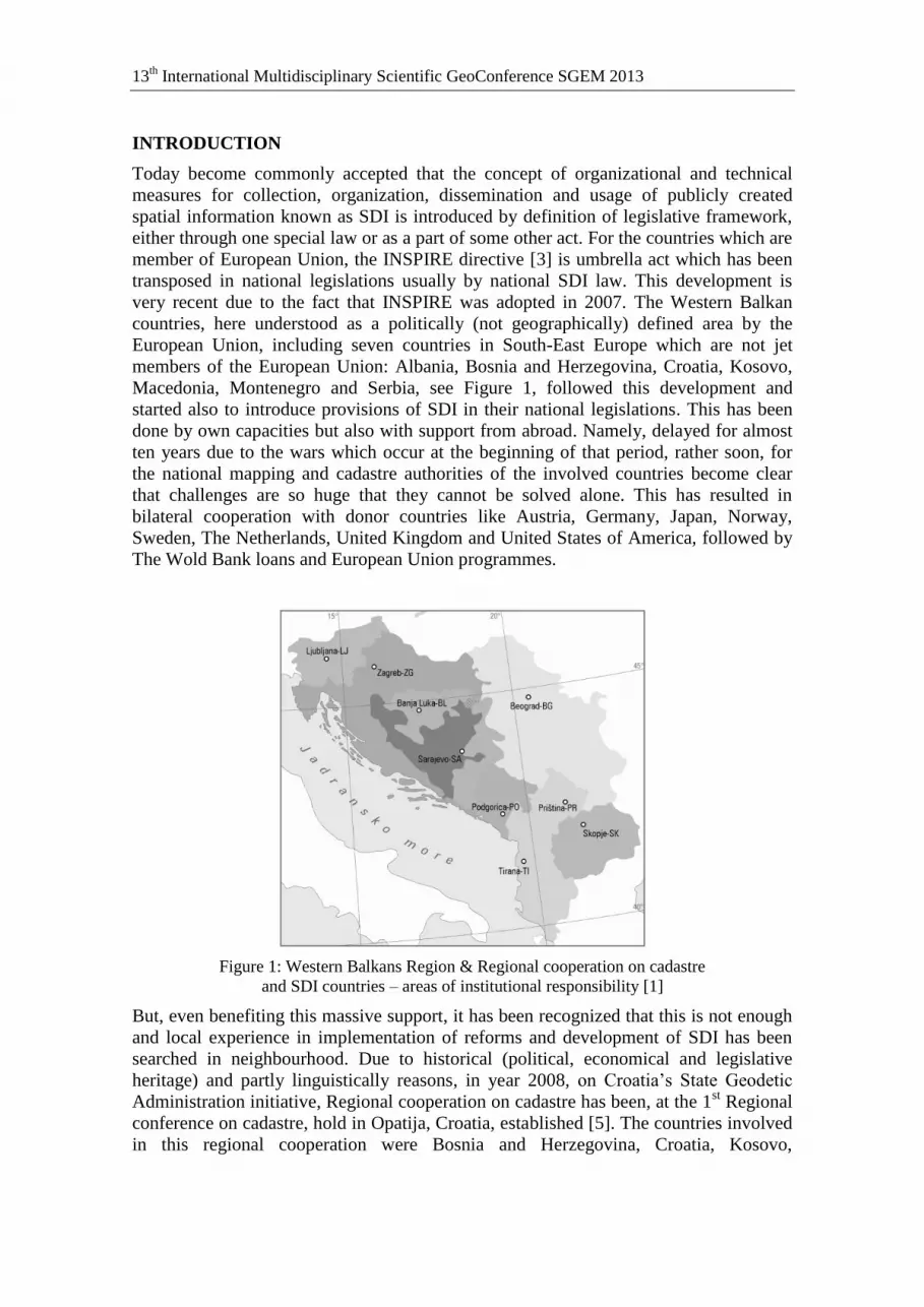
countries, here understood as a politically (not geographically) defined area by the
European Union, including seven countries in South-East Europe which are not jet
members of the European Union: Albania, Bosnia and Herzegovina, Croatia, Kosovo,
Macedonia, Montenegro and Serbia, see Figure 1, followed this development and
started also to introduce provisions of SDI in their national legislations. This has been
done by own capacities but also with support from abroad. Namely, delayed for almost
ten years due to the wars which occur at the beginning of that period, rather soon, for
the national mapping and cadastre authorities of the involved countries become clear
that challenges are so huge that they cannot be solved alone. This has resulted in
bilateral cooperation with donor countries like Austria, Germany, Japan, Norway,
Sweden, The Netherlands, United Kingdom and United States of America, followed by
The Wold Bank loans and European Union programmes.
Figure 1: Western Balkans Region & Regional cooperation on cadastre
and SDI countries – areas of institutional responsibility [1]
But, even benefiting this massive support, it has been recognized that this is not enough
and local experience in implementation of reforms and development of SDI has been
searched in neighbourhood. Due to historical (political, economical and legislative
heritage) and partly linguistically reasons, in year 2008, on Croatia’s State Geodetic
Administration initiative, Regional cooperation on cadastre has been, at the 1st Regional
conference on cadastre, hold in Opatija, Croatia, established [5]. The countries involved
in this regional cooperation were Bosnia and Herzegovina, Croatia, Kosovo,

11. Cartography and GIS
Macedonia, Montenegro, Serbia and Slovenia. Therefore Slovenia is shown on Figure 1,
regardless to fact that is not part of European Union political definition of Western
Balkan. Albania has joined regional cooperation on 3rd
Regional conference hold in
Bečići, Montenegro in 2010 [6], where has also been concluded that regional
cooperation beside cadastre should explicitly expand on SDI area. Developed
cooperation has created situation that countries in the region primarily are developing
their national SDI but secondary, this cooperation results also in regional harmonization
and kind of regional SDI is under development [2].
PRESENT SDI LEGISLATION IN THE REGION
In past seven years, see Figure 2, eight out of nine parliaments (Bosnia and Herzegovina
has two entities), except Federation of Bosnia and Herzegovina, have adopted new state
survey & cadastre legislation, out of which seven (except Kosovo) have introduced
provisions on SDI.
Figure 2: Adoption period of valid main legislation [1]
Regarding extension of SDI provisions in newly introduced legislations they differ from
country to country. Three countries have introduced separate NSDI laws. Slovenia, as
European Union country, has completed the basic process and adopted the Infrastructure
for Spatial Information Act in 2010 [8]. Albania introduced law No. 72/2012 for
organization and functioning of National Infrastructure for Spatial Information in the
Republic of Albania, whereas Croatia, which will become member of the European
Union on July 1st 2013, has done it just recently under the name Law on National
Spatial Data Infrastructure [7]. All three acts are covering all aspects of NSDI
legislation and through those laws Slovenia and Croatia have fully transposed INSPIRE
directive in to their legislation.
Next group of countries, Macedonia, Montenegro, Serbia and Republic Srpska entity in
Bosnia and Herzegovina introduced in frame of national state survey and cadastre laws
chapters on NSDI. Those five to nine article chapters are defining stakeholders,
activities, data sets, services (especially metadata service and national geo-portal) under
the law, access to data and NSDI bodies. It is worth to mention that Agency for Real-
estate Cadastre of Macedonia has drafted their NSDI law and is in process of inter-
ministerial coordination. Finally, Federation of Bosnia and Herzegovina and Kosovo are

13th International Multidisciplinary Scientific GeoConference SGEM 2013
intensively working on preparation of NSDI legislation and their NMCA’s are
expecting to pass those law regulations soon.
Apart from the fact that the majority of the countries have NSDI legislation in place,
very important issue for implementation of NSDI in each country is development and
formal approval/acceptance of national SDI strategy. Either as agency or as official
document of their governments six out of nine responsible institutions (NMCA’s) have
this strategy in place (Albania, Croatia, Macedonia, Serbia, Slovenia and Republic
Srpska in Bosnia and Herzegovina). Those strategies are different in structure, content
and ambition, but all of them include legislative, organizational, educational and
technical issues relevant for establishment and implementation of SDI in respective
countries.
Adopted NSDI legislation incorporates clear and straightforward provisions on
organization of NSDI bodies (except present legislation in Macedonia) enabling their
establishment. In general given roles to NSDI bodies are very similar, whereas their
structure differs from country to country, see Figure 3. Basically there is always a kind
of NSDI Council as a decision making body, some countries have under the Council
NSDI Boards as operational bodies, and under them, formally or informally there are
NSDI Workgroups. Special solution introduced Albanian law on SDI where is also
foreseen to establish special governmental agency which will be responsible for
development and implementation of NSDI.
Figure 3: NSDI organizational structure (existence and number of levels) [1]
Regarding introduced NSDI legislation and organizational structures in the countries in
the region there is visible similarity resulting from the regional cooperation, what is also
logical, due to historical reasons and common, especially legislative, heritage and
practices. It is also logical that stepwise approach has been implemented, introducing
first SDI legislation incorporating only part of INSPIRE Directive provisions, followed
by setting up organization, building first services and applications and executing
extensive public awareness and education campaigns. After reaching certain level of
development of SDI in their countries, second step, introduction of NSDI laws fully
harmonized with INSPIRE directive have been introduced. The mentioned regional
cooperation helped the national institutions to avoid, or better to say reduce starting
errors and wrong steps. Regarding the situation in countries in the region regarding
spatial information, cooperation of governmental institutions, technical preconditions
etc it was not possible to implement directly solutions which developed countries in
Western Europe have introduced for implementation of NSDI in their environments.

11. Cartography and GIS
Therefore, knowledge collected by neighbours and disseminated among the institutions
together with knowledge coming from international partners have created creative
environment for development and implementation of SDI in countries in the region.
PRESENT ACTIVITIES ON SDI IN WESTERN BALKANS
After the first wave of adoption of basic provisions on SDI and establishment of NSDI
bodies in the countries in the region, those NSDI bodies through the activities of
NMCA’s have focused their attention on establishment of basic SDI services, primarily
metadata services and geo-portals, see figure 4.
Figure 4: Examples of NMCA/national geo-portals in Croatia, Serbia, Macedonia
and Montenegro
Regarding other, more complex services focused also more on other governmental
institutions, main stakeholders of NSDI, development was not so fast, see figure 5.
Reason for this is that those services (invoke, transformation, download, discovery, etc)
require, beside functional application and well structured standardized data, also similar
level of preparation, organizational and technical, among all involved stakeholders.
Creating such environment and readiness of all stakeholders for full implementation of
INSPIRE standards is next step in development of NSDI for most of the countries in the
region together with continuation of efforts on standardization of digital data sets and
their update, as described in [4] as well as production of missing products (for example
topographical map in scale 1:250.000 which become standard in the European Union).

13th International Multidisciplinary Scientific GeoConference SGEM 2013
CONCLUSION
Countries of Western Balkan and their national mapping and cadastre authorities
managed (mainly), despite the delay, missing knowledge and finances, to follow
development of SDI in Europe and create proper legislative, organizational and
technical platform for development of their national SDI’s in line with European Union
INSPIRE Directive. The established international and especially regional cooperation
are also additional guarantee that this development will continue and that countries in
Western Balkan will soon become part of integrated European SDI space.
Figure 5: NSDI services establishment status [1]
REFERENCES
[1] Bačić, Ž. & Poslončec-Petrić, V.: Regional Cadastre Study 2012, 5th
Regional
Conference on Cadastre, Banja Luka - Laktaši, Bosnia and Herzegovina 2012.
Publishers: Bureau for Geodetic and Property Relations of Republic Srpska and Federal
Geodetic Administration of the Federation Bosnia and Herzegovina 2012, 114 pages.
[2] Bačić, Ž.; Rašić, Lj.; Lapaine, M.: Developing Spatial Data Infrastructure in Croatia
– Incorporating National and Regional Approach, Cartography and Geoinformation, 14,
4-23, 2010.
[3] Official Journal of the European Union: Directive 2007/2/EC of the European
Parliament and of the Council of 14 March 2007 establishing an Infrastructure for
Spatial Information in the European Community (INSPIRE). Published 25.04.2007,
L108/1-14.
[4] Poslončec-Petrić, V.: Distribution of Spatial Data official cartography in the
Republic of Croatia, University of Zagreb, Faculty of Geodesy, Ph.D. thesis, 2010.

11. Cartography and GIS
[5] Roić, M.: Regional Cadastre Study 2010, 3rd
Regional Conference on Cadastre,
Bečići, Montenegro 2010. Publisher Real Property Directorate of the Republic of
Montenegro 2010, 82 pages.
[6] Roić, M.; Fjalestedt, J.B.; Steiwer, F.: Regional Cadastre Study 2008, 1st Regional
Conference on Cadastre, Opatija, Croatia 2008. Publisher State Geodetic Administration
of Republic of Croatia, 2008, ISBN 978-953-293-000-9, 76 pages.
[7] URL: http://www.sabor.hr/Default.aspx?art=53356. Sabor Republike Hrvatske:
Zakon o nacionalnoj infrastrukturi prostornih podataka.
[8] Uradni list Republike Slovenije: Zakon o infrastrukturi za prostorske informacije.
Uradni list 8/2010 od 5.02.2010.


