Embed Size (px)
Citation preview
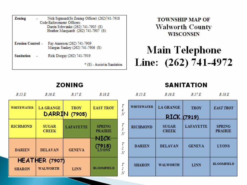
Nick Sigmund,
Sr. Zoning Officer
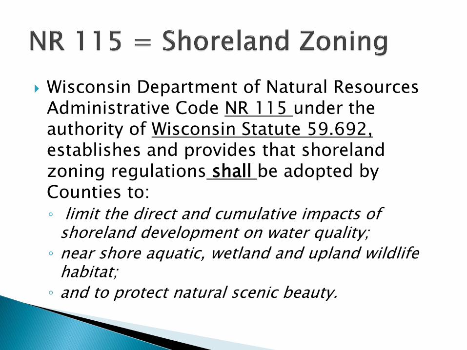
Wisconsin Department of Natural Resources Administrative Code NR 115 under the authority of Wisconsin Statute 59.692, establishes and provides that shoreland zoning regulations shall be adopted by Counties to: ◦ limit the direct and cumulative impacts of
shoreland development on water quality;
◦ near shore aquatic, wetland and upland wildlife habitat;
◦ and to protect natural scenic beauty.
While there is a science to the protection of our shorelines and waters
of the state there is also
an economic benefit.
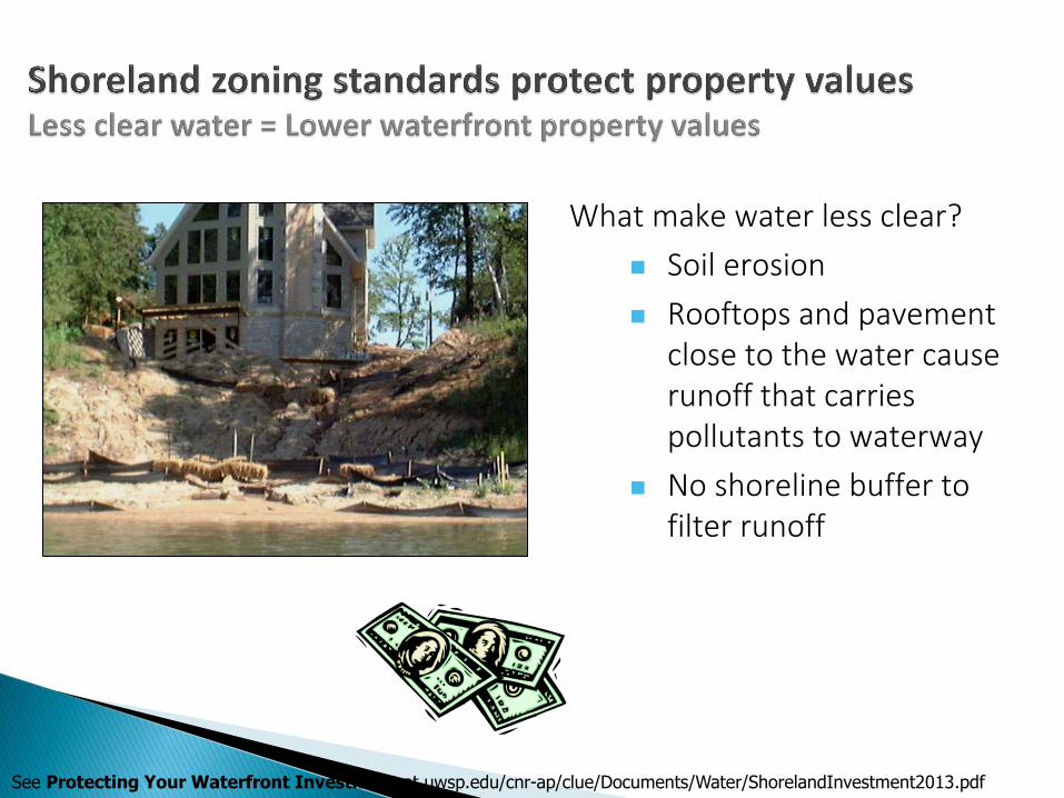
What make water less clear?
Soil erosion
Rooftops and pavement close to the water cause runoff that carries pollutants to waterway
No shoreline buffer to filter runoff
See Protecting Your Waterfront Investment at uwsp.edu/cnr-ap/clue/Documents/Water/ShorelandInvestment2013.pdf
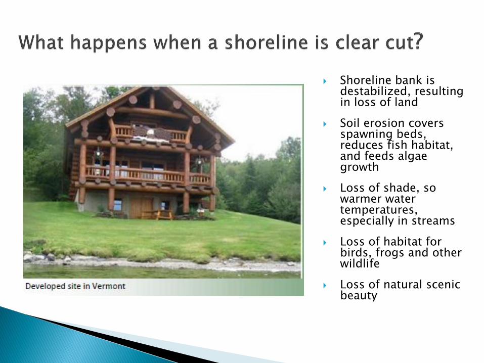
Shoreline bank is destabilized, resulting in loss of land
Soil erosion covers spawning beds, reduces fish habitat, and feeds algae growth
Loss of shade, so warmer water temperatures, especially in streams
Loss of habitat for birds, frogs and other wildlife
Loss of natural scenic beauty
Act 55 – Budget Bill: Can not be more restrictive than NR115.05
Substandard structures (nonconforming structures)
Act 167: SB 477/AB 603 Shoreland Zoning
Act 223: AB 523 Non-conforming structures
Act 214: SB 313 Notice to Town Clerks-zoning
Act 391: Existing flat roof boathouse
* on slides indicates a change in regulation
All structures are required to meet a 75’ shore yard setback unless specifically listed as exempt in NR 115. Therefore, ◦ A fence is no longer permitted within 75’ of the
shore.
◦ Retaining walls are no longer permitted within 75’ of the shore.
Exempt structures in NR115: ◦ Boathouse, walkway or stairway, 200 sq. ft. open
side structure (gazebo bill) with mitigation
35 f
t.
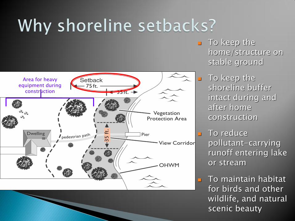
To keep the home/structure on stable ground
To keep the shoreline buffer intact during and after home construction
To reduce pollutant-carrying runoff entering lake or stream
To maintain habitat for birds and other wildlife, and natural scenic beauty
Area for heavy equipment during
construction
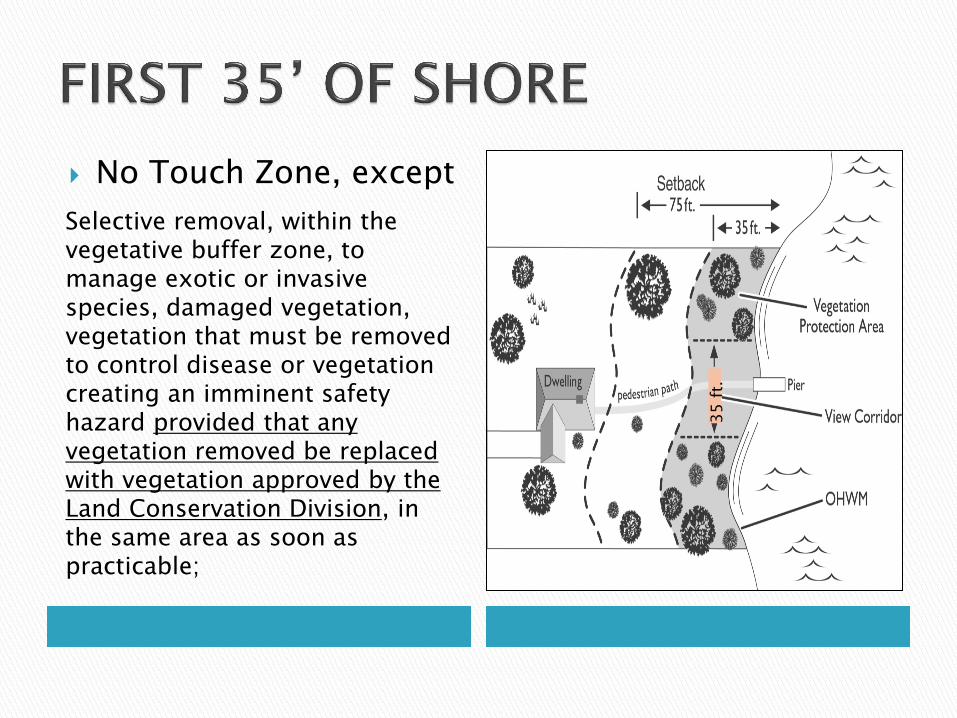
No Touch Zone, except
Selective removal, within the vegetative buffer zone, to manage exotic or invasive species, damaged vegetation, vegetation that must be removed to control disease or vegetation creating an imminent safety hazard provided that any vegetation removed be replaced with vegetation approved by the Land Conservation Division, in the same area as soon as practicable;
35 f
t.
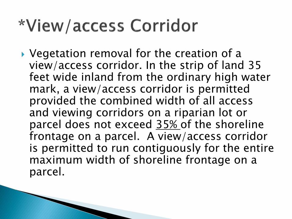
Vegetation removal for the creation of a view/access corridor. In the strip of land 35 feet wide inland from the ordinary high water mark, a view/access corridor is permitted provided the combined width of all access and viewing corridors on a riparian lot or parcel does not exceed 35% of the shoreline frontage on a parcel. A view/access corridor is permitted to run contiguously for the entire maximum width of shoreline frontage on a parcel.
(1) Stairway, lift and walkways are exempted from the shoreland setback requirements provided that the structure is necessary to access the shoreline and is located within the access/viewing corridors. Further, the structure shall be located so as to minimize earth disturbing activities and shoreland vegetation removal during construction. The structure shall be no more than 60 inches wide; open railings are permitted only where required by safety concerns; canopies, roofs, and closed railings/walls on such structures are prohibited; landings for stairways or docks are permitted only where required by safety concerns and shall not exceed 25 feet in area.
Note: No longer required to have steep slopes and unstable soils.
All counties must permit the location of a boathouse in the shore yard. Requirements are:
A 400 sq. ft. boathouse, for the storage of watercraft and related marine equipment, shall be located on slopes of 12% or less. A boathouse shall be located within the view/access corridor. The roof pitch of the boathouse shall not exceed a 4:12 pitch and side walls shall not exceed 10 feet measured from the lowest finished grade along the structure to the eave of the structure and shall not be closer than three feet to any side lot line. Boathouse roofs shall not be designed to provide general outdoor living space, i.e., as a deck. Only one boathouse is permitted on a lot as an accessory structure.
All counties must permit the location of a boathouse in the shore yard, but
On slopes greater than 12% a boathouse, for the storage of watercraft and related marine equipment, is limited to 150 sq. ft. in size. A boathouse shall be located within the view/access corridor. The roof pitch of the boathouse shall not exceed 4:12 pitch and side walls shall not exceed 10 feet measured from the lowest finished grade along the structure to the eave of the structure and shall not be closer than three feet to any side lot line. Boathouse roofs shall not be designed to provide general outdoor living space, i.e., as a deck. Only one boathouse is permitted on a lot as an accessory structure.
If an existing boathouse has a LEGAL flat roof and the existing flat roof has no side walls or screens, then the flat roof may have a railing that meets the Department of Safety and Professional Services standards.
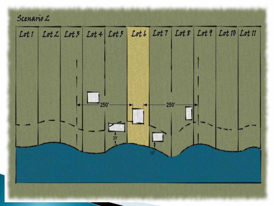
Where there is an existing development pattern, the shore yard setback (75’) for a proposed principal structure may be reduced to a setback equal to the average shore yard setback if the closest principal structure in each direction along the shoreline to a proposed principal structure exists on an adjacent lot and within 250 feet of the proposed principal structure and both of the existing principal structures are set back less than 75 feet from the ordinary high water mark.
The shore yard setback may not be reduced to less than 35 feet from the ordinary high-water mark of any navigable waters.
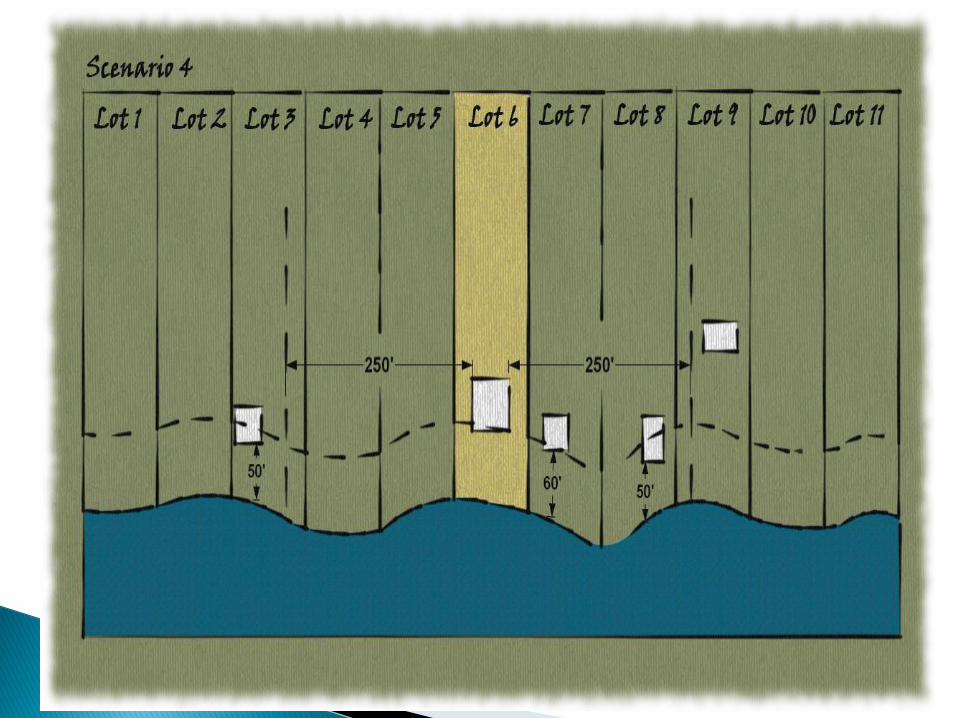
If a principal structure exists on an adjacent lot and within 250 feet of a proposed principal structure in only one direction along the shoreline, is the closest principal structure to the proposed principal structure, and is set back less than 75 feet from the ordinary high water mark,
The average shore yard setback shall be calculated as a setback equal to the average of 75 feet (vacant lot) and the distance that the existing structure is set back from the ordinary high water mark but not less than 35 feet.
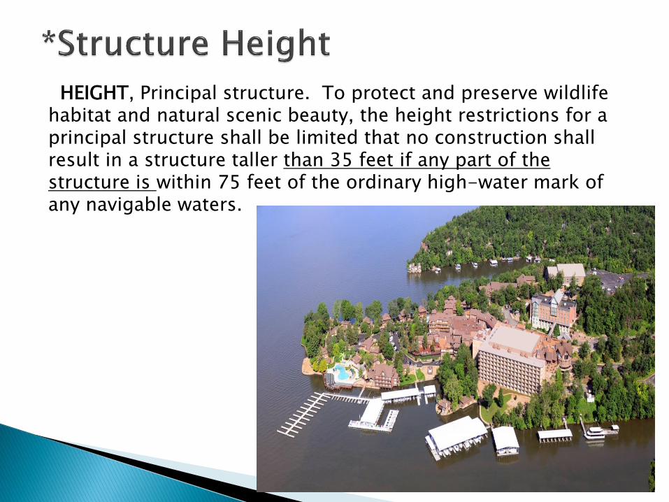
HEIGHT, Principal structure. To protect and preserve wildlife habitat and natural scenic beauty, the height restrictions for a principal structure shall be limited that no construction shall result in a structure taller than 35 feet if any part of the structure is within 75 feet of the ordinary high-water mark of any navigable waters.
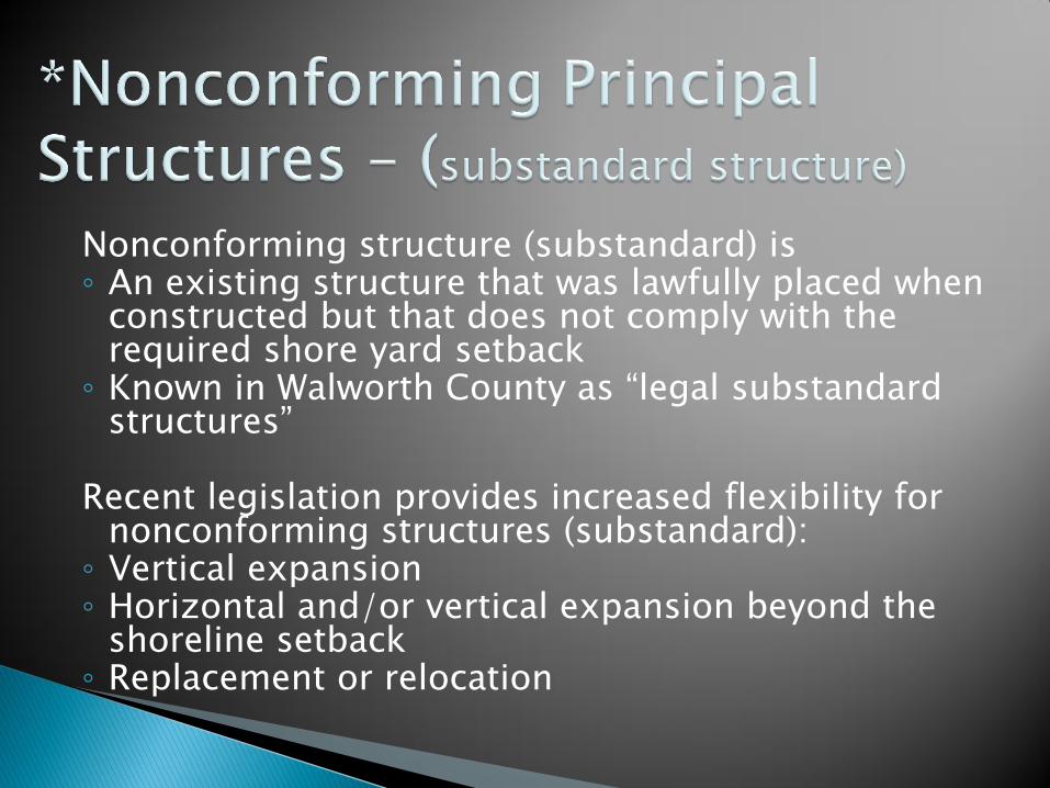
Nonconforming structure (substandard) is ◦ An existing structure that was lawfully placed when
constructed but that does not comply with the required shore yard setback
◦ Known in Walworth County as “legal substandard structures”
Recent legislation provides increased flexibility for
nonconforming structures (substandard): ◦ Vertical expansion ◦ Horizontal and/or vertical expansion beyond the
shoreline setback ◦ Replacement or relocation
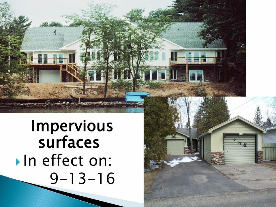
Impervious surfaces
In effect on: 9-13-16
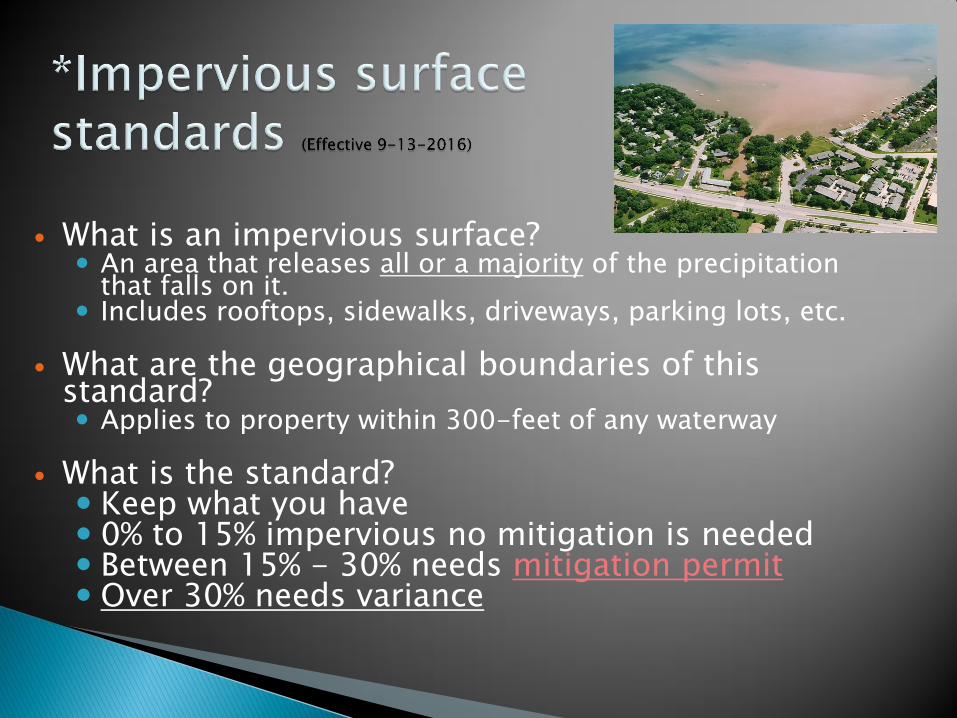
What is an impervious surface?
An area that releases all or a majority of the precipitation that falls on it.
Includes rooftops, sidewalks, driveways, parking lots, etc.
What are the geographical boundaries of this standard? Applies to property within 300-feet of any waterway
What is the standard?
Keep what you have 0% to 15% impervious no mitigation is needed Between 15% - 30% needs mitigation permit Over 30% needs variance
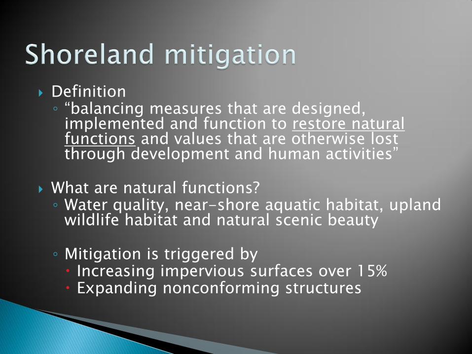
Definition ◦ “balancing measures that are designed,
implemented and function to restore natural functions and values that are otherwise lost through development and human activities”
What are natural functions? ◦ Water quality, near-shore aquatic habitat, upland
wildlife habitat and natural scenic beauty
◦ Mitigation is triggered by Increasing impervious surfaces over 15% Expanding nonconforming structures
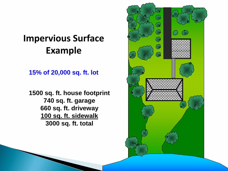
Impervious Surface Example
15% of 20,000 sq. ft. lot
1500 sq. ft. house footprint
740 sq. ft. garage
660 sq. ft. driveway
100 sq. ft. sidewalk
3000 sq. ft. total
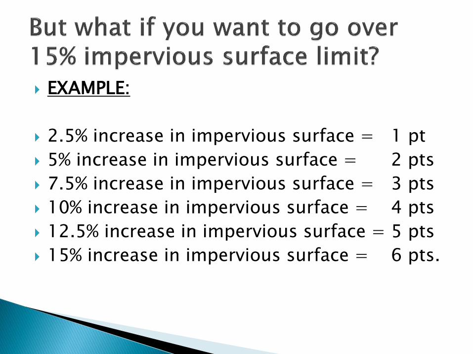
EXAMPLE:
2.5% increase in impervious surface = 1 pt
5% increase in impervious surface = 2 pts
7.5% increase in impervious surface = 3 pts
10% increase in impervious surface = 4 pts
12.5% increase in impervious surface = 5 pts
15% increase in impervious surface = 6 pts.
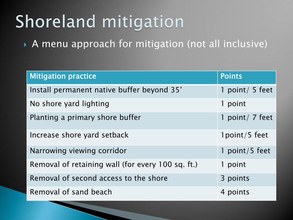
A menu approach for mitigation (not all inclusive)
Mitigation practice Points
Install permanent native buffer beyond 35’ 1 point/ 5 feet
No shore yard lighting 1 point
Planting a primary shore buffer 1 point/ 7 feet
Increase shore yard setback 1point/5 feet
Narrowing viewing corridor 1 point/5 feet
Removal of retaining wall (for every 100 sq. ft.) 1 point
Removal of second access to the shore 3 points
Removal of sand beach 4 points
What is a Highly Developed Shoreline? ◦ Means a shoreline within an area identified as an Urbanized
Area or Urban Cluster in the 2010 US Census, or ◦ A shoreline that has a commercial, industrial, or business
land use as of January 31, 2013, or ◦ An Area at least 500 feet in length composed of a majority
of lots developed with more than 30 % impervious surface area, as calculated by LURM, or
◦ Shall be composed of a majority of lots that are less than 20,000 sq. ft. in area, or
◦ Shall be located on a lake and served by a sewerage system as defined in NR 110.03(30).
Highly Developed Shoreline percentages ◦ 0-30% permitted ◦ 30% - 40% with mitigation ◦ Over 40% needs variance
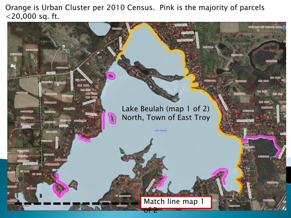
Lake Beulah (map 1 of 2) North, Town of East Troy
Orange is Urban Cluster per 2010 Census. Pink is the majority of parcels <20,000 sq. ft.
Match line map 1 of 2
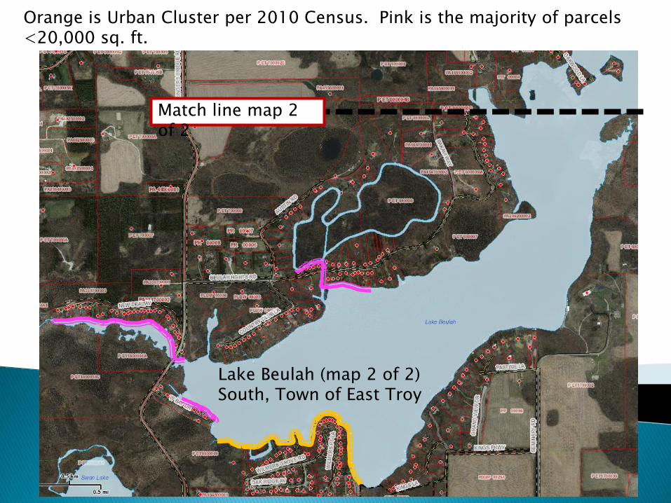
Orange is Urban Cluster per 2010 Census. Pink is the majority of parcels <20,000 sq. ft.
Lake Beulah (map 2 of 2) South, Town of East Troy
Match line map 2 of 2
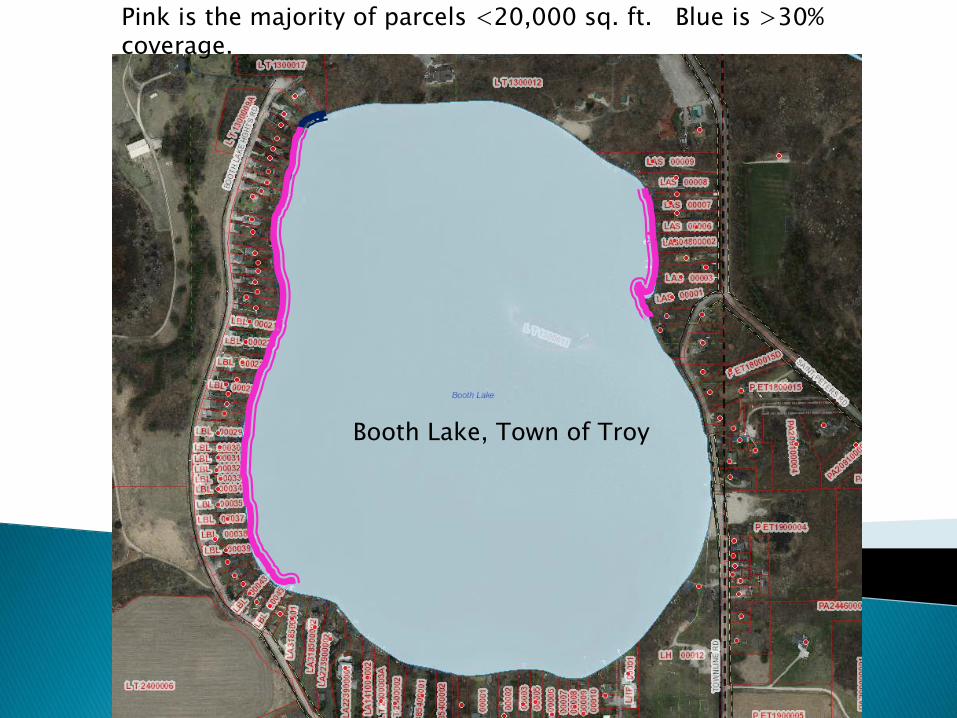
Booth Lake, Town of Troy
Pink is the majority of parcels <20,000 sq. ft. Blue is >30% coverage.
The runoff from the surface is treated by a engineered device or storm water system,
Or is discharged to an internally drained pervious area, that retains the runoff on or off the parcel to allow infiltration into the soil.
1. All earth movement activities within 75 feet of the ordinary high water mark shall be limited to minimal grade changes and only if it is done in a manner designed to minimize erosion, sedimentation and impairment of fish and wildlife habitat and preserves natural shoreline beauty. Earth movement shall not create level living space in the shore yard.
Open sided and screened structures such as gazebos, decks, patios and screen houses in the shoreland setback area that satisfy the requirements in s.59.692 (1v) if all of the following apply: (1 ) The part of a structure that is nearest to the water is located at least 35 feet landward from the ordinary high-water mark. (2) The total floor area of all of the structures in the shore yard setback area of the property will not exceed 200 square feet. In calculating this square footage boathouses shall be excluded. (3) The structure that is subject of the request for special zoning permission has no sides or has open or screened sides. (4) Walworth County must approve a plan that will be implemented by the owner of the property to preserve or establish a vegetative buffer zone that covers at least 70 percent of the half of the shore yard setback area that is nearest to the water.
The Construction, Reconstruction, Structural alteration, or Relocation of a structure will require a permit from the County.
The protection of our shorelines and the waters of the state are a benefit to all.
We are here to help YOU!
Shoreland regulations: 74-174
Shoreland Zoning Guide
Website: www.co.walworth.wi.us ◦ County ordinances
◦ Chapter 74
◦ Shoreland Zoning