Embed Size (px)
Citation preview

1
1 : . ;l
:i : ii )
:i::r::::
l isi i: i i i i i i : : i:il:i:::i:i:::::i:i::::l::::::: i : l : j :: i ::
j :::::::::: ::
:::::::::::::::: j :::::::::: l :
' : t:;::: j i ::: :: ::;: l : : : : :, 1 .
1 '
l
: li , l
t:.
1 l
r l l
i i il ' l ! , , , 1
l ; i , 'r ,1' 'i,
I
r l

PIPELINE AND COASTAL ENVIRONMENTAL SENSITIVITYMAPPING FOR THE BTC PIPELINE SYSTEM IN TURKEY
EricJ'r R.. Gundlacht.2. Murat Cekiryez, Cihan Arurl\, Cigclem Orhanz, and Paul Suthes'land3
ABSTRI\CT
Senritlvity mapping was compleredfor 1076 tm (645 mi) oJ'pipelineand fctr coa.stal areas oJ'lhe eastern lvlediterranean Seu in prcp-arutirtn .fbr cantpletion oJ' the llala*-Thili"ri--Ceyhan (BT0 PipelinePrai ect. Pipe.line senritivity mcps include ern'ircnmental, human'useand archaeological.lbaturcs as well as drainage pattentt indic.atingpotential oil flow ,znd dou,nsircam sites for spilled oil containnent.The narine maps include ent"ircntmental ani human+Lge fc.afi,(e:t,artd appropriate oil spill conlabrne'xrt site{ A/1. ir(ormfiia, Lg corn-pil.ed and .stored using a Geographic fiiformation Svstem (GIS) fronrv,hich hardcopy map-r are ereate.d at various scales depending onpurpo:te. Bolh integrated and stand-alone ttatabases cu'e used toquicVy access npeded ewimnmenlal and respanse information"Map and tact.haved data are stored on a cenfi'al senter to rtnnideinternal acces.tibili\, anclvia a web-hased, interactive intemet map-ping s"ystem. Thi^t is thef.nst tirne thalJbrmaiized sensitivi4, mappi7l.ghas been can'ied out in Ttn'lcq'.
INTRODUCTION'I'tre Baku-'1'bilisi-tley'han (tsTC) Pipelin" pllriect starts,ar tlteCaspian Sea in Azerbaijan, extends ttrrough Georgia crossing fhcnortheast border into'l)urkcy and con.tinues south-southwesl to anew marine term inal at Ceyhan in Iskenderun Gulf (Figure I ). Thispaper riescribes a pur:tion of tt:c oil spill response planning thilt, w,iscarried out in Tiirkey dt:ring tlre pro.ject's construction ph:ise inpreparation for plannod linet-ill and system operation iu 2fit)5.
FIGURE 1. LOCATION OF THE BTC PIPELINE INTURKEY VVITH PIPELINE KILOMETERS INDICATED.
THE ENP POINT IS AT CEYHAN TERMINAL ATKILOMETER 1076.
Oil spill sensitivity mapping has bocome an integlal part ofspilt tcsponse plarrning since inception in 197ti, originally siartingwiih urarine environments (Guldlach and Hayes, 1976) ud latercxtendirg to lake, river; and land-based hal:itats (arnolrg many:Gundlaclr cr i a1.,2001; lPlBCA, 1996; NOA.A, 1996:Zenger ettil. 2001). As part o:t tfie B'liC Ptoject, sorsitivi! evalualions vrerecarried out in the Iskenderun Gull'area and along the pipelilreir Turkey. This information is incoqrorated into a GeographicInfomralion System (GIS) ancl a computeriz.ecl database / re sponsenranual. The opening page of the darahas". indicating the seirrchfbltujes cun'cnily avaikible, is provided in Figure 2. Aftcr verilica-don oithe data sers. infotmarion is itrcorpotvted iitto an InrernetS{appurg Systen (ilvlS) avaiiable intemally and via t}ie inte.rnot.
FIGURE 2. OPENING SCREEN OF THE CONTAINMENTMANUAL DATABASE IN DICATI NG ENVIRON ME NTAL
AND OTHER SEARCHES AVAILABLE.
SENSITIVITY MAPPING OF THEISKENDERUN GULF AREA
Sensitivity mapping in the Iskenderun Gulf area was cotnpletedusitrg the f"rrllow'in-e proccdurcs:
. Sclection of the alea to ue mappcti based on [he Lltrmput$r-modelcd, wor,<t-caso cxtcnt of oil spillagc.
. Obtaining, Cigitizing and rectification of 1:25,000 topo-grapbic base map$ fiom the Turk-lsh Goverrnent.
IE-Tech Interrational hc. 1Etic:[email protected]:), I5 Rivel Par-l.: Drive. Ncvr Plltz, NewYolli 12561 USa;z Botas Pettoleum Pi1:eline Corp.rrl,3tion BTC Cmrle Oil Pipeline, Sogurozu Cad. Nr -1 i, t16520 Ankara, Turkey;r BTC Co., Scgulozu Cad. No 3 l, 06520 Ankara, Turkey.
2OO5 INTERNATIONAL OIL SPILL CONFERENCE
. Compietion of an aerjal survey (lowJevel heiicopter) duringwhich a digial video (with time and latitude/longitudetitling) and digital still images were taken. Observationswere recorded verbally on the digital victeo tape during thesurr€y.
. Undataking of a ground survey prior to and after the aerialsurvey to con-firm shorBiine classificafions.
. Collection ofnationally and internationally available infor-mation on the principal biological and hurnan-use resoillcesofthe area.
. Suwey oi' sensitive siles to devetop a conlainment siteda%base and response manual (also called a Ce.ographicR.esponse Plan in offter atens).
" Classification / categorization of shoreline t-vpes andbiological habitats for inclusion into a GIS (ESR.I Arehfovers 8.3).
. Inte,rnal ald extenral revierv of all information.
. Translation of material into Tulkish and English for gov-emment agency aPltroval of dre Prcject's Oil Spill ResponsePlan.
Resulls iixe presented in ibw ibmrats: (l) Landscape .{3-size(29x42 ctn; ̂ .lIxl7 inch) with underlyiag 1:30,000 topographicmaps (restricted to intemal nte. only). (2) Landscape A.3-siz,e, alsoa,t l:30,000 scale but rvithouf topographic maps (Figrre 3), an.d(3) Mixed landscape and portraitA.!-size (6Ox84 cm; 24x33 inch)l:30,000 topographic maps with all infornration indicated (in-cluding roads for site access), and (4) an Al-size, 1:230,000-scalesuounary map of se.rmitivity hformation.
FIGURE 3. EXAMPLE COASTAL SENSITIVITY MAP INTHE ISKENDERUN GULF AREA (ORIGINALLY 1:30,000-SCALE). A DETAILED TCIPOGMPHIC MAP FOR LAND
FEATURES IS AVAILABLE INTERNALLY).
Pdacipal compon€nts of the sensitivity analysis re.port (A3-f<rmiaf) iire a^s fbllo',r,'s;
. Legend, as shovrm in Fig.ure 4.Biological datrr tables fol birds, marine mammals, urarincreptiles, with statu.s of na.ti,rnal and intemational protection,concenlratiofl (i.e. populadon size), titre (month) in thearea, and tirne most sensitive (e.9. mathg, nesting, hatch-ing, sparvning, birthing, etc.), and ilbeding behavior ftrbirds.Description oli preralent winds, currents and tides.Description of pri ncipal biologica.l compon ents, particularlyfisheries, marine turtles" marine mammals. birds and in.ter-nationally Important Bird Area-s (IBAs), four of which srein the area. IBA TR079 is partially showt on the north partof Figue 3.
1:!4:r$f;l-9Jff,.i*t:l?r'?.q!i1j.{:ltl'* !'..itf"i74!,1:tll;.#.t:14.:F.!-i:i*.
/-.f.r.Jtt8.t.dj l4!it{t+Si.:r*ir..r,:;t,ltiilt{*.ditJit!.i lt .**f:..a,;r:i.1.,i.!tta.:af#iiji::::?.:i;:::i.ii::ri::i::j;:".:ri:ji::.it.i.r:::.::iiii-a?jli..:a+;,:.:i:r r:i,ir::l::::::ri+t i.i.i.iia.t 1:t :ii..:.,t 1 ii:iii.ii'{::,} ,:.ii :i?:{::: :iliri,:::i.f'i. i::l- !a:;tl: :i a,;:tii:f i:ii:it:::4tir,raNt:f:r;ia:f{rdJ .1: :i":.f-+irlitii_i:iii::i.:.i!:{ lia.:?i:iri.: i.::i::::it1ti;::r:::tJi}:t:}.:it:l:iij.::i:;:ij:i;:.:i*.::'.,..::i :ii:::?::r:::.::::i:::i::ii,.r.ilx.:::ail:..:il:!.::.:.-i:.!'.ii:r)ri::.:.:.:...:::i. ::ir::i.::::::ii.i:i:iz:::]::ili.ri:.::iili.:i:::rj:r::!:i1.:i::L.rr.: ::.?iirri:::.ri:..ir4v.i:i;. ::i..i-i-t+ :,4itla:j.. .il,tlrtii.;j.i...i.i.ji:i.|:.ri:iri -l::.,:r . .. ::::t:ii:.;:::i:::;:...:......... :.r :il::iiijr: i::i:r1:r.:j::ir;:::::i:i i .:.:.J:.i: . ::::i.:::::: ::::;::::::
. ii.,,...iii t!.! rr.:ri.:,: tr:iiirj:.:.:::. ii:l:,:i:iii
'r:..;.,..ii ::.....:iilil:::::.ii::,.i.:. ::t-:...-i:.::i::::::::.:::::::i :i::.;:::ri:::r:.+,4di :r::: :i;j-.:l::l:1. :::I:ii::::L::::i
r.:.:i:i.:::t:!:l::i.ri:j:1, lli jr::::::iiri::::::1ii:i::::
tii.r.:*li*i|:lrmJr.-r''4't:fJ{.'-tit4xii;nil:tv:
#l :::::::E:4.:::::.:::.i:::1 :ri:.:a:
i#t: r:iti::.:i i:\'li.:i!.i:.:.:i:;.'tt:t:ii.t::ti:tt.
'#i :i::i.it:ri:tit:ri!r,:.: :l-!!i::i: r:titiii.itt ""';:t<J:
ffi :1r:a.:;q:!i;i;r:1:1 ri:i:;ri.:;r: r:.:1r
l{l*: ri:;::::: :::t,rr:i::
il$li ::;:r:1.i;,y :; ;:;:111;;.,',.i:e:li .,
:.4:F.1: ::::1:::i :::i,r::::.iii::i::.::: ii:i:::: ilr':.::.:1':';: a',i:i:::iri.:i:i:::.i.'
:ltilji i:*rrrir:+. :::iiriii..j.ii::::ii+J::i
S.l: '1""''r"i'i:ii$|.:;;;1:1i;,1.:1:;:,;i.t,r:iir:,Ji...l::r;lr::ii:ri::::r:r:r::i..:::i::.
il'i!)ijiilt' ""'',"o''''':t'i':':;i
:'::':'i ::l::;:: : ::'H'ri::i:::::: i ii':':+r:: . : :.j::::i.::::.i:;::::i::i:i:;i.::;:1r:;::i::::t:.r
'::'::irir :i::::::l::i: :: tii:: ::, lr:i
n .ti:::!::lr{r :i:::1 : :::il: j:r:::::i! rt:;iriri; l::.iri:ri:r1i:::
S.atir.t+ :il:4.r{d:,JJ:,n,'. !rlll.li,t:}.i{, :}r#i:.::Jl
*i :ii:::.;::l:::.::: t:::r:i :::]::i:'::. i..:::.:'t::.
:ili, i;,::,:;i...,,.1 :;;:;:;a4 . :1ii.iti, i: i,ti:
i;&fiSiJ
::::i:i,:Ir:.]ii.: ::::.iir:i: :..i,q::rrri
ffii :ir:rP: 3:,:a';:;t :r i:i:::i:ii l::::::it::ii
l#;, :::rir::rr:!:r:::::l::liri:lL:r:: l::::;:ili::ilr:rl ji:l::i::.:
:;,rir.;i$:i:rri::r.::rn a::i:ii;i::ri. iri.:::i::i:::,ll.$ii:: i::::::::::i:::rr:::::::::: :::::::: : +::::;::::::i:: :i::::ir::::ri:
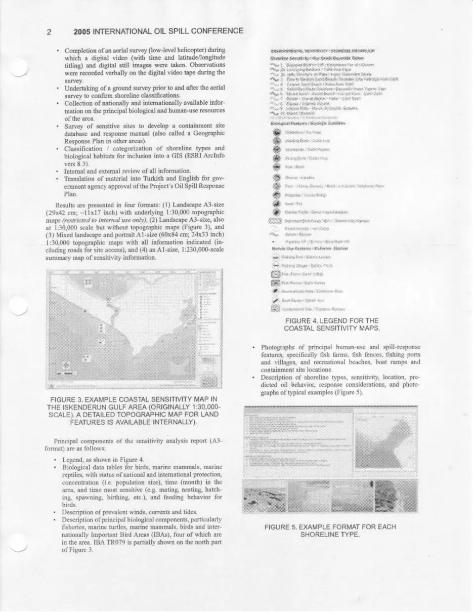
FIGURE 4 , LEGEND FOR THECOASTAL SENSITIVIry MAPS,
. Photographs of' pr:incipai human-use and spill-responsefbatures, specifically fish farms. tis} fe.nces. tishittg portsand villag,es, and fecreational beach.es, boat ramps atdoofl .tainment site locations.
. Description of shoreline t"vpes, sensitivitv, location, pre-dicted oil belr.avior, responso considemtions, and photo-graphs cl'typical cxaurples (Figwe 5).
'*tti.lttt:1l.lll
FIGURE 5. EXAMPLE FORMAT FOR EACHSHORELINE TYPE.

. Results of oil spill modeling and z,rtnes of projected impaotlbr potential releases in the marine terminal area.
. Description of containment sitps aad actirztion guidance.
. Acknowledgernent to contrit ittors and references cited.
fie srrmmar.y 1:230,000-scale sensitivity map is prnvided inFigure 6.
FIGURE 6. SUMMARY SENSITVIry MAPFOR THE ISKENDERUN GULF AREA(ORIGINALLY AT 1:230,000 SCALE).
INLAND SENSITIVITY MAPPING
the sensitiviry maps for the pipeline route include a categorizatiottof ftatur€s along the pipelile and extencl far outside tlte pipelinecoffid()r t(! include ateas potentially atllcted via *le river lranspDrlolispilled oil.
Along ttre roule, the pipeline route is categorize<l as to sensitivetbatures prcsent (er.ery 0.01 km (33 ft) based on topogmphicmaps). Categories and data sources are listed i-n Table l. l.ike thatfor shoreline se,nsitivities, a low-er ESI valile does not meaJl a lesserrcsponset only that it nay be different. Along the pipeline, allcategories present ale indicated by different lile width, so theresponder knorvs. for exarnple, that an archaeological site is pres-ent, but lhat thele is also an envirorunentally iolportani (SpecialResponse) area, and a zone oi'ground water extraction (Aquii'erProtection Area,l (liigure 7).
A11 rivers and slreams are defined in detaii along the toute interms of pipeline kjlometer point (KP). Rivers greater than 5 m(15.5 ft) r,r,ide are desilyrated a"s highest concem because of the p.o-te,rtial spread of oil downsfeam. ln addition to being napped, allriver crossirgs are included in the Containment Site Datairase, en-abling an immediate lookup btlsed on KP value.
PLANNING PROCESSES
FIGURE 7. EXAMPLE OF SENSITIVITY MAP ALONGTHE PTPELTNE (SEE FIGURE 8 FOR LEGEND).
:i1': iilt,i;11;1 r;1,11':1i;1';1'1:::lii:i,::r' ::2ii:i4'r:::r::ii:rj::::::r::::rri.:... : ::j:: .,i::iir?i:i:it rji::xl lrr. t::;ltr.:i::.:s::.r:ii.i:i:r.:<.:. ::::.:::.;: j:;:l :r.:ir:'?:rl:r
:i::l j:r:::: ::i.,r,.r,a.gr.rSt :.i;]:,:il,: ii.:*.tr:::ilil
# :i in!iit:t:rr.:i:..:ii.r'",.i it rilii:itll1 r1r11 ::i iara'
_.r::li:lr.: ,.411:;l;:;1r;.1a1:1:1ry4:Li lri,!:::.t:::;{i:lii:::;:i::r
.f.idd::+ . ,s.rri:t.::riiiirir:,j,ir: i::4,;:l::i:i+..++iix.ri:'::,.iirl *:1y.. +i],.rlli,
gi4&i;:.+. .r.,1,;4iis:'r,;irti:#:l t'::il:r,
64.d.+iir...rrr:l[./,::s t:r;ii: ::a;!.;:in::::r:i.!+..
.Jd**: ,::irr:{.tn$rrr,:.r,::rr: :i:it ,rr.}:riirr:11:::r4il.;l ,l;:;4::1,:i;i!::}1li:
.:.::i:r::::,.A.rix.::r:r.ri::rrrl:d.rri:a.,*,i.ia.:tiir;r:+
ii' :': :r, .:a.ri:a,ra,,..ljt lrr:..:a r *.ltr::li:l $!i ..i.'::rr:ir' .ib.,gilrt:4{.r:&#r!i*:r}r:r:4:::d}::ll:!:::}I a!al7,irl4..+Ir, ti::trn!)
;.iia{r:# : 4,x+r a:}r::sr+..:4:.:{..'} i}i:-:i.r..:r.::i.:
:::::::a:';::l::$"a::i;r::':;:i:;:
::: :: l::lr:::+l:.it:ii:4iii::!:t*:::::r*:i?:i:ir*::|:d:i:i,i
:.::::i,,:y;:a.i!..1:\rr'N,f;atrr',a.r::::t.;;:,,.8:,r'*.;i..p:{ i{*r:
. *. -:a!.:ilayrt!.1.:.J 4t:t:::.!.t....:.Lli: l:t
.:r' b.r::;r{.:.:.r riii4 ,:::rl
,,' &li,::r,ff e:::H.::i::l,..rt::
.l :i . iiiti..,. :?,.:+ +!....,
$l ::::4.i.r..!iit:ti:i:i:i::r:i!:l:::ir.&.:.i i.:i.r.!
{ f.::::::d -J::r.r:.j'::ii
-!S: ;t;:r:ii:!Jii:::a:tr!:t:::riil:::l:;r:r:i:::.:' :A i i i t . .:iiiti:t:l|ii:f irr\rr;it':.ji' : it'i:{ }:;4 :t}ri
'iiiii.rr,o +r.i i:,rr:;..irr.ii
'':ai;;:,:t!.-r.+:..-r:t E!a.+,r.:r::r.rr';i.;:i.:j:u+{t:#
+:r;i.i.:..;.t.:::::l**:l
:l:::::::.4:ii$.]rrr:,::it-:.:tt-..:i:.r.i::ii:,i!::!::!r:,-rpm:iri:rr:'ffi]i.
iE) rij.-.r--r. iLr.Li.-::r::iii. r:'i..:ii...iii'i..
,is..i.ii.!1:;;:4,1:1:n:1:111:1ti1i1:1f::ii.t:11:;r:ii]:tii::Ji::i:iii:
iiifti.t:::::t'i.+..:-:r.:t.:::tr.iir,r":'+\i'r.+r'4'.r!.rrr''i:r'.ar:'+,}::i:::::r'':i::ia.i.::na.
::::|::.::.,-1i'':*::}:+}:a....}.i':::.,}:::i4{.1i{$-?'}:t::1i.i:.|,(.i:...i.||,|.:..:|..i}..:4},*
FIGURE B.INLAND SENSITIVITY MAP LEGEND.
iit:::
f::lrl:

4 2OO5 INTERNATIONAL OIL SPILL CONFERENCE
Table 1. Inland Sensitivity Categories. EIA: Environmental Impact Analysis,GIS = Geographic Information System,
Category Description Ilata Source{s}
r0 Rivers (>5 m widtl), Lakes and Reservoirs
Each has a 200 m buffbr.
From a pre^construction engineering sfud3,', verified usingtopographic rnaps and during oonstr.rction. Lakos andi'eservoirs arc ftom Ploject EIA GTS files, verified dudtgfieid aotivities.
o Special Response Area-Environmental.Areas selected for additional reriponsep.lanning lbr environmcntal r'easons.
Internal document: Oil Spill Responee Plan fot SpecialRcsponse Areas, based on forests, Important Bird,{reas,and wctlands.
8 Alchreological Siles, with 200 m. buffEr. Ftom hnject EIA GIS file. updated wifh recont findsduring construction an.d data f'om tbe govflftmentmappittg agencg.
7 Aquifer Proiectior Area.
Aleas of notable aquifers lPasinler,Erzurum, (iriksun, aud Adam-Coy'han).
lnteinal document: Watet lVell A:ra$sis Srudy.
6b Eoologicalty Sensitive Arca (.ESA),designated because oi' plrurt speoies prcsent.
Fiom Proiect ElA.
6a Wot Mendow l-Iabil'ac, From h:oiect FIA GIS file.
i h Karst (limestone) Area. Fronr Proiect EIA GIS file.
JA Special Response Area-Fault Zone .
Areas swrounding nrajor fault sruoturesibr which a spec:ial respoilse plan wasplepared.
lnteiual documer:t: Oil Spill Response Plan tbr SpecirrlResponse Ateas. based on the Pro-iect EIA.
t National fiotcst, desiguaterl by llurkishGovernment.
Ijrorn Projccc IilA, updaxed with additional rcsearch.
.f Wil dtif'e Pnrtection .Area. From Plr:ject EIA, updated r,vilh additional research.
I Forest Habirat. From Project EiA GIS tlle,
Primarify Farm or GrazingLan'J. All other areas, confumed in rnany locadons by fieldobservations.
The Project has detetmined a number o{'sites that are par-tictlarly sensitive due to e.nvironmental conditions, in particulatincluding forests, Impolfaut Bird Areas, an<l wetlands, T.'b.ese aredesignated as th€ second highest sensitivity categol?, calledSpecial Response Areas-Environmental. Each Specitrl ResponseAreahas a detailed rcsponse plan focusing on contol ofoil at ornear the pipeline .
,Ardraeology has receivecl much attention belbre and durittgconstruction. r\ll sites. including 'chance linds' located duringconstruction, are included into the GIS and rnapped abng the (tuteas the third highest cstegory.
Areas of ground 1'uafer extraction, the nexf highest cateFory,lvere sfirdied in deta.il using glound watet modelling, anc( also havedetailed maps and a spill response plan. The four primary groundl€ier zones along the pipeline mostly delive w-ater from depflrs of-30 nl (100 ft) with overlyilg la-vels of silt, sand and gravel, there-fore the potential for oil reaching the aquifer is unlikely. Most ofthe water is used for ag;riculfule.
'Ihe response plan assumes a
rvor:st case, and requires actio8s to prevent oil migration aw'a,vIiom the spill site rmd lhe rernoval o1. all contamjnated sedfunents.
r\reas of irnportajnt vegetation (designated as [ioologicallySensitive Areas, based rrn plant species) and weflands comprise thenext category ftrllo',ved by areas of uaderllng karst limestone andtault crossings (Special Response fu'ea-Fauit Zone). Nationailydesignated forcsts, Iocally denoted Wildlife Protection Areas,and tbrested arcas (noi nationally designated,l comprise lower
categories. The national f<rrests and Wildlife Protection areas, lbtth€ rnost Tlart. :re inclirded with Special Response Areas.
The lor.vest oategory is famland and i or grazinl; land, cofimonalong much of the rou.te.
UPDATING THE INFORMATION'Ihe
GIS e.nables update of the rnaps and database to acconimodatechanges in, {br example. the final placennent of'the pipeline toinclude re-routes, additioral archaeologicai 'chance finds', andnerv sensitive l'eatures.
The Contrrinmen.t Site Dafahase witl al.so be updated as sitesare re-visited during different weather corditions and sea.sons.New sites will be added to both the database ald GIS maFpingsysten as they are surveyed. Nerv reports can be generated frrtmthe database at any time.
SYSTEM ACCESS DURING OPERATION
1L11 GIS and database in(brmation will be transJ'erred to a centralserver- GIS data is categoriz.ed in laye.rs, urd each layer is stored in.a table. This system allows designers to add ne.w fields to tables tostore non-vector (text-baserti so thaf each fbature (record) in a. tablewill have spatial information and attached text-based itformation. .
Information on the server will be accessible to responders andother rrserc either dirBcily or via a dial-up connection. Users s'ill

see a sp€cialized interface (lntemet Mapping System) that allowstlevelopment ofquery-based rnaps wilhout ttre need ibr specializrdGIS soiLvate instalied on their machines' llxamples of suchsearches may include: are there $pecial Response Atea"s neatKP 459, u'hich Confainment Sites ate activated for a:r incident
at KP 986.5, and are there rivers neaf, KP 534.37.The field responder nill have a tablet personal computer with
integrated GPS and GIS software enabling access to relevant
response data and maps: as well as to text-based docum€nts suchas the Site Sal'ety Plan.
USING THE INFORMATION
As descritred above, infomrotion is prrposely pro'r'ided in variousformafs. It is expected that the L:30.000 topographic maps with thevarious data layers w-ill be most appropriate to provide a:loverview ofthe area (spill site), access rotrds, flow directioq riversystems, and sensitive envilorunents. These maps are also repro-duced in sufilcient .numtrers to be used as iield maps, rvith thepotentiel to acld notations such as spill distribuiion, coutaiunentsites, erc. The Containment Site datatrase and jts integratedenvironmental searches provides t means to tapidly arisess re-sponse in{irnnation during a crisis situation. IJsing the databasewith a quick analysis of:the environmentrrl sensitivity topolyaphicmap will provide a coheren.t picttre of the resoulces at risk, po-tential florv direction ofthe spiil, applicabie r€sponse strategy andcontainment sites.
PLANNING PROCESSES
BIOGRAPHY '
Dr. Gundlach has 30 years'infernafional experience fu. oii spillresponse, ewironmental impact analyses, ew-ironmental audits,and the use of integrated databases aad mapping sysbms for theanalysis, display, and storage of technical infoluration. IIe haspublished extensively on oil spill inrpacts and emergengv responsefianagemenl He has been involved in envirorurrental sensitivitymapping tbr oil spill plannhg since 1975.
REFERENCES CITED
Gundlach, D.R. and M. Hayes. 1978. Cl.assification of coastiilenvfuonments in temrs of potential vulnerability to oil spills dam-age. Marine Teclurology Society Joumal. vat. l2{.4), p. 18-27.
Gundlach, E., \1O. Imevbore, B. l!'idrerspoon and J. Ainodion,2001. Incorporating biodiversity into sensitivity maps of tJre NigerRive.r delia. 2001 Lfertrational Oil Spill Clonference. A:nerican Pe-trole'um Instilute, !\tash. DC. p. 391- 403.
IPIECzI, 1996. Sensitivity Mapping ftrr Oil Spil1 Response.Internstioilrl Matitime (hganization atd IPIIICA, ?4pp. (httP:i/www,. ip ie ca. o rg/pu h I ica ti o nr / o il sp iil.h tml).
NOAA., 1996. Environmental Se.nsifivify I-ndei Guidelines,Version 2.0. National Oceanic and A.tmospheric A.dministration,Seattle. WA. 17 5 pp., {http : //response.resbralion.noaa.gov/index"htntl).
Ze gel, S., M.O. Hayes, J. Michel, Ir{. Write, B. Benggio, F.Lopez, E. Mosher and S. lbuw; 2001. Integrtrtecl Planting Eouihc ltrlorurtails to the Sea: Ewironutental Sensitiviry Mappingin the Caribbean, Intemational Oil Spiil Conference, AmericanPeftoleum lnstitute. p. 513-517.


