Embed Size (px)
Citation preview

SOCIAL SCIENCE
VIII_Std_History_Unit 1.indd 119 13-11-2019 17:48:21
E - Book Assessment DIGI links
Table of ContentsTable of Contents
Unit TitlesPage No.
Month
History
1. Urban changes during the British period 122 January
2. Status of Women in India through the ages 131 March
Geography
1. Industries 140 January
2.Exploring Continents (Africa, Australia and Antarctica)
147 February
3. Map Reading 164 March & April
Civics
1. Defence & Foreign Policy 177 January & February
2. The Judiciary 187 March
Economics
1. Public and Private Sectors 196 February
VIII_Std_History_Unit 1.indd 120 13-11-2019 17:48:21

HISTORY
VIII_Std_History_Unit 1.indd 121 13-11-2019 17:48:21
122
IntroductionThe evolution of towns (urban
settlements) has occurred in different ways and in different stages. Towns flourished since pre-historic times in India. Towns in India can be classified into ancient towns, medieval towns and modern towns.
Ancient TownsIn ancient times, towns emerged in
and around of residential places of kings and its location easily accessible to sea and rivers for trade. Most of them developed as administrative, religious and cultural centres. Harappa, Mohenjadaro, Varanasi, Allahabad and Madurai are well-known ancient towns.
Medieval townsDuring medieval times most of the towns
developed as headquarters of principalities and kingdoms. They functioned either fort city or port city. Important among them are Delhi, Hyderabad, Jaipur, Lucknow, Agra and Nagpur.
Modern townsWith the arrival of Europeans brought about
new changes in the development of towns. They first developed some coastal towns such as Surat, Daman, Goa and Pondicherry. The British after consolidated their power in India developed three main cities - Mumbai, Chennai and Kolkatta as the administrative headquarters and trading centres. With the extension of domination they developed new towns, depending on its location, purpose and resources. The newly developed towns are known differently as hill towns, industrial towns, court towns, railway station towns, cantonments and administrative towns.
Unique features of urbanisation under the British
I. De-industrialisationIn the beginning of eighteenth century, the
policies of the British proved harmful to the process of urbanisation. Later, the economic policies followed by the British led to the rapid transformation of India’s economy into a colonial economy and development of cities.
Urban changes during the British period
▶ Understand the growth and development of towns in ancient and medieval - periods
▶ Analyse the nature and feature of urbanization under the British period▶ Learn about the emergence of new urban centres such as Cantonments,
hill stations and port cities▶ Trace the origin and growth of Madras (Chennai)
Learning Objectives
Unit - 1
VIII_Std_History_Unit 1.indd 122 13-11-2019 17:48:21
123
With the help of one–way free trade predominance of British, Indian manufacturing industries were destroyed. The effect of this wholesale destruction of the Indian manufacturing industries, led to the ruin of the millions of artisans and craftsman. There was a sudden collapse of the urban handicrafts industry which had for centuries made India’s name in the markets of the entire civilised world.
Towns and cities long famed for their specialized products gazed continually shrinking market. As a result, old populous manufacturing towns such as Dacca, Murshidabad, Surat and Lucknow lost their previous importance. The entire industrial structure crashed down under stiff competition of imported goods.
The traditional industrial base of Indian cities, made by the indigenous handicraft production was destroyed by Industrial revolution. The high import duties and other restrictions imposed on the import of Indian goods into Britain and Europe led to the decline of Indian industries. Thus, India became the agricultural colony of Britain.
II. De-urbanisationThe transformation of India’s economy into
a colonial one – a market for the manufactures and source for the supply of the raw materials to her industries hit hard the industrial and commercial base of a number of towns.
The gradual erosion of king’s power led to the demise of towns associated with their rule. Agra once an imperial city in the first quarter of 19th century was surrounded by extensive ruins all around. The native rulers lost their kingdom to the British by means of various policies of the colonial power.
Another factor which contributed to the decline of the urban centres of the pre- British period was the introduction of the network of railroads in India since 1853.The introduction of the railways resulted in the diversion of trade routes and every railway station became a point of export of
raw materials. The railways enabled British manufactures to reach every nook and corner of the country and uprooted the traditional industries in the villages of the country.
III. The Growth of New Urban Centres
British developed new centres of trade like Calcutta, Madras and Bombay on the eastern and western coastal areas. Madras (1639) Bombay (1661) and Calcutta (1690), cities which the British largely created and fortified. All those were earlier fishing and weaving villages. Here they built their homes, shops and churches as well as their commercial and administrative headquarters.
From the mid-eighteenth century, there was a new phase of change. As the British gradually acquired political control after the Battle of Plassey in 1757, and the trade of English East India company expanded.
In the late 18th century, Calcutta, Bombay and Madras rose in prominance as Presidency cities (for administrative purposes, colonial India was divided into three presidencies) under the British Rule.
A new trend of urbanisation began in the latter half of the nineteenth century as a result of the opening of Suez Canal, introduction of steam navigation, construction of railways, canals, harbours, growth of factory industries, coal mining, tea plantation, banking, shipping and insurance. Changes in the networks of trade were reflected in the development of urban centres.
An urban area is one that has a high population density engaged in occupations other than food production, living in a highly built environment.
a. Port citiesThe British arrived in India for
trading. Madras, Calcutta and Bombay became the important ports. They played important role in trade. These cities became the prominent commercial areas
VIII_Std_History_Unit 1.indd 123 13-11-2019 17:48:21
124
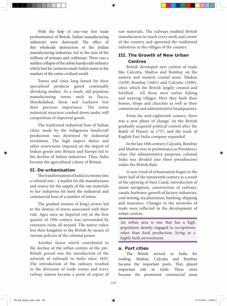
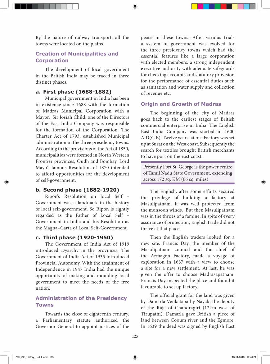
with tall European – styled buildings. The English East India Company built its factories and fortified them for the protection for their settlement. Fort St. George in Madras and Fort St. William in Calcutta were the best examples.
Fort St. William in Calcutta
b. Cantonment townsThe British occupied the Indian territory
and political power by their military force. So they needed strong military camps and established the cantonments. The cantonments were thus an entirely new kind of urban centres. Army people began to live in these places and gradually they were grown up a city. For e.g. Kanpur, Lahore.
c. Hill stationsHill stations were distinctive features of
colonial urban development. Although Hill
stations were not unknown, prior to their founding by the British in India, they were few and had a small population and were often visited for specific purpose. For e.g. Srinagar was a Mughal recreational centre, Kedarnath and Badrinath were Hindu religious Centres. The British coming from a cool temperate climate, found the Indian summer season inhospitable. So the cool climate of Indian hills was seen as protective and advantage. It protected the Europeans from hot weather and epidemics. So they built up the alternative capitals in cool areas, like Darjeeling was the alternative of Calcutta, Deradun was the alternative of Delhi. Hill stations became strategic places for billeting troops, guarding frontiers and launching campaigns. Hill stations were developed both in North and South India, e.g. Simla, Nainital, Darjeeling, Ootackamand and Kodaikanal. Simla (Shimla) was founded during the Gurkha war (1814-16). Darjeeling was wrested from the rulers of Sikkim in 1835. These hill stations were also developed as Sanatoriums (places for soldiers for rest and recovery from illness). The introduction of railways made hill station more accessible.
d. Railway townsRailway towns were also a type of urban
settlements and were established in 1853 after the introduction of railways by the British.
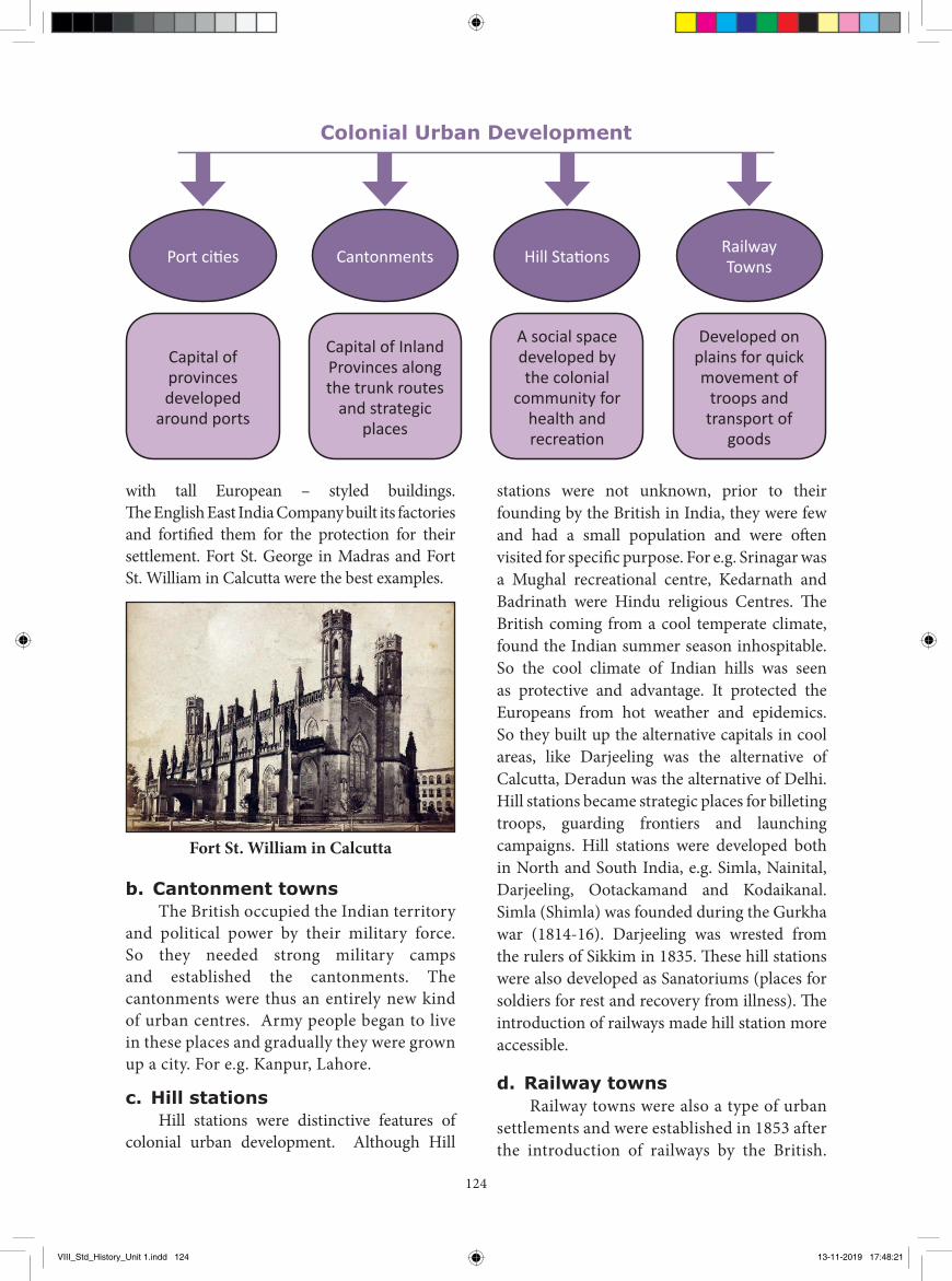
Port cities
Capital of provinces developed
around ports
Capital of Inland Provinces along the trunk routes
and strategic places
A social space developed by the colonial
community for health and recreation
Developed on plains for quick movement of
troops and transport of
goods
Cantonments Railway TownsHill Stations
Colonial Urban Development
VIII_Std_History_Unit 1.indd 124 13-11-2019 17:48:21
125125
peace in these towns. After various trials a system of government was evolved for the three presidency towns which had the essential features like a large corporation with elected members, a strong independent executive authority with adequate safeguards for checking accounts and statutory provision for the performance of essential duties such as sanitation and water supply and collection of revenue etc.
Origin and Growth of Madras
The beginning of the city of Madras goes back to the earliest stages of British commercial enterprise in India. The English East India Company was started in 1600 A.D(C.E). Twelve years later, a Factory was set up at Surat on the West coast. Subsequently the search for textiles brought British merchants to have port on the east coast.
Presently Fort St. George is the power centre of Tamil Nadu State Government, extending across 172 sq. KM (66 sq. miles)
The English, after some efforts secured the privilege of building a factory at Masulipatnam. It was well protected from the monsoon winds. But then Masulipatnam was in the throes of a famine. In spite of every assurance of protection, English trade did not thrive at that place.
Then the English traders looked for a new site. Francis Day, the member of the Masulipatnam council and the chief of the Armagon Factory, made a voyage of exploration in 1637 with a view to choose a site for a new settlement. At last, he was given the offer to choose Madrasapatnam. Francis Day inspected the place and found it favourable to set up factory.
The official grant for the land was given by Damarla Venkatapathy Nayak, the deputy of the Raja of Chandragiri (12km west of Tirupathi). Damarla gave British a piece of land between Cooum river and the Egmore. In 1639 the deed was signed by English East
By the nature of railway transport, all the towns were located on the plains.
Creation of Municipalities and Corporation
The development of local government in the British India may be traced in three distinct phases.
a. First phase (1688-1882)Municipal government in India has been
in existence since 1688 with the formation of Madras Municipal Corporation with a Mayor. Sir Josiah Child, one of the Directors of the East India Company was responsible for the formation of the Corporation. The Charter Act of 1793, established Municipal administration in the three presidency towns. According to the provisions of the Act of 1850, municipalities were formed in North Western Frontier provinces, Oudh and Bombay. Lord Mayo’s famous Resolution of 1870 intended to afford opportunities for the development of self-government.
b. Second phase (1882-1920)Ripon’s Resolution on local Self –
Government was a landmark in the history of local self-government. So Ripon is rightly regarded as the Father of Local Self –Government in India and his Resolution as the Magna–Carta of Local Self-Government.
c. Third phase (1920-1950)The Government of India Act of 1919
introduced Dyarchy in the provinces. The Government of India Act of 1935 introduced Provincial Autonomy. With the attainment of Independence in 1947 India had the unique opportunity of making and moulding local government to meet the needs of the free nation.
Administration of the Presidency Towns
Towards the close of eighteenth century, a Parliamentary statute authorized the Governor General to appoint justices of the
VIII_Std_History_Unit 1.indd 125 13-11-2019 17:48:21
126
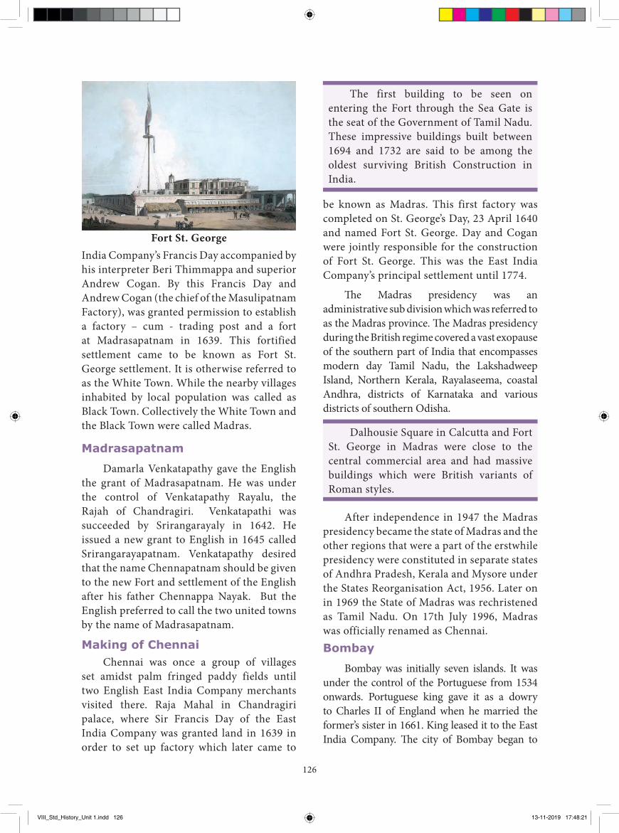
India Company’s Francis Day accompanied by his interpreter Beri Thimmappa and superior Andrew Cogan. By this Francis Day and Andrew Cogan (the chief of the Masulipatnam Factory), was granted permission to establish a factory – cum - trading post and a fort at Madrasapatnam in 1639. This fortified settlement came to be known as Fort St. George settlement. It is otherwise referred to as the White Town. While the nearby villages inhabited by local population was called as Black Town. Collectively the White Town and the Black Town were called Madras.
Madrasapatnam
Damarla Venkatapathy gave the English the grant of Madrasapatnam. He was under the control of Venkatapathy Rayalu, the Rajah of Chandragiri. Venkatapathi was succeeded by Srirangarayaly in 1642. He issued a new grant to English in 1645 called Srirangarayapatnam. Venkatapathy desired that the name Chennapatnam should be given to the new Fort and settlement of the English after his father Chennappa Nayak. But the English preferred to call the two united towns by the name of Madrasapatnam.
Making of ChennaiChennai was once a group of villages
set amidst palm fringed paddy fields until two English East India Company merchants visited there. Raja Mahal in Chandragiri palace, where Sir Francis Day of the East India Company was granted land in 1639 in order to set up factory which later came to
be known as Madras. This first factory was completed on St. George’s Day, 23 April 1640 and named Fort St. George. Day and Cogan were jointly responsible for the construction of Fort St. George. This was the East India Company’s principal settlement until 1774.
The Madras presidency was an administrative sub division which was referred to as the Madras province. The Madras presidency during the British regime covered a vast exopause of the southern part of India that encompasses modern day Tamil Nadu, the Lakshadweep Island, Northern Kerala, Rayalaseema, coastal Andhra, districts of Karnataka and various districts of southern Odisha.
Dalhousie Square in Calcutta and Fort St. George in Madras were close to the central commercial area and had massive buildings which were British variants of Roman styles.
After independence in 1947 the Madras presidency became the state of Madras and the other regions that were a part of the erstwhile presidency were constituted in separate states of Andhra Pradesh, Kerala and Mysore under the States Reorganisation Act, 1956. Later on in 1969 the State of Madras was rechristened as Tamil Nadu. On 17th July 1996, Madras was officially renamed as Chennai.Bombay
Bombay was initially seven islands. It was under the control of the Portuguese from 1534 onwards. Portuguese king gave it as a dowry to Charles II of England when he married the former’s sister in 1661. King leased it to the East India Company. The city of Bombay began to
The first building to be seen on entering the Fort through the Sea Gate is the seat of the Government of Tamil Nadu. These impressive buildings built between 1694 and 1732 are said to be among the oldest surviving British Construction in India.
Fort St. George
VIII_Std_History_Unit 1.indd 126 13-11-2019 17:48:21
127
Nellore
Gulf of Manar
Indian Ocean
Bay of Bengal
Palk Strait
Karikal
Pondicherry
Madras
Centra
l Provinces
B e n g a l
Tinne
velly
Ramnad
Madura
Tanjore
TrichinopolyCoimbatore
North Arcot
South ArcotSalem
Nilgiris
Chi
ngle
put
Chittoor
Cuddapah
KurnoolBellary
SandurState
Presidency
Anantapur
South Kanara
Coorg
M y s o r e
Tr a
va
nc
or e
CochinM
alabar
PudukkottaiState
B o m b ayN i z a m s d o m
i ni
on
s
British cochin
Anjengo
Taugasseri
EW
N
S
Not to Scale
BanganapalleState
Madras Presidency
ArabianSea
Laks
hadw
eep I
sland
s
Guntur
Kistna
Ganjam
East Godavari West
Godavari
Vizagapatam
(Source: Atlas of the Madras Presidency, Central Survey O�ce, Madras, 1921)
grow when the East India Company started using Bombay as its main port in Western India. In 1687, the English East India Company transferred its headquarters from Surat to Bombay.
Calcutta
In 1690, the English merchants founded a settlement at Sutanati. In 1698, they secured Zamindari rights over Sutanati, Calcutta and Gobindpur. The company established Fort William at Calcutta. Calcutta became Presidency with a Governor and Council to manage its affairs.
ConclusionThe British empire gradually consolidated
and established an elaborate spatial structure of administration with an imperial capital, provincial capitals and district headquarters. The new rulers brought new officials, new institutions and new structure to these towns with a kacheri, cantonment, police station, jail treasury. Public garden, post office, schools, dispensary and above all a municipal committee.
Thus in course of time, administrative headquarters emerged as the most important
VIII_Std_History_Unit 1.indd 127 13-11-2019 17:48:22
128
I. Choose the correct answer.
1. Ancient town area) Harappa and
Mohenjodarob) Delhi and Hyderabadc) Bombay and Culcuttad) None of the above
2. Coastal towns developed by the British werea) Surat b) Goac) Bombay d) All of these
the towns functioned either fort city or port city.
� With the extension of domination British developed new towns depending on its location, purpose and resources.
� In the late 18th century Calcutta, Bombay and Madras rose as Presidency cities.
� Chennai was once a group of villages. Sir Francis Day of the East India Company was granted land in 1639 to setup factory which later came to be known as Chennai.
� On 17th July 1996, Madras was officially renamed as Chennai.
towns and cities of the country. For example, by the beginning of 20th century, Calcutta, Bombay and Madras had become the leading administrative commercial and industrial cities of India. These cities became the central commercial area with buildings of European style. Sub urban railways, tram car and city buses gave the colonial cities a new look and status.
Recap� The evolution of urban settlements
has occurred in different ways and in different stages.
� In ancient times towns emerged around king’s palaces. During medieval times
Evaluation
GLOSSARYCantonment a military station in british India இராணுவ முகாம்Urbanisation the process of making an area more urban நகரமயமாதல்
Municipality a town or district that has local government நகராட்சி
Dyarchy government by two independent authorities இரட்்டையாட்சி
Rechristened give a new name to பெயரிடைபெட்டைது
Treasury a place or building where treasure is stored கருவூலம்
3. A new trend of urbanisation began in the latter half of 19th century as a result ofa) Opening of Suez Canalb) Introduction of steam navigationc) Construction of railwaysd) All the above
4. The British arrived India fora) for tradingb) for preaching their religionc) for workingd) for ruling
VIII_Std_History_Unit 1.indd 128 13-11-2019 17:48:22
129
V. Choose the correct statement1. Assertion: India became the agricultural
colony of Britain. Reason: The one-way free trade policy
followed by British and the Industrial revolution destroyed Indian indigenous industries.a) A is correct and R is Wrongb) A is wrong and R is Correctc) A is correct and R explains Ad) A is correct and R does not explain A
2. Which of the following statement(s) is/are not true?i) Srirangarayalu gave the English the
grant of Madrasapatnam.ii) Day and Cogan were jointly
responsible for the construction of Fort St. George.
iii) In 1969 the state of Madras was rechristened as Tamil Nadu.
a) i onlyb) i and iic) ii and iiid) iii only
3. Assertion: British built up their alternative capitals in hilly areas.
Reason: They found the Indian summer inhospitable.a) A is correct and R is Wrongb) A is wrong and R is Correctc) A is correct and R explains Ad) A is correct and R does not
explain A
VI. Answer the following in one or two sentences.
1. What is an urban area?2. Hilly areas were distinctive features of
colonial urban development. Why?3. Name the three Presidency cities?
5. Fort St. George was constructed by the British in a) Bombay b) Cuddalorec) Madras d) Calcutta
6. Which of the following port was the East India Company’s principal settlement until 1774?a) Fort St. William b) Fort St Davidc) Fort St. George d) None of these
II. Fill in the blanks.1. The network of railroads in India was
introduced in . 2. rightly regarded as the Father
of Local Self - Government in India.3. The Government of India Act of 1919
introduced in the provinces.4. was responsible for the
formation of the corporation.5. Francis Day and Andrew Cogan got
permission to establish a factory –cum trading post at madrasapatnam in
.
III. Match the following.1. Bombay Religious centres
2. Cantonment towns hill stations
3. kedarnath Ancient town
4. Darjeeling seven island
5. Madurai Kanpur
IV. State true or false1. Towns flourished since pre-historic times
in India.2. British acquired political control after the
Battle of Plassey.3. Fort St. Williams is in Madras.4. Army people began to live in cantonments.5. Madras was officially renamed as Chennai
in 1998.
VIII_Std_History_Unit 1.indd 129 13-11-2019 17:48:22
130
2. Mark port cities, cantonment towns, hill stations on the outline map of India. (any four places from each)
REFERENCE BOOKS
1. G. Venkatesan, Development of Rural Local Self Government, Rainbow Publications, Coimbatore, 1983.
2. Saroja Sundarajan, Madras Presidency in Pre-Gandhian era; a historical perspective, 1884-1915, Lalitha Publications, 1997.
3. Atlas of the Madras Presidency, Central Survey Offi ce, Madras, 1921.
4. India, Dorling Kindersely Limited, London, 2002.
4. State any four reason for the new trend of urbanization in the 19th century.
5. Write short note on Cantonment towns.6. What were the regions covered in the
Madras presidency during British regime?
VII. Answer the following in detail.
1. Describe the colonial urban development. 2. Trace the origin and growth of Madras.3. India became an agricultural colony of
Britain. How?
VIII. Project and Activity.1. Make an album – ‘Making of Chennai’
(from early period till now)
Web URL: https://www.zum.de/whkmla/region/india/xpresbengal.html
ICT CORNERUrban changes during the British period
Step – 1 Open the Browser and type the URL given below (or) Scan the QR Code.
Step – 2 Click the play button in left side on the screen
Step – 3 Scroll down to explore the pictorial map with descriptions
*Pictures are indicatives only.
*If browser requires, allow Flash Player or Java Script to load the pag
Through this activity you will visualize the historical atlas
of the world
VIII_Std_History_Unit 1.indd 130 13-11-2019 17:48:22
131
IntroductionGenerally human society is constantly
changing with additions, assimilations and omissions from within and outside. Women constitute half of the population. Th is is imperative to have a historical understanding of the status of women through ages.
Th e position of women was not uniform in all periods, diff ered with regional variations. In ancient India particularly early Vedic period women, enjoyed equal rights. But with the passage of time their status in the society found deteriorated as a result of frequent foreign invasions. Th ey were subjected to subjugation and subordination. New social practices, customs and systems which crept into the society in turn put limitations and restrictions on the liberty of women.
During the British Raj, many socio-religious reformers like Raja Rammohan Roy, Dayananda Saraswathi, Keshab Chandra
Sen, Iswara Chandra VidyaSagar, Pandita Ramabai, Dr. Muthulakshmi Ammaiyar, Jyoti rao phule, Periyar E.V.R, Dr. Dharmambal were the prominent leaders who fought for the uplift ment of women. Raja Rammohan Roy’s eff orts led to the abolition of sati in 1829. Vidya sagar’s crusade for the improvement in the condition of widows, led to the passing of Widow Remarriage Act in 1856. Th e reformers rightly realized that female education as an emancipating agent in eradicating social evils. So they started girls’ schools in various parts of the country, which brought signifi cant changes in the lives of women.
Women played an important part in Indian Freedom struggle. Until independence, there was no radical changes in the status of women. In independent India, last few decades have witnessed the all round development of women. Women are now making their presence felt in every walk of life.
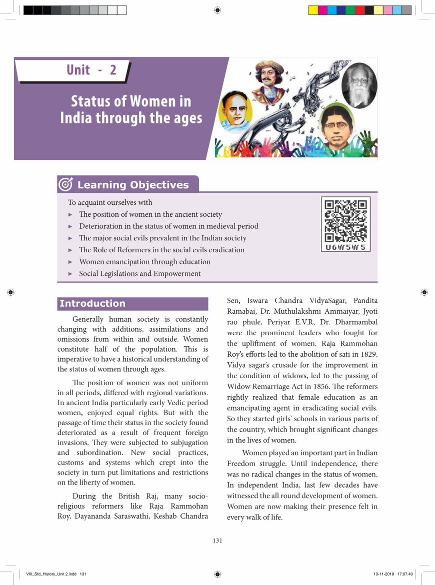
Status of Women in India through the ages
To acquaint ourselves with▶ Th e position of women in the ancient society▶ Deterioration in the status of women in medieval period▶ Th e major social evils prevalent in the Indian society▶ Th e Role of Reformers in the social evils eradication▶ Women emancipation through education▶ Social Legislations and Empowerment
Learning Objectives
Unit - 2
VIII_Std_History_Unit 2.indd 131 13-11-2019 17:07:40
132
The position of women
a) Ancient PeriodIn the ancient Indus civilization of India,
evidences show the worship of the mother goddess. Hence, the adoration for the mother is evident during that period. During the Rig Vedic period, it is believed that the position of wife was honoured and women’s position was acknowledged, especially in the performance of religious ceremonies.
During later Vedic age witnessed a transitional development in the status of women restricting her role in the social life except in the performance of religious sacrifices. Her social and political freedom was restricted. Sati became popular during the later Vedic period where the widows either chose for themselves or were forced to jump into the pyre of their husbands. The patriarchal system became rigid. Women were denied to study Vedic scriptures.
b) Medieval PeriodThe position of women in the society
further deteriorated during the medieval period and they suffered from many social evils such as sati, child marriages, female infanticide, Purdah system and slavery. Normally monogamy was in practice but among the rich polygamy was prevalent. ‘Sati’ was in practice particularly among the royal and upper strata of the society. Widow re-marriage was rare. Devadasi system was in practice in some parts of India. Among the Rajputs of Rajastan, the Jauhar was practiced. Purdah system became popular as a result of Muslim invasion. The condition of widow became miserable during the medieval period. But we don’t ignore the fact that the Mughal ruler Akbar attempted to abolish sati. In fact very little attention was paid to female education.
Jauhar refers to the practice of collective voluntary immolation by wives and daughters of defeated Rajput warriors, in order to avoid capture and dishonour.
In spite of general determination, we can find some exceptions Razia sultana, Queen Durgavati, Chand bibi, Nurjahan, Jahan nara, Jijabai and Mira bai.
The system of education in medieval times was still at a rudimentary stage. Women’s education was not completely ignored, though no regular separate school seems to have existed. Female education was informal. Girls usually had their lessons from their parents in their childhood. The rich appointed tutors to teach their daughters at home. The daughters of Rajput chiefs and Zamindars studied literature and philosophy.
c) British PeriodFor centuries women in India had been
subordinated to men and socially oppressed. The major effect of national awakening in the nineteenth century was seen in the field of social reform. The enlightened persons increasingly revolted against rigid social evils and outdated customs. Numerous individuals, reform societies and religious organisations worked hard to spread education among women, to encourage widow remarriage, to improve the living conditions of widows, to prevent marriage of young children, to bring women out of the Purdah, to enforce monogamy and to enable middle-class women to take up professions or public employment.
In the beginning of nineteenth century female literacy was extremely low when compared to male literacy. The Christian missionaries were the first to set up the Calcutta Female Juvenile Society in 1819. The Bethune school was founded in 1849 by J.E.D. Bethune, who was the president of the council of education in Calcutta.
Charles Wood’s despatch on education in 1854 laid a great stress on the need for female education. Indian Education Commission (Hunter) of 1882 recommended to start primary schools for girls and teacher-training institution and suggested special scholarships and prizes for girls. In 1880’s Indian women began to enter universities. They were also
VIII_Std_History_Unit 2.indd 132 13-11-2019 17:07:40
133
trained to become doctors and teachers. They began to write books and magazines. In 1914 the women’s medical service did a lot of work in training mid-wives. In the 1890s D.K. Karve established a number of female schools in Poona. Prof D.K. Karve, Pandita Rama bai, made sincere effort to emancipate women through education was really remarkable. The Indian women’s university was started by Prof. D.K. Karve in 1916. It was an outstanding institution imparting education to women. In the same year Lady Harding Medical College was started in Delhi.
Major Social Evils
a) Female infanticideFemale infanticide was another inhuman
practice afflicting the nineteenth century Indian society. It was particularly in vogue in Rajputana, Punjab and the North Western Provinces. It was mainly to avoid economic burden.
Factors such as family pride, the fear of not finding a suitable match for the girl child were some of the major reasons responsible for this practice. Therefore, immediately after birth, the female infants were being killed.
The company administration in India took steps to ban this practice by passing the Bengal Regulatory Act XXI of 1795, the Regulating Act of 1802 and the Female Infanticide Act of 1870.
b) Female Foeticide Female foeticide is also an inhuman
practice which cuts across the caste, creed, class and regional boundaries. Whether it is female infanticide or female foeticide the prime motive remained the same. In order to ban the female foeticide and sex-determination the central Government passed various Acts.
c) Child marriage The practice of child marriage was another
social disgrace for the women. Child marriage was prevalent among the tribes.
Akbar prohibited child marriage and made it obligatory for the parents to obtain the approval of both the bride and the bridegroom before the marriage. He prescribed 14 years as the age of constant for girls and 16 years for boys.
In 1846, the minimum marriageable age for a girl was only 10 years. The native marriage Act was passed in 1872. It fixed the minimum marriageable age of girls at 14 and boys at 18.
In 1930, the Central Legislative Assembly passed Rai Saheb Harbilas Sarada’s child Marriage Bill fixing the minimum marriageable age for boys at 18 and 14 for girls. It was later amended to 18 for girls and 21 for boys.
d) SatiSati was social evil that prevailed in Indian
society especially among the Rajputs. The feudal society of the time encouraged “sati” which meant self-immolation of the widow on the funeral pyre of her husband. Earlier it was a voluntary act but later by the relatives forced the widow to sit on the funeral pyre. The Italian traveler, Niccolo Conti, who visited Vijayanagar about the year A.D. (C.E) 1420, notes that ‘the inhabitants of this region marry as many wives as they please, who are burnt with their dead husbands’.
In the early years of 19th century, sati was in practice in various Parts of Bengal, western India and southern India. In 1811, Jagan Mohan Roy, brother of Rammohan Roy, passed away and his wife was burnt along with him. Rammohan Roy was moved to the extreme at the sight of it and took an oath that he would have the cruel practice abolished by law. He carried on a continuous agitation through press and platform for the abolition of Sati.
Raja Rammohan Roy published his tracts in 1818-20, making the point that the rite of Sati was not enjoined by the Sastras. This material was used by the Serampore missionaries to shatter the generally accepted view that Sati was an integral part of the Hindu religion. Orthodox Hindu opinion against the abolition was
VIII_Std_History_Unit 2.indd 133 13-11-2019 17:07:40
134
she raised slogan against this cruel practice. As a result the government passed the “Devadasi Abolition Act”.
Role of Social ReformersFrom the second half
of the nineteenth century, a number of social reformers and social reform movements sought to promote the upliftment of women by giving them education, raising their marriageable age and taking care of widows, as well as to remove the rigidity of caste and raise the suppressed class to a status of equality. The reformers who led the movements were the forerunners of modern India.
a) Raja Rammohan RoyThere were some enlightened Indians who
supported the British attempt to reform the oppressive social order of India. The first was the abolition of sati by law, on humanitarian grounds. Raja Rammohan Roy, the pioneer of Indian social reform movement was a casteless crusader of sati after having seen this practice in the case of his own sister-in-law. He started his camping against this in human evil practice. Influenced by the ruthless attack of the movement led by Rammohan Roy the British government declared this act as “culpable Homicide”. Raja Rammohan Roy is most remembered for helping Lord William Bentinck to declare the practice of Sati a punishable offence in 1829. He also protested against the child marriage and female infanticide. He favoured the remarriage of widows, female education and women’s right to property. Thus the evil practice of sati on any scale was wiped out.
b) Ishwar Chandra VidhyasagarIshwar Chandra Vidhyasagar carried on
the movement for female education, widow remarriage and abolition of polygamy in Bengal. He submitted petitions to this effect to the Indian Legislative Council and to the passing of the Hindu Widow Remarriage Act in 1856.
advocated by Radhakanta Deb, and Bhawani Charan Banerji.
When Lord William Bentinck took up the question of Sati, he found that the abolition had been recommended by the judges of the criminal courts. He passed Regulation XVII on December 4, 1829 ‘declaring the practice of Sati or burning or burying alive the widow of Hindus, illegal and punishable by Criminal Courts’. Similar legislative measures were enacted soon after in Bombay and Madras.
e) Devadasi SystemThe word Devadasi (Sanskrit) or Devar
adiyal (Tamil) means “servant of God” dancing girl dedicated to the service of god in a temple. Devadasi system was a social evil. There was also tradition of dedicating one daughter to the temple. In addition to taking care of the temple, they learnt and practiced Bharatha Natiyam and other classical Indian arts; traditional and enjoyed a high social status.
Later on they were ill treated and humiliated. The Devadasis lost their dignity, sense of pride, self-respect and honour.
Dr. Muthulakshmi Ammaiyar who was the first woman doctor in India, dedicated herself for the cause of abolishing the cruel practice of Devadasi system from Tamil Nadu. Appreciating her role in the agitation against Devadasi system she was nominated to the Tamil Nadu legislative council in 1929. Periyar E.V. Ramasamy was instrumental in passing the “Devadasi abolition bill”. Dr. Muthulakshmi Ammaiyar proposed the bill to the Madras legislative council in 1930.
Moovalur Ramamirdham was yet another woman who fought for the emancipation of the Devadasi. With the continuous moral support rendered by Rajaji, Periyar and Thiru.Vi.Ka,
The Madras Devadasi Act was a law that was enacted on 9th October 1947. The law was passed in the Madras presidency and gave Devadasis the legal right to marry and made it illegal to dedicated girls to India temples.
VIII_Std_History_Unit 2.indd 134 13-11-2019 17:07:40
135
His son Narayanachandra set an example to others by marrying a widow of his choice. To promote female education, Vidhyasagar founded several girls’ schools in the districts of Nadia, Midnapur, Hugli and Burdwan in Bengal.
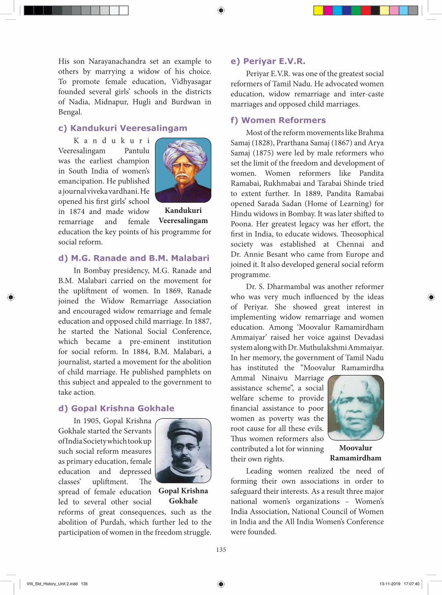
c) Kandukuri Veeresalingam K a n d u k u r i
Veeresalingam Pantulu was the earliest champion in South India of women’s emancipation. He published a journal viveka vardhani. He opened his first girls’ school in 1874 and made widow remarriage and female education the key points of his programme for social reform.
d) M.G. Ranade and B.M. MalabariIn Bombay presidency, M.G. Ranade and
B.M. Malabari carried on the movement for the upliftment of women. In 1869, Ranade joined the Widow Remarriage Association and encouraged widow remarriage and female education and opposed child marriage. In 1887, he started the National Social Conference, which became a pre-eminent institution for social reform. In 1884, B.M. Malabari, a journalist, started a movement for the abolition of child marriage. He published pamphlets on this subject and appealed to the government to take action.
d) Gopal Krishna GokhaleIn 1905, Gopal Krishna
Gokhale started the Servants of India Society which took up such social reform measures as primary education, female education and depressed classes’ upliftment. The spread of female education led to several other social reforms of great consequences, such as the abolition of Purdah, which further led to the participation of women in the freedom struggle.
Kandukuri Veeresalingam
Gopal Krishna Gokhale
e) Periyar E.V.R.Periyar E.V.R. was one of the greatest social
reformers of Tamil Nadu. He advocated women education, widow remarriage and inter-caste marriages and opposed child marriages.
f) Women ReformersMost of the reform movements like Brahma
Samaj (1828), Prarthana Samaj (1867) and Arya Samaj (1875) were led by male reformers who set the limit of the freedom and development of women. Women reformers like Pandita Ramabai, Rukhmabai and Tarabai Shinde tried to extent further. In 1889, Pandita Ramabai opened Sarada Sadan (Home of Learning) for Hindu widows in Bombay. It was later shifted to Poona. Her greatest legacy was her effort, the first in India, to educate widows. Theosophical society was established at Chennai and Dr. Annie Besant who came from Europe and joined it. It also developed general social reform programme.
Dr. S. Dharmambal was another reformer who was very much influenced by the ideas of Periyar. She showed great interest in implementing widow remarriage and women education. Among ‘Moovalur Ramamirdham Ammaiyar’ raised her voice against Devadasi system along with Dr. Muthulakshmi Ammaiyar. In her memory, the government of Tamil Nadu has instituted the “Moovalur Ramamirdha Ammal Ninaivu Marriage assistance scheme”, a social welfare scheme to provide financial assistance to poor women as poverty was the root cause for all these evils. Thus women reformers also contributed a lot for winning their own rights.
Leading women realized the need of forming their own associations in order to safeguard their interests. As a result three major national women’s organizations – Women’s India Association, National Council of Women in India and the All India Women’s Conference were founded.
Moovalur Ramamirdham
VIII_Std_History_Unit 2.indd 135 13-11-2019 17:07:40
136
• It created the feeling of sacrifice, service and rationalism.
• The practice of sati and infanticide were made illegal.
• It permitted widow remarriage.
Women in Independent India
Women in India now participate in all activities such as education, politics, medical, culture, service sectors, science and technology.
The constitution of India guarantees (Article 14) equal opportunity and equal pay for equal work.
The National policy for empowerment of women was passed under the National Policy on Education (1986), new programme was launched called Mahila Samakhya, its main focus was on empower of women. Reservation of 33 percent to women envisaged an improvement in the socio-political status of women.
The National Commission for women was set up January 1992. Its main functions is to review women related legislation and intervene in specific individual complaints of atrocities and denial of rights.
Women in the freedom movement
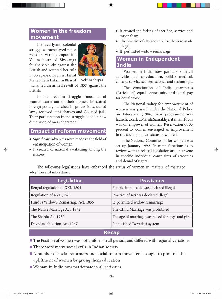
In the early anti-colonial struggle women played major roles in various capacities. Velunachiyar of Sivaganga fought violently against the British and restored her rule in Sivaganga. Begum Hazrat Mahal, Rani Lakshmi Bhai of Jhansi led an armed revolt of 1857 against the British.
In the freedom struggle thousands of women came out of their homes, boycotted foreign goods, marched in processions, defied laws, received lathi charges and Courted jails. Their participation in the struggle added a new dimension of mass character.
Impact of reform movement• Significant advances were made in the field of
emancipation of women.• It created of national awakening among the
masses.
Velunachiyar
Legislation ProvisionsBengal regulation of XXI, 1804 Female infanticide was declared illegal
Regulation of XVII,1829 Practice of sati was declared illegal
Hindus Widow’s Remarriage Act, 1856 It permitted widow remarriage
The Native Marriage Act, 1872 The Child Marriage was prohibited
The Sharda Act,1930 The age of marriage was raised for boys and girls
Devadasi abolition Act, 1947 It abolished Devadasi system
Recap� The Position of women was not uniform in all periods and differed with regional variations.� There were many social evils in Indian society� A number of social reformers and social reform movements sought to promote the
upliftment of women by giving them education� Woman in India now participate in all activities.
The following legislations have enhanced the status of women in matters of marriage adoption and inheritance.
VIII_Std_History_Unit 2.indd 136 13-11-2019 17:07:40
137
6. The Bethune school was founded in by J.E.D. Bethune.
a) 1848 b) 1849 c) 1850 d) 18517. Which commission recommended to start
primary schools for girls in 1882 ?a) Wood’s b) Welbyc) Hunter d) Muddiman
8. Sarada’s child Marriage Bill fixing the minimum marriageable age for girls at
.a) 11 b) 12 c) 13 d)14
II. Fill in the blanks1. society was setup by the
Christian missionaries in 1819.2. of Sivaganga fought bravely
against the British.3. Servants of India Society was started by
.4. was the one of the greatest
social reformer of Tamil Nadu.5. Kandukuri Veeresalingam published a
journal called .
III. Match the following1. Theosophical society - Italian traveler 2. Sarada Sadan - Social evil3. Wood’s Despatch - Annie Besant4. Niccolo Conti - Pandita
RamaBhai5. Dowry - 1854
I. Choose the correct answer
1. society is constantly changing with additions, assimilations and omissions from within and outside.a) Human b) Animalc) Forest d) Nature
2. The First women doctor in India wasa) Dharmambalb) Muthulakshmi Ammaiyarc) Moovalur Ramamirdhamd) Panditha Ramabai
3. The practice of sati was abolished in .
a) 1827 b) 1828 c) 1829 d) 18304. B.M Malabari was a
a) teacher b) doctorc) lawyer d) journalist
5. Which of the following was/were the reform movement(s)?a) Brahma Samajb) Prarthana Samajc) Arya Samajd) all the above
Evaluation
GLOSSARYzamindar a andowner பெரு நிலக்கிழார்mancipation free from social, or political restriction விடுதலல
enlightement the state of being enlightened அறிப�ாளி
polygamy the custom of being married to more than one person ெலதார மணம்
reformer a person who makes changes to something in order to improve it சீர்திருதத�ாதி
VIII_Std_History_Unit 2.indd 137 13-11-2019 17:07:40
138
IV. State True or False1. Women were honoured in Rig Vedic
period.2. Devadasi system was a social evil.3. Raja Rammohan Roy, was the pioneer of
Indian social reform movement.4. Reservation of 23 percent to women
envisaged an improvement in the socio-political status of women.
5. The age of marriage was raised for boys and girls by the Sharda Act of 1930.
V. Choose the correct statement.1. Find out the correct pair.
a) Women’s university - Prof. D.K. Karve
b) Justice Ranade - Arya Samajc) Widow Remarriage Act - 1855d) Rani Lakshmi Bhai - Delhi
2. Find the odd one out.a) Child marriage b) satic) devadasi system d) widow remarriage
3. Consider the following Statementsi) Begum Hazarat Mahal, Rani Lakshmi
Bhai led an armed revolt against the British
ii) Velunachiyar of Sivaganga, Tamil Nadu fought bravely against the British
Which of the statement (s) given above is/or correct?a) i only b) ii onlyc) i and ii d) neither i nor ii
4. Assertion: Raja Rammohan Roy is most remembered by all Indians
Reason: He wiped out the evil practice of Sati form the Indian Societya) A and R are wrongb) A is correct and R is Wrongc) A is correct and R explains Ad) A is correct and R does not explain A
VI. Answer the following in one or two sentences.
1. Name the prominent leaders who fought for the upliftment of women.
2. List out some social evils?3. Who were the notable women during the
medieval period?4. Mention the important women freedom
fighters of India?5. Give a note on Sati.
VII. Answer the following.1. Trace the role of women in freedom
struggle.2. Explain the contribution of the Social
Reformers for the eradication of social evils.
3. Give a detailed account on the Impact of reform movement?
VIII. Project and Activity.1. Prepare an information package of the
social reformers contributed in the development of women. ( Choose any one reformer and collect information related to him).
2. Group Discussion: Participation of Woman in Freedom Movement.
REFERENCE BOOKS
1. Kali Kinkar Datta, A Social History of Modern India, New Delhi: The Macmillan, 1975.
2. P.N. Chopra, B. N. Puri, M.N. Das, A.C. Pradan, A Comprehensive History of Modern India, New Delhi: Sterling Publishers, 2003.
3. P.N. Chopra, B. N. Puri, M.N. Das, A Social, Cultural and Economic History of India Vol I, II, III, New Delhi: The Macmillan, 2004.
4. Bipan Chandra, History of Modern India, New Delhi: Orient Black Swan, 2016.
VIII_Std_History_Unit 2.indd 138 13-11-2019 17:07:40

GEOGRAPHY
VIII_Std_Geography_Unit 1.indd 139 13-11-2019 18:01:23
140
Introduction Akshay and Akash were studying in 8th
standard like you. One day it was raining while they were playing in the school play ground. They started running towards the class room. Akash planned to stay under a nearby tree in the rain and called Akshay to accompany him. But he denied saying that lightning might strike the tree. Finally, they reached the class room. They saw an attractive new cotton towel in the class room. They used the towel for wiping their heads. Other students in the class room said to them,'' The towel was brought by the teacher and you made it wet. So, she might shout at you". In order to please the teacher, Akash asked the teacher some questions. He said, "Madam this is so cute and colourful. From where did you buy this? How is it made?" The teacher was very happy and started explaining the raw materials used, the way it was manufactured and marketed.
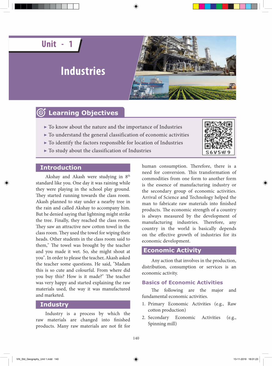
IndustryIndustry is a process by which the
raw materials are changed into finished products. Many raw materials are not fit for
human consumption. Therefore, there is a need for conversion. This transformation of commodities from one form to another form is the essence of manufacturing industry or the secondary group of economic activities. Arrival of Science and Technology helped the man to fabricate raw materials into finished products. The economic strength of a country is always measured by the development of manufacturing industries. Therefore, any country in the world is basically depends on the effective growth of industries for its economic development.
Economic ActivityAny action that involves in the production,
distribution, consumption or services is an economic activity.
Basics of Economic ActivitiesThe following are the major and
fundamental economic activities. 1. Primary Economic Activities (e.g., Raw
cotton production)2. Secondary Economic Activities (e.g.,
Spinning mill)
▶ To know about the nature and the importance of Industries▶ To understand the general classification of economic activities▶ To identify the factors responsible for location of Industries▶ To study about the classification of Industries
Learning Objectives
Industries
Unit - 1
VIII_Std_Geography_Unit 1.indd 140 13-11-2019 18:01:23
141
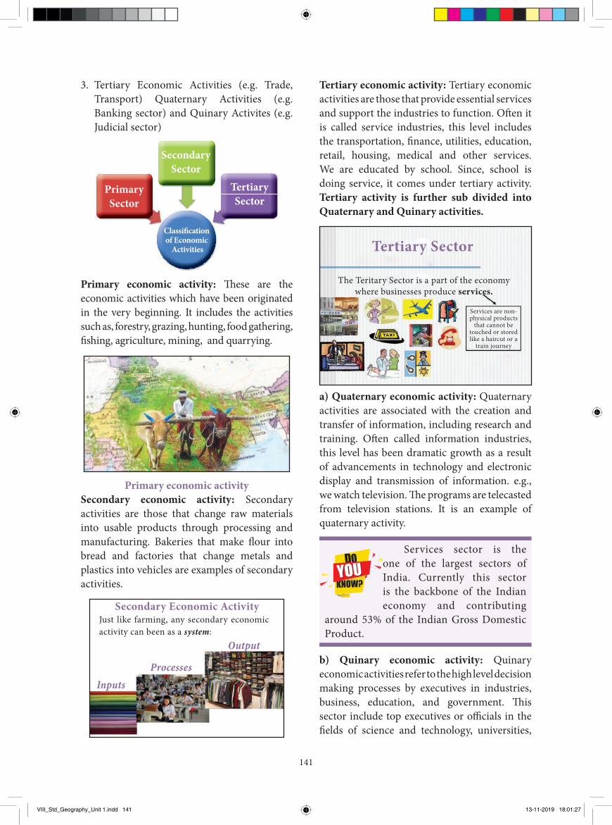
Tertiary economic activity: Tertiary economic activities are those that provide essential services and support the industries to function. Oft en it is called service industries, this level includes the transportation, fi nance, utilities, education, retail, housing, medical and other services. We are educated by school. Since, school is doing service, it comes under tertiary activity. Tertiary activity is further sub divided into Quaternary and Quinary activities.
Tertiary Sector
The Teritary Sector is a part of the economy where businesses produce services.
Services are non- physical products
that cannot be touched or stored like a haircut or a
train journey
a) Quaternary economic activity: Quaternary activities are associated with the creation and transfer of information, including research and training. Oft en called information industries, this level has been dramatic growth as a result of advancements in technology and electronic display and transmission of information. e.g., we watch television. Th e programs are telecasted from television stations. It is an example of quaternary activity.
Services sector is the one of the largest sectors of India. Currently this sector is the backbone of the Indian economy and contributing
around 53% of the Indian Gross Domestic Product.
b) Quinary economic activity: Quinary economic activities refer to the high level decision making processes by executives in industries, business, education, and government. Th is sector include top executives or offi cials in the fi elds of science and technology, universities,
3. Tertiary Economic Activities (e.g. Trade, Transport) Quaternary Activities (e.g. Banking sector) and Quinary Activites (e.g. Judicial sector)
Secondary Sector
Tertiary Sector
Primary Sector
Classifi cation of Economic
Activities
Primary economic activity: Th ese are the economic activities which have been originated in the very beginning. It includes the activities such as, forestry, grazing, hunting, food gathering, fi shing, agriculture, mining, and quarrying.
Primary economic activitySecondary economic activity: Secondary activities are those that change raw materials into usable products through processing and manufacturing. Bakeries that make fl our into bread and factories that change metals and plastics into vehicles are examples of secondary activities.
Secondary Economic ActivityJust like farming, any secondary economic activity can been as a system:
InputsProcesses
Output
VIII_Std_Geography_Unit 1.indd 141 13-11-2019 18:01:27
142
the conventional sources like coal, mineral oil, and water. So, any one of these sources must be located near the industries to fulfil its power requirement.
3. Labour: Availability of cheap and skilled labour is another important requirement for labour intensive industries (e.g., Tea industry).
4. Transport: It is needed for transporting raw materials to the industries and also for sending the finished products to the market. Availability of easy transportation always influences the location of an industry. So, the junction points of waterways, roadways and railways become active centres of industrial activity.
5. Storage and Warehousing: The finished goods should reach the market at the end of the process of manufacturing. Hence, such finished products should be stored at suitable storage or warehouse till the goods are taken to the market.
6. Topography: The site that is selected for the establishment of an industry must be flat. So, it can be well served by different modes of transport.
7. Climate: Climate of the area selected for an industry is also one of the important factors of location of industries. Extreme climate condition is not suitable for the successful industrial growth. Moreover, there are certain industries which require a specific climate. Example: Cool- humid climate is ideal for cotton textile industry. As Coimbatore and Tiruppur have such type of climate, many cotton textile industries are located in this zone.
8. Water Resources: Availability of water is another important factor that influences the industrial location. Many industries are established near rivers, canals, and lakes for this reason. Iron and steel industries, textile industries and chemical industries require plenty of water, for their proper functioning.
Find out the reasons for uneven distribution of industries in India.
Find out
health care etc. In our house, our parents purchase household articles and make decisions by themselves in some situations. Similarly, the council of ministers take decisions to introduce various people welfare schemes in the state. These two are examples of quinary activities.
ACTIVITYVisit any factory and find out the
favourable factors which are responsible for its location.
Factors responsible for location of Industries
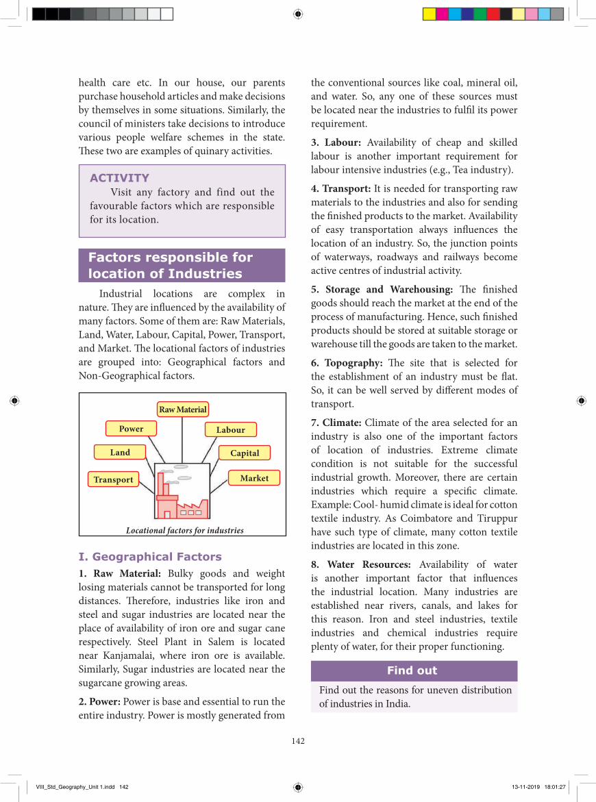
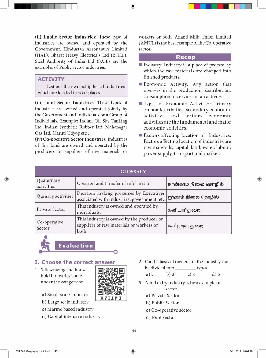
Industrial locations are complex in nature. They are influenced by the availability of many factors. Some of them are: Raw Materials, Land, Water, Labour, Capital, Power, Transport, and Market. The locational factors of industries are grouped into: Geographical factors and Non-Geographical factors.
Locational factors for industries
Transport
Land
Power
Raw Material
Labour
Capital
Market
I. Geographical Factors1. Raw Material: Bulky goods and weight losing materials cannot be transported for long distances. Therefore, industries like iron and steel and sugar industries are located near the place of availability of iron ore and sugar cane respectively. Steel Plant in Salem is located near Kanjamalai, where iron ore is available. Similarly, Sugar industries are located near the sugarcane growing areas.
2. Power: Power is base and essential to run the entire industry. Power is mostly generated from
VIII_Std_Geography_Unit 1.indd 142 13-11-2019 18:01:27
143
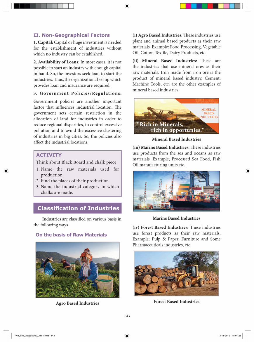
(i) Agro Based Industries: These industries use plant and animal based products as their raw materials. Example: Food Processing, Vegetable Oil, Cotton Textile, Dairy Products, etc.
(ii) Mineral Based Industries: These are the industries that use mineral ores as their raw materials. Iron made from iron ore is the product of mineral based industry. Cement, Machine Tools, etc. are the other examples of mineral based industries.
''Rich in Minerals, rich in opportunies.''
MINERAL BASED
INDUSTRIES
Mineral Based Industries
(iii) Marine Based Industries: These industries use products from the sea and oceans as raw materials. Example; Processed Sea Food, Fish Oil manufacturing units etc.
Marine Based Industries
(iv) Forest Based Industries: These industries use forest products as their raw materials. Example: Pulp & Paper, Furniture and Some Pharmaceuticals industries, etc.
Forest Based Industries
II. Non-Geographical Factors1. Capital: Capital or huge investment is needed for the establishment of industries without which no industry can be established.
2. Availability of Loans: In most cases, it is not possible to start an industry with enough capital in hand. So, the investors seek loan to start the industries. Thus, the organizational set up which provides loan and insurance are required.
3. Government Policies/Regulations:
Government policies are another important factor that influences industrial location. The government sets certain restriction in the allocation of land for industries in order to reduce regional disparities, to control excessive pollution and to avoid the excessive clustering of industries in big cities. So, the policies also affect the industrial locations.
ACTIVITYThink about Black Board and chalk piece 1. Name the raw materials used for
production.2. Find the places of their production.3. Name the industrial category in which
chalks are made.
Classification of Industries
Industries are classified on various basis in the following ways.
On the basis of Raw Materials
Agro Based Industries
VIII_Std_Geography_Unit 1.indd 143 13-11-2019 18:01:28
144
Apart from the above cited industries, cottage or household industries are also a type of small scale industry where the products are manufactured by hand, by the artisans with the help of family members. These industries are also classified and grouped as miscellaneous categories. Example: Basket weaving, Pot Making, handicrafts etc.
On the basis of Ownership (i) Private Sector Industries: These type of industries are owned and operated by individuals or a group of individuals. Example: Bajaj Auto, Reliance, etc.
On the basis of Size and Capital
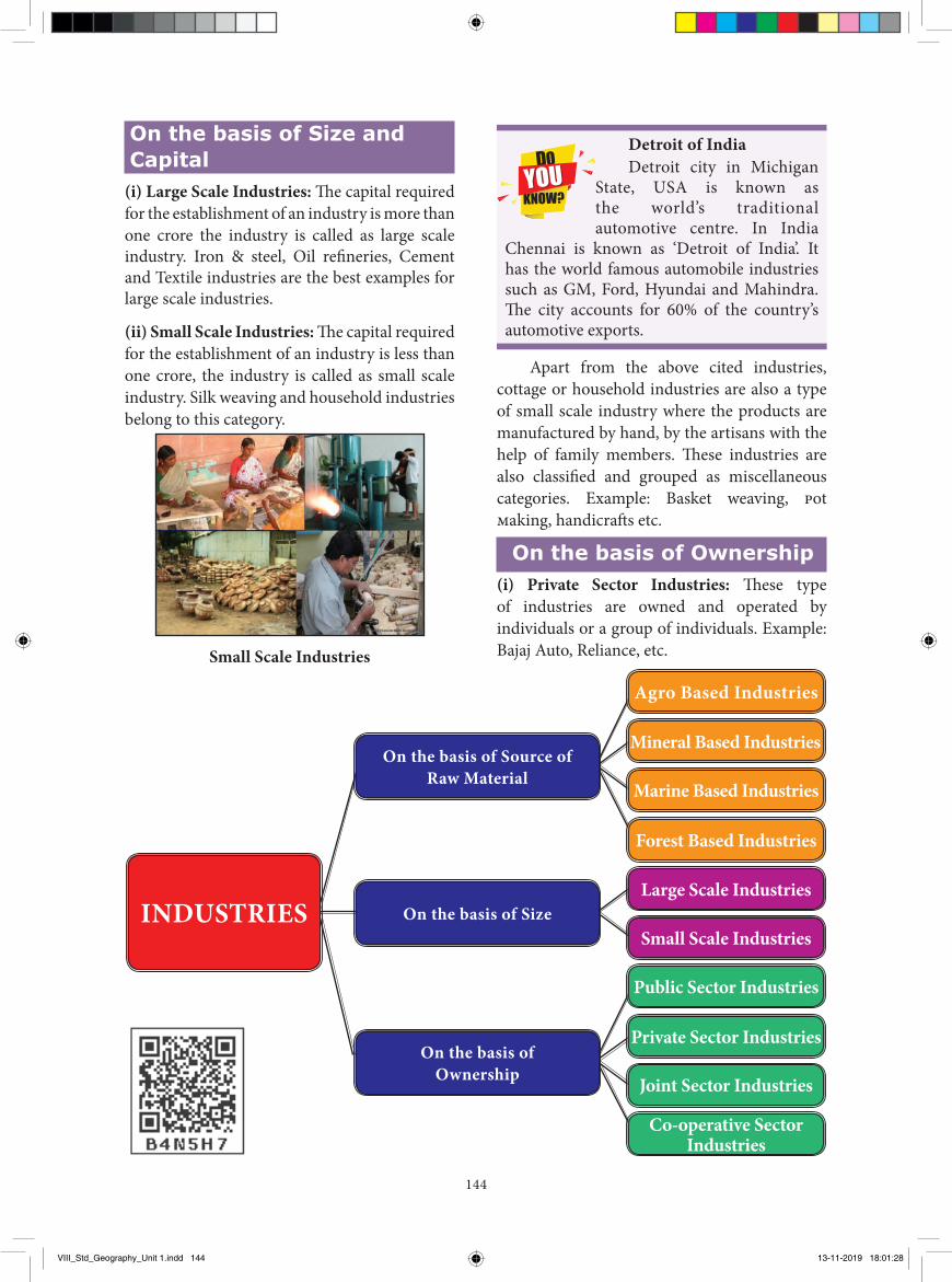
(i) Large Scale Industries: The capital required for the establishment of an industry is more than one crore the industry is called as large scale industry. Iron & steel, Oil refineries, Cement and Textile industries are the best examples for large scale industries.
(ii) Small Scale Industries: The capital required for the establishment of an industry is less than one crore, the industry is called as small scale industry. Silk weaving and household industries belong to this category.
Small Scale Industries
Detroit of IndiaDetroit city in Michigan
State, USA is known as the world’s traditional automotive centre. In India
Chennai is known as ‘Detroit of India’. It has the world famous automobile industries such as GM, Ford, Hyundai and Mahindra. The city accounts for 60% of the country’s automotive exports.
INDUSTRIES
On the basis of Source of Raw Material
On the basis of Ownership
On the basis of Size
Agro Based Industries
Marine Based Industries
Forest Based Industries
Large Scale Industries
Small Scale Industries
Public Sector Industries
Private Sector Industries
Joint Sector Industries
Co-operative Sector Industries
Mineral Based Industries
VIII_Std_Geography_Unit 1.indd 144 13-11-2019 18:01:28
145
I. Choose the correct answer1. Silk weaving and house
hold industries come under the category of ________
a) Small scale industry b) Large scale industry c) Marine based industry d) Capital intensive industry
(ii) Public Sector Industries: These type of industries are owned and operated by the Government. Hindustan Aeronautics Limited (HAL), Bharat Heavy Electricals Ltd (BHEL), Steel Authority of India Ltd (SAIL) are the examples of Public sector industries.
ACTIVITYList out the ownership based industries
which are located in your places.
(iii) Joint Sector Industries: These types of industries are owned and operated jointly by the Government and Individuals or a Group of Individuals. Example: Indian Oil Sky Tanking Ltd, Indian Synthetic Rubber Ltd, Mahanagar Gas Ltd, Maruti Udyog etc.,(iv) Co-operative Sector Industries: Industries of this kind are owned and operated by the producers or suppliers of raw materials or
GLOSSARY
Quaternary activities Creation and transfer of information நான்ாம் நிலை த�ாழில்
Quinary activities Decision making processes by Executives associated with industries, government, etc ஐந�ாம் நிலை த�ாழில்
Private Sector This industry is owned and operated by individuals. �னியார்துலை
Co-operative Sector
This industry is owned by the producer or suppliers of raw materials or workers or both.
கூட்டுைவு துலை
Evaluation
2. On the basis of ownership the industry can be divided into ________ types
a) 2 b) 3 c) 4 d) 5
3. Amul dairy industry is best example of ________ sector.
a) Private Sector b) Public Sector c) Co-operative sector d) Joint sector
workers or both. Anand Milk Union Limited (AMUL) is the best example of the Co-operative sector.
Recap� Industry: Industry is a place of process by
which the raw materials are changed into finished products.
� Economic Activity: Any action that involves in the production, distribution, consumption or services in an activity.
� Types of Economic Activities: Primary economic activities, secondary economic activities and tertiary economic activities are the fundamental and major economic activities.
� Factors affecting location of Industries: Factors affecting location of industries are raw materials, capital, land, water, labour, power supply, transport and market.
VIII_Std_Geography_Unit 1.indd 145 13-11-2019 18:01:29
146
4. What are the secondary economic activities? Give some examples.
5. What is Quinary activity? Elucidate with an example.
6. Name the factors responsible for the location of industries.
7. Write a short note on the following
a) Large scale industriesb) Small scale industries
VI. Write in detail
1. Classify and explain the industries based on the source of raw materials.
2. Explain the Geographical factors which affect the location of industries?
3. Classify the industries through a flow chart.
REFERENCE BOOKS
1. Economic Geography by “Wood and Roberts, (2010)
2. Economic Geography by Jessie P.H. Poon (2016)
3. Economic Geography by K.K. Khanna and V.K.Gupta (1998)
INTERNET RESOURCES
1. http://ncert.nic.in
2. https://www.edu.gov.mb.ca
3. http://www.yourarticlelibrary.com/industries/industries-classification-of-industries
4. https://www.clearias.com/factors-responsible-for-the-location-of-primary-secondary-and-tertiary-sector-industries-in-various-parts-of-the-world-including-india/
4. Iron and Steel and Cement Industries are the examples of ________ industries.
a) Agro based b) Mineral based
c) Forest based d) Marine based
5. Tertiary activity is divided into ________ types
a) 4 b) 3 c) 2 d) 5
II. Fill in the blanks
1. Banking is a ________ economic activity.2. Tertiary activity is divided into ________
and ________3. Government decision making process
comes under the ________ category of tertiary economic activity.
4. Raw material based perspective Cotton Textile industry is a ________ industry.
5. Capital required for establishing a large scale industry is more than ________
III. Match the following.1. Judicial sector - Private Sector2. TV telecasts - Non Geographical
factor3. Geographical factor - Quaternary activity4. Capital - Raw materials5. Bajaji Auto - Quinary activity
IV. Distinguish the following1. Secondary economic activity and tertiary
economic activity.2. Agro based and marine based industries.3. Large scale industries and small scale
industries.
V. Answer briefly1. Define industry.2. What is meant by economic activity?3. Name the major economic activities.
VIII_Std_Geography_Unit 1.indd 146 13-11-2019 18:01:29
147
Introduction A teacher handling class VIII entered the
classroom and asked the students what they were talking about. The class monitor told the teacher that the students were talking about the ODI league match between Australia and South Africa. The teacher said to the students, “Well today we will learn many things about them in this lesson”.
Africa
Location and sizeAfrica is the second largest and second
most populous continent after Asia. It stretches from 37°21'North latitude to 34° 51' South latitude and from 17°33' West longitude to 51°27' East longitude. It spreads over an area of about 30.36 million square kilometres (20.2% of the world’s land area). The equator passes through the middle of Africa and cuts into two equal halves. It is the only continent through which the major latitudes such as Tropic of
Cancer, Equator and Tropic of Capricorn pass. Its north-south extent is 7623 km and east-west extent is 7260 km. The Prime Meridian passes near Accra the capital of Ghana in the West of this continent. Africa is located in all the four hemispheres.
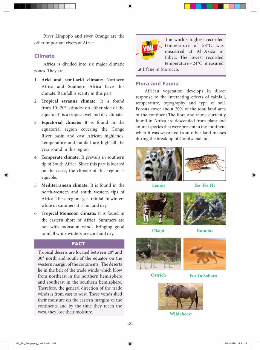
The great explorers David Living Stone and H.M. Stanley were the first to explore the interior parts of this continent. The sources reveal that the early human ancestors have lived in Africa for more than 5 million years. Africa is nicknamed as the "Mother Continent" as it was the oldest inhabited continent on Earth. The diverse geographical condition of the Continent is the main reason for heterogeneous culture and home of several ethnic groups in Africa.
▶ To study the Geographical location of the continents of Africa, Australia and Antarctica.
▶ To learn the physical setting, climate and drainage of the continents.▶ To understand the nature of the flora and fauna of the continents▶ To identify the major resources and economic activities.▶ To develop the mapping skill.
Learning Objectives
Exploring Continents Africa, Australia and Antarctica
Unit - 2
Africa is called a Dark Continent. In the beginning the interior of Africa was largely unknown to them. The European explorer
Henry M. Stanley was the first to use the term the “Dark Continent” (1878).
VIII_Std_Geography_Unit 2.indd 147 13-11-2019 17:21:12
148
Political Divisions
AFRICAPOLITICAL
INDIANOCEAN
Gulf of Aden
Red Sea
ATLANCTICOCEAN
ATLANCTICOCEAN
Not to Scale
Mediterranean Sea
10ºW 10ºE 20ºE
SOUTHAFRICA
NAMIBIA
ANGOLAZAMBIA
BOTSWANA
ZIMBABWEMOZAMMIQUE
TANZANIA
SOMALIA
ETHIOPIA
SUDAN
EGYPTLIBYAALGERIA
WESTERNSAHARA
MAURITANIA
MALI
MOROCCO
HalaibTriangle
SOUTHSUDAN
KENYADEMOCRATIC
REPUBLICOF THECONGO
UGANDCONGO
CAMEROON
GABON
NIGERIA
NIGERCHAD
CENTRALAFRICANREPUBLIC
Sao Tomeand Príncipe
SAO TOMEAND PRINCIPE
EQUATORIALGUINEA
Libreville
LESOTHOMaseru
Eswatini MaputoPretoriaGaborone
Windhoek
Harare
COMOROS
EquatorEquator
Tropic of capriconTropic of capricon
Tropic of cancer Tropic of cancer
Mogadishu
Addis Ababa
Juba
Kampala
BanguiYaounde
DjiboutiDJIBOUTI
ERITREAAsmaraKhartoum
CairoTripoli
TUNISIA
Tunis
Algiers
Rabat
El Aaiúm
Nairobi
Dodoma
BURUNDIKigaliRWANDA
Bujumbura
MALAWI
MADAGASCARAntananarivo
Luanda
Kinshasa
Lusaka
Brazzaville
MalaboAccraYamoussoukroMonrovia
ConakryGUINEA
Bissau
SENEGAL
NouakchottDakar
BanjulGUINEA-
BISSAU
Freetown
LomePorto-Novo
Abuja
N'Djamena
Bamako Niamey
BURKINA FASO
Ouagadougou
BENINTOGO
GHANA
IVORYCOAST
LIBERIA
Lilongwe
30ºE 40ºE 50ºE
30ºS
20ºS
10ºS
0º
10ºN
20ºN
30ºN
60ºE50ºE40ºN40ºE30ºE20ºE10ºE40ºN
10ºW
30ºN
20ºN
10ºN
0º
10ºS
20ºS
30ºS
20ºW 0º
0º
SIERRA LEONE
EW
N
S
THE GAMBIA
SWAZILAND
Red sea
Mediterranean sea
Sahara desert
Ahaggar Mts.Tropic of cancer
Equator
Sahel
Emi koussi
Tibesti Mts.
Lake Chad
QattaraDepression
SuezcanalToubkal
(4167 m)
R. Niger
congobasin
R. N
ile
Savanna
Savanna
BiuPlateau
R. Con
go
Southern Africa
Kalahari desert
Namib desertDrakensberg
Moz
ambi
que
Chan
nel
Great lakesMt. Kenya
Mt. Kilimanjaro(5895 m)
Lake victoria
Eastern highlands
Swah
ili co
ast
Gre
at R
iftva
lley
cape of Good hope
Strait of Gibraltar
Atlas mountain
Atlantic ocean
Indian ocean
Lake
Tang
anyik
a Gulf of Guinea
R. Zambezi
River orange
Mad
agas
car
Mt. Cameroon(4100 m)
Thabana Ntlenyana (3482 m)Mt. Compass
Mitumba MountainRange
Gulf of Aden
Tropic of capricon
Not to Scale
(3445 m)
EW
N
S
Physical Features of Africa
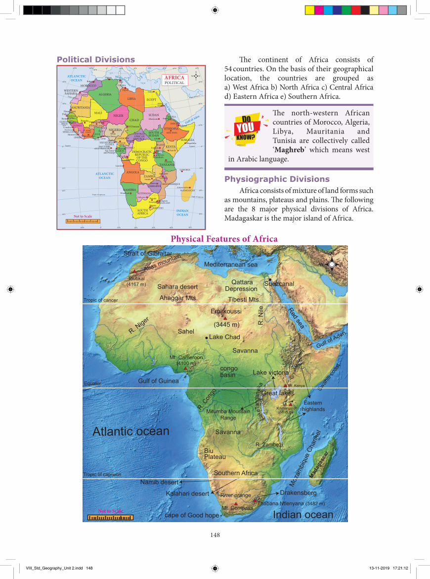
The continent of Africa consists of 54 countries. On the basis of their geographical location, the countries are grouped as a) West Africa b) North Africa c) Central Africad) Eastern Africa e) Southern Africa.
The north-western African countries of Morocco, Algeria, Libya, Mauritania and Tunisia are collectively called ‘Maghreb’ which means west
in Arabic language.
Physiographic DivisionsAfrica consists of mixture of land forms such
as mountains, plateaus and plains. The following are the 8 major physical divisions of Africa. Madagaskar is the major island of Africa.
VIII_Std_Geography_Unit 2.indd 148 13-11-2019 17:21:12
149
1. Sahara
The world-famous Sahara Desert is located in the northern part of Africa. It is one of the largest hot deserts in the world. It has an area of 9.2 million sq km. The Sahara is bordered by the Atlantic Ocean in the west, the Red Sea in the east, the Mediterranean Sea in the north and Sahel in the south. This desert covers the areas of 11 countries: Algeria, Chad, Egypt, Libya, Mali, Mauritania, Morocco, Niger, Western Sahara, Sudan and Tunisia.
It consists of many topographical features such as mountains, plateaus, ergs, oases, sand- and gravel-covered plains, salt flats, basins and depressions. Mount Koussi, an extinct volcano in Chad, is the highest point in the Sahara with 3,445 m and the Qattara Depression in Egypt is the Sahara’s deepest point (133 m below sea level). Nile and Niger rivers run through the desert.
Atlas Mountain lies in the north- west of Africa. It is a young fold mountain. It separates the Mediterranean sea and Atlantic ocean. The highest point is Mount Toubkal (4167m).
2. Sahel
Sahel means border or margin. Sahel is a semi-arid tropical Savanna region lies between the Sahara Desert in the north and Savanna grassland in the south. It stretches east-west for a distance of 4000 km and covers an area of 3.0 million sq km. It is largely a semi-arid belt of barren, sandy and rocky land. This region marks the physical and cultural transition between the more fertile tropical regions to the south and desert in the north.
3. Savanna
Tropical dry grasslands with scattered trees are known as ‘Savanna’. It is located near the equator and covers almost half of the area of Africa. This grassland is found in the regions just north and south of the rainforests that lie along the equator. Trees are the main features of the landscape in some parts of the savanna, while tall grass covers the other areas. Animals
of many species graze in this zone. The Serengeti Plain is one of the largest plains in Savanna. This is called the ‘Open Air Zoo’.
4. The Great Rift Valley and the Great Lakes of Africa
A rift valley is a large crack in the earth’s surface formed by the shifting of tectonic plates. One of the major geographical and geological features of Africa is the Great Rift Valley. It stretches from northern Syria in Asia to central Mozambique in Africa for a distance of 6400 kilometers. It runs through the eastern Africa and contains many lakes.
ACTIVITY
Find out-the Great Rift Valley and the lakes connected with it from the atlas and mention them on the map of Africa.
The African Great Lakes are a series of lakes found in the rift valley. The water in the Great lakes of Africa constitutes about 25% of the planet's unfrozen surface fresh water. There are seven major lakes in this region.
Lake Victoria of this region is the largest fresh water body in Africa and second largest in the world, next to Lake Superior in USA. It is the source of river Nile. The other lake in the valley is Tanganyika which is the longest and deepest fresh water lake in the world. Lake Albert, Lake Edward, Lake Kivu, Lake Malawi, and Lake Turkana are the other important lakes in Africa.
The glaciers on the top of Kilimanjaro have been disappearing since 20th centuries. If this trend continues, Kilimanjaro summit
will be ice –free by 2025.
5. East African Highlands
Most African mountains are found in these high lands. It stretches from Ethiopia to Cape of Good Hope. Mt. Kilimanjaro (5895m)
VIII_Std_Geography_Unit 2.indd 149 13-11-2019 17:21:13
150
Drainage of Africa
1. River Nile
The Nile is the longest river in the world with a length of 6650 km. It has two main tributaries. They are the White Nile, which originates from Burundi, and the Blue Nile, which originates from Ethiopia. These two join and form the Nile River at Khartoum, in Sudan. It flows towards northward and drains into the Mediterranean-sea. Nile is known as the “Father of African Rivers”.
The country Egypt is called the “Gift of the Nile” as it is the lifeline of the Egypt. Without Nile the Egypt would have been a desert.
ACTIVITY
On the outline map of Africa draw the courses of main rivers and name them.
2. River Congo or Zaire
Congo is the second largest river of Africa after Nile. Its length is about 4700km. Congo rises in the highlands of North Eastern Zambia between lakes Tanganyika and Nyasa. It flows through West Central Africa and drains into the Atlantic Ocean.
3. River Niger
Niger is one of the major rivers in West Africa and rises from the highlands of Guinea. It flows for about 4184 km and finally drains into the Gulf of Guinea on the Atlantic Ocean.
4. River Zambezi
The Zambezi River is the fourth longest in Africa. It rises in the north western Zambia. It is about 2574 km long and drains into the Indian ocean.The world famous waterfall ‘Victoria’ is formed by this river at the height of 108 meters. It is called the Southern Africa’s “River of Life”.
is the highest peak located in these highlands. Mt. Kenya and Mt. Ruwenzori are the major mountains located in these high lands. This region is sparsely populated and covered with rich grassland, forests, streams and waterfalls of natural scenic beauty. It enjoys misty mornings and fresh mountain breezes which attract large number of tourists from other parts of the World.
6. Swahili Coast
Swahili coast is located along the shores of East Africa. It stretches about 1,610 kilometers along the Indian Ocean from Somalia to Mozambique. It was a region where the Africans and Arabs mixed to create a unique culture referred to as Swahili Culture. People of this coast are also called 'Swahili'.
7. The Congo Basin or Zaire Basin
Congo Basin lies on the both sides of the the equator in west Central Africa. It comprises an area of more than 3.4 million square kilometres and covered with dense evergreen forest. It provides food, shelter, medicine, water, and materials for over 7.5 million people. It is the world’s second largest river basin next to Amazon.
8. Southern Africa
Most part of the Southern Africa is a plateau region. Drakensberg Mountain is found in the eastern portion of the escarpment. It extends from north east to south west for 1125 km. Its highest peak is Thabana Ntlenyana (3482m). This region is covered with grasslands known as ‘Veld’. Kalahari Desert lies in the south and Namib Desert is along the south -west shore of Africa. Kalahari Desert in this region is not actually a desert, but a bushy scrubland situated between the Orange and Zambezi Rivers.
Sheep rearing in semi –arid region of South Africa is called 'Karoos'.
VIII_Std_Geography_Unit 2.indd 150 13-11-2019 17:21:13
151
River Limpopo and river Orange are the other important rivers of Africa.
ClimateAfrica is divided into six major climatic
zones. Th ey are:
1. Arid and semi-arid climate: Northern Africa and Southern Africa have this climate. Rainfall is scanty in this part.
2. Tropical savanna climate: It is found from 100-200 latitudes on either side of the equator. It is a tropical wet and dry climate.
3. Equatorial climate: It is found in the equatorial region covering the Congo River basin and east African highlands. Temperature and rainfall are high all the year round in this region
4. Temperate climate: It prevails in southern tip of South Africa. Since this part is located on the coast, the climate of this region is equable.
5. Mediterranean climate: It is found in the north-western and south western tips of Africa. Th ese regions get rainfall in winters while in summers it is hot and dry.
6. Tropical Monsoon climate: It is found in the eastern shore of Africa. Summers are hot with monsoon winds bringing good rainfall while winters are cool and dry.
Tropical deserts are located between 20° and 30° north and south of the equator on the western margin of the continents. Th e deserts lie in the belt of the trade winds which blow from northeast in the northern hemisphere and southeast in the southern hemisphere. Th erefore, the general direction of the trade winds is from east to west. Th ese winds shed their moisture on the eastern margins of the continents and by the time they reach the west, they lose their moisture.
FACT
Th e worlds highest recorded temperature of 58°C was measured at Al- Aziza in Libya. Th e lowest recorded temperature – 24°C measured
at Irfane in Morocco.
Flora and FaunaAfrican vegetation develops in direct
response to the interacting eff ects of rainfall, temperature, topography and type of soil. Forests cover about 20% of the total land area of the continent.Th e fl ora and fauna currently found in Africa are descended from plant and animal species that were present in the continent when it was separated from other land masses during the break up of Gondwanaland.
Lemur Tse-Tse Fly
Okapi Bonobo
Fox In SaharaOstrich
Wildebeest
VIII_Std_Geography_Unit 2.indd 151 13-11-2019 17:21:13
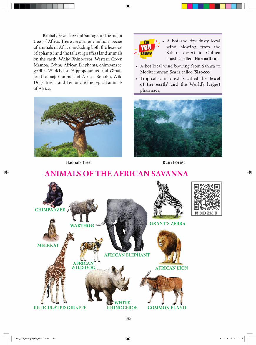
152
Baobab, Fever tree and Sausage are the major trees of Africa. There are over one million species of animals in Africa, including both the heaviest (elephants) and the tallest (giraffes) land animals on the earth. White Rhinoceros, Western Green Mamba, Zebra, African Elephants, chimpanzee, gorilla, Wildebeest, Hippopotamus, and Giraffe are the major animals of Africa. Bonobo, Wild Dogs, hyena and Lemur are the typical animals of Africa.
Baobab Tree Rain Forest
ANIMALS OF THE AFRICAN SAVANNA
CHIMPANZEE
GRANT’S ZEBRA
AFRICAN LION
COMMON ELAND
WARTHOG
AFRICAN ELEPHANT
MEERKAT
AFRICANWILD DOG
WHITERHINOCEROSRETICULATED GIRAFFE
• A hot and dry dusty local wind blowing from the Sahara desert to Guinea coast is called 'Harmattan'.
• A hot local wind blowing from Sahara to Mediterranean Sea is called 'Sirocco'.
• Tropical rain forest is called the 'Jewel of the earth' and the World’s largest pharmacy.
VIII_Std_Geography_Unit 2.indd 152 13-11-2019 17:21:14
153
America in the west. The major sea ports of Africa are Durban, Dar es Salaam and Mogadishu on the Indian Ocean, Port Said, and Alexandria, on the Mediterranean Sea, Cape Town, Algiers and Abidjan on the Atlantic Ocean.
3. Airways
They connect the capital cities of Africa and the other parts of the world. The major international airports of the continent are Cairo, Johannesburg, Nairobi, Dakar, Addis- Ababa, Casablanca, Durban, Douala and Logos.
PopulationAfrica is the world’s second most populous
continent. The United Nations estimated the population of Africa as 131 crores in 2019.The population is unevenly distributed due to physical barriers. The population density in Africa is 45 persons per sq km. 41% of the population lives in urban and 59% in rural areas. Nile delta region and South Africa are the densely populated regions of Africa. Nigeria is the most populous country of Africa followed by Ethiopia.
The major tribes of the world are called the first indigenous people. These people have a strong sense of their own identity as unique with their
own lands, languages and cultures. Afar, Fatwa, Bushmen, Dinka, Masai, Pygmies, Zulu, Tswan, and Efe are the major tribes of Africa.
Australia
Australia was the last of all the continents to be discovered, and this was due to its remoteness.
Australia is the largest island and smallest continent in the world. It is the only continent that completely occupies a single country. It has diverse in unique flora and fauna. Now let us explore the continent.
AgricultureAgriculture is a major economic activity
of the African continent. Wheat is grown in the temperate grasslands, Mediterranean region and the Nile valley. Rice is cultivated in Guinea coast, Mozambique, Madagascar and Nile valley. Maize and millets are grown all over the plateau regions. Cotton is the chief cash crop of Africa. Egypt and Sudan cultivate the best quality long staple cotton in the world. Coffee is grown in Ethiopia. Ghana is the chief producer of cocoa. Oil palm is cultivated in West African countries. Sugarcane, rubber, sisal and tobacco are the other major crops and are mostly grown in East African countries.
MineralsAfrica is rich in few mineral deposits. The
region at the south of Sahara and the plateaus of Africa are the major mineral regions of the continent. Diamonds are found in South Africa, Congo, Botswana, Sierra Leone and Angola. Kimberly in South Africa is the important producer of diamond. Angola, Nigeria, Gabon and Congo have more oil reserves. Gold is found in South Africa, Namibia, West Africa and Ghana. Chromium, cobalt, copper, iron ore, manganese. Zinc and nickel are scattered across the continent.
TransportTransports play an important role in the
economic development of a region. The physical features and slow economic growth hinder the transport system in many African countries.
1. Land ways
Roadways and Railways in Africa are poorly developed due to the presence of many barriers. It is very difficult to lay the roads and rails across the deserts and the dense forests. South Africa, Kenya, Egypt, Libya, Morocco and Nigeria have roadways and railways to some extent.
2. Waterways
Africa has trade routes between Asia and Australia in the east, Europe in the north and
VIII_Std_Geography_Unit 2.indd 153 13-11-2019 17:21:14
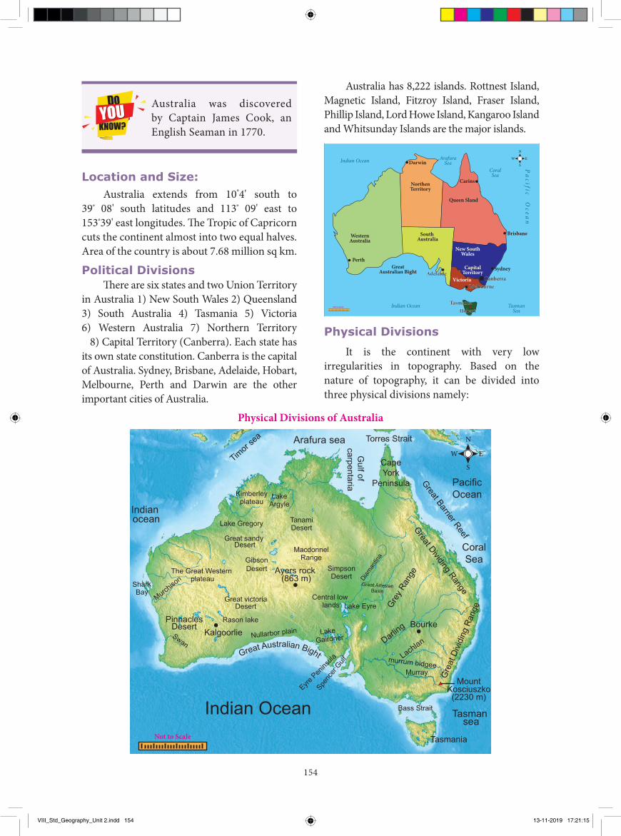
154
Australia has 8,222 islands. Rottnest Island, Magnetic Island, Fitzroy Island, Fraser Island, Phillip Island, Lord Howe Island, Kangaroo Island and Whitsunday Islands are the major islands.
WesternAustralia
Perth
TasmanSea
Indian Ocean
Indian Ocean ArafuraSea
CoralSea
Queen Sland
South Australia
NorthenTerritory
Darwin
Carins
New SouthWales
Victoria
Sydney
Canberra
Brisbane
Melbourne
CapitalTerritoryAdelaide
GreatAustralian Bight
TasmaniaHobart
Not to Scale
Pa
cif ic Ocea
n
EW
N
S
Physical Divisions
It is the continent with very low irregularities in topography. Based on the nature of topography, it can be divided into three physical divisions namely:
Australia was discovered by Captain James Cook, an English Seaman in 1770.
Location and Size:Australia extends from 10°4' south to
39º 08' south latitudes and 113º 09' east to 153º39' east longitudes. The Tropic of Capricorn cuts the continent almost into two equal halves. Area of the country is about 7.68 million sq km.
Political DivisionsThere are six states and two Union Territory
in Australia 1) New South Wales 2) Queensland 3) South Australia 4) Tasmania 5) Victoria 6) Western Australia 7) Northern Territory 8) Capital Territory (Canberra). Each state has its own state constitution. Canberra is the capital of Australia. Sydney, Brisbane, Adelaide, Hobart, Melbourne, Perth and Darwin are the other important cities of Australia.
Physical Divisions of Australia
Indian Ocean
Indian ocean
PacificOcean
CoralSea
Arafura sea
Gulf of
carpentaria
CapeYork
Peninsula
Torres Strait
Tasman sea
MountKosciuszko(2230 m)
Tasmania
Lake Gregory
Kimberleyplateau
LakeArgyle
TanamiDesert
MacdonnelRange
Lake Eyre
Bourke
Central low lands
SimpsonDesert
Ayers rock (863 m)
The Great Western plateau
Murray
Great victoriaDesert
GibsonDesert
PinnaclesDesert
Timor
sea
Gre
at D
ividi
ng R
ange
Great Dividing Range
Great Barrier Reef
Grey R
ange
Great ArtesianBasin
Darling
Lachlan
Diaman
tina
Nullarbor plain Lake Gairdner
Spenc
er Gulf
Eyre Pen
insula
Rason lake
Murchiso
nSharkBay
SwanKalgoorlie
Great sandy Desert
Bass Strait
murrum bidgee
Not to Scale
Great Australian Bight
EW
N
S
VIII_Std_Geography_Unit 2.indd 154 13-11-2019 17:21:15
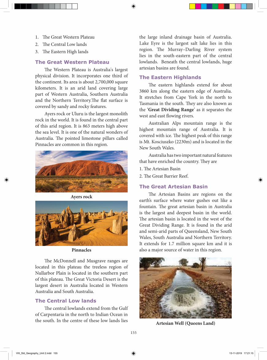
155
1. The Great Western Plateau2. The Central Low lands3. The Eastern High lands
The Great Western PlateauThe Western Plateau is Australia's largest
physical division. It incorporates one third of the continent. Its area is about 2,700,000 square kilometers. It is an arid land covering large part of Western Australia, Southern Australia and the Northern Territory.The flat surface is covered by sandy and rocky features.
Ayers rock or Uluru is the largest monolith rock in the world. It is found in the central part of this arid region. It is 863 meters high above the sea level. It is one of the natural wonders of Australia. The pointed limestone pillars called Pinnacles are common in this region.
Ayers rock
Pinnacles
The McDonnell and Musgrave ranges are located in this plateau the treeless region of Nullarbor Plain is located in the southern part of this plateau. The Great Victoria Desert is the largest desert in Australia located in Western Australia and South Australia.
The Central Low landsThe central lowlands extend from the Gulf
of Carpentaria in the north to Indian Ocean in the south. In the centre of these low lands lies
the large inland drainage basin of Australia. Lake Eyre is the largest salt lake lies in this region. The Murray–Darling River system lies in the south-eastern part of the central lowlands. Beneath the central lowlands, huge artesian basins are found.
The Eastern HighlandsThe eastern highlands extend for about
3860 km along the eastern edge of Australia. It stretches from Cape York in the north to Tasmania in the south. They are also known as the ‘Great Dividing Range’ as it separates the west and east flowing rivers.
Australian Alps mountain range is the highest mountain range of Australia. It is covered with ice. The highest peak of this range is Mt. Kosciuszko (2230m) and is located in the New South Wales.
Australia has two important natural features that have enriched the country. They are 1. The Artesian Basin2. The Great Barrier Reef.
The Great Artesian BasinThe Artesian Basins are regions on the
earth’s surface where water gushes out like a fountain. The great artesian basin in Australia is the largest and deepest basin in the world. The artesian basin is located in the west of the Great Dividing Range. It is found in the arid and semi-arid parts of Queensland, New South Wales, South Australia and Northern Territory. It extends for 1.7 million square km and it is also a major source of water in this region.
Artesian Well (Queens Land)
VIII_Std_Geography_Unit 2.indd 155 13-11-2019 17:21:15
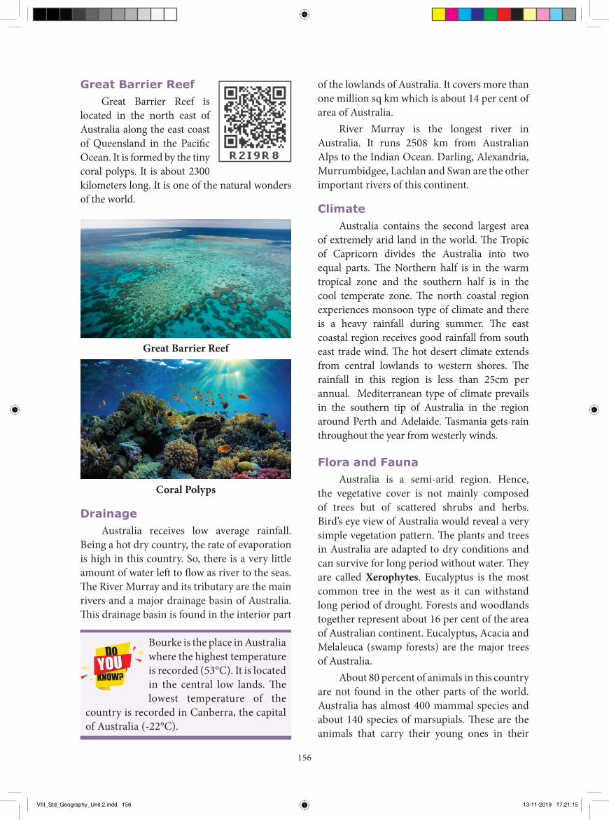
156
of the lowlands of Australia. It covers more than one million sq km which is about 14 per cent of area of Australia.
River Murray is the longest river in Australia. It runs 2508 km from Australian Alps to the Indian Ocean. Darling, Alexandria, Murrumbidgee, Lachlan and Swan are the other important rivers of this continent.
ClimateAustralia contains the second largest area
of extremely arid land in the world. Th e Tropic of Capricorn divides the Australia into two equal parts. Th e Northern half is in the warm tropical zone and the southern half is in the cool temperate zone. Th e north coastal region experiences monsoon type of climate and there is a heavy rainfall during summer. Th e east coastal region receives good rainfall from south east trade wind. Th e hot desert climate extends from central lowlands to western shores. Th e rainfall in this region is less than 25cm per annual. Mediterranean type of climate prevails in the southern tip of Australia in the region around Perth and Adelaide. Tasmania gets rain throughout the year from westerly winds.
Flora and FaunaAustralia is a semi-arid region. Hence,
the vegetative cover is not mainly composed of trees but of scattered shrubs and herbs. Bird’s eye view of Australia would reveal a very simple vegetation pattern. Th e plants and trees in Australia are adapted to dry conditions and can survive for long period without water. Th ey are called Xerophytes. Eucalyptus is the most common tree in the west as it can withstand long period of drought. Forests and woodlands together represent about 16 per cent of the area of Australian continent. Eucalyptus, Acacia and Melaleuca (swamp forests) are the major trees of Australia.
About 80 percent of animals in this country are not found in the other parts of the world. Australia has almost 400 mammal species and about 140 species of marsupials. Th ese are the animals that carry their young ones in their
Great Barrier ReefGreat Barrier Reef is
located in the north east of Australia along the east coast of Queensland in the Pacifi c Ocean. It is formed by the tiny coral polyps. It is about 2300 kilometers long. It is one of the natural wonders of the world.
Great Barrier Reef
Coral Polyps
Drainage Australia receives low average rainfall.
Being a hot dry country, the rate of evaporation is high in this country. So, there is a very little amount of water left to fl ow as river to the seas. Th e River Murray and its tributary are the main rivers and a major drainage basin of Australia. Th is drainage basin is found in the interior part
Bourke is the place in Australia where the highest temperature is recorded (53°C). It is located in the central low lands. Th e lowest temperature of the
country is recorded in Canberra, the capital of Australia (-22°C).
VIII_Std_Geography_Unit 2.indd 156 13-11-2019 17:21:15
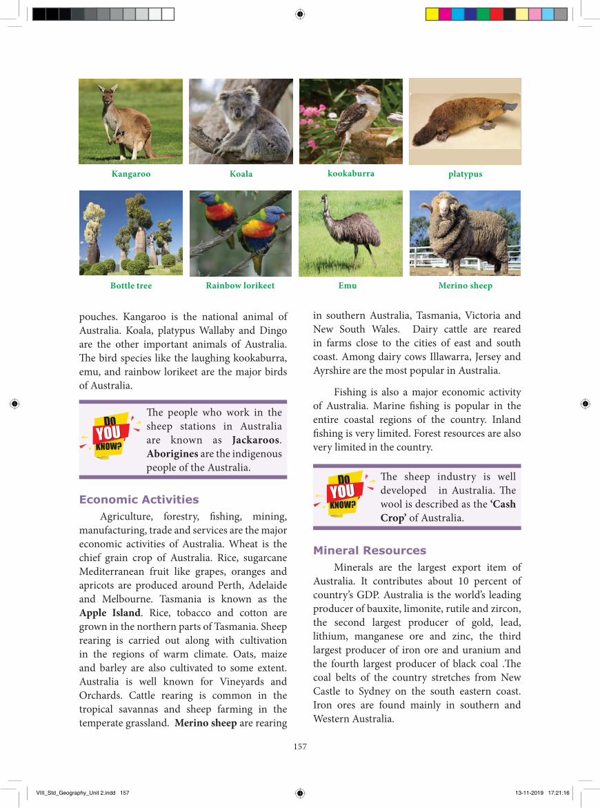
157
Kangaroo Koala kookaburra platypus
Merino sheepEmuRainbow lorikeetBottle tree
pouches. Kangaroo is the national animal of Australia. Koala, platypus Wallaby and Dingo are the other important animals of Australia. The bird species like the laughing kookaburra, emu, and rainbow lorikeet are the major birds of Australia.
The people who work in the sheep stations in Australia are known as Jackaroos. Aborigines are the indigenous people of the Australia.
Economic ActivitiesAgriculture, forestry, fishing, mining,
manufacturing, trade and services are the major economic activities of Australia. Wheat is the chief grain crop of Australia. Rice, sugarcane Mediterranean fruit like grapes, oranges and apricots are produced around Perth, Adelaide and Melbourne. Tasmania is known as the Apple Island. Rice, tobacco and cotton are grown in the northern parts of Tasmania. Sheep rearing is carried out along with cultivation in the regions of warm climate. Oats, maize and barley are also cultivated to some extent. Australia is well known for Vineyards and Orchards. Cattle rearing is common in the tropical savannas and sheep farming in the temperate grassland. Merino sheep are rearing
in southern Australia, Tasmania, Victoria and New South Wales. Dairy cattle are reared in farms close to the cities of east and south coast. Among dairy cows Illawarra, Jersey and Ayrshire are the most popular in Australia.
Fishing is also a major economic activity of Australia. Marine fishing is popular in the entire coastal regions of the country. Inland fishing is very limited. Forest resources are also very limited in the country.
The sheep industry is well developed in Australia. The wool is described as the ‘Cash Crop’ of Australia.
Mineral ResourcesMinerals are the largest export item of
Australia. It contributes about 10 percent of country’s GDP. Australia is the world’s leading producer of bauxite, limonite, rutile and zircon, the second largest producer of gold, lead, lithium, manganese ore and zinc, the third largest producer of iron ore and uranium and the fourth largest producer of black coal .The coal belts of the country stretches from New Castle to Sydney on the south eastern coast. Iron ores are found mainly in southern and Western Australia.
VIII_Std_Geography_Unit 2.indd 157 13-11-2019 17:21:16
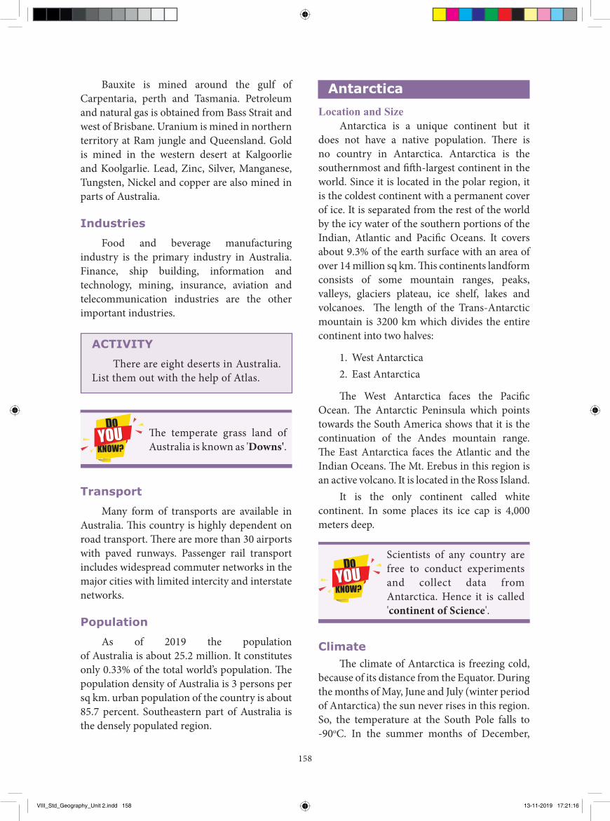
158
AntarcticaLocation and Size
Antarctica is a unique continent but it does not have a native population. There is no country in Antarctica. Antarctica is the southernmost and fifth-largest continent in the world. Since it is located in the polar region, it is the coldest continent with a permanent cover of ice. It is separated from the rest of the world by the icy water of the southern portions of the Indian, Atlantic and Pacific Oceans. It covers about 9.3% of the earth surface with an area of over 14 million sq km. This continents landform consists of some mountain ranges, peaks, valleys, glaciers plateau, ice shelf, lakes and volcanoes. The length of the Trans-Antarctic mountain is 3200 km which divides the entire continent into two halves:
1. West Antarctica2. East Antarctica
The West Antarctica faces the Pacific Ocean. The Antarctic Peninsula which points towards the South America shows that it is the continuation of the Andes mountain range. The East Antarctica faces the Atlantic and the Indian Oceans. The Mt. Erebus in this region is an active volcano. It is located in the Ross Island.
It is the only continent called white continent. In some places its ice cap is 4,000 meters deep.
Scientists of any country are free to conduct experiments and collect data from Antarctica. Hence it is called 'continent of Science'.
ClimateThe climate of Antarctica is freezing cold,
because of its distance from the Equator. During the months of May, June and July (winter period of Antarctica) the sun never rises in this region. So, the temperature at the South Pole falls to -90oC. In the summer months of December,
Bauxite is mined around the gulf of Carpentaria, perth and Tasmania. Petroleum and natural gas is obtained from Bass Strait and west of Brisbane. Uranium is mined in northern territory at Ram jungle and Queensland. Gold is mined in the western desert at Kalgoorlie and Koolgarlie. Lead, Zinc, Silver, Manganese, Tungsten, Nickel and copper are also mined in parts of Australia.
Industries
Food and beverage manufacturing industry is the primary industry in Australia. Finance, ship building, information and technology, mining, insurance, aviation and telecommunication industries are the other important industries.
ACTIVITY
There are eight deserts in Australia. List them out with the help of Atlas.
The temperate grass land of Australia is known as 'Downs'.
Transport
Many form of transports are available in Australia. This country is highly dependent on road transport. There are more than 30 airports with paved runways. Passenger rail transport includes widespread commuter networks in the major cities with limited intercity and interstate networks.
Population
As of 2019 the population of Australia is about 25.2 million. It constitutes only 0.33% of the total world’s population. The population density of Australia is 3 persons per sq km. urban population of the country is about 85.7 percent. Southeastern part of Australia is the densely populated region.
VIII_Std_Geography_Unit 2.indd 158 13-11-2019 17:21:16
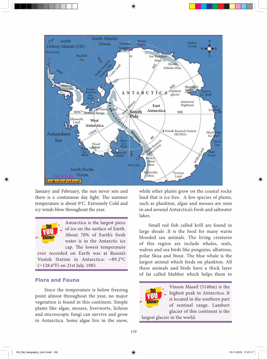
159
while other plants grow on the coastal rocky land that is ice free. A few species of plants, such as plankton, algae and mosses are seen in and around Antarctica’s fresh and saltwater lakes.
Small red fish called krill are found in large shoals .It is the food for many warm blooded sea animals. The living creatures of this region are include whales, seals, walrus and sea birds like penguins, albatross, polar Skua and Stout. The blue whale is the largest animal which feeds on plankton. All these animals and birds have a thick layer of fat called blubber which helps them to
January and February, the sun never sets and there is a continuous day light. The summer temperature is about 0oC. Extremely Cold and icy winds blow throughout the year.
Antarctica is the largest piece of ice on the surface of Earth. About 70% of Earth’s fresh water is in the Antarctic ice cap. The lowest temperature
ever recorded on Earth was at Russia’s Vostok Station in Antarctica: 89.2°C ( 128.6°F) on 21st July, 1983.
Flora and Fauna
Since the temperature is below freezing point almost throughout the year, no major vegetation is found in this continent. Simple plants like algae, mosses, liverworts, lichens and microscopic fungi can survive and grow in Antarctica. Some algae live in the snow,
Vinson Massif (5140m) is the highest peak in Antarctica. It is located in the southern part of sentinel range. Lambert glacier of this continent is the
largest glacier in the world.
Vinson massif
SouthOrkney Islands (UK)
Scotia Sea
AntarcticPeninsula
Waddell Sea
Ronne-Filchner
IceShelf
Halley
Researc
h
Statio
n (UK)
Coats Lan
d
GetzIce
Shelf
RossIce
Shelf
RooseveltIsland
Ross Sea
FloodRange
EllsworthLand
90W 90E 90
120W18080
AmundsenSea
South AtlanticOcean
South Paci�cOcean
EastAntarctica
WestAntarctica
SouthPole
PrinceAlbertMtns
McMurdo Rese
arch
Station (U
SA)
AdmiraltyMtns
IndianOcean
VictoriaLand
Wilk
es L
and
ShackletonIce Shelf
WestIce Shelf
AmeryIce Shelf
AmericanHighland
BaldCoast
DavisSea
Sor RondaneMtns
DakshinGangotri
Maitri
QueenFabiola Mtns
A N T A R C T I C A
30W
60W
30E
60E
0
Lambertglacier
Bharthi(India)
Sentinel Range Polar Plat
eauVostok Research Station
(RUSSIA)
Tr
an
s a n t a r t i cMountain
(India)
(India)
Not to Scale
EW
N
S
VIII_Std_Geography_Unit 2.indd 159 13-11-2019 17:21:17
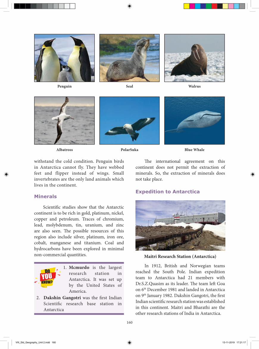
160
withstand the cold condition. Penguin birds in Antarctica cannot fly. They have webbed feet and flipper instead of wings. Small invertebrates are the only land animals which lives in the continent.
Minerals
Scientifi c studies show that the Antarctic continent is to be rich in gold, platinum, nickel, copper and petroleum. Traces of chromium, lead, molybdenum, tin, uranium, and zinc are also seen. Th e possible resources of this region also include silver, platinum, iron ore, cobalt, manganese and titanium. Coal and hydrocarbons have been explored in minimal non-commercial quantities.
Penguin
Albatross
Seal
PolarSuka
Walrus
Blue Whale
Th e international agreement on this continent does not permit the extraction of minerals. So, the extraction of minerals does not take place.
Expedition to Antarctica
Maitri Research Station (Antarctica)
In 1912, British and Norwegian teams reached the South Pole. Indian expedition team to Antarctica had 21 members with Dr.S.Z.Quasim as its leader. Th e team left Goa on 6th December 1981 and landed in Antarctica on 9th January 1982. Dakshin Gangotri, the fi rst Indian scientifi c research station was established in this continent. Maitri and Bharathi are the other research stations of India in Antarctica.
1. Mcmurdo is the largest research station in Antarctica. It was set up by the United States of America.
2. Dakshin Gangotri was the fi rst Indian Scientifi c research base station in Antarctica
VIII_Std_Geography_Unit 2.indd 160 13-11-2019 17:21:17
161
by the interaction of charged particles from the sun with atoms in the upper atmosphere. It is also called Aurora Australis or Southern Lights in the South Pole and Aurora Borealis or Northern Lights in the North Pole. These amazing colours appear in the earth’s sky, especially in the high latitudinal countries like Alaska in the north and New Zealand of Falkland in the south.
New Zealand (Aurora Australis)
Aurora
Alaska (Aurora Borealis)
A natural Curtain of combination of bright pink, red and green colour light that appears in the sky near the north and south magnetic poles is called Aurora. The effect is caused
GlossaryContinent A large land mass கண்டம்Strait A narrow water channel which connect two
large water bodies நீர்ச்சந்தி
Isthmus A narrow strip of land that connects two large land masses and separate two water bodies. நில்ச்சந்தி
Gulf A deep inlet of the sea, surrounded by a narrow mouth. வளைகு்டா
Rift Valley A linear shaped low land between the mountains. பிைவு பளைத்ாக்குReef A thin layer of calcium carbonate பவைபபாளைCataracts A fast flowing water falls over a cliff சிறு அருவிPinnacles Pointed limestone pillars found in Australian desert சுண்ாம்புப பாளை தூணRegs These are plains of sand and gravel in the arid
regions ம்றபாஙகான ்சமவவளி
Hamada Elevated plateaus of rock and stones. பாளை மறறும் கறகைால் உயரத்பபட்ட பீ்டபூமி
Oases A hub of water in the desert region. பாளலவன்ச ச்சாளல
Recap� Africa consists of a mixture of landforms such as mountains, plateaues and plains.� Australia is the largest island and smallest continent in the world.� Antarctica is the southernmost and fifth largest continent in the world.� The interaction of chrged particles from the sun with atoms in the upper atmosphere is called Aurora.
VIII_Std_Geography_Unit 2.indd 161 13-11-2019 17:21:18
162
3. is the most common tree in Australia.
4. A temperate grass land of Australia is called .
5. is the first Indian research station in Antarctica.
III. Match the following1. Pinnacle - Equatorial forest 2. Krill - salt lake 3. Ostrich - small red fish 4. Lake Eyre - flightless bird 5. Jewel of the earth - pointed limestone pillars
IV. Let us learn 1. Assertion (A): Aurora is a curtain of colour
lights appear in the sky. Reason (R): They are caused by magnetic
storms in the upper atmosphere.a) Both A and R are individually true and R
is the correct explanation for A.b) Both A and R are individually true but R
is not the correct explanation for Ac) A is true but R is false.d) R is true but A is false
2. Assertion (A): A geological feature of Africa is the Great Rift Valley.
Reason (R): A Rift valley is a large crack in the earth’s surface formed by tectonic activity.
a) Both A and R is individually true and R is the correct explanation for A.
b) Both A and R are individually true but R is not the correct explanation for A
c) A is true but R is false.d) R is true but, A is false
V. Answer in brief 1. Why Africa is called a “Mother Continent”?2. What are the important rivers of Africa?3. Name the physical division of Australia.4. Write about the nature of Antarctic continent.5. Mention any four economic activities of
Australia.
I. Choose the best answer1. The southernmost tip of
Africa is .
a) Cape Blanca b) Cape Agulhas c ) Cape of Good Hope d) Cape Town
2. The manmade canal through an isthmus between Egypt and Sinai Peninsula is
a) Panama Canal b) Aswan Canal c) Suez Canal d) Albert Canel
3. In respect of the Mediterranean climate, consider the following statements and choose the correct answer.
(1) The average rainfall is 15cm (2) The summers are hot and dry; winters
are rainy. (3) Winters are cool and dry; Summers are
hot and wet(4) Citrus fruits are growna) 1 is correct b) 2 and 4 are correctc) 3 and 4 are correctd) All are correct
4. The range which separates the west and east flowing rivers in Australia is
a) Great Dividing Rangeb) Himalayan rangec) Flinders ranged) Mac Donnell range
5. Kalgoorile is famous for mining.
a) Diamond b) Platinumc) Silver d) Gold
II. Fill in the blanks
1. Atlas Mountain is located in continent.
2. is the highest peak of Africa.
Evaluation
VIII_Std_Geography_Unit 2.indd 162 13-11-2019 17:21:18
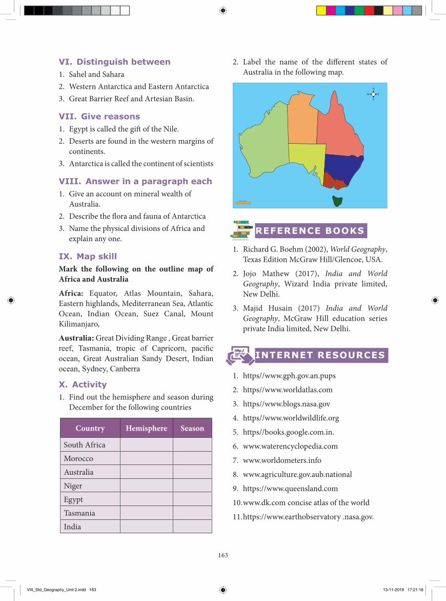
163
2. Label the name of the different states of Australia in the following map.
Not to Scale
EW
N
S
REFERENCE BOOKS
1. Richard G. Boehm (2002), World Geography, Texas Edition McGraw Hill/Glencoe, USA.
2. Jojo Mathew (2017), India and World Geography, Wizard India private limited, New Delhi.
3. Majid Husain (2017) India and World Geography, McGraw Hill education series private India limited, New Delhi.
INTERNET RESOURCES
1. https//www.gph.gov.an.pups
2. https//www.worldatlas.com
3. https//www.blogs.nasa.gov
4. https//www.worldwildlife.org
5. https//books.google.com.in.
6. www.waterencyclopedia.com
7. www.worldometers.info
8. www.agriculture.gov.aub.national
9. https://www.queensland.com
10. www.dk.com concise atlas of the world
11. https://www.earthobservatory .nasa.gov.
VI. Distinguish between1. Sahel and Sahara 2. Western Antarctica and Eastern Antarctica 3. Great Barrier Reef and Artesian Basin.
VII. Give reasons 1. Egypt is called the gift of the Nile. 2. Deserts are found in the western margins of
continents.3. Antarctica is called the continent of scientists
VIII. Answer in a paragraph each1. Give an account on mineral wealth of
Australia.2. Describe the flora and fauna of Antarctica3. Name the physical divisions of Africa and
explain any one.
IX. Map skill Mark the following on the outline map of Africa and Australia
Africa: Equator, Atlas Mountain, Sahara, Eastern highlands, Mediterranean Sea, Atlantic Ocean, Indian Ocean, Suez Canal, Mount Kilimanjaro,
Australia: Great Dividing Range , Great barrier reef, Tasmania, tropic of Capricorn, pacific ocean, Great Australian Sandy Desert, Indian ocean, Sydney, Canberra
X. Activity1. Find out the hemisphere and season during
December for the following countries
Country Hemisphere Season
South Africa
Morocco
Australia
Niger
Egypt
Tasmania
India
VIII_Std_Geography_Unit 2.indd 163 13-11-2019 17:21:18
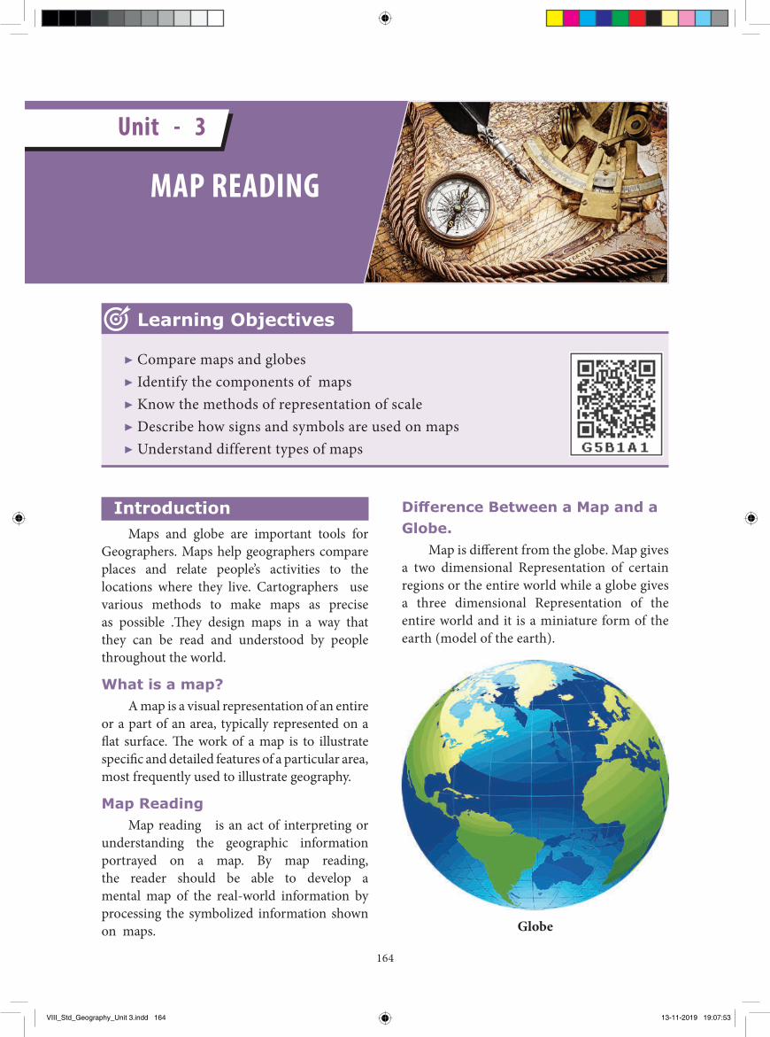
164
Introduction Maps and globe are important tools for
Geographers. Maps help geographers compare places and relate people’s activities to the locations where they live. Cartographers use various methods to make maps as precise as possible .Th ey design maps in a way that they can be read and understood by people throughout the world.
What is a map? A map is a visual representation of an entire
or a part of an area, typically represented on a fl at surface. Th e work of a map is to illustrate specifi c and detailed features of a particular area, most frequently used to illustrate geography.
Map Reading Map reading is an act of interpreting or
understanding the geographic information portrayed on a map. By map reading, the reader should be able to develop a mental map of the real-world information by processing the symbolized information shown on maps.
Diff erence Between a Map and a Globe.
Map is diff erent from the globe. Map gives a two dimensional Representation of certain regions or the entire world while a globe gives a three dimensional Representation of the entire world and it is a miniature form of the earth (model of the earth).
Globe
▶ Compare maps and globes▶ Identify the components of maps▶ Know the methods of representation of scale ▶ Describe how signs and symbols are used on maps▶ Understand different types of maps
Learning Objectives
MAP READING
Unit - 3
VIII_Std_Geography_Unit 3.indd 164 13-11-2019 19:07:53
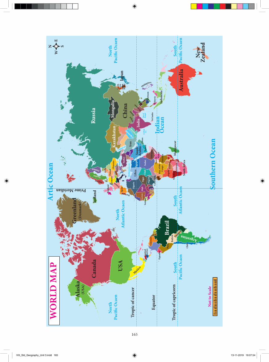
165
WO
RLD
MA
P
Aust
ralia
New
Zeal
and
Russ
ia
Chin
aJa
pan
Ger
man
yPola
nd Rum
ania
Turk
ey
Uka
rain
e
NorwaySwedan
Finland
France
Italy
Blac
k se
a
Caspian sea
Med
iterr
anea
n se
a
Braz
il
ArgentinaU
SA
Trop
ic o
f can
cer
Nor
th
P aci
�c O
caen
Nor
th
Paci
�c O
caen
Nor
th
Atla
ntic
Oca
en Sout
h At
lant
ic O
caen
Sout
h Pa
ci�c
Oca
enSo
uth
Paci
�c O
caen
Equa
tor
Prime MeridianTr
opic
of c
apri
corn
Mexico
(USA
)
Cana
da
Ala
ska
Gre
enla
nd(D
enm
ark) Ic
elan
d
Mon
galia
Kaz
akhs
tan
Sout
hern
Oce
an
Bay o
fBe
ngal
Ara
bian
sea
Art
ic O
cean
N SE
W
Not
to S
cale
Indi
a
Sout
h A
fric
a
Mad
agas
car
Indo
nesia
Saud
iA
rabi
aEg
ypt
Liby
aIr
anIr
aq
Engl
and
Chile
Boliv
ia
Peru
Equa
dor
Cen
tral
Am
eric
aVe
nezu
ela Para
guay
Spai
n
Mal
iM
auri
tani
aN
iger
Seni
gal
Ivor
yC
oast
Nig
erla
Cam
eroo
n
Chad
Alg
aria
Rep.
of t
he
Con
go
Ang
ola
Mozambique
Zam
bia
Bots
wana
Nam
ibia
Tanz
ania
Keny
aU
gand
aEthi
opiaYe
men
Om
an
Viet
nam
Nor
thKo
rea
Sout
hKo
rea
Mal
aysia
Sri l
anka
Laos
Suda
n
Somalia
Portugal
Indi
anO
cean
Philippines
Afganist
an
Pakistan
Nepal
Butan Myanmar
VIII_Std_Geography_Unit 3.indd 165 13-11-2019 19:07:54
166
The study and practice of many facets of maps and map making is called Cartography. It can be described as the art and science of map making.
Components of a map The basic components of a map are the
1. Title 2. Scale. 3.Legend or key. 4. Direction 5. Source 6.Map projection and locational information and 7.Coventional signs and symbols
a. Title Title tells about the content of the map
and is placed mostly at the top corner or at the bottom corner of the map
b. ScaleThe scale is a ratio between the actual
distance on the ground and the distance shown on the map. Generally the cartographers cannot draw maps the same size as the land. So, they reduce the size of land or features proportionally. For this purpose maps are drawn to scale. Each map has its own scale, which is indicated on the map. Often the scale is shown with a scale bar or a line and number and is placed just below the title or somewhere at the bottom of the map.
To show large areas like continents or countries small scale maps are used. Small scale maps can show only major features omitting the minor ones due to lack of space .For example physical map of the world will show us only the major physical features in the world. It represents more area of the earth but gives us less information.
To show a small area like a taluk or district large scale maps are used.
The large scale maps portray the information in detail than the small scale maps. For example physical map of India represents a small area of the earth but gives us more information. However, there is no criteria for
the classification of maps based on scale. It is only a comparative term.
ACTIVITY
Compare and find out the physical features of India which are omitted in the physical map of the world
Scales on maps can be represented in three different ways. They are:
1. Statement or Verbal scale 2. Representative Fraction (RF) or Ratio
Scale 3. Graphical or Bar Scale
1. Statement or Verbal scale In this method, the map scale is stated in
words i.e., 1cm to 1 km. It means 1cm distance on the map corresponds to 1 km distance on the ground. Thus it is written on the map like 1cm to 1 km, 1 inch to 1 mile etc.
Simple statement scale has the following characteristics.
a. If the numerator is in centimeter, the denominator is either in meters or kilometers
b. If the numerator is in inch, the denominator is in miles
2. Representative Fraction (RF) or Numerical Fraction or Ratio Scale
It shows the relationship between the map distance and the corresponding ground distance in the same units of length. R.F. is generally shown as a fraction.
For example, a fraction of 1: 50,000 shows that one unit of length on the map represents 50,000 of the same units on the ground i.e., 1cm or 1 inch on the map represents 50,000 cm or 50,000 inches respectively on the ground.
RF is represented as 1/ 50,000 or 1: 50,000
VIII_Std_Geography_Unit 3.indd 166 13-11-2019 19:07:54
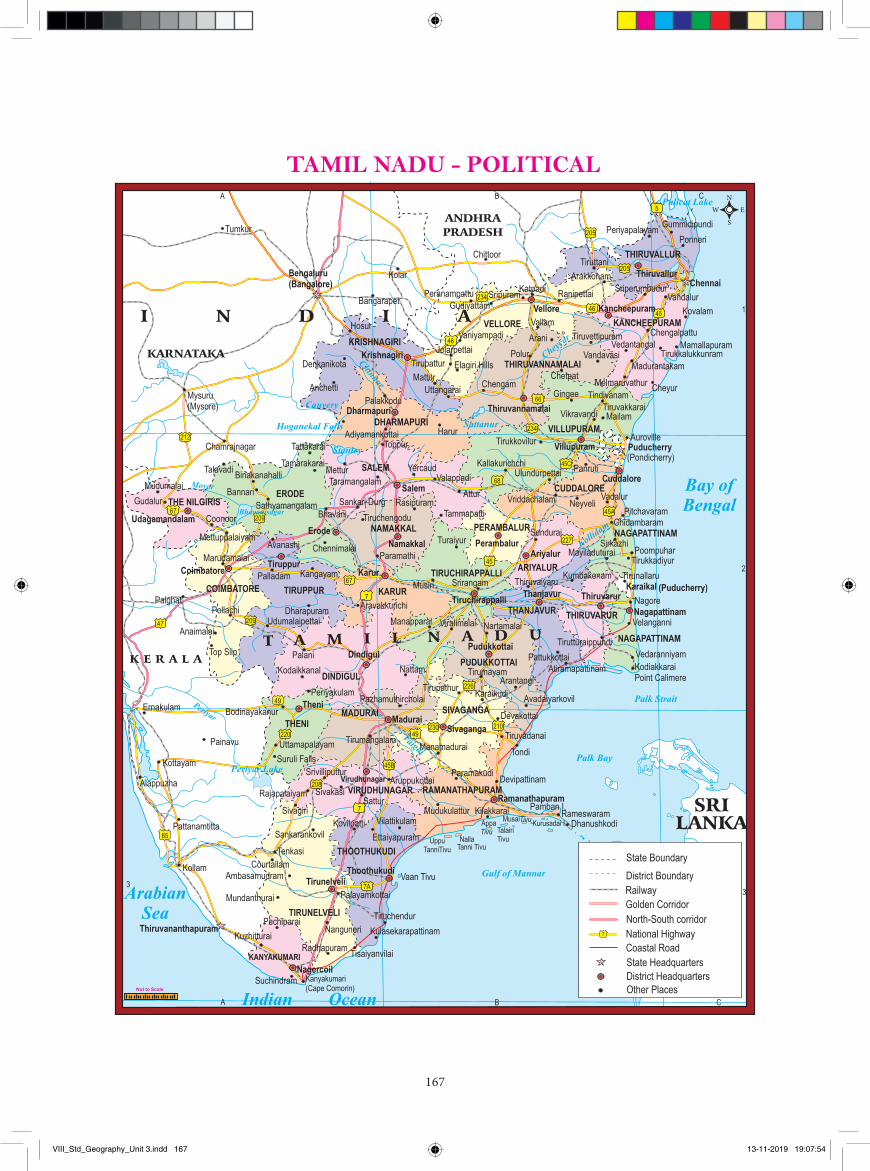
167
EW
N
S
Not to Scale
VIII_Std_Geography_Unit 3.indd 167 13-11-2019 19:07:54
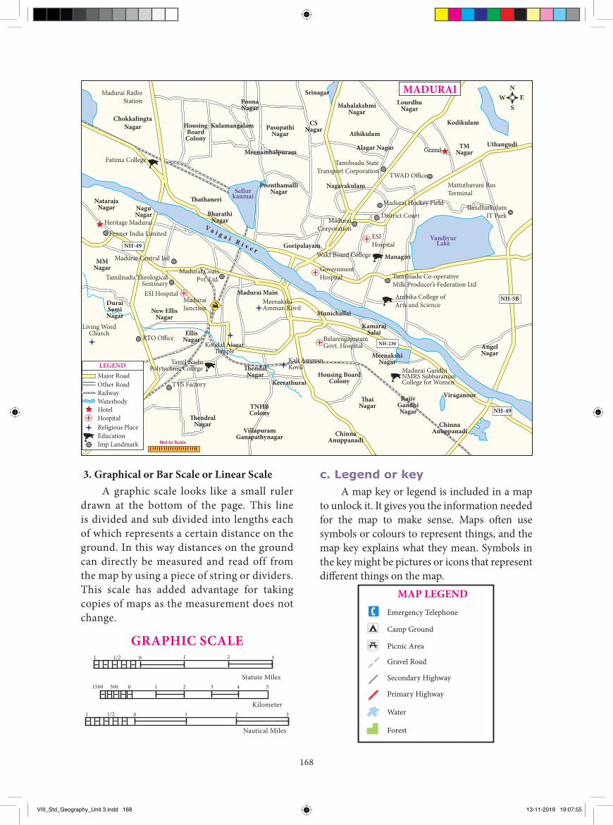
168
3. Graphical or Bar Scale or Linear Scale A graphic scale looks like a small ruler
drawn at the bottom of the page. This line is divided and sub divided into lengths each of which represents a certain distance on the ground. In this way distances on the ground can directly be measured and read off from the map by using a piece of string or dividers. This scale has added advantage for taking copies of maps as the measurement does not change.
1500
Kilometer
500 0 1 2 3 4 5
Nautical Miles
1 2 31 1/2 0
Statute Miles
11 1/2 0 2 3
GRAPHIC SCALE
c. Legend or keyA map key or legend is included in a map
to unlock it. It gives you the information needed for the map to make sense. Maps often use symbols or colours to represent things, and the map key explains what they mean. Symbols in the key might be pictures or icons that represent different things on the map.
Emergency Telephone
Camp Ground
Picnic Area
Gravel Road
Secondary Highway
Primary Highway
Water
Forest
MAP LEGEND
VandiyurLake
Sellurkanmai
LEGEND
ChokkalingtaNagar
Madurai RadioStation
Fatima College Tamilnadu StateTransport Corporation
TWAD O�ce
Grand
Mattuthavani BusTerminal
IlandhaikulamIT Park
Madurai Hockey Field
MaduraiCorporation
Heritage Madurai
Fenner India Limited
Madurai Central Jail
MaduraiJunction
Madurai CoatsPvt. Ltd.
Wakf Board College
GovernmentHospital
ESIHospital
Tamilnadu Co-operativeMilk Producer’s Federation Ltd
Ambika College ofArts and Science
Tamilnadu �eologicalSeminary
Living WordChurch
RTO O�ce
MeenakshiAmman Kovil
Tamil NaduPolytechnic College
TVS Factory
Koodal AlagarTemple
ESI Hospital
District Court
HousingBoard
Colony
Kulamangalam
PoonaNagar
PasupathiNagar
Meenambalpuram
CSNagar
MahalakshmiNagar
LourdhuNagar
TMNagar
Alagar Nagar
PoonthamalliNagar
BharathiNagar
�athaneri
GoripalayamManagiri
Nagavakulam
Uthangudi
KodikulamAthikulam
Srinagar
MMNagar
NatarajaNagar
V a i g a i R i v e r
NaguNagar
DuraiSamiNagar
New EllisNagar
EllisNagar
�endalNagar
Keerathurai
Madurai Main
Munichallai
KamarajSalai
�endralNagar
TNHBColony
Housing BoardColony
ChinnaAnuppanadi
ChinnaAnuppanadi
Viraganoor
VillapuramGanapathynagar
�aiNagar
RajivGandhiNagar
AngelNagar
BalarengapuramGovt. Hospital
Kali AmmanKovil Madurai Gandhi
NMRS SubbaramanCollege for Women
NH-230
NH-49
NH-5B
NH-49
Major RoadOther RoadRailwayWaterbodyHotelHospitalReligious PlaceEducationImp Landmark Not to Scale
MeenakshiNagar
N
SEW
MADURAI
VIII_Std_Geography_Unit 3.indd 168 13-11-2019 19:07:55
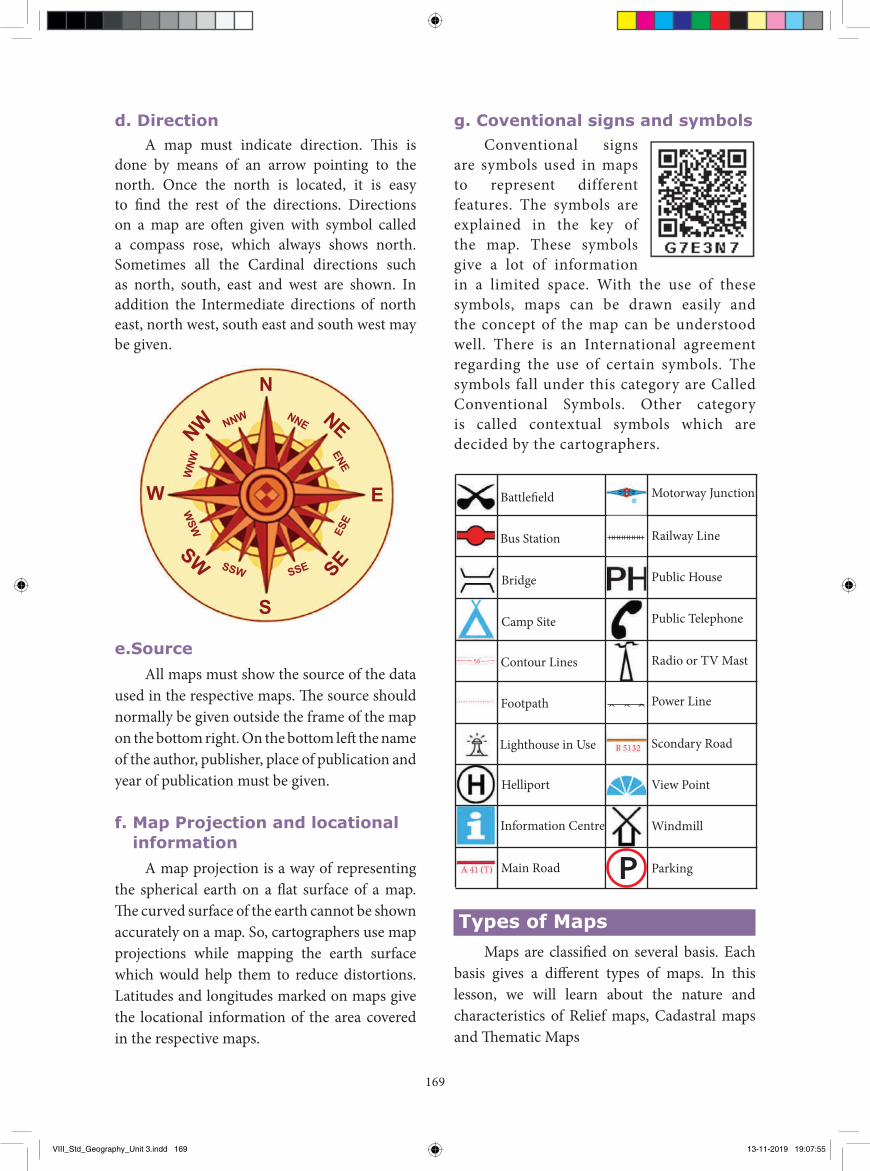
169
d. Direction A map must indicate direction. This is
done by means of an arrow pointing to the north. Once the north is located, it is easy to find the rest of the directions. Directions on a map are often given with symbol called a compass rose, which always shows north. Sometimes all the Cardinal directions such as north, south, east and west are shown. In addition the Intermediate directions of north east, north west, south east and south west may be given.
N
S
E
NW NNW
WNW
WSW
SSW SSE
ESE
NNE
ENE
NE
SW SE
W
e.Source All maps must show the source of the data
used in the respective maps. The source should normally be given outside the frame of the map on the bottom right. On the bottom left the name of the author, publisher, place of publication and year of publication must be given.
f. Map Projection and locational information
A map projection is a way of representing the spherical earth on a flat surface of a map. The curved surface of the earth cannot be shown accurately on a map. So, cartographers use map projections while mapping the earth surface which would help them to reduce distortions. Latitudes and longitudes marked on maps give the locational information of the area covered in the respective maps.
g. Coventional signs and symbolsConventional signs
are symbols used in maps to represent different features. The symbols are explained in the key of the map. These symbols give a lot of information in a limited space. With the use of these symbols, maps can be drawn easily and the concept of the map can be understood well. There is an International agreement regarding the use of certain symbols. The symbols fall under this category are Called Conventional Symbols. Other category is called contextual symbols which are decided by the cartographers.
Battle�eld
Bus Station
Bridge
Camp Site
Contour Lines
Footpath
Lighthouse in Use
Helliport
Information Centre
Main Road Parking
Windmill
View Point
Scondary Road
Power Line
Radio or TV Mast
Public Telephone
Public House
Railway Line
Motorway Junction
PTypes of Maps
Maps are classified on several basis. Each basis gives a different types of maps. In this lesson, we will learn about the nature and characteristics of Relief maps, Cadastral maps and Thematic Maps
VIII_Std_Geography_Unit 3.indd 169 13-11-2019 19:07:55
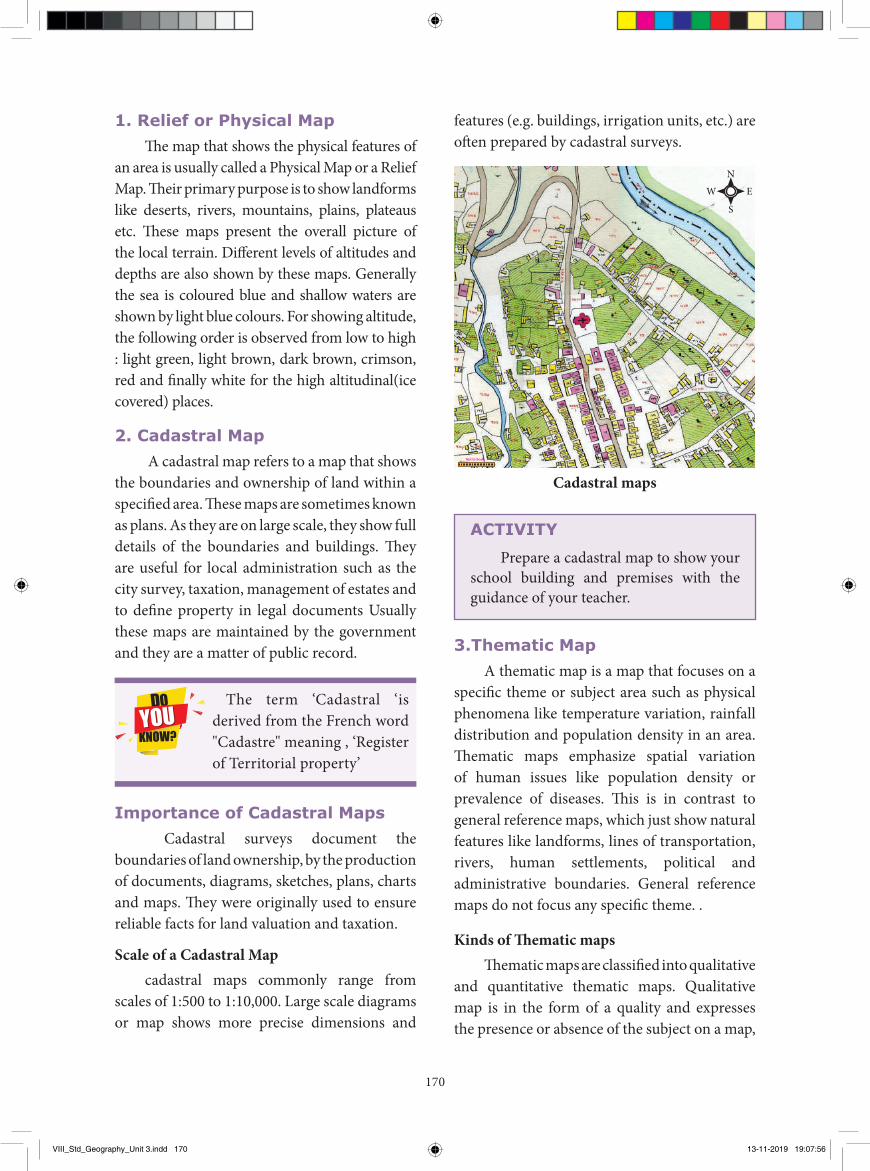
170
1. Relief or Physical MapThe map that shows the physical features of
an area is usually called a Physical Map or a Relief Map. Their primary purpose is to show landforms like deserts, rivers, mountains, plains, plateaus etc. These maps present the overall picture of the local terrain. Different levels of altitudes and depths are also shown by these maps. Generally the sea is coloured blue and shallow waters are shown by light blue colours. For showing altitude, the following order is observed from low to high : light green, light brown, dark brown, crimson, red and finally white for the high altitudinal(ice covered) places.
2. Cadastral Map A cadastral map refers to a map that shows
the boundaries and ownership of land within a specified area. These maps are sometimes known as plans. As they are on large scale, they show full details of the boundaries and buildings. They are useful for local administration such as the city survey, taxation, management of estates and to define property in legal documents Usually these maps are maintained by the government and they are a matter of public record.
The term ‘Cadastral ‘is derived from the French word "Cadastre" meaning , ‘Register of Territorial property’
Importance of Cadastral Maps Cadastral surveys document the
boundaries of land ownership, by the production of documents, diagrams, sketches, plans, charts and maps. They were originally used to ensure reliable facts for land valuation and taxation.
Scale of a Cadastral Mapcadastral maps commonly range from
scales of 1:500 to 1:10,000. Large scale diagrams or map shows more precise dimensions and
features (e.g. buildings, irrigation units, etc.) are often prepared by cadastral surveys.
EW
N
S
Not to Scale
Cadastral maps
ACTIVITY
Prepare a cadastral map to show your school building and premises with the guidance of your teacher.
3.Thematic Map A thematic map is a map that focuses on a
specific theme or subject area such as physical phenomena like temperature variation, rainfall distribution and population density in an area. Thematic maps emphasize spatial variation of human issues like population density or prevalence of diseases. This is in contrast to general reference maps, which just show natural features like landforms, lines of transportation, rivers, human settlements, political and administrative boundaries. General reference maps do not focus any specific theme. .
Kinds of Thematic mapsThematic maps are classified into qualitative
and quantitative thematic maps. Qualitative map is in the form of a quality and expresses the presence or absence of the subject on a map,
VIII_Std_Geography_Unit 3.indd 170 13-11-2019 19:07:56
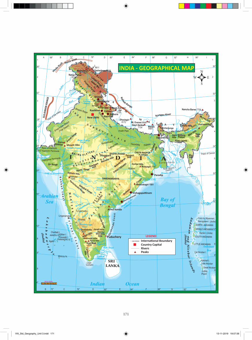
171
SULA
IMAN
RAN
GE
LEGEND
RiversPeaks
Interna�onal BoundaryCountry Capital
Puduchery
Pamir Knot
Hindu Kush
Shimla
Mussourie
Nainital
Ranikhet Almora
New Delhi
Darjeeling
Paradip
Vishagapa�nam
Machilipatanam
Purvanchal
Mount Abu
Gurushikhar
Dhupgarh
Garwal
Palani Hills
Arma Konda
Ko
nk
an
co
as
t
INDIA - GEOGRAPHICAL MAP
Kailash Range
Tsangpo River
EW
N
S
Not to Scale
VIII_Std_Geography_Unit 3.indd 171 13-11-2019 19:07:56
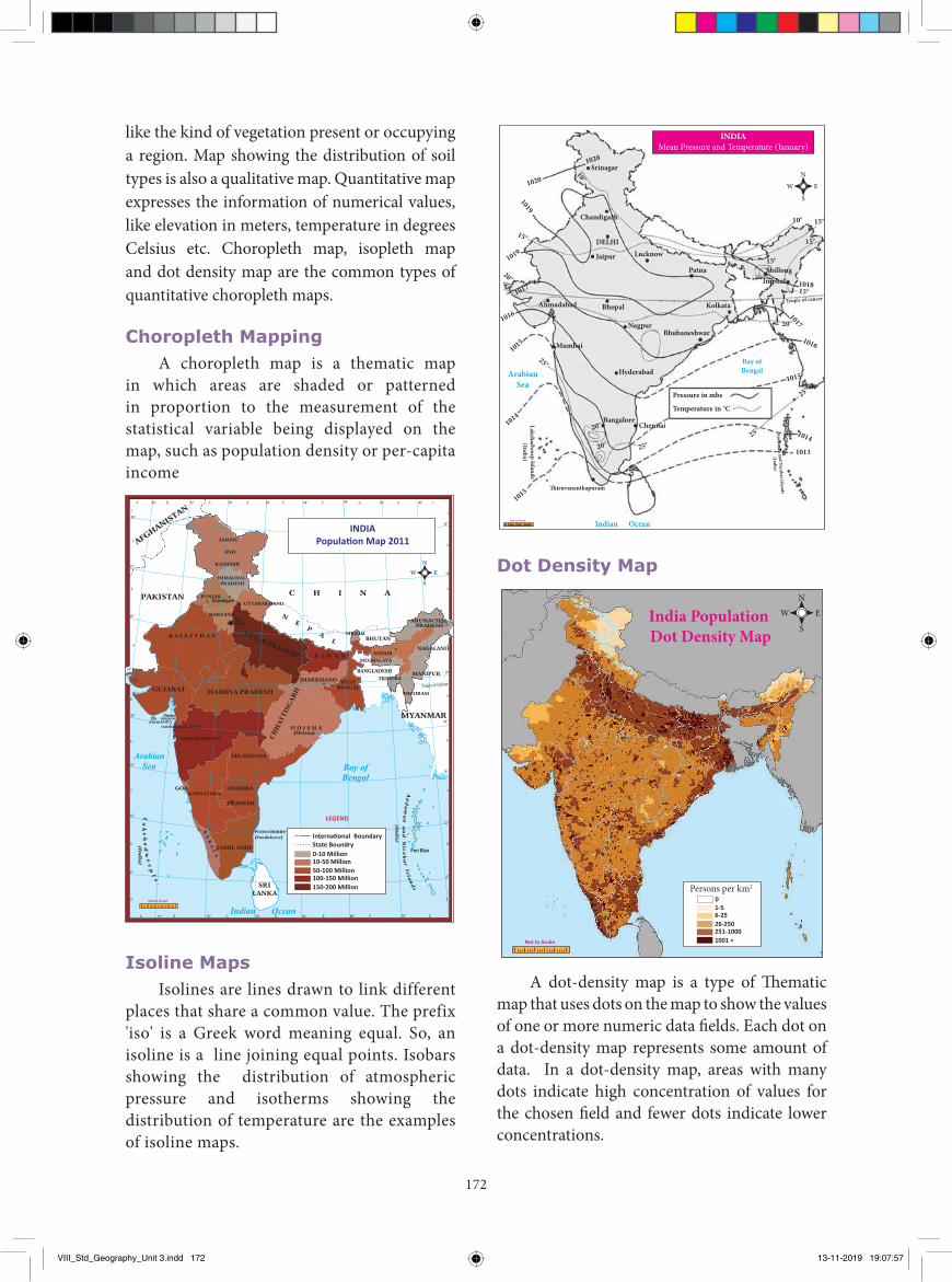
172
Srinagar
Chandigarh
DELHI
Jaipur Lucknow
Patna ShillongImphal
Kolkata
Bhubaneshwar
Bay ofBengal
Pressure in mbs
Temperature in °C
Nagpur
BhopalAhmadabad
Mumbai
BangaloreChennai
�iruvananthapuram
Lakshadweep Islands(India)
Indian Ocean
HyderabadArabianSea
Tropic of cancer
1020
1020
1019
1019
1017
1016
1015
1014
1013
10°
15°
20°
25°
20°
20° 25°25°
25°
20°
15°
15°
15°
15°10°
1018
1015
1016
1017
1013
Andam
an and Nicobar Islands
(India)
1014
Not to Scale
EW
N
S
INDIAMean Pressure and Temperature (January)
Dot Density Map
India Population Dot Density Map
EW
N
S
Not to Scale
1-5 6-2526-250251-10001001 +
0Persons per km2
A dot-density map is a type of Th ematic map that uses dots on the map to show the values of one or more numeric data fi elds. Each dot on a dot-density map represents some amount of data. In a dot-density map, areas with many dots indicate high concentration of values for the chosen fi eld and fewer dots indicate lower concentrations.
like the kind of vegetation present or occupying a region. Map showing the distribution of soil types is also a qualitative map. Quantitative map expresses the information of numerical values, like elevation in meters, temperature in degrees Celsius etc. Choropleth map, isopleth map and dot density map are the common types of quantitative choropleth maps.
Choropleth MappingA choropleth map is a thematic map
in which areas are shaded or patterned in proportion to the measurement of the statistical variable being displayed on the map, such as population density or per-capita income
Not to Scale
LEGEND
INDIAPopula�on Map 2011
State Boundry
GUJARAT
UTTAR PRADESH
MADHYA PRADESH
CHHA
TTIS
GARH
0-10 Million10-50 Million50-100 Million100-150 Million150-200 Million
Interna�onal Boundary
EW
N
S
Isoline MapsIsolines are lines drawn to link different
places that share a common value. The prefix 'iso' is a Greek word meaning equal. So, an isoline is a line joining equal points. Isobars showing the distribution of atmospheric pressure and isotherms showing the distribution of temperature are the examples of isoline maps.
VIII_Std_Geography_Unit 3.indd 172 13-11-2019 19:07:57
173
I. Choose the best answer1. The subject which deals
with map making process is _____.a) Demographyb) Cartographyc) Physiographyd) Topography
2. A map that shows the physical features of an area is called ____. a) Cadastral map b) Relief mapc) Climatic map d) Resource map
3. Shallow water bodies are represented by _____ colour.a) Yellow b) Brownc) Light blue d) Dark blue
GLOSSARY
MapA map is a two dimensional representation of the earth as a whole or part of the earth drawn with a specific scale on a flat surface
வரைபடம்
Cartography Cartography is the science and art of map-making நிலவரைபடவியல்
Map ScaleMap scale refers to the relationship (or ratio) between distance on a map and the corresponding distance on the ground.
புவிபபட அளரவ
Cadastre ‘Register of Territorial property’ நில எல்ரல பதிதல்
Evaluation 4. The maps which are known as plans are.
a) Cadastral mapsb) Topographical mapsc) Isoline mapsd) Transport maps
5. Actual distribution of population can be represented by _____ .a) lines b) Shadesc) Dots d) Contours
II. Fill in the blanks 1. The globe is the true representation of the
________.2. A way of representing the spherical earth on
a flat surface is ________.3. A line that joins the points of equal
elevation is ________.4. Cadastral maps are usually maintained by
________.5. ________ map is focused on a specific
theme.
Uses of maps• To find the location of objects and places• To find the transportation routes• Maps showing strategic locations are useful
for military
• Serve as tourist guide • To find the spatial distribution of different
phenomena• Display weather conditions• Highly helpful in learning geography• Represent the real world on a small scale
Recap� Map reading is an act of interpreting or understanding the geographic information portrayed on a map� A cadastral map refers to a map that shows the boundaries and ownership of land within a
specified area.� A thematic map is a map that focuses on a specific theme or subject area.
VIII_Std_Geography_Unit 3.indd 173 13-11-2019 19:07:57
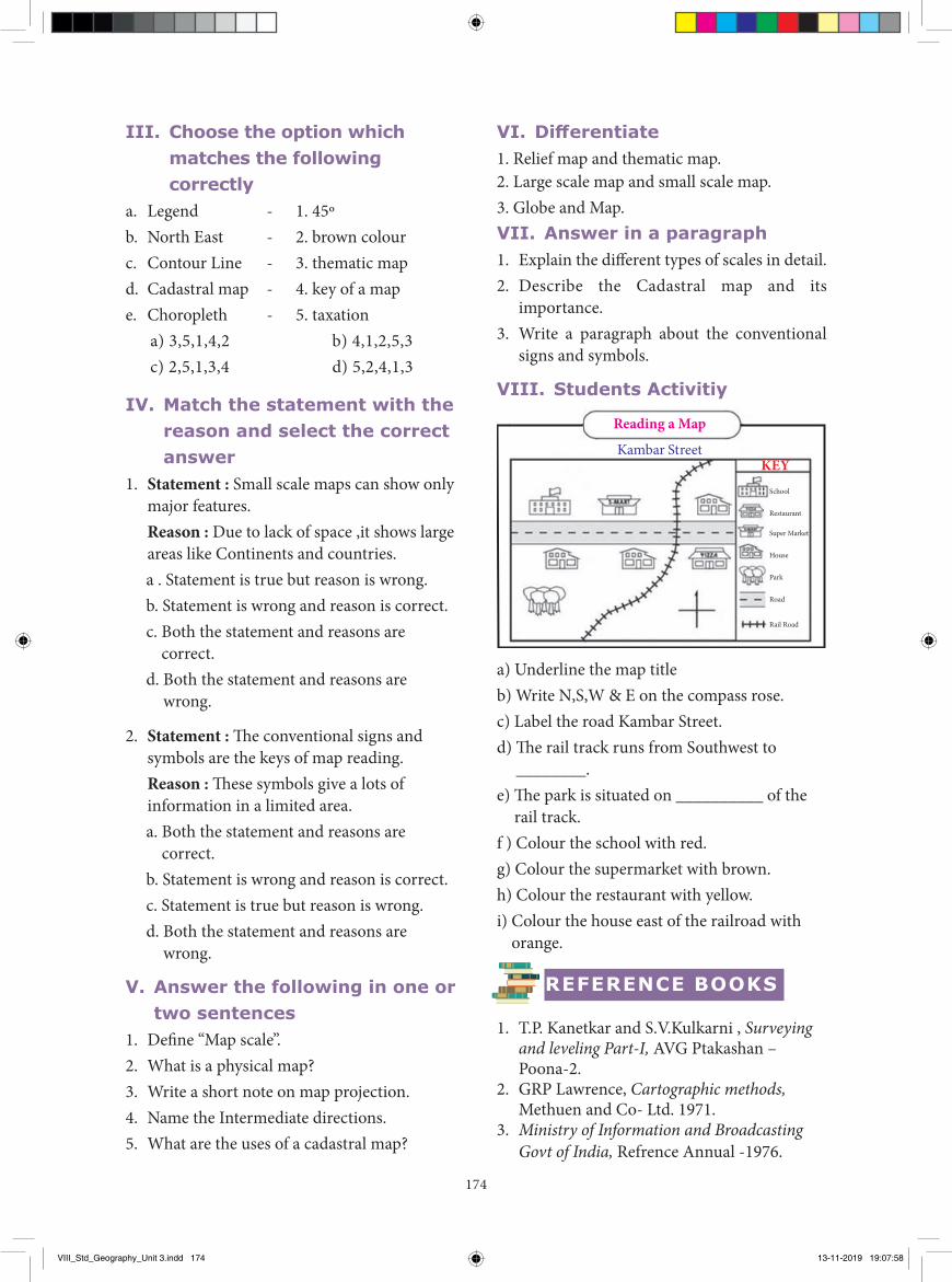
174
VI. Differentiate 1. Relief map and thematic map. 2. Large scale map and small scale map. 3. Globe and Map. VII. Answer in a paragraph 1. Explain the different types of scales in detail.2. Describe the Cadastral map and its
importance. 3. Write a paragraph about the conventional
signs and symbols.
VIII. Students Activitiy
Reading a Map
KEYKambar Street
School
Restaurant
Super Market
House
Park
Road
Rail Road
a) Underline the map titleb) Write N,S,W & E on the compass rose.c) Label the road Kambar Street.d) The rail track runs from Southwest to
________.e) The park is situated on __________ of the
rail track.f ) Colour the school with red.g) Colour the supermarket with brown.h) Colour the restaurant with yellow.i) Colour the house east of the railroad with
orange.
REFERENCE BOOKS
1. T.P. Kanetkar and S.V.Kulkarni , Surveying and leveling Part-I, AVG Ptakashan –Poona-2.
2. GRP Lawrence, Cartographic methods, Methuen and Co- Ltd. 1971.
3. Ministry of Information and Broadcasting Govt of India, Refrence Annual -1976.
III. Choose the option which matches the following correctly
a. Legend - 1. 45º b. North East - 2. brown colourc. Contour Line - 3. thematic mapd. Cadastral map - 4. key of a mape. Choropleth - 5. taxation
a) 3,5,1,4,2 b) 4,1,2,5,3c) 2,5,1,3,4 d) 5,2,4,1,3
IV. Match the statement with the reason and select the correct answer
1. Statement : Small scale maps can show only major features.
Reason : Due to lack of space ,it shows large areas like Continents and countries.a . Statement is true but reason is wrong.b. Statement is wrong and reason is correct.c. Both the statement and reasons are
correct.d. Both the statement and reasons are
wrong.
2. Statement : The conventional signs and symbols are the keys of map reading.
Reason : These symbols give a lots of information in a limited area. a. Both the statement and reasons are
correct.b. Statement is wrong and reason is correct.c. Statement is true but reason is wrong.d. Both the statement and reasons are
wrong.
V. Answer the following in one or two sentences
1. Define “Map scale”.2. What is a physical map? 3. Write a short note on map projection.4. Name the Intermediate directions.5. What are the uses of a cadastral map?
VIII_Std_Geography_Unit 3.indd 174 13-11-2019 19:07:58

175
Web URL: https://www.zum.de/whkmla/region/india/xpresbengal.html
ICT CORNERUrban changes during the British period
Step – 1 Open the Browser and type the URL given below (or) Scan the QR Code.
Step – 2 Click the play button in left side on the screen
Step – 3 Scroll down to explore the pictorial map with descriptions
*Pictures are indicatives only.
*If browser requires, allow Flash Player or Java Script to load the pag
Through this activity you will visualize the historical atlas
of the world
Step – 1 Step – 2 Step – 3
Web URL: http://www.ordnancesurvey.co.uk/mapzone
ICT CORNERMap Reading
Step – 1 Open the Browser and type the URL given below (or) Scan the QR Code.
Step – 2 Click on “Map Skills” and select any topic (ex.Scale)
Step – 3 Click on Next or previous button to know about mapping scale
*Pictures are indicatives only.
*If browser requires, allow Flash Player or Java Script to load the pag
Through this activity you will know about map skills
Step – 1 Step – 2 Step – 3
VIII_Std_Geography_Unit 3.indd 175 13-11-2019 19:07:58

CIVICS
VIII_Std_Civics_Unit_1.indd 176 13-11-2019 17:37:06
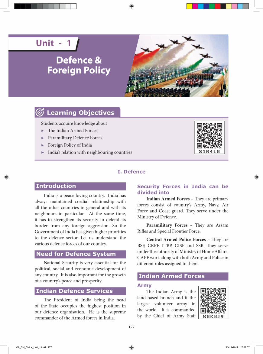
177
IntroductionIndia is a peace loving country. India has
always maintained cordial relationship with all the other countries in general and with its neighbours in particular. At the same time, it has to strengthen its security to defend its border from any foreign aggression. So the Government of India has given higher priorities to the defence sector. Let us understand the various defence forces of our country.
Need for Defence SystemNational Security is very essential for the
political, social and economic development of any country. It is also important for the growth of a country’s peace and prosperity.
Indian Defence ServicesThe President of India being the head
of the State occupies the highest position in our defence organisation. He is the supreme commander of the Armed forces in India.
Security Forces in India can be divided into
Indian Armed Forces – They are primary forces consist of country’s Army, Navy, Air Force and Coast guard. They serve under the Ministry of Defence.
Paramilitary Forces – They are Assam Rifles and Special Frontier Force.
Central Armed Police Forces – They are BSF, CRPF, ITBP, CISF and SSB. They serve under the authority of Ministry of Home Affairs. CAPF work along with both Army and Police in different roles assigned to them.
Indian Armed ForcesArmy
The Indian Army is the land-based branch and it the largest volunteer army in the world. It is commanded by the Chief of Army Staff
Defence & Foreign Policy
Unit - 1
Students acquire knowledge about▶ The Indian Armed Forces▶ Paramilitary Defence Forces▶ Foreign Policy of India▶ India’s relation with neighbouring countries
Learning Objectives
I. Defence
VIII_Std_Civics_Unit_1.indd 177 13-11-2019 17:37:07
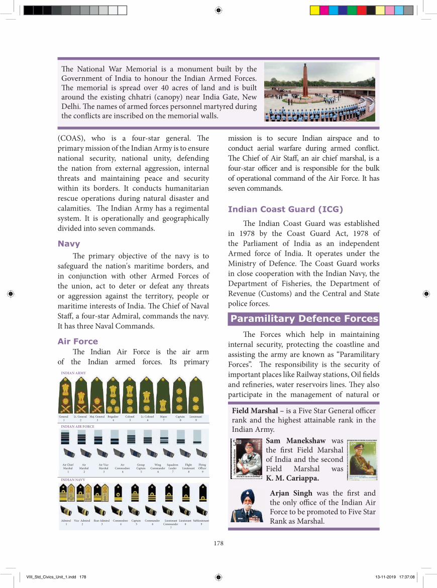
178
(COAS), who is a four-star general. Th e primary mission of the Indian Army is to ensure national security, national unity, defending the nation from external aggression, internal threats and maintaining peace and security within its borders. It conducts humanitarian rescue operations during natural disaster and calamities. Th e Indian Army has a regimental system. It is operationally and geographically divided into seven commands.
NavyTh e primary objective of the navy is to
safeguard the nation's maritime borders, and in conjunction with other Armed Forces of the union, act to deter or defeat any threats or aggression against the territory, people or maritime interests of India. Th e Chief of Naval Staff , a four-star Admiral, commands the navy. It has three Naval Commands.
Air ForceTh e Indian Air Force is the air arm
of the Indian armed forces. Its primary
mission is to secure Indian airspace and to conduct aerial warfare during armed confl ict. Th e Chief of Air Staff , an air chief marshal, is a four-star offi cer and is responsible for the bulk of operational command of the Air Force. It has seven commands.
Indian Coast Guard (ICG)
Th e Indian Coast Guard was established in 1978 by the Coast Guard Act, 1978 of the Parliament of India as an independent Armed force of India. It operates under the Ministry of Defence. Th e Coast Guard works in close cooperation with the Indian Navy, the Department of Fisheries, the Department of Revenue (Customs) and the Central and State police forces.
Paramilitary Defence ForcesTh e Forces which help in maintaining
internal security, protecting the coastline and assisting the army are known as “Paramilitary Forces”. Th e responsibility is the security of important places like Railway stations, Oil fi elds and refi neries, water reservoirs lines. Th ey also participate in the management of natural or
Field Marshal – is a Five Star General offi cer rank and the highest attainable rank in the Indian Army.
Sam Manekshaw was the fi rst Field Marshal of India and the second Field Marshal was K. M. Cariappa.
Arjan Singh was the fi rst and the only offi ce of the Indian Air Force to be promoted to Five Star Rank as Marshal.
Th e National War Memorial is a monument built by the Government of India to honour the Indian Armed Forces. Th e memorial is spread over 40 acres of land and is built around the existing chhatri (canopy) near India Gate, New Delhi. Th e names of armed forces personnel martyred during the confl icts are inscribed on the memorial walls.
INDIAN ARMY
INDIAN AIR FORCE
INDIAN NAVY
General 1
Lt. General 2
Maj. General 3
Brigadier 4
Colonel 5
Lt. Colonel 6
Major 7
Captain 8
Lieutenant 9
Air Chief Marshal
1
Air Marshal
2
Air Vice Marshal
3
Air Commodore
4
Group Captain
5
Wing Commander
6
Squadron Leader
7
Flight Lieutenant
8
Flying O�cer
9
Admiral 1
Vice Admiral 2
Rear Admiral 3
Commodore 4
Captain 5
Commander 6
LieutenantCommander
7
Lieutenant 8
Sublieutenant 9
VIII_Std_Civics_Unit_1.indd 178 13-11-2019 17:37:08
179
man-made disasters. During peace time, the paramilitary forces also have the responsibility of protecting the international borders.
a) The Assam Rifles (AR)b) The Special Frontier Force (SFF)
The Assam Rifles (AR)
The Assam Rifles came into being in 1835 which was established by the British in the Assam region, as a militia called the ‘Cachar Levy’. There are currently 46 battalions of Assam Rifles. It is under the Ministry of Home Affairs (MHA).
The Special Frontier Force (SFF)The Special Frontier Force (SFF) is a
paramilitary special force of India created in 1962. This force was put under the direct supervision of the Intelligence Bureau, and later, under the Research and Analysis Wing, India's external intelligence agency.
The Central Armed Police Forces (CAPF)
Following five forces which come under Ministry of Home Affairs were earlier considered paramilitary forces, but from March’ 2011, They have been reclassifled as Central Armed Police Forces (CAPF) to avoid confusion.
i) The Central Reserve Police Force (CRPF)ii) Indo-Tibetan Border Police (ITBP)iii) The Border Security Force (BSF)iv) Central Industrial Security Force (CISF)v) Special Service Bureau (SSB)
The Central Reserve Police Force (CRPF)
The mission of Central Reserve Police force shall be to enable the government to maintain Rule of law, public order and internal security effectively and efficiently, to preserve national integrity and promote social harmony and development by upholding supremacy of the Constitution.
The Rapid Action Force is a specialised wing of the CRPF (Central Reserve Police Force) to deal with riot, crowd control, rescue and relief operations, and related unrest situations.
Indo-Tibetan Border Police (ITBP)
It is a border guarding police force. This force is specialized in high altitude operations. It is deployed for border guarding duties from Ladakh to Arunachal Pradesh (India – China border).
The Border Security Force (BSF)
The border security force is a Border Guarding Force of India. BSF is charged with guarding India's land border during peace time and preventing transnational crimes.
In 1025 AD (CE), Rajendra Chola I, the Chola king from Tamil Nadu launched naval on the city-state of expedition Srivijaya in maritime Southeast Asia, and conquered Kadaram (modern Kedah). Rajendra's overseas expedition against Srivijaya was a unique event in India's history.
The Madras Regiment is one of the oldest infantry regiment of the Indian Army, originating in the year 1758. The Regimental Centre is at wellington, Udhagamandalam, Tamil Nadu.
In 1962, after the Sino-Indian War, the need to expand the number of officers was felt. Two Officers Training Schools (OTS) were established in Pune and Chennai to train officers for Emergency
Commission into the Army. On 1st January 1988, the school was renamed as the Officers Training Academy (OTA).
VIII_Std_Civics_Unit_1.indd 179 13-11-2019 17:37:08
180
Central Industrial Security Force (CISF)
The Central Industrial Security Force was set up under an Act of the Parliament of India on 10th March 1969. Its duties are guarding sensitive governmental buildings, the Delhi Metro, and providing airport security.
Sashastra Seema Bal/Special Service Bureau (SSB)
Sashastra Seema Bal (SSB), in English the Armed Border Force is the border guardening force for Nepal and Bhutan border. Home Guard
The Indian Home Guard is a voluntary force, tasked as an auxiliary to the Indian Police.
Home Guards are recruited from various cross sections of the civil society such as professionals, college students, agricultural and industrial workers, etc. who give their spare time for betterment of the community. All citizens of India, in the age group of 18–50, are eligible. Normal tenure of membership in Home Guards is three to five years.
To protect and guard our nation, our armed forces are always kept ready. Youth should come forward to service and save the nation by joining the armed forces. Recruitment to the Defence services is open to all Indians. It is the duty of every citizen to have an opportunity to serve the country.
National Cadet Corps (NCC)National Cadet Corps is a Tri-Services
Organization, comprising the Army, Navy and Air Force, engaged in grooming the youth of the country into disciplined and patriotic citizens. The National Cadet Corps in India is a voluntary organization which recruits cadets from high schools, colleges and universities all over India. The Cadets are given basic military training in small arms and parades.
15th January - Army Day1st February - Coast Guard Day10th March - Central Industrial Security
Force Day7th October - Rapid Action Force Day8th October - Air Force Day4th December - Navy Day7th December - Armed Forces Flag Day
II. Foreign Policy of India
A foreign policy is a set of political goals that define how a sovereign country will interact with other countries in the world. It seeks to secure the best interest of the people, territory and economy of the country. Our country’s external relation is based on certain principles and policies. India’s foreign policy was evolved with the background of her colonial sufferings.
Basic Principles of Foreign Policy ¾ Preservation of national interest ¾ Achievement of world peace ¾ Disarmament ¾ Abolition of Colonialism, Racism and Imperialism
¾ Incresing the number of friendly nations ¾ Economic development
Panchsheel
Jawaharlal Nehru, the first Prime Minister of India was the chief architect of India’s foreign policy. Nehru was a supporter of world peace. Hence he gave utmost importance to world peace in his policy planning. He declared the five principles of peace, known as Panchsheel.These principles included
1. Mutual respect for each other’s territorial integrity and sovereignty
2. Mutual non-aggression3. Mutual non-interference in each other’s
internal affairs 4. Equality and mutual benefit 5. Peaceful co-existence.
VIII_Std_Civics_Unit_1.indd 180 13-11-2019 17:37:08
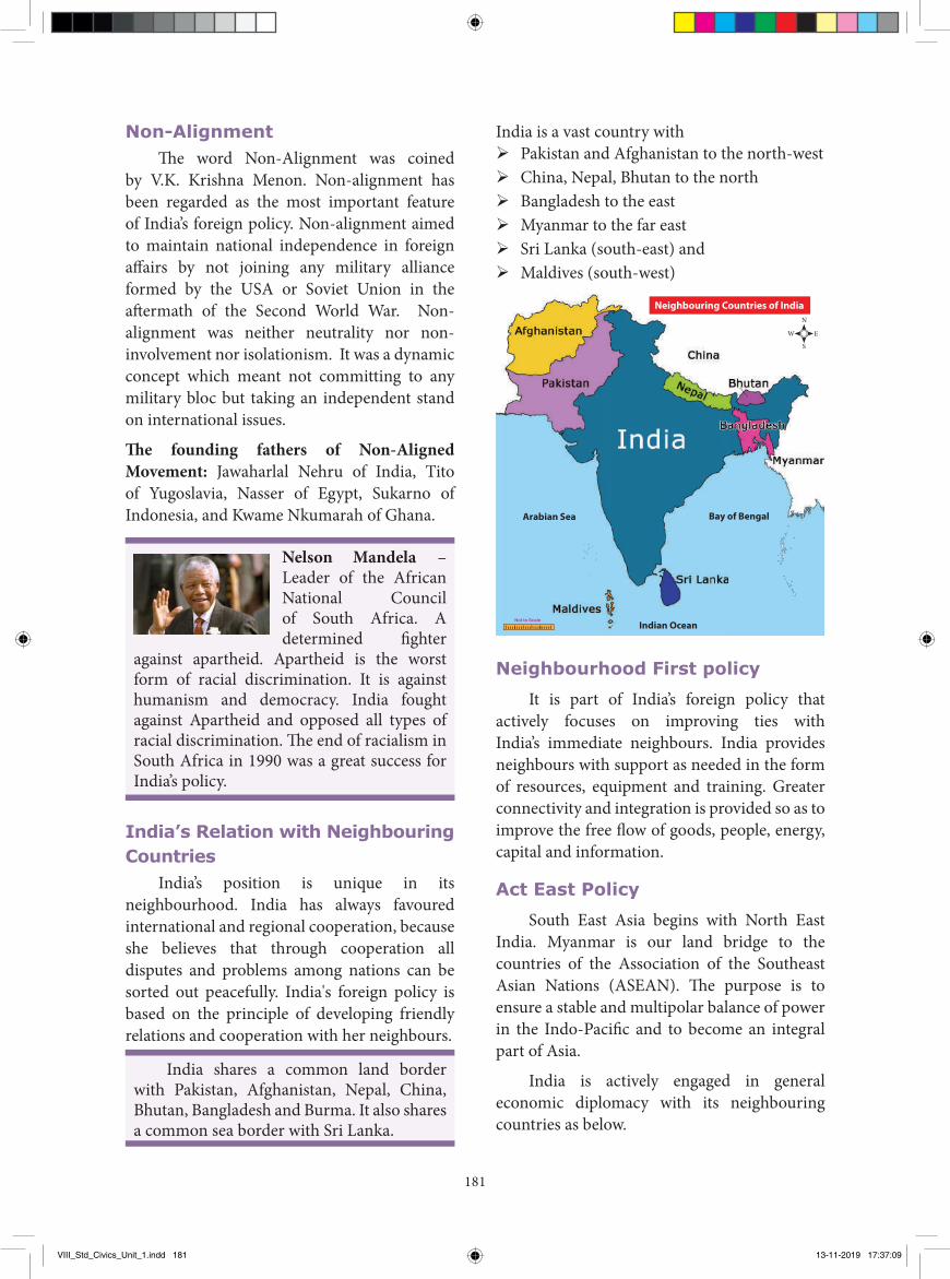
181
Non-AlignmentThe word Non-Alignment was coined
by V.K. Krishna Menon. Non-alignment has been regarded as the most important feature of India’s foreign policy. Non-alignment aimed to maintain national independence in foreign affairs by not joining any military alliance formed by the USA or Soviet Union in the aftermath of the Second World War. Non-alignment was neither neutrality nor non-involvement nor isolationism. It was a dynamic concept which meant not committing to any military bloc but taking an independent stand on international issues.
The founding fathers of Non-Aligned Movement: Jawaharlal Nehru of India, Tito of Yugoslavia, Nasser of Egypt, Sukarno of Indonesia, and Kwame Nkumarah of Ghana.
Nelson Mandela – Leader of the African National Council of South Africa. A determined fighter
against apartheid. Apartheid is the worst form of racial discrimination. It is against humanism and democracy. India fought against Apartheid and opposed all types of racial discrimination. The end of racialism in South Africa in 1990 was a great success for India’s policy.
India’s Relation with Neighbouring Countries
India’s position is unique in its neighbourhood. India has always favoured international and regional cooperation, because she believes that through cooperation all disputes and problems among nations can be sorted out peacefully. India's foreign policy is based on the principle of developing friendly relations and cooperation with her neighbours.
India shares a common land border with Pakistan, Afghanistan, Nepal, China, Bhutan, Bangladesh and Burma. It also shares a common sea border with Sri Lanka.
India is a vast country with ¾ Pakistan and Afghanistan to the north-west ¾ China, Nepal, Bhutan to the north ¾ Bangladesh to the east ¾ Myanmar to the far east ¾ Sri Lanka (south-east) and ¾ Maldives (south-west)
Not to Scale
Arabian Sea Bay of Bengal
Indian Ocean
Neighbouring Countries of India
EW
N
S
Neighbourhood First policy
It is part of India’s foreign policy that actively focuses on improving ties with India’s immediate neighbours. India provides neighbours with support as needed in the form of resources, equipment and training. Greater connectivity and integration is provided so as to improve the free flow of goods, people, energy, capital and information.
Act East Policy
South East Asia begins with North East India. Myanmar is our land bridge to the countries of the Association of the Southeast Asian Nations (ASEAN). The purpose is to ensure a stable and multipolar balance of power in the Indo-Pacific and to become an integral part of Asia.
India is actively engaged in general economic diplomacy with its neighbouring countries as below.
VIII_Std_Civics_Unit_1.indd 181 13-11-2019 17:37:09
182
SAARCIndia believes in regional co-operation. To
foster the bonds of brotherhood, co-operation and peaceful co-existence SAARC (South Asian Association for Regional Cooperation) was established. India, Bangladesh, Pakistan, Nepal, Bhutan, Sri Lanka, Maldives and Afghanistan are the eight members of the SAARC.
BCIM
This Bangladesh – China – India - Myanmar Economic corridor envisages the formation of a thriving economic belt, focusing on cross- border transport, energy and telecommunication networks.
BIMSTEC It refers Bay of Bengal Initiative for Multi-Sectoral Technical and Economic Cooperation.
Its main objectives are to strengthen and improve the technological economic cooperation, international trade and foreign direct investment cooperation. The member countries are Bangladesh, India, Myanmar, Sri Lanka, Thailand, Bhutan and Nepal.
BBINBangladesh – Bhutan - India – Nepal
has signed a framework to enable movement of passengers, cargo vehicles and for energy development.
To summarise, India is a huge country with manifold cultures. It has high status in the South East Asia. India’s foreign policy is to maintain peace, freedom and mutual co-operation among the nations. Though India is not in any major military alliance, our relations with the major powers have acquired a strategic depth.
GLOSSARYNational Security
Safety of nation நாட்டின் பாதுகாப்பு
Defence forces
Force with arms for the saftely of a country
நாட்டின் பாதுகாப்பிறகான படைகள்
Neutrality the state of not supporting or helping either side in a conflict
எப்பககமும் ஆதரவளிககாமல் இருததல்
Racialism A practice of discrimination on the basis of racial origin
இன அடிப்படையில் வவறுபாடு காணுதல்
Frontier a border separating two countries எல்டலை
Recap■ National security is very essential not only for peace but also for the economic development.■ Indian defence forces consist of the Army, Navy, Air force, various paramilitary organisations and
various inter – service institutions.■ The president is the Supreme Commander of the Indian Armed Forces.■ India has maintained cordial relationship with all the countries.■ India gives highest priority to her neighbours. A peaceful periphery is essential for India to achieve
her multifarious developmental goals.■ India has been implementing a policy of asymmetric engagement to strengthen bridges of
friendship and create new opportunities for the growth and security.
VIII_Std_Civics_Unit_1.indd 182 13-11-2019 17:37:09
183
Evaluation
I. Choose the correct answer1. The Supreme Commander of the Armed
forces is oura) Presidentb) Prime Ministerc) Governord) Chief Minister
2. The primary mission of Indian Army is to ensure
a) National Securityb) National Unityc) Defending the nation from external
aggressiond) All the above
3. The Army day is
a) 15th Januaryb) 1st Februaryc) 10th Marchd) 7th October
4. Assam Rifles is under the control of
a) Ministry of Defenceb) National Security Advisorc) PMOd) Ministry of Home Affairs
5. Indian Coast Guard was established in
a) 1976 b) 1977c) 1978 d) 1979
6. India’s foreign policy is based on several principles. One of which is
a) Satyameva Jayateb) Panchasheelc) both of thesed) None of these
7. Which of the following islands belonged to India?
a) Andaman and Maldivesb) Andaman and Lakshadweep Islandc) Sri Lanka and Maldivesd) Maldives and Lakshadweep Island
II. Fill in the blanks1. The Madras Regimental Army centre is at
_________2. The Indian Navy Chief is _________3. _________is first and only officer of
Indian Air Force to be promoted to Five Star rank Marshal of Indian Air Force.
4. The chief architect of India’s foreign policy was ________
5. The Word Non – Alignment was coined by ________
III. Match the following
1. Nelson Mandela - 8 members
2. National war Memorial
- Field Marshal
3. Manekshaw - Energy development
4. SAARC - Apartheid
5. BCIM - New Delhi
IV. State true or false1. Central Armed Police Force serve under
the Ministry of Defence.2. The Madras Regiment is one of the oldest
infantry regiment.3. The Rapid Action Force is a specialised
wing of the CRPF.4. NCC Cadets are given basic military
training.5. Bangladesh is a part of India.6. Myanmar is land bridge to ASEAN
nations.
VIII_Std_Civics_Unit_1.indd 183 13-11-2019 17:37:09
184
V. Choose the correct statement 1. Consider the following statement related
to Armed forces.
i) The Indian Army is the land based branch of Armed forces.
ii) The mission of Indian Army is not only ensure the national security but also conducts humanisation rescue operations.
a) i only b) ii only
c) Both i and ii d) Neither i nor ii
2. Assertion: The President is the Supreme Commander of the Armed forces of India.
Reason: The President is the head of the State and occupies the highest position.
a) A is correct and R explains A
b) A is correct and R does not explain A
c) A is correct and R is wrong
d) Both A and R are wrong
3. Assertion: India has favoured international co-operation.
Reason: She believes that all disputes among nations can be solved through friendly co-operation.
a) A is correct and R is wrong
b) Both A and R are wrong
c) A is correct and R explains A
d) A is correct and R does not explain A
4. Which of the following statements is not true about “Apartheid?”
i) Apartheid is a policy of racial discrimination.
ii) It is against humanism. iii) The policy of racialism is practiced in
India. a) i and ii b) ii and iii c) ii only d) iii only
5. Find the odd one out
a) Maldives b) Sri Lanka
c) Myanmar d) Lakshadweep
VI. Answer the following in one or two sentences
1. Why national security is very essential?
2. What does the following abbreviation stand for?
a) SFF b) ICG
c) BSF d) NCC
3. Write a short note on CRPF
4. Name the founding fathers of Non-Aligned Movement
5. Write the basic principles of India’s Foreign Policy.
6. Name the member countries of the SAARC.
VII. Answer the following in detail
1. Describe the structure and administration of Indian Army.
2. Write about Paramilitary Defence Forces. 3. Write five principles of Panchasheel4. India focuses on improving ties with its
neighbours. How?
VIII. HOTs1. A career in defence forces promises one
of the most prestigious and respected position in the country. State the importance.
IX. Project and Activity1. Prepare an album about our Defence
System2. Collect information about awards in the
Indian Army (for Example: Param Vir Chakra)
VIII_Std_Civics_Unit_1.indd 184 13-11-2019 17:37:09
185
3. Divide the whole class into eight groups, each representing one SAARC countries. Each group should Display the name of the country and its national flag. Hold group discussion or quizzes and the Following topics
i) Land and people
ii) Form of Government
iii) Capital
iv) Currency
v) Points of agreement with India
REFERENCE BOOKS
1. Annual Report (2017 – 2018), Ministry of External Affairs, New Delhi
2. Deshpande, Anirudh., (Ed), The First Line of Defence Glorious 50 Years of the Border Security Force, Shipra Publications, Delhi, 2015.
3. Baatcheet (Monthly Magazine- An Indian Army Publication), Additional Directorate General, Public Information, IHQ of MoD, New Delhi.
4. Jawaharlal Nehru, India’s Foreign Policy, Selected Speeches 1946-April 1961, Ministry of Information and Broadcasting, Government of India, New Delhi, 1961.
5. V.P. Dutt, India’s Foreign Policy in a Changing World, Vikas Publishing House, New Delhi, 1999.
6. Robert Bradnock, India’s Foreign Policy Since 1971, Council on Foreign Relations Press, New York, 1990.
INTERNET RESOURCES
1. www.indianarmy.nic.in2. www.indiannavy.nic.in3. www.indianairforce.nic.in4. www.assamrifles.gov.in5. www.crpf.gov.in6. www.bsf.nic.in7. www.itbpolice.nic.in8. www.cisf.gov.in9. www.ssb.nic.in10. www.indiancoastguard.gov.in11. www.nccindia.nic.in12. www.dgfscdhg.gov.in13. www.mod.gov.in14. www.madrasregiment.org
VIII_Std_Civics_Unit_1.indd 185 13-11-2019 17:37:09
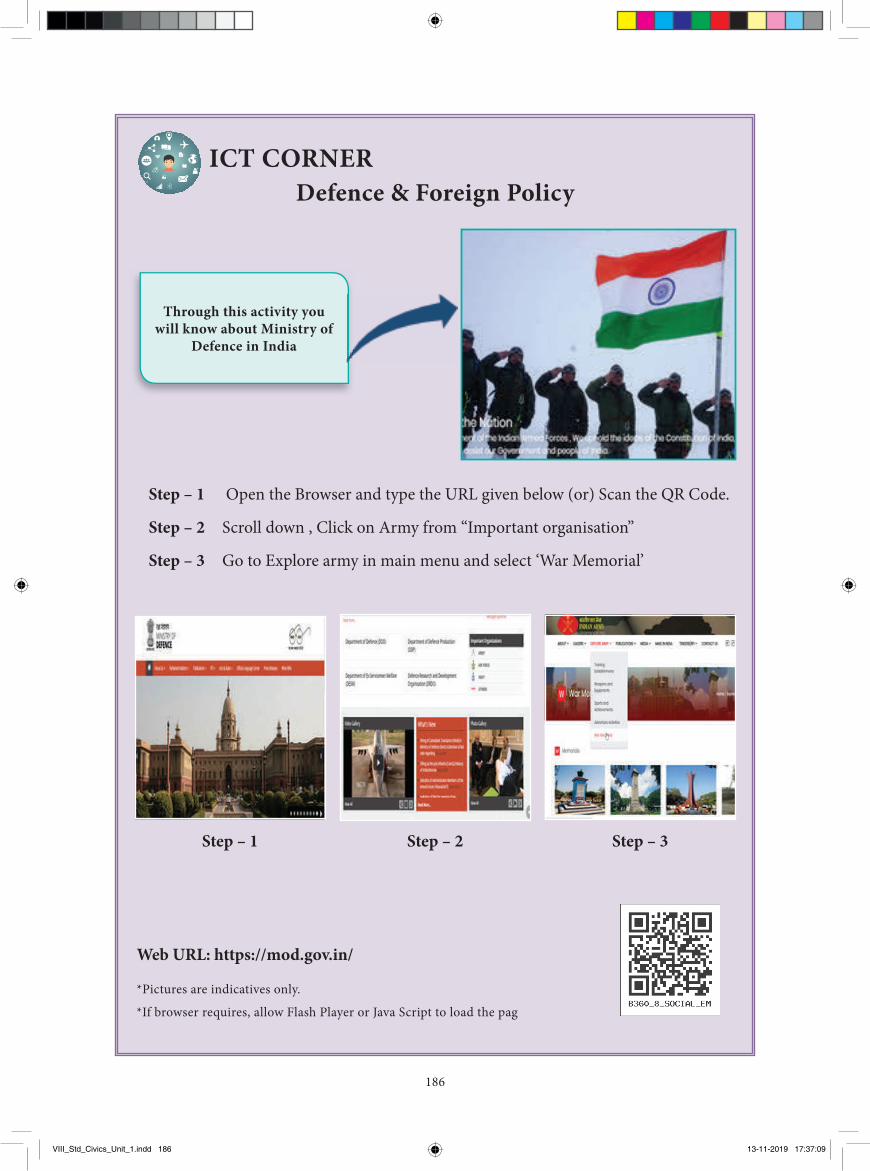
186
Web URL: https://mod.gov.in/
ICT CORNERDefence & Foreign Policy
Step – 1 Open the Browser and type the URL given below (or) Scan the QR Code.
Step – 2 Scroll down , Click on Army from “Important organisation”
Step – 3 Go to Explore army in main menu and select ‘War Memorial’
*Pictures are indicatives only.
*If browser requires, allow Flash Player or Java Script to load the pag
Through this activity you will know about Ministry of
Defence in India
Step – 1 Step – 2 Step – 3
VIII_Std_Civics_Unit_1.indd 186 13-11-2019 17:37:09
187
IntroductionThe judicial system of a country needs to be
efficient in order to ensure proper justice to all. India has a single unified and integrated judicial system. Judiciary plays an important role as an organ of the government. It administers justice, settles disputes, interprets laws, protects fundamental rights and acts as guardian of the Constitution.
Law: It is a system of rules imposed through a government or institution to govern people.
Judiciary: In law, the Judiciary or Judicial system is the system of courts which administers Justice in the name of the State.
Evolution of Indian Judiciarya. Judiciary during ancient period
During ancient times, the concept of justice was linked with religion. The king was regarded as the fountain head of Justice. Most
of the Kings’ courts dispensed justice according to ‘dharma’, (righteousness and duty) a set of conventional laws, Dharmic laws governed not only the individual but also the society.
SmiritisIn ancient India Smiritis defined the social duties for the individual. There are Manusmiriti, Naradasmiriti, Yajnavalkya smiriti etc.
The rebublics of Ganas had their own system of law. We find the existence of Kulika court. Amongst the Vajjis, there was a board of eight Kulikas for the investigation of Criminal cases. Appeal proceeded from Kula courts to Gana Courts.
b. Judiciary during Medieval period
The Tughlaq period saw the compilation of the code of civil procedure. It was called Fiqha-e-Feroze Shahi. The code prescribed details of the procedure and the law in several matters. It was written in Arabic and was
The Judiciary
Unit - 2
▶ To trace the evolution of the Judicial system▶ To understand the hierarchical structure of the Indian judiciary▶ To explain the Jurisdiction of Supreme court, High Court and Subordinate Courts▶ To understand the need for the independent Judiciary▶ To know the differences between Civil Law and Criminal Law
Learning Objectives
"The excellence of the judiciary is a measure of the excellence of the government."
VIII_Std_Civics_Unit_2.indd 187 13-11-2019 17:38:59
188
translated into Persian. Th is was followed till the reign of Aurangazeb when it was replaced by Fatawa-i-Alamgiri written in 1670.
c. Judiciary during Modern period
Th e Indian judicial system and laws we have today was formed by the British during the colonial rule in the country. Th e beginning of Indian codifi ed common law is traced back to 1727 (Under the Charter of 1726) when the Mayor’s court in Madras, Bombay and Calcutta were established by the East India Company. Regulating Act of 1773 made provision for the formation of Supreme Court. A Supreme Court was established for the fi rst time at Fort Williams in Calcutta. Sir Elijah Imphey was appointed as chief justice of that court. In 1801 and 1824 Supreme Courts were established in Madras and Bombay. Th ese Supreme Courts functioned until 1862 when they were replaced by the High Courts at all the three places.
Warren Hasting, established Mofussil Diwani Adalat to resolve civil disputes and Mofussil Fauzdari Adalat to resolve criminal disputes. Th e appeals from these courts could be taken to Sadar Diwani Adalat (civil court of appeal) and Sadar Nizamat Adalat (criminal court of appeal). Lord Cornwallis reorganised the civil and criminal judicial system. Under Cornwallis, the District Fauzdari court was abolished and Circuit Court was setup at Calcutta, Dacca, Murshidabad and Patna. During the period of William Bentinck four Circuit courts were abolished.
Th e Calcutta High Court is the oldest High court in the country, established in 1862, whereas the Allahabad High Court is the largest Court.
Sadar Diwani Adalat and Sadar Nizamat Adalat were established at Allahabad. A law commission was setup by Macaulay, which codifi ed the Indian Laws. On the basis of this Commission, A Civil Procedure Code of 1859, An Indian Penal Code of 1860, and a
Criminal Procedure Code 1861 were prepared. Th e Government of India Act 1935 created Federal Court. It was not the highest court as appeals could lie in certain situation to the Privy Council in England. Th e Jurisdiction of Privy council was abolished by the Abolition of the Privy Council Jurisdiction Act, 1949. Th e Supreme Court of India was inaugurated on 28 January 1950.
Judiciary and constitutionIndia framed its own Constitution.
Among the noble aims and objectives of the Constitution, the founding fathers accorded the highest place to ‘Justice’. During British period, Indian had neither law nor courts of their own and both the law and courts had been designed for the Colonial Power. Th e Constituent Assembly members therefore tried to ensure the independence of the Courts with full power of Judicial review. Supreme Court Rules, 1966 are framed under Article 145 of the Constitution to regulate the practice and procedure of the Supreme Court. Th e Supreme Court of India is the highest court of the land as established by Part V (‘Th e Union’) under Chapter IV titled ‘Th e Union Judiciary’ and Part VI (‘Th e State’) under Chapter VI titled ‘Subordinate Courts’ of the Constitution of India. Articles 124 to 147 of the Constitution of India lay down the composition and jurisdiction of the Supreme Court of India.
Th e fi rst political philosopher, who propounded the idea of an independent judiciary, was Montesquieu, the famous French philosopher. He believed in the theory of separation of powers of the three branches of the Government - Legislature, Executive and Judiciary.
VIII_Std_Civics_Unit_2.indd 188 13-11-2019 17:39:00
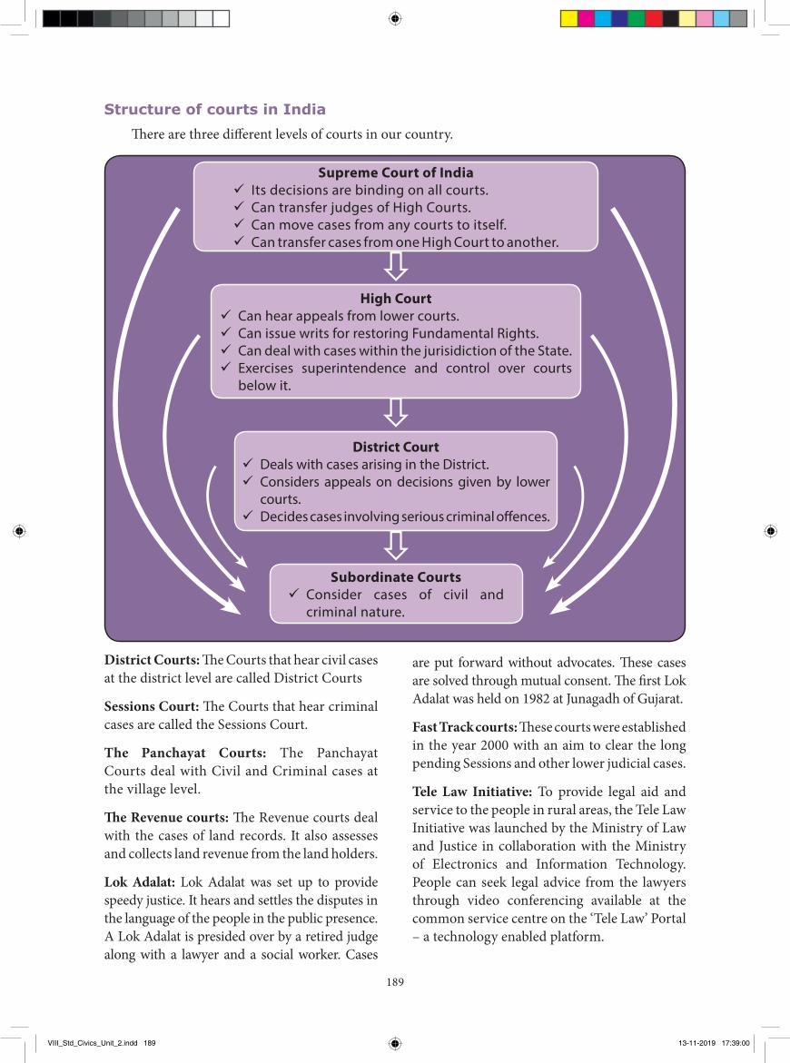
189
District Courts: The Courts that hear civil cases at the district level are called District Courts
Sessions Court: The Courts that hear criminal cases are called the Sessions Court.
The Panchayat Courts: The Panchayat Courts deal with Civil and Criminal cases at the village level.
The Revenue courts: The Revenue courts deal with the cases of land records. It also assesses and collects land revenue from the land holders.
Lok Adalat: Lok Adalat was set up to provide speedy justice. It hears and settles the disputes in the language of the people in the public presence. A Lok Adalat is presided over by a retired judge along with a lawyer and a social worker. Cases
are put forward without advocates. These cases are solved through mutual consent. The first Lok Adalat was held on 1982 at Junagadh of Gujarat.
Fast Track courts: These courts were established in the year 2000 with an aim to clear the long pending Sessions and other lower judicial cases.
Tele Law Initiative: To provide legal aid and service to the people in rural areas, the Tele Law Initiative was launched by the Ministry of Law and Justice in collaboration with the Ministry of Electronics and Information Technology. People can seek legal advice from the lawyers through video conferencing available at the common service centre on the ‘Tele Law’ Portal – a technology enabled platform.
Structure of courts in IndiaThere are three different levels of courts in our country.
Supreme Court of India 9 Its decisions are binding on all courts. 9 Can transfer judges of High Courts. 9 Can move cases from any courts to itself. 9 Can transfer cases from one High Court to another.
High Court 9 Can hear appeals from lower courts. 9 Can issue writs for restoring Fundamental Rights. 9 Can deal with cases within the jurisidiction of the State. 9 Exercises superintendence and control over courts
below it.
District Court 9 Deals with cases arising in the District. 9 Considers appeals on decisions given by lower
courts. 9 Decides cases involving serious criminal offences.
Subordinate Courts 9 Consider cases of civil and
criminal nature.
VIII_Std_Civics_Unit_2.indd 189 13-11-2019 17:39:00
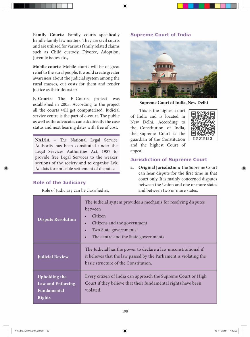
190
Family Courts: Family courts specifically handle family law matters. They are civil courts and are utilised for various family related claims such as Child custody, Divorce, Adoption, Juvenile issues etc.,
Mobile courts: Mobile courts will be of great relief to the rural people. It would create greater awareness about the judicial system among the rural masses, cut costs for them and render justice as their doorstep.
E–Courts: The E–Courts project was established in 2005. According to the project all the courts will get computerised. Judicial service centre is the part of e-court. The public as well as the advocates can ask directly the case status and next hearing dates with free of cost.
NALSA – The National Legal Service Authority has been constituted under the Legal Services Authorities Act, 1987 to provide free Legal Services to the weaker sections of the society and to organise Lok Adalats for amicable settlement of disputes.
Supreme Court of India
Supreme Court of India, New Delhi
This is the highest court of India and is located in New Delhi. According to the Constitution of India, the Supreme Court is the guardian of the Constitution and the highest Court of appeal.
Jurisdiction of Supreme Courta. Original Jurisdiction: The Supreme Court
can hear dispute for the first time in that court only. It is mainly concerned disputes between the Union and one or more states and between two or more states.
Role of the JudiciaryRole of Judiciary can be classified as,
Dispute Resolution
The Judicial system provides a mechanis for resolving disputes between • Citizen• Citizens and the government• Two State governments• The centre and the State governments
Judicial ReviewThe Judicial has the power to declare a law unconstitutional if it believes that the law passed by the Parliament is violating the basic structure of the Constitution.
Upholding the Law and Enforcing Fundamental Rights
Every citizen of India can approach the Supreme Court or High Court if they believe that their fundamental rights have been violated.
VIII_Std_Civics_Unit_2.indd 190 13-11-2019 17:39:00
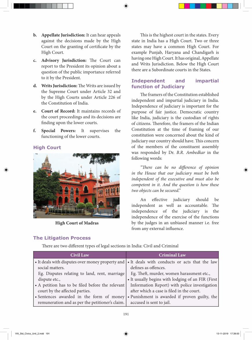
191
b. Appellate Jurisdiction: It can hear appeals against the decisions made by the High Court on the granting of certificate by the High Court.
c. Advisory Jurisdiction: The Court can report to the President its opinion about a question of the public importance referred to it by the President.
d. Writs Jurisdiction: The Writs are issued by the Supreme Court under Article 32 and by the High Courts under Article 226 of the Constitution of India.
e. Court of Record: It maintains records of the court proceedings and its decisions are finding upon the lower courts.
f. Special Powers: It supervises the functioning of the lower courts.
High Court
High Court of Madras
This is the highest court in the states. Every state in India has a High Court. Two or three states may have a common High Court. For example Punjab, Haryana and Chandigarh is having one High Court. It has original, Appellate and Writs Jurisdiction. Below the High Court there are a Subordinate courts in the States.
Independent and impartial function of Judiciary
The framers of the Constitution established independent and impartial judiciary in India. Independence of judiciary is important for the purpose of fair justice. Democratic country like India, judiciary is the custodian of rights of citizens. Therefore, the framers of the Indian Constitution at the time of framing of our constitution were concerned about the kind of judiciary our country should have. This concern of the members of the constituent assembly was responded by Dr. B.R. Ambedkar in the following words:
“There can be no difference of opinion in the House that our judiciary must be both independent of the executive and must also be competent in it. And the question is how these two objects can be secured.”
An effective judiciary should be independent as well as accountable. The independence of the judiciary is the independence of the exercise of the functions by the judges in an unbiased manner i.e. free from any external influence.
Civil Law Criminal Law• It deals with disputes over money property and
social matters. Eg. Disputes relating to land, rent, marriage
dispute etc.,• A petition has to be filed before the relevant
court by the affected parties.• Sentences awarded in the form of money
remuneration and as per the petitioner’s claim.
• It deals with conducts or acts that the law defines as offences.
Eg. Theft, murder, women harassment etc.,• It usually begins with lodging of an FIR (First
Information Report) with police investigation after which a case is filed in the court.
• Punishment is awarded if proven guilty, the accused is sent to jail.
The Litigation ProcessThere are two different types of legal sections in India: Civil and Criminal
VIII_Std_Civics_Unit_2.indd 191 13-11-2019 17:39:00
192
GlossaryLitigation the process of taking legal action வழக்கு
Writ a form of written command in the name of legal authority
நீதிப்பேராணை
Lok Adalat peoples court மக்்கள் நீதிமன்றம்Judicial Review receiving the laws by the court நீதிபுனராய்வு
Conclusion
Judiciary plays a crucial role in a democratic state. Judiciary is the custodian of the Constitution and guardian of fundamental rights. India, the largest representative democracy of the world possesses a well-structured and independent judicial system.
Recap� Sadar Diwani Adalat and Sadar Nizamat Adalat were established at Allahabad.� Lok Adalat was set up to provide speedy justice. � The E–Courts project was established in 2005.� According to the Constitution of India, the Supreme Court is the guardian of the Constitution
Public Interest Litigation (PIL): PIL is a litigation filed in a court of law for the protection of “public interest”. The Supreme court introduced this system which allows a person to approach the court with his case. PIL can be filed for the following reasons such as violation of basic human rights, religious rights, pollution, and road safety. This could be done by a written letter stating the case. This concept is unique to the Indian Judiciary.
Evaluation
I. Choose the correct answer1 The highest and final judicial tribunal of
India is a) Presidentb) Parliamentc) Supreme Courtd) Prime Minister
2 Judicial system provides a mechanism for resolving disputes between
a) Citizenb) Citizen and the government
c) Two State governmentsd) all the above
3. Dispute between States of India comes to the Supreme Court under
a) Original jurisdictionb) Appellate jurisdictionc) Advisory jurisdictiond) none of these
4. Which of the following state/ Union territories have a common High Court?
a) Punjab and Jammu Kashmir b) Assam and Bengal
VIII_Std_Civics_Unit_2.indd 192 13-11-2019 17:39:00
193
c) Panjab, Haryana and Chandigarh d) Uttar Pradesh and Bihar5. The System of Public Interest Litigation
has been introduced in India by
a) Supreme Court b) Parliament c) Political parties d) Constitutional amendments6. How many courts are there in apex level
in India?
a) One b) Two c) Three d) Four7. Supreme court is located at
a) Chandigarh b) Bombay c) Calcutta d) New Delhi8. F I R means
a) First Information Report b) First information Result c) First Incident Report d) None of these9. The court that hear criminal cases are
called
a) District court b) Sessions court c) Family court d) Revenue court
II. Fill in the blanks.1. The _________ High Court is the oldest
High Court in India.2. The framers of the Constitution established
___________and __________ judiciary in India.
3. ___________, a famous French philosopher propounded the idea of an independent judiciary.
4. __________ deals with disputes over money, property and social matters.
5. During ancient times, most of the Kings’ courts dispensed justice according to ______________.
III. Match the following.
1. Supreme Court - social duties
2. High Court - speedy justice
3. Lok Adalat - highest court of appeal
4. Sir Elijah Impey - highest court in the States
5. Smiritis - chief justice
IV. State true or false.1. The Supreme Court of India was
inaugurated on 28th January 1951.
2. During the Tughlaq period, the code of procedure was written in Arabic.
3. The Regulating Act of 1773 made provision for the formation of Supreme Court.
4. Sadar Diwani Adalat was a Criminal court of appeal.
5. The Allahabad High Court is the largest court in India.
6. The Constitution of India secures justice to all its citizen.
V. Choose the correct statement.1. Consider the following statements.
i) A law commission was setup by Macaulay.
ii) It codified the Indian Laws.
Which of the statements given above is / are correct?
a) i only b) ii only
c) Both i and ii d) Neither i nor ii
2. Consider the following statements.
i) An Indian Penal Code was prepared in 1860.
ii) The Calcutta High Court was established in 1862.
VIII_Std_Civics_Unit_2.indd 193 13-11-2019 17:39:00
194
iii) The Government of India Act, 1935 created Federal Court.
Which of the statements given above is/are correct?
a) i only b) ii, iii only
c) i,iii only d) All the above
3. Which of the following statement is not true about India’s Supreme Court?
i) The Supreme Court of India is the highest court of the land.
ii) It was established by part V under Chapter IV of Indian Constitution.
iii) Supreme court cannot transfer cases from one High court to another
iv) Its decisions are binding on all courtsa) i b) ii c. iii d. iv
4. Assertion: The Supreme Court is a Court of Record.
Reason: It maintains records of the court proceedings and its decisions are finding upon the lower courts.
a) A is correct and R is wrong. b) Both A and R are Wrong c) A is correct and R explains A d) A is correct and R does not explain A5. Agree or disagree
a) Every citizen of india can approach the Supreme court.
b) Rich and powerful people control the judiciary system.
c) Every citizen has a right to get justice through the courts.
d) Politicians can not control over judges.
VI. Answer the following in one or two sentences.
1. Why do we need judicial system?
2. What are the different levels of courts in India?
3. Differentiate Law and Judiciary.
4. Write a note on Lok Adalat.
5. What are the advantages of mobile courts?
VII. Answer the following in detail.
1. Write about the role of judiciary.
2. Differentiate Civil Law and Criminal Law.
3. Describe Jurisdiction of Supreme Court.
VIII. Project and Activity.1. Discuss: Is it necessary to have an
independent judiciary? List two reasons.
2. Organize your classroom for a mockup courtroom session. (Take a case with the help of the teacher)
REFERENCE BOOKS
1. Durga Das Basu - Introduction to the Constitution of India, Wardhe and Company, Agra, 2004.
2. M. V. Pylee - An Introduction to the Constitution of India, Vikas Publishing House, Bombay, 2007.
3. Subash Kashyap - Our Constitution, National Book Trust, New Delhi, 2013.
4. J.C. Johari - Indian Polity, Lotus Press, New Delhi, 1998.
INTERNET RESOURCES
1. https://sci.gov.in2. www.hcmadras.tn.nic.in
VIII_Std_Civics_Unit_2.indd 194 13-11-2019 17:39:01

ECONOMICS
VIII_Std_Economics_Unit 1.indd 195 13-11-2019 17:42:59
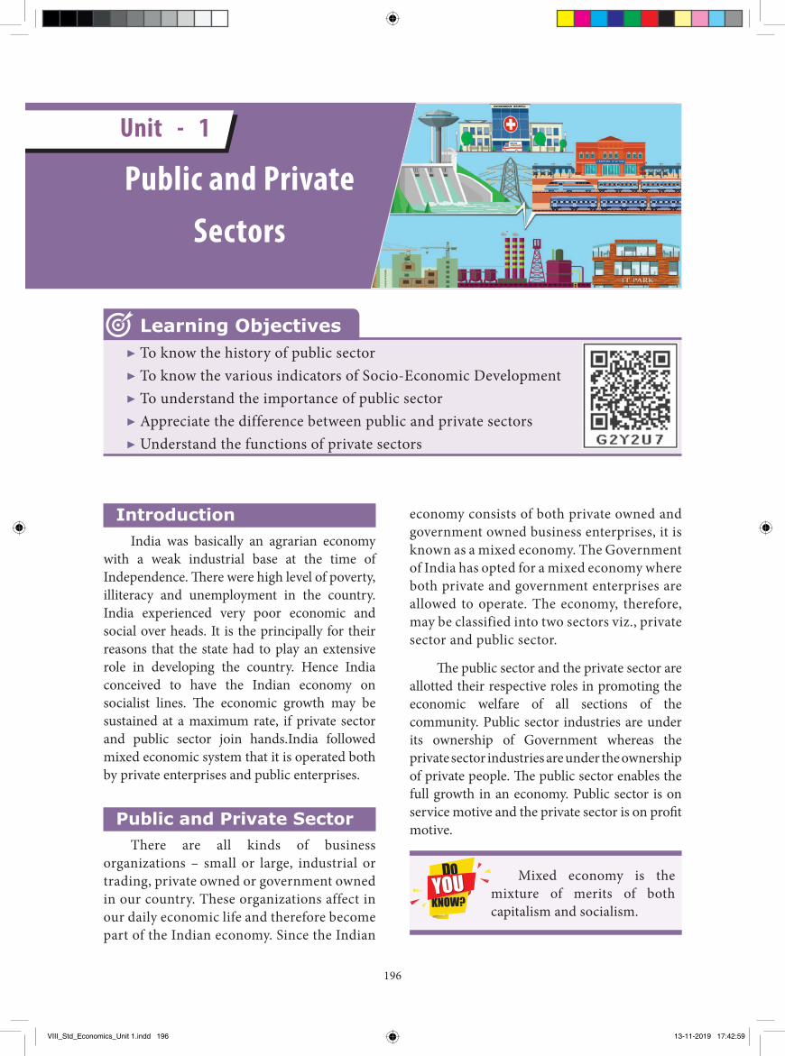
196
Introduction India was basically an agrarian economy
with a weak industrial base at the time of Independence. Th ere were high level of poverty, illiteracy and unemployment in the country. India experienced very poor economic and social over heads. It is the principally for their reasons that the state had to play an extensive role in developing the country. Hence India conceived to have the Indian economy on socialist lines. Th e economic growth may be sustained at a maximum rate, if private sector and public sector join hands.India followed mixed economic system that it is operated both by private enterprises and public enterprises.
Public and Private SectorThere are all kinds of business
organizations – small or large, industrial or trading, private owned or government owned in our country. These organizations affect in our daily economic life and therefore become part of the Indian economy. Since the Indian
economy consists of both private owned and government owned business enterprises, it is known as a mixed economy. The Government of India has opted for a mixed economy where both private and government enterprises are allowed to operate. The economy, therefore, may be classified into two sectors viz., private sector and public sector.
Th e public sector and the private sector are allotted their respective roles in promoting the economic welfare of all sections of the community. Public sector industries are under its ownership of Government whereas the private sector industries are under the ownership of private people. Th e public sector enables the full growth in an economy. Public sector is on service motive and the private sector is on profi t motive.
Mixed economy is the mixture of merits of both capitalism and socialism.
▶ To know the history of public sector▶ To know the various indicators of Socio-Economic Development▶ To understand the importance of public sector▶ Appreciate the difference between public and private sectors▶ Understand the functions of private sectors
Learning Objectives
Public and Private Sectors
Unit - 1
VIII_Std_Economics_Unit 1.indd 196 13-11-2019 17:42:59
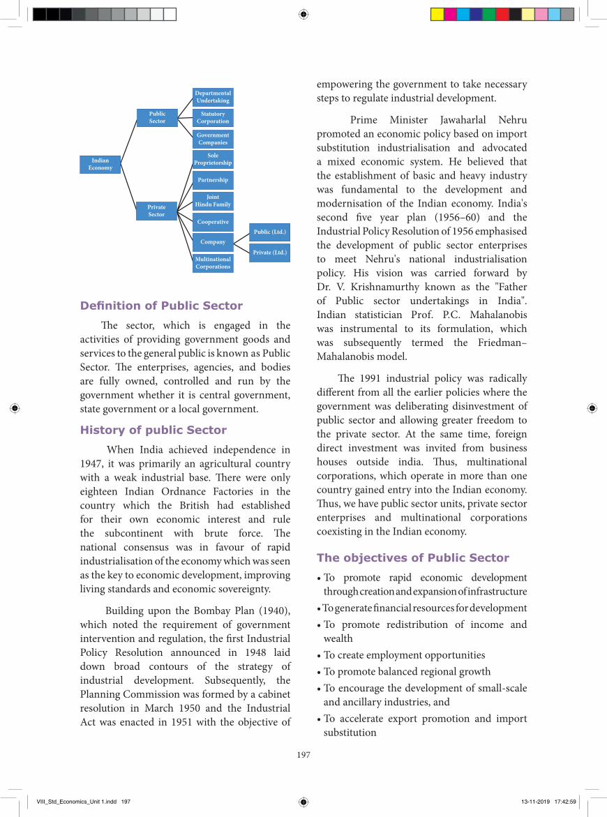
197
IndianEconomy
PublicSector
DepartmentalUndertaking
StatutoryCorporation
GovernmentCompanies
SoleProprietorship
Partnership
JointHindu Family
CooperativePublic (Ltd.)
Private (Ltd.)Company
MultinationalCorporations
PrivateSector
Definition of Public Sector
The sector, which is engaged in the activities of providing government goods and services to the general public is known as Public Sector. The enterprises, agencies, and bodies are fully owned, controlled and run by the government whether it is central government, state government or a local government.
History of public Sector
When India achieved independence in 1947, it was primarily an agricultural country with a weak industrial base. There were only eighteen Indian Ordnance Factories in the country which the British had established for their own economic interest and rule the subcontinent with brute force. The national consensus was in favour of rapid industrialisation of the economy which was seen as the key to economic development, improving living standards and economic sovereignty.
Building upon the Bombay Plan (1940), which noted the requirement of government intervention and regulation, the first Industrial Policy Resolution announced in 1948 laid down broad contours of the strategy of industrial development. Subsequently, the Planning Commission was formed by a cabinet resolution in March 1950 and the Industrial Act was enacted in 1951 with the objective of
empowering the government to take necessary steps to regulate industrial development.
Prime Minister Jawaharlal Nehru promoted an economic policy based on import substitution industrialisation and advocated a mixed economic system. He believed that the establishment of basic and heavy industry was fundamental to the development and modernisation of the Indian economy. India's second five year plan (1956–60) and the Industrial Policy Resolution of 1956 emphasised the development of public sector enterprises to meet Nehru's national industrialisation policy. His vision was carried forward by Dr. V. Krishnamurthy known as the "Father of Public sector undertakings in India". Indian statistician Prof. P.C. Mahalanobis was instrumental to its formulation, which was subsequently termed the Friedman–Mahalanobis model.
The 1991 industrial policy was radically different from all the earlier policies where the government was deliberating disinvestment of public sector and allowing greater freedom to the private sector. At the same time, foreign direct investment was invited from business houses outside india. Thus, multinational corporations, which operate in more than one country gained entry into the Indian economy. Thus, we have public sector units, private sector enterprises and multinational corporations coexisting in the Indian economy.
The objectives of Public Sector
• To promote rapid economic development through creation and expansion of infrastructure
• To generate financial resources for development• To promote redistribution of income and
wealth• To create employment opportunities• To promote balanced regional growth• To encourage the development of small-scale
and ancillary industries, and• To accelerate export promotion and import
substitution
VIII_Std_Economics_Unit 1.indd 197 13-11-2019 17:42:59
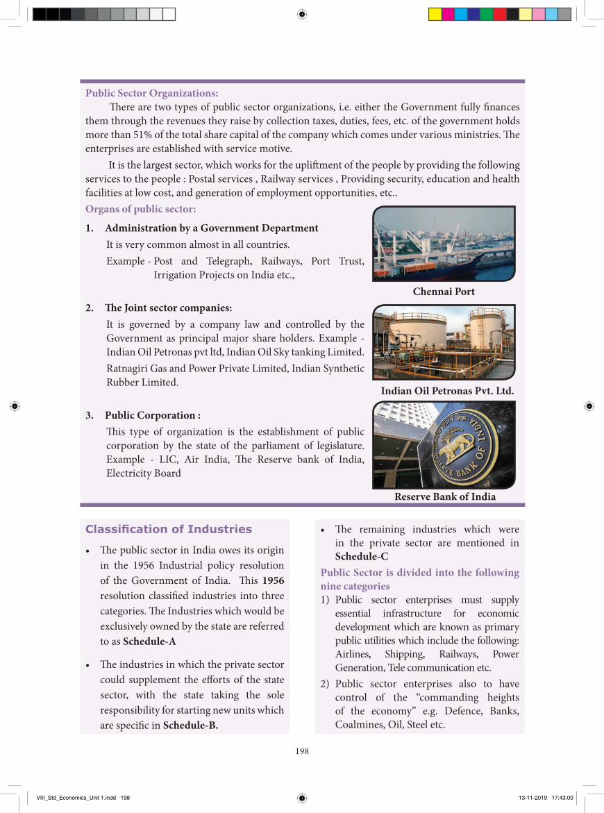
198
Public Sector Organizations: There are two types of public sector organizations, i.e. either the Government fully finances
them through the revenues they raise by collection taxes, duties, fees, etc. of the government holds more than 51% of the total share capital of the company which comes under various ministries. The enterprises are established with service motive.
It is the largest sector, which works for the upliftment of the people by providing the following services to the people : Postal services , Railway services , Providing security, education and health facilities at low cost, and generation of employment opportunities, etc..Organs of public sector:
1. Administration by a Government Department It is very common almost in all countries.Example - Post and Telegraph, Railways, Port Trust,
Irrigation Projects on India etc.,
2. The Joint sector companies: It is governed by a company law and controlled by the Government as principal major share holders. Example - Indian Oil Petronas pvt ltd, Indian Oil Sky tanking Limited. Ratnagiri Gas and Power Private Limited, Indian Synthetic Rubber Limited.
3. Public Corporation : This type of organization is the establishment of public corporation by the state of the parliament of legislature. Example - LIC, Air India, The Reserve bank of India, Electricity Board
Classification of Industries
• The public sector in India owes its origin in the 1956 Industrial policy resolution of the Government of India. This 1956 resolution classified industries into three categories. The Industries which would be exclusively owned by the state are referred to as Schedule-A
• The industries in which the private sector could supplement the efforts of the state sector, with the state taking the sole responsibility for starting new units which are specific in Schedule-B.
• The remaining industries which were in the private sector are mentioned in Schedule-C
Public Sector is divided into the following nine categories1) Public sector enterprises must supply
essential infrastructure for economic development which are known as primary public utilities which include the following: Airlines, Shipping, Railways, Power Generation, Tele communication etc.
2) Public sector enterprises also to have control of the “commanding heights of the economy” e.g. Defence, Banks, Coalmines, Oil, Steel etc.
Chennai Port
Indian Oil Petronas Pvt. Ltd.
Reserve Bank of India
VIII_Std_Economics_Unit 1.indd 198 13-11-2019 17:43:00
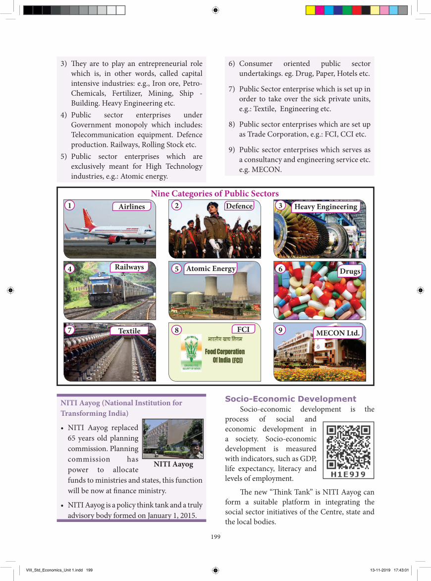
199
3) They are to play an entrepreneurial role which is, in other words, called capital intensive industries: e.g., Iron ore, Petro-Chemicals, Fertilizer, Mining, Ship - Building. Heavy Engineering etc.
4) Public sector enterprises under Government monopoly which includes: Telecommunication equipment. Defence production. Railways, Rolling Stock etc.
5) Public sector enterprises which are exclusively meant for High Technology industries, e.g.: Atomic energy.
6) Consumer oriented public sector undertakings. eg. Drug, Paper, Hotels etc.
7) Public Sector enterprise which is set up in order to take over the sick private units, e.g.: Textile, Engineering etc.
8) Public sector enterprises which are set up as Trade Corporation, e.g.: FCI, CCI etc.
9) Public sector enterprises which serves as a consultancy and engineering service etc. e.g. MECON.
Nine Categories of Public SectorsAirlines
Textile FCI
Defence Heavy Engineering
Railways Atomic Energy Drugs
MECON Ltd.
1
4
7
2
5
8
3
6
9
Socio-Economic DevelopmentSocio-economic development is the
process of social and economic development in a society. Socio-economic development is measured with indicators, such as GDP, life expectancy, literacy and levels of employment.
The new “Think Tank” is NITI Aayog can form a suitable platform in integrating the social sector initiatives of the Centre, state and the local bodies.
NITI Aayog (National Institution for Transforming India)
• NITI Aayog replaced 65 years old planning commission. Planning commission has power to allocate funds to ministries and states, this function will be now at finance ministry.
• NITI Aayog is a policy think tank and a truly advisory body formed on January 1, 2015.
NITI Aayog
VIII_Std_Economics_Unit 1.indd 199 13-11-2019 17:43:01
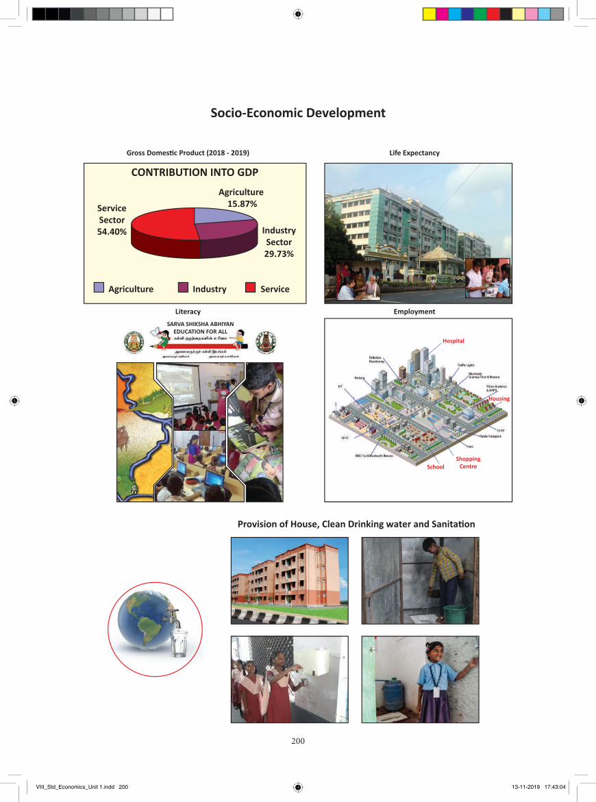
200
CONTRIBUTION INTO GDP
Agriculture 15.87%
IndustrySector29.73%
ServiceSector54.40%
Agriculture Industry Service
Housing
School
Hospital
ShoppingCentre
SARVA SHIKSHA ABHIYANEDUCATION FOR ALL
Socio-Economic Development
Gross Domes�c Product (2018 - 2019) Life Expectancy
Literacy Employment
Provision of House, Clean Drinking water and Sanita�on
VIII_Std_Economics_Unit 1.indd 200 13-11-2019 17:43:04
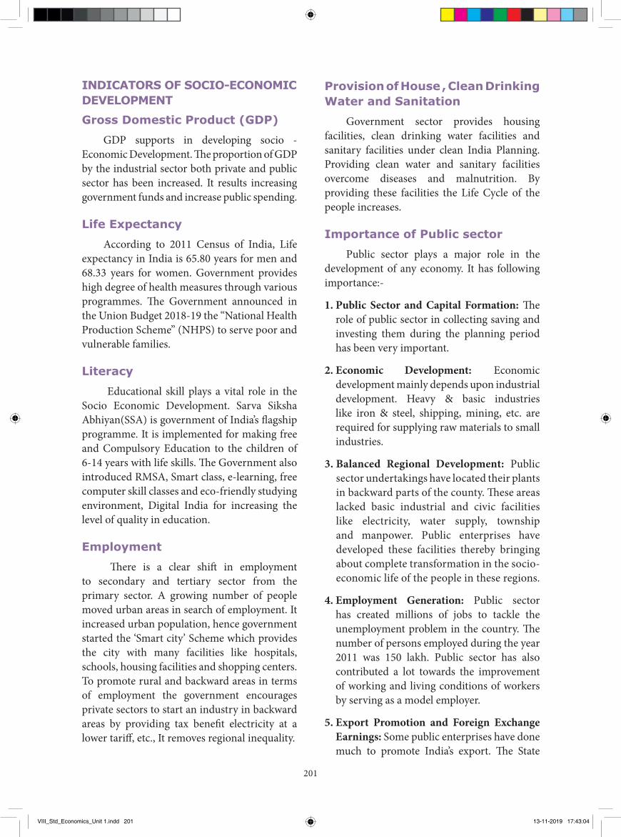
201
Provision of House , Clean Drinking Water and Sanitation
Government sector provides housing facilities, clean drinking water facilities and sanitary facilities under clean India Planning. Providing clean water and sanitary facilities overcome diseases and malnutrition. By providing these facilities the Life Cycle of the people increases.
Importance of Public sector
Public sector plays a major role in the development of any economy. It has following importance:-
1. Public Sector and Capital Formation: The role of public sector in collecting saving and investing them during the planning period has been very important.
2. Economic Development: Economic development mainly depends upon industrial development. Heavy & basic industries like iron & steel, shipping, mining, etc. are required for supplying raw materials to small industries.
3. Balanced Regional Development: Public sector undertakings have located their plants in backward parts of the county. These areas lacked basic industrial and civic facilities like electricity, water supply, township and manpower. Public enterprises have developed these facilities thereby bringing about complete transformation in the socio-economic life of the people in these regions.
4. Employment Generation: Public sector has created millions of jobs to tackle the unemployment problem in the country. The number of persons employed during the year 2011 was 150 lakh. Public sector has also contributed a lot towards the improvement of working and living conditions of workers by serving as a model employer.
5. Export Promotion and Foreign Exchange Earnings: Some public enterprises have done much to promote India’s export. The State
INDICATORS OF SOCIO-ECONOMIC DEVELOPMENTGross Domestic Product (GDP)
GDP supports in developing socio - Economic Development. The proportion of GDP by the industrial sector both private and public sector has been increased. It results increasing government funds and increase public spending.
Life Expectancy
According to 2011 Census of India, Life expectancy in India is 65.80 years for men and 68.33 years for women. Government provides high degree of health measures through various programmes. The Government announced in the Union Budget 2018-19 the “National Health Production Scheme” (NHPS) to serve poor and vulnerable families.
Literacy
Educational skill plays a vital role in the Socio Economic Development. Sarva Siksha Abhiyan(SSA) is government of India’s flagship programme. It is implemented for making free and Compulsory Education to the children of 6-14 years with life skills. The Government also introduced RMSA, Smart class, e-learning, free computer skill classes and eco-friendly studying environment, Digital India for increasing the level of quality in education.
Employment
There is a clear shift in employment to secondary and tertiary sector from the primary sector. A growing number of people moved urban areas in search of employment. It increased urban population, hence government started the ‘Smart city’ Scheme which provides the city with many facilities like hospitals, schools, housing facilities and shopping centers. To promote rural and backward areas in terms of employment the government encourages private sectors to start an industry in backward areas by providing tax benefit electricity at a lower tariff, etc., It removes regional inequality.
VIII_Std_Economics_Unit 1.indd 201 13-11-2019 17:43:04
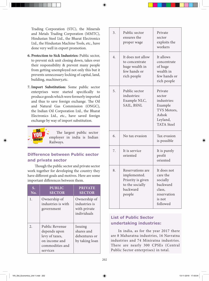
202
3. Public sector ensures the proper wage
Private sector exploits the workers
4. It does not allow to concentrate huge wealth in few hands or rich people
It allows concentrate of huge wealth in few hands or rich people
5. Public sector industries: Example NLC, SAIL, BSNL
Private sector industries: Example TVS Motors, Ashok Leyland, TATA Steel
6. No tax evasion Tax evasion is possible
7. It is service oriented
It is purely profit oriented
8. Reservations are implemented. Priority is given to the socially backward people
It does not care the socially backward class, reservation is not followed
Trading Corporation (STC), the Minerals and Metals Trading Corporation (MMTC), Hindustan Steel Ltd., the Bharat Electronics Ltd., the Hindustan Machine Tools, etc., have done very well in export promotion.
6. Protection to Sick Industries: Public sector, to prevent sick unit closing down, takes over their responsibility & prevent many people from getting unemployed not only this but it prevents unnecessary locking of capital, land, building, machinery,etc.
7. Import Substitution: Some public sector enterprises were started specifically to produce goods which were formerly imported and thus to save foreign exchange. The Oil and Natural Gas Commission (ONGC), the Indian Oil Corporation Ltd., the Bharat Electronics Ltd., etc., have saved foreign exchange by way of import substitution.
The largest public sector employer in india is Indian Railways.
Difference between Public sector and private sector
Though the public sector and private sector work together for developing the country they have different goals and motives. Here are some important differences between them.
S. No.
PUBLIC SECTOR
PRIVATE SECTOR
1. Ownership of industries is with government
Ownership of industries is with private individuals
2. Public Revenue depends upon levy of taxes, on income and commodities and services
Issuing shares and debentures or by taking loan
List of Public Sector undertaking industries:
In india, as for the year 2017 there are 8 Maharatna industries, 16 Navratna industries and 74 Miniratna industries. There are nearly 300 CPSEs (Central Public Sector enterprises) in total.
VIII_Std_Economics_Unit 1.indd 202 13-11-2019 17:43:04
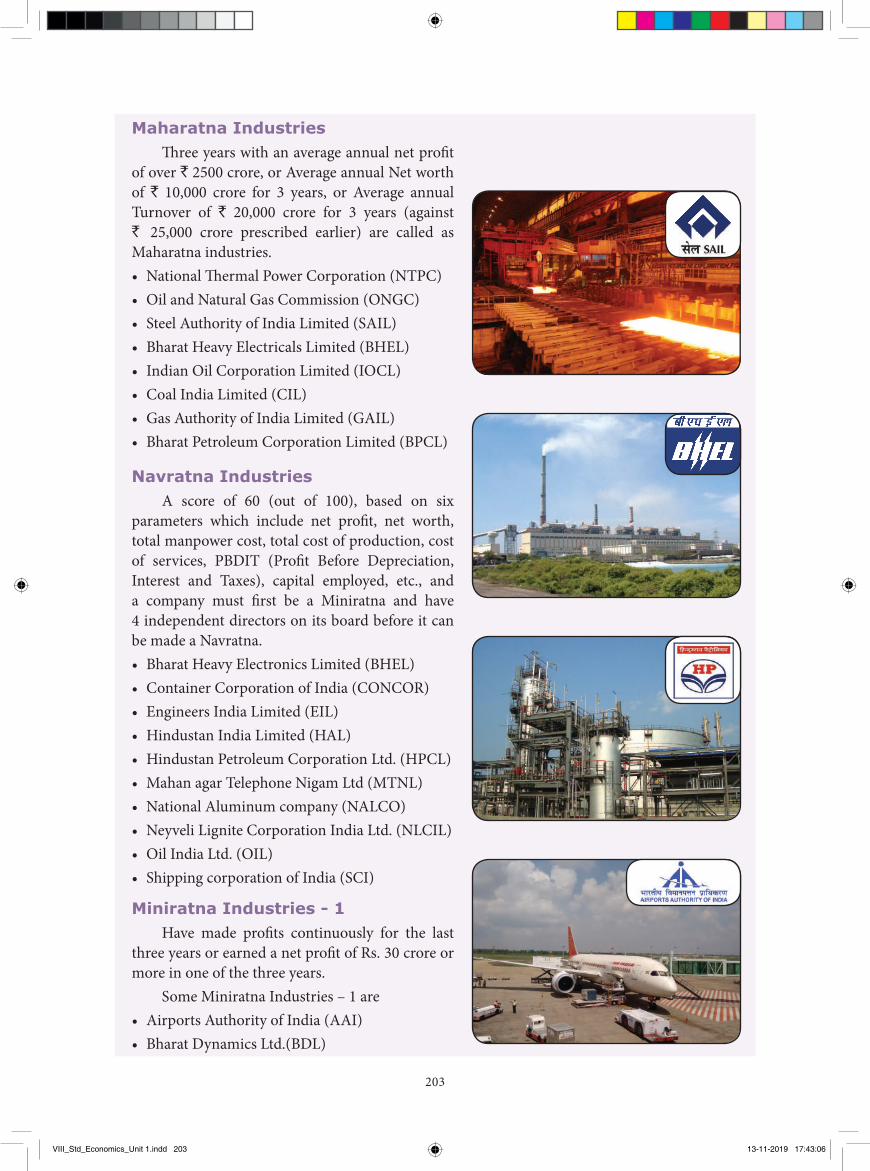
203
Maharatna IndustriesTh ree years with an average annual net profi t
of over ` 2500 crore, or Average annual Net worth of ` 10,000 crore for 3 years, or Average annual Turnover of ` 20,000 crore for 3 years (against ` 25,000 crore prescribed earlier) are called as Maharatna industries.• National Th ermal Power Corporation (NTPC)• Oil and Natural Gas Commission (ONGC)• Steel Authority of India Limited (SAIL)• Bharat Heavy Electricals Limited (BHEL)• Indian Oil Corporation Limited (IOCL)• Coal India Limited (CIL)• Gas Authority of India Limited (GAIL)• Bharat Petroleum Corporation Limited (BPCL)
Navratna IndustriesA score of 60 (out of 100), based on six
parameters which include net profi t, net worth, total manpower cost, total cost of production, cost of services, PBDIT (Profi t Before Depreciation, Interest and Taxes), capital employed, etc., and a company must fi rst be a Miniratna and have 4 independent directors on its board before it can be made a Navratna.• Bharat Heavy Electronics Limited (BHEL)• Container Corporation of India (CONCOR)• Engineers India Limited (EIL)• Hindustan India Limited (HAL)• Hindustan Petroleum Corporation Ltd. (HPCL)• Mahan agar Telephone Nigam Ltd (MTNL)• National Aluminum company (NALCO)• Neyveli Lignite Corporation India Ltd. (NLCIL)• Oil India Ltd. (OIL)• Shipping corporation of India (SCI)
Miniratna Industries - 1Have made profi ts continuously for the last
three years or earned a net profi t of Rs. 30 crore or more in one of the three years.
Some Miniratna Industries – 1 are• Airports Authority of India (AAI)• Bharat Dynamics Ltd.(BDL)
VIII_Std_Economics_Unit 1.indd 203 13-11-2019 17:43:06
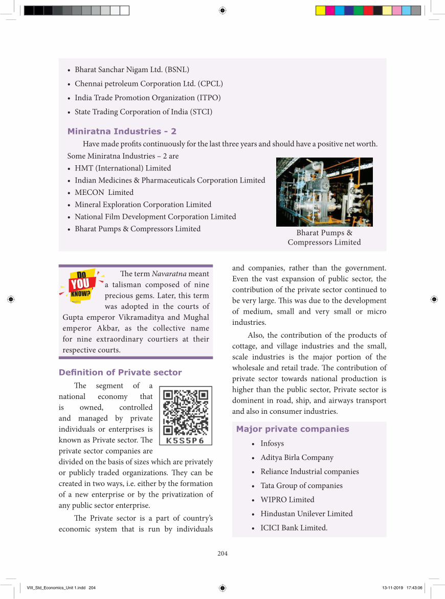
204
• Bharat Sanchar Nigam Ltd. (BSNL)
• Chennai petroleum Corporation Ltd. (CPCL)
• India Trade Promotion Organization (ITPO)
• State Trading Corporation of India (STCI)
Miniratna Industries - 2Have made profits continuously for the last three years and should have a positive net worth.
Some Miniratna Industries – 2 are• HMT (International) Limited• Indian Medicines & Pharmaceuticals Corporation Limited• MECON Limited• Mineral Exploration Corporation Limited• National Film Development Corporation Limited• Bharat Pumps & Compressors Limited Bharat Pumps &
Compressors Limited
The term Navaratna meant a talisman composed of nine precious gems. Later, this term was adopted in the courts of
Gupta emperor Vikramaditya and Mughal emperor Akbar, as the collective name for nine extraordinary courtiers at their respective courts.
Definition of Private sectorThe segment of a
national economy that is owned, controlled and managed by private individuals or enterprises is known as Private sector. The private sector companies are divided on the basis of sizes which are privately or publicly traded organizations. They can be created in two ways, i.e. either by the formation of a new enterprise or by the privatization of any public sector enterprise.
The Private sector is a part of country’s economic system that is run by individuals
and companies, rather than the government. Even the vast expansion of public sector, the contribution of the private sector continued to be very large. This was due to the development of medium, small and very small or micro industries.
Also, the contribution of the products of cottage, and village industries and the small, scale industries is the major portion of the wholesale and retail trade. The contribution of private sector towards national production is higher than the public sector, Private sector is dominent in road, ship, and airways transport and also in consumer industries.
Major private companies
• Infosys
• Aditya Birla Company
• Reliance Industrial companies
• Tata Group of companies
• WIPRO Limited
• Hindustan Unilever Limited
• ICICI Bank Limited.
VIII_Std_Economics_Unit 1.indd 204 13-11-2019 17:43:06
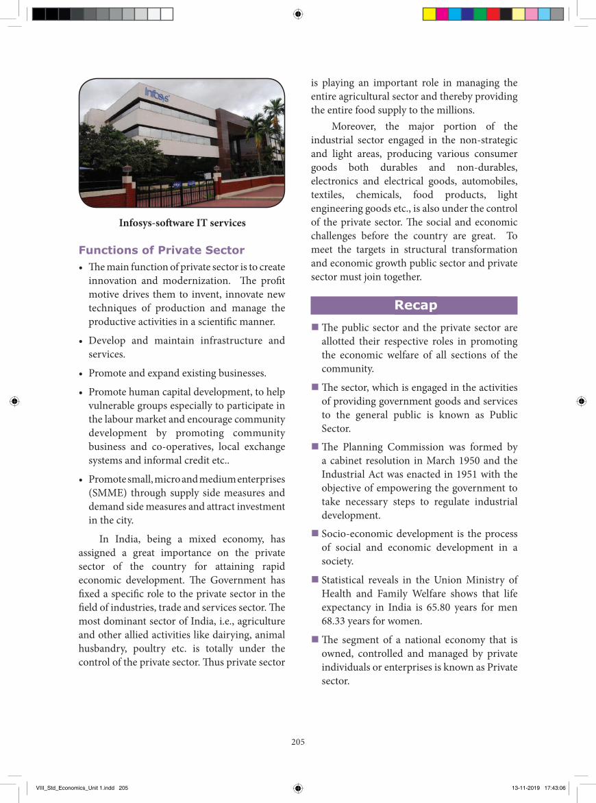
205
is playing an important role in managing the entire agricultural sector and thereby providing the entire food supply to the millions.
Moreover, the major portion of the industrial sector engaged in the non-strategic and light areas, producing various consumer goods both durables and non-durables, electronics and electrical goods, automobiles, textiles, chemicals, food products, light engineering goods etc., is also under the control of the private sector. The social and economic challenges before the country are great. To meet the targets in structural transformation and economic growth public sector and private sector must join together.
Recap� The public sector and the private sector are
allotted their respective roles in promoting the economic welfare of all sections of the community.
� The sector, which is engaged in the activities of providing government goods and services to the general public is known as Public Sector.
� The Planning Commission was formed by a cabinet resolution in March 1950 and the Industrial Act was enacted in 1951 with the objective of empowering the government to take necessary steps to regulate industrial development.
� Socio-economic development is the process of social and economic development in a society.
� Statistical reveals in the Union Ministry of Health and Family Welfare shows that life expectancy in India is 65.80 years for men 68.33 years for women.
� The segment of a national economy that is owned, controlled and managed by private individuals or enterprises is known as Private sector.
Functions of Private Sector• The main function of private sector is to create
innovation and modernization. The profit motive drives them to invent, innovate new techniques of production and manage the productive activities in a scientific manner.
• Develop and maintain infrastructure and services.
• Promote and expand existing businesses.
• Promote human capital development, to help vulnerable groups especially to participate in the labour market and encourage community development by promoting community business and co-operatives, local exchange systems and informal credit etc..
• Promote small, micro and medium enterprises (SMME) through supply side measures and demand side measures and attract investment in the city.
In India, being a mixed economy, has assigned a great importance on the private sector of the country for attaining rapid economic development. The Government has fixed a specific role to the private sector in the field of industries, trade and services sector. The most dominant sector of India, i.e., agriculture and other allied activities like dairying, animal husbandry, poultry etc. is totally under the control of the private sector. Thus private sector
Infosys-software IT services
VIII_Std_Economics_Unit 1.indd 205 13-11-2019 17:43:06
206
4. Steel Authority of India Ltd (SAIL) is a ________ Industry.
a) Miniratna Industry b) Maharatna Industry c) Navaratna Industry d) None of these
5. Public sector is on ________ motive. a) Profit Motive b) Service Motive c) Speculative Motive d) None of these
II. Fill in the blanks
1. The ________ and ________ are allotted their respective roles in promoting the economic welfare of all sections of the community.
2. The private sector is on ________ motive.
3. ________ is the process of social and economic development in a society.
4. The main function of private sector is to create ________ and ________.
5. The government is committed to strengthening ________ and co-operation among the citizens.
I. Choose the correct answer
1. The public sector in India owes its origin in the ________ Industrial policy resolution of the Government of India.
a) 1957 b) 1958
c)1966 d) 1956
2. Mixed economy is the mixture of merits of both________.
a) Capitalism
b) Socialism
c) a& b are correct
d)A & B are incorrect
3. ________ is governed by a company law and controlled by the Government as principal major share holders.
a) Private Sector
b) Joint Sector
c) Public Sector
d) None of these
GLOSSARY
Emphasized Intensity or forcefulness of expression ச�ொல்வன்மை
Accelerate Cause to move faster வி்ைவுபடுத்துதல
Disinvestment To sell off certain assets such as a manufacturing plant, a division or subsidiary, or product line
முதலீடுக்ைத் திருமபப் சபறுதல
Debenture A certificate or voucher acknowledging a debt கடனீட்டுப் பத்திைம
Ensure Be careful or certain to do something; make certain of something உறுதிப்படுத்து
Vulnerable Capable of being wounded or hurt பொதிககககூடிய
Exercise
VIII_Std_Economics_Unit 1.indd 206 13-11-2019 17:43:06
207
a) All are Correct b) i and iii are correct c) i and ii are correct d) None of these
VI. Short Answer:
1. Write short note on public sectors?2. What does the society want?3. Write the objectives of Public sector?4. What are the three organs of public sectors?5. Name some indicators that measure socio-
economic development.6. Write short note on Private sector?7. Name any three Maharatna Industries.8. Name any three Major Private Sector
industries?
VII. Brief Answer:
1. Explain the organs of public sector.2. Write briefly explain the history of public
sector?3. Explain any five measured indicators of
socio - economic development?4. What are the importance of public sector?5. Write the differences between public and
private sector.6. Write the functions of private sector?
III. Match the following.1. Think Tank - Primary Sector2. Agriculture - Gross Domestic
Product3. Industries - NITI Aayog 4. GDP - Navaratna Industry5. BHEL - Secondary Sector
IV. Which is the Odd one.1. Which one of the following is not the
indicator of the Socio Economic Development. a) Black Money b) Life Expectancy c) Gross Domestic Product (GDP) d) Employment
V. Which of the following is a correct answer
1. i) The Industries which would be exclusively owned by the state are referred to as Schedule-A
ii) The industries in which the private sector could supplement the efforts of the state sector, with the state taking the sole responsibility for starting new units which are specific in Schedule-B.
iii) The remaining industries which were in the private sector are not mentioned in Schedule.
VIII. Activity
Life expenctancy - ability to lead a long and health life.
S. No. Name of The Person Nature of work done Agriculture/ Industry /
Service1.
2.
3.
4.
5.
6.
VIII_Std_Economics_Unit 1.indd 207 13-11-2019 17:43:06
208
REFERENCE BOOKS
1. Dhaat and Sundaran - Indian Economy 2. Sankaran - Indian Economy 3. Dwett - Indian Economy
INTERNET RESOURCES
1. www.Wikipedia.com2. www.tn.gov.in3. www.statisticstimes.com4. india’s industries related websites
7.
8.
9.
10.
Explain your reasons for the classification.
IX. Life Skills:
1. Teacher and students are discuss about the Socio - Economic Development and industrial growth and development in that locality.
VIII_Std_Economics_Unit 1.indd 208 13-11-2019 17:43:06
Domain Expert
Dr. K. JAYAKUMAR Associate Professor Periyar E.V.R. College Tiruchi.
Reviewer
Dr. J. MURUGAN Assistant Professor Arignar Anna Govt. Arts College Attur, Salem Dist.
Authors
S. GOMATHI MANICKAM B.T. Assistant GHSS., Old Perungalathur Kanchipuram Dist.
P. BALAMURUGAN P.G. Assistant GBHSS., Thammampatti Salem Dist.
Domain Expert
V. TAMILARASAN Associate Professor & Head Govt. Arts College, Karur.
Reviewer
Dr. P. ARUL Associate Professor Govt. Arts College, Salem.
Authors
R. EZHILMOHAN B.T. Assistant GGHS., Yethapur Salem Dist.
V. RAVIKUMAR B.T. Assistant GHSS., Thandavarayapuram Salem Dist.
C. IYANDURAI B.T. Assistant GHS., D. Perumapalayam Salem Dist.
Domain Expert & Reviewer
Dr. M. KALIYAPERUMALProfessor & Head of the Department of Political Science (Retd.) Presidency College, Chennai.
Authors
S. GOMATHI MANICKAM B.T. Assistant GHSS., Old Perungalathur Kanchipuram Dist.
V. VELMURUGAN B.T. Assistant GHSS., Vellalagundam Salem Dist.
Academic & Subjects Co-ordinators
T. SRINIVASAN Principal DIET, Krishnagiri.
P. SURESHP.G. Assistant GGHSS., Attur Salem Dist.
VIII Std – SOCIAL SCIENCE – TERM IIIList of Adviser, Experts, Reviewers and Authors
This book has been printed on 80 GSM Elegant Maplitho paper.Printed by offset at:
QR Code Team
R. JAGANATHAN, SGT PUMS, Ganesapuram, Polur Tiruvannamalai Dist.
S. ALBERT VALAVAN BABU, B.T. Asst., G H S, PerumalKovil, Paramakudi Ramanathapuram.
M. MURUGESAN, B.T. Asst., PUMS,. Pethavelankottagam, Muttupettai, Thiruvarur
Layout StaffsKAMATCHI BALAN ARUMUGAMS. ASHOK KUMARR. BALASUBRAMANISELVAKUMAR MANICKAMMADHANV. VINOTH KUMARPRASANTHARUN KAMARAJSANTHIYAVU STEPHEN
Wrapper DesignKATHIR ARUMUGAM
In House QCRAJESH THANGAPPAN
Layout Co-ordinationRAMESH MUNISAMY
HISTORY GEOGRAPHY
ECONOMICS
CIVICS ADVISER & EXPERT
Dr. P. KUMAR Joint Director (Syllabus) SCERT, Chennai.
Domain Expert & Reviewer
DR. R. SUBRAMANIYAN Retd. Professor (Economics) Salem Soudeshwari College Salem Dist.
Author
S. SRINIVASAN P.G. Assistant GHSS., B. Thurinjipatti Dharmapuri Dist.
Content Reader
L. GOWSALYADEVI P.G. Assistant GHSS., Thoppur Dharmapuri Dist.
ICT Team D. NAGARAJ B.T. Assistant GHSS., Rappusal Pudukkotai Dist.
209
8th Social Science Authors lists.indd 209 13-11-2019 17:44:50

210
NOTES
8th Social Science Authors lists.indd 210 13-11-2019 17:44:50

211
NOTES
8th Social Science Authors lists.indd 211 13-11-2019 17:44:50

212
NOTES
8th Social Science Authors lists.indd 212 13-11-2019 17:44:50


