Embed Size (px)
Citation preview
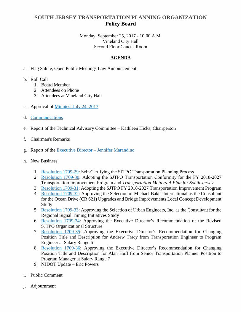
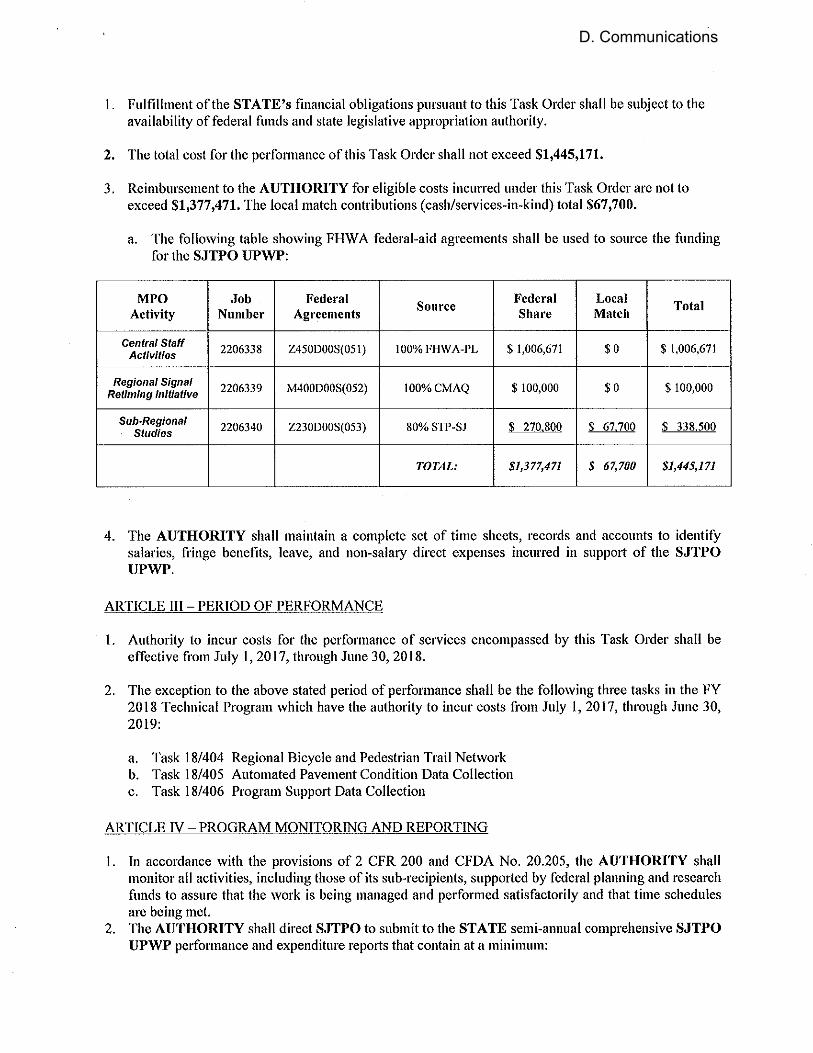
SOUTH JERSEY TRANSPORTATION PLANNING ORGANIZATION Policy Board
Monday, September 25, 2017 - 10:00 A.M.
Vineland City Hall Second Floor Caucus Room
AGENDA
a. Flag Salute, Open Public Meetings Law Announcement
b. Roll Call
1. Board Member 2. Attendees on Phone 3. Attendees at Vineland City Hall
c. Approval of Minutes: July 24, 2017
d. Communications
e. Report of the Technical Advisory Committee – Kathleen Hicks, Chairperson
f. Chairman's Remarks
g. Report of the Executive Director – Jennifer Marandino
h. New Business
1. Resolution 1709-29: Self-Certifying the SJTPO Transportation Planning Process 2. Resolution 1709-30: Adopting the SJTPO Transportation Conformity for the FY 2018-2027
Transportation Improvement Program and Transportation Matters-A Plan for South Jersey 3. Resolution 1709-31: Adopting the SJTPO FY 2018-2027 Transportation Improvement Program 4. Resolution 1709-32: Approving the Selection of Michael Baker International as the Consultant
for the Ocean Drive (CR 621) Upgrades and Bridge Improvements Local Concept Development Study
5. Resolution 1709-33: Approving the Selection of Urban Engineers, Inc. as the Consultant for the Regional Signal Timing Initiatives Study
6. Resolution 1709-34: Approving the Executive Director’s Recommendation of the Revised SJTPO Organizational Structure
7. Resolution 1709-35: Approving the Executive Director’s Recommendation for Changing Position Title and Description for Andrew Tracy from Transportation Engineer to Program Engineer at Salary Range 6
8. Resolution 1709-36: Approving the Executive Director’s Recommendation for Changing Position Title and Description for Alan Huff from Senior Transportation Planner Position to Program Manager at Salary Range 7
9. NJDOT Update – Eric Powers
i. Public Comment
j. Adjournment
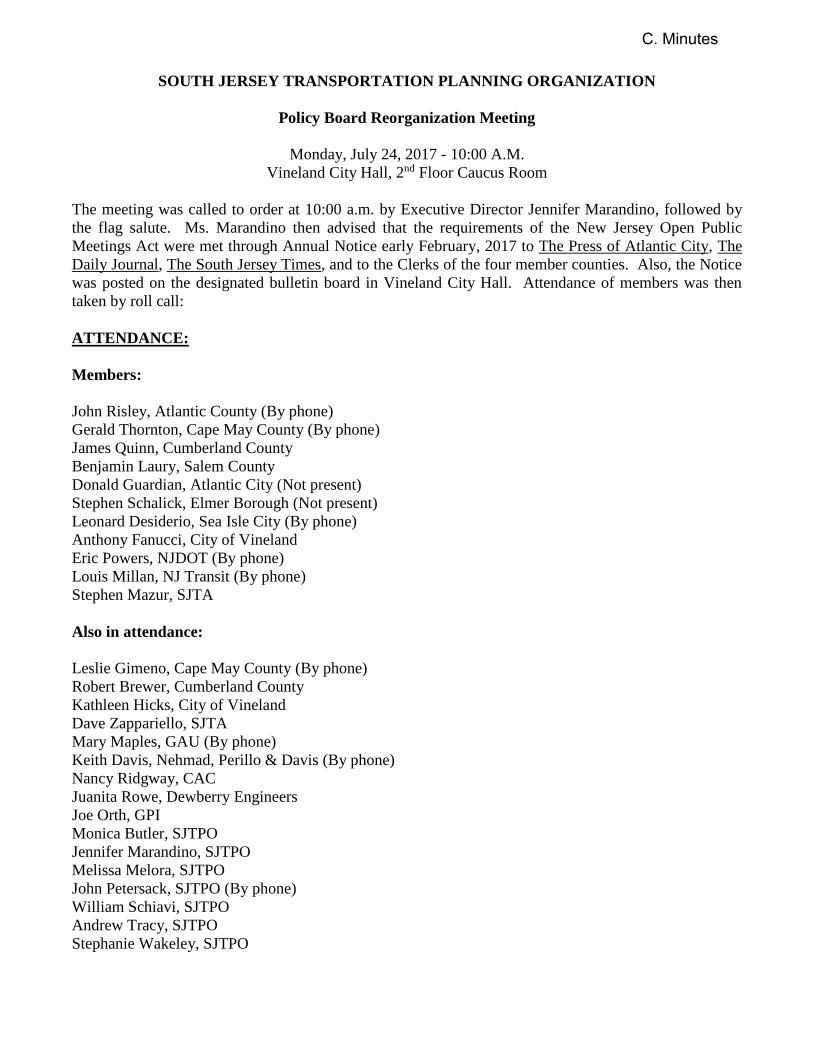
SOUTH JERSEY TRANSPORTATION PLANNING ORGANIZATION
Policy Board Reorganization Meeting
Monday, July 24, 2017 - 10:00 A.M.
Vineland City Hall, 2nd Floor Caucus Room
The meeting was called to order at 10:00 a.m. by Executive Director Jennifer Marandino, followed by
the flag salute. Ms. Marandino then advised that the requirements of the New Jersey Open Public
Meetings Act were met through Annual Notice early February, 2017 to The Press of Atlantic City, The
Daily Journal, The South Jersey Times, and to the Clerks of the four member counties. Also, the Notice
was posted on the designated bulletin board in Vineland City Hall. Attendance of members was then
taken by roll call:
ATTENDANCE:
Members:
John Risley, Atlantic County (By phone)
Gerald Thornton, Cape May County (By phone)
James Quinn, Cumberland County
Benjamin Laury, Salem County
Donald Guardian, Atlantic City (Not present)
Stephen Schalick, Elmer Borough (Not present)
Leonard Desiderio, Sea Isle City (By phone)
Anthony Fanucci, City of Vineland
Eric Powers, NJDOT (By phone)
Louis Millan, NJ Transit (By phone)
Stephen Mazur, SJTA
Also in attendance:
Leslie Gimeno, Cape May County (By phone)
Robert Brewer, Cumberland County
Kathleen Hicks, City of Vineland
Dave Zappariello, SJTA
Mary Maples, GAU (By phone)
Keith Davis, Nehmad, Perillo & Davis (By phone)
Nancy Ridgway, CAC
Juanita Rowe, Dewberry Engineers
Joe Orth, GPI
Monica Butler, SJTPO
Jennifer Marandino, SJTPO
Melissa Melora, SJTPO
John Petersack, SJTPO (By phone)
William Schiavi, SJTPO
Andrew Tracy, SJTPO
Stephanie Wakeley, SJTPO
C. Minutes
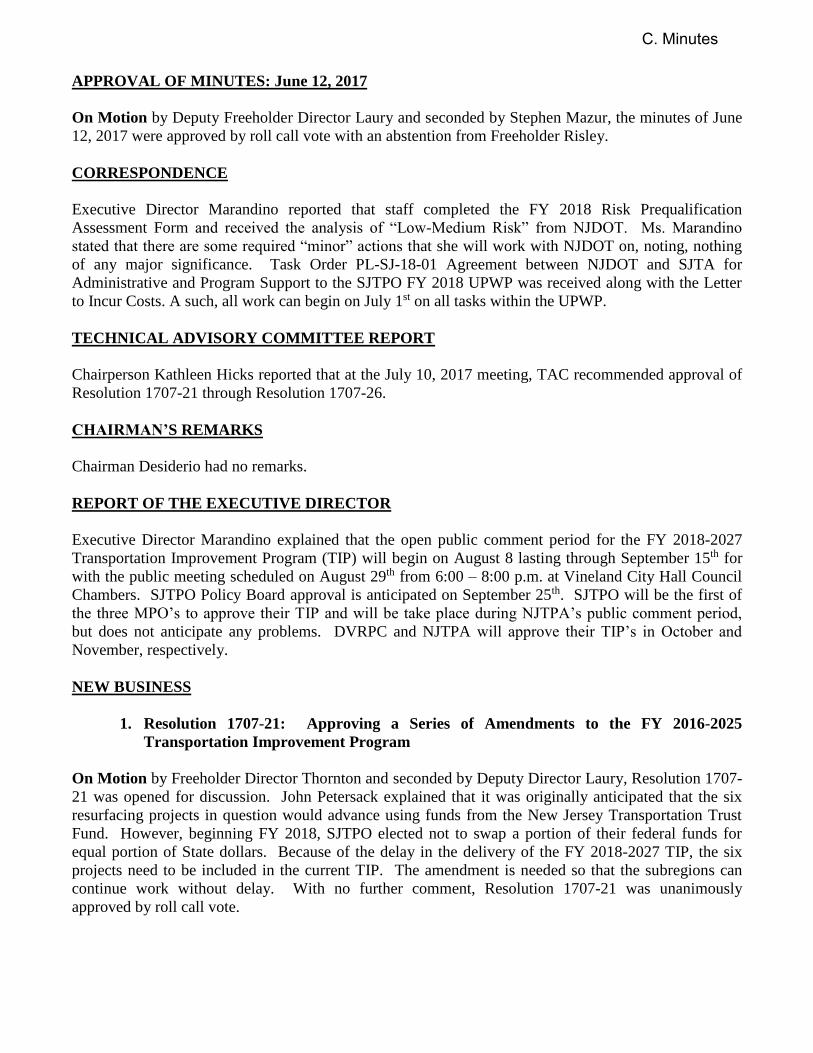
APPROVAL OF MINUTES: June 12, 2017
On Motion by Deputy Freeholder Director Laury and seconded by Stephen Mazur, the minutes of June
12, 2017 were approved by roll call vote with an abstention from Freeholder Risley.
CORRESPONDENCE
Executive Director Marandino reported that staff completed the FY 2018 Risk Prequalification
Assessment Form and received the analysis of “Low-Medium Risk” from NJDOT. Ms. Marandino
stated that there are some required “minor” actions that she will work with NJDOT on, noting, nothing
of any major significance. Task Order PL-SJ-18-01 Agreement between NJDOT and SJTA for
Administrative and Program Support to the SJTPO FY 2018 UPWP was received along with the Letter
to Incur Costs. A such, all work can begin on July 1st on all tasks within the UPWP.
TECHNICAL ADVISORY COMMITTEE REPORT
Chairperson Kathleen Hicks reported that at the July 10, 2017 meeting, TAC recommended approval of
Resolution 1707-21 through Resolution 1707-26.
CHAIRMAN’S REMARKS
Chairman Desiderio had no remarks.
REPORT OF THE EXECUTIVE DIRECTOR
Executive Director Marandino explained that the open public comment period for the FY 2018-2027
Transportation Improvement Program (TIP) will begin on August 8 lasting through September 15th for
with the public meeting scheduled on August 29th from 6:00 – 8:00 p.m. at Vineland City Hall Council
Chambers. SJTPO Policy Board approval is anticipated on September 25th. SJTPO will be the first of
the three MPO’s to approve their TIP and will be take place during NJTPA’s public comment period,
but does not anticipate any problems. DVRPC and NJTPA will approve their TIP’s in October and
November, respectively.
NEW BUSINESS
1. Resolution 1707-21: Approving a Series of Amendments to the FY 2016-2025
Transportation Improvement Program
On Motion by Freeholder Director Thornton and seconded by Deputy Director Laury, Resolution 1707-
21 was opened for discussion. John Petersack explained that it was originally anticipated that the six
resurfacing projects in question would advance using funds from the New Jersey Transportation Trust
Fund. However, beginning FY 2018, SJTPO elected not to swap a portion of their federal funds for
equal portion of State dollars. Because of the delay in the delivery of the FY 2018-2027 TIP, the six
projects need to be included in the current TIP. The amendment is needed so that the subregions can
continue work without delay. With no further comment, Resolution 1707-21 was unanimously
approved by roll call vote.
C. Minutes
2. Resolution 1707-22: Approving an Amendment to the FY 2018 Unified Planning Work
Program (UPWP) for Cumberland County Bicycle/Pedestrian Safety Action Plan to
Add as a Two-Year Effort
On Motion by Freeholder Quinn and seconded by Mayor Fanucci, Resolution 1707-22 was opened for
discussion. Executive Director Marandino explained that the Cumberland County Bicycle/Pedestrian
Safety Action Plan is currently programmed as one of several technical studies within the FY 2018
UPWP. The effort was originally programmed as a one year study for $152,400 using Highway Safety
Improvement Program (HSIP) funds. However, it was determined that extra time would be needed to
complete the study, therefore, the request is to extend the project from July 1, 2017 through to June 30,
2019, with the technical study becoming a two-year project. This extension will allow proper
coordination between NJDOT, FHWA, local jurisdictions, and staff. The project is to be funded with
federal HSIP funds. This action will not impact anything but the timeline of the project itself. With no
further comment, Resolution 1707-22 was unanimously approved by roll call vote.
3. Resolution 1707-23: Amending the FY 2018 Unified Planning Work Program (UPWP)
to Add Funding for Ocean Drive (CR 621) Upgrades and Bridge Improvements Local
Concept Development Technical Study
Jennifer Marandino explained that at the request of NJDOT for further clarification the Resolution has
been modified to include the following two new paragraphs: Whereas, on behalf of Cape May County,
SJTPO will manage a consultant-led effort for local concept development services; and Whereas,
Task 18-409: Ocean Drive (CR 621) Upgrades and Bridge Improvements Local Concept Development
will be added to the Technical Program within the SJTPO FY 2018 UPWP for the two-year
consultant-led effort. Also, language was added to the final paragraph “to add a new task and
associated funding”. On Motion by Stephen Mazur and seconded by Deputy Freeholder Director
Laury, Resolution 1707-23 was unanimously approved by roll call vote.
4. Resolution 1707-24: Approving the Selection of AECOM as the Consultant for the
SJTPO FY 2018 Port of Salem Corridor Freight/Rail Intermodal Study
On Motion by Deputy Freeholder Director Laury and seconded by Freeholder Director Thornton,
Resolution 1707-24 was opened for discussion. William Schiavi explained that on May 9th, staff
released a Request for Proposal seeking a qualified firm to study the Port of Salem and its regional
freight transportation network. The purpose of the study is to complete a review of the road and rail
connections to and from the point of access, and identify the needs related to optimum intermodal
access. He noted that the study will offer recommendations for improvements.
The notice of availability was sent to approximately 174 firms with two proposals received. The
Consultant Selection Committee consisting of Salem County, NJDOT, SJEDD, and staff, recommended
AECOM in association with subconsultant Envision Consultants, Ltd. Mr. Schiavi noted that initially
the proposal exceeded the budget by $55,021.00. However, after negotiations consisting of scope and
cost changes, the revised cost proposal of $55,020.00 was accepted. The revised cost does not exceed
the total budget and will provide a DBE contribution of 13.06%. If awarded, the total DBE/ESBE
participation rate for FY 2018 will be 13.1%. With no further comment, Resolution 1707-24 was
unanimously approved by roll call vote.
C. Minutes
5. Resolution 1707-25: Approving the Selection of IH Engineers, PC as the Consultant for
the Burns Avenue Concept Development Project
On Motion by Deputy Freeholder Director Laury and seconded by Freeholder Quinn, Resolution 1707-
25 was opened for discussion. Andrew Tracy explained that the purpose of the study is to provide
consultant support for concept development for improvement to Burns Avenue in South Vineland. The
City of Vineland has advanced this project as a location of interest; expressing that it is an underutilized
roadway in need of improvements. Proposals were due on June 8th with seven proposals received. The
Consultant Selection Committee consisting of City of Vineland, Cumberland County, and staff
recommended IH Engineers, PC in association with Richard Grubb Associates (DBE firm) and Schetter
Environmental for a total cost of $69,750.59 and an 18.1% DBE contribution, after negotiations of an
initial proposal of $79,806.93. If awarded, the total DBE/ESBE participation rate for FY 2018 will be
15.9%. With no further comment, Resolution 1707-25 was unanimously approved by roll call vote.
6. Resolution 1707-26: Endorsing Projects for SJTPO’s FY 2018 Congestion Management
and Air Quality Improvement (CMAQ) Program
On Motion by Deputy Freeholder Director Laury and seconded by Freeholder Quinn, Resolution 1707-
26 was opened for discussion. Andrew Tracy explained that CMAQ is a federally funded program that
provides for air quality improvement and traffic congestion reduction projects. CMAQ applications
were due on June 14th with six applications received, as follows:
1. Roosevelt Boulevard/34th Street Advanced Traffic Signal Project; Cape May County FY
2018 Design $0.0985 Million – FY 2018 Construction $0.657 million, totaling $0.756 million
2. Landis & Mill, Landis & Orchard Traffic Signal Upgrades; City of Vineland FY 2018
Construction $0.548 million
3. Procurement of 7 low emission, unleaded fuel, body on chassis mini-buses; Cape May
County Fare Free Transportation FY 2018 $0.500 million (plus additional 10% for
administrative fees, totaling $0.550 million
4. Purchase of Eight (8) Replacement Paratransit Passenger Buses; Atlantic County
Transportation Unit; Flex to NJ Transit FY 2018 $0.725 million (plus additional 10% for
administrative fees), totaling $0.798 million
5. It Pays to Plug In: New Jersey’s Electric Vehicle Charging Grants Program; New Jersey
Department of Environmental Protection; FY 2018 $0.399 million
6. Atlantic City Traffic Signal, Synchronization & Communications Project; Atlantic City; FY
2018 Design $0.200 million / FY 2019 Construction $3.313 million / FY 2020 Construction
$3.313 million, totaling $6.826 million across FY 2018, 2019, and 2020
All applications were reviewed by the CMAQ Project Selection Committee consisting of City of
Vineland, SJTA, NJDOT, and staff and all six projects were recommended for CMAQ funding. The
total funding request exceeds the SJTPO sub allocation of $1.9 million. Therefore, projects will be
funded as additional CMAQ funding becomes available from NJDOT as the Fiscal Year progresses.
With no further comment, Resolution 1707-26 was unanimously approved by roll call vote.
C. Minutes
7. Resolution 1707-27: Approving the Executive Director’s Recommendation for
Changing Transportation Engineer Position for Andrew Tracy from Salary Range 5 to
Salary Range 6
8. Resolution 1707-28: Approving the Executive Director’s Recommendation for
Changing Senior Transportation Planner Position for Alan Huff from Salary Range 6
to Salary Range 7
Executive Director Marandino stated that she emailed the members of SJTPO’s hiring subcommittee
pertaining to tabling both Resolutions 1707-27 and 1707-28 for the time being. She mentioned that it
was her intention to reorganize the office, which would impact the structure of SJTPO. In discussions
with Mary Maples (GAU) and Stephen Mazur, it was suggested to table the resolutions until the
proposed restructuring was brought before the Policy Board for approval, which is anticipated for
September. The recommendations of salary range changes for both Mr. Tracy and Mr. Huff would then
be reflected within the new organizational chart. In the meantime, Ms. Marandino will work with the
GAU and SJTA to pull together the restructuring in a more holistic fashion to show the proposed
hierarchy, solidifying the reorganization structure.
Freeholder Director Thornton questioned as to why the sudden involvement with tabling the resolutions,
noting that he thought everything was straightened out during the Personnel Committee meeting. Ms.
Marandino replied that the restructuring will be a more holistic view of how the organization will
function in a more cohesive fashion. Director Thornton then questioned if these proposed changes will
negatively affect anyone’s salaries and Ms. Marandino emphasized that it was not the intention. On
Motion by Freeholder Director Thornton and seconded by Deputy Director Laury, Resolution 1707-27
and Resolution 1707-28 were tabled unanimously by roll call vote.
NJDOT UPDATE – Eric Powers
Eric Powers thanked everyone for their continued work through the TIP process, noting that SJTPO will
be the first MPO to approve their TIP. Based on the amendments that have already been approved, there
will be work that must be done to FY 2018 and the existing TIP to make sure that no projects get
delayed. He stated that on the Federal side, it is a good year to date and emphasized to the subregions to
continue making it a priority to get submissions in on a timely basis. Ms. Marandino questioned what
the due date was for handing in submissions, and Mr. Powers indicated that it is September 1st. He
stated that the benefit to getting submissions in early is that the Department can start prioritizing them.
PUBLIC COMMENT
There were no public comments.
BOARD COMMENTS
Deputy Director Laury stated that he would like the Policy Board to get prior notice of the restructuring
before the next meeting. Ms. Marandino indicated that Mary Maples agreed to meet with her and SJTA
to sit down and go over the proposed changes.
C. Minutes

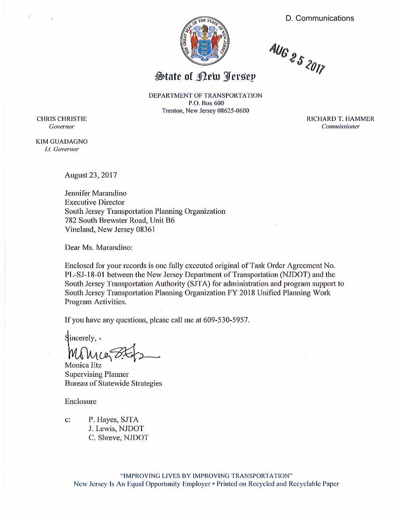
D. Communications
D. Communications
D. Communications
D. Communications
D. Communications
D. Communications
1
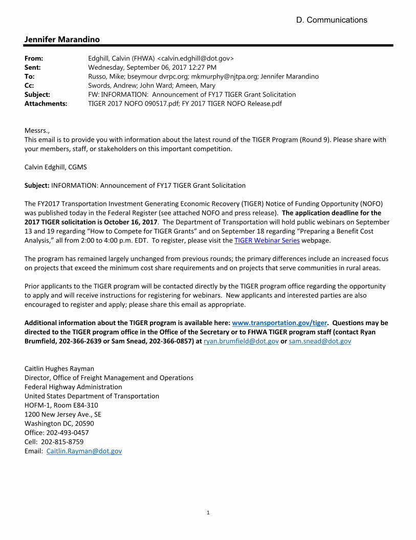
Jennifer Marandino
From: Edghill, Calvin (FHWA) <[email protected]>Sent: Wednesday, September 06, 2017 12:27 PMTo: Russo, Mike; bseymour dvrpc.org; [email protected]; Jennifer MarandinoCc: Swords, Andrew; John Ward; Ameen, MarySubject: FW: INFORMATION: Announcement of FY17 TIGER Grant SolicitationAttachments: TIGER 2017 NOFO 090517.pdf; FY 2017 TIGER NOFO Release.pdf
Messrs., This email is to provide you with information about the latest round of the TIGER Program (Round 9). Please share with your members, staff, or stakeholders on this important competition. Calvin Edghill, CGMS Subject: INFORMATION: Announcement of FY17 TIGER Grant Solicitation The FY2017 Transportation Investment Generating Economic Recovery (TIGER) Notice of Funding Opportunity (NOFO) was published today in the Federal Register (see attached NOFO and press release). The application deadline for the 2017 TIGER solicitation is October 16, 2017. The Department of Transportation will hold public webinars on September 13 and 19 regarding “How to Compete for TIGER Grants” and on September 18 regarding “Preparing a Benefit Cost Analysis,” all from 2:00 to 4:00 p.m. EDT. To register, please visit the TIGER Webinar Series webpage. The program has remained largely unchanged from previous rounds; the primary differences include an increased focus on projects that exceed the minimum cost share requirements and on projects that serve communities in rural areas. Prior applicants to the TIGER program will be contacted directly by the TIGER program office regarding the opportunity to apply and will receive instructions for registering for webinars. New applicants and interested parties are also encouraged to register and apply; please share this email as appropriate. Additional information about the TIGER program is available here: www.transportation.gov/tiger. Questions may be directed to the TIGER program office in the Office of the Secretary or to FHWA TIGER program staff (contact Ryan Brumfield, 202‐366‐2639 or Sam Snead, 202‐366‐0857) at [email protected] or [email protected] Caitlin Hughes Rayman Director, Office of Freight Management and Operations Federal Highway Administration United States Department of Transportation HOFM‐1, Room E84‐310 1200 New Jersey Ave., SE Washington DC, 20590 Office: 202‐493‐0457 Cell: 202‐815‐8759 Email: [email protected]
D. Communications
D. Communications
D. Communications
South Jersey Transportation Planning Organization
782 South Brewster Road, Unit B6, Vineland, New Jersey 08361
www.sjtpo.org (856) 794-1941(856) 794-2549 (fax)
Serving Atlantic, Cape May, Cumberland,
and Salem Counties since 1993.
Jennifer Marandino, P.E. Executive Director
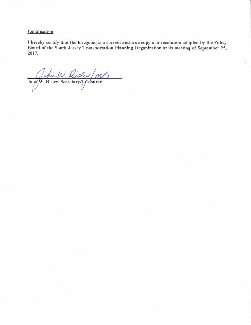
Leonard Desiderio, Chairman Benjamin H. Laury, Vice Chairman John W. Risley, Secretary/Treasurer
Atlantic County | Cape May County | Cumberland County | Salem County City of Atlantic City | City of Sea Isle City | City of Vineland | Elmer Borough
NJDOT | NJ TRANSIT | SJTA
EXECUTIVE DIRECTOR’S REPORT – September 25, 2017
NEW JERSEY REGIONAL CURVE INVENTORY AND SAFETY ASSESSMENT
In a partnership between SJTPO and DVRPC proposals were sought from qualified firms to produce a regional
curve inventory and safety assessment. The study is to be a county-wide, multi-county project to include
DVRPC’s New Jersey counties (Burlington, Camden, Gloucester, and Mercer) and the counties of SJTPO
(Atlantic, Cape May, Cumberland, and Salem).
Assisting DVRPC, SJTPO staff, along with a representative from Cape May and Cumberland Counties, reviewed
the proposals with a top ranked firm emerging. DVRPC is in the process of technical scope and cost negotiations
with the consultant and anticipates consultant selection to be before their September 28th (worst case October
26th) Board meeting.
SJTPO LOCAL SAFETY PROGRAM UPDATE SJTPO submitted projects to NJDOT Traffic Data & Safety for their initial review and screening. Staff had a
productive preliminary review meeting with NJDOT and FHWA and will be working with local jurisdiction to
supplement applications. A total of 15 projects will be formally be submitted to the Technical Review
Committee for consideration for FY 2018 Highway Safety Improvement Program (HSIP) funds, totaling over
$8.15 million. We anticipate endorsement of projects by TAC and Policy Board for consideration in November
(possibly delayed until January).
Staff will be working with the subregions to advance projects on High Risk Rural Roads (HRRR) in the four-
county region. This effort will be above and beyond the 15 projects to be considered for FY 2018 HSIP funding.
NJDOT and FHWA are very motivated to advance projects on HRRR locations.
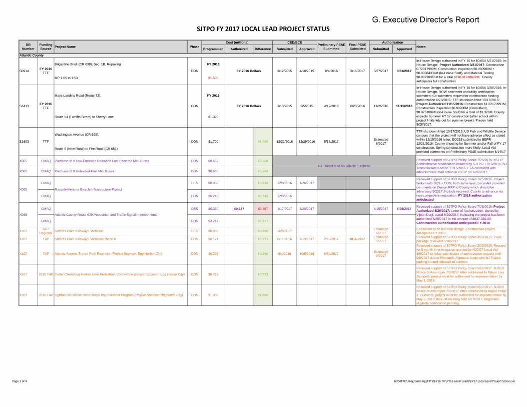
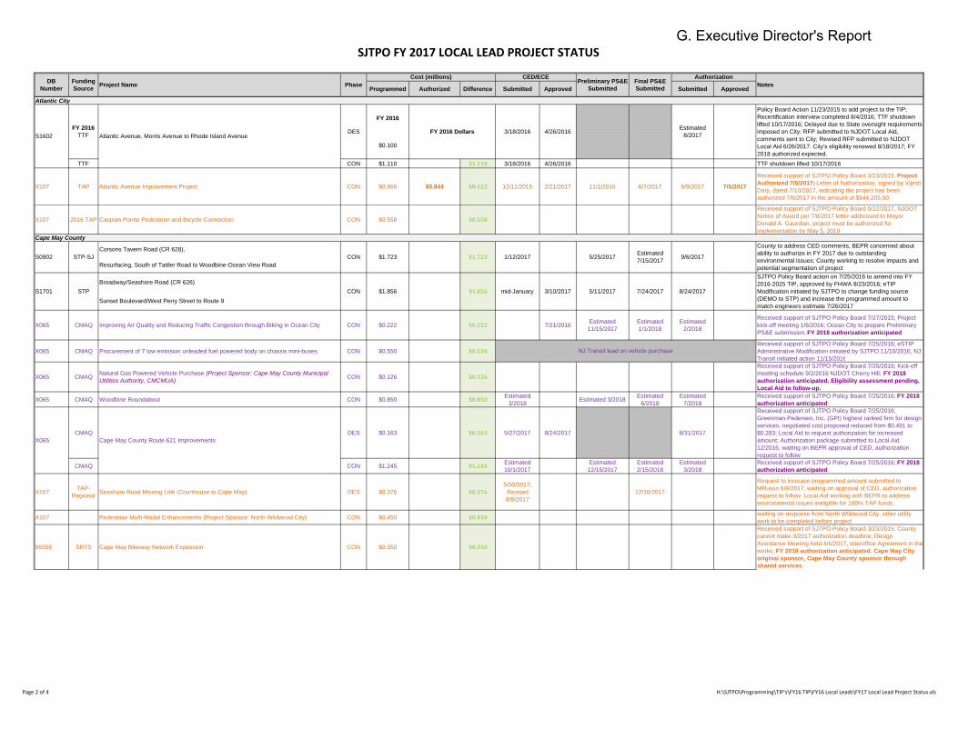
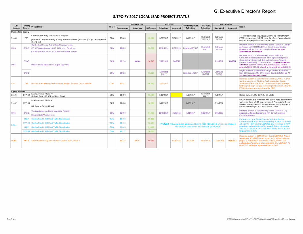
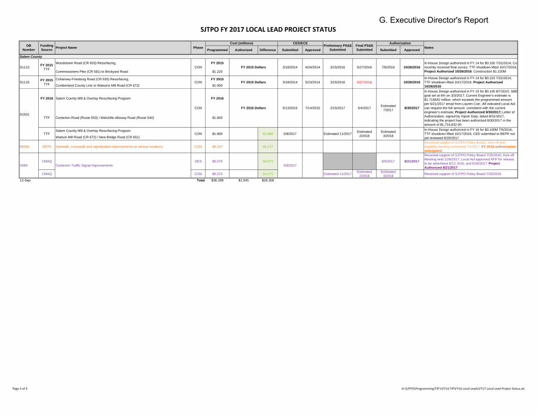
FY 2017 LOCAL LEAD PROJECT STATUS
The FY 2017 Local Lead Project Status Charts (9/12/2017) is attached.
FY 2018 TECHNICAL STUDIES
A Request for Proposals was released on September 13th for the Cumberland County Bicycle and Pedestrian
Safety Action Plan. The plan will document several action-oriented tasks geared towards advancing data-driven
bicycle and pedestrian projects via New Jersey’s Local Safety Program funded through the federal HSIP. The
desire would be to have 10 project locations for consideration as part of SJTPO’s Local Safety Program, which
would address bicycle and pedestrian crashes.
A kick-off meeting was held for the Burns Avenue Concept Development technical study, with staff working
closely with the City of Vineland and Cumberland County on this effort. The Port of Salem Corridor Freight/Rail
Intermodal Study is advancing with the Subcontract Agreement fully executed in mid-September.
G. Executive Director's Report
SJTPO FY 2017 LOCAL LEAD PROJECT STATUS
Programmed Authorized Difference Submitted Approved Submitted Approved
Atlantic County
Brigantine Blvd. (CR 638), Sec. 1B, Repaving FY 2016
MP 1.05 to 1.53 $1.500
Mays Landing Road (Route 73), FY 2016
Route 54 (Twelfth Street) to Sherry Lane $1.320
Washington Avenue (CR 608),
Route 9 (New Road) to Fire Road (CR 651)
X065 CMAQ Purchase of 9 Low-Emission Unleaded Fuel Powered Mini-Buses CON $0.660 $0.660
X065 CMAQ Purchase of 8 Unleaded-Fuel Mini Buses CON $0.660 $0.660
CMAQ DES $0.030 $0.030 12/8/2016 1/26/2017
CMAQ CON $0.245 $0.245 12/8/2016
CMAQ DES $0.330 $0.637 $0.307 1/17/2017 3/20/2017 8/15/2017 8/25/2017
CMAQ CON $3.217 $3.217
X107 TAP-Regional Somers Point Bikeway Extension DES $0.090 $0.090 3/28/2017 Estimated
6/2017Consultant to be hired for design, Construction project anticipated FY 2018
X107 TAP Somers Point Bikeway Extension Phase II CON $0.171 $0.171 8/11/2016 7/19/2017 2/10/2017 8/16/2017Estimated
5/2017Received support of SJTPO Policy Board 3/23/2015; PS&E package reviewed 5/18/2017
X107 TAP Atlantic Avenue Transit Path Extension (Project Sponsor: Egg Harbor City) CON $0.296 $0.296 6/1/2016 10/5/2016 6/30/2017 Estimated 9/2017
Received support of SJTPO Policy Board 3/23/2015; Request for 6-month time extension granted by NJDOT Local Aid 3/9/2017 to delay submission of authorization request until 9/8/2017 due to Pinelands Approval; Issue with NJ Transit parking lot and sidewalk to connect
X107 2016 TAP Cedar Creek/Egg Harbor Lake Pedestrian Connection (Project Sponsor: Egg Harbor City) CON $0.723 $0.723
Received support of SJTPO Policy Board 5/22/2017, NJDOT Notice of Award per 7/8/2017 letter addressed to Mayor Lisa Jiampetti, project must be authorized for implementation by May 2, 2019
X107 2016 TAP Lighthouse District Streetscape Improvement Program (Project Sponsor: Brigantine City) CON $1.000 $1.000
Received support of SJTPO Policy Board 5/22/2017, NJDOT Notice of Award per 7/8/2017 letter addressed to Mayor Philip J. Guenther, project must be authorized for implementation by May 5, 2019; Kick-off meeting held 8/17/2017; Brigantine eligibility certificaiton pending
NJ Transit lead on vehicle purchase
Received support of SJTPO Policy Board 7/25/2016; eSTIP Administrative Modification initiated by SJTPO 11/10/2016, NJ Transit initiated action 11/15/2016. FTA concurred with administrative mod action in eSTIP on 1/26/2017.
X065 Margate-Ventnor Bicycle Infrastructure Project
Received support of SJTPO Policy Board 7/25/2016. Project broken into DES + CON, both same year; Local Aid provided comments on Design RFP to County which should be advertised 5/2017; No bids received, County to advance via non-competitive negotiation. FY 2018 authorization
anticipated
X065 Atlantic County Route 629 Pedestrian and Traffic Signal Improvements
Received support of SJTPO Policy Board 7/25/2016. Project
Authorized 8/25/2017; Letter of Authorization, signed by Vijesh Darji, dated 8/29/2017, indicating the project has been authorized 8/25/2017 in the amount of $637,330.00; Construction authorization anticipated FY 2018
12/21/2016 12/29/2016 5/16/2017 Estimated 8/2017
TTF shutdown lifted 10/17/2016; US Fish and Wildlife Service concurs that the project will not have adverse affect as stated within 12/15/2016 letter; EO215 submitted to BEPR 12/21/2016. County shooting for Summer and/or Fall of FY 17 construction, Spring construction more likely; Local Aid provided comments on Preliminary PS&E submission 6/14/17
S1603 TTF CON $1.700 $1.700
2/5/2015 4/19/2016 6/28/2016 11/2/2016 11/15/2016
In-House Design authorized in FY 15 for $0.056 3/20/2015; In-House Design, ROW easement and utility certification submitted; Co submitted request for construction funding authorization 6/28/2016; TTF shutdown lifted 10/17/2016; Project Authorized 11/15/2016: Construction $1.22170991M, Construction Inspection $0.90980M (Consutlant), $0.0731009M (In-House Staff) for a total of $1.320M. County expects Summer FY 17 construction (after school within project limits lets out for summer break). Precon held 8/28/2017.
8/4/2016 3/16/2017 3/27/2017 3/31/2017
In-House Design authorized in FY 15 for $0.050 5/21/2015; In-House Design; Project Authorized 3/31/2017: Construction 0.72017990M, Construction Inspection $0.090980M + $0.00984334M (In-House Staff), and Material Testing $0.00720365M for a total of $0.91918689M. County anticipates fall construction
S1413 FY 2016
TTF CON FY 2016 Dollars 1/13/2015
Preliminary PS&E
Submitted
Final PS&E
Submitted
Authorization
Notes
S0914 FY 2016
TTF CON FY 2016 Dollars 3/12/2015 4/10/2015
DB
Number
Funding
SourceProject Name Phase
Cost (millions) CED/ECE
Page 1 of 4 H:\SJTPO\Programming\TIP's\FY16 TIP\FY16 Local Leads\FY17 Local Lead Project Status.xls
G. Executive Director's Report
SJTPO FY 2017 LOCAL LEAD PROJECT STATUS
Programmed Authorized Difference Submitted Approved Submitted Approved
Preliminary PS&E
Submitted
Final PS&E
Submitted
Authorization
NotesDB
Number
Funding
SourceProject Name Phase
Cost (millions) CED/ECE
Atlantic City
FY 2016
$0.100
TTF CON $1.110 $1.110 3/18/2016 4/26/2016 TTF shutdown lifted 10/17/2016
X107 TAP Atlantic Avenue Improvement Project CON $0.966 $0.844 $0.122 12/11/2015 2/21/2017 11/1/2016 6/7/2017 6/9/2017 7/5/2017
Received support of SJTPO Policy Board 3/23/2015. Project
Authorized 7/5/2017; Letter of Authorization, signed by Vijesh Darji, dated 7/10/2017, indicating the project has been authorized 7/5/2017 in the amount of $844,205.00
X107 2016 TAP Caspian Pointe Pedestrian and Bicycle Connection CON $0.558 $0.558
Received support of SJTPO Policy Board 5/22/2017, NJDOT Notice of Award per 7/8/2017 letter addressed to Mayor Donald A. Gaurdian, project must be authorized for implementation by May 5, 2019
Cape May County
Corsons Tavern Road (CR 628),
Resurfacing, South of Tattler Road to Woodbine-Ocean View Road
Broadway/Seashore Road (CR 626)
Sunset Boulevard/West Perry Street to Route 9
X065 CMAQ Improving Air Quality and Reducing Traffic Congestion through Biking in Ocean City CON $0.222 $0.222 7/21/2016 Estimated 11/15/2017
Estimated 1/1/2018
Estimated 2/2018
Received support of SJTPO Policy Board 7/27/2015; Project kick-off meeting 1/6/2016; Ocean City to prepare Preliminary PS&E submission; FY 2018 authorization anticipated
X065 CMAQ Procurement of 7 low emission unleaded fuel powered body on chassis mini-buses CON $0.550 $0.550Received support of SJTPO Policy Board 7/25/2016; eSTIP Administrative Modification initiated by SJTPO 11/10/2016, NJ Transit initiated action 11/15/2016
X065 CMAQ Natural Gas Powered Vehicle Purchase (Project Sponsor: Cape May County Municipal Utilities Authority, CMCMUA) CON $0.126 $0.126
Received support of SJTPO Policy Board 7/25/2016; Kick-off meeting schedule 9/2/2016 NJDOT Cherry Hill; FY 2018
authorization anticipated. Eligibility assessment pending,
Local Aid to follow-up.
X065 CMAQ Woodbine Roundabout CON $0.850 $0.850 Estimated 3/2018 Estimated 3/2018 Estimated
6/2018Estimated
7/2018Received support of SJTPO Policy Board 7/25/2016; FY 2018
authorization anticipated
CMAQ DES $0.163 $0.163 5/27/2017 8/24/2017 8/31/2017
Received support of SJTPO Policy Board 7/25/2016; Greenman-Pedersen, Inc. (GPI) highest ranked firm for design services, negotiated cost proposed reduced from $0.491 to $0.283; Local Aid to request authorization for increased amount; Authorization package submitted to Local Aid 12/2016, waiting on BEPR approval of CED, authorization request to follow
CMAQ CON $1.245 $1.245 Estimated 10/1/2017
Estimated 12/15/2017
Estimated 2/15/2018
Estimated 3/2018
Received support of SJTPO Policy Board 7/25/2016; FY 2018
authorization anticipated
X107 TAP-Regional Seashore Road Missing Link (Courthouse to Cape May) DES $0.376 $0.376
5/30/2017; Revised 8/9/2017
12/16/2017
Request to increase programmed amount submitted to MRusso 6/9/2017; waiting on approval of CED, authorization request to follow. Local Aid working with BEPR to address environmental issues ineligible for 100% TAP funds.
X107 Pedestrian Multi-Modal Enhancements (Project Sponsor: North Wildwood City) CON $0.450 $0.450 waiting on response from North Wildwood City, other utility work to be completed before project
99358 SRTS Cape May Bikeway Network Expansion CON $0.350 $0.350
Received support of SJTPO Policy Board 3/23/2015; County cannot make 3/2017 authorization deadline; Design Assistance Meeting held 4/6/2017, Interoffice Agreement in the works; FY 2018 authorization anticipated. Cape May City
original sponsor, Cape May County sponsor through
shared services
7/24/2017 8/24/2017
SJTPO Policy Board action on 7/25/2016 to amend into FY 2016-2025 TIP, approved by FHWA 8/23/2016; eTIP Modification initiated by SJTPO to change funding source (DEMO to STP) and increase the programmed amount to match engineers estimate 7/26/2017
NJ Transit lead on vehicle purchase
X065 Cape May County Route 621 Improvements
County to address CED comments, BEPR concerned about ability to authorize in FY 2017 due to outstanding environmental issues; County working to resolve impacts and potential segmentation of project
S1701 STP CON $1.856 $1.856 mid-January 3/10/2017 5/11/2017
1/12/2017 5/25/2017 Estimated 7/15/2017 9/6/2017S0902 STP-SJ CON $1.723 $1.723
4/26/2016 Estimated 8/2017
Policy Board Action 11/23/2015 to add project to the TIP; Recertification interview completed 8/4/2016; TTF shutdown lifted 10/17/2016; Delayed due to State oversight requirements imposed on City; RFP submitted to NJDOT Local Aid, comments sent to City; Revised RFP submitted to NJDOT Local Aid 6/26/2017. City's eligibility renewed 8/18/2017; FY 2018 authorized expected.
S1602FY 2016
TTF Atlantic Avenue, Morris Avenue to Rhode Island AvenueDES FY 2016 Dollars 3/18/2016
Page 2 of 4 H:\SJTPO\Programming\TIP's\FY16 TIP\FY16 Local Leads\FY17 Local Lead Project Status.xls
G. Executive Director's Report
SJTPO FY 2017 LOCAL LEAD PROJECT STATUS
Programmed Authorized Difference Submitted Approved Submitted Approved
Preliminary PS&E
Submitted
Final PS&E
Submitted
Authorization
NotesDB
Number
Funding
SourceProject Name Phase
Cost (millions) CED/ECE
Cumberland County
Cumberland County Federal Road Program
portions of Lincoln Avenue (CR 655), Sherman Avenue (Route 552), Mays Landing Road (Route 552)Cumberland County Traffic Signal Improvements,
CR 552 (Irving Avenue) & CR 606 (Laurel Street) and
CR 697 (Atlantic Street) & CR 731 (Commerce Street)
CMAQ DES $0.150 $0.160 $0.010 7/29/2016 8/8/2016 2/22/2017 3/8/2017
Received support of SJTPO Policy Board 7/27/2015; Consultant-led design to include traffic signals along Broad Street at High Street, 2nd, 3rd, and 4th Streets; Winning Proposal awarded by County 1/24/2017. Project Authorized
3/10/2017; Letter of Authorization dated 3/10/2017 in the amount of $159,719.00; all work to be completed by 3/8/2020
CMAQ CON $0.825 $0.825 Estimated 6/2017 Estimated 10/2017 Estimated
12/2017Estimated
1/2018
Project schedule to follow after design contract authorized. New CED requested for CON phase, County to follow-up; FY
2018 authorization anticipated
X107 TAP Maurice River Bikeway Trail - Phase V (Project Sponsor: City of Millville) CON $0.517 $0.517 1/25/2017
Received support of SJTPO Policy Board 3/23/2015; NJDOT working with City on Eligibility; TWT selected as Design Assistance Consultant, NJDOT to serve as Project Manager for Design; Design Assistance meeting held week of July 17th, FY 2018 authorization anticipated for DES
City of VinelandLandis Avenue, Phase IV, Orchard Road (CR 628) to Moyer Street
Landis Avenue, Phase V,
Mill Road to Orchard Road
The Landis Avenue Signal Upgrades Phase II,
Boulevards to West Avenue
1/12/2017
Received support of SJTPO Policy Board 3/23/2015. Project
Authorized 1/12/2017; Letter signed by S. Mikhael advising project is Authorized in the amount of $303,977.00, TTF Authorization/Agreement letter emailed to City 1/13/2017. As of 4/27/17, waiting on agreement from NJDOT
$0.029 8/18/2016 8/2/2016 9/21/2016 11/23/201699358 SRTS Sabater Elementary Safe Routes to School 2014, Phase 2 $0.275 $0.304
STP-SJ Garden Road & Mill Road Traffic Signalization CON $0.277 $0.277
HSIP Garden Road & Mill Road Traffic Signalization CON $1.005 $1.005
STP-SJ Garden Road & Mill Road Traffic Signalization ROW $0.139 $0.139
Received support of SJTPO Policy Board 7/27/2015; City prepared and signed agreement with Conrail, awaiting Conrail's signature
04314
HSIP Garden Road & Mill Road Traffic Signalization ROW $0.108 $0.108
FY 2018; ROW purchase anticipated Spring 2018 (3/31/2018) with an additional 6 months for Construction authorization (9/30/2018)
Presented to Local Safety Program Technical Review Committee 1/29/2015; Recommended by NJDOT Traffic Data & Safety for HSIP funding 5/29/2015; City in process of ROW appraisals and negioations (City funded); Public Information Session 7/11/2017; STP-SJ and HSIP money will be utilized for purchase of ROW
10/22/2015 4/10/2015 7/21/2017 8/29/2017 8/30/2017
8/18/2017
NJDOT Local Aid to coordinate with BEPR, need description of work to be done, USGS maps preferred; Proposals for Design services received on 7/27, Authorization request submitted to FHWA 8/18/2017 per 8/21 email from A. Shah
X065 CMAQ CON $1.000 $1.000
Design authorized for $0.060M 6/14/2016
S1407 STP-SJ DES $0.050 $0.050 5/17/2017 8/18/2017
5/16/2017 7/17/2017 Estimated 8/2017 9/1/2017S1124 STP-SJ CON $0.609 $0.609
Estimated 8/2017
Estimated 9/2017
Received support of SJTPO Policy Board 7/27/2015; Design authorized for $0.100M 2/1/2016; County is coordinating removal of left turn lead with City of Bridgeton FY 2018
authorization anticipated
X065 Millville Broad Street Traffic Signal Upgrades
TTF shutdown lifted 10/17/2016; Comments on Preliminary PS&E received from NJDOT Local Aid, County's consultant to respond and prepare Final PS&E package
X065 CMAQ CON $0.550 $0.550 12/31/2014 3/27/2015 Estimated 8/2017
3/30/2017 7/21/2017 6/12/2017 Estimated 7/28/2017
Estimated 9/2017S1403 TTF CON $2.000 $2.000
Page 3 of 4 H:\SJTPO\Programming\TIP's\FY16 TIP\FY16 Local Leads\FY17 Local Lead Project Status.xls
G. Executive Director's Report
SJTPO FY 2017 LOCAL LEAD PROJECT STATUS
Programmed Authorized Difference Submitted Approved Submitted Approved
Preliminary PS&E
Submitted
Final PS&E
Submitted
Authorization
NotesDB
Number
Funding
SourceProject Name Phase
Cost (millions) CED/ECE
Salem County
Woodstown Road (CR 603) Resurfacing, FY 2015
Commissioners Pike (CR 581) to Brickyard Road $1.220
Cohansey-Friesburg Road (CR 635) Resurfacing, FY 2015
Cumberland County Line to Watsons Mill Road (CR 672) $1.000
FY 2016 Salem County Mill & Overlay Resurfacing Program FY 2016
TTF Centerton Road (Route 553) / Welchille-Alloway Road (Route 540) $1.600
Salem County Mill & Overlay Resurfacing Program
Watson Mill Road (CR 672) / New Bridge Road (CR 651)
99358 SRTS Sidewalk, crosswalk and signalization improvements at various locations CON $0.237 $0.237Received support of SJTPO Policy Board ; kick-off and eligibility meeting scheduled 7/1/2017; FY 2018 authorization
anticipated
CMAQ DES $0.075 $0.075 8/9/2017 8/21/2017
Received support of SJTPO Policy Board 7/25/2016; Kick-off Meeting held 1/26/2017; Local Aid approved RFP for release, to be advertised 6/12, 6/16, and 6/26/2017. Project
Authorized 8/21/2017
CMAQ CON $0.275 $0.275 Estimated 11/2017 Estimated 2/2018
Estimated 3/2018 Received support of SJTPO Policy Board 7/25/2016
12-Sep Total $36.299 $1.945 $28.306
X065 Centerton Traffic Signal Improvements 5/8/2017
Estimated 11/2017 Estimated 2/2018
Estimated 3/2018
In-House Design authorized in FY 16 for $0.100M 7/5/2016; TTF shutdown lifted 10/17/2016; CED submitted to BEPR not yet reviewed 6/20/2017
5/4/2017 Estimated 7/2017 8/30/2017
In-House Design authorized in FY 15 for $0.100 8/7/2015. SBE goal set at 6% on 3/3/2017; Current Engineer's estimate is $1.716832 million, which exceeds the programmed amount per 6/21/2017 email from Lauren Coe; JM indicated Local Aid can request the full amount consistent with the current engineer’s estimate; Project Authorized 8/30/2017; Letter of Authorization, signed by Vijesh Darji, dated 8/31/2017, indicating the project has been authorized 8/30/2017 in the amount of $1,716,832.00
TTF CON $1.800 $1.800 5/8/2017
5/27/2016 10/26/2016
In-House Design authorized in FY 14 for $0.103 7/31/2014; TTF shutdown lifted 10/17/2016; Project Authorized
10/26/2016
S1501
CON FY 2016 Dollars 5/13/2015 7/14/2015 2/15/2017
7/6/2016 10/26/2016
In-House Design authorized in FY 14 for $0.100 7/31/2014; Co recently received final survey; TTF shutdown lifted 10/17/2016; Project Authorized 10/26/2016: Construction $1.220M
S1115 FY 2015
TTF CON FY 2015 Dollars 3/18/2014 5/23/2014 3/15/2016
S1113 FY 2015
TTF CON FY 2015 Dollars 3/18/2014 4/24/2014 3/15/2016 5/27/2016
Page 4 of 4 H:\SJTPO\Programming\TIP's\FY16 TIP\FY16 Local Leads\FY17 Local Lead Project Status.xls
G. Executive Director's Report
SOUTH JERSEY TRANSPORTATION PLANNING ORGANIZATION
ITEM 1709-29: Self-Certifying the SJTPO Transportation Planning Process
PROPOSAL
At its September 11, 2017 meeting, the Technical Advisory Committee recommended that the Policy
Board adopt a resolution self-certifying the SJTPO Transportation Planning Process, as required by
Federal regulations.
BACKGROUND
Under the current Federal Planning regulations, Metropolitan Planning Organizations (MPO's) must
annually certify that their transportation planning process is being conducted in accordance with all
applicable requirements.
H1: Resolution 1709-29
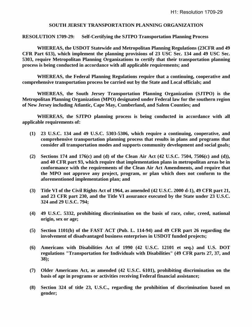
SOUTH JERSEY TRANSPORTATION PLANNING ORGANIZATION
RESOLUTION 1709-29: Self-Certifying the SJTPO Transportation Planning Process
WHEREAS, the USDOT Statewide and Metropolitan Planning Regulations (23CFR and 49
CFR Part 613), which implement the planning provisions of 23 USC Sec. 134 and 49 USC Sec.
5303, require Metropolitan Planning Organizations to certify that their transportation planning
process is being conducted in accordance with all applicable requirements; and
WHEREAS, the Federal Planning Regulations require that a continuing, cooperative and
comprehensive transportation process be carried out by the State and Local officials; and
WHEREAS, the South Jersey Transportation Planning Organization (SJTPO) is the
Metropolitan Planning Organization (MPO) designated under Federal law for the southern region
of New Jersey including Atlantic, Cape May, Cumberland, and Salem Counties; and
WHEREAS, the SJTPO planning process is being conducted in accordance with all
applicable requirements of:
(1) 23 U.S.C. 134 and 49 U.S.C. 5303-5306, which require a continuing, cooperative, and
comprehensive transportation planning process that results in plans and programs that
consider all transportation modes and supports community development and social goals;
(2) Sections 174 and 176(c) and (d) of the Clean Air Act (42 U.S.C. 7504, 7506(c) and (d)),
and 40 CFR part 93, which require that implementation plans in metropolitan areas be in
conformance with the requirements of the Clean Air Act Amendments, and require that
the MPO not approve any project, program, or plan which does not conform to the
aforementioned implementation plan; and
(3) Title VI of the Civil Rights Act of 1964, as amended (42 U.S.C. 2000 d-1), 49 CFR part 21,
and 23 CFR part 230, and the Title VI assurance executed by the State under 23 U.S.C.
324 and 29 U.S.C. 794;
(4) 49 U.S.C. 5332, prohibiting discrimination on the basis of race, color, creed, national
origin, sex or age;
(5) Section 1101(b) of the FAST ACT (Pub. L. 114-94) and 49 CFR part 26 regarding the
involvement of disadvantaged business enterprises in USDOT funded projects;
(6) Americans with Disabilities Act of 1990 (42 U.S.C. 12101 et seq.) and U.S. DOT
regulations "Transportation for Individuals with Disabilities" (49 CFR parts 27, 37, and
38);
(7) Older Americans Act, as amended (42 U.S.C. 6101), prohibiting discrimination on the
basis of age in programs or activities receiving Federal financial assistance;
(8) Section 324 of title 23, U.S.C., regarding the prohibition of discrimination based on
gender;
H1: Resolution 1709-29
SOUTH JERSEY TRANSPORATION PLANNING ORGANIZATION
ITEM 1709-30: Adopting the SJTPO Transportation Conformity Determination for the FY
2018-2027 Transportation Improvement Program and Transportation
Matters-A Plan for South Jersey
PROPOSAL:
At its September 11, 2017 meeting, the SJTPO Technical Advisory Committee recommended that the
Policy Board approve the SJTPO Transportation Conformity Determination for the FY 2018-2027
Transportation Improvement Program (TIP) and Transportation Matters-A Plan for South Jersey under
the 8-Hour Ozone National Ambient Air Quality Standards (NAAQS).
BACKGROUND:
Federal Planning Regulations require that air quality emissions from new TIPs and Regional
Transportation Plans (RTPs) conform to motor vehicle emissions budgets established by the New Jersey
State Implementation Plan (SIP). These emissions budgets are based on National Ambient Air Quality
Standards (NAAQS), set by the US Environmental Protection Agency (EPA). The attached conformity
determination demonstrates that FY 2018-2027 Transportation Improvement Program and Transportation
Matters-A Plan for South Jersey, (SJTPO’s Regional Transportation Plan), conform to air quality
standards.
The SJTPO Transportation Conformity Determination demonstrates that the 2018-2027 TIP and
Transportation Matters-A Plan for South Jersey, conform to the SIP with respect to the established motor
vehicle emissions budgets as well as all the additional requirements mandated by the Transportation
Conformity Final Rule, 40 CFR Part 93.
The SJTPO Transportation Conformity Determination was issued on August 14, 2017, and was followed
by a 30-day public comment period, in accordance with Federal Regulations and SJTPO Public
Involvement Policy. A formal public meeting was held at 6:00 p.m. at Vineland City Hall – Council
Chambers (Second Floor) located at 640 East Wood Street, Vineland, New Jersey, on Tuesday, August
29, 2017.
The SJTPO Transportation Conformity Determination Report, as well as an appendix listing the
transportation projects, can be found on the SJTPO website at www.sjtpo.org/environment/.
Favorable Policy Board Action will enable the projects and programs in SJTPO’s TIP and RTP to continue
to proceed and avoid a conformity lapse.
H2: Resolution 1709-30
SOUTH JERSEY TRANSPORTATION PLANNING ORGANIZATION
RESOLUTION 1709-30: Adopting the SJTPO Transportation Conformity Determination for
the FY 2018-2027 Transportation Improvement Program and
Transportation Matters-A Plan for South Jersey
WHEREAS, the South Jersey Transportation Planning Organization (SJTPO) is the
Metropolitan Planning Organization (MPO) designated under federal law for the southern region
of New Jersey including Atlantic, Cape May, Cumberland, and Salem Counties; and
WHEREAS, the transportation plans and programs developed by the SJTPO are required
to conform to the purposes of the State Implementation Plan for air quality control and Sections
174 and 176 (c) and (d) of the Clean Air Act (42 U.S.C. 7504, 7506 (c) and (d); and
WHEREAS, the four county SJTPO region is designated as a nonattainment area under the
8-Hour Ozone National Ambient Air Quality Standards (NAAQS), originally set in 1997, revised in
2008; and
WHEREAS, the current conformity determination for the FY 2018-2027 Transportation
Improvement Program and Transportation Matters-A Plan for South Jersey (SJTPO’s Regional
Transportation Plan), adopted in July 2016, were based on estimates consistent with emissions
budgets in the New Jersey State Implementation Plan (SIP); and
WHEREAS, updating the conformity determination will verify that SJTPO’s Regional
Transportation Plan (RTP) and TIP meet the budgets approved effective August 1, 2008, as
mandated by the US Environmental Protection Agency, and will keep the Plan and TIP in effect at
least through July 25, 2020, when the current RTP would lapse; and
WHEREAS, SJTPO solicited disclosure of Regionally Significant projects from all
transportation authorities in the region, as required to perform an updated emissions analysis; and
WHEREAS, the SJTPO Interagency Consultation Group agreed that the project listing in
Appendix A of the Transportation Conformity Analysis should be included in the analysis; and
WHEREAS, the Transportation Conformity Determination documents how the 2018-2027
TIP, and Transportation Matters-A Plan for South Jersey meet the air quality conformity
requirements, including the current budgets; and
WHEREAS, citizens, private transportation providers, and all interested parties have had
an opportunity to participate and have their views considered in the development of the SJTPO
Transportation Conformity Analysis; and
NOW, THEREFORE, BE IT RESOLVED, that the Policy Board of the South Jersey
Transportation Planning Organization hereby adopts the SJTPO Transportation Conformity
Determination for the FY 2018-2027 TIP and Transportation Matters-A Plan for South Jersey; and
H2: Resolution 1709-30
SOUTH JERSEY TRANSPORTATION PLANNING ORGANIZATION
ITEM 1709-31: Adopting the SJTPO FY 2018-2027 Transportation Improvement Program
PROPOSAL
At its September 11, 2017 meeting, the Technical Advisory Committee recommended that the Policy
Board adopt the SJTPO FY 2018-2027 Transportation Improvement Program (TIP).
BACKGROUND
On August 9, 2017, hard copies of the draft SJTPO TIP and the Public Meeting Notice flyer were
distributed to the Atlantic, Cape May, Cumberland, and Salem County libraries for public inspection. On
the same date, the documents were mailed or hand delivered to the respective County Planning Directors
along with the Planning Directors of Atlantic City and the City of Vineland and the offices of South
Jersey Transportation Planning Authority (SJTA), for public inspection. Also on August 9, 2017, the
Policy Board, Technical Advisory Committee, Citizens Advisory Committee, and Pubic Information
List received notice via email that the draft SJTPO TIP was available for review on the SJTPO website
and was informed of its release for public comment. A link to the draft TIP was provided in the email
along with the Public Meeting Notice flyer. On August 22, 2017 a legal ad was published and appeared
within The Daily Journal, South Jersey Times, and The Press of Atlantic City to advise the public of the
public meeting to be held related to the NJDOT STIP and SJTPO TIP. On Tuesday August 29, 2017, the
public meeting was held on the draft TIP and the NJDOT STIP for review and comment, and the formal
public involvement was completed.
The NJDOT STIP and SJTPO TIP are available on SJTPO’s website at www.sjtpo.org/tip.
The analysis results of the Transportation Conformity Determination Report of August 8, 2017 is
available on the SJTPO website at http://www.sjtpo.org/environment/ and is included as Appendix A of
the TIP document.
Those individuals attending the public meeting offered several comments and staff created a formal
record of those comments, which were recorded as part of the public meeting. The SJTPO public
comment period opened on August 14, 2017 lasting through September 15th. Additional written
comments related to the TIP were received, which will also be made part of the public record and
formally addressed, by SJTPO staff and member agencies, as part of the final TIP document. Following
Board adoption, staff will reply to all commenters.
As usual, if changes to the draft TIP are needed, they will be incorporated into the final TIP. These
include updating tables and minor editing as needed.
H3: Resolution 1709-31
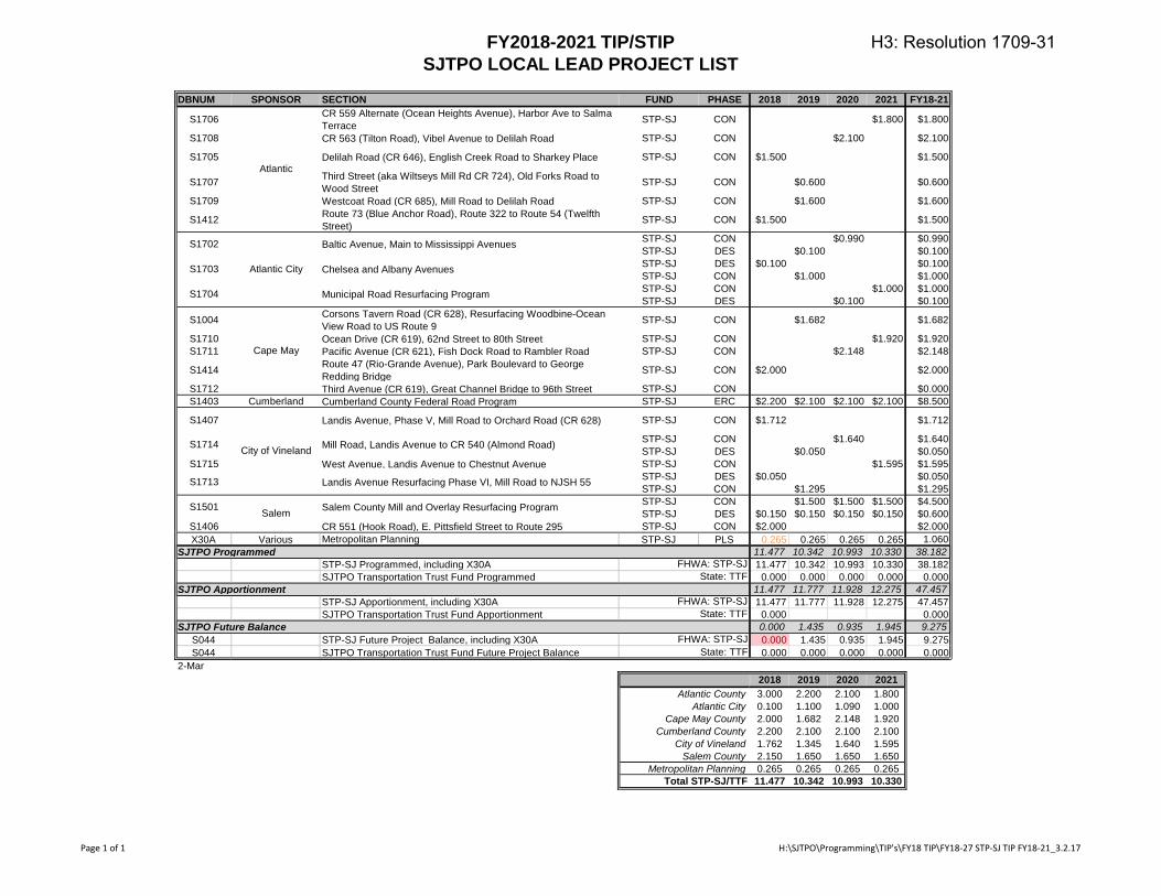
FY2018-2021 TIP/STIP
SJTPO LOCAL LEAD PROJECT LIST
DBNUM SPONSOR SECTION FUND PHASE 2018 2019 2020 2021 FY18-21
S1706 CR 559 Alternate (Ocean Heights Avenue), Harbor Ave to Salma Terrace STP-SJ CON $1.800 $1.800
S1708 CR 563 (Tilton Road), Vibel Avenue to Delilah Road STP-SJ CON $2.100 $2.100
S1705 Delilah Road (CR 646), English Creek Road to Sharkey Place STP-SJ CON $1.500 $1.500
S1707 Third Street (aka Wiltseys Mill Rd CR 724), Old Forks Road to Wood Street STP-SJ CON $0.600 $0.600
S1709 Westcoat Road (CR 685), Mill Road to Delilah Road STP-SJ CON $1.600 $1.600
S1412 Route 73 (Blue Anchor Road), Route 322 to Route 54 (Twelfth Street) STP-SJ CON $1.500 $1.500
STP-SJ CON $0.990 $0.990STP-SJ DES $0.100 $0.100STP-SJ DES $0.100 $0.100STP-SJ CON $1.000 $1.000STP-SJ CON $1.000 $1.000STP-SJ DES $0.100 $0.100
S1004 Corsons Tavern Road (CR 628), Resurfacing Woodbine-Ocean View Road to US Route 9 STP-SJ CON $1.682 $1.682
S1710 Ocean Drive (CR 619), 62nd Street to 80th Street STP-SJ CON $1.920 $1.920S1711 Pacific Avenue (CR 621), Fish Dock Road to Rambler Road STP-SJ CON $2.148 $2.148
S1414 Route 47 (Rio-Grande Avenue), Park Boulevard to George Redding Bridge STP-SJ CON $2.000 $2.000
S1712 Third Avenue (CR 619), Great Channel Bridge to 96th Street STP-SJ CON $0.000S1403 Cumberland Cumberland County Federal Road Program STP-SJ ERC $2.200 $2.100 $2.100 $2.100 $8.500
S1407 Landis Avenue, Phase V, Mill Road to Orchard Road (CR 628) STP-SJ CON $1.712 $1.712
STP-SJ CON $1.640 $1.640STP-SJ DES $0.050 $0.050
S1715 West Avenue, Landis Avenue to Chestnut Avenue STP-SJ CON $1.595 $1.595STP-SJ DES $0.050 $0.050STP-SJ CON $1.295 $1.295STP-SJ CON $1.500 $1.500 $1.500 $4.500STP-SJ DES $0.150 $0.150 $0.150 $0.150 $0.600
S1406 CR 551 (Hook Road), E. Pittsfield Street to Route 295 STP-SJ CON $2.000 $2.000X30A Various Metropolitan Planning STP-SJ PLS 0.265 0.265 0.265 0.265 1.060
SJTPO Programmed 11.477 10.342 10.993 10.330 38.182
STP-SJ Programmed, including X30A 11.477 10.342 10.993 10.330 38.182SJTPO Transportation Trust Fund Programmed 0.000 0.000 0.000 0.000 0.000
SJTPO Apportionment 11.477 11.777 11.928 12.275 47.457
STP-SJ Apportionment, including X30A 11.477 11.777 11.928 12.275 47.457SJTPO Transportation Trust Fund Apportionment 0.000 0.000
SJTPO Future Balance 0.000 1.435 0.935 1.945 9.275
S044 STP-SJ Future Project Balance, including X30A 0.000 1.435 0.935 1.945 9.275S044 SJTPO Transportation Trust Fund Future Project Balance 0.000 0.000 0.000 0.000 0.000
2-Mar2018 2019 2020 2021
3.000 2.200 2.100 1.8000.100 1.100 1.090 1.0002.000 1.682 2.148 1.9202.200 2.100 2.100 2.1001.762 1.345 1.640 1.5952.150 1.650 1.650 1.6500.265 0.265 0.265 0.265
11.477 10.342 10.993 10.330
Cumberland County
City of Vineland
Salem County
Metropolitan Planning
Total STP-SJ/TTF
Cape May County
S1501 Salem Salem County Mill and Overlay Resurfacing Program
FHWA: STP-SJState: TTF
FHWA: STP-SJState: TTF
FHWA: STP-SJState: TTF
Atlantic City
Atlantic County
Atlantic
S1702
Atlantic City
Baltic Avenue, Main to Mississippi Avenues
S1703 Chelsea and Albany Avenues
S1704 Municipal Road Resurfacing Program
Cape May
City of VinelandS1714 Mill Road, Landis Avenue to CR 540 (Almond Road)
S1713 Landis Avenue Resurfacing Phase VI, Mill Road to NJSH 55
Page 1 of 1 H:\SJTPO\Programming\TIP's\FY18 TIP\FY18-27 STP-SJ TIP FY18-21_3.2.17
H3: Resolution 1709-31
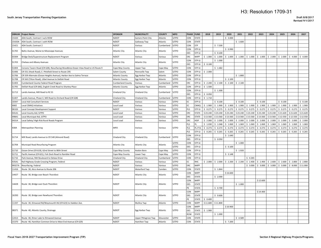
South Jersey Transportation Planning Organization Draft 8/8/2017
Revised 9/1/2017
DBNUM Project Name SPONSOR MUNCIPALITY COUNTY MPO PHASE FUND 2018 2019 2020 2021 2022 2023 2024 2025 2026 2027
15420 ADA South, Contract 1 w/o ROW NJDOT Somers Point City Atlantic SJTPO CON STATE 3.000$
15420A ADA South, Contract 1 with ROW NJDOT Galloway Twp Atlantic SJTPO CON STATE 1.600$
15421 ADA South, Contract 2 NJDOT Various Cumberland SJTPO CON STP 7.500$
CON STP-SJ 0.990$
DES STP-SJ 0.100$
03304 Bridge Deck/Superstructure Replacement Program NJDOT Various Various SJTPO ERC NHPP 1.000$ 1.000$ 1.000$ 1.000$ 1.000$ 1.000$ 2.000$ 2.000$ 4.000$ 4.000$
CON STP-SJ 1.000$
DES STP-SJ 0.100$
S1004 Corsons Tavern Road (CR 628), Resurfacing Woodbine-Ocean View Road to US Route 9 Cape May County Upper Twp Cape May SJTPO CON STP-SJ 1.682$
S1406 CR 551 (Hook Road), E. Pittsfield Street to Route 295 Salem County Pennsville Twp Salem SJTPO CON STP-SJ 2.000$
S1706 CR 559 Alternate (Ocean Heights Avenue), Harbor Ave to Salma Terrace Atlantic County Egg Harbor Twp Atlantic SJTPO CON STP-SJ 1.800$
S1708 CR 563 (Tilton Road), Uibel Avenue to Delilah Road Atlantic County Egg Harbor Twp Atlantic SJTPO CON STP-SJ 2.100$
S1403 Cumberland County Federal Road Program Cumberland County Various Cumberland SJTPO ERC STP-SJ 2.200$ 2.100$ 2.100$ 2.100$
S1705 Delilah Road (CR 646), English Creek Road to Sharkey Place Atlantic County Egg Harbor Twp Atlantic SJTPO CON STP-SJ 1.500$
CON STP-SJ 1.300$
DES STP-SJ 0.050$
S1407 Landis Avenue, Phase V, Mill Road to Orchard Road (CR 628) Vineland City Vineland City Cumberland SJTPO CON STP-SJ 1.710$
10347 Local Aid Consultant Services NJDOT Various Various SJTPO EC STP-SJ 0.100$ 0.100$ 0.100$ 0.100$ 0.100$
X065 Local CMAQ Initiatives Local Lead Various Various SJTPO EC CMAQ 1.900$ 1.900$ 1.900$ 1.900$ 1.900$ 1.900$ 1.900$ 1.900$ 1.900$ 1.900$
06326 Local Concept Development Support NJDOT Various Various SJTPO PLS STP-SJ 0.275$ 0.275$ 0.275$ 0.275$ 0.275$ 0.275$ 0.275$ 0.275$ 0.275$ 0.275$
X41A1 Local County Aid, SJTPO Local Lead Various Various SJTPO ERC STATE 23.240$ 23.240$ 23.240$ 23.240$ 23.240$ 23.240$ 23.240$ 21.620$ 21.620$ 21.620$
X98A1 Local Municipal Aid, SJTPO Local Lead Various Various SJTPO ERC STATE 13.560$ 13.560$ 13.560$ 13.560$ 13.560$ 13.560$ 13.560$ 12.550$ 12.550$ 12.550$
04314 Local Safety/ High Risk Rural Roads Program Local Lead Various Various SJTPO ERC HSIP 2.000$ 2.000$ 2.000$ 2.000$ 2.000$ 2.000$ 2.000$ 2.000$ 2.000$ 2.000$
PLS PL 1.030$ 1.048$ 1.069$ 1.069$ 1.069$ 1.069$ 1.069$ 1.069$ 1.069$ 1.069$
PLS PL-FTA 0.273$ 0.273$ 0.273$ 0.273$ 0.273$ 0.273$ 0.273$ 0.273$ 0.273$ 0.273$
PLS STP-SJ 0.265$ 0.265$ 0.265$ 0.265$ 0.265$ 0.265$ 0.265$ 0.265$ 0.265$ 0.265$
CON STP-SJ 1.640$
DES STP-SJ 0.050$
SJTPO CON STP-SJ 1.000$
SJTPO DES STP-SJ 0.100$
S1710 Ocean Drive (CR 619), 62nd Street to 80th Street Cape May County Avalon Boro Cape May SJTPO CON STP-SJ 1.920$
S1711 Pacific Avenue (CR 621), Fish Dock Road to Rambler Road Cape May County Lower Twp Cape May SJTPO CON STP-SJ 2.148$
S1716 Park Avenue, NW Boulevard to Delsea Drive Vineland City Vineland City Cumberland SJTPO CON STP-SJ 4.265$
X35A1 Rail-Highway Grade Crossing Program, Federal NJDOT Various Various SJTPO EC RHC 2.000$ 2.000$ 2.200$ 2.200$ 2.400$ 2.400$ 2.600$ 2.600$ 2.800$ 2.800$
99327A Resurfacing, Federal NJDOT Various Various SJTPO ERC NHPP 3.000$ 3.000$ 3.000$ 3.000$ 8.000$ 11.000$
11416 Route 30, Atco Avenue to Route 206 NJDOT Waterford Twp Camden SJTPO CON STATE 1.844$
CON NHPP 16.600$
DES STATE 2.000$
CON NHPP 12.600$
DES STATE 1.000$
PE STATE 0.700$
CON NHPP 14.400$
DES STATE 0.600$
PE STATE 0.400$
11337 Route 30, Elmwood Rd/Weymounth Rd (CR 623) to Haddon Ave. NJDOT Mullica Twp Atlantic SJTPO CON NHPP 11.600$ 11.800$
CON NHPP 10.900$
DES STATE 1.900$
ROW STATE 1.000$
12413 Route 40, Elmer Lake to Elmwood Avenue NJDOT Upper Pittsgrove Twp Gloucester SJTPO CON STATE 4.589$
15370 Route 40, Hamilton Common Drive to West End Avenue (CR 629) NJDOT Hamilton Twp Atlantic SJTPO CON STATE 7.200$
S1702 Baltic Avenue, Maine to Mississippi Avenues Atlantic City Atlantic City Atlantic SJTPO
S1713 Landis Avenue, Mill Road to Rt 55 Vineland City Vineland City Cumberland SJTPO
S1703 Chelsea and Albany Avenues Atlantic City Atlantic City Atlantic SJTPO
S1714 Mill Road, Landis Avenue to CR 540 (Almond Road) Vineland City Vineland City Cumberland SJTPO
X30A Metropolitan Planning MPO Various Various SJTPO
SJTPO
14428 Route 30, Bridge over Duck Thorofare NJDOT Atlantic City Atlantic SJTPO
S1704 Municipal Road Resurfacing Program Atlantic City Atlantic City Atlantic
14427 Route 30, Bridge over Beach Thorofare NJDOT Atlantic City Atlantic
08371 Route 40, Atlantic County, Drainage NJDOT Egg Harbor Twp Atlantic SJTPO
16350 Route 30, Bridge over Newfound Thorofare NJDOT Atlantic City Atlantic SJTPO
Fiscal Years 2018-2027 Transportation Improvement Program (TIP) Section II Regional Highway Projects/Programs
H3: Resolution 1709-31
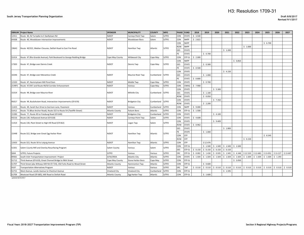
South Jersey Transportation Planning Organization Draft 8/8/2017
Revised 9/1/2017
DBNUM Project Name SPONSOR MUNCIPALITY COUNTY MPO PHASE FUND 2018 2019 2020 2021 2022 2023 2024 2025 2026 2027
12411 Route 40, NJ Turnpike to E Quillytown Rd NJDOT Carneys Point Twp Salem SJTPO CON STATE 3.540$
04308 Route 40, Woodstown Intersection Improvements NJDOT Woodstown Boro Salem SJTPO CON NHPP 2.822$
CON NHPP 6.700$
ROW NHPP 1.000$
DES STATE 1.200$
PE STATE 0.700$
S1414 Route 47 (Rio-Grande Avenue), Park Boulevard to George Redding Bridge Cape May County Wildwood City Cape May SJTPO CON STP-SJ 2.000$
CON NHPP 0.850$
DES STATE 0.300$
PE STATE 0.500$
CON STATE 4.150$
DES STATE 1.000$
PE STATE 0.800$
12320 Route 47, Nummytown Mill Pond Dam NJDOT Middle Twp Cape May SJTPO CON STATE 0.700$
2149F1 Route 47/347 and Route 49/50 Corridor Enhancement NJDOT Various Cape May SJTPO CON CMAQ 7.900$
CON STATE 5.300$
DES STATE 1.100$
ROW STATE 0.050$
CON STATE 7.350$
ROW STATE 2.200$
11423 Route 49, Sarah Run Drive to Garrison Lane, Pavement NJDOT Various Cumberland SJTPO CON NHPP 9.000$
S1412 Route 73 (Blue Anchor Road), Route 322 to Route 54 (Twelfth Street) Atlantic County Folsom Boro Atlantic SJTPO CON STP-SJ 1.500$
15390 Route 77, Route 49 to Friesburg Road (CR 640) NJDOT Bridgeton City Cumberland SJTPO CON STATE 4.100$
93216 Route 130, Hollywood Avenue (CR 618) NJDOT Carneys Point Twp Salem SJTPO CON STATE 4.608$
CON STATE 9.409$
ROW STATE 0.962$
DES STATE 1.800$
PE STATE 1.000$
CON STP 6.545$
ROW STP 0.150$
12433 Route 322, Route 50 to Leipzig Avenue NJDOT Hamilton Twp Atlantic SJTPO CON STP 12.476$
CON STP-SJ 1.500$ 1.500$ 1.500$ 1.500$
DES STP-SJ 0.150$ 0.150$ 0.150$ 0.150$
S044 SJTPO, Future Projects SJTPO Various Various SJTPO ERC STP-SJ 0.002$ 1.430$ 0.935$ 1.945$ 4.348$ 12.520$ 12.683$ 13.052$ 13.227$ 13.607$
09361 South Inlet Transportation Improvement Project SJTA/CRDA Atlantic City Atlantic SJTPO CON STATE 1.504$ 1.504$ 1.504$ 1.504$ 1.504$ 1.504$ 1.504$ 1.504$ 1.193$
S1712 Third Avenue (CR 619), Great Channel Bridge to 96th Street Cape May County Stone Harbor Boro Cape May SJTPO CON STP-SJ 2.050$
S1707 Third Street (aka Wiltseys Mill Rd CR 724), Old Forks Road to Wood Street Atlantic County Hammonton Twp Atlantic SJTPO CON STP-SJ 0.600$
X107 Transportation Alternatives Program NJDOT Various Various SJTPO ERC TAP 0.510$ 0.510$ 0.510$ 0.510$ 0.510$ 0.510$ 0.510$ 0.510$ 0.510$ 0.510$
S1715 West Avenue, Landis Avenue to Chestnut Avenue Vineland City Vineland City Cumberland SJTPO CON STP-SJ 1.595$
S1709 Westcoat Road (CR 685), Mill Road to Delilah Road Atlantic County Egg Harbor Twp Atlantic SJTPO CON STP-SJ 1.600$
updated 8/24/2017
17303 Route 47, Bridge over Dennis Creek NJDOT Dennis Twp Cape May SJTPO
196A5 Route 40/322, Median Closures, Delilah Road to East Fire Road NJDOT Hamilton Twp Atlantic SJTPO
15314 Route 49, Bridge over Maurice River NJDOT Millville City Cumberland SJTPO
16346 Route 47, Bridge over Menantico Creek NJDOT Maurice River Twp Cumberland SJTPO
11414 Route 130, Plant Street to High Hill Road (CR 662) NJDOT Logan Twp Salem SJTPO
95017 Route 49, Buckshutem Road, Intersection Improvements (CR 670) NJDOT Bridgeton City Cumberland SJTPO
SJTPO
S1501 Salem County Mill and Overlay Resurfacing Program Salem County Various Salem SJTPO
15448 Route 322, Bridge over Great Egg Harbor River NJDOT Hamilton Twp Atlantic
Fiscal Years 2018-2027 Transportation Improvement Program (TIP) Section II Regional Highway Projects/Programs
H3: Resolution 1709-31
South Jersey Transportation Planning Organization Draft 8/8/2017
Revised 9/1/2017
DBNUM Project Name SPONSOR MUNCIPALITY COUNTY MPO PHASE FUND 2018 2019 2020 2021 2022 2023 2024 2025 2026 2027
X12 Acquisition of Right of Way NJDOT Various Various Statewide ROW STATE 0.500$ 0.500$ 0.500$ 0.500$ 0.500$ 0.500$ 0.500$ 0.500$ 0.500$ 0.500$
13303 Active Traffic Management System (ATMS) NJDOT Various Various Statewide ERC CMAQ 6.000$ 7.000$ 13.000$
ERC STATE 2.000$ 2.000$ 2.000$ 2.000$ 2.000$ 2.000$ 2.000$ 2.000$ 2.000$ 2.000$
ERC STP 1.000$ 1.000$ 1.000$ 1.000$ 1.000$ 1.000$ 1.000$ 1.000$ 1.000$ 1.000$
16322 ADA South, Contract 5 NJDOT Galloway Twp Atlantic Statewide CON STATE 1.360$
08415 Airport Improvement Program NJDOT Various Various Statewide ERC STATE 4.000$ 4.000$ 4.000$ 4.000$ 4.000$ 4.000$ 4.000$ 4.000$ 4.000$ 4.000$
04311 Asbestos Surveys and Abatements NJDOT Various Various Statewide DES STATE 0.500$ 0.500$ 0.500$ 0.500$ 0.500$ 0.500$ 0.500$ 0.500$ 0.500$ 0.500$
01335 Betterments, Dams NJDOT Various Various Statewide EC STP 0.400$ 0.120$ 0.420$ 0.120$ 0.420$ 0.120$ 0.440$ 0.120$ 0.440$ 0.120$
X72B Betterments, Roadway Preservation NJDOT Various Various Statewide EC STATE 15.000$ 15.000$ 15.000$ 15.000$ 15.000$ 15.000$ 15.000$ 15.000$ 15.000$ 15.000$
X72C Betterments, Safety NJDOT Various Various Statewide EC STATE 10.000$ 10.000$ 10.000$ 10.000$ 10.000$ 10.000$ 10.000$ 10.000$ 10.000$ 10.000$
ERC CMAQ 2.500$ 2.500$ 2.500$ 2.500$ 2.500$ 2.500$ 2.500$ 2.500$ 2.500$ 2.500$
ERC STATE 1.000$ 1.000$ 1.000$ 1.000$ 1.000$ 1.000$ 1.000$ 1.000$ 1.000$ 1.000$
ERC TAP 2.500$ 2.500$ 2.500$ 2.500$ 2.500$ 2.500$ 2.500$ 2.500$ 2.500$ 2.500$
ERC BRIDGE-OFF 1.000$ 1.000$ 1.000$ 1.000$ 1.000$ 1.000$ 1.000$ 1.000$ 1.000$ 1.000$
ERC NHPP 5.100$ 4.000$ 4.000$ 4.000$ 4.000$ 4.000$ 4.000$ 4.000$ 4.000$ 4.000$
98315 Bridge Emergency Repair NJDOT Various Various Statewide EC STATE 50.000$ 55.000$ 55.000$ 55.000$ 55.000$ 55.000$ 55.000$ 55.000$ 55.000$ 55.000$
EC BRIDGE-OFF 3.000$ 7.000$ 3.460$ 7.730$ 3.620$ 8.070$ 3.780$ 8.400$ 3.780$ 8.400$
EC NHPP 14.000$ 12.600$ 12.900$ 11.900$ 14.800$ 13.300$ 14.000$ 13.000$ 16.100$ 14.400$
EC STP 7.750$ 11.100$ 7.140$ 10.270$ 7.680$ 10.930$ 7.820$ 11.200$ 8.520$ 12.100$
14404 Bridge Maintenance and Repair, Movable Bridges NJDOT Various Various Statewide EC STATE 21.600$ 28.500$ 28.500$ 28.500$ 28.500$ 28.500$ 29.456$ 31.004$ 32.629$ 35.836$
ERC NHPP 5.000$ 5.000$ 5.000$ 5.000$ 5.000$ 5.000$ 5.000$ 5.000$ 5.000$ 5.000$
ERC STP 4.000$ 4.000$ 4.000$ 4.000$ 4.000$ 4.000$ 4.000$ 4.000$ 4.000$ 4.000$
ERC NHPP 5.000$ 5.000$ 5.000$ 5.000$ 5.000$ 5.000$ 5.000$ 5.000$ 5.000$ 5.000$
ERC STP 4.000$ 4.000$ 4.000$ 4.000$ 4.000$ 4.000$ 4.000$ 4.000$ 4.000$ 4.000$
X70 Bridge Management System NJDOT Various Various Statewide EC STP 0.950$ 0.950$ 0.950$ 1.000$ 1.000$ 1.000$ 1.000$ 1.050$ 1.050$ 1.050$
EC NHPP 15.000$ 15.000$ 15.000$ 15.000$ 15.000$ 15.000$ 15.000$ 15.000$ 15.000$ 15.000$
EC STATE 25.000$ 30.000$ 30.000$ 30.000$ 30.000$ 30.000$ 30.000$ 30.000$ 30.000$ 30.000$
EC STP 10.000$ 10.000$ 10.000$ 10.000$ 10.000$ 10.000$ 10.000$ 10.000$ 10.000$ 10.000$
08381 Bridge Replacement, Future Projects NJDOT Various Various Statewide ERC NHPP 6.000$ 2.800$ 3.572$ 15.458$ 11.378$ 8.672$ 48.426$ 43.702$ 68.325$ 70.861$
08381 Bridge Replacement, Future Projects NJDOT Various Various Statewide ERC STATE 1.600$ 22.638$ 22.038$ 22.038$ 2.038$ 22.038$ 107.038$ 98.500$ 98.500$ 98.500$
98316 Bridge Scour Countermeasures NJDOT Various Various Statewide ERC NHPP 0.500$ 0.500$ 0.500$ 0.500$ 0.500$ 0.500$ 0.500$ 0.500$ 0.500$ 0.500$
98319 Capital Contract Payment Audits NJDOT Various Various Statewide EC STATE 1.000$ 1.300$ 1.300$ 1.300$ 1.300$ 1.300$ 1.300$ 1.300$ 1.300$ 1.300$
02379 Congestion Relief, Intelligent Transportation System Improvements (Smart Move Program) NJDOT Various Various Statewide ERC STATE 2.000$ 2.000$ 2.000$ 2.000$ 2.000$ 2.000$ 2.000$ 2.000$ 2.000$ 2.000$
02378 Congestion Relief, Operational Improvements (Fast Move Program) NJDOT Various Various Statewide EC STATE 1.000$ 1.000$ 1.000$ 1.000$ 1.000$ 1.000$ 1.000$ 1.000$ 1.000$ 1.000$
X180 Construction Inspection NJDOT Various Various Statewide EC STATE 9.000$ 10.000$ 10.000$ 11.500$ 11.500$ 11.500$ 11.500$ 11.500$ 11.500$ 11.500$
05304 Construction Program IT System (TRNS.PORT) NJDOT Various Various Statewide EC STATE 0.750$ 0.770$ 0.800$ 0.850$ 0.850$ 0.875$ 0.900$ 0.900$ 0.950$ 0.975$
X242 Crash Reduction Program NJDOT Various Various Statewide EC HSIP 5.000$ 5.000$ 5.000$ 5.000$ 5.000$ 5.000$ 5.000$ 5.000$ 5.000$ 5.000$
ERC STATE 2.000$ 2.000$ 2.000$ 2.000$ 2.000$ 2.000$ 2.000$ 2.000$ 2.000$ 2.000$
ERC STP 1.000$ 1.000$ 1.000$ 1.000$ 1.000$ 1.000$ 1.000$ 1.000$ 1.000$ 1.000$
X142 DBE Supportive Services Program NJDOT Various Various Statewide EC STP 0.330$ 0.330$ 0.330$ 0.330$ 0.330$ 0.330$ 0.330$ 0.330$ 0.330$ 0.330$
CON STATE 10.050$
DES STATE 1.200$
PE STATE 1.000$
DES STATE 11.000$ 11.000$ 11.000$ 11.000$ 11.000$ 11.000$ 11.000$ 11.000$ 11.000$ 11.000$
DES STP 1.000$ 1.000$ 1.000$ 1.000$ 1.000$ 1.000$ 1.000$ 1.000$ 1.000$ 1.000$
05342 Design, Geotechnical Engineering Tasks NJDOT Various Various Statewide DES STATE 0.500$ 0.500$ 0.500$ 0.500$ 0.500$ 0.500$
X197 Disadvantaged Business Enterprise NJDOT Various Various Statewide EC STP 0.100$ 0.100$ 0.100$ 0.100$ 0.100$ 0.100$ 0.100$ 0.100$ 0.100$ 0.100$
X154D Drainage Rehabilitation & Improvements NJDOT Various Various Statewide EC STP 5.000$ 5.000$ 5.000$ 5.000$ 5.000$ 5.000$ 5.000$ 5.000$ 5.000$ 5.000$
X154 Drainage Rehabilitation and Maintenance, State NJDOT Various Various Statewide EC STATE 17.000$ 17.000$ 17.000$ 17.000$ 17.000$ 17.000$ 17.000$ 17.000$ 17.000$ 17.000$
X241 Electrical Facilities NJDOT Various Various Statewide EC STATE 7.000$ 7.000$ 7.000$ 7.000$ 7.000$ 7.000$ 7.000$ 7.000$ 7.000$ 7.000$
11344 ADA Curb Ramp Implementation NJDOT Various Various Statewide
03304 Bridge Deck/Superstructure Replacement Program NJDOT Various Various Statewide
X185 Bicycle & Pedestrian Facilities/Accommodations NJDOT Various Various Statewide
17357 Bridge Maintenance Fender Replacement NJDOT Various Various Statewide
X07A Bridge Inspection NJDOT Various Various Statewide
13323 Bridge Preventive Maintenance NJDOT Various Various Statewide
17358 Bridge Maintenance Scour Countermeasures NJDOT Various Various Statewide
15322 Delaware & Raritan Canal Bridges NJDOT Various Mercer Statewide
09316 Culvert Replacement Program NJDOT Various Various Statewide
X106 NJDOTDesign, Emerging Projects Various Various Statewide
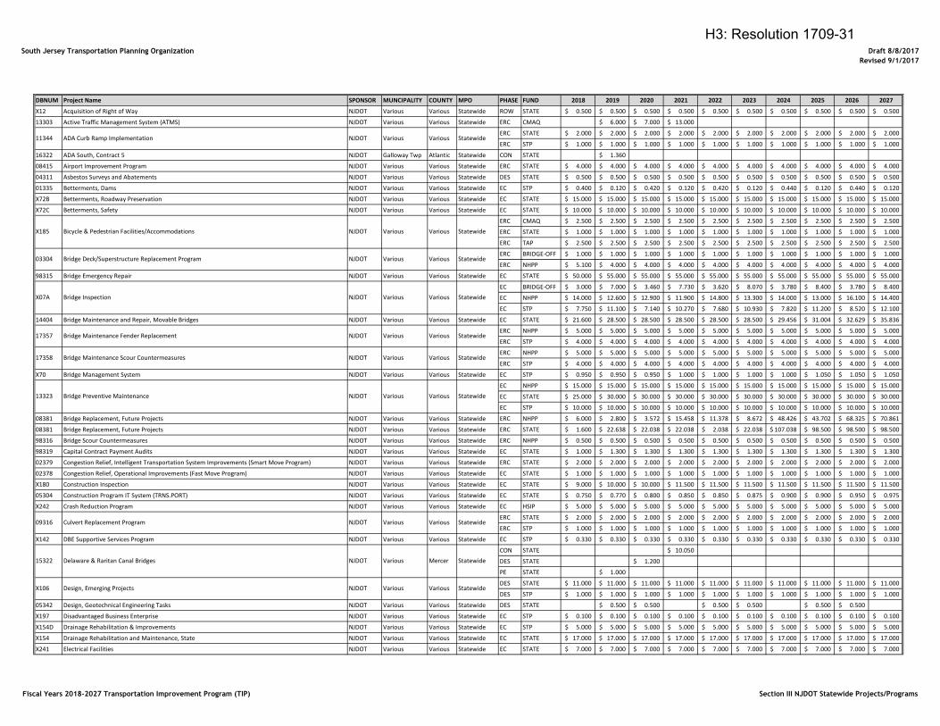
Fiscal Years 2018-2027 Transportation Improvement Program (TIP) Section III NJDOT Statewide Projects/Programs
H3: Resolution 1709-31
South Jersey Transportation Planning Organization Draft 8/8/2017
Revised 9/1/2017
DBNUM Project Name SPONSOR MUNCIPALITY COUNTY MPO PHASE FUND 2018 2019 2020 2021 2022 2023 2024 2025 2026 2027
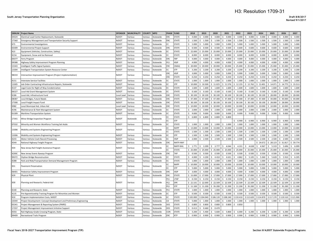
04324 Electrical Load Center Replacement, Statewide NJDOT Various Various Statewide ERC STATE 4.000$ 4.000$ 4.000$ 4.000$ 4.000$ 4.000$ 4.000$ 4.000$ 4.000$ 4.000$
17360 Emergency Management and Transportation Security Support NJDOT Various Various Statewide ERC STATE 1.500$ 1.500$ 1.500$ 1.500$ 1.500$ 1.500$ 1.500$ 1.500$ 1.500$ 1.500$
X75 Environmental Investigations NJDOT Various Various Statewide EC STATE 5.000$ 5.000$ 5.000$ 5.000$ 5.000$ 5.000$ 5.000$ 5.000$ 5.000$ 5.000$
03309 Environmental Project Support NJDOT Various Various Statewide ERC STATE 0.500$ 0.500$ 0.500$ 0.500$ 0.600$ 0.600$ 0.600$ 0.600$ 0.600$ 0.600$
X15 Equipment (Vehicles, Construction, Safety) NJDOT Various Various Statewide EC STATE 22.000$ 25.000$ 25.000$ 25.000$ 25.000$ 25.000$ 25.000$ 25.000$ 25.000$ 25.000$
X15A Equipment, Snow and Ice Removal NJDOT Various Various Statewide EC STATE 8.000$ 8.000$ 8.000$ 8.000$ 8.000$ 8.000$ 8.000$ 8.000$ 8.000$ 8.000$
00377 Ferry Program NJDOT Various Various Statewide ERC FBP 4.000$ 4.000$ 4.000$ 4.000$ 4.000$ 4.000$ 4.000$ 4.000$ 4.000$ 4.000$
09388 Highway Safety Improvement Program Planning NJDOT Various Various Statewide PLS HSIP 4.000$ 4.000$ 4.000$ 4.000$ 4.000$ 4.000$ 4.000$ 4.000$ 4.000$ 4.000$
15343 Intelligent Traffic Signal Systems NJDOT Various Various Statewide ERC CMAQ 20.000$ 20.000$ 20.000$ 20.000$ 25.000$ 25.000$ 25.000$ 25.000$ 25.000$ 25.000$
13304 Intelligent Transportation System Resource Center NJDOT Various Various Statewide EC STP 3.200$ 3.200$ 3.200$ 3.200$ 3.200$ 3.200$ 3.200$ 3.200$ 3.200$ 3.200$
ERC HSIP 3.000$ 5.000$ 5.000$ 5.000$ 5.000$ 5.000$ 5.000$ 5.000$ 5.000$ 5.000$
ERC STATE 0.250$ 0.250$ 0.250$ 0.250$ 0.250$ 0.250$ 0.250$ 0.250$ 0.250$ 0.250$
X151 Interstate Service Facilities NJDOT Various Various Statewide EC STATE 1.000$ 1.000$ 1.000$ 1.000$ 1.000$ 1.000$ 1.000$ 1.000$ 1.000$ 1.000$
13305 Job Order Contracting Infrastructure Repairs, Statewide NJDOT Various Various Statewide EC STP 10.000$ 10.500$ 11.025$ 11.576$ 12.155$ 12.763$ 13.401$ 14.071$ 14.775$ 15.513$
X137 Legal Costs for Right of Way Condemnation NJDOT Various Various Statewide EC STATE 1.600$ 1.600$ 1.600$ 1.600$ 1.600$ 1.600$ 1.600$ 1.600$ 1.600$ 1.600$
06327 Local Aid Grant Management System NJDOT Various Various Statewide EC STATE 0.160$ 0.160$ 0.160$ 0.160$ 0.160$ 0.160$ 0.160$ 0.160$ 0.160$ 0.160$
X186 Local Aid, Infrastructure Fund Local Lead Various Various Statewide ERC STATE 30.100$ 30.100$ 30.100$ 30.100$ 30.100$ 30.100$ 30.100$ 28.000$ 28.000$ 28.000$
08387 Local Bridges, Future Needs NJDOT Various Various Statewide ERC STATE 47.300$ 47.300$ 47.300$ 47.300$ 47.300$ 47.300$ 47.300$ 44.000$ 44.000$ 44.000$
17390 Local Freight Impact Fund NJDOT Various Various Statewide ERC STATE 30.100$ 30.100$ 30.100$ 30.100$ 30.100$ 30.100$ 30.100$ 28.000$ 28.000$ 28.000$
X98Z Local Municipal Aid, Urban Aid Local Lead Various Various Statewide ERC STATE 10.000$ 10.000$ 10.000$ 10.000$ 10.000$ 10.000$ 10.000$ 10.000$ 10.000$ 10.000$
X196 Maintenance & Fleet Management System NJDOT Various Various Statewide EC STATE 2.000$ 2.000$ 2.000$ 2.000$ 2.000$ 2.000$ 2.000$ 2.000$ 2.000$ 2.000$
01309 Maritime Transportation System NJDOT Various Various Statewide EC STATE 9.000$ 9.000$ 9.000$ 9.000$ 9.000$ 9.000$ 9.000$ 9.000$ 9.000$ 9.000$
EC STATE 6.800$ 6.800$ 6.800$ 6.800$
EC STP 6.900$ 6.900$ 6.900$ 6.900$ 6.900$ 6.900$
07332 Minority and Women Workforce Training Set Aside NJDOT Various Various Statewide EC STATE 1.000$ 1.000$ 1.000$ 1.000$ 1.000$ 1.000$ 1.000$ 1.000$ 1.000$ 1.000$
EC NHPP 13.000$ 13.000$ 13.000$ 13.000$ 13.000$ 13.000$ 13.000$ 13.000$ 13.000$ 13.000$
EC STATE 1.500$ 1.500$ 1.500$ 1.500$ 1.500$ 1.500$ 1.500$ 1.500$ 1.500$ 1.500$
13306 Mobility and Systems Engineering Program NJDOT Various Various Statewide EC STP 1.500$ 1.500$ 1.500$ 1.500$ 1.500$ 1.500$ 1.500$ 1.500$ 1.500$ 1.500$
X233 Motor Vehicle Crash Record Processing NJDOT Various Various Statewide EC HSIP 2.000$ 2.500$ 2.500$ 2.500$ 2.500$ 2.500$ 2.500$ 2.500$ 2.500$ 2.500$
X34A National Highway Freight Program NJDOT Various Various Statewide ERC NHFP-HWY 24.672$ 28.123$ 31.817$ 59.774$
EC NHFP-RAIL 1.771$ 3.399$ 3.777$ 4.044$ 4.331$ 4.638$ 4.967$ 5.319$ 5.696$ 6.099$
EC STATE 25.000$ 25.000$ 25.000$ 25.000$ 25.000$ 25.000$ 25.000$ 25.000$ 25.000$ 25.000$
X200C New Jersey Scenic Byways Program NJDOT Various Various Statewide ERC TAP 0.500$ 0.500$ 0.500$ 0.500$ 0.500$ 0.500$ 0.500$ 0.500$ 0.500$ 0.500$
99372 Orphan Bridge Reconstruction NJDOT Various Various Statewide EC STATE 4.000$ 4.200$ 4.410$ 4.631$ 4.862$ 5.105$ 5.360$ 5.628$ 5.910$ 6.205$
X28B Park and Ride/Transportation Demand Management Program NJDOT Various Various Statewide EC STATE 1.000$ 1.000$ 1.000$ 1.000$ 1.000$ 1.000$ 1.000$ 1.000$ 1.000$ 1.000$
EC NHPP 10.000$ 10.000$ 10.000$ 10.000$ 10.000$ 10.000$ 10.000$ 10.000$ 10.000$ 10.000$
EC STP 5.000$ 5.000$ 5.000$ 5.000$ 5.000$ 5.000$ 5.000$ 5.000$ 5.000$ 5.000$
06401 Pedestrian Safety Improvement Program NJDOT Various Various Statewide ERC HSIP 3.000$ 4.000$ 4.000$ 4.000$ 4.000$ 4.000$ 4.000$ 4.000$ 4.000$ 4.000$
X29 Physical Plant NJDOT Various Various Statewide ERC STATE 15.000$ 17.000$ 17.000$ 17.000$ 17.000$ 17.000$ 17.000$ 17.000$ 17.000$ 17.000$
PLS LTAP 0.150$ 0.150$ 0.150$ 0.150$ 0.150$ 0.150$ 0.150$ 0.150$ 0.150$ 0.150$
PLS SPR 21.531$ 22.000$ 22.509$ 22.509$ 22.509$ 22.509$ 22.509$ 22.509$ 22.509$ 22.509$
PLS STP 11.100$ 11.200$ 35.200$ 11.200$ 11.200$ 35.200$ 11.200$ 11.200$ 35.200$ 11.200$
X140 Planning and Research, State NJDOT Various Various Statewide PLS STATE 1.000$ 1.000$ 1.000$ 1.000$ 1.000$ 1.000$ 1.000$ 1.000$ 1.000$ 1.000$
X135 Pre-Apprenticeship Training Program for Minorities and Women NJDOT Various Various Statewide EC STP 0.500$ 0.500$ 0.500$ 0.500$ 0.500$ 0.500$ 0.500$ 0.500$ 0.500$ 0.500$
X10 Program Implementation Costs, NJDOT NJDOT Various Various Statewide EC STATE 102.000$ 104.040$ 106.120$ 108.240$ 110.410$ 112.620$ 114.870$ 117.170$ 119.510$ 121.900$
10344 Project Development: Concept Development and Preliminary Engineering NJDOT Various Various Statewide CD STATE 5.000$ 1.000$ 1.000$ 1.000$ 1.000$ 1.000$ 1.000$ 1.000$ 1.000$ 1.000$
05341 Project Management & Reporting System (PMRS) NJDOT Various Various Statewide DES STATE 0.800$ 0.800$ 0.800$ 0.800$ 0.850$
17337 Project Management Improvement Initiative Support NJDOT Various Various Statewide DES STATE 0.413$ 0.460$ 0.470$
X35A Rail-Highway Grade Crossing Program, State NJDOT Various Various Statewide CON STATE 5.200$ 5.400$ 5.600$ 5.800$ 6.000$ 6.200$ 6.200$ 6.200$ 6.200$ 6.200$
99409 Recreational Trails Program NJDEP Various Various Statewide ERC RTP 0.900$ 0.900$ 0.900$ 0.900$ 0.900$ 0.900$ 0.900$ 0.900$ 0.900$ 0.900$
98333 Intersection Improvement Program (Project Implementation) NJDOT Various Various Statewide
13306 Mobility and Systems Engineering Program NJDOT Various Various Statewide
17341 Minor Bridge Inspection Program NJDOT Statewide Various Statewide
X51 Pavement Preservation NJDOT Various Various Statewide
X34 New Jersey Rail Freight Assistance Program NJDOT Various Various Statewide
X30 Planning and Research, Federal-Aid NJDOT Various Various Statewide
Fiscal Years 2018-2027 Transportation Improvement Program (TIP) Section III NJDOT Statewide Projects/Programs
H3: Resolution 1709-31
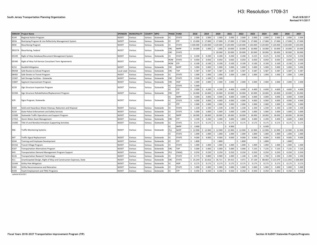
South Jersey Transportation Planning Organization Draft 8/8/2017
Revised 9/1/2017
DBNUM Project Name SPONSOR MUNCIPALITY COUNTY MPO PHASE FUND 2018 2019 2020 2021 2022 2023 2024 2025 2026 2027
X144 Regional Action Program NJDOT Various Various Statewide EC STATE 2.000$ 2.000$ 2.000$ 2.000$ 2.000$ 2.000$ 2.000$ 2.000$ 2.000$ 2.000$
X03A Restriping Program & Line Reflectivity Management System NJDOT Various Various Statewide EC STP 15.000$ 17.000$ 17.000$ 17.000$ 17.000$ 17.000$ 17.000$ 17.000$ 17.000$ 17.000$
X03E Resurfacing Program NJDOT Various Various Statewide EC STATE 100.000$ 120.000$ 120.000$ 120.000$ 120.000$ 120.000$ 120.000$ 120.000$ 120.000$ 120.000$
ERC NHPP 10.000$ 1.000$ 1.000$ 10.000$ 10.000$ 10.000$ 10.000$ 10.000$ 10.000$ 10.000$
ERC STATE 20.000$ 20.000$ 20.000$ 20.000$ 30.000$ 30.000$ 30.000$ 30.000$
05339 Right of Way Database/Document Management System NJDOT Various Various Statewide EC STATE 0.200$ 0.200$ 0.200$ 0.200$ 0.200$ 0.225$ 0.225$ 0.250$ 0.250$ 0.250$
ROW STATE 0.050$ 0.050$ 0.050$ 0.050$ 0.050$ 0.050$ 0.050$ 0.050$ 0.050$ 0.050$
ROW STP 0.100$ 0.100$ 0.100$ 0.100$ 0.100$ 0.100$ 0.100$ 0.100$ 0.100$ 0.100$
X152 Rockfall Mitigation NJDOT Various Various Statewide ERC NHPP 3.000$ 5.000$ 5.000$ 5.000$ 5.000$ 5.000$ 5.000$ 5.000$ 5.000$ 5.000$
99358 Safe Routes to School Program Local Lead Various Various Statewide ERC TAP 5.587$ 5.587$ 5.587$ 5.587$ 5.587$ 5.587$ 5.587$ 5.587$ 5.587$ 5.587$
06402 Safe Streets to Transit Program NJDOT Various Various Statewide EC STATE 1.000$ 1.000$ 1.000$ 1.000$ 1.000$ 1.000$ 1.000$ 1.000$ 1.000$ 1.000$
13307 Salt Storage Facilities - Statewide NJDOT Various Various Statewide ERC STATE 3.500$ 1.500$ 1.500$
15807 Segment Improvement Program NJDOT Various Various Statewide ERC HSIP 2.000$ 2.000$ 2.000$ 2.000$ 2.000$ 2.000$ 2.000$ 2.000$ 2.000$ 2.000$
EC STATE 5.000$
EC STP 2.000$ 4.200$ 4.200$ 4.400$ 4.400$ 4.400$ 4.600$ 4.600$ 4.600$ 4.600$
X239A Sign Structure Rehabilitation/Replacement Program NJDOT Various Various Statewide ERC STP 10.000$ 10.000$ 10.000$ 10.000$ 10.000$ 10.000$ 10.000$ 10.000$ 10.000$ 10.000$
EC NHPP 4.000$ 4.000$ 4.000$ 4.000$ 4.000$ 4.000$ 4.000$ 4.000$ 4.000$ 4.000$
EC STATE 4.000$ 4.000$ 4.000$ 4.000$ 4.000$ 4.000$ 4.000$ 4.000$ 4.000$ 4.000$
EC STP 2.000$ 2.000$ 2.000$ 2.000$ 2.000$ 2.000$ 2.000$ 2.000$ 2.000$ 2.000$
X160 Solid and Hazardous Waste Cleanup, Reduction and Disposal NJDOT Various Various Statewide EC STATE 1.330$ 1.330$ 1.330$ 1.330$ 1.330$ 1.330$ 1.330$ 1.330$ 1.330$ 1.330$
X150 State Police Enforcement and Safety Services NJDOT Various Various Statewide EC STATE 5.000$ 5.000$ 5.000$ 5.000$ 5.000$ 5.000$ 5.000$ 5.000$ 5.000$ 5.000$
13308 Statewide Traffic Operations and Support Program NJDOT Various Various Statewide EC NHPP 18.000$ 18.000$ 18.000$ 18.000$ 18.000$ 18.000$ 18.000$ 18.000$ 18.000$ 18.000$
17353 Storm Water Asset Management NJDOT Various Various Statewide ERC STP 3.100$ 3.260$ 3.400$ 3.600$ 3.800$ 4.000$ 4.200$ 4.400$ 4.600$ 4.800$
14300 Title VI and Nondiscrimination Supporting Activities NJDOT Various Various Statewide EC STATE 0.175$ 0.175$ 0.175$ 0.175$ 0.175$ 0.175$ 0.175$ 0.175$ 0.175$ 0.175$
EC NHPP 3.900$ 4.900$ 6.500$
PLS NHPP 12.900$ 12.900$ 12.900$ 12.900$ 12.900$ 12.900$ 12.900$ 12.900$ 12.900$ 12.900$
EC STATE 1.000$ 1.000$ 1.000$ 1.000$ 1.000$ 1.000$ 1.000$ 1.000$ 1.000$ 1.000$
X47 Traffic Signal Replacement NJDOT Various Various Statewide EC STATE 9.000$ 9.000$ 9.000$ 9.000$ 9.000$ 9.000$ 9.000$ 9.000$ 9.000$ 9.000$
X244 Training and Employee Development NJDOT Various Various Statewide EC STP 1.800$ 1.800$ 1.800$ 1.800$ 1.800$
01316 Transit Village Program NJDOT Various Various Statewide EC STATE 1.000$ 1.000$ 1.000$ 1.000$ 1.000$ 1.000$ 1.000$ 1.000$ 1.000$ 1.000$
X107 Transportation Alternatives Program NJDOT Various Various Statewide ERC TAP 5.000$ 5.000$ 5.000$ 5.000$ 5.000$ 7.235$ 7.235$ 7.235$ 7.235$ 7.235$
X43 Transportation Demand Management Program Support NJDOT Various Various Statewide PLS CMAQ 0.250$ 0.250$ 0.250$ 0.250$ 0.250$ 0.250$ 0.250$ 0.250$ 0.250$ 0.250$
X126 Transportation Research Technology NJDOT Various Various Statewide EC STATE 0.775$ 0.800$ 0.900$ 1.000$ 1.100$ 1.200$ 1.700$ 2.200$ 2.200$ 2.200$
X11 Unanticipated Design, Right of Way and Construction Expenses, State NJDOT Various Various Statewide ERC STATE 25.244$ 32.816$ 36.721$ 34.423$ 4.972$ 27.169$ 88.683$ 115.079$ 111.093$ 106.869$
15344 Utility Pole Mitigation NJDOT Various Various Statewide EC HSIP 0.175$ 0.175$ 0.175$ 0.175$ 0.175$ 0.175$ 0.175$ 0.175$ 0.175$ 0.175$
X182 Utility Reconnaissance and Relocation NJDOT Various Various Statewide EC STATE 5.000$ 5.000$ 5.000$ 5.000$ 5.000$ 5.000$ 5.000$ 5.000$ 5.000$ 5.000$
X199 Youth Employment and TRAC Programs NJDOT Various Various Statewide EC STP 0.350$ 0.350$ 0.350$ 0.350$ 0.350$ 0.350$ 0.350$ 0.350$ 0.350$ 0.350$
updated 8/24/2017
99327A Resurfacing, Federal NJDOT Various Various Statewide
X239 Sign Structure Inspection Program NJDOT Various Various Statewide
05340 Right of Way Full-Service Consultant Term Agreements NJDOT Various Various Statewide
X66 Traffic Monitoring Systems NJDOT Various Various Statewide
X39 Signs Program, Statewide NJDOT Various Various Statewide
Fiscal Years 2018-2027 Transportation Improvement Program (TIP) Section III NJDOT Statewide Projects/Programs
H3: Resolution 1709-31
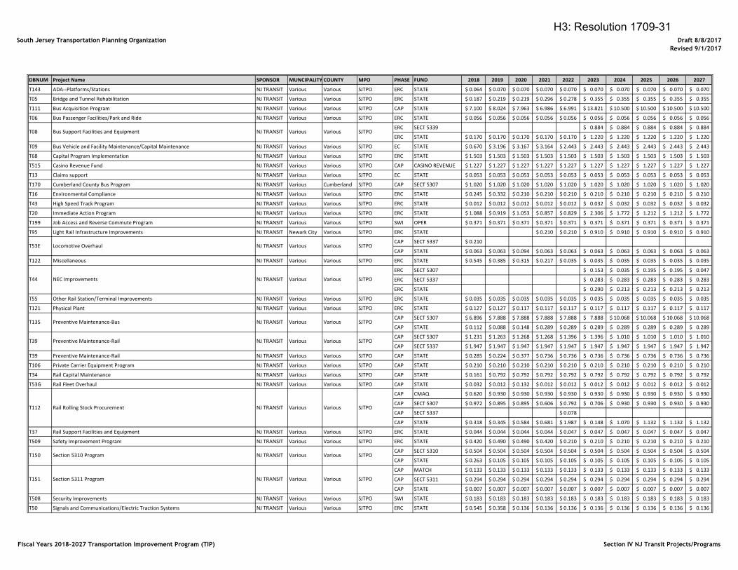
South Jersey Transportation Planning Organization Draft 8/8/2017
Revised 9/1/2017
DBNUM Project Name SPONSOR MUNCIPALITY COUNTY MPO PHASE FUND 2018 2019 2020 2021 2022 2023 2024 2025 2026 2027
T143 ADA--Platforms/Stations NJ TRANSIT Various Various SJTPO ERC STATE 0.064$ 0.070$ 0.070$ 0.070$ 0.070$ 0.070$ 0.070$ 0.070$ 0.070$ 0.070$
T05 Bridge and Tunnel Rehabilitation NJ TRANSIT Various Various SJTPO ERC STATE 0.187$ 0.219$ 0.219$ 0.296$ 0.278$ 0.355$ 0.355$ 0.355$ 0.355$ 0.355$
T111 Bus Acquisition Program NJ TRANSIT Various Various SJTPO CAP STATE 7.100$ 8.024$ 7.963$ 6.986$ 6.991$ 13.821$ 10.500$ 10.500$ 10.500$ 10.500$
T06 Bus Passenger Facilities/Park and Ride NJ TRANSIT Various Various SJTPO ERC STATE 0.056$ 0.056$ 0.056$ 0.056$ 0.056$ 0.056$ 0.056$ 0.056$ 0.056$ 0.056$
ERC SECT 5339 0.884$ 0.884$ 0.884$ 0.884$ 0.884$
ERC STATE 0.170$ 0.170$ 0.170$ 0.170$ 0.170$ 1.220$ 1.220$ 1.220$ 1.220$ 1.220$
T09 Bus Vehicle and Facility Maintenance/Capital Maintenance NJ TRANSIT Various Various SJTPO EC STATE 0.670$ 3.196$ 3.167$ 3.164$ 2.443$ 2.443$ 2.443$ 2.443$ 2.443$ 2.443$
T68 Capital Program Implementation NJ TRANSIT Various Various SJTPO ERC STATE 1.503$ 1.503$ 1.503$ 1.503$ 1.503$ 1.503$ 1.503$ 1.503$ 1.503$ 1.503$
T515 Casino Revenue Fund NJ TRANSIT Various Various SJTPO CAP CASINO REVENUE 1.227$ 1.227$ 1.227$ 1.227$ 1.227$ 1.227$ 1.227$ 1.227$ 1.227$ 1.227$
T13 Claims support NJ TRANSIT Various Various SJTPO EC STATE 0.053$ 0.053$ 0.053$ 0.053$ 0.053$ 0.053$ 0.053$ 0.053$ 0.053$ 0.053$
T170 Cumberland County Bus Program NJ TRANSIT Various Cumberland SJTPO CAP SECT 5307 1.020$ 1.020$ 1.020$ 1.020$ 1.020$ 1.020$ 1.020$ 1.020$ 1.020$ 1.020$
T16 Environmental Compliance NJ TRANSIT Various Various SJTPO ERC STATE 0.245$ 0.332$ 0.210$ 0.210$ 0.210$ 0.210$ 0.210$ 0.210$ 0.210$ 0.210$
T43 High Speed Track Program NJ TRANSIT Various Various SJTPO ERC STATE 0.012$ 0.012$ 0.012$ 0.012$ 0.012$ 0.032$ 0.032$ 0.032$ 0.032$ 0.032$
T20 Immediate Action Program NJ TRANSIT Various Various SJTPO ERC STATE 1.088$ 0.919$ 1.053$ 0.857$ 0.829$ 2.306$ 1.772$ 1.212$ 1.212$ 1.772$
T199 Job Access and Reverse Commute Program NJ TRANSIT Various Various SJTPO SWI OPER 0.371$ 0.371$ 0.371$ 0.371$ 0.371$ 0.371$ 0.371$ 0.371$ 0.371$ 0.371$
T95 Light Rail Infrastructure Improvements NJ TRANSIT Newark City Various SJTPO ERC STATE 0.210$ 0.210$ 0.910$ 0.910$ 0.910$ 0.910$ 0.910$
CAP SECT 5337 0.210$
CAP STATE 0.063$ 0.063$ 0.094$ 0.063$ 0.063$ 0.063$ 0.063$ 0.063$ 0.063$ 0.063$
T122 Miscellaneous NJ TRANSIT Various Various SJTPO ERC STATE 0.545$ 0.385$ 0.315$ 0.217$ 0.035$ 0.035$ 0.035$ 0.035$ 0.035$ 0.035$
ERC SECT 5307 0.153$ 0.035$ 0.195$ 0.195$ 0.047$
ERC SECT 5337 0.283$ 0.283$ 0.283$ 0.283$ 0.283$
ERC STATE 0.290$ 0.213$ 0.213$ 0.213$ 0.213$
T55 Other Rail Station/Terminal Improvements NJ TRANSIT Various Various SJTPO ERC STATE 0.035$ 0.035$ 0.035$ 0.035$ 0.035$ 0.035$ 0.035$ 0.035$ 0.035$ 0.035$
T121 Physical Plant NJ TRANSIT Various Various SJTPO ERC STATE 0.127$ 0.127$ 0.117$ 0.117$ 0.117$ 0.117$ 0.117$ 0.117$ 0.117$ 0.117$
CAP SECT 5307 6.896$ 7.888$ 7.888$ 7.888$ 7.888$ 7.888$ 10.068$ 10.068$ 10.068$ 10.068$
CAP STATE 0.112$ 0.088$ 0.148$ 0.289$ 0.289$ 0.289$ 0.289$ 0.289$ 0.289$ 0.289$
CAP SECT 5307 1.231$ 1.263$ 1.268$ 1.268$ 1.396$ 1.396$ 1.010$ 1.010$ 1.010$ 1.010$
CAP SECT 5337 1.947$ 1.947$ 1.947$ 1.947$ 1.947$ 1.947$ 1.947$ 1.947$ 1.947$ 1.947$
T39 Preventive Maintenance-Rail NJ TRANSIT Various Various SJTPO CAP STATE 0.285$ 0.224$ 0.377$ 0.736$ 0.736$ 0.736$ 0.736$ 0.736$ 0.736$ 0.736$
T106 Private Carrier Equipment Program NJ TRANSIT Various Various SJTPO CAP STATE 0.210$ 0.210$ 0.210$ 0.210$ 0.210$ 0.210$ 0.210$ 0.210$ 0.210$ 0.210$
T34 Rail Capital Maintenance NJ TRANSIT Various Various SJTPO CAP STATE 0.161$ 0.792$ 0.792$ 0.792$ 0.792$ 0.792$ 0.792$ 0.792$ 0.792$ 0.792$
T53G Rail Fleet Overhaul NJ TRANSIT Various Various SJTPO CAP STATE 0.032$ 0.012$ 0.132$ 0.012$ 0.012$ 0.012$ 0.012$ 0.012$ 0.012$ 0.012$
CAP CMAQ 0.620$ 0.930$ 0.930$ 0.930$ 0.930$ 0.930$ 0.930$ 0.930$ 0.930$ 0.930$
CAP SECT 5307 0.972$ 0.895$ 0.895$ 0.606$ 0.792$ 0.706$ 0.930$ 0.930$ 0.930$ 0.930$
CAP SECT 5337 0.078$
CAP STATE 0.318$ 0.345$ 0.584$ 0.681$ 1.987$ 0.148$ 1.070$ 1.132$ 1.132$ 1.132$
T37 Rail Support Facilities and Equipment NJ TRANSIT Various Various SJTPO ERC STATE 0.044$ 0.044$ 0.044$ 0.044$ 0.047$ 0.047$ 0.047$ 0.047$ 0.047$ 0.047$
T509 Safety Improvement Program NJ TRANSIT Various Various SJTPO ERC STATE 0.420$ 0.490$ 0.490$ 0.420$ 0.210$ 0.210$ 0.210$ 0.210$ 0.210$ 0.210$
CAP SECT 5310 0.504$ 0.504$ 0.504$ 0.504$ 0.504$ 0.504$ 0.504$ 0.504$ 0.504$ 0.504$
CAP STATE 0.263$ 0.105$ 0.105$ 0.105$ 0.105$ 0.105$ 0.105$ 0.105$ 0.105$ 0.105$
CAP MATCH 0.133$ 0.133$ 0.133$ 0.133$ 0.133$ 0.133$ 0.133$ 0.133$ 0.133$ 0.133$
CAP SECT 5311 0.294$ 0.294$ 0.294$ 0.294$ 0.294$ 0.294$ 0.294$ 0.294$ 0.294$ 0.294$
CAP STATE 0.007$ 0.007$ 0.007$ 0.007$ 0.007$ 0.007$ 0.007$ 0.007$ 0.007$ 0.007$
T508 Security Improvements NJ TRANSIT Various Various SJTPO SWI STATE 0.183$ 0.183$ 0.183$ 0.183$ 0.183$ 0.183$ 0.183$ 0.183$ 0.183$ 0.183$
T50 Signals and Communications/Electric Traction Systems NJ TRANSIT Various Various SJTPO ERC STATE 0.545$ 0.358$ 0.136$ 0.136$ 0.136$ 0.136$ 0.136$ 0.136$ 0.136$ 0.136$
SJTPO
T08 Bus Support Facilities and Equipment NJ TRANSIT Various Various SJTPO
T53E Locomotive Overhaul NJ TRANSIT Various Various
SJTPO
T44 NEC Improvements NJ TRANSIT Various Various SJTPO
T135 Preventive Maintenance-Bus NJ TRANSIT Various Various
SJTPO
T39 Preventive Maintenance-Rail NJ TRANSIT Various Various SJTPO
T112 Rail Rolling Stock Procurement NJ TRANSIT Various Various
T150 Section 5310 Program
T151 Section 5311 Program
NJ TRANSIT
NJ TRANSIT
Various
Various
Various SJTPO
Various SJTPO
Fiscal Years 2018-2027 Transportation Improvement Program (TIP) Section IV NJ Transit Projects/Programs
H3: Resolution 1709-31
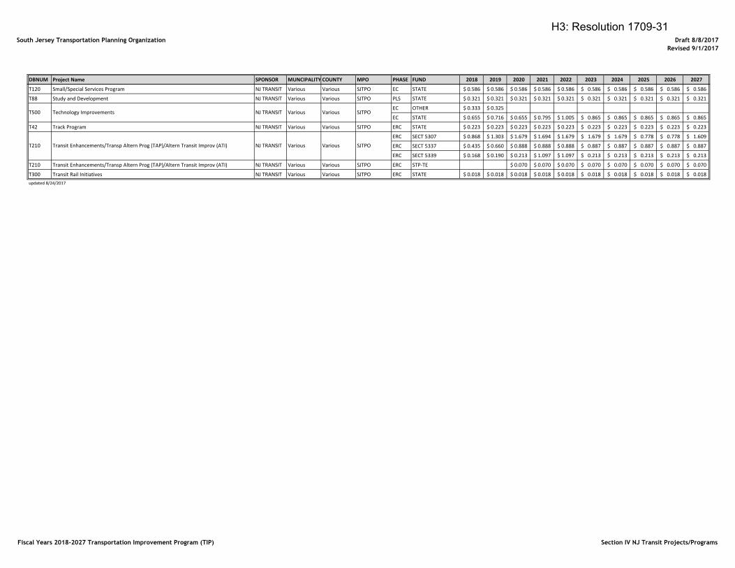
South Jersey Transportation Planning Organization Draft 8/8/2017
Revised 9/1/2017
DBNUM Project Name SPONSOR MUNCIPALITY COUNTY MPO PHASE FUND 2018 2019 2020 2021 2022 2023 2024 2025 2026 2027
T120 Small/Special Services Program NJ TRANSIT Various Various SJTPO EC STATE 0.586$ 0.586$ 0.586$ 0.586$ 0.586$ 0.586$ 0.586$ 0.586$ 0.586$ 0.586$
T88 Study and Development NJ TRANSIT Various Various SJTPO PLS STATE 0.321$ 0.321$ 0.321$ 0.321$ 0.321$ 0.321$ 0.321$ 0.321$ 0.321$ 0.321$
EC OTHER 0.333$ 0.325$
EC STATE 0.655$ 0.716$ 0.655$ 0.795$ 1.005$ 0.865$ 0.865$ 0.865$ 0.865$ 0.865$
T42 Track Program NJ TRANSIT Various Various SJTPO ERC STATE 0.223$ 0.223$ 0.223$ 0.223$ 0.223$ 0.223$ 0.223$ 0.223$ 0.223$ 0.223$
ERC SECT 5307 0.868$ 1.303$ 1.679$ 1.694$ 1.679$ 1.679$ 1.679$ 0.778$ 0.778$ 1.609$
ERC SECT 5337 0.435$ 0.660$ 0.888$ 0.888$ 0.888$ 0.887$ 0.887$ 0.887$ 0.887$ 0.887$
ERC SECT 5339 0.168$ 0.190$ 0.213$ 1.097$ 1.097$ 0.213$ 0.213$ 0.213$ 0.213$ 0.213$
T210 Transit Enhancements/Transp Altern Prog (TAP)/Altern Transit Improv (ATI) NJ TRANSIT Various Various SJTPO ERC STP-TE 0.070$ 0.070$ 0.070$ 0.070$ 0.070$ 0.070$ 0.070$ 0.070$
T300 Transit Rail Initiatives NJ TRANSIT Various Various SJTPO ERC STATE 0.018$ 0.018$ 0.018$ 0.018$ 0.018$ 0.018$ 0.018$ 0.018$ 0.018$ 0.018$
updated 8/24/2017
SJTPO
T500 Technology Improvements NJ TRANSIT Various Various SJTPO
T210 Transit Enhancements/Transp Altern Prog (TAP)/Altern Transit Improv (ATI) NJ TRANSIT Various Various
Fiscal Years 2018-2027 Transportation Improvement Program (TIP) Section IV NJ Transit Projects/Programs
H3: Resolution 1709-31
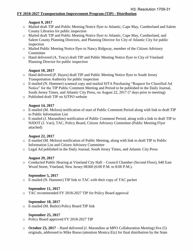
FY 2018-2027 Transportation Improvement Program (TIP) - Distribution
August 9, 2017 o Mailed draft TIP and Public Meeting Notice flyer to Atlantic, Cape May, Cumberland and Salem
County Libraries for public inspection
o Mailed draft TIP and Public Meeting Notice flyer to Atlantic, Cape May, Cumberland, and
Salem County Planning Directors, and Planning Director for City of Atlantic City for public
inspection
o Mailed Public Meeting Notice flyer to Nancy Ridgway, member of the Citizen Advisory
Committee
o Hand delivered (A. Tracy) draft TIP and Public Meeting Notice flyer to City of Vineland
Planning Director for public inspection
August 10, 2017 o Hand delivered (P. Hayes) draft TIP and Public Meeting Notice flyer to South Jersey
Transportation Authority for public inspection
o E-mailed (N. Hammer) scanned copy and mailed SJTA Purchasing “Request for Classified Ad
Notice” for the TIP Public Comment Meeting and Period to be published in the Daily Journal,
South Jersey Times, and Atlantic City Press, on August 22, 2017 (7 days prior to meeting)
o Published draft TIP on SJTPO website
August 14, 2017
o E-mailed (M. Melora) notification of start of Public Comment Period along with link to draft TIP
to Public Information List
o E-mailed (J. Marandino) notification of Public Comment Period, along with a link to draft TIP to
NJDOT (J. Vari), TAC, Policy Board, Citizen Advisory Committee (Public Meeting Flyer
attached)
August 22, 2017
o E-mailed (M. Melora) notification of Public Meeting, along with link to draft TIP to Public
Information List and Citizen Advisory Committee
o Legal Ad published in the Daily Journal, South Jersey Times, and Atlantic City Press
August 29, 2017 o Conducted Public Hearing at Vineland City Hall – Council Chamber (Second Floor), 640 East
Wood Street, Vineland, New Jersey 08360 (6:00 P.M. to 8:00 P.M.).
September 5, 2017 o E-mailed (N. Hammer) TIP link to TAC with their copy of TAC packet
September 11, 2017 o TAC recommended FY 2018-2027 TIP for Policy Board approval
September 18, 2017 o E-mailed (M. Butler) Policy Board TIP link
September 25, 2017 o Policy Board approved FY 2018-2027 TIP
o October 23, 2017 – Hand delivered (J. Marandino at MPO Collaboration Meeting) five (5)
originals, addressed to Mike Russo (attention Monica Etz) for final distribution by the State
H3: Resolution 1709-31
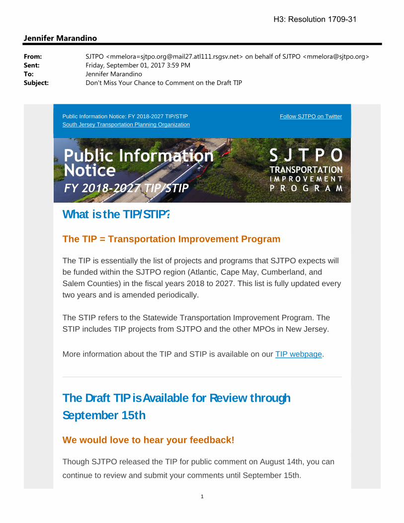
1
Jennifer Marandino
From: SJTPO <[email protected]> on behalf of SJTPO <[email protected]>Sent: Friday, September 01, 2017 3:59 PMTo: Jennifer MarandinoSubject: Don't Miss Your Chance to Comment on the Draft TIP
Public Information Notice: FY 2018-2027 TIP/STIP South Jersey Transportation Planning Organization
Follow SJTPO on Twitter
What is the TIP/STIP?
The TIP = Transportation Improvement Program
The TIP is essentially the list of projects and programs that SJTPO expects will be funded within the SJTPO region (Atlantic, Cape May, Cumberland, and Salem Counties) in the fiscal years 2018 to 2027. This list is fully updated every two years and is amended periodically. The STIP refers to the Statewide Transportation Improvement Program. The STIP includes TIP projects from SJTPO and the other MPOs in New Jersey.
More information about the TIP and STIP is available on our TIP webpage.
The Draft TIP is Available for Review through
September 15th
We would love to hear your feedback!
Though SJTPO released the TIP for public comment on August 14th, you can
continue to review and submit your comments until September 15th.
H3: Resolution 1709-31
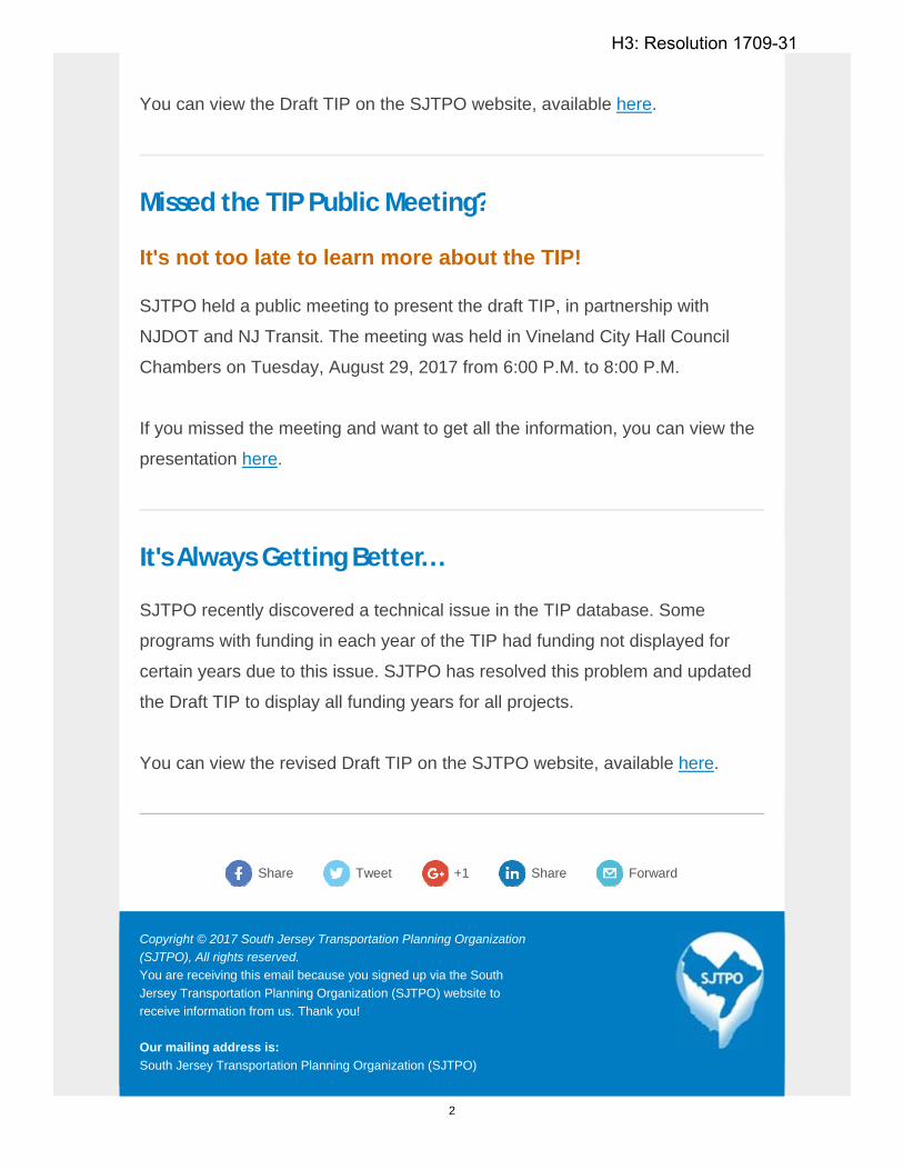
2
You can view the Draft TIP on the SJTPO website, available here.
Missed the TIP Public Meeting?
It's not too late to learn more about the TIP!
SJTPO held a public meeting to present the draft TIP, in partnership with
NJDOT and NJ Transit. The meeting was held in Vineland City Hall Council
Chambers on Tuesday, August 29, 2017 from 6:00 P.M. to 8:00 P.M.
If you missed the meeting and want to get all the information, you can view the
presentation here.
It's Always Getting Better...
SJTPO recently discovered a technical issue in the TIP database. Some
programs with funding in each year of the TIP had funding not displayed for
certain years due to this issue. SJTPO has resolved this problem and updated
the Draft TIP to display all funding years for all projects.
You can view the revised Draft TIP on the SJTPO website, available here.
Share
Tweet
+1 Share Forward
Copyright © 2017 South Jersey Transportation Planning Organization (SJTPO), All rights reserved. You are receiving this email because you signed up via the South Jersey Transportation Planning Organization (SJTPO) website to receive information from us. Thank you! Our mailing address is: South Jersey Transportation Planning Organization (SJTPO)
H3: Resolution 1709-31
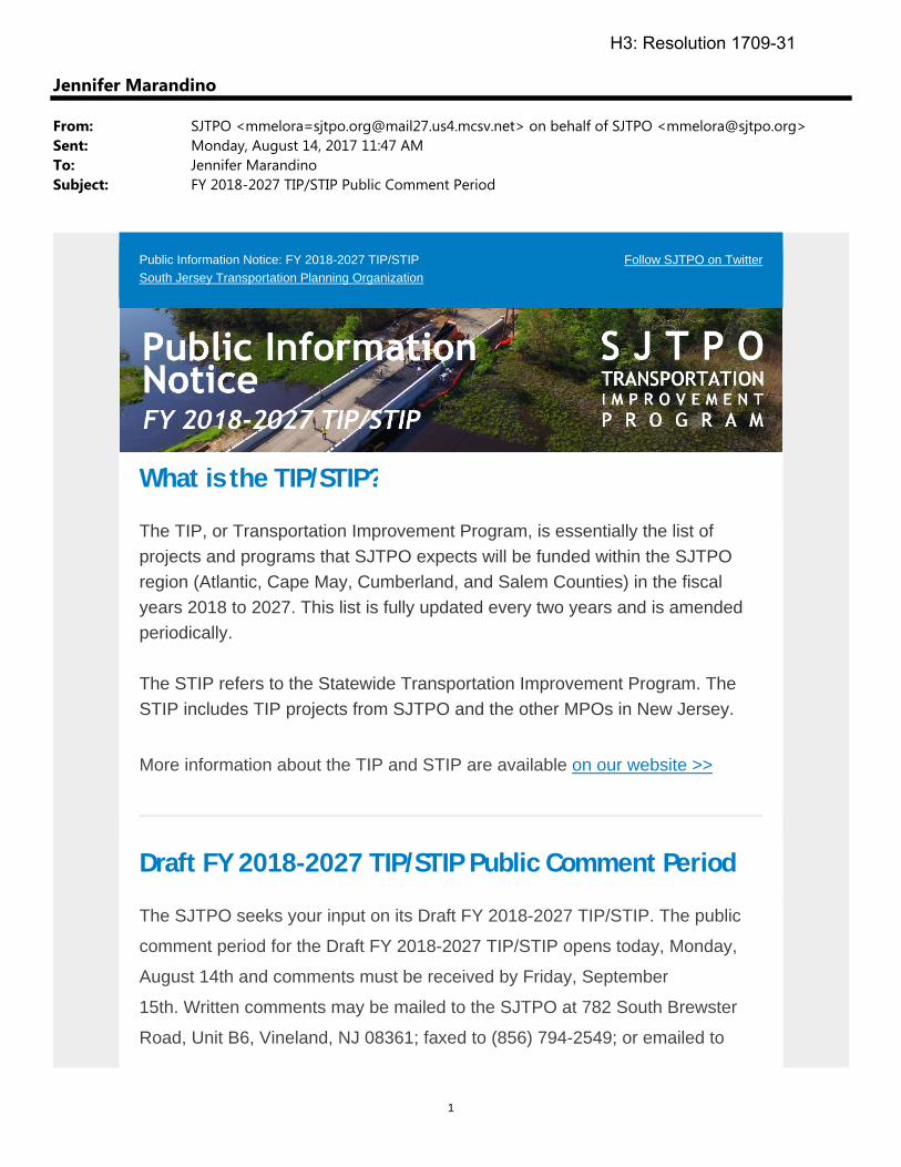
1
Jennifer Marandino
From: SJTPO <[email protected]> on behalf of SJTPO <[email protected]>Sent: Monday, August 14, 2017 11:47 AMTo: Jennifer MarandinoSubject: FY 2018-2027 TIP/STIP Public Comment Period
Public Information Notice: FY 2018-2027 TIP/STIP South Jersey Transportation Planning Organization
Follow SJTPO on Twitter
What is the TIP/STIP?
The TIP, or Transportation Improvement Program, is essentially the list of projects and programs that SJTPO expects will be funded within the SJTPO region (Atlantic, Cape May, Cumberland, and Salem Counties) in the fiscal years 2018 to 2027. This list is fully updated every two years and is amended periodically. The STIP refers to the Statewide Transportation Improvement Program. The STIP includes TIP projects from SJTPO and the other MPOs in New Jersey.
More information about the TIP and STIP are available on our website >>
Draft FY 2018-2027 TIP/STIP Public Comment Period
The SJTPO seeks your input on its Draft FY 2018-2027 TIP/STIP. The public
comment period for the Draft FY 2018-2027 TIP/STIP opens today, Monday,
August 14th and comments must be received by Friday, September
15th. Written comments may be mailed to the SJTPO at 782 South Brewster
Road, Unit B6, Vineland, NJ 08361; faxed to (856) 794-2549; or emailed to
H3: Resolution 1709-31
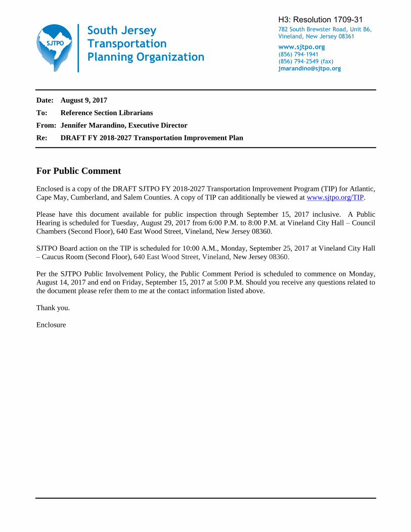
South Jersey Transportation Planning Organization
782 South Brewster Road, Unit B6, Vineland, New Jersey 08361
www.sjtpo.org (856) 794-1941 (856) 794-2549 (fax) [email protected]
Date: August 9, 2017
To: Reference Section Librarians
From: Jennifer Marandino, Executive Director
Re: DRAFT FY 2018-2027 Transportation Improvement Plan
For Public Comment
Enclosed is a copy of the DRAFT SJTPO FY 2018-2027 Transportation Improvement Program (TIP) for Atlantic,
Cape May, Cumberland, and Salem Counties. A copy of TIP can additionally be viewed at www.sjtpo.org/TIP.
Please have this document available for public inspection through September 15, 2017 inclusive. A Public
Hearing is scheduled for Tuesday, August 29, 2017 from 6:00 P.M. to 8:00 P.M. at Vineland City Hall – Council
Chambers (Second Floor), 640 East Wood Street, Vineland, New Jersey 08360.
SJTPO Board action on the TIP is scheduled for 10:00 A.M., Monday, September 25, 2017 at Vineland City Hall
– Caucus Room (Second Floor), 640 East Wood Street, Vineland, New Jersey 08360.
Per the SJTPO Public Involvement Policy, the Public Comment Period is scheduled to commence on Monday,
August 14, 2017 and end on Friday, September 15, 2017 at 5:00 P.M. Should you receive any questions related to
the document please refer them to me at the contact information listed above.
Thank you.
Enclosure
H3: Resolution 1709-31
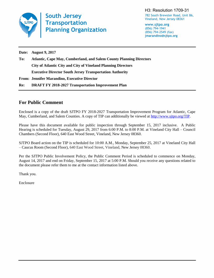
South Jersey Transportation Planning Organization
782 South Brewster Road, Unit B6, Vineland, New Jersey 08361
www.sjtpo.org (856) 794-1941 (856) 794-2549 (fax) [email protected]
Date: August 9, 2017
To: Atlantic, Cape May, Cumberland, and Salem County Planning Directors
City of Atlantic City and City of Vineland Planning Directors
Executive Director South Jersey Transportation Authority
From: Jennifer Marandino, Executive Director
Re: DRAFT FY 2018-2027 Transportation Improvement Plan
For Public Comment
Enclosed is a copy of the draft SJTPO FY 2018-2027 Transportation Improvement Program for Atlantic, Cape
May, Cumberland, and Salem Counties. A copy of TIP can additionally be viewed at http://www.sjtpo.org/TIP.
Please have this document available for public inspection through September 15, 2017 inclusive. A Public
Hearing is scheduled for Tuesday, August 29, 2017 from 6:00 P.M. to 8:00 P.M. at Vineland City Hall – Council
Chambers (Second Floor), 640 East Wood Street, Vineland, New Jersey 08360.
SJTPO Board action on the TIP is scheduled for 10:00 A.M., Monday, September 25, 2017 at Vineland City Hall
– Caucus Room (Second Floor), 640 East Wood Street, Vineland, New Jersey 08360.
Per the SJTPO Public Involvement Policy, the Public Comment Period is scheduled to commence on Monday,
August 14, 2017 and end on Friday, September 15, 2017 at 5:00 P.M. Should you receive any questions related to
the document please refer them to me at the contact information listed above.
Thank you.
Enclosure
H3: Resolution 1709-31
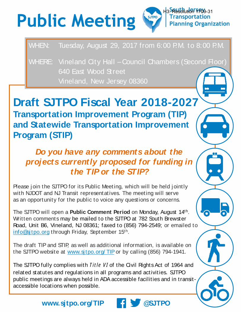
@SJTPO
Draft SJTPO Fiscal Year 2018-2027Transportation Improvement Program (TIP) and Statewide Transportation Improvement Program (STIP)
Do you have any comments about the projects currently proposed for funding in
the TIP or the STIP?
Please join the SJTPO for its Public Meeting, which will be held jointly with NJDOT and NJ Transit representatives. The meeting will serve as an opportunity for the public to voice any questions or concerns.
The SJTPO will open a Public Comment Period on Monday, August 14th. Written comments may be mailed to the SJTPO at 782 South Brewster Road, Unit B6, Vineland, NJ 08361; faxed to (856) 794-2549; or emailed to [email protected] through Friday, September 15th.
The draft TIP and STIP, as well as additional information, is available on the SJTPO website at www.sjtpo.org/TIP or by calling (856) 794-1941.
The SJTPO fully complies with Title VI of the Civil Rights Act of 1964 and related statutes and regulations in all programs and activities. SJTPO public meetings are always held in ADA accessible facilities and in transit-accessible locations when possible.
www.sjtpo.org/TIP
WHEN: Tuesday, August 29, 2017 from 6:00 P.M. to 8:00 P.M.
WHERE: Vineland City Hall – Council Chambers (Second Floor)640 East Wood StreetVineland, New Jersey 08360
H3: Resolution 1709-31
H3: Resolution 1709-31
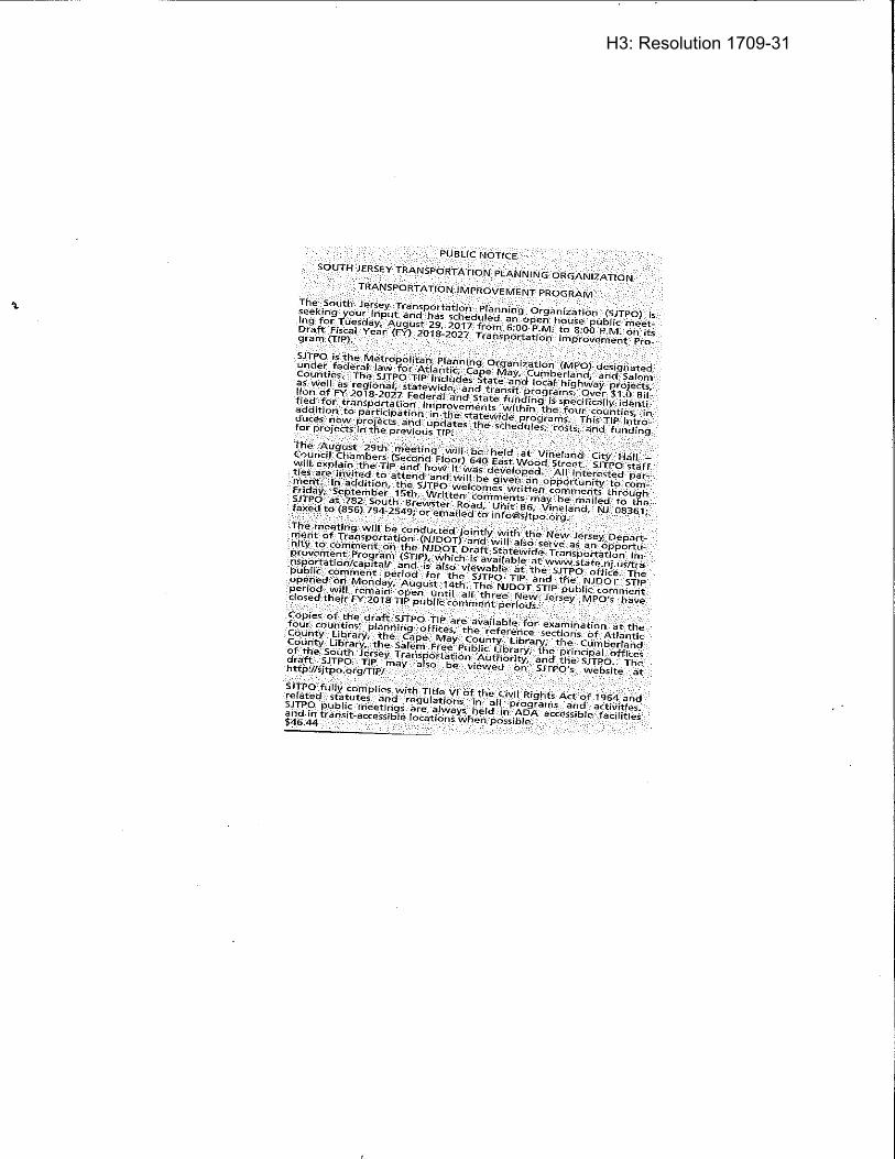
H3: Resolution 1709-31
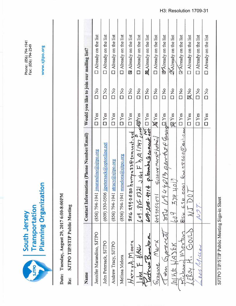
H3: Resolution 1709-31
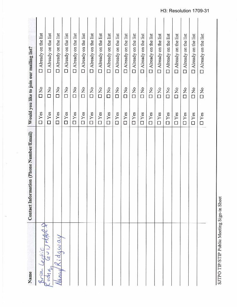
H3: Resolution 1709-31
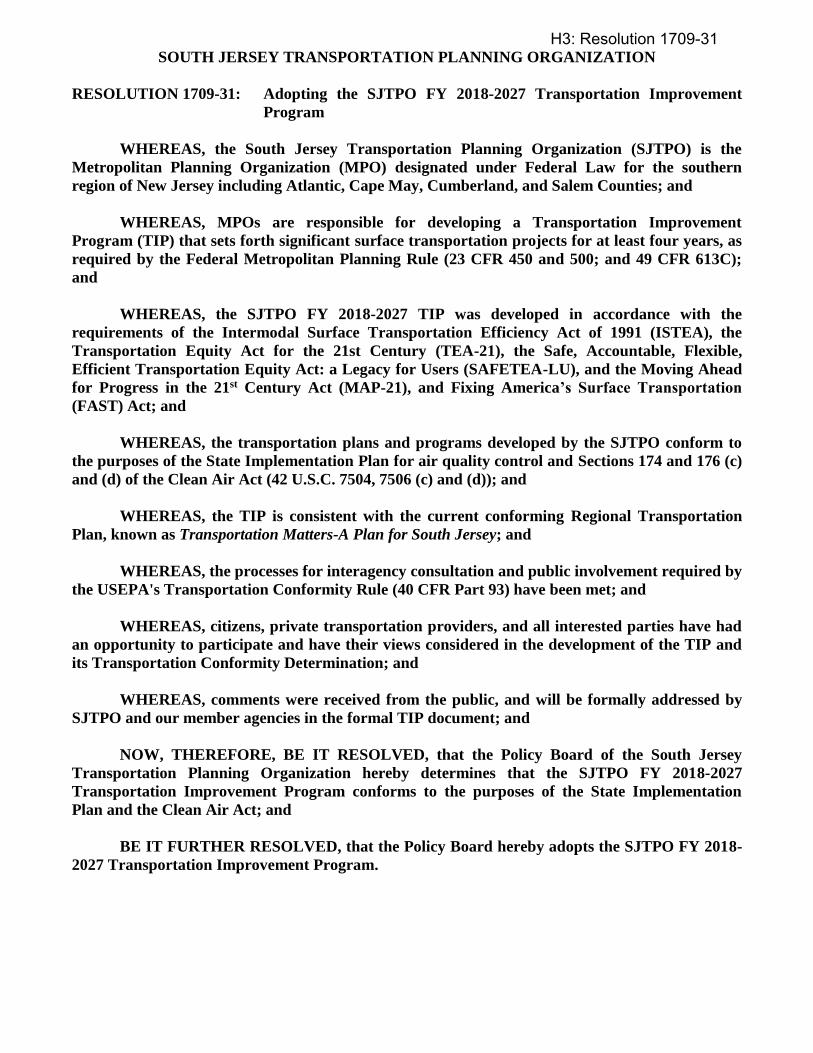
SOUTH JERSEY TRANSPORTATION PLANNING ORGANIZATION
RESOLUTION 1709-31: Adopting the SJTPO FY 2018-2027 Transportation Improvement
Program
WHEREAS, the South Jersey Transportation Planning Organization (SJTPO) is the
Metropolitan Planning Organization (MPO) designated under Federal Law for the southern
region of New Jersey including Atlantic, Cape May, Cumberland, and Salem Counties; and
WHEREAS, MPOs are responsible for developing a Transportation Improvement
Program (TIP) that sets forth significant surface transportation projects for at least four years, as
required by the Federal Metropolitan Planning Rule (23 CFR 450 and 500; and 49 CFR 613C);
and
WHEREAS, the SJTPO FY 2018-2027 TIP was developed in accordance with the
requirements of the Intermodal Surface Transportation Efficiency Act of 1991 (ISTEA), the
Transportation Equity Act for the 21st Century (TEA-21), the Safe, Accountable, Flexible,
Efficient Transportation Equity Act: a Legacy for Users (SAFETEA-LU), and the Moving Ahead
for Progress in the 21st Century Act (MAP-21), and Fixing America’s Surface Transportation
(FAST) Act; and
WHEREAS, the transportation plans and programs developed by the SJTPO conform to
the purposes of the State Implementation Plan for air quality control and Sections 174 and 176 (c)
and (d) of the Clean Air Act (42 U.S.C. 7504, 7506 (c) and (d)); and
WHEREAS, the TIP is consistent with the current conforming Regional Transportation
Plan, known as Transportation Matters-A Plan for South Jersey; and
WHEREAS, the processes for interagency consultation and public involvement required by
the USEPA's Transportation Conformity Rule (40 CFR Part 93) have been met; and
WHEREAS, citizens, private transportation providers, and all interested parties have had
an opportunity to participate and have their views considered in the development of the TIP and
its Transportation Conformity Determination; and
WHEREAS, comments were received from the public, and will be formally addressed by
SJTPO and our member agencies in the formal TIP document; and
NOW, THEREFORE, BE IT RESOLVED, that the Policy Board of the South Jersey
Transportation Planning Organization hereby determines that the SJTPO FY 2018-2027
Transportation Improvement Program conforms to the purposes of the State Implementation
Plan and the Clean Air Act; and
BE IT FURTHER RESOLVED, that the Policy Board hereby adopts the SJTPO FY 2018-
2027 Transportation Improvement Program.
H3: Resolution 1709-31

SOUTH JERSEY TRANSPORTATION PLANNING ORGANIZATION
ITEM 1709-32: Approving the Selection of Michael Baker International, Inc. as the
Consultant for the Ocean Drive (CR 621) Upgrades and Bridge Improvements
Local Concept Development Study
PROPOSAL
At its September 11, 2017 meeting, the Technical Advisory Committee recommended that the Policy
Board approve the selection of Michael Baker International, Inc. in association with WSP, Churchill
Consulting Engineers (DBE), and Richard Grubb & Associates (DBE) for the Ocean Drive (CR 621)
Upgrades and Bridge Improvements Local Concept Development Study.
BACKGROUND
The Request for Proposal (RFP) for the technical study was issued on Thursday, July 6, 2017. With the
request, SJTPO was seeking qualified firm(s) to conduct Local Concept Development (LCD) services for
Ocean Drive (County Road Number 621) from NJ Route 109 to Madison Avenue in Lower Township,
Cape May County. The main objective of the LCD Phase is to identify and compare reasonable
alternatives and strategies that address the requirements of the initial stages of the project delivery process,
and to select a Preliminary Preferred Alternative. The Notice of Availability of Requests was sent to 197
firms.
A total of four (4) proposals were received on Wednesday, August 2nd. Proposals were reviewed and
scored by the TAC-designated Consultant Selection Committee with representatives from Cape May
County, SJTA, and SJTPO. Proposals were evaluated cost-blind, based on the technical approach, firm
and staff qualifications, and DBE participation. Scores for each reviewer were converted to a rank, which
was then averaged amongst all reviewers with Michael Baker International, Inc. emerging as the top-
ranked firm. For this technical study, Michael Baker International, Inc. is partnering with WSP, Churchill
Consulting Engineers (DBE), and Richard Grubb & Associates (DBE).
The scope of work and associated project cost was reviewed and there was no need for negotiations.
Therefore, the proposed cost is $1,250,000.00, with 12.6% DBE participation. This technical study is a
two-year effort with a contract end date of June 28, 2019.
If this contract is awarded, the SJTPO DBE/ESBE participation rate for FY 2018 would be 12.9%
(including other previously approved consultant efforts in July). The attached resolution authorizes the
Executive Director to negotiate minor revisions to the scope of work and fee to best advance the goals and
intent of the project.
This study is to be funded through Task 18/409 with $1,400,000 in available budget. The task was
amended into SJTPO’s UPWP for FY 2018 earlier this year.
H4: Resolution 1709-32

Page 1
INTRODUCTION Michael Baker International, Inc. (Michael Baker) has assembled a strong team with distinctly unique expertise, background, and capability to successfully deliver this high profile and important Local Concept Development (LCD) Study. The Michael Baker Team was assembled to leverage several key advantages to provide the South Jersey Transportation Planning Organization (SJTPO) and Cape May County with a quality project completed on an accelerated schedule. We will meet these goals by relying extensively on our strong project management team, our well documented LCD Study experience including our unique knowledge of NJDOT’s LCD process, our successful completion of nearly all of the coastal bridge projects in New Jersey (predominately in the immediate vicinity of Ocean Drive), and with great relevancy, from the work completed by our major subconsultant WSP USA (WSP, formerly Parsons Brinkerhoff) as part of the previously completed study.
Project Management - Michael Baker’s Mike Sidani will be the Project Manager with assistance from Jim Yeager serving as Deputy Project Manager. Mike and Jim bring unparalleled experience from their recent management of the Oceanic Bridge LCD Study for the North Jersey Transportation Planning Authority (NJTPA) and Monmouth County. They are currently in the final stages of completing the Monmouth County Oceanic Bridge (S-31) LCD Study where they have refined a project approach that will help to streamline project delivery on Ocean Drive. Their recent experience and collaborative efforts on the Oceanic Bridge project will enable greater efficiency and more robust management of the scope of work for the Ocean Drive project. In addition, Mike Sidani has successfully delivered the largest coastal bridge project in the history of New Jersey, the $400M Route 52 Causeway. These examples are just a few advantages that Mike offers on this project.
The LCD Process - In addition to the Oceanic Bridge LCD Study, the Michael Baker Team has documented success completing a number of LCD studies over the past 20+ years. Our practical experience is reinforced by Michael Baker’s staff experience working with the NJDOT Project Management Office in the development of their current project delivery process. Over a period of six years, Michael Baker had staff on-site at NJDOT developing the current Capital Project Delivery Process and continues to work with the Department as they identify additional opportunities to streamline the process. Michael Baker additionally worked closely with the NJDOT Local Aid office in the development of the Local Public Agency Manual which directs the process for advancing projects through Concept Development, Preliminary Engineering, and Final Design, and ultimately through the construction administration process. Coordination with environmental agencies is an integral part of the LCD process and the Michael Baker Team has intimate familiarity and a trusting relationship with key leaders from these agencies.
Relevant Experience - The Michael Baker Team has unmatched experience with advancing the replacement of coastal bridges and water crossing bridges in New Jersey, including the following;
• Ocean Drive (CR 621) Upgrade and Bridge Replacements – Alternatives Analysis Report• Route 52 Causeway Replacement – Final Scoping, Preliminary and Final Design• Monmouth County Oceanic Bridge (S-31) – Local Concept Development Study• Garden State Parkway Great Egg Harbor Bridges – Concept Development, Preliminary Design, and Environmental
Permitting• I-95 Scudder Falls Bridge over the Delaware River Replacement – Preliminary Engineering and Final Design• Avalon Boulevard Bridge Rehabilitation and Widening – Final Design• Nacote Creek Bridge – Feasibility Assessment and Design• Route 50 Tuckahoe River Bridge – Final Design• Ohio Avenue Bridge over the Penrose Canal• Route 4 Bridge over the Passaic River – Concept Development• Emergency Repairs to the Townsends Inlet Bridge• Route 72 Bridge over the Manahawkin Bay – Concept Development/Feasibility Assessment, and Final Design• Garden State Parkway over Mullica River
H4: Resolution 1709-32

Page 2
• Rehabilitation of CR 619 Bridge over Great Channel • Ocean City Longport Bridge Replacement – Preliminary and Final Design • Rehabilitation of the Route 35 Bridge over the Manasquan River - Preliminary and Final Design • Rehabilitation of Roosevelt Boulevard Bridge
The Michael Baker Team brings this extensive experience and know how developed through the successful completion of studies and design on coastal bridges in New Jersey with issues directly aligned with the issues which will be addressed on the Ocean Drive Project.
The Team - The Michael Baker Team includes WSP USA (WSP, formerly Parsons Brinckerhoff), that provides intimate familiarity of the area, as well as specific knowledge of the previous work performed on the Ocean Drive project. As part of the previous study, WSP staff addressed technical elements including; the Identification of Substandard Conditions, Environmental Studies, Geotechnical Investigation, Alignment Development, and Public Outreach. All of these elements were documented in an Alternatives Analysis Report completed in January 2004. WSP staff who completed the document will provide the benefits of their knowledge of the Ocean Drive (CR 621) project to assist the Michael Baker Team in advancing the LCD Study efficiently and aggressively starting on Day One.
Michael Baker and WSP also enjoy a strong collaborative working relationship and have worked together successfully on numerous projects previously. Starting with the Route 21 Viaduct Replacement project in Newark, NJ many years ago, and continuing currently with the advancement of the Pulaski Skyway project, Michael Baker and WSP have an established working relationship and procedures for efficient project delivery including office locations that are a 5-minute drive from each other in Hamilton and Lawrenceville and in adjacent buildings in Newark, NJ. The Team of Michael Baker and WSP is currently advancing the Marine Transportation System Planning Agreement for the NJDOT Office of Maritime Resources.
Overall - This Team has the technical and project management skills, direct project related experience, strong understanding of the LCD Study process, coastal bridge experience, and intimate knowledge of the previous Ocean Drive project. The Michael Baker Team has extensive Cape May County expertise and working relationships which will enable us to hit the ground running on day one with the goal of delivering a well-established Project Purpose and Need, a full range of prudent and feasible alternatives, an alternatives comparison process which provides the appropriate focus on the important issues, and delivers an appropriate, supportable, permittable, and buildable Preliminary Preferred Alternative within fifteen months of Notice to Proceed.
PROJECT UNDERSTANDING Michael Baker understands that on behalf of Cape May County, the SJTPO is seeking to engage the services of a consulting engineering firm to perform a LCD Study for Ocean Drive (CR 621) Upgrades and Bridge Improvements from NJ Route 109 to Madison Avenue in Lower Township, Cape May County as part of the SJTPO FY 2018 Unified Planning Work Program. The major objectives of the LCD Phase are to develop a well-defined and justified Purpose and Need Statement focused on the primary transportation needs to be addressed and to identify and compare prudent and feasible alternatives, which will include bridge replacements, rehabilitation, and ‘no-build’ alternatives. Following a rigorous alternatives development and evaluation, and public outreach process, the effort will culminate in the recommendation of a Preliminary Preferred Alternative (PPA) and advancement of the project to the Local Preliminary Engineering (LPE) phase.
The Ocean Drive causeway has linked the communities of Cape May and the Wildwoods (the Cities of Wildwood and North Wildwood, Wildwood Crest and West Wildwood Boroughs, and Diamond Beach, Lower Township) since 1941. The project limits consist of a 2.7-mile stretch of roadway between NJ Route 109 and Madison Avenue. This route provides a critical link and coastal evacuation route that connects NJ Route 109 and access to the mainland and Garden State Parkway with the barrier island containing the Wildwoods, a popular summer attraction and economic center. This length of roadway includes three bridges over Mill Creek (300’ concrete T-beam bridge), Upper Thorofare (350’ concrete T-beam bridge), and Middle Thorofare (1,039’ that includes a movable bascule span). The Middle Thorofare Bridge serves as the ‘southern gateway’ to the Intracoastal Waterway in New Jersey.
H4: Resolution 1709-32

Page 3
KEY ISSUES
Currently, portions of Ocean Drive are below the 100-year flood zone elevation, and prone to occasional flooding. As it exists today, the roadway could become impassible in a hurricane or significant storm event. Much of the roadbed was constructed at an elevation of 7.5’ on fill in 1940 and has settled to an approximate elevation of 6’, well below the 100-year flood elevation (11’ per the current FEMA Flood Insurance Rate Maps). This presents a major concern as Ocean Drive is a designated emergency coastal evacuation route for the southern end of the Wildwoods. According to a US Army Corps of Engineers report, Cape May County is one of the ten most difficult areas in the United States to evacuate during a hurricane landfall. Ocean Drive is also an important linkage which provides access to the commercial fishing facilities on the mainland side, one of which is considered to be the third largest fishing seafood processing facility on the entire eastern seaboard.
Each of the three bridges within the project limits are structurally deficient and functionally obsolete due to low sufficiency ratings and narrow widths, respectively. Due to its poor condition, the Middle Thorofare Bridge has been downposted, restricting loads to 15 tons, prohibiting bus and truck traffic.
Additionally, the width of the bascule bridge opening is 50’, limiting larger vessels from entering the Intracoastal Waterway. These deficiencies restrict the growth of the nearby commercial fishing industry due to vehicle and vessel size restrictions. The narrow bridge opening has also contributed to three to four large vessels per year colliding with the bridge as they attempt to navigate the channel. The collisions have resulted in the bridge being closed for costly and inconvenient emergency repairs.
Since the Middle Thorofare Bridge is movable, it experiences 20 to 40 openings per day for the passage of maritime traffic including Cape May’s commercial fishing fleet. These openings, which last about 10 minutes each, cause between 200 and 400 minutes of roadway closures each day, causing significant negative impacts to the capacity of this critical travel link. During the summer months, the vehicle demand during peak periods far exceeds the roadway capacity, resulting in unacceptable levels of service and reduced air quality.
Ocean Drive traverses through a very environmentally sensitive area consisting largely of tidal waterways, coastal wetlands, public lands, and habitat for numerous state and federally listed species and is also considered a major migratory bird pathway. Additionally, numerous cultural resources are also present in the study area. The NJ State Historic Preservation Office has identified the Middle Thorofare Bridge as eligible for listing on the National Register of Historic Places.
These and additional key issues are shown on Figure 1: Key Issues (included at the end of this Narrative) and discussed in detail throughout our technical approach.
PREVIOUS EFFORTS The Ocean Drive Upgrade and Bridge Replacement effort was the subject of an earlier comprehensive scoping endeavor. In 1999, Michael Baker Team member, WSP USA (WSP, formerly Parsons Brinckerhoff) was selected to perform a scoping study for the Mill Creek and Upper Thorofare portion of Ocean Drive. The intent of the project was to raise the roadway elevation above the 100-year storm elevation, at the time, to a flood elevation of 9 feet. In 2002, the study was extended to include the Middle Thorofare Bridge and to rehabilitate/replace the functionally obsolete bridges. The study developed a range of horizontal alignments and considered both a low-level movable bridge over Middle Thorofare as well as high-level, long-span alternatives. Based on the Alternatives Matrix, the recommended PPA would not only satisfy the project needs but does so while minimizing various impacts including those to the sensitive environmental, cultural, and socio-economic aspects of the area.
The effort culminated in a 2004 Alternatives Analysis Report, Ocean Drive Upgrade and Bridge Replacements, County Road 621, Lower Township, Cape May County, NJ, prepared by WSP and the selection of a PPA. The PPA selected was a high-level, long-span alternative with an alignment that was to the south of the existing Middle Thorofare Bridge. Before the project was able to advance, the US Fish & Wildlife purchased a parcel of land where the PPA was proposed. As a result, the selected PPA is no longer a viable option and Cape May County has requested a new LCD Study be completed.
The invaluable experience and lessons learned from WSP’s past project will be leveraged during this effort, making the Michael Baker Team well-positioned to assist SJTPO to complete this LCD Study efficiently and expeditiously and advance the project through the Local Concept Development Process.
H4: Resolution 1709-32
Page 4
OUR STUDY APPROACH The SJTPO’s Local Project Delivery Process is intended to advance the goals of the SJTPO Regional Transportation Plan 2040. This process advances projects in a process similar to the Capital Project Delivery Process recently adopted by the NJDOT. Adhering to the prescribed process is vitally important for the project to be considered for Federal funding opportunities.
Michael Baker is uniquely familiar with NJDOT’s Capital Project Delivery Process and has provided on-site engineering consulting services to assist in developing a more efficient, logical and comprehensive Project Delivery Process. As a result of this experience, Michael Baker is intimately familiar with the inter-relationships between the activities required to complete a LCD Study, providing the knowledge which will allow the Michael Baker Team to advance appropriate tasks concurrently, identify critical path tasks, and understand the impacts delayed activities will have on the overall schedule.
The LCD process requires a number of critical activities, including the review of existing conditions and needs assessment, the identification of project stakeholders, development of a purpose and need statement, extensive public outreach, inventory of environmental and regulated resources, development and analysis of alternatives, determination of the required National Environmental Policy Act (NEPA) level of review, and the selection of a PPA. Michael Baker, in coordination with SJTPO, Cape May County and NJDOT (the Project Team), will determine the level of NEPA documentation (i.e., Categorical Exclusion(s), Environmental Assessment with FONSI, or Environmental Impact Statement) for the next phase of work.
In addition to our staff’s expertise and familiarity with the procedures of the standard project delivery process, the Michael Baker Team recognizes that each project comes with a set of unique design challenges and constraints. The Michael Baker Team’s technical staff is aptly qualified and well-suited to tackle the complexity and sensitivity of these challenges. Collectively, Michael Baker and WSP have successfully designed the majority of the coastal bridges in New Jersey, including the Route 52 Causeway Bridge in Ocean City and Somers Point, Great Egg Harbor Bridge, NJ Route 50/Tuckahoe River Bridge, Route 72 over Manahawkin Bay, the Garden State Parkway over Mullica River, and Route 35 Bridge over the Manasquan River. Michael Baker has successfully completed over 50 Concept Development Studies/Feasibility Assessment Studies over the past 25 years which follow the New Jersey Department of Transportation (NJDOT) and Federal Highway Administration (FHWA) capital project delivery process. Together, this team has developed a technical approach that is cost efficient, streamlined and consistent with federal requirements. Throughout this proposal, we will identify strategic opportunities to reduce task durations and in turn, person-hour estimates.
The following concerns specific to the scope of the Ocean Drive LCD Study were identified and considered in the development of Michael Baker’s technical approach to the project:
• Addressing functional and structural deficiencies of existing structures and roadways including substandard roadway design elements, bridge load rating, and the existing narrow (50 foot wide) channel opening width
• Considering the benefits and drawbacks of replacing the existing movable Middle Thoroughfare Bridge with a fixed structure
• Right-of-way and access impacts to adjacent property owners
• Accommodating the seasonal travel demands of the region including vehicular, non-motorized, and maritime traffic
• Environmental constraints due to the proximity of the project to protected habitats and cultural resources
• Hydrological constraints including accommodating a major coastal evacuation route and designing to an elevation above the 100-year floodplain
• Achieving public consensus by addressing the needs of and considering the impacts to the adjacent community and stakeholders affected by the project, including relevant public agencies, local businesses and property owners, the US Coast Guard, and the US Fish and Wildlife Service.
• Obtaining federal funding by advancing the LCD Study in compliance with FHWA, NJDOT, AASHTO and MUTCD guidance and standards
• Addressing SHPO concerns related to Historic Bridges and/or view impacts for Historic Districts
• Maintaining access to existing commercial fishing industry facilities during and post construction
H4: Resolution 1709-32

Page 5
• Preparing an updated Navigational Impact Report
• Establishing navigable channel vertical clearance requirements of fixed bridge alternatives The Michael Baker Team also recognizes that many of the critical activities required for the LCD Study were completed as part of the 2004 Alternatives Analysis Study. Where possible, data, analysis, and conceptual alternatives will be reevaluated from the 2004 Study and used for this LCD Study; however, as over a decade has passed since the completion of the 2004 study, there have been a number of changes which could impact the selection of a PPA including:
• Updated Design Manuals and standards
• New construction techniques and materials
• Changes in property ownership, specifically regarding United States Fish and Wildlife protected lands
• Changes in Base Flood Elevation levels
• New and updated and new state environmental regulations including the Flood Hazard Area Control Act Rules (N.J.A.C. 7:13) and Stormwater Management Rules (N.J.A.C. 7:8);
• Additions to the threatened or endangered species list (Atlantic Sturgeon)
• Updated guidance for developing a Navigation Impact Report
• Changes to the needs of the local businesses, industries, and residents
• Changes to regulatory agencies’ focus, interpretations, and staff
As will be demonstrated in this proposal, the members of the Michael Baker Team, Michael Baker, WSP USA (WSP), Churchill Consulting Engineers (Churchill), and RGA, Inc. (RGA), each have significant experience leading or contributing to the successful completion and advancement of LCD studies in New Jersey for NJDOT, MPOs, and Counties. Based on our experience with other coastal bridges, our team fully understands the unique challenges and constraints. As demonstrated through our Team’s relevant experience, Michael Baker has employed creative structural design techniques, focused on right-sizing project elements, minimized structural footprint, and developed innovative construction staging to deliver projects ahead of schedule, under budget, and limiting community, commercial, and environmental impacts. Given the complexities identified above and other challenges, the Michael Baker Team presents a technical approach that leverages expertise, experience and lessons learned from previous coastal bridge concept development, preliminary engineering, and final design projects to achieve the study goal of selecting and advancing a PPA that addresses the primary transportation and environmental needs, is supported by the public and local officials, and is in compliance with the required standards and guidance to obtain federal funding.
TECHNICAL APPROACH The Michael Baker Team’s Technical Approach complies with the NJDOT Local Concept Development Process. The required activities are presented in five major tasks that reflect broad categories of work, some of which will occur throughout the duration of the LCD process. The five major tasks are:
1. Public Outreach 2. Data Collection 3. Alternatives Analysis 4. Documentation 5. Project Management
TASK 1: PUBLIC OUTREACH
Public outreach and community involvement is an important part of LCD, particularly for bridge replacement projects that can impact access, viewsheds and/or require a detour during construction. The Michael Baker Team understands the importance of identifying and coordinating with local officials, community stakeholders, and the general public to develop a context sensitive design, and avoid project delays. Michael Baker has extensive experience facilitating public outreach efforts and community
H4: Resolution 1709-32

Page 6
involvement events starting in Concept Development and continuing through construction. Michael Baker is currently facilitating robust public outreach efforts for the Oceanic Bridge LCD Study and for the PE/FD phases of the entire Pulaski Skyway Rehabilitation Program, Contracts 5-9.
A. Public Involvement Action Plan
Michael Baker is committed to an open Concept Development process which allows ample opportunity for the community, stakeholders and the Project Team to share information and voice concerns. The first step to achieve this goal is to develop a comprehensive Public Involvement Action Plan (PIAP). The PIAP will include traditional and innovative techniques and strategies for communicating information and soliciting feedback from project stakeholders and the public during the concept development process through construction. Where possible, public involvement efforts completed under the earlier Alternatives Analysis Study will be incorporated and updated. Michael Baker will work to build off of the established stakeholder list and public outreach process findings, incorporating knowledge and expertise that have already been gained so that the study may move forward with the involvement of all affected parties.
The content of the PIAP will include a database of known stakeholders and an outline of anticipated meetings with elected officials, stakeholders and/or the general public. It will also detail public outreach techniques to solicit community feedback, potentially including social media, paper and online surveys, and a project website, and will identify community concerns and strategies to address those concerns. A community profile will also be developed and included as a supplement to the PIAP. The PIAP will be reviewed periodically throughout the concept development process and be updated or revised as needed to maintain open lines of communication with stakeholders and the communities. A draft PIAP will be submitted to the Project Team for review. The draft document will be revised to address Project Team comments and a final version of the document will be provided and uploaded to the project SharePoint site.
B. Local Officials Meetings
To provide opportunity for input from local officials representing municipalities potentially impacted by the project, the Michael Baker Team will, in coordination with the Project Team, coordinate, schedule, and lead four (4) local officials meetings. Local Officials Meetings (LOMs) are an essential task used to encourage input and support from local officials and secure buy-in of alternatives considered and the PPA. It is anticipated that local officials from Cape May County, Lower Township, the City of Cape May, and the Wildwoods will be invited to participate. Local officials from these municipalities will also be invited to participate in Stakeholder Meetings and Public Information Centers. The following describes the anticipated topics and timing of Local Officials Meetings:
• Meeting 1: Project Kickoff – Introduce project and LCD process to local officials
• Meeting 2: End of Data Collection Task – Review Project Fact Sheet, present the draft Purpose and Need Statement, and solicit feedback that will be incorporated in the final Purpose and Need Statement
• Meeting 3: During Alternatives Analysis – Present range of alternatives and solicit feedback that will be incorporated into the draft PPA
• Meeting 4: End of Alternatives Analysis Task – Present the recommended PPA and solicit feedback that will be incorporated into the selected PPA
C. Stakeholder Coordination and Meetings
The Michael Baker Team will, in coordination with the Project Team, identify and reach out to potential project stakeholders. Stakeholders will include concerned and/or affected community organizations and residents, environmental groups, local business organizations, local bicycle and pedestrian advocacy groups, first responders, and other agencies. The Michael Baker Team will coordinate with project stakeholders to obtain input on the project Purpose and Need and developed alternatives. It is anticipated that three (3) Stakeholder Meetings will be held during the LCD process. The format of these meetings are anticipated to be a formal presentation followed by a question and answer session. The following describes the anticipated topics and timing of Community Stakeholder Meetings (CSMs):
• Meeting 1: End of Data Collection Task – Introduce the project and public involvement in the LCD process, Review
H4: Resolution 1709-32

Page 7
Project Fact Sheet, present the draft Purpose and Need Statement, and solicit feedback that will be incorporated in the final Purpose and Need Statement
• Meeting 2: During Alternatives Analysis – Present range of alternatives and solicit feedback that will be incorporated into the draft PPA
• Meeting 3: End of Alternatives Analysis Task – Present the draft PPA and solicit feedback that will be incorporated into the final PPA
In addition to meetings, stakeholder outreach will occur regularly throughout the LCD Study. A stakeholder survey will be developed and distributed to stakeholders and made available to the general public via the project website and/or social media. Stakeholders and the public will have the opportunity to provide comments, feedback, and opinions and voice concerns through the project website or social media. Results of the survey will be analyzed to obtain input and determine primary concerns of stakeholders. Stakeholders will be given the opportunity to participate in surveys.
The Michael Baker Team has significant experience working with stakeholders throughout the planning and design process. As part of the Hackettstown Mobility Improvements Concept Development Study for NJDOT, improvement concepts were revised to reflect the concerns of local businesses and the Hackettstown Historical Society. For the Route 52 Causeway Replacement Project, Michael Baker established a task force during the final scoping phase to allow community feedback for aesthetic design, mobility, circulation, and the environmental process. The Michael Baker Team understands community involvement and ultimately, community approval, is paramount to a successful project.
D. Public Information Centers
The Michael Baker Team will, in coordination with the Project Team, coordinate, arrange, prepare for, facilitate, and document Public Information Centers (PICs). Public Information Centers will be open to all interested parties, and local officials and stakeholders from affected municipalities will be encouraged to attend. The Public Information Centers will follow the format as specified in the PIAP. The format options could include an informal open house session, formal presentations, or a combination of both. The centers could also be a standalone event or can be facilitated as part of another community event to reach larger percentages of the community. The Michael Baker Team will utilize the stakeholder list compiled in the PIAP as the initial channel for notifying the general public of the Public Information Centers. The Michael Baker Team will also work with impacted municipalities and Cape May County to post meeting notices on their respective websites and in public places. It is anticipated that six (6) Public Information Centers will be held: one on either side of the project limits (in Cape May and the Wildwoods) at three times during the LCD Study. The following describes the topics and timing of anticipated Local Officials Meetings:
• Meeting 1: End of Data Collection Task – Introduce the project and LCD process, Review Project Fact Sheet, present the draft Purpose and Need Statement, and solicit feedback that will be incorporated in the final Purpose and Need Statement
• Meeting 2: During Alternatives Analysis – Present range of alternatives and solicit feedback that will be incorporated into the draft PPA
• Meeting 3: End of Alternatives Analysis Task – Present the draft PPA and solicit feedback that will be incorporated into the final PPA
E. Agency Consultation Meetings
To provide opportunity for timely input from regulatory agencies, the Michael Baker Team will, in coordination with the Project Team, establish a technical work group with outside public agencies. The technical work group will consist of representatives of the following agencies:
• US Army Corps of Engineers Regulatory Program Philadelphia District
• NJ Department of Environmental Protection including Division of Land Use Regulation, Division of Fish and Wildlife Endangered and None-Game Species Program, and State Historic Preservation Office.
• National Oceanic and Atmospheric Administration National Marine Fisheries Service
H4: Resolution 1709-32

Page 8
• US Fish and Wildlife Service NJ Field Office and Cape May Wildlife Refuge
• US Coast Guard Bridge Program District 5
• US Environmental Protection Agency
• Federal Highway Authority
The Michael Baker Team is intimately familiar with the above agencies, and has coordinated extensively with agency leadership throughout the development of design on past projects in the area. It is anticipated that four (4) quarterly meetings will be held with the regulatory agencies. These meetings will be used to encourage agency input and secure buy-in of the PPA. Additional meetings will be held with individual agencies, as needed, to address specific concerns. Prior to scheduling the meeting the Michael Baker Team will meet with the SJTPO and the County to develop agendas and review materials.
The anticipated agenda for the four technical work group meetings will generally be as follows:
• Project Introduction and Review Purpose and Need
• Review and Input on Project Alternatives
• Selection of Preliminary Preferred Alternative and Review Permit Requirements
• Review and Develop Mitigation Strategies and NEPA Classification
F. Resolutions of Support
The ultimate goal of the public outreach effort is to generate support in Cape May County and Lower Township, from the stakeholders and residents, culminating with each municipality adopting a resolution of support for the PPA. The Michael Baker Team will support SJTPO and Cape May County by developing and delivering a presentation (Town Hall Presentation) for use at Township and County board meetings and providing relevant information and materials necessary to obtain the resolutions of support. It is anticipated that the project sponsor (Cape May County) will provide a resolution of support for the PPA as well.
G. Public Outreach Summary
The Michael Baker Team will document all public outreach efforts performed during the concept development study and include them as part of the Concept Development Report. The documentation will include meeting minutes, presentation materials, written and oral comments, community feedback, correspondence and the resolutions of support for the PPA.
H. Project Website and Social Media
To maintain open lines of communication throughout the study, a public facing project website will be developed. The website will provide information about the project status, ongoing work, and upcoming public meetings. The website will also be used to provide community access to project online surveys (developed as part of the Stakeholder Coordination subtask) and survey results, as well as project information, including fact sheets, presentations, and upcoming meeting notices. The Michael Baker Team will also monitor the website’s usage and traffic utilizing Google Analytics or a similar program. Google Analytics tracks and reports what website visitors are clicking and how long and how often users visit. The Michael Baker Team will report on website activity monthly. Michael Baker developed public outreach including a website for the Transportation Matters – A Plan for South Jersey, SJTPO’s 2040 Regional Transportation Plan Update.
In addition to a project website, the Michael Baker Team will develop a social media plan to leverage the use of social media as another public outreach channel throughout the LCD process. Michael Baker’s innovative outreach has included utilization of a Twitter account to notify followers of public meetings, construction updates, and traffic incidents along potential diversion routes on behalf of the NJDOT for the Pulaski Skyway Rehabilitation Program. For this study, social media including Facebook, Instagram, and Twitter can be used to keep stakeholders and community members informed about upcoming meetings and study progress. At the end of the concept development study, the Michael Baker Team will turn over all website and social media account materials and any information needed to access and maintain them, to the Project Sponsor.
Task 1 Deliverables • Public Action Plan for the project
H4: Resolution 1709-32

Page 9
• Community Profile
• Meeting materials including handouts, surveys, presentations, and display boards for all meetings
• Meeting minutes for all meetings
• Four Local Officials Meetings
• Three Stakeholder Meetings
• Six Public Information Centers
• Four Agency Consultation Meetings
• One Town Hall presentation
• Resolutions of Support from Lower Township and Cape May County
• Public Outreach Summary for the project
• A Project Website and Social Media Plan for the project
• Monthly website statistic reports for the project
TASK 2: DATA COLLECTION
To the extent possible, the Michael Baker Team will use data collected during the previous 2004 WSP study and leverage team member WSP’s uniquely intimate knowledge of the project to complete data collection and provide a thorough, efficient existing conditions analysis ahead of schedule. Additionally, in anticipation of being selected for this LCD Study and recognizing that time-sensitive data must be collected during the peak summer travel season, the Michael Baker Team began collecting traffic data in early August 2017 to obtain essential peak data that would otherwise need to have waited until summer 2018 to obtain. Through these previous and preemptive efforts, the Michael Baker Team will be primed and ready to initiate execution task activities immediately following notice to proceed. Efforts include obtaining and reviewing existing documentation, verifying, validating and updating, as needed, previously collected project mapping and survey, review and update the Environmental Screening Report, and evaluate site deficiencies. The information will be summarized in an Existing Conditions Report and serve as a primary resource in developing the project formal Purpose and Need Statement.
A. Obtain and Review Existing Documentation
In addition to reviewing the previously completed report, the Michael Baker Team will collect existing data, plans and studies of the project area from the various project stakeholders. This information may include:
• Tax and Right-of-Way Maps
• Research and obtain Deeds
• Zoning and Flood Maps
• Jurisdictional Agreements and Maps
• As-Built and Site Plans
• State and Local Master Plans and Land Use Studies
• Utility Maps
• Traffic Reports and Studies
• Structural Inspection Reports and Inventory and Appraisal sheets
• Straight Line Diagrams and Other Roadway Inventory Data
• Drainage Maps, Soil Surveys and Geodetic Surveys
• Hydrological and Hydraulic Data Reports
• Environmental Landscape Data, Reports and Studies
• Demographic profiles/Environmental Justice Maps and Data
H4: Resolution 1709-32

Page 10
Michael Baker will meet with project stakeholders to gather information relative to issues or problems that they think should be considered in this assessment. Issues that may be identified through this interview process include areas that flood or have poor drainage, unstable embankments or erosion, reoccurring maintenance requirements, issues relating to emergency evacuation needs, first responder access or circulation concerns, needs for improved directional signage, or other issues that may not be obvious to the Project Team. Michael Baker will also obtain data from State, regional, county, and municipal agencies as appropriate.
B. Project Mapping and Survey
Michael Baker Team member, Churchill Consulting Engineers (Churchill), will lead the efforts to validate, verify, and update the survey data obtained in the previous Alternatives Analysis effort, as needed. A preliminary review of the existing mapping against current aerial photography indicates that all areas remain unchanged, with the exception of the Ocean Drive and Route 109 intersection. By utilizing the existing mapping as a base, a tremendous saving in time, survey field work, and costs is achieved.
Churchill will apply ground based surveying and mapping to reflect current conditions by updating and supplementing the previous Concept Development Phase mapping. Equipment with the latest technologies will be efficiently utilized to perform accurate ground based survey and provide positioning of aerial control on universally held datums. Digital scanning capabilities will offer an opportunity to provide a quick and detailed survey grade point cloud for existing improvements that cannot be surveyed conventionally. Churchill will execute fieldwork to achieve unattained mapping details or verification that can eliminate inefficient drafting. An online FTP site will be established to allow the direct exchange and real time assessment of digital data between our field crews and office personnel. Churchill has the state-of-the-art tools and the experienced personnel to satisfy all anticipated survey requests.
Mapping will meet or exceed National Map Accuracy Standards, comply with the NJDOT Photogrammetry Manual, and conform to NJDOT Article 51.
Field surveyors will perform on-site field edits of the photogrammetric base mapping to identify any missing and/or reconstructed surface features. Churchill’s field surveyors will perform supplemental observations, as required, utilizing the control network previously established, a combination of RTK GPS, conventional total station, and high definition laser scanning. The supplemental observations will include identification of existing features (i.e. signs, fences, ground surface types, building types, etc.), surface utilities (i.e. valves, utility poles, hydrants, etc.), and additional ground locations in areas not visible from aerial photography (i.e. top and bottom of curbs, edge of pavements, sidewalks, etc.). Churchill will locate underground utilities by noting the painted markings and flags placed by utility entities. Also, the approximate horizontal locations of overhead wires will be sketched.
All surveying activities along roadways will be performed under an approved NJDOT Access Permit and the necessary Maintenance and Protection of Traffic.
Churchill will obtain record mapping by submitting requests to applicable agencies for information, performing County research, utilizing existing Right-of-Way (ROW) mapping, and reviewing local tax maps. These documents will be evaluated and will assist the field crew in identification of existing monuments. The locations of ROW and parcels will be defined and based on a combination of the recovered monumentation and the deeds/documents received. Adjacent property lines will be depicted by available parcel data from the NJ State Geographic Information Network and cross-checked against municipal tax assessment maps. Parcel lines, ROW lines, and centerline geometry will be overlaid on the topographic mapping. All established baselines will be provided from our documented research. Churchill will provide a table of baseline stations, geometric coordinates (PC, PCC, PT, and PI), equation stations, and ties in DGN format. Tie sketches of all secondary control traverse points set in the field will also be included.
Churchill will map historic Tidelands from NJDEP GIS data. Locations of existing Tidelands instruments (grants, licenses, etc.) will be researched through the Bureau of Tidelands and mapped accordingly. Furthermore, Tidal datums will be surveyed in the project area and provided in table form.
H4: Resolution 1709-32
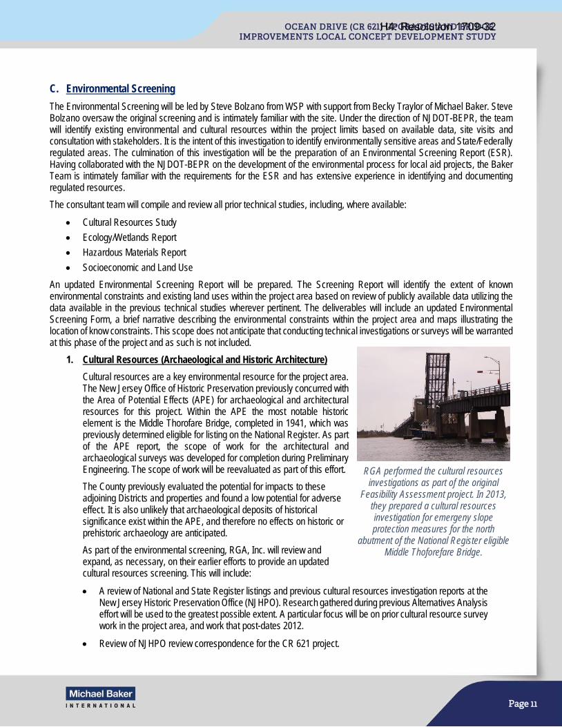
Page 11
C. Environmental Screening
The Environmental Screening will be led by Steve Bolzano from WSP with support from Becky Traylor of Michael Baker. Steve Bolzano oversaw the original screening and is intimately familiar with the site. Under the direction of NJDOT-BEPR, the team will identify existing environmental and cultural resources within the project limits based on available data, site visits and consultation with stakeholders. It is the intent of this investigation to identify environmentally sensitive areas and State/Federally regulated areas. The culmination of this investigation will be the preparation of an Environmental Screening Report (ESR). Having collaborated with the NJDOT-BEPR on the development of the environmental process for local aid projects, the Baker Team is intimately familiar with the requirements for the ESR and has extensive experience in identifying and documenting regulated resources.
The consultant team will compile and review all prior technical studies, including, where available:
• Cultural Resources Study
• Ecology/Wetlands Report
• Hazardous Materials Report
• Socioeconomic and Land Use
An updated Environmental Screening Report will be prepared. The Screening Report will identify the extent of known environmental constraints and existing land uses within the project area based on review of publicly available data utilizing the data available in the previous technical studies wherever pertinent. The deliverables will include an updated Environmental Screening Form, a brief narrative describing the environmental constraints within the project area and maps illustrating the location of know constraints. This scope does not anticipate that conducting technical investigations or surveys will be warranted at this phase of the project and as such is not included.
1. Cultural Resources (Archaeological and Historic Architecture)
Cultural resources are a key environmental resource for the project area. The New Jersey Office of Historic Preservation previously concurred with the Area of Potential Effects (APE) for archaeological and architectural resources for this project. Within the APE the most notable historic element is the Middle Thorofare Bridge, completed in 1941, which was previously determined eligible for listing on the National Register. As part of the APE report, the scope of work for the architectural and archaeological surveys was developed for completion during Preliminary Engineering. The scope of work will be reevaluated as part of this effort.
The County previously evaluated the potential for impacts to these adjoining Districts and properties and found a low potential for adverse effect. It is also unlikely that archaeological deposits of historical significance exist within the APE, and therefore no effects on historic or prehistoric archaeology are anticipated.
As part of the environmental screening, RGA, Inc. will review and expand, as necessary, on their earlier efforts to provide an updated cultural resources screening. This will include:
• A review of National and State Register listings and previous cultural resources investigation reports at the New Jersey Historic Preservation Office (NJHPO). Research gathered during previous Alternatives Analysis effort will be used to the greatest possible extent. A particular focus will be on prior cultural resource survey work in the project area, and work that post-dates 2012.
• Review of NJHPO review correspondence for the CR 621 project.
RGA performed the cultural resources investigations as part of the original
Feasibility Assessment project. In 2013, they prepared a cultural resources investigation for emergeny slope protection measures for the north
abutment of the National Register eligible Middle Thoforefare Bridge.
H4: Resolution 1709-32
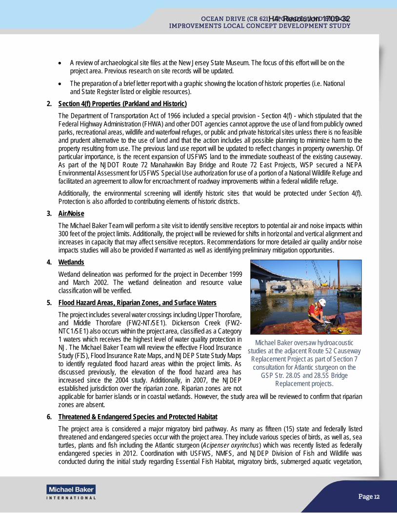
Page 12
• A review of archaeological site files at the New Jersey State Museum. The focus of this effort will be on the project area. Previous research on site records will be updated.
• The preparation of a brief letter report with a graphic showing the location of historic properties (i.e. National and State Register listed or eligible resources).
2. Section 4(f) Properties (Parkland and Historic)
The Department of Transportation Act of 1966 included a special provision - Section 4(f) - which stipulated that the Federal Highway Administration (FHWA) and other DOT agencies cannot approve the use of land from publicly owned parks, recreational areas, wildlife and waterfowl refuges, or public and private historical sites unless there is no feasible and prudent alternative to the use of land and that the action includes all possible planning to minimize harm to the property resulting from use. The previous land use report will be updated to reflect changes in property ownership. Of particular importance, is the recent expansion of USFWS land to the immediate southeast of the existing causeway. As part of the NJDOT Route 72 Manahawkin Bay Bridge and Route 72 East Projects, WSP secured a NEPA Environmental Assessment for USFWS Special Use authorization for use of a portion of a National Wildlife Refuge and facilitated an agreement to allow for encroachment of roadway improvements within a federal wildlife refuge.
Additionally, the environmental screening will identify historic sites that would be protected under Section 4(f). Protection is also afforded to contributing elements of historic districts.
3. Air/Noise
The Michael Baker Team will perform a site visit to identify sensitive receptors to potential air and noise impacts within 300 feet of the project limits. Additionally, the project will be reviewed for shifts in horizontal and vertical alignment and increases in capacity that may affect sensitive receptors. Recommendations for more detailed air quality and/or noise impacts studies will also be provided if warranted as well as identifying preliminary mitigation opportunities.
4. Wetlands
Wetland delineation was performed for the project in December 1999 and March 2002. The wetland delineation and resource value classification will be verified.
5. Flood Hazard Areas, Riparian Zones, and Surface Waters
The project includes several water crossings including Upper Thorofare, and Middle Thorofare (FW2-NT/SE1). Dickenson Creek (FW2-NTC1/SE1) also occurs within the project area, classified as a Category 1 waters which receives the highest level of water quality protection in NJ. The Michael Baker Team will review the effective Flood Insurance Study (FIS), Flood Insurance Rate Maps, and NJDEP State Study Maps to identify regulated flood hazard areas within the project limits. As discussed previously, the elevation of the flood hazard area has increased since the 2004 study. Additionally, in 2007, the NJDEP established jurisdiction over the riparian zone. Riparian zones are not applicable for barrier islands or in coastal wetlands. However, the study area will be reviewed to confirm that riparian zones are absent.
6. Threatened & Endangered Species and Protected Habitat
The project area is considered a major migratory bird pathway. As many as fifteen (15) state and federally listed threatened and endangered species occur with the project area. They include various species of birds, as well as, sea turtles, plants and fish including the Atlantic sturgeon (Acipenser oxyrinchus) which was recently listed as federally endangered species in 2012. Coordination with USFWS, NMFS, and NJDEP Division of Fish and Wildlife was conducted during the initial study regarding Essential Fish Habitat, migratory birds, submerged aquatic vegetation,
Michael Baker oversaw hydroacoustic studies at the adjacent Route 52 Causeway
Replacement Project as part of Section 7 consultation for Atlantic sturgeon on the
GSP Str. 28.0S and 28.5S Bridge Replacement projects.
H4: Resolution 1709-32
Page 13
shellfish leases, state listed species and known nesting sites, and sea turtles. As part of the screening, the Michael Baker Team will verify that the conclusions of this coordination remains valid.
7. Hazardous Waste
A Hazardous Waste Screening was performed as part of the 2004 study. The Michael Baker Team will review the study and update it to reflect current changes in land use. The screening will be completed utilizing federal and state databases, review of Sanborn Maps, and field reconnaissance. Individual property owners and local officials will not be contacted unless directed to do so by the Project Team. Results of this research will be documented in the ESR and will be submitted for review and a determination on the need for a detailed Site Investigation. A Site Investigation with detailed sampling, PAECE reports, or Contamination Clean-up Plan are not completed during the Concept Development Study. However, based upon finding of this study, recommendations for sampling or additional investigation will be provided and documented in the ESR.
8. Socio-economic, Environmental Justice, Land Use, and Community Impacts
The Michael Baker Team will assess potential socio-economic impacts, environmental justice, land use and community impact concerns that may influence the project decision making. The latest available US Census tract data will be used to identify and evaluate any potential environmental justice concerns in accordance with Executive Order 12898. Summary documentation assessing potential socio-economic, environmental justice, land use and community impact considerations, as a result of project activities, will be included in the ESR. Environmental justice communities will be identified early. If they are present, the PIAP will be updated to provide adequate outreach. Based on a preliminary review of available census data, despite being a tourist destination, the City of Wildwood exhibits economic distress characteristics. Data gathered during the previous study also indicate the heavy pedestrian use of the bridge by seasonal workings.
9. Regulatory Approvals, Consultation, and Permits
The Michael Baker Team will review the range of concepts under consideration and identify the potential Federal and State regulatory reviews, coordination and approvals that may be required. Results of the review will be documented in the ESR. In determining regulatory jurisdiction and permitting requirements, additional studies that may be recommended to further identify relevant information affecting jurisdictional determinations and extent of permitting efforts will be documented. Based upon a preliminary review of the project and its location, it is anticipated that numerous federal review and state permit processes will be required and are listed below.
As a requirement of the above permits and approvals, mitigation will ultimately be required. The primary purpose of mitigation is to offset or compensate for the potential for significant environmental harm resulting from impacts attributed to the project. Mitigation may include conservation measures to minimize impacts such as seasonal restrictions on certain activities, such as in-water construction, or other best management practices such as aquatic noise abatement measures to avoid adverse impacts to listed aquatic species. Compensatory mitigation such as land preservation, habitat restoration or creation, or accommodations for enhanced public waterfront access, may also be required. In the event the selected PPA anticipates in excess of 5 acres of impacts to Waters of the US then review by the US Environmental Protection Agency may also be necessary.
H4: Resolution 1709-32

Page 14
D. Navigation Impact Report
Michael Baker will perform a navigational study in accordance with 33 CFR Part 116.01. The “USCG Bridge Program Reasonable Needs of Navigation White Paper” will be utilized as guidance for the study.
A navigation study will be performed to develop a Navigation Impact Report (NIR). The purpose of the NIR is to investigate how the construction and operation of bridge alternatives could affect current and future river navigational uses, and to identify how various bridge options could avoid or minimize such impacts. The Navigational Impact Report will describe the existing conditions of navigation within the study area, outline the purpose and need of the project and detail the alternatives. The report will also include the results of a boat height sensitivity analysis and outline how navigation in the study area may be affected.
Ultimately, the NIR will be submitted to United States Coast Guard (USCG), the federal permitting agency which issues vertical clearance requirement permits for bridges. To ensure the needs of navigation are met, the Coast Guard must approve the dimensions and clearances of the PPA to ensure it does not unreasonably obstruct the current or foreseeable future maritime uses in the study area.
Relying on Michael Baker’s experience with other moveable bridge replacement projects, early coordination with the USCG will be initiated as part of the LCD Study. Michael Baker has successfully worked the USCG to determine the reasonable needs of navigation for the Route 52 Causeway Bridge Replacement project and is currently working with the Harbor Operators Committee and the USCG to obtain a preliminary determination on the vertical clearance for the Monmouth County Oceanic Bridge LCD Study. The Michael Baker Team will apply that lesson to the Ocean Drive LCD Study reducing the anticipated duration for this task.
The reasonable needs of navigation will be assessed and prior navigation studies for this area will be used to document existing conditions. The design depth and width of the channel at the Middle Thorofare Bridge are -12’ (mllw) and 100’, respectively. Figure 2 (included at the end of this Narrative) illustrates existing depths of channels and inlets in the vicinity of the project limits. County and metropolitan planning records will be reviewed to assess potential maritime traffic needs in the future. Additionally, the following data will be collected and analyzed:
• The existing conditions of the navigable channel. Figure 2 (included at the end of this Narrative) shows the most recent bathymetric survey of the navigable channel at the Middle Thorofare Bridge, obtained from the U.S. Army Corps of Engineers.
Michael Baker performed a navigation study in 2016 for the Monmouth County
Oceanic Bridge LCD Study.
Federal Consultation and Authorization • National Environmental Policy Act (NEPA)
Documentation • Section 106 of the National Historic
Preservation Act Consultation • Section 4(f) of the USDOT Act Evaluation • Section 7 of the Endangered Species Act with
USFWS and NMFS • Essential Fish Habitat Consultation
Magnuson-Stevens Fishery Conservation and Management Act NMFS
• US Army Corps of Engineers Permit • US Coast Guard Bridge Permit
State Review and Permits • NJDEP Freshwater Wetlands Protection Act Permit • NJDEP Flood Hazard Area Control Act Compliance • NJDEP Coastal Area Facilities Review Act Permit • NJDEP Coastal Wetlands Act Permit • Cape-Atlantic Soil Conservation District Soil
Erosion and Sediment Control Plan Certification • NJPDES Construction Stormwater General Permit,
Highway General Permit, and Request for Authorization • NJDEP Tidelands Conveyance • NJDEP Waterfront Development Permit • NJ Register of Historic Places Act • NJDEP Stormwater Management Rules (Plan Review
and Approval) • NJDEP Water Quality Certificate • NJDEP Green Acres Program
H4: Resolution 1709-32
Page 15
• Navigable channel jurisdiction (U.S. Army Corps of Engineers or the State of New Jersey maintained)
• Vessel population (type, size and use)
• Existing marina locations upstream and downstream of the Middle Thorofare Bridge
• Existing environmental land uses
• Future plans to improve the channel
• Future development/vessel population - upstream/downstream planned developments/ marinas will be researched in proximal municipalities and in waterfront development permit applications at NJDEP. An estimated number and size of boat slips (amount of personal watercraft, commercial vessels, and larger yachts/sportfishing vessels) will be calculated.
E. Evaluate Site Deficiencies
The Michael Baker Team will review the data, both the previous data and newly collected, to assess the existing transportation system to determine the existence of any controlling substandard design elements (CSDE), structural defects, and traffic operational deficiencies, in accordance with current AASHTO, MUTCD, and NJDOT design standards and guidelines.
This task includes a re-evaluation assessment of existing transportation systems and site conditions and will identify roadway deficiencies. The identified deficiencies will serve as the basis in developing the project Purpose and Need.
Michael Baker will coordinate with the Cape May County Division of Engineering to gather information relative to issues or problems that should be considered in this assessment. The coordination can identify concerns that may not be ascertained from the review of existing records or reports, or readily apparent to the Project Team. The Michael Baker Team will perform site visits to review, verify and document roadway information. Digital photos will be taken to document existing conditions and used to create a Project Fact Sheet.
The following investigations and data collection efforts will be required for performing the appropriate analyses for this project:
1. Traffic and Collision Data
Given the amount of time since the conclusion of the previous study, the Michael Baker Team will develop a traffic data acquisition program that will consist of Automatic Traffic Recorders (ATR) and manual Turning Movement Counts (TMC). Although there are existing 2010, 2014 and 2015 traffic counts within the study area, the time periods of these counts do not accurately reflect the peak and off-peak seasons. However, these previous counts will be reviewed to better understand the overall traffic patterns within the study area. Traffic data will assist in determining existing level of service and delays, forecasting future travel demand, and determining construction detours during alternatives analysis. Data will also assist in identifying potential ITS traffic management strategies to improve operations in the existing and future build conditions. Travel time, speed studies and vehicle-delay data studies will not be performed.
The Michael Baker Team recognizes that peak-season data must be collected during the peak summer season, between Memorial Day weekend and Labor Day weekend. As the anticipated Notice-to-Proceed date of this study is October 2017, the earliest time new peak-season data can be collected will be June 2018. In anticipation of this challenge, the Michael Baker Team began a preliminary traffic data collection program in early August 2017 using Automatic Traffic Recorders to obtain one week of peak-season traffic data that would otherwise need to have waited until summer 2018 to obtain. The traffic data will be used to document existing traffic operations on Ocean Drive and will be included in the existing conditions report. The data will also be considered during the alternatives analysis phase discussed in Task 3.
Michael Baker will install ATRs at the following locations:
1. CR 621 (Ocean Drive) just west of the western Middle Thorofare abutment (MP 1.6) 2. CR 621 (Ocean Drive) just west of the Upper Thorofare Bridge (MP 1.2) 3. CR 621 (Ocean Drive) just west of the Mill Creek Bridge (MP 0.7) 4. Three additional roadways will be counted at locations approved by Cape May County.
H4: Resolution 1709-32
Page 16
Manual Turning Movement Counts will be performed at the following locations:
1. Intersection of CR 621 (Ocean Drive) and NJ 109 2. Two additional intersections will be counted at locations approved by Cape May County.
Michael Baker will perform a total of two 12-hour Bicycle and Pedestrian Counts on the Middle Thorofare Bridge during the peak summer season, one weekday and one weekend.
Crash data for the most recent three years will be obtained from state and municipal sources. A crash analysis and crash diagram will be prepared detailing crash type and, if applicable, an associated sub-standard design element identified in an earlier task. The sub-standard design elements and mitigation measures will be taken into account when developing roadway alternatives.
Locations and travel routes of local emergency services and/or school services will be identified during field visits and through discussions with stakeholders.
2. Structural
This task will involve the review of available structural data and collection of additional field data for the three bridges within the project limits. According to a preliminary review of the 2004 Alternatives Analysis Report, the project includes three structurally deficient bridges: Mill Creek (300’), Upper Thorofare (350’), and Middle Thorofare (1,039’). The Mill Creek and Upper Thorofare Bridges are fixed bridges comprised of four reinforced concrete T-beams, and 12 and 14 spans respectively, each span is 25’ in length. The Middle Thorofare Bridge consists of 21 fixed spans and 1 single leaf movable bascule span. According to the 2004 Report, each of the three bridges were deemed functionally obsolete due to narrow widths, structurally deficient due deteriorated structural elements and low sufficiency ratings; 46.8, 47.3, and 4.0 (out of a possible 100 points) for the bridges over Mill Creek, Upper Thorofare, and Middle Thorofare, respectively. The Middle Thorofare Bridge is also posted due to its inability to carry loads greater than 15 tons. Additionally, the existing 50’ opening (between fenders) of the movable span restricts larger vessels from navigating past the bridge and has contributed to collisions several times each year.
The Michael Baker Team will perform up to three (3) visits to the project area to document existing structural conditions, and mechanical and electrical conditions of the moveable span of the Middle Thorofare Bridge. Notations of existing physical characteristics of the bridge will be made, and any particular problems/opportunities relative to potential improvements will be identified. The following structural information will be evaluated, observed in the field and/or identified during a thorough review of as-built plans, bridge inspection reports, and other documents: • Structural inventory & appraisal rating (SI&A) • Load posting and rating • Structural defects • Structural service life and life cycle • Structural integrity and serviceability • Vertical Clearances
3. Roadway
This task will involve the review of data provided in the 2004 Alternatives Analysis Report and performing additional investigations, including up to two field visits, to evaluate the current condition of the project area. Notations of existing physical characteristics of the road system will be made, and any particular problems/opportunities relative to potential improvements will be identified. Additionally, intersections and pedestrian facilities, including curb ramps will be inventoried and evaluated for compliance with the Americans with Disabilities Act (ADA).
The project limits consist of a 2.7-mile stretch of roadway between NJ Route 109 and Madison Avenue in the Diamond Beach section of Lower Township, Cape May County. The project includes three structurally deficient bridges includes three bridges over Mill Creek (300’), Upper Thorofare (350’), and Middle Thorofare (1,039’). The surface roadway within the project limits consists of a 40’ wide bituminous paved surface consisting of 10’ lanes and 10’ shoulders in each
H4: Resolution 1709-32
Page 17
direction. Each of the three bridges carry two 10’ lanes, no shoulders, and 1’-6” safety walks on each side. A toll booth separates the two travel lanes approximately 35’ east of the movable span of the Middle Thorofare Bridge.
A review of the 2004 Alternatives Analysis Report indicates that the existing roadway within the project limits contains several deficiencies, which include insufficient travel lane width, substandard horizontal curves, substandard profile grades, and a roadway surface elevation below the 100-year floodplain. However, this report used design standards and guidance from publications which have since been updated including the 2001 edition of AASHTO’s “A Policy on Geometric Design of Highways and Streets”. Michael Baker will evaluate these deficiencies, as well as additional applicable roadway data provided in the 2004 Report and obtained from site visits and as-built plans to determine compliance with current design standards and identify additional deficiencies. The following roadway design elements will be documented and evaluated:
• Geometrics – Horizontal and Vertical Alignment Issues with focused consideration of the 100 year flood elevation, Right-of-Way (ROW), and Environmental Impacts
• Typical Sections – Cross slopes, superelevations, and grade transitions
• Lane and Shoulder Widths, Tapers, and Transitions
• Safety/Roadside Design Features (Guiderail and End Treatments, Pavement Drop-offs, Clear Zone Issues, Slope Stabilization, etc.)
• Substandard Stopping Sight Distance
• Location of Driveways, Turnarounds, Slip Ramps, and Other Points of Access
• Right-of-Way and Utility Impacts
• Signing, Striping, Delineation, and RPMS
• Toll plaza replacement
• Impacts of structural vertical clearance on roadway geometry
4. Stormwater Management/Drainage
Michael Baker will obtain existing data, plans and studies of the project area from the various project stakeholders to evaluate site deficiencies in drainage and stormwater management design. In addition to conducting field visits during both wet and dry conditions, Michael Baker will describe drainage system defects, drainage areas, and flooding conditions as follows:
Drainage System Defects and Best Management Practices (BMPs)
Michael Baker will evaluate the existing drainage and stormwater management system to locate drainage structures and critical facilities such as the existing pipe culvert west of Fish Dock Road controlling freshwater and saltwater interaction. Due to our knowledge of the project, we know the culvert is a gathering place for recreational fishing and crabbing. This culvert is the only waterway that permits water to flow from the east side of Ocean Drive to the west side during tidal changes. The pipe is undersized and typically has water flowing through it at a high velocity. The County considers it a safety hazard and has identified it for replacement within this project. Michael Baker will also identify discharge locations within the project area.
Drainage Areas
Michael Baker will delineate the drainage areas and identify the land use and soil types for the existing conditions within the project area. Potential changes to drainage area properties, as a result of proposed concepts, will be noted in the alternatives analysis. Based on our preliminary evaluation, the project is located within a tidal Flood Hazard Area.
Flooding
Michael Baker will review information provided by Cape May County, local businesses, and residents to evaluate documented incidents of roadway flooding. Michael Baker will perform a field visit during or shortly following a storm event, if feasible, to identify roadway ponding areas within the project area. It is important to note the new preliminary
H4: Resolution 1709-32

Page 18
base flood elevation of 11’ NAVD 88 as it has risen by 2 feet since the previous concept development study was evaluated.
5. Geotechnical/Pavement
Michael Baker will obtain existing data, plans and studies of the project area from the following sources:
• Geotechnical Information in Technical Addendums for Ocean Drive Upgrade & Bridge Replacements
• NJDOT Geotechnical Data Management System online records, (i.e., Cape May Canal Bridge (North Shore Road), Route 47 Bridge (Rio Grande Road))
• Engineering Soil Survey Report (Rutgers)
• New Jersey Geological Survey Publications: Surficial Geology Maps and Bedrock Geology Maps
• As-Built Plans
• Michael Baker Team’s projects in the adjacent area
For this LCD Study, Michael Baker will use the existing subsurface information to evaluate the proposed foundation types. After an initial review already performed, Michael Baker has determined that existing soil borings satisfy the subsurface data needed and performing new soil borings will not be required as part of this effort. The scour design previously completed can be re-examined leveraging the Michael Baker Team’s knowledge of the project to ascertain a concept level understanding of the scour potential at the project site. This step will also solidify the steps need during preliminary engineering for computing and finalizing the foundation designs.
6. Utilities
Utility information is available from the Alternatives Analysis Report (2004) and in the existing utility CAD file (eutil file). Utility companies within the project include Atlantic City Electric distribution (aka Conectiv), Verizon, Comcast, South Jersey Gas, and the Lower Township MUA (sanitary sewer force main but not water). A utility contact letter (NJDOT Utility Letter No.1) will be sent to each of these utility companies in the vicinity of the project and to others as necessary, to request current utility contacts, verification that utilities are in the vicinity of the project limits, and an order of magnitude Preliminary Engineering Utility Engineering cost estimate.
Particular attention will be given to the utility crossings at the three existing bridges, as these represent prime locations where high impact utility relocations may be required. The information obtained from the utility companies will be used to update the utility base map (eutil) file.
F. Existing Conditions Documentation
A summary of the existing conditions will be incorporated into a Project Fact Sheet and will be organized in a manner consistent with the Concept Development report as outlined in the LCD Process. The digital photos taken during the field visits will be used to illustrate the existing conditions. The Project Fact Sheet will be submitted to the Project Team for review and approval. Review comments shall be incorporated into a working version. Once approved, the Project Fact Sheet will be used to introduce community members to the project. It will be available at public meetings, and on the website. Additionally, it will be included as an appendix item in the CD report.
Once the data collection effort is complete, the results will be summarized in the Existing Conditions Report (ECR). The ECR will comprehensively outline the current state of the bridge and its context. It will contain the findings from Structure Inventory & Appraisal (SI&A), reporting on the condition of the structural state of the bridge and information obtained from previous movable bridge inspections. In addition, there will be an inventory of Controlling Substandard Design Elements (CSDE), drainage & stormwater evaluation, an analysis of motorized and non-motorized traffic patterns on the bridge, report of communication with utility companies, geotechnical and new pavement evaluations, crash history report, Environmental Screening Report, Community Profile, and Navigation Evaluation. The ECR will include maps, graphics, and figures to illustrate the existing conditions, as well as appendices of back-up data which support the conclusions. The Existing Conditions Documentation will be used to develop the project Purpose and Need.
H4: Resolution 1709-32
Page 19
G. Purpose and Need Statement
The results of the data collection efforts will culminate in the development of the project Purpose and Need Statement. The Purpose and Need will focus on the transportation needs and address the structural and operational deficiencies of the roadway network.
Purpose and Need document has three components: the “Purpose”, the “Need”, and the “Goals and Objectives”. The “Purpose” will explain the fundamental transportation problem clearly and succinctly. The “Need” will go in further detail, supporting the purpose with important facts and findings from the existing conditions effort, including the bridge’s structural, mechanical, and electrical deficiencies, its place in the local and regional transportation network, its importance to maritime traffic, and its value to local businesses and residents. Finally, the “Goals and Objectives” reach beyond the fundamental transportation issue, representing outcomes that the project team wishes to achieve. The “Goals and Objectives” are developed from data collection, public input, environmental concerns, and transportation considerations.
The project Purpose and Need Statement is the foundational document in the LCD process, as it lays the initial groundwork for the development and evaluation of the alternatives. The Michael Baker Team, in collaboration with SJTPO and Cape May County, will formulate a Purpose and Need which is well justified through data collection, existing conditions analyses, project team coordination, and stakeholder and public input.
Successful alternatives must meet the Purpose and Need. For this reason, it is essential that the Purpose and Need document be carefully crafted in order to facilitate the development of a prudent range of alternatives and the selection of a fitting and successful Preliminary Preferred Alternative. Michael Baker has significant and recent experience developing Purpose and Need documents for Local Concept Development Studies which balance intersecting transportation, structural, environmental, and community issues. Our experience with the LCD studies for the Oceanic Bridge in Monmouth County, the 6th Avenue Bridge in Passaic County and the Central Avenue Bridge in Newark, will be invaluable in creating a document which can successfully guide the project.
Task 2 Deliverables: • Project Mapping (1:100 scale, 1’ contour)
• Project Fact Sheet/Existing Conditions Documentation
• Concept-level Foundation Study
• Navigational Impact Report
• Environmental Screening
• Existing Condition Report
• Draft and Final Purpose and Need Statement
TASK 3: ALTERNATIVES ANALYSIS Following the data collection phase, a number of possible alternatives will be developed. The goal of the alternative analysis phase is to identify and compare a reasonable number of prudent and feasible alternatives to satisfy the project Purpose and Need. At a minimum, the Federal process requires that a No-Build and a Rehabilitation Alternative be considered. Similarly, as the Middle Thorofare Bridge is eligible for designation on the National Register, a Modified Rehabilitation Alternative and a New Bridge constructed in a New Location Alternative must also be considered. As part of the “New Bridge in a New Location” Alternative, the existing Middle Thorofare Bridge would also need to be maintained to a level which preserves the cultural resource, but that may not accommodate vehicular traffic. In addition to these regulatory requirements, a number of build alternatives will be developed. At the conclusion of the Alternatives Analysis process, each of these alternatives will be evaluated within the Alternatives Comparison Matrix, concluding in the selection of the PPA.
In addition to the use of data collected during the previous 2004 WSP study, the Michael Baker Team will leverage team member WSP’s knowledge of previously conceived alternatives to begin the alternatives analysis task ahead of schedule. Alternative
H4: Resolution 1709-32
Page 20
development in this coastal environment has a steep learning curve that the Michael Baker Team has already reached. WSP’s history of the project coupled with the Team’s extensive experience in the area and with Cape May County will lead to a narrow and focused list of feasible build alternatives and a detailed alternatives comparison matrix.
A. Development of Engineering Alternatives
Alternatives will be developed to address the Purpose and Need Statement while minimizing impacts to the surrounding environment and community, as per SJTPO, Cape May County and NJDOT goals, while meeting Cape May County, NJDOT and Federal Highway Administration standards. Each alternative will be developed conceptually and to a detail such that impacts to surrounding resources can be determined for comparison purposes. The Michael Baker Team will develop the following alternatives as outlined above:
1. No Build
The No Build Alternative will require that the existing bridge be kept in its current state of repair, requiring on-going maintenance and potential closures. The No-Build Alternative also establishes the baseline condition for comparison and analysis during the evaluation process and in support of the environmental review documentation. Due to a number of substandard features and the location within a 100-year floodplain, this alternative is not expected to meet the needs of this project, but it is required as a necessary basis of comparison.
2. Rehabilitation
As part of our due diligence we will investigate the feasibility of a major rehabilitation of the existing bridge as required by NEPA environmental review for Section 106 & Section 4f compliance. Based on the severity of the deteriorated condition of the bridge deck, superstructure, and substructure, and the age of the bridge, it is unlikely that this alternative will meet the needs of this project. For purposes of a complete comparison, the rehabilitation alternative will be documented and included in the alternatives evaluation.
A cursory inspection of the existing bridge will be performed to determine the general extent of repair and rehabilitation that will be necessary to make this alterative comparable to the build alternatives. Existing inspection reports, maintenance records, prior repair and rehabilitation records, as well as previous studies will be examined. This field view will also allow us to determine if any short-term repairs are needed in order to continue providing safe and reliable operations until more permanent repairs to the bridge can be made.
NJDOT requires that rehabilitated structures be capable of carrying the current national minimum standard load specified by AASHTO. Michael Baker anticipates that due to the bridge’s age, a rehabilitation to current standards would be elaborate and costly. Additionally, it is anticipated that fatigue damage, which has already accumulated, will make rehabilitation a non-viable option, as strengthening a member does not negate the already accumulated stress cycle damages. With the information gathered during the field view and the existing document review, such accumulated fatigue damage will be accessed along with the other repairs needed to extend the bridge’s useful service life.
The Michael Baker Team has extensive experience in the rehabilitation of bascule highway bridges, and will use this knowledge to determine the feasibility of this option. A moveable bridge may lessen access impacts to businesses located on the roadway. However, Michael Baker understands the fundamental trade-off between movable and fixed bridges. According to a previous Navigation Report, the bridge opens about 7,500 times annually, or up to 40 times per day in the summer season. As bridge openings can disrupt traffic between Cape May and the Wildwoods, fixed bridge alternatives will also be investigated.
Michael Baker Team member WSP has extensive experience in conducting feasibility assessments, alternatives analysis, preliminary and final design, and construction engineering services for movable bridges locally and across the country.
Such requisite experience is essential to the SJTPO and Cape May County in properly assessing the rehabilitation alternative, as construction access, operation, alignment, highway and river traffic demands, all become critical considerations before selecting an alternative involving reconstruction with confidence.
H4: Resolution 1709-32

Page 21
3. Modified Rehabilitation
The Modified Rehabilitation Alternative would include major rehabilitation of the existing bridge but in a manner which would retain those elements that contribute to the bridge’s historic significance, in accordance with the Secretary of the Interior Standards. These elements could include railing, bascule, and operator’s house, among others. Similar to the Rehabilitation Alternative, the Modified Rehabilitation Alternative is unlikely to meet the needs of this project but will be reevaluated and documented to meet FHWA and LCD study requirements.
4. New Location
The New Bridge in a New Location Alternative will consider constructing a new bridge to accommodate the transportation needs of the area while maintaining the existing bridge as a cultural resource. It is likely this alternative would not advance as it incurs the impacts of a new bridge as well as some of the impacts of the rehabilitation options. However, this alternative will be evaluated and documented to meet FHWA and LCD study requirements.
In addition to the required alternatives, the Michael Baker Team will review the alternatives evaluated as part of the previous study and will investigate the feasibility of new alternatives given the constraints or changes that may have occurred since that project was completed. These changes include the U.S. Fish and Wildlife Service purchase of the property adjacent to the U.S. Coast Guard training facility, and the increased 100-year flood elevation for the area, from 9’ to 11’.
5. Other Alternative Options
Michael Baker will develop additional build alternatives that incorporate a wide range of bridge type and alignment options. Alternatives will include moveable and long-span fixed bridges of various types, both on-alignment and off-alignment. Michael Baker will revisit the previously developed alignments, which include bascule movable bridges, and high-level fixed span bridges.
Due to the Michael Baker Team’s familiarity with the project, including knowledge of environmental constraints, a number of new alternative alignments have already been identified that utilize and improve upon previously proposed alignments by minimizing impacts to federal and state wetlands. The resulting horizontal geometry will be evaluated to provide an acceptable and consistent design speed. Figure 3 (included at the end of this Narrative) depicts the previously evaluated alignments as well as possible new alignments to be evaluated.
The Michael Baker Team will also investigate additional movable bridge types, including vertical lift bridges and table bridges. Movable bridges may be able to accommodate the needs of navigation while limiting the amount of space needed for approach spans while maintaining access to local businesses located along the roadway.
The Ocean Drive causeway contains multiple segments that each serve different needs. The possibility of “branch” and “trunk” 2-stepped alignments, which span the Upper Thoroughfare, Middle Thoroughfare, and Lower Thoroughfare in a range of locations, may also be investigated. This practice allows different portions of the bridge to be evaluated separately, and for the PPA to be formed from the best choice for each particular location.
Alignments may also be developed to represent a range of construction approaches. For example, a staged construction approach can enable the construction of a bridge very close to the current alignment, while minimizing full closures of the existing bridge.
B. Alternatives Evaluation
Consistent with the RFP goal of performing a “planning level effort”, the comparison of alternative project concepts will be developed using sound engineering judgment and the Michael Baker Team’s recent and unique experience with similar projects.
In close discussion with the Project Team, the advantages and disadvantages of each basic alternative project scheme will be assessed in an Alternatives Comparison Matrix and weighted to the achievement of
Michael Baker has prepared an Alternatives Matrix for nearly all of the
CD studies it has completed over the last two decades and has the expertise to
quantitatively and qualitatively assess the alternatives based on their
surrounding resources.
H4: Resolution 1709-32
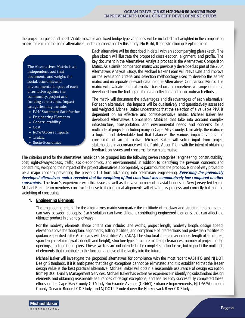
Page 22
the project purpose and need. Viable movable and fixed bridge type variations will be included and weighted in the comparison matrix for each of the basic alternatives under consideration by this study: No Build, Reconstruction or Replacement.
Each alternative will be described in detail with an accompanying plan sketch. The plan sketch will illustrate the proposed cross-section, alignment, and profile. The key document in the Alternatives Analysis process is the Alternatives Comparison Matrix. As a similar comparison matrix was previously developed as part of the 2004 Alternatives Analysis Study, the Michael Baker Team will reevaluate and improve on the evaluation criteria and selection methodology used to develop the earlier matrix and incorporate relevant data into the Alternatives Comparison Matrix. The matrix will evaluate each alternative based on a comprehensive range of criteria developed from the findings of the data collection and public outreach efforts.
The matrix will document the advantages and disadvantages of each alternative. For each alternative, the impacts will be qualitatively and quantitatively assessed and weighted. Michael Baker understands that the selection of a valuable PPA is dependent on an effective and context-sensitive matrix. Michael Baker has developed Alternatives Comparison Matrices that take into account complex infrastructure, transportation, and environmental needs and concerns for a multitude of projects including many in Cape May County. Ultimately, the matrix is a logical and defendable tool that balances the various impacts versus the constraints of an alternative. Michael Baker will solicit input from project stakeholders in accordance with the Public Action Plan, with the intent of obtaining feedback on issues and concerns for each alternative.
The criterion used for the alternatives matrix can be grouped into the following seven categories: engineering, constructability, cost, right-of-way/access, traffic, socio-economics, and environmental. In addition to identifying the previous concerns and constraints, weighting their impact of the project alternatives appropriately is paramount to the process. Right-of-way proved to be a major concern preventing the previous CD from advancing into preliminary engineering. Revisiting the previously developed alternatives matrix revealed that the weighting of that constraint was comparatively low compared to other constraints. The team’s experience with this issue as well as the vast number of coastal bridges in New Jersey led by the Michael Baker team members constructed close to their original alignments will elevate this process and correctly balance the weighting of constraints.
1. Engineering Elements
The engineering criteria for the alternatives matrix summarize the multitude of roadway and structural elements that can vary between concepts. Each solution can have different contributing engineered elements that can affect the ultimate product in a variety of ways.
For the roadway elements, these criteria can include: lane widths, project length, roadway length, design speed, elevation above the floodplain, alignments, tolling facilities, and compliance of intersections and pedestrian facilities to guidance specified in the Americans with Disabilities Act (ADA). The structural criteria may include: length of structures, span length, retaining walls (length and height), structure type, structure material, clearances, number of project bridge openings, and number of piers. These two lists are not intended to be complete and inclusive, but highlight the multitude of elements that contribute to the function and use of the facility into the future.
Michael Baker will investigate the proposed alternatives for compliance with the most recent AASHTO and NJDOT Design Standards. If it is anticipated that design exceptions cannot be eliminated and it is established that the lesser design value is the best practical alternative, Michael Baker will obtain a reasonable assurance of design exception from NJDOT Quality Management Services. Michael Baker has extensive experience in identifying substandard design elements and obtaining reasonable assurances of design exceptions, and has recently successfully completed these efforts on the Cape May County CD Study Rio Grande Avenue (CR661) Entrance Improvements, NJTPA/Monmouth County Oceanic Bridge LCD Study, and NJDOT’s Route 4 over the Hackensack River CD Study.
The Alternatives Matrix is an independent tool that documents and weighs the social, economic and environmental impact of each alternative against the community, project and funding constraints. Impact categories may include: • P&N Statement Satisfaction • Engineering Elements • Constructability • Cost • ROW/Access Impacts • Traffic • Socio-Economics
H4: Resolution 1709-32
Page 23
The risk of utility impacts for each identified alternative will be assessed. High risk utility impacts will be identified and incorporated into the alternatives evaluation processes (matrices, etc.). Utility relocation schemes and impacts will be shown on plans to illustrate potential impacts (risks) associated with each of the alternatives. Relocation cost estimates will also be requested from the utility owners to provide a more accurate construction cost estimate during the alternatives analysis task.
Once the PPA is identified, proposed utility relocations will be shown on the concept plans. The proposed concept plans with utility relocations will be discussed with the respective utility companies. A description of the existing utilities and potential impacts from the PPA will be provided in the LCD Study, including potential utility implications associated with construction staging, temporary facilities, demolition, traffic control, detours, and maintenance of draw bridge operations and lighting. A concept level cost estimate of utility impacts will be provided either as a percentage of construction cost or through considerable experience with utility cost impacts on many similar projects. Utilities will be further evaluated in the Risk Management section.
2. Cost
Cost is one of many criteria that gets evaluated during the alternative selection process; however, cost should not only be limited to the initial construction cost, but should also consider life cycle and operations costs. As such, it is important that the various alternatives be compared using costs that are reflective of the various project elements, from roadways, to bridges, to potential ground improvement needed. Movable bridges are more costly to build and have higher maintenance and operational costs. However, high level fixed bridges come with an added cost as well due to need for deeper foundations and added materials. Constructability considerations reflective of the difficulty of construction anticipated for each of the alternatives, particularly for in-water activities that would require cofferdams, need to be incorporated into the construction costs as appropriate. Costs for construction access, barge access, and construction staging need to be integrated into the overall construction cost as well.
With all the above complexities involved on this Ocean Drive project, we will apply our collective experience as a team from the design and construction of numerous coastal bridges, thus providing the SJTPO and Cape May County with a well vetted and dependable cost accounting to support the alternatives evaluation, and subsequently the PPA.
3. Right-Of-Way / Access
The right-of-way and access components of this project will be a critical driver of the selected PPA. As stated before, right-of-way is a main reason why the project could not advance beyond the original CD. The project area is surrounded by businesses and environmentally sensitive properties. The roadway itself is critical for the area’s businesses, including the tourism industry, delivering thousands of people every week to the various destinations along the shore. The route is also an evacuation route for the barrier islands. Roadway access is not the only type of access that will be important to this project. Access to the navigation channel is critical to the various federal agencies as well as the fisheries located at the project site and the pleasure boats leaving some of the area’s largest marinas just upstream of the project.
Acquisitions, easements, riparian grants, and business impacts among others will be quantified within the alternatives matrix to clearly define this category for each of the progressing alternatives. Balancing these impacts will lead to a project that meets the project’s Purpose and Need as well as the long term needs of the community.
4. Traffic
With the fluctuations of traffic on weekends and during the summer months, consideration should be given to the impacts the project will have during these peak times. The Michael Baker Team’s experience in situations like this is robust, with direct and relevant experience at Route 72, Route 52, and Rio Grande Boulevard to name only a few.
The alternatives analysis will consider the design year traffic projections, opening required (if any), queuing due to tolling, in addition to impacts driven by the engineering drivers: lane width, design speed, shoulders, etc.
H4: Resolution 1709-32

Page 24
5. Environmental
Given the environmental constraints of the area (Cape May Coastal Wetlands, Cape May National Wildlife Refuge, Marmora Wildlife Management Area, and the U.S. Fish and Wildlife Service property), obtaining a 55 mph design for a long-span high level fixed bridge may be possible, but perhaps with impacts to sensitive areas and properties. Those impacts need to be weighted appropriately for the project alternatives. This was considered at length in the previous study by Michael Baker Team member WSP providing a significant advantage to this team.
Environmental constraints will be confirmed and re-evaluated in the previous data collection phase. Impacts to the constraints will be summarized in the matrix and will include impacts to: wetlands and open waters; coastal and aquatic resources; Natural Heritage Sites; Fish and Wildlife Resources; Hydraulics and Hydrology; Air and Noise; Hazardous Materials; and Cultural Resources. While these impacts may be significant, they may also be similar from alternative to alternative. Their context in the purpose and need of the project will be an important descriptor when determining the selected alternative.
Additionally, at the time of the previous concept development study, the NJDEP Stormwater Management Rules (N.J.A.C. 7:8) were not in place. It is anticipated that the build alternatives will meet the definition of a major development (1 acre of ground disturbance or 0.25 ac net new impervious surface), requiring compliance with the Rules. The NJDEP Stormwater Management Rules require that all projects classified as a major development meet certain standards for water quality, water quantity, and groundwater recharge. However, since the project is located within a tidal flood hazard area, stormwater quantity regulations will be met by showing that the tidal flooding will exceed any local stormwater flooding. Additionally, since the project ultimately discharges to salt water, groundwater recharge compliance is not warranted. Therefore, the stormwater quality regulations will be the aspect of the rule that will require the Michael Baker Team’s attention. BMPs such as basins, swales and water quality manufactured treatment devices will be proposed to meet stormwater quality requirements. Due to the limited Right of Way and anticipated high groundwater, smaller surface BMPs and water quality manufactured treatment devices will likely be proposed to achieve the required TSS removal rate to the maximum extent practicable.
6. Socio-Economics
Socio-economics of the alternatives will consider the impacts to the population of the immediate community as well as the larger surrounding area. Businesses have access that will be impacted by nearly any project selected. Some of these businesses are largely seasonal, while the commercial fishing industry has a year round need of the roadway. In addition to the business aspects, the fabric of the surrounding communities should be considered in a selection of an alternative. Cape May, Wildwood Crest, as well as the Ocean Drive corridor have certain aesthetic elements and a vibrant engaged community that have great interest in the project area. Their interests go beyond the immediate bridge, and include parkland resources, waterfront access, fishing piers, and boating access to name a few. The impacts to the socio-economics will be part of the alternatives matrix.
7. Constructability
It is essential that constructability considerations get frequent attention during the early stages of a project, particularly during the Concept Development phase. The benefit to SJTPO is that the Michael Baker Team has successfully advanced a number of LCD studies all the way through Final Design and Construction, providing a constructability perspective in the earlier phases of the project cycle where it could be a differentiator, by integrating it into the Alternatives Analysis and Evaluation. In many instances, environmental considerations are used as the major evaluation criteria between alternatives to determine the alternative which avoids or minimizes the environmental impacts, to the detriment of constructability and construction cost. This approach frequently results in a PPA that does not get advanced past preliminary engineering without major modifications, which results in impacting the project
Constructed infiltration basin on Garrets Island for the Route 52 Causeway
Replacement Project.
H4: Resolution 1709-32

Page 25
schedule. Our team will balance the needs to avoid and minimize the environmental impacts along with the constructability considerations by integrating the following:
a. Environmental Impacts: By gaining knowledge of the existing environmental resources within the project limits, we will be able to not only quantify these environmental impacts, but also determine how they could potentially affect construction from timing restrictions for in-water construction, the need to have construction access trestles, and to determine bridge versus roadway limits to minimize impacts on wetlands.
b. Barge Access and Laydown Areas: While the final footprint for the laydown and barge access areas will be finalized in subsequent phases, their potential locations need to be evaluated during this phase as their location and size would differ between alternatives. Figure 3 (included at the end of this Narrative) illustrates existing depths of channels and inlets in the vicinity of the project limits.
c. Construction over Middle Thorofare Channel: Coordination with the US Coast Guard needs to be initiated during this phase to not only get a preliminary determination of the vertical clearance, but to also discuss allowable window for channel closure during construction.
d. Construction Staging: Depending on the geometry of the alternatives, some may be more suitable for construction staging than others which could facilitate maintenance of traffic and potential contract packaging.
e. Miscellaneous Considerations: Other considerations, such as accelerated bridge construction techniques, pile supported embankments, impacts to major utilities will be evaluated and integrated into the alternatives analysis as appropriate and when the offer to be a differentiator between alternatives.
C. Alternatives Development Documentation
The Michael Baker Team will document the methodology for developing the alternatives and detail the reasons why alternatives were removed from consideration including any fatal flaws. Michael Baker will document the public and agency input for each alternative. For identified design exceptions, Michael Baker will develop alternatives to eliminate exceptions or obtain reasonable assurance of the design exception from NJDOT and Cape May County.
The Michael Baker Team will maintain a continuous open dialog with the Project Team as the project progresses, to obtain an up-to-date understanding of the concerns of the SJTPO, Cape May County and NJDOT. We will consider the impact of each alternative and develop a methodology to weigh and/or rank the impacts for each of the identified critical issues, and, in coordination with the SJTPO, Cape May County and NJDOT, to select a PPA. We will work with the Cape May County engineer to obtain a resolution of support for the selected PPA from impacted municipalities. The PPA will be submitted for review and approval and the selection process will be documented for inclusion in the Concept Development Report.
Michael Baker will summarize the findings of the alternatives development process in the Alternatives Analysis Document, which will include a detailed description of each alternative, conceptual plan of each alternative, the Alternatives Comparison Matrix, a synopsis of the alternatives analysis, stakeholder input, comments and comment resolutions, and the selection of the PPA.
D. Value Engineering Review
Based on federal regulation 23 CFR Part 627.9(d) (1), all Federal-aid bridge projects with an estimated total cost of over $40 million shall have a Value Engineering Technical Report prepared. In accordance with the NJDOT’s Capital Project Delivery Process for Concept Development, the Michael Baker Team will provide input to the NJDOT’s Value Engineering (VE) Unit to conduct an independent review of the draft Preliminary Preferred Alternative (PPA) in order to identify, evaluate, develop, and recommend alternative designs or methods that will provide an acceptable or improved product. The Michael Baker Team will develop a project overview presentation for select NJDOT subject matter experts with diverse engineering backgrounds and who are independent from the project development team. This objectivity will allow for the identification of alternative solutions that maximize the value of every dollar spent and minimize life cycle costs.
It is well known that the earlier VE is performed during a project’s life cycle, the greater the opportunity to achieve cost savings and value. Since the Ocean Drive Upgrades and Bridge Improvements Project will be in the early LCD phase, the VE team will focus on strategic issues, overall scope development, risk mitigation, procurement strategies, constructability issues, etc., to ensure that a project will stay on track to meet its cost and schedule goals. The Michael Baker Team will organize a one day VE workshop after a draft PPA has been developed, at which time pertinent documentation, calculations and drawings will be
H4: Resolution 1709-32

Page 26
provided. At the conclusion of the VE process, the NJDOT VE Unit will provide a VE Technical Report to the design team for review and comment. Comments will be addressed in a Comment Resolution Memorandum and returned to the NJDOT for inclusion in the overall LCD Report.
Additionally, following the Value Engineering Review, a PPA Constructability Review will be performed by NJDOT’s Bureau of Construction Management to identify project specific construction risks with associated probability and impact to schedule and cost, allowing the project team to assess changes to staging and construction methods at the appropriate time in design to potentially reduce the construction duration. Previously identified constructability risks will be reviewed (as documented in the Risk Register), and any new risks identified will subsequently be added to an updated Risk Register. Furthermore, the Constructability Review will potentially help in developing a more accurate construction cost estimate. Comments from the Constructability Review will be made in writing along with comment responses from the Michael Baker Team, and included in the overall LCD Report.
E. Risk Management Review and Documentation
A key member of Michael Baker’s Concept Development Team, Martin Wade, was deeply involved with the development of NJDOT’s overall risk management process and will seamlessly incorporate the process into the overall project to help evaluate deficiencies and identify fatal flaws to assist in selecting the PPA. In accordance with NJDOT’s standards, Michael Baker will perform risk identification and quantitative risk analysis, and develop risk response strategies and action plans. A Risk Register will be maintained to document project risks throughout the project life cycle. Due to the anticipated total construction cost being greater than $100 million, a Quantitative Risk Analysis Worksheet will also be developed to numerically estimate the probability that the project will meet its cost and schedule objectives. The results of the Quantitative Risk Analysis will be summarized in the Quantitative Risk Analysis Report.
As the study progresses, one area of particular importance is the potential utility conflicts with the proposed work. These will be identified for each alternative. Impacts will be quantified, evaluated and summarized for each alternative, along with approximate costs related to the relocations required. Potential impacts related to right of way, easement requirements and environmental permits will also be addressed. This information will be provided for inclusion in the Alternative Comparison Matrix.
Per the NJDOT Capital Project Delivery Process, a Utility Risk Assessment Plan will be developed to highlight potential high risk utility impacts, such as the underground gas distribution line at the western project limit and the sanitary force main that runs the project length. Potential utility relocation alternatives considered will be in accordance with the State Utility and Railroad Accommodation Policy.
F. Develop Mitigation Strategies
If a build alternative is selected, impacts to sensitive ecological resources including wetlands, open waters and habitat for state and federal listed species are will be unavoidable. Ultimately, project authorizations will be required from several federal and state resource agencies. Mitigation in coastal areas is often challenging as most land is either already protected or developed. Recognizing these challenges, the Michael Baker Team proposes to evaluate conceptual mitigation options in Concept Development.
The Consultant Team will perform an initial mitigation site search and evaluation to determine potential mitigation strategies for inclusion in the proposed PPA. This will include the identification of potential properties for acquisition and preservation to address potentially needed authorization for a diversion of state or federal wildlife refuge properties. Additionally, opportunities within the general project environs for habitat restoration and/or creation will be identified to address compensatory mitigation requirements for wetland and coastal resource impacts. The mitigation search will include the identification of potential sites within the general project corridor and adjoining areas, a review of ownership status and whether adequate mitigation credit would be available to satisfy regulatory requirements. Additional mitigation measures such as seasonal restrictions and best management practices will also be identified, which may ultimately affect construction.
Task 3 Deliverables: • Alternatives Comparison Matrix (Electronic/5 Hardcopies)
• Description of the Alternatives (Electronic/5 Hardcopies)
H4: Resolution 1709-32

Page 27
• Risk Register
• Utility Risk Assessment Plan
• Quantitative Risk Analysis Report
• Conceptual Mitigation Report
TASK 4: DOCUMENTATION A. Concept Development Plans
Michael Baker will prepare concept plans for the selected PPA, including the proposed alignment and bridge type, local roadway improvements, drainage, anticipated impacts to sensitive receptors, right of way, potential ITS needs, and impacts to adjacent properties. This information will be developed using the updated mapping document during the data collection task. The plans will be developed at a scale of 1”=100’ with contours generated at a 1-foot interval and in accordance with Cape May County Engineering standards, AASHTO, the NJDOT Roadway Design Manual, Drainage Design Manual, the 2007 Standard Specifications for Roads and Bridge Construction, etc. Michael Baker will also prepare preliminary MPT schemes, detour routes and/or conceptual construction staging plans for review by the Project Team.
B. Prepare Order of Magnitude Cost Estimates
Based on the concept plans, a concept-level construction cost estimate for the PPA will be prepared. The cost estimate will consider major construction activities including mobilization, paving, excavation, removal and demolition of existing, new structures, drainage, SWM facilities, lighting, landscaping, environmental mitigation, MPT, etc. Recent unit bid prices will be made available to the Project Team by Cape May County or NJDOT. Contingencies and escalation will also be included. Right-of-Way impacts to property owners will also be noted.
C. NEPA Classification and Documentation
Although NEPA review and permit authorization are not addressed until Preliminary Engineering and Final Design, respectively, a primary objective during Concept Development (CD) is determining an appropriate NEPA classification. The goal of the CD process is to craft a well-defined and justified purpose and need statement and develop a range of reasonable alternative to address that need. Given the complexity and challenges of this project due to its environmental sensitivity and potential for significant impact, additional efforts to build consensus among regulatory agencies and develop preliminary mitigation strategies to address regulatory requirements can be conducted during CD. By incorporating the input from external stakeholders, including regulatory agencies, into the PPA, the project team is better able to demonstrate efforts to minimize harm, comply with applicable regulatory standards, and minimize potential for significant impacts, and in doing so, help to provide for a more defensible NEPA classification and streamline subsequent environmental approvals.
The County previously determined that the appropriate NEPA classification was an Environmental Assessment. However, given the opportunities for greater collaboration with regulatory agencies and refining mitigation strategies as part of this project, the project may likely qualify for a Categorical Exclusion Document under bridge rehabilitation, reconstruction or replacement (23 CFR 771.117(d)3. Based on the agency input and alternative analysis conducted under Task 1 and 3 above, respectively, the Michael Baker Team, in coordination with the Project Team, will determine the level of NEPA documentation (i.e., Categorical Exclusion(s), Environmental Assessment with FONSI, or Environmental Impact Statement) for the next phase of work. In addition to the environmental document, a determination will be made regarding the need for any additional Section 106 documentation or Section 4(f), Section 6 (f) etc. investigations, evaluation(s) and reporting.
D. Develop Preliminary Engineering Next Steps/Tasks
The Michael Baker Team will coordinate with the Project Team to prepare the next steps, utilizing the NJDOT PE Scope Statement format. The PE scope statement needed to conduct Preliminary Engineering and Final Design, and includes approval of the environmental document and any design exceptions. The PE Scope Statement will be included in the Concept Development Report. An initial Preliminary Engineering, Final Design and Construction schedule will be developed and will
H4: Resolution 1709-32

Page 28
include estimated durations based on Michael Baker’s significant construction management experience. The project’s critical path and variables affecting that path will be identified.
E. Concept Development Report
Michael Baker will compile and summarize the tasks completed during this Concept Development study and will organize the report as detailed in the RFP. The Concept Development Report will be sent to the Project Team for review and approval, and all comments will be addressed within two (2) weeks of receiving them.
Task 4 Deliverables: • Concept Development Plans for the selected PPA (Electronic/4 Hardcopies)
• Cost Estimates (Electronic only)
• NEPA Classification Recommendation (Electronic only)
• Concept Development Report (Electronic/5 Hardcopies)
• Preliminary Engineering Scope of Work Activities (Electronic only)
TASK 5: PROJECT MANAGEMENT This task includes project management duties and responsibilities, including scope, schedule, and budget, necessary to advance the project. Michael Baker will maintain regular and frequent contact with the SJTPO and Cape May County representatives throughout the project duration. The schedule’s critical activities will be managed aggressively to avoid delays.
Michael Baker’s primary objectives are to perform cost-effective engineering services and provide quality products that meet the budget, technical, and strategic requirements for the South Jersey Transportation Planning Organization. Project Manager Maher (Mike) Sidani, P.E., PMP, has extensive experience in managing multidisciplinary infrastructure projects. Mr. Sidani will be Michael Baker’s point of contact for SJTPO, and will facilitate the scheduling and assignment of the appropriate support staff as needed to complete the Ocean Drive (CR 621) Local Concept Development Study. He will be supported by the firm’s senior management throughout the agreement, which will include monthly internal Project Status Review meetings which scrutinize every active project with respect to budget status, schedule, and scope of work progress.
A. Project Controls
Reporting and invoicing procedures will be in accordance with the terms of the agreement. As such, Michael Baker will prepare and submit monthly progress reports to the SJTPO indicating percent of work complete that corresponds to the monthly invoice. The progress reports will include a listing of active and completed tasks, indicating the percent of work complete (total and by task), work and submittals completed in the previous month and to be performed in the next billing period, meetings, actions/decisions required by the SJTPO, Completed Goals, Upcoming Goals, SJTPO Action Items, and the status of the schedule and budget. Michael Baker will develop a detailed schedule for review and approval at the project kick-off meeting. The schedule, which will identify project tasks and milestones, will be reviewed and maintained throughout the study on a quarterly basis.
B. Status Meetings
Michael Baker will coordinate and attend monthly project status meetings with SJTPO, Cape May County, NJDOT-Local Aid, and NJDOT-BEPR (the Project Team), and prepare and distribute meeting agendas, handouts, and meeting summaries in
Michael Baker refined and documented the NJDOT Capital Project Delivery Process during a 5-year on-site assignment.
H4: Resolution 1709-32

Page 29
support of those meetings. Michael Baker will develop a two-week look ahead list of activities and identify action items to be discussed at each status meeting. Michael Baker will document meetings, maintain a list of action items, and maintain a database of design related and decision making actions as a result of attended meetings.
C. Project SharePoint Site
Michael Baker will establish a project SharePoint site. SharePoint is a web-based Microsoft product, and as such, is accessible from mobile devices with an internet connection and integrates seamlessly with Microsoft Office 365 and Microsoft Project. The SharePoint site will be made available to the Project Team and stakeholders, as appropriate. It is anticipated that the site will contain electronic copies of project documents, schedules, meeting agendas, handouts, minutes, presentations, a project calendar with meetings and project milestone dates, and the DCR.
Michael Baker is successfully hosting, maintaining and using a SharePoint site as an electronic document library for the Pulaski Skyway Rehabilitation Program, the Oceanic Bridge LCD Study, and the Sixth & Central Bridges LCD Study. As the Skyway Program consists of five design teams, each with multiple subconsultants, a SharePoint site has proven to be an excellent tool for real-time coordination and collaboration between members of the Project Team.
D. Design Communications Report
Michael Baker will establish a Design Communications Report (DCR) which will provide a record of all relevant communication, decisions, agreements, and approvals that occur between the Project Team and stakeholders. The DCR will be maintained on a project SharePoint Site. The SharePoint site will serve as an electronic document library throughout the course of the study.
E. Quality Management
Quality control at Michael Baker starts with a solid foundation in project management. Michael Baker has a series of rigorous processes and checks that result in services and products that meet or exceed client’s expectations. Quality assurance (QA) and quality control (QC) are part of an overall project management system called “The Michael Baker Way” to track and check interim products and to maintain the quality of final products. Michael Baker staff who perform quality control checks have been trained by the Project Management Institute (PMI). Michael Baker’s QA and QC methods are in place and ready to be implemented and tailored for this project. They involve separate QA procedures to verify the availability of resources and tools to enforce quality control. Michael Baker’s QA/QC Lead, Joe Danyo, will consult with Mr. Sidani to establish a Project Specific Quality Management Plan (PSQMP). The PSQMP details the specific resources and actions necessary to provide the best opportunity for the project deliverables to meet the client’s quality expectations and requirements. This PSQMP will be integrated, ongoing and focused throughout the project and not just applied before a submission. The QA/QC procedures will also be applied to the subconsultants’ tasks. By integrating QA/QC into the project’s production process, Michael Baker will deliver a clear, concise, and accurate deliverables.
“The Michael Baker Way” is Michael Baker’s proven, effective project management process to monitor and control schedules, resources and costs. This process was developed to facilitate communication and understanding between SJTPO, Cape May County and the Project Manager, while streamlining communication within the project disciplines. A Project Management Plan (PMP) will be developed for the project by the Project Manager, approved by the Principal in Charge, and distributed to all team members. The PMP serves as the roadmap to successful performance of the project and includes clear definition of the following project elements:
• Project Purpose • Project Budget & Invoicing • Project Schedule • Scope of Work & Contract • Quality Management Plan • Communications Plan • Critical Assumptions & Constraints • Risk Management Plan • Change Management Plan • Project Team & Stakeholders • Safety & Occupational Health • Project Closeout Plan
H4: Resolution 1709-32
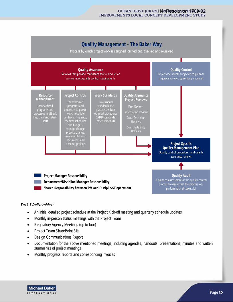
Page 30
Task 5 Deliverables: • An initial detailed project schedule at the Project Kick-off meeting and quarterly schedule updates
• Monthly in-person status meetings with the Project Team
• Regulatory Agency Meetings (up to four)
• Project Team SharePoint Site
• Design Communications Report
• Documentation for the above mentioned meetings, including agendas, handouts, presentations, minutes and written summaries of project meetings
• Monthly progress reports and corresponding invoices
H4: Resolution 1709-32
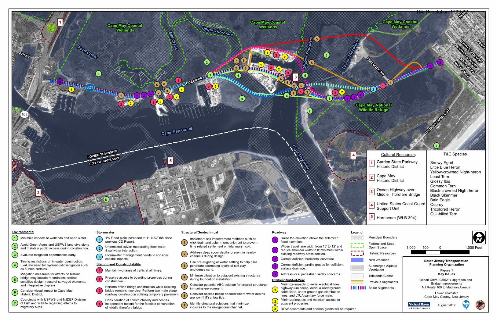
OCEAN DR
NEW JERSEY AV
USCG ENTRANCE ST
FISH DOCK RD
MEMPHIS AV
NORTH STATION AV
SOUTH STATION AV
RALEIGH AV
MADISON AV
8TH AV
Ford Creek
Mill Creek
Upper Thorofare
Lowe
r Tho
rofare
Midd
le Th
orofa
re
Cape May Inlet
Cape May Canal
1
2
3
45
3
2
6
1
2
1
2
3
5
43
4
7
21 2 3
2 3
32
1
Cape May Coastal Wetlands
Cape May Coastal Wetlands
Cape May Coastal Wetlands
Cape May NationalWildlife Refuge
5 6
5 6
5
5
5
7
64
1
2 2 2 22 2
11 2 4
2 2
12
21
2
2
4 2 21 2 4
35
109
KL6211
3
1
LOWER TOWNSHIP
CITY OF CAPE MAY
1,000 0 1,000500 Feet
Stormwater Structural/GeotechnicalEnvironmental LegendRoadwayMunicipal BoundaryFederal and State Open Space
NWI WetlandsSubmerged Aquatic VegetationTidelands Claims
Snowy EgretLittle Blue HeronYellow-crowned Night-heronLeast TernGlossy IbisCommon TernBlack-crowned Night-heronBlack SkimmerBald EagleOspreyTricolored HeronGull-billed Tern
T&E SpeciesCultural Resources1
3
Garden State Parkway Historic DistrictCape May Historic DistrictOcean Highway overMiddle Thorofare BridgeUnited States Coast GuardSupport UnitHornbeam (WLB 394)
2
4
5
Historic Resources
Minimize impacts to wetlands and open water.1Avoid Green Acres and USFWS land diversionsand maintain public access during construction.2
Timing restrictions on in-water construction.Evaluate need for hydroacustic mitigation such as bubble curtains.
4
Coordinate with USFWS and NJDEP Divisionof Fish and Wildlife regarding effects to migratory birds.
7
Consider visual impact to Cape May Historic District.6
Mitigation measures for affects on historic bridge may include recordation, context sensitive design, reuse of salvaged elements, and interpretive displays.
5
Evaluate mitigation opportunities early.3
I
Staging and Constructability
1% Flood plain increased to 11' NAVD88 sinceprevious CD Report.1
August 2017
South Jersey Transportation Planning Organization
Figure 1Key Issues
Lower TownshipCape May County, New Jersey
Ocean Drive (CR621) Upgrades and Bridge Improvements
NJ Route 109 to Madison Avenue Utilities/Right-of-Way
Raise the elevation above the 100-Year flood elevation.1Widen travel lane width from 10' to 12' and reduce shoulder width to 8' minimum within existing roadway cross section.
2
Correct deficient horizontal curvature.3Correct deficient profile grades for sufficient surface drainage.4
Stormwater management needs to consider coastal impacts.3
Undersized culvert moderating freshwater & saltwater interaction.2
Address local pedestrian safety concerns.5
Minimize impacts to aerial electrical lines, highway luminaries, aerial & underground cable lines, under ground gas distribution lines, and LTUA sanitary force main.
1
Minimize impacts and maintain access to adjacent properties.2ROW easements and riparian grants will be required.3
Previous AlignmentsBaker Alignments
Maintain two lanes of traffic at all times.1
Consideration of constructability and cost as independent factors for the feasible constructionof middle thorofare bridge.
4
Perform offline bridge construction while exisiting bridge remains inservice. Perform two main stage roadway construction utilizing temporary pavement.
3
Preserve access to boarding properties during construction.2
Identify structural solutions that minimize closures to the navigational channel.7
Consider access trestle needed where water depths are low (4.5') at low tide.6
Consider potential ABC solution for precast structures in marine environment.5
Minimize vibration to adjacent existing structures during foundation installation.4
Use pre-augering or water settling to help piles penetrate alternating layers of stiff clayand dense sand.
3
Address deep scour depths present in nearby channels during design.2
Implement soil improvement methods such as wick drain and column embankment to preventtime related settlement on tidal marsh soil.
1
H4: Resolution 1709-32
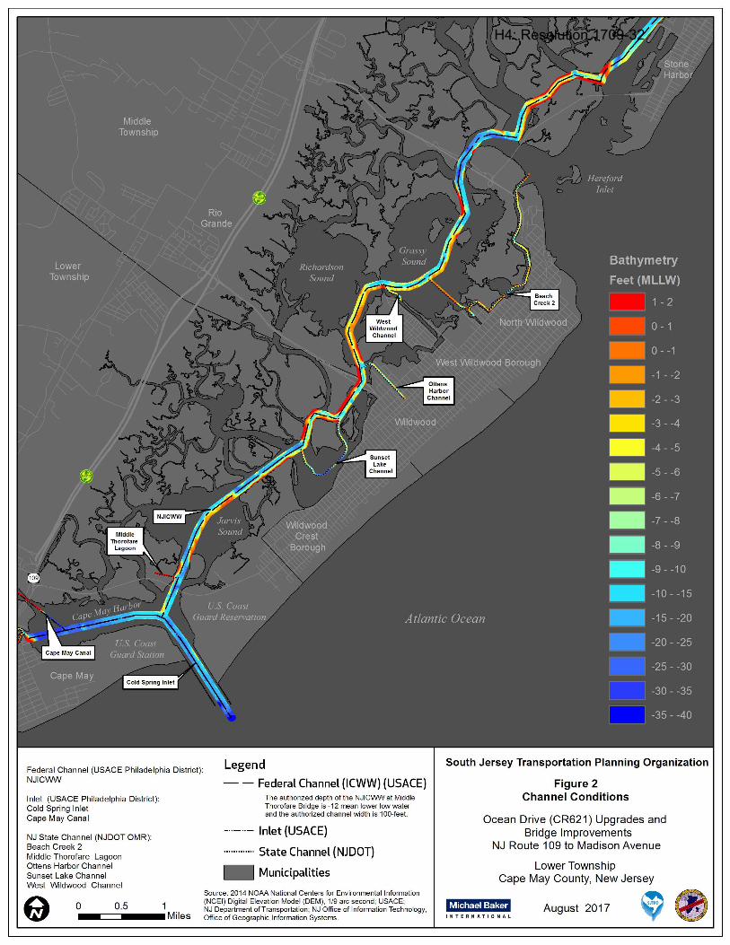
Federal Channel (USACE Philadelphia District): NJICWW
Inlet (USACE Philadelphia District): Cold Spring Inlet Cape May Canal
NJ State Channel (NJDOT OMR): Beach Creek 2 Middle Thorofare Lagoon Ottens Harbor Channel Sunset Lake Channel West Wildwood Channel
o 0.5 1 _-=== ___ Miles
Legend
Federal Channel (ICWW) (USACE) The authorized depth of the NJICWW at Middle Thorofare Bridge is -12 mean lower low water and the authorized channel width is 100-feet.
Inlet (USACE)
State Channel (NJDOT)
.. Municipalities
Source: 2014 NOAA National Centers for Env ironmental Information (NCEI) Digital Elevation Model (OEM), 1/9 arc second ; USACE; NJ Department ofTransportation; NJ Office of Information Technology, Office of Geograph ic Information Systems.
South Jersey Transportation Planning Organization
Figure 2 Channel Conditions
Ocean Drive (CR621) Upgrades and Bridge Improvements
NJ Route 109 to Madison Avenue
Lower Township Cape May County, New Jersey
~!,I"!'~T! August 2017 , .
H4: Resolution 1709-32

OCEAN DR
BAYVIEW DR
USCG ENTRANCE ST
FISH DOCK RD
Ford Creek
Mill Creek
Upper Thorofare
Lowe
r Tho
rofare
Midd
le Th
orofa
re
Cape May Inlet
Cape May Canal
109
KL621
Lower Township
Cape May City
I1,000 0 1,000500 Feet August 2017
South Jersey Transportation Planning Organization
Figure 3Alternative Alignments
Lower TownshipCape May County, New Jersey
Ocean Drive (CR621) Upgrades and Bridge Improvements
NJ Route 109 to Madison Avenue
Potential AlignmentsPrevious Alignments Baker Alignments
Baker Alternative 4Baker Alternative 3Baker Alternative 2Baker Alternative 1
USFWS Wildlife Management Area
3A3B3C3D3E3F&G
H4: Resolution 1709-32
Page 35
STAFFING PLAN Michael Baker has provided engineering and design services for some of the largest and most complex bridges recently constructed in the United States. Michael Baker is the 7th largest bridge consultant in the country, as ranked by Engineering News Record, and our diverse bridge experience enables us to provide cutting-edge ideas and superior guidance for complex bridge projects of all types. Michael Baker’s key personnel have established a legacy of responding to the most complex highway interchange projects and toughest bridge challenges with innovative and sustainable bridge designs, and have demonstrated leadership by promoting advancements in bridge design and construction, such as the use of high-performance materials and Accelerated Bridge Construction techniques.
In New Jersey, Michael Baker’s success can be summarized by the completion of the signature Route 52 Bridge for the NJDOT, a project that successfully addressed many of the same issues facing the Ocean Drive and the Middle Thorofare Bridge. Mike Sidani, the Project Manager from the Route 52 Causeway Construction project, has been selected to lead the Ocean Drive (CR 621) project for SJTPO and Cape May County. In addition to demonstrating his acumen with complex bridge Feasibility Assessment, Preliminary Engineering and Final Design in coastal areas, Mike is also the Project Manager for the Oceanic Bridge Local Concept Development (LCD) Study for NJTPA and Monmouth County. Based on the anticipated Notice to Proceed date in the RFP, the Oceanic Bridge LCD Study will be in the final stages of completion by the time the Ocean Drive study gets underway. Mike’s time can then be focused on the Ocean Drive study while incorporating all of the lessons learned from the Oceanic Bridge study. Mike will apply that direct and relevant experience to the Ocean Drive LCD Study and is one of the reasons the Michael Baker Team can accelerate the project, in advance of the schedule outlined.
Mike’s Deputy Project Manager on the Ocean Drive LCD Study will be Jim Yeager. This is the same leadership team completing the Oceanic Bridge LCD Study and is poised to execute this project at Notice to Proceed. In addition to the Oceanic Bridge LCD Study, Jim was the Project Manager for the Northerly Crossings Feasibility Study for the Delaware Joint River Toll Bridge Commission. That study included the development of alternatives for the four bridges over the Delaware River in Warren and Sussex Counties. In addition to the development of alternatives, that study had significant public outreach and alternatives analysis components. Mike’s and Jim’s complimentary skills have yielded successful collaboration on a number of projects in the past. In fact, the proposed staff from Michael Baker have worked together extensively in the past, and have developed the strong working relationships of a highly-functioning team. This project will be managed out of Michael Baker’s Hamilton, NJ office, located at 300 American Metro Boulevard, Suite 154.
Michael Baker has selected WSP USA (WSP, formerly Parsons Brinckerhoff) as a partner for the Ocean Drive LCD Study. Michael Baker has a history of teaming with WSP on a number of other endeavors including the current Marine Transportation System Planning Agreement for the NJDOT Office of Maritime Resources. WSP brings the unparalleled benefit of completing the Scope Development and Feasibility Study for Improvements to Ocean Drive in 2004. Aside from having ready access to previously collected data and information, WSP has intimate knowledge and insight of the needs, issues, major stakeholders, and methodology that went into the development and evaluation of the previous alternatives and alternatives evaluation matrix. Given that unique experience, the Michael Baker Team believes the project approach developed for the Ocean Drive LCD Study has the ability to reduce schedule durations and reduce costs while still developing, evaluating and recommending an alternative that meets the Purpose and Need of the project.
The Michael Baker Team is comprised of leaders that have delivered successful concept development studies and design projects which allows the Team to remain intact and seamlessly transition to the next phases of a project’s life, preliminary engineering and final design. Michael Baker and WSP have the previous experience with the project, LCD study experience, knowledge of bridge design, especially in coastal areas, and the resources available to hit the ground running on this assignment.
H4: Resolution 1709-32
Page 1
INTRODUCTION Michael Baker International, Inc. (Michael Baker) has assembled a strong team with distinctly unique expertise, background, and capability to successfully deliver this high profile and important Local Concept Development (LCD) Study. The Michael Baker Team was assembled to leverage several key advantages to provide the South Jersey Transportation Planning Organization (SJTPO) and Cape May County with a quality project completed on an accelerated schedule. We will meet these goals by relying extensively on our strong project management team, our well documented LCD Study experience including our unique knowledge of NJDOT’s LCD process, our successful completion of nearly all of the coastal bridge projects in New Jersey (predominately in the immediate vicinity of Ocean Drive), and with great relevancy, from the work completed by our major subconsultant WSP USA (WSP, formerly Parsons Brinkerhoff) as part of the previously completed study.
Project Management - Michael Baker’s Mike Sidani will be the Project Manager with assistance from Jim Yeager serving as Deputy Project Manager. Mike and Jim bring unparalleled experience from their recent management of the Oceanic Bridge LCD Study for the North Jersey Transportation Planning Authority (NJTPA) and Monmouth County. They are currently in the final stages of completing the Monmouth County Oceanic Bridge (S-31) LCD Study where they have refined a project approach that will help to streamline project delivery on Ocean Drive. Their recent experience and collaborative efforts on the Oceanic Bridge project will enable greater efficiency and more robust management of the scope of work for the Ocean Drive project. In addition, Mike Sidani has successfully delivered the largest coastal bridge project in the history of New Jersey, the $400M Route 52 Causeway. These examples are just a few advantages that Mike offers on this project.
The LCD Process - In addition to the Oceanic Bridge LCD Study, the Michael Baker Team has documented success completing a number of LCD studies over the past 20+ years. Our practical experience is reinforced by Michael Baker’s staff experience working with the NJDOT Project Management Office in the development of their current project delivery process. Over a period of six years, Michael Baker had staff on-site at NJDOT developing the current Capital Project Delivery Process and continues to work with the Department as they identify additional opportunities to streamline the process. Michael Baker additionally worked closely with the NJDOT Local Aid office in the development of the Local Public Agency Manual which directs the process for advancing projects through Concept Development, Preliminary Engineering, and Final Design, and ultimately through the construction administration process. Coordination with environmental agencies is an integral part of the LCD process and the Michael Baker Team has intimate familiarity and a trusting relationship with key leaders from these agencies.
Relevant Experience - The Michael Baker Team has unmatched experience with advancing the replacement of coastal bridges and water crossing bridges in New Jersey, including the following;
• Ocean Drive (CR 621) Upgrade and Bridge Replacements – Alternatives Analysis Report• Route 52 Causeway Replacement – Final Scoping, Preliminary and Final Design• Monmouth County Oceanic Bridge (S-31) – Local Concept Development Study• Garden State Parkway Great Egg Harbor Bridges – Concept Development, Preliminary Design, and Environmental
Permitting• I-95 Scudder Falls Bridge over the Delaware River Replacement – Preliminary Engineering and Final Design• Avalon Boulevard Bridge Rehabilitation and Widening – Final Design• Nacote Creek Bridge – Feasibility Assessment and Design• Route 50 Tuckahoe River Bridge – Final Design• Ohio Avenue Bridge over the Penrose Canal• Route 4 Bridge over the Passaic River – Concept Development• Emergency Repairs to the Townsends Inlet Bridge• Route 72 Bridge over the Manahawkin Bay – Concept Development/Feasibility Assessment, and Final Design• Garden State Parkway over Mullica River
H4: Resolution 1709-32
Page 2
• Rehabilitation of CR 619 Bridge over Great Channel • Ocean City Longport Bridge Replacement – Preliminary and Final Design • Rehabilitation of the Route 35 Bridge over the Manasquan River - Preliminary and Final Design • Rehabilitation of Roosevelt Boulevard Bridge
The Michael Baker Team brings this extensive experience and know how developed through the successful completion of studies and design on coastal bridges in New Jersey with issues directly aligned with the issues which will be addressed on the Ocean Drive Project.
The Team - The Michael Baker Team includes WSP USA (WSP, formerly Parsons Brinckerhoff), that provides intimate familiarity of the area, as well as specific knowledge of the previous work performed on the Ocean Drive project. As part of the previous study, WSP staff addressed technical elements including; the Identification of Substandard Conditions, Environmental Studies, Geotechnical Investigation, Alignment Development, and Public Outreach. All of these elements were documented in an Alternatives Analysis Report completed in January 2004. WSP staff who completed the document will provide the benefits of their knowledge of the Ocean Drive (CR 621) project to assist the Michael Baker Team in advancing the LCD Study efficiently and aggressively starting on Day One.
Michael Baker and WSP also enjoy a strong collaborative working relationship and have worked together successfully on numerous projects previously. Starting with the Route 21 Viaduct Replacement project in Newark, NJ many years ago, and continuing currently with the advancement of the Pulaski Skyway project, Michael Baker and WSP have an established working relationship and procedures for efficient project delivery including office locations that are a 5-minute drive from each other in Hamilton and Lawrenceville and in adjacent buildings in Newark, NJ. The Team of Michael Baker and WSP is currently advancing the Marine Transportation System Planning Agreement for the NJDOT Office of Maritime Resources.
Overall - This Team has the technical and project management skills, direct project related experience, strong understanding of the LCD Study process, coastal bridge experience, and intimate knowledge of the previous Ocean Drive project. The Michael Baker Team has extensive Cape May County expertise and working relationships which will enable us to hit the ground running on day one with the goal of delivering a well-established Project Purpose and Need, a full range of prudent and feasible alternatives, an alternatives comparison process which provides the appropriate focus on the important issues, and delivers an appropriate, supportable, permittable, and buildable Preliminary Preferred Alternative within fifteen months of Notice to Proceed.
PROJECT UNDERSTANDING Michael Baker understands that on behalf of Cape May County, the SJTPO is seeking to engage the services of a consulting engineering firm to perform a LCD Study for Ocean Drive (CR 621) Upgrades and Bridge Improvements from NJ Route 109 to Madison Avenue in Lower Township, Cape May County as part of the SJTPO FY 2018 Unified Planning Work Program. The major objectives of the LCD Phase are to develop a well-defined and justified Purpose and Need Statement focused on the primary transportation needs to be addressed and to identify and compare prudent and feasible alternatives, which will include bridge replacements, rehabilitation, and ‘no-build’ alternatives. Following a rigorous alternatives development and evaluation, and public outreach process, the effort will culminate in the recommendation of a Preliminary Preferred Alternative (PPA) and advancement of the project to the Local Preliminary Engineering (LPE) phase.
The Ocean Drive causeway has linked the communities of Cape May and the Wildwoods (the Cities of Wildwood and North Wildwood, Wildwood Crest and West Wildwood Boroughs, and Diamond Beach, Lower Township) since 1941. The project limits consist of a 2.7-mile stretch of roadway between NJ Route 109 and Madison Avenue. This route provides a critical link and coastal evacuation route that connects NJ Route 109 and access to the mainland and Garden State Parkway with the barrier island containing the Wildwoods, a popular summer attraction and economic center. This length of roadway includes three bridges over Mill Creek (300’ concrete T-beam bridge), Upper Thorofare (350’ concrete T-beam bridge), and Middle Thorofare (1,039’ that includes a movable bascule span). The Middle Thorofare Bridge serves as the ‘southern gateway’ to the Intracoastal Waterway in New Jersey.
H4: Resolution 1709-32
Page 3
KEY ISSUES
Currently, portions of Ocean Drive are below the 100-year flood zone elevation, and prone to occasional flooding. As it exists today, the roadway could become impassible in a hurricane or significant storm event. Much of the roadbed was constructed at an elevation of 7.5’ on fill in 1940 and has settled to an approximate elevation of 6’, well below the 100-year flood elevation (11’ per the current FEMA Flood Insurance Rate Maps). This presents a major concern as Ocean Drive is a designated emergency coastal evacuation route for the southern end of the Wildwoods. According to a US Army Corps of Engineers report, Cape May County is one of the ten most difficult areas in the United States to evacuate during a hurricane landfall. Ocean Drive is also an important linkage which provides access to the commercial fishing facilities on the mainland side, one of which is considered to be the third largest fishing seafood processing facility on the entire eastern seaboard.
Each of the three bridges within the project limits are structurally deficient and functionally obsolete due to low sufficiency ratings and narrow widths, respectively. Due to its poor condition, the Middle Thorofare Bridge has been downposted, restricting loads to 15 tons, prohibiting bus and truck traffic.
Additionally, the width of the bascule bridge opening is 50’, limiting larger vessels from entering the Intracoastal Waterway. These deficiencies restrict the growth of the nearby commercial fishing industry due to vehicle and vessel size restrictions. The narrow bridge opening has also contributed to three to four large vessels per year colliding with the bridge as they attempt to navigate the channel. The collisions have resulted in the bridge being closed for costly and inconvenient emergency repairs.
Since the Middle Thorofare Bridge is movable, it experiences 20 to 40 openings per day for the passage of maritime traffic including Cape May’s commercial fishing fleet. These openings, which last about 10 minutes each, cause between 200 and 400 minutes of roadway closures each day, causing significant negative impacts to the capacity of this critical travel link. During the summer months, the vehicle demand during peak periods far exceeds the roadway capacity, resulting in unacceptable levels of service and reduced air quality.
Ocean Drive traverses through a very environmentally sensitive area consisting largely of tidal waterways, coastal wetlands, public lands, and habitat for numerous state and federally listed species and is also considered a major migratory bird pathway. Additionally, numerous cultural resources are also present in the study area. The NJ State Historic Preservation Office has identified the Middle Thorofare Bridge as eligible for listing on the National Register of Historic Places.
These and additional key issues are shown on Figure 1: Key Issues (included at the end of this Narrative) and discussed in detail throughout our technical approach.
PREVIOUS EFFORTS The Ocean Drive Upgrade and Bridge Replacement effort was the subject of an earlier comprehensive scoping endeavor. In 1999, Michael Baker Team member, WSP USA (WSP, formerly Parsons Brinckerhoff) was selected to perform a scoping study for the Mill Creek and Upper Thorofare portion of Ocean Drive. The intent of the project was to raise the roadway elevation above the 100-year storm elevation, at the time, to a flood elevation of 9 feet. In 2002, the study was extended to include the Middle Thorofare Bridge and to rehabilitate/replace the functionally obsolete bridges. The study developed a range of horizontal alignments and considered both a low-level movable bridge over Middle Thorofare as well as high-level, long-span alternatives. Based on the Alternatives Matrix, the recommended PPA would not only satisfy the project needs but does so while minimizing various impacts including those to the sensitive environmental, cultural, and socio-economic aspects of the area.
The effort culminated in a 2004 Alternatives Analysis Report, Ocean Drive Upgrade and Bridge Replacements, County Road 621, Lower Township, Cape May County, NJ, prepared by WSP and the selection of a PPA. The PPA selected was a high-level, long-span alternative with an alignment that was to the south of the existing Middle Thorofare Bridge. Before the project was able to advance, the US Fish & Wildlife purchased a parcel of land where the PPA was proposed. As a result, the selected PPA is no longer a viable option and Cape May County has requested a new LCD Study be completed.
The invaluable experience and lessons learned from WSP’s past project will be leveraged during this effort, making the Michael Baker Team well-positioned to assist SJTPO to complete this LCD Study efficiently and expeditiously and advance the project through the Local Concept Development Process.
H4: Resolution 1709-32

Page 4
OUR STUDY APPROACH The SJTPO’s Local Project Delivery Process is intended to advance the goals of the SJTPO Regional Transportation Plan 2040. This process advances projects in a process similar to the Capital Project Delivery Process recently adopted by the NJDOT. Adhering to the prescribed process is vitally important for the project to be considered for Federal funding opportunities.
Michael Baker is uniquely familiar with NJDOT’s Capital Project Delivery Process and has provided on-site engineering consulting services to assist in developing a more efficient, logical and comprehensive Project Delivery Process. As a result of this experience, Michael Baker is intimately familiar with the inter-relationships between the activities required to complete a LCD Study, providing the knowledge which will allow the Michael Baker Team to advance appropriate tasks concurrently, identify critical path tasks, and understand the impacts delayed activities will have on the overall schedule.
The LCD process requires a number of critical activities, including the review of existing conditions and needs assessment, the identification of project stakeholders, development of a purpose and need statement, extensive public outreach, inventory of environmental and regulated resources, development and analysis of alternatives, determination of the required National Environmental Policy Act (NEPA) level of review, and the selection of a PPA. Michael Baker, in coordination with SJTPO, Cape May County and NJDOT (the Project Team), will determine the level of NEPA documentation (i.e., Categorical Exclusion(s), Environmental Assessment with FONSI, or Environmental Impact Statement) for the next phase of work.
In addition to our staff’s expertise and familiarity with the procedures of the standard project delivery process, the Michael Baker Team recognizes that each project comes with a set of unique design challenges and constraints. The Michael Baker Team’s technical staff is aptly qualified and well-suited to tackle the complexity and sensitivity of these challenges. Collectively, Michael Baker and WSP have successfully designed the majority of the coastal bridges in New Jersey, including the Route 52 Causeway Bridge in Ocean City and Somers Point, Great Egg Harbor Bridge, NJ Route 50/Tuckahoe River Bridge, Route 72 over Manahawkin Bay, the Garden State Parkway over Mullica River, and Route 35 Bridge over the Manasquan River. Michael Baker has successfully completed over 50 Concept Development Studies/Feasibility Assessment Studies over the past 25 years which follow the New Jersey Department of Transportation (NJDOT) and Federal Highway Administration (FHWA) capital project delivery process. Together, this team has developed a technical approach that is cost efficient, streamlined and consistent with federal requirements. Throughout this proposal, we will identify strategic opportunities to reduce task durations and in turn, person-hour estimates.
The following concerns specific to the scope of the Ocean Drive LCD Study were identified and considered in the development of Michael Baker’s technical approach to the project:
• Addressing functional and structural deficiencies of existing structures and roadways including substandard roadway design elements, bridge load rating, and the existing narrow (50 foot wide) channel opening width
• Considering the benefits and drawbacks of replacing the existing movable Middle Thoroughfare Bridge with a fixed structure
• Right-of-way and access impacts to adjacent property owners
• Accommodating the seasonal travel demands of the region including vehicular, non-motorized, and maritime traffic
• Environmental constraints due to the proximity of the project to protected habitats and cultural resources
• Hydrological constraints including accommodating a major coastal evacuation route and designing to an elevation above the 100-year floodplain
• Achieving public consensus by addressing the needs of and considering the impacts to the adjacent community and stakeholders affected by the project, including relevant public agencies, local businesses and property owners, the US Coast Guard, and the US Fish and Wildlife Service.
• Obtaining federal funding by advancing the LCD Study in compliance with FHWA, NJDOT, AASHTO and MUTCD guidance and standards
• Addressing SHPO concerns related to Historic Bridges and/or view impacts for Historic Districts
• Maintaining access to existing commercial fishing industry facilities during and post construction
H4: Resolution 1709-32
Page 5
• Preparing an updated Navigational Impact Report
• Establishing navigable channel vertical clearance requirements of fixed bridge alternatives The Michael Baker Team also recognizes that many of the critical activities required for the LCD Study were completed as part of the 2004 Alternatives Analysis Study. Where possible, data, analysis, and conceptual alternatives will be reevaluated from the 2004 Study and used for this LCD Study; however, as over a decade has passed since the completion of the 2004 study, there have been a number of changes which could impact the selection of a PPA including:
• Updated Design Manuals and standards
• New construction techniques and materials
• Changes in property ownership, specifically regarding United States Fish and Wildlife protected lands
• Changes in Base Flood Elevation levels
• New and updated and new state environmental regulations including the Flood Hazard Area Control Act Rules (N.J.A.C. 7:13) and Stormwater Management Rules (N.J.A.C. 7:8);
• Additions to the threatened or endangered species list (Atlantic Sturgeon)
• Updated guidance for developing a Navigation Impact Report
• Changes to the needs of the local businesses, industries, and residents
• Changes to regulatory agencies’ focus, interpretations, and staff
As will be demonstrated in this proposal, the members of the Michael Baker Team, Michael Baker, WSP USA (WSP), Churchill Consulting Engineers (Churchill), and RGA, Inc. (RGA), each have significant experience leading or contributing to the successful completion and advancement of LCD studies in New Jersey for NJDOT, MPOs, and Counties. Based on our experience with other coastal bridges, our team fully understands the unique challenges and constraints. As demonstrated through our Team’s relevant experience, Michael Baker has employed creative structural design techniques, focused on right-sizing project elements, minimized structural footprint, and developed innovative construction staging to deliver projects ahead of schedule, under budget, and limiting community, commercial, and environmental impacts. Given the complexities identified above and other challenges, the Michael Baker Team presents a technical approach that leverages expertise, experience and lessons learned from previous coastal bridge concept development, preliminary engineering, and final design projects to achieve the study goal of selecting and advancing a PPA that addresses the primary transportation and environmental needs, is supported by the public and local officials, and is in compliance with the required standards and guidance to obtain federal funding.
TECHNICAL APPROACH The Michael Baker Team’s Technical Approach complies with the NJDOT Local Concept Development Process. The required activities are presented in five major tasks that reflect broad categories of work, some of which will occur throughout the duration of the LCD process. The five major tasks are:
1. Public Outreach 2. Data Collection 3. Alternatives Analysis 4. Documentation 5. Project Management
TASK 1: PUBLIC OUTREACH
Public outreach and community involvement is an important part of LCD, particularly for bridge replacement projects that can impact access, viewsheds and/or require a detour during construction. The Michael Baker Team understands the importance of identifying and coordinating with local officials, community stakeholders, and the general public to develop a context sensitive design, and avoid project delays. Michael Baker has extensive experience facilitating public outreach efforts and community
H4: Resolution 1709-32
Page 6
involvement events starting in Concept Development and continuing through construction. Michael Baker is currently facilitating robust public outreach efforts for the Oceanic Bridge LCD Study and for the PE/FD phases of the entire Pulaski Skyway Rehabilitation Program, Contracts 5-9.
A. Public Involvement Action Plan
Michael Baker is committed to an open Concept Development process which allows ample opportunity for the community, stakeholders and the Project Team to share information and voice concerns. The first step to achieve this goal is to develop a comprehensive Public Involvement Action Plan (PIAP). The PIAP will include traditional and innovative techniques and strategies for communicating information and soliciting feedback from project stakeholders and the public during the concept development process through construction. Where possible, public involvement efforts completed under the earlier Alternatives Analysis Study will be incorporated and updated. Michael Baker will work to build off of the established stakeholder list and public outreach process findings, incorporating knowledge and expertise that have already been gained so that the study may move forward with the involvement of all affected parties.
The content of the PIAP will include a database of known stakeholders and an outline of anticipated meetings with elected officials, stakeholders and/or the general public. It will also detail public outreach techniques to solicit community feedback, potentially including social media, paper and online surveys, and a project website, and will identify community concerns and strategies to address those concerns. A community profile will also be developed and included as a supplement to the PIAP. The PIAP will be reviewed periodically throughout the concept development process and be updated or revised as needed to maintain open lines of communication with stakeholders and the communities. A draft PIAP will be submitted to the Project Team for review. The draft document will be revised to address Project Team comments and a final version of the document will be provided and uploaded to the project SharePoint site.
B. Local Officials Meetings
To provide opportunity for input from local officials representing municipalities potentially impacted by the project, the Michael Baker Team will, in coordination with the Project Team, coordinate, schedule, and lead four (4) local officials meetings. Local Officials Meetings (LOMs) are an essential task used to encourage input and support from local officials and secure buy-in of alternatives considered and the PPA. It is anticipated that local officials from Cape May County, Lower Township, the City of Cape May, and the Wildwoods will be invited to participate. Local officials from these municipalities will also be invited to participate in Stakeholder Meetings and Public Information Centers. The following describes the anticipated topics and timing of Local Officials Meetings:
• Meeting 1: Project Kickoff – Introduce project and LCD process to local officials
• Meeting 2: End of Data Collection Task – Review Project Fact Sheet, present the draft Purpose and Need Statement, and solicit feedback that will be incorporated in the final Purpose and Need Statement
• Meeting 3: During Alternatives Analysis – Present range of alternatives and solicit feedback that will be incorporated into the draft PPA
• Meeting 4: End of Alternatives Analysis Task – Present the recommended PPA and solicit feedback that will be incorporated into the selected PPA
C. Stakeholder Coordination and Meetings
The Michael Baker Team will, in coordination with the Project Team, identify and reach out to potential project stakeholders. Stakeholders will include concerned and/or affected community organizations and residents, environmental groups, local business organizations, local bicycle and pedestrian advocacy groups, first responders, and other agencies. The Michael Baker Team will coordinate with project stakeholders to obtain input on the project Purpose and Need and developed alternatives. It is anticipated that three (3) Stakeholder Meetings will be held during the LCD process. The format of these meetings are anticipated to be a formal presentation followed by a question and answer session. The following describes the anticipated topics and timing of Community Stakeholder Meetings (CSMs):
• Meeting 1: End of Data Collection Task – Introduce the project and public involvement in the LCD process, Review
H4: Resolution 1709-32
Page 7
Project Fact Sheet, present the draft Purpose and Need Statement, and solicit feedback that will be incorporated in the final Purpose and Need Statement
• Meeting 2: During Alternatives Analysis – Present range of alternatives and solicit feedback that will be incorporated into the draft PPA
• Meeting 3: End of Alternatives Analysis Task – Present the draft PPA and solicit feedback that will be incorporated into the final PPA
In addition to meetings, stakeholder outreach will occur regularly throughout the LCD Study. A stakeholder survey will be developed and distributed to stakeholders and made available to the general public via the project website and/or social media. Stakeholders and the public will have the opportunity to provide comments, feedback, and opinions and voice concerns through the project website or social media. Results of the survey will be analyzed to obtain input and determine primary concerns of stakeholders. Stakeholders will be given the opportunity to participate in surveys.
The Michael Baker Team has significant experience working with stakeholders throughout the planning and design process. As part of the Hackettstown Mobility Improvements Concept Development Study for NJDOT, improvement concepts were revised to reflect the concerns of local businesses and the Hackettstown Historical Society. For the Route 52 Causeway Replacement Project, Michael Baker established a task force during the final scoping phase to allow community feedback for aesthetic design, mobility, circulation, and the environmental process. The Michael Baker Team understands community involvement and ultimately, community approval, is paramount to a successful project.
D. Public Information Centers
The Michael Baker Team will, in coordination with the Project Team, coordinate, arrange, prepare for, facilitate, and document Public Information Centers (PICs). Public Information Centers will be open to all interested parties, and local officials and stakeholders from affected municipalities will be encouraged to attend. The Public Information Centers will follow the format as specified in the PIAP. The format options could include an informal open house session, formal presentations, or a combination of both. The centers could also be a standalone event or can be facilitated as part of another community event to reach larger percentages of the community. The Michael Baker Team will utilize the stakeholder list compiled in the PIAP as the initial channel for notifying the general public of the Public Information Centers. The Michael Baker Team will also work with impacted municipalities and Cape May County to post meeting notices on their respective websites and in public places. It is anticipated that six (6) Public Information Centers will be held: one on either side of the project limits (in Cape May and the Wildwoods) at three times during the LCD Study. The following describes the topics and timing of anticipated Local Officials Meetings:
• Meeting 1: End of Data Collection Task – Introduce the project and LCD process, Review Project Fact Sheet, present the draft Purpose and Need Statement, and solicit feedback that will be incorporated in the final Purpose and Need Statement
• Meeting 2: During Alternatives Analysis – Present range of alternatives and solicit feedback that will be incorporated into the draft PPA
• Meeting 3: End of Alternatives Analysis Task – Present the draft PPA and solicit feedback that will be incorporated into the final PPA
E. Agency Consultation Meetings
To provide opportunity for timely input from regulatory agencies, the Michael Baker Team will, in coordination with the Project Team, establish a technical work group with outside public agencies. The technical work group will consist of representatives of the following agencies:
• US Army Corps of Engineers Regulatory Program Philadelphia District
• NJ Department of Environmental Protection including Division of Land Use Regulation, Division of Fish and Wildlife Endangered and None-Game Species Program, and State Historic Preservation Office.
• National Oceanic and Atmospheric Administration National Marine Fisheries Service
H4: Resolution 1709-32
Page 8
• US Fish and Wildlife Service NJ Field Office and Cape May Wildlife Refuge
• US Coast Guard Bridge Program District 5
• US Environmental Protection Agency
• Federal Highway Authority
The Michael Baker Team is intimately familiar with the above agencies, and has coordinated extensively with agency leadership throughout the development of design on past projects in the area. It is anticipated that four (4) quarterly meetings will be held with the regulatory agencies. These meetings will be used to encourage agency input and secure buy-in of the PPA. Additional meetings will be held with individual agencies, as needed, to address specific concerns. Prior to scheduling the meeting the Michael Baker Team will meet with the SJTPO and the County to develop agendas and review materials.
The anticipated agenda for the four technical work group meetings will generally be as follows:
• Project Introduction and Review Purpose and Need
• Review and Input on Project Alternatives
• Selection of Preliminary Preferred Alternative and Review Permit Requirements
• Review and Develop Mitigation Strategies and NEPA Classification
F. Resolutions of Support
The ultimate goal of the public outreach effort is to generate support in Cape May County and Lower Township, from the stakeholders and residents, culminating with each municipality adopting a resolution of support for the PPA. The Michael Baker Team will support SJTPO and Cape May County by developing and delivering a presentation (Town Hall Presentation) for use at Township and County board meetings and providing relevant information and materials necessary to obtain the resolutions of support. It is anticipated that the project sponsor (Cape May County) will provide a resolution of support for the PPA as well.
G. Public Outreach Summary
The Michael Baker Team will document all public outreach efforts performed during the concept development study and include them as part of the Concept Development Report. The documentation will include meeting minutes, presentation materials, written and oral comments, community feedback, correspondence and the resolutions of support for the PPA.
H. Project Website and Social Media
To maintain open lines of communication throughout the study, a public facing project website will be developed. The website will provide information about the project status, ongoing work, and upcoming public meetings. The website will also be used to provide community access to project online surveys (developed as part of the Stakeholder Coordination subtask) and survey results, as well as project information, including fact sheets, presentations, and upcoming meeting notices. The Michael Baker Team will also monitor the website’s usage and traffic utilizing Google Analytics or a similar program. Google Analytics tracks and reports what website visitors are clicking and how long and how often users visit. The Michael Baker Team will report on website activity monthly. Michael Baker developed public outreach including a website for the Transportation Matters – A Plan for South Jersey, SJTPO’s 2040 Regional Transportation Plan Update.
In addition to a project website, the Michael Baker Team will develop a social media plan to leverage the use of social media as another public outreach channel throughout the LCD process. Michael Baker’s innovative outreach has included utilization of a Twitter account to notify followers of public meetings, construction updates, and traffic incidents along potential diversion routes on behalf of the NJDOT for the Pulaski Skyway Rehabilitation Program. For this study, social media including Facebook, Instagram, and Twitter can be used to keep stakeholders and community members informed about upcoming meetings and study progress. At the end of the concept development study, the Michael Baker Team will turn over all website and social media account materials and any information needed to access and maintain them, to the Project Sponsor.
Task 1 Deliverables • Public Action Plan for the project
H4: Resolution 1709-32
Page 9
• Community Profile
• Meeting materials including handouts, surveys, presentations, and display boards for all meetings
• Meeting minutes for all meetings
• Four Local Officials Meetings
• Three Stakeholder Meetings
• Six Public Information Centers
• Four Agency Consultation Meetings
• One Town Hall presentation
• Resolutions of Support from Lower Township and Cape May County
• Public Outreach Summary for the project
• A Project Website and Social Media Plan for the project
• Monthly website statistic reports for the project
TASK 2: DATA COLLECTION
To the extent possible, the Michael Baker Team will use data collected during the previous 2004 WSP study and leverage team member WSP’s uniquely intimate knowledge of the project to complete data collection and provide a thorough, efficient existing conditions analysis ahead of schedule. Additionally, in anticipation of being selected for this LCD Study and recognizing that time-sensitive data must be collected during the peak summer travel season, the Michael Baker Team began collecting traffic data in early August 2017 to obtain essential peak data that would otherwise need to have waited until summer 2018 to obtain. Through these previous and preemptive efforts, the Michael Baker Team will be primed and ready to initiate execution task activities immediately following notice to proceed. Efforts include obtaining and reviewing existing documentation, verifying, validating and updating, as needed, previously collected project mapping and survey, review and update the Environmental Screening Report, and evaluate site deficiencies. The information will be summarized in an Existing Conditions Report and serve as a primary resource in developing the project formal Purpose and Need Statement.
A. Obtain and Review Existing Documentation
In addition to reviewing the previously completed report, the Michael Baker Team will collect existing data, plans and studies of the project area from the various project stakeholders. This information may include:
• Tax and Right-of-Way Maps
• Research and obtain Deeds
• Zoning and Flood Maps
• Jurisdictional Agreements and Maps
• As-Built and Site Plans
• State and Local Master Plans and Land Use Studies
• Utility Maps
• Traffic Reports and Studies
• Structural Inspection Reports and Inventory and Appraisal sheets
• Straight Line Diagrams and Other Roadway Inventory Data
• Drainage Maps, Soil Surveys and Geodetic Surveys
• Hydrological and Hydraulic Data Reports
• Environmental Landscape Data, Reports and Studies
• Demographic profiles/Environmental Justice Maps and Data
H4: Resolution 1709-32
Page 10
Michael Baker will meet with project stakeholders to gather information relative to issues or problems that they think should be considered in this assessment. Issues that may be identified through this interview process include areas that flood or have poor drainage, unstable embankments or erosion, reoccurring maintenance requirements, issues relating to emergency evacuation needs, first responder access or circulation concerns, needs for improved directional signage, or other issues that may not be obvious to the Project Team. Michael Baker will also obtain data from State, regional, county, and municipal agencies as appropriate.
B. Project Mapping and Survey
Michael Baker Team member, Churchill Consulting Engineers (Churchill), will lead the efforts to validate, verify, and update the survey data obtained in the previous Alternatives Analysis effort, as needed. A preliminary review of the existing mapping against current aerial photography indicates that all areas remain unchanged, with the exception of the Ocean Drive and Route 109 intersection. By utilizing the existing mapping as a base, a tremendous saving in time, survey field work, and costs is achieved.
Churchill will apply ground based surveying and mapping to reflect current conditions by updating and supplementing the previous Concept Development Phase mapping. Equipment with the latest technologies will be efficiently utilized to perform accurate ground based survey and provide positioning of aerial control on universally held datums. Digital scanning capabilities will offer an opportunity to provide a quick and detailed survey grade point cloud for existing improvements that cannot be surveyed conventionally. Churchill will execute fieldwork to achieve unattained mapping details or verification that can eliminate inefficient drafting. An online FTP site will be established to allow the direct exchange and real time assessment of digital data between our field crews and office personnel. Churchill has the state-of-the-art tools and the experienced personnel to satisfy all anticipated survey requests.
Mapping will meet or exceed National Map Accuracy Standards, comply with the NJDOT Photogrammetry Manual, and conform to NJDOT Article 51.
Field surveyors will perform on-site field edits of the photogrammetric base mapping to identify any missing and/or reconstructed surface features. Churchill’s field surveyors will perform supplemental observations, as required, utilizing the control network previously established, a combination of RTK GPS, conventional total station, and high definition laser scanning. The supplemental observations will include identification of existing features (i.e. signs, fences, ground surface types, building types, etc.), surface utilities (i.e. valves, utility poles, hydrants, etc.), and additional ground locations in areas not visible from aerial photography (i.e. top and bottom of curbs, edge of pavements, sidewalks, etc.). Churchill will locate underground utilities by noting the painted markings and flags placed by utility entities. Also, the approximate horizontal locations of overhead wires will be sketched.
All surveying activities along roadways will be performed under an approved NJDOT Access Permit and the necessary Maintenance and Protection of Traffic.
Churchill will obtain record mapping by submitting requests to applicable agencies for information, performing County research, utilizing existing Right-of-Way (ROW) mapping, and reviewing local tax maps. These documents will be evaluated and will assist the field crew in identification of existing monuments. The locations of ROW and parcels will be defined and based on a combination of the recovered monumentation and the deeds/documents received. Adjacent property lines will be depicted by available parcel data from the NJ State Geographic Information Network and cross-checked against municipal tax assessment maps. Parcel lines, ROW lines, and centerline geometry will be overlaid on the topographic mapping. All established baselines will be provided from our documented research. Churchill will provide a table of baseline stations, geometric coordinates (PC, PCC, PT, and PI), equation stations, and ties in DGN format. Tie sketches of all secondary control traverse points set in the field will also be included.
Churchill will map historic Tidelands from NJDEP GIS data. Locations of existing Tidelands instruments (grants, licenses, etc.) will be researched through the Bureau of Tidelands and mapped accordingly. Furthermore, Tidal datums will be surveyed in the project area and provided in table form.
H4: Resolution 1709-32

Page 11
C. Environmental Screening
The Environmental Screening will be led by Steve Bolzano from WSP with support from Becky Traylor of Michael Baker. Steve Bolzano oversaw the original screening and is intimately familiar with the site. Under the direction of NJDOT-BEPR, the team will identify existing environmental and cultural resources within the project limits based on available data, site visits and consultation with stakeholders. It is the intent of this investigation to identify environmentally sensitive areas and State/Federally regulated areas. The culmination of this investigation will be the preparation of an Environmental Screening Report (ESR). Having collaborated with the NJDOT-BEPR on the development of the environmental process for local aid projects, the Baker Team is intimately familiar with the requirements for the ESR and has extensive experience in identifying and documenting regulated resources.
The consultant team will compile and review all prior technical studies, including, where available:
• Cultural Resources Study
• Ecology/Wetlands Report
• Hazardous Materials Report
• Socioeconomic and Land Use
An updated Environmental Screening Report will be prepared. The Screening Report will identify the extent of known environmental constraints and existing land uses within the project area based on review of publicly available data utilizing the data available in the previous technical studies wherever pertinent. The deliverables will include an updated Environmental Screening Form, a brief narrative describing the environmental constraints within the project area and maps illustrating the location of know constraints. This scope does not anticipate that conducting technical investigations or surveys will be warranted at this phase of the project and as such is not included.
1. Cultural Resources (Archaeological and Historic Architecture)
Cultural resources are a key environmental resource for the project area. The New Jersey Office of Historic Preservation previously concurred with the Area of Potential Effects (APE) for archaeological and architectural resources for this project. Within the APE the most notable historic element is the Middle Thorofare Bridge, completed in 1941, which was previously determined eligible for listing on the National Register. As part of the APE report, the scope of work for the architectural and archaeological surveys was developed for completion during Preliminary Engineering. The scope of work will be reevaluated as part of this effort.
The County previously evaluated the potential for impacts to these adjoining Districts and properties and found a low potential for adverse effect. It is also unlikely that archaeological deposits of historical significance exist within the APE, and therefore no effects on historic or prehistoric archaeology are anticipated.
As part of the environmental screening, RGA, Inc. will review and expand, as necessary, on their earlier efforts to provide an updated cultural resources screening. This will include:
• A review of National and State Register listings and previous cultural resources investigation reports at the New Jersey Historic Preservation Office (NJHPO). Research gathered during previous Alternatives Analysis effort will be used to the greatest possible extent. A particular focus will be on prior cultural resource survey work in the project area, and work that post-dates 2012.
• Review of NJHPO review correspondence for the CR 621 project.
RGA performed the cultural resources investigations as part of the original
Feasibility Assessment project. In 2013, they prepared a cultural resources investigation for emergeny slope protection measures for the north
abutment of the National Register eligible Middle Thoforefare Bridge.
H4: Resolution 1709-32

Page 12
• A review of archaeological site files at the New Jersey State Museum. The focus of this effort will be on the project area. Previous research on site records will be updated.
• The preparation of a brief letter report with a graphic showing the location of historic properties (i.e. National and State Register listed or eligible resources).
2. Section 4(f) Properties (Parkland and Historic)
The Department of Transportation Act of 1966 included a special provision - Section 4(f) - which stipulated that the Federal Highway Administration (FHWA) and other DOT agencies cannot approve the use of land from publicly owned parks, recreational areas, wildlife and waterfowl refuges, or public and private historical sites unless there is no feasible and prudent alternative to the use of land and that the action includes all possible planning to minimize harm to the property resulting from use. The previous land use report will be updated to reflect changes in property ownership. Of particular importance, is the recent expansion of USFWS land to the immediate southeast of the existing causeway. As part of the NJDOT Route 72 Manahawkin Bay Bridge and Route 72 East Projects, WSP secured a NEPA Environmental Assessment for USFWS Special Use authorization for use of a portion of a National Wildlife Refuge and facilitated an agreement to allow for encroachment of roadway improvements within a federal wildlife refuge.
Additionally, the environmental screening will identify historic sites that would be protected under Section 4(f). Protection is also afforded to contributing elements of historic districts.
3. Air/Noise
The Michael Baker Team will perform a site visit to identify sensitive receptors to potential air and noise impacts within 300 feet of the project limits. Additionally, the project will be reviewed for shifts in horizontal and vertical alignment and increases in capacity that may affect sensitive receptors. Recommendations for more detailed air quality and/or noise impacts studies will also be provided if warranted as well as identifying preliminary mitigation opportunities.
4. Wetlands
Wetland delineation was performed for the project in December 1999 and March 2002. The wetland delineation and resource value classification will be verified.
5. Flood Hazard Areas, Riparian Zones, and Surface Waters
The project includes several water crossings including Upper Thorofare, and Middle Thorofare (FW2-NT/SE1). Dickenson Creek (FW2-NTC1/SE1) also occurs within the project area, classified as a Category 1 waters which receives the highest level of water quality protection in NJ. The Michael Baker Team will review the effective Flood Insurance Study (FIS), Flood Insurance Rate Maps, and NJDEP State Study Maps to identify regulated flood hazard areas within the project limits. As discussed previously, the elevation of the flood hazard area has increased since the 2004 study. Additionally, in 2007, the NJDEP established jurisdiction over the riparian zone. Riparian zones are not applicable for barrier islands or in coastal wetlands. However, the study area will be reviewed to confirm that riparian zones are absent.
6. Threatened & Endangered Species and Protected Habitat
The project area is considered a major migratory bird pathway. As many as fifteen (15) state and federally listed threatened and endangered species occur with the project area. They include various species of birds, as well as, sea turtles, plants and fish including the Atlantic sturgeon (Acipenser oxyrinchus) which was recently listed as federally endangered species in 2012. Coordination with USFWS, NMFS, and NJDEP Division of Fish and Wildlife was conducted during the initial study regarding Essential Fish Habitat, migratory birds, submerged aquatic vegetation,
Michael Baker oversaw hydroacoustic studies at the adjacent Route 52 Causeway
Replacement Project as part of Section 7 consultation for Atlantic sturgeon on the
GSP Str. 28.0S and 28.5S Bridge Replacement projects.
H4: Resolution 1709-32

Page 13
shellfish leases, state listed species and known nesting sites, and sea turtles. As part of the screening, the Michael Baker Team will verify that the conclusions of this coordination remains valid.
7. Hazardous Waste
A Hazardous Waste Screening was performed as part of the 2004 study. The Michael Baker Team will review the study and update it to reflect current changes in land use. The screening will be completed utilizing federal and state databases, review of Sanborn Maps, and field reconnaissance. Individual property owners and local officials will not be contacted unless directed to do so by the Project Team. Results of this research will be documented in the ESR and will be submitted for review and a determination on the need for a detailed Site Investigation. A Site Investigation with detailed sampling, PAECE reports, or Contamination Clean-up Plan are not completed during the Concept Development Study. However, based upon finding of this study, recommendations for sampling or additional investigation will be provided and documented in the ESR.
8. Socio-economic, Environmental Justice, Land Use, and Community Impacts
The Michael Baker Team will assess potential socio-economic impacts, environmental justice, land use and community impact concerns that may influence the project decision making. The latest available US Census tract data will be used to identify and evaluate any potential environmental justice concerns in accordance with Executive Order 12898. Summary documentation assessing potential socio-economic, environmental justice, land use and community impact considerations, as a result of project activities, will be included in the ESR. Environmental justice communities will be identified early. If they are present, the PIAP will be updated to provide adequate outreach. Based on a preliminary review of available census data, despite being a tourist destination, the City of Wildwood exhibits economic distress characteristics. Data gathered during the previous study also indicate the heavy pedestrian use of the bridge by seasonal workings.
9. Regulatory Approvals, Consultation, and Permits
The Michael Baker Team will review the range of concepts under consideration and identify the potential Federal and State regulatory reviews, coordination and approvals that may be required. Results of the review will be documented in the ESR. In determining regulatory jurisdiction and permitting requirements, additional studies that may be recommended to further identify relevant information affecting jurisdictional determinations and extent of permitting efforts will be documented. Based upon a preliminary review of the project and its location, it is anticipated that numerous federal review and state permit processes will be required and are listed below.
As a requirement of the above permits and approvals, mitigation will ultimately be required. The primary purpose of mitigation is to offset or compensate for the potential for significant environmental harm resulting from impacts attributed to the project. Mitigation may include conservation measures to minimize impacts such as seasonal restrictions on certain activities, such as in-water construction, or other best management practices such as aquatic noise abatement measures to avoid adverse impacts to listed aquatic species. Compensatory mitigation such as land preservation, habitat restoration or creation, or accommodations for enhanced public waterfront access, may also be required. In the event the selected PPA anticipates in excess of 5 acres of impacts to Waters of the US then review by the US Environmental Protection Agency may also be necessary.
H4: Resolution 1709-32

Page 14
D. Navigation Impact Report
Michael Baker will perform a navigational study in accordance with 33 CFR Part 116.01. The “USCG Bridge Program Reasonable Needs of Navigation White Paper” will be utilized as guidance for the study.
A navigation study will be performed to develop a Navigation Impact Report (NIR). The purpose of the NIR is to investigate how the construction and operation of bridge alternatives could affect current and future river navigational uses, and to identify how various bridge options could avoid or minimize such impacts. The Navigational Impact Report will describe the existing conditions of navigation within the study area, outline the purpose and need of the project and detail the alternatives. The report will also include the results of a boat height sensitivity analysis and outline how navigation in the study area may be affected.
Ultimately, the NIR will be submitted to United States Coast Guard (USCG), the federal permitting agency which issues vertical clearance requirement permits for bridges. To ensure the needs of navigation are met, the Coast Guard must approve the dimensions and clearances of the PPA to ensure it does not unreasonably obstruct the current or foreseeable future maritime uses in the study area.
Relying on Michael Baker’s experience with other moveable bridge replacement projects, early coordination with the USCG will be initiated as part of the LCD Study. Michael Baker has successfully worked the USCG to determine the reasonable needs of navigation for the Route 52 Causeway Bridge Replacement project and is currently working with the Harbor Operators Committee and the USCG to obtain a preliminary determination on the vertical clearance for the Monmouth County Oceanic Bridge LCD Study. The Michael Baker Team will apply that lesson to the Ocean Drive LCD Study reducing the anticipated duration for this task.
The reasonable needs of navigation will be assessed and prior navigation studies for this area will be used to document existing conditions. The design depth and width of the channel at the Middle Thorofare Bridge are -12’ (mllw) and 100’, respectively. Figure 2 (included at the end of this Narrative) illustrates existing depths of channels and inlets in the vicinity of the project limits. County and metropolitan planning records will be reviewed to assess potential maritime traffic needs in the future. Additionally, the following data will be collected and analyzed:
• The existing conditions of the navigable channel. Figure 2 (included at the end of this Narrative) shows the most recent bathymetric survey of the navigable channel at the Middle Thorofare Bridge, obtained from the U.S. Army Corps of Engineers.
Michael Baker performed a navigation study in 2016 for the Monmouth County
Oceanic Bridge LCD Study.
Federal Consultation and Authorization • National Environmental Policy Act (NEPA)
Documentation • Section 106 of the National Historic
Preservation Act Consultation • Section 4(f) of the USDOT Act Evaluation • Section 7 of the Endangered Species Act with
USFWS and NMFS • Essential Fish Habitat Consultation
Magnuson-Stevens Fishery Conservation and Management Act NMFS
• US Army Corps of Engineers Permit • US Coast Guard Bridge Permit
State Review and Permits • NJDEP Freshwater Wetlands Protection Act Permit • NJDEP Flood Hazard Area Control Act Compliance • NJDEP Coastal Area Facilities Review Act Permit • NJDEP Coastal Wetlands Act Permit • Cape-Atlantic Soil Conservation District Soil
Erosion and Sediment Control Plan Certification • NJPDES Construction Stormwater General Permit,
Highway General Permit, and Request for Authorization • NJDEP Tidelands Conveyance • NJDEP Waterfront Development Permit • NJ Register of Historic Places Act • NJDEP Stormwater Management Rules (Plan Review
and Approval) • NJDEP Water Quality Certificate • NJDEP Green Acres Program
H4: Resolution 1709-32

Page 15
• Navigable channel jurisdiction (U.S. Army Corps of Engineers or the State of New Jersey maintained)
• Vessel population (type, size and use)
• Existing marina locations upstream and downstream of the Middle Thorofare Bridge
• Existing environmental land uses
• Future plans to improve the channel
• Future development/vessel population - upstream/downstream planned developments/ marinas will be researched in proximal municipalities and in waterfront development permit applications at NJDEP. An estimated number and size of boat slips (amount of personal watercraft, commercial vessels, and larger yachts/sportfishing vessels) will be calculated.
E. Evaluate Site Deficiencies
The Michael Baker Team will review the data, both the previous data and newly collected, to assess the existing transportation system to determine the existence of any controlling substandard design elements (CSDE), structural defects, and traffic operational deficiencies, in accordance with current AASHTO, MUTCD, and NJDOT design standards and guidelines.
This task includes a re-evaluation assessment of existing transportation systems and site conditions and will identify roadway deficiencies. The identified deficiencies will serve as the basis in developing the project Purpose and Need.
Michael Baker will coordinate with the Cape May County Division of Engineering to gather information relative to issues or problems that should be considered in this assessment. The coordination can identify concerns that may not be ascertained from the review of existing records or reports, or readily apparent to the Project Team. The Michael Baker Team will perform site visits to review, verify and document roadway information. Digital photos will be taken to document existing conditions and used to create a Project Fact Sheet.
The following investigations and data collection efforts will be required for performing the appropriate analyses for this project:
1. Traffic and Collision Data
Given the amount of time since the conclusion of the previous study, the Michael Baker Team will develop a traffic data acquisition program that will consist of Automatic Traffic Recorders (ATR) and manual Turning Movement Counts (TMC). Although there are existing 2010, 2014 and 2015 traffic counts within the study area, the time periods of these counts do not accurately reflect the peak and off-peak seasons. However, these previous counts will be reviewed to better understand the overall traffic patterns within the study area. Traffic data will assist in determining existing level of service and delays, forecasting future travel demand, and determining construction detours during alternatives analysis. Data will also assist in identifying potential ITS traffic management strategies to improve operations in the existing and future build conditions. Travel time, speed studies and vehicle-delay data studies will not be performed.
The Michael Baker Team recognizes that peak-season data must be collected during the peak summer season, between Memorial Day weekend and Labor Day weekend. As the anticipated Notice-to-Proceed date of this study is October 2017, the earliest time new peak-season data can be collected will be June 2018. In anticipation of this challenge, the Michael Baker Team began a preliminary traffic data collection program in early August 2017 using Automatic Traffic Recorders to obtain one week of peak-season traffic data that would otherwise need to have waited until summer 2018 to obtain. The traffic data will be used to document existing traffic operations on Ocean Drive and will be included in the existing conditions report. The data will also be considered during the alternatives analysis phase discussed in Task 3.
Michael Baker will install ATRs at the following locations:
1. CR 621 (Ocean Drive) just west of the western Middle Thorofare abutment (MP 1.6) 2. CR 621 (Ocean Drive) just west of the Upper Thorofare Bridge (MP 1.2) 3. CR 621 (Ocean Drive) just west of the Mill Creek Bridge (MP 0.7) 4. Three additional roadways will be counted at locations approved by Cape May County.
H4: Resolution 1709-32

Page 16
Manual Turning Movement Counts will be performed at the following locations:
1. Intersection of CR 621 (Ocean Drive) and NJ 109 2. Two additional intersections will be counted at locations approved by Cape May County.
Michael Baker will perform a total of two 12-hour Bicycle and Pedestrian Counts on the Middle Thorofare Bridge during the peak summer season, one weekday and one weekend.
Crash data for the most recent three years will be obtained from state and municipal sources. A crash analysis and crash diagram will be prepared detailing crash type and, if applicable, an associated sub-standard design element identified in an earlier task. The sub-standard design elements and mitigation measures will be taken into account when developing roadway alternatives.
Locations and travel routes of local emergency services and/or school services will be identified during field visits and through discussions with stakeholders.
2. Structural
This task will involve the review of available structural data and collection of additional field data for the three bridges within the project limits. According to a preliminary review of the 2004 Alternatives Analysis Report, the project includes three structurally deficient bridges: Mill Creek (300’), Upper Thorofare (350’), and Middle Thorofare (1,039’). The Mill Creek and Upper Thorofare Bridges are fixed bridges comprised of four reinforced concrete T-beams, and 12 and 14 spans respectively, each span is 25’ in length. The Middle Thorofare Bridge consists of 21 fixed spans and 1 single leaf movable bascule span. According to the 2004 Report, each of the three bridges were deemed functionally obsolete due to narrow widths, structurally deficient due deteriorated structural elements and low sufficiency ratings; 46.8, 47.3, and 4.0 (out of a possible 100 points) for the bridges over Mill Creek, Upper Thorofare, and Middle Thorofare, respectively. The Middle Thorofare Bridge is also posted due to its inability to carry loads greater than 15 tons. Additionally, the existing 50’ opening (between fenders) of the movable span restricts larger vessels from navigating past the bridge and has contributed to collisions several times each year.
The Michael Baker Team will perform up to three (3) visits to the project area to document existing structural conditions, and mechanical and electrical conditions of the moveable span of the Middle Thorofare Bridge. Notations of existing physical characteristics of the bridge will be made, and any particular problems/opportunities relative to potential improvements will be identified. The following structural information will be evaluated, observed in the field and/or identified during a thorough review of as-built plans, bridge inspection reports, and other documents: • Structural inventory & appraisal rating (SI&A) • Load posting and rating • Structural defects • Structural service life and life cycle • Structural integrity and serviceability • Vertical Clearances
3. Roadway
This task will involve the review of data provided in the 2004 Alternatives Analysis Report and performing additional investigations, including up to two field visits, to evaluate the current condition of the project area. Notations of existing physical characteristics of the road system will be made, and any particular problems/opportunities relative to potential improvements will be identified. Additionally, intersections and pedestrian facilities, including curb ramps will be inventoried and evaluated for compliance with the Americans with Disabilities Act (ADA).
The project limits consist of a 2.7-mile stretch of roadway between NJ Route 109 and Madison Avenue in the Diamond Beach section of Lower Township, Cape May County. The project includes three structurally deficient bridges includes three bridges over Mill Creek (300’), Upper Thorofare (350’), and Middle Thorofare (1,039’). The surface roadway within the project limits consists of a 40’ wide bituminous paved surface consisting of 10’ lanes and 10’ shoulders in each
H4: Resolution 1709-32

Page 17
direction. Each of the three bridges carry two 10’ lanes, no shoulders, and 1’-6” safety walks on each side. A toll booth separates the two travel lanes approximately 35’ east of the movable span of the Middle Thorofare Bridge.
A review of the 2004 Alternatives Analysis Report indicates that the existing roadway within the project limits contains several deficiencies, which include insufficient travel lane width, substandard horizontal curves, substandard profile grades, and a roadway surface elevation below the 100-year floodplain. However, this report used design standards and guidance from publications which have since been updated including the 2001 edition of AASHTO’s “A Policy on Geometric Design of Highways and Streets”. Michael Baker will evaluate these deficiencies, as well as additional applicable roadway data provided in the 2004 Report and obtained from site visits and as-built plans to determine compliance with current design standards and identify additional deficiencies. The following roadway design elements will be documented and evaluated:
• Geometrics – Horizontal and Vertical Alignment Issues with focused consideration of the 100 year flood elevation, Right-of-Way (ROW), and Environmental Impacts
• Typical Sections – Cross slopes, superelevations, and grade transitions
• Lane and Shoulder Widths, Tapers, and Transitions
• Safety/Roadside Design Features (Guiderail and End Treatments, Pavement Drop-offs, Clear Zone Issues, Slope Stabilization, etc.)
• Substandard Stopping Sight Distance
• Location of Driveways, Turnarounds, Slip Ramps, and Other Points of Access
• Right-of-Way and Utility Impacts
• Signing, Striping, Delineation, and RPMS
• Toll plaza replacement
• Impacts of structural vertical clearance on roadway geometry
4. Stormwater Management/Drainage
Michael Baker will obtain existing data, plans and studies of the project area from the various project stakeholders to evaluate site deficiencies in drainage and stormwater management design. In addition to conducting field visits during both wet and dry conditions, Michael Baker will describe drainage system defects, drainage areas, and flooding conditions as follows:
Drainage System Defects and Best Management Practices (BMPs)
Michael Baker will evaluate the existing drainage and stormwater management system to locate drainage structures and critical facilities such as the existing pipe culvert west of Fish Dock Road controlling freshwater and saltwater interaction. Due to our knowledge of the project, we know the culvert is a gathering place for recreational fishing and crabbing. This culvert is the only waterway that permits water to flow from the east side of Ocean Drive to the west side during tidal changes. The pipe is undersized and typically has water flowing through it at a high velocity. The County considers it a safety hazard and has identified it for replacement within this project. Michael Baker will also identify discharge locations within the project area.
Drainage Areas
Michael Baker will delineate the drainage areas and identify the land use and soil types for the existing conditions within the project area. Potential changes to drainage area properties, as a result of proposed concepts, will be noted in the alternatives analysis. Based on our preliminary evaluation, the project is located within a tidal Flood Hazard Area.
Flooding
Michael Baker will review information provided by Cape May County, local businesses, and residents to evaluate documented incidents of roadway flooding. Michael Baker will perform a field visit during or shortly following a storm event, if feasible, to identify roadway ponding areas within the project area. It is important to note the new preliminary
H4: Resolution 1709-32
Page 18
base flood elevation of 11’ NAVD 88 as it has risen by 2 feet since the previous concept development study was evaluated.
5. Geotechnical/Pavement
Michael Baker will obtain existing data, plans and studies of the project area from the following sources:
• Geotechnical Information in Technical Addendums for Ocean Drive Upgrade & Bridge Replacements
• NJDOT Geotechnical Data Management System online records, (i.e., Cape May Canal Bridge (North Shore Road), Route 47 Bridge (Rio Grande Road))
• Engineering Soil Survey Report (Rutgers)
• New Jersey Geological Survey Publications: Surficial Geology Maps and Bedrock Geology Maps
• As-Built Plans
• Michael Baker Team’s projects in the adjacent area
For this LCD Study, Michael Baker will use the existing subsurface information to evaluate the proposed foundation types. After an initial review already performed, Michael Baker has determined that existing soil borings satisfy the subsurface data needed and performing new soil borings will not be required as part of this effort. The scour design previously completed can be re-examined leveraging the Michael Baker Team’s knowledge of the project to ascertain a concept level understanding of the scour potential at the project site. This step will also solidify the steps need during preliminary engineering for computing and finalizing the foundation designs.
6. Utilities
Utility information is available from the Alternatives Analysis Report (2004) and in the existing utility CAD file (eutil file). Utility companies within the project include Atlantic City Electric distribution (aka Conectiv), Verizon, Comcast, South Jersey Gas, and the Lower Township MUA (sanitary sewer force main but not water). A utility contact letter (NJDOT Utility Letter No.1) will be sent to each of these utility companies in the vicinity of the project and to others as necessary, to request current utility contacts, verification that utilities are in the vicinity of the project limits, and an order of magnitude Preliminary Engineering Utility Engineering cost estimate.
Particular attention will be given to the utility crossings at the three existing bridges, as these represent prime locations where high impact utility relocations may be required. The information obtained from the utility companies will be used to update the utility base map (eutil) file.
F. Existing Conditions Documentation
A summary of the existing conditions will be incorporated into a Project Fact Sheet and will be organized in a manner consistent with the Concept Development report as outlined in the LCD Process. The digital photos taken during the field visits will be used to illustrate the existing conditions. The Project Fact Sheet will be submitted to the Project Team for review and approval. Review comments shall be incorporated into a working version. Once approved, the Project Fact Sheet will be used to introduce community members to the project. It will be available at public meetings, and on the website. Additionally, it will be included as an appendix item in the CD report.
Once the data collection effort is complete, the results will be summarized in the Existing Conditions Report (ECR). The ECR will comprehensively outline the current state of the bridge and its context. It will contain the findings from Structure Inventory & Appraisal (SI&A), reporting on the condition of the structural state of the bridge and information obtained from previous movable bridge inspections. In addition, there will be an inventory of Controlling Substandard Design Elements (CSDE), drainage & stormwater evaluation, an analysis of motorized and non-motorized traffic patterns on the bridge, report of communication with utility companies, geotechnical and new pavement evaluations, crash history report, Environmental Screening Report, Community Profile, and Navigation Evaluation. The ECR will include maps, graphics, and figures to illustrate the existing conditions, as well as appendices of back-up data which support the conclusions. The Existing Conditions Documentation will be used to develop the project Purpose and Need.
H4: Resolution 1709-32

Page 19
G. Purpose and Need Statement
The results of the data collection efforts will culminate in the development of the project Purpose and Need Statement. The Purpose and Need will focus on the transportation needs and address the structural and operational deficiencies of the roadway network.
Purpose and Need document has three components: the “Purpose”, the “Need”, and the “Goals and Objectives”. The “Purpose” will explain the fundamental transportation problem clearly and succinctly. The “Need” will go in further detail, supporting the purpose with important facts and findings from the existing conditions effort, including the bridge’s structural, mechanical, and electrical deficiencies, its place in the local and regional transportation network, its importance to maritime traffic, and its value to local businesses and residents. Finally, the “Goals and Objectives” reach beyond the fundamental transportation issue, representing outcomes that the project team wishes to achieve. The “Goals and Objectives” are developed from data collection, public input, environmental concerns, and transportation considerations.
The project Purpose and Need Statement is the foundational document in the LCD process, as it lays the initial groundwork for the development and evaluation of the alternatives. The Michael Baker Team, in collaboration with SJTPO and Cape May County, will formulate a Purpose and Need which is well justified through data collection, existing conditions analyses, project team coordination, and stakeholder and public input.
Successful alternatives must meet the Purpose and Need. For this reason, it is essential that the Purpose and Need document be carefully crafted in order to facilitate the development of a prudent range of alternatives and the selection of a fitting and successful Preliminary Preferred Alternative. Michael Baker has significant and recent experience developing Purpose and Need documents for Local Concept Development Studies which balance intersecting transportation, structural, environmental, and community issues. Our experience with the LCD studies for the Oceanic Bridge in Monmouth County, the 6th Avenue Bridge in Passaic County and the Central Avenue Bridge in Newark, will be invaluable in creating a document which can successfully guide the project.
Task 2 Deliverables: • Project Mapping (1:100 scale, 1’ contour)
• Project Fact Sheet/Existing Conditions Documentation
• Concept-level Foundation Study
• Navigational Impact Report
• Environmental Screening
• Existing Condition Report
• Draft and Final Purpose and Need Statement
TASK 3: ALTERNATIVES ANALYSIS Following the data collection phase, a number of possible alternatives will be developed. The goal of the alternative analysis phase is to identify and compare a reasonable number of prudent and feasible alternatives to satisfy the project Purpose and Need. At a minimum, the Federal process requires that a No-Build and a Rehabilitation Alternative be considered. Similarly, as the Middle Thorofare Bridge is eligible for designation on the National Register, a Modified Rehabilitation Alternative and a New Bridge constructed in a New Location Alternative must also be considered. As part of the “New Bridge in a New Location” Alternative, the existing Middle Thorofare Bridge would also need to be maintained to a level which preserves the cultural resource, but that may not accommodate vehicular traffic. In addition to these regulatory requirements, a number of build alternatives will be developed. At the conclusion of the Alternatives Analysis process, each of these alternatives will be evaluated within the Alternatives Comparison Matrix, concluding in the selection of the PPA.
In addition to the use of data collected during the previous 2004 WSP study, the Michael Baker Team will leverage team member WSP’s knowledge of previously conceived alternatives to begin the alternatives analysis task ahead of schedule. Alternative
H4: Resolution 1709-32

Page 20
development in this coastal environment has a steep learning curve that the Michael Baker Team has already reached. WSP’s history of the project coupled with the Team’s extensive experience in the area and with Cape May County will lead to a narrow and focused list of feasible build alternatives and a detailed alternatives comparison matrix.
A. Development of Engineering Alternatives
Alternatives will be developed to address the Purpose and Need Statement while minimizing impacts to the surrounding environment and community, as per SJTPO, Cape May County and NJDOT goals, while meeting Cape May County, NJDOT and Federal Highway Administration standards. Each alternative will be developed conceptually and to a detail such that impacts to surrounding resources can be determined for comparison purposes. The Michael Baker Team will develop the following alternatives as outlined above:
1. No Build
The No Build Alternative will require that the existing bridge be kept in its current state of repair, requiring on-going maintenance and potential closures. The No-Build Alternative also establishes the baseline condition for comparison and analysis during the evaluation process and in support of the environmental review documentation. Due to a number of substandard features and the location within a 100-year floodplain, this alternative is not expected to meet the needs of this project, but it is required as a necessary basis of comparison.
2. Rehabilitation
As part of our due diligence we will investigate the feasibility of a major rehabilitation of the existing bridge as required by NEPA environmental review for Section 106 & Section 4f compliance. Based on the severity of the deteriorated condition of the bridge deck, superstructure, and substructure, and the age of the bridge, it is unlikely that this alternative will meet the needs of this project. For purposes of a complete comparison, the rehabilitation alternative will be documented and included in the alternatives evaluation.
A cursory inspection of the existing bridge will be performed to determine the general extent of repair and rehabilitation that will be necessary to make this alterative comparable to the build alternatives. Existing inspection reports, maintenance records, prior repair and rehabilitation records, as well as previous studies will be examined. This field view will also allow us to determine if any short-term repairs are needed in order to continue providing safe and reliable operations until more permanent repairs to the bridge can be made.
NJDOT requires that rehabilitated structures be capable of carrying the current national minimum standard load specified by AASHTO. Michael Baker anticipates that due to the bridge’s age, a rehabilitation to current standards would be elaborate and costly. Additionally, it is anticipated that fatigue damage, which has already accumulated, will make rehabilitation a non-viable option, as strengthening a member does not negate the already accumulated stress cycle damages. With the information gathered during the field view and the existing document review, such accumulated fatigue damage will be accessed along with the other repairs needed to extend the bridge’s useful service life.
The Michael Baker Team has extensive experience in the rehabilitation of bascule highway bridges, and will use this knowledge to determine the feasibility of this option. A moveable bridge may lessen access impacts to businesses located on the roadway. However, Michael Baker understands the fundamental trade-off between movable and fixed bridges. According to a previous Navigation Report, the bridge opens about 7,500 times annually, or up to 40 times per day in the summer season. As bridge openings can disrupt traffic between Cape May and the Wildwoods, fixed bridge alternatives will also be investigated.
Michael Baker Team member WSP has extensive experience in conducting feasibility assessments, alternatives analysis, preliminary and final design, and construction engineering services for movable bridges locally and across the country.
Such requisite experience is essential to the SJTPO and Cape May County in properly assessing the rehabilitation alternative, as construction access, operation, alignment, highway and river traffic demands, all become critical considerations before selecting an alternative involving reconstruction with confidence.
H4: Resolution 1709-32
Page 21
3. Modified Rehabilitation
The Modified Rehabilitation Alternative would include major rehabilitation of the existing bridge but in a manner which would retain those elements that contribute to the bridge’s historic significance, in accordance with the Secretary of the Interior Standards. These elements could include railing, bascule, and operator’s house, among others. Similar to the Rehabilitation Alternative, the Modified Rehabilitation Alternative is unlikely to meet the needs of this project but will be reevaluated and documented to meet FHWA and LCD study requirements.
4. New Location
The New Bridge in a New Location Alternative will consider constructing a new bridge to accommodate the transportation needs of the area while maintaining the existing bridge as a cultural resource. It is likely this alternative would not advance as it incurs the impacts of a new bridge as well as some of the impacts of the rehabilitation options. However, this alternative will be evaluated and documented to meet FHWA and LCD study requirements.
In addition to the required alternatives, the Michael Baker Team will review the alternatives evaluated as part of the previous study and will investigate the feasibility of new alternatives given the constraints or changes that may have occurred since that project was completed. These changes include the U.S. Fish and Wildlife Service purchase of the property adjacent to the U.S. Coast Guard training facility, and the increased 100-year flood elevation for the area, from 9’ to 11’.
5. Other Alternative Options
Michael Baker will develop additional build alternatives that incorporate a wide range of bridge type and alignment options. Alternatives will include moveable and long-span fixed bridges of various types, both on-alignment and off-alignment. Michael Baker will revisit the previously developed alignments, which include bascule movable bridges, and high-level fixed span bridges.
Due to the Michael Baker Team’s familiarity with the project, including knowledge of environmental constraints, a number of new alternative alignments have already been identified that utilize and improve upon previously proposed alignments by minimizing impacts to federal and state wetlands. The resulting horizontal geometry will be evaluated to provide an acceptable and consistent design speed. Figure 3 (included at the end of this Narrative) depicts the previously evaluated alignments as well as possible new alignments to be evaluated.
The Michael Baker Team will also investigate additional movable bridge types, including vertical lift bridges and table bridges. Movable bridges may be able to accommodate the needs of navigation while limiting the amount of space needed for approach spans while maintaining access to local businesses located along the roadway.
The Ocean Drive causeway contains multiple segments that each serve different needs. The possibility of “branch” and “trunk” 2-stepped alignments, which span the Upper Thoroughfare, Middle Thoroughfare, and Lower Thoroughfare in a range of locations, may also be investigated. This practice allows different portions of the bridge to be evaluated separately, and for the PPA to be formed from the best choice for each particular location.
Alignments may also be developed to represent a range of construction approaches. For example, a staged construction approach can enable the construction of a bridge very close to the current alignment, while minimizing full closures of the existing bridge.
B. Alternatives Evaluation
Consistent with the RFP goal of performing a “planning level effort”, the comparison of alternative project concepts will be developed using sound engineering judgment and the Michael Baker Team’s recent and unique experience with similar projects.
In close discussion with the Project Team, the advantages and disadvantages of each basic alternative project scheme will be assessed in an Alternatives Comparison Matrix and weighted to the achievement of
Michael Baker has prepared an Alternatives Matrix for nearly all of the
CD studies it has completed over the last two decades and has the expertise to
quantitatively and qualitatively assess the alternatives based on their
surrounding resources.
H4: Resolution 1709-32

Page 22
the project purpose and need. Viable movable and fixed bridge type variations will be included and weighted in the comparison matrix for each of the basic alternatives under consideration by this study: No Build, Reconstruction or Replacement.
Each alternative will be described in detail with an accompanying plan sketch. The plan sketch will illustrate the proposed cross-section, alignment, and profile. The key document in the Alternatives Analysis process is the Alternatives Comparison Matrix. As a similar comparison matrix was previously developed as part of the 2004 Alternatives Analysis Study, the Michael Baker Team will reevaluate and improve on the evaluation criteria and selection methodology used to develop the earlier matrix and incorporate relevant data into the Alternatives Comparison Matrix. The matrix will evaluate each alternative based on a comprehensive range of criteria developed from the findings of the data collection and public outreach efforts.
The matrix will document the advantages and disadvantages of each alternative. For each alternative, the impacts will be qualitatively and quantitatively assessed and weighted. Michael Baker understands that the selection of a valuable PPA is dependent on an effective and context-sensitive matrix. Michael Baker has developed Alternatives Comparison Matrices that take into account complex infrastructure, transportation, and environmental needs and concerns for a multitude of projects including many in Cape May County. Ultimately, the matrix is a logical and defendable tool that balances the various impacts versus the constraints of an alternative. Michael Baker will solicit input from project stakeholders in accordance with the Public Action Plan, with the intent of obtaining feedback on issues and concerns for each alternative.
The criterion used for the alternatives matrix can be grouped into the following seven categories: engineering, constructability, cost, right-of-way/access, traffic, socio-economics, and environmental. In addition to identifying the previous concerns and constraints, weighting their impact of the project alternatives appropriately is paramount to the process. Right-of-way proved to be a major concern preventing the previous CD from advancing into preliminary engineering. Revisiting the previously developed alternatives matrix revealed that the weighting of that constraint was comparatively low compared to other constraints. The team’s experience with this issue as well as the vast number of coastal bridges in New Jersey led by the Michael Baker team members constructed close to their original alignments will elevate this process and correctly balance the weighting of constraints.
1. Engineering Elements
The engineering criteria for the alternatives matrix summarize the multitude of roadway and structural elements that can vary between concepts. Each solution can have different contributing engineered elements that can affect the ultimate product in a variety of ways.
For the roadway elements, these criteria can include: lane widths, project length, roadway length, design speed, elevation above the floodplain, alignments, tolling facilities, and compliance of intersections and pedestrian facilities to guidance specified in the Americans with Disabilities Act (ADA). The structural criteria may include: length of structures, span length, retaining walls (length and height), structure type, structure material, clearances, number of project bridge openings, and number of piers. These two lists are not intended to be complete and inclusive, but highlight the multitude of elements that contribute to the function and use of the facility into the future.
Michael Baker will investigate the proposed alternatives for compliance with the most recent AASHTO and NJDOT Design Standards. If it is anticipated that design exceptions cannot be eliminated and it is established that the lesser design value is the best practical alternative, Michael Baker will obtain a reasonable assurance of design exception from NJDOT Quality Management Services. Michael Baker has extensive experience in identifying substandard design elements and obtaining reasonable assurances of design exceptions, and has recently successfully completed these efforts on the Cape May County CD Study Rio Grande Avenue (CR661) Entrance Improvements, NJTPA/Monmouth County Oceanic Bridge LCD Study, and NJDOT’s Route 4 over the Hackensack River CD Study.
The Alternatives Matrix is an independent tool that documents and weighs the social, economic and environmental impact of each alternative against the community, project and funding constraints. Impact categories may include: • P&N Statement Satisfaction • Engineering Elements • Constructability • Cost • ROW/Access Impacts • Traffic • Socio-Economics
H4: Resolution 1709-32

Page 23
The risk of utility impacts for each identified alternative will be assessed. High risk utility impacts will be identified and incorporated into the alternatives evaluation processes (matrices, etc.). Utility relocation schemes and impacts will be shown on plans to illustrate potential impacts (risks) associated with each of the alternatives. Relocation cost estimates will also be requested from the utility owners to provide a more accurate construction cost estimate during the alternatives analysis task.
Once the PPA is identified, proposed utility relocations will be shown on the concept plans. The proposed concept plans with utility relocations will be discussed with the respective utility companies. A description of the existing utilities and potential impacts from the PPA will be provided in the LCD Study, including potential utility implications associated with construction staging, temporary facilities, demolition, traffic control, detours, and maintenance of draw bridge operations and lighting. A concept level cost estimate of utility impacts will be provided either as a percentage of construction cost or through considerable experience with utility cost impacts on many similar projects. Utilities will be further evaluated in the Risk Management section.
2. Cost
Cost is one of many criteria that gets evaluated during the alternative selection process; however, cost should not only be limited to the initial construction cost, but should also consider life cycle and operations costs. As such, it is important that the various alternatives be compared using costs that are reflective of the various project elements, from roadways, to bridges, to potential ground improvement needed. Movable bridges are more costly to build and have higher maintenance and operational costs. However, high level fixed bridges come with an added cost as well due to need for deeper foundations and added materials. Constructability considerations reflective of the difficulty of construction anticipated for each of the alternatives, particularly for in-water activities that would require cofferdams, need to be incorporated into the construction costs as appropriate. Costs for construction access, barge access, and construction staging need to be integrated into the overall construction cost as well.
With all the above complexities involved on this Ocean Drive project, we will apply our collective experience as a team from the design and construction of numerous coastal bridges, thus providing the SJTPO and Cape May County with a well vetted and dependable cost accounting to support the alternatives evaluation, and subsequently the PPA.
3. Right-Of-Way / Access
The right-of-way and access components of this project will be a critical driver of the selected PPA. As stated before, right-of-way is a main reason why the project could not advance beyond the original CD. The project area is surrounded by businesses and environmentally sensitive properties. The roadway itself is critical for the area’s businesses, including the tourism industry, delivering thousands of people every week to the various destinations along the shore. The route is also an evacuation route for the barrier islands. Roadway access is not the only type of access that will be important to this project. Access to the navigation channel is critical to the various federal agencies as well as the fisheries located at the project site and the pleasure boats leaving some of the area’s largest marinas just upstream of the project.
Acquisitions, easements, riparian grants, and business impacts among others will be quantified within the alternatives matrix to clearly define this category for each of the progressing alternatives. Balancing these impacts will lead to a project that meets the project’s Purpose and Need as well as the long term needs of the community.
4. Traffic
With the fluctuations of traffic on weekends and during the summer months, consideration should be given to the impacts the project will have during these peak times. The Michael Baker Team’s experience in situations like this is robust, with direct and relevant experience at Route 72, Route 52, and Rio Grande Boulevard to name only a few.
The alternatives analysis will consider the design year traffic projections, opening required (if any), queuing due to tolling, in addition to impacts driven by the engineering drivers: lane width, design speed, shoulders, etc.
H4: Resolution 1709-32
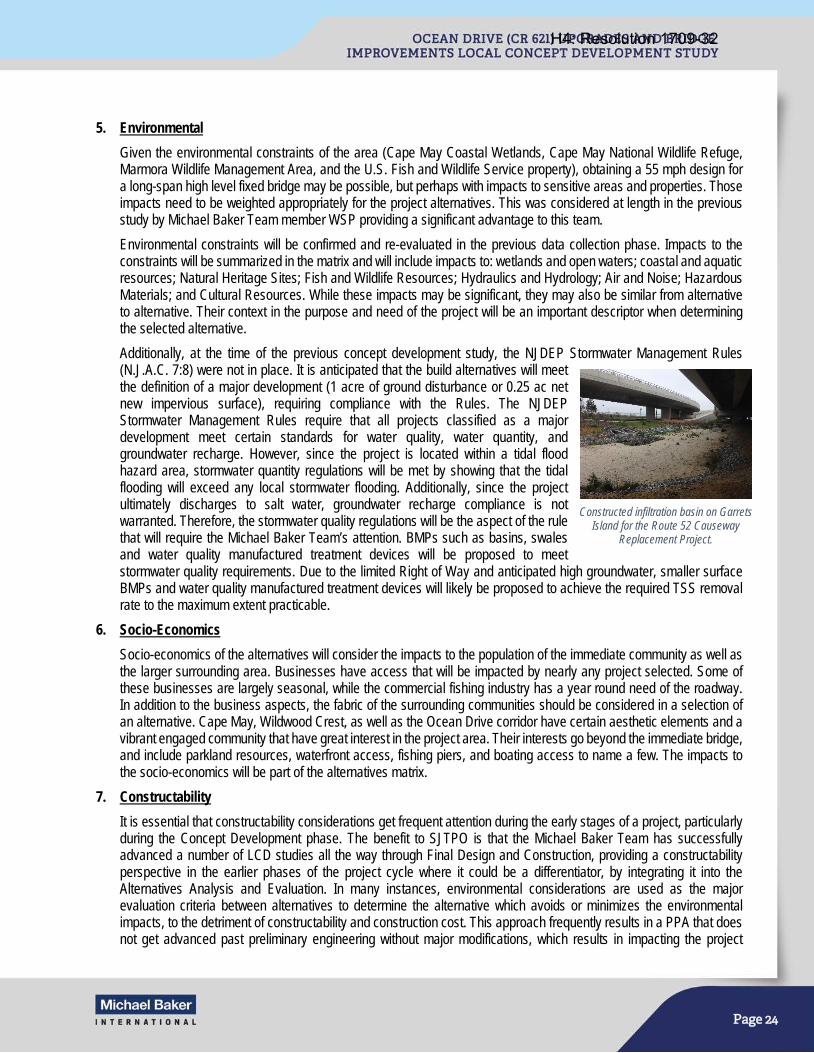
Page 24
5. Environmental
Given the environmental constraints of the area (Cape May Coastal Wetlands, Cape May National Wildlife Refuge, Marmora Wildlife Management Area, and the U.S. Fish and Wildlife Service property), obtaining a 55 mph design for a long-span high level fixed bridge may be possible, but perhaps with impacts to sensitive areas and properties. Those impacts need to be weighted appropriately for the project alternatives. This was considered at length in the previous study by Michael Baker Team member WSP providing a significant advantage to this team.
Environmental constraints will be confirmed and re-evaluated in the previous data collection phase. Impacts to the constraints will be summarized in the matrix and will include impacts to: wetlands and open waters; coastal and aquatic resources; Natural Heritage Sites; Fish and Wildlife Resources; Hydraulics and Hydrology; Air and Noise; Hazardous Materials; and Cultural Resources. While these impacts may be significant, they may also be similar from alternative to alternative. Their context in the purpose and need of the project will be an important descriptor when determining the selected alternative.
Additionally, at the time of the previous concept development study, the NJDEP Stormwater Management Rules (N.J.A.C. 7:8) were not in place. It is anticipated that the build alternatives will meet the definition of a major development (1 acre of ground disturbance or 0.25 ac net new impervious surface), requiring compliance with the Rules. The NJDEP Stormwater Management Rules require that all projects classified as a major development meet certain standards for water quality, water quantity, and groundwater recharge. However, since the project is located within a tidal flood hazard area, stormwater quantity regulations will be met by showing that the tidal flooding will exceed any local stormwater flooding. Additionally, since the project ultimately discharges to salt water, groundwater recharge compliance is not warranted. Therefore, the stormwater quality regulations will be the aspect of the rule that will require the Michael Baker Team’s attention. BMPs such as basins, swales and water quality manufactured treatment devices will be proposed to meet stormwater quality requirements. Due to the limited Right of Way and anticipated high groundwater, smaller surface BMPs and water quality manufactured treatment devices will likely be proposed to achieve the required TSS removal rate to the maximum extent practicable.
6. Socio-Economics
Socio-economics of the alternatives will consider the impacts to the population of the immediate community as well as the larger surrounding area. Businesses have access that will be impacted by nearly any project selected. Some of these businesses are largely seasonal, while the commercial fishing industry has a year round need of the roadway. In addition to the business aspects, the fabric of the surrounding communities should be considered in a selection of an alternative. Cape May, Wildwood Crest, as well as the Ocean Drive corridor have certain aesthetic elements and a vibrant engaged community that have great interest in the project area. Their interests go beyond the immediate bridge, and include parkland resources, waterfront access, fishing piers, and boating access to name a few. The impacts to the socio-economics will be part of the alternatives matrix.
7. Constructability
It is essential that constructability considerations get frequent attention during the early stages of a project, particularly during the Concept Development phase. The benefit to SJTPO is that the Michael Baker Team has successfully advanced a number of LCD studies all the way through Final Design and Construction, providing a constructability perspective in the earlier phases of the project cycle where it could be a differentiator, by integrating it into the Alternatives Analysis and Evaluation. In many instances, environmental considerations are used as the major evaluation criteria between alternatives to determine the alternative which avoids or minimizes the environmental impacts, to the detriment of constructability and construction cost. This approach frequently results in a PPA that does not get advanced past preliminary engineering without major modifications, which results in impacting the project
Constructed infiltration basin on Garrets Island for the Route 52 Causeway
Replacement Project.
H4: Resolution 1709-32
Page 25
schedule. Our team will balance the needs to avoid and minimize the environmental impacts along with the constructability considerations by integrating the following:
a. Environmental Impacts: By gaining knowledge of the existing environmental resources within the project limits, we will be able to not only quantify these environmental impacts, but also determine how they could potentially affect construction from timing restrictions for in-water construction, the need to have construction access trestles, and to determine bridge versus roadway limits to minimize impacts on wetlands.
b. Barge Access and Laydown Areas: While the final footprint for the laydown and barge access areas will be finalized in subsequent phases, their potential locations need to be evaluated during this phase as their location and size would differ between alternatives. Figure 3 (included at the end of this Narrative) illustrates existing depths of channels and inlets in the vicinity of the project limits.
c. Construction over Middle Thorofare Channel: Coordination with the US Coast Guard needs to be initiated during this phase to not only get a preliminary determination of the vertical clearance, but to also discuss allowable window for channel closure during construction.
d. Construction Staging: Depending on the geometry of the alternatives, some may be more suitable for construction staging than others which could facilitate maintenance of traffic and potential contract packaging.
e. Miscellaneous Considerations: Other considerations, such as accelerated bridge construction techniques, pile supported embankments, impacts to major utilities will be evaluated and integrated into the alternatives analysis as appropriate and when the offer to be a differentiator between alternatives.
C. Alternatives Development Documentation
The Michael Baker Team will document the methodology for developing the alternatives and detail the reasons why alternatives were removed from consideration including any fatal flaws. Michael Baker will document the public and agency input for each alternative. For identified design exceptions, Michael Baker will develop alternatives to eliminate exceptions or obtain reasonable assurance of the design exception from NJDOT and Cape May County.
The Michael Baker Team will maintain a continuous open dialog with the Project Team as the project progresses, to obtain an up-to-date understanding of the concerns of the SJTPO, Cape May County and NJDOT. We will consider the impact of each alternative and develop a methodology to weigh and/or rank the impacts for each of the identified critical issues, and, in coordination with the SJTPO, Cape May County and NJDOT, to select a PPA. We will work with the Cape May County engineer to obtain a resolution of support for the selected PPA from impacted municipalities. The PPA will be submitted for review and approval and the selection process will be documented for inclusion in the Concept Development Report.
Michael Baker will summarize the findings of the alternatives development process in the Alternatives Analysis Document, which will include a detailed description of each alternative, conceptual plan of each alternative, the Alternatives Comparison Matrix, a synopsis of the alternatives analysis, stakeholder input, comments and comment resolutions, and the selection of the PPA.
D. Value Engineering Review
Based on federal regulation 23 CFR Part 627.9(d) (1), all Federal-aid bridge projects with an estimated total cost of over $40 million shall have a Value Engineering Technical Report prepared. In accordance with the NJDOT’s Capital Project Delivery Process for Concept Development, the Michael Baker Team will provide input to the NJDOT’s Value Engineering (VE) Unit to conduct an independent review of the draft Preliminary Preferred Alternative (PPA) in order to identify, evaluate, develop, and recommend alternative designs or methods that will provide an acceptable or improved product. The Michael Baker Team will develop a project overview presentation for select NJDOT subject matter experts with diverse engineering backgrounds and who are independent from the project development team. This objectivity will allow for the identification of alternative solutions that maximize the value of every dollar spent and minimize life cycle costs.
It is well known that the earlier VE is performed during a project’s life cycle, the greater the opportunity to achieve cost savings and value. Since the Ocean Drive Upgrades and Bridge Improvements Project will be in the early LCD phase, the VE team will focus on strategic issues, overall scope development, risk mitigation, procurement strategies, constructability issues, etc., to ensure that a project will stay on track to meet its cost and schedule goals. The Michael Baker Team will organize a one day VE workshop after a draft PPA has been developed, at which time pertinent documentation, calculations and drawings will be
H4: Resolution 1709-32
Page 26
provided. At the conclusion of the VE process, the NJDOT VE Unit will provide a VE Technical Report to the design team for review and comment. Comments will be addressed in a Comment Resolution Memorandum and returned to the NJDOT for inclusion in the overall LCD Report.
Additionally, following the Value Engineering Review, a PPA Constructability Review will be performed by NJDOT’s Bureau of Construction Management to identify project specific construction risks with associated probability and impact to schedule and cost, allowing the project team to assess changes to staging and construction methods at the appropriate time in design to potentially reduce the construction duration. Previously identified constructability risks will be reviewed (as documented in the Risk Register), and any new risks identified will subsequently be added to an updated Risk Register. Furthermore, the Constructability Review will potentially help in developing a more accurate construction cost estimate. Comments from the Constructability Review will be made in writing along with comment responses from the Michael Baker Team, and included in the overall LCD Report.
E. Risk Management Review and Documentation
A key member of Michael Baker’s Concept Development Team, Martin Wade, was deeply involved with the development of NJDOT’s overall risk management process and will seamlessly incorporate the process into the overall project to help evaluate deficiencies and identify fatal flaws to assist in selecting the PPA. In accordance with NJDOT’s standards, Michael Baker will perform risk identification and quantitative risk analysis, and develop risk response strategies and action plans. A Risk Register will be maintained to document project risks throughout the project life cycle. Due to the anticipated total construction cost being greater than $100 million, a Quantitative Risk Analysis Worksheet will also be developed to numerically estimate the probability that the project will meet its cost and schedule objectives. The results of the Quantitative Risk Analysis will be summarized in the Quantitative Risk Analysis Report.
As the study progresses, one area of particular importance is the potential utility conflicts with the proposed work. These will be identified for each alternative. Impacts will be quantified, evaluated and summarized for each alternative, along with approximate costs related to the relocations required. Potential impacts related to right of way, easement requirements and environmental permits will also be addressed. This information will be provided for inclusion in the Alternative Comparison Matrix.
Per the NJDOT Capital Project Delivery Process, a Utility Risk Assessment Plan will be developed to highlight potential high risk utility impacts, such as the underground gas distribution line at the western project limit and the sanitary force main that runs the project length. Potential utility relocation alternatives considered will be in accordance with the State Utility and Railroad Accommodation Policy.
F. Develop Mitigation Strategies
If a build alternative is selected, impacts to sensitive ecological resources including wetlands, open waters and habitat for state and federal listed species are will be unavoidable. Ultimately, project authorizations will be required from several federal and state resource agencies. Mitigation in coastal areas is often challenging as most land is either already protected or developed. Recognizing these challenges, the Michael Baker Team proposes to evaluate conceptual mitigation options in Concept Development.
The Consultant Team will perform an initial mitigation site search and evaluation to determine potential mitigation strategies for inclusion in the proposed PPA. This will include the identification of potential properties for acquisition and preservation to address potentially needed authorization for a diversion of state or federal wildlife refuge properties. Additionally, opportunities within the general project environs for habitat restoration and/or creation will be identified to address compensatory mitigation requirements for wetland and coastal resource impacts. The mitigation search will include the identification of potential sites within the general project corridor and adjoining areas, a review of ownership status and whether adequate mitigation credit would be available to satisfy regulatory requirements. Additional mitigation measures such as seasonal restrictions and best management practices will also be identified, which may ultimately affect construction.
Task 3 Deliverables: • Alternatives Comparison Matrix (Electronic/5 Hardcopies)
• Description of the Alternatives (Electronic/5 Hardcopies)
H4: Resolution 1709-32
Page 27
• Risk Register
• Utility Risk Assessment Plan
• Quantitative Risk Analysis Report
• Conceptual Mitigation Report
TASK 4: DOCUMENTATION A. Concept Development Plans
Michael Baker will prepare concept plans for the selected PPA, including the proposed alignment and bridge type, local roadway improvements, drainage, anticipated impacts to sensitive receptors, right of way, potential ITS needs, and impacts to adjacent properties. This information will be developed using the updated mapping document during the data collection task. The plans will be developed at a scale of 1”=100’ with contours generated at a 1-foot interval and in accordance with Cape May County Engineering standards, AASHTO, the NJDOT Roadway Design Manual, Drainage Design Manual, the 2007 Standard Specifications for Roads and Bridge Construction, etc. Michael Baker will also prepare preliminary MPT schemes, detour routes and/or conceptual construction staging plans for review by the Project Team.
B. Prepare Order of Magnitude Cost Estimates
Based on the concept plans, a concept-level construction cost estimate for the PPA will be prepared. The cost estimate will consider major construction activities including mobilization, paving, excavation, removal and demolition of existing, new structures, drainage, SWM facilities, lighting, landscaping, environmental mitigation, MPT, etc. Recent unit bid prices will be made available to the Project Team by Cape May County or NJDOT. Contingencies and escalation will also be included. Right-of-Way impacts to property owners will also be noted.
C. NEPA Classification and Documentation
Although NEPA review and permit authorization are not addressed until Preliminary Engineering and Final Design, respectively, a primary objective during Concept Development (CD) is determining an appropriate NEPA classification. The goal of the CD process is to craft a well-defined and justified purpose and need statement and develop a range of reasonable alternative to address that need. Given the complexity and challenges of this project due to its environmental sensitivity and potential for significant impact, additional efforts to build consensus among regulatory agencies and develop preliminary mitigation strategies to address regulatory requirements can be conducted during CD. By incorporating the input from external stakeholders, including regulatory agencies, into the PPA, the project team is better able to demonstrate efforts to minimize harm, comply with applicable regulatory standards, and minimize potential for significant impacts, and in doing so, help to provide for a more defensible NEPA classification and streamline subsequent environmental approvals.
The County previously determined that the appropriate NEPA classification was an Environmental Assessment. However, given the opportunities for greater collaboration with regulatory agencies and refining mitigation strategies as part of this project, the project may likely qualify for a Categorical Exclusion Document under bridge rehabilitation, reconstruction or replacement (23 CFR 771.117(d)3. Based on the agency input and alternative analysis conducted under Task 1 and 3 above, respectively, the Michael Baker Team, in coordination with the Project Team, will determine the level of NEPA documentation (i.e., Categorical Exclusion(s), Environmental Assessment with FONSI, or Environmental Impact Statement) for the next phase of work. In addition to the environmental document, a determination will be made regarding the need for any additional Section 106 documentation or Section 4(f), Section 6 (f) etc. investigations, evaluation(s) and reporting.
D. Develop Preliminary Engineering Next Steps/Tasks
The Michael Baker Team will coordinate with the Project Team to prepare the next steps, utilizing the NJDOT PE Scope Statement format. The PE scope statement needed to conduct Preliminary Engineering and Final Design, and includes approval of the environmental document and any design exceptions. The PE Scope Statement will be included in the Concept Development Report. An initial Preliminary Engineering, Final Design and Construction schedule will be developed and will
H4: Resolution 1709-32
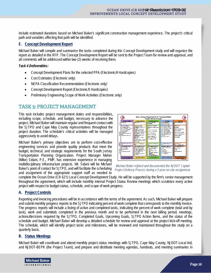
Page 28
include estimated durations based on Michael Baker’s significant construction management experience. The project’s critical path and variables affecting that path will be identified.
E. Concept Development Report
Michael Baker will compile and summarize the tasks completed during this Concept Development study and will organize the report as detailed in the RFP. The Concept Development Report will be sent to the Project Team for review and approval, and all comments will be addressed within two (2) weeks of receiving them.
Task 4 Deliverables: • Concept Development Plans for the selected PPA (Electronic/4 Hardcopies)
• Cost Estimates (Electronic only)
• NEPA Classification Recommendation (Electronic only)
• Concept Development Report (Electronic/5 Hardcopies)
• Preliminary Engineering Scope of Work Activities (Electronic only)
TASK 5: PROJECT MANAGEMENT This task includes project management duties and responsibilities, including scope, schedule, and budget, necessary to advance the project. Michael Baker will maintain regular and frequent contact with the SJTPO and Cape May County representatives throughout the project duration. The schedule’s critical activities will be managed aggressively to avoid delays.
Michael Baker’s primary objectives are to perform cost-effective engineering services and provide quality products that meet the budget, technical, and strategic requirements for the South Jersey Transportation Planning Organization. Project Manager Maher (Mike) Sidani, P.E., PMP, has extensive experience in managing multidisciplinary infrastructure projects. Mr. Sidani will be Michael Baker’s point of contact for SJTPO, and will facilitate the scheduling and assignment of the appropriate support staff as needed to complete the Ocean Drive (CR 621) Local Concept Development Study. He will be supported by the firm’s senior management throughout the agreement, which will include monthly internal Project Status Review meetings which scrutinize every active project with respect to budget status, schedule, and scope of work progress.
A. Project Controls
Reporting and invoicing procedures will be in accordance with the terms of the agreement. As such, Michael Baker will prepare and submit monthly progress reports to the SJTPO indicating percent of work complete that corresponds to the monthly invoice. The progress reports will include a listing of active and completed tasks, indicating the percent of work complete (total and by task), work and submittals completed in the previous month and to be performed in the next billing period, meetings, actions/decisions required by the SJTPO, Completed Goals, Upcoming Goals, SJTPO Action Items, and the status of the schedule and budget. Michael Baker will develop a detailed schedule for review and approval at the project kick-off meeting. The schedule, which will identify project tasks and milestones, will be reviewed and maintained throughout the study on a quarterly basis.
B. Status Meetings
Michael Baker will coordinate and attend monthly project status meetings with SJTPO, Cape May County, NJDOT-Local Aid, and NJDOT-BEPR (the Project Team), and prepare and distribute meeting agendas, handouts, and meeting summaries in
Michael Baker refined and documented the NJDOT Capital Project Delivery Process during a 5-year on-site assignment.
H4: Resolution 1709-32
Page 29
support of those meetings. Michael Baker will develop a two-week look ahead list of activities and identify action items to be discussed at each status meeting. Michael Baker will document meetings, maintain a list of action items, and maintain a database of design related and decision making actions as a result of attended meetings.
C. Project SharePoint Site
Michael Baker will establish a project SharePoint site. SharePoint is a web-based Microsoft product, and as such, is accessible from mobile devices with an internet connection and integrates seamlessly with Microsoft Office 365 and Microsoft Project. The SharePoint site will be made available to the Project Team and stakeholders, as appropriate. It is anticipated that the site will contain electronic copies of project documents, schedules, meeting agendas, handouts, minutes, presentations, a project calendar with meetings and project milestone dates, and the DCR.
Michael Baker is successfully hosting, maintaining and using a SharePoint site as an electronic document library for the Pulaski Skyway Rehabilitation Program, the Oceanic Bridge LCD Study, and the Sixth & Central Bridges LCD Study. As the Skyway Program consists of five design teams, each with multiple subconsultants, a SharePoint site has proven to be an excellent tool for real-time coordination and collaboration between members of the Project Team.
D. Design Communications Report
Michael Baker will establish a Design Communications Report (DCR) which will provide a record of all relevant communication, decisions, agreements, and approvals that occur between the Project Team and stakeholders. The DCR will be maintained on a project SharePoint Site. The SharePoint site will serve as an electronic document library throughout the course of the study.
E. Quality Management
Quality control at Michael Baker starts with a solid foundation in project management. Michael Baker has a series of rigorous processes and checks that result in services and products that meet or exceed client’s expectations. Quality assurance (QA) and quality control (QC) are part of an overall project management system called “The Michael Baker Way” to track and check interim products and to maintain the quality of final products. Michael Baker staff who perform quality control checks have been trained by the Project Management Institute (PMI). Michael Baker’s QA and QC methods are in place and ready to be implemented and tailored for this project. They involve separate QA procedures to verify the availability of resources and tools to enforce quality control. Michael Baker’s QA/QC Lead, Joe Danyo, will consult with Mr. Sidani to establish a Project Specific Quality Management Plan (PSQMP). The PSQMP details the specific resources and actions necessary to provide the best opportunity for the project deliverables to meet the client’s quality expectations and requirements. This PSQMP will be integrated, ongoing and focused throughout the project and not just applied before a submission. The QA/QC procedures will also be applied to the subconsultants’ tasks. By integrating QA/QC into the project’s production process, Michael Baker will deliver a clear, concise, and accurate deliverables.
“The Michael Baker Way” is Michael Baker’s proven, effective project management process to monitor and control schedules, resources and costs. This process was developed to facilitate communication and understanding between SJTPO, Cape May County and the Project Manager, while streamlining communication within the project disciplines. A Project Management Plan (PMP) will be developed for the project by the Project Manager, approved by the Principal in Charge, and distributed to all team members. The PMP serves as the roadmap to successful performance of the project and includes clear definition of the following project elements:
• Project Purpose • Project Budget & Invoicing • Project Schedule • Scope of Work & Contract • Quality Management Plan • Communications Plan • Critical Assumptions & Constraints • Risk Management Plan • Change Management Plan • Project Team & Stakeholders • Safety & Occupational Health • Project Closeout Plan
H4: Resolution 1709-32

Page 30
Task 5 Deliverables: • An initial detailed project schedule at the Project Kick-off meeting and quarterly schedule updates
• Monthly in-person status meetings with the Project Team
• Regulatory Agency Meetings (up to four)
• Project Team SharePoint Site
• Design Communications Report
• Documentation for the above mentioned meetings, including agendas, handouts, presentations, minutes and written summaries of project meetings
• Monthly progress reports and corresponding invoices
H4: Resolution 1709-32

OCEAN DR
NEW JERSEY AV
USCG ENTRANCE ST
FISH DOCK RD
MEMPHIS AV
NORTH STATION AV
SOUTH STATION AV
RALEIGH AV
MADISON AV
8TH AV
Ford Creek
Mill Creek
Upper Thorofare
Lowe
r Tho
rofare
Midd
le Th
orofa
re
Cape May Inlet
Cape May Canal
1
2
3
45
3
2
6
1
2
1
2
3
5
43
4
7
21 2 3
2 3
32
1
Cape May Coastal Wetlands
Cape May Coastal Wetlands
Cape May Coastal Wetlands
Cape May NationalWildlife Refuge
5 6
5 6
5
5
5
7
64
1
2 2 2 22 2
11 2 4
2 2
12
21
2
2
4 2 21 2 4
35
109
KL6211
3
1
LOWER TOWNSHIP
CITY OF CAPE MAY
1,000 0 1,000500 Feet
Stormwater Structural/GeotechnicalEnvironmental LegendRoadwayMunicipal BoundaryFederal and State Open Space
NWI WetlandsSubmerged Aquatic VegetationTidelands Claims
Snowy EgretLittle Blue HeronYellow-crowned Night-heronLeast TernGlossy IbisCommon TernBlack-crowned Night-heronBlack SkimmerBald EagleOspreyTricolored HeronGull-billed Tern
T&E SpeciesCultural Resources1
3
Garden State Parkway Historic DistrictCape May Historic DistrictOcean Highway overMiddle Thorofare BridgeUnited States Coast GuardSupport UnitHornbeam (WLB 394)
2
4
5
Historic Resources
Minimize impacts to wetlands and open water.1Avoid Green Acres and USFWS land diversionsand maintain public access during construction.2
Timing restrictions on in-water construction.Evaluate need for hydroacustic mitigation such as bubble curtains.
4
Coordinate with USFWS and NJDEP Divisionof Fish and Wildlife regarding effects to migratory birds.
7
Consider visual impact to Cape May Historic District.6
Mitigation measures for affects on historic bridge may include recordation, context sensitive design, reuse of salvaged elements, and interpretive displays.
5
Evaluate mitigation opportunities early.3
I
Staging and Constructability
1% Flood plain increased to 11' NAVD88 sinceprevious CD Report.1
August 2017
South Jersey Transportation Planning Organization
Figure 1Key Issues
Lower TownshipCape May County, New Jersey
Ocean Drive (CR621) Upgrades and Bridge Improvements
NJ Route 109 to Madison Avenue Utilities/Right-of-Way
Raise the elevation above the 100-Year flood elevation.1Widen travel lane width from 10' to 12' and reduce shoulder width to 8' minimum within existing roadway cross section.
2
Correct deficient horizontal curvature.3Correct deficient profile grades for sufficient surface drainage.4
Stormwater management needs to consider coastal impacts.3
Undersized culvert moderating freshwater & saltwater interaction.2
Address local pedestrian safety concerns.5
Minimize impacts to aerial electrical lines, highway luminaries, aerial & underground cable lines, under ground gas distribution lines, and LTUA sanitary force main.
1
Minimize impacts and maintain access to adjacent properties.2ROW easements and riparian grants will be required.3
Previous AlignmentsBaker Alignments
Maintain two lanes of traffic at all times.1
Consideration of constructability and cost as independent factors for the feasible constructionof middle thorofare bridge.
4
Perform offline bridge construction while exisiting bridge remains inservice. Perform two main stage roadway construction utilizing temporary pavement.
3
Preserve access to boarding properties during construction.2
Identify structural solutions that minimize closures to the navigational channel.7
Consider access trestle needed where water depths are low (4.5') at low tide.6
Consider potential ABC solution for precast structures in marine environment.5
Minimize vibration to adjacent existing structures during foundation installation.4
Use pre-augering or water settling to help piles penetrate alternating layers of stiff clayand dense sand.
3
Address deep scour depths present in nearby channels during design.2
Implement soil improvement methods such as wick drain and column embankment to preventtime related settlement on tidal marsh soil.
1
H4: Resolution 1709-32

Federal Channel (USACE Philadelphia District): NJICWW
Inlet (USACE Philadelphia District): Cold Spring Inlet Cape May Canal
NJ State Channel (NJDOT OMR): Beach Creek 2 Middle Thorofare Lagoon Ottens Harbor Channel Sunset Lake Channel West Wildwood Channel
o 0.5 1 _-=== ___ Miles
Legend
Federal Channel (ICWW) (USACE) The authorized depth of the NJICWW at Middle Thorofare Bridge is -12 mean lower low water and the authorized channel width is 100-feet.
Inlet (USACE)
State Channel (NJDOT)
.. Municipalities
Source: 2014 NOAA National Centers for Env ironmental Information (NCEI) Digital Elevation Model (OEM), 1/9 arc second ; USACE; NJ Department ofTransportation; NJ Office of Information Technology, Office of Geograph ic Information Systems.
South Jersey Transportation Planning Organization
Figure 2 Channel Conditions
Ocean Drive (CR621) Upgrades and Bridge Improvements
NJ Route 109 to Madison Avenue
Lower Township Cape May County, New Jersey
~!,I"!'~T! August 2017 , .
H4: Resolution 1709-32
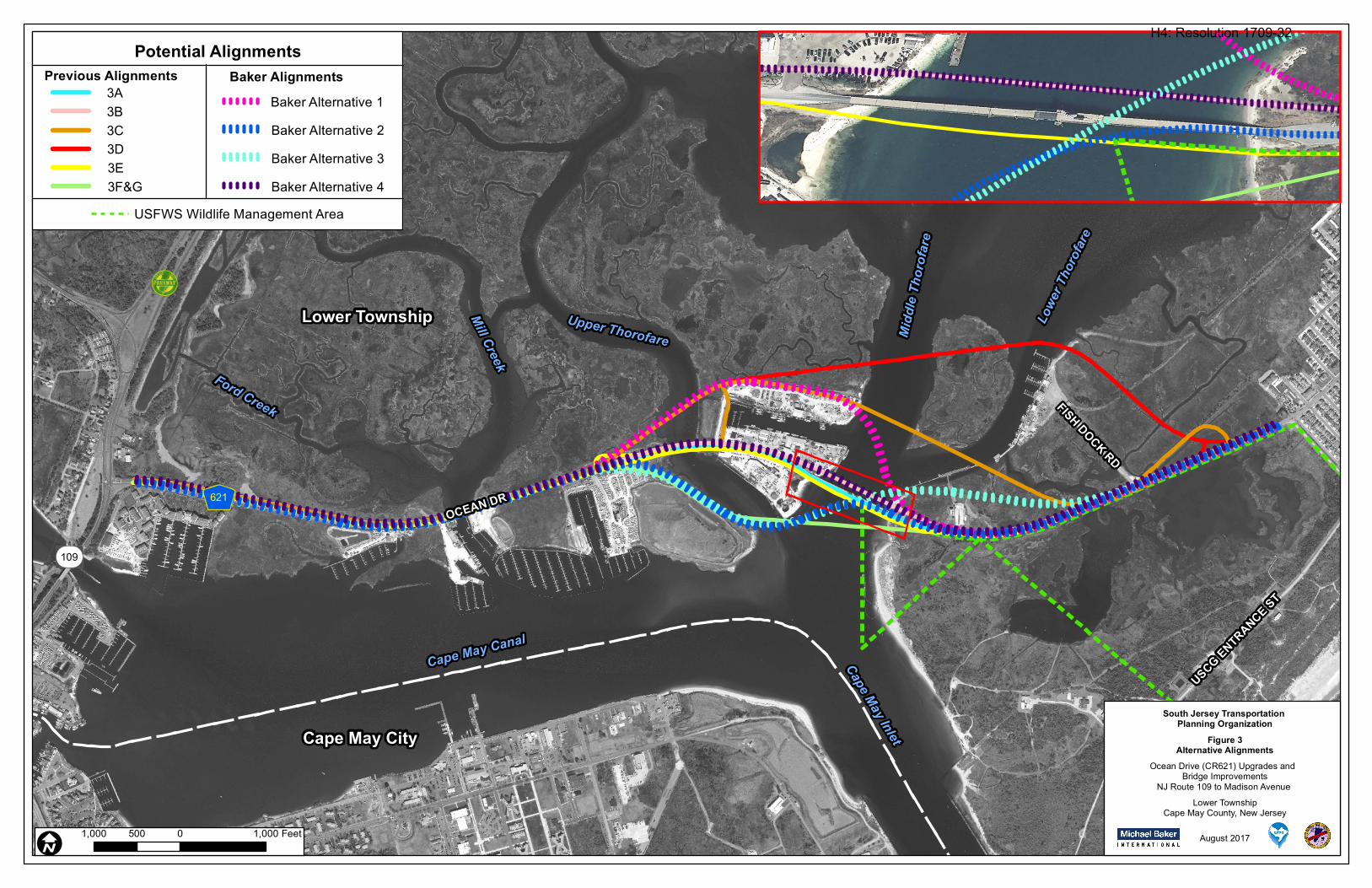
OCEAN DR
BAYVIEW DR
USCG ENTRANCE ST
FISH DOCK RD
Ford Creek
Mill Creek
Upper Thorofare
Lowe
r Tho
rofare
Midd
le Th
orofa
re
Cape May Inlet
Cape May Canal
109
KL621
Lower Township
Cape May City
I1,000 0 1,000500 Feet August 2017
South Jersey Transportation Planning Organization
Figure 3Alternative Alignments
Lower TownshipCape May County, New Jersey
Ocean Drive (CR621) Upgrades and Bridge Improvements
NJ Route 109 to Madison Avenue
Potential AlignmentsPrevious Alignments Baker Alignments
Baker Alternative 4Baker Alternative 3Baker Alternative 2Baker Alternative 1
USFWS Wildlife Management Area
3A3B3C3D3E3F&G
H4: Resolution 1709-32

Page 35
STAFFING PLAN Michael Baker has provided engineering and design services for some of the largest and most complex bridges recently constructed in the United States. Michael Baker is the 7th largest bridge consultant in the country, as ranked by Engineering News Record, and our diverse bridge experience enables us to provide cutting-edge ideas and superior guidance for complex bridge projects of all types. Michael Baker’s key personnel have established a legacy of responding to the most complex highway interchange projects and toughest bridge challenges with innovative and sustainable bridge designs, and have demonstrated leadership by promoting advancements in bridge design and construction, such as the use of high-performance materials and Accelerated Bridge Construction techniques.
In New Jersey, Michael Baker’s success can be summarized by the completion of the signature Route 52 Bridge for the NJDOT, a project that successfully addressed many of the same issues facing the Ocean Drive and the Middle Thorofare Bridge. Mike Sidani, the Project Manager from the Route 52 Causeway Construction project, has been selected to lead the Ocean Drive (CR 621) project for SJTPO and Cape May County. In addition to demonstrating his acumen with complex bridge Feasibility Assessment, Preliminary Engineering and Final Design in coastal areas, Mike is also the Project Manager for the Oceanic Bridge Local Concept Development (LCD) Study for NJTPA and Monmouth County. Based on the anticipated Notice to Proceed date in the RFP, the Oceanic Bridge LCD Study will be in the final stages of completion by the time the Ocean Drive study gets underway. Mike’s time can then be focused on the Ocean Drive study while incorporating all of the lessons learned from the Oceanic Bridge study. Mike will apply that direct and relevant experience to the Ocean Drive LCD Study and is one of the reasons the Michael Baker Team can accelerate the project, in advance of the schedule outlined.
Mike’s Deputy Project Manager on the Ocean Drive LCD Study will be Jim Yeager. This is the same leadership team completing the Oceanic Bridge LCD Study and is poised to execute this project at Notice to Proceed. In addition to the Oceanic Bridge LCD Study, Jim was the Project Manager for the Northerly Crossings Feasibility Study for the Delaware Joint River Toll Bridge Commission. That study included the development of alternatives for the four bridges over the Delaware River in Warren and Sussex Counties. In addition to the development of alternatives, that study had significant public outreach and alternatives analysis components. Mike’s and Jim’s complimentary skills have yielded successful collaboration on a number of projects in the past. In fact, the proposed staff from Michael Baker have worked together extensively in the past, and have developed the strong working relationships of a highly-functioning team. This project will be managed out of Michael Baker’s Hamilton, NJ office, located at 300 American Metro Boulevard, Suite 154.
Michael Baker has selected WSP USA (WSP, formerly Parsons Brinckerhoff) as a partner for the Ocean Drive LCD Study. Michael Baker has a history of teaming with WSP on a number of other endeavors including the current Marine Transportation System Planning Agreement for the NJDOT Office of Maritime Resources. WSP brings the unparalleled benefit of completing the Scope Development and Feasibility Study for Improvements to Ocean Drive in 2004. Aside from having ready access to previously collected data and information, WSP has intimate knowledge and insight of the needs, issues, major stakeholders, and methodology that went into the development and evaluation of the previous alternatives and alternatives evaluation matrix. Given that unique experience, the Michael Baker Team believes the project approach developed for the Ocean Drive LCD Study has the ability to reduce schedule durations and reduce costs while still developing, evaluating and recommending an alternative that meets the Purpose and Need of the project.
The Michael Baker Team is comprised of leaders that have delivered successful concept development studies and design projects which allows the Team to remain intact and seamlessly transition to the next phases of a project’s life, preliminary engineering and final design. Michael Baker and WSP have the previous experience with the project, LCD study experience, knowledge of bridge design, especially in coastal areas, and the resources available to hit the ground running on this assignment.
H4: Resolution 1709-32
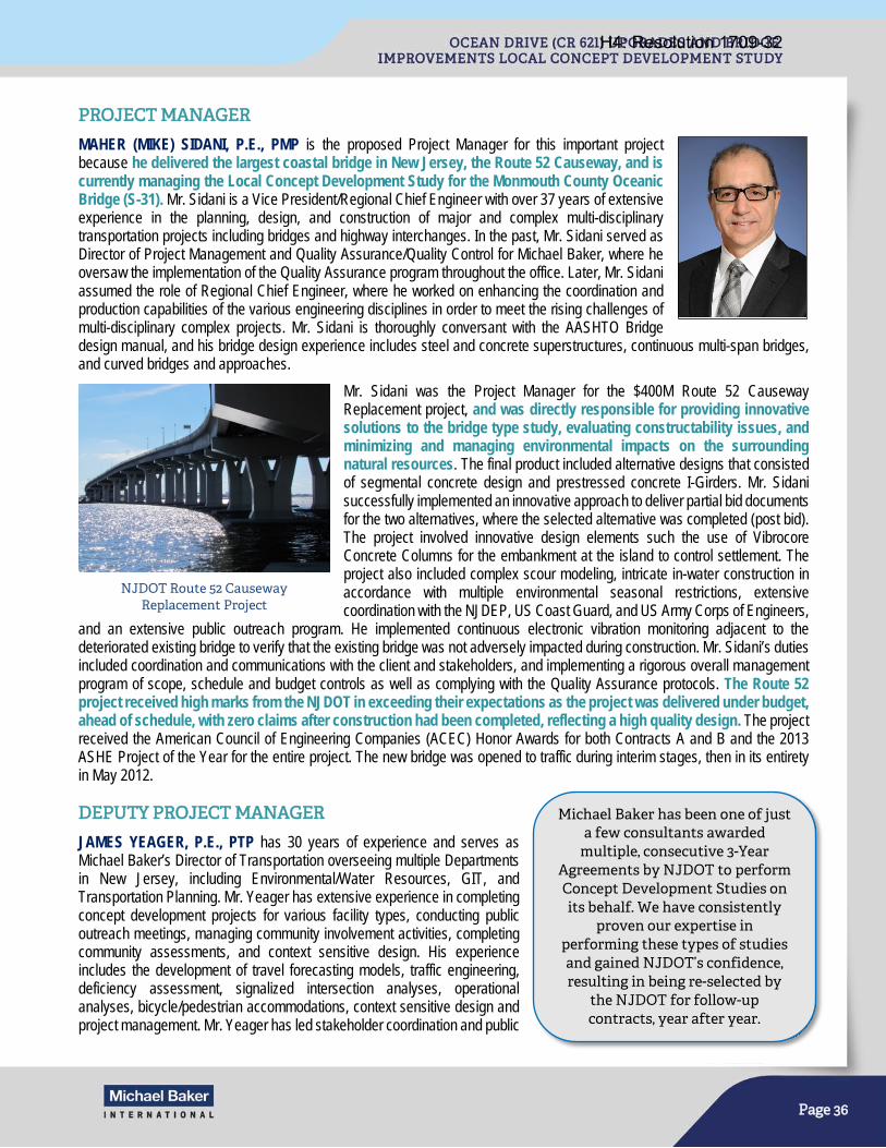
Page 36
PROJECT MANAGER
MAHER (MIKE) SIDANI, P.E., PMP is the proposed Project Manager for this important project because he delivered the largest coastal bridge in New Jersey, the Route 52 Causeway, and is currently managing the Local Concept Development Study for the Monmouth County Oceanic Bridge (S-31). Mr. Sidani is a Vice President/Regional Chief Engineer with over 37 years of extensive experience in the planning, design, and construction of major and complex multi-disciplinary transportation projects including bridges and highway interchanges. In the past, Mr. Sidani served as Director of Project Management and Quality Assurance/Quality Control for Michael Baker, where he oversaw the implementation of the Quality Assurance program throughout the office. Later, Mr. Sidani assumed the role of Regional Chief Engineer, where he worked on enhancing the coordination and production capabilities of the various engineering disciplines in order to meet the rising challenges of multi-disciplinary complex projects. Mr. Sidani is thoroughly conversant with the AASHTO Bridge design manual, and his bridge design experience includes steel and concrete superstructures, continuous multi-span bridges, and curved bridges and approaches.
Mr. Sidani was the Project Manager for the $400M Route 52 Causeway Replacement project, and was directly responsible for providing innovative solutions to the bridge type study, evaluating constructability issues, and minimizing and managing environmental impacts on the surrounding natural resources. The final product included alternative designs that consisted of segmental concrete design and prestressed concrete I-Girders. Mr. Sidani successfully implemented an innovative approach to deliver partial bid documents for the two alternatives, where the selected alternative was completed (post bid). The project involved innovative design elements such the use of Vibrocore Concrete Columns for the embankment at the island to control settlement. The project also included complex scour modeling, intricate in-water construction in accordance with multiple environmental seasonal restrictions, extensive coordination with the NJDEP, US Coast Guard, and US Army Corps of Engineers,
and an extensive public outreach program. He implemented continuous electronic vibration monitoring adjacent to the deteriorated existing bridge to verify that the existing bridge was not adversely impacted during construction. Mr. Sidani’s duties included coordination and communications with the client and stakeholders, and implementing a rigorous overall management program of scope, schedule and budget controls as well as complying with the Quality Assurance protocols. The Route 52 project received high marks from the NJDOT in exceeding their expectations as the project was delivered under budget, ahead of schedule, with zero claims after construction had been completed, reflecting a high quality design. The project received the American Council of Engineering Companies (ACEC) Honor Awards for both Contracts A and B and the 2013 ASHE Project of the Year for the entire project. The new bridge was opened to traffic during interim stages, then in its entirety in May 2012.
DEPUTY PROJECT MANAGER
JAMES YEAGER, P.E., PTP has 30 years of experience and serves as Michael Baker’s Director of Transportation overseeing multiple Departments in New Jersey, including Environmental/Water Resources, GIT, and Transportation Planning. Mr. Yeager has extensive experience in completing concept development projects for various facility types, conducting public outreach meetings, managing community involvement activities, completing community assessments, and context sensitive design. His experience includes the development of travel forecasting models, traffic engineering, deficiency assessment, signalized intersection analyses, operational analyses, bicycle/pedestrian accommodations, context sensitive design and project management. Mr. Yeager has led stakeholder coordination and public
NJDOT Route 52 Causeway Replacement Project
Michael Baker has been one of just a few consultants awarded
multiple, consecutive 3-Year Agreements by NJDOT to perform Concept Development Studies on its behalf. We have consistently
proven our expertise in performing these types of studies and gained NJDOT’s confidence, resulting in being re-selected by
the NJDOT for follow-up contracts, year after year.
H4: Resolution 1709-32
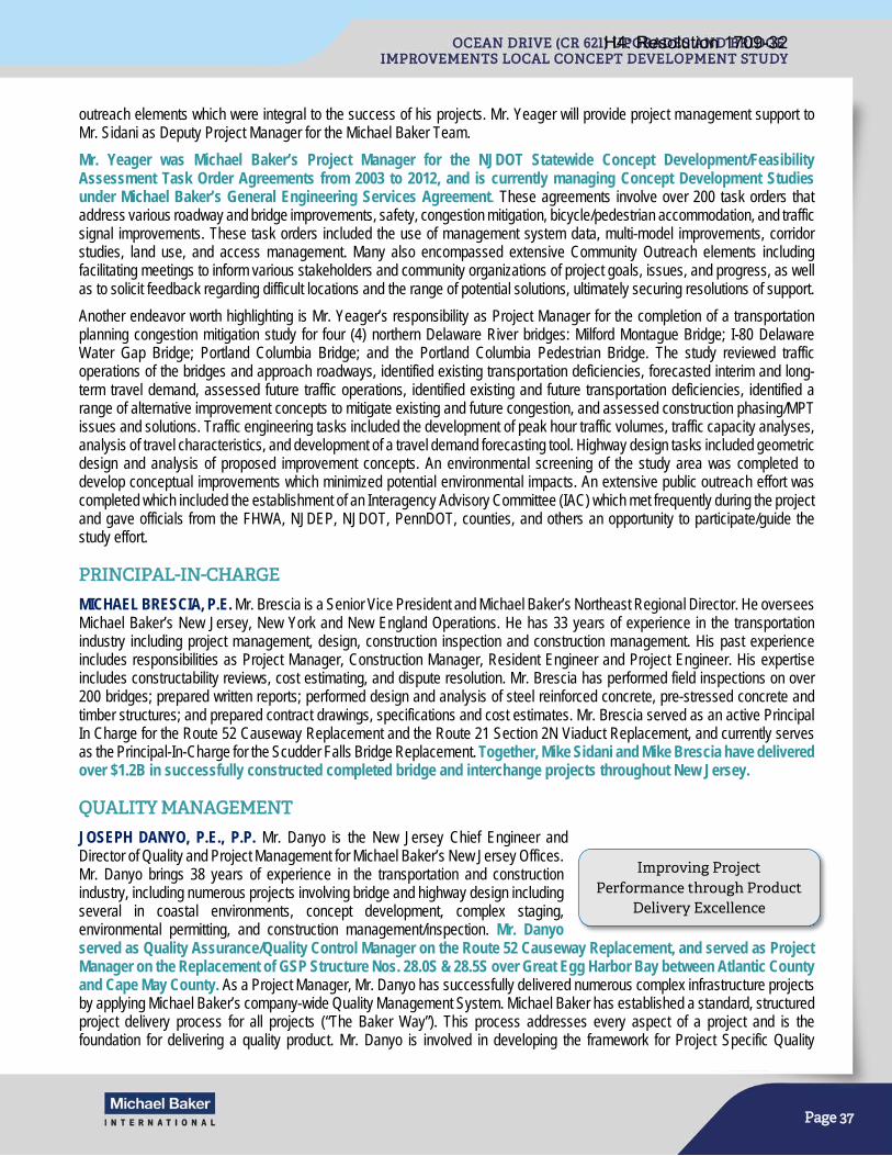
Page 37
outreach elements which were integral to the success of his projects. Mr. Yeager will provide project management support to Mr. Sidani as Deputy Project Manager for the Michael Baker Team.
Mr. Yeager was Michael Baker’s Project Manager for the NJDOT Statewide Concept Development/Feasibility Assessment Task Order Agreements from 2003 to 2012, and is currently managing Concept Development Studies under Michael Baker’s General Engineering Services Agreement. These agreements involve over 200 task orders that address various roadway and bridge improvements, safety, congestion mitigation, bicycle/pedestrian accommodation, and traffic signal improvements. These task orders included the use of management system data, multi-model improvements, corridor studies, land use, and access management. Many also encompassed extensive Community Outreach elements including facilitating meetings to inform various stakeholders and community organizations of project goals, issues, and progress, as well as to solicit feedback regarding difficult locations and the range of potential solutions, ultimately securing resolutions of support.
Another endeavor worth highlighting is Mr. Yeager’s responsibility as Project Manager for the completion of a transportation planning congestion mitigation study for four (4) northern Delaware River bridges: Milford Montague Bridge; I-80 Delaware Water Gap Bridge; Portland Columbia Bridge; and the Portland Columbia Pedestrian Bridge. The study reviewed traffic operations of the bridges and approach roadways, identified existing transportation deficiencies, forecasted interim and long-term travel demand, assessed future traffic operations, identified existing and future transportation deficiencies, identified a range of alternative improvement concepts to mitigate existing and future congestion, and assessed construction phasing/MPT issues and solutions. Traffic engineering tasks included the development of peak hour traffic volumes, traffic capacity analyses, analysis of travel characteristics, and development of a travel demand forecasting tool. Highway design tasks included geometric design and analysis of proposed improvement concepts. An environmental screening of the study area was completed to develop conceptual improvements which minimized potential environmental impacts. An extensive public outreach effort was completed which included the establishment of an Interagency Advisory Committee (IAC) which met frequently during the project and gave officials from the FHWA, NJDEP, NJDOT, PennDOT, counties, and others an opportunity to participate/guide the study effort.
PRINCIPAL-IN-CHARGE
MICHAEL BRESCIA, P.E. Mr. Brescia is a Senior Vice President and Michael Baker’s Northeast Regional Director. He oversees Michael Baker’s New Jersey, New York and New England Operations. He has 33 years of experience in the transportation industry including project management, design, construction inspection and construction management. His past experience includes responsibilities as Project Manager, Construction Manager, Resident Engineer and Project Engineer. His expertise includes constructability reviews, cost estimating, and dispute resolution. Mr. Brescia has performed field inspections on over 200 bridges; prepared written reports; performed design and analysis of steel reinforced concrete, pre-stressed concrete and timber structures; and prepared contract drawings, specifications and cost estimates. Mr. Brescia served as an active Principal In Charge for the Route 52 Causeway Replacement and the Route 21 Section 2N Viaduct Replacement, and currently serves as the Principal-In-Charge for the Scudder Falls Bridge Replacement. Together, Mike Sidani and Mike Brescia have delivered over $1.2B in successfully constructed completed bridge and interchange projects throughout New Jersey.
QUALITY MANAGEMENT
JOSEPH DANYO, P.E., P.P. Mr. Danyo is the New Jersey Chief Engineer and Director of Quality and Project Management for Michael Baker’s New Jersey Offices. Mr. Danyo brings 38 years of experience in the transportation and construction industry, including numerous projects involving bridge and highway design including several in coastal environments, concept development, complex staging, environmental permitting, and construction management/inspection. Mr. Danyo served as Quality Assurance/Quality Control Manager on the Route 52 Causeway Replacement, and served as Project Manager on the Replacement of GSP Structure Nos. 28.0S & 28.5S over Great Egg Harbor Bay between Atlantic County and Cape May County. As a Project Manager, Mr. Danyo has successfully delivered numerous complex infrastructure projects by applying Michael Baker’s company-wide Quality Management System. Michael Baker has established a standard, structured project delivery process for all projects (“The Baker Way”). This process addresses every aspect of a project and is the foundation for delivering a quality product. Mr. Danyo is involved in developing the framework for Project Specific Quality
Improving Project Performance through Product
Delivery Excellence
H4: Resolution 1709-32
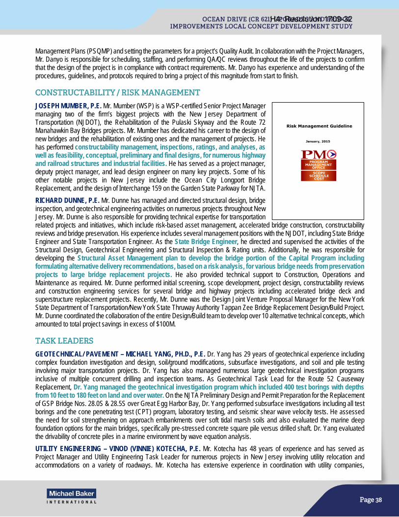
Page 38
Management Plans (PSQMP) and setting the parameters for a project’s Quality Audit. In collaboration with the Project Managers, Mr. Danyo is responsible for scheduling, staffing, and performing QA/QC reviews throughout the life of the projects to confirm that the design of the project is in compliance with contract requirements. Mr. Danyo has experience and understanding of the procedures, guidelines, and protocols required to bring a project of this magnitude from start to finish.
CONSTRUCTABILITY / RISK MANAGEMENT
JOSEPH MUMBER, P.E. Mr. Mumber (WSP) is a WSP-certified Senior Project Manager managing two of the firm’s biggest projects with the New Jersey Department of Transportation (NJDOT), the Rehabilitation of the Pulaski Skyway and the Route 72 Manahawkin Bay Bridges projects. Mr. Mumber has dedicated his career to the design of new bridges and the rehabilitation of existing ones and the management of projects. He has performed constructability management, inspections, ratings, and analyses, as well as feasibility, conceptual, preliminary and final designs, for numerous highway and railroad structures and industrial facilities. He has served as a project manager, deputy project manager, and lead design engineer on many key projects. Some of his other notable projects in New Jersey include the Ocean City Longport Bridge Replacement, and the design of Interchange 159 on the Garden State Parkway for NJTA.
RICHARD DUNNE, P.E. Mr. Dunne has managed and directed structural design, bridge inspection, and geotechnical engineering activities on numerous projects throughout New Jersey. Mr. Dunne is also responsible for providing technical expertise for transportation related projects and initiatives, which include risk-based asset management, accelerated bridge construction, constructability reviews and bridge preservation. His experience includes several management positions with the NJDOT, including State Bridge Engineer and State Transportation Engineer. As the State Bridge Engineer, he directed and supervised the activities of the Structural Design, Geotechnical Engineering and Structural Inspection & Rating units. Additionally, he was responsible for developing the Structural Asset Management plan to develop the bridge portion of the Capital Program including formulating alternative delivery recommendations, based on a risk analysis, for various bridge needs from preservation projects to large bridge replacement projects. He also provided technical support to Construction, Operations and Maintenance as required. Mr. Dunne performed initial screening, scope development, project design, constructability reviews and construction engineering services for several bridge and highway projects including accelerated bridge deck and superstructure replacement projects. Recently, Mr. Dunne was the Design Joint Venture Proposal Manager for the New York State Department of Transportation/New York State Thruway Authority Tappan Zee Bridge Replacement Design/Build Project. Mr. Dunne coordinated the collaboration of the entire Design/Build team to develop over 10 alternative technical concepts, which amounted to total project savings in excess of $100M.
TASK LEADERS
GEOTECHNICAL/ PAVEMENT – MICHAEL YANG, PH.D., P.E. Dr. Yang has 29 years of geotechnical experience including complex foundation investigation and design, soil/ground modifications, subsurface investigations, and soil and pile testing involving major transportation projects. Dr. Yang has also managed numerous large geotechnical investigation programs inclusive of multiple concurrent drilling and inspection teams. As Geotechnical Task Lead for the Route 52 Causeway Replacement, Dr. Yang managed the geotechnical investigation program which included 400 test borings with depths from 10 feet to 180 feet on land and over water. On the NJTA Preliminary Design and Permit Preparation for the Replacement of GSP Bridge Nos. 28.0S & 28.5S over Great Egg Harbor Bay, Dr. Yang performed subsurface investigations including all test borings and the cone penetrating test (CPT) program, laboratory testing, and seismic shear wave velocity tests. He assessed the need for soil strengthening on approach embankments over soft tidal marsh soils and also evaluated the marine deep foundation options for the main bridges, specifically pre-stressed concrete square pile versus drilled shaft. Dr. Yang evaluated the drivability of concrete piles in a marine environment by wave equation analysis.
UTILITY ENGINEERING – VINOD (VINNIE) KOTECHA, P.E. Mr. Kotecha has 48 years of experience and has served as Project Manager and Utility Engineering Task Leader for numerous projects in New Jersey involving utility relocation and accommodations on a variety of roadways. Mr. Kotecha has extensive experience in coordination with utility companies,
H4: Resolution 1709-32
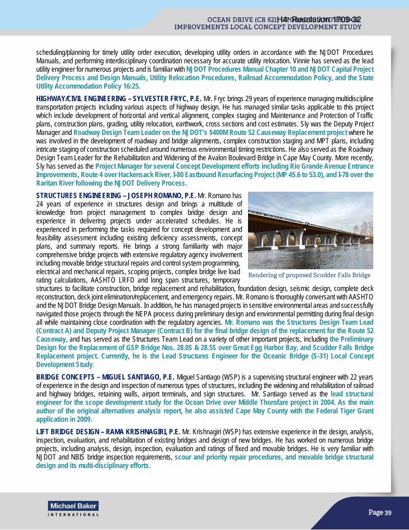
Page 39
scheduling/planning for timely utility order execution, developing utility orders in accordance with the NJDOT Procedures Manuals, and performing interdisciplinary coordination necessary for accurate utility relocation. Vinnie has served as the lead utility engineer for numerous projects and is familiar with NJDOT Procedures Manual Chapter 10 and NJDOT Capital Project Delivery Process and Design Manuals, Utility Relocation Procedures, Railroad Accommodation Policy, and the State Utility Accommodation Policy 16:25.
HIGHWAY/CIVIL ENGINEERING – SYLVESTER FRYC, P.E. Mr. Fryc brings 29 years of experience managing multidiscipline transportation projects including various aspects of highway design. He has managed similar tasks applicable to this project which include development of horizontal and vertical alignment, complex staging and Maintenance and Protection of Traffic plans, construction plans, grading, utility relocation, earthwork, cross sections and cost estimates. Sly was the Deputy Project Manager and Roadway Design Team Leader on the NJDOT’s $400M Route 52 Causeway Replacement project where he was involved in the development of roadway and bridge alignments, complex construction staging and MPT plans, including intricate staging of construction scheduled around numerous environmental timing restrictions. He also served as the Roadway Design Team Leader for the Rehabilitation and Widening of the Avalon Boulevard Bridge in Cape May County. More recently, Sly has served as the Project Manager for several Concept Development efforts including Rio Grande Avenue Entrance Improvements, Route 4 over Hackensack River, I-80 Eastbound Resurfacing Project (MP 45.6 to 53.0), and I-78 over the Raritan River following the NJDOT Delivery Process.
STRUCTURES ENGINEERING – JOSEPH ROMANO, P.E. Mr. Romano has 24 years of experience in structures design and brings a multitude of knowledge from project management to complex bridge design and experience in delivering projects under accelerated schedules. He is experienced in performing the tasks required for concept development and feasibility assessment including existing deficiency assessments, concept plans, and summary reports. He brings a strong familiarity with major comprehensive bridge projects with extensive regulatory agency involvement including movable bridge structural repairs and control system programming, electrical and mechanical repairs, scoping projects, complex bridge live load rating calculations, AASHTO LRFD and long span structures, temporary structures to facilitate construction, bridge replacement and rehabilitation, foundation design, seismic design, complete deck reconstruction, deck joint elimination/replacement, and emergency repairs. Mr. Romano is thoroughly conversant with AASHTO and the NJDOT Bridge Design Manuals. In addition, he has managed projects in sensitive environmental areas and successfully navigated those projects through the NEPA process during preliminary design and environmental permitting during final design all while maintaining close coordination with the regulatory agencies. Mr. Romano was the Structures Design Team Lead (Contract A) and Deputy Project Manager (Contract B) for the final bridge design of the replacement for the Route 52 Causeway, and has served as the Structures Team Lead on a variety of other important projects, including the Preliminary Design for the Replacement of GSP Bridge Nos. 28.0S & 28.5S over Great Egg Harbor Bay, and Scudder Falls Bridge Replacement project. Currently, he is the Lead Structures Engineer for the Oceanic Bridge (S-31) Local Concept Development Study.
BRIDGE CONCEPTS – MIGUEL SANTIAGO, P.E. Miguel Santiago (WSP) is a supervising structural engineer with 22 years of experience in the design and inspection of numerous types of structures, including the widening and rehabilitation of railroad and highway bridges, retaining walls, airport terminals, and sign structures. Mr. Santiago served as the lead structural engineer for the scope development study for the Ocean Drive over Middle Thorofare project in 2004. As the main author of the original alternatives analysis report, he also assisted Cape May County with the Federal Tiger Grant application in 2009.
LIFT BRIDGE DESIGN – RAMA KRISHNAGIRI, P.E. Mr. Krishnagiri (WSP) has extensive experience in the design, analysis, inspection, evaluation, and rehabilitation of existing bridges and design of new bridges. He has worked on numerous bridge projects, including analysis, design, inspection, evaluation and ratings of fixed and movable bridges. He is very familiar with NJDOT and NBIS bridge inspection requirements, scour and priority repair procedures, and movable bridge structural design and its multi-disciplinary efforts.
Rendering of proposed Scudder Falls Bridge
H4: Resolution 1709-32
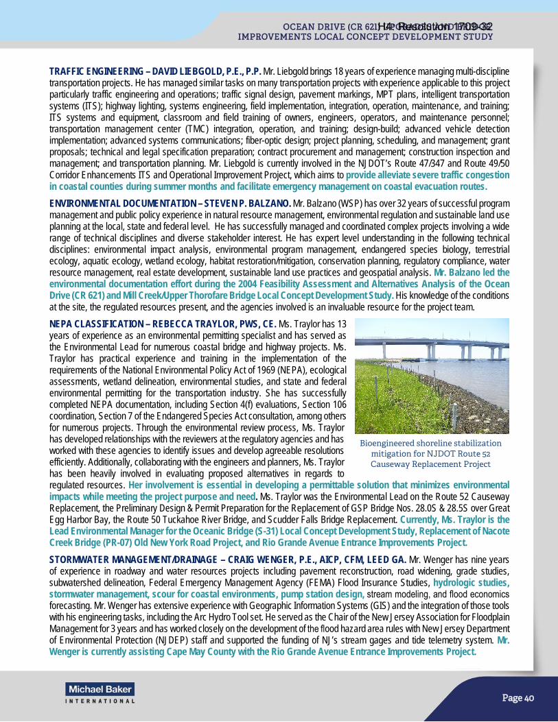
Page 40
TRAFFIC ENGINEERING – DAVID LIEBGOLD, P.E., P.P. Mr. Liebgold brings 18 years of experience managing multi-discipline transportation projects. He has managed similar tasks on many transportation projects with experience applicable to this project particularly traffic engineering and operations; traffic signal design, pavement markings, MPT plans, intelligent transportation systems (ITS); highway lighting, systems engineering, field implementation, integration, operation, maintenance, and training; ITS systems and equipment, classroom and field training of owners, engineers, operators, and maintenance personnel; transportation management center (TMC) integration, operation, and training; design-build; advanced vehicle detection implementation; advanced systems communications; fiber-optic design; project planning, scheduling, and management; grant proposals; technical and legal specification preparation; contract procurement and management; construction inspection and management; and transportation planning. Mr. Liebgold is currently involved in the NJDOT’s Route 47/347 and Route 49/50 Corridor Enhancements ITS and Operational Improvement Project, which aims to provide alleviate severe traffic congestion in coastal counties during summer months and facilitate emergency management on coastal evacuation routes.
ENVIRONMENTAL DOCUMENTATION – STEVEN P. BALZANO. Mr. Balzano (WSP) has over 32 years of successful program management and public policy experience in natural resource management, environmental regulation and sustainable land use planning at the local, state and federal level. He has successfully managed and coordinated complex projects involving a wide range of technical disciplines and diverse stakeholder interest. He has expert level understanding in the following technical disciplines: environmental impact analysis, environmental program management, endangered species biology, terrestrial ecology, aquatic ecology, wetland ecology, habitat restoration/mitigation, conservation planning, regulatory compliance, water resource management, real estate development, sustainable land use practices and geospatial analysis. Mr. Balzano led the environmental documentation effort during the 2004 Feasibility Assessment and Alternatives Analysis of the Ocean Drive (CR 621) and Mill Creek/Upper Thorofare Bridge Local Concept Development Study. His knowledge of the conditions at the site, the regulated resources present, and the agencies involved is an invaluable resource for the project team.
NEPA CLASSIFICATION – REBECCA TRAYLOR, PWS, CE. Ms. Traylor has 13 years of experience as an environmental permitting specialist and has served as the Environmental Lead for numerous coastal bridge and highway projects. Ms. Traylor has practical experience and training in the implementation of the requirements of the National Environmental Policy Act of 1969 (NEPA), ecological assessments, wetland delineation, environmental studies, and state and federal environmental permitting for the transportation industry. She has successfully completed NEPA documentation, including Section 4(f) evaluations, Section 106 coordination, Section 7 of the Endangered Species Act consultation, among others for numerous projects. Through the environmental review process, Ms. Traylor has developed relationships with the reviewers at the regulatory agencies and has worked with these agencies to identify issues and develop agreeable resolutions efficiently. Additionally, collaborating with the engineers and planners, Ms. Traylor has been heavily involved in evaluating proposed alternatives in regards to regulated resources. Her involvement is essential in developing a permittable solution that minimizes environmental impacts while meeting the project purpose and need. Ms. Traylor was the Environmental Lead on the Route 52 Causeway Replacement, the Preliminary Design & Permit Preparation for the Replacement of GSP Bridge Nos. 28.0S & 28.5S over Great Egg Harbor Bay, the Route 50 Tuckahoe River Bridge, and Scudder Falls Bridge Replacement. Currently, Ms. Traylor is the Lead Environmental Manager for the Oceanic Bridge (S-31) Local Concept Development Study, Replacement of Nacote Creek Bridge (PR-07) Old New York Road Project, and Rio Grande Avenue Entrance Improvements Project.
STORMWATER MANAGEMENT/DRAINAGE – CRAIG WENGER, P.E., AICP, CFM, LEED GA. Mr. Wenger has nine years of experience in roadway and water resources projects including pavement reconstruction, road widening, grade studies, subwatershed delineation, Federal Emergency Management Agency (FEMA) Flood Insurance Studies, hydrologic studies, stormwater management, scour for coastal environments, pump station design, stream modeling, and flood economics forecasting. Mr. Wenger has extensive experience with Geographic Information Systems (GIS) and the integration of those tools with his engineering tasks, including the Arc Hydro Tool set. He served as the Chair of the New Jersey Association for Floodplain Management for 3 years and has worked closely on the development of the flood hazard area rules with New Jersey Department of Environmental Protection (NJDEP) staff and supported the funding of NJ’s stream gages and tide telemetry system. Mr. Wenger is currently assisting Cape May County with the Rio Grande Avenue Entrance Improvements Project.
Bioengineered shoreline stabilization mitigation for NJDOT Route 52 Causeway Replacement Project
H4: Resolution 1709-32
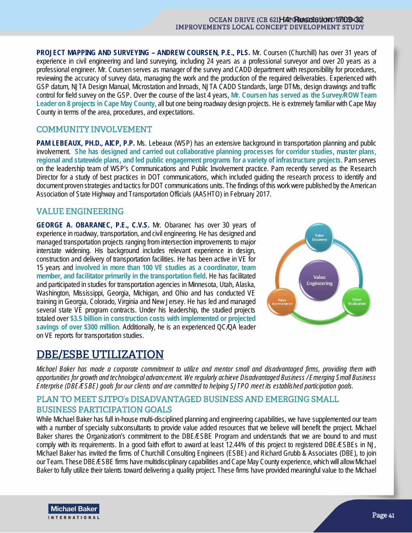
Page 41
PROJECT MAPPING AND SURVEYING – ANDREW COURSEN, P.E., PLS. Mr. Coursen (Churchill) has over 31 years of experience in civil engineering and land surveying, including 24 years as a professional surveyor and over 20 years as a professional engineer. Mr. Coursen serves as manager of the survey and CADD department with responsibility for procedures, reviewing the accuracy of survey data, managing the work and the production of the required deliverables. Experienced with GSP datum, NJTA Design Manual, Microstation and Inroads, NJTA CADD Standards, large DTMs, design drawings and traffic control for field survey on the GSP. Over the course of the last 4 years, Mr. Coursen has served as the Survey/ROW Team Leader on 8 projects in Cape May County, all but one being roadway design projects. He is extremely familiar with Cape May County in terms of the area, procedures, and expectations.
COMMUNITY INVOLVEMENT
PAM LEBEAUX, PH.D., AICP, P.P. Ms. Lebeaux (WSP) has an extensive background in transportation planning and public involvement. She has designed and carried out collaborative planning processes for corridor studies, master plans, regional and statewide plans, and led public engagement programs for a variety of infrastructure projects. Pam serves on the leadership team of WSP’s Communications and Public Involvement practice. Pam recently served as the Research Director for a study of best practices in DOT communications, which included guiding the research process to identify and document proven strategies and tactics for DOT communications units. The findings of this work were published by the American Association of State Highway and Transportation Officials (AASHTO) in February 2017.
VALUE ENGINEERING
GEORGE A. OBARANEC, P.E., C.V.S. Mr. Obaranec has over 30 years of experience in roadway, transportation, and civil engineering. He has designed and managed transportation projects ranging from intersection improvements to major interstate widening. His background includes relevant experience in design, construction and delivery of transportation facilities. He has been active in VE for 15 years and involved in more than 100 VE studies as a coordinator, team member, and facilitator primarily in the transportation field. He has facilitated and participated in studies for transportation agencies in Minnesota, Utah, Alaska, Washington, Mississippi, Georgia, Michigan, and Ohio and has conducted VE training in Georgia, Colorado, Virginia and New Jersey. He has led and managed several state VE program contracts. Under his leadership, the studied projects totaled over $3.5 billion in construction costs with implemented or projected savings of over $300 million. Additionally, he is an experienced QC/QA leader on VE reports for transportation studies.
DBE/ESBE UTILIZATION
Michael Baker has made a corporate commitment to utilize and mentor small and disadvantaged firms, providing them with opportunities for growth and technological advancement. We regularly achieve Disadvantaged Business / Emerging Small Business Enterprise (DBE/ESBE) goals for our clients and are committed to helping SJTPO meet its established participation goals.
PLAN TO MEET SJTPO’s DISADVANTAGED BUSINESS AND EMERGING SMALL BUSINESS PARTICIPATION GOALS While Michael Baker has full in-house multi-disciplined planning and engineering capabilities, we have supplemented our team with a number of specialty subconsultants to provide value added resources that we believe will benefit the project. Michael Baker shares the Organization’s commitment to the DBE/ESBE Program and understands that we are bound to and must comply with its requirements. In a good faith effort to award at least 12.44% of this project to registered DBE/ESBEs in NJ, Michael Baker has invited the firms of Churchill Consulting Engineers (ESBE) and Richard Grubb & Associates (DBE), to join our Team. These DBE/ESBE firms have multidisciplinary capabilities and Cape May County experience, which will allow Michael Baker to fully utilize their talents toward delivering a quality project. These firms have provided meaningful value to the Michael
H4: Resolution 1709-32
Page 42
Baker Team on previous projects, and have led major tasks for Michael Baker. Michael Baker will diligently monitor the project’s DBE/ESBE percentage and shift resources as required to meet the goals.
Michael Baker is confident, based on our on-going experience working with these firms and on their proven track record for quality and leadership, that each firm chosen will be a reliable partner for Michael Baker and SJTPO in delivering project assignments.
Churchill Consulting Engineers (Churchill) is certified by the NJDOT as an Emerging Small Business Enterprise (ESBE). Churchill will be provide survey/mapping, ROW, and utility
engineering, accounting for 11.5% of work towards the project’s DBE/ESBE goal
Richard Grubb & Associates, Inc. (RGA) is certified by the NJDOT, NJ Transit and Port Authority of New York & New Jersey as a Disadvantaged Business Enterprise (DBE). RGA will provide cultural resources services, accounting for 1.1% of work towards the project’s DBE/ESBE goal.
The overall combined DBE/ESBE utilization for Churchill and RGA is 12.6%, which is above the project’s 12.44% goal.
PERSON-HOUR SCHEDULES BY TASK Michael Baker’s proposed staff including their roles and reporting relationships is provided in the Organizational Chart, and resumes for key staff members are provided in the Staff Qualification section of this proposal.
The Michael Baker Team Person-hour Estimates summarize our proposed person-hours for each project by job title and task. Also included are person-hour breakdowns by firm for Michael Baker and our subconsultants: WSP, RGA, Inc., and Churchill Consulting Engineers.
The Michael Baker Team Person-hour Estimates were developed to deliver the project at a cost below the amount budgeted by the SJTPO. This will allow for the inclusion of potential unforeseen items, if they should occur, to be added to the project without exceeding the established budget amount. Based on our collective project history, intimate project knowledge, and familiarity with previous work products, the Michael Baker Team will deliver this study for the SJTPO at a value unmatched by other firms and efficiently advance this study to the next project delivery phase.
H4: Resolution 1709-32
Page 48
PROJECT SCHEDULE
The Michael Baker Team has developed a project schedule that reflects our strong and well documented understanding of the concept development process, the needs, goals, objectives and requirements of coastal bridge design, and intimate past knowledge of the project based on the work from the previous Ocean Drive (CR 621) concept development phase. The Michael Baker Team has the management experience and technical expertise to complete this Local Concept Development Study in 16 months, 3 months ahead of schedule, presenting a PPA by using the same proven team and techniques effectively applied to other similar projects.
The schedule will follow the NJDOT Local Concept Development Study, which is typically an 18 to 24 month process. However, because of the Michael Baker Team’s experience, we can reduce task durations to achieve meaningful reductions in the overall project schedule.
The critical path will run through the data collection process, documenting any design deficiencies, and developing a well-defined project Purpose and Need statement to guide the process. During these stages, the experience of completing the previous concept development efforts will provide significant efficiencies. Leveraging WSP’s comprehensive familiarity with the previous Ocean Drive Feasibility Study, we can expedite the existing conditions data collection process and confirm the project purpose and need. The data collected from the previous project is readily available and will be used as the basis for current data collection efforts from day one. The main tasks of the data collection effort will be to identify new data requirements and validate and update the previous information as necessary.
We recognize that site conditions and engineering requirements have changed since the original report. Many of these changes are identified in this proposal and obtaining new traffic data that captures peak-season activity is particularly time sensitive. As the anticipated notice-to-proceed date of this study is in October 2017, the earliest time new peak-season data can be collected will be June 2018. This constraint would delay the development of a comprehensive traffic analysis needed for the existing conditions report and consideration of traffic impacts during alternatives analysis. In anticipation of this challenge, the Michael Baker Team began a preliminary traffic data collection program in early August 2017 using Automatic Traffic Recorders to collect one week of peak-season traffic data that otherwise would not have been obtained until summer 2018. Obtaining this critical data will allow traffic analysis of existing conditions, proposed alternatives, and construction staging to occur earlier, saving months of time and accommodating the proposed accelerated 16-month schedule.
Building off of the previously considered alignments, the Michael Baker Team will develop potential alignments given the updated constraints and needs. The Michael Baker Team’s extensive collective experience on coastal bridges in New Jersey will expedite the development and evaluation of alternatives. Taking advantage of our team’s previous experience and insight with the project, we have reviewed the previous information and have preliminarily developed new potential alignments to avoid/limit impacts to known sensitive land uses as shown in Figure 3. Our intimate knowledge of the previous alternatives and site conditions will enable us to swiftly hone in on improvements to the previously studied alternatives and to efficiently develop new feasible and sensible alternatives.
Utilizing the existing information and leveraging the knowledge of previously developed alternatives will allow the Michael Baker Team to conduct activities concurrently and to overlap tasks. For example, some of the work necessary to develop alternatives and perform alternatives analysis can be performed concurrently with activities in the Data Collection task, utilizing existing data and earlier knowledge to develop and analyze alternatives and subsequently altering alternatives, if necessary, based on updated findings during Data Collection activities.
We understand that project stakeholder coordination can delay projects. Our project outreach plan has been developed to move the project forward by providing ample opportunity for stakeholders to participate and voice concerns. Having collaborated with many of the environmental agencies (NJDEP, USACE, NMFS, USCG, USFWS, and NJSHPO) on previous projects, Michael Baker, WSP, and RGA have built relationships based on trust with the regulators, allowing us to identify concerns and develop amicable solutions together in a streamlined manner.
As indicated in the proposed project schedule, the Michael Baker Team proposes completing the LCD efforts in an accelerated 16-month schedule with 3 months of schedule savings. A more detailed project schedule, including activity start/end dates, activity relationships, identification of the critical path, and milestone dates will be prepared for review by the Project Team prior to the project kickoff meeting and revisited quarterly.
H4: Resolution 1709-32
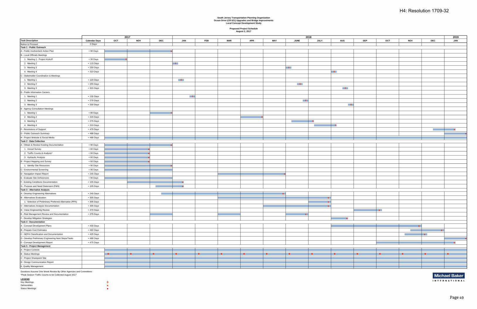
Notice to Proceed
Durations Assume One Week Review By Other Agencies and Committees*Peak Season Traffic Counts to be Collected August 2017
Key Meetings ◊Deliverables ӿStatus Meetings
2017
ӿӿ
ӿӿ
ӿ
ӿ
ӿӿ
◊
ӿӿ
Task 5 - Project Management
A - Project Controls
D - Design Communication Report
A - Concept Development Plans
South Jersey Transportation Planning Organization
ӿ
ӿ
ӿӿ
B - Local Officials Meetings
NOVOCT
20192018
◊
JAN FEB MAR APR MAY JUNE JULY AUG
◊
Ocean Drive (CR 621) Upgrades and Bridge Improvements
Local Concept Development Study
August 2, 2017
Proposed Project Schedule
1. Selection of Preliminary Preferred Alternative (PPA)
C - Alternatives Analysis Documentation
H - Project Website & Social Media
A - Obtain & Review Existing Documentation
B - Project Mapping and Survey
1. Identity Site Resources
C - Environmental Screening
OCT NOV DEC SEP DEC JAN
ӿ
F - Resolutions of Support
E - Evaluate Site Deficiencies
LEGEND
E - Concept Development Report
+ 60 Days
+ 90 Days
+ 90 Days
+ 90 Days
+ 105 Days
+ 105 Days
+ 245 Days
+ 305 Days
+ 305 Days
+ 305 Days
+ 370 Days
+ 430 Days
+ 460 Days
E. Quality Management
ӿ
F - Existing Conditions Documentation
C - NEPA Classification and Documentation
D - Develop Preliminary Engineering Next Steps/Tasks
Task 1 - Public Outreach
Task 2 - Data Collection
Task 3 - Alternative Analysis
Task 4 - Documentation
C - Stakeholder Coordination & Meetings
D - Public Information Centers
1. Meeting 1 - Project Kickoff
G - Purpose and Need Statement (P&N)
A - Develop Engineering Alternatives
B - Alternatives Evaluation
3. Hydraulic Analysis
D - Value Engineering Review
F - Develop Mitigation Strategies
2. Meeting 2
3. Meeting 3
ӿ
Task Description
A - Public Involvement Action Plan
B - Prepare Cost Estimates
Calendar Days
0 Days
3. Meeting 3 + 275 Days
1. Meeting 1
2. Meeting 2
3. Meeting 3
3. Meeting 3
1. Meeting 1
2. Meeting 2
G - Public Outreach Summary
ӿ
ӿ1. Vessel Survey
2. Traffic Counts & Analysis*
ӿ
◊
4. Meeting 4
2. Meeting 2
◊
+ 435 Days
+ 488 Days
+ 475 Days
4. Meeting 4
+ 488 Days
+ 488 Days
+ 90 Days
+ 90 Days
+ 60 Days
+ 60 Days
+ 60 Days
+ 30 Days
+ 115 Days
+ 250 Days
+ 310 Days
+ 120 Days
+ 255 Days
+ 315 Days
+ 135 Days
+ 270 Days
+ 330 Days
+ 215 Days
+ 310 Days
+ 245 Days
ӿ
ӿ
E - Agency Consultation Meetings
1. Meeting 1 + 90 Days
+ 475 Days
D - Navigation Impact Report
E - Risk Management Review and Documentation + 275 Days ӿ
◊
◊
◊
ӿ
B - Status Meetings
C - Project Sharepoint Site
◊
◊
◊
◊
◊
◊
Page 49
H4: Resolution 1709-32
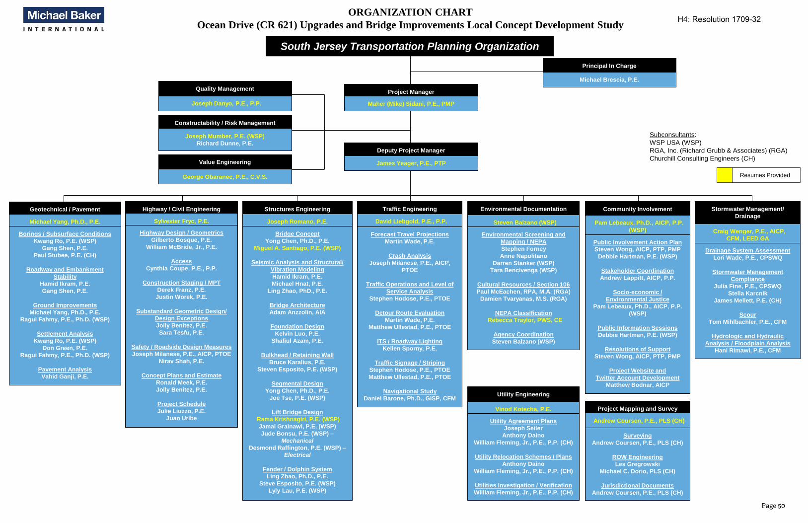
ORGANIZATION CHARTOcean Drive (CR 621) Upgrades and Bridge Improvements Local Concept Development Study
South Jersey Transportation Planning Organization
Project Manager
Maher (Mike) Sidani, P.E., PMP
Principal In Charge
Michael Brescia, P.E.
Subconsultants: WSP USA (WSP)RGA, Inc. (Richard Grubb & Associates) (RGA)Churchill Consulting Engineers (CH)
Resumes Provided
Highway / Civil Engineering
Sylvester Fryc, P.E.
Highway Design / Geometrics
Gilberto Bosque, P.E.
William McBride, Jr., P.E.
Access
Cynthia Coupe, P.E., P.P.
Construction Staging / MPT
Derek Franz, P.E.
Justin Worek, P.E.
Substandard Geometric Design/
Design Exceptions
Jolly Benitez, P.E.
Sara Tesfu, P.E.
Safety / Roadside Design Measures
Joseph Milanese, P.E., AICP, PTOE
Nirav Shah, P.E.
Concept Plans and Estimate
Ronald Meek, P.E.
Jolly Benitez, P.E.
Project Schedule
Julie Liuzzo, P.E.
Juan Uribe
Utility Engineering
Vinod Kotecha, P.E.
Utility Agreement Plans
Joseph Seiler
Anthony Daino
William Fleming, Jr., P.E., P.P. (CH)
Utility Relocation Schemes / Plans
Anthony Daino
William Fleming, Jr., P.E., P.P. (CH)
Utilities Investigation / Verification
William Fleming, Jr., P.E., P.P. (CH)
Geotechnical / Pavement
Michael Yang, Ph.D., P.E.
Borings / Subsurface Conditions
Kwang Ro, P.E. (WSP)
Gang Shen, P.E.
Paul Stubee, P.E. (CH)
Roadway and Embankment
Stability
Hamid Ikram, P.E.
Gang Shen, P.E.
Ground Improvements
Michael Yang, Ph.D., P.E.
Ragui Fahmy, P.E., Ph.D. (WSP)
Settlement Analysis
Kwang Ro, P.E. (WSP)
Don Green, P.E.
Ragui Fahmy, P.E., Ph.D. (WSP)
Pavement Analysis
Vahid Ganji, P.E.
Stormwater Management/
Drainage
Craig Wenger, P.E., AICP,
CFM, LEED GA
Drainage System Assessment
Lori Wade, P.E., CPSWQ
Stormwater Management
Compliance
Julia Fine, P.E., CPSWQ
Stella Karcnik
James Mellett, P.E. (CH)
Scour
Tom Mihlbachler, P.E., CFM
Hydrologic and Hydraulic
Analysis / Floodplain Analysis
Hani Rimawi, P.E., CFM
Project Mapping and Survey
Andrew Coursen, P.E., PLS (CH)
Surveying
Andrew Coursen, P.E., PLS (CH)
ROW Engineering
Les Gregrowski
Michael C. Dorio, PLS (CH)
Jurisdictional Documents
Andrew Coursen, P.E., PLS (CH)
Traffic Engineering
David Liebgold, P.E., P.P.
Forecast Travel Projections
Martin Wade, P.E.
Crash Analysis
Joseph Milanese, P.E., AICP,
PTOE
Traffic Operations and Level of
Service Analysis
Stephen Hodose, P.E., PTOE
Detour Route Evaluation
Martin Wade, P.E.
Matthew Ullestad, P.E., PTOE
ITS / Roadway Lighting
Kellen Sporny, P.E.
Traffic Signage / Striping
Stephen Hodose, P.E., PTOE
Matthew Ullestad, P.E., PTOE
Navigational Study
Daniel Barone, Ph.D., GISP, CFM
Environmental Documentation
Steven Balzano (WSP)
Environmental Screening and
Mapping / NEPA
Stephen Forney
Anne Napolitano
Darren Stanker (WSP)
Tara Bencivenga (WSP)
Cultural Resources / Section 106
Paul McEachen, RPA, M.A. (RGA)
Damien Tvaryanas, M.S. (RGA)
NEPA Classification
Rebecca Traylor, PWS, CE
Agency Coordination
Steven Balzano (WSP)
Community Involvement
Pam Lebeaux, Ph.D., AICP, P.P.
(WSP)
Public Involvement Action Plan
Steven Wong, AICP, PTP, PMP
Debbie Hartman, P.E. (WSP)
Stakeholder Coordination
Andrew Lappitt, AICP, P.P.
Socio-economic /
Environmental Justice
Pam Lebeaux, Ph.D., AICP, P.P.
(WSP)
Public Information Sessions
Debbie Hartman, P.E. (WSP)
Resolutions of Support
Steven Wong, AICP, PTP, PMP
Project Website and
Twitter Account Development
Matthew Bodnar, AICP
Structures Engineering
Joseph Romano, P.E.
Bridge Concept
Yong Chen, Ph.D., P.E.
Miguel A. Santiago, P.E. (WSP)
Seismic Analysis and Structural/
Vibration Modeling
Hamid Ikram, P.E.
Michael Hnat, P.E.
Ling Zhao, PhD., P.E.
Bridge Architecture
Adam Anzzolin, AIA
Foundation Design
Kelvin Luo, P.E.
Shafiul Azam, P.E.
Bulkhead / Retaining Wall
Bruce Karalius, P.E.
Steven Esposito, P.E. (WSP)
Segmental Design
Yong Chen, Ph.D., P.E.
Joe Tse, P.E. (WSP)
Lift Bridge Design
Rama Krishnagiri, P.E. (WSP)
Jamal Grainawi, P.E. (WSP)
Jude Bonsu, P.E. (WSP) –
MechanicalDesmond Raffington, P.E. (WSP) –
Electrical
Fender / Dolphin System
Ling Zhao, Ph.D., P.E.
Steve Esposito, P.E. (WSP)
Lyly Lau, P.E. (WSP)
Deputy Project Manager
James Yeager, P.E., PTP
Quality Management
Joseph Danyo, P.E., P.P.
Constructability / Risk Management
Joseph Mumber, P.E. (WSP)
Richard Dunne, P.E.
Value Engineering
George Obaranec, P.E., C.V.S.
Page 50
H4: Resolution 1709-32
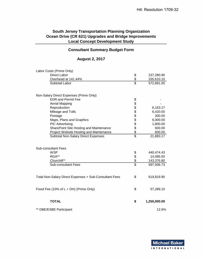
August 2, 2017
Labor Costs (Prime Only)Direct Labor 237,280.90$ Overhead at 141.44% 335,610.10$ Subtotal Labor 572,891.00$
Non-Salary Direct Expenses (Prime Only)EDR and Permit Fee -$ Aerial Mapping -$ Reproduction 6,163.17$ Mileage and Tolls 6,420.00$ Postage 300.00$ Maps, Plans and Graphics 6,000.00$ PIC Advertising 1,800.00$ SharePoint Site Hosting and Maintenance 600.00$ Project Website Hosting and Maintenance 600.00$ Subtotal Non-Salary Direct Expenses 21,883.17$
Sub-consultant FeesWSP 440,474.43$ RGA** 14,085.50$ Churchill** 143,376.80$ Sub-consultant Fees 597,936.73$
Total Non-Salary Direct Expenses + Sub-Consultant Fees 619,819.90$
Fixed Fee (10% of L + OH) (Prime Only) 57,289.10$
TOTAL 1,250,000.00$
** DBE/ESBE Participant 12.6%
South Jersey Transportation Planning Organization
Ocean Drive (CR 621) Upgrades and Bridge Improvements
Local Concept Development Study
Consultant Summary Budget Form
H4: Resolution 1709-32
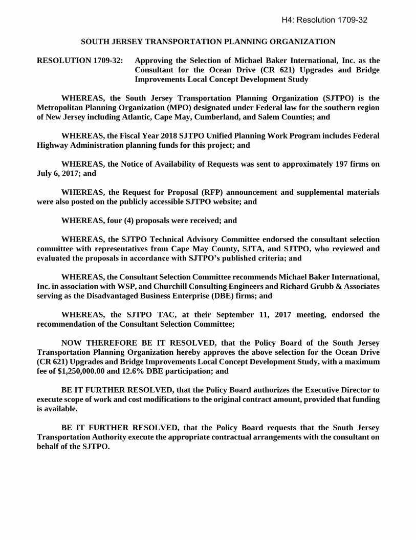
SOUTH JERSEY TRANSPORTATION PLANNING ORGANIZATION
RESOLUTION 1709-32: Approving the Selection of Michael Baker International, Inc. as the
Consultant for the Ocean Drive (CR 621) Upgrades and Bridge
Improvements Local Concept Development Study
WHEREAS, the South Jersey Transportation Planning Organization (SJTPO) is the
Metropolitan Planning Organization (MPO) designated under Federal law for the southern region
of New Jersey including Atlantic, Cape May, Cumberland, and Salem Counties; and
WHEREAS, the Fiscal Year 2018 SJTPO Unified Planning Work Program includes Federal
Highway Administration planning funds for this project; and
WHEREAS, the Notice of Availability of Requests was sent to approximately 197 firms on
July 6, 2017; and
WHEREAS, the Request for Proposal (RFP) announcement and supplemental materials
were also posted on the publicly accessible SJTPO website; and
WHEREAS, four (4) proposals were received; and
WHEREAS, the SJTPO Technical Advisory Committee endorsed the consultant selection
committee with representatives from Cape May County, SJTA, and SJTPO, who reviewed and
evaluated the proposals in accordance with SJTPO’s published criteria; and
WHEREAS, the Consultant Selection Committee recommends Michael Baker International,
Inc. in association with WSP, and Churchill Consulting Engineers and Richard Grubb & Associates
serving as the Disadvantaged Business Enterprise (DBE) firms; and
WHEREAS, the SJTPO TAC, at their September 11, 2017 meeting, endorsed the
recommendation of the Consultant Selection Committee;
NOW THEREFORE BE IT RESOLVED, that the Policy Board of the South Jersey
Transportation Planning Organization hereby approves the above selection for the Ocean Drive
(CR 621) Upgrades and Bridge Improvements Local Concept Development Study, with a maximum
fee of $1,250,000.00 and 12.6% DBE participation; and
BE IT FURTHER RESOLVED, that the Policy Board authorizes the Executive Director to
execute scope of work and cost modifications to the original contract amount, provided that funding
is available.
BE IT FURTHER RESOLVED, that the Policy Board requests that the South Jersey
Transportation Authority execute the appropriate contractual arrangements with the consultant on
behalf of the SJTPO.
H4: Resolution 1709-32
Certification
I hereby certify that the foregoing is a correct and true copy of a resolution adopted by the Policy
Board of the South Jersey Transportation Planning Organization at its meeting of September 25,
2017.
____________________________________
John W. Risley, Secretary/Treasurer
H4: Resolution 1709-32
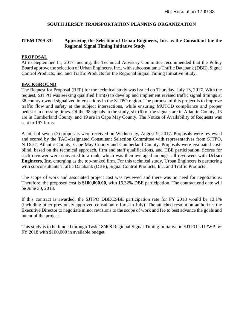
SOUTH JERSEY TRANSPORTATION PLANNING ORGANIZATION
ITEM 1709-33: Approving the Selection of Urban Engineers, Inc. as the Consultant for the
Regional Signal Timing Initiative Study
PROPOSAL
At its September 11, 2017 meeting, the Technical Advisory Committee recommended that the Policy
Board approve the selection of Urban Engineers, Inc., with subconsultants Traffic Databank (DBE), Signal
Control Products, Inc. and Traffic Products for the Regional Signal Timing Initiative Study.
BACKGROUND
The Request for Proposal (RFP) for the technical study was issued on Thursday, July 13, 2017. With the
request, SJTPO was seeking qualified firm(s) to develop and implement revised traffic signal timings at
38 county-owned signalized intersections in the SJTPO region. The purpose of this project is to improve
traffic flow and safety at the subject intersections, while ensuring MUTCD compliance and proper
pedestrian crossing times. Of the 38 signals in the study, six (6) of the signals are in Atlantic County, 13
are in Cumberland County, and 19 are in Cape May County. The Notice of Availability of Requests was
sent to 197 firms.
A total of seven (7) proposals were received on Wednesday, August 9, 2017. Proposals were reviewed
and scored by the TAC-designated Consultant Selection Committee with representatives from SJTPO,
NJDOT, Atlantic County, Cape May County and Cumberland County. Proposals were evaluated cost-
blind, based on the technical approach, firm and staff qualifications, and DBE participation. Scores for
each reviewer were converted to a rank, which was then averaged amongst all reviewers with Urban
Engineers, Inc. emerging as the top-ranked firm. For this technical study, Urban Engineers is partnering
with subconsultants Traffic Databank (DBE), Signal Control Products, Inc. and Traffic Products.
The scope of work and associated project cost was reviewed and there was no need for negotiations.
Therefore, the proposed cost is $100,000.00, with 16.32% DBE participation. The contract end date will
be June 30, 2018.
If this contract is awarded, the SJTPO DBE/ESBE participation rate for FY 2018 would be 13.1%
(including other previously approved consultant efforts in July). The attached resolution authorizes the
Executive Director to negotiate minor revisions to the scope of work and fee to best advance the goals and
intent of the project.
This study is to be funded through Task 18/408 Regional Signal Timing Initiative in SJTPO’s UPWP for
FY 2018 with $100,000 in available budget.
H5: Resolution 1709-33
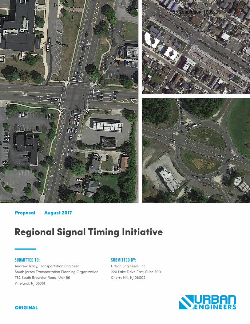
Submitted to:Andrew Tracy, Transportation EngineerSouth Jersey Transportation Planning Organization782 South Brewster Road, Unit B6Vineland, NJ 08361
Submitted by:Urban Engineers, Inc.220 Lake Drive East, Suite 300Cherry Hill, NJ 08002
Regional Signal Timing Initiative
Proposal August 2017
ORIGINAL
H5: Resolution 1709-33
Table of Contents
1. Cover Letter
2. Technical Proposal a. Narrative b. Staffing Plan (Exhibit D) c. Project Schedule d. Organization Chart e. Firm Profile f. Work History g. Resumes h. DBE/ESBE Certificates i. Equal Employment Opportunity Statement
3. Cost Proposal (submitted under separate cover) a. Total Cost by Task b. Breakdown of All Other Costs (by Firm) c. Staffing Plan (Exhibit D, with dollar values)
H5: Resolution 1709-33

1. cover letter
H5: Resolution 1709-33
August 9, 2017 Andrew Tracy Transportation Engineer South Jersey Transportation Planning Organization 782 South Brewster Road, Unit B6 Vineland, NJ 08361 Re: Request for Proposal Regional Signal Timing Initiative Dear Mr. Tracy:
Both the Federal Highway Administration (FHWA) and the Institute of Transportation Engineers (ITE) have reported
that signal timing is one of the most cost effective methods to improve traffic operations, safety, and the
environment. Studies have indicated that signal retiming can produce a benefit to cost ratio as high as 40:1.
For this project, the South Jersey Transportation Planning Organization (SJTPO) and Atlantic, Cape May and
Cumberland Counties have chosen 38 intersections for signal retiming. These intersections offer a variety of
conditions. Some of these intersections are part of corridors such as Main Road (CR 555) in Vineland, some are
along key summer routes such as Rio Grande Avenue (CR 661) while others are located at complex intersections
(e.g., the Airport Circle), and still others are isolated. Regardless of the location and operation these intersections
are important to both the people that live there as well as those that travel through the intersections.
Having worked on signal retiming and other projects in the three counties, Urban Engineers, Inc. (Urban) is well‐
prepared to deal with all the types of operating conditions (i.e., from isolated intersections to congested summer
corridors) as well as the non‐operational difficulties that can be encountered on retiming projects (e.g., controller
limitations). We are experienced in overcoming these challenges and are confident that the Urban Team can
implement new timings and achieve meaningful safety and operational benefits for SJTPO and the counties.
While Urban, as a full‐service design firm, can undertake all of the tasks outlined in the Request for Proposal (RFP),
a team of subconsultants has been assembled to strengthen our expertise, meet the desired Disadvantaged
Business Enterprise (DBE) participation goals, and provide the best value to SJTPO and the counties. Our Team is
made up of firms with knowledge and experience in the counties ‐ each providing their own unique experiences
amongst similar projects. Together, we have the experience, personnel, knowledge, and desire to provide SJTPO
and Atlantic, Cumberland and Cape May Counties with the high‐level traffic engineering, traffic signal retiming, and
field signal timing implementation services required for this project.
Urban is pleased to respond to this RFP and is excited to assist SJTPO and the counties. Some of the key reasons to
select the Urban Team for this assignment include:
Our Experienced Project Manager – Scott Diehl, PE, PTOE, has more than 20 years of transportation engineering experience and has worked with a number of New Jersey counties including Cape May, Atlantic, and Cumberland, as well as NJDOT and SJTPO, on retiming some of the area’s most congested state and county corridors. Mr. Diehl has worked to improve the operations of more than 250 signals throughout New Jersey and has trained agency staff, including County and NJDOT, on signal retiming software and best practices.
H5: Resolution 1709-33
H5: Resolution 1709-33

2. technical proposal
H5: Resolution 1709-33

a. Narrative
H5: Resolution 1709-33
sjtpo | regional signal timing initiative
urban engineers, inc.
narrativeProject Understanding: The primary objective of this project is to analyze the existing intersections, deter-mine MUTCD compliant pedestrian crossing times, and develop and implement traffic signal timing plans that reduce delay and travel time. The 38 project intersections make up a variety of operational conditions including isolated signals, multiple intersections that are part of a corridor, complex intersection geometrics and railroad preemption sequences. Some intersections and corridors are located in shore town communities that experi-ence significant seasonal traffic fluctuations with high volumes of traffic entering and exiting during weekends and vacation rental turnover periods.
Urban has experience in dealing with these varying operational conditions. For isolated intersections minimiz-ing delay for all approaches is the primary objective, which is generally accomplished with lower cycle lengths while still providing for MUTCD compliant pedestrian crossing times. For corridors, with multiple signalized intersections, the primary focus is on reducing mainline travel time and providing two-way progression while not significantly increasing delay for the sidestreet movements. Urban has experience with railroad preemption sequences on State and County routes including Southeast and Southwest Blvd’s in Cumberland County as part of the SJTPO FY 2015 Local Safety and CMAQ Project Development project. The Airport Circle intersection in Atlantic County is a highly congested location with unconventional geometry. Due to the complex geometry and movements within the Circle this location will be analyzed and optimized using microsimulation in order to account for the closely spaced approaches and stop bars on Tilton Road in proximity to the Circle.
Project Approach: The Urban Team’s project approach to signal retiming has evolved over time as more signals and corridors have been analyzed and implemented. Lessons learned during data collection, existing conditions calibration, signal retiming and implementation have contributed to the following project approach for the traffic signal retiming of the 38 signalized intersections included in this project.
Task 1: CoordinationUrban will coordinate with SJTPO and Atlantic, Cape May and Cumberland Counties at the beginning of the project as well as throughout its timeframe. In addition to the kick-off meeting, Urban will provide project status update memos every two weeks via email as requested in the RFP. The Urban Team’s proposed schedule with a completion date of May 18, 2018 was focused around providing reasonable durations for all tasks, including SJTPO and County review periods, while completing the schedule within the dates identified in the RFP.
As part of the coordination task, the Urban Team believes coordination should include input from the local municipalities. Soliciting feedback from local officials who are intimately familiar with the project intersections allows the Team to investigate any identified issues during the data collection process. This helps to outline the concerns and clearly define the desired metrics so every effort is made to resolve these issues during the signal retiming task.
DE L I V E R A B L E S
• Kick-Off Meeting Agenda and Minutes• Bi-Weekly status updates (via e-mail)
Task 2: Data CollectionAs outlined in the RFP, the Urban Team will complete Turning Movement Counts (TMCs) at locations missing existing count data as summarized in Appendix A of the RFP. The TMCs will be conducted during the school year for weekday AM (7:00AM to 9:00AM) and PM (2:00PM to 6:00PM) peak periods. As noted in the RFP, the TMC reports will be compiled in 15-minute increments and gather volume and vehicle classification for heavy trucks, medium trucks, passenger cars, pedestrians, and other non-motorized vehicles, including bicyclists.
H5: Resolution 1709-33
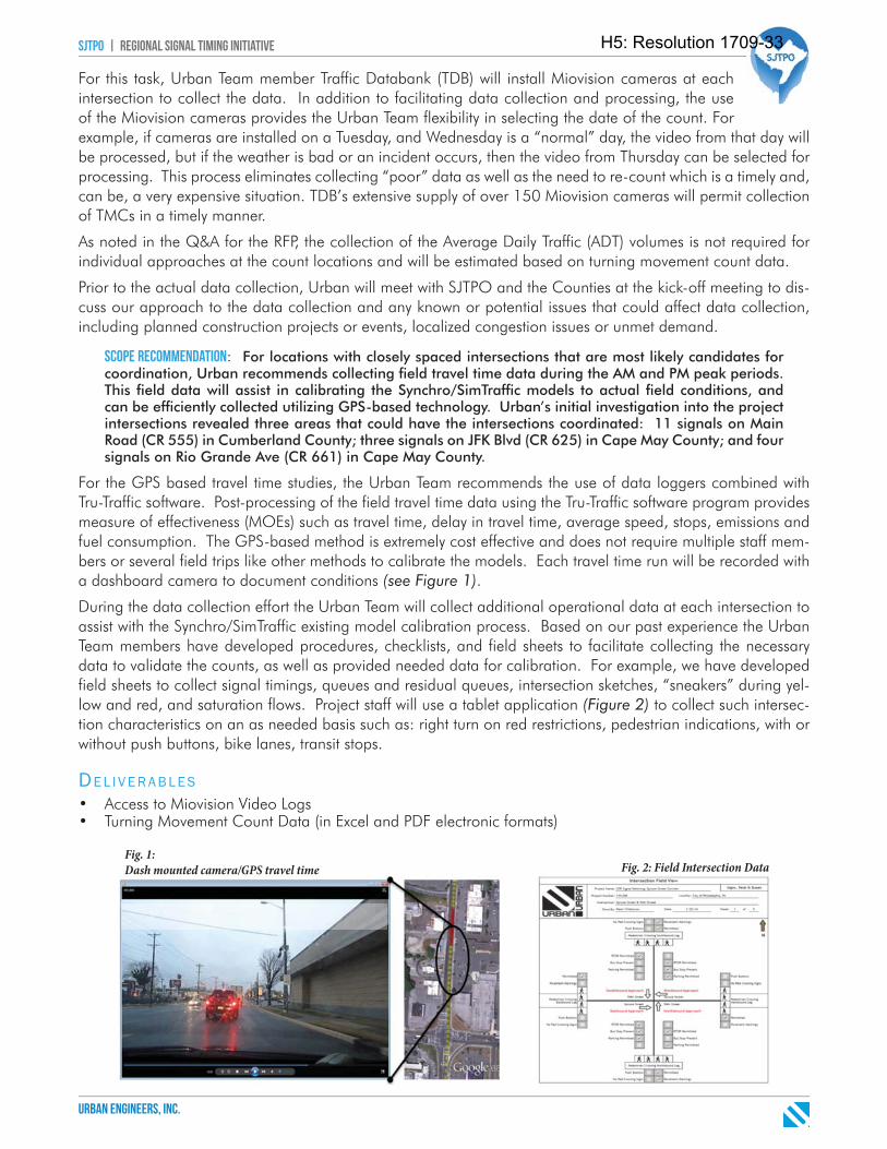
sjtpo | regional signal timing initiative
urban engineers, inc.
For this task, Urban Team member Traffic Databank (TDB) will install Miovision cameras at each intersection to collect the data. In addition to facilitating data collection and processing, the use of the Miovision cameras provides the Urban Team flexibility in selecting the date of the count. For example, if cameras are installed on a Tuesday, and Wednesday is a “normal” day, the video from that day will be processed, but if the weather is bad or an incident occurs, then the video from Thursday can be selected for processing. This process eliminates collecting “poor” data as well as the need to re-count which is a timely and, can be, a very expensive situation. TDB’s extensive supply of over 150 Miovision cameras will permit collection of TMCs in a timely manner.
As noted in the Q&A for the RFP, the collection of the Average Daily Traffic (ADT) volumes is not required for individual approaches at the count locations and will be estimated based on turning movement count data.
Prior to the actual data collection, Urban will meet with SJTPO and the Counties at the kick-off meeting to dis-cuss our approach to the data collection and any known or potential issues that could affect data collection, including planned construction projects or events, localized congestion issues or unmet demand.
Scope Recommendation: For locations with closely spaced intersections that are most likely candidates for coordination, Urban recommends collecting fi eld travel time data during the AM and PM peak periods. This fi eld data will assist in calibrating the Synchro/SimTraffi c models to actual fi eld conditions, and can be effi ciently collected utilizing GPS-based technology. Urban’s initial investigation into the project intersections revealed three areas that could have the intersections coordinated: 11 signals on Main Road (CR 555) in Cumberland County; three signals on JFK Blvd (CR 625) in Cape May County; and four signals on Rio Grande Ave (CR 661) in Cape May County.
For the GPS based travel time studies, the Urban Team recommends the use of data loggers combined with Tru-Traffic software. Post-processing of the field travel time data using the Tru-Traffic software program provides measure of effectiveness (MOEs) such as travel time, delay in travel time, average speed, stops, emissions and fuel consumption. The GPS-based method is extremely cost effective and does not require multiple staff mem-bers or several field trips like other methods to calibrate the models. Each travel time run will be recorded with a dashboard camera to document conditions (see Figure 1).
During the data collection effort the Urban Team will collect additional operational data at each intersection to assist with the Synchro/SimTraffic existing model calibration process. Based on our past experience the Urban Team members have developed procedures, checklists, and field sheets to facilitate collecting the necessary data to validate the counts, as well as provided needed data for calibration. For example, we have developed field sheets to collect signal timings, queues and residual queues, intersection sketches, “sneakers” during yel-low and red, and saturation flows. Project staff will use a tablet application (Figure 2) to collect such intersec-tion characteristics on an as needed basis such as: right turn on red restrictions, pedestrian indications, with or without push buttons, bike lanes, transit stops.
DE L I V E R A B L E S
• Access to Miovision Video Logs• Turning Movement Count Data (in Excel and PDF electronic formats)
Fig. 1: Dash mounted camera/GPS travel time Fig. 2: Field Intersection Data
H5: Resolution 1709-33
sjtpo | regional signal timing initiative
urban engineers, inc.
Task 3: Develop Revised Timing PlansFor the signal retiming task Urban is recommending Synchro for macroscopic analysis and SimTraffic for microscopic simulation analysis. Synchro is a widely used, industry standard program that provides a solid platform to develop calibrated existing conditions models, develop revised signal timings, and test various geo-metric and phasing scenarios.
The Urban Team has extensive real-world signal retiming project experience with Synchro as well as providing in-classroom training for State and County agencies on not only the Synchro Studio software suite but also signal retiming methodology and best practices. Key staff members Scott Diehl and Chris Burke have provided Synchro/SimTraffic and Signal Retiming training classes to public agencies and private consultants. The system modeling task will be made up of three tasks including Existing Conditions, No Build Conditions, and Revised Timings Conditions. The Existing Conditions analysis will setup the base models and calibrate to field condi-tions. The No Build Conditions analysis will update the vehicular and pedestrian clearance intervals and add in any known development traffic to provide an “applies-to-apples” comparison for the Revised Timings analysis.
A. Existing Conditions AnalysisThe Existing Conditions Base models will be developed in Synchro 8, 9 or 10 based on SJTPO and the County’s preference. One Synchro model will be developed for each County including all project intersections within each County. The Synchro Base model will be developed with correct geometry, signal timings matching field conditions, peak hour traffic volumes, saturation flow rate data and other appropriate model data. Urban will coordinate with the Counties to obtain as many existing signal timing directives as available, and field signal timings will be utilized to verify these directives or as a substitute if directives are not available. The calibration process will fine tune the models to match field conditions. Travel time will be the key measure for calibration of the three coordinated corridors. Input from County and Local officials, field queuing observations from Urban staff and the Miovision videos will be the key calibration measures for isolated intersections.
The Urban Team will develop and calibrate AM and PM models for all intersections in the project area. Six locations in Cape May County had Saturday TMC data collected in August 2016. Urban will create Saturday models for these locations as they are located in shore town communities and could experience seasonal travel patterns, where a dedicated Saturday Time-of-Day (TOD) plan could provide significant operational benefit.
Calibration is an iterative process where differences between field and model data are identified and resolved based on further investigation of the field data. Specific model parameters have an impact and can generate a more realistic driver behavior including lane alignment through an intersection, turning speeds, lane change distances, headway factors and entering blocked intersections. Adjustment of these parameters helps bridge the gap between field and model data to enable model calibration. Federal Highway Administrations’ Guidelines for Applying Traffic Microsimulation Modeling Software are followed for calibration with the key targets includ-ing: (1) modeled versus observed travel times within 15%; (2) modeled versus observed vehicles processed within 5%; and (3) visually acceptable queuing. It should also be noted that Urban, runs the model numerous times using the “multiple runs” feature in order to account for the variability in traffic. Typically, we use 10-15 runs to generate results that are statistically significant.
In addition to the typical Measures of Effectiveness (MOEs) including delay and Level of Service (LOS), we can also provide travel times and other MOEs by zone or corridor. Urban has developed post-processing spread-sheets for both Synchro and SimTraffic that allow for efficient and accurate processing of output data text files from both models.
The Overall Signal Retiming Process
Once the existing conditions models have been calibrated the signal retiming process can be described by the following graphic flow starting with developing clearance calculations and ending with revised signal timings. A discussion of the steps in the process is provided on the following page.
H5: Resolution 1709-33
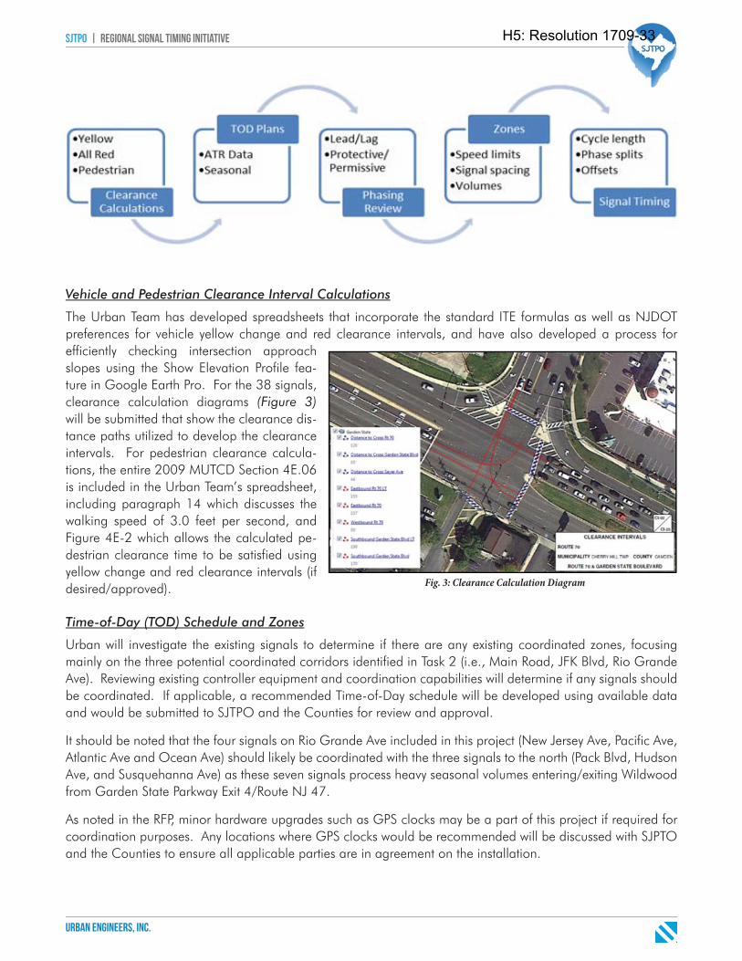
sjtpo | regional signal timing initiative
urban engineers, inc.
Vehicle and Pedestrian Clearance Interval Calculations
The Urban Team has developed spreadsheets that incorporate the standard ITE formulas as well as NJDOT preferences for vehicle yellow change and red clearance intervals, and have also developed a process for efficiently checking intersection approach slopes using the Show Elevation Profile fea-ture in Google Earth Pro. For the 38 signals, clearance calculation diagrams (Figure 3)will be submitted that show the clearance dis-tance paths utilized to develop the clearance intervals. For pedestrian clearance calcula-tions, the entire 2009 MUTCD Section 4E.06 is included in the Urban Team’s spreadsheet, including paragraph 14 which discusses the walking speed of 3.0 feet per second, and Figure 4E-2 which allows the calculated pe-destrian clearance time to be satisfied using yellow change and red clearance intervals (if desired/approved).
Time-of-Day (TOD) Schedule and Zones
Urban will investigate the existing signals to determine if there are any existing coordinated zones, focusing mainly on the three potential coordinated corridors identified in Task 2 (i.e., Main Road, JFK Blvd, Rio Grande Ave). Reviewing existing controller equipment and coordination capabilities will determine if any signals should be coordinated. If applicable, a recommended Time-of-Day schedule will be developed using available data and would be submitted to SJTPO and the Counties for review and approval.
It should be noted that the four signals on Rio Grande Ave included in this project (New Jersey Ave, Pacific Ave, Atlantic Ave and Ocean Ave) should likely be coordinated with the three signals to the north (Pack Blvd, Hudson Ave, and Susquehanna Ave) as these seven signals process heavy seasonal volumes entering/exiting Wildwood from Garden State Parkway Exit 4/Route NJ 47.
As noted in the RFP, minor hardware upgrades such as GPS clocks may be a part of this project if required for coordination purposes. Any locations where GPS clocks would be recommended will be discussed with SJPTO and the Counties to ensure all applicable parties are in agreement on the installation.
Fig. 3: Clearance Calculation Diagram
H5: Resolution 1709-33
sjtpo | regional signal timing initiative
urban engineers, inc.
B. Revised Timing Analysis
Prior to developing the Revised Timings models, the vehicle and pedestrian clearance calculations changes should be incorporated into the models.
Scope Recommendation: The Urban Team recommends developing No Build models with updated vehicle and pedestrian clearance intervals to allow for an “apples to apples” comparison with the Revised Tim-ings models.
Following the creation of No Build models, the next steps in the process is signal retiming. The signal retiming process for isolated signals is simpler as compared to coordinated corridors. Urban’s process for retiming iso-lated signal and coordinated corridors is described below.
Isolated Signals Retiming Process
Retiming isolated signals focuses on reducing delay for all movements and signal phases. The cycle length is generally based on any pedestrian interval (i.e., WALK, FLASHING DON’T WALK) minimum requirements and the ‘Natural’ cycle length suggested by Synchro. The Natural cycle length is the shortest cycle length that will give acceptable capacity and the best level of service (LOS). Minor adjustments can be made to the Natural cycle length based on SimTraffic results, but generally isolated intersection cycle lengths are within five seconds of Synchro’s Natural cycle length.
Phase splits for isolated signals follows the same process as coordinated corridors described below, and offsets are not applicable to isolated signals.
Coordinated Corridors
The process for retiming signals in a coordinated corridor is more complex compared to isolated intersections due to the need to take into account the impacts of one signal on neighboring signals. One cycle length must be selected for multiple signals in a coordinated zone as opposed to selecting one optimal cycle length for a sin-gle isolated intersection. Offsets must be developed for coordinated corridors to provide two-way progression where isolated intersections operate independently of other signals. Based on Urban’s initial review, this more complex signal retiming process will only be required for the three previously identified coordinated corridors of Main Road (CR 555), JFK Blvd (CR 625), and Rio Grande Ave (CR 661).
Urban has extensive experience in retiming signals along coordinated County and State corridors with the pro-cess being refined over time due to lessons learned from field implementation and fine tuning, before and after study results, and software program improvements. Urban’s signal retiming process revolves around iterative testing of multiple combinations of cycle length, phase splits and offsets for each coordinated sub-zone. Our experience and efficiency with signal retiming software tools and post-processing spreadsheets allows the Urban Team to test many Cycle-Split-Offset (CSO) combinations to develop optimal timing plans.
Cycle: The first “evaluation” is cycle length, which Urban understands that the selection of an appropriate cycle length for each period and zone analyzed can be the determining factor of successful signal retiming. A cycle length that is too short will result in cycle failures and poor progression, but a cycle that is too long results in queuing, and impatient side street motorists and pedestrians. The Synchro software provides sug-gested optimized cycle lengths based on Performance Index (PI), which is based on total delay and vehicle stops. The Tru-Traffic software program, which is discussed in more detail in the Offsets sections below, also suggests optimal cycle lengths but is based mainly on arterial progression. The recommended cycle lengths from these two programs along with engineering judgement and Urban’s extensive experience develop the cycle lengths to be tested in Synchro and SimTraffic.
Splits: After the cycle length for each intersection and coordinated zone are selected the next step is to setup the phase splits. The initial goal is to match Green Time to Cycle Length ratios (g/C) from the No
H5: Resolution 1709-33
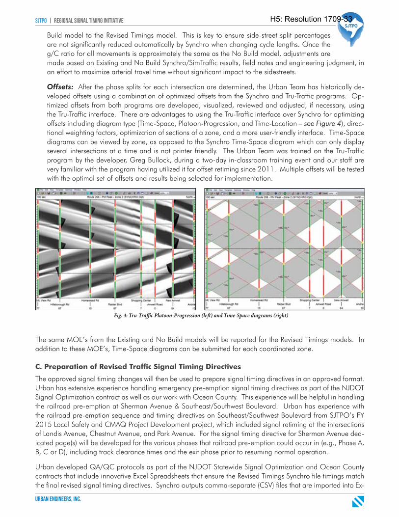
sjtpo | regional signal timing initiative
urban engineers, inc.
Build model to the Revised Timings model. This is key to ensure side-street split percentages are not significantly reduced automatically by Synchro when changing cycle lengths. Once the g/C ratio for all movements is approximately the same as the No Build model, adjustments are made based on Existing and No Build Synchro/SimTraffic results, field notes and engineering judgment, in an effort to maximize arterial travel time without significant impact to the sidestreets.
Offsets: After the phase splits for each intersection are determined, the Urban Team has historically de-veloped offsets using a combination of optimized offsets from the Synchro and Tru-Traffic programs. Op-timized offsets from both programs are developed, visualized, reviewed and adjusted, if necessary, using the Tru-Traffic interface. There are advantages to using the Tru-Traffic interface over Synchro for optimizing offsets including diagram type (Time-Space, Platoon-Progression, and Time-Location – see Figure 4), direc-tional weighting factors, optimization of sections of a zone, and a more user-friendly interface. Time-Space diagrams can be viewed by zone, as opposed to the Synchro Time-Space diagram which can only display several intersections at a time and is not printer friendly. The Urban Team was trained on the Tru-Traffic program by the developer, Greg Bullock, during a two-day in-classroom training event and our staff are very familiar with the program having utilized it for offset retiming since 2011. Multiple offsets will be tested with the optimal set of offsets and results being selected for implementation.
The same MOE’s from the Existing and No Build models will be reported for the Revised Timings models. In addition to these MOE’s, Time-Space diagrams can be submitted for each coordinated zone.
C. Preparation of Revised Traffic Signal Timing Directives
The approved signal timing changes will then be used to prepare signal timing directives in an approved format. Urban has extensive experience handling emergency pre-emption signal timing directives as part of the NJDOT Signal Optimization contract as well as our work with Ocean County. This experience will be helpful in handling the railroad pre-emption at Sherman Avenue & Southeast/Southwest Boulevard. Urban has experience with the railroad pre-emption sequence and timing directives on Southeast/Southwest Boulevard from SJTPO’s FY 2015 Local Safety and CMAQ Project Development project, which included signal retiming at the intersections of Landis Avenue, Chestnut Avenue, and Park Avenue. For the signal timing directive for Sherman Avenue ded-icated page(s) will be developed for the various phases that railroad pre-emption could occur in (e.g., Phase A, B, C or D), including track clearance times and the exit phase prior to resuming normal operation.
Urban developed QA/QC protocols as part of the NJDOT Statewide Signal Optimization and Ocean County contracts that include innovative Excel Spreadsheets that ensure the Revised Timings Synchro file timings match the final revised signal timing directives. Synchro outputs comma-separate (CSV) files that are imported into Ex-
Fig. 4: Tru-Traffi c Platoon-Progression (left ) and Time-Space diagrams (right)
H5: Resolution 1709-33
sjtpo | regional signal timing initiative
urban engineers, inc.
cel and conditional formatting in the spreadsheets highlight any discrepancies between the Synchro data and final directives. The proposed signal timing directives will be submitted to SJTPO and the Counties for their review and approval prior to implementation.
Recommendations Memos
Throughout the project Urban will keep track of equipment or design changes that could potentially improve traffic operations. Possible items for improvement could include detection installation or upgrades, pedestrian push buttons, and controller upgrades. A separate Recommendations Memo will be created for each County and will be submitted with the revised traffic signal timing directives.
A dedicated Recommendations Memo will be created for the Sherman Avenue (CR 552) & Southeast/Southwest Boulevard and submitted to Cumberland County. In addition to retiming the signal timings using the existing equipment as discussed previously in Task 3, Urban will analyze this intersection with various signal phasing, striping and geometric design changes. Several ‘alternatives’ will be developed with the Synchro/SimTraffic results summarized in an effort to determine the value each design change provides.
Based on Urban’s preliminary investigation into the Sherman Avenue intersection a key concern is what ap-pears to be a ‘yellow trap’ for the left turning vehicles from Sherman Avenue Eastbound onto Southwest Blvd Northbound, and Sherman Avenue Westbound onto Southeast Blvd Southbound. The five-section ‘doghouse’ signal heads provide an internal clearance for the vehicles on the railroad tracks, but this causes a yellow trap for the left turning vehicles described in the previous sentence. There are warning signs indicating opposing vehicles have extended green that warn motorists that they may not be able to immediately clear the intersection when their signal turns yellow and red. Potential intersection changes to analyze include (1) dedicated left turn lanes on Sherman Avenue, (2) flashing yellow arrow operation to eliminate yellow trap, (3) restrict left turns for yellow trap locations, and (4) lead versus lag operation on Southeast and Southwest Boulevard. Urban can also analyze one-way northbound and southbound operation on Southeast and Southwest Boulevard, similar to Chestnut Avenue and north, if Cumberland County desires.
DE L I V E R A B L E S
• Draft Timing Directives• Final Timing Directives• Recommendations Memo for each County• Recommendations Memo for Sherman Avenue & Southeast/Southwest Boulevard• Existing, No Build and Revised Timings Synchro Model and results for each County
Task 4: Implement Revised Timing PlansUrban has an extensive working relationship with Team Members’ Signal Control Products (SCP) and Traffic Products (TPI) on the actual implementation of signal timings on County routes. SCP will cover the implementa-tion in Atlantic and Cumberland Counties with TPI covering Cape May County. Urban, SCP and TPI work hand-in-hand to ensure the signal timing directives have all the information needed for an efficient and seamless implementation when in the field at the controllers. SCP and TPI are extremely familiar with all controller models located in their counties including all controller interface menus required for multiple Time-of-Day (TOD) plan input, preemption inputs, detector settings, and other advanced timing features.
Prior to field implementation, Urban will develop an Implementation Schedule for each County outlining the intersection, day and approximate time for implementation. The schedule will be submitted to SJTPO and the Counties for approval prior to beginning implementation.
After the Implementation Schedule and revised signal timing directives are approved by the County, the revised signal timing directives will be field implemented by Urban Team members SCP and TPI with Urban IMSA certi-
H5: Resolution 1709-33
sjtpo | regional signal timing initiative
urban engineers, inc.
fied staff as support. SCP has a working relationship with Atlantic and Cumberland Counties, and SCP staff are familiar and experienced with the signal equipment in each County and are IMSA cer-tified. SCP has experience implementing signal timings on all major controller manufacturers and models including Econolite’s ASC/2, ASC/3, and PEEK 3000E controllers which comprise all of the intersections in Atlantic and Cumberland Counties included in this project. TPI has similar experience with the Eagle EPAC 300 and Siemens m50 controllers at the Cape May County intersections.
After signal timings are implemented, the Urban Team will conduct field signal timing verification to ensure the timings input into the controllers match the developed timing directives. If during the field signal timing verifi-cation process the Urban Team notes any unexpected queuing or operations issues, the signal timings may be fine-tuned. Any field adjustments will be document and signal timing directives will be updated and resubmitted to the Counties.
DE L I V E R A B L E S
• Implementation Schedule for each County
H5: Resolution 1709-33

b. Staffing Plan (Exhibit D)
H5: Resolution 1709-33
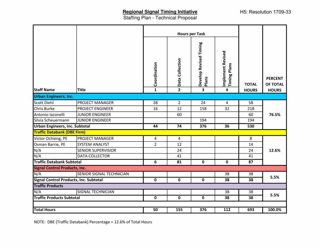
Regional Signal Timing Initiative
Staffing Plan - Technical Proposal
Co
ord
ina
tio
n
Da
ta C
oll
ect
ion
De
ve
lop
Re
vis
ed
Tim
ing
Pla
ns
Imp
lem
en
t R
ev
ise
d
Tim
ing
Pla
ns
Staff Name Title 1 2 3 4
Scott Diehl PROJECT MANAGER 28 2 24 4 58
Chris Burke PROJECT ENGINEER 16 12 158 32 218
Antonio Iaconelli JUNIOR ENGINEER 60 60
Silvia Scheuermann JUNIOR ENGINEER 194 194
44 74 376 36 530
Victor Ochieng, PE PROJECT MANAGER 4 4 8
Osman Barrie, PE SYSTEM ANALYST 2 12 14
N/A SENIOR SUPERVISIOR 24 24
N/A DATA COLLECTOR 41 41
6 81 0 0 87
N/A SENIOR SIGNAL TECHNICIAN 38 38
0 0 0 38 38
N/A SIGNAL TECHNICIAN 38 38
0 0 0 38 38
50 155 376 112 693 100.0%
PERCENT
OF TOTAL
HOURS
Urban Engineers, Inc.
Traffic Databank (DBE Firm)
Signal Control Products, Inc.
76.5%
12.6%
5.5%Signal Control Products, Inc. Subtotal
Total Hours
NOTE: DBE (Traffic Databank) Percentage = 12.6% of Total Hours
Hours per Task
TOTAL
HOURS
Urban Engineers, Inc. Subtotal
Traffic Databank Subtotal
Traffic Products
Traffic Products Subtotal5.5%
H5: Resolution 1709-33

c. Project Schedule
H5: Resolution 1709-33
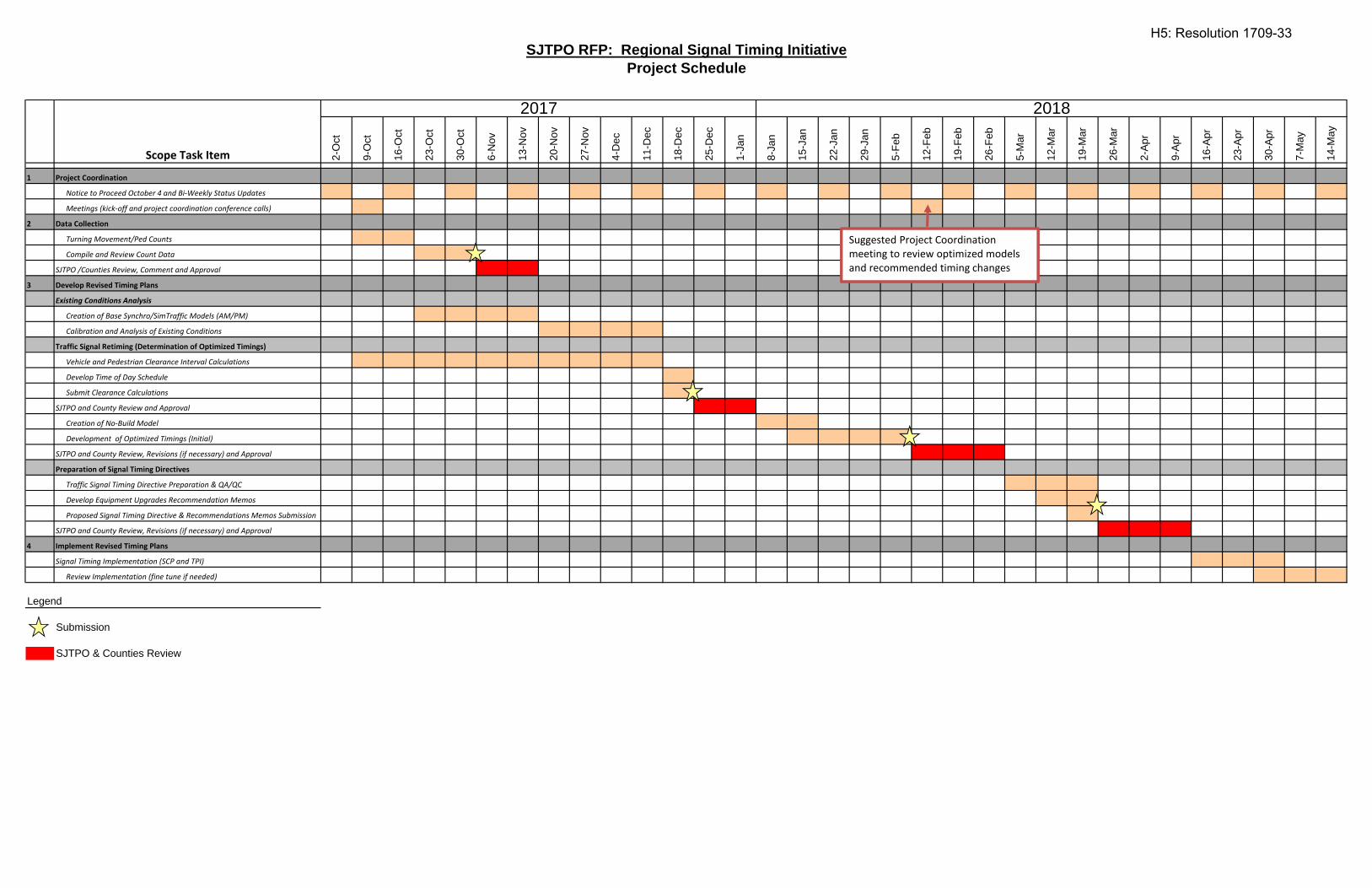
SJTPO RFP: Regional Signal Timing Initiative
Project Schedule
1 Project Coordination
Notice to Proceed October 4 and Bi‐Weekly Status Updates
Meetings (kick‐off and project coordination conference calls)
2 Data Collection
Turning Movement/Ped Counts
Compile and Review Count Data
SJTPO /Counties Review, Comment and Approval
3 Develop Revised Timing Plans
Existing Conditions Analysis
Creation of Base Synchro/SimTraffic Models (AM/PM)
Calibration and Analysis of Existing Conditions
Traffic Signal Retiming (Determination of Optimized Timings)
Vehicle and Pedestrian Clearance Interval Calculations
Develop Time of Day Schedule
Submit Clearance Calculations
SJTPO and County Review and Approval
Creation of No‐Build Model
Development of Optimized Timings (Initial)
SJTPO and County Review, Revisions (if necessary) and Approval
Preparation of Signal Timing Directives
Traffic Signal Timing Directive Preparation & QA/QC
Develop Equipment Upgrades Recommendation Memos
Proposed Signal Timing Directive & Recommendations Memos Submission
4
SJTPO and County Review, Revisions (if necessary) and Approval
Implement Revised Timing Plans
Signal Timing Implementation (SCP and TPI)
Review Implementation (fine tune if needed)
Submission
SJTPO & Counties Review
2018
8-Ja
n
15-J
an
26-M
ar
30-A
pr
23-A
pr
16-A
pr
9-Ap
r
2-Ap
r
29-J
an
Legend
7-M
ay
14-M
ay
5-Fe
b
26-F
eb
20-N
ov
27-N
ov
Scope Task Item
2017
2-O
ct
9-O
ct
16-O
ct
18-D
ec
23-O
ct
30-O
ct
6-N
ov
11-D
ec
13-N
ov
25-D
ec
1-Ja
n
4-D
ec
12-M
ar
19-M
ar
5-M
ar
12-F
eb
19-F
eb
22-J
an
Suggested Project Coordination meeting to review optimized models and recommended timing changes
H5: Resolution 1709-33
d. Organization Chart
H5: Resolution 1709-33
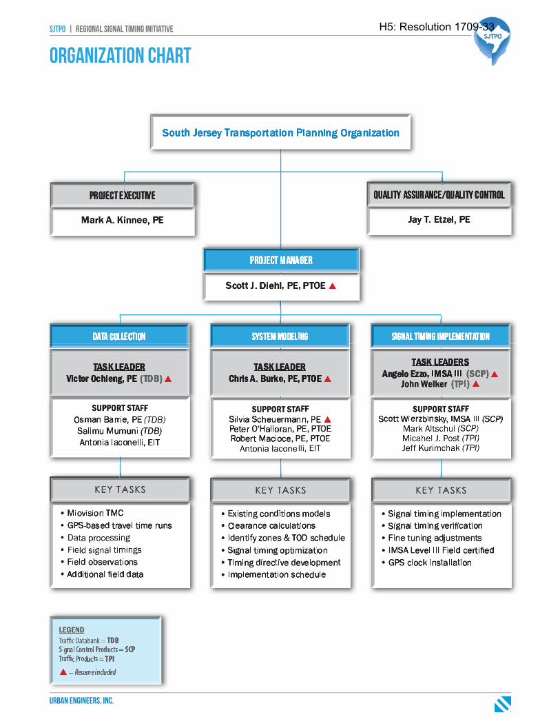
sjtpo | regional signal timing initiative
urban engineers, inc.
Organization Chart
H5: Resolution 1709-33

e. Firm Profile
H5: Resolution 1709-33
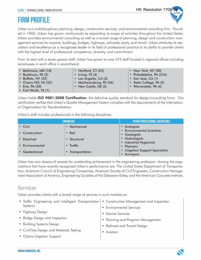
sjtpo | regional signal timing initiative
urban engineers, inc.
Firm profileUrban is a multidisciplinary planning, design, construction services, and environmental consulting firm. Found-ed in 1960, Urban has grown continuously by expanding its scope of activities throughout the United States. Urban provides environmental consulting as well as a broad range of planning, design and construction man-agement services for airports, buildings, bridges, highways, railroads, ports, and transit. Urban attributes its rep-utation and excellence as a recognized leader in its field of professional practice to its ability to provide clients with the highest level of professional competence, diversity, and commitment.
From its start with a seven-person staff, Urban has grown to over 475 staff located in regional offices including (employees in each office in parenthesis):
• Baltimore, MD (18)• Boothwyn, PA (2)• Buffalo, NY (32)• Cherry Hill, NJ (32)• Erie, PA (30)• Fort Worth, TX (1)
• Hartford, CT (25)• Irving, TX (4)• Los Angeles, CA (3)• Mechanicsburg, PA (56)• New Castle, DE (5)
• New York, NY (30)• Philadelphia, PA (234)• San Jose, CA (1)• State College, PA (2)• Warrendale, PA (4)
Urban holds ISO 9001:2008 Certifi cation; the definitive quality standard for design/consulting firms. This certification verifies that Urban’s Quality Management System complies with the requirements of the Internation-al Organization for Standardization.
Urban’s staff includes professionals in the following disciplines:
engineers other professional disciplines
• Civil
• Construction
• Electrical
• Environmental
• Geotechnical
• Mechanical
• Rail
• Structural
• Traffi c
• Transportation
• Ecologists• Environmental Scientists• Geologists• Hydrologists• Industrial Hygienists• Planners• Litigation Support Specialists• Surveyors
Urban has won dozens of awards for outstanding achievement in the engineering profession. Among the orga-nizations that have recently recognized Urban’s performance are: The United States Department of Transporta-tion, American Council of Engineering Companies, American Society of Civil Engineers, Construction Manage-ment Association of America, Engineering Societies of the Delaware Valley, and the American Concrete Institute.
ServicesUrban provides clients with a broad range of services in such markets as:
• Traffic Engineering and Intelligent Transportation Systems
• Highway Design
• Bridge Design and Inspection
• Building Systems Design
• Civil/Site Design and Materials Testing
• Claims Litigation Support
• Construction Management and Inspection
• Environmental Services
• Marine Services
• Planning and Program Management
• Railroad and Transit Design
• Aviation
H5: Resolution 1709-33
sjtpo | regional signal timing initiative
urban engineers, inc.
Urban will be joined by three additional firms to finalize the team:
Traffi c Databank (TDB), LLC, a certified New Jersey DBE, will assist in the data collection portion of the project by performing turning movement counts. TDB has collected diverse sets of traffic data used in analysis and optimization of transportation systems since 2006 when the firm was incorporated. The firm owns
over 150 Miovision video data collection units, over 400 automatic traffic recorders, and 12 GPS loggers and four dash cameras for travel time studies. Traffic Databank has completed traffic count studies at over 1,050 locations with most studies being completed using the Miovision technology proposed for this contract. Traffic Databank will temporarily install and remove the Miovision Scout units for turning movement counts (TMC). Traffic Databank will have Miovision process the count data due to Miovision’s 95% accuracy guarantee policy.
Signal Control Products (SCP) will assist in the physical programming of signal timings of signal equipment in Atlantic and Cumberland Counties. SCP is a transpor-tation solution company located in Branchburg, NJ, founded in 1975. SCP specializes in traffic signal maintenance, equipment distribution, and ITS solutions for Municipal,
County and State DOT agencies. SCP is familiar with the signal equipment used in Atlantic and Cumberland counties. SCP has experience implementing signal timings on all major controller manufacturers and models.
Traffi c Products (TPI) will assist in the physical programming of signal timings of signal equipment in Cape May County. Located in Malvern, PA, TPI specializes in NEMA and 2070 controller assemblies, ancillary equipment, and hardware and
software solutions for the Intelligent Transportation Systems (ITS) market. TPI has a long history of working with Cape May County on signal projects from updating timings to installing new controllers.
H5: Resolution 1709-33

f. Work History
H5: Resolution 1709-33
sjtpo | regional signal timing initiative
urban engineers, inc.
Work HistoryUrban has provided signal retiming and signal optimization for numerous agencies including New Jersey De-partment of Transportation (NJDOT), SJTPO, and New Jersey Counties including Atlantic, Cape May, Cumber-land, and Ocean. In addition to our project experience, Urban staff have provided training to agencies and consultants on the use of signal optimization software and how to perform signal retiming. Details on our recent experience are provided below, as well as a summary table of relevant signal retiming experience at the end of this section:
fy 2016 local safety & cmaq project development atlantic & cape May counties, nj
This project included the inventory and optimization of 40 signals along two corridors in Atlantic and Cape May Counties. Project tasks included the development of a detailed calibrated Synchro/SimTraffi c model, vehicular and pedestrian clearance intervals, and optimized timing directives as well as fi eld implementation, including fi ne tuning as necessary. The project also included the development of an intersection improvements report identifying potential benefi ts from changes at the intersections; e.g phasing, detection. GPS-clocks were installed at many of the 40 intersections to maintain coordination between the signals. The GPS-clocks and proposed signal timing directives were implemented in May 2016.
CONTACTJennifer Marandino, PE - Executive Director | South Jersey Transportation Planning Organization | 782 S. Brewster Rd., Unit 6B | Vineland, NJ 08361 | 856-794-1941 | [email protected] Tracy - Transportation Engineer | South Jersey Transportation Planning Organization | 782 S. Brewster Rd., Unit 6B | Vineland, NJ 08361 | 856-794-1941 | [email protected]
fy 2015 local safety & cmaq project development city of vineland & cumberland county, nj
This project included the optimization of 39 signals in the City of Vineland and Cumberland County, New Jersey. Urban developed a detailed calibrated Synchro/SimTraffi c model, vehicular and pedestrian clearance intervals, and t optimized timing directives. The project also entailed the development of an intersection improvements report identifying potential benefi ts of changes at the intersections; e.g. phasing, detection. We submitted a draft intersection improvement report and optimized simulation model and timings in April 2015.
CONTACTJennifer Marandino, PE - Executive Director | South Jersey Transportation Planning Organization | 782 S. Brewster Rd., Unit 6B | Vineland, NJ 08361 | 856-794-1941 | [email protected] Tracy - Transportation Engineer | South Jersey Transportation Planning Organization | 782 S. Brewster Rd., Unit 6B | Vineland, NJ 08361 | 856-794-1941 | [email protected]
njdot traffic signal optimization statewide, new jersey
Urban completed a task order agreement to develop and implement optimized traffi c signal timings for congested signalized corridors and networks in the State of New Jersey. Key project components include: data collection including GPS-based travel time studies, fi eld investigations including MUTCD compliance analysis, updating signal plans, model calibration and simulation analysis for multiple peak periods, signal optimization, implementation and fi eld adjustments, and post implementation analysis including cost/benefi t analysis.
Nine corridors and over 150 signals have been analyzed and optimized under this contract ranging from seven signals in a grid system to 30 signals along a major shore community arterial. Corridors analyzed include:
• RT 42 – Monroe and Washington Townships (6 miles and 12 signals)
• RT 45 – Gloucester County (7 miles and 19 signals)
• RT 30 – Galloway Township and Absecon City (4 miles and 12 signals)
• RT 72 – Stafford Township and Ship Bottom (9 miles and 14 signals)
• RT 9 – Atlantic County (11 miles and 30 signals)
• RT 47 – Cumberland County (9 miles and 20 signals)
• RT 206 – Hillsborough Township (5 miles and 13 signals)
• RT 70 – Camden and Burlington Counties (12 miles and 25 signals)
• RT 47/9 – Middle Township, Cape May County (2 miles and 7 signals)
CONTACTJeevanjot Singh, PMP - Principal Engineer | New Jersey Department of Transportation | 1035 Parkway Avenue | Trenton, NJ 08625 | 609-530-8327 | [email protected] Ali, EIT - Senior Engineer | New Jersey Department of Transportation | 1035 Parkway Avenue | Trenton, NJ 08625 | 609-530-2938 | [email protected]
H5: Resolution 1709-33
sjtpo | regional signal timing initiative
urban engineers, inc.
ocean county hooper avenue (cr549/631) signal optimization ocean county, nj
Urban is in the process of developing and implementing signal timing improvements at 39 intersections on CR 549/CR 631 (Hooper Ave./Brick Blvd.) in Brick and Toms River Townships, Ocean County, NJ. Project components include data collection including GPS-based and Bluetooth travel time studies, fi eld investigations including MUTCD compliance analysis, updating (red-lining) signal plans, model calibration and simulation analysis for multiple peak periods, signal optimization, implementation and fi eld adjustments, and post implementation analysis. Urban received approval of all the timing directives at the beginning of April 2015. Implementation of the directives was complete in May 2015 with after studies during the following two weeks.CONTACTMark Jehnke, PE - Traffi c Engineer | Ocean County Engineering Department | 101 Hooper Avenue | Toms River, NJ 08754 | 732-929-2183 | [email protected]
citywide retiming initiative, city of philadelphia philadelphia, pa
Urban provided the City of Philadelphia with comprehensive on-call services pertaining to planning, design, and implementation of traffi c engineer-ing and ITS related items. As part of the contract, Urban worked with the city to retime signals at over 150 signals ranging from existing individual signalized intersection to arterial corridors and urban grid networks. Urban completed retiming along the following eight corridors:
• Frankford Avenue – 5.9 miles, 43 signals• Bartram Avenue – 1.7 miles, 8 signals• Hunting Park Avenue West – 1.9 miles, 15 signals• Hunting Park Avenue East – 2.6 miles, 18 signals• Lindbergh Boulevard – 2.4 miles, 14 signals• 5th Street – 2.0 miles, 17 signals• Spruce Street – 2.4 miles, 24 signals• Grant Avenue/Welsh Street – 5.1 miles, 18 signals• Lancaster Avenue – 2.2 miles, 14 signals• Girard Avenue – 1.3 miles, 14 signals• Germantown Avenue – 1.0 miles, 8 signals• Rising Sun Avenue – 1.8 miles, 13 signals• Frankford Avenue (south) – 3.6 miles, 25 signals• Robbins Street – 1.4 miles, 12 signals• Levick Street – 1.3 miles, 11 signals• Market Street – 0.62 miles, 7 signals
Data collection for the corridors included turning movement counts, automatic traffi c recorders, GPS-based travel time, and fi eld signal timings. We completed existing conditions calibration using Synchro 8 and SimTraffi c, and signal timing optimization using a combination of Synchro/SimTraffi c and Tru-Traffi c. Tru-Traffi c is the optimal tool used for developing arterial timing diagrams and optimizing offsets. We also prepared an after study report to document the improvement in travel times and reduction in vehicle emissions.
CONTACTRichard Montanez, PE - Traffi c & Street Lighting Chief Engineer | City of Philadelphia, Traffi c Engineering Division | 1401 John F. Kennedy Blvd., Suite 900 MSB | Philadelphia, PA 19102215-686-5515 | [email protected]
stamford citywide traffic signal system optimization city of stamford, ct
The project includes signal retiming for the entire City of Stamford including 209 signalized intersections. The data collection includes using Miovi-sion Scout video collection units for turning movement counts and automatic traffi c recorder (ATR) data, GPS-based travel time studies on 18 routes using Tru-Traffi c, and general fi eld information such as signal timings, fl ow rates and driving behavior. The signal timings will be implemented locally on the recently installed Traffi cware 980 NEMA controllers and globally on the city’s central management software ATMS.now. GPS-based travel time studies will be completed for the after condition to document the travel time improvement along the 18 key routes. One Synchro/Sim-Traffi c model is being developed for the entire City for each peak period including AM, MID, PM and Saturday.CONTACTJames Travers - Transportation Bureau Chief | City of Stamford | 888 Washington Boulevard | Stamford, CT 06901 | 203-977-4979 | [email protected] Karukonda - Signal Systems Engineer | City of Stamford | 888 Washington Boulevard | Stamford, CT 06901 | 203-977-5675 | [email protected]
H5: Resolution 1709-33
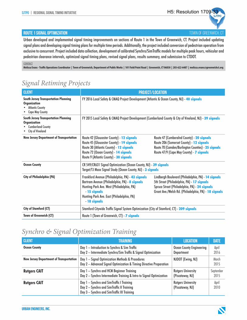
sjtpo | regional signal timing initiative
urban engineers, inc.
route 1 signal optimization town of greenwich, ct
Urban developed and implemented signal timing improvements on sections of Route 1 in the Town of Greenwich, CT. Project included updating signal plans and developing signal timing plans for multiple time periods. Additionally, the project included conversion of pedestrian operation from exclusive to concurrent. Project included data collection, development of calibrated Synchro/SimTraffi c models for multiple peak hours, vehicular and pedestrian clearance intervals, optimized signal timing plans, revised signal plans, results summary, and submission to CTDOT.CONTACTMelissa Evans - Traffi c Operations Coordinator | Town of Greenwich, Department of Public Works | 101 Field Point Road | Greenwich, CT 06830 | 203-622-6487 | [email protected]
Signal Retiming Projectsclient project/locationSouth Jersey Transportation Planning Organization• Atlantic County• Cape May County
FY 2016 Local Safety & CMAQ Project Development (Atlantic & Ocean County, NJ) - 40 signals
South Jersey Transportation Planning Organization• Cumberland County• City of Vineland
FY 2015 Local Safety & CMAQ Project Development (Cumberland County & City of Vineland, NJ) - 39 signals
New Jersey Department of Transportation Route 42 (Gloucester County) - 12 signalsRoute 45 (Gloucester County) - 19 signalsRoute 30 (Atlantic County) - 12 signalsRoute 72 (Ocean County) - 14 signalsRoute 9 (Atlantic County) - 30 signals
Route 47 (Cumberalnd County) - 20 signalsRoute 206 (Somerset County) - 12 signalsRoute 70 (Camden/Burlington Counties) - 25 signalsRoute 47/9 (Cape May County) - 7 signals
Ocean County CR 549/CR631 Signal Optimization (Ocean County, NJ) - 39 signalsTarget/TJ Maxx Signal Study (Ocean County, NJ) - 3 signals
City of Philadelphia (PA) Frankford Avenue (Philadelphia, PA) - 43 signalsBartram Avenue (Philadelphia, PA) - 8 signalsHunting Park Ave. West (Philadelphia, PA) - 15 signalsHunting Park Ave. East (Philadelphia, PA) - 18 signals
Lindbergh Boulevard (Philadelphia, PA) - 14 signals5th Street (Philadelphia, PA) - 17 signalsSpruce Street (Philadelphia, PA) - 24 signalsGrant Ave./Welsh Rd. (Philadelphia, PA) - 18 signals
City of Stamford (CT) Stamford Citywide Traffi c Signal System Optimization (City of Stamford, CT) - 209 signals
Town of Greenwich (CT) Route 1 (Town of Greenwich, CT) - 7 signals
Synchro & Signal Optimization Trainingclient training location dateOcean County Day 1 – Introduction to Synchro & Sim Traffi c
Day 2 – Intermediate Synchro/Sim Traffi c & Signal OptimizationOcean County Engineering Department
April 2016
New Jersey Department of Transportation Day 1 – Signal Optimization Methods & ProceduresDay 2 – Advanced Signal Optimization & Timing Directive Preparation
NJDOT (Ewing, NJ) March 2015
Rutgers CAIT Day 1 – Synchro and HCM Beginner TrainingDay 2 – Synchro Intermediate Training & Intro to Signal Optimization
Rutgers University (Piscataway, NJ)
September 2015
Rutgers CAIT Day 1 – Synchro and SimTraffi c I TrainingDay 2 – Synchro and SimTraffi c II TrainingDay 3 – Synchro and SimTraffi c III Training
Rutgers University (Piscataway, NJ)
April 2010
H5: Resolution 1709-33

g. Resumes
H5: Resolution 1709-33
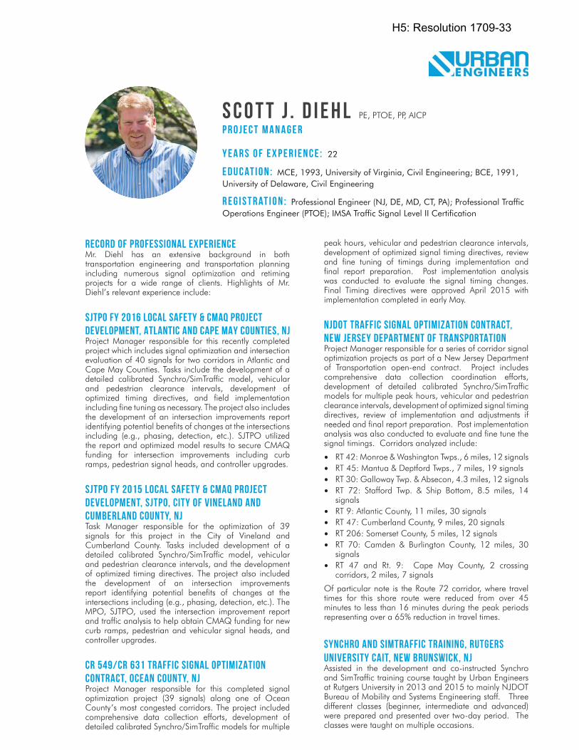
s c o t t j . d i e h l PE, PTOE, PP, AICP
p r o j e c t m a n a g e r
Y e a r s o f E x p e r i e n c e : 22
E d u c at i o n : MCE, 1993, University of Virginia, Civil Engineering; BCE, 1991, University of Delaware, Civil Engineering
r e g i s t r at i o n : Professional Engineer (NJ, DE, MD, CT, PA); Professional Traffi c Operations Engineer (PTOE); IMSA Traffi c Signal Level II Certifi cation
RECORD OF PROFESSIONAL EXPERIENCEMr. Diehl has an extensive background in both transportation engineering and transportation planning including numerous signal optimization and retiming projects for a wide range of clients. Highlights of Mr. Diehl’s relevant experience include:
SJTPO FY 2016 LOCAL SAFETY & CMAQ PROJECT DEVELOPMENT, ATLANTIC AND CAPE MAY COUNTIES, NJProject Manager responsible for this recently completed project which includes signal optimization and intersection evaluation of 40 signals for two corridors in Atlantic and Cape May Counties. Tasks include the development of a detailed calibrated Synchro/SimTraffic model, vehicular and pedestrian clearance intervals, development of optimized timing directives, and field implementation including fine tuning as necessary. The project also includes the development of an intersection improvements report identifying potential benefits of changes at the intersections including (e.g., phasing, detection, etc.). SJTPO utilized the report and optimized model results to secure CMAQ funding for intersection improvements including curb ramps, pedestrian signal heads, and controller upgrades.
SJTPO FY 2015 LOCAL SAFETY & CMAQ PROJECT DEVELOPMENT, SJTPO, CITY OF VINELAND AND CUMBERLAND COUNTY, NJTask Manager responsible for the optimization of 39 signals for this project in the City of Vineland and Cumberland County. Tasks included development of a detailed calibrated Synchro/SimTraffic model, vehicular and pedestrian clearance intervals, and the development of optimized timing directives. The project also included the development of an intersection improvements report identifying potential benefits of changes at the intersections including (e.g., phasing, detection, etc.). The MPO, SJTPO, used the intersection improvement report and traffic analysis to help obtain CMAQ funding for new curb ramps, pedestrian and vehicular signal heads, and controller upgrades.
CR 549/CR 631 TRAFFIC SIGNAL OPTIMIZATION CONTRACT, OCEAN COUNTY, NJProject Manager responsible for this completed signal optimization project (39 signals) along one of Ocean County’s most congested corridors. The project included comprehensive data collection efforts, development of detailed calibrated Synchro/SimTraffic models for multiple
peak hours, vehicular and pedestrian clearance intervals, development of optimized signal timing directives, review and fine tuning of timings during implementation and final report preparation. Post implementation analysis was conducted to evaluate the signal timing changes. Final Timing directives were approved April 2015 with implementation completed in early May.
NJDOT TRAFFIC SIGNAL OPTIMIZATION CONTRACT, NEW JERSEY DEPARTMENT OF TRANSPORTATIONProject Manager responsible for a series of corridor signal optimization projects as part of a New Jersey Department of Transportation open-end contract. Project includes comprehensive data collection coordination efforts, development of detailed calibrated Synchro/SimTraffic models for multiple peak hours, vehicular and pedestrian clearance intervals, development of optimized signal timing directives, review of implementation and adjustments if needed and final report preparation. Post implementation analysis was also conducted to evaluate and fine tune the signal timings. Corridors analyzed include:
• RT 42: Monroe & Washington Twps., 6 miles, 12 signals• RT 45: Mantua & Deptford Twps., 7 miles, 19 signals• RT 30: Galloway Twp. & Absecon, 4.3 miles, 12 signals• RT 72: Stafford Twp. & Ship Bottom, 8.5 miles, 14
signals• RT 9: Atlantic County, 11 miles, 30 signals• RT 47: Cumberland County, 9 miles, 20 signals• RT 206: Somerset County, 5 miles, 12 signals• RT 70: Camden & Burlington County, 12 miles, 30
signals • RT 47 and Rt. 9: Cape May County, 2 crossing
corridors, 2 miles, 7 signals
Of particular note is the Route 72 corridor, where travel times for this shore route were reduced from over 45 minutes to less than 16 minutes during the peak periods representing over a 65% reduction in travel times.
SYNCHRO AND SIMTRAFFIC TRAINING, RUTGERS UNIVERSITY CAIT, NEW BRUNSWICK, NJAssisted in the development and co-instructed Synchro and SimTraffic training course taught by Urban Engineers at Rutgers University in 2013 and 2015 to mainly NJDOT Bureau of Mobility and Systems Engineering staff. Three different classes (beginner, intermediate and advanced) were prepared and presented over two-day period. The classes were taught on multiple occasions.
H5: Resolution 1709-33
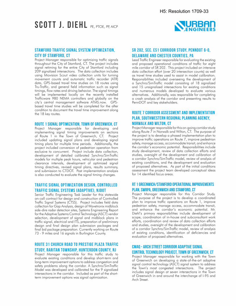
STAMFORD TRAFFIC SIGNAL SYSTEM OPTIMIZATION, CITY OF STAMFORD, CTProject Manager responsible for optimizing traffic signals throughout the City of Stamford, CT. The project includes signal retiming for the entire City of Stamford including 209 signalized intersections. The data collection includes using Miovision Scout video collection units for turning movement counts and automatic traffic recorder (ATR) data, GPS-based travel time studies on 18 routes using Tru-Traffic, and general field information such as signal timings, flow rates and driving behavior. The signal timings will be implemented locally on the recently installed Trafficware 980 NEMA controllers and globally on the city’s central management software ATMS.now. GPS-based travel time studies will be completed for the after condition to document the travel time improvement along the 18 key routes.
ROUTE 1 SIGNAL OPTIMIZATION, TOWN OF GREENWICH, CTProject Manager responsible for developing and implementing signal timing improvements on sections of Route 1 in the Town of Greenwich, CT. Project included updating signal plans and developing signal timing plans for multiple time periods. Additionally, the project included conversion of pedestrian operation from exclusive to concurrent. Project include data collection, development of detailed calibrated Synchro/SimTraffic models for multiple peak hours, vehicular and pedestrian clearance intervals, development of optimized signal timing directives, revised signal plans, results summary, and submission to CTDOT. Post implementation analysis is also conducted to evaluate the signal timing changes.
TRAFFIC SIGNAL OPTIMIZATION DESIGN, CONTROLLED TRAFFIC SIGNAL SYSTEMS (ADAPTIVE), NJDOTSenior Traffic Engineering Task Leader for this statewide on-call contract for design and construction of Controlled Traffic Signal Systems (CTSS). Project includes field data collection for Gap Analysis, design of Wavetronix midblock side-dire radar detection sites, Systems Engineering Report for the Adaptive Systems Control Technology (ASCT) vendor selection, development of signal and midblock plans in traffic signal, electrical and ITS, preparation of preliminary design and final design plan submission packages and final bid package preparation. Currently working on Route 73 - 9 miles and 16 signals in Burlington County.
ROUTE 31 CHURCH ROAD TO PRESTIGE PLAZA TRAFFIC STUDY, RARITAN TOWNSHIP, HUNTERDON COUNTY, NJProject Manager responsible for this traffic study to evaluate existing conditions and develop short-term and long-term improvement options to address congestion and safety problems along the corridor. A Synchro/SimTraffic Model was developed and calibrated for the 9 signalized intersections in the corridor. Included as part of the short-term improvement options was signal optimization.
SR 202, SEC. ES1 CORRIDOR STUDY, PENNDOT 6-0, DELAWARE AND CHESTER COUNTIES, PALead Traffic Engineer responsible for evaluating the existing and proposed operational conditions of traffic for eight mile corridor of SR 202. This project included an intensive data collection effort (over 20 intersection counts) as well as travel time studies used to assist in model calibration. Responsibilities included overseeing the development of a Synchro/SimTraffic model consisting of 18 signalized and 15 unsignalized intersections for existing conditions and numerous models developed to evaluate various alternatives. Additionally, was responsible for completing a crash analysis of the corridor and presenting results to PennDOT and key stakeholders.
ROUTE 7 CORRIDOR ASSESSMENT AND IMPLEMENTATION PLAN, SOUTHWESTERN REGIONAL PLANNING AGENCY, NORWALK AND WILTON, CTProject Manager responsible for this on-going corridor study along Route 7 in Norwalk and Wilton, CT. The purpose of the project is to develop a phased implementation plan to improve traffic operations on Route 7, improve pedestrian safety, manage access, accommodate transit, and enhance the corridor’s economic potential. Responsibilities include study development, review of data collection efforts and studies, oversight of the development and calibration of a corridor Synchro/SimTraffic model, review of analysis of existing conditions, and the development and evaluation of proposed alternatives. As part of the initial conditions assessment the project team developed conceptual ideas for 14 identified focus areas.
RT 1 GREENWICH/STAMFORD OPERATIONAL IMPROVEMENTS PLAN, SWRPA, GREENWICH AND STAMFORD, CTProject Manager responsible for this Corridor Study. The purpose of the project is to develop a coordinated plan to improve traffic operations on Route 1, improve pedestrian safety, manage access, accommodate transit, and enhance the corridor’s economic potential. Mr. Diehl’s primary responsibilities include development of scope, coordination of in-house and subconsultant work efforts, coordination and review of data collection efforts and studies, oversight of the development and calibration of a corridor Synchro/SimTraffic model, review of analysis of existing conditions, identification of deficiencies and evaluation of proposed alternatives.
CMAQ - ARCH STREET CORRIDOR ADAPTIVE SIGNAL CONTROL TECHNOLOGY PROJECT, TOWN OF GREENWICH, CTProject Manager responsible for working with the Town of Greenwich on developing a state-of-the-art adaptive signal control technology (ASCT) signal system to address the Town’s most congested intersections. The project includes signal design at seven intersections in the Town of Greenwich in and around the interchange of I-95 and Arch Street.
s c o t t j . d i e h l PE, PTOE, PP, AICP
H5: Resolution 1709-33
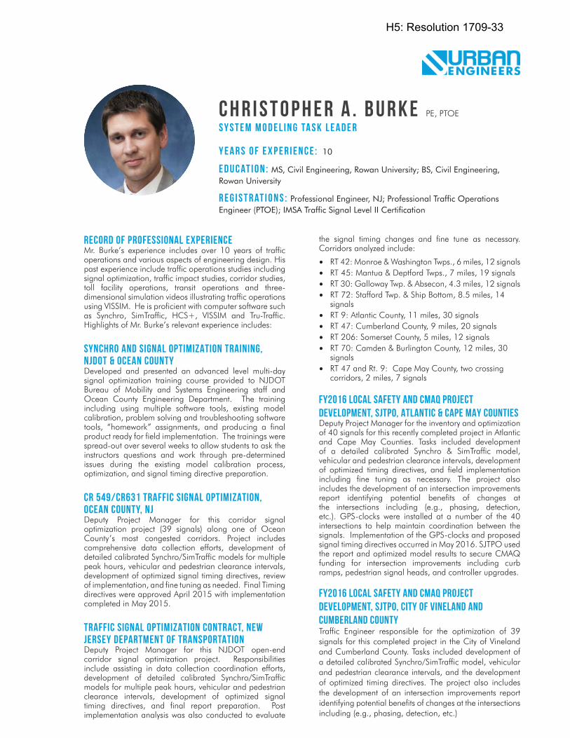
c h r i s t o p h e r a . b u r k e PE, PTOE
s y s t e m m o d e l i n g ta s k l e a d e r
Y e a r s o f E x p e r i e n c e : 10
E d u c at i o n : MS, Civil Engineering, Rowan University; BS, Civil Engineering, Rowan University
r e g i s t r at i o n s : Professional Engineer, NJ; Professional Traffi c Operations Engineer (PTOE); IMSA Traffi c Signal Level II Certifi cation
RECORD OF PROFESSIONAL EXPERIENCEMr. Burke’s experience includes over 10 years of traffic operations and various aspects of engineering design. His past experience include traffic operations studies including signal optimization, traffic impact studies, corridor studies, toll facility operations, transit operations and three-dimensional simulation videos illustrating traffic operations using VISSIM. He is proficient with computer software such as Synchro, SimTraffic, HCS+, VISSIM and Tru-Traffic. Highlights of Mr. Burke’s relevant experience includes:
SYNCHRO AND SIGNAL OPTIMIZATION TRAINING, NJDOT & OCEAN COUNTYDeveloped and presented an advanced level multi-day signal optimization training course provided to NJDOT Bureau of Mobility and Systems Engineering staff and Ocean County Engineering Department. The training including using multiple software tools, existing model calibration, problem solving and troubleshooting software tools, “homework” assignments, and producing a final product ready for field implementation. The trainings were spread-out over several weeks to allow students to ask the instructors questions and work through pre-determined issues during the existing model calibration process, optimization, and signal timing directive preparation.
CR 549/CR631 TRAFFIC SIGNAL OPTIMIZATION, OCEAN COUNTY, NJDeputy Project Manager for this corridor signal optimization project (39 signals) along one of Ocean County’s most congested corridors. Project includes comprehensive data collection efforts, development of detailed calibrated Synchro/SimTraffic models for multiple peak hours, vehicular and pedestrian clearance intervals, development of optimized signal timing directives, review of implementation, and fine tuning as needed. Final Timing directives were approved April 2015 with implementation completed in May 2015.
TRAFFIC SIGNAL OPTIMIZATION CONTRACT, NEW JERSEY DEPARTMENT OF TRANSPORTATIONDeputy Project Manager for this NJDOT open-end corridor signal optimization project. Responsibilities include assisting in data collection coordination efforts, development of detailed calibrated Synchro/SimTraffic models for multiple peak hours, vehicular and pedestrian clearance intervals, development of optimized signal timing directives, and final report preparation. Post implementation analysis was also conducted to evaluate
the signal timing changes and fine tune as necessary. Corridors analyzed include:
• RT 42: Monroe & Washington Twps., 6 miles, 12 signals• RT 45: Mantua & Deptford Twps., 7 miles, 19 signals• RT 30: Galloway Twp. & Absecon, 4.3 miles, 12 signals• RT 72: Stafford Twp. & Ship Bottom, 8.5 miles, 14
signals• RT 9: Atlantic County, 11 miles, 30 signals• RT 47: Cumberland County, 9 miles, 20 signals• RT 206: Somerset County, 5 miles, 12 signals• RT 70: Camden & Burlington County, 12 miles, 30
signals • RT 47 and Rt. 9: Cape May County, two crossing
corridors, 2 miles, 7 signals
FY2016 LOCAL SAFETY AND CMAQ PROJECT DEVELOPMENT, SJTPO, ATLANTIC & CAPE MAY COUNTIESDeputy Project Manager for the inventory and optimization of 40 signals for this recently completed project in Atlantic and Cape May Counties. Tasks included development of a detailed calibrated Synchro & SimTraffic model, vehicular and pedestrian clearance intervals, development of optimized timing directives, and field implementation including fine tuning as necessary. The project also includes the development of an intersection improvements report identifying potential benefits of changes at the intersections including (e.g., phasing, detection, etc.). GPS-clocks were installed at a number of the 40 intersections to help maintain coordination between the signals. Implementation of the GPS-clocks and proposed signal timing directives occurred in May 2016. SJTPO used the report and optimized model results to secure CMAQ funding for intersection improvements including curb ramps, pedestrian signal heads, and controller upgrades.
FY2016 LOCAL SAFETY AND CMAQ PROJECT DEVELOPMENT, SJTPO, CITY OF VINELAND AND CUMBERLAND COUNTYTraffic Engineer responsible for the optimization of 39 signals for this completed project in the City of Vineland and Cumberland County. Tasks included development of a detailed calibrated Synchro/SimTraffic model, vehicular and pedestrian clearance intervals, and the development of optimized timing directives. The project also includes the development of an intersection improvements report identifying potential benefits of changes at the intersections including (e.g., phasing, detection, etc.)
H5: Resolution 1709-33
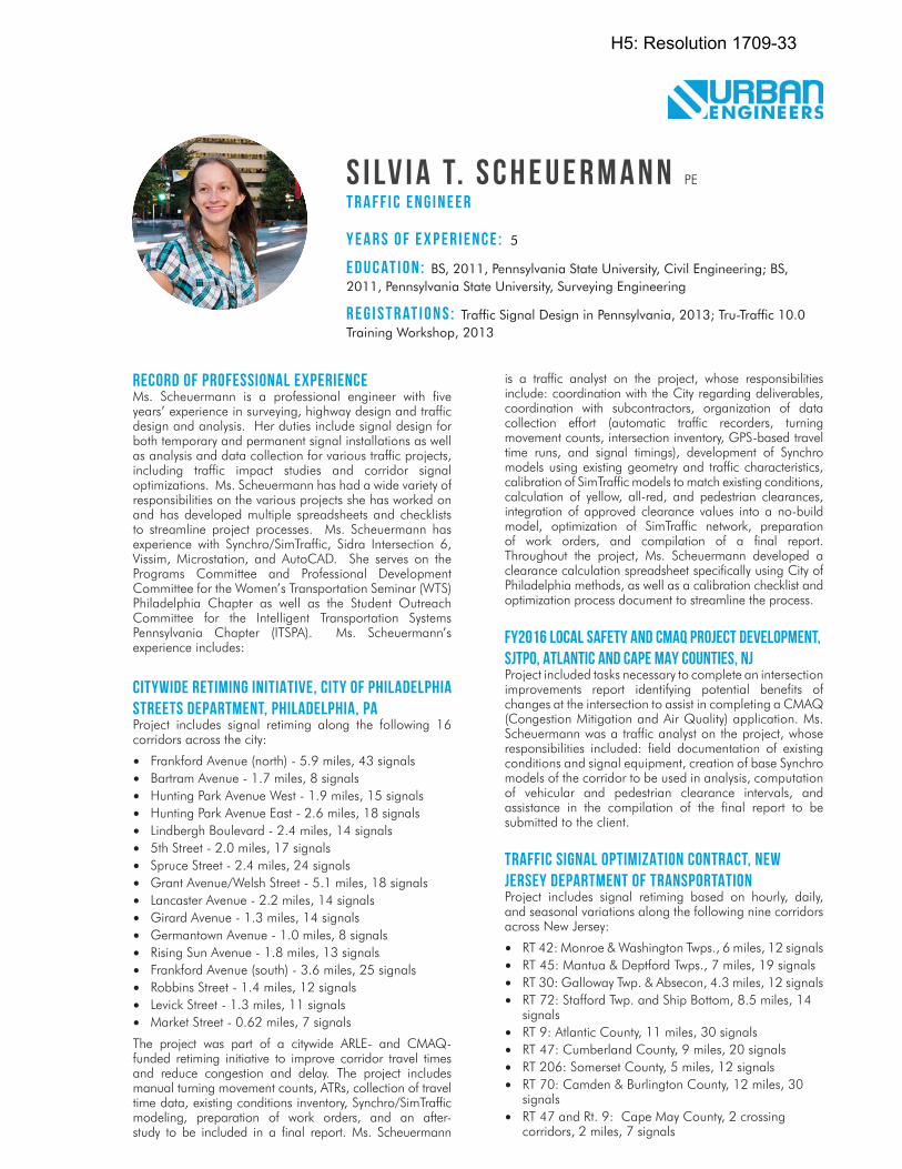
S i lv i a T. S c h e u e r m a n n PE
t r a f f i c e n g i n e e r
Y e a r s o f E x p e r i e n c e : 5
E d u c at i o n : BS, 2011, Pennsylvania State University, Civil Engineering; BS, 2011, Pennsylvania State University, Surveying Engineering
r e g i s t r at i o n s : Traffi c Signal Design in Pennsylvania, 2013; Tru-Traffi c 10.0 Training Workshop, 2013
RECORD OF PROFESSIONAL EXPERIENCEMs. Scheuermann is a professional engineer with five years’ experience in surveying, highway design and traffic design and analysis. Her duties include signal design for both temporary and permanent signal installations as well as analysis and data collection for various traffic projects, including traffic impact studies and corridor signal optimizations. Ms. Scheuermann has had a wide variety of responsibilities on the various projects she has worked on and has developed multiple spreadsheets and checklists to streamline project processes. Ms. Scheuermann has experience with Synchro/SimTraffic, Sidra Intersection 6, Vissim, Microstation, and AutoCAD. She serves on the Programs Committee and Professional Development Committee for the Women’s Transportation Seminar (WTS) Philadelphia Chapter as well as the Student Outreach Committee for the Intelligent Transportation Systems Pennsylvania Chapter (ITSPA). Ms. Scheuermann’s experience includes:
CITYWIDE RETIMING INITIATIVE, CITY OF PHILADELPHIA STREETS DEPARTMENT, PHILADELPHIA, PAProject includes signal retiming along the following 16 corridors across the city:
• Frankford Avenue (north) - 5.9 miles, 43 signals• Bartram Avenue - 1.7 miles, 8 signals• Hunting Park Avenue West - 1.9 miles, 15 signals• Hunting Park Avenue East - 2.6 miles, 18 signals• Lindbergh Boulevard - 2.4 miles, 14 signals• 5th Street - 2.0 miles, 17 signals• Spruce Street - 2.4 miles, 24 signals• Grant Avenue/Welsh Street - 5.1 miles, 18 signals• Lancaster Avenue - 2.2 miles, 14 signals• Girard Avenue - 1.3 miles, 14 signals• Germantown Avenue - 1.0 miles, 8 signals• Rising Sun Avenue - 1.8 miles, 13 signals• Frankford Avenue (south) - 3.6 miles, 25 signals• Robbins Street - 1.4 miles, 12 signals• Levick Street - 1.3 miles, 11 signals• Market Street - 0.62 miles, 7 signals
The project was part of a citywide ARLE- and CMAQ-funded retiming initiative to improve corridor travel times and reduce congestion and delay. The project includes manual turning movement counts, ATRs, collection of travel time data, existing conditions inventory, Synchro/SimTraffic modeling, preparation of work orders, and an after-study to be included in a final report. Ms. Scheuermann
is a traffic analyst on the project, whose responsibilities include: coordination with the City regarding deliverables, coordination with subcontractors, organization of data collection effort (automatic traffic recorders, turning movement counts, intersection inventory, GPS-based travel time runs, and signal timings), development of Synchro models using existing geometry and traffic characteristics, calibration of SimTraffic models to match existing conditions, calculation of yellow, all-red, and pedestrian clearances, integration of approved clearance values into a no-build model, optimization of SimTraffic network, preparation of work orders, and compilation of a final report. Throughout the project, Ms. Scheuermann developed a clearance calculation spreadsheet specifically using City of Philadelphia methods, as well as a calibration checklist and optimization process document to streamline the process.
FY2016 LOCAL SAFETY AND CMAQ PROJECT DEVELOPMENT, SJTPO, ATLANTIC AND CAPE MAY COUNTIES, NJProject included tasks necessary to complete an intersection improvements report identifying potential benefits of changes at the intersection to assist in completing a CMAQ (Congestion Mitigation and Air Quality) application. Ms. Scheuermann was a traffic analyst on the project, whose responsibilities included: field documentation of existing conditions and signal equipment, creation of base Synchro models of the corridor to be used in analysis, computation of vehicular and pedestrian clearance intervals, and assistance in the compilation of the final report to be submitted to the client.
TRAFFIC SIGNAL OPTIMIZATION CONTRACT, NEW JERSEY DEPARTMENT OF TRANSPORTATIONProject includes signal retiming based on hourly, daily, and seasonal variations along the following nine corridors across New Jersey:
• RT 42: Monroe & Washington Twps., 6 miles, 12 signals• RT 45: Mantua & Deptford Twps., 7 miles, 19 signals• RT 30: Galloway Twp. & Absecon, 4.3 miles, 12 signals• RT 72: Stafford Twp. and Ship Bottom, 8.5 miles, 14
signals• RT 9: Atlantic County, 11 miles, 30 signals• RT 47: Cumberland County, 9 miles, 20 signals• RT 206: Somerset County, 5 miles, 12 signals• RT 70: Camden & Burlington County, 12 miles, 30
signals • RT 47 and Rt. 9: Cape May County, 2 crossing
corridors, 2 miles, 7 signals
H5: Resolution 1709-33
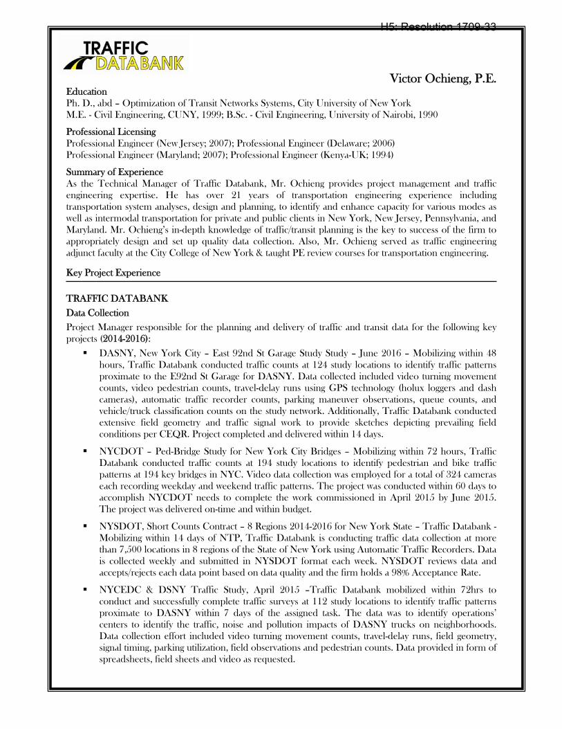
Victor Ochieng, P.E. Education Ph. D., abd – Optimization of Transit Networks Systems, City University of New York M.E. - Civil Engineering, CUNY, 1999; B.Sc. - Civil Engineering, University of Nairobi, 1990
Professional Licensing Professional Engineer (New Jersey; 2007); Professional Engineer (Delaware; 2006) Professional Engineer (Maryland; 2007); Professional Engineer (Kenya-UK; 1994)
Summary of Experience As the Technical Manager of Traffic Databank, Mr. Ochieng provides project management and traffic engineering expertise. He has over 21 years of transportation engineering experience including transportation system analyses, design and planning, to identify and enhance capacity for various modes as well as intermodal transportation for private and public clients in New York, New Jersey, Pennsylvania, and Maryland. Mr. Ochieng’s in-depth knowledge of traffic/transit planning is the key to success of the firm to appropriately design and set up quality data collection. Also, Mr. Ochieng served as traffic engineering adjunct faculty at the City College of New York & taught PE review courses for transportation engineering.
Key Project Experience
TRAFFIC DATABANK
Data Collection
Project Manager responsible for the planning and delivery of traffic and transit data for the following key projects (2014-2016):
DASNY, New York City – East 92nd St Garage Study Study – June 2016 – Mobilizing within 48 hours, Traffic Databank conducted traffic counts at 124 study locations to identify traffic patterns proximate to the E92nd St Garage for DASNY. Data collected included video turning movement counts, video pedestrian counts, travel-delay runs using GPS technology (holux loggers and dash cameras), automatic traffic recorder counts, parking maneuver observations, queue counts, and vehicle/truck classification counts on the study network. Additionally, Traffic Databank conducted extensive field geometry and traffic signal work to provide sketches depicting prevailing field conditions per CEQR. Project completed and delivered within 14 days.
NYCDOT – Ped-Bridge Study for New York City Bridges – Mobilizing within 72 hours, Traffic Databank conducted traffic counts at 194 study locations to identify pedestrian and bike traffic patterns at 194 key bridges in NYC. Video data collection was employed for a total of 324 cameras each recording weekday and weekend traffic patterns. The project was conducted within 60 days to accomplish NYCDOT needs to complete the work commissioned in April 2015 by June 2015. The project was delivered on-time and within budget.
NYSDOT, Short Counts Contract – 8 Regions 2014-2016 for New York State – Traffic Databank - Mobilizing within 14 days of NTP, Traffic Databank is conducting traffic data collection at more than 7,500 locations in 8 regions of the State of New York using Automatic Traffic Recorders. Data is collected weekly and submitted in NYSDOT format each week. NYSDOT reviews data and accepts/rejects each data point based on data quality and the firm holds a 98% Acceptance Rate.
NYCEDC & DSNY Traffic Study, April 2015 –Traffic Databank mobilized within 72hrs to conduct and successfully complete traffic surveys at 112 study locations to identify traffic patterns proximate to DASNY within 7 days of the assigned task. The data was to identify operations’ centers to identify the traffic, noise and pollution impacts of DASNY trucks on neighborhoods. Data collection effort included video turning movement counts, travel-delay runs, field geometry, signal timing, parking utilization, field observations and pedestrian counts. Data provided in form of spreadsheets, field sheets and video as requested.
H5: Resolution 1709-33
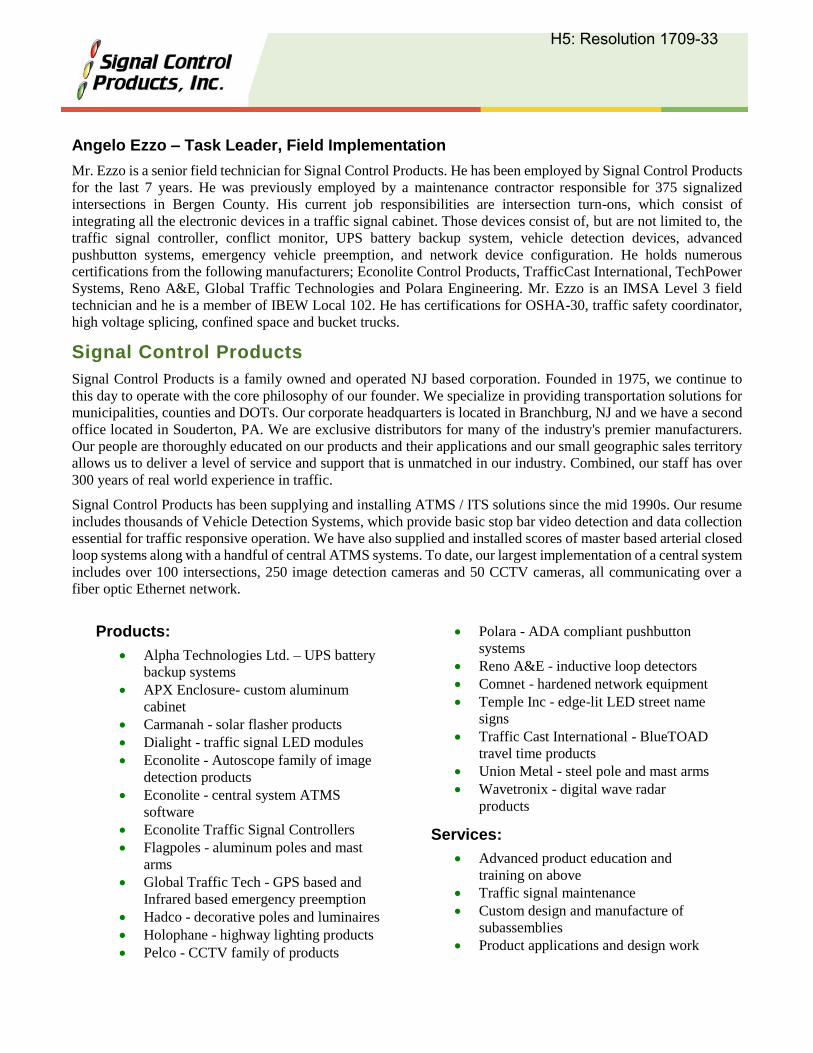
Angelo Ezzo – Task Leader, Field Implementation
Mr. Ezzo is a senior field technician for Signal Control Products. He has been employed by Signal Control Products
for the last 7 years. He was previously employed by a maintenance contractor responsible for 375 signalized
intersections in Bergen County. His current job responsibilities are intersection turn-ons, which consist of
integrating all the electronic devices in a traffic signal cabinet. Those devices consist of, but are not limited to, the
traffic signal controller, conflict monitor, UPS battery backup system, vehicle detection devices, advanced
pushbutton systems, emergency vehicle preemption, and network device configuration. He holds numerous
certifications from the following manufacturers; Econolite Control Products, TrafficCast International, TechPower
Systems, Reno A&E, Global Traffic Technologies and Polara Engineering. Mr. Ezzo is an IMSA Level 3 field
technician and he is a member of IBEW Local 102. He has certifications for OSHA-30, traffic safety coordinator,
high voltage splicing, confined space and bucket trucks.
Signal Control Products
Signal Control Products is a family owned and operated NJ based corporation. Founded in 1975, we continue to
this day to operate with the core philosophy of our founder. We specialize in providing transportation solutions for
municipalities, counties and DOTs. Our corporate headquarters is located in Branchburg, NJ and we have a second
office located in Souderton, PA. We are exclusive distributors for many of the industry's premier manufacturers.
Our people are thoroughly educated on our products and their applications and our small geographic sales territory
allows us to deliver a level of service and support that is unmatched in our industry. Combined, our staff has over
300 years of real world experience in traffic.
Signal Control Products has been supplying and installing ATMS / ITS solutions since the mid 1990s. Our resume
includes thousands of Vehicle Detection Systems, which provide basic stop bar video detection and data collection
essential for traffic responsive operation. We have also supplied and installed scores of master based arterial closed
loop systems along with a handful of central ATMS systems. To date, our largest implementation of a central system
includes over 100 intersections, 250 image detection cameras and 50 CCTV cameras, all communicating over a
fiber optic Ethernet network.
Products:
Alpha Technologies Ltd. – UPS battery
backup systems
APX Enclosure- custom aluminum
cabinet
Carmanah - solar flasher products
Dialight - traffic signal LED modules
Econolite - Autoscope family of image
detection products
Econolite - central system ATMS
software
Econolite Traffic Signal Controllers
Flagpoles - aluminum poles and mast
arms
Global Traffic Tech - GPS based and
Infrared based emergency preemption
Hadco - decorative poles and luminaires
Holophane - highway lighting products
Pelco - CCTV family of products
Polara - ADA compliant pushbutton
systems
Reno A&E - inductive loop detectors
Comnet - hardened network equipment
Temple Inc - edge-lit LED street name
signs
Traffic Cast International - BlueTOAD
travel time products
Union Metal - steel pole and mast arms
Wavetronix - digital wave radar
products
Services:
Advanced product education and
training on above
Traffic signal maintenance
Custom design and manufacture of
subassemblies
Product applications and design work
H5: Resolution 1709-33
John J. Welker
Signal Timing Implementation Task Leader
Mr. Welker joined Traffic Products 1987 as a field technician, and rapidly increased responsibility to
application and integration engineer, estimator, sales, and owner all while providing excellent technical
and service to customers.
John has extensive experience providing, integrating and timing of large signal systems in Reading, PA,
Delaware DOT, SJTPO retiming of Wildwood Crest, NJ, PennDOT and Cape May County and NJDOT.
He has worked on weather systems, variable speed limit, enhanced school zone radar systems, and
connected vehicle systems.
H5: Resolution 1709-33

h. DBE/ESBE Certificates
H5: Resolution 1709-33
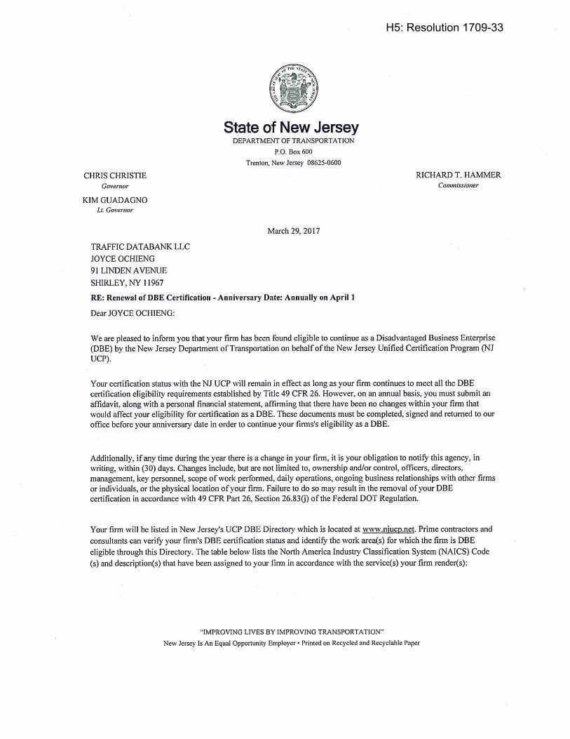
H5: Resolution 1709-33
H5: Resolution 1709-33

i. Equal Employment Opportunity Statement
H5: Resolution 1709-33
H5: Resolution 1709-33

3. cost proposal
H5: Resolution 1709-33

sjtpo | regional signal timing initiative
urban engineers, inc.
cost proposalPer the requirements of the RFP, Urban has submitted it’s Cost Proposal under separate cover.
H5: Resolution 1709-33
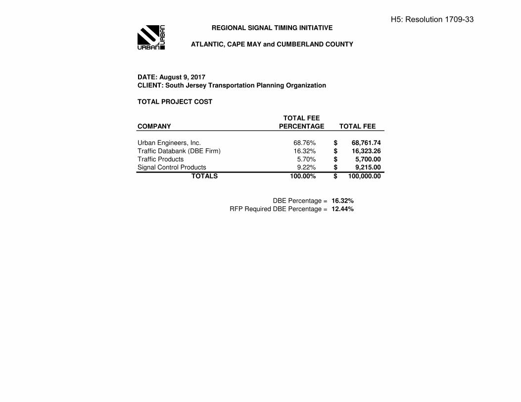
DATE: August 9, 2017
CLIENT: South Jersey Transportation Planning Organization
TOTAL PROJECT COST
TOTAL FEE
COMPANY PERCENTAGE TOTAL FEE
Urban Engineers, Inc. 68.76% 68,761.74$
Traffic Databank (DBE Firm) 16.32% 16,323.26$
Traffic Products 5.70% 5,700.00$
Signal Control Products 9.22% 9,215.00$
100.00% 100,000.00$
DBE Percentage = 16.32%
RFP Required DBE Percentage = 12.44%
TOTALS
REGIONAL SIGNAL TIMING INITIATIVE
ATLANTIC, CAPE MAY and CUMBERLAND COUNTY
H5: Resolution 1709-33
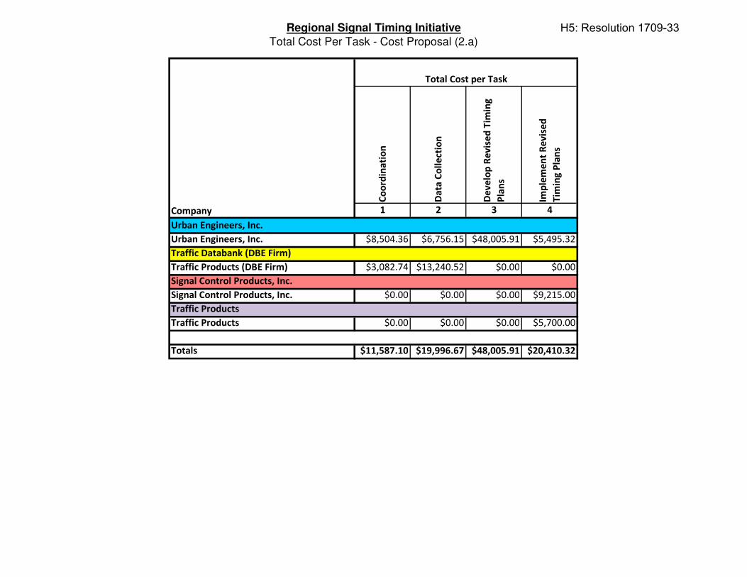
Regional Signal Timing Initiative
Total Cost Per Task - Cost Proposal (2.a)
Co
ord
ina
tio
n
Da
ta C
oll
ect
ion
De
ve
lop
Re
vis
ed
Tim
ing
Pla
ns
Imp
lem
en
t R
ev
ise
d
Tim
ing
Pla
ns
1 2 3 4
$8,504.36 $6,756.15 $48,005.91 $5,495.32
$3,082.74 $13,240.52 $0.00 $0.00
$0.00 $0.00 $0.00 $9,215.00
$0.00 $0.00 $0.00 $5,700.00
$11,587.10 $19,996.67 $48,005.91 $20,410.32
Company
Urban Engineers, Inc.
Traffic Products
Total Cost per Task
Urban Engineers, Inc.
Traffic Databank (DBE Firm)
Signal Control Products, Inc.
Signal Control Products, Inc.
Traffic Products (DBE Firm)
Traffic Products
Totals
H5: Resolution 1709-33
SOUTH JERSEY TRANSPORTATION PLANNING ORGANIZATION
RESOLUTION 1709-33: Approving the Selection of Urban Engineers, Inc. as the Consultant for
the Regional Signal Timing Initiative Study
WHEREAS, the South Jersey Transportation Planning Organization (SJTPO) is the
Metropolitan Planning Organization (MPO) designated under Federal law for the southern region
of New Jersey including Atlantic, Cape May, Cumberland, and Salem Counties; and
WHEREAS, the Fiscal Year 2018 SJTPO Unified Planning Work Program includes Federal
Highway Administration planning funds for this project; and
WHEREAS, the Notice of Availability of Requests was sent to approximately 197 firms on
July 13, 2017; and
WHEREAS, the Request for Proposal (RFP) announcement and supplemental materials
were also posted on the publicly accessible SJTPO website; and
WHEREAS, seven (7) proposals were received; and
WHEREAS, the SJTPO Technical Advisory Committee endorsed the consultant selection
committee with representatives from SJTPO, NJDOT, Atlantic County, Cape May County and
Cumberland County, who reviewed and evaluated the proposals in accordance with SJTPO’s
published criteria; and
WHEREAS, the Consultant Selection Committee recommends Urban Engineers, Inc. in
association with Signal Control Products, Inc. and Traffic Products, and Traffic Databank serving
as the Disadvantaged Business Enterprise (DBE) firm; and
WHEREAS, the SJTPO TAC, at their September 11, 2017 meeting, endorsed the
recommendation of the Consultant Selection Committee;
NOW THEREFORE BE IT RESOLVED, that the Policy Board of the South Jersey
Transportation Planning Organization hereby approves the above selection for the Regional Signal
Timing Initiative Study, with a maximum fee of $100,000.00 and 16.32% DBE participation; and
BE IT FURTHER RESOLVED, that the Policy Board authorizes the Executive Director to
execute scope of work and cost modifications to the original contract amount, provided that funding
is available.
BE IT FURTHER RESOLVED, that the Policy Board requests that the South Jersey
Transportation Authority execute the appropriate contractual arrangements with the consultant on
behalf of the SJTPO.
H5: Resolution 1709-33
SOUTH JERSEY TRANSPORTATION PLANNING ORGANIZATION
ITEM 1709-34: Approving the Executive Director’s Recommendation of the Revised SJTPO
Organizational Structure
PROPOSAL
The Executive Director is recommending that the Policy Board approve revised SJTPO organizational
structure, as illustrated in the attached SJTPO Organization Chart & Responsibilities, dated September
25, 2017.
BACKGROUND
The organizational chart, dated July 2011 (Existing), was formally approved by the SJTPO Policy Board
on July 25, 2011. The chart is outdated with several people no longer employed by SJTPO. The
organizational chart marked, as of September 24, 2017, was included For reference as it accurately
represents the existing organizational structure now. Presently there are seven employees reporting
directly to the Executive Director. While the core activities of Metropolitan Planning, Community Safety
Outreach, and Capital Programming are represented in type work for each staff members, the existing
areas were not clearly defined within the organizational structure and include a three-tiered hierarchy that
is redundant and unnecessary.
The SJTPO Organization Chart & Responsibilities, dated September 25, 2017 represents the proposed
chart. The reorganization creates three distinct areas under the Program Management & Transportation
Planning umbrella. Alan Huff, David Heller, and Andrew Tracy will be the three Program Managers, each
having their own distinct area to oversee; Safety Initiatives & Public Outreach, System Performance &
Sub-Regional Program, and Capital Programming & Project Development, respectively. The updated
chart identifies Safety Education & Outreach and Grants, Contracts & Administration as additional core
functions within the MPO.
The proposed reorganization will help capitalize on strengths of staff, helping the organization move
forward. The reorganization is consistent with staffing levels and salary included within the approved FY
2018 UPWP and are set in accordance with SJTA’s adopted salary scale, recognizing an individual’s
experience, education, licensure, certification, and professional standing.
All individual salary actions (i.e. promotions) associated with this reorganization will be acted upon by
the Policy Board as separate actions. Any title changes not impacting the salary range of an employee
does not require any further action. Updated position descriptions for all employees shall be forwarded to
SJTA for processing in the SJTA’s role as administrative host per the Basic Agreement of June 2009.
H6: Resolution 1709-34
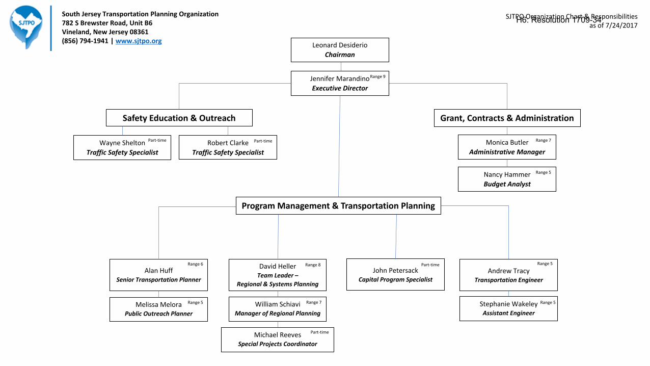
Jennifer Marandino
Executive Director
Safety Education & Outreach
Wayne Shelton
Traffic Safety Specialist
Robert Clarke
Traffic Safety Specialist
Monica Butler
Administrative Manager
Nancy Hammer
Budget Analyst
David HellerTeam Leader –
Regional & Systems Planning
Andrew TracyTransportation Engineer
John PetersackCapital Program Specialist
Stephanie WakeleyAssistant Engineer
Michael ReevesSpecial Projects Coordinator
Alan HuffSenior Transportation Planner
William SchiaviManager of Regional Planning
Melissa MeloraPublic Outreach Planner
South Jersey Transportation Planning Organization782 S Brewster Road, Unit B6Vineland, New Jersey 08361(856) 794-1941 | www.sjtpo.org
Range 6 Range 8 Range 5
Range 7Range 5
Part-time
Part-time
Range 5
Part-timePart-time Range 7
Range 5
Range 9
Program Management & Transportation Planning
Grant, Contracts & Administration
SJTPO Organization Chart & Responsibilitiesas of 7/24/2017
Leonard Desiderio
Chairman
H6: Resolution 1709-34
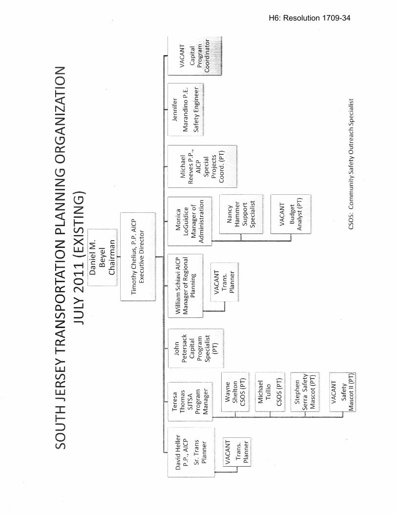
H6: Resolution 1709-34
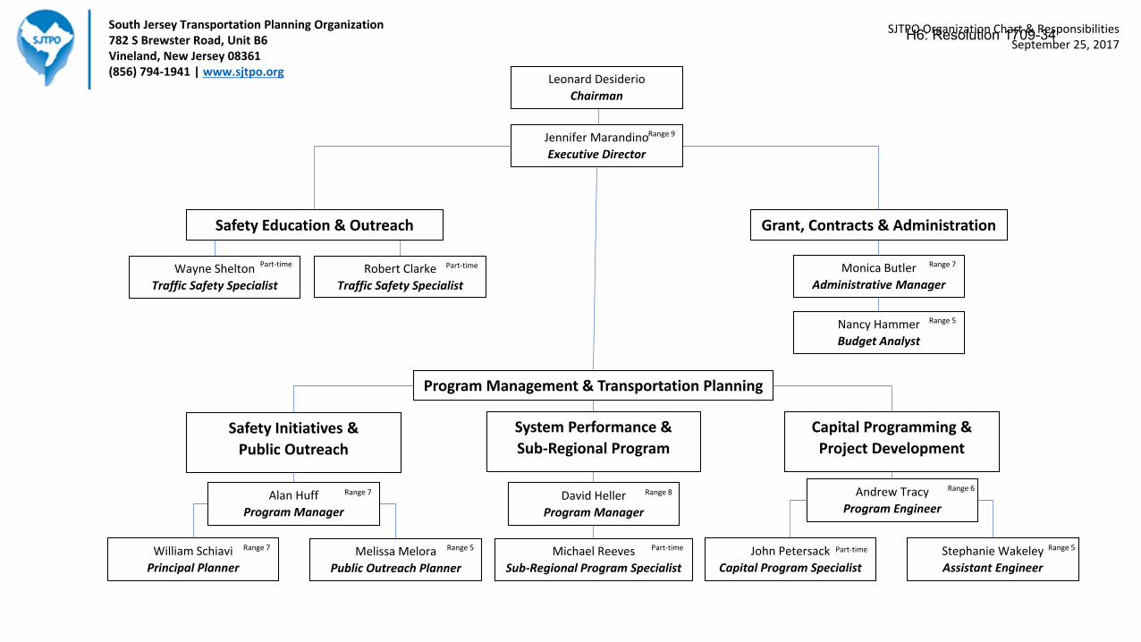
Jennifer Marandino
Executive Director
Grant, Contracts & AdministrationSafety Education & Outreach
Program Management & Transportation Planning
Wayne Shelton
Traffic Safety Specialist
Robert Clarke
Traffic Safety Specialist
Monica Butler
Administrative Manager
Nancy Hammer
Budget Analyst
David Heller
Program Manager
Andrew Tracy
Program Engineer
John Petersack
Capital Program Specialist
Stephanie Wakeley
Assistant Engineer
Michael Reeves
Sub-Regional Program Specialist
Alan Huff
Program Manager
William Schiavi
Principal Planner
Melissa Melora
Public Outreach Planner
Safety Initiatives &
Public Outreach
System Performance &
Sub-Regional Program
Capital Programming &
Project Development
South Jersey Transportation Planning Organization782 S Brewster Road, Unit B6Vineland, New Jersey 08361(856) 794-1941 | www.sjtpo.org
Range 7 Range 8 Range 6
Range 7 Range 5 Part-time Part-time Range 5
Part-timePart-time Range 7
Range 5
Range 9
SJTPO Organization Chart & ResponsibilitiesSeptember 25, 2017
Leonard Desiderio
Chairman
H6: Resolution 1709-34
SOUTH JERSEY TRANSPORTATION PLANNING ORGANIZATION
RESOLUTION 1709-34: Approving the Executive Director’s Recommendation of the Revised
SJTPO Organizational Structure
WHEREAS, the South Jersey Transportation Planning Organization (SJTPO) is the
Metropolitan Planning Organization (MPO) designated under federal law for the southern region
of New Jersey including Atlantic, Cape May, Cumberland, and Salem Counties; and
WHEREAS, pursuant to 23 U.S.C Sec. 104 (f) (3) et. seq. and 49 U.S.C. Sec. 1607 et. seq.
MPO’s are responsible for the development of a Unified Planning Work Program (UPWP) to
guide the transportation planning process in the region; and
WHEREAS, the SJTPO is responsible under federal law for carrying out numerous
required metropolitan planning activities as enumerated in the SJTPO UPWP; and
WHEREAS, on July 25, 2011, the SJTPO Policy Board approved staff reorganization to
rationalize and streamline workflow; and
WHEREAS, the previously approved organizational structure is outdated and no longer
represents the current organization and staff; and
WHEREAS, the proposed organization structure recognizes the SJTPO’s core functions
under Program Management & Transportation Planning being Safety Initiatives & Public
Outreach, System Performance & Sub-Regional Program, and Capital Programming & Project
Development; and
WHEREAS, the proposed organization structure defines three Program Managers of the
three core functions; and
WHEREAS, the proposed organization structure clearly identifies Safety Education &
Outreach and Grants, Contracts & Administration as additional core functions within the MPO;
and
WHEREAS, the proposed reorganization will help capitalize on strengths of staff, helping
the organization move forward; and
WHEREAS, the reorganization is consistent with staffing levels and salary included within
the approved FY 2018 UPWP;
WHEREAS, on March 27, 2017, the SJTPO Policy Board adopted the FY 2018 UPWP
through Resolution 1703-08; and on July 24, 2017 approved amendments to the document through
Resolution 1707-23 related to the Technical Program; and
NOW, THEREFORE, BE IT RESOLVED, that the Policy Board of the South Jersey
Transportation Planning Organization hereby approves the revised SJTPO organizational
structure, as illustrated in the attached chart, and
H6: Resolution 1709-34
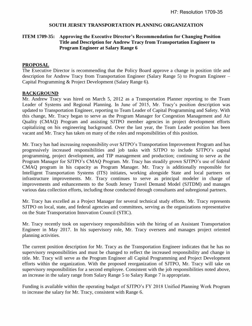
SOUTH JERSEY TRANSPORTATION PLANNING ORGANIZATION
ITEM 1709-35: Approving the Executive Director’s Recommendation for Changing Position
Title and Description for Andrew Tracy from Transportation Engineer to
Program Engineer at Salary Range 6
PROPOSAL
The Executive Director is recommending that the Policy Board approve a change in position title and
description for Andrew Tracy from Transportation Engineer (Salary Range 5) to Program Engineer –
Capital Programming & Project Development (Salary Range 6).
BACKGROUND
Mr. Andrew Tracy was hired on March 5, 2012 as a Transportation Planner reporting to the Team
Leader of Systems and Regional Planning. In June of 2015, Mr. Tracy’s position description was
updated to Transportation Engineer, reporting to Team Leader of Capital Programming and Safety. With
this change, Mr. Tracy began to serve as the Program Manager for Congestion Management and Air
Quality (CMAQ) Program and assisting SJTPO member agencies in project development efforts
capitalizing on his engineering background. Over the last year, the Team Leader position has been
vacant and Mr. Tracy has taken on many of the roles and responsibilities of this position.
Mr. Tracy has had increasing responsibility over SJTPO’s Transportation Improvement Program and has
progressively increased responsibilities and job tasks with SJTPO to include SJTPO’s capital
programming, project development, and TIP management and production; continuing to serve as the
Program Manager for SJTPO’s CMAQ Program. Mr. Tracy has steadily grown SJTPO’s use of federal
CMAQ program in his capacity as Program Manager. Mr. Tracy is additionally responsible for
Intelligent Transportation Systems (ITS) initiates, working alongside State and local partners on
infrastructure improvements. Mr. Tracy continues to serve as principal modeler in charge of
improvements and enhancements to the South Jersey Travel Demand Model (SJTDM) and manages
various data collection efforts, including those conducted through consultants and subregional partners.
Mr. Tracy has excelled as a Project Manager for several technical study efforts. Mr. Tracy represents
SJTPO on local, state, and federal agencies and committees, serving as the organizations representative
on the State Transportation Innovation Council (STIC).
Mr. Tracy recently took on supervisory responsibilities with the hiring of an Assistant Transportation
Engineer in May 2017. In his supervisory role, Mr. Tracy oversees and manages project oriented
planning activities.
The current position description for Mr. Tracy as the Transportation Engineer indicates that he has no
supervisory responsibilities and must be changed to reflect the increased responsibility and change in
title. Mr. Tracy will serve as the Program Engineer all Capital Programming and Project Development
efforts within the organization. With the proposed reorganization of SJTPO, Mr. Tracy will take on
supervisory responsibilities for a second employee. Consistent with the job responsibilities noted above,
an increase in the salary range from Salary Range 5 to Salary Range 7 is appropriate.
Funding is available within the operating budget of SJTPO’s FY 2018 Unified Planning Work Program
to increase the salary for Mr. Tracy, consistent with Range 6.
H7: Resolution 1709-35
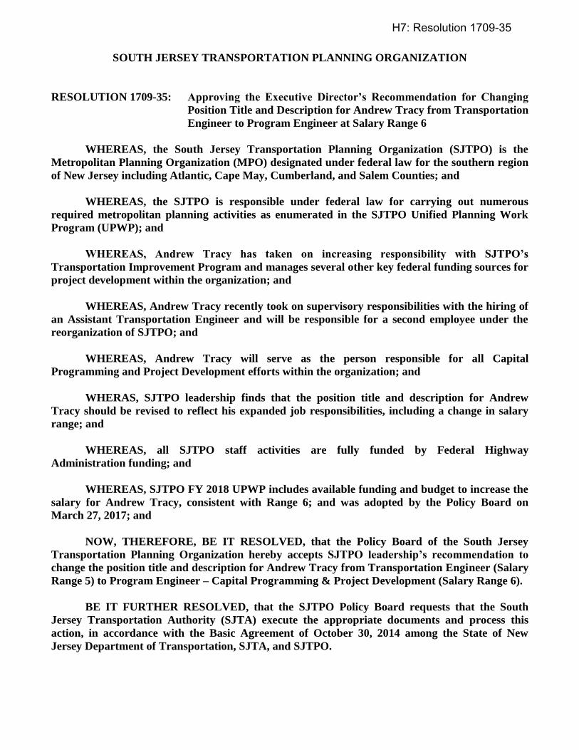
SOUTH JERSEY TRANSPORTATION PLANNING ORGANIZATION
RESOLUTION 1709-35: Approving the Executive Director’s Recommendation for Changing
Position Title and Description for Andrew Tracy from Transportation
Engineer to Program Engineer at Salary Range 6
WHEREAS, the South Jersey Transportation Planning Organization (SJTPO) is the
Metropolitan Planning Organization (MPO) designated under federal law for the southern region
of New Jersey including Atlantic, Cape May, Cumberland, and Salem Counties; and
WHEREAS, the SJTPO is responsible under federal law for carrying out numerous
required metropolitan planning activities as enumerated in the SJTPO Unified Planning Work
Program (UPWP); and
WHEREAS, Andrew Tracy has taken on increasing responsibility with SJTPO’s
Transportation Improvement Program and manages several other key federal funding sources for
project development within the organization; and
WHEREAS, Andrew Tracy recently took on supervisory responsibilities with the hiring of
an Assistant Transportation Engineer and will be responsible for a second employee under the
reorganization of SJTPO; and
WHEREAS, Andrew Tracy will serve as the person responsible for all Capital
Programming and Project Development efforts within the organization; and
WHERAS, SJTPO leadership finds that the position title and description for Andrew
Tracy should be revised to reflect his expanded job responsibilities, including a change in salary
range; and
WHEREAS, all SJTPO staff activities are fully funded by Federal Highway
Administration funding; and
WHEREAS, SJTPO FY 2018 UPWP includes available funding and budget to increase the
salary for Andrew Tracy, consistent with Range 6; and was adopted by the Policy Board on
March 27, 2017; and
NOW, THEREFORE, BE IT RESOLVED, that the Policy Board of the South Jersey
Transportation Planning Organization hereby accepts SJTPO leadership’s recommendation to
change the position title and description for Andrew Tracy from Transportation Engineer (Salary
Range 5) to Program Engineer – Capital Programming & Project Development (Salary Range 6).
BE IT FURTHER RESOLVED, that the SJTPO Policy Board requests that the South
Jersey Transportation Authority (SJTA) execute the appropriate documents and process this
action, in accordance with the Basic Agreement of October 30, 2014 among the State of New
Jersey Department of Transportation, SJTA, and SJTPO.
H7: Resolution 1709-35
SOUTH JERSEY TRANSPORTATION PLANNING ORGANIZATION
ITEM 1709-36: Approving the Executive Director’s Recommendation for Changing Position
Title and Description for Alan Huff from Senior Transportation Planner to
Program Manager at Salary Range 7
PROPOSAL
The Executive Director is recommending that the Policy Board approve a change in position title and
description for Alan Huff from Senior Transportation Planner (Salary Range 6) to Program Manager –
Safety Initiatives & Public Outreach (Salary Range 7).
BACKGROUND
Mr. Alan Huff was hired on August 12, 2013 as a Senior Transportation Planner reporting to the Team
Leader of Capital Programming and Safety. Over the last year, the Team Leader position has been
vacant and Mr. Huff has taken on many of the roles and responsibilities of this position. Mr. Huff has
had increasing responsibility over SJTPO’s Local Safety Program and is currently serving as the
Program Manager for Local Safety Program. Mr. Huff has worked with the member agencies to increase
participation in the program, along with other pilot safety efforts with the goal to substantially increase
SJTPO’s invest of federal Highway Safety Improvement Program (HSIP) funds. Mr. Huff continues to
manage the Safe Routes to Schools and Transportation Alternatives Program for the organization,
working collaboratively with Statewide partners.
Mr. Huff has excelled as a Project Manager for several technical study efforts. Mr. Huff represents
SJTPO on local, state, and federal agencies and committees, serving as the organizations representative
on the Bicycle and Pedestrian Advisory Council (BPAC).
Mr. Huff recently took on supervisory responsibilities with the hiring of a Public Outreach Planner in
May 2017. In this supervisory role, Mr. Huff oversees and manages SJTPO’s website, other public
involvement activities, including stakeholder outreach through written and visual means.
The current position description for Mr. Huff as the Senior Transportation Planner indicates that he has
no supervisory responsibilities and must be changed to reflect the increased responsibility and change in
title. Mr. Huff will serve as the Program Manager for all Safety Initiatives & Public Outreach efforts
within the organization. With the proposed reorganization of SJTPO, Mr. Huff will take on supervisory
responsibilities for a second employee. Consistent with the job responsibilities noted above, an increase
in the salary range from Salary Range 6 to Salary Range 7 is appropriate.
Funding is available within the operating budget of SJTPO’s FY 2018 Unified Planning Work Program
to increase the salary for Mr. Huff, consistent with Range 7.
H8: Resolution 1709-36
SOUTH JERSEY TRANSPORTATION PLANNING ORGANIZATION
RESOLUTION 1709-36: Approving the Executive Director’s Recommendation for Changing
Position Title and Description for Alan Huff from Senior
Transportation Planner to Program Manager at Salary Range 7
WHEREAS, the South Jersey Transportation Planning Organization (SJTPO) is the
Metropolitan Planning Organization (MPO) designated under federal law for the southern region
of New Jersey including Atlantic, Cape May, Cumberland, and Salem Counties; and
WHEREAS, the SJTPO is responsible under federal law for carrying out numerous
required metropolitan planning activities as enumerated in the SJTPO Unified Planning Work
Program (UPWP); and
WHEREAS, Alan Huff has taken on increasing responsibility with SJTPO’s Local Safety
Program and manages several other key federal funding sources for project development within
the organization; and
WHEREAS, Alan Huff recently took on supervisory responsibilities with the hiring of a
Public Outreach Planner and will be responsible for a second employee under the reorganization
of SJTPO; and
WHEREAS, Alan Huff will serve as the person responsible for all Safety Initiatives and
Public Outreach efforts within the organization; and
WHERAS, SJTPO leadership finds that the position title and description for Alan Huff
should be revised to reflect his expanded job responsibilities, including a change in salary range;
and
WHEREAS, all SJTPO staff activities are fully funded by Federal Highway
Administration funding; and
WHEREAS, SJTPO FY 2018 UPWP includes available funding and budget to increase the
salary for Alan Huff, consistent with Range 7; and was adopted by the Policy Board on March 27,
2017; and
NOW, THEREFORE, BE IT RESOLVED, that the Policy Board of the South Jersey
Transportation Planning Organization hereby accepts SJTPO leadership’s recommendation to
change the position title and description for Alan Huff from Senior Transportation Planner
(Salary Range 6) to Program Manager – Safety Initiatives & Public Outreach (Salary Range 7).
BE IT FURTHER RESOLVED, that the SJTPO Policy Board requests that the South
Jersey Transportation Authority (SJTA) execute the appropriate documents and process this
action, in accordance with the Basic Agreement of October 30, 2014 among the State of New
Jersey Department of Transportation, SJTA, and SJTPO.
H8: Resolution 1709-36