Embed Size (px)
Citation preview
SURREY HILLS AND CANTERBURY HILL ESTATE HERITAGE STUDY
Prepared by Lovell Chen Pty Ltd
February 2014
Revised by Context Pty Ltd and City of Boroondara April 2016
SURREY HI LLS AND CANTERBURY HI LL ESTATE HERITAGE STUDY 1
Attachment 1
Table of Contents
Contents
1.0 Introduction 4
1.1 Study area 4
1.2 Previous heritage studies 6
1.3 Community consultation 6
1.4 Summary of study findings & recommendations 7 1.4.1 Remaining historic properties 8
1.5 Planning Scheme amendments & Planning Panel reviews 8
2.0 Study methodology 8
2.1 Historical research 8
2.2 Physical survey 9 2.2.1 Descriptions 9
2.2.2 Precincts boundaries: inclusions & exclusions 9
2.2.3 Mapping 10
2.2.4 ‘Authenticity’ and dating of houses 10
2.3 Assessment of significance 11 2.3.1 Architectural & comparative analysis 11
2.3.2 Property gradings 12
2.3.3 Assessment against criteria 13
2.3.4 Statements of significance 14
2.4 Preparation of citations 14
2.5 Stage 2 - Preliminary Consultation 14 2.5.1 Consultation 14
2.5.2 Review of Feedback 15
2.5.3 Revisions to Heritage Study 15
2.6 Stage 2 - Exhibition 16 2.6.1 Exhibition 16
2.6.2 Review of Submissions 16
2.6.3 Revisions to Heritage Study 17
2.7 Stage 2 - Panel 18 2.7.1 Panel Hearing 18
2.7.2 Revisions to Heritage Study 18
SURREY HI LLS AND CANTERBURY HI LL ESTATE HERITAGE STUDY 2
STAGE 1A AND 1B CITATIONS TO THE SURREY HILLS AND CANTERBURY HILL ESTATE HERITAGE STUDY 20
APPENDIX 1: STAGE 1 HERITAGE CITATIONS - PRECINCTS 21
STAGE 2 CITATIONS TO THE SURREY HILLS AND CANTERBURY HILL ESTATE HERITAGE STUDY 121
(SURREY HILLS SOUTH RESIDENTIAL PRECINCTS HERITAGE STUDY) 121
APPENDIX 2: STAGE 2 HERITAGE CITATIONS - INDIVIDUAL PROPERTIES 122
Former Surrey College, 17-19A Barton Street, Surrey Hills 123
Former St Joseph’s Boys Home, 19 Middlesex Road, Surrey Hills 137
Holy Redeemer Church Parish Hall, 305-307 Mont Albert Road, Surrey Hills 152
1 Montrose Street, Surrey Hills 161
Wyclif Congregational Church, 2-4 Norfolk Road, Surrey Hills 171
Kylemore Flats, 52 Union Road, Surrey Hills 184
Surrey Gardens, 88-90 Union Road, Surrey Hills 196
26 Weybridge Street, Surrey Hills 216
627 Whitehorse Road, Surrey Hills 228
Leumascot, 5 Windsor Crescent, Surrey Hills 238
APPENDIX 3: STAGE 2 HERITAGE CITATIONS - PRECINCTS 249
Surrey Hills English Counties Residential Precinct 250
Surrey Hills Redvers - Kennealy Street Residential Precinct 277
Union Road South Residential Precinct 297
APPENDIX 4: INDEX 318
APPENDIX 5: BIBLIOGRAPHY 339
APPENDIX 6: REFERENCE LIST 342
SURREY HI LLS AND CANTERBURY HI LL ESTATE HERITAGE STUDY 3
1.0 Introduction
This ‘Methodology Report’ relates to the Surrey Hills & Canterbury Hill Estate Heritage Study (generally referred to below as the heritage study), undertaken for the City of Boroondara. The report describes and summarises the methodology and approach used, including the tasks and outputs of the study.
Lovell Chen was commissioned by Boroondara in early 2011 to undertake the heritage study, which was subsequently completed in two main stages through to late 2013. As noted below (see Section 1.5) Stage 1 of the heritage study has already been implemented into the Boroondara Planning Scheme through Amendments C148 and C150.
Stage 2 (Surrey Hills South Residential Precincts Heritage Study) is completed in terms of the survey and assessment of precincts and places, but has not been completed an Amendment process (Amendment C177). Stage 2 has undergone preliminary consultation and public exhibition with affected and adjoining property owners and occupiers. The feedback received was reviewed by Council’s internal heritage consultant from Context Pty Ltd and Council officers. The recommendations have been revised as a result of the review. This is further discussed in Section 2.5.3 of this report.
This ‘Methodology Report’ report includes:
• Study background information. • Summary of study findings. • An overview of the study methodology, including an explanation of the approach
taken to the survey, heritage assessment of properties in the study area and preliminary consultation outcomes in respect to Stage 2 of the heritage study.
• A list of references used and cited in the study (‘Bibliography’ at Appendix A).
1.1 Study area
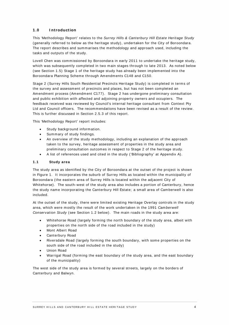
The study area as identified by the City of Boroondara at the outset of the project is shown in Figure 1. It incorporates the suburb of Surrey Hills as located within the municipality of Boroondara (the eastern area of Surrey Hills is located within the adjacent City of Whitehorse). The south-west of the study area also includes a portion of Canterbury, hence the study name incorporating the Canterbury Hill Estate; a small area of Camberwell is also included.
At the outset of the study, there were limited existing Heritage Overlay controls in the study area, which were mostly the result of the work undertaken in the 1991 Camberwell Conservation Study (see Section 1.2 below). The main roads in the study area are:
• Whitehorse Road (largely forming the north boundary of the study area, albeit with properties on the north side of the road included in the study)
• Mont Albert Road • Canterbury Road • Riversdale Road (largely forming the south boundary, with some properties on the
south side of the road included in the study) • Union Road • Warrigal Road (forming the east boundary of the study area, and the east boundary
of the municipality)
The west side of the study area is formed by several streets, largely on the borders of Canterbury and Balwyn.
SURREY HI LLS AND CANTERBURY HI LL ESTATE HERITAGE STUDY 4
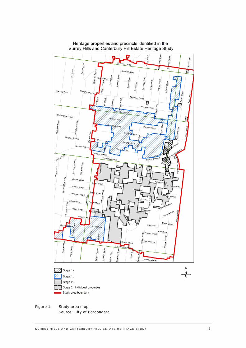
Figure 1 Study area map. Source: City of Boroondara
SURREY HI LLS AND CANTERBURY HI LL ESTATE HERITAGE STUDY 5
Stage 1 (a and b) of the study focused mostly on the area north of Canterbury Road, where the following precincts were identified/assessed:
• Union Road Commercial Precinct (Stage 1a) • Union Road Residential Precinct (north) (Stage 1b) • Surrey Hills North Precinct (Stage 1b) • Canterbury Hill Estate Precinct (located south of Canterbury Road) (Stage 1b)
Stage 2 (Surrey Hills South Residential Precincts Heritage Study) of the study focused mostly on the area south of Canterbury Road, and specifically the following precincts:
• Union Road Residential Precinct (south) • English Counties Residential Precinct • Redvers Street Residential Precinct
Stage 2 initially recommended a precinct in the south eastern section of the study area referred to as the War Service Homes Precinct. However, following the review of feedback received from the preliminary consultation, this precinct was removed from the final heritage study.
Stage 2 also involved the assessment of individual properties across the whole of the study area.
Note: Surrey Hills North Precinct incorporates some properties just outside the study area boundary, on the east side of Chatham Road in Canterbury (west side of Chatham Road is fully outside the study boundary). Canterbury Hill Estate Precinct also includes a small group of properties outside the study area, on the north side of Riversdale Road, Camberwell.
1.2 Previous heritage studies
The Camberwell Conservation Study was prepared by Graeme Butler and Associates in 1991. While the latter study investigated some areas and properties within the Surrey Hills and Canterbury Hill Estate study area, it is understood that due to the then scope of the study, the area was not thoroughly examined nor all properties fully assessed. However, the general areas of the Union Road Commercial Precinct and Canterbury Hill Estate Precinct were identified in the 1991 study, and a number of properties in the study area were given heritage gradings.
Lovell Chen utilised this previous work and earlier assessments as a guide, but independently reviewed and assessed the broader study area and precincts/properties within it.
1.3 Community consultation
Boroondara organised a community consultation workshop, which was held on 24 March 2011 at the Surrey Hills Neighbourhood Centre, 157 Union Road, Surrey Hills; this was attended by members of the Surrey Hills Historical Society and Boroondara community. The workshop was a two-way process, with the consultants and Council officers explaining the nature and scope of the overall study to the attendees, and answering questions; while the attendees were also invited to offer information on heritage places in Surrey Hills. A questionnaire was handed out to interested parties at the workshop, which asked the following questions:
• Are you aware of any sources of historical information on Surrey Hills? If so, would you please list these and/or identify where they are available.
• Do you have any information on the history of Surrey Hills, including historical written material and/or images and photographs? If so, could you provide this for Council to copy for the consultants’ use?
SURREY HI LLS AND CANTERBURY HI LL ESTATE HERITAGE STUDY 6
• Would you like to speak with the consultants directly in regard to the history and heritage of Surrey Hills? If so, please indicate and provide your details for the consultants to contact you.
• Are there any other matters of interest or importance in relation to the history of Surrey Hills that you would like to discuss or convey to the consultants?
Information returned to the consultants via the questionnaires was later utilised in the heritage study.
1.4 Summary of study findings & recommendations
As a result of the Surrey Hills & Canterbury Hill Estate Heritage Study, the following precincts in Surrey Hills and Canterbury were recommended for Heritage Overlay controls:
Stage 1
• Union Road Commercial Precinct* • Canterbury Hill Estate Precinct* • Union Road Residential Precinct (north) • Surrey Hills North Precinct
Stage 2 (Surrey Hills South Residential Precincts Heritage Study)
• Union Road Residential Precinct (south) • English Counties Precinct • Redvers Street Precinct
*As noted above, these general precinct areas were previously identified in the Camberwell Conservation Study 1991, but were reviewed and re-assessed by Lovell Chen for this heritage study. All other precincts were identified by Lovell Chen.
It is noted that a precinct was originally recommended in the south eastern section of the study area referred to as the War Service Homes Precinct. However, upon review of feedback received from the preliminary consultation, it was found that there were some inaccuracies in the historical information which supported the precinct. In particular, it was confirmed that though there were houses within the proposed subdivision constructed to War Services Homes standard designs, it was not one of the War Services Homes estates developed by the War Services Homes Commission. Further comparative analysis was also undertaken with other similar areas which concluded that there are other better representation of the type of development and housing contained within the precinct. Therefore, the precinct no longer contained sufficient historical or architectural significance and the precinct was removed from the final heritage study.
Also under Stage 2 (Surrey Hills South Residential Precincts Heritage Study), the following individual properties were recommended for Heritage Overlay controls:
• 19 Barton Street, Surrey Hills • (Fmr) St Joseph’s Boys Home, 19 Middlesex Road, Surrey Hills • Holy Redeemer Church Hall, 305-307 Mont Albert Road, Surrey Hills • 1 Montrose Street, Surrey Hills • Wyclif Congregational Church, 2-4 Norfolk Road, Surrey Hills • Surrey Gardens, 88-90 Union Road, Surrey Hills • Kylemore Flats, 52 Union Road, Surrey Hills • 26 Weybridge Street, Surrey Hills • 627 Whitehorse Road, Surrey Hills • 5 Windsor Crescent, Surrey Hills
SURREY HI LLS AND CANTERBURY HI LL ESTATE HERITAGE STUDY 7
1.4.1 Remaining historic properties
Where there are historic properties in Surrey Hills which are not currently covered by Heritage Overlay controls, or identified and recommended for controls as a result of this study, this is likely due to the following:
• The properties are not of sufficient individual heritage significance to justify an individual Heritage Overlay control, or
• The properties are not located in a discrete area, or streetscape, with sufficient other contributory heritage properties to justify a precinct Heritage Overlay control.
1.5 Planning Scheme amendments & Planning Panel reviews
As noted above, at the time of writing, Stage 1 of this heritage study has already been through an amendment process, with the findings reviewed by Planning Panels Victoria, and several precincts included in Boroondara’s Schedule to the Heritage Overlay, as follows:
• Amendment C148 (approved in Nov. 2012), Union Road Commercial Precinct • Amendment C150 (approved in Sept. 2014), three heritage precincts:
o Union Road Residential Precinct (north) o Surrey Hills North Precinct o Canterbury Hill Estate Precinct
2.0 Study methodology
This section of the report provides an overview of the methodology adopted for the survey and assessment of the precincts and individual properties addressed in the Surrey Hills and Canterbury Hill Estate Heritage Study. The methodology generally followed a standard approach to such studies and included the following tasks: historical research; a physical survey and investigation of the study area; an assessment of the significance of the identified precincts and properties against accepted heritage criteria, including comparative analysis; identification of the relative levels of significance for each property within the precincts; and the preparation of supporting documentation (precinct citations and property schedules).
The methodology and approach was informed by the principles and ‘Practice notes’ of the Burra Charter (2013 as revised), adopted by Australia ICOMOS (International Council on Monuments and Sites); these are recognised Australia-wide in the identification, assessment and conservation of heritage places. Cultural heritage significance is defined in the Burra Charter as being ‘embodied in the place - in its fabric, setting, use, associations and meanings’. Places may have a range of values for different individuals or groups, including aesthetic, historic, scientific, social or spiritual value. An understanding of the Burra Charter values has informed this assessment process, including the use of the heritage assessment criteria.
2.1 Historical research
Considerable historical research was undertaken into the study area, which was subsequently relied on in the historical assessment and documentation of places, and in the preparation of study citations. While the City of Boroondara Thematic Environmental History (Built Heritage, 2012) is a comprehensive recent historical municipal reference, research for this heritage study focussed in more depth on Surrey Hills.
The history included in the citations utilised published secondary sources as well as some primary sources including historic images (where located); Sands and MacDougall Directories; newspapers; Melbourne & Metropolitan Board of Works (MMBW) Survey and Detail Plans; and estate and land subdivision plans drawn from the Boroondara Library Service History collection and from the State Library of Victoria. In some specific cases
SURREY HI LLS AND CANTERBURY HI LL ESTATE HERITAGE STUDY 8
property information was also provided by Council (primarily from Boroondara Building Department records); and Certificates of Title and rate books were accessed (for the assessment of the individual properties). The 1991 Camberwell Conservation Study volumes were also utilised, as were the ‘History Walkabout’ notes provided by the Surrey Hills Neighbourhood Centre Heritage Collection. The list of ‘References’ at the end of the citations provides more detail as to the specific references used in the preparation of each precinct history; see also the ‘Bibliography’ at Appendix A.
For the precincts, the research shed light on the local pattern of historical development, and helped understand how the particular built form evolved in the precinct areas and streetscapes. This in turn assisted in assessing the historical significance of the precincts. The dating of properties in precincts (as indicated in the schedule of properties) was generally approximate and based on an assessment made during the surveys (see also comments below on dating properties, at Section 2.2.4).
For the individual properties, the research was more targeted, and focused more specifically on the design and construction of the buildings, the original and early owners, and (where relevant) uses and associated events over time. As with the precincts, the historical information assisted in assessing the historical significance of the individual properties.
2.2 Physical survey
During the course of the staged approach to this heritage study, the entire study area was surveyed by Lovell Chen.
The physical surveys typically involved the inspection of each property from the street, or publicly accessible areas. Photographs were taken, some of which are reproduced in the citations. The surveys assisted in describing the precincts and individual properties; determining the approximate age of buildings; identifying building styles and distinguishing architectural features and characteristics; assessing the level of intactness; and identifying any obvious alterations to the original form of the buildings. Modifications or changes to properties which are not visible or obvious from the street are not necessarily identified. It is also the case that changes to the rears of buildings do not necessarily diminish the significance of buildings. Over-painting of an original unpainted surface (such as a face brick wall) is in some cases an action which diminishes significance, but this depends on the overall impact of the over-painting, recognising also that such work is ultimately reversible.
2.2.1 Descriptions
The descriptions of the precincts, deriving from the physical surveys, generally include an overview of the precinct areas, and not detailed descriptions of individual properties. Typical building or dwelling types are identified, as are unusual types; periods of development are described; and the valued built form characteristics are also outlined. Descriptions of individual properties are more detailed, including reference to the period and style of building. Modifications or changes to properties, where identified and visible, are also described.
2.2.2 Precincts boundaries: inclusions & exclusions
Determining the precinct boundaries relied on a number of factors, although the overriding objective was to capture or include predominantly historic properties within a preferably contiguous and identifiable precinct area. Some non-heritage or ‘non-contributory’ properties (see explanation of property gradings below at Section 2.3.2) are included within the precinct boundaries, although again the objective was to minimise this. The inclusion or exclusion of ‘non-contributory’ properties largely depended on their location. For instance, where a ‘non-contributory’ property is located within a row of (or adjoined on both sides by) ‘contributory’ buildings, or is otherwise in a heritage-sensitive part of the precinct (such as a
SURREY HI LLS AND CANTERBURY HI LL ESTATE HERITAGE STUDY 9
corner within the precinct), the property was retained in the precinct. This will assist in managing the precinct’s heritage character and values through having Heritage Overlay controls over future development of these ‘non-contributory’ sites, accepting that demolition of ‘non-contributory’ buildings is contemplated in Council’s heritage policy. 'Non-contributory' properties located on the edge of precincts were generally excluded from the precincts. Groups, or long runs, of contiguous ‘non-contributory’ properties were also generally minimised or avoided within precinct boundaries.
2.2.3 Mapping
Maps of the precinct boundaries are included on the front pages of the precinct citations. These indicate that most of the precincts are contiguous, or in some cases have limited non-contiguous components. The properties are also shown as colour graded, to indicate their level of significance. The precinct maps were produced with the assistance of Council. For individual properties, these were typically mapped to the extent of the property allotments shown on the base plans provided by Boroondara, although this method of mapping does not necessarily indicate that the full extent of the mapped area is of heritage value or character. For instance, areas to the rears of properties often include additions, outbuildings, garages, car parking spaces, etc, which are of limited or no heritage interest. In some instance, for the larger complexes and properties assessed, only the building of heritage value, with some setting or curtilage surrounding, is mapped within the larger allotment.
2.2.4 ‘Authenticity’ and dating of houses
During the course of Lovell Chen’s heritage study work in Surrey Hills, it became apparent that the suburb has a high proportion of modified and extended older or historic dwellings, many of which were originally modest in scale. While the initial late nineteenth century development phase of the area saw large houses built on expansive allotments, subsequent residential development in the first decades of the twentieth century commonly took the form of smaller timber dwellings, associated with a lower middle class demographic. In the post-WWII period through to the later decades of the twentieth century, the Surrey Hills demographic changed, with the suburb attracting more affluent residents. This in turn led to a pattern of house renovation and extension, often resulting in smaller dwellings significantly increasing in size. Typical extensions to originally modest Federation era residences, for example, can include large gabled first floor additions. Large extensions are also sometimes undertaken in a style and detailing which mimics the original, resulting in a house which appears from the street as a very large period home but in fact has retained proportionally limited original or historic fabric.
In assessing the acceptability of visible additions and extensions to historic dwellings in the precinct – or the extent to which an addition detracts from the ‘contributory’ heritage value of the property - a number of factors were considered. These included the form, materials and detailing of the addition, and whether it was sympathetic to the dwelling; the visibility of the addition, and whether it was seen as sufficiently recessive to the original dwelling, or proportionally too dominating or overwhelming; the degree to which the addition can be discerned as a later and non-original element; and the extent to which the original visible roof form has been altered.
The use of traditional or faux-historic building styles, for new dwellings, is also found in the suburb, resulting in some quite well executed ‘faux’ period-style houses. Examples of reproduction Federation villas are found in the Surrey Hills North Precinct at the western end of Croydon Road. Modern reproduction dwellings are not of heritage value. The dwellings with substantial period-style extensions, and the ‘faux’ period-style houses, provide challenges for the consultants in that the extent of non-original fabric, or reproduction fabric, can be difficult to identify via a typical street survey. In some cases, the original assessment
SURREY HI LLS AND CANTERBURY HI LL ESTATE HERITAGE STUDY 10
of these dwellings as being of heritage value was revised, in light of more information becoming available about their lack of authenticity. This particularly occurred in the Surrey Hills North Precinct.
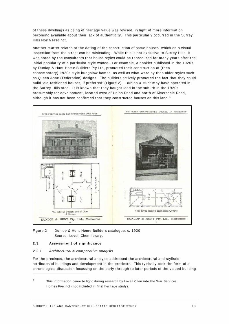
Another matter relates to the dating of the construction of some houses, which on a visual inspection from the street can be misleading. While this is not exclusive to Surrey Hills, it was noted by the consultants that house styles could be reproduced for many years after the initial popularity of a particular style waned. For example, a booklet published in the 1920s by Dunlop & Hunt Home Builders Pty Ltd, promoted their construction of (then contemporary) 1920s style bungalow homes, as well as what were by then older styles such as Queen Anne (Federation) designs. The builders actively promoted the fact that they could build ‘old-fashioned houses, if preferred’ (Figure 2). Dunlop & Hunt may have operated in the Surrey Hills area. It is known that they bought land in the suburb in the 1920s presumably for development, located west of Union Road and north of Riversdale Road, although it has not been confirmed that they constructed houses on this land.1
Figure 2 Dunlop & Hunt Home Builders catalogue, c. 1920. Source: Lovell Chen library.
2.3 Assessment of significance
2.3.1 Architectural & comparative analysis
For the precincts, the architectural analysis addressed the architectural and stylistic attributes of buildings and development in the precincts. This typically took the form of a chronological discussion focussing on the early through to later periods of the valued building
1 This information came to light during research by Lovell Chen into the War Services Homes Precinct (not included in final heritage study).
SURREY HI LLS AND CANTERBURY HI LL ESTATE HERITAGE STUDY 11
styles prevalent in the precincts. In the larger precincts, an overview of streets is also included, which identifies the styles which are prominent or prevalent in individual streets.
For the individual properties, the architectural analysis examined the particular style of the building, its influences and distinguishing characteristics, leading to an understanding of the architectural and aesthetic merit of the property.
The precincts and individual properties were also assessed using comparative analysis, the purpose of which is to compare similar ‘types’ of places with other broadly similar places (similar in architectural style, period, use, etc). This assists in determining the relative significance or importance of the heritage place, and identifying distinguishing characteristics of the properties/precincts. Places are ‘compared’ with regard to intactness, rarity, architectural qualities or merit, or other distinctive aspects of their history or form. The comparative analysis then assists in establishing whether the subject property is of a greater or lesser order of importance when compared to other similar examples or building types. For the individual properties, comparative analysis is a particularly important step where the level of local significance is typically required to be high to justify an individual Heritage Overlay control.
The precincts, as heritage places, were also compared in a general sense to other comparable precincts in Boroondara. This process assisted in shedding light on the important and distinctive characteristics of the subject precincts.
2.3.2 Property gradings
Properties within the precincts are identified as ‘significant’, ‘contributory’ or ‘non-contributory’. These relative levels of significance (property gradings) are consistent with those included in Boroondara’s Clause 22.05 ‘Heritage Policy’, specifically Clause 22.05-6 ‘Definitions and Gradings’. The following definitions are taken from the local heritage policy:
‘Significant’ heritage places are places of State, municipal or local cultural heritage significance that are individually important in their own right. When in a precinct, they may also contribute to the cultural heritage significance of the precinct. 'Significant' graded places within a precinct are of the same cultural heritage value as places listed individually in the Schedule to the Heritage Overlay.
‘Contributory’ heritage places are places that contribute to the cultural heritage significance of a precinct. They are not considered to be individually important places of State, municipal or local cultural heritage significance, however when combined with other ‘significant’ and/or ‘contributory’ heritage places, they play an integral role in demonstrating the cultural heritage significance of a precinct.
‘Non-contributory’ places are places within a heritage precinct that have no identifiable cultural heritage significance. They are included within a Heritage Overlay because any development of the place may impact on the cultural heritage significance of the precinct or adjacent ‘significant’ or ‘contributory’ heritage places.
‘Significant’ buildings in the precincts are generally individually important in the precinct context, because they exhibit particular architectural merit or other distinguishing characteristics, with a corresponding or comparatively high level of external intactness. The precinct citations include more detailed information on, and assessments of, the ‘significant’ properties in the precincts.
SURREY HI LLS AND CANTERBURY HI LL ESTATE HERITAGE STUDY 12
Where places are identified as being ‘contributory’, this reflects their ‘contributory’ value to the precinct, meaning the value derived from their ‘contribution’ to the overall heritage character of the precinct. For buildings constructed in the valued phases of development (and valued architectural styles) of the particular precinct, this generally includes retaining their largely original fabric, form, detailing and external appearance (as visible from the principal streetscape), although some ‘contributory’ buildings have visible additions to the rears (or rear halves) of dwellings and can have minor or otherwise limited changes to the fronts of buildings including principal facades. Unlike ‘significant’ properties, ‘contributory’ properties do not necessarily have to have particular architectural merit or distinguishing characteristics in order to be of heritage value. Their value is more of a collective nature, and often associated with being similar in form and character to other ‘contributory’ houses in the street/precinct.
Where places are identified as being ‘non-contributory’, this was typically on the basis of the buildings being of recent origin; of obviously limited heritage interest or value; or through being modified/altered to the extent that their original form and historic character have been significantly impacted or diminished, resulting in a building where the original form and detailing is difficult to read or discern. ‘Non-contributory’ houses can include those which have been substantially increased in size, and have large and prominent, or jarring and intrusive additions which overwhelm the original building form; or those which are reproduction or ‘faux’ residences, as outlined above at Section 2.2.4.
The impact of modifications goes directly to the issue of intactness, which has traditionally been a key consideration in heritage studies and the assessment of heritage places. Intactness – meaning the degree to which a historic building or structure retains its original form, fabric, appearance and character - is one of the factors which influences the grading of properties. A building which has a low level of intactness, and a limited capacity to provide evidence of its original form and appearance, is normally assessed to be at a low level of significance or, depending on the degree of change, ‘non-contributory’.
2.3.3 Assessment against criteria
For the purposes of significance assessment, at the commencement of the heritage study amended assessment criteria adopted in 2008 by the Heritage Council Victoria were used in the assessment process and reproduced in the citations. In later stages of the study, the assessment criteria were adopted from the ‘recognised heritage criteria’ set out in the Victorian Planning Provisions Practice Note on ‘Applying the Heritage Overlay’ (September 2012). These latter criteria were generally consistent with the earlier criteria, save for some minor word changes, as follows:
Criterion A - Importance to the course, or pattern, of the City of Boroondara’s cultural or natural history.
Criterion B - Possession of uncommon rare or endangered aspects of the City of Boroondara’s cultural or natural history.
Criterion C – Potential to yield information that will contribute to an understanding of the City of Boroondara’s cultural or natural history.
Criterion D – Importance in demonstrating the principal characteristics of a class of cultural or natural places and environments.
Criterion E – Importance in exhibiting particular aesthetic characteristics.
Criterion F – Importance in demonstrating a high degree of creative or technical achievement at a particular period.
SURREY HI LLS AND CANTERBURY HI LL ESTATE HERITAGE STUDY 13
Criterion G – Strong or special association with a particular community or cultural group for social, cultural or spiritual reasons. This includes the significance of a place to Indigenous peoples as part of their continuing and developing cultural traditions.
Criterion H – Special association with the life or works of a person, or group of persons, of importance in City of Boroondara’s history.
2.3.4 Statements of significance
The statements of significance included in the precincts and individual property citations are in the Heritage Victoria recommended ‘What? How? Why?’ format. This is also the recommended approach of the September 2012 Victorian Planning Provisions Practice Note. In the citations, the statement under ‘Why is it significant?’ reproduces and/or paraphrases the individual criteria assessments, and identifies the key heritage characteristics and attributes of the precincts and properties. This approach is also consistent with the VPP Practice Note.
2.4 Preparation of citations
The precinct citations each contain the following:
• Map of the precinct, showing the precinct boundary, and the relative gradings of properties within the precinct.
• History of precinct. • Current and historic images. • Description of precinct. • Architectural and comparative analysis. • Assessment against heritage criteria. • Statement of significance. • Recommendations, including a draft schedule to the Heritage Overlay. • List of references. • Attached schedule of properties.
The schedule of properties attached to the citations lists every property in the precinct, regardless of their relative grading or significance. The schedule includes:
• Name of property (where known) • Address • Grading • Date of construction
The individual property citations are essentially the same as those for the precincts, albeit of shorter length and not including the schedule of properties.
2.5 Stage 2 - Preliminary Consultation
2.5.1 Consultation
Prior to finalising the recommendations and citations for Stage 2 (Surrey Hills South Residential Precincts Heritage Study) of the broader heritage study, preliminary consultation was undertaken with affected and adjoining property owners and occupiers. The preliminary consultation was undertaken in accordance with a new approach initiated by Council in respect to preparing heritage studies. Preliminary consultation was not undertaken in respect to Stage 1 of the heritage study.
Council received forty four (44) responses during the consultation period in respect to the heritage study.
SURREY HI LLS AND CANTERBURY HI LL ESTATE HERITAGE STUDY 14
2.5.2 Review of Feedback
All responses were reviewed by both officers and Council's heritage consultant. The review of feedback included:
• site inspection of each property mentioned in feedback • site inspection of each property where a consent for demolition was issued for the
property under Section 29A of the Building Act 1993 to determine whether the demolition had been carried out and whether the extent of demolition had affected the heritage significance of the property
• ‘drive-by’ site inspection of every property included in the heritage precincts • review of building cards and permits for properties where the construction date of
buildings were queried or unclear, and also to check intactness in some cases • further historical research where issues were raised in the feedback or identified
during site inspections • further comparative analysis including site inspection of other areas similar to the
War Service Home Residential Precinct • review of the boundaries of the Union Road South Residential Precinct following a site
inspection of the precinct
The methodology used in the review of feedback was consistent with the original approach taken in respect to the assessment of significance and grading of properties.
2.5.3 Revisions to Heritage Study
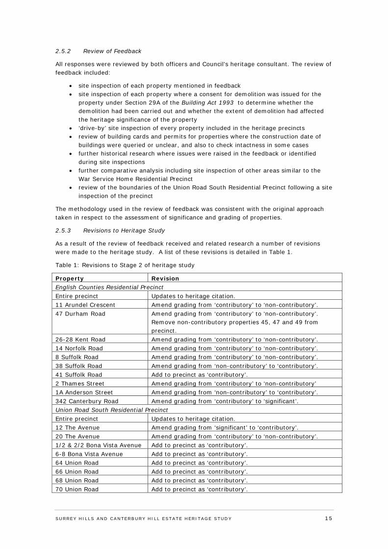
As a result of the review of feedback received and related research a number of revisions were made to the heritage study. A list of these revisions is detailed in Table 1.
Table 1: Revisions to Stage 2 of heritage study
Property Revision English Counties Residential Precinct Entire precinct Updates to heritage citation. 11 Arundel Crescent Amend grading from ‘contributory’ to ‘non-contributory’. 47 Durham Road Amend grading from ‘contributory’ to ‘non-contributory’.
Remove non-contributory properties 45, 47 and 49 from precinct.
26-28 Kent Road Amend grading from ‘contributory’ to ‘non-contributory’. 14 Norfolk Road Amend grading from ‘contributory’ to ‘non-contributory’. 8 Suffolk Road Amend grading from ‘contributory’ to ‘non-contributory’. 38 Suffolk Road Amend grading from ‘non-contributory’ to ‘contributory’. 41 Suffolk Road Add to precinct as ‘contributory’. 2 Thames Street Amend grading from ‘contributory’ to ‘non-contributory’ 1A Anderson Street Amend grading from ‘non-contributory’ to ‘contributory’. 342 Canterbury Road Amend grading from ‘contributory’ to ‘significant’. Union Road South Residential Precinct Entire precinct Updates to heritage citation. 12 The Avenue Amend grading from ‘significant’ to ‘contributory’. 20 The Avenue Amend grading from ‘contributory’ to ‘non-contributory’. 1/2 & 2/2 Bona Vista Avenue Add to precinct as ‘contributory’. 6-8 Bona Vista Avenue Add to precinct as ‘contributory’. 64 Union Road Add to precinct as ‘contributory’. 66 Union Road Add to precinct as ‘contributory’. 68 Union Road Add to precinct as ‘contributory’. 70 Union Road Add to precinct as ‘contributory’.
SURREY HI LLS AND CANTERBURY HI LL ESTATE HERITAGE STUDY 15
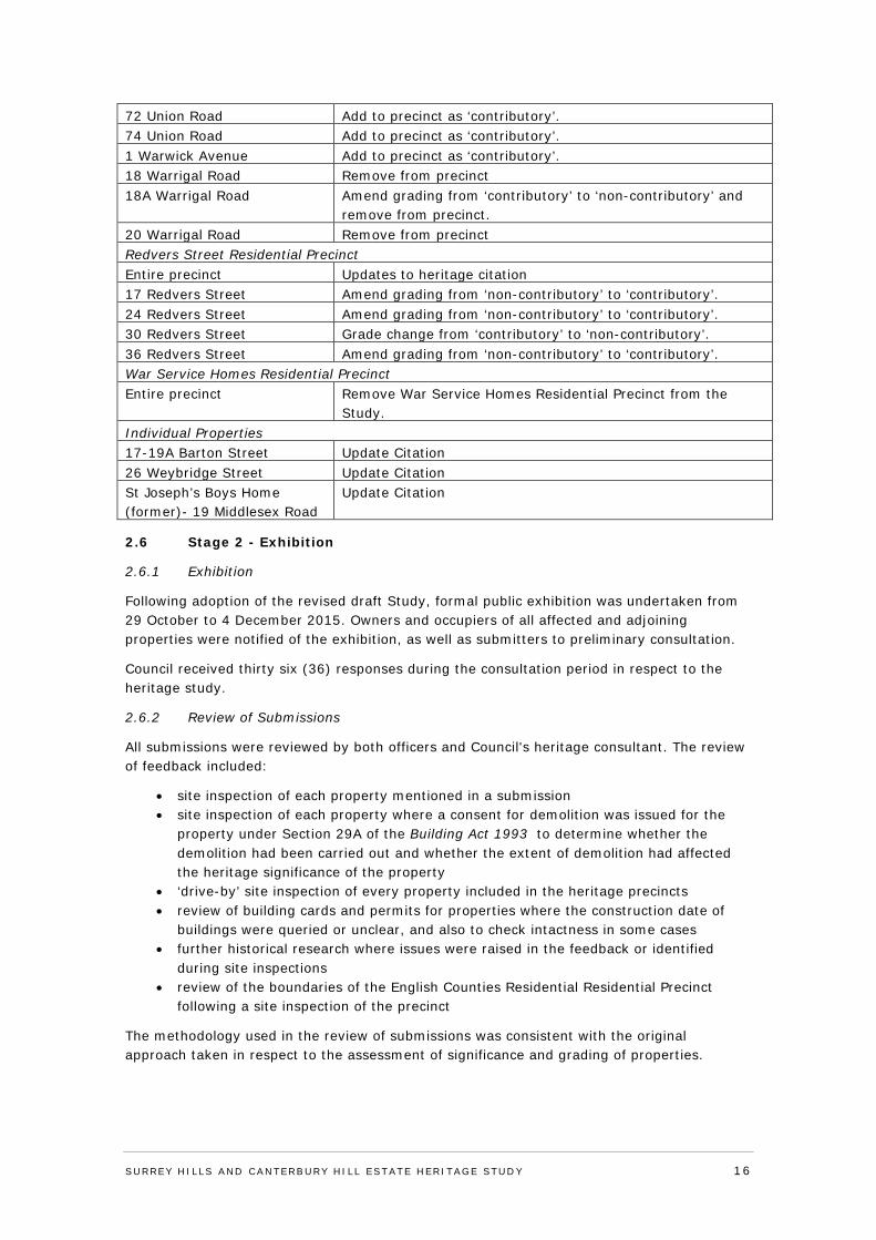
72 Union Road Add to precinct as ‘contributory’. 74 Union Road Add to precinct as ‘contributory’. 1 Warwick Avenue Add to precinct as ‘contributory’. 18 Warrigal Road Remove from precinct 18A Warrigal Road Amend grading from ‘contributory’ to ‘non-contributory’ and
remove from precinct. 20 Warrigal Road Remove from precinct Redvers Street Residential Precinct Entire precinct Updates to heritage citation 17 Redvers Street Amend grading from ‘non-contributory’ to ‘contributory’. 24 Redvers Street Amend grading from ‘non-contributory’ to ‘contributory’. 30 Redvers Street Grade change from ‘contributory’ to ‘non-contributory’. 36 Redvers Street Amend grading from ‘non-contributory’ to ‘contributory’. War Service Homes Residential Precinct Entire precinct Remove War Service Homes Residential Precinct from the
Study. Individual Properties 17-19A Barton Street Update Citation 26 Weybridge Street Update Citation St Joseph’s Boys Home (former)- 19 Middlesex Road
Update Citation
2.6 Stage 2 - Exhibition
2.6.1 Exhibition
Following adoption of the revised draft Study, formal public exhibition was undertaken from 29 October to 4 December 2015. Owners and occupiers of all affected and adjoining properties were notified of the exhibition, as well as submitters to preliminary consultation.
Council received thirty six (36) responses during the consultation period in respect to the heritage study.
2.6.2 Review of Submissions
All submissions were reviewed by both officers and Council's heritage consultant. The review of feedback included:
• site inspection of each property mentioned in a submission • site inspection of each property where a consent for demolition was issued for the
property under Section 29A of the Building Act 1993 to determine whether the demolition had been carried out and whether the extent of demolition had affected the heritage significance of the property
• ‘drive-by’ site inspection of every property included in the heritage precincts • review of building cards and permits for properties where the construction date of
buildings were queried or unclear, and also to check intactness in some cases • further historical research where issues were raised in the feedback or identified
during site inspections • review of the boundaries of the English Counties Residential Residential Precinct
following a site inspection of the precinct
The methodology used in the review of submissions was consistent with the original approach taken in respect to the assessment of significance and grading of properties.
SURREY HI LLS AND CANTERBURY HI LL ESTATE HERITAGE STUDY 16
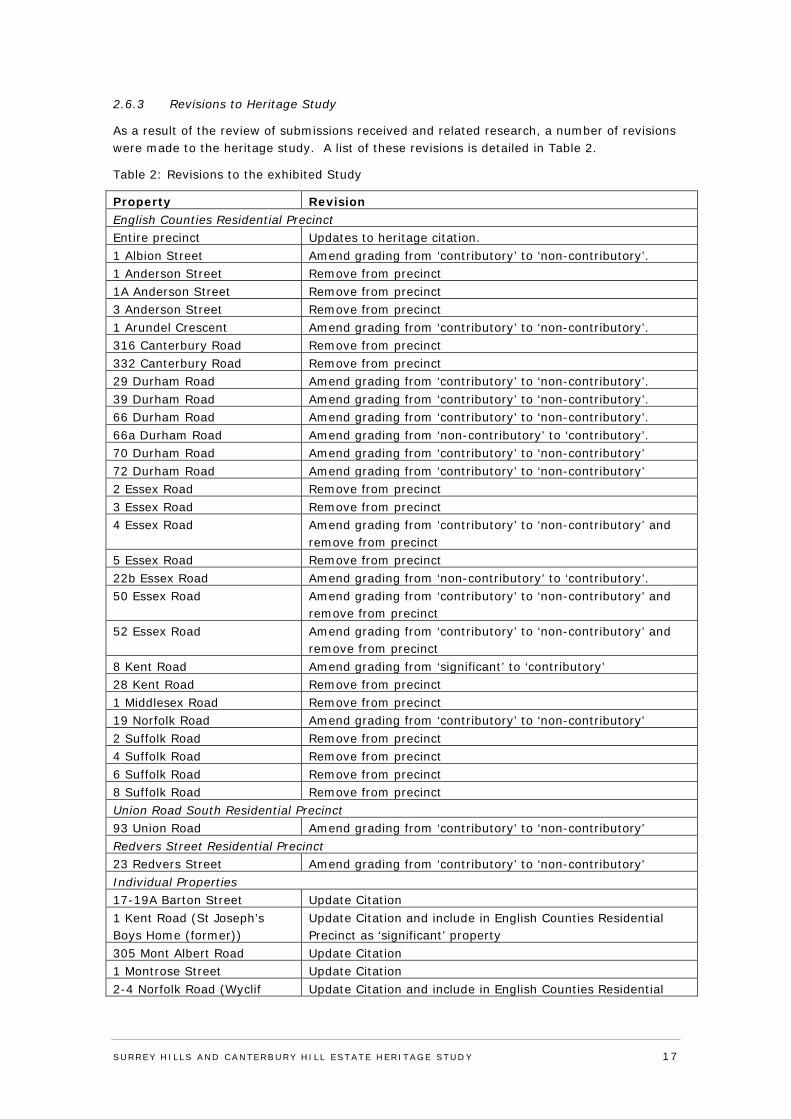
2.6.3 Revisions to Heritage Study
As a result of the review of submissions received and related research, a number of revisions were made to the heritage study. A list of these revisions is detailed in Table 2.
Table 2: Revisions to the exhibited Study
Property Revision English Counties Residential Precinct Entire precinct Updates to heritage citation. 1 Albion Street Amend grading from ‘contributory’ to ‘non-contributory’. 1 Anderson Street Remove from precinct 1A Anderson Street Remove from precinct 3 Anderson Street Remove from precinct 1 Arundel Crescent Amend grading from ‘contributory’ to ‘non-contributory’. 316 Canterbury Road Remove from precinct 332 Canterbury Road Remove from precinct 29 Durham Road Amend grading from ‘contributory’ to ‘non-contributory’. 39 Durham Road Amend grading from ‘contributory’ to ‘non-contributory’. 66 Durham Road Amend grading from ‘contributory’ to ‘non-contributory’. 66a Durham Road Amend grading from ‘non-contributory’ to ‘contributory’. 70 Durham Road Amend grading from ‘contributory’ to ‘non-contributory’ 72 Durham Road Amend grading from ‘contributory’ to ‘non-contributory’ 2 Essex Road Remove from precinct 3 Essex Road Remove from precinct 4 Essex Road Amend grading from ‘contributory’ to ‘non-contributory’ and
remove from precinct 5 Essex Road Remove from precinct 22b Essex Road Amend grading from ‘non-contributory’ to ‘contributory’. 50 Essex Road Amend grading from ‘contributory’ to ‘non-contributory’ and
remove from precinct 52 Essex Road Amend grading from ‘contributory’ to ‘non-contributory’ and
remove from precinct 8 Kent Road Amend grading from ‘significant’ to ‘contributory’ 28 Kent Road Remove from precinct 1 Middlesex Road Remove from precinct 19 Norfolk Road Amend grading from ‘contributory’ to ‘non-contributory’ 2 Suffolk Road Remove from precinct 4 Suffolk Road Remove from precinct 6 Suffolk Road Remove from precinct 8 Suffolk Road Remove from precinct Union Road South Residential Precinct 93 Union Road Amend grading from ‘contributory’ to ‘non-contributory’ Redvers Street Residential Precinct 23 Redvers Street Amend grading from ‘contributory’ to ‘non-contributory’ Individual Properties 17-19A Barton Street Update Citation 1 Kent Road (St Joseph’s Boys Home (former))
Update Citation and include in English Counties Residential Precinct as ‘significant’ property
305 Mont Albert Road Update Citation 1 Montrose Street Update Citation 2-4 Norfolk Road (Wyclif Update Citation and include in English Counties Residential
SURREY HI LLS AND CANTERBURY HI LL ESTATE HERITAGE STUDY 17
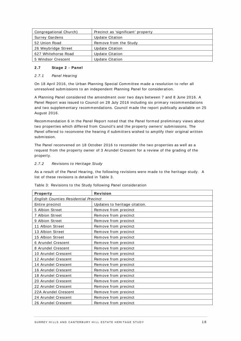
Congregational Church) Precinct as ‘significant’ property Surrey Gardens Update Citation 52 Union Road Remove from the Study 26 Weybridge Street Update Citation 627 Whitehorse Road Update Citation 5 Windsor Crescent Update Citation
2.7 Stage 2 - Panel
2.7.1 Panel Hearing
On 18 April 2016, the Urban Planning Special Committee made a resolution to refer all unresolved submissions to an independent Planning Panel for consideration.
A Planning Panel considered the amendment over two days between 7 and 8 June 2016. A Panel Report was issued to Council on 28 July 2016 including six primary recommendations and two supplementary recommendations. Council made the report publically available on 25 August 2016.
Recommendation 6 in the Panel Report noted that the Panel formed preliminary views about two properties which differed from Council’s and the property owners’ submissions. The Panel offered to reconvene the hearing if submitters wished to amplify their original written submission.
The Panel reconvened on 18 October 2016 to reconsider the two properties as well as a request from the property owner of 3 Arundel Crescent for a review of the grading of the property.
2.7.2 Revisions to Heritage Study
As a result of the Panel Hearing, the following revisions were made to the heritage study. A list of these revisions is detailed in Table 3.
Table 3: Revisions to the Study following Panel consideration
Property Revision English Counties Residential Precinct Entire precinct Updates to heritage citation. 5 Albion Street Remove from precinct 7 Albion Street Remove from precinct 9 Albion Street Remove from precinct 11 Albion Street Remove from precinct 13 Albion Street Remove from precinct 15 Albion Street Remove from precinct 6 Arundel Crescent Remove from precinct 8 Arundel Crescent Remove from precinct 10 Arundel Crescent Remove from precinct 12 Arundel Crescent Remove from precinct 14 Arundel Crescent Remove from precinct 16 Arundel Crescent Remove from precinct 18 Arundel Crescent Remove from precinct 20 Arundel Crescent Remove from precinct 22 Arundel Crescent Remove from precinct 22A Arundel Crescent Remove from precinct 24 Arundel Crescent Remove from precinct 26 Arundel Crescent Remove from precinct
SURREY HI LLS AND CANTERBURY HI LL ESTATE HERITAGE STUDY 18
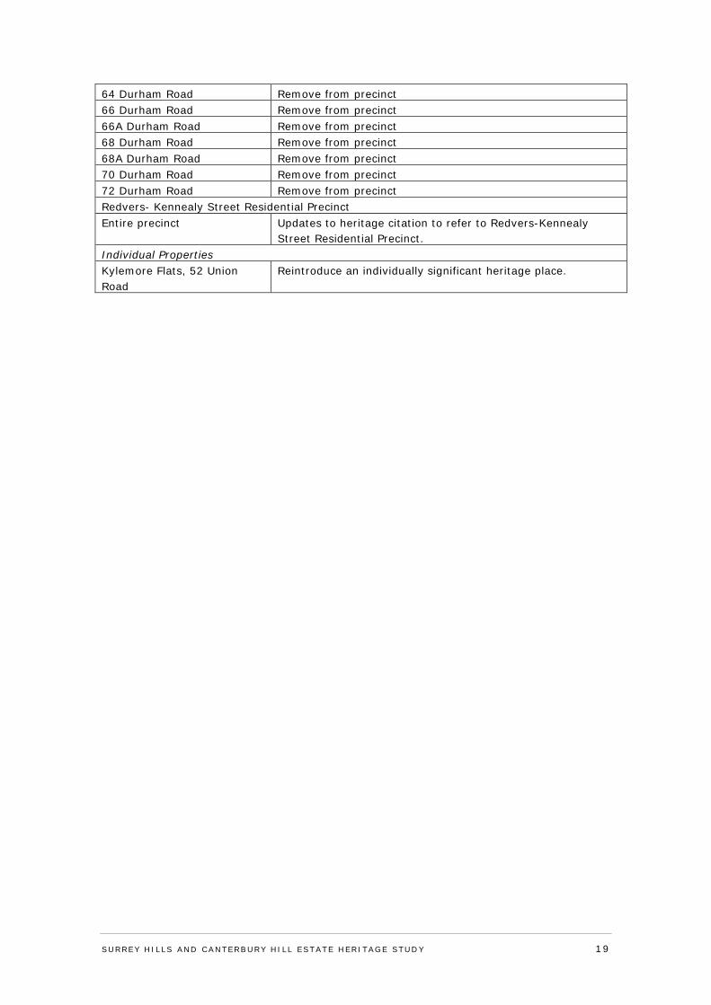
64 Durham Road Remove from precinct 66 Durham Road Remove from precinct 66A Durham Road Remove from precinct 68 Durham Road Remove from precinct 68A Durham Road Remove from precinct 70 Durham Road Remove from precinct 72 Durham Road Remove from precinct Redvers- Kennealy Street Residential Precinct Entire precinct Updates to heritage citation to refer to Redvers-Kennealy
Street Residential Precinct. Individual Properties Kylemore Flats, 52 Union Road
Reintroduce an individually significant heritage place.
SURREY HI LLS AND CANTERBURY HI LL ESTATE HERITAGE STUDY 19
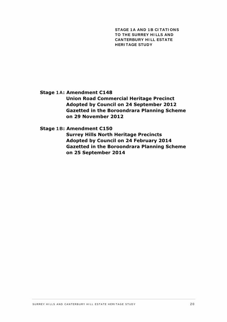
STAGE 1A AND 1B CITATIONS TO THE SURREY HILLS AND CANTERBURY HILL ESTATE HERITAGE STUDY
SURREY HI LLS AND CANTERBURY HI LL ESTATE HERITAGE STUDY 20
Stage 1A: Amendment C148 Union Road Commercial Heritage Precinct Adopted by Council on 24 September 2012 Gazetted in the Boroondrara Planning Scheme on 29 November 2012
Stage 1B: Amendment C150 Surrey Hills North Heritage Precincts Adopted by Council on 24 February 2014 Gazetted in the Boroondrara Planning Scheme on 25 September 2014
APPENDIX 1: STAGE 1 HERITAGE CITATIONS - PRECINCTS
SURREY HI LLS AND CANTERBURY HI LL ESTATE HERITAGE STUDY 21
Surrey Hills and Canterbury Hill Estate Heritage Study Lovell Chen June 2011 Union Road Commercial Precinct Citation
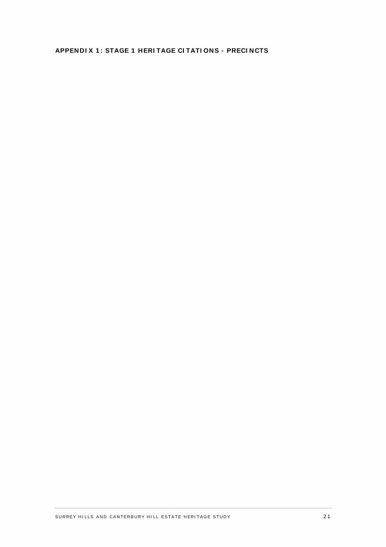
Precinct Union Road Commercial Precinct, Surrey Hills
Property No
Streets Canterbury Road, Union Road Survey Date March/May 2011
SURREY HILLS AND CANTERBURY HILL ESTATE HERITAGE STUDY 22
__________________________________________________________________________________________________________
Surrey Hills and Canterbury Hill Estate Heritage Study Lovell Chen June 2011 Union Road Commercial Precinct Citation
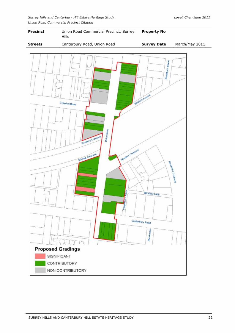
Figure 1 Union Road, west side
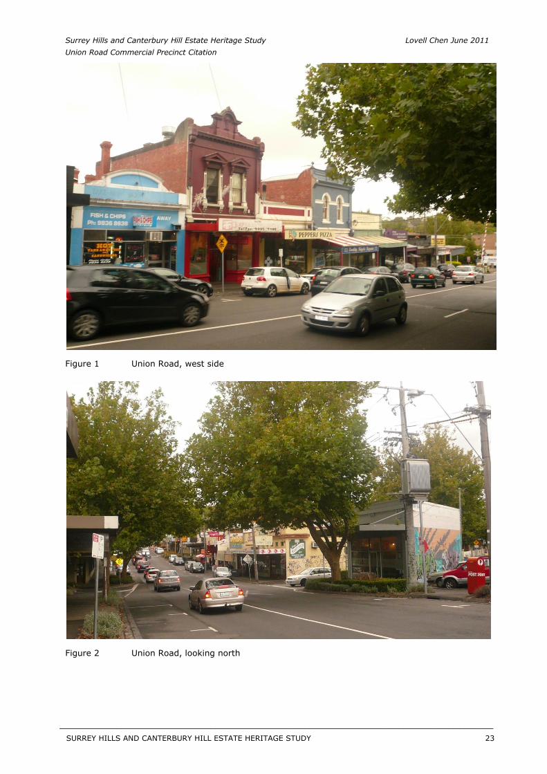
Figure 2 Union Road, looking north
SURREY HILLS AND CANTERBURY HILL ESTATE HERITAGE STUDY 23
__________________________________________________________________________________________________________
Surrey Hills and Canterbury Hill Estate Heritage Study Lovell Chen June 2011 Union Road Commercial Precinct Citation
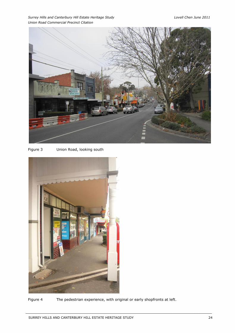
Figure 3 Union Road, looking south
Figure 4 The pedestrian experience, with original or early shopfronts at left.
SURREY HILLS AND CANTERBURY HILL ESTATE HERITAGE STUDY 24
__________________________________________________________________________________________________________
Surrey Hills and Canterbury Hill Estate Heritage Study Lovell Chen June 2011 Union Road Commercial Precinct Citation
History
[See also the Schedule of Properties attached to this citation.]
The Union Road Commercial Precinct is located in an area which formed part of the south-west corner of Elgar’s Special Survey of 1841. This land was subdivided and sold off in allotments of varying sizes during the 1850s, although the area was relatively slow to develop. By 1881, in the whole of the Shire of Boroondara, there were less than 300 residents.1
In 1882, the railway line was extended to Lilydale and a station was constructed at Surrey Hills. A creek originally flowed alongside the railway line in this area.2 The original single-track line went through Surrey Hills, with a turning loop at the station. The line was duplicated in the 1890s and electrified in the 1920s.3 The original station is no longer extant, having been replaced with the reconfiguration of the station precinct in c.1970 when a third track was added to the Lilydale-Belgrave line. The original gates and signal box were also replaced, the former by a set of automatic booms.
The railway heightened the appeal of the district and spurred an increase in population. An extraordinary boom in real estate prices and land speculation was also underway during the 1880s. The railway station served as a hub for development of the suburb, and a shopping precinct began to emerge in the vicinity of the station. Union Road itself predated the railway line but after the opening of the railway, it was briefly known as Surrey Road.4 By 1885, it had reverted to its original title.
While the railway brought increased population, development of the future precinct area remained relatively slow. In 1885, Sands and MacDougal directories list only two residents with addresses to Union Road; William Anger, farmer; and carpenter Thomas Bate.5 The Surrey Family Hotel was built in 1888 on the prominent corner of Canterbury Road, and is listed together with a number of residences to the south of the railway line in the Sands and MacDougal directory of 1890.6 The southern end of the current precinct, at and near the corner of Canterbury Road, was in fact in the late nineteenth century the nucleus of commercial activity in the area.7
To the north of the railway line, a number of commercial enterprises had been established, including the multiple businesses of James Sneddon8 (an estate agent and ironmongery), a Singer Machine Agency, John Collins’ bookstore and Morris and Carter, watchmakers.9 Reflecting the pace of land sales picking up, two estate agents were also located within the future precinct boundaries.10 The Premier Land Agency was reputedly built in 1887 on the site of the current (c.1970s) property at 124 Union Road.11 Little is known about the nature of the first commercial buildings, with the Surrey Family Hotel being the earliest known surviving building in the precinct, followed by several which date to the 1890s.
The prosperity of the 1880s gave way to a bank and property collapse, prompting a severe economic depression throughout Victoria which is known historically as the ‘Bust’. In Surrey Hills, the depression ended the land boom that had characterised the 1880s. By 1895, the estate agents of the previous decade had vacated and several rows of shops had been constructed along Union Road. These provided accommodations for an increasing number of commercial enterprises, including a fruiterer, grocer, stationer, ironmonger, tailor, bootmaker and confectioner.12 A purpose built post office was also constructed on the corner of Canterbury and Union roads in 1901. The lingering impacts of the ‘Bust’ were such, however, that by 1909 the majority of land in Surrey Hills still remained vacant.
The Surrey Hall, constructed for a Mrs Ellerker in 1891, was used for film screenings before the cinema, the Surrey Picture Theatre, was built in the late 1930s.13 Surrey Hall was described in a contemporary newspaper as ‘a building the want of which has long been felt in Surrey Hills…one minute from the railway station it will be sought after for concerts and public entertainment’. The building featured ground floor shop tenancies, first floor spaces to Union Road, and a double height hall space to the rear, with stage. The Surrey Hills Literary Institute was one of the first occupants of the building, operating a library and reading room upstairs. By 1892 the hall was also being used for meetings of the local branch of the Australian Natives Association and by 1921 the Freemasons. In
SURREY HILLS AND CANTERBURY HILL ESTATE HERITAGE STUDY 25
__________________________________________________________________________________________________________
Surrey Hills and Canterbury Hill Estate Heritage Study Lovell Chen June 2011 Union Road Commercial Precinct Citation
addition, the hall was also the venue for many music concerts, bazaars, electoral meetings, rallies, and gymnastic and athletic displays in its early history. Since the 1940s the hall has been utilised as the premises of a clothing manufacturing business, currently known as Surrey Clothing.
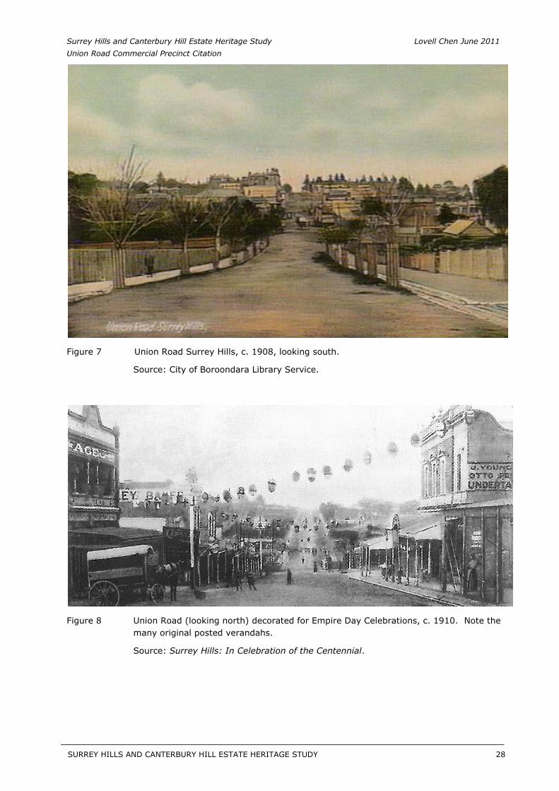
During the early years of the twentieth century, more businesses and proprietors took advantage of the increasing commuter traffic to and from the Surrey Hills Railway Station, and constructed new premises within the precinct. These included tobacconists, estate agents, hairdressers, confectioners, a draper, and a chemist.14 An image from c.1910 (see Figure 8) shows an abundance of posted verandahs over the footpaths to both sides of Union Road, the majority of which no longer exist or have been replaced.
Bus services were established to transport residents from the outlying areas of the suburb to the railway. The 1924 Motor Omnibus Act meant drivers could apply for a ‘regular service’ licence along routes they nominated.15
A second wave of development of the Union Road precinct began in the years following World War I. This is also consistent with the broader history of Surrey Hills, where the 1920s was a period of residential consolidation in the suburb. Surrey Hills was earmarked for the development of homes for returning soldiers and, during the interwar period, the State Savings Bank also financed the construction of many local houses as part of their campaign to encourage home ownership.16
In the 1910s through to 1925, new commercial premises were constructed within the Union Road precinct, virtually infilling all remaining vacant sites. The E S & A Bank built premises on Union Road in 1912, and the State Savings Bank occupied premises to the south of Windsor Crescent from 1916.17 By 1930, the Commercial Bank of Australia was also located on Union Road.18 During this period, earlier retailers were supplemented with a variety of new stores including a ladies draper, boot shops, laundry, painter, greengrocers, florist, chemist, butchers, delicatessen, cab proprietors and newsagents.19 The Surrey Family Hotel was converted to boarding house use in the 1920s, when the area went ‘dry’.
When the next economic Depression hit at the end of the 1920s, activity again slowed in the precinct. There was also, not surprisingly, fierce competition between businesses many of whom offered credit to entice the frugal customer.20 While local growth and development slowed, it did not stop entirely and by 1941 the population of the municipality had grown to 69,000.21
As in other areas of Boroondara, the advent of the motor car confirmed Surrey Hills as a dormitory suburb for Melbourne workers. At the same time, the railway remained a popular mode of transportation, ensuring the viability of the commercial precinct at Union Road. A number of garages were also established in the precinct in response to the growing rates of car ownership.
While the precinct retains much of its character, as developed from the late nineteenth century through to the early decades of the twentieth century, a number of modern infill shops have recently replaced the earlier buildings of the 1890s and 1920s.
[Butler, G. Camberwell Conservation Study, 1991; additional research by Lovell Chen, 2011. Information also provided by the Surrey Hills Neighbourhood Centre Heritage Collection, including ‘History Walkabout’ notes.]
SURREY HILLS AND CANTERBURY HILL ESTATE HERITAGE STUDY 26
__________________________________________________________________________________________________________
Surrey Hills and Canterbury Hill Estate Heritage Study Lovell Chen June 2011 Union Road Commercial Precinct Citation
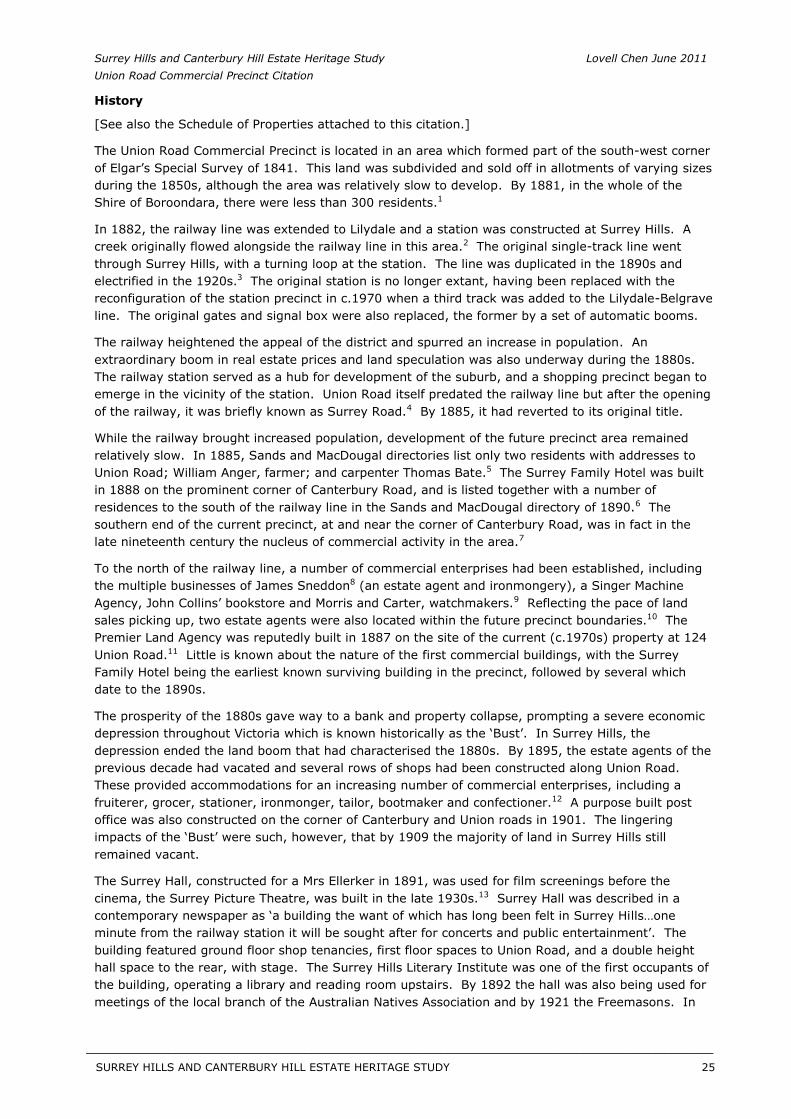
Figure 5 Surrey Hills Station in 1889.
Source: VPRS 12800/P1, H4365, Public Record Office Victoria.
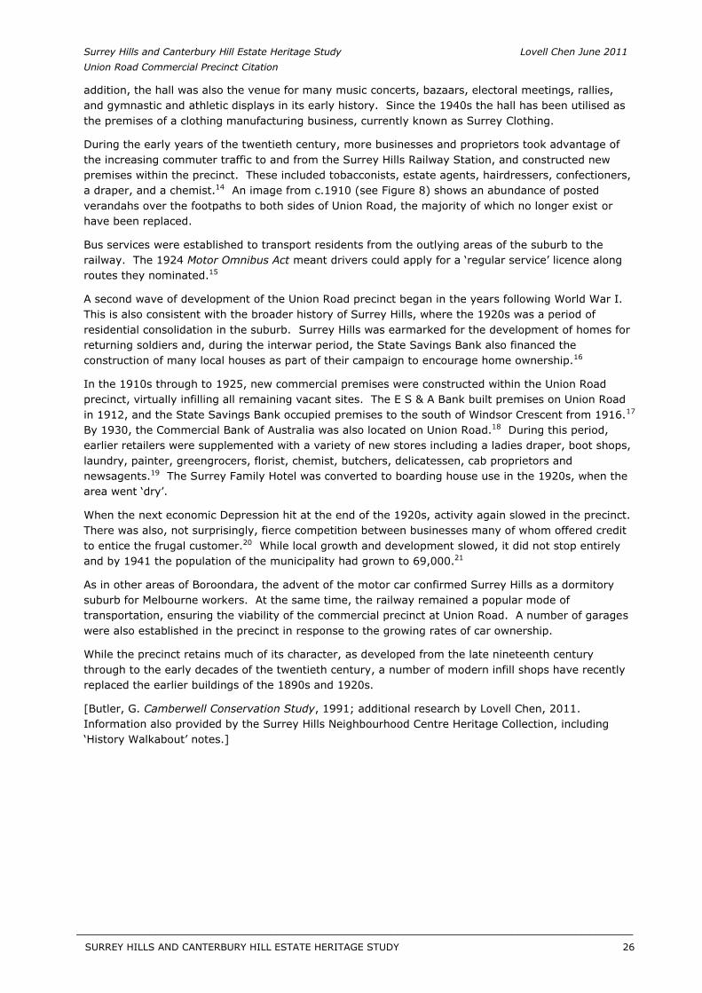
Figure 6 Corner of Canterbury Road and Union Road, 1901, looking east. The building known as Dartnells Pharmacy is at centre right, with the corner of the Surrey Family Hotel just visible at left.
Source: City of Boroondara Library Service.
SURREY HILLS AND CANTERBURY HILL ESTATE HERITAGE STUDY 27
__________________________________________________________________________________________________________
Surrey Hills and Canterbury Hill Estate Heritage Study Lovell Chen June 2011 Union Road Commercial Precinct Citation
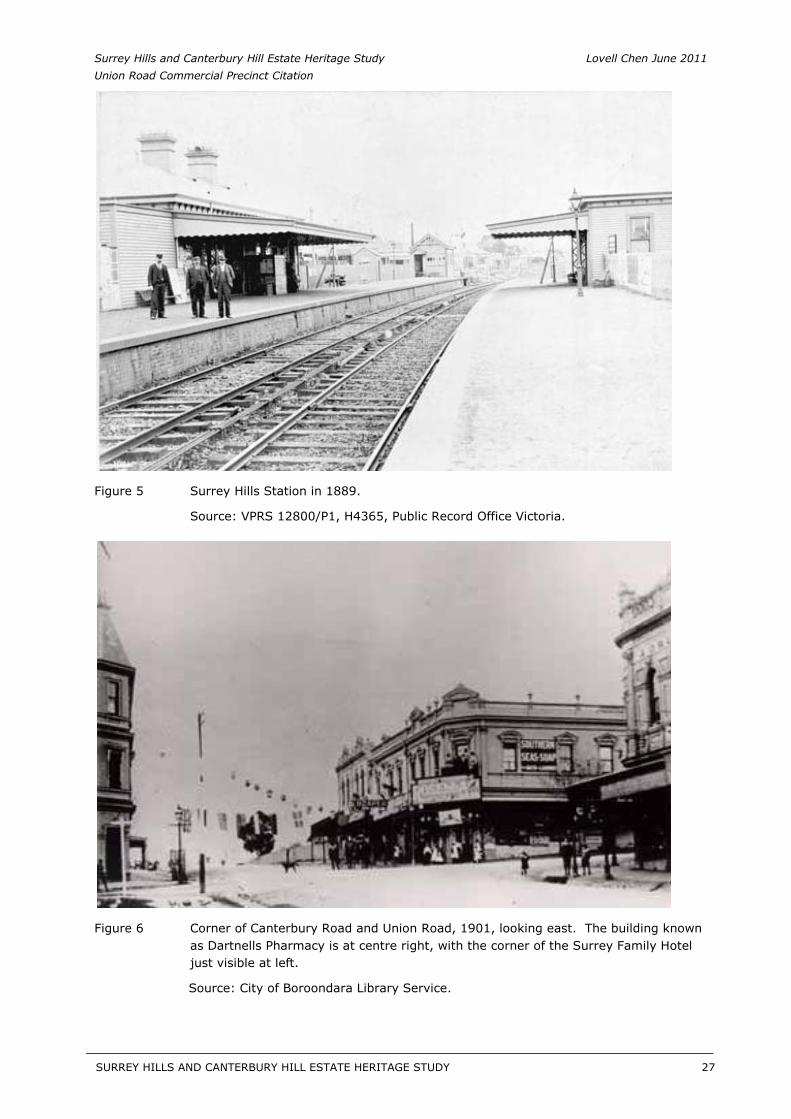
Figure 7 Union Road Surrey Hills, c. 1908, looking south.
Source: City of Boroondara Library Service.
Figure 8 Union Road (looking north) decorated for Empire Day Celebrations, c. 1910. Note the many original posted verandahs.
Source: Surrey Hills: In Celebration of the Centennial.
SURREY HILLS AND CANTERBURY HILL ESTATE HERITAGE STUDY 28
__________________________________________________________________________________________________________
Surrey Hills and Canterbury Hill Estate Heritage Study Lovell Chen June 2011 Union Road Commercial Precinct Citation
Description
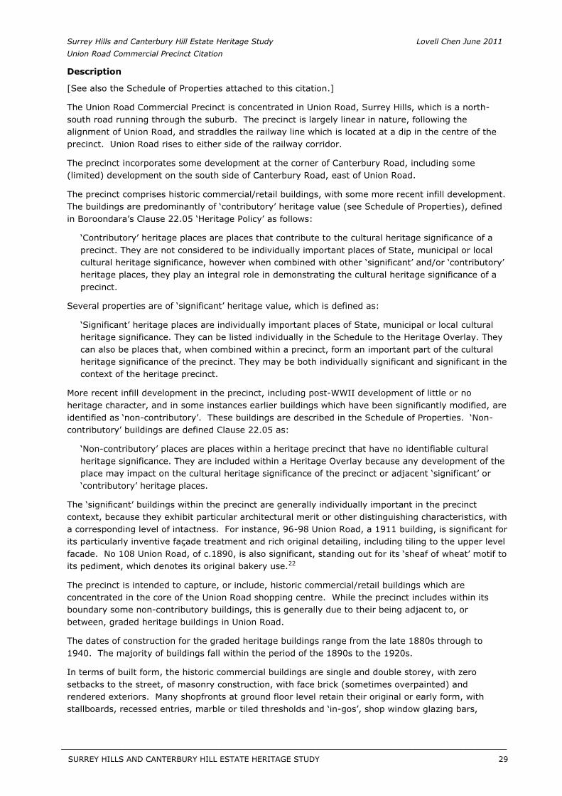
[See also the Schedule of Properties attached to this citation.]
The Union Road Commercial Precinct is concentrated in Union Road, Surrey Hills, which is a north-south road running through the suburb. The precinct is largely linear in nature, following the alignment of Union Road, and straddles the railway line which is located at a dip in the centre of the precinct. Union Road rises to either side of the railway corridor.
The precinct incorporates some development at the corner of Canterbury Road, including some (limited) development on the south side of Canterbury Road, east of Union Road.
The precinct comprises historic commercial/retail buildings, with some more recent infill development. The buildings are predominantly of ‘contributory’ heritage value (see Schedule of Properties), defined in Boroondara’s Clause 22.05 ‘Heritage Policy’ as follows:
‘Contributory’ heritage places are places that contribute to the cultural heritage significance of a precinct. They are not considered to be individually important places of State, municipal or local cultural heritage significance, however when combined with other ‘significant’ and/or ‘contributory’ heritage places, they play an integral role in demonstrating the cultural heritage significance of a precinct.
Several properties are of ‘significant’ heritage value, which is defined as:
‘Significant’ heritage places are individually important places of State, municipal or local cultural heritage significance. They can be listed individually in the Schedule to the Heritage Overlay. They can also be places that, when combined within a precinct, form an important part of the cultural heritage significance of the precinct. They may be both individually significant and significant in the context of the heritage precinct.
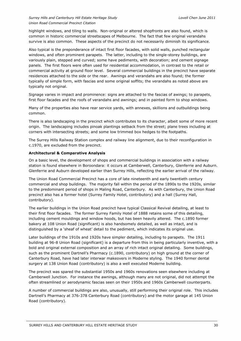
More recent infill development in the precinct, including post-WWII development of little or no heritage character, and in some instances earlier buildings which have been significantly modified, are identified as ‘non-contributory’. These buildings are described in the Schedule of Properties. ‘Non-contributory’ buildings are defined Clause 22.05 as:
‘Non-contributory’ places are places within a heritage precinct that have no identifiable cultural heritage significance. They are included within a Heritage Overlay because any development of the place may impact on the cultural heritage significance of the precinct or adjacent ‘significant’ or ‘contributory’ heritage places.
The ‘significant’ buildings within the precinct are generally individually important in the precinct context, because they exhibit particular architectural merit or other distinguishing characteristics, with a corresponding level of intactness. For instance, 96-98 Union Road, a 1911 building, is significant for its particularly inventive façade treatment and rich original detailing, including tiling to the upper level facade. No 108 Union Road, of c.1890, is also significant, standing out for its ‘sheaf of wheat’ motif to its pediment, which denotes its original bakery use.22
The precinct is intended to capture, or include, historic commercial/retail buildings which are concentrated in the core of the Union Road shopping centre. While the precinct includes within its boundary some non-contributory buildings, this is generally due to their being adjacent to, or between, graded heritage buildings in Union Road.
The dates of construction for the graded heritage buildings range from the late 1880s through to 1940. The majority of buildings fall within the period of the 1890s to the 1920s.
In terms of built form, the historic commercial buildings are single and double storey, with zero setbacks to the street, of masonry construction, with face brick (sometimes overpainted) and rendered exteriors. Many shopfronts at ground floor level retain their original or early form, with stallboards, recessed entries, marble or tiled thresholds and ‘in-gos’, shop window glazing bars,
SURREY HILLS AND CANTERBURY HILL ESTATE HERITAGE STUDY 29
__________________________________________________________________________________________________________
Surrey Hills and Canterbury Hill Estate Heritage Study Lovell Chen June 2011 Union Road Commercial Precinct Citation
highlight windows, and tiling to walls. Non-original or altered shopfronts are also found, which is common in historic commercial streetscapes of Melbourne. The fact that few original verandahs survive is also common. These aspects of the precinct do not necessarily diminish its significance.
Also typical is the preponderance of intact first floor facades, with solid walls, punched rectangular windows, and often prominent parapets. The latter, including to the single-storey buildings, are variously plain, stepped and curved; some have pediments, with decoration; and cement signage panels. The first floors were often used for residential accommodation, in contrast to the retail or commercial activity at ground floor level. Several commercial buildings in the precinct have separate residences attached to the side or the rear. Awnings and verandahs are also found; the former typically of simple form, with fascias and some original soffits; the verandahs as noted above are typically not original.
Signage varies in impact and prominence: signs are attached to the fascias of awings; to parapets, first floor facades and the roofs of verandahs and awnings; and in painted form to shop windows.
Many of the properties also have rear service yards, with annexes, skillions and outbuildings being common.
There is also landscaping in the precinct which contributes to its character, albeit some of more recent origin. The landscaping includes pinoak plantings setback from the street; plane trees including at corners with intersecting streets; and some low trimmed box hedges to the footpaths.
The Surrey Hills Railway Station complex and railway line alignment, due to their reconfiguration in c.1970, are excluded from the precinct.
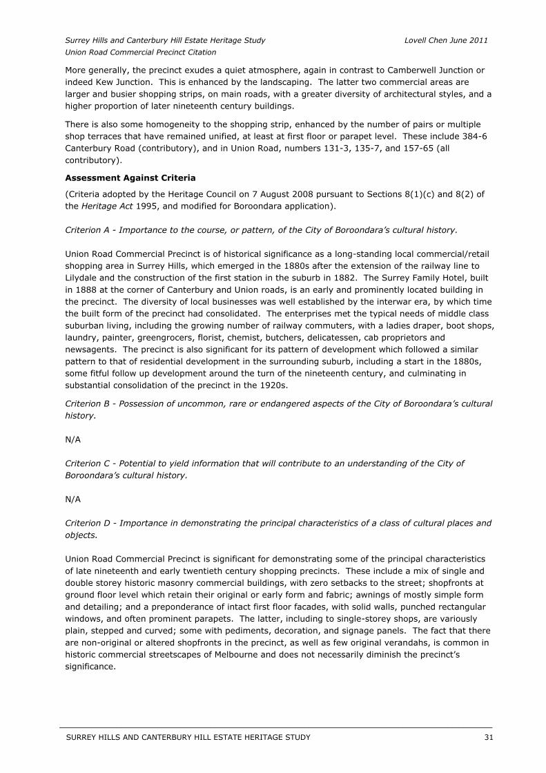
Architectural & Comparative Analysis
On a basic level, the development of shops and commercial buildings in association with a railway station is found elsewhere in Boroondara: it occurs at Camberwell, Canterbury, Glenferrie and Auburn. Glenferrie and Auburn developed earlier than Surrey Hills, reflecting the earlier arrival of the railway.
The Union Road Commercial Precinct has a core of late nineteenth and early twentieth century commercial and shop buildings. The majority fall within the period of the 1890s to the 1920s, similar to the predominant period of shops in Maling Road, Canterbury. As with Canterbury, the Union Road precinct also has a former hotel (Surrey Family Hotel, contributory) and a hall (Surrey Hall, contributory).
The earlier buildings in the Union Road precinct have typical Classical Revival detailing, at least to their first floor facades. The former Surrey Family Hotel of 1888 retains some of this detailing, including cement mouldings and window hoods, but has been heavily altered. The c.1890 former bakery at 108 Union Road (significant) is also handsomely detailed, as well as intact, and is distinguished by a ‘sheaf of wheat’ detail to the pediment, which indicates its original use.
Later buildings of the 1910s and 1920s have simpler detailing, including to parapets. The 1911 building at 96-8 Union Road (significant) is a departure from this in being particularly inventive, with a bold and original external composition and an array of rich intact original detailing. Some buildings, such as the prominent Dartnell’s Pharmacy (c.1890, contributory) on high ground at the corner of Canterbury Road, have had later interwar makeovers in Moderne styling. The 1940 former dental surgery at 138 Union Road (contributory) is also a well executed Moderne building.
The precinct was spared the substantial 1950s and 1960s renovations seen elsewhere including at Camberwell Junction. For instance the awnings, although many are not original, did not attempt the often streamlined or aerodynamic fascias seen on their 1950s and 1960s Camberwell counterparts.
A number of commercial buildings are also, unusually, still performing their original role. This includes Dartnell’s Pharmacy at 376-378 Canterbury Road (contributory) and the motor garage at 145 Union Road (contributory).
SURREY HILLS AND CANTERBURY HILL ESTATE HERITAGE STUDY 30
__________________________________________________________________________________________________________
Surrey Hills and Canterbury Hill Estate Heritage Study Lovell Chen June 2011 Union Road Commercial Precinct Citation
More generally, the precinct exudes a quiet atmosphere, again in contrast to Camberwell Junction or indeed Kew Junction. This is enhanced by the landscaping. The latter two commercial areas are larger and busier shopping strips, on main roads, with a greater diversity of architectural styles, and a higher proportion of later nineteenth century buildings.
There is also some homogeneity to the shopping strip, enhanced by the number of pairs or multiple shop terraces that have remained unified, at least at first floor or parapet level. These include 384-6 Canterbury Road (contributory), and in Union Road, numbers 131-3, 135-7, and 157-65 (all contributory).
Assessment Against Criteria
(Criteria adopted by the Heritage Council on 7 August 2008 pursuant to Sections 8(1)(c) and 8(2) of the Heritage Act 1995, and modified for Boroondara application).
Criterion A - Importance to the course, or pattern, of the City of Boroondara’s cultural history.
Union Road Commercial Precinct is of historical significance as a long-standing local commercial/retail shopping area in Surrey Hills, which emerged in the 1880s after the extension of the railway line to Lilydale and the construction of the first station in the suburb in 1882. The Surrey Family Hotel, built in 1888 at the corner of Canterbury and Union roads, is an early and prominently located building in the precinct. The diversity of local businesses was well established by the interwar era, by which time the built form of the precinct had consolidated. The enterprises met the typical needs of middle class suburban living, including the growing number of railway commuters, with a ladies draper, boot shops, laundry, painter, greengrocers, florist, chemist, butchers, delicatessen, cab proprietors and newsagents. The precinct is also significant for its pattern of development which followed a similar pattern to that of residential development in the surrounding suburb, including a start in the 1880s, some fitful follow up development around the turn of the nineteenth century, and culminating in substantial consolidation of the precinct in the 1920s.
Criterion B - Possession of uncommon, rare or endangered aspects of the City of Boroondara’s cultural history.
N/A
Criterion C - Potential to yield information that will contribute to an understanding of the City of Boroondara’s cultural history.
N/A
Criterion D - Importance in demonstrating the principal characteristics of a class of cultural places and objects.
Union Road Commercial Precinct is significant for demonstrating some of the principal characteristics of late nineteenth and early twentieth century shopping precincts. These include a mix of single and double storey historic masonry commercial buildings, with zero setbacks to the street; shopfronts at ground floor level which retain their original or early form and fabric; awnings of mostly simple form and detailing; and a preponderance of intact first floor facades, with solid walls, punched rectangular windows, and often prominent parapets. The latter, including to single-storey shops, are variously plain, stepped and curved; some with pediments, decoration, and signage panels. The fact that there are non-original or altered shopfronts in the precinct, as well as few original verandahs, is common in historic commercial streetscapes of Melbourne and does not necessarily diminish the precinct’s significance.
SURREY HILLS AND CANTERBURY HILL ESTATE HERITAGE STUDY 31
__________________________________________________________________________________________________________
Surrey Hills and Canterbury Hill Estate Heritage Study Lovell Chen June 2011 Union Road Commercial Precinct Citation
Criterion E - Importance in exhibiting particular aesthetic characteristics.
Union Road Commercial Precinct is of aesthetic/architectural significance. The precinct has a comparatively high level of intactness, and streetscape diversity arising from the variety of façade and parapet treatments. Earlier buildings in the precinct have typical Classical Revival detailing, at least to their first floor facades. The c.1890 former bakery at 108 Union Road is distinguished in this context, with its handsome detailing and ‘sheaf of wheat’ motif to the pediment indicating its original use. Later buildings of the 1910s and 1920s have simpler detailing, although the 1911 building at 96-8 Union Road departs from this with its bold and original composition and rich detailing. There is also some homogeneity to the shopping strip, enhanced by pairs or multiple shop terraces that have remained unified, at least at first floor or parapet level. The precinct additionally derives some aesthetic value from its landscaping and street plantings, albeit some of which is of recent origin.
Criterion F - Importance in demonstrating a high degree of creative or technical achievement at a particular period.
N/A
Criterion G - Strong or special association with a particular community or cultural group for social, cultural or spiritual reasons. This includes the significance of a place to Indigenous peoples as part of their continuing and developing cultural traditions.
Union Road Commercial Precinct is of social significance as a much valued commercial/retail shopping area in Surrey Hills, which has served the local community, and railway commuter traffic, since its emergence in the 1880s and consolidation in the 1920s. Although comparatively modest in size, the fact that the precinct retains its commercial focus emphasises its importance to the community of Surrey Hills.
Criterion H - Special association with the life or works of a person, or group of persons, of importance in City of Boroondara’s history.
N/A
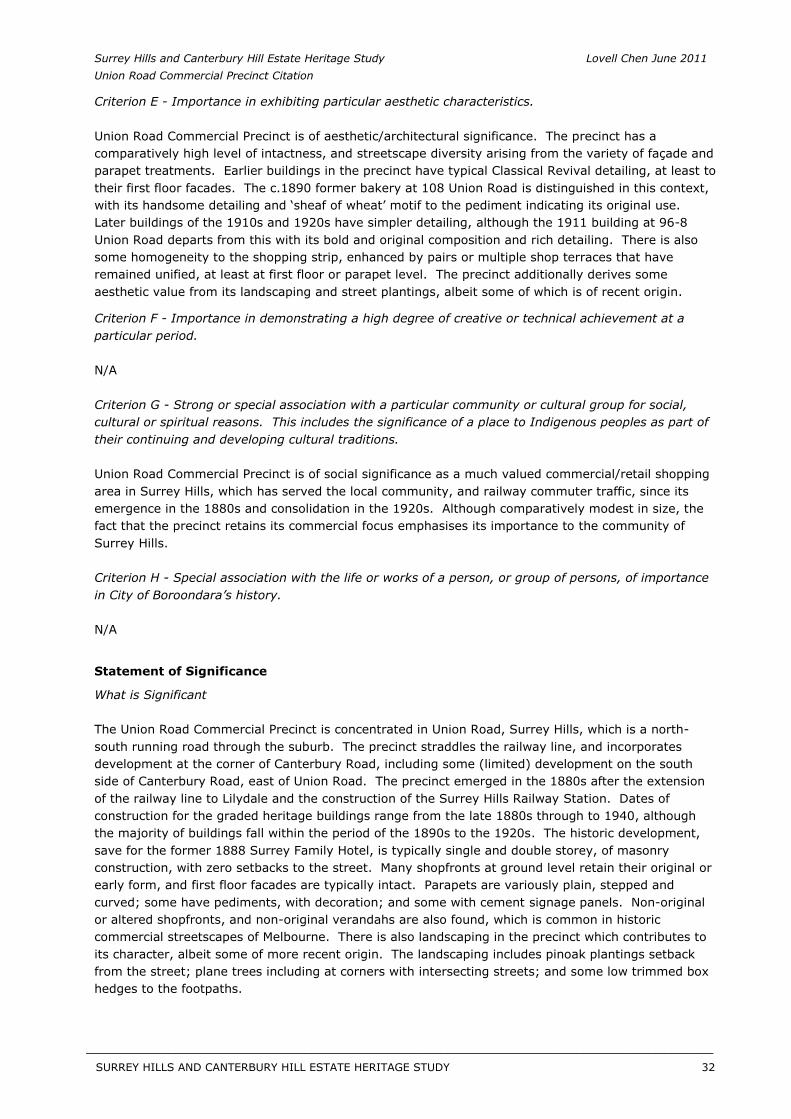
Statement of Significance
What is Significant
The Union Road Commercial Precinct is concentrated in Union Road, Surrey Hills, which is a north-south running road through the suburb. The precinct straddles the railway line, and incorporates development at the corner of Canterbury Road, including some (limited) development on the south side of Canterbury Road, east of Union Road. The precinct emerged in the 1880s after the extension of the railway line to Lilydale and the construction of the Surrey Hills Railway Station. Dates of construction for the graded heritage buildings range from the late 1880s through to 1940, although the majority of buildings fall within the period of the 1890s to the 1920s. The historic development, save for the former 1888 Surrey Family Hotel, is typically single and double storey, of masonry construction, with zero setbacks to the street. Many shopfronts at ground level retain their original or early form, and first floor facades are typically intact. Parapets are variously plain, stepped and curved; some have pediments, with decoration; and some with cement signage panels. Non-original or altered shopfronts, and non-original verandahs are also found, which is common in historic commercial streetscapes of Melbourne. There is also landscaping in the precinct which contributes to its character, albeit some of more recent origin. The landscaping includes pinoak plantings setback from the street; plane trees including at corners with intersecting streets; and some low trimmed box hedges to the footpaths.
SURREY HILLS AND CANTERBURY HILL ESTATE HERITAGE STUDY 32
__________________________________________________________________________________________________________
Surrey Hills and Canterbury Hill Estate Heritage Study Lovell Chen June 2011 Union Road Commercial Precinct Citation
How is it Significant
The Union Road Commercial Precinct is of historical, social and aesthetic/architectural significance to the City of Boroondara.
Why is it Significant
Union Road Commercial Precinct is of local historical significance (Criterion A). It is a long-standing local commercial/retail shopping area in Surrey Hills, which emerged in the 1880s after the extension of the railway line to Lilydale and the construction of the railway station in 1882. The diversity of local businesses was well established by the interwar era, by which time the built form of the precinct had also consolidated. The diverse commercial enterprises of the period met the typical needs of middle class suburban living, including the growing number of railway commuters, with a ladies draper, boot shops, laundry, painter, greengrocers, florist, chemist, butchers, delicatessen, cab proprietors and newsagents. The precinct is also of historical significance for its pattern of development which followed a similar pattern to that of residential development in Surrey Hills, commencing in the 1880s and, after some fitful follow up development around the turn of the nineteenth century, culminated in substantial consolidation in the 1920s. In terms of social significance (Criterion G), Union Road Commercial Precinct is locally significant as a much valued commercial/retail shopping area in Surrey Hills, which has served the community, and railway commuter traffic, for over 120 years. Although comparatively modest in size, its ongoing commercial focus emphasises its importance to the community of Surrey Hills.
Union Road Commercial Precinct is of local aesthetic/architectural significance (Criterion E). The precinct has a comparatively high level of intactness, and streetscape diversity arising from the variety of façade and parapet treatments. Earlier buildings in the precinct have typical Classical Revival detailing, at least to their first floor facades, while later buildings of the 1910s and 1920s have simpler detailing. There is also some homogeneity to the shopping strip, enhanced by pairs or multiple shop terraces that have remained unified, at least at first floor or parapet level. The precinct also derives some aesthetic value from its landscaping and street plantings. Union Road Commercial Precinct is additionally significant for demonstrating some of the principal characteristics of late nineteenth and early twentieth century shopping precincts (Criterion D). These include a mix of single and double storey historic masonry commercial buildings, with zero setbacks to the street; shopfronts at ground floor level which retain their original or early form and fabric; awnings of mostly simple form and detailing; and a preponderance of intact first floor facades, with solid walls, punched rectangular windows, and often prominent parapets.
Recommendations
Recommended for inclusion in the Schedule to the Heritage Overlay of the Boroondara Planning Scheme.
External Paint Colours No
Internal Alterations Controls No
Tree Controls No
Outbuildings and fences exemptions No
Victorian Heritage Register No
Prohibited uses may be permitted No
Incorporated plan No
Aboriginal heritage place No
SURREY HILLS AND CANTERBURY HILL ESTATE HERITAGE STUDY 33
__________________________________________________________________________________________________________
Surrey Hills and Canterbury Hill Estate Heritage Study Lovell Chen June 2011 Union Road Commercial Precinct Citation
Identified By
Lovell Chen, Surrey Hills and Canterbury Hill Estate Heritage Study, 2011.
References
General: Butler, G. Camberwell Conservation Study, 1991.
Specific: 1 Chris McConville and Associates, Camberwell Conservation Study: Volume Two: CamberwellEnvironment History, City of Camberwell, Camberwell, Vic, 1990, p. 17.
2 Surrey Hills Neighbourhood Centre Heritage Collection, ‘History Walkabout’ notes.
3 See Leo Harrigan, Victorian Railways to ’62, Victorian railways, Melbourne, 1962, p. 116.
4 The Argus, 22 October 1883, p. 6.
5 Sands and MacDougal Directories, 1885.
6 Sands and MacDougal Directories, 1890.
7 There were a number of earlier businesses concentrated here, which have subsequently been demolished/replaced, including a row of shops known as Hansen’s Exchange and Woodhead’s Corner Store, see Surrey Hills Neighbourhood Centre Heritage Collection, ‘History Walkabout’ notes.
8 Surrey Hills Neighbourhood Centre Heritage Collection, ‘History Walkabout’ notes, identify Sneddon as a community-minded local figure, whose descendants remained in Surrey Hills for several generations.
9 Sands and MacDougal Directories, 1890.
10 Sands and MacDougal Directories, 1890.
11 Surrey Hills Neighbourhood Centre Heritage Collection, ‘History Walkabout’ notes.
12 Sands and MacDougal Directories, 1895.
13 Information obtained from Surrey Hills History Nook Group, Surrey Hills: In Celebration of theCentennial 1883 – 1983, the Authors, Surrey Hills, Vic, 1983, pp46-48; Public Building File No.2554, VPRS7882/P1, Public Records Office of Victoria.
14 Sands and MacDougal Directories, 1925.
15 Chris McConville and Associates, Camberwell Conservation Study: Volume Twp: CamberwellEnvironment History, City of Camberwell, Camberwell, Vic, 1990, p. 62.
16 Museum Victoria: <http://museumvictoria.com.au/collections/themes/2470/the-state-savings-bank-of-victoria-
melbourne-victoria>, accessed 25 March 2011.
17 Sands and MacDougal Directories, 1920.
18 Sands and MacDougal Directories, 1930.
19 Sands and MacDougal Directories, 1925.
20 Blainey, Geoffrey, A History of Camberwell, as cited in Peel, Victoria, Zion, Deborah and Yule, Jane, A History of Hawthorn, Melbourne University Press in association with the City of Hawthorn, Cartlon, Vic, 1993, p. 95.
21 Blainey, Geoffrey, A History of Camberwell, as cited in Peel, Victoria, Zion, Deborah and Yule, Jane, A History of Hawthorn, Melbourne University Press in association with the City of Hawthorn, Cartlon, Vic, 1993, p. 94.
SURREY HILLS AND CANTERBURY HILL ESTATE HERITAGE STUDY 34
__________________________________________________________________________________________________________
Surrey Hills and Canterbury Hill Estate Heritage Study Lovell Chen June 2011 Union Road Commercial Precinct Citation
22 This building was constructed for George Garner, baker and pastry cook, see Surrey Hills Neighbourhood Centre Heritage Collection, ‘History Walkabout’ notes.
SURREY HILLS AND CANTERBURY HILL ESTATE HERITAGE STUDY 35
__________________________________________________________________________________________________________
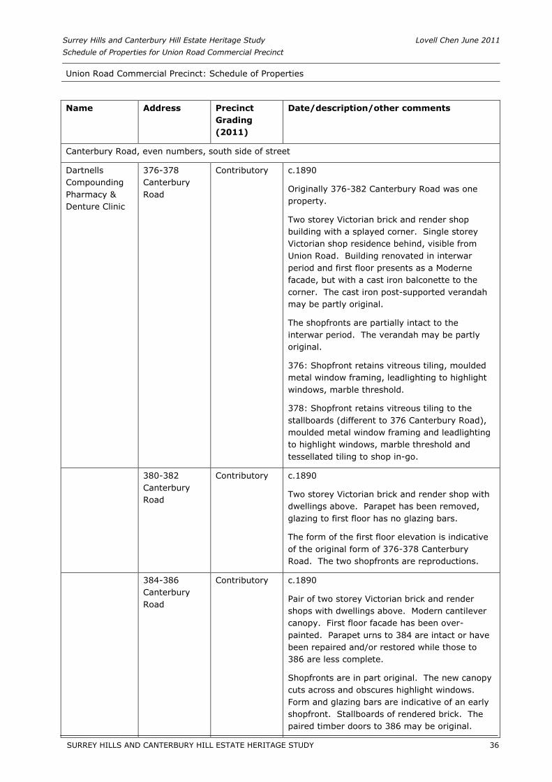
Surrey Hills and Canterbury Hill Estate Heritage Study Lovell Chen June 2011 Schedule of Properties for Union Road Commercial Precinct
Union Road Commercial Precinct: Schedule of Properties
Name Address Precinct Grading (2011)
Date/description/other comments
Canterbury Road, even numbers, south side of street
Dartnells Compounding Pharmacy & Denture Clinic
376-378 Canterbury Road
Contributory c.1890
Originally 376-382 Canterbury Road was one property.
Two storey Victorian brick and render shop building with a splayed corner. Single storey Victorian shop residence behind, visible from Union Road. Building renovated in interwar period and first floor presents as a Moderne facade, but with a cast iron balconette to the corner. The cast iron post-supported verandah may be partly original.
The shopfronts are partially intact to the interwar period. The verandah may be partly original.
376: Shopfront retains vitreous tiling, moulded metal window framing, leadlighting to highlight windows, marble threshold.
378: Shopfront retains vitreous tiling to the stallboards (different to 376 Canterbury Road), moulded metal window framing and leadlighting to highlight windows, marble threshold and tessellated tiling to shop in-go.
380-382 Canterbury Road
Contributory c.1890
Two storey Victorian brick and render shop with dwellings above. Parapet has been removed, glazing to first floor has no glazing bars.
The form of the first floor elevation is indicative of the original form of 376-378 Canterbury Road. The two shopfronts are reproductions.
384-386 Canterbury Road
Contributory c.1890
Pair of two storey Victorian brick and render shops with dwellings above. Modern cantilever canopy. First floor facade has been over-painted. Parapet urns to 384 are intact or have been repaired and/or restored while those to 386 are less complete.
Shopfronts are in part original. The new canopy cuts across and obscures highlight windows. Form and glazing bars are indicative of an early shopfront. Stallboards of rendered brick. The paired timber doors to 386 may be original.
SURREY HILLS AND CANTERBURY HILL ESTATE HERITAGE STUDY 36
__________________________________________________________________________________________________________
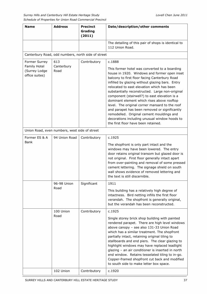
Surrey Hills and Canterbury Hill Estate Heritage Study Lovell Chen June 2011 Schedule of Properties for Union Road Commercial Precinct
Name Address Precinct Grading (2011)
Date/description/other comments
The detailing of this pair of shops is identical to 112 Union Road.
Canterbury Road, odd numbers, north side of street
Former Surrey Family Hotel (Surrey Lodge office suites)
613 Canterbury Road
Contributory c.1888
This former hotel was converted to a boarding house in 1920. Windows and former open inset balcony to first floor facing Canterbury Road infilled by glazing without glazing bars. Entry relocated to east elevation which has been substantially reconstructed. Large non-original component (stairwell?) to east elevation is a dominant element which rises above rooftop level. The original corner mansard to the roof and parapet has been removed or significantly remodelled. Original cement mouldings and decorations including unusual window hoods to the first floor have been retained.
Union Road, even numbers, west side of street
Former ES & A Bank
94 Union Road Contributory c.1925
The shopfront is only part intact and the windows may have been lowered. The entry door retains original transom but glazed door is not original. First floor generally intact apart from over-painting and removal of some pressed cement lettering. The signage shield on south wall shows evidence of removed lettering and the text is still discernible.
96-98 Union Road
Significant 1911
This building has a relatively high degree of intactness. Bird netting infills the first floor verandah. The shopfront is generally original, but the verandah has been reconstructed.
100 Union Road
Contributory c.1925
Single storey brick shop building with painted rendered parapet. There are high level windows above canopy – see also 131-33 Union Road which has a similar treatment. The shopfront partially intact, retaining original tiling to stallboards and end piers. The clear glazing to highlight windows may have replaced leadlight glazing – an air conditioner is inserted in north end window. Retains tesselated tiling to in-go. Copper-framed shopfront cut back and modified to south side to make letter box space.
102 Union Contributory c.1920
SURREY HILLS AND CANTERBURY HILL ESTATE HERITAGE STUDY 37
__________________________________________________________________________________________________________
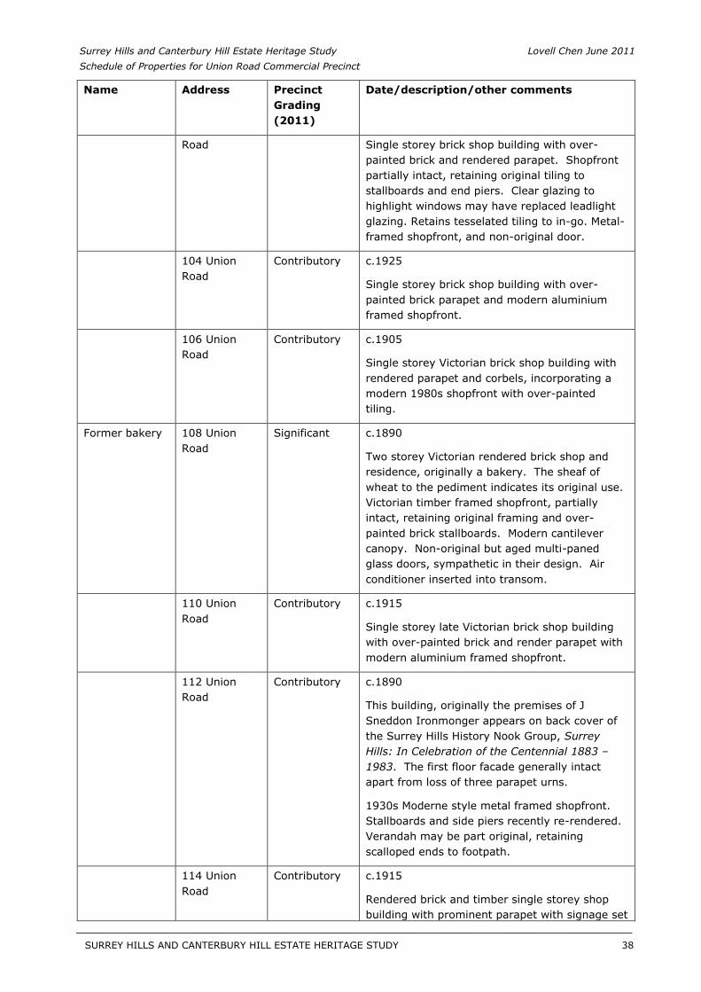
Surrey Hills and Canterbury Hill Estate Heritage Study Lovell Chen June 2011 Schedule of Properties for Union Road Commercial Precinct
Name Address Precinct Grading (2011)
Date/description/other comments
Road Single storey brick shop building with over-painted brick and rendered parapet. Shopfront partially intact, retaining original tiling to stallboards and end piers. Clear glazing to highlight windows may have replaced leadlight glazing. Retains tesselated tiling to in-go. Metal-framed shopfront, and non-original door.
104 Union Road
Contributory c.1925
Single storey brick shop building with over-painted brick parapet and modern aluminium framed shopfront.
106 Union Road
Contributory c.1905
Single storey Victorian brick shop building with rendered parapet and corbels, incorporating a modern 1980s shopfront with over-painted tiling.
Former bakery 108 Union Road
Significant c.1890
Two storey Victorian rendered brick shop and residence, originally a bakery. The sheaf of wheat to the pediment indicates its original use. Victorian timber framed shopfront, partially intact, retaining original framing and over-painted brick stallboards. Modern cantilever canopy. Non-original but aged multi-paned glass doors, sympathetic in their design. Air conditioner inserted into transom.
110 Union Road
Contributory c.1915
Single storey late Victorian brick shop building with over-painted brick and render parapet with modern aluminium framed shopfront.
112 Union Road
Contributory c.1890
This building, originally the premises of J Sneddon Ironmonger appears on back cover of the Surrey Hills History Nook Group, SurreyHills: In Celebration of the Centennial 1883 – 1983. The first floor facade generally intact apart from loss of three parapet urns.
1930s Moderne style metal framed shopfront. Stallboards and side piers recently re-rendered. Verandah may be part original, retaining scalloped ends to footpath.
114 Union Road
Contributory c.1915
Rendered brick and timber single storey shop building with prominent parapet with signage set
SURREY HILLS AND CANTERBURY HILL ESTATE HERITAGE STUDY 38
__________________________________________________________________________________________________________
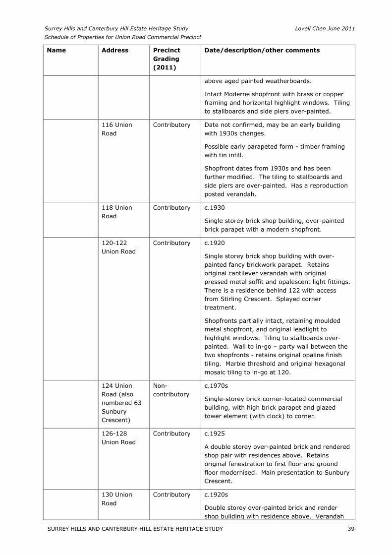
Surrey Hills and Canterbury Hill Estate Heritage Study Lovell Chen June 2011 Schedule of Properties for Union Road Commercial Precinct
Name Address Precinct Grading (2011)
Date/description/other comments
above aged painted weatherboards.
Intact Moderne shopfront with brass or copper framing and horizontal highlight windows. Tiling to stallboards and side piers over-painted.
116 Union Road
Contributory Date not confirmed, may be an early building with 1930s changes.
Possible early parapeted form - timber framing with tin infill.
Shopfront dates from 1930s and has been further modified. The tiling to stallboards and side piers are over-painted. Has a reproduction posted verandah.
118 Union Road
Contributory c.1930
Single storey brick shop building, over-painted brick parapet with a modern shopfront.
120-122 Union Road
Contributory c.1920
Single storey brick shop building with over-painted fancy brickwork parapet. Retains original cantilever verandah with original pressed metal soffit and opalescent light fittings. There is a residence behind 122 with access from Stirling Crescent. Splayed corner treatment.
Shopfronts partially intact, retaining moulded metal shopfront, and original leadlight to highlight windows. Tiling to stallboards over-painted. Wall to in-go – party wall between the two shopfronts - retains original opaline finish tiling. Marble threshold and original hexagonal mosaic tiling to in-go at 120.
124 Union Road (also numbered 63 Sunbury Crescent)
Non-contributory
c.1970s
Single-storey brick corner-located commercial building, with high brick parapet and glazed tower element (with clock) to corner.
126-128 Union Road
Contributory c.1925
A double storey over-painted brick and rendered shop pair with residences above. Retains original fenestration to first floor and ground floor modernised. Main presentation to Sunbury Crescent.
130 Union Road
Contributory c.1920s
Double storey over-painted brick and render shop building with residence above. Verandah
SURREY HILLS AND CANTERBURY HILL ESTATE HERITAGE STUDY 39
__________________________________________________________________________________________________________
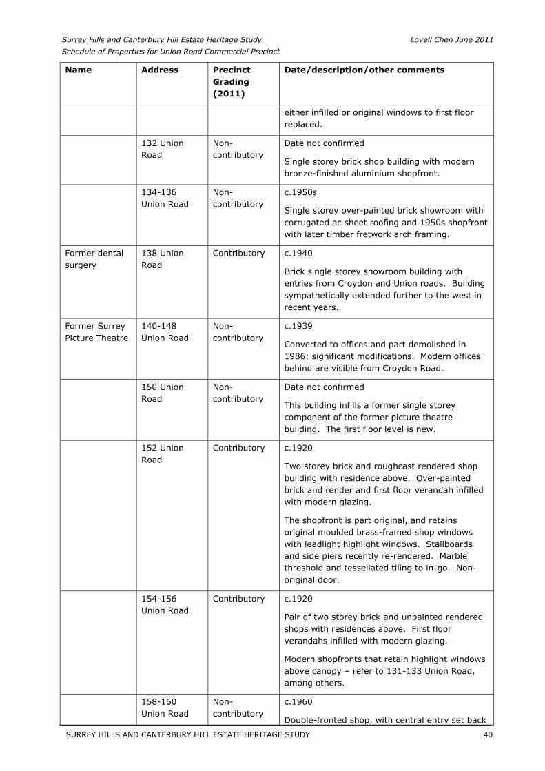
Surrey Hills and Canterbury Hill Estate Heritage Study Lovell Chen June 2011 Schedule of Properties for Union Road Commercial Precinct
Name Address Precinct Grading (2011)
Date/description/other comments
either infilled or original windows to first floor replaced.
132 Union Road
Non-contributory
Date not confirmed
Single storey brick shop building with modern bronze-finished aluminium shopfront.
134-136 Union Road
Non-contributory
c.1950s
Single storey over-painted brick showroom with corrugated ac sheet roofing and 1950s shopfront with later timber fretwork arch framing.
Former dental surgery
138 Union Road
Contributory c.1940
Brick single storey showroom building with entries from Croydon and Union roads. Building sympathetically extended further to the west in recent years.
Former Surrey Picture Theatre
140-148 Union Road
Non-contributory
c.1939
Converted to offices and part demolished in 1986; significant modifications. Modern offices behind are visible from Croydon Road.
150 Union Road
Non-contributory
Date not confirmed
This building infills a former single storey component of the former picture theatre building. The first floor level is new.
152 Union Road
Contributory c.1920
Two storey brick and roughcast rendered shop building with residence above. Over-painted brick and render and first floor verandah infilled with modern glazing.
The shopfront is part original, and retains original moulded brass-framed shop windows with leadlight highlight windows. Stallboards and side piers recently re-rendered. Marble threshold and tessellated tiling to in-go. Non-original door.
154-156 Union Road
Contributory c.1920
Pair of two storey brick and unpainted rendered shops with residences above. First floor verandahs infilled with modern glazing.
Modern shopfronts that retain highlight windows above canopy – refer to 131-133 Union Road, among others.
158-160 Union Road
Non-contributory
c.1960
Double-fronted shop, with central entry set back
SURREY HILLS AND CANTERBURY HILL ESTATE HERITAGE STUDY 40
__________________________________________________________________________________________________________
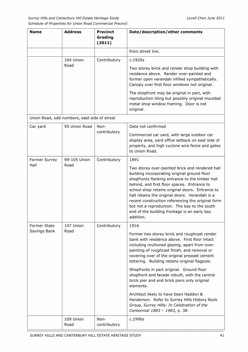
Surrey Hills and Canterbury Hill Estate Heritage Study Lovell Chen June 2011 Schedule of Properties for Union Road Commercial Precinct
Name Address Precinct Grading (2011)
Date/description/other comments
from street line.
164 Union Road
Contributory c.1920s
Two storey brick and render shop building with residence above. Render over-painted and former open verandah infilled sympathetically. Canopy over first floor windows not original.
The shopfront may be original in part, with reproduction tiling but possibly original moulded metal shop window framing. Door is not original.
Union Road, odd numbers, east side of street
Car yard 95 Union Road Non-contributory
Date not confirmed
Commercial car yard, with large outdoor car display area, yard office setback on east side of property, and high cyclone wire fence and gates to Union Road.
Former Surrey Hall
99-105 Union Road
Contributory 1891
Two storey over-painted brick and rendered hall building incorporating original ground floor shopfronts flanking entrance to the timber hall behind, and first floor spaces. Entrance to school shop retains original doors. Entrance to hall retains the original doors. Verandah is a recent construction referencing the original form but not a reproduction. The bay to the south end of the building frontage is an early bay addition.
Former State Savings Bank
107 Union Road
Contributory 1916
Former two storey brick and roughcast render bank with residence above. First floor intact including mullioned glazing, apart from over-painting of roughcast finish, and removal or covering over of the original pressed cement lettering. Building retains original flagpole.
Shopfronts in part original. Ground floor shopfront and facade rebuilt, with the central brick pier and end brick piers only original elements.
Architect likely to have been Haddon & Henderson. Refer to Surrey Hills History Nook Group, Surrey Hills: In Celebration of theCentennial 1883 – 1983, p. 38.
109 Union Road
Non-contributory
c.1990s
SURREY HILLS AND CANTERBURY HILL ESTATE HERITAGE STUDY 41
__________________________________________________________________________________________________________
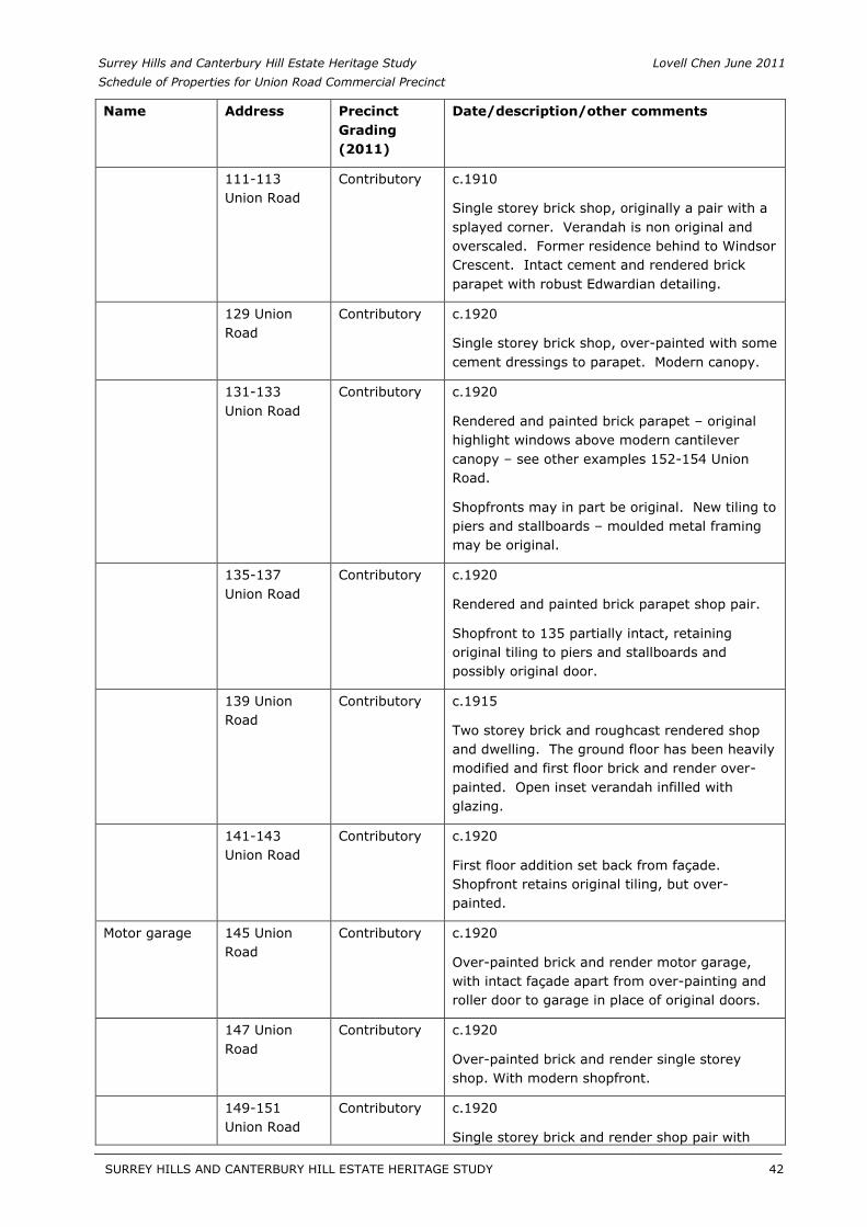
Surrey Hills and Canterbury Hill Estate Heritage Study Lovell Chen June 2011 Schedule of Properties for Union Road Commercial Precinct
Name Address Precinct Grading (2011)
Date/description/other comments
111-113 Union Road
Contributory c.1910
Single storey brick shop, originally a pair with a splayed corner. Verandah is non original and overscaled. Former residence behind to Windsor Crescent. Intact cement and rendered brick parapet with robust Edwardian detailing.
129 Union Road
Contributory c.1920
Single storey brick shop, over-painted with some cement dressings to parapet. Modern canopy.
131-133 Union Road
Contributory c.1920
Rendered and painted brick parapet – original highlight windows above modern cantilever canopy – see other examples 152-154 Union Road.
Shopfronts may in part be original. New tiling to piers and stallboards – moulded metal framing may be original.
135-137 Union Road
Contributory c.1920
Rendered and painted brick parapet shop pair.
Shopfront to 135 partially intact, retaining original tiling to piers and stallboards and possibly original door.
139 Union Road
Contributory c.1915
Two storey brick and roughcast rendered shop and dwelling. The ground floor has been heavily modified and first floor brick and render over-painted. Open inset verandah infilled with glazing.
141-143 Union Road
Contributory c.1920
First floor addition set back from façade. Shopfront retains original tiling, but over-painted.
Motor garage 145 Union Road
Contributory c.1920
Over-painted brick and render motor garage, with intact façade apart from over-painting and roller door to garage in place of original doors.
147 Union Road
Contributory c.1920
Over-painted brick and render single storey shop. With modern shopfront.
149-151 Union Road
Contributory c.1920
Single storey brick and render shop pair with
SURREY HILLS AND CANTERBURY HILL ESTATE HERITAGE STUDY 42
__________________________________________________________________________________________________________
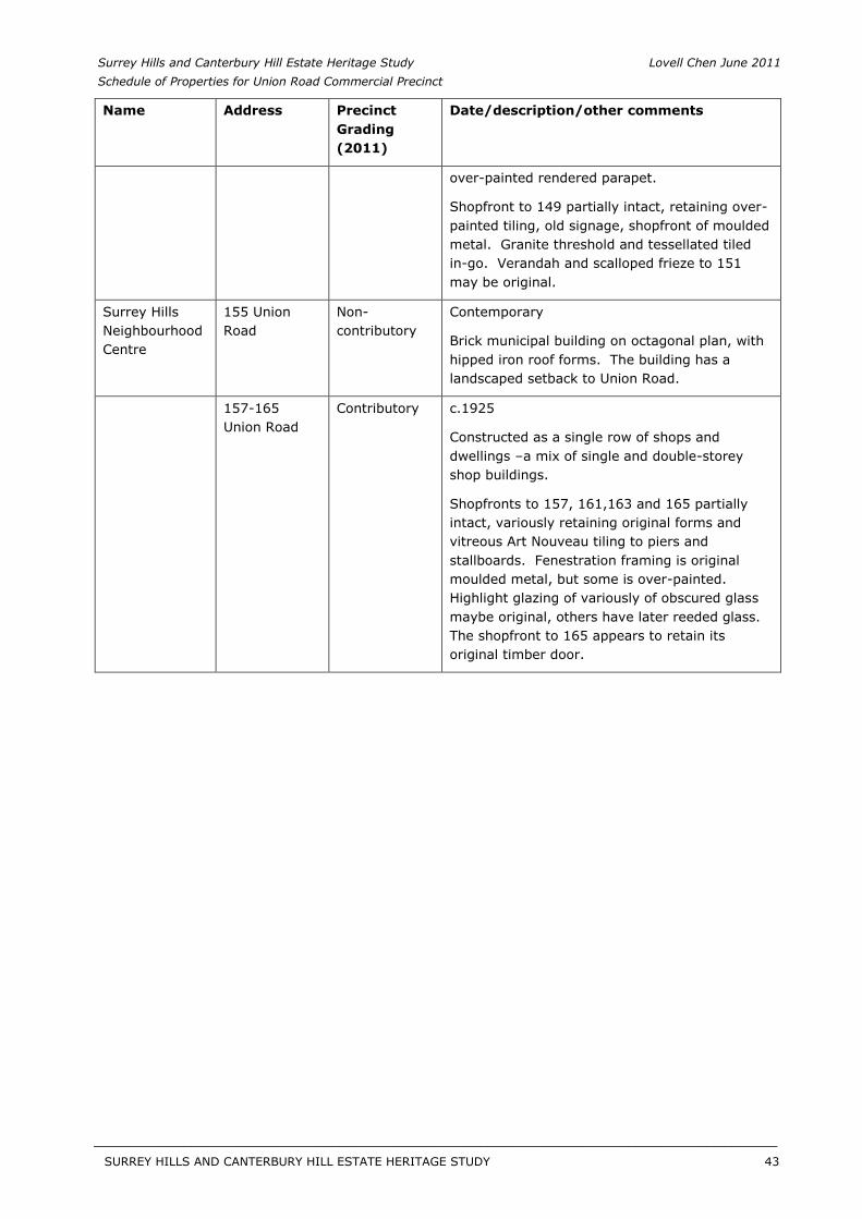
Surrey Hills and Canterbury Hill Estate Heritage Study Lovell Chen June 2011 Schedule of Properties for Union Road Commercial Precinct
Name Address Precinct Grading (2011)
Date/description/other comments
over-painted rendered parapet.
Shopfront to 149 partially intact, retaining over-painted tiling, old signage, shopfront of moulded metal. Granite threshold and tessellated tiled in-go. Verandah and scalloped frieze to 151 may be original.
Surrey Hills Neighbourhood Centre
155 Union Road
Non-contributory
Contemporary
Brick municipal building on octagonal plan, with hipped iron roof forms. The building has a landscaped setback to Union Road.
157-165 Union Road
Contributory c.1925
Constructed as a single row of shops and dwellings –a mix of single and double-storey shop buildings.
Shopfronts to 157, 161,163 and 165 partially intact, variously retaining original forms and vitreous Art Nouveau tiling to piers and stallboards. Fenestration framing is original moulded metal, but some is over-painted. Highlight glazing of variously of obscured glass maybe original, others have later reeded glass. The shopfront to 165 appears to retain its original timber door.
SURREY HILLS AND CANTERBURY HILL ESTATE HERITAGE STUDY 43
__________________________________________________________________________________________________________
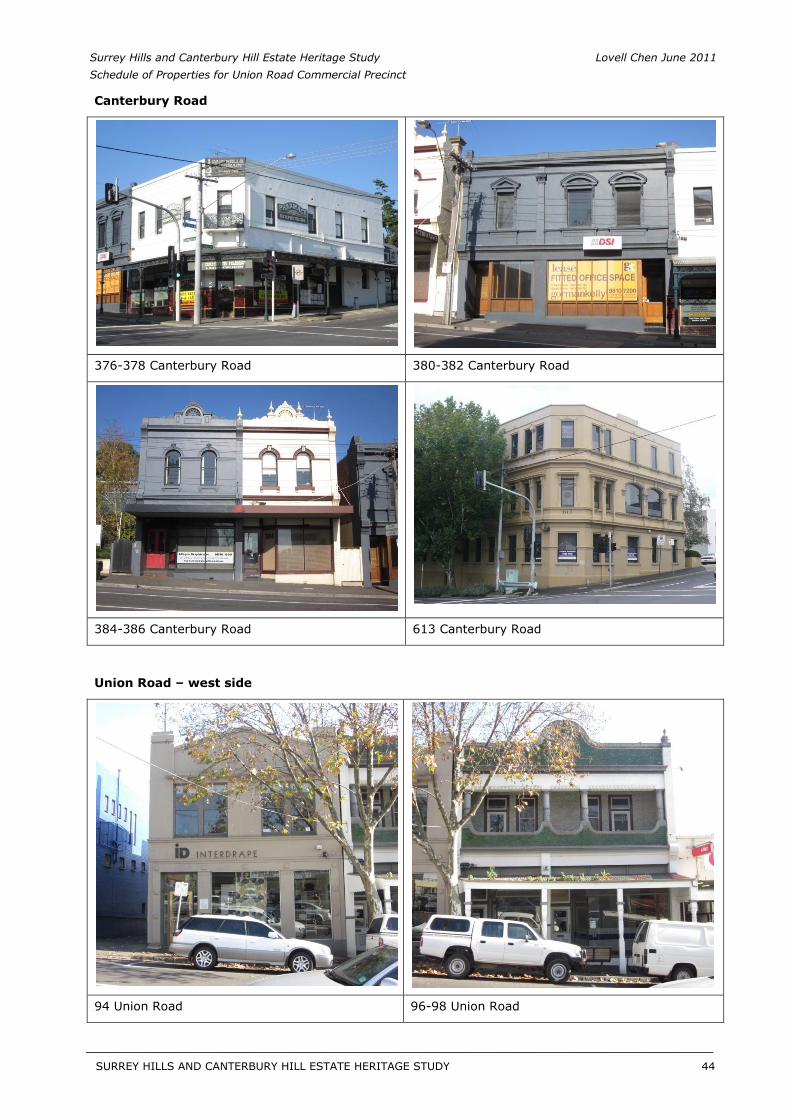
Surrey Hills and Canterbury Hill Estate Heritage Study Lovell Chen June 2011 Schedule of Properties for Union Road Commercial Precinct
Canterbury Road
376-378 Canterbury Road 380-382 Canterbury Road
384-386 Canterbury Road 613 Canterbury Road
Union Road – west side
94 Union Road 96-98 Union Road
SURREY HILLS AND CANTERBURY HILL ESTATE HERITAGE STUDY 44
__________________________________________________________________________________________________________
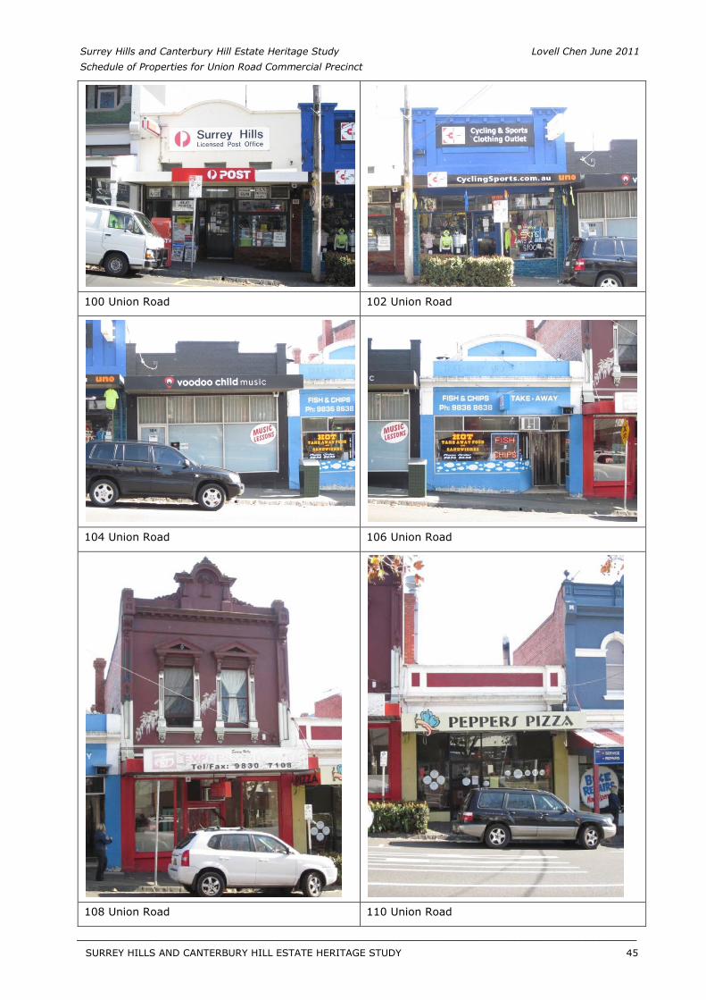
Surrey Hills and Canterbury Hill Estate Heritage Study Lovell Chen June 2011 Schedule of Properties for Union Road Commercial Precinct
100 Union Road 102 Union Road
104 Union Road 106 Union Road
108 Union Road 110 Union Road
SURREY HILLS AND CANTERBURY HILL ESTATE HERITAGE STUDY 45
__________________________________________________________________________________________________________
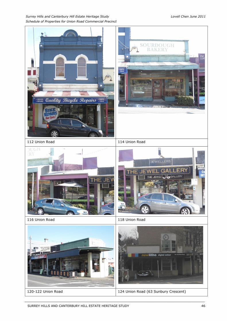
Surrey Hills and Canterbury Hill Estate Heritage Study Lovell Chen June 2011 Schedule of Properties for Union Road Commercial Precinct
112 Union Road 114 Union Road
116 Union Road 118 Union Road
120-122 Union Road 124 Union Road (63 Sunbury Crescent)
SURREY HILLS AND CANTERBURY HILL ESTATE HERITAGE STUDY 46
__________________________________________________________________________________________________________
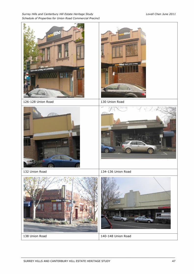
Surrey Hills and Canterbury Hill Estate Heritage Study Lovell Chen June 2011 Schedule of Properties for Union Road Commercial Precinct
126-128 Union Road 130 Union Road
132 Union Road 134-136 Union Road
138 Union Road 140-148 Union Road
SURREY HILLS AND CANTERBURY HILL ESTATE HERITAGE STUDY 47
__________________________________________________________________________________________________________
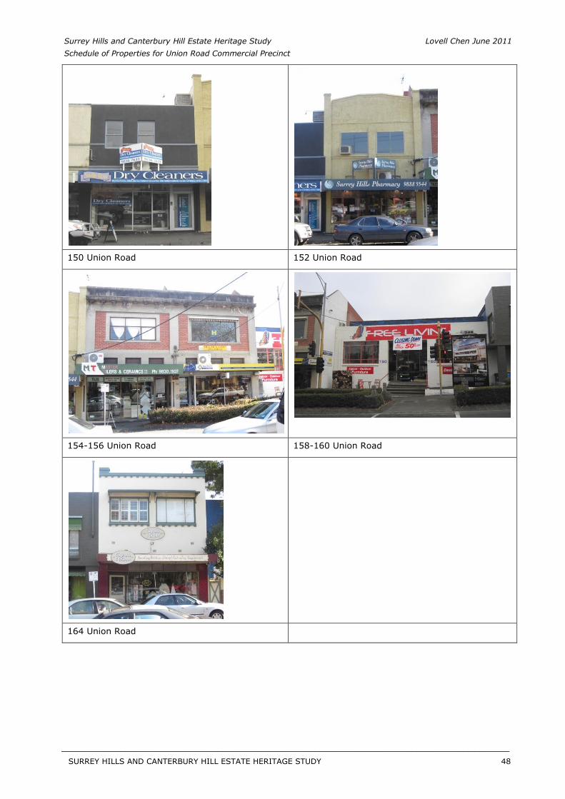
Surrey Hills and Canterbury Hill Estate Heritage Study Lovell Chen June 2011 Schedule of Properties for Union Road Commercial Precinct
150 Union Road 152 Union Road
154-156 Union Road 158-160 Union Road
164 Union Road
SURREY HILLS AND CANTERBURY HILL ESTATE HERITAGE STUDY 48
__________________________________________________________________________________________________________
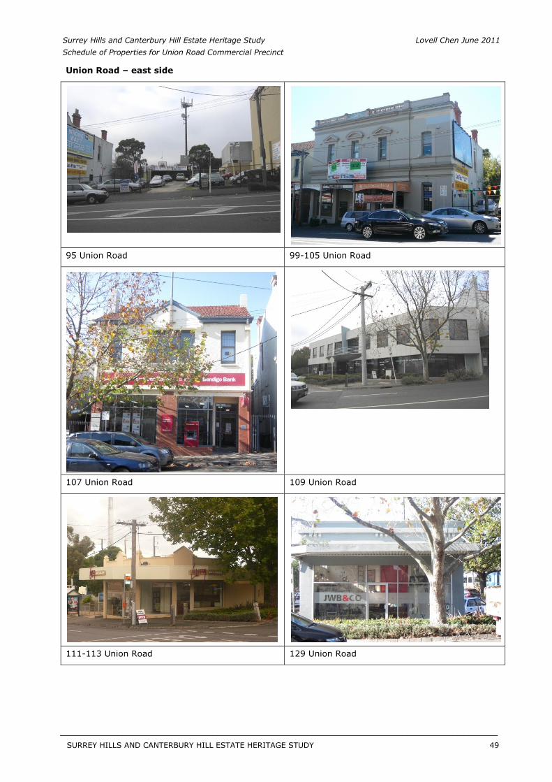
Surrey Hills and Canterbury Hill Estate Heritage Study Lovell Chen June 2011 Schedule of Properties for Union Road Commercial Precinct
Union Road – east side
95 Union Road 99-105 Union Road
107 Union Road 109 Union Road
111-113 Union Road 129 Union Road
SURREY HILLS AND CANTERBURY HILL ESTATE HERITAGE STUDY 49
__________________________________________________________________________________________________________
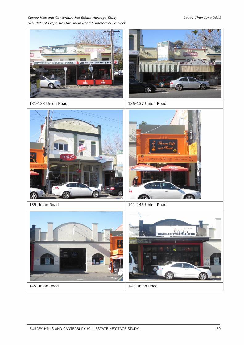
Surrey Hills and Canterbury Hill Estate Heritage Study Lovell Chen June 2011 Schedule of Properties for Union Road Commercial Precinct
131-133 Union Road 135-137 Union Road
139 Union Road 141-143 Union Road
145 Union Road 147 Union Road
SURREY HILLS AND CANTERBURY HILL ESTATE HERITAGE STUDY 50
__________________________________________________________________________________________________________
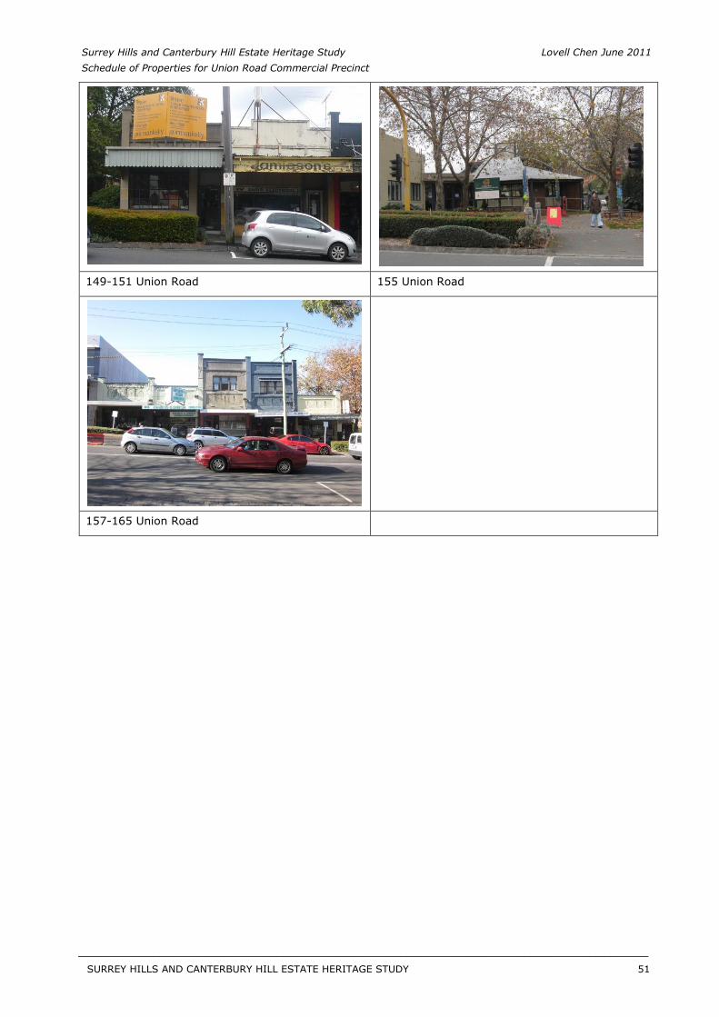
Surrey Hills and Canterbury Hill Estate Heritage Study Lovell Chen June 2011 Schedule of Properties for Union Road Commercial Precinct
149-151 Union Road 155 Union Road
157-165 Union Road
SURREY HILLS AND CANTERBURY HILL ESTATE HERITAGE STUDY 51
__________________________________________________________________________________________________________
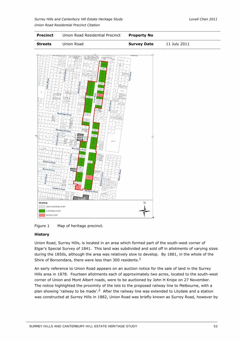
Surrey Hills and Canterbury Hill Estate Heritage Study Lovell Chen 2011
Union Road Residential Precinct Citation
Precinct Union Road Residential Precinct Property No
Streets Union Road Survey Date 11 July 2011
Figure 1 Map of heritage precinct.
History
Union Road, Surrey Hills, is located in an area which formed part of the south-west corner of Elgar’s Special Survey of 1841. This land was subdivided and sold off in allotments of varying sizes during the 1850s, although the area was relatively slow to develop. By 1881, in the whole of the Shire of Boroondara, there were less than 300 residents.1
An early reference to Union Road appears on an auction notice for the sale of land in the Surrey Hills area in 1878. Fourteen allotments each of approximately two acres, located to the south-west corner of Union and Mont Albert roads, were to be auctioned by John H Knipe on 27 November. The notice highlighted the proximity of the lots to the proposed railway line to Melbourne, with a plan showing ‘railway to be made’.2 After the railway line was extended to Lilydale and a stationwas constructed at Surrey Hills in 1882, Union Road was briefly known as Surrey Road, however by
SURREY HILLS AND CANTERBURY HILL ESTATE HERITAGE STUDY 52
__________________________________________________________________________________________________________
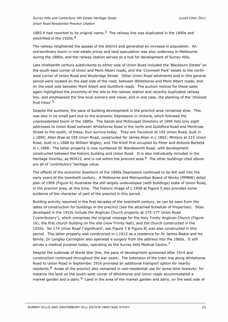
Surrey Hills and Canterbury Hill Estate Heritage Study Lovell Chen 2011
Union Road Residential Precinct Citation
1885 it had reverted to its original name.3 The railway line was duplicated in the 1890s andelectrified in the 1920s.4
The railway heightened the appeal of the district and generated an increase in population. An extraordinary boom in real estate prices and land speculation was also underway in Melbourne during the 1880s, and the railway station served as a hub for development of Surrey Hills.
Late nineteenth century subdivisions to either side of Union Road included the ‘Blackburn Estate’ on the south-east corner of Union and Mont Albert roads, and the ‘Cromwell Park’ estate to the north-west corner of Union Road and Weybridge Street. Other Union Road allotments sold in this general period were located on the east side of the road, between Whitehorse and Mont Albert roads, and on the west side between Mont Albert and Guildford roads. The auction notices for these sales again highlighted the proximity of the lots to the railway station and recently duplicated railway line, and emphasised the fine local scenery and views, and in one case, the planting of the ‘choicest fruit trees’.5
Despite the auctions, the pace of building development in the precinct area remained slow. This was also in no small part due to the economic Depression in Victoria, which followed the unprecedented boom of the 1880s. The Sands and McDougall Directory of 1895 lists only eight addresses to Union Road between Whitehorse Road in the north and Guildford Road and Montrose Street to the south; of these, four survive today. They are Tavistock at 192 Union Road, built in c.1890; Allan Brae at 195 Union Road, constructed for James Allan in c.1892; Mintaro at 215 Union Road, built in c.1888 by William Wigley; and The Knoll first occupied by Peter and Antonia Barbeta in c.1888. The latter property is now numbered 50 Wandsworth Road, with development constructed between the historic building and Union Road. It is also individually included in the Heritage Overlay, as HO415, and is not within the precinct area.6 The other buildings cited aboveare all of ‘contributory’ heritage value.
The effects of the economic downturn of the 1890s Depression continued to be felt well into the early years of the twentieth century. A Melbourne and Metropolitan Board of Works (MMBW) detail plan of 1909 (Figure 6) illustrates the still largely undeveloped (with buildings) state of Union Road, in the precinct area, at this time. The historic image of c.1908 at Figure 5 also provides some evidence of the character of part of the precinct in this period.
Building activity resumed in the first decades of the twentieth century, as can be seen from the dates of construction for buildings in the precinct (see the attached Schedule of Properties). Sites developed in the 1910s include the Anglican Church property at 175-177 Union Road (‘contributory’), which comprises the original vicarage for the Holy Trinity Anglican Church (Figure 16), the first church building on the site (now Trinity Hall), and the church constructed in the 1920s. No 174 Union Road (‘significant’, see Figure 7 & Figure 8) was also constructed in this period. This latter property was constructed in c.1912 as a residence for Dr James Blakie and his family; Dr Langley Carrington also operated a surgery from the address into the 1960s. It still serves a medical purpose today, operating as the Surrey Hills Medical Centre.7
Despite the outbreak of World War One, the pace of development quickened after 1914 and construction continued throughout the war years. The extension of the tram line along Whitehorse Road to Union Road in September 1916 provided an additional transport option for nearby residents.8 Areas of the precinct also remained in non-residential use for some time however; forinstance the land on the south-west corner of Whitehorse and Union roads accommodated a market garden and a dairy.9 Land in the area of the market garden and dairy, on the west side of
SURREY HILLS AND CANTERBURY HILL ESTATE HERITAGE STUDY 53
__________________________________________________________________________________________________________
Surrey Hills and Canterbury Hill Estate Heritage Study Lovell Chen 2011
Union Road Residential Precinct Citation
Union Road between Whitehorse Road and Weybridge Street, in fact remained largely undeveloped until the mid to late 1920s when the first dwellings were constructed.
There is also some evidence of people purchasing adjoining allotments, constructing a dwelling on one, and keeping the ‘side’ allotment as a garden. As in the case of Teralba at 229 Union Road (‘contributory’), the adjoining block to the north at 231 was maintained as an orchard until it was developed in the mid-twentieth century.10 Another example is at 176 and 178 Union Road(‘contributory’), where the latter is an interwar villa and the adjoining block, today provides a generous garden setting. Previously this was the site of a residence, demolished in c. 1971. The interwar villa was constructed on the site of an earlier weatherboard house Avondale, shown on the 1902 MMBW plan at Figure 6. When rebuilding took place, presumably during the mid-late 1930s, the house was sited on the same footprint as the earlier house.
Another characteristic of the precinct is the tendency, in some instances, to construct larger dwellings on the more generous allotments. This is a pattern which is common to main or principal roads in Borooondara, encouraged in this instance also by the elevated nature of Union Road.
It is also noted that there was an albeit small concentration of families of Spanish descent in this area of Surrey Hills, including several who owned properties in Union Road, and adjoining streets. They included the Clota and Figuerola families at 181 (‘significant’) and 230 (‘contributory’) Union Road, respectively.11
Both sides of Union Road were virtually fully developed by the advent of World War Two, with little subsequent development until the later twentieth century when new infill dwellings replaced some of the earlier buildings.
[Butler, G. Camberwell Conservation Study, 1991; additional research by Lovell Chen, 2011. Information also provided by the Surrey Hills Neighbourhood Centre Heritage Collection, including ‘History Walkabout’ notes.]
SURREY HILLS AND CANTERBURY HILL ESTATE HERITAGE STUDY 54
__________________________________________________________________________________________________________
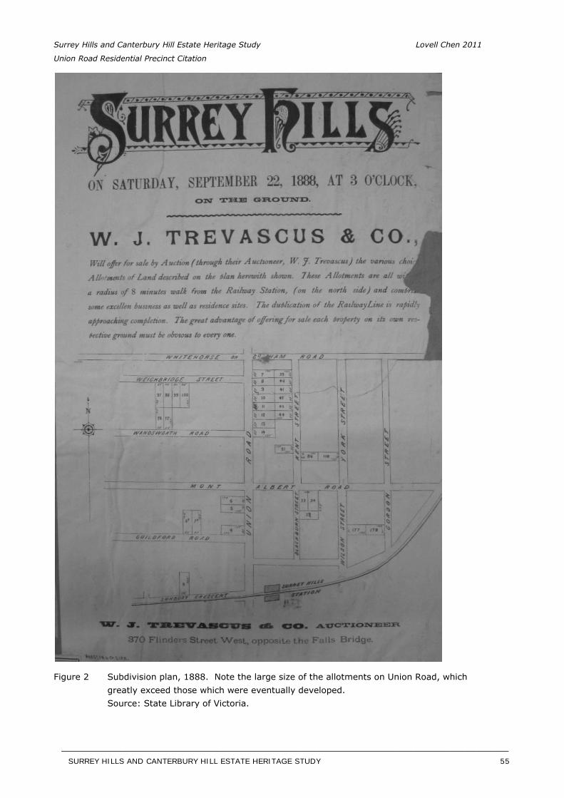
Surrey Hills and Canterbury Hill Estate Heritage Study Lovell Chen 2011
Union Road Residential Precinct Citation
Figure 2 Subdivision plan, 1888. Note the large size of the allotments on Union Road, which greatly exceed those which were eventually developed. Source: State Library of Victoria.
SURREY HILLS AND CANTERBURY HILL ESTATE HERITAGE STUDY 55
__________________________________________________________________________________________________________
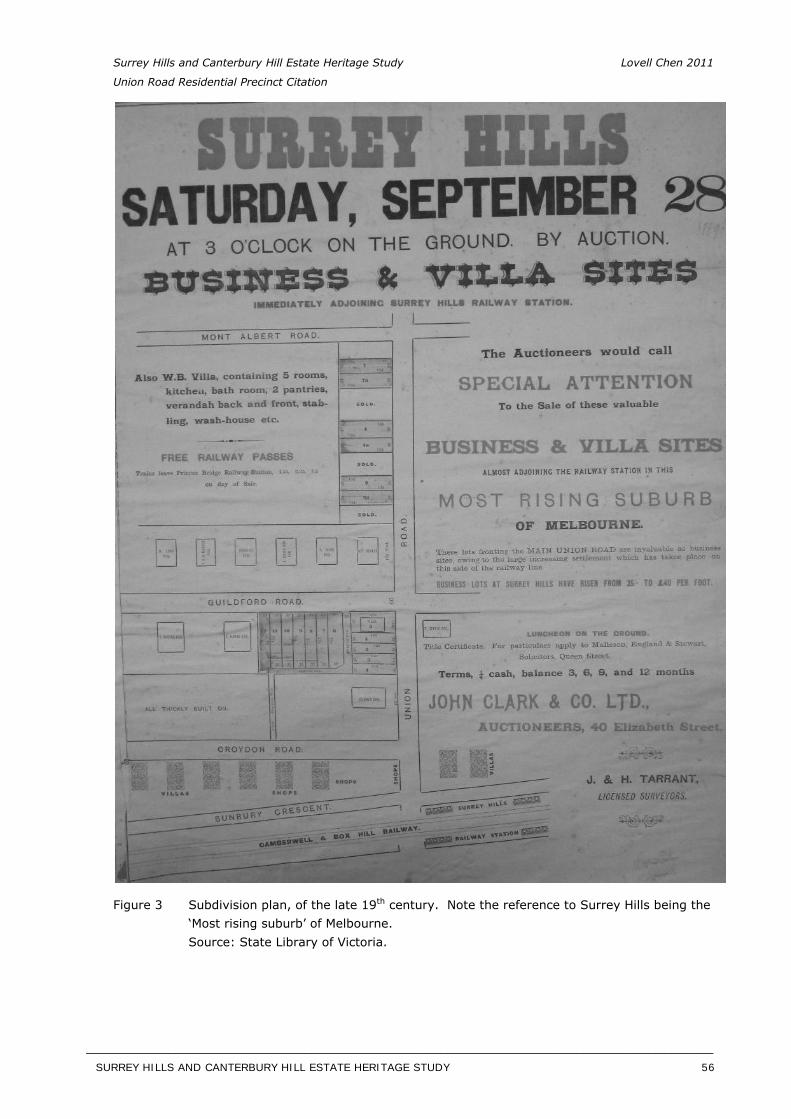
Surrey Hills and Canterbury Hill Estate Heritage Study Lovell Chen 2011
Union Road Residential Precinct Citation
Figure 3 Subdivision plan, of the late 19th century. Note the reference to Surrey Hills being the ‘Most rising suburb’ of Melbourne. Source: State Library of Victoria.
SURREY HILLS AND CANTERBURY HILL ESTATE HERITAGE STUDY 56
__________________________________________________________________________________________________________
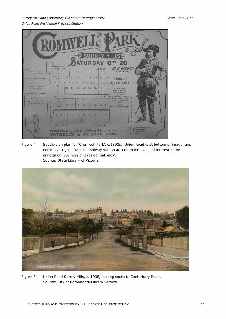
Surrey Hills and Canterbury Hill Estate Heritage Study Lovell Chen 2011
Union Road Residential Precinct Citation
Figure 4 Subdivision plan for ‘Cromwell Park’, c.1890s. Union Road is at bottom of image, and north is at right. Note the railway station at bottom left. Also of interest is the annotation ‘business and residential sites’. Source: State Library of Victoria.
Figure 5 Union Road Surrey Hills, c. 1908, looking south to Canterbury Road. Source: City of Boroondara Library Service.
SURREY HILLS AND CANTERBURY HILL ESTATE HERITAGE STUDY 57
__________________________________________________________________________________________________________
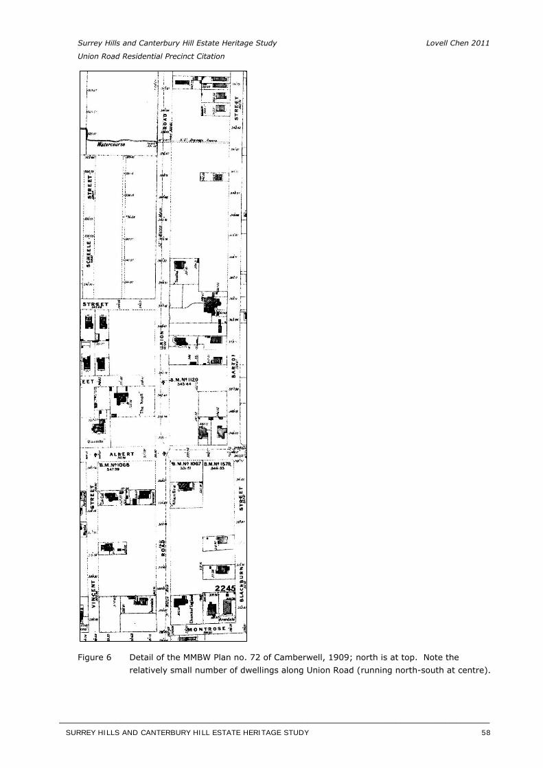
Surrey Hills and Canterbury Hill Estate Heritage Study Lovell Chen 2011
Union Road Residential Precinct Citation
Figure 6 Detail of the MMBW Plan no. 72 of Camberwell, 1909; north is at top. Note the relatively small number of dwellings along Union Road (running north-south at centre).
SURREY HILLS AND CANTERBURY HILL ESTATE HERITAGE STUDY 58
__________________________________________________________________________________________________________
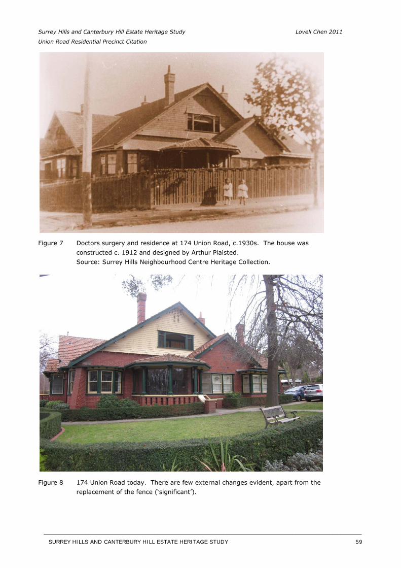
Surrey Hills and Canterbury Hill Estate Heritage Study Lovell Chen 2011
Union Road Residential Precinct Citation
Figure 7 Doctors surgery and residence at 174 Union Road, c.1930s. The house was constructed c. 1912 and designed by Arthur Plaisted. Source: Surrey Hills Neighbourhood Centre Heritage Collection.
Figure 8 174 Union Road today. There are few external changes evident, apart from the replacement of the fence (‘significant’).
SURREY HILLS AND CANTERBURY HILL ESTATE HERITAGE STUDY 59
__________________________________________________________________________________________________________
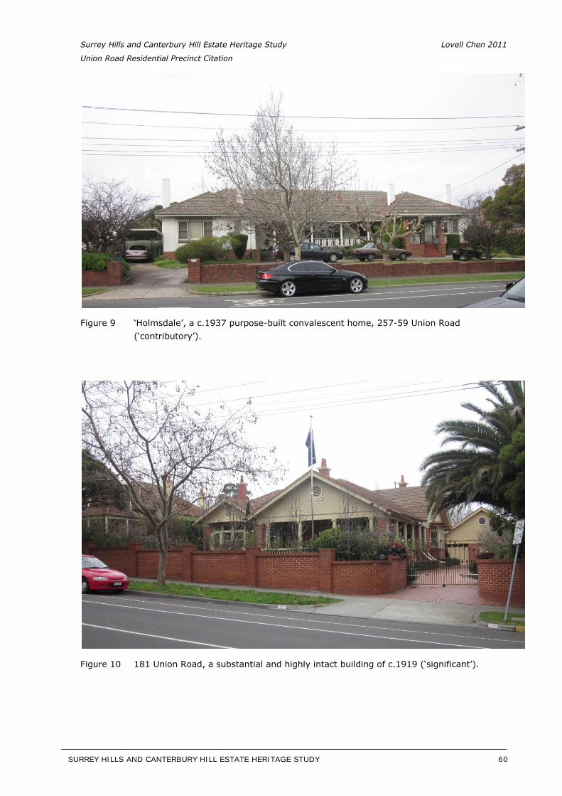
Surrey Hills and Canterbury Hill Estate Heritage Study Lovell Chen 2011
Union Road Residential Precinct Citation
Figure 9 ‘Holmsdale’, a c.1937 purpose-built convalescent home, 257-59 Union Road (‘contributory’).
Figure 10 181 Union Road, a substantial and highly intact building of c.1919 (‘significant’).
SURREY HILLS AND CANTERBURY HILL ESTATE HERITAGE STUDY 60
__________________________________________________________________________________________________________
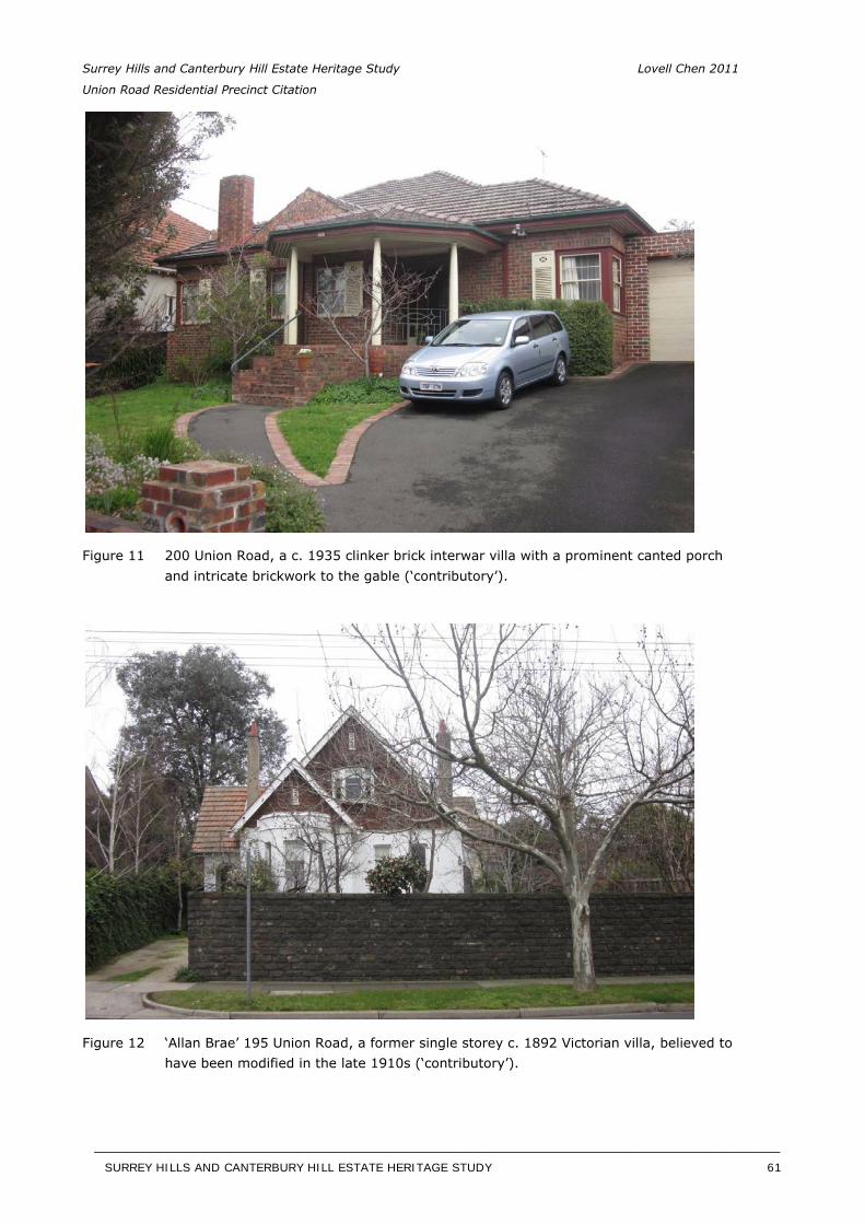
Surrey Hills and Canterbury Hill Estate Heritage Study Lovell Chen 2011
Union Road Residential Precinct Citation
Figure 11 200 Union Road, a c. 1935 clinker brick interwar villa with a prominent canted porch and intricate brickwork to the gable (‘contributory’).
Figure 12 ‘Allan Brae’ 195 Union Road, a former single storey c. 1892 Victorian villa, believed to have been modified in the late 1910s (‘contributory’).
SURREY HILLS AND CANTERBURY HILL ESTATE HERITAGE STUDY 61
__________________________________________________________________________________________________________
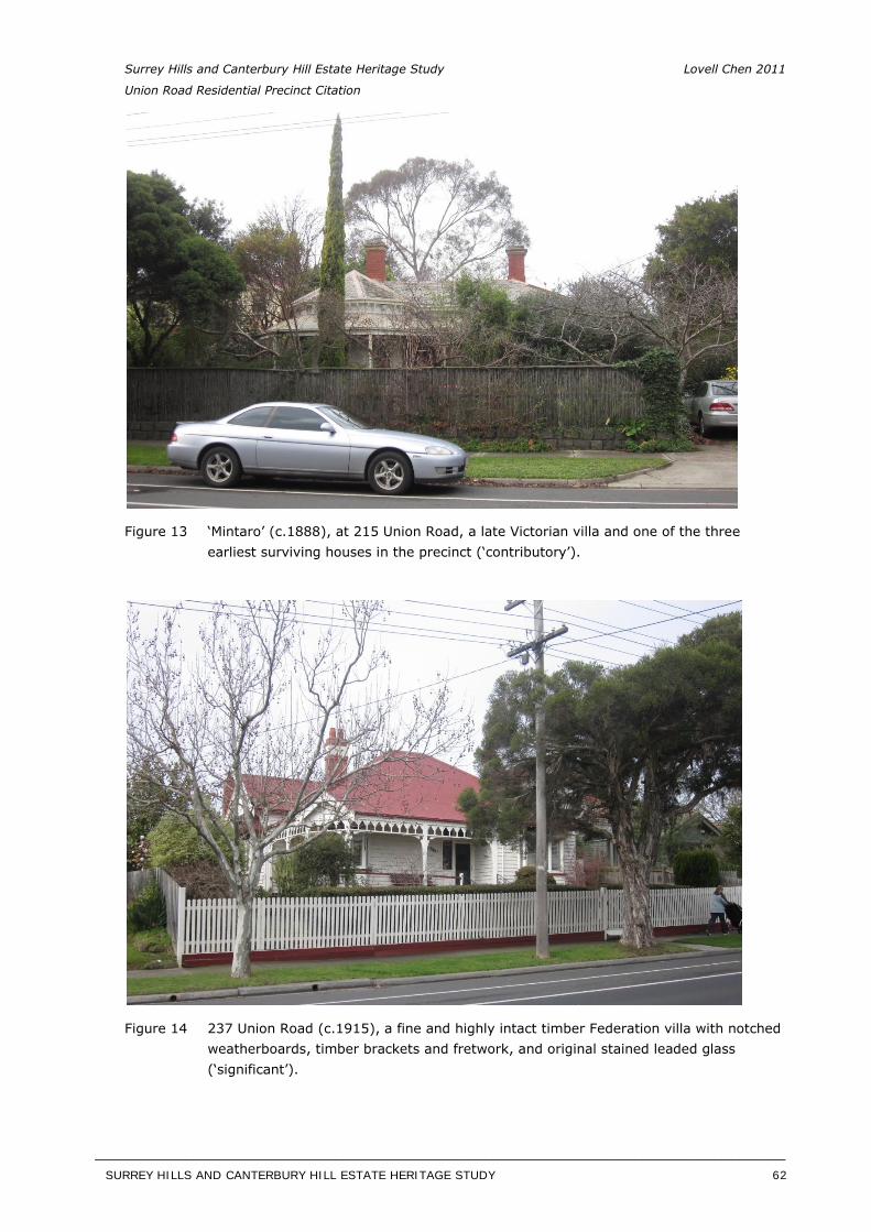
Surrey Hills and Canterbury Hill Estate Heritage Study Lovell Chen 2011
Union Road Residential Precinct Citation
Figure 13 ‘Mintaro’ (c.1888), at 215 Union Road, a late Victorian villa and one of the three earliest surviving houses in the precinct (‘contributory’).
Figure 14 237 Union Road (c.1915), a fine and highly intact timber Federation villa with notched weatherboards, timber brackets and fretwork, and original stained leaded glass (‘significant’).
SURREY HILLS AND CANTERBURY HILL ESTATE HERITAGE STUDY 62
__________________________________________________________________________________________________________
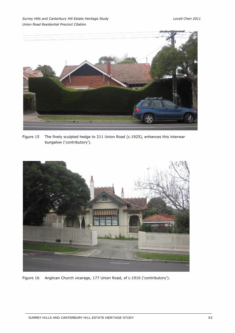
Surrey Hills and Canterbury Hill Estate Heritage Study Lovell Chen 2011
Union Road Residential Precinct Citation
Figure 15 The finely sculpted hedge to 211 Union Road (c.1925), enhances this interwar bungalow (‘contributory’).
Figure 16 Anglican Church vicarage, 177 Union Road, of c.1910 (‘contributory’).
SURREY HILLS AND CANTERBURY HILL ESTATE HERITAGE STUDY 63
__________________________________________________________________________________________________________
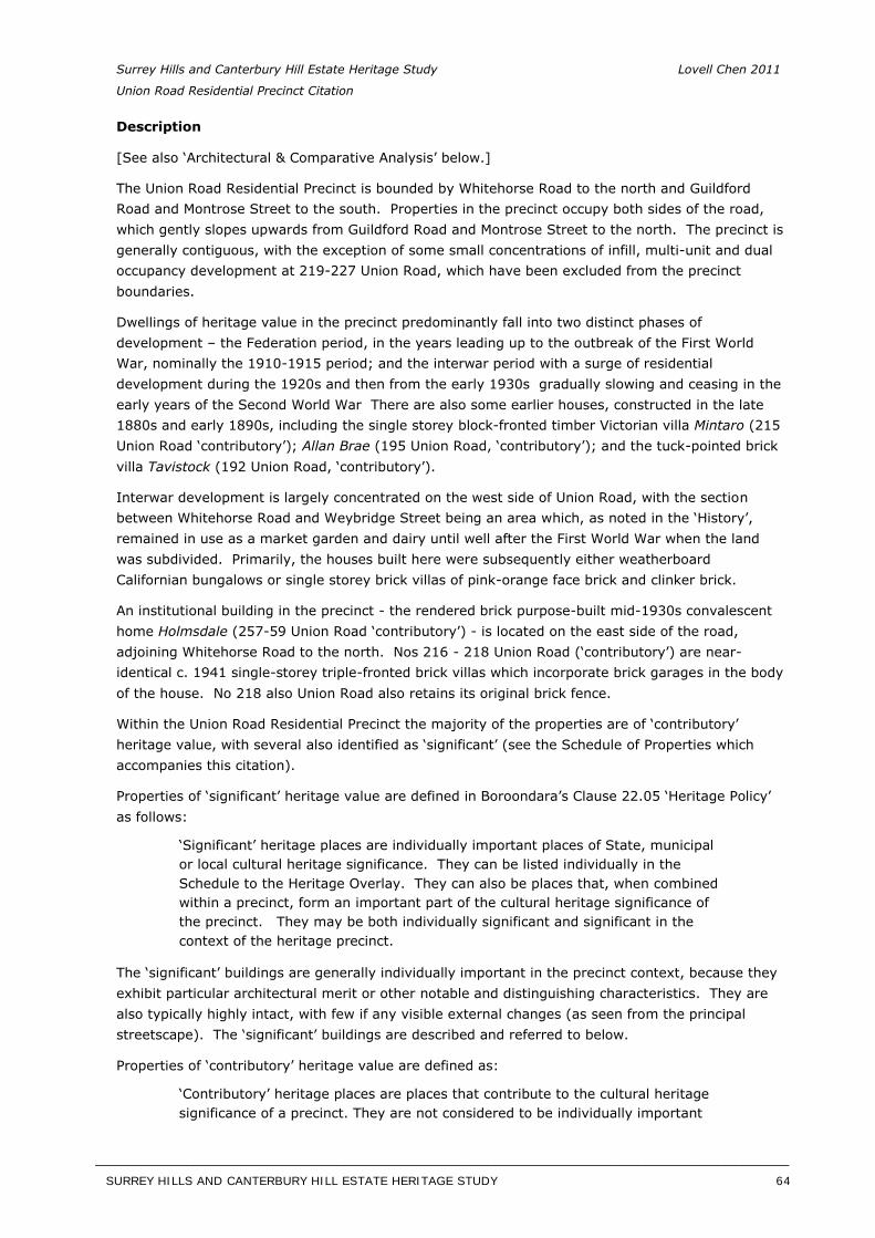
Surrey Hills and Canterbury Hill Estate Heritage Study Lovell Chen 2011
Union Road Residential Precinct Citation
Description
[See also ‘Architectural & Comparative Analysis’ below.]
The Union Road Residential Precinct is bounded by Whitehorse Road to the north and Guildford Road and Montrose Street to the south. Properties in the precinct occupy both sides of the road, which gently slopes upwards from Guildford Road and Montrose Street to the north. The precinct is generally contiguous, with the exception of some small concentrations of infill, multi-unit and dual occupancy development at 219-227 Union Road, which have been excluded from the precinct boundaries.
Dwellings of heritage value in the precinct predominantly fall into two distinct phases of development – the Federation period, in the years leading up to the outbreak of the First World War, nominally the 1910-1915 period; and the interwar period with a surge of residential development during the 1920s and then from the early 1930s gradually slowing and ceasing in the early years of the Second World War There are also some earlier houses, constructed in the late 1880s and early 1890s, including the single storey block-fronted timber Victorian villa Mintaro (215 Union Road ‘contributory’); Allan Brae (195 Union Road, ‘contributory’); and the tuck-pointed brick villa Tavistock (192 Union Road, ‘contributory’).
Interwar development is largely concentrated on the west side of Union Road, with the section between Whitehorse Road and Weybridge Street being an area which, as noted in the ‘History’, remained in use as a market garden and dairy until well after the First World War when the land was subdivided. Primarily, the houses built here were subsequently either weatherboard Californian bungalows or single storey brick villas of pink-orange face brick and clinker brick.
An institutional building in the precinct - the rendered brick purpose-built mid-1930s convalescent home Holmsdale (257-59 Union Road ‘contributory’) - is located on the east side of the road, adjoining Whitehorse Road to the north. Nos 216 - 218 Union Road (‘contributory’) are near-identical c. 1941 single-storey triple-fronted brick villas which incorporate brick garages in the body of the house. No 218 also Union Road also retains its original brick fence.
Within the Union Road Residential Precinct the majority of the properties are of ‘contributory’ heritage value, with several also identified as ‘significant’ (see the Schedule of Properties which accompanies this citation).
Properties of ‘significant’ heritage value are defined in Boroondara’s Clause 22.05 ‘Heritage Policy’ as follows:
‘Significant’ heritage places are individually important places of State, municipal or local cultural heritage significance. They can be listed individually in the Schedule to the Heritage Overlay. They can also be places that, when combined within a precinct, form an important part of the cultural heritage significance of the precinct. They may be both individually significant and significant in the context of the heritage precinct.
The ‘significant’ buildings are generally individually important in the precinct context, because they exhibit particular architectural merit or other notable and distinguishing characteristics. They are also typically highly intact, with few if any visible external changes (as seen from the principal streetscape). The ‘significant’ buildings are described and referred to below.
Properties of ‘contributory’ heritage value are defined as:
‘Contributory’ heritage places are places that contribute to the cultural heritage significance of a precinct. They are not considered to be individually important
SURREY HILLS AND CANTERBURY HILL ESTATE HERITAGE STUDY 64
__________________________________________________________________________________________________________
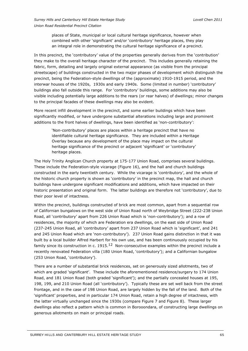
Surrey Hills and Canterbury Hill Estate Heritage Study Lovell Chen 2011
Union Road Residential Precinct Citation
places of State, municipal or local cultural heritage significance, however when combined with other ‘significant’ and/or ‘contributory’ heritage places, they play an integral role in demonstrating the cultural heritage significance of a precinct.
In this precinct, the ‘contributory’ value of the properties generally derives from the ‘contribution’ they make to the overall heritage character of the precinct. This includes generally retaining the fabric, form, detailing and largely original external appearance (as visible from the principal streetscape) of buildings constructed in the two major phases of development which distinguish the precinct, being the Federation-style dwellings of the (approximate) 1910-1915 period, and the interwar houses of the 1920s, 1930s and early 1940s. Some (limited in number) ‘contributory’ buildings also fall outside this range. For ‘contributory’ buildings, some additions may also be visible including potentially large additions to the rears (or rear halves) of dwellings; minor changes to the principal facades of these dwellings may also be evident.
More recent infill development in the precinct, and some earlier buildings which have been significantly modified, or have undergone substantial alterations including large and prominent additions to the front halves of dwellings, have been identified as ‘non-contributory’:
‘Non-contributory’ places are places within a heritage precinct that have no identifiable cultural heritage significance. They are included within a Heritage Overlay because any development of the place may impact on the cultural heritage significance of the precinct or adjacent ‘significant’ or ‘contributory’ heritage places.
The Holy Trinity Anglican Church property at 175-177 Union Road, comprises several buildings. These include the Federation-style vicarage (Figure 16), and the hall and church buildings constructed in the early twentieth century. While the vicarage is ‘contributory’, and the whole of the historic church property is shown as ‘contributory’ in the precinct map, the hall and church buildings have undergone significant modifications and additions, which have impacted on their historic presentation and original form. The latter buildings are therefore not ‘contributory’, due to their poor level of intactness.
Within the precinct, buildings constructed of brick are most common, apart from a sequential row of Californian bungalows on the west side of Union Road north of Weybridge Street (222-238 Union Road, all ‘contributory’ apart from 226 Union Road which is ‘non-contributory’); and a row of residences, the majority of which are Federation era dwellings, on the east side of Union Road (237-245 Union Road, all ‘contributory’ apart from 237 Union Road which is ‘significant’, and 241 and 245 Union Road which are ‘non-contributory’). 237 Union Road gains distinction in that it was built by a local builder Alfred Harbert for his own use, and has been continuously occupied by his family since its construction in c. 1915.12 Non-consecutive examples within the precinct include arecently renovated Federation villa (180 Union Road, ‘contributory’); and a Californian bungalow (253 Union Road, ‘contributory’).
There are a number of substantial brick residences, set on generously sized allotments, two of which are graded ‘significant’. These include the aforementioned residence/surgery to 174 Union Road, and 181 Union Road (both graded ‘significant’); and the partially concealed houses at 195, 198, 199, and 210 Union Road (all ‘contributory’). Typically these are set well back from the street frontage, and in the case of 198 Union Road, are largely hidden by the fall of the land. Both of the ‘significant’ properties, and in particular 174 Union Road, retain a high degree of intactness, with the latter virtually unchanged since the 1930s (compare Figure 7 and Figure 8). These larger dwellings also reflect a pattern which is common in Borooondara, of constructing large dwellings on generous allotments on main or principal roads.
SURREY HILLS AND CANTERBURY HILL ESTATE HERITAGE STUDY 65
__________________________________________________________________________________________________________
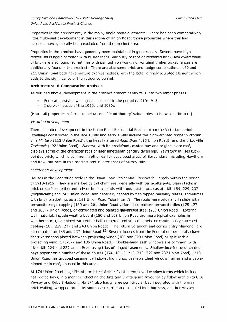
Surrey Hills and Canterbury Hill Estate Heritage Study Lovell Chen 2011
Union Road Residential Precinct Citation
Properties in the precinct are, in the main, single home allotments. There has been comparatively little multi-unit development in this section of Union Road; those properties where this has occurred have generally been excluded from the precinct area.
Properties in the precinct have generally been maintained in good repair. Several have high fences, as is again common with busier roads, variously of face or rendered brick; low dwarf walls of brick are also found, sometimes with painted iron work; non-original timber picket fences are additionally found in the precinct. There are also some brick and hedge combinations; 189 and 211 Union Road both have mature cypress hedges, with the latter a finely sculpted element which adds to the significance of the residence behind.
Architectural & Comparative Analysis
As outlined above, development in the precinct predominantly falls into two major phases:
Federation-style dwellings constructed in the period c.1910-1915 Interwar houses of the 1920s and 1930s
[Note: all properties referred to below are of ‘contributory’ value unless otherwise indicated.]
Victorian development
There is limited development in the Union Road Residential Precinct from the Victorian period. Dwellings constructed in the late 1880s and early 1890s include the block-fronted timber Victorian villa Mintaro (215 Union Road); the heavily altered Allan Brae (195 Union Road); and the brick villa Tavistock (192 Union Road). Mintaro, with its breakfront, canted bay and original slate roof, displays some of the characteristics of later nineteenth century dwellings. Tavistock utilises tuck-pointed brick, which is common in other earlier developed areas of Boroondara, including Hawthorn and Kew, but rare in this precinct and in later areas of Surrey Hills.
Federation development
Houses in the Federation style in the Union Road Residential Precinct fall largely within the period of 1910-1915. They are marked by tall chimneys, generally with terracotta pots, plain stacks in brick or surfaced either entirely or in neck bands with roughcast stucco as at 185, 189, 229, 237 (‘significant’) and 243 Union Road, and generally capped by flat-topped masonry plates, sometimes with brick bracketing, as at 181 Union Road (‘significant’). The roofs were originally in slate with terracotta ridge-capping (189 and 201 Union Road), Marseilles-pattern terracotta tiles (175-177 and 183-7 Union Road), or corrugated and painted galvanised steel (237 Union Road). External wall materials include weatherboard (180 and 198 Union Road are more typical examples in weatherboard), combined with either half-timbered and stucco panels, or continuously stuccoed gabling (189, 229, 237 and 243 Union Road). The return verandah and corner entry ‘diagonal’ are accentuated on 185 and 237 Union Road.13 Several houses from the Federation period also haveshort verandahs placed between projecting wings (189 and 229 Union Road) or split with a projecting wing (175-177 and 185 Union Road). Double-hung sash windows are common, with 181-185, 229 and 237 Union Road using trios of hinged casements. Shallow box-frame or canted bays appear on a number of these houses (174, 181-5, 210, 213, 229 and 237 Union Road). 210 Union Road has grouped casement windows, highlights, basket-arched window frames and a gable-hipped main roof, unusual in this area.
At 174 Union Road (‘significant’) architect Arthur Plaisted employed window forms which include flat-roofed bays, in a manner reflecting the Arts and Crafts genre favoured by fellow architects CFA Voysey and Robert Haddon. No 174 also has a large semicircular bay integrated with the main brick walling, wrapped round its south-east corner and bisected by a buttress, another Voysey
SURREY HILLS AND CANTERBURY HILL ESTATE HERITAGE STUDY 66
__________________________________________________________________________________________________________
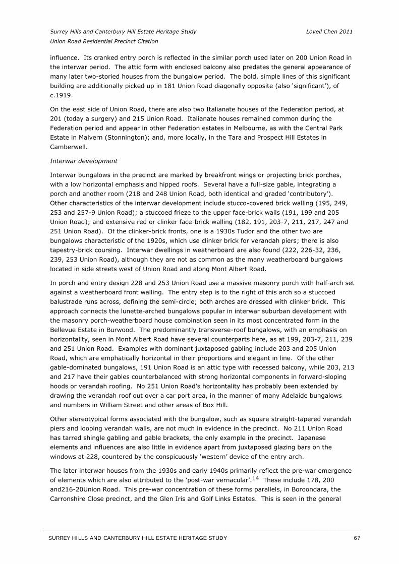
Surrey Hills and Canterbury Hill Estate Heritage Study Lovell Chen 2011
Union Road Residential Precinct Citation
influence. Its cranked entry porch is reflected in the similar porch used later on 200 Union Road in the interwar period. The attic form with enclosed balcony also predates the general appearance of many later two-storied houses from the bungalow period. The bold, simple lines of this significant building are additionally picked up in 181 Union Road diagonally opposite (also ‘significant’), of c.1919.
On the east side of Union Road, there are also two Italianate houses of the Federation period, at 201 (today a surgery) and 215 Union Road. Italianate houses remained common during the Federation period and appear in other Federation estates in Melbourne, as with the Central Park Estate in Malvern (Stonnington); and, more locally, in the Tara and Prospect Hill Estates in Camberwell.
Interwar development
Interwar bungalows in the precinct are marked by breakfront wings or projecting brick porches, with a low horizontal emphasis and hipped roofs. Several have a full-size gable, integrating a porch and another room (218 and 248 Union Road, both identical and graded ‘contributory’). Other characteristics of the interwar development include stucco-covered brick walling (195, 249, 253 and 257-9 Union Road); a stuccoed frieze to the upper face-brick walls (191, 199 and 205 Union Road); and extensive red or clinker face-brick walling (182, 191, 203-7, 211, 217, 247 and 251 Union Road). Of the clinker-brick fronts, one is a 1930s Tudor and the other two are bungalows characteristic of the 1920s, which use clinker brick for verandah piers; there is also tapestry-brick coursing. Interwar dwellings in weatherboard are also found (222, 226-32, 236, 239, 253 Union Road), although they are not as common as the many weatherboard bungalows located in side streets west of Union Road and along Mont Albert Road.
In porch and entry design 228 and 253 Union Road use a massive masonry porch with half-arch set against a weatherboard front walling. The entry step is to the right of this arch so a stuccoed balustrade runs across, defining the semi-circle; both arches are dressed with clinker brick. This approach connects the lunette-arched bungalows popular in interwar suburban development with the masonry porch-weatherboard house combination seen in its most concentrated form in the Bellevue Estate in Burwood. The predominantly transverse-roof bungalows, with an emphasis on horizontality, seen in Mont Albert Road have several counterparts here, as at 199, 203-7, 211, 239 and 251 Union Road. Examples with dominant juxtaposed gabling include 203 and 205 Union Road, which are emphatically horizontal in their proportions and elegant in line. Of the other gable-dominated bungalows, 191 Union Road is an attic type with recessed balcony, while 203, 213 and 217 have their gables counterbalanced with strong horizontal components in forward-sloping hoods or verandah roofing. No 251 Union Road’s horizontality has probably been extended by drawing the verandah roof out over a car port area, in the manner of many Adelaide bungalows and numbers in William Street and other areas of Box Hill.
Other stereotypical forms associated with the bungalow, such as square straight-tapered verandah piers and looping verandah walls, are not much in evidence in the precinct. No 211 Union Road has tarred shingle gabling and gable brackets, the only example in the precinct. Japanese elements and influences are also little in evidence apart from juxtaposed glazing bars on the windows at 228, countered by the conspicuously ‘western’ device of the entry arch.
The later interwar houses from the 1930s and early 1940s primarily reflect the pre-war emergence of elements which are also attributed to the ‘post-war vernacular’.14 These include 178, 200and216-20Union Road. This pre-war concentration of these forms parallels, in Boroondara, the Carronshire Close precinct, and the Glen Iris and Golf Links Estates. This is seen in the general
SURREY HILLS AND CANTERBURY HILL ESTATE HERITAGE STUDY 67
__________________________________________________________________________________________________________
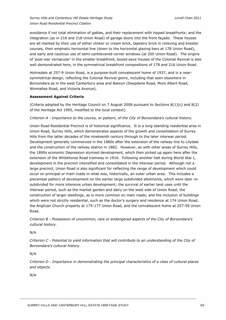
Surrey Hills and Canterbury Hill Estate Heritage Study Lovell Chen 2011
Union Road Residential Precinct Citation
avoidance if not total elimination of gables, and their replacement with hipped breakfronts; and the integration (as in 216 and 218 Union Road) of garage doors into the front façade. These houses are all marked by their use of either clinker or cream brick, tapestry brick in relieving and kneeler courses, their emphatic horizontal line (down to the horizontal glazing bars at 178 Union Road), and early and cautious use of semi-cantilevered corner windows (at 200 Union Road). The origins of ‘post-war vernacular’ in the smaller breakfront, boxed eave houses of the Colonial Revival is also well demonstrated here, in the symmetrical breakfront compositions of 178 and 216 Union Road.
Holmsdale at 257-9 Union Road, is a purpose-built convalescent home of 1937, and is a near-symmetrical design, reflecting the Colonial Revival genre, including that seen elsewhere in Boroondara as in the west Canterbury area and Balwyn (Deepdene Road, Mont Albert Road, Winmallee Road, and Victoria Avenue).
Assessment Against Criteria
(Criteria adopted by the Heritage Council on 7 August 2008 pursuant to Sections 8(1)(c) and 8(2) of the Heritage Act 1995, modified to the local context).
Criterion A - Importance to the course, or pattern, of the City of Boroondara’s cultural history.
Union Road Residential Precinct is of historical significance. It is a long-standing residential area in Union Road, Surrey Hills, which demonstrates aspects of the growth and consolidation of Surrey Hills from the latter decades of the nineteenth century through to the later interwar period. Development generally commenced in the 1880s after the extension of the railway line to Lilydale and the construction of the railway station in 1882. However, as with other areas of Surrey Hills, the 1890s economic Depression stymied development, which then picked up again here after the extension of the Whitehorse Road tramway in 1916. Following another halt during World War I, development in the precinct intensified and consolidated in the interwar period. Although not a large precinct, Union Road is also significant for reflecting the range of development which could occur on principal or main roads in what was, historically, an outer urban area. This includes a piecemeal pattern of development on the earlier large subdivided allotments, which were later re-subdivided for more intensive urban development; the survival of earlier land uses until the interwar period, such as the market garden and dairy on the west side of Union Road; the construction of larger dwellings, as is more common on main roads; and the inclusion of buildings which were not strictly residential, such as the doctor’s surgery and residence at 174 Union Road, the Anglican Church property at 175-177 Union Road, and the convalescent home at 257-59 Union Road.
Criterion B - Possession of uncommon, rare or endangered aspects of the City of Boroondara’s cultural history.
N/A
Criterion C - Potential to yield information that will contribute to an understanding of the City of Boroondara’s cultural history.
N/A
Criterion D - Importance in demonstrating the principal characteristics of a class of cultural places and objects.
N/A
SURREY HILLS AND CANTERBURY HILL ESTATE HERITAGE STUDY 68
________________________________________________________________________________________________________
Surrey Hills and Canterbury Hill Estate Heritage Study Lovell Chen 2011
Union Road Residential Precinct Citation
Criterion E - Importance in exhibiting particular aesthetic characteristics.
Union Road Residential Precinct is of aesthetic/architectural significance. The precinct, which predominantly comprises dwellings from the Federation period of (nominally) 1910-1915, and the interwar period of the 1920s, 1930s and early 1940s, has a comparatively high level of intactness in terms of its historical development. Typical, and valued, Federation characteristics of dwellings in the precinct include external wall materials of weatherboard with either half-timbered and stucco panels, or continuously stuccoed gabling; the return verandah and corner entry ‘diagonal’ form; tall chimneys; and some houses with short verandahs placed between projecting wings. Double-hung sash windows are common; there are also hinged casements, shallow box-frame and canted bay windows. Interwar development is largely concentrated on the west side of Union Road. Its principal, and valued, characteristics include bungalows marked by breakfront wings or projecting brick porches, with a low horizontal emphasis and hipped roofs. Several have a full-size gable, and porches integrated with rooms. Other characteristics include stucco-covered brick walling, a stuccoed frieze to the upper face-brick walls, and extensive red or clinker face-brick walling. Transverse-roof bungalows, with accentuated horizontal forms, are also found. Later interwar houses in the precinct generally avoid gables, replacing these with hipped breakfronts; the later dwellings are also marked by the use of clinker or cream brick, relieving tapestry brick, and again an emphatic horizontal emphasis.
Criterion F - Importance in demonstrating a high degree of creative or technical achievement at a particular period.
N/A
Criterion G - Strong or special association with a particular community or cultural group for social, cultural or spiritual reasons. This includes the significance of a place to Indigenous peoples as part of their continuing and developing cultural traditions.
N/A
Criterion H - Special association with the life or works of a person, or group of persons, of importance in City of Boroondara’s history.
N/A
Significant properties within the Union Road Residential Precinct
174 Union Road (c.1912)
174 Union Road is a significant as a substantial purpose-built residence and doctor’s surgery designed by noted and prolific interwar architect Arthur Plaisted. The dwelling employs a number of architectural design elements which derive from the Arts and Crafts movement. These include window forms which comprise flat-roofed bays and a large semicircular bay integrated with the main brick walling, wrapped round its south-east corner and bisected by a buttress (Figure 8). The attic form with enclosed balcony also predates the general appearance of many later two-storied houses from the bungalow period. The property is prominently sited at the corner of Union and Guildford roads and retains a very high level of intactness as comparison with an early photograph demonstrates (Figure 7).
The residence is also of historical significance for its continuous use as –for many years – a purpose-built doctor’s surgery and residence and more recently as a doctor’s surgery. This use is now of 100 years standing.
SURREY HILLS AND CANTERBURY HILL ESTATE HERITAGE STUDY 69
__________________________________________________________________________________________________________
Surrey Hills and Canterbury Hill Estate Heritage Study Lovell Chen 2011
Union Road Residential Precinct Citation
181 Union Road (c.1919)181 Union Road is significant as a large and handsomely proportioned brick residence dominated by a prominent roughcast rendered gabled return verandah. This is supported on Ionic columns, with a brick balustrade infilled with cement balusters, enclosed by gabled canted bay windows of differing forms, to the west and south (Figure 10). The gables are dominated by large circular roof vents, with moulded mounts featuring sinuous Art Nouveau-derived ornamentation. The combination of Federation forms and nascent bungalow elements adds to the significance of this distinctive and largely intact brick residence.
237 Union Road (c.1915)
237 Union Road is significant as a fine and highly intact timber Federation villa, which retains many of its original details including notched weatherboards, timber brackets and fretwork, and original stained leaded glass (Figure 14). Its asymmetrical planning and splayed corner bay with gable detail, is a distinctive and noteworthy characteristic of houses of this era. The house is also enhanced by its prominent chimneys.
Statement of Significance
What is Significant
Union Road Residential Precinct in Surrey Hills is bounded by Whitehorse Road to the north and Guildford Road and Montrose Street to the south. Properties in the precinct occupy both sides of the road, which gently slopes upwards from the south to the north. Dwellings of heritage value predominantly fall into two distinct phases of development, the Federation period of nominally 1910-1915; and the interwar period of the 1920s, 1930s and early 1940s. There are also some houses of the late 1880s and early 1890s, reflecting earlier subdivisions, including the stimulus provided by the railway’s arrival at Surrey Hills in 1882. Within the precinct, brick dwellings are most common, although weatherboard houses of the Federation and interwar periods are also found. There are also a number of substantial brick residences, on generous allotments, which reflect a common pattern (in Borooondara) of constructing large dwellings on main or principal roads. Both sides of Union Road were virtually fully developed by the advent of World War Two, with little subsequent development until the later twentieth century when infill dwellings replaced some of the earlier buildings.
The precinct comprises a high number of properties which have are graded ‘contributory’, with relatively few graded ‘significant’.
How is it Significant
Union Road Residential Precinct is of historical and aesthetic/architectural significance to the City of Boroondara.
Why is it Significant
Union Road Residential Precinct is of local historical significance, as a long-standing residential area concentrated in Union Road, which demonstrates aspects of the growth and consolidation of Surrey Hills from the latter decades of the nineteenth century through to the interwar period. Development generally commenced in the 1880s after the extension of the railway line to Lilydale and the construction of the railway station in 1882. However, as with other areas of Surrey Hills, development was stymied by the 1890s economic Depression, and then picked up again after the extension of the Whitehorse Road tramway in 1916. Following another halt during World War I, development intensified and consolidated in the interwar period. Although not a large precinct, Union Road is also significant for reflecting the range of development which could occur on principal or main roads in what was, historically, an outer urban area. This includes a piecemeal pattern of
SURREY HILLS AND CANTERBURY HILL ESTATE HERITAGE STUDY 70
__________________________________________________________________________________________________________
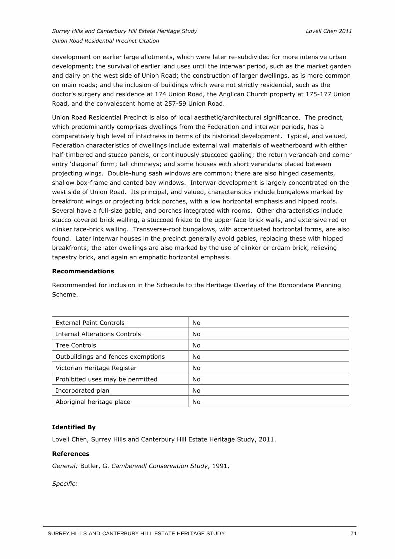
Surrey Hills and Canterbury Hill Estate Heritage Study Lovell Chen 2011
Union Road Residential Precinct Citation
development on earlier large allotments, which were later re-subdivided for more intensive urban development; the survival of earlier land uses until the interwar period, such as the market garden and dairy on the west side of Union Road; the construction of larger dwellings, as is more common on main roads; and the inclusion of buildings which were not strictly residential, such as the doctor’s surgery and residence at 174 Union Road, the Anglican Church property at 175-177 Union Road, and the convalescent home at 257-59 Union Road.
Union Road Residential Precinct is also of local aesthetic/architectural significance. The precinct, which predominantly comprises dwellings from the Federation and interwar periods, has a comparatively high level of intactness in terms of its historical development. Typical, and valued, Federation characteristics of dwellings include external wall materials of weatherboard with either half-timbered and stucco panels, or continuously stuccoed gabling; the return verandah and corner entry ‘diagonal’ form; tall chimneys; and some houses with short verandahs placed between projecting wings. Double-hung sash windows are common; there are also hinged casements, shallow box-frame and canted bay windows. Interwar development is largely concentrated on the west side of Union Road. Its principal, and valued, characteristics include bungalows marked by breakfront wings or projecting brick porches, with a low horizontal emphasis and hipped roofs. Several have a full-size gable, and porches integrated with rooms. Other characteristics include stucco-covered brick walling, a stuccoed frieze to the upper face-brick walls, and extensive red or clinker face-brick walling. Transverse-roof bungalows, with accentuated horizontal forms, are also found. Later interwar houses in the precinct generally avoid gables, replacing these with hipped breakfronts; the later dwellings are also marked by the use of clinker or cream brick, relieving tapestry brick, and again an emphatic horizontal emphasis.
Recommendations
Recommended for inclusion in the Schedule to the Heritage Overlay of the Boroondara Planning Scheme.
External Paint Controls No
Internal Alterations Controls No
Tree Controls No
Outbuildings and fences exemptions No
Victorian Heritage Register No
Prohibited uses may be permitted No
Incorporated plan No
Aboriginal heritage place No
Identified By
Lovell Chen, Surrey Hills and Canterbury Hill Estate Heritage Study, 2011.
References
General: Butler, G. Camberwell Conservation Study, 1991.
Specific:
SURREY HILLS AND CANTERBURY HILL ESTATE HERITAGE STUDY 71
__________________________________________________________________________________________________________
Surrey Hills and Canterbury Hill Estate Heritage Study Lovell Chen 2011
Union Road Residential Precinct Citation
1 Chris McConville and Associates, Camberwell Conservation Study: Volume Two: CamberwellEnvironment History, City of Camberwell, Camberwell, Vic, 1990, p. 17.
2 ‘Plan of Land at Surrey Hills’, State Library of Victoria.
3 The Argus, 22 October 1883, p. 6.
4 See Leo Harrigan, Victorian Railways to ’62, Victorian railways, Melbourne, 1962, p. 116.
5 Auction notices, various, State Library of Victoria.
6 Surrey Hills Neighbourhood Centre Heritage Collection, ‘Surrey Hills History Walkabout no. 5’.
7 Surrey Hills Neighbourhood Centre Heritage Collection, ‘Surrey Hills History Walkabout no. 5’.
8 Graeme Butler & Associates, Camberwell Conservation Study, 1991, vol. 2, p.60.
9 Surrey Hills Neighbourhood Centre Heritage Collection, ‘Surrey Hills History Walkabout no. 5’.
10 Surrey Hills Neighbourhood Centre Heritage Collection, ‘Surrey Hills History Walkabout no. 5’.
11 Surrey Hills Neighbourhood Centre Heritage Collection, ‘Surrey Hills History Walkabout no. 5’.
12 Information provided by the Surrey Hills Historical Society, July 2012.
13 For more on this aspect of Federation architecture see discussion in Richard Apperly and others, TheHistory and Design of the Australian House, Oxford, Melbourne, 1985, pp. 79-80, 83-85; Conrad Hamann, ‘The Inclusive Tradition in Victoria’s Architecture,’ in AGL Shaw (ed.); Victoria’s Heritage, Allen and Unwin, Sydney, 1985; and Part 3: 1900-1945, in Leon Paroissien (series editor) A History ofAustralian Architecture, text, tape and slides, Educational Media, Melbourne, 1985.
14 This is attributable to Robin Boyd, who saw its emergence in Melbourne suburbs as a builder-designers’ imitation of the Victorian type developed by trained architects, and represented in flat or shed-roofed buildings by Roy Grounds, Best Overend and others. See Robin Boyd, ‘Major steps in stylism’, VictorianModern: 111 Years of Modern Architecture in the State of Victoria, Australia, RVIA Architectural Students’ Society, Melbourne, 1947. In later years Boyd viewed the ‘post-war vernacular’ as antithetical to trained architects’ endeavours; see The Australian Ugliness (Cheshire, Melbourne) in 1960.
SURREY HILLS AND CANTERBURY HILL ESTATE HERITAGE STUDY 72
__________________________________________________________________________________________________________
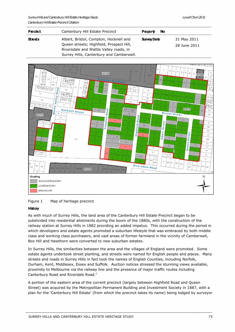
Surrey Hills and Canterbury Hill Estate Heritage Study Lovell Chen 2011Canterbury Hill Estate Precinct Citation
Precinct Canterbury Hill Estate Precinct Property No
Streets Albert, Bristol, Compton, Hocknell and Queen streets; Highfield, Prospect Hill, Riversdale and Wattle Valley roads, in Surrey Hills, Canterbury and Camberwell.
Survey Date 31 May 2011
28 June 2011
Figure 1 Map of heritage precinct
History
As with much of Surrey Hills, the land area of the Canterbury Hill Estate Precinct began to be subdivided into residential allotments during the boom of the 1880s, with the construction of the railway station at Surrey Hills in 1882 providing an added impetus. This occurred during the period in which developers and estate agents promoted a suburban lifestyle that was embraced by both middle class and working class purchasers, and vast areas of former farmland in the vicinity of Camberwell, Box Hill and Hawthorn were converted to new suburban estates.
In Surrey Hills, the similarities between the area and the villages of England were promoted. Some estate agents undertook street planting, and streets were named for English people and places. Many streets and roads in Surrey Hills in fact took the names of English Counties, including Norfolk, Durham, Kent, Middlesex, Essex and Suffolk. Auction notices stressed the stunning views available, proximity to Melbourne via the railway line and the presence of major traffic routes including Canterbury Road and Riverdale Road.1
A portion of the eastern area of the current precinct (largely between Highfield Road and Queen Street) was acquired by the Metropolitan Permanent Building and Investment Society in 1887, with a plan for the ‘Canterbury Hill Estate’ (from which the precinct takes its name) being lodged by surveyor
Riversdale Road
Co
mp
ton
Ro
adHocknell Street
Prospect Hill Road
Hig
hfi
eld
Ro
ad
Wa
ttle
Va
lle
y R
oa
d
Alb
ert
Str
ee
t
Bristol Street
Qu
ee
n S
tre
et
SURREY HILLS AND CANTERBURY HILL ESTATE HERITAGE STUDY 73
__________________________________________________________________________________________________________
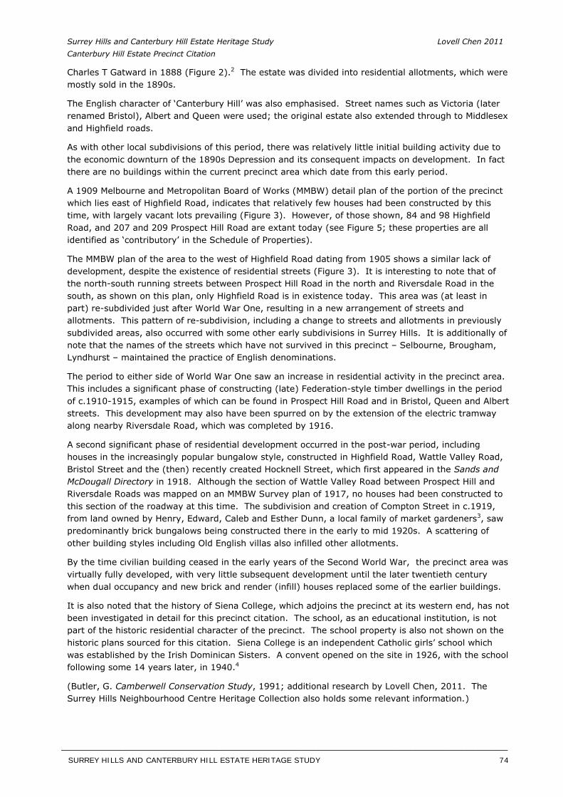
Surrey Hills and Canterbury Hill Estate Heritage Study Lovell Chen 2011 Canterbury Hill Estate Precinct Citation
Charles T Gatward in 1888 (Figure 2).2 The estate was divided into residential allotments, which were mostly sold in the 1890s.
The English character of ‘Canterbury Hill’ was also emphasised. Street names such as Victoria (later renamed Bristol), Albert and Queen were used; the original estate also extended through to Middlesex and Highfield roads.
As with other local subdivisions of this period, there was relatively little initial building activity due to the economic downturn of the 1890s Depression and its consequent impacts on development. In fact there are no buildings within the current precinct area which date from this early period.
A 1909 Melbourne and Metropolitan Board of Works (MMBW) detail plan of the portion of the precinct which lies east of Highfield Road, indicates that relatively few houses had been constructed by this time, with largely vacant lots prevailing (Figure 3). However, of those shown, 84 and 98 Highfield Road, and 207 and 209 Prospect Hill Road are extant today (see Figure 5; these properties are all identified as ‘contributory’ in the Schedule of Properties).
The MMBW plan of the area to the west of Highfield Road dating from 1905 shows a similar lack of development, despite the existence of residential streets (Figure 3). It is interesting to note that of the north-south running streets between Prospect Hill Road in the north and Riversdale Road in the south, as shown on this plan, only Highfield Road is in existence today. This area was (at least in part) re-subdivided just after World War One, resulting in a new arrangement of streets and allotments. This pattern of re-subdivision, including a change to streets and allotments in previously subdivided areas, also occurred with some other early subdivisions in Surrey Hills. It is additionally of note that the names of the streets which have not survived in this precinct – Selbourne, Brougham, Lyndhurst – maintained the practice of English denominations.
The period to either side of World War One saw an increase in residential activity in the precinct area. This includes a significant phase of constructing (late) Federation-style timber dwellings in the period of c.1910-1915, examples of which can be found in Prospect Hill Road and in Bristol, Queen and Albert streets. This development may also have been spurred on by the extension of the electric tramway along nearby Riversdale Road, which was completed by 1916.
A second significant phase of residential development occurred in the post-war period, including houses in the increasingly popular bungalow style, constructed in Highfield Road, Wattle Valley Road, Bristol Street and the (then) recently created Hocknell Street, which first appeared in the Sands andMcDougall Directory in 1918. Although the section of Wattle Valley Road between Prospect Hill and Riversdale Roads was mapped on an MMBW Survey plan of 1917, no houses had been constructed to this section of the roadway at this time. The subdivision and creation of Compton Street in c.1919, from land owned by Henry, Edward, Caleb and Esther Dunn, a local family of market gardeners3, saw predominantly brick bungalows being constructed there in the early to mid 1920s. A scattering of other building styles including Old English villas also infilled other allotments.
By the time civilian building ceased in the early years of the Second World War, the precinct area was virtually fully developed, with very little subsequent development until the later twentieth century when dual occupancy and new brick and render (infill) houses replaced some of the earlier buildings.
It is also noted that the history of Siena College, which adjoins the precinct at its western end, has not been investigated in detail for this precinct citation. The school, as an educational institution, is not part of the historic residential character of the precinct. The school property is also not shown on the historic plans sourced for this citation. Siena College is an independent Catholic girls’ school which was established by the Irish Dominican Sisters. A convent opened on the site in 1926, with the school following some 14 years later, in 1940.4
(Butler, G. Camberwell Conservation Study, 1991; additional research by Lovell Chen, 2011. The Surrey Hills Neighbourhood Centre Heritage Collection also holds some relevant information.)
SURREY HILLS AND CANTERBURY HILL ESTATE HERITAGE STUDY 74
__________________________________________________________________________________________________________
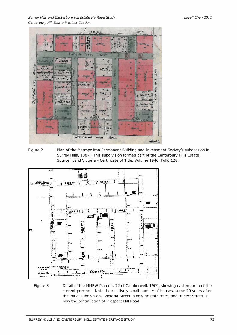
Surrey Hills and Canterbury Hill Estate Heritage Study Lovell Chen 2011 Canterbury Hill Estate Precinct Citation
Figure 2 Plan of the Metropolitan Permanent Building and Investment Society’s subdivision in Surrey Hills, 1887. This subdivision formed part of the Canterbury Hills Estate. Source: Land Victoria - Certificate of Title, Volume 1946, Folio 128.
Figure 3 Detail of the MMBW Plan no. 72 of Camberwell, 1909, showing eastern area of the current precinct. Note the relatively small number of houses, some 20 years after the initial subdivision. Victoria Street is now Bristol Street, and Rupert Street is now the continuation of Prospect Hill Road.
SURREY HILLS AND CANTERBURY HILL ESTATE HERITAGE STUDY 75
__________________________________________________________________________________________________________
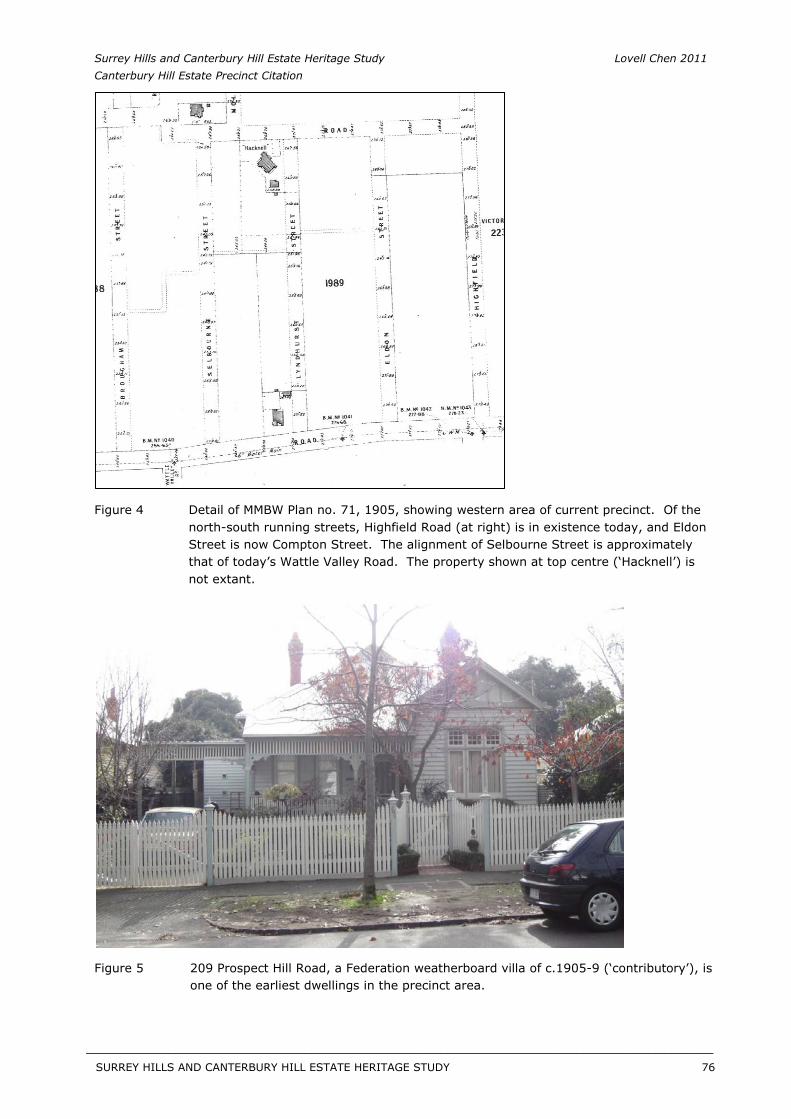
Surrey Hills and Canterbury Hill Estate Heritage Study Lovell Chen 2011 Canterbury Hill Estate Precinct Citation
Figure 4 Detail of MMBW Plan no. 71, 1905, showing western area of current precinct. Of the north-south running streets, Highfield Road (at right) is in existence today, and Eldon Street is now Compton Street. The alignment of Selbourne Street is approximately that of today’s Wattle Valley Road. The property shown at top centre (‘Hacknell’) is not extant.
Figure 5 209 Prospect Hill Road, a Federation weatherboard villa of c.1905-9 (‘contributory’), is one of the earliest dwellings in the precinct area.
SURREY HILLS AND CANTERBURY HILL ESTATE HERITAGE STUDY 76
__________________________________________________________________________________________________________
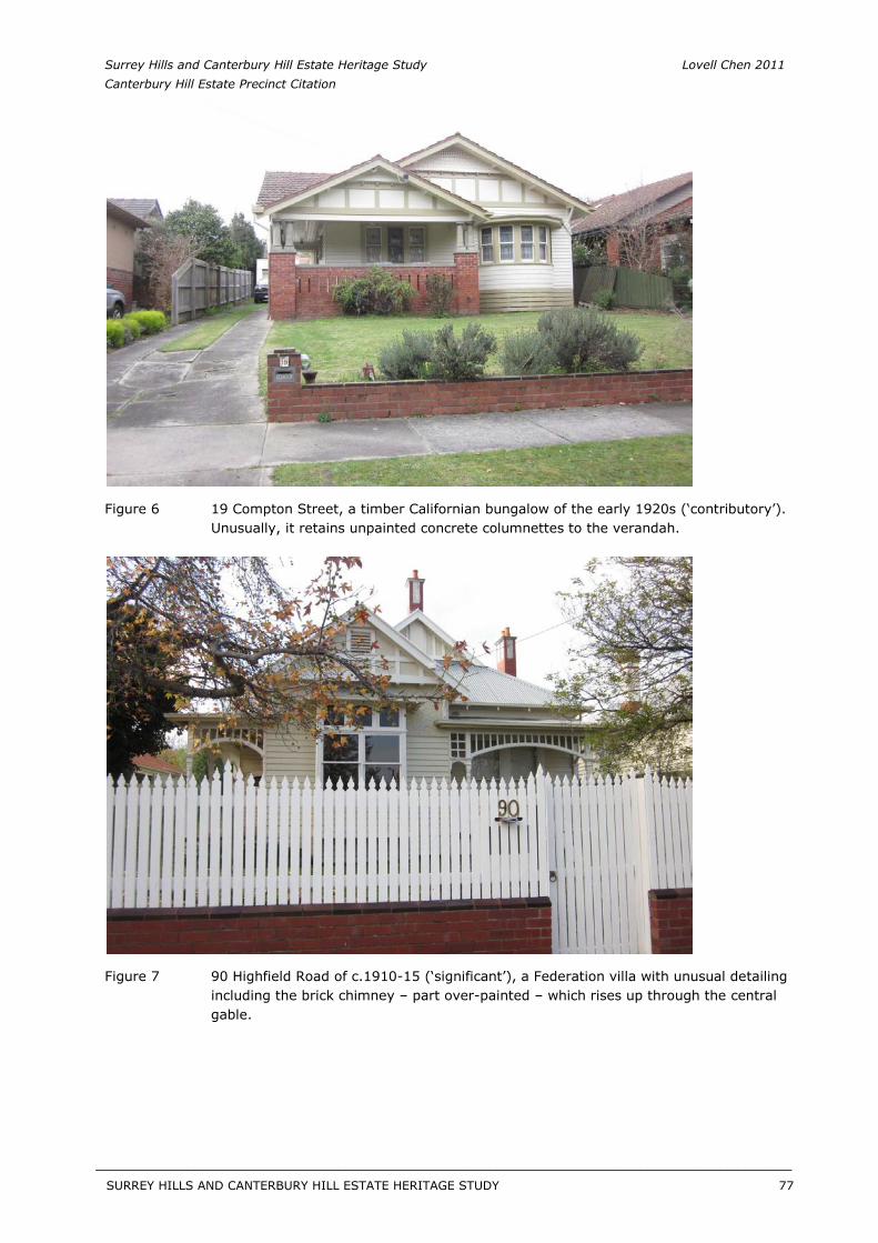
Surrey Hills and Canterbury Hill Estate Heritage Study Lovell Chen 2011 Canterbury Hill Estate Precinct Citation
Figure 6 19 Compton Street, a timber Californian bungalow of the early 1920s (‘contributory’). Unusually, it retains unpainted concrete columnettes to the verandah.
Figure 7 90 Highfield Road of c.1910-15 (‘significant’), a Federation villa with unusual detailing including the brick chimney – part over-painted – which rises up through the central gable.
SURREY HILLS AND CANTERBURY HILL ESTATE HERITAGE STUDY 77
__________________________________________________________________________________________________________
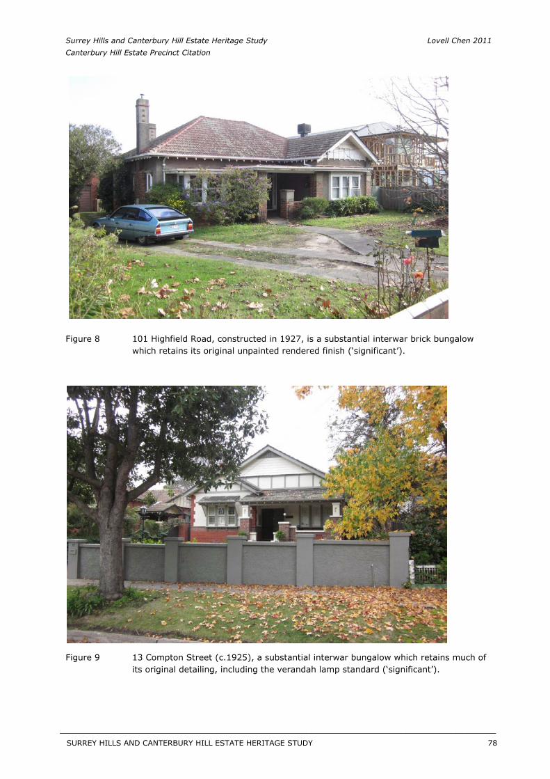
Surrey Hills and Canterbury Hill Estate Heritage Study Lovell Chen 2011 Canterbury Hill Estate Precinct Citation
Figure 8 101 Highfield Road, constructed in 1927, is a substantial interwar brick bungalow which retains its original unpainted rendered finish (‘significant’).
Figure 9 13 Compton Street (c.1925), a substantial interwar bungalow which retains much of its original detailing, including the verandah lamp standard (‘significant’).
SURREY HILLS AND CANTERBURY HILL ESTATE HERITAGE STUDY 78
__________________________________________________________________________________________________________
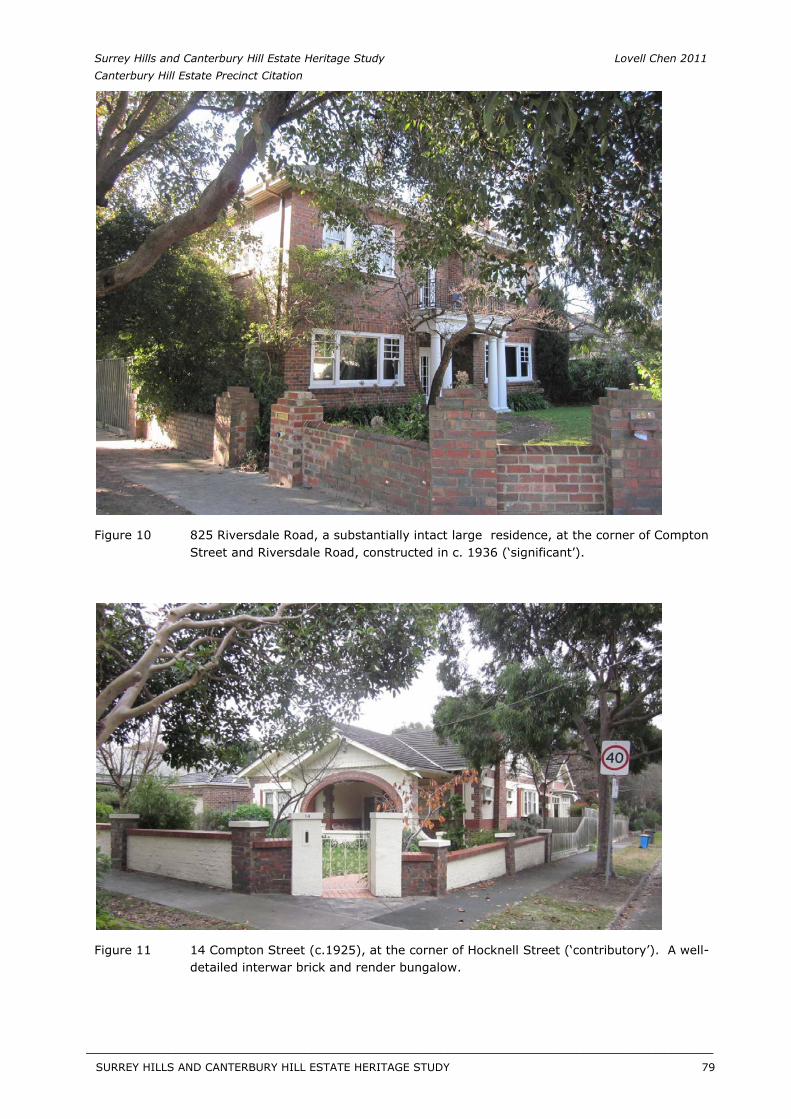
Surrey Hills and Canterbury Hill Estate Heritage Study Lovell Chen 2011 Canterbury Hill Estate Precinct Citation
Figure 10 825 Riversdale Road, a substantially intact large residence, at the corner of Compton Street and Riversdale Road, constructed in c. 1936 (‘significant’).
Figure 11 14 Compton Street (c.1925), at the corner of Hocknell Street (‘contributory’). A well-detailed interwar brick and render bungalow.
SURREY HILLS AND CANTERBURY HILL ESTATE HERITAGE STUDY 79
__________________________________________________________________________________________________________
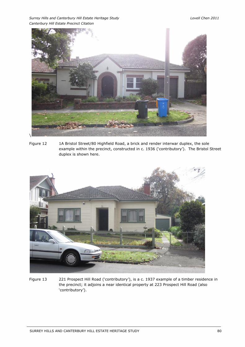
Surrey Hills and Canterbury Hill Estate Heritage Study Lovell Chen 2011 Canterbury Hill Estate Precinct Citation
\
Figure 12 1A Bristol Street/80 Highfield Road, a brick and render interwar duplex, the sole example within the precinct, constructed in c. 1936 (‘contributory’). The Bristol Street duplex is shown here.
Figure 13 221 Prospect Hill Road (‘contributory’), is a c. 1937 example of a timber residence in the precinct; it adjoins a near identical property at 223 Prospect Hill Road (also ‘contributory’).
SURREY HILLS AND CANTERBURY HILL ESTATE HERITAGE STUDY 80
__________________________________________________________________________________________________________
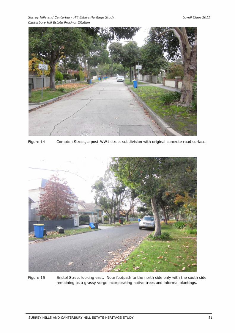
Surrey Hills and Canterbury Hill Estate Heritage Study Lovell Chen 2011 Canterbury Hill Estate Precinct Citation
Figure 14 Compton Street, a post-WW1 street subdivision with original concrete road surface.
Figure 15 Bristol Street looking east. Note footpath to the north side only with the south side remaining as a grassy verge incorporating native trees and informal plantings.
SURREY HILLS AND CANTERBURY HILL ESTATE HERITAGE STUDY 81
__________________________________________________________________________________________________________
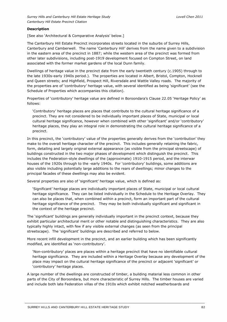
Surrey Hills and Canterbury Hill Estate Heritage Study Lovell Chen 2011 Canterbury Hill Estate Precinct Citation
Description
[See also ‘Architectural & Comparative Analysis’ below.]
The Canterbury Hill Estate Precinct incorporates streets located in the suburbs of Surrey Hills, Canterbury and Camberwell. The name ‘Canterbury Hill’ derives from the name given to a subdivision in the eastern area of the precinct in 1887; while the western area of the precinct was formed from other later subdivisions, including post-1919 development focused on Compton Street, on land associated with the former market gardens of the local Dunn family.
Dwellings of heritage value in the precinct date from the early twentieth century (c.1905) through to the late 1930s-early 1940s period.). The properties are located in Albert, Bristol, Compton, Hocknell and Queen streets; and Highfield, Prospect Hill, Riversdale and Wattle Valley roads. The majority of the properties are of ‘contributory’ heritage value, with several identified as being ‘significant’ (see the Schedule of Properties which accompanies this citation).
Properties of ‘contributory’ heritage value are defined in Boroondara’s Clause 22.05 ‘Heritage Policy’ as follows:
‘Contributory’ heritage places are places that contribute to the cultural heritage significance of a precinct. They are not considered to be individually important places of State, municipal or local cultural heritage significance, however when combined with other ‘significant’ and/or ‘contributory’ heritage places, they play an integral role in demonstrating the cultural heritage significance of a precinct.
In this precinct, the ‘contributory’ value of the properties generally derives from the ‘contribution’ they make to the overall heritage character of the precinct. This includes generally retaining the fabric, form, detailing and largely original external appearance (as visible from the principal streetscape) of buildings constructed in the two major phases of development which distinguish the precinct. This includes the Federation-style dwellings of the (approximate) 1910-1915 period, and the interwar houses of the 1920s through to the -early 1940s. For ‘contributory’ buildings, some additions are also visible including potentially large additions to the rears of dwellings; minor changes to the principal facades of these dwellings may also be evident.
Several properties are also of ‘significant’ heritage value, which is defined as:
‘Significant’ heritage places are individually important places of State, municipal or local cultural heritage significance. They can be listed individually in the Schedule to the Heritage Overlay. They can also be places that, when combined within a precinct, form an important part of the cultural heritage significance of the precinct. They may be both individually significant and significant in the context of the heritage precinct.
The ‘significant’ buildings are generally individually important in the precinct context, because they exhibit particular architectural merit or other notable and distinguishing characteristics. They are also typically highly intact, with few if any visible external changes (as seen from the principal streetscape). The ‘significant’ buildings are described and referred to below.
More recent infill development in the precinct, and an earlier building which has been significantly modified, are identified as ‘non-contributory’.
‘Non-contributory’ places are places within a heritage precinct that have no identifiable cultural heritage significance. They are included within a Heritage Overlay because any development of the place may impact on the cultural heritage significance of the precinct or adjacent ‘significant’ or ‘contributory’ heritage places.
A large number of the dwellings are constructed of timber, a building material less common in other parts of the City of Boroondara, but more characteristic of Surrey Hills. The timber houses are varied and include both late Federation villas of the 1910s which exhibit notched weatherboards and
SURREY HILLS AND CANTERBURY HILL ESTATE HERITAGE STUDY 82
__________________________________________________________________________________________________________
Surrey Hills and Canterbury Hill Estate Heritage Study Lovell Chen 2011 Canterbury Hill Estate Precinct Citation
roughcast rendering, as well as timber Californian bungalows of the 1920s and later (see Figure 5 & Figure 6).
There are also significant numbers of brick dwellings, albeit only a small number of these are late Federation villas; 204 Prospect Hill Road is an isolated example in its immediate context. The majority of these buildings are brick and rendered Californian bungalows, of the later 1920s and early 1930s, as well as some Old English style clinker brick and render villas (20 Compton Street), and dwellings displaying Mediterranean influences (93 and 95 Highfield Road).
A notable example of this phase of precinct development includes 101 Highfield Road, a large clinker brick and render bungalow of c.1927 which retains its unpainted roughcast render finishes (and is a ‘significant’ building). Nos 95 Highfield Road and 20 Compton Street (‘contributory’ buildings) also both exhibit specialty clinker brickwork (Figure 8). The brick and render c. 1936 interwar duplexes at 80 Highfield Road and 1A Bristol Street (Figure 12, ‘contributory’) are atypical building types in the precinct area.
Riversdale Road, between Compton Street and Highfield Road, has a run of six brick dwellings spanning the mid 1930s-early 1940s period, one of which (825 Riversdale Road, see Figure 10) is ‘significant’. This row displays a diversity of influences, including Old English and neo-Georgian (as per 825 Riversdale Road); no 831 Riversdale Road, c. 1940 has a ‘waterfall’ frontage. The majority of the dwellings in this row also retain their original fences, save for 831 Riversdale Road.
Generally the brick housing types relate to the later period of precinct development when the then Council, in the late 1920s, passed by-laws restricting but not completely eradicating the construction of dwellings in timber.5 Despite this, 221 and 223 Prospect Hill Road (both ‘contributory’) were constructed in the late 1930s of this material (Figure 13).6
A number of dwellings are located on Wattle Valley Road, in the western area of the precinct, and not contiguous with the precinct. These are nevertheless ‘contributory’ dwellings from the 1920s which share the heritage characteristics of the precinct.
By the advent of World War Two, as noted in the ‘History’ section, the precinct was almost completely developed; the afore-mentioned timber houses in Prospect Hill Road and the neighbouring c. 1941 brick residence at 225 Prospect Hill Road (also ‘contributory’) appearing to being among the last properties developed, before wartime restrictions bought civilian building construction to halt in the early 1940s.
Other characteristics of the precinct include the siting of houses on reasonably generous allotments, particularly those in the streets which run north-south. Setbacks to the street boundaries are also typically generous, with gardens, lawns and landscaped settings being common. Houses are also generally well-maintained, and while most dwellings were originally single-storey in scale, a number have been extended in the past several decades including with first floor additions as well as extensions to the rears and (in some cases) sides of properties.
Surrey Hills generally has a high proportion of modified and extended dwellings, many of which were originally modest timber houses constructed in the first decades of the twentieth century. With the suburb attracting more affluent residents in the latter twentieth century, a pattern of house renovation and extension emerged, often resulting in smaller dwellings significantly increasing in size, including through construction of large double-storey additions. This pattern is evident in the precinct.
In assessing the acceptability of visible additions and extensions to historic dwellings in the precinct – or the extent to which an addition detracts from the contributory value of the property - a number of factors were considered. These included the form, materials and detailing of the addition, and whether it was sympathetic to the dwelling; the visibility of the addition, and whether it was seen as sufficiently recessive to the original dwelling, or proportionally too dominating or overwhelming; the degree to which the addition can be
SURREY HILLS AND CANTERBURY HILL ESTATE HERITAGE STUDY 83
__________________________________________________________________________________________________________
Surrey Hills and Canterbury Hill Estate Heritage Study Lovell Chen 2011 Canterbury Hill Estate Precinct Citation
discerned as a later and non-original element; and the extent to which the original visible roof form has been altered.
Throughout the precinct the terrain is gently undulating, with streets of asphalt, with the exception of the original concrete road surface to Compton Street (Figure 14). Streets are generally planted with deciduous trees with species favoured including Pin oaks and London planes, although native Queensland Box and eucalypts are also evident. Footpaths are of concrete with the exception of the south side of Bristol Street, which is bordered by a grassed verge. Fences are variously of low to high form, of reproduction historical-style timber pickets, with solid masonry, cyclone wire, and steel fences with brick piers also found. There are some original brick and render ‘dwarf’ fences. No. 82 Highfield Road (‘contributory’) is almost completely concealed by a tall cypress hedge.
Some more recent infill development has occurred including cluster units and dual occupancy development from the 1980s and 1990s, generally set behind one another, although in some cases such as 85 and 85A Wattle Valley Road (‘non-contributory’) these have appeared side by side, testament to the wide allotments in some streets in the precinct. Modern infill housing, ranging from single to three storey residences, has also been constructed and generally adopts an historicist style rather than a more contemporary idiom. Overwhelmingly these are constructed of brick with some exhibiting rendered finishes.
Architectural & Comparative Analysis
As outlined above, development in the precinct predominantly falls into two major phases:
Federation-style dwellings constructed in the period c.1910-1915 Interwar houses of the 1920s, 1930s and early 1940s
[Note: all properties referred to below are of ‘contributory’ value unless otherwise indicated.]
Federation Houses
The Federation houses of the precinct are largely located in Prospect Hill Road, Bristol, Queen and Albert streets, and are mostly of timber construction. They typically have a diagonal composition, which in simple terms means a principal front elevation (to the street) and a visible side elevation which shares the detail of the front. The buildings have an L-shaped mass or plan, with a single or return verandah, bays (including gabled bays) to the front and side elevation (usually connected by the verandah), and a diagonal or curved corner bay. They were also intended to be ‘read’ diagonally, being a reaction against the facade-dominated houses of the earlier Victorian period.
Federation architects and builders in Australia were influenced by the Arts and Crafts Movement, aiming broadly at generating a recognisably regional or national style.7 Though often called Queen Anne, Federation houses in fact bear little resemblance to the original London houses of Queen Anne’s period, and are connected with the Queen Anne Revival of architect Norman Shaw and his London contemporaries in their detail rather than their broader massing and composition. The half-timbered projecting gabled wings or bays were a reflection of Queen Anne, with the tall 1: 3 patterned casement windows (i.e. one large window opening with a tripartite window arrangement) more indebted to Norman Shaw’s earlier Free Style work rather than his Queen Anne designs.8 The timber fretwork on the verandah posts and friezes was a reaction against the cast iron lace of earlier decades, while the wide use of segmental and round arches was an extension of their use on institutional buildings. In fact, institutional and domestic buildings were thought to share a common form in the Federation period, unlike the later interwar period where houses and institutional buildings were mostly thought of as separate realms requiring completely distinct architecture.9
The precinct includes a range of well-designed and executed dwellings which demonstrate key Federation ideas in house design and detailing including the aforementioned diagonal planning; gabled and pitched roof forms; projecting wings/bays with half-timbered gables; timber-posted verandahs including return verandahs with timber friezes and fretwork; tall brick chimney stacks and 1: 3 casement windows. These include 2, 4 and 6 Albert Street; 3 and 7 Bristol Street; 198, 201, 204,
SURREY HILLS AND CANTERBURY HILL ESTATE HERITAGE STUDY 84
__________________________________________________________________________________________________________
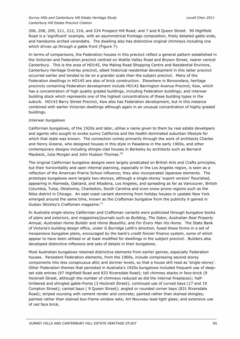
Surrey Hills and Canterbury Hill Estate Heritage Study Lovell Chen 2011 Canterbury Hill Estate Precinct Citation
206, 208, 209, 211, 212, 216, and 224 Prospect Hill Road; and 7 and 8 Queen Street. 90 Highfield Road is a ‘significant’ example, with an asymmetrical frontage composition, finely detailed gable ends, and handsome arched verandahs. The dwelling also has distinctive original chimneys including one which drives up through a gable front (Figure 7).
In terms of comparisons, the Federation houses in this precinct reflect a general pattern established in the Victorian and Federation precinct centred on Wattle Valley Road and Bryson Street, nearer central Canterbury. This is the area of HO145, the Maling Road Shopping Centre and Residential Environs, Canterbury Heritage Overlay precinct, albeit historical residential development in this latter precinct occurred earlier and tended to be on a grander scale than the subject precinct. Many of the Federation dwellings in HO145 are also of brick construction. Elsewhere in Boroondara, heritage precincts containing Federation development include HO142 Barrington Avenue Precinct, Kew, which has a concentration of high quality graded buildings, including Federation buildings; and interwar building stock which represents one of the highest concentrations of these building types in the suburb. HO143 Barry Street Precinct, Kew also has Federation development, but in this instance combined with earlier Victorian dwellings although again in an unusual concentration of highly graded buildings.
Interwar bungalows
Californian bungalows, of the 1920s and later, utilise a name given to them by real estate developers and agents who sought to evoke sunny California and the health-dominated suburban lifestyle for which that state was known. The connection comes primarily through the work of architects Charles and Henry Greene, who designed houses in this style in Pasadena in the early 1900s, and other contemporary designs including shingle-clad houses in Berkeley by architects such as Bernard Maybeck, Julia Morgan and John Hudson Thomas.10
The original Californian bungalow designs were largely predicated on British Arts and Crafts principles, but their horizontality and open internal planning, especially in the Los Angeles region, is seen as a reflection of the American Prairie School influence; they also incorporated Japanese elements. The prototype bungalows were largely two-storeys, although a single-storey ‘export version’ flourished, appearing in Alameda, Oakland, and Altadena, Los Angeles, and spreading as far as Vancouver, British Columbia, Tulsa, Oklahoma, Charleston, South Carolina and even snow-prone regions such as the Niles district in Chicago. An east coast variant stemming from holiday houses in upstate New York emerged around the same time, known as the Craftsman bungalow from the publicity it gained in Gustav Stickley’s Craftsman magazine.11
In Australia single-storey Californian and Craftsman variants were publicised through bungalow books of plans and exteriors, and magazines/journals such as Building, The Salon, Australian Real PropertyAnnual, Australian Home Builder and Home Beautiful, and For Every Man His Home. The State Bank of Victoria’s building design office, under G Burridge Leith’s direction, fused these forms in a set of inexpensive bungalow plans, encouraged by the bank’s credit foncier finance system, some of which appear to have been utilised or at least modified for dwellings in the subject precinct. Builders also developed distinctive inflexions and sets of details in their bungalows.
Most Australian bungalows retained distinctive elements from earlier genres, especially Federation houses. Persistent Federation elements, from the 1900s, include compressing second storey components into less conspicuous attic and dormer levels, so that a house still read as ‘single-storey’. Other Federation themes that persisted in Australia’s 1920s bungalows included frequent use of deep-set side entries (97 Highfield Road and 833 Riversdale Road); tall chimney stacks in face-brick (9 Hocknell Street, although the number of chimneys reduced as did the internal fireplaces); half-timbered and shingled gable-fronts (3 Hocknell Street); continued use of curved bays (17 and 19 Compton Street); canted bays ( 9 Queen Street); angled or rounded corner bays (831 Riversdale Road); striped coursing with cement render and concrete; painted rather than stained shingles; painted rather than stained box-frame window sets; Art Nouveau lead-light glass; and extensive use of red face brick.
SURREY HILLS AND CANTERBURY HILL ESTATE HERITAGE STUDY 85
__________________________________________________________________________________________________________
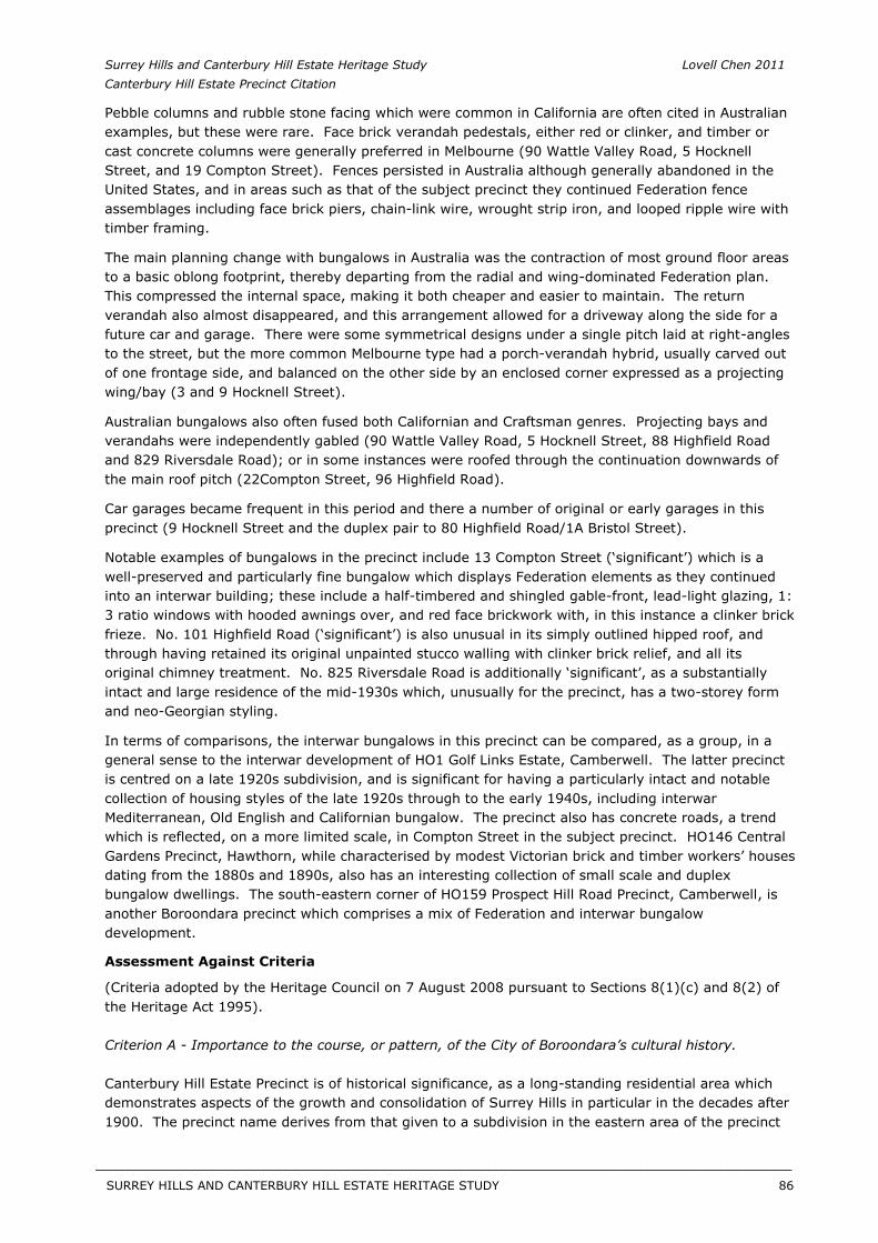
Surrey Hills and Canterbury Hill Estate Heritage Study Lovell Chen 2011 Canterbury Hill Estate Precinct Citation
Pebble columns and rubble stone facing which were common in California are often cited in Australian examples, but these were rare. Face brick verandah pedestals, either red or clinker, and timber or cast concrete columns were generally preferred in Melbourne (90 Wattle Valley Road, 5 Hocknell Street, and 19 Compton Street). Fences persisted in Australia although generally abandoned in the United States, and in areas such as that of the subject precinct they continued Federation fence assemblages including face brick piers, chain-link wire, wrought strip iron, and looped ripple wire with timber framing.
The main planning change with bungalows in Australia was the contraction of most ground floor areas to a basic oblong footprint, thereby departing from the radial and wing-dominated Federation plan. This compressed the internal space, making it both cheaper and easier to maintain. The return verandah also almost disappeared, and this arrangement allowed for a driveway along the side for a future car and garage. There were some symmetrical designs under a single pitch laid at right-angles to the street, but the more common Melbourne type had a porch-verandah hybrid, usually carved out of one frontage side, and balanced on the other side by an enclosed corner expressed as a projecting wing/bay (3 and 9 Hocknell Street).
Australian bungalows also often fused both Californian and Craftsman genres. Projecting bays and verandahs were independently gabled (90 Wattle Valley Road, 5 Hocknell Street, 88 Highfield Road and 829 Riversdale Road); or in some instances were roofed through the continuation downwards of the main roof pitch (22Compton Street, 96 Highfield Road).
Car garages became frequent in this period and there a number of original or early garages in this precinct (9 Hocknell Street and the duplex pair to 80 Highfield Road/1A Bristol Street).
Notable examples of bungalows in the precinct include 13 Compton Street (‘significant’) which is a well-preserved and particularly fine bungalow which displays Federation elements as they continued into an interwar building; these include a half-timbered and shingled gable-front, lead-light glazing, 1: 3 ratio windows with hooded awnings over, and red face brickwork with, in this instance a clinker brick frieze. No. 101 Highfield Road (‘significant’) is also unusual in its simply outlined hipped roof, and through having retained its original unpainted stucco walling with clinker brick relief, and all its original chimney treatment. No. 825 Riversdale Road is additionally ‘significant’, as a substantially intact and large residence of the mid-1930s which, unusually for the precinct, has a two-storey form and neo-Georgian styling.
In terms of comparisons, the interwar bungalows in this precinct can be compared, as a group, in a general sense to the interwar development of HO1 Golf Links Estate, Camberwell. The latter precinct is centred on a late 1920s subdivision, and is significant for having a particularly intact and notable collection of housing styles of the late 1920s through to the early 1940s, including interwar Mediterranean, Old English and Californian bungalow. The precinct also has concrete roads, a trend which is reflected, on a more limited scale, in Compton Street in the subject precinct. HO146 Central Gardens Precinct, Hawthorn, while characterised by modest Victorian brick and timber workers’ houses dating from the 1880s and 1890s, also has an interesting collection of small scale and duplex bungalow dwellings. The south-eastern corner of HO159 Prospect Hill Road Precinct, Camberwell, is another Boroondara precinct which comprises a mix of Federation and interwar bungalow development.
Assessment Against Criteria
(Criteria adopted by the Heritage Council on 7 August 2008 pursuant to Sections 8(1)(c) and 8(2) of the Heritage Act 1995).
Criterion A - Importance to the course, or pattern, of the City of Boroondara’s cultural history.
Canterbury Hill Estate Precinct is of historical significance, as a long-standing residential area which demonstrates aspects of the growth and consolidation of Surrey Hills in particular in the decades after 1900. The precinct name derives from that given to a subdivision in the eastern area of the precinct
SURREY HILLS AND CANTERBURY HILL ESTATE HERITAGE STUDY 86
__________________________________________________________________________________________________________
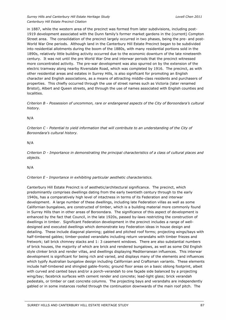
Surrey Hills and Canterbury Hill Estate Heritage Study Lovell Chen 2011 Canterbury Hill Estate Precinct Citation
in 1887, while the western area of the precinct was formed from later subdivisions, including post-1919 development associated with the Dunn family’s former market gardens in the (current) Compton Street area. The consolidation of the precinct largely occurred in two phases, being the pre- and post-World War One periods. Although land in the Canterbury Hill Estate Precinct began to be subdivided into residential allotments during the boom of the 1880s, with many residential portions sold in the 1890s, relatively little building activity occurred due to the economic downturn of the late nineteenth century. It was not until the pre World War One and interwar periods that the precinct witnessed more concentrated activity. The pre-war development was also spurred on by the extension of the electric tramway along nearby Riversdale Road, which was completed by 1916. The precinct, as with other residential areas and estates in Surrey Hills, is also significant for promoting an English character and English associations, as a means of attracting middle-class residents and purchasers of properties. This chiefly occurred through the use of street names such as Victoria (later renamed Bristol), Albert and Queen streets, and through the use of names associated with English counties and localities.
Criterion B - Possession of uncommon, rare or endangered aspects of the City of Boroondara’s cultural history.
N/A
Criterion C - Potential to yield information that will contribute to an understanding of the City of Boroondara’s cultural history.
N/A
Criterion D - Importance in demonstrating the principal characteristics of a class of cultural places and objects.
N/A
Criterion E - Importance in exhibiting particular aesthetic characteristics.
Canterbury Hill Estate Precinct is of aesthetic/architectural significance. The precinct, which predominantly comprises dwellings dating from the early twentieth century through to the early 1940s, has a comparatively high level of intactness in terms of its Federation and interwar development. A large number of these dwellings, including late Federation villas as well as some Californian bungalows, are constructed of timber, which is a building material more commonly found in Surrey Hills than in other areas of Boroondara. The significance of this aspect of development is enhanced by the fact that Council, in the late 1920s, passed by-laws restricting the construction of dwellings in timber. Significant Federation development in the precinct includes a range of well-designed and executed dwellings which demonstrate key Federation ideas in house design and detailing. These include diagonal planning; gabled and pitched roof forms; projecting wings/bays with half-timbered gables; timber-posted verandahs including return verandahs with timber friezes and fretwork; tall brick chimney stacks and 1: 3 casement windows. There are also substantial numbers of brick houses, the majority of which are brick and rendered bungalows, as well as some Old English style clinker brick and render villas, and dwellings displaying Mediterranean influences. This interwar development is significant for being rich and varied, and displays many of the elements and influences which typify Australian bungalow design including Californian and Craftsman variants. These elements include half-timbered and shingled gable-fronts; ground floor areas on a basic oblong footprint, albeit with curved and canted bays and/or a porch-verandah to one façade side balanced by a projecting wing/bay; facebrick surfaces with cement render and concrete; lead-light glass; brick verandah pedestals, or timber or cast concrete columns. The projecting bays and verandahs are independently gabled or in some instances roofed through the continuation downwards of the main roof pitch. The
SURREY HILLS AND CANTERBURY HILL ESTATE HERITAGE STUDY 87
__________________________________________________________________________________________________________
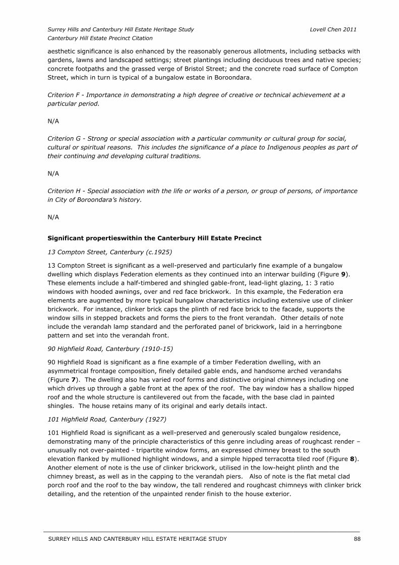
Surrey Hills and Canterbury Hill Estate Heritage Study Lovell Chen 2011 Canterbury Hill Estate Precinct Citation
aesthetic significance is also enhanced by the reasonably generous allotments, including setbacks with gardens, lawns and landscaped settings; street plantings including deciduous trees and native species; concrete footpaths and the grassed verge of Bristol Street; and the concrete road surface of Compton Street, which in turn is typical of a bungalow estate in Boroondara.
Criterion F - Importance in demonstrating a high degree of creative or technical achievement at a particular period.
N/A
Criterion G - Strong or special association with a particular community or cultural group for social, cultural or spiritual reasons. This includes the significance of a place to Indigenous peoples as part of their continuing and developing cultural traditions.
N/A
Criterion H - Special association with the life or works of a person, or group of persons, of importance in City of Boroondara’s history.
N/A
Significant propertieswithin the Canterbury Hill Estate Precinct
13 Compton Street, Canterbury (c.1925)
13 Compton Street is significant as a well-preserved and particularly fine example of a bungalow dwelling which displays Federation elements as they continued into an interwar building (Figure 9). These elements include a half-timbered and shingled gable-front, lead-light glazing, 1: 3 ratio windows with hooded awnings, over and red face brickwork. In this example, the Federation era elements are augmented by more typical bungalow characteristics including extensive use of clinker brickwork. For instance, clinker brick caps the plinth of red face brick to the facade, supports the window sills in stepped brackets and forms the piers to the front verandah. Other details of note include the verandah lamp standard and the perforated panel of brickwork, laid in a herringbone pattern and set into the verandah front.
90 Highfield Road, Canterbury (1910-15)
90 Highfield Road is significant as a fine example of a timber Federation dwelling, with an asymmetrical frontage composition, finely detailed gable ends, and handsome arched verandahs (Figure 7). The dwelling also has varied roof forms and distinctive original chimneys including one which drives up through a gable front at the apex of the roof. The bay window has a shallow hipped roof and the whole structure is cantilevered out from the facade, with the base clad in painted shingles. The house retains many of its original and early details intact.
101 Highfield Road, Canterbury (1927)
101 Highfield Road is significant as a well-preserved and generously scaled bungalow residence, demonstrating many of the principle characteristics of this genre including areas of roughcast render – unusually not over-painted - tripartite window forms, an expressed chimney breast to the south elevation flanked by mullioned highlight windows, and a simple hipped terracotta tiled roof (Figure 8). Another element of note is the use of clinker brickwork, utilised in the low-height plinth and the chimney breast, as well as in the capping to the verandah piers. Also of note is the flat metal clad porch roof and the roof to the bay window, the tall rendered and roughcast chimneys with clinker brick detailing, and the retention of the unpainted render finish to the house exterior.
SURREY HILLS AND CANTERBURY HILL ESTATE HERITAGE STUDY 88
__________________________________________________________________________________________________________
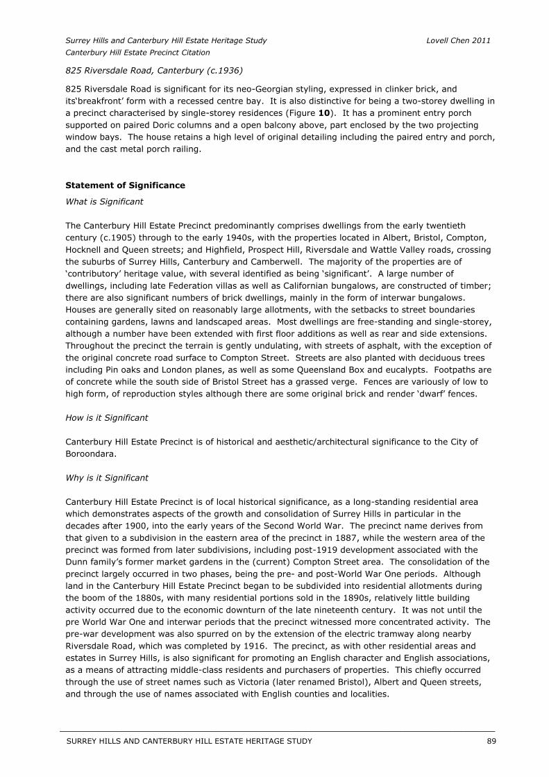
Surrey Hills and Canterbury Hill Estate Heritage Study Lovell Chen 2011 Canterbury Hill Estate Precinct Citation
825 Riversdale Road, Canterbury (c.1936)
825 Riversdale Road is significant for its neo-Georgian styling, expressed in clinker brick, and its‘breakfront’ form with a recessed centre bay. It is also distinctive for being a two-storey dwelling in a precinct characterised by single-storey residences (Figure 10). It has a prominent entry porch supported on paired Doric columns and a open balcony above, part enclosed by the two projecting window bays. The house retains a high level of original detailing including the paired entry and porch, and the cast metal porch railing.
Statement of Significance
What is Significant
The Canterbury Hill Estate Precinct predominantly comprises dwellings from the early twentieth century (c.1905) through to the early 1940s, with the properties located in Albert, Bristol, Compton, Hocknell and Queen streets; and Highfield, Prospect Hill, Riversdale and Wattle Valley roads, crossing the suburbs of Surrey Hills, Canterbury and Camberwell. The majority of the properties are of ‘contributory’ heritage value, with several identified as being ‘significant’. A large number of dwellings, including late Federation villas as well as Californian bungalows, are constructed of timber; there are also significant numbers of brick dwellings, mainly in the form of interwar bungalows. Houses are generally sited on reasonably large allotments, with the setbacks to street boundaries containing gardens, lawns and landscaped areas. Most dwellings are free-standing and single-storey, although a number have been extended with first floor additions as well as rear and side extensions. Throughout the precinct the terrain is gently undulating, with streets of asphalt, with the exception of the original concrete road surface to Compton Street. Streets are also planted with deciduous trees including Pin oaks and London planes, as well as some Queensland Box and eucalypts. Footpaths are of concrete while the south side of Bristol Street has a grassed verge. Fences are variously of low to high form, of reproduction styles although there are some original brick and render ‘dwarf’ fences.
How is it Significant
Canterbury Hill Estate Precinct is of historical and aesthetic/architectural significance to the City of Boroondara.
Why is it Significant
Canterbury Hill Estate Precinct is of local historical significance, as a long-standing residential area which demonstrates aspects of the growth and consolidation of Surrey Hills in particular in the decades after 1900, into the early years of the Second World War. The precinct name derives from that given to a subdivision in the eastern area of the precinct in 1887, while the western area of the precinct was formed from later subdivisions, including post-1919 development associated with the Dunn family’s former market gardens in the (current) Compton Street area. The consolidation of the precinct largely occurred in two phases, being the pre- and post-World War One periods. Although land in the Canterbury Hill Estate Precinct began to be subdivided into residential allotments during the boom of the 1880s, with many residential portions sold in the 1890s, relatively little building activity occurred due to the economic downturn of the late nineteenth century. It was not until the pre World War One and interwar periods that the precinct witnessed more concentrated activity. The pre-war development was also spurred on by the extension of the electric tramway along nearby Riversdale Road, which was completed by 1916. The precinct, as with other residential areas and estates in Surrey Hills, is also significant for promoting an English character and English associations, as a means of attracting middle-class residents and purchasers of properties. This chiefly occurred through the use of street names such as Victoria (later renamed Bristol), Albert and Queen streets, and through the use of names associated with English counties and localities.
SURREY HILLS AND CANTERBURY HILL ESTATE HERITAGE STUDY 89
__________________________________________________________________________________________________________
Surrey Hills and Canterbury Hill Estate Heritage Study Lovell Chen 2011 Canterbury Hill Estate Precinct Citation
Canterbury Hill Estate Precinct is of local aesthetic/architectural significance. The precinct, which predominantly comprises dwellings dating from the early twentieth century through to the 1930s, has a comparatively high level of intactness in terms of its Federation and interwar development. A large number of these dwellings, including late Federation villas as well as some Californian bungalows, are constructed of timber, which is a building material more commonly found in Surrey Hills than in other areas of Boroondara. The significance of this aspect of development is enhanced by the fact that Council, in the late 1920s, passed by-laws restricting the construction of dwellings in timber. Significant Federation development in the precinct includes a range of well-designed and executed dwellings which demonstrate key Federation ideas in house design and detailing. These include diagonal planning; gabled and pitched roof forms; projecting wings/bays with half-timbered gables; timber-posted verandahs including return verandahs with timber friezes and fretwork; tall brick chimney stacks and 1: 3 casement windows. There are also substantial numbers of brick houses, the majority of which are brick and rendered bungalows, as well as some Old English style clinker brick and render villas, and dwellings displaying Mediterranean influences. This rich and varied interwar development displays many of the elements and influences which typify Australian bungalow design including Californian and Craftsman variants. These include half-timbered and shingled gable-fronts; ground floor areas on a basic oblong footprint, albeit with curved and canted bays and/or a porch-verandah to one façade side balanced by a projecting wing/bay; facebrick surfaces with cement render and concrete; lead-light glass; and brick verandah pedestals, or timber or cast concrete columns. The projecting bays and verandahs are independently gabled or in some instances roofed through the continuation downwards of the main roof pitch. The aesthetic significance is also enhanced by the reasonably generous allotments, including setbacks with gardens, lawns and landscaped settings; street plantings including deciduous trees and native species; concrete footpaths and the grassed verge of Bristol Street; and also the concrete road surface of Compton Street, which in turn is typical of a bungalow estate in Boroondara.
Recommendations
Recommended for inclusion in the Schedule to the Heritage Overlay of the Boroondara Planning Scheme.
External Paint Controls No
Internal Alterations Controls No
Tree Controls No
Outbuildings and fences exemptions No
Victorian Heritage Register No
Prohibited uses may be permitted No
Incorporated plan No
Aboriginal heritage place No
Identified By
Lovell Chen, Surrey Hills and Canterbury Hill Estate Heritage Study, 2011.
References
General: Butler, G. Camberwell Conservation Study, 1991.
SURREY HILLS AND CANTERBURY HILL ESTATE HERITAGE STUDY 90
__________________________________________________________________________________________________________
Surrey Hills and Canterbury Hill Estate Heritage Study Lovell Chen 2011 Canterbury Hill Estate Precinct Citation
Specific: 1 Surrey Hills History Nook Group, Surrey Hills: In Celebration of the Centennial 1883 – 1983, the Authors, Surrey Hills, Vic, 1983.
2 Lodged Plan 2670, Lands Victoria.
3 See Certificate of Title Volume 3047 Folio 369
4 See Siena College website, www.siena.vic.edu.au.
5 Graeme Butler & Associates, Camberwell Conservation Study, 1991, vol. 2, pp. 20-21.
6 Derived from listings in the Sands & McDougall Directory of Victoria, 1936-1943.
7 For Federation Architecture, see, esp., Bernard and Kate Smith, The Architectural Character ofGlebe, Sydney, Co-op, Sydney, 1974; Conrad Hamann, Nationalism and Reform in Australian Architecture, 1880-1920,’ Historical Studies, 18, 72, April 1979, pp. 393-411, and in Leon Paroissien (series ed.,) A History of Australian Architecture, Part 3: 1900-1945, Educational Media, 1986. Trevor Howells, ed., contrib., Towards the Dawn: Federation Architecture in Australia, 1890-1915, Hale andIremonger, Sydney, 1989; Richard Apperly, Robert Irving, Peter Reynolds, Identifying AustralianArchitecture, Angus and Robertson, Sydney, 1990, part 3: Federation. Conrad Hamann, ‘The Federation City’, in Philip Goad, ed., contrib., Melbourne Architecture, Watermark, Sydney, 1999, pp. 78-81 ff. The Arts and Crafts connection has been drawn together by Caroline Miley, Beautiful andUseful: the Arts and Crafts Movement in Tasmania, Victoria Museum, Launceston, 1990; Harriet Edquist, Pioneers of Modernism: The Arts and Crafts Movement in Australia, Miegunyah, Melbourne, 2007.
8 Cf. Andrew Saint, Richard Norman Shaw, Yale, London and New Haven, 1980; Mark Girouard, Sweetness and Light: a History of the Queen Anne Movement, Yale, London, New Haven, 1982.
9 Conrad Hamann, A History of Australian Architecture, Part 3; also ‘The Inclusive Tradition in Victoria’s Architecture’, in AGL Shaw, ed., Victoria’s Heritage, Allen and Unwin, Sydney, 1986.
10 See, esp. David Gebhard and Robert Winter, Los Angeles: an Architectural Guide, Gibbs Smith, Salt Lake City, 1994, pp. 369-373, 390-1; Robert Winter, Toward a Simpler Way of Life: The Arts andCrafts Architects of California, University of California, Berkeley and Los Angeles, 1997. In Australia the bungalow is discussed by John Clare, ‘The Californian Bungalow in Australia’, Historic Environment, 5, 1, 1986, pp. 19-29; Donald Johnson, Australian Architecture 1901-51: Sources of Modernism, University of Sydney Press, 1981, pp. 55-64; Peter Cuffley, Australian Houses of the ‘20s and ‘30s, Five Mile, Melbourne, 1989, chs. 1-4 esp.; and in Graeme Butler, The Californian Bungalow inAustralia, Lothian, Melbourne, 1992.
11 See Robert Judson Clark, The Arts and Crafts Movement in America, Princeton, 1978. The Boston-based architect Katherine Budd championed the East Coast form in her column in the influential Massachusetts Architectural Review during the 1900s. See also Butler, The Californian Bungalow inAustralia.
SURREY HILLS AND CANTERBURY HILL ESTATE HERITAGE STUDY 91
__________________________________________________________________________________________________________
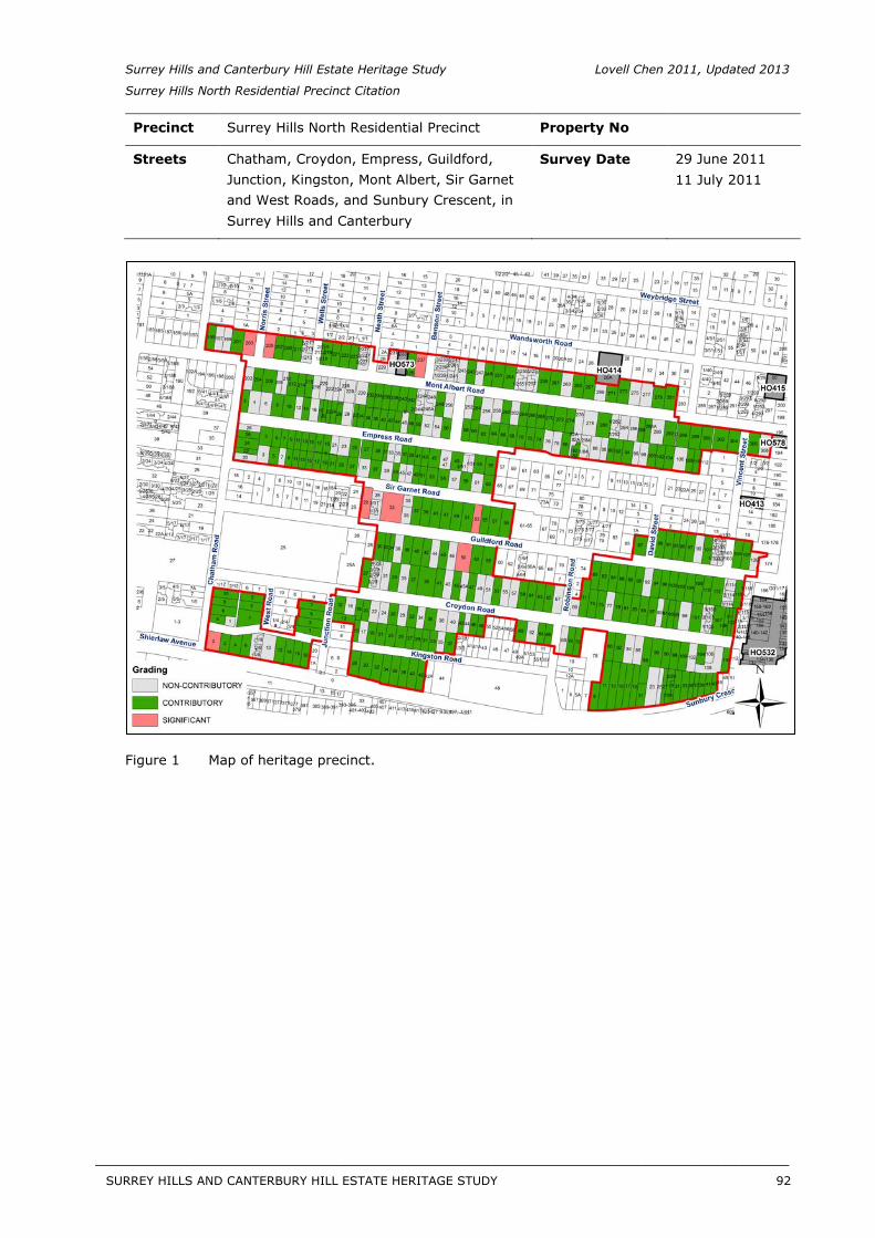
Surrey Hills and Canterbury Hill Estate Heritage Study Lovell Chen 2011, Updated 2013
Surrey Hills North Residential Precinct Citation
Precinct Surrey Hills North Residential Precinct Property No
Streets Chatham, Croydon, Empress, Guildford, Junction, Kingston, Mont Albert, Sir Garnet and West Roads, and Sunbury Crescent, in Surrey Hills and Canterbury
Survey Date 29 June 201111 July 2011
Figure 1 Map of heritage precinct.
SURREY HILLS AND CANTERBURY HILL ESTATE HERITAGE STUDY 92
__________________________________________________________________________________________________________
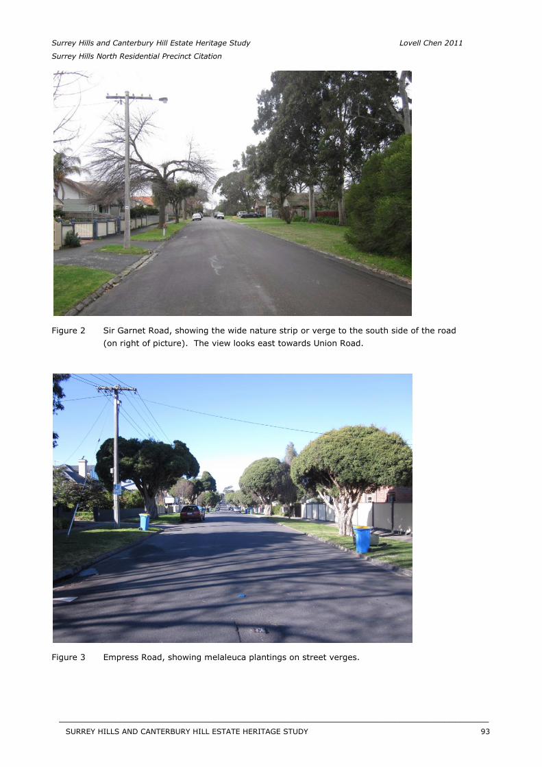
Surrey Hills and Canterbury Hill Estate Heritage Study Lovell Chen 2011
Surrey Hills North Residential Precinct Citation
Figure 2 Sir Garnet Road, showing the wide nature strip or verge to the south side of the road (on right of picture). The view looks east towards Union Road.
Figure 3 Empress Road, showing melaleuca plantings on street verges.
SURREY HILLS AND CANTERBURY HILL ESTATE HERITAGE STUDY 93
__________________________________________________________________________________________________________
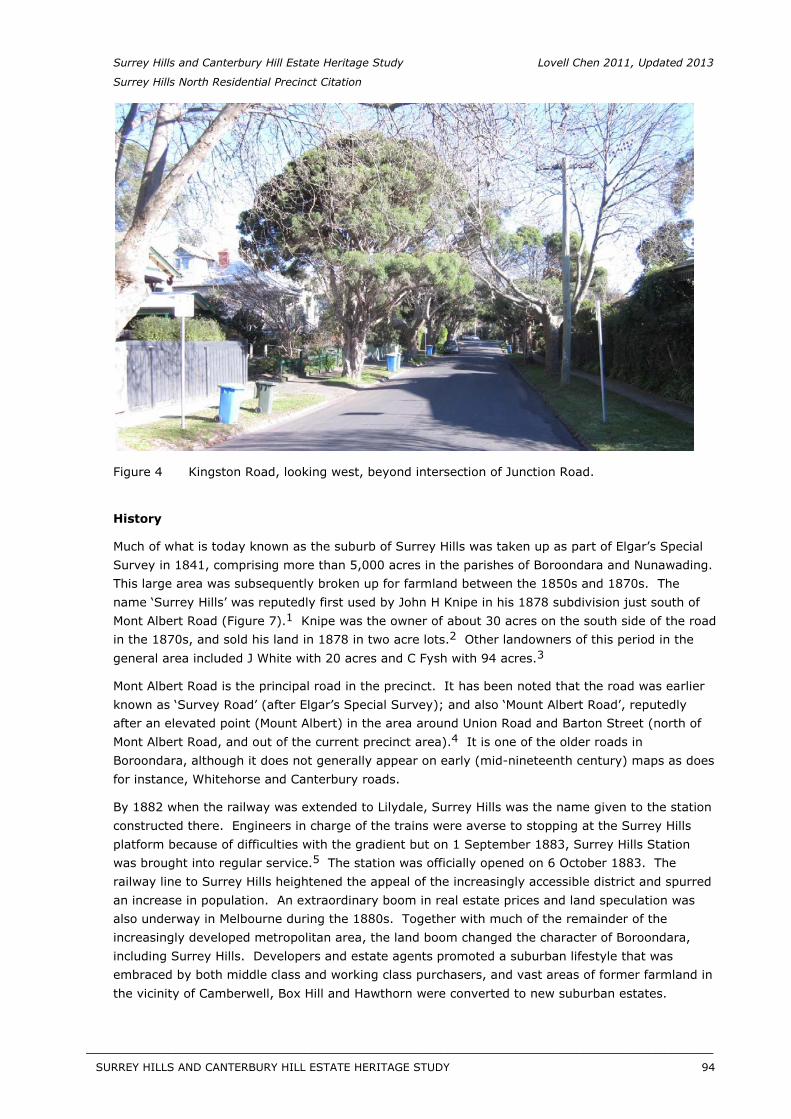
Surrey Hills and Canterbury Hill Estate Heritage Study Lovell Chen 2011, Updated 2013
Surrey Hills North Residential Precinct Citation
Figure 4 Kingston Road, looking west, beyond intersection of Junction Road.
History
Much of what is today known as the suburb of Surrey Hills was taken up as part of Elgar’s Special Survey in 1841, comprising more than 5,000 acres in the parishes of Boroondara and Nunawading. This large area was subsequently broken up for farmland between the 1850s and 1870s. The name ‘Surrey Hills’ was reputedly first used by John H Knipe in his 1878 subdivision just south of Mont Albert Road (Figure 7).1 Knipe was the owner of about 30 acres on the south side of the roadin the 1870s, and sold his land in 1878 in two acre lots.2 Other landowners of this period in thegeneral area included J White with 20 acres and C Fysh with 94 acres.3
Mont Albert Road is the principal road in the precinct. It has been noted that the road was earlier known as ‘Survey Road’ (after Elgar’s Special Survey); and also ‘Mount Albert Road’, reputedly after an elevated point (Mount Albert) in the area around Union Road and Barton Street (north of Mont Albert Road, and out of the current precinct area).4 It is one of the older roads inBoroondara, although it does not generally appear on early (mid-nineteenth century) maps as does for instance, Whitehorse and Canterbury roads.
By 1882 when the railway was extended to Lilydale, Surrey Hills was the name given to the station constructed there. Engineers in charge of the trains were averse to stopping at the Surrey Hills platform because of difficulties with the gradient but on 1 September 1883, Surrey Hills Station was brought into regular service.5 The station was officially opened on 6 October 1883. Therailway line to Surrey Hills heightened the appeal of the increasingly accessible district and spurred an increase in population. An extraordinary boom in real estate prices and land speculation was also underway in Melbourne during the 1880s. Together with much of the remainder of the increasingly developed metropolitan area, the land boom changed the character of Boroondara, including Surrey Hills. Developers and estate agents promoted a suburban lifestyle that was embraced by both middle class and working class purchasers, and vast areas of former farmland in the vicinity of Camberwell, Box Hill and Hawthorn were converted to new suburban estates.
SURREY HILLS AND CANTERBURY HILL ESTATE HERITAGE STUDY 94
__________________________________________________________________________________________________________
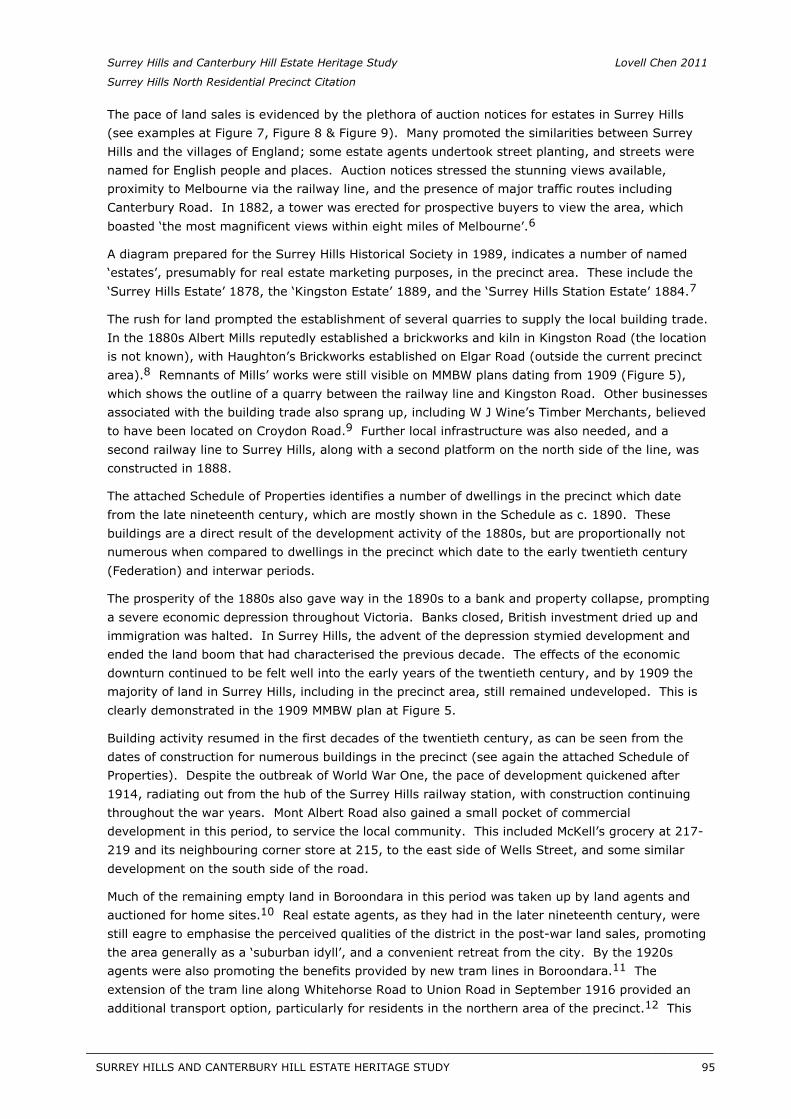
Surrey Hills and Canterbury Hill Estate Heritage Study Lovell Chen 2011
Surrey Hills North Residential Precinct Citation
The pace of land sales is evidenced by the plethora of auction notices for estates in Surrey Hills (see examples at Figure 7, Figure 8 & Figure 9). Many promoted the similarities between Surrey Hills and the villages of England; some estate agents undertook street planting, and streets were named for English people and places. Auction notices stressed the stunning views available, proximity to Melbourne via the railway line, and the presence of major traffic routes including Canterbury Road. In 1882, a tower was erected for prospective buyers to view the area, which boasted ‘the most magnificent views within eight miles of Melbourne’.6
A diagram prepared for the Surrey Hills Historical Society in 1989, indicates a number of named ‘estates’, presumably for real estate marketing purposes, in the precinct area. These include the ‘Surrey Hills Estate’ 1878, the ‘Kingston Estate’ 1889, and the ‘Surrey Hills Station Estate’ 1884.7
The rush for land prompted the establishment of several quarries to supply the local building trade. In the 1880s Albert Mills reputedly established a brickworks and kiln in Kingston Road (the location is not known), with Haughton’s Brickworks established on Elgar Road (outside the current precinct area).8 Remnants of Mills’ works were still visible on MMBW plans dating from 1909 (Figure 5),which shows the outline of a quarry between the railway line and Kingston Road. Other businesses associated with the building trade also sprang up, including W J Wine’s Timber Merchants, believed to have been located on Croydon Road.9 Further local infrastructure was also needed, and asecond railway line to Surrey Hills, along with a second platform on the north side of the line, was constructed in 1888.
The attached Schedule of Properties identifies a number of dwellings in the precinct which date from the late nineteenth century, which are mostly shown in the Schedule as c. 1890. These buildings are a direct result of the development activity of the 1880s, but are proportionally not numerous when compared to dwellings in the precinct which date to the early twentieth century (Federation) and interwar periods.
The prosperity of the 1880s also gave way in the 1890s to a bank and property collapse, prompting a severe economic depression throughout Victoria. Banks closed, British investment dried up and immigration was halted. In Surrey Hills, the advent of the depression stymied development and ended the land boom that had characterised the previous decade. The effects of the economic downturn continued to be felt well into the early years of the twentieth century, and by 1909 the majority of land in Surrey Hills, including in the precinct area, still remained undeveloped. This is clearly demonstrated in the 1909 MMBW plan at Figure 5.
Building activity resumed in the first decades of the twentieth century, as can be seen from the dates of construction for numerous buildings in the precinct (see again the attached Schedule of Properties). Despite the outbreak of World War One, the pace of development quickened after 1914, radiating out from the hub of the Surrey Hills railway station, with construction continuing throughout the war years. Mont Albert Road also gained a small pocket of commercial development in this period, to service the local community. This included McKell’s grocery at 217-219 and its neighbouring corner store at 215, to the east side of Wells Street, and some similar development on the south side of the road.
Much of the remaining empty land in Boroondara in this period was taken up by land agents and auctioned for home sites.10 Real estate agents, as they had in the later nineteenth century, werestill eagre to emphasise the perceived qualities of the district in the post-war land sales, promoting the area generally as a ‘suburban idyll’, and a convenient retreat from the city. By the 1920s agents were also promoting the benefits provided by new tram lines in Boroondara.11 Theextension of the tram line along Whitehorse Road to Union Road in September 1916 provided an additional transport option, particularly for residents in the northern area of the precinct.12 This
SURREY HILLS AND CANTERBURY HILL ESTATE HERITAGE STUDY 95
__________________________________________________________________________________________________________
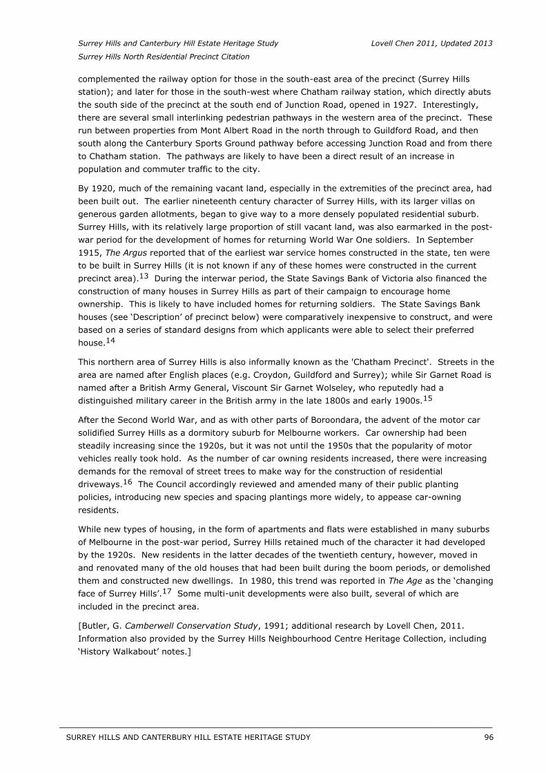
Surrey Hills and Canterbury Hill Estate Heritage Study Lovell Chen 2011, Updated 2013
Surrey Hills North Residential Precinct Citation
complemented the railway option for those in the south-east area of the precinct (Surrey Hills station); and later for those in the south-west where Chatham railway station, which directly abuts the south side of the precinct at the south end of Junction Road, opened in 1927. Interestingly, there are several small interlinking pedestrian pathways in the western area of the precinct. These run between properties from Mont Albert Road in the north through to Guildford Road, and then south along the Canterbury Sports Ground pathway before accessing Junction Road and from there to Chatham station. The pathways are likely to have been a direct result of an increase in population and commuter traffic to the city.
By 1920, much of the remaining vacant land, especially in the extremities of the precinct area, had been built out. The earlier nineteenth century character of Surrey Hills, with its larger villas on generous garden allotments, began to give way to a more densely populated residential suburb. Surrey Hills, with its relatively large proportion of still vacant land, was also earmarked in the post-war period for the development of homes for returning World War One soldiers. In September 1915, The Argus reported that of the earliest war service homes constructed in the state, ten were to be built in Surrey Hills (it is not known if any of these homes were constructed in the current precinct area).13 During the interwar period, the State Savings Bank of Victoria also financed theconstruction of many houses in Surrey Hills as part of their campaign to encourage home ownership. This is likely to have included homes for returning soldiers. The State Savings Bank houses (see ‘Description’ of precinct below) were comparatively inexpensive to construct, and were based on a series of standard designs from which applicants were able to select their preferred house.14
This northern area of Surrey Hills is also informally known as the 'Chatham Precinct'. Streets in the area are named after English places (e.g. Croydon, Guildford and Surrey); while Sir Garnet Road is named after a British Army General, Viscount Sir Garnet Wolseley, who reputedly had a distinguished military career in the British army in the late 1800s and early 1900s.15
After the Second World War, and as with other parts of Boroondara, the advent of the motor car solidified Surrey Hills as a dormitory suburb for Melbourne workers. Car ownership had been steadily increasing since the 1920s, but it was not until the 1950s that the popularity of motor vehicles really took hold. As the number of car owning residents increased, there were increasing demands for the removal of street trees to make way for the construction of residential driveways.16 The Council accordingly reviewed and amended many of their public plantingpolicies, introducing new species and spacing plantings more widely, to appease car-owning residents.
While new types of housing, in the form of apartments and flats were established in many suburbs of Melbourne in the post-war period, Surrey Hills retained much of the character it had developed by the 1920s. New residents in the latter decades of the twentieth century, however, moved in and renovated many of the old houses that had been built during the boom periods, or demolished them and constructed new dwellings. In 1980, this trend was reported in The Age as the ‘changing face of Surrey Hills’.17 Some multi-unit developments were also built, several of which areincluded in the precinct area.
[Butler, G. Camberwell Conservation Study, 1991; additional research by Lovell Chen, 2011. Information also provided by the Surrey Hills Neighbourhood Centre Heritage Collection, including ‘History Walkabout’ notes.]
SURREY HILLS AND CANTERBURY HILL ESTATE HERITAGE STUDY 96
__________________________________________________________________________________________________________
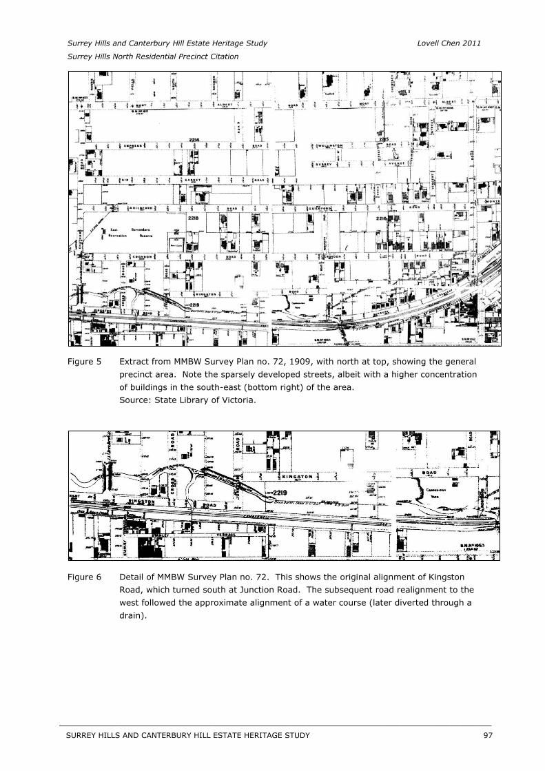
Surrey Hills and Canterbury Hill Estate Heritage Study Lovell Chen 2011
Surrey Hills North Residential Precinct Citation
Figure 5 Extract from MMBW Survey Plan no. 72, 1909, with north at top, showing the general precinct area. Note the sparsely developed streets, albeit with a higher concentration of buildings in the south-east (bottom right) of the area. Source: State Library of Victoria.
Figure 6 Detail of MMBW Survey Plan no. 72. This shows the original alignment of Kingston Road, which turned south at Junction Road. The subsequent road realignment to the west followed the approximate alignment of a water course (later diverted through a drain).
SURREY HILLS AND CANTERBURY HILL ESTATE HERITAGE STUDY 97
__________________________________________________________________________________________________________
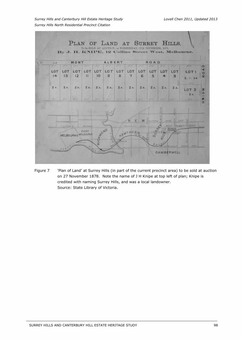
Surrey Hills and Canterbury Hill Estate Heritage Study Lovell Chen 2011, Updated 2013
Surrey Hills North Residential Precinct Citation
Figure 7 ‘Plan of Land’ at Surrey Hills (in part of the current precinct area) to be sold at auction on 27 November 1878. Note the name of J H Knipe at top left of plan; Knipe is credited with naming Surrey Hills, and was a local landowner. Source: State Library of Victoria.
SURREY HILLS AND CANTERBURY HILL ESTATE HERITAGE STUDY 98
__________________________________________________________________________________________________________
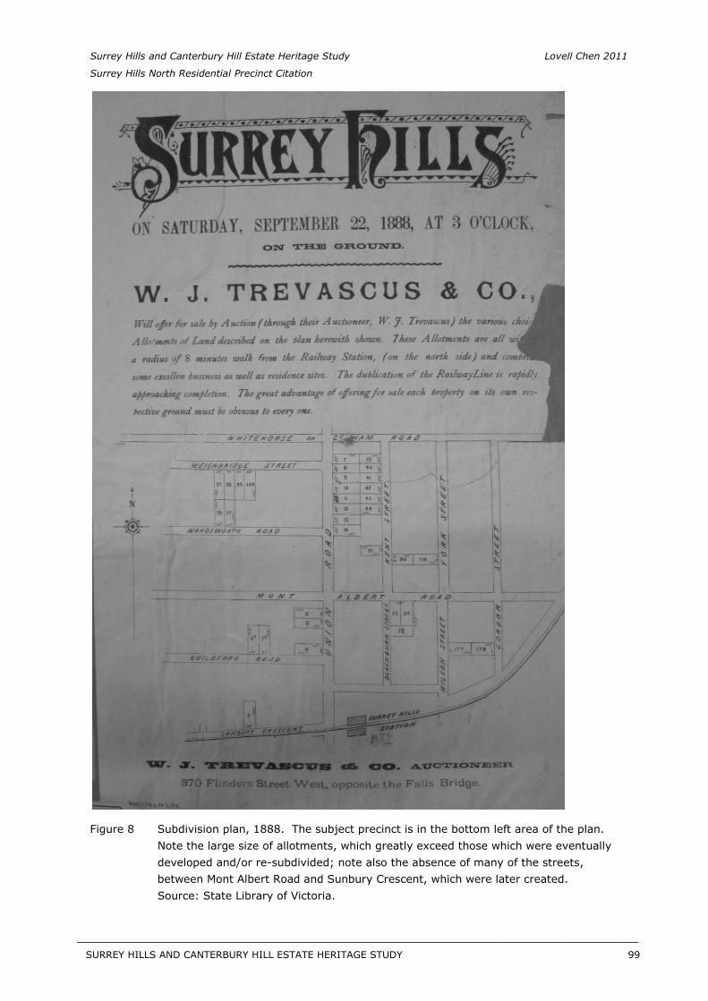
Surrey Hills and Canterbury Hill Estate Heritage Study Lovell Chen 2011
Surrey Hills North Residential Precinct Citation
Figure 8 Subdivision plan, 1888. The subject precinct is in the bottom left area of the plan. Note the large size of allotments, which greatly exceed those which were eventually developed and/or re-subdivided; note also the absence of many of the streets, between Mont Albert Road and Sunbury Crescent, which were later created. Source: State Library of Victoria.
SURREY HILLS AND CANTERBURY HILL ESTATE HERITAGE STUDY 99
__________________________________________________________________________________________________________
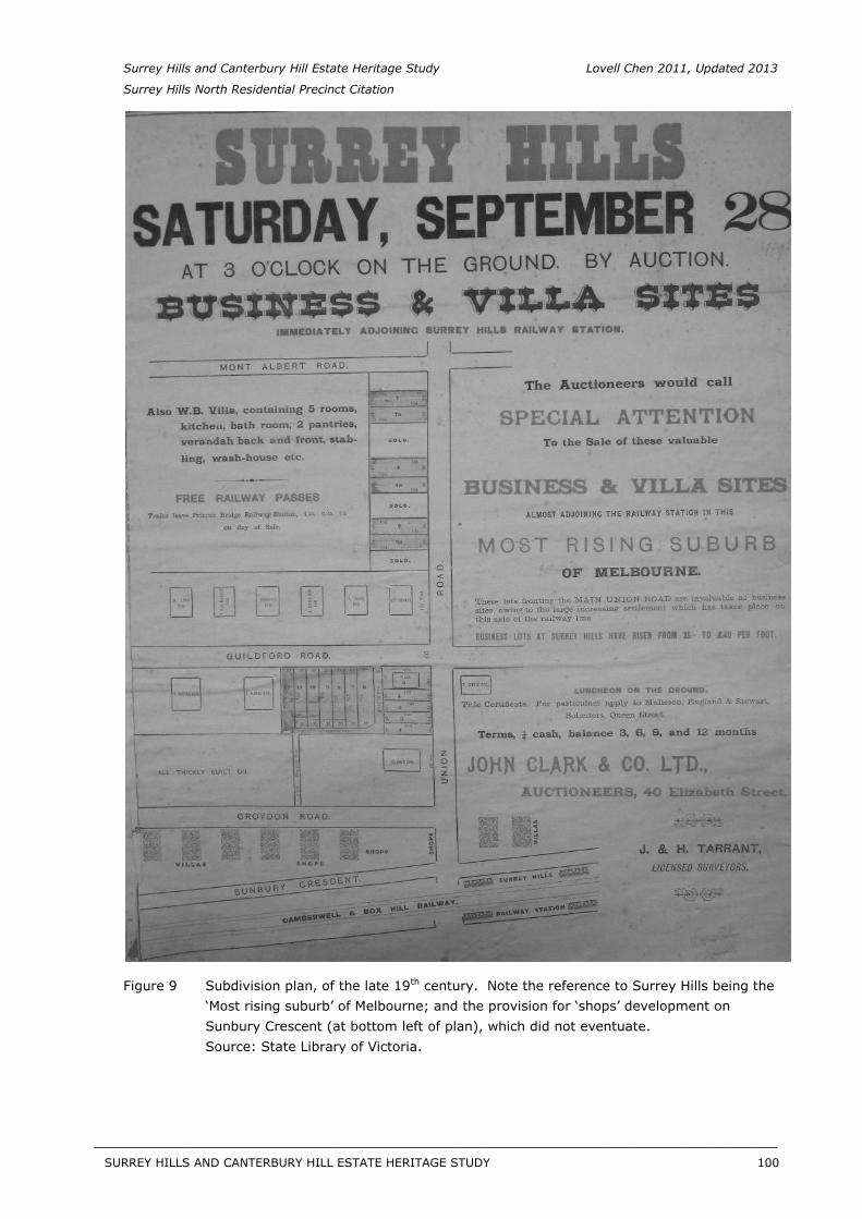
Surrey Hills and Canterbury Hill Estate Heritage Study Lovell Chen 2011, Updated 2013
Surrey Hills North Residential Precinct Citation
Figure 9 Subdivision plan, of the late 19th century. Note the reference to Surrey Hills being the ‘Most rising suburb’ of Melbourne; and the provision for ‘shops’ development on Sunbury Crescent (at bottom left of plan), which did not eventuate. Source: State Library of Victoria.
SURREY HILLS AND CANTERBURY HILL ESTATE HERITAGE STUDY 100
__________________________________________________________________________________________________________
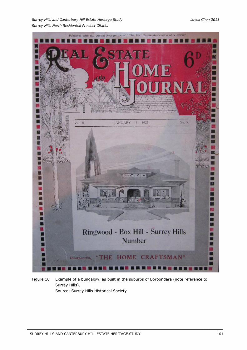
Surrey Hills and Canterbury Hill Estate Heritage Study Lovell Chen 2011
Surrey Hills North Residential Precinct Citation
Figure 10 Example of a bungalow, as built in the suburbs of Boroondara (note reference to Surrey Hills). Source: Surrey Hills Historical Society
SURREY HILLS AND CANTERBURY HILL ESTATE HERITAGE STUDY 101
__________________________________________________________________________________________________________
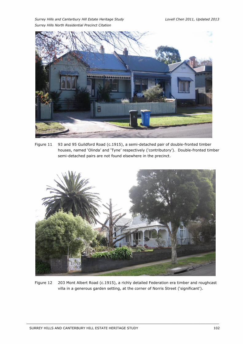
Surrey Hills and Canterbury Hill Estate Heritage Study Lovell Chen 2011, Updated 2013
Surrey Hills North Residential Precinct Citation
Figure 11 93 and 95 Guildford Road (c.1915), a semi-detached pair of double-fronted timber houses, named ‘Olinda’ and ‘Tyne’ respectively (‘contributory’). Double-fronted timber semi-detached pairs are not found elsewhere in the precinct.
Figure 12 203 Mont Albert Road (c.1915), a richly detailed Federation era timber and roughcast villa in a generous garden setting, at the corner of Norris Street (‘significant’).
SURREY HILLS AND CANTERBURY HILL ESTATE HERITAGE STUDY 102
__________________________________________________________________________________________________________
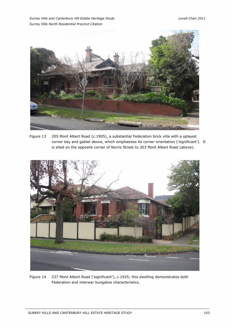
Surrey Hills and Canterbury Hill Estate Heritage Study Lovell Chen 2011
Surrey Hills North Residential Precinct Citation
Figure 13 205 Mont Albert Road (c.1905), a substantial Federation brick villa with a splayed corner bay and gablet above, which emphasises its corner orientation (‘significant’). It is sited on the opposite corner of Norris Street to 203 Mont Albert Road (above).
Figure 14 237 Mont Albert Road (‘significant’), c.1925; this dwelling demonstrates both Federation and interwar bungalow characteristics.
SURREY HILLS AND CANTERBURY HILL ESTATE HERITAGE STUDY 103
__________________________________________________________________________________________________________
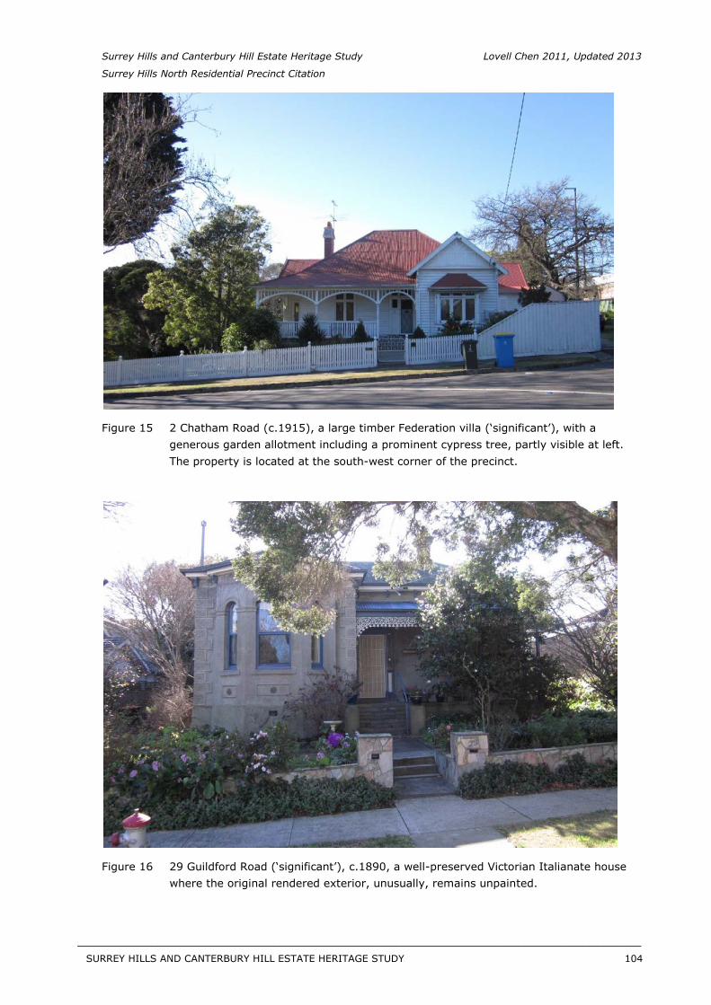
Surrey Hills and Canterbury Hill Estate Heritage Study Lovell Chen 2011, Updated 2013
Surrey Hills North Residential Precinct Citation
Figure 15 2 Chatham Road (c.1915), a large timber Federation villa (‘significant’), with a generous garden allotment including a prominent cypress tree, partly visible at left. The property is located at the south-west corner of the precinct.
Figure 16 29 Guildford Road (‘significant’), c.1890, a well-preserved Victorian Italianate house where the original rendered exterior, unusually, remains unpainted.
SURREY HILLS AND CANTERBURY HILL ESTATE HERITAGE STUDY 104
__________________________________________________________________________________________________________
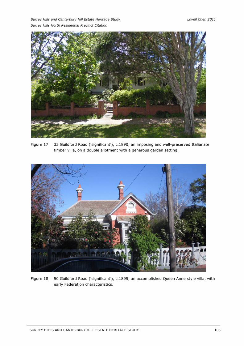
Surrey Hills and Canterbury Hill Estate Heritage Study Lovell Chen 2011
Surrey Hills North Residential Precinct Citation
Figure 17 33 Guildford Road (‘significant’), c.1890, an imposing and well-preserved Italianate timber villa, on a double allotment with a generous garden setting.
Figure 18 50 Guildford Road (‘significant’), c.1895, an accomplished Queen Anne style villa, with early Federation characteristics.
SURREY HILLS AND CANTERBURY HILL ESTATE HERITAGE STUDY 105
__________________________________________________________________________________________________________
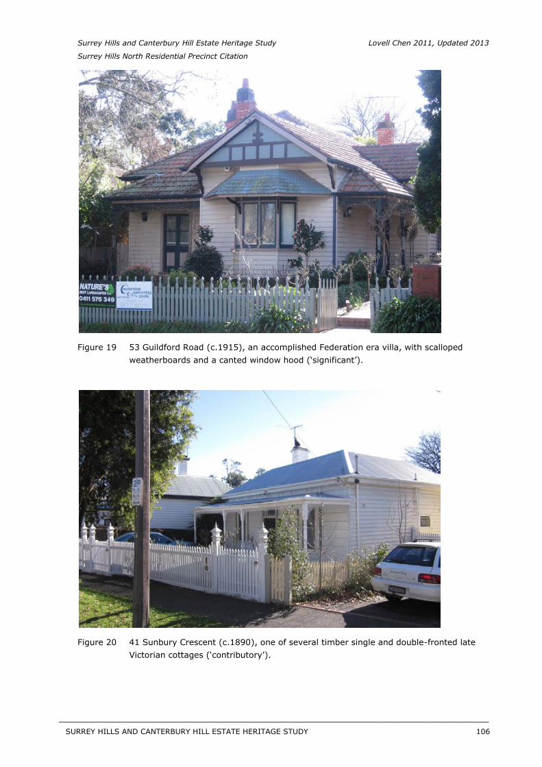
Surrey Hills and Canterbury Hill Estate Heritage Study Lovell Chen 2011, Updated 2013
Surrey Hills North Residential Precinct Citation
Figure 19 53 Guildford Road (c.1915), an accomplished Federation era villa, with scalloped weatherboards and a canted window hood (‘significant’).
Figure 20 41 Sunbury Crescent (c.1890), one of several timber single and double-fronted late Victorian cottages (‘contributory’).
SURREY HILLS AND CANTERBURY HILL ESTATE HERITAGE STUDY 106
__________________________________________________________________________________________________________
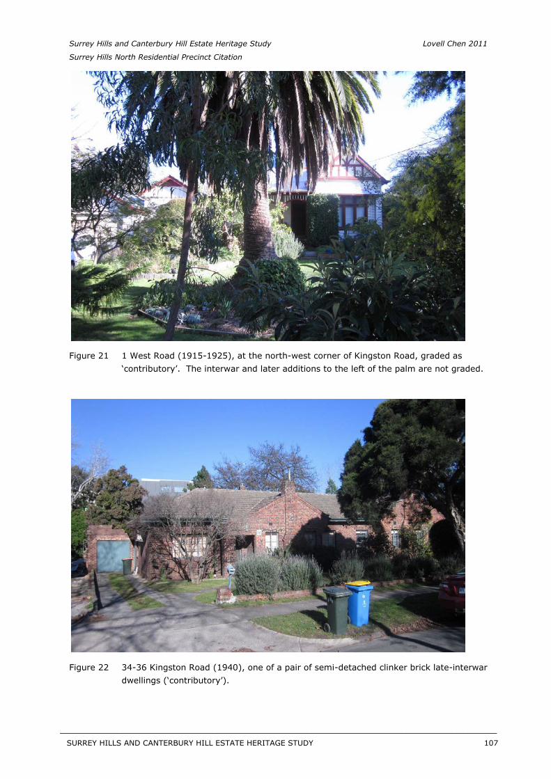
Surrey Hills and Canterbury Hill Estate Heritage Study Lovell Chen 2011
Surrey Hills North Residential Precinct Citation
Figure 21 1 West Road (1915-1925), at the north-west corner of Kingston Road, graded as ‘contributory’. The interwar and later additions to the left of the palm are not graded.
Figure 22 34-36 Kingston Road (1940), one of a pair of semi-detached clinker brick late-interwar dwellings (‘contributory’).
SURREY HILLS AND CANTERBURY HILL ESTATE HERITAGE STUDY 107
__________________________________________________________________________________________________________

Surrey Hills and Canterbury Hill Estate Heritage Study Lovell Chen 2011, Updated 2013
Surrey Hills North Residential Precinct Citation
Figure 23 4 Kingston Road (c.1890-1910), a double-fronted late Victorian timber cottage, with an additional gabled bay, added in the Federation period (‘contributory’).
Description
[Note: all properties specifically identified below are of ‘contributory’ value unless otherwise indicated. Images of select ‘significant’ and representative ‘contributory’ properties are included above.]
Overview
Surrey Hills North Residential Precinct is a large precinct area located in Surrey Hills, and part of Canterbury, in the municipality of Boroondara. It is (in general terms) bounded by the railway embankment and Sunbury Crescent to the south; Mont Albert Road to the north; Chatham Road to the west; and (approximately) the east boundaries of properties running parallel with Union Road in the east. Streets in the precinct predominantly run from east to west, with generally lesser (shorter) streets, other than Chatham Road, running north-south. There are also narrow pedestrian walkways between properties, linking streets such as Mont Albert Road through to Guildford Road, and continuing through the Canterbury Sports Ground to Junction Road and onto Chatham station; and elsewhere between Mont Albert Road and Empress Road; and from Guildford Road through to Sunbury Crescent (the latter is just outside the precinct area, on the east side). In addition, an unmade roadway – Frimley Road – connects Surrey Avenue and Empress Road at the east end, narrowing to the aforementioned pedestrian link north to Mont Albert Road.
In terms of the topography, the precinct is undulating, with some of the east-west roads sloping down to the west, and the northern area of the precinct being on higher ground. Close to the railway, in the south-west corner of the precinct, the topography again changes slightly with houses on the south side of Kingston Road between Junction and Chatham roads, being more
SURREY HILLS AND CANTERBURY HILL ESTATE HERITAGE STUDY 108
__________________________________________________________________________________________________________
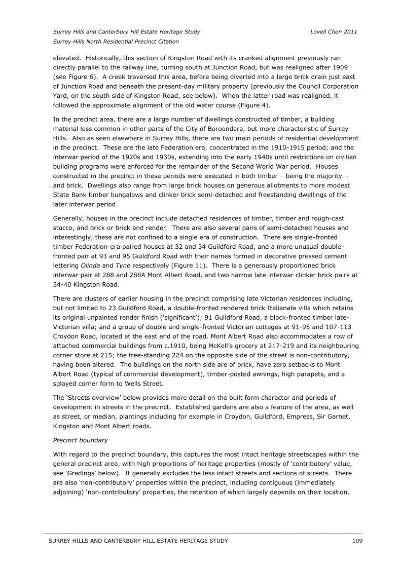
Surrey Hills and Canterbury Hill Estate Heritage Study Lovell Chen 2011
Surrey Hills North Residential Precinct Citation
elevated. Historically, this section of Kingston Road with its cranked alignment previously ran directly parallel to the railway line, turning south at Junction Road, but was realigned after 1909 (see Figure 6). A creek traversed this area, before being diverted into a large brick drain just east of Junction Road and beneath the present-day military property (previously the Council Corporation Yard, on the south side of Kingston Road, see below). When the latter road was realigned, it followed the approximate alignment of the old water course (Figure 4).
In the precinct area, there are a large number of dwellings constructed of timber, a building material less common in other parts of the City of Boroondara, but more characteristic of Surrey Hills. Also as seen elsewhere in Surrey Hills, there are two main periods of residential development in the precinct. These are the late Federation era, concentrated in the 1910-1915 period; and the interwar period of the 1920s and 1930s, extending into the early 1940s until restrictions on civilian building programs were enforced for the remainder of the Second World War period. Houses constructed in the precinct in these periods were executed in both timber – being the majority – and brick. Dwellings also range from large brick houses on generous allotments to more modest State Bank timber bungalows and clinker brick semi-detached and freestanding dwellings of the later interwar period.
Generally, houses in the precinct include detached residences of timber, timber and rough-cast stucco, and brick or brick and render. There are also several pairs of semi-detached houses and interestingly, these are not confined to a single era of construction. There are single-fronted timber Federation-era paired houses at 32 and 34 Guildford Road, and a more unusual double-fronted pair at 93 and 95 Guildford Road with their names formed in decorative pressed cement lettering Olinda and Tyne respectively (Figure 11). There is a generously proportioned brick interwar pair at 288 and 288A Mont Albert Road, and two narrow late interwar clinker brick pairs at 34-40 Kingston Road.
There are clusters of earlier housing in the precinct comprising late Victorian residences including, but not limited to 23 Guildford Road, a double-fronted rendered brick Italianate villa which retains its original unpainted render finish (‘significant’); 91 Guildford Road, a block-fronted timber late-Victorian villa; and a group of double and single-fronted Victorian cottages at 91-95 and 107-113 Croydon Road, located at the east end of the road. Mont Albert Road also accommodates a row of attached commercial buildings from c.1910, being McKell’s grocery at 217-219 and its neighbouring corner store at 215; the free-standing 224 on the opposite side of the street is non-contributory, having been altered. The buildings on the north side are of brick, have zero setbacks to Mont Albert Road (typical of commercial development), timber-posted awnings, high parapets, and a splayed corner form to Wells Street.
The ‘Streets overview’ below provides more detail on the built form character and periods of development in streets in the precinct. Established gardens are also a feature of the area, as well as street, or median, plantings including for example in Croydon, Guildford, Empress, Sir Garnet, Kingston and Mont Albert roads.
Precinct boundary
With regard to the precinct boundary, this captures the most intact heritage streetscapes within the general precinct area, with high proportions of heritage properties (mostly of ‘contributory’ value, see ‘Gradings’ below). It generally excludes the less intact streets and sections of streets. There are also ‘non-contributory’ properties within the precinct, including contiguous (immediately adjoining) ‘non-contributory’ properties, the retention of which largely depends on their location.
SURREY HILLS AND CANTERBURY HILL ESTATE HERITAGE STUDY 109
__________________________________________________________________________________________________________
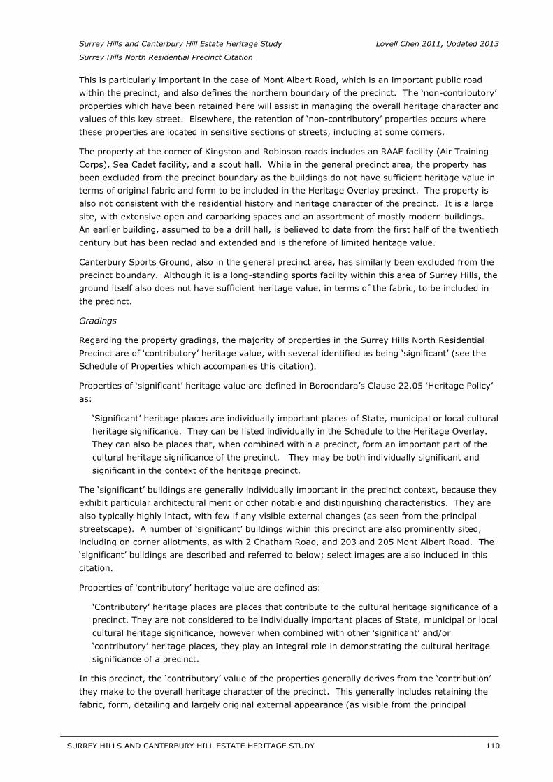
Surrey Hills and Canterbury Hill Estate Heritage Study Lovell Chen 2011, Updated 2013
Surrey Hills North Residential Precinct Citation
This is particularly important in the case of Mont Albert Road, which is an important public road within the precinct, and also defines the northern boundary of the precinct. The ‘non-contributory’ properties which have been retained here will assist in managing the overall heritage character and values of this key street. Elsewhere, the retention of ‘non-contributory’ properties occurs where these properties are located in sensitive sections of streets, including at some corners.
The property at the corner of Kingston and Robinson roads includes an RAAF facility (Air Training Corps), Sea Cadet facility, and a scout hall. While in the general precinct area, the property has been excluded from the precinct boundary as the buildings do not have sufficient heritage value in terms of original fabric and form to be included in the Heritage Overlay precinct. The property is also not consistent with the residential history and heritage character of the precinct. It is a large site, with extensive open and carparking spaces and an assortment of mostly modern buildings. An earlier building, assumed to be a drill hall, is believed to date from the first half of the twentieth century but has been reclad and extended and is therefore of limited heritage value.
Canterbury Sports Ground, also in the general precinct area, has similarly been excluded from the precinct boundary. Although it is a long-standing sports facility within this area of Surrey Hills, the ground itself also does not have sufficient heritage value, in terms of the fabric, to be included in the precinct.
Gradings
Regarding the property gradings, the majority of properties in the Surrey Hills North Residential Precinct are of ‘contributory’ heritage value, with several identified as being ‘significant’ (see the Schedule of Properties which accompanies this citation).
Properties of ‘significant’ heritage value are defined in Boroondara’s Clause 22.05 ‘Heritage Policy’ as:
‘Significant’ heritage places are individually important places of State, municipal or local cultural heritage significance. They can be listed individually in the Schedule to the Heritage Overlay. They can also be places that, when combined within a precinct, form an important part of the cultural heritage significance of the precinct. They may be both individually significant and significant in the context of the heritage precinct.
The ‘significant’ buildings are generally individually important in the precinct context, because they exhibit particular architectural merit or other notable and distinguishing characteristics. They are also typically highly intact, with few if any visible external changes (as seen from the principal streetscape). A number of ‘significant’ buildings within this precinct are also prominently sited, including on corner allotments, as with 2 Chatham Road, and 203 and 205 Mont Albert Road. The ‘significant’ buildings are described and referred to below; select images are also included in this citation.
Properties of ‘contributory’ heritage value are defined as:
‘Contributory’ heritage places are places that contribute to the cultural heritage significance of a precinct. They are not considered to be individually important places of State, municipal or local cultural heritage significance, however when combined with other ‘significant’ and/or ‘contributory’ heritage places, they play an integral role in demonstrating the cultural heritage significance of a precinct.
In this precinct, the ‘contributory’ value of the properties generally derives from the ‘contribution’ they make to the overall heritage character of the precinct. This generally includes retaining the fabric, form, detailing and largely original external appearance (as visible from the principal
SURREY HILLS AND CANTERBURY HILL ESTATE HERITAGE STUDY 110
__________________________________________________________________________________________________________
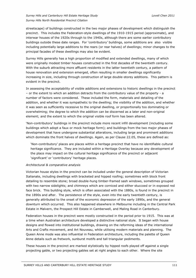
Surrey Hills and Canterbury Hill Estate Heritage Study Lovell Chen 2011
Surrey Hills North Residential Precinct Citation
streetscape) of buildings constructed in the two major phases of development which distinguish the precinct. This includes the Federation-style dwellings of the 1910-1915 period (approximate), and interwar houses of the 1920s through to the 1940s, although there are some earlier contributory buildings outside these date ranges. For ‘contributory’ buildings, some additions are also visible including potentially large additions to the rears (or rear halves) of dwellings; minor changes to the principal facades of these dwellings may also be evident.
Surrey Hills generally has a high proportion of modified and extended dwellings, many of which were originally modest timber houses constructed in the first decades of the twentieth century. With the suburb attracting more affluent residents in the latter twentieth century, a pattern of house renovation and extension emerged, often resulting in smaller dwellings significantly increasing in size, including through construction of large double-storey additions. This pattern is evident in the precinct.
In assessing the acceptability of visible additions and extensions to historic dwellings in the precinct – or the extent to which an addition detracts from the contributory value of the property - anumber of factors were considered. These included the form, materials and detailing of the addition, and whether it was sympathetic to the dwelling; the visibility of the addition, and whether it was seen as sufficiently recessive to the original dwelling, or proportionally too dominating or overwhelming; the degree to which the addition can be discerned as a later and non-original element; and the extent to which the original visible roof form has been altered.
‘Non-contributory’ buildings in the precinct include more recent infill development (including some buildings which adopt a faux or mock heritage form); and buildings from the two major phases of development that have undergone substantial alterations, including large and prominent additions which dominate the front halves of dwellings. Again, as per Clause 22.05, these are defined as:
‘Non-contributory’ places are places within a heritage precinct that have no identifiable cultural heritage significance. They are included within a Heritage Overlay because any development of the place may impact on the cultural heritage significance of the precinct or adjacent ‘significant’ or ‘contributory’ heritage places.
Architectural & comparative analysis
Victorian house styles in the precinct can be included under the general description of Victorian Italianate, including dwellings with bracketed and hipped roofing; sometimes with block front detailing to resemble stone; broad double-hung timber-framed sash windows, sometimes grouped with two narrow sidelights; and chimneys which are corniced and either stuccoed or in exposed red face brick. This building style, which is often associated with the 1880s, is found in the precinct in the 1890s and after. The persistence of the style, even into the early twentieth century, is generally attributed to the onset of the economic depression of the early 1890s, and the general downturn which occurred. This also happened elsewhere in Melbourne including in the Central Park Estate in Malvern, the Prospect Hill Estate in Camberwell, and Maling Road in Canterbury.
Federation houses in the precinct were mostly constructed in the period prior to 1915. This was at a time when Australian architecture developed a distinctive national style. It began with house designs and flowed into institutional buildings, drawing on the reforming ideas of the international Arts and Crafts movement, and Art Nouveau, while utilising modern materials and planning. The Queen Anne mode was also influential in Federation architecture, including the palette of Queen Anne details such as fretwork, sunburst motifs and tall triangular pediments.
These houses in the precinct are marked stylistically by hipped roofs played off against a single projecting gable, or two projecting gables set at right angles to each other. Where the site
SURREY HILLS AND CANTERBURY HILL ESTATE HERITAGE STUDY 111
__________________________________________________________________________________________________________
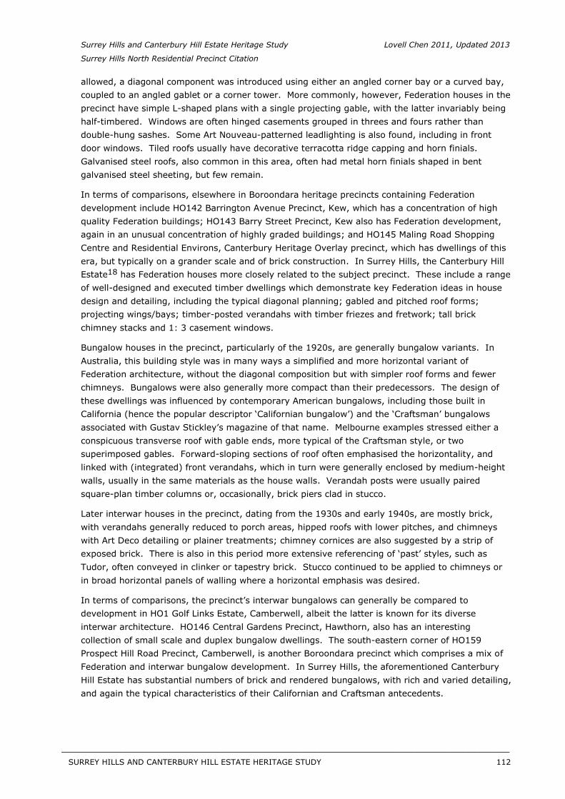
Surrey Hills and Canterbury Hill Estate Heritage Study Lovell Chen 2011, Updated 2013
Surrey Hills North Residential Precinct Citation
allowed, a diagonal component was introduced using either an angled corner bay or a curved bay, coupled to an angled gablet or a corner tower. More commonly, however, Federation houses in the precinct have simple L-shaped plans with a single projecting gable, with the latter invariably being half-timbered. Windows are often hinged casements grouped in threes and fours rather than double-hung sashes. Some Art Nouveau-patterned leadlighting is also found, including in front door windows. Tiled roofs usually have decorative terracotta ridge capping and horn finials. Galvanised steel roofs, also common in this area, often had metal horn finials shaped in bent galvanised steel sheeting, but few remain.
In terms of comparisons, elsewhere in Boroondara heritage precincts containing Federation development include HO142 Barrington Avenue Precinct, Kew, which has a concentration of high quality Federation buildings; HO143 Barry Street Precinct, Kew also has Federation development, again in an unusual concentration of highly graded buildings; and HO145 Maling Road Shopping Centre and Residential Environs, Canterbury Heritage Overlay precinct, which has dwellings of this era, but typically on a grander scale and of brick construction. In Surrey Hills, the Canterbury Hill Estate18 has Federation houses more closely related to the subject precinct. These include a rangeof well-designed and executed timber dwellings which demonstrate key Federation ideas in house design and detailing, including the typical diagonal planning; gabled and pitched roof forms; projecting wings/bays; timber-posted verandahs with timber friezes and fretwork; tall brick chimney stacks and 1: 3 casement windows.
Bungalow houses in the precinct, particularly of the 1920s, are generally bungalow variants. In Australia, this building style was in many ways a simplified and more horizontal variant of Federation architecture, without the diagonal composition but with simpler roof forms and fewer chimneys. Bungalows were also generally more compact than their predecessors. The design of these dwellings was influenced by contemporary American bungalows, including those built in California (hence the popular descriptor ‘Californian bungalow’) and the ‘Craftsman’ bungalows associated with Gustav Stickley’s magazine of that name. Melbourne examples stressed either a conspicuous transverse roof with gable ends, more typical of the Craftsman style, or two superimposed gables. Forward-sloping sections of roof often emphasised the horizontality, and linked with (integrated) front verandahs, which in turn were generally enclosed by medium-height walls, usually in the same materials as the house walls. Verandah posts were usually paired square-plan timber columns or, occasionally, brick piers clad in stucco.
Later interwar houses in the precinct, dating from the 1930s and early 1940s, are mostly brick, with verandahs generally reduced to porch areas, hipped roofs with lower pitches, and chimneys with Art Deco detailing or plainer treatments; chimney cornices are also suggested by a strip of exposed brick. There is also in this period more extensive referencing of ‘past’ styles, such as Tudor, often conveyed in clinker or tapestry brick. Stucco continued to be applied to chimneys or in broad horizontal panels of walling where a horizontal emphasis was desired.
In terms of comparisons, the precinct’s interwar bungalows can generally be compared to development in HO1 Golf Links Estate, Camberwell, albeit the latter is known for its diverse interwar architecture. HO146 Central Gardens Precinct, Hawthorn, also has an interesting collection of small scale and duplex bungalow dwellings. The south-eastern corner of HO159 Prospect Hill Road Precinct, Camberwell, is another Boroondara precinct which comprises a mix of Federation and interwar bungalow development. In Surrey Hills, the aforementioned Canterbury Hill Estate has substantial numbers of brick and rendered bungalows, with rich and varied detailing, and again the typical characteristics of their Californian and Craftsman antecedents.
SURREY HILLS AND CANTERBURY HILL ESTATE HERITAGE STUDY 112
__________________________________________________________________________________________________________
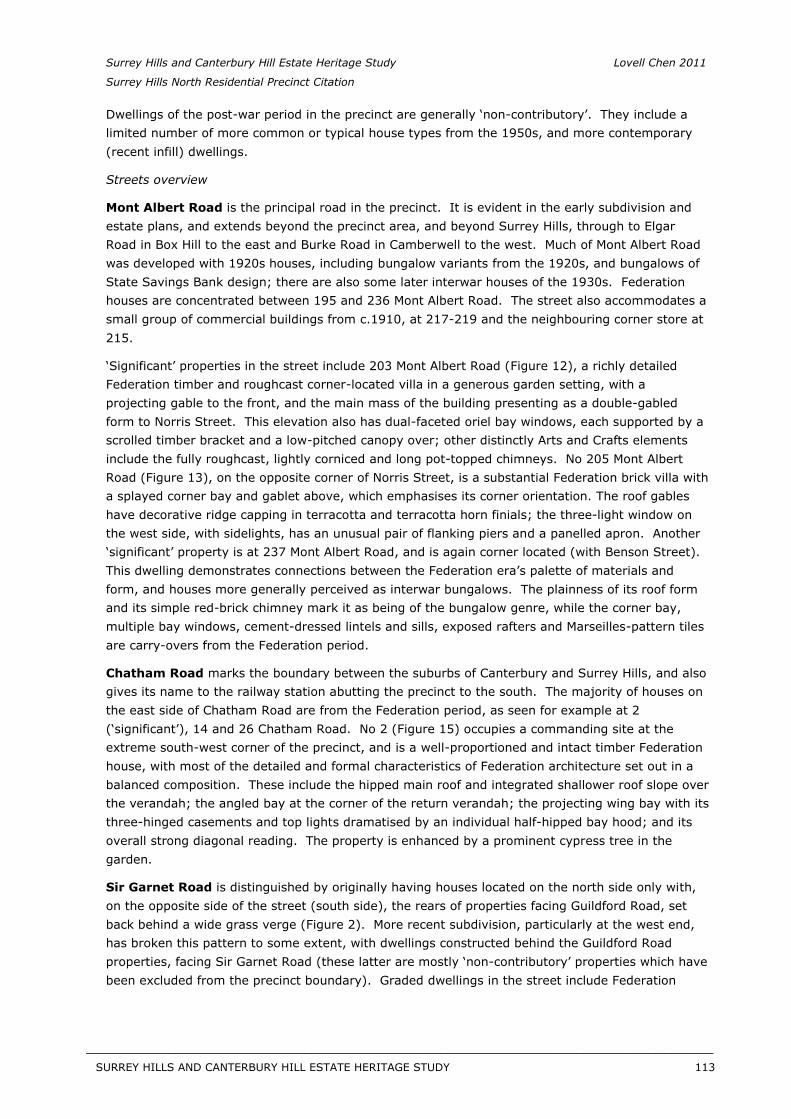
Surrey Hills and Canterbury Hill Estate Heritage Study Lovell Chen 2011
Surrey Hills North Residential Precinct Citation
Dwellings of the post-war period in the precinct are generally ‘non-contributory’. They include a limited number of more common or typical house types from the 1950s, and more contemporary (recent infill) dwellings.
Streets overview
Mont Albert Road is the principal road in the precinct. It is evident in the early subdivision and estate plans, and extends beyond the precinct area, and beyond Surrey Hills, through to Elgar Road in Box Hill to the east and Burke Road in Camberwell to the west. Much of Mont Albert Road was developed with 1920s houses, including bungalow variants from the 1920s, and bungalows of State Savings Bank design; there are also some later interwar houses of the 1930s. Federation houses are concentrated between 195 and 236 Mont Albert Road. The street also accommodates a small group of commercial buildings from c.1910, at 217-219 and the neighbouring corner store at 215.
‘Significant’ properties in the street include 203 Mont Albert Road (Figure 12), a richly detailed Federation timber and roughcast corner-located villa in a generous garden setting, with a projecting gable to the front, and the main mass of the building presenting as a double-gabled form to Norris Street. This elevation also has dual-faceted oriel bay windows, each supported by a scrolled timber bracket and a low-pitched canopy over; other distinctly Arts and Crafts elements include the fully roughcast, lightly corniced and long pot-topped chimneys. No 205 Mont Albert Road (Figure 13), on the opposite corner of Norris Street, is a substantial Federation brick villa with a splayed corner bay and gablet above, which emphasises its corner orientation. The roof gables have decorative ridge capping in terracotta and terracotta horn finials; the three-light window on the west side, with sidelights, has an unusual pair of flanking piers and a panelled apron. Another ‘significant’ property is at 237 Mont Albert Road, and is again corner located (with Benson Street). This dwelling demonstrates connections between the Federation era’s palette of materials and form, and houses more generally perceived as interwar bungalows. The plainness of its roof form and its simple red-brick chimney mark it as being of the bungalow genre, while the corner bay, multiple bay windows, cement-dressed lintels and sills, exposed rafters and Marseilles-pattern tiles are carry-overs from the Federation period.
Chatham Road marks the boundary between the suburbs of Canterbury and Surrey Hills, and also gives its name to the railway station abutting the precinct to the south. The majority of houses on the east side of Chatham Road are from the Federation period, as seen for example at 2 (‘significant’), 14 and 26 Chatham Road. No 2 (Figure 15) occupies a commanding site at the extreme south-west corner of the precinct, and is a well-proportioned and intact timber Federation house, with most of the detailed and formal characteristics of Federation architecture set out in a balanced composition. These include the hipped main roof and integrated shallower roof slope over the verandah; the angled bay at the corner of the return verandah; the projecting wing bay with its three-hinged casements and top lights dramatised by an individual half-hipped bay hood; and its overall strong diagonal reading. The property is enhanced by a prominent cypress tree in the garden.
Sir Garnet Road is distinguished by originally having houses located on the north side only with, on the opposite side of the street (south side), the rears of properties facing Guildford Road, set back behind a wide grass verge (Figure 2). More recent subdivision, particularly at the west end, has broken this pattern to some extent, with dwellings constructed behind the Guildford Road properties, facing Sir Garnet Road (these latter are mostly ‘non-contributory’ properties which have been excluded from the precinct boundary). Graded dwellings in the street include Federation
SURREY HILLS AND CANTERBURY HILL ESTATE HERITAGE STUDY 113
__________________________________________________________________________________________________________
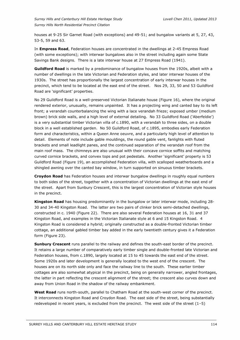
Surrey Hills and Canterbury Hill Estate Heritage Study Lovell Chen 2011, Updated 2013
Surrey Hills North Residential Precinct Citation
houses at 9-25 Sir Garnet Road (with exceptions) and 49-51; and bungalow variants at 5, 27, 43, 53-5, 59 and 63.
In Empress Road, Federation houses are concentrated in the dwellings at 2-45 Empress Road (with some exceptions); with interwar bungalows also in the street including again some State Savings Bank designs. There is a late interwar house at 27 Empress Road (1941).
Guildford Road is marked by a predominance of bungalow houses from the 1920s, albeit with a number of dwellings in the late Victorian and Federation styles, and later interwar houses of the 1930s. The street has proportionally the largest concentration of early interwar houses in the precinct, which tend to be located at the east end of the street. Nos 29, 33, 50 and 53 Guildford Road are ‘significant’ properties.
No 29 Guildford Road is a well-preserved Victorian Italianate house (Figure 16), where the original rendered exterior, unusually, remains unpainted. It has a projecting wing and canted bay to its left front; a verandah counterbalancing the wing with a lace verandah frieze; exposed umber (medium brown) brick side walls, and a high level of external detailing. No 33 Guildford Road (‘Aberfeldie’) is a very substantial timber Victorian villa of c.1890, with a verandah to three sides, on a double block in a well established garden. No 50 Guildford Road, of c.1895, embodies early Federation form and characteristics, within a Queen Anne oeuvre, and a particularly high level of attention to detail. Elements of note include gable mouldings, the round gable vent, fanlights with fluted brackets and small leadlight panes, and the continued separation of the verandah roof from the main roof mass. The chimneys are also unusual with their concave cornice soffits and matching curved cornice brackets, and convex tops and pot pedestals. Another ‘significant’ property is 53 Guildford Road (Figure 19), an accomplished Federation villa, with scalloped weatherboards and a shingled awning over the canted bay window, in turn supported on sinuous timber brackets.
Croydon Road has Federation houses and interwar bungalow dwellings in roughly equal numbers to both sides of the street, together with a concentration of Victorian dwellings at the east end of the street. Apart from Sunbury Crescent, this is the largest concentration of Victorian style houses in the precinct.
Kingston Road has housing predominantly in the bungalow or later interwar mode, including 28-30 and 34-40 Kingston Road. The latter are two pairs of clinker brick semi-detached dwellings, constructed in c. 1940 (Figure 22). There are also several Federation houses at 16, 31 and 37 Kingston Road, and examples in the Victorian Italianate style at 6 and 15 Kingston Road. 4 Kingston Road is considered a hybrid; originally constructed as a double-fronted Victorian timber cottage, an additional gabled timber bay added in the early twentieth century gives it a Federation form (Figure 23).
Sunbury Crescent runs parallel to the railway and defines the south-east border of the precinct. It retains a large number of comparatively early timber single and double-fronted late Victorian and Federation houses, from c.1890, largely located at 15 to 45 towards the east end of the street. Some 1920s and later development is generally located to the west end of the crescent. The houses are on its north side only and face the railway line to the south. These earlier timber cottages are also somewhat atypical in the precinct, being on generally narrower, angled frontages, the latter in part reflecting the crescent alignment of the street; the crescent also curves down and away from Union Road in the shadow of the railway embankment.
West Road runs north-south, parallel to Chatham Road at the south-west corner of the precinct. It interconnects Kingston Road and Croydon Road. The east side of the street, being substantially redeveloped in recent years, is excluded from the precinct. The west side of the street (1–5)
SURREY HILLS AND CANTERBURY HILL ESTATE HERITAGE STUDY 114
__________________________________________________________________________________________________________
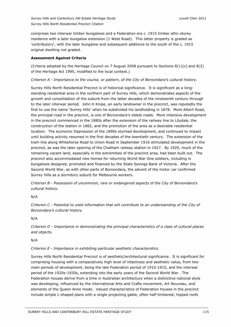
Surrey Hills and Canterbury Hill Estate Heritage Study Lovell Chen 2011
Surrey Hills North Residential Precinct Citation
comprises two interwar timber bungalows and a Federation era c. 1915 timber attic-storey residence with a later bungalow extension (1 West Road). This latter property is graded as ‘contributory’, with the later bungalow and subsequent additions to the south of the c. 1915 original dwelling not graded.
Assessment Against Criteria
(Criteria adopted by the Heritage Council on 7 August 2008 pursuant to Sections 8(1)(c) and 8(2) of the Heritage Act 1995, modified to the local context.)
Criterion A - Importance to the course, or pattern, of the City of Boroondara’s cultural history.
Surrey Hills North Residential Precinct is of historical significance. It is significant as a long-standing residential area in the northern part of Surrey Hills, which demonstrates aspects of the growth and consolidation of the suburb from the latter decades of the nineteenth century through to the later interwar period. John H Knipe, an early landowner in the precinct, was reputedly the first to use the name ‘Surrey Hills’ when he subdivided his landholding in 1878. Mont Albert Road, the principal road in the precinct, is one of Boroondara’s oldest roads. More intensive development in the precinct commenced in the 1880s after the extension of the railway line to Lilydale, the construction of the station in 1882, and the promotion of the area as a desirable residential location. The economic Depression of the 1890s stymied development, and continued to impact until building activity resumed in the first decades of the twentieth century. The extension of the tram line along Whitehorse Road to Union Road in September 1916 stimulated development in the precinct, as was the later opening of the Chatham railway station in 1927. By 1920, much of the remaining vacant land, especially in the extremities of the precinct area, had been built out. The precinct also accommodated new homes for returning World War One soldiers, including in bungalows designed, promoted and financed by the State Savings Bank of Victoria. After the Second World War, as with other parts of Boroondara, the advent of the motor car confirmed Surrey Hills as a dormitory suburb for Melbourne workers.
Criterion B - Possession of uncommon, rare or endangered aspects of the City of Boroondara’s cultural history.
N/A
Criterion C - Potential to yield information that will contribute to an understanding of the City of Boroondara’s cultural history.
N/A
Criterion D - Importance in demonstrating the principal characteristics of a class of cultural places and objects.
N/A
Criterion E - Importance in exhibiting particular aesthetic characteristics.
Surrey Hills North Residential Precinct is of aesthetic/architectural significance. It is significant for comprising housing with a comparatively high level of intactness and aesthetic value, from two main periods of development, being the late Federation period of 1910-1915, and the interwar period of the 1920s-1930s, extending into the early years of the Second World War. The Federation houses derive from a time in Australian architecture when a distinctive national style was developing, influenced by the international Arts and Crafts movement, Art Nouveau, and elements of the Queen Anne mode. Valued characteristics of Federation houses in the precinct include simple L-shaped plans with a single projecting gable, often half-timbered; hipped roofs
SURREY HILLS AND CANTERBURY HILL ESTATE HERITAGE STUDY 115
__________________________________________________________________________________________________________
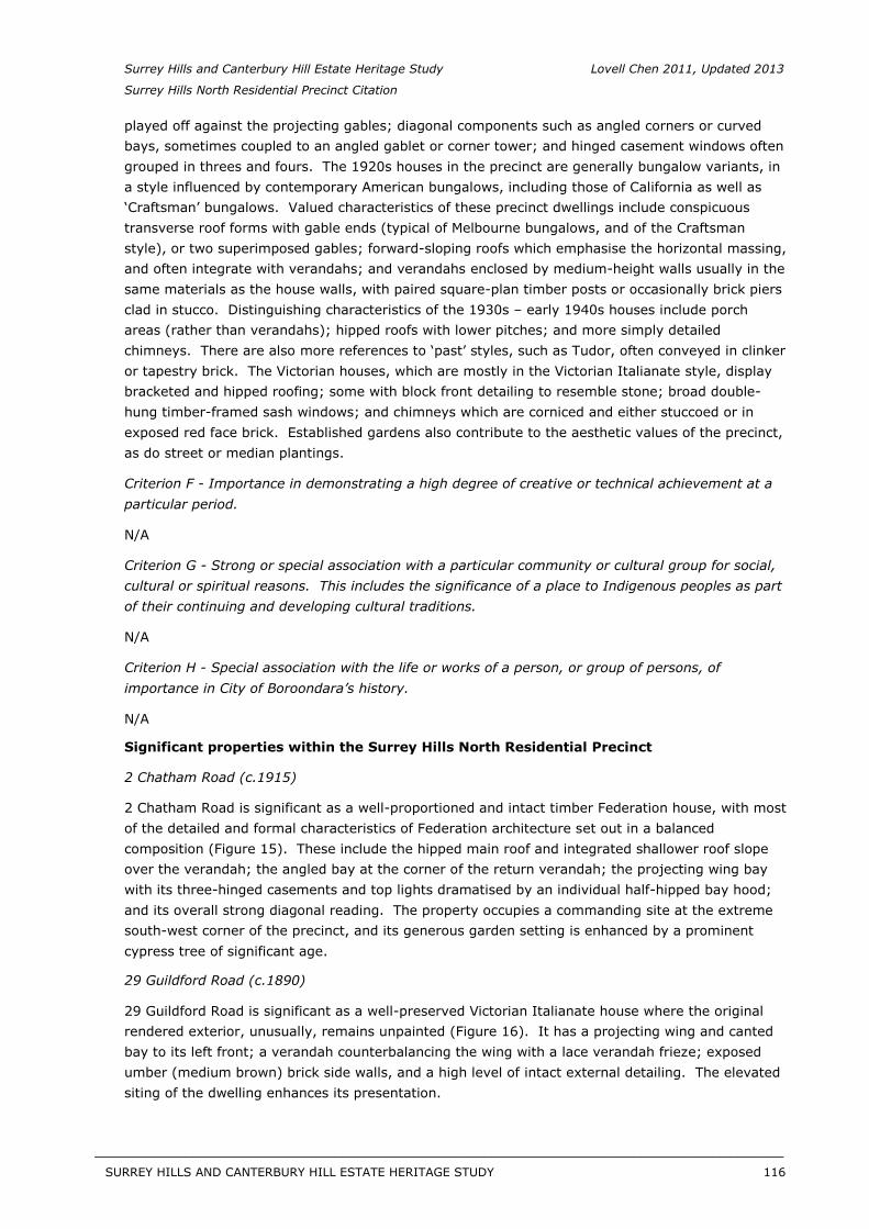
Surrey Hills and Canterbury Hill Estate Heritage Study Lovell Chen 2011, Updated 2013
Surrey Hills North Residential Precinct Citation
played off against the projecting gables; diagonal components such as angled corners or curved bays, sometimes coupled to an angled gablet or corner tower; and hinged casement windows often grouped in threes and fours. The 1920s houses in the precinct are generally bungalow variants, in a style influenced by contemporary American bungalows, including those of California as well as ‘Craftsman’ bungalows. Valued characteristics of these precinct dwellings include conspicuous transverse roof forms with gable ends (typical of Melbourne bungalows, and of the Craftsman style), or two superimposed gables; forward-sloping roofs which emphasise the horizontal massing, and often integrate with verandahs; and verandahs enclosed by medium-height walls usually in the same materials as the house walls, with paired square-plan timber posts or occasionally brick piers clad in stucco. Distinguishing characteristics of the 1930s – early 1940s houses include porch areas (rather than verandahs); hipped roofs with lower pitches; and more simply detailed chimneys. There are also more references to ‘past’ styles, such as Tudor, often conveyed in clinker or tapestry brick. The Victorian houses, which are mostly in the Victorian Italianate style, display bracketed and hipped roofing; some with block front detailing to resemble stone; broad double-hung timber-framed sash windows; and chimneys which are corniced and either stuccoed or in exposed red face brick. Established gardens also contribute to the aesthetic values of the precinct, as do street or median plantings.
Criterion F - Importance in demonstrating a high degree of creative or technical achievement at a particular period.
N/A
Criterion G - Strong or special association with a particular community or cultural group for social, cultural or spiritual reasons. This includes the significance of a place to Indigenous peoples as part of their continuing and developing cultural traditions.
N/A
Criterion H - Special association with the life or works of a person, or group of persons, of importance in City of Boroondara’s history.
N/A
Significant properties within the Surrey Hills North Residential Precinct
2 Chatham Road (c.1915)
2 Chatham Road is significant as a well-proportioned and intact timber Federation house, with most of the detailed and formal characteristics of Federation architecture set out in a balanced composition (Figure 15). These include the hipped main roof and integrated shallower roof slope over the verandah; the angled bay at the corner of the return verandah; the projecting wing bay with its three-hinged casements and top lights dramatised by an individual half-hipped bay hood; and its overall strong diagonal reading. The property occupies a commanding site at the extreme south-west corner of the precinct, and its generous garden setting is enhanced by a prominent cypress tree of significant age.
29 Guildford Road (c.1890)
29 Guildford Road is significant as a well-preserved Victorian Italianate house where the original rendered exterior, unusually, remains unpainted (Figure 16). It has a projecting wing and canted bay to its left front; a verandah counterbalancing the wing with a lace verandah frieze; exposed umber (medium brown) brick side walls, and a high level of intact external detailing. The elevated siting of the dwelling enhances its presentation.
SURREY HILLS AND CANTERBURY HILL ESTATE HERITAGE STUDY 116
__________________________________________________________________________________________________________
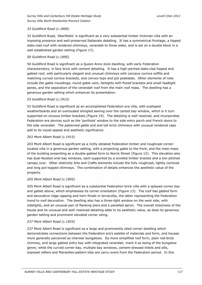
Surrey Hills and Canterbury Hill Estate Heritage Study Lovell Chen 2011
Surrey Hills North Residential Precinct Citation
33 Guildford Road (c.1890)
33 Guildford Road, ‘Aberfeldie’ is significant as a very substantial timber Victorian villa with an imposing presence and well-preserved Italianate detailing. It has a symmetrical frontage, a hipped slate-clad roof with rendered chimneys, verandah to three sides, and is set on a double block in a well established garden setting (Figure 17).
50 Guildford Road (c.1895)
50 Guildford Road is significant as a Queen Anne style dwelling, with early Federation characteristics, in face brick with cement detailing. It has a high-pitched slate-clad hipped and gabled roof, with particularly elegant and unusual chimneys with concave cornice soffits and matching curved cornice brackets, and convex tops and pot pedestals. Other elements of note include the gable mouldings, round gable vent, fanlights with fluted brackets and small leadlight panes, and the separation of the verandah roof from the main roof mass. The dwelling has a generous garden setting which enhances its presentation.
53 Guildford Road (c.1915)
53 Guildford Road is significant as an accomplished Federation era villa, with scalloped weatherboards and an overscaled shingled awning over the canted bay window, which is it turn supported on sinuous timber brackets (Figure 19). The detailing is well resolved, and incorporates Federation era devices such as the ‘porthole’ window to the side entry porch and French doors to the side verandah. The patterned gable end and tall brick chimneys with unusual rendered caps add to its visual appeal and aesthetic significance.
203 Mont Albert Road (c.1915)
203 Mont Albert Road is significant as a richly detailed Federation timber and roughcast corner-located villa in a generous garden setting, with a projecting gable to the front, and the main mass of the building presenting as a double-gabled form to Norris Street (Figure 12). This elevation also has dual-faceted oriel bay windows, each supported by a scrolled timber bracket and a low-pitched canopy over. Other distinctly Arts and Crafts elements include the fully roughcast, lightly corniced and long pot-topped chimneys. The combination of details enhances the aesthetic value of the property.
205 Mont Albert Road (c.1905)
205 Mont Albert Road is significant as a substantial Federation brick villa with a splayed corner bay and gablet above, which emphasises its corner orientation (Figure 13). The roof has gabled form and decorative ridge capping and horn finials in terracotta, the latter representing the Federation trend to roof decoration. The dwelling also has a three-light window on the west side, with sidelights, and an unusual pair of flanking piers and a panelled apron. The overall intactness of the house and its unusual and well–resolved detailing adds to its aesthetic value, as does its generous garden setting and prominent elevated corner siting.
237 Mont Albert Road (c.1925)
237 Mont Albert Road is significant as a large and prominently sited corner dwelling which demonstrates connections between the Federation era’s palette of materials and form, and houses more generally perceived as interwar bungalows. Its more simplified roof form, plain red-brick chimney, and large gabled entry bay with integrated verandah, mark it as being of the bungalow genre; while the curved corner bay, multiple bay windows, cement-dressed lintels and sills, exposed rafters and Marseilles-pattern tiles are carry-overs from the Federation period. In this
SURREY HILLS AND CANTERBURY HILL ESTATE HERITAGE STUDY 117
__________________________________________________________________________________________________________
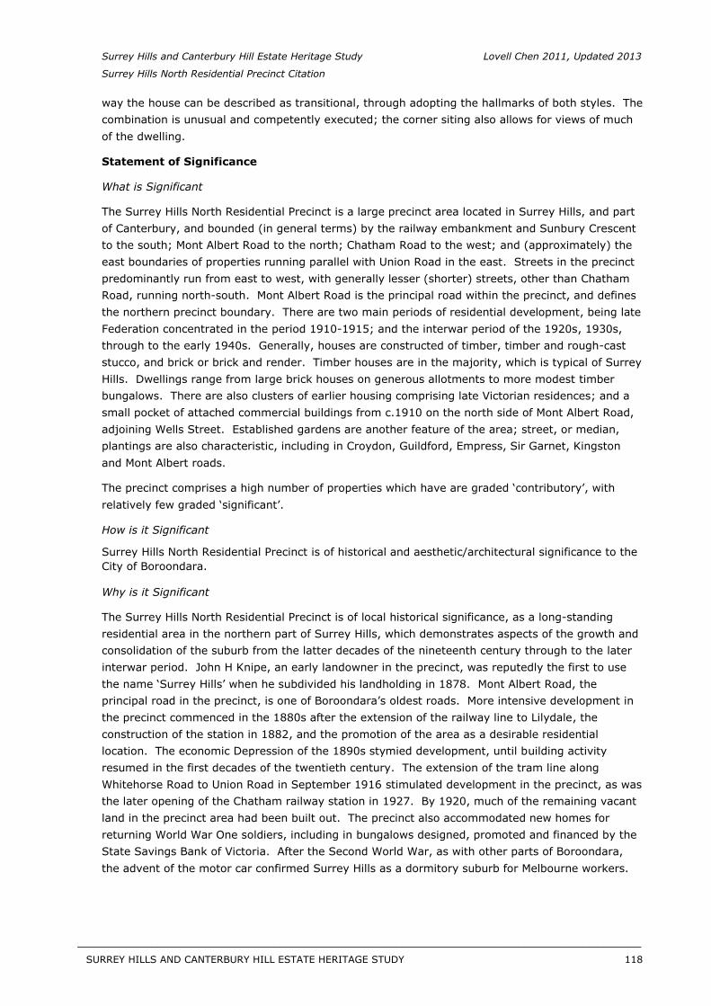
Surrey Hills and Canterbury Hill Estate Heritage Study Lovell Chen 2011, Updated 2013
Surrey Hills North Residential Precinct Citation
way the house can be described as transitional, through adopting the hallmarks of both styles. The combination is unusual and competently executed; the corner siting also allows for views of much of the dwelling.
Statement of Significance
What is Significant
The Surrey Hills North Residential Precinct is a large precinct area located in Surrey Hills, and part of Canterbury, and bounded (in general terms) by the railway embankment and Sunbury Crescent to the south; Mont Albert Road to the north; Chatham Road to the west; and (approximately) the east boundaries of properties running parallel with Union Road in the east. Streets in the precinct predominantly run from east to west, with generally lesser (shorter) streets, other than Chatham Road, running north-south. Mont Albert Road is the principal road within the precinct, and defines the northern precinct boundary. There are two main periods of residential development, being late Federation concentrated in the period 1910-1915; and the interwar period of the 1920s, 1930s, through to the early 1940s. Generally, houses are constructed of timber, timber and rough-cast stucco, and brick or brick and render. Timber houses are in the majority, which is typical of Surrey Hills. Dwellings range from large brick houses on generous allotments to more modest timber bungalows. There are also clusters of earlier housing comprising late Victorian residences; and a small pocket of attached commercial buildings from c.1910 on the north side of Mont Albert Road, adjoining Wells Street. Established gardens are another feature of the area; street, or median, plantings are also characteristic, including in Croydon, Guildford, Empress, Sir Garnet, Kingston and Mont Albert roads.
The precinct comprises a high number of properties which have are graded ‘contributory’, with relatively few graded ‘significant’.
How is it Significant
Surrey Hills North Residential Precinct is of historical and aesthetic/architectural significance to the City of Boroondara.
Why is it Significant
The Surrey Hills North Residential Precinct is of local historical significance, as a long-standing residential area in the northern part of Surrey Hills, which demonstrates aspects of the growth and consolidation of the suburb from the latter decades of the nineteenth century through to the later interwar period. John H Knipe, an early landowner in the precinct, was reputedly the first to use the name ‘Surrey Hills’ when he subdivided his landholding in 1878. Mont Albert Road, the principal road in the precinct, is one of Boroondara’s oldest roads. More intensive development in the precinct commenced in the 1880s after the extension of the railway line to Lilydale, the construction of the station in 1882, and the promotion of the area as a desirable residential location. The economic Depression of the 1890s stymied development, until building activity resumed in the first decades of the twentieth century. The extension of the tram line along Whitehorse Road to Union Road in September 1916 stimulated development in the precinct, as was the later opening of the Chatham railway station in 1927. By 1920, much of the remaining vacant land in the precinct area had been built out. The precinct also accommodated new homes for returning World War One soldiers, including in bungalows designed, promoted and financed by the State Savings Bank of Victoria. After the Second World War, as with other parts of Boroondara, the advent of the motor car confirmed Surrey Hills as a dormitory suburb for Melbourne workers.
SURREY HILLS AND CANTERBURY HILL ESTATE HERITAGE STUDY 118
__________________________________________________________________________________________________________
Surrey Hills and Canterbury Hill Estate Heritage Study Lovell Chen 2011
Surrey Hills North Residential Precinct Citation
Surrey Hills North Residential Precinct is also of local aesthetic/architectural significance, comprising housing with a comparatively high level of intactness from two main periods of development, being the late Federation period of 1910-1915, and the interwar period of the 1920s and 1930s to early 1940s. The Federation houses derive from a time in Australian architecture when a distinctive national style was developing, influenced by the international Arts and Crafts movement, Art Nouveau, and elements of the Queen Anne mode. Valued characteristics of Federation houses in the precinct include simple L-shaped plans with a single projecting gable, often half-timbered; hipped roofs played off against the projecting gables; diagonal components such as angled corners or curved bays, sometimes coupled to an angled gablet or corner tower; and hinged casement windows often grouped in threes and fours. The 1920s houses in the precinct are generally bungalow variants, in a style influenced by contemporary American bungalows, including those of California as well as ‘Craftsman’ bungalows. Valued characteristics of these precinct dwellings include conspicuous transverse roof forms with gable ends (typical of Melbourne bungalows, and of the Craftsman style), or two superimposed gables; forward-sloping roofs which emphasise the horizontal massing, and often integrate with verandahs; and verandahs enclosed by medium-height walls usually in the same materials as the house walls, with paired square-plan timber posts or occasionally brick piers clad in stucco. Distinguishing characteristics of the 1930s –early 1940s houses include porch areas (rather than verandahs); hipped roofs with lower pitches; and more simply detailed chimneys. There are also more references to ‘past’ styles, such as Tudor, often conveyed in clinker or tapestry brick. The Victorian houses, which are mostly in the Victorian Italianate style, display bracketed and hipped roofing; some with block front detailing to resemble stone; broad double-hung timber-framed sash windows; and chimneys which are corniced and either stuccoed or in exposed red face brick. Established gardens also contribute to the aesthetic values of the precinct, as do street or median plantings.
Recommendations
Recommended for inclusion in the Schedule to the Heritage Overlay of the Boroondara Planning Scheme.
External Paint Controls No
Internal Alterations Controls No
Tree Controls No
Outbuildings and fences exemptions No
Victorian Heritage Register No
Prohibited uses may be permitted No
Incorporated plan No
Aboriginal heritage place No
Identified By
Lovell Chen, Surrey Hills and Canterbury Hill Estate Heritage Study, 2011.
References
General: Butler, G. Camberwell Conservation Study, 1991.
Specific:
SURREY HILLS AND CANTERBURY HILL ESTATE HERITAGE STUDY 119
__________________________________________________________________________________________________________
Surrey Hills and Canterbury Hill Estate Heritage Study Lovell Chen 2011, Updated 2013
Surrey Hills North Residential Precinct Citation
1 Surrey Hills History Nook Group, Surrey Hills: In Celebration of the Centennial 1883 – 1983, the Authors, Surrey Hills, Vic, 1983, p. 1.
2 Surrey Hills Neighbourhood Centre Heritage Collection, ‘Surrey Hills History Walkabout no. 2’.
3 See diagram titled ‘Landowners 1880’, prepared by Alan Holt in 1989, copy provided to the consultants by the Surrey Hills Historical Society.
4 Surrey Hills Neighbourhood Centre Heritage Collection, ‘Surrey Hills History Walkabout no. 6’, and ‘Surrey Hills History Walkabout no. 2’.
5 Surrey Hills History Nook Group, Surrey Hills: In Celebration of the Centennial 1883 – 1983, the Authors, Surrey Hills, Vic, 1983, p. 5.
6 Auction Notice cited in Surrey Hills History Nook Group, Surrey Hills: In Celebration of the Centennial1883 – 1983, the Authors, Surrey Hills, Vic, 1983, p. 9.
7 See diagram titled ‘Residential Subdivisions’, prepared by Alan Holt in 1989, copy provided to the consultants by the Surrey Hills Historical Society.
8 Surrey Hills History Nook Group, Surrey Hills: In Celebration of the Centennial 1883 – 1983, the Authors, Surrey Hills, Vic, 1983, p. 9.
9 Surrey Hills History Nook Group, Surrey Hills: In Celebration of the Centennial 1883 – 1983, the Authors, Surrey Hills, Vic, 1983, p. 38.
10 Home and Garden Beautiful, 1 August 1915, as cited in Chris McConville and Associates, CamberwellConservation Study: Volume Two: Camberwell Environment History, City of Camberwell, Camberwell, Vic, 1990, p. 3.
11 Chris McConville and Associates, Camberwell Conservation Study: Volume Twp: CamberwellEnvironment History, City of Camberwell, Camberwell, Vic, 1990, pp. 5-6.
12 Graeme Butler & Associates, Camberwell Conservation Study, 1991, vol. 2, p.60.
13 The Argus, 15 September 1919, p. 8.
14 Museum Victoria: <http://museumvictoria.com.au/collections/themes/2470/the-state-savings-bank-of-victoria-melbourne-
victoria>, accessed 25 March 2011.
15 Wikipedia; see also www.boroondaralocal.com.au.
16 Chris McConville and Associates, Camberwell Conservation Study: Volume Twp: CamberwellEnvironment History, City of Camberwell, Camberwell, Vic, 1990, p. 84.
17 The Age, 9 May 1980, p. 31.
18 Identified by Lovell Chen as part of this study of Surrey Hills.
SURREY HILLS AND CANTERBURY HILL ESTATE HERITAGE STUDY 120
__________________________________________________________________________________________________________
STAGE 2 CITATIONS TO THE SURREY HILLS AND CANTERBURY HILL ESTATE HERITAGE STUDY
(SURREY HILLS SOUTH RESIDENTIAL PRECINCTS HERITAGE STUDY)
SURREY HI LLS AND CANTERBURY HI LL ESTATE HERITAGE STUDY 121
APPENDIX 2: STAGE 2 HERITAGE CITATIONS - INDIVIDUAL PROPERTIES
SURREY HI LLS AND CANTERBURY HI LL ESTATE HERITAGE STUDY 122

Former Surrey College, 17-19A Barton Street, Surrey Hills
Name Former Surrey College
Address 17-19A Barton Street, Surrey Hills
Extent of Overlay
Place Type Residence
Survey Date April 2013 (from public domain only), Aug. 2014 (entire exterior)
Date of Construction
1891 and 1897
Recommendation Include in the Schedule to the Heritage Overlay
Intactness Good X Fair Poor
Figure 3 East side of subject property, as seen from Barton Street.
History
Much of what is today known as the suburb of Surrey Hills was taken up as part of Elgar’s Special Survey in 1841, comprising more than 5,000 acres in the parishes of Boroondara and Nunawading. This large area was subsequently broken up for farmland between the 1850s and 1870s. The name ‘Surrey Hills’ was reputedly first used by John H Knipe in his 1878 subdivision just south of Mont Albert Road.1
Prior to this, the current land area bounded by Warrigal, Riversdale and Canterbury roads and the approximate alignment of Highfield Road in the Parish of Boroondara was divided into lots 151, 152 and 153 and purchased at a land sale held on 5 May 1853. Mr W Smith purchased the 132 acres of lot 152, and partners T B Payne and H Glass purchased the 105
SURREY HI LLS AND CANTERBURY HI LL ESTATE HERITAGE STUDY 123
acre lot 153, and the nearly 130 acre Allotment 151.2 Although the gold rushes of the 1850s prompted a massive influx of immigrants to Melbourne, Surrey Hills continued to remain predominantly rural in character and sparsely settled, especially the outlying land to the east.
The Boroondara District Road Board was established in July 1854 and by 1860, a number of the major roads that bisect the Parish of Boroondara had been established. The Roads Board became the Shire of Boroondara in 1871. Soon after, Councillors floated a proposal for the beautification of the district, including planting of street trees.3
However, it was the construction of the railway through the eastern suburbs to Lilydale in 1882 which provided the catalyst for more intensive development of the suburb. The name ‘Surrey Hills’ was confirmed with the construction of the Surrey Hills Railway Station, which officially opened on 6 October 1883. 4
Undeveloped land near the railway was a boon for developers, and the hills, providing views of the surrounding district, were highly marketable.5 The 1880s saw a boom in real estate prices and land speculation, and the railway line to Surrey Hills heightened the appeal of the increasingly accessible district. Developers and estate agents promoted a suburban lifestyle in the area that was embraced by both middle class and working class purchasers.
The prosperity of the 1880s gave way to a bank and property collapse in the 1890s, prompting a severe economic depression throughout Victoria. Despite the rapid sale of residential estates that had marked the 1880s, by the early 1910s much of Surrey Hills still remained vacant, with the Melbourne and Metropolitan Board of Works (MMBW) plans from this period showing a number of residential estates occupied with a relatively small number of houses.6 Members of the community had also been advocating for the construction of tram lines, and in 1916 the electric tramway was extended along Whitehorse Road to Union Road, and along Riversdale Road to Wattle Park.7 The extension of these tramway routes was also beneficial to developers who could promote proximity to the tramlines, and the increasingly accessible outlying areas of the suburb.8
The white collar character of Surrey Hills in the 1880s, with its genteel housing and large garden allotments, began to give way to a more densely populated residential suburb in the first half of the twentieth century. Examples of earlier and often larger houses remained in the suburb, however, often in juxtaposition with more modest Federation and interwar houses and bungalows.
19 Barton Street
The subject property was originally part of the Surrey Park Estate, which was subdivided and sold in the mid-1880s (Figure 4). As with many subdivisions in Surrey Hills, Surrey Park adopted English county names - Kent (later Barton) and York - for the two thoroughfares which bisected it. Union Road was to the west side. The first auction of land was held in December 1884, with sixty-four allotments offered for sale.9 Surrey Park was ‘the most convenient, highest and most charming estate’, and prospective residents would see their pale cheeks turned the ‘ruddy brown of health’ from the ‘pure bracing air’ of Surrey Hills.10 Early purchasers of land in the estate included Jessie Monteath, Robert Cashin and Louisa Langland, all of whom acquired allotments in the 1880s that would later be consolidated to form the subject property.11
SURREY HI LLS AND CANTERBURY HI LL ESTATE HERITAGE STUDY 124
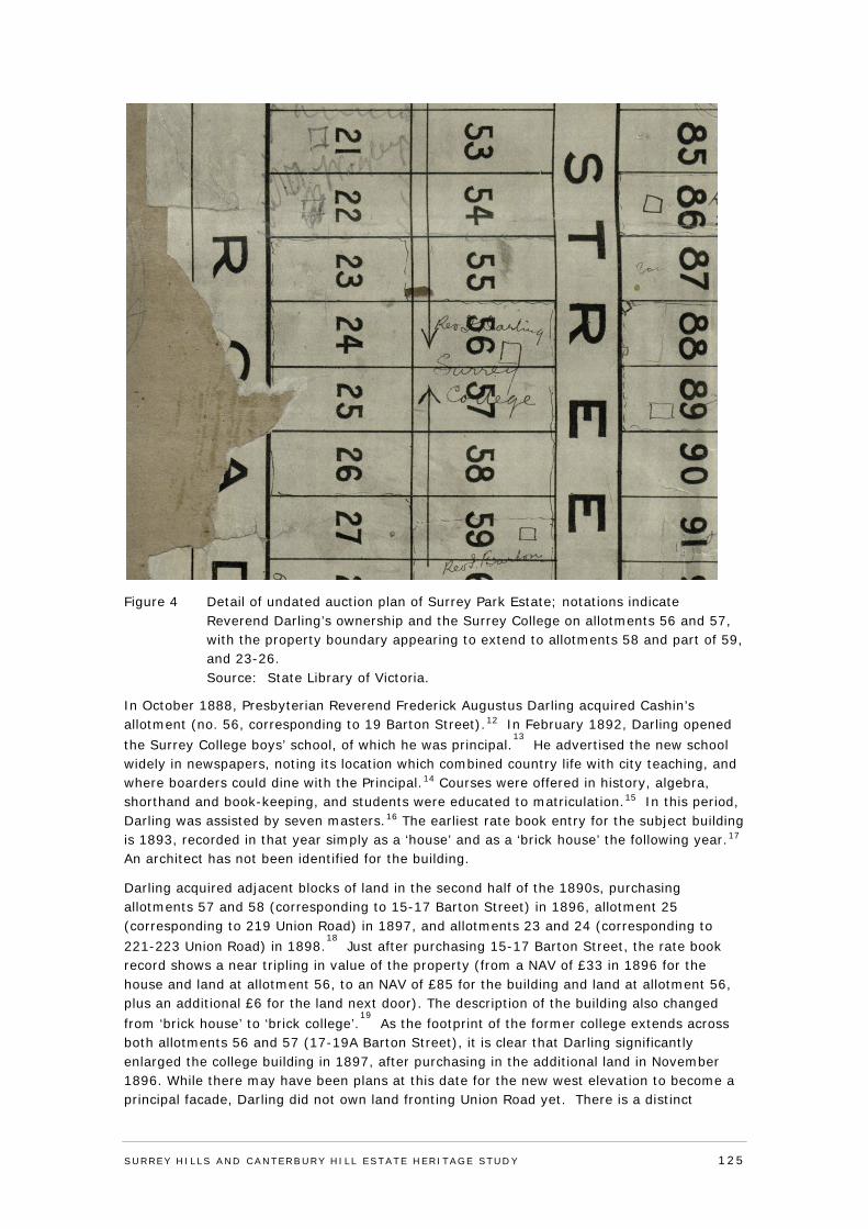
Figure 4 Detail of undated auction plan of Surrey Park Estate; notations indicate Reverend Darling’s ownership and the Surrey College on allotments 56 and 57, with the property boundary appearing to extend to allotments 58 and part of 59, and 23-26. Source: State Library of Victoria.
In October 1888, Presbyterian Reverend Frederick Augustus Darling acquired Cashin’s allotment (no. 56, corresponding to 19 Barton Street).12 In February 1892, Darling opened the Surrey College boys’ school, of which he was principal.
13 He advertised the new school
widely in newspapers, noting its location which combined country life with city teaching, and where boarders could dine with the Principal.14 Courses were offered in history, algebra, shorthand and book-keeping, and students were educated to matriculation.15 In this period, Darling was assisted by seven masters.16 The earliest rate book entry for the subject building is 1893, recorded in that year simply as a ‘house’ and as a ‘brick house’ the following year.17 An architect has not been identified for the building.
Darling acquired adjacent blocks of land in the second half of the 1890s, purchasing allotments 57 and 58 (corresponding to 15-17 Barton Street) in 1896, allotment 25 (corresponding to 219 Union Road) in 1897, and allotments 23 and 24 (corresponding to 221-223 Union Road) in 1898.
18 Just after purchasing 15-17 Barton Street, the rate book
record shows a near tripling in value of the property (from a NAV of £33 in 1896 for the house and land at allotment 56, to an NAV of £85 for the building and land at allotment 56, plus an additional £6 for the land next door). The description of the building also changed from ‘brick house’ to ‘brick college’.
19 As the footprint of the former college extends across
both allotments 56 and 57 (17-19A Barton Street), it is clear that Darling significantly enlarged the college building in 1897, after purchasing in the additional land in November 1896. While there may have been plans at this date for the new west elevation to become a principal facade, Darling did not own land fronting Union Road yet. There is a distinct
SURREY HI LLS AND CANTERBURY HI LL ESTATE HERITAGE STUDY 125
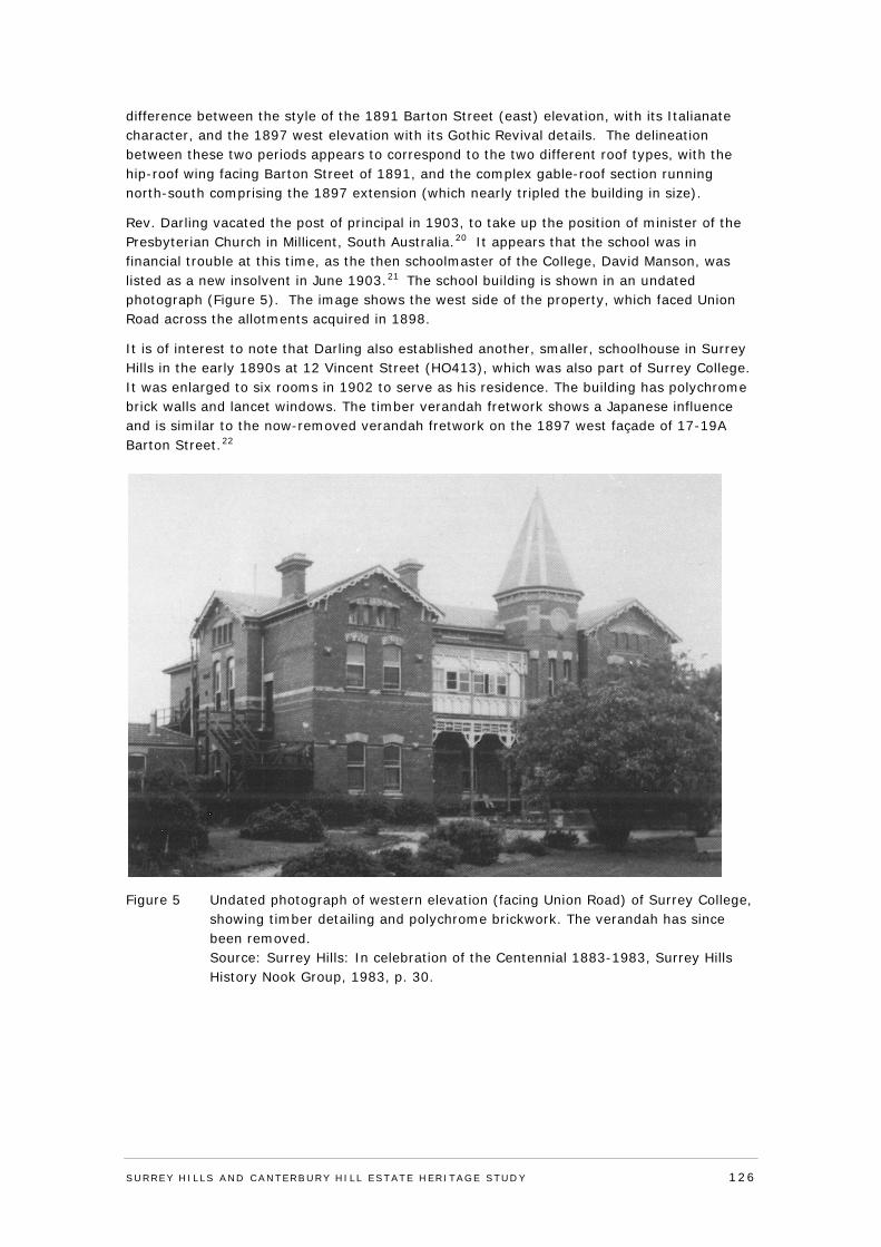
difference between the style of the 1891 Barton Street (east) elevation, with its Italianate character, and the 1897 west elevation with its Gothic Revival details. The delineation between these two periods appears to correspond to the two different roof types, with the hip-roof wing facing Barton Street of 1891, and the complex gable-roof section running north-south comprising the 1897 extension (which nearly tripled the building in size).
Rev. Darling vacated the post of principal in 1903, to take up the position of minister of the Presbyterian Church in Millicent, South Australia.20 It appears that the school was in financial trouble at this time, as the then schoolmaster of the College, David Manson, was listed as a new insolvent in June 1903.21 The school building is shown in an undated photograph (Figure 5). The image shows the west side of the property, which faced Union Road across the allotments acquired in 1898.
It is of interest to note that Darling also established another, smaller, schoolhouse in Surrey Hills in the early 1890s at 12 Vincent Street (HO413), which was also part of Surrey College. It was enlarged to six rooms in 1902 to serve as his residence. The building has polychrome brick walls and lancet windows. The timber verandah fretwork shows a Japanese influence and is similar to the now-removed verandah fretwork on the 1897 west façade of 17-19A Barton Street.22
Figure 5 Undated photograph of western elevation (facing Union Road) of Surrey College, showing timber detailing and polychrome brickwork. The verandah has since been removed. Source: Surrey Hills: In celebration of the Centennial 1883-1983, Surrey Hills History Nook Group, 1983, p. 30.
SURREY HI LLS AND CANTERBURY HI LL ESTATE HERITAGE STUDY 126
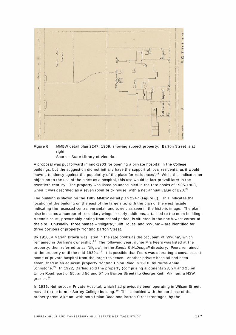
Figure 6 MMBW detail plan 2247, 1909, showing subject property. Barton Street is at right. Source: State Library of Victoria.
A proposal was put forward in mid-1903 for opening a private hospital in the College buildings, but the suggestion did not initially have the support of local residents, as it would ‘have a tendency against the popularity of the place for residences’.23 While this indicates an objection to the use of the place as a hospital, this use would in fact prevail later in the twentieth century. The property was listed as unoccupied in the rate books of 1905-1908, when it was described as a seven room brick house, with a net annual value of £20.24
The building is shown on the 1909 MMBW detail plan 2247 (Figure 6). This indicates the location of the building on the east of the large site, with the plan of the west façade indicating the recessed central verandah and tower, as seen in the historic image. The plan also indicates a number of secondary wings or early additions, attached to the main building. A tennis court, presumably dating from school period, is situated in the north-west corner of the site. Unusually, three names – ‘Nilgara’, ‘Cliff House’ and ‘Wyuna’ – are identified for three portions of property fronting Barton Street.
By 1910, a Marian Brown was listed in the rate books as the occupant of ‘Wyuna’, which remained in Darling’s ownership.25 The following year, nurse Mrs Peers was listed at the property, then referred to as ‘Nilgara’, in the Sands & McDougall directory. Peers remained at the property until the mid-1920s.26 It is possible that Peers was operating a convalescent home or private hospital from the large residence. Another private hospital had been established in an adjacent property fronting Union Road in 1910, by Nurse Annie Johnstone.27 In 1922, Darling sold the property (comprising allotments 23, 24 and 25 on Union Road, part of 55, and 56 and 57 on Barton Street) to George Keith Aikman, a NSW grazier.28
In 1936, Nethercourt Private Hospital, which had previously been operating in Wilson Street, moved to the former Surrey College building.29 This coincided with the purchase of the property from Aikman, with both Union Road and Barton Street frontages, by the
SURREY HI LLS AND CANTERBURY HI LL ESTATE HERITAGE STUDY 127
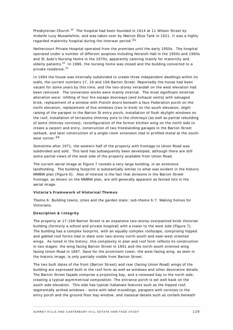
Presbyterian Church.30 The hospital had been founded in 1914 at 11 Wilson Street by midwife Lucy Musselwhite, and was taken over by Matron Eliza Tank in 1921. It was a highly regarded maternity hospital during the interwar period.31
Nethercourt Private Hospital operated from the premises until the early 1950s. The hospital operated under a number of different auspices including Norwich Hall in the 1950s and 1960s and St Jude’s Nursing Home in the 1970s, apparently catering mainly for maternity and elderly patients.32 In 1986, the nursing home was closed and the building converted to a private residence.33
In 1994 the house was internally subdivided to create three independent dwellings within its walls, the current numbers 17, 19 and 19A Barton Street. Reportedly the house had been vacant for some years by this time, and the two-storey verandah on the west elevation had been removed. The conversion works were mainly internal. The most significant external alteration were: infilling of four fire escape doorways (and exhaust vents) with salvaged brick, replacement of a window with French doors beneath a faux Federation porch on the north elevation, replacement of five windows (two in-kind) on the south elevation, slight raising of the parapet to the Barton St entry porch, installation of flush skylight windows on the roof, installation of terracotta chimney pots to the chimneys (as well as partial rebuilding of some chimney cornices), reconfiguration of the former kitchen wing on the north side to create a carport and entry, construction of two freestanding garages in the Barton Street setback, and later construction of a single-room extension clad in profiled metal at the south-west corner.34
Sometime after 1971, the western half of the property with frontage to Union Road was subdivided and sold. This land has subsequently been developed, although there are still some partial views of the west side of the property available from Union Road.
The current aerial image at Figure 7 reveals a very large building, in an extensive landholding. The building footprint is substantially similar to what was evident in the historic MMBW plan (Figure 6). Also of interest is the fact that divisions in the Barton Street frontage, as shown on the MMBW plan, are still generally apparent as fenced lots in the aerial image.
Victoria’s Framework of Historical Themes
Theme 6: Building towns, cities and the garden state; sub-theme 6.7: Making homes for Victorians.
Description & Integrity
The property at 17-19A Barton Street is an expansive two-storey overpainted brick Victorian building (formerly a school and private hospital) with a tower to the west side (Figure 7). The building has a complex footprint, with an equally complex roofscape, comprising hipped and gabled roof forms clad in slate over two-storey north-south and east-west oriented wings. As noted in the history, this complexity in plan and roof form reflects its construction in two stages: the wing facing Barton Street in 1891 and the north-south oriented wing facing Union Road in 1897. Save for the prominent tower, the west-facing wing, as seen in the historic image, is only partially visible from Barton Street.
The two built dates of the front (Barton Street) and rear (facing Union Road) wings of the building are expressed both in the roof form as well as windows and other decorative details. The Barton Street façade comprise a projecting bay, and a recessed bay to the north side, creating a typical asymmetrical composition. The entrance porch is set well back on the south side elevation. This side has typical Italianate features such as the hipped roof, segmentally arched windows - some with label mouldings, parapets with cornices to the entry porch and the ground floor bay window, and classical details such as corbels beneath
SURREY HI LLS AND CANTERBURY HI LL ESTATE HERITAGE STUDY 128
moulded window sills and paterae and fluting on the cornice above the bay window. In contrast, the large wing facing Union Road exhibits a new group of design features which are mainly Gothic Revival in character. These include shallow pointed arches to the windows, pierced bargeboards with timber brackets to the multiple gables (two facing Union Road, one to the north elevation and one to the south elevation), and an octagonal tower and a pointed roof above the western entry which adds a Romanesque Revival influence. There are some consistent features between the two parts, including a label moulding above the tiny attic windows in the gables, moulded window sills, and a classical swag motif on the face of the tower.
Much of the slate roof cladding appears to have been replaced in-kind and the aluminium flashing to the ridges is of recent origin. A number of skylights have been installed on the roof, but these are not visible from the ground. The tower roof is also clad in replacement slates, reproducing the original diaper pattern. There are seven visible overpainted-brick chimneys with corniced tops and terracotta chimney pots (most of the posts were installed as part of the 1990s works). The eaves gutters are recent although some of the down pipes are long standing. Exterior brick walls are overpainted, effectively concealing the patching done to the brick walls in the 1990s (filling in escape doors and exhaust vent holes).
As noted in the history, there was a series of internal and external works undertaken in the 1990s when the building was rescued and converted to three separate dwellings. Building plans lodged with Council, as well as photos taken by the owners document changes to the building. Of these alterations, the two new garages are the most visible from Barton Street, followed by the reconfigured kitchen wing on the north elevation. There is also some visibility of the faux Federation entry porch on the north side. The extension at the south-west corner is designed to sit proud of the building and is legible as a modern intervention with its flat roof and metal cladding - it is of the type likely to be approved in an existing Heritage Overlay. Overall, the alterations made in the 1990s were sympathetic to the building and did not disrupt or confuse its original design.
The building is set in a landscaped garden with extensive areas of recent brick paving. The east boundary is enclosed by a non-original high brick and timber palisade fence. There are two vehicle crossovers on Barton Street.
SURREY HI LLS AND CANTERBURY HI LL ESTATE HERITAGE STUDY 129
Figure 7 Recent aerial photograph of 17-19A Barton Street. The hip-roof section facing Barton Street is believed to date from 1891, and the large gabled wing behind it from 1897. Source: Nearmap (5 April, 2013).
SURREY HI LLS AND CANTERBURY HI LL ESTATE HERITAGE STUDY 130
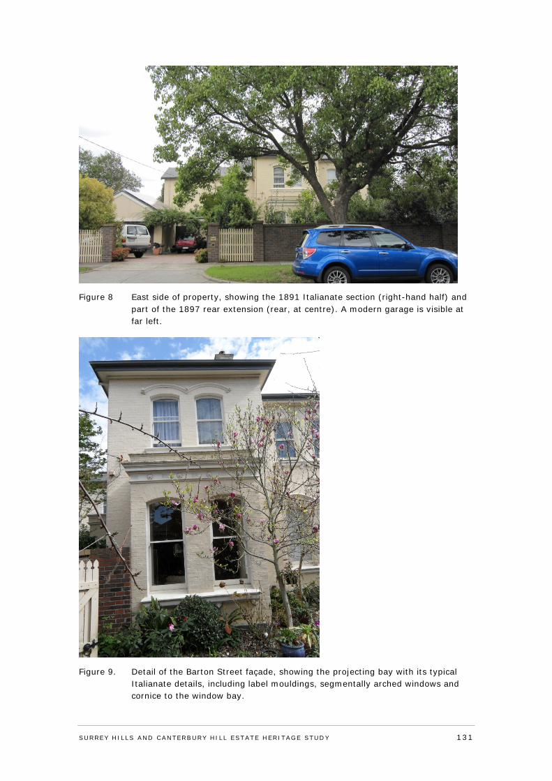
Figure 8 East side of property, showing the 1891 Italianate section (right-hand half) and part of the 1897 rear extension (rear, at centre). A modern garage is visible at far left.
Figure 9. Detail of the Barton Street façade, showing the projecting bay with its typical Italianate details, including label mouldings, segmentally arched windows and cornice to the window bay.
SURREY HI LLS AND CANTERBURY HI LL ESTATE HERITAGE STUDY 131
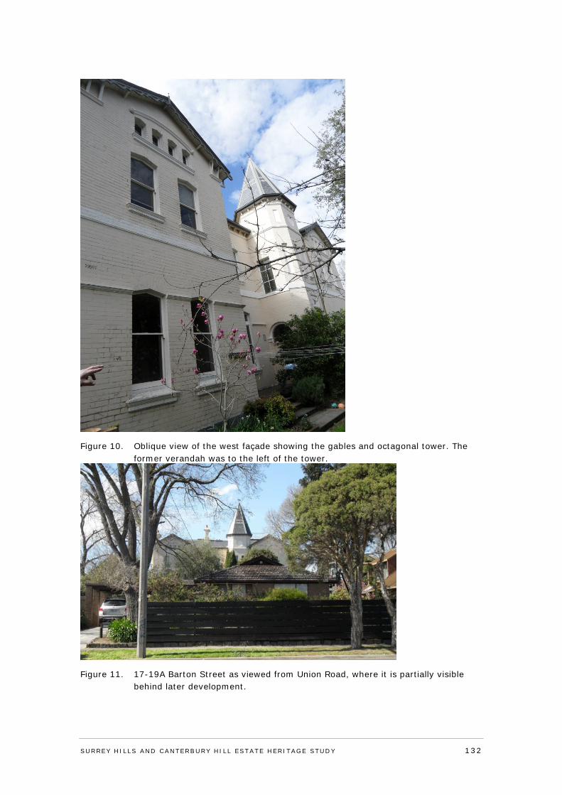
Figure 10. Oblique view of the west façade showing the gables and octagonal tower. The former verandah was to the left of the tower.
Figure 11. 17-19A Barton Street as viewed from Union Road, where it is partially visible behind later development.
SURREY HI LLS AND CANTERBURY HI LL ESTATE HERITAGE STUDY 132
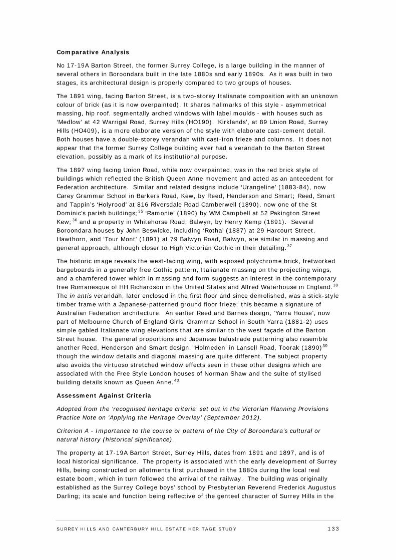
Comparative Analysis
No 17-19A Barton Street, the former Surrey College, is a large building in the manner of several others in Boroondara built in the late 1880s and early 1890s. As it was built in two stages, its architectural design is properly compared to two groups of houses.
The 1891 wing, facing Barton Street, is a two-storey Italianate composition with an unknown colour of brick (as it is now overpainted). It shares hallmarks of this style - asymmetrical massing, hip roof, segmentally arched windows with label moulds - with houses such as ‘Medlow’ at 42 Warrigal Road, Surrey Hills (HO190). ‘Kirklands’, at 89 Union Road, Surrey Hills (HO409), is a more elaborate version of the style with elaborate cast-cement detail. Both houses have a double-storey verandah with cast-iron frieze and columns. It does not appear that the former Surrey College building ever had a verandah to the Barton Street elevation, possibly as a mark of its institutional purpose.
The 1897 wing facing Union Road, while now overpainted, was in the red brick style of buildings which reflected the British Queen Anne movement and acted as an antecedent for Federation architecture. Similar and related designs include ‘Urangeline’ (1883-84), now Carey Grammar School in Barkers Road, Kew, by Reed, Henderson and Smart; Reed, Smart and Tappin’s ‘Holyrood’ at 816 Riversdale Road Camberwell (1890), now one of the St Dominic’s parish buildings;35 ‘Ramonie’ (1890) by WM Campbell at 52 Pakington Street Kew;36 and a property in Whitehorse Road, Balwyn, by Henry Kemp (1891). Several Boroondara houses by John Beswicke, including ‘Rotha’ (1887) at 29 Harcourt Street, Hawthorn, and ‘Tour Mont’ (1891) at 79 Balwyn Road, Balwyn, are similar in massing and general approach, although closer to High Victorian Gothic in their detailing.37
The historic image reveals the west-facing wing, with exposed polychrome brick, fretworked bargeboards in a generally free Gothic pattern, Italianate massing on the projecting wings, and a chamfered tower which in massing and form suggests an interest in the contemporary free Romanesque of HH Richardson in the United States and Alfred Waterhouse in England.38 The in antis verandah, later enclosed in the first floor and since demolished, was a stick-style timber frame with a Japanese-patterned ground floor frieze; this became a signature of Australian Federation architecture. An earlier Reed and Barnes design, ‘Yarra House’, now part of Melbourne Church of England Girls’ Grammar School in South Yarra (1881-2) uses simple gabled Italianate wing elevations that are similar to the west façade of the Barton Street house. The general proportions and Japanese balustrade patterning also resemble another Reed, Henderson and Smart design, ‘Holmeden’ in Lansell Road, Toorak (1890)39 though the window details and diagonal massing are quite different. The subject property also avoids the virtuoso stretched window effects seen in these other designs which are associated with the Free Style London houses of Norman Shaw and the suite of stylised building details known as Queen Anne.40
Assessment Against Criteria
Adopted from the ‘recognised heritage criteria’ set out in the Victorian Planning Provisions Practice Note on ‘Applying the Heritage Overlay’ (September 2012).
Criterion A - Importance to the course or pattern of the City of Boroondara’s cultural or natural history (historical significance).
The property at 17-19A Barton Street, Surrey Hills, dates from 1891 and 1897, and is of local historical significance. The property is associated with the early development of Surrey Hills, being constructed on allotments first purchased in the 1880s during the local real estate boom, which in turn followed the arrival of the railway. The building was originally established as the Surrey College boys’ school by Presbyterian Reverend Frederick Augustus Darling; its scale and function being reflective of the genteel character of Surrey Hills in the
SURREY HI LLS AND CANTERBURY HI LL ESTATE HERITAGE STUDY 133
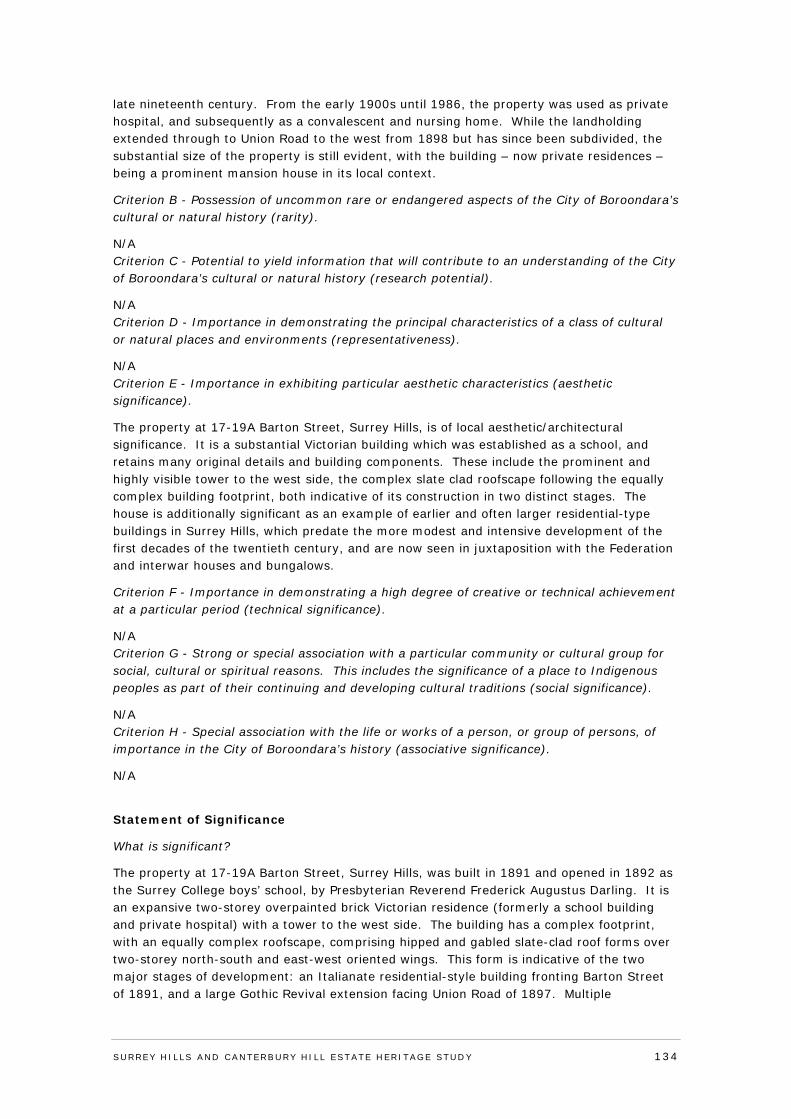
late nineteenth century. From the early 1900s until 1986, the property was used as private hospital, and subsequently as a convalescent and nursing home. While the landholding extended through to Union Road to the west from 1898 but has since been subdivided, the substantial size of the property is still evident, with the building – now private residences – being a prominent mansion house in its local context.
Criterion B - Possession of uncommon rare or endangered aspects of the City of Boroondara’s cultural or natural history (rarity).
N/A Criterion C - Potential to yield information that will contribute to an understanding of the City of Boroondara’s cultural or natural history (research potential).
N/A Criterion D - Importance in demonstrating the principal characteristics of a class of cultural or natural places and environments (representativeness).
N/A Criterion E - Importance in exhibiting particular aesthetic characteristics (aesthetic significance).
The property at 17-19A Barton Street, Surrey Hills, is of local aesthetic/architectural significance. It is a substantial Victorian building which was established as a school, and retains many original details and building components. These include the prominent and highly visible tower to the west side, the complex slate clad roofscape following the equally complex building footprint, both indicative of its construction in two distinct stages. The house is additionally significant as an example of earlier and often larger residential-type buildings in Surrey Hills, which predate the more modest and intensive development of the first decades of the twentieth century, and are now seen in juxtaposition with the Federation and interwar houses and bungalows.
Criterion F - Importance in demonstrating a high degree of creative or technical achievement at a particular period (technical significance).
N/A Criterion G - Strong or special association with a particular community or cultural group for social, cultural or spiritual reasons. This includes the significance of a place to Indigenous peoples as part of their continuing and developing cultural traditions (social significance).
N/A Criterion H - Special association with the life or works of a person, or group of persons, of importance in the City of Boroondara’s history (associative significance).
N/A
Statement of Significance
What is significant?
The property at 17-19A Barton Street, Surrey Hills, was built in 1891 and opened in 1892 as the Surrey College boys’ school, by Presbyterian Reverend Frederick Augustus Darling. It is an expansive two-storey overpainted brick Victorian residence (formerly a school building and private hospital) with a tower to the west side. The building has a complex footprint, with an equally complex roofscape, comprising hipped and gabled slate-clad roof forms over two-storey north-south and east-west oriented wings. This form is indicative of the two major stages of development: an Italianate residential-style building fronting Barton Street of 1891, and a large Gothic Revival extension facing Union Road of 1897. Multiple
SURREY HI LLS AND CANTERBURY HI LL ESTATE HERITAGE STUDY 134
overpainted-brick chimneys with corniced tops are visible. Windows are timber-framed sashes, with those to the east elevation having segmentally arched-heads with moulded sills and curved label mouldings above, while those to the east elevation have shallow pointed arches. In 1898 Rev. Darling extended the large landholding to Union Road. The western component of the property was later subdivided and developed, although there are still some partial views of the west side of the property available from Union Road. The house is set in a landscaped garden with extensive areas of recent brick paving. The east boundary is enclosed by a non-original high brick and timber palisade fence. There are two vehicle crossovers on Barton Street and modern garages.
How is it significant?
The property at 17-19A Barton Street, Surrey Hills, is of local historical and aesthetic/architectural significance to the City of Boroondara.
Why is it significant?
The property at 17-19A Barton Street, Surrey Hills, dates from 1891 and 1897, and is of local historical significance. The property is associated with the early development of Surrey Hills, being constructed on allotments first purchased in the 1880s during the local real estate boom, which in turn followed the arrival of the railway. The building was originally established as the Surrey College boys’ school by Presbyterian Reverend Frederick Augustus Darling, with its scale and function reflective of the genteel character of Surrey Hills in the late nineteenth century. Between the early 1900s and 1986, the property was used as private hospital, and subsequently as a convalescent and nursing home. While the landholding extended through to Union Road from 1898, the substantial size of the property is still evident, with the building – now private residences – being a prominent mansion house in its local context. The property is also of local aesthetic/architectural significance. The substantial Victorian building retains many original details and building components from its two building phases. These include the prominent and highly visible tower to the west side, the complex slate clad roofscape following the equally complex building footprint, both indicative of its construction in two distinct stages. The house is additionally significant as an example of earlier and often larger houses in Surrey Hills, which predate the more modest and intensive development of the first decades of the twentieth century, and are now seen in juxtaposition with the Federation and interwar houses and bungalows.
Recommendations
Recommended for inclusion in the Schedule to the Heritage Overlay of the Boroondara Planning Scheme.
External paint controls No
Internal alteration controls No
Tree controls No
Outbuildings and fences not exempt under Clause 43.01-3 No
Included on the Victorian Heritage Register under the Heritage Act 1995
No
Prohibited uses may be permitted No
Name of Incorporated Plan under Clause 43.01-2
Aboriginal heritage place No
SURREY HI LLS AND CANTERBURY HI LL ESTATE HERITAGE STUDY 135
Identified By
Lovell Chen, Surrey Hills and Canterbury Hill Estate Heritage Study, 2013. Revised by
Context Pty Ltd, 2014.
References
Refer to Appendix 5: Reference List
SURREY HI LLS AND CANTERBURY HI LL ESTATE HERITAGE STUDY 136
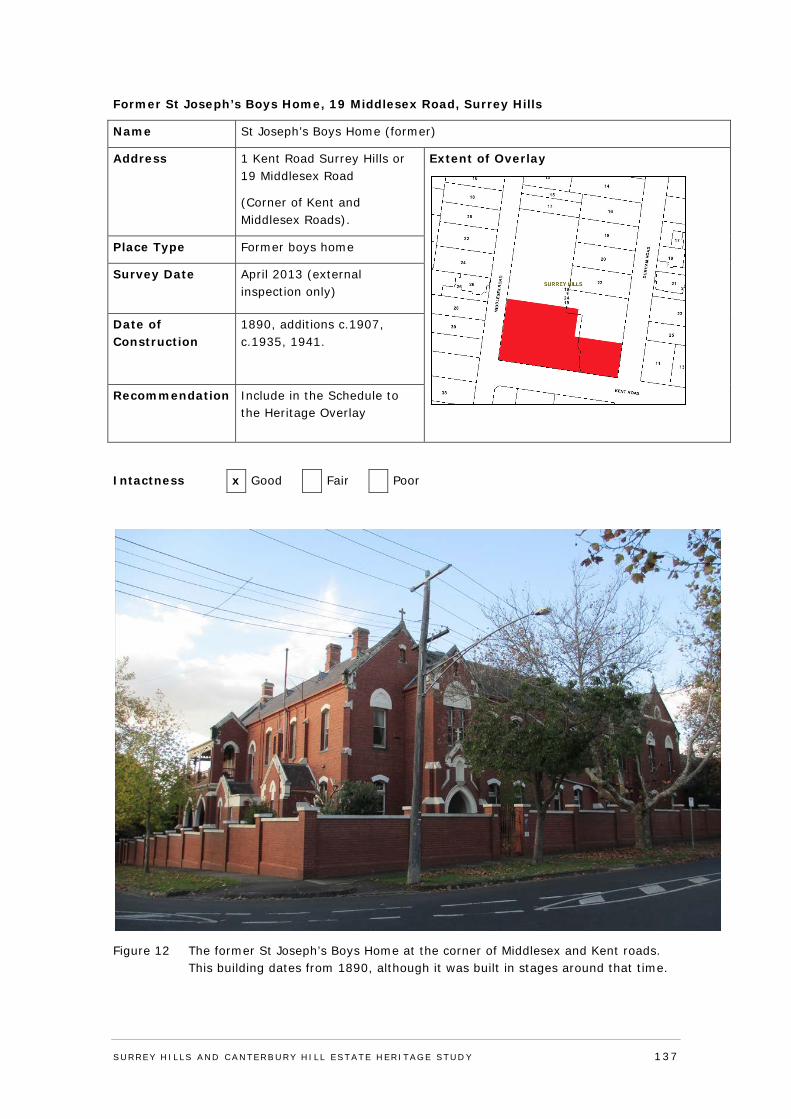
Former St Joseph’s Boys Home, 19 Middlesex Road, Surrey Hills
Name St Joseph’s Boys Home (former)
Address 1 Kent Road Surrey Hills or 19 Middlesex Road
(Corner of Kent and Middlesex Roads).
Extent of Overlay
Place Type Former boys home
Survey Date April 2013 (external inspection only)
Date of Construction
1890, additions c.1907, c.1935, 1941.
Recommendation Include in the Schedule to the Heritage Overlay
Intactness x Good Fair Poor
Figure 12 The former St Joseph’s Boys Home at the corner of Middlesex and Kent roads. This building dates from 1890, although it was built in stages around that time.
SURREY HI LLS AND CANTERBURY HI LL ESTATE HERITAGE STUDY 137
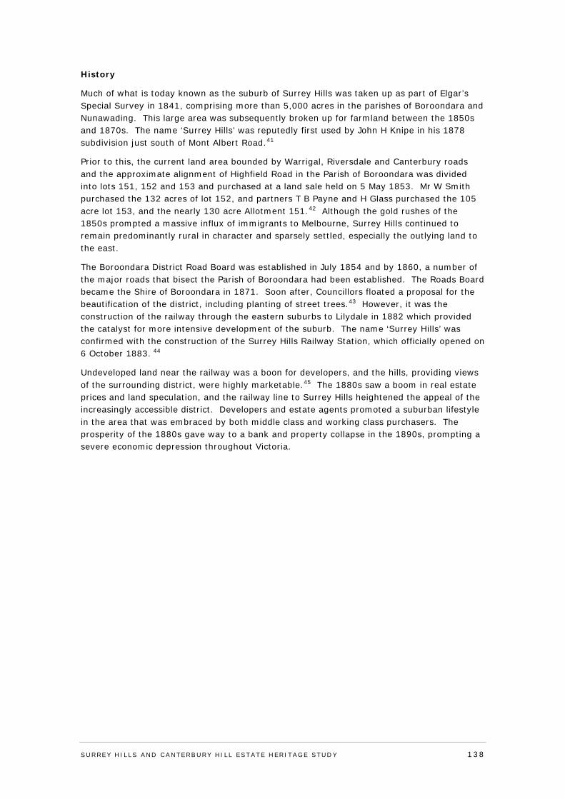
History
Much of what is today known as the suburb of Surrey Hills was taken up as part of Elgar’s Special Survey in 1841, comprising more than 5,000 acres in the parishes of Boroondara and Nunawading. This large area was subsequently broken up for farmland between the 1850s and 1870s. The name ‘Surrey Hills’ was reputedly first used by John H Knipe in his 1878 subdivision just south of Mont Albert Road.41
Prior to this, the current land area bounded by Warrigal, Riversdale and Canterbury roads and the approximate alignment of Highfield Road in the Parish of Boroondara was divided into lots 151, 152 and 153 and purchased at a land sale held on 5 May 1853. Mr W Smith purchased the 132 acres of lot 152, and partners T B Payne and H Glass purchased the 105 acre lot 153, and the nearly 130 acre Allotment 151.42 Although the gold rushes of the 1850s prompted a massive influx of immigrants to Melbourne, Surrey Hills continued to remain predominantly rural in character and sparsely settled, especially the outlying land to the east.
The Boroondara District Road Board was established in July 1854 and by 1860, a number of the major roads that bisect the Parish of Boroondara had been established. The Roads Board became the Shire of Boroondara in 1871. Soon after, Councillors floated a proposal for the beautification of the district, including planting of street trees.43 However, it was the construction of the railway through the eastern suburbs to Lilydale in 1882 which provided the catalyst for more intensive development of the suburb. The name ‘Surrey Hills’ was confirmed with the construction of the Surrey Hills Railway Station, which officially opened on 6 October 1883. 44
Undeveloped land near the railway was a boon for developers, and the hills, providing views of the surrounding district, were highly marketable.45 The 1880s saw a boom in real estate prices and land speculation, and the railway line to Surrey Hills heightened the appeal of the increasingly accessible district. Developers and estate agents promoted a suburban lifestyle in the area that was embraced by both middle class and working class purchasers. The prosperity of the 1880s gave way to a bank and property collapse in the 1890s, prompting a severe economic depression throughout Victoria.
SURREY HI LLS AND CANTERBURY HI LL ESTATE HERITAGE STUDY 138
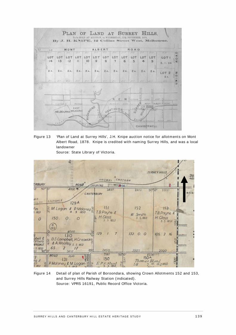
Figure 13 ‘Plan of Land at Surrey Hills’, J.H. Knipe auction notice for allotments on Mont Albert Road, 1878. Knipe is credited with naming Surrey Hills, and was a local landowner Source: State Library of Victoria.
Figure 14 Detail of plan of Parish of Boroondara, showing Crown Allotments 152 and 153, and Surrey Hills Railway Station (indicated). Source: VPRS 16191, Public Record Office Victoria.
SURREY HI LLS AND CANTERBURY HI LL ESTATE HERITAGE STUDY 139
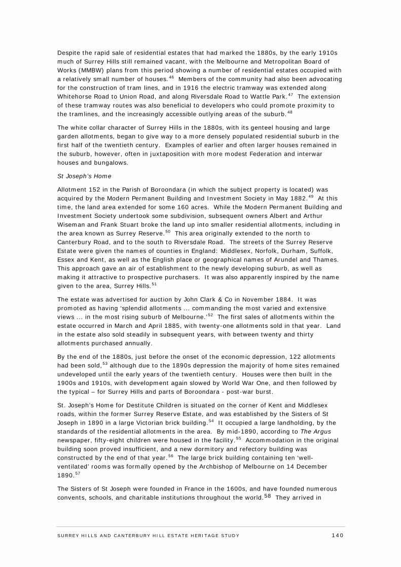
Despite the rapid sale of residential estates that had marked the 1880s, by the early 1910s much of Surrey Hills still remained vacant, with the Melbourne and Metropolitan Board of Works (MMBW) plans from this period showing a number of residential estates occupied with a relatively small number of houses.46 Members of the community had also been advocating for the construction of tram lines, and in 1916 the electric tramway was extended along Whitehorse Road to Union Road, and along Riversdale Road to Wattle Park.47 The extension of these tramway routes was also beneficial to developers who could promote proximity to the tramlines, and the increasingly accessible outlying areas of the suburb.48
The white collar character of Surrey Hills in the 1880s, with its genteel housing and large garden allotments, began to give way to a more densely populated residential suburb in the first half of the twentieth century. Examples of earlier and often larger houses remained in the suburb, however, often in juxtaposition with more modest Federation and interwar houses and bungalows.
St Joseph’s Home
Allotment 152 in the Parish of Boroondara (in which the subject property is located) was acquired by the Modern Permanent Building and Investment Society in May 1882.49 At this time, the land area extended for some 160 acres. While the Modern Permanent Building and Investment Society undertook some subdivision, subsequent owners Albert and Arthur Wiseman and Frank Stuart broke the land up into smaller residential allotments, including in the area known as Surrey Reserve.50 This area originally extended to the north to Canterbury Road, and to the south to Riversdale Road. The streets of the Surrey Reserve Estate were given the names of counties in England: Middlesex, Norfolk, Durham, Suffolk, Essex and Kent, as well as the English place or geographical names of Arundel and Thames. This approach gave an air of establishment to the newly developing suburb, as well as making it attractive to prospective purchasers. It was also apparently inspired by the name given to the area, Surrey Hills.51
The estate was advertised for auction by John Clark & Co in November 1884. It was promoted as having ‘splendid allotments ... commanding the most varied and extensive views ... in the most rising suburb of Melbourne.’52 The first sales of allotments within the estate occurred in March and April 1885, with twenty-one allotments sold in that year. Land in the estate also sold steadily in subsequent years, with between twenty and thirty allotments purchased annually.
By the end of the 1880s, just before the onset of the economic depression, 122 allotments had been sold,53 although due to the 1890s depression the majority of home sites remained undeveloped until the early years of the twentieth century. Houses were then built in the 1900s and 1910s, with development again slowed by World War One, and then followed by the typical – for Surrey Hills and parts of Boroondara - post-war burst.
St. Joseph’s Home for Destitute Children is situated on the corner of Kent and Middlesex roads, within the former Surrey Reserve Estate, and was established by the Sisters of St Joseph in 1890 in a large Victorian brick building.54 It occupied a large landholding, by the standards of the residential allotments in the area. By mid-1890, according to The Argus newspaper, fifty-eight children were housed in the facility.55 Accommodation in the original building soon proved insufficient, and a new dormitory and refectory building was constructed by the end of that year.56 The large brick building containing ten ‘well-ventilated’ rooms was formally opened by the Archbishop of Melbourne on 14 December 1890.57
The Sisters of St Joseph were founded in France in the 1600s, and have founded numerous convents, schools, and charitable institutions throughout the world.58 They arrived in
SURREY HI LLS AND CANTERBURY HI LL ESTATE HERITAGE STUDY 140
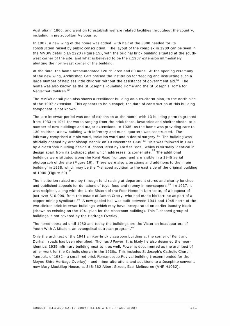
Australia in 1866, and went on to establish welfare related facilities throughout the country, including in metropolitan Melbourne.
In 1907, a new wing of the home was added, with half of the £800 needed for its construction raised by public conscription. The layout of the complex in 1909 can be seen in the MMBW detail plan 2223 (Figure 15), with the original brick building situated at the south-west corner of the site, and what is believed to be the c.1907 extension immediately abutting the north-east corner of the building.
At the time, the home accommodated 120 children and 80 nuns. At the opening ceremony of the new wing, Archbishop Carr praised the institution for ‘feeding and instructing such a large number of helpless little children’ without the assistance of government aid.59 The home was also known as the St Joseph’s Foundling Home and the St Joseph's Home for Neglected Children.60
The MMBW detail plan also shows a rectilinear building on a cruciform plan, to the north side of the 1907 extension. This appears to be a chapel; the date of construction of this building component is not known
The late interwar period was one of expansion at the home, with 13 building permits granted from 1933 to 1941 for works ranging from the brick fence, lavatories and shelter sheds, to a number of new buildings and major extensions. In 1935, as the home was providing care to 130 children, a new building with infirmary and nuns’ quarters was constructed. The infirmary comprised a main ward, isolation ward and a dental surgery.61 The building was officially opened by Archbishop Mannix on 10 November 1935.62 This was followed in 1941 by a classroom building beside it, constructed by Forster Bros., which is virtually identical in design apart from its L-shaped plan which addresses its corner site.
63 The additional
buildings were situated along the Kent Road frontage, and are visible in a 1945 aerial photograph of the site (Figure 16). There were also alterations and additions to the ‘main building’ in 1938, which may be the T-shaped addition to the east side of the original building of 1900 (Figure 20).
64
The institution raised money through fund raising at department stores and charity lunches, and published appeals for donations of toys, food and money in newspapers.65 In 1937, it was recipient, along with the Little Sisters of the Poor Home in Northcote, of a bequest of just over £10,000, from the estate of James Crotty, who had made his fortune as part of a copper mining syndicate.66 A new gabled hall was built between 1941 and 1945 north of the two clinker-brick interwar buildings, which may have incorporated an earlier laundry block (shown as existing on the 1941 plan for the classroom building). This T-shaped group of buildings is not covered by the Heritage Overlay.
The home operated until 1980 and today the buildings are the Victorian headquarters of Youth With A Mission, an evangelical outreach program.67
Only the architect of the 1941 clinker-brick classroom building at the corner of Kent and Durham roads has been identified: Thomas J Power. It is likely he also designed the near-identical 1935 infirmary building next to it as well. Power is documented as the architect of other work for the Catholic church in the 1930s. This includes St Joseph’s Catholic Church, Yambuk, of 1932 - a small red brick Romanesque Revival building (recommended for the Moyne Shire Heritage Overlay) - and minor alterations and additions to a Josephite convent, now Mary Mackillop House, at 348-362 Albert Street, East Melbourne (VHR H1062).
SURREY HI LLS AND CANTERBURY HI LL ESTATE HERITAGE STUDY 141
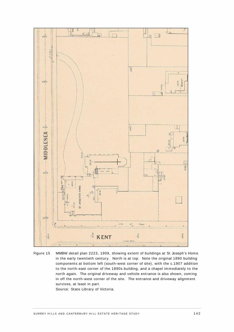
Figure 15 MMBW detail plan 2223, 1909, showing extent of buildings at St Joseph’s Home in the early twentieth century. North is at top. Note the original 1890 building components at bottom left (south-west corner of site), with the c.1907 addition to the north-east corner of the 1890s building, and a chapel immediately to the north again. The original driveway and vehicle entrance is also shown, coming in off the north-west corner of the site. The entrance and driveway alignment survives, at least in part. Source: State Library of Victoria.
SURREY HI LLS AND CANTERBURY HI LL ESTATE HERITAGE STUDY 142
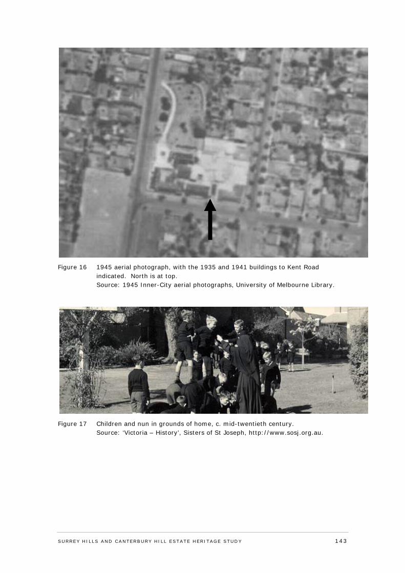
Figure 16 1945 aerial photograph, with the 1935 and 1941 buildings to Kent Road indicated. North is at top. Source: 1945 Inner-City aerial photographs, University of Melbourne Library.
Figure 17 Children and nun in grounds of home, c. mid-twentieth century. Source: ‘Victoria – History’, Sisters of St Joseph, http://www.sosj.org.au.
SURREY HI LLS AND CANTERBURY HI LL ESTATE HERITAGE STUDY 143
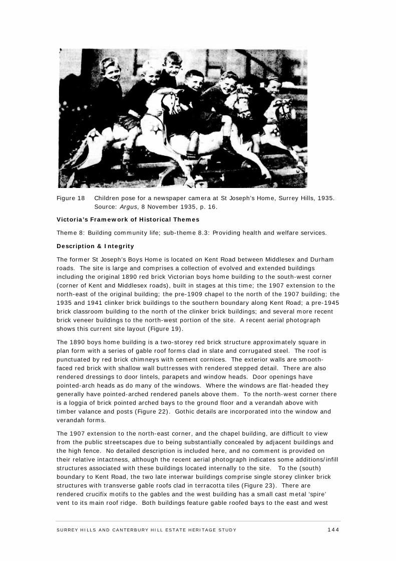
Figure 18 Children pose for a newspaper camera at St Joseph’s Home, Surrey Hills, 1935. Source: Argus, 8 November 1935, p. 16.
Victoria’s Framework of Historical Themes
Theme 8: Building community life; sub-theme 8.3: Providing health and welfare services.
Description & Integrity
The former St Joseph’s Boys Home is located on Kent Road between Middlesex and Durham roads. The site is large and comprises a collection of evolved and extended buildings including the original 1890 red brick Victorian boys home building to the south-west corner (corner of Kent and Middlesex roads), built in stages at this time; the 1907 extension to the north-east of the original building; the pre-1909 chapel to the north of the 1907 building; the 1935 and 1941 clinker brick buildings to the southern boundary along Kent Road; a pre-1945 brick classroom building to the north of the clinker brick buildings; and several more recent brick veneer buildings to the north-west portion of the site. A recent aerial photograph shows this current site layout (Figure 19).
The 1890 boys home building is a two-storey red brick structure approximately square in plan form with a series of gable roof forms clad in slate and corrugated steel. The roof is punctuated by red brick chimneys with cement cornices. The exterior walls are smooth-faced red brick with shallow wall buttresses with rendered stepped detail. There are also rendered dressings to door lintels, parapets and window heads. Door openings have pointed-arch heads as do many of the windows. Where the windows are flat-headed they generally have pointed-arched rendered panels above them. To the north-west corner there is a loggia of brick pointed arched bays to the ground floor and a verandah above with timber valance and posts (Figure 22). Gothic details are incorporated into the window and verandah forms.
The 1907 extension to the north-east corner, and the chapel building, are difficult to view from the public streetscapes due to being substantially concealed by adjacent buildings and the high fence. No detailed description is included here, and no comment is provided on their relative intactness, although the recent aerial photograph indicates some additions/infill structures associated with these buildings located internally to the site. To the (south) boundary to Kent Road, the two late interwar buildings comprise single storey clinker brick structures with transverse gable roofs clad in terracotta tiles (Figure 23). There are rendered crucifix motifs to the gables and the west building has a small cast metal ‘spire’ vent to its main roof ridge. Both buildings feature gable roofed bays to the east and west
SURREY HI LLS AND CANTERBURY HI LL ESTATE HERITAGE STUDY 144
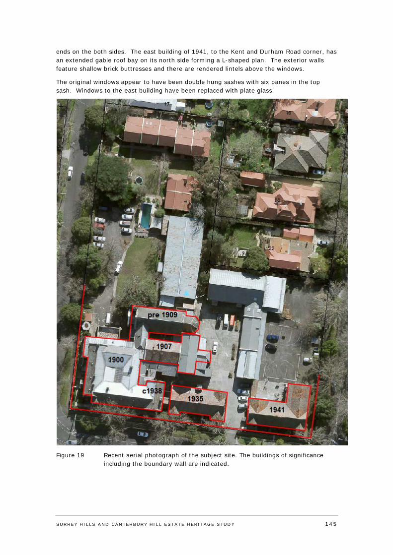
ends on the both sides. The east building of 1941, to the Kent and Durham Road corner, has an extended gable roof bay on its north side forming a L-shaped plan. The exterior walls feature shallow brick buttresses and there are rendered lintels above the windows.
The original windows appear to have been double hung sashes with six panes in the top sash. Windows to the east building have been replaced with plate glass.
Figure 19 Recent aerial photograph of the subject site. The buildings of significance including the boundary wall are indicated.
SURREY HI LLS AND CANTERBURY HI LL ESTATE HERITAGE STUDY 145
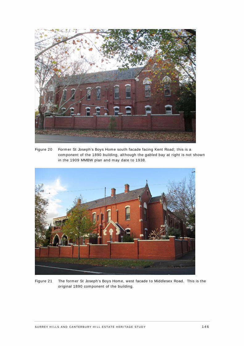
Figure 20 Former St Joseph’s Boys Home south facade facing Kent Road; this is a component of the 1890 building, although the gabled bay at right is not shown in the 1909 MMBW plan and may date to 1938.
Figure 21 The former St Joseph’s Boys Home, west facade to Middlesex Road. This is the original 1890 component of the building.
SURREY HI LLS AND CANTERBURY HI LL ESTATE HERITAGE STUDY 146
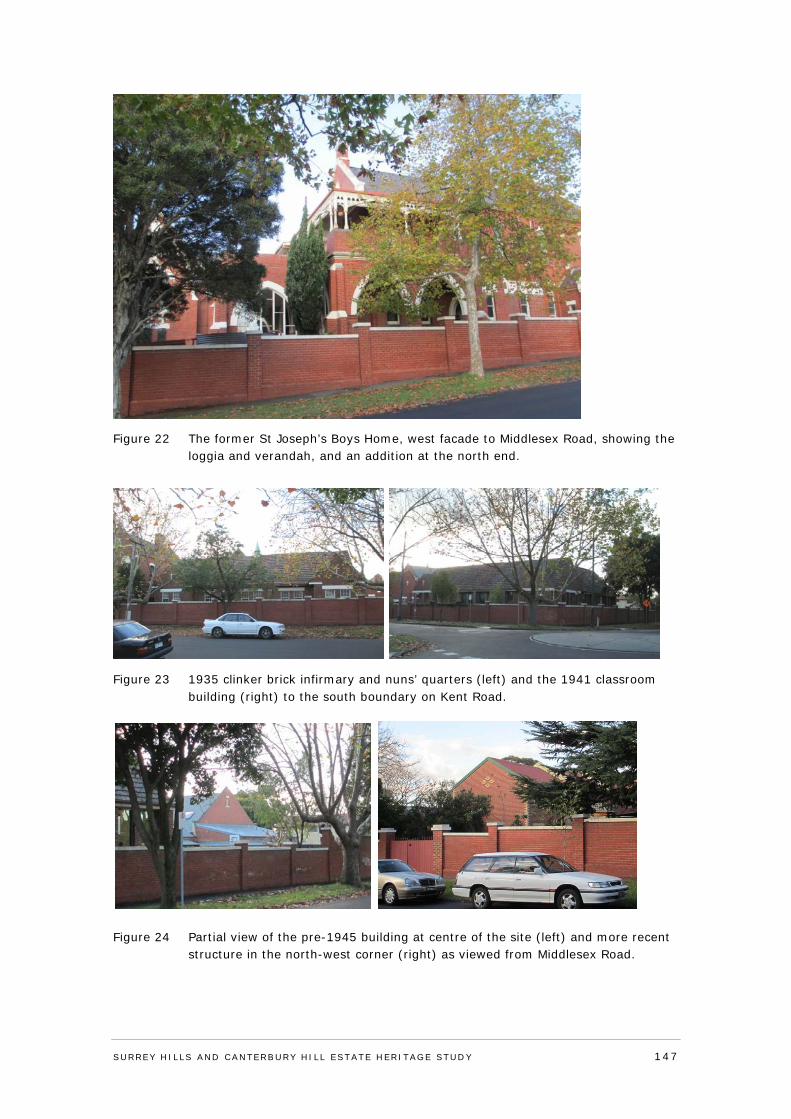
Figure 22 The former St Joseph’s Boys Home, west facade to Middlesex Road, showing the loggia and verandah, and an addition at the north end.
Figure 23 1935 clinker brick infirmary and nuns’ quarters (left) and the 1941 classroom building (right) to the south boundary on Kent Road.
Figure 24 Partial view of the pre-1945 building at centre of the site (left) and more recent
structure in the north-west corner (right) as viewed from Middlesex Road.
SURREY HI LLS AND CANTERBURY HI LL ESTATE HERITAGE STUDY 147
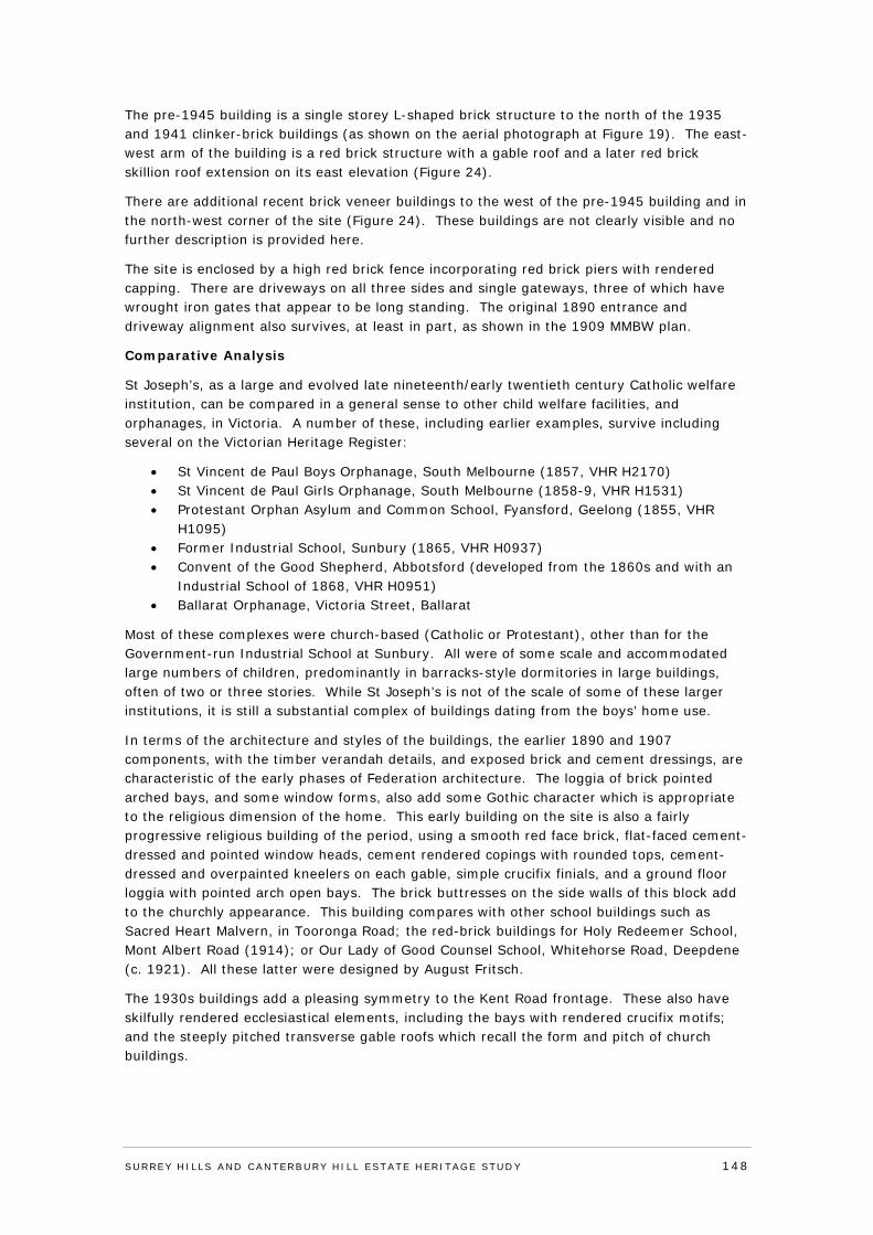
The pre-1945 building is a single storey L-shaped brick structure to the north of the 1935 and 1941 clinker-brick buildings (as shown on the aerial photograph at Figure 19). The east-west arm of the building is a red brick structure with a gable roof and a later red brick skillion roof extension on its east elevation (Figure 24).
There are additional recent brick veneer buildings to the west of the pre-1945 building and in the north-west corner of the site (Figure 24). These buildings are not clearly visible and no further description is provided here.
The site is enclosed by a high red brick fence incorporating red brick piers with rendered capping. There are driveways on all three sides and single gateways, three of which have wrought iron gates that appear to be long standing. The original 1890 entrance and driveway alignment also survives, at least in part, as shown in the 1909 MMBW plan.
Comparative Analysis
St Joseph’s, as a large and evolved late nineteenth/early twentieth century Catholic welfare institution, can be compared in a general sense to other child welfare facilities, and orphanages, in Victoria. A number of these, including earlier examples, survive including several on the Victorian Heritage Register:
• St Vincent de Paul Boys Orphanage, South Melbourne (1857, VHR H2170) • St Vincent de Paul Girls Orphanage, South Melbourne (1858-9, VHR H1531) • Protestant Orphan Asylum and Common School, Fyansford, Geelong (1855, VHR
H1095) • Former Industrial School, Sunbury (1865, VHR H0937) • Convent of the Good Shepherd, Abbotsford (developed from the 1860s and with an
Industrial School of 1868, VHR H0951) • Ballarat Orphanage, Victoria Street, Ballarat
Most of these complexes were church-based (Catholic or Protestant), other than for the Government-run Industrial School at Sunbury. All were of some scale and accommodated large numbers of children, predominantly in barracks-style dormitories in large buildings, often of two or three stories. While St Joseph’s is not of the scale of some of these larger institutions, it is still a substantial complex of buildings dating from the boys’ home use.
In terms of the architecture and styles of the buildings, the earlier 1890 and 1907 components, with the timber verandah details, and exposed brick and cement dressings, are characteristic of the early phases of Federation architecture. The loggia of brick pointed arched bays, and some window forms, also add some Gothic character which is appropriate to the religious dimension of the home. This early building on the site is also a fairly progressive religious building of the period, using a smooth red face brick, flat-faced cement-dressed and pointed window heads, cement rendered copings with rounded tops, cement-dressed and overpainted kneelers on each gable, simple crucifix finials, and a ground floor loggia with pointed arch open bays. The brick buttresses on the side walls of this block add to the churchly appearance. This building compares with other school buildings such as Sacred Heart Malvern, in Tooronga Road; the red-brick buildings for Holy Redeemer School, Mont Albert Road (1914); or Our Lady of Good Counsel School, Whitehorse Road, Deepdene (c. 1921). All these latter were designed by August Fritsch.
The 1930s buildings add a pleasing symmetry to the Kent Road frontage. These also have skilfully rendered ecclesiastical elements, including the bays with rendered crucifix motifs; and the steeply pitched transverse gable roofs which recall the form and pitch of church buildings.
SURREY HI LLS AND CANTERBURY HI LL ESTATE HERITAGE STUDY 148
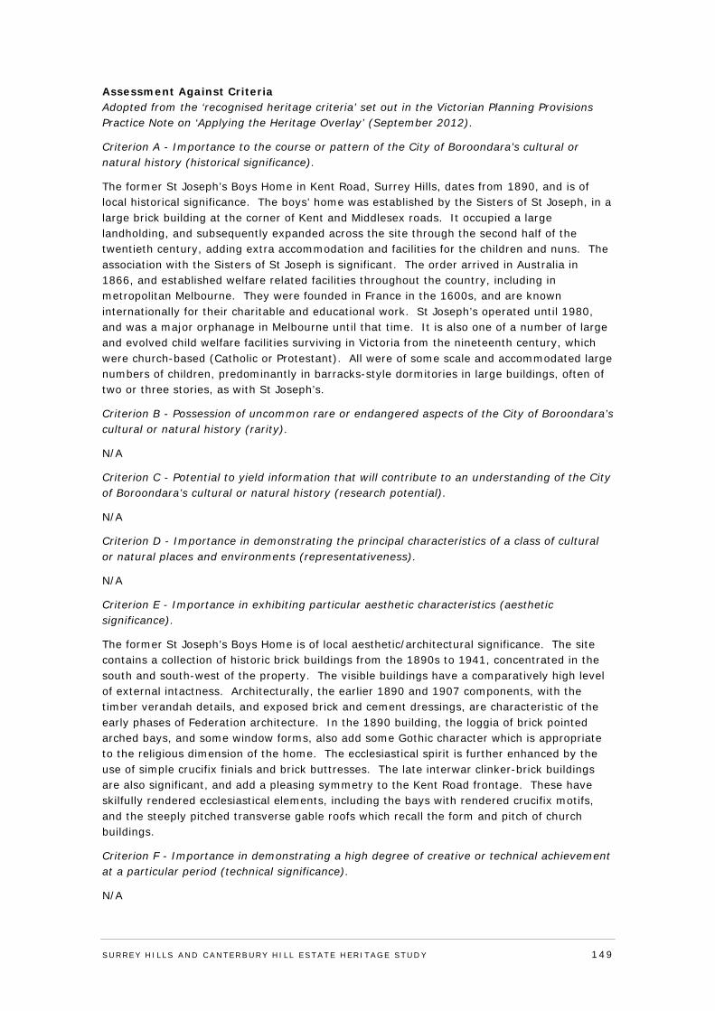
Assessment Against Criteria Adopted from the ‘recognised heritage criteria’ set out in the Victorian Planning Provisions Practice Note on ‘Applying the Heritage Overlay’ (September 2012).
Criterion A - Importance to the course or pattern of the City of Boroondara’s cultural or natural history (historical significance).
The former St Joseph’s Boys Home in Kent Road, Surrey Hills, dates from 1890, and is of local historical significance. The boys’ home was established by the Sisters of St Joseph, in a large brick building at the corner of Kent and Middlesex roads. It occupied a large landholding, and subsequently expanded across the site through the second half of the twentieth century, adding extra accommodation and facilities for the children and nuns. The association with the Sisters of St Joseph is significant. The order arrived in Australia in 1866, and established welfare related facilities throughout the country, including in metropolitan Melbourne. They were founded in France in the 1600s, and are known internationally for their charitable and educational work. St Joseph’s operated until 1980, and was a major orphanage in Melbourne until that time. It is also one of a number of large and evolved child welfare facilities surviving in Victoria from the nineteenth century, which were church-based (Catholic or Protestant). All were of some scale and accommodated large numbers of children, predominantly in barracks-style dormitories in large buildings, often of two or three stories, as with St Joseph’s.
Criterion B - Possession of uncommon rare or endangered aspects of the City of Boroondara’s cultural or natural history (rarity).
N/A
Criterion C - Potential to yield information that will contribute to an understanding of the City of Boroondara’s cultural or natural history (research potential).
N/A
Criterion D - Importance in demonstrating the principal characteristics of a class of cultural or natural places and environments (representativeness).
N/A
Criterion E - Importance in exhibiting particular aesthetic characteristics (aesthetic significance).
The former St Joseph’s Boys Home is of local aesthetic/architectural significance. The site contains a collection of historic brick buildings from the 1890s to 1941, concentrated in the south and south-west of the property. The visible buildings have a comparatively high level of external intactness. Architecturally, the earlier 1890 and 1907 components, with the timber verandah details, and exposed brick and cement dressings, are characteristic of the early phases of Federation architecture. In the 1890 building, the loggia of brick pointed arched bays, and some window forms, also add some Gothic character which is appropriate to the religious dimension of the home. The ecclesiastical spirit is further enhanced by the use of simple crucifix finials and brick buttresses. The late interwar clinker-brick buildings are also significant, and add a pleasing symmetry to the Kent Road frontage. These have skilfully rendered ecclesiastical elements, including the bays with rendered crucifix motifs, and the steeply pitched transverse gable roofs which recall the form and pitch of church buildings.
Criterion F - Importance in demonstrating a high degree of creative or technical achievement at a particular period (technical significance).
N/A
SURREY HI LLS AND CANTERBURY HI LL ESTATE HERITAGE STUDY 149
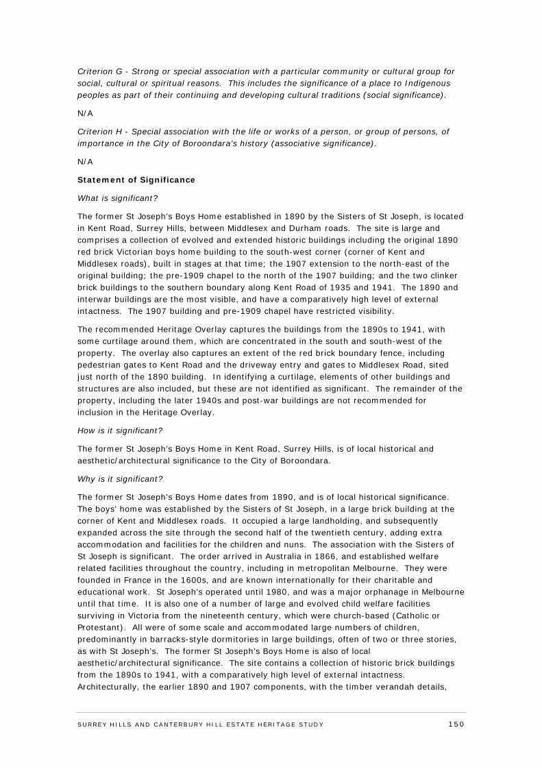
Criterion G - Strong or special association with a particular community or cultural group for social, cultural or spiritual reasons. This includes the significance of a place to Indigenous peoples as part of their continuing and developing cultural traditions (social significance).
N/A
Criterion H - Special association with the life or works of a person, or group of persons, of importance in the City of Boroondara’s history (associative significance).
N/A
Statement of Significance
What is significant?
The former St Joseph’s Boys Home established in 1890 by the Sisters of St Joseph, is located in Kent Road, Surrey Hills, between Middlesex and Durham roads. The site is large and comprises a collection of evolved and extended historic buildings including the original 1890 red brick Victorian boys home building to the south-west corner (corner of Kent and Middlesex roads), built in stages at that time; the 1907 extension to the north-east of the original building; the pre-1909 chapel to the north of the 1907 building; and the two clinker brick buildings to the southern boundary along Kent Road of 1935 and 1941. The 1890 and interwar buildings are the most visible, and have a comparatively high level of external intactness. The 1907 building and pre-1909 chapel have restricted visibility.
The recommended Heritage Overlay captures the buildings from the 1890s to 1941, with some curtilage around them, which are concentrated in the south and south-west of the property. The overlay also captures an extent of the red brick boundary fence, including pedestrian gates to Kent Road and the driveway entry and gates to Middlesex Road, sited just north of the 1890 building. In identifying a curtilage, elements of other buildings and structures are also included, but these are not identified as significant. The remainder of the property, including the later 1940s and post-war buildings are not recommended for inclusion in the Heritage Overlay.
How is it significant?
The former St Joseph’s Boys Home in Kent Road, Surrey Hills, is of local historical and aesthetic/architectural significance to the City of Boroondara.
Why is it significant?
The former St Joseph’s Boys Home dates from 1890, and is of local historical significance. The boys’ home was established by the Sisters of St Joseph, in a large brick building at the corner of Kent and Middlesex roads. It occupied a large landholding, and subsequently expanded across the site through the second half of the twentieth century, adding extra accommodation and facilities for the children and nuns. The association with the Sisters of St Joseph is significant. The order arrived in Australia in 1866, and established welfare related facilities throughout the country, including in metropolitan Melbourne. They were founded in France in the 1600s, and are known internationally for their charitable and educational work. St Joseph’s operated until 1980, and was a major orphanage in Melbourne until that time. It is also one of a number of large and evolved child welfare facilities surviving in Victoria from the nineteenth century, which were church-based (Catholic or Protestant). All were of some scale and accommodated large numbers of children, predominantly in barracks-style dormitories in large buildings, often of two or three stories, as with St Joseph’s. The former St Joseph’s Boys Home is also of local aesthetic/architectural significance. The site contains a collection of historic brick buildings from the 1890s to 1941, with a comparatively high level of external intactness. Architecturally, the earlier 1890 and 1907 components, with the timber verandah details,
SURREY HI LLS AND CANTERBURY HI LL ESTATE HERITAGE STUDY 150
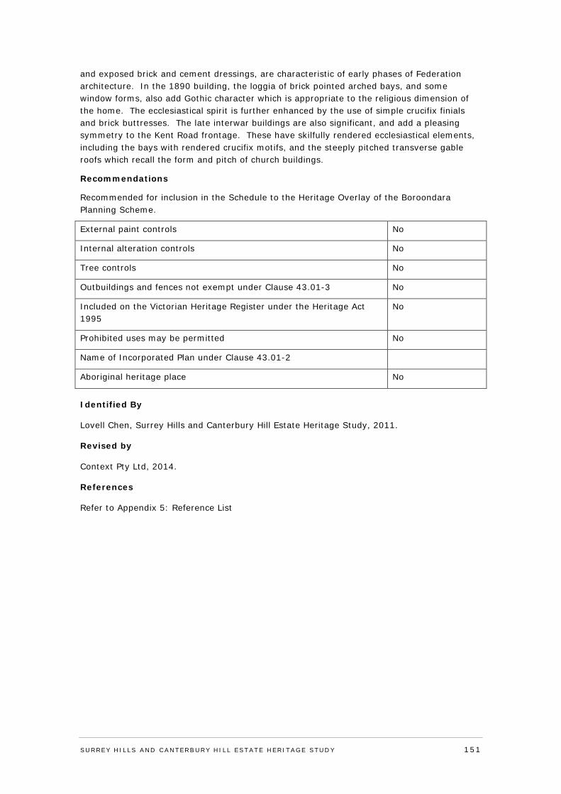
and exposed brick and cement dressings, are characteristic of early phases of Federation architecture. In the 1890 building, the loggia of brick pointed arched bays, and some window forms, also add Gothic character which is appropriate to the religious dimension of the home. The ecclesiastical spirit is further enhanced by the use of simple crucifix finials and brick buttresses. The late interwar buildings are also significant, and add a pleasing symmetry to the Kent Road frontage. These have skilfully rendered ecclesiastical elements, including the bays with rendered crucifix motifs, and the steeply pitched transverse gable roofs which recall the form and pitch of church buildings.
Recommendations
Recommended for inclusion in the Schedule to the Heritage Overlay of the Boroondara Planning Scheme.
External paint controls No
Internal alteration controls No
Tree controls No
Outbuildings and fences not exempt under Clause 43.01-3 No
Included on the Victorian Heritage Register under the Heritage Act 1995
No
Prohibited uses may be permitted No
Name of Incorporated Plan under Clause 43.01-2
Aboriginal heritage place No
Identified By
Lovell Chen, Surrey Hills and Canterbury Hill Estate Heritage Study, 2011.
Revised by
Context Pty Ltd, 2014.
References
Refer to Appendix 5: Reference List
SURREY HI LLS AND CANTERBURY HI LL ESTATE HERITAGE STUDY 151
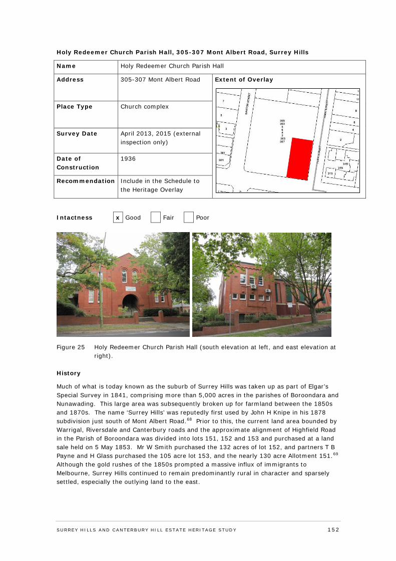
Holy Redeemer Church Parish Hall, 305-307 Mont Albert Road, Surrey Hills
Name Holy Redeemer Church Parish Hall
Address 305-307 Mont Albert Road
Extent of Overlay
Place Type Church complex
Survey Date April 2013, 2015 (external inspection only)
Date of Construction
1936
Recommendation Include in the Schedule to the Heritage Overlay
Intactness x Good Fair Poor
Figure 25 Holy Redeemer Church Parish Hall (south elevation at left, and east elevation at right).
History
Much of what is today known as the suburb of Surrey Hills was taken up as part of Elgar’s Special Survey in 1841, comprising more than 5,000 acres in the parishes of Boroondara and Nunawading. This large area was subsequently broken up for farmland between the 1850s and 1870s. The name ‘Surrey Hills’ was reputedly first used by John H Knipe in his 1878 subdivision just south of Mont Albert Road.68 Prior to this, the current land area bounded by Warrigal, Riversdale and Canterbury roads and the approximate alignment of Highfield Road in the Parish of Boroondara was divided into lots 151, 152 and 153 and purchased at a land sale held on 5 May 1853. Mr W Smith purchased the 132 acres of lot 152, and partners T B Payne and H Glass purchased the 105 acre lot 153, and the nearly 130 acre Allotment 151.69 Although the gold rushes of the 1850s prompted a massive influx of immigrants to Melbourne, Surrey Hills continued to remain predominantly rural in character and sparsely settled, especially the outlying land to the east.
SURREY HI LLS AND CANTERBURY HI LL ESTATE HERITAGE STUDY 152
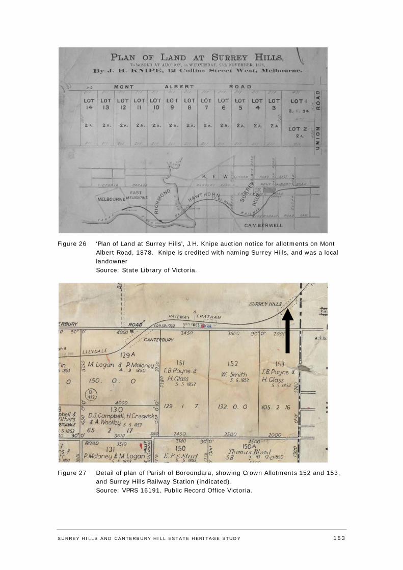
Figure 26 ‘Plan of Land at Surrey Hills’, J.H. Knipe auction notice for allotments on Mont Albert Road, 1878. Knipe is credited with naming Surrey Hills, and was a local landowner Source: State Library of Victoria.
Figure 27 Detail of plan of Parish of Boroondara, showing Crown Allotments 152 and 153, and Surrey Hills Railway Station (indicated). Source: VPRS 16191, Public Record Office Victoria.
SURREY HI LLS AND CANTERBURY HI LL ESTATE HERITAGE STUDY 153
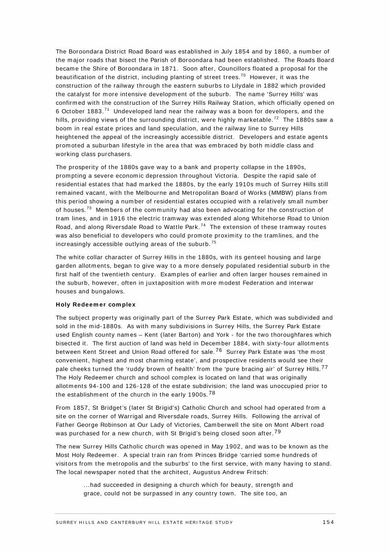
The Boroondara District Road Board was established in July 1854 and by 1860, a number of the major roads that bisect the Parish of Boroondara had been established. The Roads Board became the Shire of Boroondara in 1871. Soon after, Councillors floated a proposal for the beautification of the district, including planting of street trees.70 However, it was the construction of the railway through the eastern suburbs to Lilydale in 1882 which provided the catalyst for more intensive development of the suburb. The name ‘Surrey Hills’ was confirmed with the construction of the Surrey Hills Railway Station, which officially opened on 6 October 1883.71 Undeveloped land near the railway was a boon for developers, and the hills, providing views of the surrounding district, were highly marketable.72 The 1880s saw a boom in real estate prices and land speculation, and the railway line to Surrey Hills heightened the appeal of the increasingly accessible district. Developers and estate agents promoted a suburban lifestyle in the area that was embraced by both middle class and working class purchasers.
The prosperity of the 1880s gave way to a bank and property collapse in the 1890s, prompting a severe economic depression throughout Victoria. Despite the rapid sale of residential estates that had marked the 1880s, by the early 1910s much of Surrey Hills still remained vacant, with the Melbourne and Metropolitan Board of Works (MMBW) plans from this period showing a number of residential estates occupied with a relatively small number of houses.73 Members of the community had also been advocating for the construction of tram lines, and in 1916 the electric tramway was extended along Whitehorse Road to Union Road, and along Riversdale Road to Wattle Park.74 The extension of these tramway routes was also beneficial to developers who could promote proximity to the tramlines, and the increasingly accessible outlying areas of the suburb.75
The white collar character of Surrey Hills in the 1880s, with its genteel housing and large garden allotments, began to give way to a more densely populated residential suburb in the first half of the twentieth century. Examples of earlier and often larger houses remained in the suburb, however, often in juxtaposition with more modest Federation and interwar houses and bungalows.
Holy Redeemer complex
The subject property was originally part of the Surrey Park Estate, which was subdivided and sold in the mid-1880s. As with many subdivisions in Surrey Hills, the Surrey Park Estate used English county names – Kent (later Barton) and York - for the two thoroughfares which bisected it. The first auction of land was held in December 1884, with sixty-four allotments between Kent Street and Union Road offered for sale.76 Surrey Park Estate was ‘the most convenient, highest and most charming estate’, and prospective residents would see their pale cheeks turned the ‘ruddy brown of health’ from the ‘pure bracing air’ of Surrey Hills.77 The Holy Redeemer church and school complex is located on land that was originally allotments 94-100 and 126-128 of the estate subdivision; the land was unoccupied prior to the establishment of the church in the early 1900s.78
From 1857, St Bridget’s (later St Brigid’s) Catholic Church and school had operated from a site on the corner of Warrigal and Riversdale roads, Surrey Hills. Following the arrival of Father George Robinson at Our Lady of Victories, Camberwell the site on Mont Albert road was purchased for a new church, with St Brigid’s being closed soon after.79
The new Surrey Hills Catholic church was opened in May 1902, and was to be known as the Most Holy Redeemer. A special train ran from Princes Bridge ‘carried some hundreds of visitors from the metropolis and the suburbs’ to the first service, with many having to stand. The local newspaper noted that the architect, Augustus Andrew Fritsch:
...had succeeded in designing a church which for beauty, strength and grace, could not be surpassed in any country town. The site too, an
SURREY HI LLS AND CANTERBURY HI LL ESTATE HERITAGE STUDY 154
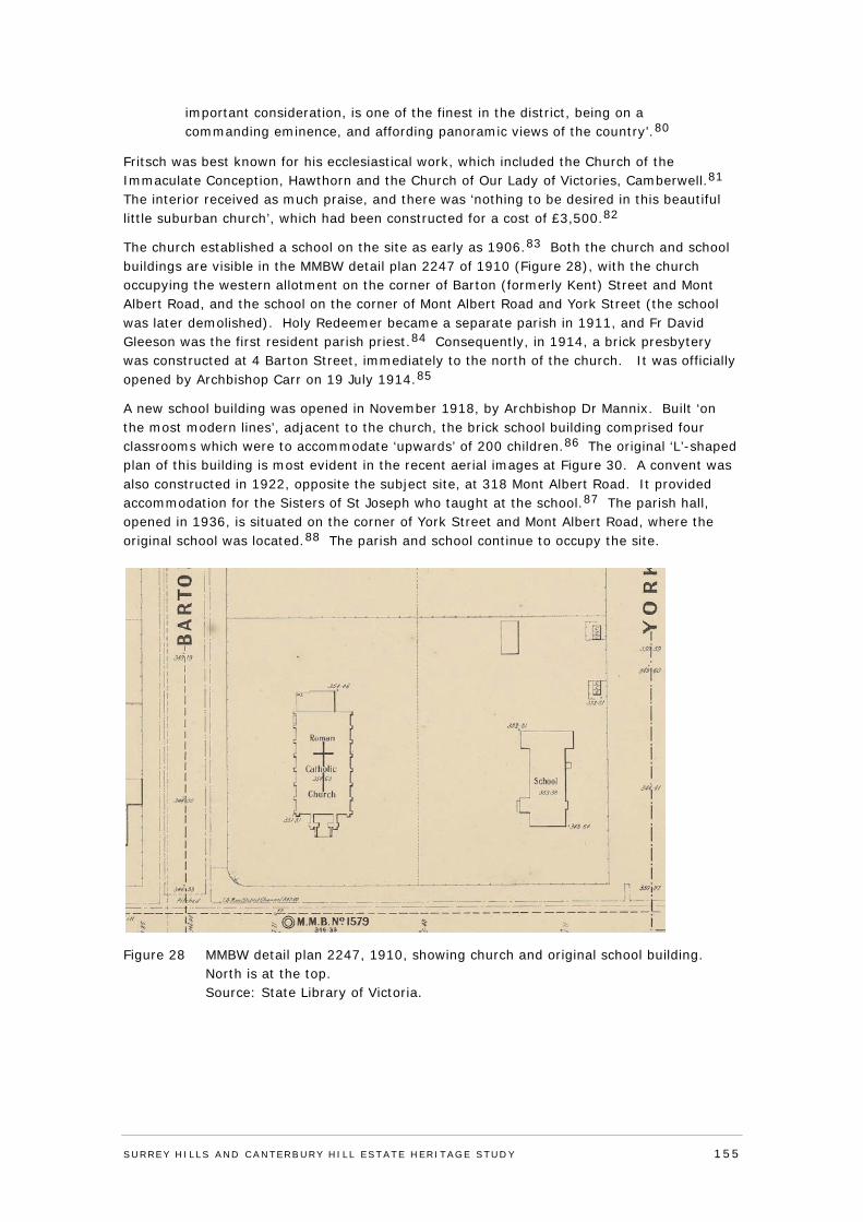
important consideration, is one of the finest in the district, being on a commanding eminence, and affording panoramic views of the country’.80
Fritsch was best known for his ecclesiastical work, which included the Church of the Immaculate Conception, Hawthorn and the Church of Our Lady of Victories, Camberwell.81 The interior received as much praise, and there was ‘nothing to be desired in this beautiful little suburban church’, which had been constructed for a cost of £3,500.82
The church established a school on the site as early as 1906.83 Both the church and school buildings are visible in the MMBW detail plan 2247 of 1910 (Figure 28), with the church occupying the western allotment on the corner of Barton (formerly Kent) Street and Mont Albert Road, and the school on the corner of Mont Albert Road and York Street (the school was later demolished). Holy Redeemer became a separate parish in 1911, and Fr David Gleeson was the first resident parish priest.84 Consequently, in 1914, a brick presbytery was constructed at 4 Barton Street, immediately to the north of the church. It was officially opened by Archbishop Carr on 19 July 1914.85
A new school building was opened in November 1918, by Archbishop Dr Mannix. Built ‘on the most modern lines’, adjacent to the church, the brick school building comprised four classrooms which were to accommodate ‘upwards’ of 200 children.86 The original ‘L’-shaped plan of this building is most evident in the recent aerial images at Figure 30. A convent was also constructed in 1922, opposite the subject site, at 318 Mont Albert Road. It provided accommodation for the Sisters of St Joseph who taught at the school.87 The parish hall, opened in 1936, is situated on the corner of York Street and Mont Albert Road, where the original school was located.88 The parish and school continue to occupy the site.
Figure 28 MMBW detail plan 2247, 1910, showing church and original school building. North is at the top. Source: State Library of Victoria.
SURREY HI LLS AND CANTERBURY HI LL ESTATE HERITAGE STUDY 155

Figure 29 1945 aerial photograph; the parish hall is indicated. To the left is the 1918 school and the 1902 church, with the 1914 presbytery on Barton Street to the north of the church. Mont Albert Road is at bottom. Source: 1945 Inner-City Aerial photographs, University of Melbourne library.
Figure 30 Recent aerial photograph. As per the 1945 image above, the parish hall is at bottom right. This image also shows the infill structures which link the earlier buildings on the property. Source: Nearmap (5 April, 2013).
SURREY HI LLS AND CANTERBURY HI LL ESTATE HERITAGE STUDY 156
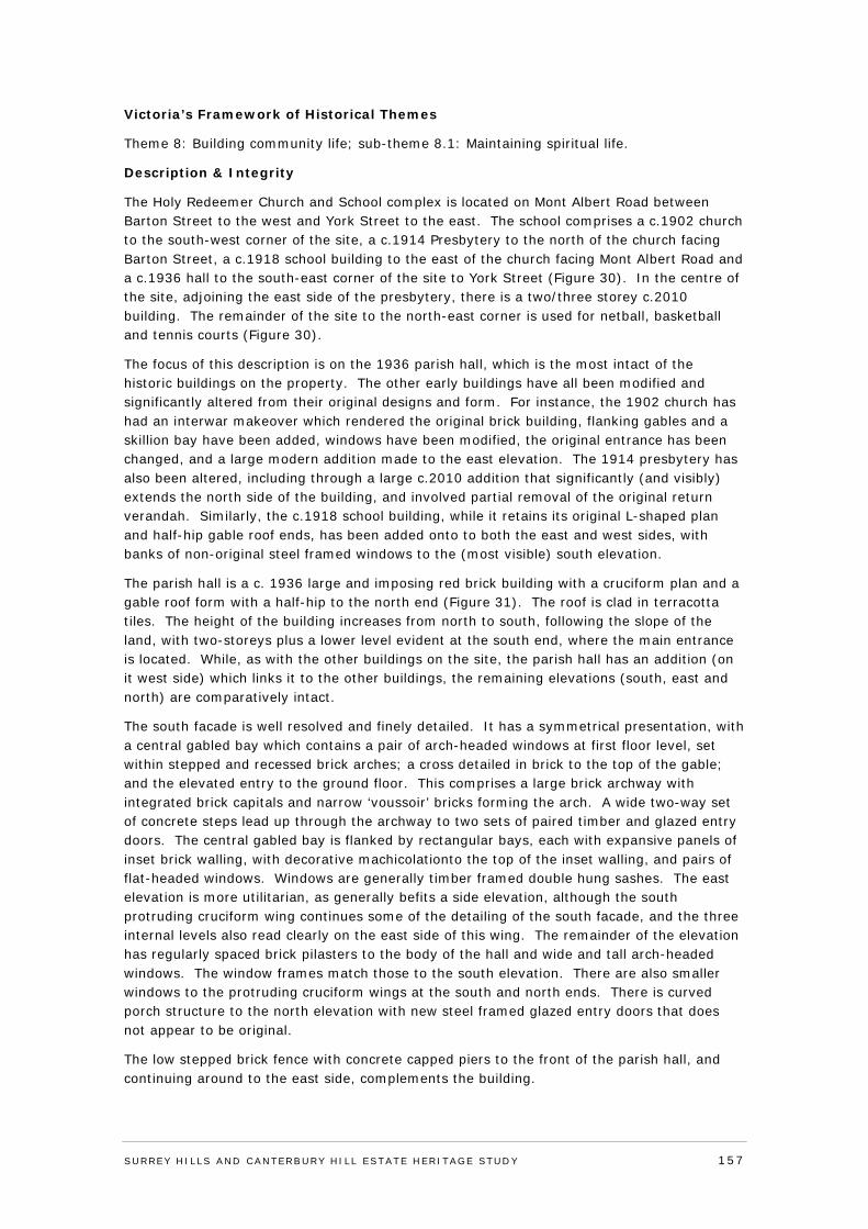
Victoria’s Framework of Historical Themes
Theme 8: Building community life; sub-theme 8.1: Maintaining spiritual life.
Description & Integrity
The Holy Redeemer Church and School complex is located on Mont Albert Road between Barton Street to the west and York Street to the east. The school comprises a c.1902 church to the south-west corner of the site, a c.1914 Presbytery to the north of the church facing Barton Street, a c.1918 school building to the east of the church facing Mont Albert Road and a c.1936 hall to the south-east corner of the site to York Street (Figure 30). In the centre of the site, adjoining the east side of the presbytery, there is a two/three storey c.2010 building. The remainder of the site to the north-east corner is used for netball, basketball and tennis courts (Figure 30).
The focus of this description is on the 1936 parish hall, which is the most intact of the historic buildings on the property. The other early buildings have all been modified and significantly altered from their original designs and form. For instance, the 1902 church has had an interwar makeover which rendered the original brick building, flanking gables and a skillion bay have been added, windows have been modified, the original entrance has been changed, and a large modern addition made to the east elevation. The 1914 presbytery has also been altered, including through a large c.2010 addition that significantly (and visibly) extends the north side of the building, and involved partial removal of the original return verandah. Similarly, the c.1918 school building, while it retains its original L-shaped plan and half-hip gable roof ends, has been added onto to both the east and west sides, with banks of non-original steel framed windows to the (most visible) south elevation.
The parish hall is a c. 1936 large and imposing red brick building with a cruciform plan and a gable roof form with a half-hip to the north end (Figure 31). The roof is clad in terracotta tiles. The height of the building increases from north to south, following the slope of the land, with two-storeys plus a lower level evident at the south end, where the main entrance is located. While, as with the other buildings on the site, the parish hall has an addition (on it west side) which links it to the other buildings, the remaining elevations (south, east and north) are comparatively intact.
The south facade is well resolved and finely detailed. It has a symmetrical presentation, with a central gabled bay which contains a pair of arch-headed windows at first floor level, set within stepped and recessed brick arches; a cross detailed in brick to the top of the gable; and the elevated entry to the ground floor. This comprises a large brick archway with integrated brick capitals and narrow ‘voussoir’ bricks forming the arch. A wide two-way set of concrete steps lead up through the archway to two sets of paired timber and glazed entry doors. The central gabled bay is flanked by rectangular bays, each with expansive panels of inset brick walling, with decorative machicolationto the top of the inset walling, and pairs of flat-headed windows. Windows are generally timber framed double hung sashes. The east elevation is more utilitarian, as generally befits a side elevation, although the south protruding cruciform wing continues some of the detailing of the south facade, and the three internal levels also read clearly on the east side of this wing. The remainder of the elevation has regularly spaced brick pilasters to the body of the hall and wide and tall arch-headed windows. The window frames match those to the south elevation. There are also smaller windows to the protruding cruciform wings at the south and north ends. There is curved porch structure to the north elevation with new steel framed glazed entry doors that does not appear to be original.
The low stepped brick fence with concrete capped piers to the front of the parish hall, and continuing around to the east side, complements the building.
SURREY HI LLS AND CANTERBURY HI LL ESTATE HERITAGE STUDY 157
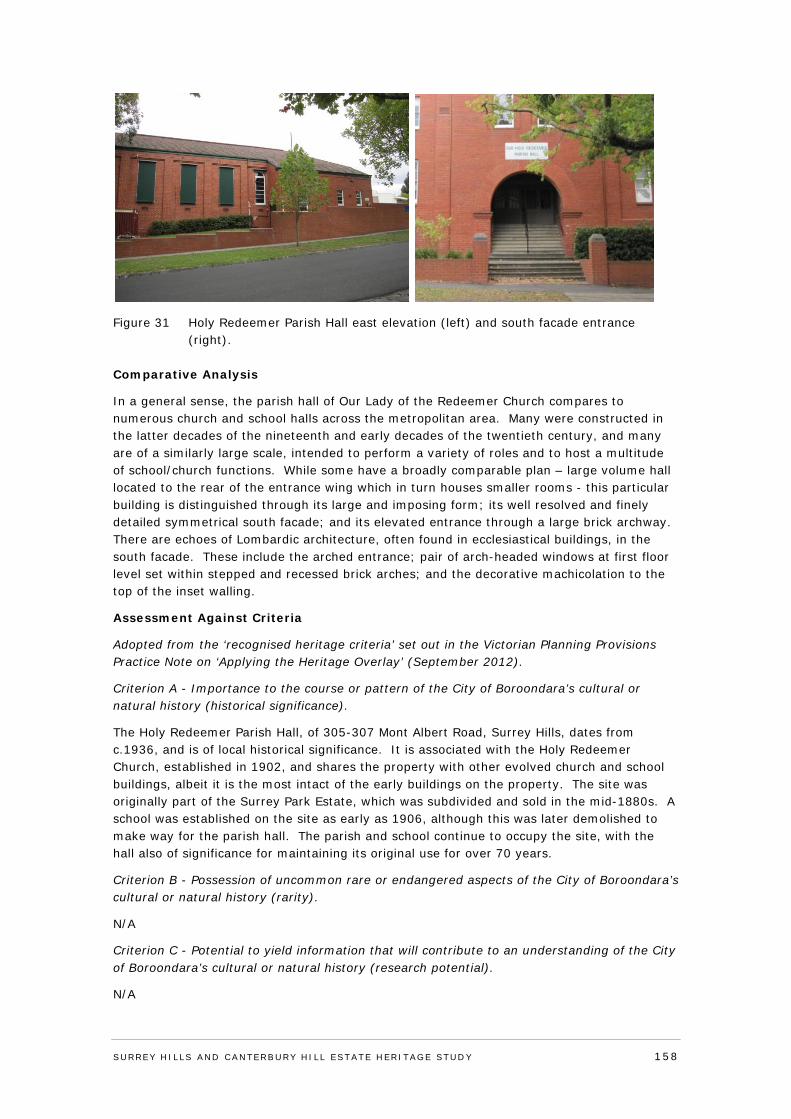
Figure 31 Holy Redeemer Parish Hall east elevation (left) and south facade entrance (right).
Comparative Analysis
In a general sense, the parish hall of Our Lady of the Redeemer Church compares to numerous church and school halls across the metropolitan area. Many were constructed in the latter decades of the nineteenth and early decades of the twentieth century, and many are of a similarly large scale, intended to perform a variety of roles and to host a multitude of school/church functions. While some have a broadly comparable plan – large volume hall located to the rear of the entrance wing which in turn houses smaller rooms - this particular building is distinguished through its large and imposing form; its well resolved and finely detailed symmetrical south facade; and its elevated entrance through a large brick archway. There are echoes of Lombardic architecture, often found in ecclesiastical buildings, in the south facade. These include the arched entrance; pair of arch-headed windows at first floor level set within stepped and recessed brick arches; and the decorative machicolation to the top of the inset walling.
Assessment Against Criteria
Adopted from the ‘recognised heritage criteria’ set out in the Victorian Planning Provisions Practice Note on ‘Applying the Heritage Overlay’ (September 2012).
Criterion A - Importance to the course or pattern of the City of Boroondara’s cultural or natural history (historical significance).
The Holy Redeemer Parish Hall, of 305-307 Mont Albert Road, Surrey Hills, dates from c.1936, and is of local historical significance. It is associated with the Holy Redeemer Church, established in 1902, and shares the property with other evolved church and school buildings, albeit it is the most intact of the early buildings on the property. The site was originally part of the Surrey Park Estate, which was subdivided and sold in the mid-1880s. A school was established on the site as early as 1906, although this was later demolished to make way for the parish hall. The parish and school continue to occupy the site, with the hall also of significance for maintaining its original use for over 70 years.
Criterion B - Possession of uncommon rare or endangered aspects of the City of Boroondara’s cultural or natural history (rarity).
N/A
Criterion C - Potential to yield information that will contribute to an understanding of the City of Boroondara’s cultural or natural history (research potential).
N/A
SURREY HI LLS AND CANTERBURY HI LL ESTATE HERITAGE STUDY 158
Criterion D - Importance in demonstrating the principal characteristics of a class of cultural or natural places and environments (representativeness).
N/A
Criterion E - Importance in exhibiting particular aesthetic characteristics (aesthetic significance).
The Holy Redeemer Parish Hall, of 305-307 Mont Albert Road, Surrey Hills, is of local aesthetic/architectural significance. It is a large and imposing church hall, comparatively externally intact, with a well resolved and finely detailed symmetrical south facade distinguished by its elevated entrance with large brick archway. Echoes of Lombardic architecture, as often found in ecclesiastical buildings, can be seen in the south facade, including through the arched entrance; pair of arch-headed windows at first floor level set within stepped and recessed brick arches; and decorative machicolation to the top of the inset walling to the bays which flank the central gabled bay. The wide two-way set of concrete steps which lead up through the archway to two sets of original paired timber and glazed entry doors, are also of note.
Criterion F - Importance in demonstrating a high degree of creative or technical achievement at a particular period (technical significance).
N/A
Criterion G - Strong or special association with a particular community or cultural group for social, cultural or spiritual reasons. This includes the significance of a place to Indigenous peoples as part of their continuing and developing cultural traditions (social significance).
N/A
Criterion H - Special association with the life or works of a person, or group of persons, of importance in the City of Boroondara’s history (associative significance).
N/A
Statement of Significance
What is significant?
The Holy Redeemer Parish Hall, of 305-307 Mont Albert Road, Surrey Hills, dates from c. 1936. It is a large red brick building with a cruciform plan and gable roof clad in terracotta tiles. The height of the building increases from north to south, with two-storeys plus a lower level evident at the south end. The well resolved and finely detailed south facade has a symmetrical presentation, with a central gabled bay which contains a pair of arch-headed windows at first floor level, set within stepped and recessed brick arches; a cross detailed in brick to the top of the gable; and the elevated entry to the ground floor. This comprises a large brick archway with integrated brick capitals and narrow ‘voussoir’ bricks forming the arch. A wide two-way set of concrete steps lead up through the archway to two sets of original paired timber and glazed entry doors. The central gabled bay is flanked by rectangular bays, each with expansive panels of inset brick walling, with decorative machicolation to the top of the walling, and pairs of flat-headed windows. Windows are generally timber framed double hung sashes. The east elevation is more utilitarian, as generally befits a side elevation, although the south protruding cruciform wing continues some of the detailing of the south facade. The remainder of this elevation has regularly spaced brick pilasters to the body of the hall and wide and tall arch-headed windows. The low stepped brick fence with concrete capped piers to the front of the parish hall, which continues around to the east side, complements the building.
SURREY HI LLS AND CANTERBURY HI LL ESTATE HERITAGE STUDY 159
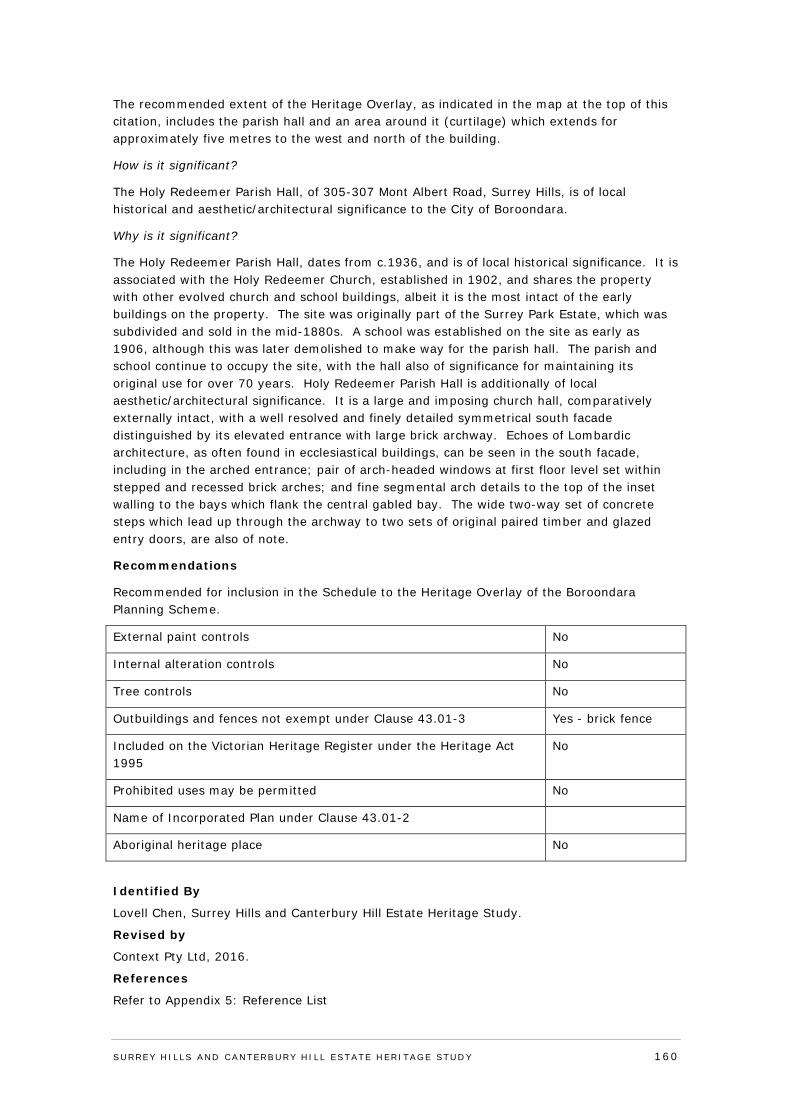
The recommended extent of the Heritage Overlay, as indicated in the map at the top of this citation, includes the parish hall and an area around it (curtilage) which extends for approximately five metres to the west and north of the building.
How is it significant?
The Holy Redeemer Parish Hall, of 305-307 Mont Albert Road, Surrey Hills, is of local historical and aesthetic/architectural significance to the City of Boroondara.
Why is it significant?
The Holy Redeemer Parish Hall, dates from c.1936, and is of local historical significance. It is associated with the Holy Redeemer Church, established in 1902, and shares the property with other evolved church and school buildings, albeit it is the most intact of the early buildings on the property. The site was originally part of the Surrey Park Estate, which was subdivided and sold in the mid-1880s. A school was established on the site as early as 1906, although this was later demolished to make way for the parish hall. The parish and school continue to occupy the site, with the hall also of significance for maintaining its original use for over 70 years. Holy Redeemer Parish Hall is additionally of local aesthetic/architectural significance. It is a large and imposing church hall, comparatively externally intact, with a well resolved and finely detailed symmetrical south facade distinguished by its elevated entrance with large brick archway. Echoes of Lombardic architecture, as often found in ecclesiastical buildings, can be seen in the south facade, including in the arched entrance; pair of arch-headed windows at first floor level set within stepped and recessed brick arches; and fine segmental arch details to the top of the inset walling to the bays which flank the central gabled bay. The wide two-way set of concrete steps which lead up through the archway to two sets of original paired timber and glazed entry doors, are also of note.
Recommendations
Recommended for inclusion in the Schedule to the Heritage Overlay of the Boroondara Planning Scheme.
External paint controls No
Internal alteration controls No
Tree controls No
Outbuildings and fences not exempt under Clause 43.01-3 Yes - brick fence
Included on the Victorian Heritage Register under the Heritage Act 1995
No
Prohibited uses may be permitted No
Name of Incorporated Plan under Clause 43.01-2
Aboriginal heritage place No
Identified By
Lovell Chen, Surrey Hills and Canterbury Hill Estate Heritage Study.
Revised by
Context Pty Ltd, 2016.
References
Refer to Appendix 5: Reference List
SURREY HI LLS AND CANTERBURY HI LL ESTATE HERITAGE STUDY 160
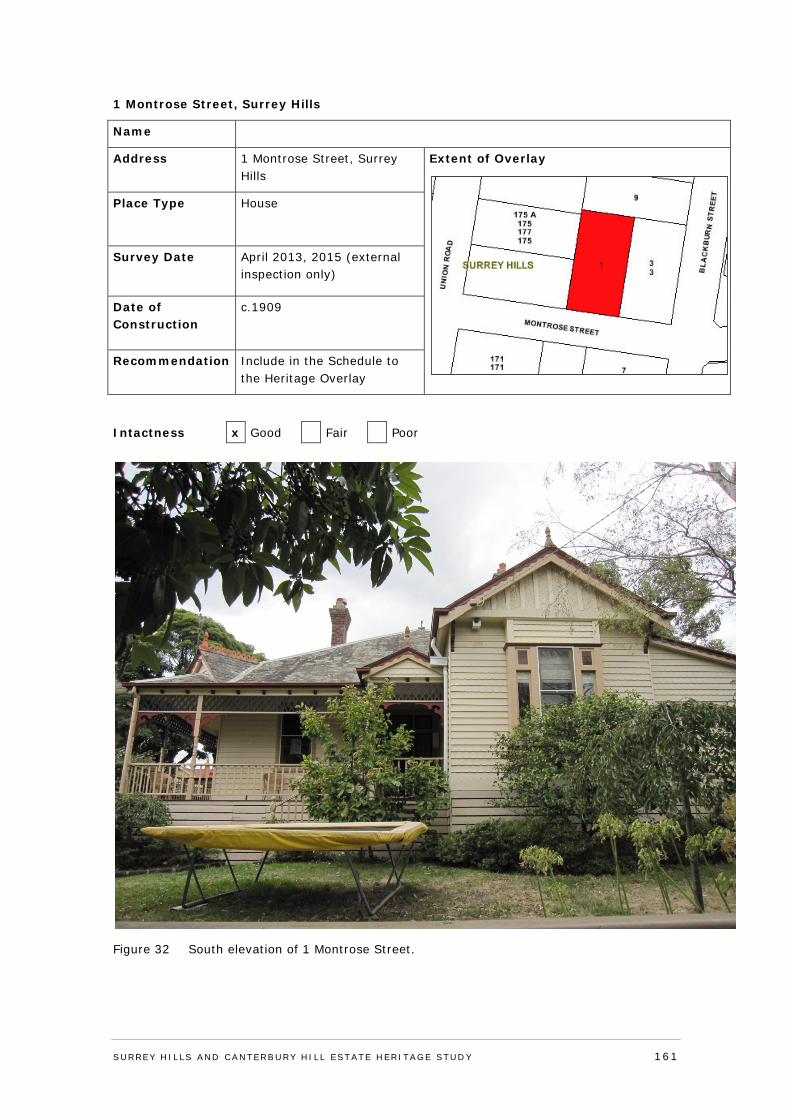
1 Montrose Street, Surrey Hills
Name
Address 1 Montrose Street, Surrey Hills
Extent of Overlay
Place Type House
Survey Date April 2013, 2015 (external inspection only)
Date of Construction
c.1909
Recommendation Include in the Schedule to the Heritage Overlay
Intactness x Good Fair Poor
Figure 32 South elevation of 1 Montrose Street.
SURREY HI LLS AND CANTERBURY HI LL ESTATE HERITAGE STUDY 161
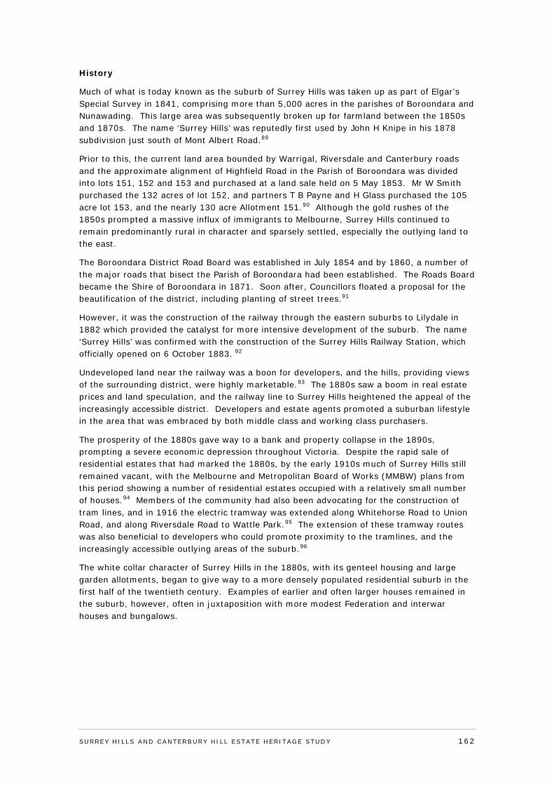
History
Much of what is today known as the suburb of Surrey Hills was taken up as part of Elgar’s Special Survey in 1841, comprising more than 5,000 acres in the parishes of Boroondara and Nunawading. This large area was subsequently broken up for farmland between the 1850s and 1870s. The name ‘Surrey Hills’ was reputedly first used by John H Knipe in his 1878 subdivision just south of Mont Albert Road.89
Prior to this, the current land area bounded by Warrigal, Riversdale and Canterbury roads and the approximate alignment of Highfield Road in the Parish of Boroondara was divided into lots 151, 152 and 153 and purchased at a land sale held on 5 May 1853. Mr W Smith purchased the 132 acres of lot 152, and partners T B Payne and H Glass purchased the 105 acre lot 153, and the nearly 130 acre Allotment 151.90 Although the gold rushes of the 1850s prompted a massive influx of immigrants to Melbourne, Surrey Hills continued to remain predominantly rural in character and sparsely settled, especially the outlying land to the east.
The Boroondara District Road Board was established in July 1854 and by 1860, a number of the major roads that bisect the Parish of Boroondara had been established. The Roads Board became the Shire of Boroondara in 1871. Soon after, Councillors floated a proposal for the beautification of the district, including planting of street trees.91
However, it was the construction of the railway through the eastern suburbs to Lilydale in 1882 which provided the catalyst for more intensive development of the suburb. The name ‘Surrey Hills’ was confirmed with the construction of the Surrey Hills Railway Station, which officially opened on 6 October 1883. 92
Undeveloped land near the railway was a boon for developers, and the hills, providing views of the surrounding district, were highly marketable.93 The 1880s saw a boom in real estate prices and land speculation, and the railway line to Surrey Hills heightened the appeal of the increasingly accessible district. Developers and estate agents promoted a suburban lifestyle in the area that was embraced by both middle class and working class purchasers.
The prosperity of the 1880s gave way to a bank and property collapse in the 1890s, prompting a severe economic depression throughout Victoria. Despite the rapid sale of residential estates that had marked the 1880s, by the early 1910s much of Surrey Hills still remained vacant, with the Melbourne and Metropolitan Board of Works (MMBW) plans from this period showing a number of residential estates occupied with a relatively small number of houses.94 Members of the community had also been advocating for the construction of tram lines, and in 1916 the electric tramway was extended along Whitehorse Road to Union Road, and along Riversdale Road to Wattle Park.95 The extension of these tramway routes was also beneficial to developers who could promote proximity to the tramlines, and the increasingly accessible outlying areas of the suburb.96
The white collar character of Surrey Hills in the 1880s, with its genteel housing and large garden allotments, began to give way to a more densely populated residential suburb in the first half of the twentieth century. Examples of earlier and often larger houses remained in the suburb, however, often in juxtaposition with more modest Federation and interwar houses and bungalows.
SURREY HI LLS AND CANTERBURY HI LL ESTATE HERITAGE STUDY 162
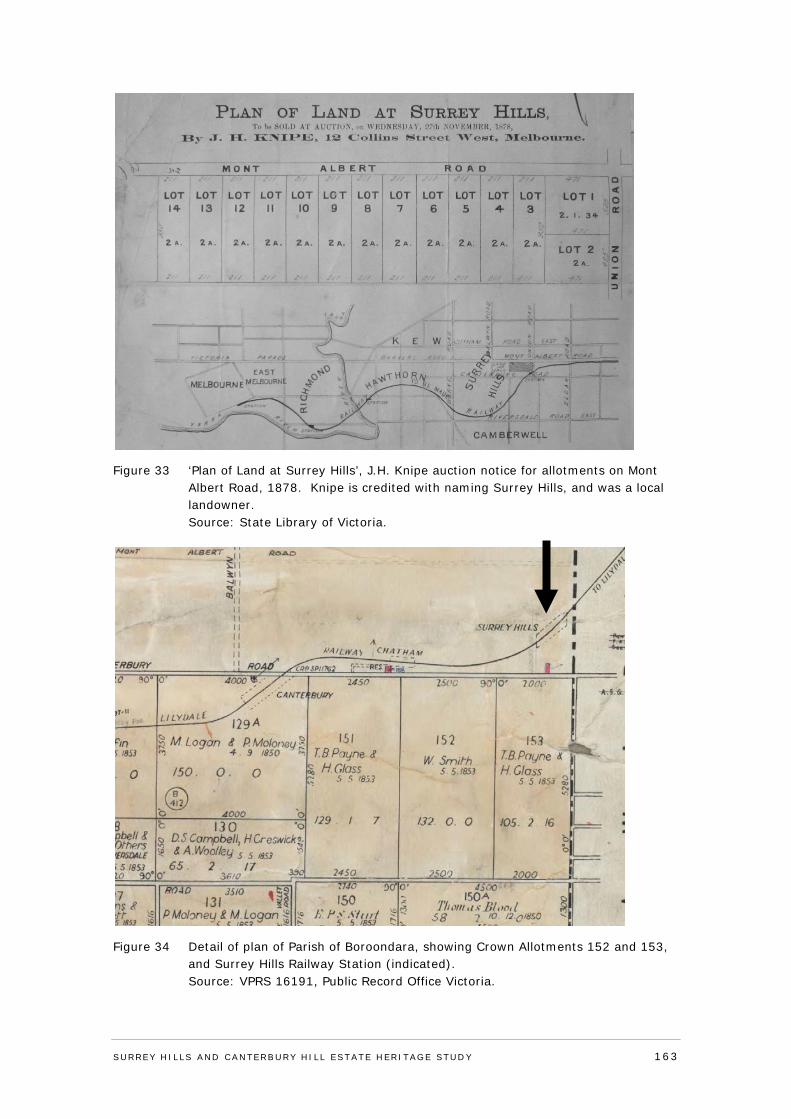
Figure 33 ‘Plan of Land at Surrey Hills’, J.H. Knipe auction notice for allotments on Mont Albert Road, 1878. Knipe is credited with naming Surrey Hills, and was a local landowner. Source: State Library of Victoria.
Figure 34 Detail of plan of Parish of Boroondara, showing Crown Allotments 152 and 153, and Surrey Hills Railway Station (indicated). Source: VPRS 16191, Public Record Office Victoria.
SURREY HI LLS AND CANTERBURY HI LL ESTATE HERITAGE STUDY 163
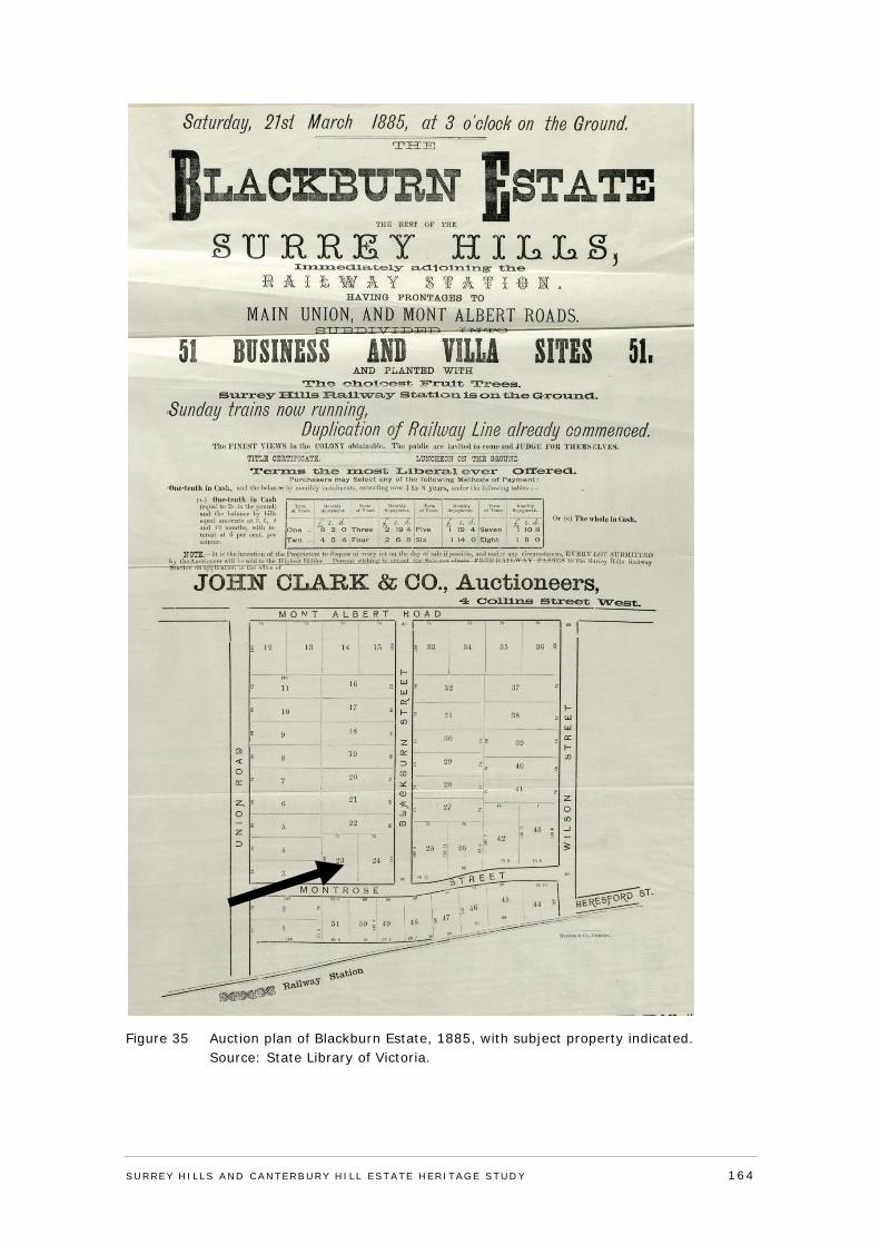
Figure 35 Auction plan of Blackburn Estate, 1885, with subject property indicated. Source: State Library of Victoria.
SURREY HI LLS AND CANTERBURY HI LL ESTATE HERITAGE STUDY 164
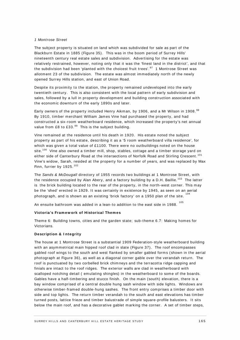
1 Montrose Street
The subject property is situated on land which was subdivided for sale as part of the Blackburn Estate in 1885 (Figure 35). This was in the boom period of Surrey Hills’ nineteenth century real estate sales and subdivision. Advertising for the estate was relatively restrained, however, noting only that it was the ‘finest land in the district’, and that the subdivision had been ‘planted with the choicest fruit trees’.97 1 Montrose Street was allotment 23 of the subdivision. The estate was almost immediately north of the newly opened Surrey Hills station, and east of Union Road.
Despite its proximity to the station, the property remained undeveloped into the early twentieth century. This is also consistent with the local pattern of early subdivision and sales, followed by a lull in property development and building construction associated with the economic downturn of the early 1890s and later.
Early owners of the property included Henry Aikman, by 1906, and a Mr Wilson in 1908.98 By 1910, timber merchant William James Vine had purchased the property, and had constructed a six-room weatherboard residence, which increased the property’s net annual value from £8 to £33.99 This is the subject building.
Vine remained at the residence until his death in 1920. His estate noted the subject property as part of his estate, describing it as a ‘5 room weatherboard villa residence’, for which was given a total value of £1100. There were no outbuildings noted on the house site.100 Vine also owned a timber mill, shop, stables, cottage and a timber storage yard on either side of Canterbury Road at the intersections of Norfolk Road and Stirling Crescent.101 Vine’s widow, Sarah, resided at the property for a number of years, and was replaced by Max Finn, furrier by 1925.102
The Sands & McDougall directory of 1955 records two buildings at 1 Montrose Street, with the residence occupied by Alan Abery, and a factory building by a D.H. Baillie.103 The latter is the brick building located to the rear of the property, in the north-west corner. This may be the ‘shed’ erected in 1929. It was certainly in existence by 1945, as seen on an aerial photograph, and is shown as an existing ‘brick factory’ on a 1950 plan of the site.
104
An ensuite bathroom was added in a lean-to addition to the east side in 1988. 105
Victoria’s Framework of Historical Themes
Theme 6: Building towns, cities and the garden state; sub-theme 6.7: Making homes for Victorians.
Description & Integrity
The house at 1 Montrose Street is a substantial 1909 Federation-style weatherboard building with an asymmetrical main hipped roof clad in slate (Figure 37). The roof encompasses gabled roof wings to the south and west flanked by smaller gabled forms (shown in the aerial photograph at Figure 36), as well as a diagonal corner gable over the verandah return. The roof is punctuated by two corbelled brick chimneys and the terracotta ridge capping and finials are intact to the roof ridges. The exterior walls are clad in weatherboard with scalloped notching detail ( emulating shingles) in the weatherboard to some of the boards. Gables have a half-timbering and stucco finish. On the main (south) elevation, there is a bay window comprised of a central double hung sash window with side lights. Windows are otherwise timber-framed double-hung sashes. The front entry comprises a timber door with side and top lights. The return timber verandah to the south and east elevations has timber turned posts, lattice frieze and timber balustrade of simple square-profile balusters. It sits below the main roof, and has a decorative gablet marking the corner. A set of timber steps,
SURREY HI LLS AND CANTERBURY HI LL ESTATE HERITAGE STUDY 165
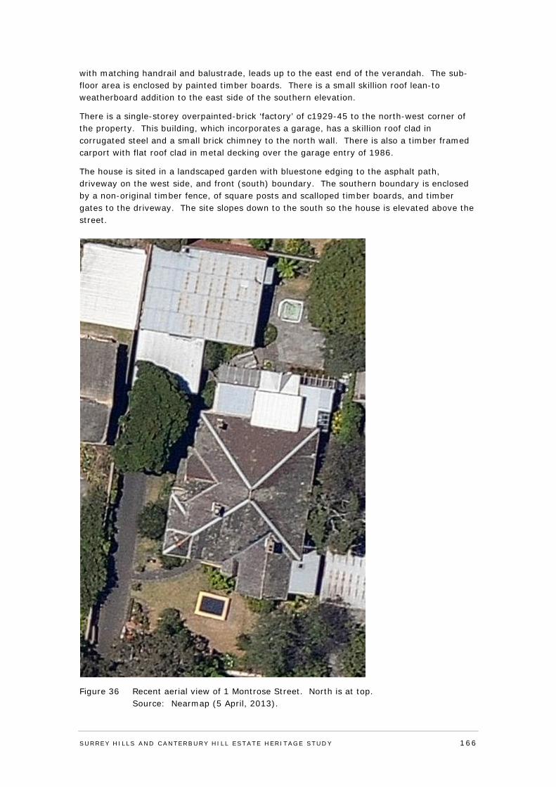
with matching handrail and balustrade, leads up to the east end of the verandah. The sub-floor area is enclosed by painted timber boards. There is a small skillion roof lean-to weatherboard addition to the east side of the southern elevation.
There is a single-storey overpainted-brick ‘factory’ of c1929-45 to the north-west corner of the property. This building, which incorporates a garage, has a skillion roof clad in corrugated steel and a small brick chimney to the north wall. There is also a timber framed carport with flat roof clad in metal decking over the garage entry of 1986.
The house is sited in a landscaped garden with bluestone edging to the asphalt path, driveway on the west side, and front (south) boundary. The southern boundary is enclosed by a non-original timber fence, of square posts and scalloped timber boards, and timber gates to the driveway. The site slopes down to the south so the house is elevated above the street.
Figure 36 Recent aerial view of 1 Montrose Street. North is at top. Source: Nearmap (5 April, 2013).
SURREY HI LLS AND CANTERBURY HI LL ESTATE HERITAGE STUDY 166
Figure 37 View of the south and west elevations showing the roof form and diagonal planning of the building.
Comparative Analysis
No 1 Montrose Street incorporates some of the most valued elements of Australian Federation houses.106 This includes prominent gabled bays associated with diagonal planning, whereby the house addresses its site and the street diagonally, given further emphasis here by the diagonal corner gable over the verandah return. This arrangement is then ‘unified’ under a dominant hipped main roof, which also integrates the roof to the verandah. No 1 Montrose Street compares in this way with many other houses in Boroondara, including the Mellor house (1898) in Mont Albert Road, Canterbury, and the Cupples House (1899-1900) at 616 Riversdale Road, Camberwell (both by Ussher and Kemp); 1045 Burke Road (1906), Camberwell by C Goodridge; and the houses by Christopher Cowper and others in the Grace Park Estate, Hawthorn. A clear weatherboard counterpart is also located at 17 O’Shaughnessy Street, Kew, albeit weatherboard examples of this scale and with comparable architectural merit are less common than their brick counterparts. Other distinctive Federation aspects of this house include the paired fanlight windows to each side of the central double-hung sash in the window to the gabled bay facing Montrose Street; and the chamfered ‘shingle’ cuts to the weatherboard bands. Apperly and others would term this house ‘Federation Queen Anne’,107 although as a version of the Australian verandah homestead it shows American influences as much as anything from Queen Anne’s era (1702-14).108
Assessment Against Criteria
Adopted from the ‘recognised heritage criteria’ set out in the Victorian Planning Provisions Practice Note on ‘Applying the Heritage Overlay’ (September 2012).
Criterion A - Importance to the course or pattern of the City of Boroondara’s cultural or natural history (historical significance).
No 1 Montrose Street, Surrey Hills, dates from 1909, and is of local historical significance. It is associated with a subdivision of 1885, which occurred at the peak of Surrey Hills’
SURREY HI LLS AND CANTERBURY HI LL ESTATE HERITAGE STUDY 167
nineteenth century real estate boom. The lapse that occurred before the house was built is also consistent with the local pattern of blocks standing empty, following the economic downturn of the early 1890s and later. The house was eventually constructed for timber merchant William James Vine, and its substantial size reflects his local commercial standing which included ownership of a timber mill, shop, stables and timber storage yard in Canterbury Road.
Criterion B - Possession of uncommon rare or endangered aspects of the City of Boroondara’s cultural or natural history (rarity).
N/A
Criterion C - Potential to yield information that will contribute to an understanding of the City of Boroondara’s cultural or natural history (research potential).
N/A
Criterion D - Importance in demonstrating the principal characteristics of a class of cultural or natural places and environments (representativeness).
N/A
Criterion E - Importance in exhibiting particular aesthetic characteristics (aesthetic significance).
No 1 Montrose Street, Surrey Hills, is of local aesthetic/architectural significance. It is a lively and inventive example of a large and prominent Federation house, which is substantially externally intact, and incorporates some of the most valued elements of Australian Federation architecture. These include the prominent gabled bay to Montrose Street, associated with the diagonal planning, given further emphasis here by the diagonal corner gable over the verandah return. This arrangement is also ‘unified’ under a dominant albeit still asymmetrical hipped main roof, which integrates the roof to the verandah. Other distinctive Federation aspects of the house include the sidelight windows to each side of the central window in the gabled bay facing Montrose Street, and the chamfered ‘shingle’ cuts to the weatherboards. Other surviving elements include slate cladding to the roof, terracotta ridge capping and finials, corbelled brick chimneys, and half-timbering and stucco to the gables. The dwelling is also significant as a weatherboard example of a Federation house of this scale, with these being less common than their brick counterparts.
Criterion F - Importance in demonstrating a high degree of creative or technical achievement at a particular period (technical significance).
N/A
Criterion G - Strong or special association with a particular community or cultural group for social, cultural or spiritual reasons. This includes the significance of a place to Indigenous peoples as part of their continuing and developing cultural traditions (social significance).
N/A
Criterion H - Special association with the life or works of a person, or group of persons, of importance in the City of Boroondara’s history (associative significance).
N/A
SURREY HI LLS AND CANTERBURY HI LL ESTATE HERITAGE STUDY 168
Statement of Significance
What is significant?
No 1 Montrose Street, Surrey Hills, dates from 1909, and is a substantial elevated Federation-style weatherboard dwelling with an asymmetrical main hipped roof clad in slate. The roof encompasses gabled roof wings to the south and west flanked by smaller gabled forms, together with a diagonal corner gable over the verandah return. The roof is punctuated by corbelled brick chimneys and retains original terracotta ridge capping and finials. The exterior walls are clad in weatherboard with scalloped notching detail (emulating shingles); gables have half-timbering and stucco finish; and the main bay on the south elevation has a central double hung sash window with side lights. The front entry is accessed via timber steps up to the return verandah, which has; timber turned posts, lattice frieze and timber balustrade.
In the north-west corner of the property is a single-storey overpainted-brick factory building incorporating a garage, with a skillion roof; to the front of this is a timber-framed carport with flat roof. Neither of these structures are significant. The house is sited in a landscaped garden with a driveway and crossover on the west side; the southern boundary is enclosed by a non-original timber fence.
How is it significant?
The property at 1 Montrose Street, Surrey Hills, is of local historical and aesthetic/architectural significance to the City of Boroondara.
Why is it significant?
No 1 Montrose Street, Surrey Hills, dates from 1909, and is of local historical significance. It is associated with a subdivision of 1885, which occurred at the peak of Surrey Hills’ nineteenth century real estate boom. The lapse that occurred before the house was built is also consistent with the local pattern of blocks standing empty, following the economic downturn of the early 1890s and later. The house was eventually constructed for timber merchant William James Vine, and its substantial size reflects his local commercial standing which included ownership of a timber mill, shop, stables and timber storage yard in Canterbury Road. No1 Montrose Street is also of local aesthetic/architectural significance. It is a lively and inventive example of a large and prominent Federation house, which is substantially externally intact, and incorporates some of the most valued elements of Australian Federation architecture. These include the prominent gabled bay to Montrose Street, associated with the diagonal planning, given further emphasis here by the diagonal corner gable over the verandah return. This arrangement is also ‘unified’ under a dominant albeit still asymmetrical hipped main roof, which integrates the roof to the verandah. Other distinctive Federation aspects of the house include the sidelight windows to the central window in the gabled bay facing Montrose Street, and the chamfered ‘shingle’ cuts to the weatherboards. Other surviving elements include slate cladding to the roof, terracotta ridge capping and finials, corbelled brick chimneys, and half-timbering and stucco to the gables. The dwelling is additionally significant as a weatherboard example of a Federation house of this scale, with these being less common than their brick counterparts.
SURREY HI LLS AND CANTERBURY HI LL ESTATE HERITAGE STUDY 169
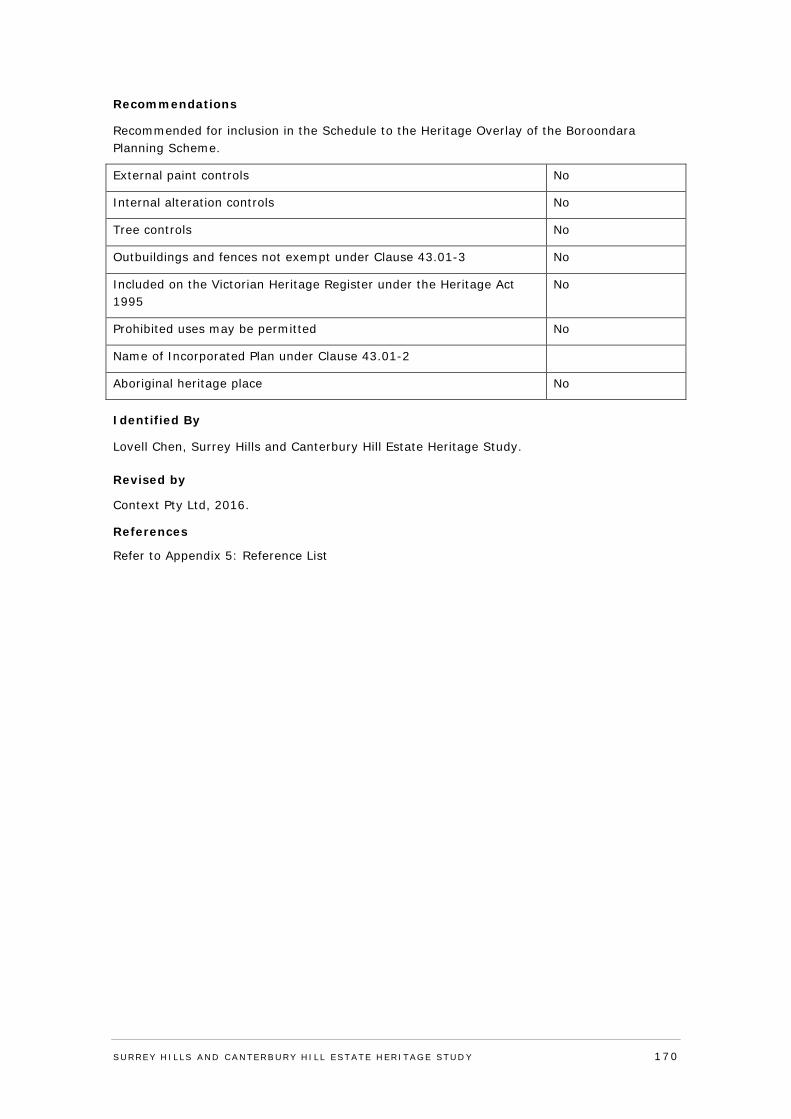
Recommendations
Recommended for inclusion in the Schedule to the Heritage Overlay of the Boroondara Planning Scheme.
External paint controls No
Internal alteration controls No
Tree controls No
Outbuildings and fences not exempt under Clause 43.01-3 No
Included on the Victorian Heritage Register under the Heritage Act 1995
No
Prohibited uses may be permitted No
Name of Incorporated Plan under Clause 43.01-2
Aboriginal heritage place No
Identified By
Lovell Chen, Surrey Hills and Canterbury Hill Estate Heritage Study.
Revised by
Context Pty Ltd, 2016.
References
Refer to Appendix 5: Reference List
SURREY HI LLS AND CANTERBURY HI LL ESTATE HERITAGE STUDY 170
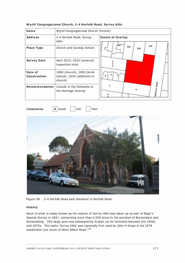
Wyclif Congregational Church, 2-4 Norfolk Road, Surrey Hills
Name Wyclif Congregational Church (former)
Address 2-4 Norfolk Road, Surrey Hills
Extent of Overlay
Place Type Church and Sunday School
Survey Date April 2013, 2015 (external inspection only)
Date of Construction
1890 (church), 1950 (brick school), 1934 (additions to church)
Recommendation Include in the Schedule to the Heritage Overlay
Intactness X Good Fair Poor
Figure 38 2-4 Norfolk Road east elevation to Norfolk Road.
History
Much of what is today known as the suburb of Surrey Hills was taken up as part of Elgar’s Special Survey in 1841, comprising more than 5,000 acres in the parishes of Boroondara and Nunawading. This large area was subsequently broken up for farmland between the 1850s and 1870s. The name ‘Surrey Hills’ was reputedly first used by John H Knipe in his 1878 subdivision just south of Mont Albert Road.109
SURREY HI LLS AND CANTERBURY HI LL ESTATE HERITAGE STUDY 171
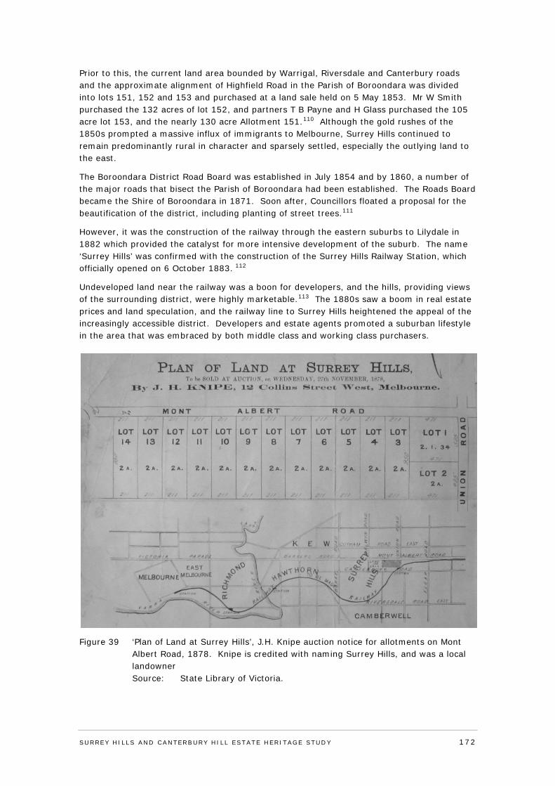
Prior to this, the current land area bounded by Warrigal, Riversdale and Canterbury roads and the approximate alignment of Highfield Road in the Parish of Boroondara was divided into lots 151, 152 and 153 and purchased at a land sale held on 5 May 1853. Mr W Smith purchased the 132 acres of lot 152, and partners T B Payne and H Glass purchased the 105 acre lot 153, and the nearly 130 acre Allotment 151.110 Although the gold rushes of the 1850s prompted a massive influx of immigrants to Melbourne, Surrey Hills continued to remain predominantly rural in character and sparsely settled, especially the outlying land to the east.
The Boroondara District Road Board was established in July 1854 and by 1860, a number of the major roads that bisect the Parish of Boroondara had been established. The Roads Board became the Shire of Boroondara in 1871. Soon after, Councillors floated a proposal for the beautification of the district, including planting of street trees.111
However, it was the construction of the railway through the eastern suburbs to Lilydale in 1882 which provided the catalyst for more intensive development of the suburb. The name ‘Surrey Hills’ was confirmed with the construction of the Surrey Hills Railway Station, which officially opened on 6 October 1883. 112
Undeveloped land near the railway was a boon for developers, and the hills, providing views of the surrounding district, were highly marketable.113 The 1880s saw a boom in real estate prices and land speculation, and the railway line to Surrey Hills heightened the appeal of the increasingly accessible district. Developers and estate agents promoted a suburban lifestyle in the area that was embraced by both middle class and working class purchasers.
Figure 39 ‘Plan of Land at Surrey Hills’, J.H. Knipe auction notice for allotments on Mont Albert Road, 1878. Knipe is credited with naming Surrey Hills, and was a local landowner Source: State Library of Victoria.
SURREY HI LLS AND CANTERBURY HI LL ESTATE HERITAGE STUDY 172
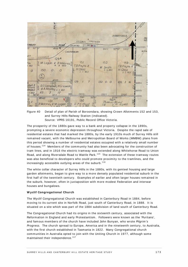
Figure 40 Detail of plan of Parish of Boroondara, showing Crown Allotments 152 and 153, and Surrey Hills Railway Station (indicated). Source: VPRS 16191, Public Record Office Victoria.
The prosperity of the 1880s gave way to a bank and property collapse in the 1890s, prompting a severe economic depression throughout Victoria. Despite the rapid sale of residential estates that had marked the 1880s, by the early 1910s much of Surrey Hills still remained vacant, with the Melbourne and Metropolitan Board of Works (MMBW) plans from this period showing a number of residential estates occupied with a relatively small number of houses.114 Members of the community had also been advocating for the construction of tram lines, and in 1916 the electric tramway was extended along Whitehorse Road to Union Road, and along Riversdale Road to Wattle Park.115 The extension of these tramway routes was also beneficial to developers who could promote proximity to the tramlines, and the increasingly accessible outlying areas of the suburb.116
The white collar character of Surrey Hills in the 1880s, with its genteel housing and large garden allotments, began to give way to a more densely populated residential suburb in the first half of the twentieth century. Examples of earlier and often larger houses remained in the suburb, however, often in juxtaposition with more modest Federation and interwar houses and bungalows.
Wyclif Congregational Church
The Wyclif Congregational Church was established in Canterbury Road in 1884, before moving to its current site in Norfolk Road, just south of Canterbury Road, in 1888. It is situated on a site which was part of the 1884 subdivision of land south of Canterbury Road.
The Congregational Church had its origins in the sixteenth century, associated with the Reformation in England and early Protestantism. Followers were known as the ‘Puritans’, and famous members of the church have included John Bunyan, who wrote Pilgrim’s Progress. The church spread to Europe, America and in the nineteenth century, to Australia, with the first church established in Tasmania in 1822. Many Congregational church communities in Australia opted to join with the Uniting Church in 1977, although some maintained their independence.117
SURREY HI LLS AND CANTERBURY HI LL ESTATE HERITAGE STUDY 173
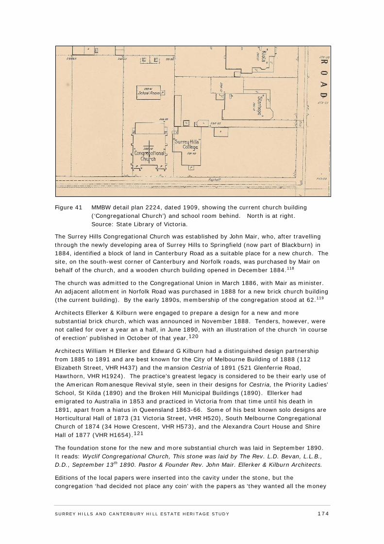
Figure 41 MMBW detail plan 2224, dated 1909, showing the current church building (‘Congregational Church’) and school room behind. North is at right. Source: State Library of Victoria.
The Surrey Hills Congregational Church was established by John Mair, who, after travelling through the newly developing area of Surrey Hills to Springfield (now part of Blackburn) in 1884, identified a block of land in Canterbury Road as a suitable place for a new church. The site, on the south-west corner of Canterbury and Norfolk roads, was purchased by Mair on behalf of the church, and a wooden church building opened in December 1884.118
The church was admitted to the Congregational Union in March 1886, with Mair as minister. An adjacent allotment in Norfolk Road was purchased in 1888 for a new brick church building (the current building). By the early 1890s, membership of the congregation stood at 62.119
Architects Ellerker & Kilburn were engaged to prepare a design for a new and more substantial brick church, which was announced in November 1888. Tenders, however, were not called for over a year an a half, in June 1890, with an illustration of the church ‘in course of erection’ published in October of that year.120
Architects William H Ellerker and Edward G Kilburn had a distinguished design partnership from 1885 to 1891 and are best known for the City of Melbourne Building of 1888 (112 Elizabeth Street, VHR H437) and the mansion Cestria of 1891 (521 Glenferrie Road, Hawthorn, VHR H1924). The practice’s greatest legacy is considered to be their early use of the American Romanesque Revival style, seen in their designs for Cestria, the Priority Ladies’ School, St Kilda (1890) and the Broken Hill Municipal Buildings (1890). Ellerker had emigrated to Australia in 1853 and practiced in Victoria from that time until his death in 1891, apart from a hiatus in Queensland 1863-66. Some of his best known solo designs are Horticultural Hall of 1873 (31 Victoria Street, VHR H520), South Melbourne Congregational Church of 1874 (34 Howe Crescent, VHR H573), and the Alexandra Court House and Shire Hall of 1877 (VHR H1654).121
The foundation stone for the new and more substantial church was laid in September 1890. It reads: Wyclif Congregational Church, This stone was laid by The Rev. L.D. Bevan, L.L.B., D.D., September 13th 1890. Pastor & Founder Rev. John Mair. Ellerker & Kilburn Architects.
Editions of the local papers were inserted into the cavity under the stone, but the congregation ‘had decided not place any coin’ with the papers as ‘they wanted all the money
SURREY HI LLS AND CANTERBURY HI LL ESTATE HERITAGE STUDY 174
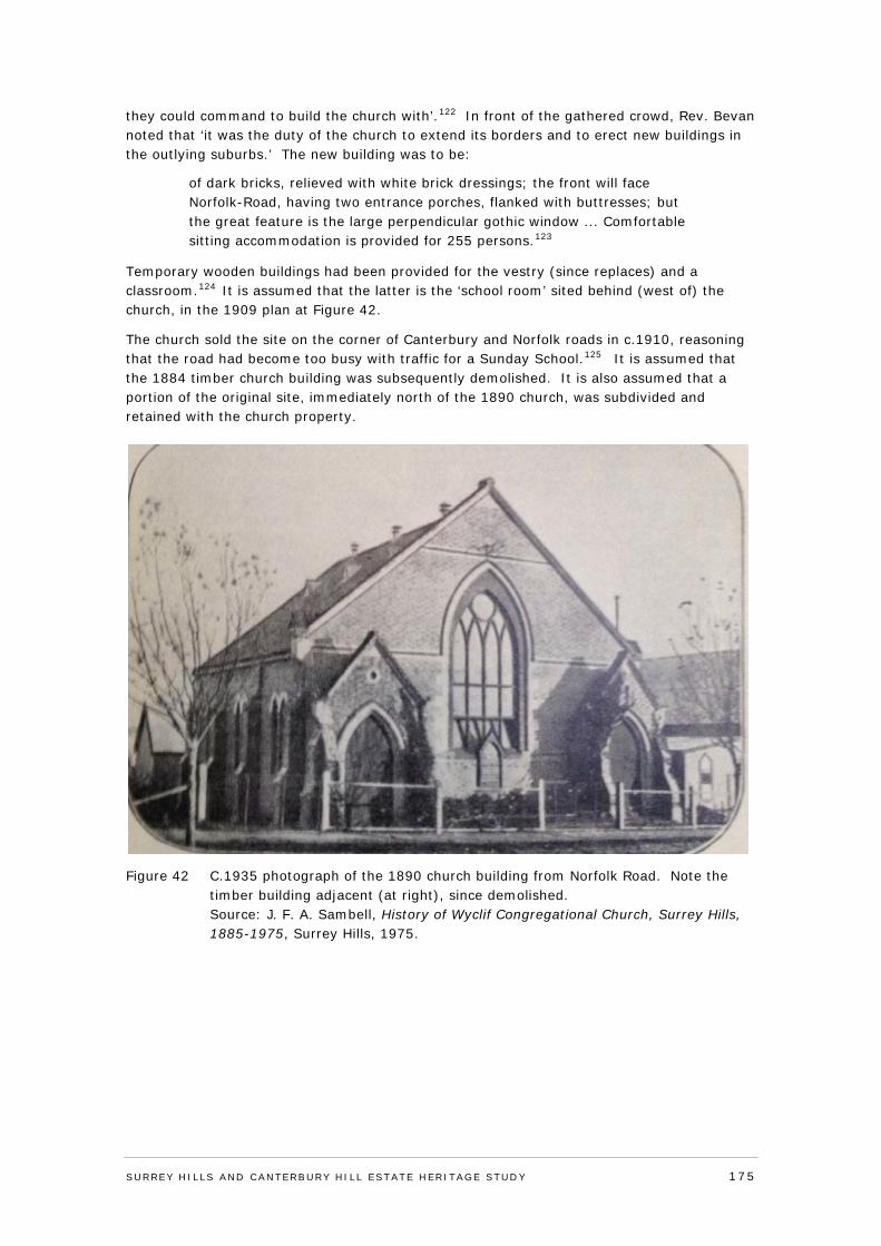
they could command to build the church with’.122 In front of the gathered crowd, Rev. Bevan noted that ‘it was the duty of the church to extend its borders and to erect new buildings in the outlying suburbs.’ The new building was to be:
of dark bricks, relieved with white brick dressings; the front will face Norfolk-Road, having two entrance porches, flanked with buttresses; but the great feature is the large perpendicular gothic window ... Comfortable sitting accommodation is provided for 255 persons.123
Temporary wooden buildings had been provided for the vestry (since replaces) and a classroom.124 It is assumed that the latter is the ‘school room’ sited behind (west of) the church, in the 1909 plan at Figure 42.
The church sold the site on the corner of Canterbury and Norfolk roads in c.1910, reasoning that the road had become too busy with traffic for a Sunday School.125 It is assumed that the 1884 timber church building was subsequently demolished. It is also assumed that a portion of the original site, immediately north of the 1890 church, was subdivided and retained with the church property.
Figure 42 C.1935 photograph of the 1890 church building from Norfolk Road. Note the timber building adjacent (at right), since demolished. Source: J. F. A. Sambell, History of Wyclif Congregational Church, Surrey Hills, 1885-1975, Surrey Hills, 1975.
SURREY HI LLS AND CANTERBURY HI LL ESTATE HERITAGE STUDY 175
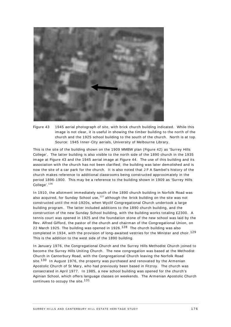
Figure 43 1945 aerial photograph of site, with brick church building indicated. While this image is not clear, it is useful in showing the timber building to the north of the church and the 1925 school building to the south of the church. North is at top. Source: 1945 Inner-City aerials, University of Melbourne Library.
This is the site of the building shown on the 1909 MMBW plan (Figure 42) as ‘Surrey Hills College’. The latter building is also visible to the north side of the 1890 church in the 1935 image at Figure 43 and the 1945 aerial image at Figure 44. The use of this building and its association with the church has not been clarified; the building was later demolished and is now the site of a car park for the church. It is also noted that J F A Sambel’s history of the church makes reference to additional classrooms being constructed approximately in the period 1896-1900. This may be a reference to the building shown in 1909 as ‘Surrey Hills College’.126
In 1910, the allotment immediately south of the 1890 church building in Norfolk Road was also acquired, for Sunday School use,127 although the brick building on the site was not constructed until the mid-1920s, when Wyclif Congregational Church undertook a large building program. The latter included additions to the 1890 church building, and the construction of the new Sunday School building, with the building works totaling £2300. A tennis court was opened in 1925 and the foundation stone of the new school was laid by the Rev. Alfred Gifford, the pastor of the church and chairman of the Congregational Union, on 22 March 1925. The building was opened in 1926.128 The church building was also completed in 1934, with the provision of long-awaited vestries for the Minister and choir.129 This is the addition to the west side of the 1890 building.
In January 1976, the Congregational Church and the Surrey Hills Methodist Church joined to become the Surrey Hills Uniting Church. The new congregation was based at the Methodist Church in Canterbury Road, with the Congregational Church leaving the Norfolk Road site.130 In August 1976, the property was purchased and renovated by the Armenian Apostolic Church of St Mary, who had previously been based in Fitzroy. The church was consecrated in April 1977. In 1985, a new school building was opened for the church’s Aginian School, which offers language classes on weekends. The Armenian Apostolic Church continues to occupy the site.131
SURREY HI LLS AND CANTERBURY HI LL ESTATE HERITAGE STUDY 176
Graeme Butler has observed that the Non-Conformist or Dissenting Church presence in Camberwell (Presbyterian, Methodist, Congregationalist, Baptist and others) was significantly higher than in other municipalities.132 Congregational churches, following amalgamation with the Uniting Church, are commonly now either demolished, converted to another use, or occupied by other denominations, as has occurred here.
Victoria’s Framework of Historical Themes
Theme 8: Building community life; sub-theme 8.1: Maintaining spiritual life.
Description & Integrity
The Wyclif Congregational Church complex at 2-4 Norfolk Road, Surrey Hills, comprises a car park on the north of the site; a 1890 polychrome brick church with rear additions dating from c1900-1920s and 1934; a 1925 red brick Sunday School building, with a later gabled west wing; and sundry other elements.
The 1890 church building is a polychrome brick structure, approximately square in plan form with a gable roof clad in slate with pointed metal vents (Figure 46). The east facade to Norfolk Road has a large Perpendicular Gothic tracery window with stained glass, and two gabled entry bays with decorative brick buttressing and lancet shaped doorways with ledged doors. There are three red and cream brick stringcourses and a gabled parapet with unpainted cement detailing. Set below the central window is a timber signboard that mimics its pointed-arch form. It is visible in the 1935 photo (see Figure 43).
The north and south elevations have brick buttresses with cream brick dressings and pairs of lancet windows with cream brick arches. The rear-most bay of the nave appears to be a later addition. It continues the gabled roof line of the earlier church, engaged buttresses and cream brick dressings, but is constructed of a redder brick, such as was common c1900-20s. The windows here are triple lancets, set higher than those to the rest of the building. Behind it there is a hipped roof addition with a projecting west bay to the rear of the church that was added c.1934 to accommodate the vestries and choir, although this has limited visibility from the street. It is constructed of clinker bricks with rendered spandrels.
The 1925 red brick Sunday School building to the south of the church is rectangular in plan form with a high gable roof clad in terracotta tiles (Figure 47). The building presents its side (east) elevation to the street, giving the gabled roof form and east roof plane considerable prominence. The east elevation has stepped brick buttresses and shallow arch-headed windows fitted with timber framed awning windows and top lights. There is a single doorway to the east elevation with a non-original flush panel timber door. There is also a small weatherboard bay to the north-east corner that is incorporated into the main roof line. This may have been a toilet enclosure or small shed. The gabled north elevation has brick buttresses and a large central pointed arch-headed window flanked by two narrow windows. At the apex of thegable is a small area clad in timber shingles, indicating an Arts and Crafts influence. The west side of the building was not inspected, however aerial photographs indicate a gabled roof wing, of lower height than the school building, projecting from the west elevation. It appears to be contemporaneous with the 1925 building, with the same splayed brick sills as the Sunday School, and hopper windows typical of the interwar period. There is also a single storey flat roof c.1980s building that sits low on the site, again on the west side (possibly on the site of the 1925 tennis court).
There is an asphalt car park to the north of the church building; cyclone wire fencing; paving and hard surfaced areas; and some informal plantings and grassed areas.
SURREY HI LLS AND CANTERBURY HI LL ESTATE HERITAGE STUDY 177
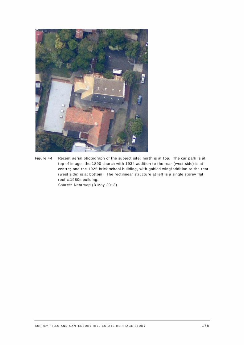
Figure 44 Recent aerial photograph of the subject site; north is at top. The car park is at top of image; the 1890 church with 1934 addition to the rear (west side) is at centre; and the 1925 brick school building, with gabled wing/addition to the rear (west side) is at bottom. The rectilinear structure at left is a single storey flat roof c.1980s building. Source: Nearmap (8 May 2013).
SURREY HI LLS AND CANTERBURY HI LL ESTATE HERITAGE STUDY 178
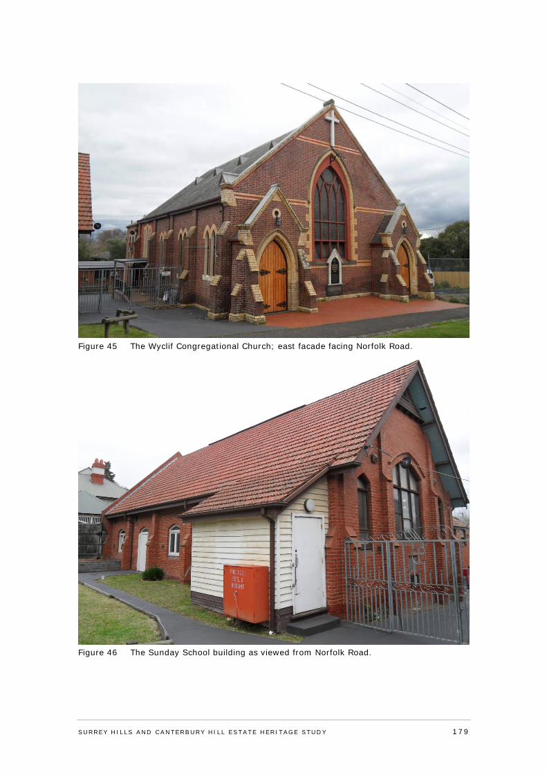
Figure 45 The Wyclif Congregational Church; east facade facing Norfolk Road.
Figure 46 The Sunday School building as viewed from Norfolk Road.
SURREY HI LLS AND CANTERBURY HI LL ESTATE HERITAGE STUDY 179
Comparative Analysis
Wyclif Congregational Church in Norfolk Road, Surrey Hills, is characteristic of Congregationalist Protestant church design of the late nineteenth century. This includes the use of umber brick and polychromy in cream and red. The building compares most directly with the former Congregational Church at 28 Trafalgar Road, Camberwell (1888; Contributory to precinct HO159). It has similar broad proportions with similar materials, including a fairly low-pitched slate-tiled roof, and walls of umber brick and polychrome. The broad proportions reflect a church where the activities were predominantly preaching and singing, as compared to a processional and sacramental church, with a central internal focus and altar at the apse (or apex). The proportions also resemble those of the churches in Victoria designed by Charles and James Webb or Crouch and Wilson.133 The window placement differs at Camberwell, being a triple lancet high up and two paired lancets expressing the two internal pew aisles. At Surrey Hills, the two front entrance porches express the two internal pew aisles. The 1920s red brick Sunday School building resembles the red brick forms of architects’ Alexander North and Louis Williams, as at St Mark’s Anglican Church Hall, cnr Burke and Canterbury roads, Camberwell (1914; HO483); and St Stephen’s, 22-24 Merton Street, Darebin (1926-27). It also resembles the former Peace Church at 620 Riversdale Road, Camberwell (c. 1926).
William H Ellerker’s South Melbourne Congregational Church of 1874 (VHR H573) is a more sophisticated version of the gabled church seen in Surrey Hills. Here the side aisles are expressed by buttressed minor gables to either side of the central major gable, and the bichrome brickwork is used in a number of decorative patterns.
Assessment Against Criteria
Adopted from the ‘recognised heritage criteria’ set out in the Victorian Planning Provisions Practice Note on ‘Applying the Heritage Overlay’ (September 2012).
Criterion A - Importance to the course or pattern of the City of Boroondara’s cultural or natural history (historical significance).
The Wyclif Congregational Church, Surrey Hills, is of local historical significance. It is associated with the establishment of Congregationalism in the suburb in the 1880s, where the first church property fronted Canterbury Road, and the current property was purchased and extended from the late 1880s. Congregationalism had its origins in the sixteenth century English Reformation and early Protestantism, and spread through subsequent centuries to Europe, America, and eventually to Australia in the early nineteenth century. The earliest building on the subject site is the 1890 church building; other buildings and additions consolidated the presence of the denomination in Surrey Hills, offering classes and recreational opportunities, as well as church services. The property was retained by the Congregational Church until the 1970s, before concluding over 90 years of association. The property is also significant for demonstrating the presence of Non-Conformist or Dissenting denominations in (the former city of) Camberwell, where they reputedly had a greater presence than in other municipalities. Congregational churches are also commonly now either demolished, converted to another use, or occupied by other denominations, as has occurred here.
Criterion B - Possession of uncommon rare or endangered aspects of the City of Boroondara’s cultural or natural history (rarity).
N/A
Criterion C - Potential to yield information that will contribute to an understanding of the City of Boroondara’s cultural or natural history (research potential).
SURREY HI LLS AND CANTERBURY HI LL ESTATE HERITAGE STUDY 180
N/A
Criterion D - Importance in demonstrating the principal characteristics of a class of cultural or natural places and environments (representativeness).
N/A
Criterion E - Importance in exhibiting particular aesthetic characteristics (aesthetic significance).
The Wyclif Congregational Church property, Surrey Hills, is of local aesthetic/architectural significance. The building of most significance on the site is the 1890 church, which is substantially externally intact as it presents to the street, and is characteristic of Congregationalist Protestant church design of the late nineteenth century. This includes the use of umber brick and polychromy in cream and red. The broad proportions also reflect a church where the activities were predominantly preaching and singing, as opposed to a processional and sacramental church, with a central internal focus and altar at the apse (or apex). The two front entrance porches additionally express two internal pew aisles. Other original elements of note include the broad slate-clad gable roof with pointed metal vents; a Perpendicular Gothic tracery window with stained glass in the east facade; the two gabled entry bays with decorative brick buttressing and lancet shaped doorways with ledged doors; and brick buttresses with cream brick dressings. The 1925 red brick Sunday School building is of lesser significance architecturally, but still demonstrative of church halls/Sunday schools of the general period. It has a high terracotta-tiled gable roof, which is prominent in the Norfolk Road context given the orientation of the building; stepped brick buttresses; and a large central pointed arch-headed window flanked by two narrow windows.
Criterion F - Importance in demonstrating a high degree of creative or technical achievement at a particular period (technical significance).
N/A
Criterion G - Strong or special association with a particular community or cultural group for social, cultural or spiritual reasons. This includes the significance of a place to Indigenous peoples as part of their continuing and developing cultural traditions (social significance).
N/A
Criterion H - Special association with the life or works of a person, or group of persons, of importance in the City of Boroondara’s history (associative significance).
The Wyclif Congregational Church of 1890 is of local associative significance for its links with the distinguished 19th-century Melbourne architectural practice of Ellerker & Kilburn. The practice is best known for its early use of the American Romanesque Revival style, such as Cestria in Hawthorn. Together, and Ellerker as a sole practitioner, were responsible for many Melbourne landmarks.
Statement of Significance
What is significant?
The Wyclif Congregational Church complex at 2-4 Norfolk Road, Surrey Hills, comprises a 1890 polychrome brick church designed by architectural practice Ellerker & Kilburn, with rear additions dating from the interwar period; a 1925 red brick Sunday School building, with a gabled west wing; and sundry other elements. The 1890 church building is a polychrome brick structure, approximately square in plan form, and with a slate-clad gable roof. The main gabled east facade to Norfolk Road has a large Perpendicular Gothic tracery window with stained glass, and two gabled entry bays with decorative brick buttressing and lancet
SURREY HI LLS AND CANTERBURY HI LL ESTATE HERITAGE STUDY 181
shaped doorways with ledged doors; the entries express two internal pew aisles. The side elevations have pairs of lancet windows with cream brick arches. Stringcourses are of red and cream brick; the gable parapet has unpainted cement detailing; and the elevations have brick buttresses with cream brickdressings. The 1925 red brick Sunday School building to the south of the church is rectangular in plan form with a high gable roof clad in terracotta tiles. The building presents its side (east) elevation to the street, giving the gabled roof form and east roof plane considerable prominence. The east elevation has stepped brick buttresses and shallow arch-headed windows; the gabled north elevation also has brick buttresses and a large central pointed arch-headed window flanked by two narrow windows.
There is an asphalt car park to the north of the church building; cyclone wire fencing; paving and hard surfaced areas; and some informal plantings and grassed areas, none of which are significant.
How is it significant?
The property at is of local historical, aesthetic/architectural and associative significance to the City of Boroondara.
Why is it significant?
The Wyclif Congregational Church, Surrey Hills, is of local historical significance. It is associated with the establishment of Congregationalism in the suburb in the 1880s, where the first church property fronted Canterbury Road, and the current property was purchased and extended from the late 1880s. Congregationalism had its origins in the sixteenth century English Reformation and early Protestantism, and spread through subsequent centuries to Europe, America, and eventually to Australia in the early nineteenth century. The earliest building on the subject site is the 1890 church building; other buildings and additions consolidated the presence of the denomination in Surrey Hills, offering classes and recreational opportunities, as well as church services. The property was retained by the Congregational Church until the 1970s, before concluding over 90 years of association. The property is also significant for demonstrating the presence of Non-Conformist or Dissenting denominations in (the former city of) Camberwell, where they reputedly had a greater presence than in other municipalities. Congregational churches are also commonly now either demolished, converted to another use, or occupied by other denominations, as has occurred here.
The Wyclif Congregational Church is also of local aesthetic/architectural significance. The building of most significance on the site is the 1890 church, which is substantially externally intact as it presents to the street, and is characteristic of Congregationalist Protestant church design of the late nineteenth century. This includes the use of umber brick and polychromy in cream and red. The broad proportions also reflect a church where the activities were predominantly preaching and singing, as opposed to a processional and sacramental church, with a central internal focus and altar at the apse (or apex). The two front entrance porches additionally express two internal pew aisles. Other original elements of note include the broad slate-clad gable roof with pointed metal vents; a large Perpendicular Gothic tracery window with stained glass in the east facade; two gabled entry bays with decorative brick buttressing and lancet shaped doorways with timber panel doors; and brick buttresses with stepped details in cream brick. The 1920s red brick Sunday School building is of lesser significance architecturally, but still demonstrative of church halls/Sunday schools of the general period. It has a high terracotta-tiled gable roof, which is prominent in the Norfolk Road context given the orientation of the building; stepped brick buttresses; and a large central pointed arch-headed window flanked by two narrow windows.
The Wyclif Congregational Church of 1890 is of local associative significance for its links with the distinguished 19th-century Melbourne architectural practice of Ellerker & Kilburn. The
SURREY HI LLS AND CANTERBURY HI LL ESTATE HERITAGE STUDY 182
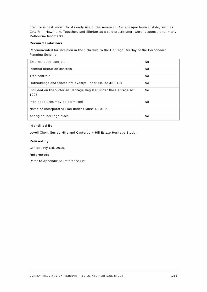
practice is best known for its early use of the American Romanesque Revival style, such as Cestria in Hawthorn. Together, and Ellerker as a sole practitioner, were responsible for many Melbourne landmarks.
Recommendations
Recommended for inclusion in the Schedule to the Heritage Overlay of the Boroondara Planning Scheme.
External paint controls No
Internal alteration controls No
Tree controls No
Outbuildings and fences not exempt under Clause 43.01-3 No
Included on the Victorian Heritage Register under the Heritage Act 1995
No
Prohibited uses may be permitted No
Name of Incorporated Plan under Clause 43.01-2
Aboriginal heritage place No
Identified By
Lovell Chen, Surrey Hills and Canterbury Hill Estate Heritage Study.
Revised by
Context Pty Ltd, 2016.
References
Refer to Appendix 5: Reference List
SURREY HI LLS AND CANTERBURY HI LL ESTATE HERITAGE STUDY 183
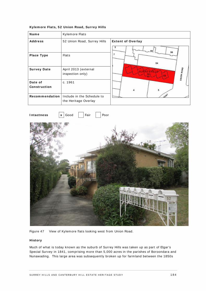
Kylemore Flats, 52 Union Road, Surrey Hills
Name Kylemore Flats
Address 52 Union Road, Surrey Hills
Extent of Overlay
Place Type Flats
Survey Date April 2013 (external inspection only)
Date of Construction
c. 1961
Recommendation Include in the Schedule to the Heritage Overlay
Intactness x Good Fair Poor
Figure 47 View of Kylemore flats looking west from Union Road.
History
Much of what is today known as the suburb of Surrey Hills was taken up as part of Elgar’s Special Survey in 1841, comprising more than 5,000 acres in the parishes of Boroondara and Nunawading. This large area was subsequently broken up for farmland between the 1850s
SURREY HI LLS AND CANTERBURY HI LL ESTATE HERITAGE STUDY 184
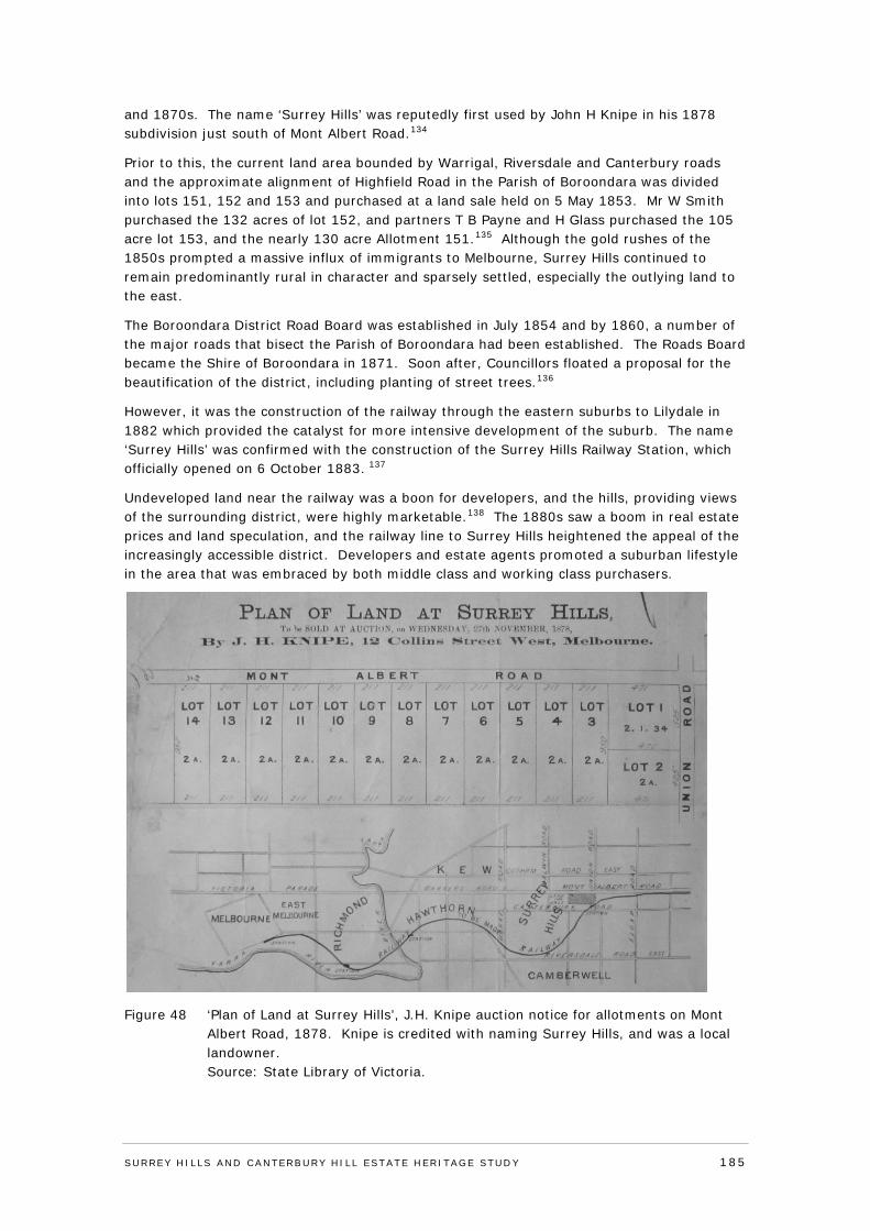
and 1870s. The name ‘Surrey Hills’ was reputedly first used by John H Knipe in his 1878 subdivision just south of Mont Albert Road.134
Prior to this, the current land area bounded by Warrigal, Riversdale and Canterbury roads and the approximate alignment of Highfield Road in the Parish of Boroondara was divided into lots 151, 152 and 153 and purchased at a land sale held on 5 May 1853. Mr W Smith purchased the 132 acres of lot 152, and partners T B Payne and H Glass purchased the 105 acre lot 153, and the nearly 130 acre Allotment 151.135 Although the gold rushes of the 1850s prompted a massive influx of immigrants to Melbourne, Surrey Hills continued to remain predominantly rural in character and sparsely settled, especially the outlying land to the east.
The Boroondara District Road Board was established in July 1854 and by 1860, a number of the major roads that bisect the Parish of Boroondara had been established. The Roads Board became the Shire of Boroondara in 1871. Soon after, Councillors floated a proposal for the beautification of the district, including planting of street trees.136
However, it was the construction of the railway through the eastern suburbs to Lilydale in 1882 which provided the catalyst for more intensive development of the suburb. The name ‘Surrey Hills’ was confirmed with the construction of the Surrey Hills Railway Station, which officially opened on 6 October 1883. 137
Undeveloped land near the railway was a boon for developers, and the hills, providing views of the surrounding district, were highly marketable.138 The 1880s saw a boom in real estate prices and land speculation, and the railway line to Surrey Hills heightened the appeal of the increasingly accessible district. Developers and estate agents promoted a suburban lifestyle in the area that was embraced by both middle class and working class purchasers.
Figure 48 ‘Plan of Land at Surrey Hills’, J.H. Knipe auction notice for allotments on Mont Albert Road, 1878. Knipe is credited with naming Surrey Hills, and was a local landowner. Source: State Library of Victoria.
SURREY HI LLS AND CANTERBURY HI LL ESTATE HERITAGE STUDY 185
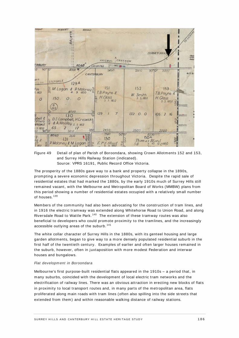
Figure 49 Detail of plan of Parish of Boroondara, showing Crown Allotments 152 and 153, and Surrey Hills Railway Station (indicated). Source: VPRS 16191, Public Record Office Victoria.
The prosperity of the 1880s gave way to a bank and property collapse in the 1890s, prompting a severe economic depression throughout Victoria. Despite the rapid sale of residential estates that had marked the 1880s, by the early 1910s much of Surrey Hills still remained vacant, with the Melbourne and Metropolitan Board of Works (MMBW) plans from this period showing a number of residential estates occupied with a relatively small number of houses.139
Members of the community had also been advocating for the construction of tram lines, and in 1916 the electric tramway was extended along Whitehorse Road to Union Road, and along Riversdale Road to Wattle Park.140 The extension of these tramway routes was also beneficial to developers who could promote proximity to the tramlines, and the increasingly accessible outlying areas of the suburb.141
The white collar character of Surrey Hills in the 1880s, with its genteel housing and large garden allotments, began to give way to a more densely populated residential suburb in the first half of the twentieth century. Examples of earlier and often larger houses remained in the suburb, however, often in juxtaposition with more modest Federation and interwar houses and bungalows.
Flat development in Boroondara
Melbourne's first purpose-built residential flats appeared in the 1910s – a period that, in many suburbs, coincided with the development of local electric tram networks and the electrification of railway lines. There was an obvious attraction in erecting new blocks of flats in proximity to local transport routes and, in many parts of the metropolitan area, flats proliferated along main roads with tram lines (often also spilling into the side streets that extended from them) and within reasonable walking distance of railway stations.
SURREY HI LLS AND CANTERBURY HI LL ESTATE HERITAGE STUDY 186
The housing shortage that emerged in the early post-war period prompted, amongst other things, a burgeoning demand for new flats and apartments in many parts of the metropolitan area. The post-war apartment boom was centred in the former City of Hawthorn, where it represented a logical continuation of the pre-war apartment boom.
Broadly speaking, the residential flats erected from the late 1940s to the early 1960s were of high quality. Some of Melbourne's leading modern architects designed flats in the area during that period, including Roy Simpson, Frederick Romberg, Horace Tribe, Bernard Slawik, Anatol Kagan and Gerd & Renate Bock.
The eminent firm of Grounds, Romberg & Boyd were responsible for a much-published block of bachelor flats at the river end of Barkers Road (1955), as well as a slightly later development at 150 Power Street (1958) that was lauded in the press as a fine re-interpretation of the traditional terrace house type. Several other apartment projects from this era were lauded for their architectural innovation; the Parklands Flats in Grattan Avenue (1949) were the first block of stratum-titled flats to be erected in Melbourne, while another development in Harcourt Street (1956) was credited at the time with reintroducing the villa unit typology into the metropolitan area. Hawthorn's apartment boom continued through the later 1960s (including some notable examples by architects such as Charles Duncan and Whitford & Peck) and into the following decade (Built Heritage, 2012:146-7)
The introduction of Company title and Stratum title after the Second World War enabled flats to be sold individually for the first time. This was promoted as ‘buy your own’ or ‘own your own’. With the post-war housing shortage, flats were promoted as a means of quickly solving the housing crisis and this encouraged the development of higher density developments (Context, 2012:15)
Kylemore Flats
The allotment of the subject property was purchased by Lily Pratchett in 1918, and transferred to Harriet Joyce and Dunlop and Hunt Home Builders the following August.142 The building company was based in Melbourne, and constructed homes to order based on their catalogue of plans. The designs could be adjusted for individual clients, and it is likely that they constructed a residence on the allotment.143 The property was then purchased by Henry Norman Parkes in December1921.144. Henry Parkes resided at the property until his death in 1957. The property was initially known as 312 Union Road, and following the renumbering of the street, it became 52 Union Road.145
Following her husband’s death, Jessie Parkes remained at the property until it was sold to J Boumeester and his wife, Beryl on 14 April 1960. That same day, the company Glengarriff Heights Proprietary Limited was also listed as the proprietor, indicating that the Boumeesters purchased the property to develop it.146 The flats were designed by architect Kurt Popper. (Building Plans)
A plan of subdivision was lodged with the Titles Office in December 1961, which divided the property into seven strata allotments, each containing split-level units, with an integrated garage at ground level, and a modest dwelling above.147 The incorporation of a garage within the design is consistent with the rise of car-ownership by the 1960s, and the space accorded in properties to vehicle accommodation. By the following June, five of the seven units had been sold.148 The 1965 edition of the Sands & McDougall directory lists five of the units as being occupied.149
The construction of the units was also consistent with a trend for such developments in post-war Melbourne, including within the City of Camberwell.150 While unusual in the Surrey Hills context, which for many decades was a suburb which attracted families, Kylemore Flats represents a reflection of the growing demand for smaller residences for singles and couples.
SURREY HI LLS AND CANTERBURY HI LL ESTATE HERITAGE STUDY 187
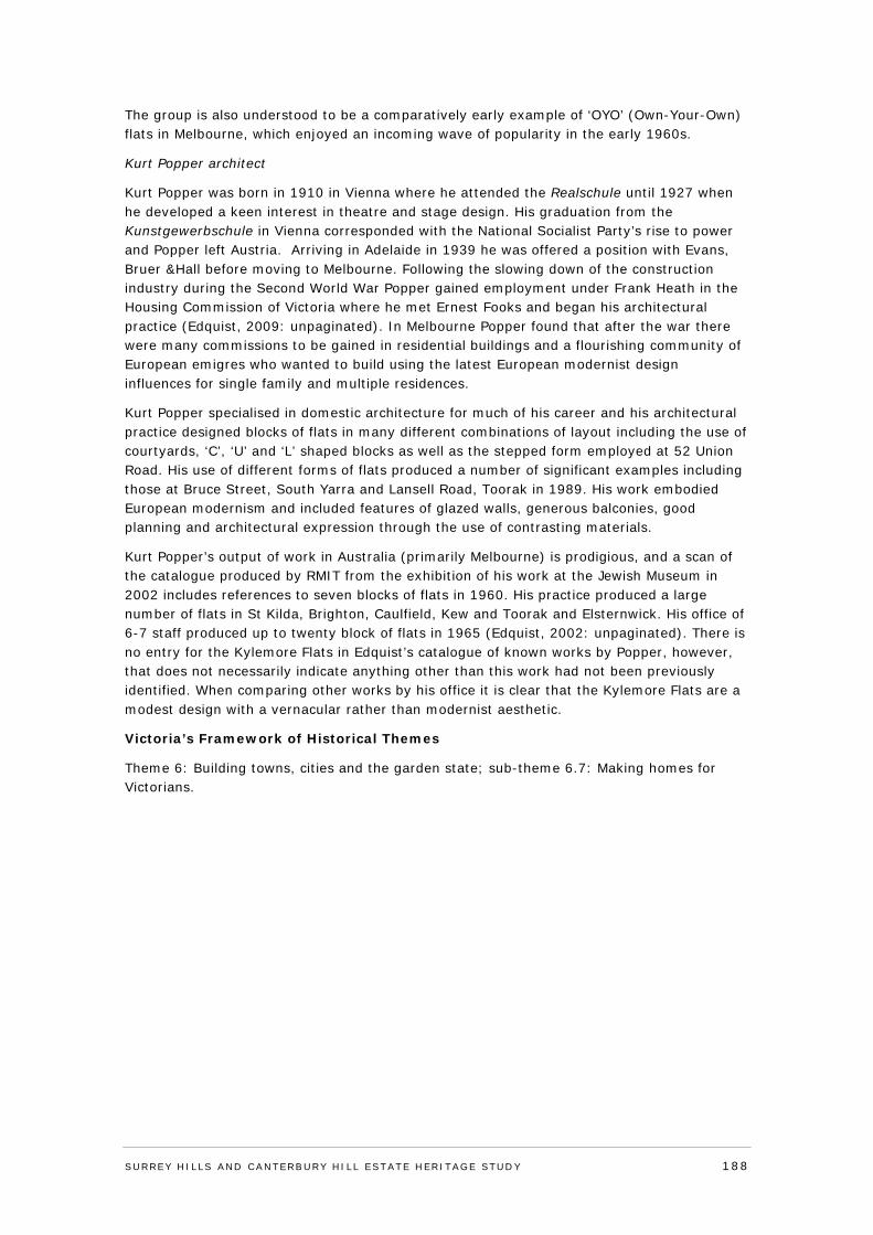
The group is also understood to be a comparatively early example of ‘OYO’ (Own-Your-Own) flats in Melbourne, which enjoyed an incoming wave of popularity in the early 1960s.
Kurt Popper architect
Kurt Popper was born in 1910 in Vienna where he attended the Realschule until 1927 when he developed a keen interest in theatre and stage design. His graduation from the Kunstgewerbschule in Vienna corresponded with the National Socialist Party’s rise to power and Popper left Austria. Arriving in Adelaide in 1939 he was offered a position with Evans, Bruer &Hall before moving to Melbourne. Following the slowing down of the construction industry during the Second World War Popper gained employment under Frank Heath in the Housing Commission of Victoria where he met Ernest Fooks and began his architectural practice (Edquist, 2009: unpaginated). In Melbourne Popper found that after the war there were many commissions to be gained in residential buildings and a flourishing community of European emigres who wanted to build using the latest European modernist design influences for single family and multiple residences.
Kurt Popper specialised in domestic architecture for much of his career and his architectural practice designed blocks of flats in many different combinations of layout including the use of courtyards, ‘C’, ‘U’ and ‘L’ shaped blocks as well as the stepped form employed at 52 Union Road. His use of different forms of flats produced a number of significant examples including those at Bruce Street, South Yarra and Lansell Road, Toorak in 1989. His work embodied European modernism and included features of glazed walls, generous balconies, good planning and architectural expression through the use of contrasting materials.
Kurt Popper’s output of work in Australia (primarily Melbourne) is prodigious, and a scan of the catalogue produced by RMIT from the exhibition of his work at the Jewish Museum in 2002 includes references to seven blocks of flats in 1960. His practice produced a large number of flats in St Kilda, Brighton, Caulfield, Kew and Toorak and Elsternwick. His office of 6-7 staff produced up to twenty block of flats in 1965 (Edquist, 2002: unpaginated). There is no entry for the Kylemore Flats in Edquist’s catalogue of known works by Popper, however, that does not necessarily indicate anything other than this work had not been previously identified. When comparing other works by his office it is clear that the Kylemore Flats are a modest design with a vernacular rather than modernist aesthetic.
Victoria’s Framework of Historical Themes
Theme 6: Building towns, cities and the garden state; sub-theme 6.7: Making homes for Victorians.
SURREY HI LLS AND CANTERBURY HI LL ESTATE HERITAGE STUDY 188
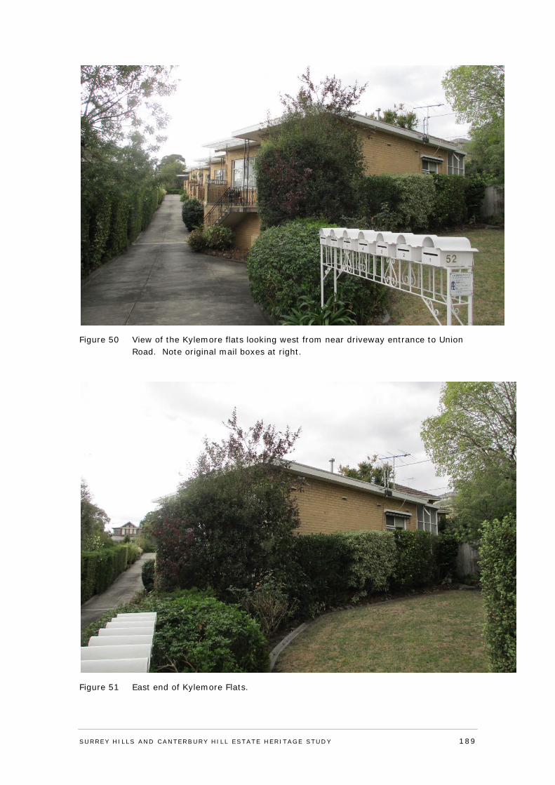
Figure 50 View of the Kylemore flats looking west from near driveway entrance to Union Road. Note original mail boxes at right.
Figure 51 East end of Kylemore Flats.
SURREY HI LLS AND CANTERBURY HI LL ESTATE HERITAGE STUDY 189
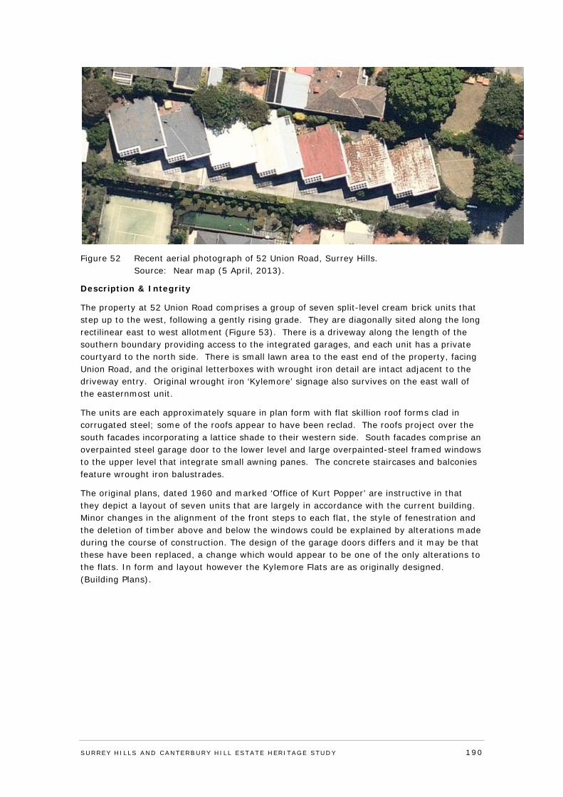
Figure 52 Recent aerial photograph of 52 Union Road, Surrey Hills. Source: Near map (5 April, 2013).
Description & Integrity
The property at 52 Union Road comprises a group of seven split-level cream brick units that step up to the west, following a gently rising grade. They are diagonally sited along the long rectilinear east to west allotment (Figure 53). There is a driveway along the length of the southern boundary providing access to the integrated garages, and each unit has a private courtyard to the north side. There is small lawn area to the east end of the property, facing Union Road, and the original letterboxes with wrought iron detail are intact adjacent to the driveway entry. Original wrought iron ‘Kylemore’ signage also survives on the east wall of the easternmost unit.
The units are each approximately square in plan form with flat skillion roof forms clad in corrugated steel; some of the roofs appear to have been reclad. The roofs project over the south facades incorporating a lattice shade to their western side. South facades comprise an overpainted steel garage door to the lower level and large overpainted-steel framed windows to the upper level that integrate small awning panes. The concrete staircases and balconies feature wrought iron balustrades.
The original plans, dated 1960 and marked ‘Office of Kurt Popper’ are instructive in that they depict a layout of seven units that are largely in accordance with the current building. Minor changes in the alignment of the front steps to each flat, the style of fenestration and the deletion of timber above and below the windows could be explained by alterations made during the course of construction. The design of the garage doors differs and it may be that these have been replaced, a change which would appear to be one of the only alterations to the flats. In form and layout however the Kylemore Flats are as originally designed. (Building Plans).
SURREY HI LLS AND CANTERBURY HI LL ESTATE HERITAGE STUDY 190
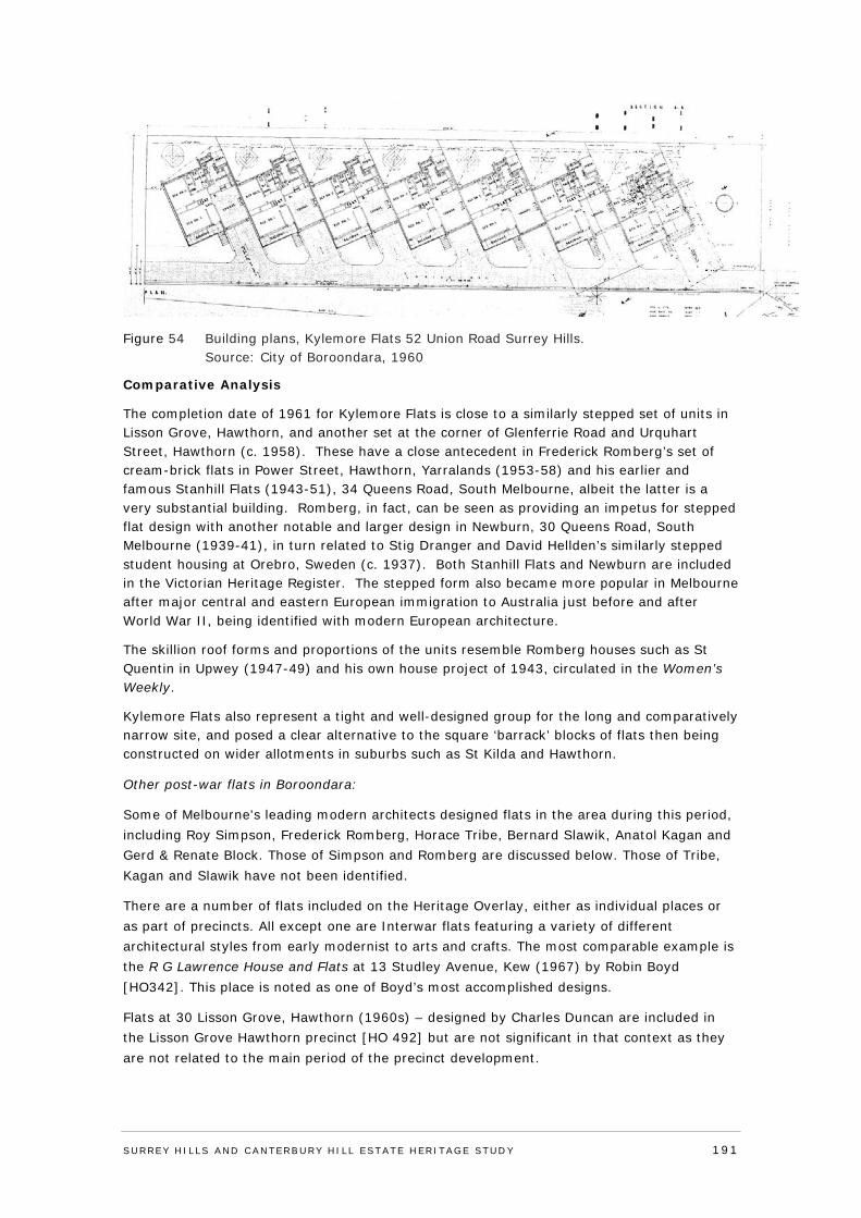
Figure 54 Building plans, Kylemore Flats 52 Union Road Surrey Hills. Source: City of Boroondara, 1960
Comparative Analysis
The completion date of 1961 for Kylemore Flats is close to a similarly stepped set of units in Lisson Grove, Hawthorn, and another set at the corner of Glenferrie Road and Urquhart Street, Hawthorn (c. 1958). These have a close antecedent in Frederick Romberg’s set of cream-brick flats in Power Street, Hawthorn, Yarralands (1953-58) and his earlier and famous Stanhill Flats (1943-51), 34 Queens Road, South Melbourne, albeit the latter is a very substantial building. Romberg, in fact, can be seen as providing an impetus for stepped flat design with another notable and larger design in Newburn, 30 Queens Road, South Melbourne (1939-41), in turn related to Stig Dranger and David Hellden’s similarly stepped student housing at Orebro, Sweden (c. 1937). Both Stanhill Flats and Newburn are included in the Victorian Heritage Register. The stepped form also became more popular in Melbourne after major central and eastern European immigration to Australia just before and after World War II, being identified with modern European architecture.
The skillion roof forms and proportions of the units resemble Romberg houses such as St Quentin in Upwey (1947-49) and his own house project of 1943, circulated in the Women’s Weekly.
Kylemore Flats also represent a tight and well-designed group for the long and comparatively narrow site, and posed a clear alternative to the square ‘barrack’ blocks of flats then being constructed on wider allotments in suburbs such as St Kilda and Hawthorn.
Other post-war flats in Boroondara:
Some of Melbourne's leading modern architects designed flats in the area during this period, including Roy Simpson, Frederick Romberg, Horace Tribe, Bernard Slawik, Anatol Kagan and Gerd & Renate Block. Those of Simpson and Romberg are discussed below. Those of Tribe, Kagan and Slawik have not been identified.
There are a number of flats included on the Heritage Overlay, either as individual places or as part of precincts. All except one are Interwar flats featuring a variety of different architectural styles from early modernist to arts and crafts. The most comparable example is the R G Lawrence House and Flats at 13 Studley Avenue, Kew (1967) by Robin Boyd [HO342]. This place is noted as one of Boyd’s most accomplished designs.
Flats at 30 Lisson Grove, Hawthorn (1960s) – designed by Charles Duncan are included in the Lisson Grove Hawthorn precinct [HO 492] but are not significant in that context as they are not related to the main period of the precinct development.
SURREY HI LLS AND CANTERBURY HI LL ESTATE HERITAGE STUDY 191
Knottywoods Flats, 63 Wattle Road, Hawthorn (1962) by Architect Roy Simpson is a complex of 16 units behind his family home [HO429]. This block has not been inspected for comparative purposes.
Flats at 157 Highfield Road, Camberwell (1960) – designed by Peter McIntyre are not included on the HO.
Parklands Flats at 4 Grattan Street Hawthorn (1950) – designed by Frederick Romberg are an earlier and more architecturally interesting example and have been recently assessed to be of individual heritage significance.
Grounds, Romberg & Boyd were also responsible for a development at 150 Power Street (1958) that was lauded in the press as a fine re-interpretation of the traditional terrace house type.
Flats at 2 Barkers Road, by Frederick Romberg was also recently assessed to be of local significance to Boroondara and is an earlier example of modernist flats comparable to Kylemore Flats.
Kylemore Flats are a modest design by the office of Kurt Popper, who is one of a number of well-regarded European émigré architects working in Melbourne in the post-war years. Flats are not a major part of the Surrey Hills landscape and are an unusual building typology for the locality and not well represented on the HO. The Kylemore Flats are noted for their stepped layout, are highly intact and represent a relatively early strata title arrangement.
Assessment Against Criteria
Adopted from the ‘recognised heritage criteria’ set out in the Victorian Planning Provisions Practice Note on ‘Applying the Heritage Overlay’ (September 2012).
Criterion A - Importance to the course or pattern of the City of Boroondara’s cultural or natural history (historical significance).
Kylemore Flats are historically significant for their representation of a change in the housing market that provided alternative accommodation to the single family house. Whilst flats in the Surrey Hills locality are rare, a number of post war flats designed by well-known architects were built in Boroondara, particularly in the Hawthorn area. Kylemore Flats are historically significant as a development from c.1961 under a relatively early strata-title arrangement. Kylemore Flats is historically significant as a demonstration growing demand for smaller residences for singles and couples, and is also understood to be a comparatively early example of ‘OYO’ (Own-Your-Own) flats in Melbourne, which enjoyed an incoming wave of popularity in the early 1960s.
Criterion B - Possession of uncommon rare or endangered aspects of the City of Boroondara’s cultural or natural history (rarity).
N/A
Criterion C - Potential to yield information that will contribute to an understanding of the City of Boroondara’s cultural or natural history (research potential).
N/A
Criterion D - Importance in demonstrating the principal characteristics of a class of cultural or natural places and environments (representativeness).
N/A
SURREY HI LLS AND CANTERBURY HI LL ESTATE HERITAGE STUDY 192
Criterion E - Importance in exhibiting particular aesthetic characteristics (aesthetic significance).
Kylemore Flats, at 52 Union Road, Surrey Hills, designed by European émigré architect Kurt Popper for J and B Boumeester is of local aesthetic significance. The units as a group appear comparatively externally intact, retaining their original external form, materials and details (including the original wrought iron letterboxes and ‘Kylemore’ signage).
Kylemore Flats are aesthetically significant as a building form derived from their strongly repetitive and stepped form gently rising to the west, with the south side of each unit visible from Union Road due to the diagonal arrangement. The development, although on a more modest scale, follows an approach largely pioneered by architect Frederick Romberg, who designed stepped plan flat developments in Melbourne from the late 1930s to the 1950s.
The objective was to ensure that no flat (or unit) overlooked another. Kylemore Flats, as well-designed group for the long and comparatively narrow site, also demonstrates a clear alternative to the square ‘barrack’ form blocks of flats then being constructed on wider allotments in St Kilda and Hawthorn. The prominence given to the car differed from the previous generation of flats, which normally relegated them to space by the driveway or to a row of garages at the rear.
Kylemore Flats are aesthetically significant as a modest work of Kurt Popper who specialised in domestic architecture for much of his career. Undertaking commissions for many flats in the post-war period and throughout the metropolitan area; Popper’s work embodied European modernism and included features such as glazed walls, generous balconies, rational planning and an architectural expression through the use of contrasting materials. Kylemore Flats sit at the more vernacular end of the extensive output by Popper and his office throughout the 1960s. The aesthetic significance of the flats is enhanced by the high degree of integrity that is displayed in the form, materials and detailing that is little changed when compared with the plans. Criterion F - Importance in demonstrating a high degree of creative or technical achievement at a particular period (technical significance).
N/A
Criterion G - Strong or special association with a particular community or cultural group for social, cultural or spiritual reasons. This includes the significance of a place to Indigenous peoples as part of their continuing and developing cultural traditions (social significance).
N/A
Criterion H - Special association with the life or works of a person, or group of persons, of importance in the City of Boroondara’s history (associative significance).
N/A
Statement of Significance
What is significant?
Kylemore Flats, at 52 Union Road, Surrey Hills, designed by the office of European émigré architect Kurt Popper dating from c.1961 and comprising a group of seven comparatively externally intact split-level cream brick flats. The diagonally sited flats are planned along a long rectilinear east to west allotment, with a driveway following the southern boundary providing access to the integrated garages. Each flat has a private courtyard to the north side, and a small lawn area is sited to the east end of the property, facing Union Road. The flats are each approximately square in plan form with flat skillion roof forms clad in corrugated steel; the roofs project over the south facades incorporating a lattice shade to
SURREY HI LLS AND CANTERBURY HI LL ESTATE HERITAGE STUDY 193
their western side. South facades comprise an overpainted steel garage door to the lower level and large overpainted-steel framed windows to the upper level that integrate small awning panes. The concrete staircases and balconies feature wrought iron balustrades.
How is it significant?
Kylemore Flats, at 52 Union Road, Surrey Hills, is of local historic and aesthetic significance to the City of Boroondara.
Why is it significant?
Kylemore Flats, at 52 Union Road, Surrey Hills, dating from c.1961 is of historic significance for the representation of a change in the housing market that provided alternative accommodation to the single family house. Kylemore Flats represent a growing demand for smaller residences for singles and couples, and is also understood to be a comparatively early example of ‘OYO’ (Own-Your-Own) flats in Melbourne, which enjoyed an incoming wave of popularity in the early 1960s. The construction of the units was also consistent with a trend for these developments in post-war Melbourne, albeit more unusual in the Surrey Hills context in this period; but otherwise reflected in Boroondara’s development. Kylemore Flats are historically significant for their demonstration in their design and layout and provision of individual garages; of the rise of car-ownership, which by the 1960s had become increasingly common.
Kylemore Flats are aesthetically significant as a modest work by European émigré architect and modernist Kurt Popper whose practice in Adelaide and Melbourne spanned the years 1939-1975, building many single residences and flats. Kylemore Flats is aesthetically significant as an intact group of seven flats in stepped formation retaining their original external form, materials and details including the original wrought iron letterboxes and ‘Kylemore’ signage.
Whilst the flats are individually compact in size, they gain visual impact as a group from their strongly repetitive and stepped form rising to the west; with the south side of each unit visible from Union Road due to the diagonal arrangement.
The development, although on a more modest scale; follows an approach largely pioneered by architect Frederick Romberg, who designed stepped flat developments in Melbourne from the late 1930s to the 1950s where the design objective was to ensure that no flat overlooked another. Kylemore Flats demonstrates a clear alternative to the square ‘barrack’ form blocks of flats then being constructed on wider allotments in St Kilda and Hawthorn. The prominence given to the car differed from the previous generation of flats, which normally relegated them to space by the driveway or to a row of garages at the rear.
Recommendations
Recommended for inclusion in the Schedule to the Heritage Overlay of the Boroondara Planning Scheme.
External paint controls No
Internal alteration controls No
Tree controls No
Outbuildings and fences not exempt under Clause 43.01-3 No
SURREY HI LLS AND CANTERBURY HI LL ESTATE HERITAGE STUDY 194

Included on the Victorian Heritage Register under the Heritage Act 1995
No
Prohibited uses may be permitted No
Name of Incorporated Plan under Clause 43.01-2 No
Aboriginal heritage place No
Identified By
Lovell Chen, Surrey Hills and Canterbury Hill Estate Heritage Study. References
Refer to Appendix 5: Reference List Additional in text references added below.
City of Boroondara, Building Plans
Context Pty Ltd, 2013 2 Barkers Road Hawthorn, prepared for the City of Boroondara
Context Pty Ltd, 2012, Residential Flats In the City of Stonnington, prepared for the City of Stonnington
Built Heritage, 2012, City of Boroondara Thematic Environmental History
Edquist, H, Kurt Popper: From Vienna to Melbourne Architecture 1939-1975
SURREY HI LLS AND CANTERBURY HI LL ESTATE HERITAGE STUDY 195
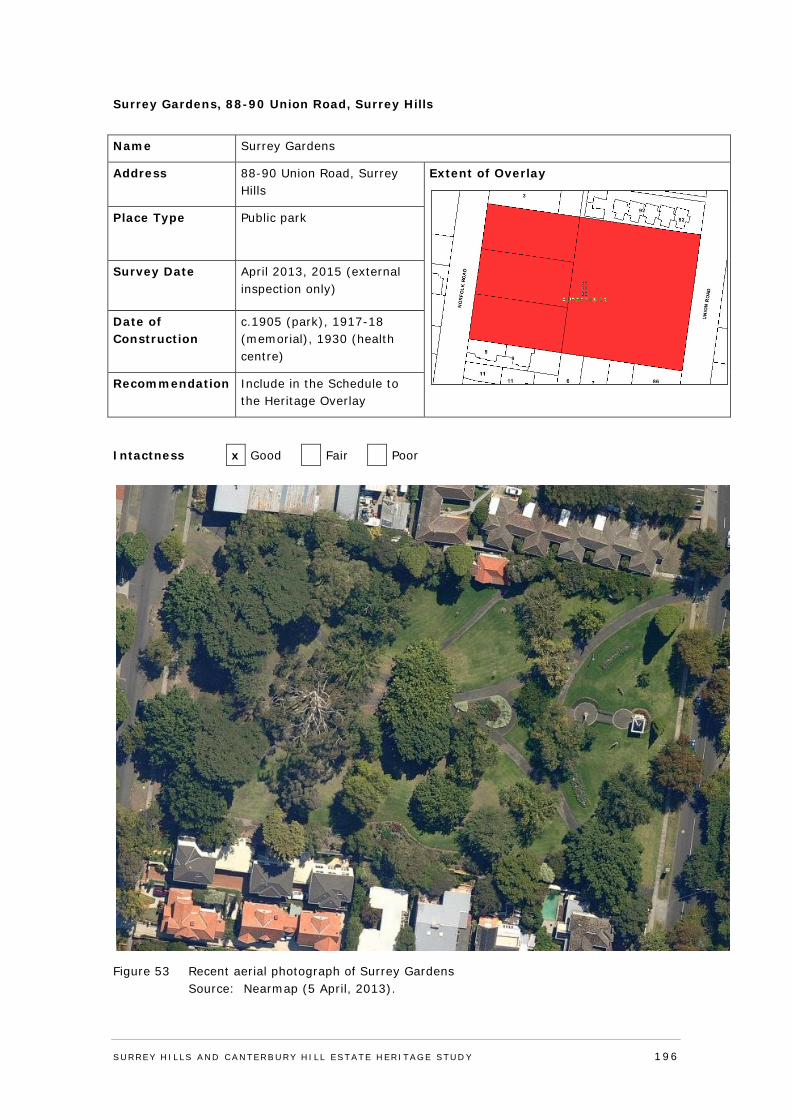
Surrey Gardens, 88-90 Union Road, Surrey Hills
Name Surrey Gardens
Address 88-90 Union Road, Surrey Hills
Extent of Overlay
Place Type Public park
Survey Date April 2013, 2015 (external inspection only)
Date of Construction
c.1905 (park), 1917-18 (memorial), 1930 (health centre)
Recommendation Include in the Schedule to the Heritage Overlay
Intactness x Good Fair Poor
Figure 53 Recent aerial photograph of Surrey Gardens Source: Nearmap (5 April, 2013).
SURREY HI LLS AND CANTERBURY HI LL ESTATE HERITAGE STUDY 196

History
Much of what is today known as the suburb of Surrey Hills was taken up as part of Elgar’s Special Survey in 1841, comprising more than 5,000 acres in the parishes of Boroondara and Nunawading. This large area was subsequently broken up for farmland between the 1850s and 1870s. The name ‘Surrey Hills’ was reputedly first used by John H Knipe in his 1878 subdivision just south of Mont Albert Road.151
Prior to this, the current land area bounded by Warrigal, Riversdale and Canterbury roads and the approximate alignment of Highfield Road in the Parish of Boroondara was divided into lots 151, 152 and 153 and purchased at a land sale held on 5 May 1853. Mr W Smith purchased the 132 acres of lot 152, and partners T B Payne and H Glass purchased the 105 acre lot 153, and the nearly 130 acre Allotment 151.152 Although the gold rushes of the 1850s prompted a massive influx of immigrants to Melbourne, Surrey Hills continued to remain predominantly rural in character and sparsely settled, especially the outlying land to the east.
The Boroondara District Road Board was established in July 1854 and by 1860, a number of the major roads that bisect the Parish of Boroondara had been established. The Roads Board became the Shire of Boroondara in 1871. Soon after, Councillors floated a proposal for the beautification of the district, including planting of street trees.153
However, it was the construction of the railway through the eastern suburbs to Lilydale in 1882 which provided the catalyst for more intensive development of the suburb. The name ‘Surrey Hills’ was confirmed with the construction of the Surrey Hills Railway Station, which officially opened on 6 October 1883.154
Undeveloped land near the railway was a boon for developers, and the hills, providing views of the surrounding district, were highly marketable.155 The 1880s saw a boom in real estate prices and land speculation, and the railway line to Surrey Hills heightened the appeal of the increasingly accessible district. Developers and estate agents promoted a suburban lifestyle in the area that was embraced by both middle class and working class purchasers.
The prosperity of the 1880s gave way to a bank and property collapse in the 1890s, prompting a severe economic depression throughout Victoria. Despite the rapid sale of residential estates that had marked the 1880s, by the early 1910s much of Surrey Hills still remained vacant, with the Melbourne and Metropolitan Board of Works (MMBW) plans from this period showing a number of residential estates occupied with a relatively small number of houses.156
Members of the community had also been advocating for the construction of tram lines, and in 1916 the electric tramway was extended along Whitehorse Road to Union Road, and along Riversdale Road to Wattle Park.157 The extension of these tramway routes was also beneficial to developers who could promote proximity to the tramlines, and the increasingly accessible outlying areas of the suburb.158
The white collar character of Surrey Hills in the 1880s, with its genteel housing and large garden allotments, began to give way to a more densely populated residential suburb in the first half of the twentieth century. Examples of earlier and often larger houses remained in the suburb, however, often in juxtaposition with more modest Federation and interwar houses and bungalows.
SURREY HI LLS AND CANTERBURY HI LL ESTATE HERITAGE STUDY 197
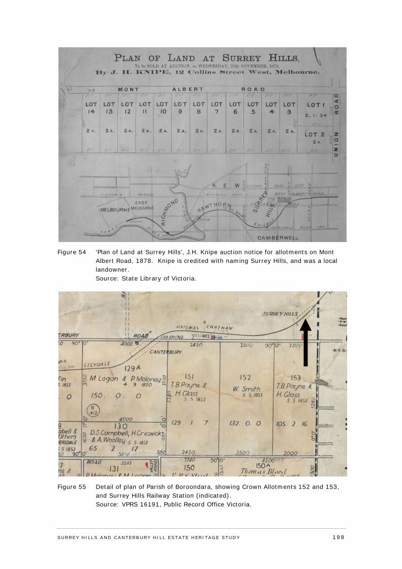
Figure 54 ‘Plan of Land at Surrey Hills’, J.H. Knipe auction notice for allotments on Mont Albert Road, 1878. Knipe is credited with naming Surrey Hills, and was a local landowner. Source: State Library of Victoria.
Figure 55 Detail of plan of Parish of Boroondara, showing Crown Allotments 152 and 153, and Surrey Hills Railway Station (indicated). Source: VPRS 16191, Public Record Office Victoria.
SURREY HI LLS AND CANTERBURY HI LL ESTATE HERITAGE STUDY 198
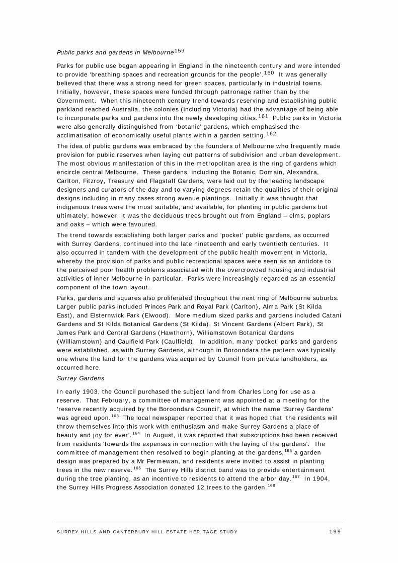
Public parks and gardens in Melbourne159
Parks for public use began appearing in England in the nineteenth century and were intended to provide ‘breathing spaces and recreation grounds for the people’.160 It was generally believed that there was a strong need for green spaces, particularly in industrial towns. Initially, however, these spaces were funded through patronage rather than by the Government. When this nineteenth century trend towards reserving and establishing public parkland reached Australia, the colonies (including Victoria) had the advantage of being able to incorporate parks and gardens into the newly developing cities.161 Public parks in Victoria were also generally distinguished from ‘botanic’ gardens, which emphasised the acclimatisation of economically useful plants within a garden setting.162
The idea of public gardens was embraced by the founders of Melbourne who frequently made provision for public reserves when laying out patterns of subdivision and urban development. The most obvious manifestation of this in the metropolitan area is the ring of gardens which encircle central Melbourne. These gardens, including the Botanic, Domain, Alexandra, Carlton, Fitzroy, Treasury and Flagstaff Gardens, were laid out by the leading landscape designers and curators of the day and to varying degrees retain the qualities of their original designs including in many cases strong avenue plantings. Initially it was thought that indigenous trees were the most suitable, and available, for planting in public gardens but ultimately, however, it was the deciduous trees brought out from England – elms, poplars and oaks – which were favoured.
The trend towards establishing both larger parks and ‘pocket’ public gardens, as occurred with Surrey Gardens, continued into the late nineteenth and early twentieth centuries. It also occurred in tandem with the development of the public health movement in Victoria, whereby the provision of parks and public recreational spaces were seen as an antidote to the perceived poor health problems associated with the overcrowded housing and industrial activities of inner Melbourne in particular. Parks were increasingly regarded as an essential component of the town layout.
Parks, gardens and squares also proliferated throughout the next ring of Melbourne suburbs. Larger public parks included Princes Park and Royal Park (Carlton), Alma Park (St Kilda East), and Elsternwick Park (Elwood). More medium sized parks and gardens included Catani Gardens and St Kilda Botanical Gardens (St Kilda), St Vincent Gardens (Albert Park), St James Park and Central Gardens (Hawthorn), Williamstown Botanical Gardens (Williamstown) and Caulfield Park (Caulfield). In addition, many ‘pocket’ parks and gardens were established, as with Surrey Gardens, although in Boroondara the pattern was typically one where the land for the gardens was acquired by Council from private landholders, as occurred here.
Surrey Gardens
In early 1903, the Council purchased the subject land from Charles Long for use as a reserve. That February, a committee of management was appointed at a meeting for the ‘reserve recently acquired by the Boroondara Council’, at which the name ‘Surrey Gardens’ was agreed upon.163 The local newspaper reported that it was hoped that ‘the residents will throw themselves into this work with enthusiasm and make Surrey Gardens a place of beauty and joy for ever’.164 In August, it was reported that subscriptions had been received from residents ‘towards the expenses in connection with the laying of the gardens’. The committee of management then resolved to begin planting at the gardens,165 a garden design was prepared by a Mr Permewan, and residents were invited to assist in planting trees in the new reserve.166 The Surrey Hills district band was to provide entertainment during the tree planting, as an incentive to residents to attend the arbor day.167 In 1904, the Surrey Hills Progress Association donated 12 trees to the garden.168
SURREY HI LLS AND CANTERBURY HI LL ESTATE HERITAGE STUDY 199
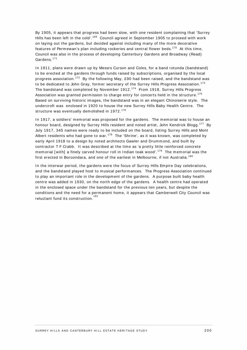
By 1905, it appears that progress had been slow, with one resident complaining that ‘Surrey Hills has been left in the cold’.169 Council agreed in September 1905 to proceed with work on laying out the gardens, but decided against including many of the more decorative features of Permewan’s plan including rockeries and central flower beds.170 At this time, Council was also in the process of developing Canterbury Gardens and Broadway (Read) Gardens.171
In 1911, plans were drawn up by Messrs Curson and Coles, for a band rotunda (bandstand) to be erected at the gardens through funds raised by subscriptions, organised by the local progress association.172 By the following May, £90 had been raised, and the bandstand was to be dedicated to John Gray, former secretary of the Surrey Hills Progress Association.173 The bandstand was completed by November 1912.174 From 1918, Surrey Hills Progress Association was granted permission to charge entry for concerts held in the structure.175 Based on surviving historic images, the bandstand was in an elegant Chinoiserie style. The undercroft was enclosed in 1920 to house the new Surrey Hills Baby Health Centre. The structure was eventually demolished in 1972.176
In 1917, a soldiers’ memorial was proposed for the gardens. The memorial was to house an honour board, designed by Surrey Hills resident and noted artist, John Kendrick Blogg.177 By July 1917, 345 names were ready to be included on the board, listing Surrey Hills and Mont Albert residents who had gone to war.178 The ‘Shrine’, as it was known, was completed by early April 1918 to a design by noted architects Gawler and Drummond, and built by contractor T F Crabb. It was described at the time as ‘a pretty little reinforced concrete memorial [with] a finely carved honour roll in Indian teak wood’.179 The memorial was the first erected in Boroondara, and one of the earliest in Melbourne, if not Australia.180
In the interwar period, the gardens were the focus of Surrey Hills Empire Day celebrations, and the bandstand played host to musical performances. The Progress Association continued to play an important role in the development of the gardens. A purpose built baby health centre was added in 1930, on the north edge of the gardens. A health centre had operated in the enclosed space under the bandstand for the previous ten years, but despite the conditions and the need for a permanent home, it appears that Camberwell City Council was reluctant fund its construction.
181
SURREY HI LLS AND CANTERBURY HI LL ESTATE HERITAGE STUDY 200
Figure 56 Undated early photograph of Surrey Gardens, prior to tree planting, and showing layout of pathways and early fencing. View is looking east towards Union Road. Source: City of Boroondara.
Figure 57 Early (undated) photograph of bandstand, prior to enclosing of its undercroft. Source: City of Boroondara.
SURREY HI LLS AND CANTERBURY HI LL ESTATE HERITAGE STUDY 201
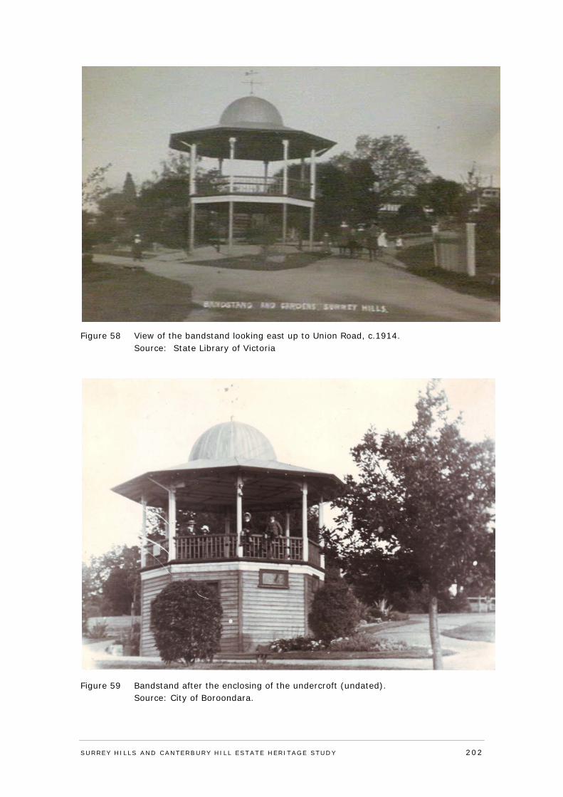
Figure 58 View of the bandstand looking east up to Union Road, c.1914. Source: State Library of Victoria
Figure 59 Bandstand after the enclosing of the undercroft (undated). Source: City of Boroondara.
SURREY HI LLS AND CANTERBURY HI LL ESTATE HERITAGE STUDY 202
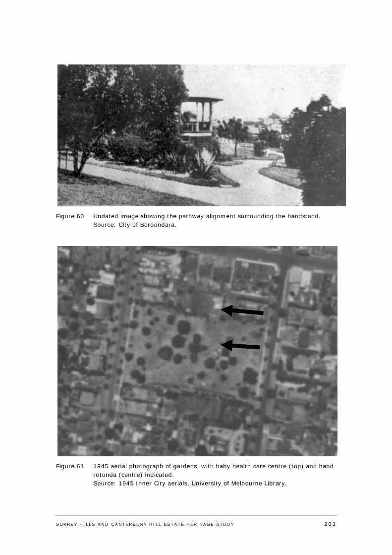
Figure 60 Undated image showing the pathway alignment surrounding the bandstand. Source: City of Boroondara.
Figure 61 1945 aerial photograph of gardens, with baby health care centre (top) and band rotunda (centre) indicated. Source: 1945 Inner City aerials, University of Melbourne Library.
SURREY HI LLS AND CANTERBURY HI LL ESTATE HERITAGE STUDY 203
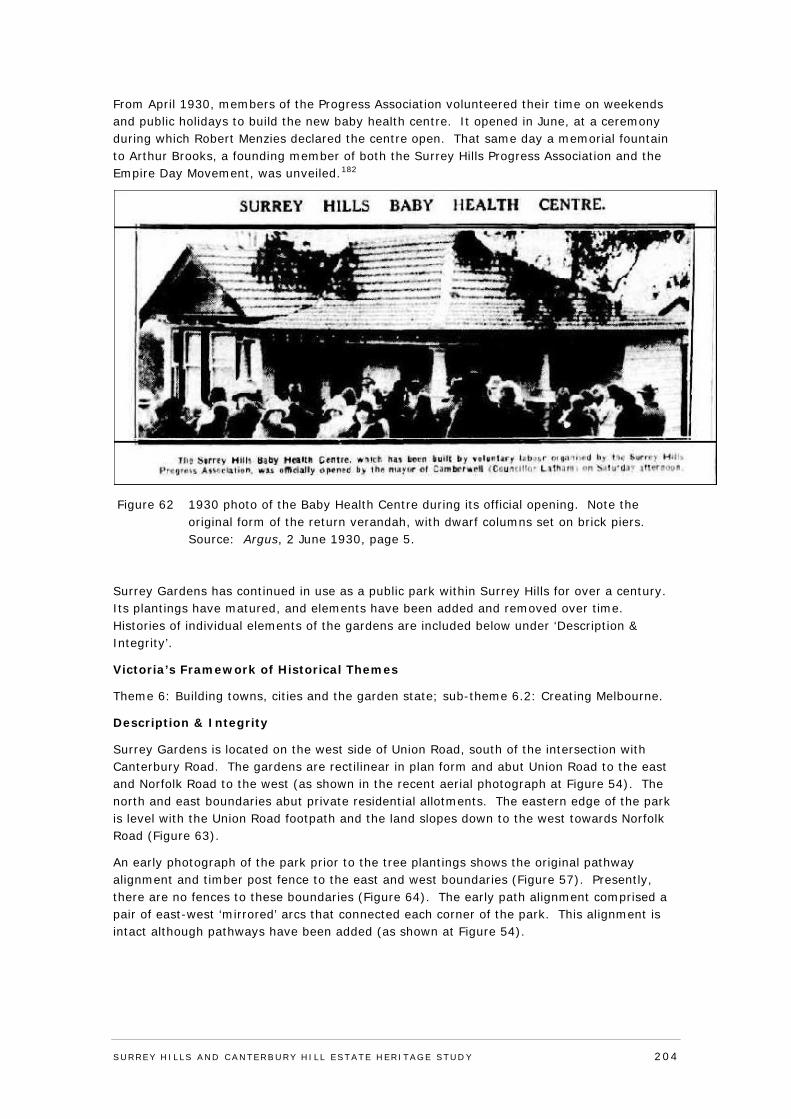
From April 1930, members of the Progress Association volunteered their time on weekends and public holidays to build the new baby health centre. It opened in June, at a ceremony during which Robert Menzies declared the centre open. That same day a memorial fountain to Arthur Brooks, a founding member of both the Surrey Hills Progress Association and the Empire Day Movement, was unveiled.182
Figure 62 1930 photo of the Baby Health Centre during its official opening. Note the original form of the return verandah, with dwarf columns set on brick piers. Source: Argus, 2 June 1930, page 5.
Surrey Gardens has continued in use as a public park within Surrey Hills for over a century. Its plantings have matured, and elements have been added and removed over time. Histories of individual elements of the gardens are included below under ‘Description & Integrity’.
Victoria’s Framework of Historical Themes
Theme 6: Building towns, cities and the garden state; sub-theme 6.2: Creating Melbourne.
Description & Integrity
Surrey Gardens is located on the west side of Union Road, south of the intersection with Canterbury Road. The gardens are rectilinear in plan form and abut Union Road to the east and Norfolk Road to the west (as shown in the recent aerial photograph at Figure 54). The north and east boundaries abut private residential allotments. The eastern edge of the park is level with the Union Road footpath and the land slopes down to the west towards Norfolk Road (Figure 63).
An early photograph of the park prior to the tree plantings shows the original pathway alignment and timber post fence to the east and west boundaries (Figure 57). Presently, there are no fences to these boundaries (Figure 64). The early path alignment comprised a pair of east-west ‘mirrored’ arcs that connected each corner of the park. This alignment is intact although pathways have been added (as shown at Figure 54).
SURREY HI LLS AND CANTERBURY HI LL ESTATE HERITAGE STUDY 204
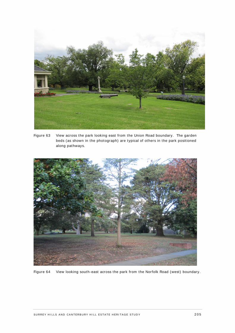
Figure 63 View across the park looking east from the Union Road boundary. The garden beds (as shown in the photograph) are typical of others in the park positioned along pathways.
Figure 64 View looking south-east across the park from the Norfolk Road (west) boundary.
SURREY HI LLS AND CANTERBURY HI LL ESTATE HERITAGE STUDY 205
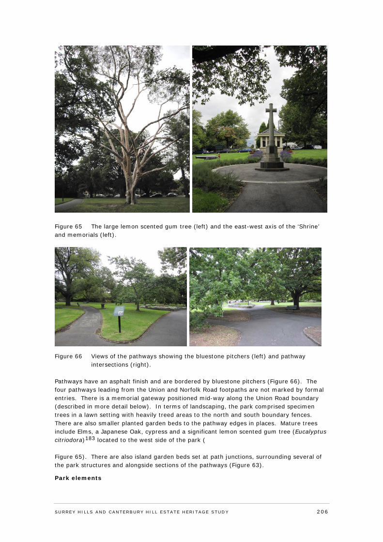
Figure 65 The large lemon scented gum tree (left) and the east-west axis of the ‘Shrine’ and memorials (left).
Figure 66 Views of the pathways showing the bluestone pitchers (left) and pathway intersections (right).
Pathways have an asphalt finish and are bordered by bluestone pitchers (Figure 66). The four pathways leading from the Union and Norfolk Road footpaths are not marked by formal entries. There is a memorial gateway positioned mid-way along the Union Road boundary (described in more detail below). In terms of landscaping, the park comprised specimen trees in a lawn setting with heavily treed areas to the north and south boundary fences. There are also smaller planted garden beds to the pathway edges in places. Mature trees include Elms, a Japanese Oak, cypress and a significant lemon scented gum tree (Eucalyptus citriodora)183 located to the west side of the park ( Figure 65). There are also island garden beds set at path junctions, surrounding several of the park structures and alongside sections of the pathways (Figure 63).
Park elements
SURREY HI LLS AND CANTERBURY HI LL ESTATE HERITAGE STUDY 206
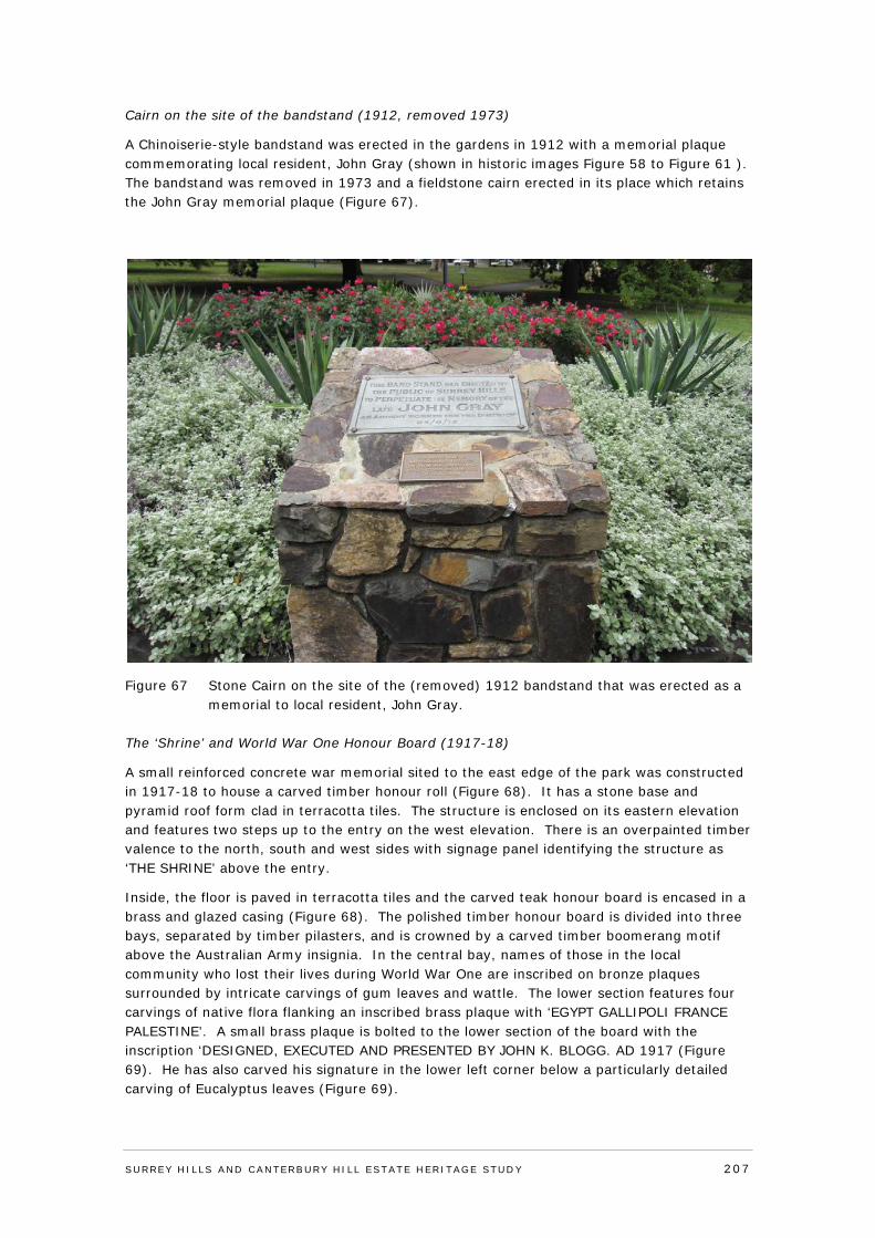
Cairn on the site of the bandstand (1912, removed 1973)
A Chinoiserie-style bandstand was erected in the gardens in 1912 with a memorial plaque commemorating local resident, John Gray (shown in historic images Figure 58 to Figure 61 ). The bandstand was removed in 1973 and a fieldstone cairn erected in its place which retains the John Gray memorial plaque (Figure 67).
Figure 67 Stone Cairn on the site of the (removed) 1912 bandstand that was erected as a memorial to local resident, John Gray.
The ‘Shrine’ and World War One Honour Board (1917-18)
A small reinforced concrete war memorial sited to the east edge of the park was constructed in 1917-18 to house a carved timber honour roll (Figure 68). It has a stone base and pyramid roof form clad in terracotta tiles. The structure is enclosed on its eastern elevation and features two steps up to the entry on the west elevation. There is an overpainted timber valence to the north, south and west sides with signage panel identifying the structure as ‘THE SHRINE’ above the entry.
Inside, the floor is paved in terracotta tiles and the carved teak honour board is encased in a brass and glazed casing (Figure 68). The polished timber honour board is divided into three bays, separated by timber pilasters, and is crowned by a carved timber boomerang motif above the Australian Army insignia. In the central bay, names of those in the local community who lost their lives during World War One are inscribed on bronze plaques surrounded by intricate carvings of gum leaves and wattle. The lower section features four carvings of native flora flanking an inscribed brass plaque with ‘EGYPT GALLIPOLI FRANCE PALESTINE’. A small brass plaque is bolted to the lower section of the board with the inscription ‘DESIGNED, EXECUTED AND PRESENTED BY JOHN K. BLOGG. AD 1917 (Figure 69). He has also carved his signature in the lower left corner below a particularly detailed carving of Eucalyptus leaves (Figure 69).
SURREY HI LLS AND CANTERBURY HI LL ESTATE HERITAGE STUDY 207
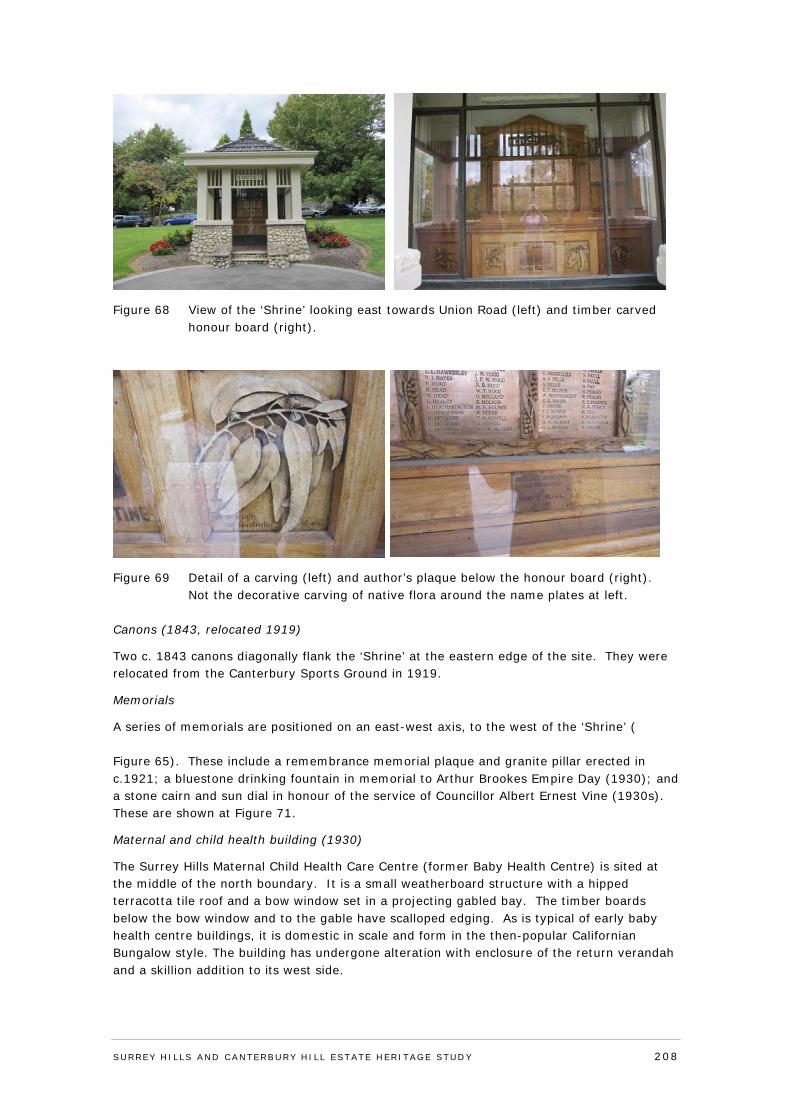
Figure 68 View of the ‘Shrine’ looking east towards Union Road (left) and timber carved honour board (right).
Figure 69 Detail of a carving (left) and author’s plaque below the honour board (right). Not the decorative carving of native flora around the name plates at left.
Canons (1843, relocated 1919)
Two c. 1843 canons diagonally flank the ‘Shrine’ at the eastern edge of the site. They were relocated from the Canterbury Sports Ground in 1919.
Memorials
A series of memorials are positioned on an east-west axis, to the west of the ‘Shrine’ ( Figure 65). These include a remembrance memorial plaque and granite pillar erected in c.1921; a bluestone drinking fountain in memorial to Arthur Brookes Empire Day (1930); and a stone cairn and sun dial in honour of the service of Councillor Albert Ernest Vine (1930s). These are shown at Figure 71.
Maternal and child health building (1930)
The Surrey Hills Maternal Child Health Care Centre (former Baby Health Centre) is sited at the middle of the north boundary. It is a small weatherboard structure with a hipped terracotta tile roof and a bow window set in a projecting gabled bay. The timber boards below the bow window and to the gable have scalloped edging. As is typical of early baby health centre buildings, it is domestic in scale and form in the then-popular Californian Bungalow style. The building has undergone alteration with enclosure of the return verandah and a skillion addition to its west side.
SURREY HI LLS AND CANTERBURY HI LL ESTATE HERITAGE STUDY 208
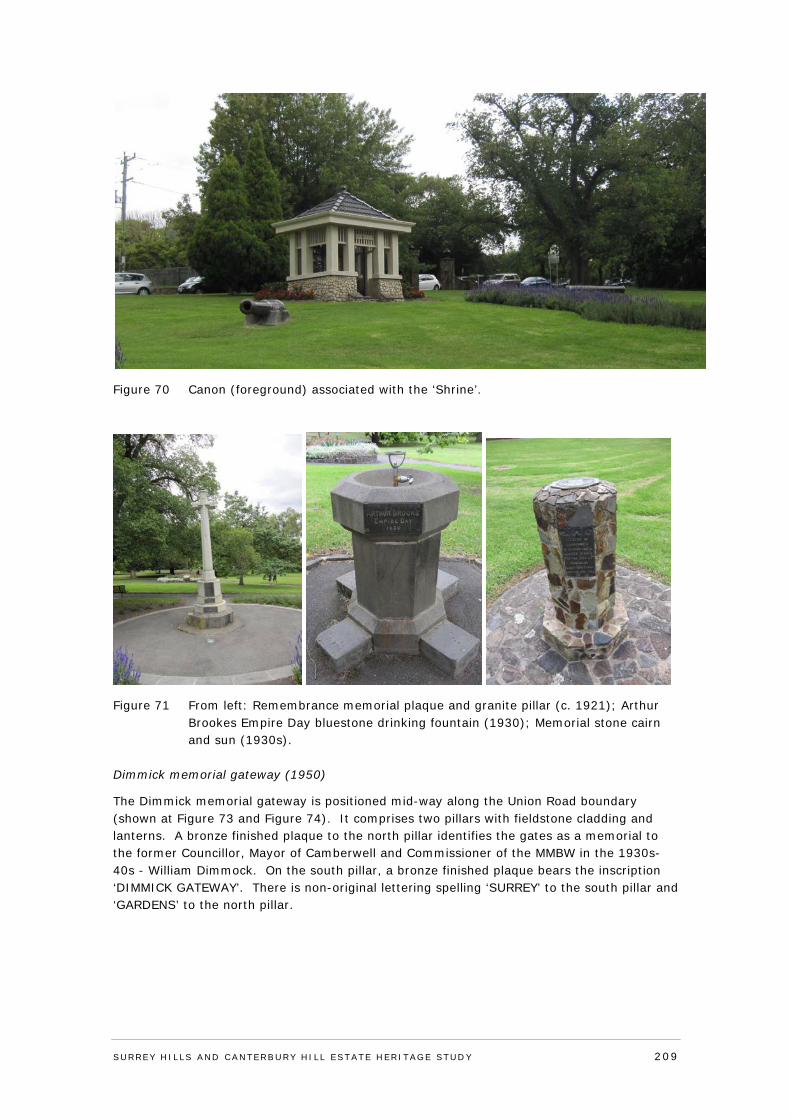
Figure 70 Canon (foreground) associated with the ‘Shrine’.
Figure 71 From left: Remembrance memorial plaque and granite pillar (c. 1921); Arthur Brookes Empire Day bluestone drinking fountain (1930); Memorial stone cairn and sun (1930s).
Dimmick memorial gateway (1950)
The Dimmick memorial gateway is positioned mid-way along the Union Road boundary (shown at Figure 73 and Figure 74). It comprises two pillars with fieldstone cladding and lanterns. A bronze finished plaque to the north pillar identifies the gates as a memorial to the former Councillor, Mayor of Camberwell and Commissioner of the MMBW in the 1930s-40s - William Dimmock. On the south pillar, a bronze finished plaque bears the inscription ‘DIMMICK GATEWAY’. There is non-original lettering spelling ‘SURREY’ to the south pillar and ‘GARDENS’ to the north pillar.
SURREY HI LLS AND CANTERBURY HI LL ESTATE HERITAGE STUDY 209
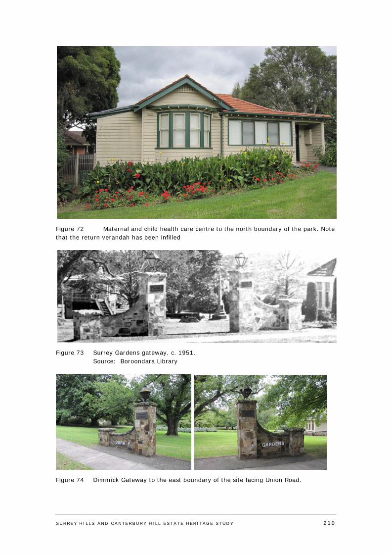
Figure 72 Maternal and child health care centre to the north boundary of the park. Note that the return verandah has been infilled
Figure 73 Surrey Gardens gateway, c. 1951. Source: Boroondara Library
Figure 74 Dimmick Gateway to the east boundary of the site facing Union Road.
SURREY HI LLS AND CANTERBURY HI LL ESTATE HERITAGE STUDY 210
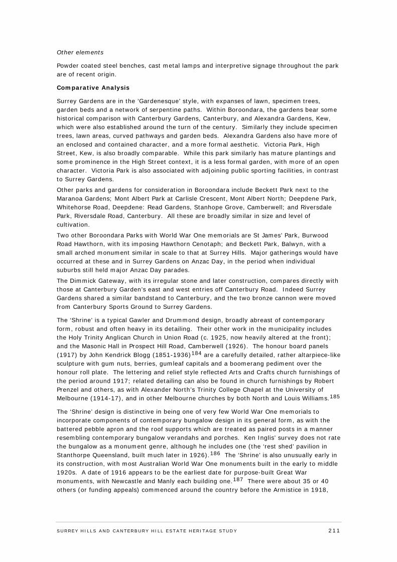
Other elements
Powder coated steel benches, cast metal lamps and interpretive signage throughout the park are of recent origin.
Comparative Analysis
Surrey Gardens are in the ‘Gardenesque’ style, with expanses of lawn, specimen trees, garden beds and a network of serpentine paths. Within Boroondara, the gardens bear some historical comparison with Canterbury Gardens, Canterbury, and Alexandra Gardens, Kew, which were also established around the turn of the century. Similarly they include specimen trees, lawn areas, curved pathways and garden beds. Alexandra Gardens also have more of an enclosed and contained character, and a more formal aesthetic. Victoria Park, High Street, Kew, is also broadly comparable. While this park similarly has mature plantings and some prominence in the High Street context, it is a less formal garden, with more of an open character. Victoria Park is also associated with adjoining public sporting facilities, in contrast to Surrey Gardens.
Other parks and gardens for consideration in Boroondara include Beckett Park next to the Maranoa Gardens; Mont Albert Park at Carlisle Crescent, Mont Albert North; Deepdene Park, Whitehorse Road, Deepdene: Read Gardens, Stanhope Grove, Camberwell; and Riversdale Park, Riversdale Road, Canterbury. All these are broadly similar in size and level of cultivation.
Two other Boroondara Parks with World War One memorials are St James’ Park, Burwood Road Hawthorn, with its imposing Hawthorn Cenotaph; and Beckett Park, Balwyn, with a small arched monument similar in scale to that at Surrey Hills. Major gatherings would have occurred at these and in Surrey Gardens on Anzac Day, in the period when individual suburbs still held major Anzac Day parades.
The Dimmick Gateway, with its irregular stone and later construction, compares directly with those at Canterbury Garden’s east and west entries off Canterbury Road. Indeed Surrey Gardens shared a similar bandstand to Canterbury, and the two bronze cannon were moved from Canterbury Sports Ground to Surrey Gardens.
The ‘Shrine’ is a typical Gawler and Drummond design, broadly abreast of contemporary form, robust and often heavy in its detailing. Their other work in the municipality includes the Holy Trinity Anglican Church in Union Road (c. 1925, now heavily altered at the front); and the Masonic Hall in Prospect Hill Road, Camberwell (1926). The honour board panels (1917) by John Kendrick Blogg (1851-1936)184 are a carefully detailed, rather altarpiece-like sculpture with gum nuts, berries, gumleaf capitals and a boomerang pediment over the honour roll plate. The lettering and relief style reflected Arts and Crafts church furnishings of the period around 1917; related detailing can also be found in church furnishings by Robert Prenzel and others, as with Alexander North’s Trinity College Chapel at the University of Melbourne (1914-17), and in other Melbourne churches by both North and Louis Williams.185
The ‘Shrine’ design is distinctive in being one of very few World War One memorials to incorporate components of contemporary bungalow design in its general form, as with the battered pebble apron and the roof supports which are treated as paired posts in a manner resembling contemporary bungalow verandahs and porches. Ken Inglis’ survey does not rate the bungalow as a monument genre, although he includes one (the ‘rest shed’ pavilion in Stanthorpe Queensland, built much later in 1926).186 The ‘Shrine’ is also unusually early in its construction, with most Australian World War One monuments built in the early to middle 1920s. A date of 1916 appears to be the earliest date for purpose-built Great War monuments, with Newcastle and Manly each building one.187 There were about 35 or 40 others (or funding appeals) commenced around the country before the Armistice in 1918,
SURREY HI LLS AND CANTERBURY HI LL ESTATE HERITAGE STUDY 211
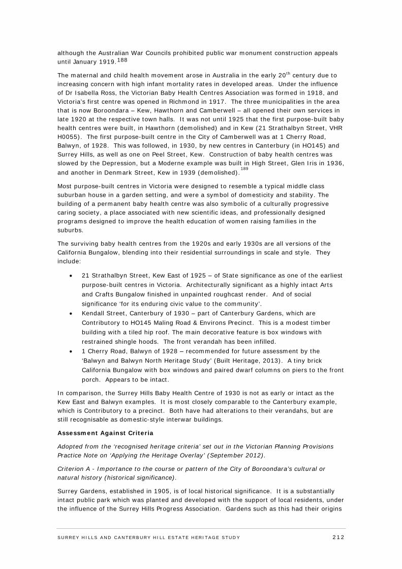
although the Australian War Councils prohibited public war monument construction appeals until January 1919.188
The maternal and child health movement arose in Australia in the early 20th century due to increasing concern with high infant mortality rates in developed areas. Under the influence of Dr Isabella Ross, the Victorian Baby Health Centres Association was formed in 1918, and Victoria’s first centre was opened in Richmond in 1917. The three municipalities in the area that is now Boroondara – Kew, Hawthorn and Camberwell – all opened their own services in late 1920 at the respective town halls. It was not until 1925 that the first purpose-built baby health centres were built, in Hawthorn (demolished) and in Kew (21 Strathalbyn Street, VHR H0055). The first purpose-built centre in the City of Camberwell was at 1 Cherry Road, Balwyn, of 1928. This was followed, in 1930, by new centres in Canterbury (in HO145) and Surrey Hills, as well as one on Peel Street, Kew. Construction of baby health centres was slowed by the Depression, but a Moderne example was built in High Street, Glen Iris in 1936, and another in Denmark Street, Kew in 1939 (demolished).
189
Most purpose-built centres in Victoria were designed to resemble a typical middle class suburban house in a garden setting, and were a symbol of domesticity and stability. The building of a permanent baby health centre was also symbolic of a culturally progressive caring society, a place associated with new scientific ideas, and professionally designed programs designed to improve the health education of women raising families in the suburbs.
The surviving baby health centres from the 1920s and early 1930s are all versions of the California Bungalow, blending into their residential surroundings in scale and style. They include:
• 21 Strathalbyn Street, Kew East of 1925 – of State significance as one of the earliest purpose-built centres in Victoria. Architecturally significant as a highly intact Arts and Crafts Bungalow finished in unpainted roughcast render. And of social significance ‘for its enduring civic value to the community’.
• Kendall Street, Canterbury of 1930 – part of Canterbury Gardens, which are Contributory to HO145 Maling Road & Environs Precinct. This is a modest timber building with a tiled hip roof. The main decorative feature is box windows with restrained shingle hoods. The front verandah has been infilled.
• 1 Cherry Road, Balwyn of 1928 – recommended for future assessment by the ‘Balwyn and Balwyn North Heritage Study’ (Built Heritage, 2013). A tiny brick California Bungalow with box windows and paired dwarf columns on piers to the front porch. Appears to be intact.
In comparison, the Surrey Hills Baby Health Centre of 1930 is not as early or intact as the Kew East and Balwyn examples. It is most closely comparable to the Canterbury example, which is Contributory to a precinct. Both have had alterations to their verandahs, but are still recognisable as domestic-style interwar buildings.
Assessment Against Criteria
Adopted from the ‘recognised heritage criteria’ set out in the Victorian Planning Provisions Practice Note on ‘Applying the Heritage Overlay’ (September 2012).
Criterion A - Importance to the course or pattern of the City of Boroondara’s cultural or natural history (historical significance).
Surrey Gardens, established in 1905, is of local historical significance. It is a substantially intact public park which was planted and developed with the support of local residents, under the influence of the Surrey Hills Progress Association. Gardens such as this had their origins
SURREY HI LLS AND CANTERBURY HI LL ESTATE HERITAGE STUDY 212
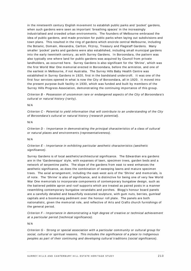
in the nineteenth century English movement to establish public parks and ‘pocket’ gardens, when such gardens were seen as important ‘breathing spaces’ in the increasingly industrialised and crowded urban environments. The founders of Melbourne embraced the idea of public gardens, and made provision for public parks when laying out subdivisions and town plans. This resulted in the ring of gardens which encircle central Melbourne, including the Botanic, Domain, Alexandra, Carlton, Fitzroy, Treasury and Flagstaff Gardens. Many smaller ‘pocket’ parks and gardens were also established, including small municipal gardens into the early twentieth century, as with Surrey Gardens. In Boroondara, the pattern was also typically one where land for public gardens was acquired by Council from private landholders, as occurred here. Surrey Gardens is also significant for the ‘Shrine’, which was the first World War One memorial erected in Boroondara, before the armistice, and one of the earliest in Melbourne, if not Australia. The Surrey Hills Baby Health Centre was established in Surrey Gardens in 1920, first in the bandstand undercroft. It was one of the first four services opened in what is now the City of Boroondara, all in 1920. It moved into the present purpose-built facility in 1930, which was funded and built by members of the Surrey Hills Progress Association, demonstrating the continuing importance of this group.
Criterion B - Possession of uncommon rare or endangered aspects of the City of Boroondara’s cultural or natural history (rarity).
N/A
Criterion C - Potential to yield information that will contribute to an understanding of the City of Boroondara’s cultural or natural history (research potential).
N/A
Criterion D - Importance in demonstrating the principal characteristics of a class of cultural or natural places and environments (representativeness).
N/A
Criterion E - Importance in exhibiting particular aesthetic characteristics (aesthetic significance).
Surrey Gardens is of local aesthetic/architectural significance. The Edwardian era gardens are in the ‘Gardenesque’ style, with expanses of lawn, specimen trees, garden beds and a network of serpentine paths. The slope of the gardens from east to west enhances the aesthetic significance, as does the combination of sweeping lawns and mature specimen trees. The axial arrangement, including the east-west axis of the ‘Shrine’ and memorials, is of note. The ‘Shrine’ is also of significance, and is distinctive for being one of very few World War One memorials to incorporate components of contemporary bungalow design, such as the battered pebble apron and roof supports which are treated as paired posts in a manner resembling contemporary bungalow verandahs and porches. Blogg’s honour board panels are a carefully detailed and beautifully executed sculpture, with gum nuts, berries, gumleaf capitals and a boomerang pediment over the honour roll plate. The panels are both nationalistic, given the memorial role, and reflective of Arts and Crafts church furnishings of the general period.
Criterion F - Importance in demonstrating a high degree of creative or technical achievement at a particular period (technical significance).
N/A
Criterion G - Strong or special association with a particular community or cultural group for social, cultural or spiritual reasons. This includes the significance of a place to Indigenous peoples as part of their continuing and developing cultural traditions (social significance).
SURREY HI LLS AND CANTERBURY HI LL ESTATE HERITAGE STUDY 213
Surrey Gardens is of local social significance. The gardens have been well used and valued by the community for over a century, including for memorial purposes. The maternal and child health centre is also of social significance for the role it has served in this location for nearly 100 years, where it has served to mark phases in the lives of local mothers and their babies.
Criterion H - Special association with the life or works of a person, or group of persons, of importance in the City of Boroondara’s history (associative significance).
N/A
Statement of Significance
What is significant?
Surrey Gardens, in Union Road, Surrey Hills, date from c.1905, and are rectilinear in plan form. The eastern edge of the park is level with the Union Road footpath and the land slopes down to the west towards Norfolk Road. The early path alignment comprised a pair of east-west ‘mirrored’ arcs that connected each corner of the park; this alignment is intact although pathways have been added. In terms of landscaping, the park comprises specimen trees in a lawn setting with heavily treed areas to the north and south boundary fences. There are also smaller planted garden beds to the pathway edges in places. Mature trees include elms, a Japanese Oak, cypress and a significant lemon scented gum tree (Eucalyptus citriodora) located to the west side of the park. There are also island garden beds set at path junctions, surrounding several of the park structures and alongside sections of the pathways. Significant elements of the gardens include the ‘Shrine’ World War One memorial with honour board (1917); the Dimmick memorial gateway (1950) to Union Road; other memorials on an east-west axis, to the west of the ‘Shrine’; and the cairn which marks the site of the demolished bandstand (1912 removed 1973), and also commemorates local resident, John Gray. The Maternal Child Health Care (former Baby Health) Centre building of 1930 is a contributory element.
How is it significant?
Surrey Gardens, Union Road, Surrey Hills, is of local historical, social and aesthetic/architectural significance to the City of Boroondara.
Why is it significant?
Surrey Gardens, established in 1905, is of local historical significance. It is a substantially intact public park which was planted and developed with the support of local residents, under the influence of the Surrey Hills Progress Association. It had its origins in the nineteenth century English movement to establish public parks and ‘pocket’ gardens, when such gardens were seen as important ‘breathing spaces’ in the increasingly industrialised and crowded urban environments. The founders of Melbourne embraced the idea of public gardens, and made provision for public parks when laying out subdivisions and town plans. This resulted in the ring of gardens which encircle central Melbourne, including the Botanic, Domain, Alexandra, Carlton, Fitzroy, Treasury and Flagstaff Gardens. Many smaller ‘pocket’ parks and gardens were also established, including small municipal gardens into the early twentieth century, as with Surrey Gardens. In Boroondara, the pattern was typically one where land for public gardens was acquired by Council from private landholders, as occurred here. Surrey Gardens is also historically significant for the ‘Shrine’, which was the first World War One memorial erected in Boroondara, before the armistice, and one of the earliest in Melbourne, if not Australia. The Surrey Hills Baby Health Centre was established in Surrey Gardens in 1920, first in the bandstand undercroft. It was one of the first four services opened in what is now the City of Boroondara, all in 1920. It moved into the present
SURREY HI LLS AND CANTERBURY HI LL ESTATE HERITAGE STUDY 214
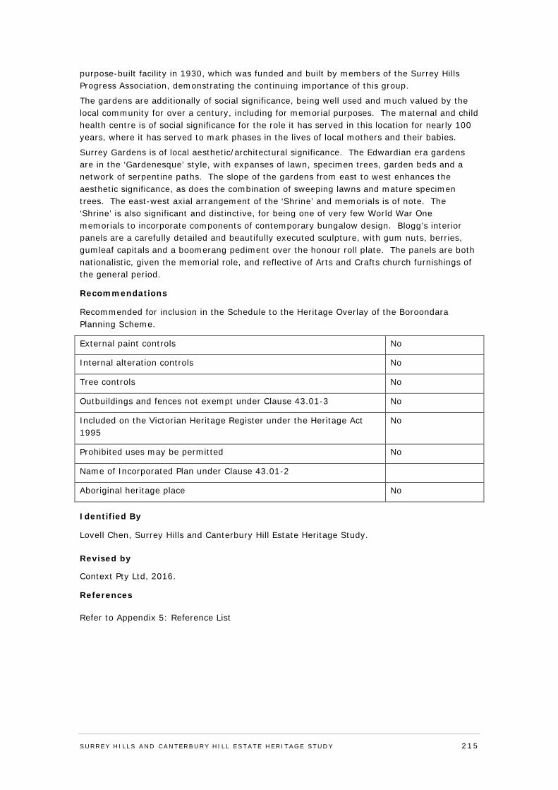
purpose-built facility in 1930, which was funded and built by members of the Surrey Hills Progress Association, demonstrating the continuing importance of this group.
The gardens are additionally of social significance, being well used and much valued by the local community for over a century, including for memorial purposes. The maternal and child health centre is of social significance for the role it has served in this location for nearly 100 years, where it has served to mark phases in the lives of local mothers and their babies.
Surrey Gardens is of local aesthetic/architectural significance. The Edwardian era gardens are in the ‘Gardenesque’ style, with expanses of lawn, specimen trees, garden beds and a network of serpentine paths. The slope of the gardens from east to west enhances the aesthetic significance, as does the combination of sweeping lawns and mature specimen trees. The east-west axial arrangement of the ‘Shrine’ and memorials is of note. The ‘Shrine’ is also significant and distinctive, for being one of very few World War One memorials to incorporate components of contemporary bungalow design. Blogg’s interior panels are a carefully detailed and beautifully executed sculpture, with gum nuts, berries, gumleaf capitals and a boomerang pediment over the honour roll plate. The panels are both nationalistic, given the memorial role, and reflective of Arts and Crafts church furnishings of the general period.
Recommendations
Recommended for inclusion in the Schedule to the Heritage Overlay of the Boroondara Planning Scheme.
External paint controls No
Internal alteration controls No
Tree controls No
Outbuildings and fences not exempt under Clause 43.01-3 No
Included on the Victorian Heritage Register under the Heritage Act 1995
No
Prohibited uses may be permitted No
Name of Incorporated Plan under Clause 43.01-2
Aboriginal heritage place No
Identified By
Lovell Chen, Surrey Hills and Canterbury Hill Estate Heritage Study.
Revised by
Context Pty Ltd, 2016.
References Refer to Appendix 5: Reference List
SURREY HI LLS AND CANTERBURY HI LL ESTATE HERITAGE STUDY 215
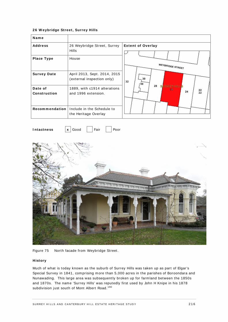
26 Weybridge Street, Surrey Hills
Name
Address 26 Weybridge Street, Surrey Hills
Extent of Overlay
Place Type House
Survey Date April 2013, Sept. 2014, 2015 (external inspection only)
Date of Construction
1889, with c1914 alterations and 1996 extension.
Recommendation Include in the Schedule to the Heritage Overlay
Intactness x Good Fair Poor
Figure 75 North facade from Weybridge Street.
History
Much of what is today known as the suburb of Surrey Hills was taken up as part of Elgar’s Special Survey in 1841, comprising more than 5,000 acres in the parishes of Boroondara and Nunawading. This large area was subsequently broken up for farmland between the 1850s and 1870s. The name ‘Surrey Hills’ was reputedly first used by John H Knipe in his 1878 subdivision just south of Mont Albert Road.190
SURREY HI LLS AND CANTERBURY HI LL ESTATE HERITAGE STUDY 216
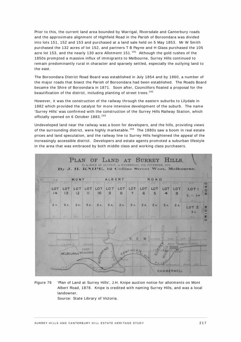
Prior to this, the current land area bounded by Warrigal, Riversdale and Canterbury roads and the approximate alignment of Highfield Road in the Parish of Boroondara was divided into lots 151, 152 and 153 and purchased at a land sale held on 5 May 1853. Mr W Smith purchased the 132 acres of lot 152, and partners T B Payne and H Glass purchased the 105 acre lot 153, and the nearly 130 acre Allotment 151.191 Although the gold rushes of the 1850s prompted a massive influx of immigrants to Melbourne, Surrey Hills continued to remain predominantly rural in character and sparsely settled, especially the outlying land to the east.
The Boroondara District Road Board was established in July 1854 and by 1860, a number of the major roads that bisect the Parish of Boroondara had been established. The Roads Board became the Shire of Boroondara in 1871. Soon after, Councillors floated a proposal for the beautification of the district, including planting of street trees.192
However, it was the construction of the railway through the eastern suburbs to Lilydale in 1882 which provided the catalyst for more intensive development of the suburb. The name ‘Surrey Hills’ was confirmed with the construction of the Surrey Hills Railway Station, which officially opened on 6 October 1883.193
Undeveloped land near the railway was a boon for developers, and the hills, providing views of the surrounding district, were highly marketable.194 The 1880s saw a boom in real estate prices and land speculation, and the railway line to Surrey Hills heightened the appeal of the increasingly accessible district. Developers and estate agents promoted a suburban lifestyle in the area that was embraced by both middle class and working class purchasers.
Figure 76 ‘Plan of Land at Surrey Hills’, J.H. Knipe auction notice for allotments on Mont Albert Road, 1878. Knipe is credited with naming Surrey Hills, and was a local landowner. Source: State Library of Victoria.
SURREY HI LLS AND CANTERBURY HI LL ESTATE HERITAGE STUDY 217
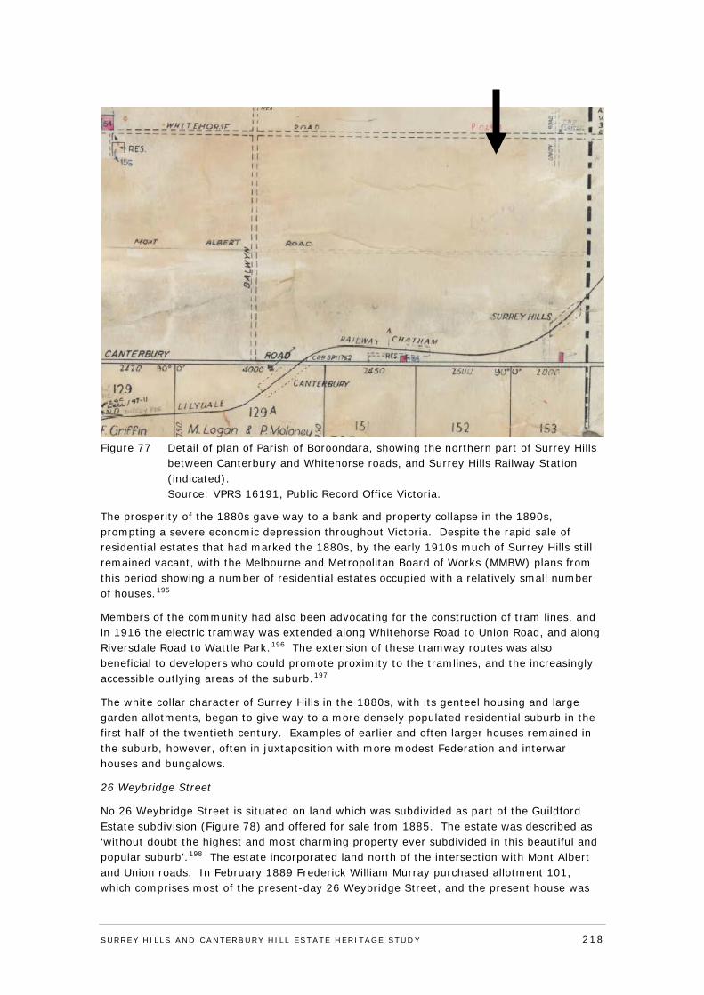
Figure 77 Detail of plan of Parish of Boroondara, showing the northern part of Surrey Hills
between Canterbury and Whitehorse roads, and Surrey Hills Railway Station (indicated). Source: VPRS 16191, Public Record Office Victoria.
The prosperity of the 1880s gave way to a bank and property collapse in the 1890s, prompting a severe economic depression throughout Victoria. Despite the rapid sale of residential estates that had marked the 1880s, by the early 1910s much of Surrey Hills still remained vacant, with the Melbourne and Metropolitan Board of Works (MMBW) plans from this period showing a number of residential estates occupied with a relatively small number of houses.195
Members of the community had also been advocating for the construction of tram lines, and in 1916 the electric tramway was extended along Whitehorse Road to Union Road, and along Riversdale Road to Wattle Park.196 The extension of these tramway routes was also beneficial to developers who could promote proximity to the tramlines, and the increasingly accessible outlying areas of the suburb.197
The white collar character of Surrey Hills in the 1880s, with its genteel housing and large garden allotments, began to give way to a more densely populated residential suburb in the first half of the twentieth century. Examples of earlier and often larger houses remained in the suburb, however, often in juxtaposition with more modest Federation and interwar houses and bungalows.
26 Weybridge Street
No 26 Weybridge Street is situated on land which was subdivided as part of the Guildford Estate subdivision (Figure 78) and offered for sale from 1885. The estate was described as ‘without doubt the highest and most charming property ever subdivided in this beautiful and popular suburb’.198 The estate incorporated land north of the intersection with Mont Albert and Union roads. In February 1889 Frederick William Murray purchased allotment 101, which comprises most of the present-day 26 Weybridge Street, and the present house was
SURREY HI LLS AND CANTERBURY HI LL ESTATE HERITAGE STUDY 218
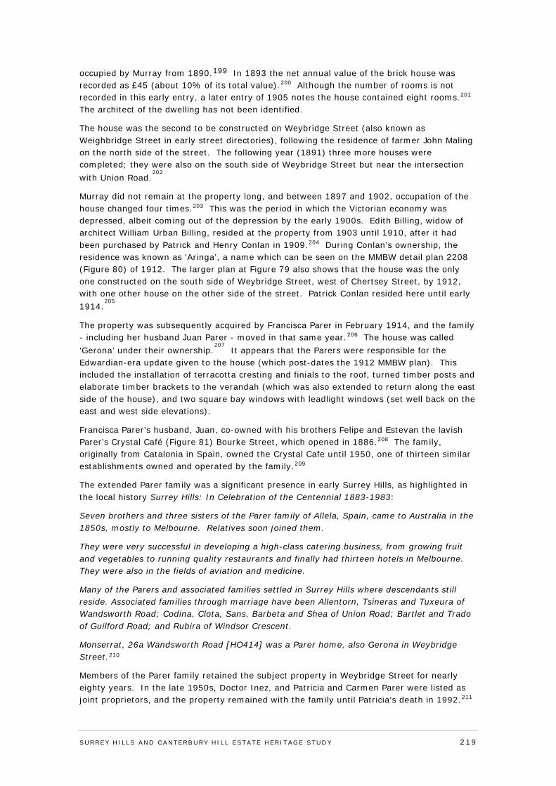
occupied by Murray from 1890.199 In 1893 the net annual value of the brick house was recorded as £45 (about 10% of its total value).200 Although the number of rooms is not recorded in this early entry, a later entry of 1905 notes the house contained eight rooms.201 The architect of the dwelling has not been identified.
The house was the second to be constructed on Weybridge Street (also known as Weighbridge Street in early street directories), following the residence of farmer John Maling on the north side of the street. The following year (1891) three more houses were completed; they were also on the south side of Weybridge Street but near the intersection with Union Road.
202
Murray did not remain at the property long, and between 1897 and 1902, occupation of the house changed four times.203 This was the period in which the Victorian economy was depressed, albeit coming out of the depression by the early 1900s. Edith Billing, widow of architect William Urban Billing, resided at the property from 1903 until 1910, after it had been purchased by Patrick and Henry Conlan in 1909.204 During Conlan’s ownership, the residence was known as ‘Aringa’, a name which can be seen on the MMBW detail plan 2208 (Figure 80) of 1912. The larger plan at Figure 79 also shows that the house was the only one constructed on the south side of Weybridge Street, west of Chertsey Street, by 1912, with one other house on the other side of the street. Patrick Conlan resided here until early 1914.
205
The property was subsequently acquired by Francisca Parer in February 1914, and the family - including her husband Juan Parer - moved in that same year.206 The house was called ‘Gerona’ under their ownership.
207 It appears that the Parers were responsible for the
Edwardian-era update given to the house (which post-dates the 1912 MMBW plan). This included the installation of terracotta cresting and finials to the roof, turned timber posts and elaborate timber brackets to the verandah (which was also extended to return along the east side of the house), and two square bay windows with leadlight windows (set well back on the east and west side elevations).
Francisca Parer’s husband, Juan, co-owned with his brothers Felipe and Estevan the lavish Parer’s Crystal Café (Figure 81) Bourke Street, which opened in 1886.208 The family, originally from Catalonia in Spain, owned the Crystal Cafe until 1950, one of thirteen similar establishments owned and operated by the family.209
The extended Parer family was a significant presence in early Surrey Hills, as highlighted in the local history Surrey Hills: In Celebration of the Centennial 1883-1983:
Seven brothers and three sisters of the Parer family of Allela, Spain, came to Australia in the 1850s, mostly to Melbourne. Relatives soon joined them.
They were very successful in developing a high-class catering business, from growing fruit and vegetables to running quality restaurants and finally had thirteen hotels in Melbourne. They were also in the fields of aviation and medicine.
Many of the Parers and associated families settled in Surrey Hills where descendants still reside. Associated families through marriage have been Allentorn, Tsineras and Tuxeura of Wandsworth Road; Codina, Clota, Sans, Barbeta and Shea of Union Road; Bartlet and Trado of Guilford Road; and Rubira of Windsor Crescent.
Monserrat, 26a Wandsworth Road [HO414] was a Parer home, also Gerona in Weybridge Street.210
Members of the Parer family retained the subject property in Weybridge Street for nearly eighty years. In the late 1950s, Doctor Inez, and Patricia and Carmen Parer were listed as joint proprietors, and the property remained with the family until Patricia’s death in 1992.211
SURREY HI LLS AND CANTERBURY HI LL ESTATE HERITAGE STUDY 219
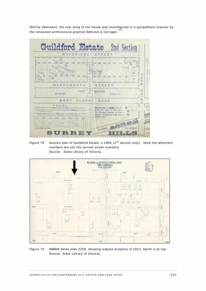
Shortly afterward, the rear wing of the house was reconfigured in a sympathetic manner by the renowned architectural practice Edmond & Corrigan.
212
Figure 78 Auction plan of Guildford Estate, c.1885 (2nd section only). Note the allotment numbers are not the current street numbers. Source: State Library of Victoria.
Figure 79 MMBW detail plan 2208, showing subject property in 1912. North is at top. Source: State Library of Victoria
SURREY HI LLS AND CANTERBURY HI LL ESTATE HERITAGE STUDY 220
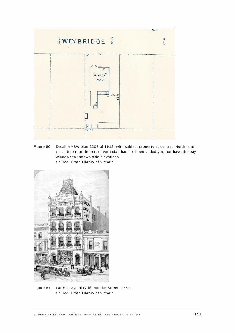
Figure 80 Detail MMBW plan 2208 of 1912, with subject property at centre. North is at top. Note that the return verandah has not been added yet, nor have the bay windows to the two side elevations. Source: State Library of Victoria
Figure 81 Parer’s Crystal Café, Bourke Street, 1887. Source: State Library of Victoria.
SURREY HI LLS AND CANTERBURY HI LL ESTATE HERITAGE STUDY 221

Victoria’s Framework of Historical Themes
Theme 6: Building towns, cities and the garden state; sub-theme 6.7: Making homes for Victorians.
Description & Integrity
The house at 26 Weybridge Street is a 1889-90 single-storey rendered brick Italianate residence with hipped roof forms clad in slate, and a prominent canted bay window to the west side of the north-facing facade. The roof is punctuated by three rendered and ornately corniced chimneys and there are smaller chimneys to the rear component. Decorative moulded brackets and rosettes line the eaves.
The exterior walls are rendered and feature a rusticated finish either side of the bay window to the northern façade, and ruled render to the remainder of the walls. The canted bay features moulded architraves to the central shallow arch-headed window and flanking stilted arch-headed windows. Other windows are generally shallow arch-headed with timber framed double hung sashes.
As noted in the history, the exterior of the house was updated with Edwardian-era elements around the time the Parer family took possession in 1914. This included the addition of terracotta cresting and finials to the roof, square-set bay windows of double-hung leadlight windows with highlights set back on the side elevations, as well as Art Nouveau-inspired leadlights to the front arched windows. The timber verandah that returns around the north and east elevations also appears to date from this time, replacing that shown in the MMBW plan at Figure 80. The verandah has turned timber posts, large solid timber brackets, a slate and terracotta crested roof, and is paved in tessellated terracotta tiles.
A vehicle crossover and driveway is located on the west side of the Weybridge Street boundary. There are hard paved areas to the west side, and front of the house, for car parking. The rest of the landscape is planted with trees and shrubs. The front boundary is enclosed by a non-original mild-steel fence with rendered posts. There is a gable-fronted outbuilding (shown as the ‘Ballroom’ on 1996 plans) which may date to the same time as the c1914 update. It has weatherboard walls and a half-timbered gable roof, typical of the Edwardian era. The chimney is more in the Victorian mode - rendered with a rendered cornice - though it had not been built by 1912. The configuration of door and window openings has been changed since 1996.
The entire extent of the 1889-90 house, beneath an M-hip roof, has been retained as has the long western rear wing (visible in 1912). A post-1912 eastern rear wing was reconfigured (or rebuilt) in a 1996 renovation, which included the construction of a large square-set bay window to the rear of the west elevation.213
SURREY HI LLS AND CANTERBURY HI LL ESTATE HERITAGE STUDY 222
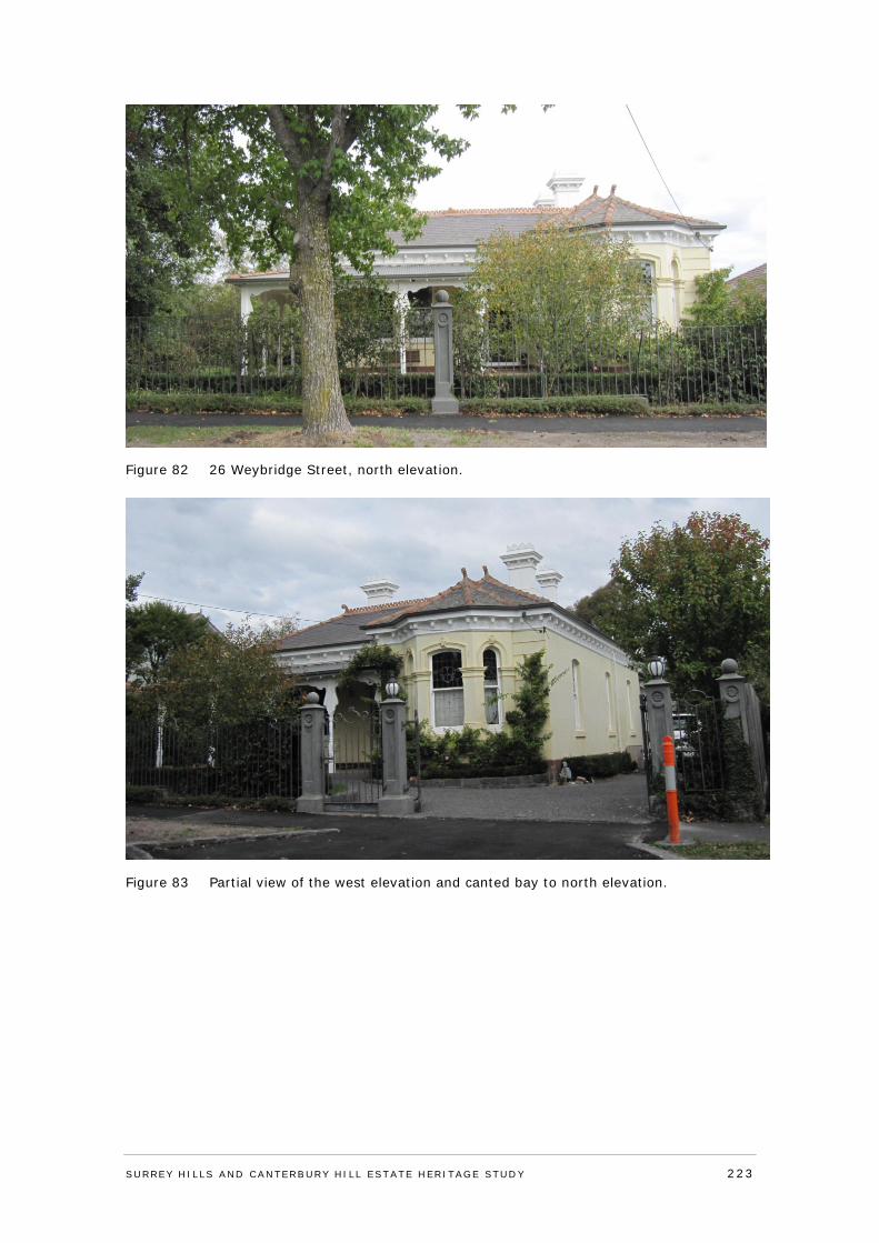
Figure 82 26 Weybridge Street, north elevation.
Figure 83 Partial view of the west elevation and canted bay to north elevation.
SURREY HI LLS AND CANTERBURY HI LL ESTATE HERITAGE STUDY 223
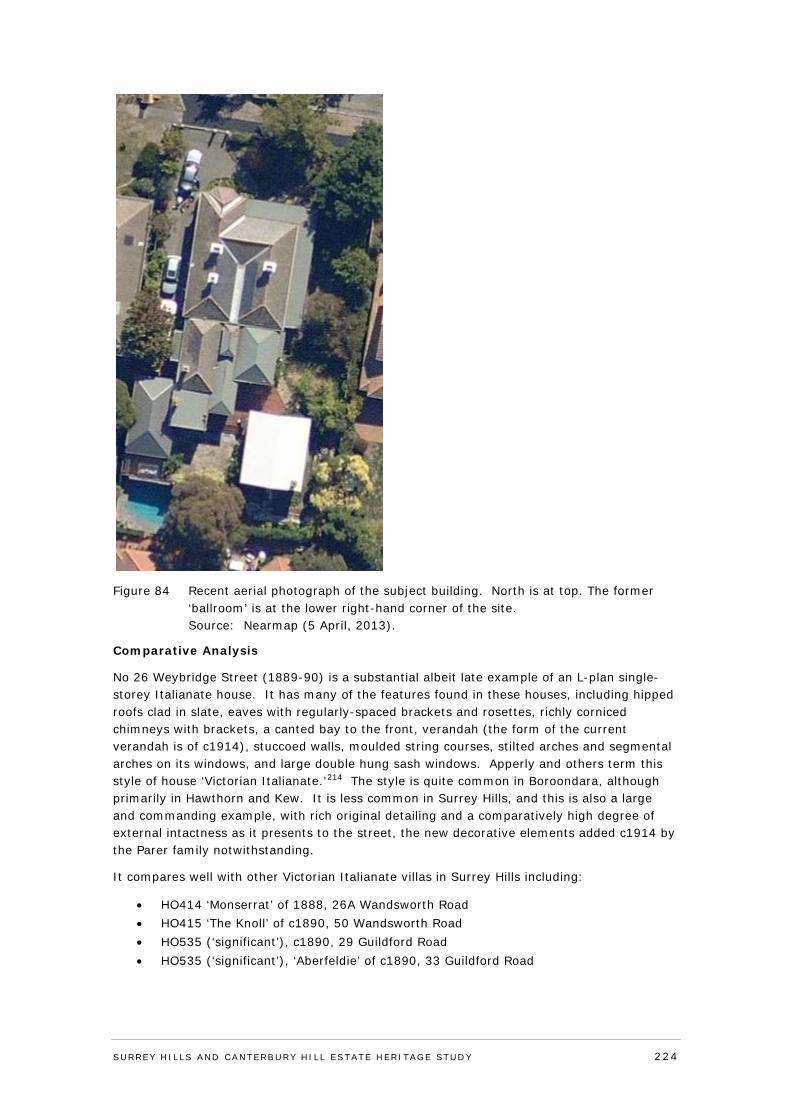
Figure 84 Recent aerial photograph of the subject building. North is at top. The former ‘ballroom’ is at the lower right-hand corner of the site. Source: Nearmap (5 April, 2013).
Comparative Analysis
No 26 Weybridge Street (1889-90) is a substantial albeit late example of an L-plan single-storey Italianate house. It has many of the features found in these houses, including hipped roofs clad in slate, eaves with regularly-spaced brackets and rosettes, richly corniced chimneys with brackets, a canted bay to the front, verandah (the form of the current verandah is of c1914), stuccoed walls, moulded string courses, stilted arches and segmental arches on its windows, and large double hung sash windows. Apperly and others term this style of house ‘Victorian Italianate.’214 The style is quite common in Boroondara, although primarily in Hawthorn and Kew. It is less common in Surrey Hills, and this is also a large and commanding example, with rich original detailing and a comparatively high degree of external intactness as it presents to the street, the new decorative elements added c1914 by the Parer family notwithstanding.
It compares well with other Victorian Italianate villas in Surrey Hills including:
• HO414 ‘Monserrat’ of 1888, 26A Wandsworth Road • HO415 ‘The Knoll’ of c1890, 50 Wandsworth Road • HO535 (‘significant’), c1890, 29 Guildford Road • HO535 (‘significant’), ‘Aberfeldie’ of c1890, 33 Guildford Road
SURREY HI LLS AND CANTERBURY HI LL ESTATE HERITAGE STUDY 224
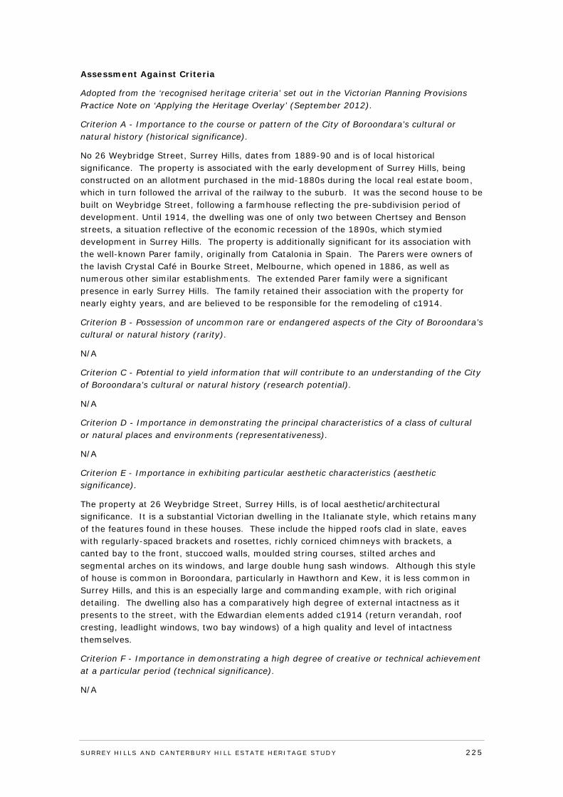
Assessment Against Criteria
Adopted from the ‘recognised heritage criteria’ set out in the Victorian Planning Provisions Practice Note on ‘Applying the Heritage Overlay’ (September 2012).
Criterion A - Importance to the course or pattern of the City of Boroondara’s cultural or natural history (historical significance).
No 26 Weybridge Street, Surrey Hills, dates from 1889-90 and is of local historical significance. The property is associated with the early development of Surrey Hills, being constructed on an allotment purchased in the mid-1880s during the local real estate boom, which in turn followed the arrival of the railway to the suburb. It was the second house to be built on Weybridge Street, following a farmhouse reflecting the pre-subdivision period of development. Until 1914, the dwelling was one of only two between Chertsey and Benson streets, a situation reflective of the economic recession of the 1890s, which stymied development in Surrey Hills. The property is additionally significant for its association with the well-known Parer family, originally from Catalonia in Spain. The Parers were owners of the lavish Crystal Café in Bourke Street, Melbourne, which opened in 1886, as well as numerous other similar establishments. The extended Parer family were a significant presence in early Surrey Hills. The family retained their association with the property for nearly eighty years, and are believed to be responsible for the remodeling of c1914.
Criterion B - Possession of uncommon rare or endangered aspects of the City of Boroondara’s cultural or natural history (rarity).
N/A
Criterion C - Potential to yield information that will contribute to an understanding of the City of Boroondara’s cultural or natural history (research potential).
N/A
Criterion D - Importance in demonstrating the principal characteristics of a class of cultural or natural places and environments (representativeness).
N/A
Criterion E - Importance in exhibiting particular aesthetic characteristics (aesthetic significance).
The property at 26 Weybridge Street, Surrey Hills, is of local aesthetic/architectural significance. It is a substantial Victorian dwelling in the Italianate style, which retains many of the features found in these houses. These include the hipped roofs clad in slate, eaves with regularly-spaced brackets and rosettes, richly corniced chimneys with brackets, a canted bay to the front, stuccoed walls, moulded string courses, stilted arches and segmental arches on its windows, and large double hung sash windows. Although this style of house is common in Boroondara, particularly in Hawthorn and Kew, it is less common in Surrey Hills, and this is an especially large and commanding example, with rich original detailing. The dwelling also has a comparatively high degree of external intactness as it presents to the street, with the Edwardian elements added c1914 (return verandah, roof cresting, leadlight windows, two bay windows) of a high quality and level of intactness themselves.
Criterion F - Importance in demonstrating a high degree of creative or technical achievement at a particular period (technical significance).
N/A
SURREY HI LLS AND CANTERBURY HI LL ESTATE HERITAGE STUDY 225
Criterion G - Strong or special association with a particular community or cultural group for social, cultural or spiritual reasons. This includes the significance of a place to Indigenous peoples as part of their continuing and developing cultural traditions (social significance).
N/A
Criterion H - Special association with the life or works of a person, or group of persons, of importance in the City of Boroondara’s history (associative significance).
N/A
Statement of Significance
What is significant?
No 26 Weybridge Street, Surrey Hills, dates from 1889-90, and is a substantial single-storey rendered brick Italianate residence with hipped roof forms clad in slate, and a prominent canted bay window to the west side of the north-facing facade. The roof is punctuated by rendered and ornately corniced chimneys, with smaller chimneys to the rear component. Decorative moulded brackets line the eaves. The ruled rendered exterior walls have a rusticated finish either side of the bay window to the northern facade. The canted bay has moulded architraves to the central arch-headed window and flanking stilted arch-headed windows. Other front windows are generally shallow arch-headed with timber-framed double-hung sashes. The house was updated during the Edwardian era (c1914), including the timber verandah that returns around the north and east elevations paved in tessellated terracotta tiles, terracotta cresting and finials to the roof, square-set bay windows of double-hung leadlight windows with highlights set back on the side elevations, as well as Art Nouveau-inspired leadlights to the front arched windows. These alterations are considered to be contributory elements of the house.
There is a gable-fronted outbuilding (shown as the ‘Ballroom’ on 1996 plans) which may date to the same time as the c1914 update. It has weatherboard walls and a half-timbered gable roof, typical of the Edwardian era. The chimney is more in the Victorian mode - rendered with a rendered cornice - though it had not been built by 1912. The configuration of its door and window openings has been changed since 1996.
A number of further additions have been made to the house which are considered non-significant elements. These include the driveway, hard paved garden areas, the 1996 alterations and extensions to the rear of the house, and the non-original wrought mild-steel fence with rendered posts.
How is it significant?
The property at 26 Weybridge Street, Surrey Hills, is of local historical and aesthetic/architectural significance to the City of Boroondara.
Why is it significant?
The property at 26 Weybridge Street, Surrey Hills, is of local historical significance. The property dates from 1889-90 and is associated with early development of Surrey Hills, being constructed on an allotment purchased in the mid-1880s during the local real estate boom, which in turn followed the arrival of the railway to the suburb. It was the second house to be built on Weybridge Street, following a farmhouse and until 1914, it was one of only two dwellings between Chertsey and Benson streets, a situation reflective of the economic recession of the 1890s, which stymied development in Surrey Hills. The property is additionally significant for its association with the well-known Parer family, originally from Catalonia in Spain. The Parers were owners of the lavish Crystal Café in Bourke Street,
SURREY HI LLS AND CANTERBURY HI LL ESTATE HERITAGE STUDY 226
Melbourne, which opened in 1886, as well as numerous other similar establishments. The extended Parer family were a significant presence in early Surrey Hills. The family retained their association with the property for nearly eighty years, and are believed to be responsible for the remodeling of c1914.
No 26 Weybridge Street is also of local aesthetic/architectural significance. It is a substantial Victorian dwelling in the Italianate style, which retains many features found in these houses. These include the hipped roofs clad in slate, eaves with regularly-spaced brackets and rosettes, richly corniced chimneys with brackets, a canted bay to the front, stuccoed walls, moulded string courses, stilted arches and segmental arches on its windows, and large double hung sash windows. Although this style of house is common in Boroondara, particularly in Hawthorn and Kew, it is less common in Surrey Hills, and this is an especially large and commanding example, with rich original detailing. The dwelling also has a comparatively high degree of external intactness as it presents to the street, with the Edwardian elements added c1914 (return verandah, roof cresting, leadlight windows, two bay windows) of a high quality and level of intactness themselves.
Recommendations
Recommended for inclusion in the Schedule to the Heritage Overlay of the Boroondara Planning Scheme.
External paint controls No
Internal alteration controls No
Tree controls No
Outbuildings and fences not exempt under Clause 43.01-3 No
Included on the Victorian Heritage Register under the Heritage Act 1995
No
Prohibited uses may be permitted No
Name of Incorporated Plan under Clause 43.01-2
Aboriginal heritage place No
Identified By
Lovell Chen, Surrey Hills and Canterbury Hill Estate Heritage Study.
Revised by
Context Pty Ltd, 2016.
References
Refer to Appendix 5: Reference List
SURREY HI LLS AND CANTERBURY HI LL ESTATE HERITAGE STUDY 227
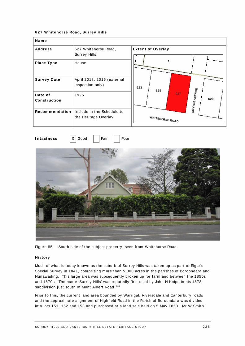
627 Whitehorse Road, Surrey Hills
Name
Address 627 Whitehorse Road, Surrey Hills
Extent of Overlay
Place Type House
Survey Date April 2013, 2015 (external inspection only)
Date of Construction
1925
Recommendation Include in the Schedule to the Heritage Overlay
Intactness X Good Fair Poor
Figure 85 South side of the subject property, seen from Whitehorse Road.
History
Much of what is today known as the suburb of Surrey Hills was taken up as part of Elgar’s Special Survey in 1841, comprising more than 5,000 acres in the parishes of Boroondara and Nunawading. This large area was subsequently broken up for farmland between the 1850s and 1870s. The name ‘Surrey Hills’ was reputedly first used by John H Knipe in his 1878 subdivision just south of Mont Albert Road.215
Prior to this, the current land area bounded by Warrigal, Riversdale and Canterbury roads and the approximate alignment of Highfield Road in the Parish of Boroondara was divided into lots 151, 152 and 153 and purchased at a land sale held on 5 May 1853. Mr W Smith
SURREY HI LLS AND CANTERBURY HI LL ESTATE HERITAGE STUDY 228
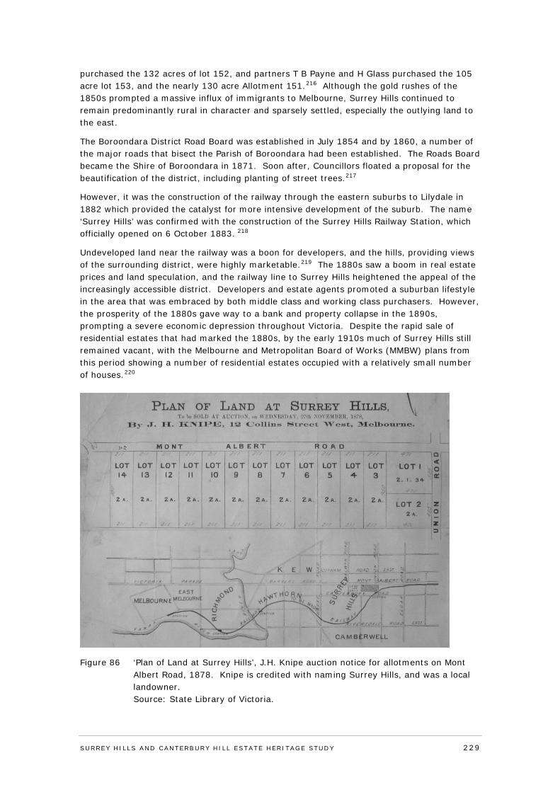
purchased the 132 acres of lot 152, and partners T B Payne and H Glass purchased the 105 acre lot 153, and the nearly 130 acre Allotment 151.216 Although the gold rushes of the 1850s prompted a massive influx of immigrants to Melbourne, Surrey Hills continued to remain predominantly rural in character and sparsely settled, especially the outlying land to the east.
The Boroondara District Road Board was established in July 1854 and by 1860, a number of the major roads that bisect the Parish of Boroondara had been established. The Roads Board became the Shire of Boroondara in 1871. Soon after, Councillors floated a proposal for the beautification of the district, including planting of street trees.217
However, it was the construction of the railway through the eastern suburbs to Lilydale in 1882 which provided the catalyst for more intensive development of the suburb. The name ‘Surrey Hills’ was confirmed with the construction of the Surrey Hills Railway Station, which officially opened on 6 October 1883. 218
Undeveloped land near the railway was a boon for developers, and the hills, providing views of the surrounding district, were highly marketable.219 The 1880s saw a boom in real estate prices and land speculation, and the railway line to Surrey Hills heightened the appeal of the increasingly accessible district. Developers and estate agents promoted a suburban lifestyle in the area that was embraced by both middle class and working class purchasers. However, the prosperity of the 1880s gave way to a bank and property collapse in the 1890s, prompting a severe economic depression throughout Victoria. Despite the rapid sale of residential estates that had marked the 1880s, by the early 1910s much of Surrey Hills still remained vacant, with the Melbourne and Metropolitan Board of Works (MMBW) plans from this period showing a number of residential estates occupied with a relatively small number of houses.220
Figure 86 ‘Plan of Land at Surrey Hills’, J.H. Knipe auction notice for allotments on Mont Albert Road, 1878. Knipe is credited with naming Surrey Hills, and was a local landowner. Source: State Library of Victoria.
SURREY HI LLS AND CANTERBURY HI LL ESTATE HERITAGE STUDY 229
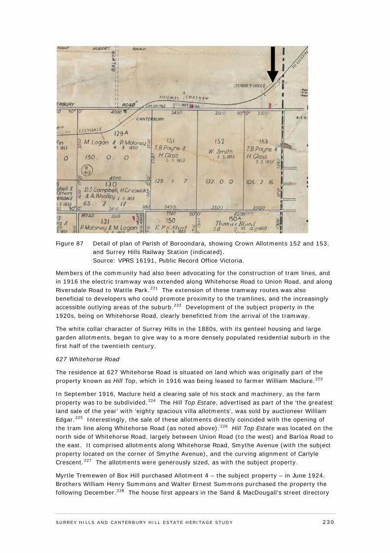
Figure 87 Detail of plan of Parish of Boroondara, showing Crown Allotments 152 and 153, and Surrey Hills Railway Station (indicated). Source: VPRS 16191, Public Record Office Victoria.
Members of the community had also been advocating for the construction of tram lines, and in 1916 the electric tramway was extended along Whitehorse Road to Union Road, and along Riversdale Road to Wattle Park.221 The extension of these tramway routes was also beneficial to developers who could promote proximity to the tramlines, and the increasingly accessible outlying areas of the suburb.222 Development of the subject property in the 1920s, being on Whitehorse Road, clearly benefitted from the arrival of the tramway.
The white collar character of Surrey Hills in the 1880s, with its genteel housing and large garden allotments, began to give way to a more densely populated residential suburb in the first half of the twentieth century.
627 Whitehorse Road
The residence at 627 Whitehorse Road is situated on land which was originally part of the property known as Hill Top, which in 1916 was being leased to farmer William Maclure.223
In September 1916, Maclure held a clearing sale of his stock and machinery, as the farm property was to be subdivided.224 The Hill Top Estate, advertised as part of the ‘the greatest land sale of the year’ with ‘eighty spacious villa allotments’, was sold by auctioneer William Edgar.225 Interestingly, the sale of these allotments directly coincided with the opening of the tram line along Whitehorse Road (as noted above).226 Hill Top Estate was located on the north side of Whitehorse Road, largely between Union Road (to the west) and Barloa Road to the east. It comprised allotments along Whitehorse Road, Smythe Avenue (with the subject property located on the corner of Smythe Avenue), and the curving alignment of Carlyle Crescent.227 The allotments were generously sized, as with the subject property.
Myrtle Tremewen of Box Hill purchased Allotment 4 – the subject property – in June 1924. Brothers William Henry Summons and Walter Ernest Summons purchased the property the following December.228 The house first appears in the Sand & MacDougall’s street directory
SURREY HI LLS AND CANTERBURY HI LL ESTATE HERITAGE STUDY 230
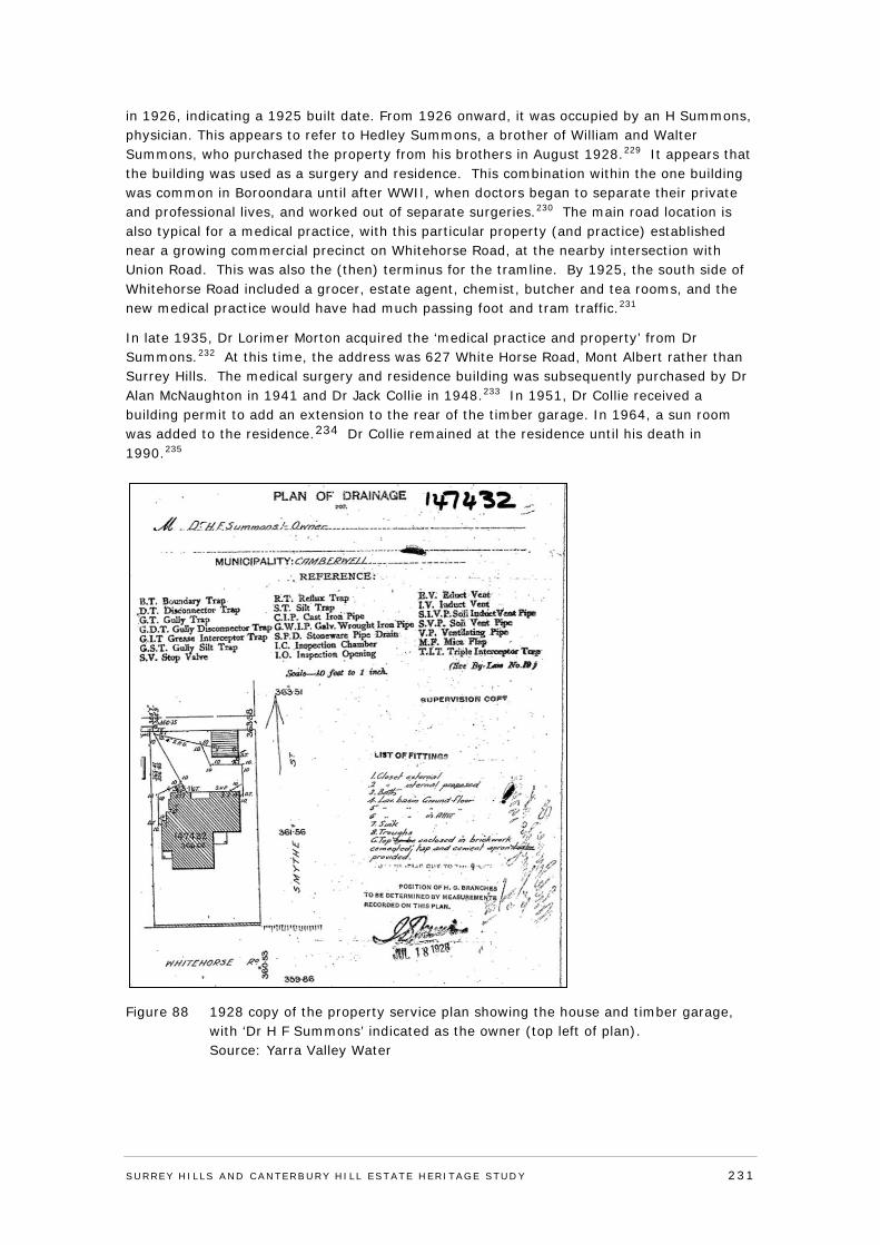
in 1926, indicating a 1925 built date. From 1926 onward, it was occupied by an H Summons, physician. This appears to refer to Hedley Summons, a brother of William and Walter Summons, who purchased the property from his brothers in August 1928.229 It appears that the building was used as a surgery and residence. This combination within the one building was common in Boroondara until after WWII, when doctors began to separate their private and professional lives, and worked out of separate surgeries.230 The main road location is also typical for a medical practice, with this particular property (and practice) established near a growing commercial precinct on Whitehorse Road, at the nearby intersection with Union Road. This was also the (then) terminus for the tramline. By 1925, the south side of Whitehorse Road included a grocer, estate agent, chemist, butcher and tea rooms, and the new medical practice would have had much passing foot and tram traffic.231
In late 1935, Dr Lorimer Morton acquired the ‘medical practice and property’ from Dr Summons.232 At this time, the address was 627 White Horse Road, Mont Albert rather than Surrey Hills. The medical surgery and residence building was subsequently purchased by Dr Alan McNaughton in 1941 and Dr Jack Collie in 1948.233 In 1951, Dr Collie received a building permit to add an extension to the rear of the timber garage. In 1964, a sun room was added to the residence.234 Dr Collie remained at the residence until his death in 1990.235
Figure 88 1928 copy of the property service plan showing the house and timber garage, with ‘Dr H F Summons’ indicated as the owner (top left of plan). Source: Yarra Valley Water
SURREY HI LLS AND CANTERBURY HI LL ESTATE HERITAGE STUDY 231
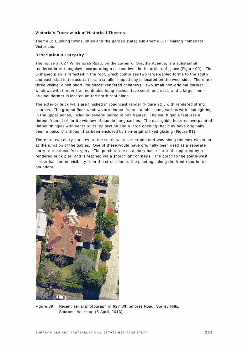
Victoria’s Framework of Historical Themes
Theme 6: Building towns, cities and the garden state; sub-theme 6.7: Making homes for Victorians.
Description & Integrity
The house at 627 Whitehorse Road, on the corner of Smythe Avenue, is a substantial rendered brick bungalow incorporating a second level in the attic roof space (Figure 90). The L-shaped plan is reflected in the roof, which comprises two large gabled forms to the south and east, clad in terracotta tiles; a smaller hipped bay is located on the west side. There are three visible, albeit short, roughcast rendered chimneys. Two small non-original dormer windows with timber-framed double hung sashes, face south and east; and a larger non-original dormer is located on the north roof plane.
The exterior brick walls are finished in roughcast render (Figure 91), with rendered string courses. The ground floor windows are timber-framed double-hung sashes with lead lighting in the upper panes, including several paired in box frames. The south gable features a timber-framed tripartite window of double hung sashes. The east gable features overpainted timber shingles with vents to its top section and a large opening that may have originally been a balcony although has been enclosed by non-original fixed glazing (Figure 91).
There are two entry porches, to the south-west corner and mid-way along the east elevation, at the junction of the gables. One of these would have originally been used as a separate entry to the doctor’s surgery. The porch to the east entry has a flat roof supported by a rendered brick pier, and is reached via a short flight of steps. The porch to the south-west corner has limited visibility from the street due to the plantings along the front (southern) boundary.
Figure 89 Recent aerial photograph of 627 Whitehorse Road, Surrey Hills. Source: Nearmap (5 April, 2013).
SURREY HI LLS AND CANTERBURY HI LL ESTATE HERITAGE STUDY 232
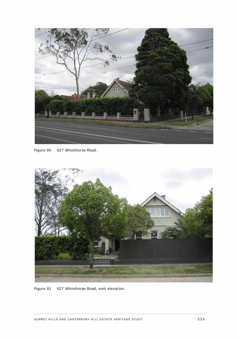
Figure 90 627 Whitehorse Road.
Figure 91 627 Whitehorse Road, east elevation.
SURREY HI LLS AND CANTERBURY HI LL ESTATE HERITAGE STUDY 233
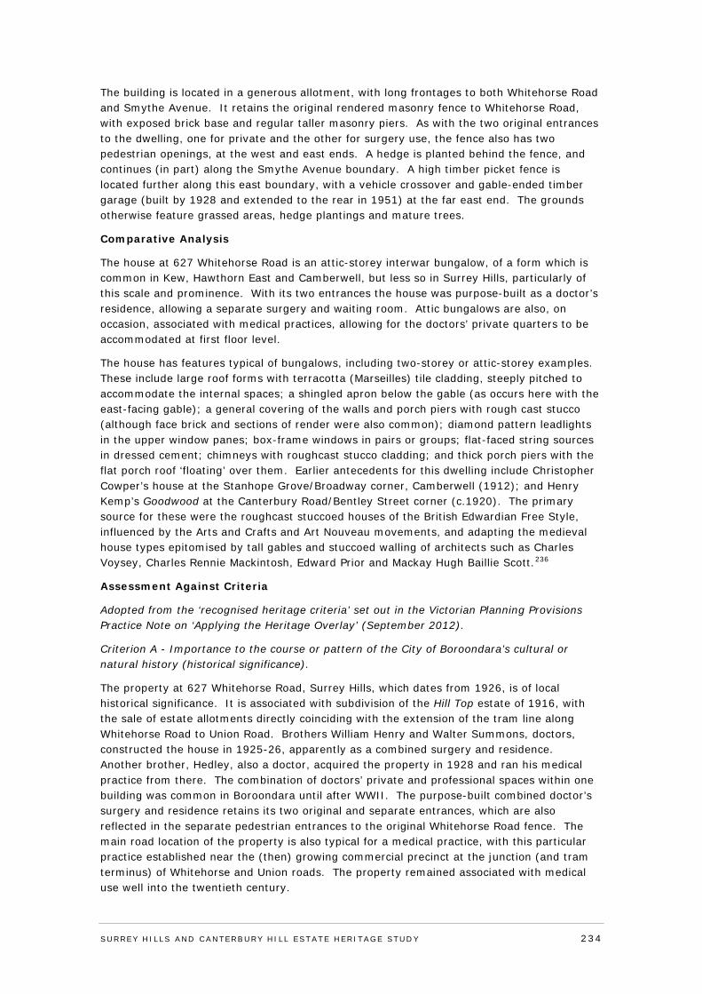
The building is located in a generous allotment, with long frontages to both Whitehorse Road and Smythe Avenue. It retains the original rendered masonry fence to Whitehorse Road, with exposed brick base and regular taller masonry piers. As with the two original entrances to the dwelling, one for private and the other for surgery use, the fence also has two pedestrian openings, at the west and east ends. A hedge is planted behind the fence, and continues (in part) along the Smythe Avenue boundary. A high timber picket fence is located further along this east boundary, with a vehicle crossover and gable-ended timber garage (built by 1928 and extended to the rear in 1951) at the far east end. The grounds otherwise feature grassed areas, hedge plantings and mature trees.
Comparative Analysis
The house at 627 Whitehorse Road is an attic-storey interwar bungalow, of a form which is common in Kew, Hawthorn East and Camberwell, but less so in Surrey Hills, particularly of this scale and prominence. With its two entrances the house was purpose-built as a doctor’s residence, allowing a separate surgery and waiting room. Attic bungalows are also, on occasion, associated with medical practices, allowing for the doctors’ private quarters to be accommodated at first floor level.
The house has features typical of bungalows, including two-storey or attic-storey examples. These include large roof forms with terracotta (Marseilles) tile cladding, steeply pitched to accommodate the internal spaces; a shingled apron below the gable (as occurs here with the east-facing gable); a general covering of the walls and porch piers with rough cast stucco (although face brick and sections of render were also common); diamond pattern leadlights in the upper window panes; box-frame windows in pairs or groups; flat-faced string sources in dressed cement; chimneys with roughcast stucco cladding; and thick porch piers with the flat porch roof ‘floating’ over them. Earlier antecedents for this dwelling include Christopher Cowper’s house at the Stanhope Grove/Broadway corner, Camberwell (1912); and Henry Kemp’s Goodwood at the Canterbury Road/Bentley Street corner (c.1920). The primary source for these were the roughcast stuccoed houses of the British Edwardian Free Style, influenced by the Arts and Crafts and Art Nouveau movements, and adapting the medieval house types epitomised by tall gables and stuccoed walling of architects such as Charles Voysey, Charles Rennie Mackintosh, Edward Prior and Mackay Hugh Baillie Scott.236
Assessment Against Criteria
Adopted from the ‘recognised heritage criteria’ set out in the Victorian Planning Provisions Practice Note on ‘Applying the Heritage Overlay’ (September 2012).
Criterion A - Importance to the course or pattern of the City of Boroondara’s cultural or natural history (historical significance).
The property at 627 Whitehorse Road, Surrey Hills, which dates from 1926, is of local historical significance. It is associated with subdivision of the Hill Top estate of 1916, with the sale of estate allotments directly coinciding with the extension of the tram line along Whitehorse Road to Union Road. Brothers William Henry and Walter Summons, doctors, constructed the house in 1925-26, apparently as a combined surgery and residence. Another brother, Hedley, also a doctor, acquired the property in 1928 and ran his medical practice from there. The combination of doctors’ private and professional spaces within one building was common in Boroondara until after WWII. The purpose-built combined doctor’s surgery and residence retains its two original and separate entrances, which are also reflected in the separate pedestrian entrances to the original Whitehorse Road fence. The main road location of the property is also typical for a medical practice, with this particular practice established near the (then) growing commercial precinct at the junction (and tram terminus) of Whitehorse and Union roads. The property remained associated with medical use well into the twentieth century.
SURREY HI LLS AND CANTERBURY HI LL ESTATE HERITAGE STUDY 234
Criterion B - Possession of uncommon rare or endangered aspects of the City of Boroondara’s cultural or natural history (rarity).
N/A
Criterion C - Potential to yield information that will contribute to an understanding of the City of Boroondara’s cultural or natural history (research potential).
N/A
Criterion D - Importance in demonstrating the principal characteristics of a class of cultural or natural places and environments (representativeness).
N/A Criterion E - Importance in exhibiting particular aesthetic characteristics (aesthetic significance).
The property at 627 Whitehorse Road, Surrey Hills, is of local aesthetic/architectural significance. It is a large and substantially externally intact interwar attic-storey bungalow, of a form and scale which is more common elsewhere in Boroondara but less so in Surrey Hills. The house has a range of features typical of bungalows, including two-storey or attic-storey examples. These include large gabled roof forms with Marseilles tile cladding, steeply pitched to accommodate internal spaces; a shingled apron below the gable (as occurs here with the east-facing gable); a general covering of the walls and porch piers with roughcast stucco or render; diamond pattern leadlights in upper window panes, within box-frame windows; flat-faced string sources in dressed cement; chimneys with roughcast stucco cladding; and thick porch piers with the flat porch roof ‘floating’ above. The house derives additional significance through its prominent siting and large allotment, and retention of all-over roughcast render, original fenestration and other original detailing.
Criterion F - Importance in demonstrating a high degree of creative or technical achievement at a particular period (technical significance).
N/A
Criterion G - Strong or special association with a particular community or cultural group for social, cultural or spiritual reasons. This includes the significance of a place to Indigenous peoples as part of their continuing and developing cultural traditions (social significance).
N/A
Criterion H - Special association with the life or works of a person, or group of persons, of importance in the City of Boroondara’s history (associative significance).
N/A
Statement of Significance
What is significant?
No 627 Whitehorse Road, Surrey Hills, dates from 1926 and is a substantial rendered brick bungalow incorporating a second (attic) level, and prominently sited at the corner of Whitehorse Road and Smythe Avenue. The roof comprises two large gables to the south and east, clad in terracotta tiles, and a smaller hipped bay on the west side. There are three visible, albeit short, roughcast rendered chimneys. The ground floor windows are timber-framed double-hung sashes with lead lighting to upper panes, including several paired windows in box frames. The south gable has a timber-framed tripartite window of double hung sashes. The east gable has timber shingles with vents to its top section, and a large opening that may have originally been a balcony, which was subsequently enclosed. Other non-original elements include two small dormer windows facing south and east, and a larger
SURREY HI LLS AND CANTERBURY HI LL ESTATE HERITAGE STUDY 235
dormer on the north roof plane. Two entry porches, to the south-west corner and mid-way along the east elevation, reflect the building’s original use as a combined doctor’s residence and surgery. The elevated porch to the east entry has a flat roof supported by a rendered brick pier. The building is located in a generous allotment, with long frontages to both Whitehorse Road and Smythe Avenue. It retains the original rendered masonry fence to Whitehorse Road, which also has two separate pedestrian entrances, one for private and the other (originally) for surgery use. Plantings include hedging, grassed areas and mature trees.
How is it significant?
The property at 627 Whitehorse Road, Surrey Hills, is of local historical and aesthetic/architectural significance to the City of Boroondara.
Why is it significant?
The property at 627 Whitehorse Road, Surrey Hills, dates from 1926, and is of local historical significance. It is associated with subdivision of the Hill Top estate of 1916, with the sale of estate allotments directly coinciding with the extension of the tram line along Whitehorse Road to Union Road. Brothers William Henry and Walter Summons, doctors, constructed the house in 1925-26, apparently as a combined surgery and residence. Another brother, Hedley, also a doctor, acquired the property in 1928 and ran his medical practice from there. The combination of doctors’ private and professional spaces within one building was common in Boroondara until after WWII. The purpose-built combined doctor’s surgery and residence retains its two original and separate entrances, which are also reflected in the separate pedestrian entrances to the original Whitehorse Road fence. The main road location of the property is also typical for a medical practice, with this particular practice established near the (then) growing commercial precinct at the junction (and tram terminus) of Whitehorse and Union roads. The property remained associated with medical use well into the twentieth century. The property is also of local aesthetic/architectural significance. It is a large and substantially externally intact interwar attic-storey bungalow, of a form and scale which is more common elsewhere in Boroondara but less so in Surrey Hills. The house has a range of features typical of bungalows, including two-storey or attic-storey examples. These include large gabled roof forms with Marseilles tile cladding, steeply pitched to accommodate internal spaces; a shingled apron below the gable (as occurs here with the east-facing gable); a general covering of the walls and porch piers with roughcast stucco or render; diamond pattern leadlights in upper window panes, within box-frame windows; flat-faced string sources in dressed cement; chimneys with roughcast stucco cladding; and thick porch piers with the flat porch roof ‘floating’ above. The house derives additional significance through its prominent siting and large allotment, and retention of all-over roughcast render, original fenestration and other original detailing.
Recommendations
Recommended for inclusion in the Schedule to the Heritage Overlay of the Boroondara Planning Scheme.
External paint controls No
Internal alteration controls No
Tree controls No
Outbuildings and fences not exempt under Clause 43.01-3 No
Included on the Victorian Heritage Register under the Heritage Act 1995
No
SURREY HI LLS AND CANTERBURY HI LL ESTATE HERITAGE STUDY 236
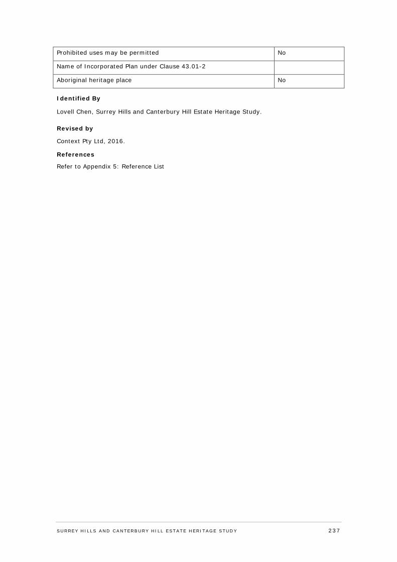
Prohibited uses may be permitted No
Name of Incorporated Plan under Clause 43.01-2
Aboriginal heritage place No
Identified By
Lovell Chen, Surrey Hills and Canterbury Hill Estate Heritage Study.
Revised by
Context Pty Ltd, 2016.
References
Refer to Appendix 5: Reference List
SURREY HI LLS AND CANTERBURY HI LL ESTATE HERITAGE STUDY 237
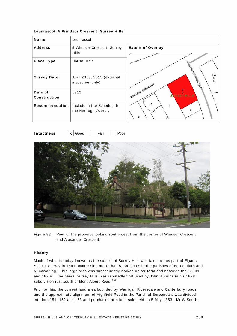
Leumascot, 5 Windsor Crescent, Surrey Hills
Name Leumascot
Address 5 Windsor Crescent, Surrey Hills
Extent of Overlay
Place Type House/ unit
Survey Date April 2013, 2015 (external inspection only)
Date of Construction
1913
Recommendation Include in the Schedule to the Heritage Overlay
Intactness X Good Fair Poor
Figure 92 View of the property looking south-west from the corner of Windsor Crescent and Alexander Crescent.
History
Much of what is today known as the suburb of Surrey Hills was taken up as part of Elgar’s Special Survey in 1841, comprising more than 5,000 acres in the parishes of Boroondara and Nunawading. This large area was subsequently broken up for farmland between the 1850s and 1870s. The name ‘Surrey Hills’ was reputedly first used by John H Knipe in his 1878 subdivision just south of Mont Albert Road.237
Prior to this, the current land area bounded by Warrigal, Riversdale and Canterbury roads and the approximate alignment of Highfield Road in the Parish of Boroondara was divided into lots 151, 152 and 153 and purchased at a land sale held on 5 May 1853. Mr W Smith
SURREY HI LLS AND CANTERBURY HI LL ESTATE HERITAGE STUDY 238
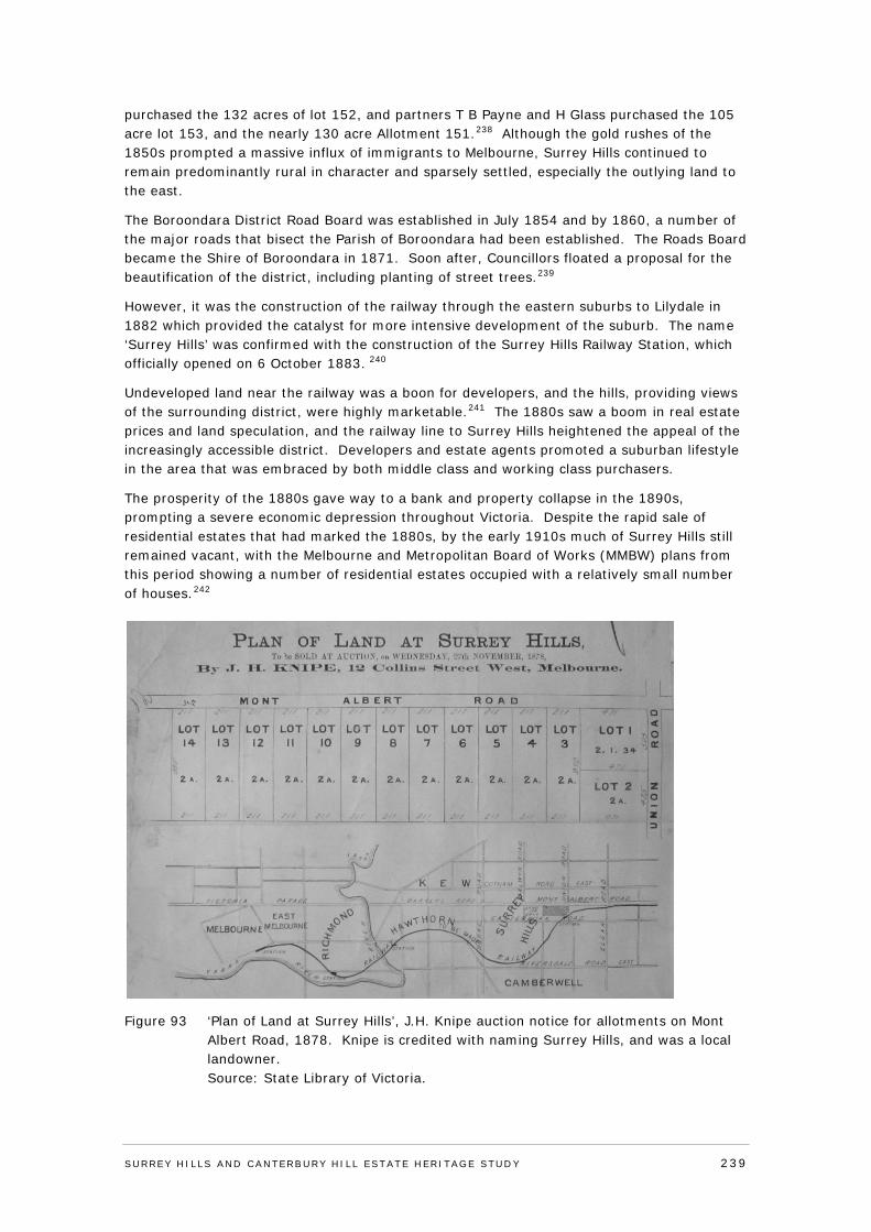
purchased the 132 acres of lot 152, and partners T B Payne and H Glass purchased the 105 acre lot 153, and the nearly 130 acre Allotment 151.238 Although the gold rushes of the 1850s prompted a massive influx of immigrants to Melbourne, Surrey Hills continued to remain predominantly rural in character and sparsely settled, especially the outlying land to the east.
The Boroondara District Road Board was established in July 1854 and by 1860, a number of the major roads that bisect the Parish of Boroondara had been established. The Roads Board became the Shire of Boroondara in 1871. Soon after, Councillors floated a proposal for the beautification of the district, including planting of street trees.239
However, it was the construction of the railway through the eastern suburbs to Lilydale in 1882 which provided the catalyst for more intensive development of the suburb. The name ‘Surrey Hills’ was confirmed with the construction of the Surrey Hills Railway Station, which officially opened on 6 October 1883. 240
Undeveloped land near the railway was a boon for developers, and the hills, providing views of the surrounding district, were highly marketable.241 The 1880s saw a boom in real estate prices and land speculation, and the railway line to Surrey Hills heightened the appeal of the increasingly accessible district. Developers and estate agents promoted a suburban lifestyle in the area that was embraced by both middle class and working class purchasers.
The prosperity of the 1880s gave way to a bank and property collapse in the 1890s, prompting a severe economic depression throughout Victoria. Despite the rapid sale of residential estates that had marked the 1880s, by the early 1910s much of Surrey Hills still remained vacant, with the Melbourne and Metropolitan Board of Works (MMBW) plans from this period showing a number of residential estates occupied with a relatively small number of houses.242
Figure 93 ‘Plan of Land at Surrey Hills’, J.H. Knipe auction notice for allotments on Mont Albert Road, 1878. Knipe is credited with naming Surrey Hills, and was a local landowner. Source: State Library of Victoria.
SURREY HI LLS AND CANTERBURY HI LL ESTATE HERITAGE STUDY 239
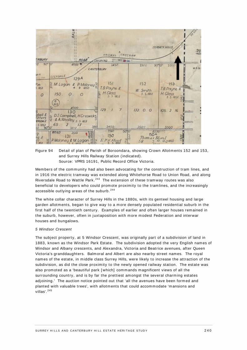
Figure 94 Detail of plan of Parish of Boroondara, showing Crown Allotments 152 and 153, and Surrey Hills Railway Station (indicated). Source: VPRS 16191, Public Record Office Victoria.
Members of the community had also been advocating for the construction of tram lines, and in 1916 the electric tramway was extended along Whitehorse Road to Union Road, and along Riversdale Road to Wattle Park.243 The extension of these tramway routes was also beneficial to developers who could promote proximity to the tramlines, and the increasingly accessible outlying areas of the suburb.244
The white collar character of Surrey Hills in the 1880s, with its genteel housing and large garden allotments, began to give way to a more densely populated residential suburb in the first half of the twentieth century. Examples of earlier and often larger houses remained in the suburb, however, often in juxtaposition with more modest Federation and interwar houses and bungalows.
5 Windsor Crescent
The subject property, at 5 Windsor Crescent, was originally part of a subdivision of land in 1883, known as the Windsor Park Estate. The subdivision adopted the very English names of Windsor and Albany crescents, and Alexandra, Victoria and Beatrice avenues, after Queen Victoria’s granddaughters. Balmoral and Albert are also nearby street names. The royal names of the estate, in middle class Surrey Hills, were likely to increase the attraction of the subdivision, as did the close proximity to the newly opened railway station. The estate was also promoted as a ‘beautiful park [which] commands magnificent views of all the surrounding country, and is by far the prettiest amongst the several charming estates adjoining.’ The auction notice pointed out that ‘all the avenues have been formed and planted with valuable trees’, with allotments that could accommodate ‘mansions and villas’.245
SURREY HI LLS AND CANTERBURY HI LL ESTATE HERITAGE STUDY 240
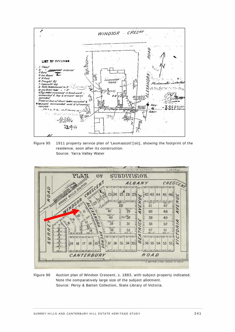
Figure 95 1911 property service plan of ‘Leumascott’[sic], showing the footprint of the residence, soon after its construction. Source: Yarra Valley Water
Figure 96 Auction plan of Windsor Crescent, c. 1883, with subject property indicated. Note the comparatively large size of the subject allotment. Source: Percy & Batten Collection, State Library of Victoria.
SURREY HI LLS AND CANTERBURY HI LL ESTATE HERITAGE STUDY 241
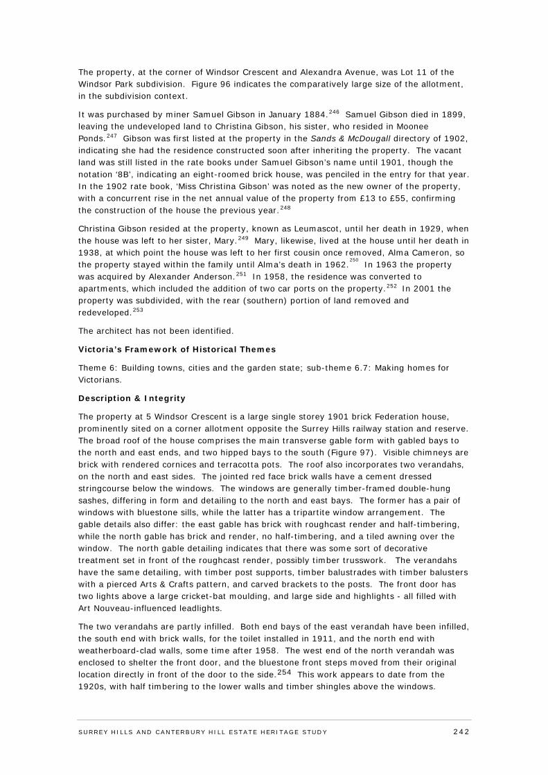
The property, at the corner of Windsor Crescent and Alexandra Avenue, was Lot 11 of the Windsor Park subdivision. Figure 96 indicates the comparatively large size of the allotment, in the subdivision context.
It was purchased by miner Samuel Gibson in January 1884.246 Samuel Gibson died in 1899, leaving the undeveloped land to Christina Gibson, his sister, who resided in Moonee Ponds.247 Gibson was first listed at the property in the Sands & McDougall directory of 1902, indicating she had the residence constructed soon after inheriting the property. The vacant land was still listed in the rate books under Samuel Gibson’s name until 1901, though the notation ‘8B’, indicating an eight-roomed brick house, was penciled in the entry for that year. In the 1902 rate book, ‘Miss Christina Gibson’ was noted as the new owner of the property, with a concurrent rise in the net annual value of the property from £13 to £55, confirming the construction of the house the previous year.248
Christina Gibson resided at the property, known as Leumascot, until her death in 1929, when the house was left to her sister, Mary.249 Mary, likewise, lived at the house until her death in 1938, at which point the house was left to her first cousin once removed, Alma Cameron, so the property stayed within the family until Alma’s death in 1962.
250 In 1963 the property
was acquired by Alexander Anderson.251 In 1958, the residence was converted to apartments, which included the addition of two car ports on the property.252 In 2001 the property was subdivided, with the rear (southern) portion of land removed and redeveloped.253
The architect has not been identified.
Victoria’s Framework of Historical Themes
Theme 6: Building towns, cities and the garden state; sub-theme 6.7: Making homes for Victorians.
Description & Integrity
The property at 5 Windsor Crescent is a large single storey 1901 brick Federation house, prominently sited on a corner allotment opposite the Surrey Hills railway station and reserve. The broad roof of the house comprises the main transverse gable form with gabled bays to the north and east ends, and two hipped bays to the south (Figure 97). Visible chimneys are brick with rendered cornices and terracotta pots. The roof also incorporates two verandahs, on the north and east sides. The jointed red face brick walls have a cement dressed stringcourse below the windows. The windows are generally timber-framed double-hung sashes, differing in form and detailing to the north and east bays. The former has a pair of windows with bluestone sills, while the latter has a tripartite window arrangement. The gable details also differ: the east gable has brick with roughcast render and half-timbering, while the north gable has brick and render, no half-timbering, and a tiled awning over the window. The north gable detailing indicates that there was some sort of decorative treatment set in front of the roughcast render, possibly timber trusswork. The verandahs have the same detailing, with timber post supports, timber balustrades with timber balusters with a pierced Arts & Crafts pattern, and carved brackets to the posts. The front door has two lights above a large cricket-bat moulding, and large side and highlights - all filled with Art Nouveau-influenced leadlights.
The two verandahs are partly infilled. Both end bays of the east verandah have been infilled, the south end with brick walls, for the toilet installed in 1911, and the north end with weatherboard-clad walls, some time after 1958. The west end of the north verandah was enclosed to shelter the front door, and the bluestone front steps moved from their original location directly in front of the door to the side.254 This work appears to date from the 1920s, with half timbering to the lower walls and timber shingles above the windows.
SURREY HI LLS AND CANTERBURY HI LL ESTATE HERITAGE STUDY 242
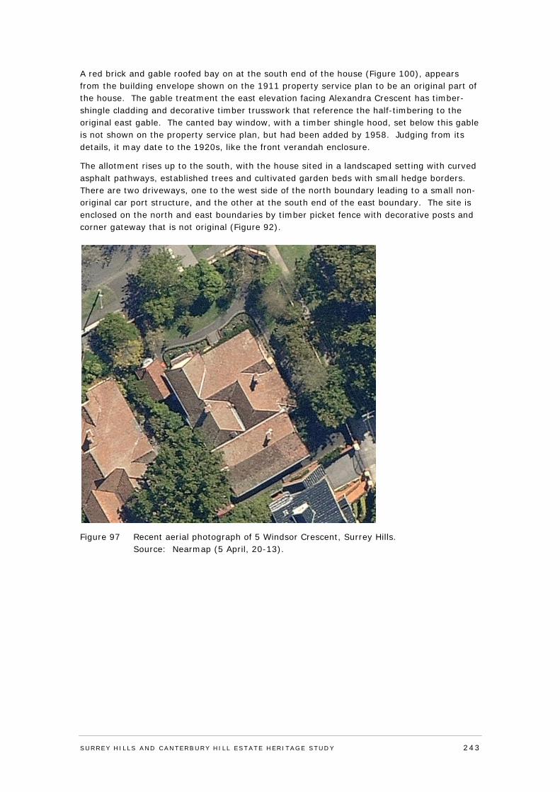
A red brick and gable roofed bay on at the south end of the house (Figure 100), appears from the building envelope shown on the 1911 property service plan to be an original part of the house. The gable treatment the east elevation facing Alexandra Crescent has timber-shingle cladding and decorative timber trusswork that reference the half-timbering to the original east gable. The canted bay window, with a timber shingle hood, set below this gable is not shown on the property service plan, but had been added by 1958. Judging from its details, it may date to the 1920s, like the front verandah enclosure.
The allotment rises up to the south, with the house sited in a landscaped setting with curved asphalt pathways, established trees and cultivated garden beds with small hedge borders. There are two driveways, one to the west side of the north boundary leading to a small non-original car port structure, and the other at the south end of the east boundary. The site is enclosed on the north and east boundaries by timber picket fence with decorative posts and corner gateway that is not original (Figure 92).
Figure 97 Recent aerial photograph of 5 Windsor Crescent, Surrey Hills. Source: Nearmap (5 April, 20-13).
SURREY HI LLS AND CANTERBURY HI LL ESTATE HERITAGE STUDY 243
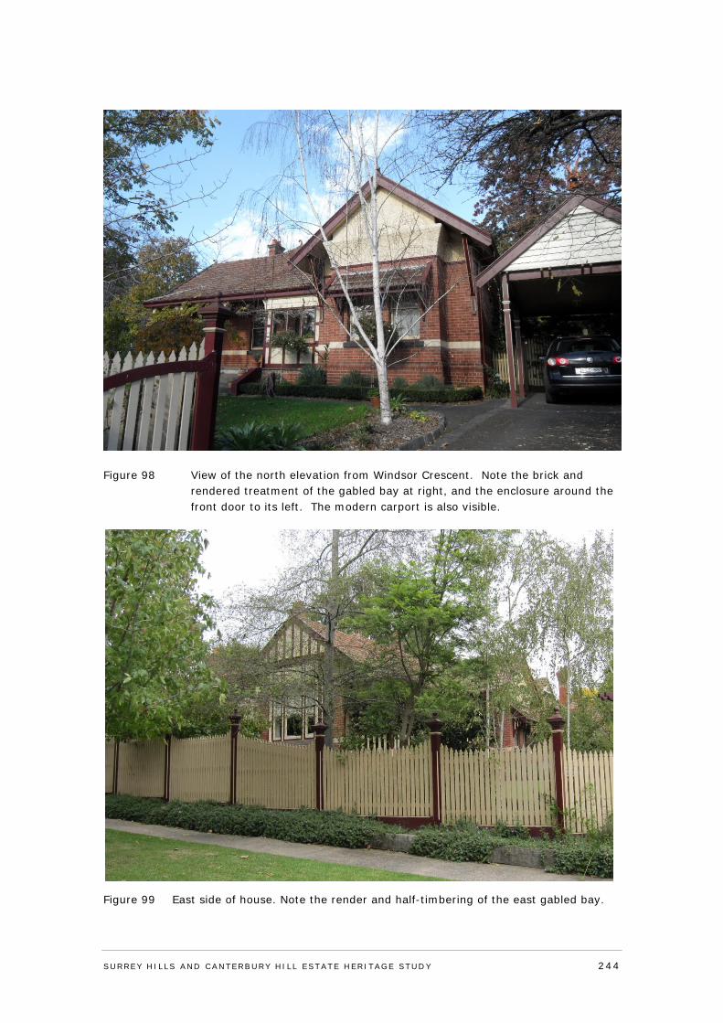
Figure 98 View of the north elevation from Windsor Crescent. Note the brick and rendered treatment of the gabled bay at right, and the enclosure around the front door to its left. The modern carport is also visible.
Figure 99 East side of house. Note the render and half-timbering of the east gabled bay.
SURREY HI LLS AND CANTERBURY HI LL ESTATE HERITAGE STUDY 244
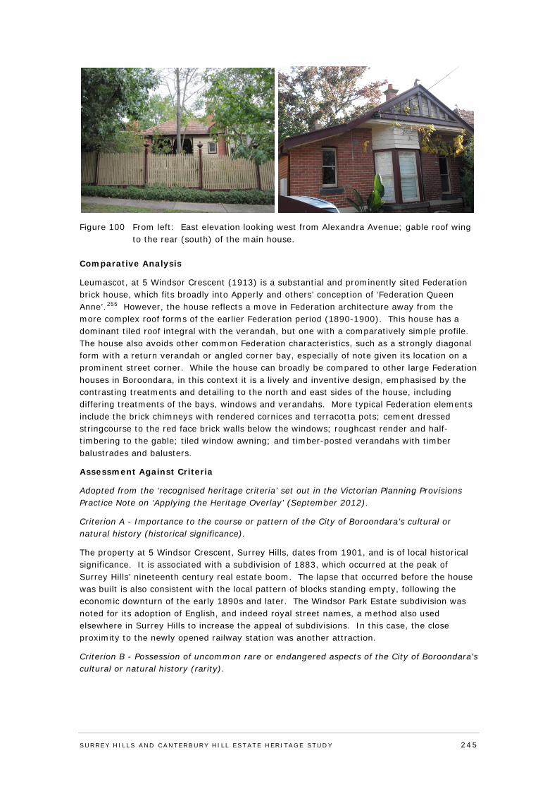
Figure 100 From left: East elevation looking west from Alexandra Avenue; gable roof wing to the rear (south) of the main house.
Comparative Analysis
Leumascot, at 5 Windsor Crescent (1913) is a substantial and prominently sited Federation brick house, which fits broadly into Apperly and others’ conception of ‘Federation Queen Anne’.255 However, the house reflects a move in Federation architecture away from the more complex roof forms of the earlier Federation period (1890-1900). This house has a dominant tiled roof integral with the verandah, but one with a comparatively simple profile. The house also avoids other common Federation characteristics, such as a strongly diagonal form with a return verandah or angled corner bay, especially of note given its location on a prominent street corner. While the house can broadly be compared to other large Federation houses in Boroondara, in this context it is a lively and inventive design, emphasised by the contrasting treatments and detailing to the north and east sides of the house, including differing treatments of the bays, windows and verandahs. More typical Federation elements include the brick chimneys with rendered cornices and terracotta pots; cement dressed stringcourse to the red face brick walls below the windows; roughcast render and half-timbering to the gable; tiled window awning; and timber-posted verandahs with timber balustrades and balusters.
Assessment Against Criteria
Adopted from the ‘recognised heritage criteria’ set out in the Victorian Planning Provisions Practice Note on ‘Applying the Heritage Overlay’ (September 2012).
Criterion A - Importance to the course or pattern of the City of Boroondara’s cultural or natural history (historical significance).
The property at 5 Windsor Crescent, Surrey Hills, dates from 1901, and is of local historical significance. It is associated with a subdivision of 1883, which occurred at the peak of Surrey Hills’ nineteenth century real estate boom. The lapse that occurred before the house was built is also consistent with the local pattern of blocks standing empty, following the economic downturn of the early 1890s and later. The Windsor Park Estate subdivision was noted for its adoption of English, and indeed royal street names, a method also used elsewhere in Surrey Hills to increase the appeal of subdivisions. In this case, the close proximity to the newly opened railway station was another attraction.
Criterion B - Possession of uncommon rare or endangered aspects of the City of Boroondara’s cultural or natural history (rarity).
SURREY HI LLS AND CANTERBURY HI LL ESTATE HERITAGE STUDY 245
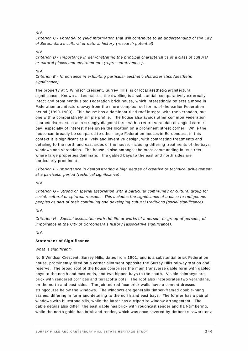
N/A Criterion C - Potential to yield information that will contribute to an understanding of the City of Boroondara’s cultural or natural history (research potential).
N/A Criterion D - Importance in demonstrating the principal characteristics of a class of cultural or natural places and environments (representativeness).
N/A Criterion E - Importance in exhibiting particular aesthetic characteristics (aesthetic significance).
The property at 5 Windsor Crescent, Surrey Hills, is of local aesthetic/architectural significance. Known as Leumascot, the dwelling is a substantial, comparatively externally intact and prominently sited Federation brick house, which interestingly reflects a move in Federation architecture away from the more complex roof forms of the earlier Federation period (1890-1900). This house has a dominant tiled roof integral with the verandah, but one with a comparatively simple profile. The house also avoids other common Federation characteristics, such as a strongly diagonal form with a return verandah or angled corner bay, especially of interest here given the location on a prominent street corner. While the house can broadly be compared to other large Federation houses in Boroondara, in this context it is significant as a lively and inventive design, with contrasting treatments and detailing to the north and east sides of the house, including differing treatments of the bays, windows and verandahs. The house is also amongst the most commanding in its street, where large properties dominate. The gabled bays to the east and north sides are particularly prominent.
Criterion F - Importance in demonstrating a high degree of creative or technical achievement at a particular period (technical significance).
N/A
Criterion G - Strong or special association with a particular community or cultural group for social, cultural or spiritual reasons. This includes the significance of a place to Indigenous peoples as part of their continuing and developing cultural traditions (social significance).
N/A
Criterion H - Special association with the life or works of a person, or group of persons, of importance in the City of Boroondara’s history (associative significance).
N/A
Statement of Significance
What is significant?
No 5 Windsor Crescent, Surrey Hills, dates from 1901, and is a substantial brick Federation house, prominently sited on a corner allotment opposite the Surrey Hills railway station and reserve. The broad roof of the house comprises the main transverse gable form with gabled bays to the north and east ends, and two hipped bays to the south. Visible chimneys are brick with rendered cornices and terracotta pots. The roof also incorporates two verandahs, on the north and east sides. The jointed red face brick walls have a cement dressed stringcourse below the windows. The windows are generally timber-framed double-hung sashes, differing in form and detailing to the north and east bays. The former has a pair of windows with bluestone sills, while the latter has a tripartite window arrangement. The gable details also differ; the east gable has brick with roughcast render and half-timbering, while the north gable has brick and render, which was once covered by timber trusswork or a
SURREY HI LLS AND CANTERBURY HI LL ESTATE HERITAGE STUDY 246
similar treatment, and a tiled awning over the window. The verandahs have the same detailing,with timber post supports, timber balustrades with timber balusters with a pierced Arts & Crafts pattern, and carved brackets to the posts. The front door has two lights above a large cricket-bat moulding, and large side and highlights – all filled with Art Nouveau-influenced leadlights. The north verandah was partially infilled, c.1920s, with half-timbered and shingled walls to create an enclosed entry. The bluestone front steps were moved at this time. A red brick and gable roofed bay at the south end of the house has a timber and shingled gable treatment set above a canted bay window which may also be a c1920s alteration. The allotment rises up to the south, with the house sited in a landscaped setting with curved asphalt pathways, established trees and cultivated garden beds with hedge borders. There are two driveways, one to the west side of the north boundary leading to a small non-original car port structure, and the other at the south end of the east boundary. The site is enclosed on the north and east boundaries by a non-original timber picket fence with decorative posts and corner gateway.
How is it significant?
The property at 5 Windsor Crescent, Surrey Hills, is of local historical and aesthetic/architectural significance to the City of Boroondara.
Why is it significant?
The property, known as Leumascot at 5 Windsor Crescent, Surrey Hills, dates from 1913, and is of local historical significance. It is associated with a subdivision of 1883, which occurred at the peak of Surrey Hills’ nineteenth century real estate boom. The lapse that occurred before the house was built is also consistent with the local pattern of blocks standing empty, following the economic downturn of the early 1890s and later. The Windsor Park Estate subdivision was noted for its adoption of English, and indeed royal street names, a method also used elsewhere in Surrey Hills to increase the appeal of subdivisions. No 5 Windsor Crescent is also of local aesthetic/architectural significance. The dwelling is a substantial, comparatively externally intact and prominently sited Federation brick house, which interestingly reflects a move in Federation architecture away from the more complex roof forms of the earlier Federation period (1890-1900). This house has a dominant tiled roof integral with the verandah, but one with a comparatively simple profile. The house also avoids other common Federation characteristics, such as a strongly diagonal form with a return verandah or angled corner bay, especially of interest here given the location on a prominent street corner. While the house can broadly be compared to other large Federation houses in Boroondara, in this context it is significant as a lively and inventive design, with contrasting treatments and detailing to the north and east sides of the house, including differing treatments of the bays, windows and verandahs. The house is also amongst the most commanding in its street, where large properties dominate. The gabled bays to the east and north sides are particularly prominent.
Recommendations
Recommended for inclusion in the Schedule to the Heritage Overlay of the Boroondara Planning Scheme.
External paint controls No
Internal alteration controls No
Tree controls No
Outbuildings and fences not exempt under Clause 43.01-3 No
Included on the Victorian Heritage Register under the Heritage Act No
SURREY HI LLS AND CANTERBURY HI LL ESTATE HERITAGE STUDY 247
1995
Prohibited uses may be permitted No
Name of Incorporated Plan under Clause 43.01-2
Aboriginal heritage place No
Identified By
Lovell Chen, Surrey Hills and Canterbury Hill Estate Heritage Study.
Revised by
Context Pty Ltd, 2016.
References
Refer to Appendix 5: Reference List
SURREY HI LLS AND CANTERBURY HI LL ESTATE HERITAGE STUDY 248
APPENDIX 3: STAGE 2 HERITAGE CITATIONS - PRECINCTS
SURREY HI LLS AND CANTERBURY HI LL ESTATE HERITAGE STUDY 249
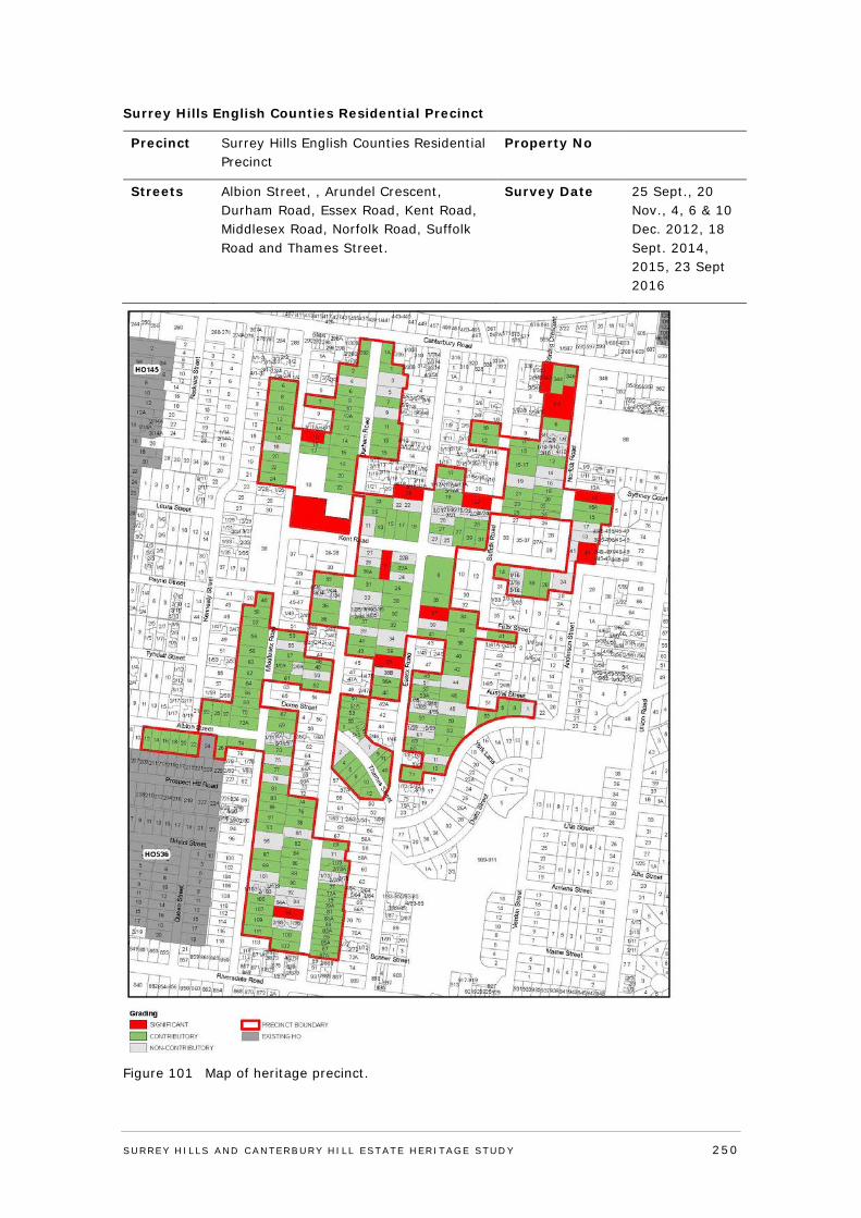
Surrey Hills English Counties Residential Precinct
Precinct Surrey Hills English Counties Residential Precinct
Property No
Streets Albion Street, , Arundel Crescent, Durham Road, Essex Road, Kent Road, Middlesex Road, Norfolk Road, Suffolk Road and Thames Street.
Survey Date 25 Sept., 20 Nov., 4, 6 & 10 Dec. 2012, 18 Sept. 2014, 2015, 23 Sept 2016
Figure 101 Map of heritage precinct.
SURREY HI LLS AND CANTERBURY HI LL ESTATE HERITAGE STUDY 250
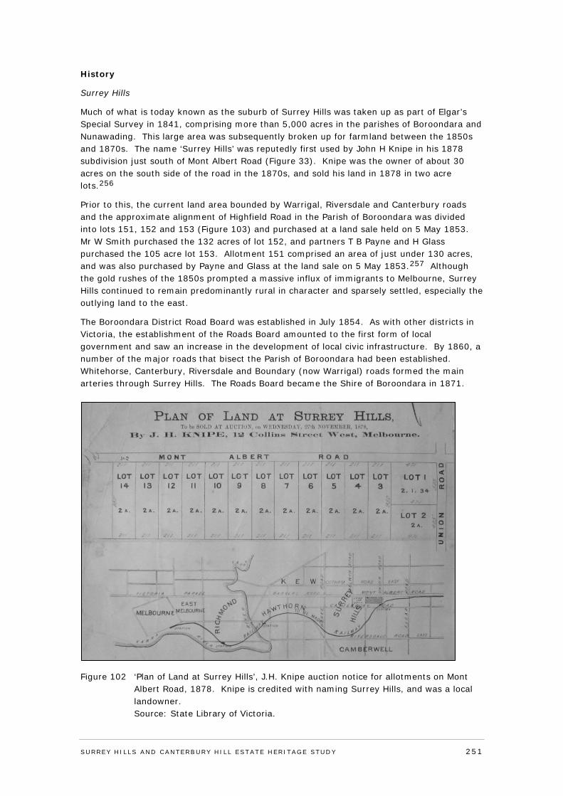
History
Surrey Hills
Much of what is today known as the suburb of Surrey Hills was taken up as part of Elgar’s Special Survey in 1841, comprising more than 5,000 acres in the parishes of Boroondara and Nunawading. This large area was subsequently broken up for farmland between the 1850s and 1870s. The name ‘Surrey Hills’ was reputedly first used by John H Knipe in his 1878 subdivision just south of Mont Albert Road (Figure 33). Knipe was the owner of about 30 acres on the south side of the road in the 1870s, and sold his land in 1878 in two acre lots.256
Prior to this, the current land area bounded by Warrigal, Riversdale and Canterbury roads and the approximate alignment of Highfield Road in the Parish of Boroondara was divided into lots 151, 152 and 153 (Figure 103) and purchased at a land sale held on 5 May 1853. Mr W Smith purchased the 132 acres of lot 152, and partners T B Payne and H Glass purchased the 105 acre lot 153. Allotment 151 comprised an area of just under 130 acres, and was also purchased by Payne and Glass at the land sale on 5 May 1853.257 Although the gold rushes of the 1850s prompted a massive influx of immigrants to Melbourne, Surrey Hills continued to remain predominantly rural in character and sparsely settled, especially the outlying land to the east.
The Boroondara District Road Board was established in July 1854. As with other districts in Victoria, the establishment of the Roads Board amounted to the first form of local government and saw an increase in the development of local civic infrastructure. By 1860, a number of the major roads that bisect the Parish of Boroondara had been established. Whitehorse, Canterbury, Riversdale and Boundary (now Warrigal) roads formed the main arteries through Surrey Hills. The Roads Board became the Shire of Boroondara in 1871.
Figure 102 ‘Plan of Land at Surrey Hills’, J.H. Knipe auction notice for allotments on Mont Albert Road, 1878. Knipe is credited with naming Surrey Hills, and was a local landowner.
Source: State Library of Victoria.
SURREY HI LLS AND CANTERBURY HI LL ESTATE HERITAGE STUDY 251
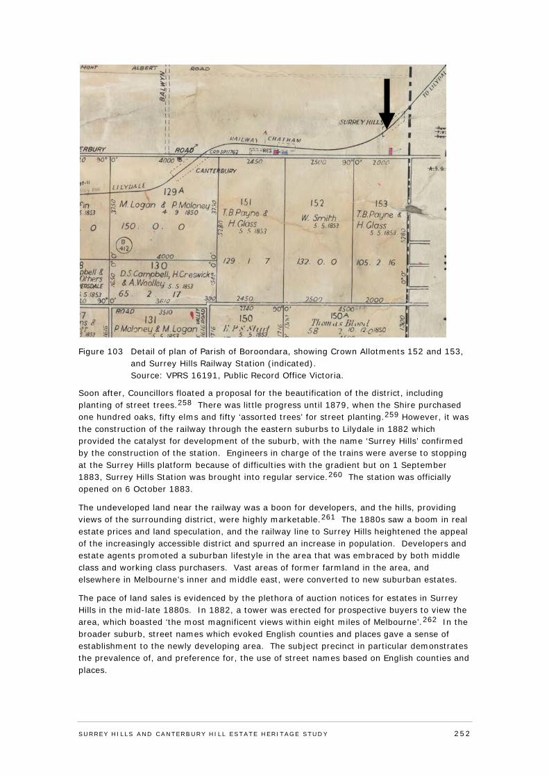
Figure 103 Detail of plan of Parish of Boroondara, showing Crown Allotments 152 and 153, and Surrey Hills Railway Station (indicated).
Source: VPRS 16191, Public Record Office Victoria.
Soon after, Councillors floated a proposal for the beautification of the district, including planting of street trees.258 There was little progress until 1879, when the Shire purchased one hundred oaks, fifty elms and fifty ‘assorted trees’ for street planting.259 However, it was the construction of the railway through the eastern suburbs to Lilydale in 1882 which provided the catalyst for development of the suburb, with the name ‘Surrey Hills’ confirmed by the construction of the station. Engineers in charge of the trains were averse to stopping at the Surrey Hills platform because of difficulties with the gradient but on 1 September 1883, Surrey Hills Station was brought into regular service.260 The station was officially opened on 6 October 1883.
The undeveloped land near the railway was a boon for developers, and the hills, providing views of the surrounding district, were highly marketable.261 The 1880s saw a boom in real estate prices and land speculation, and the railway line to Surrey Hills heightened the appeal of the increasingly accessible district and spurred an increase in population. Developers and estate agents promoted a suburban lifestyle in the area that was embraced by both middle class and working class purchasers. Vast areas of former farmland in the area, and elsewhere in Melbourne’s inner and middle east, were converted to new suburban estates.
The pace of land sales is evidenced by the plethora of auction notices for estates in Surrey Hills in the mid-late 1880s. In 1882, a tower was erected for prospective buyers to view the area, which boasted ‘the most magnificent views within eight miles of Melbourne’.262 In the broader suburb, street names which evoked English counties and places gave a sense of establishment to the newly developing area. The subject precinct in particular demonstrates the prevalence of, and preference for, the use of street names based on English counties and places.
SURREY HI LLS AND CANTERBURY HI LL ESTATE HERITAGE STUDY 252

Figure 104 Surrey Hills Station in 1889. Source: VPRS 12800/P1, H4365, Public Record Office Victoria.
The prosperity of the 1880s gave way to a bank and property collapse in the 1890s, prompting a severe economic depression throughout Victoria. Despite the rapid sale of residential estates that had marked the 1880s, by 1909 the majority of land at Surrey Hills still remained vacant. As a consequence, many of the home sites sold were to remain unimproved until after World War I, with development radiating out from the hub of the Surrey Hills railway station. Melbourne and Metropolitan Board of Works (MMBW) plans from 1909 show that a number of residential estates remain completely undeveloped or punctuated with isolated residential construction. Members of the community had also been advocating for the construction of a tram line, and in 1916 the electric tramway was extended along Whitehorse Road from Boundary Road (now Warrigal Road).263 The line was later extended to Elgar Road in 1925.264 The construction of the electric tramway was also beneficial to developers. The outlying areas of the suburb were now increasingly accessible and auctioneers promoted proximity to the tramline.265
The white collar character of Surrey Hills in the 1880s, with its genteel housing and large allotments, began to give way to a more densely populated residential suburb. Surrey Hills was also earmarked for the construction of homes for returning World War I soldiers. The relatively large proportion of vacant land remaining in the suburb meant it was readily available for the rapid development required by the War Services Board. In September 1919 the Argus reported that of the earliest war service homes constructed in the state, ten were to be built in Surrey Hills.266 However, development slowed as the depression took hold near the end of the 1920s. Despite its seeming middle class security and the relative wealth of residents who mostly owned their own homes, the impact of the depression was still felt in Surrey Hills. By the early 1930s about 50,000 people lived in the municipality - and approximately one quarter of these was unemployed.267
During the 1930s, growth in Surrey Hills slowed in comparison to the previous decade, but the population of the wider municipality still grew to 69,000 by 1941.268 After World War 2, while post-war migration had some impact on the predominantly Anglo-Celtic population
SURREY HI LLS AND CANTERBURY HI LL ESTATE HERITAGE STUDY 253
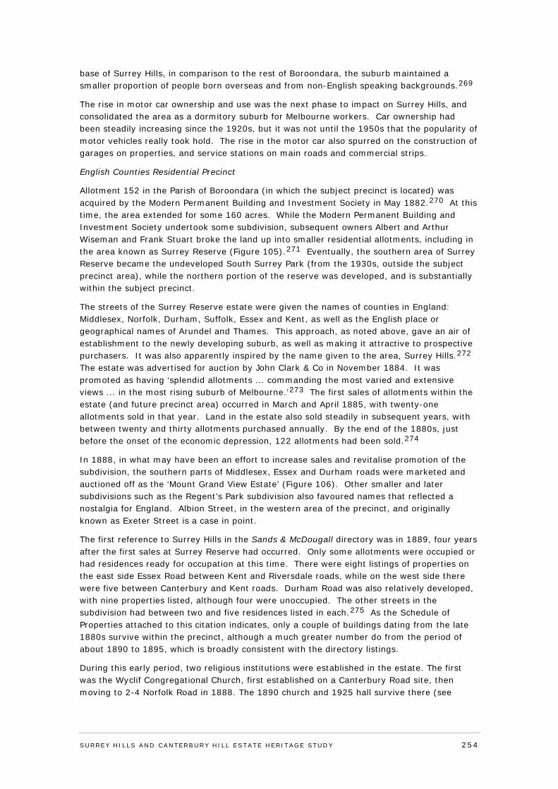
base of Surrey Hills, in comparison to the rest of Boroondara, the suburb maintained a smaller proportion of people born overseas and from non-English speaking backgrounds.269
The rise in motor car ownership and use was the next phase to impact on Surrey Hills, and consolidated the area as a dormitory suburb for Melbourne workers. Car ownership had been steadily increasing since the 1920s, but it was not until the 1950s that the popularity of motor vehicles really took hold. The rise in the motor car also spurred on the construction of garages on properties, and service stations on main roads and commercial strips.
English Counties Residential Precinct
Allotment 152 in the Parish of Boroondara (in which the subject precinct is located) was acquired by the Modern Permanent Building and Investment Society in May 1882.270 At this time, the area extended for some 160 acres. While the Modern Permanent Building and Investment Society undertook some subdivision, subsequent owners Albert and Arthur Wiseman and Frank Stuart broke the land up into smaller residential allotments, including in the area known as Surrey Reserve (Figure 105).271 Eventually, the southern area of Surrey Reserve became the undeveloped South Surrey Park (from the 1930s, outside the subject precinct area), while the northern portion of the reserve was developed, and is substantially within the subject precinct.
The streets of the Surrey Reserve estate were given the names of counties in England: Middlesex, Norfolk, Durham, Suffolk, Essex and Kent, as well as the English place or geographical names of Arundel and Thames. This approach, as noted above, gave an air of establishment to the newly developing suburb, as well as making it attractive to prospective purchasers. It was also apparently inspired by the name given to the area, Surrey Hills.272 The estate was advertised for auction by John Clark & Co in November 1884. It was promoted as having ‘splendid allotments ... commanding the most varied and extensive views ... in the most rising suburb of Melbourne.’273 The first sales of allotments within the estate (and future precinct area) occurred in March and April 1885, with twenty-one allotments sold in that year. Land in the estate also sold steadily in subsequent years, with between twenty and thirty allotments purchased annually. By the end of the 1880s, just before the onset of the economic depression, 122 allotments had been sold.274
In 1888, in what may have been an effort to increase sales and revitalise promotion of the subdivision, the southern parts of Middlesex, Essex and Durham roads were marketed and auctioned off as the ‘Mount Grand View Estate’ (Figure 106). Other smaller and later subdivisions such as the Regent’s Park subdivision also favoured names that reflected a nostalgia for England. Albion Street, in the western area of the precinct, and originally known as Exeter Street is a case in point.
The first reference to Surrey Hills in the Sands & McDougall directory was in 1889, four years after the first sales at Surrey Reserve had occurred. Only some allotments were occupied or had residences ready for occupation at this time. There were eight listings of properties on the east side Essex Road between Kent and Riversdale roads, while on the west side there were five between Canterbury and Kent roads. Durham Road was also relatively developed, with nine properties listed, although four were unoccupied. The other streets in the subdivision had between two and five residences listed in each.275 As the Schedule of Properties attached to this citation indicates, only a couple of buildings dating from the late 1880s survive within the precinct, although a much greater number do from the period of about 1890 to 1895, which is broadly consistent with the directory listings.
During this early period, two religious institutions were established in the estate. The first was the Wyclif Congregational Church, first established on a Canterbury Road site, then moving to 2-4 Norfolk Road in 1888. The 1890 church and 1925 hall survive there (see
SURREY HI LLS AND CANTERBURY HI LL ESTATE HERITAGE STUDY 254
individual citation). St Joseph’s Home for Destitute Children was established in a large brick building at the corner of Kent and Middlesex roads in 1890 (see individual citation).
Despite the successful sale of residential lots within the precinct area in the 1880s, the majority of home sites were still undeveloped due to the 1890s depression, and largely remained so until the early years of the twentieth century. Houses were then built in the 1900s and 1910s, with development again slowed by World War One, and then followed by the typical – for Surrey Hills and parts of Boroondara - post-war burst. There are numerous houses in the precinct from the latter period, being built from the 1920s through to c.1940. The 1909 MMBW detail plans at Figure 107 and Figure 108 show the north-western and north-eastern areas of the precinct, with the latter area slightly more developed at this time. Albion Street – originally named Exeter Street - was developed from the 1910s. Figure 109 and Figure 110, MMBW detail plans from 1927 and 1925 respectively, illustrate the increasing development in this period, in the middle and southern areas of the precinct.
Figure 105 Plan of Surrey Reserve, showing allotments in northern portion of subdivision. Note plan has been rotated; north is at top, c. 1885.
Source: State Library of Victoria.
SURREY HI LLS AND CANTERBURY HI LL ESTATE HERITAGE STUDY 255
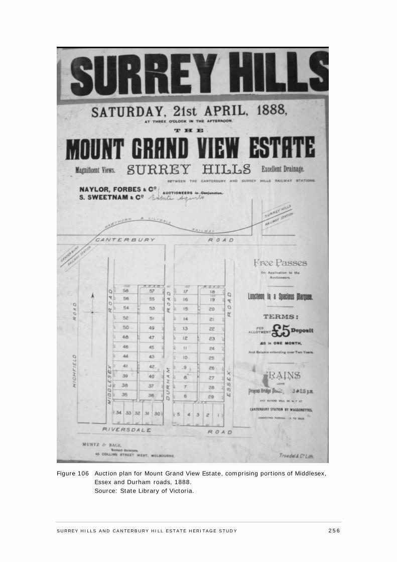
Figure 106 Auction plan for Mount Grand View Estate, comprising portions of Middlesex, Essex and Durham roads, 1888.
Source: State Library of Victoria.
SURREY HI LLS AND CANTERBURY HI LL ESTATE HERITAGE STUDY 256
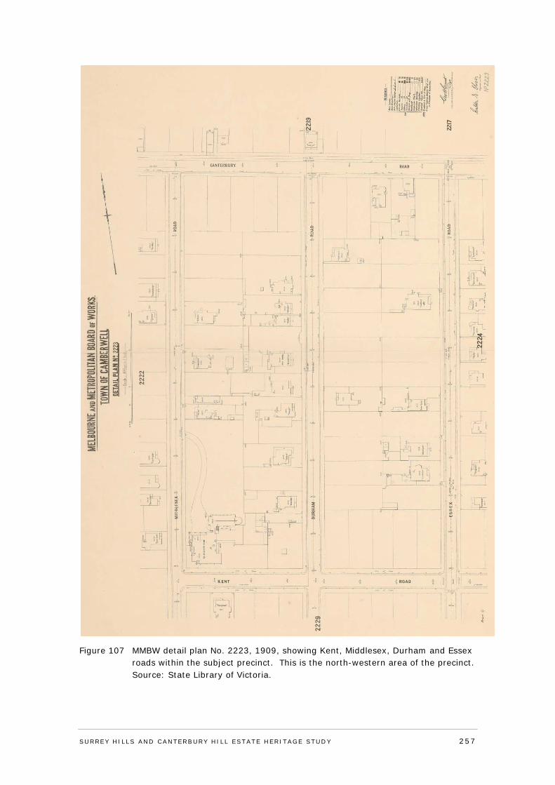
Figure 107 MMBW detail plan No. 2223, 1909, showing Kent, Middlesex, Durham and Essex roads within the subject precinct. This is the north-western area of the precinct.
Source: State Library of Victoria.
SURREY HI LLS AND CANTERBURY HI LL ESTATE HERITAGE STUDY 257
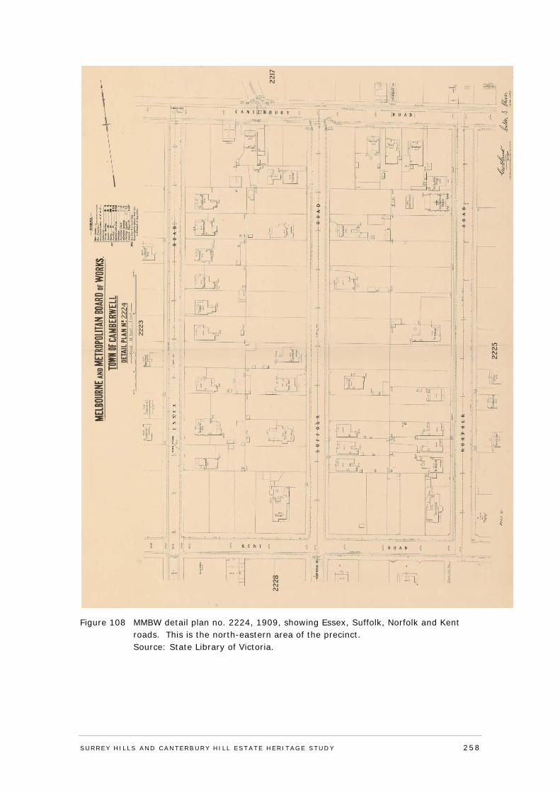
Figure 108 MMBW detail plan no. 2224, 1909, showing Essex, Suffolk, Norfolk and Kent roads. This is the north-eastern area of the precinct.
Source: State Library of Victoria.
SURREY HI LLS AND CANTERBURY HI LL ESTATE HERITAGE STUDY 258
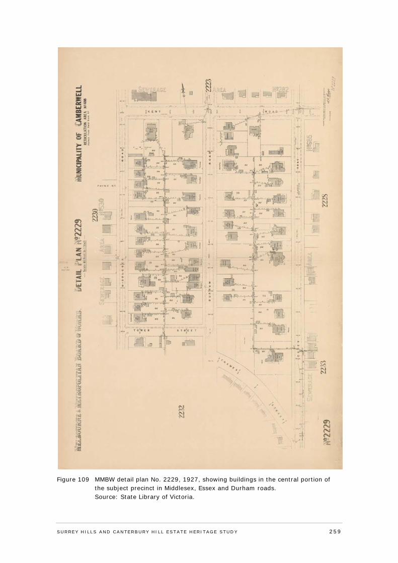
Figure 109 MMBW detail plan No. 2229, 1927, showing buildings in the central portion of the subject precinct in Middlesex, Essex and Durham roads.
Source: State Library of Victoria.
SURREY HI LLS AND CANTERBURY HI LL ESTATE HERITAGE STUDY 259
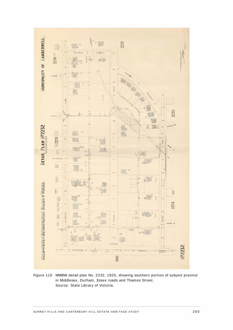
Figure 110 MMBW detail plan No. 2232, 1925, showing southern portion of subject precinct in Middlesex, Durham, Essex roads and Thames Street.
Source: State Library of Victoria.
SURREY HI LLS AND CANTERBURY HI LL ESTATE HERITAGE STUDY 260
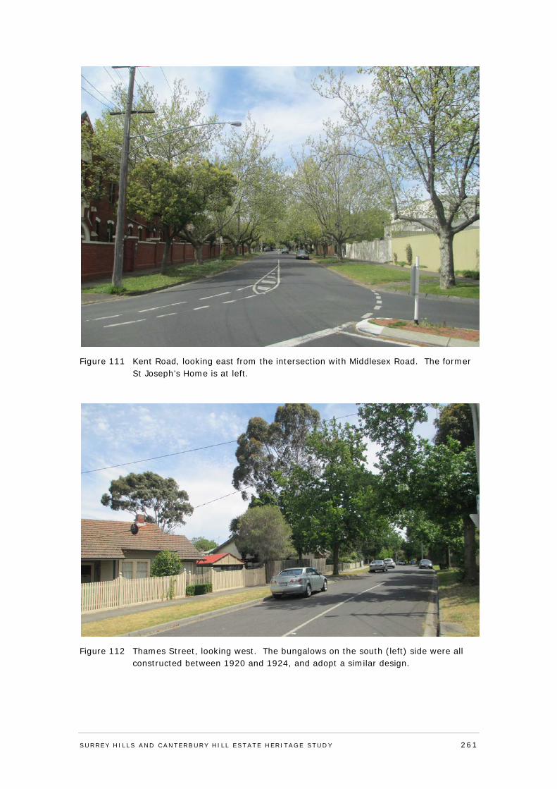
Figure 111 Kent Road, looking east from the intersection with Middlesex Road. The former St Joseph’s Home is at left.
Figure 112 Thames Street, looking west. The bungalows on the south (left) side were all constructed between 1920 and 1924, and adopt a similar design.
SURREY HI LLS AND CANTERBURY HI LL ESTATE HERITAGE STUDY 261
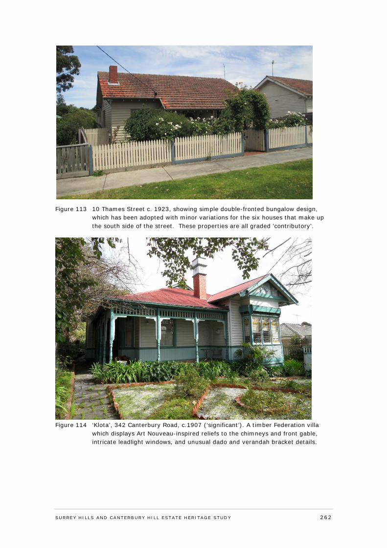
Figure 113 10 Thames Street c. 1923, showing simple double-fronted bungalow design, which has been adopted with minor variations for the six houses that make up the south side of the street. These properties are all graded ’contributory’.
Figure 114 ‘Klota’, 342 Canterbury Road, c.1907 (‘significant’). A timber Federation villa
which displays Art Nouveau-inspired reliefs to the chimneys and front gable, intricate leadlight windows, and unusual dado and verandah bracket details.
SURREY HI LLS AND CANTERBURY HI LL ESTATE HERITAGE STUDY 262
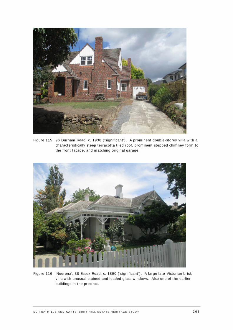
Figure 115 96 Durham Road, c. 1938 (‘significant’). A prominent double-storey villa with a characteristically steep terracotta tiled roof, prominent stepped chimney form to the front facade, and matching original garage.
Figure 116 ‘Neerena’, 38 Essex Road, c. 1890 (‘significant’). A large late-Victorian brick villa with unusual stained and leaded glass windows. Also one of the earlier buildings in the precinct.
SURREY HI LLS AND CANTERBURY HI LL ESTATE HERITAGE STUDY 263
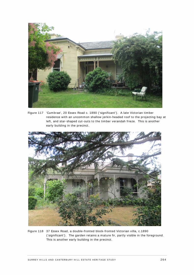
Figure 117 ‘Cumbrae’, 20 Essex Road c. 1890 (‘significant’). A late Victorian timber residence with an uncommon shallow jerkin-headed roof to the projecting bay at left, and star-shaped cut-outs to the timber verandah frieze. This is another early building in the precinct.
Figure 118 37 Essex Road, a double-fronted block-fronted Victorian villa, c.1890 (‘significant’). The garden retains a mature fir, partly visible in the foreground. This is another early building in the precinct.
SURREY HI LLS AND CANTERBURY HI LL ESTATE HERITAGE STUDY 264
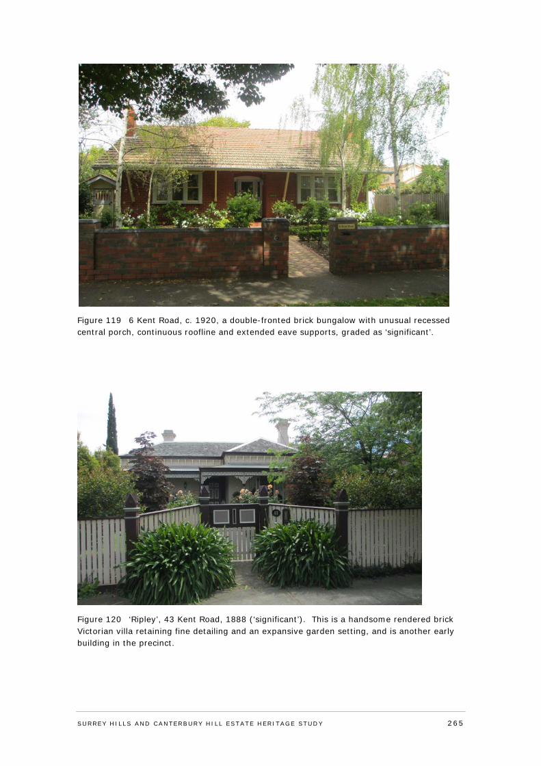
Figure 119 6 Kent Road, c. 1920, a double-fronted brick bungalow with unusual recessed central porch, continuous roofline and extended eave supports, graded as ‘significant’.
Figure 120 ‘Ripley’, 43 Kent Road, 1888 (‘significant’). This is a handsome rendered brick Victorian villa retaining fine detailing and an expansive garden setting, and is another early building in the precinct.
SURREY HI LLS AND CANTERBURY HI LL ESTATE HERITAGE STUDY 265
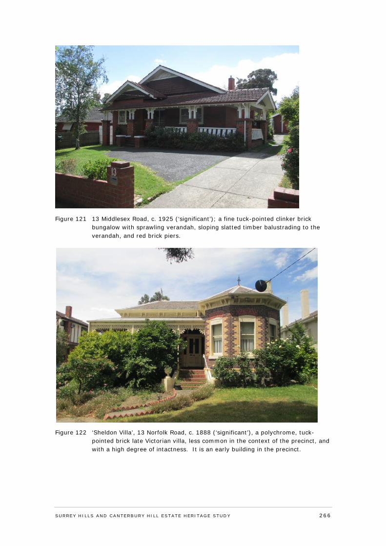
Figure 121 13 Middlesex Road, c. 1925 (‘significant’); a fine tuck-pointed clinker brick bungalow with sprawling verandah, sloping slatted timber balustrading to the verandah, and red brick piers.
Figure 122 ‘Sheldon Villa’, 13 Norfolk Road, c. 1888 (‘significant’), a polychrome, tuck-pointed brick late Victorian villa, less common in the context of the precinct, and with a high degree of intactness. It is an early building in the precinct.
SURREY HI LLS AND CANTERBURY HI LL ESTATE HERITAGE STUDY 266
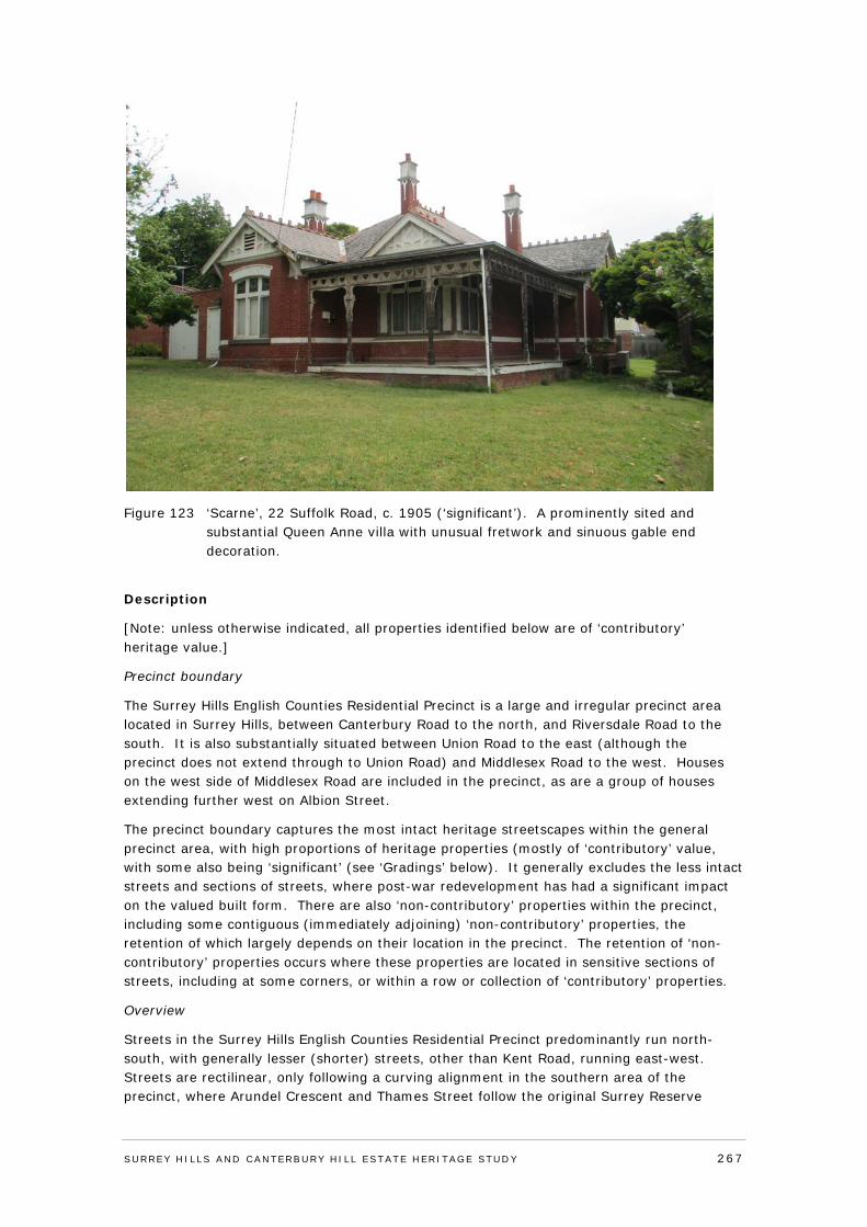
Figure 123 ‘Scarne’, 22 Suffolk Road, c. 1905 (‘significant’). A prominently sited and substantial Queen Anne villa with unusual fretwork and sinuous gable end decoration.
Description
[Note: unless otherwise indicated, all properties identified below are of ‘contributory’ heritage value.]
Precinct boundary
The Surrey Hills English Counties Residential Precinct is a large and irregular precinct area located in Surrey Hills, between Canterbury Road to the north, and Riversdale Road to the south. It is also substantially situated between Union Road to the east (although the precinct does not extend through to Union Road) and Middlesex Road to the west. Houses on the west side of Middlesex Road are included in the precinct, as are a group of houses extending further west on Albion Street.
The precinct boundary captures the most intact heritage streetscapes within the general precinct area, with high proportions of heritage properties (mostly of ‘contributory’ value, with some also being ‘significant’ (see ‘Gradings’ below). It generally excludes the less intact streets and sections of streets, where post-war redevelopment has had a significant impact on the valued built form. There are also ‘non-contributory’ properties within the precinct, including some contiguous (immediately adjoining) ‘non-contributory’ properties, the retention of which largely depends on their location in the precinct. The retention of ‘non-contributory’ properties occurs where these properties are located in sensitive sections of streets, including at some corners, or within a row or collection of ‘contributory’ properties.
Overview
Streets in the Surrey Hills English Counties Residential Precinct predominantly run north-south, with generally lesser (shorter) streets, other than Kent Road, running east-west. Streets are rectilinear, only following a curving alignment in the southern area of the precinct, where Arundel Crescent and Thames Street follow the original Surrey Reserve
SURREY HI LLS AND CANTERBURY HI LL ESTATE HERITAGE STUDY 267
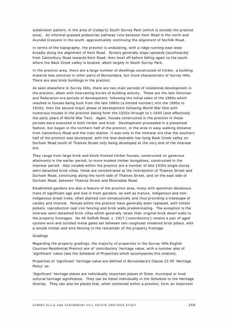
subdivision pattern, in the area of (today’s) South Surrey Park (which is outside the precinct area). An informal grassed pedestrian pathway runs between Kent Road in the north and Arundel Crescent in the south, approximately continuing the alignment of Norfolk Road.
In terms of the topography, the precinct is undulating, with a ridge running east-west broadly along the alignment of Kent Road. Streets generally slope upwards (southwards) from Canterbury Road towards Kent Road, then level off before falling again to the south where the Back Creek valley is located, albeit largely in South Surrey Park.
In the precinct area, there are a large number of dwellings constructed of timber, a building material less common in other parts of Boroondara, but more characteristic of Surrey Hills. There are also brick buildings in the precinct.
As seen elsewhere in Surrey Hills, there are two main periods of residential development in the precinct, albeit with intervening bursts of building activity. These are the late Victorian and Federation era periods of development, following the initial sales of the 1880s which resulted in houses being built from the late 1880s (a limited number) into the 1890s to 1910s; then the second major phase of development following World War One with numerous houses in the precinct dating from the 1920s through to c.1940 (and effectively the early years of World War Two). Again, houses constructed in the precinct in these periods were executed in both timber and brick. Development proceeded in a piecemeal fashion, but began in the northern half of the precinct, in the area in easy walking distance from Canterbury Road and the train station. It was only in the interwar era that the southern half of the precinct was developed, with the less-desirable low-lying Back Creek valley on Durham Road south of Thames Street only being developed at the very end of the interwar era.
They range from large brick and block-fronted timber houses, constructed on generous allotments in the earlier period, to more modest timber bungalows, constructed in the interwar period. Also notable within the precinct are a number of late 1930s single-storey semi-detached brick villas; these are concentrated at the intersection of Thames Street and Durham Road, continuing along the north side of Thames Street, and on the east side of Durham Road, between Thames Street and Riversdale Road.
Established gardens are also a feature of the precinct area, many with specimen deciduous trees of significant age and size in front gardens, as well as mature, indigenous and non-indigenous street trees, often planted non-consecutively and thus providing a treescape of variety and interest. Fences within the precinct have generally been replaced, with timber pickets, reproduction cast iron fencing and brick walls predominating. The exception is the interwar semi-detached brick villas which generally retain their original brick dwarf walls to the property frontages. No 46 Suffolk Road, c. 1927 (‘contributory’) retains a pair of aged cyclone wire and scrolled metal gates set between two roughcast rendered brick pillars, with a simple timber and wire fencing to the remainder of the property frontage.
Gradings
Regarding the property gradings, the majority of properties in the Surrey Hills English Counties Residential Precinct are of ‘contributory’ heritage value, with a number also of ‘significant’ value (see the Schedule of Properties which accompanies this citation).
Properties of ‘significant’ heritage value are defined in Boroondara’s Clause 22.05 ‘Heritage Policy’ as:
‘Significant’ heritage places are individually important places of State, municipal or local cultural heritage significance. They can be listed individually in the Schedule to the Heritage Overlay. They can also be places that, when combined within a precinct, form an important
SURREY HI LLS AND CANTERBURY HI LL ESTATE HERITAGE STUDY 268
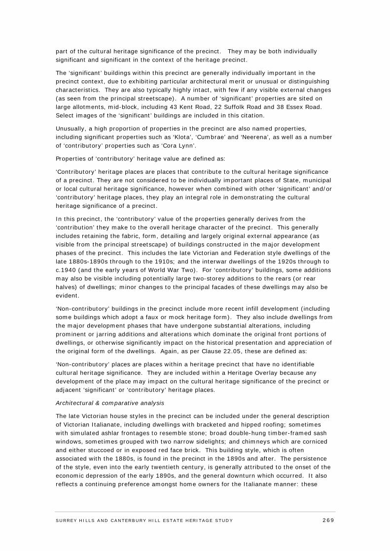
part of the cultural heritage significance of the precinct. They may be both individually significant and significant in the context of the heritage precinct.
The ‘significant’ buildings within this precinct are generally individually important in the precinct context, due to exhibiting particular architectural merit or unusual or distinguishing characteristics. They are also typically highly intact, with few if any visible external changes (as seen from the principal streetscape). A number of ‘significant’ properties are sited on large allotments, mid-block, including 43 Kent Road, 22 Suffolk Road and 38 Essex Road. Select images of the ‘significant’ buildings are included in this citation.
Unusually, a high proportion of properties in the precinct are also named properties, including significant properties such as ‘Klota’, ‘Cumbrae’ and ‘Neerena’, as well as a number of ‘contributory’ properties such as ‘Cora Lynn’.
Properties of ‘contributory’ heritage value are defined as:
‘Contributory’ heritage places are places that contribute to the cultural heritage significance of a precinct. They are not considered to be individually important places of State, municipal or local cultural heritage significance, however when combined with other ‘significant’ and/or ‘contributory’ heritage places, they play an integral role in demonstrating the cultural heritage significance of a precinct.
In this precinct, the ‘contributory’ value of the properties generally derives from the ‘contribution’ they make to the overall heritage character of the precinct. This generally includes retaining the fabric, form, detailing and largely original external appearance (as visible from the principal streetscape) of buildings constructed in the major development phases of the precinct. This includes the late Victorian and Federation style dwellings of the late 1880s-1890s through to the 1910s; and the interwar dwellings of the 1920s through to c.1940 (and the early years of World War Two). For ‘contributory’ buildings, some additions may also be visible including potentially large two-storey additions to the rears (or rear halves) of dwellings; minor changes to the principal facades of these dwellings may also be evident.
‘Non-contributory’ buildings in the precinct include more recent infill development (including some buildings which adopt a faux or mock heritage form). They also include dwellings from the major development phases that have undergone substantial alterations, including prominent or jarring additions and alterations which dominate the original front portions of dwellings, or otherwise significantly impact on the historical presentation and appreciation of the original form of the dwellings. Again, as per Clause 22.05, these are defined as:
‘Non-contributory’ places are places within a heritage precinct that have no identifiable cultural heritage significance. They are included within a Heritage Overlay because any development of the place may impact on the cultural heritage significance of the precinct or adjacent ‘significant’ or ‘contributory’ heritage places.
Architectural & comparative analysis
The late Victorian house styles in the precinct can be included under the general description of Victorian Italianate, including dwellings with bracketed and hipped roofing; sometimes with simulated ashlar frontages to resemble stone; broad double-hung timber-framed sash windows, sometimes grouped with two narrow sidelights; and chimneys which are corniced and either stuccoed or in exposed red face brick. This building style, which is often associated with the 1880s, is found in the precinct in the 1890s and after. The persistence of the style, even into the early twentieth century, is generally attributed to the onset of the economic depression of the early 1890s, and the general downturn which occurred. It also reflects a continuing preference amongst home owners for the Italianate manner: these
SURREY HI LLS AND CANTERBURY HI LL ESTATE HERITAGE STUDY 269
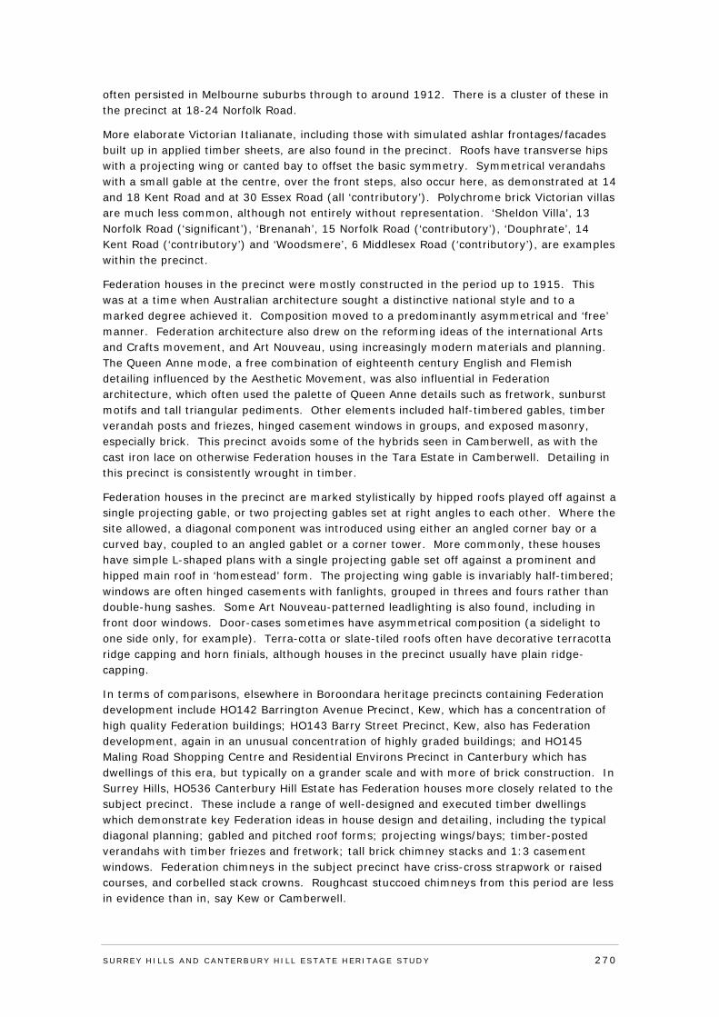
often persisted in Melbourne suburbs through to around 1912. There is a cluster of these in the precinct at 18-24 Norfolk Road.
More elaborate Victorian Italianate, including those with simulated ashlar frontages/facades built up in applied timber sheets, are also found in the precinct. Roofs have transverse hips with a projecting wing or canted bay to offset the basic symmetry. Symmetrical verandahs with a small gable at the centre, over the front steps, also occur here, as demonstrated at 14 and 18 Kent Road and at 30 Essex Road (all ‘contributory’). Polychrome brick Victorian villas are much less common, although not entirely without representation. ‘Sheldon Villa’, 13 Norfolk Road (‘significant’), ‘Brenanah’, 15 Norfolk Road (‘contributory’), ‘Douphrate’, 14 Kent Road (‘contributory’) and ‘Woodsmere’, 6 Middlesex Road (‘contributory’), are examples within the precinct.
Federation houses in the precinct were mostly constructed in the period up to 1915. This was at a time when Australian architecture sought a distinctive national style and to a marked degree achieved it. Composition moved to a predominantly asymmetrical and ‘free’ manner. Federation architecture also drew on the reforming ideas of the international Arts and Crafts movement, and Art Nouveau, using increasingly modern materials and planning. The Queen Anne mode, a free combination of eighteenth century English and Flemish detailing influenced by the Aesthetic Movement, was also influential in Federation architecture, which often used the palette of Queen Anne details such as fretwork, sunburst motifs and tall triangular pediments. Other elements included half-timbered gables, timber verandah posts and friezes, hinged casement windows in groups, and exposed masonry, especially brick. This precinct avoids some of the hybrids seen in Camberwell, as with the cast iron lace on otherwise Federation houses in the Tara Estate in Camberwell. Detailing in this precinct is consistently wrought in timber.
Federation houses in the precinct are marked stylistically by hipped roofs played off against a single projecting gable, or two projecting gables set at right angles to each other. Where the site allowed, a diagonal component was introduced using either an angled corner bay or a curved bay, coupled to an angled gablet or a corner tower. More commonly, these houses have simple L-shaped plans with a single projecting gable set off against a prominent and hipped main roof in ‘homestead’ form. The projecting wing gable is invariably half-timbered; windows are often hinged casements with fanlights, grouped in threes and fours rather than double-hung sashes. Some Art Nouveau-patterned leadlighting is also found, including in front door windows. Door-cases sometimes have asymmetrical composition (a sidelight to one side only, for example). Terra-cotta or slate-tiled roofs often have decorative terracotta ridge capping and horn finials, although houses in the precinct usually have plain ridge-capping.
In terms of comparisons, elsewhere in Boroondara heritage precincts containing Federation development include HO142 Barrington Avenue Precinct, Kew, which has a concentration of high quality Federation buildings; HO143 Barry Street Precinct, Kew, also has Federation development, again in an unusual concentration of highly graded buildings; and HO145 Maling Road Shopping Centre and Residential Environs Precinct in Canterbury which has dwellings of this era, but typically on a grander scale and with more of brick construction. In Surrey Hills, HO536 Canterbury Hill Estate has Federation houses more closely related to the subject precinct. These include a range of well-designed and executed timber dwellings which demonstrate key Federation ideas in house design and detailing, including the typical diagonal planning; gabled and pitched roof forms; projecting wings/bays; timber-posted verandahs with timber friezes and fretwork; tall brick chimney stacks and 1:3 casement windows. Federation chimneys in the subject precinct have criss-cross strapwork or raised courses, and corbelled stack crowns. Roughcast stuccoed chimneys from this period are less in evidence than in, say Kew or Camberwell.
SURREY HI LLS AND CANTERBURY HI LL ESTATE HERITAGE STUDY 270
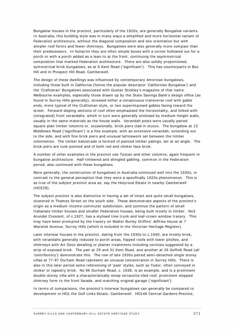
Bungalow houses in the precinct, particularly of the 1920s, are generally Bungalow variants. In Australia, this building style was in many ways a simplified and more horizontal variant of Federation architecture, without the diagonal composition and site orientation but with simpler roof forms and fewer chimneys. Bungalows were also generally more compact than their predecessors. In footprint they are often simple boxes with a corner hollowed out for a porch or with a porch added as a lean-to at the front, continuing the asymmetrical composition that marked Federation architecture. There are also solidly proportioned, symmetrical brick bungalows, as at 6 Kent Road (‘significant’). This has counterparts in Box Hill and in Prospect Hill Road, Camberwell.
The design of these dwellings was influenced by contemporary American bungalows, including those built in California (hence the popular descriptor ‘Californian Bungalow’) and the ‘Craftsman’ Bungalows associated with Gustav Stickley’s magazine of that name. Melbourne examples, especially those drawn up by the State Savings Bank’s design office (as found in Surrey Hills generally), stressed either a conspicuous transverse roof with gable ends, more typical of the Craftsman style, or two superimposed gables facing toward the street. Forward-sloping sections of roof often emphasised the horizontality, and linked with (integrated) front verandahs, which in turn were generally enclosed by medium-height walls, usually in the same materials as the house walls. Verandah posts were usually paired square-plan timber columns or, occasionally, brick piers clad in stucco. The bungalow at 13 Middlesex Road (‘significant’) is a fine example, with an extensive verandah, extending out to the side, and with fine brick piers and unusual latticework set between the timber colonnettes. The timber balustrade is formed of painted timber palings, set at an angle. The brick piers are tuck-pointed and of both red and clinker face brick.
A number of other examples in the precinct use Tuscan and other columns, again frequent in bungalow architecture. Half-timbered and shingled gabling, common in the Federation period, also continued with these bungalows.
More generally, the construction of bungalows in Australia continued well into the 1930s, in contrast to the general perception that they were a specifically 1920s phenomenon. This is as true of the subject precinct area as, say the Holyrood Estate in nearby Camberwell (HO228).
The subject precinct is also distinctive in having a set of intact and quite small bungalows, clustered in Thames Street on the south side. These demonstrate aspects of the precinct’s origin as a medium-income commuter subdivision, and continue the pattern of small Italianate timber houses and smaller Federation houses, being built mostly in timber. No3 Arundel Crescent, of c.1927, has a stylised tree trunk and leaf-crown window tracery. This may have been prompted by the tracery on Walter Burley Griffins’ Jeffries House at 7 Warwick Avenue, Surrey Hills (which is included in the Victorian Heritage Register).
Later interwar houses in the precinct, dating from the 1930s to c.1940, are mostly brick, with verandahs generally reduced to porch areas, hipped roofs with lower pitches, and chimneys with Art Deco detailing or plainer treatments including cornices suggested by a strip of exposed brick. The pair at 29 and 31 Kent Road, and another at 26 Suffolk Road (all ‘contributory’) demonstrate this. The row of late 1930s paired semi-detached single storey villas at 77-87 Durham Road represent an unusual concentration in Surrey Hills. There is also in this later period some referencing of ‘past’ styles, such as Tudor, often conveyed in clinker or tapestry brick. No 96 Durham Road, c. 1938, is an example, and is a prominent double-storey villa with a characteristically steep terracotta tiled roof, prominent stepped chimney form to the front facade, and matching original garage (‘significant’).
In terms of comparisons, the precinct’s interwar bungalows can generally be compared to development in HO1 the Golf Links Estate, Camberwell. HO146 Central Gardens Precinct,
SURREY HI LLS AND CANTERBURY HI LL ESTATE HERITAGE STUDY 271
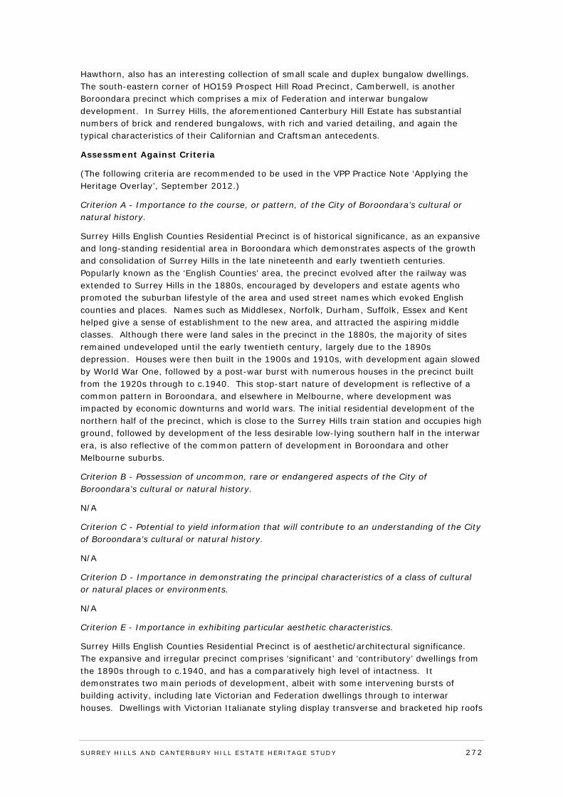
Hawthorn, also has an interesting collection of small scale and duplex bungalow dwellings. The south-eastern corner of HO159 Prospect Hill Road Precinct, Camberwell, is another Boroondara precinct which comprises a mix of Federation and interwar bungalow development. In Surrey Hills, the aforementioned Canterbury Hill Estate has substantial numbers of brick and rendered bungalows, with rich and varied detailing, and again the typical characteristics of their Californian and Craftsman antecedents.
Assessment Against Criteria
(The following criteria are recommended to be used in the VPP Practice Note ‘Applying the Heritage Overlay’, September 2012.)
Criterion A - Importance to the course, or pattern, of the City of Boroondara’s cultural or natural history.
Surrey Hills English Counties Residential Precinct is of historical significance, as an expansive and long-standing residential area in Boroondara which demonstrates aspects of the growth and consolidation of Surrey Hills in the late nineteenth and early twentieth centuries. Popularly known as the ‘English Counties’ area, the precinct evolved after the railway was extended to Surrey Hills in the 1880s, encouraged by developers and estate agents who promoted the suburban lifestyle of the area and used street names which evoked English counties and places. Names such as Middlesex, Norfolk, Durham, Suffolk, Essex and Kent helped give a sense of establishment to the new area, and attracted the aspiring middle classes. Although there were land sales in the precinct in the 1880s, the majority of sites remained undeveloped until the early twentieth century, largely due to the 1890s depression. Houses were then built in the 1900s and 1910s, with development again slowed by World War One, followed by a post-war burst with numerous houses in the precinct built from the 1920s through to c.1940. This stop-start nature of development is reflective of a common pattern in Boroondara, and elsewhere in Melbourne, where development was impacted by economic downturns and world wars. The initial residential development of the northern half of the precinct, which is close to the Surrey Hills train station and occupies high ground, followed by development of the less desirable low-lying southern half in the interwar era, is also reflective of the common pattern of development in Boroondara and other Melbourne suburbs.
Criterion B - Possession of uncommon, rare or endangered aspects of the City of Boroondara’s cultural or natural history.
N/A
Criterion C - Potential to yield information that will contribute to an understanding of the City of Boroondara’s cultural or natural history.
N/A
Criterion D - Importance in demonstrating the principal characteristics of a class of cultural or natural places or environments.
N/A
Criterion E - Importance in exhibiting particular aesthetic characteristics.
Surrey Hills English Counties Residential Precinct is of aesthetic/architectural significance. The expansive and irregular precinct comprises ‘significant’ and ‘contributory’ dwellings from the 1890s through to c.1940, and has a comparatively high level of intactness. It demonstrates two main periods of development, albeit with some intervening bursts of building activity, including late Victorian and Federation dwellings through to interwar houses. Dwellings with Victorian Italianate styling display transverse and bracketed hip roofs
SURREY HI LLS AND CANTERBURY HI LL ESTATE HERITAGE STUDY 272
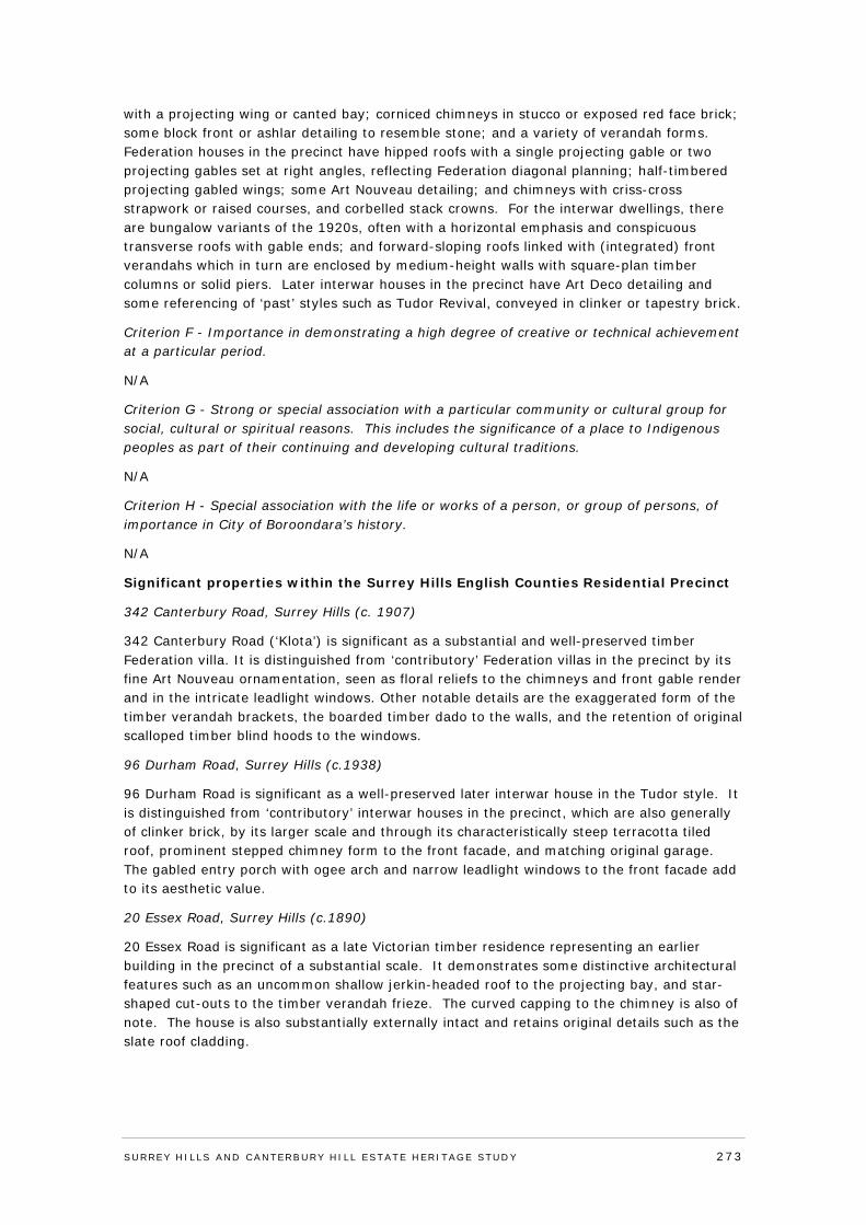
with a projecting wing or canted bay; corniced chimneys in stucco or exposed red face brick; some block front or ashlar detailing to resemble stone; and a variety of verandah forms. Federation houses in the precinct have hipped roofs with a single projecting gable or two projecting gables set at right angles, reflecting Federation diagonal planning; half-timbered projecting gabled wings; some Art Nouveau detailing; and chimneys with criss-cross strapwork or raised courses, and corbelled stack crowns. For the interwar dwellings, there are bungalow variants of the 1920s, often with a horizontal emphasis and conspicuous transverse roofs with gable ends; and forward-sloping roofs linked with (integrated) front verandahs which in turn are enclosed by medium-height walls with square-plan timber columns or solid piers. Later interwar houses in the precinct have Art Deco detailing and some referencing of ‘past’ styles such as Tudor Revival, conveyed in clinker or tapestry brick.
Criterion F - Importance in demonstrating a high degree of creative or technical achievement at a particular period.
N/A
Criterion G - Strong or special association with a particular community or cultural group for social, cultural or spiritual reasons. This includes the significance of a place to Indigenous peoples as part of their continuing and developing cultural traditions.
N/A
Criterion H - Special association with the life or works of a person, or group of persons, of importance in City of Boroondara’s history.
N/A
Significant properties within the Surrey Hills English Counties Residential Precinct
342 Canterbury Road, Surrey Hills (c. 1907)
342 Canterbury Road (‘Klota’) is significant as a substantial and well-preserved timber Federation villa. It is distinguished from ‘contributory’ Federation villas in the precinct by its fine Art Nouveau ornamentation, seen as floral reliefs to the chimneys and front gable render and in the intricate leadlight windows. Other notable details are the exaggerated form of the timber verandah brackets, the boarded timber dado to the walls, and the retention of original scalloped timber blind hoods to the windows.
96 Durham Road, Surrey Hills (c.1938)
96 Durham Road is significant as a well-preserved later interwar house in the Tudor style. It is distinguished from ‘contributory’ interwar houses in the precinct, which are also generally of clinker brick, by its larger scale and through its characteristically steep terracotta tiled roof, prominent stepped chimney form to the front facade, and matching original garage. The gabled entry porch with ogee arch and narrow leadlight windows to the front facade add to its aesthetic value.
20 Essex Road, Surrey Hills (c.1890)
20 Essex Road is significant as a late Victorian timber residence representing an earlier building in the precinct of a substantial scale. It demonstrates some distinctive architectural features such as an uncommon shallow jerkin-headed roof to the projecting bay, and star-shaped cut-outs to the timber verandah frieze. The curved capping to the chimney is also of note. The house is also substantially externally intact and retains original details such as the slate roof cladding.
SURREY HI LLS AND CANTERBURY HI LL ESTATE HERITAGE STUDY 273
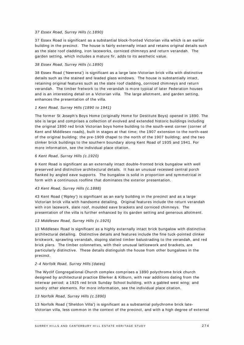
37 Essex Road, Surrey Hills (c.1890)
37 Essex Road is significant as a substantial block-fronted Victorian villa which is an earlier building in the precinct. The house is fairly externally intact and retains original details such as the slate roof cladding, iron laceworks, corniced chimneys and return verandah. The garden setting, which includes a mature fir, adds to its aesthetic value.
38 Essex Road, Surrey Hills (c.1890)
38 Essex Road (‘Neerena') is significant as a large late-Victorian brick villa with distinctive details such as the stained and leaded glass windows. The house is substantially intact, retaining original features such as the slate roof cladding, corniced chimneys and return verandah. The timber fretwork to the verandah is more typical of later Federation houses and is an interesting detail on a Victorian villa. The large allotment, and garden setting, enhances the presentation of the villa.
1 Kent Road, Surrey Hills (1890 to 1941)
The former St Joseph’s Boys Home (originally Home for Destitute Boys) opened in 1890. The site is large and comprises a collection of evolved and extended historic buildings including the original 1890 red brick Victorian boys home building to the south-west corner (corner of Kent and Middlesex roads), built in stages at that time; the 1907 extension to the north-east of the original building; the pre-1909 chapel to the north of the 1907 building; and the two clinker brick buildings to the southern boundary along Kent Road of 1935 and 1941. For more information, see the individual place citation.
6 Kent Road, Surrey Hills (c.1920)
6 Kent Road is significant as an externally intact double-fronted brick bungalow with well preserved and distinctive architectural details. It has an unusual recessed central porch flanked by angled eave supports. The bungalow is solid in proportion and symmetrical in form with a continuous roofline that dominates the exterior presentation.
43 Kent Road, Surrey Hills (c.1888)
43 Kent Road (‘Ripley’) is significant as an early building in the precinct and as a large Victorian brick villa with handsome detailing. Original features include the return verandah with iron lacework, slate roof, moulded eave brackets and corniced chimneys. The presentation of the villa is further enhanced by its garden setting and generous allotment.
13 Middlesex Road, Surrey Hills (c.1925)
13 Middlesex Road is significant as a highly externally intact brick bungalow with distinctive architectural detailing. Distinctive details and features include the fine tuck-pointed clinker brickwork, sprawling verandah, sloping slatted timber balustrading to the verandah, and red brick piers. The timber colonnettes, with their unusual latticework and brackets, are particularly distinctive. These details distinguish the house from other bungalows in the precinct.
2-4 Norfolk Road, Surrey Hills (dates)
The Wyclif Congregational Church complex comprises a 1890 polychrome brick church designed by architectural practice Ellerker & Kilburn, with rear additions dating from the interwar period; a 1925 red brick Sunday School building, with a gabled west wing; and sundry other elements. For more information, see the individual place citation.
13 Norfolk Road, Surrey Hills (c.1890)
13 Norfolk Road (‘Sheldon Villa’) is significant as a substantial polychrome brick late-Victorian villa, less common in the context of the precinct, and with a high degree of external
SURREY HI LLS AND CANTERBURY HI LL ESTATE HERITAGE STUDY 274
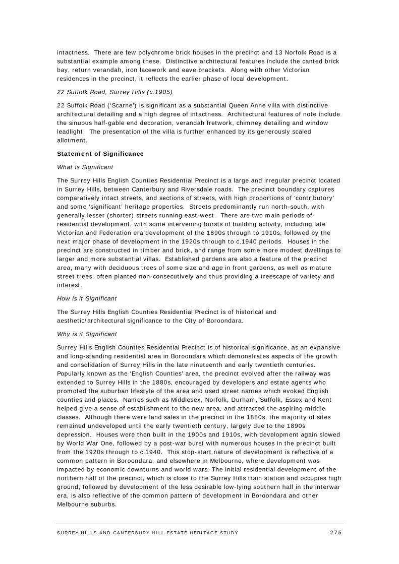
intactness. There are few polychrome brick houses in the precinct and 13 Norfolk Road is a substantial example among these. Distinctive architectural features include the canted brick bay, return verandah, iron lacework and eave brackets. Along with other Victorian residences in the precinct, it reflects the earlier phase of local development.
22 Suffolk Road, Surrey Hills (c.1905)
22 Suffolk Road (‘Scarne’) is significant as a substantial Queen Anne villa with distinctive architectural detailing and a high degree of intactness. Architectural features of note include the sinuous half-gable end decoration, verandah fretwork, chimney detailing and window leadlight. The presentation of the villa is further enhanced by its generously scaled allotment.
Statement of Significance
What is Significant
The Surrey Hills English Counties Residential Precinct is a large and irregular precinct located in Surrey Hills, between Canterbury and Riversdale roads. The precinct boundary captures comparatively intact streets, and sections of streets, with high proportions of ‘contributory’ and some ‘significant’ heritage properties. Streets predominantly run north-south, with generally lesser (shorter) streets running east-west. There are two main periods of residential development, with some intervening bursts of building activity, including late Victorian and Federation era development of the 1890s through to 1910s, followed by the next major phase of development in the 1920s through to c.1940 periods. Houses in the precinct are constructed in timber and brick, and range from some more modest dwellings to larger and more substantial villas. Established gardens are also a feature of the precinct area, many with deciduous trees of some size and age in front gardens, as well as mature street trees, often planted non-consecutively and thus providing a treescape of variety and interest.
How is it Significant
The Surrey Hills English Counties Residential Precinct is of historical and aesthetic/architectural significance to the City of Boroondara.
Why is it Significant
Surrey Hills English Counties Residential Precinct is of historical significance, as an expansive and long-standing residential area in Boroondara which demonstrates aspects of the growth and consolidation of Surrey Hills in the late nineteenth and early twentieth centuries. Popularly known as the ‘English Counties’ area, the precinct evolved after the railway was extended to Surrey Hills in the 1880s, encouraged by developers and estate agents who promoted the suburban lifestyle of the area and used street names which evoked English counties and places. Names such as Middlesex, Norfolk, Durham, Suffolk, Essex and Kent helped give a sense of establishment to the new area, and attracted the aspiring middle classes. Although there were land sales in the precinct in the 1880s, the majority of sites remained undeveloped until the early twentieth century, largely due to the 1890s depression. Houses were then built in the 1900s and 1910s, with development again slowed by World War One, followed by a post-war burst with numerous houses in the precinct built from the 1920s through to c.1940. This stop-start nature of development is reflective of a common pattern in Boroondara, and elsewhere in Melbourne, where development was impacted by economic downturns and world wars. The initial residential development of the northern half of the precinct, which is close to the Surrey Hills train station and occupies high ground, followed by development of the less desirable low-lying southern half in the interwar era, is also reflective of the common pattern of development in Boroondara and other Melbourne suburbs.
SURREY HI LLS AND CANTERBURY HI LL ESTATE HERITAGE STUDY 275
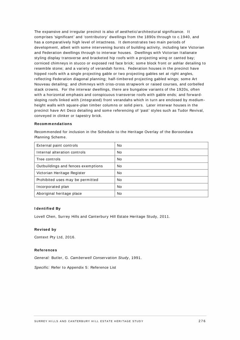
The expansive and irregular precinct is also of aesthetic/architectural significance. It comprises ‘significant’ and ‘contributory’ dwellings from the 1890s through to c.1940, and has a comparatively high level of intactness. It demonstrates two main periods of development, albeit with some intervening bursts of building activity, including late Victorian and Federation dwellings through to interwar houses. Dwellings with Victorian Italianate styling display transverse and bracketed hip roofs with a projecting wing or canted bay; corniced chimneys in stucco or exposed red face brick; some block front or ashlar detailing to resemble stone; and a variety of verandah forms. Federation houses in the precinct have hipped roofs with a single projecting gable or two projecting gables set at right angles, reflecting Federation diagonal planning; half-timbered projecting gabled wings; some Art Nouveau detailing; and chimneys with criss-cross strapwork or raised courses, and corbelled stack crowns. For the interwar dwellings, there are bungalow variants of the 1920s, often with a horizontal emphasis and conspicuous transverse roofs with gable ends; and forward-sloping roofs linked with (integrated) front verandahs which in turn are enclosed by medium-height walls with square-plan timber columns or solid piers. Later interwar houses in the precinct have Art Deco detailing and some referencing of ‘past’ styles such as Tudor Revival, conveyed in clinker or tapestry brick.
Recommendations
Recommended for inclusion in the Schedule to the Heritage Overlay of the Boroondara Planning Scheme.
External paint controls No
Internal alteration controls No
Tree controls No
Outbuildings and fences exemptions No
Victorian Heritage Register No
Prohibited uses may be permitted No
Incorporated plan No
Aboriginal heritage place No
Identified By
Lovell Chen, Surrey Hills and Canterbury Hill Estate Heritage Study, 2011.
Revised by
Context Pty Ltd, 2016.
References
General: Butler, G. Camberwell Conservation Study, 1991. Specific: Refer to Appendix 5: Reference List
SURREY HI LLS AND CANTERBURY HI LL ESTATE HERITAGE STUDY 276
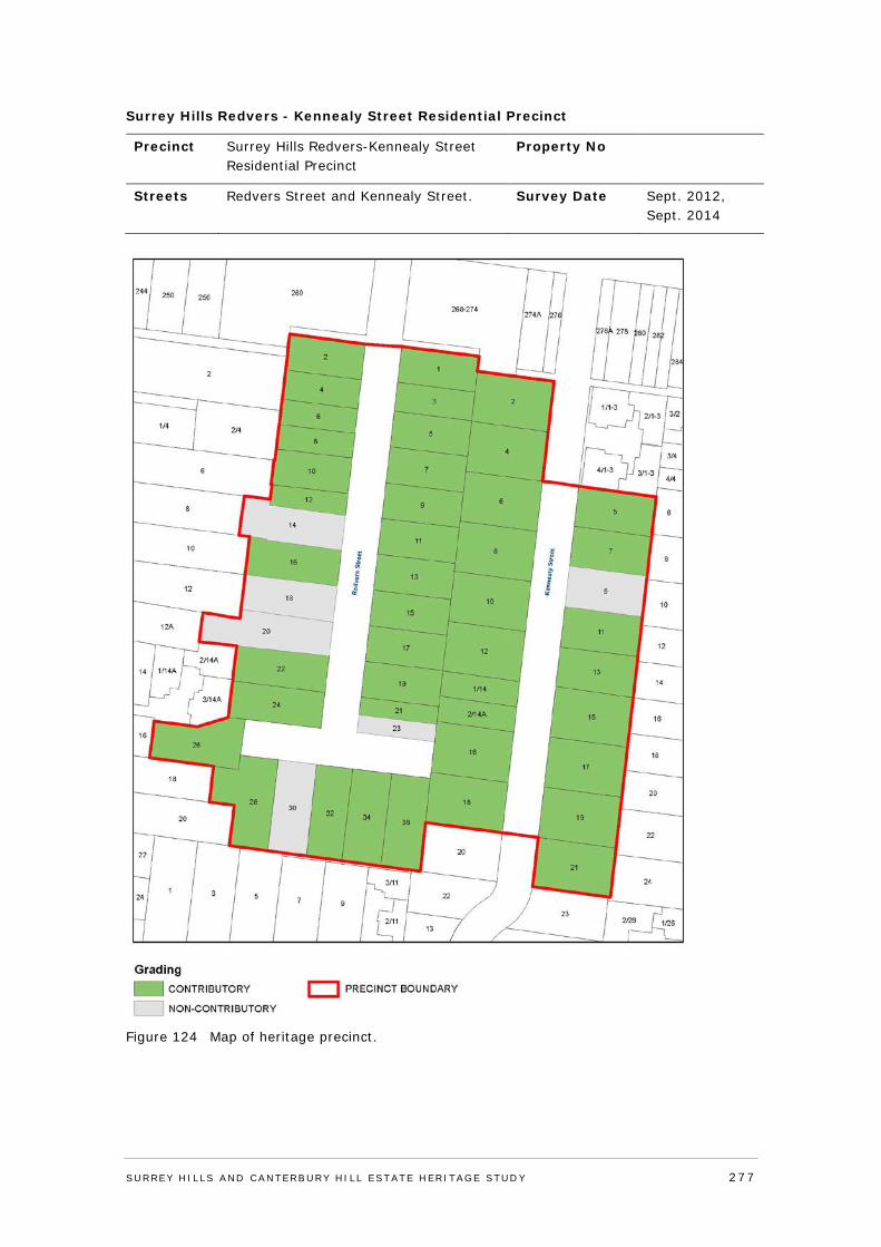
Surrey Hills Redvers - Kennealy Street Residential Precinct
Precinct Surrey Hills Redvers-Kennealy Street Residential Precinct
Property No
Streets Redvers Street and Kennealy Street. Survey Date Sept. 2012, Sept. 2014
Figure 124 Map of heritage precinct.
SURREY HI LLS AND CANTERBURY HI LL ESTATE HERITAGE STUDY 277
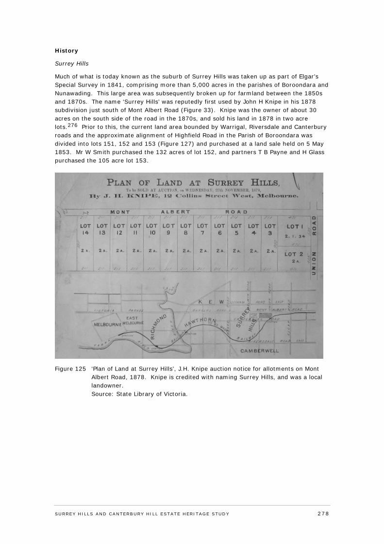
History
Surrey Hills
Much of what is today known as the suburb of Surrey Hills was taken up as part of Elgar’s Special Survey in 1841, comprising more than 5,000 acres in the parishes of Boroondara and Nunawading. This large area was subsequently broken up for farmland between the 1850s and 1870s. The name ‘Surrey Hills’ was reputedly first used by John H Knipe in his 1878 subdivision just south of Mont Albert Road (Figure 33). Knipe was the owner of about 30 acres on the south side of the road in the 1870s, and sold his land in 1878 in two acre lots.276 Prior to this, the current land area bounded by Warrigal, Riversdale and Canterbury roads and the approximate alignment of Highfield Road in the Parish of Boroondara was divided into lots 151, 152 and 153 (Figure 127) and purchased at a land sale held on 5 May 1853. Mr W Smith purchased the 132 acres of lot 152, and partners T B Payne and H Glass purchased the 105 acre lot 153.
Figure 125 ‘Plan of Land at Surrey Hills’, J.H. Knipe auction notice for allotments on Mont Albert Road, 1878. Knipe is credited with naming Surrey Hills, and was a local landowner. Source: State Library of Victoria.
SURREY HI LLS AND CANTERBURY HI LL ESTATE HERITAGE STUDY 278
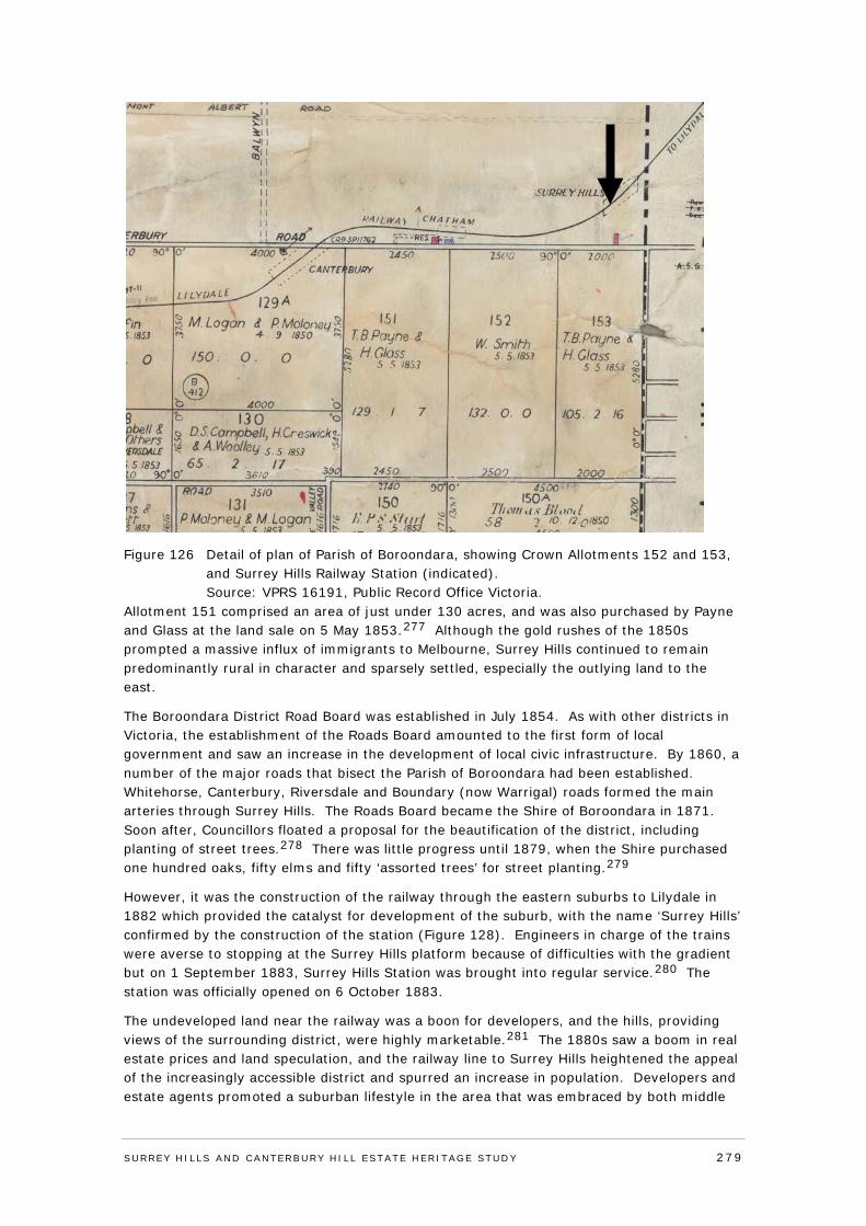
Figure 126 Detail of plan of Parish of Boroondara, showing Crown Allotments 152 and 153, and Surrey Hills Railway Station (indicated). Source: VPRS 16191, Public Record Office Victoria.
Allotment 151 comprised an area of just under 130 acres, and was also purchased by Payne and Glass at the land sale on 5 May 1853.277 Although the gold rushes of the 1850s prompted a massive influx of immigrants to Melbourne, Surrey Hills continued to remain predominantly rural in character and sparsely settled, especially the outlying land to the east.
The Boroondara District Road Board was established in July 1854. As with other districts in Victoria, the establishment of the Roads Board amounted to the first form of local government and saw an increase in the development of local civic infrastructure. By 1860, a number of the major roads that bisect the Parish of Boroondara had been established. Whitehorse, Canterbury, Riversdale and Boundary (now Warrigal) roads formed the main arteries through Surrey Hills. The Roads Board became the Shire of Boroondara in 1871. Soon after, Councillors floated a proposal for the beautification of the district, including planting of street trees.278 There was little progress until 1879, when the Shire purchased one hundred oaks, fifty elms and fifty ‘assorted trees’ for street planting.279
However, it was the construction of the railway through the eastern suburbs to Lilydale in 1882 which provided the catalyst for development of the suburb, with the name ‘Surrey Hills’ confirmed by the construction of the station (Figure 128). Engineers in charge of the trains were averse to stopping at the Surrey Hills platform because of difficulties with the gradient but on 1 September 1883, Surrey Hills Station was brought into regular service.280 The station was officially opened on 6 October 1883.
The undeveloped land near the railway was a boon for developers, and the hills, providing views of the surrounding district, were highly marketable.281 The 1880s saw a boom in real estate prices and land speculation, and the railway line to Surrey Hills heightened the appeal of the increasingly accessible district and spurred an increase in population. Developers and estate agents promoted a suburban lifestyle in the area that was embraced by both middle
SURREY HI LLS AND CANTERBURY HI LL ESTATE HERITAGE STUDY 279
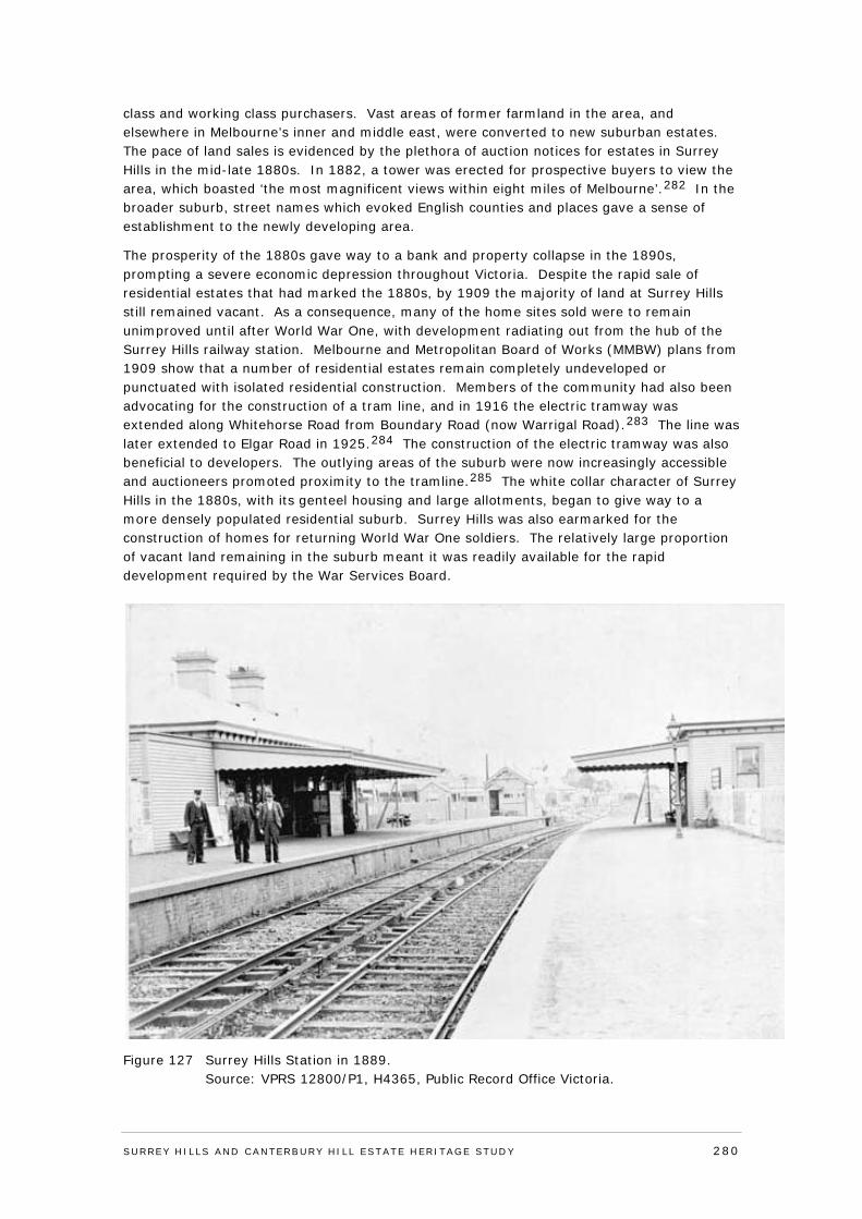
class and working class purchasers. Vast areas of former farmland in the area, and elsewhere in Melbourne’s inner and middle east, were converted to new suburban estates. The pace of land sales is evidenced by the plethora of auction notices for estates in Surrey Hills in the mid-late 1880s. In 1882, a tower was erected for prospective buyers to view the area, which boasted ‘the most magnificent views within eight miles of Melbourne’.282 In the broader suburb, street names which evoked English counties and places gave a sense of establishment to the newly developing area.
The prosperity of the 1880s gave way to a bank and property collapse in the 1890s, prompting a severe economic depression throughout Victoria. Despite the rapid sale of residential estates that had marked the 1880s, by 1909 the majority of land at Surrey Hills still remained vacant. As a consequence, many of the home sites sold were to remain unimproved until after World War One, with development radiating out from the hub of the Surrey Hills railway station. Melbourne and Metropolitan Board of Works (MMBW) plans from 1909 show that a number of residential estates remain completely undeveloped or punctuated with isolated residential construction. Members of the community had also been advocating for the construction of a tram line, and in 1916 the electric tramway was extended along Whitehorse Road from Boundary Road (now Warrigal Road).283 The line was later extended to Elgar Road in 1925.284 The construction of the electric tramway was also beneficial to developers. The outlying areas of the suburb were now increasingly accessible and auctioneers promoted proximity to the tramline.285 The white collar character of Surrey Hills in the 1880s, with its genteel housing and large allotments, began to give way to a more densely populated residential suburb. Surrey Hills was also earmarked for the construction of homes for returning World War One soldiers. The relatively large proportion of vacant land remaining in the suburb meant it was readily available for the rapid development required by the War Services Board.
Figure 127 Surrey Hills Station in 1889. Source: VPRS 12800/P1, H4365, Public Record Office Victoria.
SURREY HI LLS AND CANTERBURY HI LL ESTATE HERITAGE STUDY 280
In September 1919 the Argus reported that of the earliest war service homes constructed in the state, ten were to be built in Surrey Hills.286 However, development slowed as the depression took hold near the end of the 1920s. Despite its seeming middle class security and the relative wealth of residents who mostly owned their own homes, the impact of the depression was still felt in Surrey Hills. By the early 1930s about 50,000 people lived in the municipality - and approximately one quarter of these was unemployed.287
During the 1930s, growth in Surrey Hills slowed in comparison to the previous decade, but the population of the wider municipality still grew to 69,000 by 1941.288 After World War Two, while post-war migration had some impact on the predominantly Anglo-Celtic population base of Surrey Hills, in comparison to the rest of Boroondara, the suburb maintained a smaller proportion of people born overseas and from non-English speaking backgrounds.289
The rise in motor car ownership and use was the next phase to impact on Surrey Hills, and consolidated the area as a dormitory suburb for Melbourne workers. Car ownership had been steadily increasing since the 1920s, but it was not until the 1950s that the popularity of motor vehicles really took hold. The rise in the motor car also spurred on the construction of garages on properties, and service stations on main roads and commercial strips.
Redvers-Kennealy Street Residential Precinct
The subject precinct area developed in two main stages from the late 1880s and from the mid-1920s, with some intervening bursts of development. Redvers Street was initially known as Alma Street or Alma Road, presumably after the Battle of the Alma, in the Crimean War of 1854-56. The subdivision which created Redvers Street was undertaken in early 1889, and consisted of thirty-three allotments fronting Redvers Street, William Street and Canterbury Road.290 The 1889 edition of the Sands & McDougall Directory contains the first listings for the developing suburb of Surrey Hills. Two properties were noted in Alma Street, one occupied by William McAlpin and the other vacant. By 1894, there were seven properties listed along the street, which terminated at William Street.291 William Street was likely envisaged to become a longer east-west street through the new estates, however, it remained as a truncated cul-de-sac, and was changed to part of Redvers Street in 1928.292 Richard Avard was listed in William Street from 1892, in the house that was later known as ‘Bona Vista’ (see Figure 132).293 The street was renamed Redvers Street in 1900-1901, likely after Sir Redvers Buller, the Commander-in-Chief in the early part of the Second Boer War of 1899-1902.294
The number of properties in Redvers Street remained steady into the early years of the twentieth century, with just six properties listed in the 1907 edition of the Sands & McDougall directory.295 Redvers Street was connected to water and sewerage in 1908, and the number of properties had increased by the time of the MMBW plan of the street from 1909 (Figure 129). Many of the residences in the street had names, which included ‘Toorah’ (7), ‘Brampton’ (17), ‘Nerring’ (18, since demolished) and ‘Hestia’ (22, see Figure 134). Though Redvers Street was relatively established by this time, Kennealy Street had not yet been created.
Kennealy Street is named for the Kennealy family, who had resided on a property fronting Canterbury Road from c.1891. John Kennealy, a labourer, died soon after he and his family had acquired the five acre property on Canterbury Road in 1891. His estate, which he left to his wife, and subsequently his six children, recorded the property as part of Section 151 of the Parish of Boroondara, on which was erected a four-roomed weatherboard house.296 This building is visible in the 1909 MMBW detail plan, located in the centre of a relatively large portion of land (Figure 129). His widow Margaret and son John operated a dairy at the property from 1895.297
SURREY HI LLS AND CANTERBURY HI LL ESTATE HERITAGE STUDY 281
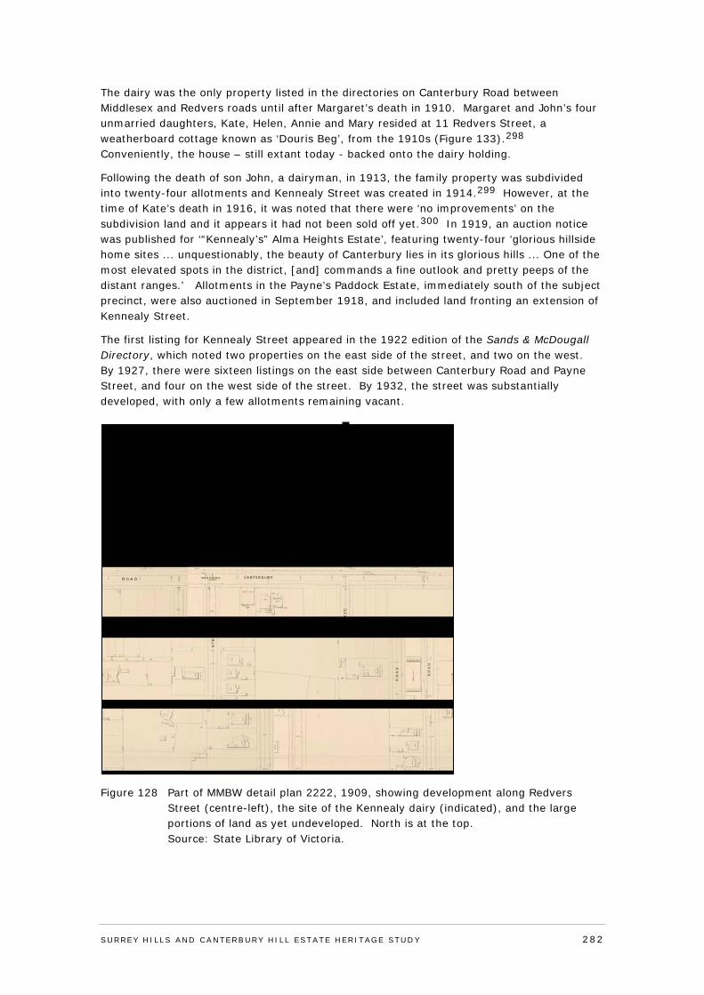
The dairy was the only property listed in the directories on Canterbury Road between Middlesex and Redvers roads until after Margaret’s death in 1910. Margaret and John’s four unmarried daughters, Kate, Helen, Annie and Mary resided at 11 Redvers Street, a weatherboard cottage known as ‘Douris Beg’, from the 1910s (Figure 133).298 Conveniently, the house – still extant today - backed onto the dairy holding.
Following the death of son John, a dairyman, in 1913, the family property was subdivided into twenty-four allotments and Kennealy Street was created in 1914.299 However, at the time of Kate’s death in 1916, it was noted that there were ‘no improvements’ on the subdivision land and it appears it had not been sold off yet.300 In 1919, an auction notice was published for ‘“Kennealy’s” Alma Heights Estate’, featuring twenty-four ‘glorious hillside home sites ... unquestionably, the beauty of Canterbury lies in its glorious hills ... One of the most elevated spots in the district, [and] commands a fine outlook and pretty peeps of the distant ranges.’ Allotments in the Payne’s Paddock Estate, immediately south of the subject precinct, were also auctioned in September 1918, and included land fronting an extension of Kennealy Street.
The first listing for Kennealy Street appeared in the 1922 edition of the Sands & McDougall Directory, which noted two properties on the east side of the street, and two on the west. By 1927, there were sixteen listings on the east side between Canterbury Road and Payne Street, and four on the west side of the street. By 1932, the street was substantially developed, with only a few allotments remaining vacant.
Figure 128 Part of MMBW detail plan 2222, 1909, showing development along Redvers Street (centre-left), the site of the Kennealy dairy (indicated), and the large portions of land as yet undeveloped. North is at the top. Source: State Library of Victoria.
SURREY HI LLS AND CANTERBURY HI LL ESTATE HERITAGE STUDY 282
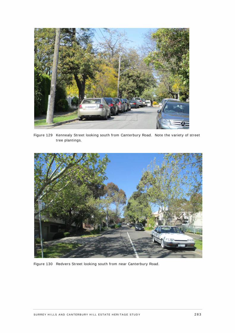
Figure 129 Kennealy Street looking south from Canterbury Road. Note the variety of street tree plantings.
Figure 130 Redvers Street looking south from near Canterbury Road.
SURREY HI LLS AND CANTERBURY HI LL ESTATE HERITAGE STUDY 283
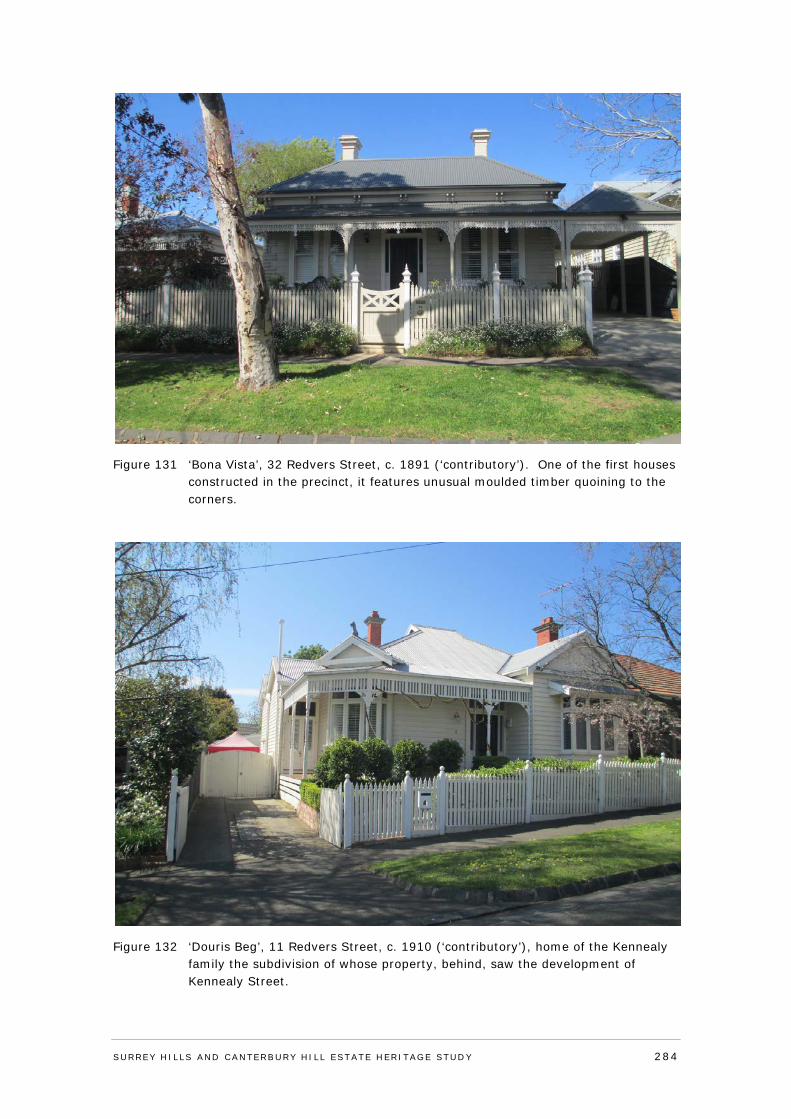
Figure 131 ‘Bona Vista’, 32 Redvers Street, c. 1891 (‘contributory’). One of the first houses constructed in the precinct, it features unusual moulded timber quoining to the corners.
Figure 132 ‘Douris Beg’, 11 Redvers Street, c. 1910 (‘contributory’), home of the Kennealy family the subdivision of whose property, behind, saw the development of Kennealy Street.
SURREY HI LLS AND CANTERBURY HI LL ESTATE HERITAGE STUDY 284
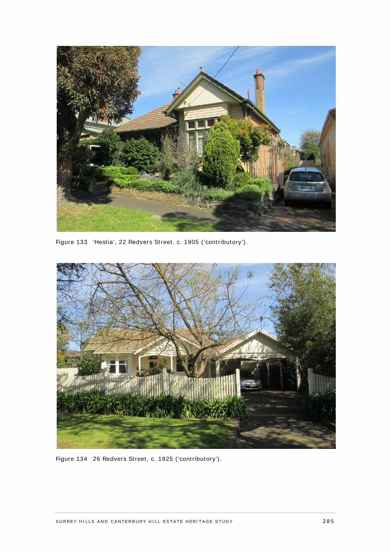
Figure 133 ‘Hestia’, 22 Redvers Street, c. 1905 (‘contributory’).
Figure 134 26 Redvers Street, c. 1925 (‘contributory’).
SURREY HI LLS AND CANTERBURY HI LL ESTATE HERITAGE STUDY 285
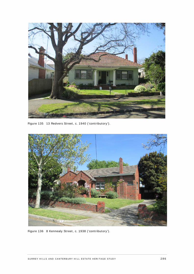
Figure 135 13 Redvers Street, c. 1940 (‘contributory’).
Figure 136 8 Kennealy Street, c. 1938 (‘contributory’).
SURREY HI LLS AND CANTERBURY HI LL ESTATE HERITAGE STUDY 286
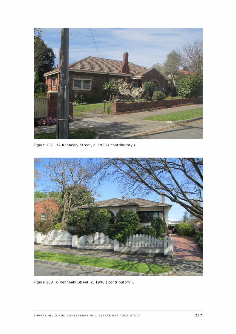
Figure 137 17 Kennealy Street, c. 1938 (‘contributory’).
Figure 138 6 Kennealy Street, c. 1936 (‘contributory’).
SURREY HI LLS AND CANTERBURY HI LL ESTATE HERITAGE STUDY 287
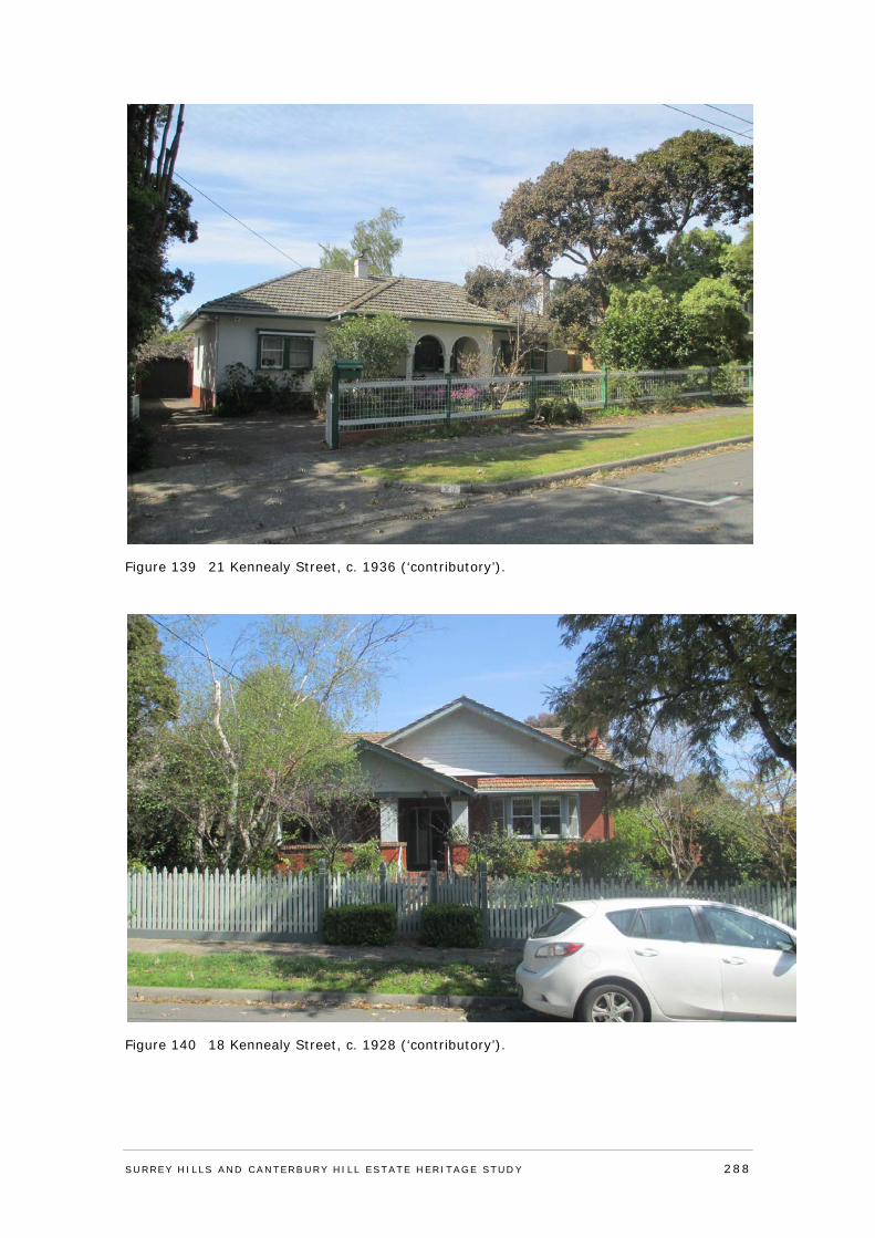
Figure 139 21 Kennealy Street, c. 1936 (‘contributory’).
Figure 140 18 Kennealy Street, c. 1928 (‘contributory’).
SURREY HI LLS AND CANTERBURY HI LL ESTATE HERITAGE STUDY 288
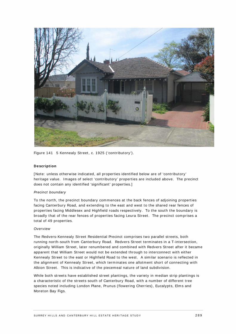
Figure 141 5 Kennealy Street, c. 1925 (‘contributory’).
Description
[Note: unless otherwise indicated, all properties identified below are of ‘contributory’ heritage value. Images of select ‘contributory’ properties are included above. The precinct does not contain any identified ‘significant’ properties.]
Precinct boundary
To the north, the precinct boundary commences at the back fences of adjoining properties facing Canterbury Road, and extending to the east and west to the shared rear fences of properties facing Middlesex and Highfield roads respectively. To the south the boundary is broadly that of the rear fences of properties facing Leura Street. The precinct comprises a total of 49 properties.
Overview
The Redvers-Kennealy Street Residential Precinct comprises two parallel streets, both running north-south from Canterbury Road. Redvers Street terminates in a T-intersection, originally William Street, later renumbered and combined with Redvers Street after it became apparent that William Street would not be extended through to interconnect with either Kennealy Street to the east or Highfield Road to the west. A similar scenario is reflected in the alignment of Kennealy Street, which terminates one allotment short of connecting with Albion Street. This is indicative of the piecemeal nature of land subdivision.
While both streets have established street plantings, the variety in median strip plantings is a characteristic of the streets south of Canterbury Road, with a number of different tree species noted including London Plane, Prunus (flowering Cherries), Eucalypts, Elms and Moreton Bay Figs.
SURREY HI LLS AND CANTERBURY HI LL ESTATE HERITAGE STUDY 289
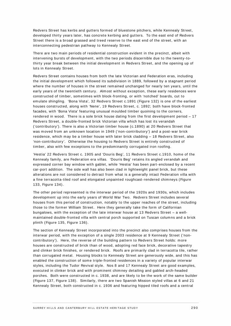
Redvers Street has kerbs and gutters formed of bluestone pitchers, while Kennealy Street, developed thirty years later, has concrete kerbing and gutters. To the east end of Redvers Street there is a broad grassed and treed reserve to the east end of the street, with an interconnecting pedestrian pathway to Kennealy Street.
There are two main periods of residential construction evident in the precinct, albeit with intervening bursts of development, with the two periods discernible due to the twenty-to-thirty year break between the initial development in Redvers Street, and the opening up of lots in Kennealy Street.
Redvers Street contains houses from both the late Victorian and Federation eras, including the initial development which followed its subdivision in 1889, followed by a stagnant period where the number of houses in the street remained unchanged for nearly ten years, until the early years of the twentieth century. Almost without exception, these early residences were constructed of timber, sometimes with block-fronting, or with ‘notched’ boards, cut to emulate shingling. ‘Bona Vista’, 32 Redvers Street c.1891 (Figure 132) is one of the earliest houses constructed, along with ‘Nene’, 19 Redvers Street, c. 1892; both have block-fronted facades, with ‘Bona Vista’ featuring unusual moulded timber quoining to the corners, rendered in wood. There is a sole brick house dating from the first development period – 17 Redvers Street, a double-fronted brick Victorian villa which has lost its verandah (‘contributory’). There is also a Victorian timber house (c.1890) at 20 Redvers Street that was moved from an unknown location in 1949 (‘non-contributory’) and a post-war brick residence, which may be a timber house with later brick cladding – 18 Redvers Street, also ‘non-contributory’. Otherwise the housing to Redvers Street is entirely constructed of timber, also with few exceptions to the predominantly corrugated iron roofing.
‘Hestia’ 22 Redvers Street c. 1905 and ‘Douris Beg’, 11 Redvers Street c.1910, home of the Kennealy family, are Federation era villas. ‘Douris Beg’ retains its angled verandah and expressed corner bay window with gablet, while ‘Hestia’ has been part-enclosed by a recent car-port addition. The side wall has also been clad in lightweight panel brick, but these alterations are not considered to detract from what is a generally intact Federation villa with a fine terracotta-tiled roof and elongated unpainted roughcast-rendered chimneys (Figure 133, Figure 134).
The other period represented is the interwar period of the 1920s and 1930s, which includes development up into the early years of World War Two. Redvers Street includes several houses from this period of construction, notably to the upper reaches of the street, including those to the former William Street. Here they generally take the form of Californian bungalows, with the exception of the late interwar house at 13 Redvers Street – a well-maintained double-fronted villa with central porch supported on Tuscan columns and a brick plinth (Figure 135, Figure 136).
The section of Kennealy Street incorporated into the precinct also comprises houses from the interwar period, with the exception of a single 2003 residence at 9 Kennealy Street (‘non-contributory’). Here, the reverse of the building pattern to Redvers Street holds: more houses are constructed of brick than of wood, adopting red face brick, decorative tapestry and clinker brick finishes, or rendered brick. Roofs are primarily clad in terracotta tile, rather than corrugated metal. Housing blocks to Kennealy Street are generously wide, and this has enabled the construction of some triple-fronted residences in a variety of popular interwar styles, including the Tudor Revival style. Nos 8 and 17 Kennealy Street are good examples, executed in clinker brick and with prominent chimney detailing and gabled arch-headed porches. Both were constructed in c. 1938, and are likely to be the work of the same builder (Figure 137, Figure 138). Similarly, there are two Spanish Mission styled villas at 6 and 21 Kennealy Street, both constructed in c. 1936 and featuring hipped tiled roofs and a central
SURREY HI LLS AND CANTERBURY HI LL ESTATE HERITAGE STUDY 290
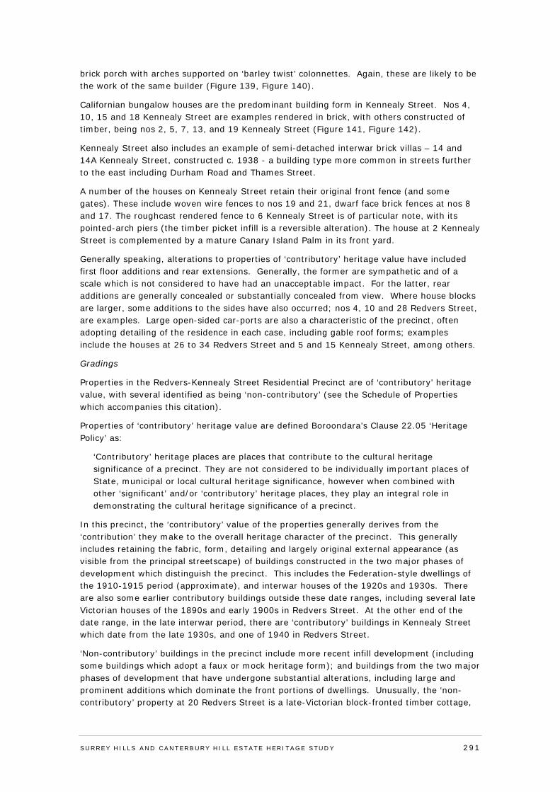
brick porch with arches supported on ‘barley twist’ colonnettes. Again, these are likely to be the work of the same builder (Figure 139, Figure 140).
Californian bungalow houses are the predominant building form in Kennealy Street. Nos 4, 10, 15 and 18 Kennealy Street are examples rendered in brick, with others constructed of timber, being nos 2, 5, 7, 13, and 19 Kennealy Street (Figure 141, Figure 142).
Kennealy Street also includes an example of semi-detached interwar brick villas – 14 and 14A Kennealy Street, constructed c. 1938 - a building type more common in streets further to the east including Durham Road and Thames Street.
A number of the houses on Kennealy Street retain their original front fence (and some gates). These include woven wire fences to nos 19 and 21, dwarf face brick fences at nos 8 and 17. The roughcast rendered fence to 6 Kennealy Street is of particular note, with its pointed-arch piers (the timber picket infill is a reversible alteration). The house at 2 Kennealy Street is complemented by a mature Canary Island Palm in its front yard.
Generally speaking, alterations to properties of ‘contributory’ heritage value have included first floor additions and rear extensions. Generally, the former are sympathetic and of a scale which is not considered to have had an unacceptable impact. For the latter, rear additions are generally concealed or substantially concealed from view. Where house blocks are larger, some additions to the sides have also occurred; nos 4, 10 and 28 Redvers Street, are examples. Large open-sided car-ports are also a characteristic of the precinct, often adopting detailing of the residence in each case, including gable roof forms; examples include the houses at 26 to 34 Redvers Street and 5 and 15 Kennealy Street, among others.
Gradings
Properties in the Redvers-Kennealy Street Residential Precinct are of ‘contributory’ heritage value, with several identified as being ‘non-contributory’ (see the Schedule of Properties which accompanies this citation).
Properties of ‘contributory’ heritage value are defined Boroondara’s Clause 22.05 ‘Heritage Policy’ as:
‘Contributory’ heritage places are places that contribute to the cultural heritage significance of a precinct. They are not considered to be individually important places of State, municipal or local cultural heritage significance, however when combined with other ‘significant’ and/or ‘contributory’ heritage places, they play an integral role in demonstrating the cultural heritage significance of a precinct.
In this precinct, the ‘contributory’ value of the properties generally derives from the ‘contribution’ they make to the overall heritage character of the precinct. This generally includes retaining the fabric, form, detailing and largely original external appearance (as visible from the principal streetscape) of buildings constructed in the two major phases of development which distinguish the precinct. This includes the Federation-style dwellings of the 1910-1915 period (approximate), and interwar houses of the 1920s and 1930s. There are also some earlier contributory buildings outside these date ranges, including several late Victorian houses of the 1890s and early 1900s in Redvers Street. At the other end of the date range, in the late interwar period, there are ‘contributory’ buildings in Kennealy Street which date from the late 1930s, and one of 1940 in Redvers Street.
‘Non-contributory’ buildings in the precinct include more recent infill development (including some buildings which adopt a faux or mock heritage form); and buildings from the two major phases of development that have undergone substantial alterations, including large and prominent additions which dominate the front portions of dwellings. Unusually, the ‘non-contributory’ property at 20 Redvers Street is a late-Victorian block-fronted timber cottage,
SURREY HI LLS AND CANTERBURY HI LL ESTATE HERITAGE STUDY 291
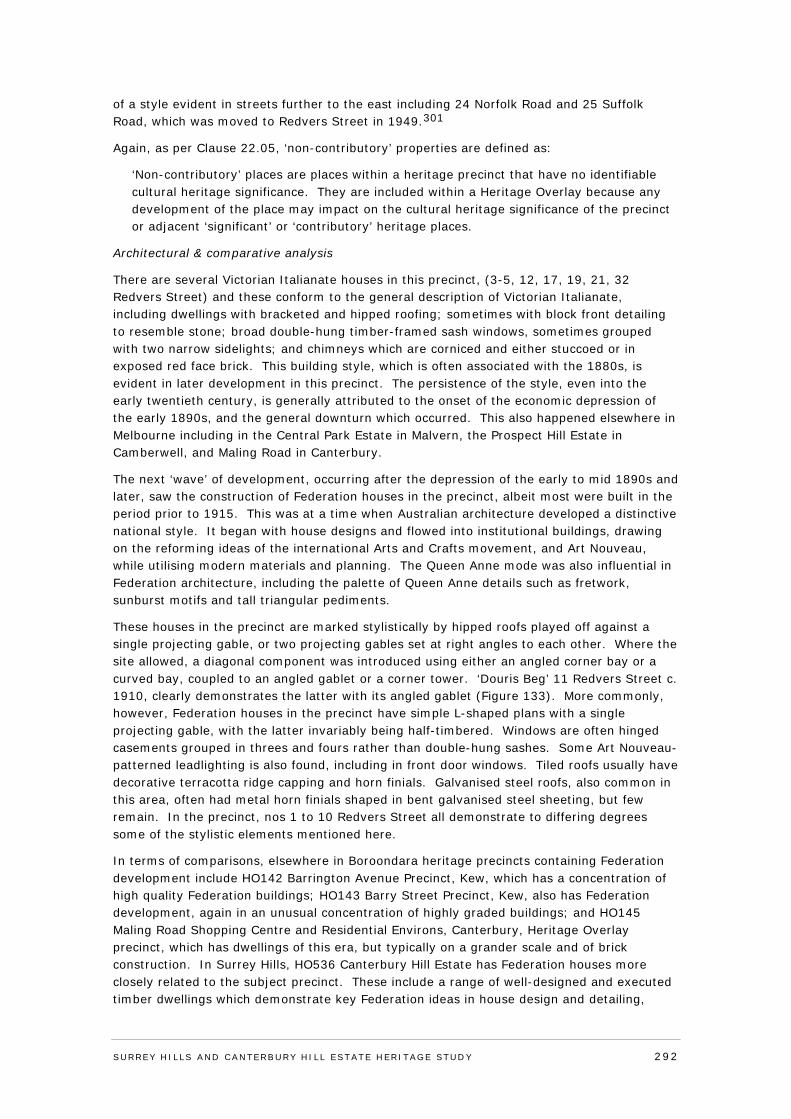
of a style evident in streets further to the east including 24 Norfolk Road and 25 Suffolk Road, which was moved to Redvers Street in 1949.301
Again, as per Clause 22.05, ‘non-contributory’ properties are defined as:
‘Non-contributory’ places are places within a heritage precinct that have no identifiable cultural heritage significance. They are included within a Heritage Overlay because any development of the place may impact on the cultural heritage significance of the precinct or adjacent ‘significant’ or ‘contributory’ heritage places.
Architectural & comparative analysis
There are several Victorian Italianate houses in this precinct, (3-5, 12, 17, 19, 21, 32 Redvers Street) and these conform to the general description of Victorian Italianate, including dwellings with bracketed and hipped roofing; sometimes with block front detailing to resemble stone; broad double-hung timber-framed sash windows, sometimes grouped with two narrow sidelights; and chimneys which are corniced and either stuccoed or in exposed red face brick. This building style, which is often associated with the 1880s, is evident in later development in this precinct. The persistence of the style, even into the early twentieth century, is generally attributed to the onset of the economic depression of the early 1890s, and the general downturn which occurred. This also happened elsewhere in Melbourne including in the Central Park Estate in Malvern, the Prospect Hill Estate in Camberwell, and Maling Road in Canterbury.
The next ‘wave’ of development, occurring after the depression of the early to mid 1890s and later, saw the construction of Federation houses in the precinct, albeit most were built in the period prior to 1915. This was at a time when Australian architecture developed a distinctive national style. It began with house designs and flowed into institutional buildings, drawing on the reforming ideas of the international Arts and Crafts movement, and Art Nouveau, while utilising modern materials and planning. The Queen Anne mode was also influential in Federation architecture, including the palette of Queen Anne details such as fretwork, sunburst motifs and tall triangular pediments.
These houses in the precinct are marked stylistically by hipped roofs played off against a single projecting gable, or two projecting gables set at right angles to each other. Where the site allowed, a diagonal component was introduced using either an angled corner bay or a curved bay, coupled to an angled gablet or a corner tower. ‘Douris Beg’ 11 Redvers Street c. 1910, clearly demonstrates the latter with its angled gablet (Figure 133). More commonly, however, Federation houses in the precinct have simple L-shaped plans with a single projecting gable, with the latter invariably being half-timbered. Windows are often hinged casements grouped in threes and fours rather than double-hung sashes. Some Art Nouveau-patterned leadlighting is also found, including in front door windows. Tiled roofs usually have decorative terracotta ridge capping and horn finials. Galvanised steel roofs, also common in this area, often had metal horn finials shaped in bent galvanised steel sheeting, but few remain. In the precinct, nos 1 to 10 Redvers Street all demonstrate to differing degrees some of the stylistic elements mentioned here.
In terms of comparisons, elsewhere in Boroondara heritage precincts containing Federation development include HO142 Barrington Avenue Precinct, Kew, which has a concentration of high quality Federation buildings; HO143 Barry Street Precinct, Kew, also has Federation development, again in an unusual concentration of highly graded buildings; and HO145 Maling Road Shopping Centre and Residential Environs, Canterbury, Heritage Overlay precinct, which has dwellings of this era, but typically on a grander scale and of brick construction. In Surrey Hills, HO536 Canterbury Hill Estate has Federation houses more closely related to the subject precinct. These include a range of well-designed and executed timber dwellings which demonstrate key Federation ideas in house design and detailing,
SURREY HI LLS AND CANTERBURY HI LL ESTATE HERITAGE STUDY 292
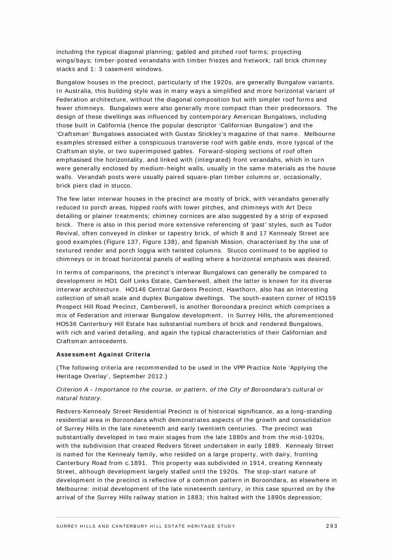
including the typical diagonal planning; gabled and pitched roof forms; projecting wings/bays; timber-posted verandahs with timber friezes and fretwork; tall brick chimney stacks and 1: 3 casement windows.
Bungalow houses in the precinct, particularly of the 1920s, are generally Bungalow variants. In Australia, this building style was in many ways a simplified and more horizontal variant of Federation architecture, without the diagonal composition but with simpler roof forms and fewer chimneys. Bungalows were also generally more compact than their predecessors. The design of these dwellings was influenced by contemporary American Bungalows, including those built in California (hence the popular descriptor ‘Californian Bungalow’) and the ‘Craftsman’ Bungalows associated with Gustav Stickley’s magazine of that name. Melbourne examples stressed either a conspicuous transverse roof with gable ends, more typical of the Craftsman style, or two superimposed gables. Forward-sloping sections of roof often emphasised the horizontality, and linked with (integrated) front verandahs, which in turn were generally enclosed by medium-height walls, usually in the same materials as the house walls. Verandah posts were usually paired square-plan timber columns or, occasionally, brick piers clad in stucco.
The few later interwar houses in the precinct are mostly of brick, with verandahs generally reduced to porch areas, hipped roofs with lower pitches, and chimneys with Art Deco detailing or plainer treatments; chimney cornices are also suggested by a strip of exposed brick. There is also in this period more extensive referencing of ‘past’ styles, such as Tudor Revival, often conveyed in clinker or tapestry brick, of which 8 and 17 Kennealy Street are good examples (Figure 137, Figure 138), and Spanish Mission, characterised by the use of textured render and porch loggia with twisted columns. Stucco continued to be applied to chimneys or in broad horizontal panels of walling where a horizontal emphasis was desired.
In terms of comparisons, the precinct’s interwar Bungalows can generally be compared to development in HO1 Golf Links Estate, Camberwell, albeit the latter is known for its diverse interwar architecture. HO146 Central Gardens Precinct, Hawthorn, also has an interesting collection of small scale and duplex Bungalow dwellings. The south-eastern corner of HO159 Prospect Hill Road Precinct, Camberwell, is another Boroondara precinct which comprises a mix of Federation and interwar Bungalow development. In Surrey Hills, the aforementioned HO536 Canterbury Hill Estate has substantial numbers of brick and rendered Bungalows, with rich and varied detailing, and again the typical characteristics of their Californian and Craftsman antecedents.
Assessment Against Criteria
(The following criteria are recommended to be used in the VPP Practice Note ‘Applying the Heritage Overlay’, September 2012.)
Criterion A - Importance to the course, or pattern, of the City of Boroondara’s cultural or natural history.
Redvers-Kennealy Street Residential Precinct is of historical significance, as a long-standing residential area in Boroondara which demonstrates aspects of the growth and consolidation of Surrey Hills in the late nineteenth and early twentieth centuries. The precinct was substantially developed in two main stages from the late 1880s and from the mid-1920s, with the subdivision that created Redvers Street undertaken in early 1889. Kennealy Street is named for the Kennealy family, who resided on a large property, with dairy, fronting Canterbury Road from c.1891. This property was subdivided in 1914, creating Kennealy Street, although development largely stalled until the 1920s. The stop-start nature of development in the precinct is reflective of a common pattern in Boroondara, as elsewhere in Melbourne: initial development of the late nineteenth century, in this case spurred on by the arrival of the Surrey Hills railway station in 1883; this halted with the 1890s depression;
SURREY HI LLS AND CANTERBURY HI LL ESTATE HERITAGE STUDY 293
development picked up again in the 1900s only to be arrested once more by World War One; then a post-war burst which also stuttered with the depression of the late 1920s and early 1930s. Unusually, the two parallel streets of the precinct strongly reflect the two main periods of residential development.
Criterion B - Possession of uncommon, rare or endangered aspects of the City of Boroondara’s cultural or natural history.
N/A
Criterion C - Potential to yield information that will contribute to an understanding of the City of Boroondara’s cultural or natural history.
N/A
Criterion D - Importance in demonstrating the principal characteristics of a class of cultural or natural places or environments.
N/A
Criterion E - Importance in exhibiting particular aesthetic characteristics.
Redvers-Kennealy Street Residential Precinct is of aesthetic/architectural significance. The precinct, which comprises contributory dwellings dating from the 1890s through to 1940, has a comparatively high level of intactness. Redvers Street is notable for its late Victorian and Federation houses, mostly of timber construction, including several Victorian Italianate houses. The latter have bracketed and hipped roofing, some with block front detailing to resemble stone, and corniced chimneys. Federation dwellings in the precinct are marked by hipped roofs played off against a single projecting gable, or two projecting gables set at right angles, or more commonly simple L-shaped plans with a single projecting gable. The interwar period of the 1920s and 1930s is also represented in Redvers Street, as it is in Kennealy Street, where brick houses are more common, including use of red face brick, decorative tapestry and clinker brick finishes, and rendered brick. Bungalow houses in the precinct, particularly of the 1920s, are generally Bungalow variants, influenced by contemporary American Bungalows. Wider housing blocks to Kennealy Street have also enabled the construction of several triple-fronted residences in popular interwar Tudor Revival and Spanish Mission styles.
Criterion F - Importance in demonstrating a high degree of creative or technical achievement at a particular period.
N/A
Criterion G - Strong or special association with a particular community or cultural group for social, cultural or spiritual reasons. This includes the significance of a place to Indigenous peoples as part of their continuing and developing cultural traditions.
N/A
Criterion H - Special association with the life or works of a person, or group of persons, of importance in City of Boroondara’s history.
N/A
Statement of Significance
What is Significant
Redvers-Kennealy Street Residential Precinct is concentrated on Redvers and Kennealy streets, Surrey Hills. The precinct, which is predominantly of ‘contributory’ heritage
SURREY HI LLS AND CANTERBURY HI LL ESTATE HERITAGE STUDY 294
properties dating from the 1890s to 1940, comprises two parallel streets running south off Canterbury Road. The two streets, unusually, strongly reflect the two main periods of residential development in the precinct, albeit with intervening bursts of development. This occurred from the 1890s (Redvers Street, after the street was created in 1889) and from the 1920s (Kennealy Street, after the street was created in 1914). Redvers Street contains houses from the late Victorian and Federation eras, mostly constructed of timber. The street also contains some interwar dwellings, including Californian bungalows, but the majority of 1920s and 1930s houses are located in Kennealy Street, where they are predominantly of brick construction.
How is it significant?
Redvers-Kennealy Street Residential Precinct is of historical and aesthetic/architectural significance to the City of Boroondara.
Why is it Significant
Redvers-Kennealy Street Residential Precinct is of historical significance, as a long-standing residential area in Boroondara which demonstrates aspects of the growth and consolidation of Surrey Hills in the late nineteenth and early twentieth centuries. The precinct was substantially developed in two main stages from the late 1880s and from the mid-1920s, with the subdivision that created Redvers Street undertaken in early 1889. Kennealy Street is named for the Kennealy family, who resided on a large property, with dairy, fronting Canterbury Road from c.1891. This property was subdivided in 1914, creating Kennealy Street, although development largely stalled until the 1920s. The stop-start nature of development in the precinct is reflective of a common pattern in Boroondara, as elsewhere in Melbourne: initial development of the late nineteenth century, in this case spurred on by the arrival of the Surrey Hills railway station in 1883; this halted with the 1890s depression; development picked up again in the 1900s only to be arrested once more by World War One; then a post-war burst which also stuttered with the depression of the late 1920s and early 1930s. Unusually, the two parallel streets of the precinct strongly reflect the two main periods of residential development.
The precinct is also of aesthetic/architectural significance, and has a comparatively high level of intactness with contributory dwellings dating from the 1890s through to 1940. Redvers Street is notable for its late Victorian and Federation houses, mostly of timber construction, including several Victorian Italianate houses. The latter have bracketed and hipped roofing, some with block front detailing to resemble stone, and corniced chimneys. Federation dwellings in the precinct are marked by hipped roofs played off against a single projecting gable, or two projecting gables set at right angles, or more commonly simple L-shaped plans with a single projecting gable. The interwar period of the 1920s and 1930s is also represented in Redvers Street, as it is in Kennealy Street, where brick houses are more common, including use of red face brick, decorative tapestry and clinker brick finishes, and rendered brick. Bungalow houses in the precinct, particularly of the 1920s, are generally Bungalow variants, influenced by contemporary American Bungalows. Wider housing blocks to Kennealy Street have also enabled the construction of several triple-fronted residences in popular interwar Tudor Revival and Spanish Mission styles.
Recommendations
Recommended for inclusion in the Schedule to the Heritage Overlay of the Boroondara Planning Scheme.
External paint controls No
Internal alteration controls No
SURREY HI LLS AND CANTERBURY HI LL ESTATE HERITAGE STUDY 295
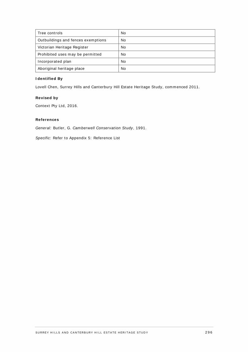
Tree controls No
Outbuildings and fences exemptions No
Victorian Heritage Register No
Prohibited uses may be permitted No
Incorporated plan No
Aboriginal heritage place No
Identified By
Lovell Chen, Surrey Hills and Canterbury Hill Estate Heritage Study, commenced 2011. Revised by
Context Pty Ltd, 2016.
References
General: Butler, G. Camberwell Conservation Study, 1991. Specific: Refer to Appendix 5: Reference List
SURREY HI LLS AND CANTERBURY HI LL ESTATE HERITAGE STUDY 296
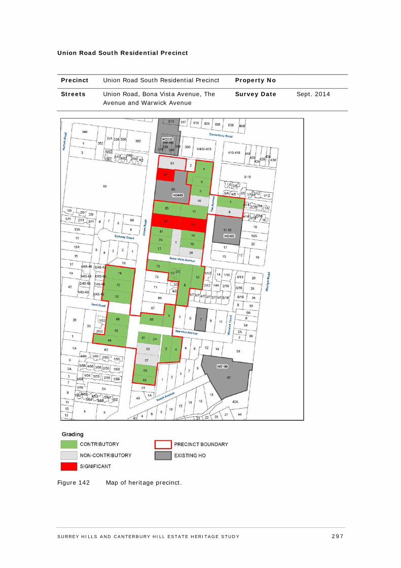
Union Road South Residential Precinct
Precinct Union Road South Residential Precinct Property No
Streets Union Road, Bona Vista Avenue, The Avenue and Warwick Avenue
Survey Date Sept. 2014
Figure 142 Map of heritage precinct.
SURREY HI LLS AND CANTERBURY HI LL ESTATE HERITAGE STUDY 297
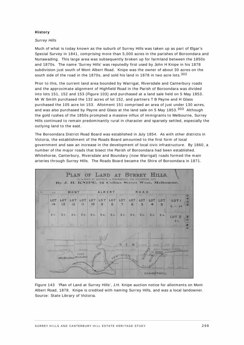
History
Surrey Hills
Much of what is today known as the suburb of Surrey Hills was taken up as part of Elgar’s Special Survey in 1841, comprising more than 5,000 acres in the parishes of Boroondara and Nunawading. This large area was subsequently broken up for farmland between the 1850s and 1870s. The name ‘Surrey Hills’ was reputedly first used by John H Knipe in his 1878 subdivision just south of Mont Albert Road. Knipe was the owner of about 30 acres on the south side of the road in the 1870s, and sold his land in 1878 in two acre lots.302
Prior to this, the current land area bounded by Warrigal, Riversdale and Canterbury roads and the approximate alignment of Highfield Road in the Parish of Boroondara was divided into lots 151, 152 and 153 (Figure 103) and purchased at a land sale held on 5 May 1853. Mr W Smith purchased the 132 acres of lot 152, and partners T B Payne and H Glass purchased the 105 acre lot 153. Allotment 151 comprised an area of just under 130 acres, and was also purchased by Payne and Glass at the land sale on 5 May 1853.303 Although the gold rushes of the 1850s prompted a massive influx of immigrants to Melbourne, Surrey Hills continued to remain predominantly rural in character and sparsely settled, especially the outlying land to the east.
The Boroondara District Road Board was established in July 1854. As with other districts in Victoria, the establishment of the Roads Board amounted to the first form of local government and saw an increase in the development of local civic infrastructure. By 1860, a number of the major roads that bisect the Parish of Boroondara had been established. Whitehorse, Canterbury, Riversdale and Boundary (now Warrigal) roads formed the main arteries through Surrey Hills. The Roads Board became the Shire of Boroondara in 1871.
Figure 143 ‘Plan of Land at Surrey Hills’, J.H. Knipe auction notice for allotments on Mont Albert Road, 1878. Knipe is credited with naming Surrey Hills, and was a local landowner. Source: State Library of Victoria.
SURREY HI LLS AND CANTERBURY HI LL ESTATE HERITAGE STUDY 298
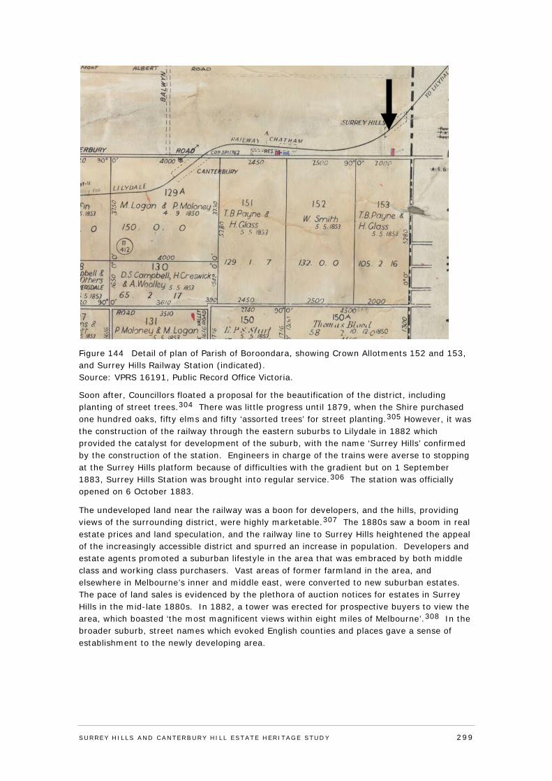
Figure 144 Detail of plan of Parish of Boroondara, showing Crown Allotments 152 and 153, and Surrey Hills Railway Station (indicated). Source: VPRS 16191, Public Record Office Victoria.
Soon after, Councillors floated a proposal for the beautification of the district, including planting of street trees.304 There was little progress until 1879, when the Shire purchased one hundred oaks, fifty elms and fifty ‘assorted trees’ for street planting.305 However, it was the construction of the railway through the eastern suburbs to Lilydale in 1882 which provided the catalyst for development of the suburb, with the name ‘Surrey Hills’ confirmed by the construction of the station. Engineers in charge of the trains were averse to stopping at the Surrey Hills platform because of difficulties with the gradient but on 1 September 1883, Surrey Hills Station was brought into regular service.306 The station was officially opened on 6 October 1883.
The undeveloped land near the railway was a boon for developers, and the hills, providing views of the surrounding district, were highly marketable.307 The 1880s saw a boom in real estate prices and land speculation, and the railway line to Surrey Hills heightened the appeal of the increasingly accessible district and spurred an increase in population. Developers and estate agents promoted a suburban lifestyle in the area that was embraced by both middle class and working class purchasers. Vast areas of former farmland in the area, and elsewhere in Melbourne’s inner and middle east, were converted to new suburban estates. The pace of land sales is evidenced by the plethora of auction notices for estates in Surrey Hills in the mid-late 1880s. In 1882, a tower was erected for prospective buyers to view the area, which boasted ‘the most magnificent views within eight miles of Melbourne’.308 In the broader suburb, street names which evoked English counties and places gave a sense of establishment to the newly developing area.
SURREY HI LLS AND CANTERBURY HI LL ESTATE HERITAGE STUDY 299
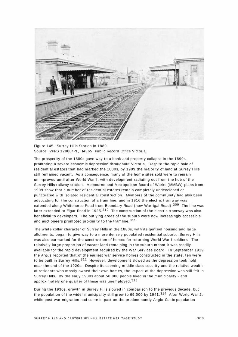
Figure 145 Surrey Hills Station in 1889. Source: VPRS 12800/P1, H4365, Public Record Office Victoria.
The prosperity of the 1880s gave way to a bank and property collapse in the 1890s, prompting a severe economic depression throughout Victoria. Despite the rapid sale of residential estates that had marked the 1880s, by 1909 the majority of land at Surrey Hills still remained vacant. As a consequence, many of the home sites sold were to remain unimproved until after World War I, with development radiating out from the hub of the Surrey Hills railway station. Melbourne and Metropolitan Board of Works (MMBW) plans from 1909 show that a number of residential estates remain completely undeveloped or punctuated with isolated residential construction. Members of the community had also been advocating for the construction of a tram line, and in 1916 the electric tramway was extended along Whitehorse Road from Boundary Road (now Warrigal Road).309 The line was later extended to Elgar Road in 1925.310 The construction of the electric tramway was also beneficial to developers. The outlying areas of the suburb were now increasingly accessible and auctioneers promoted proximity to the tramline.311
The white collar character of Surrey Hills in the 1880s, with its genteel housing and large allotments, began to give way to a more densely populated residential suburb. Surrey Hills was also earmarked for the construction of homes for returning World War I soldiers. The relatively large proportion of vacant land remaining in the suburb meant it was readily available for the rapid development required by the War Services Board. In September 1919 the Argus reported that of the earliest war service homes constructed in the state, ten were to be built in Surrey Hills.312 However, development slowed as the depression took hold near the end of the 1920s. Despite its seeming middle class security and the relative wealth of residents who mostly owned their own homes, the impact of the depression was still felt in Surrey Hills. By the early 1930s about 50,000 people lived in the municipality - and approximately one quarter of these was unemployed.313
During the 1930s, growth in Surrey Hills slowed in comparison to the previous decade, but the population of the wider municipality still grew to 69,000 by 1941.314 After World War 2, while post-war migration had some impact on the predominantly Anglo-Celtic population
SURREY HI LLS AND CANTERBURY HI LL ESTATE HERITAGE STUDY 300
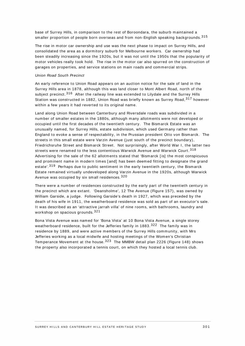
base of Surrey Hills, in comparison to the rest of Boroondara, the suburb maintained a smaller proportion of people born overseas and from non-English speaking backgrounds.315
The rise in motor car ownership and use was the next phase to impact on Surrey Hills, and consolidated the area as a dormitory suburb for Melbourne workers. Car ownership had been steadily increasing since the 1920s, but it was not until the 1950s that the popularity of motor vehicles really took hold. The rise in the motor car also spurred on the construction of garages on properties, and service stations on main roads and commercial strips.
Union Road South Precinct
An early reference to Union Road appears on an auction notice for the sale of land in the Surrey Hills area in 1878, although this was land closer to Mont Albert Road, north of the subject precinct.316 After the railway line was extended to Lilydale and the Surrey Hills Station was constructed in 1882, Union Road was briefly known as Surrey Road,317 however within a few years it had reverted to its original name.
Land along Union Road between Canterbury and Riversdale roads was subdivided in a number of smaller estates in the 1880s, although many allotments were not developed or occupied until the first decades of the twentieth century. The Bismarck Estate was an unusually named, for Surrey Hills, estate subdivision, which used Germany rather than England to evoke a sense of respectability, in the Prussian president Otto von Bismarck. The streets in this small estate were Varzin Avenue (just south of the precinct boundary), Friedrichsruhe Street and Bismarck Street. Not surprisingly, after World War I, the latter two streets were renamed to the less contentious Warwick Avenue and Warwick Court.318 Advertising for the sale of the 62 allotments stated that ‘Bismarck [is] the most conspicuous and prominent name in modern times [and] has been deemed fitting to designate the grand estate’.319 Perhaps due to public sentiment in the early twentieth century, the Bismarck Estate remained virtually undeveloped along Varzin Avenue in the 1920s, although Warwick Avenue was occupied by six small residences.320
There were a number of residences constructed by the early part of the twentieth century in the precinct which are extant. ‘Deansholme’, 12 The Avenue (Figure 157), was owned by William Garside, a judge. Following Garside’s death in 1927, which was preceded by the death of his wife in 1911, the weatherboard residence was sold as part of an executor’s sale. It was described as an ‘attractive jarrah villa’ of nine rooms, with bathrooms, laundry and workshop on spacious grounds.321
Bona Vista Avenue was named for ‘Bona Vista’ at 10 Bona Vista Avenue, a single storey weatherboard residence, built for the Jefferies family in 1883.322 The family was in residence by 1889, and were active members of the Surrey Hills community, with Mrs Jefferies working as a local midwife and hosting meetings of the Women’s Christian Temperance Movement at the house.323 The MMBW detail plan 2226 (Figure 148) shows the property also incorporated a tennis court, on which they hosted a local tennis club.
SURREY HI LLS AND CANTERBURY HI LL ESTATE HERITAGE STUDY 301
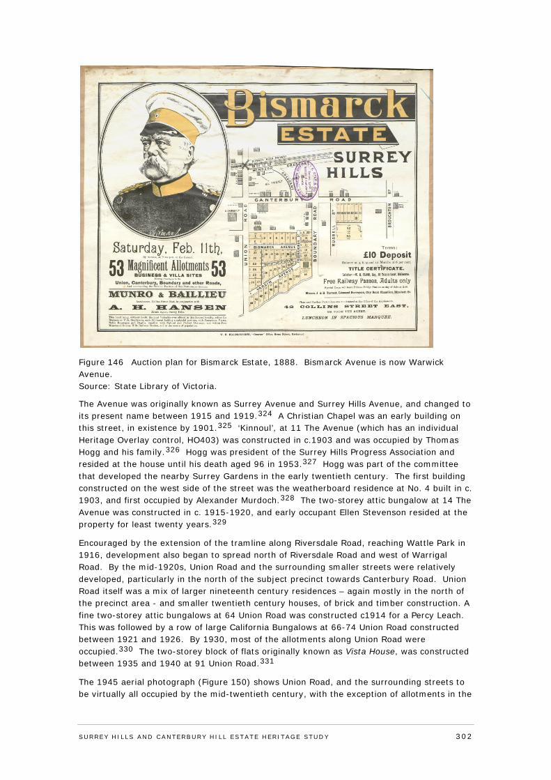
Figure 146 Auction plan for Bismarck Estate, 1888. Bismarck Avenue is now Warwick Avenue. Source: State Library of Victoria.
The Avenue was originally known as Surrey Avenue and Surrey Hills Avenue, and changed to its present name between 1915 and 1919.324 A Christian Chapel was an early building on this street, in existence by 1901.325 ‘Kinnoul’, at 11 The Avenue (which has an individual Heritage Overlay control, HO403) was constructed in c.1903 and was occupied by Thomas Hogg and his family.326 Hogg was president of the Surrey Hills Progress Association and resided at the house until his death aged 96 in 1953.327 Hogg was part of the committee that developed the nearby Surrey Gardens in the early twentieth century. The first building constructed on the west side of the street was the weatherboard residence at No. 4 built in c. 1903, and first occupied by Alexander Murdoch.328 The two-storey attic bungalow at 14 The Avenue was constructed in c. 1915-1920, and early occupant Ellen Stevenson resided at the property for least twenty years.329
Encouraged by the extension of the tramline along Riversdale Road, reaching Wattle Park in 1916, development also began to spread north of Riversdale Road and west of Warrigal Road. By the mid-1920s, Union Road and the surrounding smaller streets were relatively developed, particularly in the north of the subject precinct towards Canterbury Road. Union Road itself was a mix of larger nineteenth century residences – again mostly in the north of the precinct area - and smaller twentieth century houses, of brick and timber construction. A fine two-storey attic bungalows at 64 Union Road was constructed c1914 for a Percy Leach. This was followed by a row of large California Bungalows at 66-74 Union Road constructed between 1921 and 1926. By 1930, most of the allotments along Union Road were occupied.330 The two-storey block of flats originally known as Vista House, was constructed between 1935 and 1940 at 91 Union Road.331
The 1945 aerial photograph (Figure 150) shows Union Road, and the surrounding streets to be virtually all occupied by the mid-twentieth century, with the exception of allotments in the
SURREY HI LLS AND CANTERBURY HI LL ESTATE HERITAGE STUDY 302
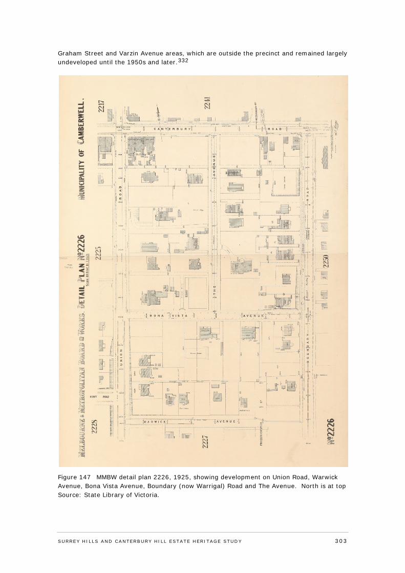
Graham Street and Varzin Avenue areas, which are outside the precinct and remained largely undeveloped until the 1950s and later.332
Figure 147 MMBW detail plan 2226, 1925, showing development on Union Road, Warwick Avenue, Bona Vista Avenue, Boundary (now Warrigal) Road and The Avenue. North is at top Source: State Library of Victoria.
SURREY HI LLS AND CANTERBURY HI LL ESTATE HERITAGE STUDY 303
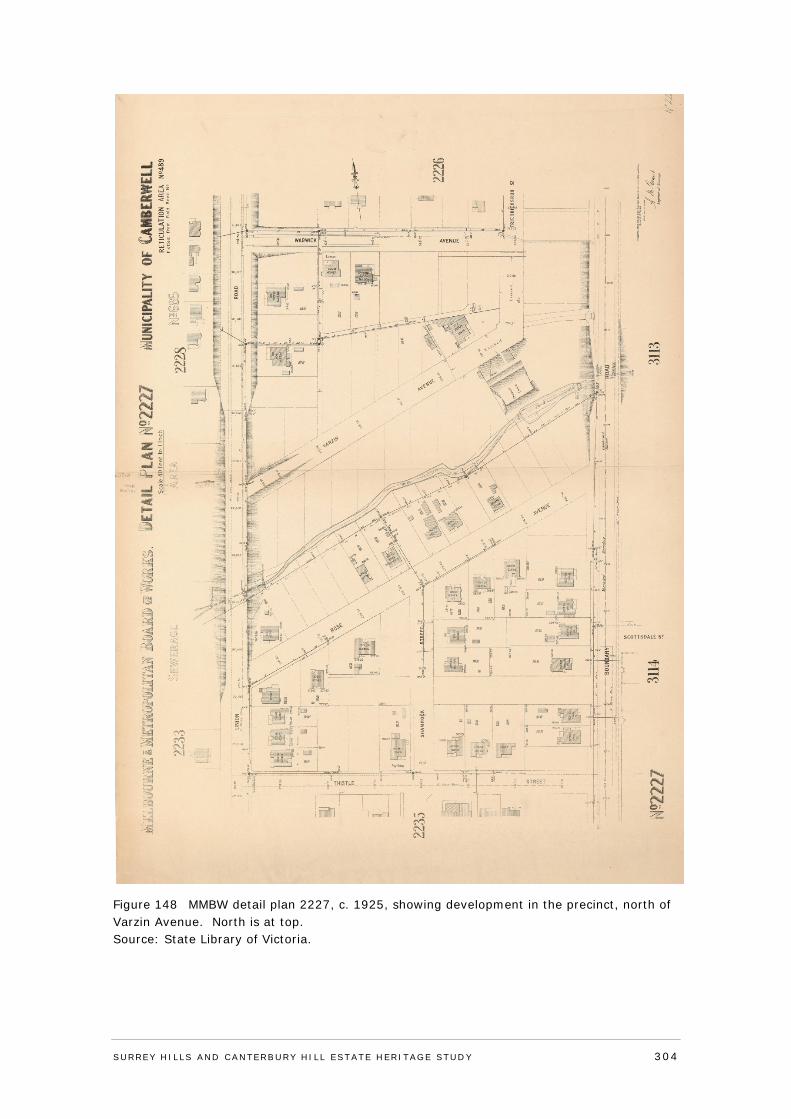
Figure 148 MMBW detail plan 2227, c. 1925, showing development in the precinct, north of Varzin Avenue. North is at top. Source: State Library of Victoria.
SURREY HI LLS AND CANTERBURY HI LL ESTATE HERITAGE STUDY 304
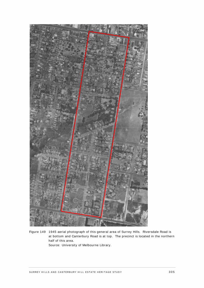
Figure 149 1945 aerial photograph of this general area of Surrey Hills. Riversdale Road is at bottom and Canterbury Road is at top. The precinct is located in the northern half of this area.
Source: University of Melbourne Library.
SURREY HI LLS AND CANTERBURY HI LL ESTATE HERITAGE STUDY 305
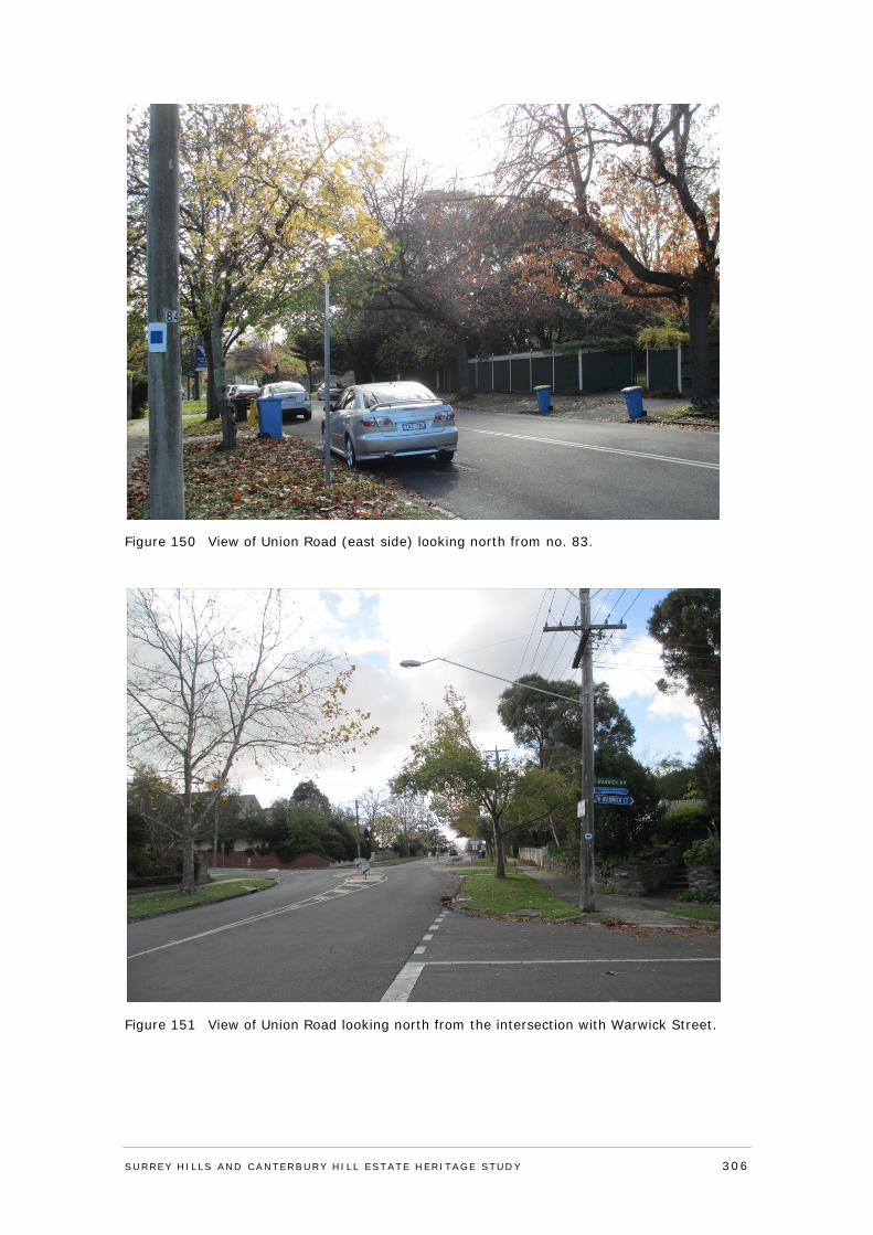
Figure 150 View of Union Road (east side) looking north from no. 83.
Figure 151 View of Union Road looking north from the intersection with Warwick Street.
SURREY HI LLS AND CANTERBURY HI LL ESTATE HERITAGE STUDY 306
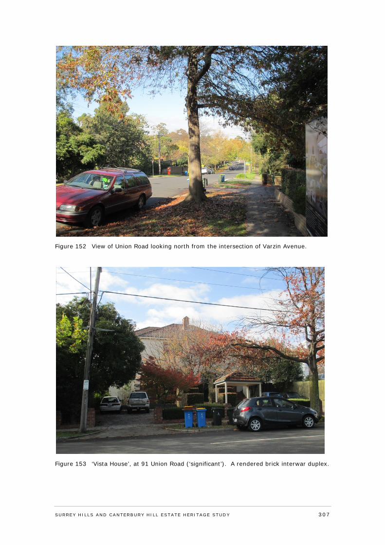
Figure 152 View of Union Road looking north from the intersection of Varzin Avenue.
Figure 153 ‘Vista House’, at 91 Union Road (‘significant’). A rendered brick interwar duplex.
SURREY HI LLS AND CANTERBURY HI LL ESTATE HERITAGE STUDY 307
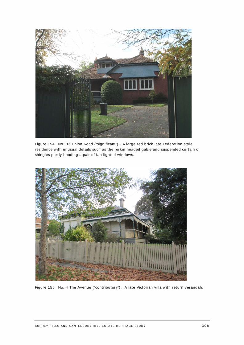
Figure 154 No. 83 Union Road (‘significant’). A large red brick late Federation style residence with unusual details such as the jerkin headed gable and suspended curtain of shingles partly hooding a pair of fan lighted windows.
Figure 155 No. 4 The Avenue (‘contributory’). A late Victorian villa with return verandah.
SURREY HI LLS AND CANTERBURY HI LL ESTATE HERITAGE STUDY 308
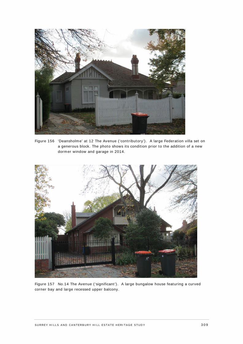
Figure 156 ‘Deansholme’ at 12 The Avenue (‘contributory’). A large Federation villa set on a generous block. The photo shows its condition prior to the addition of a new dormer window and garage in 2014.
Figure 157 No.14 The Avenue (‘significant’). A large bungalow house featuring a curved corner bay and large recessed upper balcony.
SURREY HI LLS AND CANTERBURY HI LL ESTATE HERITAGE STUDY 309
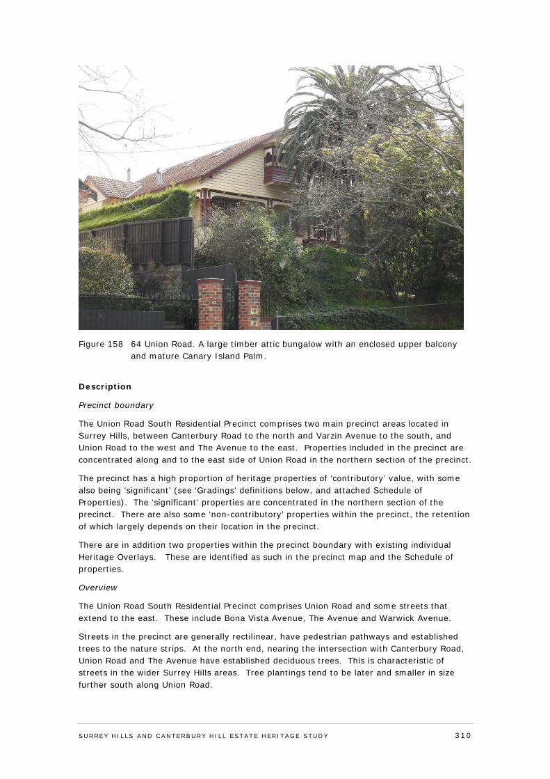
Figure 158 64 Union Road. A large timber attic bungalow with an enclosed upper balcony and mature Canary Island Palm.
Description
Precinct boundary
The Union Road South Residential Precinct comprises two main precinct areas located in Surrey Hills, between Canterbury Road to the north and Varzin Avenue to the south, and Union Road to the west and The Avenue to the east. Properties included in the precinct are concentrated along and to the east side of Union Road in the northern section of the precinct.
The precinct has a high proportion of heritage properties of ‘contributory’ value, with some also being ‘significant’ (see ‘Gradings’ definitions below, and attached Schedule of Properties). The ‘significant’ properties are concentrated in the northern section of the precinct. There are also some ‘non-contributory’ properties within the precinct, the retention of which largely depends on their location in the precinct.
There are in addition two properties within the precinct boundary with existing individual Heritage Overlays. These are identified as such in the precinct map and the Schedule of properties.
Overview
The Union Road South Residential Precinct comprises Union Road and some streets that extend to the east. These include Bona Vista Avenue, The Avenue and Warwick Avenue.
Streets in the precinct are generally rectilinear, have pedestrian pathways and established trees to the nature strips. At the north end, nearing the intersection with Canterbury Road, Union Road and The Avenue have established deciduous trees. This is characteristic of streets in the wider Surrey Hills areas. Tree plantings tend to be later and smaller in size further south along Union Road.
SURREY HI LLS AND CANTERBURY HI LL ESTATE HERITAGE STUDY 310
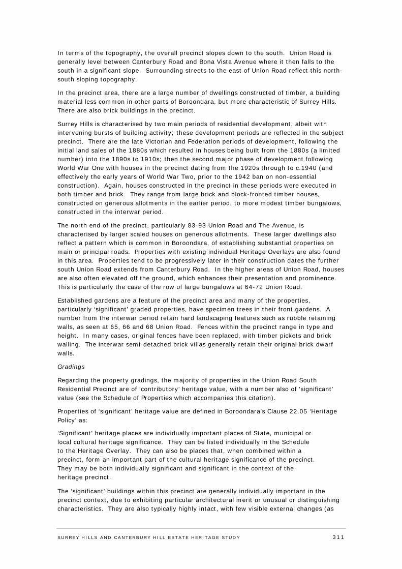
In terms of the topography, the overall precinct slopes down to the south. Union Road is generally level between Canterbury Road and Bona Vista Avenue where it then falls to the south in a significant slope. Surrounding streets to the east of Union Road reflect this north-south sloping topography.
In the precinct area, there are a large number of dwellings constructed of timber, a building material less common in other parts of Boroondara, but more characteristic of Surrey Hills. There are also brick buildings in the precinct.
Surrey Hills is characterised by two main periods of residential development, albeit with intervening bursts of building activity; these development periods are reflected in the subject precinct. There are the late Victorian and Federation periods of development, following the initial land sales of the 1880s which resulted in houses being built from the 1880s (a limited number) into the 1890s to 1910s; then the second major phase of development following World War One with houses in the precinct dating from the 1920s through to c.1940 (and effectively the early years of World War Two, prior to the 1942 ban on non-essential construction). Again, houses constructed in the precinct in these periods were executed in both timber and brick. They range from large brick and block-fronted timber houses, constructed on generous allotments in the earlier period, to more modest timber bungalows, constructed in the interwar period.
The north end of the precinct, particularly 83-93 Union Road and The Avenue, is characterised by larger scaled houses on generous allotments. These larger dwellings also reflect a pattern which is common in Boroondara, of establishing substantial properties on main or principal roads. Properties with existing individual Heritage Overlays are also found in this area. Properties tend to be progressively later in their construction dates the further south Union Road extends from Canterbury Road. In the higher areas of Union Road, houses are also often elevated off the ground, which enhances their presentation and prominence. This is particularly the case of the row of large bungalows at 64-72 Union Road.
Established gardens are a feature of the precinct area and many of the properties, particularly ‘significant’ graded properties, have specimen trees in their front gardens. A number from the interwar period retain hard landscaping features such as rubble retaining walls, as seen at 65, 66 and 68 Union Road. Fences within the precinct range in type and height. In many cases, original fences have been replaced, with timber pickets and brick walling. The interwar semi-detached brick villas generally retain their original brick dwarf walls.
Gradings
Regarding the property gradings, the majority of properties in the Union Road South Residential Precinct are of ‘contributory’ heritage value, with a number also of ‘significant’ value (see the Schedule of Properties which accompanies this citation).
Properties of ‘significant’ heritage value are defined in Boroondara’s Clause 22.05 ‘Heritage Policy’ as:
‘Significant’ heritage places are individually important places of State, municipal or local cultural heritage significance. They can be listed individually in the Schedule to the Heritage Overlay. They can also be places that, when combined within a precinct, form an important part of the cultural heritage significance of the precinct. They may be both individually significant and significant in the context of the heritage precinct.
The ‘significant’ buildings within this precinct are generally individually important in the precinct context, due to exhibiting particular architectural merit or unusual or distinguishing characteristics. They are also typically highly intact, with few visible external changes (as
SURREY HI LLS AND CANTERBURY HI LL ESTATE HERITAGE STUDY 311
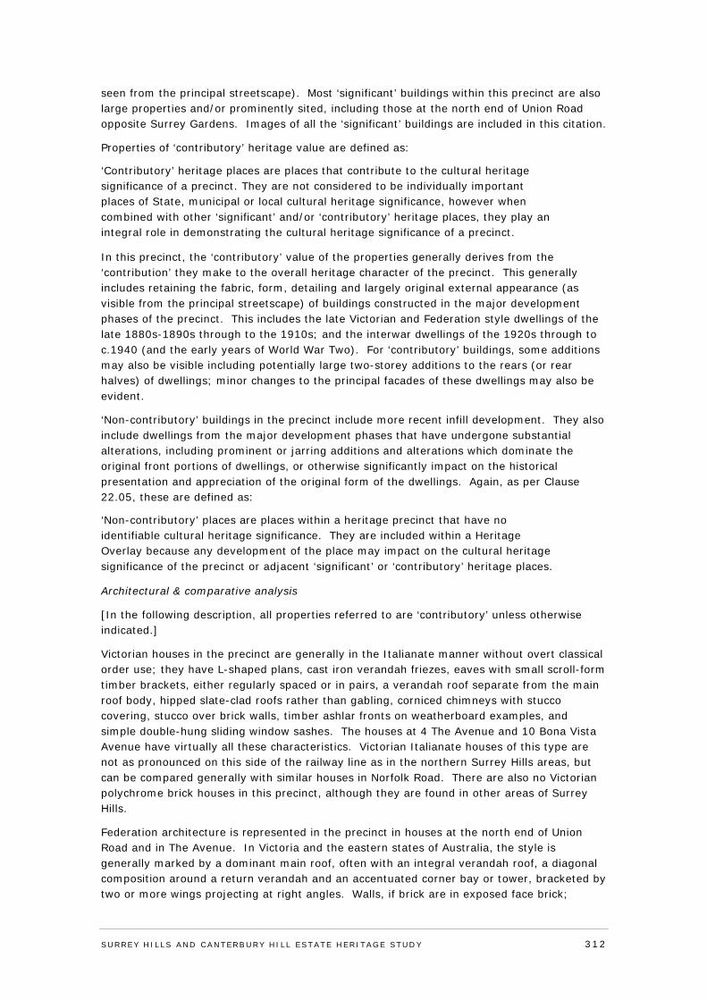
seen from the principal streetscape). Most ‘significant’ buildings within this precinct are also large properties and/or prominently sited, including those at the north end of Union Road opposite Surrey Gardens. Images of all the ‘significant’ buildings are included in this citation.
Properties of ‘contributory’ heritage value are defined as:
‘Contributory’ heritage places are places that contribute to the cultural heritage significance of a precinct. They are not considered to be individually important places of State, municipal or local cultural heritage significance, however when combined with other ‘significant’ and/or ‘contributory’ heritage places, they play an integral role in demonstrating the cultural heritage significance of a precinct.
In this precinct, the ‘contributory’ value of the properties generally derives from the ‘contribution’ they make to the overall heritage character of the precinct. This generally includes retaining the fabric, form, detailing and largely original external appearance (as visible from the principal streetscape) of buildings constructed in the major development phases of the precinct. This includes the late Victorian and Federation style dwellings of the late 1880s-1890s through to the 1910s; and the interwar dwellings of the 1920s through to c.1940 (and the early years of World War Two). For ‘contributory’ buildings, some additions may also be visible including potentially large two-storey additions to the rears (or rear halves) of dwellings; minor changes to the principal facades of these dwellings may also be evident.
‘Non-contributory’ buildings in the precinct include more recent infill development. They also include dwellings from the major development phases that have undergone substantial alterations, including prominent or jarring additions and alterations which dominate the original front portions of dwellings, or otherwise significantly impact on the historical presentation and appreciation of the original form of the dwellings. Again, as per Clause 22.05, these are defined as:
‘Non-contributory’ places are places within a heritage precinct that have no identifiable cultural heritage significance. They are included within a Heritage Overlay because any development of the place may impact on the cultural heritage significance of the precinct or adjacent ‘significant’ or ‘contributory’ heritage places.
Architectural & comparative analysis
[In the following description, all properties referred to are ‘contributory’ unless otherwise indicated.]
Victorian houses in the precinct are generally in the Italianate manner without overt classical order use; they have L-shaped plans, cast iron verandah friezes, eaves with small scroll-form timber brackets, either regularly spaced or in pairs, a verandah roof separate from the main roof body, hipped slate-clad roofs rather than gabling, corniced chimneys with stucco covering, stucco over brick walls, timber ashlar fronts on weatherboard examples, and simple double-hung sliding window sashes. The houses at 4 The Avenue and 10 Bona Vista Avenue have virtually all these characteristics. Victorian Italianate houses of this type are not as pronounced on this side of the railway line as in the northern Surrey Hills areas, but can be compared generally with similar houses in Norfolk Road. There are also no Victorian polychrome brick houses in this precinct, although they are found in other areas of Surrey Hills.
Federation architecture is represented in the precinct in houses at the north end of Union Road and in The Avenue. In Victoria and the eastern states of Australia, the style is generally marked by a dominant main roof, often with an integral verandah roof, a diagonal composition around a return verandah and an accentuated corner bay or tower, bracketed by two or more wings projecting at right angles. Walls, if brick are in exposed face brick;
SURREY HI LLS AND CANTERBURY HI LL ESTATE HERITAGE STUDY 312
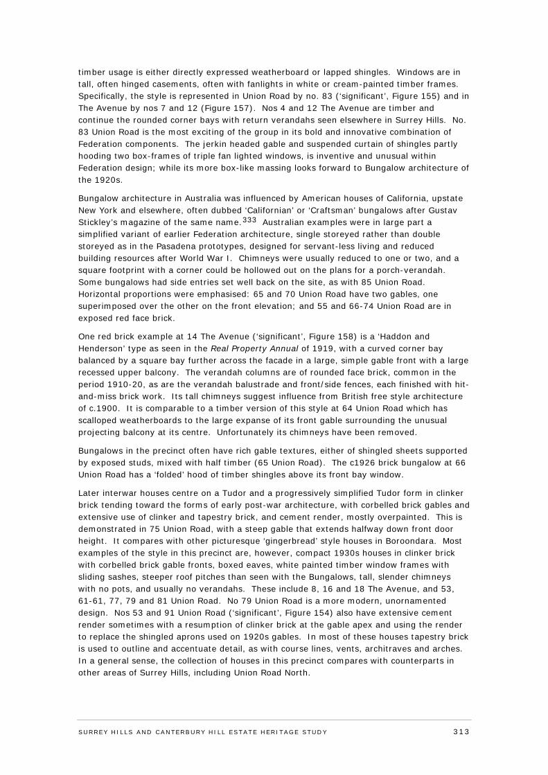
timber usage is either directly expressed weatherboard or lapped shingles. Windows are in tall, often hinged casements, often with fanlights in white or cream-painted timber frames. Specifically, the style is represented in Union Road by no. 83 (‘significant’, Figure 155) and in The Avenue by nos 7 and 12 (Figure 157). Nos 4 and 12 The Avenue are timber and continue the rounded corner bays with return verandahs seen elsewhere in Surrey Hills. No. 83 Union Road is the most exciting of the group in its bold and innovative combination of Federation components. The jerkin headed gable and suspended curtain of shingles partly hooding two box-frames of triple fan lighted windows, is inventive and unusual within Federation design; while its more box-like massing looks forward to Bungalow architecture of the 1920s.
Bungalow architecture in Australia was influenced by American houses of California, upstate New York and elsewhere, often dubbed ‘Californian’ or ‘Craftsman’ bungalows after Gustav Stickley’s magazine of the same name.333 Australian examples were in large part a simplified variant of earlier Federation architecture, single storeyed rather than double storeyed as in the Pasadena prototypes, designed for servant-less living and reduced building resources after World War I. Chimneys were usually reduced to one or two, and a square footprint with a corner could be hollowed out on the plans for a porch-verandah. Some bungalows had side entries set well back on the site, as with 85 Union Road. Horizontal proportions were emphasised: 65 and 70 Union Road have two gables, one superimposed over the other on the front elevation; and 55 and 66-74 Union Road are in exposed red face brick.
One red brick example at 14 The Avenue (‘significant’, Figure 158) is a ‘Haddon and Henderson’ type as seen in the Real Property Annual of 1919, with a curved corner bay balanced by a square bay further across the facade in a large, simple gable front with a large recessed upper balcony. The verandah columns are of rounded face brick, common in the period 1910-20, as are the verandah balustrade and front/side fences, each finished with hit-and-miss brick work. Its tall chimneys suggest influence from British free style architecture of c.1900. It is comparable to a timber version of this style at 64 Union Road which has scalloped weatherboards to the large expanse of its front gable surrounding the unusual projecting balcony at its centre. Unfortunately its chimneys have been removed.
Bungalows in the precinct often have rich gable textures, either of shingled sheets supported by exposed studs, mixed with half timber (65 Union Road). The c1926 brick bungalow at 66 Union Road has a ‘folded’ hood of timber shingles above its front bay window.
Later interwar houses centre on a Tudor and a progressively simplified Tudor form in clinker brick tending toward the forms of early post-war architecture, with corbelled brick gables and extensive use of clinker and tapestry brick, and cement render, mostly overpainted. This is demonstrated in 75 Union Road, with a steep gable that extends halfway down front door height. It compares with other picturesque ‘gingerbread’ style houses in Boroondara. Most examples of the style in this precinct are, however, compact 1930s houses in clinker brick with corbelled brick gable fronts, boxed eaves, white painted timber window frames with sliding sashes, steeper roof pitches than seen with the Bungalows, tall, slender chimneys with no pots, and usually no verandahs. These include 8, 16 and 18 The Avenue, and 53, 61-61, 77, 79 and 81 Union Road. No 79 Union Road is a more modern, unornamented design. Nos 53 and 91 Union Road (‘significant’, Figure 154) also have extensive cement render sometimes with a resumption of clinker brick at the gable apex and using the render to replace the shingled aprons used on 1920s gables. In most of these houses tapestry brick is used to outline and accentuate detail, as with course lines, vents, architraves and arches. In a general sense, the collection of houses in this precinct compares with counterparts in other areas of Surrey Hills, including Union Road North.
SURREY HI LLS AND CANTERBURY HI LL ESTATE HERITAGE STUDY 313
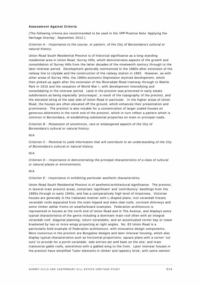
Assessment Against Criteria
(The following criteria are recommended to be used in the VPP Practice Note ‘Applying the Heritage Overlay’, September 2012.)
Criterion A - Importance to the course, or pattern, of the City of Boroondara’s cultural or natural history.
Union Road South Residential Precinct is of historical significance as a long-standing residential area in Union Road, Surrey Hills, which demonstrates aspects of the growth and consolidation of Surrey Hills from the latter decades of the nineteenth century through to the later interwar period. Development generally commenced in the 1880s after extension of the railway line to Lilydale and the construction of the railway station in 1882. However, as with other areas of Surrey Hills, the 1890s economic Depression stymied development, which then picked up again after the extension of the Riversdale Road tramway through to Wattle Park in 1916 and the cessation of World War I, with development intensifying and consolidating in the interwar period. Land in the precinct was promoted in early estate subdivisions as being especially ‘picturesque’, a result of the topography of the precinct, and the elevated siting of the east side of Union Road in particular. In the higher areas of Union Road, the houses are often elevated off the ground, which enhances their presentation and prominence. The precinct is also notable for a concentration of larger scaled houses on generous allotments in the north end of the precinct, which in turn reflect a pattern which is common in Boroondara, of establishing substantial properties on main or principal roads.
Criterion B - Possession of uncommon, rare or endangered aspects of the City of Boroondara’s cultural or natural history.
N/A
Criterion C - Potential to yield information that will contribute to an understanding of the City of Boroondara’s cultural or natural history.
N/A
Criterion D - Importance in demonstrating the principal characteristics of a class of cultural or natural places or environments.
N/A
Criterion E - Importance in exhibiting particular aesthetic characteristics.
Union Road South Residential Precinct is of aesthetic/architectural significance. The precinct, in several main precinct areas, comprises ‘significant’ and ‘contributory’ dwellings from the 1880s through to early 1940s, and has a comparatively high level of intactness. Victorian houses are generally in the Italianate manner with L-shaped plans; iron verandah friezes; verandah roofs separated from the main hipped and slate-clad roofs; corniced chimneys and some timber ashlar fronts on weatherboard examples. Federation architecture is represented in houses at the north end of Union Road and in The Avenue, and displays some typical characteristics of the genre including a dominant main roof often with an integral verandah roof; diagonal planning; return verandahs; and an accentuated corner bay or tower bracketed by two or more wings projecting at right angles. No. 83 Union Road is a particularly bold example of Federation architecture, with innovative design components. More numerous in the precinct are Bungalow designs and later interwar housing, which also display typical characteristics such as horizontal proportions; square plans with a corner ‘cut outs’ to provide for a porch-verandah; side entries set well back on the site; and main transverse gable roofs, sometimes with a gabled wing to the front. Later interwar houses in the precinct have simplified Tudor elements in clinker and tapestry brick, with some cement
SURREY HI LLS AND CANTERBURY HI LL ESTATE HERITAGE STUDY 314
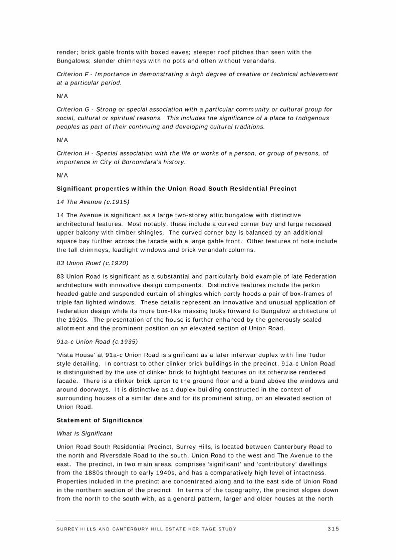
render; brick gable fronts with boxed eaves; steeper roof pitches than seen with the Bungalows; slender chimneys with no pots and often without verandahs.
Criterion F - Importance in demonstrating a high degree of creative or technical achievement at a particular period.
N/A
Criterion G - Strong or special association with a particular community or cultural group for social, cultural or spiritual reasons. This includes the significance of a place to Indigenous peoples as part of their continuing and developing cultural traditions.
N/A
Criterion H - Special association with the life or works of a person, or group of persons, of importance in City of Boroondara’s history.
N/A
Significant properties within the Union Road South Residential Precinct
14 The Avenue (c.1915)
14 The Avenue is significant as a large two-storey attic bungalow with distinctive architectural features. Most notably, these include a curved corner bay and large recessed upper balcony with timber shingles. The curved corner bay is balanced by an additional square bay further across the facade with a large gable front. Other features of note include the tall chimneys, leadlight windows and brick verandah columns.
83 Union Road (c.1920)
83 Union Road is significant as a substantial and particularly bold example of late Federation architecture with innovative design components. Distinctive features include the jerkin headed gable and suspended curtain of shingles which partly hoods a pair of box-frames of triple fan lighted windows. These details represent an innovative and unusual application of Federation design while its more box-like massing looks forward to Bungalow architecture of the 1920s. The presentation of the house is further enhanced by the generously scaled allotment and the prominent position on an elevated section of Union Road.
91a-c Union Road (c.1935)
‘Vista House’ at 91a-c Union Road is significant as a later interwar duplex with fine Tudor style detailing. In contrast to other clinker brick buildings in the precinct, 91a-c Union Road is distinguished by the use of clinker brick to highlight features on its otherwise rendered facade. There is a clinker brick apron to the ground floor and a band above the windows and around doorways. It is distinctive as a duplex building constructed in the context of surrounding houses of a similar date and for its prominent siting, on an elevated section of Union Road.
Statement of Significance
What is Significant
Union Road South Residential Precinct, Surrey Hills, is located between Canterbury Road to the north and Riversdale Road to the south, Union Road to the west and The Avenue to the east. The precinct, in two main areas, comprises ‘significant’ and ‘contributory’ dwellings from the 1880s through to early 1940s, and has a comparatively high level of intactness. Properties included in the precinct are concentrated along and to the east side of Union Road in the northern section of the precinct. In terms of the topography, the precinct slopes down from the north to the south with, as a general pattern, larger and older houses at the north
SURREY HI LLS AND CANTERBURY HI LL ESTATE HERITAGE STUDY 315
end and smaller and more modern dwellings further south. In the higher areas of Union Road, houses are also often elevated off the ground, which enhances their presentation and prominence. A large number of dwellings are of timber, a building material which is characteristic of Surrey Hills; there are also brick buildings in the precinct. In terms of the eras and styles of development, there are two main periods albeit with intervening bursts of building activity. They are the late Victorian and Federation periods of development, following the initial land sales of the 1880s which resulted in houses being built from the 1880s (a limited number) into the 1890s to 1910s; then the second major phase of development following World War One with houses in the precinct dating from the 1920s through to c.1940 (and effectively the early years of World War Two, prior to the 1942 ban on non-essential construction).
How is it Significant
The Union Road South Residential Precinct is of historical and aesthetic/architectural significance to the City of Boroondara.
Why is it Significant
The Union Road South Residential Precinct is of historical significance, as a long-standing residential area in Union Road, Surrey Hills, which demonstrates aspects of the growth and consolidation of Surrey Hills from the latter decades of the nineteenth century through to the later interwar period. Development generally commenced in the 1880s after extension of the railway line to Lilydale and the construction of the railway station in 1882. However, as with other areas of Surrey Hills, the 1890s economic Depression stymied development, which then picked up again after the extension of the Riversdale Road tramway through to Wattle Park in 1916 and the cessation of World War I, with development intensifying and consolidating in the interwar period. Land in the precinct was promoted in early estate subdivisions as being especially ‘picturesque’, a result of the topography of the precinct, and the elevated siting of the east side of Union Road in particular. The precinct is also notable for a concentration of larger scaled houses on generous allotments in the northern section, which in turn reflects a pattern which is common in Boroondara, of establishing substantial properties on main or principal roads.
Union Road South Residential Precinct is also of aesthetic/architectural significance. Victorian houses are generally in the Italianate manner with L-shaped plans; iron verandah friezes; verandah roofs separated from the main hipped and slate-clad roofs; corniced chimneys; and some timber ashlar fronts on weatherboard examples. Federation architecture is represented in houses at the north end of Union Road and in The Avenue, and displays some typical characteristics of the genre including a dominant main roof often with an integral verandah roof; diagonal planning; return verandahs; and an accentuated corner bay or tower bracketed by two or more wings projecting at right angles. More numerous in the precinct are Bungalow designs and later interwar housing, which also display typical characteristics such as horizontal proportions; square plans with a corner ‘cut outs’ to provide for a porch-verandah; side entries set well back on the site; and main transverse gable roofs, sometimes with a gabled wing to the front. Later interwar houses in the precinct have simplified Tudor elements in clinker and tapestry brick, with some cement render; brick gable fronts with boxed eaves; steeper roof pitches than seen with the Bungalows; slender chimneys with no pots and often without verandahs.
Recommendations
Recommended for inclusion in the Schedule to the Heritage Overlay of the Boroondara Planning Scheme.
SURREY HI LLS AND CANTERBURY HI LL ESTATE HERITAGE STUDY 316
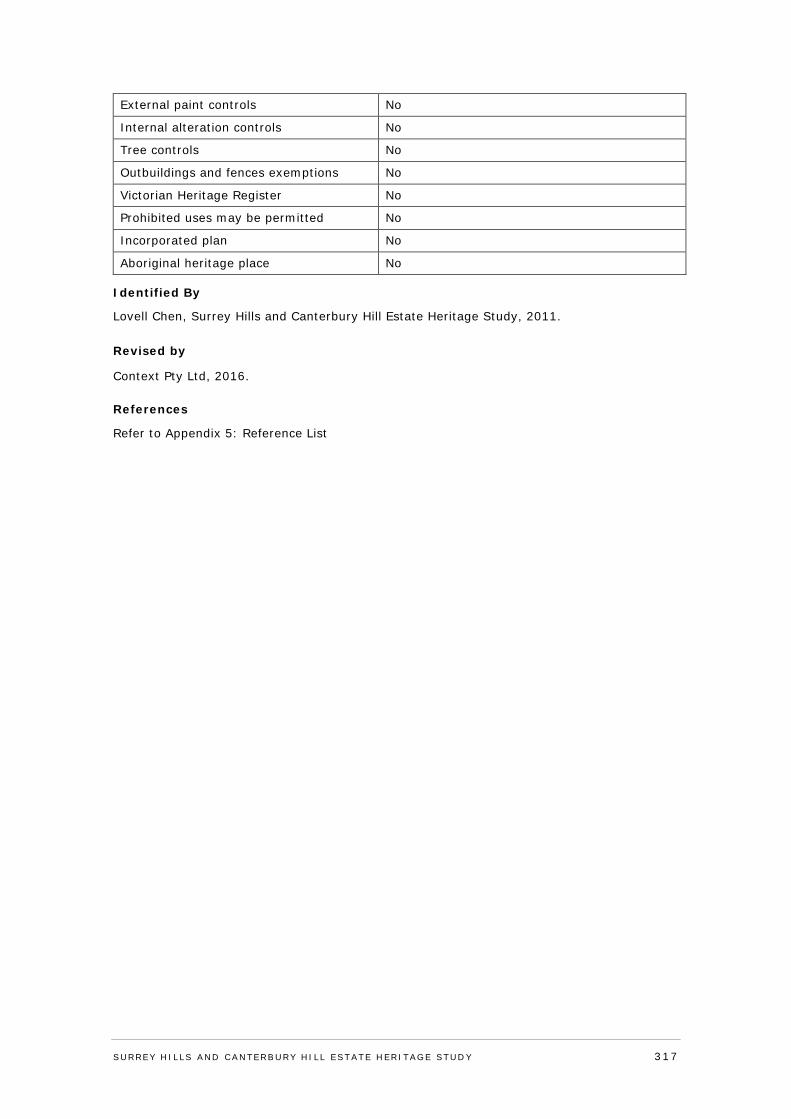
External paint controls No
Internal alteration controls No
Tree controls No
Outbuildings and fences exemptions No
Victorian Heritage Register No
Prohibited uses may be permitted No
Incorporated plan No
Aboriginal heritage place No
Identified By
Lovell Chen, Surrey Hills and Canterbury Hill Estate Heritage Study, 2011. Revised by
Context Pty Ltd, 2016.
References
Refer to Appendix 5: Reference List
SURREY HI LLS AND CANTERBURY HI LL ESTATE HERITAGE STUDY 317
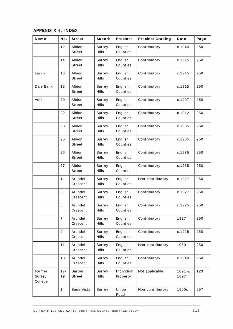
APPENDIX 4: INDEX
Name No. Street Suburb Precinct Precinct Grading Date Page
12 Albion Street
Surrey Hills
English Counties
Contributory c.1940 250
14 Albion Street
Surrey Hills
English Counties
Contributory c.1915 250
Larvik 16 Albion Street
Surrey Hills
English Counties
Contributory c.1915 250
Dale Bank 18 Albion Street
Surrey Hills
English Counties
Contributory c.1915 250
Adlih 20 Albion Street
Surrey Hills
English Counties
Contributory c.1907 250
22 Albion Street
Surrey Hills
English Counties
Contributory c.1912 250
23 Albion Street
Surrey Hills
English Counties
Contributory c.1935 250
25 Albion Street
Surrey Hills
English Counties
Contributory c.1935 250
26 Albion Street
Surrey Hills
English Counties
Contributory c.1935 250
27 Albion Street
Surrey Hills
English Counties
Contributory c.1935 250
1 Arundel Crescent
Surrey Hills
English Counties
Non-contributory c.1927 250
3 Arundel Crescent
Surrey Hills
English Counties
Contributory c.1927 250
5 Arundel Crescent
Surrey Hills
English Counties
Contributory c.1925 250
7 Arundel Crescent
Surrey Hills
English Counties
Contributory 1927 250
9 Arundel Crescent
Surrey Hills
English Counties
Contributory c.1925 250
11 Arundel Crescent
Surrey Hills
English Counties
Non-contributory 1960 250
13 Arundel Crescent
Surrey Hills
English Counties
Contributory c.1940 250
Former Surrey College
17-19
Barton Street
Surrey Hills
Individual Property
Not applicable 1891 & 1897
123
1 Bona Vista Surrey Union Road
Non-contributory 1990s 297
SURREY HI LLS AND CANTERBURY HI LL ESTATE HERITAGE STUDY 318
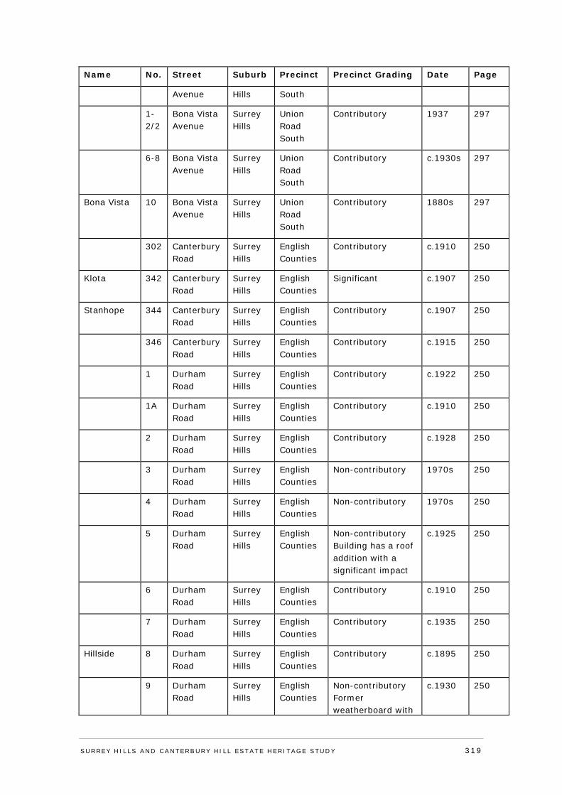
Name No. Street Suburb Precinct Precinct Grading Date Page
Avenue Hills South
1-2/2
Bona Vista Avenue
Surrey Hills
Union Road South
Contributory 1937 297
6-8 Bona Vista Avenue
Surrey Hills
Union Road South
Contributory c.1930s 297
Bona Vista 10 Bona Vista Avenue
Surrey Hills
Union Road South
Contributory 1880s 297
302 Canterbury Road
Surrey Hills
English Counties
Contributory c.1910 250
Klota 342 Canterbury Road
Surrey Hills
English Counties
Significant c.1907 250
Stanhope 344 Canterbury Road
Surrey Hills
English Counties
Contributory c.1907 250
346 Canterbury Road
Surrey Hills
English Counties
Contributory c.1915 250
1 Durham Road
Surrey Hills
English Counties
Contributory c.1922 250
1A Durham Road
Surrey Hills
English Counties
Contributory c.1910 250
2 Durham Road
Surrey Hills
English Counties
Contributory c.1928 250
3 Durham Road
Surrey Hills
English Counties
Non-contributory 1970s 250
4 Durham Road
Surrey Hills
English Counties
Non-contributory 1970s 250
5 Durham Road
Surrey Hills
English Counties
Non-contributory Building has a roof addition with a significant impact
c.1925 250
6 Durham Road
Surrey Hills
English Counties
Contributory c.1910 250
7 Durham Road
Surrey Hills
English Counties
Contributory c.1935 250
Hillside 8 Durham Road
Surrey Hills
English Counties
Contributory c.1895 250
9 Durham Road
Surrey Hills
English Counties
Non-contributory Former weatherboard with
c.1930 250
SURREY HI LLS AND CANTERBURY HI LL ESTATE HERITAGE STUDY 319
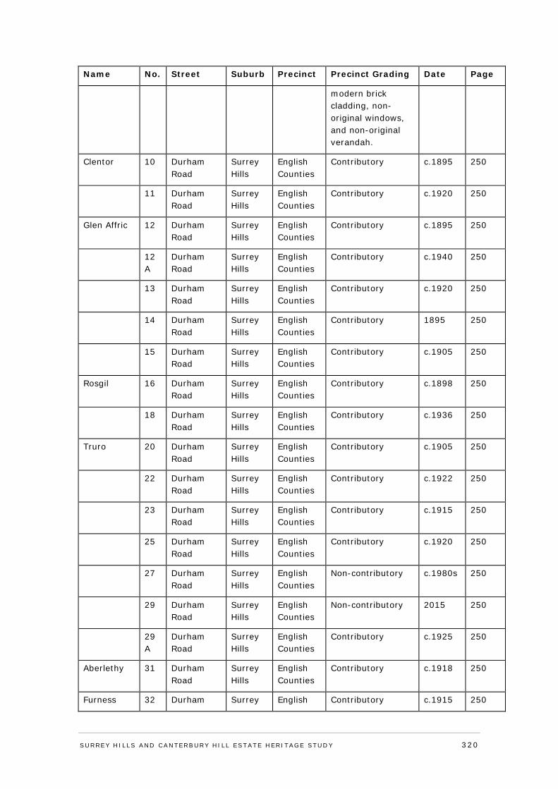
Name No. Street Suburb Precinct Precinct Grading Date Page
modern brick cladding, non-original windows, and non-original verandah.
Clentor 10 Durham Road
Surrey Hills
English Counties
Contributory c.1895 250
11 Durham Road
Surrey Hills
English Counties
Contributory c.1920 250
Glen Affric 12 Durham Road
Surrey Hills
English Counties
Contributory c.1895 250
12A
Durham Road
Surrey Hills
English Counties
Contributory c.1940 250
13 Durham Road
Surrey Hills
English Counties
Contributory c.1920 250
14 Durham Road
Surrey Hills
English Counties
Contributory 1895 250
15 Durham Road
Surrey Hills
English Counties
Contributory c.1905 250
Rosgil 16 Durham Road
Surrey Hills
English Counties
Contributory c.1898 250
18 Durham Road
Surrey Hills
English Counties
Contributory c.1936 250
Truro 20 Durham Road
Surrey Hills
English Counties
Contributory c.1905 250
22 Durham Road
Surrey Hills
English Counties
Contributory c.1922 250
23 Durham Road
Surrey Hills
English Counties
Contributory c.1915 250
25 Durham Road
Surrey Hills
English Counties
Contributory c.1920 250
27 Durham Road
Surrey Hills
English Counties
Non-contributory c.1980s 250
29 Durham Road
Surrey Hills
English Counties
Non-contributory 2015 250
29A
Durham Road
Surrey Hills
English Counties
Contributory c.1925 250
Aberlethy 31 Durham Road
Surrey Hills
English Counties
Contributory c.1918 250
Furness 32 Durham Surrey English Contributory c.1915 250
SURREY HI LLS AND CANTERBURY HI LL ESTATE HERITAGE STUDY 320
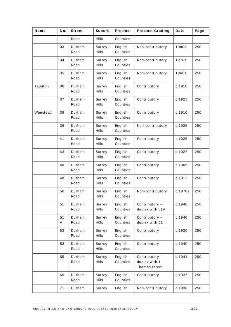
Name No. Street Suburb Precinct Precinct Grading Date Page
Road Hills Counties
33 Durham Road
Surrey Hills
English Counties
Non-contributory 1980s 250
34 Durham Road
Surrey Hills
English Counties
Non-contributory 1970s 250
35 Durham Road
Surrey Hills
English Counties
Non-contributory 1960s 250
Taunton 36 Durham Road
Surrey Hills
English Counties
Contributory c.1910 250
37 Durham Road
Surrey Hills
English Counties
Contributory c.1925 250
Wanstead 38 Durham Road
Surrey Hills
English Counties
Contributory c.1910 250
39 Durham Road
Surrey Hills
English Counties
Non-contributory c.1925 250
41 Durham Road
Surrey Hills
English Counties
Contributory c.1925 250
43 Durham Road
Surrey Hills
English Counties
Contributory c.1927 250
46 Durham Road
Surrey Hills
English Counties
Contributory c.1905 250
48 Durham Road
Surrey Hills
English Counties
Contributory c.1912 250
50 Durham Road
Surrey Hills
English Counties
Non-contributory c.1970s 250
51 Durham Road
Surrey Hills
English Counties
Contributory – duplex with 51A
c.1940 250
51A
Durham Road
Surrey Hills
English Counties
Contributory – duplex with 51
c.1940 250
52 Durham Road
Surrey Hills
English Counties
Contributory c.1920 250
53 Durham Road
Surrey Hills
English Counties
Contributory c.1940 250
55 Durham Road
Surrey Hills
English Counties
Contributory – duplex with 1 Thames Street
c.1941 250
69 Durham Road
Surrey Hills
English Counties
Contributory c.1937 250
71 Durham Surrey English Non-contributory c.1930 250
SURREY HI LLS AND CANTERBURY HI LL ESTATE HERITAGE STUDY 321
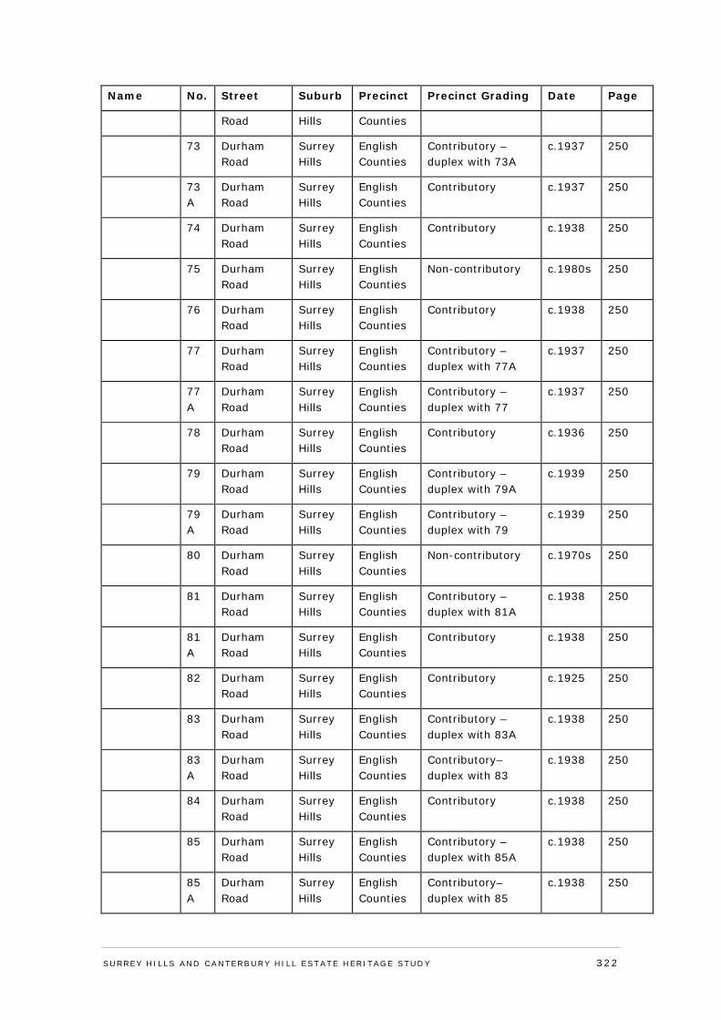
Name No. Street Suburb Precinct Precinct Grading Date Page
Road Hills Counties
73 Durham Road
Surrey Hills
English Counties
Contributory – duplex with 73A
c.1937 250
73A
Durham Road
Surrey Hills
English Counties
Contributory c.1937 250
74 Durham Road
Surrey Hills
English Counties
Contributory c.1938 250
75 Durham Road
Surrey Hills
English Counties
Non-contributory c.1980s 250
76 Durham Road
Surrey Hills
English Counties
Contributory c.1938 250
77 Durham Road
Surrey Hills
English Counties
Contributory – duplex with 77A
c.1937 250
77A
Durham Road
Surrey Hills
English Counties
Contributory – duplex with 77
c.1937 250
78 Durham Road
Surrey Hills
English Counties
Contributory c.1936 250
79 Durham Road
Surrey Hills
English Counties
Contributory – duplex with 79A
c.1939 250
79A
Durham Road
Surrey Hills
English Counties
Contributory – duplex with 79
c.1939 250
80 Durham Road
Surrey Hills
English Counties
Non-contributory c.1970s 250
81 Durham Road
Surrey Hills
English Counties
Contributory – duplex with 81A
c.1938 250
81A
Durham Road
Surrey Hills
English Counties
Contributory c.1938 250
82 Durham Road
Surrey Hills
English Counties
Contributory c.1925 250
83 Durham Road
Surrey Hills
English Counties
Contributory – duplex with 83A
c.1938 250
83A
Durham Road
Surrey Hills
English Counties
Contributory– duplex with 83
c.1938 250
84 Durham Road
Surrey Hills
English Counties
Contributory c.1938 250
85 Durham Road
Surrey Hills
English Counties
Contributory – duplex with 85A
c.1938 250
85A
Durham Road
Surrey Hills
English Counties
Contributory– duplex with 85
c.1938 250
SURREY HI LLS AND CANTERBURY HI LL ESTATE HERITAGE STUDY 322
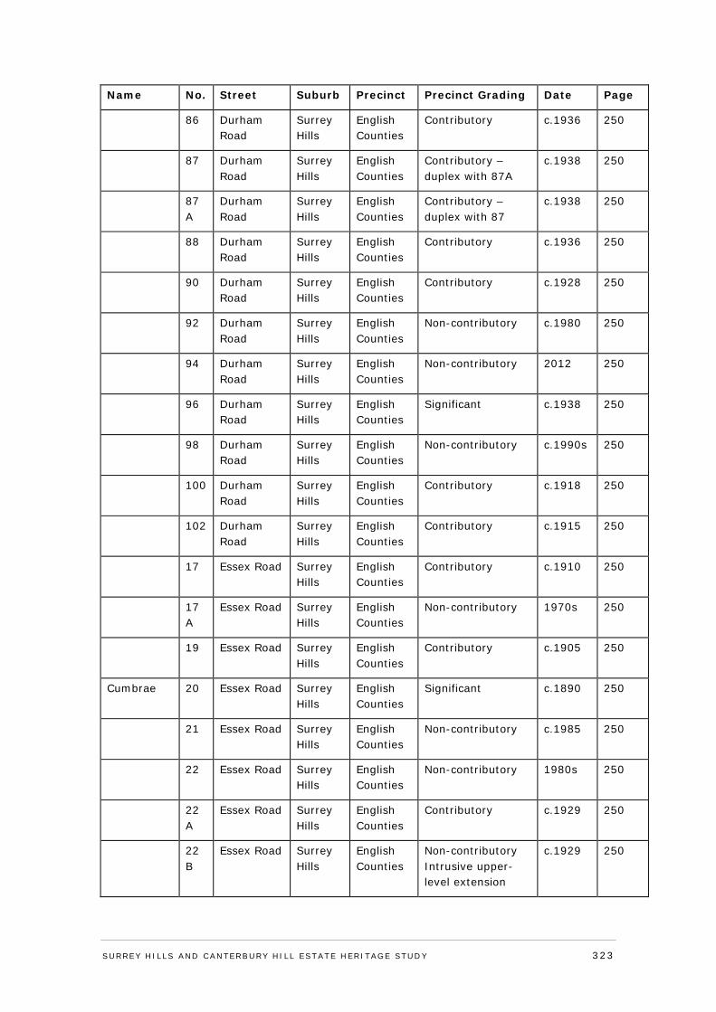
Name No. Street Suburb Precinct Precinct Grading Date Page
86 Durham Road
Surrey Hills
English Counties
Contributory c.1936 250
87 Durham Road
Surrey Hills
English Counties
Contributory – duplex with 87A
c.1938 250
87A
Durham Road
Surrey Hills
English Counties
Contributory – duplex with 87
c.1938 250
88 Durham Road
Surrey Hills
English Counties
Contributory c.1936 250
90 Durham Road
Surrey Hills
English Counties
Contributory c.1928 250
92 Durham Road
Surrey Hills
English Counties
Non-contributory c.1980 250
94 Durham Road
Surrey Hills
English Counties
Non-contributory 2012 250
96 Durham Road
Surrey Hills
English Counties
Significant c.1938 250
98 Durham Road
Surrey Hills
English Counties
Non-contributory c.1990s 250
100 Durham Road
Surrey Hills
English Counties
Contributory c.1918 250
102 Durham Road
Surrey Hills
English Counties
Contributory c.1915 250
17 Essex Road Surrey Hills
English Counties
Contributory c.1910 250
17A
Essex Road Surrey Hills
English Counties
Non-contributory 1970s 250
19 Essex Road Surrey Hills
English Counties
Contributory c.1905 250
Cumbrae 20 Essex Road Surrey Hills
English Counties
Significant c.1890 250
21 Essex Road Surrey Hills
English Counties
Non-contributory c.1985 250
22 Essex Road Surrey Hills
English Counties
Non-contributory 1980s 250
22A
Essex Road Surrey Hills
English Counties
Contributory c.1929 250
22B
Essex Road Surrey Hills
English Counties
Non-contributory Intrusive upper-level extension
c.1929 250
SURREY HI LLS AND CANTERBURY HI LL ESTATE HERITAGE STUDY 323

Name No. Street Suburb Precinct Precinct Grading Date Page
24 Essex Road Surrey Hills
English Counties
Non-contributory c.2000 250
25 Essex Road Surrey Hills
English Counties
Non-contributory c.1990 250
26 Essex Road Surrey Hills
English Counties
Contributory c.1915 250
27 Essex Road Surrey Hills
English Counties
Contributory c.1930 250
28 Essex Road Surrey Hills
English Counties
Contributory c.1915 250
29 Essex Road Surrey Hills
English Counties
Non-contributory c.1980 250
Kellymont 30 Essex Road Surrey Hills
English Counties
Contributory c.1889 250
32 Essex Road Surrey Hills
English Counties
Contributory c.1925 250
34 Essex Road Surrey Hills
English Counties
Non-contributory Heavily modified brick residence, with later render and changes to building form
c.1992 250
Woolwin 35 Essex Road Surrey Hills
English Counties
Contributory c.1890 250
36 Essex Road Surrey Hills
English Counties
Contributory c.1900 250
37 Essex Road Surrey Hills
English Counties
Significant c.1890 250
Neerena 38 Essex Road Surrey Hills
English Counties
Significant c.1890 250
38A
Essex Road Surrey Hills
English Counties
Contributory c.1935 250
38B
Essex Road Surrey Hills
English Counties
Non-contributory Altered windows, low integrity
c.1940 250
39 Essex Road Surrey Hills
English Counties
Non-contributory c.1965 250
40 Essex Road Surrey Hills
English Counties
Contributory c.1929 250
41 Essex Road Surrey English Contributory c.1925 250
SURREY HI LLS AND CANTERBURY HI LL ESTATE HERITAGE STUDY 324
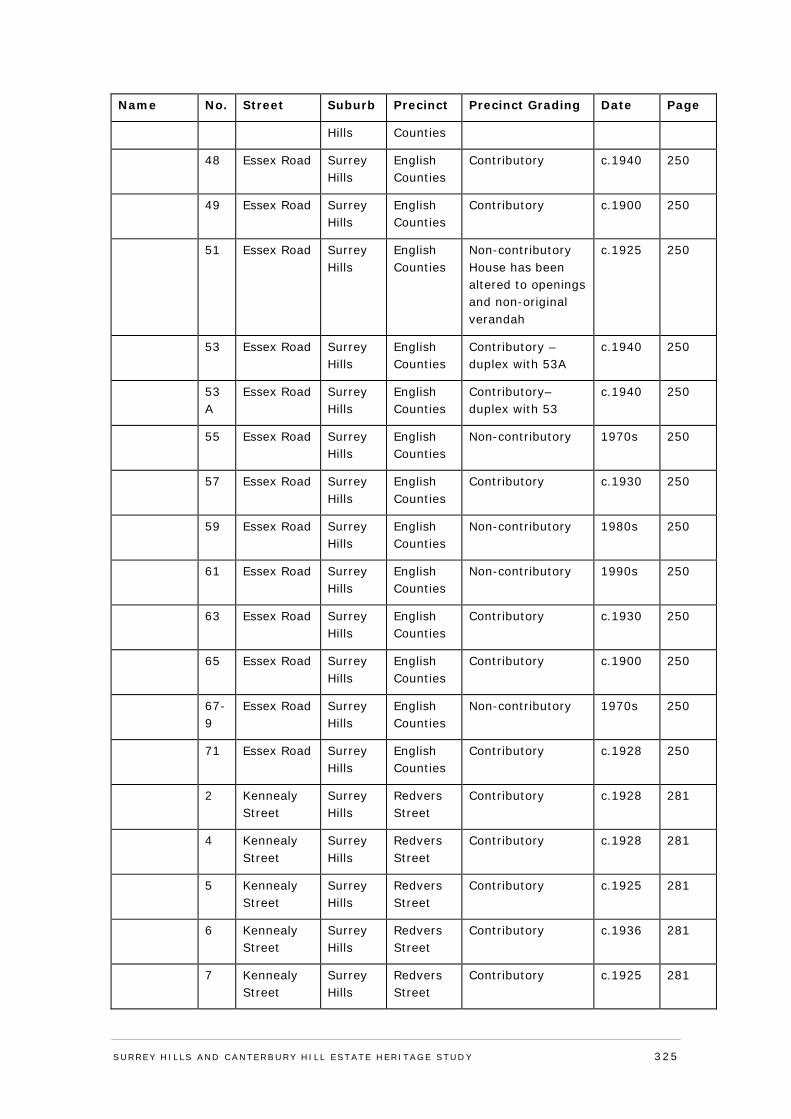
Name No. Street Suburb Precinct Precinct Grading Date Page
Hills Counties
48 Essex Road Surrey Hills
English Counties
Contributory c.1940 250
49 Essex Road Surrey Hills
English Counties
Contributory c.1900 250
51 Essex Road Surrey Hills
English Counties
Non-contributory House has been altered to openings and non-original verandah
c.1925 250
53 Essex Road Surrey Hills
English Counties
Contributory – duplex with 53A
c.1940 250
53A
Essex Road Surrey Hills
English Counties
Contributory– duplex with 53
c.1940 250
55 Essex Road Surrey Hills
English Counties
Non-contributory 1970s 250
57 Essex Road Surrey Hills
English Counties
Contributory c.1930 250
59 Essex Road Surrey Hills
English Counties
Non-contributory 1980s 250
61 Essex Road Surrey Hills
English Counties
Non-contributory 1990s 250
63 Essex Road Surrey Hills
English Counties
Contributory c.1930 250
65 Essex Road Surrey Hills
English Counties
Contributory c.1900 250
67-9
Essex Road Surrey Hills
English Counties
Non-contributory 1970s 250
71 Essex Road Surrey Hills
English Counties
Contributory c.1928 250
2 Kennealy Street
Surrey Hills
Redvers Street
Contributory c.1928 281
4 Kennealy Street
Surrey Hills
Redvers Street
Contributory c.1928 281
5 Kennealy Street
Surrey Hills
Redvers Street
Contributory c.1925 281
6 Kennealy Street
Surrey Hills
Redvers Street
Contributory c.1936 281
7 Kennealy Street
Surrey Hills
Redvers Street
Contributory c.1925 281
SURREY HI LLS AND CANTERBURY HI LL ESTATE HERITAGE STUDY 325
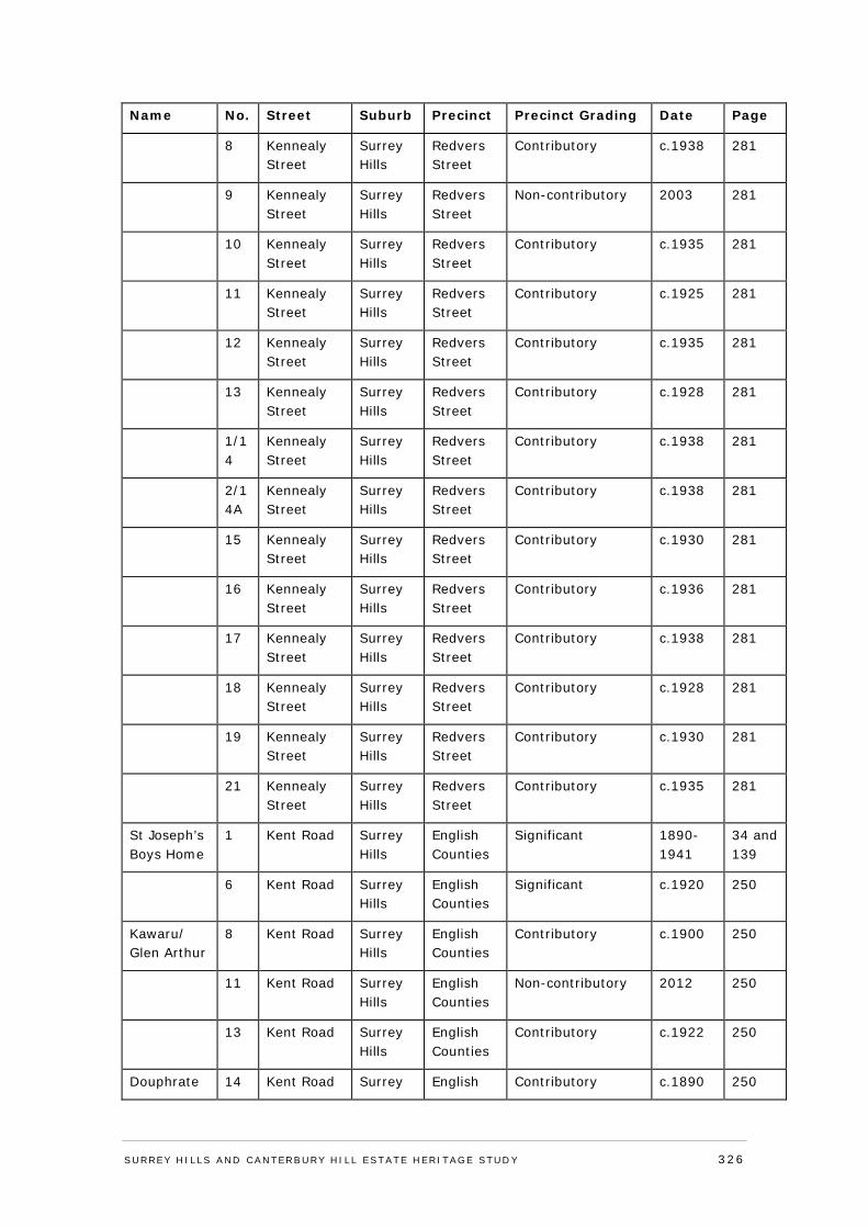
Name No. Street Suburb Precinct Precinct Grading Date Page
8 Kennealy Street
Surrey Hills
Redvers Street
Contributory c.1938 281
9 Kennealy Street
Surrey Hills
Redvers Street
Non-contributory 2003 281
10 Kennealy Street
Surrey Hills
Redvers Street
Contributory c.1935 281
11 Kennealy Street
Surrey Hills
Redvers Street
Contributory c.1925 281
12 Kennealy Street
Surrey Hills
Redvers Street
Contributory c.1935 281
13 Kennealy Street
Surrey Hills
Redvers Street
Contributory c.1928 281
1/14
Kennealy Street
Surrey Hills
Redvers Street
Contributory c.1938 281
2/14A
Kennealy Street
Surrey Hills
Redvers Street
Contributory c.1938 281
15 Kennealy Street
Surrey Hills
Redvers Street
Contributory c.1930 281
16 Kennealy Street
Surrey Hills
Redvers Street
Contributory c.1936 281
17 Kennealy Street
Surrey Hills
Redvers Street
Contributory c.1938 281
18 Kennealy Street
Surrey Hills
Redvers Street
Contributory c.1928 281
19 Kennealy Street
Surrey Hills
Redvers Street
Contributory c.1930 281
21 Kennealy Street
Surrey Hills
Redvers Street
Contributory c.1935 281
St Joseph’s Boys Home
1 Kent Road Surrey Hills
English Counties
Significant 1890-1941
34 and 139
6 Kent Road Surrey Hills
English Counties
Significant c.1920 250
Kawaru/ Glen Arthur
8 Kent Road Surrey Hills
English Counties
Contributory c.1900 250
11 Kent Road Surrey Hills
English Counties
Non-contributory 2012 250
13 Kent Road Surrey Hills
English Counties
Contributory c.1922 250
Douphrate 14 Kent Road Surrey English Contributory c.1890 250
SURREY HI LLS AND CANTERBURY HI LL ESTATE HERITAGE STUDY 326
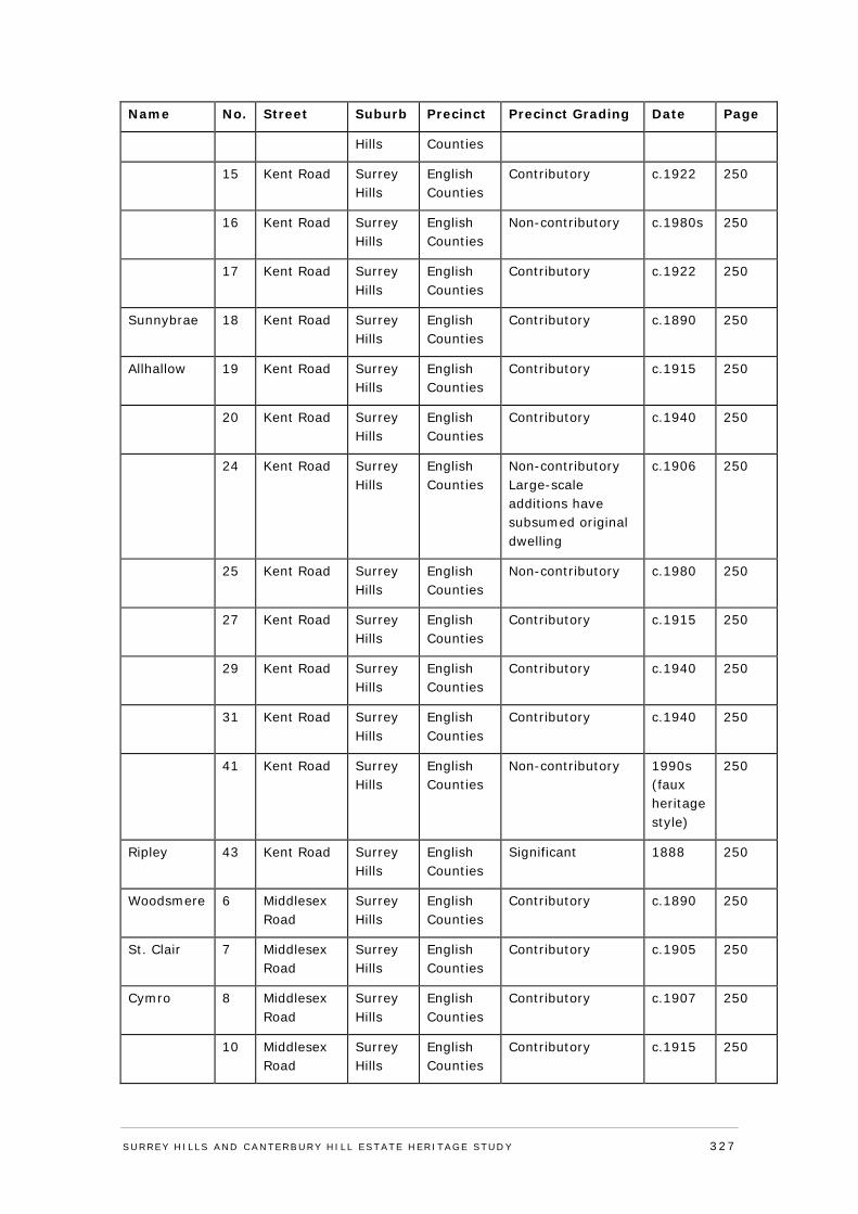
Name No. Street Suburb Precinct Precinct Grading Date Page
Hills Counties
15 Kent Road Surrey Hills
English Counties
Contributory c.1922 250
16 Kent Road Surrey Hills
English Counties
Non-contributory c.1980s 250
17 Kent Road Surrey Hills
English Counties
Contributory c.1922 250
Sunnybrae 18 Kent Road Surrey Hills
English Counties
Contributory c.1890 250
Allhallow 19 Kent Road Surrey Hills
English Counties
Contributory c.1915 250
20 Kent Road Surrey Hills
English Counties
Contributory c.1940 250
24 Kent Road Surrey Hills
English Counties
Non-contributory Large-scale additions have subsumed original dwelling
c.1906 250
25 Kent Road Surrey Hills
English Counties
Non-contributory c.1980 250
27 Kent Road Surrey Hills
English Counties
Contributory c.1915 250
29 Kent Road Surrey Hills
English Counties
Contributory c.1940 250
31 Kent Road Surrey Hills
English Counties
Contributory c.1940 250
41 Kent Road Surrey Hills
English Counties
Non-contributory
1990s (faux heritage style)
250
Ripley 43 Kent Road Surrey Hills
English Counties
Significant 1888 250
Woodsmere 6 Middlesex Road
Surrey Hills
English Counties
Contributory c.1890 250
St. Clair 7 Middlesex Road
Surrey Hills
English Counties
Contributory c.1905 250
Cymro 8 Middlesex Road
Surrey Hills
English Counties
Contributory c.1907 250
10 Middlesex Road
Surrey Hills
English Counties
Contributory c.1915 250
SURREY HI LLS AND CANTERBURY HI LL ESTATE HERITAGE STUDY 327
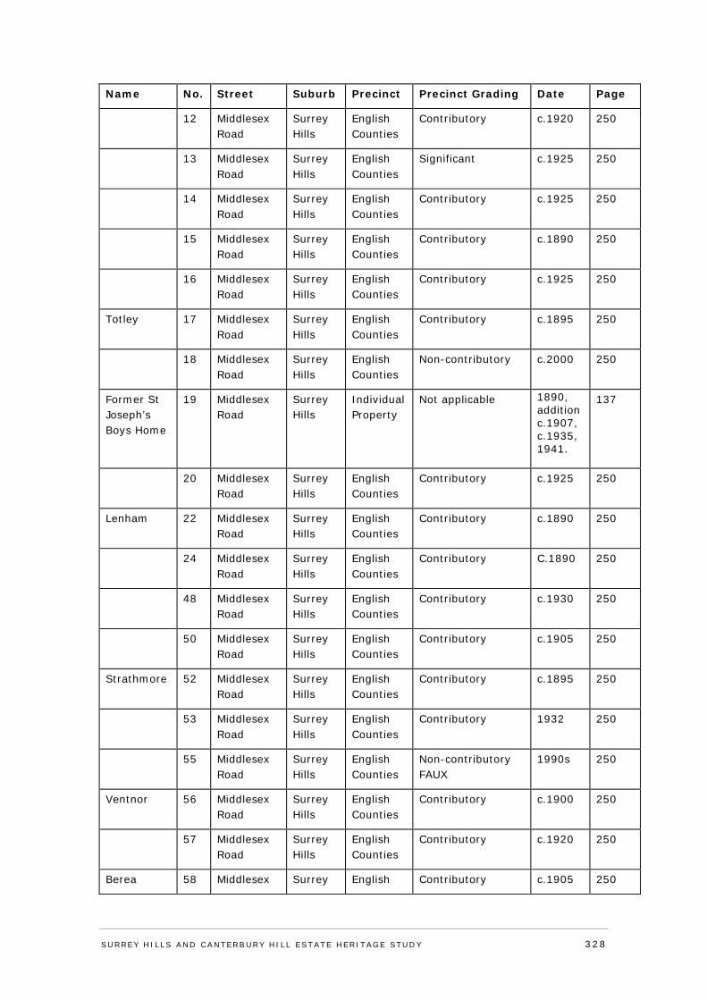
Name No. Street Suburb Precinct Precinct Grading Date Page
12 Middlesex Road
Surrey Hills
English Counties
Contributory c.1920 250
13 Middlesex Road
Surrey Hills
English Counties
Significant c.1925 250
14 Middlesex Road
Surrey Hills
English Counties
Contributory c.1925 250
15 Middlesex Road
Surrey Hills
English Counties
Contributory c.1890 250
16 Middlesex Road
Surrey Hills
English Counties
Contributory c.1925 250
Totley 17 Middlesex Road
Surrey Hills
English Counties
Contributory c.1895 250
18 Middlesex Road
Surrey Hills
English Counties
Non-contributory c.2000 250
Former St Joseph’s Boys Home
19 Middlesex Road
Surrey Hills
Individual Property
Not applicable 1890, addition c.1907, c.1935, 1941.
137
20 Middlesex Road
Surrey Hills
English Counties
Contributory c.1925 250
Lenham 22 Middlesex Road
Surrey Hills
English Counties
Contributory c.1890 250
24 Middlesex Road
Surrey Hills
English Counties
Contributory C.1890 250
48 Middlesex Road
Surrey Hills
English Counties
Contributory c.1930 250
50 Middlesex Road
Surrey Hills
English Counties
Contributory c.1905 250
Strathmore 52 Middlesex Road
Surrey Hills
English Counties
Contributory c.1895 250
53 Middlesex Road
Surrey Hills
English Counties
Contributory 1932 250
55 Middlesex Road
Surrey Hills
English Counties
Non-contributory FAUX
1990s 250
Ventnor 56 Middlesex Road
Surrey Hills
English Counties
Contributory c.1900 250
57 Middlesex Road
Surrey Hills
English Counties
Contributory c.1920 250
Berea 58 Middlesex Surrey English Contributory c.1905 250
SURREY HI LLS AND CANTERBURY HI LL ESTATE HERITAGE STUDY 328
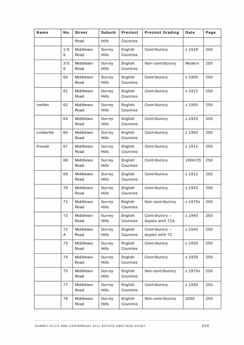
Name No. Street Suburb Precinct Precinct Grading Date Page
Road Hills Counties
1/59
Middlesex Road
Surrey Hills
English Counties
Contributory c.1918 250
2/59
Middlesex Road
Surrey Hills
English Counties
Non-contributory Modern 250
60 Middlesex Road
Surrey Hills
English Counties
Contributory c.1905 250
61 Middlesex Road
Surrey Hills
English Counties
Contributory c.1912 250
Inellen 62 Middlesex Road
Surrey Hills
English Counties
Contributory c.1905 250
64 Middlesex Road
Surrey Hills
English Counties
Contributory c.1925 250
Lindaville 66 Middlesex Road
Surrey Hills
English Counties
Contributory c.1900 250
Freude 67 Middlesex Road
Surrey Hills
English Counties
Contributory c.1912 250
68 Middlesex Road
Surrey Hills
English Counties
Contributory 1900/25 250
69 Middlesex Road
Surrey Hills
English Counties
Contributory c.1912 250
70 Middlesex Road
Surrey Hills
English Counties
Contributory c.1925 250
71 Middlesex Road
Surrey Hills
English Counties
Non-contributory c.1970s 250
72 Middlesex Road
Surrey Hills
English Counties
Contributory – duplex with 72A
c.1940 250
72A
Middlesex Road
Surrey Hills
English Counties
Contributory – duplex with 72
c.1940 250
73 Middlesex Road
Surrey Hills
English Counties
Contributory c.1925 250
74 Middlesex Road
Surrey Hills
English Counties
Contributory c.1925 250
75 Middlesex Road
Surrey Hills
English Counties
Non-contributory c.1970s 250
77 Middlesex Road
Surrey Hills
English Counties
Contributory c.1930 250
79 Middlesex Road
Surrey Hills
English Counties
Non-contributory 2000 250
SURREY HI LLS AND CANTERBURY HI LL ESTATE HERITAGE STUDY 329
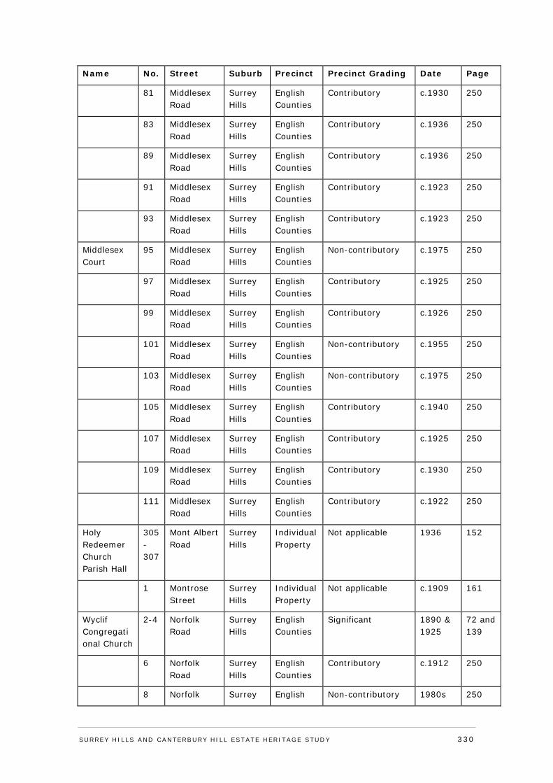
Name No. Street Suburb Precinct Precinct Grading Date Page
81 Middlesex Road
Surrey Hills
English Counties
Contributory c.1930 250
83 Middlesex Road
Surrey Hills
English Counties
Contributory c.1936 250
89 Middlesex Road
Surrey Hills
English Counties
Contributory c.1936 250
91 Middlesex Road
Surrey Hills
English Counties
Contributory c.1923 250
93 Middlesex Road
Surrey Hills
English Counties
Contributory c.1923 250
Middlesex Court
95 Middlesex Road
Surrey Hills
English Counties
Non-contributory c.1975 250
97 Middlesex Road
Surrey Hills
English Counties
Contributory c.1925 250
99 Middlesex Road
Surrey Hills
English Counties
Contributory c.1926 250
101 Middlesex Road
Surrey Hills
English Counties
Non-contributory c.1955 250
103 Middlesex Road
Surrey Hills
English Counties
Non-contributory c.1975 250
105 Middlesex Road
Surrey Hills
English Counties
Contributory c.1940 250
107 Middlesex Road
Surrey Hills
English Counties
Contributory c.1925 250
109 Middlesex Road
Surrey Hills
English Counties
Contributory c.1930 250
111 Middlesex Road
Surrey Hills
English Counties
Contributory c.1922 250
Holy Redeemer Church Parish Hall
305-307
Mont Albert Road
Surrey Hills
Individual Property
Not applicable 1936 152
1 Montrose Street
Surrey Hills
Individual Property
Not applicable c.1909 161
Wyclif Congregational Church
2-4 Norfolk Road
Surrey Hills
English Counties
Significant 1890 & 1925
72 and 139
6 Norfolk Road
Surrey Hills
English Counties
Contributory c.1912 250
8 Norfolk Surrey English Non-contributory 1980s 250
SURREY HI LLS AND CANTERBURY HI LL ESTATE HERITAGE STUDY 330
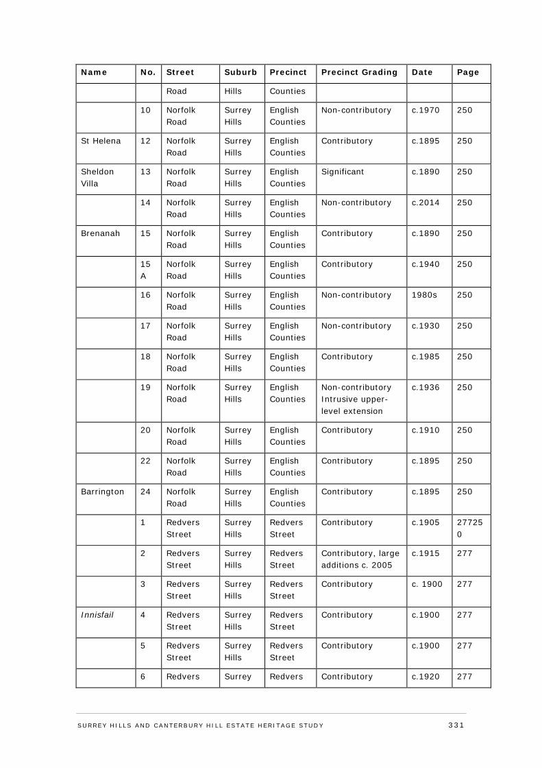
Name No. Street Suburb Precinct Precinct Grading Date Page
Road Hills Counties
10 Norfolk Road
Surrey Hills
English Counties
Non-contributory c.1970 250
St Helena 12 Norfolk Road
Surrey Hills
English Counties
Contributory c.1895 250
Sheldon Villa
13 Norfolk Road
Surrey Hills
English Counties
Significant c.1890 250
14 Norfolk Road
Surrey Hills
English Counties
Non-contributory c.2014 250
Brenanah 15 Norfolk Road
Surrey Hills
English Counties
Contributory c.1890 250
15A
Norfolk Road
Surrey Hills
English Counties
Contributory c.1940 250
16 Norfolk Road
Surrey Hills
English Counties
Non-contributory 1980s 250
17 Norfolk Road
Surrey Hills
English Counties
Non-contributory c.1930 250
18 Norfolk Road
Surrey Hills
English Counties
Contributory c.1985 250
19 Norfolk Road
Surrey Hills
English Counties
Non-contributory Intrusive upper-level extension
c.1936 250
20 Norfolk Road
Surrey Hills
English Counties
Contributory c.1910 250
22 Norfolk Road
Surrey Hills
English Counties
Contributory c.1895 250
Barrington 24 Norfolk Road
Surrey Hills
English Counties
Contributory c.1895 250
1 Redvers Street
Surrey Hills
Redvers Street
Contributory c.1905 277250
2 Redvers Street
Surrey Hills
Redvers Street
Contributory, large additions c. 2005
c.1915 277
3 Redvers Street
Surrey Hills
Redvers Street
Contributory c. 1900 277
Innisfail 4 Redvers Street
Surrey Hills
Redvers Street
Contributory c.1900 277
5 Redvers Street
Surrey Hills
Redvers Street
Contributory c.1900 277
6 Redvers Surrey Redvers Contributory c.1920 277
SURREY HI LLS AND CANTERBURY HI LL ESTATE HERITAGE STUDY 331
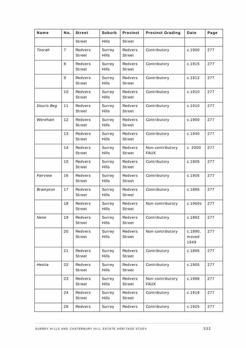
Name No. Street Suburb Precinct Precinct Grading Date Page
Street Hills Street
Toorah 7 Redvers Street
Surrey Hills
Redvers Street
Contributory c.1900 277
8 Redvers Street
Surrey Hills
Redvers Street
Contributory c.1915 277
9 Redvers Street
Surrey Hills
Redvers Street
Contributory c.1912 277
10 Redvers Street
Surrey Hills
Redvers Street
Contributory c.1910 277
Douris Beg 11 Redvers Street
Surrey Hills
Redvers Street
Contributory c.1910 277
Werehain 12 Redvers Street
Surrey Hills
Redvers Street
Contributory c.1900 277
13 Redvers Street
Surrey Hills
Redvers Street
Contributory c.1940 277
14 Redvers Street
Surrey Hills
Redvers Street
Non-contributory FAUX
c. 2000 277
15 Redvers Street
Surrey Hills
Redvers Street
Contributory c.1905 277
Fairview 16 Redvers Street
Surrey Hills
Redvers Street
Contributory c.1905 277
Brampton 17 Redvers Street
Surrey Hills
Redvers Street
Contributory c.1895 277
18 Redvers Street
Surrey Hills
Redvers Street
Non-contributory c.1960s 277
Nene 19 Redvers Street
Surrey Hills
Redvers Street
Contributory c.1892 277
20 Redvers Street
Surrey Hills
Redvers Street
Non-contributory c.1890, moved 1949
277
21 Redvers Street
Surrey Hills
Redvers Street
Contributory c.1895 277
Hestia 22 Redvers Street
Surrey Hills
Redvers Street
Contributory c.1905 277
23 Redvers Street
Surrey Hills
Redvers Street
Non-contributory FAUX
c.1988 277
24 Redvers Street
Surrey Hills
Redvers Street
Contributory c.1918 277
26 Redvers Surrey Redvers Contributory c.1925 277
SURREY HI LLS AND CANTERBURY HI LL ESTATE HERITAGE STUDY 332
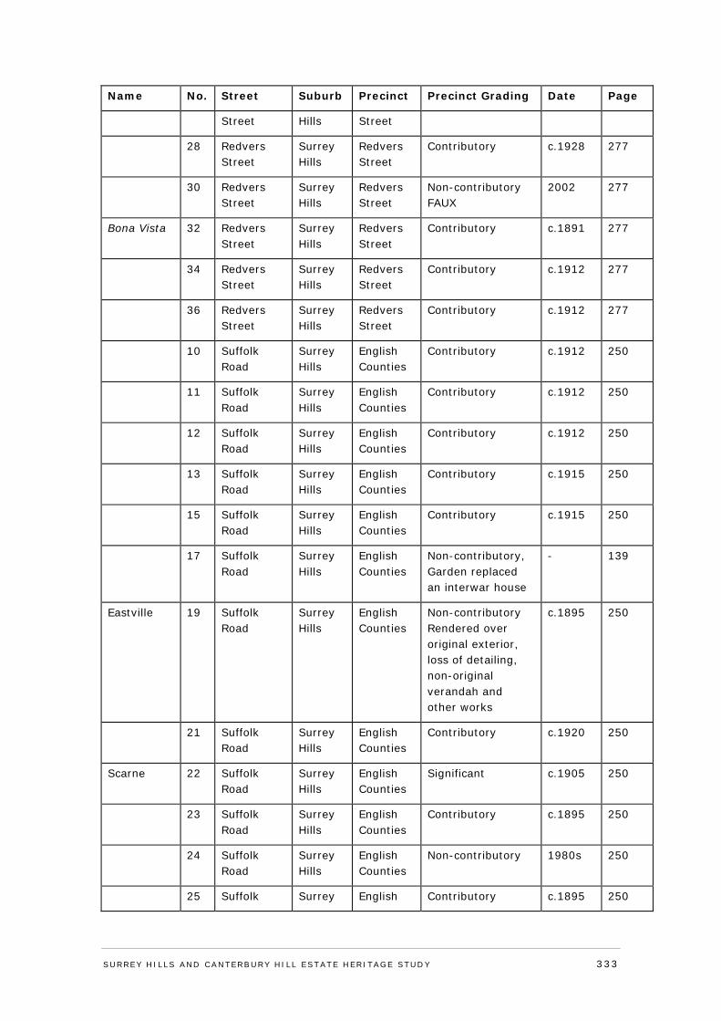
Name No. Street Suburb Precinct Precinct Grading Date Page
Street Hills Street
28 Redvers Street
Surrey Hills
Redvers Street
Contributory c.1928 277
30 Redvers Street
Surrey Hills
Redvers Street
Non-contributory FAUX
2002 277
Bona Vista 32 Redvers Street
Surrey Hills
Redvers Street
Contributory c.1891 277
34 Redvers Street
Surrey Hills
Redvers Street
Contributory c.1912 277
36 Redvers Street
Surrey Hills
Redvers Street
Contributory c.1912 277
10 Suffolk Road
Surrey Hills
English Counties
Contributory c.1912 250
11 Suffolk Road
Surrey Hills
English Counties
Contributory c.1912 250
12 Suffolk Road
Surrey Hills
English Counties
Contributory c.1912 250
13 Suffolk Road
Surrey Hills
English Counties
Contributory c.1915 250
15 Suffolk Road
Surrey Hills
English Counties
Contributory c.1915 250
17 Suffolk Road
Surrey Hills
English Counties
Non-contributory, Garden replaced an interwar house
- 139
Eastville 19 Suffolk Road
Surrey Hills
English Counties
Non-contributory Rendered over original exterior, loss of detailing, non-original verandah and other works
c.1895 250
21 Suffolk Road
Surrey Hills
English Counties
Contributory c.1920 250
Scarne 22 Suffolk Road
Surrey Hills
English Counties
Significant c.1905 250
23 Suffolk Road
Surrey Hills
English Counties
Contributory c.1895 250
24 Suffolk Road
Surrey Hills
English Counties
Non-contributory 1980s 250
25 Suffolk Surrey English Contributory c.1895 250
SURREY HI LLS AND CANTERBURY HI LL ESTATE HERITAGE STUDY 333
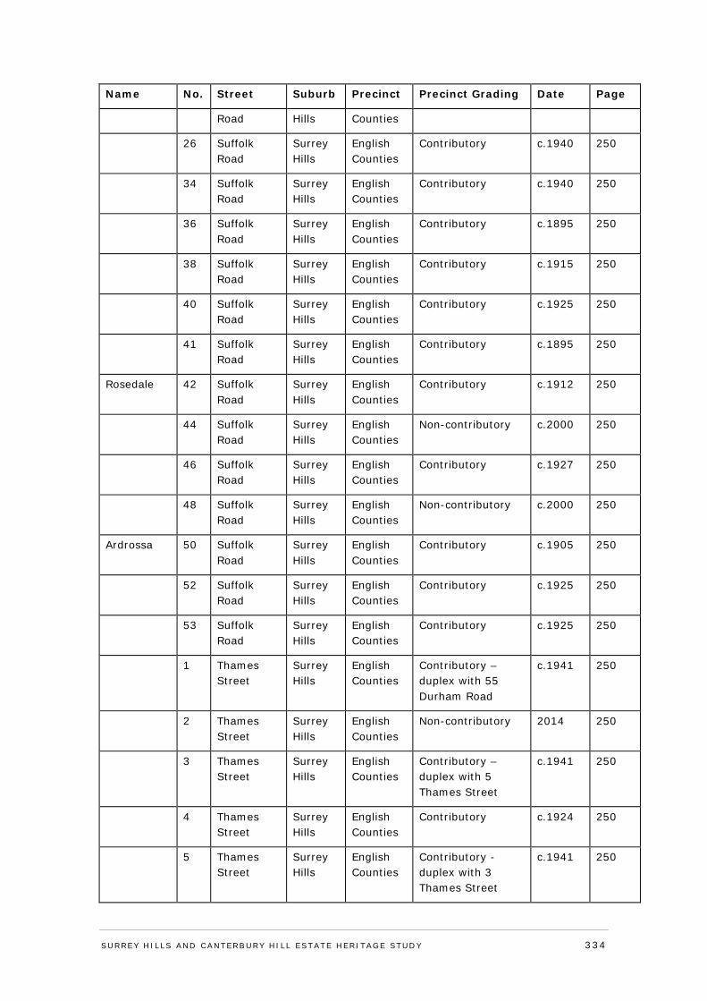
Name No. Street Suburb Precinct Precinct Grading Date Page
Road Hills Counties
26 Suffolk Road
Surrey Hills
English Counties
Contributory c.1940 250
34 Suffolk Road
Surrey Hills
English Counties
Contributory c.1940 250
36 Suffolk Road
Surrey Hills
English Counties
Contributory c.1895 250
38 Suffolk Road
Surrey Hills
English Counties
Contributory c.1915 250
40 Suffolk Road
Surrey Hills
English Counties
Contributory c.1925 250
41 Suffolk Road
Surrey Hills
English Counties
Contributory c.1895 250
Rosedale 42 Suffolk Road
Surrey Hills
English Counties
Contributory c.1912 250
44 Suffolk Road
Surrey Hills
English Counties
Non-contributory c.2000 250
46 Suffolk Road
Surrey Hills
English Counties
Contributory c.1927 250
48 Suffolk Road
Surrey Hills
English Counties
Non-contributory c.2000 250
Ardrossa 50 Suffolk Road
Surrey Hills
English Counties
Contributory c.1905 250
52 Suffolk Road
Surrey Hills
English Counties
Contributory c.1925 250
53 Suffolk Road
Surrey Hills
English Counties
Contributory c.1925 250
1 Thames Street
Surrey Hills
English Counties
Contributory – duplex with 55 Durham Road
c.1941 250
2 Thames Street
Surrey Hills
English Counties
Non-contributory 2014 250
3 Thames Street
Surrey Hills
English Counties
Contributory – duplex with 5 Thames Street
c.1941 250
4 Thames Street
Surrey Hills
English Counties
Contributory c.1924 250
5 Thames Street
Surrey Hills
English Counties
Contributory - duplex with 3 Thames Street
c.1941 250
SURREY HI LLS AND CANTERBURY HI LL ESTATE HERITAGE STUDY 334
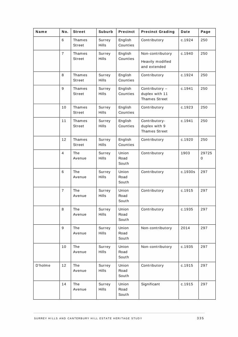
Name No. Street Suburb Precinct Precinct Grading Date Page
6 Thames Street
Surrey Hills
English Counties
Contributory c.1924 250
7 Thames Street
Surrey Hills
English Counties
Non-contributory
Heavily modified and extended
c.1940 250
8 Thames Street
Surrey Hills
English Counties
Contributory c.1924 250
9 Thames Street
Surrey Hills
English Counties
Contributory – duplex with 11 Thames Street
c.1941 250
10 Thames Street
Surrey Hills
English Counties
Contributory c.1923 250
11 Thames Street
Surrey Hills
English Counties
Contributory- duplex with 9 Thames Street
c.1941 250
12 Thames Street
Surrey Hills
English Counties
Contributory c.1920 250
4 The Avenue
Surrey Hills
Union Road South
Contributory 1903 297250
6 The Avenue
Surrey Hills
Union Road South
Contributory c.1930s 297
7 The Avenue
Surrey Hills
Union Road South
Contributory c.1915 297
8 The Avenue
Surrey Hills
Union Road South
Contributory c.1935 297
9 The Avenue
Surrey Hills
Union Road South
Non-contributory 2014 297
10 The Avenue
Surrey Hills
Union Road South
Non-contributory c.1935 297
D’holme 12 The Avenue
Surrey Hills
Union Road South
Contributory c.1915 297
14 The Avenue
Surrey Hills
Union Road South
Significant c.1915 297
SURREY HI LLS AND CANTERBURY HI LL ESTATE HERITAGE STUDY 335
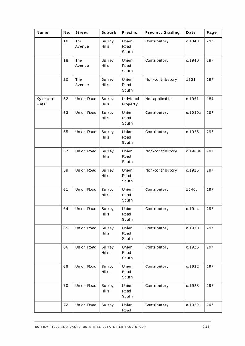
Name No. Street Suburb Precinct Precinct Grading Date Page
16 The Avenue
Surrey Hills
Union Road South
Contributory c.1940 297
18 The Avenue
Surrey Hills
Union Road South
Contributory c.1940 297
20 The Avenue
Surrey Hills
Union Road South
Non-contributory 1951 297
Kylemore Flats
52 Union Road Surrey Hills
Indvidual Property
Not applicable c.1961 184
53 Union Road Surrey Hills
Union Road South
Contributory c.1930s 297
55 Union Road Surrey Hills
Union Road South
Contributory c.1925 297
57 Union Road Surrey Hills
Union Road South
Non-contributory c.1960s 297
59 Union Road Surrey Hills
Union Road South
Non-contributory c.1925 297
61 Union Road Surrey Hills
Union Road South
Contributory 1940s 297
64 Union Road Surrey Hills
Union Road South
Contributory c.1914 297
65 Union Road Surrey Hills
Union Road South
Contributory c.1930 297
66 Union Road Surrey Hills
Union Road South
Contributory c.1926 297
68 Union Road Surrey Hills
Union Road South
Contributory c.1922 297
70 Union Road Surrey Hills
Union Road South
Contributory c.1923 297
72 Union Road Surrey Union Road
Contributory c.1922 297
SURREY HI LLS AND CANTERBURY HI LL ESTATE HERITAGE STUDY 336
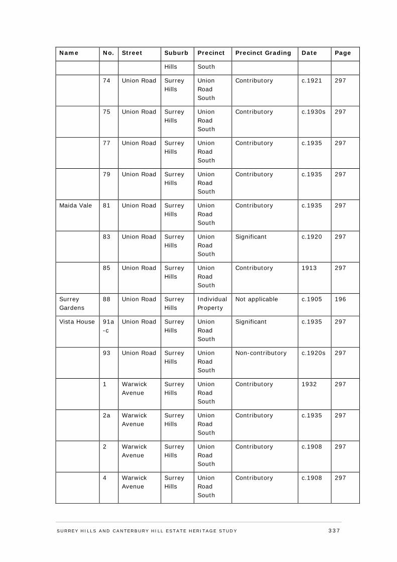
Name No. Street Suburb Precinct Precinct Grading Date Page
Hills South
74 Union Road Surrey Hills
Union Road South
Contributory c.1921 297
75 Union Road Surrey Hills
Union Road South
Contributory c.1930s 297
77 Union Road Surrey Hills
Union Road South
Contributory c.1935 297
79 Union Road Surrey Hills
Union Road South
Contributory c.1935 297
Maida Vale 81 Union Road Surrey Hills
Union Road South
Contributory c.1935 297
83 Union Road Surrey Hills
Union Road South
Significant c.1920 297
85 Union Road Surrey Hills
Union Road South
Contributory 1913 297
Surrey Gardens
88 Union Road Surrey Hills
Individual Property
Not applicable c.1905 196
Vista House 91a-c
Union Road Surrey Hills
Union Road South
Significant c.1935 297
93 Union Road Surrey Hills
Union Road South
Non-contributory c.1920s 297
1 Warwick Avenue
Surrey Hills
Union Road South
Contributory 1932 297
2a Warwick Avenue
Surrey Hills
Union Road South
Contributory c.1935 297
2 Warwick Avenue
Surrey Hills
Union Road South
Contributory c.1908 297
4 Warwick Avenue
Surrey Hills
Union Road South
Contributory c.1908 297
SURREY HI LLS AND CANTERBURY HI LL ESTATE HERITAGE STUDY 337

Name No. Street Suburb Precinct Precinct Grading Date Page
26 Weybridge Street
Surrey Hills
Individual Property
Not applicable 1889, with c1914 alteration & 1996 addition
216
627 Whitehorse Road
Surrey Hills
Individual Property
Not applicable 1926 228
Leumascot 5 Windsor Crescent
Surrey Hills
Individual Property
Not applicable 1913 238
SURREY HI LLS AND CANTERBURY HI LL ESTATE HERITAGE STUDY 338
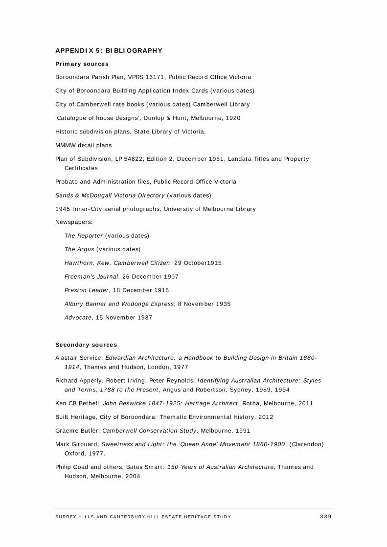
APPENDIX 5: BIBLIOGRAPHY
Primary sources
Boroondara Parish Plan, VPRS 16171, Public Record Office Victoria
City of Boroondara Building Application Index Cards (various dates)
City of Camberwell rate books (various dates) Camberwell Library
‘Catalogue of house designs’, Dunlop & Hunt, Melbourne, 1920
Historic subdivision plans, State Library of Victoria.
MMMW detail plans
Plan of Subdivision, LP 54822, Edition 2, December 1961, Landata Titles and Property Certificates
Probate and Administration files, Public Record Office Victoria
Sands & McDougall Victoria Directory (various dates)
1945 Inner-City aerial photographs, University of Melbourne Library
Newspapers:
The Reporter (various dates)
The Argus (various dates)
Hawthorn, Kew, Camberwell Citizen, 29 October1915
Freeman’s Journal, 26 December 1907
Preston Leader, 18 December 1915
Albury Banner and Wodonga Express, 8 November 1935
Advocate, 15 November 1937
Secondary sources
Alastair Service, Edwardian Architecture: a Handbook to Building Design in Britain 1880-1914, Thames and Hudson, London, 1977
Richard Apperly, Robert Irving, Peter Reynolds, Identifying Australian Architecture: Styles and Terms, 1788 to the Present, Angus and Robertson, Sydney, 1989, 1994
Ken CB Bethell, John Beswicke 1847-1925: Heritage Architect, Rotha, Melbourne, 2011
Built Heritage, City of Boroondara: Thematic Environmental History, 2012
Graeme Butler, Camberwell Conservation Study, Melbourne, 1991
Mark Girouard, Sweetness and Light: the ‘Queen Anne’ Movement 1860-1900, (Clarendon) Oxford, 1977.
Philip Goad and others, Bates Smart: 150 Years of Australian Architecture, Thames and Hudson, Melbourne, 2004
SURREY HI LLS AND CANTERBURY HI LL ESTATE HERITAGE STUDY 339
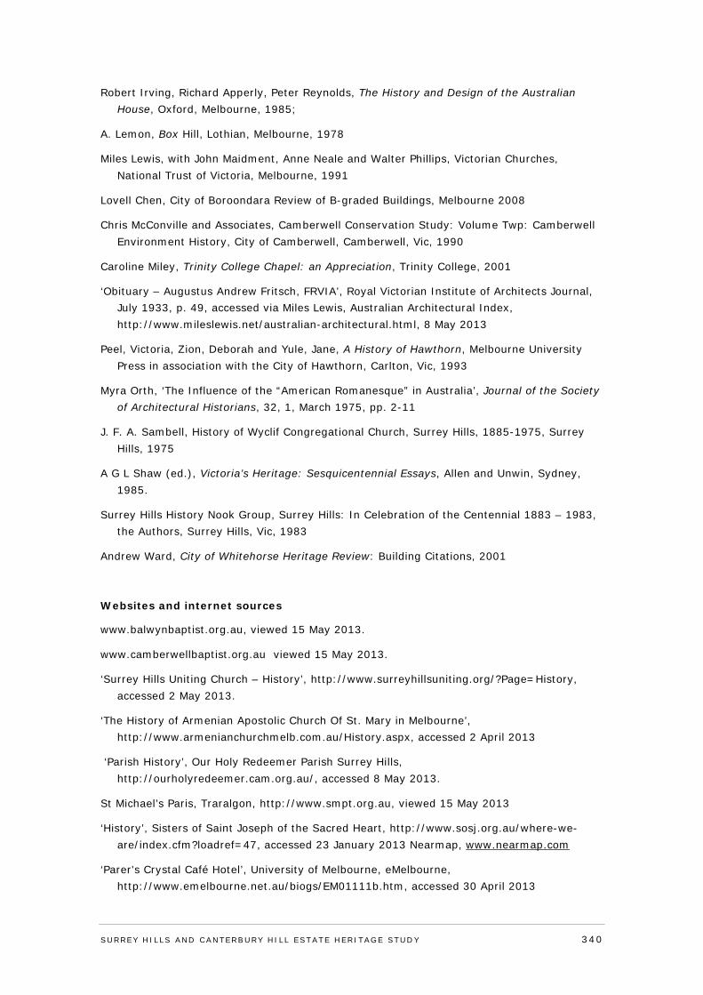
Robert Irving, Richard Apperly, Peter Reynolds, The History and Design of the Australian House, Oxford, Melbourne, 1985;
A. Lemon, Box Hill, Lothian, Melbourne, 1978
Miles Lewis, with John Maidment, Anne Neale and Walter Phillips, Victorian Churches, National Trust of Victoria, Melbourne, 1991
Lovell Chen, City of Boroondara Review of B-graded Buildings, Melbourne 2008
Chris McConville and Associates, Camberwell Conservation Study: Volume Twp: Camberwell Environment History, City of Camberwell, Camberwell, Vic, 1990
Caroline Miley, Trinity College Chapel: an Appreciation, Trinity College, 2001
‘Obituary – Augustus Andrew Fritsch, FRVIA’, Royal Victorian Institute of Architects Journal, July 1933, p. 49, accessed via Miles Lewis, Australian Architectural Index, http://www.mileslewis.net/australian-architectural.html, 8 May 2013
Peel, Victoria, Zion, Deborah and Yule, Jane, A History of Hawthorn, Melbourne University Press in association with the City of Hawthorn, Carlton, Vic, 1993
Myra Orth, ‘The Influence of the “American Romanesque” in Australia’, Journal of the Society of Architectural Historians, 32, 1, March 1975, pp. 2-11
J. F. A. Sambell, History of Wyclif Congregational Church, Surrey Hills, 1885-1975, Surrey Hills, 1975
A G L Shaw (ed.), Victoria’s Heritage: Sesquicentennial Essays, Allen and Unwin, Sydney, 1985.
Surrey Hills History Nook Group, Surrey Hills: In Celebration of the Centennial 1883 – 1983, the Authors, Surrey Hills, Vic, 1983
Andrew Ward, City of Whitehorse Heritage Review: Building Citations, 2001
Websites and internet sources
www.balwynbaptist.org.au, viewed 15 May 2013.
www.camberwellbaptist.org.au viewed 15 May 2013.
‘Surrey Hills Uniting Church – History’, http://www.surreyhillsuniting.org/?Page=History, accessed 2 May 2013.
‘The History of Armenian Apostolic Church Of St. Mary in Melbourne’, http://www.armenianchurchmelb.com.au/History.aspx, accessed 2 April 2013
‘Parish History’, Our Holy Redeemer Parish Surrey Hills, http://ourholyredeemer.cam.org.au/, accessed 8 May 2013.
St Michael’s Paris, Traralgon, http://www.smpt.org.au, viewed 15 May 2013
‘History’, Sisters of Saint Joseph of the Sacred Heart, http://www.sosj.org.au/where-we-are/index.cfm?loadref=47, accessed 23 January 2013 Nearmap, www.nearmap.com
‘Parer's Crystal Café Hotel’, University of Melbourne, eMelbourne, http://www.emelbourne.net.au/biogs/EM01111b.htm, accessed 30 April 2013
SURREY HI LLS AND CANTERBURY HI LL ESTATE HERITAGE STUDY 340
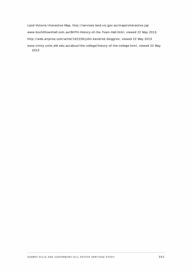
Land Victoria Interactive Map, http://services.land.vic.gov.au/maps/interactive.jsp
www.boxhilltownhall.com.au/BHTH-History-of-the-Town-Hall.html, viewed 22 May 2013.
http://web.artprice.com/artist/162228/john-kendrick-blogg/en, viewed 22 May 2013
www.trinity.unim,elb.edu.au/about/the-college/history-of-the-college.html, viewed 22 May 2013
SURREY HI LLS AND CANTERBURY HI LL ESTATE HERITAGE STUDY 341
APPENDIX 6: REFERENCE LIST
1 The attribution of J.H. Knipe to the name Surrey Hills has been noted in A. Lemon, Box Hill, Lothian, Melbourne, 1978, pp. 73-74 and Surrey Hills History Nook Group, Surrey Hills: In Celebration of the Centennial 1883 – 1983, the Authors, Surrey Hills, Vic, 1983, p. 1.
2 Boroondara Parish Plan, VPRS 16171, Public Record Office Victoria.
3 Council Minutes, 1872 as cited in Chris McConville and Associates, Camberwell Conservation Study: Volume Twp: Camberwell Environment History, City of Camberwell, Camberwell, Vic, 1990, p. 82.
4 Surrey Hills History Nook Group, Surrey Hills: In Celebration of the Centennial 1883 – 1983, the Authors, Surrey Hills, Vic, 1983, p. 5.
5 A. Lemon, Box Hill, Lothian, Melbourne, 1978, p. 74.
6 See MMBW detail plans 2247 and 2248, 1910, State Library of Victoria.
7 Built Heritage, City of Boroondara: Thematic Environmental History, 2012, p. 70.
8 Chris McConville and Associates, Camberwell Conservation Study: Volume Two: Camberwell Environment History, City of Camberwell, Camberwell, Vic, 1990, p. 61.
9 Surrey Park Estate Subdivision Plan, Troedel Collection, 1884, State Library of Victoria.
10 Argus, 6 December 1884, p. 2.
11 Certificates of Title Volume 2150 Folio 901 (cancelled), Volume 1777 Folio 213 (cancelled), Volume 2447 Folio 330 (cancelled), also see Volume 2258 Folio 568 (cancelled) and Volume 3160 Folio 960 (cancelled), Landata Title and Property Certificates.
12 Certificate of Title Volume 1777 Folio 213 (cancelled), Landata Title and Property Certificates.
13 Argus, 4 February 1892, p. 10.
14 Kilmore Free Press, 18 February 1892, p. 1S.
15 Surrey Hills History Nook Group, Surrey Hills: In Celebration of the Centennial 1883 – 1983, the Authors, Surrey Hills, Vic, 1983, p. 30.
16 The Reporter, 24.12.1891.
17 City of Camberwell rate books, North Ward, 1893, rate no. 1166, and North Ward, 1894, rate no. 1291, Camberwell Library.
18 Certificate of Title Volume 2258 Folio 568 (cancelled), Volume 2150 Folio 901 (cancelled), and Volume 2447 Folio 330 (cancelled), Landata Title and Property Certificates
19 City of Camberwell rate books, North Riding, 1896-97, rate no. 1120, and North Ward, 1897-98, rates nos. 1086 and 1087, Camberwell Library.
20 Chronicle, 30 May 1903, p. 37.
21 Argus, 3 June 1903, p. 5.
SURREY HI LLS AND CANTERBURY HI LL ESTATE HERITAGE STUDY 342
22 Victorian Heritage Database citation for 12 Vincent Street, Surrey Hills. http://vhd.heritage.vic.gov.au/vhd/heritagevic/?timeout=yes#detail_places;14738 (accessed 12/7/13). Surrey Hills History Nook Group, Surrey Hills: In Celebration of the Centennial 1883 – 1983, the Authors, Surrey Hills, Vic, 1983, p. 30.
23 Reporter, 4 September 1903, p. 4.
24 City of Camberwell rate books, North Ward, 1905, rate no. 1268 and 1908, rate no. 1889, Camberwell Library.
25 City of Camberwell rate books, North Ward, 1910, rate no. 1358, Camberwell Library.
26 Sands & McDougall Victoria Directory, various dates, 1911-1925.
27 Reporter, 23 December 1910, p. 5.
28 Certificate of Title (cancelled) Volume 4642 Folio 270, Landata Title and Property Certificates.
29 Sands & McDougall Victoria Directory, 1936.
30 Certificate of Title (cancelled) Volume 6076 Folio 006, Landata Title and Property Certificates.
31 Surrey Hills History Nook Group, Surrey Hills: In Celebration of the Centennial 1883 – 1983, the Authors, Surrey Hills, Vic, 1983, p. 35.
32 Sands & McDougall Victoria Directory, various dates, 1936-1974. Summary of patients based on family notices in the Argus newspaper including 17 June 1939, p. 8 and 30 March 1942, p. 2.
33 City of Boroondara Building Application Index #81323, 7 October 1986, 17 Barton Street, copy provided by Council.
34 City of Boroondara Building Application Plans #RS2350, 9 August 1994, 17-19 Barton Street, copy provided by Council. Personal communication from the current owners & 1990s photographs, sighted 2014.
35 Miles Lewis, Part 2 of Philip Goad and others, Bates Smart: 150 Years of Australian Architecture, Thames and Hudson, Melbourne, 2004, pp. 77-9 (Urangeline); 82-3 (Holyrood). See also Lovell Chen, City of Boroondara Review of B-graded Buildings, Melbourne 2008.
36 Miles Lewis, Part 2 of Philip Goad and others, Bates Smart: 150 Years of Australian Architecture, Thames and Hudson, Melbourne, 2004, p. 79.
37 Ken CB Bethell, John Beswicke 1847-1925: Heritage Architect, Rotha, Melbourne, 2011, pp. 27, -28, 39, 84-85 (Rotha); 93 (Tour Mont).
38 See esp. Myra Orth, ‘The Influence of the “American Romanesque” in Australia’, Journal of the Society of Architectural Historians, 32, 1, March 1975, pp. 2-11; Richard Apperly, Robert Irving, Peter Reynolds, Identifying Australian Architecture: Styles and Terms, 1788 to the Present, Angus and Robertson, Sydney, 1989, 1994.
39 Miles Lewis, Part 2 of Philip Goad and others, Bates Smart: 150 Years of Australian Architecture, Thames and Hudson, Melbourne, 2004, pp. 79-80.
40 See Mark Girouard, Sweetness and Light: the ‘Queen Anne’ Movement 1860-1900, (Clarendon) Oxford, 1977.
SURREY HI LLS AND CANTERBURY HI LL ESTATE HERITAGE STUDY 343
41 The attribution of J.H. Knipe to the name Surrey Hills has been noted in A. Lemon, Box Hill, Lothian, Melbourne, 1978, pp. 73-74 and Surrey Hills History Nook Group, Surrey Hills: In Celebration of the Centennial 1883 – 1983, the Authors, Surrey Hills, Vic, 1983, p. 1.
42 Boroondara Parish Plan, VPRS 16171, Public Record Office Victoria.
43 Council Minutes, 1872 as cited in Chris McConville and Associates, Camberwell Conservation Study: Volume Twp: Camberwell Environment History, City of Camberwell, Camberwell, Vic, 1990, p. 82.
44 Surrey Hills History Nook Group, Surrey Hills: In Celebration of the Centennial 1883 – 1983, the Authors, Surrey Hills, Vic, 1983, p. 5.
45 A. Lemon, Box Hill, Lothian, Melbourne, 1978, p. 74.
46 See MMBW detail plans 2247 and 2248, 1910, State Library of Victoria.
47 Built Heritage, City of Boroondara: Thematic Environmental History, 2012, p. 70.
48 Chris McConville and Associates, Camberwell Conservation Study: Volume Twp: Camberwell Environment History, City of Camberwell, Camberwell, Vic, 1990, p. 61.
49 Certificate of Title, Vol 1355, Fol 973.
50 Certificate of Title, Vol 1639, Fol 618.
51 Andrew Lemon, Box Hill, Lothian Publishing, Melbourne, 1978, p. 73.
52 Argus, 22 November 1884, p. 2.
53 Certificate of Title, Vol 1639, Fol 618.
54 Built Heritage, City of Boroondara: Thematic Environmental History, 2012, p. 198.
55 Argus, 30 June 1890, p. 10.
56 Built Heritage, City of Boroondara: Thematic Environmental History, 2012, p. 198.
57 Reporter, 19 December 1890, p. 3.
58 See http://www.newadvent.org/cathen/08511a.htm, accessed 3 September 2013.
59 Freeman’s Journal, 26 December 1907, p. 22.
60 Preston Leader, 18 December 1915, p.15, and Argus, 14 December 1935, p 24.
61 Argus, 24 October 1935, p. 16.
62 Albury Banner and Wodonga Express, 8 November 1935, p. 14.
63 City of Boroondara Building Application Plans, St Joseph’s Home, ‘Proposed New Class Rooms’, Thomas Power, Permit No. 14026, 4 February 1941, copy provided by Council.
64 City of Boroondara Building Application Index Card, St Joseph’s Home, Permit No. 10307, 13 September 1938, copy provided by Council. The cost of these alterations was £2,300 - the same as the cost of the 1935 infirmary building - indicating a large-scale extension. The plans for this application could not be located in Council records, but the extension to the main building is visible in the 1945 aerial photo.
65 Argus, 10 December 1908, p. 4.
66 Advocate, 15 November 1937, p.2.
SURREY HI LLS AND CANTERBURY HI LL ESTATE HERITAGE STUDY 344
67 ‘History’, Sisters of Saint Joseph of the Sacred Heart, http://www.sosj.org.au/where-we-are/index.cfm?loadref=47, accessed 23 January 2013.
68 The attribution of J.H. Knipe to the name Surrey Hills has been noted in A. Lemon, Box Hill, Lothian, Melbourne, 1978, pp. 73-74 and Surrey Hills History Nook Group, Surrey Hills: In Celebration of the Centennial 1883 – 1983, the Authors, Surrey Hills, Vic, 1983, p. 1.
69 Boroondara Parish Plan, VPRS 16171, Public Record Office Victoria.
70 Council Minutes, 1872 as cited in Chris McConville and Associates, Camberwell Conservation Study: Volume Twp: Camberwell Environment History, City of Camberwell, Camberwell, Vic, 1990, p. 82.
71 Surrey Hills History Nook Group, Surrey Hills: In Celebration of the Centennial 1883 – 1983, the Authors, Surrey Hills, Vic, 1983, p. 5.
72 A. Lemon, Box Hill, Lothian, Melbourne, 1978, p. 74.
73 See MMBW detail plans 2247 and 2248, 1910, State Library of Victoria.
74 Built Heritage, City of Boroondara: Thematic Environmental History, 2012, p. 70.
75 Chris McConville and Associates, Camberwell Conservation Study: Volume Twp: Camberwell Environment History, City of Camberwell, Camberwell, Vic, 1990, p. 61.
76 Surrey Park Estate Subdivision Plan, Troedel Collection, 1884, State Library of Victoria.
77 Argus, 6 December 1884, p. 2.
78 Based on listings in the Sands & McDougall Victoria directory, 1900-1903.
79 ‘Former St Joseph’s Convent’ citation, Andrew Ward, City of Whitehorse Heritage Review: Building Citations, 2001.
80 Reporter, 23 May 1902, p. 3.
81 ‘Obituary – Augustus Andrew Fritsch, FRVIA’, Royal Victorian Institute of Architects Journal, July 1933, p. 49, accessed via Miles Lewis, Australian Architectural Index, http://www.mileslewis.net/australian-architectural.html, 8 May 2013.
82 Reporter, 23 May 1902, p. 3.
83 Sands & McDougall Victoria directory, 1905-1906.
84 ‘Parish History’, Our Holy Redeemer Parish Surrey Hills, http://ourholyredeemer.cam.org.au/, accessed 8 May 2013.
85 Reporter, 24 July 1914, p. 9.
86 Reporter, 15 November 1918, p. 3.
87 ‘Parish History’, Our Holy Redeemer Parish Surrey Hills, http://ourholyredeemer.cam.org.au/, accessed 8 May 2013.
88 Argus, 14 March 1936, p. 21.
89 The attribution of J.H. Knipe to the name Surrey Hills has been noted in A. Lemon, Box Hill, Lothian, Melbourne, 1978, pp. 73-74 and Surrey Hills History Nook Group, Surrey Hills: In Celebration of the Centennial 1883 – 1983, the Authors, Surrey Hills, Vic, 1983, p. 1.
SURREY HI LLS AND CANTERBURY HI LL ESTATE HERITAGE STUDY 345
90 Boroondara Parish Plan, VPRS 16171, Public Record Office Victoria.
91 Council Minutes, 1872 as cited in Chris McConville and Associates, Camberwell Conservation Study: Volume Twp: Camberwell Environment History, City of Camberwell, Camberwell, Vic, 1990, p. 82.
92 Surrey Hills History Nook Group, Surrey Hills: In Celebration of the Centennial 1883 – 1983, the Authors, Surrey Hills, Vic, 1983, p. 5.
93 A. Lemon, Box Hill, Lothian, Melbourne, 1978, p. 74.
94 See MMBW detail plans 2247 and 2248, 1910, State Library of Victoria.
95 Built Heritage, City of Boroondara: Thematic Environmental History, 2012, p. 70.
96 Chris McConville and Associates, Camberwell Conservation Study: Volume Twp: Camberwell Environment History, City of Camberwell, Camberwell, Vic, 1990, p. 61.
97 Argus, 14 March 1885, p. 3.
98 City of Camberwell rate books, North Ward, 1906, rate no. 1277, 1908, rate no. 1337, Camberwell Library.
99 City of Camberwell rate books, North Ward, 1908, rate no. 1337, 1910, rate no. 1337, Camberwell Library.
100 William James Vine, Probate and Administration files, 1920, VPRS 28/P3/1032, Public Record Office Victoria.
101 William James Vine, Probate and Administration files, 1920, VPRS 28/P3/1032, Public Record Office Victoria.
102 Sands & McDougall Victoria Directory, 1925.
103 Sands & McDougall Victoria Directory, 1955.
104 City of Boroondara (Camberwell) Building Application Index Card, 1 Montrose Street, Permit No. 958, 3 September 1929 and No. 5928, 31 October 1950, copy provided by Council. 1945 aerials, University of Melbourne Library.
105 City of Boroondara (Camberwell) Building Application Index Card, 1 Montrose Street, Permit No. 84995, 21 March 1988, copy provided by Council.
106 See Miles Lewis, ‘The Victorian House’, in Robert Irving, Richard Apperly, Peter Reynolds, The History and Design of the Australian House, Oxford, Melbourne, 1985; Conrad Hamann, ‘The Inclusive Tradition in Victoria’s Architecture’, in AGL Shaw (ed.), Victoria’s Heritage: Sesquicentennial Essays, Allen and Unwin, Sydney, 1985.
107 Richard Apperly, Robert Irving, Peter Reynolds, Identifying Australian Architecture: Styles and Terms, 1788 to the Present, Angus and Robertson, Sydney, 1989, 1994, pp. 132-135.
108 Beverley Ussher, ‘The Architectural Development of Melbourne’, Journal of the Royal Victorian Institute of Architects, V, 1907-8, p. 86, quoted by C Hamann, ‘Nationalism and Reform in Australian Architecture, 1880-1920’, Historical Studies, 18, 72, April 1979, pp. 393-411; George Tibbits. Ch. 3 of Trevor Howells, Towards the Dawn: Federation Architecture in Australia 1890-1915, Hale and Iremonger, Sydney, 1989.
109 The attribution of J.H. Knipe to the name Surrey Hills has been noted in A. Lemon, Box Hill, Lothian, Melbourne, 1978, pp. 73-74 and Surrey Hills History Nook Group, Surrey
SURREY HI LLS AND CANTERBURY HI LL ESTATE HERITAGE STUDY 346
Hills: In Celebration of the Centennial 1883 – 1983, the Authors, Surrey Hills, Vic, 1983, p. 1.
110 Boroondara Parish Plan, VPRS 16171, Public Record Office Victoria.
111 Council Minutes, 1872 as cited in Chris McConville and Associates, Camberwell Conservation Study: Volume Twp: Camberwell Environment History, City of Camberwell, Camberwell, Vic, 1990, p. 82.
112 Surrey Hills History Nook Group, Surrey Hills: In Celebration of the Centennial 1883 – 1983, the Authors, Surrey Hills, Vic, 1983, p. 5.
113 A. Lemon, Box Hill, Lothian, Melbourne, 1978, p. 74.
114 See MMBW detail plans 2247 and 2248, 1910, State Library of Victoria.
115 Built Heritage, City of Boroondara: Thematic Environmental History, 2012, p. 70.
116 Chris McConville and Associates, Camberwell Conservation Study: Volume Twp: Camberwell Environment History, City of Camberwell, Camberwell, Vic, 1990, p. 61.
117 History of the Congregational Church, see ‘Fellowship of Congregational Churches’, at http://www.fcc-cong.org/history.asp (accessed July 2013).
118 J. F. A. Sambell, History of Wyclif Congregational Church, Surrey Hills, 1885-1975, Surrey Hills, 1975, p. 6.
119 J. F. A. Sambell, History of Wyclif Congregational Church, Surrey Hills, 1885-1975, Surrey Hills, 1975, p. 7.
120 Building, Engineering & Mining Journal, 24 November 1888, p. 462. Australian Builder and Contractor’s News, 15 June 1890, p. 1116 and 25 October 1890, p. 314.
121 Beeston, Janet, ‘William Ellerker’ in Goad & Willis (eds.) The Encyclopedia of Australian Architecture, 2012, p. 231. Miles Lewis’ Australian Architectural Index. Heritage Victoria’s HERMES database.
122 Reporter, 19 September 1890, p. 3.
123 Reporter, 19 September 1890, p. 3.
124 Reporter, 19 September 1890, p. 3.
125 J. F. A. Sambell, History of Wyclif Congregational Church, Surrey Hills, 1885-1975, Surrey Hills, 1975, p. 10.
126 J. F. A. Sambell, History of Wyclif Congregational Church, Surrey Hills, 1885-1975, Surrey Hills, 1975, p. 9.
127 J. F. A. Sambell, History of Wyclif Congregational Church, Surrey Hills, 1885-1975, Surrey Hills, 1975, p. 10.
128 J. F. A. Sambell, History of Wyclif Congregational Church, Surrey Hills, 1885-1975, Surrey Hills, 1975, p. 12.
129 J. F. A. Sambell, History of Wyclif Congregational Church, Surrey Hills, 1885-1975, Surrey Hills, 1975, p. 13.
130 ‘Surrey Hills Uniting Church – History’, http://www.surreyhillsuniting.org/?Page=History, accessed 2 May 2013.
SURREY HI LLS AND CANTERBURY HI LL ESTATE HERITAGE STUDY 347
131 ‘The History of Armenian Apostolic Church Of St. Mary in Melbourne’, http://www.armenianchurchmelb.com.au/History.aspx, accessed 2 April 2013.
132 Graeme Butler, Camberwell Conservation Study, Melbourne, 1991, p. 107.
133 These architects are discussed in the Brighton section of: Miles Lewis, with John Maidment, Anne Neale and Walter Phillips, Victorian Churches, National Trust of Victoria, Melbourne, 1991, pp. 59-60.
134 The attribution of J.H. Knipe to the name Surrey Hills has been noted in A. Lemon, Box Hill, Lothian, Melbourne, 1978, pp. 73-74 and Surrey Hills History Nook Group, Surrey Hills: In Celebration of the Centennial 1883 – 1983, the Authors, Surrey Hills, Vic, 1983, p. 1.
135 Boroondara Parish Plan, VPRS 16171, Public Record Office Victoria.
136 Council Minutes, 1872 as cited in Chris McConville and Associates, Camberwell Conservation Study: Volume Twp: Camberwell Environment History, City of Camberwell, Camberwell, Vic, 1990, p. 82.
137 Surrey Hills History Nook Group, Surrey Hills: In Celebration of the Centennial 1883 – 1983, the Authors, Surrey Hills, Vic, 1983, p. 5.
138 A. Lemon, Box Hill, Lothian, Melbourne, 1978, p. 74.
139 See MMBW detail plans 2247 and 2248, 1910, State Library of Victoria.
140 Built Heritage, City of Boroondara: Thematic Environmental History, 2012, p. 70.
141 Chris McConville and Associates, Camberwell Conservation Study: Volume Twp: Camberwell Environment History, City of Camberwell, Camberwell, Vic, 1990, p. 61.
142 Certificate of Title (cancelled), Volume 4112 Folio 400, Landata Titles and Property Certificates.
143 ‘Catalogue of house designs’, Dunlop & Hunt, Melbourne, 1920.
144 Certificate of Title (cancelled), Volume 4112 Folio 400, Landata Titles and Property Certificates.
145 Sands & McDougall Victoria Directory, 1925, 1935.
146 Certificate of Title (cancelled), Volume 4112 Folio 400, Landata Titles and Property Certificates.
147 Plan of Subdivision, LP 54822, Edition 2, December 1961, Landata Titles and Property Certificates.
148 Certificate of Title (cancelled), Volume 4112 Folio 400, Landata Titles and Property Certificates.
149 Sands & McDougall Victoria Directory, 1965.
150 Built Heritage, City of Boroondara: Thematic Environmental History, 2012, pp 146-147.
151 The attribution of J.H. Knipe to the name Surrey Hills has been noted in A. Lemon, Box Hill, Lothian, Melbourne, 1978, pp. 73-74 and Surrey Hills History Nook Group, Surrey Hills: In Celebration of the Centennial 1883 – 1983, the Authors, Surrey Hills, Vic, 1983, p. 1.
SURREY HI LLS AND CANTERBURY HI LL ESTATE HERITAGE STUDY 348
152 Boroondara Parish Plan, VPRS 16171, Public Record Office Victoria.
153 Council Minutes, 1872 as cited in Chris McConville and Associates, Camberwell Conservation Study: Volume Twp: Camberwell Environment History, City of Camberwell, Camberwell, Vic, 1990, p. 82.
154 Surrey Hills History Nook Group, Surrey Hills: In Celebration of the Centennial 1883 – 1983, the Authors, Surrey Hills, Vic, 1983, p. 5.
155 A. Lemon, Box Hill, Lothian, Melbourne, 1978, p. 74.
156 See MMBW detail plans 2247 and 2248, 1910, State Library of Victoria.
157 Built Heritage, City of Boroondara: Thematic Environmental History, 2012, p. 70.
158 Chris McConville and Associates, Camberwell Conservation Study: Volume Twp: Camberwell Environment History, City of Camberwell, Camberwell, Vic, 1990, p. 61.
159 This overview is based on that included in the citation for Alexandra Gardens, Cotham Road, Kew, prepared by Lovell Chen in 2011 as part of the Kew Junction Commercial Heritage Study for the City of Boroondara.
160 VPD. Melbourne to Burwood Tramways Park Bill Debate. 21 December 1915, p. 4331.
161 Ramsay, Juliet, Parks, Gardens and Special Trees: A Classification and Assessment Method for the Register of the National Estate, 1991, pp. 6-7.
162 Aitken, Richard, Gardenesque: A Celebration of Australian Gardening, 2004, p. 95.
163 Reporter, 27 February 1903, p. 2.
164 Reporter, 27 February 1903, p. 2.
165 Reporter, 14 August 1903, p. 4.
166 Reporter, 24 June 1904, p. 5, and 29 July 1904, p.5.
167 Reporter, 29 July 1904, p.5.
168 Reporter, 15 July 1904, p. 5.
169 Reporter, 11 August 1905, p. 8.
170 Reporter, 22 September 1905, p. 5.
171 Reporter, 14 July 1905, p. 5, and 8 September 1905, p. 5
172 Reporter, 3 November 1911, p. 4, and 3 May 1912, p. 4.
173 Reporter, 3 May 1912, p. 4.
174 Reporter, 9 August 1912, p. 8, Argus, 4 November 1912, p. 14.
175 Reporter, 22 November 1918, p. 5.
176 Argus, 2 June, 1930, p.12. Built Heritage, City of Boroondara: Thematic Environmental History, 2012, p. 197, 206
177 Built Heritage, City of Boroondara: Thematic Environmental History, 2012, p. 203.
178 Report, 13 July 1917, p. 3.
179 Reporter, 12 April1918, p.2.
SURREY HI LLS AND CANTERBURY HI LL ESTATE HERITAGE STUDY 349
180 Built Heritage, City of Boroondara: Thematic Environmental History, 2012, p. 203.
181 Argus, 2 June 1930, p. 12.
182 Argus, 2 June 1930, p. 12.
183 Tree species are identified on a sign located in the park that also presents a historical overview.
184 http://web.artprice.com/artist/162228/john-kendrick-blogg/en, viewed 22 May 2013.
185 www.trinity.unim,elb.edu.au/about/the-college/history-of-the-college.html, viewed 22 May 2013, Caroline Miley, Trinity College Chapel: an Appreciation, Trinity College, 2001.
186 Ken Inglis assisted by Jan Brazier, Sacred Places: War Memorials in the Australian Landscape, Miegunyah, Melbourne, 1998, pp. 154-179. The Stanthorpe pavilion is illustrated on p. 142.
187 Ken Inglis assisted by Jan Brazier, Sacred Places: War Memorials in the Australian Landscape, Miegunyah, Melbourne, 1998, pp. 110-11.
188 Ken Inglis assisted by Jan Brazier, Sacred Places: War Memorials in the Australian Landscape, Miegunyah, Melbourne, 1998, pp. 110-122.
189 Built Heritage, City of Boroondara: Thematic Environmental History, 2012, pp. 197-198.
190 The attribution of J.H. Knipe to the name Surrey Hills has been noted in A. Lemon, Box Hill, Lothian, Melbourne, 1978, pp. 73-74 and Surrey Hills History Nook Group, Surrey Hills: In Celebration of the Centennial 1883 – 1983, the Authors, Surrey Hills, Vic, 1983, p. 1.
191 Boroondara Parish Plan, VPRS 16171, Public Record Office Victoria.
192 Council Minutes, 1872 as cited in Chris McConville and Associates, Camberwell Conservation Study: Volume Twp: Camberwell Environment History, City of Camberwell, Camberwell, Vic, 1990, p. 82.
193 Surrey Hills History Nook Group, Surrey Hills: In Celebration of the Centennial 1883 – 1983, the Authors, Surrey Hills, Vic, 1983, p. 5.
194 A. Lemon, Box Hill, Lothian, Melbourne, 1978, p. 74.
195 See MMBW detail plans 2247 and 2248, 1910, State Library of Victoria.
196 Built Heritage, City of Boroondara: Thematic Environmental History, 2012, p. 70.
197 Chris McConville and Associates, Camberwell Conservation Study: Volume Twp: Camberwell Environment History, City of Camberwell, Camberwell, Vic, 1990, p. 61.
198 Argus, 12 September 1885, p. 2.
199 Certificate of Title (cancelled) Volume 2126 Folio 056, Landata Titles and Property Certificates. Sands & McDougall Victoria Directory, 1890 & 1891. Surrey Hills History Nook Group, Surrey Hills: In Celebration of the Centennial 1883 – 1983, the Authors, Surrey Hills, Vic, 1983, p. 56 (NB: This source gives the house name as ‘Aringa’ but says it was built for a ‘Mr. Cornelius’, who does not appear in the title records.)
200 City of Camberwell rate books, North Ward, 1893, rate no. 1116, Camberwell Library.
201 City of Camberwell rate books, North Ward, 1905, rate no. 1716, Camberwell Library.
SURREY HI LLS AND CANTERBURY HI LL ESTATE HERITAGE STUDY 350
202 Sands & McDougall Victoria Directory, various dates, 1890-1894.
203 Sands & McDougall Victoria Directory, various dates, 1897-1903.
204 Sands & McDougall Victoria Directory, various dates, 1906-1911, Certificate of Title (cancelled) Volume 2126 Folio 056, Volume 3361 Folio 121, Landata Titles and Property Certificates.
205 Sands & McDougall Victoria Directory, various dates, 1911-1915.
206 Certificate of Title (cancelled) Volume 3361 Folio 121, Certificate of Title Volume 10147 Folio 560, Landata Titles and Property Certificates. Note that one source (Surrey Hills History Nook Group, Surrey Hills: In Celebration of the Centennial 1883 – 1983, the Authors, Surrey Hills, Vic, 1983, p. 56) claims that the Parers moved in in 1910, but this is contradicted by the Sands & McDougall Victoria Directory, which lists ‘Juan Parer’ as a resident on Weybridge Street in 1915 for the first time (the directory listings having been compiled the previous year).
207 Surrey Hills History Nook Group, Surrey Hills: In Celebration of the Centennial 1883 – 1983, the Authors, Surrey Hills, Vic, 1983, p. 14.
208 Argus, 14 October 1886, p. 6.
209 ‘Parer's Crystal Café Hotel’, University of Melbourne, eMelbourne, http://www.emelbourne.net.au/biogs/EM01111b.htm, accessed 30 April 2013.
210 Surrey Hills History Nook Group, Surrey Hills: In Celebration 1883 - 1983, the Authors, Surrey Hills, Vic, 1983, p. 14.
211 Certificate of Title (cancelled) Volume 03361 Folio 121, Certificate of Title Volume 10147 Folio 560, Landata Titles and Property Certificates.
212 City of Boroondara Building Application Plans, ‘Proposed Alterations to 26 Weybridge Street Surrey Hills for Jo and Richard Eager’, Edmond & Corrigan, Permit No. 9228, 1996, copy provided by Council.
213 City of Boroondara Building Application Plans, ‘Proposed Alterations to 26 Weybridge Street Surrey Hills for Jo and Richard Eager’, Edmond & Corrigan, Permit No. 9228, 1996, copy provided by Council.
214 Richard Apperly, Robert Irving, Peter Reynolds, Identifying Australian Architecture: Styles and Terms, 1788 to the Present, Angus and Robertson, Sydney, 1989, 1994, p.p 70-73.
215 The attribution of J.H. Knipe to the name Surrey Hills has been noted in A. Lemon, Box Hill, Lothian, Melbourne, 1978, pp. 73-74 and Surrey Hills History Nook Group, Surrey Hills: In Celebration of the Centennial 1883 – 1983, the Authors, Surrey Hills, Vic, 1983, p. 1.
216 Boroondara Parish Plan, VPRS 16171, Public Record Office Victoria.
217 Council Minutes, 1872 as cited in Chris McConville and Associates, Camberwell Conservation Study: Volume Twp: Camberwell Environment History, City of Camberwell, Camberwell, Vic, 1990, p. 82.
218 Surrey Hills History Nook Group, Surrey Hills: In Celebration of the Centennial 1883 – 1983, the Authors, Surrey Hills, Vic, 1983, p. 5.
219 A. Lemon, Box Hill, Lothian, Melbourne, 1978, p. 74.
SURREY HI LLS AND CANTERBURY HI LL ESTATE HERITAGE STUDY 351
220 See MMBW detail plans 2247 and 2248, 1910, State Library of Victoria.
221 Built Heritage, City of Boroondara: Thematic Environmental History, 2012, p. 70.
222 Chris McConville and Associates, Camberwell Conservation Study: Volume Twp: Camberwell Environment History, City of Camberwell, Camberwell, Vic, 1990, p. 61.
223 Reporter, 22 September 1916, p.4.
224 Reporter, 22 September 1916, p.4.
225 Argus, 12 October 1916, p. 2.
226 Hawthorn, Kew, Camberwell Citizen, 6 October 1916, p. 2.
227 Allotments in the subdivision taken from properties identified as part of Lodged Plan 7993, on Land Victoria Interactive Map, http://services.land.vic.gov.au/maps/interactive.jsp, accessed 29 April 2013.
228 Certificate of Title (cancelled) Volume 04860 Folio 977, Landata Titles and Property Certificates.
229 Certificate of Title (cancelled) Volume 04860 Folio 977, Landata Titles and Property Certificates.
230 Built Heritage, City of Boroondara: Thematic Environmental History, 2012, p. 193.
231 Sands & McDougall Victoria Directory, 1925.
232 Argus, 22 November 1935, p. 8.
233 Certificate of Title (cancelled) Volume 04860 Folio 977, Landata Titles and Property Certificates.
234 City of Boroondara Building Application Index Card, 627 Whitehorse Road, Permit No. 34374, 15 January 1964, copy provided by Council.
235 Certificate of Title (cancelled) Volume 04860 Folio 977, Landata Titles and Property Certificates.
236 Alastair Service, Edwardian Architecture: a Handbook to Building Design in Britain 1880-1914, Thames and Hudson, London, 1977, esp, pp. 20-37, 93-95. Richard Apperly, Robert Irving, Peter Reynolds, Identifying Australian Architecture: Styles and Terms, 1788 to the Present, Angus and Robertson, Sydney, 1989, 1994, pp. 140-143 and pp. 144-147.
237 The attribution of J.H. Knipe to the name Surrey Hills has been noted in A. Lemon, Box Hill, Lothian, Melbourne, 1978, pp. 73-74 and Surrey Hills History Nook Group, Surrey Hills: In Celebration of the Centennial 1883 – 1983, the Authors, Surrey Hills, Vic, 1983, p. 1.
238 Boroondara Parish Plan, VPRS 16171, Public Record Office Victoria.
239 Council Minutes, 1872 as cited in Chris McConville and Associates, Camberwell Conservation Study: Volume Twp: Camberwell Environment History, City of Camberwell, Camberwell, Vic, 1990, p. 82.
240 Surrey Hills History Nook Group, Surrey Hills: In Celebration of the Centennial 1883 – 1983, the Authors, Surrey Hills, Vic, 1983, p. 5.
241 A. Lemon, Box Hill, Lothian, Melbourne, 1978, p. 74.
SURREY HI LLS AND CANTERBURY HI LL ESTATE HERITAGE STUDY 352
242 See MMBW detail plans 2247 and 2248, 1910, State Library of Victoria.
243 Built Heritage, City of Boroondara: Thematic Environmental History, 2012, p. 70.
244 Chris McConville and Associates, Camberwell Conservation Study: Volume Twp: Camberwell Environment History, City of Camberwell, Camberwell, Vic, 1990, p. 61.
245 Argus, 1 December 1883, p. 3.
246 Certificate of Title (cancelled) Volume 01531, Folio 170, Landata Titles and Property Certificates.
247 Samuel Gibson, Wills and Probate files, 1899, VPRS 28/P2/532, File 73/609, Public Record Office Victoria.
248 City of Camberwell rate books, North Riding, 1901, rate no. 753 and 1902, rate no. 760, Camberwell Library.
249 Certificate of Title (cancelled) Volume 01531, Folio 170, Landata Titles and Property Certificates, Argus, 18 July 1906, p.3 and 17 October 1938, p. 10. The familial relationship is indicated in Samuel Gibson’s Probate.
250 Pers. Comm., H.A. May, 2015.
251 Certificate of Title (cancelled) Volume 01531, Folio 170, Landata Titles and Property Certificates.
252 City of Boroondara Building Application Index Card, 5 Windsor Crescent, Permit No. 22011, 20 January 1958, copy provided by Council.
253 Certificate of Title Volume 10594 Folio 263, Landata Titles and Property Certificates.
254 Property Service Plan, 1911, Yarra Valley Water. City of Boroondara Building Plans, 5 Windsor Crescent, Permit No. 22011, lodged 20 January 1958, copy provided by Council.
255 Richard Apperly, Robert Irving, Peter Reynolds, Identifying Australian Architecture: Styles and Terms, 1788 to the Present, Angus and Robertson, Sydney, 1989, 1994, pp. 132-135.
256 The attribution of J.H. Knipe to the name Surrey Hills has been noted in A. Lemon, Box Hill, Lothian, Melbourne, 1978, pp. 73-74 and Surrey Hills History Nook Group, Surrey Hills: In Celebration of the Centennial 1883 – 1983, the Authors, Surrey Hills, Vic, 1983, p. 1.
257 Boroondara Parish Plan, VPRS 16171, Public Record Office Victoria.
258 Council Minutes, 1872 as cited in Chris McConville and Associates, Camberwell Conservation Study: Volume Twp: Camberwell Environment History, City of Camberwell, Camberwell, Vic, 1990, p. 82.
259 Chris McConville and Associates, Camberwell Conservation Study: Volume Twp: Camberwell Environment History, City of Camberwell, Camberwell, Vic, 1990, p. 82.
260 Surrey Hills History Nook Group, Surrey Hills: In Celebration of the Centennial 1883 – 1983, the Authors, Surrey Hills, Vic, 1983, p. 5.
261 A. Lemon, Box Hill, Lothian, Melbourne, 1978, p. 74.
262 Auction Notice cited in Surrey Hills History Nook Group, Surrey Hills: In Celebration of the Centennial 1883 – 1983, the Authors, Surrey Hills, Vic, 1983, p. 9.
SURREY HI LLS AND CANTERBURY HI LL ESTATE HERITAGE STUDY 353
263 Surrey Hills History Nook Group, Surrey Hills: In Celebration of the Centennial 1883 – 1983, the Authors, Surrey Hills, Vic, 1983, p. 20.
264 Surrey Hills History Nook Group, Surrey Hills: In Celebration of the Centennial 1883 – 1983, the Authors, Surrey Hills, Vic, 1983, p. 20.
265 Chris McConville and Associates, Camberwell Conservation Study: Volume Twp: Camberwell Environment History, City of Camberwell, Camberwell, Vic, 1990, p. 61.
266 The Argus, 15 September 1919, p. 8.
267 Blainey, Geoffrey, A History of Camberwell, as cited in Peel, Victoria, Zion, Deborah and Yule, Jane, A History of Hawthorn, Melbourne University Press in association with the City of Hawthorn, Cartlon, Vic, 1993, p. 95.
268 Blainey, Geoffrey, A History of Camberwell, as cited in Peel, Victoria, Zion, Deborah and Yule, Jane, A History of Hawthorn, Melbourne University Press in association with the City of Hawthorn, Cartlon, Vic, 1993, p. 94.
269 ‘Surrey Hills: Birthplace’, City of Boroondara Community Profile, profile.id, http://profile.id.com.au/boroondara/birthplace?WebID=210, accessed 22 April 2013
270 Certificate of Title, Vol 1355, Fol 973.
271 Certificate of Title, Vol 1639, Fol 618.
272 Andrew Lemon, Box Hill, Lothian Publishing, Melbourne, 1978, p. 73.
273 Argus, 22 November 1884, p. 2.
274 Certificate of Title, Vol 1639, Fol 618.
275 Sands & McDougall Melbourne and Suburban directory, 1889
276 The attribution of J.H. Knipe to the name Surrey Hills has been noted in A. Lemon, Box Hill, Lothian, Melbourne, 1978, pp. 73-74 and Surrey Hills History Nook Group, Surrey Hills: In Celebration of the Centennial 1883 – 1983, the Authors, Surrey Hills, Vic, 1983, p. 1.
277 Boroondara Parish Plan, VPRS 16171, Public Record Office Victoria.
278 Council Minutes, 1872 as cited in Chris McConville and Associates, Camberwell Conservation Study: Volume Twp: Camberwell Environment History, City of Camberwell, Camberwell, Vic, 1990, p. 82.
279 Chris McConville and Associates, Camberwell Conservation Study: Volume Twp: Camberwell Environment History, City of Camberwell, Camberwell, Vic, 1990, p. 82.
280 Surrey Hills History Nook Group, Surrey Hills: In Celebration of the Centennial 1883 – 1983, the Authors, Surrey Hills, Vic, 1983, p. 5.
281 A. Lemon, Box Hill, Lothian, Melbourne, 1978, p. 74.
282 Auction Notice cited in Surrey Hills History Nook Group, Surrey Hills: In Celebration of the Centennial 1883 – 1983, the Authors, Surrey Hills, Vic, 1983, p. 9.
283 Surrey Hills History Nook Group, Surrey Hills: In Celebration of the Centennial 1883 – 1983, the Authors, Surrey Hills, Vic, 1983, p. 20.
284 Surrey Hills History Nook Group, Surrey Hills: In Celebration of the Centennial 1883 – 1983, the Authors, Surrey Hills, Vic, 1983, p. 20.
SURREY HI LLS AND CANTERBURY HI LL ESTATE HERITAGE STUDY 354
285 Chris McConville and Associates, Camberwell Conservation Study: Volume Twp: Camberwell Environment History, City of Camberwell, Camberwell, Vic, 1990, p. 61.
286 The Argus, 15 September 1919, p. 8.
287 Blainey, Geoffrey, A History of Camberwell, as cited in Peel, Victoria, Zion, Deborah and Yule, Jane, A History of Hawthorn, Melbourne University Press in association with the City of Hawthorn, Cartlon, Vic, 1993, p. 95.
288 Blainey, Geoffrey, A History of Camberwell, as cited in Peel, Victoria, Zion, Deborah and Yule, Jane, A History of Hawthorn, Melbourne University Press in association with the City of Hawthorn, Cartlon, Vic, 1993, p. 94.
289 ‘Surrey Hills: Birthplace’, City of Boroondara Community Profile, profile.id, http://profile.id.com.au/boroondara/birthplace?WebID=210, accessed 22 April 2013
290 LP 2344, Edition 3, 23 January 1889, Landata Titles and Property Certificates.
291 Sands & McDougall Melbourne and Suburban directory,1894.
292 LP 2344, Edition 3, 23 January 1889, Landata Titles and Property Certificates.
293 Sands & McDougall Melbourne and Suburban Directory, 1892.
294 Sands & McDougall Melbourne and Suburban Directory, 1901.
295 Sands & McDougall Melbourne and Suburban Directory, 1907.
296 John Kennealy, Wills and Probate File, VPRS 28/P0/584, 1891.
297 Sands & McDougall Melbourne and Suburban Directory, 1895.
298 Margaret Kennealy, Wills and Probate File, VPRS 28/P3/155, 1910, and John Kennealy, Wills and Probate File, VPRS 28/P3/393, 1913, Public Record Office Victoria.
299 LP 6411, 21 July 1914, Landata Titles and Property Certificates.
300 Kate Kennealy, Wills and Probate File, VPRS 28/P3/649, 1916, Public Record Office of Victoria.
301 City of Camberwell, Building plans, Permit No. 3088, 27 May 1949.
302 The attribution of J.H. Knipe to the name Surrey Hills has been noted in A. Lemon, Box Hill, Lothian, Melbourne, 1978, pp. 73-74 and Surrey Hills History Nook Group, Surrey Hills: In Celebration of the Centennial 1883 – 1983, the Authors, Surrey Hills, Vic, 1983, p. 1.
303 Boroondara Parish Plan, VPRS 16171, Public Record Office Victoria.
304 Council Minutes, 1872 as cited in Chris McConville and Associates, Camberwell Conservation Study: Volume Twp: Camberwell Environment History, City of Camberwell, Camberwell, Vic, 1990, p. 82.
305 Chris McConville and Associates, Camberwell Conservation Study: Volume Twp: Camberwell Environment History, City of Camberwell, Camberwell, Vic, 1990, p. 82.
306 Surrey Hills History Nook Group, Surrey Hills: In Celebration of the Centennial 1883 – 1983, the Authors, Surrey Hills, Vic, 1983, p. 5.
307 A. Lemon, Box Hill, Lothian, Melbourne, 1978, p. 74.
SURREY HI LLS AND CANTERBURY HI LL ESTATE HERITAGE STUDY 355
308 Auction Notice cited in Surrey Hills History Nook Group, Surrey Hills: In Celebration of the Centennial 1883 – 1983, the Authors, Surrey Hills, Vic, 1983, p. 9.
309 Surrey Hills History Nook Group, Surrey Hills: In Celebration of the Centennial 1883 – 1983, the Authors, Surrey Hills, Vic, 1983, p. 20.
310 Surrey Hills History Nook Group, Surrey Hills: In Celebration of the Centennial 1883 – 1983, the Authors, Surrey Hills, Vic, 1983, p. 20.
311 Chris McConville and Associates, Camberwell Conservation Study: Volume Twp: Camberwell Environment History, City of Camberwell, Camberwell, Vic, 1990, p. 61.
312 The Argus, 15 September 1919, p. 8.
313 Blainey, Geoffrey, A History of Camberwell, as cited in Peel, Victoria, Zion, Deborah and Yule, Jane, A History of Hawthorn, Melbourne University Press in association with the City of Hawthorn, Cartlon, Vic, 1993, p. 95.
314 Blainey, Geoffrey, A History of Camberwell, as cited in Peel, Victoria, Zion, Deborah and Yule, Jane, A History of Hawthorn, Melbourne University Press in association with the City of Hawthorn, Cartlon, Vic, 1993, p. 94.
315 ‘Surrey Hills: Birthplace’, City of Boroondara Community Profile, profile.id, http://profile.id.com.au/boroondara/birthplace?WebID=210, accessed 22 April 2013
316 ‘Plan of Land at Surrey Hills’, State Library of Victoria.
317 The Argus, 22 October 1883, p. 6.
318 Sands & McDougall Victoria Directory, 1919, 1920.
319 Argus, 31 January 1888, p. 3.
320 MMBW detail plan Nos. 2227 and 2228, 1925, State Library of Victoria.
321 Argus, 1 December 1934, p. 2.
322 Surrey Hills History Nook Group, Surrey Hills: In Celebration of the Centennial 1883 – 1983, the Authors, Surrey Hills, Vic, 1983, p. 55.
323 Sands & McDougall Melbourne & Suburbs directory, 1889; Reporter, 17 October 1902, p. 2; Surrey Hills History Nook Group, Surrey Hills: In Celebration of the Centennial 1883 – 1983, the Authors, Surrey Hills, Vic, 1983, pp. 34, 51.
324 Sands & McDougall Victoria Directory, various dates, 1901, 1906, 1915, 1919.
325 Sands & McDougall Melbourne & Suburbs directory, 1901.
326 Sands & McDougall Melbourne & Suburbs directory, 1903.
327 Reporter, 26 November 1909, p. 5, Argus, 23 September 1953, p. 13.
328 Sands & McDougall Melbourne & Suburbs directory, 1903, 1905.
329 Sands & McDougall Victoria Directory, 1915, 1920, 1940.
330 Sands & McDougall Victoria Directory, 1930.
331 Sands & McDougall Victoria Directory, 1935, 1940.
332 Sands & McDougall Victoria Directory, 1955.
SURREY HI LLS AND CANTERBURY HI LL ESTATE HERITAGE STUDY 356
333 Graeme Butler, The Californian Bungalow in Australia, Lothian, Melbourne, 1992; Peter Cuffley, Australian Houses of the ‘20s and ‘30s, Five Mile, Melbourne, 1989; Apperly, Irving and Reynolds, in Identifying Australian Architecture: ‘Federation Bungalow c. 1890—c. 1915, pp. 144-147; ‘Inter-War California Bungalow c. 1915—c. 1940’, pp. 206-209.
SURREY HI LLS AND CANTERBURY HI LL ESTATE HERITAGE STUDY 357


