Embed Size (px)
Citation preview
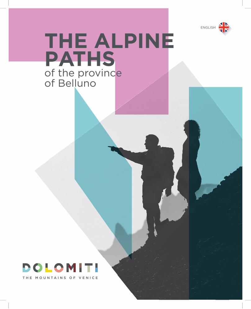
THE ALPINE PATHSof the provinceof Belluno
ENGLISH
Consorzio DMO Dolomitic/o Provincia di Belluno
Telefono+ 39 0437 [email protected]
www.infodolomiti.it
The Alta Vias of the Dolomites (Dolomite High Routes) 03.The Alta Via 1 04.The Alta Via 2 05.The Alta Via 3 06.The Alta Via 4 07.The Alta Via 5 08.The Alta Via 6 09.The Alta Via 7 10.The Alta Via 8 11.The Alta Via 9 12. The Alta Via dei Pastori (The High Route of the Shepherds) 13.The Alta Via dell'Orso (The High Route of the Bear) 14.The Alta Via Amelia 15.The Traverse of CadoreThe cammini delle Dolomiti (The Walks of the Dolomites)19.The cammino delle Dolomiti 20. The Via dei Papi (The Way of the Popes) 21.Park2trek 22. The Dolomiti Bellunesi Alta Via 23. The Yellow Via Alpina 24.he Dolomites in miniature 25. The Via degli Ospizi (The Trail of the Hospices) 26.Sentiero Buzzati (The trail of Dino Buzzati) 27.Strada de la Vena 28.E7 Venetian Prealps of Belluno and Treviso 29.Anello Zoldano 30.Piccolo Anello Zoldano (Small Zoldo Circuit) 31.Munich—Venice 32.Cortina Dolomiti Ultra Trekking 33. Sentieri Parlanti (Talking Trails)
INDEX
In the meantime, the first rays of sunlight reach the high peaks. Now Barnabo admires the mountains.They don't really look like towers, castles or ruined churches, but these ones only look like themselves, just as these ones are,with the white landslides, the crevasses,the gravel ledges, the endless edgesoverhanging bent out into the void.
from Bàrnabo delle montagneDino Buzzati
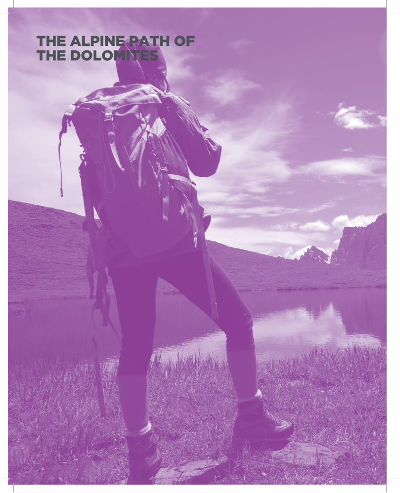
THE ALPINE PATH OF THE DOLOMITES
5
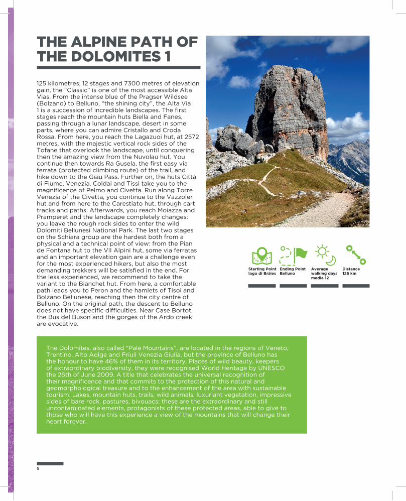
125 kilometres, 12 stages and 7300 metres of elevation gain, the “Classic” is one of the most accessible Alta Vias. From the intense blue of the Pragser Wildsee (Bolzano) to Belluno, “the shining city”, the Alta Via 1 is a succession of incredible landscapes. The first stages reach the mountain huts Biella and Fanes, passing through a lunar landscape, desert in some parts, where you can admire Cristallo and Croda Rossa. From here, you reach the Lagazuoi hut, at 2572 metres, with the majestic vertical rock sides of the Tofane that overlook the landscape, until conquering then the amazing view from the Nuvolau hut. You continue then towards Ra Gusela, the first easy via ferrata (protected climbing route) of the trail, and hike down to the Giau Pass. Further on, the huts Città di Fiume, Venezia, Coldai and Tissi take you to the magnificence of Pelmo and Civetta. Run along Torre Venezia of the Civetta, you continue to the Vazzoler hut and from here to the Carestiato hut, through cart tracks and paths. Afterwards, you reach Moiazza and Pramperet and the landscape completely changes: you leave the rough rock sides to enter the wild Dolomiti Bellunesi National Park. The last two stages on the Schiara group are the hardest both from a physical and a technical point of view: from the Pian de Fontana hut to the VII Alpini hut, some via ferratas and an important elevation gain are a challenge even for the most experienced hikers, but also the most demanding trekkers will be satisfied in the end. For the less experienced, we recommend to take the variant to the Bianchet hut. From here, a comfortable path leads you to Peron and the hamlets of Tisoi and Bolzano Bellunese, reaching then the city centre of Belluno. On the original path, the descent to Belluno does not have specific difficulties. Near Case Bortot, the Bus del Buson and the gorges of the Ardo creek are evocative.
The Dolomites, also called “Pale Mountains”, are located in the regions of Veneto, Trentino, Alto Adige and Friuli Venezia Giulia, but the province of Belluno has the honour to have 46% of them in its territory. Places of wild beauty, keepers of extraordinary biodiversity, they were recognised World Heritage by UNESCO the 26th of June 2009. A title that celebrates the universal recognition of their magnificence and that commits to the protection of this natural and geomorphological treasure and to the enhancement of the area with sustainable tourism. Lakes, mountain huts, trails, wild animals, luxuriant vegetation, impressive sides of bare rock, pastures, bivouacs: these are the extraordinary and still uncontaminated elements, protagonists of these protected areas, able to give to those who will have this experience a view of the mountains that will change their heart forever.
THE ALPINE PATH OF THE DOLOMITES 1
Ending PointBelluno
Starting Pointlago di Bràies
Distance125 km
Average walking days media 12
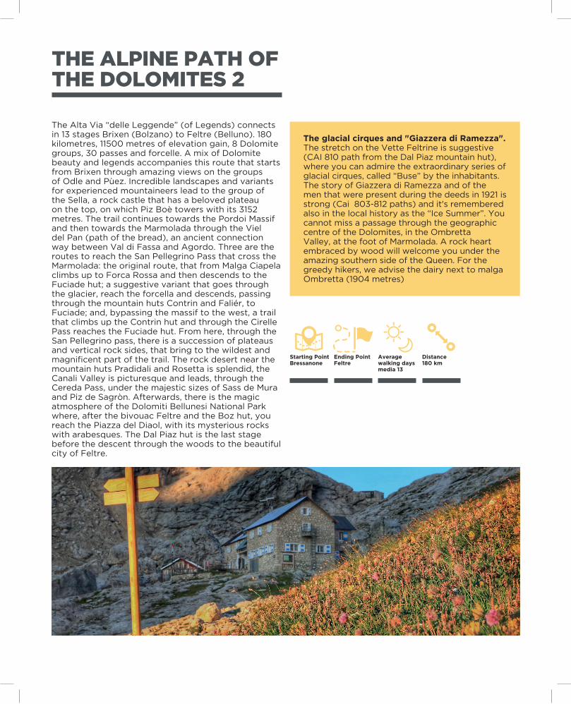
The Alta Via “delle Leggende” (of Legends) connects in 13 stages Brixen (Bolzano) to Feltre (Belluno). 180 kilometres, 11500 metres of elevation gain, 8 Dolomite groups, 30 passes and forcelle. A mix of Dolomite beauty and legends accompanies this route that starts from Brixen through amazing views on the groups of Odle and Pùez. Incredible landscapes and variants for experienced mountaineers lead to the group of the Sella, a rock castle that has a beloved plateau on the top, on which Piz Boè towers with its 3152 metres. The trail continues towards the Pordoi Massif and then towards the Marmolada through the Viel del Pan (path of the bread), an ancient connection way between Val di Fassa and Agordo. Three are the routes to reach the San Pellegrino Pass that cross the Marmolada: the original route, that from Malga Ciapela climbs up to Forca Rossa and then descends to the Fuciade hut; a suggestive variant that goes through the glacier, reach the forcella and descends, passing through the mountain huts Contrin and Faliér, to Fuciade; and, bypassing the massif to the west, a trail that climbs up the Contrin hut and through the Cirelle Pass reaches the Fuciade hut. From here, through the San Pellegrino pass, there is a succession of plateaus and vertical rock sides, that bring to the wildest and magnificent part of the trail. The rock desert near the mountain huts Pradidali and Rosetta is splendid, the Canali Valley is picturesque and leads, through the Cereda Pass, under the majestic sizes of Sass de Mura and Piz de Sagròn. Afterwards, there is the magic atmosphere of the Dolomiti Bellunesi National Park where, after the bivouac Feltre and the Boz hut, you reach the Piazza del Diaol, with its mysterious rocks with arabesques. The Dal Piaz hut is the last stage before the descent through the woods to the beautiful city of Feltre.
The glacial cirques and "Giazzera di Ramezza". The stretch on the Vette Feltrine is suggestive (CAI 810 path from the Dal Piaz mountain hut), where you can admire the extraordinary series of glacial cirques, called “Buse” by the inhabitants. The story of Giazzera di Ramezza and of the men that were present during the deeds in 1921 is strong (Cai 803-812 paths) and it's remembered also in the local history as the “Ice Summer”. You cannot miss a passage through the geographic centre of the Dolomites, in the Ombretta Valley, at the foot of Marmolada. A rock heart embraced by wood will welcome you under the amazing southern side of the Queen. For the greedy hikers, we advise the dairy next to malga Ombretta (1904 metres)
THE ALPINE PATH OF THE DOLOMITES 2
Ending PointFeltre
Starting PointBressanone
Distance180 km
Average walking days media 13
7
THE ALPINE PATH OF THE DOLOMITES 3
Ending PointLongarone
Starting PointVillabassa
Distance100 km
Average walking days media 8
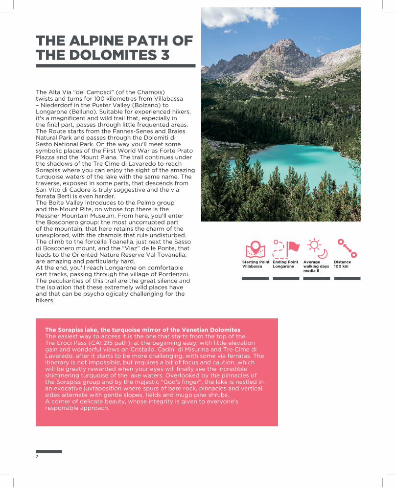
The Alta Via “dei Camosci” (of the Chamois) twists and turns for 100 kilometres from Villabassa – Niederdorf in the Puster Valley (Bolzano) to Longarone (Belluno). Suitable for experienced hikers, it's a magnificent and wild trail that, especially in the final part, passes through little frequented areas. The Route starts from the Fannes-Senes and Braies Natural Park and passes through the Dolomiti di Sesto National Park. On the way you'll meet some symbolic places of the First World War as Forte Prato Piazza and the Mount Piana. The trail continues under the shadows of the Tre Cime di Lavaredo to reach Sorapiss where you can enjoy the sight of the amazing turquoise waters of the lake with the same name. The traverse, exposed in some parts, that descends from San Vito di Cadore is truly suggestive and the via ferrata Berti is even harder.The Boite Valley introduces to the Pelmo group and the Mount Rite, on whose top there is the Messner Mountain Museum. From here, you'll enter the Bosconero group: the most uncorrupted part of the mountain, that here retains the charm of the unexplored, with the chamois that rule undisturbed. The climb to the forcella Toanella, just next the Sasso di Bosconero mount, and the “Viaz” de le Ponte, that leads to the Oriented Nature Reserve Val Tovanella, are amazing and particularly hard.At the end, you'll reach Longarone on comfortable cart tracks, passing through the village of Pordenzoi. The peculiarities of this trail are the great silence and the isolation that these extremely wild places have and that can be psychologically challenging for the hikers.
The Sorapiss lake, the turquoise mirror of the Venetian DolomitesThe easiest way to access it is the one that starts from the top of the Tre Croci Pass (CAI 215 path): at the beginning easy, with little elevation gain and wonderful views on Cristallo, Cadini di Misurina and Tre Cime di Lavaredo, after it starts to be more challenging, with some via ferratas. The itinerary is not impossible, but requires a bit of focus and caution, which will be greatly rewarded when your eyes will finally see the incredible shimmering turquoise of the lake waters. Overlooked by the pinnacles of the Sorapiss group and by the majestic “God's finger”, the lake is nestled in an evocative juxtaposition where spurs of bare rock, pinnacles and vertical sides alternate with gentle slopes, fields and mugo pine shrubs.A corner of delicate beauty, whose integrity is given to everyone's responsible approach.
THE ALPINE PATH OF THE DOLOMITES 4
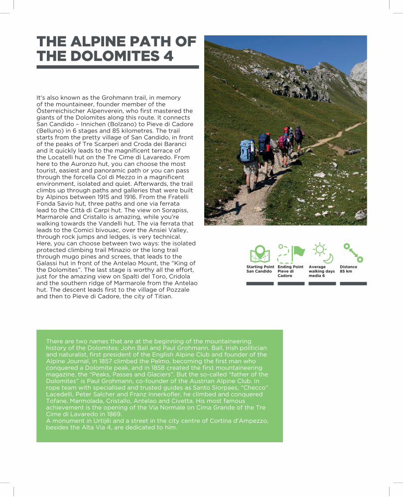
It's also known as the Grohmann trail, in memory of the mountaineer, founder member of the Österreichischer Alpenverein, who first mastered the giants of the Dolomites along this route. It connects San Candido – Innichen (Bolzano) to Pieve di Cadore (Belluno) in 6 stages and 85 kilometres. The trail starts from the pretty village of San Candido, in front of the peaks of Tre Scarperi and Croda dei Baranci and it quickly leads to the magnificent terrace of the Locatelli hut on the Tre Cime di Lavaredo. From here to the Auronzo hut, you can choose the most tourist, easiest and panoramic path or you can pass through the forcella Col di Mezzo in a magnificent environment, isolated and quiet. Afterwards, the trail climbs up through paths and galleries that were built by Alpinos between 1915 and 1916. From the Fratelli Fonda Savio hut, three paths and one via ferrata lead to the Città di Carpi hut. The view on Sorapiss, Marmarole and Cristallo is amazing, while you're walking towards the Vandelli hut. The via ferrata that leads to the Comici bivouac, over the Ansiei Valley, through rock jumps and ledges, is very technical. Here, you can choose between two ways: the isolated protected climbing trail Minazio or the long trail through mugo pines and screes, that leads to the Galassi hut in front of the Antelao Mount, the “King of the Dolomites”. The last stage is worthy all the effort, just for the amazing view on Spalti del Toro, Cridola and the southern ridge of Marmarole from the Antelao hut. The descent leads first to the village of Pozzale and then to Pieve di Cadore, the city of Titian.
There are two names that are at the beginning of the mountaineering history of the Dolomites: John Ball and Paul Grohmann. Ball, Irish politician and naturalist, first president of the English Alpine Club and founder of the Alpine Journal, in 1857 climbed the Pelmo, becoming the first man who conquered a Dolomite peak, and in 1858 created the first mountaineering magazine, the “Peaks, Passes and Glaciers”. But the so-called “father of the Dolomites” is Paul Grohmann, co-founder of the Austrian Alpine Club. In rope team with specialised and trusted guides as Santo Siorpaes, “Checco” Lacedelli, Peter Salcher and Franz Innerkofler, he climbed and conquered Tofane, Marmolada, Cristallo, Antelao and Civetta. His most famous achievement is the opening of the Via Normale on Cima Grande of the Tre Cime di Lavaredo in 1869.A monument in Urtijëi and a street in the city centre of Cortina d'Ampezzo, besides the Alta Via 4, are dedicated to him.
Ending PointPieve di Cadore
Starting PointSan Candido
Distance85 km
Average walking days media 6
9
Titian, symbol of the Italian art, was born in Pieve di Cadore at the end of the 15th century. He left the Cadorine valley when he was very young and went to Venice, where he became Painter of the Republic of Venice, but he never forgot his Dolomites.He was the first to catch their sublime beauty: he always immortalized their wonderful profile and unique light on the background of many paintings, introducing the Dolomites to the courts of all Europe. His home, in the main square of Pieve di Cadore, can be visited still today and, with its rustic furniture and the walls covered in wood, keeps the charm of the Cadorine style.
THE ALPINE PATH OF THE DOLOMITES 5
Ending PointPieve di Cadore
Starting PointSesto
Distance90 km
Average walking days media 7
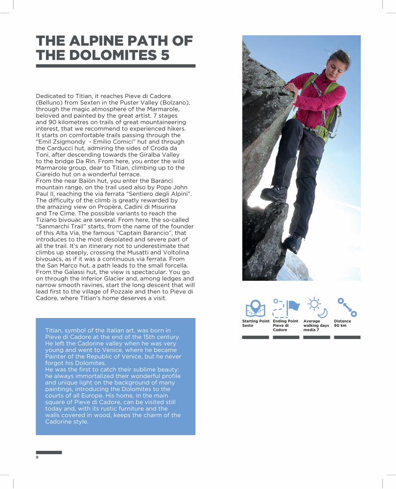
Dedicated to Titian, it reaches Pieve di Cadore (Belluno) from Sexten in the Puster Valley (Bolzano), through the magic atmosphere of the Marmarole, beloved and painted by the great artist. 7 stages and 90 kilometres on trails of great mountaineering interest, that we recommend to experienced hikers. It starts on comfortable trails passing through the “Emil Zsigmondy - Emilio Comici” hut and through the Carducci hut, admiring the sides of Croda da Toni, after descending towards the Giralba Valley to the bridge Da Rin. From here, you enter the wild Marmarole group, dear to Titian, climbing up to the Ciareido hut on a wonderful terrace.From the near Baiòn hut, you enter the Baranci mountain range, on the trail used also by Pope John Paul II, reaching the via ferrata “Sentiero degli Alpini”. The difficulty of the climb is greatly rewarded by the amazing view on Propèra, Cadini di Misurina and Tre Cime. The possible variants to reach the Tiziano bivouac are several. From here, the so-called “Sanmarchi Trail” starts, from the name of the founder of this Alta Via, the famous “Captain Barancio”, that introduces to the most desolated and severe part of all the trail. It's an itinerary not to underestimate that climbs up steeply, crossing the Musatti and Voltolina bivouacs, as if it was a continuous via ferrata. From the San Marco hut, a path leads to the small forcella. From the Galassi hut, the view is spectacular. You go on through the Inferior Glacier and, among ledges and narrow smooth ravines, start the long descent that will lead first to the village of Pozzale and then to Pieve di Cadore, where Titian's home deserves a visit.
THE ALPINE PATH OF THE DOLOMITES 6
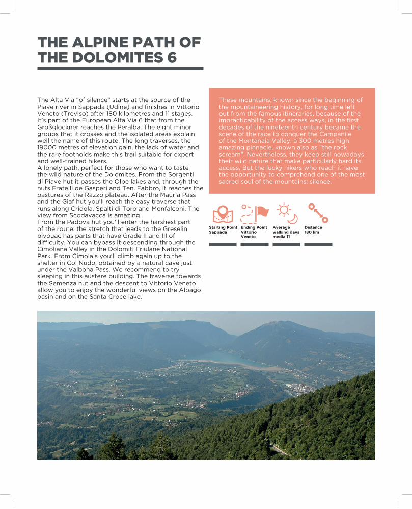
The Alta Via “of silence” starts at the source of the Piave river in Sappada (Udine) and finishes in Vittorio Veneto (Treviso) after 180 kilometres and 11 stages. It's part of the European Alta Via 6 that from the Großglockner reaches the Peralba. The eight minor groups that it crosses and the isolated areas explain well the name of this route. The long traverses, the 19000 metres of elevation gain, the lack of water and the rare footholds make this trail suitable for expert and well-trained hikers.A lonely path, perfect for those who want to taste the wild nature of the Dolomites. From the Sorgenti di Piave hut it passes the Olbe lakes and, through the huts Fratelli de Gasperi and Ten. Fabbro, it reaches the pastures of the Razzo plateau. After the Mauria Pass and the Giaf hut you'll reach the easy traverse that runs along Cridola, Spalti di Toro and Monfalconi. The view from Scodavacca is amazing.From the Padova hut you'll enter the harshest part of the route: the stretch that leads to the Greselin bivouac has parts that have Grade II and III of difficulty. You can bypass it descending through the Cimoliana Valley in the Dolomiti Friulane National Park. From Cimolais you'll climb again up to the shelter in Col Nudo, obtained by a natural cave just under the Valbona Pass. We recommend to try sleeping in this austere building. The traverse towards the Semenza hut and the descent to Vittorio Veneto allow you to enjoy the wonderful views on the Alpago basin and on the Santa Croce lake.
These mountains, known since the beginning of the mountaineering history, for long time left out from the famous itineraries, because of the impracticability of the access ways, in the first decades of the nineteenth century became the scene of the race to conquer the Campanile of the Montanaia Valley, a 300 metres high amazing pinnacle, known also as “the rock scream”. Nevertheless, they keep still nowadays their wild nature that make particularly hard its access. But the lucky hikers who reach it have the opportunity to comprehend one of the most sacred soul of the mountains: silence.
Ending PointVittorio Veneto
Starting PointSappada
Distance180 km
Average walking days media 11
11
THE ALPINE PATH OF THE DOLOMITES 7
Ending PointTambre
Starting Pointrif. Dolomieu al Dolada
Distance36 km
Average walking days medi 5
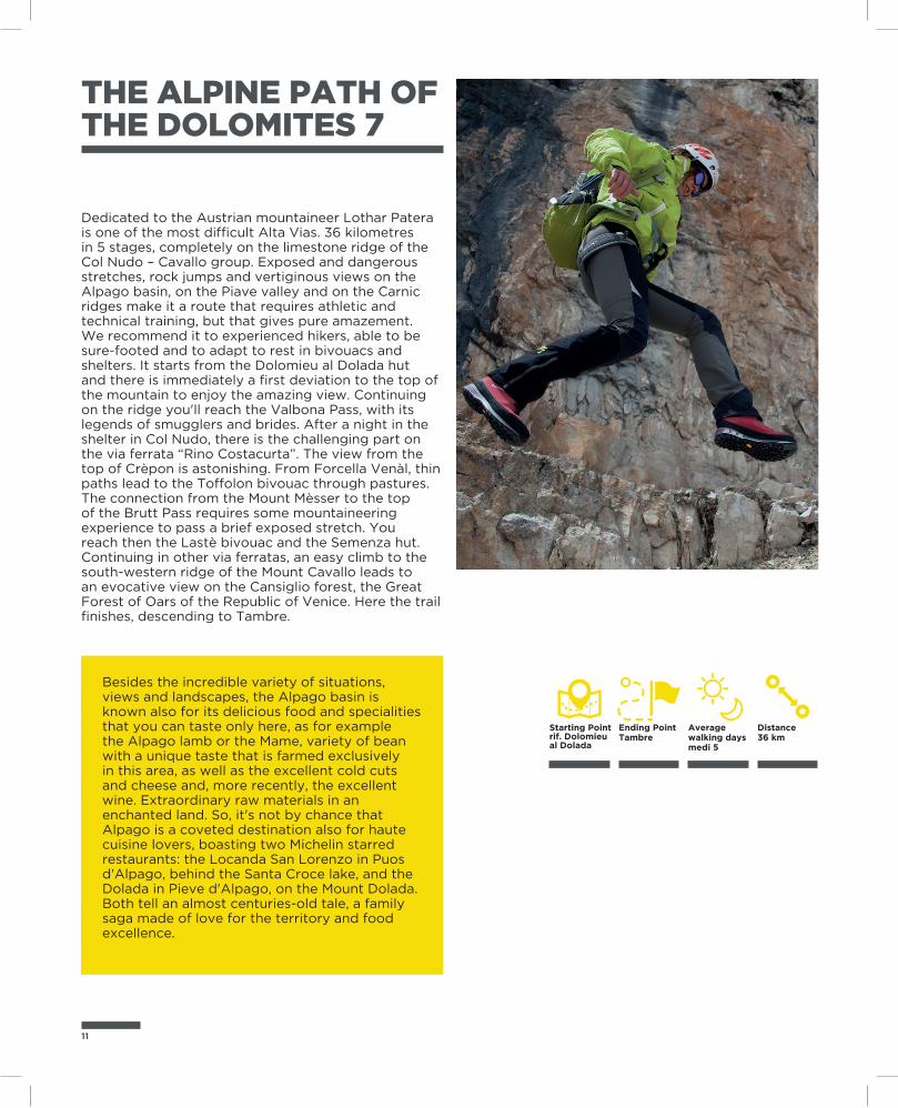
Dedicated to the Austrian mountaineer Lothar Patera is one of the most difficult Alta Vias. 36 kilometres in 5 stages, completely on the limestone ridge of the Col Nudo – Cavallo group. Exposed and dangerous stretches, rock jumps and vertiginous views on the Alpago basin, on the Piave valley and on the Carnic ridges make it a route that requires athletic and technical training, but that gives pure amazement. We recommend it to experienced hikers, able to be sure-footed and to adapt to rest in bivouacs and shelters. It starts from the Dolomieu al Dolada hut and there is immediately a first deviation to the top of the mountain to enjoy the amazing view. Continuing on the ridge you'll reach the Valbona Pass, with its legends of smugglers and brides. After a night in the shelter in Col Nudo, there is the challenging part on the via ferrata “Rino Costacurta”. The view from the top of Crèpon is astonishing. From Forcella Venàl, thin paths lead to the Toffolon bivouac through pastures. The connection from the Mount Mèsser to the top of the Brutt Pass requires some mountaineering experience to pass a brief exposed stretch. You reach then the Lastè bivouac and the Semenza hut. Continuing in other via ferratas, an easy climb to the south-western ridge of the Mount Cavallo leads to an evocative view on the Cansiglio forest, the Great Forest of Oars of the Republic of Venice. Here the trail finishes, descending to Tambre.
Besides the incredible variety of situations, views and landscapes, the Alpago basin is known also for its delicious food and specialities that you can taste only here, as for example the Alpago lamb or the Mame, variety of bean with a unique taste that is farmed exclusively in this area, as well as the excellent cold cuts and cheese and, more recently, the excellent wine. Extraordinary raw materials in an enchanted land. So, it's not by chance that Alpago is a coveted destination also for haute cuisine lovers, boasting two Michelin starred restaurants: the Locanda San Lorenzo in Puos d'Alpago, behind the Santa Croce lake, and the Dolada in Pieve d'Alpago, on the Mount Dolada. Both tell an almost centuries-old tale, a family saga made of love for the territory and food excellence.
THE ALPINE PATH OF THE DOLOMITES 8
With its wonderful views, its sides and heart marked by kilometres of trenches, galleries, caves and cart tracks, the Mount Grappa is one of the most vivid symbols of the Great War. The soldiers resting in the ossuary in Cima Grappa are 22910, of which 20332 without identity. It's a place of reflection with its “ways of heroes” that symbolically connect the Italian ossuary to the Austro-Hungarian one. It is also a place of heroic deeds. One above all, necessary and determined, the one of the 15th of June 1918 that saw the 9° Reparto degli Arditi (9th Unit of the Daring Ones) pushing the Austro-Hungarian Army back, who, occupied Col Moschin, thought to have conquered the way to the Venetian plain. The trenches and galleries that are accessible still today are several on this mount that was changed in fort, symbol of the Italian Resistance. Soldier Peter Pan's grave is the symbol of these young people's sacrifice.
Ending PointBassano del Grappa
Starting PointFeltre
Distance63 km
Average walking days media 4
From Feltre (Belluno) to Bassano del Grappa (Vicenza), the Alta Via “of the Heroes” passes through the territory of the Grappa Massif, retracing the places of the Great War. 4 stages that connect the Piave Valley to the Brenta Valley in 63 kilometres. Technically simple, but with few footholds, it requires ability to organise and adapt, also because of the difficulty to find water. The route starts from the wonderful city of Feltre and, continuing to Porcen, climbs up to the Mount Tomatico through a comfortable cart track. From its top, you can enjoy the view on the Valbelluna, with the majestic Dolomites on the background. From the wide glade of Malga Pàoda the view expands on the ridge of the Prealps, with the Mount Cesen that overlooks the Piave valley. The itinerary, evocative any variant you choose, continues to Malga Dumela. From here, it continues to the Bassano hut and, crossing Col de l'Orso, reaches the heart of the Mount Grappa, Sacred to the Country. Military paths, trenches, bunkers and commemorative plaques remember the Heroes who here defended Italy and Italians until the last drop of life, with highest sacrifice and audacity. In Cima Grappa you can visit the War Memorial, monumental cemetery built in 1935 in memory of the fallen soldiers of the Great War, where the impressive holiness of the place combines with the peacefulness of the landscape. The descent is through military paths and streets, as the “Cadorna” and the “Strada militare di arroccamento”, to Bassano del Grappa, where you must not miss a visit to the Ponte Vecchio.
13
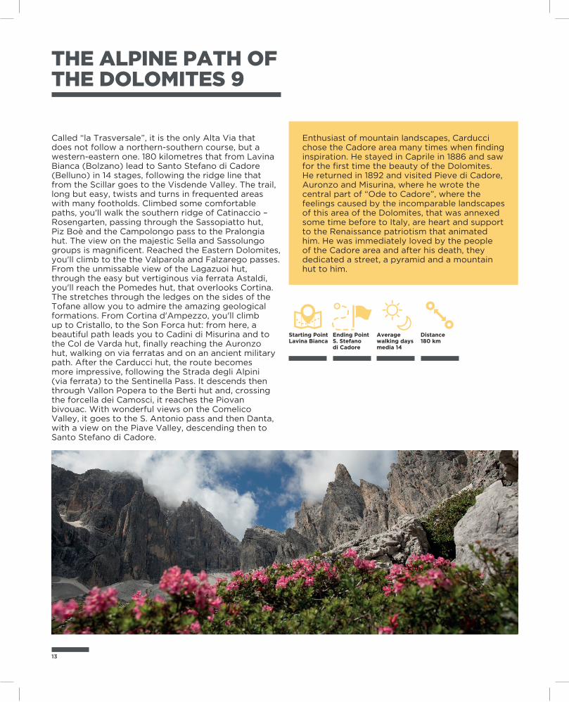
THE ALPINE PATH OF THE DOLOMITES 9
Called “la Trasversale”, it is the only Alta Via that does not follow a northern-southern course, but a western-eastern one. 180 kilometres that from Lavina Bianca (Bolzano) lead to Santo Stefano di Cadore (Belluno) in 14 stages, following the ridge line that from the Scillar goes to the Visdende Valley. The trail, long but easy, twists and turns in frequented areas with many footholds. Climbed some comfortable paths, you'll walk the southern ridge of Catinaccio – Rosengarten, passing through the Sassopiatto hut, Piz Boè and the Campolongo pass to the Pralongia hut. The view on the majestic Sella and Sassolungo groups is magnificent. Reached the Eastern Dolomites, you'll climb to the the Valparola and Falzarego passes. From the unmissable view of the Lagazuoi hut, through the easy but vertiginous via ferrata Astaldi, you'll reach the Pomedes hut, that overlooks Cortina. The stretches through the ledges on the sides of the Tofane allow you to admire the amazing geological formations. From Cortina d'Ampezzo, you'll climb up to Cristallo, to the Son Forca hut: from here, a beautiful path leads you to Cadini di Misurina and to the Col de Varda hut, finally reaching the Auronzo hut, walking on via ferratas and on an ancient military path. After the Carducci hut, the route becomes more impressive, following the Strada degli Alpini (via ferrata) to the Sentinella Pass. It descends then through Vallon Popera to the Berti hut and, crossing the forcella dei Camosci, it reaches the Piovan bivouac. With wonderful views on the Comelico Valley, it goes to the S. Antonio pass and then Danta, with a view on the Piave Valley, descending then to Santo Stefano di Cadore.
Enthusiast of mountain landscapes, Carducci chose the Cadore area many times when finding inspiration. He stayed in Caprile in 1886 and saw for the first time the beauty of the Dolomites. He returned in 1892 and visited Pieve di Cadore, Auronzo and Misurina, where he wrote the central part of “Ode to Cadore”, where the feelings caused by the incomparable landscapes of this area of the Dolomites, that was annexed some time before to Italy, are heart and support to the Renaissance patriotism that animated him. He was immediately loved by the people of the Cadore area and after his death, they dedicated a street, a pyramid and a mountain hut to him.
Ending PointS. Stefano di Cadore
Starting PointLavina Bianca
Distance180 km
Average walking days media 14
THE ALPINE PATH OF THE SHEPHERDS
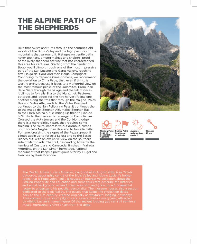
Hike that twists and turns through the centuries-old woods of the Biois Valley and the high pastures of the mountains that surround it. 6 stages on gentle paths, never too hard, among malgas and shelters, proof of the lively shepherd activity that has characterized this area for centuries. Starting from the hamlet of Bogo, you'll climb through one of the most impressive part of the San Lucano and Gares valleys, reaching first Malga dei Caoz and then Malga Campignat. Continuing to Capanna Cima Comelle, we recommend the deviation to Cima Pape, that, even if tiring, is worthy trying because it leads to a wonderful view on the most famous peaks of the Dolomites. From Pian de le Giare through the village and the fall of Gares, it climbs to forcella Stia to the Mulaz hut. Pastures, cottages and lodges for the hay harvest follow one another along the trail that through the Malghe Valés Bas and Valés Alto, leads to the Valles Pass and continues to the San Pellegrino Pass. It continues then to the malga dei Zinghen Alti, malga Zinghen Bas to the Flora Alpina hut, climbing up then to Pian de la Schita to the panoramic passage on Forca Rossa. Crossed the Auta towers and the Col Mont lodge, there is a more difficult part, that requires some training. The route, impressive but arduous, climbs up to forcella Negher then descend to forcella delle Fontane, crossing the slopes of the Pezza group. It climbs again up to forcella Sciota and to the Sasso Bianco hut, with an exclusive view on the southern side of Marmolada. The trail, descending towards the hamlets of Costoia and Canacede, finishes in Vallada Agordina, on the San Simon hermitage, national monument that keeps a prestigious altar by Flugel and frescoes by Paris Bordone.
The MusAL Albino Luciani Museum, inaugurated in August 2016, is in Canale d'Agordo, geographic centre of the Biois Valley and Albino Luciani's home-town, that is Pope John Paul I. It houses an interactive collection about the Smiling Pope's life and education and some tours that describe the historical and social background where Luciani was born and grew up, a fundamental factor to understand his peculiar personality. The museum houses also a section dedicated to the Biois Valley. The palace that keeps the exposition dates back to the 15th century: created originally as wayfarers' lodging, nowadays it welcomes thousands of pilgrims and several visitors every year, attracted by Albino Luciani's human figure. Of the ancient lodging you can still admire a fresco, representing Christ risen from the tomb.
Ending PointSan Simondi Vallada
Starting PointBogo di CencenigheAgordino
Distance30 km
Average walking days media 3
15
THE HIGH ROUTE OF THE BEAR
Ending PointLivinallongo del Col di Lana
Starting PointColle Santa Lucia
Distance10 km
Average distance 3 ore
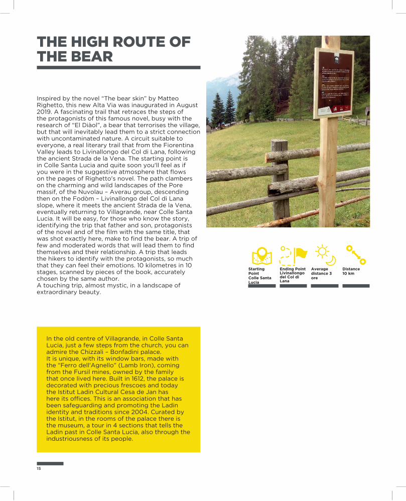
Inspired by the novel “The bear skin” by Matteo Righetto, this new Alta Via was inaugurated in August 2019. A fascinating trail that retraces the steps of the protagonists of this famous novel, busy with the research of “El Diàol”, a bear that terrorises the village, but that will inevitably lead them to a strict connection with uncontaminated nature. A circuit suitable to everyone, a real literary trail that from the Fiorentina Valley leads to Livinallongo del Col di Lana, following the ancient Strada de la Vena. The starting point is in Colle Santa Lucia and quite soon you'll feel as if you were in the suggestive atmosphere that flows on the pages of Righetto's novel. The path clambers on the charming and wild landscapes of the Pore massif, of the Nuvolau – Averau group, descending then on the Fodòm – Livinallongo del Col di Lana slope, where it meets the ancient Strada de la Vena, eventually returning to Villagrande, near Colle Santa Lucia. It will be easy, for those who know the story, identifying the trip that father and son, protagonists of the novel and of the film with the same title, that was shot exactly here, make to find the bear. A trip of few and moderated words that will lead them to find themselves and their relationship. A trip that leads the hikers to identify with the protagonists, so much that they can feel their emotions. 10 kilometres in 10 stages, scanned by pieces of the book, accurately chosen by the same author.A touching trip, almost mystic, in a landscape of extraordinary beauty.
In the old centre of Villagrande, in Colle Santa Lucia, just a few steps from the church, you can admire the Chizzali – Bonfadini palace.It is unique, with its window bars, made with the “Ferro dell'Agnello” (Lamb Iron), coming from the Fursil mines, owned by the family that once lived here. Built in 1612, the palace is decorated with precious frescoes and today the Istitut Ladin Cultural Cesa de Jan has here its offices. This is an association that has been safeguarding and promoting the Ladin identity and traditions since 2004. Curated by the Istitut, in the rooms of the palace there is the museum, a tour in 4 sections that tells the Ladin past in Colle Santa Lucia, also through the industriousness of its people.
“AMELIA” HIGH ROUTE
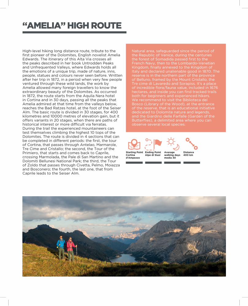
High-level hiking long distance route, tribute to the first pioneer of the Dolomites, English novelist Amelia Edwards. The itinerary of this Alta Via crosses all the peaks described in her book Untrodden Peaks and Unfrequented Valleys, where Edwards holds all the emotions of a unique trip, made of nature, inns, people, statues and colours never seen before. Written after her trip in 1872, in a period when very few people ventured through these wild lands, the work by Amelia allowed many foreign travellers to know the extraordinary beauty of the Dolomites. As occurred in 1872, the route starts from the Aquila Nera hotel in Cortina and in 30 days, passing all the peaks that Amelia admired at that time from the valleys below, reaches the Bad Ratzes hotel, at the foot of the Seiser Alm. The basic route is divided in 30 stages, for 400 kilometres and 10000 metres of elevation gain, but it offers variants in 20 stages, when there are paths of historical interest or more difficult via ferratas.During the trail the experienced mountaineers can test themselves climbing the highest 10 tops of the Dolomites. The route is divided in 4 sections that can be completed in different periods: the first, the tour of Cortina, that passes through Antelao, Marmarole, Tre Cime and Cristallo; the second, the Tour of the Primiero, that starts and comes back to Caprile, crossing Marmolada, the Pale di San Martino and the Dolomiti Bellunesi National Park; the third, the Tour of Zoldo that passes through Civetta, Pelmo, Moiazza and Bosconero; the fourth, the last one, that from Caprile leads to the Seiser Alm.
Natural area, safeguarded since the period of the Republic of Venice, during the centuries the forest of Somadida passed first to the French Navy, then to the Lombardo-Venetian Kingdom, finally annexed to the Kingdom of Italy and declared unalienable good in 1870. The reserve is in the northern part of the province of Belluno, framed by the Mount Cristallo, the Tre cime di Lavaredo and Sorapiss. It's a place of incredible flora/fauna value, included in 1676 hectares, and inside you can find tracked trails both for beginners and experienced hikers. We recommend to visit the Biblioteca del Bosco (Library of the Wood), at the entrance of the reserve, that is an educational initiative dedicated to Dolomite nature and legends, and the Giardino delle Farfalle (Garden of the Butterflies), a delimited area where you can observe several local species.
Ending PointAlpe di Siusi
Starting PointCortina d'Ampezzo
Distance400 km
Average walking days media 30
17
Ending PointCaralte di Perarolo
Starting PointAuronzo di Cadore
Distance75 km
Average walking days media 3/4
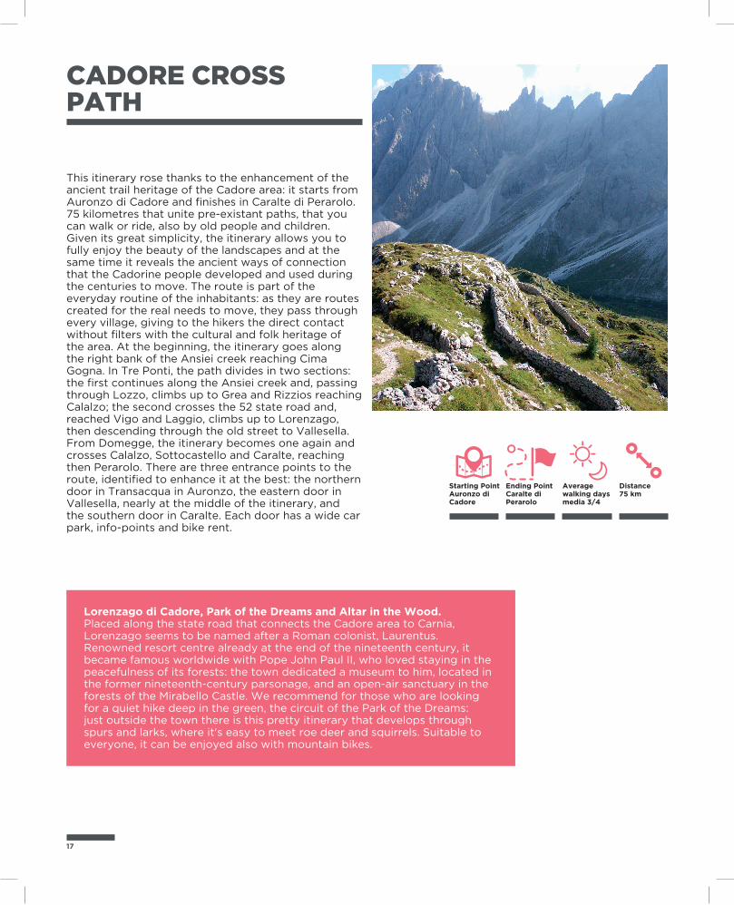
CADORE CROSS PATH
Lorenzago di Cadore, Park of the Dreams and Altar in the Wood.Placed along the state road that connects the Cadore area to Carnia, Lorenzago seems to be named after a Roman colonist, Laurentus. Renowned resort centre already at the end of the nineteenth century, it became famous worldwide with Pope John Paul II, who loved staying in the peacefulness of its forests: the town dedicated a museum to him, located in the former nineteenth-century parsonage, and an open-air sanctuary in the forests of the Mirabello Castle. We recommend for those who are looking for a quiet hike deep in the green, the circuit of the Park of the Dreams: just outside the town there is this pretty itinerary that develops through spurs and larks, where it's easy to meet roe deer and squirrels. Suitable to everyone, it can be enjoyed also with mountain bikes.
This itinerary rose thanks to the enhancement of the ancient trail heritage of the Cadore area: it starts from Auronzo di Cadore and finishes in Caralte di Perarolo. 75 kilometres that unite pre-existant paths, that you can walk or ride, also by old people and children. Given its great simplicity, the itinerary allows you to fully enjoy the beauty of the landscapes and at the same time it reveals the ancient ways of connection that the Cadorine people developed and used during the centuries to move. The route is part of the everyday routine of the inhabitants: as they are routes created for the real needs to move, they pass through every village, giving to the hikers the direct contact without filters with the cultural and folk heritage of the area. At the beginning, the itinerary goes along the right bank of the Ansiei creek reaching Cima Gogna. In Tre Ponti, the path divides in two sections: the first continues along the Ansiei creek and, passing through Lozzo, climbs up to Grea and Rizzios reaching Calalzo; the second crosses the 52 state road and, reached Vigo and Laggio, climbs up to Lorenzago, then descending through the old street to Vallesella. From Domegge, the itinerary becomes one again and crosses Calalzo, Sottocastello and Caralte, reaching then Perarolo. There are three entrance points to the route, identified to enhance it at the best: the northern door in Transacqua in Auronzo, the eastern door in Vallesella, nearly at the middle of the itinerary, and the southern door in Caralte. Each door has a wide car park, info-points and bike rent.
19
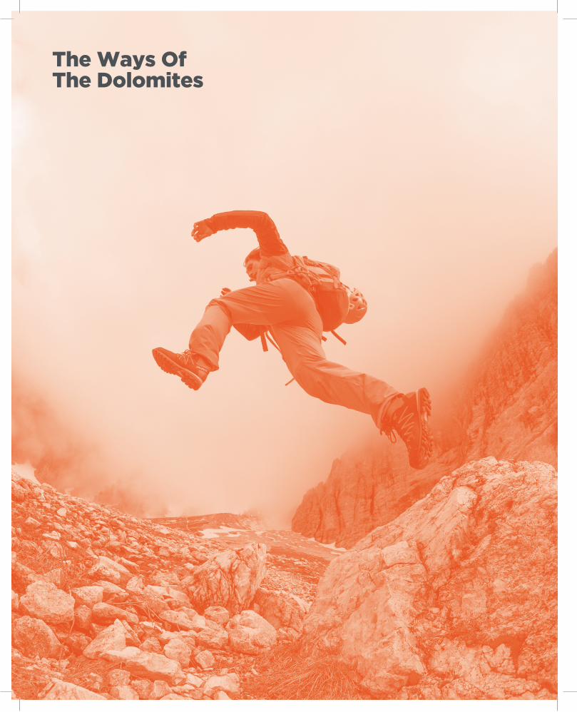
The Ways Of The Dolomites
21
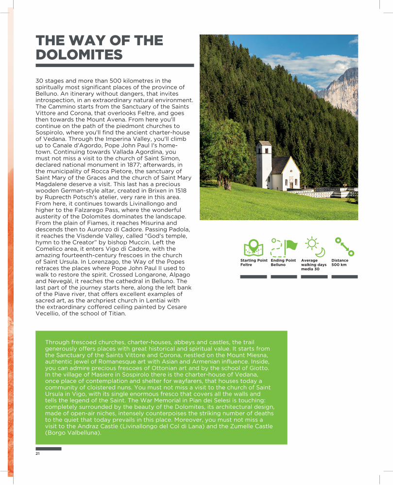
THE WAY OF THE DOLOMITES
30 stages and more than 500 kilometres in the spiritually most significant places of the province of Belluno. An itinerary without dangers, that invites introspection, in an extraordinary natural environment. The Cammino starts from the Sanctuary of the Saints Vittore and Corona, that overlooks Feltre, and goes then towards the Mount Avena. From here you'll continue on the path of the piedmont churches to Sospirolo, where you'll find the ancient charter-house of Vedana. Through the Imperina Valley, you'll climb up to Canale d'Agordo, Pope John Paul I's home-town. Continuing towards Vallada Agordina, you must not miss a visit to the church of Saint Simon, declared national monument in 1877; afterwards, in the municipality of Rocca Pietore, the sanctuary of Saint Mary of the Graces and the church of Saint Mary Magdalene deserve a visit. This last has a precious wooden German-style altar, created in Brixen in 1518 by Ruprecth Potsch's atelier, very rare in this area. From here, it continues towards Livinallongo and higher to the Falzarego Pass, where the wonderful austerity of the Dolomites dominates the landscape.From the plain of Fiames, it reaches Misurina and descends then to Auronzo di Cadore. Passing Padola, it reaches the Visdende Valley, called “God's temple, hymn to the Creator” by bishop Muccin. Left the Comelico area, it enters Vigo di Cadore, with the amazing fourteenth-century frescoes in the church of Saint Ursula. In Lorenzago, the Way of the Popes retraces the places where Pope John Paul II used to walk to restore the spirit. Crossed Longarone, Alpago and Nevegàl, it reaches the cathedral in Belluno. The last part of the journey starts here, along the left bank of the Piave river, that offers excellent examples of sacred art, as the archpriest church in Lentiai with the extraordinary coffered ceiling painted by Cesare Vecellio, of the school of Titian.
Through frescoed churches, charter-houses, abbeys and castles, the trail generously offers places with great historical and spiritual value. It starts from the Sanctuary of the Saints Vittore and Corona, nestled on the Mount Miesna, authentic jewel of Romanesque art with Asian and Armenian influence. Inside, you can admire precious frescoes of Ottonian art and by the school of Giotto. In the village of Masiere in Sospirolo there is the charter-house of Vedana, once place of contemplation and shelter for wayfarers, that houses today a community of cloistered nuns. You must not miss a visit to the church of Saint Ursula in Vigo, with its single enormous fresco that covers all the walls and tells the legend of the Saint. The War Memorial in Pian dei Selesi is touching: completely surrounded by the beauty of the Dolomites, its architectural design, made of open-air niches, intensely counterpoises the striking number of deaths to the quiet that today prevails in this place. Moreover, you must not miss a visit to the Andraz Castle (Livinallongo del Col di Lana) and the Zumelle Castle (Borgo Valbelluna).
Ending PointBelluno
Starting PointFeltre
Distance500 km
Average walking days media 30
THE WAY OF THE POPES
Part of a group of European spiritual routes, it offers itineraries surrounded by woods, created and developed following the testaments of the faith of four Popes who loved and lived the province of Belluno. It has 15 stages with two possible starting points. The first from Canale d'Agordo, Pope John Paul I's home-town, from which it descends firstly along the Biois Valley and then along the Cordevole creek and the valley with the same name, reaching the pleasant landscapes of the Dolomiti Bellunesi National Park. Along the path you meet the charter-house of Vedana, just few steps from the small lake with the same name, the only example of not damaged charter-houses in the Veneto region. The second from Lorenzago di Cadore, in the places dear to Pope John Paul II and Pope Benedict XVI, who here loved to walk to restore the spirit, surrounded by the majestic Dolomites. The route descends then along the Piave valley, crossing Pieve di Cadore, Ospitale and Longarone, reaching then Belluno. In the hamlet of Mussoi, Pope Gregory XVI's home-town, the two trails meet, continuing in the same single route towards Vittorio Veneto (Treviso). The views that you can enjoy passing through the Valbelluna to Anzù in Feltre are impressive. Here there is the Sanctuary of the Saints Vittore and Corona. Then, it goes back along the left bank of the Piave river towards Lentiai, until reaching one of the most beautiful villages in Italy, Mel in Borgo Valbelluna. From here, within the historical Diocese of Ceneda of Vittorio Veneto, it reaches the Praderadego Pass.
Belluno, the capital of the Dolomites, is the home-town of two popes, born under the shadows of the Pale Mountains and grown up under the World Heritage rock cathedrals. The most famous of them is undoubtedly Albino Luciani, born in canale d'Agordo and become Pope with the name of John Paul I. Loved by the Italians, he is remembered as the “Smiling Pope” and was never forgotten, also because of his sudden death, still mysterious today, just after 33 days of papacy. In 1765, in Mussoi, hamlet of Belluno, Bartolomeo Alberto Cappellari was born, Pope Gregory XVI from 1831 to 1846. He made the history of Rome, greatly implementing the number of the Vatican Museums and building the park of Villa Gregoriana in Tivoli, where today the FAI (National Trust of Italy) has its offices. But the paths, the peaks and the woods of Belluno are linked also to two other popes, who chose them as places to restore the body and the spirit: John Paul II and Benedict XVI.
Ending Pointpasso di Praderadego
Starting PointLorenzago di Cadore / Canale d’Agordo
Distance95 km
Average walking days media 4/5
23
PARK2TREK
Almost entirely uninhabited, the Dolomiti Bellunesi National Park, with its 31000 hectares, is a succession of rocks, plateaus, woods and canyons, a masterpiece of biodiversity. A real paradise for the wild alpine animals and for rare plants that survived glaciations.It houses a quarter of the national plant heritage, some native. It's the house of thousands of chamois, deer, roe deer and mouflons, and here 115 species of birds and 20 amphibians and reptiles nest. In the area there is also 40% of the species of butterflies in Italy.
Ending PointSan Martino di Castrozza
Starting PointFeltre
Distance80,1 km
Average walking days medi 6
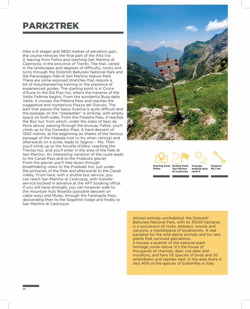
Hike in 6 stages and 5800 metres of elevation gain, the course retraces the final part of the Alta Via 2, leaving from Feltre and reaching San Martino di Castrozza, in the province of Trento. The trail, varied in the landscapes and degrees of difficulty, twists and turns through the Dolomiti Bellunesi National Park and the Paneveggio Pale di San Martino Nature Park.There are some exposed stretches that require a bit of mountaineering training or the presence of experienced guides. The starting point is in Croce d'Aune to the Dal Piaz hut, where the traverse of the Vette Feltrine begins. From the wonderful Busa delle Vette, it crosses the Piètena Pass and reaches the suggestive and mysterious Piazza del Diavolo. The part that passes the Sasso Scarnia is quite difficult and the passage on the “stepladder” is striking, with empty space on both sides. From the Finestra Pass, it reaches the Boz hut, from which, under the sides of Sass de Mura above, passing through the bivouac Feltre, you'll climb up to the Comedon Pass. A hard descent of 1300 metres, at the beginning on sheets of the famous passage of the Intajada (not to try when raining) and afterwards on a scree, leads to Sagron – Mis. Then you'll climb up to the forcella d'Oltro, reaching the Treviso hut, and you'll enter in the area of the Pale di San Martino. An interesting variation of the route leads to the Canali Pass and to the Fradusta glacier.From the glacier you'll hike down through breathtaking views to the Pradidali hut, just under the pinnacles of the Pale and afterwards to the Canali Valley. From here, with a shuttle bus service, you can reach San Martino di Castrozza, with transfer service booked in advance at the APT booking office. If you still have strength, you can however walk to the mountain huts Rosetta (possible descent on cable-way) and Mulaz, through the Farangole Pass, descending then to the Segantini lodge and finally to San Martino di Castrozza.
THE DOLOMITI BELLUNESI ALPINE PATH
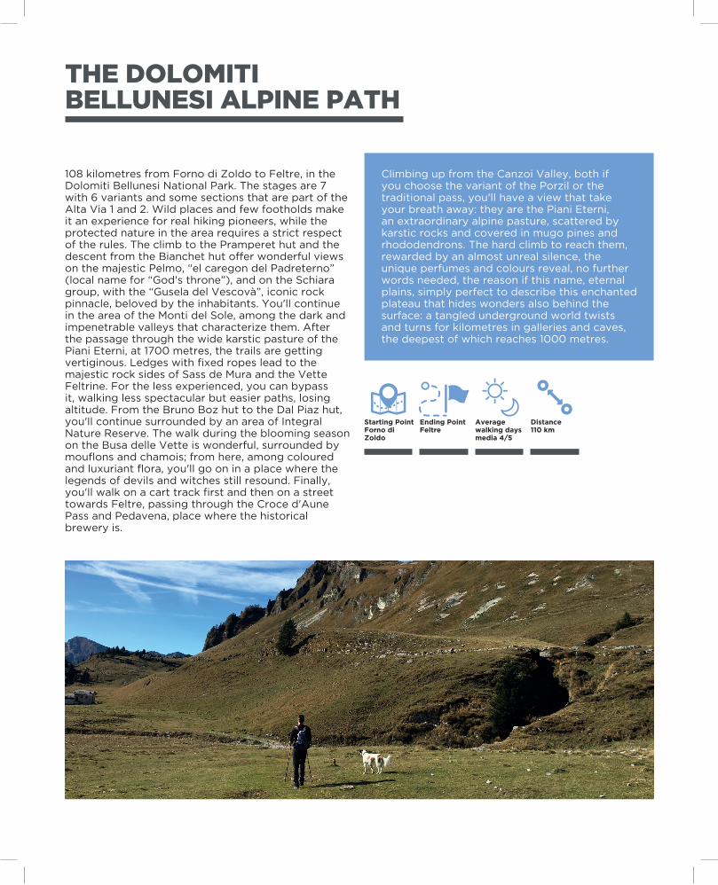
108 kilometres from Forno di Zoldo to Feltre, in the Dolomiti Bellunesi National Park. The stages are 7 with 6 variants and some sections that are part of the Alta Via 1 and 2. Wild places and few footholds make it an experience for real hiking pioneers, while the protected nature in the area requires a strict respect of the rules. The climb to the Pramperet hut and the descent from the Bianchet hut offer wonderful views on the majestic Pelmo, “el caregon del Padreterno” (local name for “God's throne”), and on the Schiara group, with the “Gusela del Vescovà”, iconic rock pinnacle, beloved by the inhabitants. You'll continue in the area of the Monti del Sole, among the dark and impenetrable valleys that characterize them. After the passage through the wide karstic pasture of the Piani Eterni, at 1700 metres, the trails are getting vertiginous. Ledges with fixed ropes lead to the majestic rock sides of Sass de Mura and the Vette Feltrine. For the less experienced, you can bypass it, walking less spectacular but easier paths, losing altitude. From the Bruno Boz hut to the Dal Piaz hut, you'll continue surrounded by an area of Integral Nature Reserve. The walk during the blooming season on the Busa delle Vette is wonderful, surrounded by mouflons and chamois; from here, among coloured and luxuriant flora, you'll go on in a place where the legends of devils and witches still resound. Finally, you'll walk on a cart track first and then on a street towards Feltre, passing through the Croce d'Aune Pass and Pedavena, place where the historical brewery is.
Climbing up from the Canzoi Valley, both if you choose the variant of the Porzil or the traditional pass, you'll have a view that take your breath away: they are the Piani Eterni, an extraordinary alpine pasture, scattered by karstic rocks and covered in mugo pines and rhododendrons. The hard climb to reach them, rewarded by an almost unreal silence, the unique perfumes and colours reveal, no further words needed, the reason if this name, eternal plains, simply perfect to describe this enchanted plateau that hides wonders also behind the surface: a tangled underground world twists and turns for kilometres in galleries and caves, the deepest of which reaches 1000 metres.
Ending PointFeltre
Starting PointForno di Zoldo
Distance110 km
Average walking days media 4/5
25
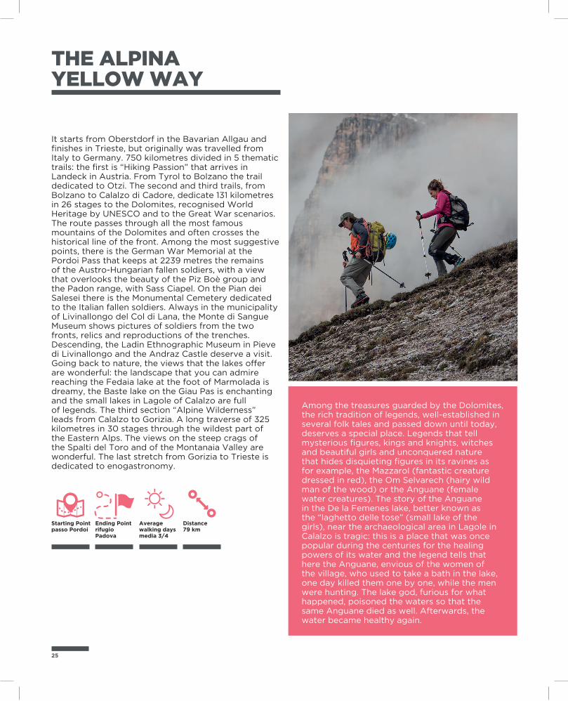
THE ALPINA YELLOW WAY
It starts from Oberstdorf in the Bavarian Allgau and finishes in Trieste, but originally was travelled from Italy to Germany. 750 kilometres divided in 5 thematic trails: the first is “Hiking Passion” that arrives in Landeck in Austria. From Tyrol to Bolzano the trail dedicated to Otzi. The second and third trails, from Bolzano to Calalzo di Cadore, dedicate 131 kilometres in 26 stages to the Dolomites, recognised World Heritage by UNESCO and to the Great War scenarios. The route passes through all the most famous mountains of the Dolomites and often crosses the historical line of the front. Among the most suggestive points, there is the German War Memorial at the Pordoi Pass that keeps at 2239 metres the remains of the Austro-Hungarian fallen soldiers, with a view that overlooks the beauty of the Piz Boè group and the Padon range, with Sass Ciapel. On the Pian dei Salesei there is the Monumental Cemetery dedicated to the Italian fallen soldiers. Always in the municipality of Livinallongo del Col di Lana, the Monte di Sangue Museum shows pictures of soldiers from the two fronts, relics and reproductions of the trenches. Descending, the Ladin Ethnographic Museum in Pieve di Livinallongo and the Andraz Castle deserve a visit. Going back to nature, the views that the lakes offer are wonderful: the landscape that you can admire reaching the Fedaia lake at the foot of Marmolada is dreamy, the Baste lake on the Giau Pas is enchanting and the small lakes in Lagole of Calalzo are full of legends. The third section “Alpine Wilderness” leads from Calalzo to Gorizia. A long traverse of 325 kilometres in 30 stages through the wildest part of the Eastern Alps. The views on the steep crags of the Spalti del Toro and of the Montanaia Valley are wonderful. The last stretch from Gorizia to Trieste is dedicated to enogastronomy.
Among the treasures guarded by the Dolomites, the rich tradition of legends, well-established in several folk tales and passed down until today, deserves a special place. Legends that tell mysterious figures, kings and knights, witches and beautiful girls and unconquered nature that hides disquieting figures in its ravines as for example, the Mazzarol (fantastic creature dressed in red), the Om Selvarech (hairy wild man of the wood) or the Anguane (female water creatures). The story of the Anguane in the De la Femenes lake, better known as the “laghetto delle tose” (small lake of the girls), near the archaeological area in Lagole in Calalzo is tragic: this is a place that was once popular during the centuries for the healing powers of its water and the legend tells that here the Anguane, envious of the women of the village, who used to take a bath in the lake, one day killed them one by one, while the men were hunting. The lake god, furious for what happened, poisoned the waters so that the same Anguane died as well. Afterwards, the water became healthy again.
Ending Pointrifugio Padova
Starting Pointpasso Pordoi
Distance79 km
Average walking days media 3/4
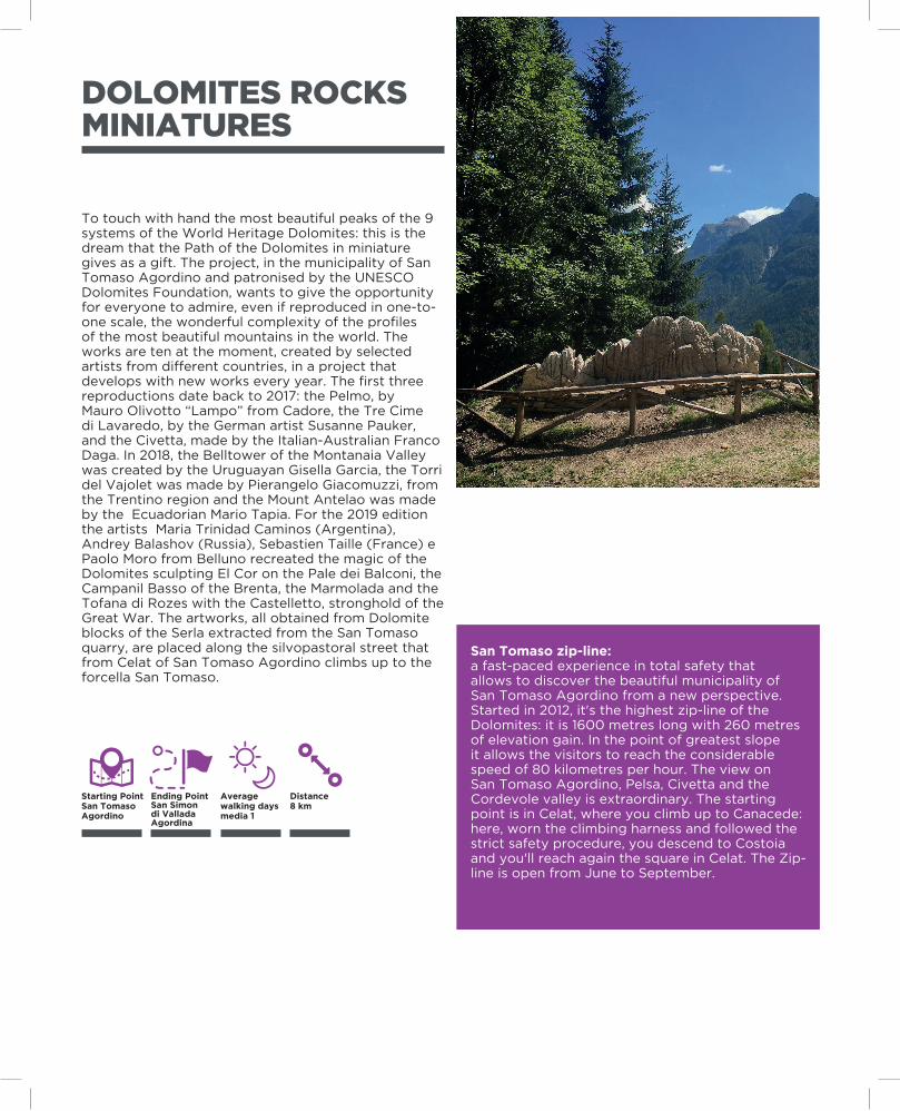
DOLOMITES ROCKS MINIATURES
To touch with hand the most beautiful peaks of the 9 systems of the World Heritage Dolomites: this is the dream that the Path of the Dolomites in miniature gives as a gift. The project, in the municipality of San Tomaso Agordino and patronised by the UNESCO Dolomites Foundation, wants to give the opportunity for everyone to admire, even if reproduced in one-to-one scale, the wonderful complexity of the profiles of the most beautiful mountains in the world. The works are ten at the moment, created by selected artists from different countries, in a project that develops with new works every year. The first three reproductions date back to 2017: the Pelmo, by Mauro Olivotto “Lampo” from Cadore, the Tre Cime di Lavaredo, by the German artist Susanne Pauker, and the Civetta, made by the Italian-Australian Franco Daga. In 2018, the Belltower of the Montanaia Valley was created by the Uruguayan Gisella Garcia, the Torri del Vajolet was made by Pierangelo Giacomuzzi, from the Trentino region and the Mount Antelao was made by the Ecuadorian Mario Tapia. For the 2019 edition the artists Maria Trinidad Caminos (Argentina), Andrey Balashov (Russia), Sebastien Taille (France) e Paolo Moro from Belluno recreated the magic of the Dolomites sculpting El Cor on the Pale dei Balconi, the Campanil Basso of the Brenta, the Marmolada and the Tofana di Rozes with the Castelletto, stronghold of the Great War. The artworks, all obtained from Dolomite blocks of the Serla extracted from the San Tomaso quarry, are placed along the silvopastoral street that from Celat of San Tomaso Agordino climbs up to the forcella San Tomaso.
San Tomaso zip-line:a fast-paced experience in total safety that allows to discover the beautiful municipality of San Tomaso Agordino from a new perspective. Started in 2012, it's the highest zip-line of the Dolomites: it is 1600 metres long with 260 metres of elevation gain. In the point of greatest slope it allows the visitors to reach the considerable speed of 80 kilometres per hour. The view on San Tomaso Agordino, Pelsa, Civetta and the Cordevole valley is extraordinary. The starting point is in Celat, where you climb up to Canacede: here, worn the climbing harness and followed the strict safety procedure, you descend to Costoia and you'll reach again the square in Celat. The Zip-line is open from June to September.
Ending PointSan Simon di Vallada Agordina
Starting PointSan Tomaso Agordino
Distance8 km
Average walking days media 1
27
THE TRAIL OF THE HOSPICES
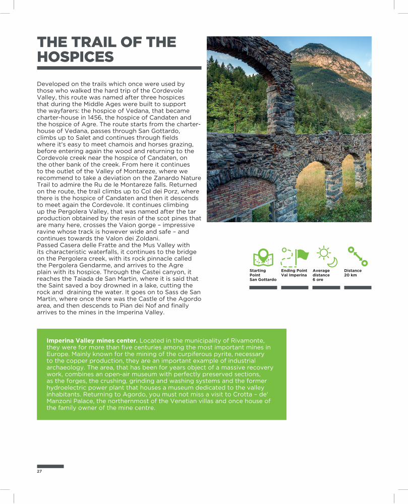
Developed on the trails which once were used by those who walked the hard trip of the Cordevole Valley, this route was named after three hospices that during the Middle Ages were built to support the wayfarers: the hospice of Vedana, that became charter-house in 1456, the hospice of Candaten and the hospice of Agre. The route starts from the charter-house of Vedana, passes through San Gottardo, climbs up to Salet and continues through fields where it's easy to meet chamois and horses grazing, before entering again the wood and returning to the Cordevole creek near the hospice of Candaten, on the other bank of the creek. From here it continues to the outlet of the Valley of Montareze, where we recommend to take a deviation on the Zanardo Nature Trail to admire the Ru de le Montareze falls. Returned on the route, the trail climbs up to Col dei Porz, where there is the hospice of Candaten and then it descends to meet again the Cordevole. It continues climbing up the Pergolera Valley, that was named after the tar production obtained by the resin of the scot pines that are many here, crosses the Vaion gorge – impressive ravine whose track is however wide and safe – and continues towards the Valon dei Zoldani.Passed Casera delle Fratte and the Mus Valley with its characteristic waterfalls, it continues to the bridge on the Pergolera creek, with its rock pinnacle called the Pergolera Gendarme, and arrives to the Agre plain with its hospice. Through the Castei canyon, it reaches the Taiada de San Martin, where it is said that the Saint saved a boy drowned in a lake, cutting the rock and draining the water. It goes on to Sass de San Martin, where once there was the Castle of the Agordo area, and then descends to Pian dei Nof and finally arrives to the mines in the Imperina Valley.
Imperina Valley mines center. Located in the municipality of Rivamonte, they were for more than five centuries among the most important mines in Europe. Mainly known for the mining of the curpiferous pyrite, necessary to the copper production, they are an important example of industrial archaeology. The area, that has been for years object of a massive recovery work, combines an open-air museum with perfectly preserved sections, as the forges, the crushing, grinding and washing systems and the former hydroelectric power plant that houses a museum dedicated to the valley inhabitants. Returning to Agordo, you must not miss a visit to Crotta – de' Manzoni Palace, the northernmost of the Venetian villas and once house of the family owner of the mine centre.
Ending PointVal Imperina
Starting PointSan Gottardo
Distance20 km
Average distance6 ore
“DINO BUZZATI” TRAIL
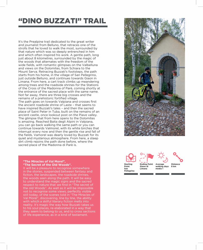
It's the Prealpine trail dedicated to the great writer and journalist from Belluno, that retraces one of the strolls that he loved to walk the most, surrounded by that nature which was so deeply entrenched in him and which often inspired his work. A gentle path, long just about 8 kilometres, surrounded by the magic of the woods that alternates with the freedom of the wide fields, with romantic glimpses on the Valbelluna and views on the Dolomites, from Schiara to the Mount Serva. Retracing Buzzati's footsteps, the path starts from his home, in the village of San Pellegrino, just outside Belluno, and continues towards Giaon in Limana. From here, a cart track climbs up meandering among trees and the roadside shrines for the Stations of the Cross of the Madonna of Parè, coming shortly at the entrance of the sacred place with the same name. Not far away, there are three big crosses and the remains of a prehistoric fortified village.The path goes on towards Valpiana and crosses first the ancient roadside shrine of Laste – that seems to have inspired Buzzati's tales – and then the sacred place of Saint Peter in Tuba, built on the remains of an ancient castle, once lookout post on the Piave valley. The glimpse that from here opens to the Dolomites is amazing. Reached Baita degli Alpini in Valpiana, you can go back walking the same path or you can continue towards Valmorel, with its white birches that interrupt every now and then the gentle rise and fall of the fields. Vamorel was dearly loved by Buzzati for its quiet and mysterious atmosphere. From here, a steep dirt climb rejoins the path done before, where the sacred place of the Madonna di Parè is.
"The Miracles of Val Morel", "The Secret of the Old Woods".It will be a pleasure to recognise somewhere in the stories, suspended between fantasy and fiction, the landscapes, the roadside shrines, the woods seen along the path. It will be easy to understand the magic signs and the sacred respect to nature that we find in “The secret of the old Woods”. As well as it will be impossible not to recognise some views, perfectly visible still today, of the scenes told in “The Miracles of Val Morel”, discovering, line by line, the ability with which a skilful literary fiction melts into reality. It's magic the way how Buzzati takes us to his soul places, re-elaborated in a way that they seem to belong to us, and to cross sections of life experience, as in a kind of testament.
Ending PointGiaon di Limana
Starting PointSan Pellegrino
Distance8 km
Average walking days media 1
29
“VENA” CROSS PATH
A trail of high historical-cultural value, retracing the ancient Via del Ferro (Iron Way) that connected the Fursil mines, at the foot of the Mount Pore near Colle di Santa Lucia, to the furnaces of the Andraz Castle and the passage of Valparola. An easy trail, that follows paths and cart tracks, with unique views on the Fiorentina Valley and on the Fodòm Valley.A wonderful hike, well-marked and without great elevation gains, to know better the events and the disputes for the property of this important mining activity between Tyrol and The Republic of Venice. The guided tour to the Fursil mines – just during the summer season – could be introductory: here they mined siderite, mineral that once liquefied acquires properties similar to steel, making it esteemed in all Europe. The path, that twists and turns through larch and spur woods, starts from the square in Villagrande in Colle Santa Lucia and continues along the state road towards Selva di Cadore. Crossed the bridge on the Ru de la Pavia, the street leads to the entrance of the galleries of the Fursil mines. From the mines a comfortable cart track leads to the Pianaz and, from here, passes through the suggestive semicircle valley overlooked by the Mount Pore. Crossed the villages of Ruiz and Zopei, it reaches Forzela in an area of significant naturalistic importance. The path becomes a comfortable cart track and through woods leads to Livinallongo. After the wonderful hamlet of Col de Larzonei, it crosses the Andraz – Nuvolau trail and reaches the Andraz Castle through the woods.
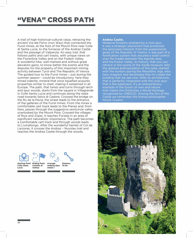
Andraz Castle. Medieval fortalice shielded by a rock spur, it was a strategic placement that protected the episcopal interests from the expansionist goals of the Republic of Venice. It was part of a fortification system that assured a total control over the trades between the Agordo area and the Puster Valley. Its history, that you can retrace in the rooms of the inside museum, tells the gradual anthropization of this area, started with the hunters during the Mesolithic Age, who here stopped, and developed then to create the building that we see now. With its architecture, that is perfectly integrated with the rock spur that is the basement, it's an extraordinary example of the fusion of man and nature that makes the Dolomites a World Heritage recognised by UNESCO. Among the Sirs of the Castle we remember the bishop-philosopher Nicola Cusano.
Ending PointCastello di Andraz
Starting PointColle SantaLucia
Distance15 km
Average walking days media 1
E7 VENETIAN PREALPS OF BELLUNO AND TREVISO
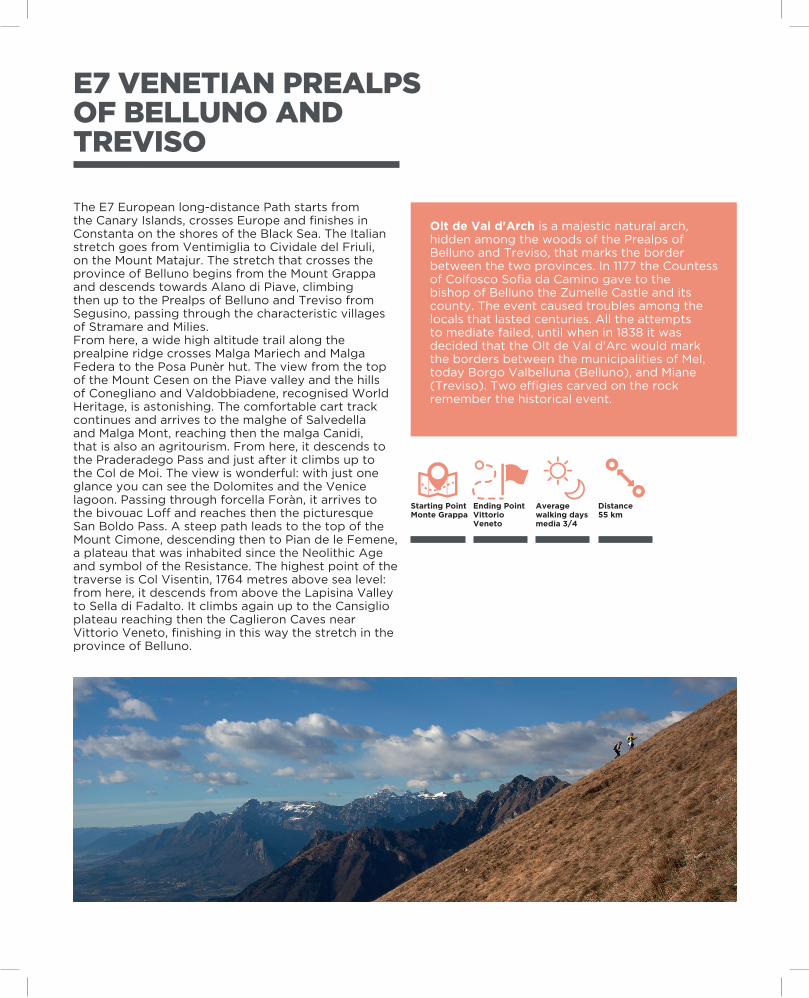
The E7 European long-distance Path starts from the Canary Islands, crosses Europe and finishes in Constanta on the shores of the Black Sea. The Italian stretch goes from Ventimiglia to Cividale del Friuli, on the Mount Matajur. The stretch that crosses the province of Belluno begins from the Mount Grappa and descends towards Alano di Piave, climbing then up to the Prealps of Belluno and Treviso from Segusino, passing through the characteristic villages of Stramare and Milies.From here, a wide high altitude trail along the prealpine ridge crosses Malga Mariech and Malga Federa to the Posa Punèr hut. The view from the top of the Mount Cesen on the Piave valley and the hills of Conegliano and Valdobbiadene, recognised World Heritage, is astonishing. The comfortable cart track continues and arrives to the malghe of Salvedella and Malga Mont, reaching then the malga Canidi, that is also an agritourism. From here, it descends to the Praderadego Pass and just after it climbs up to the Col de Moi. The view is wonderful: with just one glance you can see the Dolomites and the Venice lagoon. Passing through forcella Foràn, it arrives to the bivouac Loff and reaches then the picturesque San Boldo Pass. A steep path leads to the top of the Mount Cimone, descending then to Pian de le Femene, a plateau that was inhabited since the Neolithic Age and symbol of the Resistance. The highest point of the traverse is Col Visentin, 1764 metres above sea level: from here, it descends from above the Lapisina Valley to Sella di Fadalto. It climbs again up to the Cansiglio plateau reaching then the Caglieron Caves near Vittorio Veneto, finishing in this way the stretch in the province of Belluno.
Olt de Val d'Arch is a majestic natural arch, hidden among the woods of the Prealps of Belluno and Treviso, that marks the border between the two provinces. In 1177 the Countess of Colfosco Sofia da Camino gave to the bishop of Belluno the Zumelle Castle and its county. The event caused troubles among the locals that lasted centuries. All the attempts to mediate failed, until when in 1838 it was decided that the Olt de Val d'Arc would mark the borders between the municipalities of Mel, today Borgo Valbelluna (Belluno), and Miane (Treviso). Two effigies carved on the rock remember the historical event.
Ending PointVittorio Veneto
Starting PointMonte Grappa
Distance55 km
Average walking days media 3/4
31
ZOLDO RING
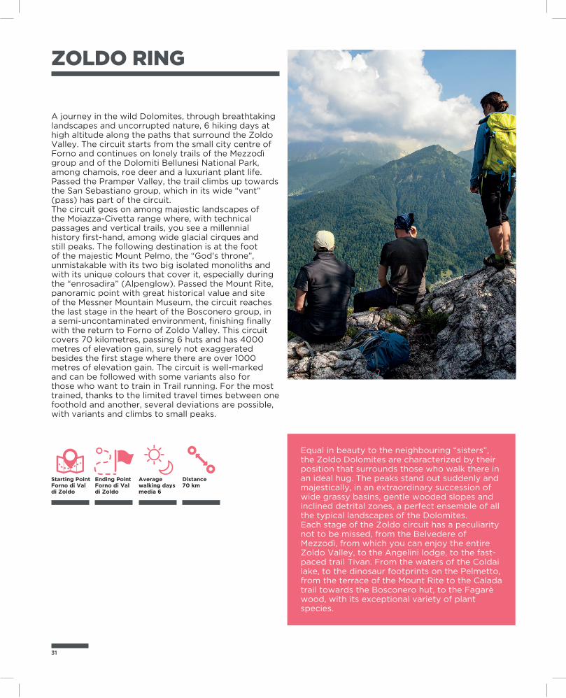
A journey in the wild Dolomites, through breathtaking landscapes and uncorrupted nature, 6 hiking days at high altitude along the paths that surround the Zoldo Valley. The circuit starts from the small city centre of Forno and continues on lonely trails of the Mezzodì group and of the Dolomiti Bellunesi National Park, among chamois, roe deer and a luxuriant plant life. Passed the Pramper Valley, the trail climbs up towards the San Sebastiano group, which in its wide “vant” (pass) has part of the circuit.The circuit goes on among majestic landscapes of the Moiazza-Civetta range where, with technical passages and vertical trails, you see a millennial history first-hand, among wide glacial cirques and still peaks. The following destination is at the foot of the majestic Mount Pelmo, the “God's throne”, unmistakable with its two big isolated monoliths and with its unique colours that cover it, especially during the “enrosadira” (Alpenglow). Passed the Mount Rite, panoramic point with great historical value and site of the Messner Mountain Museum, the circuit reaches the last stage in the heart of the Bosconero group, in a semi-uncontaminated environment, finishing finally with the return to Forno of Zoldo Valley. This circuit covers 70 kilometres, passing 6 huts and has 4000 metres of elevation gain, surely not exaggerated besides the first stage where there are over 1000 metres of elevation gain. The circuit is well-marked and can be followed with some variants also for those who want to train in Trail running. For the most trained, thanks to the limited travel times between one foothold and another, several deviations are possible, with variants and climbs to small peaks.
Equal in beauty to the neighbouring “sisters”, the Zoldo Dolomites are characterized by their position that surrounds those who walk there in an ideal hug. The peaks stand out suddenly and majestically, in an extraordinary succession of wide grassy basins, gentle wooded slopes and inclined detrital zones, a perfect ensemble of all the typical landscapes of the Dolomites.Each stage of the Zoldo circuit has a peculiarity not to be missed, from the Belvedere of Mezzodì, from which you can enjoy the entire Zoldo Valley, to the Angelini lodge, to the fast-paced trail Tivan. From the waters of the Coldai lake, to the dinosaur footprints on the Pelmetto, from the terrace of the Mount Rite to the Calada trail towards the Bosconero hut, to the Fagarè wood, with its exceptional variety of plant species.
Ending PointForno di Val di Zoldo
Starting PointForno di Valdi Zoldo
Distance70 km
Average walking days media 6
ZOLDO SMALLRING
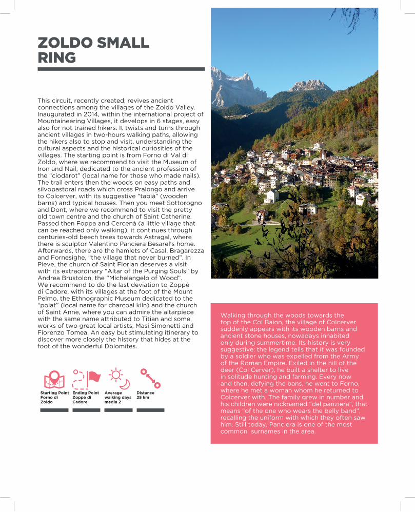
This circuit, recently created, revives ancient connections among the villages of the Zoldo Valley. Inaugurated in 2014, within the international project of Mountaineering Villages, it develops in 6 stages, easy also for not trained hikers. It twists and turns through ancient villages in two-hours walking paths, allowing the hikers also to stop and visit, understanding the cultural aspects and the historical curiosities of the villages. The starting point is from Forno di Val di Zoldo, where we recommend to visit the Museum of Iron and Nail, dedicated to the ancient profession of the “ciodarot” (local name for those who made nails). The trail enters then the woods on easy paths and silvopastoral roads which cross Pralongo and arrive to Colcerver, with its suggestive “tabià” (wooden barns) and typical houses. Then you meet Sottorogno and Dont, where we recommend to visit the pretty old town centre and the church of Saint Catherine. Passed then Foppa and Cercenà (a little village that can be reached only walking), it continues through centuries-old beech trees towards Astragal, where there is sculptor Valentino Panciera Besarel's home. Afterwards, there are the hamlets of Casal, Bragarezza and Fornesighe, “the village that never burned”. In Pieve, the church of Saint Florian deserves a visit with its extraordinary “Altar of the Purging Souls” by Andrea Brustolon, the “Michelangelo of Wood”.We recommend to do the last deviation to Zoppè di Cadore, with its villages at the foot of the Mount Pelmo, the Ethnographic Museum dedicated to the “poiat” (local name for charcoal kiln) and the church of Saint Anne, where you can admire the altarpiece with the same name attributed to Titian and some works of two great local artists, Masi Simonetti and Fiorenzo Tomea. An easy but stimulating itinerary to discover more closely the history that hides at the foot of the wonderful Dolomites.
Walking through the woods towards the top of the Col Baion, the village of Colcerver suddenly appears with its wooden barns and ancient stone houses, nowadays inhabited only during summertime. Its history is very suggestive: the legend tells that it was founded by a soldier who was expelled from the Army of the Roman Empire. Exiled in the hill of the deer (Col Cerver), he built a shelter to live in solitude hunting and farming. Every now and then, defying the bans, he went to Forno, where he met a woman whom he returned to Colcerver with. The family grew in number and his children were nicknamed “del panziera”, that means “of the one who wears the belly band”, recalling the uniform with which they often saw him. Still today, Panciera is one of the most common surnames in the area.
Ending PointZoppé di Cadore
Starting PointForno di Zoldo
Distance25 km
Average walking days media 2
33
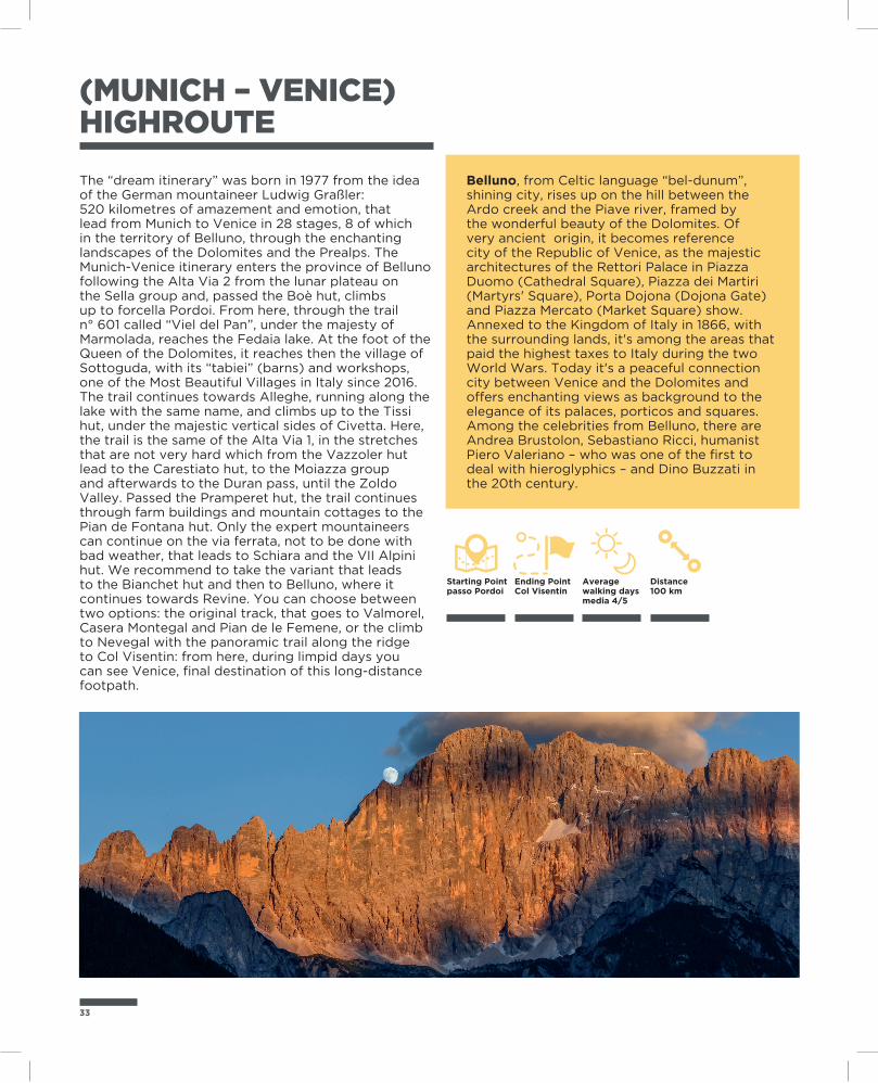
(MUNICH – VENICE) HIGHROUTE
The “dream itinerary” was born in 1977 from the idea of the German mountaineer Ludwig Graßler:520 kilometres of amazement and emotion, that lead from Munich to Venice in 28 stages, 8 of which in the territory of Belluno, through the enchanting landscapes of the Dolomites and the Prealps. The Munich-Venice itinerary enters the province of Belluno following the Alta Via 2 from the lunar plateau on the Sella group and, passed the Boè hut, climbs up to forcella Pordoi. From here, through the trail n° 601 called “Viel del Pan”, under the majesty of Marmolada, reaches the Fedaia lake. At the foot of the Queen of the Dolomites, it reaches then the village of Sottoguda, with its “tabiei” (barns) and workshops, one of the Most Beautiful Villages in Italy since 2016.The trail continues towards Alleghe, running along the lake with the same name, and climbs up to the Tissi hut, under the majestic vertical sides of Civetta. Here, the trail is the same of the Alta Via 1, in the stretches that are not very hard which from the Vazzoler hut lead to the Carestiato hut, to the Moiazza group and afterwards to the Duran pass, until the Zoldo Valley. Passed the Pramperet hut, the trail continues through farm buildings and mountain cottages to the Pian de Fontana hut. Only the expert mountaineers can continue on the via ferrata, not to be done with bad weather, that leads to Schiara and the VII Alpini hut. We recommend to take the variant that leads to the Bianchet hut and then to Belluno, where it continues towards Revine. You can choose between two options: the original track, that goes to Valmorel, Casera Montegal and Pian de le Femene, or the climb to Nevegal with the panoramic trail along the ridge to Col Visentin: from here, during limpid days you can see Venice, final destination of this long-distance footpath.
Belluno, from Celtic language “bel-dunum”, shining city, rises up on the hill between the Ardo creek and the Piave river, framed by the wonderful beauty of the Dolomites. Of very ancient origin, it becomes reference city of the Republic of Venice, as the majestic architectures of the Rettori Palace in Piazza Duomo (Cathedral Square), Piazza dei Martiri (Martyrs' Square), Porta Dojona (Dojona Gate) and Piazza Mercato (Market Square) show. Annexed to the Kingdom of Italy in 1866, with the surrounding lands, it's among the areas that paid the highest taxes to Italy during the two World Wars. Today it's a peaceful connection city between Venice and the Dolomites and offers enchanting views as background to the elegance of its palaces, porticos and squares. Among the celebrities from Belluno, there are Andrea Brustolon, Sebastiano Ricci, humanist Piero Valeriano – who was one of the first to deal with hieroglyphics – and Dino Buzzati in the 20th century.
Ending PointCol Visentin
Starting Pointpasso Pordoi
Distance100 km
Average walking days media 4/5
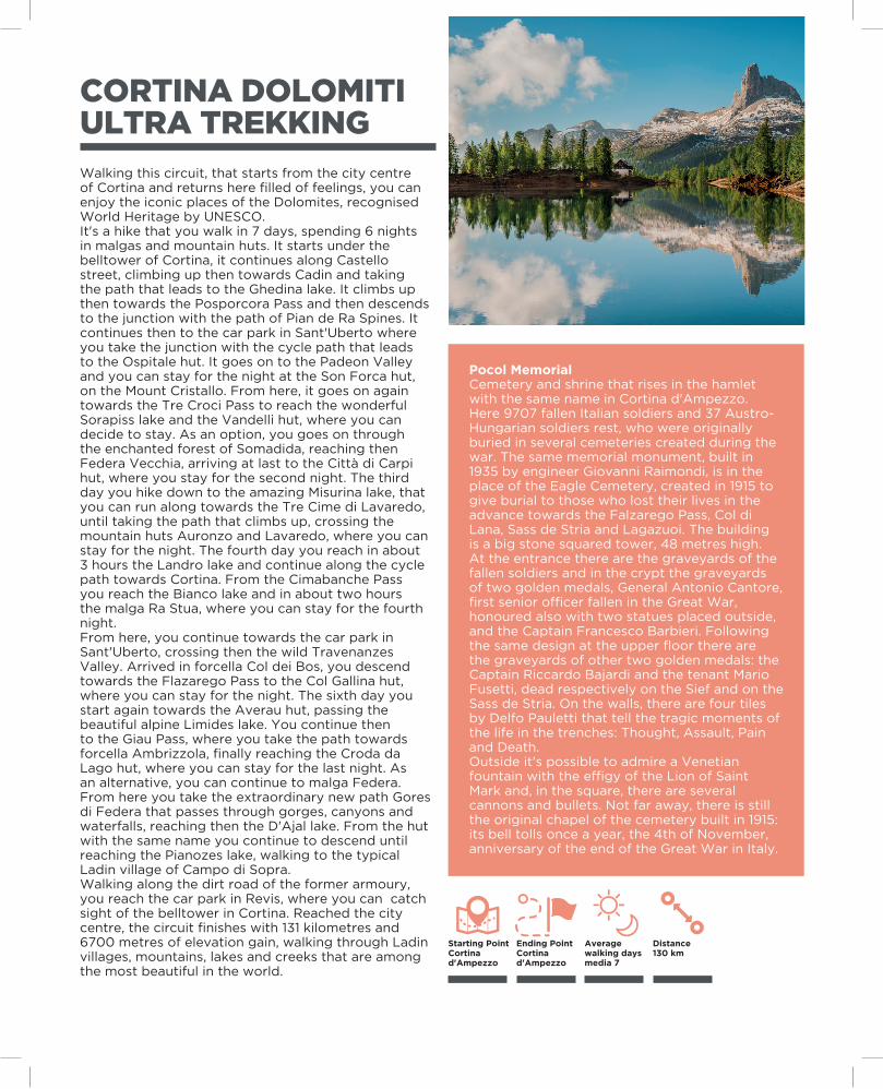
CORTINA DOLOMITIULTRA TREKKINGWalking this circuit, that starts from the city centre of Cortina and returns here filled of feelings, you can enjoy the iconic places of the Dolomites, recognised World Heritage by UNESCO.It's a hike that you walk in 7 days, spending 6 nights in malgas and mountain huts. It starts under the belltower of Cortina, it continues along Castello street, climbing up then towards Cadin and taking the path that leads to the Ghedina lake. It climbs up then towards the Posporcora Pass and then descends to the junction with the path of Pian de Ra Spines. It continues then to the car park in Sant'Uberto where you take the junction with the cycle path that leads to the Ospitale hut. It goes on to the Padeon Valley and you can stay for the night at the Son Forca hut, on the Mount Cristallo. From here, it goes on again towards the Tre Croci Pass to reach the wonderful Sorapiss lake and the Vandelli hut, where you can decide to stay. As an option, you goes on through the enchanted forest of Somadida, reaching then Federa Vecchia, arriving at last to the Città di Carpi hut, where you stay for the second night. The third day you hike down to the amazing Misurina lake, that you can run along towards the Tre Cime di Lavaredo, until taking the path that climbs up, crossing the mountain huts Auronzo and Lavaredo, where you can stay for the night. The fourth day you reach in about 3 hours the Landro lake and continue along the cycle path towards Cortina. From the Cimabanche Pass you reach the Bianco lake and in about two hours the malga Ra Stua, where you can stay for the fourth night.From here, you continue towards the car park in Sant'Uberto, crossing then the wild Travenanzes Valley. Arrived in forcella Col dei Bos, you descend towards the Flazarego Pass to the Col Gallina hut, where you can stay for the night. The sixth day you start again towards the Averau hut, passing the beautiful alpine Limides lake. You continue then to the Giau Pass, where you take the path towards forcella Ambrizzola, finally reaching the Croda da Lago hut, where you can stay for the last night. As an alternative, you can continue to malga Federa. From here you take the extraordinary new path Gores di Federa that passes through gorges, canyons and waterfalls, reaching then the D'Ajal lake. From the hut with the same name you continue to descend until reaching the Pianozes lake, walking to the typical Ladin village of Campo di Sopra.Walking along the dirt road of the former armoury, you reach the car park in Revis, where you can catch sight of the belltower in Cortina. Reached the city centre, the circuit finishes with 131 kilometres and 6700 metres of elevation gain, walking through Ladin villages, mountains, lakes and creeks that are among the most beautiful in the world.
Ending PointCortina d'Ampezzo
Starting PointCortina d'Ampezzo
Distance130 km
Average walking days media 7
Pocol MemorialCemetery and shrine that rises in the hamlet with the same name in Cortina d'Ampezzo. Here 9707 fallen Italian soldiers and 37 Austro-Hungarian soldiers rest, who were originally buried in several cemeteries created during the war. The same memorial monument, built in 1935 by engineer Giovanni Raimondi, is in the place of the Eagle Cemetery, created in 1915 to give burial to those who lost their lives in the advance towards the Falzarego Pass, Col di Lana, Sass de Stria and Lagazuoi. The building is a big stone squared tower, 48 metres high. At the entrance there are the graveyards of the fallen soldiers and in the crypt the graveyards of two golden medals, General Antonio Cantore, first senior officer fallen in the Great War, honoured also with two statues placed outside, and the Captain Francesco Barbieri. Following the same design at the upper floor there are the graveyards of other two golden medals: the Captain Riccardo Bajardi and the tenant Mario Fusetti, dead respectively on the Sief and on the Sass de Stria. On the walls, there are four tiles by Delfo Pauletti that tell the tragic moments of the life in the trenches: Thought, Assault, Pain and Death.Outside it's possible to admire a Venetian fountain with the effigy of the Lion of Saint Mark and, in the square, there are several cannons and bullets. Not far away, there is still the original chapel of the cemetery built in 1915: its bell tolls once a year, the 4th of November, anniversary of the end of the Great War in Italy.
35
TALKING TRAILS
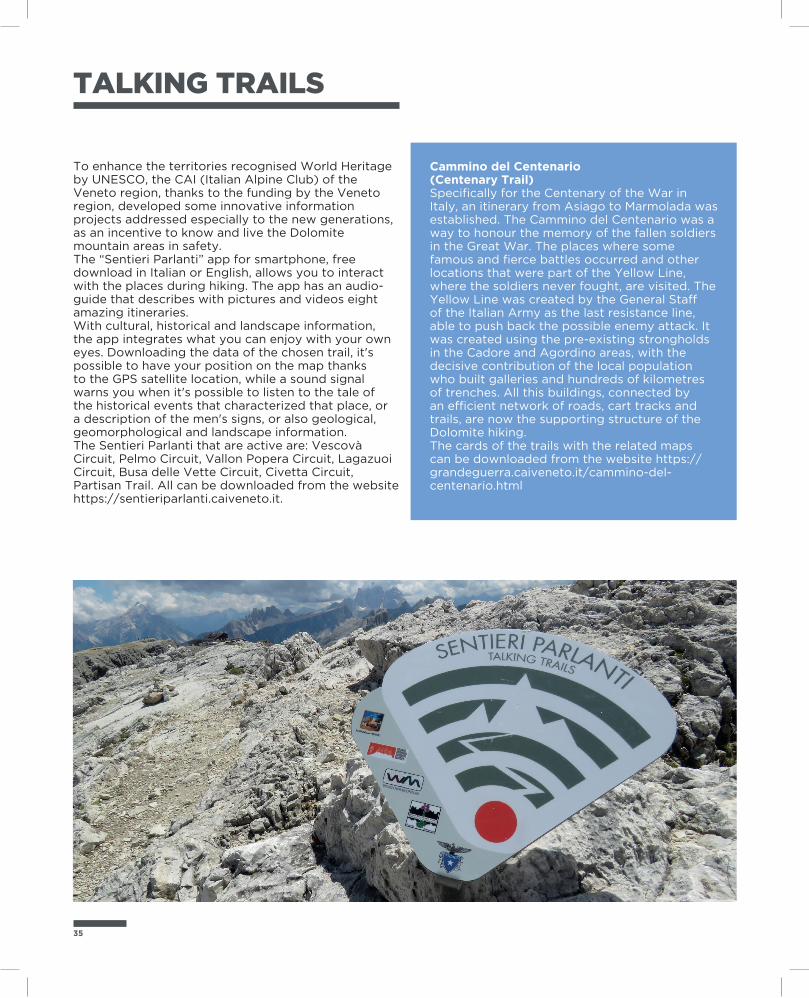
To enhance the territories recognised World Heritage by UNESCO, the CAI (Italian Alpine Club) of the Veneto region, thanks to the funding by the Veneto region, developed some innovative information projects addressed especially to the new generations, as an incentive to know and live the Dolomite mountain areas in safety.The “Sentieri Parlanti” app for smartphone, free download in Italian or English, allows you to interact with the places during hiking. The app has an audio-guide that describes with pictures and videos eight amazing itineraries.With cultural, historical and landscape information, the app integrates what you can enjoy with your own eyes. Downloading the data of the chosen trail, it's possible to have your position on the map thanks to the GPS satellite location, while a sound signal warns you when it's possible to listen to the tale of the historical events that characterized that place, or a description of the men's signs, or also geological, geomorphological and landscape information.The Sentieri Parlanti that are active are: Vescovà Circuit, Pelmo Circuit, Vallon Popera Circuit, Lagazuoi Circuit, Busa delle Vette Circuit, Civetta Circuit, Partisan Trail. All can be downloaded from the website https://sentieriparlanti.caiveneto.it.
Cammino del Centenario (Centenary Trail)Specifically for the Centenary of the War in Italy, an itinerary from Asiago to Marmolada was established. The Cammino del Centenario was a way to honour the memory of the fallen soldiers in the Great War. The places where some famous and fierce battles occurred and other locations that were part of the Yellow Line, where the soldiers never fought, are visited. The Yellow Line was created by the General Staff of the Italian Army as the last resistance line, able to push back the possible enemy attack. It was created using the pre-existing strongholds in the Cadore and Agordino areas, with the decisive contribution of the local population who built galleries and hundreds of kilometres of trenches. All this buildings, connected by an efficient network of roads, cart tracks and trails, are now the supporting structure of the Dolomite hiking.The cards of the trails with the related maps can be downloaded from the website https://grandeguerra.caiveneto.it/cammino-del-centenario.html
The Alpine Guides
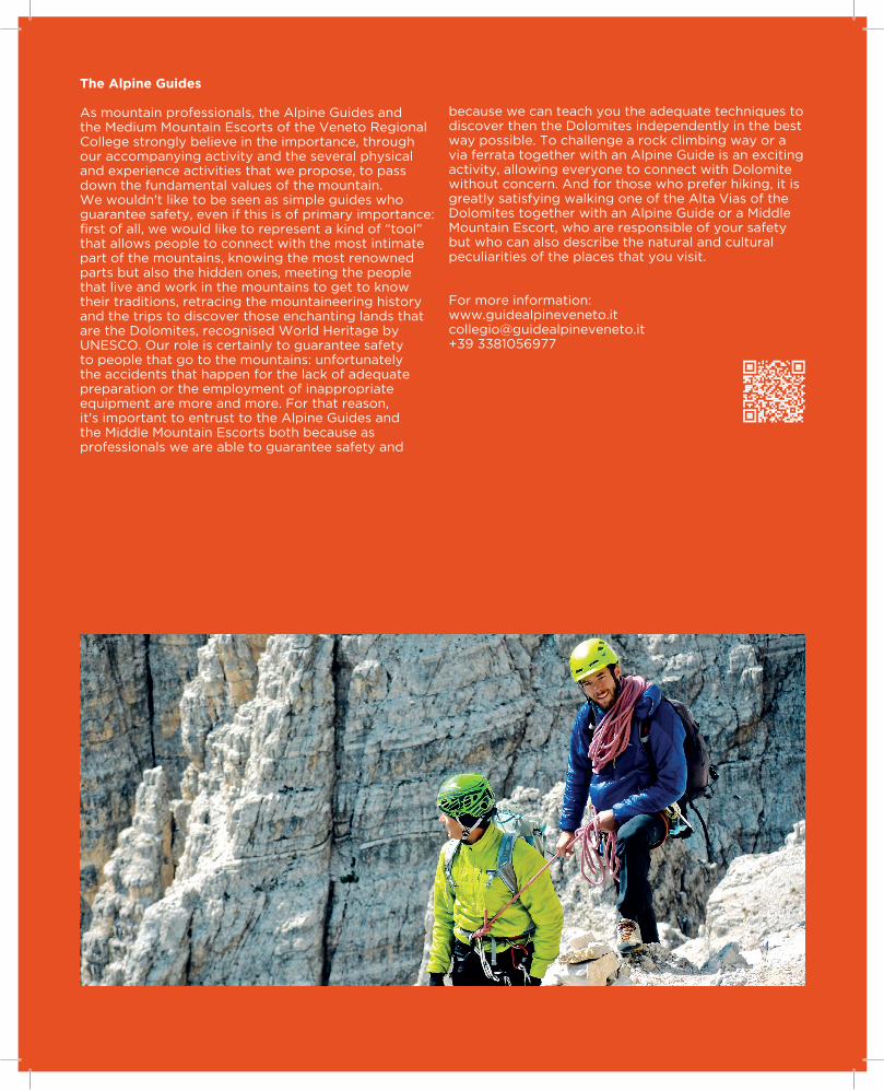
As mountain professionals, the Alpine Guides and the Medium Mountain Escorts of the Veneto Regional College strongly believe in the importance, through our accompanying activity and the several physical and experience activities that we propose, to pass down the fundamental values of the mountain. We wouldn't like to be seen as simple guides who guarantee safety, even if this is of primary importance: first of all, we would like to represent a kind of “tool” that allows people to connect with the most intimate part of the mountains, knowing the most renowned parts but also the hidden ones, meeting the people that live and work in the mountains to get to know their traditions, retracing the mountaineering history and the trips to discover those enchanting lands that are the Dolomites, recognised World Heritage by UNESCO. Our role is certainly to guarantee safety to people that go to the mountains: unfortunately the accidents that happen for the lack of adequate preparation or the employment of inappropriate equipment are more and more. For that reason, it's important to entrust to the Alpine Guides and the Middle Mountain Escorts both because as professionals we are able to guarantee safety and
because we can teach you the adequate techniques to discover then the Dolomites independently in the best way possible. To challenge a rock climbing way or a via ferrata together with an Alpine Guide is an exciting activity, allowing everyone to connect with Dolomite without concern. And for those who prefer hiking, it is greatly satisfying walking one of the Alta Vias of the Dolomites together with an Alpine Guide or a Middle Mountain Escort, who are responsible of your safety but who can also describe the natural and cultural peculiarities of the places that you visit.
For more information: www.guidealpineveneto.it [email protected] +39 3381056977
37
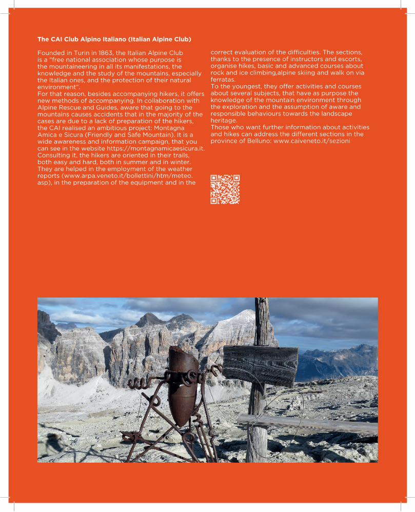
The CAI Club Alpino Italiano (Italian Alpine Club)
Founded in Turin in 1863, the Italian Alpine Club is a “free national association whose purpose is the mountaineering in all its manifestations, the knowledge and the study of the mountains, especially the Italian ones, and the protection of their natural environment”.For that reason, besides accompanying hikers, it offers new methods of accompanying. In collaboration with Alpine Rescue and Guides, aware that going to the mountains causes accidents that in the majority of the cases are due to a lack of preparation of the hikers, the CAI realised an ambitious project: Montagna Amica e Sicura (Friendly and Safe Mountain). It is a wide awareness and information campaign, that you can see in the website https://montagnamicaesicura.it.Consulting it, the hikers are oriented in their trails, both easy and hard, both in summer and in winter.They are helped in the employment of the weather reports (www.arpa.veneto.it/bollettini/htm/meteo.asp), in the preparation of the equipment and in the
correct evaluation of the difficulties. The sections, thanks to the presence of instructors and escorts, organise hikes, basic and advanced courses about rock and ice climbing,alpine skiing and walk on via ferratas.To the youngest, they offer activities and courses about several subjects, that have as purpose the knowledge of the mountain environment through the exploration and the assumption of aware and responsible behaviours towards the landscape heritage.Those who want further information about activities and hikes can address the different sections in the province of Belluno: www.caiveneto.it/sezioni
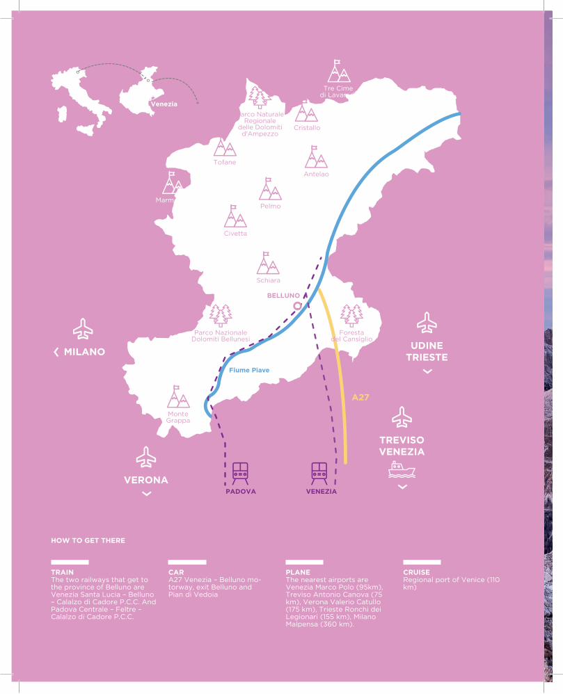
TREVISOVENEZIA
PADOVA
UDINETRIESTE
VERONA
MILANO
‹
Parco NazionaleDolomiti Bellunesi
Civetta
Antelao
Schiara
Tofane
MonteGrappa
Pelmo
Cristallo
Tre Cime di Lavaredo
Marmolada
Parco NaturaleRegionale
delle Dolomitid'Ampezzo
Fiume Piave
A27
VENEZIA
°°
‹
BELLUNO
Venezia
Forestadel Cansiglio
HOW TO GET THERE
CARA27 Venezia – Belluno mo-torway, exit Belluno andPian di Vedoia
TRAINThe two railways that get to the province of Belluno are Venezia Santa Lucia – Belluno – Calalzo di Cadore P.C.C. And Padova Centrale – Feltre – Calalzo di Cadore P.C.C.
PLANEThe nearest airports are Venezia Marco Polo (95km), Treviso Antonio Canova (75 km), Verona Valerio Catullo (175 km), Trieste Ronchi dei Legionari (155 km), Milano Malpensa (360 km).
CRUISERegional port of Venice (110 km)
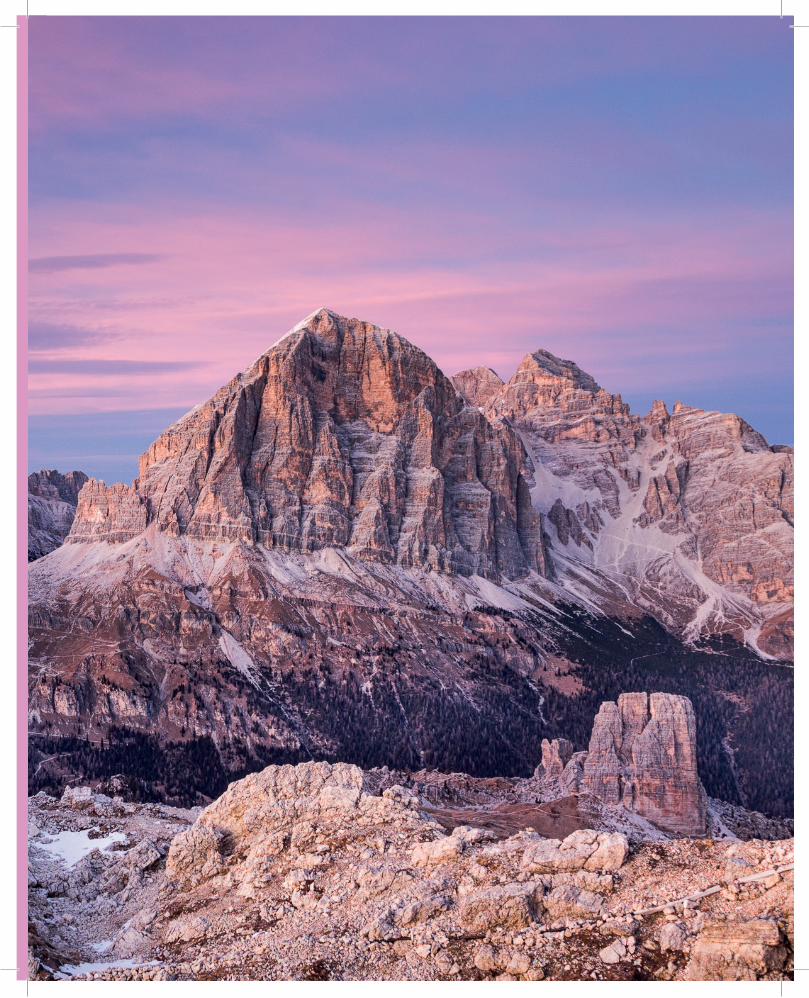
39
FONDO


