Embed Size (px)
Citation preview

1
The Newshot Island boat graveyard: an assemblage of 19th century vessels on the Clyde
Authors: Ellie Graham, University of St Andrews, St Katharine’s Lodge, The Scores, St Andrews; Tom
Dawson, University of St Andrews, St Katharine’s Lodge, The Scores, St Andrews; Steve Liscoe, FSA
Scot, Nautical Archaeology Society, Fort Cumberland, Portsmouth.
With contributions by Peter Dick, the Historical Diving Society, Ardmore, Church Road, Isleworth
Keywords: Scotland, Clyde, deepening, sailing ship, post-medieval, ship graveyard
ABSTRACT A project by SCAPE, NAS and local volunteers at Newshot Island on the Clyde near Glasgow
documented an important ships graveyard dating to the early 20th century. The vessels tell the story
of the creation of the Clyde Navigation, represent a significant aspect of the river's history and
exemplify the technological and industrial development of the region. The survey and research
revealed that the remains on site include a unique survivor – the earliest diving support vessel
known to have been recorded, and has resulted in the designation of the remains as a Scheduled
Ancient Monument by Historic Environment Scotland.
INTRODUCTION
Site location and description of remains The boat graveyard at Newshot Island comprises a group of at least 53 vessels in an area of intertidal
sand, silt and mud on the south bank of the Clyde at Newshot Island Nature Reserve, Renfrewshire.
The remains lie around 300m north of Inchinnan centred on NS 47808 70534 (Figure 1). They cover a
c.600m length of foreshore on the south bank of the River Clyde and along the relict south channel
which formed Newshot Island.
The vessels are in the intertidal zone and are partially buried in riverine sediment; salt marsh is
developing around those to the east. Forty-eight are rectangular flat-bottomed wooden punts, four
boats are wooden sailing vessels, with hulls upstanding to varying heights. There is one metal barge.
The remains of further vessels may be located in the area, either obscured by accreted sediment or
too broken up to be clearly recognisable.
The vessels form three main groups (Figure 1). Area 1 is adjacent to Park Quay and includes the
remains of seven punts. Area 2, is centred on the mouth of the Newshot Creek, which originally
divided Newshot Island from the south bank of the Clyde, and comprises ten further punts and four
wooden sailing boats, one of which, in the middle of the creek, is mostly permanently submerged
with only the top of the surviving parts of the hull exposed at low water springs. Area 3 lies c.200m
to the south east of Area 2, on the south bank of Newshot Creek and consists of 28 wooden punts
and the metal barge. Three further punts lie between Areas 2 and 3.
The National Monuments Record for Scotland (Canmore) entry for the site recorded the remains of
mud punts which had been used in dredging the River Clyde and three other craft, thought to have
been abandoned there after a wartime bombing raid.
Project background In 2012, The SCAPE Trust (Scottish Coastal Archaeology and the Problem of Erosion) launched the
Scotland’s Coastal Heritage at Risk Project (SCHARP). The project aimed to work with local
communities to update records of vulnerable coastal heritage sites around Scotland and carry out

2
practical projects (ShoreDIGs) at selected threatened, locally-valued sites. The potential for
collaboration with the Nautical Archaeology Society (NAS) was identified early in the project.
Suitable sites were discussed for joint ShoreDIGs / NAS projects, and Newshot Island was selected
for detailed survey and research.
Initial contact with local archives and community groups put SCAPE in touch with local resident Ian
Sinclair, who had undertaken independent research into the site and the history of the vessels.
A project to record the remains in detail was developed and four seasons of fieldwork were
undertaken, in October 2014, February 2017, June 2017 and May 2018.
Organisation and community involvement Project planning was undertaken by SCAPE and the NAS. In keeping with the emphasis on
community involvement in both organisations, volunteer participation was a significant focus of the
project design. Thirty-five local volunteers were involved in undertaking the fieldwork (shown
recording Area 1 in Figure 2). Training in the principles of recording and site survey was delivered in
classroom sessions at the start of the fieldwork and the partnership with the NAS allowed volunteers
the opportunity to gain an accredited qualification. Thanks to support from Historic Environment
Scotland, fifteen volunteers completed the Introduction to Nautical Archaeology course. Eight
volunteers also received training in illustration software and digitised the drawings of the vessels.
Staff from Museum of London Archaeology visited Scotland and participated in the project to inform
the development of the Coastal and Intertidal Zone Archaeological Network project (CITiZAN).
Aims and objectives Create a detailed and comprehensive record of the vessels before they deteriorate further;
Create a record of the vessels’ condition which can be used as a basis for future condition
monitoring;
Research the history of the vessels which comprise the boat graveyard;
Provide an opportunity for learning and involvement for the local community, SCHARP
volunteers, and NAS members;
Share the results with the West of Scotland Archaeological Service HER and Canmore;
Publicise the results of the project through the SCHARP networks.
The survey identified the boat graveyard as comprising a group of wooden sailing vessels and the
remains of the dredging plant operated by the Clyde Navigation Trust during the 19th and 20th
centuries. The work both highlighted the inherent importance of this assemblage of vessels and the
value that a community-focused approach can bring. It drew attention to the essential but often-
overlooked role played by dredging activity in the operation of the ports of the Clyde and represents
the first detailed archaeological recording of remains of this type. Furthermore, historical research
precipitated by the archaeological recording work resulted in the identification of the earliest known
surviving diving support vessel, ultimately leading to the decision by Historic Environment Scotland
to protect the site as a Scheduled Monument in recognition of its rarity and the significance of the
assemblage in the industrial and maritime landscape of the Firth of Clyde. The range of techniques
and technologies employed form a case study in the effectiveness of different approaches for the
ongoing monitoring and management of vulnerable sites.
3
HISTORICAL AND ARCHAEOLOGICAL BACKGROUND
Boat graveyards The importance of ship graveyards as a site type, their potential for informing our understanding of
past societies that created them, and their value as a threatened, under-studied resource has been
presented by Nathan Richards (2011). As a maritime nation with a long coastline, Scotland has a rich
heritage of boats, ships and associated infrastructure. Recent work has focused on creating and
enhancing accessible records of the maritime historical and archaeological resource (project Adair,
RCAHMS & Historic Scotland 2012), working with local communities to record intertidal and
submerged shipwrecks on Scotland’s Atlantic coast (Project SAMPHIRE, McCarthy et al 2015), and
surveys of the First and Second World War wreck sites at Scapa Flow (Christie et al 2014). There has
also been significant detailed research on individual shipwrecked vessels underwater (Martin 1998,
Martin 2017) and intertidal abandoned vessels (Wood 1997a).
Intertidal assemblages of vessels by the nature of their liminal location are particularly vulnerable to
being overlooked, falling between the perceived remits of terrestrial and underwater archaeological
disciplines. However, their significance for the wider understanding of maritime history has been
highlighted by recent work in the UK (Milne et al 1998; Parker 1998; Barnett 2007; HWTMA 2008). In
England, reports commissioned by English Heritage (now Historic England) (Davies 2011, Pett 2013)
provided an audit of intertidal hulks and a national resource assessment, leading to a number of
recommendations for further work, including regular re-survey for monitoring purposes, and
emphasised the scope for volunteer involvement in such work. As stated by numerous authors, such
groups should be viewed both as monuments in their own right and as part of the wider historic
landscape (Richards 2011, 84-117; Beattie-Edwards & Satchell 2011, 80-82). Their vulnerability in the
intertidal zone to natural processes of erosion and deterioration exacerbates the lack of
investigation; they are a fragile and dwindling resource.
In Scotland, a number of intertidal boat graveyards have been surveyed at Kincardine (Wood 1997b)
Aberlady (Groom & Oxley 2002) as well as assemblages of sailing drifters at Loch Fleet (Graham &
Hambly 2017a) and Findhorn Bay (Graham & Hambly 2017b). Many further ships graveyards around
Scotland however, have not yet been examined. The assemblage at Bowling Harbour, for example, is
diverse but has not yet been fully studied.
The Firth of Clyde The Firth of Clyde and Clyde estuary form part of the fjord landscape of the west coast of Scotland,
where the River Clyde drains the western part of the southern uplands. With a small catchment area
and length of 100 miles, the river’s volume and flow are limited, becoming estuarine just upstream
of Glasgow at the upper tidal limit. The channel opens into the outer Firth at Greenock, ultimately
connecting the Scottish Lowlands to the Atlantic.
The natural channel of the River Clyde was originally very shallow. The bed of the outer Firth of
Clyde shoals abruptly between Greenock and Dumbarton, with the first of the pinch points at
Dumbuck, as attested by a putative ford of Roman date (Canmore ID 43350) which crossed the river
here. At this point, and several other locations on the upper stretch of the estuary as it approached
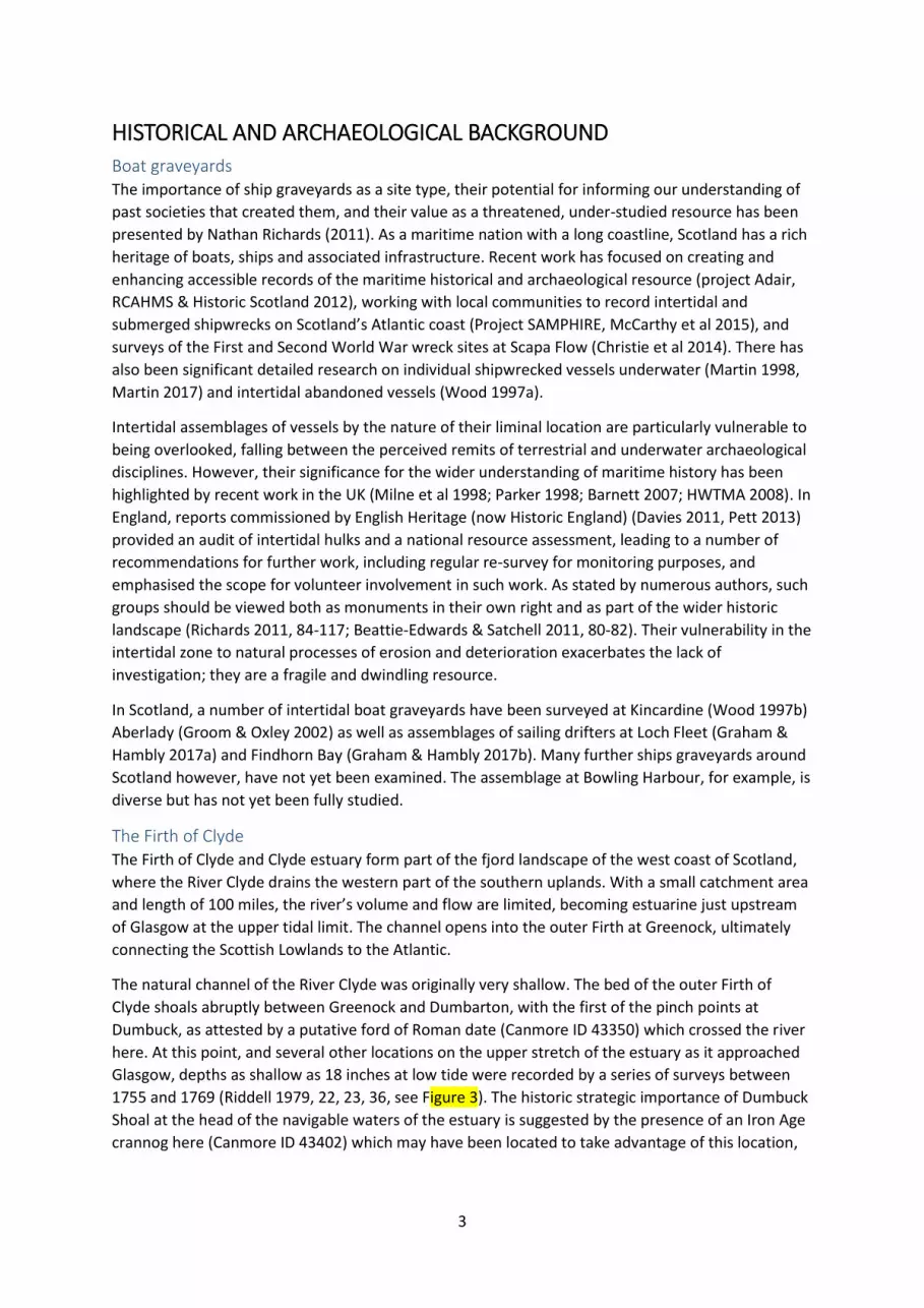
Glasgow, depths as shallow as 18 inches at low tide were recorded by a series of surveys between
1755 and 1769 (Riddell 1979, 22, 23, 36, see Figure 3). The historic strategic importance of Dumbuck
Shoal at the head of the navigable waters of the estuary is suggested by the presence of an Iron Age
crannog here (Canmore ID 43402) which may have been located to take advantage of this location,

4
as suggested by Hale (2000), and by the Early Historic stronghold of the Kingdom of Stathclyde at
Dumbarton (Stevenson 1985, 68).
Glasgow became a Royal Burgh in 1175 and by the 17th century, was engaged in international trade,
but due to the problems posed by the shallow river, cargoes were unloaded at ports downstream
and either transported by road or transhipped onto small boats to navigate the upper channel.
Although the construction of Port Glasgow, begun in 1669, gave the city its own deepwater port, it
was 18 miles away from Glasgow itself (Riddell 1979, 8-10).
With the Act of Union in 1707 the opportunity for trade with the American colonies was opened up
to Scotland. Thanks to its west-coast location, Glasgow was well-placed to take advantage of the
opportunities for transatlantic trade. Commodities imported, principally tobacco, generated great
wealth for the Glaswegian merchants engaged in the trade, and the ‘Tobacco Lords’ obtained
significant influence on the running of the city. Their frustrations with the delays and expense
caused by the transhipment of goods at Port Glasgow led to increasingly strident demands to
improve the navigability of the Clyde to facilitate access by ship to Glasgow itself.
In response, a series of attempts were made to deepen the channel from the mid-18th century, both
to expedite shipping and to reduce the flood risk the river posed. Early engineers identified the
width of the river, divided by islets into multiple channels at several points, notably at Dumbuck and
Newshot Island, and the soft, eroding banks as the cause of the problem. Initial work by John
Golborne focused on narrowing the channel to speed the flow of the water and harness its natural
scouring action in order to deepen the riverbed through erosion. Lateral jetties projecting into the
channel were constructed, joined in 1773 by a training wall, the Lang Dyke, to narrow the river and
increase its flow. Likewise, the southern channel at Newshot Island was blocked to concentrate the
flow of water (Riddell 1979, 43-49). The programme of improvement, which fell within the remit of
the River Improvement Trust, not only deepened the river, but straightened it along this stretch
between Longhaugh Point and Dumbarton, and within 5 years, Golborne achieved the depth of 7
feet which he had been contracted to deliver.
Despite this success, there was constant demand for further improvement to meet the growing
needs as ships continually increased in size and international trade from the city expanded.
Furthermore, while the erosive action of the water achieved significant deepening along much of the
channel, it had limited impact on harder rocky areas which by the 1820s had become the main
constraint to the depth of the Clyde.
The development of the Clyde Navigation Steam dredgers were first used on the river in 1824, (Riddell 1979, 84) both to excavate the riverbed
further and to maintain the depth already achieved by removing silt deposited by the river. They
worked in partnership with wooden barges, tethered to the sterns of the dredgers, which collected
the excavated spoil, and transported it to the riverbank where it was used for land reclamation. This
both further narrowed the channel and created new ground for riverside development. Although
originally moved by punting, from which the term ‘mud punts’ was coined, by the 1830s the vessels
were moved by steam tugs between the dredgers and dumping grounds. When being moved, they
were lashed together in a raft of 10-12 vessels, (Riddell 1979, 275-283).
This combination of training walls and dredging significantly improved the navigability of the river,
however the increasing size of ships, developing industries and the growing demands from Glasgow
to expand its foreign trade generated a constant need for further deepening. The success of the
dredgers at removing softer sediments also exposed large boulders and areas of rock on the riverbed,

5
which contemporary dredging equipment couldn’t remove. In reports of 1827 and 1831 a diving bell
was recommended by the engineer Robert Stevenson to deepen more difficult stretches of the
riverbed (Riddell 1979, 275).
Although this technology had been in use since the early 16th century, it was further developed by
the engineer John Smeaton with the introduction of a pumped air supply to the bell and used in
1779 at Hexham Bridge. It was subsequently employed by Smeaton and later John Rennie in the
construction of Ramsgate harbour. Rennie also improved the design and employed a diving bell at
Plymouth breakwater in 1812, which was later sent to Portsmouth dockyard. Perhaps most famously,
Isambard Kingdom Brunel used a diving bell borrowed from the West India Docks to inspect the
Thames Tunnel in 1827 after it was flooded during construction (Newton 1827, 292-294).
Accepting Stevenson’s advice for developing the Clyde waterway, the River Improvement Trust
ordered a diving bell and support apparatus in 1833. Initially retrofitted to a wooden punt, a custom-
built support vessel was constructed in 1852. The Clyde Navigation Trust (which had superseded the
River Improvement Trust in 1858) added a second bell and barge to their dredging fleet nine years
later.
Excavated material from the riverbed illustrated the hazards the naturally shallow channel presented
to shipping when deepening works around Newshot Island in the 1840s recovered scraps of copper
and iron ripped from ships’ hulls by the rocks (Riddell 1979, 123). Although the combination of
dredgers and diving was extremely successful at deepening the river, a bank of volcanic rock
discovered at Elderslie in 1854 required explosives, used in conjunction with the dredgers and diving
bell to remove the debris.
By the middle of the 19th century, the improvement of the navigation of the Clyde was described as
“one of the most successful engineering operations achieved in Great Britain” (Bald 1845, 234),
thanks to the dredging plant of the Clyde Navigation Trust, which had a dedicated repair and
maintenance yard at Dalmuir, opposite Newshot. The scale of the dredging fleet and its constant
maintenance needs are illustrated by size of the workforce; 200 workers were employed there. This
fleet, consisting of dredgers, punts, tugs and the two bell support barges could, by the early 20th
century, be collectively called “the largest and most powerful in Britain” (Riddell 1979, 305), while in
order to supply the needs of the dredging plant, the Renfrew yards Lobnitz & Co and Simons were
world leaders in building dredger plant, supplying specialist vessels internationally (Walker 1984, 80-
82).
With the success of the deepening work, Glasgow’s harbours and shipyards could develop
unencumbered by the constraints of the shallow channel. Alongside the improvement of the river
channel, the 19th century saw massive development of docks and wharfage along the length of the
river.
As well as quays lining the riverfront for much of its length, three general cargo docks were built by
the Clyde Navigation Trust in the 19th century. The earliest, Windmillcroft, on the south side of the
river, was initially constructed as a quay in 1839, and developed into a dock in 1864, opening three
years later as Windmillcroft Basin, and becoming generally known as Kingston Dock. This was
followed by Queens Dock (also known as Stobcross), begun in 1872 and opened in 1877, and the
Princes (Cessnock) Dock, where work commenced in 1889 and was completed in 1897. These were
followed by the George V Dock, which in the now well-established tradition of disregarding official
names in favour of informally naming a dock after its location, was occasionally also known as

6
Shieldhall. Constructed in the 1920s and formally opened in 1931, its low-water draught of 32ft
attests to the success of the ongoing deepening work (Riddell 1979, 192-8).
Similarly, through the 19th century, shipyards along the Clyde developed, moving from the
production of wooden sailing ships to the steam-power and iron hulls for which Clyde shipbuilding
became famous (Walker 1984) and producing ever-larger vessels. By the early 20th century, the
Clyde became one of the three principal centres of British shipbuilding, along with the northeast of
England and Belfast (Pollard & Robertson 1979). Alongside iconic ships such as the Cutty Sark (1869)
and HMS Hood (1918), Clyde yards produced the sister passenger liners Lucania & Campania (1892),
Lusitania (1907), Queen Mary (1934) and Queen Elizabeth (1938), each of which was the largest
passenger liner in the world when launched (Walker, 1984; Hope, 1990).
With the introduction of steam and subsequently diesel power, wooden sailing vessels declined from
the middle of the 19th century onwards. Despite this, a number of sailing vessels remained in service
well into the 20th century, but were increasingly concentrated on the home trade, in ever-decreasing
numbers, with only a few continuing in service up to the Second World War (Greenhill 1968, 39-48).
The assemblage of vessels at the Newshot Island ship graveyard thus represent the rise of the Clyde
and the decline of sail, embodying the larger themes of the development of maritime technology in
the late 19th and early 20th centuries.

7
FIELDWORK
Methodology
On-site survey and recording As preparation for the fieldwork, a drone flight over the site was carried out by Eddie Martin in
September 2014, in order to create an aerial photogrammetric model using PhotoScan software.
Two geo-rectified, accurate, highly detailed orthophotos of the boat graveyard were created from
this model and made available online (http://www.gigapan.com/gigapans/162364 and
http://www.gigapan.com/gigapans/162373). An initial Total Station survey of the site established a
site grid and located the remains relative to permanent ground control points. These two surveys
then formed the basis for planning the further detailed recording.
The fieldwork was carried out with local volunteers over three seasons in October 2014, February
2017 and June 2017; with an additional day in May 2018. The 2014 work was focused on Area 1
(Figure 1) and recorded four mud punts. The 2017 surveys recorded three wooden sailing vessels in
Area 2 and the metal barge in Area 3. Supplementary work in May 2018 investigated the metal barge.
The methodology comprised three basic elements; firstly completion of a wreck recording form
(developed from the NAS and CITiZAN pro-forma), followed by photographic recording and scale
drawing. Volunteers carried out the on-site recording under guidance from SCAPE staff and NAS
tutors. The photographic record for each vessel included both general views of the remains and
details, and a photo board was used for identification. General shots showing the overall site and
working shots were also taken. Selected vessels were also drawn at a scale of 1:20 using a baseline
and offsets with planning frames used for details where appropriate, and including fixed points
recorded by the original Total Station survey, allowing the detailed records to be related to this
survey and the permanent ground control points. The photographic and drawn surveys were
undertaken concurrently, allowing the selection of features of interest and specific views for
photographs to be informed by the process of observing and drawing the remains.
The selection of vessels for detailed recording was based on individuality and accessibility; all the
exposed wooden sailing vessels were surveyed and drawn; the metal barge was recorded by
comprehensive ground, pole and drone photography to give 360 degree views due to the difficulties
of access in the deeper mud in this area. The mud punts which were recorded in detail were chosen
based on their accessibility, being representational of the overall assemblage and degree of
preservation. Where present and appropriate, upstanding elements were drawn as elevations, and
some profiles were drawn.
In 2018, the original site grid and all accessible remains were located using a dGPS to create a basic
site plan, allowing the detailed drawings and the photo-mosaic images to be accurately located.
This comprehensive record of the assemblage, supplemented by detailed information about selected
vessels, can form a baseline for site monitoring. The results of repeat surveys in the future can be
compared to examine changes in the site’s condition. Rapid drone surveys used to create
photogrammetric georectified 3-dimensional models will facilitate quick comparison, allow any
changes in the site to be recognised, accurately quantified and threats to be identified. Already, the
most recent survey in 2018 identified a number of changes to the site since the initial fieldwork in
autumn 2014, including the movement of several of the punts in group 1 and the deterioration and
partial disintegration of two, highlighting the need for regular site monitoring.
Post-excavation and historical research

8
The records, drawings and photos for each vessel were checked and digitised. Volunteers digitised
the drawings in the free illustration package Inkscape in order to create a digital record of the
remains and generate publication-standard images as well as further developing and reinforcing the
archaeological recording skills learned on site.
Historical research was undertaken; reports from contemporary newspapers and online aerial
photography collections were consulted. The project benefitted from the extensive archives of the
Clyde Navigation Trust, held at the Glasgow City Archives in the Mitchell Library, which contain
detailed documentary records about the Trust’s dredging plant, and a large photographic collection.
Oral history information about the site was collected from a local resident.

9
RESULTS
DREDGING PLANT
Mud punts and adjacent features
Of the c.48 mud punts identified at Newshot Island, four of the most accessible, most representative
and best-preserved in Area 1 were recorded in detail, by photography and drawn plans at a scale of
1:20 and completion of a wreck-recording pro-forma. Despite varying levels of preservation, they
were of very similar construction, and rapid survey of the punts in Areas 2 and 3 suggest that these
also conformed to a very similar design. No record of the plans or designs for these vessels has been
found within the archives of the Clyde Navigation Trust. As observed by a volunteer with experience
of boatbuilding, these are essentially floating wooden boxes, and their construction was more
closely aligned with joinery than boatbuilding, and it may be that no plans were ever produced. In
the absecnce of original construction drawings, the archaeological documentation of these remains
produced by this survey work may be the only record of the once-prolific vessels.
These punts are illustrated by the example of boat 5 in Figure 4. They are simple, straight-sided,
rectangular flat-bottomed wooden dumb barges, c.10m in length and 4.5m beam, and around a
maximum of 1.1m in depth, designed to be simple but robust floating platforms for the removal of
excavated spoil from the dredging and diving operations. Each punt had a carrying capacity of 10
tons (8 cubic yards / 6 cubic metres), and they worked in groups tethered together in rafts, which
were towed from the dredging and diving operations to the spoil disposal grounds. The sturdy
wooden construction is of timber frames 0.55m centre to centre, with carvel planking on the bottom,
sides and deck. A grid of timber stanchions supported crossbeams for the deck planks, which in most
cases has been lost, revealing the interior structure. Iron elements of the construction include
fastenings, knees and reinforcement strapping at the corners. Four metal bollards at the corners
were used for mooring, towing and tethering the punts into a raft.
One of the punts in Area 2 contained a bundle of reeds which appears to have been used as a fender,
presumably during towing in rafts to prevent punts damaging each other. The punts in all three
areas are closely grouped in regular formations. This suggests that they may simply have been
abandoned on the foreshore at their former working moorings.
A cluster of square concrete mooring blocks with iron rings lies to the west of the punts in Area 1. A
badly eroded stone quay formed the coast edge in Area 1 behind the punts. It appears to have been
constructed of rubble used as fill behind large masonry blocks to consolidate that riverbank, but is
now badly eroded with the rubble spread around the foreshore. One stone and one concrete jetty
projects from the bank between Area 1 and the mooring blocks.
Bell Support Barge
Description
The metal barge (vessel 30) was identified as a diving bell barge by local volunteer Ian Sinclair, who
had consulted the archives of the Clyde Navigation Trust prior to the involvement of SCAPE and the
NAS. It is the only metal vessel on site, and was recorded by comprehensive aerial and ground
photographic survey (Figure 5).
It is an iron barge, measuring c. 15.24m in length, 6m in breadth and up to 2.5m at its highest point,
with a spoon bow, and distinctive flat transom with a central square cut-out. The lower part of the
hull is buried in the foreshore sediment and the interior is filled with silt. The main body of the hull

10
stands above the current (2017) beach level by c.0.75m on average; in parts to the original deck
height. The hull is formed of iron plates densely riveted together, but now corroded through in
several places. On the port side and around the cut-out stern, sections of the hull have been
deliberately removed, with drips of molten metal around the cut edge attesting to the use of a gas
cutting torch. Two sections of the hull plating have been detached by this means but left on site
around the stern. The iron stem, frames and hanging knees are visible in the interior of the hull
plating. Occasional timber elements include wooden frames, attached by square-section iron bolts,
and wooden wales running the length of the outside of the hull. There are small circular portholes in
the hull towards the stem. A cast iron post c.1.5m high stands on the starboard quarter. No deck
structures survive other than this post and two bollards attached to the remains of the deck on the
starboard side. A wooden punt lies alongside on the inshore, port side, possibly originally tethered
to the vessel. A riveted rectangular metal structure which measures 1.27m by 1.98m and appears to
taper slightly lies adjacent to the vessel on the starboard side and is almost completely buried. It is
badly corroded, leaving only the edges where plates are riveted to frames. No form of propulsion is
evident, and the information about the vessel in the documentary records confirm that it was a
dumb barge, which was towed to and from the excavation grounds.
Identification
Two diving bell barges were constructed by the Clyde Navigation Trust as part of their deepening
work. The first diving bell was built in 1833, and was initially retro-fitted to operate from a mud punt.
A custom-built support vessel with a bell-carriage, lifting gear, crab winch and cranes, was ordered in
1852 and built by Clyde shipbuilders A & J Inglis & Co. (Figure 6), onto which the existing diving bell
was mounted. In reflection of its success, a second barge and bell were ordered, and built to very
similar specifications in 1861 by the London Works, Renfrew (Figure 7).
The Trust’s specifications for the two diving bell barges, the tender documents from the successful
yards for both contracts and the plans for the 1852 diving bell barge were examined and compared
with the remains of the metal vessel on site. The specifications were very precise in the
requirements for the barges and the bell, and the detail the plans and tenders contain show that
there was very little difference between the earlier and later vessels, other than a slight increase in
size from a 50ft length to 56ft, and from 20ft breadth at the stern to 23ft. These minor differences in
size allowed comparison between the two sets of specifications and the vessel on site.
Measurements of 6m (20ft) breadth at the stern of the metal barge confirm its identity as the earlier
of the two diving bell barges, dating it to 1852.
A suggestion was made that the rectangular metal box adjacent to the barge could be associated to
it, as its visible dimensions in plan (1.98m x 1.27m; i.e. 6ft 6in x 4ft 2in) closely matched the
dimensions of the first diving bell and the cut-out in the barge’s transom. However, its lightweight
construction, with the thin plating largely corroded through in many places, countered this. On
further investigation, it was found to be aa asymmetric shallow box of only about 0.3m depth (Figure
8) and has been tentatively identified as a water tank which has come adrift from one of the nearby
wooden sailing vessels and lodged against the hull of the barge.
The archives of the Clyde Navigation Trust record the first diving bell barge as derelict and out of
commission in 1931, and broken up in 1933; though given the substantial survival of the hull, this
presumably constituted its abandonment after useful elements had been salvaged – as illustrated by
the lack of deck structures and the partial removal of metal plates from the hull – rather than
complete dismantling (Figure 9).

11
The similarity in the specifications for the two vessels suggests that the first diving bell was found to
operate so successfully that little improvement was required. However, changes include an increase
to the size of the bell itself, and expanded crew capacity, from 8 berths on the first barge, to 14 on
the second, as well as more detailed specifications for the construction of the cabin and
accommodation. The two stern cranes on the first barge were reduced to one on the second.
Discussion
This group of vessels is located opposite the repair and maintenance yard for the Clyde Navigation
Trust’s dredging plant at Dalmuir, constructed in 1867. In addition to the remains of the vessels,
other features on the riverbank at Newshot include the square concrete mooring blocks near Area 1,
suggesting that parts of the fleet were moored here when they were not in use (Figure 10). Historic
aerial photographs dating to the 1930s and 40s appear to show rafts of punts in this location,
demonstrating the close association of the dredging fleet with this area.
Furthermore, the Clyde Navigation Trust rented Newshot Island as a disposal site in 1860. By this
time, due to the development of much of the riverbank for industry and infrastructure, disposal of
spoil had become problematic for the Trust, and this was the only site they were able to acquire
(Riddell 1979, 284).
With the increasing difficulty of spoil disposal, the ongoing need for deepening, and development of
new technology offering opportunities to improve speed and efficiency, the dredging plant became
larger and more advanced through the late 19th and early 20th centuries. More powerful dredgers
were built, increasing the volume of spoil produced. In response, self-propelled hopper barges,
which could dump dredged material at sea, were introduced on the Clyde in 1862, leading to a
decline in the use of punts. Development of this new technology led to major expansion and
overhaul of the dredging plant, with almost complete replacement of the fleet in the first decade of
the 20th century, rendering many of the older vessels, particularly the mud punts, redundant. Their
numbers declined from 355 at their height in the early 1860s, to 270 in 1871, and 80 by the turn of
the century. This coincided with a move away from the Dalmuir yard when the site was sold to a
shipbuilding company in 1905, with work transferred to a new site at Renfrew in 1908.
Despite this geographic and technological shift, however, Newshot Island continued in use as a
dumping ground where spoil was delivered by the older punts into the 20th century, the last location
where they were employed in disposal. Likewise, elements of earlier technology remained in use;
the first diving bell barge was active until 1931, and the second until 1935, when it was replaced by a
third diving bell mounted on a much larger support barge. Punts remained in service, in ever-
declining numbers, dwindling to around a dozen by 1965, employed in general duties and carrying
stone from quarries, supplies to the dredgers, and partnering the last of the older style of dredgers
(Riddell 1979, 276-284).
The group of punts in Area 1 may represent the latest of these vessels to be used. The now-eroded
quay here and the adjacent jetty appear to date to the mid-20th century; neither is shown on the 4th
edition (1939) OS map but both are first depicted on the 1958 1:1000 scale OS map, while the rubble
which has eroded from the quay is of this period. It has been suggested that this rubble fill may be
some of the debris cleared from the wartime bombing of Glasgow. A late date for the construction
of this quay suggests that the punts of Area 1 had not yet been deposited here, as they would have
formed an obstruction for craft using it. Their abandonment here in the second half of the 20th
century thus implies that they were amongst the last of the punts to have remained in use on the
river.

12
This assemblage of dredging vessels at Newshot Island represents the last survivors of the Clyde
Navigation Trust’s once vast dredging fleet, and the only archaeological record of these remains and
of the activity itself. They exemplify the vital role that dredging played in the creation and
maintenance of the channel of the Clyde, without which the development of the city of Glasgow and
the ongoing operation of any Clyde ports would have been impossible. The contribution made by the
dredging fleet to the industrial expansion of this region was essential but often largely overlooked.
The remains are inherently important as rare survivors of vessels of this type and date, but are also
intertwined with their setting. They are of major significance for the maritime landscape they occupy
on the banks of the river Clyde, which owes its international standing as a shipping channel and
shipbuilding centre to the fleet of which these are the only remnants.
WOODEN SAILING VESSELS
Description
The four wooden sailing vessels are preserved to varying degrees (Figures 11-13). The three
accessible boats were recorded by ground and aerial photography, scale drawing, completion of a
wreck-recording pro-forma and surveyed and located using a dGPS. The fourth vessel sits in the
middle of Newshot Creek and remains almost completely submerged at ordinary low tides.
Vessel 8 (Figure 11) is a wooden sailing vessels, with a visible length of 24.6m with remains spread
over a beam of c6.8m and a maximum height of 1m. Only the one end is visible on the intertidal
riverbank, thought to be the stern, though this has not been definitively proven. The other end,
presumed to be the bow, has been buried in encroaching salt marsh and only the lowest part of the
hull survives; partially filled with silt which obscures internal details presumed to survive buried. It
has been destroyed to the level of the keel around the stern, but is better preserved amidships. The
keel, keelson and garboard strakes survive visible around the exposed sternpost and are presumed
to survive beneath the silt elsewhere. The surviving lower part of the planking and ceiling planking
indicates that this was a carvel built vessel. Both ceiling and planking appear to have originally been
double-skinned, with the ends of iron fastenings which protrude beyond the surviving layer of
planking, indicating that the outer layer has been removed, presumably salvaged. Ten floor timbers
are visible, more are likely to survive buried in silt. The vessel was robustly built, with futtock
scantlings of 0.25m (moulded) and between 0.15 and 0.3m (sided) with the majority being between
0.2 and 0.25m, and variable timber and space of c.0.2-0.3m, frequently with no space between
frames, and alternating floor timbers and half timbers. The visible floors at the stern end are
uniformly 0.25m (moulded) and 0.3m (sided). However, many of the timbers are badly eroded,
affecting the accuracy of the visible measured dimensions. Sixty-nine first futtocks are visible,
though further are likely to survive beneath the silt. Amidships, the hull survives to the 2nd futtock
joint, and 32 second futtocks are visible. A detached section of the port side hull consisting of
planking and second futtocks has broken from the main body of the wreck at the joint between the
first and second futtock. The visible fastenings are of mixed materials, mostly iron, but copper alloy
and occasional treenails were also noted, most densely around the stern area. The extent of erosion
on the planking and exposed treenails has destroyed any evidence of marks on their heads or
accurate diameters. The base of the stern post survives attached to the keel, and part of the port
side of the hull has collapsed adjacent to the stern, comprising a detached portion of planking with
an iron-lined hole c.0.15m in diameter. The upper part of the hull and any deck structures, masts
and rigging have been destroyed. Only the lowest part of the hull survives around the stern, but
there is no evidence of machinery having been fitted, suggesting that this was a sailing vessel.

13
Vessel 9 (Figure 12) is the remains of a wooden sailing vessels , the best-preserved of the wooden
sailing ships on the site. The hull survives for its full original length of 26m up to the turn of the bilge,
with a surviving beam of 7.4m. The wooden hull survives to a total height of c.3m, with the upper
1.5m exposed, and the lower c.1.5m buried in foreshore sediment. Iron frames attached to the
interior of the ceiling planking stand to a further c.1.5m above the wooden structure, and appear to
indicate the original height of the weather deck. A 5 foot draught mark is visible as attached lead
numerals on both sides of the stem post, indicating the depth of the hull still buried in the silts. The
lower elements of the hull structure (keel, keelson, floors) were not seen but are presumed to
survive. The lower parts of both the stem and stern posts survive. Ceiling planking and planking
survive, indicating that this was a carvel built vessel, but obscuring the details of the frame
construction. The framing appears to be robust, with variable spacing averaging 0.2-0.3m and
occasionally no space between frames. All of the lower futtocks appear to survive. Eleven knees
were noted, one timber knee has become detached and was recorded out of situ in the interior. The
external planking has possibly been repaired on the port side with a large scarphed strake insert; a
similar scarphed insert was observed in the starboard hull planking. A large vertical timber stands
behind the stem post, possibly a stanchion, and a large, long transverse timber lying across the
vessel amidships on top of the sediment which fills the hull may be a crossbeam. An iron-lined
hawse-hole survives at the bow. Fastenings are predominantly treenails, with some iron and
occasional copper alloy. The treenails have eroded badly, destroying constructional details and
leaving voids in the planking, which average 0.1m diameter. Iron sheeting, strapping and gudgeons
survive on the stern post, with one pintle still in situ apparently corroded in place and broken off
from the rudder. The rudder is detached but lies adjacent to the stern, with further iron pintles
attached. Although the superstructure has been destroyed and there is no evidence of masts or
rigging, the lack of machinery or propeller around the stern and rudder supports its identification as
a sailing vessel. Information from a local resident has suggested that a mast may have been
detached and lay adjacent in the saltmarsh within living memory, but no evidence of this was
observed on site. Possible charring was noted on a small area of ceiling planking towards the stern. A
patch of white leaching through the planking on the port side has been tentatively identified as
kaolin clay, which may indicate the final cargo.
Vessel 10 (Figure 13) is a wooden sailing vessels , with a visible length of 13.5m and breadth of 5.7m.
Only the bow is visible, the stern of the vessel has been buried by saltmarsh. The lower 1m of the
hull is buried in foreshore mud and the interior is filled with silt with heavy reed growth filling all but
the front 5m of the remains, leaving an exposed height of up to 1.3m. The lower elements of the hull
(keel, keelson and floors) as well as much of the stern end are not visible, buried in silt but are
presumed to survive within the sediment and saltmarsh. Seven strakes of the carvel planking are
visible, and three of the ceiling planking. The futtocks appear to have been built as pairs, with spaces
of between 0.18 and 0.2m, with 35 first futtocks visible on the port side, and 41 on the starboard
side, scantlings .0.13-0.14m (sided) by 0.14-0.17m (moulded), no floor timbers are visible as they are
obscured by ceiling planking and sediment. The stem post is visible to a height of 1.25m, with
draught marks incised in Roman numerals, the four and five foot marks are visible on the port side,
and the four foot mark on the starboard side. The stem deadwood is partially exposed and is
attached to the stem post by a threaded iron bolt. Square-section iron bolts attach the deadwood
and the frames to the planking. The planking is also fastened by treenails of 0.03m diameter at
regular intervals, the heads of which, where they survive, are marked with an X. A detached section
of the upper part of the bow lies a short distance in front of the vessel, partly submerged at normal
low tides and consists of part of the stem post and attached pieces of planking. This also has an iron-
lined hawse hole. An iron chain lies 3.7m from the bow on the port side. Although the

14
superstructure has been destroyed and there is no evidence of masts or rigging – and this is the only
one of the three accessible boats where the stern is not visible – this is presumed like the others to
have been a sailing vessel as there is no evidence to suggest otherwise.
Vessel 11 appears to be a wooden carvel-built sailing vessels slightly smaller than the other three
vessels, but has not been surveyed in detail as it lies across the mouth of the creek which separates
Newshot Island from the south bank of the Clyde and is inaccessible. Stem post, stern post, frames
and planking survive, and are exposed to a maximum of approximately 0.4m at low tide. Lower
elements of the hull’s construction are presumed to survive submerged.
The construction of the three wooden vessels (8, 9 and 10) is consistent with their identification as
late 19th century sailing ships of the sort which were engaged in the coastal trade and around the
Firth of Clyde in the early 20th century. Although the location of the fourth boat (vessel 11) in the
channel prevents detailed examination, it seems to be of similar type.
Documentary research
Three of the four wooden ships at Newshot Island were recorded in the National Monuments
Record as schooners, and the entry stated that they had been abandoned there following a
“wartime bombing incident in one of Glasgow’s docks” (Canmore ID 102974). The Clydebank Blitz of
March 1941 caused extensive damage to the Glasgow riverfront, and aerial reconnaissance photos
taken by the Luftwaffe in 1939 show targets identified around Newshot Island and the adjacent
saltings. Modern aerial satellite imagery shows bomb craters on Newshot Island. However, historic
aerial photographs held by HES and available through the National Collection of Aerial Photographs
showed the vessels on site in 1937, prior to the outbreak of the war (Figure 10). Second World War
bombing therefore cannot account for their dumping at Newshot; and Glasgow was not targeted by
Zeppelin raids in the First World War. However, four schooners are recorded as having been
destroyed by a major fire at Kingston Dock in June 1914.
As the first of the four docks on the Clyde, the Kingston Dock had initially accommodated the largest
foreign trading vessels on the river. However by the early years of the 20th century, its depth was
unsuitable for the larger ships then in use, and it was used only by the coastal trade. In 1913, work
was started to improve the facilities by widening and deepening the dock. However, in June 1914, a
catastrophic fire was started by workmen using a red hot iron to bore a hole in creosoted timber.
The internal quays of the dock had been constructed of timber, with masonry walls confined to the
area around the entrance. Although both cheaper and quicker, and possibly a solution to the sandy
soil into which the dock was excavated, this left it vulnerable to fire, a risk that was foreseen during
the building of the later Princes Dock in 1884, when the initial design for wooden wharfs was
changed in favour of brick and concrete (Riddell 1979, 221).
The fire was reported in international newspapers which contained various levels of detail, including
that four schooners were destroyed in the fire. Many of the reports list the burned vessels:
The Warsash, from Dumfries
The Navigator, from Portsmouth
The Volant, from Wick
The Dashwood, from Penzance
A fifth vessel, the Edith (a Cornish ship) was named in a single report (Shields Daily News 19th June
1914) as having been destroyed. Ian Whittaker’s research (1998) corroborates the destruction of the

15
Warsash and the Navigator, and adds the Edith and J.T.S. (from Barrow, Cumbria) as casualties of
the fire, but does not list the Volant or the Dashwood.
Examination of shipping registers for the home ports of the vessels clarified the conflicting reports.
The Warsash is listed in the Dumfries Port records as having been destroyed by fire in Glasgow on
18th June 1914. The Portsmouth records for the Navigator also confirm destruction by fire in 1914.
The register entry for J.T.S. was closed on 6th July 1914, citing destruction by fire at Kingston Dock.
The Edith is also recorded as having been destroyed in fire (though this is erroneously listed as
Princes Dock http://www.cotswoldcanalsheritage.org.uk/page_id__132.aspx) prior to the First
World War.
However, the other vessels listed by the newspaper reports, the Volant and the Dashwood, appear
to have remained active after the date of the Kingston Dock fire. The Volant was sold to an Irish
owner in 1916, and the registry wasn’t closed until 1956; a vessel of this name was also recorded as
being windbound at Holyhead in 1934 while bound for Ireland (Greenhill 1968, 202). Records for the
Dashwood state that the ship was owned by a Mr Tregaskis of Penzance and remained active until
wrecked in 1918.
In summary, the historical records appear to indicate that the majority of the contemporary news
reports were incorrect in the names of two of the vessels which were destroyed in the fire, and that
the four schooners destroyed were Warsash, Navigator, Edith and J.T.S.. None of the three vessels
which have been examined in detail have yet been positively identified; given their condition and the
extent of the damage they have suffered, it is possible that no definitive identification can be made.
The tentative identification of white material leaching from between the strakes of vessel 9 as kaolin
clay, however, could potentially indicate the cargo the vessel was carrying, and the port or area of
origin on its last journey. Contemporary newspaper accounts of the fire list the Navigator’s cargo as
clay (of unspecified type) from Falmouth, Cornwall. Not only does this detail further link the remains
on site with the Kingston Docks fire, but it could indicate that this vessel is the Navigator, with a
cargo likely bound for Glasgow’s prolific clay pipe industry when destroyed by the fire.
Moreover, with the widespread news reports on the fire, a number of contemporary photographs
have also survived showing both the event itself and its immediate aftermath. One of the most
relevant shows a burnt out ship in the foreground of the destroyed dock (Figure 14) very similar in
appearance to the surviving hulk of vessel 9.
Furthermore, oral history collected from local resident Alex Lang included the detail that his
grandfather remembered the four vessels being towed down the Clyde to Newshot Island in 1914
still smoking, while his own recollections included playing on the deck of one of the ships (vessel 9)
in the 1950s when the stern showed clear evidence of burning.
The four wooden schooners destroyed in the fire are described as having been “burnt to the water’s
edge” (Western Mail 19th June 1914). The lower parts of the hulls are all that remain of the vessels at
Newshot, however this could be entirely due to the deterioration of the remains over the
intervening 100 years in the intertidal zone, rather than necessarily indicating that they were largely
destroyed prior to their abandonment, while Alex Lang recalls playing on the deck of vessel 9 which
stood to the height of the iron frames. His description of the remaining extent of this vessel tallied
closely to what remained of the burnt schooner in the 1914 photograph.
Richards (2011, 160) highlights the deliberate use of fire in salvage activities in order to destroy
unwanted elements of a hull and facilitate the recovery of fittings, but notes that in an intertidal
context, any evidence of this would likely be destroyed by erosion and shipworm. In this case, it is

16
impossible to disentangle the fire damage from the natural processes of decay. However, the
presence of substantial iron elements remaining on site, especially on vessel 9, counter any
suggestion that this was burning to recover metals.
The balance of evidence, including the fire damage noted on the planking towards the stern of boat
9 and the contemporaneous abandonment of a group of four vessels strongly indicates that there is
a link between this boat graveyard and the fire, and that these vessels are almost certainly the four
schooners which were reported destroyed.
The complete loss of decks, superstructure and rigging, due to a combination of fire and the natural
processes of decay, has destroyed any evidence that could conclusively allow the identification of
the remains specifically as schooners. However, the documentary evidence regarding the Kingston
Dock fire and the vessels destroyed by it confirms that they were all schooners, so identification of
the Newshot remains with the Kingston Dock casualties corroborates the original description of the
vessels in the National Monuments Record as schooners.
Occasional specific constructional details have been noted, such as the different styles of the
draught marks on the stems on boats 9 and 10, the caulking cuts on boat 10, the iron straps on the
interior of boat 9 and the double skin outer planking on boat 8. This represents a potential avenue of
further research which may be explored in the future. The Lloyds Register or British Corporation
survey records for these vessels may contain construction details and scantlings for the four
schooners destroyed by the fire, and comparison with the remains on site may enable them to be
related, possibly allowing differentiation between the four ships on site and specific identification of
the individual vessels, which would conclusively prove the relationship between the remains and the
Kingston Dock fire.

17
Discussion
Development of the boat graveyard Richards (2011, 85-92) emphasises the importance of two considerations in selecting a site for
disposal of vessels; somewhere they could easily be towed and where they would not form an
obstruction. Newshot Creek meets these requirements. A relic of the original south channel of the
Clyde, which formed Newshot Island until being blocked during the deepening work in the late 18th
century, it is now a small tributary draining the marshy hinterland. The deep silt of the foreshore
here may also have contributed to the choice of location; silty sediments are often preferred as
vessels settle in and are less likely to refloat. Moreover, the identification of three substantial
mooring anchors of apparently 18th century date slightly upstream of the vessels in the creek suggest
that this location was in use as an informal anchorage for large vessels from the 18th to 20th centuries.
This boat graveyard formed through the first half of the 20th century. If the date of 1914 following
the Kingston Dock fire is accepted for the abandonment of the schooners, these were probably
among the first vessels to be disposed of here. Documentary sources date the decommissioning of
the diving bell barge to 1933. Although no specific date has been found for the deposition of the
associated mud punts in Area 3, it’s likely, given the arrangement of the vessels on the foreshore,
that this either was contemporary with the dumping of the diving bell barge, or post-dated it.
Although there is potential for delay between the decommissioning of the diving bell barge and its
disposal (see below), Area 3 is fully formed on an aerial photograph of 1943.
Finally, Area 1 appears to be the latest area of the boat graveyard to have formed, with the small
group of punts here likely to have been the last vessels abandoned at the site. Documentary sources
indicate that some mud punts were in use up to the 1960s. A 1947 aerial photograph shows several
punts moored here, which appear to be in better condition than those in Area 3, and may have still
been in use. Further, the 1950s construction of the now-eroded quay on this stretch of the bank
possibly indicates that their abandonment here was later than this. These punts may therefore
represent some of the last to have been in service on the river. Thus, although it is tempting to link
the boat graveyard’s location to the dredger maintenance yard opposite, this is likely to have been
incidental and merely represents reuse of an established mooring and disposal site which continued
long after the relocation of the yard away from this stretch of the river.
Salvage This group of vessels also offers limited insight into the pre- and post-abandonment salvage
processes employed. The destruction of the schooners in the fire would have compromised potential
for salvage from the hulks. Richards (2011, 149) states that both rudders and the means of
propulsion were often removed, however the masts and rigging of the sailing vessels would have
been destroyed by the fire, while the rudder of boat 9 is on site and seems to have become
unshipped post-deposition. It’s possible that under the circumstances, no serious attempts were
made to salvage material from these vessels.
Between the stern of vessel 9 and the bow of vessel 10 lies a large section of the upper part of a
stem, with hood ends of strakes still attached, that has, at some time, been cut from the bow of one
of the vessels and abandoned. Though it was not possible to determine which boat it originated
from it is believed to represent some minor, local attempt at salvaging timber from the schooners.
The diving bell barge is recorded as having been ‘broken up’ in 1933; however as discussed by
Richards (2011) this most often refers to the salvage and recovery of reusable elements followed by

18
disposal of the hull rather than complete dismantling. The deck structures, cranes and winches on
the barge have been removed, either pre- or post-deposition.
Historic aerial photography confirms that the diving support barge and the punts were on site by
1937, and that the superstructures had been removed by this date. During the global depression of
the 1930s, the steel and iron industry was dependent on scrap metal, which was being imported in
large quantities (Richards 2011, 152). Despite the high value of scrap iron at this time, however, the
recovery of metal from the upper section and the deck of the hull by gas torches, with detached
pieces left next to the vessel, attests to in-situ post-abandonment salvage activity, representing a
later return to the hulk as opposed to having been part of an initial salvage attempt. The punt
moored on the port (shoreward) side of the hull was likely used as a platform from which salvagers
worked; the port hull has been cut to the level of the punt’s deck. Aerial photographs of the site
dating to the 1940s show that the hulk has been cut down by this date. If the attempted salvage of
plates from the hull was undertaken on site, post-deposition, rather than forming part of the original
process, the recovery of the plating may date to the scrap metal drives of the wartime years.

19
Conclusion This boat graveyard is significant both for the value of individual vessels and as assemblage which
forms part of the historic maritime landscape of the Clyde.
The remains of the schooners represent a turning point in maritime history. Although wooden sailing
ships were once prolific around Britain and further afield, they were in decline by the early 20th
century. The fire at the Kingston Dock occurred at a time when sailing ships, out-competed by bigger
and faster engine-powered vessels, were increasingly confined to working on the home trade and as
coasters. Diesel engines were introduced prior to 1914, but the First World War acted as the major
catalyst for change, and after this few schooners continued in use, with sail predominantly replaced
by engine power. Although the abandonment of these four ships was due to a specific catastrophic
event, they were already towards the end of their economically viable lives. They thus illustrate a
watershed when maritime technology was moving from sail to steam power and from wooden to
metal hulls. Their destruction, due to their presence at an outdated dock which was undergoing
refurbishment, is a further reminder of the threat of obsolescence and reflects the needs for not
only ships, but also ports to keep up with new technology. Their significance is further enhanced by
the rarity of such remains, despite the former abundance of such ships. Paradoxically, the survival of
these examples is probably only due to their destruction in the fire and resulting abandonment in a
backwater.
The diving bell barge is arguably the earliest known surviving diving support vessel, possibly a unique
survivor of original 19th century diving equipment. The distinctiveness of the remains on site coupled
with the extensive archives of the Clyde Navigation Trust allowed its identification as a specific
vessel, which illustrates the development of diving techniques, the history of civil engineering on the
river and the innovation, development and ultimately obsolescence of this technology.
The importance of this remnant dredging fleet is reinforced by their group value and setting. They
are closely linked to their immediate environment; this stretch of the river was a focus of activity;
with the Dalmuir maintenance yard, the last active spoil disposal ground and habitual mooring place
of some of the vessels.
The remains also offer insight into the formation of the river and the history of the wider area. The
vessels played a key role in the creation and development of the Clyde navigation and therefore in
the growth of Glasgow as a centre of industry and shipbuilding. They reflect the ongoing demands
placed on the river to serve the needs of the economy that relied upon it. Their design, function and
eventual redundancy and disposal are a microcosm of the evolution of the Clyde and illustrate the
role of human agency in shaping the landscape, presenting an essential but arguably under-
appreciated aspect of the maritime history of the region.
The groups of vessels in this boat graveyard are therefore representative of two aspects of the
Clyde’s history; and both illustrate underlying trends of technological and societal change. They
mirror the Clyde’s technological, economic and industrial development and the continual
importance of the river to the city and the wider area.
This site is thus an example of how boat graveyards form an important part of the wider maritime
landscape, and of how such sites have the potential to add significantly to our understanding of the
development of maritime technology. Boat graveyards are a rare and declining resource and, as
highlighted by a number of authors (Milne et al 1998, Richards 2011, Beattie-Edwards & Satchell
2011, Davies 2011, Pett 2013) more work is needed to record such sites. They present a number of

20
management challenges. Wooden – and metal – remains in the intertidal zone are inherently
vulnerable to a number of natural processes, subject to decay, corrosion, erosion and
biodegradation. Responsibility and ownership can also be difficult to ascertain. However, projects to
survey these sites can ensure their inclusion in historic environment datasets and raise awareness of
their importance. Although this alone does not confer protection, as a result of this particular project,
in June 2018 the ship graveyard at Newshot Island was designated as a Scheduled Ancient
Monument by Historic Environment Scotland. Although now subject to this statutory protection, the
record created by this work can provide a baseline for ongoing monitoring, against which future re-
surveys can be compared. The site was also featured in an episode of the TV series Britain at Low
Tide which showcased intertidal archaeological sites on the Clyde, bringing the heritage to a wider
audience. By involving local volunteers in the survey and research, the project not only
demonstrated public interest and the potential for work of this type to integrate community
involvement in research projects, but also to enhance public appreciation of this important heritage.

21
Acknowledgements The SCHARP Project is funded by the Heritage Lottery Fund, Historic Environment Scotland (HES) and
the Crown Estate and is supported by the University of St Andrews. Thanks are due to the staff of
archives around Britain for their assistance in researching the history of the vessels on this site. The
work of Catherine Abbott, and other members of the Britain at Low Tide production team was very
valuable in furthering elements of the historical research. The authors gratefully acknowledge the
contribution made by all the volunteers and colleagues who have participated in the Newshot survey.

22
Bibliography Bald. W., 1845, ‘Account of the Improvement of the Navigation of the River Clyde’. Civil Engineers
and Architect’s Journal 8: 235-235.
Barnett, L P, 2007, Fore & Aft: the story of the Purton Ships Graveyard, Gloucester: Friends of Purton
Publishing.
Beattie-Edwards, M & Satchell, J. 2011, The Hulks of Forton Lake, Gosport: the Forton Lake
archaeology project 2006-2009. BAR Report 536. Oxford: Archaeopress.
Christie, A, Heath, K and Littlewood, M, 2014, Scapa Flow 2013 Marine Archaeology Survey: Final
Report. Kirkwall: ORCA Marine.
Davies, L, 2011, Hulk Assemblages: asssessing the national context. English Heritage Project Number
5919, Report Number 129/2011. London, MOLA
Graham, E. and Hambly, J. 2017a. Loch Fleet boat graveyard. Unpublished Data Structure Report.
Graham, E. and Hambly, J. 2017b. Findhorn Bay boat graveyard. Unpublished Data Structure Report.
Greenhill, B., 1968, The Merchant Schooners. Newton Abbott: David & Charles.
Groom, D & Oxley, I, 2002, Scotland’s ship graveyard survey: interim report 1. Aberlady Bay, East
Lothian. Maritime Fife unpublished report.
Hale, A., 2000, Scottish Marine Crannogs. BAR Report No. 369. Oxford: Archaeopress.
Hope, R., 1990 A New History of British Shipping. London: John Murray
HWTMA, 2008, Recording archaeological remains on the River Hamble.
http://www.maritimearchaeologytrust.org/uploads/publications/HambleHLFProjectReport1.pdf
MacGregor, D., 1997, The Schooner: its design and development from 1600 to the present. London:
Chatham Publishing.
Martin, C, 1998, Scotland's historic shipwrecks. London: B.T. Batsford; Edinburgh: Historic Scotland
Martin, C, 2017, A Cromwellian warship wrecked off Duart Castle, Mull, Scotland, in 1653. Edinburgh:
Society of Antiquaries of Scotland
McCarthy, J, Roberts, A. and Benjamin, J, 2015 SAMPHIRE. The Scottish Atlantic Maritime Past:
Heritage, Investigation, Research & Education. Non-Technical Report. Edinburgh: Wessex
Archaeology.
Milne, G, McKewan, C. and Goodburn, G., 1998, Nautical Archaeology on the Foreshore: hulk
recording on the Medway. Swindon: RCHM.
Newton, 1827, The London Journal of Arts and Sciences, Volume 13 Sherwood, Neely, and Jones,
1827
Parker, T, 1998, ‘Survey of the Purton hulks’, Archaeology of the Severn Estuary, 9, 91-3.
Pett, L, 2013, Hulk Assemblages: asssessing the national context (Part Two). English Heritage Project
Number 5919, Report Number 79/2013. London, MOLA

23
Pollard, S & Robertson, P, 1979, The British Shipbuilding Industry 1870-1914. Cambridge,
Massachusetts & London: Harvard University Press
RCAHMS & Historic Scotland 2012, Project Adair: Mapping Marine Heritage Sites to Support New
Marine Legislation. Edinburgh: RCAHMS.
Richards, N, 2011, Ships' Graveyards: Abandoned Watercraft and the Archaeological Site Formation
Process. Florida Scholarship Online DOI: 10.5744/florida/9780813032573.001.0001
Riddell, J., 1979, Clyde Navigation: a history of the development and deepening of the River Clyde.
Edinburgh: John Donald Publishers.
Stevenson, J B., 1985, Exploring Scotland's heritage: the Clyde estuary and Central Region, Exploring
Scotland's heritage series. Edinburgh: RCAHMS.
Walker, F, 1984, Song of the Clyde. Cambridge: Patrick Stephens.
Whittaker, I., 1998, Off Scotland: a comprehensive record of maritime and aviation losses in Scottish
waters. Edinburgh: C. Anne Publishing.
Williams, R., 2009. A Directory of Ships. History, Memories & Photos from the Cotswold Canals.
Website: http://www.cotswoldcanalsheritage.org.uk/page_id__132.aspx, accessed 06/07/2017
Wood, A 1997a, Newport on Tay Wreck, Maritime Fife unpublished report.
Wood, A 1997b, Kincardine Foreshore Survey, Maritime Fife unpublished report.
Primary sources
Ordnance Survey County Series 3rd Revision, 1939. 1:2500 Renfrewshire Sheet VIII.02
Ordnance Survey National Grid, 1958. 1:2500 National Grid Tile NS 4770
Clyde Navigation Trust archives:
T-CN 12.40: blueprint and specification of diving bell barge, 1852.
T-CN 19.431: photograph of second diving bell barge in use, 1914.
T-CN 19.12.293: photograph of Kingston Dock following the fire, 1914.
Historic Environment Scotland:
SC 1315612, aerial photograph of Newshot Island, 1937.
Western Mail, 19th June 1914, Eleven Hours Fire Fight – A Glasgow Dock Destryoed - £250,000
Damage – Blaze Sweeps Sheds and Ships. Trinity Mirror.
Shields Daily News, 19th June 1914, Fearful Fire – Great Blaze At Glasgow Dock – Damage £250,000 –
Four Vessels and Sheds Burnt. Johnston Press.
Figures & captions:
1. Location map & site plan. 1:25 000 Scale Colour Raster [TIFF geospatial data], Scale 1:25000,
Tiles: ns46_clipped, ns47, ns56_clipped, ns57, ns66_clipped, ns67_clipped, ns68_clipped,
ns36_clipped, ns38_clipped, ns58_clipped, ns48_clipped, ns37_clipped, Updated: 12 March
2018, Ordnance Survey (GB), Using: EDINA Digimap Ordnance Survey Service,

24
<https://digimap.edina.ac.uk>, Downloaded: 2018-08-07 12:10:18.68. MiniScale® [TIFF
geospatial data], Scale 1:1000000, Tiles: GB, Updated: 14 November 2017, Ordnance Survey
(GB), Using: EDINA Digimap Ordnance Survey Service, <https://digimap.edina.ac.uk>,
Downloaded: 2018-08-07 15:18:11.962. Plan digitised by Caroline Stepniak.
2. Aerial photo of area 1 group of punts. Eddie Martin.
3. Plan of the River Clyde showing depths in 1755/1769. SCAPE, after Riddell 1979.
4. Punt 5. Photo: SCAPE. Plan: Irene Dayer, Gillian Dawson, Carla Rennie, Colin Young, Mel Bush
and Sue Bush.
5. Diving Bell Barge. Photo: SCAPE. Aerial view: Eddie Martin.
6. Blueprint of diving bell barge 1, 1852. T-CN 12.40. Glasgow City Archives
7. Diving bell barge 2 in use, 1914. T-CN 19.431. Glasgow City Archives
8. Excavated side of square feature adjacent to diving bell barge hull, showing shallow depth.
SCAPE.
9. Evidence of salvage from diving bell barge: molten metal droplets on hull demonstrating use
of gas cutting torch, and metal plates removed from stern. SCAPE.
10. Aerial photo of Newshot Island, showing the remains of the schooners in on site in 1937. ©
HES: Aerofilms Collection SC 1315612.
11. Schooner, boat 8. Photo: SCAPE. Plan: Dawn Hollis, Allison Gleadhill, Irene Dayer, Katherine
Price, Justine Tarelli, Derek Wilson and Pat Wilson.
12. Schooner, boat 9. Photo: SCAPE. Plan: Steve Liscoe, Stephen Stockdale, Nick Bulpitt, Tanya
Freke and Tom Dawson.
13. Schooner, boat 10. Photo: Steve Liscoe. Plan: Alexandra Deamer-John, Katherine Price,
Kelsey Jackson-Williams and Joanna Hambly.
14. Kingston dock after the 1914 fire, with a burnt-out schooner in the foreground. T-CN
19/12/293. Glasgow City Archives