Embed Size (px)
Citation preview
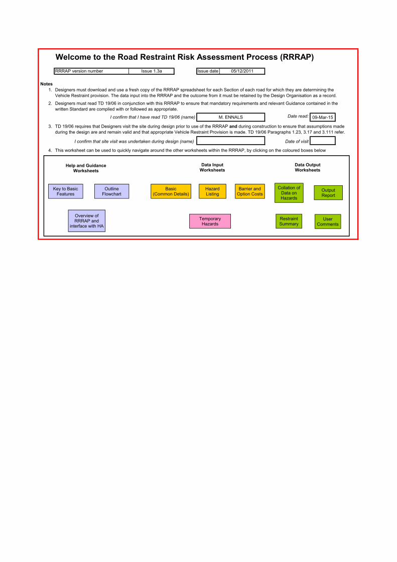
Welcome to the Road Restraint Risk Assessment Process (RRRAP)
RRRAP version number Issue date
Notes
1.
2.
09-Mar-15
3.
Date of visit
4. This worksheet can be used to quickly navigate around the other worksheets within the RRRAP, by clicking on the coloured boxes below
Issue 1.3a 05/12/2011
Designers must download and use a fresh copy of the RRRAP spreadsheet for each Section of each road for which they are determining the
Designers must read TD 19/06 in conjunction with this RRRAP to ensure that mandatory requirements and relevant Guidance contained in the
Vehicle Restraint provision. The data input into the RRRAP and the outcome from it must be retained by the Design Organisation as a record.
during the design are and remain valid and that appropriate Vehicle Restraint Provision is made. TD 19/06 Paragraphs 1.23, 3.17 and 3.111 refer.
I confirm that site visit was undertaken during design (name)
written Standard are complied with or followed as appropriate.
M. ENNALS Date read:I confirm that I have read TD 19/06 (name)
TD 19/06 requires that Designers visit the site during design prior to use of the RRRAP and during construction to ensure that assumptions made
Basic (Common Details)
Hazard Listing
Collation of Data on Hazards
Temporary Hazards
Key to Basic Features
Outline Flowchart
Overview of RRRAP and
interface with HA
Help and Guidance Worksheets
Barrier and Option Costs
Data Input Worksheets
Restraint Summary
Data Output Worksheets
Output Report
User Comments
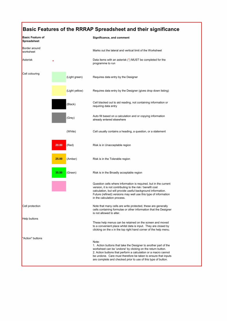
Basic Features of the RRRAP Spreadsheet and their significance
Significance, and comment
Border around worksheet Marks out the lateral and vertical limit of the Worksheet
Asterisk*
Data items with an asterisk (*) MUST be completed for the programme to run
Cell colouring(Light green) Requires data entry by the Designer
(Light yellow) Requires data entry by the Designer (gives drop down listing)
(Black)Cell blacked out to aid reading, not containing information or requiring data entry
(Grey)Auto fill based on a calculation and or copying information already entered elsewhere
(White) Cell usually contains a heading, a question, or a statement
20.00 (Red) Risk is in Unacceptable region
25.00 (Amber) Risk is in the Tolerable region
35.00 (Green) Risk is in the Broadly acceptable region
Cell protection Note that many cells are write protected, these are generally cells containing formulae or other information that the Designer is not allowed to alter.
Help buttons
"Action" buttonsNote: 1. Action buttons that take the Designer to another part of the worksheet can be 'undone' by clicking on the return button.2. Action buttons that perform a calculation or a macro cannot be undone. Care must therefore be taken to ensure that inputs are complete and checked prior to use of this type of button.
These help menus can be retained on the screen and moved to a convenient place whilst data is input. They are closed by clicking on the x in the top right hand corner of the help menu.
Basic Feature of
Spreadsheet
Question cells where information is required, but in the current version, it is not contributing to the risk / benefit cost calculation, but will provide useful background information. Future (refined) versions may well use this type of information in the calculation process.
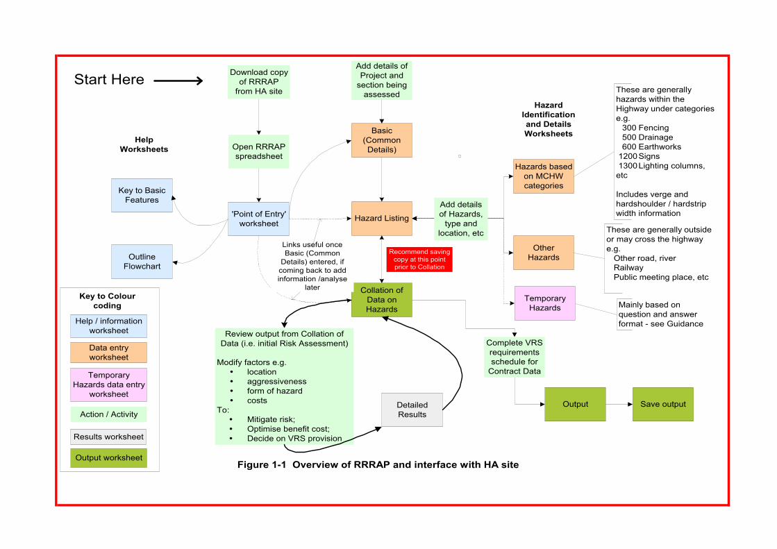
'Point of Entry'worksheet
Key to BasicFeatures
OutlineFlowchart
Basic(CommonDetails)
Hazard Listing
Hazards basedon MCHWcategories
OtherHazards
Collation ofData onHazards
These are generallyhazards within theHighway under categoriese.g.
300 Fencing500 Drainage600 Earthworks
1200Signs 1300Lighting columns,etc
Includes verge andhardshoulder / hardstripwidth information
TemporaryHazards
Download copyof RRRAP
from HA site
Open RRRAPspreadsheet
These are generally outsideor may cross the highwaye.g.
Other road, riverRailwayPublic meeting place, etc
Links useful onceBasic (Common
Details) entered, ifcoming back to addinformation /analyse
later
Mainly based onquestion and answerformat - see Guidance
DetailedResults
HazardIdentificationand DetailsWorksheets
HelpWorksheets
Add detailsof Hazards,
type andlocation, etc
Review output from Collation ofData (i.e. initial Risk Assessment)
Modify factors e.g. location aggressiveness form of hazard costs
To: Mitigate risk; Optimise benefit cost; Decide on VRS provision
Output Save output
Complete VRSrequirementsschedule for
Contract Data
Add details ofProject and
section beingassessed
Figure 1-1 Overview of RRRAP and interface with HA site
Key to Colourcoding
Help / informationworksheet
Data entryworksheet
Action / Activity
Results worksheet
Output worksheet
TemporaryHazards data entry
worksheet
Start Here
Recommend savingcopy at this pointprior to Collation
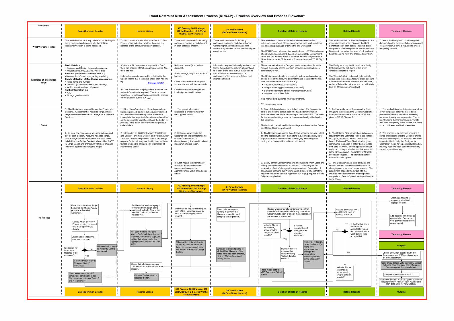
Road Restraint Risk Assessment Process (RRRAP) - Process Overview and Process Flowchart
Worksheet
Basic (Common Details) Hazards Listing
300 Fencing, 500 Drainage,
600 Earthworks, H-S & Verge
Widths, etc Worksheets
OH's worksheets
(OH's = Others Hazards)Collation of Data on Hazards Detailed Results Temporary Hazards
What Worksheet is for
This worksheet records key details about the Project
being designed and reasons why the Vehicle
Restraint Provision is being assessed.
This worksheet is to identify for the Section of the
Project being looked at, whether there are any
hazards of the particular category present.
These worksheets are for inputting
particulars relating to each hazard
in each category present.
These worksheets are for inputting
particulars relating to each hazard where
Others might be affected by an errant
vehicle or by another hazard that is hit by an
errant vehicle.
This worksheet collates all the information entered on the
individual Hazard and Other Hazard worksheets, and puts them
into ascending chainage order on the one worksheet.
The RRRAP also calculates the length of need of VRS in advance
of and beyond each hazard, based on a default N2 Containment
Level and W2 working width. It identifies whether the provision is
'Broadly acceptable', 'Tolerable' or 'Unacceptable' (ref TD 19 Fig 2-
1).
This worksheet is to advise the Designer of the
respective levels of the Risk and the Cost
Benefit ratios of each option. It allows direct
comparison of differing options and enables the
Designer to ascertain the level of risk and cost
benefit accruing from any proposed provision.
To assist the Designer in considering and
documenting the process of determining what
VRS provision, if any, is required to protect
temporary hazards.
Examples of information
req'd
Basic Details e.g.
• Designer and Design Organisation names
• Project Name, PIN No. and Project type
Restraint provision associated with e.g.
• New section of road or upgrading to existing
Details of Section of Road being assessed e.g.
• Road name and number
• Location: junction / marker post / chainage
• Which side of road e.g. n/s verge
Traffic Information e.g.
• AADT
• % large goods vehicles.
A 'Yes' or a 'No' response is required (i.e. 'Yes',
there are hazards of that category present or 'No',
there are not).
Help buttons can be pressed to help identify the
type of hazard that is included under each heading,
e.g.
If a 'Yes' is entered, the programme indicates that
further information is required. The appropriate
worksheet for entering this is accessed by clicking
on the adjacent button, e.g.
Nature of hazard (from a drop
down list).
Start chainage, length and width of
hazard.
Offset of hazard from Psb (point
from which set-back is measured).
Other information relating to the
local alignment and location.
Information required is broadly similar to that
for the hazards in the column adjacent and
to the left of this one, but will include items
that will allow an assessment to be
undertaken of the number of Others that
might be affected.
The worksheet allows the Designer to decide whether, for each
hazard, the safety barrier provision based on default values is
satisfactory or not.
The Designer can decide to investigate further, and can change
one or more of the following parameters and recalculate the risk
level based on the revised choice, e.g.
• Cost of Vehicle Restraint System1;
• Length, width, aggressiveness of hazard2;
• Barrier containment, and or Working Width Class3;
• Offset of hazard from Psb.
Help menus give guidance where appropriate.
1,2,3 - See Notes below
The Designer is required to produce a design
that results in the risk being in the green
'Broadly acceptable' region.
The 'Calculate Risk ' button will automatically
colour code the cells as follows: green denoting
a 'Broadly acceptable' provision and risk level,
amber a 'Tolerable' risk level and red with white
text, an 'Unacceptable' risk level.
1. The Designer is required to split the Project into
Sections. Assessment of nearside verge, offside
verge and central reserve will always be in different
Sections.
1. If the 'To collate data on Hazards press here '
button is pressed, and it is subsequently realised
that the information relating to the Hazards is
incomplete, the requisite information can be added
on the appropriate worksheet(s) and the button re-
pressed. This action will over-write the previous
collated data.
1. The type of information
requested is broadly similar for
each type of hazard.
1. Cost of Option is based on a default value. The Designer is
able to override the default cost if he has better information
available about the whole life costing of particular VRS. The basis
for the revised costings must be documented and justified up by
the Designer.
The factors to be included in the costings are shown on the Barrier
and Option Costings worksheet.
1. Further guidance on Assessing the Risk,
mitigating the Risk and the Benefit / Cost ratio
for Options that involve provision of VRS is
given in TD 19 Chapter 2.
1. The methodology for determining whether
or not temporary safety barrier is to be
provided is different to that for assessing
permanent safety barrier provision. This is
mainly due to the transient nature, variety,
and often complexity of the factors that need
to be considered and their interaction.
2. At least one assessment will need to be carried
out for each Section. Also, the nearside verge,
offside verge and central reserve will need to be
subdivided into further Sections where either AADT,
% Large Goods and or Medium Vehicles, or speed
limit differ significantly along the length.
2. Information on '600 Earthworks', '1100 Kerbs
and Edge of Pavement Details', and 'Hardshoulder
/ hardstrip width & verge width details' are always
required for the full length of the Section, as these
factors are used to calculate key information at
intermediate points.
2. Help menus will assist the
Designer with the format for some
of the information and in
determining e.g. from and to where
measurements are taken.
2. The Designer can assess the effect of changing the size, offset
and the aggressiveness of the hazard (e.g. using passively safe
sign posts rather than standard, or changing a retaining wall
having wide deep profiles to be smooth faced).
2. The Detailed Risk spreadsheet indicates in
tabular form the Estimated Risk to the Vehicle
Occupant, Estimated Risk to Others and,
hence, Estimated Total Risk that arise given
incremental increases in safety barrier length
from zero to 100 m. These figures are colour
coded according to whether the risk levels fall
in the 'Unacceptable' , 'Tolerable', or 'Broadly
acceptable' regions. The estimated Benefit
Cost ratio is also given,
2. The process is on the lines of posing a
series of questions that the Designer should
consider and respond to. Many of these are
issues that historically the Designer (or
Contractor) would have potentially looked at,
but may not have been documented in any
formal or consistent way.
3. Each hazard is automatically
allocated a unique reference
number and assigned an
aggressiveness value based on its
nature.
3. Safety barrier Containment Level and Working Width Class are
initially based on a default of N2 and W2. The Designer can
assess the effect of changing these parameters. Remember, if
considering changing the Working Width Class, to check that the
requirements of the various Figures in TD 19 (e.g. Figures 3-1 and
3-2) are complied with.
3. The Designer is able to re-calculate the
level of risk and cost benefit consequent on
changing one or more of the parameters. The
programme appends the output into the
Detailed Results worksheet enabling direct
comparison of each Option investigated on the
same sheet.
Basic (Common Details) Hazards Listing
300 Fencing, 500 Drainage,
600 Earthworks, H-S & Verge
Widths, etc Worksheets
OH's worksheets
(OH's = Others Hazards)Collation of Data on Hazards Detailed Results Temporary Hazards
Temporary Hazards
Outputs
Basic (Common Details) Hazards Listing
300 Fencing, 500 Drainage, 600
Earthworks, H-S & Verge Widths,
etc Worksheets
OH's worksheets
(OH's = Others Hazards)Collation of Data on Hazards Detailed Results Outputs
Notes
The Process
Enter basic details of Project being looked at onto 'Basic (Common Details)' worksheet.
Decide which Section of Project is being assessed and enter appropriate details.
Check all cells requiring input are complete.
Is situation for temporary Hazards to be assessed?
Click on button to go to 'Hazards Listing' worksheet.
Yes
When assessment for VRS completed, come back to this Worksheet and click on 'Go to Q and A Worksheet'.
Click on button to go to 'Hazards Listing' worksheet.
No
If a Hazard of each category is present within Section being assessed, indicate 'Yes' in the 'Yes / No' column, otherwise indicate 'No'.
For each Hazard category, where 'Further Data is Required' is shown, click on the adjacent button that takes you to the appropriate worksheet for data entry.
Click on 'Collate data on Hazards' button.
When all the data relating to all the Hazards of the noted type has been entered, click on 'Return to Hazards Listing' button.
When all the data relating to all the Other Hazards of the noted type has been entered, click on 'Return to Hazards Listing' button.
Enter data as required relating to each of the Hazards present in each Hazard category that is present.
Enter data as required relating to each of the Hazards present in each category that is present.
Review whether safety barrier provision that uses default values is satisfactory or whether further investigation of one or more locations / parameters is warranted.
Is further investigation of proposed VRS provision warranted?
Press 'Copy data to VRS Summary Output' button.
Indicate 'Yes' as response(s) under heading 'Output detailed results?'
Remove / redesign / move the hazard(s), make less aggressive, etc , change the parameters accordingly then press 'Calculate' button.
Indicate 'No' as response(s) under heading 'Output detailed results?'
Yes
No
Is the level of risk in the 'Broadly acceptable' region and ALARP? Is the Cost Benefit ratio acceptable?
Assess Estimated Risk and Benefit Cost of revised provision.
No
Indicate 'No' as response(s) under heading 'Output detailed results?'
Yes
Enter data relating to temporary situation in appropriate cells.
Check that all data entries are complete for all Hazards that are present.
Add details / comments as appropriate. Decide on VRS provision and record on worksheet.
Click 'Copy data to VRS Summary Output'button to save and print copy of output.
Save a copy of the spreadsheet.
Check, and when satisfied with the Assessment and VRS provision, sign off the Assessment.
If another Section to be analysed, download another copy of RRRAP from HA site and
start data entry for new Section.
Compile Specification App 4/1 .
Drainage include?
500
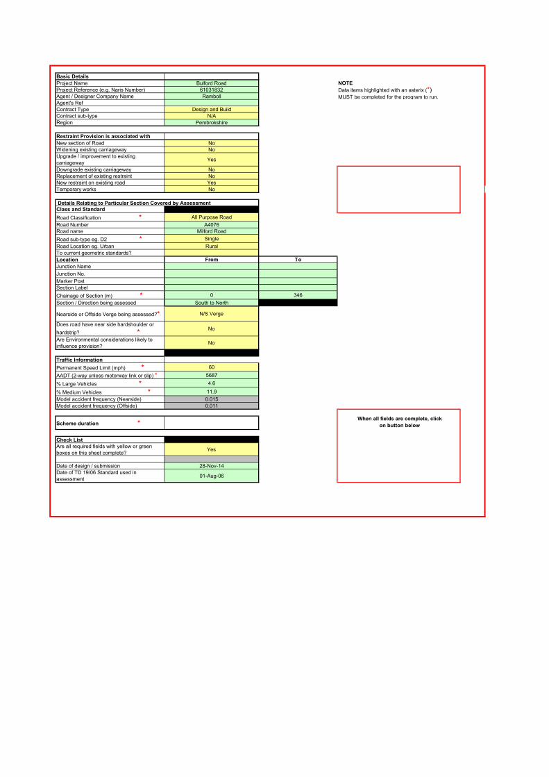
Basic Details
Project Name Bulford Road NOTE
Project Reference (e.g. Naris Number) 61031832
Agent / Designer Company Name Ramboll
Agent's Ref
Contract Type Design and Build
Contract sub-type N/A
Region Pembrokshire
Restraint Provision is associated with
New section of Road No
Widening existing carriageway No
Upgrade / improvement to existing
carriagewayYes
Downgrade existing carriageway No
Replacement of existing restraint No
New restraint on existing road Yes
Temporary works No
Details Relating to Particular Section Covered by AssessmentClass and Standard
Road Classification * All Purpose Road
Road Number A4076
Road name Milford Road
Road sub-type eg. D2 * Single
Road Location eg. Urban Rural
To current geometric standards?
Location From To
Junction Name
Junction No.
Marker Post
Section Label
Chainage of Section (m) * 0 346
Section / Direction being assessed South to North
Nearside or Offside Verge being assessed?* N/S Verge
Does road have near side hardshoulder or
hardstrip? *No
Are Environmental considerations likely to
influence provision?No
Traffic Information
Permanent Speed Limit (mph) * 60
AADT (2-way unless motorway link or slip) * 5687
% Large Vehicles * 4.6
% Medium Vehicles * 11.9
Model accident frequency (Nearside) 0.015
Model accident frequency (Offside) 0.011
Scheme duration *When all fields are complete, click
on button below
Check ListAre all required fields with yellow or green
boxes on this sheet complete?Yes
Date of design / submission 28-Nov-14
Date of TD 19/06 Standard used in
assessment01-Aug-06
Data items highlighted with an asterix (*) MUST be completed for the program to run.
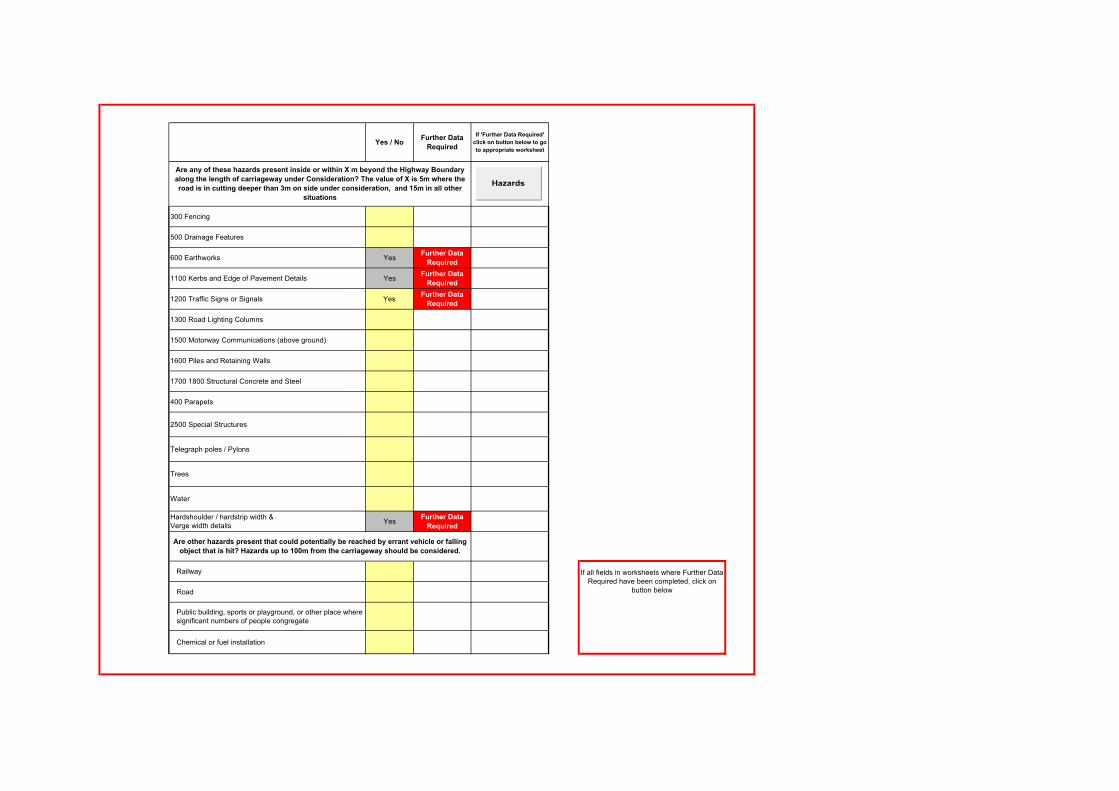
Yes / NoFurther Data
Required
If 'Further Data Required'
click on button below to go
to appropriate worksheet
300 Fencing
500 Drainage Features
600 Earthworks YesFurther Data
Required
1100 Kerbs and Edge of Pavement Details YesFurther Data
Required
1200 Traffic Signs or Signals YesFurther Data
Required
1300 Road Lighting Columns
1500 Motorway Communications (above ground)
1600 Piles and Retaining Walls
1700 1800 Structural Concrete and Steel
400 Parapets
2500 Special Structures
Telegraph poles / Pylons
Trees
Water
Hardshoulder / hardstrip width &Verge width details
YesFurther Data
Required
Railway
Road
Public building, sports or playground, or other place where significant numbers of people congregate
Chemical or fuel installation
Are other hazards present that could potentially be reached by errant vehicle or falling
object that is hit? Hazards up to 100m from the carriageway should be considered.
If all fields in worksheets where Further Data Required have been completed, click on
button below
Are any of these hazards present inside or within X m beyond the Highway Boundary
along the length of carriageway under Consideration? The value of X is 5m where the
road is in cutting deeper than 3m on side under consideration, and 15m in all other
situations
Hazards
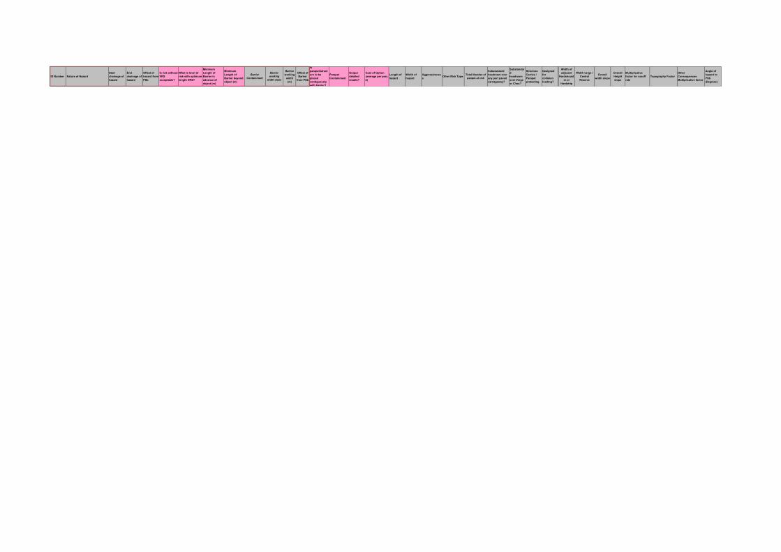
ID Number Nature of Hazard
Start
chainage of
hazard
End
chainage of
hazard
Offset of
hazard from
PSb
Is risk without
VRS
acceptable?
What is level of
risk with optimum
length VRS?
Minimum
Length of
Barrier in
advance of
object (m)
Minimum
Length of
Barrier beyond
object (m)
Barrier
Containment
Barrier
working
width class
Barrier
working
width
(m)
Offset of
Barrier
from PSb
Is
parapet/struct
ure to be
placed
contiguously
with barrier?
Parapet
Containment
Output
detailed
results?
Cost of Option
(average per year,
£)
Length of
hazard
Width of
hazard
Aggressivenes
sOther Risk Type
Total Number of
people at risk
Substandard
headroom over
any part paved
carriageway?
Substandar
d
headroom
over Verge
or C/res?
Structure
Carries /
Parapet
protecting
Designed
for
collision
loading?
Width of
adjacent
Hardshould
er or
Hardstrip
Width verge /
Central
Reserve
Overall
width slope
Overall
Height
slope
Multiplicative
factor for runoff
rate
Topography Factor
Other
Consequences
Multiplicative factor
Angle of
hazard to
PSb
(Degrees)
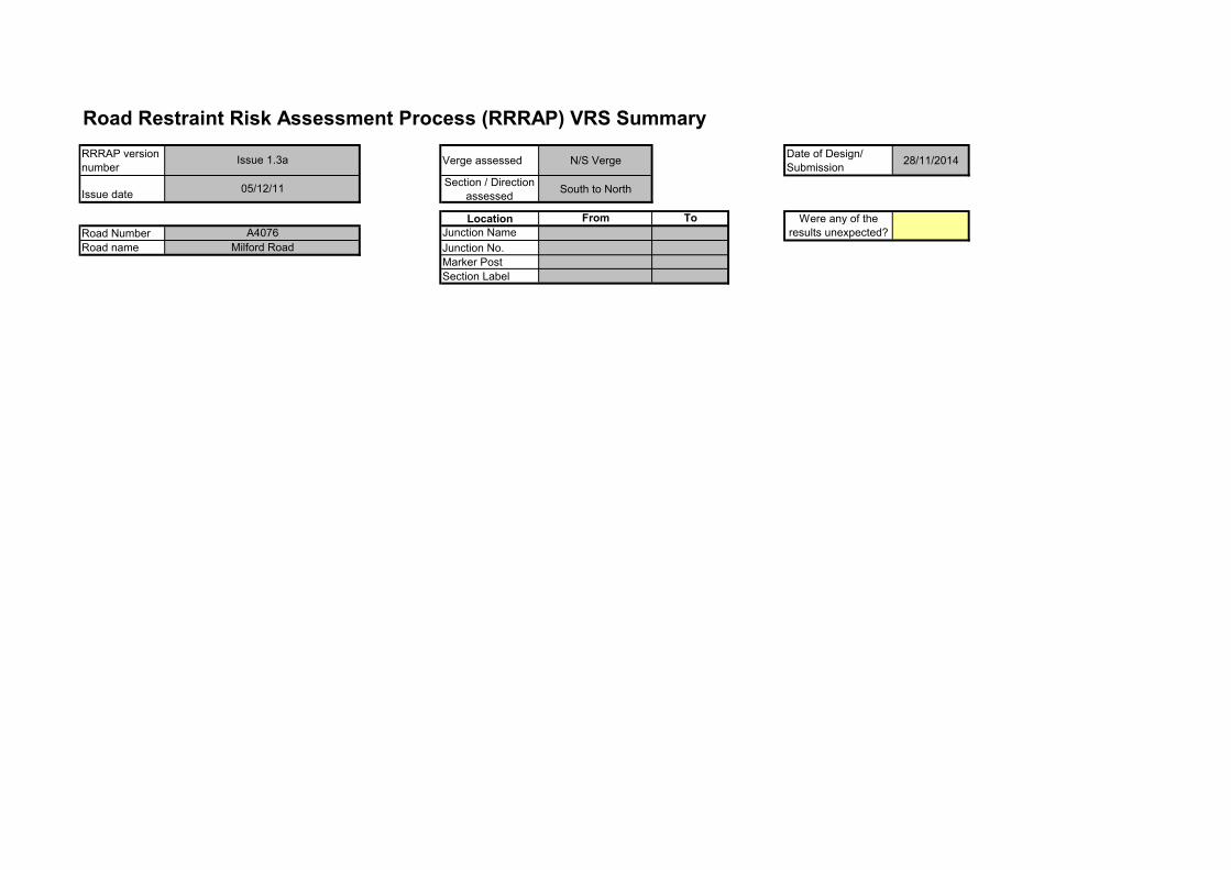
Road Restraint Risk Assessment Process (RRRAP) VRS Summary
RRRAP version
numberVerge assessed N/S Verge
Date of Design/
Submission28/11/2014
Issue dateSection / Direction
assessedSouth to North
Location From To
Road Number Junction Name
Road name Junction No.
Marker Post
Section Label
Milford Road
A4076
Were any of the
results unexpected?
Issue 1.3a
05/12/11
Road Restraint Risk Assessment Process (RRRAP) VRS Summary
RRRAP version
numberVerge assessed N/S Verge
Date of Design/
Submission28/11/2014
Issue dateSection / Direction
assessedSouth to North
Location From To
Road Number Junction Name
Road name Junction No.
Marker Post
Section Label
ID Number Nature of Hazard
Start
chainage of
hazard
End chainage
of hazard
Offset of hazard
from PSb
Minimum Length of
Barrier in advance
of object (m)
Minimum
Length of
Barrier
beyond
object (m)
Barrier
Containm
ent
Barrier working
width class
Parapet
Containment
Barrier
working
width (m)
Offset of
Barrier
from PSb
0600.0001 Nominally at Grade 0.00 346.00 2.00 N2 W2 1.201200.0001 Sign on post(s) 50.00 50.22 2.50 N2 W2 1.20
Milford Road
A4076
Were any of the
results unexpected?
Issue 1.3a
05/12/11
Comments
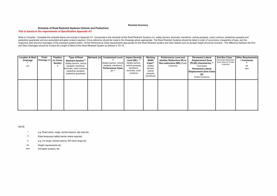
Schedule of Road Restraint Systems (Vehicle and Pedestrian)
This is based on the requirements of Specification Appendix 4/1
Location & Start
Chainage
* (m)
Finish
Chainage (m)Position
on Cross-
Section
+
Type of Road
Restraint System** (Safety barriers, vehicle
parapets, transitions,
terminals, crash cushions,
pedestrian parapets,
pedestrian guardrails)
Set-back (m) Containment Level
** (Safety barriers, vehicle
parapets, transitions)
Performance Class (P) **
Impact Severity
Level (ISL) ** (Safety barriers,
vehicle parapets,
transitions,
terminals, crash
cushions)
Working
Width
Class** (Safety
barriers,
vehicle
parapets,
transitions)
Performance Level and
whether Redirective (R) or
Non-redirective (NR) (Crash
Cushions)
Permanent Lateral
Displacement Zone
(PLDZ) characterisic **
(Terminals)
Permanent Lateral
Displacement Zone Class
(D) (Crash Cushions)
Exit Box Class ** (Terminals) Redirection
Zone Class (Z) (Crash
Cushions)
Other Requirements
/ Comments
**
++
+++
NOTE:
*
**
+
++
+++
Height requirements etc.
Anti-glare screens, etc
[Note to Compiler: Complete the schedule below and include in Appendix 4/1. Incorporate in the schedule all the Road Restraint Systems (i.e. safety barriers, terminals, transitions, vehicle parapets, crash cushions, pedestrian parapets and
pedestrian guardrails) and any associated anti-glare screens required. Cross-reference should be made to the Drawings where appropriate. The Road Restraint Systems should be listed in order of occurrence, irrespective of type, and the
respective start and end chainages of the proposed systems listed. All the Performance Class requirements appropriate for the Road Restraint System and other details such as parapet height should be included. The difference between the End
and Start Chainages should be at least the Length of Need of the Road Restraint System as defined in TD 19.
Restraint Summary
e.g. Road name, verge, central reserve, slip road etc.
Enter temporary safety barrier where required.
e.g. LH verge; central reserve, RH hand verge etc.
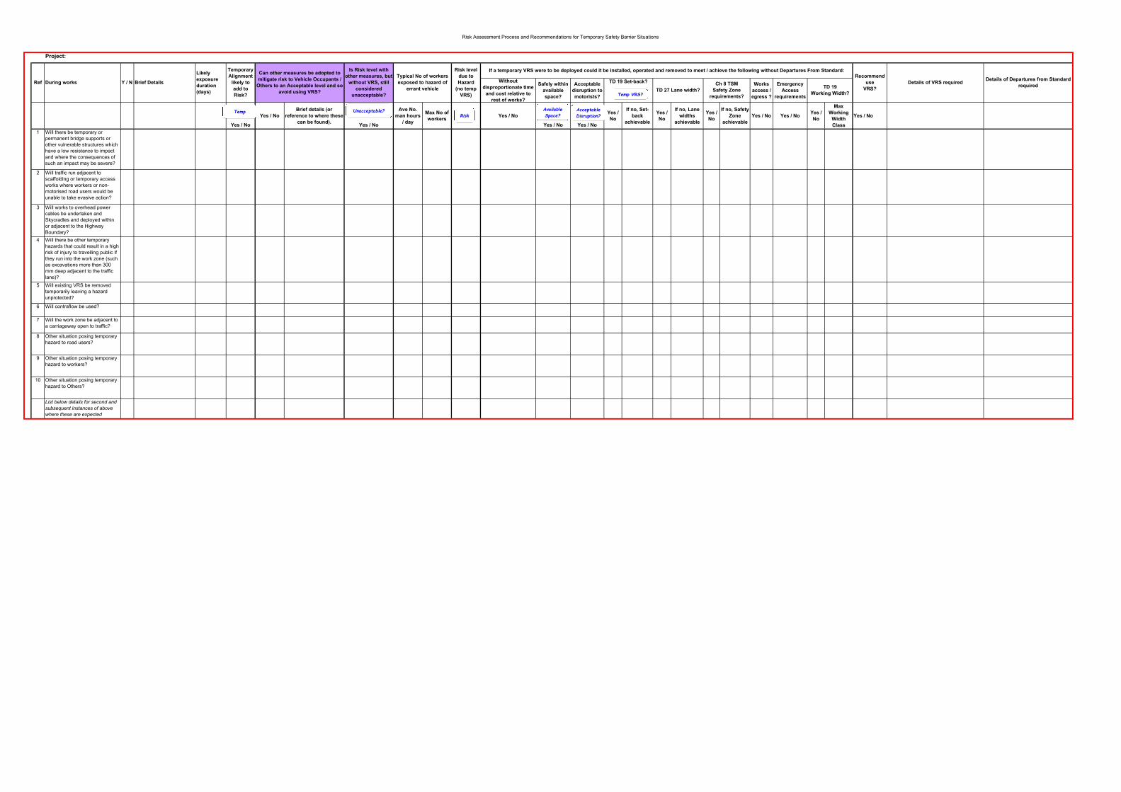
Risk Assessment Process and Recommendations for Temporary Safety Barrier Situations
Project:
Without
disproportionate time
and cost relative to
rest of works?
Safely within
available
space?
Acceptable
disruption to
motorists?
Works
access /
egress ?
Emergency
Access
requirements
Yes / No
Yes / No
Brief details (or
reference to where these
can be found).Yes / No
Ave No.
man hours
/ day
Max No of
workersYes / No
Yes / No Yes / No
Yes /
No
If no, Set-
back
achievable
Yes /
No
If no, Lane
widths
achievable
Yes /
No
If no, Safety
Zone
achievable
Yes / No Yes / NoYes /
No
Max
Working
Width
Class
Yes / No
1 Will there be temporary or
permanent bridge supports or other vulnerable structures which
have a low resistance to impact and where the consequences of such an impact may be severe?
2 Will traffic run adjacent to
scaffolding or temporary access works where workers or non-motorised road users would be
unable to take evasive action?
3 Will works to overhead power cables be undertaken and Skycradles and deployed within
or adjacent to the Highway Boundary?
4 Will there be other temporary hazards that could result in a high
risk of injury to travelling public if they run into the work zone (such as excavations more than 300
mm deep adjacent to the traffic lane)?
5 Will existing VRS be removed temporarily leaving a hazard
unprotected?
6 Will contraflow be used?
7 Will the work zone be adjacent to a carriageway open to traffic?
8 Other situation posing temporary
hazard to road users?
9 Other situation posing temporary
hazard to workers?
10 Other situation posing temporary
hazard to Others?
List below details for second and
subsequent instances of above where these are expected
Can other measures be adopted to
mitigate risk to Vehicle Occupants /
Others to an Acceptable level and so
avoid using VRS?
During worksRef
Risk level
due to
Hazard
(no temp
VRS)
Likely
exposure
duration
(days)
Brief DetailsY / N
Temporary
Alignment
likely to
add to
Risk?
Typical No of workers
exposed to hazard of
errant vehicle
Details of Departures from Standard
requiredDetails of VRS required
Recommend
use
VRS?
Is Risk level with
other measures, but
without VRS, still
considered
unacceptable?
TD 19 Set-back?
TD 27 Lane width?
Ch 8 TSM
Safety Zone
requirements?
TD 19
Working Width?
If a temporary VRS were to be deployed could it be installed, operated and removed to meet / achieve the following without Departures From Standard:
Risk
Available
Space?
Acceptable
Disruption?Unacceptable?Temp
Temp VRS?
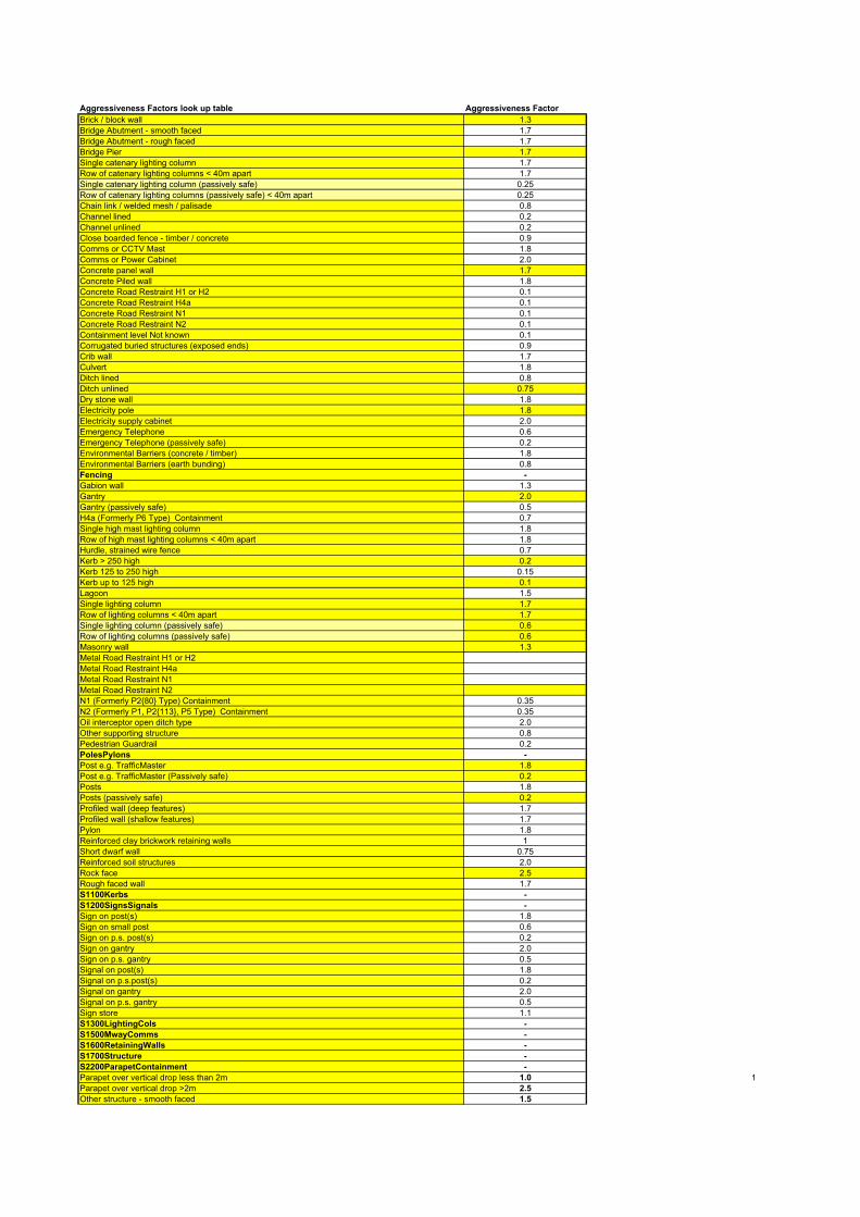
Aggressiveness Factors look up table Aggressiveness Factor
Brick / block wall 1.3
Bridge Abutment - smooth faced 1.7
Bridge Abutment - rough faced 1.7
Bridge Pier 1.7
Single catenary lighting column 1.7
Row of catenary lighting columns < 40m apart 1.7
Single catenary lighting column (passively safe) 0.25
Row of catenary lighting columns (passively safe) < 40m apart 0.25
Chain link / welded mesh / palisade 0.8
Channel lined 0.2
Channel unlined 0.2
Close boarded fence - timber / concrete 0.9
Comms or CCTV Mast 1.8
Comms or Power Cabinet 2.0
Concrete panel wall 1.7
Concrete Piled wall 1.8
Concrete Road Restraint H1 or H2 0.1
Concrete Road Restraint H4a 0.1
Concrete Road Restraint N1 0.1
Concrete Road Restraint N2 0.1
Containment level Not known 0.1
Corrugated buried structures (exposed ends) 0.9
Crib wall 1.7
Culvert 1.8
Ditch lined 0.8
Ditch unlined 0.75
Dry stone wall 1.8
Electricity pole 1.8
Electricity supply cabinet 2.0
Emergency Telephone 0.6
Emergency Telephone (passively safe) 0.2
Environmental Barriers (concrete / timber) 1.8
Environmental Barriers (earth bunding) 0.8
Fencing -
Gabion wall 1.3
Gantry 2.0
Gantry (passively safe) 0.5
H4a (Formerly P6 Type) Containment 0.7
Single high mast lighting column 1.8
Row of high mast lighting columns < 40m apart 1.8
Hurdle, strained wire fence 0.7
Kerb > 250 high 0.2
Kerb 125 to 250 high 0.15
Kerb up to 125 high 0.1
Lagoon 1.5
Single lighting column 1.7
Row of lighting columns < 40m apart 1.7
Single lighting column (passively safe) 0.6
Row of lighting columns (passively safe) 0.6
Masonry wall 1.3
Metal Road Restraint H1 or H2
Metal Road Restraint H4a
Metal Road Restraint N1
Metal Road Restraint N2
N1 (Formerly P2{80} Type) Containment 0.35
N2 (Formerly P1, P2{113}, P5 Type) Containment 0.35
Oil interceptor open ditch type 2.0
Other supporting structure 0.8
Pedestrian Guardrail 0.2
PolesPylons -
Post e.g. TrafficMaster 1.8
Post e.g. TrafficMaster (Passively safe) 0.2
Posts 1.8
Posts (passively safe) 0.2
Profiled wall (deep features) 1.7
Profiled wall (shallow features) 1.7
Pylon 1.8
Reinforced clay brickwork retaining walls 1
Short dwarf wall 0.75
Reinforced soil structures 2.0
Rock face 2.5
Rough faced wall 1.7
S1100Kerbs -
S1200SignsSignals -
Sign on post(s) 1.8
Sign on small post 0.6
Sign on p.s. post(s) 0.2
Sign on gantry 2.0
Sign on p.s. gantry 0.5
Signal on post(s) 1.8
Signal on p.s.post(s) 0.2
Signal on gantry 2.0
Signal on p.s. gantry 0.5
Sign store 1.1
S1300LightingCols -
S1500MwayComms -
S1600RetainingWalls -
S1700Structure -
S2200ParapetContainment -
Parapet over vertical drop less than 2m 1.0 1
Parapet over vertical drop >2m 2.5
Other structure - smooth faced 1.5
Other structure - rough faced 1.7
S2500SpecialStructures -
S400SafetyFence -
S500Drainage -
Sheet Piled wall 1.7
Smooth faced wall 0.25
Steps 0.4
Telegraph pole 1.7Transmission Station 2
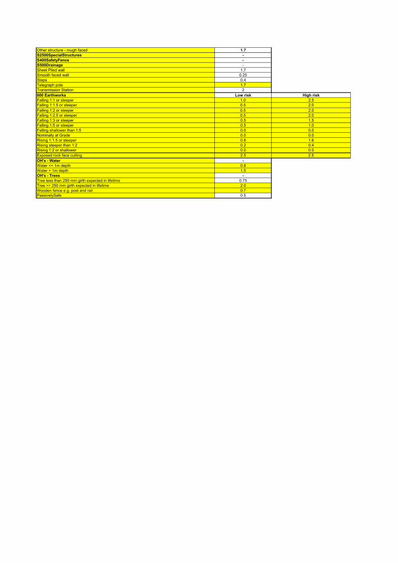
600 Earthworks Low risk High risk
Falling 1:1 or steeper 1.0 2.5Falling 1:1.5 or steeper 0.5 2.0
Falling 1:2 or steeper 0.5 2.0
Falling 1:2.5 or steeper 0.5 2.0
Falling 1:3 or steeper 0.5 1.5
Falling 1:5 or steeper 0.5 1.0
Falling shallower than 1:5 0.0 0.0
Nominally at Grade 0.0 0.0
Rising 1:1.5 or steeper 0.8 1.6
Rising steeper than 1:2 0.2 0.4Rising 1:2 or shallower 0.0 0.0
Exposed rock face cutting 2.5 2.5
OH's - Water -
Water <= 1m depth 0.8
Water > 1m depth 1.5
OH's - Trees -
Tree less than 250 mm girth expected in lifetime 0.75
Tree >= 250 mm girth expected in lifetime 2.0
Wooden fence e.g. post and rail 0.7PassivelySafe 0.5
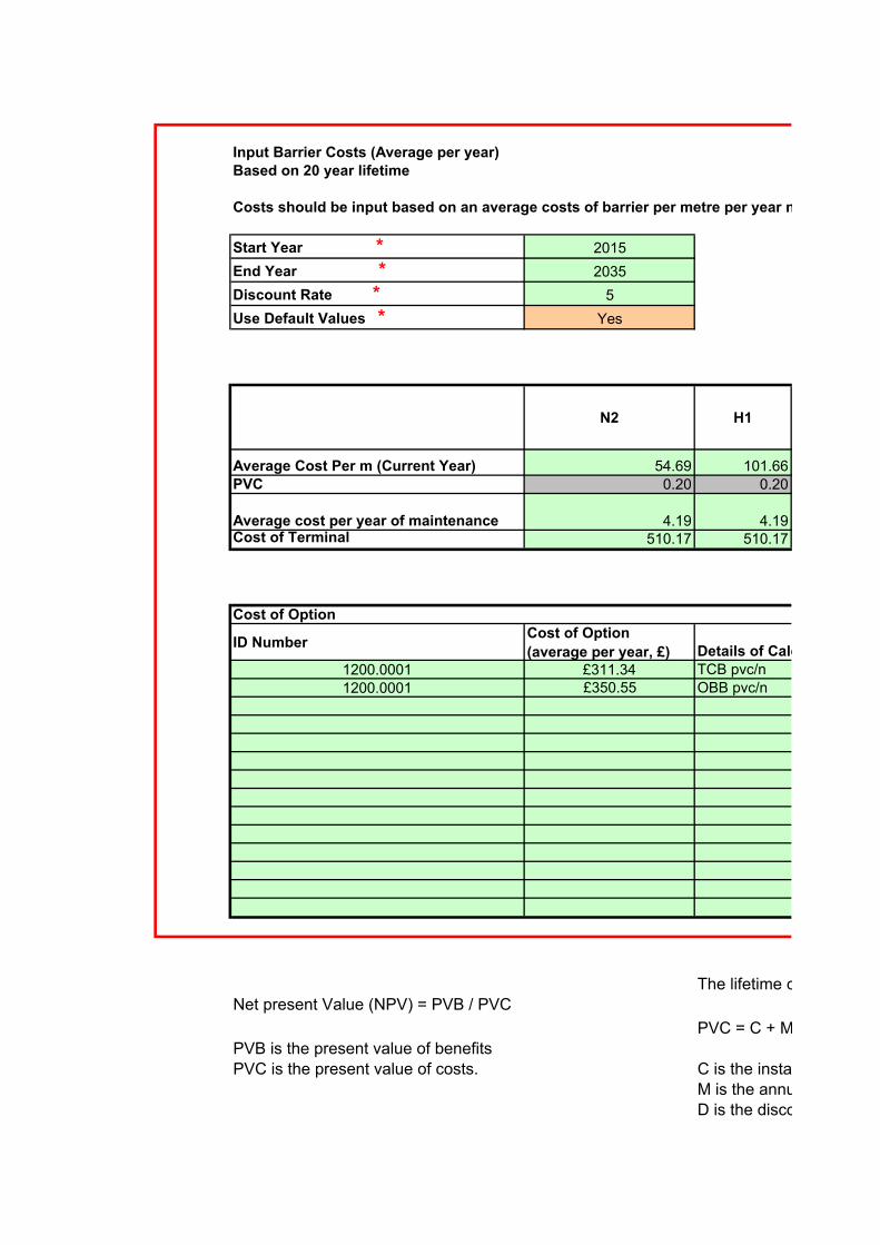
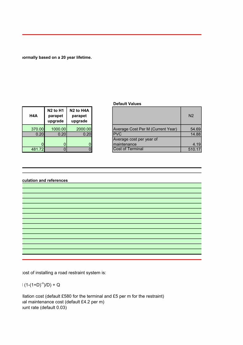
Input Barrier Costs (Average per year)Based on 20 year lifetime
Costs should be input based on an average costs of barrier per metre per year normally based on a 20 year lifetime.
Start Year * 2015 20
End Year * 2035 0.0175
Discount Rate * 5 0.0182
Use Default Values * Yes 1.208707164
N2 H1
Average Cost Per m (Current Year) 54.69 101.66PVC 0.20 0.20
Average cost per year of maintenance 4.19 4.19Cost of Terminal 510.17 510.17
Cost of Option
ID NumberCost of Option
(average per year, £)1200.0001 £311.341200.0001 £350.55
The lifetime cost of installing a road restraint system is:Net present Value (NPV) = PVB / PVC
PVC = C + M (1-(1+D)PVB is the present value of benefits
PVC is the present value of costs. C is the installation cost (default £580 for the terminal and £5 per m for the restraint)M is the annual maintenance cost (default £4.2 per m)D is the discount rate (default 0.03)
TCB pvc/nDetails of Calculation and references
OBB pvc/n
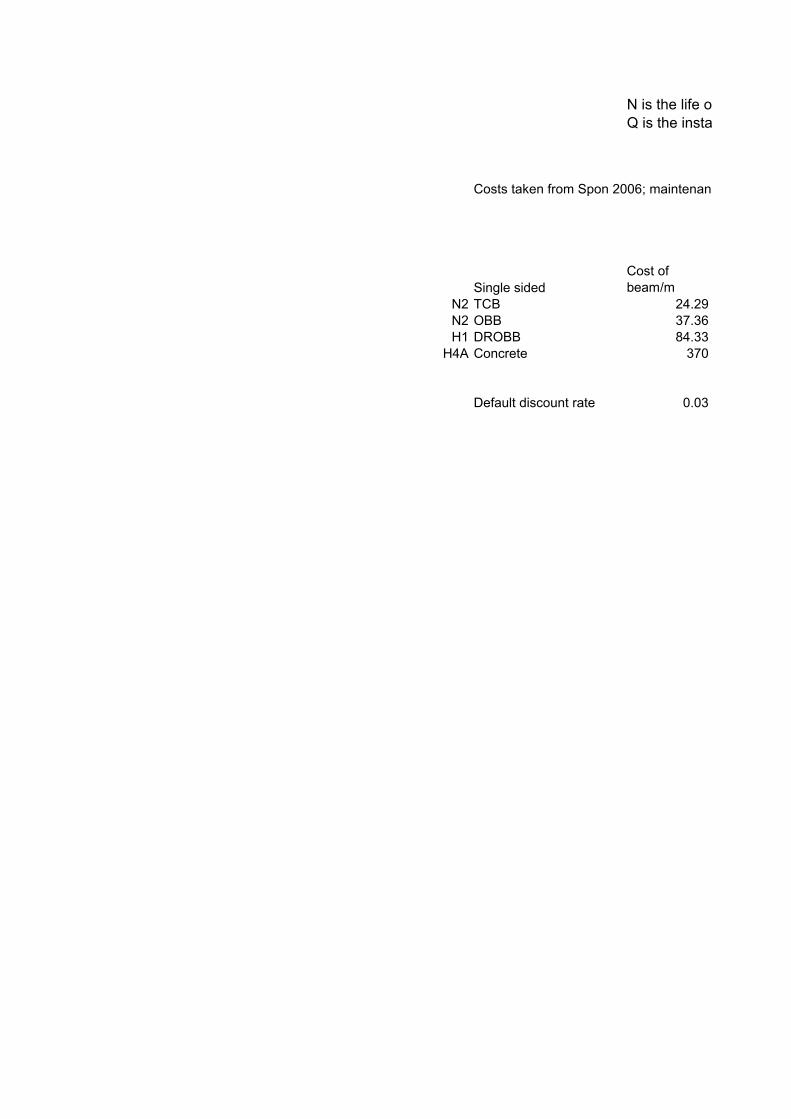
N is the life of the restraint system (default 20 years)
Q is the installation delays (default 0)
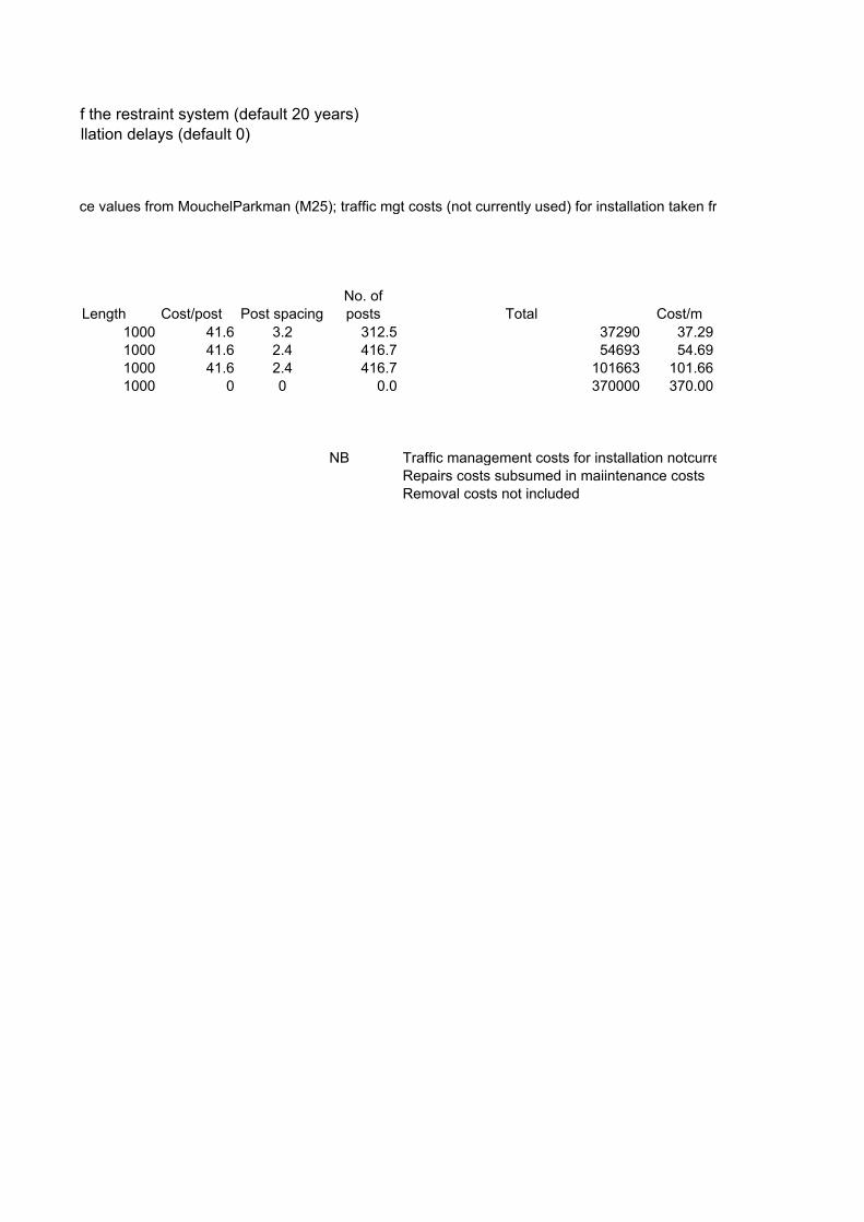
Costs taken from Spon 2006; maintenance values from MouchelParkman (M25); traffic mgt costs (not currently used) for installation taken from 25 costs supplied from MouchelParkman to Gavin Williams
Single sided
Cost of beam/m
N2 TCB 24.29N2 OBB 37.36H1 DROBB 84.33
H4A Concrete 370
Default discount rate 0.03
Costs should be input based on an average costs of barrier per metre per year normally based on a 20 year lifetime.
Default Values
H4A
N2 to H1
parapet
upgrade
N2 to H4A
parapet
upgrade
N2
370.00 1000.00 2000.00 Average Cost Per M (Current Year) 54.690.20 0.20 0.20 PVC 14.88
0 0 0
Average cost per year of maintenance 4.19
481.72 0 0 Cost of Terminal 510.17
The lifetime cost of installing a road restraint system is:
PVC = C + M (1-(1+D)-n)/D) + Q
C is the installation cost (default £580 for the terminal and £5 per m for the restraint)M is the annual maintenance cost (default £4.2 per m)D is the discount rate (default 0.03)
Details of Calculation and references
N is the life of the restraint system (default 20 years)
Q is the installation delays (default 0)
Costs taken from Spon 2006; maintenance values from MouchelParkman (M25); traffic mgt costs (not currently used) for installation taken from 25 costs supplied from MouchelParkman to Gavin Williams
Length Cost/post Post spacingNo. of posts Total Cost/m
1000 41.6 3.2 312.5 37290 37.291000 41.6 2.4 416.7 54693 54.691000 41.6 2.4 416.7 101663 101.661000 0 0 0.0 370000 370.00
NB Traffic management costs for installation notcurrently includedRepairs costs subsumed in maiintenance costsRemoval costs not included
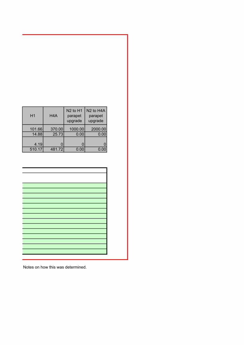
H1 H4AN2 to H1 parapet upgrade
N2 to H4A parapet upgrade
101.66 370.00 1000.00 2000.0014.88 25.73 0.00 0.00
4.19 0 0 0510.17 481.72 0.00 0.00
Notes on how this was determined.
Costs taken from Spon 2006; maintenance values from MouchelParkman (M25); traffic mgt costs (not currently used) for installation taken from 25 costs supplied from MouchelParkman to Gavin Williams
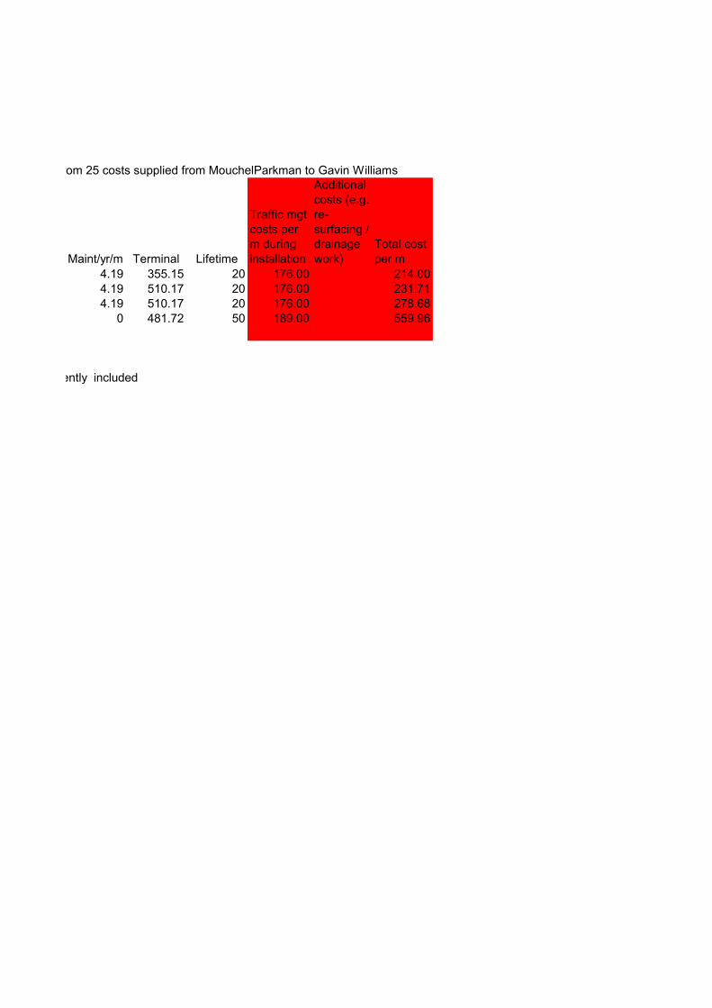
Maint/yr/m Terminal Lifetime
Traffic mgt costs per m during installation
Additional costs (e.g. re-surfacing / drainage work)
Total cost per m
4.19 355.15 20 176.00 214.004.19 510.17 20 176.00 231.714.19 510.17 20 176.00 278.68
0 481.72 50 189.00 559.96
Traffic management costs for installation notcurrently included
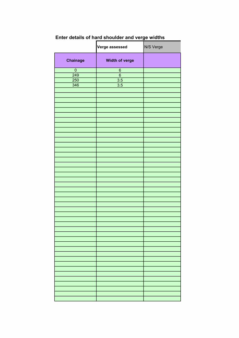
Enter details of hard shoulder and verge widths
Verge assessed N/S Verge
Chainage Width of verge
0 6249 6250 3.5346 3.5
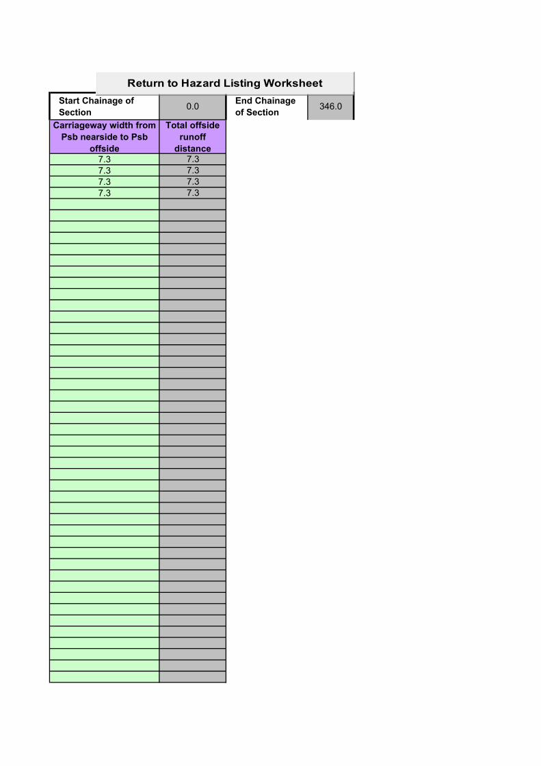
Start Chainage of
Section0.0
End Chainage
of Section346.0
Carriageway width from
Psb nearside to Psb
offside
Total offside
runoff
distance7.3 7.3
7.3 7.3
7.3 7.3
7.3 7.3
Return to Hazard Listing Worksheet
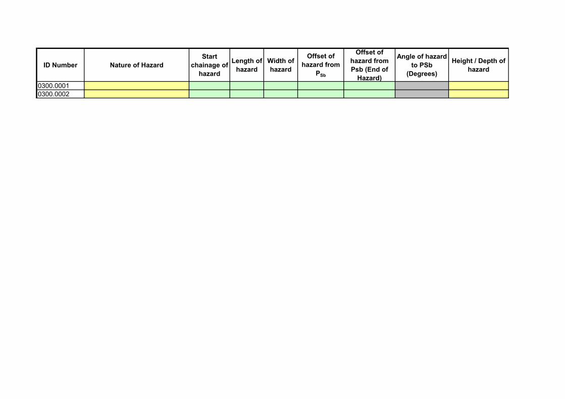
ID Number Nature of Hazard
Start
chainage of
hazard
Length of
hazard
Width of
hazard
Offset of
hazard from
PSb
Offset of
hazard from
Psb (End of
Hazard)
Angle of hazard
to PSb
(Degrees)
Height / Depth of
hazard
0300.00010300.0002
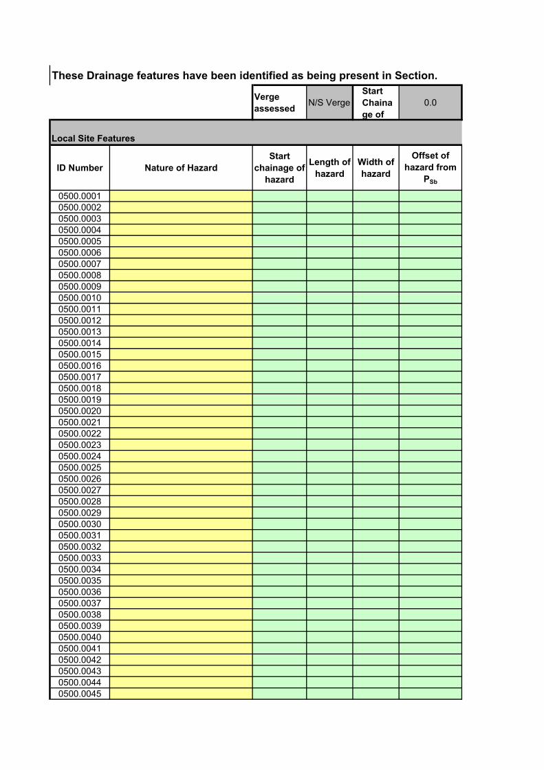
These Drainage features have been identified as being present in Section.
Verge
assessedN/S Verge
Start
Chaina
ge of
0.0
Local Site Features
ID Number Nature of Hazard
Start
chainage of
hazard
Length of
hazard
Width of
hazard
Offset of
hazard from
PSb
0500.00010500.00020500.00030500.00040500.00050500.00060500.00070500.00080500.00090500.00100500.00110500.00120500.00130500.00140500.00150500.00160500.00170500.00180500.00190500.00200500.00210500.00220500.00230500.00240500.00250500.00260500.00270500.00280500.00290500.00300500.00310500.00320500.00330500.00340500.00350500.00360500.00370500.00380500.00390500.00400500.00410500.00420500.00430500.00440500.0045
0500.00460500.00470500.00480500.00490500.00500500.00510500.00520500.00530500.00540500.00550500.00560500.00570500.00580500.00590500.00600500.00610500.00620500.00630500.00640500.00650500.00660500.00670500.00680500.00690500.00700500.00710500.00720500.00730500.00740500.00750500.00760500.00770500.00780500.00790500.00800500.00810500.00820500.00830500.00840500.00850500.00860500.00870500.00880500.00890500.00900500.00910500.00920500.00930500.00940500.00950500.00960500.00970500.00980500.0099
0500.0100
End Chainage
of Section346.0
Offset of
hazard from
Psb (End of
Hazard)
Angle of
hazard to
PSb
(Degrees)
Height / Depth
of hazardAggressiveness Local alignment (F2)
Return to Hazard Listing Worksheet
Sleep - related Site (F3) Speed (F4) Other features (F6)
Return to Hazard Listing Worksheet

Multiplicative factor for
runoff rate
Topography
Factor
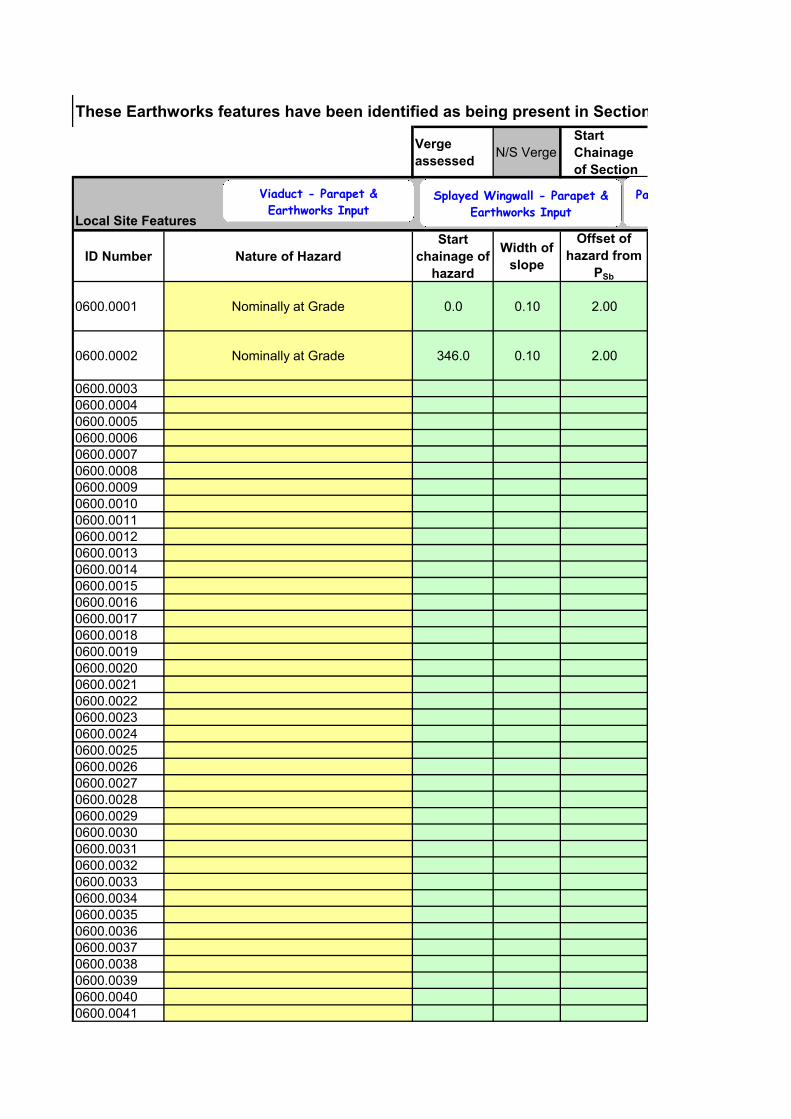
These Earthworks features have been identified as being present in Section.
Verge
assessedN/S Verge
Start
Chainage
of Section
Local Site Features
ID Number Nature of Hazard
Start
chainage of
hazard
Width of
slope
Offset of
hazard from
PSb
0600.0001 Nominally at Grade 0.0 0.10 2.00
0600.0002 Nominally at Grade 346.0 0.10 2.00
0600.00030600.00040600.00050600.00060600.00070600.00080600.00090600.00100600.00110600.00120600.00130600.00140600.00150600.00160600.00170600.00180600.00190600.00200600.00210600.00220600.00230600.00240600.00250600.00260600.00270600.00280600.00290600.00300600.00310600.00320600.00330600.00340600.00350600.00360600.00370600.00380600.00390600.00400600.0041
Viaduct - Parapet &
Earthworks InputSplayed Wingwall - Parapet &
Earthworks Input
Parallel Wingwall
0600.00420600.00430600.00440600.00450600.00460600.00470600.00480600.00490600.00500600.00510600.00520600.00530600.00540600.00550600.00560600.00570600.00580600.00590600.00600600.00610600.00620600.00630600.00640600.00650600.00660600.00670600.00680600.00690600.00700600.00710600.00720600.00730600.00740600.00750600.00760600.00770600.00780600.00790600.00800600.00810600.00820600.00830600.00840600.00850600.00860600.00870600.00880600.00890600.00900600.00910600.00920600.00930600.00940600.00950600.00960600.0097
0600.00980600.00990600.01000600.01010600.01020600.01030600.01040600.01050600.01060600.01070600.01080600.01090600.01100600.01110600.01120600.01130600.01140600.01150600.01160600.01170600.01180600.01190600.01200600.01210600.01220600.01230600.01240600.01250600.01260600.01270600.01280600.01290600.01300600.01310600.01320600.01330600.01340600.01350600.01360600.01370600.01380600.01390600.01400600.01410600.01420600.01430600.01440600.01450600.01460600.01470600.01480600.0149
0600.0150
These Earthworks features have been identified as being present in Section.
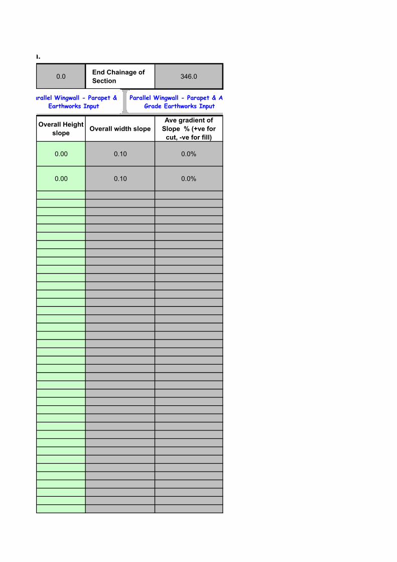
0.0End Chainage of
Section346.0
Overall Height
slopeOverall width slope
Ave gradient of
Slope % (+ve for
cut, -ve for fill)
0.00 0.10 0.0%
0.00 0.10 0.0%
Parallel Wingwall - Parapet &
Earthworks Input
Parallel Wingwall - Parapet & At
Grade Earthworks Input
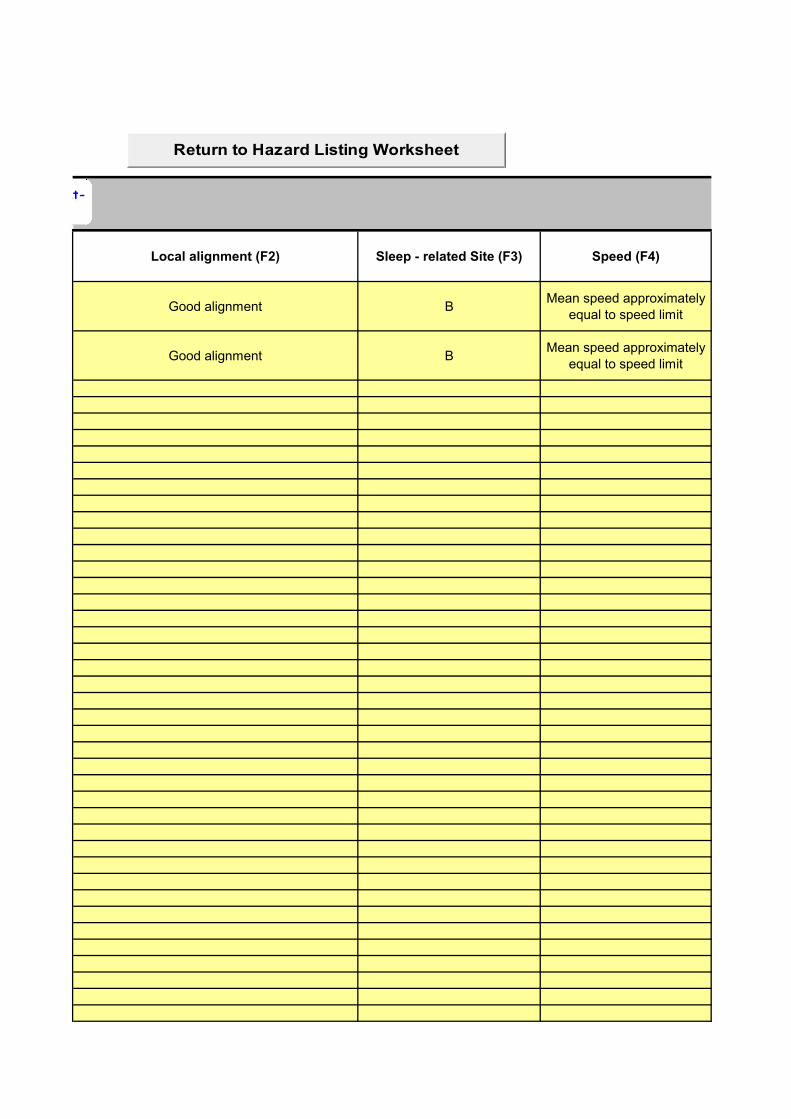
Local alignment (F2) Sleep - related Site (F3) Speed (F4)
Good alignment BMean speed approximately
equal to speed limit
Good alignment BMean speed approximately
equal to speed limit
Return to Hazard Listing Worksheet
Parapet & At-


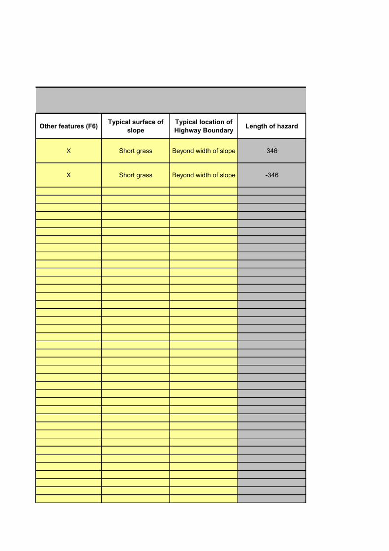
Other features (F6)Typical surface of
slope
Typical location of
Highway BoundaryLength of hazard
X Short grass Beyond width of slope 346
X Short grass Beyond width of slope -346
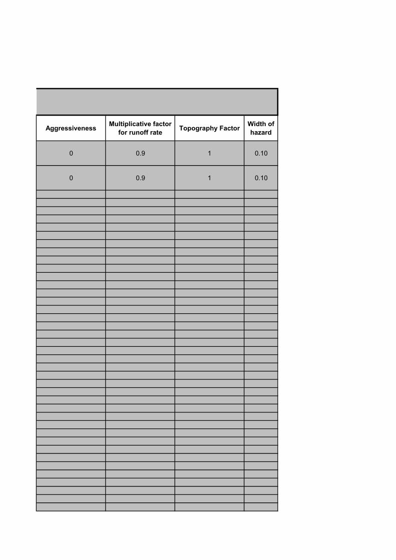
AggressivenessMultiplicative factor
for runoff rateTopography Factor
Width of
hazard
0 0.9 1 0.10
0 0.9 1 0.10
These Kerbing features have been identified as being present in Section. - These should be input for complete section
Verge
assessedN/S Verge
Start
Chainage of
Section
0.0
Local Site Features
ID Number Nature of Hazard
Start
chainage
of hazard1100.0001 Kerb 100mm high or less 0.01100.0002 Kerb 100mm high or less 346.01100.00031100.00041100.00051100.00061100.00071100.00081100.00091100.00101100.00111100.00121100.00131100.00141100.00151100.00161100.00171100.00181100.00191100.00201100.0021
Return to Hazard Listing Worksheet

These Kerbing features have been identified as being present in Section. - These should be input for complete section
End
Chainage of
Section
346.0
Return to Hazard Listing Worksheet
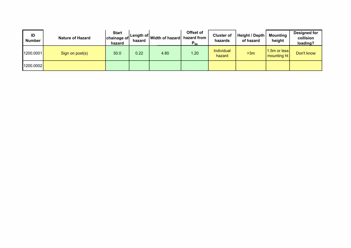
ID
NumberNature of Hazard
Start
chainage of
hazard
Length of
hazardWidth of hazard
Offset of
hazard from
PSb
Cluster of
hazards
Height / Depth
of hazard
Mounting
height
Designed for
collision
loading?
1200.0001 Sign on post(s) 50.0 0.22 4.80 1.20Individual
hazard>3m
1.5m or less mounting ht
Don't know
1200.0002
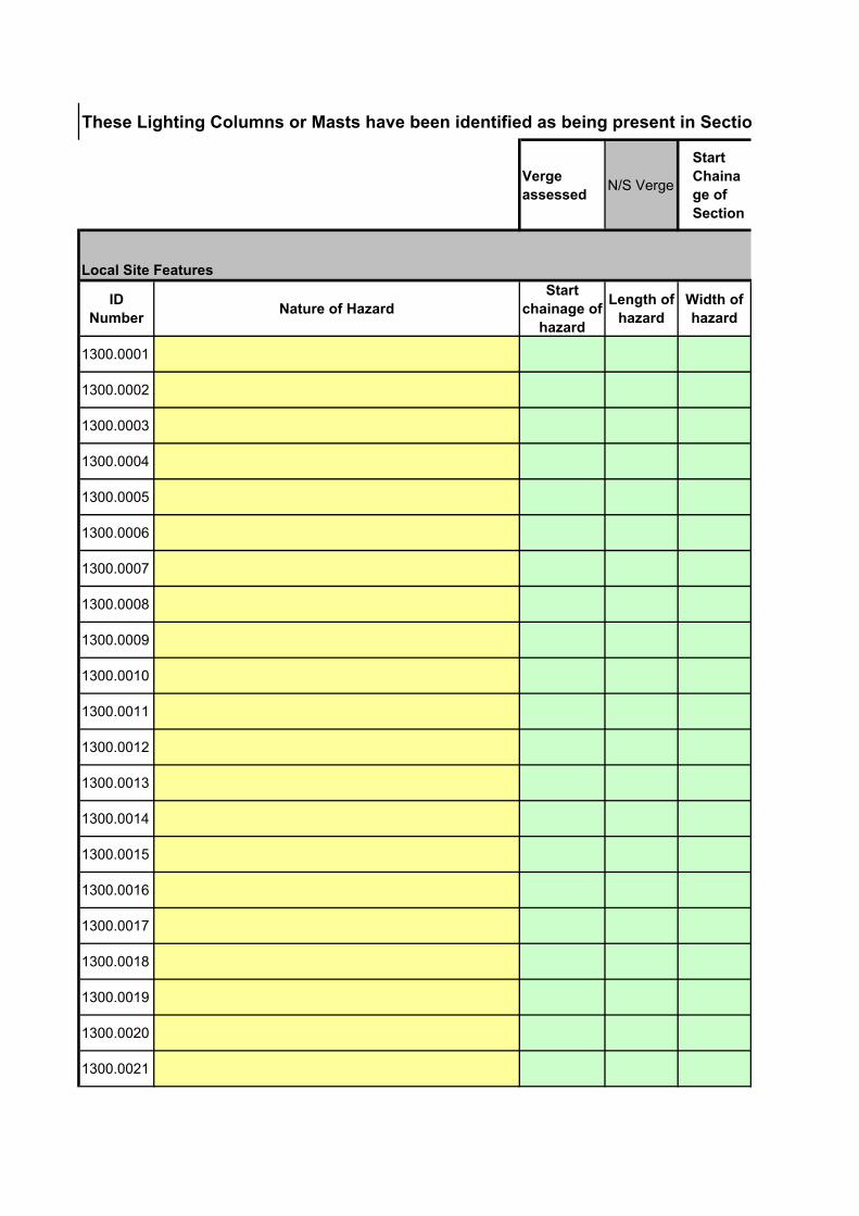
These Lighting Columns or Masts have been identified as being present in Section.
Verge
assessedN/S Verge
Start
Chaina
ge of
Section
Local Site Features
ID
NumberNature of Hazard
Start
chainage of
hazard
Length of
hazard
Width of
hazard
1300.0001
1300.0002
1300.0003
1300.0004
1300.0005
1300.0006
1300.0007
1300.0008
1300.0009
1300.0010
1300.0011
1300.0012
1300.0013
1300.0014
1300.0015
1300.0016
1300.0017
1300.0018
1300.0019
1300.0020
1300.0021
1300.0022
1300.0023
1300.0024
1300.0025
1300.0026
1300.0027
1300.0028
1300.0029
1300.0030
1300.0031
1300.0032
1300.0033
1300.0034
1300.0035
1300.0036
1300.0037
1300.0038
1300.0039
1300.0040
1300.0041
1300.0042
1300.0043
1300.0044
1300.0045
1300.0046
1300.0047
1300.0048
1300.0049
1300.0050
1300.0051
1300.0052
1300.0053
1300.0054
1300.0055
1300.0056
1300.0057
1300.0058
1300.0059
1300.0060
1300.0061
1300.0062
1300.0063
1300.0064
1300.0065
1300.0066
1300.0067
1300.0068
1300.0069
1300.0070
1300.0071
1300.0072
1300.0073
1300.0074
1300.0075
1300.0076
1300.0077
1300.0078
1300.0079
1300.0080
1300.0081
1300.0082
1300.0083
1300.0084
1300.0085
1300.0086
1300.0087
1300.0088
1300.0089
1300.0090
1300.0091
1300.0092
1300.0093
1300.0094
1300.0095
1300.0096
1300.0097
1300.0098
1300.0099
1300.0100
1300.0101
These Lighting Columns or Masts have been identified as being present in Section.
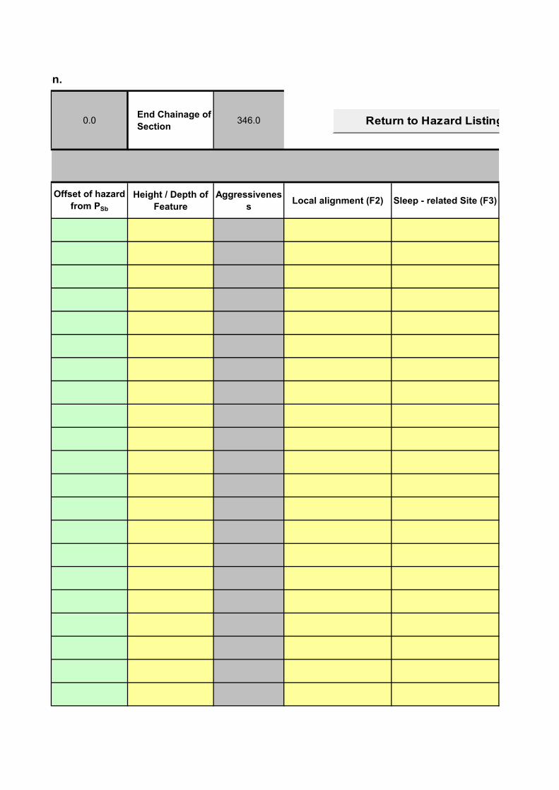
0.0End Chainage of
Section346.0
Offset of hazard
from PSb
Height / Depth of
Feature
Aggressivenes
sLocal alignment (F2) Sleep - related Site (F3)
Return to Hazard Listing Worksheet

Speed (F4) Other features (F6)Multiplicative factor for
runoff rateTopography Factor
Return to Hazard Listing Worksheet

These Motorway Comms features have been identified as being present in Section.
Verge
assessedN/S Verge
Start
Chainage of
Section
0.0
Local Site Features
ID
NumberNature of Hazard
Start
chainage
of hazard
Length of
hazard
Width of
hazard
Offset of
hazard from
PSb
1500.00011500.00021500.00031500.00041500.00051500.00061500.00071500.00081500.00091500.00101500.00111500.00121500.00131500.00141500.00151500.00161500.00171500.00181500.00191500.00201500.00211500.00221500.00231500.00241500.00251500.00261500.00271500.00281500.00291500.00301500.00311500.00321500.00331500.00341500.00351500.00361500.00371500.00381500.00391500.00401500.00411500.00421500.00431500.00441500.0045
1500.00461500.00471500.00481500.00491500.0050
1500.0051
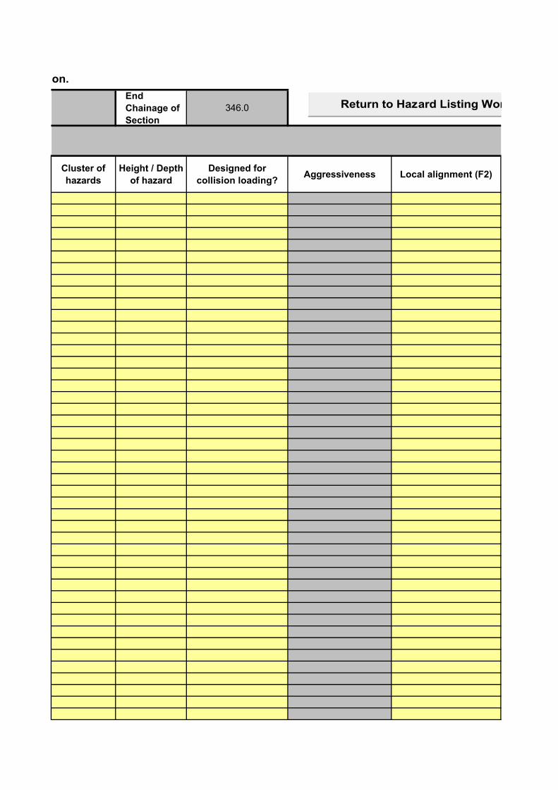
These Motorway Comms features have been identified as being present in Section.
End
Chainage of
Section
346.0
Cluster of
hazards
Height / Depth
of hazard
Designed for
collision loading?Aggressiveness Local alignment (F2)
Return to Hazard Listing Worksheet
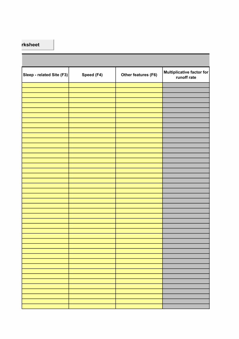
Sleep - related Site (F3) Speed (F4) Other features (F6)Multiplicative factor for
runoff rate
Return to Hazard Listing Worksheet
Topography
Factor
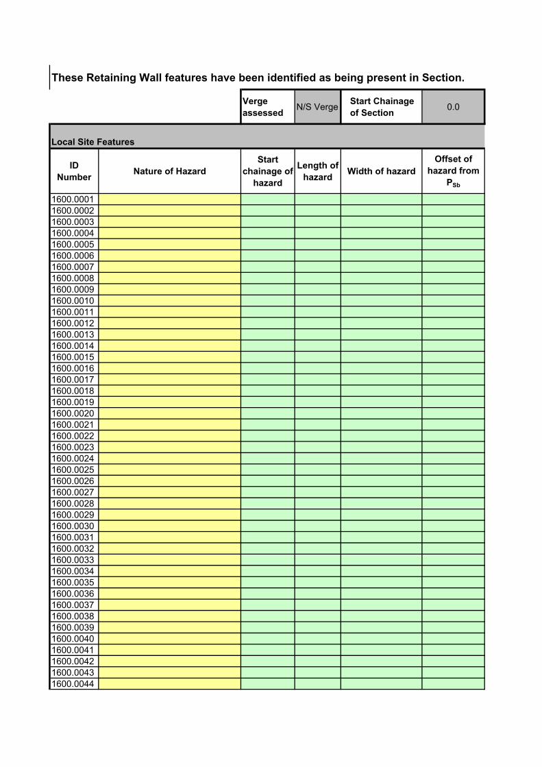
These Retaining Wall features have been identified as being present in Section.
Verge
assessedN/S Verge
Start Chainage
of Section0.0
Local Site Features
ID
NumberNature of Hazard
Start
chainage of
hazard
Length of
hazardWidth of hazard
Offset of
hazard from
PSb
1600.00011600.00021600.00031600.00041600.00051600.00061600.00071600.00081600.00091600.00101600.00111600.00121600.00131600.00141600.00151600.00161600.00171600.00181600.00191600.00201600.00211600.00221600.00231600.00241600.00251600.00261600.00271600.00281600.00291600.00301600.00311600.00321600.00331600.00341600.00351600.00361600.00371600.00381600.00391600.00401600.00411600.00421600.00431600.0044

1600.00451600.00461600.00471600.00481600.00491600.0050
1600.0051
End
Chainage of
Section
346.0
Offset of
hazard from
Psb (End of
Hazard)
Angle of
hazard to
PSb
(Degrees)
Height / Depth
of hazardAggressiveness Local alignment (F2)
Return to Hazard Listing Worksheet
Sleep - related Site (F3) Speed (F4) Other features (F6)
Return to Hazard Listing Worksheet
Multiplicative factor for runoff
rateTopography Factor

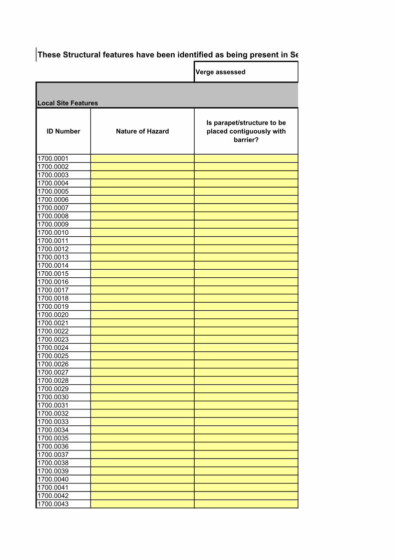
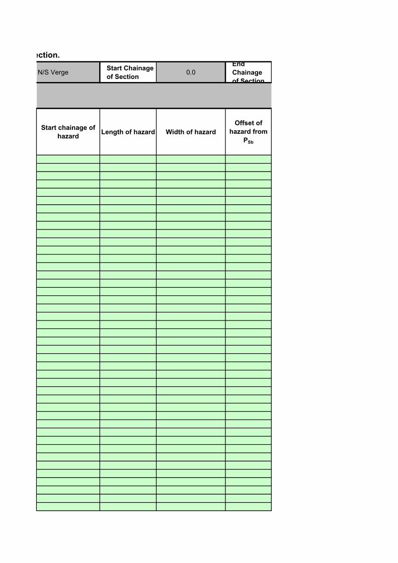
These Structural features have been identified as being present in Section.
Verge assessed
Local Site Features
ID Number Nature of Hazard
Is parapet/structure to be
placed contiguously with
barrier?
1700.00011700.00021700.00031700.00041700.00051700.00061700.00071700.00081700.00091700.00101700.00111700.00121700.00131700.00141700.00151700.00161700.00171700.00181700.00191700.00201700.00211700.00221700.00231700.00241700.00251700.00261700.00271700.00281700.00291700.00301700.00311700.00321700.00331700.00341700.00351700.00361700.00371700.00381700.00391700.00401700.00411700.00421700.0043

1700.00441700.00451700.00461700.00471700.00481700.00491700.0050
1700.0051
These Structural features have been identified as being present in Section.
N/S VergeStart Chainage
of Section0.0
End
Chainage
of Section
Start chainage of
hazardLength of hazard Width of hazard
Offset of
hazard from
PSb
346.0
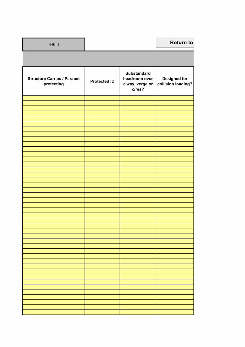
Structure Carries / Parapet
protectingProtected ID
Substandard
headroom over
c'way, verge or
c/res?
Designed for
collision loading?
Return to Hazard Listing Worksheet
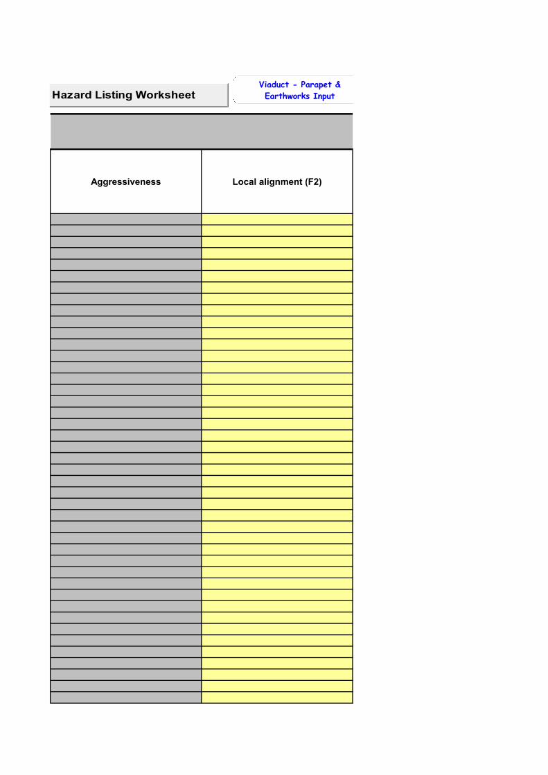
Aggressiveness Local alignment (F2)
Return to Hazard Listing WorksheetViaduct - Parapet &
Earthworks Input
Sleep - related Site (F3) Speed (F4)
Splayed Wingwall - Parapet &
Earthworks Input
Parallel Wingwall - Parapet &
Earthworks Input
Other features (F6)
Multiplicative
factor for runoff
rate
Topograp
hy Factor
Parallel Wingwall - Parapet &
At-Grade Earthworks Input
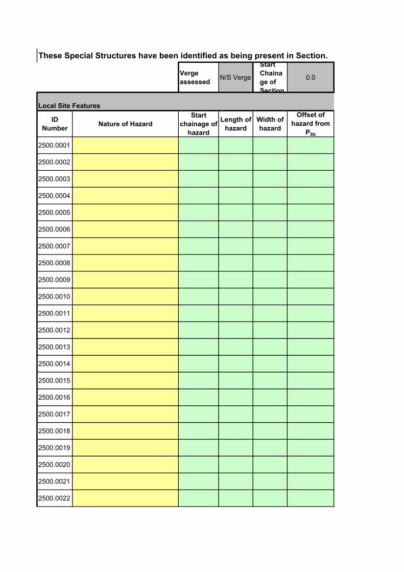
These Special Structures have been identified as being present in Section.
Verge
assessedN/S Verge
Start
Chaina
ge of
Section
0.0
Local Site Features
ID
NumberNature of Hazard
Start
chainage of
hazard
Length of
hazard
Width of
hazard
Offset of
hazard from
PSb
2500.0001
2500.0002
2500.0003
2500.0004
2500.0005
2500.0006
2500.0007
2500.0008
2500.0009
2500.0010
2500.0011
2500.0012
2500.0013
2500.0014
2500.0015
2500.0016
2500.0017
2500.0018
2500.0019
2500.0020
2500.0021
2500.0022
2500.0023
2500.0024
2500.0025
2500.0026
2500.0027
2500.0028
2500.0029
2500.0030
2500.0031
2500.0032
2500.0033
2500.0034
2500.0035
2500.0036
2500.0037
2500.0038
2500.0039
2500.0040
2500.0041
2500.0042
2500.0043
2500.0044
2500.0045
2500.0046
2500.0047
2500.0048
2500.0049
2500.0050
2500.0051
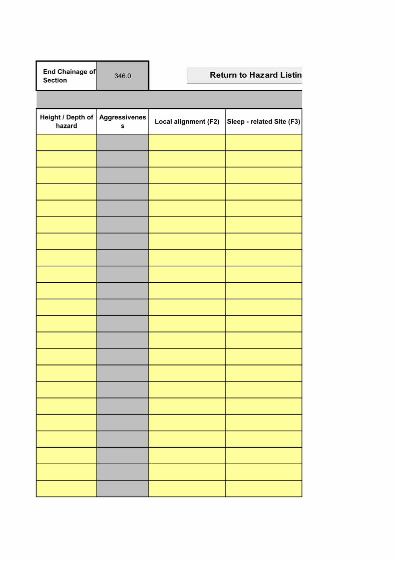
End Chainage of
Section346.0
Height / Depth of
hazard
Aggressivenes
sLocal alignment (F2) Sleep - related Site (F3)
Return to Hazard Listing Worksheet
Speed (F4) Other features (F6)Multiplicative factor for
runoff rate
Topography
Factor
Return to Hazard Listing Worksheet
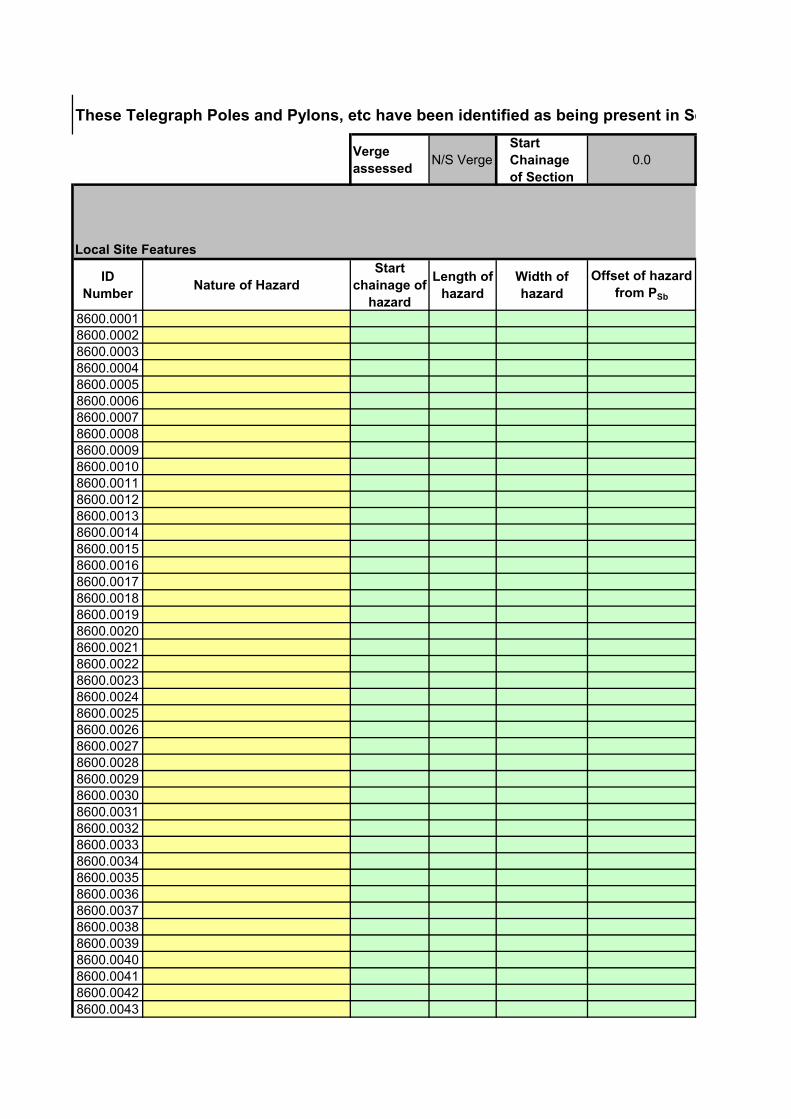
These Telegraph Poles and Pylons, etc have been identified as being present in Section.
Verge
assessedN/S Verge
Start
Chainage
of Section
0.0
Local Site Features
ID
NumberNature of Hazard
Start
chainage of
hazard
Length of
hazard
Width of
hazard
Offset of hazard
from PSb
8600.00018600.00028600.00038600.00048600.00058600.00068600.00078600.00088600.00098600.00108600.00118600.00128600.00138600.00148600.00158600.00168600.00178600.00188600.00198600.00208600.00218600.00228600.00238600.00248600.00258600.00268600.00278600.00288600.00298600.00308600.00318600.00328600.00338600.00348600.00358600.00368600.00378600.00388600.00398600.00408600.00418600.00428600.0043
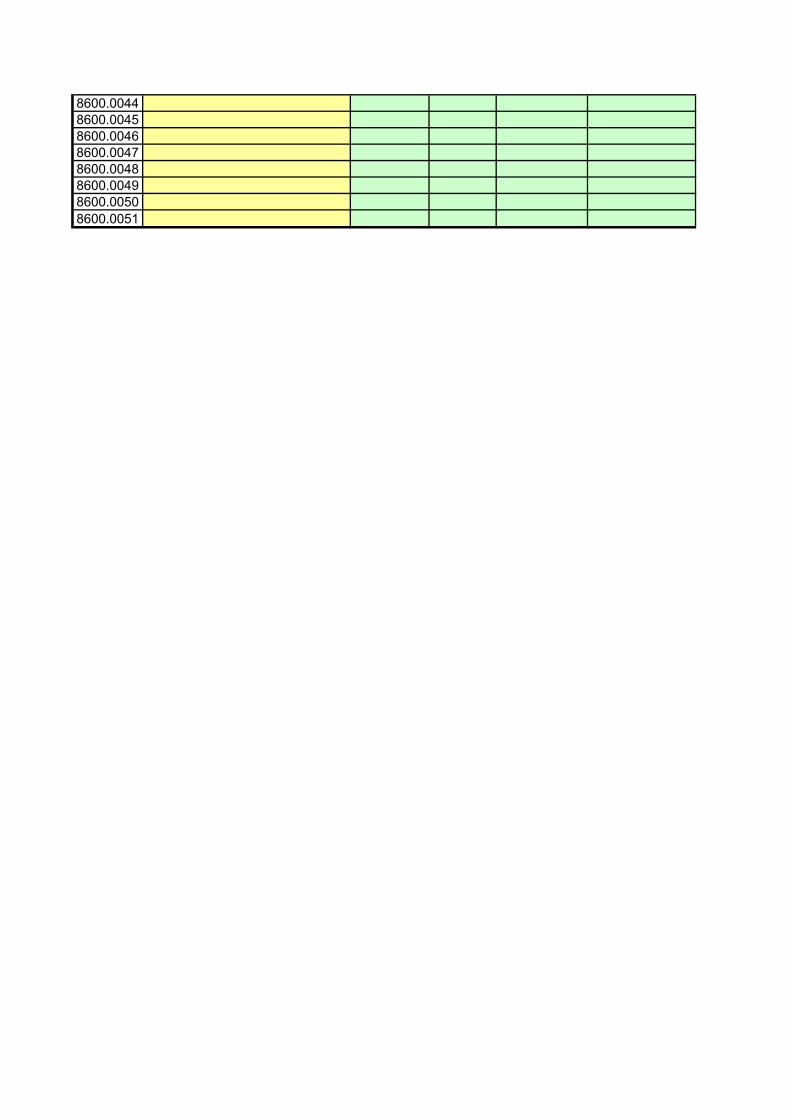
8600.00448600.00458600.00468600.00478600.00488600.00498600.0050
8600.0051
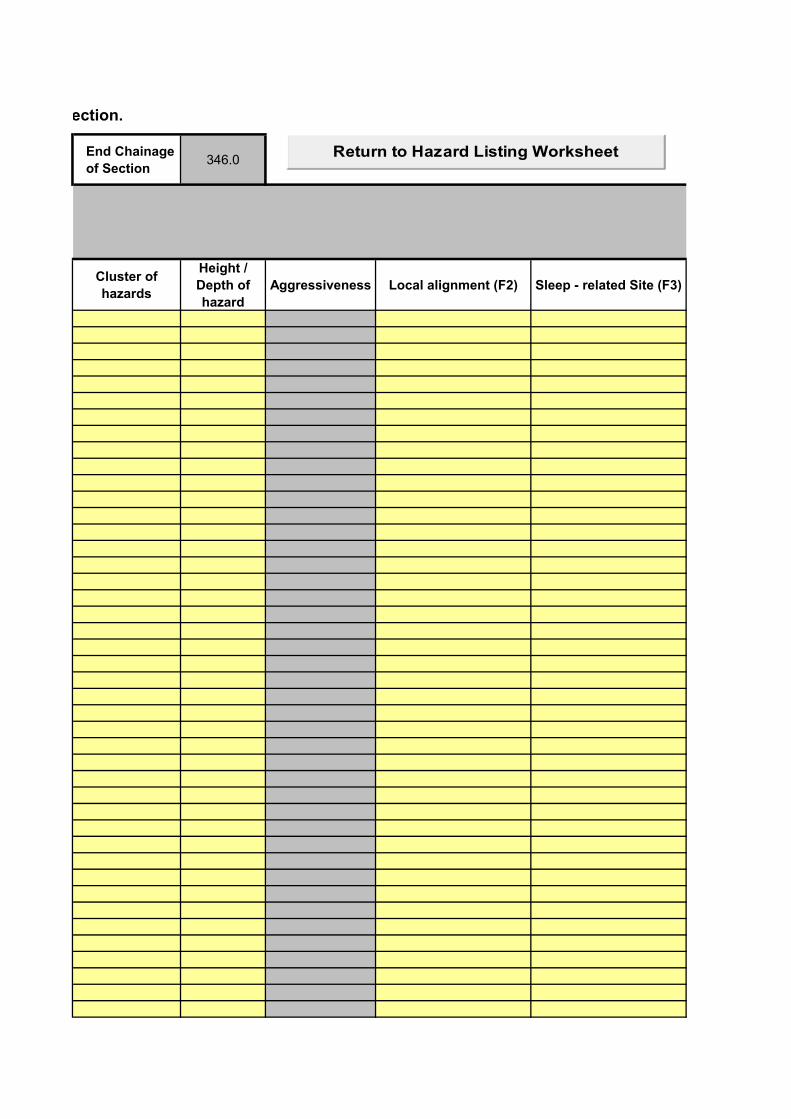
These Telegraph Poles and Pylons, etc have been identified as being present in Section.
End Chainage
of Section346.0
Cluster of
hazards
Height /
Depth of
hazard
Aggressiveness Local alignment (F2) Sleep - related Site (F3)
Return to Hazard Listing Worksheet
Speed (F4) Other features (F6)Multiplicative factor for
runoff rateTopography Factor


These significant Trees that might be reached have been identified as being present in Section.
Verge
assessedN/S Verge
Start
Chainage
of Section
0.0
Local Site Features
ID
NumberNature of Hazard
Start
chainage
of hazard
Length of
hazard
Width of
hazard
Offset of
hazard
from PSb
8700.00018700.00028700.00038700.00048700.00058700.00068700.00078700.00088700.00098700.00108700.00118700.00128700.00138700.00148700.00158700.00168700.00178700.00188700.00198700.00208700.00218700.00228700.00238700.00248700.00258700.00268700.00278700.00288700.00298700.00308700.00318700.00328700.00338700.00348700.00358700.00368700.00378700.00388700.00398700.00408700.00418700.00428700.0043

8700.00448700.00458700.00468700.00478700.00488700.00498700.0050
8700.0051
These significant Trees that might be reached have been identified as being present in Section.End
Chainage
of
Section
346.0
Cluster of
hazardsAggressiveness Local alignment (F2) Sleep - related Site (F3)
Return to Hazard Listing Worksheet
Speed (F4) Other features (F6)Multiplicative factor for
runoff rate
Return to Hazard Listing Worksheet
Topography Factor

ID Number Nature of Hazard
Start
chainage of
hazard
Length of
hazardWidth of hazard
Offset of hazard
from PSb
Offset of hazard
from Psb (End
of Hazard)
Angle of hazard
to PSb
(Degrees)
Local alignment (F2)Sleep - related Site
(F3)Speed (F4) Other features (F6)
Multiplicative factor
for runoff rate
Above or below
road level?
Likelihood of
reaching other
hazard based on
topography
Topography
Factor
Permissible Line Speed
and Track AlignmentNo of Tracks
Other
Consequences
Multiplicative
factor
8100.0001
8100.0002
8100.0003
8100.0004
8100.0005
8100.0006
8100.0007
8100.0008
8100.0009
8100.0010
8100.0011
8100.0012
8100.0013
8100.0014
8100.0015
8100.0016
8100.0017
8100.0018
8100.0019
8100.0020
8100.0021
8100.0022
8100.0023
8100.0024
8100.0025
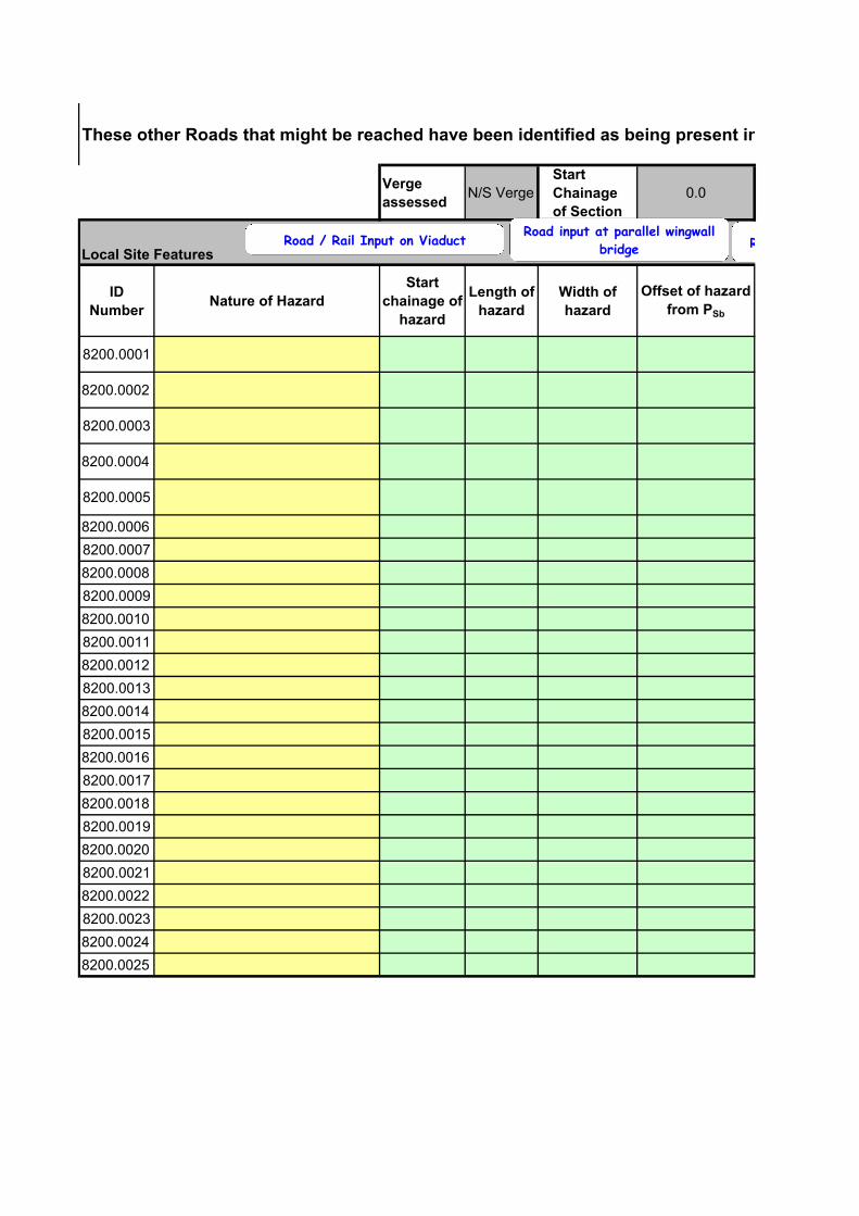
These other Roads that might be reached have been identified as being present in Section.
Verge
assessedN/S Verge
Start
Chainage
of Section
0.0
Local Site Features
ID
NumberNature of Hazard
Start
chainage of
hazard
Length of
hazard
Width of
hazard
Offset of hazard
from PSb
8200.0001
8200.0002
8200.0003
8200.0004
8200.0005
8200.0006
8200.0007
8200.0008
8200.0009
8200.0010
8200.0011
8200.0012
8200.0013
8200.0014
8200.0015
8200.0016
8200.0017
8200.0018
8200.0019
8200.0020
8200.0021
8200.0022
8200.0023
8200.0024
8200.0025
Road / Rail Input on ViaductRoad input at parallel wingwall
bridge Road input at splayed
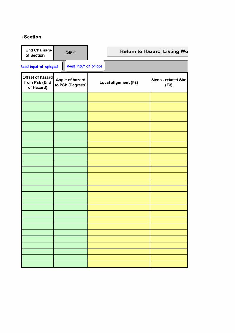
These other Roads that might be reached have been identified as being present in Section.
End Chainage
of Section346.0
Offset of hazard
from Psb (End
of Hazard)
Angle of hazard
to PSb (Degrees)Local alignment (F2)
Sleep - related Site
(F3)
Return to Hazard Listing Worksheet
Road input at splayed Road input at bridge
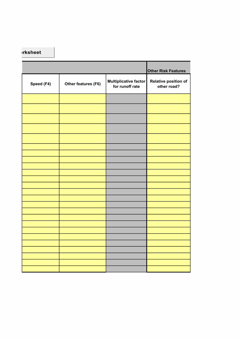
Other Risk Features
Speed (F4) Other features (F6)Multiplicative factor
for runoff rate
Relative position of
other road?
Return to Hazard Listing Worksheet
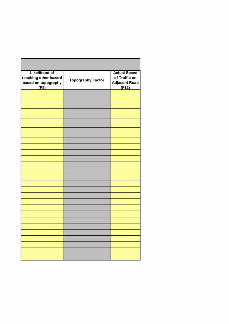
Likelihood of
reaching other hazard
based on topography
(F5)
Topography Factor
Actual Speed
of Traffic on
Adjacent Road
(F12)
Other features (adjacent road) (F13)Traffic Flow (Vehicles per
day) (F14)
Other Consequences
Multiplicative factor

These significant water hazards that might be reached have been identified as being present in Section.
Verge
assessedN/S Verge
Start
Chainage
of Section
0.0
Local Site Features
ID
NumberNature of Hazard
Start
chainage of
hazard
Length of
hazard
Width of
hazard
Offset of
hazard
from PSb
8800.00018800.00028800.00038800.00048800.0018800.0018800.0018800.0018800.0018800.00108800.0018800.0018800.0018800.0018800.0028800.0028800.0028800.0028800.0028800.00208800.0028800.0028800.0028800.0028800.0038800.0038800.0038800.0038800.0038800.00308800.0038800.0038800.0038800.0038800.0048800.0048800.0048800.0048800.0048800.00408800.0048800.0048800.0048800.0048800.005
8800.0058800.0058800.0058800.0058800.0050
8800.005
These significant water hazards that might be reached have been identified as being present in Section.
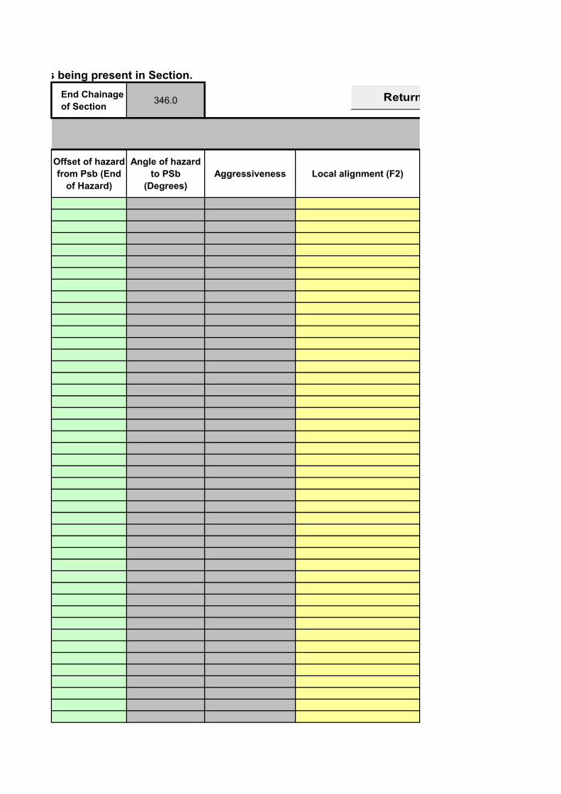
End Chainage
of Section346.0
Offset of hazard
from Psb (End
of Hazard)
Angle of hazard
to PSb
(Degrees)
Aggressiveness Local alignment (F2)
Return to Hazard Listing Worksheet
Sleep - related Site (F3) Speed (F4) Other features (F6)
Return to Hazard Listing Worksheet
Multiplicative factor for
runoff rateTopography Factor
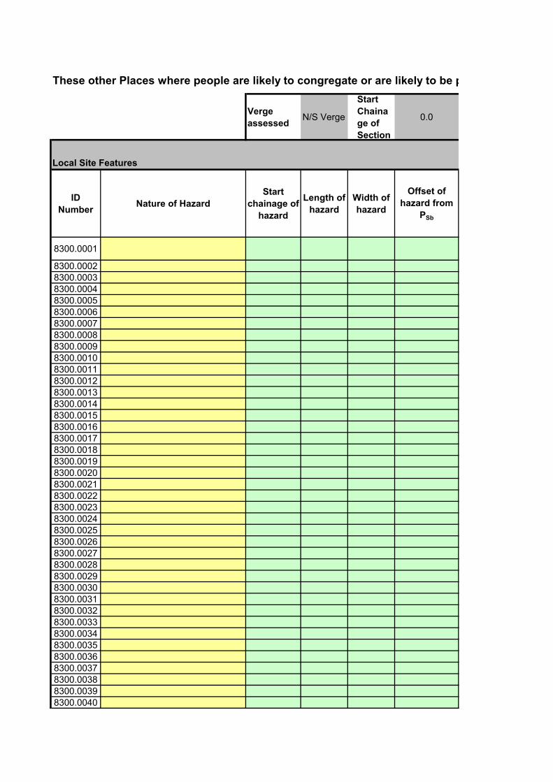
These other Places where people are likely to congregate or are likely to be particularly exposed to hazard of errant vehicles for long periods of time have been identified as being present in Section
Verge
assessedN/S Verge
Start
Chaina
ge of
Section
0.0
Local Site Features
ID
NumberNature of Hazard
Start
chainage of
hazard
Length of
hazard
Width of
hazard
Offset of
hazard from
PSb
8300.0001
8300.00028300.00038300.00048300.00058300.00068300.00078300.00088300.00098300.00108300.00118300.00128300.00138300.00148300.00158300.00168300.00178300.00188300.00198300.00208300.00218300.00228300.00238300.00248300.00258300.00268300.00278300.00288300.00298300.00308300.00318300.00328300.00338300.00348300.00358300.00368300.00378300.00388300.00398300.0040

8300.00418300.00428300.00438300.00448300.00458300.00468300.00478300.00488300.0049
8300.0050
These other Places where people are likely to congregate or are likely to be particularly exposed to hazard of errant vehicles for long periods of time have been identified as being present in Section
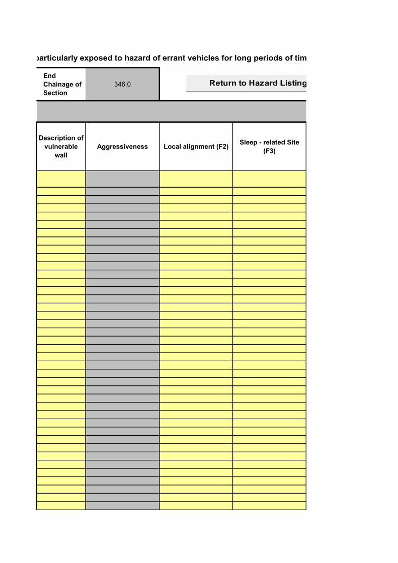
End
Chainage of
Section
346.0
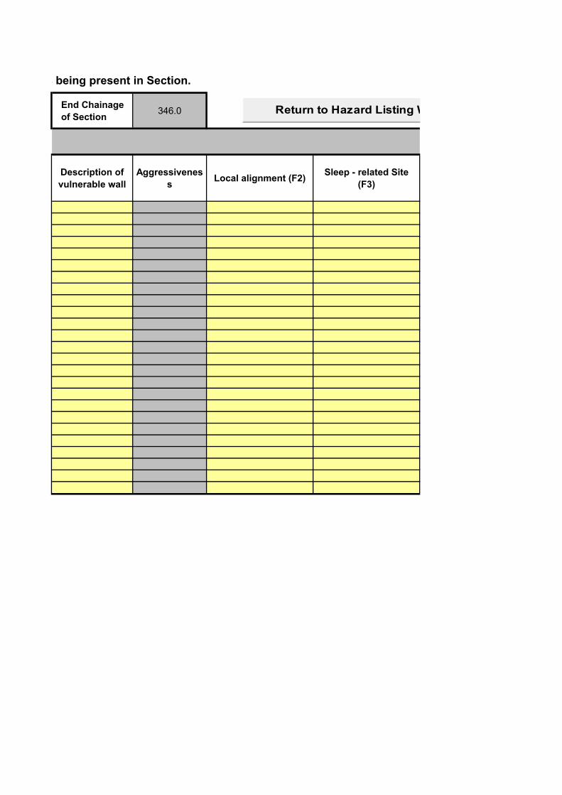
Description of
vulnerable
wall
Aggressiveness Local alignment (F2)Sleep - related Site
(F3)
Return to Hazard Listing Worksheet
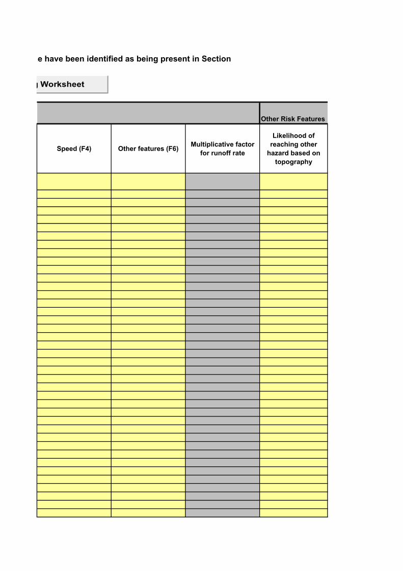
These other Places where people are likely to congregate or are likely to be particularly exposed to hazard of errant vehicles for long periods of time have been identified as being present in Section
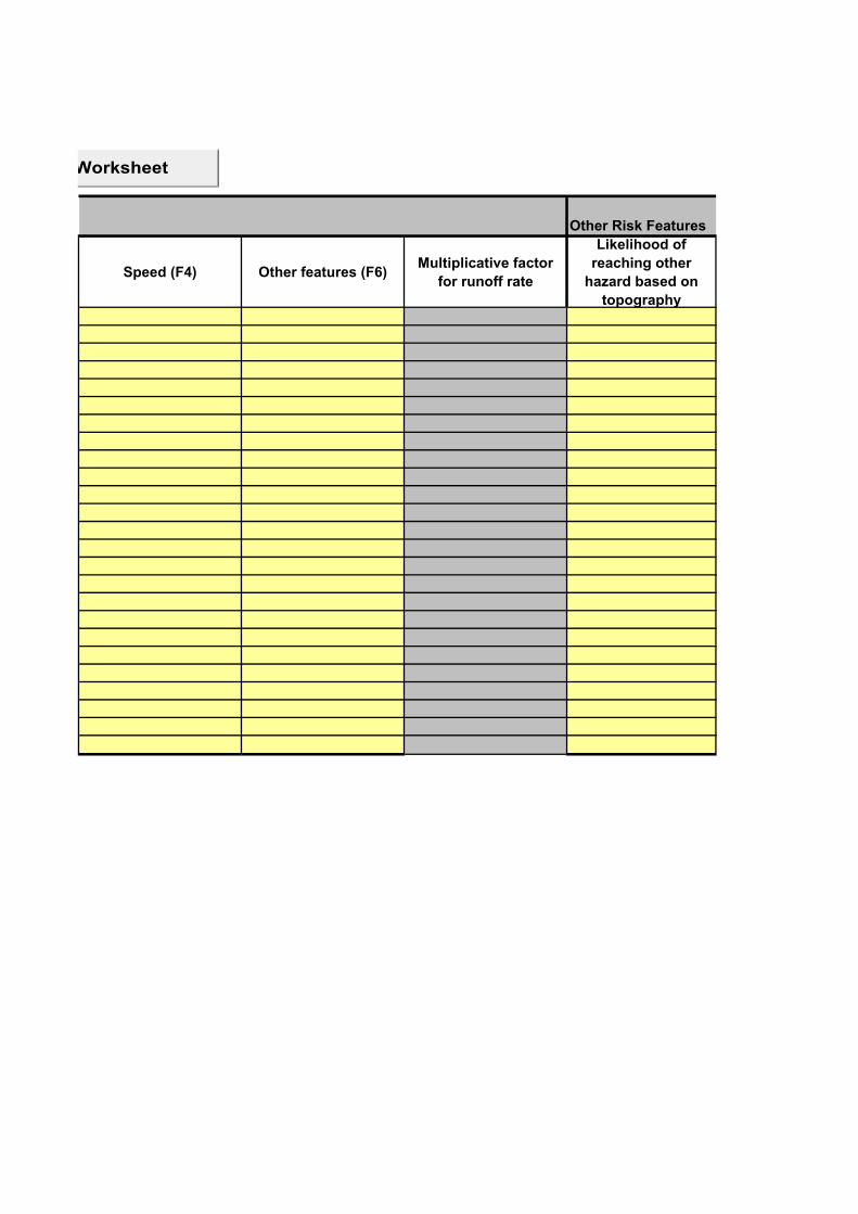
Other Risk Features
Speed (F4) Other features (F6)Multiplicative factor
for runoff rate
Likelihood of
reaching other
hazard based on
topography
Return to Hazard Listing Worksheet
Topography
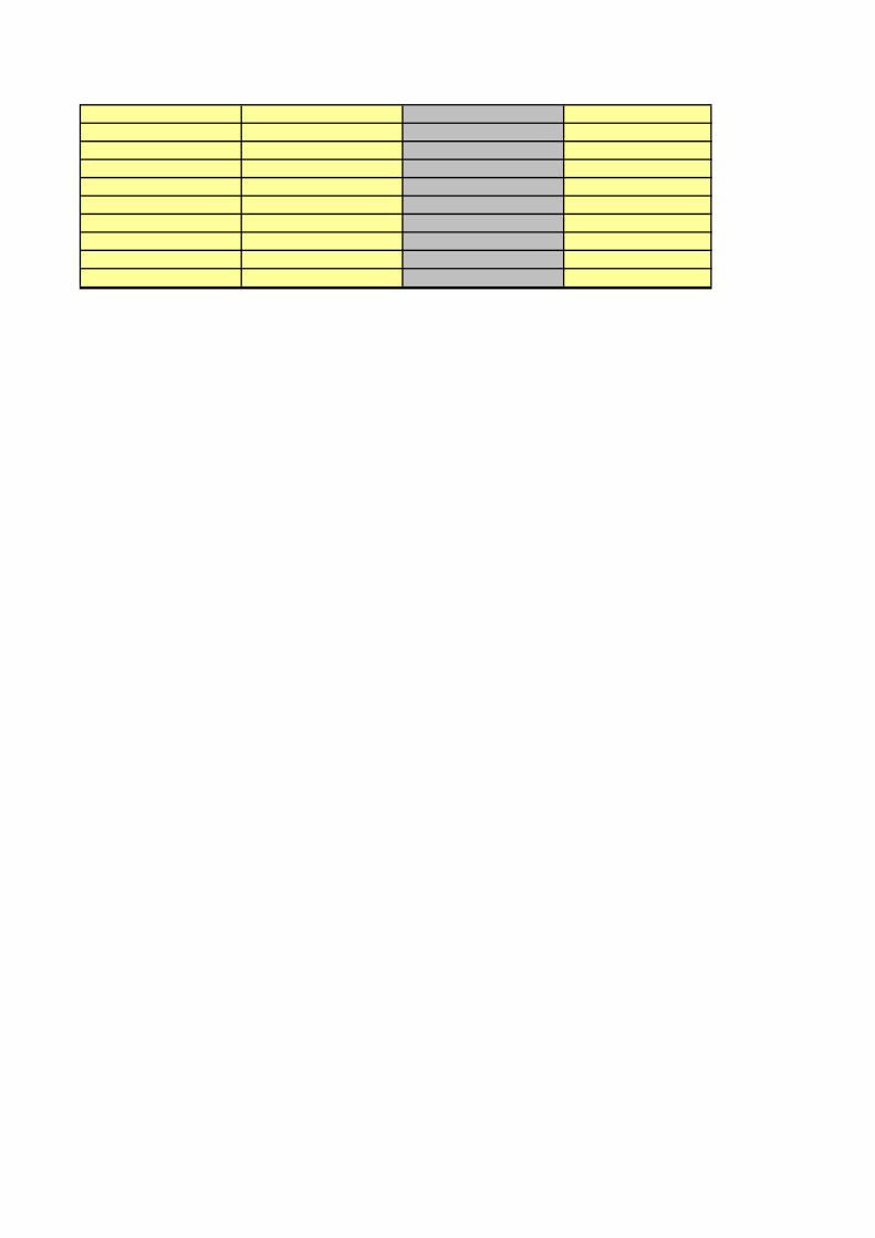
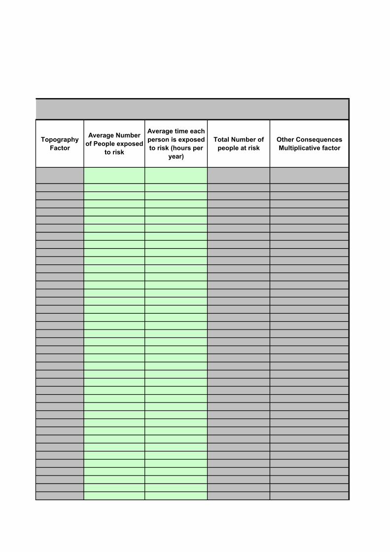
Factor
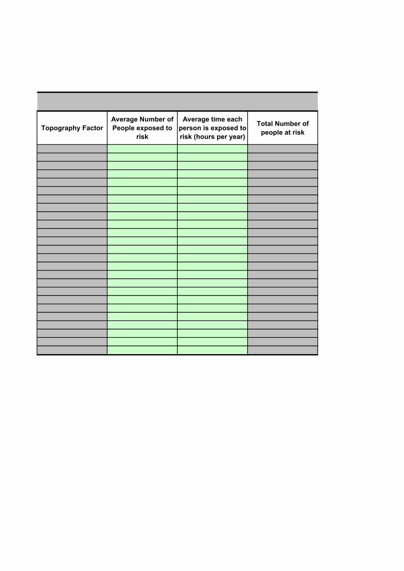
Average Number
of People exposed
to risk
Average time each
person is exposed
to risk (hours per
year)
Total Number of
people at risk
Other Consequences
Multiplicative factor
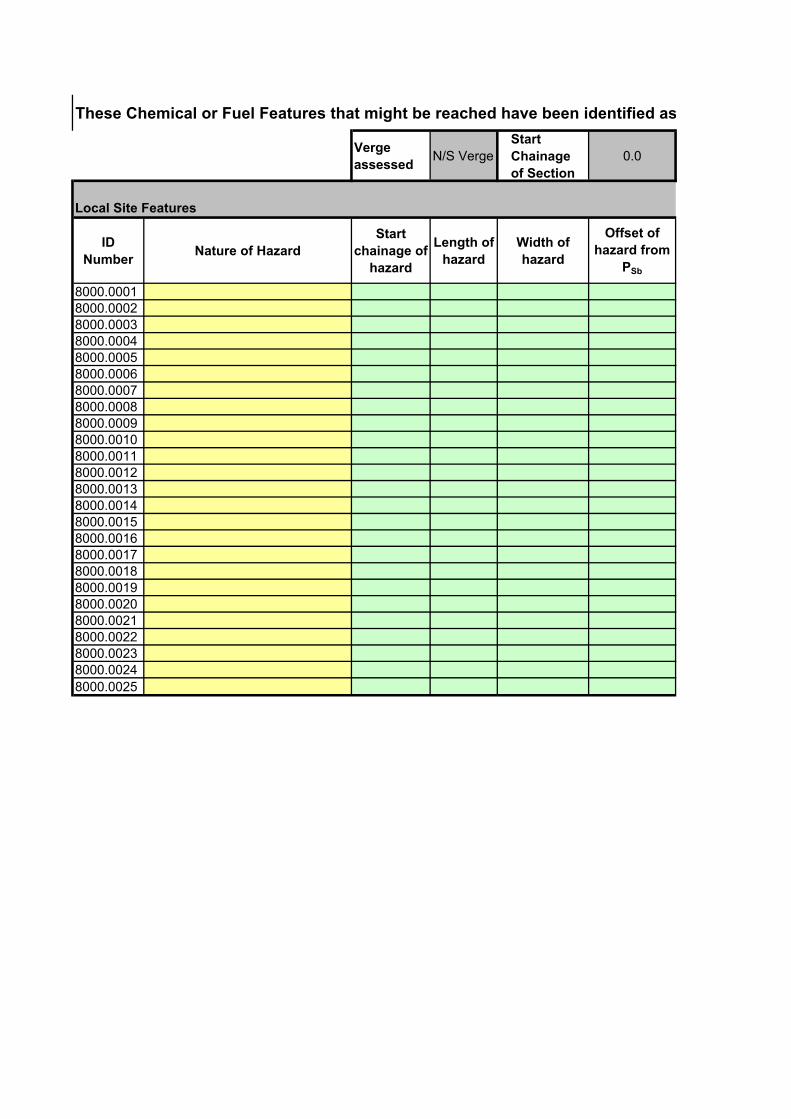
These Chemical or Fuel Features that might be reached have been identified as being present in Section.
Verge
assessedN/S Verge
Start
Chainage
of Section
0.0
Local Site Features
ID
NumberNature of Hazard
Start
chainage of
hazard
Length of
hazard
Width of
hazard
Offset of
hazard from
PSb
8000.00018000.00028000.00038000.00048000.00058000.00068000.00078000.00088000.00098000.00108000.00118000.00128000.00138000.00148000.00158000.00168000.00178000.00188000.00198000.00208000.00218000.00228000.00238000.0024
8000.0025
These Chemical or Fuel Features that might be reached have been identified as being present in Section.
End Chainage
of Section346.0
Description of
vulnerable wall
Aggressivenes
sLocal alignment (F2)
Sleep - related Site
(F3)
Return to Hazard Listing Worksheet
Other Risk Features
Speed (F4) Other features (F6)Multiplicative factor
for runoff rate
Likelihood of
reaching other
hazard based on
topography
Return to Hazard Listing Worksheet
Topography Factor
Average Number of
People exposed to
risk
Average time each
person is exposed to
risk (hours per year)
Total Number of
people at risk
Other
Consequences
Multiplicative factor