Embed Size (px)
Citation preview
1
YRC JOURNAL
Articles
Trekking inMorroco
Azerbaijan
SummerIsles
ParysMountain
MOUNTAINS OFMOURNE
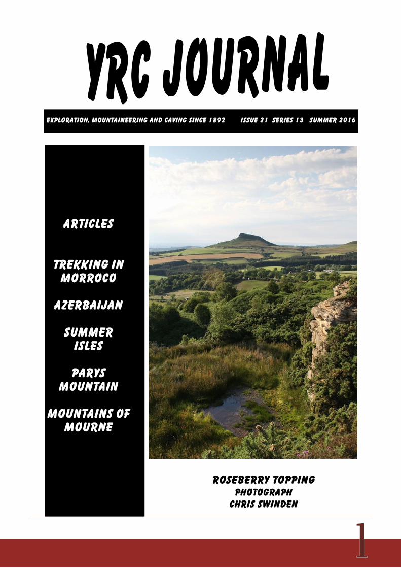
Exploration, mountaineering and caving since 1892 issue 21 Series 13 SUMMER 2016
ROSEBERRY TOPPINGPHOTOGRAPH
CHRIS SWINDEN
YRC journal Page 2
3 Editorial
4 Azerbaijan John & Valerie Middleton
8 Invasion Roy Denney
10 Summer Isles Alan Linford
11 Poet’s Corner Wm Cecil Slingsby
12 Australia Iain Gilmour
13 Parys Mountain Tim Josephy
16 Chippings
21 Natural History
26 Obituaries and appreciations
33 Morocco
48 Reviews
49 UK Meet reports
Jan 8-10 Little Langdale, CumbriaJan 28-31 Glencoe, ScotlandFeb 26-28 Cwm Dyli, WalesMar 18-20 Newtonmoor, ScotlandApr 22-24 Thirlmere, CumbriaMay 7-14 Leverburgh, HarrisMay 20-22 North WalesJun 10-12 Ennerdale, Cumbria
CONTENTS
YRC journal page 3
EDITORS NOTEThe Club has been in existence almost124 years which means next year willbe something of a celebration and welook forward to an interesting meetsprogramme.
We are also bringing out a special editionof the Journal to mark the occasion. Workon it is well advanced and I would like tothank the many members who haveprovided me with snippets and oldphotographs.
This edition will concentrate on thehighlights of the last twenty five yearsduring which period cameras have movedon and we have a welter of wonderfulphotographs. Many have never been seenbefore and some previously only in blackand white.
We look back at the many interestingplaces we have been to and things wehave done and can look forward tocontinuing this tradition.
This special edition should be a realkeepsake for the members but will alsohopefully inspire those that follow us topush new boundaries.
This publication will distort our usual outputcycle and the next Journal will come out inMarch 2017 and cover nine months ofactivity and the deadline for this edition willbe the end of that February.
Meet reports and Club proceedings afterthat time will be kept until early thefollowing year with the special editioncoming out during that gap.
No more photographs now please, unlessI have specifically asked for them as weare now putting the chapters together. Ifwe find we are lacking something on aspecific location or activity we will approachlikely members direct.
We have been trawling through thearchives and old journals checking factsand looking for material to include and ithas reminded us that we have lots of sparecopies of old journals. We always print afew spares to replace members lost onesand to be able to provide recent ones toprospective members but invariably thereare a few left over.
In addition, many members’ families giveold copies back to the Club when amember passes on.
We have a way of using the more recentones to good purpose. If any memberknows of a school or library or any otheroutlet which might take and enjoy themplease let us know as we may triggerinterest in membership that way.
Similarly if you have a friend who might betempted to join, copies might be availableafter we have satisfied the initial demand.
Many members do like to collect and retainthe journals but have gaps in theircollections which we may be able to fill andnewer members might like to have copiesfrom the days before they joined.
Please get in touch with the Club Librarianif you want to find out what is available.
As to the content of the Journal pleaseremember that it is your journal. Othermembers want to know what you havebeen up to, especially those now oldermembers no longer active themselves.
It is when we come to carry out an exerciselike this special edition that we realise howmany exploits discussed socially neverreach the pages of the journal.
You may feel that putting pen to paper isnot your forte but I am more than happy totidy up articles for you.
YRC journal page 4
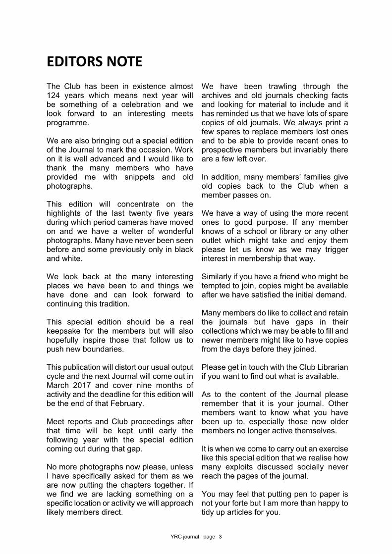
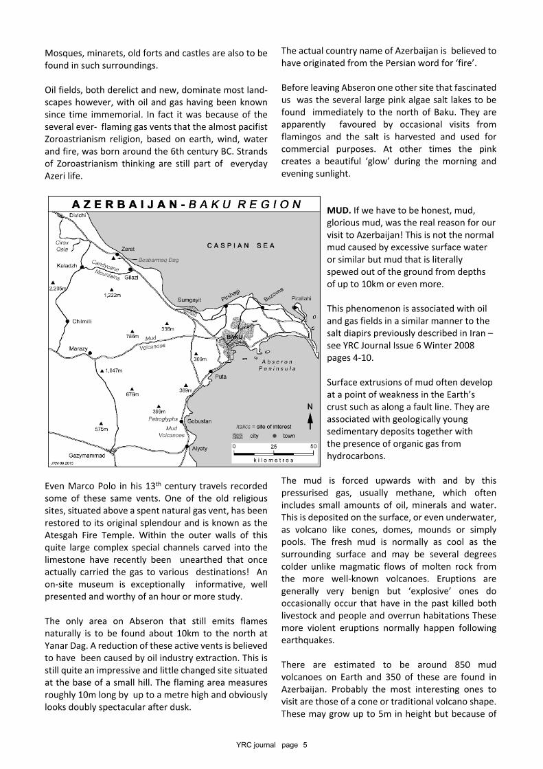
AZERBAIJAN has the privilege of being the eastern-mostof all the European countries. It is bordered by Russiato the north, Georgia and Armenia to the west, Nagorno-Karabakh and Iran to the south and the Caspian Sea tothe east.
It covers an area of 86,600 square kilometres with itshighest elevation being 4,466m on the Bazzarduzu Dagalong the Russian border. The lowest point is theCaspian Sea coastline itself at -32m. Its considerablewealth is derived from petroleum products, caviar,carpets, saffron, olives and other agricultural products.The population is estimated as just over 8 million peoplemade up of 90% ethnic Azeris with the remainder beingLezgins, Armenians, Russians, Talysh and Georgians.Politically it manages to maintain good relations with allthe surrounding countries as well the majority of the restof the world. Historically it is at the crossing pointbetween east and west with all the benefits (trade etc.,)and tribulations (invasions etc.,) that such a positionholds. The dominant religion is a very tolerant form ofShia Islam with virtually all other forms of worship beingaccepted.
BAKU is the capital city composed of a beautifullyrenovated Historic City centre surrounded by futuristicbuildings, luxurious shopping malls, very plush offices,
AZERBAIJAN – LAND OF FIRE(and mud!)
John & Valerie Middleton
A refreshingly different country that can make an alternative ‘stop over’ on anylong journey to or from the Far East or Central Asia. It is full of extremes,contradictions and contrasts but will prove safe, secure and fascinating.
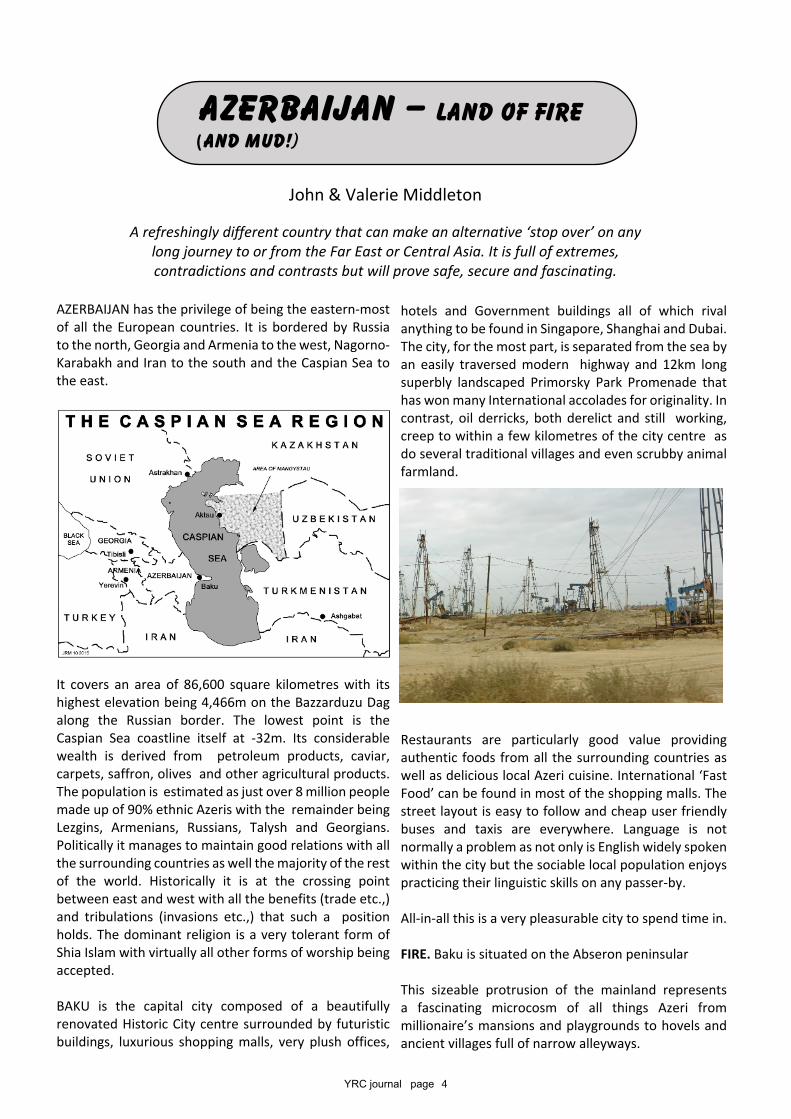
hotels and Government buildings all of which rivalanything to be found in Singapore, Shanghai and Dubai.The city, for the most part, is separated from the sea byan easily traversed modern highway and 12km longsuperbly landscaped Primorsky Park Promenade thathas won many International accolades for originality. Incontrast, oil derricks, both derelict and still working,creep to within a few kilometres of the city centre asdo several traditional villages and even scrubby animalfarmland.
Restaurants are particularly good value providingauthentic foods from all the surrounding countries aswell as delicious local Azeri cuisine. International ‘FastFood’ can be found in most of the shopping malls. Thestreet layout is easy to follow and cheap user friendlybuses and taxis are everywhere. Language is notnormally a problem as not only is English widely spokenwithin the city but the sociable local population enjoyspracticing their linguistic skills on any passer-by.
All-in-all this is a very pleasurable city to spend time in.
FIRE. Baku is situated on the Abseron peninsular
This sizeable protrusion of the mainland representsa fascinating microcosm of all things Azeri frommillionaire’s mansions and playgrounds to hovels andancient villages full of narrow alleyways.
YRC journal page 5
Mosques, minarets, old forts and castles are also to befound in such surroundings.
Oil fields, both derelict and new, dominate most land-scapes however, with oil and gas having been knownsince time immemorial. In fact it was because of theseveral ever- flaming gas vents that the almost pacifistZoroastrianism religion, based on earth, wind, waterand fire, was born around the 6th century BC. Strandsof Zoroastrianism thinking are still part of everydayAzeri life.
Even Marco Polo in his 13th century travels recordedsome of these same vents. One of the old religioussites, situated above a spent natural gas vent, has beenrestored to its original splendour and is known as theAtesgah Fire Temple. Within the outer walls of thisquite large complex special channels carved into thelimestone have recently been unearthed that onceactually carried the gas to various destinations! Anon-site museum is exceptionally informative, wellpresented and worthy of an hour or more study.
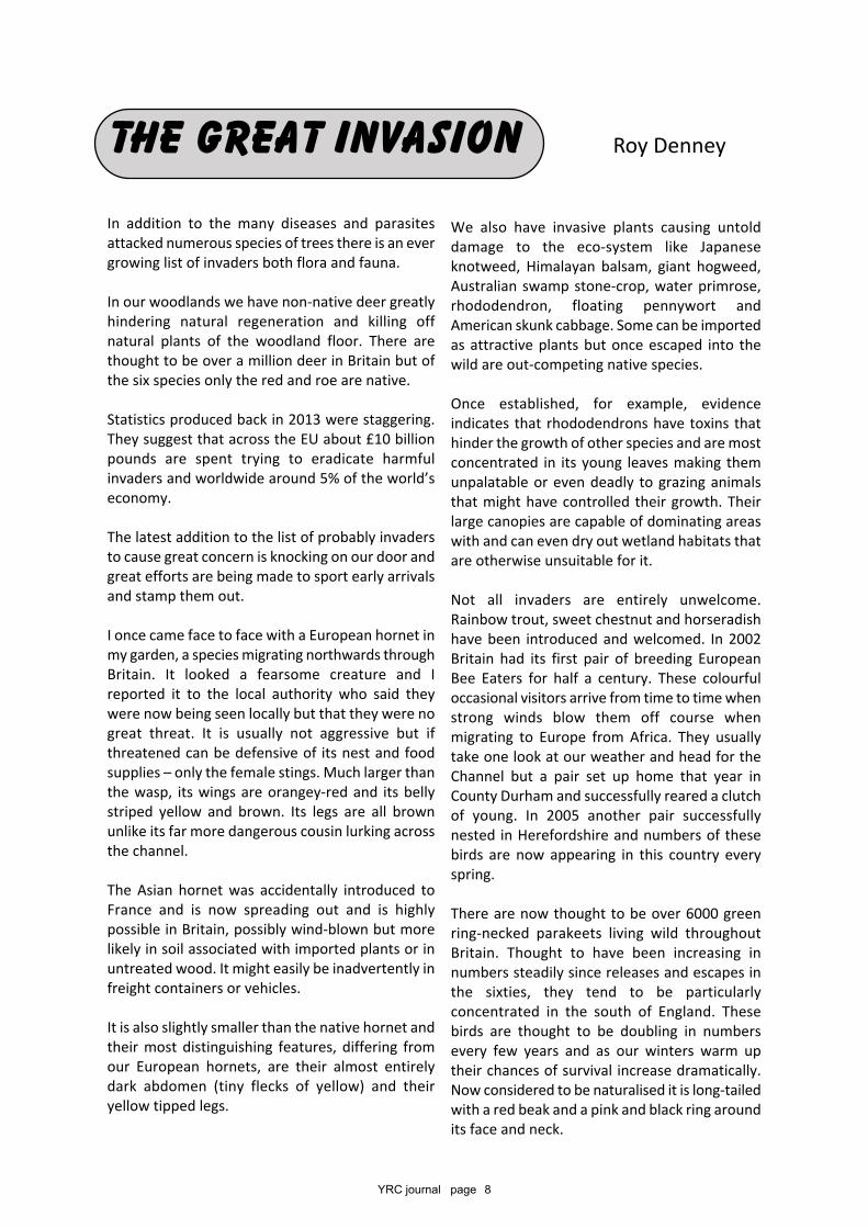
The only area on Abseron that still emits flamesnaturally is to be found about 10km to the north atYanar Dag. A reduction of these active vents is believedto have been caused by oil industry extraction. This isstill quite an impressive and little changed site situatedat the base of a small hill. The flaming area measuresroughly 10m long by up to a metre high and obviouslylooks doubly spectacular after dusk.
The actual country name of Azerbaijan is believed tohave originated from the Persian word for ‘fire’.
Before leaving Abseron one other site that fascinatedus was the several large pink algae salt lakes to befound immediately to the north of Baku. They areapparently favoured by occasional visits fromflamingos and the salt is harvested and used forcommercial purposes. At other times the pinkcreates a beautiful ‘glow’ during the morning andevening sunlight.
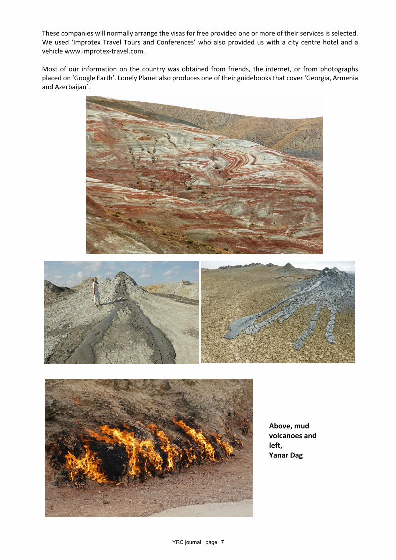
MUD. If we have to be honest, mud,glorious mud, was the real reason for ourvisit to Azerbaijan! This is not the normalmud caused by excessive surface wateror similar but mud that is literallyspewed out of the ground from depthsof up to 10km or even more.
This phenomenon is associated with oiland gas fields in a similar manner to thesalt diapirs previously described in Iran –see YRC Journal Issue 6 Winter 2008pages 4-10.
Surface extrusions of mud often developat a point of weakness in the Earth’scrust such as along a fault line. They areassociated with geologically youngsedimentary deposits together withthe presence of organic gas fromhydrocarbons.
The mud is forced upwards with and by thispressurised gas, usually methane, which oftenincludes small amounts of oil, minerals and water.This is deposited on the surface, or even underwater,as volcano like cones, domes, mounds or simplypools. The fresh mud is normally as cool as thesurrounding surface and may be several degreescolder unlike magmatic flows of molten rock fromthe more well-known volcanoes. Eruptions aregenerally very benign but ‘explosive’ ones dooccasionally occur that have in the past killed bothlivestock and people and overrun habitations Thesemore violent eruptions normally happen followingearthquakes.
There are estimated to be around 850 mudvolcanoes on Earth and 350 of these are found inAzerbaijan. Probably the most interesting ones tovisit are those of a cone or traditional volcano shape.These may grow up to 5m in height but because of
YRC journal page 6
their soft composition they tend to be ephemeral. The resulting mounds do slowly increase in height withseveral exceeding 500m. The base of these may extend over several square kilometres.
The easiest concentration of these cones to visit is found about an hour’s drive southwards from Baku inthe hills close to Gobustan. A complex series of very minor roads lead onto Dasgil Hill. Upon the top of thissits a concentration of about 30 assorted shapes and sizes of miniature volcanoes.
The ground is surprisingly solid and it is possible to walk onto them for some really close up views andphotographs. Activity within each vent is variable from virtually nothing but gurgling’s, through rising andfalling mud levels to others with obvious flows. The consistency of the mud is one of a viscosity that slowlydevelops into attractive ripples and curves, sometimes with a dull surface but more often with a shiny skin.The second site that we visited was a five minute walk from kilometre 41 on route M27 which runs fromBaku to Shamakha. This is just as interesting as the previous site although the volcanoes are probably of aslightly smaller size.
Two further sites that we did not visit due to time constraints and access difficulties were the individualTuragay and Lokbaton mud volcanos. The former is 400m high with a shallow gently seeping caldera on itsdomed summit whilst the latter, rising to only 100m, spewed out flames 300m high as recently as the year2000!
On the day that we visited the mud volcanoes close to Gobustan we also spent half the day investigatingthe UNESCO listed Gobustan Petroglyphs. There are 5,000 of these impressive carvings to be seen amongstlarge rocks and caves that overlook the Caspian Sea. Many date back to 10,000BC.
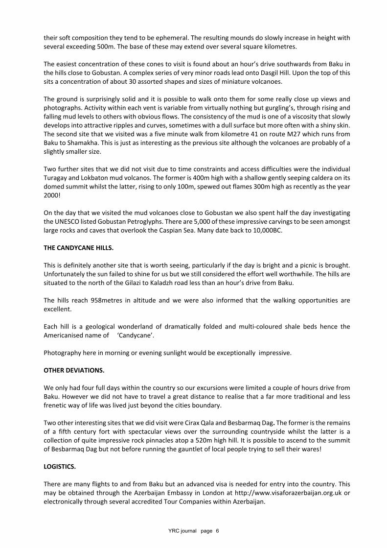
THE CANDYCANE HILLS.
This is definitely another site that is worth seeing, particularly if the day is bright and a picnic is brought.Unfortunately the sun failed to shine for us but we still considered the effort well worthwhile. The hills aresituated to the north of the Gilazi to Kaladzh road less than an hour’s drive from Baku.
The hills reach 958metres in altitude and we were also informed that the walking opportunities areexcellent.
Each hill is a geological wonderland of dramatically folded and multi-coloured shale beds hence theAmericanised name of ‘Candycane’.
Photography here in morning or evening sunlight would be exceptionally impressive.
OTHER DEVIATIONS.
We only had four full days within the country so our excursions were limited a couple of hours drive fromBaku. However we did not have to travel a great distance to realise that a far more traditional and lessfrenetic way of life was lived just beyond the cities boundary.
Two other interesting sites that we did visit were Cirax Qala and Besbarmaq Dag. The former is the remainsof a fifth century fort with spectacular views over the surrounding countryside whilst the latter is acollection of quite impressive rock pinnacles atop a 520m high hill. It is possible to ascend to the summitof Besbarmaq Dag but not before running the gauntlet of local people trying to sell their wares!
LOGISTICS.
There are many flights to and from Baku but an advanced visa is needed for entry into the country. Thismay be obtained through the Azerbaijan Embassy in London at http://www.visaforazerbaijan.org.uk orelectronically through several accredited Tour Companies within Azerbaijan.
YRC journal page 7
These companies will normally arrange the visas for free provided one or more of their services is selected.We used ‘Improtex Travel Tours and Conferences’ who also provided us with a city centre hotel and avehicle www.improtex-travel.com .
Most of our information on the country was obtained from friends, the internet, or from photographsplaced on ‘Google Earth’. Lonely Planet also produces one of their guidebooks that cover ‘Georgia, Armeniaand Azerbaijan’.
Above, mudvolcanoes andleft,Yanar Dag
YRC journal page 8
In addition to the many diseases and parasitesattacked numerous species of trees there is an evergrowing list of invaders both flora and fauna.
In our woodlands we have non-native deer greatlyhindering natural regeneration and killing offnatural plants of the woodland floor. There arethought to be over a million deer in Britain but ofthe six species only the red and roe are native.
Statistics produced back in 2013 were staggering.They suggest that across the EU about £10 billionpounds are spent trying to eradicate harmfulinvaders and worldwide around 5% of the world’seconomy.
The latest addition to the list of probably invadersto cause great concern is knocking on our door andgreat efforts are being made to sport early arrivalsand stamp them out.
I once came face to face with a European hornet inmy garden, a species migrating northwards throughBritain. It looked a fearsome creature and Ireported it to the local authority who said theywere now being seen locally but that they were nogreat threat. It is usually not aggressive but ifthreatened can be defensive of its nest and foodsupplies – only the female stings. Much larger thanthe wasp, its wings are orangey-red and its bellystriped yellow and brown. Its legs are all brownunlike its far more dangerous cousin lurking acrossthe channel.
The Asian hornet was accidentally introduced toFrance and is now spreading out and is highlypossible in Britain, possibly wind-blown but morelikely in soil associated with imported plants or inuntreated wood. It might easily be inadvertently infreight containers or vehicles.
It is also slightly smaller than the native hornet andtheir most distinguishing features, differing fromour European hornets, are their almost entirelydark abdomen (tiny flecks of yellow) and theiryellow tipped legs.
We also have invasive plants causing untolddamage to the eco-system like Japaneseknotweed, Himalayan balsam, giant hogweed,Australian swamp stone-crop, water primrose,rhododendron, floating pennywort andAmerican skunk cabbage. Some can be importedas attractive plants but once escaped into thewild are out-competing native species.
Once established, for example, evidenceindicates that rhododendrons have toxins thathinder the growth of other species and are mostconcentrated in its young leaves making themunpalatable or even deadly to grazing animalsthat might have controlled their growth. Theirlarge canopies are capable of dominating areaswith and can even dry out wetland habitats thatare otherwise unsuitable for it.
Not all invaders are entirely unwelcome.Rainbow trout, sweet chestnut and horseradishhave been introduced and welcomed. In 2002Britain had its first pair of breeding EuropeanBee Eaters for half a century. These colourfuloccasional visitors arrive from time to time whenstrong winds blow them off course whenmigrating to Europe from Africa. They usuallytake one look at our weather and head for theChannel but a pair set up home that year inCounty Durham and successfully reared a clutchof young. In 2005 another pair successfullynested in Herefordshire and numbers of thesebirds are now appearing in this country everyspring.
There are now thought to be over 6000 greenring-necked parakeets living wild throughoutBritain. Thought to have been increasing innumbers steadily since releases and escapes inthe sixties, they tend to be particularlyconcentrated in the south of England. Thesebirds are thought to be doubling in numbersevery few years and as our winters warm uptheir chances of survival increase dramatically.Now considered to be naturalised it is long-tailedwith a red beak and a pink and black ring aroundits face and neck.
THE GREAT INVASION Roy Denney
YRC journal page 9
In flight it has pointed wings, with a very steady,direct flight. It flocks in its hundreds by roost sites,and can be very noisy.
A pair of European eagle owls nested in a remotepiece of woodland in Northumberland in 2003 andtwo chicks were found in a hollow in a tree spring2005 and by 2009 they were cropping up in anumber of locations. European eagle owls areamongst the world's largest owls and grow to aheight of two foot six inches with a wingspan ofnearly six feet; a large beak; enormous talons andstartling bright orange eyes. They can weigh in atup to nine pounds and, like most owls, hunt at nightfor their prey which includes rats, mice, voles,rabbits, hares and other birds.
They are fairly common in the wilder areas ofEurope, Scandinavia, Northern Africa, Asia and theMiddle East but were very rarely seen in Britain andthen only in the Highlands of Scotland. The specieswas wiped out in Britain about 150 years ago andbecause we are an island and the birds don't liketo cross large expanses of water it was thoughtunlikely they would be back. This does not howeverseem to be the case and they are increasingly beingspotted in other locations
Those early arrivals seen in Scotland were probablyisland hoppers from Scandinavia blown off theirnormal patch by bad weather. There are a lot incaptivity and it is quite likely that the first breedingpair in Northumberland were escapees but theycould have migrated down from Scotland.Wherever they came from they are now with us
and should survive well in Britain’s wilder cornersif not persecuted by man.
Much as I like to see ‘lost’ species returning towhere they originally existed, it always has a knockon effect with other creatures in the food chain. Aneagle owl was caught on camera attacking a henharrier in Bowland and then remaining on thatbirds nest for some time and needless to say thatnest then failed. Given hen harriers are very few innumber and rarely successfully breed in Englandthis was fairly disastrous. Quite apart from takingsome other birds for food the eagle owl is knownto attack other predators to get rid of ‘competition’.
Little egrets were unknown in my youth but arenow widespread.
We need to watch out for and try and stop alienspecies whose introduction does or is likely tocause economic or environmental harm or harm tothe health of humans or farmed animals but weoften realise too late what harm they can do. Theapparently attractive and tasty North Americangrey squirrels are driving native red squirrels tonear extinction in most of England; rabbits and nowcane toads plagued Australia, both having beenintroduced for apparently good reason; signalcrayfish from America are out-competing thenative and introducing disease etc. Problems withescaped mink, terrapins and zanders are welldocumented. Once established they are nearimpossible to remove despite our best efforts.
The only success I can recall is the coypu.
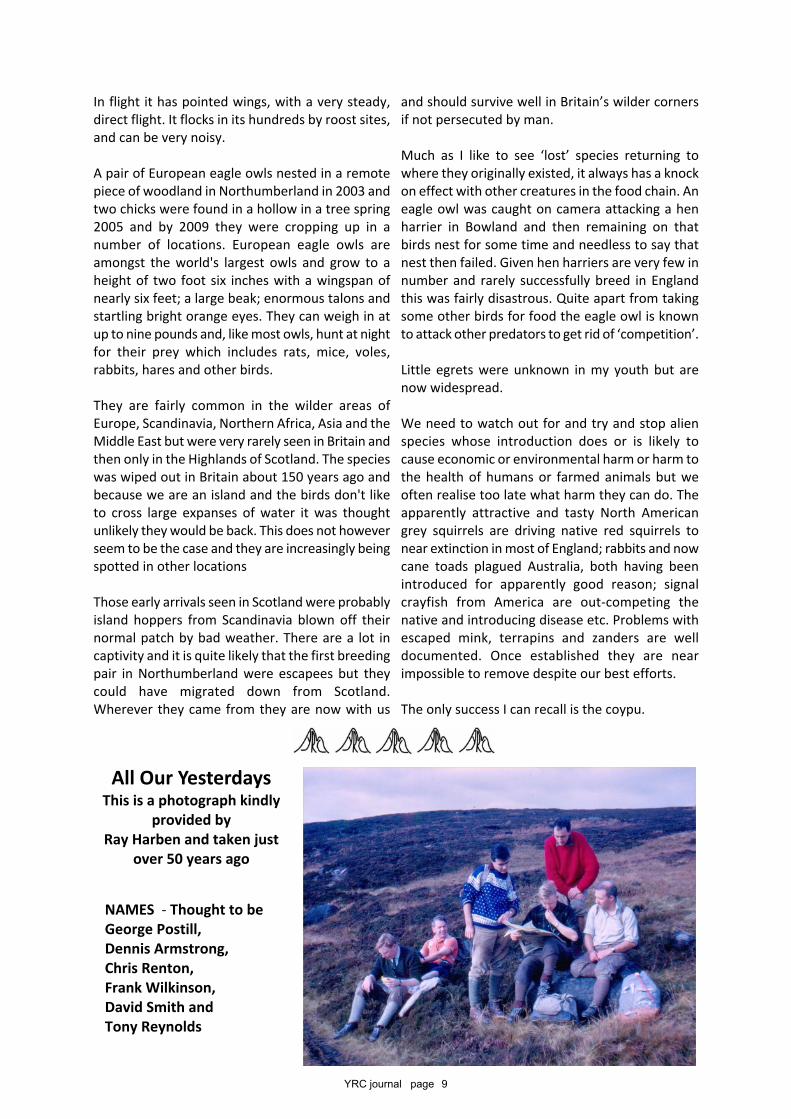
All Our YesterdaysThis is a photograph kindly
provided byRay Harben and taken just
over 50 years ago
NAMES - Thought to beGeorge Postill,Dennis Armstrong,Chris Renton,Frank Wilkinson,David Smith andTony Reynolds
YRC journal page 10
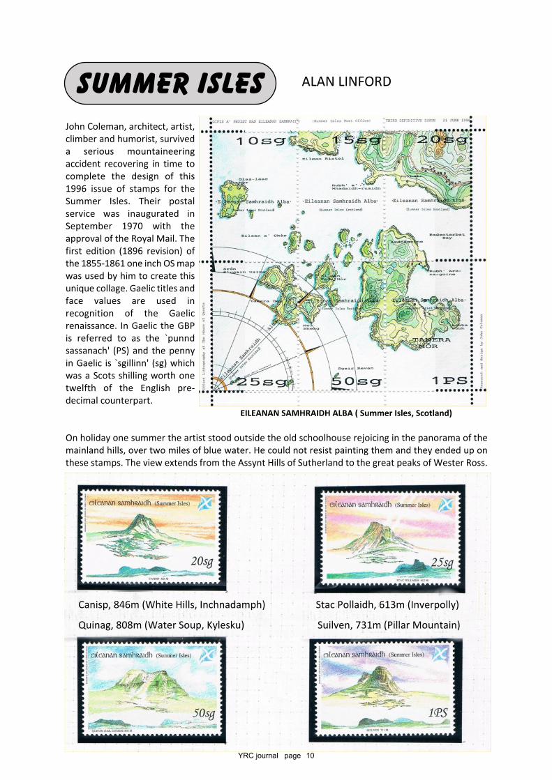
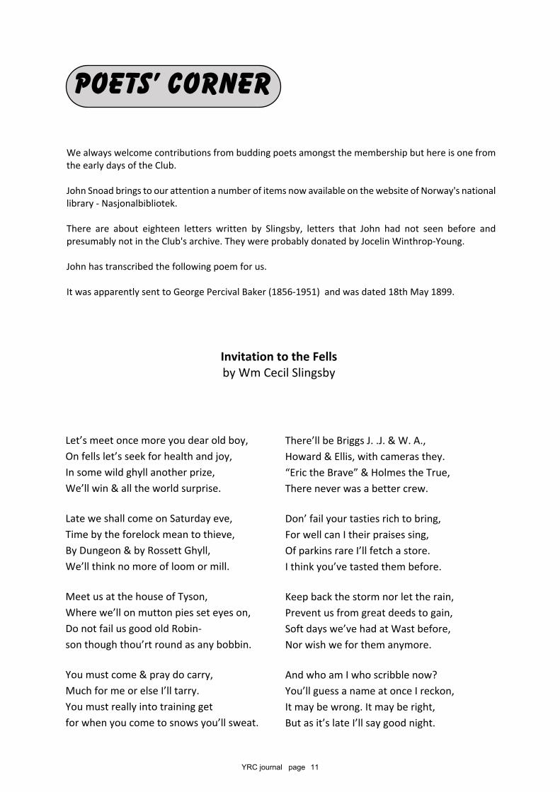
John Coleman, architect, artist,climber and humorist, surviveda serious mountaineeringaccident recovering in time tocomplete the design of this1996 issue of stamps for theSummer Isles. Their postalservice was inaugurated inSeptember 1970 with theapproval of the Royal Mail. Thefirst edition (1896 revision) ofthe 1855-1861 one inch OS mapwas used by him to create thisunique collage. Gaelic titles andface values are used inrecognition of the Gaelicrenaissance. In Gaelic the GBPis referred to as the `punndsassanach' (PS) and the pennyin Gaelic is `sgillinn' (sg) whichwas a Scots shilling worth onetwelfth of the English pre-decimal counterpart.
On holiday one summer the artist stood outside the old schoolhouse rejoicing in the panorama of themainland hills, over two miles of blue water. He could not resist painting them and they ended up onthese stamps. The view extends from the Assynt Hills of Sutherland to the great peaks of Wester Ross.
SUMMER ISLES ALAN LINFORD
EILEANAN SAMHRAIDH ALBA ( Summer Isles, Scotland)
Canisp, 846m (White Hills, Inchnadamph) Stac Pollaidh, 613m (Inverpolly)
Quinag, 808m (Water Soup, Kylesku) Suilven, 731m (Pillar Mountain)
YRC journal page 11
Let’s meet once more you dear old boy,On fells let’s seek for health and joy,In some wild ghyll another prize,We’ll win & all the world surprise.
Late we shall come on Saturday eve,Time by the forelock mean to thieve,By Dungeon & by Rossett Ghyll,We’ll think no more of loom or mill.
Meet us at the house of Tyson,Where we’ll on mutton pies set eyes on,Do not fail us good old Robin-son though thou’rt round as any bobbin.
You must come & pray do carry,Much for me or else I’ll tarry.You must really into training getfor when you come to snows you’ll sweat.
We always welcome contributions from budding poets amongst the membership but here is one fromthe early days of the Club.
John Snoad brings to our attention a number of items now available on the website of Norway's nationallibrary - Nasjonalbibliotek.
There are about eighteen letters written by Slingsby, letters that John had not seen before andpresumably not in the Club's archive. They were probably donated by Jocelin Winthrop-Young.
John has transcribed the following poem for us.
It was apparently sent to George Percival Baker (1856-1951) and was dated 18th May 1899.
POETS’ CORNER
Invitation to the Fellsby Wm Cecil Slingsby
There’ll be Briggs J. .J. & W. A.,Howard & Ellis, with cameras they.“Eric the Brave” & Holmes the True,There never was a better crew.
Don’ fail your tasties rich to bring,For well can I their praises sing,Of parkins rare I’ll fetch a store.I think you’ve tasted them before.
Keep back the storm nor let the rain,Prevent us from great deeds to gain,Soft days we’ve had at Wast before,Nor wish we for them anymore.
And who am I who scribble now?You’ll guess a name at once I reckon,It may be wrong. It may be right,But as it’s late I’ll say good night.
YRC journal page 12
We saw wallabies and burrows where thenocturnal wombat had been digging. There arethousands more tracks to explore, but at least wemade a start.
Tasmania was near enough and a suitable size fora ten day visit, and we chose Tassie instead ofNew Zealand which would have required moretravel and time. There is something homely andfamiliar about Tasmania, reminiscent of England50 years ago.
We flew to Hobart and planned our trip along theeast coast heading north to Launceston. This onlygave us a brief introduction, regrettably missingthe wilder west side of the island where theweather can blast in from the roaring forties withsqualls and rain.
Hobart has a beautiful harbour, a Saturdaymarket with 300 stalls of local craft goods,a working square-rigged historic sailing ship,a crazy art gallery built by a local gambler,and the best sea food of scallops and prawnsimaginable. Nearby Port Arthur has theoriginal buildings which were constructedby the convicts banished to Tasmania, andpoignant reminders of our murky past.
However, locals who might ask where you arefrom will often respond warmly with “Ah,from the mother country”.
We saw trail heads leading into the bush, andthere are many recommended day walks. Weparticularly enjoyed a coastal walk at FortescueBay which has a superb beach of dazzling whitesand, and the crystal clear seawater of theSouthern Ocean. The Wineglass Bay area atFreycinet has a splendid 11km walk with avigorous climb to a viewing point at a col of thegranite Hazard Mountains, and then descends totwo superb beaches and a rocky path over theshoulder of the mountain back to the startingpoint. We were near Great Oyster Bay, the sourceof some of the famous shellfish, and home of theOyster Bay Pine, a cypress tree of distinctiveupright habit.
A SHORT WALK IN AUSTRALIA AND TASMANIA
Oz and Tassie would be how the locals refer to theareas where Sarah and I took a few short walkswhile visiting family in Melbourne. A short walk inAustralia is about as helpful a definition as a strollin Asia, but we enjoyed our little forays enough totell you about them.
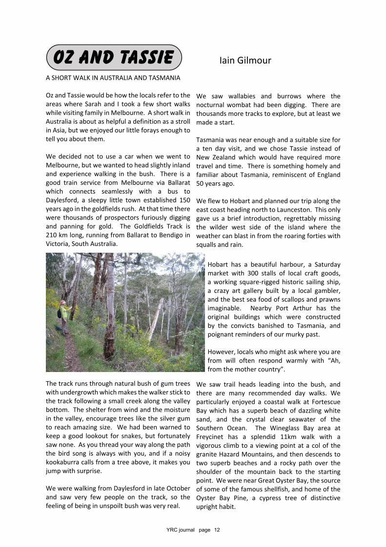
We decided not to use a car when we went toMelbourne, but we wanted to head slightly inlandand experience walking in the bush. There is agood train service from Melbourne via Ballaratwhich connects seamlessly with a bus toDaylesford, a sleepy little town established 150years ago in the goldfields rush. At that time therewere thousands of prospectors furiously diggingand panning for gold. The Goldfields Track is210 km long, running from Ballarat to Bendigo inVictoria, South Australia.
The track runs through natural bush of gum treeswith undergrowth which makes the walker stick tothe track following a small creek along the valleybottom. The shelter from wind and the moisturein the valley, encourage trees like the silver gumto reach amazing size. We had been warned tokeep a good lookout for snakes, but fortunatelysaw none. As you thread your way along the paththe bird song is always with you, and if a noisykookaburra calls from a tree above, it makes youjump with surprise.
We were walking from Daylesford in late Octoberand saw very few people on the track, so thefeeling of being in unspoilt bush was very real.
Oz and Tassie Iain Gilmour
YRC journal page 13
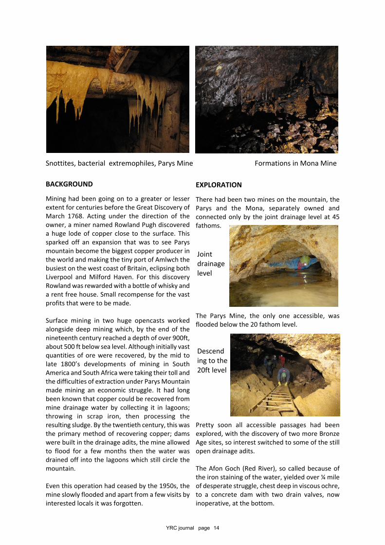
The mines were to prove to have some remarkablefeatures.
As we journeyed north to Launceston there aremore dazzling beaches, vineyards, and a café atOrford with exquisite scallop pies.
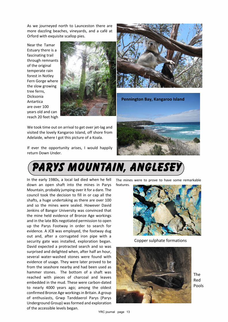
Near the TamarEstuary there is afascinating trailthrough remnantsof the originaltemperate rainforest in NotleyFern Gorge wherethe slow growingtree ferns,DicksoniaAntarticaare over 100years old and canreach 20 feet high
We took time out on arrival to get over jet-lag andvisited the lovely Kangaroo Island, off shore fromAdelaide, where I got this picture of a Koala.
If ever the opportunity arises, I would happilyreturn Down Under.
In the early 1980s, a local lad died when he felldown an open shaft into the mines in ParysMountain, probably jumping over it for a dare. Thecouncil took the decision to fill in or cap all theshafts, a huge undertaking as there are over 100and so the mines were sealed. However DavidJenkins of Bangor University was convinced thatthe mine held evidence of Bronze Age workingsand in the late 80s negotiated permission to openup the Parys Footway in order to search forevidence. A JCB was employed, the footway dugout and, after a corrugated iron pipe with asecurity gate was installed, exploration began.David expected a protracted search and so wassurprised and delighted when, after half an hour,several water-washed stones were found withevidence of usage. They were later proved to befrom the seashore nearby and had been used ashammer stones. The bottom of a shaft wasreached with pieces of charcoal and leavesembedded in the mud. These were carbon-datedto nearly 4000 years ago; among the oldestconfirmed Bronze Age workings in Britain. A groupof enthusiasts, Grwp Tanddaerol Parys (ParysUnderground Group) was formed and explorationof the accessible levels began.
PARYS MOUNTAIN, ANGLESEY
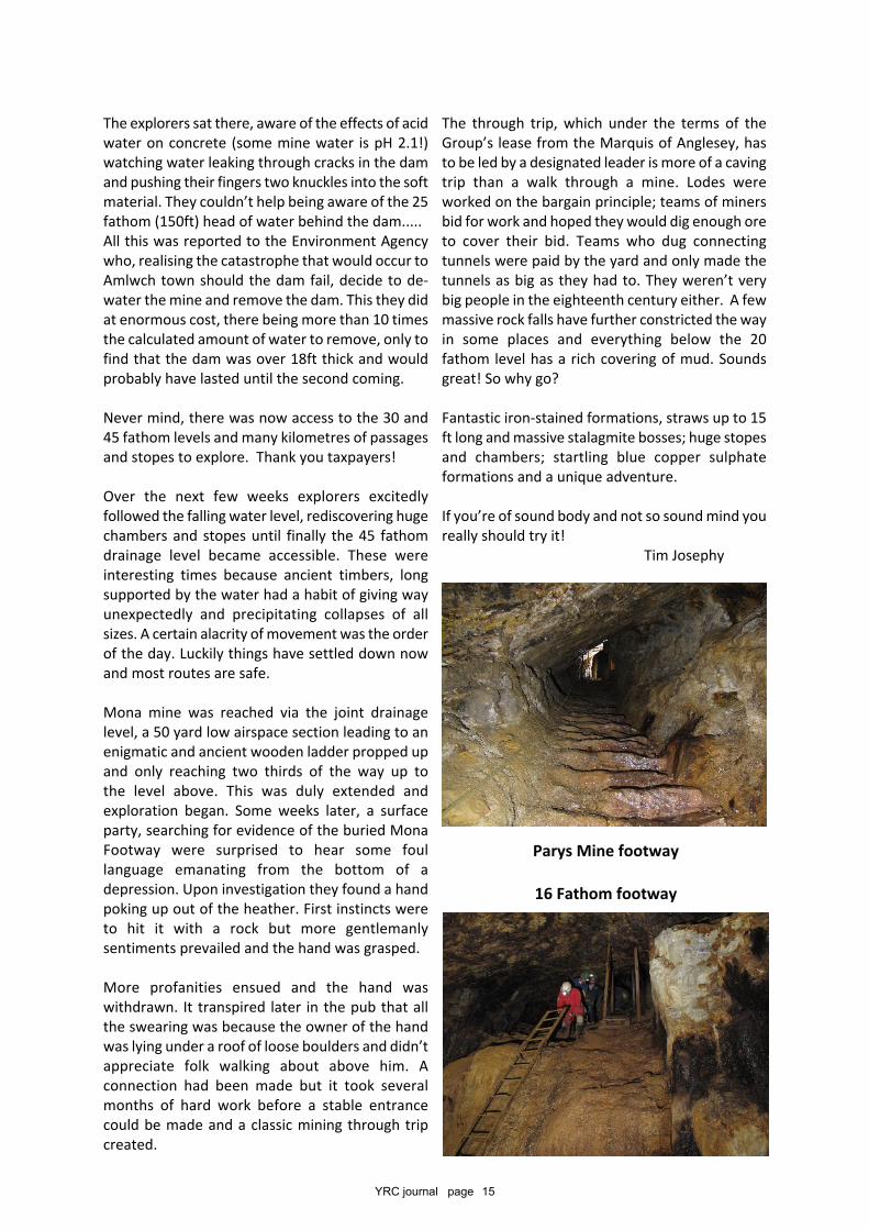
TheRedPools
Copper sulphate formations
Pennington Bay, Kangaroo Island
YRC journal page 14
EXPLORATION
There had been two mines on the mountain, theParys and the Mona, separately owned andconnected only by the joint drainage level at 45fathoms.
The Parys Mine, the only one accessible, wasflooded below the 20 fathom level.
Pretty soon all accessible passages had beenexplored, with the discovery of two more BronzeAge sites, so interest switched to some of the stillopen drainage adits.
The Afon Goch (Red River), so called because ofthe iron staining of the water, yielded over ¼ mileof desperate struggle, chest deep in viscous ochre,to a concrete dam with two drain valves, nowinoperative, at the bottom.
BACKGROUND
Mining had been going on to a greater or lesserextent for centuries before the Great Discovery ofMarch 1768. Acting under the direction of theowner, a miner named Rowland Pugh discovereda huge lode of copper close to the surface. Thissparked off an expansion that was to see Parysmountain become the biggest copper producer inthe world and making the tiny port of Amlwch thebusiest on the west coast of Britain, eclipsing bothLiverpool and Milford Haven. For this discoveryRowland was rewarded with a bottle of whisky anda rent free house. Small recompense for the vastprofits that were to be made.
Surface mining in two huge opencasts workedalongside deep mining which, by the end of thenineteenth century reached a depth of over 900ft,about 500 ft below sea level. Although initially vastquantities of ore were recovered, by the mid tolate 1800’s developments of mining in SouthAmerica and South Africa were taking their toll andthe difficulties of extraction under Parys Mountainmade mining an economic struggle. It had longbeen known that copper could be recovered frommine drainage water by collecting it in lagoons;throwing in scrap iron, then processing theresulting sludge. By the twentieth century, this wasthe primary method of recovering copper; damswere built in the drainage adits, the mine allowedto flood for a few months then the water wasdrained off into the lagoons which still circle themountain.
Even this operation had ceased by the 1950s, themine slowly flooded and apart from a few visits byinterested locals it was forgotten.
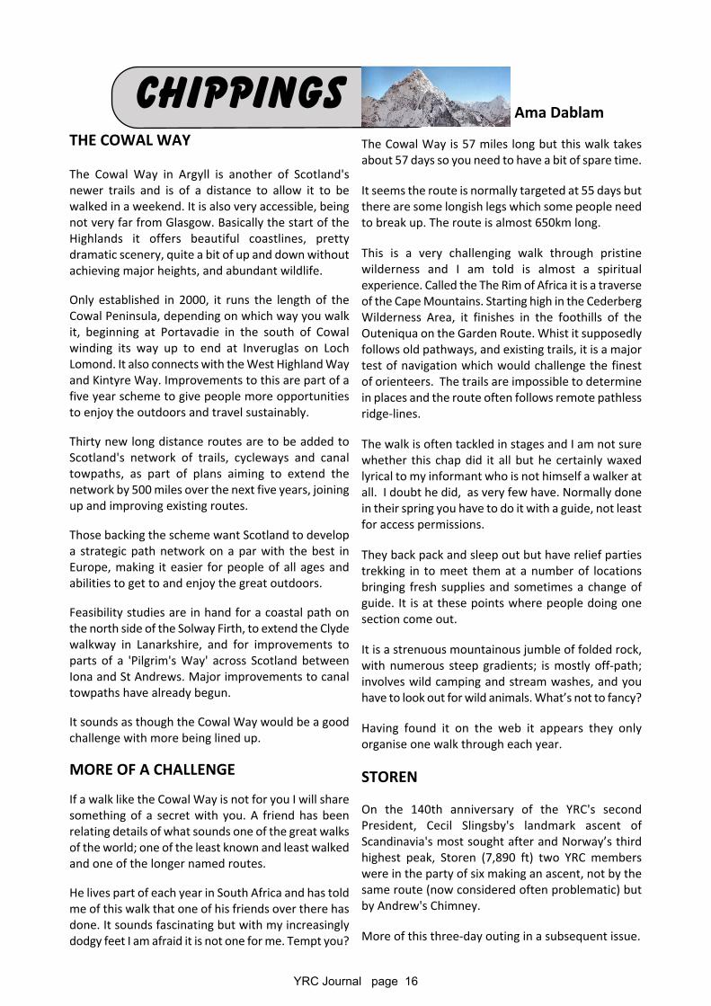
Snottites, bacterial extremophiles, Parys Mine Formations in Mona Mine
Jointdrainagelevel
Descending to the20ft level
YRC journal page 15
The through trip, which under the terms of theGroup’s lease from the Marquis of Anglesey, hasto be led by a designated leader is more of a cavingtrip than a walk through a mine. Lodes wereworked on the bargain principle; teams of minersbid for work and hoped they would dig enough oreto cover their bid. Teams who dug connectingtunnels were paid by the yard and only made thetunnels as big as they had to. They weren’t verybig people in the eighteenth century either. A fewmassive rock falls have further constricted the wayin some places and everything below the 20fathom level has a rich covering of mud. Soundsgreat! So why go?
Fantastic iron-stained formations, straws up to 15ft long and massive stalagmite bosses; huge stopesand chambers; startling blue copper sulphateformations and a unique adventure.
If you’re of sound body and not so sound mind youreally should try it! Tim Josephy
The explorers sat there, aware of the effects of acidwater on concrete (some mine water is pH 2.1!)watching water leaking through cracks in the damand pushing their fingers two knuckles into the softmaterial. They couldn’t help being aware of the 25fathom (150ft) head of water behind the dam.....All this was reported to the Environment Agencywho, realising the catastrophe that would occur toAmlwch town should the dam fail, decide to de-water the mine and remove the dam. This they didat enormous cost, there being more than 10 timesthe calculated amount of water to remove, only tofind that the dam was over 18ft thick and wouldprobably have lasted until the second coming.
Never mind, there was now access to the 30 and45 fathom levels and many kilometres of passagesand stopes to explore. Thank you taxpayers!
Over the next few weeks explorers excitedlyfollowed the falling water level, rediscovering hugechambers and stopes until finally the 45 fathomdrainage level became accessible. These wereinteresting times because ancient timbers, longsupported by the water had a habit of giving wayunexpectedly and precipitating collapses of allsizes. A certain alacrity of movement was the orderof the day. Luckily things have settled down nowand most routes are safe.
Mona mine was reached via the joint drainagelevel, a 50 yard low airspace section leading to anenigmatic and ancient wooden ladder propped upand only reaching two thirds of the way up tothe level above. This was duly extended andexploration began. Some weeks later, a surfaceparty, searching for evidence of the buried MonaFootway were surprised to hear some foullanguage emanating from the bottom of adepression. Upon investigation they found a handpoking up out of the heather. First instincts wereto hit it with a rock but more gentlemanlysentiments prevailed and the hand was grasped.
More profanities ensued and the hand waswithdrawn. It transpired later in the pub that allthe swearing was because the owner of the handwas lying under a roof of loose boulders and didn’tappreciate folk walking about above him. Aconnection had been made but it took severalmonths of hard work before a stable entrancecould be made and a classic mining through tripcreated.
Parys Mine footway
16 Fathom footway
YRC Journal page 16
THE COWAL WAY
The Cowal Way in Argyll is another of Scotland'snewer trails and is of a distance to allow it to bewalked in a weekend. It is also very accessible, beingnot very far from Glasgow. Basically the start of theHighlands it offers beautiful coastlines, prettydramatic scenery, quite a bit of up and down withoutachieving major heights, and abundant wildlife.
Only established in 2000, it runs the length of theCowal Peninsula, depending on which way you walkit, beginning at Portavadie in the south of Cowalwinding its way up to end at Inveruglas on LochLomond. It also connects with the West Highland Wayand Kintyre Way. Improvements to this are part of afive year scheme to give people more opportunitiesto enjoy the outdoors and travel sustainably.
Thirty new long distance routes are to be added toScotland's network of trails, cycleways and canaltowpaths, as part of plans aiming to extend thenetwork by 500 miles over the next five years, joiningup and improving existing routes.
Those backing the scheme want Scotland to developa strategic path network on a par with the best inEurope, making it easier for people of all ages andabilities to get to and enjoy the great outdoors.
Feasibility studies are in hand for a coastal path onthe north side of the Solway Firth, to extend the Clydewalkway in Lanarkshire, and for improvements toparts of a 'Pilgrim's Way' across Scotland betweenIona and St Andrews. Major improvements to canaltowpaths have already begun.
It sounds as though the Cowal Way would be a goodchallenge with more being lined up.
MORE OF A CHALLENGE
If a walk like the Cowal Way is not for you I will sharesomething of a secret with you. A friend has beenrelating details of what sounds one of the great walksof the world; one of the least known and least walkedand one of the longer named routes.
He lives part of each year in South Africa and has toldme of this walk that one of his friends over there hasdone. It sounds fascinating but with my increasinglydodgy feet I am afraid it is not one for me. Tempt you?
The Cowal Way is 57 miles long but this walk takesabout 57 days so you need to have a bit of spare time.
It seems the route is normally targeted at 55 days butthere are some longish legs which some people needto break up. The route is almost 650km long.
This is a very challenging walk through pristinewilderness and I am told is almost a spiritualexperience. Called the The Rim of Africa it is a traverseof the Cape Mountains. Starting high in the CederbergWilderness Area, it finishes in the foothills of theOuteniqua on the Garden Route. Whist it supposedlyfollows old pathways, and existing trails, it is a majortest of navigation which would challenge the finestof orienteers. The trails are impossible to determinein places and the route often follows remote pathlessridge-lines.
The walk is often tackled in stages and I am not surewhether this chap did it all but he certainly waxedlyrical to my informant who is not himself a walker atall. I doubt he did, as very few have. Normally donein their spring you have to do it with a guide, not leastfor access permissions.
They back pack and sleep out but have relief partiestrekking in to meet them at a number of locationsbringing fresh supplies and sometimes a change ofguide. It is at these points where people doing onesection come out.
It is a strenuous mountainous jumble of folded rock,with numerous steep gradients; is mostly off-path;involves wild camping and stream washes, and youhave to look out for wild animals. What’s not to fancy?
Having found it on the web it appears they onlyorganise one walk through each year.
STOREN
On the 140th anniversary of the YRC's secondPresident, Cecil Slingsby's landmark ascent ofScandinavia's most sought after and Norway’s thirdhighest peak, Storen (7,890 ft) two YRC memberswere in the party of six making an ascent, not by thesame route (now considered often problematic) butby Andrew's Chimney.
More of this three-day outing in a subsequent issue.
chippings Ama Dablam
YRC Journal page 17
AND EVEN MORE CHALLENGING…..HOW DO YOU MOVE AMOUNTAIN?
The answer is of course to change a map.
A fairly modest peak on the Norwegian side ofthe Finnish border may be ‘moved’ into Finlandwhich would make it that country’s highest peak.
If the border were to move east about 200metres and north 150 metres, the summit of the1365m Halti would then be in Finland.
At present the highest place in Finland is partway up a slope and compared the the giants inNorway this summit is of little consequence tothem.
There is a campaign to bring this about tocelebrate Finland’s 100 years as an independentcountry.
WHERE WITCHES FLY….ON A COLD WINTER’S NIGHT
Pendle Hill is an imposing divide betweencommunities in this part of Lancashire and aswell as being a good walking place affordinggood views it is a land of myth and mystery.
Stories of the Pendle Witches have passed intoLancashire legend and folk poem and music. Itreflects a period of malicious accusations andcounter-accusations with people convicted ofwitchcraft and at least nine being executed. Thearea is now to receive a lottery grant to delveinto its wide and fascinating heritage includingthe starting of the Quaker movement.
LOMOND & TROSSACHS
Scotland’s first National Park, Loch Lomond &The Trossachs is set to receive £1.5m to fund aLandscape Partnership project at its eastern-most corner. Callander sits on the HighlandBoundary Fault in a geological gap between theLowlands and Highlands, and provides a naturalgateway to the National Park and the Highlands.
Made famous far and wide as Tannochbrae, thehome of Doctor Finlay’s Casebook when
televised in the 60s it had a period as a verypopular visitor location.
Ambitious plans as part of this new scheme includerestoring its fortunes by transforming the towninto the 'Outdoor Capital of the National Park' anddeveloping a cycling and walking network.
COAST PATH UPDATE
Natural England is moving on nicely with its workto deliver the England Coast Path, with workunderway to open up half of it at present.Eventually the path will stretch out across 2700miles of often stunning walking routes if you fancya really long walk. To establish the route theyhave divided the coast of England into sixty-sixbite-sized stretches with teams working closelywith local authorities, land owners and occupiers,communities, interest groups and others to ensurethe best and most appropriate alignment for thenew coast path.
They have already opened up over 100 miles withalmost as much again opening any time now, inKent and Somerset. They are now building on thisprogress with the aim of still completing thecoastal path around England by 2020.
Stretches are open in Dorset and Norfolk; in theNorth West the Cumbrian stretch from Allonby toWhitehaven is now open and the rest betweenGretna and Silecroft is currently being worked on.Work on the coast round Morecambe Bay down toCleveleys should start this year. In the North Eastthe Durham stretch is open and south from thereto the Humber is being worked on.
The new routes will also improve access to ourcoastline, beaches and foreshore, with someexisting coastal footpaths actually moved nearerthe sea so walkers have a better opportunity toproperly enjoy our coastal views and beaches. TheEngland Coast Path will be a well way-markedNational Trail around the whole of the English coast.
THE REAL CHALLENGE OF FRACKING
How do you fracture the lower rock strata inLimestone areas without disrupting the routeswater takes underground; causing rock falls in cavesystems and making caving a considerable amountmore dangerous?
YRC Journal page 18
I am no geologist and have only ever been an occasional caver but I cannot help but fear some of themagnificent calcite features I have seen underground may be destroyed or blocked off from futuregenerations. The government has announced that licences will be given including parts of the PeakDistrict and North Yorkshire. The licenses are for exploration not production fracking and the jury is stillout on possible underground effects on the hydrology but it is envisaged that productive sites will bechosen for licencing taking such matters into account.
THE BANFF MOUNTAIN FILM FESTIVAL
By the time this is published it will be too late to watch the films at any of the British venues but someare still available on line. Those of you lucky enough to have caught one of the shows will know howgood some of the entries were last year. There are two collections on tour and I took in the Redprogramme as it included one film I particularly wanted to see.
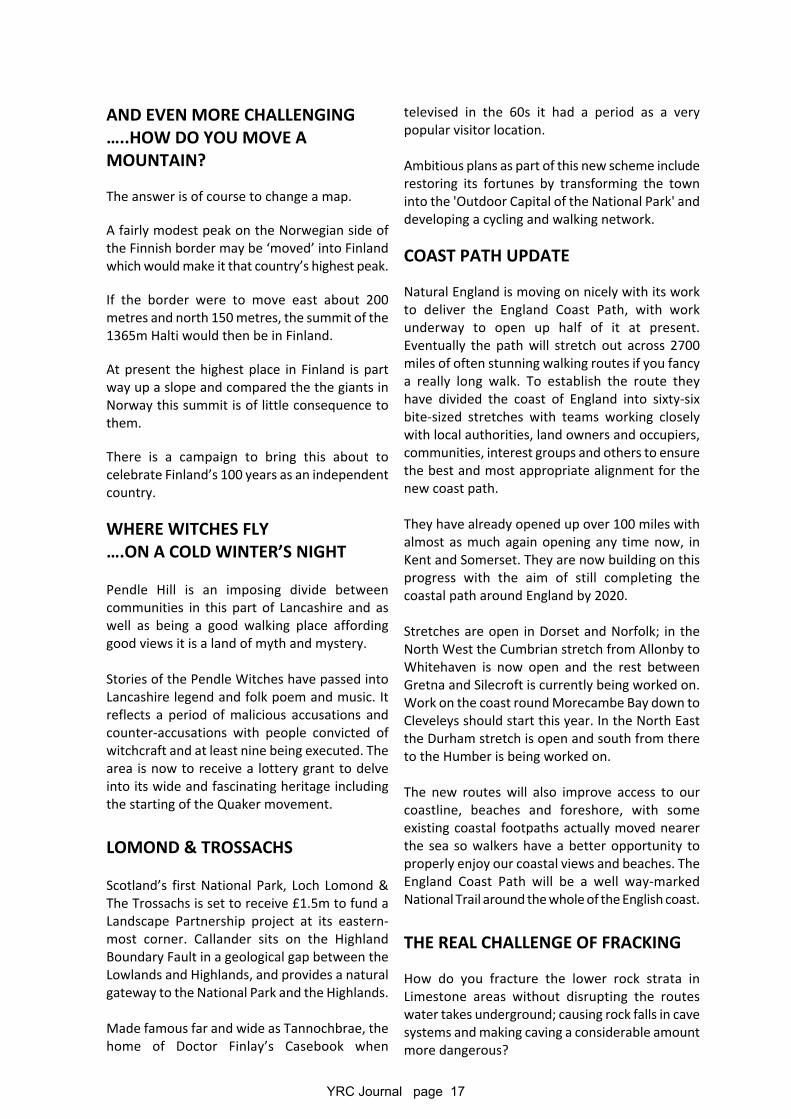
The Cerro Fitz Roy skyline is one of the most dramatic in the world and the continuous traverse has beenan ambition of many seriously great climbers. This film, ‘A Line in the Sky’ accompanies the two manwho first managed the traverse of the ridge line.
(see http://www.patagonia.com/us/the-fitz-traverse)
In early February 2014, after sitting and watching for weeks the skies cleared and the forecast showedfive days of high pressure and low winds, by local standards the best that could be hoped for and theywent for it. They knew to succeed they had to be very quick so travelled very light with everything theyneeded in two small back packs as the traverse includes numerous serious and lengthy rock climbs.
This film won the Best Film-Climbing Award and covered an epic many had thought impossible. It involves13,000 feet of vertical ascent and three miles in all, taking in Fitz Roy itself and six dramatic satellitepeaks largely on ice-covered rock.
Alex Honnold and Tommy Caldwell are probably the top American big wall climbers but this trip toPatagonia was Honnold’s first and he had little experience of alpinism.
They ended up doing it in five days camping out sharing one sleeping bag including one night at thesummit of Fitz Roy (3,359 m) and another atop of Poincenot (3002m).
This achievement earned the climbers the Piolet d’Or, mountaineering’s highest award.
Another of the seven films included in the Red tour well worth a look at was ‘Unbranded’. Notmountaineering but a long distance trek on horseback.
YRC Journal page 19
That does not do it justice! Trying to make people aware of the plight of the wild horses (Mustangs) roamingthe wilderness area of the States four men just out of college caught a string of mustangs and partly trainedthem before riding 3000 miles from Mexico to Canada, They road through public access lands, crossing thedesert; going over the Tortilla mountains, through the Grand Canyon, Yellowstone and Glacier NationalParks. At times man and horse were rock climbing. It took them five months.
The film won a People’s Choice Award. (See trailer https://www.youtube.com/watch?v=uQmmaiWHYHQ)
Another great ‘climbing’ film I have just seen and recommend is Meru if you can find it being shown anywhere.
CAPE CAVING
Following up on previous pieces about caves in South Africa they are not on the scale of those in the UKand elsewhere. Most of these dolomite caves are in the former Transvaal which Steve Craven and hisassociates in the Cape leave to their members in Johannesburg. In the Cape they have many short caves inthe Table Mountain sandstone on the Back Table, and above Kalk Bay and Muizenberg. Those on the BackTable are mass movement caves in which they have 4.7 km. of continuous surveyed cave passage, whichis not bad for insoluble rock.
They also have some in the coastal limestone on the De Hoop reserve east of Bredasdorp and in thelimestone north of Oudtshoorn which includes a commercial one ‘Cango Cave’.
In the Ghaap Plateau of the Northern Cape there are dolomite caves, but because of the huge distancesfrom Cape Town and Johannesburg where the speleologists live, they are not well recorded as the localsare uninterested.
If we again consider a meet in South Africa there would be opportunities for some work underground inaddition to climbing and trekking.
CLIMBING MOUNTAINS - EVEREST
Despite the disasters of recent years the Everest Industry appears to be back in full swing. Speaking assomebody who could never have dreamt of attempting it, it is easy for me to look at the activity with somedisdain. I know the draw of mountains and the elation of achievement beyond your personal expectationsbut I really cannot see the attraction of climbing Everest these days.
You obviously have to be fit but with sufficient money the professional firms will get a lot of people up thereso what is so special? Do we really want to ascend what is an open air cemetery combined with a rubbishtip. If I want to be part of a traffic jam I can find that in Leicester.
Thankfully the heavily used glacier camp sites within sight of Everest are kept clean by the local guideassociations leaving an impression of the wilderness experience for trekkers and climbers. They also haveprocedures for current campers to clear their sites backed up by end of season clearances. Unfortunatelythe upper reaches of the mountain are still not pleasant in places.
Money as always speaks. If you have lots of it somebody will always help you spend it and Nepal as one ofthe world’s poorest nations has found it hard to resist letting too many people onto the mountain but haveannounced restrictions on the numbers and characteristics of those who will be allowed above base camp.In future. Under-18s, the over 75s, anyone disabled to the the point of not being independent climbers andthose without 6,500m peaks to their name will be banned.
Trekking up to look across at base camp I saw far more attractive mountains offering far more challengingreal climbing opportunities.
If you really want a challenge what about Ama Dablam.
Now that is what I call a mountain!
YRC Journal page 20
MOUNTAINS CLIMBING
Summits in the more geologically active partsof the world are mostly slowly rising.Certainly getting higher quicker than theyare being eroded. Our records of the heightswill need checking from time to time.Earthquakes can have dramatic effects onthe surface but they also cause or reflectmajor changes in the earth itself.
All the great ranges are where the tectonicplates meet and effectively one continent isbumping into another.
Some are pushing head on and some grindingpast each other. When the latter build uppressure it can suddenly be released with aquake. When they meet head on one tendsto ride up over the other but again not in asmooth motion and the sudden releases cancause mayhem. Quakes can differ greatly notonly in magnitude but whether they are deepseated or nearer the surface. It makes a greatdeal of difference to the effect on the surface.
The constant movement of the Indian subcontinent pushing north into Asia at a rateof 37mm a year is what has produced thegreat peaks of the Karakoram, Pamirs, HinduKush and Himalayas. As the one is beingpushed under the other, one rises and onesinks and the recent apparently majorquakes in that region could have been a greatdeal worse had the quake been nearer thesurface.
BEN IS GROWING TOO
The latest measurements have thrown up a bitof a surprise. The O. S. has now determined thatBen Nevis is 1,345 metres above sea level, onemeter higher than previously thought.
The actual height is apparently 1,344.527Given the technology available then it issurprising perhaps that the last measurement,taken in 1949, was so accurate.
TEESDALE WAY
The Teesdale Way is a 92 mile trail, from Cumbriaand Cow Green Reservoir in Upper Teesdalethrough County Durham and Teesside to theNorth Sea coast at Warrenby in Redcar.
For much of the way it follows the River Tees andmembers have walked the western end on anumber of meets over the years.
It is now to be ‘improved’ and promoted by theRiver Tees Rediscovered project; a £3.7mprogramme supported under the HeritageLottery Fund’s Landscape PartnershipProgramme. It will deliver improved signage,surfacing and path furniture on the Way andalong a series of linked countryside and urbantrails. The project will also help to interpret andcelebrate the industrial and natural heritage ofthe area and runs over 5 years. A diverse rangeof projects is in hand including schemes whichwill conserve and enhance natural environmentand heritage features, and improve public access
MORE PARKS FOR SCOTLAND
The Scottish Campaign for National Parkssupported by a number of other organisations iscalling on the Scottish Government to honour itselection manifesto commitment to explore thepossible creation of new national parks.
Scotland only has two national parks, LochLomond & the Trossachs and the Cairngorms.They are suggesting seven areas to consider asfuture national parks, including possible marinenational parks taking in Lochaber and South Skyeand / or the Argyll Islands and coast.
HODGE CLOSE
The Climber magazine is making much of theclimbs on slate in Hodge Close.
“The centre piece of Lakeland slate has to be theimposing Hodge Close, a huge hole withimmaculate 50m off-vertical walls rising out of a32m deep, green pond. This is a very specialplace to climb, once an industrial eyesoreproducing millions of tons of slate to roof thehouses of our land, nature has taken over toleave a tranquil place of beauty with thebackdrop of Wetherlam and the Langdales“
Now why did we not think of that?
Seriously though with all that exposure in moresenses than one should we not make more of thefact that LHG is only yards away. Something forour web site?
YRC Journal page 21
AT THE RISK OF BEING A BOARIf you go down to the woods today, you may get abig surprise.
I have been doing just that for 60 years and thereare massive changes over that timeframe.
As somebody who loves wildlife and wild placesand also a keen walker and orienteer, I havealways spent hours in woodland. As a youngerman larger animals were a rarity wherever I was.Since then Roe have re-inhabited many areas,muntjac have come out of nowhere and are noweverywhere and we even get occasional polecatsnow.
Now after an absence of nearly half a century, wildboars are again fairly wide spread - they now haveno natural enemies and the UK population isexploding. These and the muntjac are decimatingour understory.
Plants growing beneath the trees where minimallight penetrates grow earlier than the canopy treesto make use of the earlier availability of light andgreater humidity include ferns, mosses and fungiwhich provide favourable habitats for many smallcreatures and plants, available to these beastswhen other food sources are scarce.
Some areas are turning to drastic solutions. It wasreported last year that in Germany three quartersof a million boars are shot every year and thatbarely keeps the numbers steady. With an averagelitter of six young, plentiful food and no predators,the boar are on a winner.
Here in England with ideal conditions, where theconditions are even better for them, they will beeverywhere unless we do something about them.
The Forest of Dean which I visited this summer isnow thought to have a population of about 1000boars which are being culled each year to keepthem in some sort of check. To put this inperspective they expect top cull 60% just to standstill year on year.
There are increasing numbers of tales of terrifyingencounters with them. Some of the fear maybe misplaced, as boars are by nature shy andsecretive, but if cornered or disturbed they can bedangerous.
They can weigh 25 stone, and anything that heavycoming at you at up to 30 mph can be ratherdisconcerting. No use climbing over a fence as theyhave been seen to clear six-foot fences. Like manywild animals if you have a dog they will feel threat-ened and these beasts have wicked little tusks andthey know how to use them.
Eat them I say; they are very tasty.
MORE PROTECTED WATERS
It is good to report that the extent of the marineprotection around the British Isles is increasing. Asalways with Government matters there are, tomy mind, far to many slightly different forms ofprotection. We have Marine Special Areas ofConservation (SACs), Marine Special ProtectionAreas (SPAs), Marine Conservation Zones (MCZs)and Nature Conservation MPAs (NCMPAs.Anyway all protection is welcome.
The Government has now designated anothertwenty three new Marine Conservation Zonesmaking fifty in all and technically means that about8,000 square miles of UK waters now have someenvironmental protection.
It is worth noting though that as yet there is as yetno management plan nor are there any legislationor byelaws in place. There will be no keep-offsigns, and apparently no policing so activitiesin the reserves will probably remain largelyunchanged.
BEE PROBLEMS
There are well documented concerns about thedramatic reduction in numbers of bees around butthings seem to have got worse last year in theNorth West.
It appears that Bee-Eaters have been breedingsuccessfully last year, in a quarry near Brampton inCumbria.
The same people bemoaning the plight of the beeswere celebrating this breeding success. Strangeworld isn’t it?
Natural historyWILDLIFE, ecology AND THE natural ENVIRONMENT0 1
YRC Journal page 22
Active and restored quarry sites can and do providehabitats for a wide variety of species. The quarryingindustry has through restoration programmes,already delivered or has planned, over 10,000hectares of priority habitats
The Twite has declined dramatically both in numbersand range over last 25 years and it is now a rare birdin England, only breeding in a few small locations inthe South Pennines. This includes a small group nearDove Holes quarry.
CEMEX, the quarry company, has been workingwith the RSPB in providing extra feeding to helpmaintain this population which now seems to beslowly expanding.
WELSH IMPROVEMENTS
Natural Resources Wales with the help of EU fundingis to introduce or enhance active management andrestoration of a large number of sites to act as keyreservoirs of biodiversity, mostly in Special Areas ofConservation and Special Protection Areas.
The total cost to deliver the actions across Wales hasbeen calculated at £120 million over five years but itwill have to be spread thinly as protected sites coveraround 7% of the land area of Wales and about a thirdof Welsh seas. An analysis has identified priorityecosystems, which include peat lands, sand dunes,woodland, rivers and, in the marine environment,estuaries and salt marsh, lagoons and shingle.
THE COST OF ENERGY?
There are sources of fuel out there but they have tobe used sensibly. 'Sustainably' as the jargon goes.
Deutsche Bank is on record saying solar power will becheap enough within two years to make fossils fuelsredundant.
On the face of it that should be welcome but fieldupon field of solar panels disfigures the landscape andtakes often productive agricultural land. The easyanswer is to say that fuel supplies come first and theenvironment has to be surrendered. This gives ineffect little value to our environment but it is avaluable asset.
The UK has many Capital Assets - No not Londonbuildings; and not only just the machinery we use to
produce goods but also the elements of the naturalenvironment which provide identifiable benefits suchas clean water and air, food and recreation. These arebeing depleted and our stock is in a long-term declinewith impacts on economic growth and the wellbeingof the population. If economic growth is to besustained, this natural capital has to be protected.
It has been estimated that poor air quality causes inexcess of 40,000 deaths each year in the UK. This hasa significant impact on the productivity and publichealth. We are thought to lose over £5bn through lostwork days and possibly as much again on the NHSbudget.
The challenge of protecting and improving our naturalcapital is large but doable and it can still contribute toboth energy creation and energy and costs savings.
One of the earlier forms of energy was of course peat.With extraction for fuel followed by use for gardenenhancement our peat lands have been decimated.Farmers and grouse moor owners are teaming up withconservationists to restore vast expanses of PeakDistrict and South Pennines peat lands; extensivetracts of semi-natural moorland with upland heathand peat bog, supporting birds of prey and wadingbirds.
The peat bogs have been in decline since the industrialrevolution, but thanks to individual moorland owners,large Environmental Stewardship (ES) schemes are inhand to bring about £15 million of moorlandrestoration over the next five years. This does ofcourse mean we must stop peat extraction but it canstill contribute to the economic package.
These schemes will involve changing management on39,000 hectares of moorland, with less heatherburn-off and a return to traditional sheep herdingpractices to help improve the environment. They willbe blocking gullies increased water retention on theSSSIs to sustain peat bogs and their special plant lifeand birds. The knock on benefits to the economy isreduced flooding down stream and more carbonretention in peat, helping mitigate climate change.One of the difficulties with any attempt at landscapescale works is that there are so many agencies andgovernment departments involved in some way.Natural England and DeFRA are very much involvedon the wildlife and environment side, theEnvironment Agency are also involved and especiallyin flood management and even English Heritage havegot involved. They organised studies of these areas
YRC Journal page 23
looking out for archaeological remains in the peat andunderneath it. If like in Ireland they find bodies therethen presumably the anthropologists will want part ofthe action. It is possible that schemes to solve otherproblems could be threats to any archaeologicalremains.
Amongst the areas receiving particular attention fromthe archaeologists are the fells of south west Cumbriaincluding the Langdales and Bowland Forest, on thedoorsteps of our two cottages. It is thought thatsignificant archaeological remains may be foundbeneath the peat at the top of the original soil. If thepeat has preserved things from 8,000 years ago theywould want to remove the peat to find them but onceair gets to them they would soon deteriorate so it is abit of a catch 22. If the archaeologists want to removepeat and the conservationalists want to protect it therecould be some lively debates.
Strangely the biggest threat to upland peat areas isprobably climate change although longer growingseasons, milder winters and more rain should help it.The problem is though, that warm, dry conditions andprolonged droughts can increase fire risk and a peatmoor can burn for a long time. This is where we camein: it is a fuel source. Such conditions may alsoencourage the growth of competing heathland plants.On one level deep rooted plants would be welcome asthey can prevent mud slides which peat areas canexperience when we have a lot of rain.
It seems the best option is to protect entire landscapeswhere there are likely to be historic remains whilst notactually looking for them; working towards completepreservation until such time as techniques evolve toallow for search and recovery without riskingenvironmental impacts. By this we make no economicreturn out of the archaeological possibilities but thepeat lands as a natural asset will still contribute as acarbon soak and a flood alleviation mechanism.
Another agency involved is the Natural CapitalCommittee which advises the Government, workingclosely with other QUANGOs and non-governmentalagencies and the private sector.
They are recommending a long-term, strategicinvestment in this area which they feel will delivergood value for money. They make a strong economiccase for planting of up to 250,000 additional hectaresof woodlands near towns to generate net societalbenefits in excess of £500 million per annum althoughthe mind boggles at how they came up with that figure.
Peatland restoration on around 140,000 hectares in
upland areas, they say would deliver net benefitsof £570 million over 40 years in carbon values alone.Restoring old habitats to hold back water run offand prevent downstream flooding has to be a soundidea and in no way disfigures the landscape. Despitetheir benefits other uses of our natural assetscannot all claim the same and wind turbines fall verymuch into this category as increasingly do massivefarms of solar panels.
Tidal energy capture seems one of the betteroptions although many suggestions for capturing ithave proved equally unacceptable. Barragescreating lagoons are very expensive and normallysilt up and become ineffective between 8 and 15years after construction. It is one way of creatingnew land but long term does not solve our energyneeds. It has been suggested that if we tapped intothe hot air created by the endless committee,commissions and governments discussing this wewould not have a problem.
One encouraging idea being used in Australia is analternative use of tidal power. Most systems rely onwave power as tides come in and then additionalpressure as captured water is slowly released todrive turbines. There are numerous other smallscale projects working and producing power butimpractical on a scale to be meaningful. We havesnakes, ducking ducks and nodding seabirds to givea few nicknames.
The Ozzies are trialing a simple device which sits likea spinning top on a wire and moves up and downwith every wave not needing a great tidal range.This Salter's duck / nodding duck / Edinburgh duckwas developed in Britain in the 1970s in responseto the oil crisis. When we got cheaper oil and NorthSea gas we did not develop it further. Salter is SouthAfrican but studied in England and worked inEdinburgh. This looks the best idea yet.
We do need power but we also need to protect thisglobe we live on. We must stop the human racefrom killing off our own planet as that would be theend of us. A healthy environment for and a futurefor our descendents is a must if we don’t want togo down as the last generation that had a chanceto stop the destruction and did nothing.
There is an immediate benefit anyway; if we couldcut stress-related illnesses, obesity, mental healthand other related illnesses; the NHS would havemore money for other problems.
The natural world can really help. But it needs ourhelp to.
YRC Journal page 24
The RSPB has estimated that of 3000 species it looked at60% are in decline. A mixture of our farming practicesand disease has hit pollinators especially bees and if theydo not do their work plant species will decline even faster.
We need to act to afford wildlife and our environmentthe protection it needs if only in our own selfish interest.One encouraging bit of news recently was that somebodywas actually jailed for wildlife crime.
Fining a gamekeeper on a rich estate has never been adeterrent.
NORTH PENNINE CREEPY CRAWLIES
Whether you are put off by creepy crawlies or arefascinated by their diversity there is good news from theNorth Pennines AONB. A new project has beenlaunched, Cold-blooded and Spineless, which aims toput invertebrates in the spotlight. Two thirds of all ofinvertebrates have declined in the last half century andthere are still many we know little about.
We are particularly ignorant of those species that livein the uplands.A half million pounds grant from the Heritage LotteryFund to be used over 5 years, will allow these to bestudied in the North Pennines.
Invertebrates are invaluable for good biodiversity and ahealthy landscape. They are classic recyclers and act aspest controllers and are a vital food source for all kindsof fish, birds and animals.
Teachers and youth groups and the public at informalsurvey days will encourage a group of invertebratechampions in the region. The North Pennines AONBPartnership’s WildWatch website has been enhanced tooffer features to help budding entomologists. Recorderscan upload images of their observations, join a forum toget expert advice and share their interest in importantlocal sites.(see www.northpennines.org.uk/wildwatch)
JOHNS BLUE AGAIN
Until recently their were 14 slightly differentlycoloured types of Blue John to be found, all fromdifferent seams around Castleton. All strange andintriguing mixes of blue and purple and not veryuseful in jewelry as it is quite soft, it hasnevertheless been prized as something unique tothe area.
Now, 150 years since the last find, another seam of
this fluorite has been discovered. The RidleySeam named after the miner who found itwas something of a surprise as he found italmost accidentally
BIODIVERSITY HOTSPOTS
There is much talk of the remarkable diversityand range of species to be found on coral reefsand in rain forests, but the humble hedge can givethem a run for their money.
Classed as a priority habitat, their importance forwildlife is often understated. Many studies showthat they are vital for insects, small mammals andfarmland birds. Arable farmland relies onpollinators living in these hedges and they in turnrely on the wild flowers along hedgerows and theblossoms on some hedging species.
One hedge less than 100 yards long has beenfound to contain over 2000 species that could beseen with the naked eye and the true figure isprobably nearer to 3,000. It probably alsoincluded over 10% of all insects known to be inthe UK.
The great majority of these creatures are findingfood and a safe haven in the hedge. Many breedthere and find shelter and protection from badweather and others will be using the hedge as asafe flyway through the countryside, bumblebeesand bats especially.
THE OUTER HEBRIDES
This is of course a favourite place visited by ameet recently. Its remoteness, wildlife diversityand near wilderness areas are marred somewhatby ugly intrusive military cabins by the village bayand the military radio gear by the hilltop.
Perhaps visiting and sporting activities should berestricted as the islands are hugely important fortheir wildlife. They are home to huge populationsof sea birds including the world’s second largestcolony of North Atlantic gannets.
The waters around St Kilda are designated aSpecial Area of Conservation (SAC) for their reefsand sea caves, which attract a wealth ofspectacular sea life.
Monitoring these underwater worlds is extremelydifficult due to the remoteness of St Kilda and the
YRC Journal page 25
treacherous waters. Any diving has to be regulatedby strict safety limits. Recent endeavours have foundcave entrances teeming with life, from kelp tocolourful sponges, sea-squirts, bryozoans andanemones with many other species hiding betweenthem.
Work will continue when weather permits for theNational Museum of Scotland and Herriot-WattUniversity
KINDER PROJECT
The five year project to restore Kinder is progressingwell. The moorland had been badly damaged byfires, pollution and over grazing, not to mention theeffects of thousands of feet but £2.7 Million is beingspent on restoration.
So far 80 hectares have been replanted with afurther 191 hectares having been spread withseed.
6,000 small dams have been created to stop runoff and over 14k of sheep fences have beenerected.
The moors are returning to their former stateas lush wet bogs which helps prevent lowlandflooding, improves the quality of the waterfinally escaping the moors and providers ahabitat which is encouraging the return ofnumerous native species.
BYE BYE FLUTTERBY
Almost 80% of our butterfly species have seena fairly pronounced decline over the last halfcentury.
We may soon be saying goodbye to some oncecommon species either resident or regularmigrant visitors
The long-term reduction in numbers of theWood White, Small Skipper , White Admiral, andMarsh Fritillary continues and the Essex Skipper,Small Heath and Wall, are now amongst themost rapidly declining. All is not lost howeveras organisations are waking up to the problemand trying to fight it.
Preserving, protecting and reinstating their
habitats makes a big difference and four onceendangered species are actually increasing overrecent years. During the last ten years the Dukeof Burgundy, Dingy Skipper Pearl-borderedFritillary and Silver-studded Blue have seengood increases in occurrence and even our mostendangered butterfly, the High Brown Fritillary,has plateaued.
It is a very mixed picture. One of our commonspecies, the Gatekeeper, whilst not yetthreatened has declined by almost half duringthis century.
Butterflies that migrate from more equableenvironments are not doing badly with threecommon species becoming much moreabundant (Clouded Yellow, Red Admiral andPainted Lady).
Two other once rare migrants, the ScarceTortoiseshell and Long-tailed Blue have arrivedin increasing numbers.
RATTY RETURNS
After an absence of 50 years you should soonbe able to catch a glimpse of water voles inMalham Tarn.
This year after work to restore the tarn andremove pollution the national Trust is to releasesixty or more to try and re-establish apopulation with another release planned fornext year.
A BETTER BLEASDALE
Back in 2013, volunteers planted common cottongrass and moved Sphagnum moss into new poolscreated on the fells and the hags were re-profiledto have a less angular edges helping to reduceerosion of the peat by the wind and the rain.
They were then limed and further seeded toencourage vegetation growth, good for the wildlifebut also helping to stabilise the peat.
Signs are good that the moorland is responding wellto the restoration works undertaken so far. Theresults are now being seen with vegetation slowlyreturning.
YRC Journal page 26
exhausted. Trying to come off the top they wereengulfed in a white-out with oxygen running out sothey huddled down in a little snow hole hittingeach other regularly to keep each other awake andtherefore alive.
With eyesight failing and badly frostbitten andstruggling out of the improvised bivvi they werefound by the second summit pair who had expectedto find two bodies. It took five days to get them offthe mountain and Stokes lost over three stones.He and Lane were awarded the British EmpireMedal. Lane later had to have the five frostbittenfinger-tips of his right hand amputated and bothmen lost their toes.
It took a long time for Stokes and Lane to walk, runand climb again on their damaged feet but onceStokes was fit for active service again, he joined theFalklands campaign.
Despite his experiences Stokes did return for afurther three attempts on Everest; first in 1984planning an ascent up the north face havingprepared on Mount McKinley the year before. Itwas another disaster and near miss however as anavalanche killed one member of the team and leftStokes with a fractured neck.
Leaving the Army the following year and with ateam of ex-SAS and top civilian climbers withpermission from the Chinese he was to attempt thenorth-east ridge, then an un-climbed route, but theattempt had to be abandoned at about 26,000 ftdue to strong winds. The team did however capturesome wonderful film footage of Tibet and Everest.
His last attempt, in 1988, saw two climbers succeedin crossing the perilous Three Pinnacles, completingthis previously unconquered stretch. Stokes, wasthe expedition leader but could not join the bid forthe summit as he had suffered a cerebral oedemaleaving him partially paralysed and he had beenevacuated.
In 1988 Stokes produced an autobiography, 'Soldiers and Sherpas: A Taste for Adventure'. Threeyears later in Herefordshire, he founded the 'Tastefor Adventure Centre', providing activity days forunderprivileged children, older people and peoplewith physical and learning disabilities.
He was appointed MBE in 2004.
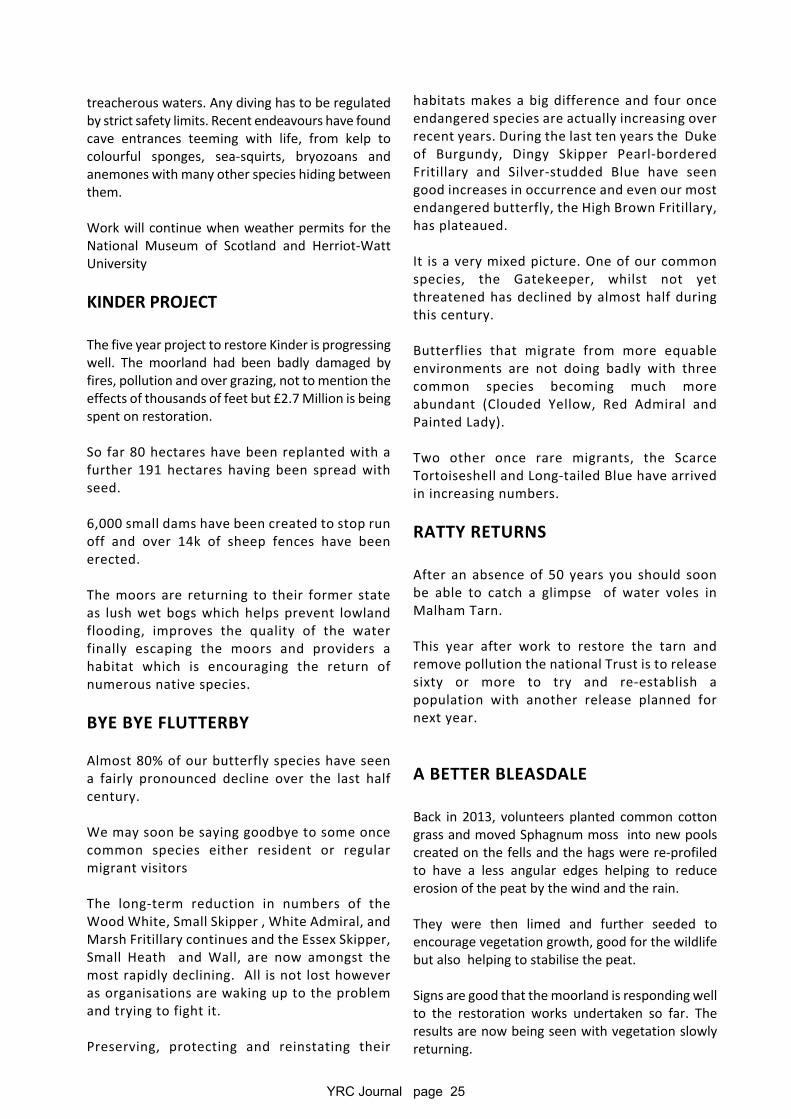
Obituaries & APPRECIATIONSJOHN HENRY STOKES MBE BEM
John "Brummie" Stokes, diedin January. Born in 1945 insouth Staffordshire on theedge of Birmingham; a way-ward child his schooling wasapparently patchy and hewas often in trouble with thelaw.
He got his taste for adventure on a Sunday Schoolcoach trip when he first climbed Snowdon. It wassurprising they took him along as he was alwaysducking out of Sunday classes for a smoke.
At the age of 17 with encouragement from thejudiciary he joined the army and the rest is, asthey say, history. He took to it like a duck to waterand kept pushing himself and would never give inwith anything. After several attempts he passedthe selection course for the SAS where he learntjungle fighting and mountain skills which hehoned all his life.
His military career saw him serving in Borneo,Malaya, Singapore and Hong Kong. He also servedin Guyana, the Canadian Rockies, Germany andthe Falklands, along the way becoming an SASmountain expert. He was part of an Army teamwhich summitted Everest in 1976.
He never seemed to know when he was beatenand should probably be described as an obsessive.
He really got the bug in 1975 on Nhuptse. It waspretty amazing that he made that trip anyway aswhile in Dhofar three years earlier, he was shot inthe leg, and lost a kneecap. Four men had died onthat Nhuptse trip; but Stokes and his climbingpartner, Michael 'Bronco' Lane, were notdaunted.
The following year was nearly his last. These twowere trapped at Camp 6 on Everest in a storm andwhen it finally abated they should have comedown. Not for them; heroically brave or stupidlyfool-hearted as it may have been, having lost aday and with oxygen supplies dwindling theyattempted the south-west face the followingmorning and summitted during the afternoon,
YRC Journal page 27
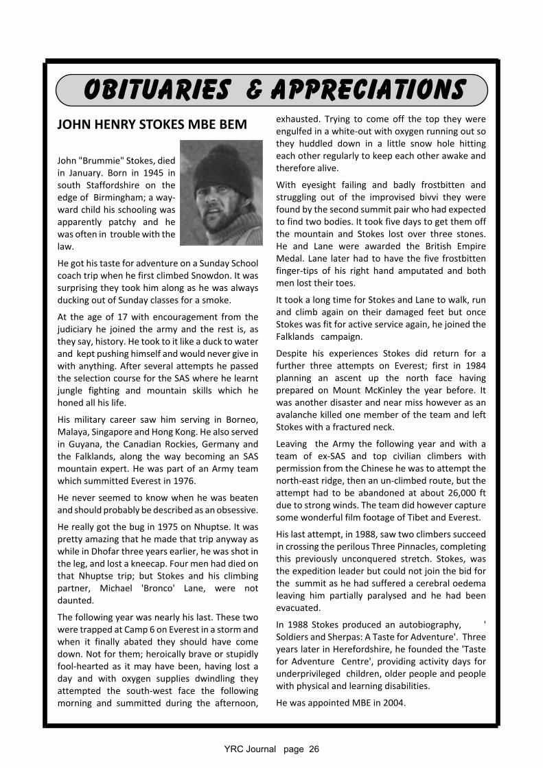
Lieutenant Colonel Alastair Edward Henry Worsley, MBE1960 – 2016Explorer Henry Worsley died in hospital in Punta Arenas, Chile aftercollapsing from exhaustion just thirty miles short of completing a solocrossing of Antarctica.
The 55-year-old was attempting to recreate the majority of Sir ErnestShackleton's unfinished journey to the South Pole and become the firstadventurer to cross the Antarctic continent without support having beenpart of the successful 2009 expedition that retraced Ernest Shackleton'sfootsteps.
He was 71 days 913 miles into the charity challenge when he called for helpand had to be airlifted off the treacherous ice having exceeded his goal ofraising £100,000 for the Endeavour Fund, a charity founded to help injuredservice personnel. He had passed the South Pole, battling extreme weather conditions and temperaturesof as low as -44C when he began to suffer from severe dehydration and exhaustion and decided to stopand raised the alert.
On earlier expeditions he had already become the onlyperson ever to have completed both classic routes to theSouth Pole as established Scott, Amundsen andShackleton. He was a descendant of Frank WorsleyShackleton’s skipper on the Endurance.
Lieutenant Colonel Worsley was a special forces veteranwho had served in Afghanistan, Ireland and Bosnia. He hadbeen born into a military family and his father was GeneralSir Richard Worsley. He seemed destined for the army andtrained at Sandhurst before being commissioned into 3rdBattalion, the Royal Green Jackets, in 1980.
He went on to become battalion adjutant of his and was selected for the SAS in 1988 When on ‘specialduties’ in Northern Ireland, he served in Intelligence for which he was awarded the MBE in 1994. He latertook command of a battalion of the Royal Green Jackets, in Bosnia and completed two tours of duty withthe SAS, in Afghanistan.
Sammy Chapman 1941 - 2015Sammy died at the end of last year shortly after celebrating her 74th birthdaywith members of her family at the Club’s annual dinner. She and Albert had livedat Scar top on the side of Whernside for 40 years and many members hadenjoyed her hospitality there.
During our 1984 Christmas meet she somehow managed to cater for 55, a featrepeated in 2001 when she coped with the Presidents garden party with 65attending.
Albert was encouraged by Sammy to go off on his many treks and together they visited over 30 countries.They always considered their stay in northern India as the most enjoyable.
The Club was very well represented at her funeral including Motup Goba who flew in from India especially.
She will be fondly remembered and sadly missed by many members of the Club.
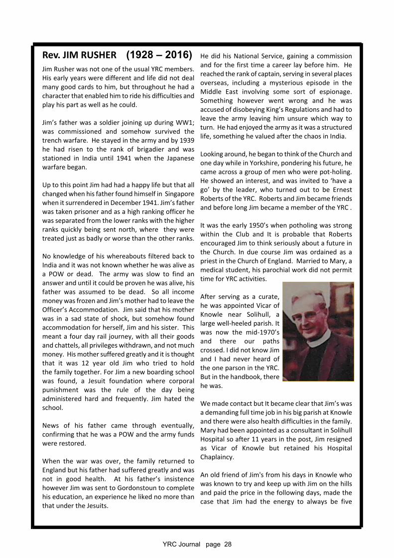
YRC Journal page 28
Rev. JIM RUSHER (1928 – 2016)Jim Rusher was not one of the usual YRC members.His early years were different and life did not dealmany good cards to him, but throughout he had acharacter that enabled him to ride his difficulties andplay his part as well as he could.
Jim’s father was a soldier joining up during WW1;was commissioned and somehow survived thetrench warfare. He stayed in the army and by 1939he had risen to the rank of brigadier and wasstationed in India until 1941 when the Japanesewarfare began.
Up to this point Jim had had a happy life but that allchanged when his father found himself in Singaporewhen it surrendered in December 1941. Jim’s fatherwas taken prisoner and as a high ranking officer hewas separated from the lower ranks with the higherranks quickly being sent north, where they weretreated just as badly or worse than the other ranks.
No knowledge of his whereabouts filtered back toIndia and it was not known whether he was alive asa POW or dead. The army was slow to find ananswer and until it could be proven he was alive, hisfather was assumed to be dead. So all incomemoney was frozen and Jim’s mother had to leave theOfficer’s Accommodation. Jim said that his motherwas in a sad state of shock, but somehow foundaccommodation for herself, Jim and his sister. Thismeant a four day rail journey, with all their goodsand chattels, all privileges withdrawn, and not muchmoney. His mother suffered greatly and it is thoughtthat it was 12 year old Jim who tried to holdthe family together. For Jim a new boarding schoolwas found, a Jesuit foundation where corporalpunishment was the rule of the day beingadministered hard and frequently. Jim hated theschool.
News of his father came through eventually,confirming that he was a POW and the army fundswere restored.
When the war was over, the family returned toEngland but his father had suffered greatly and wasnot in good health. At his father’s insistencehowever Jim was sent to Gordonstoun to completehis education, an experience he liked no more thanthat under the Jesuits.
He did his National Service, gaining a commissionand for the first time a career lay before him. Hereached the rank of captain, serving in several placesoverseas, including a mysterious episode in theMiddle East involving some sort of espionage.Something however went wrong and he wasaccused of disobeying King’s Regulations and had toleave the army leaving him unsure which way toturn. He had enjoyed the army as it was a structuredlife, something he valued after the chaos in India.
Looking around, he began to think of the Church andone day while in Yorkshire, pondering his future, hecame across a group of men who were pot-holing.He showed an interest, and was invited to ‘have ago’ by the leader, who turned out to be ErnestRoberts of the YRC. Roberts and Jim became friendsand before long Jim became a member of the YRC .
It was the early 1950’s when potholing was strongwithin the Club and It is probable that Robertsencouraged Jim to think seriously about a future inthe Church. In due course Jim was ordained as apriest in the Church of England. Married to Mary, amedical student, his parochial work did not permittime for YRC activities.
After serving as a curate,he was appointed Vicar ofKnowle near Solihull, alarge well-heeled parish. Itwas now the mid-1970’sand there our pathscrossed. I did not know Jimand I had never heard ofthe one parson in the YRC.But in the handbook, therehe was.
We made contact but It became clear that Jim’s wasa demanding full time job in his big parish at Knowleand there were also health difficulties in the family.Mary had been appointed as a consultant in SolihullHospital so after 11 years in the post, Jim resignedas Vicar of Knowle but retained his HospitalChaplaincy.
An old friend of Jim's from his days in Knowle whowas known to try and keep up with Jim on the hillsand paid the price in the following days, made thecase that Jim had the energy to always be five
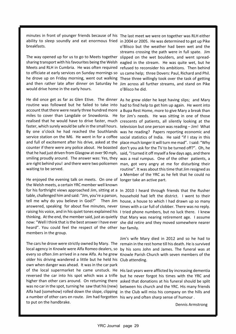
YRC Journal page 29
minutes in front of younger friends because of hisability to sleep soundly and eat enormous friedbreakfasts.
The way opened up for us to go to Meets togethersharing transport with his favourites being the WelshMeets and RLH in Cumbria. He was often requiredto officiate at early services on Sunday mornings sohe drove up on Friday morning, went out walkingand then rather late after dinner on Saturday hewould drive home in the early hours.
He did once get as far as Glen Etive. The dinnerroutine was followed but he failed to take intoaccount that there were nearly three hundred moremiles to cover than Langdale or Snowdonia. Herealised that he would have to drive faster, muchfaster, which surely would be safe in the small hours.By one o’clock he had reached the Southlandsservice station on the M6. He went in for a coffeeand full of excitement after his drive, asked at thecounter if there were any police about. He boastedthat he had just driven from Glasgow at over 90 mph,smiling proudly around. The answer was: Yes, theyare right behind you! and there were two policemenwaiting to be served.
He enjoyed the evening talk on meets. On one ofthe Welsh meets, a certain YRC member well knownfor his forthright views approached Jim, sitting at atable, challenged him and said: “Jim, you’re a parson,tell me why do you believe in God?” Then Jimanswered, speaking for about five minutes, neverraising his voice, and in his quiet tones explained histhinking. At the end, the member said, just as quietlynow: “Well I think that is the best answer I have everheard”. You could feel the respect of the othermembers in the group.
The cars he drove were strictly owned by Mary. Thelocal agency in Knowle were Alfa Romeo dealers, soevery so often Jim arrived in a new Alfa. As he grewolder his driving wandered a little but he held hisown when danger was ahead. It was in the car parkof the local supermarket he came unstuck. Hereversed the car into his spot which was a triflehigher than other cars around. On returning therewas no car in the spot, turning he saw that his (new)Alfa had (somehow) rolled down the slope, clippinga number of other cars en route. Jim had forgottento put on the handbrake.
The last meet we were on together was RLH eitherin 2004 or 2005. He was determined to get up Pikeo’Blisco but the weather had been wet and thestreams crossing the path were in full spate. Jimslipped on the wet boulders, and went spread-eagled in the stream. He was quite wet, but herefused to reconsider his ambitions. Then behindus came help; three Dovers: Paul, Richard and Phil.These three willingly took over the task of gettingJim across all further streams, and stand on Pikeo’Blisco he did.
As he grew older he kept having slips; and Maryhad to find help to get him up again. He went intoa Bupa Rest Home, more to give Mary a break thanfor Jim’s needs. He was sitting in one of thosecrescents of patients, all silently looking at thetelevision but one person was reading – Jim! Whatwas he reading? Papers reporting economic andsocial statistics of India. He said “if I stay in thisplace much longer it will turn me mad”. I said: “Whydon’t you ask for the TV to be turned off?”. Oh, hesaid, “I turned it off myself a few days ago, and therewas a real rumpus. One of the other patients, aman, got very angry at me for disturbing theirroutine”. It was about this time that Jim resigned asa Member of the YRC as he felt that he could nolonger take an active part.
In 2010 I heard through friends that the Rusherhousehold had left the district. I went to theirhouse, a house to which I had drawn up so manytimes with a car full of clobber. There was no reply.I tried phone numbers, but no luck there. I knewthat Mary was nearing retirement age. I assumeshe did retire and they moved somewhere nearerher family.
Jim's wife Mary died in 2012 and so he had toremain in the rest home till his death. He is survivedby his sons John and James. The funeral was atKnowle Parish Church with seven members of theClub attending.
His last years were afflicted by increasing dementiabut he never forgot his times with the YRC andasked that donations at his funeral should be splitbetween his church and the YRC. His many friendsin the Club will miss his company on the hills andhis wry and often sharp sense of humour .
Dennis Armstrong
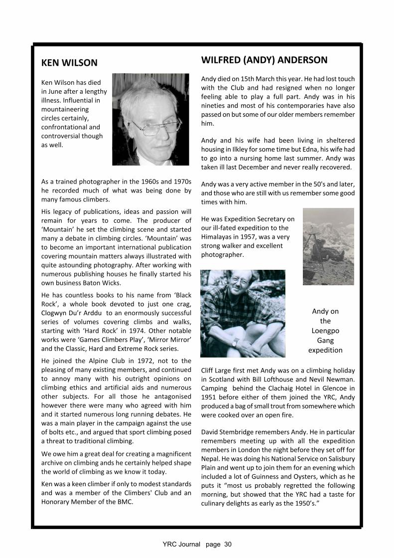
YRC Journal page 30
KEN WILSON
Ken Wilson has diedin June after a lengthyillness. Influential inmountaineeringcircles certainly,confrontational andcontroversial thoughas well.
As a trained photographer in the 1960s and 1970she recorded much of what was being done bymany famous climbers.
His legacy of publications, ideas and passion willremain for years to come. The producer of‘Mountain’ he set the climbing scene and startedmany a debate in climbing circles. ‘Mountain’ wasto become an important international publicationcovering mountain matters always illustrated withquite astounding photography. After working withnumerous publishing houses he finally started hisown business Baton Wicks.
He has countless books to his name from ‘BlackRock’, a whole book devoted to just one crag,Clogwyn Du’r Arddu to an enormously successfulseries of volumes covering climbs and walks,starting with ‘Hard Rock’ in 1974. Other notableworks were ‘Games Climbers Play’, ‘Mirror Mirror’and the Classic, Hard and Extreme Rock series.
He joined the Alpine Club in 1972, not to thepleasing of many existing members, and continuedto annoy many with his outright opinions onclimbing ethics and artificial aids and numerousother subjects. For all those he antagonisedhowever there were many who agreed with himand it started numerous long running debates. Hewas a main player in the campaign against the useof bolts etc., and argued that sport climbing poseda threat to traditional climbing.
We owe him a great deal for creating a magnificentarchive on climbing ands he certainly helped shapethe world of climbing as we know it today.
Ken was a keen climber if only to modest standardsand was a member of the Climbers' Club and anHonorary Member of the BMC.
WILFRED (ANDY) ANDERSON
Andy died on 15th March this year. He had lost touchwith the Club and had resigned when no longerfeeling able to play a full part. Andy was in hisnineties and most of his contemporaries have alsopassed on but some of our older members rememberhim.
Andy and his wife had been living in shelteredhousing in Ilkley for some time but Edna, his wife hadto go into a nursing home last summer. Andy wastaken ill last December and never really recovered.
Andy was a very active member in the 50's and later,and those who are still with us remember some goodtimes with him.
He was Expedition Secretary onour ill-fated expedition to theHimalayas in 1957, was a verystrong walker and excellentphotographer.
Cliff Large first met Andy was on a climbing holidayin Scotland with Bill Lofthouse and Nevil Newman.Camping behind the Clachaig Hotel in Glencoe in1951 before either of them joined the YRC, Andyproduced a bag of small trout from somewhere whichwere cooked over an open fire.
David Stembridge remembers Andy. He in particularremembers meeting up with all the expeditionmembers in London the night before they set off forNepal. He was doing his National Service on SalisburyPlain and went up to join them for an evening whichincluded a lot of Guinness and Oysters, which as heputs it “most us probably regretted the followingmorning, but showed that the YRC had a taste forculinary delights as early as the 1950’s.”
Andy onthe
LoengpoGang
expedition
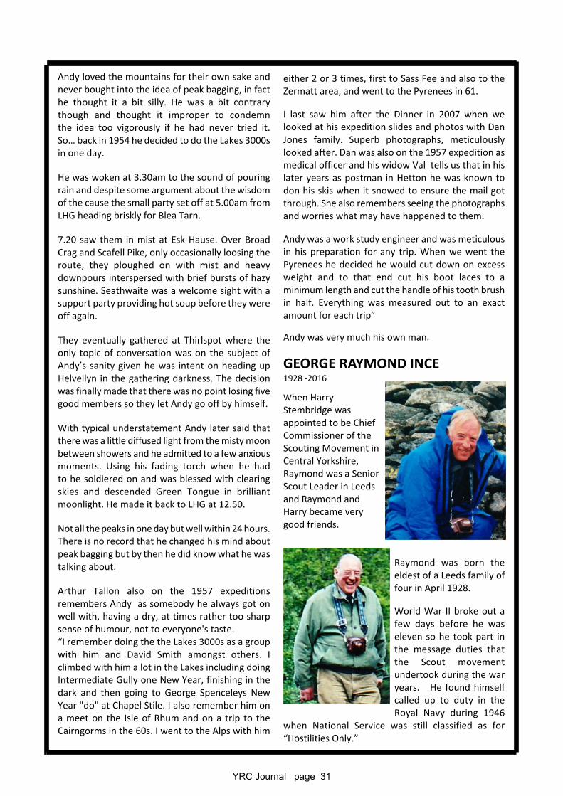
YRC Journal page 31
Andy loved the mountains for their own sake andnever bought into the idea of peak bagging, in facthe thought it a bit silly. He was a bit contrarythough and thought it improper to condemnthe idea too vigorously if he had never tried it.So… back in 1954 he decided to do the Lakes 3000sin one day.
He was woken at 3.30am to the sound of pouringrain and despite some argument about the wisdomof the cause the small party set off at 5.00am fromLHG heading briskly for Blea Tarn.
7.20 saw them in mist at Esk Hause. Over BroadCrag and Scafell Pike, only occasionally loosing theroute, they ploughed on with mist and heavydownpours interspersed with brief bursts of hazysunshine. Seathwaite was a welcome sight with asupport party providing hot soup before they wereoff again.
They eventually gathered at Thirlspot where theonly topic of conversation was on the subject ofAndy’s sanity given he was intent on heading upHelvellyn in the gathering darkness. The decisionwas finally made that there was no point losing fivegood members so they let Andy go off by himself.
With typical understatement Andy later said thatthere was a little diffused light from the misty moonbetween showers and he admitted to a few anxiousmoments. Using his fading torch when he hadto he soldiered on and was blessed with clearingskies and descended Green Tongue in brilliantmoonlight. He made it back to LHG at 12.50.
Not all the peaks in one day but well within 24 hours.There is no record that he changed his mind aboutpeak bagging but by then he did know what he wastalking about.
Arthur Tallon also on the 1957 expeditionsremembers Andy as somebody he always got onwell with, having a dry, at times rather too sharpsense of humour, not to everyone's taste.“I remember doing the the Lakes 3000s as a groupwith him and David Smith amongst others. Iclimbed with him a lot in the Lakes including doingIntermediate Gully one New Year, finishing in thedark and then going to George Spenceleys NewYear "do" at Chapel Stile. I also remember him ona meet on the Isle of Rhum and on a trip to theCairngorms in the 60s. I went to the Alps with him
either 2 or 3 times, first to Sass Fee and also to theZermatt area, and went to the Pyrenees in 61.
I last saw him after the Dinner in 2007 when welooked at his expedition slides and photos with DanJones family. Superb photographs, meticulouslylooked after. Dan was also on the 1957 expedition asmedical officer and his widow Val tells us that in hislater years as postman in Hetton he was known todon his skis when it snowed to ensure the mail gotthrough. She also remembers seeing the photographsand worries what may have happened to them.
Andy was a work study engineer and was meticulousin his preparation for any trip. When we went thePyrenees he decided he would cut down on excessweight and to that end cut his boot laces to aminimum length and cut the handle of his tooth brushin half. Everything was measured out to an exactamount for each trip”
Andy was very much his own man.
GEORGE RAYMOND INCE1928 -2016
When HarryStembridge wasappointed to be ChiefCommissioner of theScouting Movement inCentral Yorkshire,Raymond was a SeniorScout Leader in Leedsand Raymond andHarry became verygood friends.
Raymond was born theeldest of a Leeds family offour in April 1928.
World War II broke out afew days before he waseleven so he took part inthe message duties thatthe Scout movementundertook during the waryears. He found himselfcalled up to duty in theRoyal Navy during 1946
when National Service was still classified as for“Hostilities Only.”
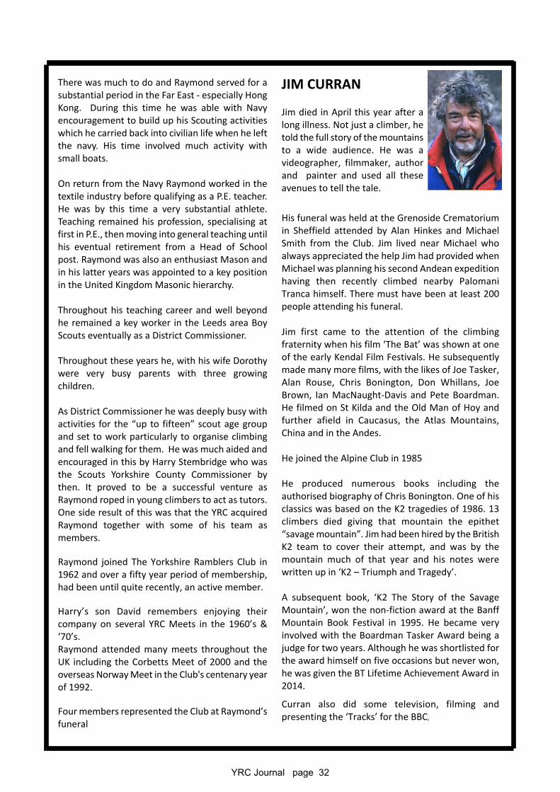
YRC Journal page 32
There was much to do and Raymond served for asubstantial period in the Far East - especially HongKong. During this time he was able with Navyencouragement to build up his Scouting activitieswhich he carried back into civilian life when he leftthe navy. His time involved much activity withsmall boats.
On return from the Navy Raymond worked in thetextile industry before qualifying as a P.E. teacher.He was by this time a very substantial athlete.Teaching remained his profession, specialising atfirst in P.E., then moving into general teaching untilhis eventual retirement from a Head of Schoolpost. Raymond was also an enthusiast Mason andin his latter years was appointed to a key positionin the United Kingdom Masonic hierarchy.
Throughout his teaching career and well beyondhe remained a key worker in the Leeds area BoyScouts eventually as a District Commissioner.
Throughout these years he, with his wife Dorothywere very busy parents with three growingchildren.
As District Commissioner he was deeply busy withactivities for the “up to fifteen” scout age groupand set to work particularly to organise climbingand fell walking for them. He was much aided andencouraged in this by Harry Stembridge who wasthe Scouts Yorkshire County Commissioner bythen. It proved to be a successful venture asRaymond roped in young climbers to act as tutors.One side result of this was that the YRC acquiredRaymond together with some of his team asmembers.
Raymond joined The Yorkshire Ramblers Club in1962 and over a fifty year period of membership,had been until quite recently, an active member.
Harry’s son David remembers enjoying theircompany on several YRC Meets in the 1960’s &‘70’s.Raymond attended many meets throughout theUK including the Corbetts Meet of 2000 and theoverseas Norway Meet in the Club's centenary yearof 1992.
Four members represented the Club at Raymond’sfuneral
JIM CURRAN
Jim died in April this year after along illness. Not just a climber, hetold the full story of the mountainsto a wide audience. He was avideographer, filmmaker, authorand painter and used all theseavenues to tell the tale.
His funeral was held at the Grenoside Crematoriumin Sheffield attended by Alan Hinkes and MichaelSmith from the Club. Jim lived near Michael whoalways appreciated the help Jim had provided whenMichael was planning his second Andean expeditionhaving then recently climbed nearby PalomaniTranca himself. There must have been at least 200people attending his funeral.
Jim first came to the attention of the climbingfraternity when his film ‘The Bat’ was shown at oneof the early Kendal Film Festivals. He subsequentlymade many more films, with the likes of Joe Tasker,Alan Rouse, Chris Bonington, Don Whillans, JoeBrown, Ian MacNaught-Davis and Pete Boardman.He filmed on St Kilda and the Old Man of Hoy andfurther afield in Caucasus, the Atlas Mountains,China and in the Andes.
He joined the Alpine Club in 1985
He produced numerous books including theauthorised biography of Chris Bonington. One of hisclassics was based on the K2 tragedies of 1986. 13climbers died giving that mountain the epithet“savage mountain”. Jim had been hired by the BritishK2 team to cover their attempt, and was by themountain much of that year and his notes werewritten up in ‘K2 – Triumph and Tragedy’.
A subsequent book, ‘K2 The Story of the SavageMountain’, won the non-fiction award at the BanffMountain Book Festival in 1995. He became veryinvolved with the Boardman Tasker Award being ajudge for two years. Although he was shortlisted forthe award himself on five occasions but never won,he was given the BT Lifetime Achievement Award in2014.
Curran also did some television, filming andpresenting the ‘Tracks’ for the BBC,
YRC journal page 33
JBEL SARHRO, MOROCCOA THIRST FOR STARK BEAUTY
A two-week trekking meet, 5th-19th April 2016
Leader: Mick Borroff
Introduction
Having been on the very enjoyable YRC meet to Tafraoute in the Anti-Atlas in 2009, I was keen toreturn to Morocco. I was originally thinking of another similar week based at a hotel where wecould go off on day trips walking, scrambling and climbing, but could not identify anotherimmediately attractive location.
A trek in the mountains of the Atlas or Jbel Sirwa in April appealed, but would be complicated bylate snow, so I looked further afield on Google Earth and came cross a number of intriguing imagestaken in the Jbel Sarhro (Sarhro means drought or thirst). Having read a copy of Alan Palmer’sguidebook “Moroccan Atlas - The Trekking Guide”, I decided to reach out to him to help me refinea two week route across the Sarhro’s starkly beautiful landscape. Alan proved to be veryknowledgeable and most helpful, so I chose to use the services of his trekking company Trek inMorocco to arrange our trip.
The Jbel Sarhro is a little trekked area on the south side of the Atlas Mountains which enjoys a dryand hot climate year round. 2016 had been a dry year with just one day of rain since last October– hence its name!
A number of trekking routes are possible in the Sarhro and our chosen route linked several of theseto take in various scrambling objectives as well close encounters with the area’s gorges andspectacular rock formations.
Alan suggested that we use the services of Lhoussain Oufkir, a qualified mountain guide fromBoumalne du Dades who he had trekked with before. We found Lhoussain to be a warm and likeableindividual who was always smiling! His deep knowledge of the region and evident respect for theSarhro’s Amazigh people enriched our visit, together with his insights into national and regionalpolitics, past history and current affairs. His remarkable multilingual skills facilitated ourcommunications and engagement with the Berber nomads whom we met and our five local Amazighmuleteers.
Each muleteer brought his own mule – they were all in good condition and received consideratetreatment throughout the trek.
Our cook Hamid was from Marrakech and together with Mohammad, one of the muleteers,prepared consistently appetising and plentiful food which was enjoyed by all. Some 200 flat breadsand 80kg of vegetables were consumed supplemented with a goat, a few chickens, eggs and tinnedfish - mackerel, sardines and tuna! The latter was simply labelled “Isobel” in marked contrast withour Euro labelling! This was washed down by gallons of mint tea, which was drunk at everyopportunity. Water was obtained from local wells and the occasional spring and was purified by avariety of systems.
These all worked as the group stayed healthy with an absence of gastrointestinal upsets.
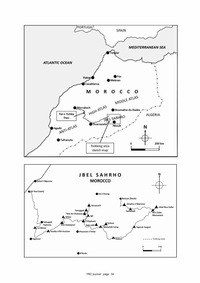
YRC journal page 34
YRC journal page 35
Participants
Mick Borroff, Peter Chadwick, Barry Dover, Richard Dover, Paul Dover, Bill Gibbs, David Hick,Janelle Humphreys (guest), Michael Smith and Richard Taylor.
Our itinerary was as follows:
Summary
Tue 5 April Arrive in MarrakechWed Transfer over the Tizi n’Tichka to the Valley of the RosesThu Ait Youl - Tafoughalt Pastures - Le MerseFri Le Merse - Assaka n'Ait OuzzineSat Assaka n'Ait Ouzzine - Tine Ouwayour summit - IrhissiSun Irhissi - IgliMon Igli - Kouaouch summit - Tamajgalt summit - IgliTue 12 Igli - Tadawt n'Tablah - Bab n'Ali - Waterfall CampWed Waterfall Camp - Tazlout - AzdourThu Azdour - Tagroat TazgartFri Tagroat Tazgart - Jbel Bou Gafer summit - Bou Gafer MonumentSat Bou Gafer Monument - TanemlaltSun Tanemlalt - Amalou n' Mansour summit - Iknioun - Valley of the RosesMon Transfer to Marrakech via Ait Ben Haddou and TelouetTue 19 Sightseeing in Marrakech and depart
Detailed Itinerary
5th AprilWe arrived in Marrakech and were transported to our hotel by Jamal Imerhane, Alan’s local agent.The Riad Bahia is situated in the Mellah (the old Jewish quarter of the city) and we arrived in timeto meet our mountain guide Lhoussain and enjoy a mixture of vegetarian starters and a chickentagine in the hotel before going to bed at around midnight.
6th AprilLhoussain and Hamid joined us for the 6 hour minibus transfer over the snow-capped AtlasMountains via the Tizi n’Tichka pass, with the road in the process of being comprehensivelyupgraded. There were a number of police speed traps as we passed through the villages en route– their police use the same technology as ours! We stayed in the very pleasant Kasbah Agoulzi inthe Valley of the Roses (the Mgoun valley), so-called as pink Persian roses are grown as a crop tobe distilled to produce rose oil, rose essence and rose water etc.
7th AprilA local Mercedes minibus appeared at the hotel first thing in the morning which had done some740,000 km if the clock was to be believed! After stopping in Qalaa’t Mgouna to pick up a mountainof flatbreads, eggs, some lamb and 50kg of vegetables, this transported us together with a largepile of tents, foam mats and other foodstuffs to the village of Ait Youl (1385m), the start of our trek.Here we met the five muleteers, who had camped out overnight with their animals.
Leaving them to weigh and equitably divide the loads between their mules, we started walking atabout 9.45am and began getting used to the heat as we walked south across the dry plain onfootpaths and small tracks.
Mohamed’s mule was used for taking the food and kitchen equipment for our lunch stops whilstthe other muleteers continued to set up the camp. Espying “lunch mule” next to a suitably shadyspot was always a welcome sight!
YRC journal page 36
After mint tea, our midday meal consisted of a huge plate of freshly prepared finely chopped saladvegetables and tinned fish accompanied by flat breads and pasta or rice and a spicy lentil-basedsauce, followed by fruit and more mint tea. Lunch was timed to avoid the hottest part of the dayand allowed a short siesta if required. This set the pattern for the remainder of the trek, except fortwo days where we carried packed lunches to be eaten on the summits.
Approaching the Tafoughalt pass, some of the group bought scarves and trinkets from a squattinglady sat next to the well in the hope of passing trade. This was the first of many such opportunities!Often Berber children raced out of their adobe houses or herders came over armed with blue plasticbags of intricately made but gaudy trinkets to tempt any passing trekkers and boost their families’incomes.
Just below the col itself Mick, Peter, Barry, Richard T, Michael and Dave decided to take the side-tripup to see the Tafoughalt Pastures (1950m), an upland grassy meadow used by Berber nomads tograze their sheep and goats. One black roofed tent was spotted on a ridge, but the only Berbers weencountered were a lady and her children living in a small stone-built house who invited us to jointhem for a glass of mint tea, which was prepared outside over a camping gas stove. Plates of drieddates and almonds were then produced. This was the first of several examples of genuine Berberhospitality in the mountains which elicited our thanks. (This report uses the more familiar termBerbers to describe this ethnic group, but they refer to themselves as Amazighs).
We descended from the pastures to re-join the main track and soon found our cluster of tentshuddling round the well at Le Merse (1924m). A typical dinner of lentil soup and bread, lamb tagineand an apple was taken in a large tent whilst sat on sleeping mats on the ground. The four corner(pole) positions were much sought after to provide welcome back support!
8th AprilWe breakfasted early on bread, jams, honey, Nutella and processed cheeses washed down withcopious tea, coffee or hot chocolate. This proved to be the usual menu for trek breakfasts. We weresometimes offered a thin 'porridge' which once a suitable quantity of jam and salt had been added,was quite tasty. A varied day of walking started with an ascent to the Tizi n’Tagmout col (and downtowards Tagmout village where a mobile phone signal could be picked up. We passed a grove ofnewly planted almond trees to reach a watershed marked with the ancient graves of warriors fromthe Ait Seddrat and Ait ‘Atta tribes.
A descent along a dry river eventually led to a spring and the welcome sight of lunch mule. Ourmeal taken on a shady ledge above the stream and was enjoyed with a chorus of croaking frogs andsightings of a few brown leeches and a small black water snake.
Suitably refreshed, we continued above the river gorge with good views east to the peaks of TineOuwayour and Amalou n’Mansour, passing a ruined kasbah (citadel) en route to our camp (1592m)on the football pitch belonging to Assaka n'Ait Ouzzine village. The local children turned out in forceto watch the goings on in camp and eventually treated us to a stone-throwing competition, withtin cans regularly jumping in the air – one can see just how local goatherds get their accuracy inpitching stones!
9th AprilThis was another very varied day which started with a walk through the village then along the drystreambed towards the flat-topped peak of Tine Ouwayour (place of the moon). On the map andon Google Earth, the upside down heart-shaped mountain is unmistakable. Our plan was to ascendit using the major gully penetrating cliffs along the southern flank. Lhoussain had never been up itbefore so when we met a Berber guarding her large flock of black goats, he asked her if it ‘went’.
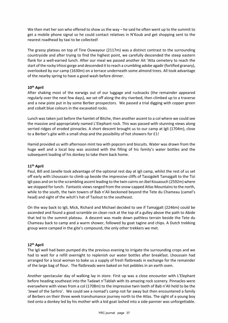
YRC journal page 37
We then met her son who offered to show us the way – he said he often went up to the summit toget a mobile phone signal so he could contact relatives in N’Koub and get shopping sent to thenearest roadhead by taxi to be collected!
The grassy plateau on top of Tine Ouwayour (2117m) was a distinct contrast to the surroundingcountryside and after trying to find the highest point, we carefully descended the steep easternflank for a well-earned lunch. After our meal we passed another Ait ‘Atta cemetery to reach thestart of the rocky Irhissi gorge and descended it to reach a crumbling adobe agadir (fortified granary),overlooked by our camp (1630m) on a terrace underneath some almond trees. All took advantageof the nearby spring to have a good wash before dinner.
10th AprilAfter shaking most of the earwigs out of our luggage and rucksacks (the remainder appearedregularly over the next few days), we set off along the dry riverbed, then climbed up to a traverseand a new piste put in by some Berber prospectors. We passed a trial digging with copper greenand cobalt blue colours in the excavated rocks.
Lunch was taken just before the hamlet of Bitche, then another ascent to a col where we could seethe massive and appropriately named L’Elephant rock. This was passed with stunning views alongserried ridges of eroded pinnacles. A short descent brought us to our camp at Igli (1704m), closeto a Berber’s gite with a small shop and the possibility of hot showers for £1!
Hamid provided us with afternoon mint tea with popcorn and biscuits. Water was drawn from thehuge well and a local boy was assisted with the filling of his family’s water bottles and thesubsequent loading of his donkey to take them back home.
11th AprilPaul, Bill and Janelle took advantage of the optional rest day at Igli camp, whilst the rest of us setoff early with Lhoussain to climb up beside the impressive cliffs of Tassigdelt Tamajgalt to the TiziIgli pass and on to the scrambling ascent leading to the twin cairns on Jbel Kouaouch (2592m) wherewe stopped for lunch. Fantastic views ranged from the snow-capped Atlas Mountains to the north,while to the south, the twin towers of Bab n’Ali beckoned beyond the Tete du Chameau (camel’shead) and sight of the witch’s hat of Tazlout to the southeast.
On the way back to Igli, Mick, Richard and Michael decided to see if Tamajgalt (2246m) could beascended and found a good scramble on clean rock at the top of a gulley above the path to Abidethat led to the summit plateau. A descent was made down pathless terrain beside the Tete duChameau back to camp and a warm shower, followed by goat tagine and chips. A Dutch trekkinggroup were camped in the gite’s compound, the only other trekkers we met.
12th AprilThe Igli well had been pumped dry the previous evening to irrigate the surrounding crops and wehad to wait for a refill overnight to replenish our water bottles after breakfast. Lhoussain hadarranged for a local woman to bake us a supply of fresh flatbreads in exchange for the remainderof the large bag of flour. The flatbreads were baked on hot pebbles in an earth oven.
Another spectacular day of walking lay in store. First up was a close encounter with L’Elephantbefore heading southeast into the Tadawt n’Tablah with its amazing rock scenery. Pinnacles wereeverywhere with views from a col (1708m) to the impressive twin teeth of Bab n’Ali held to be the‘Jewel of the Sarhro’. We could see a nomad’s camp not far away but then encountered a familyof Berbers on their three week transhumance journey north to the Atlas. The sight of a young boytied onto a donkey led by his mother with a kid goat lashed into a side pannier was unforgettable.
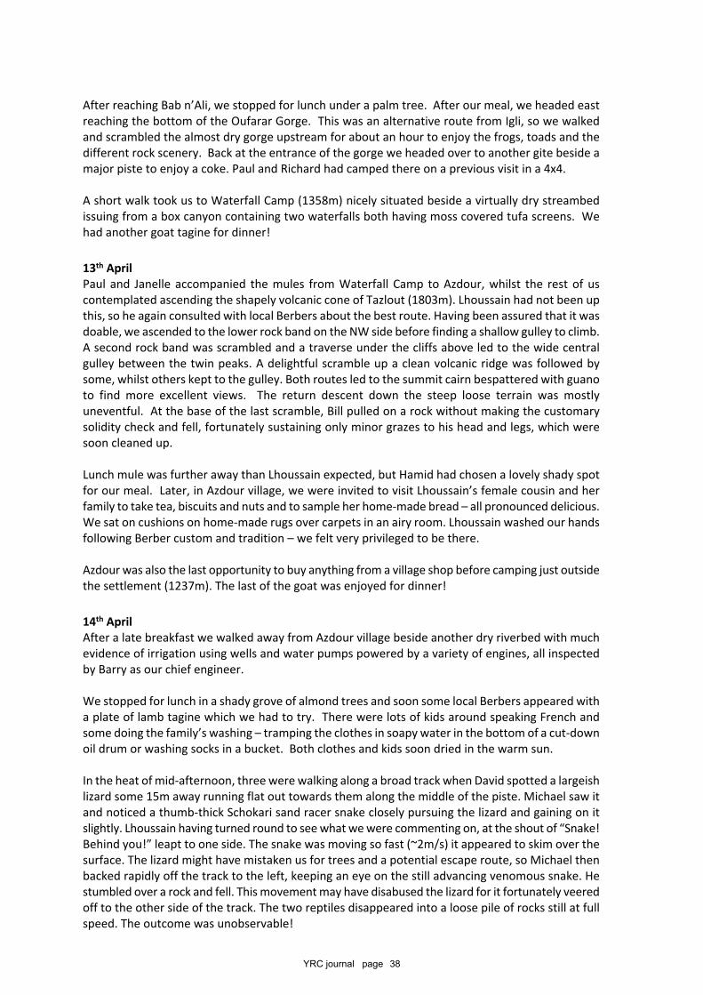
YRC journal page 38
After reaching Bab n’Ali, we stopped for lunch under a palm tree. After our meal, we headed eastreaching the bottom of the Oufarar Gorge. This was an alternative route from Igli, so we walkedand scrambled the almost dry gorge upstream for about an hour to enjoy the frogs, toads and thedifferent rock scenery. Back at the entrance of the gorge we headed over to another gite beside amajor piste to enjoy a coke. Paul and Richard had camped there on a previous visit in a 4x4.
A short walk took us to Waterfall Camp (1358m) nicely situated beside a virtually dry streambedissuing from a box canyon containing two waterfalls both having moss covered tufa screens. Wehad another goat tagine for dinner!
13th AprilPaul and Janelle accompanied the mules from Waterfall Camp to Azdour, whilst the rest of uscontemplated ascending the shapely volcanic cone of Tazlout (1803m). Lhoussain had not been upthis, so he again consulted with local Berbers about the best route. Having been assured that it wasdoable, we ascended to the lower rock band on the NW side before finding a shallow gulley to climb.A second rock band was scrambled and a traverse under the cliffs above led to the wide centralgulley between the twin peaks. A delightful scramble up a clean volcanic ridge was followed bysome, whilst others kept to the gulley. Both routes led to the summit cairn bespattered with guanoto find more excellent views. The return descent down the steep loose terrain was mostlyuneventful. At the base of the last scramble, Bill pulled on a rock without making the customarysolidity check and fell, fortunately sustaining only minor grazes to his head and legs, which weresoon cleaned up.
Lunch mule was further away than Lhoussain expected, but Hamid had chosen a lovely shady spotfor our meal. Later, in Azdour village, we were invited to visit Lhoussain’s female cousin and herfamily to take tea, biscuits and nuts and to sample her home-made bread – all pronounced delicious.We sat on cushions on home-made rugs over carpets in an airy room. Lhoussain washed our handsfollowing Berber custom and tradition – we felt very privileged to be there.
Azdour was also the last opportunity to buy anything from a village shop before camping just outsidethe settlement (1237m). The last of the goat was enjoyed for dinner!
14th AprilAfter a late breakfast we walked away from Azdour village beside another dry riverbed with muchevidence of irrigation using wells and water pumps powered by a variety of engines, all inspectedby Barry as our chief engineer.
We stopped for lunch in a shady grove of almond trees and soon some local Berbers appeared witha plate of lamb tagine which we had to try. There were lots of kids around speaking French andsome doing the family’s washing – tramping the clothes in soapy water in the bottom of a cut-downoil drum or washing socks in a bucket. Both clothes and kids soon dried in the warm sun.
In the heat of mid-afternoon, three were walking along a broad track when David spotted a largeishlizard some 15m away running flat out towards them along the middle of the piste. Michael saw itand noticed a thumb-thick Schokari sand racer snake closely pursuing the lizard and gaining on itslightly. Lhoussain having turned round to see what we were commenting on, at the shout of “Snake!Behind you!” leapt to one side. The snake was moving so fast (~2m/s) it appeared to skim over thesurface. The lizard might have mistaken us for trees and a potential escape route, so Michael thenbacked rapidly off the track to the left, keeping an eye on the still advancing venomous snake. Hestumbled over a rock and fell. This movement may have disabused the lizard for it fortunately veeredoff to the other side of the track. The two reptiles disappeared into a loose pile of rocks still at fullspeed. The outcome was unobservable!
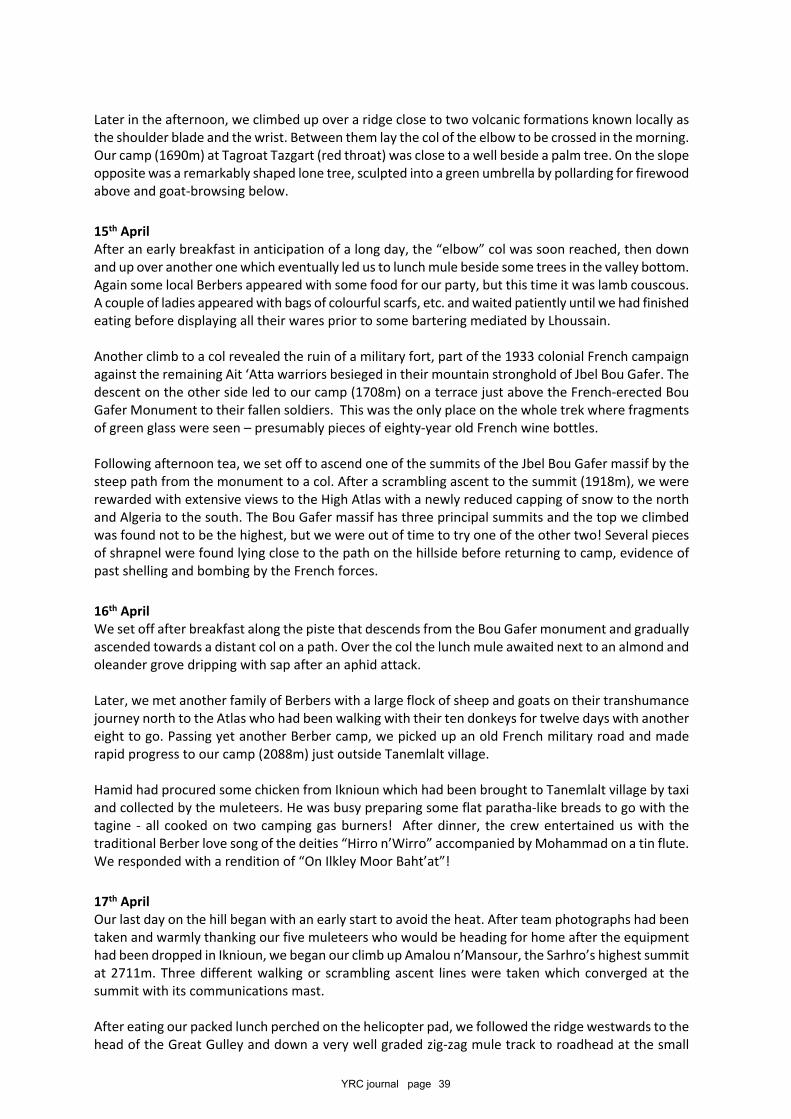
YRC journal page 39
Later in the afternoon, we climbed up over a ridge close to two volcanic formations known locally asthe shoulder blade and the wrist. Between them lay the col of the elbow to be crossed in the morning.Our camp (1690m) at Tagroat Tazgart (red throat) was close to a well beside a palm tree. On the slopeopposite was a remarkably shaped lone tree, sculpted into a green umbrella by pollarding for firewoodabove and goat-browsing below.
15th AprilAfter an early breakfast in anticipation of a long day, the “elbow” col was soon reached, then downand up over another one which eventually led us to lunch mule beside some trees in the valley bottom.Again some local Berbers appeared with some food for our party, but this time it was lamb couscous.A couple of ladies appeared with bags of colourful scarfs, etc. and waited patiently until we had finishedeating before displaying all their wares prior to some bartering mediated by Lhoussain.
Another climb to a col revealed the ruin of a military fort, part of the 1933 colonial French campaignagainst the remaining Ait ‘Atta warriors besieged in their mountain stronghold of Jbel Bou Gafer. Thedescent on the other side led to our camp (1708m) on a terrace just above the French-erected BouGafer Monument to their fallen soldiers. This was the only place on the whole trek where fragmentsof green glass were seen – presumably pieces of eighty-year old French wine bottles.
Following afternoon tea, we set off to ascend one of the summits of the Jbel Bou Gafer massif by thesteep path from the monument to a col. After a scrambling ascent to the summit (1918m), we wererewarded with extensive views to the High Atlas with a newly reduced capping of snow to the northand Algeria to the south. The Bou Gafer massif has three principal summits and the top we climbedwas found not to be the highest, but we were out of time to try one of the other two! Several piecesof shrapnel were found lying close to the path on the hillside before returning to camp, evidence ofpast shelling and bombing by the French forces.
16th AprilWe set off after breakfast along the piste that descends from the Bou Gafer monument and graduallyascended towards a distant col on a path. Over the col the lunch mule awaited next to an almond andoleander grove dripping with sap after an aphid attack.
Later, we met another family of Berbers with a large flock of sheep and goats on their transhumancejourney north to the Atlas who had been walking with their ten donkeys for twelve days with anothereight to go. Passing yet another Berber camp, we picked up an old French military road and maderapid progress to our camp (2088m) just outside Tanemlalt village.
Hamid had procured some chicken from Iknioun which had been brought to Tanemlalt village by taxiand collected by the muleteers. He was busy preparing some flat paratha-like breads to go with thetagine - all cooked on two camping gas burners! After dinner, the crew entertained us with thetraditional Berber love song of the deities “Hirro n’Wirro” accompanied by Mohammad on a tin flute.We responded with a rendition of “On Ilkley Moor Baht’at”!
17th AprilOur last day on the hill began with an early start to avoid the heat. After team photographs had beentaken and warmly thanking our five muleteers who would be heading for home after the equipmenthad been dropped in Iknioun, we began our climb up Amalou n’Mansour, the Sarhro’s highest summitat 2711m. Three different walking or scrambling ascent lines were taken which converged at thesummit with its communications mast.
After eating our packed lunch perched on the helicopter pad, we followed the ridge westwards to thehead of the Great Gulley and down a very well graded zig-zag mule track to roadhead at the small
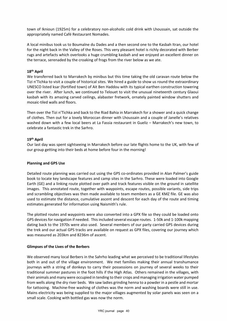
YRC journal page 40
town of Iknioun (1925m) for a celebratory non-alcoholic cold drink with Lhoussain, sat outside theappropriately named Café Restaurant Nomades.
A local minibus took us to Boumalne du Dades and a then second one to the Kasbah Itran, our hotelfor the night back in the Valley of the Roses. This very pleasant hotel is richly decorated with Berberrugs and artefacts which overlooks a huge crumbling kasbah and we enjoyed an excellent dinner onthe terrace, serenaded by the croaking of frogs from the river below as we ate.
18th AprilWe transferred back to Marrakech by minibus but this time taking the old caravan route below theTizi n’Tichka to visit a couple of historical sites. We hired a guide to show us round the extraordinaryUNESCO listed ksar (fortified town) of Ait Ben Haddou with its typical earthen construction toweringover the river. After lunch, we continued to Telouet to visit the unusual nineteenth century Glaouikasbah with its amazing carved ceilings, alabaster fretwork, ornately painted window shutters andmosaic-tiled walls and floors.
Then over the Tizi n’Tichka and back to the Riad Bahia in Marrakech for a shower and a quick changeof clothes. Then out for a lovely Moroccan dinner with Lhoussain and a couple of Janelle’s relativeswashed down with a few local beers at La Fassia restaurant in Gueliz – Marrakech’s new town, tocelebrate a fantastic trek in the Sarhro.
19th AprilOur last day was spent sightseeing in Marrakech before our late flights home to the UK, with few ofour group getting into their beds at home before four in the morning!
Planning and GPS Use
Detailed route planning was carried out using the GPS co-ordinates provided in Alan Palmer’s guidebook to locate key landscape features and camp sites in the Sarhro. These were loaded into GoogleEarth (GE) and a linking route plotted over path and track features visible on the ground in satelliteimages. This annotated route, together with waypoints, escape routes, possible variants, side tripsand scrambling objectives was then made available to team members as a GE KMZ file. GE was alsoused to estimate the distance, cumulative ascent and descent for each day of the route and timingestimates generated for information using Naismith’s rule.
The plotted routes and waypoints were also converted into a GPX file so they could be loaded ontoGPS devices for navigation if needed. This included several escape routes. 1-50k and 1-100k mappingdating back to the 1970s were also used. Several members of our party carried GPS devices duringthe trek and our actual GPS tracks are available on request as GPX files, covering our journey whichwas measured as 203km and 8236m of ascent.
Glimpses of the Lives of the Berbers
We observed many local Berbers in the Sahrho leading what we perceived to be traditional lifestylesboth in and out of the village environment. We met families making their annual transhumancejourneys with a string of donkeys to carry their possessions on journey of several weeks to theirtraditional summer pastures in the foot hills if the High Atlas. Others remained in the villages, withtheir animals and many were occupied in tending to their crops and managing irrigation water pumpedfrom wells along the dry river beds. We saw ladies grinding henna to a powder in a pestle and mortarfor tattooing. Machine-free washing of clothes was the norm and washing boards were still in use.Mains electricity was being supplied to the major villages augmented by solar panels was seen on asmall scale. Cooking with bottled gas was now the norm.
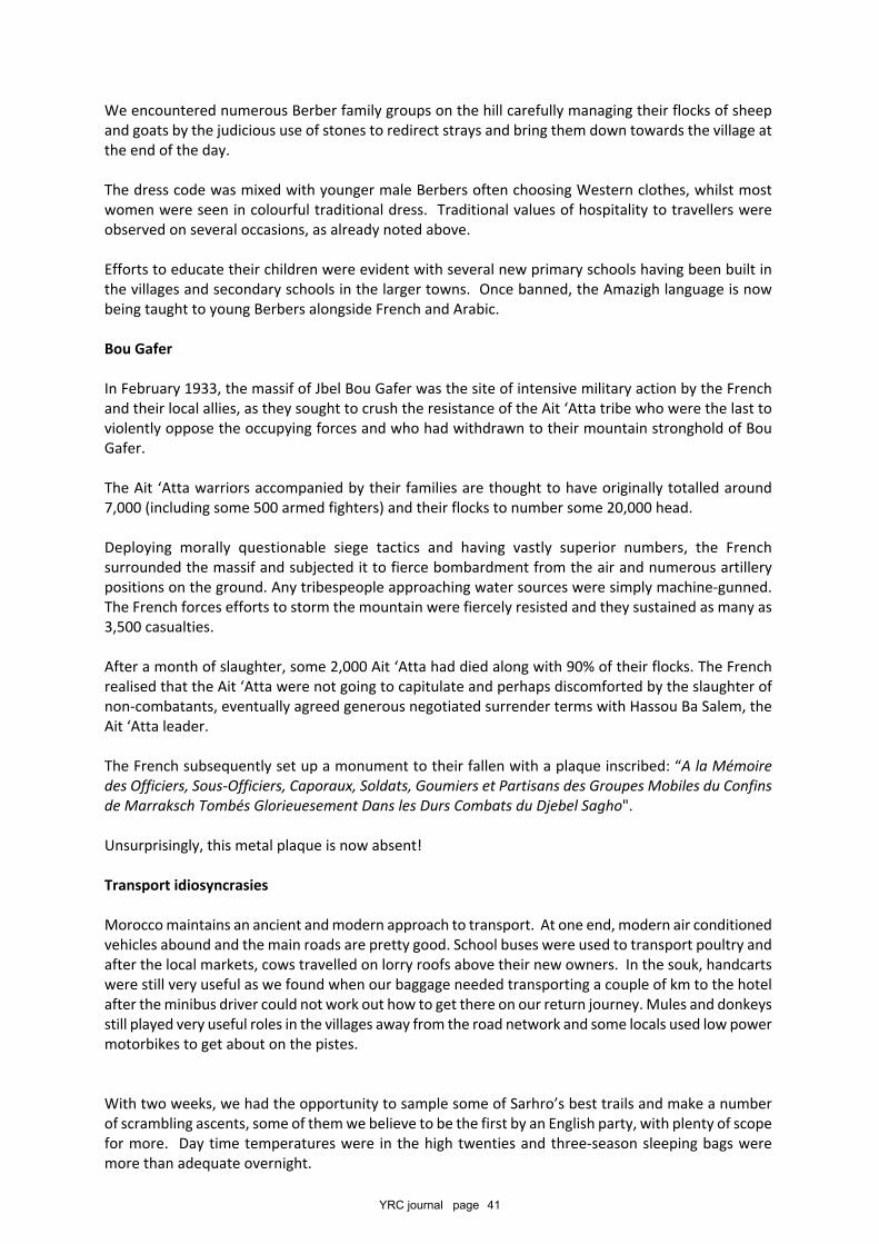
YRC journal page 41
We encountered numerous Berber family groups on the hill carefully managing their flocks of sheepand goats by the judicious use of stones to redirect strays and bring them down towards the village atthe end of the day.
The dress code was mixed with younger male Berbers often choosing Western clothes, whilst mostwomen were seen in colourful traditional dress. Traditional values of hospitality to travellers wereobserved on several occasions, as already noted above.
Efforts to educate their children were evident with several new primary schools having been built inthe villages and secondary schools in the larger towns. Once banned, the Amazigh language is nowbeing taught to young Berbers alongside French and Arabic.
Bou Gafer
In February 1933, the massif of Jbel Bou Gafer was the site of intensive military action by the Frenchand their local allies, as they sought to crush the resistance of the Ait ‘Atta tribe who were the last toviolently oppose the occupying forces and who had withdrawn to their mountain stronghold of BouGafer.
The Ait ‘Atta warriors accompanied by their families are thought to have originally totalled around7,000 (including some 500 armed fighters) and their flocks to number some 20,000 head.
Deploying morally questionable siege tactics and having vastly superior numbers, the Frenchsurrounded the massif and subjected it to fierce bombardment from the air and numerous artillerypositions on the ground. Any tribespeople approaching water sources were simply machine-gunned.The French forces efforts to storm the mountain were fiercely resisted and they sustained as many as3,500 casualties.
After a month of slaughter, some 2,000 Ait ‘Atta had died along with 90% of their flocks. The Frenchrealised that the Ait ‘Atta were not going to capitulate and perhaps discomforted by the slaughter ofnon-combatants, eventually agreed generous negotiated surrender terms with Hassou Ba Salem, theAit ‘Atta leader.
The French subsequently set up a monument to their fallen with a plaque inscribed: “A la Mémoiredes Officiers, Sous-Officiers, Caporaux, Soldats, Goumiers et Partisans des Groupes Mobiles du Confinsde Marraksch Tombés Glorieuesement Dans les Durs Combats du Djebel Sagho".
Unsurprisingly, this metal plaque is now absent!
Transport idiosyncrasies
Morocco maintains an ancient and modern approach to transport. At one end, modern air conditionedvehicles abound and the main roads are pretty good. School buses were used to transport poultry andafter the local markets, cows travelled on lorry roofs above their new owners. In the souk, handcartswere still very useful as we found when our baggage needed transporting a couple of km to the hotelafter the minibus driver could not work out how to get there on our return journey. Mules and donkeysstill played very useful roles in the villages away from the road network and some locals used low powermotorbikes to get about on the pistes.
With two weeks, we had the opportunity to sample some of Sarhro’s best trails and make a numberof scrambling ascents, some of them we believe to be the first by an English party, with plenty of scopefor more. Day time temperatures were in the high twenties and three-season sleeping bags weremore than adequate overnight.
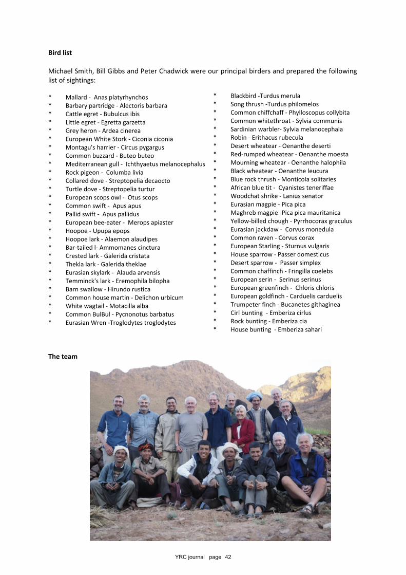
YRC journal page 42
Bird list
Michael Smith, Bill Gibbs and Peter Chadwick were our principal birders and prepared the followinglist of sightings:
* Mallard - Anas platyrhynchos* Barbary partridge - Alectoris barbara* Cattle egret - Bubulcus ibis* Little egret - Egretta garzetta* Grey heron - Ardea cinerea* European White Stork - Ciconia ciconia* Montagu's harrier - Circus pygargus* Common buzzard - Buteo buteo* Mediterranean gull - Ichthyaetus melanocephalus* Rock pigeon - Columba livia* Collared dove - Streptopelia decaocto* Turtle dove - Streptopelia turtur* European scops owl - Otus scops* Common swift - Apus apus* Pallid swift - Apus pallidus* European bee-eater - Merops apiaster* Hoopoe - Upupa epops* Hoopoe lark - Alaemon alaudipes* Bar-tailed l- Ammomanes cinctura* Crested lark - Galerida cristata* Thekla lark - Galerida theklae* Eurasian skylark - Alauda arvensis* Temminck's lark - Eremophila bilopha* Barn swallow - Hirundo rustica* Common house martin - Delichon urbicum* White wagtail - Motacilla alba* Common BulBul - Pycnonotus barbatus* Eurasian Wren -Troglodytes troglodytes
The team
* Blackbird -Turdus merula* Song thrush -Turdus philomelos* Common chiffchaff - Phylloscopus collybita* Common whitethroat - Sylvia communis* Sardinian warbler- Sylvia melanocephala* Robin - Erithacus rubecula* Desert wheatear - Oenanthe deserti* Red-rumped wheatear - Oenanthe moesta* Mourning wheatear - Oenanthe halophila* Black wheatear - Oenanthe leucura* Blue rock thrush - Monticola solitaries* African blue tit - Cyanistes teneriffae* Woodchat shrike - Lanius senator* Eurasian magpie - Pica pica* Maghreb magpie -Pica pica mauritanica* Yellow-billed chough - Pyrrhocorax graculus* Eurasian jackdaw - Corvus monedula* Common raven - Corvus corax* European Starling - Sturnus vulgaris* House sparrow - Passer domesticus* Desert sparrow - Passer simplex* Common chaffinch - Fringilla coelebs* European serin - Serinus serinus* European greenfinch - Chloris chloris* European goldfinch - Carduelis carduelis* Trumpeter finch - Bucanetes githaginea* Cirl bunting - Emberiza cirlus* Rock bunting - Emberiza cia* House bunting - Emberiza sahari
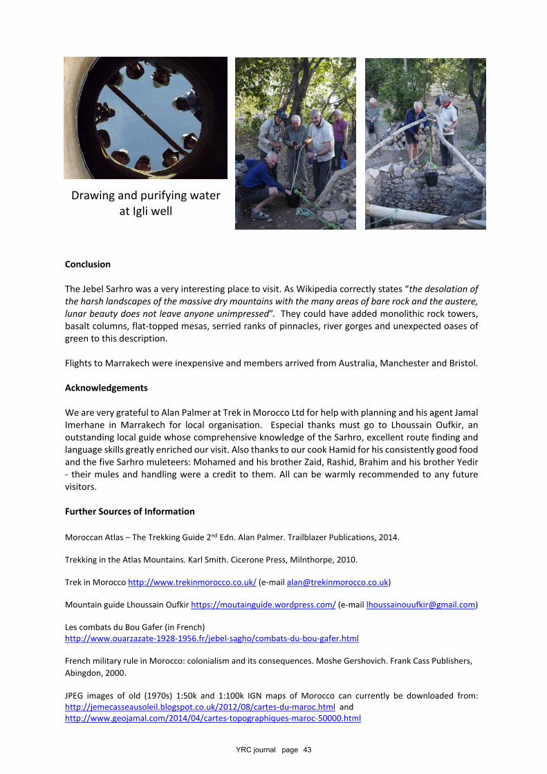
YRC journal page 43
Conclusion
The Jebel Sarhro was a very interesting place to visit. As Wikipedia correctly states “the desolation ofthe harsh landscapes of the massive dry mountains with the many areas of bare rock and the austere,lunar beauty does not leave anyone unimpressed”. They could have added monolithic rock towers,basalt columns, flat-topped mesas, serried ranks of pinnacles, river gorges and unexpected oases ofgreen to this description.
Flights to Marrakech were inexpensive and members arrived from Australia, Manchester and Bristol.
Acknowledgements
We are very grateful to Alan Palmer at Trek in Morocco Ltd for help with planning and his agent JamalImerhane in Marrakech for local organisation. Especial thanks must go to Lhoussain Oufkir, anoutstanding local guide whose comprehensive knowledge of the Sarhro, excellent route finding andlanguage skills greatly enriched our visit. Also thanks to our cook Hamid for his consistently good foodand the five Sarhro muleteers: Mohamed and his brother Zaid, Rashid, Brahim and his brother Yedir- their mules and handling were a credit to them. All can be warmly recommended to any futurevisitors.
Further Sources of Information
Moroccan Atlas – The Trekking Guide 2nd Edn. Alan Palmer. Trailblazer Publications, 2014.
Trekking in the Atlas Mountains. Karl Smith. Cicerone Press, Milnthorpe, 2010.
Trek in Morocco http://www.trekinmorocco.co.uk/ (e-mail [email protected])
Mountain guide Lhoussain Oufkir https://moutainguide.wordpress.com/ (e-mail [email protected])
Les combats du Bou Gafer (in French)http://www.ouarzazate-1928-1956.fr/jebel-sagho/combats-du-bou-gafer.html
French military rule in Morocco: colonialism and its consequences. Moshe Gershovich. Frank Cass Publishers,Abingdon, 2000.
JPEG images of old (1970s) 1:50k and 1:100k IGN maps of Morocco can currently be downloaded from:http://jemecasseausoleil.blogspot.co.uk/2012/08/cartes-du-maroc.html andhttp://www.geojamal.com/2014/04/cartes-topographiques-maroc-50000.html
Drawing and purifying waterat Igli well
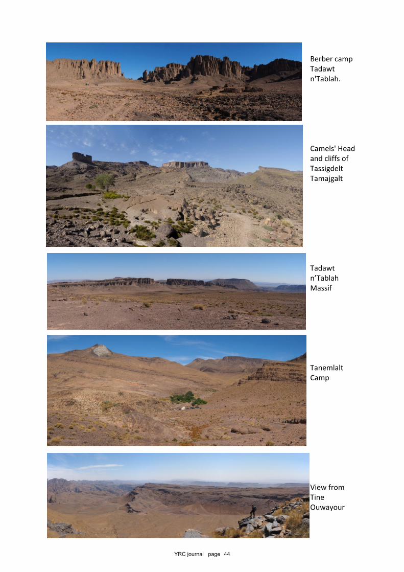
YRC journal page 44
Berber campTadawtn'Tablah.
Camels' Headand cliffs ofTassigdeltTamajgalt
Tadawtn’TablahMassif
TanemlaltCamp
View fromTineOuwayour
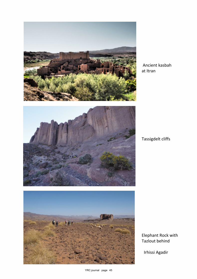
YRC journal page 45
Ancient kasbahat Itran
Tassigdelt cliffs
Elephant Rock withTazlout behind
Irhissi Agadir
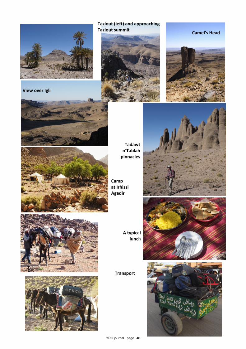
YRC journal page 46
A typicallunch
Tazlout (left) and approachingTazlout summit Camel's Head
View over Igli
Tadawtn'Tablah
pinnacles
Campat IrhissiAgadir
Transport
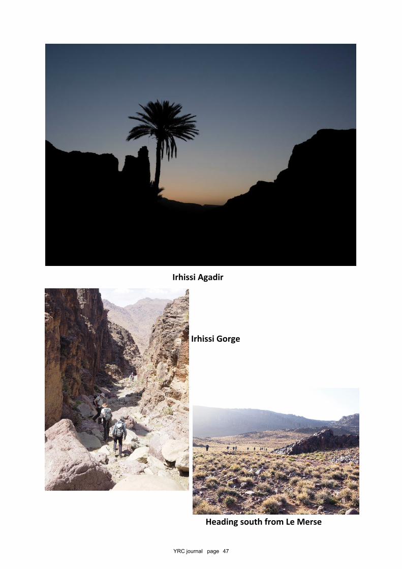
YRC journal page 47
Irhissi Agadir
Heading south from Le Merse
Irhissi Gorge
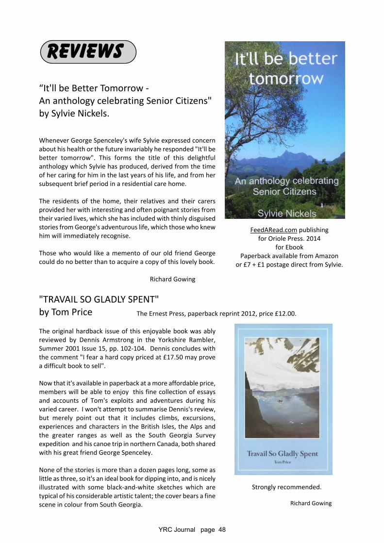
YRC Journal page 48
REVIEWS
“It'll be Better Tomorrow -An anthology celebrating Senior Citizens"by Sylvie Nickels.
Whenever George Spenceley's wife Sylvie expressed concernabout his health or the future invariably he responded "It'll bebetter tomorrow". This forms the title of this delightfulanthology which Sylvie has produced, derived from the timeof her caring for him in the last years of his life, and from hersubsequent brief period in a residential care home.
The residents of the home, their relatives and their carersprovided her with interesting and often poignant stories fromtheir varied lives, which she has included with thinly disguisedstories from George's adventurous life, which those who knewhim will immediately recognise.
Those who would like a memento of our old friend Georgecould do no better than to acquire a copy of this lovely book.
Richard Gowing
"TRAVAIL SO GLADLY SPENT"by Tom Price
The original hardback issue of this enjoyable book was ablyreviewed by Dennis Armstrong in the Yorkshire Rambler,Summer 2001 Issue 15, pp. 102-104. Dennis concludes withthe comment "I fear a hard copy priced at £17.50 may provea difficult book to sell".
Now that it's available in paperback at a more affordable price,members will be able to enjoy this fine collection of essaysand accounts of Tom's exploits and adventures during hisvaried career. I won't attempt to summarise Dennis's review,but merely point out that it includes climbs, excursions,experiences and characters in the British Isles, the Alps andthe greater ranges as well as the South Georgia Surveyexpedition and his canoe trip in northern Canada, both sharedwith his great friend George Spenceley.
None of the stories is more than a dozen pages long, some aslittle as three, so it's an ideal book for dipping into, and is nicelyillustrated with some black-and-white sketches which aretypical of his considerable artistic talent; the cover bears a finescene in colour from South Georgia.
FeedARead.com publishingfor Oriole Press. 2014
for EbookPaperback available from Amazon
or £7 + £1 postage direct from Sylvie.
The Ernest Press, paperback reprint 2012, price £12.00.
Strongly recommended.
Richard Gowing
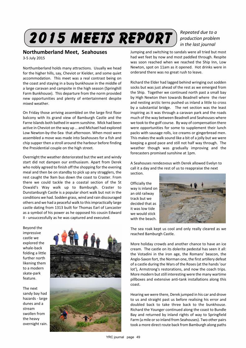
YRC journal page 49
Northumberland Meet, Seahouses3-5 July 2015
Northumberland holds many attractions. Usually we headfor the higher hills, say, Cheviot or Kielder, and some quietaccommodation. This meet was a real contrast being onthe coast and staying in a busy bunkhouse in the middle ofa large caravan and campsite in the high season (SpringhillFarm Bunkhouse). This departure from the norm providednew opportunities and plenty of entertainment despitemixed weather.
On Friday those arriving assembled on the large first floorbalcony with its grand view of Bamburgh Castle and theFarne Islands both bathed in warm sunshine. Mick had beenactive in Cheviot on the way up … and Michael had exploredLow Newton-by-the-Sea that afternoon. When most wereassembled a move was made into Seahouses for a fish andchip supper then a stroll around the harbour before findingthe Presidential couple on the high street.
Overnight the weather deteriorated but the wet and windystart did not dampen our enthusiasm. Apart from Derekwho nobly agreed to finish off the shopping for the eveningmeal and then be on standby to pick up any stragglers, therest caught the 9am bus down the coast to Craster. Fromthere we could tackle the a coastal section of the StOswald's Way walk up to Bamburgh. Craster toDunstanburgh Castle is a popular short walk but not in theconditions we had. Sodden grass, wind and rain discouragedothers and we had a peaceful walk to this impractically largecastle dating from 1313 built for Thomas Earl of Lancasteras a symbol of his power as he opposed his cousin EdwardII - unsuccessfully as he was captured and executed.
Beyond theimpressivecastle weexplored thewhale-backfolding a littlefurther northlikening themto a modernskate-parkfeature.
The nextsandy bay hadhazards - largedunes and astreamswollen fromthe heavyovernight rain.
2015 mEETS REPORTJumping and switching to sandals were all tried but mosthad wet feet by now and most paddled through. Respitewas soon reached when we reached the Ship Inn, LowNewton, spot on 11am as it opened. Hot drinks were inorderand there was no great rush to leave.
Richard the Elder had lagged behind wringing out soddensocks but was just ahead of the rest as we emerged fromthe Ship. Together we continued north past a small bayby High Newton then towards Beadnell where the riverand nesting arctic terns pushed us inland a little to crossby a substantial bridge. The net section was the leastinspiring as it was through a caravan park and the roadsmuch of the way between Beadnell and Seahouses wherewe took to the golf course. By way of compensation therewere opportunities for some to supplement their lunchpacks with sausage rolls, ice creams or gingerbread men.This makes the walk sound like a bit of a jolly but we werekeeping a good pace and still not half way through. Theweather though was gradually improving and theforecasters promised sunshine at 1pm.
A Seahouses rendezvous with Derek allowed Evelyn tocall it a day and the rest of us to reappraise the nextsection.
Officially theway is inland onan old railwaytrack but wedecided that asit was low tidewe would stickwith the beach.
The sea roak kept us cool and only really cleared as wereached Bamburgh Castle.
More holiday crowds and another chance to have an icecream. The castle on its dolerite pedestal has seen it all:the Votadini in the iron age, the Romans' beacon, theAnglo-Saxon fort, the Norman one, the first artillery defeatof a castle during the Wars of the Roses (at the hands 'ourlot'), Armstrong's restorations, and now the coach trips.More modern but still interesting were the many wartimepillboxes and extensive anti-tank installations along thiscoast.
Hearing we were there, Derek jumped in his car and droveto us and straight past us before realising his error anddoubled back to take three back to the bunkhouse.Richard the Younger continued along the coast to BundleBay and returned by inland rights of way to SpringfieldFarm (a mile or so inland from Seahouses). Two other pairstook a more direct route back from Bamburgh along paths
Repeated due to aproduction problemin the last journal
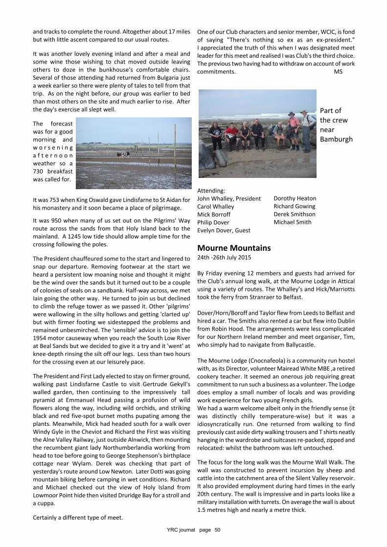
YRC journal page 50
and tracks to complete the round. Altogether about 17 milesbut with little ascent compared to our usual routes.
It was another lovely evening inland and after a meal andsome wine those wishing to chat moved outside leavingothers to doze in the bunkhouse's comfortable chairs.Several of those attending had returned from Bulgaria justa week earlier so there were plenty of tales to tell from thattrip. As on the night before, our group was earlier to bedthan most others on the site and much earlier to rise. Afterthe day's exercise all slept well.
The forecastwas for a goodmorning andw o r s e n i n ga f t e r n o o nweather so a730 breakfastwas called for.
It was 753 when King Oswald gave Lindisfarne to St Aidan forhis monastery and it soon became a place of pilgrimage.
It was 950 when many of us set out on the Pilgrims' Wayroute across the sands from that Holy Island back to themainland. A 1245 low tide should allow ample time for thecrossing following the poles.
The President chauffeured some to the start and lingered tosnap our departure. Removing footwear at the start weheard a persistent low moaning noise and thought it mightbe the wind over the sands but it turned out to be a coupleof colonies of seals on a sandbank. Half-way across, we metIain going the other way. He turned to join us but declinedto climb the refuge tower as we passed it. Other 'pilgrims'were wallowing in the silty hollows and getting 'clarted up'but with firmer footing we sidestepped the problems andremained unbesmirched. The 'sensible' advice is to join the1954 motor causeway when you reach the South Low Riverat Beal Sands but we decided to give it a try and it 'went' atknee-depth rinsing the silt off our legs. Less than two hoursfor the crossing even at our leisurely pace.
The President and First Lady elected to stay on firmer ground,walking past Lindisfarne Castle to visit Gertrude Gekyll'swalled garden, then continuing to the impressively tallpyramid at Emmanuel Head passing a profusion of wildflowers along the way, including wild orchids, and strikingblack and red five-spot burnet moths pupating among theplants. Meanwhile, Mick had headed south for a walk overWindy Gyle in the Cheviot and Richard the First was visitingthe Alne Valley Railway, just outside Alnwick, then mountingthe recumbent giant lady Northumberlandia working fromhead to toe before going to George Stephenson's birthplacecottage near Wylam. Derek was checking that part ofyesterday's route around Low Newton. Later Dotti was goingmountain biking before camping in wet conditions. Richardand Michael checked out the view of Holy Island fromLowmoor Point hide then visited Druridge Bay for a stroll anda cuppa.
Certainly a different type of meet.
One of our Club characters and senior member, WCIC, is fondof saying "There's nothing so ex as an ex-president."I appreciated the truth of this when I was designated meetleader for this meet and realised I was Club's the third choice.The previous two having had to withdraw on account of workcommitments. MS
Attending:John Whalley, PresidentCarol WhalleyMick BorroffPhilip DoverEvelyn Dover, Guest
Mourne Mountains24th -26th July 2015
By Friday evening 12 members and guests had arrived forthe Club’s annual long walk, at the Mourne Lodge in Atticalusing a variety of routes. The Whalley’s and Hick/Marriottstook the ferry from Stranraer to Belfast.
Dover/Horn/Boroff and Taylor flew from Leeds to Belfast andhired a car. The Smiths also rented a car but flew into Dublinfrom Robin Hood. The arrangements were less complicatedfor our Northern Ireland member and meet organiser, Tim,who simply had to navigate from Ballycastle.
The Mourne Lodge (Cnocnafeola) is a community run hostelwith, as its Director, volunteer Mairead White MBE ,a retiredcookery teacher. It seemed an onerous job requiring greatcommitment to run such a business as a volunteer. The Lodgedoes employ a small number of locals and was providingwork experience for two young French girls.We had a warm welcome albeit only in the friendly sense (itwas distinctly chilly temperature-wise) but it was aidiosyncratically run. One returned from walking to findpreviously cast aside dirty walking trousers and T shirts neatlyhanging in the wardrobe and suitcases re-packed, zipped andrelocated: whilst the bathroom was left untouched.
The focus for the long walk was the Mourne Wall Walk. Thewall was constructed to prevent incursion by sheep andcattle into the catchment area of the Silent Valley reservoir.It also provided employment during hard times in the early20th century. The wall is impressive and in parts looks like amilitary installation with turrets. On average the wall is about1.5 metres high and nearly a metre thick.
Part ofthe crewnearBamburgh
Dorothy HeatonRichard GowingDerek SmithsonMichael Smith
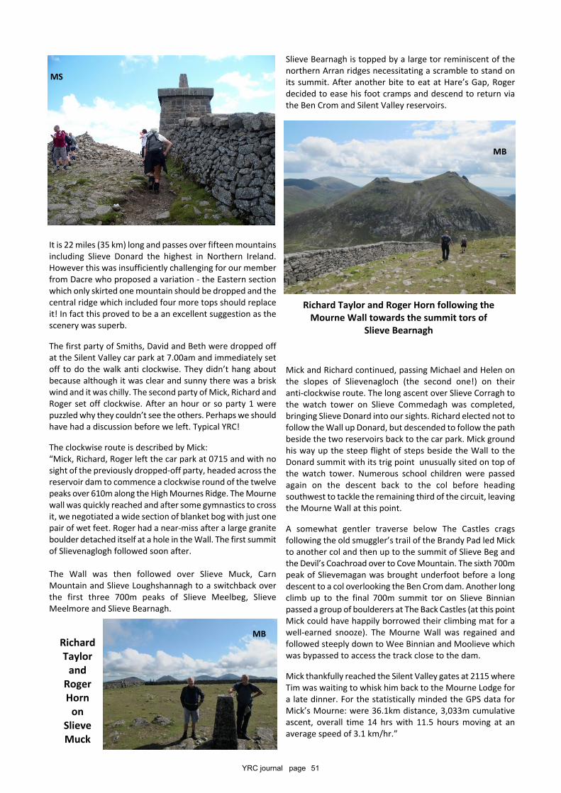
YRC journal page 51
It is 22 miles (35 km) long and passes over fifteen mountainsincluding Slieve Donard the highest in Northern Ireland.However this was insufficiently challenging for our memberfrom Dacre who proposed a variation - the Eastern sectionwhich only skirted one mountain should be dropped and thecentral ridge which included four more tops should replaceit! In fact this proved to be a an excellent suggestion as thescenery was superb.
The first party of Smiths, David and Beth were dropped offat the Silent Valley car park at 7.00am and immediately setoff to do the walk anti clockwise. They didn’t hang aboutbecause although it was clear and sunny there was a briskwind and it was chilly. The second party of Mick, Richard andRoger set off clockwise. After an hour or so party 1 werepuzzled why they couldn’t see the others. Perhaps we shouldhave had a discussion before we left. Typical YRC!
The clockwise route is described by Mick:“Mick, Richard, Roger left the car park at 0715 and with nosight of the previously dropped-off party, headed across thereservoir dam to commence a clockwise round of the twelvepeaks over 610m along the High Mournes Ridge. The Mournewall was quickly reached and after some gymnastics to crossit, we negotiated a wide section of blanket bog with just onepair of wet feet. Roger had a near-miss after a large graniteboulder detached itself at a hole in the Wall. The first summitof Slievenaglogh followed soon after.
The Wall was then followed over Slieve Muck, CarnMountain and Slieve Loughshannagh to a switchback overthe first three 700m peaks of Slieve Meelbeg, SlieveMeelmore and Slieve Bearnagh.
Slieve Bearnagh is topped by a large tor reminiscent of thenorthern Arran ridges necessitating a scramble to stand onits summit. After another bite to eat at Hare’s Gap, Rogerdecided to ease his foot cramps and descend to return viathe Ben Crom and Silent Valley reservoirs.
Mick and Richard continued, passing Michael and Helen onthe slopes of Slievenagloch (the second one!) on theiranti-clockwise route. The long ascent over Slieve Corragh tothe watch tower on Slieve Commedagh was completed,bringing Slieve Donard into our sights. Richard elected not tofollow the Wall up Donard, but descended to follow the pathbeside the two reservoirs back to the car park. Mick groundhis way up the steep flight of steps beside the Wall to theDonard summit with its trig point unusually sited on top ofthe watch tower. Numerous school children were passedagain on the descent back to the col before headingsouthwest to tackle the remaining third of the circuit, leavingthe Mourne Wall at this point.
A somewhat gentler traverse below The Castles cragsfollowing the old smuggler’s trail of the Brandy Pad led Mickto another col and then up to the summit of Slieve Beg andthe Devil’s Coachroad over to Cove Mountain. The sixth 700mpeak of Slievemagan was brought underfoot before a longdescent to a col overlooking the Ben Crom dam. Another longclimb up to the final 700m summit tor on Slieve Binnianpassed a group of boulderers at The Back Castles (at this pointMick could have happily borrowed their climbing mat for awell-earned snooze). The Mourne Wall was regained andfollowed steeply down to Wee Binnian and Moolieve whichwas bypassed to access the track close to the dam.
Mick thankfully reached the Silent Valley gates at 2115 whereTim was waiting to whisk him back to the Mourne Lodge fora late dinner. For the statistically minded the GPS data forMick’s Mourne: were 36.1km distance, 3,033m cumulativeascent, overall time 14 hrs with 11.5 hours moving at anaverage speed of 3.1 km/hr.”
MS
MB
MS
RichardTaylor
andRogerHorn
onSlieveMuck
MB
Richard Taylor and Roger Horn following theMourne Wall towards the summit tors of
Slieve Bearnagh
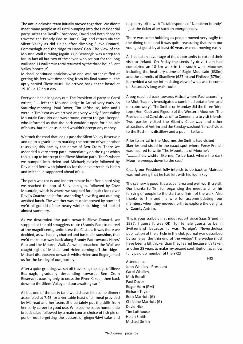
YRC journal page 52
The anti-clockwise team initially moved together. We didn’tmeet many people at all until bumping into the Presidentialparty. After the Devil’s Coachroad, David and Beth chose totraverse the Brandy Pad to Hares’ Gap and return via theSilent Valley as did Helen after climbing Slieve Donard,Commedagh and the ridge to Hares’ Gap. The view of theMourne Wall climbing (again!) Up Bearnagh was a step toofar. In fact all but two of the seven who set out for the longwalk and 11 walkers in total returned by the three hour SilentValley ‘shortcut’.Michael continued anticlockwise and was rather miffed atgetting his feet wet descending from his final summit - theaptly named Slieve Muck. He arrived back at the hostel at19.10 - a 12 hour day.
Everyone had a long day out. The Presidential party as Carolwrites, “ ... left the Mourne Lodge in Attical very early onSaturday morning. Paul Dover, Tim Lofthouse, John and Iwere in Tim’s car as we arrived at a very windy Silent ValleyMountain Park. No-one was around, except the gate keeper,who informed us that the park wouldn’t open for a coupleof hours, but he let us in and wouldn’t accept any money.
We took the road that led us past the Silent Valley Reservoirand up to a granite dam marking the bottom of yet anotherreservoir, this one by the name of Ben Crom. There weascended a very steep path immediately on the right whichtook us up to intercept the Slieve Binnian path. That’s wherewe bumped into Helen and Michael; closely followed byDavid and Beth who joined us for the next stretch as Helenand Michael disappeared ahead of us.
The path was rocky and indeterminate but after a hard slogwe reached the top of Slievelamagan, followed by CoveMountain, which is where we stopped for a quick look overDevil’s Coachroad, before ascending Slieve Beg and our longawaited lunch. The weather was much improved by now andwe’d all got rid of our heavy winter clothing and lookedalmost summery.
As we descended the path towards Slieve Donard, westopped at the old smugglers route (Brandy Pad) to marvelat the magnificent granite tors: the Castles. It was there wedecided, as we happily chatted and basked in sunshine, thatwe’d make our way back along Brandy Pad towards Hares’Gap and the Mourne Wall. As we approached the Wall wecaught sight of Michael and Helen coming off the ridge -Michael disappeared onwards whilst Helen and Roger joinedus for the last leg of our journey.
After a quick greeting, we set off traversing the edge of SlieveBearnagh, gradually descending towards Ben CromReservoir, pausing only to cross the River Kilkeel, then backdown to the Silent Valley and our awaiting car.”
All but one of the party (and we did save him some dinner)assembled at 7.45 for a veritable feast of a meal providedby Mairead and her team. She certainly put the skills fromher early career to good use. Wholesome soup; homemadebread: salad followed by a main course choice of fish pie orpork - not forgetting the dessert of ginger/kiwi cake and
raspberry trifle with “4 tablespoons of Napoleon brandy”- just the ticket after such an energetic day.
There was some hobbling as people moved very cagily tothe dining table and it was quite reassuring that even ouryoungest guest by at least 40 years was not moving easily!
All had taken advantage of the opportunity to extend theirvisit to Ireland. On Friday the Leeds fly drive team hadcompleted an 18 km walk in the south west Mournesincluding the heathery dome of Eagle Mountain (638m)and the summits of Shanlieve (627m) and Finlieve (579m).It provided a rather intimidating view of what was to comeon Saturday’s long walk route.
A bog road led back towards Attical where Paul accordingto Mick “happily investigated a combined potato farm andmicrobrewery”. The Smiths on Monday did the three ‘bird’tops (Hen; Cock and Pigeon) of the Western Mournes. ThePresident and Carol drove off to Connemara to visit friends.Two parties visited the Giant’s Causeway and otherattractions of Antrim and the Sunday washout ‘forced’ visitsto the Bushmills distillery and a pub in Belfast.
Prior to arrival in the Mournes the Smiths had visitedSkerries and stood in the exact spot where Percy Frenchwas inspired to write ‘The Mountains of Mourne’,“...........he's wishful like me, To be back where the darkMourne sweeps down to the sea.”
Clearly our President fully intends to be back as Maireadwas muttering that he had left with his room key!
The scenery is good. It’s a super area and well worth a visit.Our thanks to Tim for organising the meet and for hisferrying of people to the start and finish of the walk. Alsothanks to Tim and his wife for accommodating fourmembers when they moved north to explore the delightsof County Antrim.
This is your scribe’s first meet report since Saas Grund in1987. I guess It was OK for female guests to be inSwitzerland because it was ‘foreign’. Neverthelesspublication of the article in the club journal was describedby some as ‘the thin end of the wedge’ The wedge musthave been a bit thicker than they feared because it’s takenanother 28 years to make my second contribution as a nowfully paid up member of the YRC!
HJSAttendanceJohn Whalley - PresidentCarol WhalleyMick BoroffPaul DoverRoger Horn (PM)Richard TaylorBeth Marriott (G)Christine Marriott (G)David HickTim LofthouseHelen SmithMichael Smith
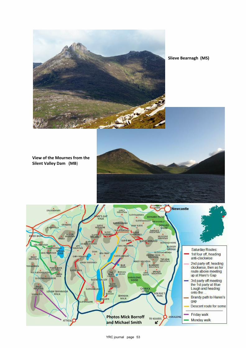
YRC journal page 53
Slieve Bearnagh (MS)
View of the Mournes from theSilent Valley Dam (MB)
Photos Mick Borroffand Michael Smith
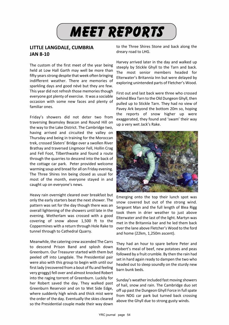
YRC journal page 54
LITTLE LANGDALE, CUMBRIAJAN 8-10
The custom of the first meet of the year beingheld at Low Hall Garth may well be more thanfifty years strong despite that week often bringingindifferent weather. There are memories ofsparkling days and good névé but they are few.This year did not refresh those memories thougheveryone got plenty of exercise. It was a sociableoccasion with some new faces and plenty offamiliar ones.
Friday’s showers did not deter two fromtraversing Beamsley Beacon and Round Hill onthe way to the Lake District. The Cambridge two,having arrived and circuited the valley onThursday and being in training for the Moroccantrek, crossed Slaters’ Bridge over a swollen RiverBrathay and traversed Lingmoor Fell, Hollin Cragand Fell Foot, Tilberthwaite and found a routethrough the quarries to descend into the back ofthe cottage car park. Peter provided welcomewarming soup and bread for all on Friday evening.The Three Shires Inn being closed as usual formost of the month, everyone stayed in andcaught up on everyone’s news.
Heavy rain overnight cleared over breakfast butonly the early starters beat the next shower. Thepattern was set for the day though there was anoverall lightening of the showers until late in theevening. Wetherlam was crossed with a goodcovering of snow above 1,500 ft to theCoppermines with a return through Hole Rake totunnel through to Cathedral Quarry.
Meanwhile, the catering crew ascended The Carrsto descend Prison Band and splosh downGreenburn. Our Treasurer started with them butpeeled off into Langdale. The Presidential pairwere also with this group to begin with until ourfirst lady (recovered from a bout of flu and feelingvery groggy) fell over and almost knocked Robertinto the raging torrent of Greenburn. Luckily forher Robert saved the day. They walked pastGreenburn Reservoir and on to Wet Side Edge,where suddenly high winds and thick mist werethe order of the day. Eventually the skies clearedso the Presidential couple made their way down
to the Three Shires Stone and back along thedreary road to LHG.
Harvey arrived later in the day and walked upsteeply by Stickle Ghyll to the Tarn and back.The most senior members headed forElterwater’s Britannia Inn but were delayed byexploring unintended parts of Fletcher’s Wood.
First out and last back were three who crossedbehind Blea Tarn to the Old Dungeon Ghyll, thenpulled up to Stickle Tarn. They had no view ofPavey Ark beyond the bottom 20m so, hopingthe reports of snow higher up wereexaggerated, they found and ‘swam’ their wayup a very wet Jack’s Rake.
Emerging onto the top their lunch spot wassnow covered but out of the strong wind.Sergeant Man and the full length of Blea Riggtook them in drier weather to just aboveElterwater and the last of the light. Martyn wasmet in the Britannia bar and he led them backover the lane above Fletcher’s Wood to the fordand home (22km, 1,250m ascent).
They had an hour to spare before Peter andRobert’s meal of beef, new potatoes and peasfollowed by a fruit crumble. By then the rain hadset in hard again ready to dampen the two whoheaded out to sleep soundly on the sturdy newbarn bunk beds.
Sunday’s weather included fast moving showersof hail, snow and rain. The Cambridge duo setoff up past the Dungeon Ghyll Force in full spatefrom NDG car park but turned back crossingabove the Ghyll due to strong gusty winds.
mEET REPORTs
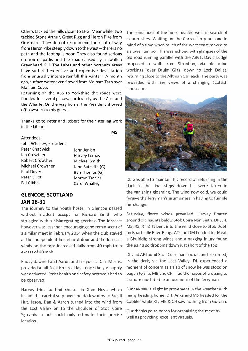
YRC journal page 55
Others tackled the hills closer to LHG. Meanwhile, twotackled Stone Arthur, Great Rigg and Heron Pike fromGrasmere. They do not recommend the right of wayfrom Heron Pike steeply down to the west – there is nopath and the footing is poor. They also found seriouserosion of paths and the road caused by a swollenGreenhead Gill. The Lakes and other northern areashave suffered extensive and expensive devastationfrom unusually intense rainfall this winter. A monthago, surface water even flowed from Malham Tarn overMalham Cove.Returning on the A65 to Yorkshire the roads wereflooded in several places, particularly by the Aire andthe Wharfe. On the way home, the President showedoff Lowstern to his guest.
Thanks go to Peter and Robert for their sterling workin the kitchen.
MSAttendees:John Whalley, PresidentPeter ChadwickIan CrowtherRobert CrowtherMichael CrowtherPaul DoverPeter ElliotBill Gibbs
GLENCOE, SCOTLANDJAN 28-31The journey to the youth hostel in Glencoe passedwithout incident except for Richard Smith whostruggled with a disintegrating gearbox. The forecasthowever was less than encouraging and reminiscent ofa similar meet in February 2014 when the club stayedat the independent hostel next door and the forecastwinds on the tops increased daily from 40 mph to inexcess of 80 mph.
Friday dawned and Aaron and his guest, Dan Morris,provided a full Scottish breakfast, once the gas supplywas activated. Strict health and safety protocols had tobe observed.
Harvey tried to find shelter in Glen Nevis whichincluded a careful step over the dark waters to SteallHut. Jason, Dan & Aaron turned into the wind fromthe Lost Valley on to the shoulder of Stob CoireSgreanhach but could only estimate their preciselocation.
The remainder of the meet headed west in search ofclearer skies. Waiting for the Corran ferry put one inmind of a time when much of the west coast moved toa slower tempo. This was echoed with glimpses of theold road running parallel with the A861. David Lodgeproposed a walk from Strontian, via old mineworkings, over Druim Glas, down to Loch Doilet,returning close to the Allt nan Cailleach. The party wasrewarded with fine views of a changing Scottishlandscape.
DL was able to maintain his record of returning in thedark as the final steps down hill were taken inthe vanishing gloaming. The wind now cold, we couldforgive the ferryman’s grumpiness in having to fumblefor change.
Saturday, fierce winds prevailed. Harvey floatedaround old haunts below Stob Coire Nan Beith. DH, JH,MS, RS, RT & TJ bent into the wind close to Stob Dubhon Buachaille Etive Beag. AO and DM headed for Mealla Bhuiridh; strong winds and a nagging injury foundthe pair also dropping down just short of the top.
DL and AP found Stob Coire nan Lochan and returned,in the dark, via the Lost Valley. DL experienced amoment of concern as a slab of snow he was stood onbegan to slip. MB and CH had the hopes of crossing toLismore much to the amusement of the ferryman.
Sunday saw a slight improvement in the weather withmany heading home. DH, Anka and MS headed for theCobbler while RT, MB & CH saw nothing from Gulvain.
Our thanks go to Aaron for organising the meet aswell as providing excellent victuals.
John JenkinHarvey LomasMichael SmithJohn Sutcliffe (G)Ben Thomas (G)Martyn TraslerCarol Whalley
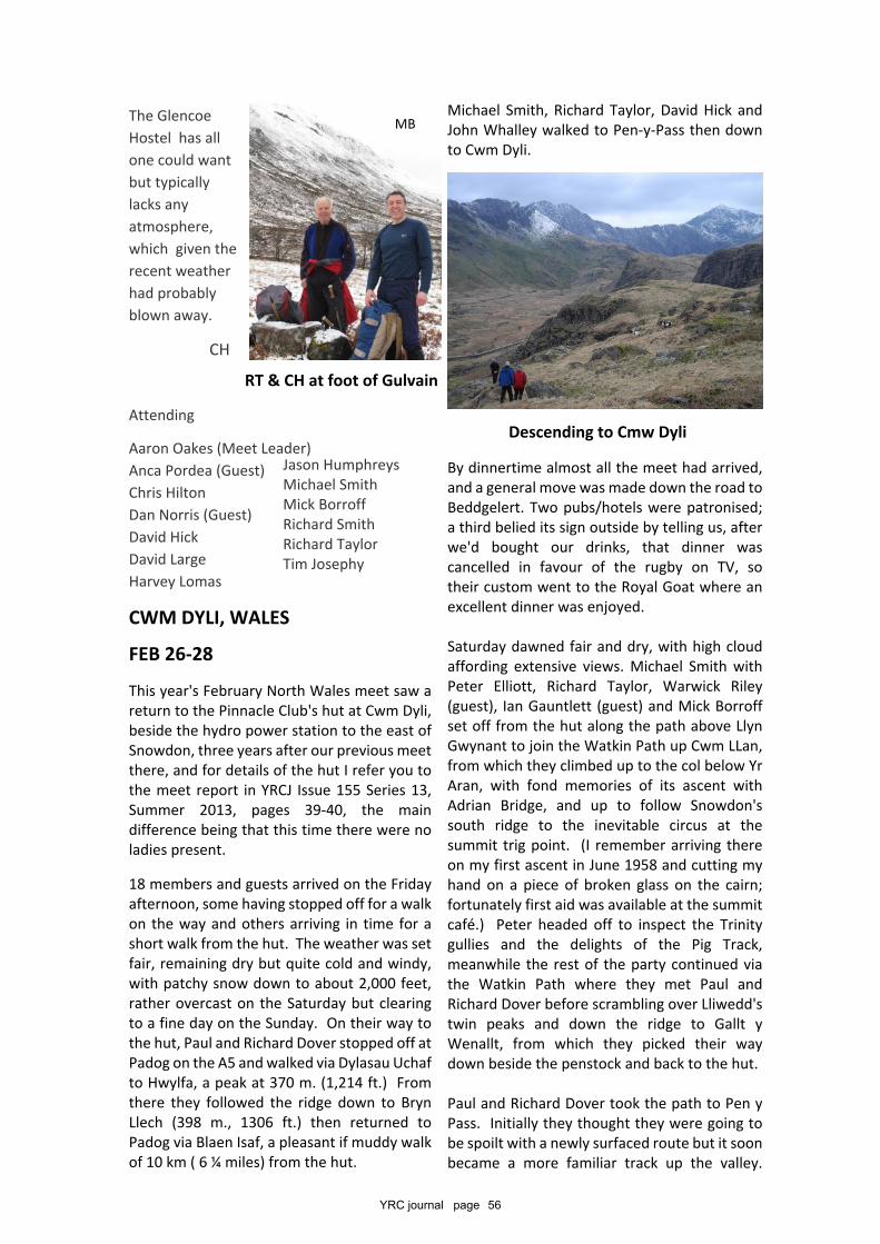
YRC journal page 56
The GlencoeHostel has allone could wantbut typicallylacks anyatmosphere,which given therecent weatherhad probablyblown away.
CH
Attending
Aaron Oakes (Meet Leader)Anca Pordea (Guest)Chris HiltonDan Norris (Guest)David HickDavid LargeHarvey Lomas
CWM DYLI, WALES
FEB 26-28
This year's February North Wales meet saw areturn to the Pinnacle Club's hut at Cwm Dyli,beside the hydro power station to the east ofSnowdon, three years after our previous meetthere, and for details of the hut I refer you tothe meet report in YRCJ Issue 155 Series 13,Summer 2013, pages 39-40, the maindifference being that this time there were noladies present.
18 members and guests arrived on the Fridayafternoon, some having stopped off for a walkon the way and others arriving in time for ashort walk from the hut. The weather was setfair, remaining dry but quite cold and windy,with patchy snow down to about 2,000 feet,rather overcast on the Saturday but clearingto a fine day on the Sunday. On their way tothe hut, Paul and Richard Dover stopped off atPadog on the A5 and walked via Dylasau Uchafto Hwylfa, a peak at 370 m. (1,214 ft.) Fromthere they followed the ridge down to BrynLlech (398 m., 1306 ft.) then returned toPadog via Blaen Isaf, a pleasant if muddy walkof 10 km ( 6 ¼ miles) from the hut.
Michael Smith, Richard Taylor, David Hick andJohn Whalley walked to Pen-y-Pass then downto Cwm Dyli.
By dinnertime almost all the meet had arrived,and a general move was made down the road toBeddgelert. Two pubs/hotels were patronised;a third belied its sign outside by telling us, afterwe'd bought our drinks, that dinner wascancelled in favour of the rugby on TV, sotheir custom went to the Royal Goat where anexcellent dinner was enjoyed.
Saturday dawned fair and dry, with high cloudaffording extensive views. Michael Smith withPeter Elliott, Richard Taylor, Warwick Riley(guest), Ian Gauntlett (guest) and Mick Borroffset off from the hut along the path above LlynGwynant to join the Watkin Path up Cwm LLan,from which they climbed up to the col below YrAran, with fond memories of its ascent withAdrian Bridge, and up to follow Snowdon'ssouth ridge to the inevitable circus at thesummit trig point. (I remember arriving thereon my first ascent in June 1958 and cutting myhand on a piece of broken glass on the cairn;fortunately first aid was available at the summitcafé.) Peter headed off to inspect the Trinitygullies and the delights of the Pig Track,meanwhile the rest of the party continued viathe Watkin Path where they met Paul andRichard Dover before scrambling over Lliwedd'stwin peaks and down the ridge to Gallt yWenallt, from which they picked their waydown beside the penstock and back to the hut.
Paul and Richard Dover took the path to Pen yPass. Initially they thought they were going tobe spoilt with a newly surfaced route but it soonbecame a more familiar track up the valley.
RT & CH at foot of Gulvain
MB
Jason HumphreysMichael SmithMick BorroffRichard SmithRichard TaylorTim Josephy
Descending to Cmw Dyli
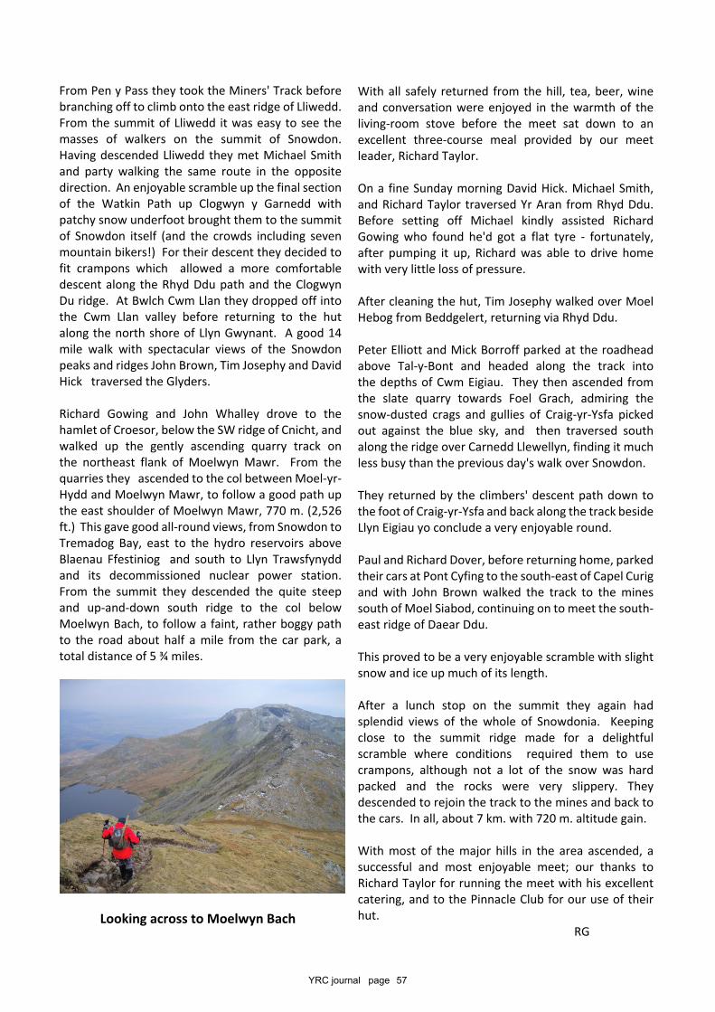
YRC journal page 57
From Pen y Pass they took the Miners' Track beforebranching off to climb onto the east ridge of Lliwedd.From the summit of Lliwedd it was easy to see themasses of walkers on the summit of Snowdon.Having descended Lliwedd they met Michael Smithand party walking the same route in the oppositedirection. An enjoyable scramble up the final sectionof the Watkin Path up Clogwyn y Garnedd withpatchy snow underfoot brought them to the summitof Snowdon itself (and the crowds including sevenmountain bikers!) For their descent they decided tofit crampons which allowed a more comfortabledescent along the Rhyd Ddu path and the ClogwynDu ridge. At Bwlch Cwm Llan they dropped off intothe Cwm Llan valley before returning to the hutalong the north shore of Llyn Gwynant. A good 14mile walk with spectacular views of the Snowdonpeaks and ridges John Brown, Tim Josephy and DavidHick traversed the Glyders.
Richard Gowing and John Whalley drove to thehamlet of Croesor, below the SW ridge of Cnicht, andwalked up the gently ascending quarry track onthe northeast flank of Moelwyn Mawr. From thequarries they ascended to the col between Moel-yr-Hydd and Moelwyn Mawr, to follow a good path upthe east shoulder of Moelwyn Mawr, 770 m. (2,526ft.) This gave good all-round views, from Snowdon toTremadog Bay, east to the hydro reservoirs aboveBlaenau Ffestiniog and south to Llyn Trawsfynyddand its decommissioned nuclear power station.From the summit they descended the quite steepand up-and-down south ridge to the col belowMoelwyn Bach, to follow a faint, rather boggy pathto the road about half a mile from the car park, atotal distance of 5 ¾ miles.
With all safely returned from the hill, tea, beer, wineand conversation were enjoyed in the warmth of theliving-room stove before the meet sat down to anexcellent three-course meal provided by our meetleader, Richard Taylor.
On a fine Sunday morning David Hick. Michael Smith,and Richard Taylor traversed Yr Aran from Rhyd Ddu.Before setting off Michael kindly assisted RichardGowing who found he'd got a flat tyre - fortunately,after pumping it up, Richard was able to drive homewith very little loss of pressure.
After cleaning the hut, Tim Josephy walked over MoelHebog from Beddgelert, returning via Rhyd Ddu.
Peter Elliott and Mick Borroff parked at the roadheadabove Tal-y-Bont and headed along the track intothe depths of Cwm Eigiau. They then ascended fromthe slate quarry towards Foel Grach, admiring thesnow-dusted crags and gullies of Craig-yr-Ysfa pickedout against the blue sky, and then traversed southalong the ridge over Carnedd Llewellyn, finding it muchless busy than the previous day's walk over Snowdon.
They returned by the climbers' descent path down tothe foot of Craig-yr-Ysfa and back along the track besideLlyn Eigiau yo conclude a very enjoyable round.
Paul and Richard Dover, before returning home, parkedtheir cars at Pont Cyfing to the south-east of Capel Curigand with John Brown walked the track to the minessouth of Moel Siabod, continuing on to meet the south-east ridge of Daear Ddu.
This proved to be a very enjoyable scramble with slightsnow and ice up much of its length.
After a lunch stop on the summit they again hadsplendid views of the whole of Snowdonia. Keepingclose to the summit ridge made for a delightfulscramble where conditions required them to usecrampons, although not a lot of the snow was hardpacked and the rocks were very slippery. Theydescended to rejoin the track to the mines and back tothe cars. In all, about 7 km. with 720 m. altitude gain.
With most of the major hills in the area ascended, asuccessful and most enjoyable meet; our thanks toRichard Taylor for running the meet with his excellentcatering, and to the Pinnacle Club for our use of theirhut.
RGLooking across to Moelwyn Bach

YRC journal page 58
AttendersJohn Whalley, President,Mick Borroff, John Brown, Alan Clare,Derek Clayton, Ian Crowther, Paul Dover,Richard Dover, Peter Elliott, David Hick,Richard Gowing, John Jenkin, Tim Josephy,Richard Taylor, Michael Smith,John Lloyd (g), Warwick Riley (g),Ian Gauntlett (g),
NEWTONMOOR, SCOTLAND MAR 18-20
I hope the participants will excuse me if I inadvertently cropped them in the wrong place and left them hangingon by their nails half way up some crag, whilst I struggled to get my head round all the Fiacaill a’ Choire Chais’esand Brocken Spectacles!
Eleven members and one guestattended the meet at the Potterybunkhouse near Laggan Bridge –an ideal location for exploring theGrampians to the east and theMonadhliaths to the north. Thebunkhouse was very comfortablewith a triple aspect lounge-kitchenlooking out across the flood plainof the Upper Spey. A wood-burning stove kept us warm andcozy in the evenings whilst wewatched the capable chef / leaderbeavering away in the adjoiningkitchen that lacked only the usualsharp knife. Chris’ food wassplendid, with two bottles ofwhisky appearing with perfecttiming to mellow away the evenings.
Carneddau
MB
Carnned LLewelyn
The locals
Temperature inversion above Coire an t-Sneacchda
MB

YRC journal page 59
The hostel, we learned, had been opened by thefamous Polar Explorer, Wally Herbert, with examplesof his outstanding artwork adorning the walls. Beyondthese, looking out over some of the ramblers’ heads Icouldn’t help noticing the Highland sheep that whiled-away most of the long weekend contentedly snuggleddown - also waiting to be fed!
The weather was reasonable for the time of year withmid-slope cloud giving way to fine views above about900m. The parties reported a variety of wildlifeincluding snow buntings, ptarmigans, oyster catchersand black grouse with an unconfirmed sighting of anAbominable Snowgirl disappearing off a snow bridge.It was Mick and Chris’ confirmed sighting of at least adozen March mountain hares over in Deeside that musttake first prize, however.
On the Saturday, and suitably mellowed, Michael,Derek, Peter and David headed up Beinn a’Chaorainnstarting out from Roughburn near the Loch Laggandam. Climbing above the clouds the party wasrewarded with fine uninterrupted views of Torridonand Skye and round to the Ben and the Mamores.Brocken Spectres were seen from the northern lip ofthe Beinn. Two of the party descended from the col atTom Mòr whilst the two others continued round overBeinn Teallaich – one of the lowest Munros.
Chris and Mick headed over to Aviemore and venturedinto Coire an t-Sneachda. On the approach the mistlifted and they made their way up snowy slopes underblue skies and sunshine to the rocky scramble of FiacaillCoire an t-Sneachda, watched by two pairs of Ptarmiganbefore emerging onto the Cairngorm plateau.Traversing the coire headwall over to Fiacaill a’ ChoireChais they saw their Brocken Spectre images projectedonto the mist-filled Coire an t-Sneachda.
The President, Carol and the writer were joined by BobPeckham, a guest and old friend from Inverness, tohead up the glen from Aberader towards CreagMeagaidh. The First Lady set the pace through thenature reserve where managed reductions in grazinglivestock and deer populations have lead to a regrowthof the native woodland. Carol’s progress was hamperedby her lack of winter boots once we entered the snowcovered slopes approaching the lochan and so, afternearly disappearing through a snow bridge, she decidedto head to lower ground to explore the various trails inthe nature reserve.
Bob and I continued on through the low cloud up thesnow slope leading to the ‘window’ before emerging
into blinding sunshine onto the one square kilometresnow-covered plateau, a shining island surrounded bya sea of cotton-wool cloud. The whalebacks of BenNevis and Aonach Mor were clearly discernable to thewest and beyond were half-imagined hints ofKnoydart.
Sated by the awesome views we made our way alongthe tundra-covered ridge keeping just above theclouds towards Munro Puist Coire Ardour beforeheel-scrunching our way down through steep mushysnow slopes and across boggy heathland to the bridgeand awaiting car, ending a very fine walk.
On the Sunday, Michael, Mick and Chris headed to theCairngorm’s Coire an t-Sneachda for Aladdin’s Couloirwith well-frozen neve; Michael then descending byFiacaill a’Choire. Snow conditions were good but itwas cold and windy on the plateau with poor visibility,although they did manage to spot a Snow Bunting.
Derek and Andrew Duxbury, starting from GeneralWade’s A889, headed up the Allt an t’ Bluic andclimbed Meall nan Eagan (MR 597875) beforeexploring for future expeditions.
Carol, the President and I had a relaxed day, startingwith a visit to the impressive ruins of the RuthvenBarracks just to the south of Kingussie. RetreatingJacobites destroyed the barracks in the aftermath ofCulloden in 1745. In the afternoon we had a ramblethrough the woods of Glen More nature reserve to thesouth of Loch Morlich, proving what I always suspected- if you keep turning right in a maze of woodland pathsyou eventually get back to where you started, if youcan remember where that was.
Heading home on Monday Mick and Chris Hilton weretempted by the better weather forecasts to headover to the Spittal of Glenmuick on Deeside to climbthe Black Spout. After heading up to the bealachbetween the main Lochnagar ridge and Meikle Papthey descended into the shelter of Lochnagar’smagnificent coire before crossing over to the mouthof the Black Spout, watched over by at least dozenwhite mountain hares. They then ascended the gully,front-pointing up the well-bonded snowpack, takingthe steeper left branch that was cornice-free andallowed them to gain the plateau and the cairn ofCac Carn Beag for a well-earned second lunch and anuneventful return to the car.
Michael drove up Glen Fincastle just a few miles southof Blair Atholl and went up Tulach Hill (470m) for good
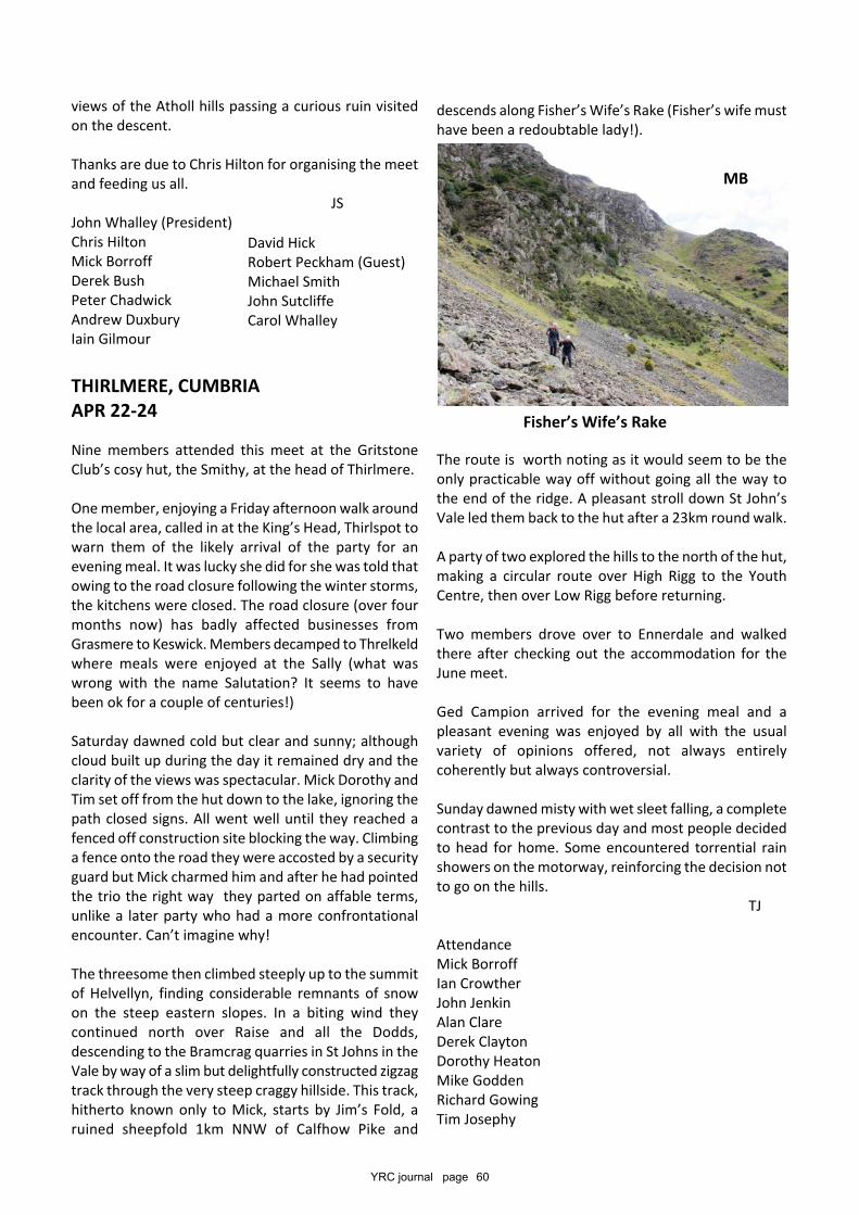
YRC journal page 60
views of the Atholl hills passing a curious ruin visitedon the descent.
Thanks are due to Chris Hilton for organising the meetand feeding us all.
JSJohn Whalley (President)Chris HiltonMick BorroffDerek BushPeter ChadwickAndrew DuxburyIain Gilmour
THIRLMERE, CUMBRIAAPR 22-24
Nine members attended this meet at the GritstoneClub’s cosy hut, the Smithy, at the head of Thirlmere.
One member, enjoying a Friday afternoon walk aroundthe local area, called in at the King’s Head, Thirlspot towarn them of the likely arrival of the party for anevening meal. It was lucky she did for she was told thatowing to the road closure following the winter storms,the kitchens were closed. The road closure (over fourmonths now) has badly affected businesses fromGrasmere to Keswick. Members decamped to Threlkeldwhere meals were enjoyed at the Sally (what waswrong with the name Salutation? It seems to havebeen ok for a couple of centuries!)
Saturday dawned cold but clear and sunny; althoughcloud built up during the day it remained dry and theclarity of the views was spectacular. Mick Dorothy andTim set off from the hut down to the lake, ignoring thepath closed signs. All went well until they reached afenced off construction site blocking the way. Climbinga fence onto the road they were accosted by a securityguard but Mick charmed him and after he had pointedthe trio the right way they parted on affable terms,unlike a later party who had a more confrontationalencounter. Can’t imagine why!
The threesome then climbed steeply up to the summitof Helvellyn, finding considerable remnants of snowon the steep eastern slopes. In a biting wind theycontinued north over Raise and all the Dodds,descending to the Bramcrag quarries in St Johns in theVale by way of a slim but delightfully constructed zigzagtrack through the very steep craggy hillside. This track,hitherto known only to Mick, starts by Jim’s Fold, aruined sheepfold 1km NNW of Calfhow Pike and
descends along Fisher’s Wife’s Rake (Fisher’s wife musthave been a redoubtable lady!).
The route is worth noting as it would seem to be theonly practicable way off without going all the way tothe end of the ridge. A pleasant stroll down St John’sVale led them back to the hut after a 23km round walk.
A party of two explored the hills to the north of the hut,making a circular route over High Rigg to the YouthCentre, then over Low Rigg before returning.
Two members drove over to Ennerdale and walkedthere after checking out the accommodation for theJune meet.
Ged Campion arrived for the evening meal and apleasant evening was enjoyed by all with the usualvariety of opinions offered, not always entirelycoherently but always controversial.
Sunday dawned misty with wet sleet falling, a completecontrast to the previous day and most people decidedto head for home. Some encountered torrential rainshowers on the motorway, reinforcing the decision notto go on the hills. TJ
AttendanceMick BorroffIan CrowtherJohn JenkinAlan ClareDerek ClaytonDorothy HeatonMike GoddenRichard GowingTim Josephy
David HickRobert Peckham (Guest)Michael SmithJohn SutcliffeCarol Whalley
MB
Fisher’s Wife’s Rake
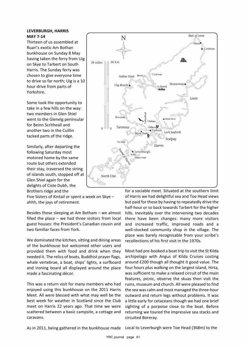
YRC journal page 61
LEVERBURGH, HARRISMAY 7-14Thirteen of us assembled atRuari’s exotic Am Bothanbunkhouse on Sunday 8 Mayhaving taken the ferry from Uigon Skye to Tarbert on SouthHarris. The Sunday ferry waschosen to give everyone timeto drive so far north; Uig is a 10hour drive from parts ofYorkshire.
Some took the opportunity totake in a few hills on the way:two members in Glen Shielwent to the Glenelg peninsularfor Beinn Scritheall andanother two in the Cuillintacked parts of the ridge.
Similarly, after departing thefollowing Saturday mostmotored home by the sameroute but others extendedtheir stay, traversed the stringof islands south, stopped off atGlen Shiel again for thedelights of Ciste Dubh, theBrothers ridge and theFive Sisters of Kintail or spent a week on Skye –ahhh, the joys of retirement.
Besides those sleeping at Am Botham – we almostfilled the place – we had three visitors from localguest houses: the President’s Canadian cousin andtwo familiar faces from York.
We dominated the kitchen, sitting and dining areasof the bunkhouse but welcomed other users andprovided them with food and drink when theyneeded it. The relics of boats, Buddhist prayer flags,whale vertebrae, a boat, ships’ lights, a surfboardand ironing board all displayed around the placemade a fascinating décor.
This was a return visit for many members who hadenjoyed using this bunkhouse on the 2011 HarrisMeet. All were blessed with what may well be thebest week for weather in Scotland since the Clubmeet on Harris 22 years ago. That time we werescattered between a basic campsite, a cottage andcaravans.
As in 2011, being gathered in the bunkhouse made
for a sociable meet. Situated at the southern limitof Harris we had delightful sea and Toe Head viewsbut paid for these by having to repeatedly drive thehalf-hour or so back towards Tarbert for the higherhills. Inevitably over the intervening two decadesthere have been changes: many more visitorsand increased traffic, improved roads and awell-stocked community shop in the village. Theplace was barely recognisable from your scribe’srecollections of his first visit in the 1970s.
Most had pre-booked a boat trip to visit the St Kildaarchipelago with Angus of Kilda Cruises costingaround £200 though all thought it good value. Thefour hours plus walking on the largest island, Hirta,was sufficient to make a relaxed circuit of the mainfeatures, picnic, observe the skuas then visit theruins, museum and church. All were pleased to findthe sea was calm and most managed the three-houroutward and return legs without problems. It wasa little early for cetaceans though we had one briefsighting of a porpoise close to the boat. Beforereturning we toured the impressive sea stacks andcircuited Boreray.
Local to Leverburgh were Toe Head (368m) to the
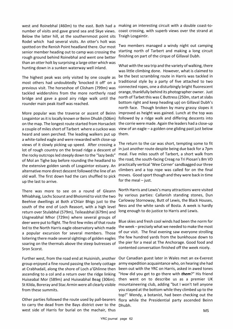
YRC journal page 62
west and Roinebhal (460m) to the east. Both had anumber of visits and gave grand sea and Skye views.Below the latter hill, at the southernmost point sitsRodel which had several visits. An otter’s holt wasspotted on the Renish Point headland there. Our mostsenior member heading out to camp was crossing therough ground behind Roinebhal and went one betterthan an otter holt by surprising a large otter which washunting down in a sunken waterway well inland.
The highest peak was only visited by one couple asmost others had undoubtedly ‘knocked it off’ on aprevious visit. The horseshoe of Clisham (799m) wastackled widdershins from the more northerly roadbridge and gave a good airy ridge walk until therounder main peak itself was reached.
More popular was the traverse or ascent of BeinnLosgaintor as it is locally known or Beinn Dhubh (506m)on the map. The longest route started from Horsacleita couple of miles short of Tarbert where a cuckoo washeard and seen perched. The leading walkers put upa white-tailed eagle and were rewarded with close-upviews of it slowly picking up speed. After crossing alot of rough country on the broad ridge a descent ofthe rocky outcrops led steeply down to the “lazy beds”of Mol an Tighe bay before rounding the headland tothe extensive golden sands of Losgaintor estuary. Analternative more direct descent followed the line of anold wall. The first down had the cars shuffled to pickup the last to arrive.
There was more to see on a round of GleannMhiabhaig, Lochs Scourst and Bhoismid to visit the twoBeehive dwellings at Both a’Chlair Bhigs just to thesouth of the end of Loch Reasort, with a high levelreturn over Stulabhal (579m), Teileasbhal (679m) andUisgneabhal Mhor (729m) where several groups ofdeer were put to flight. The first few miles of that routeled to the North Harris eagle observatory which madea popular excursion for several members. Thoseloitering there made several sightings of golden eaglessoaring on the thermals above the steep butresses ofSron Scorst.
Further west, from the road end at Huisinish, anothergroup enjoyed a fine round passing the lonely cottageat Crabhadail, along the shore of Loch a’Ghlinne thenascending to a col and a return over the ridge linkingHuiseabal Mor (589m) and Huiseabhal Beag (306m).St Kilda, Boreray and Stac Armin were all clearly visiblefrom these summits.
Other parties followed the route used by pall-bearersto carry the dead from the Bays district over to thewest side of Harris for burial on the machair, thus
making an interesting circuit with a double coast-to-coast crossing, with superb views over the strand atTraigh Losgaintir.
Two members managed a windy night out campingstarting north of Tarbert and making a long circuitfinishing on part of the cirque of Gillaval Dubh.
What with the sea trip and the variety of walking, therewas little climbing done. However, what is claimed tobe the best scrambling route in Harris was tackled intraditional style by a party of five attached to twoconnected ropes, one a disturbingly bright fluorescentorange, thankfully behind its photographer owner. Justnorth of Tarbet this was C Buttress (250m, start at slabsbottom right and keep heading up) on Gillaval Dubh’snorth face. Though broken by many grassy slopes itimproved as height was gained. Lunch at the top wasfollowed by a ridge walk and differing descents intothe corrie were made. Again the leaders had a close-upview of an eagle – a golden one gliding past just belowthem.
The return to the car was short, tempting some to fitin just another route despite being due back for a 7pmmeal. Five miles south of Tarbert, a short walk fromthe road, the south-facing Creag na Tri Piosan’s 8m VDpractically vertical ‘Wee Corner’ sandbagged our threeclimbers and a top rope was called for on the finalmoves. Good sport though and they were back in timefor the meal – just.
North Harris and Lewis’s many attractions were visitedby various parties: Callanish standing stones, DunCarloway Stornoway, Butt of Lewis, the Black Houses,Ness and the white sands of Bosta. A week is hardlylong enough to do justice to Harris and Lewis.
Blue skies and fresh cool winds had been the norm forthe week – precisely what we needed to make the mostof our visit. The final evening saw everyone strollingthe few hundred yards from the bunkhouse down tothe pier for a meal at The Anchorage. Good food andcontented conversation finished off the week nicely.
Our Canadian guest later in Wales met an ex-Everestarmy expedition acquaintance who, on hearing she hadbeen out with the YRC on Harris, asked in awed tones"How did you get to go there with them?" His friendthen went on to describe us as a premier UKmountaineering club, adding "but I won't tell anyoneyou stayed at the bottom while they climbed up to thetop!" Wendy, a botanist, had been checking out theflora while the Presidential party ascended BeinnDhubh. MS
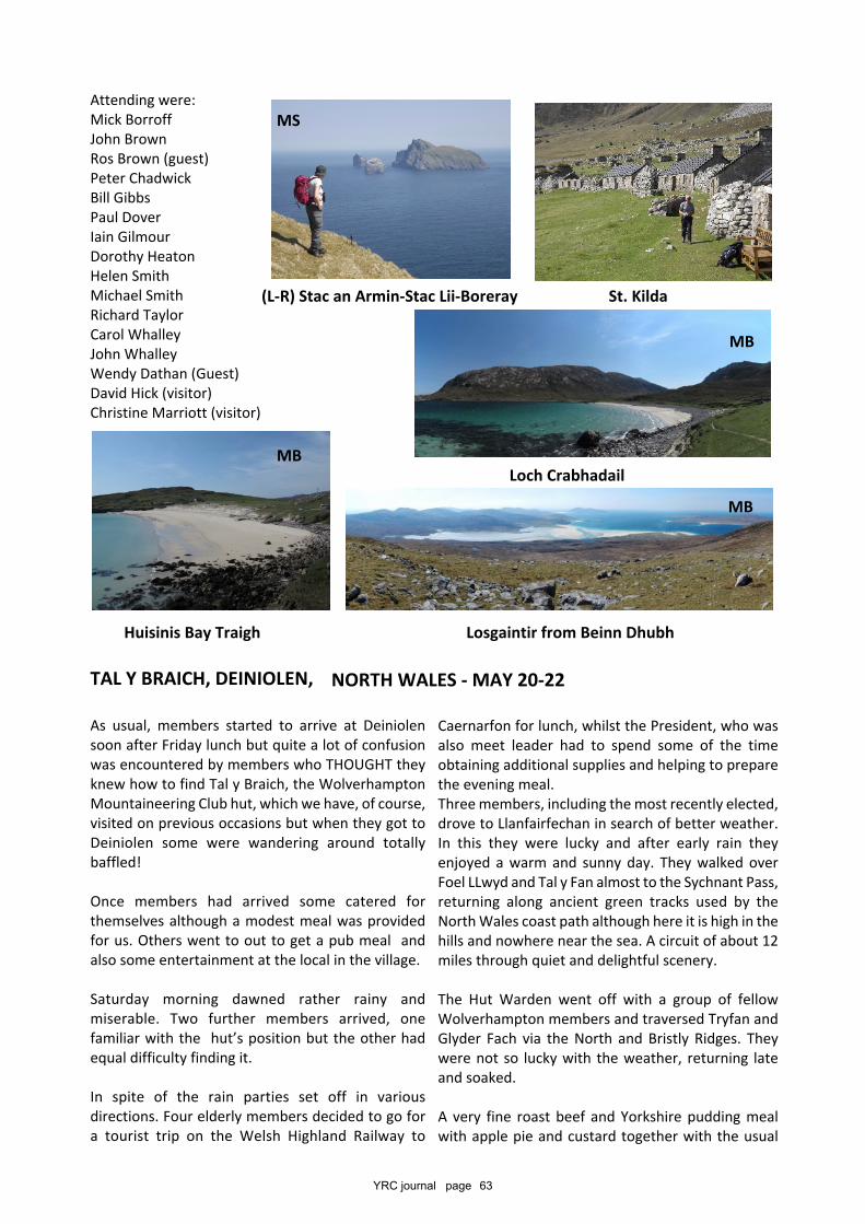
YRC journal page 63
Caernarfon for lunch, whilst the President, who wasalso meet leader had to spend some of the timeobtaining additional supplies and helping to preparethe evening meal.Three members, including the most recently elected,drove to Llanfairfechan in search of better weather.In this they were lucky and after early rain theyenjoyed a warm and sunny day. They walked overFoel LLwyd and Tal y Fan almost to the Sychnant Pass,returning along ancient green tracks used by theNorth Wales coast path although here it is high in thehills and nowhere near the sea. A circuit of about 12miles through quiet and delightful scenery.
The Hut Warden went off with a group of fellowWolverhampton members and traversed Tryfan andGlyder Fach via the North and Bristly Ridges. Theywere not so lucky with the weather, returning lateand soaked.
A very fine roast beef and Yorkshire pudding mealwith apple pie and custard together with the usual
Attending were:Mick BorroffJohn BrownRos Brown (guest)Peter ChadwickBill GibbsPaul DoverIain GilmourDorothy HeatonHelen SmithMichael SmithRichard TaylorCarol WhalleyJohn WhalleyWendy Dathan (Guest)David Hick (visitor)Christine Marriott (visitor)
TAL Y BRAICH, DEINIOLEN,
As usual, members started to arrive at Deiniolensoon after Friday lunch but quite a lot of confusionwas encountered by members who THOUGHT theyknew how to find Tal y Braich, the WolverhamptonMountaineering Club hut, which we have, of course,visited on previous occasions but when they got toDeiniolen some were wandering around totallybaffled!
Once members had arrived some catered forthemselves although a modest meal was providedfor us. Others went to out to get a pub meal andalso some entertainment at the local in the village.
Saturday morning dawned rather rainy andmiserable. Two further members arrived, onefamiliar with the hut’s position but the other hadequal difficulty finding it.
In spite of the rain parties set off in variousdirections. Four elderly members decided to go fora tourist trip on the Welsh Highland Railway to
(L-R) Stac an Armin-Stac Lii-Boreray St. Kilda
Loch Crabhadail
Huisinis Bay Traigh Losgaintir from Beinn Dhubh
NORTH WALES - MAY 20-22
MB
MB
MS
MB
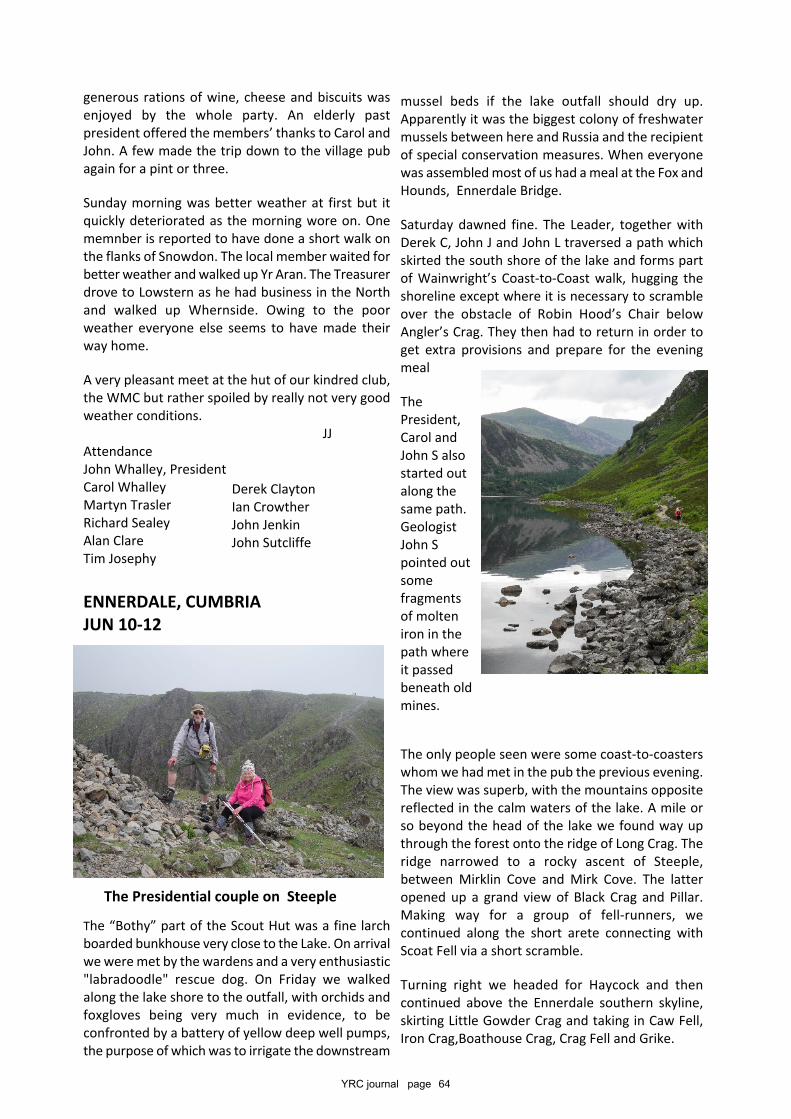
YRC journal page 64
mussel beds if the lake outfall should dry up.Apparently it was the biggest colony of freshwatermussels between here and Russia and the recipientof special conservation measures. When everyonewas assembled most of us had a meal at the Fox andHounds, Ennerdale Bridge.
Saturday dawned fine. The Leader, together withDerek C, John J and John L traversed a path whichskirted the south shore of the lake and forms partof Wainwright’s Coast-to-Coast walk, hugging theshoreline except where it is necessary to scrambleover the obstacle of Robin Hood’s Chair belowAngler’s Crag. They then had to return in order toget extra provisions and prepare for the eveningmeal
ThePresident,Carol andJohn S alsostarted outalong thesame path.GeologistJohn Spointed outsomefragmentsof molteniron in thepath whereit passedbeneath oldmines.
The only people seen were some coast-to-coasterswhom we had met in the pub the previous evening.The view was superb, with the mountains oppositereflected in the calm waters of the lake. A mile orso beyond the head of the lake we found way upthrough the forest onto the ridge of Long Crag. Theridge narrowed to a rocky ascent of Steeple,between Mirklin Cove and Mirk Cove. The latteropened up a grand view of Black Crag and Pillar.Making way for a group of fell-runners, wecontinued along the short arete connecting withScoat Fell via a short scramble.
Turning right we headed for Haycock and thencontinued above the Ennerdale southern skyline,skirting Little Gowder Crag and taking in Caw Fell,Iron Crag,Boathouse Crag, Crag Fell and Grike.
generous rations of wine, cheese and biscuits wasenjoyed by the whole party. An elderly pastpresident offered the members’ thanks to Carol andJohn. A few made the trip down to the village pubagain for a pint or three.
Sunday morning was better weather at first but itquickly deteriorated as the morning wore on. Onememnber is reported to have done a short walk onthe flanks of Snowdon. The local member waited forbetter weather and walked up Yr Aran. The Treasurerdrove to Lowstern as he had business in the Northand walked up Whernside. Owing to the poorweather everyone else seems to have made theirway home.
A very pleasant meet at the hut of our kindred club,the WMC but rather spoiled by really not very goodweather conditions. JJAttendanceJohn Whalley, PresidentCarol WhalleyMartyn TraslerRichard SealeyAlan ClareTim Josephy
ENNERDALE, CUMBRIAJUN 10-12
The “Bothy” part of the Scout Hut was a fine larchboarded bunkhouse very close to the Lake. On arrivalwe were met by the wardens and a very enthusiastic"labradoodle" rescue dog. On Friday we walkedalong the lake shore to the outfall, with orchids andfoxgloves being very much in evidence, to beconfronted by a battery of yellow deep well pumps,the purpose of which was to irrigate the downstream
The Presidential couple on Steeple
Derek ClaytonIan CrowtherJohn JenkinJohn Sutcliffe
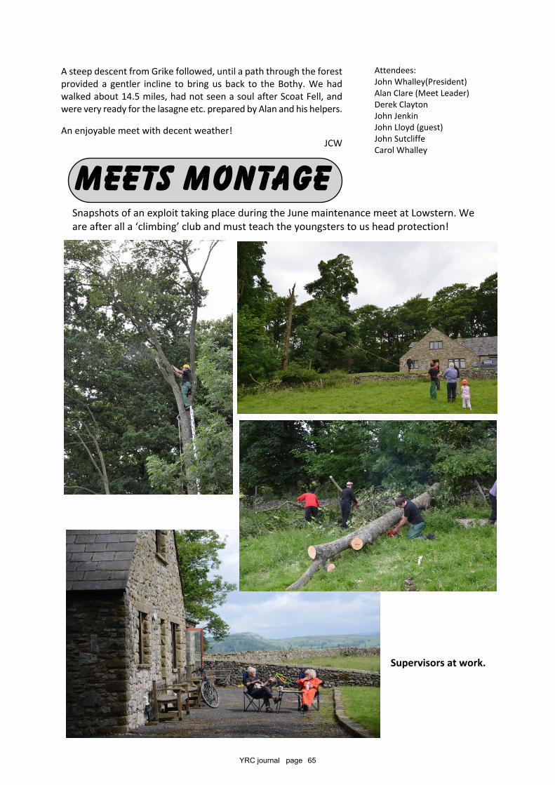
YRC journal page 65
Attendees:John Whalley(President)Alan Clare (Meet Leader)Derek ClaytonJohn JenkinJohn Lloyd (guest)John SutcliffeCarol Whalley
A steep descent from Grike followed, until a path through the forestprovided a gentler incline to bring us back to the Bothy. We hadwalked about 14.5 miles, had not seen a soul after Scoat Fell, andwere very ready for the lasagne etc. prepared by Alan and his helpers.
An enjoyable meet with decent weather!JCW
MEETS MONTAGESnapshots of an exploit taking place during the June maintenance meet at Lowstern. Weare after all a ‘climbing’ club and must teach the youngsters to us head protection!
Supervisors at work.
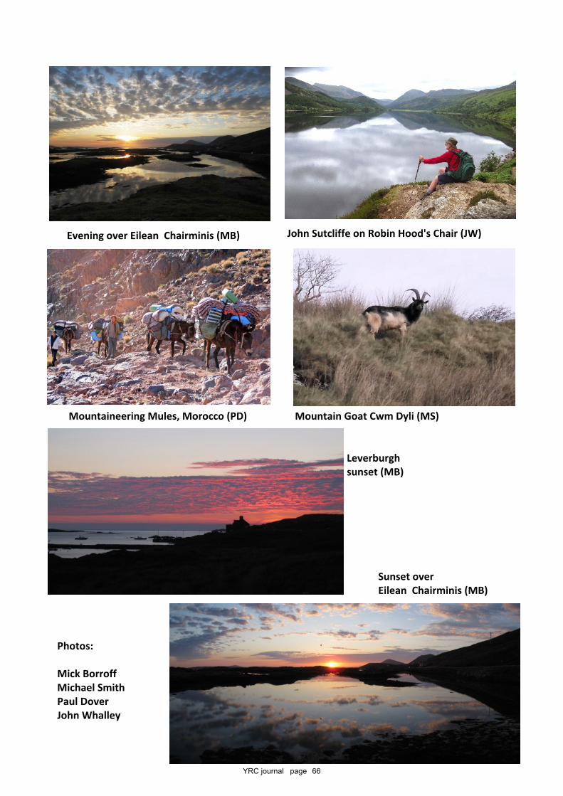
YRC journal page 66
Mountaineering Mules, Morocco (PD) Mountain Goat Cwm Dyli (MS)
John Sutcliffe on Robin Hood's Chair (JW)
Leverburghsunset (MB)
Sunset overEilean Chairminis (MB)
Photos:
Mick BorroffMichael SmithPaul DoverJohn Whalley
Evening over Eilean Chairminis (MB)
Additional copies of the journals can be provided at cost whilst stocks last.
Articles or the entire publication may also appear on our website and can beprovided in electronic form and may be reproduced for any purpose other than for
sale, providing that the author and the club are given proper acknowledgement.The same applies to any photographs provided.
The copyright does however remain with the Club or the authors.
Requests should be addressed to the Club's Honorary Secretarywho will advise on any costs and availability.
Journals occasionally include material from non-members who are happy for us toreproduce their work but we may not be able to pass these on in electronic form or
show them on the website due to copyright considerations.
Similarly where members retain copyright it will be indicated and items may not bereproduced without their express permission and will not appear on the website.
Members can be contacted via the Secretary and other authors via the Editor.
The current series 13 of the journals goes back to Summer 2006.Series 12 was published under the title of the 'Yorkshire Rambler'
and goes back to summer 1994. Both these series are held in electronic form.
Earlier journals can be accessed for informationand go back to the formation of the club in 1892
Articles and items appearing in Chippings, Natural History and Obituariesare written and / or compiled by the Editor unless otherwise attributed.
The opinions expressed in this publication are not necessarilythose of the YRC or its Officers.
The Club’s rules and bye-laws are printed inissue 11 of series 13 of the Journal, Summer 2011
The aims of the Club are to organise walking, mountaineeringand skiing excursions; to encourage the exploration of cavesand pot-holes; to conduct expeditions to remote parts of theplanet; the pursuit of other outdoor activities and to gatherand promote knowledge of natural history, archaeology,
geology, folklore and other kindred subjects.
Deadline for material for the next journal is February 28th 2017
Editor - Roy Denney,33 Clovelly Road, Glenfield, Leicestershire LE3 8AE
SecretaryTim Josephy
The YRC Journal is published twice a year and is free to memberslibraries and certain kindred clubs. First published July 1899
Club Properties
Low Hall Garth, Little Langdale, CumbriaLowstern, Clapham, North Yorkshire
www.yrc.org.ukhttps://www.facebook.com/yrcuk
The YRCThe Yorkshire Ramblers Club Established 1892
For enquiries regarding the possible hire of Club cottages contact
Richard Josephy, 135 Divinity Road, Oxford OX4 1LWTel. 01865 723630
Lodged with the British Library - Publisher ID L-42592Printed by Alfred Willday & Son Ltd, Unit 1, Dunns Lane, Leicester LE3 5LX - 0116 251 8478
The Mountaineering, Exploration and Caving Club


