Embed Size (px)
Citation preview
There are many ways to bring in LiDAR into Civil 3D. Data sources can come from surveyors and or web based data sources. Notes: Online LiDAR data sets should only be used for planning and not final design except for special circumstances!!! For design purposes LiDAR needs to be developed from a reliable source and verified for accuracy by a professional land surveyor in the field prior to using in final design work.
Web Based Resources for data:
Trimble Data Marketplace
NOAA Digital Coast
United States Interagency Elevation Inventory
Puget Sound LiDAR Consortium (requires login, just sign up with email, its free) WA Only data
USGS National Map
Open Topology
CA Sea Floor
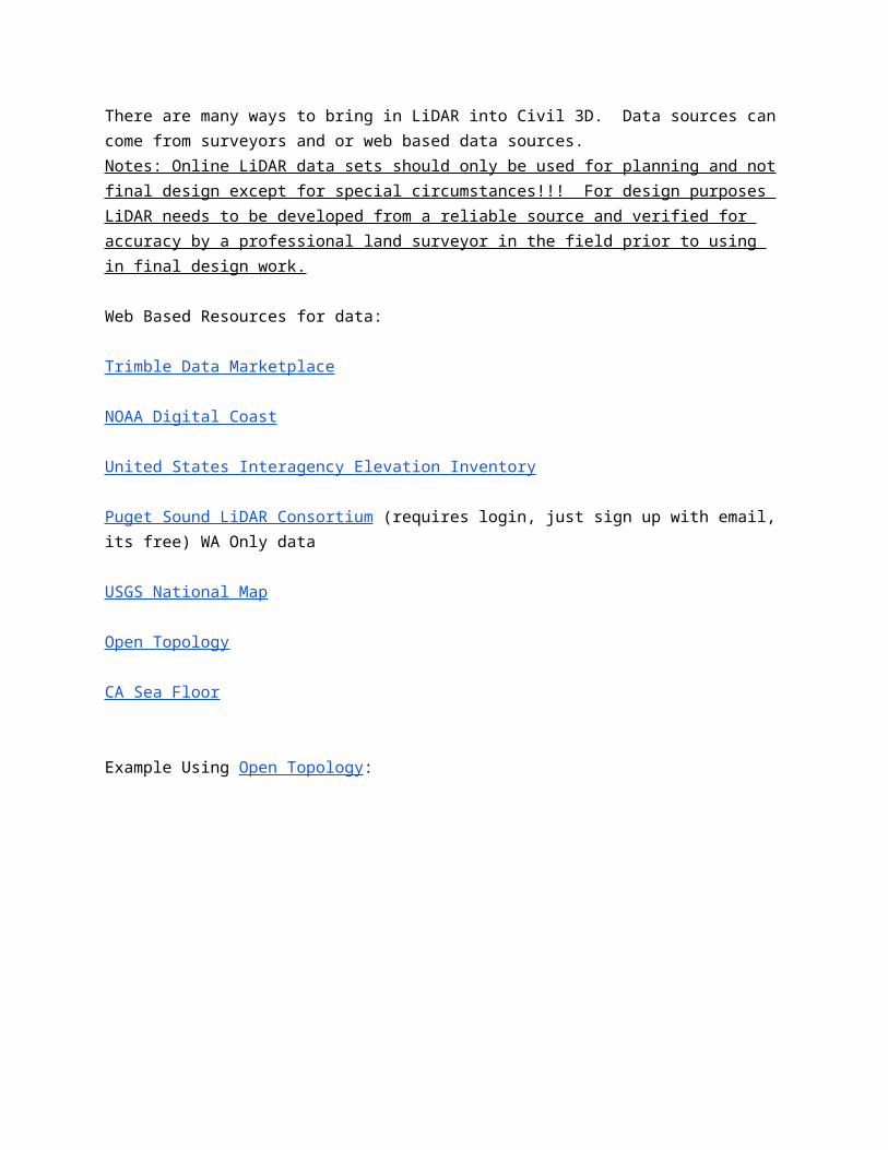
Example Using Open Topology:
zoom into SLO
Click blue box Select A Region, then click data set below “Get Data”
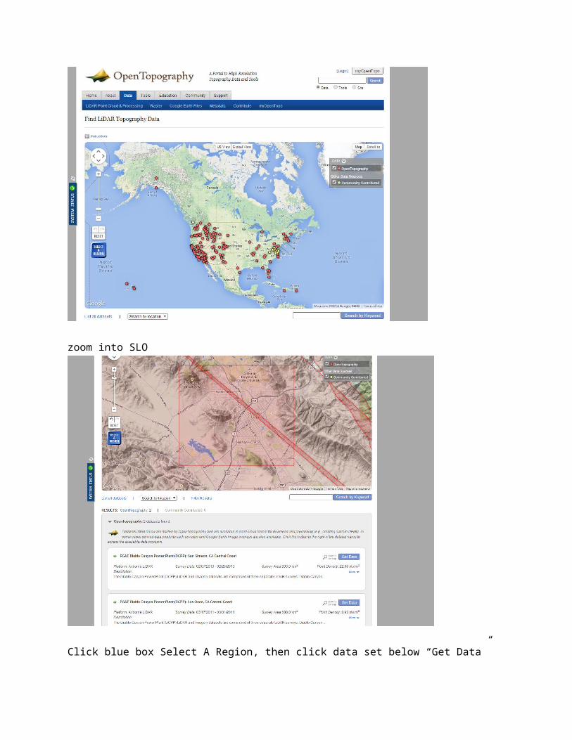
try and find .LAS file type. This will be the best to work with in C3D
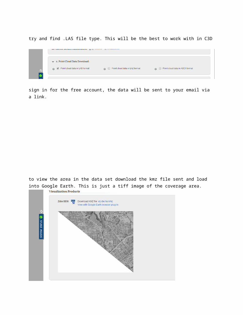
sign in for the free account, the data will be sent to your email via a link.
to view the area in the data set download the kmz file sent and load into Google Earth. This is just a tiff image of the coverage area.
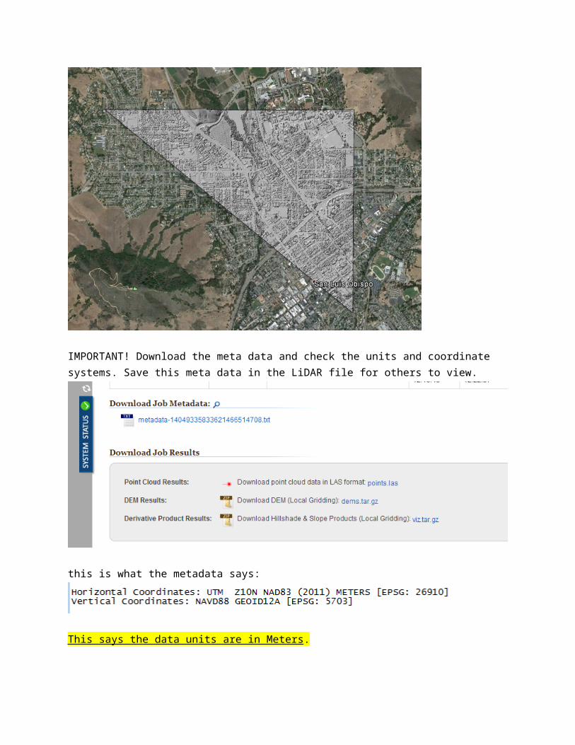
IMPORTANT! Download the meta data and check the units and coordinate systems. Save this meta data in the LiDAR file for others to view.
this is what the metadata says:
This says the data units are in Meters.
Now download the .las file, depending on your upload rate this could take 10 mins or longer.
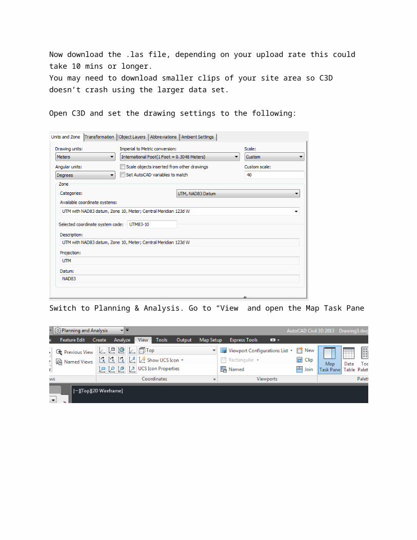
You may need to download smaller clips of your site area so C3D doesn’t crash using the larger data set.
Open C3D and set the drawing settings to the following:
Switch to Planning & Analysis. Go to “View” and open the Map Task Pane
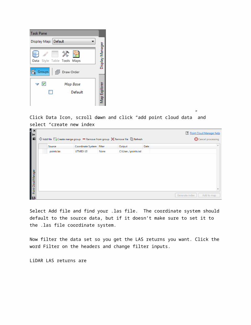
Click Data Icon, scroll down and click “add point cloud data” and select “create new index”
Select Add file and find your .las file. The coordinate system should default to the source data, but if it doesn’t make sure to set it to the .las file coordinate system.
Now filter the data set so you get the LAS returns you want. Click the word Filter on the headers and change filter inputs.
LiDAR LAS returns are
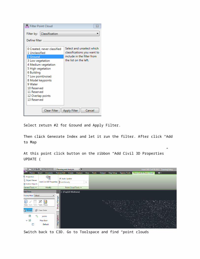
Select return #2 for Ground and Apply Filter.
Then click Generate Index and let it run the filter. After click “Add to Map”
At this point click button on the ribbon “Add Civil 3D Properties” UPDATE (
Switch back to C3D. Go to Toolspace and find “point clouds”Right click Point Cloud just added in step above and click “add points to surface. Name your surface, and select contour style.
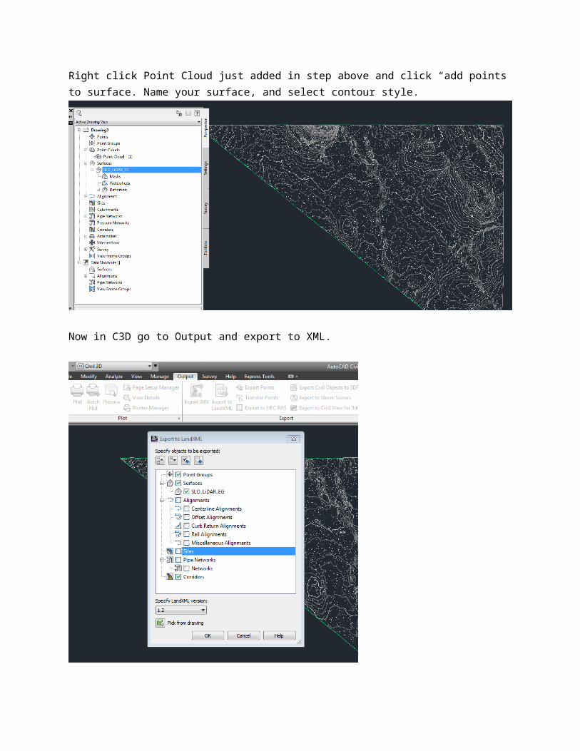
Now in C3D go to Output and export to XML.
save the xml file. Open a new drawing and set the units to desired input. In this case I choose units feet, NAD 83 CA State Plane Zone 5 US Foot
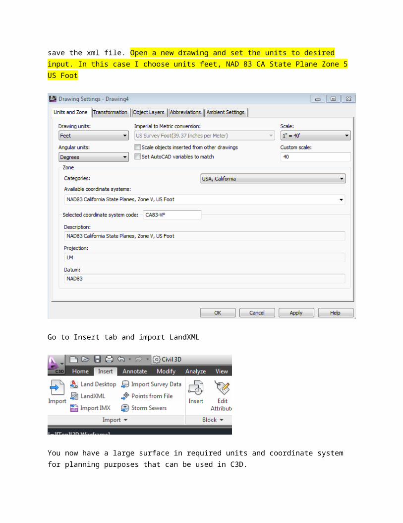
Go to Insert tab and import LandXML
You now have a large surface in required units and coordinate system for planning purposes that can be used in C3D.
Original Author: BAH


![Inventor 2009 API Object Model - forums.autodesk.com · FaceFeature (c) FaceFeatures FoldFeature (c) FoldFeatures AngleConstraint (l) AssemblyComponentDefinition [m] AssemblyConstraint](https://img.pdfslide.net/doc/110x75/5e6d9cfab4fbbd2256545eca/inventor-2009-api-object-model-facefeature-c-facefeatures-foldfeature-c-foldfeatures.jpg)


![forums.autodesk.com · -----[ AIDA64 Extreme ]----- Versão](https://img.pdfslide.net/doc/110x75/5c6538bc09d3f2b26e8c5f1b/-aida64-extreme-versao-.jpg)