Embed Size (px)
Citation preview


- What kind of work does the geological engineer do
before and during the mining operation?
A)- Mineral Explorations;
B)- Preparing geologic and mining maps
C)- Calculation of reservoir (prospecting & evaluation)
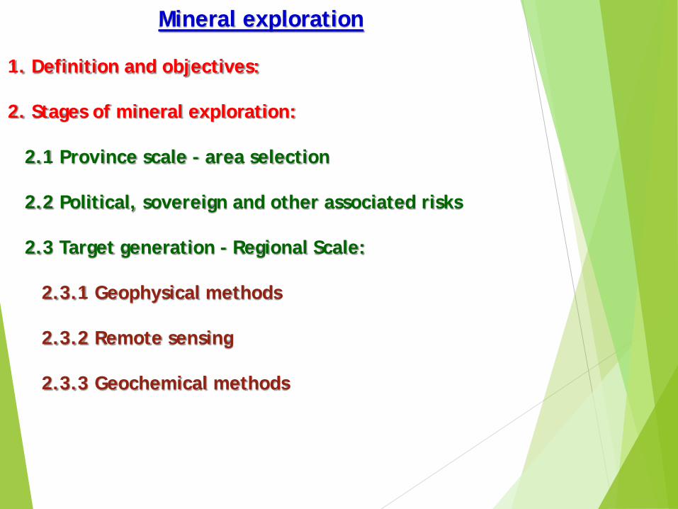
Mineral exploration
1. Definition and objectives:
2. Stages of mineral exploration:
2.1 Province scale - area selection
2.2 Political, sovereign and other associated risks
2.3 Target generation - Regional Scale:
2.3.1 Geophysical methods
2.3.2 Remote sensing
2.3.3 Geochemical methods

is the process of finding ores (commercially viable
concentrations of minerals) to mine. Mineral exploration is a
much more intensive, organized and professional form of
mineral prospecting and, though it frequently uses the
services of prospecting, the process of mineral exploration
on the whole is much more involved.
Mineral exploration
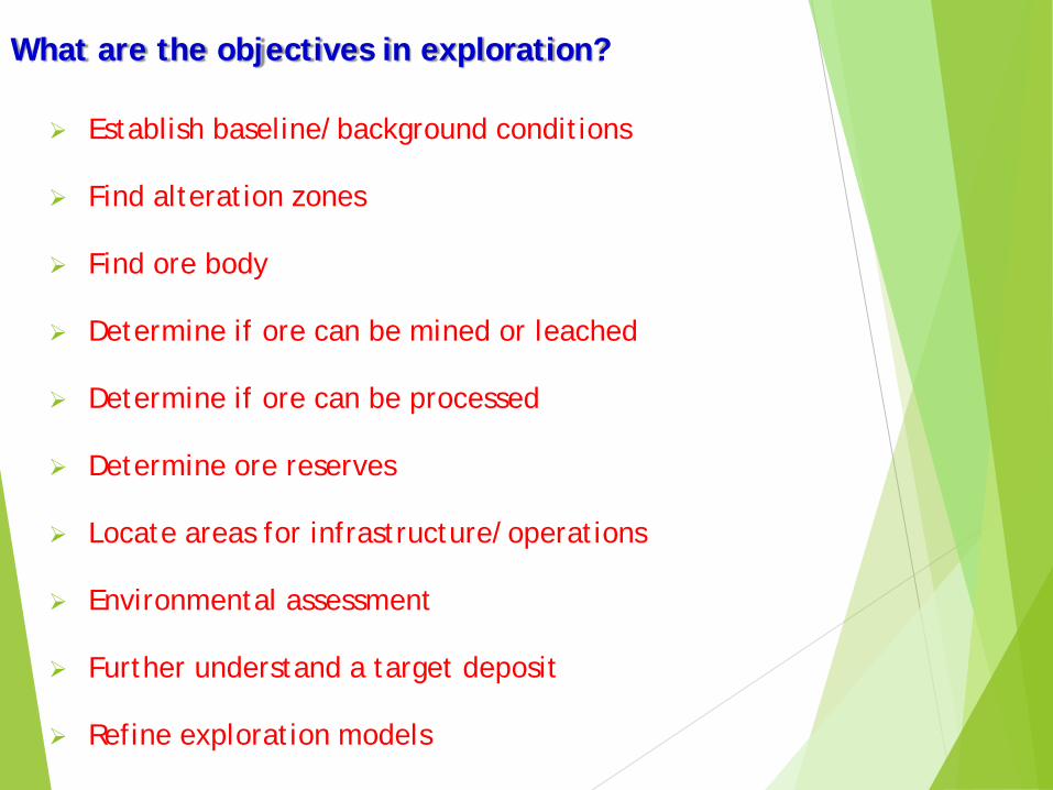
What are the objectives in exploration?
Establish baseline/background conditions
Find alteration zones
Find ore body
Determine if ore can be mined or leached
Determine if ore can be processed
Determine ore reserves
Locate areas for infrastructure/operations
Environmental assessment
Further understand a target deposit
Refine exploration models

2.1 Stages of mineral exploration
Mineral exploration methods vary at different stages of the process
depending on size of the area being explored, as well as the
density and type of information sought. Aside from extraplanetary
exploration, at the largest scale is a geological mineral Province,
which may be sub-divided into Regions. At the smaller scale are
mineral Prospects, which may contain several mineral Deposits.

2.2 Province scale - area selection
Area selection is a crucial step in professional mineral exploration.This selection depends on: It should be best, most prospective, Easy, possibility, cheaply and quickly finding the area in a mineral field,
geological region or terrain. Area selection is based on applying the theories behind ore genesis, the
knowledge of known ore occurrences and the method of their formation, toknown geological regions via the study of geological maps, to determinepotential areas where the particular class of ore deposit being sought mayexist.
Area selection is also influenced by the commodity (raw materials) beingsought; exploring for gold occurs in a different manner and within differentrocks and areas to exploration for oil or natural gas or iron ore. Areas whichare prospective for gold may not be prospective for other metals andcommodities.
Area selection may also be influenced by previous finds, a practiceaffectionately named subsurface control or nearology, and may also bedetermined in part by financial and taxation incentives and tariff systems ofindividual nations. The role of infrastructure may also be crucial in areaselection, because the ore must be brought to market and infrastructurecosts may render isolated ore uneconomic.

Political, sovereign and other associated risks
Any area selected for mineral exploration also carries various forms of
sovereign and other associated risks;
the risk that even if a commercially viable deposit is present, political,
environmental and social factors may make the discovery and
development of the mineral resource inviable.

The risks also include,
a change in the security of licence tenure due to changes in legal,
political or other factors;
changes in local land tenure (such as declaration of various types of
conservation zones);
outbreaks of social unrest within a country or region (including
competition for mineral resources by artisanal miners, who may be
operating illegally, or from political resistance from local or non-local
organizations, who may or may not be represented or supported locally,
but who are opposed to certain, or all, forms of mining);
changes in tax and other financial conditions subsequent to the
conditions which were legally in place at the start of exploration;
natural disasters such as volcanoes, earthquakes, floods etc.

2.3 Target generation - Regional Scale The target generation phase involves investigations of the geology
via mapping, geophysics and conducting geochemical or intensivegeophysical testing of the surface and subsurface geology.
In some cases, for instance in areas covered by soil, alluvium andplatform cover, drilling may be performed directly as a mechanismfor generating targets.Geophysical methods, Remote sensing, Geochemical methods

2.3.1 Geophysical methods
Geophysical instruments play a large role in gathering geologicaldata which is used in mineral exploration.
Instruments are used in geophysical surveys to check forvariations in gravity, magnetism, electromagnetism (resistivity ofrocks) and a number of different other variables in a certainarea.
The most effective and widespread method of gatheringgeophysical data is via flying airborne geophysics.

Geiger counters and scintillometers are used to determine the
amount of radioactivity. This is particularly applicable to searching
for uranium ore deposits but can also be of use in detecting
radiometric anomalies associated with metasomatism.

Airborne magnetometers are used to search for magnetic anomalies in the
Earth's magnetic field.
The anomalies are an indication of concentrations of magnetic minerals
such as magnetite, pyrrhotite and ilmenite in the Earth's crust.
It is often the case that such magnetic anomalies are caused by
mineralization events and associated metals.

Ground-based geophysical prospecting in the target selection
stage is more limited, due to the time and cost. The most
widespread use of ground-based geophysics is electromagnetic
geophysics which detects conductive minerals such as sulfide
minerals within more resistive host rocks.

Ultraviolet lamps may cause certain minerals to fluoresce, and is a key tool in
prospecting for tungsten mineralization.

2.3.2 Remote sensing
Since the advent of cheap and declassified Landsat images in the
late 1970s and early 1980s, mineral exploration has begun to use
satellite imagery to map not only the visual light spectrum over
mineral exploration tenements, but spectra which are beyond
the visible.
Satellite based spectroscopes allow the modern mineral
explorationist, in regions devoid of cover and vegetation, to map
minerals and alteration directly.
Remote sensing surveys, including aeromagnetic, gravity and
satellite data can be used together with field geology and
geochemical surveys.
all integrated using GIS applications, to determine the optimal
conditions for the targeting of mineral deposits

Hyperspectral mapping
Rock Sample
Sun
Diffractometer
Collector
Infrared
Red
Green
BlueUltraviole
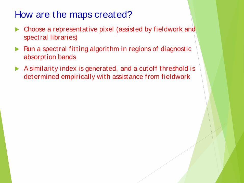
How are the maps created? Choose a representative pixel (assisted by fieldwork and
spectral libraries)
Run a spectral fitting algorithm in regions of diagnostic absorption bands
A similarity index is generated, and a cutoff threshold is determined empirically with assistance from fieldwork

Typical Spectra