Embed Size (px)
Citation preview
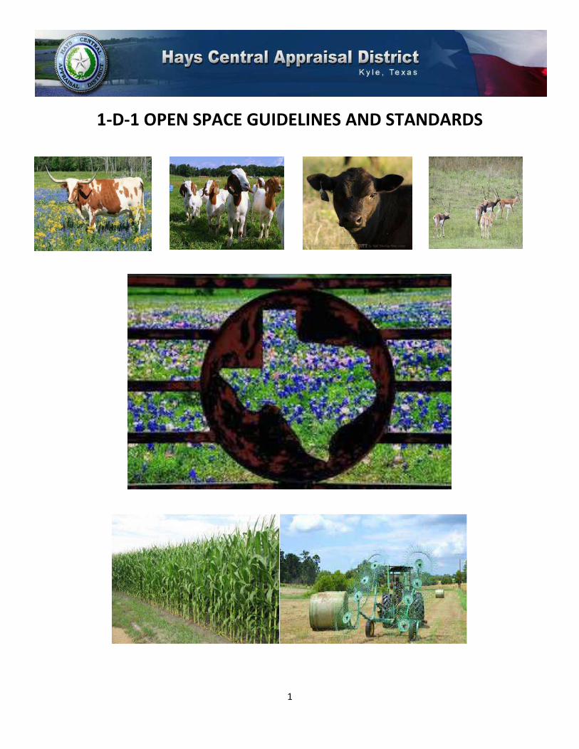
1
1-D-1 OPEN SPACE GUIDELINES AND STANDARDS

2
OPEN SPACE GUIDELINES & STANDARDS
TABLE OF CONTENTS
I. INTRODUCTION .................................................................................................... 3
II. DEFINITIONS ......................................................................................................... 3
III. STANDARDS .......................................................................................................... 5
Historical Use
Current Use
Principle Use
Degree of Intensity
IV. PROCEDURES ........................................................................................................ 8
Applications
Leases
Determination
AG Fact Sheet
Confidential Policy
Field Inspections
Change of Land Use and Rollback Penalty
V. TYPES OF AGRICULTURAL USE OPERATIONS ........................................................ 12
Livestock
Exotic Game
Hay Production
Crop Land
Orchard
Vineyard
Beekeeping
Ecological Laboratory
Wildlife Management
VI. LAND TYPES ....................................................................................................... 17
Description of Classes
Productivity Schedules
VII. AGRICULTURAL ADVISORY BOARD ...................................................................... 18
These guidelines were adopted by the Hays Central Appraisal District on 11/02/2015.

3
I. INTRODUCTION
The Hays Central Appraisal District (also referred to as HAYSCAD or the district) is responsible for the
administration of special use valuation (also referred to as ag valuation or 1-d-1 use) found in the Texas Property
Tax Code in Subchapter D, Sec. 23.51 through Sec. 23.60. The district has developed guidelines for qualifying
property as open space for special use valuation. The district referred to the following resources for guidance in
establishing its guidelines:
o Texas Property Tax Code
o Texas Comptroller
o Texas Parks & Wildlife
o Texas Agricultural Extension Service
o Hays County Agrilife Extension Agent
o Texas State & Soil Conservation Board
o Hays CAD Agricultural Advisory Board
Agricultural Appraisal applies only to land. Only the acreage used in an agricultural operation may qualify for
agricultural use valuation. Land not qualifying for agricultural use is valued at market value. Improvements are
appraised separately at their market value. Farm and ranch machinery and equipment (implements of
husbandry) used for agricultural production are exempt from ad valorem taxes; however you must now apply
for an Agricultural Exemption Registration Number through the Texas Comptroller at 1-800-252-5555. Hays CAD
does not provide this number.
II. DEFINITIONS
Agricultural Operation – land operated by the producer with equipment, labor, management and production
practices that are substantially separate from other operations (USDA).
Agricultural Use – includes but is not limited to the following activities:
o Cultivation of the soil
o Producing crops for human or animal feed
o Planting seed for production of fiber
o Raising or keeping livestock
o Raising or keeping exotic animals for the production of human food or other tangible
products having commercial value
o Planting cover crops for the purpose of participating in a government program
o Raising or keeping bees for pollination or production of human food
o Use of land for wildlife management
Animal Unit – used to represent the relationship of quantity of livestock and wildlife in terms of weight, an
animal unit equals 1000 lbs. of live animal weight.
Crop – cultivated plant that is grown as food (i.e. corn) or a cultivated plant to produce something for human
use (i.e. cotton); an amount of grain or produce harvested at one time.

4
Cultivate – to prepare and use (land) for crops.
Ecological Laboratory – allowing an accredited university to perform multiple ecological impact studies on
your property.
Equipment – necessary items used for a particular purpose.
Exotic Animal – is a species of game that is not indigenous to Texas.
Husbandry – the care, cultivation and breeding of crops and livestock.
Implements of Husbandry – machinery and equipment items that are used in the production of farm or ranch
products; regardless of their primary design.
Improved Pasture – fenced land planted with grasses that are not native to Hays County but are suitable for
grazing by livestock.
Livestock – farm and ranch animals regarded as an asset (not as a pet).
Native Pasture – fenced land covered with grasses that are native to Hays County that are suitable for grazing
by livestock.
Open-space – land that is currently devoted principally to agricultural use to the degree of intensity generally
accepted in the area and that has been devoted principally for agricultural use for 5 of the preceding 7 years.
Orchard – a piece of land planted with fruit or nut trees.
Pasture – fenced land covered with grass and other low plants suitable for grazing livestock .
Primary – of chief importance.
Principal– a fundamental quality or attribute determining the nature of something (Oxford Dictionary).
Typical – having distinctive qualities of a particular type of person or thing (Oxford Dictionary).
Use – the action of using something or the state of being used for some purpose (Oxford Dictionary).
Vineyard – a plantation of grapevines, typically producing grapes used in wine making.
Wildlife – breeding, migrating or wintering population of an indigenous species that is specific to a certain
ecological region.
5
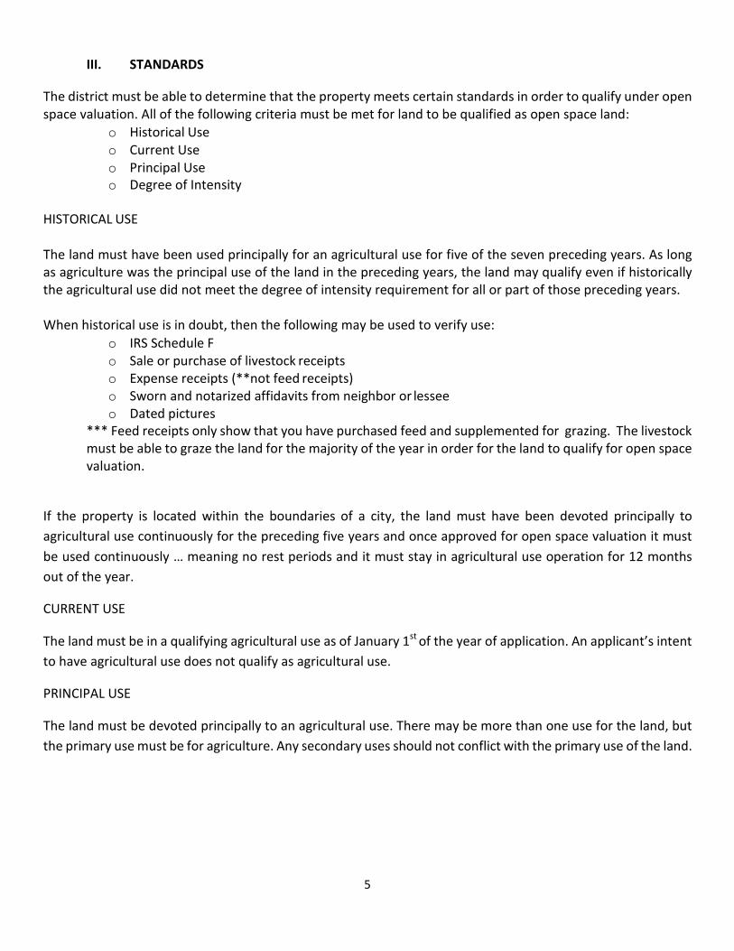
III. STANDARDS
The district must be able to determine that the property meets certain standards in order to qualify under open
space valuation. All of the following criteria must be met for land to be qualified as open space land:
o Historical Use
o Current Use
o Principal Use
o Degree of Intensity
HISTORICAL USE
The land must have been used principally for an agricultural use for five of the seven preceding years. As long
as agriculture was the principal use of the land in the preceding years, the land may qualify even if historically
the agricultural use did not meet the degree of intensity requirement for all or part of those preceding years.
When historical use is in doubt, then the following may be used to verify use:
o IRS Schedule F
o Sale or purchase of livestock receipts
o Expense receipts (**not feed receipts)
o Sworn and notarized affidavits from neighbor or lessee
o Dated pictures
*** Feed receipts only show that you have purchased feed and supplemented for grazing. The livestock
must be able to graze the land for the majority of the year in order for the land to qualify for open space
valuation.
If the property is located within the boundaries of a city, the land must have been devoted principally to
agricultural use continuously for the preceding five years and once approved for open space valuation it must
be used continuously … meaning no rest periods and it must stay in agricultural use operation for 12 months
out of the year.
CURRENT USE
The land must be in a qualifying agricultural use as of January 1st
of the year of application. An applicant’s intent
to have agricultural use does not qualify as agricultural use.
PRINCIPAL USE
The land must be devoted principally to an agricultural use. There may be more than one use for the land, but
the primary use must be for agriculture. Any secondary uses should not conflict with the primary use of the land.

6
Recreational Use
Hunting, Horse Boarding and Training areas and other similar uses will be considered a recreational use. These
uses may be associated with the land along with agricultural use but alone will not qualify the land for open
space valuation. If no qualifying agricultural use exists on the property, then the recreational use will be
considered the principal use of the land.
Residential Use
When land has a residential improvement such as a residence or manufactured home, the District will assign a
portion of the land as residential use. The following are examples on how to determine the amount of land that
will be classified as residential:
1. If the residence has been surveyed with land less than an acre, then the District may use the amount
specified in the survey.
2. If the property owner files a homestead application specifying up to 20 acres as their homestead,
then the District may use the amount specified on the application as the residence use area and this
area will be at market value with the improvement.
3. If no amount has been specified by the property owner, then the District may assign land as
residential use per field inspection. The appraiser shall determine if the area with a residence has
been fenced or “marked” by roads or landscaping. The amount of land within this area will be
identified as residential use.
Non Use
If the land does not have a use that can be identified as agricultural, residential, commercial or recreational,
then the district will recognize it as not being in use or idle. In other words, the property is just a vacant tract of
land and will not be appraised for special use valuation.
Principal Use vs. Primary Use Example
Principal Use – the entire outside circle with the smaller circles inside = Agricultural Use
Primary Use – the biggest inside circle = Livestock Operation
Secondary Uses – the smallest inside circles = Residential Use, Hunting or Recreational Use, Hay Crop
Livestock
Operation
Hunting Lease or
Recreational Use
Hay Crop
Production
Residential
Use

7
DEGREE OF INTENSITY
The degree of intensity measures what land is capable of producing under typical management. The degree of
intensity varies on the type of agricultural use. This test only applies to current use not historical use over the
preceding 5 out of 7 years. This test is intended to exclude land on which token agricultural uses occur in an
effort to obtain tax relief. In order for land to qualify, the property must meet the minimum standards set forth
for the specific agricultural use operation.
Drought Conditions
If the majority of the year is declared as being in drought by the Governor’s Office, then the District may take
into consideration a property having a decrease in intensity and not a change in use.
Resting Periods
The District requires a written notification that the property will be rested for a calendar year. The notification
must be submitted no later than the May 1st
application deadline to be considered for that appraisal year.
Excluding a drought proclamation by the Governor’s Office (see above), a property may not be rested for more
than 2 years during a 7 year period.
You must perform at least one of the following agricultural activities and show proof to qualify for a rest period:
1. Letting land sit idle due to government program (show proof of program)
2. Rotating livestock to another pasture because of over grazing
3. Improvements to land that necessitate removal of livestock or a stop in crop production such as:
o Fence repair
o Erosion control
o Brush control or clearing
o Re seeding of native or improved grasses
o Reestablishing or maintenance to a water source
HAYSCAD will only approve one calendar year of rest at a time.

8
IV. PROCEDURES
Each year the District will notify by certified mail all property owners who need to submit a 1-d-1 open space
use agricultural use application. The District requires an application for the following reasons:
o The property had a change in ownership name
o The property had a change in acreage size due to a split
o The Chief Appraiser has determined the need for a new (updated) application
Change in Ownership Name
Every January 1st
the District will verify that all deed recordings from the preceding year that include land that
had a current agricultural use valuation have been updated in its appraisal records. A list will be generated to
include all of these properties that have had such a change in ownership. These properties will have the
agricultural valuation removed until the current property owner submits an application in their name and it is
approved for the current appraisal year.
Change in Acreage Size
Every January 1st
the District will identify all properties that had a change in acreage size due to a new survey,
plat or property split. A list will be generated to include all of these properties that have had an acreage size
change. These properties will have the agricultural valuation removed until the current property owner of the
changed and newly recorded acreage submits an application in their name and it is approved for the current
appraisal year.
The Chief Appraiser has determined the need for a new application
Every January 1st
the District will identify all properties that the Chief Appraiser has determined need a new
application.
The reasons for this could include, but are not limited to:
o Field inspection of the property determined no active agricultural use
o The application on file is over 10 years old
o The property owner did not respond to or submit an Agricultural Fact Sheet to the District when
it was requested the previous year
A list will be generated to include all of these properties. These properties will have the agricultural valuation
removed until the property owner submits an application in their name and it is approved for the current
appraisal year.
All of these lists will be used to generate letters to send via certified mail to the property owner to inform them
that the agricultural use valuation has been removed and that they must submit an application by the due date
of May 1st
.

9
APPLICATIONS
The District uses the state approved Property Tax Form 50-129 Application for 1-d-1 (Open-Space) Agricultural Use
Appraisal. The District requires any information necessary to support the claim of agricultural use to be submitted
with the application.
Example of this information includes but is not limited to:
o Valid and Current Lease Agreement
o Sales receipts for livestock
o IRS Schedule F
o Proof of number of livestock on the property
o Proof of type of livestock on the property
o Proof of sale of crop
o If applying for wildlife please request those separate requirements
The District accepts applications until May 1st
of each appraisal year as timely. Should May 1st
fall on a weekend or
holiday the application deadline will be the following Monday. The District will accept a late application filed after
the May 1st
deadline but before the approval of the appraisal records (usually in July). If a late application is approved
it will be assessed a 10% late filing penalty.
As applications are received, all applications and their attached documents shall be stamp dated. All applications and
attached documents will be forwarded to the special use (or AG) Appraiser for review. The District may request
additional documents, if necessary, in order to determine if the property qualifies.
All applications are initially checked for the following:
o The application identifies the property
o The application is filled out in its entirety with correct information
o The application is signed by the property owner or their authorized agent
o All supporting documentation to support the claim of ag use is attached
After the initial review the applications will be divided by regions in Hays County and prepared for field inspections.
LEASES
Leases are a contract by which one party conveys the use of their land or property to another for a specified time, usually
in return for a periodic payment. An owner applying for agricultural use valuation using a lease agreement needs to include
a current copy of the lease with the application. All lease agreements should include the property owners’ name, the
number of acres leased, for what purposes and the duration of the agreement. Lease agreements also need to include
the name, address & telephone number of the person (or persons) leasing the property. The lessee must be the person
who actually owns the livestock or produces the crop(s) on the lessors land. If rent is paid by the lessee please also include
that amount. Valid lease agreements must be signed & dated by all parties involved.

10
DETERMINATION
The District will either grant or deny the 1-d-1 agricultural use application. Once a determination of use is established
the District will notify each applicant in writing of the determination. The application, documentation and any
correspondence with the property owner will then be scanned into its individual accounts for retention and the hard
copies will be stored off site.
AFTER APPROVAL – Documentation requirements.
If the property is approved for a traditional agriculture use like grazing livestock, crop production or exotic game
grazing the District will periodically mail you an AG Fact Sheet to request updated information about the agricultural
status of your property. You will also need to update any lease information or submit proof of the current qualifying
agricultural use. You must fill out this fact sheet and attach any documentation and return it in a timely manner to
avoid removal of the agricultural special use valuation. If the agricultural special use evaluation is removed you will
be sent certified notice to reapply the following appraisal year.
If the property is approved for a Wildlife Management use the District will send a notice of inspection and the
property will be inspected by the Wildlife Appraiser during the second half of the appraisal year to confirm your
wildlife activities. You will be required to submit an activity log along with an expense sheet at each inspection to
continue to qualify for wildlife management.
If the property is approved for Eco Lab use the district will request annual reports of the University based studies
that were completed with all relevant findings documented and accounted for.
FIELD INSPECTIONS
The AG appraiser(s) will utilize Pictometry Aerial imagery to determine location and possible agricultural use of the
property. If the appraiser cannot clearly determine the use of the property from these images they will physically
inspect the properties to determine the current and principal use. If the property cannot be clearly seen from the
road and its use cannot clearly be determined then an AG Inspection Letter will be sent to the owner and/or agent
requesting immediate access to the property.
During the field inspection, the appraiser will document any relevant information on the property card. Notes will be
made about the condition of the soil, fences or lack of, water source, crop type, type and quantity of livestock or any
other evidence necessary to make a determination of use.
CONFIDENTIAL POLICY
It is the Hays Central Appraisal District’s policy that all reported revenue, leases and any personal information such
as driver’s license or social security numbers are to be treated as confidential information. The district will not share
or give copies of your application or any supplemental information to anyone. If the owner wishes for us to give them
a copy of their application they must come into the appraisal office and request it in writing. They will also be asked
to show a valid picture ID.

11
CHANGE OF LAND USE AND ROLLBACK PENALTY
Texas Property Tax Code - Sec. 23.55. Change of Use of Land.
(a) If the use of land that has been appraised as provided by this subchapter changes, an additional tax is
imposed on the land equal to the difference between the taxes imposed on the land for each of the five years
preceding the year in which the change of use occurs that the land was appraised as provided by this subchapter
and the tax that would have been imposed had the land been taxed on the basis of market value in each of
those years, plus interest at an annual rate of seven percent calculated from the dates on which the differences
would have become due. For purposes of this subsection, the chief appraiser may not consider any period during
which land is owned by the state in determining whether a change in the use of the land has occurred.
(b) A tax lien attaches to the land on the date the change of use occurs to secure payment of the additional tax
and interest imposed by this section and any penalties incurred. The lien exists in favor of all taxing units for
which the additional tax is imposed.
(c) The additional tax imposed by this section does not apply to a year for which the tax has already been
imposed.
(d) If the change of use applies to only part of a parcel that has been appraised as provided by this subchapter,
the additional tax applies only to that part of the parcel and equals the difference between the taxes imposed
on that part of the parcel and the taxes that would have been imposed had that part been taxed on the basis of
market value.
(e) A determination that a change in use of the land has occurred is made by the chief appraiser. The chief
appraiser shall deliver a notice of the determination to the owner of the land as soon as possible after making
the determination and shall include in the notice an explanation of the owner’s right to protest the
determination. If the owner does not file a timely protest or if the final determination of the protest is that the
additional taxes are due, the assessor for each taxing unit shall prepare and deliver a bill for the additional taxes
plus interest as soon as practicable. The taxes and interest are due and become delinquent and incur penalties
and interest as provided by law for ad valorem taxes imposed by the taxing unit if not paid before the next
February 1 that is at least 20 days after the date the bill is delivered to the owner of the land.
If land receiving agricultural valuation changes to a non- agricultural use or if the property owner stops using
the property for an agricultural use then a rollback penalty may be imposed. A rollback estimate will be
calculated by the District only upon written request but please be aware that it will be an estimate only. All
rollback calculations and billings are done by the Hays County Tax Office.

12
V. TYPES OF AGRICULTURAL USE OPERATIONS
The historical use and principal use tests apply to all properties. The degree of intensity varies from each type
of operation.
The following are various types of typical agricultural operations in Hays County. Some properties are comprised
of one or more agricultural operations.
o Livestock operation
o Exotic game operation
o Hay production
o Crop Land operation
o Orchard/Vineyard
o Beekeeping operation
o Ecological Laboratory study
o Wildlife Management
Other types of agricultural operations may exist in Hays County; however they will be reviewed on a case by
case basis by the District.
LIVESTOCK & EXOTIC GAME OPERATIONS
Properties must be involved in standard agricultural practices. These include being fenced and proper fence
maintenance, stock water, managing grazing areas to prevent over grazing and the marketing and sale of
livestock. Minimum animal units required for open space valuation in Hays County is 3 animal units. The
following is a chart showing the recommended minimum acreage needed to support these animal units.
Pasture Type Acres per animal X minimum animal Recommended
unit unit acreage needed to support minimum animal units
Improved Pasture 5 3 15
Native Pasture Good 12 3 36
Native Pasture Fair 18 3 54
Sources used to determined minimum acreage recommendations:
-Taylor, C.A, Jr., and M.M Kothmann. Managing Stocking Rates to Achieve Livestock Production Goals on the Edwards Plateau. N.p., n.d. Web.
-Lyons, Robert K., and Richard V. Machen. “Stocking Rate: The Key Grazing Management Decision.”
(n.d.): n.pag. Web.
-Hays County Agrilife Extension Agent

13

14
HAY PRODUCTION
The land must be involved in standard hay production practices including tillage, fertilizing, cutting, bailing,
hauling, brush control and the hay produced should be marketable. In a typical year 2-3 cuttings can be achieved.
Hay production should be approximately 3,000 pounds per acre.
CROP LAND OPERATION
Land must be involved in standard practices including tillage, planting, fertilizing, insect control, cutting, bailing
and marketing. In typical years 1 cutting can be achieved.
Crop Bushels per acre yielded
Corn 81.9
Sorghum 76.7
Source:
USDA Hays County production estimates for 2014. Web.
http://www.nass.usda.gov/Statistics_by_State/Texas/Publications/County_Estimates/ce_pdf/ce_209.p
df - as of July 2015.
ORCHARD & VINEYARD OPERATIONS
These operations are in the business of cultivating trees, bushes or vines that produce nuts or fruits which are
sold commercially. Typically these operations have a regular schedule of pruning, spraying and cultivation as
well as keeping the area around the trees mowed or disked. Drip irrigation and high fencing is typical for
vineyards. Evidence of these practices should be apparent during an onsite inspection. The minimum acreage
recommendation for an orchard or vineyard is 5 acres but only the area that is planted with trees, bushes or
vines will qualify for agricultural valuation.
Pecan Trees Minimum of 15 per acre
Olive Trees or Bushes Minimum of 50 per acre
Peach Trees Minimum of 70 per acre
Vines (grapes, berries, etc) Minimum of 100 vines per acre
Plant Nurseries Will be based on normal planting
requirements per type of plant grown
Sources:
Hays County Agrilife Extension Agent
15
BEEKEEPING OPERATION
Effective January 1, 2012, the Texas Legislature added another agricultural use for purposes of open space land
appraisal. Tax Code Section 23.51 (2) was amended to include the definition of agricultural use “the use of land
to raise or keep bees for pollination or for the production of human food or other tangible products having a
commercial value, provided that the land used is not less than 5 or more than 20 acres.”
This Provision permits the owner to raise or keep bees for two purposes (1) pollination or (2) the production of
human food or products that have commercial value.
The minimum degree of intensity was established using Section 131.001 of the Texas Agricultural Code’s
definition of an apiary as a place where six or more colonies of bees or nuclei of bees are kept. A colony is the
hive and its equipment and appurtenances including bees, comb, honey, pollen and brood.
When a property owner initially seeks qualification for agricultural use appraisal for beekeeping, they must show
proof of history of agricultural use on the land for five (5) of the preceding seven (7) years. Acreage with a
Homestead Exemption will not be considered for agricultural history of use or for agricultural valuation; this also
means that if you have a 5 acre parcel with a homestead you will not meet the minimum of 5 acres used for a
beekeeping operation. You must have a minimum of 5 acres plus additional acreage to account for your
homestead improvement to qualify for this agricultural valuation.
HAYSCAD will require copies of the Registration of the Apiary with the Texas Apiary Inspection Service thru the
Agrilife Research Office (http://tais.tamu.edu) and the property owner will also be required to submit a
landscape plan of the property and indicate how different plantings (fruit trees, shrubs, vines, flowers, clover,
buckwheat, vetch, etc.) contribute to bee foraging.
In order to continue to qualify the hives must be located on the property for at least 9 months of the calendar
year and all hives must be maintained and kept alive. The properties that qualify for bee management will be
inspected 1-2 times per year to check for compliance by the HAYSCAD AG Appraiser.
The agricultural productivity value for land used for bee keeping will be orchard/nursery land.
Hays County’s minimum degree of intensity standard is set at 5 acres with 6 colonies. For each additional 1.5
acres one additional hive is required.
ACRES HIVES ACRES HIVES ACRES HIVES
5 6 11 10 17 14
6.5 7 12.5 11 18.5 15
8 8 14 12 20 16
9.5 9 15.5 13

16
ECOLOGICAL LABORATORY
Please call the District at 512-268-2522 and ask to speak with Melisa Dickerson for specific qualifications and
requirements for Eco Lab Studies.
WILDLIFE MANAGEMENT
To qualify under wildlife management the land must first be qualified for and appraised as 1-d-1 open space use
in the previous year. Per Texas Administrative Code Rule 9.2005 Wildlife Use Requirement; Hays County is
located in the Edwards Plateau (Eastern) Region of Texas. The Hays Central Appraisal District’s Board of Directors
has adopted the wildlife use requirement as follows:
Wildlife Use Percentage for stand-alone parcels : 95%
Equates to : total acreage minus one divided by total acreage to = 95%
20 acres – 1 acre = 19 acres
19 acres / 20 acres = 95% Wildlife Use Percentage (minimum to qualify)
Wildlife Use Percentage for Associations & Co-Ops : 92%
Equates to : total acreage minus one divided by total acreage to = 92%
12.50 acres – 1 acre = 11.50 acres
11.50 acres / 12.50 acres = 92% Wildlife Use Percentage (minimum to qualify)
Endangered Species Percentage : also 92% calculated the same as Associations & Co-Ops
The minimum number of acres using the adopted ratio results in a minimum of 20 acres to qualify as a stand-
alone tract of land used for wildlife management OR a minimum of 12.50 acres to qualify as a Wildlife
Management Co-Op; meaning that a minimum of two properties that are contiguous much each have a
minimum of 12.50 acres to qualify.
Additional information must be submitted by the land owner with the state application for 1-d-1 open space
agricultural use for wildlife management when attempting to qualify their land for this special use valuation. A
state wildlife plan must accompany all applications for wildlife management. The District can email or mail you
one at your request or the form, along with further information concerning the rules and requirements of
wildlife management use, can be found on The Texas Parks and Wildlife Department website at
www.tpwd.state.tx.us/landwater/land/private/agricultural_land/. Also on The Texas Comptroller of Public
Accounts website at www.window.state.tx.us/taxinfo/proptax/agrland/ you can find the manual for Guidelines
for Qualification of Agricultural Land in Wildlife Management Use that the District uses to help determine if land
qualifies for this special use valuation.
Once a property is approved by the District for Wildlife Management Use, the Wildlife Appraiser will inspect the
property regularly, sometimes yearly, to make sure all wildlife activities are being done and in compliance with
intensity level requirements. It will be very important for the property owner to keep a detailed activity and
expense log of every wildlife activity and observation done on the property. The Wildlife Appraiser will collect
this information during inspections to be saved with the District’s records for your property.
17
VI. LAND TYPES
Each Appraisal District is responsible for creating a schedule of land types and agricultural land values for their
county. This is done by calculating cash leases submitted to the District by land owners. Land types are
determined by the condition of the land, the type of soil and the type of vegetation cover the land. Hays County
has several different land types. They are as follows:
o Native Grass Pasture
o Improved Grass Pasture
o Dry Cropland
o Irrigated Cropland
o Orchard/Vineyard
These land types can then be broken down further into 2 quality types of Good or Fair.
DESCRIPTION OF CLASSES
Native Grass Pasture: Land primarily consisting of native grasses (Little Bluestem, Side Oats Grama, Indian Grass)
with little to no improved grass mixed in. There should be little to moderate rocks with shallow to deep soil.
Slope of the land should be level to moderate. There should be minimal to moderate invasive brush and tree
growth (cedar, huisache, mesquite and cactus). Fenced for grazing.
Improved Grass Pasture: Land primarily consisting of improved grass (Bermuda, Klein, Rye) with little to no
native grasses mixed in. There should be little to no rocks. The soil is deep and rich with limited invasive brush
or tree growth (cedar, huisache, mesquite and cactus) with less than 25% canopy coverage. Slope of the land
should be level to moderate. Fenced for grazing.
Dry Crop Land: Land that is planted in row or broadcast crops with the purpose of selling the harvest
commercially. The soil is deep and rich with little to no rocks. Less than 10% invasive brush or trees (cedar,
huisache, mesquite and cactus) with a typical canopy of 15% or less and slope of the land should be level to
gently sloping (1 to 5 feet every 100 feet).
Irrigated Crop Land: the same as Dry Cropland with the exception of having a fixed drip or sprinkler irrigation
system.
Orchard & Vineyard Land: Land that is planted in rows with trees, bushes or vines that produce fruits or nuts
which are sold commercially. Typical soil is deep and rich with little to no rocks. Slope is level to gently sloping
(1 to 5 feet every 100 feet). The majority of orchards and vineyards have a fixed irrigation system.
Pastures are used for grazing livestock and must be fenced. Crop Land is used for raising crops. Orchards and
Vineyards are used for raising fruits and nuts.

18
PRODUCTIVITY SCHEDULES
The Hays Central Appraisal District is required to develop productivity schedules each year for every
classification of agricultural land in their jurisdiction. A modified income approach using cash lease information
is the method used for appraising productivity value. Leases that are submitted by property owners are used to
compile and develop the productivity schedule using the leases submitted two years prior to the year that the
schedule is being developed for.
VII. AGRICULTURAL ADVISORY BOARD
The Agricultural Advisory Board is appointed by the Chief Appraiser with the advice and consent of the Hays
Central Appraisal District Board of Directors. The Agricultural Advisory Board members must be land owners in
the district whose land qualifies for appraisal under the Texas Property Tax Code, Chapter 23, Subchapters C,
D, E or H and they must have been residents of the District for at least five years. The Agricultural Advisory Board
meets at least once per year, without compensation, to approve the Productivity Schedule Values for that year
and to discuss any agricultural use issues going on in the county.
Under the Texas Property Tax Code, the board’s function is to advise the Chief Appraiser on major issues dealing
with agricultural and timber appraisal; net to land, degree of intensity standards and other agricultural use and
appraisal issues. As an advisory board, the board has no decision making authority or responsibility. The
Agricultural Advisory Board will not become involved in matters dealing with individual properties or in
approving applications for agricultural appraisal.
Contact Information
Hays Central Appraisal District 512-268-2522
Agricultural Department
o Melisa Dickerson, AG & Wildlife Appraiser x265 [email protected]
o Dabby Ritchie, RPA, AG Appraiser x245 [email protected]
o Rosario Barrientos, Department Assistant, x241 [email protected]
Hays County Agricultural and Wildlife Resources
Texas A&M Agrilife Extension - County Extension Agent for Hays –512-393-2120
Texas Parks and Wildlife Department Private Lands Biologist for Hays – Blake Hendon 830-353-7484
Natural Resources Conservation Services – Kathryn Brady is the Hays County District Conservationist 512-392-4050


![Workplace standards and guidelines for office space [PDF 1.7MB]](https://img.pdfslide.net/doc/110x75/586b60a01a28ab2a738ba9b7/workplace-standards-and-guidelines-for-office-space-pdf-17mb.jpg)