Embed Size (px)
Citation preview
1 14th GEOIDE Annual Scientific Conference, Quebec City, QC, May 14-17, 2012. 14ème Conférence scientifique annuelle de GEOIDE, Quebec City, QC, du 14 au 17 mai 2012
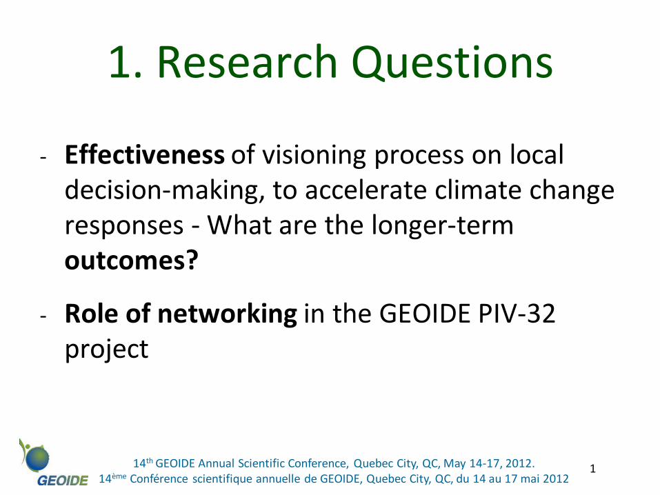
1. Research Questions
- Effectiveness of visioning process on local decision-making, to accelerate climate change responses - What are the longer-term outcomes?
- Role of networking in the GEOIDE PIV-32 project
2 14th GEOIDE Annual Scientific Conference, Quebec City, QC, May 14-17, 2012. 14ème Conférence scientifique annuelle de GEOIDE, Quebec City, QC, du 14 au 17 mai 2012
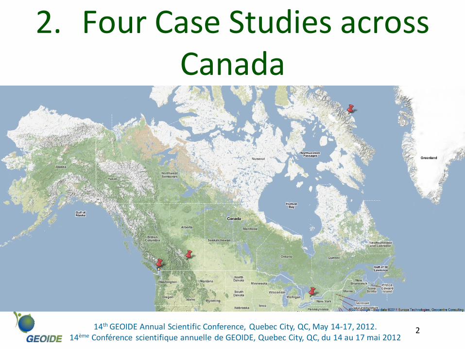
2. Four Case Studies across Canada
3 14th GEOIDE Annual Scientific Conference, Quebec City, QC, May 14-17, 2012. 14ème Conférence scientifique annuelle de GEOIDE, Quebec City, QC, du 14 au 17 mai 2012
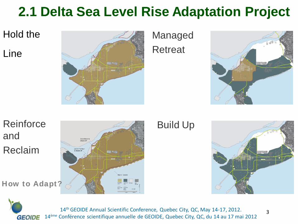
Hold the
Line
Reinforce and Reclaim
Managed Retreat
Build Up
2.1 Delta Sea Level Rise Adaptation Project
How to Adapt?
4 14th GEOIDE Annual Scientific Conference, Quebec City, QC, May 14-17, 2012. 14ème Conférence scientifique annuelle de GEOIDE, Quebec City, QC, du 14 au 17 mai 2012
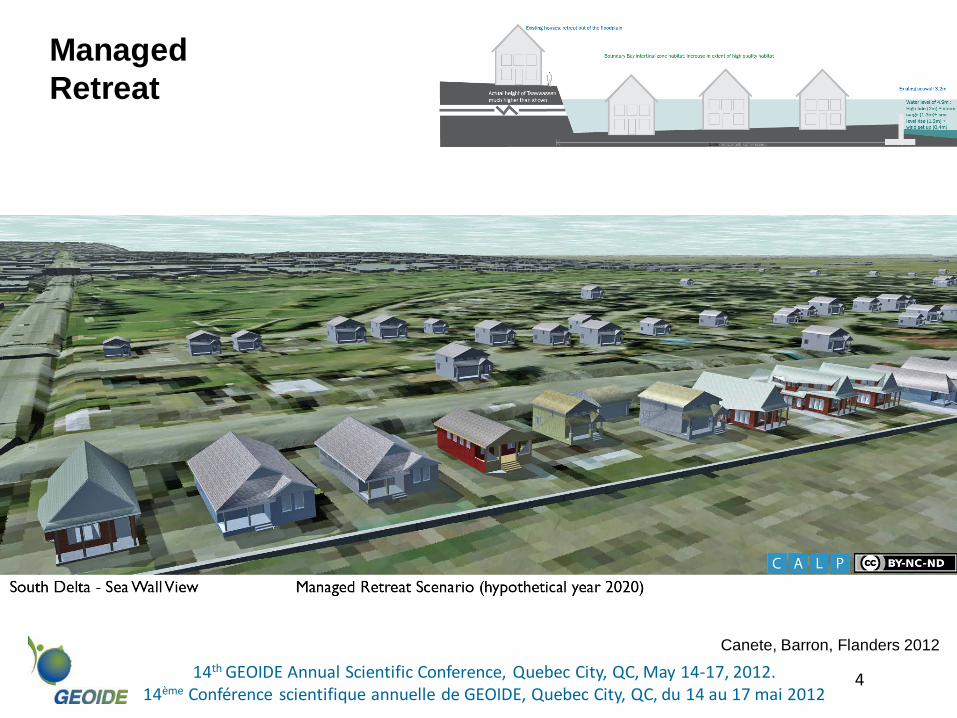
Managed Retreat
Canete, Barron, Flanders 2012
5 14th GEOIDE Annual Scientific Conference, Quebec City, QC, May 14-17, 2012. 14ème Conférence scientifique annuelle de GEOIDE, Quebec City, QC, du 14 au 17 mai 2012
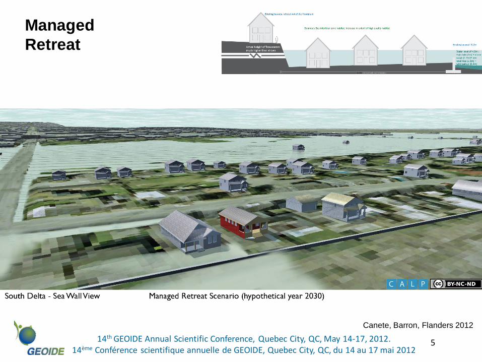
Managed Retreat
Canete, Barron, Flanders 2012
6 14th GEOIDE Annual Scientific Conference, Quebec City, QC, May 14-17, 2012. 14ème Conférence scientifique annuelle de GEOIDE, Quebec City, QC, du 14 au 17 mai 2012
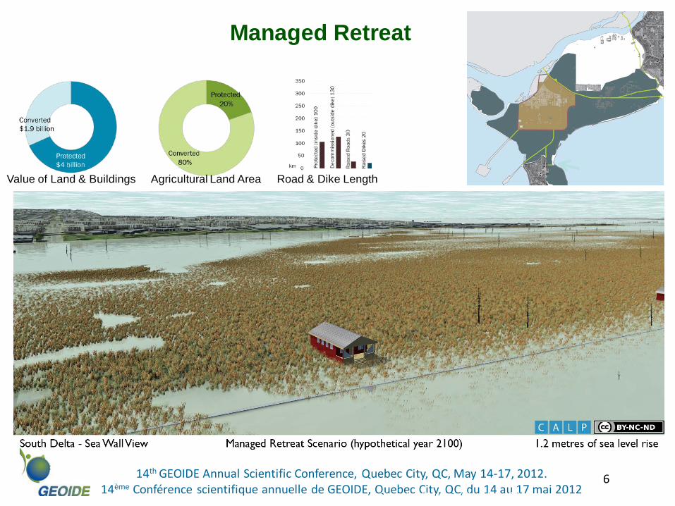
Managed Retreat
Value of Land & Buildings Agricultural Land Area Road & Dike Length
Canete, Barron, Flanders 2012
7 14th GEOIDE Annual Scientific Conference, Quebec City, QC, May 14-17, 2012. 14ème Conférence scientifique annuelle de GEOIDE, Quebec City, QC, du 14 au 17 mai 2012
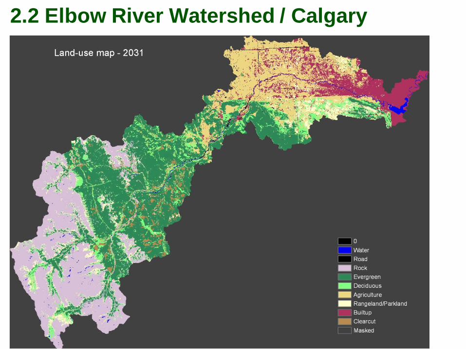
2.2 Elbow River Watershed / Calgary
8 14th GEOIDE Annual Scientific Conference, Quebec City, QC, May 14-17, 2012. 14ème Conférence scientifique annuelle de GEOIDE, Quebec City, QC, du 14 au 17 mai 2012
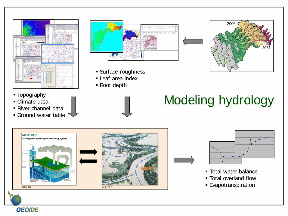
Topography Climate data River channel data Ground water table
Total water balance Total overland flow Evapotranspiration
2006
2031
Surface roughness Leaf area index Root depth
Modeling hydrology
10 14th GEOIDE Annual Scientific Conference, Quebec City, QC, May 14-17, 2012. 14ème Conférence scientifique annuelle de GEOIDE, Quebec City, QC, du 14 au 17 mai 2012
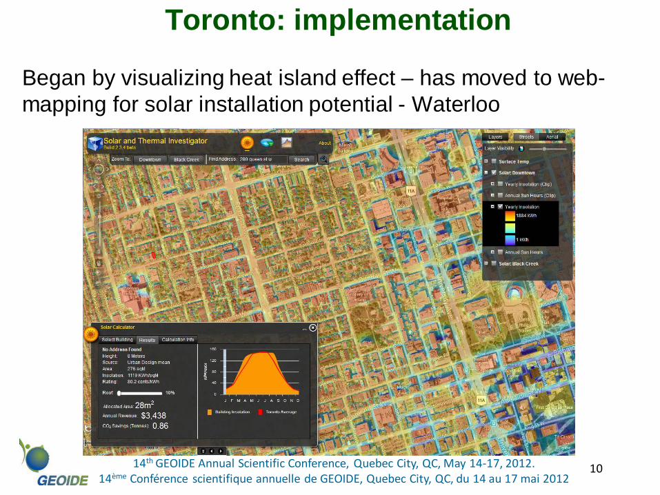
Toronto: implementation
Began by visualizing heat island effect – has moved to web-mapping for solar installation potential - Waterloo
11 14th GEOIDE Annual Scientific Conference, Quebec City, QC, May 14-17, 2012. 14ème Conférence scientifique annuelle de GEOIDE, Quebec City, QC, du 14 au 17 mai 2012
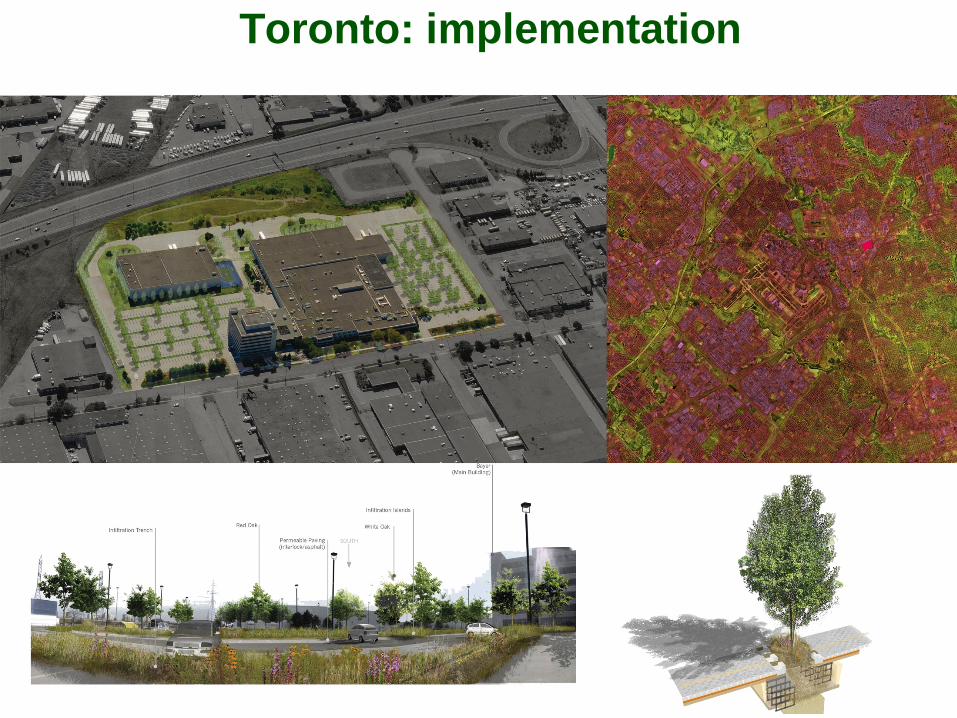
Toronto: implementation
Visualizing the heat island effect to make large and small-scale recommendations for mitigation
12 14th GEOIDE Annual Scientific Conference, Quebec City, QC, May 14-17, 2012. 14ème Conférence scientifique annuelle de GEOIDE, Quebec City, QC, du 14 au 17 mai 2012
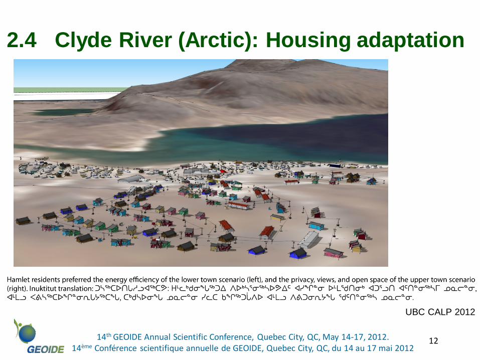
2.4 Clyde River (Arctic): Housing adaptation
UBC CALP 2012
13 14th GEOIDE Annual Scientific Conference, Quebec City, QC, May 14-17, 2012. 14ème Conférence scientifique annuelle de GEOIDE, Quebec City, QC, du 14 au 17 mai 2012
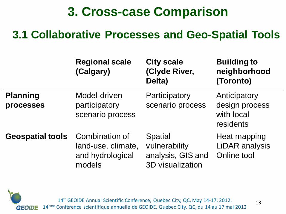
3.1 Collaborative Processes and Geo-Spatial Tools
Regional scale (Calgary)
City scale (Clyde River, Delta)
Building to neighborhood (Toronto)
Planning processes
Model-driven participatory scenario process
Participatory scenario process
Anticipatory design process with local residents
Geospatial tools Combination of land-use, climate, and hydrological models
Spatial vulnerability analysis, GIS and 3D visualization
Heat mapping LiDAR analysis Online tool
3. Cross-case Comparison