Embed Size (px)
Citation preview
1
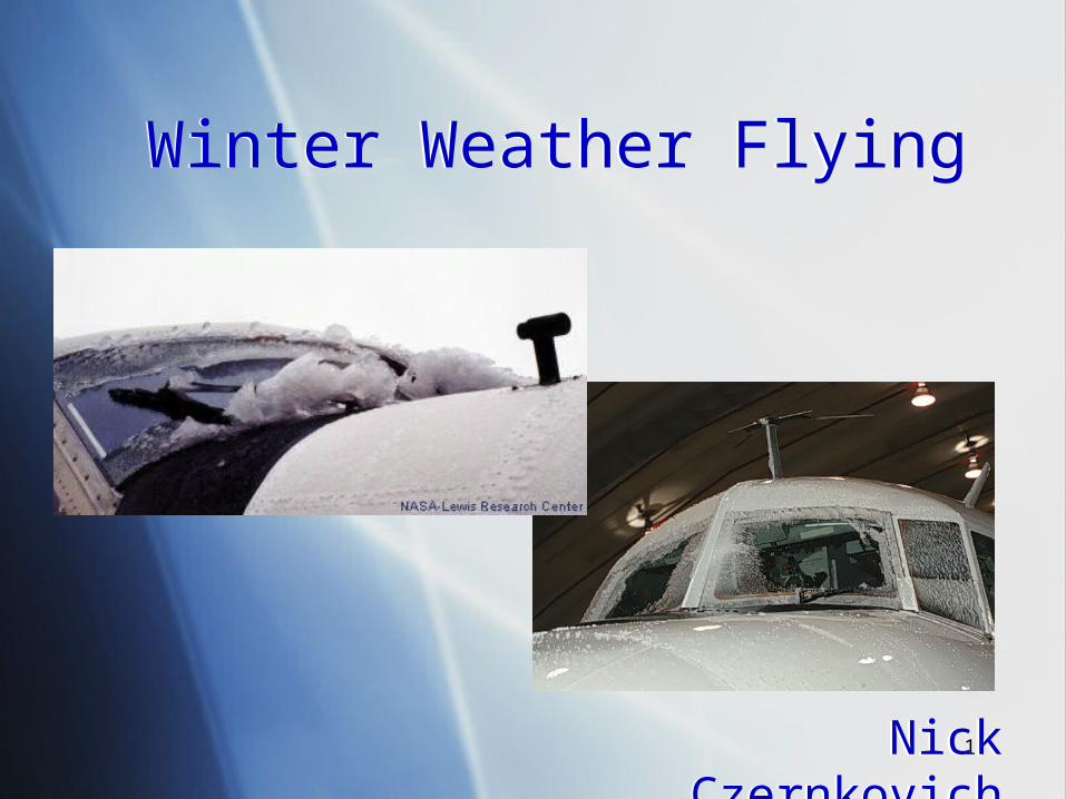
Winter Weather FlyingWinter Weather Flying
Nick CzernkovichNick Czernkovich
2
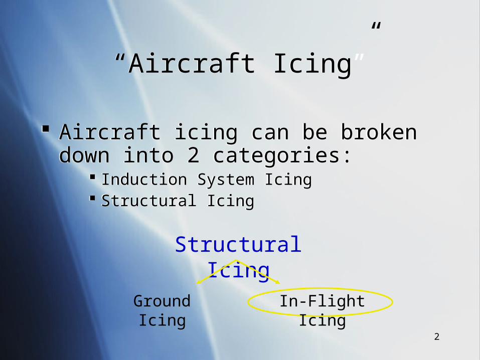
“Aircraft Icing”“Aircraft Icing”
Aircraft icing can be broken down into 2 categories:
Induction System Icing Structural Icing
Aircraft icing can be broken down into 2 categories:
Induction System Icing Structural Icing
Structural Icing
Ground Icing
In-Flight Icing
3
Some General StatisticsSome General Statistics
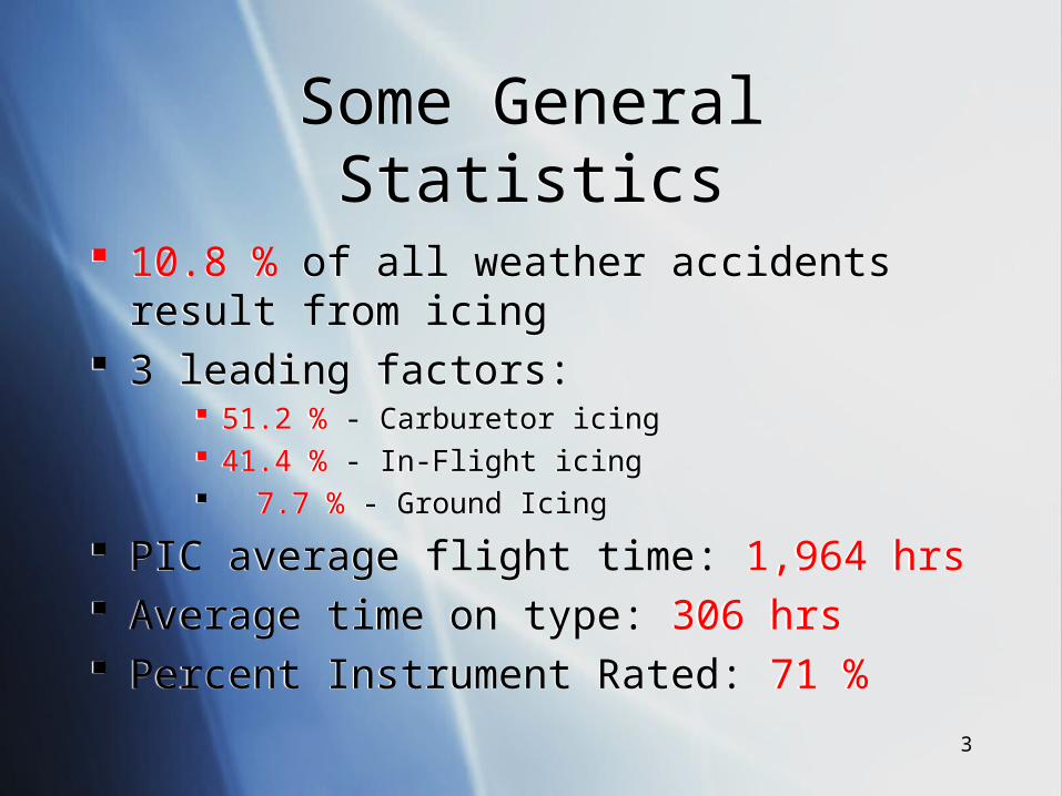
10.8 % of all weather accidents result from icing 3 leading factors:
51.2 % - Carburetor icing 41.4 % - In-Flight icing 7.7 % - Ground Icing
PIC average flight time: 1,964 hrs Average time on type: 306 hrs Percent Instrument Rated: 71 %
10.8 % of all weather accidents result from icing 3 leading factors:
51.2 % - Carburetor icing 41.4 % - In-Flight icing 7.7 % - Ground Icing
PIC average flight time: 1,964 hrs Average time on type: 306 hrs Percent Instrument Rated: 71 %
4
In-Flight Icing StatisticsIn-Flight Icing Statistics
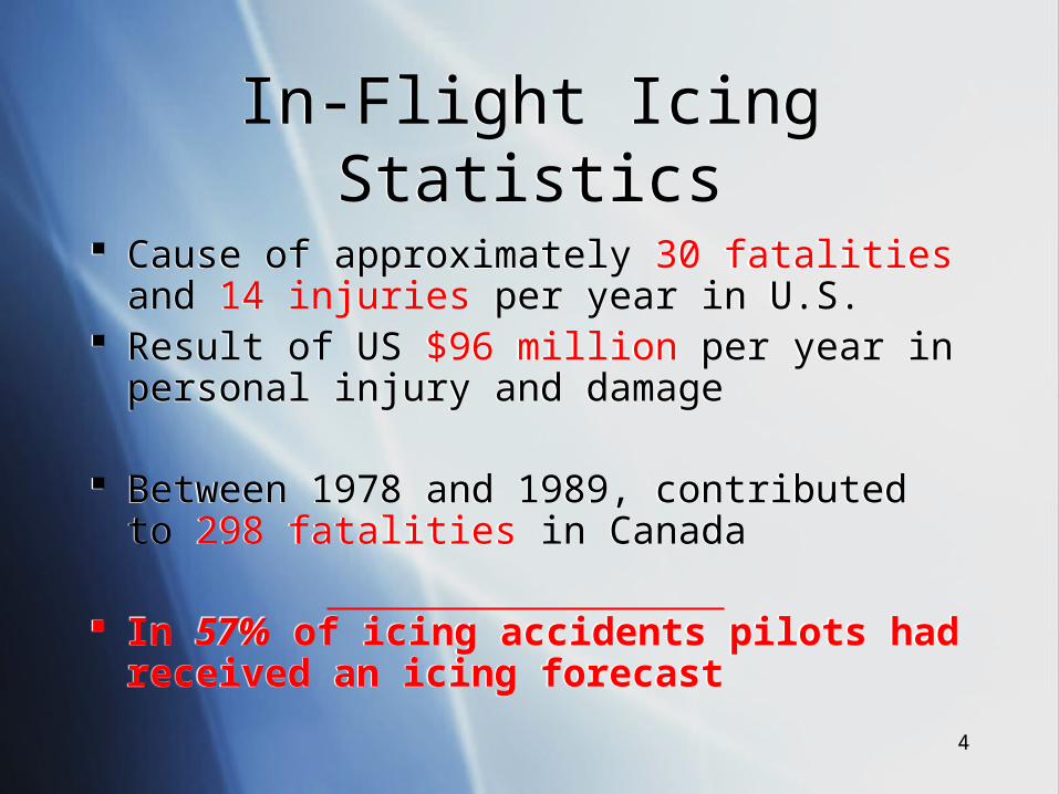
Cause of approximately 30 fatalities and 14 injuries per year in U.S.
Result of US $96 million per year in personal injury and damage
Between 1978 and 1989, contributed to 298 fatalities in Canada
In 57% of icing accidents pilots had received an icing forecast
Cause of approximately 30 fatalities and 14 injuries per year in U.S.
Result of US $96 million per year in personal injury and damage
Between 1978 and 1989, contributed to 298 fatalities in Canada
In 57% of icing accidents pilots had received an icing forecast

5
Some PicturesSome Pictures
6
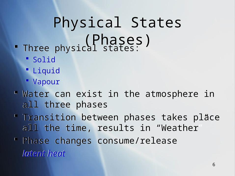
Physical States (Phases)Physical States (Phases) Three physical states:
Solid Liquid Vapour
Water can exist in the atmosphere in all three phases Transition between phases takes place all the time,
results in “Weather” Phase changes consume/release
latent heat
Three physical states: Solid Liquid Vapour
Water can exist in the atmosphere in all three phases Transition between phases takes place all the time,
results in “Weather” Phase changes consume/release
latent heat
7
Two Points to RememberTwo Points to Remember
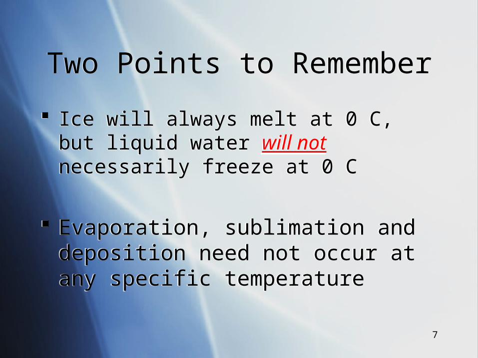
Ice will always melt at 0 C, but liquid water will not necessarily freeze at 0 C
Evaporation, sublimation and deposition need not occur at any specific temperature
Ice will always melt at 0 C, but liquid water will not necessarily freeze at 0 C
Evaporation, sublimation and deposition need not occur at any specific temperature
8
Warm Cloud ProcessWarm Cloud Process
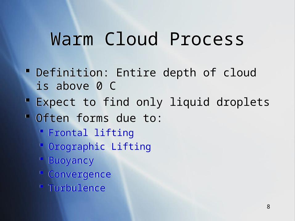
Definition: Entire depth of cloud is above 0 C Expect to find only liquid droplets Often forms due to:
Frontal lifting Orographic Lifting Buoyancy Convergence Turbulence
Definition: Entire depth of cloud is above 0 C Expect to find only liquid droplets Often forms due to:
Frontal lifting Orographic Lifting Buoyancy Convergence Turbulence
9
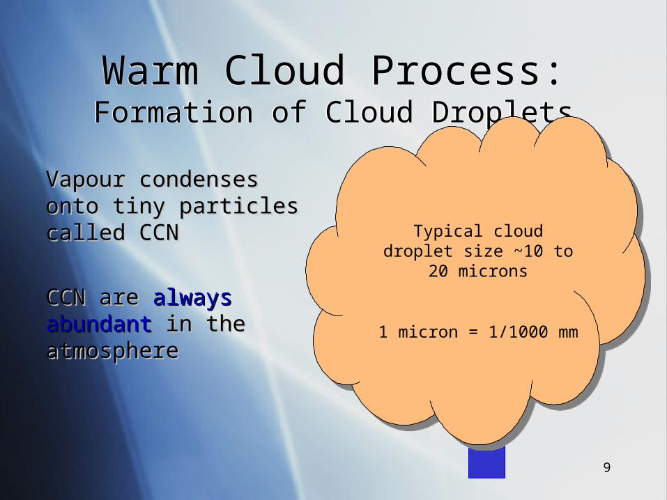
Warm Cloud Process:Formation of Cloud DropletsWarm Cloud Process:Formation of Cloud Droplets
Vapour condenses Vapour condenses onto tiny particles onto tiny particles called CCNcalled CCN
CCN are CCN are always always abundantabundant in the in the atmosphereatmosphere
Typical cloud droplet size ~10 to
20 microns
1 micron = 1/1000 mm
10
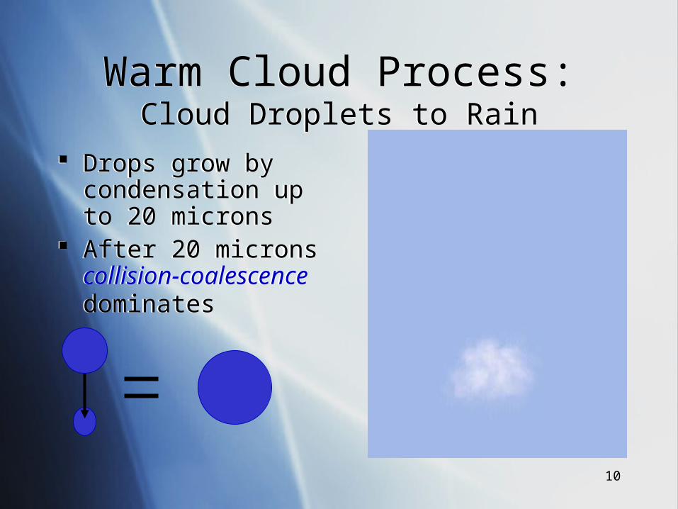
Warm Cloud Process:Cloud Droplets to Rain
Warm Cloud Process:Cloud Droplets to Rain
Drops grow by condensation up to 20 microns
After 20 microns collision-coalescence dominates
Drops grow by condensation up to 20 microns
After 20 microns collision-coalescence dominates
11
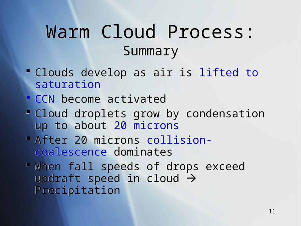
Warm Cloud Process:Summary
Warm Cloud Process:Summary
Clouds develop as air is lifted to saturation CCN become activated Cloud droplets grow by condensation up to
about 20 microns After 20 microns collision-coalescence
dominates When fall speeds of drops exceed updraft
speed in cloud Precipitation
Clouds develop as air is lifted to saturation CCN become activated Cloud droplets grow by condensation up to
about 20 microns After 20 microns collision-coalescence
dominates When fall speeds of drops exceed updraft
speed in cloud Precipitation
12
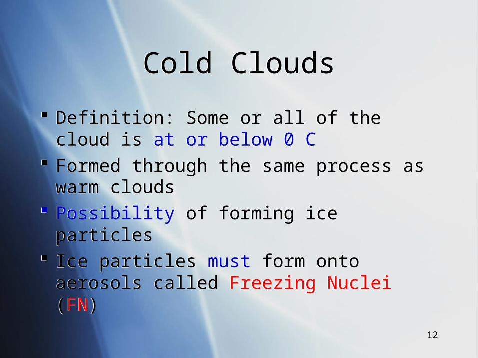
Cold CloudsCold Clouds
Definition: Some or all of the cloud is at or below 0 C
Formed through the same process as warm clouds
Possibility of forming ice particles Ice particles must form onto aerosols called
Freezing Nuclei (FN)
Definition: Some or all of the cloud is at or below 0 C
Formed through the same process as warm clouds
Possibility of forming ice particles Ice particles must form onto aerosols called
Freezing Nuclei (FN)
13
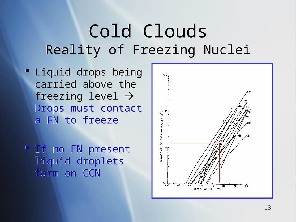
Cold CloudsReality of Freezing Nuclei
Cold CloudsReality of Freezing Nuclei
Liquid drops being carried above the freezing level Drops must contact a FN to freeze
If no FN present liquid droplets form on CCN
Liquid drops being carried above the freezing level Drops must contact a FN to freeze
If no FN present liquid droplets form on CCN
14
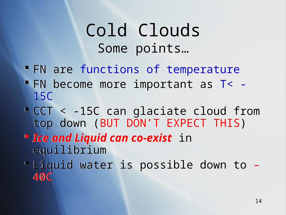
Cold CloudsSome points…
Cold CloudsSome points…
FN are functions of temperature FN become more important as T< -15C CCT < -15C can glaciate cloud from top
down (BUT DON’T EXPECT THIS) Ice and Liquid can co-exist in
equilibrium Liquid water is possible down to –40C
FN are functions of temperature FN become more important as T< -15C CCT < -15C can glaciate cloud from top
down (BUT DON’T EXPECT THIS) Ice and Liquid can co-exist in
equilibrium Liquid water is possible down to –40C
15
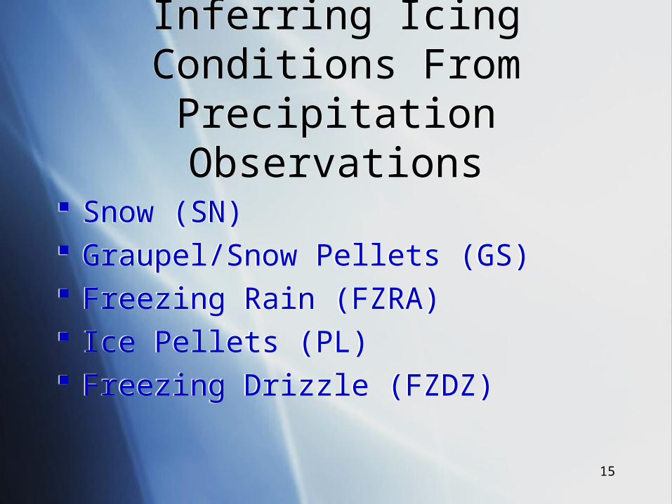
Inferring Icing Conditions From Precipitation Observations
Inferring Icing Conditions From Precipitation Observations
Snow (SN) Graupel/Snow Pellets (GS) Freezing Rain (FZRA) Ice Pellets (PL) Freezing Drizzle (FZDZ)
Snow (SN) Graupel/Snow Pellets (GS) Freezing Rain (FZRA) Ice Pellets (PL) Freezing Drizzle (FZDZ)
16
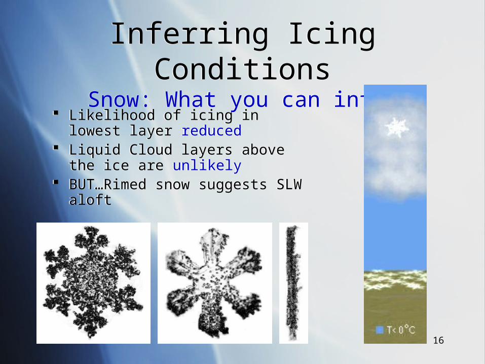
Inferring Icing ConditionsSnow: What you can infer
Inferring Icing ConditionsSnow: What you can infer
Likelihood of icing in lowest layer reduced
Liquid Cloud layers above the ice are unlikely
BUT…Rimed snow suggests SLW aloft
Likelihood of icing in lowest layer reduced
Liquid Cloud layers above the ice are unlikely
BUT…Rimed snow suggests SLW aloft
17
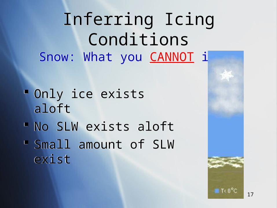
Inferring Icing ConditionsSnow: What you CANNOT infer
Inferring Icing ConditionsSnow: What you CANNOT infer
Only ice exists aloft No SLW exists aloft Small amount of SLW exist
Only ice exists aloft No SLW exists aloft Small amount of SLW exist
18
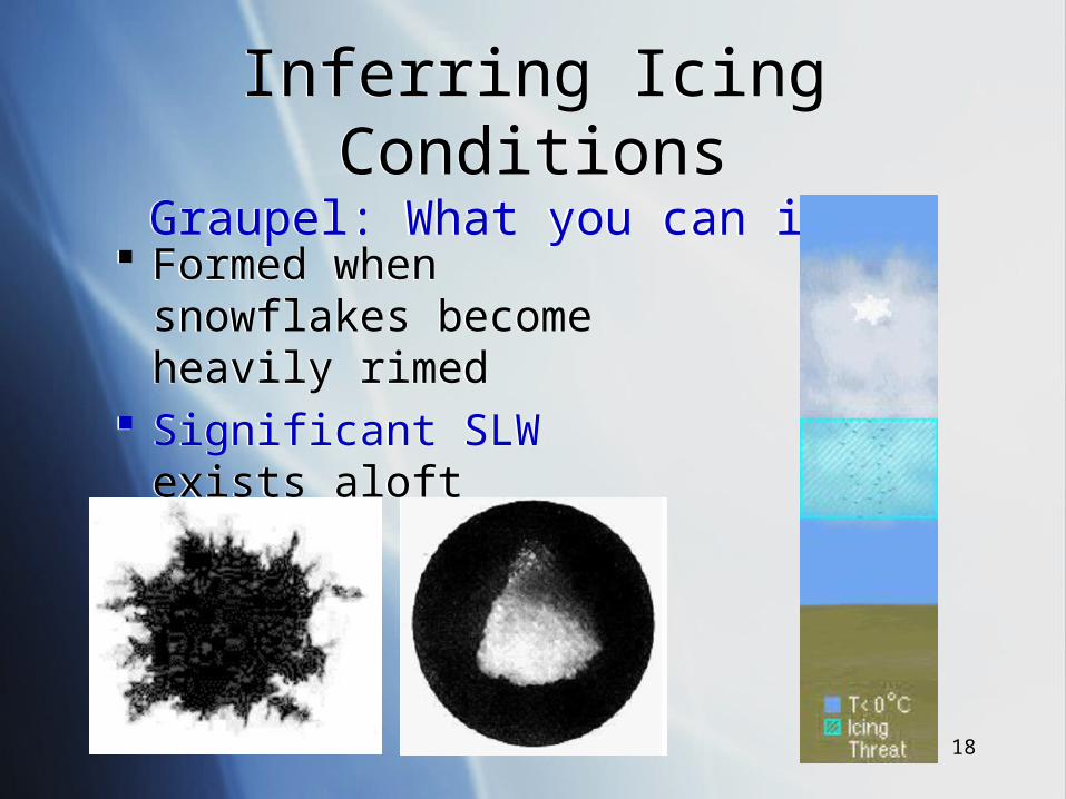
Inferring Icing ConditionsGraupel: What you can infer
Inferring Icing ConditionsGraupel: What you can infer
Formed when snowflakes become heavily rimed
Significant SLW exists aloft
Formed when snowflakes become heavily rimed
Significant SLW exists aloft
19
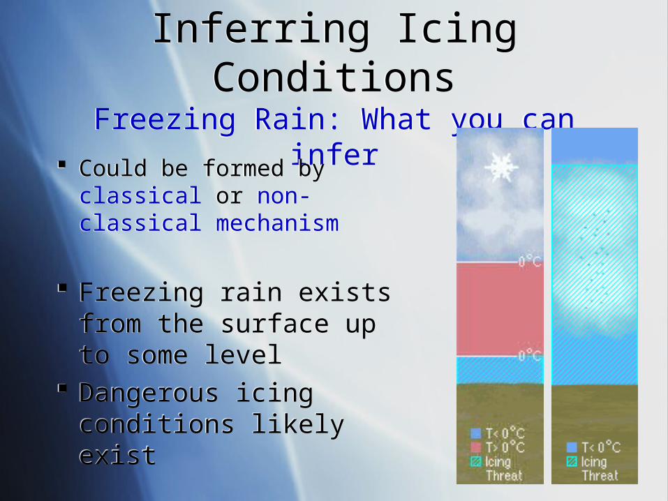
Inferring Icing ConditionsFreezing Rain: What you can inferInferring Icing ConditionsFreezing Rain: What you can infer
Could be formed by classical or non-classical mechanism
Freezing rain exists from the surface up to some level
Dangerous icing conditions likely exist
Could be formed by classical or non-classical mechanism
Freezing rain exists from the surface up to some level
Dangerous icing conditions likely exist
20
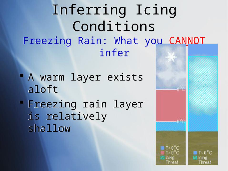
Inferring Icing ConditionsFreezing Rain: What you CANNOT infer
Inferring Icing ConditionsFreezing Rain: What you CANNOT infer
A warm layer exists aloft Freezing rain layer is
relatively shallow
A warm layer exists aloft Freezing rain layer is
relatively shallow
21
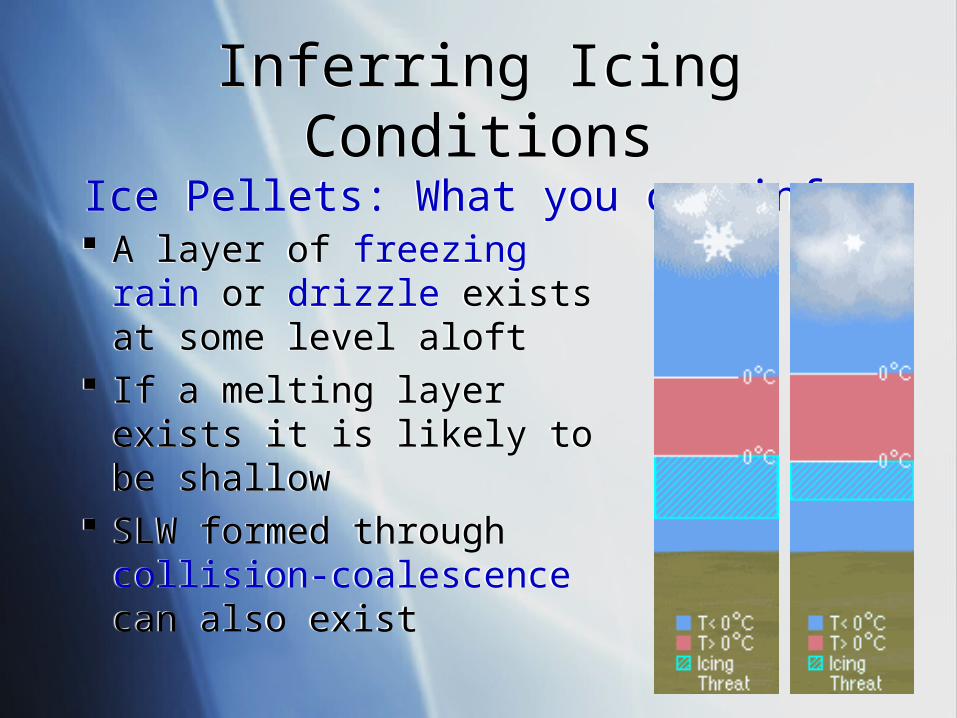
Inferring Icing ConditionsIce Pellets: What you can infer
Inferring Icing ConditionsIce Pellets: What you can infer
A layer of freezing rain or drizzle exists at some level aloft
If a melting layer exists it is likely to be shallow
SLW formed through collision-coalescence can also exist
A layer of freezing rain or drizzle exists at some level aloft
If a melting layer exists it is likely to be shallow
SLW formed through collision-coalescence can also exist
22
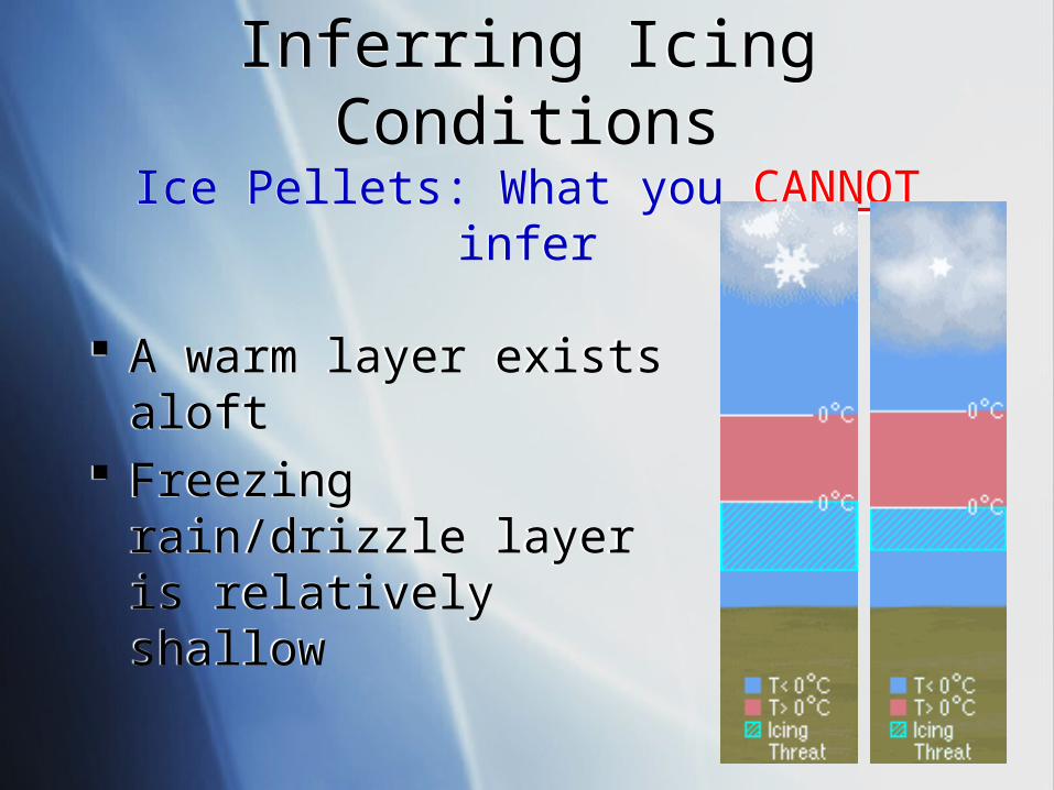
Inferring Icing ConditionsIce Pellets: What you CANNOT inferInferring Icing Conditions
Ice Pellets: What you CANNOT infer
A warm layer exists aloft Freezing rain/drizzle layer
is relatively shallow
A warm layer exists aloft Freezing rain/drizzle layer
is relatively shallow
23
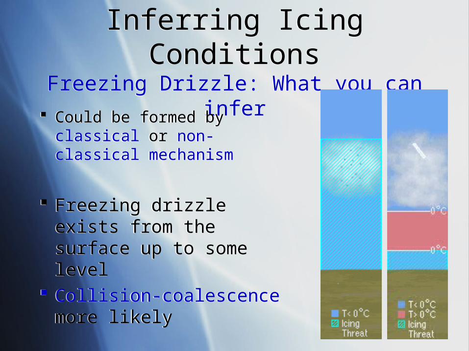
Inferring Icing ConditionsFreezing Drizzle: What you can inferInferring Icing ConditionsFreezing Drizzle: What you can infer
Could be formed by classical or non-classical mechanism
Freezing drizzle exists from the surface up to some level
Collision-coalescence more likely
Could be formed by classical or non-classical mechanism
Freezing drizzle exists from the surface up to some level
Collision-coalescence more likely
24
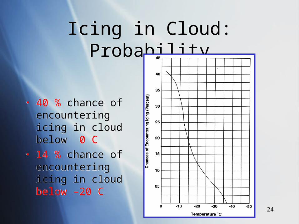
Icing in Cloud: ProbabilityIcing in Cloud: Probability
• 40 % chance of encountering icing in cloud below 0 C
• 14 % chance of encountering icing in cloud below –20 C
• 40 % chance of encountering icing in cloud below 0 C
• 14 % chance of encountering icing in cloud below –20 C
25
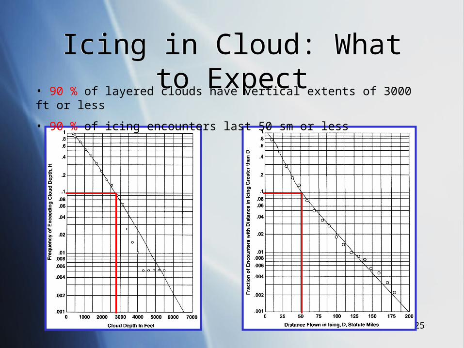
Icing in Cloud: What to ExpectIcing in Cloud: What to Expect• 90 % of layered clouds have vertical extents of 3000 ft or less
• 90 % of icing encounters last 50 sm or less
26
Mechanics of IcingMechanics of Icing
27
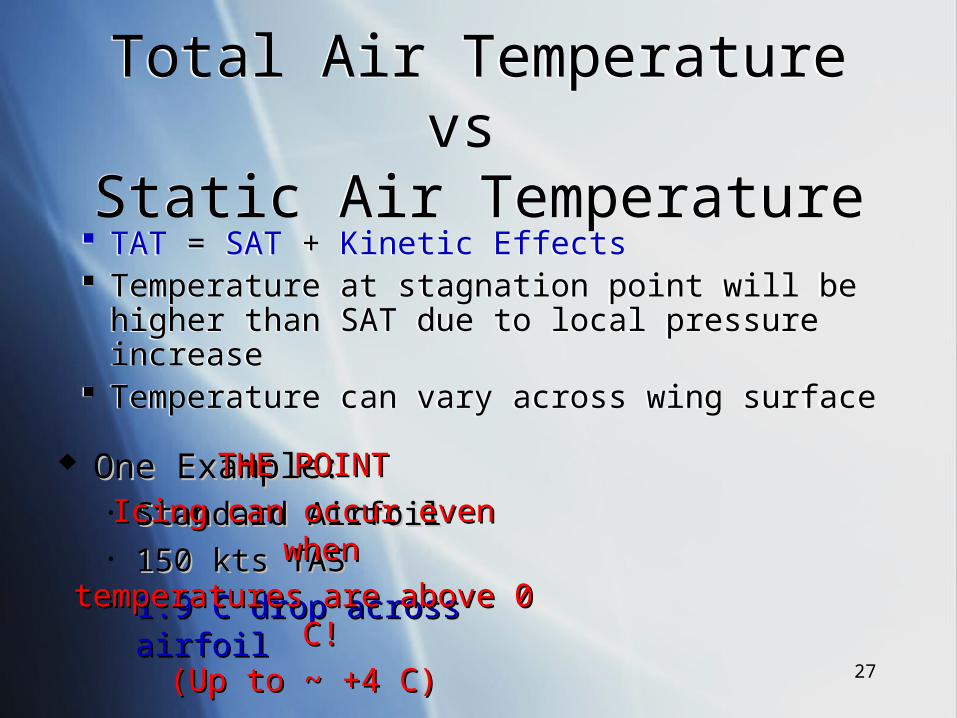
Total Air Temperature vs Static Air Temperature
Total Air Temperature vs Static Air Temperature
TAT = SAT + Kinetic Effects Temperature at stagnation point will be higher
than SAT due to local pressure increase Temperature can vary across wing surface
TAT = SAT + Kinetic Effects Temperature at stagnation point will be higher
than SAT due to local pressure increase Temperature can vary across wing surface
One Example:One Example:• Standard AirfoilStandard Airfoil• 150 kts TAS150 kts TAS• 1.9 C drop across 1.9 C drop across airfoilairfoil
THE POINTTHE POINT
Icing can occur even Icing can occur even whenwhen
temperatures are above 0 temperatures are above 0 C!C!
(Up to ~ +4 C)(Up to ~ +4 C)
28
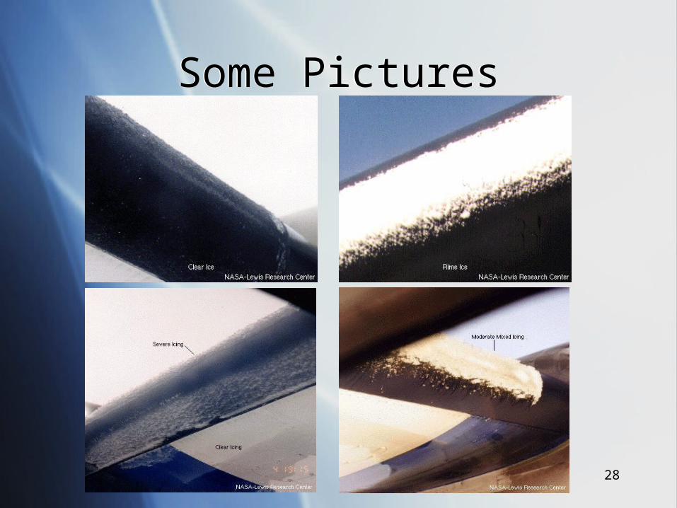
Some PicturesSome Pictures
29
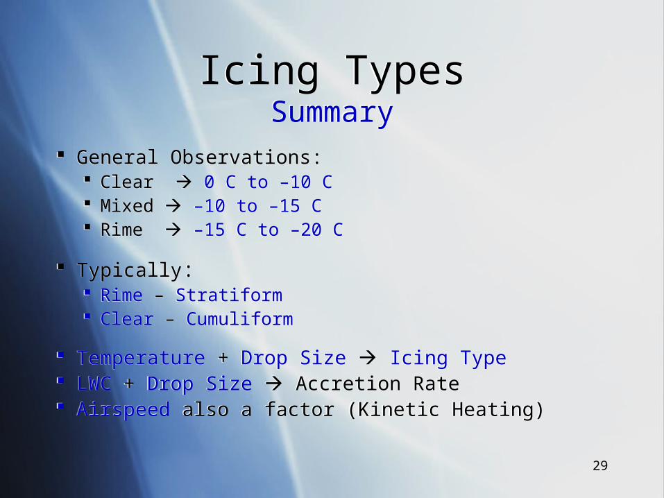
Icing TypesSummary
Icing TypesSummary
General Observations: Clear 0 C to –10 C Mixed –10 to –15 C Rime –15 C to –20 C
Typically: Rime – Stratiform Clear – Cumuliform
Temperature + Drop Size Icing Type LWC + Drop Size Accretion Rate Airspeed also a factor (Kinetic Heating)
General Observations: Clear 0 C to –10 C Mixed –10 to –15 C Rime –15 C to –20 C
Typically: Rime – Stratiform Clear – Cumuliform
Temperature + Drop Size Icing Type LWC + Drop Size Accretion Rate Airspeed also a factor (Kinetic Heating)
30
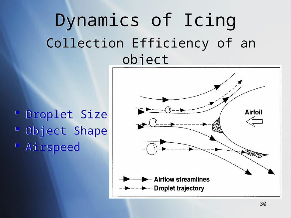
Dynamics of Icing Collection Efficiency of an object
Dynamics of Icing Collection Efficiency of an object
Droplet Size Object Shape Airspeed
Droplet Size Object Shape Airspeed
31
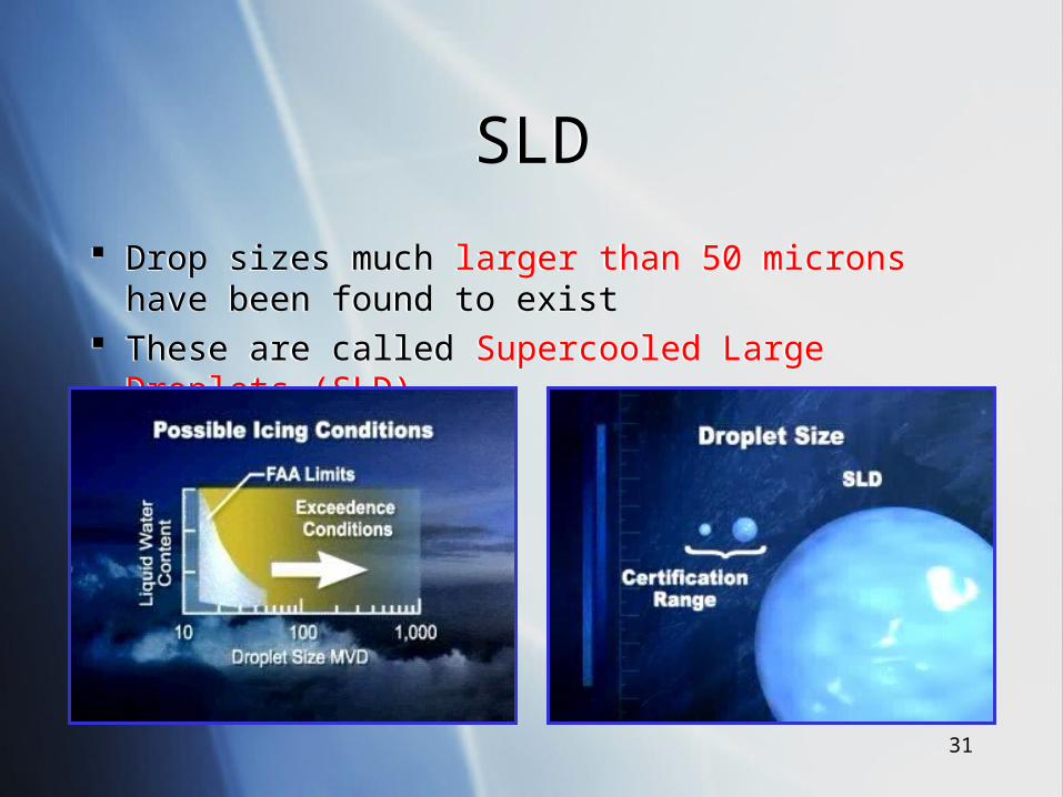
SLDSLD
Drop sizes much larger than 50 microns have been found to exist
These are called Supercooled Large Droplets (SLD)
Drop sizes much larger than 50 microns have been found to exist
These are called Supercooled Large Droplets (SLD)
32
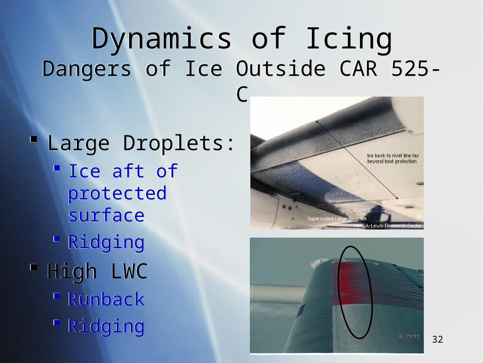
Dynamics of IcingDangers of Ice Outside CAR 525-C
Dynamics of IcingDangers of Ice Outside CAR 525-C
Large Droplets: Ice aft of protected
surface Ridging
High LWC Runback Ridging
Large Droplets: Ice aft of protected
surface Ridging
High LWC Runback Ridging
33
Performance PenaltiesPerformance Penalties
Decreased Lift Increased Drag Decreased Stall Angle Increased Stall Speed
Decreased Lift Increased Drag Decreased Stall Angle Increased Stall Speed
Increased Vibration Changes in Pressure
Distribution Early Boundary Layer
Separation Reduced
Controllability
Increased Vibration Changes in Pressure
Distribution Early Boundary Layer
Separation Reduced
Controllability
34
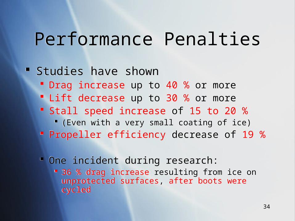
Performance PenaltiesPerformance Penalties
Studies have shown Drag increase up to 40 % or more Lift decrease up to 30 % or more Stall speed increase of 15 to 20 %
(Even with a very small coating of ice) Propeller efficiency decrease of 19 %
One incident during research: 36 % drag increase resulting from ice on unprotected surfaces,
after boots were cycled
35
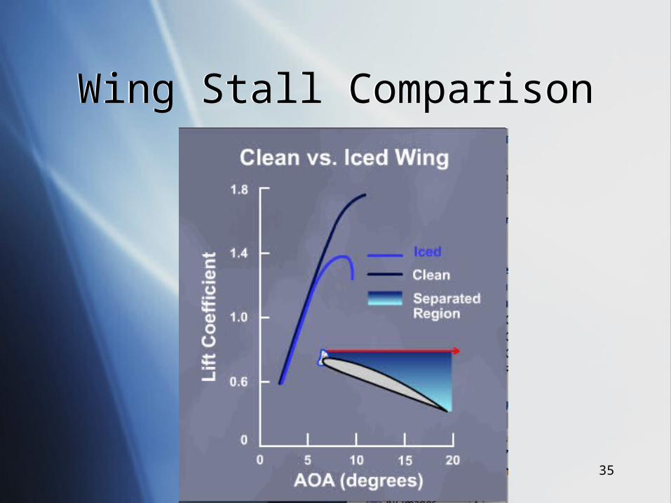
Wing Stall ComparisonWing Stall Comparison
36
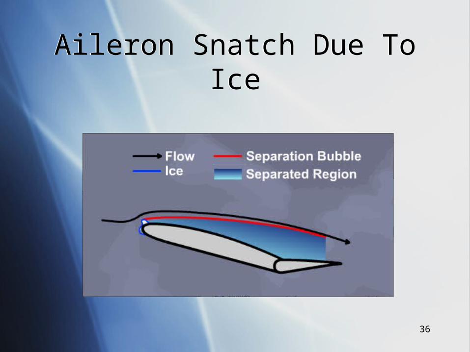
Aileron Snatch Due To IceAileron Snatch Due To Ice
37
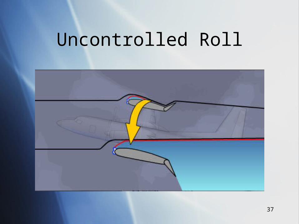
Uncontrolled RollUncontrolled Roll
38
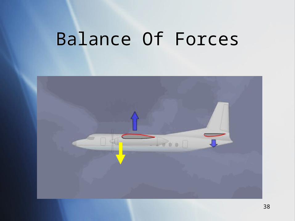
Balance Of ForcesBalance Of Forces
39
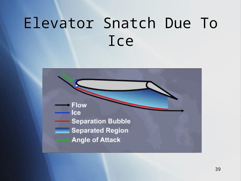
Elevator Snatch Due To IceElevator Snatch Due To Ice
40
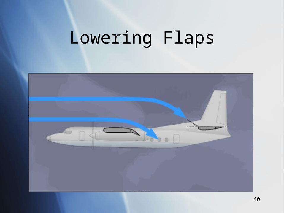
Lowering FlapsLowering Flaps
41
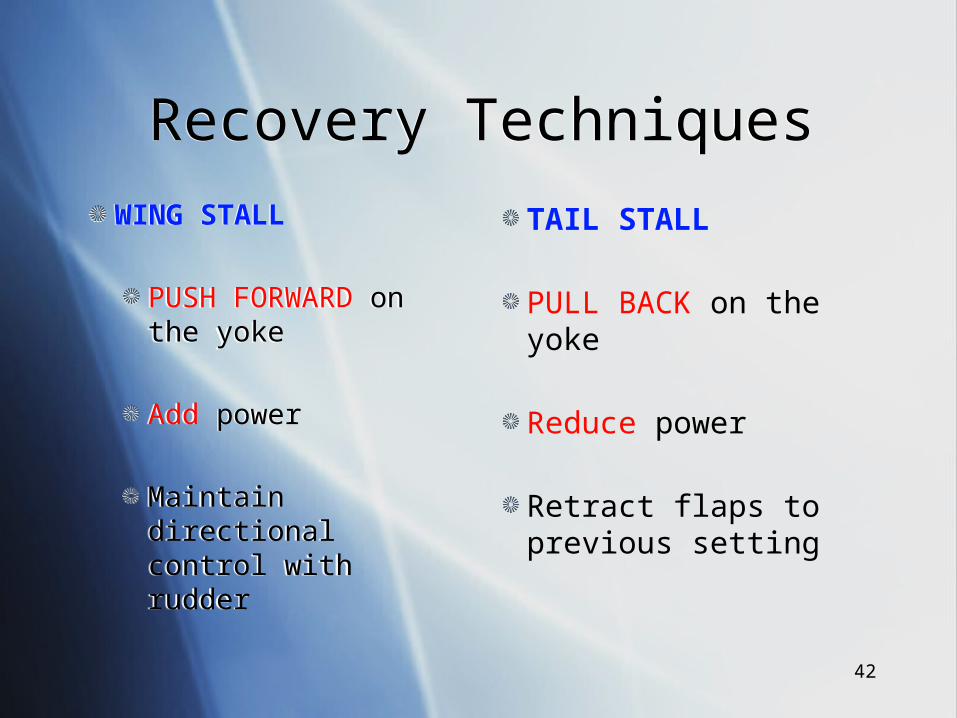
Stall RecognitionStall Recognition
WING STALL
Wing Buffet
Wing drop
High/moderate angles of attack
Tends to happen at the low end of the speed regime
WING STALL
Wing Buffet
Wing drop
High/moderate angles of attack
Tends to happen at the low end of the speed regime
TAIL STALL
Lightening of the controls
Dramatic nose drop
Often after flap extension
High end of the flap extension range
42
Recovery TechniquesRecovery Techniques
WING STALL
PUSH FORWARD on the yoke
Add power
Maintain directional control with rudder
WING STALL
PUSH FORWARD on the yoke
Add power
Maintain directional control with rudder
TAIL STALL
PULL BACK on the yoke
Reduce power
Retract flaps to previous setting

43
Flight PlanningFlight Planning
44
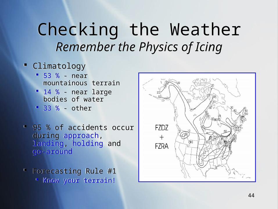
Checking the WeatherRemember the Physics of IcingChecking the WeatherRemember the Physics of Icing
Climatology 53 % - near mountainous
terrain 14 % - near large bodies of
water 33 % - other
95 % of accidents occur during approach, landing, holding and go-around
Forecasting Rule #1 Know your terrain!
Climatology 53 % - near mountainous
terrain 14 % - near large bodies of
water 33 % - other
95 % of accidents occur during approach, landing, holding and go-around
Forecasting Rule #1 Know your terrain!
45
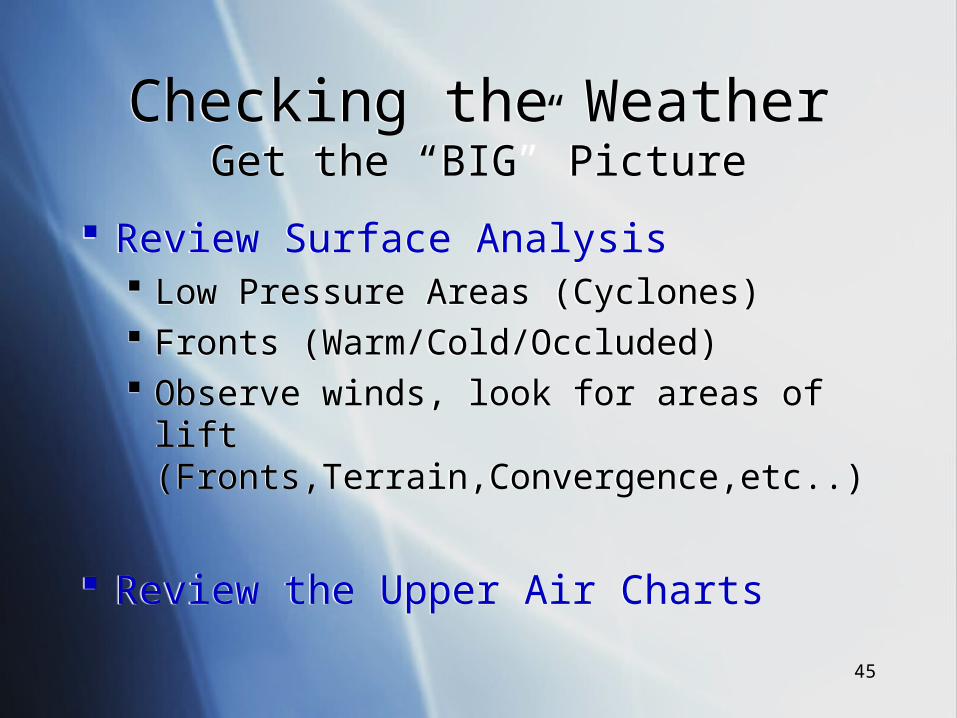
Checking the WeatherGet the “BIG” Picture
Checking the WeatherGet the “BIG” Picture
Review Surface Analysis Low Pressure Areas (Cyclones) Fronts (Warm/Cold/Occluded) Observe winds, look for areas of lift
(Fronts,Terrain,Convergence,etc..)
Review the Upper Air Charts
Review Surface Analysis Low Pressure Areas (Cyclones) Fronts (Warm/Cold/Occluded) Observe winds, look for areas of lift
(Fronts,Terrain,Convergence,etc..)
Review the Upper Air Charts
46
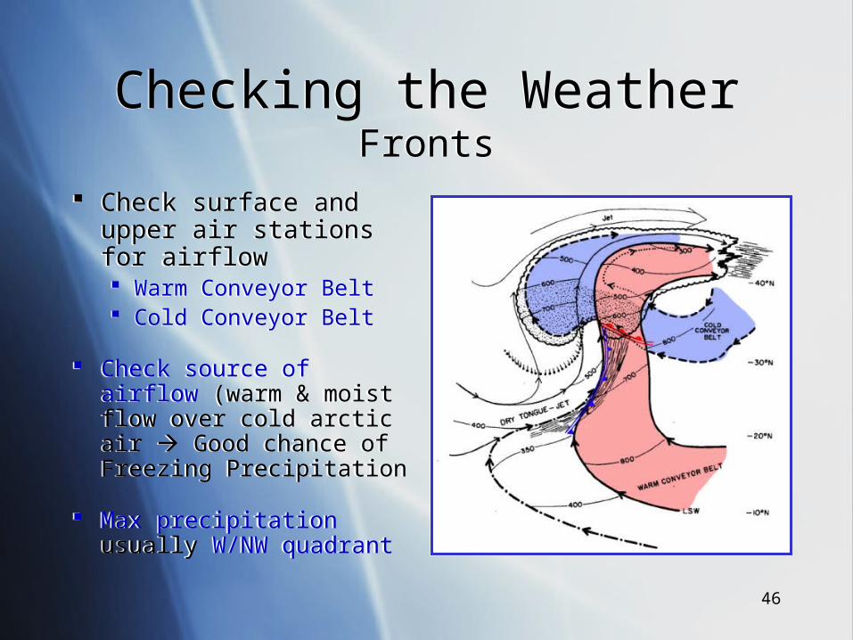
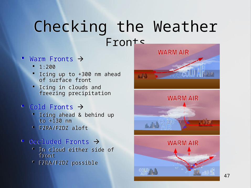
Checking the WeatherFronts
Checking the WeatherFronts
Check surface and upper air stations for airflow Warm Conveyor Belt Cold Conveyor Belt
Check source of airflow (warm & moist flow over cold arctic air Good chance of Freezing Precipitation
Max precipitation usually W/NW quadrant
Check surface and upper air stations for airflow Warm Conveyor Belt Cold Conveyor Belt
Check source of airflow (warm & moist flow over cold arctic air Good chance of Freezing Precipitation
Max precipitation usually W/NW quadrant
47
Checking the WeatherFronts
Checking the WeatherFronts
Warm Fronts 1:200 Icing up to +300 nm ahead of
surface front Icing in clouds and freezing
precipitation
Cold Fronts Icing ahead & behind up to +130
nm FZRA/FZDZ aloft
Occluded Fronts In cloud either side of front FZRA/FZDZ possible
Warm Fronts 1:200 Icing up to +300 nm ahead of
surface front Icing in clouds and freezing
precipitation
Cold Fronts Icing ahead & behind up to +130
nm FZRA/FZDZ aloft
Occluded Fronts In cloud either side of front FZRA/FZDZ possible
48
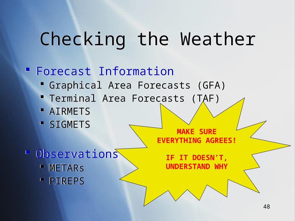
Checking the WeatherChecking the Weather
Forecast Information Graphical Area Forecasts (GFA) Terminal Area Forecasts (TAF) AIRMETS SIGMETS
Observations METARs PIREPS
Forecast Information Graphical Area Forecasts (GFA) Terminal Area Forecasts (TAF) AIRMETS SIGMETS
Observations METARs PIREPS
MAKE SURE EVERYTHING AGREES!
IF IT DOESN’T, UNDERSTAND WHY
49
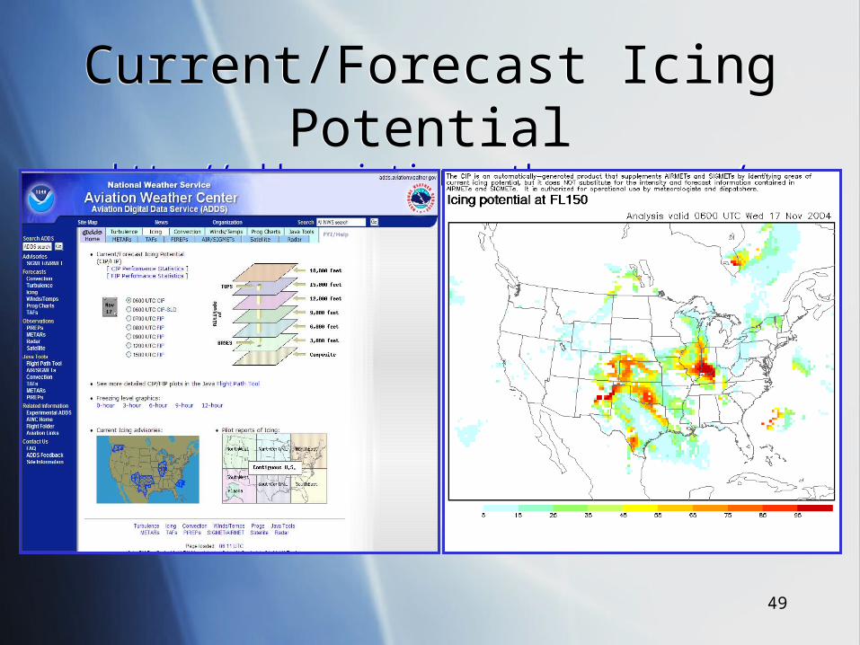
Current/Forecast Icing Potentialhttp://adds.aviationweather.noaa.gov/
Current/Forecast Icing Potentialhttp://adds.aviationweather.noaa.gov/
50
Checking the WeatherWhat you NEED to know
Checking the WeatherWhat you NEED to know
Extent of cloud coverage Cloud tops Cloud bases Frontal positions (current & forecast) Precipitation Freezing level
Extent of cloud coverage Cloud tops Cloud bases Frontal positions (current & forecast) Precipitation Freezing level
51
Filing the Flight PlanA Few Things to RememberFiling the Flight PlanA Few Things to Remember
ALWAYS HAVE AN OUT FOR EVERY PHASE OF THE FLIGHT!
Piston aircraft Reduced thrust margin Usually cruise at 75-85% power
Iced wing will not climb as efficiently Be mindful of MEA Penetrate fronts at a 90 degree angle Fly on LEEWARD side of mountain ranges
ALWAYS HAVE AN OUT FOR EVERY PHASE OF THE FLIGHT!
Piston aircraft Reduced thrust margin Usually cruise at 75-85% power
Iced wing will not climb as efficiently Be mindful of MEA Penetrate fronts at a 90 degree angle Fly on LEEWARD side of mountain ranges
52
Monitoring the WeatherDon’t make it your last priority!Monitoring the WeatherDon’t make it your last priority!
A change in weather may warrant the cancellation of your flight
Update Weather and Reassess your outs PIREPS (Icing) METARS (Clouds,Precipitation,Fronts) Forecasts (Make sure they are holding)
Canada (126.7 MHz) & US (122.0 MHz)
A change in weather may warrant the cancellation of your flight
Update Weather and Reassess your outs PIREPS (Icing) METARS (Clouds,Precipitation,Fronts) Forecasts (Make sure they are holding)
Canada (126.7 MHz) & US (122.0 MHz)
53
In-Flight StrategiesIf Ice is Encountered
In-Flight StrategiesIf Ice is Encountered
Start working to get out
Possible Options: Climb Descend Continue Divert Return Declare an Emergency
Start working to get out
Possible Options: Climb Descend Continue Divert Return Declare an Emergency
54
In-Flight StrategiesIf Ice is Encountered
In-Flight StrategiesIf Ice is Encountered
Remember: 90 % of icing encounters are 50 sm or less 9 out of 10 times a change of 3000 ft will take you
out of icing conditions Be mindful of MEA Be cautious of cloud tops
Use a safe airspeed to maneuver Keep bank angles to a minimum
Remember: 90 % of icing encounters are 50 sm or less 9 out of 10 times a change of 3000 ft will take you
out of icing conditions Be mindful of MEA Be cautious of cloud tops
Use a safe airspeed to maneuver Keep bank angles to a minimum
55
Lake Effect SnowLake Effect Snow
56
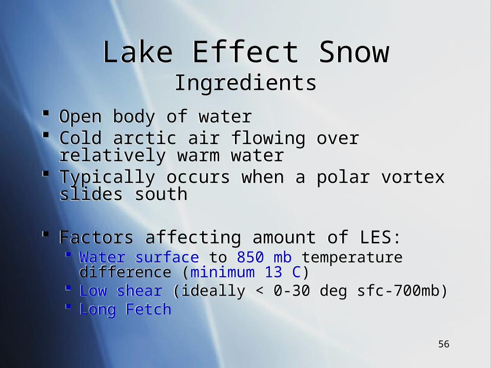
Lake Effect SnowIngredients
Lake Effect SnowIngredients
Open body of water Cold arctic air flowing over relatively warm water Typically occurs when a polar vortex slides south
Factors affecting amount of LES: Water surface to 850 mb temperature difference
(minimum 13 C) Low shear (ideally < 0-30 deg sfc-700mb) Long Fetch
Open body of water Cold arctic air flowing over relatively warm water Typically occurs when a polar vortex slides south
Factors affecting amount of LES: Water surface to 850 mb temperature difference
(minimum 13 C) Low shear (ideally < 0-30 deg sfc-700mb) Long Fetch
57
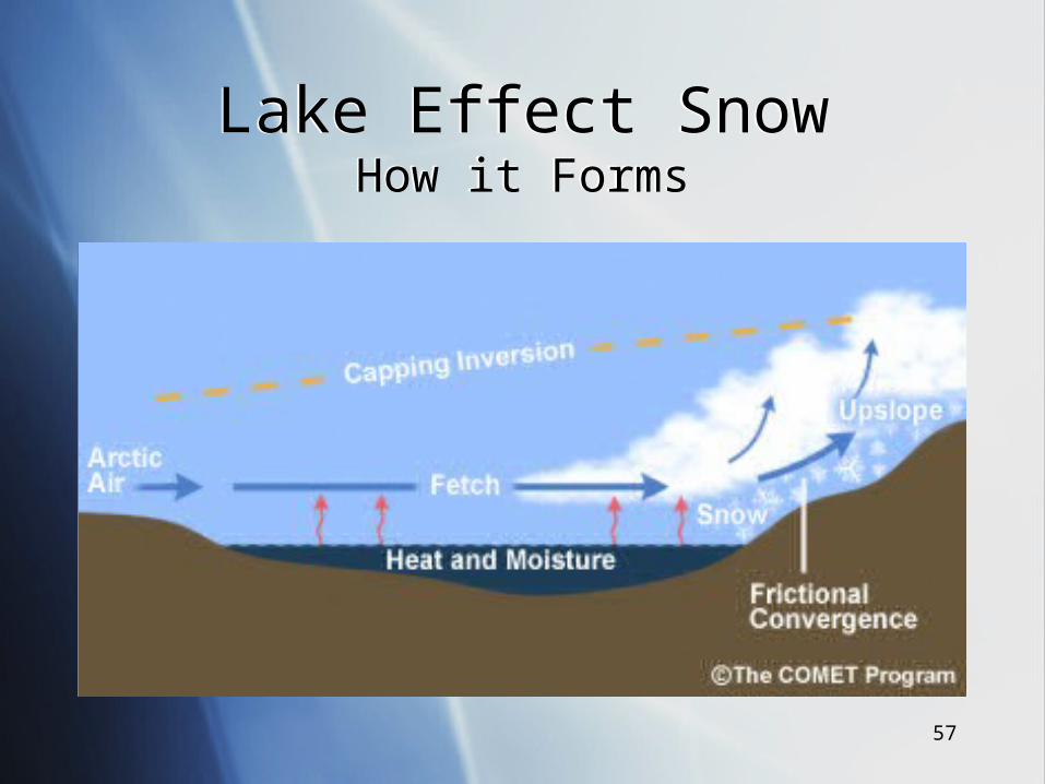
Lake Effect SnowHow it Forms
Lake Effect SnowHow it Forms
58
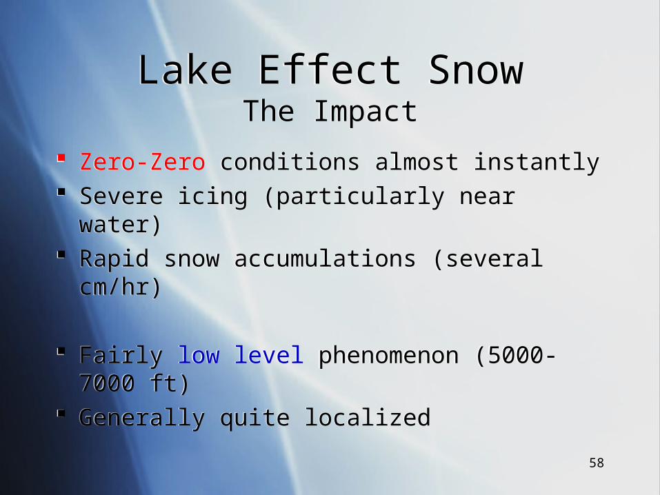
Lake Effect SnowThe Impact
Lake Effect SnowThe Impact
Zero-Zero conditions almost instantly Severe icing (particularly near water) Rapid snow accumulations (several cm/hr)
Fairly low level phenomenon (5000-7000 ft) Generally quite localized
Zero-Zero conditions almost instantly Severe icing (particularly near water) Rapid snow accumulations (several cm/hr)
Fairly low level phenomenon (5000-7000 ft) Generally quite localized
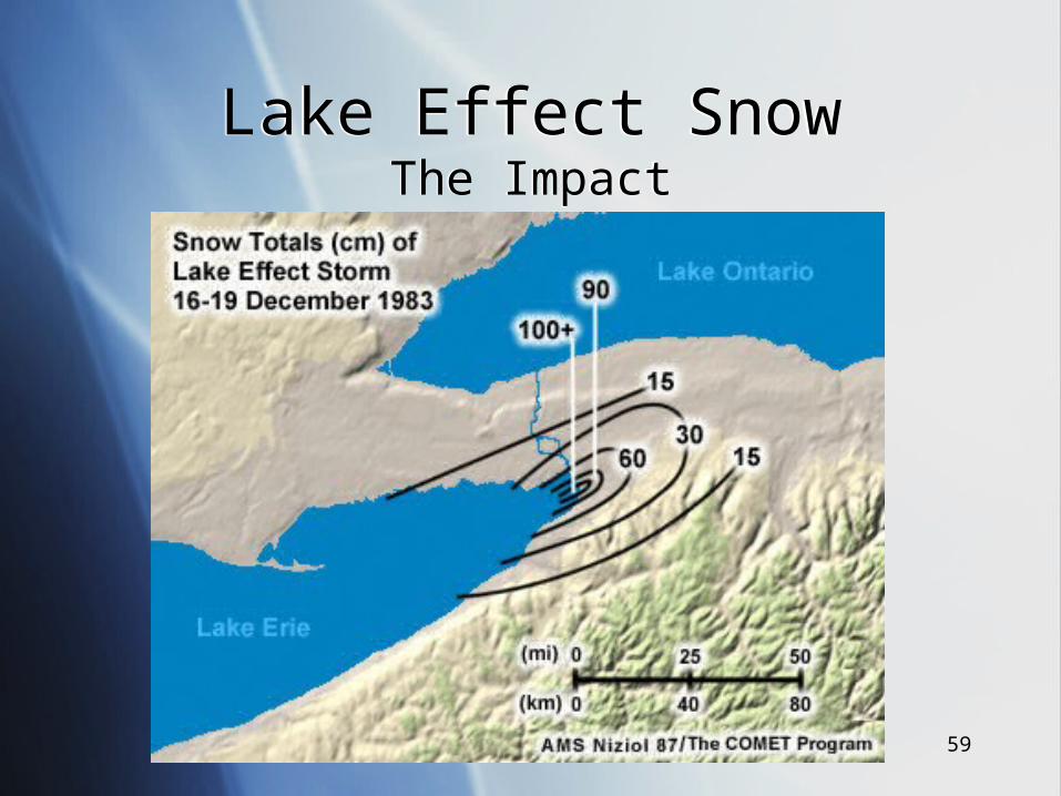
59
Lake Effect SnowThe Impact
Lake Effect SnowThe Impact
60
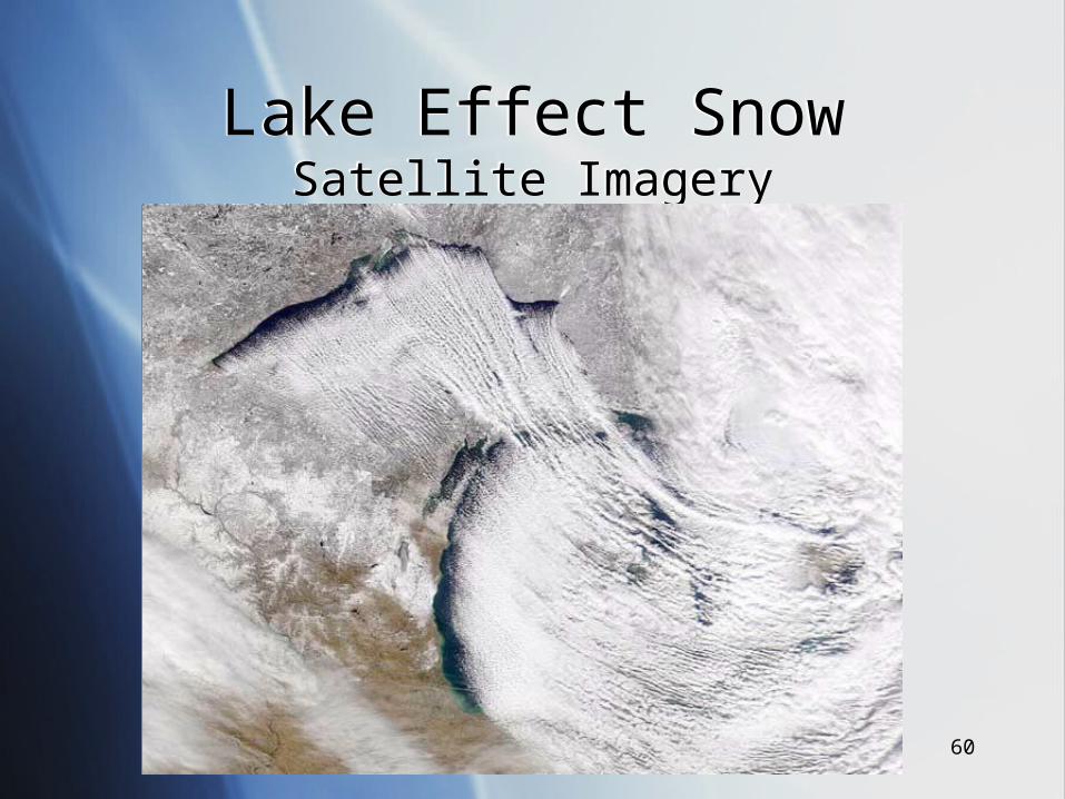
Lake Effect SnowSatellite Imagery
Lake Effect SnowSatellite Imagery
61
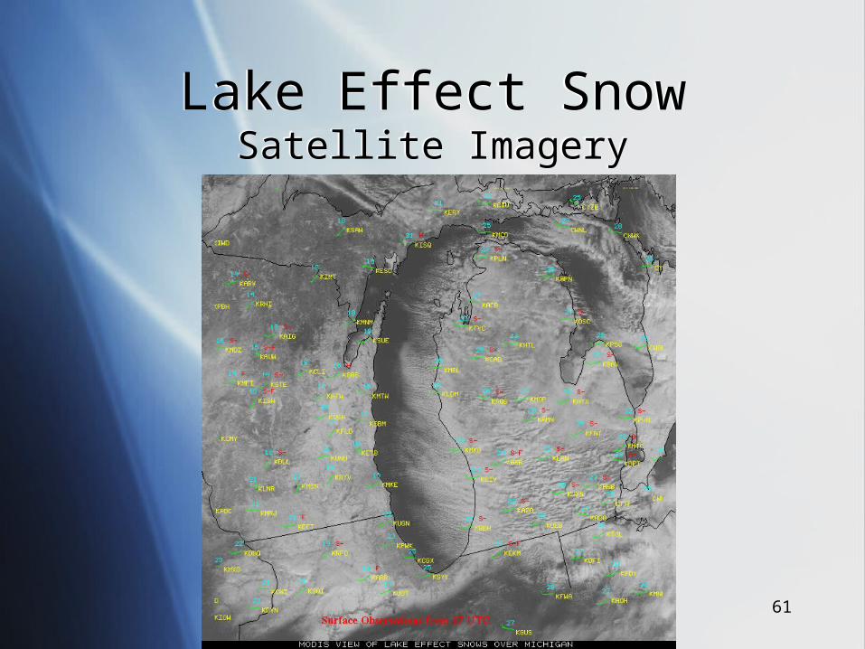
Lake Effect SnowSatellite Imagery
Lake Effect SnowSatellite Imagery

62
www.aerosafety.cawww.aerosafety.ca

63


![Aircraft Icing Handbook [2000 CAA]](https://img.pdfslide.net/doc/110x75/55cf948b550346f57ba2be9d/aircraft-icing-handbook-2000-caa.jpg)