Embed Size (px)
Citation preview

1Wireless Sensor Networks
Akyildiz/Vuran
Chapter 12:Localization

2Wireless Sensor Networks
Akyildiz/Vuran
Why Localization? Track items (boxes in a warehouse, badges in a building, etc)
Identify items
Not everything needs an IP address
Cost and Physical Environment
Energy Efficiency
GPS does not work everywhere
Smart Systems – devices need to know where they are
Geographic routing & coverage problems
People and asset tracking

3Wireless Sensor Networks
Akyildiz/Vuran
Localization Challenges PHY Layer Measurement Challenges
Multipath Shadowing Sensor imperfections Changes in propagation properties Many more
Computational Challenges Many formulations of localization problems: (e.g., how to solve the
optimization problem, distributed solution)

4Wireless Sensor Networks
Akyildiz/Vuran
Localization Challenges May not have base stations or beacons for relative
positioning
GPS may not be available
Sensor nodes may fail
Low-end sensor nodes

5Wireless Sensor Networks
Akyildiz/Vuran
Localization Techniques 1. Electromagnetic Trackers:
High accuracy and resolution, expensive
2. Optical Trackers:
Robust, high accuracy and resolution, expensive and mechanically complex; calibration needed.

6Wireless Sensor Networks
Akyildiz/Vuran
Localization Techniques 3. Radio Position Systems (such as GPS)
Successful in the wide area
Ineffective in buildings
Only offer modest location accuracy; cost, size and unavailability.
4. GPS-less Techniques
Beacon Based Techniques
Relative Location Based Techniques

7Wireless Sensor Networks
Akyildiz/Vuran
GPS Global Positioning System
History
U.S. Department of Defense wanted the military to have a super precise form of worldwide positioning
After $12B, the result was the GPS system!
$750M/year spent for maintenance
8Wireless Sensor Networks
Akyildiz/Vuran
GPS Approach
“Man-made stars" as reference points to calculate positions accurate to a matter of meters
With advanced forms of GPS you can make measurements to with accuracy better than a centimeter
Like giving every square meter on the planet a unique address!

9Wireless Sensor Networks
Akyildiz/Vuran
GPS System Constellation of 24 NAVSTAR satellites made by Rockwell
Altitude: 10,900 nautical miles
Weight: 1900 lbs (in orbit)
Size: 17 ft with solar panels extended
Orbital Period: 12 hours
Orbital Plane: 55 degrees to equitorial plane
Planned Lifespan: 7.5 years
10Wireless Sensor Networks
Akyildiz/Vuran
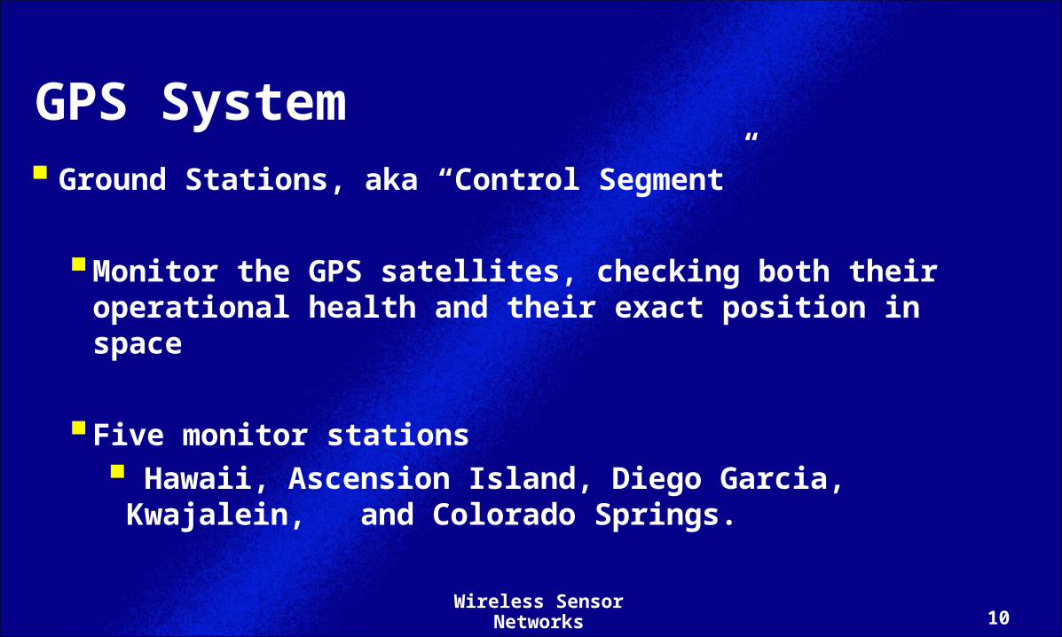
GPS System Ground Stations, aka “Control Segment”
Monitor the GPS satellites, checking both their operational health and their exact position in space
Five monitor stations
Hawaii, Ascension Island, Diego Garcia, Kwajalein, and Colorado Springs.

11Wireless Sensor Networks
Akyildiz/Vuran
How GPS Works ? 1. The basis of GPS is “trilateration" from satellites.
(popularly but wrongly called “triangulation”)
2. To “trilaterate," a GPS receiver measures distance using the travel time of radio signals.
3. To measure travel time, GPS needs very accurate timing which it achieves with some tricks.

12Wireless Sensor Networks
Akyildiz/Vuran
How GPS Works ? 4. Along with distance, you need to know exactly where the
satellites are in space. High orbits and careful monitoring are the secret.
5. Finally you must correct for any delays the signal experiences as it travels through the atmosphere.
13Wireless Sensor Networks
Akyildiz/Vuran
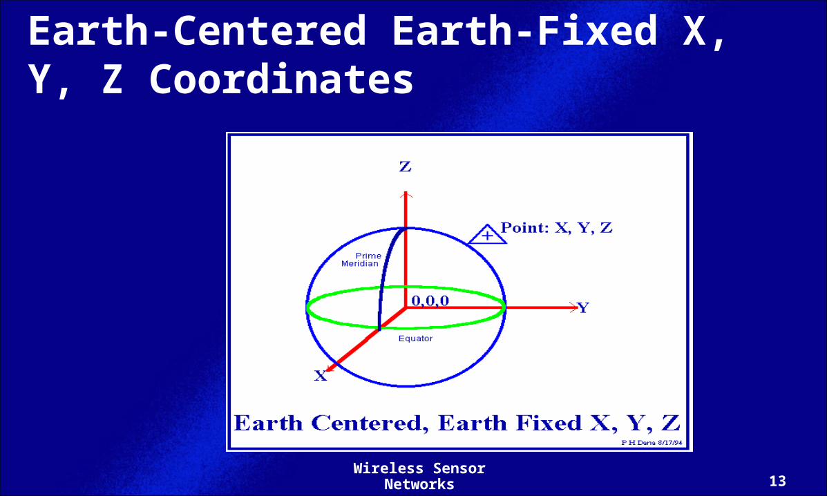
Earth-Centered Earth-Fixed X, Y, Z Coordinates

14Wireless Sensor Networks
Akyildiz/Vuran
Trilateration GPS receiver measures distances from satellites
Distance from satellite #1 = 11000 miles
We must be on the surface of a sphere of radius 11000 miles, centered at satellite #1
Distance from satellite #2 = 12000 miles
We are also on the surface of a sphere of radius 12000 miles, centered at satellite #2,
i.e., on the circle where the two spheres intersect

15Wireless Sensor Networks
Akyildiz/Vuran
Trilateration Distance from satellite #3 = 13000 miles
We are also on the surface of a sphere of radius 13000 miles, centered at satellite #3
i.e., on the two points where this sphere and the circle intersect
could use a fourth measurement, but usually one of the points is impossible (far from Earth, or moving with high velocity) and can be rejected.

16Wireless Sensor Networks
Akyildiz/Vuran
Measuring Distances from Satellites By timing how long it takes for a signal sent from the
satellite to arrive at the receiver
We already know the speed of light
Timing problem is tricky
Smallest distance - 0.06 seconds
Need some really precise clocks

17Wireless Sensor Networks
Akyildiz/Vuran
Measuring Distances from Satellites Need some really precise clocks
Thousandth of a second error 200 miles of error
On satellite side, atomic clocks provide almost perfectly stable and accurate timing
What about on the receiver side?
Atomic clocks too expensive!
Assuming precise clocks, how do we measure travel times?
18Wireless Sensor Networks
Akyildiz/Vuran
Measuring Travel Times from Satellites
Each satellite transmits a unique pseudo-random code, a copy of which is created in real time in the user-set receiver by the internal electronics
The receiver then gradually time-shifts its internal code until it corresponds to the received code--an event called lock-on.
Once locked on to a satellite, the receiver can determine the exact timing of the received signal in reference to its own internal clock

19Wireless Sensor Networks
Akyildiz/Vuran
Measuring Travel Times from Satellites If receiver clock was perfectly synchronized, three satellites
would be enough
In real GPS receivers, the internal clock is not accurate enough
The clock bias error can be determined by locking on to four satellites, and solving for X, Y, and Z coordinates, and the clock bias error

20Wireless Sensor Networks
Akyildiz/Vuran
Extra Satellite Measurement to Eliminate Clock Errors Three perfect measurements can locate a point in 3D
Four imperfect measurements can do the same thing
If there is error in receiver clock, the fourth measurement will not intersect with the first three
Receiver looks for a single correction factor

21Wireless Sensor Networks
Akyildiz/Vuran
Extra Satellite Measurement to Eliminate Clock Errors The correction factor can then be applied to all
measurements from then on.
From then on its clock is synced to universal time.
This correction process would have to be repeated constantly to make sure the receiver's clocks stay synched
At least four channels are required for four simultaneous measurements

22Wireless Sensor Networks
Akyildiz/Vuran
Where are the Satellites? Need to know exactly where the satellites are
Each GPS satellite has a very precise orbit, 11000 miles up in space, according to the GPS master Plan
On the ground all GPS receivers have an almanac programmed into their computers that tells them where in the sky each satellite is, moment by moment

23Wireless Sensor Networks
Akyildiz/Vuran
GPS in WSNs Xbow MTS420CA: Environmental monitoring sensor board
For Mica2 and MicaZ
Tracking channels: 12
Position accuracy: 10 m

24Wireless Sensor Networks
Akyildiz/Vuran
GPS in WSNs Applicable to outdoor applications
e.g. Monitoring volcanic eruptions [1]
GPS still expensive
MicaZ node: $125
MTS420CA: $375[1] [1] G. Werner-Allen, et.al., ``Monitoring Volcanic Eruptions with a Wireless Sensor G. Werner-Allen, et.al., ``Monitoring Volcanic Eruptions with a Wireless Sensor Network,’’ in Network,’’ in Proc. European Workshop on Sensor Networks (EWSN'05)Proc. European Workshop on Sensor Networks (EWSN'05), Jan. , Jan. 2005.2005.

25Wireless Sensor Networks
Akyildiz/Vuran
GPS in WSNs GPS does NOT work indoors
Accuracy (10m) may not be enough for dense WSNs
GPS-less techniques are required

26Wireless Sensor Networks
Akyildiz/Vuran
GPS-less Techniques These techniques use DISTANCE or ANGLE measurements
from a set of fixed reference points and applying
MULTI-LATERATION or TRIANGULATION techniques.
a. Received Signal Strength (RSS)a. Received Signal Strength (RSS)
b. Time of Arrival (TOA)b. Time of Arrival (TOA)
c. Time Difference of Arrival (TDOA)c. Time Difference of Arrival (TDOA)
d. Angle of Arrival (AOA)d. Angle of Arrival (AOA)

27Wireless Sensor Networks
Akyildiz/Vuran
Received Signal Strength (RSS) BASIC IDEA:
The following information is used to estimate the distance of a transmitter to a receiver:
a. The Power of the Received Signala. The Power of the Received Signal
b. Knowledge of b. Knowledge of TransmitteTransmitter Powerr Power
c. Path Loss Modelc. Path Loss Model

28Wireless Sensor Networks
Akyildiz/Vuran
Received Signal Strength (RSS) Each measurement gives a circle on which the sensor must Each measurement gives a circle on which the sensor must
lie lie
RSS RSS method may be unreliable and inaccurate due to:
a. Multi-path effects
b. Shadowing, scattering, and other impairments
c. Non line-of-sight conditions

29Wireless Sensor Networks
Akyildiz/Vuran
Time of Arrival (ToA)
BASIC IDEA:
Estimate the relative distance to a beacon by applying the measured propagation time to a complex distance formula.

30Wireless Sensor Networks
Akyildiz/Vuran
Time of Arrival (ToA) Active: Receiver sends a signal that is bounced back so
that the receiver know the round-trip time
Passive: Receiver and transmitter are separate Time of signal transmission needs to be known
A drawback is due to fast propagation speed of wireless signals where a small error in time measurement can result in large distance estimate errors

31Wireless Sensor Networks
Akyildiz/Vuran
Localization via RSSI or ToA
x1
x2
x3
d1
d3
d2
SensorSensor

32Wireless Sensor Networks
Akyildiz/Vuran
Time Difference of Arrival (TDoA) BASIC IDEA:
Time of signal transmission need not to be known
Each TDoA measurement defines line-of-position as a hyperbola
Location of sensor is at the intersection of the hyperbolas

33Wireless Sensor Networks
Akyildiz/Vuran
Localization via TDoA

34Wireless Sensor Networks
Akyildiz/Vuran
Angle of Arrival (AoA)Angle of Arrival (AoA) Special antenna configurations are used to estimate the
angle of arrival of the received signal from a beacon node
Angle of arrival Angle of arrival method may also be unreliable and inaccurate due to:
a. Multi-path effects, b. Shadowing, scattering, and other impairments, c. Non line of sight conditions.

35Wireless Sensor Networks
Akyildiz/Vuran
11
2233
xx1 1 ,y,y11
xx2 2 ,y,y22
xx3 3 ,y,y33
beaconbeacon
sensorsensor
Three or more beacon location and Three or more beacon location and their direction according to the their direction according to the node location are known.node location are known.
Three or more beacon location and Three or more beacon location and their distance to the node location their distance to the node location are known.are known.
dd11 xx1 1 ,y,y11
xx2 2 ,y,y22
xx3 3 ,y,y33
dd22
dd33
Multilateration, Triangulation

36Wireless Sensor Networks
Akyildiz/Vuran
Solving over Multiple HopsIterative Multilateration
Beacon node(known position)
Unknown node (known position)

37Wireless Sensor Networks
Akyildiz/Vuran
Collaborative Multilateration All available measurements are used as constraints
Solve for the positions of multiple unknowns simultaneously
Catch: This is a non-linear optimization problem!
How do we solve this?
Known position
Unknown position

38Wireless Sensor Networks
Akyildiz/Vuran
Sources of Errors Multipath
RSSI
Up to 30-40 dB variation
May be combated by using pre-measured signal strength contours

39Wireless Sensor Networks
Akyildiz/Vuran
Sources of Errors AoA
Scattering near and around the sensor & beacon affects the measured AoA
At short distances, signals arrive with a large AoA spread, and therefore AoA may be impractical

40Wireless Sensor Networks
Akyildiz/Vuran
Sources of Errors
ToA and TDoA
Influenced by the presence of multipath fading
Results in a shift in the peak of the correlation

41Wireless Sensor Networks
Akyildiz/Vuran
Sources of Errors Non line-of-sight (NLoS)
AoASignal takes a longer path or arrives at a different angleCan be disaster for AoA if received AoA much different
from true AoAToA/TDoA
The measured distance may be considerably greater than true distances

42Wireless Sensor Networks
Akyildiz/Vuran
OVERALL OPEN RESEARCH ISSUES Localization is domain specific
Still many open problemsDesign decisions based on availability of technology, and
constraints of the operating environmentCan we have powerful computationWhat is the availability of infrastructure supportWhat type of obstructions are in the environment?How fast, accurate, reliable should the localization
process be?