Embed Size (px)
Citation preview

6/14/2010
MID‐AMERICA REGIONAL COUNCIL | TRANSPORTATION OUTLOOK 2040 | 10.0 Environmental Integration 1
10.0 ENVIRONMENTAL INTEGRATION
I. Introduction
Greater Kansas City may not have mountains or oceansides to protect, but it does have a unique blend of ecosystems and natural resources (See Figure 10.1), including approximately 6,000 miles of streams and 482,000 acres of natural land cover (23 percent of the region’s total land area). When these areas are protected and restored, they can help improve the quality of life for area residents and contribute to the region’s overall sustainability vision. Some communities have already stepped up to the plate, creating approximately 103,418 acres of parks (more than 1,100 parks) and protecting about 90,000 acres of land within stream setbacks. Environmental protection isn’t just a local or regional issue. The 2005 Safe, Accountable, Flexible, Efficient, Transportation Equity Act–A Legacy for Users (SAFETEA‐LU) transportation bill includes requirements for environmental integration and mitigation. It is expected that the next transportation bill will include a stronger environmental position, addressing such issues as climate change and energy conservation. In June 2009, the U.S. Environmental Protection Agency (EPA), U.S. Department of Housing and Urban Development (HUD), and U.S. Department of Transportation (DOT) partnered to form a Livable Communities Partnership to help improve access to affordable housing, provide more transportation options, and lower transportation costs while protecting the environment in communities nationwide. Through a set of Livability Principles and a partnership agreement that guides the agencies’ efforts, this partnership is coordinating federal housing, transportation, and other infrastructure investments to protect the environment, promote equitable development, and help address the challenges of climate change. Public engagement processes for efforts such as Imagine KC (a regional visioning process for the region’s built and natural environment) and Transportation Outlook 2040 produced a regional sustainability vision in support of the federal Livability Principles. Overwhelming, public feedback demonstrates that area residents recognize the relationship between a healthy environment and a high quality of life. They also know that transportation systems are not merely a means to an end — they are an integral part of the community fabric that can also provide many community, environmental, and economic benefits for its residents. Transportation Outlook 2040 includes transportation‐related strategies to address our region’s environmental integration goals, including protection and restoration of high‐quality ecosystems and habitat, protection of prime agricultural land, reduction of greenhouse‐gas emissions, generation of less waste and recycling the waste we do generate, and improved air and water quality. Indicators of success will guide us in measuring progress towards these goals.

6/14/2010
MID‐AMERICA REGIONAL COUNCIL | TRANSPORTATION OUTLOOK 2040 | 10.0 Environmental Integration 2
Figure 10.1: Natural, Cultural and Historic Resources in the Kansas City Region
6/14/2010
MID‐AMERICA REGIONAL COUNCIL | TRANSPORTATION OUTLOOK 2040 | 10.0 Environmental Integration 3
II. Overview of Relationship between the Natural Environment and Transportation Outlook 2040 Policy Goals While it is true that transportation systems can achieve multiple community benefits, the same can be said of natural resource protection. Environmental protection and restoration can contribute to many of the policy goals outlined in Transportation Outlook 2040, including the following: accessibility, climate change and energy use, economic vitality, place making, public health and security. Accessibility Of the environmental strategies listed in this chapter, MetroGreen®, a regional greenways and trails plan (see strategies for more information), is most directly connected to the accessibility policy goal. MetroGreen® seeks to link communities across the region, providing residents with access to the natural environment, recreational opportunities, and an interconnected bicycle/pedestrian infrastructure. Climate Change and Energy Use Many environmental strategies advance the climate change and energy use goal. Environmentally friendly construction, operation, and maintenance functions seek to limit unnecessary idling, thereby reducing many types of emissions. MetroGreen® corridors reduce greenhouse gas emissions and energy use by providing opportunities for residents to travel on the trail system via nonmotorized transportation. The green spaces associated with MetroGreen also reduce energy use by absorbing heat that would otherwise contribute to the region’s urban heat island effect. Transportation system management and transportation demand management strategies advance climate change and energy use goals by improving traffic flow and encouraging carpooling, walking, bicycling and transit use. Economic Vitality A healthy environment and recreational opportunities help draw in and retain businesses and talented workers, as well as increase the value of nearby real estate. Specific to air quality, being designated as a nonattainment area for any of the criteria pollutants has a significant economic impact on a region. The Clean Air Action Plan strives to protect air quality through locally appropriate, multi‐pollutant, multi‐benefit approaches that protect economic, community and environmental interests at the same time. Importantly, implementation of several of the environmental strategies supports the creation of green jobs.
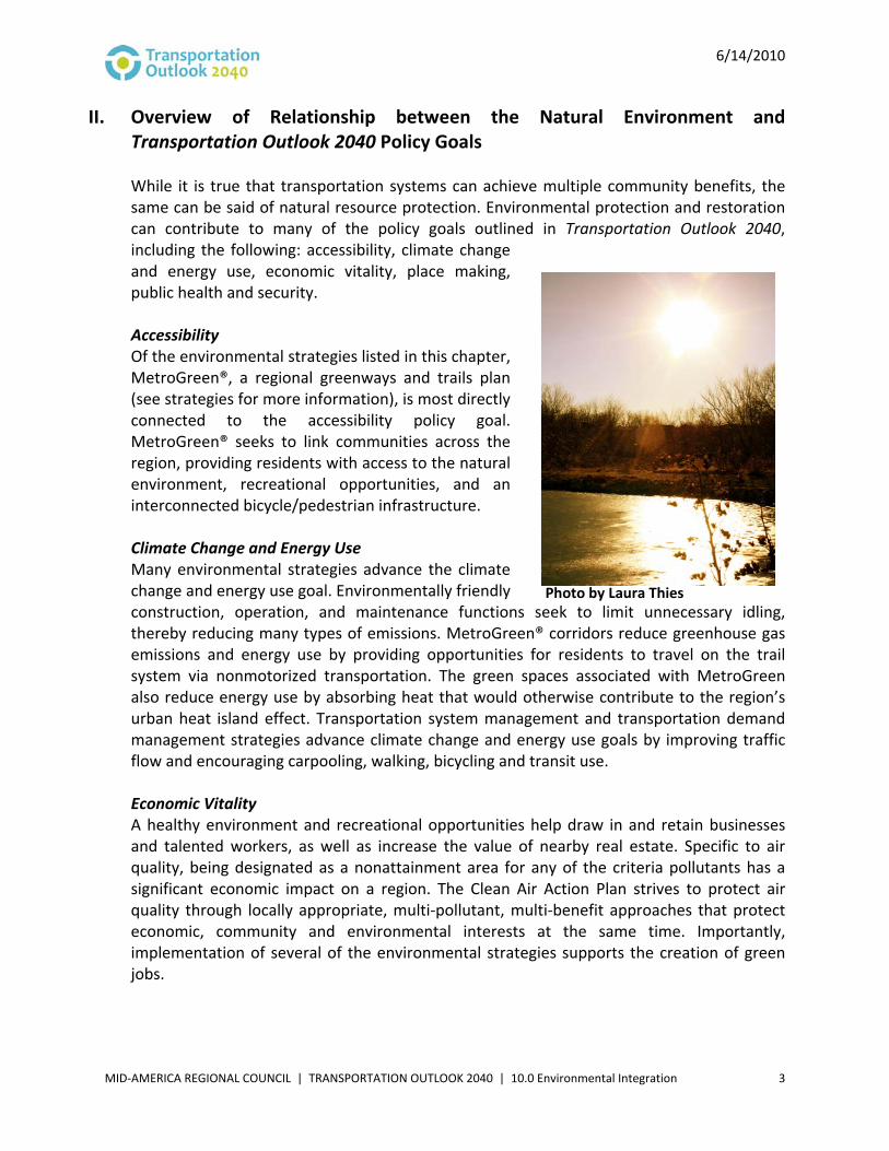
Photo by Laura Thies

6/14/2010
MID‐AMERICA REGIONAL COUNCIL | TRANSPORTATION OUTLOOK 2040 | 10.0 Environmental Integration 4
Place Making Great places include lots of green space and places for people to gather and recreate. MARC’s Creating Quality Places (CQP) program includes the following principle related to the advancement of place making through the integration of transportation and environmental considerations: “The design of quality places incorporates features and amenities that minimize environmental impacts on water quality caused by stormwater runoff and erosion, and on air quality caused by motor vehicle traffic.” The following CQP principle addresses open space and trails plans, such as MetroGreen®: “A quality place preserves major natural features in a neighborhood or a community (streams, slopes and natural habitats) as open space, and links those resources to public places by pedestrian and bike paths.” Public Health The primary environmental strategies that can result in healthier lifestyles and lower asthma rates are the Clean Air Action Plan and MetroGreen®. Specific to air quality, the health impacts of ground‐level ozone are varied and wide ranging. Of particular concern is the impact on the young and the elderly; however, even healthy adults can feel the effects of ozone on high‐ozone days. The AirQ Workforce Partnership and air quality education programs educate residents about alternative transportation options on high‐ozone days, easy behavioral changes that can affect ozone levels, and how to deal with outdoor and indoor activities on days when their health may be affected. All of the strategies within the Clean Air Action Plan address a public health concern, as air quality is a large factor in asthma and other respiratory concerns. MetroGreen® supports the public health goal by providing trails and protecting air and water quality. Security Supporting local decisions to adopt practices that reduce petroleum consumption in the transportation sector can advance energy securities of the United States by reducing our country’s reliance on foreign oil.
III. Environmental Strategies to Achieve Transportation Outlook 2040 Policy Goals Specific environmental strategies that can help achieve the Transportation Outlook 2040 Policy Goals are as follows:
• Implement the Clean Air Action Plan In the five‐county Kansas City metropolitan area, cars, trucks and other on‐road vehicles collectively travel an estimated 53,000,000 miles per day. In the process, they generate a variety of air pollutants: volatile organic compounds (VOCs) and nitrogen oxides (NOx), the two primary contributors to the region’s ground‐level ozone problem; fine particulates, which are associated with a variety of cardiovascular problems; hazardous pollutants like benzene; and carbon dioxide, the principal greenhouse gas responsible for climate change.
6/14/2010
MID‐AMERICA REGIONAL COUNCIL | TRANSPORTATION OUTLOOK 2040 | 10.0 Environmental Integration 5
In 2007, three of the eight ground‐level ozone monitors in the Kansas City metropolitan area violated the 1997 84 parts per billion (ppb) eight‐hour ozone standard. In 2008, a revised ozone standard was finalized at 75 ppb, and in 2009 the 2008 standard was determined to need reconsideration and is currently pending a second revision to 60–70 ppb. It will likely take many years for the region to comply with the new standard; additionally, there is growing public and political pressure to develop a national strategy for substantially reducing emissions of carbon dioxide and other greenhouse gases. The Clean Air Action Plan is an award‐winning local plan to reduce ozone‐forming emissions on a voluntary basis. The plan contains four categories of emission reduction strategies: electric power‐plant controls, diesel‐engine retrofits, public education, and long‐term initiatives to promote sustainable development. The plan was designed to achieve emissions reductions both in the near and long term.
Specific transportation‐related implementation strategies:
a. Diesel emission‐reduction strategies. Diesel engines emit nitrogen oxides and contribute to fine particulate pollution. As such, the Clean Air Action Plan includes a variety of strategies to reduce emissions from diesel engines, including: o Retrofits, repowers and replacements of heavy‐duty diesel vehicles – This
strategy targets older diesel vehicles, on‐road and off‐road. Putting pollution controls on these vehicles would improve air quality regionally and could also significantly improve air quality in localized areas such as school‐bus‐loading zones and freight‐loading areas.
o Truck‐stop electrification – Installing heating, ventilation and air conditioning, electrical and phone and data‐line infrastructure in truck‐stop parking lots would enable drivers to shut off their engines while parked, reducing pollution generated by truck stops.
o Idling reduction programs for public and private diesel fleets – Technologies and policies to reduce idling of fleet vehicles can reduce nitrogen oxide and fine particulate pollution and simultaneously reduce fuel costs for fleet operators.
o Switching locomotive emissions‐control technologies – Auxiliary power units and other technologies can be installed on locomotives to shut down the main engine while maintaining all vital main engine systems at greatly reduced fuel consumption.
b. Multimodal opportunities. o Smart Moves Regional Transit Vision – This cooperatively developed transit
vision for expanded and enhanced public transportation services in metropolitan Kansas City. Ultimately, Smart Moves would relieve roadway congestion and reduce the necessity for automobile use.

6/14/2010
MID‐AMERICA REGIONAL COUNCIL | TRANSPORTATION OUTLOOK 2040 | 10.0 Environmental Integration 6
o Bicycling and walking – Increased funding for planning and infrastructure associated with walking and bicycling would relieve roadway congestion and reduce the necessity for automobile use.
Transportation strategies in the region have a significant influence on air quality in a region teetering on the brink of violating federal standards. With transportation‐related sources accounting for a significant portion of contaminants, planning a transportation system that better uses alternate travel modes, shortens commutes and reduces emissions from existing sources is critical to clean air in our metro. Ultimately, a reimagining of vehicle choices will have a dramatic impact on the region’s air quality. With transit, bicycles and walking currently representing a miniscule part of region’s transportation use, we have a tremendous opportunity to expand in these areas and realize the benefits they offer by decreasing transportation’s contribution to air pollution. Facilitation of these alternative uses will require forward‐thinking land‐use planning that considers the feasibility of alternative transportation. Land‐use planning that encourages proximity of origins and destinations, transit accessibility and walkability is critical to encouraging these uses.
• Implement MetroGreen®
MetroGreen® (Figure 10.2) is an interconnected system of public and private natural areas, greenways and trails linking communities throughout the Kansas City metropolitan area. The 1,144‐mile greenway plan covers Leavenworth, Johnson and Wyandotte counties in Kansas and Cass, Clay, Jackson and Platte counties in Missouri. MetroGreen® identifies more than 75 separate corridors that will form a regional network to connect many of the area's most valuable natural assets. Over 300 miles of the system have been constructed, and an additional 100 miles are planned for construction in the next 10 years.
Specific implementation strategies: a. Leverage transportation resources to proactively and strategically protect and
restore priority natural resource areas. b. Formalize a regional mitigation strategy that would:
o Assist communities in proactively protecting and restoring natural areas with tools such as conservation easements, stream buffers, mixed‐use zoning districts, and incentives for redevelopment and infill.
o Invest mitigation resources in prioritized ecological areas and MetroGreen® to address cumulative impacts on an ecosystem basis.
o Include performance measures for regular monitoring of mitigation sites. o Formalize agency roles.
c. Encourage local governments to include MetroGreen® in their capital programs and planning efforts, and work with them to implement priority corridors.

6/14/2010
MID‐AMERICA REGIONAL COUNCIL | TRANSPORTATION OUTLOOK 2040 | 10.0 Environmental Integration 7
Figure 10.2: MetroGreen® Corridors and Parks

6/14/2010
MID‐AMERICA REGIONAL COUNCIL | TRANSPORTATION OUTLOOK 2040 | 10.0 Environmental Integration 8
• Develop and Implement a Regional Climate Protection and Adaptation Plan
The Kansas City region should tackle reducing greenhouse‐gas emissions because it will reduce the region’s impact on global climate change, and federal climate change and energy legislation is poised to change the way we plan transportation systems. In December 2009, the Environmental Protection Agency announced that scientific evidence surrounding climate change clearly shows that greenhouse gases “threaten the public health and welfare of the American people” and that the pollutants — mainly carbon dioxide from burning fossil fuels — should be regulated under the Clean Air Act. Additionally, the U.S. House of Representatives passed the American Clean Energy and Security Act (H.R. 2454) in June 2009, and the Clean Energy Jobs and American Power Act (S.1733) is being debated in relevant committees. Current greenhouse gas emissions reporting guidelines indicate that the transportation sector accounted for about 28 percent of total U.S. greenhouse gas emissions in 2006, making it the second largest source, behind electricity generation (34 percent). The largest sources of transportation emissions in 2006 were passenger cars (34 percent) and light‐duty trucks, which include sport‐utility vehicles, pickups and minivans (28 percent). Based on a figure of 55,944,396 vehicle miles traveled per day, the Kansas City region’s estimated transportation‐related greenhouse gas emissions for 2010 are 32,775 tonnes e‐CO2 (equivalent carbon dioxide) per day or 11.96 million tons/year. Development of a region climate protection plan would not only contribute to Transportation Outlook 2040 policy goals and performance measures, but it will also bolster current efforts underway in entities such as Kansas City, Mo., and Johnson County, Kan.; and the Greater Kansas City Chamber of Commerce (Greater Kansas City Climate Protection Partnership).
Specific transportation‐related strategies: a. Incorporate energy conservation, use of renewable energy, and reductions in
greenhouse gas emissions into the transportation project solicitation and funding processes.
b. Adjust methodologies and models for quantification of transportation‐related greenhouse gas emissions.
c. Work with local governments to include transportation‐related greenhouse gas reductions strategies in their policies and ordinances, such as: o Encourage eco‐driving. o Encourage carpooling (e.g., RideShare). o Allow employees to telecommute. o Ramp up speed limit enforcement. o Install LED traffic lights. o Use low greenhouse‐gas emissions pavement and paving practices. o Adopt policies to facilitate the development of compact, mixed‐use, walkable
communities.

6/14/2010
MID‐AMERICA REGIONAL COUNCIL | TRANSPORTATION OUTLOOK 2040 | 10.0 Environmental Integration 9
• Increase Vehicle Fuel Efficiency and Use of Alternative Fuel Vehicles Fuel‐efficient and alternative‐fuel vehicles save drivers money, reduce greenhouse gas emissions, improve air quality, and reduce U.S. dependence on foreign oil. Regarding fuel efficiency, the purpose of Corporate Average Fuel Economy (CAFE) standards, first enacted by Congress in 1975, are to reduce energy consumption by increasing the fuel economy of cars and light trucks. In 2007, an energy bill was enacted that requires 35 miles per gallon by 2020 CAFE. This was the first increase in average fleet fuel economy in 32 years. The Department of Transportation and Environmental Protection Agency are currently working to propose standards for control of fuel economy and emissions of greenhouse gases for Model Years 2012–2016. Regarding alternative fuels, these are derived from resources other than petroleum, and include ethanol, biodiesel, natural gas, propane and hydrogen. Some are produced domestically, reducing U.S. dependence on imported oil, and some are derived from renewable sources. Often, they produce less pollution than gasoline or diesel. A local initiative leading the charge in promoting alternative fuel vehicles is the Kansas City Regional Clean Cities Coalition, a partner of the U.S. Department of Energy's Clean Cities Program. The mission of the National Clean Cities Program is to advance the economic, environmental and energy securities of the United States by supporting local decisions to adopt practices that contribute to reduced petroleum consumption in the transportation sector.
Specific implementation strategies:
a. Conduct planning and strengthen incentives for alternative fuel infrastructure needed to support alternative‐fuel vehicle technology implementation.
b. Educate stakeholders on vehicle fuel efficiency and alternative‐fuel vehicles. c. Secure grant resources for the promotion and support of fuel efficiency and
alternative fuel vehicles.
• Implement Recommendations Outlined in the Linking Environmental and Transportation Planning Action Plan During 2008 and 2009, MARC worked with transportation and natural resource experts to develop strategies for more integrated transportation planning. This project was funded by an Eco‐Logical grant from the Federal Highway Administration. The Eco‐Logical framework supports making infrastructure more sensitive to wildlife and ecosystems through greater interagency cooperation and landscape‐scale conservation and restoration. The main outcome of the project included a Linking Environmental and Transportation Planning Action Plan that set priorities for this effort. This plan was adopted by the MARC Board of Directors in May 2009. The main components of the action plan are as follows:

6/14/2010
MID‐AMERICA REGIONAL COUNCIL | TRANSPORTATION OUTLOOK 2040 | 10.0 Environmental Integration 10
a. Develop a regional mitigation strategy (see “Implement MetroGreen,” strategy b).
b. Develop new and enhance existing environmental policies for transportation‐related construction, operation and maintenance functions, which could include the following: o Use of stormwater management and erosion control best management
practices for roadway rights‐of‐ways design and maintenance (e.g., use of native plants and protection of individual significant trees and established vegetation).
o Protection of wildlife corridors and passages. o Use of recycled and recyclable materials. o Use of alternative fuels. o Use of anti‐idling measures. o Use of environmentally friendly roadway de‐icing products. o Use of environmentally friendly roadway striping products.
c. Integrate environmental considerations into all phases of project development. d. Prioritize investments that protect important natural resources and have air
quality and greenhouse gas emissions benefits. e. Assemble and merge environmental, historic, cultural and transportation data
early in transportation planning processes to identify high priority natural areas that should be avoided, protected or restored.
f. Convene interdisciplinary teams to advise on transportation planning processes. g. Develop a process for collecting, sharing and updating natural resource and
transportation data among agencies. h. Update the Natural Resources Inventory to include more new and more localized
information (e.g., wetlands, vegetative cover and prime agricultural land). i. Encourage transportation and natural resource agencies to dedicate a staff
position to ensuring links among land‐use, environmental and transportation planning.
j. Review MARC’s committee structure and makeup to ensure interdisciplinary representation.
• Make More Efficient Use of Existing Roadways through Operational Improvements and Strategies to Reduce Vehicle Trips Improved transportation system management can improve vehicle flow on the roadway system, which reduces fuel use and greenhouse gas emissions. Transportation management techniques fall into two general categories: 1) transportation system management (TSM) and, 2) transportation demand management (TDM). TSM strategies are, generally, physical improvements that improve traffic flow, such as signalization, signal coordination, channelization, addition of turn lanes, ramp metering, contra flow or reversible traffic lanes, and high‐occupancy vehicle (HOV) lanes. TDM strategies are intended to reduce or shift the demand for travel, and include alternative work schedule programs, programs to encourage transit use or ridesharing, telecommunications and congestion pricing.

6/14/2010
MID‐AMERICA REGIONAL COUNCIL | TRANSPORTATION OUTLOOK 2040 | 10.0 Environmental Integration 11
Other transportation management strategies include intelligent transportation system (ITS) techniques such as motorist information systems and incident management programs that address nonrecurring congestion caused by accidents or disabled vehicles.
Specific implementation strategies: a. Expand transportation options:
o Direct additional resources to transit, bicycle/pedestrian facilities and Rideshare.
o Create and implement a regional bicycle/pedestrian plan. o Develop a regional complete streets policy and integrate it into regional
transportation project selection criteria. o Continue working with local governments to include Smart Moves and
MetroGreen in their planning efforts, and to implement these plans. b. Support place making:
o Prioritize investments to support activity centers and transit corridors. o Strengthen and revitalize existing communities and neighborhoods. o Promote housing options for residents of all ages and income levels. o Promote durable, energy‐efficient, and lean‐carbon buildings and
neighborhoods. o Support compact, mixed‐use, walkable communities and neighborhoods.
c. Give priority to operational enhancements to improve traffic flow: o Continue support for Kansas City Scout. o Continue support and implementation of Operation Green Light. o Investigate the use of high‐occupancy vehicle lanes and high‐occupancy toll
lanes on congested highway corridors. d. Encourage funding of projects that incorporate TSM strategies.
IV. Environmental Evaluation of Project List Per the Federal Highway Administration Eco‐Logical process and Linking Environmental and Transportation Planning Action Plan, MARC will sought ways to better integrate environmental considerations throughout the development of Transportation Outlook 2040, and will continue to do so with future funding rounds. As such, for the first time, the project solicitation process included a look at how nominated projects might impact our region’s natural resources (See Figure 10.3). Direct and indirect impacts of transportation projects on natural habitats include changes in drainage systems, fills of aquatic habitat, interruption of fish and aquatic species passage, interruption of wildlife crossing, and alteration of aquatic and terrestrial habitat. But the evaluation of environmental impacts went beyond habitat disruption to include factors such as climate change, air quality, and high‐quality natural areas. The evaluation criteria directly related to the natural environment were:

6/14/2010
MID‐AMERICA REGIONAL COUNCIL | TRANSPORTATION OUTLOOK 2040 | 10.0 Environmental Integration 12
• Whether the project reduces greenhouse gas emissions and/or reduces the use of carbon‐based fuel.
• Whether the project preserves or restores environmentally sensitive lands, cultural resources and agricultural lands and/or includes an environmental mitigation plan.
• Whether the project helps implement or connect MetroGreen regional trails and greenways system.
• Whether the project reduces ozone precursor emissions.
During the project evaluation process, a conservation index was used to help assess a project’s impact on the region’s natural resources. The index was developed by combining and weighting various environmental data to highlight areas of environmental significance. A geographic information systems buffer was then applied to each project, resulting in a score that indicated whether the project has a high or low potential to impact nearby environmental resources. This ranking was combined with applicants’ responses to create an overall project score for the following criteria: “preserves or restores environmentally sensitive lands, cultural resources and agricultural lands and/or includes an environmental mitigation plan”. An application guidebook; Web links to regional plans, initiatives and studies; and a Web‐based map that included regional natural resources and MetroGreen® corridors were available to assist applicants in answering questions related the environment. It is also important to note that any federal‐aid project is required to assess specific impacts in individual environmental impact studies. Regarding project solicitation categories, regional environmental mitigation strategies were solicited as a subset of management and operations programs. This category focused on regional mitigation strategies that provide an alternative to site‐by‐site mitigation for transportation projects. Regional environmental mitigation strategies are those that are focused on multiple ecological, community and economic benefits. The mitigation hierarchy is as follows: avoid, minimize, repair/restore, reduce over time, and compensate (as defined by the National Environmental Policy Act). While no projects were nominated for this category, it is anticipated that projects will continue to be sought for this category with future plan updates.

6/14/2010
MID‐AMERICA REGIONAL COUNCIL | TRANSPORTATION OUTLOOK 2040 | 10.0 Environmental Integration 13
Figure 10.3: Natural, Cultural and Historic Resources and
Transportation Outlook 2040 Projects

6/14/2010
MID‐AMERICA REGIONAL COUNCIL | TRANSPORTATION OUTLOOK 2040 | 10.0 Environmental Integration 14
Ecoregions The natural regions of the Kansas City region can generally be divided into four ecoregions ‐ the Missouri Alluvial Plan, Rolling Loess Prairies, Wooded Osage Plains, and Osage Cuestas. Ecoregions are distinguished by general similarity in the type, quality and quantity of environmental resources. Human land use may be consistent with ecological boundaries, and ecoregions can often be identified from the visual pattern of the landscape. On the ground, ecoregion boundaries may be sharp if there is an abrupt transition in a physiographic feature, but often the transitions are more gradual, over a distance of several miles on the ground. Below is an overview1, by ecoregion, of possible impacts that could be caused to the natural environment by projects listed in Transportation Outlook 2040. This evaluation was not factored into the project evaluation process, but rather is meant to provide information on the ecoregions of the Kansas City region, as well as supplemental information on the relationship between the natural environment and future transportation projects. The Missouri Alluvial Plain is the historic floodplain of the Missouri River, found at the base of bluffs on both the north and south sides of the river in downtown Kansas City, Mo.; North Kansas City, Mo.; Kansas City, Kan.; and Parkville, Mo. These areas originally supported floodplain forests, but now support urban development, parks and agriculture. Projects in this area may be more likely to have impacts to farmland, floodplains, wetlands, and archaeological resources. Projects affecting the Missouri Alluvial Plain include trail projects, such as the Missouri Riverfront Trail (197) and Bee Creek Greenway (368); and new corridor projects such as the Lewis and Clark Expressway (318, 434, 465, 530, 531, 643) and Brush Creek Parkway Extension (731). Existing corridor projects with potential to affect these resources include widening projects and bridge replacement projects such as the MO 45 Bridge Replacement over the Platte River (797), MO 291 Bridge Replacement (193), Front Street (557), MO 210 Widening (148), and Centennial Bridge (684). Adjacent to the Missouri Alluvial Plain on both the north and south sides of the Missouri River are the Rolling Loess Prairies. This ecoregion is found in northern Kansas City, Mo., Liberty, Mo., Parkville, Mo., Sugar Creek, Mo., and Independence, Mo. These areas originally supported tallgrass prairie and oak‐hickory forest, but today also support urban development. Projects in this area may be more likely to have impacts to cultural and historic properties and woodland areas. Projects that involve new bridges and stream crossings would be likely to have wetland and floodplain impacts. New corridor projects affecting this region include the Shoal Creek Parkway (646, 656, and 673), Line Creek Parkway (591 and 594), Maplewoods Parkway (608, 609, 610), Clay County New Interstate PTNA Corridor (149, 456), Jackson County Expressway (226), South Liberty Parkway (627), Tiffany Springs Parkway (680, 683, 686, 687, 691, 696), NW 132nd Street (615), NW 126th
1 This analysis was adapted from work completed by Harold Draper, Project Manager, Environmental Studies & Permitting Group, Burns & McDonnell, Kansas City, Missouri.

6/14/2010
MID‐AMERICA REGIONAL COUNCIL | TRANSPORTATION OUTLOOK 2040 | 10.0 Environmental Integration 15
Street (767), NW 96th Street (619), Mexico City Avenue (612), NE 108th Street (613), NW 108th Street (620), Flintlock Road (584), Interurban (647), NW 126th Street (672), Parvin Road (632), Englewood (555), Congress (546), and Cookingham (551). Upgrades to existing roads, including MO 9 (560), and MO E, B, and KK Flooding Relief (663, 666, 668), can also be expected to have natural area impacts. South Kansas City, Mo.; south Leawood, Kan.; south Overland Park, Kan.; Lees Summit, Mo.; and Blue Springs, Mo. are located in the Wooded Osage Plains. This area is made up of low, gently rolling ridges and limestone escarpments. Originally, it supported a mosaic of oak‐hickory and tallgrass prairie, but today supports urban land and cropland. Projects in this area may be more likely to have impacts to cultural and historic properties, woodland areas and wildlife habitat. Projects that involve new bridges and stream crossings would be likely to have wetland and floodplain impacts. MetroGreen projects affecting this region include the Rock Island Corridor (Katy Trail) (763, 772) and Fleming Park Trail (741). New corridor projects affecting this region include East Longview Parkway (552), Little Blue Road (606), Gregory Blvd (726), Roanoke Road (400), Graham Francy Arterial (789), Blackwell Project (118), Markey Parkway (636), and 140th Street Extension (469). Upgrades to existing roads can also be expected to have natural area impacts, including I‐435 Widening (160), I‐70 Truck‐Only Lanes (182), I‐470 Widening (112, 113), Kenneth Road (74, 281), Truman Road (348), Rhinehart Road (773), 143rd Street (79), Mission Road (65), 151st Street (63), Red Bridge Road (771), MO 45 Widening (168), and 163rd Street (432). North and west Johnson, Wyandotte, and Leavenworth counties in Kansas, including the cities of Leavenworth; Kansas City, Kan.; Shawnee; Lenexa; and Olathe, are in the Osage Cuestas ecoregion. This region contains gently undulating low ridges with occasional escarpments, especially near streams. Tallgrass prairie was more common in this area than in the Wooded Osage Plains, with oak‐hickory and floodplain forests along streams. Projects that involve new bridges and stream crossings would be likely to have wetland and floodplain impacts. Projects in this area that may be more likely to have impacts to remnant prairies and wildlife habitat include McIntyre Expressway (151), Leavenworth‐Lansing Bypass (698), K‐7 Freeway (739), Prairie Star Parkway (244), 67th Street (230), West Gilman Road (223), 147th Street (224), Clare Road (243), Ridgeview (257), Poffer Road (452), Sunflower Western Corridor (103), Gilman Road (223), Harley Russel Rail Spur (728), 119th
Street (138), and 151st Street (141). Upgrades to existing roads can also be expected to have natural area impacts, including K‐10 Widening (716), Donahoo Road (415), Leavenworth Road (464), Leavenworth County Road 1 (705), US 24‐40 (701), Woodland Road (228), K‐7 Corridor (401), U.S. 56 (720), Lackman Road (233, 267), 87th Street (260, 261), Lone Elm Road (253), Moonlight Road (304), 147th Street (224), 83rd Street (203), and 4‐H Road (198).

6/14/2010
MID‐AMERICA REGIONAL COUNCIL | TRANSPORTATION OUTLOOK 2040 | 10.0 Environmental Integration 16
Figure 10.4: Greater Kansas City Ecoregions