Embed Size (px)
Citation preview

2. delineate limits of acceptable change,which will ensure that visitors continueto enjoy a remote and naturalexperience on the Ningaloo coast; and
3. preserve, enhance and protect theenvironment.
These guidelines primarily are intended toensure all future semi-permanent andpermanent tourism accommodationdevelopments or expansion of existingdevelopments on the Ningaloo coast, from theExmouth Gulf to Carnarvon townsite, outsideof the regional centres of Exmouth andCarnarvon, are low-impact, sustainabletourism developments. Examples includecampsites, camping nodes, ecocamps andecolodges.
These guidelines must be read in conjunctionwith relevant statements of planning policysuch as the State coastal planning statement ofplanning policy 2.6 and the Ningaloo coaststatement of planning policy 6.3.
1.4.2 LocationAll development will be approved only wherestrategic planning has identified sites that aresuitable and appropriate for the for small-scaleand/or low-impact tourism developmentproposed.
The Ningaloo coast regional strategyCarnarvon to Exmouth and accompanyingNingaloo coast statement of planning policy6.3 outline acceptable node locations anddevelopment intensities for the entireNingaloo coast, with a range of touristservices and facilities being provided for (referto figure 5). The strategy supersedes previousstudies mentioned above.
Tourist activity (which includes camping,caravanning and station accommodation) isspread along much of the Ningaloo coast.Outside of the Cape Range National Park,much of it has occurred in an ad hoc and108
1.4 Planning andenvironmentalguidelines forsustainabletourism on theNingaloo coast
1.4.1 IntroductionThe Ningaloo coast is a fragile natural area,subject to cyclones and tsunamis, and is thehome of rare marine and terrestrial speciesand landscapes and seascapes that could bedamaged irretrievably by insensitive or ad hocdevelopment. This fragile natural area, its floraand fauna, ruggedness, sense of remotenessand potential world heritage values also arethe basis of a growing, economicallyimportant, nature-based tourism industry. Thearea is designated as a zone of opportunity inthe Nature based tourism strategy for WesternAustralia. The sustainability of the tourismindustry and the natural area on which itdepends will involve careful planning,management and sympathetic development.
Pressure for substantial developments hasintensified over recent years due to the growthin tourism. The coast already is subject to avariety of developments, including roads,formal and informal camping sites, toilets, carparks, boat-launching areas, moorings,interpretation centres, observation structures,accommodation, signs, shelters, paths andpicnic areas.
The aim of these guidelines is to:
1. provide state agencies, localgovernment, community andproponents with clear guidanceregarding sustainable tourismdevelopment;

• W e s t e r n A u s t r a l i a n P l a n n i n g C o m m i s s i o n •
109
unmanaged way, with detrimental impacts onthe environment resulting from uncontrolledaccess, waste disposal, rubbish dumping,campfires and wood gathering, and weedinvasion. These campsites need to berationalised and those identified for retentionmanaged adequately through an integratedmanagement process involving pastoralleaseholders, coastal users and theDepartment of Conservation and LandManagement.
PoliciesP.1 Proposed tourism developments
should be located consistent with theState coastalplanning statementof planning policy2.6, Ningaloocoast regionalstrategyCarnarvon toExmouth,Ningaloo coaststatement ofplanning policy6.3, NingalooMarine Parkmanagement planand Cape RangeNational Park management plan.
P.2 Subject to environmental assessment,only tourism accommodationdevelopment proposals which arestaged within the identified tourisminvestigation envelopes will beconsidered. Monitoring ofenvironmental impacts shall berequired as part of any approval andwhere necessary may require thecessation and remediation of anapproved development.
P.3 Camping on the Ningaloo coastshould be restricted to designatedand managed campsites, both inremote and semi-remote settings.
GuidelineG.1 Proposed tourism developments
should be located to ensure:
a. an appropriate distance from areas of cultural significance or heritage value including Aboriginalheritage is maintained;
b. stable environmental conditions (geological, hydrological and marine) exist for access, building construction and visitor and management use patterns;
c. soil types are suitable for and capable of development;
d. buildings and infrastructure are located to avoid risk of damage from coastal processes, consistent with State coastal planning statement of planning policy 2.6;
e. insect breeding sites, such as those of mosquitoes and biting midges, are avoided;
f. risks and hazards to visitors are minimised;
g. locations of declared rare or priority flora and fauna species areavoided or protected, and disturbance to important breedingor feeding areas is minimised;
h. where possible, the potential for further expansion or upgrading can be accommodated without significant impact on the environment;
i. potential impacts upon Marine Park Sanctuary Zones, fish habitat protection areas and other sensitive marine environments areminimised;
j. where possible, access to suitable artesian water sources is available;and
k. minimal impact or alteration to the natural topography of the site.
Section one - Regional strategy

1.4.3 Development type and scaleThe Ningaloo coast is a fragile coastalenvironment and its attraction is itsenvironmental, ecological, landscape andremoteness values. The development ofsustainable tourism accommodation shall becarefully considered so as not to detract fromthe Ningaloo coast’s amenity values. The typeof development envisaged for the Ningaloocoast generally is low-impact accommodation,such as an ecolodge style development whichis defined as:
Ecotourism accommodation, such as anecolodge, includes the requirement ofspecial care in design, construction andoperation so as not to destroy the veryresources or qualities that visitors cometo experience. With all ecotourismproposals, education about theenvironment as well as utilisation oflocal culture, services, products andcommunities are important as is theactual operation of the facility, andinformation on these aspects must beincluded within any proposal. Anecolodge should subtly fit in with thelandscape, utilise sustainable power, below energy incorporating solar passivedesign, minimal water use, ecologicallysensitive waste disposal and recyclableprocessing of all waste with no resultantpollution.
There is a demand for the provision of small-scale and/or low-impact tourism facilities.From a planning perspective, the Ningaloocoast regional strategy Carnarvon to Exmouthhas determined that all major (larger-scale/higher-impact) tourism developments will berequired to locate within the Carnarvon andExmouth regional centres. The regionalcentres:
• are physically more capable andsuitable for development; and
• have the available infrastructure, ieroads, air transport, communications,boat harbour, community facilities,water, sewerage and power.
Given the development on the east coast ofNorth West Cape, incorporating the Exmouthboat harbour and associated marina, tourismand residential development, and theCarnarvon fascine residential developmentand the potential Whitlock Island tourismdevelopment, it is appropriate that furtherdevelopment be focused in those areas. It alsois appropriate that the coast be retainedlargely in its natural state.
PoliciesP.4 Subject to environmental and
planning approvals larger-scale/higher-impact tourism facilityproposals will be confined toExmouth and Carnarvon.
P.5 Development in Coral Bay will bebased on the settlement plan in theNingaloo coast regional strategyCarnaron to Exmouth, withappropriate services being providedto the settlement and, must be inaccordance with these guidelines.
P.6 Proposed tourism developmentsoutside Carnarvon, Exmouth andCoral Bay should be small-scale, low-impact and environmentally sensitivefacilities consistent with thedesignation in the Ningaloo coastregional strategy Carnarvon toExmouth, including ecolodge styledevelopments in addition to campingnodes.
110
• W e s t e r n A u s t r a l i a n P l a n n i n g C o m m i s s i o n •
111
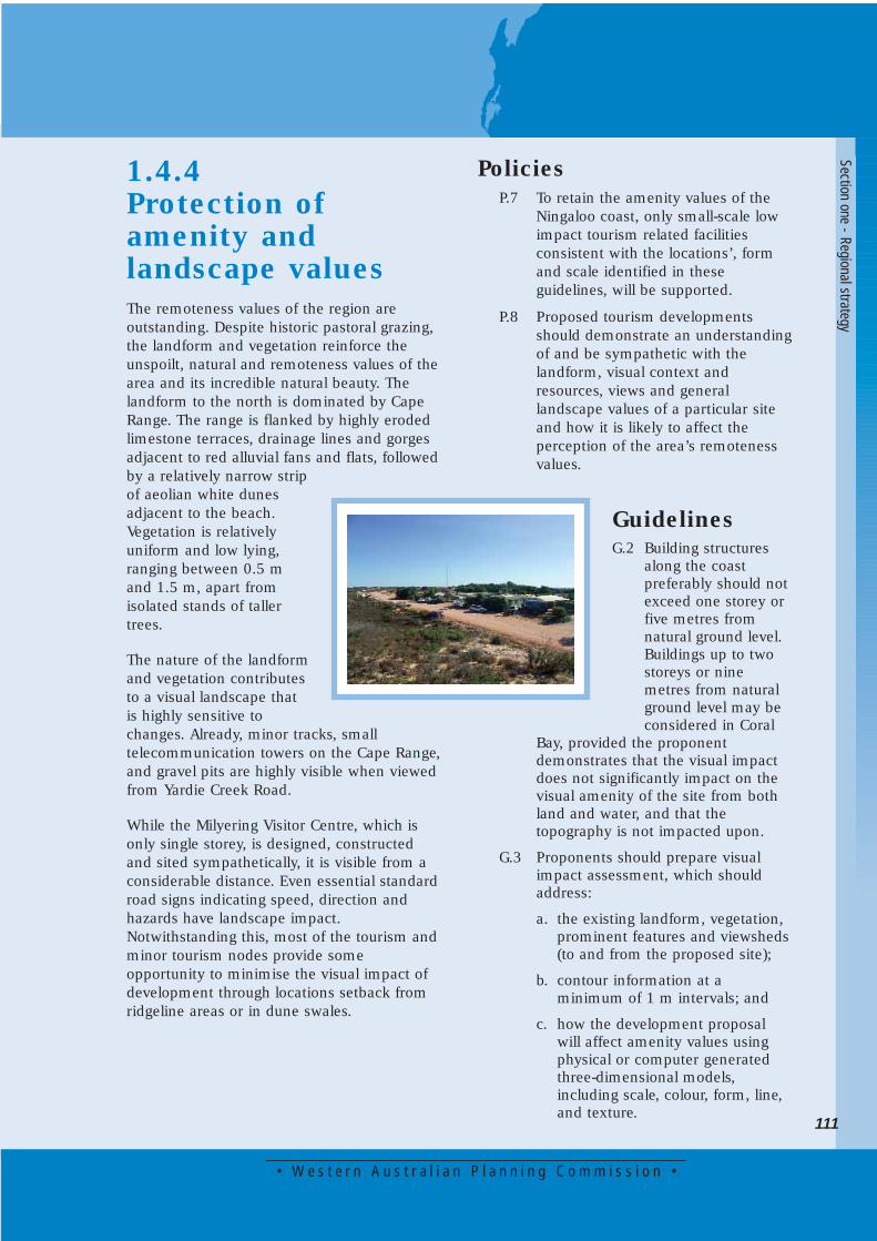
1.4.4 Protection ofamenity andlandscape valuesThe remoteness values of the region areoutstanding. Despite historic pastoral grazing,the landform and vegetation reinforce theunspoilt, natural and remoteness values of thearea and its incredible natural beauty. Thelandform to the north is dominated by CapeRange. The range is flanked by highly erodedlimestone terraces, drainage lines and gorgesadjacent to red alluvial fans and flats, followedby a relatively narrow stripof aeolian white dunesadjacent to the beach.Vegetation is relativelyuniform and low lying,ranging between 0.5 mand 1.5 m, apart fromisolated stands of tallertrees.
The nature of the landformand vegetation contributesto a visual landscape thatis highly sensitive tochanges. Already, minor tracks, smalltelecommunication towers on the Cape Range,and gravel pits are highly visible when viewedfrom Yardie Creek Road.
While the Milyering Visitor Centre, which isonly single storey, is designed, constructedand sited sympathetically, it is visible from aconsiderable distance. Even essential standardroad signs indicating speed, direction andhazards have landscape impact.Notwithstanding this, most of the tourism andminor tourism nodes provide someopportunity to minimise the visual impact ofdevelopment through locations setback fromridgeline areas or in dune swales.
PoliciesP.7 To retain the amenity values of the
Ningaloo coast, only small-scale lowimpact tourism related facilitiesconsistent with the locations’, formand scale identified in theseguidelines, will be supported.
P.8 Proposed tourism developmentsshould demonstrate an understandingof and be sympathetic with thelandform, visual context andresources, views and generallandscape values of a particular siteand how it is likely to affect theperception of the area’s remotenessvalues.
GuidelinesG.2 Building structures
along the coast preferably should notexceed one storey or five metres from natural ground level. Buildings up to two storeys or nine metres from natural ground level may be considered in Coral
Bay, provided the proponentdemonstrates that the visual impactdoes not significantly impact on thevisual amenity of the site from bothland and water, and that thetopography is not impacted upon.
G.3 Proponents should prepare visualimpact assessment, which shouldaddress:
a. the existing landform, vegetation, prominent features and viewsheds(to and from the proposed site);
b. contour information at a minimum of 1 m intervals; and
c. how the development proposal will affect amenity values using physical or computer generated three-dimensional models, including scale, colour, form, line, and texture.
Section one - Regional strategy
G.4 The proposed tourism developmentshould be designed, constructed andoperated to ensure:
a. water wise vegetation, preferably West Australian natives where possible, are planted for screening,windbreaks, rehabilitation and landscape treatments;
b. weeds are monitored and eradicated where appropriate;
c. minimal change is made to landform cut and fill and topography to accommodate buildings and infrastructure;
d. disturbance or loss of natural vegetation is minimised or avoided;
e. architectural style, landscape design and construction materials reflect local elements (eg landform);
f. impacts on visually prominent areas such as headlands, cliffs andridges are avoided;
g. that materials used are appropriate for the location, are assessed through visual impact assessment and have low reflective qualities that closely complement the visual amenity ofthe area;
h. noise pollution is minimised;
i. lighting which may affect nocturnal or breeding animals is minimised;
j. services, including powerlines are located below ground, where practical, provided the environmental impact is acceptable; and
k. isolated structures, such as car parks, toilet blocks, towers and storage areas, blend into the natural setting with appropriate selection of materials and with locally endemic vegetation.
1.4.5 Coastal setbackThe Ningaloo coast has diverse landforms andnatural systems and the coastal zone differsfrom place to place. Due to this diversity andin accordance with State coastal planningstatement of planning policy 2.6, setbacks fordevelopment within the coastal zone shouldbe defined following consideration of thenatural coastal processes in specific areas,including storm surge and sea-level rise. Forexample, some areas have extensive mobiledunes while others have rocky foreshores.Some areas have drainage systems whichaffect mangroves and others have coastalplains which are subject to tidal or surfacerun-off inundation. Some areas are importanthabitats for natural fauna while others havehigh recreational value.
The coastal zone is dynamic and changes overtime. The coast is subject to erosion oraccretion due to natural processes and/or as aresult of human and animal activity. Forexample, dunes can be mobile as a result ofnatural processes or can become mobile as aresult of vegetation removal. Therefore, onone hand, developments could be affected byforeshore and dune mobility while on theother, they could affect vegetation and causedune mobility.
PoliciesP.9 Permanent tourist accommodation
developments should be set backfrom the coast based on anassessment of natural coastal processconstraints, as per State coastalplanning statement of planning policy2.6.
P.10 Development should provide forappropriately managed public accessto the coast in keeping with therecommendations of the Ningaloocoast regional strategy Carnarvon toExmouth.
112
• W e s t e r n A u s t r a l i a n P l a n n i n g C o m m i s s i o n •
113
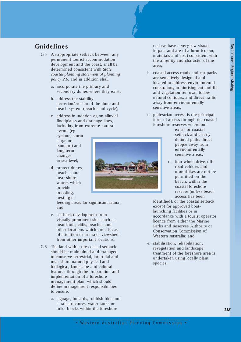
GuidelinesG.5 An appropriate setback between any
permanent tourist accommodationdevelopment and the coast, shall bedetermined consistent with Statecoastal planning statement of planningpolicy 2.6, and in addition shall:
a. incorporate the primary and secondary dunes where they exist;
b. address the stability accretion/erosion of the dune and beach system (beach sand cycle);
c. address inundation eg on alluvial floodplains and drainage lines, including from extreme natural events (eg cyclone, storm surge or tsunami) and long-term changes in sea level;
d. protect dunes, beaches and near shore waters which provide breeding, nesting or feeding areas for significant fauna;and
e. set back development from visually prominent sites such as headlands, cliffs, beaches and other locations which are a focus of attention or in major viewshedsfrom other important locations.
G.6 The land within the coastal setbackshould be maintained and managedto conserve terrestrial, intertidal andnear shore natural physical andbiological, landscape and culturalfeatures through the preparation andimplementation of a foreshoremanagement plan, which shoulddefine management responsibilitiesto ensure:
a. signage, bollards, rubbish bins andsmall structures, water tanks or toilet blocks within the foreshore
reserve have a very low visual impact and are of a form (colour, materials and size) consistent withthe amenity and character of the area;
b. coastal access roads and car parksare sensitively designed and located to address environmental constraints, minimising cut and filland vegetation removal, follow natural contours, and direct traffic away from environmentally sensitive areas;
c. pedestrian access is the principal form of access through the coastalforeshore reserves where one
exists or coastal setback and clearly defined paths direct people away from environmentally sensitive areas;
d. four-wheel drive, off-road vehicles and motorbikes are not be permitted on the beach, within the coastal foreshore reserve (unless beach access has been
identified), or the coastal setback except for approved boat-launching facilities or in accordance with a tourist operatorlicence from either the Marine Parks and Reserves Authority or Conservation Commission of Western Australia; and
e. stabilisation, rehabilitation, revegetation and landscape treatment of the foreshore area is undertaken using locally plant species.
Section one - Regional strategy

1.4.6 MarineinfrastructureDirect marine impacts arise due mainly towater-based activities (eg boating) and generallyhave a localised impact, such as damage causedby anchor chains. Indirect marine impacts (egincreased turbidity, habitat disturbance and bilgedischarge) usually are more difficult to controlwhere large numbers of recreational boatenthusiasts have access to coral reefs. There alsois an increased risk of contamination due to fuelspills and inappropriate sullage and rubbishdisposal.
Marinas and canals have the potential to causesignificant environmental impact, at the time ofconstruction and on an ongoing basis. Thisinfrastructure is not considered to be consistentwith the environmental values of the area andthe intent of small-scale low-key environmentallysensitive tourism developments.
Management is required to prevent uncontrolledaccess by vehicles and the accumulation ofboats on the beach in the vicinity of informalbeach boat-launching sites.
PoliciesP.11 Marina and canal developments will be
considered only in the designatedtownsites of Exmouth and Carnarvon.
P.12 Small jetties and boat-launchingfacilities may be allowed provided theyare consistent with the Ningaloo MarinePark management plan, Ningaloo coastregional strategy Carnarvon toExmouth, have a strategic facilities planand have been referred to theEnvironmental Protection Authority.
P.13 Coastal engineering structures such asgroynes and seawalls will not bepermitted adjacent to the NingalooReef, outside the already approvedstructures in Carnarvon, Exmouth andCoral Bay, other than for a publicpurpose.
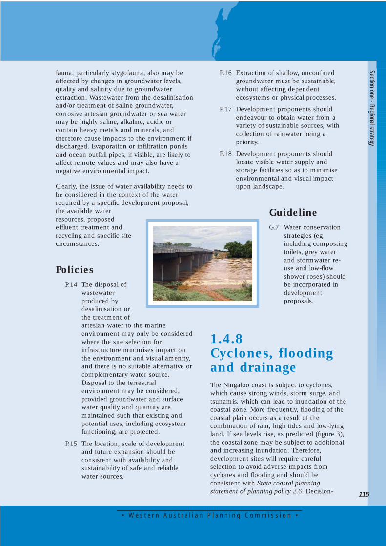
1.4.7 Water availabilityWater availability has been recognised as oneof the most significant constraints to thedevelopment of the region. The climate of theNingaloo coast ranges from hot, aridconditions at the tip of Cape Range in thenorth to warm semi-arid conditions aroundCarnarvon in the south. During January andFebruary each year, the maximum dailytemperature regularly reaches 45°C.
Rainfall in the region averages 300 mmannually with peak falls in summer andwinter. The sources of rain include tropicalcyclones, the incursion of warm moist airfrom the Kimberley Region and mid-latitudedepressions.
Groundwater occurs either as superficial orconfined groundwater. Supplies of fresh,unconfined groundwater generally arerestricted to the vicinity of the major rivers orin elevated areas such as Cape Range. In thecase of Cape Range, fresh or brackishgroundwater usually overlies very salinegroundwater. Confined or artesiangroundwater is under pressure and rises whenintercepted by a bore or may naturally flow tothe surface via springs.
Artesian groundwater occurs throughout mostof the region and may be as much as 900 mbelow the surface in coastal areas such asCoral Bay where alternative sources ofgroundwater generally are not available.Artesian groundwater is brackish to verysaline, varies in temperature from 10°C to100°C and is corrosive. It requires substantialtreatment usually involving desalination,cooling, softening and removal of iron toattain potable water quality.
Water availability also constitutes a significantenvironmental constraint. Pumping of fresh orbrackish water which overlies saline water cancause saltwater intrusion to the surface.Recharge of the shallow aquifer may occuronly after intense or long rainfall and in someyears, this may not occur at all. Subterranean
114
• W e s t e r n A u s t r a l i a n P l a n n i n g C o m m i s s i o n •
115
fauna, particularly stygofauna, also may beaffected by changes in groundwater levels,quality and salinity due to groundwaterextraction. Wastewater from the desalinisationand/or treatment of saline groundwater,corrosive artesian groundwater or sea watermay be highly saline, alkaline, acidic orcontain heavy metals and minerals, andtherefore cause impacts to the environment ifdischarged. Evaporation or infiltration pondsand ocean outfall pipes, if visible, are likely toaffect remote values and may also have anegative environmental impact.
Clearly, the issue of water availability needs tobe considered in the context of the waterrequired by a specific development proposal,the available waterresources, proposedeffluent treatment andrecycling and specific sitecircumstances.
PoliciesP.14 The disposal of
wastewaterproduced bydesalinisation orthe treatment ofartesian water to the marineenvironment may only be consideredwhere the site selection forinfrastructure minimises impact onthe environment and visual amenity,and there is no suitable alternative orcomplementary water source.Disposal to the terrestrialenvironment may be considered,provided groundwater and surfacewater quality and quantity aremaintained such that existing andpotential uses, including ecosystemfunctioning, are protected.
P.15 The location, scale of developmentand future expansion should beconsistent with availability andsustainability of safe and reliablewater sources.
Section one - Regional strategy
P.16 Extraction of shallow, unconfinedgroundwater must be sustainable, without affecting dependent ecosystems or physical processes.
P.17 Development proponents should endeavour to obtain water from avariety of sustainable sources, withcollection of rainwater being apriority.
P.18 Development proponents shouldlocate visible water supply andstorage facilities so as to minimiseenvironmental and visual impactupon landscape.
GuidelineG.7 Water conservation
strategies (eg including compostingtoilets, grey water and stormwater re-use and low-flow shower roses) should be incorporated in development proposals.
1.4.8 Cyclones, floodingand drainageThe Ningaloo coast is subject to cyclones,which cause strong winds, storm surge, andtsunamis, which can lead to inundation of thecoastal zone. More frequently, flooding of thecoastal plain occurs as a result of thecombination of rain, high tides and low-lyingland. If sea levels rise, as predicted (figure 3),the coastal zone may be subject to additionaland increasing inundation. Therefore,development sites will require carefulselection to avoid adverse impacts fromcyclones and flooding and should beconsistent with State coastal planningstatement of planning policy 2.6. Decision-
making authorities must assess and respondto development proposals carefully to avoidliability for loss or damage.
PoliciesP.19 Landforms and topography should
not be altered substantially to dealwith potential flooding.
P.20 Tourism development within thenominated storm surge lines will belimited to:
a. those structures necessary for public facilities which are coastallydependent or those which are temporary within the 3 m AHD contour line (which represents a 1 in 100 year flooding event from both terrestrial and marine sources); and
b. no permanent or semi permanent structures within the 4 m AHD contour line (which represents a cyclone category 5 worst case track) unless the proponent accepts that the structure is expendable or the proposal is designed to acceptable site levels to reduce the impact of potential storm surge.
P.21 Permanent tourist accommodationdevelopments shall be constructed toAustralian Standard AS/NZS1170.2:2002 (or its replacement) towithstand the wind effects ofcyclones, and semi-permanentstructures should be easily removablein the event of a cyclone warningbeing issued.
GuidelineG.8 Development proposals shall:
a. consider innovative pavement solutions as an alternative to bitumen and concrete to decrease the amount of stormwater run-off;
b. use historical terrestrial and marine flooding data or best estimates based on adjacent lands,and a precautionary principle safety factor to determine areas subject to 1 in 100 year inundation events; and
c. incorporate water-sensitive design principles and features into overalldesign of buildings, hard surfaces, landscaped areas and stormwater drainage.
1.4.9 Sewage treatmentSewage treatment presents a considerableenvironmental constraint to development.Conventional septic systems involve theleaching of nutrients and other pollutantswhich may affect subterranean fauna, marinewater and groundwater quality and coralecosystems. Unlike freshwater wetlands, themarine environment is sensitive to nitrogenrather than phosphorus. In addition, coral reefsystems are very low in nutrients and smallincreases can result in a significant ecosystemresponse (Grigg and Dollar, 1993). Alternativetreatment units (eg Ecomax or Biocycle) forsecondary and postsecondary treatment stillproduce effluent containing nutrients, metalsand sludge, which require disposal.Evaporative or digestion ponds may produceodour, be highly visible and represent a risk tothe environment if containment mechanisms(eg plastic or clay lining) fail. Tertiarytreatment of sewage is likely to beuneconomic, given the anticipated scale ofdevelopment and current technology (Baker,pers com).
PoliciesP.22 Appropriate management and
monitoring should be established toensure criteria are met and there arecontingency plans for cases of
116

• W e s t e r n A u s t r a l i a n P l a n n i n g C o m m i s s i o n •
117
infrastructure failure or whereminimum criteria are not met.
P.23 Sewage treatment infrastructureshould produce minimal odour andbe appropriately separated frompermanent tourist accommodationdevelopments.
GuidelinesG.9 Best practice enclosed treatment
plants will be considered for approvalwhere:
a. an integrated and sustainable approach is adopted to minimise water use and maximise recycling;
b. treated sewagewill contain a maximum of 2.5 g/m3 total nitrogen, 1 g/m3 total phosphorus, 5 g/m3
biological oxygen demand, 5 g/m3 suspended solids and 100 thermo tolerant coliforms; and
c. treated sewage will be disposed via trickle irrigation to natural vegetation (not within 100 m of beaches or wetlands) or evaporation ponds rather than disposal to the marine environment or groundwater aquifer via injection.
G.10 Screened solids and sludge should betransported to an appropriatelicensed landfill.
G.11 Organic fertilisers may be used whenderived from the developmentproposal itself (eg toilet compost)rather than inorganic fertiliser, subjectto Health Department requirements.
G.12 Sewage treatment and disposalsystems should incorporate fauna-exclusion strategies or makeprovision for fauna management.
1.4.10 Waste disposalLandfill sites in remote areas normally areunlined, uncovered and infrequentlymaintained (Mantle, pers com). This mayresult in odour, pollutants leaching intogroundwater and rubbish dispersal from
strong onshore winds. Thelocation of a landfill siteadjacent to tourismdevelopment reducesremote values and tourismamenity and should havea site management planprepared.
PolicyP.24 Organic and green
waste should becollected, composted andappropriately stored for use as mulchif appropriate, soil improver orfertiliser. Organic waste not used forthis purpose and all inorganic wasteshould be transported to a licensedlandfill facility.
GuidelineG.13 Development proposals should
prepare and implement a wastemanagement program whichminimises waste production andmaximises use and recycling.
Section one - Regional strategy
1.4.11 AccessMost of the Ningaloo coast is frequentlyaccessed by locals and visitors travelling infour-wheel drive vehicles and caravansseeking a coastal holiday experience,adventure and/or solitude. The establishmentof indiscriminate tracks to the coast leading torecreation sites for fishing, diving or camping,as well as many campsites themselves arecausing loss of vegetation and subsequentdune destabilisation. This is compounded byhistorically inappropriate rubbish disposal,increased fire risk from campfires anddegradation to native vegetation from coastaluse. In recent years visitor numbers haveincreased markedly, such that urgentmanagement is required to prevent long-termor irreversible damage to the environment.
The main tourist access network shouldremain the North West Coastal Highway,Minilya - Exmouth and Burkett roads. Themain north-south coastal access roads(Blowholes - Gnaraloo Road and Coral Bay-Yardie Creek Road) should be located inaccordance with setback requirements awayfrom the coast, with spur roads providingaccess to appropriate destinations. Thisstrategy has been highly successful in CapeRange National Park by minimising indiscreetand uncontrolled beach access, usually byfour-wheel drive vehicles. The spur roads alsowould need to be formed and maintained toremove the necessity for vehicle operators tocreate new tracks when existing ones becomeboggy, rough or impassable.
Providing access to a particular tourism sitemay have significant environmentalimplications beyond its direct constructionimpacts. It would be irresponsible to subjectthe coastal zone to increased use prior todevelopment of supporting infrastructure andmanagement arrangements.
Yardie Creek is one of the main features ofthe Cape Range National Park, for its wildlifeconservation, aesthetic, cultural and nature-
based tourism values. The issue of a crossingfor Yardie Creek has been discussed for sometime. The provision of a permanent crossingof Yardie Creek would detract significantlyfrom the environmental values, amenity of thearea and the current visitor experience. Onbalance, the existing natural sandbar crossingnear the mouth of the creek is moreaesthetically and environmentally acceptable.It is consistent with the maintenance of thearea’s environmental values andCommonwealth Department of Defenceoperational requirements south of YardieCreek.
PoliciesP.25 Access to and from tourist
developments on the Ningaloo coastshould be via formed spur roads.
P.26 The planning and construction ofaccess roads, supportingmanagement (eg car parks, signage,track closures, spur roads and rubbishcollection) and proposed tourismnodes should be integrated andco-ordinated by the NingalooSustainable Development Committee.
P.27 The crossing at Yardie Creek shouldremain in its natural state with nobuilt structure supported.
P.28 Development proposals shouldencourage walking, hiking andorganised tour experiences, ratherthan individual vehicle transport.
GuidelinesG.14 Roads, tracks and paths should be
aligned and constructed to minimisedisruption of native fauna movementpatterns.
G.15 In fragile environments, boardwalksand fenced walkways should beprovided.
118
• W e s t e r n A u s t r a l i a n P l a n n i n g C o m m i s s i o n •
119
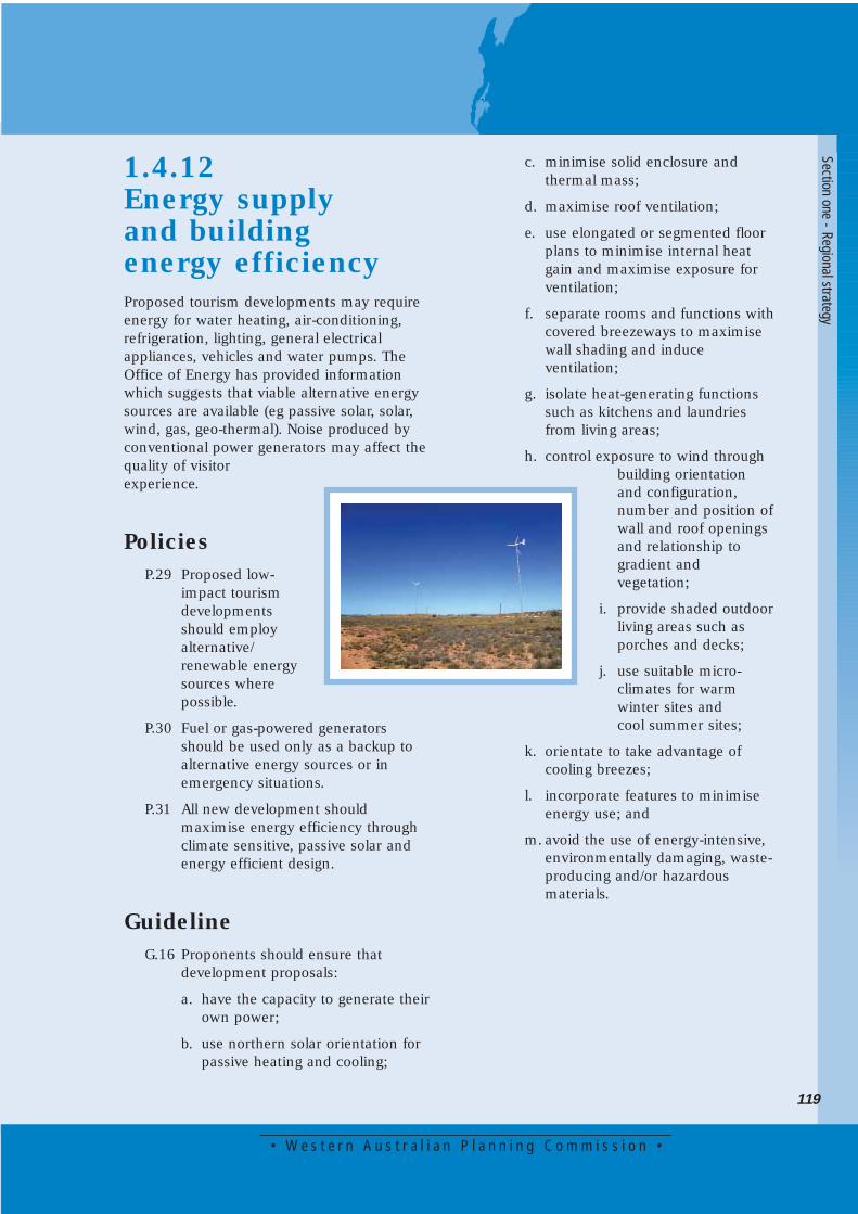
1.4.12 Energy supply and building energy efficiencyProposed tourism developments may requireenergy for water heating, air-conditioning,refrigeration, lighting, general electricalappliances, vehicles and water pumps. TheOffice of Energy has provided informationwhich suggests that viable alternative energysources are available (eg passive solar, solar,wind, gas, geo-thermal). Noise produced byconventional power generators may affect thequality of visitorexperience.
PoliciesP.29 Proposed low-
impact tourismdevelopmentsshould employalternative/renewable energysources wherepossible.
P.30 Fuel or gas-powered generatorsshould be used only as a backup toalternative energy sources or inemergency situations.
P.31 All new development shouldmaximise energy efficiency throughclimate sensitive, passive solar andenergy efficient design.
GuidelineG.16 Proponents should ensure that
development proposals:
a. have the capacity to generate theirown power;
b. use northern solar orientation for passive heating and cooling;
c. minimise solid enclosure and thermal mass;
d. maximise roof ventilation;
e. use elongated or segmented floor plans to minimise internal heat gain and maximise exposure for ventilation;
f. separate rooms and functions withcovered breezeways to maximise wall shading and induce ventilation;
g. isolate heat-generating functions such as kitchens and laundries from living areas;
h. control exposure to wind through building orientation and configuration, number and position ofwall and roof openings and relationship to gradient and vegetation;
i. provide shaded outdoorliving areas such as porches and decks;
j. use suitable micro-climates for warm winter sites and cool summer sites;
k. orientate to take advantage of cooling breezes;
l. incorporate features to minimise energy use; and
m. avoid the use of energy-intensive, environmentally damaging, waste-producing and/or hazardous materials.
Section one - Regional strategy
1.4.13 Construction and managementThe following factors should be incorporatedin the planning and implementation phases ofthe proposed development, through anenvironmental management system(International Organisation of Standardisation,1997) to minimise impacts and achieve amore sustainable development.
GuidelinesG.17 Construction practices should ensure
minimal site disruption.
G.18 Proponents should develop on-siteguidelines or controls for contractors,specifying appropriate constructionpractices.
G.19 Proponents should provide briefing ortraining sessions for all contractorsand their employees, specifying thedesired practices and theconsequences of non-compliance.
G.20 Contractors should provide aperformance bond or deposit whichcan be used to repair anyenvironmental damage inconsistentwith an environmental managementplan.
G.21 Environmental objectives and criteriashould be documented.
G.22 Monitoring and evaluation systemsshould be prepared andimplemented.
G.23 The proponent should undertakeregular environmental audits.
G.24 Staff training and environmentaleducation programs should beestablished.
G.25 Interaction between tourists andphysical and/or cultural environmentsshould be documented and managed(eg visitor information and educationfacilities).
G.26 Minimal use and disposal of chemicalcleaning products should beencouraged. Where disposal isunavoidable, low-impact productsshould be sought.
G.27 Construction and decorationmaterials should not produce orrelease harmful chemicals during orafter manufacture.
G.28 Proponents should prepare and adopta product-purchasing policy whichminimises life cycle costs andmaximises use, re-use and recycling.
G.29 Proponents should provideinformation to visitors that encourageappropriate behaviour towardswildlife, cultural resources, historicand natural features.
1.4.14 Approvals processThe tenure, vesting and zoning of land,variations in planning schemes andmanagement plans and the type ofdevelopment proposal will determine thedevelopment approval required. Despitevariations, it is important that tourismdevelopments are considered in acoordinated, orderly and consistent waythereby ensuring the objectives and intendedoutcomes of these guidelines and theNingaloo coast regional strategy Carnarvon toExmouth are achieved. Currently underinvestigation is the length of tenure to beallowed on leasehold land vested in theConservation Commission of WesternAustralia, and whether this should, in theappropriate circumstances, be longer than thecurrently allowed 21 plus 21 years.
PolicyP.32 Development approvals will be as
required by the governanceframework for the Ningaloo coast.
120
• W e s t e r n A u s t r a l i a n P l a n n i n g C o m m i s s i o n •
121
P.33 All development proposals, whichcould have a significant impact onthe environment, will be referred tothe Environmental ProtectionAuthority (EPA).
P.34 Development of tourism sites willrequire approval under the WesternAustralian Planning Commission Act1985, Town Planning and DevelopmentAct 1928 and be consistent with theState planning strategy, the Ningaloocoast regional strategy Carnarvon toExmouth, the Ningaloo coaststatement of planning policy 6.3,other relevant statements of planningpolicy, relevant schemes and considerAboriginal heritage sites and/orsurveys.
P.35 All development proposals within theconservation estate should beconsistent with the State planningstrategy, the Ningaloo coast regionalstrategy Carnarvon to Exmouth, theNingaloo coast statement of planningpolicy 6.3, other relevant statementsof planning policy, relevant schemesand consider Aboriginal heritage sitesand/or surveys and the approvedmanagement plan for that area.
GuidelineG.30 Prior to lodging an application for
development, proponents shouldliaise with the Department ofConservation and Land Management,Department of Environment,Department for Planning andInfrastructure, local government andDepartment of Indigenous Affairs.
G.31 Proponents will be required toprovide a high level of information tothe EPA upfront, at the time ofreferral. This information shouldinclude:
a. a detailed description of the development proposal including site and landscape appraisal, ultimate development scenario,
project design, access arrangements, construction, management and operation;
b. a detailed description of the existing, physical, biological, landscape and cultural environment, which include detailed field investigations of flora, fauna (terrestrial, marine and subterranean), declared rare and priority species, biodiversity, geology and geomorphology, hydrology, ecological processes and systems, land- and sea-scape, drainage, flooding and Aboriginal cultural heritage significance;
c. an assessment of coastal processes if the site abuts the coast;
d. an assessment of construction, visual, indirect, ongoing, off-site and cumulative impacts of the development proposal, and its supporting infrastructure;
e. an assessment of alternatives and justification of the development proposal selected;
f. information which demonstrates, with a high degree of scientific confidence, that anticipated environmental impacts can be managed;
g. a commitment to and description of an environmental management system which integrates the construction and operation of the development proposal with environmental management criteria and objectives, defined management responsibilities for implementation and demonstratesprogressive improvement; and
h. a monitoring program, contingency and emergency response plans in case environmental criteria or objectives are not met.
Section one - Regional strategy

122