Embed Size (px)
Citation preview
14. RETROFITTING SUBURBIAINTRODUCTION...........................................................................................14-1TRANSFORMING SUBURBAN STREETS TO LIVING STREETS........................14-2
Changing Streets without Changing the Right-of-Way............................14-2Non-Physical Changes.............................................................................14-4Street Crossings......................................................................................14-4
RE-ESTABLISHING STREET NETWORKS.......................................................14-5SECOND-GENERATION LAND USE ALONG TRANSFORMED STREETS..........14-6SETTING PRIORITIES AND PHASING............................................................14-7MODEL PROJECT:BRIDEPORT WAY..............................................................14-9ADDITIONAL RESOURCES.........................................................................14-11
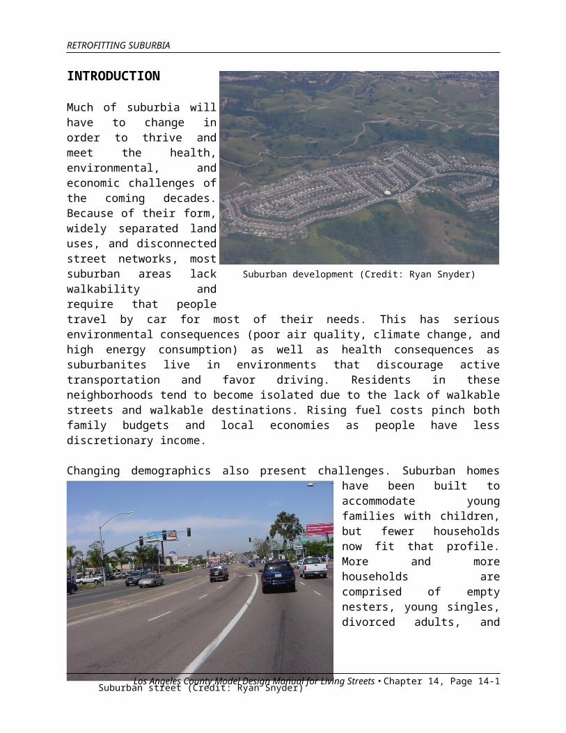
Suburban development (Credit: Ryan Snyder)
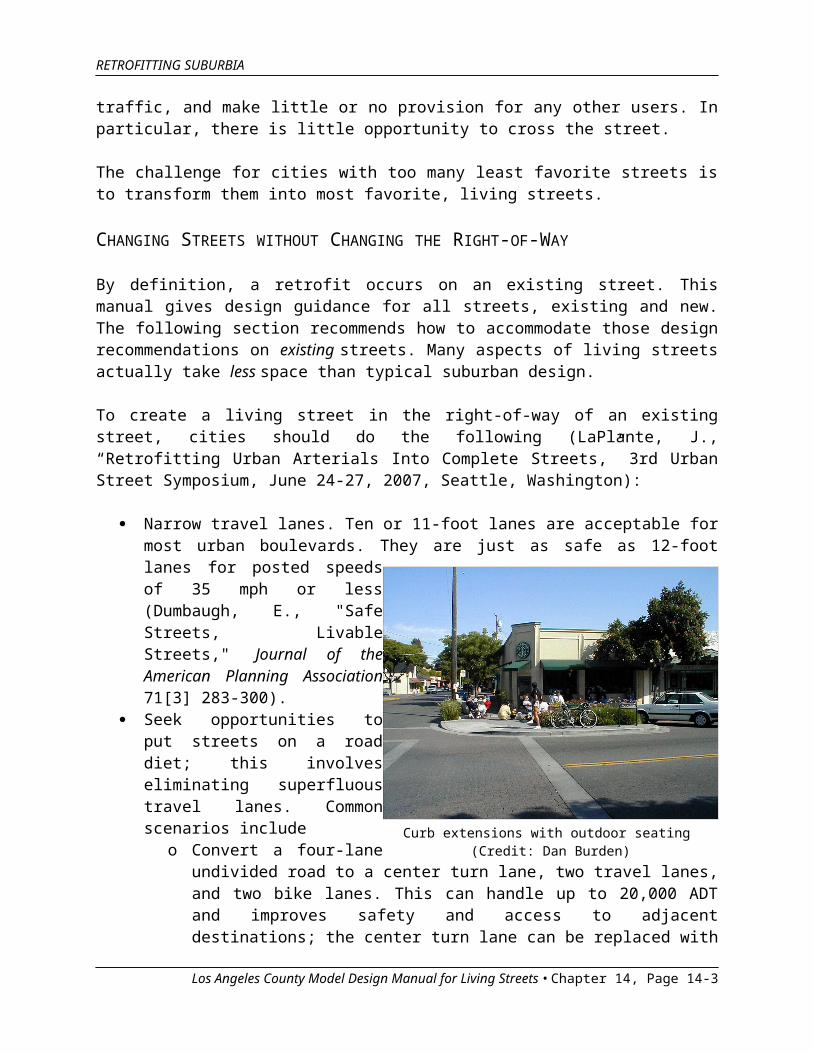
Suburban street (Credit: Ryan Snyder)
RETROFITTING SUBURBIA
INTRODUCTION
Much of suburbia will have to change in order to thrive and meet the health, environmental, and economic challenges of the coming decades. Because of their form, widely separated land uses, and disconnected street networks, most suburban areas lack walkability and require that people travel by car for most of their needs. This has serious environmental consequences (poor air quality, climate change, and high energy consumption) as well as health consequences as suburbanites live in environments that discourage active transportation and favor driving. Residents in these neighborhoods tend to become isolated due to the lack of walkable streets and walkable destinations. Rising fuel costs pinch both family budgets and local economies as people have less discretionary income.
Changing demographics also present challenges. Suburban homes have been built to accommodate young families with children, but fewer households now fit that profile. More and more households are comprised of empty nesters, young singles, divorced adults, and other non-nuclear families, and this trend is expected to grow in the future.
As fuel prices continue to rise and as residents age, suburbs will need to serve more of their residents’
needs closer to home, and serve those needs in places that can be reached other than by driving. Suburban areas will need to be retrofitted to
Los Angeles County Model Design Manual for Living Streets • Chapter 14, Page 14-1

RETROFITTING SUBURBIA
accommodate a new reality that rewards places that are close to more people and reachable in many ways.
This chapter describes how streets can support retrofitting suburbia, provides strategies for retrofitting streets, and recommends priorities and phasing. All of the changes recommended in this chapter will improve safety. The first priority for a city beginning to retrofit itself for the future should be to find and fix the places that are unsafe.
TRANSFORMING SUBURBAN STREETS TO LIVING STREETS
Streets play an enormous role in determining a place’s quality of life. Everywhere in the country, people prefer a certain kind of street (“Redefining Charlotte’s Streets,” Urban Street Design Guidelines, Charlotte, North Carolina, 10/22/2007). People’s favorite streets include those with
An abundant tree canopy and other streetscape features Sidewalks and buffering from traffic Moderate traffic speeds All kinds of uses (walking, cycling, driving, and enjoying the lawns or
sidewalks and patios on either side)
People need not know the term “living street” to recognize and enjoy one.
The least favorite streets are those where driveways, parking lots, and utility poles are more abundant than trees and people. They often consist of wide expanses of pavement for moving traffic, and make little or no provision for any other users. In particular, there is little opportunity to cross the street.
The challenge for cities with too many least favorite streets is to transform them into most favorite, living streets.
CHANGING STREETS WITHOUT CHANGING THE RIGHT-OF-WAY
By definition, a retrofit occurs on an existing street. This manual gives design guidance for all streets, existing and new. The following section recommends how to accommodate those design recommendations on existing streets. Many aspects of living streets actually take less space than typical suburban design.
To create a living street in the right-of-way of an existing street, cities should do the following (LaPlante, J., “Retrofitting Urban Arterials Into Complete Streets,” 3rd Urban Street Symposium, June 24-27, 2007, Seattle, Washington):
Los Angeles County Model Design Manual for Living Streets • Chapter 14, Page 14-2
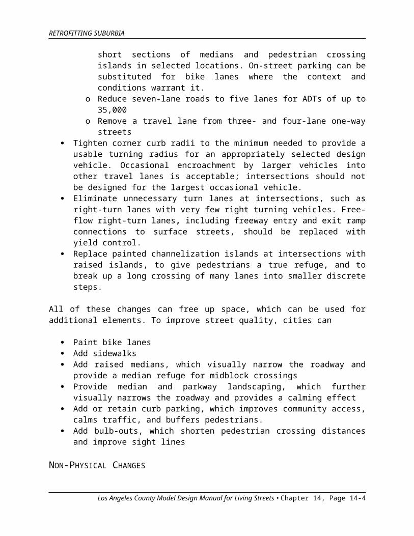
Curb extensions with outdoor seating (Credit: Dan Burden)
RETROFITTING SUBURBIA
Narrow travel lanes. Ten or 11-foot lanes are acceptable for most urban boulevards. They are just as safe as 12-foot lanes for posted speeds of 35 mph or less (Dumbaugh, E., "Safe Streets, Livable Streets," Journal of the American Planning Association 71[3] 283-300).
Seek opportunities to put streets on a road diet; this involves eliminating superfluous travel lanes. Common scenarios include
o Convert a four-lane undivided road to a center turn lane, two travel lanes, and two bike lanes. This can handle up to 20,000 ADT and improves safety and access to adjacent destinations; the center turn lane can be replaced with short sections of medians and pedestrian crossing islands in selected locations. On-street parking can be substituted for bike lanes where the context and conditions warrant it.
o Reduce seven-lane roads to five lanes for ADTs of up to 35,000o Remove a travel lane from three- and four-lane one-way streets
Tighten corner curb radii to the minimum needed to provide a usable turning radius for an appropriately selected design vehicle. Occasional encroachment by larger vehicles into other travel lanes is acceptable; intersections should not be designed for the largest occasional vehicle.
Eliminate unnecessary turn lanes at intersections, such as right-turn lanes with very few right turning vehicles. Free-flow right-turn lanes, including freeway entry and exit ramp connections to surface streets, should be replaced with yield control.
Replace painted channelization islands at intersections with raised islands, to give pedestrians a true refuge, and to break up a long crossing of many lanes into smaller discrete steps.
All of these changes can free up space, which can be used for additional elements. To improve street quality, cities can
Paint bike lanes Add sidewalks Add raised medians, which visually narrow the roadway and provide a
median refuge for midblock crossings
Los Angeles County Model Design Manual for Living Streets • Chapter 14, Page 14-3
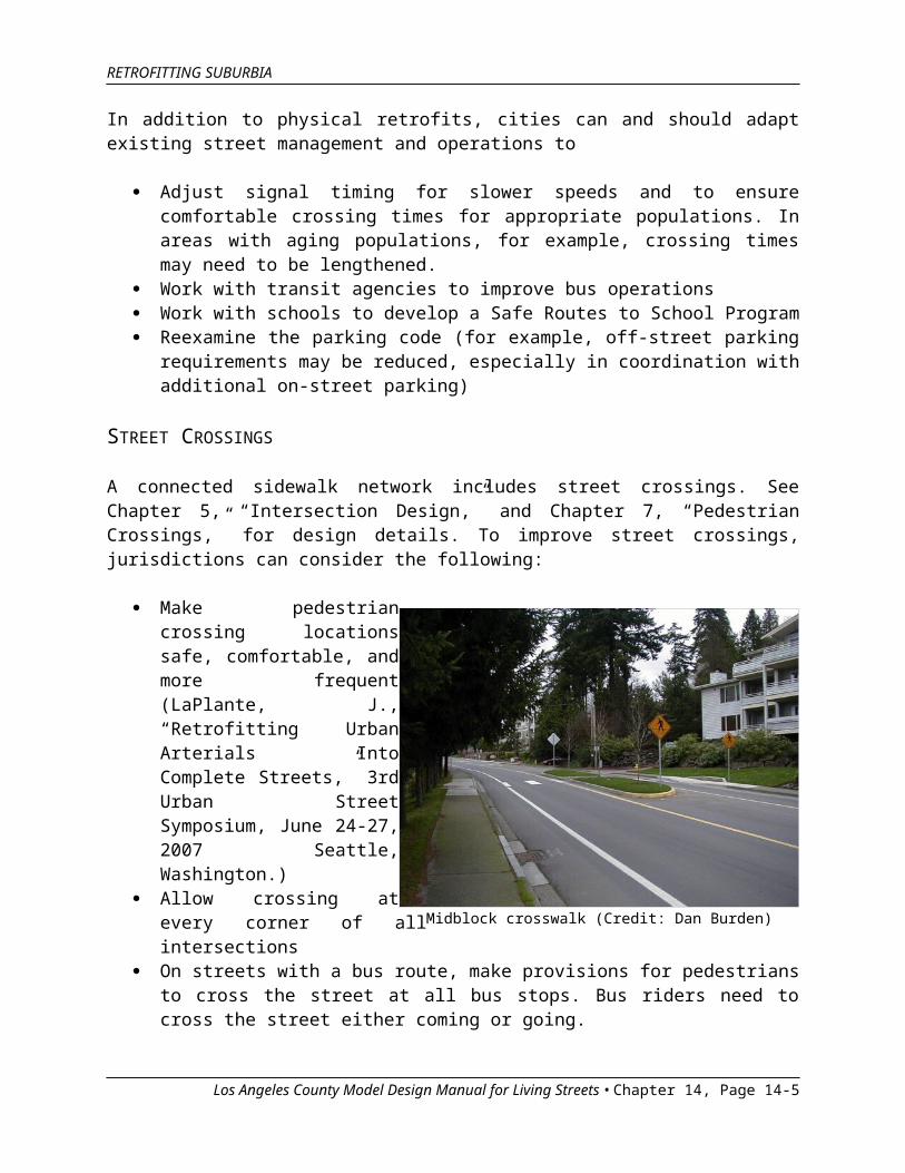
Midblock crosswalk (Credit: Dan Burden)
RETROFITTING SUBURBIA
Provide median and parkway landscaping, which further visually narrows the roadway and provides a calming effect
Add or retain curb parking, which improves community access, calms traffic, and buffers pedestrians.
Add bulb-outs, which shorten pedestrian crossing distances and improve sight lines
NON-PHYSICAL CHANGES In addition to physical retrofits, cities can and should adapt existing street management and operations to
Adjust signal timing for slower speeds and to ensure comfortable crossing times for appropriate populations. In areas with aging populations, for example, crossing times may need to be lengthened.
Work with transit agencies to improve bus operations Work with schools to develop a Safe Routes to School Program Reexamine the parking code (for example, off-street parking
requirements may be reduced, especially in coordination with additional on-street parking)
STREET CROSSINGS A connected sidewalk network includes street crossings. See Chapter 5, “Intersection Design,” and Chapter 7, “Pedestrian Crossings,” for design details. To improve street crossings, jurisdictions can consider the following:
Make pedestrian crossing locations safe, comfortable, and more frequent (LaPlante, J., “Retrofitting Urban Arterials Into Complete Streets,” 3rd Urban Street Symposium, June 24-27, 2007 Seattle, Washington.)
Allow crossing at every corner of all intersections
On streets with a bus route, make provisions for pedestrians to cross the street at all bus stops. Bus riders need to cross the street either coming or going.
Los Angeles County Model Design Manual for Living Streets • Chapter 14, Page 14-4
Connecting cul-de-sacs (Credit: Marty Bruinsma)
RETROFITTING SUBURBIA
Provide midblock crossings. Pedestrians should not be expected to travel to the closest intersection to cross the street. Signalized intersections in suburban areas are often spaced ¼ mile, ½ mile, or even further apart; it is unreasonable to expect people to walk that far to cross the street. Nor do signalized intersections offer safety benefits to pedestrians, due to the many added turning conflicts at large suburban intersections.
Many of these changes can be made through spot improvement programs. Many are relatively inexpensive; it is not necessary to wait for a reconstruction to create a living street. More substantial retrofits may require reconstruction (see the Model Project section at the end of this chapter). A planned surface repaving project is an excellent time to retrofit the corridor to add comfort, convenience, safety, aesthetics, and economic value.
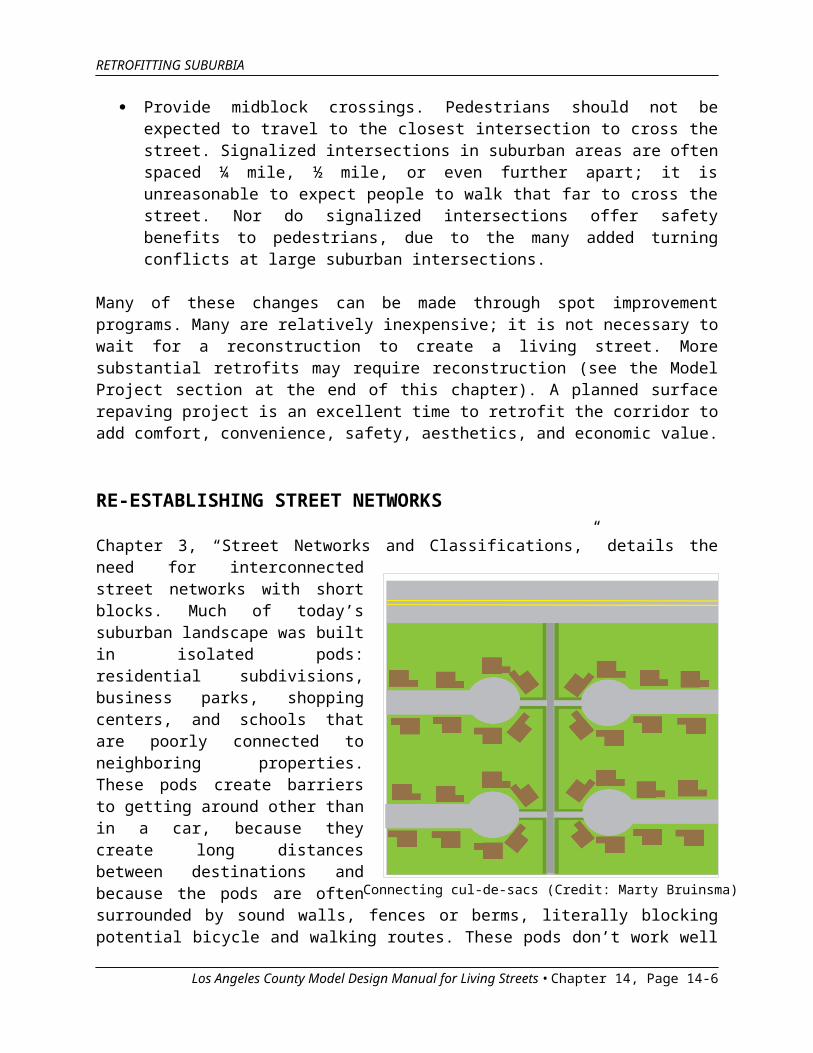
RE-ESTABLISHING STREET NETWORKS
Chapter 3, “Street Networks and Classifications,” details the need for interconnected street networks with short blocks. Much of today’s suburban landscape was built in isolated pods: residential subdivisions, business parks, shopping centers, and schools that are poorly connected to neighboring properties. These pods create barriers to getting around other than in a car, because they create long distances between destinations and because the pods are often surrounded by sound walls, fences or berms, literally blocking potential bicycle and walking routes. These pods don’t work well for auto traffic either, since they force all traffic onto busy streets rather than allowing connection and local circulation through local streets.
To create a vibrant suburb that will thrive in new conditions, direct connections must be created or re-created to enable efficient, direct travel by everyone. That means establishing or re-establishing street and sidewalk networks.
Los Angeles County Model Design Manual for Living Streets • Chapter 14, Page 14-5
RETROFITTING SUBURBIA
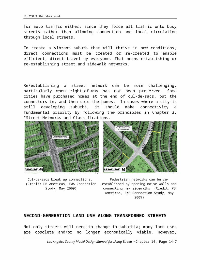
Re/establishing a street network can be more challenging, particularly when right-of-way has not been preserved. Some cities have purchased homes at the end of cul-de-sacs, put the connectors in, and then sold the homes. In cases where a city is still developing suburbs, it should make connectivity a fundamental priority by following the principles in Chapter 3, “Street Networks and Classifications.”
Cul-de-sacs break up connections. (Credit: PB Americas, EWA Connection Study,
May 2009)
Pedestrian networks can be re-established by opening noise walls and connecting new
sidewalks. (Credit: PB Americas, EWA Connection Study, May 2009)
SECOND-GENERATION LAND USE ALONG TRANSFORMED STREETS
Not only streets will need to change in suburbia; many land uses are obsolete and/or no longer economically viable. However, street improvements generally should come before land use change in suburban retrofitting. This is because high-quality land uses come to high-quality streets. Very rarely will high-quality land uses come to low-quality streets.
The street and the land use work together and determine whether a place is attractive and draws people and investment. To that end, communities retrofitting older suburban areas would do well to use the following three principles:
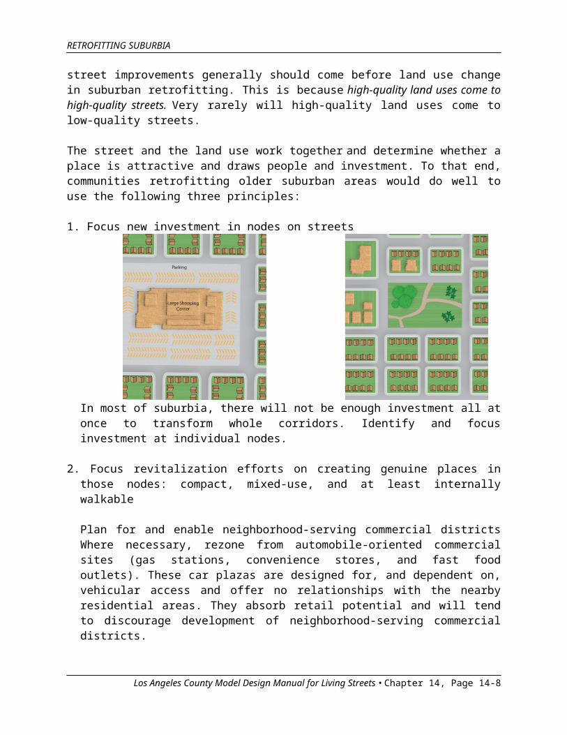
1. Focus new investment in nodes on streets
In most of suburbia, there will not be enough investment all at once to transform whole corridors. Identify and focus investment at individual nodes.
Los Angeles County Model Design Manual for Living Streets • Chapter 14, Page 14-6
RETROFITTING SUBURBIA
2. Focus revitalization efforts on creating genuine places in those nodes: compact, mixed-use, and at least internally walkable
Plan for and enable neighborhood-serving commercial districts Where necessary, rezone from automobile-oriented commercial sites (gas stations, convenience stores, and fast food outlets). These car plazas are designed for, and dependent on, vehicular access and offer no relationships with the nearby residential areas. They absorb retail potential and will tend to discourage development of neighborhood-serving commercial districts.
3. Carefully detail the desired outcomes
It is vital that retrofit efforts pay attention to the details described in the individual chapters of this manual. Adopting well-intentioned policy goals is not enough. There must be follow through by incorporating the vision’s details in the design and construction of the project.
Infill development between nodes that follows the principles of this manual will help to connect the nodes into livable neighborhoods.
SETTING PRIORITIES AND PHASING
The primary challenge in retrofitting suburbia is less fixing the infrastructure and more creating economically sustainable places, with the emphasis on place.
Los Angeles County Model Design Manual for Living Streets • Chapter 14, Page 14-7
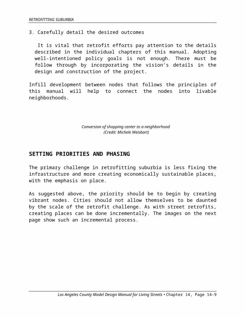
Conversion of shopping center to a neighborhood (Credit: Michele Weisbart)
RETROFITTING SUBURBIA
As suggested above, the priority should be to begin by creating vibrant nodes. Cities should not allow themselves to be daunted by the scale of the retrofit challenge. As with street retrofits, creating places can be done incrementally. The images on the next page show such an incremental process.
Los Angeles County Model Design Manual for Living Streets • Chapter 14, Page 14-8
Example of a transformed suburban street (Credit: Urban Advantage, Inc.)
RETROFITTING SUBURBIA
Los Angeles County Model Design Manual for Living Streets • Chapter 14, Page 14-9

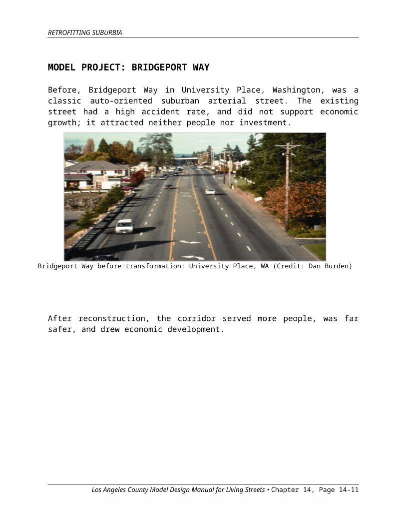
Bridgeport Way before transformation: University Place, WA (Credit: Dan Burden)
RETROFITTING SUBURBIA
MODEL PROJECT: BRIDGEPORT WAY
Before, Bridgeport Way in University Place, Washington, was a classic auto-oriented suburban arterial street. The existing street had a high accident rate, and did not support economic growth; it attracted neither people nor investment.
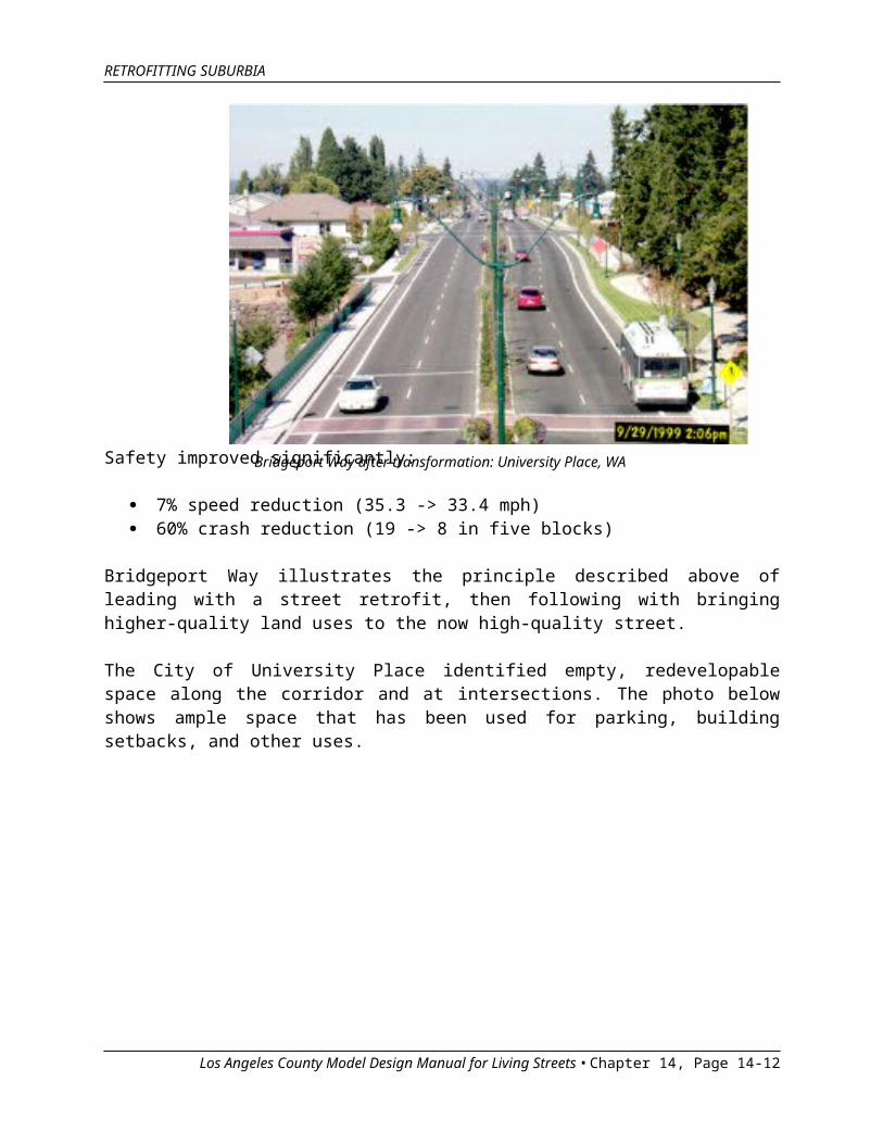
After reconstruction, the corridor served more people, was far safer, and drew economic development.
Safety improved significantly:
Los Angeles County Model Design Manual for Living Streets • Chapter 14, Page 14-10
Bridgeport Way after transformation: University Place, WA (Credit: Michael Wallwork)
RETROFITTING SUBURBIA
7% speed reduction (35.3 -> 33.4 mph) 60% crash reduction (19 -> 8 in five blocks)
Bridgeport Way illustrates the principle described above of leading with a street retrofit, then following with bringing higher-quality land uses to the now high-quality street.
The City of University Place identified empty, redevelopable space along the corridor and at intersections. The photo below shows ample space that has been used for parking, building setbacks, and other uses.
Los Angeles County Model Design Manual for Living Streets • Chapter 14, Page 14-11
Bridgeport Way transformation opportunities: University Place, WA (Credit: Michael Wallwork)
RETROFITTING SUBURBIA
The City planned for new development that would create a new place, as shown in the rendering below.
ADDITIONAL RESOURCES
ICF International with Nelson\Nygaard Consulting Associates and Reid Ewing. Transportation Study of the U.S. Route 1 College Park Corridor, July 14, 2008.
PB Americas, EWA Connectivity Study, May 2009.
Dunham-Jones, E. and Williamson, J., Retrofitting Suburbia: Urban Design Solutions for Redesigning Suburbs, John Wiley & Sons, 2009. This book focuses more on retrofitting parcels of land, rather than on the streets between them. Nonetheless, it is an excellent resource.
Los Angeles County Model Design Manual for Living Streets • Chapter 14, Page 14-12
Bridgeport Way plan: University Place, WA (Credit: City of University Place)