Embed Size (px)
Citation preview
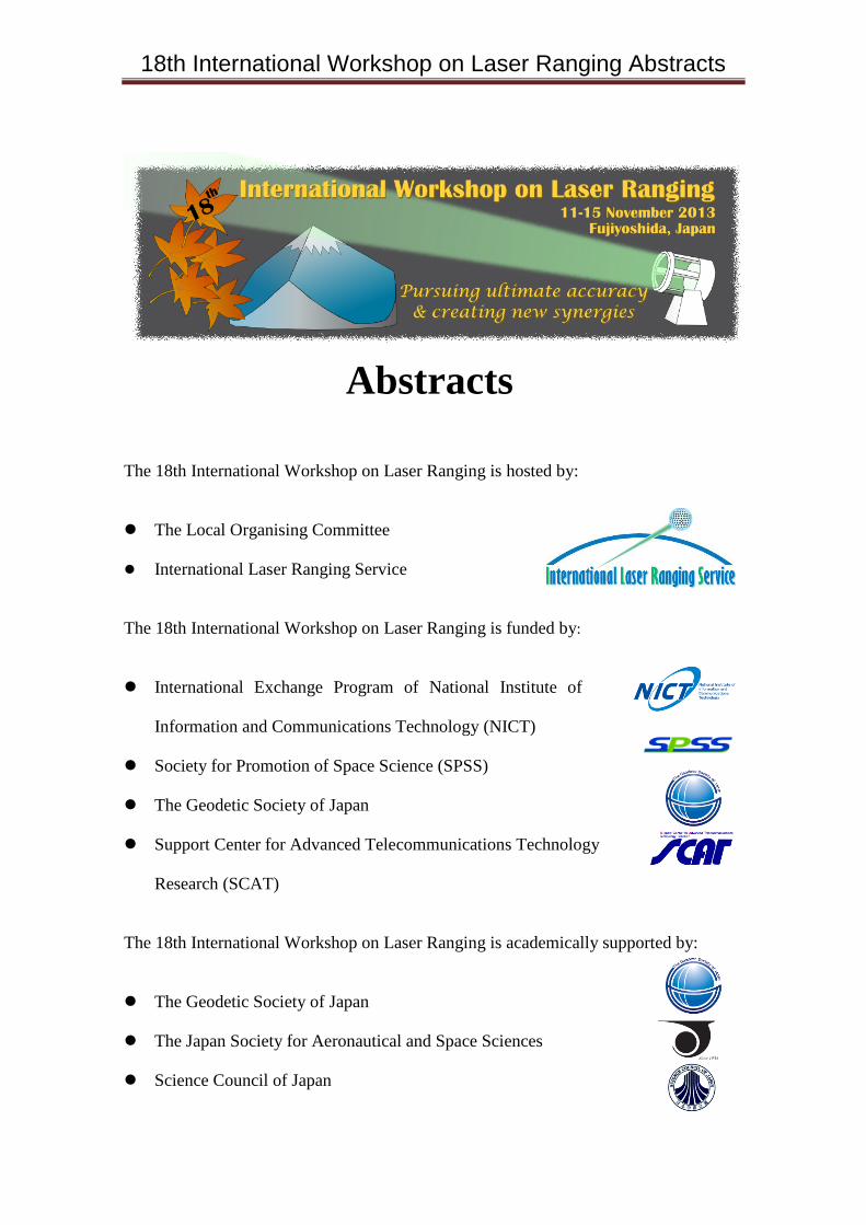
18th International Workshop on Laser Ranging Abstracts
Abstracts
The 18th International Workshop on Laser Ranging is hosted by:
The Local Organising Committee
International Laser Ranging Service
The 18th International Workshop on Laser Ranging is funded by:
International Exchange Program of National Institute of
Information and Communications Technology (NICT)
Society for Promotion of Space Science (SPSS)
The Geodetic Society of Japan
Support Center for Advanced Telecommunications Technology
Research (SCAT)
The 18th International Workshop on Laser Ranging is academically supported by:
The Geodetic Society of Japan
The Japan Society for Aeronautical and Space Sciences
Science Council of Japan
18th International Workshop on Laser Ranging Abstracts
Companies providing exhibition booths are:
Hamamatsu Photonics K. K. (2 spans)
Autex Inc.
Guidetech
Kyoei Optronics Co., Ltd. & Okamoto Optics Works, Inc.
Nitto Optical Co., Ltd.
Local Organising Committee members are:
Toshimichi Otsubo (Hitotsubashi Univ; Chair), Kyohei Akiyama (JAXA),
Hiroo Kunimori (NICT), Toshihiro Kubo-oka (NICT), Shun-ichi Watanabe (Japan
Coast Guard), and Hiroshi Araki (NAOJ)
with great help from:
Takahide Mizuno, Mariko Kawano, Shinichi Nakamura, Anne Mori,
Sachiyo Kasho (JAXA), Mihoko Kobayashi, Shinichirou Takakura, Kohei Ikeda,
Hiroyuki Makino, Saeto Kudo (Hitotsubashi Univ), Mariko Sato, Shimosato
Hydrographic Observatory (Japan Coast Guard), Ryosuke Nagasawa (Sokendai),
Koji Matsuo (Kyoto Univ), Site Tour Elucidators (NICT), Highland Resort Hotel
& Spa, ICS Inc, and Fujiyoshida City.
Program Committee members are:
Shinichi Nakamura (JAXA & AIT, Japan; Chair), Graham M Appleby (NERC,
UK), Hiroshi Araki (NAOJ, Japan), Mathis Blossfeld (DGFI, Germany),
Georg Kirchner (Austrian Academy of Science), Daniel Kucharski (KASI, Korea),
Hiroo Kunimori (NICT, Japan), Hyung-Chul Lim (KASI, Korea),
Christopher Moore (EOS, Australia), Takahide Mizuno (JAXA, Japan),
Jürgen Müller (Leibniz Univ Hannover, Germany), Toshimichi Otsubo
(Hitotsubashi Univ, Japan), Erricos C Pavlis (GEST/UMBC, USA), Michael R
Pearlman (Harvard Univ, USA), Victor D Shargorodsky (OJC RPC, Russia),
Ulrich Schreiber (TUM, Germany), Daniela Thaller (BKG, Germany),
Scott L Wetzel (HTSI, USA), Matthew Wilkinson (NERC, UK), and
Zhang Zhongping (SHAO, China)
18th International Workshop on Laser Ranging Abstracts
Session 1: Data management, GGOS, Geodesy
Chairs:
Daniela Thaller
and
Mathis Blossfeld
18th International Workshop on Laser Ranging Abstracts
13-0101
ICSU-World Data System, New Scientific Data Management
Yasuhiro Murayama[1], Mustapha Mokrane[2], Bernard Minster[3]
[1] NICT/WDS-Scientific Committee
[2] WDS-Internationao Programme Office
[3] UCSD/WDS-Scientific Committee
The ICSU World Data System (ICSU-WDS) was established 2008 in ICSU
(International Council for Science) reforming the two former scientific data bodies of
WDC and FAGS with their more than 50-year’s legacy. WDS’ s primary goals are to
ensure the long-term stewardship of quality-assessed data for research and education,
and the provision of such data and related data services to the international science
community and other stakeholders. Open sharing of information and data is one of
essential components of scientific activity, while data is recognized indispensable
information resource for science and society. Today unlike conventional libraries and
bibliographic access, online data and journals in digital forms are requiring society to
identify new ways of data preservation, certification, sharing, and citation of such
digital resources, while new technologies provide potential to solve those problems
and moreover new potential to enable new sciences even. ICSU-WDS, now with 75
member institutions including ILRS and IVS, is building a new international
federation of system of data systems to target forming the community of excellence
and achieving the goals.
18th International Workshop on Laser Ranging Abstracts
13-0102
Dissemination of SLR data-related products through a Virtual
Observatory
Florent Deleflie [1], Christophe Portmann [2], Laurent Soudarin [3],
Christophe Barache [4], Jerome Berthier [1], and David Coulot [5,1]
[1] GRGS/IMCCE
[2] Solussio
[3] GRGS/CLS
[4] GRGS/Paris Observatory
[5] GRGS/IGN, Univ. Paris Diderot
This paper presents the astronomical so-called Virtual Observatory (VO), and gives
some examples of Webservices hosted by GRGS Analysis Center webpages, that can
be used for Earth sciences applications, and for SLR stations operations.
Astronomers using this VO are now organized within an international association
called the International Virtual Observatory Alliance (IVOA), which was formed in
June 2002 with a mission to "facilitate the international coordination and
collaboration necessary for the development and deployment of the tools, systems
and organizational structures necessary to enable the international utilization of
astronomical archives."
GRGS now routinely delivers geodetic products to most of the space geodetic
services of the International Association of Geodesy. Some of these products are now
natively archived following the data format recommended by IVOA, the VO-Table
format, an improved version of the XML format. We pay a particular attention on (i)
Space Station Coordinates time series deduced from SLR, DORIS and GPS data, (ii)
EOP time series deduced from SLR and VLBI data, (iii) SLR station biases.
18th International Workshop on Laser Ranging Abstracts
13-0103
GGOS Global Space Geodesy Networks and the Role of Laser
Ranging
Michael Pearlman [1], Erricos Pavlis [2], Carey Noll [3], Chopo Ma [3],
Scott Wetzel [4], Graham Appleby [5], Ruth Neilan [6]
[1] Harvard - Smithsonian Center for Astrophysics
[2] Univ. of Maryland
[3] NASA GSFC
[4] Honeywell Technical Solutions, Inc
[5] Natural Environment Research Council
[6] JPL/Caltech
The reference frame is essential to measurements and their interpretation of global
change conditions. The improvements in the reference frame and other space
geodesy data products spelled out in the GGOS 2020 plan will evolve over time as
new space geodesy sites enhance the global distribution of the network, and new
technologies are implemented at the sites thus enabling improved data processing and
analysis. The GGOS goals include the development of the reference frame to 1 mm
accuracy and 0.1 mm stability, an order of magnitude better than the present situation.
To achieve the improved reference frame, simulations show that we will need 30
globally distributed core sites with VLBI, SLR, GNSS and DORIS (where available).
In addition, co-location sites with less than the full core complement will continue to
play a very important role in filling out the network while it is evolving and even
after full implementation. The global participation of new technology SLR is a key
element to making this work.
GGOS, through its Call for Participation, bi-lateral and multi-lateral discussions, and
work through the Technique Services (IGS, ILRS, IVS, and IERS) continues to
encourage current groups to upgrade and new groups to join the activity. This talk
will give an update on the current and planned expansion of the global space geodesy
network with particular attention on SLR.
18th International Workshop on Laser Ranging Abstracts
13-0104
NASA’s Space Geodesy Project
S. M. Merkowitz [1], S. Desai [2] , R. S. Gross [2], L. Hilliard [1],
F. G. Lemoine[1], J. L. Long [1], C. Ma [1], J. F. McGarry [1], D. Murphy [2],
C. E. Noll [1], E. C. Pavlis [3], M. R. Pearlman [4], D. A. Stowers [2],
F. H. Webb [2]
[1] NASA GSFC
[2] JPL, CalTech
[3] Univ. of Maryland
[4] Harvard-Smithsonian Center for Astrophysics
NASA's Space Geodesy Project (SGP) recently completed a prototype core site as the
basis for a next generation Space Geodetic Network that is part of NASA's
contribution to the Global Geodetic Observing System (GGOS). This system is
designed to produce the higher quality data required to establish and maintain the
Terrestrial Reference Frame and provide information essential for fully realizing the
measurement potential of the current and future generation of Earth Observing
spacecraft. The prototype core site is at NASA's Geophysical and Astronomical
Observatory at Goddard Space Flight Center and includes co-located, state of-the-art,
systems from all four space geodetic observing techniques: Very Long Baseline
Interferometry (VLBI), Satellite Laser Ranging (SLR), Global Navigation Satellite
Systems (GNSS), and Doppler Orbitography and Radiopositioning Integrated by
Satellite (DORIS). A system for monitoring of the “ties” between these four systems
is an integral part of the core site development concept and this specific prototype.
When fully implemented, this upgraded global network will benefit in addition to the
ITRF, all other network products (e.g. Precision Orbit Determination, local &
regional deformation, astrometry, etc.), which will also be improved by at least an
order of magnitude, with concomitant benefits to the supported and tracked missions,
science projects, and engineering applications. We present the results of the prototype
site demonstration and describe the NASA plans for implementing its next generation
network.
18th International Workshop on Laser Ranging Abstracts
13-0105
SLR-GNSS analysis in the framework of the ITRF2013 computation
Daniela Thaller [1], Ole Roggenbuck [1], Krzysztof Sosnica [2],
Peter Steigenberger [3], Maria Mareyen [1], Christian Baumann [2],
Rolf Dach [2], Adrian Jäggi [2]
[1] Bundesamt für Kartographie und Geodäsie (BKG)
[2] Astronomical Institute, Univ. of Bern (AIUB)
[3] Institut für Astronomische und Physikalische Geodäsie (IAPG), TU München
The call for participation for the ITRF2013 also asked for pre-combined contributions,
although they would not be directly included in the ITRF2013 combination.
In the framework of the CODE (Center for Orbit Determination in Europe)
consortium, pre-combined GNSS-SLR solutions are computed. The important
characteristic of these pre-combined solutions is that the satellite co-location at the
GNSS satellites is employed, i.e., the SLR tracking of the GPS and GLONASS
satellites is included into the combination, together with the GNSS microwave data
and the SLR data to LAGEOS and Etalon satellites.
Since about three years, several SLR stations make an effort to track the full
GLONASS constellation, which should ideally provide a stronger connection
between GNSS and SLR.
We will show the status of this combination work.
18th International Workshop on Laser Ranging Abstracts
13-0106
Recent Progress and Future Perspectives of the International VLBI
Service for Geodesy and Astrometry (IVS)
Shinobu Kurihara, and many colleagues of the IVS
Geospatial Information Authority of Japan
The International VLBI Service for Geodesy and Astrometry (IVS) was established
in 1999 to operate or support Very Long Baseline Interferometry (VLBI) components.
IVS provides a service which supports geodetic and astrometric work on reference
systems, Earth science research, and operational activities. IVS is a Service of the
International Association of Geodesy (IAG) and of the International Astronomical
Union (IAU).
In recent months, IVS has made enormous progress advancing towards the
realization of the VLBI2010 Global Observing System (VGOS). The key issues of
the new generation IVS installations are fast rotating radio telescopes capable of
receiving broadband quasar radiation between 2 and 14 GHz in a continuous
frequency band. A number of new telescopes have been built or are approved
providing a good basis for a thorough refurbishing of the IVS network as a whole.
Together with addressing a number of other technique-specific issues, the IVS is on a
good path to fulfill the requirements of the Global Geodetic Observing System
(GGOS). This presentation will explain the status of VGOS and its future path of
development.
18th International Workshop on Laser Ranging Abstracts
13-0107
Deployment of SLR colocation sites with one-way RF systems and
VLBI for the improvement of the GLONASS
Pasinkov V.V. , Kovalev V.V. , Fedotov A.A. , Shargorodskiy V.D.
Open Joint-Stock Company Research-and-Production Corporation
“Precision Systems and Instruments”
Maintaining of the GLONASS competitive characteristics ensuring decimeter
accuracy of navigation requires the deployment of fundamental coordinate/time
support and, with the goal to improve the accuracy of navigation field by an order of
magnitude.
Therefore, the following specific requirements should be met:
- accuracy of geodynamic data calculation < of 1.5 cm in linear measure,
- coordinate accuracy of stations involved in the ephemeris determination < 1 cm
relative to the center of mass, and 0.3 cm in relative binding,
- accuracy of the account for refraction: < 1 cm around the zenith,
- delay calibration accuracy in the GLONASS navigation signals < 3-5 cm.
These problems are solved by colocation of different methods: SLR- one-way RF
ranging -VLBI -WVR.
Improving of the GLONASS geodynamic value is achieved by refinement of the
actual earth rotation parameters 3-4 times a day. The VLBI network will provide
operative definition of World time using antennas of small diameter (about 12m) and
new equipment for data collection and correlation.
Combining WVR and one-way RF systems, will provide mutual scaling of direct
measurements of the water vapor concentration and verification of the hydrostatic
component of refraction in the troposphere.
Geodetic accuracy is also achieved using the advantages of different instruments. To
improve the accuracy of GLONASS, the new Federal program includes “BLTS-M”
satellites with millimeter target error in 1500 - 3000 km high orbits with simultaneous
creation of new generation of submillimeter-accuracy SLR stations.
To calibrate the delays in the GLONASS navigation signals, a one-way laser ranging
system is provided. Testing of the first such system is underway on «Glonass-M» №
47.
Deployment of colocation sites SLR, one-way RF system and VLBI provides a new
level of accuracy for the GLONASS system as a whole.
18th International Workshop on Laser Ranging Abstracts
13-0117
Laser ranging in Main metrological center of the Russian State service
of time, frequency and the Earth rotation parameters determination
I. Blinov, I. Ignatenko
National Research Institute for Physical-Technical and Radio Engineering
Measurements (VNIIFTRI)
The report presents condition and development of laser ranging measurements in
VNIIFTRI. Special attention is paid to metrological aspects. Considered the issues of
comparisons with the standards and rigs of highest accurac

18th International Workshop on Laser Ranging Abstracts
Session 2: Gravity, Earth Model, Reference Frame
Chairs:
Giuseppe Bianco
and
Koji Matsuo
18th International Workshop on Laser Ranging Abstracts
13-0108
Earth gravity field recovery using GPS, GLONASS, and SLR
satellites
Krzysztof Sośnica [1], Adrian Jäggi [1], Daniela Thaller [2], Ulrich Meyer [1],
Christian Baumann [1], Gerhard Beutler [1], Rolf Dach [1]
[1] Astronomical Institute, Univ. of Bern
[2] Bundesamt für Kartographie und Geodäsie
The time variable Earth’s gravity field provides the information about mass transport
in the system Earth, i.e., the relationship of mass transport between atmosphere,
oceans, and land hydrology.
We recover the low degree parameters of the time variable gravity field using
microwave observations from GPS and GLONASS satellites and from SLR data to
five geodetic satellites, namely LAGEOS-1/2, Starlette, Stella, and AJISAI. The
refined orbit modeling of low orbiting geodetic SLR satellites is performed by using
pseudo-stochastic orbit parameters. The SLR-derived geopotential coefficients are
compared to GRACE and GNSS results.
GPS satellites are particularly sensitive to specific coefficients of the Earth's gravity
field, because of the deep 2:1 orbital resonance with Earth rotation (two revolutions
of the GPS satellites per sidereal day). The resonant coefficients cause, among other,
a “secular” drift (actually periodic variations of very long periods) of the semi-major
axes of up to 5.3 m/day of GPS satellites.
We processed 10 years of GPS and GLONASS data using the standard orbit models
from the Center of Orbit Determination in Europe (CODE) with a simultaneous
estimation of the Earth gravity field coefficients and other parameters, e.g., satellite
orbit parameters, station coordinates, Earth rotation parameters, troposphere delays,
etc. The weekly GNSS gravity solutions up to degree and order 4 are compared to the
weekly SLR and the monthly GRACE gravity field solutions.
18th International Workshop on Laser Ranging Abstracts
13-0109
Temporal variations in the Earth’s gravity field from multiple SLR
satellites: Toward the investigation of polar ice sheet mass balance
Koji Matsuo [1], Toshimichi Otsubo [2]
[1] Kyoto Univ. [2] Hitotsubashi Univ.
The Hitotsubashi University and National Institute of Information and
Communications Technology of Japan have developed an analysis software package
named “c5++” to process systematically various data acquired by space geodetic
techniques [Otsubo et al, 1994]. This software implements a system to derive
temporal variations in the Earth’s gravity field from the SLR tracking data. Using this
software and incorporating data from five SLR satellites, we obtain monthly time
series of gravitational Stokes coefficients of degree and order up to 4 between
September 1986 and May 2013. Here we utilize them to investigate the ice sheet
mass balance in Greenland and Antarctica. Our SLR gravity solutions suggest that
Greenland mass balance was nearly-balanced prior to 2002 and shifted to decreasing
afterwards. The mass balance in West Antarctica also shows similar trends as
Greenland. However, that in East Antarctica shows opposite trends: i.e. near-balance
prior to 2002 and shifting to increasing afterwards. These mass variabilities agree
well with numerical results of mass balance estimate by input output method
[Shepherd et al., 2012]. So, the present study demonstrates that the retrospective SLR
data allow us to “observe” the mass variability of Greenland and Antarctica prior to
the launch of GRACE mission in 2002.
18th International Workshop on Laser Ranging Abstracts
13-0110
Low-frequency gravity change from GPS data of COSMIC and
GRACE: potential enhancement from COSMIC-2’s GPS and SLR
data
Cheinway Hwang [1], Shin-Fa Lin[1,2], Yan-Ti Chen [1], Tzu-Pang Tseng [3],
B. F. Chao [4]
[1] National Chiao Tung Univ.
[2]National Space Organization
[3]GPS Science and Application Research Center, National Central Univ.
[4]Institute of Earth Sciences, Academia Sinica
This paper shows the estimation of low-frequency time-varying gravity fields from
GPS data from low-earth orbiters. Our current solutions use GPS data from COSMIC
and GRACE satellite missions, but will include more data from missions such as
CHAMP and future COSMIC-2. Some of the COSMIC-2 satellites will be equipped
with SLR retro-reflectors, allowing for orbit validation and extra data to enhance our
low- frequency gravity solutions. Our solutions use the analytical orbit perturbation
theory and the input data are the residuals between the kinematic orbit and the
dynamic orbit, the latter being generated by GEODYN II. The dynamic orbit models
all perturbing forces except the time-varying gravity. We will present the preliminary
result from COSMIC and GRACE GPS data from September 2006 to December
2007 (16 months), with a possible extension of the gravity time series. Our
time-varying gravity filed is complete to spherical harmonic degree 5. The gravity
variations from the GPS and GRACE (based on KBR) solutions show consistent
patterns over space and time, especially in regions of active hydrological changes.
The monthly GPS-derived second, third and fourth zonal gravity coefficients show
high correlations with the SLR-derived result.
18th International Workshop on Laser Ranging Abstracts
13-0111
Earth’s low degree gravitational variations from space geodetic data
V.Luceri [1], C.Sciarretta [1], G.Bianco [2]
[1] e-GEOS S.p.A., Centro di Geodesia Spaziale
[2] Agenzia Spaziale Italiana, Centro di Geodesia Spaziale
Geodetic techniques allow to monitor the main mass variations of our planet reflected
by variations of the Earth’s figure axis and oblateness which are described by the
second-degree geopotential coefficients. SLR data have been used in this study to
retrieve time series of direct estimates of low degree geopotential coefficients using 7
geodetic satellites: Lageos1, Lageos2, Stella, Starlette, Ajisai, Etalon1 and Etalon2.
SLR, GPS and VLBI can be used to estimate these variations through derived
excitation functions from the EOPs estimations. The excitation functions incorporate
the influence by earth’s atmosphere and oceans, both from their mass and motion
components, which can be modelled by the atmospheric and oceanic angular
momenta variations provided by the IERS dedicated bureaus.
The C21/S21/C20 long-term geodetic time series, obtained with different methods
and using different data, deprived of the modelled atmospheric and oceanic ‘motion’
terms to isolate their response to the mass variations only, will be presented and
inter-compared, to evaluate their consistency. The residual signal contents of the
geodetic values will be evaluated too.
18th International Workshop on Laser Ranging Abstracts
13-0112
Geophysical fluid models for atmosphere, ocean and hydrology and
their impact on SLR analysis
Ole Roggenbuck, Maria Mareyen
Federal agency for cartography and geodesy Germany (BKG)
For a wide range of sciences it is important to know the shape of the earth, the earth
gravity field, the earth rotation and their evolution in time. Especially in case of slow
moving phenomena like the sea level rise it is important to have access to high
quality reference frames. Reference frames like the ITRF describe the position of
points with coordinates and velocities related to a reference epoch.
Apart from linear behavior we have to consider a sum of additional time dependent
variations. These additional terms are often caused by the ocean, the atmosphere and
the hydrology, the so called geophysical fluids. With changes in mass distribution
they have an influence on the gravity field and the shape of the earth. Beside the tidal
effects there are also non-tidal effects. For modeling these effects, special data sets
describing the global mass variations in the atmosphere, the ocean and the hydrology
are mandatory.
We analyzed eleven years of Lageos and Etalon data using different loading models
for the geometric deformation and the gravity effect. We tested different model
combinations and studied the impact on the estimated station coordinates and other
parameters, e.g., the geocenter and Earth rotation parameters.
18th International Workshop on Laser Ranging Abstracts
13-0113
Consistent estimation of Earth rotation, geometry and gravity with
DGFI's multi-satellite solution
Mathis Blossfeld [1], Vojtech Stefka [2], Horst Mueller [1], Michael Gerstl [1]
[1] Deutsches Geodaetisches Forschungsinstitut (DGFI)
[2] Astronomical Institute, Academy of Sciences of the Czech Republic (CAS)
Satellite Laser Ranging (SLR) is the unique technique to determine station
coordinates together with Earth Orientation Parameter (EOP) and Stokes coefficients
of the Earth's gravity field in one common adjustment. These parameters form the so
called "three pillars" (Plag & Pearlman, 2009) of the Global Geodetic Observing
System (GGOS). In its function as official analysis center of the International Laser
Ranging Service (ILRS), DGFI is developing and maintaining software to process
SLR observations called "DGFI Orbit and Geodetic parameter estimation Software"
(DOGS). The software is used to analyze SLR observations and to compute
multi-satellite solutions.
In this study, up to 12 satellites (ETALON1/2, LAGEOS1/2, STELLA, STARLETTE,
AJISAI, LARETS, LARES, BLITS, WESTPAC, BEACON) with different orbit
characteristics (e.g. inclination and altitude) are combined. The relative weighting of
the satellites is done using a variance component estimation (VCE). The diversity of
the orbits allows de-correlating highly correlated parameters such as gravity field
coefficients (GFCs) and EOP. The correlations are studied in detail. Together with
the Earth’s gravity field (GFCs up to degree/order 6) and rotation (terrestrial pole
coordinates, UT1-UTC), also the 3D station coordinates are estimated on a weekly
and monthly basis. The results are compared to common state-of-the-art products
which are provided by the IERS.
18th International Workshop on Laser Ranging Abstracts
13-0114
SLR-derived terrestrial reference frame using observations to
LAGEOS-1/2, Starlette, Stella, and AJISAI
Krzysztof Sośnica [1], Adrian Jäggi [1], Daniela Thaller [2], Gerhard Beutler [1],
Rolf Dach [1], Christian Baumann [1]
[1] Astronomical Institute, Univ. of Bern
[2] Bundesamt für Kartographie und Geodäsie
Currently, the contributions of Starlette, Stella, and AJISAI are not taken into account
when defining the International Terrestrial Reference Frame (ITRF), despite the large
amount of data collected in a long time-span. Consequently, the SLR-derived
parameters and the SLR part of the ITRF are almost exclusively defined by
LAGEOS-1 and LAGEOS-2.
We investigate the potential of combining the observations to several SLR satellites
with different orbital characteristics. Ten years of SLR data are homogeneously
processed using the development version 5.3 of the Bernese GNSS Software. Special
emphasis is put on orbit parameterization and the impact of LEO data on the
estimation of the geocenter coordinates, Earth rotation parameters, Earth gravity field
coefficients, and the station coordinates in one common adjustment procedure.
We find that the parameters derived from the multi-satellite solutions are of better
quality than those obtained in single satellite solutions or solutions based on the two
LAGEOS satellites. A spectral analysis the SLR network scale w.r.t. SLRF2008
shows that artifacts related to orbit perturbations in the LAGEOS-1/2 solutions, i.e.,
periods related to the draconitic years of the LAGEOS satellites, are greatly reduced
in the combined solutions.
18th International Workshop on Laser Ranging Abstracts
13-0115
The Error Analysis of SHAO Terrestrial Reference Frame and EOPs
Xiaoya Wang, Bing He, Bin Wu, Xiaogong Hu
Shanghai Astronomical Observatory
SHAO has carried out a new TRF and corresponding EOPs based on the SINEX
solutions of the space geodetic techniques such as VLBI, SLR, GNSS and DORIS.
The accuracy of EOPs is similar with that of DGFI’s EOPs with respect to IERS 08
C04. The accuracy is about 0.142 mas for PMX, 0.139 mas for PMY, 0.010ms for
UT1-UTC and 0.02ms for LOD. From the residuals of our EOPs and IERS 08 C04
we can see the mean is very small 0.027 mas for PMX, 0.066mas for PMY, 0.008ms
for UT1-UTC and 0.001ms for LOD. And also there are no any significant signals.
So we think if we still can improve our EOPs’ accuracy. The position and velocity for
our TRF are close to that of ITRF2008 for regular space geodetic sites. The accuracy
is better than 5mm for positions and 1mm/yr for velocities. There is one question
again if we can improve our TRF. Therefore, we analyze the accuracy and residuals
in order to look for some regular patterns and methods to improve our EOP and TRF.
18th International Workshop on Laser Ranging Abstracts
13-0116
JCET’s Daily-updated State-of-the-art SLR-only TRF
Erricos C. Pavlis, Magdalena Kuzmicz-Cieslak, Daniel König and Keith Evans
GEST/Univ. of Maryland Baltimore County
GGOS requirements for ITRF accuracy are very stringent, especially in the origin
definition and scale stability. Additionally, precise monitoring of the geocenter and
its variations over increasingly shorter intervals is a priority goal in order to meet
these requirements of 1 mm accuracy and 0.1 mm/y stability. To meet the goals of
GGOS geodetic techniques need to provide high fidelity data and products, based on,
and validated through, the use of the most accurate and up to date standards. At the
JCET/GSFC ILRS AC we have been generating incremental TRF updates on a daily
basis for several years now, based solely on SLR data. The utility of such a TRF is
primarily the delivery of up to date positions and velocities for our tracking sites and
the improvement of such information for newly introduced systems, with little or
no-data contribution during the development of the available ITRF. The approach can
be easily extended to include the contribution from the other techniques, for a trully
multi-technique TRF. We will present results from our current operational scheme
and compare them to the nominal ITRF products, based on the currently accepted
IERS and ILRS standards.

18th International Workshop on Laser Ranging Abstracts
Session 3: Data Quality and its Products, SLR Network
Chair:
Shinichi Nakamura
and
Florent Deleflie
18th International Workshop on Laser Ranging Abstracts
13-0201
Quality of the SLR data 1983-2012
Stanislaw Schillak[1], Pawel Lejba[1], Piotr Michalek[1], Karolina Szafranek[2]
[1] Space Research Centre PAS
[2] Military University of Technology
The presentation shows the results of the orbital analysis of the SLR data for
determination of station positions and velocities from September 1983 to December
2012. The computations were realized by Goddard’s NASA GEODYN-II orbital
program from results of laser observations of the LAGEOS-1 and LAGEOS-2
satellites. The positions were determined for the first day of each month from the
monthly arcs computed from 10-20 the best stations (quality and quantity) in each
year in ITRF2008. The results for a given station with lower number of normal points
than 50 per month were rejected. The station velocities were computed for data span
longer than 3 years. The accuracy was estimated as 3D RMS of station position for
common epoch 2005.0. The results were divided into 6 groups 5 years each:
1983-1987, 1988-1992 (both only for LAGEOS-1), 1993-1997, 1998-2002,
2003-2007, 2008-2012. In total the positions and velocities of 137 sites were
determined including 16 sites longer than 20 years span, velocities for 90 sites and 30
mobile sites with span longer than 3 years. The best results of 3D RMS were obtained
on the level of 4 mm (1998-2012) (stations Herstmonceux – the best in 3 spans,
Mt.Stromlo, Graz and Zimmerwald), 24 stations had accuracy below 10 mm. The
results before 1993 were significantly worse due to only one LAGEOS satellite, after
2005 small deterioration of accuracy were observed mainly due to systematical biases
several important stations and earthquakes which are especially often in the last three
years (Concepcion, San Juan, Monument Peak, Koganei, Simosato, Changchun). The
results will be available soon on Borowiec web page www.cbk.poznan.pl .
18th International Workshop on Laser Ranging Abstracts
13-0202
Quality and possible improvements of the official ILRS products
Horst Mueller, Mathis Blossfeld
DGFI, Munich, Germany
The ILRS is providing a few products for the international community. Seven
analysis and two combination centres take care of the quality of the resulting products,
station coordinates, EOPs and satellite orbits. Daily and weekly products are provided
by the ILRS data centres.
In this paper we are looking for some possible improvements of these products,
though the general quality is quite good at the moment. One aspect to improve station
coordinates is the consistent handling of station biases and the station coordinates
used for processing. We looked into time series of biases, also for core stations, and
analysed the influence of individual satellites and the yield of combined biases. An
other aspect is the sky coverage over the tracking stations, therefore we tried to get a
quality criteria for the minimum number of passes over a station to get good weekly
station coordinates. Biases and station coordinates are correlated and especially the
height component of a station depends on the range bias estimated. EOPs depend on a
homogeneous distribution of observation along the orbit. Especially Etalon is poorly
tracked with presently 150 to 200 observation per week only and hence has little
influence on the ILRS product.
Furthermore we were investigating the use of the new satellite Lares as an additional
target or as replacement for Etalon tracking. This satellite can easily be modelled
since he combines a heavy weight with a small diameter. Due to the orbit
characteristic Lares can also improve the sky coverage over stations. Besides this
satellites can be used to improve low degree harmonics of the earth gravity field.
These coefficients, up to degree and order four to six, are not well defined by the
present gravity missions GOCE and GRACE.
18th International Workshop on Laser Ranging Abstracts
13-0203
Subdaily Quality Check of Laser Ranging Data at Hitotsubashi Univ.
Toshimichi Otsubo, Mihoko Kobayashi, Shinichirou Takakura
Hitotsubashi Univ.
Rapid quality check analysis has played an important role to improve the quality of
satellite laser ranging. Since 1999, the ILRS associate analysis centers in Japan,
NICT and later Hitotsubashi University, have issued quality check reports routinely.
It had been a weekly service at the beginning, and later switched to a daily service in
2005. Furthermore, in August 2012, we upgraded it to a 6-hourly service. It is
now possible for an observer to check his/her tracking data before going home.
The analysis software itself has been upgraded at the same time. The new C++
version of our geodetic analysis software 'c5++' is implemented in the automated
sequence. The new software is compatible with the IERS Conventions (2010) and
other latest models, and we can provide more stable and more precise analysis reports
than the previous version.
When we detect a series of anomalous passes, we report the incident to the station
and the 'rapidservicemail' mailing service operated at DGFI. Up to now, we search
such incidents by human eyes, but we plan to automate the detection process in the
near future.
18th International Workshop on Laser Ranging Abstracts
13-0204
Quality assessment of SLR data-related products
Jean-Michel Lemoine [1], Florent Deleflie [2], Franck Reinquin [1],
David Coulot [3,2]
[1] GRGS/CNES
[2] GRGS/IMCCE
[3] GRGS/IGN Univ. Paris Diderot
We draw an assessment of the quality obtained on SLR data – related products that
are computed from the analysis of Lageos-1 and Lageos-2 data acquired by the ILRS
network over more than 20 years. In particular, we show and analyze time series of
post-fit residuals for both satellites, biases and space stations coordinates (SSCs), that
are deduced following the recommendations provided by the Analysis Working
Group. Moreover, as an update of the SLRF2008 reference file, we perform and
analyze the same kind of study from orbit computations (i) where all the a priori
parameters are those we submitted to the Combination Centers (SSC, EOPs), (ii) with
a modelling accounting as well for atmospheric loading effects over the last few years.
We discuss the corresponding results.
18th International Workshop on Laser Ranging Abstracts
13-0205
EUROLAS Data Center - Improvements of the Website for the ILRS
Community
Christian Schwatke
DGFI
In 2011, the EDC website (http://edc.dgfi.badw.de) was released. This website
provides information about the data flow between stations, prediction providers and
the EDC. It also gives detail information about the status of every individual
submitted SLR passage.
In this presentation, we introduce new features of the EDC websites which are useful
for station managers and users such as
- tool for checking CRD and CPF format,
- individual CPF mailer configuration,
- API for station manager to get information about their submitted data,
- monthly and yearly reports of EDC,
- new statistics about satellites and stations (e.g. daily and monthly number of SLR
measurements),
- new statistics about the EDC data holding (e.g. time span between measurement at
availability at the DC),
- etc.
18th International Workshop on Laser Ranging Abstracts
13-0206
NASA SLR operational network project overview.
David McCormick
NASA
This paper presents the past and present performance of the NASA SLR network.
The NASA SLR network has many legacy systems that need to last or be transitioned
to the future network. This paper answers how, at a high project level, NASA will
manage component obsolescence in a changing environment to maintain and improve
NASA’s contribution to the ILRS and Geodesy.
18th International Workshop on Laser Ranging Abstracts
13-0207
Engineering changes to the NASA SLR Network to overcome
obsoleteness and improve performance and reliability
Thomas Varghese
NASA/ Cybioms Corporation
NASA SLR network has provided excellent laser ranging data over decades to
contribute to ITRF, altimetry support, and transponder measurements. The
obsoleteness of hardware and ensuing difficulty to maintain a reliable and sustainable
network have prompted an effort to replace, refurbish, and revamp the system for
continuity of operations and improved ranging performance. This paper will
describe the challenges, issues, and the technical effort currently in progress in
pursuit of reliable and state of the art performanc
18th International Workshop on Laser Ranging Abstracts
Session 4: POD and its Application
Chairs:
Erricos C Pavlis
and
Daniel Kucharski
18th International Workshop on Laser Ranging Abstracts
13-0208
Orbit Determination and Analysis for STSAT-2C
Young-Rok Kim, Eunseo Park, and Hyung-Chul Lim
Korea Astronomy and Space Science Institute, Korea
The Korea’s first SLR satellite, Science and Technology Satellite (STSAT)-2C was
launched on January 30, 2013 by Korea Space Launch Vehicle (KSLV)-1. SLR
tracking for STSAT-2C was started on March 29, 2013. However, there are very few
SLR measurements because the accuracy of predicted orbit by consolidated
prediction format (CPF) is poor. It becomes trouble both tracking and orbit
determination for STSAT-2C. In this study, the orbit determination using SLR
measurements for STSAT-2C is performed. For orbit determination, NASA/GSFC
GEODYN II software is used and various strategies are applied. The period of
atmospheric drag coefficients and acceleration parameters estimation and arc length
are changed. For orbit quality assessment, post-fit residuals of orbit determination
process and orbit overlaps of arcs are analyzed. Additionally, the differences between
estimated orbit and CPFs are presented. Finally, we propose better orbit
determination strategy to overcome inaccurate initial orbit condition and sparse or
insufficient measurements by SLR-only.
18th International Workshop on Laser Ranging Abstracts
13-0209
GNSS Satellite Orbit Validation Using Satellite Laser Ranging
Oliver Montenbruck [1], Peter Steigenberger [2], Georg Kirchner [3]
[1] DLR/GSOC
[2] TUM/IAPG
[3] ÖAW/IWF
With a total of four new regional and global navigation satellite systems that have
launched first satellites or even started an operational service, the GNSS landscape
has experienced major changes in recent years. As part of the Multi-GNSS
Experiment (MGEX) of the International GNSS Service (IGS), a global network of
multi-GNSS monitoring stations has been established and various analysis centers
have started to determine orbits of selected GNSSs on a routine basis. As a key
feature, all satellites of the new constellations (i.e. Galileo, BeiDou, QZSS and
IRNSS) are equipped with laser ranging reflector arrays enabling high-precision two
way ranging measurements. The presentation illustrates the use of SLR observations
collected by the ILRS for validation of precise and broadcast ephemerides of the new
constellations. As an independent and unambiguous tracking system, SLR helps to
gain a better understanding of the new satellites, which still lack a thorough
characterization of their orbit and attitude dynamics. SLR tracking is thus considered
an essential contribution for a future use of the new GNSSs in space geodesy. The
presentation also addresses operational aspects of SLR tracking of the new navigation
satellites related to their specific orbits, regional distribution and continuously
increasing number.
18th International Workshop on Laser Ranging Abstracts
13-0210
The concept and the preliminary results of the SLR application in the
problem of improving the GLONASS accuracy
V.V. Pasinkov[1], V.D. Shargorodsky[1], M.A. Sadovnikov[1], V.V. Sumerin[1]
Russia
We present the concept of one-way and two-way laser ranging to improve the
accuracy of ephemeris and time-frequency information of the GLONASS Russian
navigation system, as well as the techniques of using laser ranging for:
- calibration of RF one-way measuring systems,
- determination of the differences of on-board and on-ground time scales,
- accuracy control of ephemeris-time data of the navigation message and geodetic
data of the GLONASS system measuring sites.
The description is presented of the ground-based and on-board equipment intended
for inter-satellite coordinate/time measurements, and for laser one-way and two-way
ranging.
Experimental data are presented of the inter-satellite measurements and also of
comparison between on-ground and on-board time scales using the equipment
installed on the SC "Glonass-728", "GLONASS-729" and "Glonass-747".
18th International Workshop on Laser Ranging Abstracts
13-0211
The Accuracy Verification for GPS Receiver of ZY-3 Satellite by SLR
Zhao Chunmei[1], Tang Xinming [2], Wei Zhibin [1], Li Qian [1]
[1]Chinese Academy of Surveying and Mapping
[2]Satellite Surveying and Mapping Application Center, NASG
The ZY-3 satellite provides stereo and multispectral imagery for topographic
mapping, remote sensing and environmental applications. ZY-3 has two
dual-frequency homemade GPS receivers to determine the satellite orbit. Based on
the satellite dynamics principle and batch processing mode, the orbit of ZY-3 satellite
was determined using zero-difference GPS measurements. In order to verify the orbit
accuracy by GPS, we carried out a laser restricted ranging campaign with the support
of the International Laser Ranging Service (ILRS). Compared with SLR data, the
distance bias between the satellite and SLR stations was less than 4cm, which
revealed that ZY-3 satellite orbit accuracy can meet the requirement of satellite
mission.
18th International Workshop on Laser Ranging Abstracts
13-0213
Multi-Static Laser Ranging to Space Debris Targets: Tests and
Results
Georg Kirchner [1], Franz Koidl [1], Martin Ploner [2], Pierre Lauber[2],
Johann Eckl [3], Matthew Wilkinson [4], Robert Sherwood [4],
Adolf Giessen [5], Martin Weigel [6]
[1]Austrian Academy of Sciences, Space Research Institute
[2]Astronomical Institute, Univ. of Bern
[3]SLR Station Wettzell, Germany
[4]NERC Space Geodesy Facility
[5]DLR Stuttgart, Institute for Technical Physics
[6]DLR Oberpfaffenhofen
Using a strong laser (200 mJ @ 532 nm, 3 ns pulse length, 80 Hz) borrowed from
DLR Stuttgart, the SLR station Graz tracked space debris targets up to distances of >
3000 km. Several cooperating SLR stations within Europe – synchronized to the Graz
laser firing times - successfully detected and time-tagged these Graz photons,
diffusely reflected from the space debris targets.
These quasi-simultaneously measured distances from several laser stations to the
same orbital arc allow for better orbit determination using one or only few passes of
non-cooperative targets.
18th International Workshop on Laser Ranging Abstracts
13-0214
Progress and Observation of Space Debris Laser Ranging
Zhang Zhongping, Zhang Haifeng, Wu Zhibo, Li Pu, Meng Wendong, Chen
Juping, Chen WanZhen
Shanghai Astronomical Observatory
As an increasing number of Space debris, high precise measurement and accurate
catalogue for space debris are required to protect payloads against debris collision.
Laser ranging is a kind of real-time measuring technology with high precision for
space-debris observation. Since 2007, Shanghai Observatory has begun to do
researches on the debris laser ranging technology. With a high power laser of 50W at
200Hz repetition rate, and low noise detectors, Shanghai Observatory has the ability
to range debris of less than 1m2 at the distance of 1000km. This paper presents the
debris laser ranging system, observations and preliminary results of orbit
determination to space debris by single station measurement
18th International Workshop on Laser Ranging Abstracts
13-0215
ENVISAT Spin and Attitude Determination Using SLR
Georg Kirchner [1], Daniel Kucharski [2], Franz Koidl [1]
[1]Austrian Academy of Sciences, Space Research Institute
[2]Korea Astronomy and Space Science Institute
During the last few months, several SLR stations of the ILRS network have tracked
ENVISAT; the data has been used to enhance orbit prediction accuracy, and to
determine attitude and spin of ENVISAT.
While ENVISAT attitude during its active phase was controlled, it now has started to
spin with about 120 seconds per revolution; its spin axis seems to have stabilized in
such a way, that about 50% of the passes allow the stations to ‘see’ the
retro-reflectors – thus enabling routine SLR. Few Passes without ‘visible’
retro-reflectors have been measured by Graz using the strong DLR laser, and
detecting the diffuse reflected photons.
18th International Workshop on Laser Ranging Abstracts
Session 5: Laser Time Transfer
Chairs:
Stanislaw Schillak
and
Ivan Prochazka
18th International Workshop on Laser Ranging Abstracts
13-0216
Time Transfer: Sideline or Geodetic Objective?
Anja Schlicht [1], Ulrich Schreiber [2], Ivan Prochazka [3], Pierre Exertier [4]
[1] Technische Universität München
[2] Observatory Wettzell
[3] Technical Univ. of Prague
[4] Observatoire de la Cote d'Azur
Even if this presentation won't answer this question it should give an orientation to
the SLR stations which effords are worth to investigate into future activities and
which profits can be seen for geodesy as they answer this question by themselves.
There are several questions on the way to this main question, where we could give
answers:
Which synergies can be used doing ranging and time transfer?
Why are clocks put into orbit?
How can space and ground clocks be compared?
Which clock does a station need?
What's the differnce between T2L2 and ELT?
Which effords are necessary to contribute to ELT?
What's a reference point for time?
What profits can geodesy gain?
18th International Workshop on Laser Ranging Abstracts
13-0217
European Laser Time Transfer (ELT) - System delays calibration
I. Prochazka [1], K. U. Schreiber [2], J. Kodet [2,1], A. Schlicht [2], J.Blazej [1]
[1] Czech Technical Univ. in Prague
[2] Forschungseinrichtung Satellitengeodäsie, TUM Geodetic Observatory Wettzell
The laser time transfer is an attractive technique providing the capability of time
transfer ground to space and ground to ground with picosecond precision and several
picoseconds accuracy. The technique is relying on the existing ground based
infrastructure used for satellite laser ranging (SLR). In order to reach the ultimate
precision and accuracy the ground systems participating in time transfer have to be
properly calibrated for this purpose. The new tool “ELT Calibration Device” is
currently under construction. The device is planned to be operated successively on
the participating SLR stations to characterize the ground segment timing performance
prior to the mission launch. The Calibration Device is simulating the ELT operation
to some extent, thus the calibration campaign will serve as an “exercise” before the
real flying hardware will be in operation. The outputs of the calibration campaigns
can be used in other laser time transfer missions, as well. The basic concept of this
process will be presented along with the overall SLR station requirements.
18th International Workshop on Laser Ranging Abstracts
13-0218
European Laser Time Transfer (ELT) and Laser Safety for the ISS
Ulrich Schreiber [1], Jan Kodet [1,3], Anja Schlicht [1], Ivan Prochazka[3],
Johann Eckl [2], Guenther Herold [2]
[1] Geodetic Observatory Wettzell, TUM
[2] Geodetic Observatory Wettzell, BKG
[3] Czech Technical Univ. in Prague
The methods of optical time transfer have been proposed and pioneered by the French
group (Exertier, Samain et al.) in Grasse. As a result T2L2 was launched on Jason 2
and demonstrated the viability of this technique. With the Atomic Clock Ensemble in
Space (ACES) a follow up mission for the exploitation of time transfer is in
preparation at ESA. While the USO of Jason 2 drifts significantly, ACES will provide
a stable reference for non common view time comparison. The ILRS has been
confronted with challenging tracking restrictions several times in the past. With
ACES at the Columbus module of the ISS the challenge of guaranteed eye safety at
all times during SLR laser activities is given. This talk reviews the requirements and
the currently proposed procedure.
18th International Workshop on Laser Ranging Abstracts
13-0219
Progress Report on the WLRS: Getting ready for GGOS, LLR and
Time Transfer
Guenther Herold [1], Johann Eckl [1], Matthias Muehlbauer [1],
Andreas Leidig [2], Ulrich Schreiber [2]
[1] Geodetic Observatory Wettzell, BKG
[2] Geodetic Observatory Wettzell, TUM
The goals set forward by the GGOS have stringent implications for the SLR stations.
Most prominently this requires a good control over systematic effects reducing the
accuracy on the range measurements. At the same time the observation load on the
system increases as more satellites are endorsed for tracking by the ILRS. We have
taken up the challenges and remodeled the WLRS. A new laser with shorter pulse
duration and higher reliability and stability is currently being integrated as well as a
new ground target providing higher accuracy. We also concentrated on the support
for high altitude satellites in order to get back to LLR observations. Last but not least,
we have improved our control system to support satellite interleaving. A lot of effort
went into the construction of a calibrated timing link between the WLRS and the
master clock of the Geodetic Observatory Wettzell in order to support optical time
transfer between T2L2 on Jason 2 and eventually ELT on the ISS.
18th International Workshop on Laser Ranging Abstracts
13-0220
Local ties control in application of laser time transfer
Jan Kodet [1,3], Ulrich Schreiber [1], Johann Eckl [2], Ivan Prochazka[3],
Petr Panek [4]
[1]TUM, Wettzell Observatory
[2]BKG, Wettzell Observatory
[3]Czech Technical Univ. in Prague
[4]Institute of Photonics and Electronics, Academy of Sciences of the Czech
Republic
In many fundamental physical experiments time plays an important role. The
standard way for the comparison of time and frequency is the application of GNSS
signals and the Two-Way Satellite Time and Frequency Transfer - TWSTFT.
Recently, there is a rapid increase of the optical time comparison development, which
uses the Satellite Laser Ranging network (SLR). Currently the French project T2L2
operating on board Jason 2 and the LTT project on board of Compass GNSS are
operational. European Space Agency project ELT in support of the Atomic Clock
Ensemble in Space (ACES) is under development. The main aim of these projects is
the time synchronization with a precision below 40 ps rms and an absolute error well
below 100 ps. A lot of effort went into the development of a symmetric two-way
measurement technique to identify unaccounted system delays between the WLRS
and the master clock of the Geodetic Observatory Wettzell. The paper discusses the
obtained results and proposes how to deal with the timing system
and calibration in applications of the optical time transfers.
18th International Workshop on Laser Ranging Abstracts
Session 6: Space Mission
Chairs:
Zhang Zhongping
and
Ludwig Grunwaldt
18th International Workshop on Laser Ranging Abstracts
13-0221
Russian free-space laser communication experiment “SLS”
Grechukhin I.A.[1], Grigoriev V.N. [1], Danileiko N.O. [1], Ivlev O.A. [1],
KovalevV.V. [1], Manzheley A.I. [3], Nabokin P.I. [1], Slagoda V.V. [2],
Sorokin I.V. [2], Shargorodsky V.D. [1], Shevchik A.S.[1], Sumerin V.V.[1]
[1]Open Joint-Stock Company Research-and-Production Corporation
“Precision Systems and Instruments”
[2]Rocket and Space Corporation “Energia”
[3] Mission Control Center of TSNIIMASH
The Russian experiment "Space LaserComm System" (SLS) was operated from
August 2011 till July 2013 and had demonstrated the Russian space laser information
transfer technology. In “SLS” space experiment were used: an onboard laser
communication system (BLS), mounted on the International Space Station (ISS), and
a ground laser system (GLS) sited at “Arkhyz” SLR-station (ID1886). SLS technique
was developed and produced at RPC "PSI".
More than 100 LaserComm sessions were carried out with the results achieved:
• Precision laser beam targeting with an error less than few angular seconds at high
target speeds (more than 8 deg/s)
• High volume of information data transfer technology, at 125 Mbit/s downlink
data-rate, which includes real scientific information transfer at 125 Mbit/s downlink
and 3 Mbit/s uplink with BER=1e-9 bit-1;
• Information transfer technology on 622 Mbit/s downlink rate, with BER=1e-7 bit-1;
• Research of BLS-GLS link performance capabilities in night and daylight
conditions, in circumsolar zone, in haze and clouded sky up to 80%.
Hardware components and technology of intersatellite LaserComm systems were
tested out during SLS experiment.
Space experiment was carried out by RPC "PSI" in cooperation with RSC “Energy”
and Mission Control Center of TSNIIMASH under control of ROSKOSMOS as a
part of long-term science-applied research and experimental program on Russian ISS
section.
18th International Workshop on Laser Ranging Abstracts
13-0222
Laser Ranging to Nano-Satellites in LEO Orbits: Plans, Issues,
Simulations
Georg Kirchner [1], Ludwig Grunwaldt [2], Reinhard Neubert [2],
Franz Koidl [1], Merlin Baschke [3], Zizung Yoon [3], Hauke Fiedler [4]
[1]Austrian Academy of Sciences, Space Research Institute
[2]GFZ Potsdam
[3]Technical Univ. Berlin, Department for Aeronautics and Astronautics
[4]DLR Oberpfaffenhofen
Several small satellites in the class of pico- and nano-satellites will be equipped with
multiple small corner cubes: OPS-SAT (ESA), S-Net and TechnoSat (8 kg resp. 15
kg; Technical University Berlin). The size of these satellites is in the range of
10x10x30 cm, up to about 40 x 40 x 30 cm; the planned circular orbits are in the 500
– 600 km range.
Commercially available 0.5” corner cubes will be used for SLR; a single corner cube
of this size will be sufficient for SLR to the planned LEO orbits.
Placing several of these corner cubes on each side of the satellites will not only allow
for standard SLR and POD, but also for an independent attitude determination with <
1° accuracy, even after the end of the satellites lifetime, or in case of problems or
satellite failure.
18th International Workshop on Laser Ranging Abstracts
13-0223
SpinSat Mission Overview
Andrew Nicholas
Naval Research Laboratory
The SpinSat flight is a small satellite mission proposed by the Naval Research
Laboratory and Digital Solid State Propulsion (DSSP) LLC to demonstrate and
characterize the on-orbit performance of electrically controlled solid propellant
technology in space. This is an enabling technology for the small satellite community
that will allow small satellites to perform maneuvers. The mission consists of a
spherical spacecraft fitted with Electrically Controlled Solid Propellant thrusters and
retro-reflectors for satellite laser ranging (SLR). The spacecraft will be deployed
from the International Space Station. This paper presents a mission overview and
emphasis will be placed on the design, thruster design, optical layout, and unique
SSA observationr opportunities of the mission.
18th International Workshop on Laser Ranging Abstracts
Session 7: SLR Technology and Synergy
Chairs:
Ulrich Schreiber
and
Matthew Wilkinson
18th International Workshop on Laser Ranging Abstracts
13-0301
The Collocation of NGSLR with MOBLAS-7 and the Future of NASA
Satellite Laser Ranging
J. McGarry [1], S. Merkowitz [1], H. Donovan [2], J. Horvath [2], C. Clarke [2],
J. Degnan [3], J. Cheek [3], A. Nelson [2], D. Patterson [2], A. Mann [2],
F. Hall [2], R. Ricklefs [4], T. Varghese [4], T. Zagwodzki [4], E. Pavlis [5]
[1] NASA GSFC, [2] HTSI
[3] Sigma Space Corporation
[4] Cybioms Corporation
[5] Univ. of Maryland
In July 2013 NASA’s prototype Next Generation Satellite Laser Ranging System
(NGSLR) completed a five week successful collocation with the NASA SLR
Network station MOBLAS-7. This was the final system test to validate the NGSLR
design.
During collocation NGSLR demonstrated its ability to perform day and night tracking
to satellites from LEO to GNSS altitudes, even through thin clouds and between thick
clouds. The system has tracked almost all of the ILRS satellites from GRACE and
TanDEM-X to GLONASS and Galileo. The ground calibration stability was shown
to be better than 1 mm RMS over 1-2 hour periods. Preliminary analysis of the
system range bias, for the LAGEOS and LAGEOS-2 satellites, shows that NGSLR is
somewhat long when compared to the collocated MOBLAS-7 ranges, but is very
stable, and this is confirmed by independent analysis performed with SLR Network
generated orbits.
NGSLR has performed extremely well and at the required levels for future NASA
SLR systems. Within the next year the NGSLR automation will be completed and
this prototype system will be made more operational. Future NASA systems are
planned to be fabricated in the next few years and these systems will build upon the
foundation laid by NGSLR.
18th International Workshop on Laser Ranging Abstracts
13-0302
Evaluation of the 2013 NGSLR and MOBLAS-7 Co-location Dataset
at GGAO
Erricos C. Pavlis [1], Magdalena Kuzmicz-Cieslak [1], Jan F. McGarry [2],
Christopher B. Clarke [3], Julie Horvath [3] and Howard Donovan [3]
[1] GEST/Univ. of Maryland Baltimore County
[2] NASA GSFC
[3] HTSI
NASA Goddard’s NGSLR system participated in a co-location campaign during June
2013, tracking along with the local fixed system MOBLAS-7 as many common view
passes of various missions, as the schedule permitted. Part of the new system
(NGSLR) validation and acceptance process was the evaluation of that data set
against the concurrent tracking of the ILRS network, and in particular, the commonly
observed passes between the two co-located systems. This presentation will focus on
the results we obtained from the analysis of LAGEOS, LAGEOS 2, LARES and a
few other select satellite targets, of the NGSLR data vis-à-vis with the complete set of
tracking data on these targets from the entire ILRS network. We will focus also on a
comparison of the data from NGSLR versus data collected by similar systems around
the world and on the same targets, with emphasis on the level of systematic
differences between NGSLR and these systems.
18th International Workshop on Laser Ranging Abstracts
13-0303
The results of two-color observations
Stanislaw Schillak
Space Research Centre PAS
The two-color SLR measurements were realized so far by two SLR stations:
Zimmerwald (7810) from August 2002 to January 2008 and Concepcion (7405) from
May 2003 to November 2009. Both stations used Titanium-sapphire lasers with
primary wavelength 423 nm and secondary 846 nm. In stop channel both colors were
divided and return signals were detected independently for each color by two
detectors and time interval counters or event timers. The results for both colors were
treated as for two stations: 7810B (7405B) – blue and 7810IR (7405IR) – infrared.
The station positions were computed by Goddard’s NASA GEODYN-II program
from the data LAGEOS-1 and LAGEOS-2 satellites. In the period of study were 47
common monthly points for both colors in Zimmerwald and only 8 common points in
Concepcion, hence the detailed analysis were performed only for Zimmerwald data.
The NEU positions 3D RMS were equal to 3.5 mm (N), 3.2 mm (E), 16.5 mm (U) for
blue and 3.2 mm (N), 2.9 mm (E), 14.6 (U) for infrared. In the period of study were
47 common monthly points for both colors. The difference between N, E, U
components in blue and infrared for common points were equal to 0.8±2.0 mm,
0.4±1.9 mm and -4.8±8.7 mm respectively. The differences between Range Biases
for both colors independently for LAGEOS-1 and LAGEOS-2 were equal to -5.7±8.6
mm and -5.0±9.5 mm respectively. The same for both satellites annual wave with
amplitude 10 mm was detected. This effect can to be explain by differences in
atmospheric correction for each color. This same analysis for station Concepcion
(7405) couldn’t to be performed due to only 8 common points. Unfortunately the
station Zimmerwald operated from March 2008 with neodymium laser and
Concepcion from 2009 use only infrared (846 nm) and verification of presented
results is impossible. In future very important should be laser ranging in two-colors
532 nm and 1064 nm for confirmation presented here results, especially that a new
sensitive APD detectors for 1064 nm are now available.
18th International Workshop on Laser Ranging Abstracts
13-0304
Modeling spin parameters of Ajisai, LARES and the other geodetic
satellites with SLR data
Daniel Kucharski [1], Hyung-Chul Lim [1], Georg Kirchner [2],
Toshimichi Otsubo [3], Giuseppe Bianco [4], Franz Koidl [2],
Joo-Yeon Hwang [1,5]
[1] KASI
[2] Space Research Institute, Austrian Academy of Sciences
[3] Hitotsubashi Univ.
[4] Agenzia Spaziale Italiana, Centro di Geodesia Spaziale G. Colombo
[5] Yonsei Univ.
The SLR data allows for the spin parameters determination of the fully passive,
geodetic satellites. We have spectrally analyzed the long time series of the Full Rate
SLR data delivered by the global network of the SLR stations and obtained
information about the spin parameters, and the spin evolution, of the following
satellites: Ajisai, BLITS, Etalon-1, Etalon-2, LAGEOS-1, LAGEOS-2, LARES,
Larets, Stella. The satellites made of the conducting materials are exponentially
losing the rotational energy over time with the rate depending on the intensity of the
Earth's magnetic field at the altitude of an orbit. Our results show that the Low Earth
Orbiting satellites Larets and Stella lose spin with the fastest rate - it takes only 38
days for the spin period of Larets to double, while for Ajisai - 46.7 years.
This presentation will show the differences in the observed spin dynamics between
the above mentioned satellites and the results of the spin modeling of the spacecrafts.
18th International Workshop on Laser Ranging Abstracts
Session 8: SLR Technology and Safety
Chairs:
Graham Appleby
and
Georg Kirchner
18th International Workshop on Laser Ranging Abstracts
13-0305
Upgrade of the NGSLR optical bench and resulting performance
improvements
H. Donovan, T. Zagwodzki, J. Annen, J. Horvath, F. Hall, D. Patterson,
A. Nelson, E. Hoffman, J. Degnan, J. McGarry, J. Cheek
NASA/HTSI
After several years of field development and satellite laser ranging operations, the
Optical Bench has under gone many incremental changes to accommodate increased
demands on the capabilities of the NGSLR.
Initially designed for low energy, eyesafe laser ranging, the Optical Bench has been
modified to handle energies needed to perform daytime GNSS tracking as well as
meet newly developed American National
Standards Institute (ANSI) and Federal Aviation Administration (FAA) safety
requirements.
In time, it was realized that an overall design change was essential to better
accommodate iterative upgrades, allow for full use of increased laser power, provide
more precise and efficient optical alignments, and incorporate lessons learned thus far
from SLR operations. We will review the initial design of the Optical Bench and its
implementation as well as discuss the upgrades, the supporting reasons, and the
improvements in system performance because of this upgrade.
18th International Workshop on Laser Ranging Abstracts
13-0306
Proposed beam divergence estimation procedure for the ILRS
R. Burris[1], J. Rodriguez[2], R. Smith[1], L. Thomas[1], D. Huber[1]
[1] U.S. Naval Research Laboratory
[2] NERC Space Geodesy Facility
Link budgets for many of the ILRS sites are estimated using divergence values that
are derived from the site logs. Actual data for calculating the station divergence is
often incomplete or very optimistic and based on diffraction theory from the full size
of the primary mirror for monostatic systems or the full size of the Coude path and
beam expander for bistatic systems.
Accurate divergence measurements and a standard method of measuring the
divergence is needed by the ILRS for several reasons, including GNSS array
requirements and performance prediction and reliable prediction of the energy
density delivered on target for the entire ILRS network to deal with requests for
information for potential new satellites.
A procedure was developed and presented at the last ILRS meeting for scanning over
azimuth and elevation on two satellites and using an equation derived from the laser
radar equation for estimating the site divergence. A new method has been
developed which requires scanning a single satellite and performing transmit power
measurements to estimate the site divergence. This method will be presented here
with some preliminary results.
18th International Workshop on Laser Ranging Abstracts
13-0307
Integration of a SBS-3 ADS-B receiver into the SGF, Herstmonceux
aircraft safety system
Matthew Wilkinson, Jose Rodriguez
NERC Space Geodesy Facility
The SBS-3 receiver decodes ADS-B transmissions, which include positions and
velocities, picked up from nearby aircraft.
Following the experience of other SLR stations, the unit was purchased to inform the
observer and to be integrated into the SLR safety system to further avoid laser
collisions with aircraft. SBS- 3 connects to the network and allows the raw data
stream to be accessed directly .This is an efficient and reliable way to handle the
plane transmissions, which are broadcast 1-2 times a second. The data must be
properly interpreted to give the latitude, longitude, altitude, plane ID and velocities
from each message.
A TCP/IP server was built to permanently connect to the SBS-3 translate the raw data
to the position and velocity messages and to then provide the data to multiple client
connections .An additional connection to the server provides the real time SLR
telescope and laser direction.
This server proved to be very reliable and has enabled an aircraft audio alarm client
to be developed as well as a visual display client. The safety system is highly
accurate with alarms coinciding closely with the sounding of the radar safety system.
Further integration into the SLR system is underway.
18th International Workshop on Laser Ranging Abstracts
13-0308
The new ADS-B based aircraft avoidance system at the MLRO
Domenico Iacovone [1], Giuseppe Bianco [2]
[1] e-Geos/MLRO
[2] ASI/MLRO
The Matera Laser Ranging Observatory (MLRO), since the beginning of operations,
has been equipped with a pulsed radar system which stops the ranging activity in case
of possible collision between the laser beam and flying aircrafts. The MLRO safety
standards have recently been improved with the integration of a new safety device
based on the Automatic Dependent Surveillance – Broadcast (ASD-B) technology, on
which the new Air Traffic Management (ATM) standards, to be enforced in Europe
from January 2015, will be based. This presentation gives a thorough description of
the capability of the new virtual radar system and its integration in the MLRO.
18th International Workshop on Laser Ranging Abstracts
13-0309
Hazards & Risks @ SLR Network, Updates and New Challenges
Jorge R. del Pino
Institute of Astronomy Univ. of Latvia
As a follow-up of the related 17th Workshop’s presentation, new examples of
Hazards and its outcomes affecting the SLR network are presented. The SLR network
seismic risk ranking is expanded to include new stations and upgraded with seismic
data up to October 2013. Several proposals are presented with the purpose to improve
the SLR Network Hazards & Risks management including in
In-The-Sky-Laser-Safety
18th International Workshop on Laser Ranging Abstracts
Session 9: Moon & Deep Space
Chairs:
Hiroshi Araki
and
Jürgen Müller
18th International Workshop on Laser Ranging Abstracts
13-0401
Status of LLRRA-21 and Simulation of Apollo Behavior
Douglas Currie [1], Bradford Behr [1], Giovanni Delle Monache [2],
Simone Dell’Agnello [2] and Tom Murphy [3]
[1] Univ. of Maryland
[2] INFN-Laboratori Nazionali di Frascati dell'INFN (LNF)
[3] Univ. of California at San Diego
The current status of the “Lunar Laser Ranging Retroreflector for the 21st Century”
will be discussed. This will address the latest simulations and the resultant challenges,
particularly in the choice of optimal thermal coatings. The plans for a thermal
vacuum test will also be described. Finally, the current work on the pointing
mechanism, being conducted in both at Sant’Anna University in Italy and at the
University of Maryland will be illustrated. The second part will address the
simulation of the Apollo retroreflectors and the relation between the simulations and
the observation and the APOLLO station in general and during the lunar eclipse. This
will particularly address the role of the dust and the implications of the lunar eclipse
observations as they imply limitations and new directions for the next generation
retroreflector packages.
18th International Workshop on Laser Ranging Abstracts
13-0402
Lunar Laser Ranging – What is it Good for?
Jürgen Müller [1,2], Liliane Biskupek [1], Franz Hofmann [1], Enrico Mai [1]
[1] Institut für Erdmessung (IfE), Leibniz Universität Hannover
[2] QUEST – Centre for Quantum Engineering and Space-Time Research
In 1969, a new era for studying Earth-Moon dynamics has started. Since the first
returns of laser pulses sent from observatories on Earth to reflector arrays on the
Moon, a new space geodetic technique – Lunar Laser Ranging (LLR) – provides an
ongoing time series of highly accurate Earth-Moon distance measurements. This data
can be used to carry out relativity tests and to potentially support various GGOS
objectives.
LLR data analysis is realized at the cm level of accuracy, for which the whole
measurement process is modeled at appropriate post-Newtonian approximation, i.e.
the orbits of the major bodies of the solar system, the rotation of Earth and Moon,
signal propagation, but also the involved reference and time systems as well as the
time-variable positions of the observatories and reflectors.
We will show where relativity enters the LLR analysis and what the major classical
(Newtonian) effects are such as gravity field of Earth and Moon, tidal effects, ocean
loading, lunar tidal acceleration (that causes the increase of the Earth-Moon distance
by about 3.8 cm/year), etc.
By analyzing the 43-year record of range data, LLR is able to provide, among others,
a dynamical realization of the International Celestial Reference System, parameters
related to the selenocentric and terrestrial reference frames, (long-periodic) Earth
Orientation Parameters as well as quantities testing General Relativity (e.g. strong
equivalence principle, Yukawa-like perturbations or time-variability of the
gravitational constant).
We will present results for a selection of those parameters.
18th International Workshop on Laser Ranging Abstracts
13-0403
Lunar Laser Ranging : Recent activities of Paris Observatory Lunar
Analysis Center
S. Bouquillon[1], G. Francou[1], H. Manche[2], J-M Torre[3],
C. Le Poncin-Lafitte[1] & C. Lhotka[4]
[1] Observatoire de Paris
[2] Observatoire de Paris Astronomie et Systèmes Dynamiques
[3] Université de Nice Sophia-Antipolis Observatoire de la Côte d’Azur Géoazur
Caussols
[4] Department of Mathematics Univ. of Rome Tor Vergata
The lunar analysis center POLAC is located at SyRTE laboratory of “Observatoire de
Paris” (France). It works in close cooperation with the laser ranging team of the
“Observatoire de la Côte d'Azur” (GRGS analysis center), with the two IERS centers
based at the “Observatoire de Paris” (EOP and ICRS centers) and with the group in
charge of the development of INPOP planetary ephemeris. The aim of this
presentation is to review the recent activities of our group and more particularly to
focus on the two main efforts done to support respectively LLR observers and LLR
data users. Concerning the support to LLR observer, we present the recent
improvement achieved in the “LLR data Prediction and Validation tools”
(http://polac.obspm.fr/PaV/). Concerning the support to LLR data users, we present a
set of LLR observations (from the 20th of August 1969 until the 30th of May 2013)
based on a critical analysis of an extended LLR data gathering which includes the
two databases of ILRS (hosted by DGFI and GSFC) and the archives maintained by
POLAC, by the GRASSE Station and by the APOLLO station.
18th International Workshop on Laser Ranging Abstracts
13-0404
Analysis and application of 1-way laser ranging data from ILRS
ground stations to LRO
S. Bauer [1], D. Dirkx [2], J. Oberst [1,3], H. Hussmann [1], P. Gläser [3],
U. Schreiber [4], D. Mao [5], G. Neumann [6], E. Mazarico [6], M. Torrence [7],
J. McGarry [6], D. Smith [8], M. Zuber [8]
[1] DLR Berlin, [2] TU Delft , [3] TU Berlin
[4] Geodätisches Observatorium Wettzell
[5] Sigma Space Corporation, [6] NASA GSFC
[7] SGT Inc., [8] MIT
One-way LR (Laser Ranging) is being performed routinely from ILRS (International
Laser Ranging Service) ground stations to LOLA (Lunar Orbiter Laser Altimeter),
onboard NASA’s LRO (Lunar Reconnaissance Or-biter). The high accuracy
spacecraft range measurements can be used for positioning, characterization of the
LRO clock, in particular the long-term behavior and referencing of MET (Mission
Elapsed Time) and TDB (Barycentric Dynamical Time) with high precision. We use
automated tools to process LR data from the various ranging stations over the entire
LRO science mission. Based on the ranging data we have developed a clock model
that is including variations of the LRO clock due to aging as well as environmental
effects. In a next step, we have simulated artificial LR to LRO data utilizing
information from the processed data to analyze possibilities and limits of orbit
determination based on LR data. The current status of the LRO clock model, the LR
to LRO data simulation and the orbit determination as well as their interdependences
will be described.
18th International Workshop on Laser Ranging Abstracts
13-0405
LRO-LR: four years of history making laser ranging
J. McGarry [1], X. Sun [1], D. Mao [2], J. Horvath [3], H. Donovan [3],
C. Clarke [3], E. Hoffman [3], J. Cheek [2], T. Zagwodzki [4], M. Torrence [5],
M. Barker [2], E. Mazarico [6], G. Neumann [1], D. Smith [6], M. Zuber [6]
[1] NASA GSFC
[2] Sigma Space Corporation
[3] HTSI
[4] Cybioms Corporation
[5] Stinger Ghaffarian Technologies
[6] MIT
The Lunar Reconnaissance Orbiter launched in June 2009. The first laser ranging
attempted from NASA’s Next Generation Satellite Laser Ranging (NGSLR) system
was on June 30th, and it was also the first successful ranging to LRO. Since that
time ten ILRS systems around the world have participated in ranging to LRO and we
have accumulated over 3000 hours of laser ranging data. These data have been used
to very accurately determine the clock rate and drift and to produce precision orbits.
By using the high-resolution GRAIL gravity models, the LRO orbits determined from
LR data alone have a total position error of 10 meters in average, and show the same
quality as those generated using conventional radiometric tracking data.
Many LR passes have been taken simultaneously between two, three and four stations
and often global tracking achieves close to 24 hour coverage. This has opened up
new opportunities for other laser timing and communication technology
demonstrations. In 2013 we demonstrated the first uplink lasercom from NGSLR to
LRO. We are currently conducting laser time transfer tests between SLR stations
using LRO as a common receiver in space.
18th International Workshop on Laser Ranging Abstracts
13-0406
Frequency-dependence of the tidal dissipation on the Moon: Effect of
the low-viscosity zone at the lowermost mantle
Yuji Harada [1], Sander Goossens [2], Koji Matsumoto [3], Jianguo Yan [4],
Jinsong Ping [5], Hirotomo Noda [3], and Junichi Haruyama [6]
[1] China Univ. of Geosciences, Wuhan
[2] Univ. of Maryland
[3] National Astronomical Observatory of Japan
[4] Wuhan Univ.
[5] National Astronomical Observatories, Chinese Academy of Sciences
[6] JAXA
Tidal heating due to viscous dissipation in a planetary body is an important energy
conversion process, depending on its internal structure, and connected to its thermal
and orbital states. Our moon is not an exception. Previous studies have calculated the
tidal response including dependence of the dissipation on the lunar interior structure,
but these studies did not completely explain the geodetically-observed dependence of
the dissipation on the lunar tidal period. One possibility to interpret this
frequency-dependence is a low-viscosity layer inside the mantle as a natural
consequence of the strong seismic attenuation zone, because such a viscosity contrast
affects this dependence. However, previous studies have not considered its potential
impact. Here we show that the explicit influence of the low-viscosity zone
successfully provides the frequency-dependent dissipation on the Moon consistent
with the geodetic observables. We found that the above-mentioned high-attenuation
zone is equivalent to the low-viscosity layer. Furthermore, we also found that the
resultant viscosity value is remarkably low, signifying a relaxation time close to the
tidal period. This ultralow viscosity implies partial melting as formerly suggested.
Our result demonstrates that the most effective dissipation is localised to this layer,
indicating a blanket effect on the core.
18th International Workshop on Laser Ranging Abstracts
13-0407
Numerical geodesy experiments for a Phobos laser ranging mission
concept
D.Dirkx, L.L.A. Vermeersen, R. Noomen, P.N.A.M. Visser
Delft Univ. of Technology
We have developed a software system for simulating interplanetary tracking system
performance, with a focus on planetary laser ranging systems. Using this software,
we analyze the performance of a Phobos lander equipped with an active laser system
conducting two-way asynchronous direct-to-Earth ranging. We assume one 30 min
tracking arc per day from 6 SLR stations, providing single two-way range normal
points at 1 min intervals with a precision of 1 mm, simulated as Gaussian noise. The
analysis focuses on the estimation quality of physical parameters of the Martian
system, such as gravity field coefficients, Love numbers and rotational parameters of
Mars and Phobos. We present the estimation results, which indicate that significant
improvement on knowledge of the interiors of both Phobos and Mars can be achieved,
both compared to current knowledge and potential radiometric tracking results.
However, assuming purely Gaussian noise yields overly optimistic estimation results.
We employ consider covariance analysis to investigate the influence of errors in both
range accuracy and SLR station positions (modeled as systematic errors). The results
of this analysis indicate that these types of errors will dominate the error introduced
by the assumed 1 mm range precision by more than an order of magnitude.
18th International Workshop on Laser Ranging Abstracts
Session 10: Retroreflectors (1)
Chair:
Jan McGarry
and
Linda Thomas
18th International Workshop on Laser Ranging Abstracts
13-0408
Transfer Function of the Lares Satellite
David Arnold
SAO
This paper presents a transfer function for the LARES satellite in the form of cross
section and range correction matrices in the far field. The coordinate axes of the
matrices are the x and y components of the velocity aberration. The matrices are
computed using a model of the diffraction pattern of each cube corner as described in
SAO Special Report 382. The variations and uncertainties in the range correction are
estimated as a function of the incidence angle on the satellite, velocity aberration, and
manufacturing errors in the dihedral angle offsets. These theoretical calculations can
be compared to observed cross section and range measurements. Accurate range
corrections are important since LARES is one of the satellites being used to develop
the reference frame.
18th International Workshop on Laser Ranging Abstracts
13-0409
The ring retroreflectors system
V.B.Burmistrov, M.A.Sadovnikov, A.L.Sokolov, V.D.Shargorodskiy
OJC «RPC «Precision Systems and Instruments», Moscow, Russia
Reflection characteristics of retroreflector systems (RRS) define energy balance of
laser ranging in great degree. At inclined incidence of light, RMS of the single
measurement is 1 cm in the case of cube-corner reflectors flat panels. To reduce the
RMS it is needed to use the ring retroreflector system, which is composed by CCR
with DAO and with special interference coating on its sides.
In this case, a diffraction pattern looks like two spots at the angular distance of about
11". The size of the CCR aperture should be 42 – 48 mm. The retroreflector array
consists of 36 – 48 CCR, placed as a ring. The cross-section can reach up to 180•106
m2 and the ring-shaped diffraction pattern is formed.
The ring retroreflector system, composed by “two-spot” CCRs, has the same qualities.
Firstly the cross-section increases. Secondly the reflect signal is formed by few CCRs.
This CCRs are located on the opposite sides of the ring at a considerable distance
from each other. So it allows to determine retroreflector array’s center more
accurately and to reduce RMS.
18th International Workshop on Laser Ranging Abstracts
13-0410
Status of the GPS III Laser Retroreflector Array
Linda Thomas [1], Stephen Merkowitz [2]
[1] Naval Research Laboratory
[2] NASA GSFC
Systematic co-location in space through the precision orbit determination of GPS
satellites via satellite laser ranging will contribute significantly towards improving
the accuracy and stability of the Terrestrial Reference Frame. GPS will then provide a
means to accurately and uniformly distribute this new accuracy to all systems
utilizing GPS. NASA is partnered with the Naval Research Lab on the development
and testing of a flight model Laser Retroreflector Array. Early validation of the
design is critical to provide confidence that fight units will meet the requirements.
Status to date and an updated plan will be presented.
18th International Workshop on Laser Ranging Abstracts
13-0411
Development of the Retro-reflector on the Moon for the Future Lunar
Laser Ranging
Hiroshi Araki[1], Shingo Kashima[1], Hirotomo Noda[1], Hiroo Kunimori[2],
Hitomi Mashiko[3], Toshimichi Otsubo[4], Makoto Utsunomiya[5],
Yoshiaki Matsumoto[6]
[1]NAOJ
[2]NICT
[3]Iwate Univ.
[4]Hitotsubashi Univ.
[5]JAXA
[6]PLANET INC.
Lunar Laser Ranging (LLR) data are important for the investigations of the lunar
rotation, tide, and lunar deep interior structure. The range accuracy of LLR has been
less than 2 cm for the last 20 years due to the progress of laser transmit/receive
system on the ground stations and the atmospheric signal delay model, however, one
order or more accurate ranging than 2cm is needed for better understanding of the
lunar deep interior. We are developing 'single aperture and hollow' retro-reflector
(corner cube mirror; CCM) to be aboard future lunar landing missions. The aperture
of CCM is 20cm because the reflection efficiency of that size is found to be higher
than that of Apollo 11 array CCP. For the CCM 'ultra low expansion glass-ceramic
(CCZ-EX; OHARA Inc.)' or 'single crystal Si' is selected for candidate material of
CCM in terms of small |CTE|/K (Thermal expansion coefficient over thermal
diffusivity)and large specific Young modulus. The optical performance of CCM
deformed by lunar gravity or solar illumination in the gimbal model will be presented
for some cases. We are now trying to fabricate CCM test model made from CCZ-EX
using the optical contacting method that is applicable to single crystal Si, too.
18th International Workshop on Laser Ranging Abstracts
13-0412
Completion of ETRUSCO2, thermal test results and thermal optical
simulation of the standard GNSS Retroreflector Array (GRA)
C. Cantone [1], Simone Dell’Agnello [1], G. Delle Monache [1], A. Boni [1],
G. Patrizi [1], M. Tibuzzi [1], E. Ciocci [1], C. Lops [1], M. Martini [1],
L. Salvatori [1], S. Contessa [1], L. Palandra [1], M. Maiello [1], M. Marra [1],
F. Piergentili [1], G. Capotorto [1], G. Bianco [3], R. Vittori[1]& [2]
[1] INFN- Laboratori Nazionali di Frascati (INFN-LNF)
[2] Aeronautica Militare Italiana (AMI)
[3] ASI, Centro di Geodesia Spaziale “G. Colombo” (ASI-CGS)
The SCF (Satellite/Lunar/GNSS laser ranging/altimetry Characterization Facility)
and SCF-Test are an innovative OGSE (Optical Ground Support Equipment) and
innovative industrial test procedure to characterize and model the detailed thermal
behavior and optical performance of cube corner laser retroreflectors (CCRs) for the
Satellite Laser Ranging (SLR) to GNSS in accurately laboratory-simulated space
conditions. They were developed by INFN-LNF and are in use by NASA, ESA, ASI,
ISRO and the Italian Ministry of Defence. This is done with specialized instruments
measuring and modeling optical Far Field Diffraction Pattern (FFDP), Wavefront
Fizeau Interferogram (WFI) and temperature distribution of Laser Retroreflector
Arrays (LRAs) of CCRs under accurately representative and/or critical space
conditions produced also with close-match solar simulators.
Under ASI-INFN contract n. I/077/09/0 ETRUSCO-2 (Extra Terrestrial Ranging to
Unified Satellite COnstellations-2) we: built a second SCF optimized for GNSS and
in particular for Galileo and GPS-III (SCF-G) and a GNSS Retroreflector Array
(GRA) based on standards of the ILRS (International Lase Ranging Service);
developed an orbit-realistic SCF-Test for GNSS and applied it to Galileo IOV. The
new SCF-G will be described and results of the GRA characterization and of its
integrated thermal and optical modeling will be reported.
18th International Workshop on Laser Ranging Abstracts
13-0413
Processing Single Photon Data for Maximum Range Accuracy
Christopher B. Clarke [1], John J. Degnan[2], Jan F. McGarry [3],
Erricos Pavlis [4]
[1] HTSI
[2] Sigma Space Corporation
[3] NASA/GSFC
[4] GEST/UMBC
When ranging with single photons, the probability distribution for photon returns is
given by the convolution of the laser pulse, receiver response, and the target signature.
Even for picosecond laser pulses and single cube calibration targets, the probability
distribution for NGSLR returns will be dominated by the non-Gaussian PMT/receiver
response. For dynamic satellites, the target contribution is represented by an
average response over the duration of a satellite normal point. The target range is best
estimated by the centroid of the distribution, which generally falls well behind the
peak. Thus, choosing a tight iterative sigma filter during data editing results in a RMS
cutoff near the peak and biases the range measurement toward shorter values. This
effect was clearly demonstrated during the recent collocation of NGSLR with
MOBLAS-7. For a 1.8 sigma RMS filter, both short arc collocations and global
orbital fits of LAGEOS and LEO satellites showed a centimeter or greater bias
between NGSLR and MOBLAS-7. However, when a 3 sigma RMS filter was applied,
the LEO biases were reduced to a few millimeters while the LAGEOS bias was about
one centimeter, in good agreement with prior analyses.
18th International Workshop on Laser Ranging Abstracts
Session 11: Retroreflectors (2) and CoM
Chairs:
John Degnan
and
Scott Wetzel
18th International Workshop on Laser Ranging Abstracts
13-0414
SLR energy density estimations and measurements for the
Herstmonceux station
Matthew Wilkinson, Jose Rodriguez
NERC Space Geodesy Facility
The energy budget for an individual station must take into account system losses,
atmospheric transparency and turbulence, target reflectivity and laser and detector
characteristics. Treating these factors correctly will enable the estimation of return
energy densities that approximate those experienced during SLR observation.
The team at the Space Geodesy Facility, Herstmonceux are investigating a number of
areas regarding energy density. The first is the investigation into the optical aspects
of the SLR system to identify under-performance. The second uses SLR return rates
to calculated the returning energy density and these values are investigated for a
series of ILRS targets using the 12Hz and 2kHz SLR systems. Finally, close
attention is given to all aspects of the link budget equation, using real measurements
where possible, to give the best energy estimations. A comparison of the theoretical
and observed return rates will be an indication for system performance and link
budget accuracy.
In particular interest is the Jason-2 satellite, launched in 2008 as part of the
OCA/CNES time transfer by laser link (T2L2) payload. Jason-2 records energy
densities of incoming SLR laser pulses. These are compared with the returning
energy densities at the Herstmonceux station.
18th International Workshop on Laser Ranging Abstracts
13-0415
Optical FFDP and interferometry measurement and modeling of
retroreflector payloads at SCF_LAB
Boni A. [1], Dell’Agnello S.[1], Delle Monache G. O. [1], Cantone C. [1],
Intaglietta N. [1], Lops C. [1], Maiello M.[1], Martini M.[1], Patrizi G.[1],
Salvatori L.[1], Tibuzzi M.[1], Contessa S.[1], Palandra L.[2], Capotorto G.[2],
Marra M.[2], Piergentili F.[2], Bianco G.[4], Vittori R.[3]
[1] INFN-LNF
[2] Univ. of Rome "Tor Vergata"
[3] Aeronautica Militare Italiana
[4] ASI-CGS
INFN (Istituto Nazionale di Fisica Nucleare), in the framework of the r&d project
ETRUSCO-2 (Extra Terrestrial Ranging to Unified Satellite COnstellations),
designed and tested a full scale retroreflector array for GNSS applications, the GRA.
This payload was designed in order to optimize optical performance in orbit. The
standard test procedure we developed and optimized for other retroreflectors we
tested before this project, is conceived of three steps. First we measured each
retroreflector of the array in air, to check compliance with design specifications.
Second we performed a standard SCF-Test on representative CCRs of the array,
checking for the variation of FFDP intensity at the correct velocity aberration due to
thermal stresses. Third we measured some CCRs on a simulated Galileo orbit in order
to check variation of performance, in terms of FFDP and wavefront interferogram, in
a more realistic environment. We repeated this last test for a simulated
thermal/optical model of the GRA. A fine tune between simulations and
measurements would allow us to simulate the array in conditions difficult to replicate
in laboratory. We will apply tests here described to other GNSS retroreflector
payloads such as a few other retroreflectors of the Galileo IOV satellites and an array
of the IRNSS constellation.
18th International Workshop on Laser Ranging Abstracts
13-0416
Thermal/Optical Analysis of Cube Corner Retroreflectors for the
Lunar Environment
Giovanni O. Delle Monache [1], Douglas Currie [2], Simone Dell’ Agnello [1],
Bradfor Bher [2]
[1] INFN-LNF Frascati Italy
[2] Univ. of Maryland College Park MD
Over the past 40 years, the Lunar Laser Ranging Program (LLRP) to the Apollo Cube Corner
(CCR) Retroreflector Arrays (ALLRRA) has supplied almost all of the significant tests of General
Relativity. This is the only Apollo experiment that is still in operation. Initially the ALLRRAs
contributed a negligible fraction of the ranging error budget. Over the decades, the ranging
capabilities of the ground stations have improved by more than two orders of magnitude. Now,
because of the lunar librations, the existing Apollo retroreflector arrays contribute a significant
fraction of the limiting errors in the range measurements. The University of Maryland, as the
Principal Investigator for the original Apollo arrays, is now proposing a new approach to the Lunar
Laser Array technology. The investigation of this new technology, with Professor Currie as
Principal Investigator, is currently being supported by two NASA programs, two INFN experiments
led by INFN-LNF Italy and, in minor part, by the Italian Space Agency. Thus after the proposed
installation during the next lunar landing, the new arrays will support ranging observations that are
a factor 100 more accurate than the current ALLRRAs. One of the most critical challenges is the
issue of heat flows or thermal gradients inside the CCR. Since the index of refraction of the fused
silica depends upon temperature, thermal gradients in the CCR will cause the index of refraction to
vary within the CCR and thus it will not act as a diffraction-limited mirror. For this reason, we need
to understand in detail the magnitude of the gradients caused by the various effects, and then adjust
the design to control these gradients and finally evaluate the performance with the control
procedures in place. We first need to determine the heat deposition. This is accomplished using
dedicated programs developed in parallel at Frascati and at the University of Maryland. To perform
these simulations, we use Thermal Desktop®. This analysis yields a three dimensional matrix
describing the temperature distribution in the CCR for a given configuration and set of parameters.
A program developed at the University of Maryland using IDL of RSI Inc. converts the three
dimensional temperature matrixes into a two-dimensional phase front, which captures the error
induced by the temperature gradients. Results of an integrated model, which contains the passive
thermal controlled experimental package, the model for the behavior of the regolith and the
coupling of these effects are presented. The model has been parameterized to agree with the Heat
Flow Experiment (HFE) deployed during the Apollo 16 mission by means of a Thermal Desktop®
model of the Regolith down to 3 m depth developed by correlation to Apollo data and related
articles. In addition this Regolith model is used to investigate current optical performance of Apollo
11 ALLRRA during eclipse, to evaluate degradation by possible lunar dust deposition. Preliminary
results on Apollo 11 “dusted” ALLRRA model will be presented as well as preliminary thermo-
optical test of the Moonlight package will be presented.
18th International Workshop on Laser Ranging Abstracts
13-0417
Attempt to further enhance ranging accuracies to Lageos through
de-convolution of the target response
Thomas Varghese, Thomas Zagwodzki, Thomas Oldham, Randall Ricklefs
Cybioms Corporation
In our continuing quest to improve the ranging accuracy to Lageos, a detailed
analysis of the integrated response to the satellite was examined for a state of the art
ranging system. Target response, which is a convolution of the spread function of the
satellite convolved with the transmitter and receiver temporal characteristics and the
signal processing schema, was computed. These computed responses were then
compared with the high resolution (2 picoseconds) experimental data for the satellite
optical response. Results are discussed.
18th International Workshop on Laser Ranging Abstracts
13-0418
Centre of Mass corrections for precise analysis of LAGEOS, Etalon
and Ajisai data
Graham Appleby [1] and Toshimichi Otsubo [2]
[1] Space Geodesy Facility, Herstmonceux
[2] Hitotsubashi Univ.
One of the limiting factors in reaching the scientific goal of 1-mm accuracy satellite
laser ranging to the geodetic satellites is referring the range observations to the
centres of mass (CoM) of the spherical satellites. The cube-corner retroreflectors that
are distributed over the surfaces of the geodetic satellites LAGEOS (diameter 0.60m),
Etalon (1.29m) and Ajisai (2.14m) give rise to broad, complex temporal distribution
of the return laser pulses. Accurate modeling of the characteristics of the detection of
those pulses that takes account of the various laser station technologies is required in
order to minimize the potential for attributing error in the computed value of the CoM
correction to apparent range error. Such systematic effects can be more than 10 mm
for the two LAGEOS and up to several cm for Ajisai and the two Etalon satellites.
Earlier theoretical results (Otsubo and Appleby, JGR, 2003) have been used to
develop tables of CoM corrections and their uncertainties that are applicable in a
simple way when analyzing range data from all the ILRS stations that have operated
from 1980 onwards. The ILRS Analysis Centres will use the corrections for
re-processing work during 2013 towards the ILRS contribution to ITRF2013
18th International Workshop on Laser Ranging Abstracts
13-0419
Centre-of-mass Corrections of sub-cm-precision Targets,
STARELTTE and LARES
Toshimichi Otsubo [1], Robert A Sherwood [2], Graham M Appleby [2],
Reinhart Neubert [3]
[1] Hitotsubashi Univ.
[2] NERC SGF Herstmonceux
[3] GFZ Potsdam
The target signature effects of small spherical satellites, LARES and STARLETTE
are investigated. Otsubo and Appleby (2003) had looked into the effects for larger
satellites such as AJISAI and LAGEOS, where the system dependence of the
centre-of-mass correction amounts to 5 cm and 1 cm, respectively. Recent
enhancement in precision and repetition rate makes it possible and necessary to study
the effects for smaller targets STARLETTE and LARES. Note that the
STARLETTE satellite is followed by its twin STELLA, optically identical, in 1993.
Using kHz fullrate laser ranging data obtained at Herstmocneux, UK, and Potsdam,
Germany, and comparing the residual profile with optical simulations, it is revealed
that the center-of-mass correction can vary within 128 to 135 mm for LARES, and 75
to 82 mm for STARLETTE. The result of STARLETTE indicates that the current
standard value 75 mm is too small in general for STARLETTE and also for STELLA.
Assuming a 3 mm shift of STARLETTE and STELLA, the impact can be up to 0.5
ppb for the terrestrial reference frame scale and up to 1.7 ppb for the gravity constant
(GM) of the Earth.
18th International Workshop on Laser Ranging Abstracts
Session 12: SLR Technology and Development, Misc
Chairs:
Hyung-Chul Lim
and
Anja Schlicht
18th International Workshop on Laser Ranging Abstracts
13-0420
Simulation and Research of Transmitting and Receiving Epoch
Overlapping Phenomenon on Co-Optical Path kHz Laser Ranging
System
Zhai Dong-sheng,Li zhu-lian,Fu Hong-lin,Li Yu-qiang,Zhang Yun-cheng,Xiong Yao –heng
Yunnan Astronomical Observatory, Chinese Academy of Sciences
High Frequency Laser Ranging is one of effective methods to increase the
measurement frequency and improve the accuracy of normal point(NP). The principle
and method of Yunnan Observatory Common Optical–Path High Frequency Laser
Ranging system will be introduced. There are transmitting and receiving epoch
overlapping phenomenon in high frequency laser ranging system. By analyzing this
phenomennon and computer simulation,the overlap rate under different orbit satellite
in ranging process is obtained.In order to decrease the probability of overlap in 1.2m
telescope satellite co-optical Path KHz Laser ranging system, rotating shutter control
algorithm will be researched here.
18th International Workshop on Laser Ranging Abstracts
13-0421
The new CMOS Tracking Camera used at the Zimmerwald
Observatory
M. Ploner, P. Lauber, M. Prohaska, P. Schlatter, T. Schildknecht, J. Utzinger,
A. Jäggi
Astronomical Institute, Univ. of Bern
During the last years the use of tracking cameras for SLR observations became less
important due to the high accuracy of the predicted orbits. Upcoming new targets like
satellites in eccentric orbits and space debris objects, however, require tracking
cameras again. Since a few months the interline CCD (Charge Coupled Device)
camera was replaced at the Zimmerwald Observatory with a so called scientific
CMOS (Complementary Metal Oxide Semiconductor) camera. This technology
compromises a better performance for this application than all kind of CCD cameras.
After the comparison of the different technologies the focus will be on the integration
in the Zimmerwald SLR system. First experiences could be gained during the bistatic
experiments carried out together with the SLR station Graz Lustbühel.
18th International Workshop on Laser Ranging Abstracts
13-0422
RECENT ADVANCES IN PHOTON-COUNTING 3D IMAGING
LIDARS
John J. Degnan, Christopher Field, Roman Machan, Ed Leventhal,
David Lawrence,Yunhui Zheng, Robert Upton, Jose Tillard, Spencer Disque,
Sean Howell
Sigma Space Corporation
Over the last several years, Sigma Space Corporation has been extending single
photon sensitive (photon-counting) 3D imaging lidar to higher and higher altitudes.
Scanning systems to date have operated at aircraft AGLs up to 8.6 km. With laser
repetition rates between 20 and 32 kHz and a Diffractive Optical Element (DOE) to
split the laser beam into 100 low power beamlets and a precision timing channel
assigned to each beamlet, we have achieved measurement rates up to 3.2 million
3D pixels per second. Laser pulsewidths between 100 and 700 picoseconds have
typically been employed, yielding high range resolution. The result has been large
area coverage with high resolution horizontal (decimeter) and vertical (centimeter)
3D imagery. Our systems are presently being deployed on a variety of aircraft to
demonstrate their utility in multiple applications including large scale surveying and
surveillance, bathymetry, forestry, etc. Our smallest unit , the Mini-ATM
(Miniature Airborne Topographic Mapper) , designed for NASA to fit in a mini-UAV
for wide swath cryospheric measurements, features a 90o full conical scan,
measures approximately 0.03 m3 (1 ft3) in volume, weighs 12.7 kg (28 lbs), and
consumes ~168 W of 28 VDC prime power.
18th International Workshop on Laser Ranging Abstracts
13-0424
Recent achievements in detector and timing technology for SLR and
laser time transfer
I. Prochazka [1], K. U. Schreiber [2], J. Kodet [2,1], Petr Panek [3], J. J. Eckl [2]
[1] Czech Technical Univ. in Prague, Prague, Czech Republic
[2] Forschungseinrichtung Satellitengeodäsie, TUM, Geodetic Observatory Wettzell
[3] Academy of Sciences of Czech Republic, Institute of Photonics
We are presenting the work progress and recent results in the development and
construction of new devices for sub – millimeter laser ranging and picosecond
accuracy laser time transfer. The devices applicable both in space and on a ground
will be presented. The key hardware components are: the Start detector and
discriminator, photon counting detector and the timing device. The optical detectors
along with the latest version of NPET timing system enable laser ranging on single
photon signal level with sub-picosecond long term stability and < 200 fs precision. In
addition the NPET timing system provides the timescale synchronization within the
observatory campus on a picosecond level. For space debris laser tracking we have
developed a photon counting detector package providing 70% photon detection
efficiency at the wavelength of 532 nm. The key performance of the devices will be
presented.

18th International Workshop on Laser Ranging Abstracts
13-0425
Investigation and Compensation of Detector Time Delays caused by
Receive Signal Intensity Fluctuations
Johann Eckl [1], Guenther Herold [1], Rudolf Motz [1], Andreas Leidig [1],
Ulrich Schreiber [2]
[1] Geodetic Observatory Wettzell, BKG
[2] Geodetic Observatory Wettzell, TUM
Systematic errors are limiting the achievable accuracy in satellite laser ranging. Apart
from the effects caused by the intensity dependent apparent depth of the target
structure also the intensity dependent delays in the detector response are of great
concern. These can be as large as several 100 picoseconds in extreme cases. We have
investigated the typical fluctuations of the receive signal intensity caused by the
limited pointing accuracy of the laser telescope on a collimated beam and the
dynamic atmosphere around the ranging site. Satellite ranging measurements as well
as laboratory data were taken and compared to a theoretical model of the detector
response. The paper discusses the obtained results and provides a strategy for the
mitigation of intensity dependent detector delays.
18th International Workshop on Laser Ranging Abstracts
13-0426
Event Timer A033-ET: Advancement of Performance Characteristics
Boole Eugene, Bespal’ko V., Vedin V.
Institute of Electronics and Computer Science
The A033-ET is commercially available from 2010 but it is permanently being
improved in performance and stability. Up to now more than 20 devices have been
manufactured and carefully tested, which provided sufficient statistic to reliably
specify the A033-ET performance. The special attention is paid at resolution and
epoch stability for time event measurements in the external temperature change. The
second problem is to increase the performance of the interface with the application
software.
The main achieved results are presented in this report. Specifically, it is shown that
the A033-ET stably provides the time interval RMS resolution less than 3 ps, epoch
variation in temperature about 1-2 ps/oC and average measurement rate more than 1
MSPS. Taking into account the reasonable price of A033-ET, these results allow
considering that A033-ET can be the basic measurement instrument for the most of
ground-based SLR stations.
18th International Workshop on Laser Ranging Abstracts
13-0427
Towards Integrated Communication and Ranging system using 1.5um
wavelength fiber technology
Hiroo Kunimori[1], Mikio Fujiwara[1] and Tetsuo Hosokawa[2]
[1] NICT
[2] Kyoei Optronics Co. Ltd.
Synergy of optical communication and ranging system in space is one of future
applicatioon for exploration to moon or beyond mission where satellite resources
getting limited. Common resources of laser and optics as well as electronics are to
be used.
The National Institute of Information and Communications Technology (NICT) has
developed of the optical space communication measurement evaluation system. One
of them is namely the optical space communication photon counting equipment
system in which FPGA based Pulse Position Modulation (PPM) communication
system, using key devises such as a super-conducting single photon detector, laser
diode and optical fiber transmit and receive devices for the communication
wavelength as well as electronics such as precise timing system for ranging
instruments. We describe the outline of conceptual design about the PPM optical
communication by a wavelength of 1.5um single photon detector and will discuss
integration into laser ranging system.
18th International Workshop on Laser Ranging Abstracts
Session 13: Operational Aspects and Recent Progress
Chairs:
Hiroo Kunimori
and
Chris Moore
18th International Workshop on Laser Ranging Abstracts
13-0501
Status of SLR Upgrades at the U.S. Naval Research Laboratory’s
Optical Test Facility
Reed Smith, Ray Burris, Linda Thomas
U.S. Naval Research Laboratory
The Naval Research Laboratory’s satellite laser ranging facility was originally
installed in 2001. Over the last decade many of the components of this system have
become hard or impossible to find replacements for. Two years ago NRL began to
seek funding for repairs and upgrades to bring the system back to full functionality.
L3 Brashear was contracted to evaluate the existing system and repair or replace all
degraded or obsolete hardware and software.
Additionally, NRL has been working towards installing two additional laser ranging
systems. A 1 kHz system transmitting at 1550nm and a 50 Hz system transmitting at
1560nm are currently being developed and installed.
The details of these repairs and upgrades will be presented here.
18th International Workshop on Laser Ranging Abstracts
13-0503
Preserving history and technical “know-how” - experience at SLR
station Riga
Kalvis Salminsh, Jorge R. del Pino
Institute of Astronomy Univ. of Latvia
With the satellite observational start dates: visual – 1957; photographic - early 60’s;
SLR testing and integration - early 70’s; regular SLR - 1988 and GPS - 1996, Riga
1884 is one of the oldest continuous operating station in the world. Now we have to
deal with the 53 years of heritage including history, “know-how” and technical
information in different formats and several languages and a lot of the old hardware.
This situation is complicated due to the change of generations and loss of knowledge.
We present our experience on recovering the historical information and "know-how"
to support the current station upgrade and the steps taken to preserve information in
the future. The preservation of the old hardware components and documents of
historical interest is also under way.
18th International Workshop on Laser Ranging Abstracts
13-0504
Challenges and progress with the development of a Lunar Laser
Ranger for South Africa
Ludwig Combrinck, Roelf Botha
Hartebeesthoek Radio Astronomy Observatory
The development of a Lunar and Satellite Laser Ranger at the Hartebeesthoek Radio
Astronomy Observatory, South Africa, in collaboration with the Observatoire de la
Côte d'Azur (France) and NASA(GSFC) is progressing well. Complete refurbishment
of the ex-French telescope is underway, this includes a complete strip-down of the
telescope, re-aluminising and re-coating of the main and secondary mirrors, gearbox
overhauls and new drive motors, encoders and servo system. We describe the
development and algorithms of the telescope steer and tracking software system as
well as the software approaches used to control and access various subsystems via
micro-controllers. As far as possible, the Lunar Laser Ranger will be software
operated. The focus of this approach is on efficiency, safety and optimal use of
tracking time. Subsystems will be monitored continuously, flagging out of bound
parameters for possible human intervention, or automatic system shutdown. An
integrated but independent GNSS/electronic laser distance measuring system will
provide continuous and automated inter-vector ties between the telescope's invariant
reference point and pre-surveyed reference piers. The laser system being constructed
in collaboration with NASA(GSFC)is described and some technical parameters are
brought into context with expected system performance.

18th International Workshop on Laser Ranging Abstracts
13-0505
On Objectives and Some Results of Russian Laser Ranging Network
Operation in 2013
Vladimir Glotov [1], Nataly Parkhomenko [2]
[1] Central Research Institute of Machine Building, Korolev, Moscow Region
[2] Research-and-Production Corporation Open Joint-Stock Company
The Russian Laser Ranging Network will include some 20 laser optical stations to be
used for solving various tasks in satellite navigation, geodesy and geodynamics. To
effectively operate the Russian Laser Ranging Network the following specific actions
should be taken:
- coordinating operation of the station network aimed at enabling measurements
according to the unified spacecraft observational programs;
- collecting and processing of measurement results in Data Analysis Centers as well
as comparing results obtained from different Centers;
- operational monitoring of the network measurement quality and its compliance with
the requirements as to the measurement data content based on the common procedure
for measurement data quality analysis.
The presentation provides the update on the issues stated above, gives
recommendations on how to overcome the existing challenges and also provides
some statistical overview of the Russian Laser Ranging Network operation in 2013.
18th International Workshop on Laser Ranging Abstracts
13-0506
Technical Aspects and Progress of Korean SLR Systems
Hyung-Chul Lim, Man-Soo Choi, Eunseo Park, Eunjung Choi,
Seung-Cheol Bang, Seong-Yeol Yu, Tae-Keun Kim, Young-Rok Kim,
Dong-Jin Kim, Ki-Pyung Seong, Neung-Hyun Ka, Chul-Hee Choi,
Ju-Hyun Hwang
Korea Astronomy and Space Science Institute
Korea Astronomy and Space Science Institute (KASI) has been developing two
satellite laser ranging (SLR) systems; mobile and fixed SLR system. The mobile SLR
system is now in operational test phase in KASI headquarter, which will be moved to
Sejong site for the establishment of fundamental station. The fixed SLR system will
be developed in 2015 and then installed at the Gamak site which is about 150km far
from Sejong site. The mobile SLR system has bistatic optical path with 40cm
receiving telescope and 10cm transmitting telescope. It was joined to International
Laser Ranging Service(ILRS) network in November 2012 and its 2kHz measurement
date will be released from October 2013. Two RMS(Root Mean Square) values,
single-shot calibration and Lageos satellite, are analyzed to investigate the system
performance. The fixed SLR system has common coude optical path with more than
100cm telescope. It has two functions; satellite laser ranging to geostationary
satellites and space objects imaging using an adaptive optics. Additionally, it will be
upgraded to space debris laser ranging using high power laser in 2017.
18th International Workshop on Laser Ranging Abstracts
13-0507
Japanese SLR activities and Challenges
Shinichi Nakamura [1], Kyohei Akiyama [1], Sachiyo Kasho[1], Ann Mori [1],
Hiroo Kunimori[2], Toshihiro Kubooka[2], Mariko Sato[3],
Shun-ichi Watanabe[3], and Toshimichi Otsubo[4]
[1] JAXA
[2] NICT
[3] JCG
[4] Hitotsubashi Univ.
Since 1986 in which AJISAI was lounched, JAXA, NICT, Hitotshubashi Univ. JCG,
and GSI made a local consortim whose purpose is share orbital data and analysical
results. In 2010, when GSI pulled out of an agreement, AJISAI consortium has
restructured as Japanese ILRS committee.
Example of its activities is evaluation of prediction file of ETS-8 before starting ILRS
campaign, evaluation of long term tred of AJISAI spin rate, and shareing operational
know-how and how to fix mechanical failure. Additionary, this workshop has been
organized as well.
As you recognized, generational shift was started at each SLR stations. We are about
to keep knowledge succession absolutely. On the other hands, we are trying
introducing new technology. At presentation, we will explain our activities and
challenges briefly.

18th International Workshop on Laser Ranging Abstracts
Poster Session
18th International Workshop on Laser Ranging Abstracts
13-Po01
A Multi-platform Package for the Visualization of the ILRS QC
Reports
Erricos C. Pavlis [1], Peter Hinkey [2] and Keith Evans [1]
[1] GEST/Univ. of Maryland Baltimore County
[2] ProObject, Hanover
We developed a software package based on MATLAB™ that allows users to query a
data base with ILRS-sanctioned QC reports and visualize the reported information as
a function of the tracking site, tracked satellite target and reporting Analysis Center,
over the selected period of interest. The user can perform simple statistics on the
windowed data set. The “JCET QC Viewer” software works on multiple platforms
(e.g. Windows, Linux and Mac OS), and does not require ownership or local
availability of MATLAB™. The software will be distributed by the ILRS along with
a data base of all the available QC reports up to the release date and from all ACs.
The users will be responsible for updating the data base by including the reports
released beyond the date of release of the package. We will present the capabilities
offered by this package and examples for each application. As long as there are no
format or content changes in the distriduted QC reports the software requires little
maintenace. We plan to maintain the QC Viewer as resources and time permits and
extend it to include any future additions or modifications to the current suite of
distributed reports.
18th International Workshop on Laser Ranging Abstracts
13-Po02
A Report on JAXA Tanegashima Station (GMSL)
Sachiyo Kasho, Kyohei Akiyama, Anne Mori
JAXA
JAXA conducted the 2nd QZS-1 tracking campaign from February 25 to March 7,
2013. In this period, a lot of SLR tracking data were obtained through cooperation of
many ILRS stations. This poster reports on a summary of this tracking campaign and
evaluation results of QZS-1 orbits using SLR observations. Also presented is an
operation status of Tanegashima station (GMSL) for the last one year. Although this
station has been suspending its operation for a failure of the telescope since July 2013,
a plan of its resumption is underway. Furthermore JAXA is currently examining a
possibility of tracking debris by leveraging our SLR system, of which latest status is
also shared.
18th International Workshop on Laser Ranging Abstracts
13-Po03
Accident in orbit
Natalia Parkhomenko , Victor Shargorodsky, Vladimir Vasiliev, Vasily Yurasov
Open Joint-Stock Company Research-and-Production Corporation
“Precision Systems and Instruments”
Late January 2013, the BILTS nanosatellite has been lost - supposedly as a result of
its collision with a small uncatalogized fragment of space debris. The collision caused
a change in the BLITS orbit parameters as well in its spin rate and spin axis
orientation. The BLITS optical retroreflector cross-section value has decreased more
than 500,000 times, thus preventing its use as a laser ranging target.
Currently, the OJC “RPC “PCI” has started a development of a new spherical
retroreflector nanosatellite where zero signature is combined with a considerably
enhanced efficiency. Introduction into the ball lens structure of an intermittent layer
of a high-refraction glass for spherical aberration correction will, as follows from
calculations, increase the cross-section value by nearly an order of magnitude with
only modest (20 percent) increase of the ball lens external diameter relative to the
BLITS.
18th International Workshop on Laser Ranging Abstracts
13-Po04
Accuracy and Stability Assessment of the ILRS Stations Over Two
Decades
Erricos C. Pavlis, Keith Evans and Magdalena Kuzmicz-Cieslak
GEST/Univ. of Maryland Baltimore County
The development of the ITRF depends on the quality of the contributions from the
four geometric techniques. With the GGOS requirements for ITRF accuracy and
stability becoming exceedingly stringent, ITRS requests that each technique generate
and deliver an assessment of the performance of each system over time, covering as
much of the period spanned by their contribution as possible. Since the ITRF relies
on the combination of the techniques at the co-located sites, these information can be
used to sort out cases where a discrepancy is observed between the techniques and
the local survey information, isolating the most likely culprit and taking appropriate
steps to avoid distorting the final result. In response to an ITRS request we have
developed a historical qualification index based on the long-term and short-term
performance information available to ILRS, a consistently-derived set of systematic
error estimates from the analysis of LAGEOS and LAGEOS 2 SLR data and all the
engineering information reported to ILRS by the stations. We propose to establish
and maintain this index to serve as input to ITRS for the ITRF2013 development as
well as for the future realizations.
18th International Workshop on Laser Ranging Abstracts
13-Po05
Advanced Telescopes, SLR, and Radar capability to support IRNSS at
GEO ranges
Thomas Varghese
Cybioms Corporation
ISRO has started the deployment of its seven regional navigational GEO/GSO
satellites. The radar tracking data for orbit determination will be significantly
enhanced by the high ranging accuracies provided by SLR data. In this regard, the
process of establishing two remotely controlled Satellite Photometry and Ranging
(SPR) facilities separated by nearly 2000 km has begun with a master control facility
at a third location. The near term plan is to deploy 2 SLR systems in the next 2 years
to create the required local observation geometry. The planned SLR systems have
state of the art (1) telescopes with adaptive optics, (2)high resolution imaging
capability to support photometry and debris tracking, (3)SLR hardware and software
to support high precision normal points, and (4)capability to add a Ground Terminal
for laser communications in the future. An overview of the systems is presented.
18th International Workshop on Laser Ranging Abstracts
13-Po06
Alignment measurement with optical transponder system of
Hayabusa-2 LIDAR
Hirotomo Noda [1], Takahide Mizuno [2], Hiroo Kunimori [3],
Hiroshi Takeuchi [2], and Noriyuki Namiki [4]
[1] National Astronomical Observatory of Japan
[2] JAXA
[3] NICT
[4] Chiba Institute of Technology
The laser altimeter called “LIDAR” aboard Hayabusa-2 asteroid mission is a ranging
instrument which measures the distance between spacecraft and the target asteroid
called 1999JU3. It is also equipped with a function of “optical transponder”, in which
LIDAR receives the laser from a ground SLR station and sends back to the same
ground station. The experiment will be carried out when the satellite is near the Earth
for gravity assist. It will be not only the first full-operation of LIDAR, but also it will
provide an opportunity of in-flight measurement of the alignment of LIDAR
boresight after the launch. The SLR telescope of 1.5m aperture in NICT Koganei will
be used as a ground station. A 1-micron laser with power of 1.2J and repetition rate
of 10Hz will be installed for this purpose. The spacecraft will scan the Earth at a
certain rate so that each of footprint of LIDAR (1mrad) can overlap each other.
Taking into account the attitude determination error of 0.5mrad, the boresight of
LIDAR to the spacecraft body will be determined within accuracy of 1.5mrad.The
opportunity of the experiment is restricted according to the position of Sun,
spacecraft, and Earth due to thermal condition of spacecraft.
18th International Workshop on Laser Ranging Abstracts
13-Po07
Broadening of SLR Network in Chinese Mainland
Liping Ji
Satellite Observatory, Chinese Academy of Surveying & Mapping
Chinese mainland should broaden it SLR network ,to determine and check up the
orbits of its Compass/Beidou satellites.At least 3 new stations should be located in
west China's Urumqi,Xining and Lhasa. Three broadening plan of SLR network can
be thought about,and more mobile system may be disigned.Three mathods can be
used in overcoming its main difficulty.
18th International Workshop on Laser Ranging Abstracts
13-Po08
Collaboration of ranging and optical communication mission
RISESAT
Toshihiro Kubo-oka [1], Hiroo Kunimori [1], Tetsuharu Fuse [1],
Hideki Takenaka [1], Morio Toyoshima [1],Toshinori Kuwahara [2],
Kazuya Yoshida [2], Yoshihiro Tomioka [2], Kazufumi Fukuda [2],
Junichi Kurihara [3] and Yukihiro Takahashi [3]
[1] NICT
[2] Tohoku University
[3] Hokkaido University
A 50kg-class micro satellite RISESAT, the second satellite in the Japanese
"Hodoyoshi" project, has various missions for space research: a laser communication
terminal called VSOTA, a 5m GSD multi-spectral high-resolution telescope called
HPT, a corner cube retro reflector, and so on. VSOTA aims to demonstrate
satellite-to-ground laser communication by means of accurate attitude control of the
satellite body itself. HPT can be used to send the coordinate information of the light
spot from laser on the ground to the attitude control system. CCR will be used to
make sure to keep acquisition and pointing for ground station as well as laser ranging. In this presentation, collaborate experiment plan of VSOTA, HPT, CCR and ground
SLR stations for satellite attitude determination is introduced.
18th International Workshop on Laser Ranging Abstracts
13-Po09
COMMISSIONING OF THE NEW LASER STATION IN IRKUTSK
V.A. Emelyanov [1], G.I. Modestova [1], V.V. Kaplenko [1], S.I. Raschetin [1],
E.P. Gladkevich [1], E.N. Myasnikova[1], I.N. Bobrik [1], I.Yu. Ignatenko [2]
[1] East-Siberian Branch of National Research Institute for Physical-Technical and
Radio Engineering Measurements (VNIIFTRI), Irkutsk
[2] National Research Institute for Physical-Technical and Radio Engineering
Measurements (VNIIFTRI), Mendeleevo
It describes the history of the development of laser observations in Irkutsk. Are the
main characteristics of the station and the first results of observations.
18th International Workshop on Laser Ranging Abstracts
13-Po10
Comparison of orbit precisions on different types of navigation
satellites based on SLR tracking data
Zhao Gang, Zhou Shanshi, Zhou Xuhua, Wu Bin
Shanghai Astronomical Observatory
SLR-derived orbits of certain navigation satellites, including parts of GPS,
GLONASS, Galileo and China’s BeiDou (Compass) are evaluated and compared
quantitatively. Given the amount of SLR tracking data, 7-day arcs are calculated. The
post-fit residuals are a few centimeters universally. For MEO, the 3-D RMS of orbit
overlaps (2-day over 7-day) or comparisons with radio-derived orbits (7-day) are tens
of centimeters, and the radial precisions are around 4-10 centimeters. The results of
GLONASS satellites are slightly better than those of GPS or BeiDou in this analysis,
which may be caused by different quantities of tracking data. The orbit precisions of
MEO are better than GEO/IGSO (in BeiDou system) generally. Sparse observational
data and non-homogeneous tracking network throw serious effects on SLR-only orbit
determination of navigation satellites.
18th International Workshop on Laser Ranging Abstracts
13-Po11
Definition and Realization of the MLRS Calibration Point
Randall L. Ricklefs[1], Peter J. Shelus[1], and Jerry R. Wiant[2]
[1] The Univ. of Texas at Austin, Center for Spave Research
[2] The Univ. of Texas at Austin, McDonald Observatory
Laser ranging measurements are usually defined to be the range that would be
measured if one were firing through an infinitesimally small telescope that is located
at the first non-translating point along the receive path. In the case of the MLRS, this
point is the center of the #6 mirror, at the center of rotation of the x-axis. This point is
defined to be the MLRS Calibration Point. This must not be confused with the term
“Conventional Reference Point” which usually refers to the intersection of the axes of
rotation of a conventional telescope. The MLRS telescope employs an X-Y mount
and its axes do not intersect. How this affects the “eccentricity” of the MLRS will be
discussed.
18th International Workshop on Laser Ranging Abstracts
13-Po12
Demonstration of portable frequency transfer using SMF-coupled
free-space optical terminal
Miho Fujieda, Yoshinori Arimoto, Nobuyasu Shiga, Kohta Kido,
Yuko Hanado, and Hiroo Kunimori
NICT
Stable frequency signal dissemination is demanded by various users, such as particle
accelerators, radio astronomy and so on. Frequency generation using GPS receiver
becomes popular, which stability is not enough in some cases. Frequency transfer
using optical fibers is a well-established technique and most promising to perform
highly accurate optical clock comparison. However it requires a physical connection
between two sites by optical fibers. The securement is not easy and it sometimes
costs a lot. NICT has developed frequency transfer systems using optical fibers for
dissemination. A free-space optical communication terminal has been developed for
multi-Gigabit wireless links. It can be a true replacement of a single-mode-fiber
(SMF) with its direct SMF coupling design. Toward a portable and stable
free-space frequency transfer system, we have started an experiment combined with
them. The recent result will be reported.
18th International Workshop on Laser Ranging Abstracts
13-Po13
Detection and timing of laser pulses from Lunar Reconnaissance
Orbiter
Szymon Stuglik, Xiaoli Sun
Former NASA intern
NASA Goddard Space Flight Center (GSFC) established in 1959 in Greenbelt,
Maryland is the NASA biggest center for unmanned space missions. GSFC is a home
to nearly 10,000 scientists and engineers involved in almost every aspect of NASA
space exploration and exploitation program.
Space Lidars are one of many instruments designed and developed at NASA Goddard
for use in Earth observation satellites as well as in deep space mission spacecrafts. In
space calibration of optical instruments such as laser altimeters is currently being
investigated at GSFC. The calibration requires complex aperture for detecting and
time tagging the laser pulses emitted by space born Lidar on the ground. This paper
will describe the project at NASA GSFC during which NASA internship students
supervised and supported by NASA scientists attempted detecting and time taging the
Lunar Reconnaissance Orbiter laser pulses using the GuideTech GT668PCI-2 CTIA
(Continuous Time Interval Analyzer) for calibration and validation purposes.
18th International Workshop on Laser Ranging Abstracts
13-Po14
Development of software for high-precision LLR data analysis
Ryosuke Nagasawa [1], Toshimichi Otsubo [2], and Hideo Hanada [3]
[1] Grad. Univ. Advanced Studies
[2] Hitotsubashi Univ.
[3] National Astron. Obs. Japan
For the purpose of determining the lunar orbital/rotational motion and tidal
deformation using lunar laser ranging (LLR) observation data, analysis software is
being developed.
As the first step of this study, we construct an LLR observation model, combining the
newest physical models. The observation model consists of the lunar orbit and
libration obtained from DE430 (provided by NASA JPL), and the other physical
models compatible with IERS Conventions (2010) such as Earth orientation, solid
Earth/Moon tides, and some factors affecting propagation delay. In order to calculate
these components precisely, we use the modules of the geodetic data analysis
software "c5++" (Otsubo et al., JpGU, 2011). LLR observation data are provided as
normal points obtained at Apache Point, Grasse, Matera and McDonald. In this
calculation, there are 3372 normal points distributed from June 1996 to August 2012.
Comparing the observed and predicted one-way range, the mean and the standard
deviation of the residuals are about 5.7 cm and 4.8 cm respectively.
We are working on development of software for parameter estimation of lunar orbit,
libration, and solid-body tides. We will report a result of the above-mentioned
modeling and our current status of the software development.
18th International Workshop on Laser Ranging Abstracts
13-Po15
Development of the High Speed Differentiation Discriminator for
Laser Ranging System
Yuji Miura,Yasuji Suzaki
Universe Ltd.
The timing discriminator is one of equipments consisted of Laser Ranging System
and it is required to minimize walk error.
Constant Fraction Discriminator (CFD) has been used in a many observation sights
to achieve the purpose, but current CFD are difficult to follow to speed-up of the
system in the future.
Moreover, there is annoyingness that it is necessary to exchange a delay line
corresponding to the input pulse width in CFD.
Therefore we have been developing new high speed discriminator that adopts a
differentiation circuit as a method to overcome these.
The principle of the Differentiation Discriminator is as follows.
When a negative pulse passes through a differentiation circuit, an output waveform
swings from a negative side to a positive side.
If the input pulse waveforms are a similar figure, the zero crossing timing point does
not depend on the input pulse height and it is constant.
Target specifications of new discriminator are as follows.
Minimum input pulse width : 100ps FWHM
Walk : <+/-10ps over 50:1 dynamic range
Input pulse height range : -20mV to -2V
We would like to report the present state of the prototype.
18th International Workshop on Laser Ranging Abstracts
13-Po16
Educational Activities Related to Satellite Laser Ranging at
Hitotsubashi Univ.
Toshimichi Otsubo [1], Mihoko Kobayashi [1], Hiroo Kunimori [2],
Daniel Kucharski [3], Graham M Appleby [4]
[1] Hitotsubashi Univ.
[2] NICT
[3] KASI
[4] NERC SGF Herstmonceux
Satellite/lunar laser ranging (SLR/LLR) is full of educational materials. We present
several examples actually used at Hitotsubashi University.
Although Hitotsubashi University has no department of science or technology,
SLR/LLR and its many components have been actively taught in lectures such as
"Earth Science I/II" (approx. 100 students for each), "Junior Seminar" (8 students; 1st
and 2nd grade) and "Senior Seminar" (3 to 7 students; 3rd and 4th grade).
In addition to the overview of the large-size class lectures, the interactive teaching in
the small-size seminars is focused in the presentation. We have invited guest
speakers at the university or connected globally via Skype, and we have also visited
the NICT Koganei laser ranging station located nearby. The students have also
experienced a handmade corner-cube reflector from a sheet-type mirror.
We would like to encourage the worldwide university teachers in this field to make
use of SLR/LLR in educational activities.
18th International Workshop on Laser Ranging Abstracts
13-Po17
Estimation of geocenter motion using GRACE precise orbits
Tzu-Pang Tseng[1],Cheinway Hwang[2], Shin-Fa Lin[2], Yan-Ti Chen[2]
[1] GPS Science and Application Research Center, National Central Univ., Taiwan
[2] National Chiao Tung Univ., Taiwan
This study provides an alternative approach to determine the geocenter motion by
using both kinematic and dynamic orbits of GRACE satellites. The concept originates
from the different reference frames for dynamic and kinematic orbits. The former
refers to the geocenter (center of mass of the Earth) and the latter refers to the origin
of International Terrestrial Reference Frame (ITRF). With such two orbits, the
geocenter motion with respect to the origin of ITRF can be estimated by using a
network shift method. For the first time, we demonstrate that the geocenter motion
can be achieved by a PPP-based technology using GRACE precise orbits. In this
paper, we will present the monthly annual geocenter motions over 2003-2012, which
will be expected to be consistent with the SLR-derived and GPS-derived geocenter
solutions.
18th International Workshop on Laser Ranging Abstracts
13-Po18
Estimation of the Earth’s gravity field combining SLR and GRACE
data
Christoph Haberkorn, Mathis Bloßfeld, Johannes Bouman,
Martin Fuchs and Michael Schmidt
Deutsches Geodätisches Forschungsinstitut, München, Germany
Since 2002, GRACE observes the Earth’s gravity field with a spatial resolution up to
150 km. The main goal of this mission is the determination of temporal variations in
the Earth’s gravity field to detect mass displacements. The GRACE mission consists
of two identical satellites, which observe the range and its first and second derivative
(range-rate and range-acceleration) along the line of sight of both satellites. Despite
these observations, additional data like accelerometer and GPS data are needed to
compute an accurate orbit.
Using the integral equation approach (IEA), GRACE observations can be linked with
the Earth’s gravitational potential, which is expressed in terms of spherical harmonics
for global solutions. However, the estimation of low degree coefficients is difficult
with GRACE. In contrast, Satellite Laser Ranging (SLR) data from multiple missions
allow to estimate these lower degree coefficients with high accuracy. In this study,
the combination of GRACE and SLR normal equation matrices is used to estimate a
set of spherical harmonics. Thereby the benefit of SLR data compared to the
GRACE-only solution is analyzed.
We will present the mathematical model on which our solution is based. Furthermore,
we will discuss first results of the combination.
18th International Workshop on Laser Ranging Abstracts
13-Po19
EUROLAS Data Center - Status Report 2012-2013
Christian Schwatke
DGFI
The EUROLAS Data Center (EDC) operates as ILRS Data Center. Since 2010 the
EDC operates also as ILRS Operation Center. On 2012-05-02 the "Consolidated
Laser Ranging Data (CRD)" became the official data format at the ILRS. In the year
2012 the transition from the old CSTG/MERIT-II format to the new CRD format was
performed.
In this poster, statistics of Normal Points (NPT) and Full-Rate data (FRD) in the new
CRD format at the EDC are shown. Furthermore statistics of predictions (CPF) and
ILRS products are provided. Concluding information about stations and satellites are
shown.
18th International Workshop on Laser Ranging Abstracts
13-Po20
Expanding the SLR space segment with the Galileo constellation?
Jose Rodriguez, Graham Appleby
NERC Space Geodesy Facility
Data from four geodetic satellites (Lageos 1/2 and Etalon 1/2) are currently used by
the ILRS analysis centres to compute station coordinates and Earth orientation
parameters. A good coverage of these targets by the SLR network is therefore
required to ensure high quality solutions are obtained. While Lageos satellites are
routinely tracked by most stations, much less data are available for Etalon targets,
translating into overall poorer solutions.
Here we investigate the possibility of expanding the geodetic targets with the Galileo
constellation, to strengthen or replace the role played by the Etalon satellites. Despite
their lower ILRS priority, current Galileo laser ranging coverage is similar to that of
Etalon, suggesting these are easier targets for the network. We compare station
coordinates obtained from Lageos + Galileo and the standard Lageos + Etalon, and
discuss issues such as potential coverage and attitude modelling.
18th International Workshop on Laser Ranging Abstracts
13-Po21
ILRS Website Update
C. Noll [1], M. Torrence [2], L. Tyahla [2]
[1] NASA Goddard Space Flight Center
[2] SGT, Inc.
The ILRS website, http://ilrs.gsfc.nasa.gov, is the central source of information for all
aspects of the service. The website provides information on the organization and
operation of ILRS and descriptions of ILRS components, data, and products.
Furthermore, the website and provides an entry point to the archive of these data and
products available through the data centers. Links are provided to extensive
information on the ILRS network stations including performance assessments and
data quality evaluations. Descriptions of supported satellite missions (current, future,
and past) are provided to aid in station acquisition and data analysis. The website was
recently redesigned. Content was reviewed during the update process, ensuring
information is current and useful. This poster will detail the completed design
including specific examples of key sections, applications, and webpages.
18th International Workshop on Laser Ranging Abstracts
13-Po22
Impact of Earth radiation pressure on LAGEOS orbits and on the
global scale
Krzysztof Sośnica [1], Carlos Javier Rodríguez-Solano [2], Daniela Thaller [3],
Adrian Jäggi [1], Gerhard Beutler [1], Rolf Dach [1]
[1] Astronomical Institute, Univ. of Bern
[2] Institut für Astronomische und Physikalische Geodäsie, TUM
[3] Bundesamt für Kartographie und Geodäsie
The indirect solar radiation pressure caused by reflected or re-emitted solar radiation
by the Earth’s surface is an important non-gravitational force perturbing the orbits of
geodetic satellites. In the case of LAGEOS this acceleration may be of the order of
15% of the direct solar radiation pressure. Therefore, Earth radiation pressure has a
non-negligible impact not only on LAGEOS orbits, but also on the SLR-derived
terrestrial reference frame.
We assess the impact of Earth radiation pressure on the LAGEOS orbits and on other
parameters derived from SLR observations, e.g., the global scale, geocenter
variations, and station coordinates. Independently, two radiation forces of different
origins are considered:
(1) Reflected visible radiation (albedo reflectivity),
(2) Emitted radiation (infrared emissivity).
Earth radiation pressure has a remarkable impact on the semi-major axes of the
LAGEOS satellites by causing a systematic reduction of 1.5 mm. The infrared Earth
radiation causes a reduction of about 1.0 mm and the albedo reflectivity of 0.5 mm of
the LAGEOS’ semi-major axes.
The global scale defined by the SLR network is changed by 0.17 ppb, when applying
Earth radiation pressure modeling. The resulting station heights differ by 0.5-0.6 mm
in the solution with and without modeling of the Earth radiation pressure. However, if
range biases are estimated, the differences in modeling are absorbed by them, and
thus, the station heights are not affected by missing or wrong models.
18th International Workshop on Laser Ranging Abstracts
13-Po23
Improvements of System Stability at Changchun Observatory
HAN Xingwei[1], FAN Cunbo[2], SONG Qingli[3], DONG Xue[4],
ZHANG Haitao[5], LIU Chengzhi[6]
Changchun Observatory, NAO
Changchun Station (7237)’s routinely KHz SLR operation since July 2009 has
undergone a lot of improvement on system stability. A new near target was installed
for system calibration. Auto-Gate-Identification was applied to enhance the detect
probability of return pulse signal. The A032-ET was replaced with A033-ET to
increase timing precision. Also an additional delay cable was connected to A033-ET
channel B in order to adjust measured delay from near target. The correlation
between the detector operation temperature and system delay was particularly
analyzed.
18th International Workshop on Laser Ranging Abstracts
13-Po24
Japanese Altimetry Mission, COMPIRA
Akihisa Uematsu, Kyohei Akiyama, Norimasa Ito,
and the JAXA COMPIRA team
JAXA
Japan Aerospace Exploration Agency (JAXA) has proposed a new altimetry mission,
COMPIRA (Coastal and Ocean Measurement mission with Precise and Innovative
Radar Altimeter). There are three main purposes of the COMPIRA mission; ocean
currents forecast for various human activities over the ocean including ship
navigation, fishery for estimating fishing places, and scientific outcomes including
ocean submesoscale phenomena, sea-level rise phenomena, and improvement of
Tsunami forecast model. To obtain sea surface height data over the coastal region,
wide-swath measurement is effective. COMPIRA will carry a wide-swath altimeter
with two synthetic aperture radar antennas, named SHIOSAI (SAR Height Imaging
Oceanic Sensor with Advanced Interferometry), having 80 km swath in both left and
right sides. To meet the accuracy requirement of sea surface (~7.5 cm, with spatial
resolution of 5 km), precise orbit determination is important. In addition to GPS
receiver, LRA (Laser Retroreflector Array) will be mounted, to calibrate biases of
GPS-determined orbits and to obtain combined precise orbits from SLR/GPS
measurements with the cooperation of ILRS stations. In the poster, we will present
purposes, requirements, and several studies related to the COMPIRA mission.
18th International Workshop on Laser Ranging Abstracts
13-Po25
Linux/RTAI Real-time Control System at MLRS
Ricklefs, R. L.
The Univ. of Texas at Austin, Center for Space Research
The McDonald Laser Ranging Station (MLRS) has for 2 decades used a proprietary,
unix-like real-time operating system to control tracking, ranging, and timing. With
the availability of a 7 year duration Long Term Support version of Ubuntu Linux, as
well as the Real Time Application Interface (RTAI) and Real Time Device Driver
interface (RTDM) add-ons for real-time control, there came an opportunity to convert
to a stable, modern, open-source alternative. We will review the architecture and
development of this system and describe recent experience with its installation and
operation.
18th International Workshop on Laser Ranging Abstracts
13-Po26
LRO Orbit Determination with Laser Ranging Data
Dandan Mao[1], Mark Torrence[2], Erwan Mazarico[3], Xiaoli Sun[4],
David Rowlands[4], Jan McGarry[4], Gregory Neumann[4], Mike Barker[1],
Jim Golder[1], David Smith[3], Maria Zuber[3]
[1]Sigma Space Corporation
[2]Stinger Ghaffarian Technologies,
[3] MIT.
[4] NASA Goddard Space Flight Center
The Laser ranging (LR) experiment to the Lunar Reconnaissance Orbiter (LRO) has
been in operation for more than 4 years, since the launch of the spacecraft in June
2009. Led by NASA's Next Generation Satellite Laser Ranging (NGSLR) station at
Greenbelt, Maryland, ten laser ranging stations over the world have been
participating in the experiment and have collected over 3,200 hours of ranging data.
These range measurements are used to generate precise orbital solutions for LRO and
monitor the behavior of the LRO clock.
To achieve high-quality range measurements, the NGSLR and four other ground
stations are using H-maser clocks to obtain a stable and continuous time-base for the
orbit solutions. In January 2013, an All-View GPS receiver was included at NGSLR
which monitors the H-maser time against the master clock at the United States Naval
Observatory (USNO) via GPS satellites. With these improvements, NGSLR
established nano-second level epoch time accuracy and 10^-15 clock stability.
By using a high-resolution gravity model from the GRAIL Discovery mission, the
LRO orbits determined from LR data alone have a total position error of 10 meters on
average, and show the same quality as those generated using conventional
radiometric tracking data. In this approach, 2-week long arcs were used with LR
biases adjusted once per arc. A timing bias was also adjusted to compensate both the
ground and spacecraft clock characteristics for each arc. Another approach to LRO
orbit determinations is to take advantage of the knowledge we have gained through
LR of the long-term stability of the LRO clock. That allows the spacecraft clock
behavior to be separated from the ground station clocks and modeled over a 6-month
time span in our latest POD process. We shall present the results from both
approaches, and an assessment of the quality of the orbital reconstruction.
18th International Workshop on Laser Ranging Abstracts
13-Po27
Near Ground Target for 1.2m Telescope SLR System
Yuncheng Zhang , Zhulian Li, Dongsheng Zhai, Yuqiang Li, Yaoheng Xiong
Yunnan Astronomical Observatory, Chinese Academy of Sciences
Because of laser and electronic delay, a ground target is used for calibration the
system delay. In 1.2m telescope Satellite Laser Ranging (SLR) system of Kunming
station, we used a ground target which has about 200m distance with telescope for a
long time, but recently we found that the system delay has changed and the accuracy
is not very good. The reason might be that station coordinate has changed because of
earthquake, the ground target position has changed or system delay has changed.
Therefore, we try to set a near ground target in front of telescope in order to decrease
the effect of far ground target and atmospheric delay. Though it is difficult to set a
super short distance target for transmitting and receiving common optical path SLR
system, we successfully did it for our system by many research and experiments.
18th International Workshop on Laser Ranging Abstracts
13-Po28
New gatable MCP-PMTs and their performances in comparison to
semiconductor type detectors for SLR applications
Takeshi Taguchi, Masahiro Nakamura
Hamamatsu Photonics K. K.
Gatable MCP-PMT (Micro Channel Plate Photo Multiplier Tubes) and
semiconductor detectors such as APD (Avalanche Photo Diode) are commonly used
for SLR applications. Performance of these detectors are compared on parameters
such as sensitivity, noise, temporal response, timing jitter and other characteristics.
The Gatable MCP-PMTs we have developed show improvements in especially
sensitivity and noise induced by gating pulse We also focus on signal processing
technic to optimize detector performance and introduce other possible detector
modules for different applications. Other possible applications using MCP-PMTs are
discussed as well for general laser ranging.
18th International Workshop on Laser Ranging Abstracts
13-Po29
New telescope and observatory building to Metsähovi, Finland
Arttu Raja-Halli , Jyri Näränen , and Markku Poutanen
Finnish Geodetic Institute
Finnish Geodetic Institute is currently performing a large update of the research
infrastructure at Mets テ、hovi Fundamental Geodetic Station with dedicated funding
from the Government. As a part of that project, we will procure a new SLR telescope
capable of 2 kHz operation that is able to meet the challenges set up by the ever
increasing demand for higher data production rates. The aim for finalizing the
contract for the new telescope is at the end of 2013 and the expected first light by the
end of 2015. To house the new telescope, a new observatory building will be
designed and built. Most of the electronics and software of the SLR system, including
a High-Q 2 kHz laser and a C-SPAD detector, have already been acquired and have
been presented previously. A new addition is an Alcor-system OMEA all-sky camera
and AirNav Radarbox that will be used as aids in both observation planning and
aircraft detection. The latter is an important issue at Metsähovi as the use of radar is
prohibited due to the proximity of an astronomical radio telescope.
We will present the current status and future plans of the Metsähovi SLR-station
update project.
18th International Workshop on Laser Ranging Abstracts
13-Po30
NGSLR Collocation Analysis
Julie E. Horvath [1], Christopher B. Clarke [1], Jan F. McGarry [2],
Howard L. Donovan [1], John J. Degnan [3], Alice Nelson [1],
Donald Patterson [1], Anthony Mann [1], Felipe Hall [1], Thomas Zagwodzki [4]
[1] Honeywell Technology Solutions Inc
[2] NASA Goddard Space Flight Center
[3] Sigma Space Corporation
[4] Cybioms Corporation
After 2 years of intensive engineering development, NASA’s Next Generation
Satellite Laser Ranging System (NGSLR) was collocated against the NASA Network
standard, MOBLAS-7. Collocation, a method of direct comparison testing developed
by NASA and Honeywell in the 1980’s, is used to identify laser system ranging
anomalies by utilizing geometry to isolate station dependent, systematic ranging
errors from other external sources of systematic errors. The completed collocation
was the final step for the NGSLR system performance and design validation.
During collocation, the NGSLR and MOBLAS-7 systems operated in good weather
simultaneously for 12 hours per day / 5 days a week, day and night, from May 29th
through July 5th, 2013. The systems tracked a total of 81 simultaneous passes,
including 28 simultaneous LAGEOS passes during the collocation. This comparison
test was the first NASA Collocation conducted between a single photon system
(NGSLR) and a multi-photon (MOBLAS-7) system. Because there are known
differences with satellite CoM corrections between single photon and multi-photon
detection systems, it was assumed prior to collocation that NGSLR would measure
long to MOBLAS-7. We will provide details of the NGSLR / MOBLAS-7
collocation analysis and describe the processing methods used to show NASA's Next
Generation SLR performance.
18th International Workshop on Laser Ranging Abstracts
13-Po31
Ranage Gate Generator Development for 10kHz Laser Ranging
Seung-Cheol Bang, Nung-hyun Ka, Hyung-Chul Lim
Korea Astronomy and Space Science Institute
Korea Astronomy and Space Science institute (KASI) is developing the new range
gate generator, called A-RGG, for 10kHz laser ranging. The A-RGG is designed
based on GRAZ ISA Card but range gate (RG) is computed in FPGA H/W of A-RGG
using Lagrange interpolation instead of PC program. The A-RGG consists of RG
signal generator for C-SPAD, FIRE signal generator, 3 OUTPUT ports to control
external device and LED indicator. The RG signal generator calculates the expected
laser arrival time returned from satellites by using lookup table transferred from the
operation system. It can also support the calibration ranging even though the ground
target has short distance. The FIRE signal generator controls the laser system to fire a
laser pulse and conducts laser collision avoidance against backscattering. The period
and pulse width of FIRE signal is controlled by external program. The pulse start
time and width of signals in 3 OUTPUT ports are also programmable, which can be
synchronized with RG or FIRE signal. The LED indicator shows internal operation
status. The all functions of A-RGG are controlled through serial communication.
18th International Workshop on Laser Ranging Abstracts
13-Po32
Remote Control Southern Hemisphere SSA Observatory
Ian Ritchie
EOS Space Systems Pty Limited
EOS Space Systems (EOSSS) is a research and development company which has
developed custom observatories, camera and telescope systems for space surveillance
since 1996, as well as creating several evolutions of systems control software for
control of observatories and laser tracking systems. Our primary research observatory
is the Space Research Centre (SRC) at Mount Stromlo Australia. The current SRC
control systems are designed such that remote control can be offered for real time
data collection, noise filtering and flexible session management. Several fields of
view are available simultaneously for tracking orbiting objects, with real time
imaging to Mag 18. Orbiting objects can have the centroids post processed into
orbital determination/ orbital projection (OD/OP) elements. With or without laser
tracking of orbiting objects, they can be tracked in terminator conditions and their
OD/OP data created, then enhanced by proprietary methods involving ballistic
coefficient estimation and OD convergence pinning, using a priori radar elements.
Sensors in development include a thermal imager for satellite thermal signature
detection. Extending laser tracking range by use of adaptive optics beam control is
also in development now. This Southern Hemisphere observatory is in a unique
position to facilitate the study of space debris, either stand-alone or as part of a
network such as Falcon. Current national and international contracts will enhance the
remote control capabilities further, creating a resource ready to go for a wide variety
of SSA missions.

18th International Workshop on Laser Ranging Abstracts
13-Po33
Results and Analyses of Debris Tracking from Mt Stromlo
Jizhang Sang[1], Ian Ritchie[2], Matt Pearson[2], and Craig Smith[2]
[1] School of Geodesy and Geomatics, Wuhan University, China
[2] EOS Space Systems Pty limited.
In the last 2 years, EOS Space Systems has conducted three debris tracking
campaigns using its Space Debris Tracking System at Mt Stromlo. The first one was
an optical (passive) tracking campaign undertaken between 8 May and 23 May 2012.
The second one was a laser tracking mission in July/August 2012, and the third was
also a laser tracking campaign in April/May 2013. One of the main objectives of
these campaigns was to assess the performance of the short-term (1-2 days) debris
orbit prediction (OP), from tracking data at a sole station. This paper presents the
results and analyses of the short-term OP performance assessments. It shows that the
1-day OP accuracy better than 20 arc seconds is achievable using only 2 passes of
tracking data over 24 hours.
18th International Workshop on Laser Ranging Abstracts
13-Po34
Riga SLR station upgrade and status report
Kalvis Salminsh, Maris Abele, Jorge R. del Pino
Institute of Astronomy Univ. of Latvia
This paper discusses currently ongoing upgrades at the station Riga including
telescope receiver channel, system calibration, telescope mount model, modernization
of time and frequency service and other activities.
18th International Workshop on Laser Ranging Abstracts
13-Po35
Satellite Laser Ranging at the Shimosato Hydrographic Observatory
Mariko Sato, Shun-ichi Watanabe, Takashi Kurokawa, Hiroko Fukura,
Miyuki Fujisawa, Mikuto Koike, Masayuki Fujita, and Arata Sengoku
Japan Coast Guard
The Shimosato Hydrographic Observatory in Wakayama Prefecture, central Japan,
has been carrying out Satellite Laser Ranging (SLR) observation for AJISAI,
LAGEOS-1, LAGEOS-2 and other geodetic and earth observation satellites since
1982. More than 33,000 passes have been obtained as of Aug. 31, 2013. Through the
SLR observation, the precise position of Japan has been determined on the
international reference frame such as ITRF. Based on this, we determined the
transformation parameters from the Tokyo Datum to the world geodetic system.
Furthermore, we have detected the intraplate deformation caused by the subduction
of the Philippine Sea Plate off Shimosato in the interseismic phase and the coseismic
crustal movements associated with the 2004 off the Kii Peninsula earthquake (Mw
7.5) and the 2011 off Tohoku earthquake (Mw 9.0). In this presentation, we
summarize the observation equipment and results of our observation.
18th International Workshop on Laser Ranging Abstracts
13-Po36
Satellite Tracking Near Japan 50 Years Ago
Jerry R. Wiant [1], Judit Gyorgyey Ries [2]
[1] Univ. of Texas
[2] Univ. of Texas
As an undergraduate Jerry Wiant tracked satellites while participating in a
work-study program at New Mexico State University, Las Cruces, NM. During the
summer of 1963 Jerry doppler-shift tracked satellites while on Marcus Island and Iwo
Jima Island southeast of Japan. Photos of the station, equipment, living conditions,
local cuisine, and few artifacts are presented.
18th International Workshop on Laser Ranging Abstracts
13-Po37
SLR configuration and data management software (Debit) using WEB
and relational data base
Hiroo Kunimori [1], Reiko Iwafune, Koji Ohi[2]
[1]NICT [2]Autex,inc
Koganei Ranging Engine (KRE) related software is under development in which all
resouces in laser station and parameteters to be administrated.
Open source based software based o webb and data base integrates the configuration
set parameter management of station subsystem such as telecope, Range Gate
Generator, Event timer,laser and meteorological subsystem.
Non-dedicated SLR laser station like Koganei but also to apply synergy application
such as Laser Communication experiment will be discussed.
18th International Workshop on Laser Ranging Abstracts
13-Po38
SLR data processing status of Korean SLR system
Eunseo Park [1], Young-Rok Kim [1], Jay Hyungjik Oh [2], Eun-Jung Choi [1],
Mansoo Choi [1], Hyung-Chul Lim [1]
[1] Korea Astronomy and Space Science Institute
[2] Yonsei University
Korea Astronomy and Space Science Institute (KASI) installed SLR station
(Daedeok) and joined the ILRS network in 2012. In addition, from early in 2013,
KASI planed to prepare the SLR data processing. In this paper, we present current
status and results of precise orbit determination (POD) and geodetic parameter
estimations using satellite laser ranging (SLR) observations. The NASA/GSFC
GEODYN II and SOLVE softwares were used for processing the normal point
observation data set of LAGEOS-1, LAGEOS-2, ETALON-1 and ETALON-2. A
weekly-based orbit determination strategy was employed to process SLR
observations and the coordinates of ILRS sites were determined.
18th International Workshop on Laser Ranging Abstracts
13-Po39
SLR Station Potsdam Software Upgrade based on a Linux Real Time
System
André Kloth [1], Jens Steinborn [1], Ludwig Grunwaldt [2]
[1] SpaceTech GmbH
[2] GFZ German Research Centre for Geosciences
After the successful migration to a Kilohertz system in 2011 there was a growing
need for a major redesign of the software ensemble running the Potsdam SLR station.
Like in most of the older SLR stations there where a couple of computers and a
various number of loosely coupled software components developed over decades,
which made it very hard to maintain and integrate new features. To ensure the
long-term maintainability and extensibility of the station GFZ contracted in 2011
SpaceTech GmbH for the redesign and implementation of a new SLR operation
software. The new software was designed as a client-server application comprising a
real-time daemon which controls all hardware components and performs all
timing-critical operations and a GUI software for commanding the real-time daemon
and serving as an easy to use interface for the operator.
Both components of the software are running on a single Linux machine with a
real-time kernel. The Potsdam SLR station is successfuly operated by the new
software since September 2012.
18th International Workshop on Laser Ranging Abstracts
13-Po40
SLR Tracking of Envisat Past its End-of-Life
Martin Weigel [1]
, Georg Kirchner [2], Hauke Fiedler [1]
[1] DLR-GSOC
[2] ÖAW / IWF
After more than twice of the scheduled life-time, contact with the Envisat satellite
was lost in April 2012. Since then, the satellite has been moving uncontrolled in a
Sun-synchronous orbit of about 770 km altitude. In the absence of telemetry and
active tracking, satellite laser ranging measurements provide an important means for
monitoring both the orbit and attitude of Envisat. Since public orbit information (in
the form of twoline elements) is generally too coarse to enable a seamless SLR
tracking, DLR has taken initiative to determine the orbit of Envisat from SLR
tracking and to generate station predicts for the ILRS. Starting from a small initial set
of tracking points collected by the Graz laser station after visual search and
acquisition of Envisat, a routine processing chain has been established in May of this
year. This has enabled a large number of volunteer stations to contribute Envisat
observations, which in turn supported a routine orbit processing. The poster focuses
on the assessment of the orbit determination and prediction performance and relates it
to the achieved SLR coverage. It complements other presentations addressing the
benefit of SLR tracking for studies of Envisat attitude behavior.
18th International Workshop on Laser Ranging Abstracts
13-Po41
Some aspects of the budget of uncertainty in measurement laser
station.
I.Ignatenko
National Research Institute for Physical-Technical and Radio Engineering
Measurements (VNIIFTRI)
Increases of requirements to accuracy of measurements causes consider even minor
factors affecting the result. The report examines some of these factors. The analysis
of influence of these factors on the results and outline the ways to improve the quality
of measurements.
18th International Workshop on Laser Ranging Abstracts
13-Po42
Stability of the SGF, Herstmonceux site and SLR calibration
Graham Appleby
, Christopher Potter, Jose Rodriguez, Robert Sherwood
, Toby Shoobridge, Victoria Smith, Matthew Wilkinson
NERC Space Geodesy Facility
The NERC BGS Space Geodesy Facility, Herstmonceux operates a very precise,
kHz-capable Satellite Laser Ranging station, two modern GNSS receivers, one of
which has contributed to IGS for over 15 years and, since late 2006, an Absolute
Gravimeter which provides a weekly time-series of local gravity acceleration. In line
with GGOS recommendations, site inter-technique stability is of prime concern, and
precise levelling and short-baseline GPS analyses are carried out at regular intervals.
In this poster we discuss the results of these monitoring measurements, and in
addition report on an exhaustive investigation into small, occasional abnormal
variations in the laser ranging calibration results, which were flagged as being
significant. Steps were taken to minimize the effects of these anomalies in the laser
range data delivered by this prolific station. The investigation revealed a very subtle
cause of the effect, which has now been eradicated. Designs for a future SLR
calibration target to enable local tie surveys to be carried out more easily are also
presented.
18th International Workshop on Laser Ranging Abstracts
13-Po43
Status of the Zimmerwald SLR station
M. Ploner, J. Utzinger, P. Lauber, M. Prohaska, P. Schlatter, P. Ruzek, T.
Schildknecht, K. Sosnica, A. Jäggi
Astronomical Institute, Univ. of Bern
The Zimmerwald SLR station is operated in a monostatic mode with 532nm laser
pulses emitted at adjustable frequencies of 90-110Hz with energies slightly less than
10mJ. A rotating shutter protects the CSPAD receiver from the backscatter of the
transmit beam. These systems are located below the telescope in an operator room
housed within the observatory building with the laser system located in a separated,
air-conditioned part of the room. All hardware components may be automatically
accessed by the control software and from remote if required. Thanks to the fully
automatic and remotely controllable SLR operations, the Zimmerwald station is one
of the most productive stations in the ILRS network. Key characteristics of the target
scheduling, acquisition and tracking, and signal optimization as used in Zimmerwald
for a fully autonomous operation are presented, and their impact on the station
performance and quality of the collected SLR data is shown. Specialities like the
tracking of the full GLONASS constellation, one-way ranging to the Lunar
Reconnaissance Orbiter, and photon reception from bi-static experiments with the
Graz SLR station are highlighted as well.
18th International Workshop on Laser Ranging Abstracts
13-Po44
Superconducting single photon detectors for near infrared wavelength
with high sensitivity, low noise, and high timing resolution
Shigehito Miki [1], Taro Yamashita [1], Zhen Wang [1][2],
and Hirotaka Terai [1]
[1]NICT [2]SIMIT
Recently, superconducting nanowire single photon detector (SNSPD or SSPD) is
becoming a promising detector to achieve excellent performances as compared to
semiconductor avalanche photo diode which is mostly used at present. In laser
sensing research area, SSPD should be an attractive because of its high single photon
sensitivity, low dark count, and short timing jitter. In this paper, we introduce the
mechanism and features of SNSPD and report on the recent progress of our SNSPD
system.

18th International Workshop on Laser Ranging Abstracts
13-Po45
System design of the South African Lunar Laser Ranger
RC Botha, WL Combrinck
Hartebeesthoek Radio Astronomy Observatory
The development of a Lunar Laser Ranging system for South Africa is progressing
well. During the system design phase a lot of attention was given to incorporate ideas
that worked at other laser ranging stations, as well as avoid things that proved to be
problematic.
Implementing a industry-standard systems communications and interlink backbone is
of utmost importance since it will reduce initial development time and should ensure
long-term support and component availability. Central software control systems are
being developed in-house to monitor and control the complete laser ranging system
from the control room. These approaches allow us to place equipment directly where
it must measure or provide signals, rather than in one large control room. This
drastically cuts down on cabling, potential timing calibration problems and the
number of different interfaces that must be interacted with.
An overview of the system design, depicting both current and planned systems, will
be presented.
18th International Workshop on Laser Ranging Abstracts
13-Po46
T/R switch development utilizing optical fiber technology
Tetsuo Hosokawa[1], Hiroo Kunimori[2]
[1]Kyoei Optronics Co,Ltd.
[2]NICT
T/R switch utilizing well established optical fiber communication technology has
been developed in order to use Synergy of Optical Communication and Ranging
System.
The switch utilize the optical fiber circulator concept, and enlarge the clear aperture
from 10 micro m to 2.2mm in order to handle the high power laser pulse.
The switch can handle the ps to ns-pulse, 10kw peak power, 1MHz pulse repetition
rate laser and operate in C-band wavelength range.
We describe the configuration, operation principle, and evaluation data such as
insertion loss, and T/R isolation characteristics vs. beam size.
The switch will be used in eye-safe laser ranging and long distance optical
communication.
18th International Workshop on Laser Ranging Abstracts
13-Po47
T2L2 : Microwave link comparison
E. Samain [1], J.-M. Torre [1], P. Exertier [1], Ph. Guillemot [2], S. Leon [3]
D. Rovera [4], M. Abgrall [4], J. Achkar [4] R. Sherwood [5], G. Appleby [5]
J. Kodet [6], U. Schreiber [6]
[1] OCA
[2] CNES
[3] CNES
[4] OP
[5] NERC
[6] TUM
T2L2 (Time Transfer by Laser Link), developed by both CNES and OCA permits the
synchroni-zation of remote ultra stable clocks over intercontinental distances. The
principle is derived from laser telemetry technology with dedicated space equipment
deigned to record arrival time of laser pulses at the satellite. T2L2 permits to realize
some links between distant clocks with time stability a few picoseconds and accuracy
better than 100 ps.
Several campaigns were done to demonstrate both the ultimate time accuracy and
time stability capabilities. Some campaigns have been done to accurately compare
T2L2 with microwave time transfer GPS. These comparisons are based on a global
calibration of both laser stations and GNSS equipment.
The presentation is focused on the recent campaign done between Hertsmonceux,
Obs-Paris, OCA and Wettzell.
18th International Workshop on Laser Ranging Abstracts
13-Po48
Terrestrial Reference Frame Realization from GPS and SLR
Jan P. Weiss, Willy Bertiger, Shailen D. Desai, Bruce J. Haines, Aurore Sibois
JPL, California Institute of Technology
We present terrestrial reference frame (TRF) realizations based on precise orbit
determination of the GPS constellation and low-Earth orbiters (LEOs). Our solutions
rely on accurate and consistent GPS orbit determination tuned for reference frame
realization: we use multi-day orbit arcs to capitalize on the spacecraft dynamics,
estimate once- and twice-per-revolution accelerations in the spacecraft-sun
coordinate system, utilize a homogeneous network of ground stations equipped with
choke-ring antennas, and apply 1-km a priori constraints to the station positions.
Receiver and transmitter antenna phase variation (APV) calibrations are derived from
test range measurements and LEO data processed with a fiducial-free network. The
resulting TRF is therefore realized without a priori ties to the International Terrestrial
Reference Frame (ITRF).
The orbit solutions and reference frame realizations span 19 years, from 1994-2012.
The baseline solution includes only microwave measurements from the ground
network and GPS constellation. Relative to ITRF2008, this solution yields a 3D
origin offset and rate of 9 mm and 0.7 mm/yr, respectively, and scale bias and rate of
2 ppb and 0.06 ppb/yr. Next, we include GRACE-A from 2002 onwards. The
spacecraft’s near polar orbit greatly improves the spatio-temporal distribution of the
observations over the oceans and in the north-south direction. Including the LEOs in
the global precise orbit solutions further reduces the Z-origin bias and scatter relative
to ITRF2008 by more than 50%. We also include laser range tracking of GRACE
during select time periods. Here we rely on fixing the “space tie” between the
GRACE GPS antenna and laser retro-reflector to relate the two techniques and
continue to estimate all ground station positions with loose apriori constraints. We
evaluate the impact of including SLR on all transformation parameters with respect to
ITRF2008 and discuss sensitivity to the space-tie vector.
18th International Workshop on Laser Ranging Abstracts
13-Po49
The design of laser retro-reflectors and its application in the docking
mission of Chinese Tiangong-1 space lab module
Chen Wanzhen, Li pu, Meng wendong, Wang Yuanming,
Yang fumin, Zhang zhongping
Shanghai Observatory, Chinese Academy of Sciences
In the first Chinese spacecraft docking mission of Tiangong-1 space lab module, the
onboard lidar technology is adopted for searching and precisely measuring the
distance between the involved two spacecrafts. Shanghai Observatory has designed
and developed laser retro-reflector for the onboard lidar system. The retro-reflector is
installed on the surface of Tiangong-1 space lab module to reflect the laser signal
from the Shenzhou spacecraft which can obtain the azimuth, elevation and distance of
Tiangong-1 spacecraft. To meet the requirements of measuring system, the reflectors
are composed of two kind components, the far field cooperative object and the near
field cooperative object. The former is assembled with multi sets of different
dimension corner cube arrays to make its field of view up to 90°×105° and the
minimum reflective area over 100cm2 at the distance of more than 20km for the
purpose of searching object. The later is one single large corner cube for the high
precise distance measurement when the range of two spacecrafts is near. This paper
introduces the design of laser retro-reflectors for the onboard lidar and its application
in the Chinese docking mission
18th International Workshop on Laser Ranging Abstracts
13-Po50
The Ground Calibration System of Korean SLR System
Sung-Yeol Yu, Seung-Cheol Bang, Eun-Jung Choi, Tae Kenu Kim,
Hyung-Chul Lim, Yoon-Kyung Seo, Mansoo Choi, Eunseo Park
Korea Astronmy and Space Science Institute
Since 2008 Korea Astronomy and Space Science Institute (KASI) is developing two
SLR systems under the ARGO project (Accurate Ranging system for Geodetic
Observation) in Korea. The finished mobile SLR station (40 cm), ARGO-M, is now
under the starting phase, while the fixed system (1 m class), ARGO-F, is in the
design phase. The ARGO-M operates with the kHz repetition rate laser and is
equipped with the near ground calibration target mounted under of the dome. The
ground calibration allows evaluation of the SLR system delay, which depends on the
configuration of the hardware, but also on the temporary atmospheric conditions. The
calibration correction is applied to the raw range measurements during the course of
the post-processing. We conducted the finite element analysis (FEA) to examine the
structure error of the ground target, and performed 3D distance measurement between
the virtual reference point of the mount and the ground target. We also measured the
environment vibrations which are able to affect the calibration process. This
presentation describes design of the ARGO-M ground calibration target, as well as
the conditions of its environment and the results of the system calibration.
18th International Workshop on Laser Ranging Abstracts
13-Po51
The Laser Enable Box (LEB) – A tool for local and
In-Sky-Laser-Safety
Martin Riederer[1], Johann Eckl[1], Guenther Herold[1]
and Ulrich Schreiber[2]
[1] Geodaetisches Observatorium Wettzell, Bundesamt für Kartographie und
Geodaesie
[2]Geodaetisches Observatorium Wettzell, Forschungseinrichtung Satellitengeodäsie,
TUM
In-Sky-Laser-Safety as well as local laser hazard prevention is of great importance in
SLR in particular when autonomous and semi-autonomous tracking operations are
employed. The situation is further exacerbated when SLR is operated on more
complex ranging missions, where tracking restrictions apply.
We have designed a general laser safety concept that addresses the requirements of a
modern autonomous SLR facility. It comprises a management system that can handle
all the different local safety components. A diverse variety of sensor and logical state
input instances are rated within an overall safety scheme. From that a safety status is
generated, which ensures secure operations at all times. This paper outlines the basic
concept.
18th International Workshop on Laser Ranging Abstracts
13-Po52
The preliminary Results of Laser Ranging to Satellites with 10 kHz
Laser System at Shanghai Station
Chen Juping, Wu Zhibo, Zhang Haifeng,
Li Pu, Meng Wendong, Zhang Zhongping
Shanghai Observatory, Chinese Academy of Sciences
Since September 2009 Shanghai Observatory has started routinely kHz repetition rate
SLR and now the kHz SLR system can track to satellites (from 400km to 36000km)
in daylight and at nighttime. Based on the kHz SLR system, Range Gate Generator,
SLR data acquisition, controlling software and data post-processing software are
upgraded to meet the requirement of 10 kHz repetition rate SLR. 10kHz laser system
with the power of about 3W, pulse-width 30ps built by the North China Research
Institute of Electro-Optics (NCRIEO) is installed at Shanghai SLR Station. Through
adopting the working mode of the two computers, Event Timer and CSPAD detector,
which are used in the kHz SLR, the SLR measurement to satellites with the 10 kHz
laser are implemented. The results show 10kHz system has several times as many
returns as the kHz to range low orbit satellites.
18th International Workshop on Laser Ranging Abstracts
13-Po53
The switching device for external and internal calibration at the
station «Katziveli»
Yu. Ignatenko
Crimean Laser Observatory, Katzively.
The paper presents one of the ways to improve the results of the location. For this
purpose developed and included in the optical scheme SLR-system of a special
device. It allows you to quickly switch with internal calibration mode in mode
calibration external without additional adjustment procedures. Detail the
well-established optical scheme of the approval system laser-telescope.
18th International Workshop on Laser Ranging Abstracts
13-Po54
Time Transfer between two Satellite Laser Ranging Stations via
Lunar Reconnaissance Orbiter Laser Ranging
Xiaoli Sun [1], David R. Skillman [1], Jan F. McGarry [1]
Dandan Mao [2], Mark H. Torrence [3], Evan D. Hoffman [4]
[1] NASA Goddard Space Flight Center
[2] SigmaSpace Corp.
[3] SGT INc.
[4] Honeywell Technology Solutions Inc.
Several satellite laser ranging (SLR) stations routinely range to the Lunar
Reconnaissance Orbiter (LRO) at the same time during a one-way LRO Laser
Ranging (LR) session. These simultaneous laser ranging data can be used to compare
the station times or transfer time between them using the range information obtained
from the radio frequency (RF) tracking. The error in the time transfer depends on the
difference of the ranges from the SLR stations to LRO but not the absolute ranges.
Nanosecond accuracy and precision are expected with the qualities of LRO Laser
Ranging (LR) data and routine LRO RF tracking data.
The time base at NGSLR has recently been improved to nanosecond precision and
accuracy to improve the LRO LR measurements and prepare for the time transfer
tests. The timing signals from the hydrogen maser at Goddard’s Very Long Baseline
Interferometry (VLBI) site is now transmitted to the Next Generation Satellite Laser
ranging (NGSLR) via optical fibers. An All-View GPS receiver is used at NGSLR to
monitor the hydrogen maser time against the GPS time. By comparing our All View
GPS data with those from the nearby United State Naval Observatory (USNO), we
can largely cancel out the effect of ionosphere delays to the GPS signals and
reference our hydrogen maser time to the master clock at USNO.
Time transfer tests were successfully conducted on ground between two nearby SLR
stations, NGSLR and the Mobile Laser System (MOBLAS-7) at NASA Goddard
Space Flight Center, ranging to a fixed target and recording the laser pulse arrival
times at the target as in LRO. In addition, a number of simultaneous LRO laser
ranging measurements were conducted from NGSLR and MOBLAS-7 and the results
are currently being analyzed. Several time transfer tests are planned between NGSLR
in Maryland and McDonald Laser Ranging Station (MLRS) in Texas, later in the year.
18th International Workshop on Laser Ranging Abstracts
13-Po55
Ultra-low timing jitter optical pulse trains from mode locked Er-fiber
lasers
Tae Keun Kim [1], Youjian Song [2], Kwangyun Jung [2], Chur Kim [2],
Hyoji Kim [2], Chang Hee Nam [2] and Jungwon Kim [2]
[1] KASI
[2] KAIST
For the outstanding characteristics, such as high gain, low noise, good thermal
property, compactness and convenience in building and operation, femtosecond mode
locked fiber lasers are finding more and more applications. Especially, ultralow noise
characteristics of mode locked fiber lasers can be expanded to various time
applications. According to the noise theory, ultralow timing jitter of mode-locked
fiber lasers can be achieved at short pulse duration, high intra-cavity pulse energy and
nearly zero net-cavity dispersion conditions. Stretched-pulse type mode locked
Er-fiber lasers have femtosecond level short pulse duration and high intra-cavity
pulse energy. Net-cavity dispersion of a stretched-pulse mode-locked Er-fiber laser,
consisting mostly of fibers, is controlled by changing the fiber length in cavity. So the
timing jitter of laser is reduced by dispersion control. At the optimal dispersion
conditions obtained by changing the length of SMF-28 fiber in the cavity, sub-100
attosecond timing jitter can be achieved from a mode locked fiber laser.
18th International Workshop on Laser Ranging Abstracts
13-Po56
Upgrade of SLR station 7841 Potsdam
Ludwig Grunwaldt [1], Stefan Weisheit [1], Jens Steinborn [2]
[1] GFZ German Research Centre for Geosciences Potsdam
[2] Spacetech GmbH Immenstaad
The SLR station 7841 was upgraded to kHz operation in 2011. Laser repetition rates
of 2 or 4 kHz are feasible. The range gate generator is based on an ARM-7
microprocessor with a clock frequency of 60 MHz. A Hamamatsu 5320 PMT tube or
alternatively a 100 micro m (non-compensated) MPD SPAD are used for signal
detection. The system is operated in strict single photoelectron mode under both day
and night conditions with return rates not exceeding few per cent. The tracking
software is based on a RT Linux system [cf. the related paper by Steinborn et al.].
18th International Workshop on Laser Ranging Abstracts
13-Po57
Combined LARES-LAGEOS solutions
Christian Baumann [1], Krzysztof Sosnica [1], Daniela Thaller [2],
Adrian Jäggi [1], and Rolf Dach [1]
[1] Astronomical Institute, Univ. of Bern
[2] Bundesamt für Kartographie und Geodäsie
The geodetic satellite LARES (Laser RElativity Satellite) is in Earth’s orbit since
February 13, 2012. We use LARES SLR-measurements up to August 2013 to
investigate different approaches to parameterize LARES’ orbit and to assess its
impact on the quality of SLR-derived parameters such as station coordinates, Earth
rotation parameters and geocenter coordinates. We study in particular the impact of
the arc length and the number and types of empirical orbit parameters to exploit the
very small area-to-mass ratio of LARES.
The solutions of the combination of LARES with the two LAGEOS satellites will be
analyzed, as well. Specific emphasis will be given on the impact of LARES on the
SLR-derived parameters in a combined solution. In the framework of the
determination low degree coefficients of the Earth’s gravity field, the contribution of
LARES will be addressed, too.
Lessons learned from LARES orbit modeling will give evidence about LARES’
contribution to the standard products generated by the Analysis Centers of the
International Laser Ranging Service.

18th International Workshop on Laser Ranging Abstracts
13-Po58
NASA SLR Network Key Safety Elements
Chris Quinn, David McCormick
EXELIS Inc., NASA
This paper will present the key elements of an effective safety program for the NASA
Network of SLR stations
18th International Workshop on Laser Ranging Abstracts
13-Po59
ILRS Station Reporting
Carey Noll [1], Michael Pearlman [2], Mark Torrence [3]
[1] NASA Goddard Space Flight Center
[2] Harvard Smithsonian Center for Astrophysics
[3] SGT, Inc.
Network stations provided system configuration documentation upon joining the
ILRS. This information, found in the various site and system log files available on the
ILRS website, is essential to the ILRS analysis centers, combination centers, and
general user community. Therefore, it is imperitive that the station personnel inform
the general ILRS community when changes to the system occur in a timely fashion.
This poster provides some information about the various documentation that must be
maintained.
13-Po60
Ukraine SLR stations: the current state and future
Zhaborovskyy Vitaliy
Main Astronomical Observatory of NAS of Ukraine
Ukraine have feasible participation in SLR. We have 3 active station. The current
state of Ukraine network, successes and troubles are presented. The futures plans and
perspectives are described.
13-Po61
Space Debris Removal
Thomas-Alexander Diedrich Nehls, Ron Noomen, Ingvar Out
Delft Univ. of Technology
Space Debris poses an ever-increasing threat to spaceflight. The amount of space
debris may have reached a critical point, where without an active removal system the
amount of space debris will keep increasing through collisions. In order to preserve
the space environment, an active space debris removal system is essential.
A possible candidate for an active space debris removal system would entail a ground
laser which deorbits space debris by means of Laser Propulsion (LP). Pointing a laser
beam onto a debris particle ablates its surface, causing a jet of material vapor whose
thrust can be used for deorbiting the particle. The feasibility of using LP for
deorbiting space debris in the size range of 1 to 10 cm has been assessed here. It is
shown that the orbital lifetime of space debris objects can be significantly reduced
using LP. The potential for deorbiting debris by means of LP becomes apparent for
higher LEO and MEO orbits, where the orbital lifetime ranges from a hundred years
practically up to infinity. For example, for the altitude regime of GNSS missions,
typically around 20000 km, the orbital lifetime can be reduced to approximately 7
years using LP. Preferred Presentation Type Poster presentation Research Area
Synergy (Time Transfer, Optical Communications, Space Debris, Multi-technique
Combination and GGOS, Various Applications)