Embed Size (px)
Citation preview
1D, 2D integrated Flood Risk Mapping (Incheon-gyo Catchment)
2007. 8. 20Team RED
Seongjoon BYEON Myeongsoo HAMMichele ROMANO K. Shobha YADAV
Masahiko TERAZONOADVISER : Gyewoon CHOI
CONTENTS
HYDROASIA TEAM-RED
INTRODUCTION
OBJECTIVES OF STUDY
PRE-PROCESSING WITH GIS
URBAN DRAINAGE MODEL SETUP
MIKEFLOOD MODEL SETUP
ANALYZING RESULTS
CONCLUSION
FURTHER PLAN
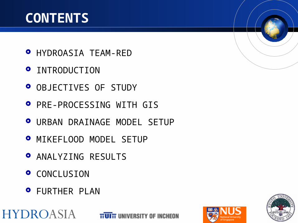
HYDROASIA TEAM-RED
HYDROASIA TEAM-RED
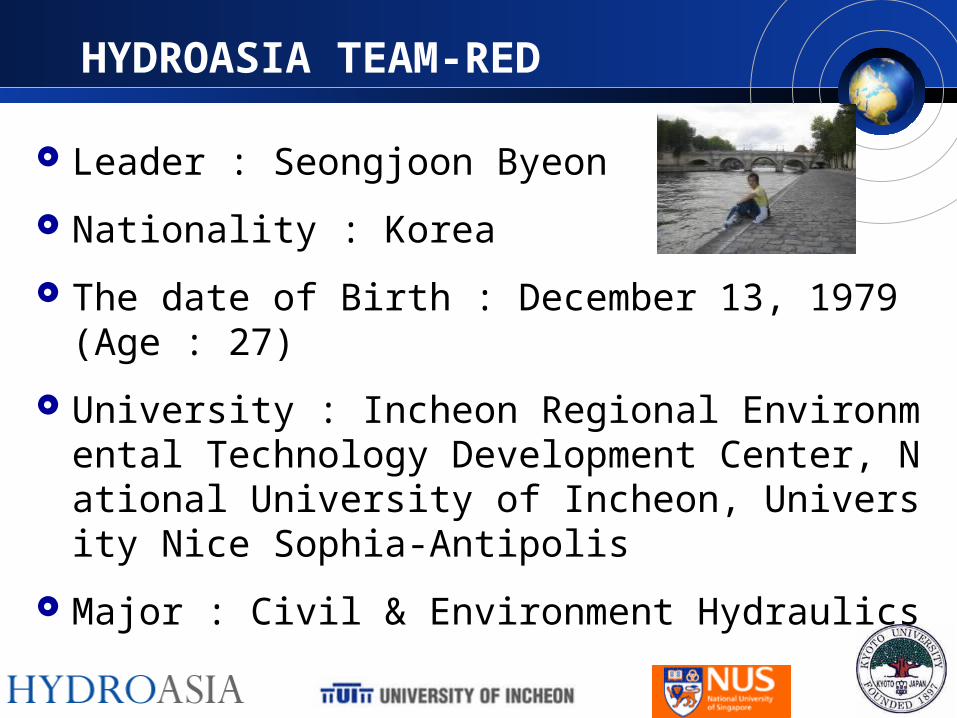
Leader : Seongjoon Byeon
Nationality : Korea
The date of Birth : December 13, 1979 (Age : 27)
University : Incheon Regional Environmental Technology Development Center, National University of Incheon, University Nice Sophia-Antipolis
Major : Civil & Environment Hydraulics
HYDROASIA TEAM-RED
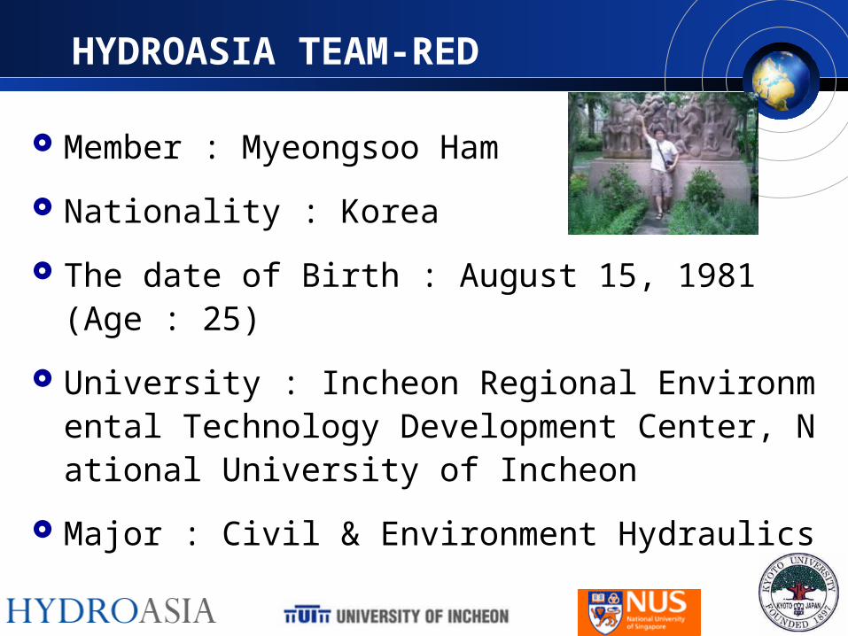
Member : Myeongsoo Ham
Nationality : Korea
The date of Birth : August 15, 1981 (Age : 25)
University : Incheon Regional Environmental Technology Development Center, National University of Incheon
Major : Civil & Environment Hydraulics
HYDROASIA TEAM-RED
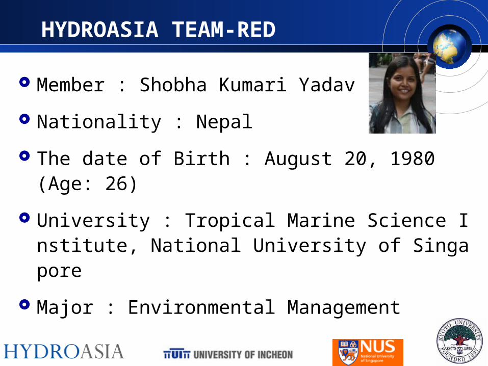
Member : Shobha Kumari Yadav
Nationality : Nepal
The date of Birth : August 20, 1980 (Age: 26)
University : Tropical Marine Science Institute, National University of Singapore
Major : Environmental Management
HYDROASIA TEAM-RED
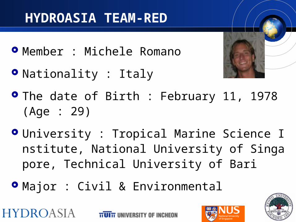
Member : Michele Romano
Nationality : Italy
The date of Birth : February 11, 1978 (Age : 29)
University : Tropical Marine Science Institute, National University of Singapore, Technical University of Bari
Major : Civil & Environmental
HYDROASIA TEAM-RED
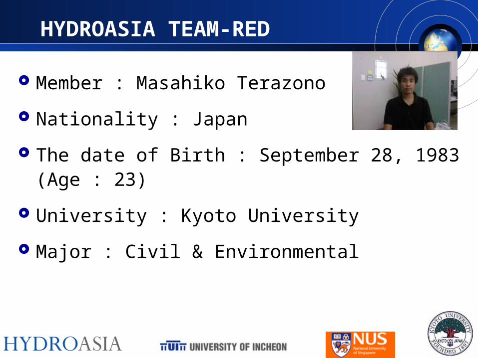
Member : Masahiko Terazono
Nationality : Japan
The date of Birth : September 28, 1983 (Age : 23)
University : Kyoto University
Major : Civil & Environmental
HYDROASIA TEAM-RED
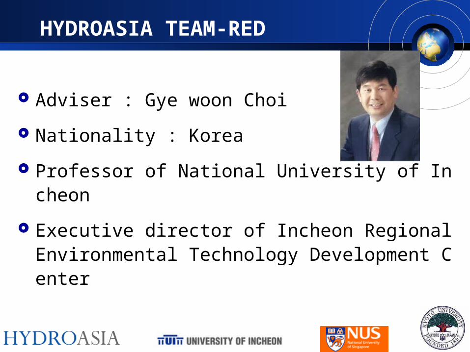
Adviser : Gye woon Choi
Nationality : Korea
Professor of National University of Incheon
Executive director of Incheon Regional Environmental Technology Development Center
OBJECTIVES OF STUDY
Main purpose
– Runoff analysis based on rainfall data and DEM
– Mapping Flood Risk
– Comparison with Real Flood
– Comparison with results simulated with different parameters and model
– To find out optimized Storm Performance
OBJECTIVES OF STUDY
Making good experiences
– Collaborating on a study with foreign students using the internet as a common working and communication platform
– Sharing knowledge and skills
– Experiencing the ‘Technological Culture’ for a sustainable water management

Production of Weekly Reports
Production of Documents
and easy tutorials
UPLOADING THE PLATFORM

Flow chart Overall frame work
MIKE FLOOD
Set up
Coupling
Preprocessing for MOUSE
Run Model
Check the result and evaluation
Set up
Validation
MIKE21 Model
Overall frame work
MOUSE Model
Set up
ValidationPreparation
GIS
Rainfall Analysis
INTRODUCTION
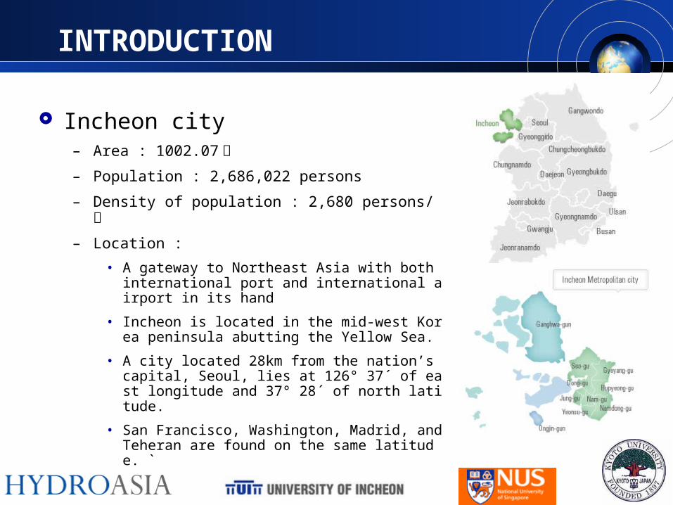
Incheon city– Area : 1002.07 ㎢
– Population : 2,686,022 persons
– Density of population : 2,680 persons/ ㎢
– Location : • A gateway to Northeast Asia with both international p
ort and international airport in its hand
• Incheon is located in the mid-west Korea peninsula abutting the Yellow Sea.
• A city located 28km from the nation’s capital, Seoul, lies at 126° 37´ of east longitude and 37° 28´ of north latitude.
• San Francisco, Washington, Madrid, and Teheran are found on the same latitude. `
INTRODUCTION
Incheon-gyo Catchment
석남배수분구
주안배수분구
2간석 배수분구
1간석 배수분구
도화배수분구
송현배수분구
홈플러스
현대아파트
가좌하수처리장
굴포 배수구역
승기 배수구역
학익 배수구역
인천교매립지 펌프장
가좌 배수구역
3▣
2.5X
2.5
3▣3.0X2.0
.U(10.0+6.0)X2.5
3▣3.0X3.0
D1,
000D
1,00
0
▣3.
0X1.
5
▣3.
5X1.
52▣2.
0X1.
52▣
4.0X
3.0
2▣
2.5X
2 .0
D1,2
00D1,0
00D
1,0
00
▣1.5
X1.5
▣(1.5+1.3)X0.8
D600
D1,3
50 ▣1.5X1.2
D1,000
D900
D700
D1,2
00
▣2.
5*1.
5▣
2.5*
1.5▣
2.5*
1.5
▣1.2*0.8
▣2.
5*1.
5
▣2.5*2.0
▣2.5*1
.5
3▣3.
0*2.
0
3▣3.0*2.0
3▣3.0*2.0
▣2.5*2.0
▣2.
5*2.
0
▣2.5*2.0
4▣3.
0*2.
0
4▣3.
0*2.
0
4▣3.
7*2.
0
2▣3.0*2.02▣2.0*2.02▣2.0*2.0
2▣2.0*2.0
2▣2.0*2.0
2▣
3.7*
2.0
2▣3.0*2.0 2▣
3.7*
2.0
2▣3.0*1.9
2▣3.0*2.1 2▣2.5*2.0 2▣2.0*2.0
2▣2.0*2.02▣2.0*2.0
4▣3.
5*2.
0
4▣3.5*2.04▣
3.5*2.0
3.75*2.0
3.0*2.22▣
3.5*2.24▣
3.0*2.0
1▣1.5*2.0
2▣2.5*2.0
▣2.6*1.6▣3.0*1.6 ▣
3.0*1.0
▣2.6*1.0▣
2.6*1.0
▣3.0*1.0
▣2.5*2.0▣2.5*2.0
▣2.
0*1.
5
3▣2.5*2.0
2▣3.0*2.0
▣1.
5X1.
5
▣1.
2*1.
2
▣1.
2*1.
2
~▣1.5*0.8
▣2.0
*1.2
~▣3.5*2.0
▣2.5*2.0
▣2.5*2.0~▣3.5*2.0
▣3.0
*1.5
▣2.0
*1.5
▣3.5
*2.0
▣3.0
*2.0
2▣
2.0*
1.5
▣1.
5*1.
2
▣3.
5X3.
5
▣3.
0*1.
5
▣2.0*1.5
▣1.
8*1.
5▣
2.5*
.15▣3.5*1
.5
+▣3.
0*3.
5
2▣2.
5*3.
03▣
3.0*
3.1
▣1.2X1.2
▣1.2X1.0
▣1.2*1.2
▣1.2*1.0
▣1.5*1.5
▣1.5
*1.5
3▣3.0*2.5 2▣3.0*2.02▣4.5*2.0
2▣2.5*2.0 ▣2.0
*1. 5
▣1.0*1.0
▣2.5*2.0
▣2.5*1.0
▣1.5
*1.5
▣1.2
*1.5
▣2.0*2.0
▣2.0
*1.53
▣3.
5*2. 0
▣2.0*1.5
3▣
2.0*
2.0
▣2.0*1.5▣2.0*1.0
2▣2.0*2.02▣2.5*2.0
2▣2.0*2.0
2▣2.5*2.0
2▣
2.5*
2.0
2▣2.0*2.0
▣1.5
*1.5
▣1.
5*1.
5
▣2.5*1.5
▣1.5*1.5▣2.0*1.2
▣2.0*2.0▣1.5*1.5
2▣2.
0*1.
5▣
1.5*
1.0
2▣3.5*2.02▣3.0*2.5
2▣2.5*2.0
2▣2.0*2.0
▣1.
5*1.
5
▣1.5*1.5
▣1.
5*1.
0
▣2.0
*1.5
▣2.
0*1
.5
▣2.
5*2.
5
▣2. 2
* 2.0
▣2.5*2.5
▣2.5*2.5▣1.2*1.2
▣2.
0*1.
5
2▣2.
0*1.
5
▣1.
5*1.
7
▣2.
0*1.
5
▣2.0*2.5▣2.0*2.2
▣3.
0*2.
0
▣2.
5*1.
5
▣3.
0*2.
0
2▣3.
0*2.
0
▣1.
5*1.
5
▣2.5*1.0 3▣
3.0*
2.0
▣1.
5*1.
0
▣1.5*1.5
2▣2.
5*2.
0▣
2.5*
1.8 ▣2.
5*2.
0▣2.5*1.52▣
2.5*2.0
▣1.5*1.1
▣3.5
*2.0
▣2.0
*1.2
▣2.0
*1.5
▣3.0
*1.8
2▣
3.0*
1. 8
▣1.2*1.2
▣1.5*1.2
▣1.6
*1.5
▣3.
2*1
.5
▣1.5*1.5
▣1.
5*1.
0
4▣3.
0*2.
0
▣3.0*1.52▣3.0*2.0
2▣
1.5*
1.2
▣1.5
*1.5
▣2.5*2.0
▣2.
0*2.
0
▣2.0*1.5
▣3.0*2.0
2▣3.0*2.0
▣2.0
*1.5
2▣2.2*1.82▣2.0*2.0
▣3.2*3.0
▣2.0*1.5▣1.5*1.5▣1.0*1.2▣1.5*1.0
▣2.0*1.5▣2.0*1.5
▣2.0
*1.5
▣1.
5*1.
0
▣1.2*1.2
▣1.2*1.5
▣3.
0*2
.5
▣2.
0*1.
5
▣1.5*1.5
▣1.5*1.5
▣1.0*1.0
~▣
1.4*
1.0
~▣1.3*1.6▣1.3*1.0 2▣
4.0*
2.0
2▣2.
5*2.
0
2▣4.
0*1.
8 2▣4.
0*2.
0
3▣3.
0*3.
1
▣3.
0*3.
5▣2.
0*1.
0
▣2.
6*2.
1
▣2.5*2.0
▣2.5*2.0
▣2.5*2.0
3▣3.0*2.0
▣1.3
*1.0
▣2.0*2.0
▣4.
0*2.
0
▣4.0*1.8
▣1.6*1.6
▣1.5*1.5
~▣2.0*1.5
2▣
2.0*
2.0
2▣
3.0*
2.5
~▣
3.5*2
.5▣
2.0
*2.0
+▣
3.5
*2.5
+▣
3.5
*2.5
2▣
3.5X
2.0
2▣3.5X2.0
▣2.
5X2.
3
▣1.0X1.0
▣2.0
X1.5
3▣3.0*2.0
2▣3.0*1.9
2▣2.0*2.0
3▣5.0X3.5
+1▣3.5X3.6
3▣5.0X3.2
3▣5.0X2.9
3▣5.0X2.9
3▣5.0X3.5
3▣5.0X3.1
3▣5.0X3.2
3▣5.0X3.5
3▣
5.0X
3.5
+1▣
3.5X3.
6
3▣5.0X2.9
+1▣3.0X3.3
4▣5.0X3.3
3▣5.0X3.3
3▣5.0X3.6 + 2▣4.5X4.0
5▣4.8X4.0
3▣5.0X3.6+ 2▣4.0X3.6
4▣5.0X3.04▣
3.5X2.0
3▣5.0X3.3+1▣3.0X3.3
4▣5.0X3.3
3▣5.0X3.4+2▣4.0X3.4
3▣5.0X3.6 + 2▣4.5X3.6 3▣5.0X3.6 + 2▣
4.5X3.6
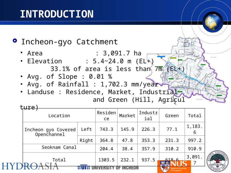
• Area : 3,091.7 ha• Elevation : 5.4~24.0 m (EL+) 33.1% of area is less than 7m (EL+)• Avg. of Slope : 0.01 %• Avg. of Rainfall : 1,702.3 mm/year• Landuse : Residence, Market, Industrial and Green (Hill, Agriculture)
Location Residence Market Industrial Green Total
Incheon gyo CoveredOpenchannel
Left 743.3 145.9 226.3 77.1 1,183.6
Right 364.8 47.8 353.3 231.3 997.2
Seoknam Canal 204.4 38.4 357.9 310.2 910.9
Total 1303.5 232.1 937.5 618.6 3,091.7
PRE-PROCESSING WITH GIS
A GIS is a computer system capable of capturing, storing, analyzing, and displaying geographically referenced information
GIS can display the Earth in realistic, 3D perspective views & animations that convey information more effectively
The main purpose of GIS analysis is to study the topographical characteristics of the study area which is further used for flood modelling
PRE-PROCESSING WITH GIS
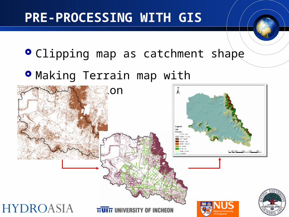
Clipping map as catchment shape
Making Terrain map with interpolation
PRE-PROCESSING WITH GIS
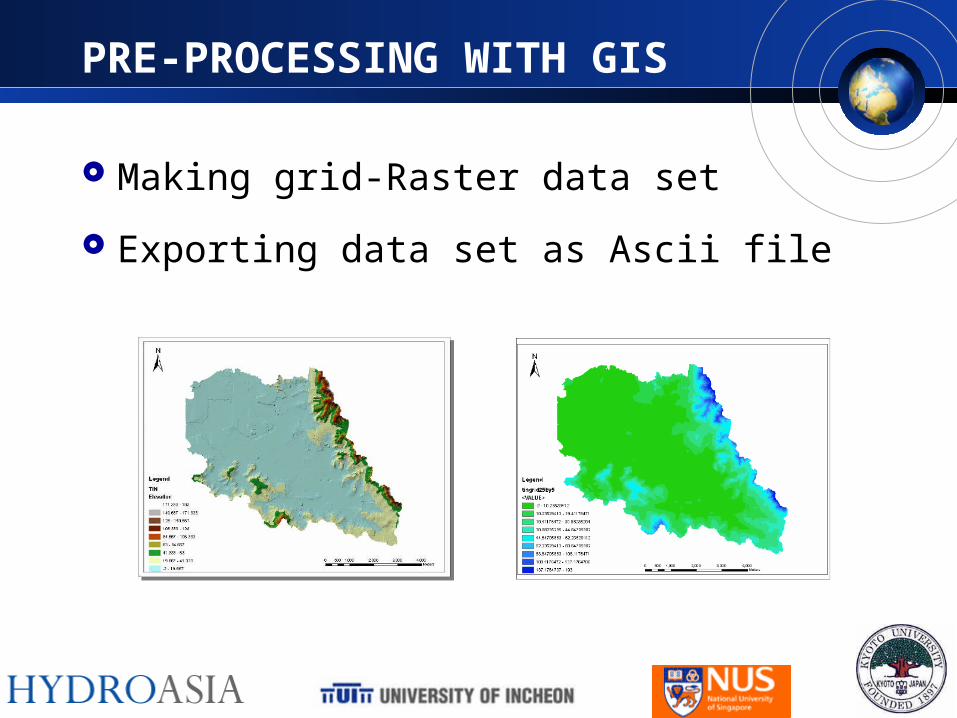
Making grid-Raster data set
Exporting data set as Ascii file
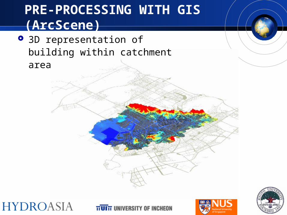
PRE-PROCESSING WITH GIS (ArcScene)
3D representation of building within catchment area
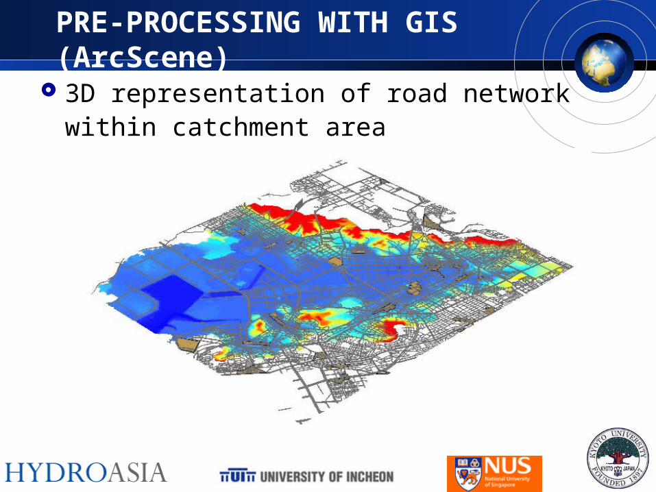
PRE-PROCESSING WITH GIS (ArcScene)
3D representation of road network within catchment area
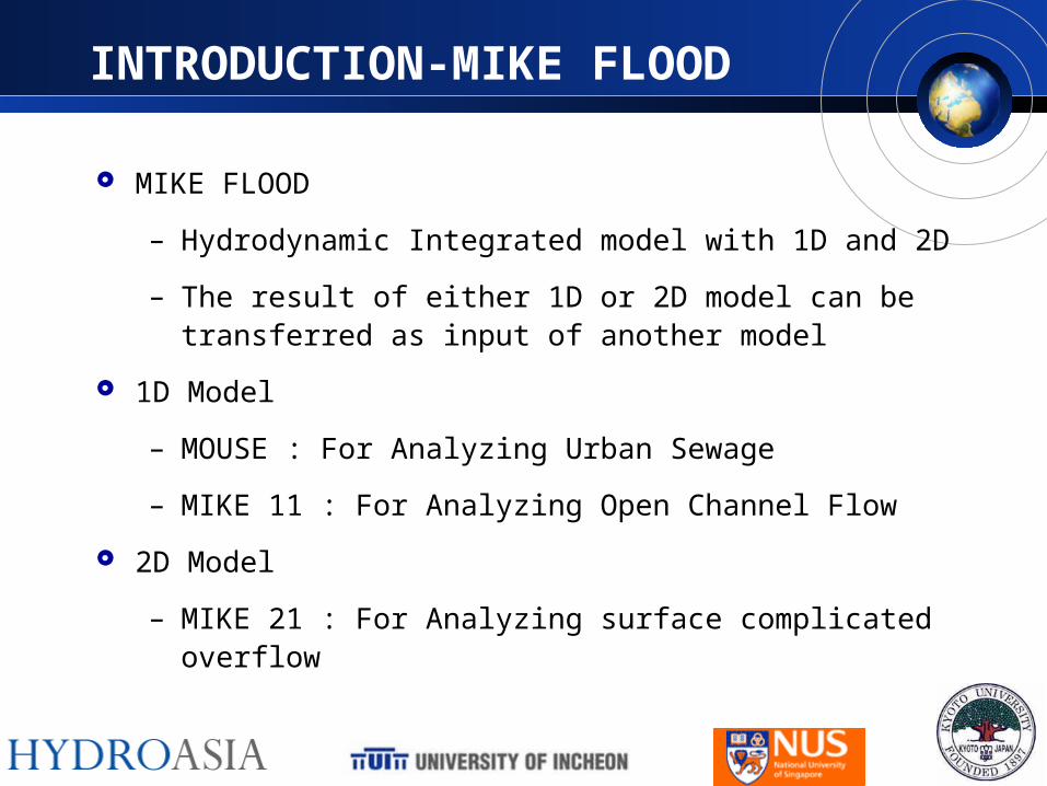
INTRODUCTION-MIKE FLOOD
MIKE FLOOD
– Hydrodynamic Integrated model with 1D and 2D
– The result of either 1D or 2D model can be transferred as input of another model
1D Model
– MOUSE : For Analyzing Urban Sewage
– MIKE 11 : For Analyzing Open Channel Flow
2D Model
– MIKE 21 : For Analyzing surface complicated overflow
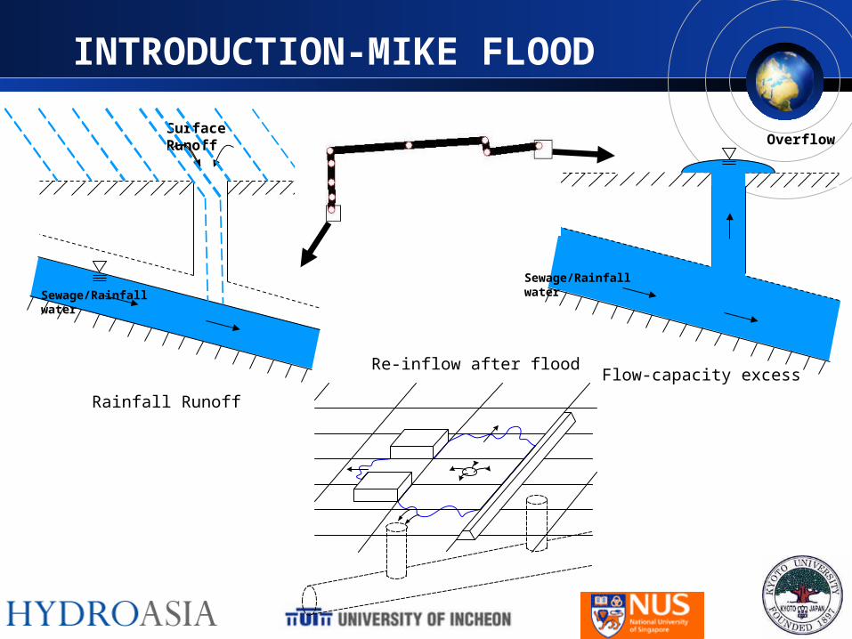
INTRODUCTION-MIKE FLOOD
Rainfall Runoff
Surface Runoff Overflo
w
Figure 1 Application of Standard Links
Re-inflow after floodFlow-capacity excess
Sewage/Rainfall water
Sewage/Rainfall water
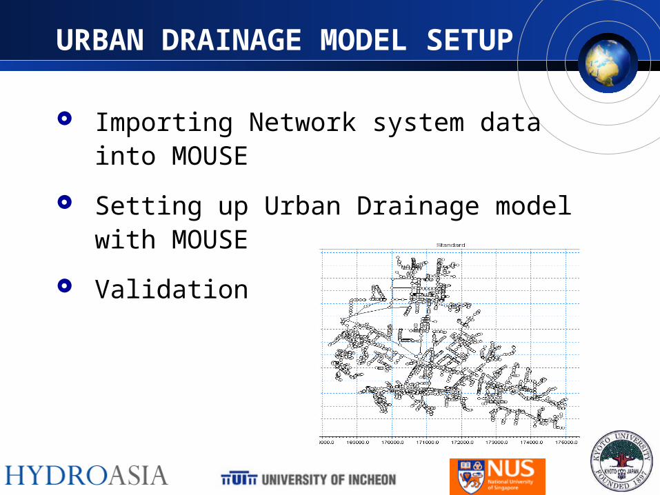
URBAN DRAINAGE MODEL SETUP
Importing Network system data into MOUSE
Setting up Urban Drainage model with MOUSE
Validation
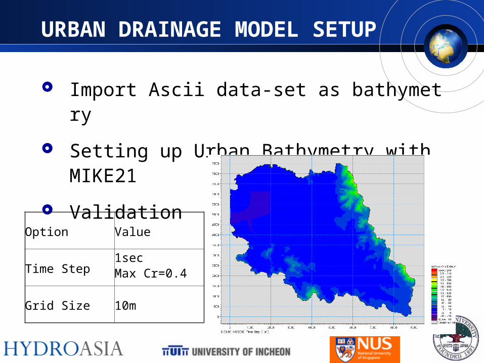
URBAN DRAINAGE MODEL SETUP
Import Ascii data-set as bathymetry
Setting up Urban Bathymetry with MIKE21
Validation
Option Value
Time Step1secMax Cr=0.4
Grid Size 10m
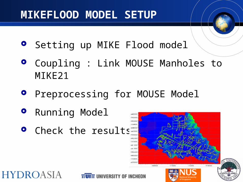
MIKEFLOOD MODEL SETUP
Setting up MIKE Flood model
Coupling : Link MOUSE Manholes to MIKE21
Preprocessing for MOUSE Model
Running Model
Check the results
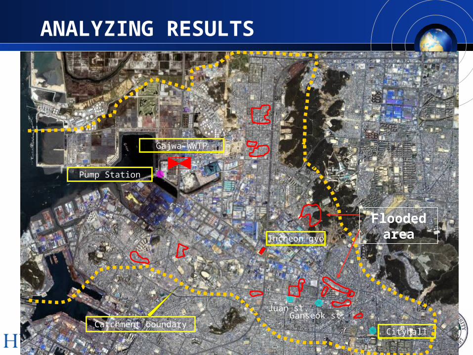
Catchment boundary
Gajwa-WWTP
Cityhall
Ganseok st.Juan st.
Incheon gyo
Pump Station
Flooded area
ANALYZING RESULTS
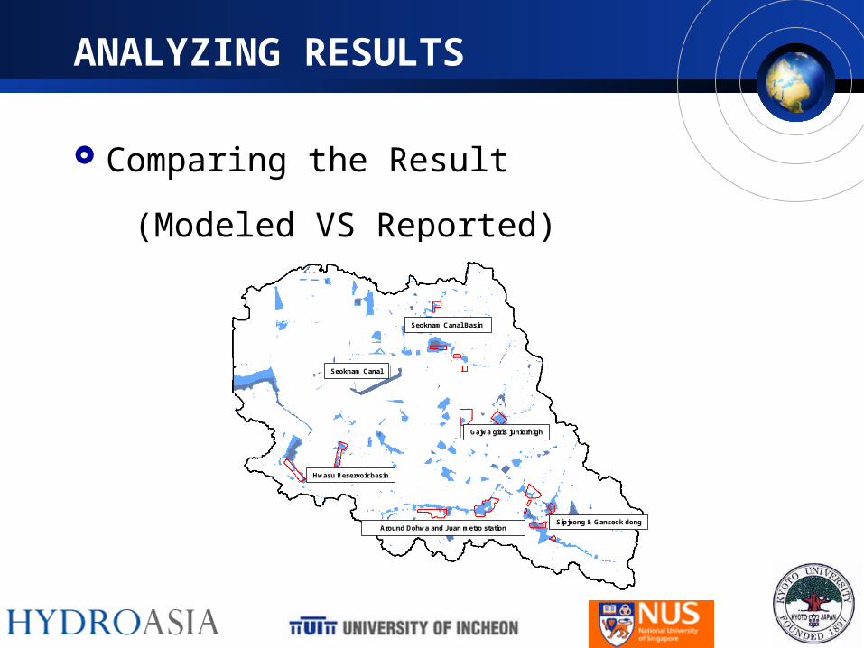
ANALYZING RESULTS
Comparing the Result
(Modeled VS Reported)
Hwasu Reservoir basin
Around Dohwa and Juan metro station
Seoknam Canal Basin
Gajwa girls juniorhigh
Sipjeong & Ganseok dong
Seoknam Canal
Hwasu Reservoir basin
Around Dohwa and Juan metro station
Seoknam Canal Basin
Gajwa girls juniorhigh
Sipjeong & Ganseok dong
Seoknam Canal
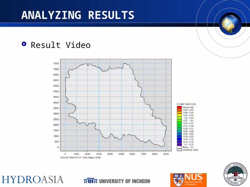
ANALYZING RESULTS
Result Video
CONCLUSION
The Simulation has been built through web-collaboration of Team-Red
Model has been run successfully with good looking result
The advantage mapping with 2D surface runoff modeling could be found as following
– The terrain characteristic can be considered
– The lag due to the puddle, discontinuity can be considered
– The magnification of result can be prevented with distribution of flooded water to another manhole
This study is expected to be continued as following further plan
FURTHER PLAN
Applying Building layer map
Investigating the way to apply runoff coefficient
Applying RTC gate and pump
Discussion of 2D Runoff result
Discussion of Precipitation Intensity
Discussion of Solution
Comparison with results simulated with different parameters and model

Lets take pride in being
TEAM RED !!!