Embed Size (px)
Citation preview

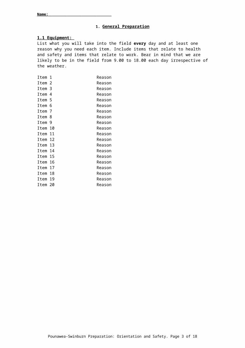
Name:
GEOL344: Fieldwork Preparation: Orientation and Safety 2017Pounawea, Swinburn and Bruce Rocks- Field Classes 2017
This document serves several purposes:
1. For you to give us names and addresses of contacts at home and to inform us of any problems you may have that may affect your safety in the field.
2. To enable you to orient yourself in advance of the Pounawea and Swinburn field areas.
3. To enable you to assess the general hazards and hazards at each of the field localities and to think about how you will behave in the field to reduce the risks associated with each of these hazards.
Other documents (http://www.otago.ac.nz/geology/study/papers/index.html?papercode=geol344) on our website may help you here. There is also a word version in case you want to complete it on a computer.
Procedure:
If you intend taking GEOL 344 you must complete the rest of this form and get it to Dee Roben by 25 th November 2016. This form will contribute to your assessment on the fieldclass: it will be marked like any other piece of work. This is mandatory preparation for GEOL344. You will not be accepted onto GEOL344 unless you have completed this work to an acceptable level (ie you get a pass mark). Ways of getting the work to Dee:
1. Hand it in to her.2. Send by post to: Dee Roben - Academic Administrator
Geology Department, University of OtagoPO Box 56Dunedin 9054New Zealand
3. Email a pdf version (scanned or worked directly on the original documents) to [email protected] Name your file: LASTNAME, initials-344-2016You must send a single pdf file! Scan to a single pdf or get a pdf merger like PDFSaM (http://www.pdfsam.org/downloads/). PDFSaM Instructions
Information we needThe data on this document will be made available to all staff on the fieldclass and will be kept for future reference. If you have relevant information that you wish to remain discrete and would rather not put down in the next section, please communicate problems by emailing Dee ([email protected]).
Name:
Mobile phone number:
Holiday time (December-January) address:
Email address:
Emergency contact at home: Name: Relationship:Fax No: Phone No:Address:
List any illnesses/ injuries that may affect your safety in the field (Please include, asthma, hay fever or other allergies, vertigo, poor eyesight, diabetes):
What precautions can you take in the field to reduce risk of problems associated with the above. Include listing any medication you need to bring?
Do you have any special dietary requirements?
In Swinburn, we camp on a farm. Do you have a tent you can bring to Swinburn? If so how many people are you happy to share it with?
Pounawea-Swinburn Preparation: Orientation and Safety. Page 1 of 15

Name:
1. General Preparation
1.1 Equipment: List what you will take into the field every day and at least one reason why you need each item. Include items that relate to health and safety and items that relate to work. Bear in mind that we are likely to be in the field from 9.00 to 18.00 each day irrespective of the weather.
Item 1 ReasonItem 2 ReasonItem 3 ReasonItem 4 ReasonItem 5 ReasonItem 6 ReasonItem 7 ReasonItem 8 ReasonItem 9 ReasonItem 10 ReasonItem 11 ReasonItem 12 ReasonItem 13 ReasonItem 14 ReasonItem 15 ReasonItem 16 ReasonItem 17 ReasonItem 18 ReasonItem 19 ReasonItem 20 Reason
Pounawea-Swinburn Preparation: Orientation and Safety. Page 2 of 15
Name:
1.2 Genaral HazardsUnder each of the following subheadings list the hazards you can think off (bear in mind you will be in a group) and the precautions that reduce the risk associated with those hazards.
1.2.1 Working in the intertidal zone
Hazard Precautions
Hazard Precautions
Hazard Precautions
1.2.2 Working by steep cliffs
Hazard Precautions
Hazard Precautions
Hazard Precautions
1.2.3 Working by roadsides
Hazard Precautions
Hazard Precautions
Hazard Precautions
1.2.4 Using Geological Hammers (we will have some and safety goggles that you can borrow).
Hazard Precautions
Hazard Precautions
Hazard Precautions
1.2.4 General hazards related to the weather
Hazard Precautions
Hazard Precautions
Hazard Precautions
Pounawea-Swinburn Preparation: Orientation and Safety. Page 3 of 15
Name:
1.3 Behaviour in Rural AreasList aspects of your behaviour that are important in preserving the environment and maintaining good relationships with farmers and other local people during the course of the fieldclass.
1.2.3.4.5.
1.4 Emergenciesa. On this fieldclass you will always be close to a group comprising half of the fieldclass. If there is
an accident or some other urgent problem arises, what should you do?
b. What is meant by the ABC (or DRSABC) of first aid? Briefly explain the importance of this.
2. Itinerary: orientation and planning for specific hazards
The exact itinerary will depend upon weather and other factors. The exercises below will give you an idea of where we are going, what the geology is and what specific hazards exist.
2.1 On the Bruce Rocks and Pounawea fieldclass you will be working on coastal localities (see maps).
a. Fill in the times (use the 24 hour clock and daylight savings time) and heights (in m) of high tide and low tide and whether the tides are spring or neap for each of the days of the class where we are working on the coast. Tide tables and instructions on how to use them can be found at:0
http://www.linz.govt.nz/hydro/tidal-info/tide-tables/calculate or use the tool at:http://www.niwa.co.nz/services/online-services/tide-forecaster
Low tides High tides Spring/NeapTuesday 7th FebruaryWednesday 8th FebruaryThursday 9th February
Saturday 11th FebruarySunday 12th FebruaryMonday 13th FebruaryTuesday 14h February
b. Outline in 3 to 4 lines how you have calculated the tide times.
c. Explain what is meant by spring and neap tides.
Pounawea-Swinburn Preparation: Orientation and Safety. Page 4 of 15

Name:
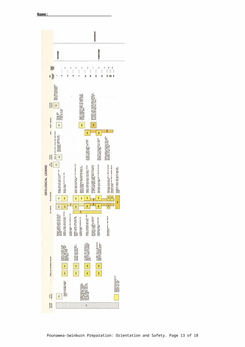
2.2 You are provided with geological and topographic maps of the broader Pounawea, Swinburn and Bruce Rocks areas. The maps have 1km grids. The maps are incomplete because the scale is not marked and North is not marked. At Pounawea we stay in Pounawea, in Swinburn we stay at Glenrowan. Bruce Rocks will be visited in day trip/s from Dunedin
a. Add the missing information to make all the maps complete. b. Annotate onto the topographic maps, neatly and clearly, the hazards that you can assess from the
maps (or from online resources listed below). If relevant make reference to your tide table. An example hazard map can be seen at (http://www.otago.ac.nz/geology/admin-health-safety/field-procedures/index.html)
c. By reference to the geological map, suggest on the map, what age and type of rocks we will be examining. Annotate this onto the appropriate maps. This is quite difficult using the printed geological maps – you may want to enlarge the pdf version on screen.
Mark the maps in pencil so that changes can be made later if necessary. You will need to use the maps each day of the fieldclass so ensure your work is neat. If you use symbols, make sure there is a key.
You may find it helpful to access some online resources to look at the maps in a wider context and to look at the landscape via tools such as Google Earth:
http://www.topomap.co.nz/This allows you to look at topo maps and/ or satellite imagery (and superpose the images).https://maps.google.co.nz/For map view with or without terrain and for satellite view.http://www.google.com/earth/index.htmlTo download Google Earth. Flyovers, 3D views etc not available using the topomap site.http://data.gns.cri.nz/geology/ (GNS Science New Zealand Geology Web Map)Instructions for using the New Zealand Geology web map
You may wish (not needed but useful) to buy the relevant QMAP sheet (Geological map plus a book explaining the geology). These can be purchased from GNS Science or UBS. They are also freely available in digital format on the Geology GIS database (campus access only): https://docs.google.com/forms/d/1hCpnhgJDLSKOUpCxEGoWFgYeRjaQRwYwrzxCh8xnmo0/viewformThe relevant sheets are:
Pounawea (only just creeps onto map): Geology of the Dunedin Area 1:250,000 editors D.G. Bishop and I.M. Turnbull
Swinburn: Geology of the Waitaki Area 1:250,000 editor P.J. Forsyth
Pounawea-Swinburn Preparation: Orientation and Safety. Page 5 of 15

Name:
Pounawea-Swinburn Preparation: Orientation and Safety. Page 6 of 15

Name:
Pounawea-Swinburn Preparation: Orientation and Safety. Page 7 of 15

Name:
Pounawea-Swinburn Preparation: Orientation and Safety. Page 8 of 15

Name:
Pounawea-Swinburn Preparation: Orientation and Safety. Page 9 of 15

Name:
Pounawea-Swinburn Preparation: Orientation and Safety. Page 10 of 15

Name:
Pounawea-Swinburn Preparation: Orientation and Safety. Page 11 of 15

Name:
Pounawea-Swinburn Preparation: Orientation and Safety. Page 12 of 15
Name:
Pounawea-Swinburn Preparation: Orientation and Safety. Page 13 of 15

Name:
Pounawea-Swinburn Preparation: Orientation and Safety. Page 14 of 15

Name:
Pounawea-Swinburn Preparation: Orientation and Safety. Page 15 of 15