Embed Size (px)
Citation preview
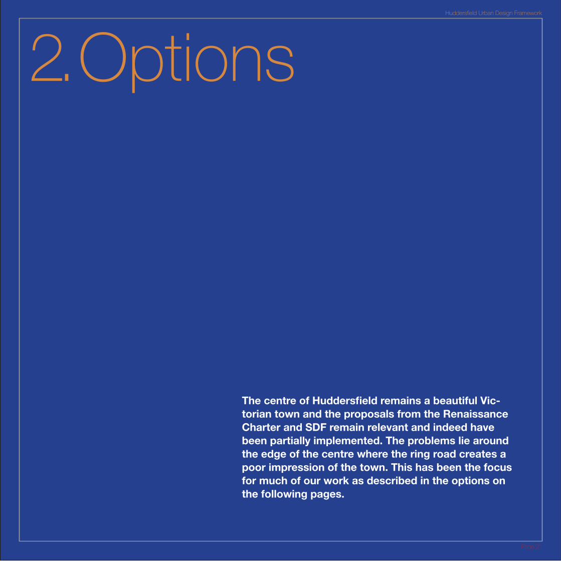
2. Options
The centre of Huddersfield remains a beautiful Vic-torian town and the proposals from the Renaissance Charter and SDF remain relevant and indeed have been partially implemented. The problems lie around the edge of the centre where the ring road creates a poor impression of the town. This has been the focus for much of our work as described in the options on the following pages.
Huddersfield Urban Design Framework
Page 21
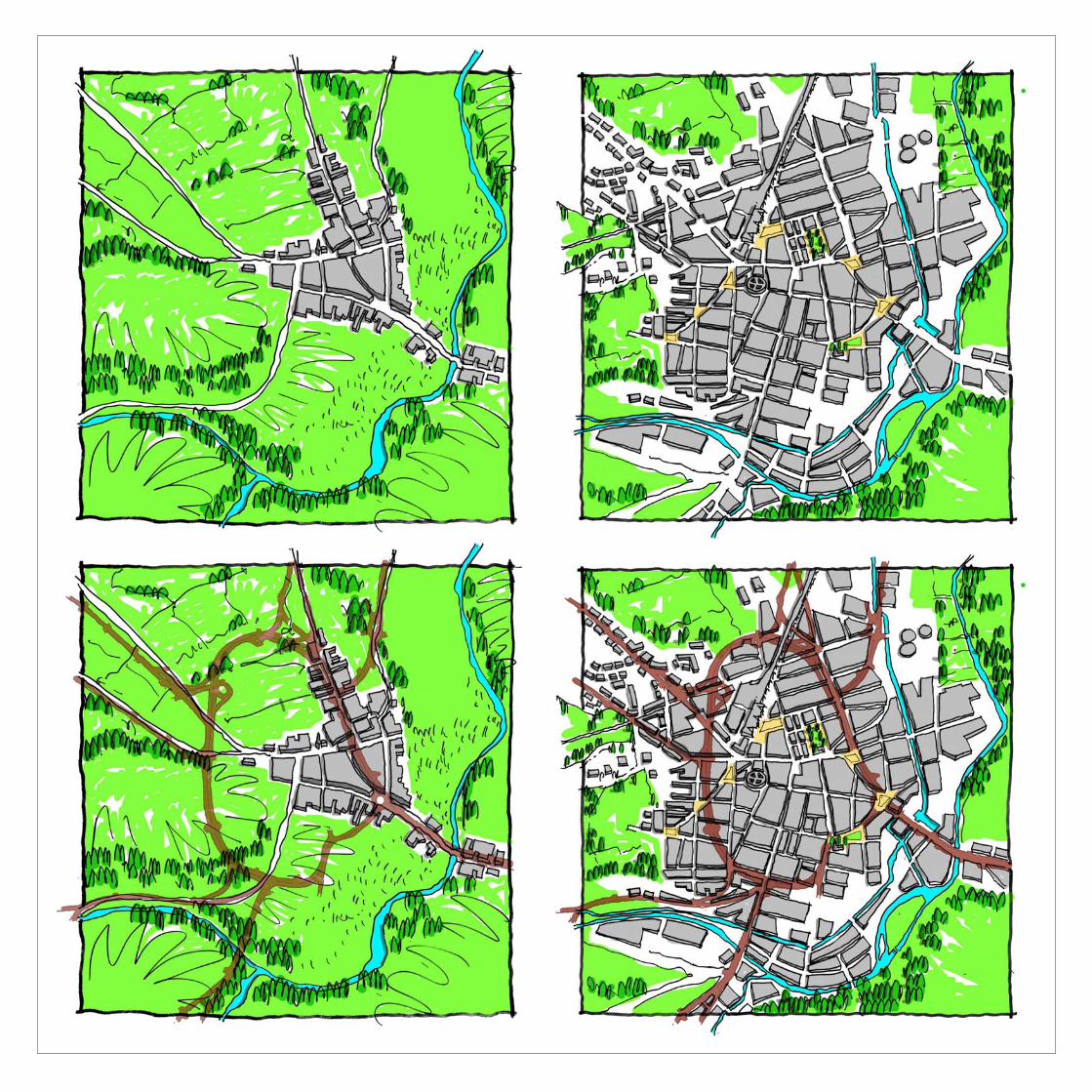
Shatter Zone
The development on Huddersfield only makes sense when the plan of the Ring Road is overlaid on the historic plans. It passes through the heart of the original town and a sequence of public spaces on the Victorian plan.
The plans to the left tell the story of Huddersfield’s development. The top left plan shows the pre-Victorian town built at a point where the river could be bridged on one of the main routes between Yorkshire and Lancahshire. The middle plan shows the way in which the Victorian town expanded following the arrival of the railways with the regular grid of streets to the north west and south west of the old town. What is noticable about this plan is the sequence of public squares and spaces including the Beast Market, Shore Head, St. Paul’s Church and a sequence of spaces on Springwood Street which ran on the line of the rail tunnel. The final plan on the top row shows the situation today as we have described. This shows the intact core of the town and the shatter zone around it, illustrating the extent to which the town has changed.
The reason for this becomes clear when the line of the ring road is placed over these plans as shown on the bottom row. The left plan shows that the ring road actually passes through the heart of the historic town. North Gate which forms part of the ring road was the main route into town from the north. The central plan shows the impact of the Ring Road on the Victorian town. Particularly striking is the way it cuts through Beast Market, Shore Head and the space next to St. Paul’s Church. It also slices through the town extension along Springwood Street leaving very little trace of the urban structure in the south west of the centre. The options explored on the following pages seek to address the damage illustrated on the plans to the left.
Huddersfield Urban Design Framework
Page 23
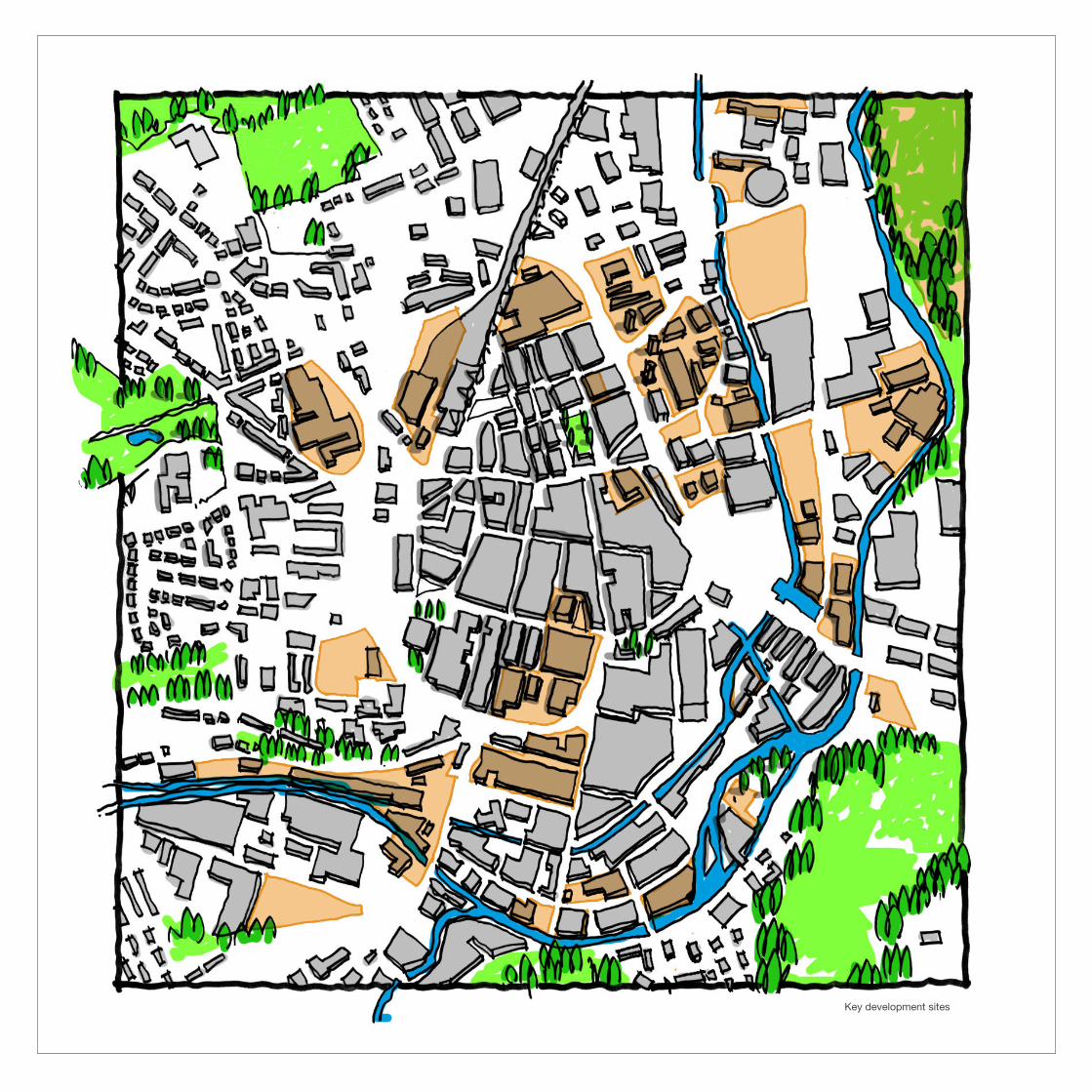
Key development sites
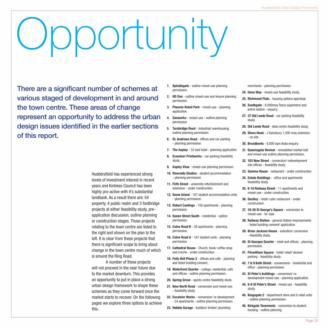
Opportunity1. Spindlegate - outline mixed-use planning
permission.
2. HD One - outline mixed-use and leisure planning permission.
3. Pheonix Retail Park - mixed-use - planning application.
4. Gasworks - mixed-use - outline planning permission.
5. Turnbridge Road - industrial/ warehousing outline planning permission.
6. St. Andrews Road - offices and car-parking - planning permission.
7. The Aspley - 33-bed hotel - planning application.
8. Examiner Printworks - car-parking feasibility study.
9. Aspley View - mixed-use planning permission.
10. Riverside Studios - student accommodation - planning permission.
11. Firth Street - university refurbishment and extension - under construction.
12. Snow Island - 107 student accommodation units - planning permission.
13. Robert Castings - 150 apartments - planning permission.
14. Queen Street South - residential - outline permission.
15. Colne Road B - 38 apartments - planning permission.
16. Colne Road A - 167 student units - planning permission.
17. Cathedral House - Church, book/ coffee shop and creche - under construction.
18. Folly Hall Phase 2 - offices and cafe - planning and listed building consent.
19. Waterfront Quarter - college, residential, cafe and offices - outline planning permission.
20. Spring Grove - sports centre feasibility study.
21. New North Road - conversion and mixed-use - feasibility study.
22. Excelsior Works - conversion/ re-development - 54 apartments - outline planning permission.
23. Hebble Garage - builders/ timber/ plumbing
merchants - planning permission.
24. Unna Way - mixed-use feasibility study.
25. Richmond Flats - housing options appraisal.
26. Southgate - 8,000msq Tesco superstore and petrol station - enquiry.
27. 37 Old Leeds Road - car parking feasibility study.
28. Old Leeds Road - data centre feasibility study.
29. Shore Head - J Sainsbury 1,500 msq extension - on site.
30. Broadbents - 8,000 sqm Asda enquiry.
31. Queensgate Revival - remodelled market hall and mixed-use outline planning permission.
32. 103 New Street - conversion/ redevelopment into offices - feasibility study.
33. Gamma House - restaurant - under construction.
34. Estate Buildings - office and apartments feasibility study.
35. 6-10 Railway Street - 11 apartments and mixed-use - under construction.
36. Destiny - retail/ cafe/ restaurant - under construction.
37. 18-20 St George’s Square - conversion to mixed-use - for sale.
38. Railway Station - general station improvements - listed building consent/ application.
39. Brian Jackson House - extention/ conversion - feasibility study.
40. St Georges Quarter - retail and offices - planning permission.
41. Fitzwilliam Square - hotel/ retail/ decked parking - feasibility study.
42. 7 & 9 Bath Street - conversions- residential and office - planning permission.
43. St Peter’s buildings - conversion/ re-development mixed-use - planning application.
44. 6-8 St Peter’s Street - mixed use - feasibility study.
45. Kingsgate 2 - department store and 6 retail units - outline planning permission.
46. Kirkgate Tenements - conversion to student housing - outline planning.
There are a significant number of schemes at various staged of development in and around the town centre. These areas of change represent an opportunity to address the urban design issues identified in the earlier sections of this report.
Huddersfield has experienced strong levels of investment interest in recent years and Kirklees Council has been highly pro-active with it’s substantial landbank. As a result there are: 54 property, 4 public realm and 3 footbridge projects at either feasibility study, pre-application discussion, outline planning or construction stages. Those projects relating to the town centre are listed to the right and shown on the plan to the left. It is clear from these projects that there is significant scope to bring about change in the town centre much of which is around the Ring Road. A number of these projects will not proceed in the near future due to the market downturn. This provides an opportunity to put in place a strong urban design framework to shape these schemes as they come forward once the market starts to recover. On the following pages we explore three options to achieve this.
Huddersfield Urban Design Framework
Page 25
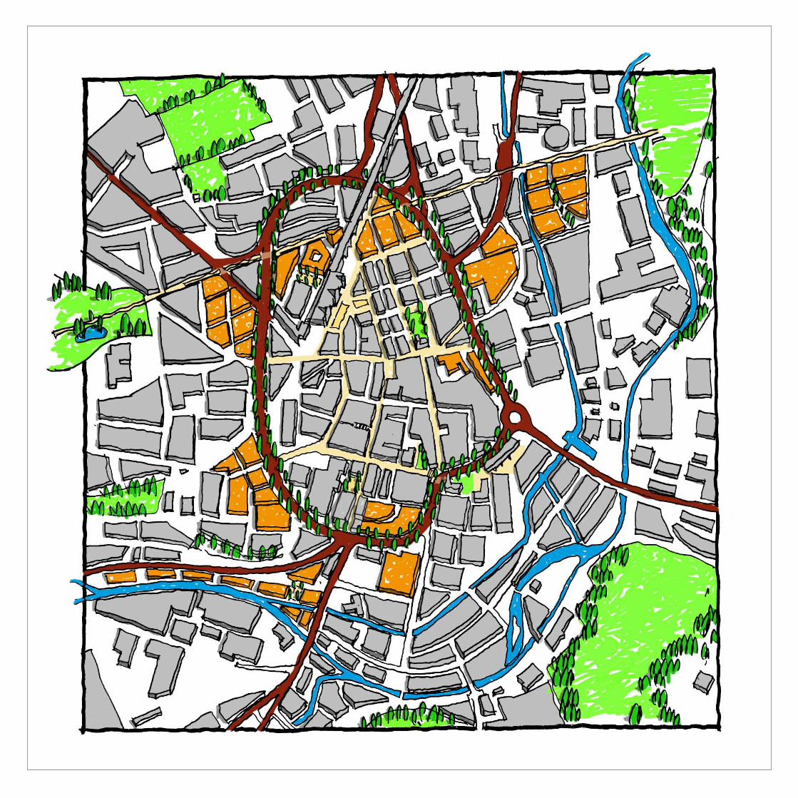
Option 1:
TourniquetOption 1 retains the Ring Road in its current configuration. This could indeed be used to take even more traffic out of the town centre streets like Westgate. The strategy instead seeks to urbanise the ring road with frontage development and tree planting to create a boulevard.
Instead of altering the movement of traffic through the town, this option aims to spread the urban quality of the town centre beyond its edge by improving the quality of the environment around the ring road and promoting its use by all modes, including pedestrians and cyclists. The level of traffic on the Ring Road described on Page 19 is not so high that the street could not be designed as a Boulevard. Indeed Kensington High Street in London carries as much traffic as the busiest parts of Huddersfield’s Ring Road. Yet Kensington High Street has surface level, pedestrian friendly crossings,
frontage development and has removed railings and other barriers. Monitoring of the project shows that accident rates have fallen since the railings were removed. Option One would therefore involve the gradual transformation of the Ring Road:
� Removing barriers � Introducing traffic light-controlled
pedestrian crossings � Planting street trees
Creating cycle lanes and wider pavements.
In addition to this all new development fronting the Ring Road (shown in Orange on the plan to the left) would be expected to address the road. New buildings should face outwards and create a coherent building line onto the Ring Road (see page 38). Buildings should also take their main pedestrian access from the Ring Road and where possible provide active frontage. This is something that is being implemented elsewhere. Wakefield has for a number of years been implementing
their Emerald Ring that came from their Renaissance SDF and is gradually transforming their ring road into a green boulevard. Nottingham has introduced similar measures on Maid Marrian Way and is proposing to downgrade other parts of its ring road. Sheffield has also adopted planning guidance for its new ring road to regulate development on the frontage, including for example a 8m pavement, street trees and material specifications.
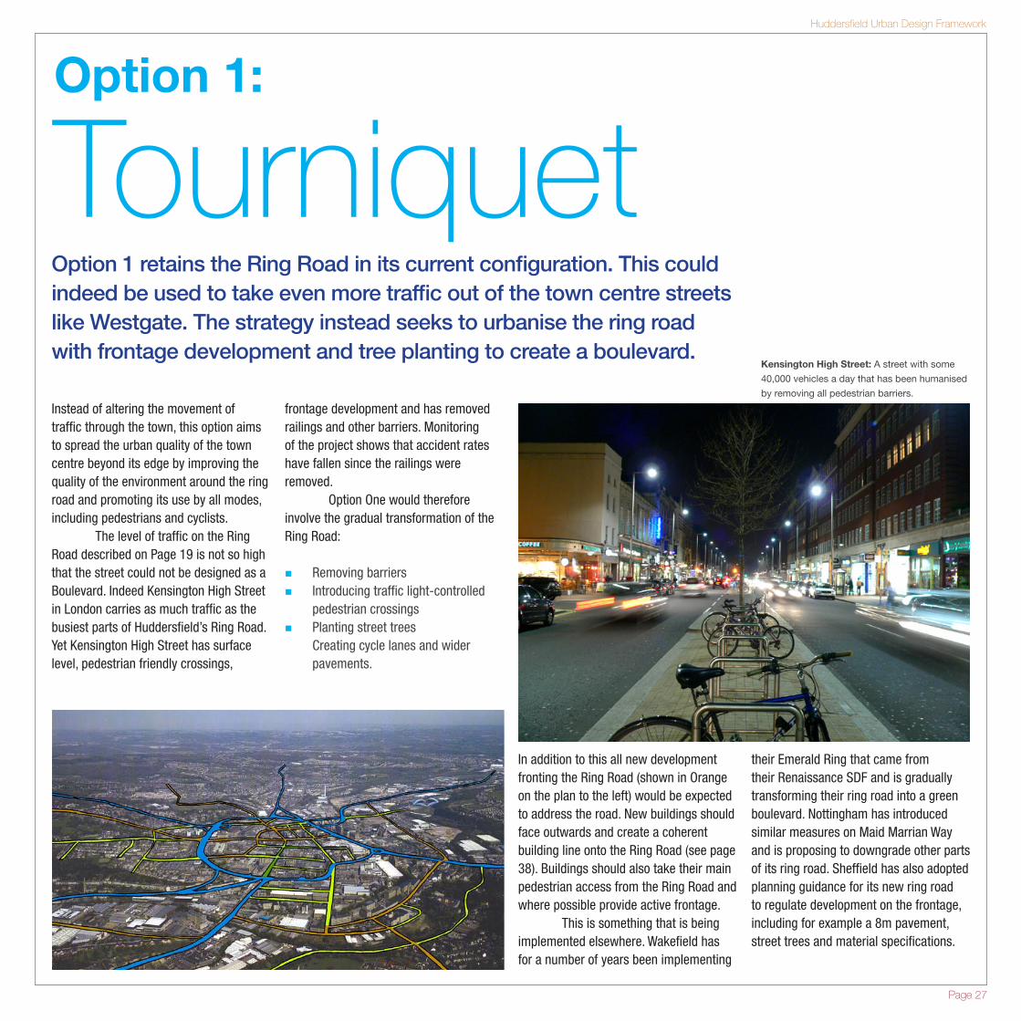
Kensington High Street: A street with some
40,000 vehicles a day that has been humanised
by removing all pedestrian barriers.
Huddersfield Urban Design Framework
Page 27
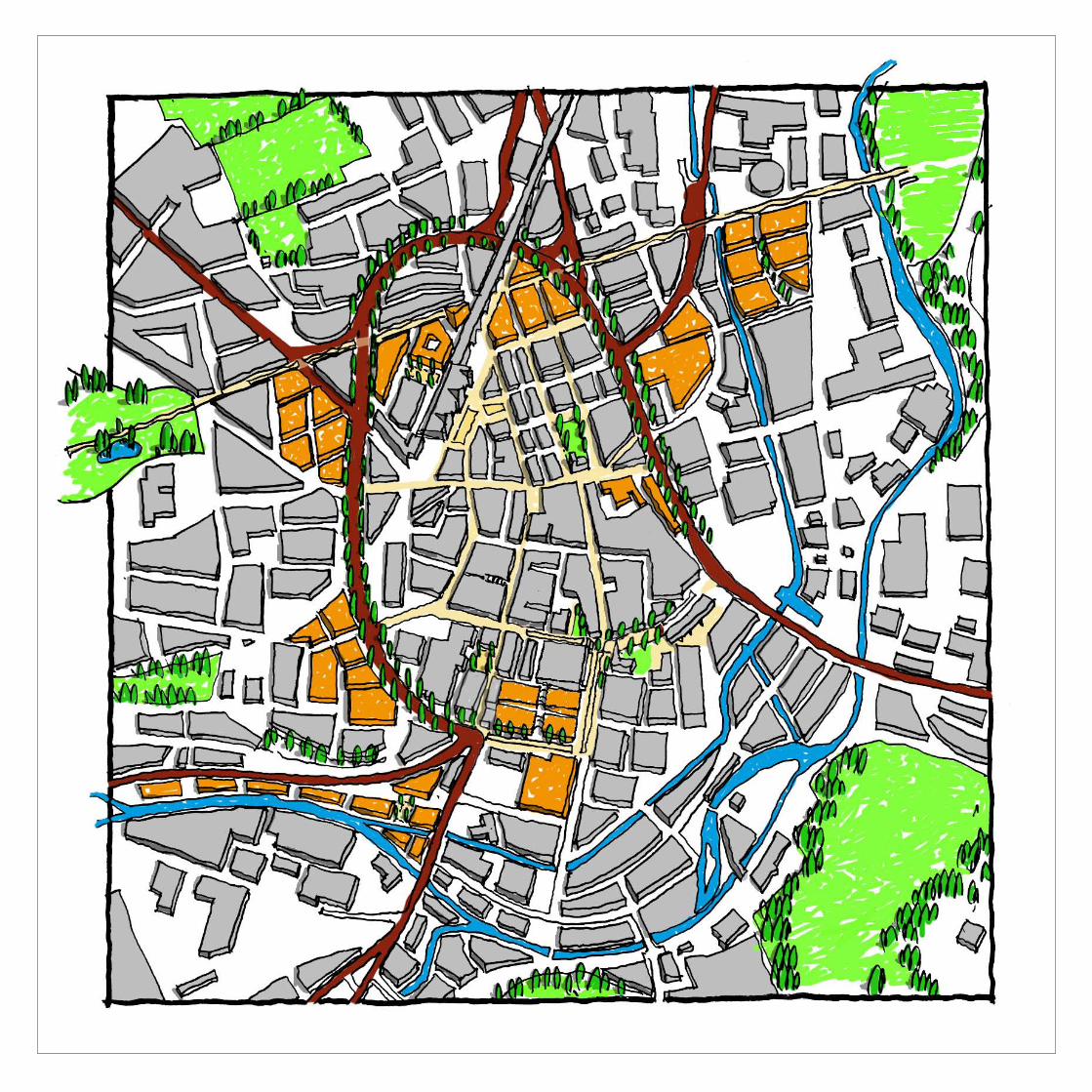
Option 2:
Horseshoe This option looks to downgrade the section of Ring Road between the University and the town centre by creating a horseshoe-shaped ‘bypass’ linking all of the radial routes into the town.
The role of the Ring Road is to link together the main radial routes into town to distribute local traffic and to handle through traffic. This could be done with a horseshoe shaped road taking traffic around the northern part of the centre. This would involve slightly longer journeys but has the great benefit of allowing the downgrading of the section of ring road between the University and the town centre.
As shown on page 23 the section of Ring Road by the University goes through what used to be the heart of the town and the severance of the university from
incorporate active frontage onto the calmed road, including the blank lower facade of the market.
The balance of the ring road would be treated as in Option 1. A significant benefit would be the removal of the Shorehead Roundabout to create a much more attractive gateway to the town and an easier pedestrian crossing between Wakefield Road and the town centre.
the centre is a major problem and was identified in the Renaissance SDF. The horseshoe ring road would allow traffic to be diverted away from this section of road which could then be treated as a shared surface for local traffic only. As part of this the curves on the current road would be turned back into ‘T’ junctions, freeing up land. This would be of benefit to the Queensgate development allowing a larger site area. This scheme should
Bury Town Centre: Where the ring road has been
downgraded between a new development and the
town centre following an URBED masterplan.
Huddersfield Urban Design Framework
Page 29
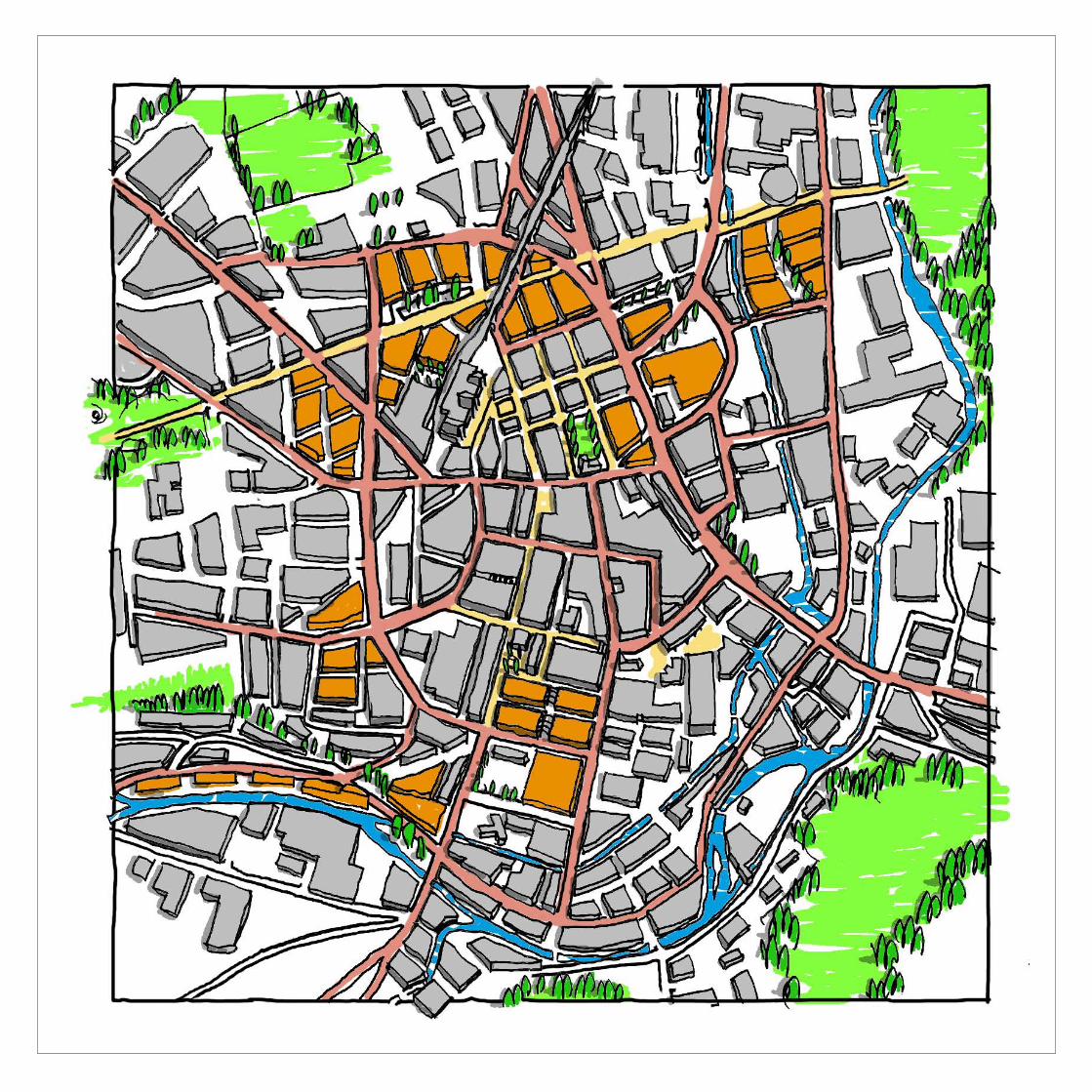
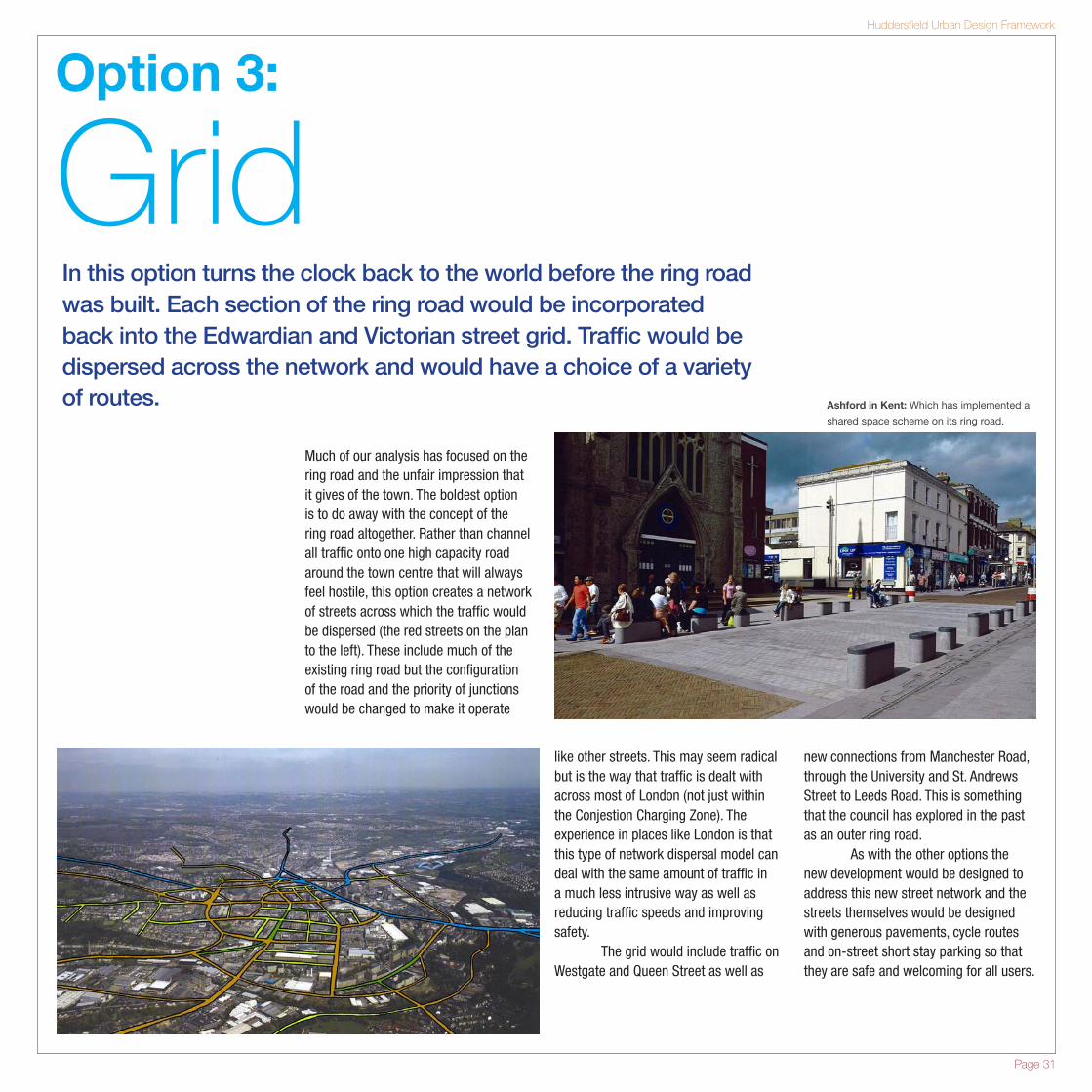
Option 3:
GridIn this option turns the clock back to the world before the ring road was built. Each section of the ring road would be incorporated back into the Edwardian and Victorian street grid. Traffic would be dispersed across the network and would have a choice of a variety of routes.
Much of our analysis has focused on the ring road and the unfair impression that it gives of the town. The boldest option is to do away with the concept of the ring road altogether. Rather than channel all traffic onto one high capacity road around the town centre that will always feel hostile, this option creates a network of streets across which the traffic would be dispersed (the red streets on the plan to the left). These include much of the existing ring road but the configuration of the road and the priority of junctions would be changed to make it operate
like other streets. This may seem radical but is the way that traffic is dealt with across most of London (not just within the Conjestion Charging Zone). The experience in places like London is that this type of network dispersal model can deal with the same amount of traffic in a much less intrusive way as well as reducing traffic speeds and improving safety. The grid would include traffic on Westgate and Queen Street as well as
new connections from Manchester Road, through the University and St. Andrews Street to Leeds Road. This is something that the council has explored in the past as an outer ring road. As with the other options the new development would be designed to address this new street network and the streets themselves would be designed with generous pavements, cycle routes and on-street short stay parking so that they are safe and welcoming for all users.
Ashford in Kent: Which has implemented a
shared space scheme on its ring road.
Huddersfield Urban Design Framework
Page 31
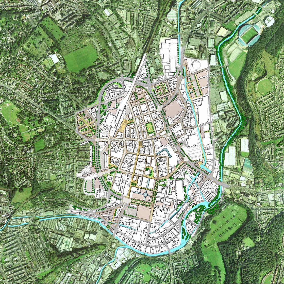
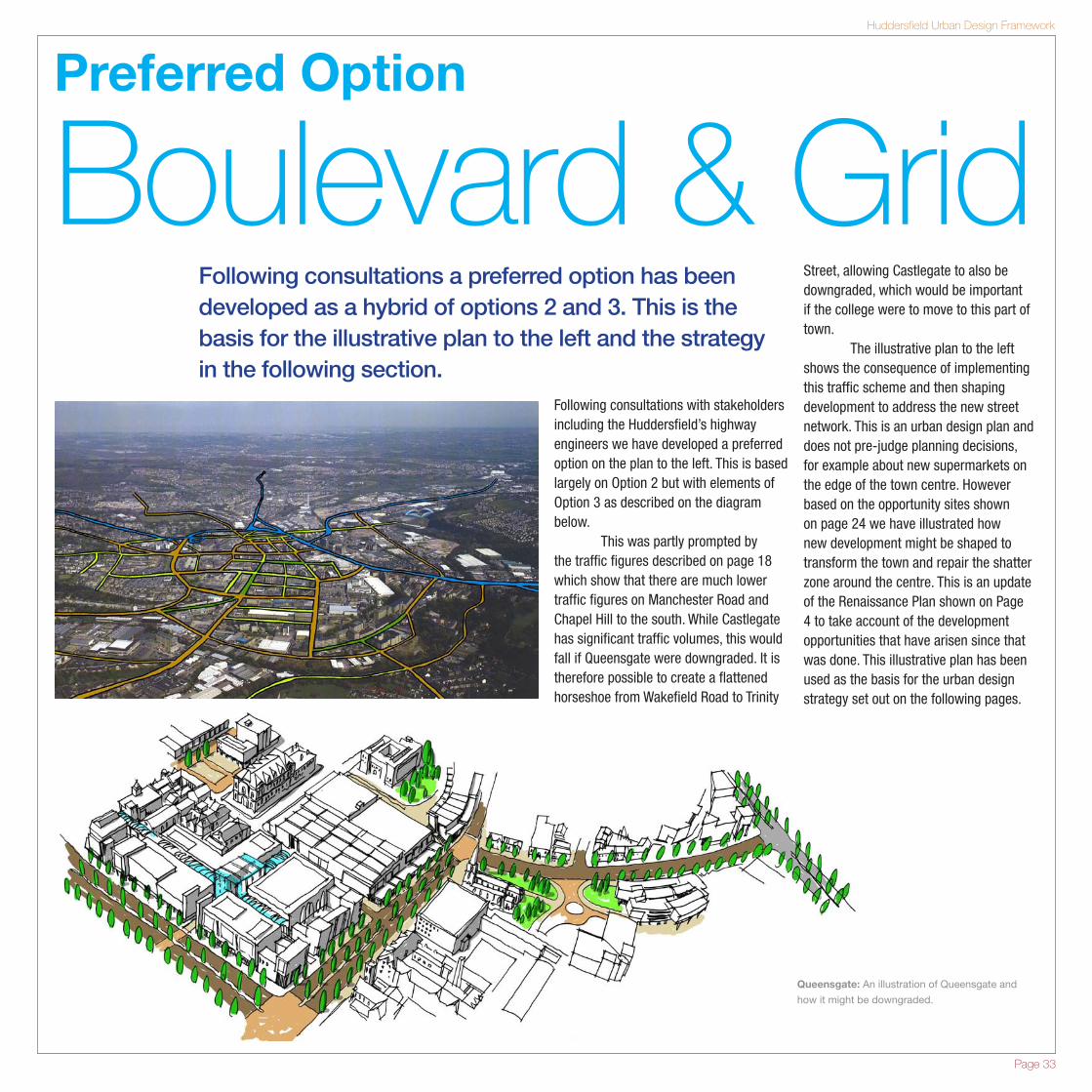
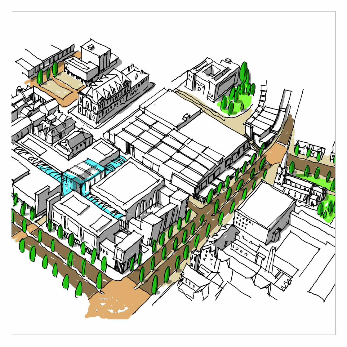
Preferred Option
Boulevard & GridFollowing consultations a preferred option has been developed as a hybrid of options 2 and 3. This is the basis for the illustrative plan to the left and the strategy in the following section.
Following consultations with stakeholders including the Huddersfield’s highway engineers we have developed a preferred option on the plan to the left. This is based largely on Option 2 but with elements of Option 3 as described on the diagram below. This was partly prompted by the traffic figures described on page 18 which show that there are much lower traffic figures on Manchester Road and Chapel Hill to the south. While Castlegate has significant traffic volumes, this would fall if Queensgate were downgraded. It is therefore possible to create a flattened horseshoe from Wakefield Road to Trinity
Street, allowing Castlegate to also be downgraded, which would be important if the college were to move to this part of town. The illustrative plan to the left shows the consequence of implementing this traffic scheme and then shaping development to address the new street network. This is an urban design plan and does not pre-judge planning decisions, for example about new supermarkets on the edge of the town centre. However based on the opportunity sites shown on page 24 we have illustrated how new development might be shaped to transform the town and repair the shatter zone around the centre. This is an update of the Renaissance Plan shown on Page 4 to take account of the development opportunities that have arisen since that was done. This illustrative plan has been used as the basis for the urban design strategy set out on the following pages.
Queensgate: An illustration of Queensgate and
how it might be downgraded.
Huddersfield Urban Design Framework
Page 33