Embed Size (px)
Citation preview
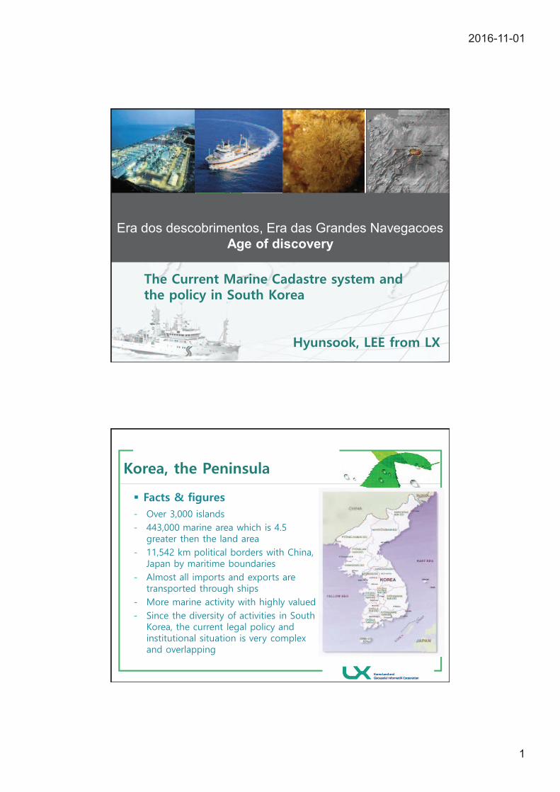
2016-11-01
1
Era dos descobrimentos, Era das Grandes Navegacoes
Age of discovery
§
2016-11-01
2
www.themegallery.
com
LOGO
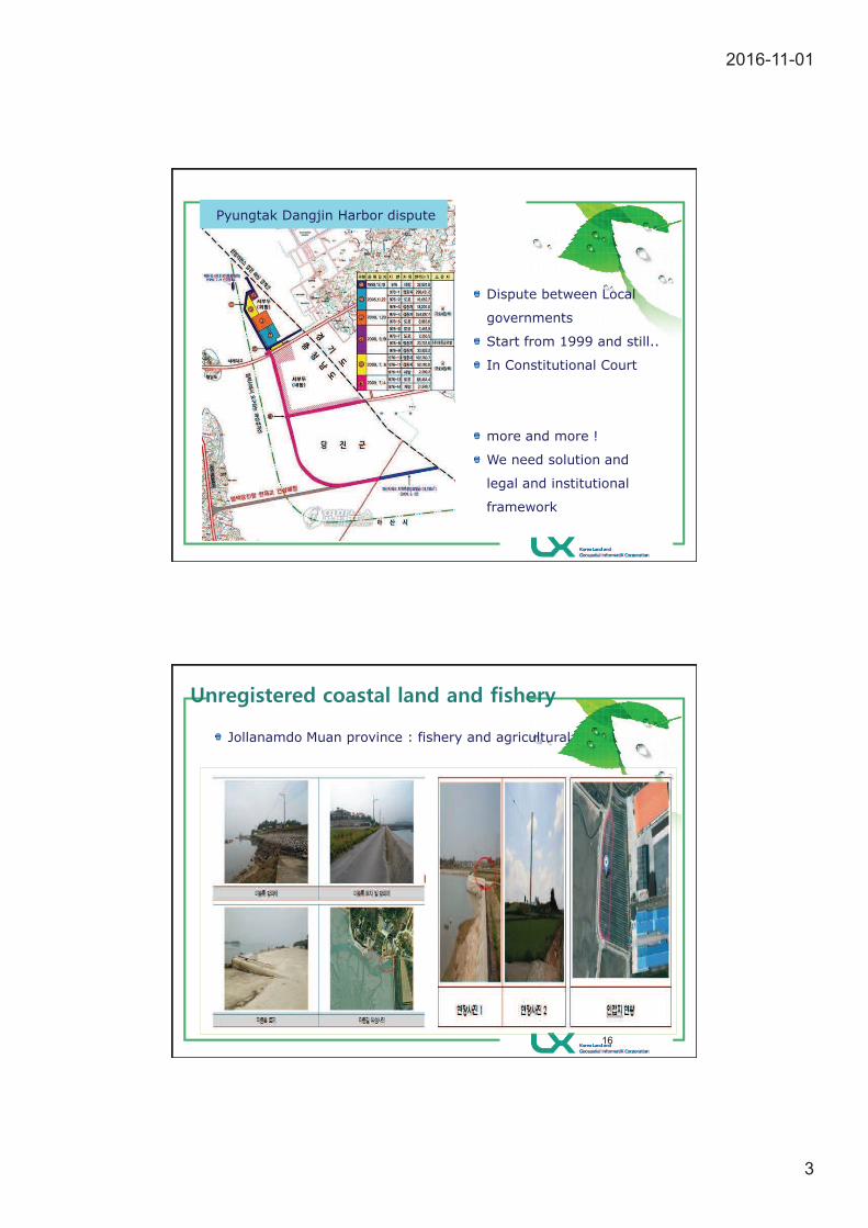
Reclamation land( (Pyungtak vs Dangjin dispute)
2016-11-01
3
Dispute between Local
governments
Start from 1999 and still..
In Constitutional Court
more and more !
We need solution and
legal and institutional
framework
Pyungtak Dangjin Harbor dispute
16
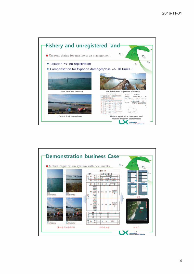
Jollanamdo Muan province : fishery and agricultural
2016-11-01
4
Taxation => no registration
Compensation for typhoon damages/loss => 10 times !!
19
2016-11-01
5
4
‘Ministry of Education,
Science and Technology’, 'Ministry of National Defense’, 'Ministry of Public
Administration and Security, 'Ministry of Culture, Sports and Tourism', ’Ministry for
Food, Agriculture, Forestry and Fisheries', 'Ministry of Knowledge Economy'
'Ministry of Welfare and Family Affairs', 'Ministry of Environment, 'Ministry of Land,
Transport and Maritime Affairs', ’Statistics Korea’, ’Korea Meteorological
Administration, ’Korea Coast Guard’, and many local governments.
’Coastal Act’ and ’Shared Marine area management
and Landfill Act’, ’Harbor Act’, ’Fishing and fisheries Act’, ’Domestic Water Act’,
Fishing boat Act’ and so on
21
2016-11-01
6
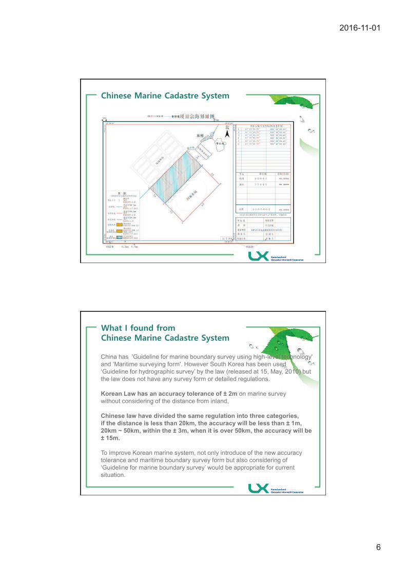
China has 'Guideline for marine boundary survey using high-level technology'
and ‘Maritime surveying form'. However South Korea has been used
‘Guideline for hydrographic survey’ by the law (released at 15, May, 2010) but
the law does not have any survey form or detailed regulations.
Korean Law has an accuracy tolerance of ± 2m on marine survey
without considering of the distance from inland,
Chinese law have divided the same regulation into three categories,
if the distance is less than 20km, the accuracy will be less than ± 1m,
20km ~ 50km, within the ± 3m, when it is over 50km, the accuracy will be
± 15m.
To improve Korean marine system, not only introduce of the new accuracy
tolerance and maritime boundary survey form but also considering of
‘Guideline for marine boundary survey’ would be appropriate for current
situation.
2016-11-01
7
33
2016-11-01
8