Embed Size (px)
Citation preview
1
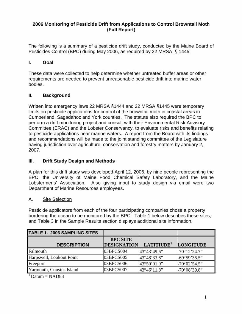
2006 Monitoring of Pesticide Drift from Applications to Control Browntail Moth (Full Report)
The following is a summary of a pesticide drift study, conducted by the Maine Board of Pesticides Control (BPC) during May 2006, as required by 22 MRSA § 1445.
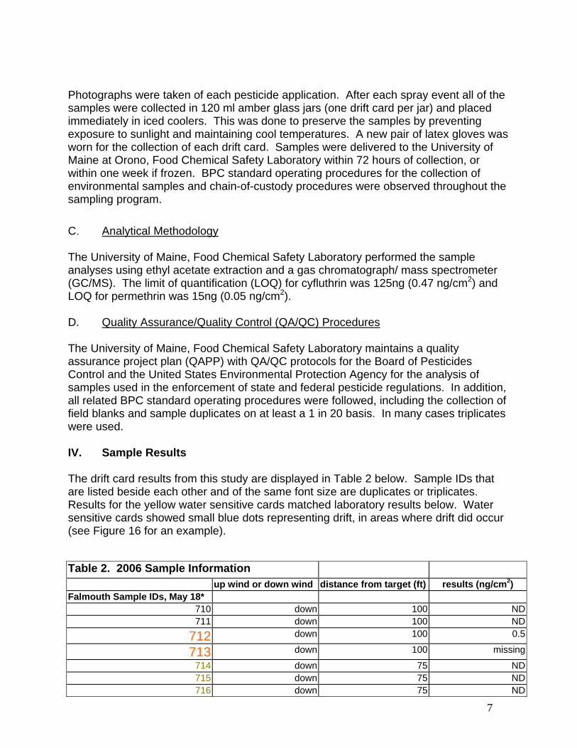
I. Goal These data were collected to help determine whether untreated buffer areas or other requirements are needed to prevent unreasonable pesticide drift into marine water bodies. II. Background Written into emergency laws 22 MRSA §1444 and 22 MRSA §1445 were temporary limits on pesticide applications for control of the browntail moth in coastal areas in Cumberland, Sagadahoc and York counties. The statute also required the BPC to perform a drift monitoring project and consult with their Environmental Risk Advisory Committee (ERAC) and the Lobster Conservancy, to evaluate risks and benefits relating to pesticide applications near marine waters. A report from the Board with its findings and recommendations will be made to the joint standing committee of the Legislature having jurisdiction over agriculture, conservation and forestry matters by January 2, 2007. III. Drift Study Design and Methods A plan for this drift study was developed April 12, 2006, by nine people representing the BPC, the University of Maine Food Chemical Safety Laboratory, and the Maine Lobstermens’ Association. Also giving input to study design via email were two Department of Marine Resources employees. A. Site Selection Pesticide applicators from each of the four participating companies chose a property bordering the ocean to be monitored by the BPC. Table 1 below describes these sites, and Table 3 in the Sample Results section displays additional site information. TABLE 1. 2006 SAMPLING SITES
DESCRIPTION
BPC SITE DESIGNATION
LATITIUDE1
LONGITUDE
Falmouth 03BPCS004 43°43’49.6” -70°12’24.7” Harpswell, Lookout Point 03BPCS005 43°48’33.6” -69°59’36.5” Freeport 03BPCS006 43°50’01.0” -70°02’54.5” Yarmouth, Cousins Island 03BPCS007 43°46’11.8” -70°08’39.8” 1 Datum = NAD83

2
B. Insecticide Application and Sample Collection
Two sites were treated with cyfluthrin (Falmouth and Yarmouth) and the other two sites were treated with permethrin. BPC staff was on site at the time of the applications and recorded weather conditions using a Kestrel 3000 Pocket Weather Meter. Prior to pesticide treatment, a BPC employee mounted 185-millimeter diameter filter papers to drift card stands at each site to catch any pesticide drift. Water sensitive cards were also used at three of four sites (see Figure 1). New cardboard platform bases were used at each site.
Figure 1. Drift card triplicates and yellow water sensitive card Refer to Figures 2 through 5 below for diagrams showing the layout of drift cards in relation to the pesticide spray target areas, direction of spray, and wind direction. These four diagrams are not to scale. Small circles represent drift cards; two circles side by side are duplicates, and three circles side by side are triplicates. The sample ID (a number in the 700s) is listed next to each drift card.

3
Figure 2. Falmouth Site

4
Figure 3. Harpswell Site

5
Figure 4. Freeport Site

6
Figure 5. Yarmouth Site
7
Photographs were taken of each pesticide application. After each spray event all of the samples were collected in 120 ml amber glass jars (one drift card per jar) and placed immediately in iced coolers. This was done to preserve the samples by preventing exposure to sunlight and maintaining cool temperatures. A new pair of latex gloves was worn for the collection of each drift card. Samples were delivered to the University of Maine at Orono, Food Chemical Safety Laboratory within 72 hours of collection, or within one week if frozen. BPC standard operating procedures for the collection of environmental samples and chain-of-custody procedures were observed throughout the sampling program. C. Analytical Methodology
The University of Maine, Food Chemical Safety Laboratory performed the sample analyses using ethyl acetate extraction and a gas chromatograph/ mass spectrometer (GC/MS). The limit of quantification (LOQ) for cyfluthrin was 125ng (0.47 ng/cm2) and LOQ for permethrin was 15ng (0.05 ng/cm2). D. Quality Assurance/Quality Control (QA/QC) Procedures
The University of Maine, Food Chemical Safety Laboratory maintains a quality assurance project plan (QAPP) with QA/QC protocols for the Board of Pesticides Control and the United States Environmental Protection Agency for the analysis of samples used in the enforcement of state and federal pesticide regulations. In addition, all related BPC standard operating procedures were followed, including the collection of field blanks and sample duplicates on at least a 1 in 20 basis. In many cases triplicates were used.
IV. Sample Results The drift card results from this study are displayed in Table 2 below. Sample IDs that are listed beside each other and of the same font size are duplicates or triplicates. Results for the yellow water sensitive cards matched laboratory results below. Water sensitive cards showed small blue dots representing drift, in areas where drift did occur (see Figure 16 for an example). Table 2. 2006 Sample Information
up wind or down wind distance from target (ft) results (ng/cm2) Falmouth Sample IDs, May 18*
710 down 100 ND711 down 100 ND
712 down 100 0.5
713 down 100 missing
714 down 75 ND715 down 75 ND716 down 75 ND
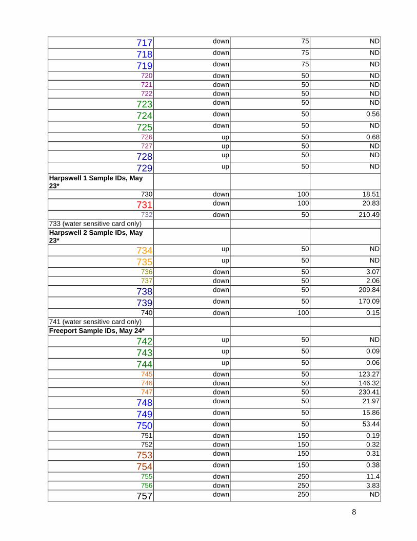
8
717 down 75 ND
718 down 75 ND
719 down 75 ND
720 down 50 ND721 down 50 ND722 down 50 ND
723 down 50 ND
724 down 50 0.56
725 down 50 ND
726 up 50 0.68727 up 50 ND
728 up 50 ND
729 up 50 ND
Harpswell 1 Sample IDs, May 23*
730 down 100 18.51
731 down 100 20.83
732 down 50 210.49733 (water sensitive card only) Harpswell 2 Sample IDs, May 23*
734 up 50 ND
735 up 50 ND
736 down 50 3.07737 down 50 2.06
738 down 50 209.84
739 down 50 170.09
740 down 100 0.15741 (water sensitive card only) Freeport Sample IDs, May 24*
742 up 50 ND
743 up 50 0.09
744 up 50 0.06
745 down 50 123.27746 down 50 146.32747 down 50 230.41
748 down 50 21.97
749 down 50 15.86
750 down 50 53.44
751 down 150 0.19752 down 150 0.32
753 down 150 0.31
754 down 150 0.38
755 down 250 11.4756 down 250 3.83
757 down 250 ND

9
758 down 250 ND
759 (blank) missingYarmouth Sample IDs, May 26*
760 up 250 ND
761 up 250 ND
762 up 150 ND763 up 150 ND
764 up 50 ND
765 up 50 0.56
766 up 50 ND
767 down 222 ND768 down 222 ND
769 down 222 ND
770 down 222 ND
771 down 150 ND772 down 150 0.74773 down 150 0.49
774 down 150 0.87
775 down 150 1.02
776 down 150 0.7
777 down 50 3.47778 down 50 2.55779 down 50 3.24
780 down 50 4.27
781 down 50 4.23
782 down 50 3.31
783 (blank) ND Table 3. Site Information
*Falmouth, May 18
*Harpswell 1, May 23
*Harpswell 2, May 23
*Freeport, May 24
*Yarmouth, May 26
Pesticide used Tempo, cyfluthrin Astro, permethrin Astro, permethrin Astro, permethrin
Tempo, cyfluthrin
EPA Reg. No. 432-1363 279-3141 279-3141 279-3141 432-1363
Pesticide dilution rate
2 oz/ 100 gal 6 oz./ 100 gal 6 oz./ 100 gal 5 oz./ 100 gal 5 oz./ 100 gal
Amount of diluted pesticide used on site
8 gal 25 gal 10 gal 50 gal 15 gal
Drift adjuvant added?
Yes, Direct (polyvinal polymer)
Yes, Lesco Spreader Sticker
Yes, Lesco Spreader Sticker
No No
Time of spray 7:18-7:21AM Early AM Early AM 6:30 5:18-5:25AM Height of trees 40' 82.5' 74' (several red
oaks) 40-55' 40-50'
Size of treated area
area of three trees a few trees a few trees trees around perimeter of house
property perimeter trees

10
Wind speed calm, not registering on Kestrel
4.9 mph ave, 7.5 max
4.9 mph ave, 7.5 max
1.7 mph ave, 4 max
calm, not registering on Kestrel
Wind direction from E, away from water
off water off water toward water but very calm (treated area > 250' from water)
hard to tell at first but toward water (from NE)(treated trees were 250'from water)
Temperature 50 F 47.9 F 47.9 F 50.7 F 51 F Humidity 79% 79% 96% 86%Cloud cover full clouds light clouds,
really no blue skylight clouds, really no blue sky
light clouds, partly clear
part clear
Time of weather recording
7AM 6:50AM 6:50AM 5:40AM 5:25AM
Appliction equipment
hydraulic sprayer, nozzle size 14, 500 psi, 12 gpm
hydraulic sprayer, nozzle size 16, 400 psi, 50 gpm max
hydraulic sprayer, nozzle size 16, 500 psi, 50 gpm max
hydraulic sprayer, #12 disk, 800 psi, 20 gpm max
mist blower
Notes this common area where drift cards were set up was wooded but trees had been thinned, no water sensitive cards used - too wet
some drift cards blew off stands before they could be collected (extra staples used next time). Water sensitive cards used
some drift cards blew off stands before they could be collected (extra staples used next time). Water sensitive cards used
water sensitive cards used
mist blower pointed in different directions as moved around perimeter. Water sensitive cards used
V. Discussion and Conclusions
Temporary laws in effect during these applications, requiring a 50’ no spray buffer next to the high tide line, and for applications within 250’ of the water, requiring pesticide spray to be directed away from the water and requiring the wind to be away from the water, appear to protect marine water from drift. However, one up wind sample near the water (sample 726 in Falmouth) was found to have a level of pesticide near the limit of quantification, but this could have been a lab error since its duplicate did not detect any pesticide, or might have been a result of the calm morning. Two duplicate drift cards in Freeport (samples 743 and 744), up wind of the target, were found to have low levels of pesticide. During this spray event the hydraulic sprayer was briefly turned in the direction of the up wind samples to spray part of a tree. If the wind died down during this moment, that could explain the pesticide drifting over to the up wind cards 50’ away. The target area at this site was greater than 250’ from the water so the direction of spray did not have to be in a particular direction (see Figure 4). Other up wind samples in this study did not detect pesticide. This study found evidence that detectable levels of pesticide residues are capable of drifting down wind after an application, as expected. According to these results, low levels of pesticides can drift at least 250’ from the target.
11
Some samples did not show pesticide drifting that far, however, and that could be due to trees outside of the target intercepting the drift before it landed on the cards, lack of wind, or other variables. In conclusion, the BPC recommends that the temporary browntail moth spray requirements be extended for upcoming spray seasons, including the requirement that wind must be away from the water. In addition, the BPC also recommends that browntail moth pesticide applications be prohibited when wind speed is less than 2 miles per hour (see the January 2, 2007 BPC memo to the legislature for other BPC recommendations not directly related to this drift study). Appendix. Site Photos
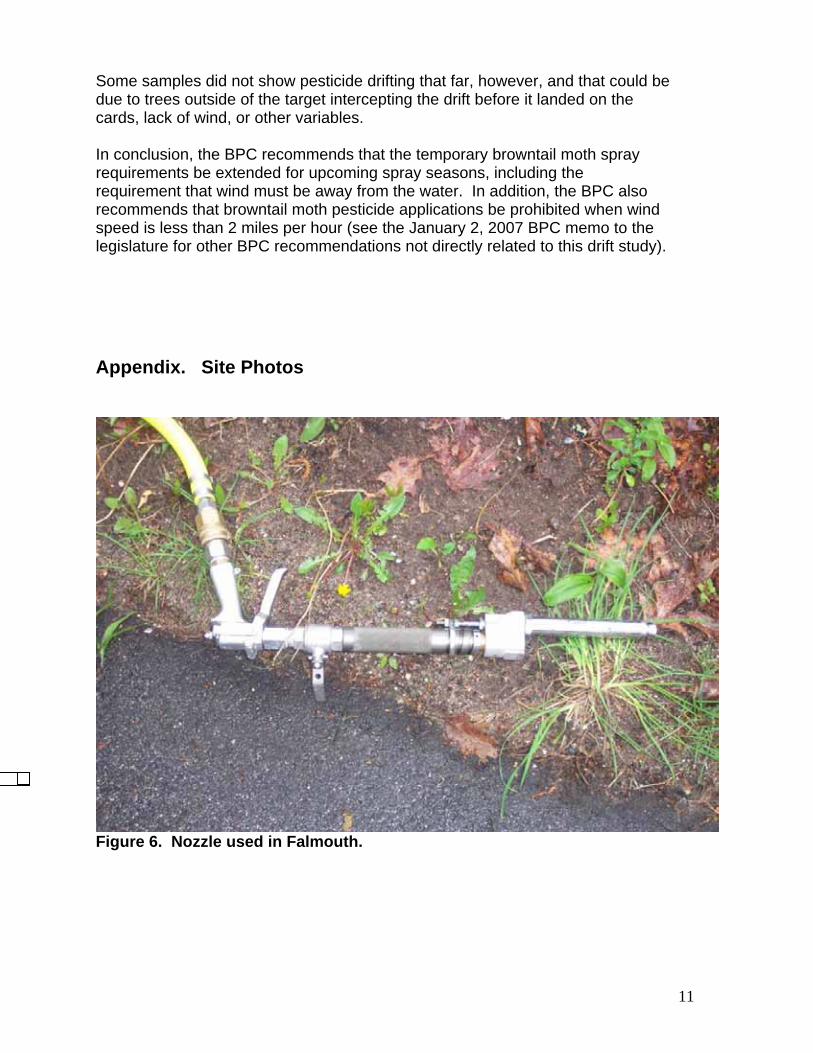
Figure 6. Nozzle used in Falmouth.
12
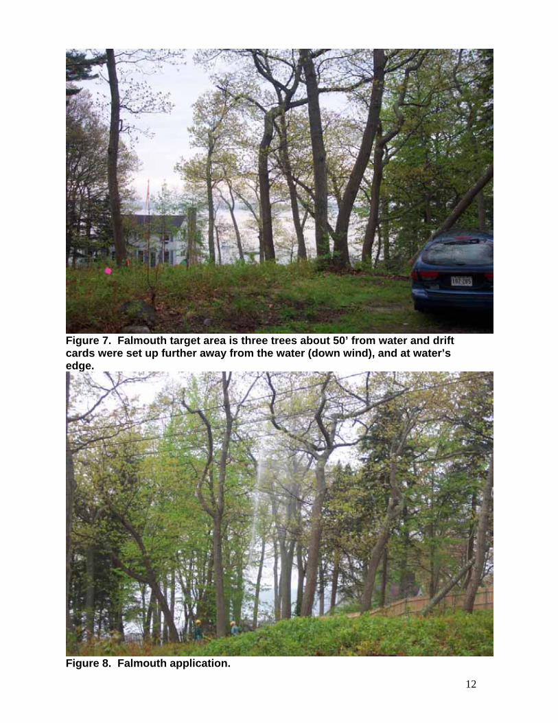
Figure 7. Falmouth target area is three trees about 50’ from water and drift cards were set up further away from the water (down wind), and at water’s edge.
Figure 8. Falmouth application.
13
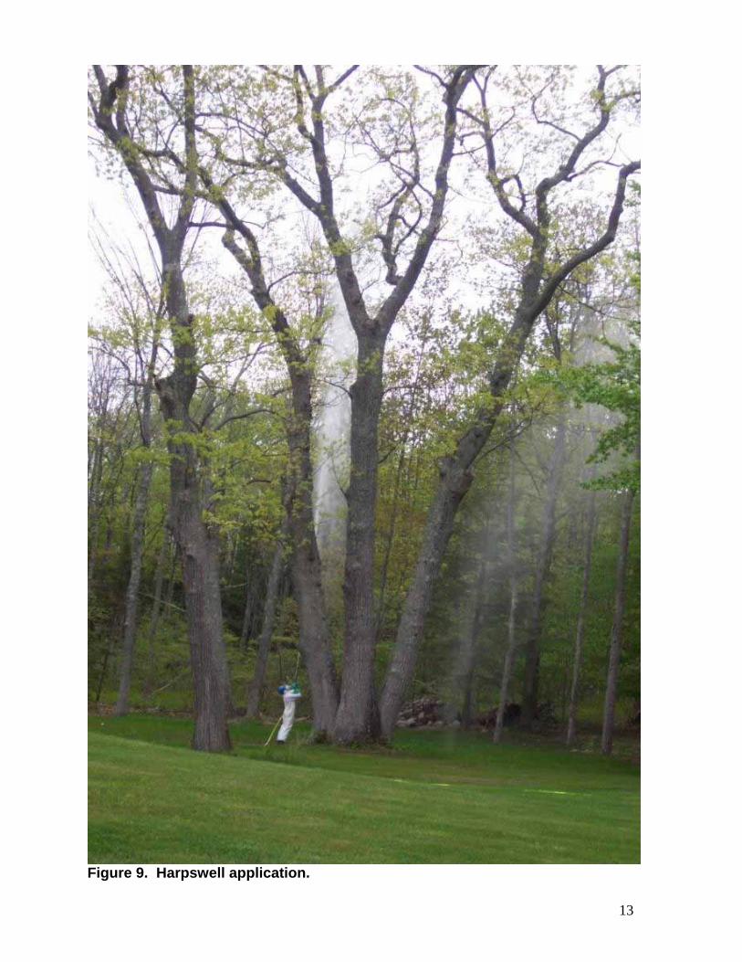
Figure 9. Harpswell application.
14
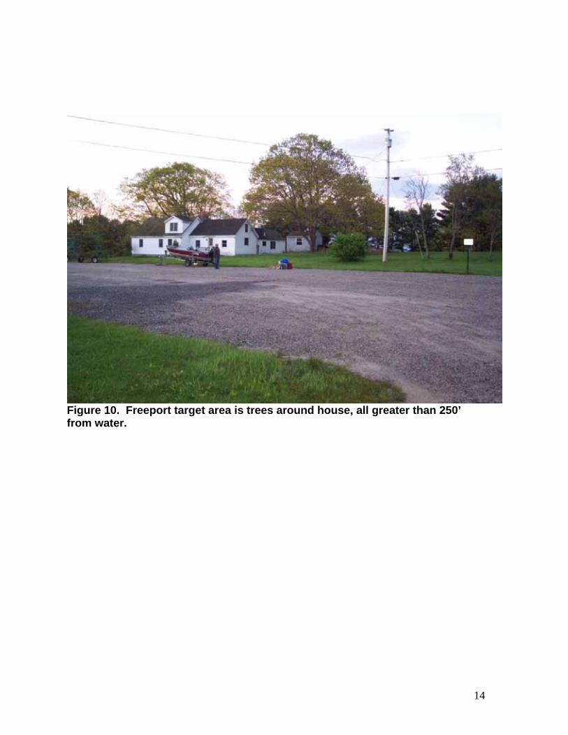
Figure 10. Freeport target area is trees around house, all greater than 250’ from water.
15
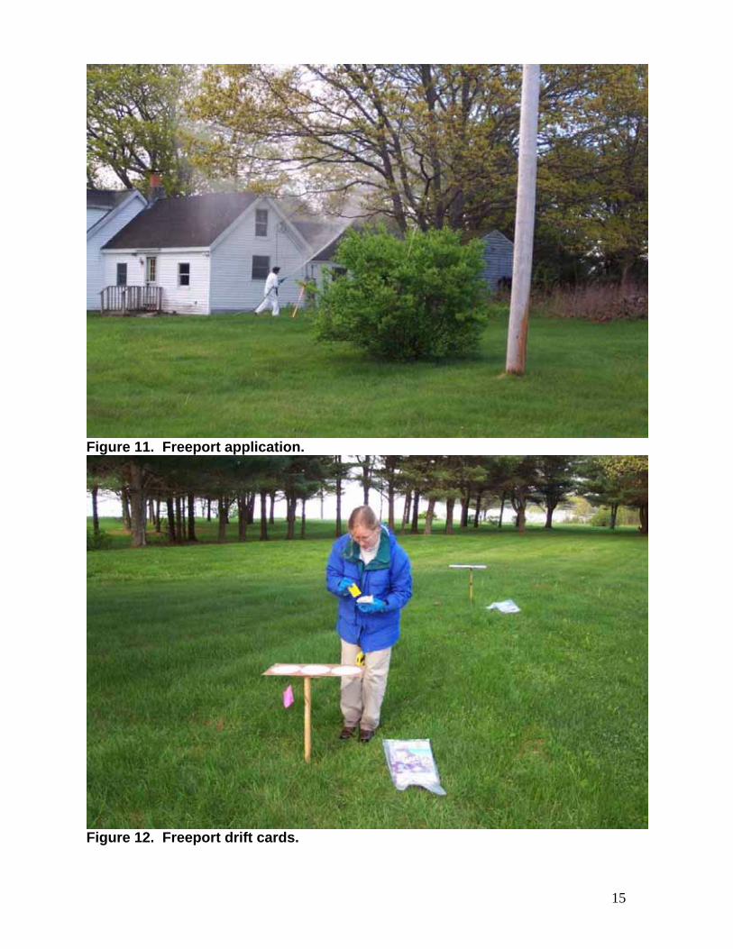
Figure 11. Freeport application.
Figure 12. Freeport drift cards.

16
Figure 13. More Freeport application. Sprayer pointed toward drift cards.
Figure 14. Freeport drift cards set up across lawn. Pine trees may have caught some drift before it reached cards.

17
Figure 15. Yarmouth drift cards set up in this area. Ocean is down this hill over 250’ from target area. Slight movement of air toward the water during this spray event.
Figure 16. Water sensitive cards from the Freeport site from left to right: 250’, 150’, and 50’ downwind from target. Very small liquid droplets are just barely visible on the yellow cards that were 250’ and 150’ from the target.