Embed Size (px)
Citation preview
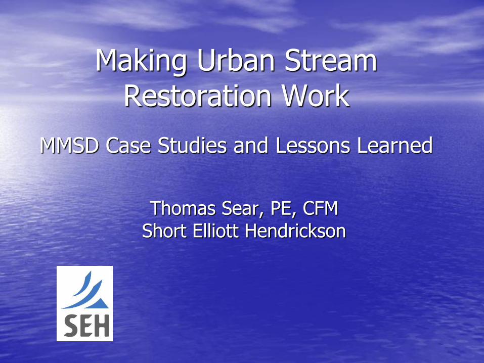
Making Urban Stream Restoration Work
MMSD Case Studies and Lessons Learned
Thomas Sear, PE, CFM Short Elliott Hendrickson
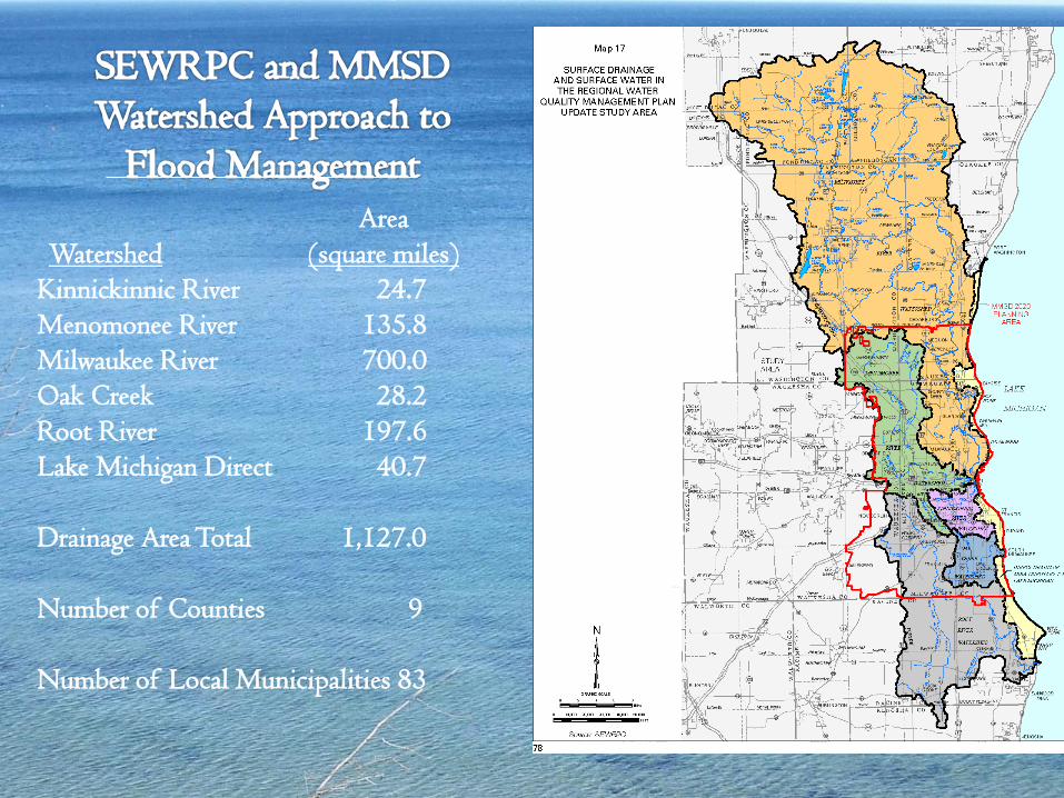
Area
Watershed (square miles)
Kinnickinnic River 24.7
Menomonee River 135.8
Milwaukee River 700.0
Oak Creek 28.2
Root River 197.6
Lake Michigan Direct 40.7
Drainage Area Total 1,127.0
Number of Counties 9
Number of Local Municipalities 83
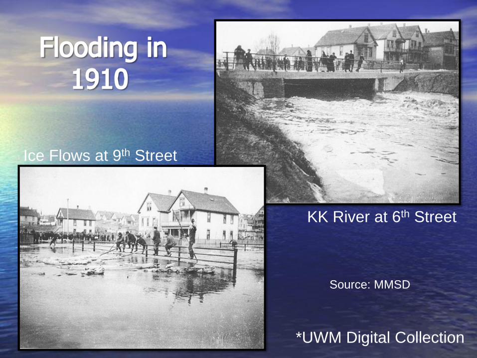
KK River at 6th Street
Ice Flows at 9th Street
*UWM Digital Collection
Source: MMSD
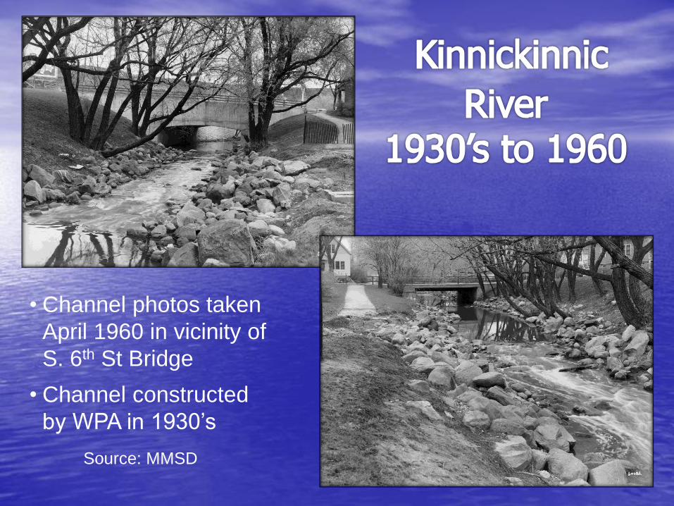
• Channel photos taken
April 1960 in vicinity of
S. 6th St Bridge
• Channel constructed
by WPA in 1930’s
Source: MMSD
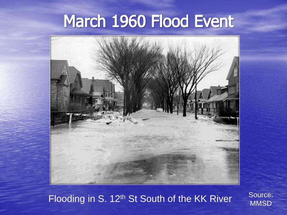
Flooding in S. 12th St South of the KK River Source:
MMSD
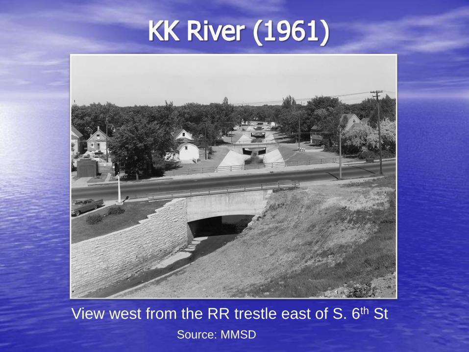
View west from the RR trestle east of S. 6th St
Source: MMSD
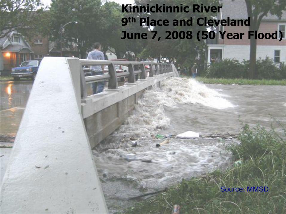
Kinnickinnic River 9th Place and Cleveland June 7, 2008 (50 Year Flood)
Source: MMSD
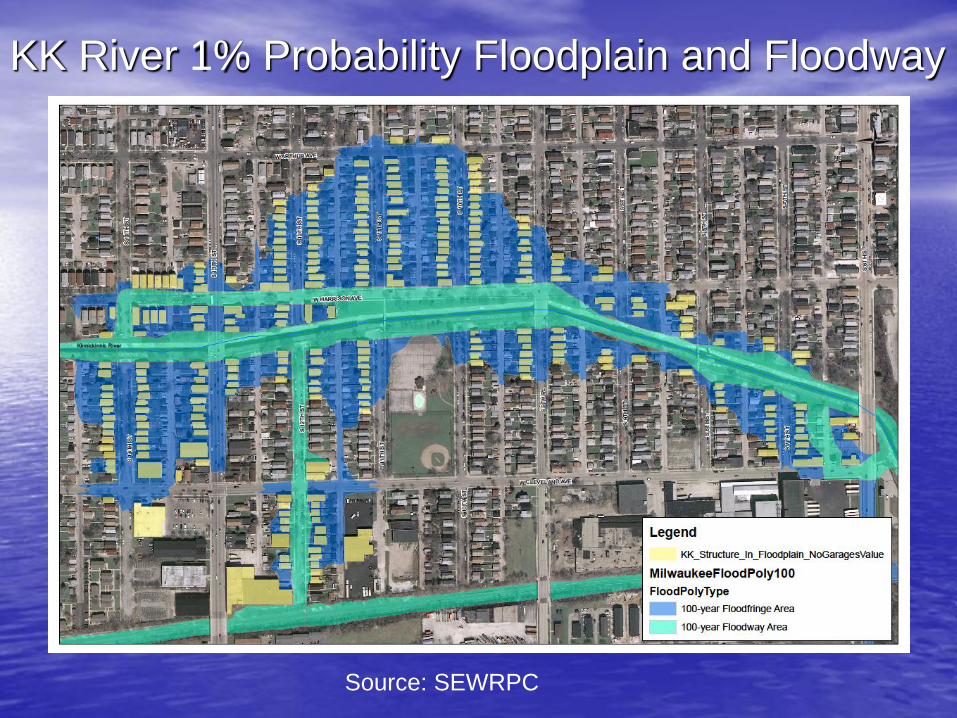
KK River 1% Probability Floodplain and Floodway
Source: SEWRPC
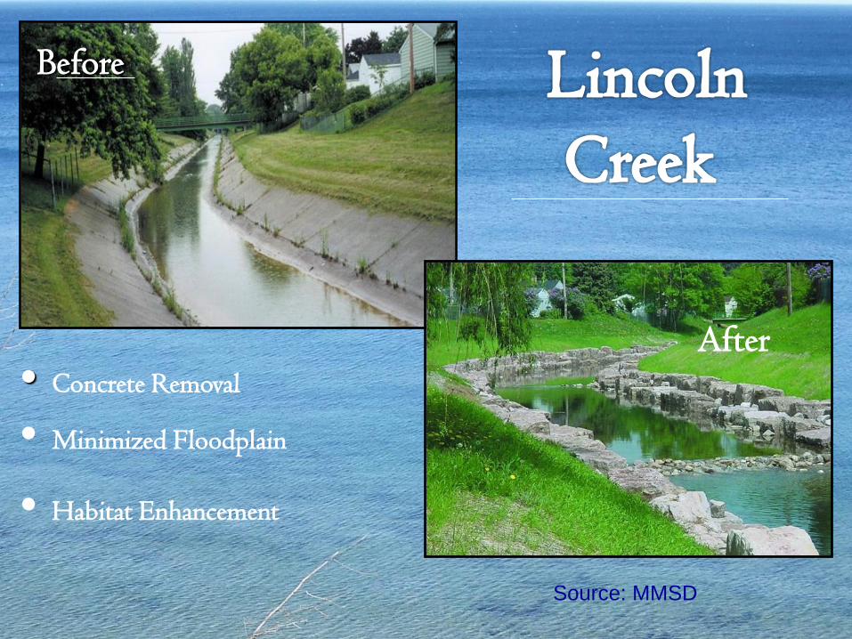
Before
• Concrete Removal
• Minimized Floodplain
• Habitat Enhancement
After
Source: MMSD
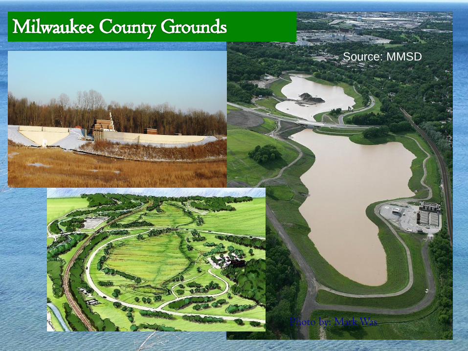
Photo by: Mark Was
Source: MMSD
Source: MMSD
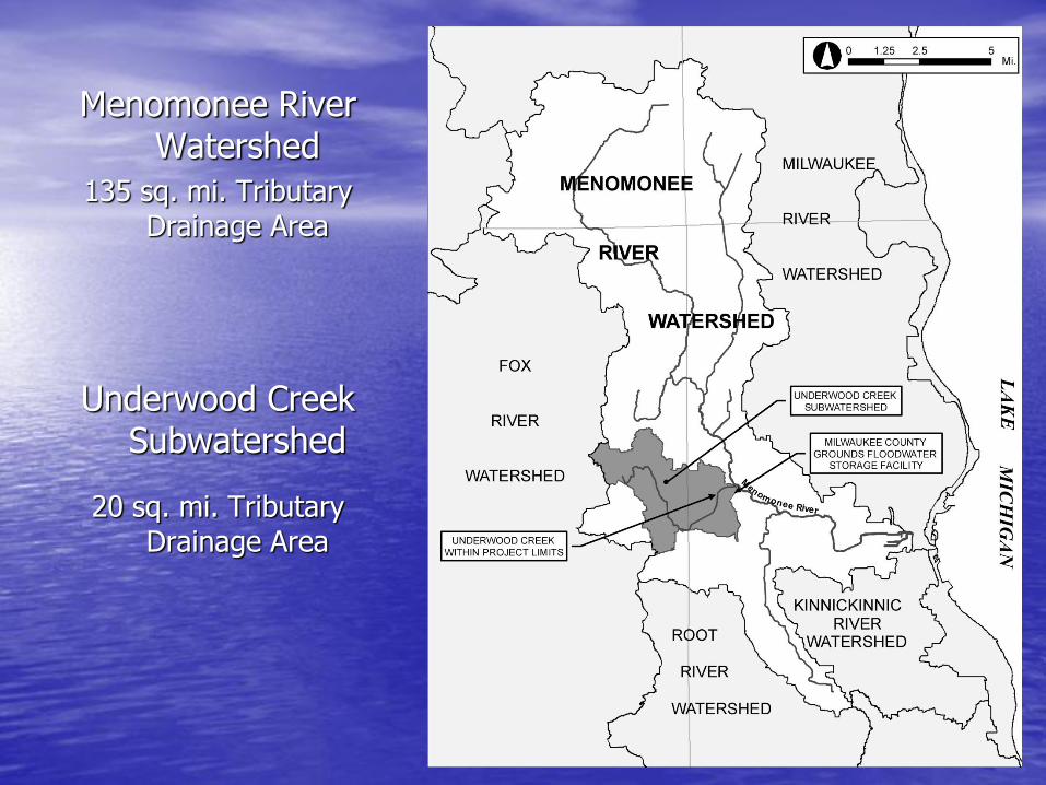
Menomonee River Watershed
135 sq. mi. Tributary Drainage Area
Underwood Creek Subwatershed
20 sq. mi. Tributary Drainage Area
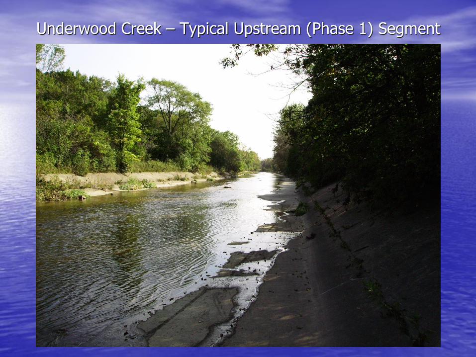
Underwood Creek – Typical Upstream (Phase 1) Segment
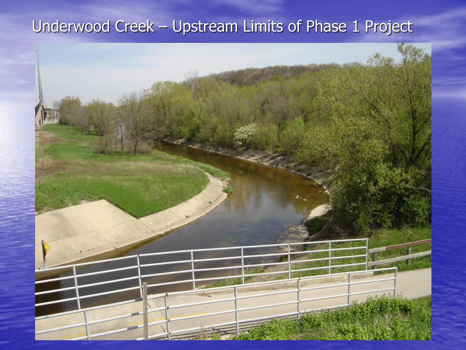
Underwood Creek – Upstream Limits of Phase 1 Project
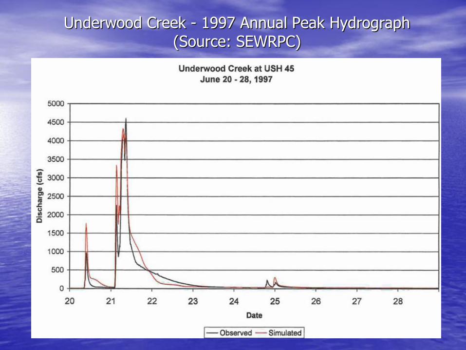
Underwood Creek - 1997 Annual Peak Hydrograph (Source: SEWRPC)
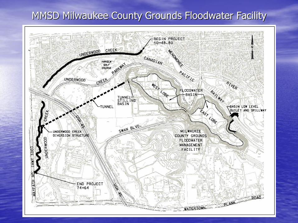
MMSD Milwaukee County Grounds Floodwater Facility
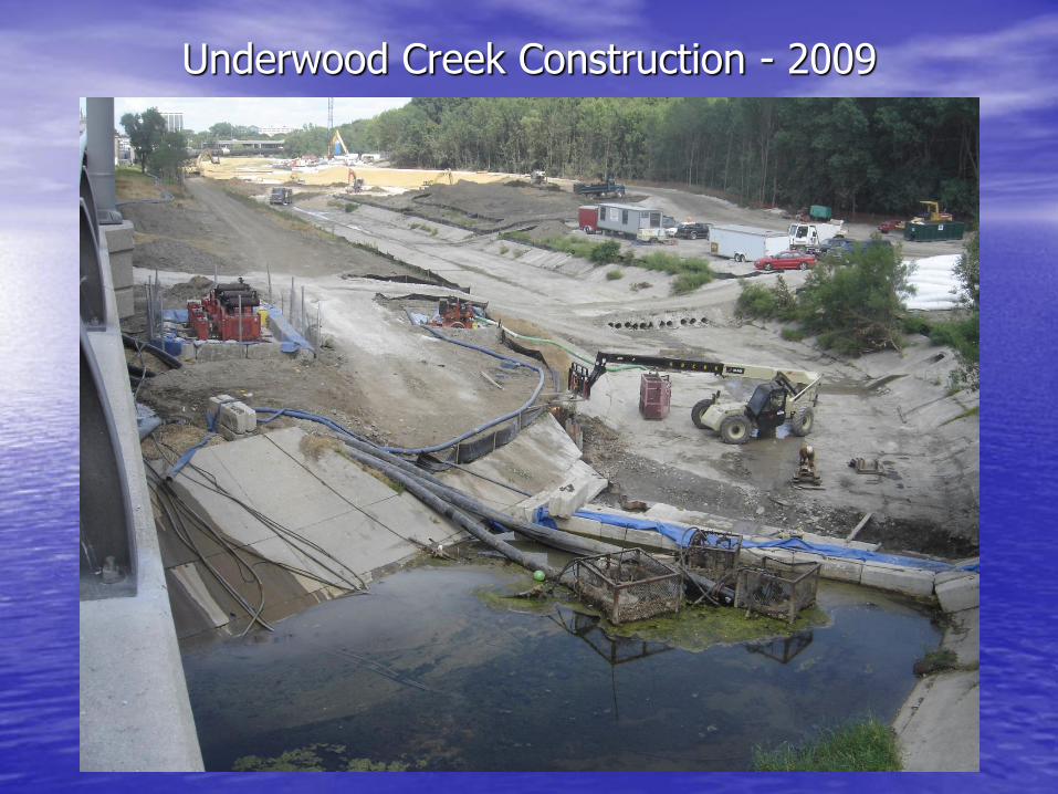
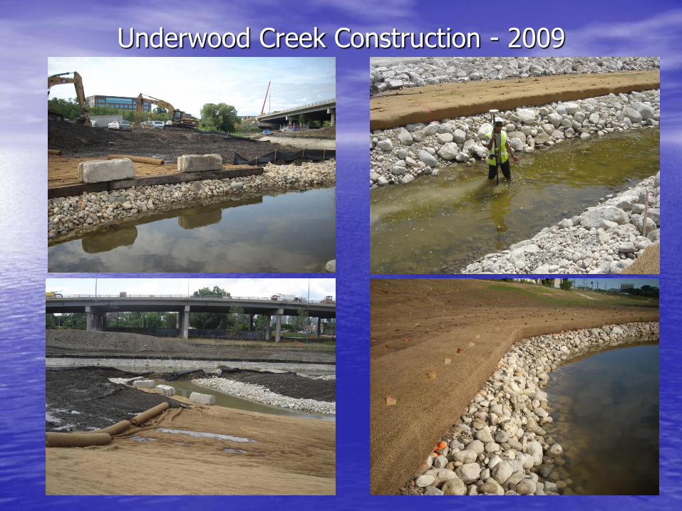
Underwood Creek Construction - 2009
Underwood Creek Construction - 2009
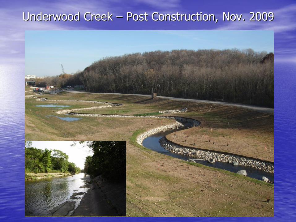
Underwood Creek – Post Construction, Nov. 2009
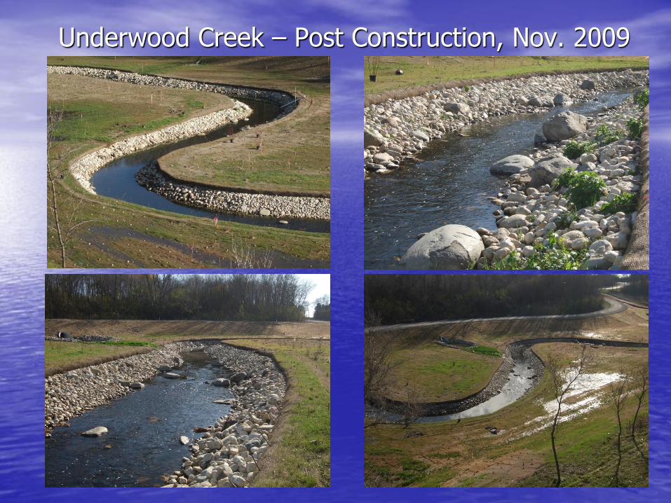
Underwood Creek – Post Construction, Nov. 2009
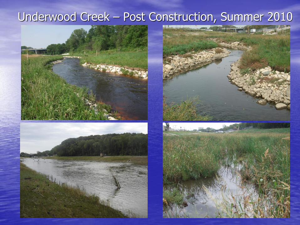
Underwood Creek – Post Construction, Summer 2010
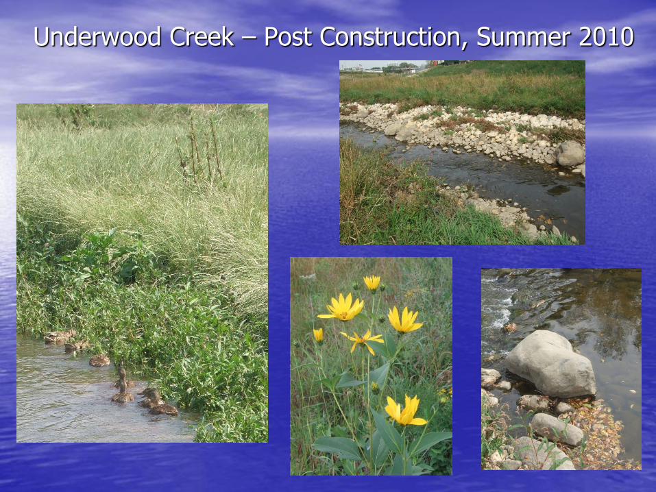
Underwood Creek – Post Construction, Summer 2010
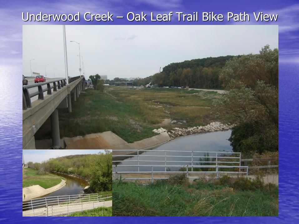
Underwood Creek – Oak Leaf Trail Bike Path View
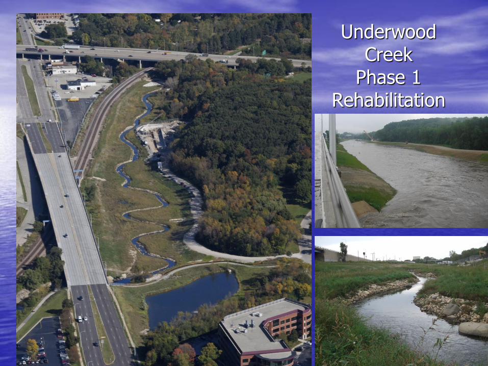
Underwood Creek
Phase 1 Rehabilitation
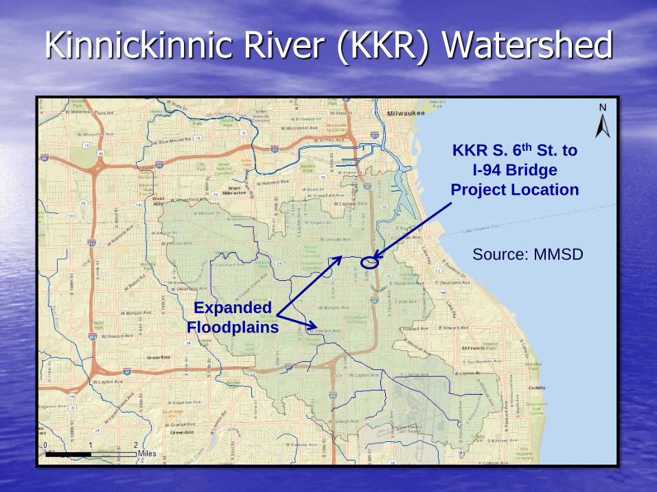
Kinnickinnic River (KKR) Watershed
KKR S. 6th St. to
I-94 Bridge
Project Location
Expanded
Floodplains
Source: MMSD
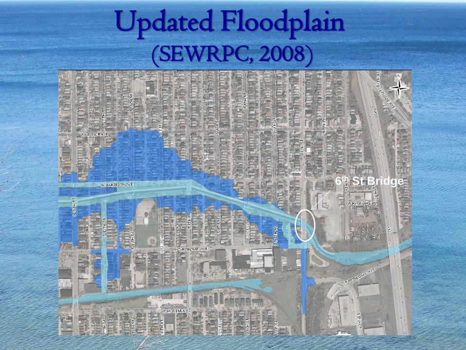
Updated Floodplain (SEWRPC, 2008)
6th St Bridge
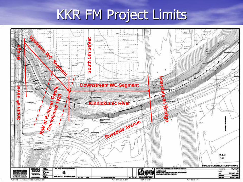
KKR FM Project Limits
Downstream WC Segment
So
uth
6th
Str
ee
t
Kinnickinnic River
So
uth
5th
Str
ee
t
Bri
dg
e
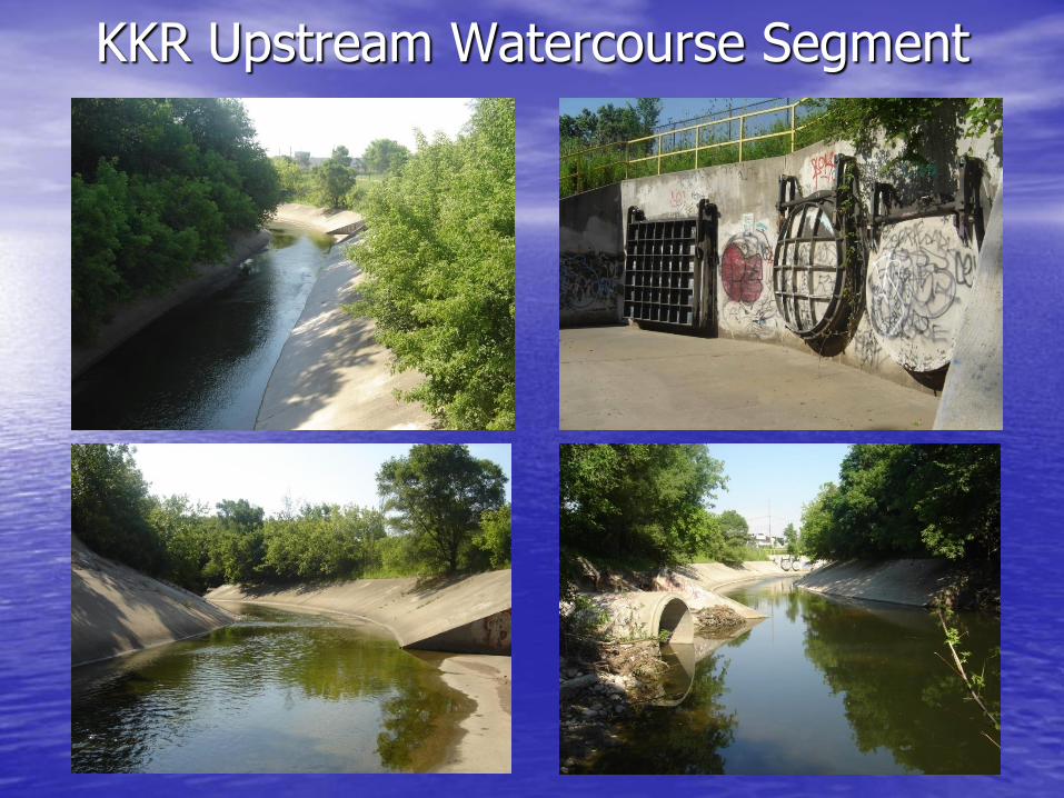
KKR Upstream Watercourse Segment
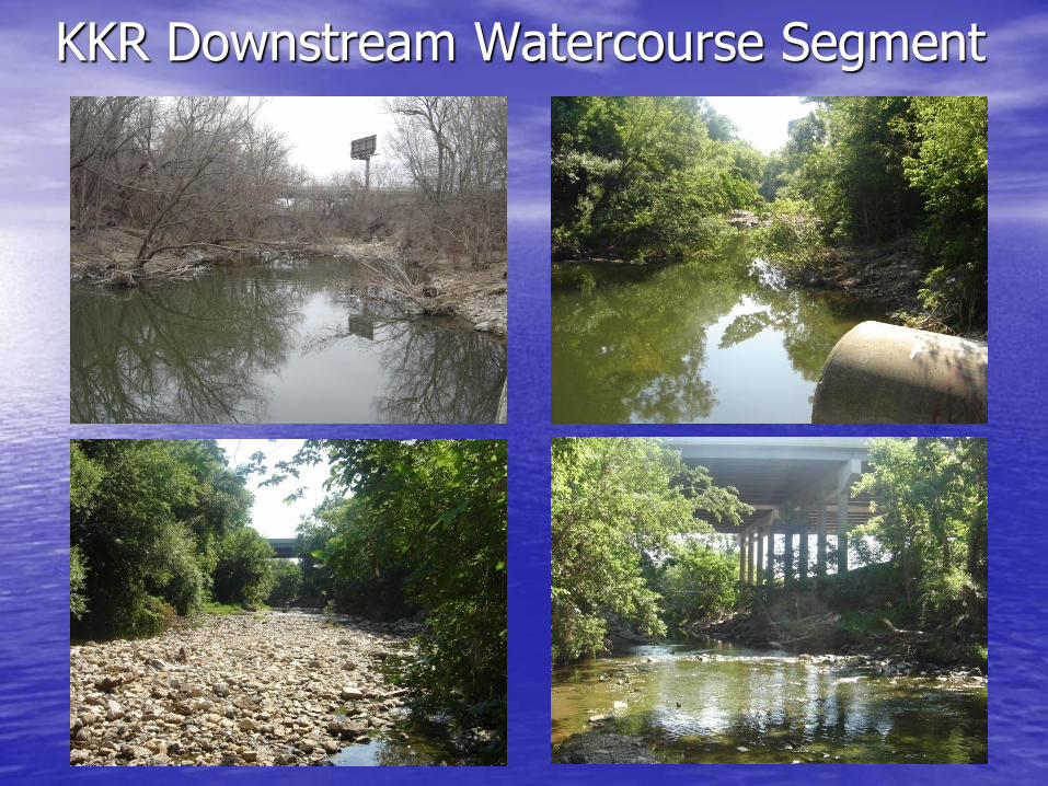
KKR Downstream Watercourse Segment
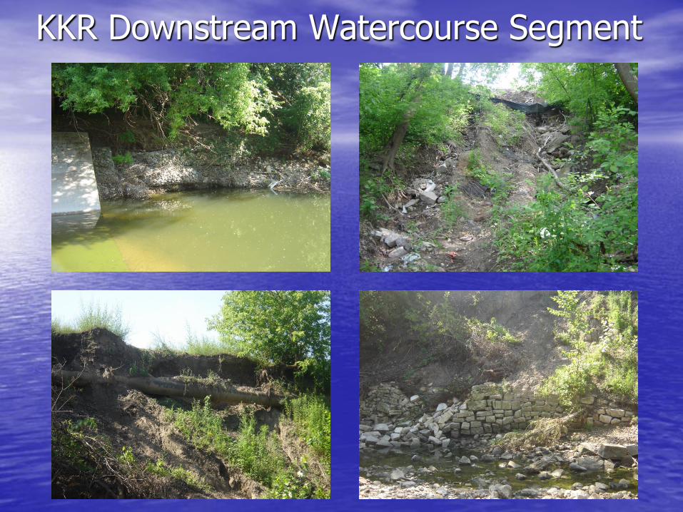
KKR Downstream Watercourse Segment
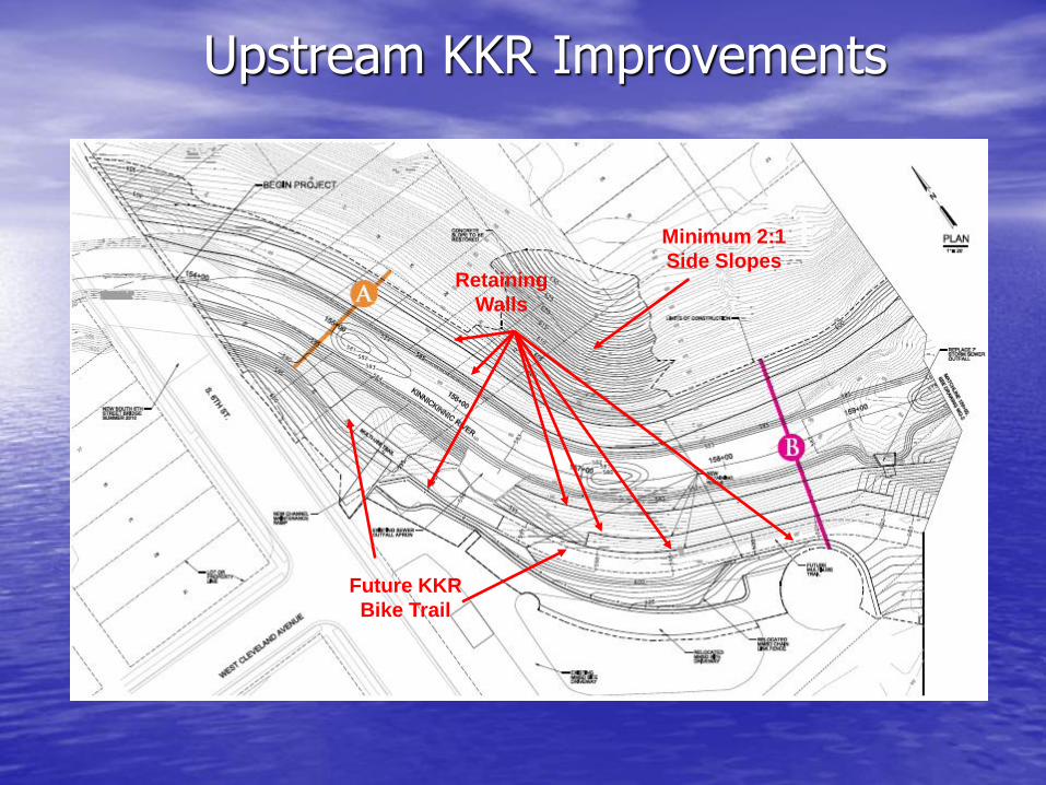
Upstream KKR Improvements
Minimum 2:1
Side Slopes
Future KKR
Bike Trail
Retaining
Walls
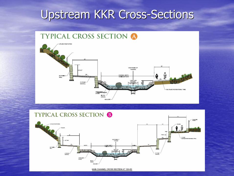
Upstream KKR Cross-Sections
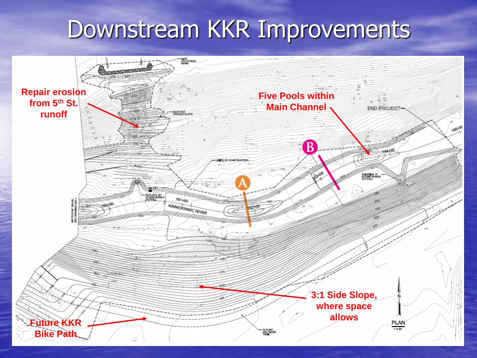
Downstream KKR Improvements
Future KKR
Bike Path
3:1 Side Slope,
where space
allows
Five Pools within
Main Channel
Repair erosion
from 5th St.
runoff
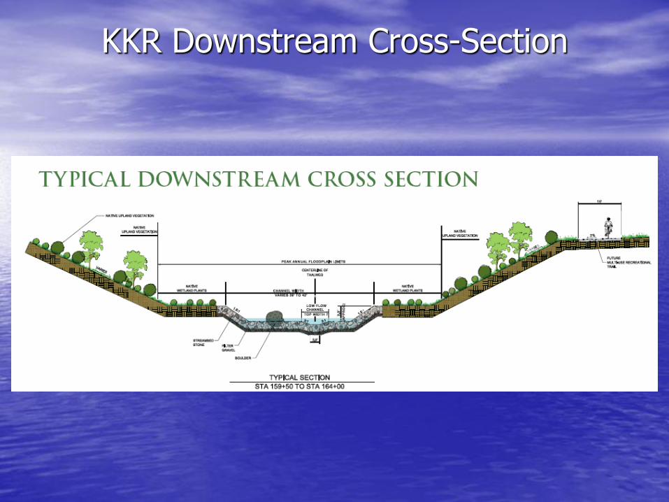
KKR Downstream Cross-Section
Typical Riffle Section
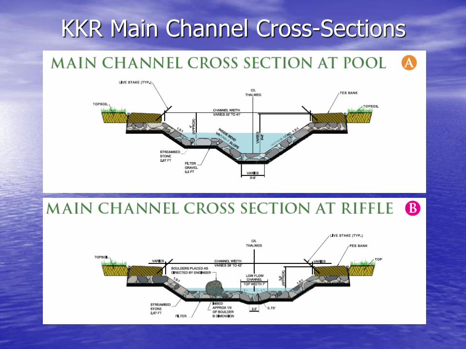
KKR Main Channel Cross-Sections
Typical Pool Section
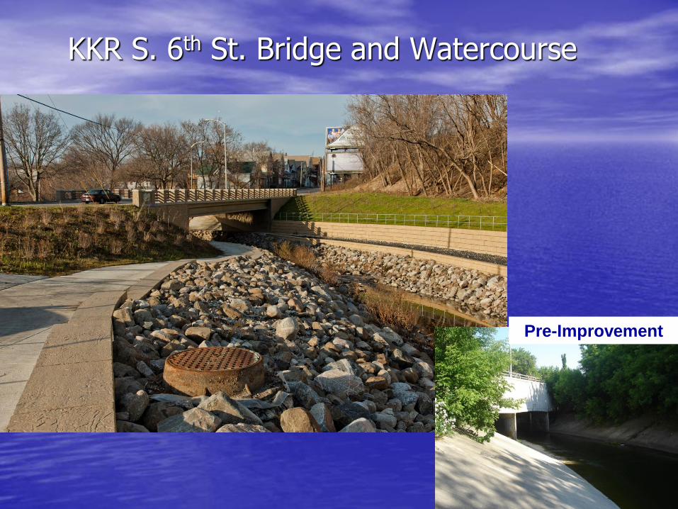
KKR S. 6th St. Bridge and Watercourse
Pre-Improvement
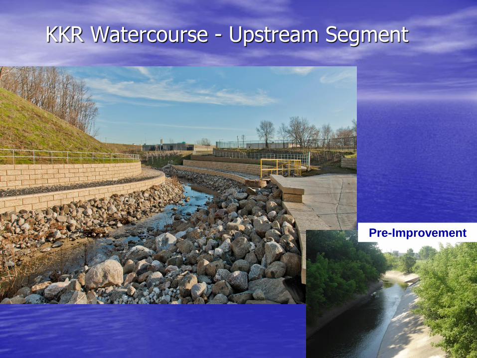
KKR Watercourse - Upstream Segment
Pre-Improvement
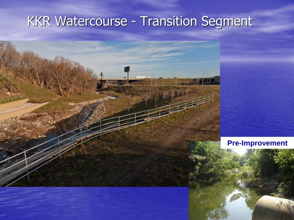
KKR Watercourse - Transition Segment
Pre-Improvement
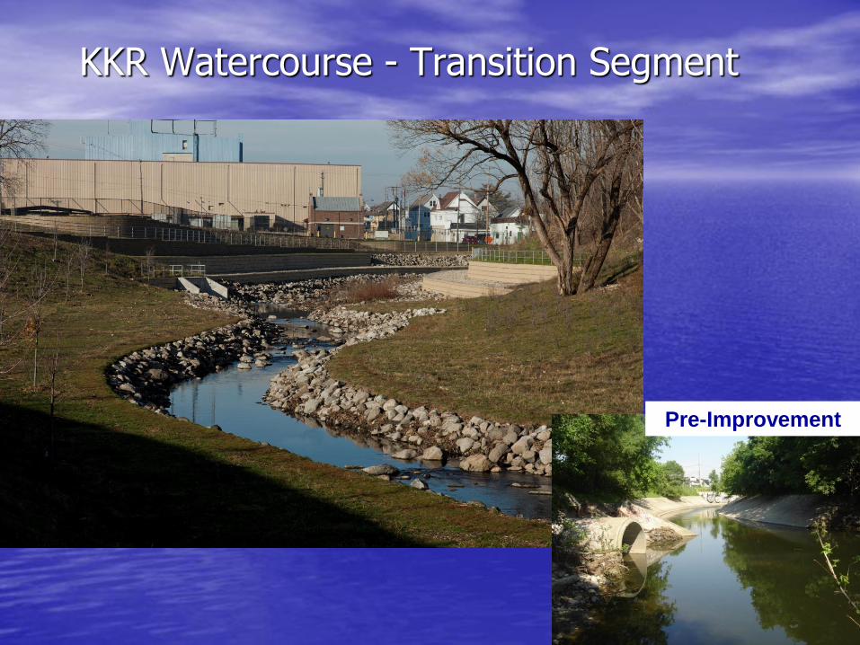
KKR Watercourse - Transition Segment
Pre-Improvement
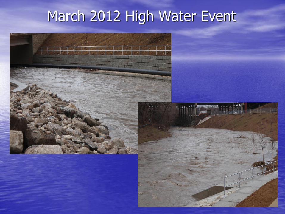
March 2012 High Water Event
Lessons Learned in Stakeholder and Public Involvement
• Obtain Stakeholder / Public Input – Agency Coordination – Stakeholder Meetings – Public Information Meetings
• Apply Phased Planning and Design Approach
– Phase 1 – Planning – Phase 2 – Preliminary Design – Phase 3 – Final Design
• Develop Project Goals and Priorities
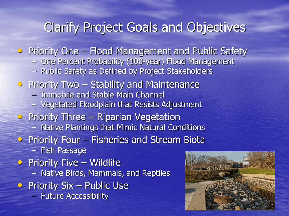
Clarify Project Goals and Objectives
• Priority One – Flood Management and Public Safety – One Percent Probability (100-year) Flood Management – Public Safety as Defined by Project Stakeholders
• Priority Two – Stability and Maintenance – Immobile and Stable Main Channel – Vegetated Floodplain that Resists Adjustment
• Priority Three – Riparian Vegetation – Native Plantings that Mimic Natural Conditions
• Priority Four – Fisheries and Stream Biota – Fish Passage
• Priority Five – Wildlife – Native Birds, Mammals, and Reptiles
• Priority Six – Public Use – Future Accessibility
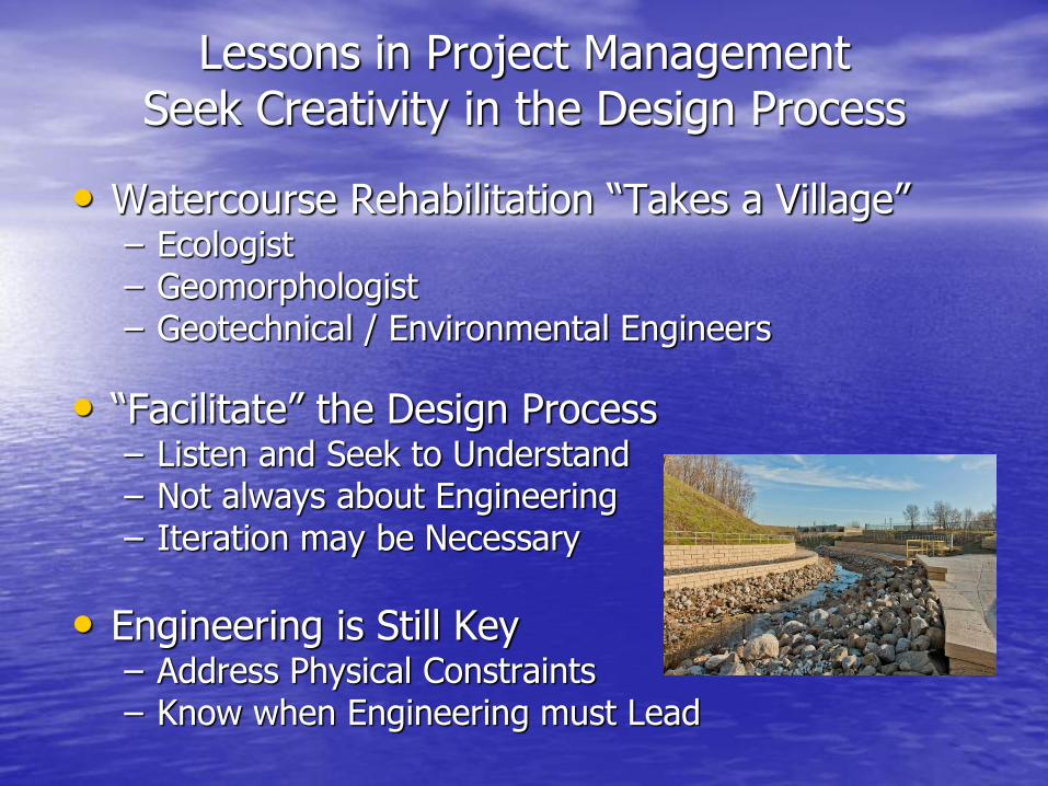
Lessons in Project Management Seek Creativity in the Design Process
• Watercourse Rehabilitation “Takes a Village” – Ecologist – Geomorphologist – Geotechnical / Environmental Engineers
• “Facilitate” the Design Process – Listen and Seek to Understand – Not always about Engineering – Iteration may be Necessary
• Engineering is Still Key – Address Physical Constraints – Know when Engineering must Lead
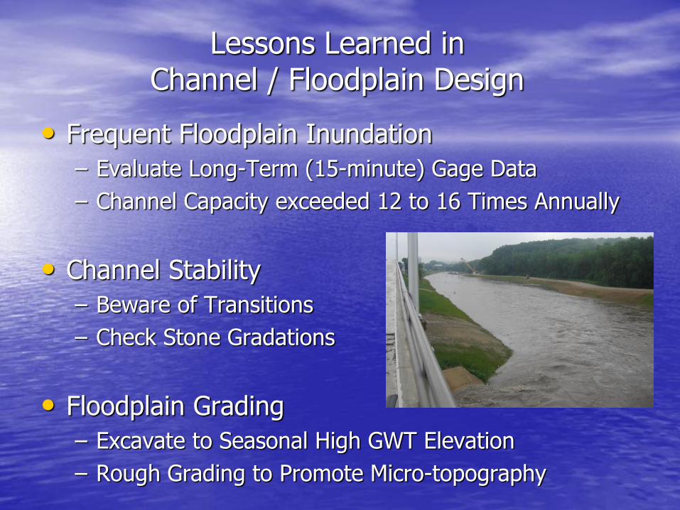
Lessons Learned in Channel / Floodplain Design
• Frequent Floodplain Inundation
– Evaluate Long-Term (15-minute) Gage Data
– Channel Capacity exceeded 12 to 16 Times Annually
• Channel Stability
– Beware of Transitions
– Check Stone Gradations
• Floodplain Grading
– Excavate to Seasonal High GWT Elevation
– Rough Grading to Promote Micro-topography
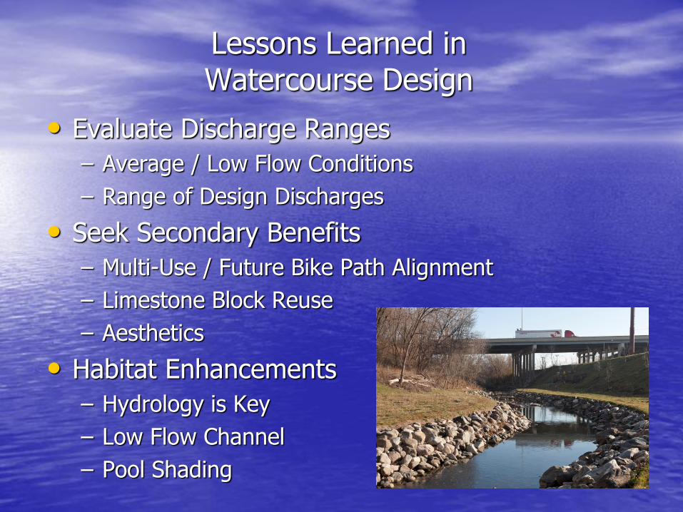
Lessons Learned in Watercourse Design
• Evaluate Discharge Ranges
– Average / Low Flow Conditions
– Range of Design Discharges
• Seek Secondary Benefits
– Multi-Use / Future Bike Path Alignment
– Limestone Block Reuse
– Aesthetics
• Habitat Enhancements
– Hydrology is Key
– Low Flow Channel
– Pool Shading
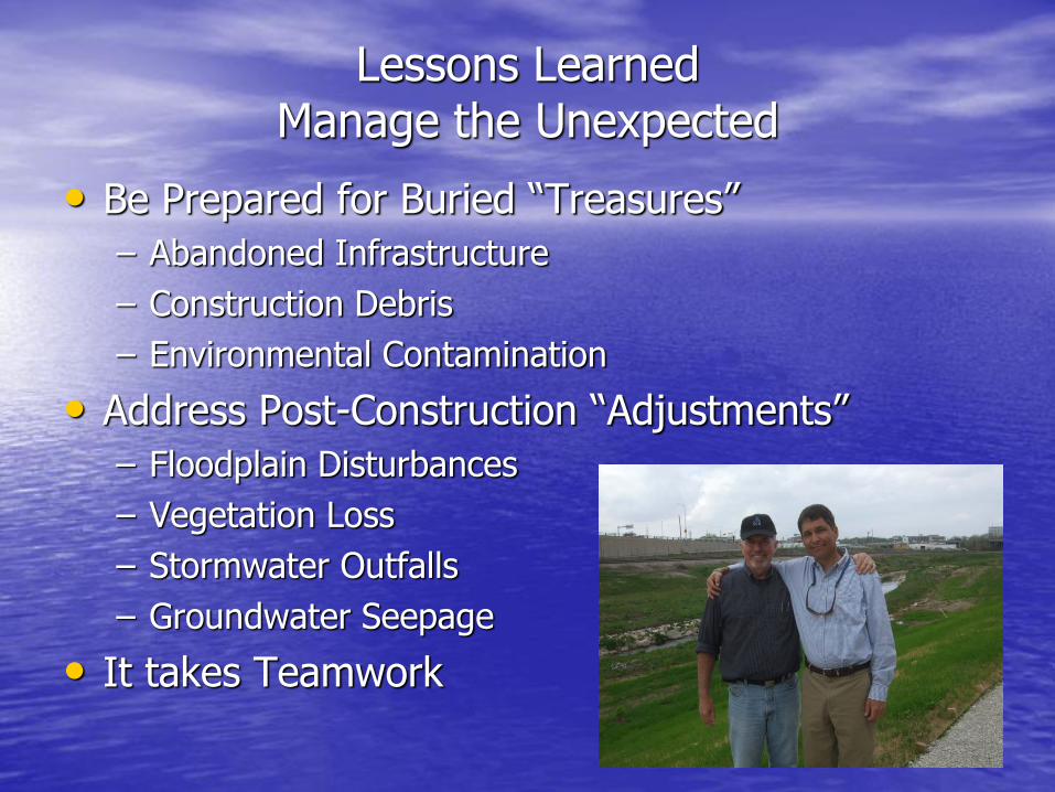
Lessons Learned Manage the Unexpected
• Be Prepared for Buried “Treasures”
– Abandoned Infrastructure
– Construction Debris
– Environmental Contamination
• Address Post-Construction “Adjustments”
– Floodplain Disturbances
– Vegetation Loss
– Stormwater Outfalls
– Groundwater Seepage
• It takes Teamwork

Questions?