Embed Size (px)
Citation preview
Regional Setting I3
3. REGIONAL SETTING This section outlines the overall physical, biological, human and administrative setting in which the renewal of offshore hydrocarbon exploration would occur.
PHYSICAL ENVIRONMENT
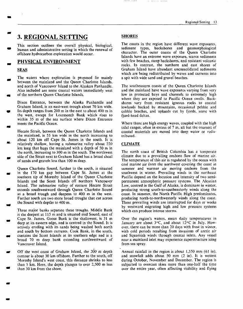
The waters where exploration is proposed lie mainly between the mainland and the Queen Charlotte Islands, and north of Vancouver Island to the Alaskan Panhandle. Also included are some coastal waters immediately west of the northern Queen Charlotte Islands.
Dixon Entrance, between the Alaska Panhandle and Graham Island, is an east-west trough about 70 km wide. Its depth ranges from 200 m in the east to about 400 m in the west, except for Learmonth Bank which rises to within 35 m of the sea surface where Dixon Entrance meets the Pacific Ocean.
Hecate Strait, between the Queen Charlotte Islands and the mainland, is 55 km wide in the north increasing to about 120 km off Cape St. James in the south. It is relatively shallow, having a submarine valley about 220 km long that hugs the mainland with a depth of 50 m in the north, increasing to 300 m in the south. The northwest side of the Strait next to Graham Island has a broad shoal of sands and gravels less than 100 m deep.
Queen Charlotte Sound, further to the south, is situated m the 170 km gap between Cape St. James at the southern tip of Moresby Island of the Queen Charlotte Islands and the Scott Islands off northern Vancouver Island. The submarine valley of eastern Hecate Strait extends southwestward through Queen Charlotte Sound as a broad trough and deepens to 400 m in the west. Further south are two more broad troughs that cut across the Sound with depths to 400 m.
Three major banks separate these troughs. Middle Bank is the deepest at I I5 m and is situated mid Sound, east of Cape St. James. Goose Bank is the shallowest, is 31 m deep at its eastern edge, and is centred in the Sound. It is actively eroding with its sands being washed both north and south by bottom currents. Cook Bank, in the south, contains the Scott Islands at its southern edge and is a broad 70 m deep bank extending northwestward of Vancouver Island.
Off the west coast of Graham Island, the 200 m depth contour is about 30 km offshore. Further to the south, off Moresby Island’s west coast, this distance shrinks to less than 5 km. Here, the depth plunges to over 2,500 m less than 30 km from the shore.
SHORES
The coasts in the region have different wave exposures, sediment types, backshores and geomorphological character. The outer coasts of the Queen Charlotte Islands have an extreme wave exposure, scarce sediments with few beaches, steep backshores, and resistant volcanic rocks. In contrast, the northern and east shores of Graham Island have abundant unconsolidated sediments which are being redistributed by waves and currents into a spit with wide sand and gravel beaches.
The southeastern coasts of the Queen Charlotte Islands and the mainland have wave exposures varying from very low in protected bays and channels to extremely high where they are exposed to Pacific Ocean swells. Back- shores vary from resistant igneous rocks to coastal lowlands backed by mountains, occasional pebble and cobble beaches, and uplands cut by fjords, some with fjord-head deltas.
Where there are high energy waves, coupled with the high tidal ranges, often in excess of 7 m, all but the coarsest of coastal materials are moved into deep water or redis- tributed.
CLIMATE
The north coast of British Columbia has a temperate climate due to a prevailing onshore flow of marine air. The temperature of this air is regulated by the ocean with cool marine air from the northwest covering the coast in summer and warmer air moving onshore from the southwest in winter. Prevailing winds in the northeast Pacific depend on the location and intensity of two semi- permanent atmospheric pressure systems. The Aleutian Low, centred in the Gulf of Alaska, is dominant in winter, producing strong south-to-southeasterly winds along the coast. In summer, the North Pacific High predominates, producing north-to-northwesterly winds along the coast. These prevailing winds are interrupted for days or weeks by westward migrating high and low pressure systems which can produce intense storms.
Over the region’s waters, mean daily temperatures in January are about 3°C. and about 12°C in July. How- ever, there can be nmre than 20 days with frost in winter, with cold periods resulting from invasions of arctic air and Squamish winds through coastal inlets. Any vessel near a mainland inlet may experience superstructure icing from sea spray.
-Annual rainfall in the region is about 1,550 mm (61 in), and snowfall adds about 50 mm (2 in). It is wettest during October, November and December. The region is subjected to overcast skies more than one-half the time over the entire year, often affecting visibility and flying
14 Regional Setting
D’XON ENTRAN-C-F A
OUE
Figure 3: Bio-Physical Environment of the North Coast Area
Regional Setting 15
conditions. Although common year round, fog is most prevalent in summer.
WINDS AND WAVES
The Queen Charlotte Islands lie in one of the windiest regions of Canada and severe winds are more common than in other areas; winds to 200 km/hr were estimated at Cape St. James in January 1951. Winds from major weather systems are modified by mountainous terrain and, within 50 km of coasts, tend to blow parallel to the shore. Strongest winds occur in December through February and weakest in July and August. Late Septem- ber to early October is when abrupt increases occur in mean wind speeds. Strong winds occasionally blow in summer as well.
In Hecate Strait, the prevailing winds in winter are from the southeast, averaging 50 km/Iv (27 knots) in January. In summer, prevailing winds are from the northwest and average 30 km/hr (I 6 knots) during July.
Prevailing wind patterns are modified by other factors. Strong winds flow out through inlets toward the sea when there is a high pressure system over the central or northern interior. These outflow or “Squamish” winds often reach gale force. Another modification, occurring mainly in summer, is caused by diurnal sea breezes set up by the daily heating and cooling of land masses near the sea.
Winds provide the energy for generating waves and swells. Both are highest in fall and winter when the strength, duration and fetch of winds are greater in comparison with summer conditions. Depending on the extent of sheltering by land masses and the direction of the swell, wave heights in Queen Charlotte Sound are generally less than in the Pacific Ocean. Also, average wave heights are less in Dixon Entrance than in Queen Charlotte Sound but higher than in Hecate Strait. Variations within these waterways depend on distance from the open ocean and on wind directions. Queen Charlotte Sound and the southern end of Hecate Strait are especially vulnerable to deep-sea waves and swell from the southwest.
Another effect of importance is the refraction and breaking of swell in gradually shoaling waters such as over the shallow banks in Queen Charlotte Sound and over Learmonth Bank in Dixon Entrance. Waves begin to steepen and amplify when they enter shallow water or face opposing currents. In addition. the period of such amplified waves can be shortened when they move against ebb currents.
A characteristic of the west coast is the suddenness with which extreme autumn wave conditions can arise. The
Shell drill rig SEDCO 135F, situated in 137 m of water in Queen Charlotte Sound, was hit by a series of storms and heavy seas 9 to 15 m high for 16 days beginning in mid October 1968. On October 23, waves exceeding 20 m high occurred with a wave 30 m high being observed. The most dangerous aspect of the storm was not the maximum wave height but the rapidity with which wave heights increased. Within eight hours, the wave height had increased from 3 m to over 20 m. The more recent, serious storm on October 11 and 12, 1984, in which a number of fishermen lost their lives, has reinforced awareness of this hazard and the need for upgrading the prediction of’storms.
we are in a region where ~ewre ~torrn~ can develop rather rapidly, where wme heights can become very significant within relatively short periods of time, and where wind speeds can be excessive.” (Pat H&es, Chevron. Port Hardy, Sept. I9851
’ our waters rank with, or even exceed the worst in the world, including the Cape of Good Hope. Our waters are so danger- ous, I mn told, because combinations of factors arising from high winds, strong tides, shallow depths and giant waves can readily combine to produce extremely hazardous and freak conditions.” (Jack Miller. Port Ciements. November 1984)
TIDES AND CURRENTS
Local sea level changes, caused by tides, occur roughly twice per day and generate tidal currents that move vast volumes of water. The mean tidal range is about 3 m at the seaward side of Queen Charlotte Sound. It increases to 4.8 m midway up Hecate Strait, further increasing to 5.0 m at Prince Rupert. From Prince Rupert to the seaward exit of Dixon Entrance, it decreases to 3.5 m. Tidal ranges over 7 m are found near Prince Rupert and within Skidegate Channel that separates Graham and Moresby Islands.
Currents are the sum of tidal currents and non-tidal currents, both of which contribute to the circulation of the region’s waters. The non-tidal circulation is mainly a result of coastal winds and runoff from the land.
16 Regional Setting
The tidal currents, themselves, are a combination of mainly diurnal and semi-diurnal components, but varia- tions occur over periods of a fortnight, a month and a season. Where currents are confined by the topography of a channel, tidal currents ebb and flood aligned with the channel. However, where they have more sea-room, the tidal currents rotate over time. Where semi-diurnal tides dominate, as in the exploration region, a boat with a bow anchor would turn through a complete circle in one-half day. Tidal current speeds are generally in the range of 25 to 50 cm/set (0.5 to 1 knot). Especially strong tidal currents occur in restricted waterways. Tidal current speeds off Cape St. James normally exceed 50 cm/set (1 knot). Tidal streams in Hecate Strait show little rotation due to its valley-like shape and ebb and flood with rates up to 50 cm/set (1 knot).
In Dixon Entrance, flood streams are stronger on the southern side and ebb streams stronger on the northern side. This creates a counter clockwise vortex or gyre in the centre of Dixon Entrance north of Rose Spit on northeast Graham Island. At the shore, tidal currents at the periphery of this vortex reach speeds between 50 and 100 cm/w (1 to 2 knots). Local residents claim that these tidal currents can be in excess of 100 cm/set.
Throughout the main waterways of the region, near- bottom tidal currents are weaker than at the surface, with speeds ranging between I5 to 25 cm/w (0.3 to 0.5 knot).
Winds greatly influence current patterns. For example, with north to northwest prevailing winds, surface waters are driven southerly and southeasterly, parallel to the coast, at a few percent of the wind speed. A reversal will occur with south to southeast prevailing winds. These changes, superimposed on tidal fluctuations, will occur simultaneously over distances of hundreds of kilometres.
Runoff also affects current patterns, particularly during early summer following snow melt in the mountains. For example, brackish water, mainly from Nass and Skeena River runoff, hugs the northern side of Dixon Entrance as it flows westward at the surface; a compensating eastward flow of salt water tends to move along its southern side. The seaward motion of fresh water and its mixing with salt water also results in a landward underflow of salt water to compensate for the salt water lost in mixing. Runoff effects essentially disappear during November through February when runoff is minimal.
While wind and runoff are clearly important in generat- ing currents, the response of the ocean to wind forcing can vary considerably throughout the north-coast area. This response will depend on such local conditions as bathymetric features and proximity to fresh water runoff. Computations of the non-tidal component of near surface currents, that are derived as a fixed percentage of the local wind speed, provide only a rough guide to the actual current that could be encountered.
The surface waters of the region are often dominated by intermittent wind-generated inertial currents. These currents rotate clockwise (looking downward) and trace out a roughly circular path in 15% hours (at latitude 51 “N). They are often generated by the rapid passage of southeasterly frontal winds that accompany extra-tropical storms as they cross the north coast. Inertial currents may exceed 50 cm/set (1 knot), and are mainly confined to the upper 50 m. They tend to persist for about 21% days following the rapid passage of a storm but will decay more rapidly in shallow water where frictional effects occur. The interval between successive storms in the northeast Pacific in winter is about 2% days, which suggests that extended periods of intense inertial oscilla- tions will exist in the region from late autumn to early spring.
Surface currents are so complex that, while clearly more studies are required, it should not be assumed that a simple pattern will emerge that will significantly enhance predictive ability.
EARTHQUAKES
Earthquakes are common in the offshore and coastal regions of British Columbia. The region is one of the most active seismic areas of Canada. In 1949 the largest earthquake recorded in Canada occurred west of the Queen Charlotte Islands with a magnitude of 8.1 on the Richter scale. This earthquake occurred along an active major crustal plate fault, the Queen Charlotte Fault, which lies at the shelf-break just west of the Queen Charlotte Islands. Two other major earthquakes, both of magnitude 7.0, occurred in 1929 and in 1970 and are thought to have originated in this fault. Numerous lesser earthquakes have occurred in the complex fault system seaward of Queen Charlotte Sound. Several other more minor faults have been identified cutting through Moresby and Graham Islands, but their seaward exten- sion into Queen Charlotte Sound and Dixon Entrance is uncertain.
Tsunamis, commonly although incorrectly called “tidal waves”, are usually generated by subsea earthquakes. These are seismic sea waves with a wave length in the deep sea of several hundred kilometres hut an amplitude of usually less than I metre. As they approach shallow or constricted waters, the wave length shortens and the wave amplitude increases. This effect is accentuated in shallow bays or estuaries where wave amplitudes reach tens of metres and destruction ensues. Offshore, ships or drilling platforms would seldom notice the passage of such a wwe.
Other hazards associated with earthquakes are the possibility of drilling in a major active fault zone, and the creation of bottom sediment slumps and turbidity flows.
Regional Setting I7
The latter occur when sediments on a slope are disturbed and flow in a high speed slurry on the seabottom. Such flows from the Grand Banks earthquake in 1929 severed submarine cables on the sea floor.
BIOLOGICAL ENVIRONMENT
ECOSYSTEMS
There are two major marine ecosystems in the region : the nearshore and the continental shelf. Nearshore ecosys- tems occur near rocky shores, on mud flats, in estuaries and in shallow bays. Sunlight penetrates throughout nearshore ecosystems and nutrients flowing through them from the sea are supplemented by those from the land. In shallow bays, estuaries and mudflats, nutrients regene- rated from decaying organic matter are important to productivity. Water movement distributes some of the nearshore production into deeper water in the form of drifting detritus and rafts of seaweed, which contributes to pelagic and benthic foodwebs. In turn, the larvae and juveniles of fish such as salmon and herring depend on this production for survival.
Continental shelf ecosystems exist where deeper water prevents sufficient light from penetrating far enough for plants to grow on the seabottom but where the water is shallow enough so that production in the surface waters is directly accessible to the benthic community. The animals in benthic and pelagic communities interact directly. For example, sandlance migrate to shallow waters diurnally to feed on plankton, thereby transferring organic matter to the benthic community. Such shelf seas are also shallow enough so that currents and winds can mix the waters to make nutrients available to all parts of the foodweb.
In contrast to the nearshore ecosystems where seaweeds and seagrasses are primary producers, phytoplankton are the primary producers in continental shelf ecosystems. The growing season for phytoplankton in Queen Char- lotte Sound and Hecate Strait is from April or May through to October. There is a spring bloom which falls off in summer, and then increases again in the fall. In summer, lower productivity results from depleted nutri- ents in stratified water. There is some evidence that mixing at oceanographic fronts creates enhanced produc- tivity of phytoplankton, however, identification of such areas in the exploration region has yet to take place.
Both nearshore and continental shelf ecosystems have grazers and scavengers. Grazers such as zooplankton, snails, clams, chitons and urchins consume phytoplankton and seaweeds. Grazers, in turn, are eaten by starfish, predacious snails, salmon, herring, petrels, ancient murrelets and gray whales. Some of these are eaten by halibut, ling cod, cormorants, eagles, falcons, seals, dolphins and killer whales.
Scavengers exist on the remains and excretions of other organisms. Typical of these arc bacteria, sea cucumbers, anemones and shore crabs.
Shellfish and other invertebrates in the area include Dungeness crabs, razor clams, littleneck clams, butter clams, geoducks, weathervane scallops, mussels, abalone, octopus, squid and red sea urchins.
Finfish are a significant renewable marine resource in the region. Of these, the five species of Pacific salmon - chum, coho, chinook, pink and sockeye - are the most important. About 650 rivers and streams in the region are used for spawning and by juveniles. Large runs of salmon occur in the Bella Coola River, Skeena River. Nass River, Smith Inlet, Rivers Inlet and elsewhere. Also, salmon stocks from Alaska, Washington, Oregon and California migrate through the region’s waters to and from the Gulf of Alaska and the north Pacific. Immature salmon may spend several months feeding in estuaries while gradually becoming adjusted to salt water before moving offshore. More than I billion fry are believed to migrate up the coast. Information on the timing and paths of juvenile migrations is uncertain, but it is suspected that most migrate close to the shore within the upper IO m of the water column.
Adult Pacific herring migrate to their spawning grounds, mostly during March and April, and they spawn in inshore protected waters. Eggs are deposited on kelp, red algae, eelgrass and rockweed where they hatch after 10 to 20 days. After hatching, larvae congregate in large masses near the spawning grounds. Adult herring are an important food for salmon, groundfish, some seabirds and marine mammals.
Groundfish are bottom dwelling fish that inhabit deeper offshore waters as adults and include species within the flatfish, rockfish, greenling, sabiefish, cod, skate and dogfish families. Although most arc demersal for a large proportion of their adult lives, all groundfish have pelagic larval stages and many produce pelagic eggs.
Species of flatfish within the region are Pacific halibut, dover sole, rock sole, turbot and petrale sole. Most soles and flounders spawn in winter and early spring; generally, most eggs are pelagic, some floating below the surface. All their larvae are pelagic.
Thirty-three species of rockfish occur in the region. Eight species of greenling and two of sablefish are known in these waters. Ocean perch. rockfish, ling cod and sable- fish are the most numerous groundfish in Queen Char- lotte Sound. All four species of true cods occur in the region. Cod spawn in winter and spring, most producing pelagic eggs.
18 Regional Setting
Also of importance within the region is the eulichan. The total spawning stock in the Nass River alone is estimated to be 1,000 tonnes. Eulichon larvae. juveniles and adults appear to have a wide ocean distribution and are likely to be abundant in Hecate Strait and Dixon Entrance. Information on this species is sparse.
The eggs and larvae of various fish species are vital and vulnerable stages in the life history of some fish but little is known about them. A recent, limited study indicates that their abundance varies within the region and with the time of year. It also indicates that sandlance larvae are predominant and thus are likely to be of major impor- tance to pelagic foodwebs. They are known to be a main diet item for some seabirds, both as larvae and adults.
Millions of breeding, migrating and marine birds use the waters off the north coast of British Columbia. Most common are the true seabirds: albatrossa, shearwaters, fulmars, storm petrels, cormorants, gulls and &ids. Shorebirds are also numerous. At times, other birds such as loons, grebes, swans. ducks and geese often outnumber seabirds in sane coastal areas, particularly outside the breeding season.
The birds of the coast feed at all levels of the foodweb. Canada geese, brat and dabbling ducks feed on vegeta- tion; some grebes, some diving ducks. some alcids and shearwaters feed on crustaceans, euphausids and amphi- pods; black turnstones, oystercatchers, surfbirds and other shorebirds eat intertidal invertebrates. Diving ducks eat molluscs, especially mussels and some herring roe and marine vegetation; shearwaters eat cephalopods; loons, grebes. cormorants, mergansers, some alcids and gulls eat fish, including herring and sandlance.
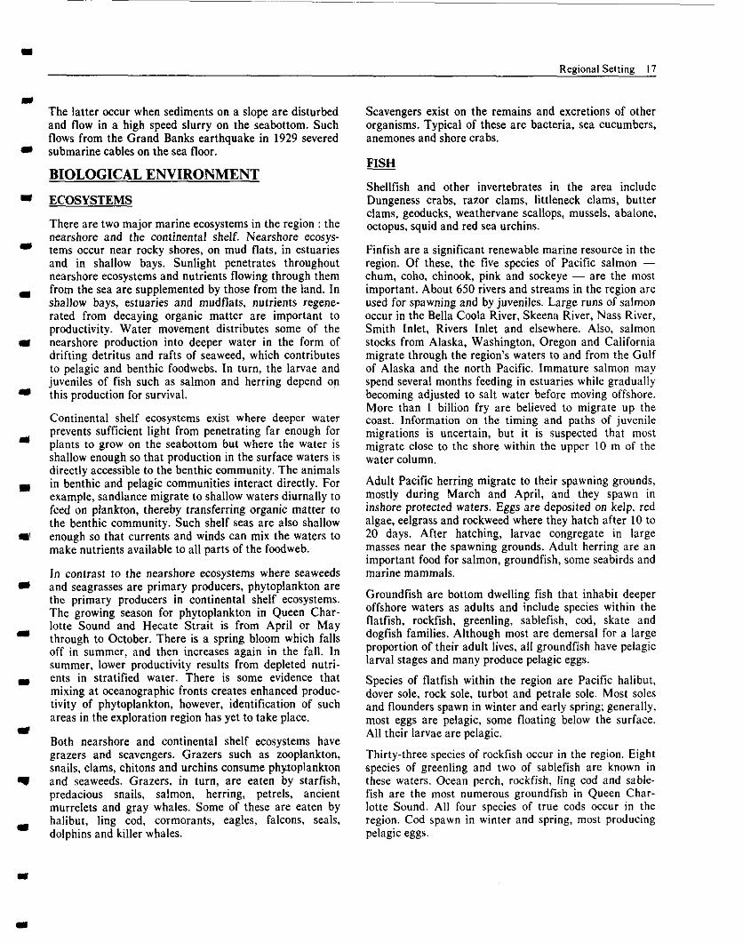
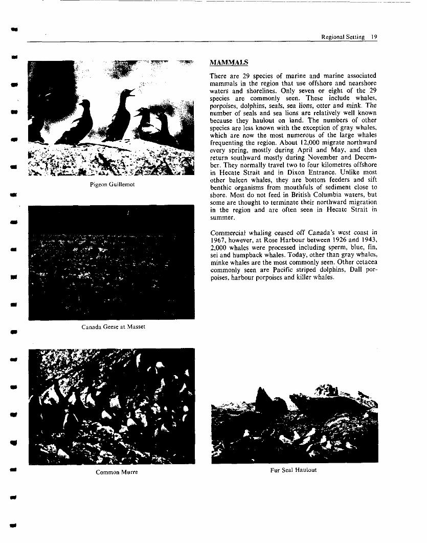
By far the greatest proportion of colonial breeding seabirds on the west coast are alcids, including guillemots, murres, puffins, auklets and murrelets. They live almost exclusively at sea and come ashore only long enough to breed and launch their chicks into the sea. They require only small territories for their nests 01 burrows and most breed in high density colonies, located on exposed, isolated islands or points on or near the Queen Charlotte Islands, Vancouver Island or the mainland. The marbled murrelet is an exception. It nests in coastal forests and in rocky screes are believed to be scattered along the length of the entire coast.
Major seabird colonies in the area are: - -Triangle Island in the Scott Islands has the largest
number of breeding seabirds on Canada’s west coast, approximately three-quarters of a million. This includes about 360,000 pairs of breeding C&n’s
auklets, representing 40 percent of the world’s breeding population. There are also large colonies of rhinoceros auklet and tufted puffin, the latter being the largest colony on Canada’s west coast.
-On the east coast of Moresby Island are a series of nesting areas for storm petrels, Cassin’s auklets and ancient murrelets. At the present time, a large colony of ancient murrelets is located on Lyell Island.
-On Moresby Island, Cassin’s auklets nest at Kerou- ard and Anthony Islands. Engelfield Bay has an important storm petrel colony.
-Along the west coast of Graham Island are major nesting sites for Cassin’s auklets, ancient murrelets and storm petrels.
-In Queen Charlotte Strait, large colonies of rhinoce- ros auklet occur on Storm Island and Pine Island. As well, storm petrels nest on Tree Island and in the Buckle Group.
-Off the northern mainland coast, Lucy Island in Chatham Sound has a large colony of rhinoceros auklets; Moore Island has a large colony of Leach’s storm petrels; and Byer’s Island has a large colony of ancient murrelets.
-The Forrester Island group in the Alaskan waters of northern Dixon Entrance has large colonies of storm petrel, murrelet, auklet and puffin totalling more than one-half million breeding pairs of birds.
In addition to colonial breeding seabirds, migrants and overwintering birds use the marine waters of the region. Over a million birds heading for northern Canada and Alaska use the coastal waters in the spring and on return in the fall. Shearwaters are southern hemisphere migrants that occur in spectacular numbers primarily from April through October. Other c~mmcm migrants are: arctic loons, phalaropes, geese, swans, ducks and gulls. Most migrants concentrate in protected estuaries and bays and use particular offshore feeding areas from November to April.
Shore-associated species such as oystercatchers, bald eagles, peregrine falcons, great blue herons, kingfishers and northwestern crows are, for the most part, permanent residents, although specific populations may be migra- tory.
Existing information provides a general picture of seabird use of the region. However, much is still unknown and scientific confirmation of this “general picture” proceeds slowly. For example, an accurate population census of the major colonies is far from complete. The colonies of the mainland coast are poorly known as is the feeding ecology of offshore seabirds.
Regional Setting 19
Pigeon Guillemot
Canada Geese at Masset
MAMMALS
There are 29 species of marine and marine associated mammals in the region that use offshore and nearshore waters and shorelines. Only seven or eight of the 29 species arc commonly seen. These include whales, porpoises, dolphins, seals, sea lions, otter and mink. The number of seals and sea lions are relatively well known because they haulout on land. The numbers of other species are less known with the exception of gray whales, which are now the most numerous of the large whales frequenting the region. About 12,000 migrate northward every spring, mostly during April and May, and then return southward mostly during November and Decem- ber. They normally travel two to four kilometres offshore in Hecate Strait and in Dixon Entrance. Unlike most other baleen whales, they are bottom feeders and sift benthic organisms from mouthfuls of sediment close to shore. Most do not feed in British Columbia waters, but some are thought to terminate their northward migration in the region and are often seen in Hecate Strait in S”IlllIler.
Commercial whaling ceased off Canada’s west coast in 1967, however, at Rose Harbour between 1926 and 1943, 2,000 whales were processed including sperm, blue, fin, sei and humpback whales. Today, other than gray whales, minke whales are the most commonly seen. Other cetacea commonly seen are Pacific striped dolphins, Dal1 por- poises, harbour porpoises and killer whales.
Common Mum Fur Seal Haulout
20 Regional Setting
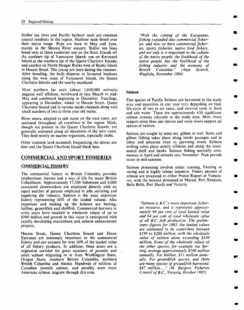
Stellar sea lions and Pacific harbour seals are common coastal residents in the region. Harbour seals breed over their entire range. Pups are born in May and June, mainly in the Skeena River estuary. Steller sea lions breed only at three rookeries: one on the Scott Islands off the northern tip of Vancouver Island; one on Kerouard Island at the southern tip of the Queen Charlotte Islands; and another on North Danger Rocks west of Banks Island in Hecate Strait. The young are born during the summer. After breeding, the bulls disperse to favoured haulouts along the west coast of Vancouver Island, the Queen Charlotte Islands and the nearby mainland.
Most northern fur seals (about 1,650,OOO animals) migrate well offshore, northward in late March to mid- May and southward beginning in December. Yearlings, appearmg in December, winter in Hecate Strait, Queen Charlotte Sound and in various inside channels along with small numbers of two to three year old males.
River otters, adapted to salt water on the west coast, are scattered throughout all coastlines in the region. Mink, though not present in the Queen Charlotte Islands, are generally scattered along all shorelines of the west coast. They feed mostly on marine organisms, especially crabs.
Other common land mammals frequenting the shores are deer and the Queen Charlotte Island black bear.
COMMERCIAL AND SPORT FISHERIES
COMMERCIAL FISHERY
The commercial fishery in British Columbia provides employment, income and a way of life for many British Columbians. Approximately 17,500 fishermen and 6,000 associated shoreworkers are employed directly with an equal number of persons employed in jobs servicing and supplying the industry. Salmon is the most important fishery representing 60% of the landed volume. Also important and making up the balance are herring, halibut, groundfish and shellfish. Commercial harvests in some years have resulted in wholesale values of up to $500 million and growth in this value is anticipated with rapidly developing mariculture and salmon enhancement projects.
Hecate Strait, Queen Charlotte Sound and Dixon Entrance are extremely import&n to the commercial fishery and can account for over 50% of the landed value of all fishery products. In addition, these areas are a migration corridor for great numbers of juvenile and adult salmon migrating to or from Washington State, Oregon state, southern British Columbia, northern British Columbia and Alaska. Hundreds of millions of Canadian juvenile salmon, and possibly even more American salmon, migrate through this area.
“With the coming of the Europeans, Jshing expanded into commercial fiSher- ies, and now we have commercial fisher- ies. sports fisheries, native food fishery, and not only is it important to the culture of the native people. the livelihood of the native people. but the livelihood of the
fishing industry and the econ;~;,~;f
’
Salmon
Five species of Pacific Salmon are harvested in the study area and quantities in any year vary depending on their life-cycle of two to six years, and survival rates in fresh and salt water. There are approximately 650 significant salmon streams adjacent to the study area. Most rivers support more than one species and some rivers support all species of salmon.
Salmon are caught by seine net, gillnet or troll. Seine and gillnet fishing takes place along inside passages and in inlets and estuaries close to spawning rivers. Salmon trolling takes place mostly offshore and along the conti- nental shelf and banks. Salmon fishing normally com- mences in April and extends into November. Peak periods occur in mid-summer.
Salmon processing involves either canning, freezing or curing and is highly labour intensive. Ninety percent of salmon are processed at either Prince Rupert or Vancou- ver, with the balance processed at Mass& Port Simpson, Bella Bella, Port Hardy and Victoria.
“Salmon is B.C.‘s most important fisher- ies resource. and it represents approxi- mately 60 per cent of total landed value and 64 per cent of total wholesale value of all B.C. fish production. The prelim- inary figures for 1985. the landed values are estimated to be somewhere between $190 to $200 milLion, with the wholesale value of salmon alone exceeding $350 million. Some of the wholesale values of the other species, for example roe her- ring. average approximately $100 million annually. For halibut, $1 I million nnnu- ally. For groundfish species, and there are many species of groundfish harvested. 847 million... .” (M. Burgess. Fisheries Council of B.C., Victoria, October 1985)
Regional Setting 21
Herring
Herring have always been an important part of the commercial fisherv and on occasion their landed value has exceeded that of salmon. Before 1965, herring was used mainly for the manufacture of fish meal and oil; catches during this period averaged 165,000 tonnes per year. Due to several poor year classes and possibly overfishing, the fishery was closed in the mid-1960’s to allow for the rebuilding of stocks.
The stocks recovered dramatically after a few short years and a small roe fishery was permitted in 1969. Because of its high economic value, this fishery quickly expanded and peaked in 1979 at more than $200 million. In recent years the resource has again become weak, and stringent conservation methods have again become necessary.
Roe herring are caught by both gillnet and seine and are harvested close to their spawning time and spawning location in order to ensure the highest possible roe recovery. A small portion of the catch is caught by seine and impounded to provide a “Roe on Kelp” product.
The majority of herring caught within the study area are processed in Prince Rupert and the operation is labour intensive.
Halibut
Pacific halibut have the highest economic value of the groundfish species. They are caught using a longliner hook and line primarily in Hecate Strait and Dixon Entrance. The fishery normally takes place in short periods from May to August.
Due to overfishing and poor survival of certain year classes, halibut stocks declined seriously during the 1960’s. and strict conservation measures had to be adopted. Recently, stocks have been rebuilding and quotas for the fishery are being increased.
Because of their transboundary migrations, halibut are managed by the joint United States and Canadian International Pacific Halibut Commission.
Groundfish
Cod, perch, sole, flounder, pollock and other groundfish abound in the study area and are caught by either bottom or mid-water trawl. Fishing takes place primarily off- shore. The fish are landed in both Prince Rupert and Vancouver. Normally the fishery takes place during all months of the year.
Shellfish
Shellfish such as prawns and crabs are caught in traps, shrimp are trawled, abalone and geoducks are harvested by divers and clams are dug by hand or machine at low water.
SPORT FISHING
Sport fishing in British Columbia is an important recrea- tional activity for over 300,000 residents and visitors, and a substantial economic resource. Economic activity generated by the recreational fisheries include boat gear and moorage purchases and rentals, tourist facilities and guiding services. Angler-owned pleasure boats alone were estimated to be worth $837 million in 1980. Spending related to marine sport fishing is presently estimated to exceed $100 million annually. As in the commercial fishery, salmon is by far the most important species, but others such as cod and shellfish have value. While most of the sport fishery in British Columbia occurs in the Strait of Georgia and the Strait of Juan de Fuca, a moderate
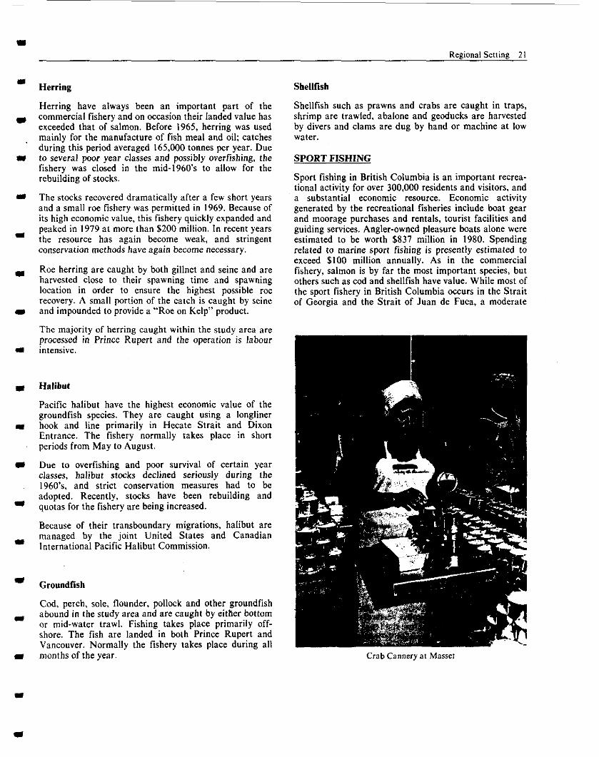
Crab Cannery at Masset
22 Regional Setting
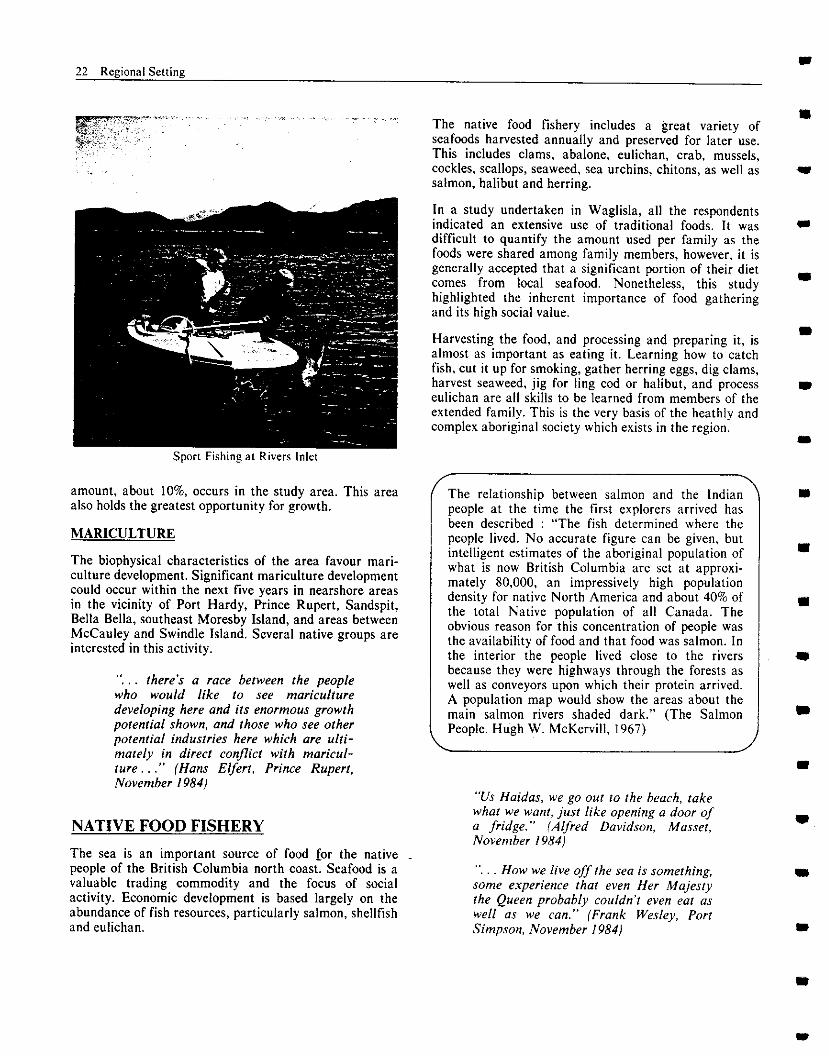
Sport Fishing at Rivers lnlct
amount, about IO%, occurs in the study area. This area also holds the greatest opportunity for growth.
MARICULTURE
The biophysical characteristics of the area favour mari- culture development. Significant mariculture development could occur within the next five years in nearshore areas in the vicinity of Port Hardy, Prince Rupert, Sandspit, Bella Bella, southeast Moresby Island, and areas between McCauley and Swindle Island. Several native groups are interested in this activity.
,, there’s a race between the people who would like to see mariculture developing here and its enormous growth potential shown. and those who see other potential industries here which ore ulti- mately in direct conflict with maricul- twe .” (Hans Elfert. Prince Rupert. November I9841
NATIVE FOOD FISHERY
The sea is an important source of food for the native people of the British Columbia north coast. Seafood is a valuable trading commodity and the focus of social activity. Economic development is based largely on the abundance of fish resources, particularly salmon, shellfish and eulichan.
The native food fishery includes a great variety of seafoods harvested annually and preserved for later use. This includes clams, abalone, eulichan, crab, mussels, cockles, scallops, seaweed, sea urchins, chitons, as well as salmon, halibut and herring.
In a study undertaken in Waglisla, all the respondents indicated an extensive use of traditional foods. It was difficult to quantify the amount used per family as the foods were shared among family members, however, it is generally accepted that a significant portion of their diet comes from local seafood. Nonetheless, this study highlighted the inherent importance of food gathering and its high social value.
Harvesting the food, and processing and preparing it, is almost as important as eating it. Learning how to catch fish, cut it up for smoking, gather herring eggs, dig clams, harvest seaweed, jig for ling cod or halibut, and process eulichan are all skills to be learned from members of the extended family. This is the very basis of the heathly and complex aboriginal society which exists in the region.
, The relationship between salmon and the Indian people at the time the first explorers arrived has been described : “The fish determined where the people lived. No accurate figure can be given, but intelligent estimates of the aboriginal population of what is now British Columbia are set at approxi- mately 80,000, an impressively high population density for native North America and about 40% of the total Native population of all Canada. The obvious reason for this concentration of people was the availability of food and that food was salmon. In the interior the people lived close to the rivers because they were highways through the forests as well as conveyors upon which their protein arrived. A population map would show the areas about the main salmon rivers shaded dark.” (The Salmon People. Hugh W. McKervill, 1967)
/
“Us Haidas. we go out to the beach, take what we want, just like opening a door o/ a fridge.” (Aped Davidson, Masset. November 1984)
How we live off the sea is something, some experience that even Her Majesty the Queen probably couldn’t even eat as well (IS we ran.” (Frank Wesley, Port Simpson. November 1984)
m Regional Setting 23
- OTHER RESOURCE USES
A number of other important marine related resource use s activities exist in the area and there is the potential to
support expansion of these as well as to introduce new ones.
- TOURISM AND RECREATION
Wilderness recreation on the west coast is among its - fastest growing industries. South Moresby and the west
coast of Graham Island are described as among the finest wilderness recreation areas in the world. The region has enjoyed significant increases in tourism and recreational
a use in recent years and these should continue with improved access and the availability of additional tourist facilities.
II At present there are six provincial parks in the region and an additional five have been proposed. Improved visitor facilities are being developed at Port Hardy, Bella Coola, Prince Rupert, Masset and Queen Charlotte City. A
m number of tour operations are also active in the region.
Specific activities include scuba diving, kayaking, sailing, motor cruising, sightseeing from Alaska bound cruise
1 ships and coastal ferries, sport fishing, hunting, whale watching, beachcombing, nature tours, hiking, camping, recreational vehicle use, cultural and anthropological
I tours, bird watching, wildlife viewing and photography.
. it’s (I pristine coast. and it’s reflected
I in rhe tourist trade that comet to visit this area, Ihe appreciation that people from all parts of the world have for non only the beauty of the coast, but its
m unpolluted qualify ” (Paul Manson, Prince Rupert, November 1984)
- SENSITIVE AREAS
A number of coastal areas have been identified which are - either unique or particularly sensitive to environmental
damage. At present, fifteen areas have been designated as Ecological Reserves and eight others have been proposed. In addition, there are two Natural Areas of Canadian
II Significance and one wildlife sanctuary. All coastal islands with areas less than 64.75 hectares (160 acres) and north of 5 IoN latitude are currently reserved from alienation. There were a number of other areas-identified
- as deserving of special protection.
The British Columbia Heritage Conservation Branch
m estimated that there are at least 2,000 shoreline archaeo- logical sites in the region.
PORT AND SHIPPING ACTIVITIES
Prince Rupert is one of the largest natural harbours in the world and handles a significant and increasing volume of international shipping. Deep sea freighters such as cargo carriers, bulk container vessels and large passenger vessels put into Prince Rupert on a year-round basis. Freight traffic from the Ridley Island coal and grain terminals is expected to increase with proposals for further coal shipments. The shipment of LNG from the proposed terminal at nearby Port Simpson may also increase freight traffic. Kitimat, Stewart, Port Hardy and Port Alice also handle international traffic.
Coastal vessel traffic consists of tug and barge or boom combinations, self-propelled barges, ferries, coastal ships such as freighters, fish packers and tankers, commercial fishing vessels and recreational vessels. Many coastal communities and logging camps depend on marine transportation for supplies. Commercial fishing vessels are generally active from April through September. The density of vessels on the fishing ground, their fishing method, short-notice changes in fisheries openings and frequent periods of poor vwblhty create some unique marine traffic concerns.
A voluntary Vessel Traffic Management System is currently in place.
PEOPLE
The total population in the vicinity of the exploration area is 57,000 (Statistics Canada, 1981). The population is distributed among several larger centres: Prince Rupert (16,000), Kitimat (13,000) and Port Hardy (5,000) and a number of smaller communities. While most communities can be reached by water and air transportation, the larger centres are also linked by rail or road transportation. A number of communities are in close proximity to each other at the north end of Vancouver Island, on the Queen Charlotte Islands and in the Prince Rupert area, while communities on the rest of the mainland coast are few and relatively far apart.
The aboriginal population of the area is about 10,000 or 18% of the total population. About two-thirds live on Indian Reserves. The resident on-reserve population for individual bands may represent as little as one-third of those who consider that reserve as their home community.
The economic base of the region’s population has been highly dependent on renewable resource-related activities since before the turn of the century. Many communities in the north coast region of British Columbia depend primarily upon fishing and forestry resource industries. except for Port Hardy which also depends on mining, and Kitimat which is based on mineral processing.
24 Regional Setting
In many cases, however, the economic base of individual communities is based almost exclusively on a single activity such as fishing. as in Waglisla, Port Simpson, Alert Bay and Sointula; or forestry as in Port Clements and Sandspit. This leaves these communities extremely vulnerable to shifting markets. Employment in the fishery, fish processing and forestry industries is highly seasonal and workers often earn their entire year’s income in a relatively short period of time. In particular, employ- ment in fishing is volatile. The weight and value of the catch can fluctuate widely from year to year. Conse- quently, many communities have sought opportunities to diversify their economic base through tourism, fish processing and mariculture.
“When we speak about this issue, we ore speakingfrom our hearts. for it’s because of our love for this port of the comt that we ore here.” (Lynn Hill, Hartley Bay Band Council. Hartley Bay. September I985)
ADMINISTRATION
LOCAL AND REGIONAL GOVERNMENTS
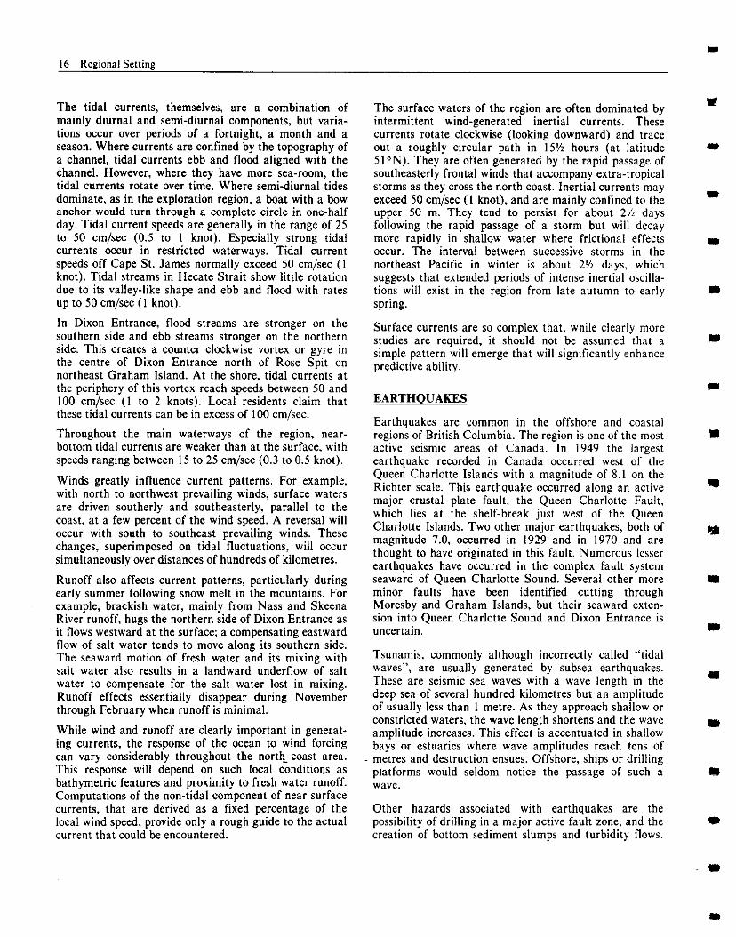
Community governments on the British Columbia north coast are organized under the British Columbia Munic- ipal or the federal Indian Act. In addition, regional districts are established under the Municipal Act. These
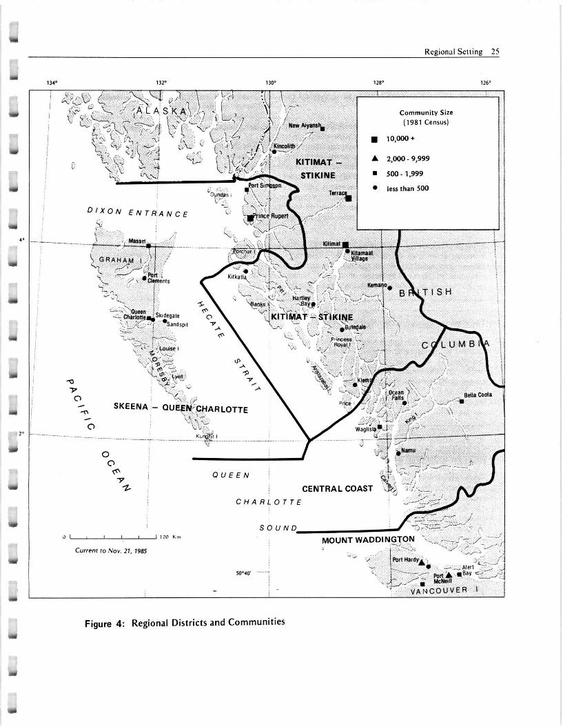
include the four regional districts of Skeena-Queen Charlotte, Kitimat-Stikine, Central Coast and Mount Waddington. Regional districts provide a federated approach to local control over problems which extend beyond municipal boundaries.
Within the review area are a number of incorporated municipalities including the city of Prince Rupert, four district municipalities, one town and seven villages as well as numerous unincorporated communities. Incorporated municipalities are responsible for providing and managing community services such as water supply and sewage disposal. In the case of unincorporated communities, it is the regional district or an improvement district that is responsible for these services. None of these communities have the authority to become directly involved in the management of oil and gas developments offshore.
Native communities administered by Indian bands are organized under the Indian Act. Bands have varied mandates, varied authority to manage community services, and varied financial resources available to them. Decisions are subject to approval from the Department of Indian Affairs and Northern Development. Indian bands having a similar interest or concern may unite to form tribal councils. Tribal councils create a forum to represent issues of common interest and to lobby the provincial and federal governments.
Tribal councils or bands with similar concerns have formed larger alliances, such as the Offshore Alliance of Aboriginal Nations, in order to provide representation on issues of mutual concern.
These various Indian organizations have no authority at present to become directly involved in decisions surround- ing the protection and conservation of marine resources. However, representatives of native groups often become involved in resouxe use issues indirectly through informal consultations. Participation usually occurs through the initiative of the individual band or tribal council.
ADMINISTRATION OF OFFSHORE PETROLEUM RESOURCES
A number of federal and provincial agencies are respon- sible for resource management and regulation in the exploration area. The Canada Oil and Gas Lands Administration of the federal government, and the Ministry of Energy, Mines and Petroleum Resources of the provincial government are responsible for regulating and managing offshore petroleum resources. Current administrative arrangements are described in the boxes.
Y
Regional Selling 25
Community Sire eye& I” (1981 Cenrur)
/jr Y v/‘ ,,' , 1o,ooo+
KITIMAT 9 A 2,000 - 9,999
STlKlNE n sM)-1,999
l lerr than 500
@WRLOTTE \
Figure 4: Regional Districts and Communities
26 Regional Setting
CANADA OIL AND GAS LANDS ADMINISTRA- m
The Canada Oil and Gas Lands Administration is responsible for ensuring that industry complies with the statutory and administrative requirements of federal government agencies. This coordinating role is particularly important in the administration of envi- ronmental management matters in offshore areas since a number of federal government agencies such as the Department of Fisheries and Oceans, Environment Canada, and the Canadian Coast Guard, as well as several provincial ministries, all have key regulatory and advisory roles.
A major function of the Canada Oil and Gas Lands Administration is to assess the identifiable impacts of oil and gas activities upon the natural and human environments. It assesses proposed offshore activities on the basis of available information and expert advice
from both internal staff and interagency advisory bodies. It may disallow the activity, permit the activity as proposed, or permit it subject to modifications designed to protect the environment.
The Canada Oil and Gas Lands Administration operates under the authority of the Canada Oil and Gas Act. the Canada Oil and Gas Production and Conservation Act and their allied regulations.
The Canada Oil and Gas Act provides the basis for granting exploration, development and production rights as well as defining how the benefits from offshore production will be distributed between government and industry. This Act allows the Gover- nor-in-Council to withdraw lands from exploration for any reason, including “an environmental or social problem of a serious nature” (Section 6(b)). Revisions to this Act are currently before parliament.
The Environmental Studies Revolving Fund
The Canada Oil and Gas Act provides the authority to establish an Environmental Studies Revolving Fund for the purpose of financing environmental or social studies. to help Ministers “decide whether or not to authorize exploration or development activities under this Act or any other Act of Parliament” (Section 49). Oil and gas companies holding acreage in various regions throughout Canada Lands contribute to this
,
fund through a levy system. Research carried out under this fund is administered bv the Canada Oil and Gas Lands Administration upon ihe advice of working committees which include representatives of various government departments and industry. Money from the fund has already been used extensively in studies related to east coast and Arctic offshore oil and gas activities, but few studies have been conducted to date on the west coast because of the moratorium.
MINISTRY OF ENERGY, MINES AND PETROLEUM RESOURCES
The Ministry of Energy, Mines and Petroleum Resources is the provincial agency responsible for the regulation of petroleum exploration and development and the administration of provincial oil and gas rights within British Columbia. The Petroleum Resources Division within this Ministry authorizes exploration, drilling and production operations under conditions set out in the British Columbia Petroleum and Natural GasAct.
The Petroleum and Natural Gas Act regulates the _ disposition of petroleum and natural gas rights in the province, effects the conservation of the oil and gas resources of the province, secures the observance of
safe and efficient field practices, and affords each owner of oil and gas reserves the opportunity to obtain its share of production. Petroleum activities are also to be carried out in general cooperation with the needs of local residents in all areas of British Columbia where petroleum potential exists. The Petroleum Resources Division has prepared Draft Regulations pertaining to offshore oil and gas activities. These are compatible with those used by the Canada Oil and Gas Lands Administration in other offshore regions in Canada.
The Ministry of Energy, Mines and Petroleum Resources solicits advice from the Ministry of Environ- ment and others on all environmental management issues pertaining to offshore hydrocarbon activity and is committed to developing and establishing any resulting terms and conditions for project develop- ments accordingly.
Regional Setting 21
Regulations derived from the Canada Oil and Gas Production and Conservation Act provide the ability for government to manage activities associated with offshore operations and contain provisions for the environmental safety of these operations. Regulations include the Canada Oil and Gas Drilling Regulations. Among other things, they require the identification of natural condi- tions that might affect the safety of the operation, such as weather, sea conditions and ice hazards. They also require an assessment of the natural environment that might be affected by oil and gas activity.
Exploration Agreements
The Exploration Agreements Canada Oil and Gas Lands
entered into with the Administration give an
interested company the right to explore f-or hydrocarbons on specified Canada Lands over a specified period of time, usually five years. In exchange for these rights, the company must agree to evaluate the oil and gas potential on the area covered in the Agreement. This evaluation requirement is also defined in the Agreement but usually consists of a comprehensive seismic survey and the drilling of one or more exploratory wells.
The Exploration Agreement generally does not contain provisions that relate directly to environmental manage- ment. However, in cases where information on social or
environmental resources at risk is determined to be inadequate for decision-making purposes, the Exploration Agreement may require the operator to conduct certain environmental studies or to undertake a consultative process with community interests such as the fishing industry or native people, before proceeding with explora- tion activities. Where exploratory activities will be conducted in hostile physical environments, the Agree- ment may restrict the times of year during which a company is permitted to operate.
Other Government Management Agencies
Other federal and provincial agencies have responsibilities for managing resources which could be affected by resource development off the British Columbia coast. For example, the federal Department of Fisheries and Oceans manages the fisheries resource in the area. Certain aspects of this are transferred by agreement to the Fisheries Branch of the British Columbia Ministry of Environment. Other regulatory or management agencies actively involved in the region include the Canadian Coast Guard, Environment Canada, the Department of Indian Affairs and Northern Development, the British Columbia Ministry of Lands, Parks and Housing, the British Columbia Ministry of Municipal Affairs, other branches of the British Columbia Ministry of Environ- ment and the British Columbia Ministry of the Provincial Secretary (Provincial Museum, Heritage Conservation Branch).
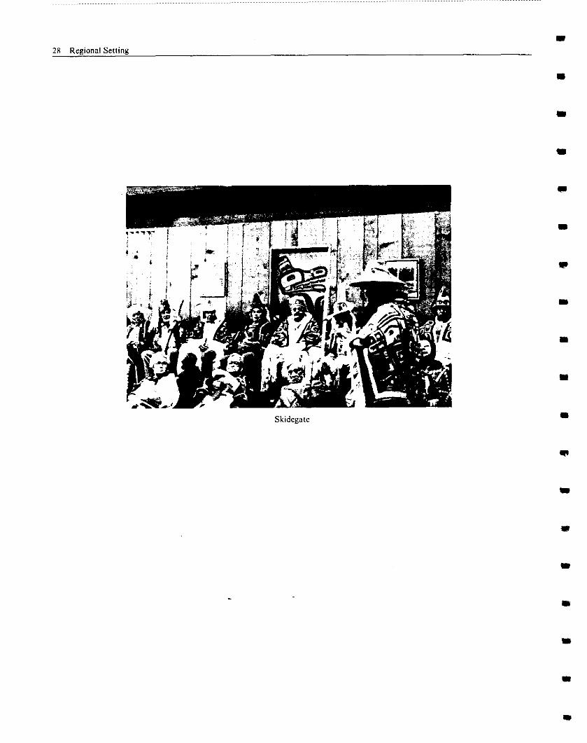
Skidegate
I 28 Regional Setting
m
m


![Vehicular Fog Computing: A Viewpoint of Vehicles as the ...cwc.ucsd.edu/sites/cwc.ucsd.edu/files/Vehicular Fog... · fog computing paradigm [10]–[14]. Specifically, in the fog](https://img.pdfslide.net/doc/110x75/5ece3cb4a160d21f083aea78/vehicular-fog-computing-a-viewpoint-of-vehicles-as-the-cwcucsdedusitescwcucsdedufilesvehicular.jpg)


![[데브루키] FOG](https://img.pdfslide.net/doc/110x75/559c0b481a28ab896a8b476a/-fog.jpg)