Embed Size (px)
Citation preview
3D Sub-Bottom Profiling High resolution 3D imaging of buried targets – GeoChirp 3D
Martin Gutowski, Jérôme Malgorn – Kongsberg Maritime Mark Vardy – National Oceanography Centre, Southampton
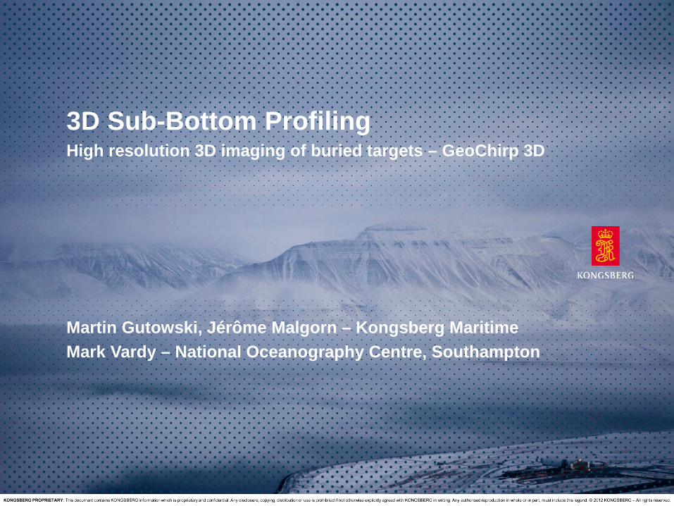
Motivation
• Produce a 3D sub-bottom profiler data set – Decimetre resolution – 10s of metre penetration
25/06/2015 Page 2 WORLD CLASS - through people, technology and dedication.
• Applications • Marine engineering and site surveys • Marine geology and geophysics • Defence: UXO & MCM • Marine archaeology
• Deliverables
• Industry standard SEGY data set • After acquisition: shotgathers with populated source and
receiver positions • After processing: stacked and (partly) migrated
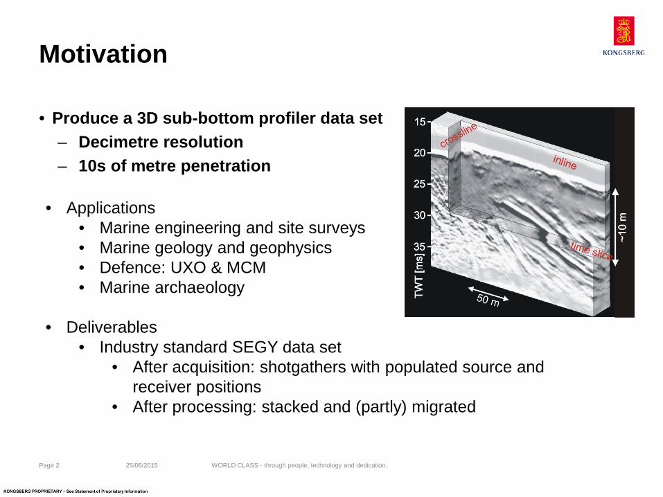
Background
– Fully sample a reflection wavefield over an area – Produce a 3D data volume rather than 2D sections
• Can be viewed in horizontal, vertical and arbitrary slices independent of acquisition directions
• 3D processing yields better data quality and higher resolution – Standard tool in hydrocarbon exploration – 10s of meter resolution and kilometres penetration
25/06/2015 Page 3 WORLD CLASS - through people, technology and dedication.
• 3D seismics
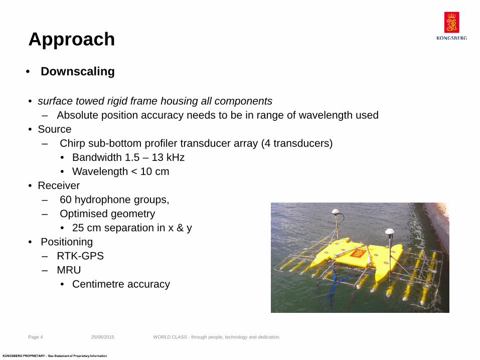
Approach
• surface towed rigid frame housing all components – Absolute position accuracy needs to be in range of wavelength used
• Source – Chirp sub-bottom profiler transducer array (4 transducers)
• Bandwidth 1.5 – 13 kHz • Wavelength < 10 cm
• Receiver – 60 hydrophone groups, – Optimised geometry
• 25 cm separation in x & y • Positioning
– RTK-GPS – MRU
• Centimetre accuracy 25/06/2015 Page 4 WORLD CLASS - through people, technology and dedication.
• Downscaling
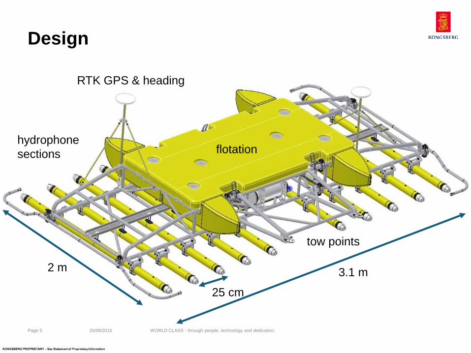
Design
25/06/2015 Page 5 WORLD CLASS - through people, technology and dedication.
flotation
RTK GPS & heading
tow points
hydrophone sections
25 cm
3.1 m 2 m
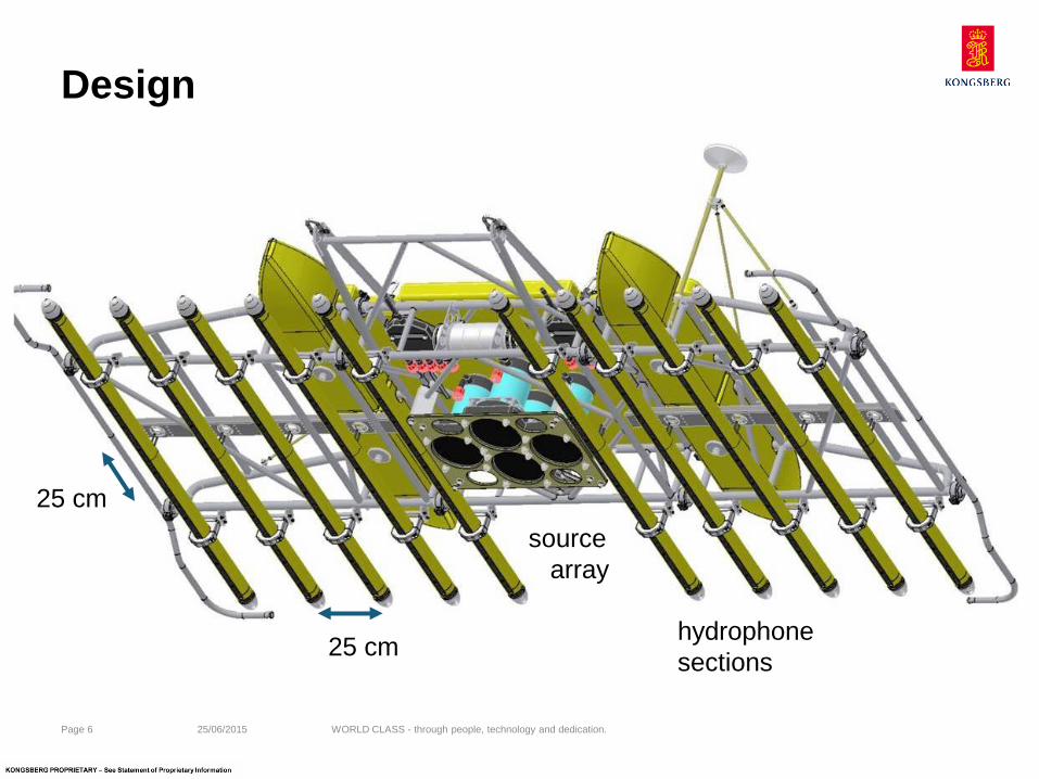
Design
25/06/2015 Page 6 WORLD CLASS - through people, technology and dedication.
25 cm
25 cm
hydrophone sections
source array
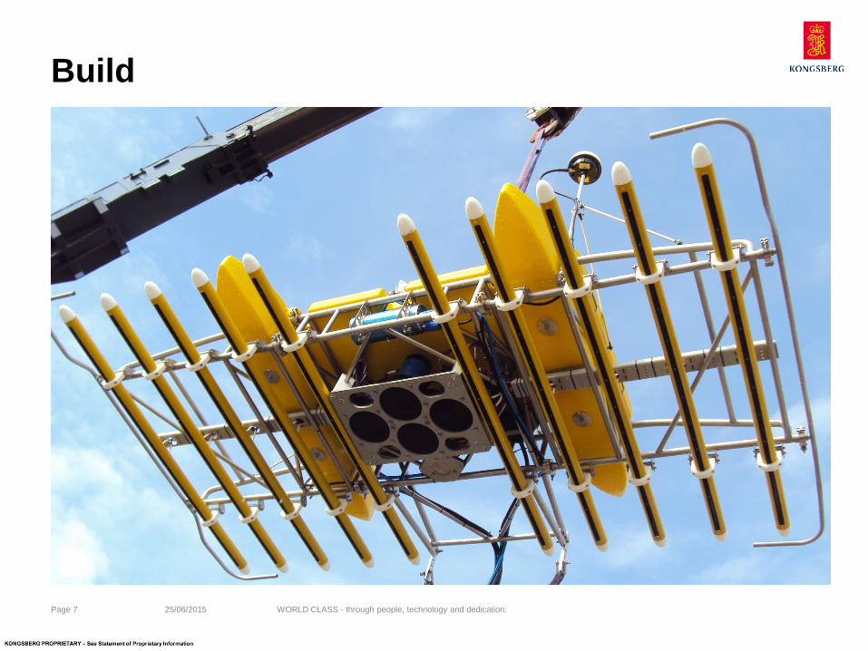
Build
25/06/2015 Page 7 WORLD CLASS - through people, technology and dedication.
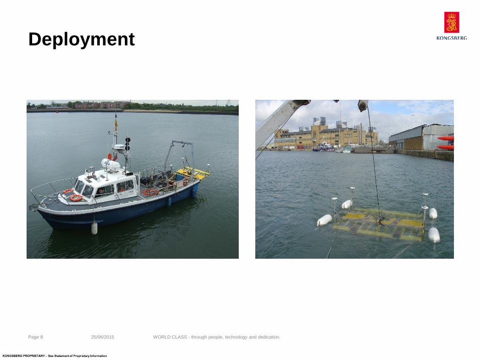
Deployment
25/06/2015 Page 8 WORLD CLASS - through people, technology and dedication.

Deployment
25/06/2015 Page 9 WORLD CLASS - through people, technology and dedication.
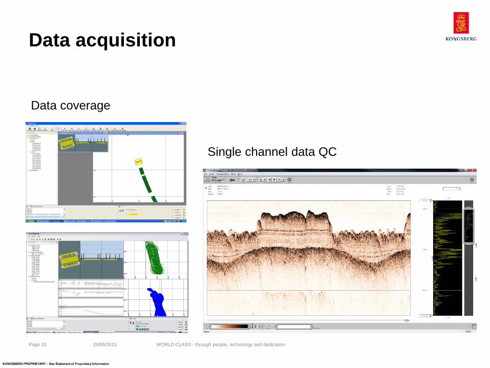
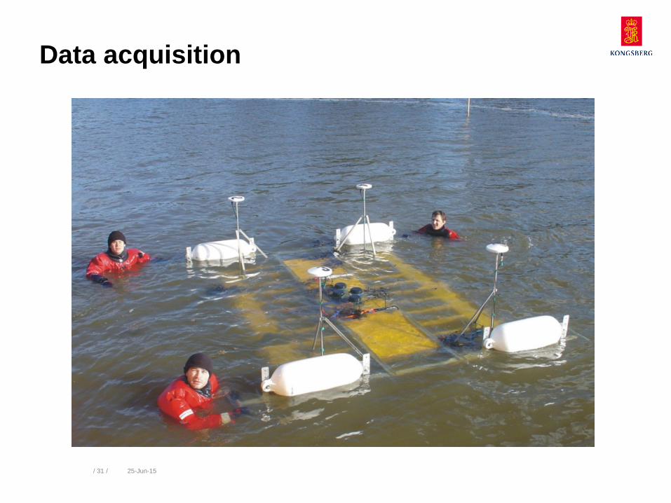
Data acquisition
25/06/2015 Page 10 WORLD CLASS - through people, technology and dedication.
Data coverage
Single channel data QC
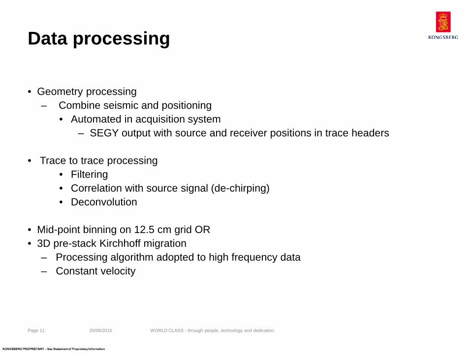
Data processing
• Geometry processing – Combine seismic and positioning
• Automated in acquisition system – SEGY output with source and receiver positions in trace headers
• Trace to trace processing
• Filtering • Correlation with source signal (de-chirping) • Deconvolution
• Mid-point binning on 12.5 cm grid OR • 3D pre-stack Kirchhoff migration
– Processing algorithm adopted to high frequency data – Constant velocity
25/06/2015 Page 11 WORLD CLASS - through people, technology and dedication.
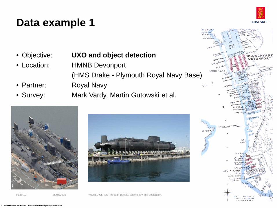
Data example 1
• Objective: UXO and object detection • Location: HMNB Devonport (HMS Drake - Plymouth Royal Navy Base) • Partner: Royal Navy • Survey: Mark Vardy, Martin Gutowski et al.
25/06/2015 Page 12 WORLD CLASS - through people, technology and dedication.
/ 13 / 25-Jun-15
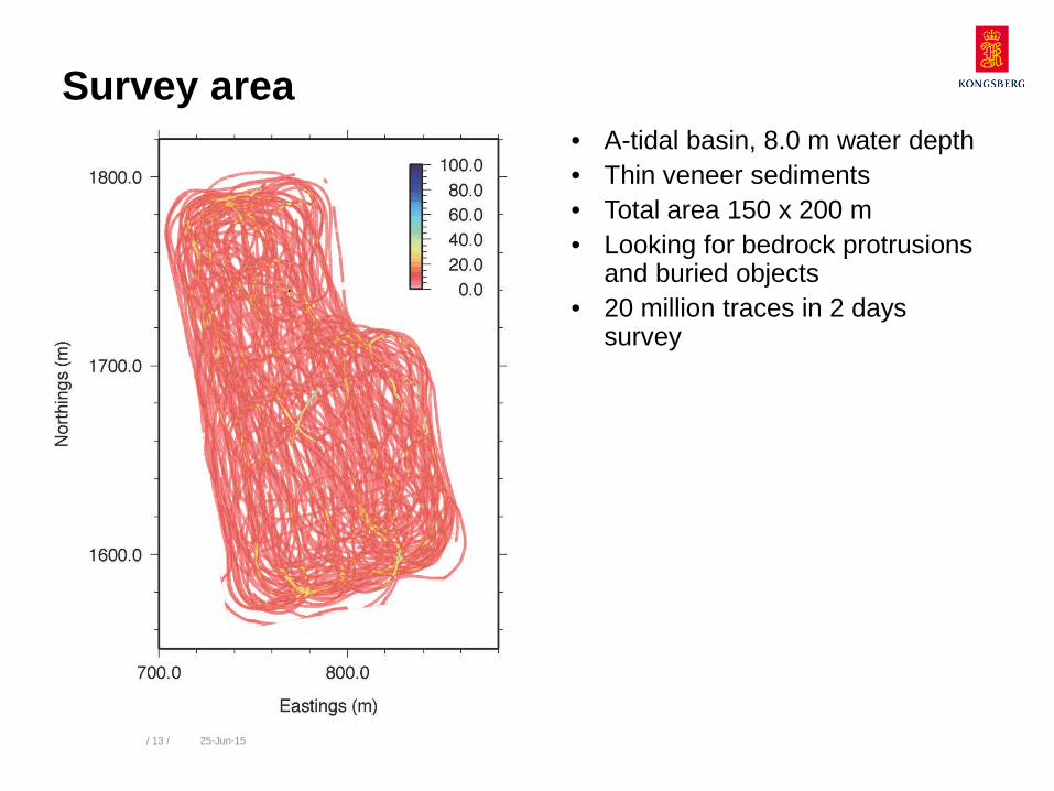
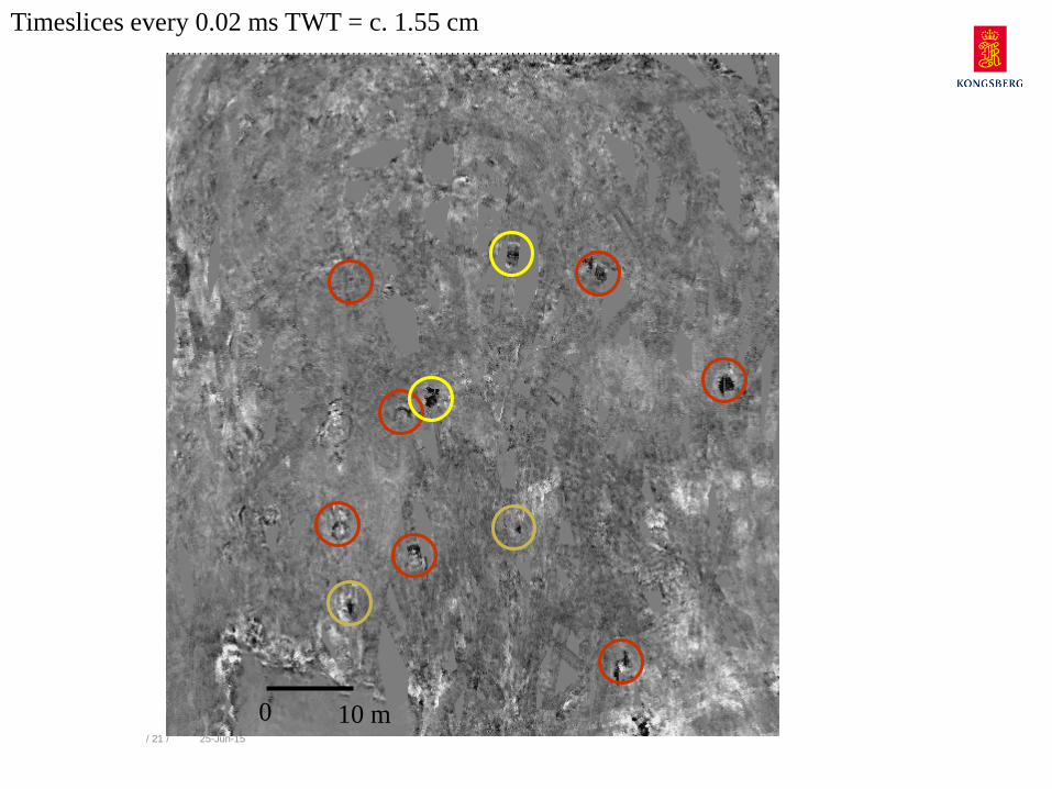
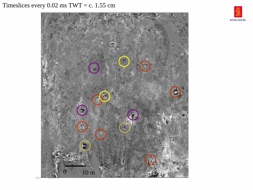
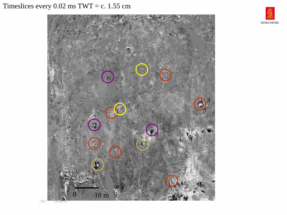
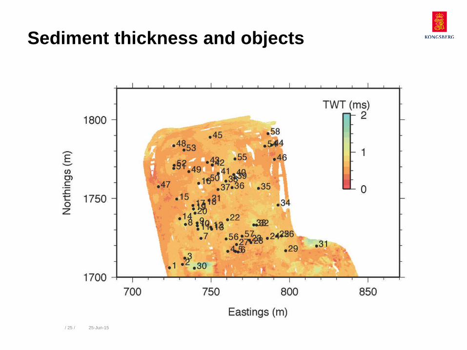
Survey area • A-tidal basin, 8.0 m water depth • Thin veneer sediments • Total area 150 x 200 m • Looking for bedrock protrusions
and buried objects • 20 million traces in 2 days
survey
/ 14 / 25-Jun-15
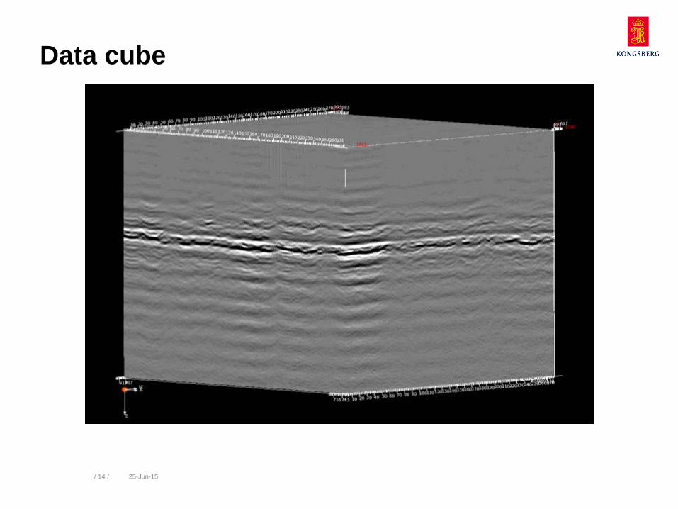
Data cube
/ 15 / 25-Jun-15
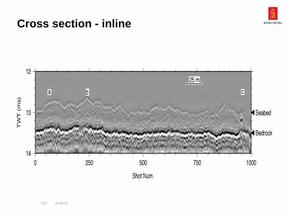
Cross section - inline
/ 16 / 25-Jun-15
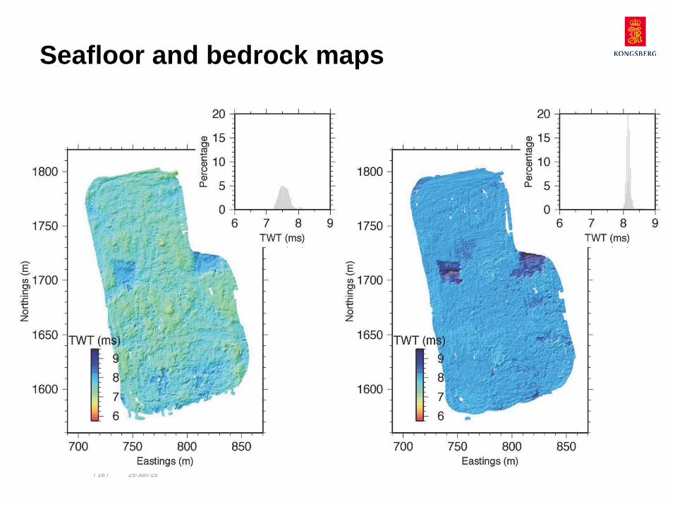
Seafloor Bedrock Seafloor and bedrock maps
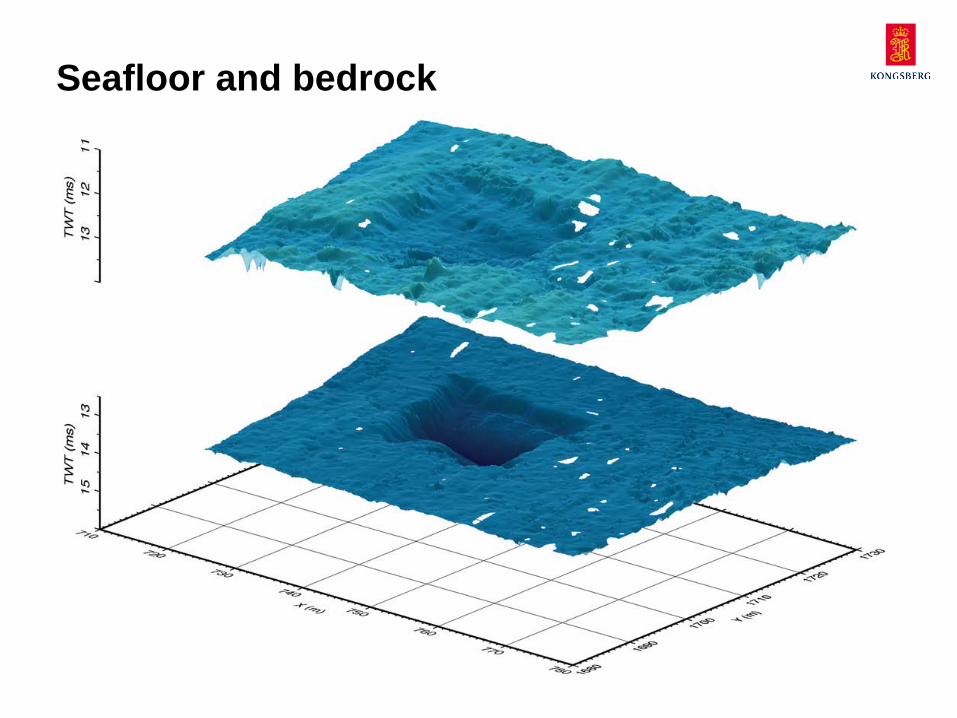
Seafloor and bedrock
WORLD CLASS – through people, technology and dedication / 17 / 25-Jun-15
/ 18 / 25-Jun-15
0 10 m
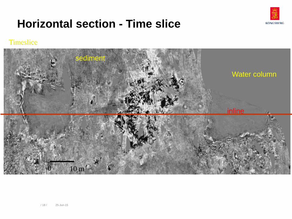
Timeslice
inline
Water column
sediment
Horizontal section - Time slice
/ 19 / 25-Jun-15
0 10 m
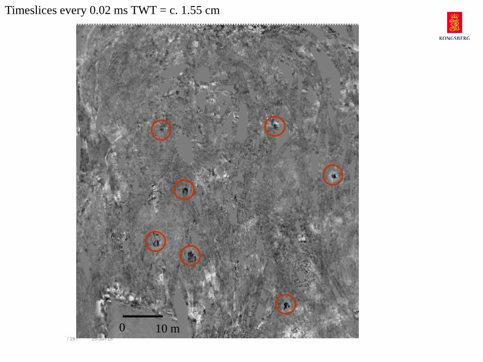
Timeslices every 0.02 ms TWT = c. 1.55 cm
/ 20 / 25-Jun-15
0 10 m
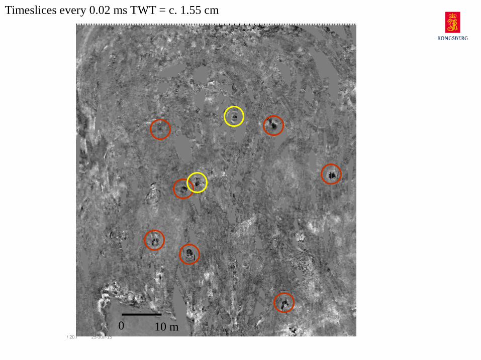
Timeslices every 0.02 ms TWT = c. 1.55 cm
/ 21 / 25-Jun-15
0 10 m
Timeslices every 0.02 ms TWT = c. 1.55 cm

/ 22 / 25-Jun-15
0 10 m
Timeslices every 0.02 ms TWT = c. 1.55 cm
/ 23 / 25-Jun-15
0 10 m
Timeslices every 0.02 ms TWT = c. 1.55 cm
/ 24 / 25-Jun-15
0 10 m
Timeslices every 0.02 ms TWT = c. 1.55 cm
/ 25 / 25-Jun-15
Sediment thickness and objects
/ 26 / 25-Jun-15
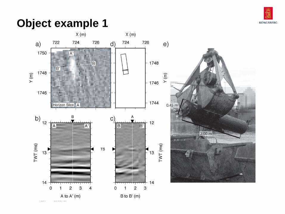
Object example 1
/ 27 / 25-Jun-15
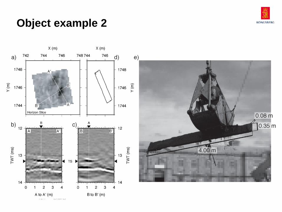
Object example 2
/ 28 / 25-Jun-15
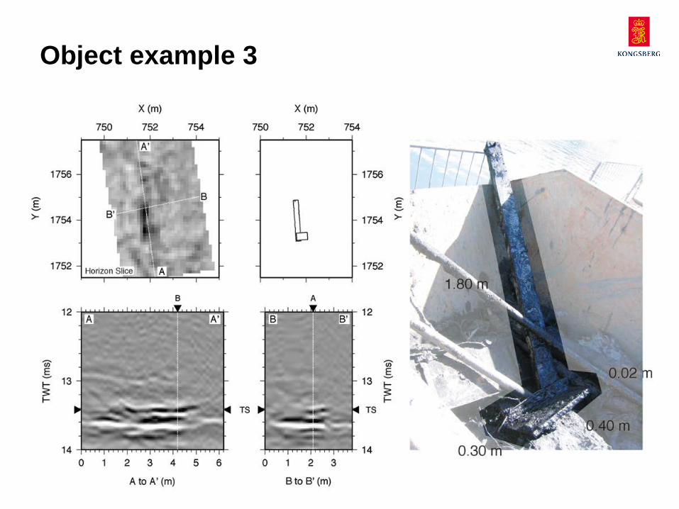
Object example 3
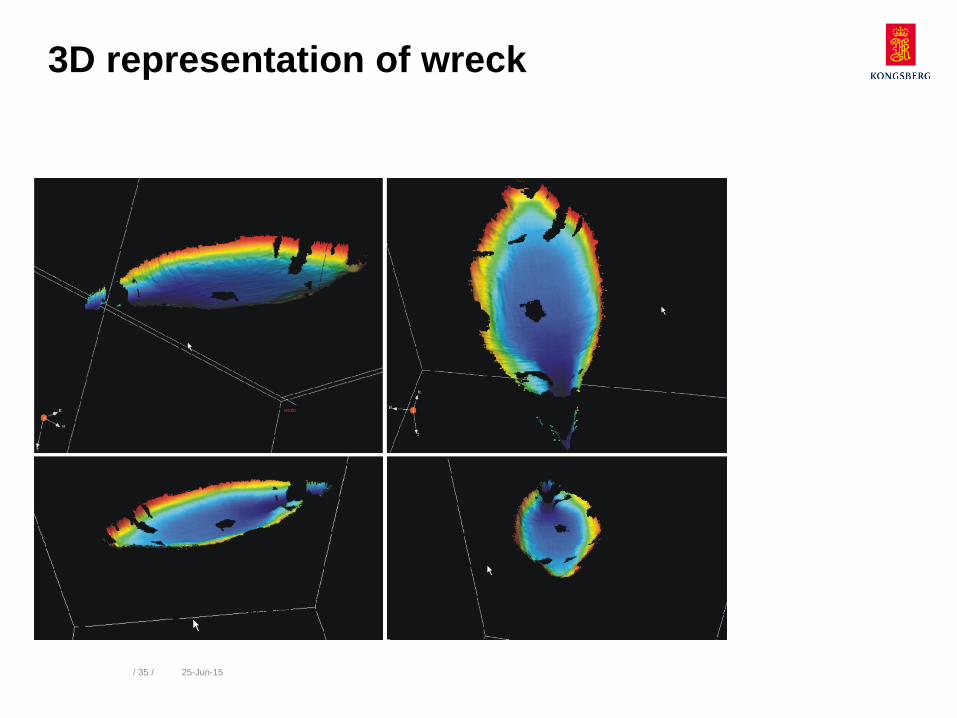
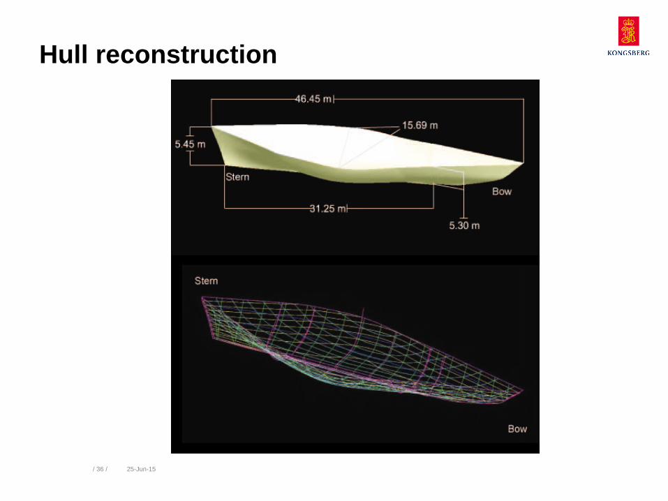
Data example 2
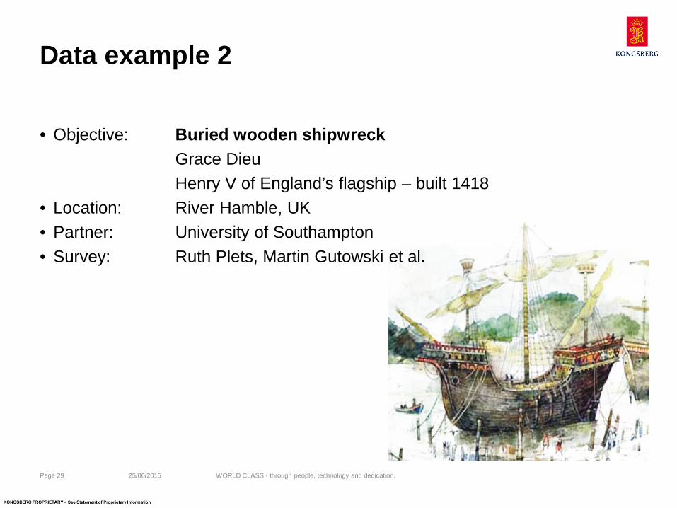
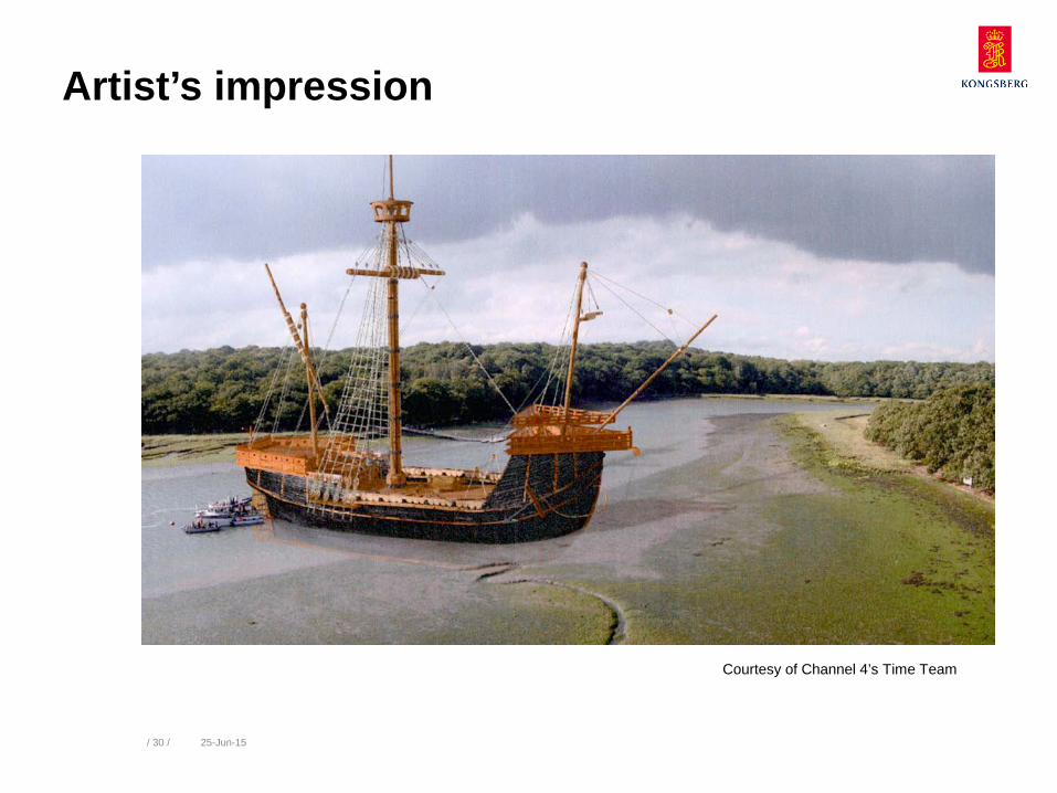
• Objective: Buried wooden shipwreck Grace Dieu Henry V of England’s flagship – built 1418
• Location: River Hamble, UK • Partner: University of Southampton • Survey: Ruth Plets, Martin Gutowski et al.
25/06/2015 Page 29 WORLD CLASS - through people, technology and dedication.
/ 30 / 25-Jun-15
Courtesy of Channel 4’s Time Team
Artist’s impression
/ 31 / 25-Jun-15
Data acquisition
/ 32 / 25-Jun-15
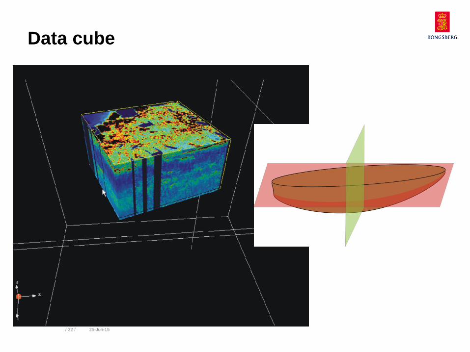
Data cube
/ 33 / 25-Jun-15
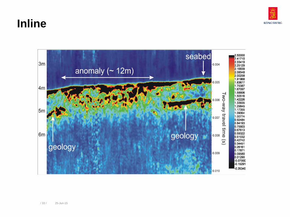
Inline
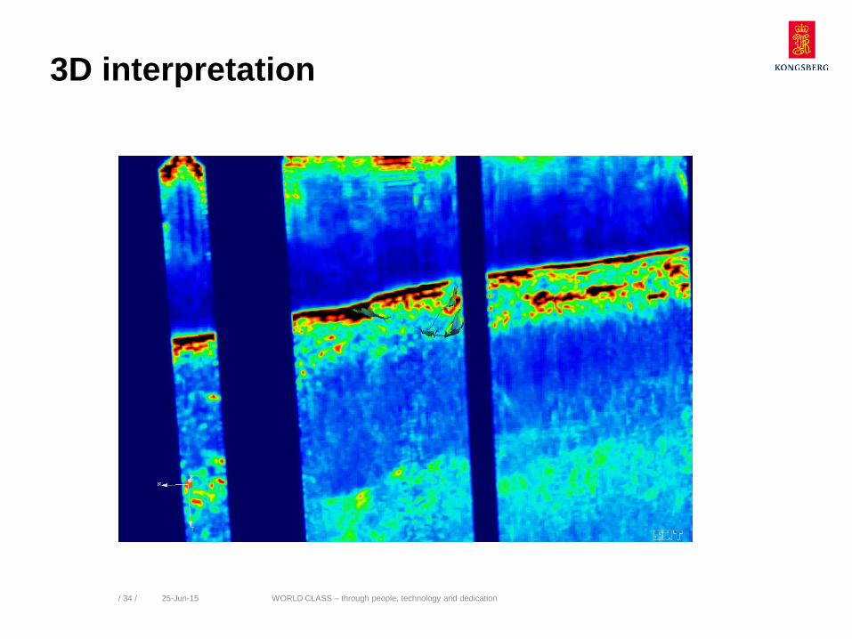
3D interpretation
WORLD CLASS – through people, technology and dedication / 34 / 25-Jun-15
/ 35 / 25-Jun-15
3D representation of wreck
/ 36 / 25-Jun-15
Hull reconstruction
kongsberg.com