Embed Size (px)
Citation preview
45
TSHWANE METROPOLITAN SPATIAL DEVELOPMENT FRAMEWORK 2012
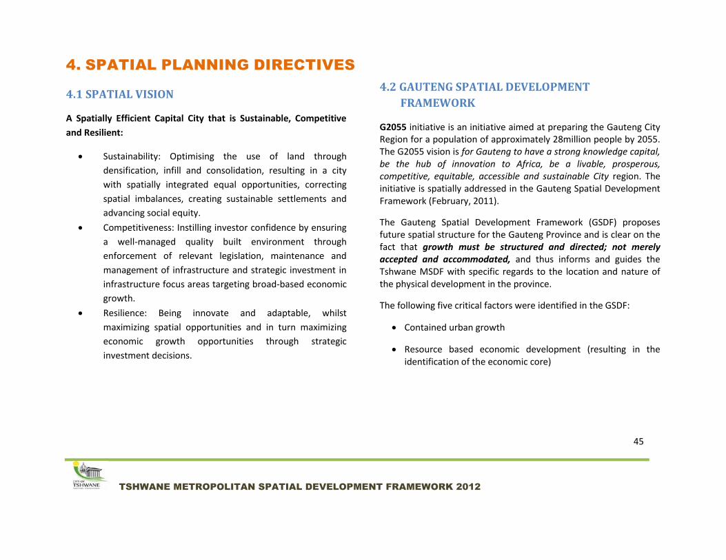
4. SPATIAL PLANNING DIRECTIVES
4.1 SPATIAL VISION
A Spatially Efficient Capital City that is Sustainable, Competitive
and Resilient:
Sustainability: Optimising the use of land through
densification, infill and consolidation, resulting in a city
with spatially integrated equal opportunities, correcting
spatial imbalances, creating sustainable settlements and
advancing social equity.
Competitiveness: Instilling investor confidence by ensuring
a well-managed quality built environment through
enforcement of relevant legislation, maintenance and
management of infrastructure and strategic investment in
infrastructure focus areas targeting broad-based economic
growth.
Resilience: Being innovate and adaptable, whilst
maximizing spatial opportunities and in turn maximizing
economic growth opportunities through strategic
investment decisions.
4.2 GAUTENG SPATIAL DEVELOPMENT
FRAMEWORK
G2055 initiative is an initiative aimed at preparing the Gauteng City Region for a population of approximately 28million people by 2055. The G2055 vision is for Gauteng to have a strong knowledge capital, be the hub of innovation to Africa, be a livable, prosperous, competitive, equitable, accessible and sustainable City region. The initiative is spatially addressed in the Gauteng Spatial Development Framework (February, 2011).
The Gauteng Spatial Development Framework (GSDF) proposes future spatial structure for the Gauteng Province and is clear on the fact that growth must be structured and directed; not merely accepted and accommodated, and thus informs and guides the Tshwane MSDF with specific regards to the location and nature of the physical development in the province.
The following five critical factors were identified in the GSDF:
Contained urban growth
Resource based economic development (resulting in the identification of the economic core)

46
TSHWANE METROPOLITAN SPATIAL DEVELOPMENT FRAMEWORK 2012
Re-direction of urban growth (stabilise/limit growth in economically non-viable areas, achieve growth on the land within the economic growth sphere)
Protection of rural areas and enhancement of tourism and agricultural related activities
Increased access and mobility.
The primary structuring elements identified within the GSDF are those of:
urban mixed-use activity nodes
open space and green system
public transit and movement routes
urban corridors and activity spines
4.2.1 NODE HIERARCHY
The GSDF defines nodes as being intense concentrations of activities, containing a mixture of uses such as retail, office, entertainment, community facilities and an adjoining residential component. A node can be oriented towards a local, neighbourhood, regional or city-wide community. The GSDF identifies a hierarchy of nodes that correspond with Tshwane nodes in the following manner:
GSDF MSDF
Regional Node Capital Core/ Tshwane CBD
Primary Node Secondary Node
Metropolitan Node
Secondary Node Tertiary Node
Urban Core
Local Node Emerging Node
Specialist Node Specialised Nodes
The GSDF further analyses nodes in terms of
Function
Economy/Land Use
Intensity of Use
Density
Walkability/Extent
Public Facilities
Public Transport
4.2.2 OPEN SPACE AND GREEN SYSTEM
The GSDF open space and green system is informed by the provincial dolomite belts, soil fertility for purposes of agricultural activity, conservation areas, ridges, watercourses and heritage sites.

47
TSHWANE METROPOLITAN SPATIAL DEVELOPMENT FRAMEWORK 2012
4.2.3 PUBLIC TRANSIT AND MOVEMENT ROUTES
The GSDF indicates that the existing rail systems and BRT routes should form the basis of the transport system for Gauteng for both freight and public transport. The GSDF further takes cogniscance of the proposed extended/upgraded rail links, providing a commuter line that connects Mabopane to Hammanskraal and Hammanskraal to the Capital Core (urban structuring initiative), as indicated in the Tshwane MSDF . It also indicates that the proposed Tshwane inner-rail loop of the Tshwane MSDF would significantly increase urban consolidation potential as a well-located public, subsidized initiative.
4.2.4 URBAN CORRIDORS AND ACTIVITY SPINES
The GSDF defines an urban corridor as being the largest of the
urban structure elements, consisting of a combination of structuring
elements at the metropolitan and regional scale of the urban
environment. It is typically a linear element linking two
metropolitan nodes, showing that it is origin and destination driven
(i.e. it goes from somewhere important to somewhere important). A
corridor of this nature is complex in profile and the mix of uses,
resulting in varying development intensity and a width.
On the other hand, an activity spine is a linear mixed-use element of
urban structure containing an intense concentration of facilities
which are all focused along a major transportation route. It is the
focal point of an urban corridor or can be a separate element. The
spine is traffic oriented, accessed through public and private
transport. It carries various modes of traffic which give direct access
to a range of high intensify land uses. Pedestrian movement in
between passing trade characterizes the nature of the activity,
supported by a strong residential component.
Major Regional Corridors identified are:
N1 (Polokwane/Tshwane/JHB/Vaal/Bloem/Cape Town)
N 4 (Rustenburg/Tshwane/ Witbank) Major Provincial Corridor:
R21 from Tshwane to OR Tambo International Airport
4.2.5 CONSOLIDATION AND DENSIFICATION
Given the comprehensive system of discernible urban corridors and public transport potential within Gauteng, consolidation of urban development should be concentrated around existing primary urban centers, urban nodes, and urban corridors and along urban activity spines.
4.2.6 GROWTH MANAGEMENT: URBAN EDGE
The primary growth management tool will be the urban edge. The
urban edge is an urban management tool used to counter urban
sprawl and unplanned expansion, encourage densification and
protect natural resources within the city.

48
TSHWANE METROPOLITAN SPATIAL DEVELOPMENT FRAMEWORK 2012
In 2011 decision was taken that the Provincial Urban Edge would no longer be implemented by Gauteng. Rather, that the edge should be managed by local municipalities themselves, to ensure an appropriate and contextual application of growth management.
To this end, the City of Tshwane will reflect strategic urban edge delineations within the Regional Spatial Planning Frameworks and other lower hierarchy spatial plans. Amendments to or deviations from the urban edge will be at the discretion of the municipality, subject to the merits of the specific application.
The concept of the ‘urban void’, as defined in the GSDF, is also
important to note. The urban void comprises expansive areas (or
discontinuities) within the urban system that remain or are under-
and/or undeveloped for very specific reasons. These typically
include extensive agricultural holdings and mining areas, as well as
land used for military purposes. Some areas remain undeveloped
due to their potential threat to human safety and health, for
example unstable geotechnical conditions due to the formation of
sink holes and previous mining activity, and industrial activity/
production which prohibit urban development in close proximity to
the industrial activity. Other areas may be developed over time as
the urban system grows and expands and certain activities may be
re-located and/or discontinued, creating opportunities for new
development.
It is critical to remember is that the GSDF is a long term spatial
framework and reflects the vision for 2055. On the municipal level,
spatial planning will need to respond to the G2055 vision and GSDF
within the local context in incremental stages providing more
detailed spatial directives in short, medium and long-term plans.

49
TSHWANE METROPOLITAN SPATIAL DEVELOPMENT FRAMEWORK 2012
GAUTENG SPATIAL DEVELOPMENT FRAMEWORK
50
TSHWANE METROPOLITAN SPATIAL DEVELOPMENT FRAMEWORK 2012
GAUTENG SPATIAL DEVELOPMENT FRAMEWORK: TSHWANE

51
TSHWANE METROPOLITAN SPATIAL DEVELOPMENT FRAMEWORK 2012

52
TSHWANE METROPOLITAN SPATIAL DEVELOPMENT FRAMEWORK 2012
4.3 THE NEW GROWTH PATH AND TSHWANE STATEGIC INVESTMENT PLAN
In his inaugural State of the nation Address in June 2009, President Jacob Zuma identified the need to create decent work; expand on our investment attraction and job creation initiatives and to promote a more inclusive economy. The New Growth Path of 2010 knits together the Industrial Policy Action Plan (IPAP) as well as policies and programmes in rural development, agriculture, science and technology, education and skills development, labour, mining and beneficiation, tourism, social development and other areas. The spatial response to this Growth Path will encompass the identification of the following:
Infrastructure focus areas
Agricultural and agro processing focus areas
Knowledge economies
Rural management programmes to improve livelihoods and stimulate employment
But the ‘economic growth basket’ will require synergy among several building blocks. And given that many of these interventions towards an improved economy will happen in space, the spatial plan is imperative. Needless to say, the ‘spatial basket’ is also much wider, and the response will thus have to encompass a more complex tapestry which will be weaved together into a complementary and integrated strategy.
In March of 2011, the CoT approved the Tshwane Strategic
Investment Attraction, Facilitation and Aftercare Plan (2011-2016).
The purpose of the plan is to outline the City of Tshwane’s strategic
and systematic approach to the investment promotion, attraction,
facilitation and retention functions, with the view to increase
investment volumes in the City which would have a direct impact on
economic growth and development, as well as to increase the
employment creation potential of the economy. The plan identifies
the following as priority investment sectors for:
Automotives and Components
Tourism and Related services
Agriculture and Agro-processing
Aerospace and Defense technologies
Mixed Manufacturing
Research and Development
Alternative and Renewable Technologies
Business Process Outsourcing and Off-shoring

53
TSHWANE METROPOLITAN SPATIAL DEVELOPMENT FRAMEWORK 2012
Mining and Beneficiation
The Tshwane Investment Approach will consist of 3 phases:
PHASE 1: Framework Plan
Adopt the Metropolitan Spatial Development Framework
(MSDF) and the Regional Spatial Development Frameworks
(RSDF), and align them to the Tshwane economic strategies
Identify strategic land parcels for Greenfield and expansion
investment projects
Align infrastructure development plans to the inherent SDF
investment opportunities
Identify regional and sectoral comparative and competitive
advantages
Classify investment project categories to be prioritized and
fast-tracked
PHASE 2: Pre- Investment Facilitation
Investment mapping and planning (i.e. identification of
source countries and targeting strategic multi-national
corporations
Arrange business seminars and investment conference
International investment marketing missions
Investment profiling, packaging and guide
Investors’ guide and hand-holding
Stakeholder consultation
Investment Research and registry
PHASE 3: Development Facilitation
Leveraging of private sector funding through:
Investment and business incentives
Investment Attraction and Facilitation Plan
Efficiency of planning
The relevance of the Strategic Investment Attraction, Facilitation
and Aftercare Plan is critical in identifying areas for focused
infrastructure investment in order to ensure continued growth in
existing economic nodes and identification of new opportunity
areas for economic growth.
The alignment or misalignment of existing nodal areas with
investment sector areas will also guide the City as to where greater
amounts of public funding is required, versus areas that already
have huge private sector funding support.
Diagram 12 is a schematic presentation that indicates that the bulk
our the City’s first order nodes (metropolitan nodes) are largely
already spatially integrated with a number of our economic

54
TSHWANE METROPOLITAN SPATIAL DEVELOPMENT FRAMEWORK 2012
investment centres on a strategic scale. The city’s second order
nodes (urban cores) are not.
In terms of the MSDF, urban cores have been identified as target
areas for focused public intervention, on order to ensure that they
develop into economic nodes of greater significance.
The planned Integrated Public Transport Network (IRPTN) (further
discussed under in chapter 5- Movement and Connectivity) will be
an important intervening measure to address this misalignment.
The relevance of the Strategic Investment Plan is to stimulate
economic growth in Tshwane. The IRPTN will address the spatial
disjuncture of economic growth by:
Improving access to economic opportunities, social spaces
and services by bridging geographic distances, affordability,
reliably and safely
Stimulating economic development by supporting the
movement of goods from points of production to where
they are consumed, thereby facilitating regional and
international trade
Integrating labour markets through strategic linkages

55
TSHWANE METROPOLITAN SPATIAL DEVELOPMENT FRAMEWORK 2012
DIAGRAM 6: SCHEMATIC REPRESENTATION OF PRIORITY INVESTMENT SECTORS AND ECONOMIC GROWTH CENTRES

56
TSHWANE METROPOLITAN SPATIAL DEVELOPMENT FRAMEWORK 2012
4.4 TSOSOLOSO PROGRAMME
4.4.1 BACKGROUND
The social and economic re-development of South African townships has been identified as a national priority. The Neighbourhood Development Partnership Grant (NDPG) is an initiative by the National Treasury Department that seeks to address development issues within townships. It was announced in the budget speech (15 February 2006) by the then Minister of Finance as a conditional grant to municipalities through the Division of Revenue Act (DORA). Its intentions are to stimulate and accelerate investment in poor, under-served residential neighbourhoods (townships) by providing Technical Assistance (TA) and Capital Grant (CG) for municipal projects, through an allocation of about R 10 billion over a ten year period for around 100 initiatives country-wide.
The NDPG program was established with the objective of leveraging private sector investment thereby stimulating social and economic potential within townships. It plays a key role in unlocking resources and initiating the property developments required to transform target areas into vibrant and economically functional neighbourhoods that are pleasant to live in and provide residents with access to shops, markets, recreational and community facilities as well as public transport. The overall aim of the NDPG is to support municipalities to design and implement projects, within the context of overstretching Township regeneration strategies. Municipalities are urged to submit applications for TA and CG for projects that meet the set-out criteria stipulated in the program toolkit.
The City of Tshwane (CoT) submitted an application for NDPG funding in May 2006 based on the Tsosoloso Program Concept. The application was accepted and the NDPG funding was awarded in November 2006. The CoT obtained supporting Council resolution in January 2007 for the Tsosoloso program, as per required in the NDPG funding conditions.
The primary aim of the Tsosoloso programme is to create vibrant, quality spaces focusing on nodes of economic potential to act as catalysts for development. This includes, but not limited to developing squares, trading facilities and intermodal transfer facilities in largely dormitory areas, as well as the clustering of civic and social facilities around areas of potential to increase the economic viability of the areas and so attract and maintain private sector investment.
Through the NDPG, CoT aims to create places of opportunity through the clustering and integrated design of public facilities to unlock economic opportunities within the former Township areas, also referred to as urban cores in the context of this MSDF. Urban cores are futher discussed in chapter 5 of this document. There are five key points of action of the Tsosoloso Programme namely:
1. Creation of community activity centres and focal points (including town centres and urban cores),
2. Strengthening of activity linkages (activity spines and streets),
3. Transformation of transport interchanges into civic termini,
4. Enhancement of the pedestrian environment, and

57
TSHWANE METROPOLITAN SPATIAL DEVELOPMENT FRAMEWORK 2012
5. The enrichment of the quality of the public environment with public art and green structures (trees).
The implementation of Tsosoloso-related projects is heavily dependent on the approval of Business Plans submitted by the City to National Treasury.
The following nodes have been identified and prioritised for long-term focus and overall implementation of the programme:
Township/Catchment Area Node/Precinct
Mamelodi/Nelmampius 1. Eerste Fabrieke Station Node
2. Solomon Mahlangu Precinct (Denneboom Station)
3. T-Section Node
Atteridgeville 4. Saulsville Station Node (includes: Saulsville Station, Atteridgeville Station, CBD and resorts)
Mabopane/Soshanguve 5. Mabopane Station
6. Soshanguve South x14 (Klip-kruisfontein)
Hammanskraal/Temba 7. Hammanskraal/Temba Node
Olivienhoubosch/Monavoni 8. Olivienhoutbosch Node
Refilwe 9. To be determined
4.4.2 INTEGRATION WITH FORMER METSWEDING NDPG
NODES
During late 2010, the former Metsweding Municipality initiated the implementation of its NDPG Programme. Three nodes were identified for purposes of the programme:
Refilwe (in the former Nokeng Tsa Taemane)
Zithobeni (in the former Kungwini)
Enkangala (in the former Kungwini)
It is due to the fact that these three urban cores have been recently added to the City of Tshwane that the specific focus precincts within the catchment areas are yet to be determined.

58
TSHWANE METROPOLITAN SPATIAL DEVELOPMENT FRAMEWORK 2012
4.5 SPATIAL POLICY
Growth management is a spatial concept that encompasses all aspects that ensure efficient, optimal and sustainable development of the physical environment. A key principle of this concept is smart growth. The smart growth principle guides development such that resources and services are provided in such a manner that they meet the demands of the affected population over the long-term.
Nodes are those parts of the city where development should be focused. The widest variety of services and opportunities should be provided at nodal points, at degrees relative to their nodal status.
Due to the high cost of providing bulk infrastructure in low density areas, urban sprawl should be discouraged. It is imperative that available infrastructure within the nodes are used optimally. This requires densification and intensification of land uses through compaction and infill developments. Transit-oriented development will optimise the potential and infrastructure capacity of nodes while combating urban sprawl through movement between and connectivity of focus areas of development.
The urban edge will, as a growth management tool contributes to
the achievement of strategic objectives by conserving valuable
environmental areas which would otherwise be compromised by
development, and by promoting the use of existing infrastructure
through redevelopment, infill development and densification within
the edge, thus achieving development that is sustainable. The urban
edge also encourages the agglomeration of economies within the
edge, encouraging scattered secondary or emerging nodes to
develop into consolidated primary nodes as opposed to leapfrog
development. The edge also ensures the protection of land- an
exhaustible resource- by encouraging Brownfield developments
instead of Greenfield developments.

59
TSHWANE METROPOLITAN SPATIAL DEVELOPMENT FRAMEWORK 2012
4.5.1 COMPACTION AND DENSIFICATION
The urban environment is characterised by qualities that are essential in terms of equity, liveability and sustainability, such as diversity, choice, uniqueness, sense of place and opportunity.
It is the intention of the MSDF to restructure our fragmented, inequitable and inefficient urban form to create a more equitable, efficient and environmentally and financially sustainable urban dispensation in line with current legislation and policy.
The compaction and functional integration of the city are normative directives from national level, and implies:
(1) higher density urban development,
(2) greater mixing of compatible land uses and
(3) focussed concentration of high-density residential land uses and intensification of non- residential land uses in nodes, around transit stations (such as the Gautrain, BRT, Rail and other formalised intermodal transport facilities (See chapter 5 discussion of the spatial economy of transport planning) and along activity corridors.

60
TSHWANE METROPOLITAN SPATIAL DEVELOPMENT FRAMEWORK 2012
Corridors and Activity Spines are identified and described in the following sections. Intensification should specifically be focussed around these structuring concepts as first priorities of intervention.
Densification goes hand-in-hand with this approach to intensification and is also structured around the Metropolitan Activity Areas, Corridors and Activity Spines. The purpose of such higher density residential development is to provide residential opportunities in environments that are high-intensity, mixed use, pedestrian friendly and supported by public transport where a number of economic and social opportunities are available within a relatively compact geographical area. These areas should also be linked to the Tshwane Open Space System to support their viability. The increase in residential densities will result in the reduction of private recreation and entertainment space. Special attention should, therefore, be given to the creation, design and management of public spaces as well as communal and social facilities (e.g. parks, sports fields, educational facilities etc.) in areas where higher densities are developed.

61
TSHWANE METROPOLITAN SPATIAL DEVELOPMENT FRAMEWORK 2012
4.5.1.1 DENSIFICATION
The main objectives of residential densification and compaction are to:
o minimise/reduce the footprint of the city
o prevent the destruction of valuable agricultural land
o reduce pressure for the development of open spaces and environmentally sensitive land due to the optimal use of available land; providing choice in terms of housing typologies
o improve the viability of public transport
o improve the efficiency of urban areas - increased convenience for the residents of the city in terms of improved access to goods, services and job opportunities as well as a reduction in travelling times, cost and distances
o improve use of service infrastructure
o increase the marketability of the city and
o reduce inequality
The programme for densification and the endeavour to reach the set objectives should be measured against a set of conditions or reservations, which ensure that densification occurs in a positive manner and does not
occur without proper regard to the impact it may have on the way in which people live and the city functions.
These conditions are:
Structural environment:
Densification should take place in a focussed and logical manner which can assist in transforming the current ambiguous/amorphous urban form into an area with an identifiable spatial logic and identity. Economic restructuring will benefit from promoting spatial access to economic opportunity and promoting job creation via the multiplier effect associated with building medium density housing stock.
Choice in housing options:
Balance and diversity in the range of housing options, densities and typologies to serve in the needs, desires and income abilities of all the residents of the city should be ensured. One of the major problems with the establishment of residential areas in the CoT is that these areas more often than not are merely housing estates and not neighbourhoods in the true sense of the word. This applies to both middle income and lower income areas. For example, we see the bland environments that are being created by the RDP housing schemes, but the lack of true neighbourhood creation is also very evident in the middle income areas.
62
TSHWANE METROPOLITAN SPATIAL DEVELOPMENT FRAMEWORK 2012
Diversity:
The population in a metropolitan area is highly heterogeneous. Planners involved in planning the compaction and densification of the city will clearly need to recognise this multiplicity of users and trips that metropolitan areas generate. A standardised, one-size fits-all approach to densification in different parts of metropolitan areas will not do. Densities will be informed by the desirability and appropriateness of specific densities at the related locations. Densities will range from low to high. Some areas may have a mix of densities, while others will have consistent densities throughout.
High quality environment within a liveable city:
Densification should bring about a positive change in the liveability and urban structure of the city. Compact, well-planned cities tend to be more liveable. Aspects such as low environmental quality, monotonous urban landscape and overcrowding, which can be the result of “one-sided” densification, should be prevented.
The principles and sub-principles for densification are as follows:
Appropriate higher density housing opportunities at appropriate locations must be provided for all income groups
o A range of housing opportunities and choices should be provided
o Social integration must be promoted throughout the metropolitan area
Densification must contribute to the overall structure and functionality of the metropolitan area in that it takes place in a balanced, focussed and structured way:
o Densification should be concentrated around specific strategic areas
o Density levels should be linked to the functional characteristics of various parts of the city
o Densification and compaction must be applied in such a way that diversity and unique spatial characteristics are maintained within the city
o Density should relate to the surrounding area
Specific areas of opportunity or need for restructuring should be identified (areas that should not be densified for specific reasons should also be identified)
o Areas of opportunity should posses real current or future potential for growth and development and such potential should also be desirable from a restructuring point of view
o (Re-) development should be promoted within existing built-up areas as an antidote to greenfield developments.

63
TSHWANE METROPOLITAN SPATIAL DEVELOPMENT FRAMEWORK 2012
Open space, farmland, natural beauty, critical environmental areas, and cultural assets should be preserved and enhanced.
Areas targeted for densification should be well served by public transport, or have the possibility to be well served by public transport in future.
Areas targeted for densification should be treated as whole environments, with investment in infrastructure, landscaping, open spaces and social facilities ideally preceding higher density developments
o The development and retention of quality living environments should be ensured, which means that indiscriminate application of densification should be avoided.
o Mixed land uses in areas earmarked for densification should be promoted
o Developments should promote safety and security in an area
Residential densification and compaction should be aligned with the principles of smart growth. The Compaction and Densification Strategy of 2005 identifies four general density zones within the municipal area. The principles of the Compaction and Densification Strategy have been practically applied within the Regional Spatial Development Frameworks. The densities that are applicable in specific RSDFs are a function of the local context and factors such as:
Location and prominence within the city
Accessibility
Socio-economic characteristics - lifestyles, household sizes, level of urbanisation,
Special attributes (e.g. historical or cultural heritage)
Existing infrastructure
Long term prospects
Current level of public transport
Site characteristics
Environmental Considerations
Land availability and costs vs. opportunities for redevelopment.
The following Key Density Zones (area-specific elaborations to be found in RSDFs) are identified in the Densification Strategy, which are:
Concentration zones:
High Density Zone
Transit Oriented Zones

64
TSHWANE METROPOLITAN SPATIAL DEVELOPMENT FRAMEWORK 2012
Linear Zones:
Development Corridor
Activity Spine
Suburban Densification Zones
Low Density Zones
Restructuring Zones
4.5.1.2 CONCENTRATION ZONES
Under this classification, reference is made to locales directly influenced by transportation or concentration of economic activity.
High Density Zones: The High Density Zones are the primary focus areas for high density, medium to high-rise residential developments. Characteristics of these zones are those found in major metropolitan urban centres. These locations have developed into places accommodating a whole range of urban activities, from economic activities, ranges of services, entertainment and a choice of housing on an intense scale. Medium to high rise office and apartment blocks are found in abundance and space is at a premium. Most transport routes converge onto and radiate outwards from this zone. Thus it becomes an area of confluence with a great mix of land use.
Transit Oriented Zones: Transit Promotion Zones refer to those nodes that are centred on transportation nodes or facilities, such as stations, highway interchanges and other modal inter-changes. Transit Promotion Nodes could be part of High Density Zones or Corridors where such zones also incorporate a major transport facility.
4.5.1.3 LINEAR ZONES
Linear zones refer specifically to high activity areas that are located along major mobility routes. The mobility routes usually carry high capacities of traffic to areas such as Zones of Concentration and Transit Oriented Zones and thus encourage the feasibility of public transport.
A distinction must be made between linear developments where there are limited access (i.e. a high mobility function) and high levels of access (i.e. a high activity function).
Activity Spine: Describes a major axis/transport route that runs through the city. A mix of public and private transport will be prevalent on such routes and a mix of land uses will be the dominant trend. This provides linkages between nodes and in so doing it also attracts development. In such areas there is a need to densify as there is usually a high demand for residential, office and retail space. Access is good for on street facilities.
Development Corridor: It signals the development occurring along a major transport route, for instance a freeway or a rail system. Direct access to features lining the corridor is restricted with the number of stops of public transport being further apart from each other. There is a stronger correlation
65
TSHWANE METROPOLITAN SPATIAL DEVELOPMENT FRAMEWORK 2012
between the development and its surrounding environment than there is with the corridor itself. Points of concentration of higher density development must occur around the public transport stops and interchanges.
A development corridor should consist of a package of key structuring elements, namely:
A distinct road hierarchy
Mobility spines
Activity Spines
An open space system
Connected nodes (may vary in type and size) and
A defined start and end
4.5.1.4 SUBURBAN DENSIFICATION ZONE
Such zones develop in existing low density areas where there is potential for moderate densification through sub-divisions, second dwelling houses and cluster housing developments, especially in areas that are close to places of employment, major retail centres and prominent transport routes.
4.5.1.5 LOW DENSITY ZONES:
Such zones are typified by mono-functional suburbs, which play host to mostly high income earners, and comprises mostly of large stands with single dwelling houses. Access to public transport is limited to that which serves domestic workers in the area. Privately owned motor vehicles constitute the major flow of traffic. Retail centres are often not in close proximity to such zones and there is little or no mix of land uses present. A typical location would be peripheral areas but could also include areas more centrally located but with special circumstances/characteristics.
4.5.1.6 MULTIPURPOSE FACILITY CLUSTERS
In order to support compaction and densification strategies, nodal areas (see chapter 5- Nodes and Activity Areas) should, as far as possible, incorporate multipurpose facility clusters. This will be especially critical in nodes that are anchored by inter-modal transit facilities and where transit-oriented development occurs. Large numbers of people arrive at such nodes from different origins, thus increasing the need for versatility of services and facilities available for a large and varied heterogeneous population. This is an example of implementing the economy of density.
A multipurpose facility cluster is a multifaceted facility under one roof or more, which offers a range of services such as social services, recreation, health, and other economic activities, in one location. Multipurpose facility clusters are generally located together with structural elements of urban settlements (at a transport stop/interchange, urban square, market, sports field, etc).

66
TSHWANE METROPOLITAN SPATIAL DEVELOPMENT FRAMEWORK 2012
The advantages of establishing multipurpose facility clusters are:
Convenience, as all services are located at a central point, allowing people to accomplish more tasks in a single journey, equating to savings in both time and money
Reduction in the cost of providing public facilities through the sharing of resources, equipment and land
Exposure for public facilities and encouragement of their use
Integration of different communities
Reduction of inequalities in the provision of facilities
Provision of greater security
Offsetting of transport costs
DIAGRAM 7: EDUCATIONAL FACILITY CLUSTER
Source: Leggett et al 1977

67
TSHWANE METROPOLITAN SPATIAL DEVELOPMENT FRAMEWORK 2012
DIAGRAM 8: COMPATIBILITY MATRIX FOR MULTIPURPOSE FACILITY CLUSTERS
Source: CSIR, 2000

68
TSHWANE METROPOLITAN SPATIAL DEVELOPMENT FRAMEWORK 2012
4.5.1.7 ENEMIES OF A MORE COMPACT AND EFFICIENT TSHWANE
Certain current development trends in the city can be seen as directly opposing the aims and objectives for compacting and densifying the city, and are critical issues that need to be addressed. These include:
Over-emphasis on single erf-single house developments
Low coverage and low height restrictions
Too few functional and attractive communal open spaces and recreational facilities in strategic areas to support higher density housing
Large parking areas around commercial developments that take up much of valuable land
Uncoordinated focus areas for development and infrastructure investment (dispersed densification and intensification attempts)
Inefficient public transport systems
Pedestrian unfriendly nodal areas
Perceptions that high density housing is merely there to house the lower income groups and cannot support a more affluent life-style
Lack of incentives for developers who are prepared to go “up-and-under” (increased height and basements)
Provision of low cost and social housing in outlying parts of the metropolitan area
Low emphasis on redevelopment and regeneration, with a strong emphasis on Greenfield development

69
TSHWANE METROPOLITAN SPATIAL DEVELOPMENT FRAMEWORK 2012
4.5.2 THE GREEN ECONOMY OF SPATIAL PLANNING
Current economic models have to be questioned. As people die of poverty the world goes on to produce record gains on global stock exchanges. Greed to maximise profits at the expense of ordinary people is unsustainable and cannot be ignored. The South African economy is predominantly carbon based – energy is generated by coal. With current development trends, economic growth will equate to carbon growth. In order to become sustainable, the South African economy has to decouple from coal and carbon and follow a carbon neutral economy. The Green Economy is about survival, to solve / address environmental, economic and social problems in order to create a sustainable long term solution. In order to maintain the level of profits required by big business, new innovation in technology will be critical, so as to ensure similar or equal product output, with minimal carbon output. The broad application of the Green Economy concept relates to
sustainable development in all its forms and covers six main areas:
Renewable Energy
Green Buildings
Clean Transportation
Water
Management
Waste
Management
Land
Management
Land use management is an important aspect of spatial planning, and assists in addressing global concerns such as climate change.
Climate change will impact future urban spatial patterns, growth, and development. The world’s population is migrating to cities; one-half of the global population is already urbanised. It is predicted that by 2030 at least 61
[WHY WE ARE
CONCERNED ABOUT
CLIMAGE CHANGE
Over the past 100 years,
the average temperature
on Earth has increased
by more than half a
degree Celsius. The
1980s and 1990s were
the warmest decades on
record, and the 20th
century was the warmest
in the past 1000 years.
All predictions are that
the warming will
continue. Scientists
around the world predict
that average global
temperatures are
expected to rise by 1.4°C
to 6.4°C over the next
century.
To put that in
perspective, today’s
average global
temperatures are only
about five degrees
warmer than they were
during the last Ice Age.]

70
TSHWANE METROPOLITAN SPATIAL DEVELOPMENT FRAMEWORK 2012
percent of the world’s population will be living in cities. Cities of the developing world will absorb 95 percent of all urban growth and will be home to almost 4 billion people, or 80 percent of the world’s urban population.
As we begin the second decade of a new century, more than half of the world’s population lives in cities and urban centres. Urban settlements are the lifelines of today’s society. They serve as nations’ economic engines, centres of technology and innovation and function as living examples of our cultural heritage. But inherent in the important roles they play in society are the consequences of their success: cities can also generate new risks. Particularly at risk are the increasing number of informal settlements- more than 800,000 slum dwellers around the world today- and the social inequality which creates little incentive to invest in safer infrastructure and safety nets, and environmental degradation (Wahlström, 2010).
Given the inextricable link connecting urbanization, urban poverty and climate change, the way in which the world’s growing cities are planned and managed will largely determine the pace of global warming.
“Climate change is no longer a distant possibility but a current reality. Global temperatures have recorded unprecedented increases. The length and timing of seasons are changing. The frequency and severity of floods and cyclones accompanied by rising sea levels are increasing. In short, climate change has become one
of the defining challenges for policymakers, industry, and civil society in this century, and is a development, investment, economic, and social issue, which affects most sectors.” Mr. Keshav Varma, Sector Director, Urban, Water, and Disaster Management Unit, The World Bank.
The world is at a unique moment in time. Three major processes are coming together: urbanization, decentralization and the rise of domestic capital markets. The way cities are managed to deal with their growth and the increase of their vulnerabilities is very important in this context.
[In North America, this
small change in average
temperatures was enough
to melt the vast ice sheets
that once covered much
of the continent. A rise in
the overall temperature of
the earth affects the
climate in regions around
the world in different
ways. Rising
temperatures will cause:
Droughts, Heat waves
,More forest fires, Melting
icecaps, Increased sea
levels, Floods and More
severe storms
These changes in
weather, sea levels, and
land use patterns are
collectively called Climate
Change. Climate
changes will affect:
Agriculture, Wildlife and
the Economy. ]
(Conservation Corps of
Newfoundland and,
2011Labrador)

71
TSHWANE METROPOLITAN SPATIAL DEVELOPMENT FRAMEWORK 2012
The most adverse impacts of climate change are likely to be in urban areas where people, resources, and infrastructure are concentrated. The responsibility to respond to climate change impacts and consequences will fall onto city governments and their communities. Therefore a strong local commitment and organization is required influence behavioural and technological change to reduce carbon emissions and the consequences of climate change and regional threats they represent. The response to climate change impacts are in their essence urban governance and management issues.
Climate changes are attributed to rising greenhouse gasses (GHGs) emanating from human activities. These include: urbanisation, land use change, deforestation and land conversion from agricultural use.
According to the Stern Review (2006) scientific evidence substantiate that climate change is a serious global threat which demands an urgent response. The Review concludes that the benefits of strong, early action on climate change considerably outweigh the future costs.
4.5.2.1 TSHWANE’S CURRENT URBAN FORM
Tshwane is a very large and dispersed metropolis featuring numerous problematic characteristics:
• Low density sprawl, which is based on an anti-urban ethic of the free-standing house on a plot (In the case
of lower income housing this means housing estates generally located on the periphery)
• Fragmentation, which means that the 'grain' of development is coarse, with isolated (introverted) pockets (or cells) connected by roads (and freeways) and frequently separated by buffers of under-utilised open space
• Separation of functions, which means that land uses, public facilities (urban elements), races, income groups are all separated by great distances
The combined implications of the above on the lives of the majority are disastrous:
Much time-consuming and expensive commuting is necessitated, which aggravates poverty (and inequity) in society
City living has become over-dependant on the private car - which the vast majority cannot afford
Increasing numbers of private cars result in traffic congestion and increases pollution
The nature of roads results in environments which generate few opportunities to which small-scale economic operators can respond
The system is inefficient and wasteful of scarce resources, such as land, energy and finance

72
TSHWANE METROPOLITAN SPATIAL DEVELOPMENT FRAMEWORK 2012
The present patterns of development result in extensive environmental destruction
A further implication is that Tshwane is becoming increasingly inefficient and hence unsustainable spatially. More residents are becoming ever more dependent on private transport, which is also becoming increasingly expensive. The majority of the city’s residents have no option other than to rely on inadequate public transport which is also becoming more expensive and unsafe, with the consequence that many opportunities and facilities are inaccessible to them. Servicing costs are drastically increasing as distances increase and the city has difficulty even maintaining existing infrastructure.
The City has to weigh these conflicts against the future direction and development of the City of Tshwane and therefore has an obligation to take a long term view. The objective of redevelopment projects is to create a better future for all residents of the entire metropolitan area. Traditionally, the road with the least conflict was the preferred option when dealing with redevelopment conflicts. The net result was short term solutions, aimed at satisfying vested interests.
The current spatial reality and the correction thereof is something the city has to actively pursue. Already, a great deal of investment has been committed to better the lives of people that are living at the edges of the city. However, if the city wants to effectively tackle
the consequences of inequality, the root of the problem and not the symptoms, has to be addressed.
The true solution will only come in the form of a gradual change in the spatial form - away from separation and segregation to a system that embraces the concepts of accessibility, equality, sustainability and connectivity. Now, more than ever, the time has come to reconnect the city to its people so that its energy can be harnessed to enable people to live with dignity and pride.
The current single dwelling car dominated urban landscape has to adapt toward more compact higher density areas to sustain public transport. The current generation, as a consequence of climate change, has to forfeit current land use models and urban development traditions to create a sustainable urban model in the interest of future generations.
We must change how we live as a city and region, and as communities and neighbourhoods, households, and individuals. We know that greater change must start now, but the “what, where, when and how fast” of change continues to be determined. Our city’s footprints are powerfully determined and influenced by our patterns of density, design and land use. A well-designed, compact city is an efficient, sustainable and vibrant city. A denser city uses less energy, provides easier access, promotes public health, and is more affordable than a less dense city.
Cities will need to become more aware of the impact that their consumption patterns have on other regions and ecosystems. A
73
TSHWANE METROPOLITAN SPATIAL DEVELOPMENT FRAMEWORK 2012
sustainable city will also need to acquire accountability and responsibility for increasing consumption patterns. Cities may work towards responsibility by adapting a policy to reduce, recycle, and re-use consumed goods. Some cities may go as far as implementing user fees in order to control unsustainable consumption patterns.
Urban sprawl is a key driver of environmental decline – it has a significant impact on the city's unique and rare biodiversity, and it places increasing pressure on its infrastructure – an already overburdened resource.
4.5.2.2 PROMOTION OF THE GREEN ECONOMY THROUGH SPATIAL PLANNING
Compaction and densification
Urban density is a key part of the solution; but it is not a one-size-fits-all solution. Higher-density settlement is closely associated with reduced greenhouse gas emissions per person. The growth of Tshwane should be directed inwards, towards the City’s nodes, with the highest densities being directed towards the Metropolitan nodes, mixed-use activity spines and specialised activity zones. Built-up areas should not be allowed to extend further outwards beyond the urban edge where it contributes to urban sprawl.
Greater residential density allows for more and better transportation choices, including mass transit, biking, and pedestrian trails. Such densities also improve the walkability of neighbourhoods and access to services and amenities while
decreasing sprawl and the consumption of land. Density depends on both dwelling unit size and household size.
Parking Requirements
Current parking requirements especially for retail and office developments encourage private vehicle use and detract from the potential to create the threshold required to support an efficient public transport system. Development within nodes should be done with a view towards transit-oriented development, minimising provision for private vehicles. Parking requirements of the city should begin to fall in line with current land use policies as espoused in the MSDF and RSDFs.
Mixed use developments that support Sustainable Human Settlements
Increased residential densities are needed within business nodes in order to promote more affordable housing (facilitating accessibility to economic opportunities and decreasing travel costs).

74
TSHWANE METROPOLITAN SPATIAL DEVELOPMENT FRAMEWORK 2012
Reduce private transportation – move towards public transport
Urban sprawl is still an urgent problem. Compact, mixed-use, transit-served neighbourhoods have dramatically lower emissions per person – as much as half or less per capita of sprawl developments.
Green Buildings
Green buildings (also known as green construction or sustainable
building) refers to a built structure and process that is
environmentally responsible and resource-efficient throughout a
building's life-cycle: from siting to design, construction, operation,
maintenance, renovation, and demolition. This practice expands
and complements the classical building design concerns of
economy, utility, durability, and comfort.
Although new technologies are constantly being developed to
complement current practices in creating greener structures, the
common objective is that green buildings are designed to reduce
the overall impact of the built environment on human health and
the natural environment by:
Efficiently using energy, water, and other resources Protecting occupant health and improving employee
productivity Reducing waste, pollution and environmental degradation

75
TSHWANE METROPOLITAN SPATIAL DEVELOPMENT FRAMEWORK 2012
Incorporating Greenery within the Urban Environment
Vertical Gardens, also interchangeably referred to as living walls, living roofs, green walls, vertical gardens, vertical landscapes, vertical plantscapes, vegetated walls, green roofs and living roofs. This is a term that can refer to various forms of built structures that incorporate greenery/vegetation either partially or totally. It is usually done either on the façade or roof of the built structure.
Urban Parks, one of the most famous of which is Central Park in Manhattan, are an ideal solution to provide a sustainable green lung even within a densified urban area.
4.5.3 SUSTAINABLE HUMAN SETTLMENTS
The term ‘sustainable human settlement’ refers to a spatial concept that has two areas of emphasis: 1) human 2) sustainable
“The human-centred approach emphasises that a central purpose of planning is to ensure that the developmental needs and activities of people living in settlements are catered for and, in particular, that opportunities for people to achieve their full potential are maximised through their own efforts. This approach, rather than being purely cost- or technology-driven, is people-driven and democratic” (CSIR, 2000). It makes such settlements socially, politically and economically sustainable. But there is also the dimension of environmental sustainability.
The environmental approach “recognises that natural systems interact in highly synergistic ways, which must be respected if breakdowns in them are to be prevented. Human actions on the landscape, such as settlement-making, must thus be sensitive to ecological processes. Therefore, rather than imposing settlement development on the environment, this approach emphasises design with nature, thereby creating synergy between man-made and ecological systems” (CSIR, 2000).
Of human settlements, the NDP says the following:
“Settlement patterns should meet the needs and preferences of citizens, taking into account broader social, environmental and

76
TSHWANE METROPOLITAN SPATIAL DEVELOPMENT FRAMEWORK 2012
economic interests. Travel distances need to be shorter. This means ensuring that a larger proportion of workers live closer to their
places of work, and that public transport is safe, reliable, affordable and energy efficient. It means building denser and more liveable cities and towns” (National Planning Commission, 2011).
The NDP targets for 2030 are for:
• More people living closer to their places of work
• Better quality public transport
• More jobs in or close to dense , urban townships
The sustainable human settlements concept is akin to the concept of nodal development in that it both aim to provide a range of services, amenities and residential options in an integrated location. Thus citizens are given the choice to work, live and play with reduced need and cost for travel. Avoidance of low density sprawl responding positively to climate change by reducing the carbon footprint and consolidates the area in which services (including infrastructure) are provided, resulting in a high level of service and convenience. The sustainable human settlement concept also requires that densification, compaction and infill serve as a foundation for the mixed income, mixed land-use, mixed housing option.
One of the more recent terms to describe one form of a sustainable human settlement is the “20 Minute Neighbourhood”. Quite simply put, this is a neighbourhood in which all required services and facilities are to be found no further than a 20 minute walk from where one lives. The goal of a 20 minute neighbourhood is to encourage pedestrianism over the use of private vehicles (See Diagram 9).
As in many other South African Cities, the geography of human settlements in Tshwane is sprawled and unequal in terms of both level and quality of development and also in terms of opportunities. The spatial restructuring of this inefficient city will require focussed and unwavering application of sound planning principles over the medium to long term.
As of March 2011, the CoT was given Level 2 Housing Accreditation. Level two accreditation status gives municipalities the responsibility to approve and manage housing construction programmes and ensure and technical quality assurance. In the past, the authority for this rested primarily with provincial governments (South African Government Information, 2011). This accreditation will assist in ensuring the Tshwane housing is aligned with the City’s strategic objectives.
The sustainable human settlements concept largely focuses on
where people live, and is thus related to housing.

77
TSHWANE METROPOLITAN SPATIAL DEVELOPMENT FRAMEWORK 2012
The housing landscape is a challenging one, as it is influenced by the spatial spread of communities throughout the city, whether the settlements are formal or informal, legal or not. The nature of
settlements that arise out of poverty often means that they are located far from economic opportunities and areas targeted for integration and densification.

78
TSHWANE METROPOLITAN SPATIAL DEVELOPMENT FRAMEWORK 2012
DIAGRAM 9: 20 Minute Neighbourhoods; Source: Luberschane, 2009

79
TSHWANE METROPOLITAN SPATIAL DEVELOPMENT FRAMEWORK 2012
Any interventions around the housing programme of the City will need to address the multi-dimensional dynamics that influence how individuals and households choose to (or are forced to) settle. Due to our chequered settlement landscape, a number of areas need to be addressed:
4.5.3.1 INFORMAL SETTLEMENTS
An informal settlement, also known as a squatter camp, is a slum settlement (usually illegal or unauthorized) of impoverished people who live in improvised dwellings often made from scrap materials. In South Africa, informal settlements are primarily the product of biased spatial planning, which fuelled unequal distribution of wealth and opportunity. While informal settlements used to be found on the periphery of towns and cities, they are now to be found within urban areas themselves, as urban areas are where most economic opportunities exist. Because informal settlements are not guided by spatial planning and related processes, they often do not have proper sanitation, electricity or water services.
Since 1994, the South African Government has been chasing an ever-growing housing backlog through various public housing initiatives. As it is unlikely that the supply will ever meet the demand, alternative interventions are required. These include informal settlement upgrade and formalisation of existing informal settlements.
4.5.3.2 INFORMAL SETTLEMENT UPGRADE
Also known as in-situ upgrading, the basic intent of this intervention is to improve the quality of living environment for informal settlement dwellers without relocating them. If possible, relocation is avoided in order to avoid disruption of established community life and moving people far away from where they may have already managed to find work.
Informal settlement upgrade involves provision of roads and bulk infrastructure. Where possible, the existing layout is re-configured to ensure ease of access and efficiency.
4.5.3.3 FORMALISATION OF INFORMAL SETTLMENTS
Formalisation of an informal settlement is ideal when the informal settlement is appropriately located in terms of sound spatial planning principles (access to public transport, work opportunities, infill and compaction compliant, etc.) and are thus capable of becoming viable human settlements.
The formalisation process is as follows:
Registration of the township and its inhabitants on a township register;
Town Planning processes, which include environmental and geotechnical surveys, township establishment (design, layout plan, demarcation of stands, allocation of stand
80
TSHWANE METROPOLITAN SPATIAL DEVELOPMENT FRAMEWORK 2012
numbers and street names, registration of the township in the Deeds Office, proclamation of the township; allocation of title deeds to residents)
Once a township is proclaimed, services can be provided.
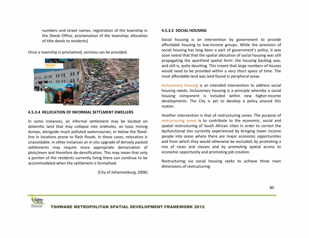
4.5.3.4 RELOCATION OF INFORMAL SETTLMENT DWELLERS
In some instances, an informal settlement may be located on dolomitic land that may collapse into sinkholes, on toxic mining dumps, alongside much polluted watercourses, or below the flood-line in locations prone to flash floods. In these cases, relocation is unavoidable. In other instances an in situ upgrade of densely packed settlements may require more appropriate demarcation of plots/even and therefore de-densification. This may mean that only a portion of the residents currently living there can continue to be accommodated when the settlement is formalised.
(City of Johannesburg, 2006)
4.5.3.5 SOCIAL HOUSING
Social housing is an intervention by government to provide affordable housing to low-income groups. While the provision of social housing has long been a part of government’s policy, it was soon noted that that the spatial allocation of social housing was still propagating the apartheid spatial form: the housing backlog was, and still is, quite daunting. This meant that large numbers of houses would need to be provided within a very short space of time. The most affordable land was land found in peripheral areas.
Inclusionary housing is an intended intervention to address social housing needs. Inclusionary housing is a principle whereby a social housing component is included within new higher-income developments. The City is yet to develop a policy around this matter.
Another intervention is that of restructuring zones. The purpose of restructuring zones is to contribute to the economic, social and spatial restructuring of South African cities in order to correct the dysfunctional ties currently experienced by bringing lower income people into areas where there are major economic opportunities and from which they would otherwise be excluded; by promoting a mix of races and classes and by promoting spatial access to economic opportunity and promoting job creation.
Restructuring via social housing seeks to achieve three main dimensions of restructuring:

81
TSHWANE METROPOLITAN SPATIAL DEVELOPMENT FRAMEWORK 2012
Spatial restructuring by bringing lower income people into areas where there are major economic opportunities (both with respect to jobs and consumption) and from which they would otherwise be excluded because of the dynamics of the land market on the one hand and the effects of land use planning instruments such as minimum erf sizes. What needs to emphasised here is the primary meaning of spatial restructuring as it is used in social housing policy. Indirectly social housing as understood here contributes to spatial restructuring by increasing densities and compacting growth, thereby ensuring that the poor are not pushed out to marginal locations at the edge of the city.
Social restructuring by promoting a mix of different racial groups.
Economic restructuring by promoting spatial access to economic opportunity and promoting job creation via the
multiplier effect associated with building medium density housing stock .Thus, all CoT restructuring zones were identified within a 20km radius of the inner city, which has been identified as area of most work opportunity.
It should be stressed that the primary dimension and meaning of restructuring, in this context is economic opportunity and access. The CoT has identified 8 provisional restructuring zones, the details of which are available in Annexure 1. It is important to note that these zones were identified prior to the merger with Metsweding. Future social housing should be primarily located close to work opportunities (possible and feasible) identified as metropolitan cores in terms of the MSDF and defined in chapter 5 of the document.
In 2011, the CoT Department of Sustainable Human Settlements completed an audit of the zones in order to determine land ownership, feasibility for residential development and alternative strategic intentions of available land by the CoT. This audit complemented a number of other studies into the various parcels of land with potential for residential development.
The results identified 4099 hectares of strategically located vacant land that could be considered for future residential densification and infill purposes within a 20km radius of the inner city. All of this will be subject to detailed precinct planning and technical investigations.

82
TSHWANE METROPOLITAN SPATIAL DEVELOPMENT FRAMEWORK 2012
OUTCOME OF VACANT LAND AUDIT FOR RESIDENTIAL USE AND PROPOSED HOUSING TYPOLOGIES
(Source: CoT Sustainable Human Settlements Department, 2011)

83
TSHWANE METROPOLITAN SPATIAL DEVELOPMENT FRAMEWORK 2012
4.5.3.6 SPATIAL GUIDING PRINCIPLES FOR SUSTAINABLE HUMAN SETTLMENTS
With regards to the housing component of sustainable human settlements, the following spatial guidelines should be applied:
INFORMAL SETTLEMENT UPGRADES AND RELOCATION
Existing informal settlements that fall outside of the urban edge should not be provided with in-situ upgrading. They should rather be relocated
Informal settlements should only be relocated to areas that geotechnically sound and do not fall within a flood line
Compaction, infill and densification should serve as key guiding principles for both in-situ upgrading and relocations
Informal settlement management plans should incorporate landscape planning
SOCIAL HOUSING
Housing should provide a range of typologies within strategic nodes in order to address both social and economic restructuring
Housing typologies should allow for diversity and significant densification in order to address the green economy of spatial planning
Brownfield development is preferable to greenfield development in order to achieve infill development, compaction and rejuvenation of decaying areas (where applicable

84
TSHWANE METROPOLITAN SPATIAL DEVELOPMENT FRAMEWORK 2012
Housing location should be targeted towards significant places of work opportunity, i.e. metropolitan nodes and primarily and urban cores
Housing developments should include the provision of or be located next to safe and efficient linkages with space for pedestrians and cyclists
Housing location should be well planned to ensure connectivity via public transport to other places of significance in the metropolitan area
Urban design, landscaping and streetscaping should be incorporated in housing schemes (see section 4.5.8)
Social housing should be an effective component of sustainable human settlements i.e. providing or being located close to social amenities and facilities
Mixed-use residential buildings should be implemented where possible, allowing for an optimal use of all available resources, supporting transit-oriented development and providing a sustainable living environment (see chapter 5- Movement and Connectivity for more information on transit oriented development). Transit-oriented development supports the concept of the 20 Minute Neighbourhood.
Transit-oriented development: Mixed-use, high density residential building within a node and close to public transport

87
TSHWANE METROPOLITAN SPATIAL DEVELOPMENT FRAMEWORK 2012
4.5.4 RETAIL DEVELOPMENT
Retail is one of the most dynamic urban land uses/activities of our
cities, towns and rural areas. The Retail Sector is a significant
catalyst for urban development in Tshwane. Shopping centres have
influenced and changed the spatial direction in many areas e.g.
Menlyn Park Shopping Centre, Centurion Mall and the Kolonade
Shopping Centre in Montana, Hatfield Plaza in Hatfield and Brooklyn
Mall in Brooklyn. The development of these shopping centres
initiated substantial redevelopment and new development within
the vicinity of their trade areas.
In fact, while the economic activity of all of the metropolitan nodes
of the city may initially have been anchored by retail developments
(with the exception of Hatfield which was additionally anchored by
the University of Pretoria), over time the nodes have progressed to
encompass additional diverse economic activity to the extent that
the metropolitan nodes can serve all or most required needs (work
opportunity, shopping, education, medical, residential,
entertainment) of residents within or near that node.
The City of Tshwane accepts that demand for retail space is mainly driven by consumer characteristics and profiles, population numbers and growth and the level of disposable income per sub-area, while the success of the retail sector is very much a function of economic conditions on the macro and micro level, changes in shopping
behavior, new retail formats, changes in the rest of the urban environment as well as shopper preferences. Lifestyles play an important role in what goods and services consumers purchase.
As with all development in the city, retail development should comply with the requirements of sustainable, efficient, equitable, convenient and attractive environments. In the case of metropolitan nodes and urban cores, all developments should, as far as possible within the specific context, additionally respond to public transport-oriented development, within the ambit of sustainable and efficient development.
The City will evaluate retail applications in line with the objectives of the Long Term Strategy of the CoT, Metropolitan Spatial Development Framework and the Tshwane Retail Strategy, most recently approved in 2007.
These should be contextualised and interpreted on local level, and are reflected in the Regional Spatial Development Frameworks for this purpose. The following provides a brief summary of each of the spatial strategies:
Renewal Strategy: In many instances retail facilities have become outdated, the increase in passing traffic has created a problem and in many instances parking facilities are inadequate. The revitalisation, upgrade and improvement of these areas should be encouraged. Once a particular

88
TSHWANE METROPOLITAN SPATIAL DEVELOPMENT FRAMEWORK 2012
location or structure is no longer viable for retail purposes it is recommended that the structure be demolished and converted for other uses. This strategy will be driven by the decrease in return on investment in a particular area, large vacancies and the reluctance of retailers to move into a particular area. Urban decay, poor locations and unsafe areas will be the main problems to deal with. This should also form part of a broader revitalisation strategy for areas experiencing urban decay. A renewal or upgrade strategy should also be followed by shopping centre owners. In most cases shopping centres are in need of a minor upgrade/major maintenance overhaul at intervals of 5 to 7 years.
Maintenance strategy: In certain cases shopping centres have become outdated and routine maintenance no longer effective and the upgrading or the redevelopment of the centre imperative. A maintenance strategy will mainly be applicable in already built up areas.
Expansion strategy: The change and growth in consumer demand in a particular area as well as new retail offerings will ‘force’ landlords to expand their existing retail facilities or to include new retail types. This is especially applicable in the case of regional and super regional centres, but can also be relevant for existing business clusters. Most regional centres continuously expand to make provision for internal growth and to accommodate new retail concepts or
trends. Cognisance should be taken of this particular need. This growth will mainly be driven by the already proven success of a particular centre, its location and the needs of the market.
Infill strategy: In this instance reference is made to infill in already built up residential areas where retail has been lacking or undersupplied. This type of development will then capitalise on an existing market and will prevent major outflows from a particular area to other shopping destinations. It is important to note that once the area is sufficiently serviced, the Infill Strategy must be replaced by the Maintenance and Expansion Strategies, and where new growth occurs, the Follow-the-roofs strategy.
'Follow-the roofs'/ new growth areas strategy: This strategy focuses on new growth areas and the provision of retail facilities once a certain threshold level of houses and disposable income is reached. In the case of a ‘follow the roofs’ strategy, timing is of critical importance. Should a centre be built too soon the retail performance will be low and casualties, especially amongst the smaller tenants, will be high. Further growth in an area should also be such that the trade area of the proposed centre will fill up sooner rather than later. This strategy will not support leapfrog development nor motivation for development on the back of speculation, and the concept of infill development is critical.

89
TSHWANE METROPOLITAN SPATIAL DEVELOPMENT FRAMEWORK 2012
Nodal strategy: Nodal or urban core strategy is applicable where larger retail facilities will create agglomeration advantages for complementary retail facilities. Urban and Metropolitan cores are those nodes or urban centres that fulfil a city wide function. These nodes are not stagnant and will expand over time. It is important that these agglomeration nodal developments take place in close proximity of small to super regional centres. Different types of retail facilities are on offer and not all can be accommodated in a traditional shopping centre. The best locational advantages of these complementary retail facilities are in close proximity to the existing regional centres. Other types of retail nodes where agglomeration benefits could be created could also be established. The agglomeration effect is created by the catalytic nature of regional centres. The node will grow to include a variety of facilities and to reach a stage where the required tenant mix reaches the necessary critical mass.
Modal interchange strategy: This type of facility depends mainly on the nature of the commuters, the area as well as the different transport modes used. Land uses in these areas should be focussed on transport orientated developments, with retail focussing on convenience for the relevant commuter target market.
4.5.4.1 RETAIL CATEGORIES
Within the Tshwane context, retail developments can be
categorized as follows:
Spaza Shop
Filling Station Stores
Neighbourhood Centre
Regional Centre
Super Regional Centre
Wholesale Retail
Spaza Shops This is an informal retail facility that first developed in the
townships as a result of the lack of formal retail facilities in the
area. Such stores are now also opening in the suburbs. This
phenomenon mainly occurs in the low and middle-low socio-
economic areas. The premises consist mainly of a converted
garage, a room in the house or small separate structure on the
erf. The reasons for existence of this type of facility are mainly
two fold namely: the lack of convenient grocery shopping
facilities in the area or economic conditions where a household
decides to open a small store to earn an income. In terms of
the Tshwane Town Planning Scheme of 2008, a spaza shop is a

90
TSHWANE METROPOLITAN SPATIAL DEVELOPMENT FRAMEWORK 2012
primary land use right known as a home enterprise for some
residential properties. The zoning certificate of the property
(which can be obtained from the Municipality) will indicate
whether this is a primary right or a land use requiring consent
from the Municpality.
Filling Station Stores This retail facility located at filling stations and consists of a small store offering a variety of mainly daily purchased consumer goods (e.g. cool drinks, sweets, bread, milk and cigarettes, representing ±80% of all purchases). The distinguishing factor here is that the store is operated by filling station personnel only and the store is mostly operated on a 24-hour basis. The main distinguishing factor here is so-called “express convenience”. Many of these stores nowadays offer take-away products, bakery facilities and lately small Woolworths Food stores. Ready-made food is a key aspect of express convenience. These stores also offer parking and a 24-hour secure environment. Filling station stores, as with filling stations, can be found in all nodal typologies and outside of nodes.
Neighbourhood Centre
The main function still remains express convenience complemented with other convenience products. The success
of these centres is mainly determined by the strength and attraction of the anchor tenant, availability of parking, a good, accessible and safe location, and the rest of the tenant mix to supplement the rest of the centre. This is the retail facility aimed at the suburban level with a larger impact than the local convenience centre. Such a facility could also be housed in a single building or a number of buildings located in close proximity to each other to provide a single destination. The size of these centres is normally between ±4 000m² and ±12 000m².Neighbourhood centres can be found in all nodal typologies. Within metropolitan nodes and urban cores, these centres should be clustered in single multi-functional buildings in order to support the principles of transit-oriented development.
Regional Centre
The role and function of these centres are to satisfy the needs of a large primary and secondary catchment area. The support from the tertiary trade area normally varies between 10% and 15%. These centres are also supported by a strong working component in the immediate vicinity of these centres mainly because of first and second order nodes created by the development of these centres (agglomeration benefits). These centres also offer a wider entertainment component to attract people especially at night.

91
TSHWANE METROPOLITAN SPATIAL DEVELOPMENT FRAMEWORK 2012
This is a very large retail facility offering a very wide variety of stores, appealing shopping atmosphere, sufficient parking facilities and a significant entertainment component. The size of these centres is normally between ±50 000m² and ±100 000m². Regional centres should be located in metropolitan and urban cores.
Super Regional Centre
A few super regional centres have developed over the last couple of years in all our major metropolitan areas. The role and function of these centres is to provide retail facilities city-wide for the region as well as a national and international market. The city-wide support is very important in this case. These centres offer a very wide tenant mix, entertainment, services and the latest retail concepts. This is a very large retail facility offering the widest possible variety of stores, appealing shopping atmosphere, open and under cover parking facilities and a large entertainment component. The size of these centres is normally over ±100 000m². Menlyn Shopping Centre is one such centre. Super regional centres should be located in metropolitan nodes and urban cores.
Wholesale Retail
These facilities should supplement other retail offerings in a particular node or sub-node. These centres should not duplicate and compete with adjacent/nearly regional and super regional centres. The aim must be to complement facilities in a regional centre. The emphasis is on good products at affordable prices. Most of these centres also offer a strong food/grocery component. The function therefore is destination as well as convenience driven. The value centres are mostly occupied by traders requiring large space and are destination orientated. An example is Makro. The size of a value centre ranges from ±10 000m² to ±50 000m².
The following will form part of the evaluation criteria for retail
applications:
Whether the category of the proposed development is appropriate for the location
Whether the proposed retail development is in line with the applicable Regional Spatial Development Framework
Whether the proposed development contributes towards the objectives of transit-oriented development
Whether accessibility to the proposed development is catered for by public transport

92
TSHWANE METROPOLITAN SPATIAL DEVELOPMENT FRAMEWORK 2012
Whether the proposed development makes provision for public transport (e.g. drop- off bays, parking for public transport, safe access of public transport users from transportation to shopping centre);
Whether the proposed development caters for informal trade in an integrated and formal manner
How the proposed development adds value to the aesthetic quality of the built environment
How the proposed development affects the natural environment
4.5.4.2 RETAIL IN URBAN CORES
It is important to look at retail development within urban cores relative to other parts of the city in context. The retail developments in urban cores are not developed to the same level as in other parts of the city due to the inequitable development policies of the past. Nonetheless, retail activity does serve as an economic activity within urban cores, albeit not to the same extent as in the metropolitan cores which have a long history of favourable development policies.
Within the current context of the city’s development policies where equal opportunity is promoted, it is also important to note that retail development, as with many other economic activities, is largely a function of the private sector. The private sector is market-driven, which means that it responds to demand and consumer
characteristics. At the same time, the consumer will seek out very specific retail typologies depending on their specific characteristics as a consumer. This supply-demand relationship between developer and consumer will remain a permanent state of affairs. At present, the extent of retail development has largely catered for consumer groups mostly found within urban cores. Previously, due to a lack of private transport and expensive public transport, low-income earners were compelled to source their needs from small localised township retailers. Lower priced goods available at township shopping centres or establishments offered not only the variety of goods available, but also allowed goods and services at more affordable prices.
But the population profiles throughout the city are changing as it becomes more integrated spatially, socially and economically. These new population dynamics require that access is given to the upwardly mobile of the former township areas so that spending within the retail arena or urban cores can be directed inward to contribute towards further developing the urban cores. Those that move up the social and income ladder that previously preferred to shop outside townships in upmarket malls (known as ‘outshopping’) may to a large extent start redirecting their expenditure to township malls if upmarket retail developments are increasingly brought into the urban cores. The importance of increased, high quality retail development within urban cores is thus two-fold:
Equitable access to retail opportunities

93
TSHWANE METROPOLITAN SPATIAL DEVELOPMENT FRAMEWORK 2012
Economic stimulation by redirecting spending that might otherwise leave the urban core back towards the core to increase development
While retail development is driven by the private sector, the city has a role towards facilitating the ease with which developers invest in the urban cores. This especially relates to service infrastructure and supporting development policies. Through the NDPG programme public initiatives will support private funding within urban core areas.
4.5.5 RURAL MANAGEMENT
The NDP 2030 highlights the importance of rural areas, reminding
us that despite population shifts from rural to urban areas, the
health and wellbeing of the entire population still depends on rural
goods and services- food, water, minerals, energy, biodiversity,
natural and cultural experiences, labour and land- and this will
become increasingly clear in the next few decades, as resources
become more constrained.
The NDP recognizes that rural areas are usually divided into
different types of villages, towns and informal settlements in
commercial farming areas and former homelands. This calls for
differentiated interventions that are sensitive to the context of each
individual rural area, and avoiding the one-size-fits-all approach.
The NDP further indicates that infrastructure unlocks the
development potential of rural areas. Appropriate levels, form and
location are important, given that infrastructure investment is less
cost effective in lower density areas with small economies. The
question is not whether infrastructure should be provided, but what
levels and forms of infrastructure should be provided, where it
should be located and how it should be funded.
The CRDP is premised on a proactive participatory community-
based planning approach towards rural management. The
programme aims at being an effective response against poverty and
improving food security by maximizing the use and management of
natural resources to create vibrant, equitable and sustainable rural
communities, by contributing to the redistribution of 30% of the
country’s agricultural land, improving food security of the rural
poor, creating of business opportunities, decongesting and
rehabilitating of over-crowded former homeland areas, and
expanding opportunities for women, youth, people with disabilities
and older people who stay in rural areas.

94
TSHWANE METROPOLITAN SPATIAL DEVELOPMENT FRAMEWORK 2012
4.5.5.1 TSHWANE CONTEXT
The urban edge delineates urban areas. This includes pockets within
the Bronkhorstspruit, Cullinan, Rayton and Ekandustria/ Ekangala,
areas.
In addition to urban areas, one also finds:
o Future urban areas: Areas that have been identified
as suitable for urban development in the short to
medium future. These areas are identified based on
need (development pressure, logic of an area to
expand and being, in line with growth management
principles of compaction, densification and infill).
Availability of services / infrastructure,
environmental sensitivities and geological
constraints must be taken into consideration.
Certain rural areas may fall into this category.
o Management Areas: Areas that are neither
demarcated as ‘urban’ nor identified for ‘future
urban development’; often characterised by
cultivation and very low densities (rural character),
or with environmental sensitivities forming part of
larger ecological biospheres. Minimum engineering
services and infrastructure for the applicable
densities and land uses must be available. Urban
development will not be permitted in these areas.
Certain rural areas fall within this category.
There are examples of developments that were approved and
developed inconsistent with the Urban Edge. Going forward, these
developments and areas need to be evaluated against the backdrop
of sound town planning principles and the smart growth concept.

95
TSHWANE METROPOLITAN SPATIAL DEVELOPMENT FRAMEWORK 2012
Areas identified as Future Urban Development zones in terms of
former planning for the Metsweding area, but not in line with
growth management principles (in turn there is no indication of the
possibility of infrastructure being provided for in the short to
medium term), will remain as Future Urban Development areas but
retain a rural character until such time that basic services can be
provided. These areas still need to be managed as rural areas with
specific guidelines contained in the different RSDF’s.
As soon as the areas earmarked and these specific areas have been
serviced, they will be excluded from the Rural Component and will
form part of the urban fabric of the city.
As a result of the merger between Metsweding District Municipality
and the former City of Tshwane, the City now has a significant rural
component. The rural areas should be developed:
To enable people living in the region’s villages to have
better access to a comprehensive range of services
To provide an alternative living environment to the region’s
people who either lack access to arable land, or who are
largely dependent on migrant remittances or both.
To promote the development of the province’s economic
potential in rural areas
To reduce the imbalances in the provision of infrastructure
and services between districts and localities within the
province.
To Create options for social mobility if desired
The chief principle is to increase accessibility of rural people to basic
services in support of survival strategies in the first instance and, in
the second, to establish a base from which to start engaging more in
productive activities. Given limited resources, policy should provide
for basics for survival to all existing settlements, but no provision for
additional settlement growth. Localities with some economic
potential should receive higher levels and a wider range of
services/facilities.
4.5.5.2 AGRICULTURE IN RURAL AREAS
The GSDF identifies Agricultural Hubs within regions 2, 5and 7, all
with varying degrees of agricultural potential. A further agricultural
hub is These regions incorporate the largest part of the rural areas
of Tshwane.
Agricultural land use encompasses purposes normally associated or
reasonably required in connection with agricultural purposes and
agri-villages. Dwelling units must be related to the agricultural use
of the property. “Community Agricultural Centres” are “Agricultural

96
TSHWANE METROPOLITAN SPATIAL DEVELOPMENT FRAMEWORK 2012
Project Areas” that have been planned to include a range of
agricultural activities, including agricultural product beneficiation.
Land specifically identified as high potential farmland for productive
and sustainable commercial agriculture (i.e. the cultivation of crops,
rearing of livestock, extensive game farming, as well as processing
of agricultural products should be protected from development and
suburban encroachment. These areas are highly suitable for
agricultural use and must not be seen as mere vacant land waiting
for development. The availability of water is however an important
factor for the viability of this activity. Because of the above, the
subdivision of high potential farmland should not be readily
permitted, except in special circumstances. It is possible that
smaller farm portions could also be viable for intensive agricultural
purposes, and if subdivision is necessary to facilitate this, it should
be supported.
In these cases the subdivision applications must be clearly linked to
business plans to support such intensive farming enterprises.
Activities and structures within these areas shall be restricted to
o extensive/intensive commercial agriculture
o farm stalls and home industries
o accommodation for farmers and farm workers;
and
o hospitality facilities secondary to the farming
activity.
Agriculture is a function of both food security and economic growth.
Agriculture, if implemented sustainably, is an important tool in
ensuring food security. Food security exists when all people, at all
times, have physical, social and economic access to sufficient, safe
and nutritious food which meets their dietary needs and food
preferences for an active healthy life” (CoT Integrated Food Security
Policy).
In 2008, the City of Tshwane finalized the “Integrated Food Security
Policy”. This was approved in 2009. The Policy documents the threat
of increasing poverty across an ever growing Tshwane population
and the challenge of ensuring food availability under these
circumstances. The policy indicates that the problems associated
with food insecurity specific to the CoT can be attributed to the
following determinants:
Food availability
Food accessibility
Inadequate safety nets
Food safety and nutrition

97
TSHWANE METROPOLITAN SPATIAL DEVELOPMENT FRAMEWORK 2012
Weak information management system
Strategies to overcome these challenges include the following:
Promoting food production and trade (urban and peri-urban
agriculture)
Promoting income generation and job creation
Building adequate safety nets including basic services, food
bank, etc
Promoting food safety and nutrition
In 2009, a draft discussion paper: “An Integrated Agricultural
Development Support Strategy” has been developed. The purpose
of the document is to trigger strategic thinking among stakeholders
and champions of the City. The strategy and its implementation
focus on the following:
Food security and poverty eradication
Empowerment of the farmer and increased incomes
Promotion of agro-diversification including value addition
and trade
Sustainable Partnerships
Sustainable agriculture
In 2009, the former Metsweding Municipality developed the
“Agricultural Development Strategy and Implementation Plan”. The
plan illustrates that the area is well endowed in natural resources,
with a good climatic regime for agricultural production. The
implication is that a wide range of crops can be grown in the area,
but the problem is that there is a limited amount of high potential
agricultural land available. Parts of regions 6 and 7 have a high
potential for crop enterprises and livestock enterprises due to the
large extent of arable land in the area. Region 5 is characterized by
a savannah biome and has significant game farming in the area. This
makes beef production less attractive and more risky due to the
potential risk of disease transfer between livestock and game.
However, there is better potential for goat rearing or mixed farming
in the area. (Source: Metsweding Agricultural development Strategy
and Implementation Plan, 2009).
An important aspect of this agricultural strategy is to begin to
understand that agriculture is not an activity that exclusively occurs
in peri-urban, peripheral or rural areas. In view of the fact that the
most rapidly growth populations of the world are concentrated in
urban areas, the concept of ‘urban agriculture’ is highly appropriate

98
TSHWANE METROPOLITAN SPATIAL DEVELOPMENT FRAMEWORK 2012
and necessary. Urban agriculture can be defined as the growing of
plants and the raising of animals for food and other uses within and
around cities and towns. It also includes related activities such as
the production and delivery of inputs, and the processing and
marketing of products.
Looking forward, an integrated Agricultural Strategy, incorporating
all new regions of the CoT will need to be developed.

99
TSHWANE METROPOLITAN SPATIAL DEVELOPMENT FRAMEWORK 2012
DIAGRAM 10: Potential Agricultural Hubs as identified in the GSDF

100
TSHWANE METROPOLITAN SPATIAL DEVELOPMENT FRAMEWORK 2012
4.5.6 THE URBAN EDGE
The urban edge, as indicated in the GSDF is a theoretical line that is drawn
around a space and delineates the boundary within which a certain intensity
of urban development can take place. The purpose of the urban edge is to
support growth management principles which require densification,
intensification and infill in order to be successfully implemented.
The urban edge contributes towards the achievement of the strategic
objectives by conserving valuable environmental areas, which would
otherwise be compromised by urban growth, and promoting the use of
existing infrastructure through urban renewal, infill development and
densification within the edge, thus achieving development that is
sustainable.
The spatial concentration of communities through densification will allow for
a more efficient use of social facilities and infrastructure.
The urban edge thus informs the municipal budget preparation for the
allocation of projects.
The concept of the ‘urban void’, as defined in the GSDF, is also important to
note. The urban void comprises expansive areas (or discontinuities) within
the urban system that remain or are under-and/or undeveloped for very
specific reasons. These typically include extensive agricultural holdings and
mining areas, as well as land used for military purposes. Some areas remain

101
TSHWANE METROPOLITAN SPATIAL DEVELOPMENT FRAMEWORK 2012
undeveloped due to their potential threat to human safety and health, for
example unstable geotechnical conditions due to the formation of sink holes
and previous mining activity, and industrial activity/ production which
prohibit urban development in close proximity of the industrial activity.
Other areas may be developed over time. As the urban system grows and
expands, certain activities may be re-located and/or discontinued, creating
opportunities for new development.
4.5.6.1 BACKGROUND
The guidelines and statutory requirements for urban management growth
stem from two pieces of legislation. The Development Facilitation Act of
1995 which advocates for the development of compact towns and cities,
whilst the Municipal Systems Act of 2000 requires municipalities to compile
their Integrated Development Plans with the Spatial Development
Framework as the core component.
The Gauteng Provincial Administration drafted the first Gauteng Spatial
Development Framework in 1999 in response to national directives and local
development conditions. The exploitation of our natural resources has made
it apparent that drastic measures needed to be introduced in order to
preserve our environment for future generations. The Gauteng Spatial
Development Framework contains initiatives that strive to ensure necessary
changes and improvement to the living environment. As part of the first draft
of the framework, the Gauteng urban edge was proposed. The urban edge is
an urban management tool used to counter urban sprawl and unplanned
expansion, encourage densification and protect natural resources within the
city.
Each local municipality within the Gauteng province was requested to
delineate a municipal urban edge and incorporate it into Spatial
Development Frameworks and other planning strategic documents to
contain the outward growth of urban areas and to facilitate the restructuring
and spatial integration of urban areas. The Gauteng urban edge was
approved in 2001 following a submission to the Provincial cabinet and was
rendered as binding to all provincial departments and municipalities.
Following this, municipalities were annually given an opportunity to propose
amendments to the delineation of the Gauteng urban edge. The proposals
were then considered by the Department of Gauteng Provincial Government
and workshops are conducted with municipalities, after which
recommendations were made to the MEC for Economic Development for
approval.
In March 2007 the first stage of the review process led by the Gauteng
Department of Economic Development’s IDP unit, made a call to
municipalities to submit proposed amendments to the edge. Subsequent to
that, the Gauteng urban edge 2007/8 was approved and new calls for
proposed amendments were made. The guiding principles for the revision of
the urban edge were based on the following:

102
TSHWANE METROPOLITAN SPATIAL DEVELOPMENT FRAMEWORK 2012
Conservation of Environmental Resources – specifically
conservation areas, heritage sites, open space and sensitive
areas;
Optimum utilisation of engineering services and community
facilities. These services are not only expensive to install but
specifically expensive to operate and maintain. The high capital
and maintenance costs of development in peripheral areas thus
need to be considered carefully. Particularly the availability of
bulk services within an area should be considered.
Optimisation of public transport systems with resultant
reduction in pollution (air, noise, etc) and travel time and cost;
Prevention of urban decay. By drawing a boundary around the
existing urban area development is focused inward, resulting in
all opportunities being explored, especially the regeneration of
decaying areas.
Promotion of opportunities for redevelopment, infill
development and densification. The conservative approach to
expansion also results in opportunities for infill development
being explored. As well-located land is often more expensive and
vacant land in the urban area often has high levels constraints,
higher densities are considered as these result in a higher yield.
Creating affordable cities for residents - shorter travelling
distances (costs) and efficient use of infrastructure. The long
term cost to end-users in terms of commuting costs and
obtaining goods and services not available in peripheral areas
often outweigh the short term cost of cheap land;
Upgrading/re-use of infrastructure rather than expansion. Proper
maintenance and upgrading of existing infrastructure is more
cost-effective than expanding and thus creating more
maintenance costs;
Restructuring of the Apartheid city – growing Gauteng into a
global city region which is internally coherent and externally
competitive;
Improving economies of scale - more people/km² imply more
business opportunities and efficient use of community facilities.
Develop a sustainable urban region through promoting equitable
access to basic services, the protection of natural and cultural
resources, and an urban form that supports greater efficiencies
in land use and service provision as contemplated in the Gauteng
Spatial Development Perspective.

103
TSHWANE METROPOLITAN SPATIAL DEVELOPMENT FRAMEWORK 2012
Tshwane submitted proposed amendments in August 2008. The proposals
were approved by Province in June 2009. In October 2009 Tshwane
submitted proposals with regard to the amendment of the Provincial Urban
Edge for the period of 2009/10. The proposals were informed by a hierarchy
of plans, which includes the MSDF and RSDFs in the different areas. The new
provincial urban edge amendments were approved by Province in July 2010.
In 2011, the decision was taken that the Provincial Urban Edge would no
longer be implemented by Gauteng Provincial Government (specifically the
Department of Economic Development), but rather be managed by local
municipalities themselves, to ensure an appropriate and contextual
application of growth management.
To this end, the City of Tshwane will reflect urban edge delineations within
the RSDFs and other lower hierarchy spatial plans. The MSDF is a strategic
document that indicates a spatial vision that spans 20-30 years, whereas the
urban edge may be amended more regularly than just once during that
interval. Amendments or deviations to the urban edge will be at the
discretion of the municipality, subject to the merits of the specific application
in terms of the spatial directives discussed in this document, the spatial
directives of the applicable RSDF and the availability of service infrastructure.
4.5.7 GROWTH MANAGEMENT BOUNDARY
The Growth Management Boundary is the difference between the urban
edge and the limit (boundary) of a future urban area. Areas identified as
‘exurbia’ can often be affected by this concept. A future urban area is an area
that has been identified as suitable for urban development in the short to
medium future. These areas are identified based on need (development
pressure, logic of an area to expand and being in line with growth
management principles of compaction, densification and infill). Availability of
services / infrastructure, environmental sensitivities and geological
constraints will inform the time at and extent to which the urban edge can be
extended towards the growth management boundary.
Growth Management boundaries and future urban areas will be indicated in
Regional and Local Spatial Development Frameworks.

104
TSHWANE METROPOLITAN SPATIAL DEVELOPMENT FRAMEWORK 2012
DIAGRAM 11:
Schematic and
hypothetical
illustration of a Growth
Management Boundary

105
TSHWANE METROPOLITAN SPATIAL DEVELOPMENT FRAMEWORK 2012
4.5.8 URBAN DESIGN AND QUALITY OF ENVIRONMENT
The public realm incorporates those spaces that we spend more than half
our time in. The importance of the quality of the built environment may not
be obvious, but is still important for the overall efficiency of both the urban
and rural environment. Urban areas, though, seem to be more susceptible to
negative impacts of environmental deterioration such as urban decay.
The management of the quality of the environment is important for the
following reasons:
Environmental Impact: the quality of the built environment will have
important implications for the natural environment. Urban design
largely deals with the quality of the built environment that is vital for
preserving the natural environment.
Urban and architectural design, in particular, can both have a
significant impact on reducing the negative effects of climate change
if implemented on a large scale. This would require an entire city to
take on a formal policy that incentivises green buildings.
Competitive Edge: the image that a city presents has ripple effects
not only nationally but internationally. Physical features may
influence investor confidence. There is also a strong relationship
between technological changes in the economic production and
structural changes in the quality and production of urban spaces.
Thus, immediate associations can be made as to the level of
sophistication of a particular city based on the quality of its
environment.
When seeking a competitive edge in the global arena, one has to ask
what it is that makes a ‘successful’ city. A successful city is reliant on
the synergy among several building blocks. One of these building
blocks is physical renewal. As Nicholas Brook says: “The physical
regeneration of cities – the renewal of its buildings and infrastructure
– is almost invariably a key part of any successful urban strategy. In
many cases the renewal of a key area of the city acts as a focus for
national and international attention as well as generating civic pride
and the ‘buzz’ that the city is on the move …”, (Stafford, 2006).
The quality of the physical environment can also be an indication of
the City’s commitment to urban management, which is also an
indication of the city’s commitment to the protection of various
investments (both public and private) including service
infrastructure. Again, this is a matter that influences investor
confidence.
City Image: an important factor determining why people choose to
visit, invest in or relocate to a particular place is the "atmosphere" or
the "cultural identity". Tourists now look for the "local culture" of
places rather than a visit a particular art gallery, monument or place

106
TSHWANE METROPOLITAN SPATIAL DEVELOPMENT FRAMEWORK 2012
of natural beauty alone. Also a desirable location, good educational
facilities, a friendly, caring community, a healthy and safe
environment, good quality housing, and a competitive, stimulating
local atmosphere are essential for business development. Therefore
the "image of the local community" is becoming more significant to
attract investors and tourist to that area. It is imperative to create a
sense of pride for the residents of a city. When striking up a
conversation with a stranger seated next to you on an airplane, does
that person respond: I’m from – you fill in the name of the city – and
expect you to immediately recognize their city and to have a positive
image of, if not envy for, that community. This factor is nearly
impossible to quantify – but I think we all know it when we see it and
relish it when we have it. “I’m proud of my community and let me
tell you why!” (Stafford, 2006)
The following table encompasses a number of considerations for urban
design and a quality environment in Tshwane:

107
TSHWANE METROPOLITAN SPATIAL DEVELOPMENT FRAMEWORK 2012
URBAN CONTEXT
A comprehensive understanding and appreciation of context and the balancing of neighbourhood character and strategic planning objectives must be the starting point for any
design. This requires an understanding of a proposed development and its relationships to the surrounding public setting, neighbouring properties and any strategic issues
relating to the site
Objective 1: Ensure buildings respond creatively to their
existing context and to agreed aspirations for the future
development of the area.
Consideration 1.1: Assess the character of an area by including the
following:
Environment
Street details
Buildings and rhythm
Connection to public realm
Architectural character
Social and economic activity
Cultural identity
Consideration 1.2: Ensure a development is consistent with the
strategic location of the site.
Consideration 1.3: Consider the likely location, size and expected
impact of future development and possible uses nearby when
designing new developments.

108
TSHWANE METROPOLITAN SPATIAL DEVELOPMENT FRAMEWORK 2012
BUILDING ENVELOPES
Building envelopes –the location of buildings on their lot, their height and overall shape –can affect neighbourhood character, sunlight to adjoining buildings and open spaces,
privacy, the quality of spaces inside the building, sense of pedestrian scale and amenity in nearby streets. Higher density development means increasing the overall volume of
building envelopes
Objective 1: To ensure that the height of new
development responds to existing urban context and
neighbourhood character of the area.
Reinforce valued aspects of existing neighbourhood
character (historic and cultural fabric) unless a new
character needs to be created to achieve planning policies
for the area.

109
TSHWANE METROPOLITAN SPATIAL DEVELOPMENT FRAMEWORK 2012
Objective 2: To ensure new development
is appropriate to the scale of nearby
streets, other public spaces and buildings.
Relate building height to street width and
intended character. Urban centres are
characterised by a strong sense of enclosure
with street spaces that are generally lined by
buildings set along the front property
boundary.
Set back upper levels of tall buildings to help
create a pedestrian scale at street level and to
mitigate unwanted wind effects.
Objective 3: To respond to existing or
preferred street character
Buildings should be built up to the sidewalk to
reinforce the definition and importance of the
street , except where creating a new public
space is an integral part of the development
proposal.
Objective 4: To ensure areas can develop
with an equitable access to outlook and
Consider the possible future development of
adjoining sites and allow, as best as possible,

110
TSHWANE METROPOLITAN SPATIAL DEVELOPMENT FRAMEWORK 2012
sunlight.
an equitable spread of development potential
throughout the site.
Orientate new building to optimise sunlight and amenity for
dwellings, private open spaces and adjoining public spaces
Objective 5: To maximise informal or passive
surveillance of streets and other public open spaces
whilst also protecting the privacy of properties.
Use level changes, especially living-areas and balcony
spaces elevated above the street level, to allow views from
residential units onto adjacent public spaces while
controlling views into these units.

111
TSHWANE METROPOLITAN SPATIAL DEVELOPMENT FRAMEWORK 2012
STREETSCAPE
Because of their generally larger site sizes, built form and frontage widths, higher density residential buildings have significant part to play in the comfort and usable qualities of
the streets they edge.
Objective 1: Create walkable areas within safe and
interesting public settings.
Maintain and extend street networks to create a closely spaced
and interconnected street system in areas where higher density
buildings are proposed so as to encourage pedestrianisation
between activities
Objective 2: Closely integrate the layout and occupation
patterns of new development with the street.
Locate active ground floor uses along the street perimeter of
new development to increase the safety, use and interest of
the street.
Avoid creating blank walls, large service areas, car parking,
continuous garage doors or dense planting to ground level
street frontages of new developments.
Screen or disguise above-ground parking areas in new

112
TSHWANE METROPOLITAN SPATIAL DEVELOPMENT FRAMEWORK 2012
development from the street.
Accentuate and identify building entrances by providing good
visual and physical connections between the street and lobby
spaces.
Objective 3: Avoid creating inactive frontages as a result of
fencing private open spaces. A cooperative, rather than
defensive, design approach is encouraged when adjacent
uses are compatible
Use low height, transparent or partially open fences to create
an impression of openness and permeability. If the site is
fenced in, a palisade fence should be used for at least 75% of
the length of the site. Solid boundary walls should be placed
where it is critical to provide for privacy or private outdoor
spaces.

113
TSHWANE METROPOLITAN SPATIAL DEVELOPMENT FRAMEWORK 2012
BUILDING LAYOUT AND DESIGN
Site design and building form refer to the arrangement of buildings, space and landscape within a site. They involve the careful consideration of building scale and form,
movement patterns and external spaces. The interrelationships between these, rather than their individual characteristics will largely determine the effectiveness of the
design.
Objective 1: To provide a range of dwelling sizes and types
in higher density residential developments
Design for a mix of dwelling types, particularly in larger
residential developments (e.g. to suit single people, family
groups of varying sizes, students, the elderly, and people on
low to moderate incomes).
Objective 2: To optimise the layout of buildings in response
to occupant’s needs
Design the internal layout of higher density residential
development to suit the site and surroundings as well as the
needs of its occupants. Generally layouts should seek to
maximise desirable orientations.
Check layout of residential apartments for practicality and
flexibility. The usefulness of apartments can be reduced by
room sizes and shapes that are too small in relations to their
intended uses. These problems may significantly reduce the
flexibility of their use and detrimentally affect their long term

114
TSHWANE METROPOLITAN SPATIAL DEVELOPMENT FRAMEWORK 2012
value.
Objective 3: To promote buildings of high architectural
quality and visual interest.
Design various building elements (roofs, entrances and corners)
to suit the different ways they will be viewed by surrounding
activities.
Consider materials as an integral part of the design response.
High quality materials that withstand the effects of weathering
and wear are important to the value of the building over the long
term.

115
TSHWANE METROPOLITAN SPATIAL DEVELOPMENT FRAMEWORK 2012
Objective 4: To provide safe and convenient access between
car parking areas and pedestrian access to buildings.
Parking areas should be broken up in small parcels and spread
over the site. A break of at least 5 meters (soft landscaping or
dwelling unit intruding and overlooking the space) should be
established between two parking pockets.
Design car parks to assist orientation and way-finding within
either the parking garage or to entrances of units.

116
TSHWANE METROPOLITAN SPATIAL DEVELOPMENT FRAMEWORK 2012
OPEN SPACE AND LANDSCAPE DESIGN
New development should contribute to the creation of private and public open spaces that are accessible, attractive, safe and comfortable for their users.
Objective 1: To ensure access to adequate open
space for all residents.
Ensure private open spaces (balconies, terraces, and
courtyards) are usable and provide reasonable levels of
amenity and privacy
Clearly distinguish between private and public spaces
by accordingly designing access and landscaping.
Objective 2: To ensure common or shared spaces
are functional and attractive for their intended
users.
Consider the availability of recreational spaces and
facilities and the potential demands for them and
provide facilities that are absent or under-supplied.
Design spaces which are usable in a range of weather
conditions at various times of the year.

117
TSHWANE METROPOLITAN SPATIAL DEVELOPMENT FRAMEWORK 2012
Ensure that there is a dominant presence of natural
permeable surfaces within high density developments
to mitigate increased storm water run-off (geological
conditions permitting)
Open space should:
Be substantially fronted by active ground floors
including building entries.
Provide an outlook for as many dwellings as possible
Be designed to protect any natural features on the site
or immediately adjacent to the site.
Be accessible and useable
Orientate balconies, terraces and communal open
space to optimise access to sunlight.