Embed Size (px)
Citation preview
40 Years Listening to the Beat of the Earth
Zoltán Horváth EGS MREG Classification Task Team
&
Mining and Geological Survey of Hungary
EUROGEOSURVEYS
Activities of EurGeoSurveys on mineral resource data
harmonization
Geneva, 2nd of May 2019.
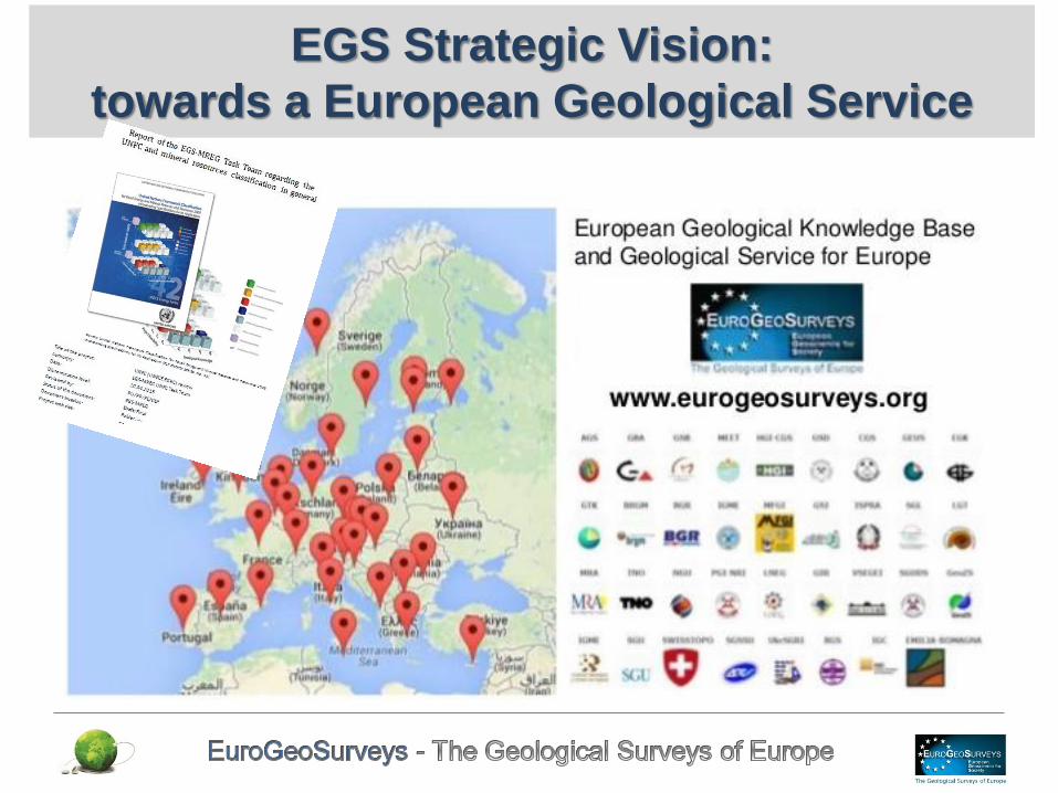
EGS Strategic Vision:
towards a European Geological Service
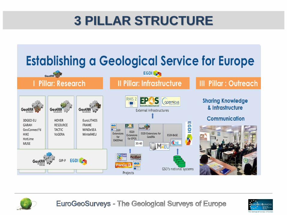
3 PILLAR STRUCTURE

European Minerals Yearbook
• The first official European Minerals Yearbook: 15th October 2015:
in Brussels, was launched in the frame of the Raw Materials
Diplomacy Dialogue.
• Innovative comprehensive source of minerals statistics
• Can facilitate the European Union decision-making on investment
planning and can be used to benefit the European economy, industrial
development and trade and the lives of European citizens.
• Alongside data for primary minerals, the European Minerals Yearbook
includes available data for mineral-based waste generation,
treatment and trade.
• It presents national level statistical data for 40 European countries.
All the data are accessible digitally through the European Minerals
Knowledge Data Platform and provide the resource potential of
primary and secondary mineral sources in Europe.
• 65 commodities from primary minerals with a focus on the 20 (later
25) critical raw materials (CRM) for the EU, covering a 10-year span
for production and trade.
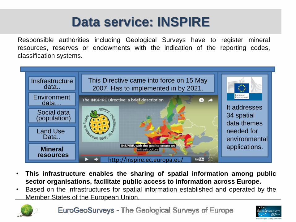
Data service: INSPIRE
Responsible authorities including Geological Surveys have to register mineral
resources, reserves or endowments with the indication of the reporting codes,
classification systems.
• This infrastructure enables the sharing of spatial information among public
sector organisations, facilitate public access to information across Europe.
• Based on the infrastructures for spatial information established and operated by the
Member States of the European Union.
It addresses
34 spatial
data themes
needed for
environmental
applications.
This Directive came into force on 15 May
2007. Has to implemented in by 2021.
Mineral resources
Land Use Data..
Social data (population)
Environmentdata…
Insfrastructure data..
http://inspire.ec.europa.eu/
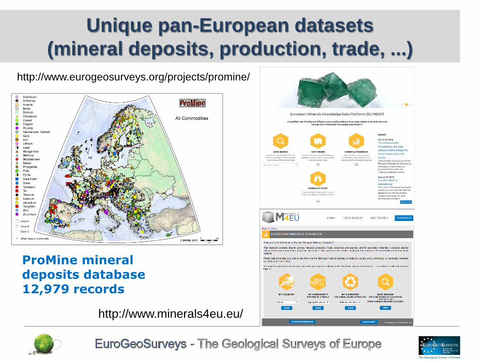
ProMine mineral deposits database 12,979 records
Unique pan-European datasets
(mineral deposits, production, trade, ...)
http://www.eurogeosurveys.org/projects/promine/
http://www.minerals4eu.eu/

Infrastructure – EGDI examples
OneGeologyEurope; Surface geology of Europe in 1:1 mil. Using distributed architecture, including ISO19115 metadata and WMS/ WFS (GeoSciML) services
Mineral deposits; Compiled and harmonised through a number of projects (ProMine, EuroGeoSources, Minerals4EU) using distributed architectures, ISO, OGC and CGI standards
EMODnet-geology; Marine substrate map. Currently in 1: 1 million, but aiming for 1: 250 000 covering all European waters
GEMAS; geochemical mapping of agricultural and grazing land soils of Europe
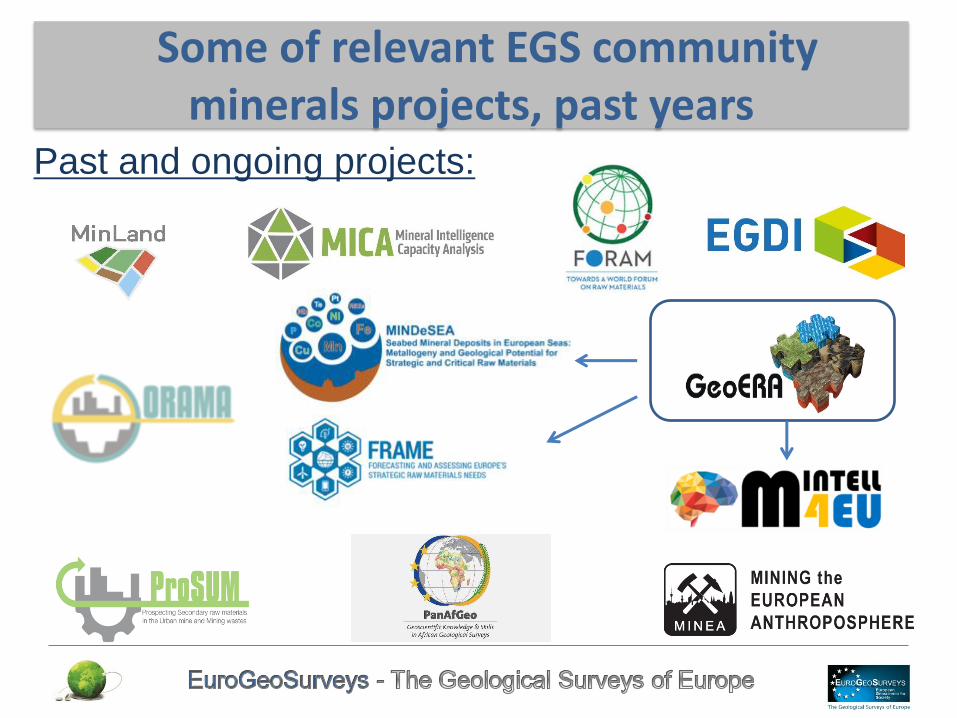
Past and ongoing projects:
Some of relevant EGS community minerals projects, past years
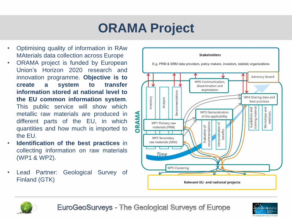
ORAMA Project
• Optimising quality of information in RAw
MAterials data collection across Europe
• ORAMA project is funded by European
Union’s Horizon 2020 research and
innovation programme. Objective is to
create a system to transfer
information stored at national level to
the EU common information system.
This public service will show which
metallic raw materials are produced in
different parts of the EU, in which
quantities and how much is imported to
the EU.
• Identification of the best practices in
collecting information on raw materials
(WP1 & WP2).
• Lead Partner: Geological Survey of
Finland (GTK)
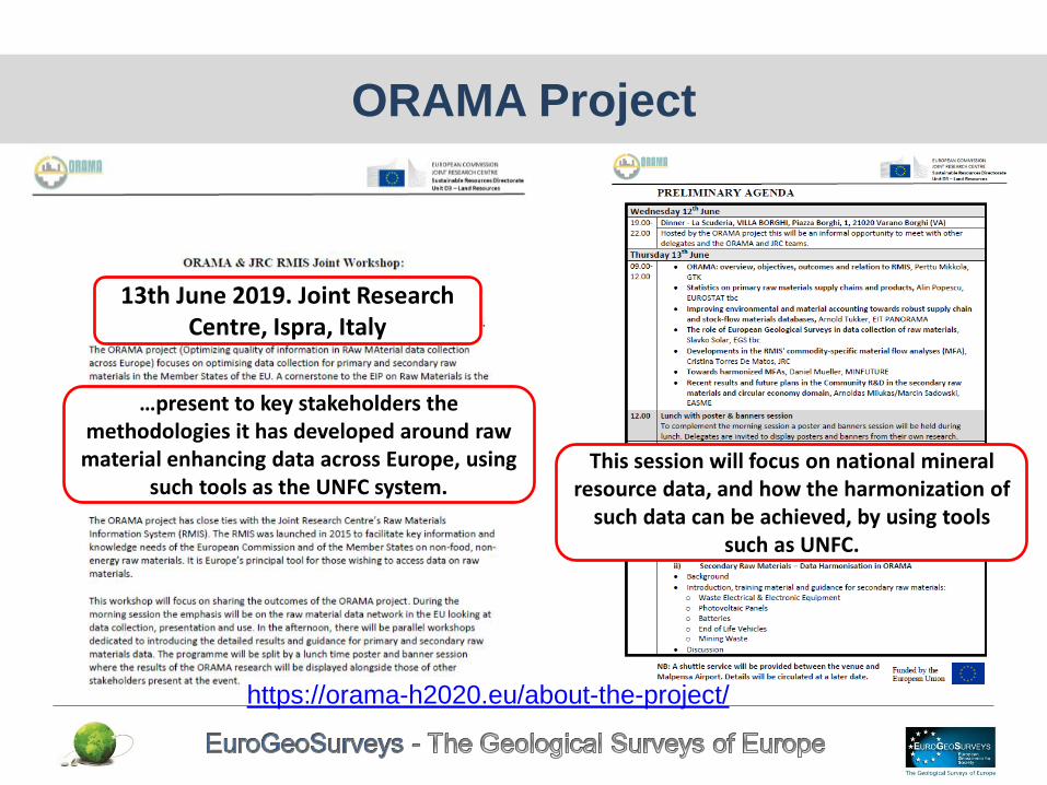
ORAMA Project
…present to key stakeholders the methodologies it has developed around raw material enhancing data across Europe, using
such tools as the UNFC system.
13th June 2019. Joint Research Centre, Ispra, Italy
This session will focus on national mineral resource data, and how the harmonization of
such data can be achieved, by using tools such as UNFC.
https://orama-h2020.eu/about-the-project/

MINTELL4EU: Mineral Intelligence for Europe Co-ordinator: Geological Survey of Denmark and Greenland
http://geoera.eu/projects/mintell4eu7/
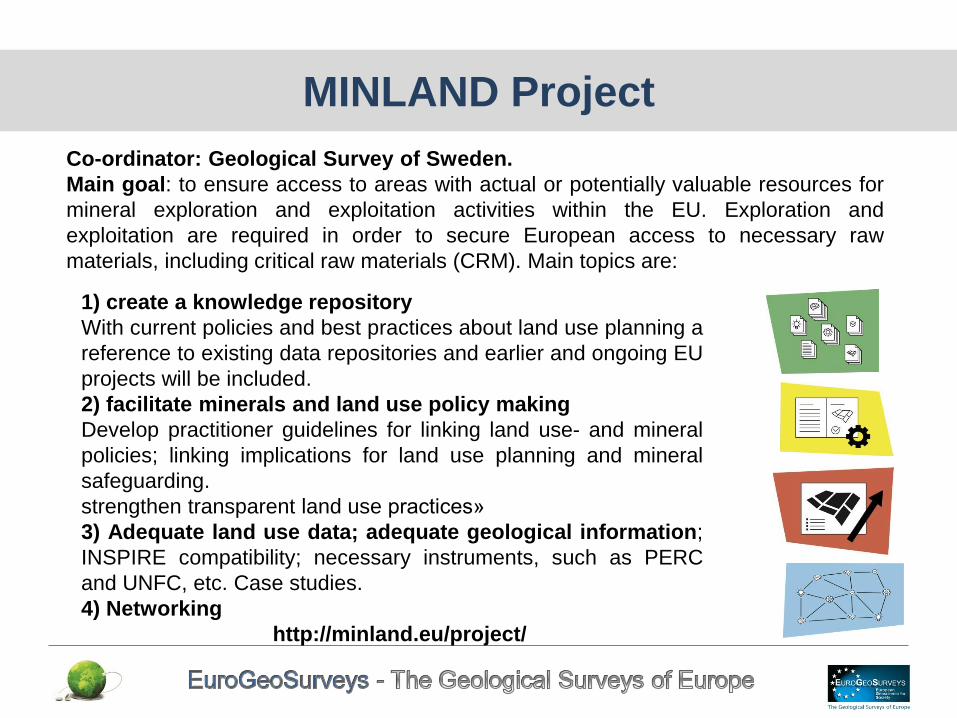
MINLAND Project
Co-ordinator: Geological Survey of Sweden.
Main goal: to ensure access to areas with actual or potentially valuable resources for
mineral exploration and exploitation activities within the EU. Exploration and
exploitation are required in order to secure European access to necessary raw
materials, including critical raw materials (CRM). Main topics are:
1) create a knowledge repository
With current policies and best practices about land use planning a
reference to existing data repositories and earlier and ongoing EU
projects will be included.
2) facilitate minerals and land use policy making
Develop practitioner guidelines for linking land use- and mineral
policies; linking implications for land use planning and mineral
safeguarding.
strengthen transparent land use practices»
3) Adequate land use data; adequate geological information;
INSPIRE compatibility; necessary instruments, such as PERC
and UNFC, etc. Case studies.
4) Networking
http://minland.eu/project/
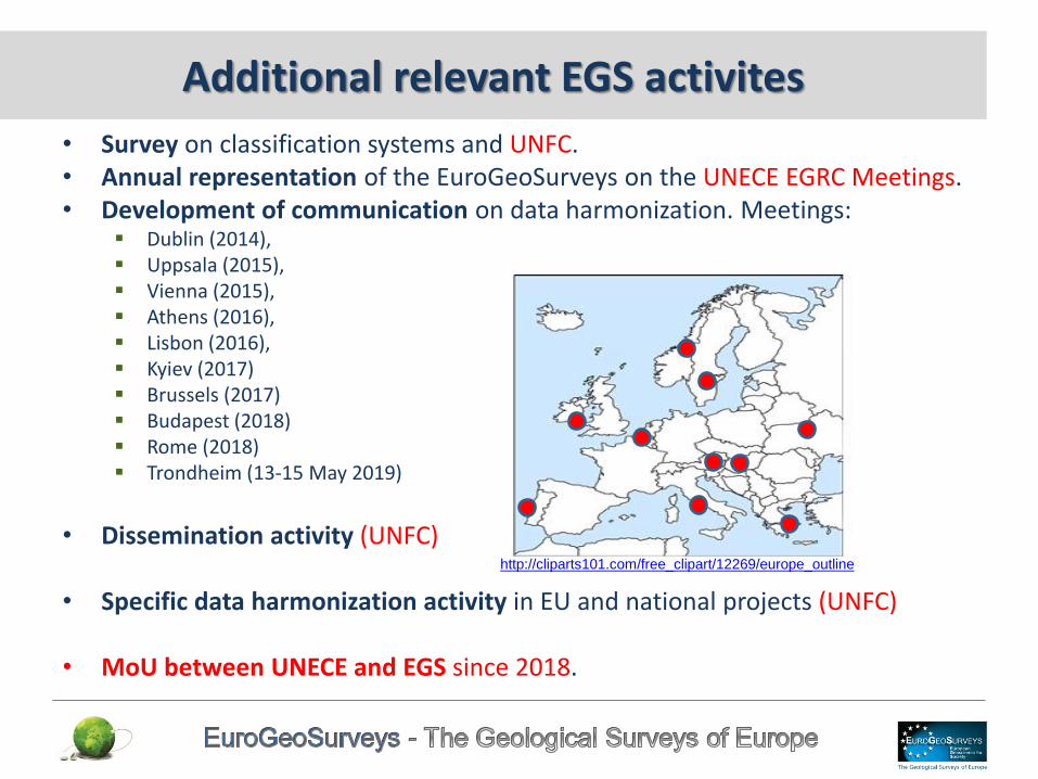
Additional relevant EGS activites
• Survey on classification systems and UNFC. • Annual representation of the EuroGeoSurveys on the UNECE EGRC Meetings. • Development of communication on data harmonization. Meetings:
Dublin (2014), Uppsala (2015), Vienna (2015), Athens (2016), Lisbon (2016), Kyiev (2017) Brussels (2017) Budapest (2018) Rome (2018) Trondheim (13-15 May 2019)
• Dissemination activity (UNFC)
• Specific data harmonization activity in EU and national projects (UNFC)
• MoU between UNECE and EGS since 2018.
http://cliparts101.com/free_clipart/12269/europe_outline

Milestone: publication about the potential application of
UNFC and international reporting codes
Bulletin of Hungarian Geological Society
• http://epa.oszk.hu/01600/01635/00452/pdf/
• Cs. Baksa, T. Fancsik, G. Katona: Preface to the special volume dealing
with the national and international practice of the mineral resource inventories.
• Z. Horváth, K. Sári, B. Fodor: Overview of the international mineral resource
classification framework and the reporting standards for solid minerals
• A. Nádor: An overview of the international classification and reporting systems for geothermal energy and the first attempts to bring Hungarian practice in line with these systems
• Zs. Kovács: Domestic practice with reference to the hydrocarbon inventory of Hungary and the uniform interpretation and correlation of classification, in line with international systems
• Z. Horváth, K. Sári: The modernisation of the Hungarian non-metallic mineral resource inventory based on the international mineral classification framework and reporting standards
• Z. Püspöki, Mrs Hámor M. Vidó, K. Sári, R. Szeiler, T. Fancsik: Facilities for, and deficiencies of the registry of Hungarian coal resources
• Gy. Falus, Á. Szamosfalvi: Overview of international systems for the registration of carbon dioxide geological storage potential
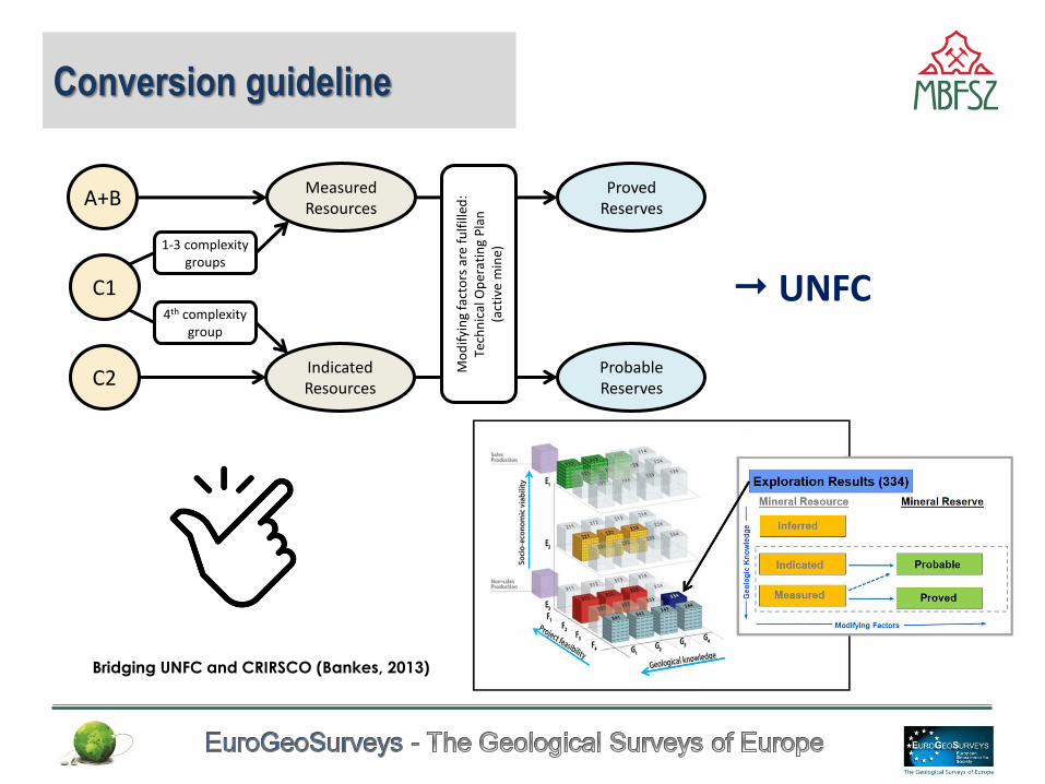
Conversion guideline
4th complexity group
C2
C1
A+B
1-3 complexity groups
Indicated Resources
Measured Resources
Probable Reserves
Proved Reserves
Mo
dif
yin
g fa
cto
rs a
re f
ulf
illed
: Te
chn
ical
Op
erat
ing
Pla
n
(act
ive
min
e)
UNFC
Bridging UNFC and CRIRSCO (Bankes, 2013)
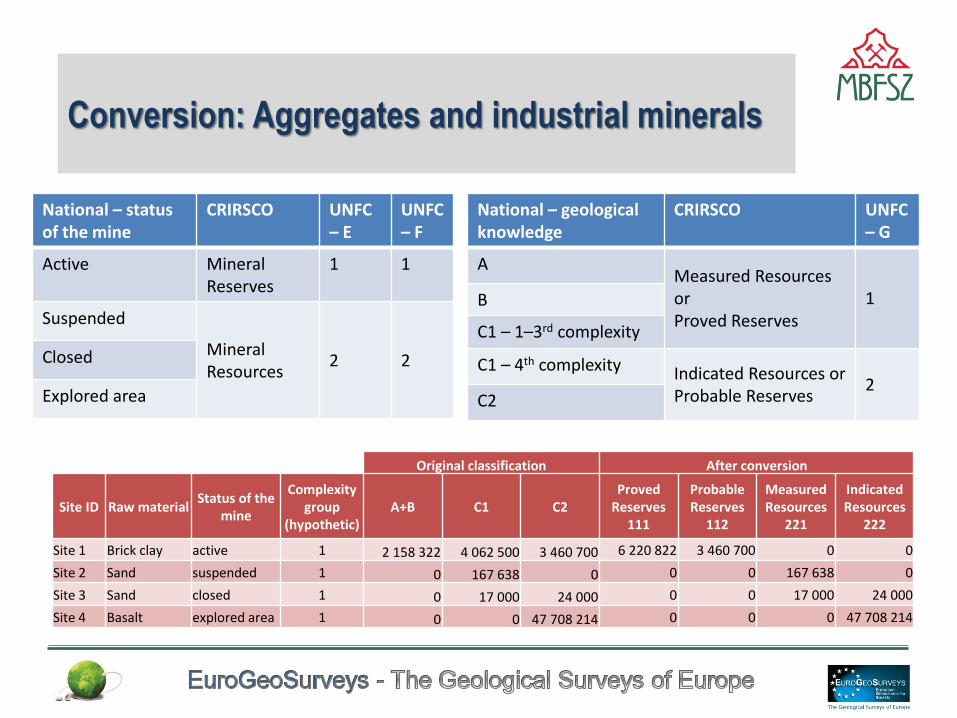
Conversion: Aggregates and industrial minerals
Original classification After conversion
Site ID Raw material Status of the
mine
Complexity group
(hypothetic) A+B C1 C2
Proved Reserves
111
Probable Reserves
112
Measured Resources
221
Indicated Resources
222
Site 1 Brick clay active 1 2 158 322 4 062 500 3 460 700 6 220 822 3 460 700 0 0
Site 2 Sand suspended 1 0 167 638 0 0 0 167 638 0
Site 3 Sand closed 1 0 17 000 24 000 0 0 17 000 24 000
Site 4 Basalt explored area 1 0 0 47 708 214 0 0 0 47 708 214
National – geological knowledge
CRIRSCO UNFC – G
A Measured Resources or Proved Reserves
1 B
C1 – 1–3rd complexity
C1 – 4th complexity Indicated Resources or Probable Reserves
2 C2
National – status of the mine
CRIRSCO UNFC – E
UNFC – F
Active Mineral Reserves
1 1
Suspended
Mineral Resources
2 2 Closed
Explored area
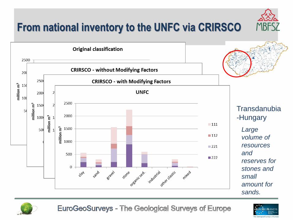
From national inventory to the UNFC via CRIRSCO
Transdanubia
-Hungary
Large
volume of
resources
and
reserves for
stones and
small
amount for
sands.
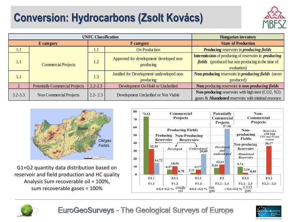
Conversion: Hydrocarbons (Zsolt Kovács)
18
G1+G2 quantity data distribution based on reservoir and field production and HC quality
Analysis Sum recoverable oil = 100%, sum recoverable gases = 100%
Hungarian inventory
State of Production
1.1 1.1 On Production Producing reservoirs in producing fields
1.1 1.2Approved for development/ developed non-
producing
Intermission of producing of reservoirs in producing
fields (produced but non producing in the time of
evaluation)
1.1 1.3Justified for Development/ undeveloped non-
producing
Non producing reservoirs in producing fields (never
produced)
2 Potentially Commercial Projects 2.2-2.3 Development On Hold or Unclarified Non producing reservoirs in non producing fields
3.2-3.3 Non Commercial Projects 2.2- 2.3 Development Unclarified or Not ViableNon producing reservoirs with high inert (CO2, N2)
gases & Abandoned reservoirs with minimal resoruce
E category F category
Commercial Projects
UNFC Classification
Basin
Oli/gas
Fields
Summary
• The European Minerals Yearbook is a powerful tool to provide proper data for minerals. Anthropogenic Resources can also be involved with additional improvements (National and EU funded projects).
• This period is favourable for development of the data existing infrastructure and to improve data quality based also on national and international projects.
• In case of proprer information on geological knowledge and potential for mineral resources the „G” categories can be identified (G1, G2, G3,G4).
• The state of the project from the plan of exploration via exploitation to the closure and reclamation may be described category „F” (F1, F2,F3, F4).
• Existence or lack of different permissions (e.g. from environmental authority and from the society: local/regional acceptance by communities, settlements with economic considerations) „E” categories can be identified (E1, E2, E3).
• Tested methodologies are viable (data transformation from national to CRIRSCO then UNFC, from national to UNFC then to CRIRSCO)
• Improvement of infrastructure and reporting system (e.g. reporting forms) including inventory and the improvement of relevant legislations (e.g. content of reports, complexity of a deposit).
• Careful assessment of available datasets on mineral resources is needed.
• On national level national experts can contribute to the data harmonization (informal datasets), however the involvement of Competent Persons / Euro-Geologists may have additional benefits.
• Preparation of national/regional level guidances and the use of UNFC /UNRM system can efficiently contribute to the sustainable resource management on different levels taking into account social, economic and environmental concept.
Summary
EuroGeoSurveys
cooperation is our strength and future
Thank you for your attention!
If you would like more information
do not hesitate to contact us
EuroGeoSurveys Secretariat
36-38, Rue Joseph II
1000 Brussels, Belgium
Tel : +32 2 888 75 53
Fax : +32 2 503 50 25
E-mail: [email protected]


![2012 Minerals Yearbook - USGS Mineral … [AdVAnce ReLeAse] U.s. GeOLOGicAL sURVeY MineRALs YeARBOOK—2012 for exploration and other mineral-related information— • Australian](https://img.pdfslide.net/doc/110x75/5b5f2ea77f8b9aa3048e941b/2012-minerals-yearbook-usgs-mineral-advance-release-us-geological-survey-minerals.jpg)