Embed Size (px)
Citation preview
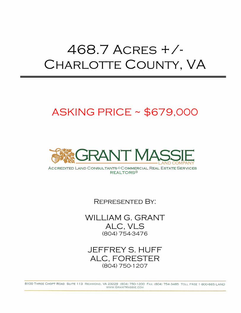
468.7 Acres +/- Charlotte County, VA
ASKING PRICE ~ $679,000
Represented By:
WILLIAM G. GRANT ALC, VLS
(804) 754-3476
JEFFREY S. HUFF ALC, FORESTER
(804) 750-1207
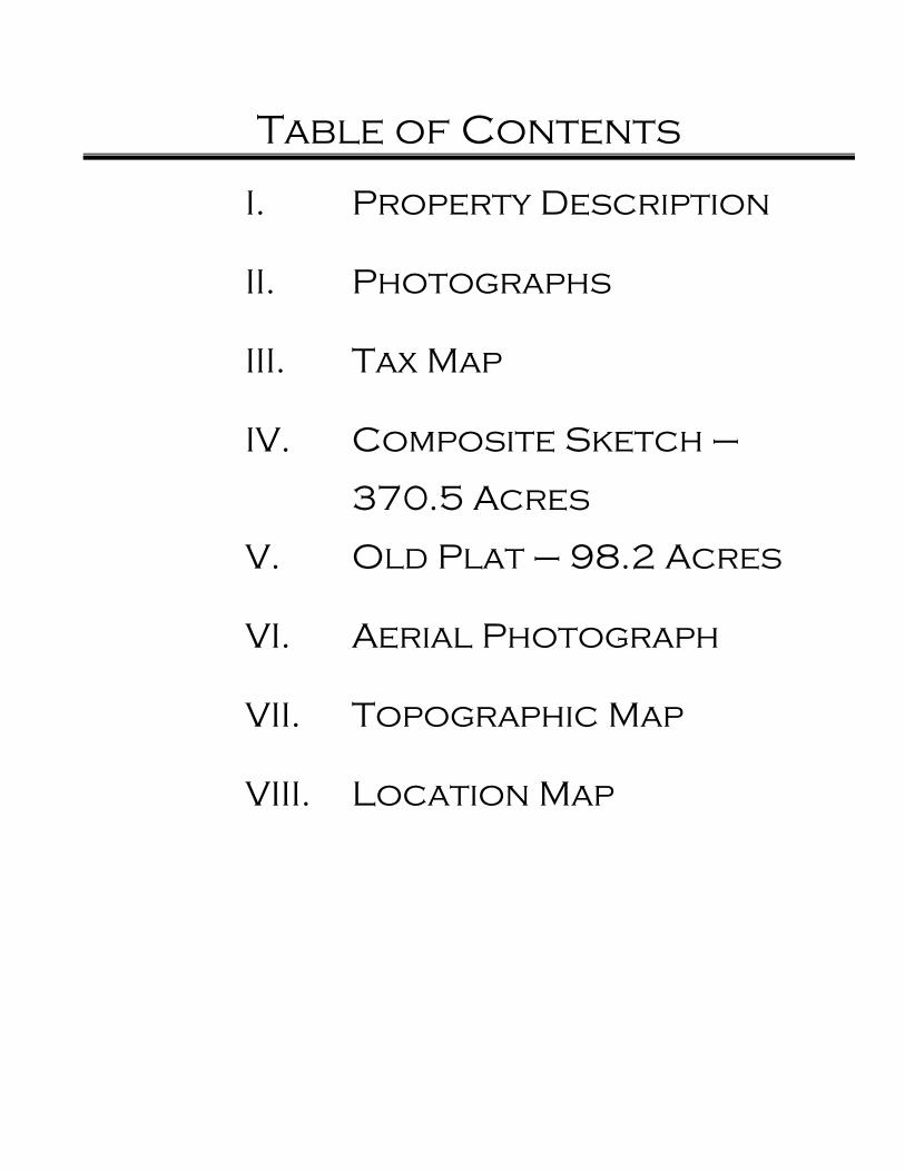
Table of Contents
I. Property Description
II. Photographs
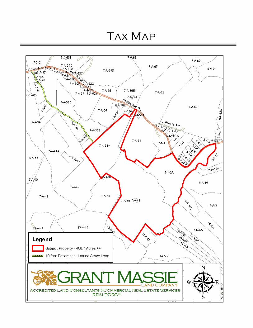
III. Tax Map
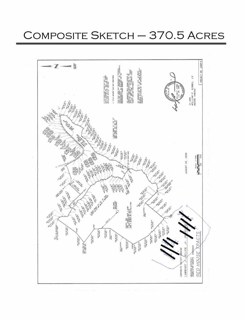
IV. Composite Sketch –
370.5 Acres
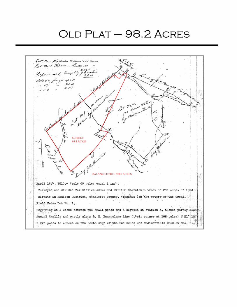
V. Old Plat – 98.2 Acres
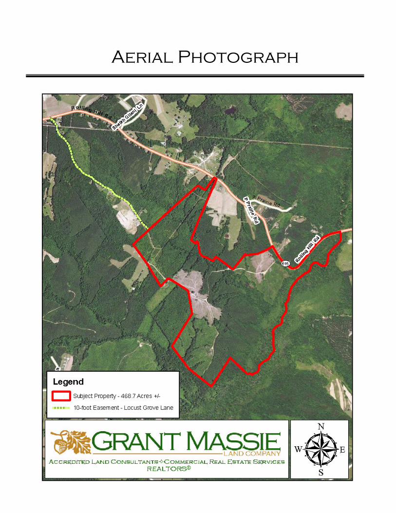
VI. Aerial Photograph
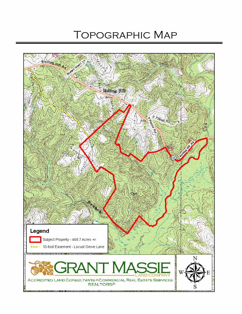
VII. Topographic Map
VIII. Location Map
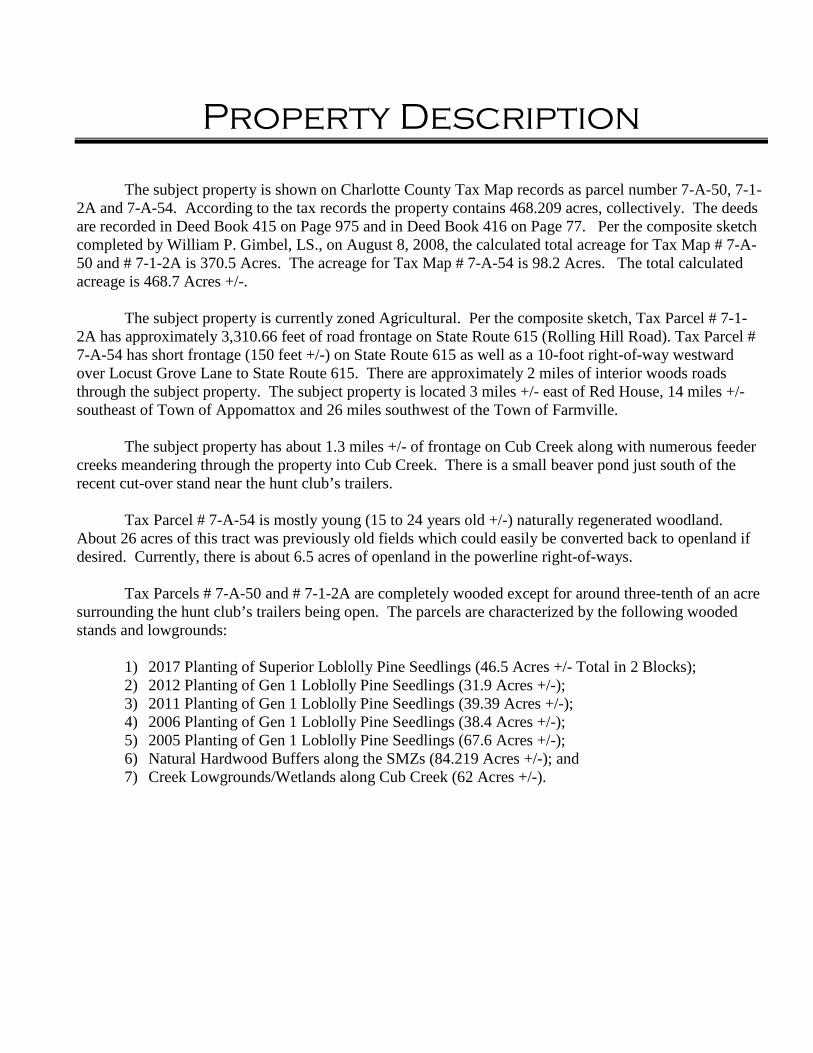
Property Description
The subject property is shown on Charlotte County Tax Map records as parcel number 7-A-50, 7-1-
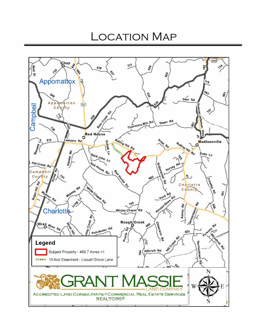
2A and 7-A-54. According to the tax records the property contains 468.209 acres, collectively. The deeds are recorded in Deed Book 415 on Page 975 and in Deed Book 416 on Page 77. Per the composite sketch completed by William P. Gimbel, LS., on August 8, 2008, the calculated total acreage for Tax Map # 7-A-50 and # 7-1-2A is 370.5 Acres. The acreage for Tax Map # 7-A-54 is 98.2 Acres. The total calculated acreage is 468.7 Acres +/-. The subject property is currently zoned Agricultural. Per the composite sketch, Tax Parcel # 7-1-2A has approximately 3,310.66 feet of road frontage on State Route 615 (Rolling Hill Road). Tax Parcel # 7-A-54 has short frontage (150 feet +/-) on State Route 615 as well as a 10-foot right-of-way westward over Locust Grove Lane to State Route 615. There are approximately 2 miles of interior woods roads through the subject property. The subject property is located 3 miles +/- east of Red House, 14 miles +/- southeast of Town of Appomattox and 26 miles southwest of the Town of Farmville. The subject property has about 1.3 miles +/- of frontage on Cub Creek along with numerous feeder creeks meandering through the property into Cub Creek. There is a small beaver pond just south of the recent cut-over stand near the hunt club’s trailers. Tax Parcel # 7-A-54 is mostly young (15 to 24 years old +/-) naturally regenerated woodland. About 26 acres of this tract was previously old fields which could easily be converted back to openland if desired. Currently, there is about 6.5 acres of openland in the powerline right-of-ways. Tax Parcels # 7-A-50 and # 7-1-2A are completely wooded except for around three-tenth of an acre surrounding the hunt club’s trailers being open. The parcels are characterized by the following wooded stands and lowgrounds:
1) 2017 Planting of Superior Loblolly Pine Seedlings (46.5 Acres +/- Total in 2 Blocks); 2) 2012 Planting of Gen 1 Loblolly Pine Seedlings (31.9 Acres +/-); 3) 2011 Planting of Gen 1 Loblolly Pine Seedlings (39.39 Acres +/-); 4) 2006 Planting of Gen 1 Loblolly Pine Seedlings (38.4 Acres +/-); 5) 2005 Planting of Gen 1 Loblolly Pine Seedlings (67.6 Acres +/-); 6) Natural Hardwood Buffers along the SMZs (84.219 Acres +/-); and 7) Creek Lowgrounds/Wetlands along Cub Creek (62 Acres +/-).
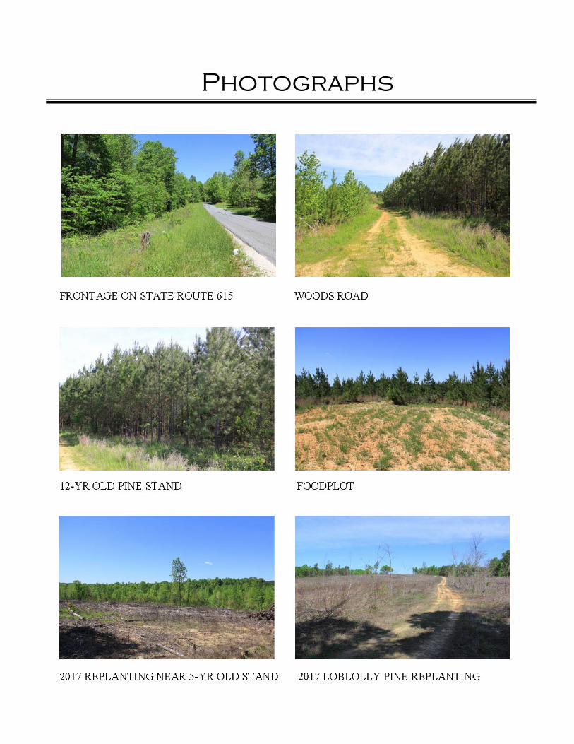
Photographs
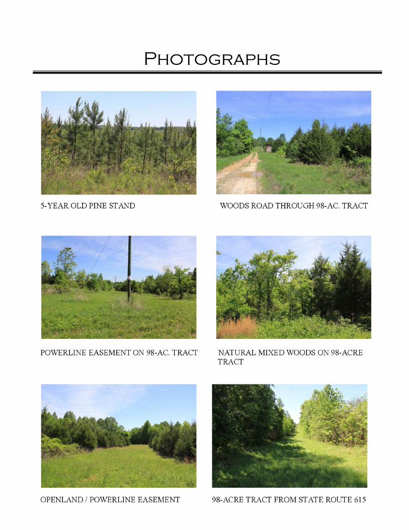
Photographs
Tax Map
Composite Sketch – 370.5 Acres
Old Plat – 98.2 Acres
Aerial Photograph
Topographic Map
Location Map