Embed Size (px)
Citation preview
Using the Five Themes of Geography to Teach About China (Grade 6)
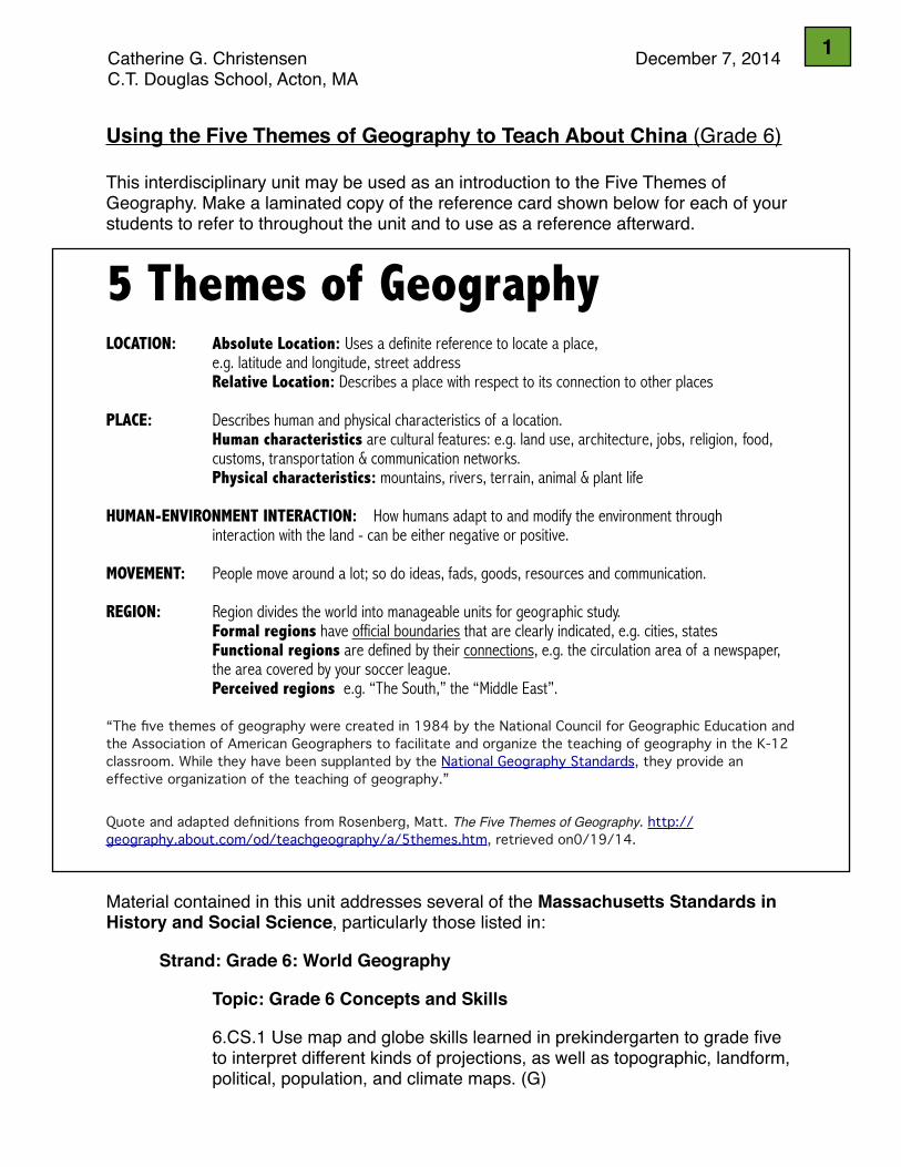
This interdisciplinary unit may be used as an introduction to the Five Themes of Geography. Make a laminated copy of the reference card shown below for each of your students to refer to throughout the unit and to use as a reference afterward.
5 Themes of GeographyLOCATION: Absolute Location: Uses a definite reference to locate a place, e.g. latitude and longitude, street address Relative Location: Describes a place with respect to its connection to other places
PLACE: Describes human and physical characteristics of a location. Human characteristics are cultural features: e.g. land use, architecture, jobs, religion, food, customs, transportation & communication networks. Physical characteristics: mountains, rivers, terrain, animal & plant life
HUMAN-ENVIRONMENT INTERACTION: How humans adapt to and modify the environment through interaction with the land - can be either negative or positive.
MOVEMENT: People move around a lot; so do ideas, fads, goods, resources and communication.
REGION: Region divides the world into manageable units for geographic study. Formal regions have official boundaries that are clearly indicated, e.g. cities, states Functional regions are defined by their connections, e.g. the circulation area of a newspaper, the area covered by your soccer league. Perceived regions e.g. “The South,” the “Middle East”.
“The five themes of geography were created in 1984 by the National Council for Geographic Education and the Association of American Geographers to facilitate and organize the teaching of geography in the K-12 classroom. While they have been supplanted by the National Geography Standards, they provide an effective organization of the teaching of geography.”
Quote and adapted definitions from Rosenberg, Matt. The Five Themes of Geography. http://geography.about.com/od/teachgeography/a/5themes.htm, retrieved on0/19/14.
Material contained in this unit addresses several of the Massachusetts Standards in History and Social Science, particularly those listed in: ! Strand: Grade 6: World Geography
! ! Topic: Grade 6 Concepts and Skills
! ! 6.CS.1 Use map and globe skills learned in prekindergarten to grade five ! ! to interpret different kinds of projections, as well as topographic, landform, ! ! political, population, and climate maps. (G)
! !
Catherine G. Christensen! ! ! ! ! December 7, 2014C.T. Douglas School, Acton, MA
1
! ! 6.CS.2 Use geographic terms correctly, such as delta, glacier, location, ! ! settlement, region, natural resource, human resource, mountain, hill, plain, ! ! plateau, river, island, isthmus, peninsula, erosion, climate, drought, ! ! monsoon, hurricane, ocean and wind currents, tropics, rain forest, tundra, ! ! desert, continent, region, country, nation, and urbanization. (G)
! ! 6.CS.4 Explain the difference between absolute and relative location and ! ! give examples of different ways to indicate relative location for countries or ! ! cities across the world. (G)
! ! 6.CS.5 Identify how current world atlases are organized and the kind of ! ! information they provide for each continent and country. (G)
! ! 6.CS.6 Identify what time zones are, when and how the precise ! ! measurement of longitude was scientifically and historically determined, ! ! the function and location of the international date line, and the function of ! ! the Royal Observatory in Greenwich, England, and give examples of ! ! differences in time in countries in different parts of the world. (G)
! ! 6.CS.7 Use the following demographic terms correctly: ethnic group, ! ! religious group, and linguistic group. (G)
! Topic: Grade 6 Learning Standards - North and East Asia
! ! 6.NEA.1 On a map of the world, locate North and East Asia, the Pacific ! ! Ocean, and the Arctic Ocean. On a map of East Asia, locate the Sea of ! ! Japan, the Yellow Sea, the East China Sea, the Gobi Desert, the ! ! Himalayas, and the Yellow and Yangtze Rivers. . . . (G)
! ! 6.NEA.2 Use a map key to locate the countries and major cities in the ! ! various regions of East Asia. (G, E)! !! ! 6.NEA.3 Explain how the following five factors have influenced settlement ! ! and the economies of major East Asian countries. (G, E)
A. absolute and relative locationsB. climateC. major physical characteristicsD. major natural resourcesE. population size
!
2
Optional Topics for Study
! ! 6.NEA.5! ! • Describe the general level of education in selected countries in East Asia ! ! and its relationship to the economy. (G, H, E)! ! • Describe the political and social status of women in selected countries in ! ! East Asia. (G, H, E)! ! • Describe major ethnic and religious groups in various countries in East ! ! Asia. (G, H, E)! ! • Explain why China’s geographical boundaries served to limit its ! ! interactions with other regions and cultures for many centuries. (G, H)! ! • Locate Tibet on a map and explain why its location may have influenced ! ! China . . . (G, H)! ! • Explain how location has made the Korean peninsula both a ! ! battleground and a cultural bridge between China and Japan. (G, H)! ! • Describe why the Chinese government seeks to control population ! ! growth and the methods it uses to control population growth. (G, H)! ! • Describe and explain the status of Taiwan. (H, G)
! !
3
LESSON #1: LOCATION
LOCATION:! Absolute Location: Uses a definite reference to locate a place, ! ! ! e.g. latitude and longitude, street address! ! ! Relative Location: Describes a place with respect to its ! ! ! connection to other places
Materials: • Unlined paper and pencils (for map drawing activity)• Student atlases or map of the world for determining latitude and longitude of key cities• To verify accuracy of latitude and longitude, internet access to http://www.latlong.net/
or http://itouchmap.com/latlong.html • National Geographic (Winkel Tripel Projection) or other Atlantic Ocean-centered map
of the world• Chinese world map (SinoMaps Press, ISBN: 978-7-5031-8133-7/K-4678)
Warm-up activity:From memory, students draw a map of the world on a blank sheet of 8.5” x 11” paper, labeling China and any of its immediate neighbors. These maps may serve as a pre-assessment of student understanding.
Map Skills review:Students practice map skills learned in earlier grades by completing an activity in which they identify the absolute and relative locations of key Chinese cities, such as Beijing, Xi’an, Chongqing, Shanghai, and Hong Kong. Students test their knowledge by creating a set of questions and answers, then challenging each other to find the city at a particular set of coordinates, listing the coordinates of particular cities, and identifying cities by their location relative to each other or to physical features on a map.
Students check the accuracy of their approximate coordinates against those found by entering the name of each city into either of the two websites listed above.
Discuss the difference and relationship between the terms “accurate” and “precise”.
Location as address: Study return address on a shipment from Xi’an, China. Discuss.
Comparison of World Maps: !Compare National Geographic map and official Chinese map.Students will be familiar with an Atlantic Ocean-centered projection, with the Americas to the west, and Europe, Africa, Asia, and Australia to the east. Before revealing the Chinese map of the world, ask students to make predictions about what they expect to see. Once revealed, ask students to make observations (“What do you notice about this map?”), including similarities and differences, going around the room (or discussion circle) so that every student has a chance to contribute a new observation to the discussion. Ask what the students wonder about. If you have any Chinese speaking students, ask if they would be willing to translate some of the Chinese characters.
• Why do these maps show the world differently?• Do students have any other experience with world maps created in other countries?
4
LESSON #2: PLACE
PLACE:! Describes human and physical characteristics of a location.! ! Human characteristics are cultural features: e.g. land use, architecture, ! ! jobs, religion, food, customs, transportation & communication networks.! ! Physical characteristics: mountains, rivers, terrain, animal & plant life
Materials:• Picture book read aloud: Young, Ed (2005) Beyond the Great Mountains: A Visual Poem About
China, Chronicle Books, San Francisco. (Richly textured images; basic Chinese characters explained.)• Small white boards and markers, or pencil and paper• Blank maps of China, one per student• Colored pencils or markers• Thematic maps of China: see attached document• Postcards, museum catalogs, and other print and internet resources about China.• Internet access to National Geographic MapMaker Interactive which provides political,
topographic, satellite, street, terrain, and ocean base maps that are customizable, printable, and bookmark-able at this website:
http://mapmaker.education.nationalgeographic.com/?ar_a=1&b=1&ls=000000000000• A partial list of additional resources:! Al, Stefan, ed. (August 2012) Factory Towns of South China: An Illustrated Guidebook, Hong ! ! Kong University Press, Hong Kong.! Kids Discover, (1999) Ancient China, Kids Discover, New York.! Thompson, Hugh, & K. Lane, eds. (2014) DK Eyewitness Travel: China, Dorling Kindersley, NY.! Geography and Early Settlement of China, the Chapter 19 Geography Challenge in ! ! Teachers‘ Curriculum Institute (2011) History Alive! The Ancient World, Interactive ! ! Student Notebook, pp. 1-3. ! “The Han Empire” in Alaska Hults, Building Skills by Exploring Maps: Ancient ! ! Civilizations (2005) Creative Teaching Press, Huntington Beach, CA, pp. 34-35.
Warm-up activity:What comes to mind when you think of China? Students to list as many ideas as they can on small white boards or sheets of paper. Generate a class list with two major categories: human characteristics and physical characteristics (as defined above). Read aloud Ed Young’s Beyond the Great Mountains: A Visual Poem About China.
Map Skills review:Students practice map skills learned in earlier grades by completing an activity in which they identify key land and water features and determine the absolute and relative locations of various physical and cultural features such as the Great Wall, Three Gorges Dam and Grand Canal.
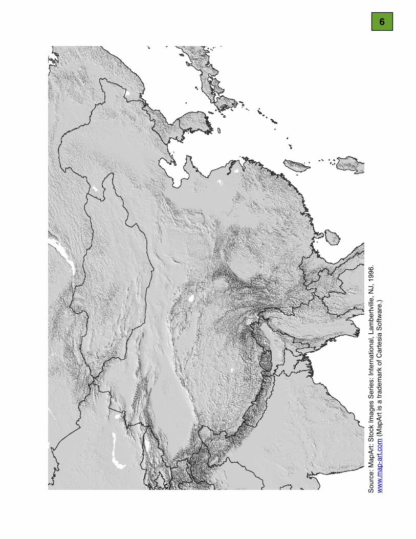
Two excellent ready-made activities are bolded in the list of resources shown above. Otherwise, take a blank map of China, such as the one provided on the following page, and instruct students to locate and label the following features:Manchurian Plain, North China Plain, Gobi Desert, Taklimakan Desert, Kunlun Mountains, Plateau of Tibet, Loess Plateau, Tian Shan Mountains, Himalayan Mountains, Greater Khingan Range, Hainan, Taiwan, Korean Peninsula, Sea of Japan, Yellow Sea, East China Sea, South China Sea, Chang Jiang (Yangtze) River, Huang He (Yellow) River, and Pearl River.
5
Sour
ce: M
apAr
t: St
ock
Imag
es S
erie
s: In
tern
atio
nal,
Lam
bertv
ille, N
J, 1
996.
w
ww.
map
-art.
com
(Map
Art i
s a
trade
mar
k of
Car
tesi
a So
ftwar
e.)
6

• How did China’s physical features impact the history of the Chinese people?• What happened to the territorial extent of four B.C.E. empires (Shang [12th c. B.C.E.],
Zhou [8th c. B.C.E.], Qin [3rd c. B.C.E.], and Han [1st c. B.C.E.]), and why?
Jigsaw Activity:Divide the class into 5 groups, one for each of the following cities: Beijing, Xi’an, Chongqing, Shanghai, and Hong Kong. Given the definition of “place”, challenge students to conduct research and make a poster presentation of each city’s: (a) physical setting and (b) human characteristics at key times in the past and in the present. Give students specific guidelines about poster size, layout, and number of details to include.(Consider using other examples: factory towns, Lhasa) Student presentations may include some of the following information:
City Physical Characteristics
(Past) Human Characteristics
(Present) Human Characteristics
Beijing • Northern tip of No. China Plain
• Mts. to north, northwest, & west
• Hot, humid summers; cold, windy, dry winters
• “Land of the Yellow Earth” - yellow limestone silt from the Gobi Desert, carried by wind.
• Rivers are part of Hai R. system, running to SE
• Northern terminus of Grand Canal to Hangzhou & South-North Water Transfer Project
• Peking Man (homo erectus) - 400,000 years ago
• Kublai Khan (Mongol) made it his capital toward end of 13th c.
• Seat of Ming (1407+) & Qing dynasties
• Forbidden City (officially known as Palace Museum) & Tian’an Men Guangchang (Square of the Gate of Heavenly Peace)
• Yonghe Gong (Lama Temple)
• Temple of Heaven• Hutongs• Great Wall
• Capital of PRC (pop’n: 20 million)• Current name given in 1949
(Zhongdu, Dadu, Beiping of old)• Still organized along N-S lines with
straight, wide avenues and winding alleys around the Forbidden City.
• Growing network of concentric ring roads to accommodate increased number of vehicles
• Peking University• Olympic Games• Tourism• Has good air, rail, and bus links to
other cities• Peking Opera (Qing+)• No distinctive cuisine, but borrows
from many traditions• Microcosm of modern China & its
contradictions: rich/poor, new/old• Severe pollution problem
Xi’an • In center of the Guanzhong Plain on a floodplain created by 8 rivers & streams
• Elevation: 1,312 ft• Borders Qin Mts.
to south, and Wei R. to north, Loess Plateau to north.
• temperate climate influenced by East Asian monsoon
• ‘tween semi-arid & humid subtrop. climates
• Banpo Site (Neolithic village from 6,000 years ago)
• Called Chang’an in ancient times
• One of the birthplaces of the ancient civilization in the Yellow River Basin
• First emperor, Qin Shi Huangdi, unified China from this city
• Capital to 11 dynasties over 4,000 years
• Eastern end - Silk Rd.• largest, wealthiest city
in world by 9th c.
• Capital of modern Shaanxi Province• Pop. 8.4 million, 1 of 3 most
populous cities in Western China• Thriving tourist economy due to a
variety of sights: Xi’an City Wall, Forest of Steles Museum (housing stone pillars carved for ceremonial purposes dating from Han dynasty), temples and pagodas
• Great Mosque (built in 742) - introduction of Islam across the Silk Road
• Terra Cotta Army - discovered in 1974, and now built into an world-class, civilization-affirming tourist attraction
• 1 of 13 emerging PRC megacities
7
City Physical Characteristics
(Past) Human Characteristics
(Present) Human Characteristics
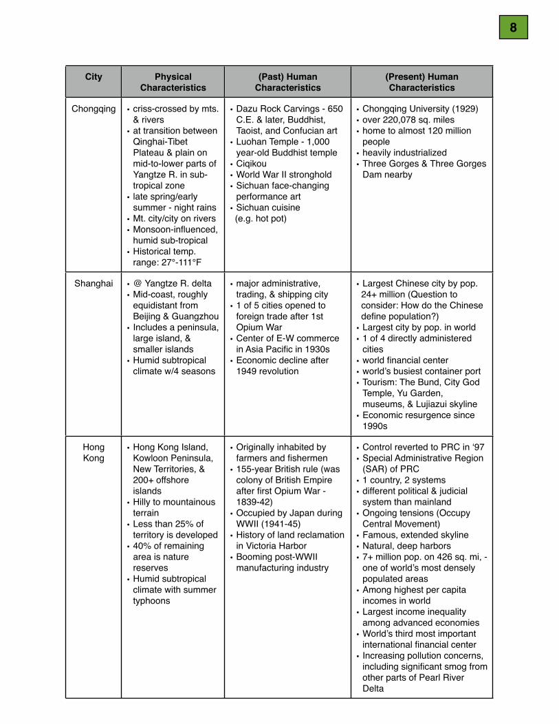
Chongqing • criss-crossed by mts. & rivers
• at transition between Qinghai-Tibet Plateau & plain on mid-to-lower parts of Yangtze R. in sub-tropical zone
• late spring/early summer - night rains
• Mt. city/city on rivers• Monsoon-influenced,
humid sub-tropical• Historical temp.
range: 27°-111°F
• Dazu Rock Carvings - 650 C.E. & later, Buddhist, Taoist, and Confucian art
• Luohan Temple - 1,000 year-old Buddhist temple
• Ciqikou• World War II stronghold• Sichuan face-changing
performance art• Sichuan cuisine (e.g. hot pot)
• Chongqing University (1929)• over 220,078 sq. miles• home to almost 120 million
people• heavily industrialized • Three Gorges & Three Gorges
Dam nearby
Shanghai • @ Yangtze R. delta• Mid-coast, roughly
equidistant from Beijing & Guangzhou
• Includes a peninsula, large island, & smaller islands
• Humid subtropical climate w/4 seasons
• major administrative, trading, & shipping city
• 1 of 5 cities opened to foreign trade after 1st Opium War
• Center of E-W commerce in Asia Pacific in 1930s
• Economic decline after 1949 revolution
• Largest Chinese city by pop. 24+ million (Question to consider: How do the Chinese define population?)• Largest city by pop. in world• 1 of 4 directly administered
cities• world financial center• world’s busiest container port• Tourism: The Bund, City God
Temple, Yu Garden, museums, & Lujiazui skyline
• Economic resurgence since 1990s
Hong Kong
• Hong Kong Island, Kowloon Peninsula, New Territories, & 200+ offshore islands
• Hilly to mountainous terrain
• Less than 25% of territory is developed
• 40% of remaining area is nature reserves
• Humid subtropical climate with summer typhoons
• Originally inhabited by farmers and fishermen
• 155-year British rule (was colony of British Empire after first Opium War - 1839-42)
• Occupied by Japan during WWII (1941-45)
• History of land reclamation in Victoria Harbor
• Booming post-WWII manufacturing industry
• Control reverted to PRC in ‘97• Special Administrative Region
(SAR) of PRC• 1 country, 2 systems• different political & judicial
system than mainland• Ongoing tensions (Occupy
Central Movement)• Famous, extended skyline• Natural, deep harbors• 7+ million pop. on 426 sq. mi, -
one of world’s most densely populated areas
• Among highest per capita incomes in world
• Largest income inequality among advanced economies
• World’s third most important international financial center
• Increasing pollution concerns, including significant smog from other parts of Pearl River Delta
8
LESSON #3: HUMAN-ENVIRONMENT INTERACTION
HUMAN-ENVIRONMENT INTERACTION: How humans adapt to & modify the environment through interaction with the land - can be either negative or positive.
Materials:• Images of: the Great Wall, Three Gorges Dam, Grand Canal, South-North Water
Transfer Project, Hong Kong Harbor, terraced rice farming, and urban smog in China.• Google Presentation or PPT capability, or traditional poster presentation materials• Postcards, posters, museum catalogs, and other print and internet resources about
China, past and present. • A partial list of resources:! Beshore, George (1998) Science in Ancient China, Franklin Watts, New York.! China Digital Times http://chinadigitaltimes.net/ ! Chinese National Committee on Large Dams, "Three Gorges Project". ! ! http://www.chincold.org.cn/dams/rootfiles/2010/07/20/1279253974143251-1279253974145520.pdf! ! Retrieved 10/26/14.! Cotterell, Arthur (1994) Eyewitness Books: Ancient China, Alfred A. Knopf, New York.! Fisher, Leonard Everett (1986)The Great Wall of China, Macmillan: New York.! Guerringue, Brett, South-North Water Transfer Project, ICE Case Studies, No. 277, May 2013. ! ! http://www1.american.edu/ted/ICE/north-china.html Retrieved October 26, 2014.! Kids Discover, (1999) Ancient China, Kids Discover, New York.! Kleeman, Terry, & Tracy Barrett (2005) The Ancient Chinese World, Oxford University Press, NY.! Starr, John Bryan (2010) Understanding China: A Guide to China’s Economy, History, and ! ! Political Culture, 3rd ed., Hill and Wang, New York.! Strapp, James (2009) Science & Technology Inside Ancient China, Amber Books: Armonk, NY. ! Teachers’ Curriculum Institute (2011) History Alive! The Ancient World, TCI, Palo Alto.! Thompson, Hugh, & Kathryn Lane, eds. (2014) DK Eyewitness Travel: China, Dorling Kindersley, ! ! NY.! Three Gorges Role Play, author unknown, set in 1992! Veeck, Gregory, Clifton W. Pannell, Christopher J. Smith, and Youqin Huang (2011) China’s ! ! Geography: Globalization and the Dynamics of Political, Economic, and Social Change, ! ! 2nd ed., Rowman & Littlefield, New York.! U.S.-China Joint Announcement on Climate Change, Beijing, China, 12 November 2014! ! http://www.whitehouse.gov/the-press-office/2014/11/11/us-china-joint-announcement-! ! climate-change! Waterlow, Julia (1994) The Ancient Chinese, Thomson Learning, New York.!Warm-up Activity: A picture is worth a thousand words. Show students several of the images listed above. Discuss commonalities; then introduce the third theme.
Student Research Activities - who, what, when, where, why, how?Working in small groups, pairs, or independently, students pose as research journalists investigating examples of human-environment interaction listed above. After presenting their findings to the class, consider some of the extension activities listed below.
1. The Great Wall of China Although originally built at great human cost as a defensive fortification along mountain ridges, it was unable to stop nomadic tribes (“barbarians”) from invading China. Begun over 2,200 years ago by emperor Qin Shi Huangdi, it was later augmented by the Ming emperors of 500 years ago. Although much of it is in disrepair, restored sections are
9
popular tourist attractions. Students should also consider how and why the Chinese government may be using the Great Wall as a unifying national symbol to underscore its claim of being the oldest civilization on earth.
2. The Three Gorges DamThis project has been called China’s biggest construction project since the Great Wall.Students investigate the pros and cons of this complicated and controversial project. Students should take care to investigate sources from all sides of the issue.
3. The Grand Canal Begun in 486 B.C.E., and built in sections over the next 1,000 years, the Grand Canal is the world’s largest manmade waterway. Measuring 1,112 miles in length, from Beijing to Hangzhou, it connects the populous north with the southern rice-producing region.
4. The South-North Water Transfer Project“This government-backed . . . undertaking aims to move billions of cubic meters of fresh water from the south of China, where water is relatively plentiful, to the north where there’s a shortage. The plan includes an East, Central and Western corridor. Since the supposed announcement of the project by Mao Zedong in the early 1950’s, a national water supply system has only been on the books until recently when the dream has become a reality in the form of the largest and most expensive water supply system in the world. While China is able to afford these projects now, in terms of money and political power, it’s questionable if it will be able to finish by 2050, its slated final date of completion.” (Guerringue, 2013)
5. Victoria Harbor, Hong Kong Hong Kong is a natural deep-water port that has relied on repeated land reclamation projects in Victoria Harbor to accommodate its ever-increasing demand for land and access to the harbor. Refer to satellite images and maps of Victoria Harbor to observe depth of natural harbor and changing coastline.
6. Farming • Terraced farming (e.g. photo of terraced rice paddies in wet, warm Chang Jiang Basins on p. 203 of
History Alive! The Ancient World, Chapter 19: Geography & Settlement of China, TCI, 2011)• Soils: “The unusual effects of more than twenty-five centuries of cultivation on some of
China’s soils must also be considered. In China, more than any other nation, anthropogenic (human-induced) effects associated with wet-rice cultivation and terrace construction have formed distinct and extensive groups of soils that are rare in most other temperate nations.” (Veeck, et al, p. 920, Kindle edition)
7. Air, Water and Soil Pollution Students should consider these questions: Why is pollution such a problem in China?Why is it unsafe to drink tap water in China? Will these problems get better or worse in the future? What is their impact on the rest of the world and on efforts to reduce global climate change? Investigate November 2014 US-PRC Joint Announcement on Climate Change.
Discuss potential for controversy with large human-environment interaction projects. Can progress and sustainable practices coexist?
10

LESSON #4: MOVEMENT
MOVEMENT: People move around a lot; so do ideas, fads, goods, resources and communication.
Materials:• Postcard of poster depicting Marx, Engels, Lenin, Stalin, and Mao Zedong (“Long live Marxism Leninism and Mao Zedong Thought”)• Multiple issues of China Daily and South China Morning Post newspapers• A partial list of resources:! China Digital Times, http://chinadigitaltimes.net/! Horovitz, Bruce (EDT Sept. 16, 2013) “China to Become No. 2 Market for Starbucks” USA Today,! http://www.usatoday.com/story/money/business/2013/09/16/starbucks-china-flagship-stores/. . .! ! Retrieved October 26, 2014.! Osnos, Evan, (2014) Age of Ambition: Chasing Fortune, Truth, and Faith in the New China, ! ! Farrar, Straus and Giroux, New York.! Strapp, James, (2009) Science & Technology Inside Ancient China, Amber Books: Armonk, NY.! List of Walmart stores in China: http://www.wal-martchina.com/english/walmart/wminchina.htm! ! Retrieved October 26, 2014.! “The Silk Road” Chapter 24 in Teachers’ Curriculum Institute (2011) History Alive! The Ancient ! ! World, TCI, Palo Alto and associated Interactive Student Notebook pages.! “Starbucks in China: A Top Five List” (2/05/2009),The China Beat: Blogging How the East is Read, ! ! http://thechinabeat.blogspot.com/2009/02/starbucks-in-china-top-five-list.html. ! ! Retrieved October 26, 2014.!This lesson could be conducted as a series of case studies of movement into and out of China.
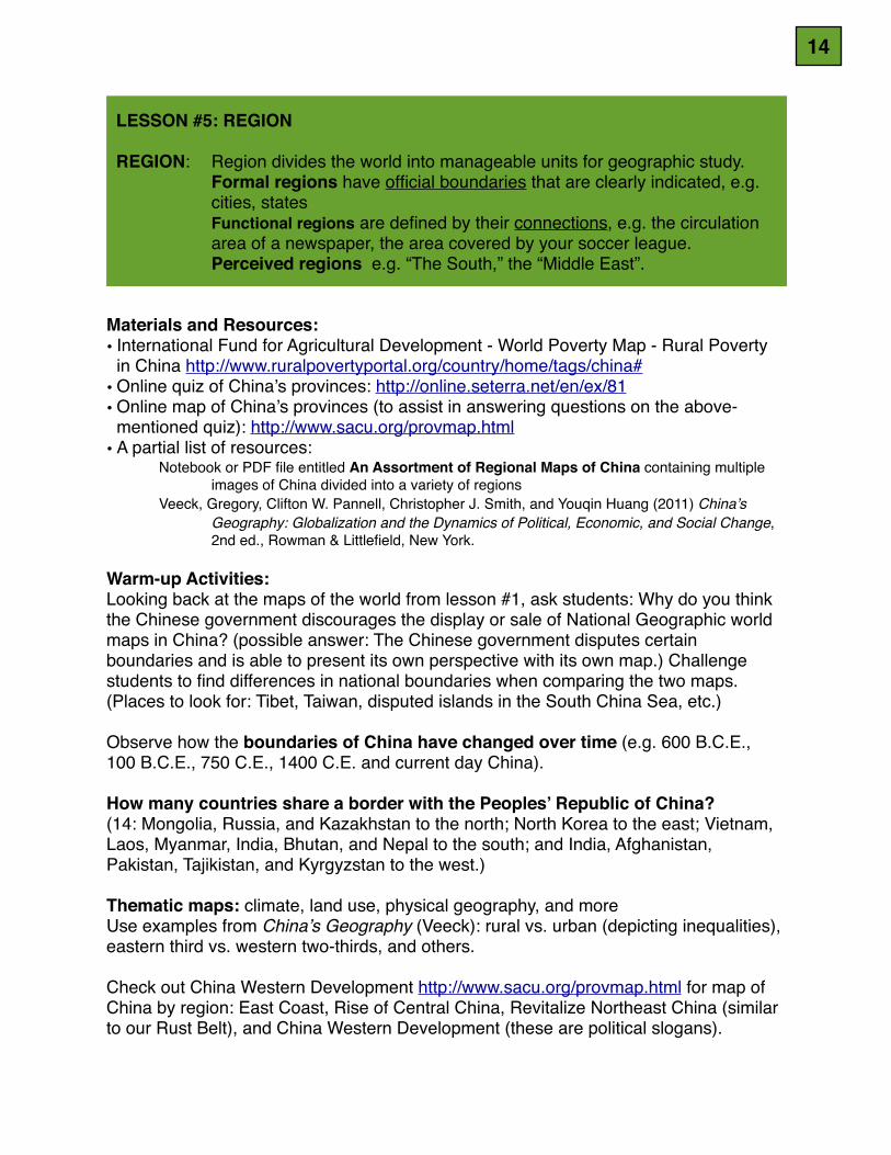
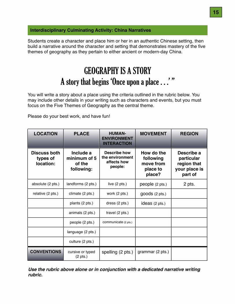
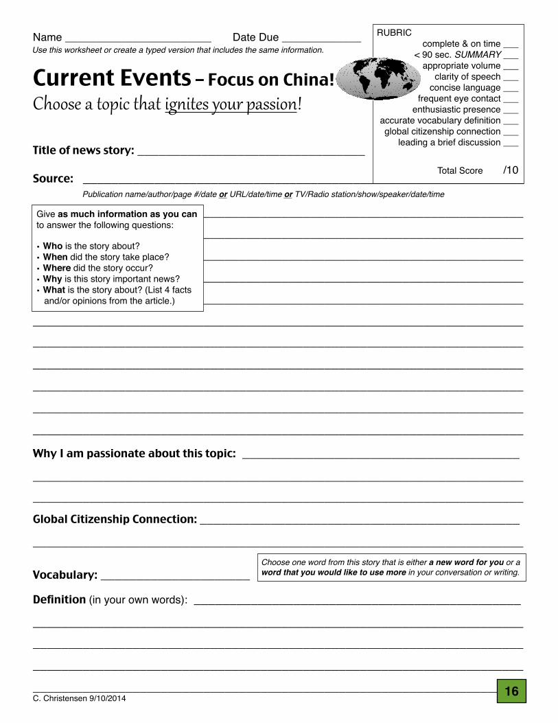
Warm-up Activity:Show images of commercial activity in China with ties to the rest of the world: Walmart, Starbucks, Kentucky Fried Chicken, Papa Johns, designer boutiques. Where were these pictures taken? These are relatively recent examples of movement of goods and ideas. What about in the past?
The Silk RoadRead about the Silk Road, a network of trade routes stretching over more than four thousand miles that connected the Han and Roman empires. (The History Alive! chapter and companion workbook pages is very good.) Goods, ideas, and people traveled the Silk Road. Chinese traded silk, fine dishware (china), ornaments, jewelry, cast-iron products, and decorative boxes. Goods from Central Asia included horses, jade, furs, and gold. Traders from India brought cotton, spices, pearls, and ivory. The Chinese valued Roman glass products such as trays, vases, necklaces and small bottles, as well as asbestos and coral. New foods and spices were introduced to China as a result of trade. Buddhism probably came to China from India by pilgrims and traders traveling the Silk Road in the 1st c. C.E. and eventually became the dominant religion. Investigate modern-day interpretations of the Silk Road.
Communist IdeologyPostcard of Marx, Engels, Lenin, Stalin, & Mao as backdrop to discussion of origins and history of Communist Party in China.
11
Retrieved October 26, 2014.
Movement or lack of movement of ideas: (1) Compare several issues of China Daily and South China Morning Post newspapers
from the same days. Can you tell which newspaper is endorsed by the central government? Is there a perceived “enemy” or “whipping boy” in either paper? Which paper is more critical of Japan? Which paper is more critical of the Beijing government? How can you tell?
(2) Research articles about China Weibo and “the Great Firewall”. Why is internet access different on mainland China than it is in Hong Kong? Compare internet access in the United States to internet access on mainland China.
Movement of people: (1) Read excerpt from Evan Osnos book about travel by Chinese nationals outside
China. Why is it so restricted?(2) Why do so many people choose to leave China? If it seems appropriate to do so,
ask Chinese-born students why their families have emigrated to the United States.(3) Challenge students to think of other countries where citizens are thinking of
emigrating to other countries. Are students, perhaps, descended from people who made similar choices?
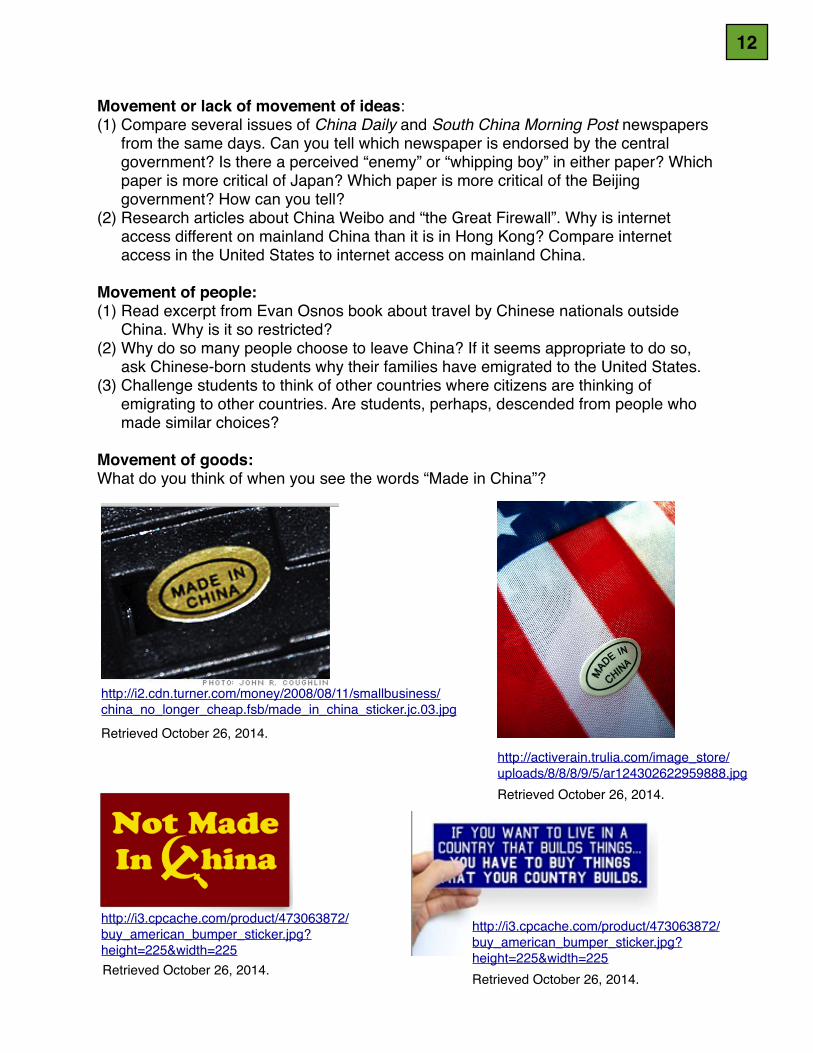
Movement of goods:What do you think of when you see the words “Made in China”?
http://i2.cdn.turner.com/money/2008/08/11/smallbusiness/china_no_longer_cheap.fsb/made_in_china_sticker.jc.03.jpg
http://activerain.trulia.com/image_store/uploads/8/8/8/9/5/ar124302622959888.jpgRetrieved October 26, 2014.
http://i3.cpcache.com/product/473063872/buy_american_bumper_sticker.jpg?height=225&width=225Retrieved October 26, 2014.
http://i3.cpcache.com/product/473063872/buy_american_bumper_sticker.jpg?height=225&width=225Retrieved October 26, 2014.
12
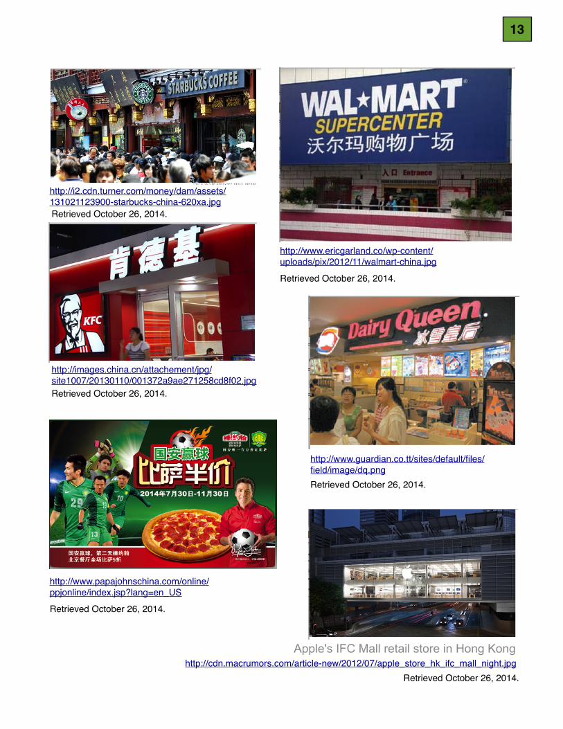
http://images.china.cn/attachement/jpg/site1007/20130110/001372a9ae271258cd8f02.jpgRetrieved October 26, 2014.
http://i2.cdn.turner.com/money/dam/assets/131021123900-starbucks-china-620xa.jpgRetrieved October 26, 2014.
http://www.papajohnschina.com/online/ppjonline/index.jsp?lang=en_US
Retrieved October 26, 2014.
http://www.ericgarland.co/wp-content/uploads/pix/2012/11/walmart-china.jpg
Retrieved October 26, 2014.
http://www.guardian.co.tt/sites/default/files/field/image/dq.pngRetrieved October 26, 2014.
http://cdn.macrumors.com/article-new/2012/07/apple_store_hk_ifc_mall_night.jpgRetrieved October 26, 2014.
Apple's IFC Mall retail store in Hong Kong
13
LESSON #5: REGION
REGION:! Region divides the world into manageable units for geographic study. ! ! Formal regions have official boundaries that are clearly indicated, e.g. ! ! cities, states! ! Functional regions are defined by their connections, e.g. the circulation ! ! area of a newspaper, the area covered by your soccer league.! ! Perceived regions e.g. “The South,” the “Middle East”.
Materials and Resources:• International Fund for Agricultural Development - World Poverty Map - Rural Poverty
in China http://www.ruralpovertyportal.org/country/home/tags/china#• Online quiz of China’s provinces: http://online.seterra.net/en/ex/81• Online map of China’s provinces (to assist in answering questions on the above-
mentioned quiz): http://www.sacu.org/provmap.html• A partial list of resources:! Notebook or PDF file entitled An Assortment of Regional Maps of China containing multiple ! ! images of China divided into a variety of regions! Veeck, Gregory, Clifton W. Pannell, Christopher J. Smith, and Youqin Huang (2011) China’s ! ! Geography: Globalization and the Dynamics of Political, Economic, and Social Change, ! ! 2nd ed., Rowman & Littlefield, New York.!Warm-up Activities:Looking back at the maps of the world from lesson #1, ask students: Why do you think the Chinese government discourages the display or sale of National Geographic world maps in China? (possible answer: The Chinese government disputes certain boundaries and is able to present its own perspective with its own map.) Challenge students to find differences in national boundaries when comparing the two maps.(Places to look for: Tibet, Taiwan, disputed islands in the South China Sea, etc.)
Observe how the boundaries of China have changed over time (e.g. 600 B.C.E., 100 B.C.E., 750 C.E., 1400 C.E. and current day China).
How many countries share a border with the Peoples’ Republic of China? (14: Mongolia, Russia, and Kazakhstan to the north; North Korea to the east; Vietnam, Laos, Myanmar, India, Bhutan, and Nepal to the south; and India, Afghanistan, Pakistan, Tajikistan, and Kyrgyzstan to the west.)
Thematic maps: climate, land use, physical geography, and moreUse examples from China’s Geography (Veeck): rural vs. urban (depicting inequalities), eastern third vs. western two-thirds, and others.
Check out China Western Development http://www.sacu.org/provmap.html for map of China by region: East Coast, Rise of Central China, Revitalize Northeast China (similar to our Rust Belt), and China Western Development (these are political slogans).
14
Interdisciplinary Culminating Activity: China Narratives
Students create a character and place him or her in an authentic Chinese setting, then build a narrative around the character and setting that demonstrates mastery of the five themes of geography as they pertain to either ancient or modern-day China.
GEOGRAPHY IS A STORYA story that begins ‘Once upon a place . . .’ ”
You will write a story about a place using the criteria outlined in the rubric below. You may include other details in your writing such as characters and events, but you must focus on the Five Themes of Geography as the central theme.
Please do your best work, and have fun!
LOCATION PLACE HUMAN-ENVIRONMENT INTERACTION
MOVEMENT REGION
Discuss both types of location:
Include a minimum of 5
of the following:
Describe how the environment
affects how people:
How do the following
move from place to place?
Describe a particular
region that your place is
part of
absolute (2 pts.) landforms (2 pts.) live (2 pts.) people (2 pts.) 2 pts.
relative (2 pts.) climate (2 pts.) work (2 pts.) goods (2 pts.)
plants (2 pts.) dress (2 pts.) ideas (2 pts.)
animals (2 pts.) travel (2 pts.)
people (2 pts.) communicate (2 pts.)
language (2 pts.)
culture (2 pts.)
CONVENTIONS cursive or typed(2 pts.)
spelling (2 pts.) grammar (2 pts.)
Use the rubric above alone or in conjunction with a dedicated narrative writing rubric.
15
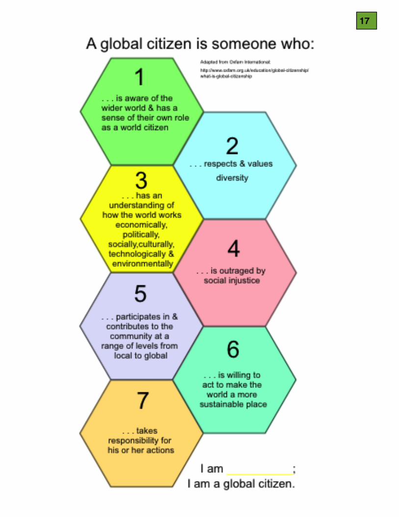
Current Events – Focus on China!Choose a topic that ig-ites your passion!
Title of news story: ________________________________
Source: ______________________________________________________________ _______________________________________________________________________________________________________________________________________________________________________________________________________________________________________________________________________________________________________________________________________________________________________________________________________________________________________________________________________________________________________________________________________________________________________________________________________________________________________________________________________________________________________________________________________________________________________________________
Why I am passionate about this topic: _________________________________________________________________________________________________________________________________________________________________________________Global Citizenship Connection: __________________________________________________________________________________________________________________
Vocabulary: _____________________
Definition (in your own words): __________________________________________________________________________________________________________________________________________________________________________________________________________________________________________________________________________________________________________________________________
Name ________________________ Date Due _____________ RUBRIC complete & on time ___
< 90 sec. SUMMARY ___appropriate volume ___
clarity of speech ___concise language ___
frequent eye contact ___enthusiastic presence ___
accurate vocabulary definition ___global citizenship connection ___
leading a brief discussion ___
Total Score /10
Publication name/author/page #/date or URL/date/time or TV/Radio station/show/speaker/date/time
Give as much information as you can to answer the following questions:
• Who is the story about?• When did the story take place?• Where did the story occur?• Why is this story important news?• What is the story about? (List 4 facts and/or opinions from the article.)
Choose one word from this story that is either a new word for you or a word that you would like to use more in your conversation or writing.
Use this worksheet or create a typed version that includes the same information.
C. Christensen 9/10/2014 16
17