Embed Size (px)
Citation preview

Broadsands
Village Design Statement
An integral part of the Brixham Peninsula Neighbourhood Plan


Document 6 of 10
Submission Document August 2017 | 3
Contents 1 The aims of this Village Design Statement ...................................................... 5
2 Approach taken ............................................................................................ 5
3 A brief description of Broadsands .................................................................. 6
4 Historical development ................................................................................. 8
5 Built environment ....................................................................................... 11
5.1 Extensive single-storey collections of bungalow style properties dating
from the 1960s and 1970s ....................................................................... 11
5.2 Pre-and post-war houses by Louis de Soissons and others ............................ 14
5.3 Guidelines .................................................................................................. 17
5.4 1930s modernist houses by William Lescaze ................................................. 17
5.5 Occasional substantial detached houses from the 1920s ................................ 18
6 Landscape and natural environment ............................................................ 19
6.1 The Neolithic Tomb .................................................................................... 19
6.2 The Warrener’s House ................................................................................ 20
6.3 Lord Churston’s Bath House ........................................................................ 20
6.4 The Great Western Railway ......................................................................... 20
7 Transport .................................................................................................. 22
7.1 Broadsands Beach visitor and recreational facilities redevelopment ................ 23
8 Conclusion – Design guidelines .................................................................... 25
8.1 Good design .............................................................................................. 25
8.2 General guidelines ...................................................................................... 26
8.3 Guidelines for specific village areas .............................................................. 27


Document 6 of 10
Submission Document August 2017 | 5
1 The aims of this Village Design Statement
1.0.1 The primary aims of this Village Design Statement are to:
• understand and record the important and distinct features of the
Broadsands area which combine to create its unique character
• encourage developers and householders to design new developments so
that they are in keeping with existing local character – and to avoid those
that are not by illustrating some that represent poor examples, as well as
some good examples.
1.0.2 This document confines itself in scope to the design of new development and
does not detail what type of development should take place in Broadsands.
2 Approach taken
2.0.1 This document has been researched and written entirely by residents of
Broadsands with input being sought from the relevant and immediately
neighbouring communities by way of consultation and liaison with the
Broadsands and Elberry Residents Association (BERA) and Churston Galmpton
and Broadsands Community Partnership (CGBCP).
2.0.2 BERA was established in 1958 and has been operating now for the last 55
years; it played a key role in the formation of the CGBCP and has been a
participant of the Brixham Peninsular Neighbourhood Forum (BPNF). BERA has
an area of membership covering approximately 480 households.
2.0.3 The consultation process has consisted of a detailed public consultation and
survey conducted in February 2012 together with regular public meetings held
from 2012 to 2016, which have been advertised in the local News Gazette and
on public noticeboards. All comments have been noted and considered and
emerging draft documentation has been freely available on the internet.
2.0.4 The draft document will be circulated to organisations having a key interest in
planning matters, including:

Broadsands: Village Design Statement
6 | Submission Document August 2017
• Torbay Borough Council
• The Environment Agency
• The Council for the Protection of Rural England
• Natural England
• Devon Wildlife Trust
• Torbay Coast and Countryside Trust
• RSPB.
2.0.5 A record of any comments and proposed amendments will be kept.
3 A brief description of Broadsands
3.0.1 Broadsands is a mixed residential/rural/coastal recreation neighbourhood
forming part of the southern crescent of Torbay, and lying between the main
road (A379) linking Paignton (Goodrington) to Churston and Brixham, bordered
to the north by Goodrington, to the south by Churston and to the east by the
sea. The total land area is c 5.0 sq km.
Figure 1: The Broadsands Village Design Statement area.
Document 6 of 10
Submission Document August 2017 | 7
3.0.2 The resident population of the defined area is c 1500 people.
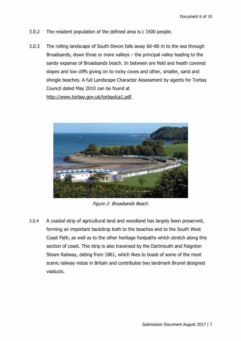
3.0.3 The rolling landscape of South Devon falls away 60–80 m to the sea through
Broadsands, down three or more valleys – the principal valley leading to the
sandy expanse of Broadsands beach. In between are field and heath covered
slopes and low cliffs giving on to rocky coves and other, smaller, sand and
shingle beaches. A full Landscape Character Assessment by agents for Torbay
Council dated May 2010 can be found at
http://www.torbay.gov.uk/torbaylca1.pdf.
Figure 2: Broadsands Beach.
3.0.4 A coastal strip of agricultural land and woodland has largely been preserved,
forming an important backdrop both to the beaches and to the South West
Coast Path, as well as to the other heritage footpaths which stretch along this
section of coast. This strip is also traversed by the Dartmouth and Paignton
Steam Railway, dating from 1861, which likes to boast of some of the most
scenic railway vistas in Britain and contributes two landmark Brunel designed
viaducts.

Broadsands: Village Design Statement
8 | Submission Document August 2017
Figure 3: Brunel viaduct at Broadsands.
3.0.5 A short parade of shops and the adjacent small library at the junction of the
main road and the road leading down to Broadsands beach serves as a
community hub and amenity, as well as an important facility for visitors and
tourists alike.
Figure 4: Parade of shops at Windy Corner.
4 Historical development
4.0.1 Above the beach at Broadsands, the gently sloping fields formed part of Lord
Churston’s estate and have been farmed for hundreds of years. The land
around Elberry was part of the manorial estate of Churston Court until it was
acquired by the local authority in 1946. The tithe map of 1839 shows that fields
were rented by different individuals, who probably travelled from Galmpton and
Churston to tend them.

Document 6 of 10
Submission Document August 2017 | 9
4.0.2 A substantial farm is situated close to Elberry Cove. In the 1850s and 1860s the
first Lord Churston had the farm and its outbuildings re-built and improved. No
expense was spared, and the finest and most hard-wearing materials were
used. It was described in a local directory at the time as a “model farm” and
stands today as an example of the best Victorian building skills. Its status as a
working farm underscores the rural nature of the Broadsands coastal strip.
4.0.3 Broadsands was rural until the mid-1930s when it was an undeveloped coast
between Paignton and Brixham. A handful of fairly substantial houses had been
built on prime elevated sites with sea views in the 1920s and early 1930s. It still
retains an important and substantial green strip of undeveloped coastal land.
4.0.4 In 1932, Lord Churston sold a substantial portion of the Broadsands and Elberry
area to Staverton Builders Ltd., a subsidiary company of the Dartington Hall
Trust. In his book The Churston Ferrers Housing Scheme, Daniel Jon Metcalfe1
explains, “The 188 acre segment of land cost £58100 and included a cove and
beach, wooded slopes, farmland and a 100 ft high stone viaduct built by Brunel
to carry the G.W.R. Brixham line. With limited building for miles in any direction
the site was picturesque and those involved with its acquisition pointed out that
it was worthy of something special.”
”
Figure 5: Lescaze House in Rock Close.
1 Daniel Metcalfe, The Churston Ferrers Housing Scheme, Torbay, Devon: a dissertation charting the history of the Modern Speculative Housing at Churston Ferrers with reference to the English Suburban Estate (2002).
Broadsands: Village Design Statement
10 | Submission Document August 2017
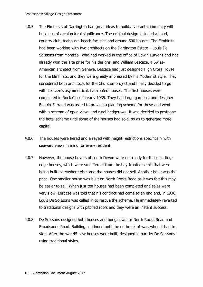
4.0.5 The Elmhirsts of Dartington had great ideas to build a vibrant community with
buildings of architectural significance. The original design included a hotel,
country club, teahouse, beach facilities and around 500 houses. The Elmhirsts
had been working with two architects on the Dartington Estate – Louis De
Soissons from Montreal, who had worked in the office of Edwin Lutyens and had
already won the Tite prize for his designs, and William Lescaze, a Swiss–
American architect from Geneva. Lescaze had just designed High Cross House
for the Elmhirsts, and they were greatly impressed by his Modernist style. They
considered both architects for the Churston project and finally decided to go
with Lescaze’s asymmetrical, flat-roofed houses. The first houses were
completed in Rock Close in early 1935. They had large gardens, and designer
Beatrix Farrand was asked to provide a planting scheme for these and went
with a scheme of open views and rural hedgerows. It was decided to postpone
the hotel scheme until some of the houses had sold, so as to generate more
capital.
4.0.6 The houses were tiered and arrayed with height restrictions specifically with
seaward views in mind for every resident.
4.0.7 However, the house buyers of south Devon were not ready for these cutting-
edge houses, which were so different from the bay-fronted semis that were
being built everywhere else, and the houses did not sell. Another issue was the
price. One smaller house was built on North Rocks Road as it was felt this may
be easier to sell. When just ten houses had been completed and sales were
very slow, Lescaze was told that his contract had come to an end and, in 1936,
Louis De Soissons was called in to rescue the scheme. He immediately reverted
to traditional designs with pitched roofs and they were an instant success.
4.0.8 De Soissons designed both houses and bungalows for North Rocks Road and
Broadsands Road. Building continued until the outbreak of war, when it had to
stop. After the war 45 new houses were built, designed in part by De Soissons
using traditional styles.

Document 6 of 10
Submission Document August 2017 | 11
4.0.9 Later after World War II, housing pressure from Paignton and national demand
for seaside retirement homes saw the development in the 1960s and 1970s of
two substantial pockets of modest primarily single-storey bungalow dwellings,
together with the small parade of shops and library adjacent to the Windy
Corner junction.
4.0.10 No new material construction has taken place since those decades. Sites are
virtually non-existent owing to the fact that most of the viable sites have been
built on over the last 50 years, and the protected status of the vast majority of
green space adjacent to the coast.
4.0.11 The housing stock is relatively young, so extension and refurbishment are the
main development opportunity and activity, with the occasional demolition and
replacement of existing buildings.
5 Built environment
5.0.1 With the exception of the green strip of undeveloped coastal land separating all
of Broadsands from the sea, Broadsands is almost exclusively given over to
residential development.
5.0.2 There are four primary types of property grouped in defined pockets.
5.1 Extensive single-storey collections of bungalow style properties
dating from the 1960s and 1970s
5.1.1 These are primarily situated in the areas of Broadsands Park Road and Brunel
Road.
5.1.2 The majority of these dwellings are fully detached, detached with shared garage
or semi-detached, and comprise originally two to three bedrooms. Most stand
on modest plots at a density of about six to nine per acre. Many are built in tiers
on slopes and rely on consistently low roof heights to preserve views. Many
have dormer rooms or dormer extensions. All have off-road parking for at least
one or two vehicles.

Broadsands: Village Design Statement
12 | Submission Document August 2017
Figure 6: 1960s and 1970s residential developments.
5.1.3 The roads in these developments are relatively narrow with pavements on
either side. There was no original tree planting despite this being a feature of
earlier developments (cf Broadsands Road), and none has subsequently taken
place. Such planting would have softened the visual impact of these extensive
estates of dwellings and echoed the wooded nature of much of the surrounding
area. No hedging or verges were retained or created, leading to low visual and
natural diversity. Many units benefit from distant views and glimpses of the sea,
woodland or fields which have been designed into the estate layout. The single-
storey developments stepping up the slope and spacing around the dwellings
both contribute to the maximisation of views for residents.
Figure 7: Brunel Road area.

Document 6 of 10
Submission Document August 2017 | 13
5.1.4 The views and vistas in this area are shared by all the properties and
pedestrians, and can justifiably be called “public” views – see Figure 8.
Figure 8: View from Brunel Road Estate.
5.1.5 Construction and finish vary with age, with a mix of rendered and brick finishes,
slate and tiled (concrete or composite) roofs, and a variety of window styles and
sizes. There are many styles and configuration of bungalow with certain types
being reproduced originally in modest quantities – enough to give some visual
variation.
5.1.6 Thus, from a design point of view, while there are no notable common
architectural features, it is very important to maintain proportionality within
these developments, especially in respect of:
• Roof design. There should be visual conformity in roof design both in
terms of pitch and materials.
• Roof height. There is a need to respect the tradition of preserving
neighbours’ views.
• Building footprint. Many extensions and some redevelopments have
taken up substantially the whole plot or the majority of the area, resulting
in a disproportionately large footprint out of character with neighbouring
properties.

Broadsands: Village Design Statement
14 | Submission Document August 2017
5.2 Pre-and post-war houses by Louis de Soissons and others
5.2.1 The houses constructed in the wake of the withdrawal of William Lescaze from
the modernist development in Broadsands were laid out according to a scheme
designed by Louis de Soissons and executed by a number of architects. They
are situated at the lower end of Broadsands Road and the first section of Brunel
road, as well as the higher situated North Rocks Road, and they have been
emulated at a later date in Tor Close.
Figure 9: Areas laid out by Louis de Soissons.
5.2.2 These houses are much more conventional but nod to modernity, being
detached, two storey, rendered white with plain facades, large windows and
plain gabled Delabole (Cornwall) slate roofs.
Figure 10: de Soissons layout and style.

Document 6 of 10
Submission Document August 2017 | 15
5.2.3 They are on moderately large individual plots (about four to five per acre) with
garage and driveway.
5.2.4 Many are situated on the tree-lined and grass-verged Broadsands Road and
front the road with a hedgerow, giving a spacious impression embellished with
rural touches. They are a testament to the importance of trees and hedges to
the streetscape. Regrettably, many hedges have been uprooted and replaced
with panel fencing fronting the pavement resulting in a significantly less
attractive streetscape (see Figures 11 and 12).
Figure 11: Hedges and trees – 2011.
Figure 12: No hedge – 2016.

Broadsands: Village Design Statement
16 | Submission Document August 2017
5.2.5 The genesis of the developments by William Lescaze and Louis de Soissons
explains the absence of attached and terraced housing from this area as well as
developments of flats or other larger or higher buildings.
5.2.6 Many of the spaces between these houses were filled at about the same time or
shortly afterwards by bungalows on individual plots at about the same density
as the houses.
5.2.7 This has resulted in a distinctive character to the area of well-spaced modest
villas and bungalows set in leafy pleasant surroundings.
5.2.8 Any new development by builders or individuals in this area should maintain or
echo similar qualities by ensuring the maintenance of:
• Proportionality. Roof height (one or two storey only so as not impact
adversely the views of neighbours which are a feature of the area),
footprint on plot (retaining an air of spaciousness within the plot), low
massing of development (individual dwellings, not multiple unit buildings).
5.2.9 An example of where this principle was recently ignored was in the granting of
permission for a development of flats in the face of substantial local opposition
at the “Broadhaven” development at 5 Broadsands Road, where both the height
and mass of the development are inappropriate.
Figure 13: Proposed Broadhaven development.

Document 6 of 10
Submission Document August 2017 | 17
5.3 Guidelines
5.3.1 Appropriate materials. The use of render under slate roofs should be extended
to extensions and additions for buildings in this area which do not set out to
emulate the nearby modernist flat roof designs.
5.3.2 Trees and hedges. These should be maintained or added to in order to
preserve and enhance this characteristic of the area.
5.4 1930s modernist houses by William Lescaze
5.4.1 These houses (six of which are situated in Rock Close and three nearby)
represent a significant asset in the slim portfolio of buildings having
architectural merit in greater Torbay. They have attracted the attentions of
architects worldwide, as well as having been the subject of at least one
academic thesis. They recently attracted the attention of English Heritage.
5.4.2 Although few in number the houses have a dominant architectural impact sitting
adjacent to so many conventional dwellings of low architectural value.
5.4.3 As such, every effort should be made to preserve and enhance them
appropriately, as well as the landscape in which they sit.
Figure 14: Site of Lescaze Houses.
Broadsands: Village Design Statement
18 | Submission Document August 2017
Figure 15: Sales Brochure for Lescaze Houses at Rock Close.
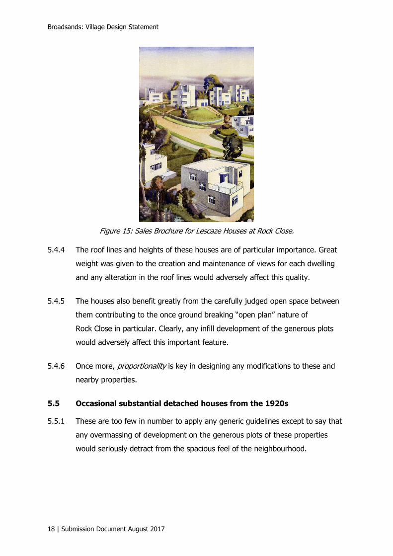
5.4.4 The roof lines and heights of these houses are of particular importance. Great
weight was given to the creation and maintenance of views for each dwelling
and any alteration in the roof lines would adversely affect this quality.
5.4.5 The houses also benefit greatly from the carefully judged open space between
them contributing to the once ground breaking “open plan” nature of
Rock Close in particular. Clearly, any infill development of the generous plots
would adversely affect this important feature.
5.4.6 Once more, proportionality is key in designing any modifications to these and
nearby properties.
5.5 Occasional substantial detached houses from the 1920s
5.5.1 These are too few in number to apply any generic guidelines except to say that
any overmassing of development on the generous plots of these properties
would seriously detract from the spacious feel of the neighbourhood.

Document 6 of 10
Submission Document August 2017 | 19
6 Landscape and natural environment
6.0.1 Key to the character of the area is the substantial expanse of green and
wooded space backing on to a section of unspoilt coast forming part of the
Torbay Global Geopark – part of the Global Network of only 90 Geoparks
designed to protect geodiversity of which only nine are situated in the UK.
6.0.2 Saltern Cove, situated in the Broadsands coastal section, is the only Underwater
Local Nature Reserve in England.
6.0.3 On this stretch of coast, holidaymakers share the beach with black-necked
grebes and cirl buntings as well as little egrets, herons, and many resident and
visiting seabirds. Buzzards and owls live in the woods behind, foxes and
badgers saunter through the gardens of houses by Tor Rocks and seals
regularly patrol near the shore. Across the headland of Elberry Common, with
its superb views and woodland walk, lies Elberry Cove. Here the beach is
bleached shingle and large areas of the sea bed are covered with seagrass. This
is an important habitat and breeding ground for many species, notably native
seahorses. Pipefish, spider crabs, sea hares, swimming crabs, sea slugs, shelled
molluscs and sea worms are also found in the seagrass beds.
6.0.4 There are several landmarks within the area setting it apart from a mere
collection of dwellings.
6.1 The Neolithic Tomb
6.1.1 This tomb is situated behind Broadsands beach, and was discovered in 1956 by
Guy Belleville, a local archaeologist. He also found evidence that people had
lived in the valley leading from Warborough Common to Broadsands during the
late Palaeolithic and Bronze Age. About half a mile from the tomb he unearthed
numbers of worked flints, arrowheads and fragments of polished flint axes. The
tomb was a significant discovery because at that time there were no other
certain examples of a Passage Tomb in the south-west of England and they are
comparatively rare in Britain.
Broadsands: Village Design Statement
20 | Submission Document August 2017
6.2 The Warrener’s House
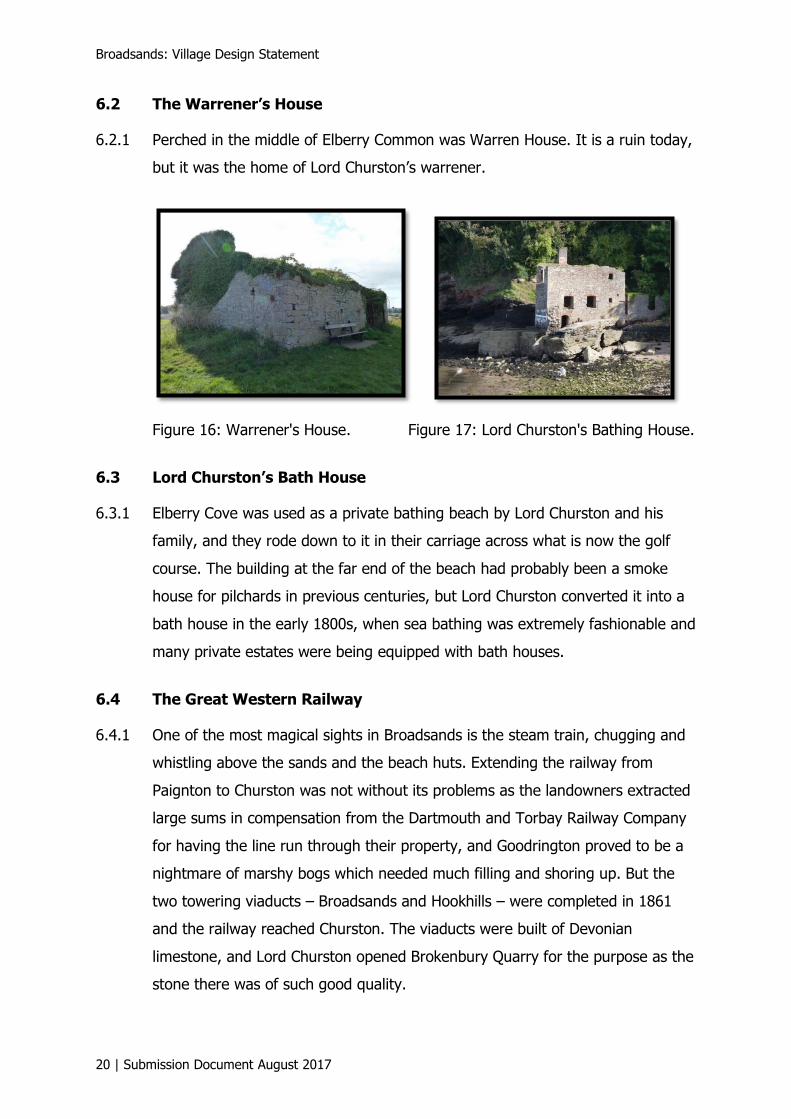
6.2.1 Perched in the middle of Elberry Common was Warren House. It is a ruin today,
but it was the home of Lord Churston’s warrener.
Figure 16: Warrener's House. Figure 17: Lord Churston's Bathing House.
6.3 Lord Churston’s Bath House
6.3.1 Elberry Cove was used as a private bathing beach by Lord Churston and his
family, and they rode down to it in their carriage across what is now the golf
course. The building at the far end of the beach had probably been a smoke
house for pilchards in previous centuries, but Lord Churston converted it into a
bath house in the early 1800s, when sea bathing was extremely fashionable and
many private estates were being equipped with bath houses.
6.4 The Great Western Railway
6.4.1 One of the most magical sights in Broadsands is the steam train, chugging and
whistling above the sands and the beach huts. Extending the railway from
Paignton to Churston was not without its problems as the landowners extracted
large sums in compensation from the Dartmouth and Torbay Railway Company
for having the line run through their property, and Goodrington proved to be a
nightmare of marshy bogs which needed much filling and shoring up. But the
two towering viaducts – Broadsands and Hookhills – were completed in 1861
and the railway reached Churston. The viaducts were built of Devonian
limestone, and Lord Churston opened Brokenbury Quarry for the purpose as the
stone there was of such good quality.

Document 6 of 10
Submission Document August 2017 | 21
Figure 18: GWR.
6.4.2 Views and vistas play a vital part in the character of the area.
6.4.3 This encompasses both views downslope and out to sea and upslope across
unspoilt rural and woodland stretches to the fringes of habitation.
6.4.4 It is particularly important that the habitation creeps no closer nor intrudes
upon this undeveloped strip, and that the low-profile skyline is preserved so as
not to intrude any further on the views enjoyed by holidaymakers, walkers,
sailors and all those enjoying the amenity.
6.4.5 There are existing examples of the impact of inappropriate design by way of
high rooflines, overmassing or general development too close to the coastal
strip.
Figure 19: Skyline from Broadsands Avenue with overmassed building.

Broadsands: Village Design Statement
22 | Submission Document August 2017
7 Transport
7.0.1 The neighbourhood is bounded on the landward upslope side by the A379 – for
the most part a busy single-carriageway primary transit route/public transport
route which has no cycle lane provision (an omission, as it is the only level road
in the Village Design Statement area) and a speed limit of 30 mph.
7.0.2 The absence of a dedicated cycle route needs to be addressed as a matter of
urgency. The map in Figure 20 shows the almost total absence of cycle route
provision in the area. A solution lies in using the underutilised footway on the
A379, and appropriate signage.
Figure 20: Cycle routes.
7.0.3 All other roads are minor in varying degrees, and the majority of them
residential. The majority of these roads offer no through way or links with
adjacent habitation owing to the topography. With restricted vehicle standing in
most dwellings, multiple car ownership means vehicles are frequently parked on
the highway.

Document 6 of 10
Submission Document August 2017 | 23
7.0.4 There is a strong case for traffic calming on all these minor roads, as all trips
will be for residence access or beach car park access purposes only. Such
measures would represent both an environmental benefit and a safer road
environment in built-up residential areas.
7.0.5 The area is key to several important footpaths, chief of which is the South West
Coast Path, together with very popular walking routes around Elberry Cove and
towards Galmpton and the River Dart. These paths are used heavily by
residents, holidaymakers and serious ramblers alike. It is therefore vital to
maintain their integrity and beauty by respecting not only their physical status,
but also the views and vistas they enjoy. Some terrible mistakes have been
made historically in this respect – see for example the proximity of caravans to
the South West Coast Path at Waterside Caravan Park in Figure 21.
Figure 21: Caravans next to the South West Coast Path.
7.1 Broadsands Beach visitor and recreational facilities redevelopment
7.1.1 The survey of residents in 2012 produced overwhelming support for the
redevelopment of the very dilapidated and poorly designed buildings currently
sited to the rear of the promenade at Broadsands beach (see Figure 2 earlier).
7.1.2 Any redevelopment of this site should have regard for the sensitive nature of
the site not only owing to the setting between the beach and open farmland,
but also to the proximity to sensitive wildlife habitats – notably the cirl bunting
colony in the fields and hedgerows situated to the rear.

Broadsands: Village Design Statement
24 | Submission Document August 2017
7.1.3 From a design perspective, any development should make extensive use of
natural materials and low-level elevations to make minimal impact on views and
vistas. The design should also seek to achieve architectural merit fitting for the
very high profile status of the site in tourist amenity terms – in other words
avoiding the significantly inappropriate crude and obtrusive design of the
present building.
7.1.4 Inspiration might be taken, for example from the award winning innovative
design café built at East Beach, Littlehampton.
Figure 22: East Beach Café, Littlehampton.
7.1.5 Another worthy example is the more conservative contemporary design of
Fifteen Cornwall at Watergate Bay in Cornwall.
Figure 23: Fifteen Cornwall.
7.1.6 Torbay planners should consider holding an open design competition for the site
to attract the interest of architectural practices in a landmark project.
Document 6 of 10
Submission Document August 2017 | 25
8 Conclusion – Design guidelines
8.1 Good design
8.1.1 Good design in this area is typified by the pre- and post-Dartington inspired
architectural styles described above, as well as some older landmarks and
buildings using local materials. In their time these buildings and their
landscaping represented outstanding and innovative design which set new
standards for the area. This is a goal which is key to current national planning
guidelines.
8.1.2 These design standards were not maintained through the two areas developed
in the 1960s and 1970s.
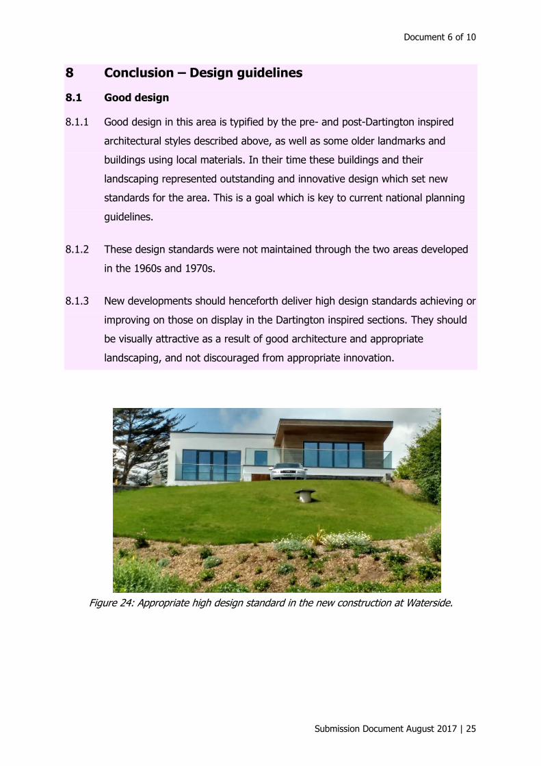
8.1.3 New developments should henceforth deliver high design standards achieving or
improving on those on display in the Dartington inspired sections. They should
be visually attractive as a result of good architecture and appropriate
landscaping, and not discouraged from appropriate innovation.
Figure 24: Appropriate high design standard in the new construction at Waterside.

Broadsands: Village Design Statement
26 | Submission Document August 2017
Figure 25: High design standard in bungalow remodelling.
8.2 General guidelines
8.2.1 The massing, density and footprint of any new development should not be
excessive for the site or out of proportion to that of the area of the village in
which it sits.
8.2.2 New extensions and additions should be sympathetic in scale to the existing
building using materials and designs characteristic of the fabric. They should
also respect the setting of the village while not preventing or discouraging
appropriate innovation.
8.2.3 To retain character, the size of new dwellings should be in proportion to those
prevalent in the immediate area of the village, as should their relationship to,
and within, the road.
8.2.4 Proposed development should strengthen the local landscape character by
providing boundary lines of suitable material, for example trees along lanes in
communal spaces. Trees planted should be of native varieties (for example,
beech) rather than decorative or non-indigenous species.
8.2.5 The typical use of low hedging enhances an open feel and often allows glimpses
of the surrounding countryside. Front garden boundaries should preferably be
of low hedging or shrubbery to add to green interval space.

Document 6 of 10
Submission Document August 2017 | 27
8.3 Guidelines for specific village areas
8.3.1 1960s and 1970s bungalow developments
• The tiered and single-storey nature of these buildings should be extended
to any new development – new or replacement building or extension – in
order to adhere to the historical maintenance of views and vistas for all
residents afforded by the topography of the village.
• Roof heights should conform to those of surrounding properties for the
same reason.
8.3.2 Pre-and post-war houses by de Soissons and others
• The extensive soft landscaping around these properties should be
maintained and enhanced where any new development is proposed.
• The low massing of development should be maintained in these areas.
• Any new development should retain a sense of space within an individual
plot which reflects that typical of the area.
• New developments should not exceed the two-storey height typical of
these properties.
8.3.3 The “Lescaze” modernist properties
• The architectural merit and design qualities of these properties should be
reflected in any proposals to extend or redevelop any of them.
• Any extension or development should respect the design principles of
clean lines and rendered finish materials used in the originals in order to
provide visual integrity.
• The intention of the architect to afford views to each tier of the properties
should be maintained by retaining their current height and flat roof
design.

Broadsands: Village Design Statement
28 | Submission Document August 2017
8.3.4 Occasional older detached houses
• Proportionality of the building to the often generous sized plot is a
particular feature of these buildings, and so any development should
maintain this proportionality.
• These buildings often have substantial mature soft landscaping and this
should be maintained or enhanced as part of any new development.
8.3.5 On open spaces and vistas
• New developments should respect the sense of openness and seek to
protect important views.
• New developments should not intrude on skylines, particularly in respect
of upslope views from the coast.
Figure 26: Unspoiled panoramic skyline from the South West Coast Path at Broadsands.
Figure 27: Viewpoint for panorama above.

Document 6 of 10
Submission Document August 2017 | 29
8.3.6 On roads and footpaths
• The present network of footpaths should be maintained and where
possible expanded.
• The kerbs of pavements should reflect existing styles with a modest
height.
• Road signs and markings should be kept to a minimum.
8.3.7 On-street lighting
• Street lighting in any new development should be minimised if possible to
help maintain the existing low level of lighting. However, where street
lighting is a requirement, it should be sympathetic to the locality.
8.3.8 General
• The rural unspoilt transition between the sea and the countryside is an
important characteristic of the area – in fact the most important
characteristic highlighted in the initial public consultation. The design of
any new development, property alterations or amenity/infrastructure
alteration or enhancement, wherever situated in the village, should
respect this unspoilt margin by sensitive consideration of its potential
impact upon it.
• Front gardens/areas. Any development should not result in frontages
being dominated by hard surfacing and parked cars. The conversion of
front gardens to hard surfaced areas should be avoided wherever
possible. The area of hard landscaping should be minimised to enable soft
landscaping to dominate and reduce potential flooding from water run-off.
• New development should have a quality landscape scheme, which
incorporates new tree planting and retains as many of the natural
landscape features as possible. The hard and soft landscape design should
successfully integrate the development into the local environment.

Broadsands: Village Design Statement
30 | Submission Document August 2017
• Developers are strongly encouraged to discuss their proposals at the
earliest opportunity with the villagers and show how the details of their
proposals reflect these points.


Typeset by Sunrise Setting Ltd, Brixham Submission Document August 2017