Embed Size (px)
Citation preview

31
6.0
TR
AN
SP
OR
TA
TIO
NTransportation refers to the element of the Comprehensive Plan that serves to assure sufficient transportation mobility to accommodate the transportation needs of the community. Mobility needs must take into account all modes of transportation from pedestrians, bicycles, public transportation, streets and highways, railroads and airports. Adequate transportation facilities are vital to promote growth, manage the effects of development and protect and improve Bryan’s quality of life.This chapter includes a description of the current transportation planning effort, the existing transportation system and conditions, transportation system issues and needs, future transportation plans, and goals and objectives to direct efforts associated with the development of an effective transportation system for Bryan.
6.1 Current Transportation PlanningThe City of Bryan currently cooperates with local, state and federal agencies to identify and prioritize transportation improvement needs for the region. The Bryan/College Station Metropolitan Planning Organization (B/CS MPO) is the organization that is responsible for county-wide transportation planning. This organization currently contains representatives from the following agencies:
•CityofBryan•CityofCollegeStation•BrazosCounty•TexasA&MUniversity•TexasDepartmentofTransportation(TxDOT)
The committee holds monthly meetings to discuss transportation issues, solutions and forecasted needs for the region. Every two years the committee produces a prioritized list of short range (3 year) county-wide transportation improvement needs in an effort toassistTxDOTwiththeirplanning.Thislistisrepresentativeofthoseprojectsidentified on the MPO long range (20 year) Metropolitan Transportation Plan (MTP). The 2006-2008 MPO Transportation Improvement Plan (TIP) is available online at www.bcsmpo.org/.In addition to working with the MPO and establishing a priority list of thoroughfare improvements community wide, the City of Bryan maintains its own priority of desired local thoroughfare and bikeway improvements with the Bryan Thoroughfare Plan and the Bryan Bikeway Master Plan, both of which are elements of the 2006 Comprehensive Plan. In addition to these two plans, there is a v/Bike Master Plan contained within the City of Bryan Parks Master Plan. All of these plans serve to ensure orderly and timely development of Bryan’s highway, street and bikeway systems to serve the community’s mobility and access needs. Through the implementation of these plans, the City can secure the needed rights-of-way and transportation system improvements to extend the transportation system network within the city limits and its extraterritorial jurisdiction, thus providing an excellent system of mobility for its citizens.
6.2 Existing Transportation SystemThe City of Bryan existing transportation system consists of a highway and street network as well as sidewalks and a dispersion of hike and bike trails. In addition, public transportation, rail and air transportation, provided by other entities, are available in the region.Existing Transportation System NetworkThe existing transportation network includes Federal and State Highways, Farm-to-Market roads, major and minor arterials, collector streets, residential streets, sidewalks, hike and bike trails, and traffic control devices.

32
Federal and State Highways
TheBryanareahasseveralFederal(US)andStateHighways(SH)thataredesignatedas part of the National Highway System (NHS). These include:
•SH6(EarlRudderFreeway)•US190/SH21(SanJacinto)
In addition, the following roads are State Highways that are not part of the NHS:•SH30•SH47
All of these roadways serve as major transportation routes to connect the B/CS area to major highways throughout Texas. These transportation routes are vital to the health of the area’s economy and continued growth. SH6providesamajortransportationroutetoconnecttheBryanareatoUS290and the Houston metropolitan area to the south and to Interstate Highway (IH) 35 in Waco to the north. SH6 is currently (2006) undergoing major improvements to the south between College Station and Navasota. These improvements will provide additional capacity and safety for this highly utilized transportation route. US190/SH21providesaroutefromSH6toMadisonvillewhileSH21continueseast-westacrossBryanlinkingIH35nearSanMarcostoIH45atMadisonville.SH30extendseastfromSH6toIH45inHuntsvilleandprovidesamajorrouteforeast bound traffic. SH47providesaconnectionfromSH21neartheTexasA&MRiversideCampustoFM 60 near Easterwood Airport.
Farm-to-Market Roads
In addition to the Federal and State highways, there are numerous Farm-to-Market roadwaysthatservethearea.Manyoftheseconsistof4to6lanesoftravelwhichprovide mobility throughout the region. These include:
•FM60(UniversityDrive)•FM158(BoonvilleRoad/W.J.BryanParkway)•FM974(TaborRoad)•FM2818(N.HarveyMitchellParkway)•FM1179(VillaMariaRoad/BriarcrestDrive/SteepHollowRoad)•FM1687(SandyPointRoad)•FM1688(LeonardRoad)•FM2223(CameronRanchRoad)
Major and Minor Arterial Streets
Bryan has several major and minor arterials within its existing network of roadways. Amajorarterialisdefinedasasix(6)lanedividedroadwaywitha96-footpavementwidth cross section contained within a 120-foot wide right-of-way. Major arterials function as roadways that carry traffic volumes in the general range of 20,000 to 60,000vehiclesperday.Aminorarterialisdefinedasa4lanedividedroadwaywitha70-or76-footpavementwidthcrosssectioncontainedwithina100-footwideright-of-way,oritcanbedefinedasafive(5)laneundividedroadwaywitha70-footpavement width cross section. Minor arterials function as roadways that carry traffic volumes in the general range of 5,000 to 30,000 vehicles per day. Problems arise when roadways not built to the above arterial standards begin carrying high traffic

33
volumes, thus functioning as arterials. Although the following roadways may or may not be constructed to these dimensions, they function as major or minor arterials. These include:Major
•TexasAvenue(SHBusiness6)•VillaMariaRoad/BriarcrestDrive(FM1179)•N.HarveyMitchellParkway(FM2818)•W.J.BryanParkway/BoonvilleRoad(FM158)
Minor
•29thStreet•FinfeatherRoad•OldRelianceRoad/MLKJr.Street•SouthCollegeAvenue•WoodvilleRoad
Collectors and Residential Streets
In addition to the major roadways, the Bryan transportation network contains numerous collector and residential streets which provide connectivity within and around subdivisions. The connectivity of these roadways is critical to the efficiency and effectiveness of the overall transportation system.Sidewalks
Bryan has several miles of existing sidewalks throughout the City. The majority of the sidewalks have been installed by developers in subdivisions constructed after 2000 when the City of Bryan modified its Subdivision Ordinance to require sidewalks on both sides of all curb and gutter streets. There are also sidewalks throughout the DowntownareaandmorescatteredthroughoutthecommunitywhichhavebeeninstalledbytheCityorTxDOTaspartoftheirCapitalImprovementsPrograms.Bikeways
Bryan has numerous residents that cycle for both transportation and recreation. Students, whether elementary, high school or college, often cycle as a form of transportation to and from school. In addition, there appears to be an ever increasing number of employees who are biking to work, particularly those in the service industry. And of course, there are always the contingent of avid long distance cyclists and general weekend recreational cyclists who utilize the existing transportation system. The existing bikeway system in Bryan consists of approximately 5 miles of bike paths along FM 158 between FM 60 and SH 6, approximately 3.5 miles of bike paths, currently constructed or under design, within the Park Hudson, Austin’s Colony andShirewoodSubdivisions,approximately17milesofoffstreetbiketrailsatBryanUtilitiesLake,andabikelaneonSouthCollegeAvenuebetweenVillaMariaRoadandDodgeStreet.Public Transportation
IntercitybusserviceisprovidedbyGreyhoundLines,Inc.,attheirlocationonFinfeatherRoad.Serviceincludesonenorthboundandonesouthboundbusdaily.The number of buses leaving daily has decreased over the past 5 years.ThecitybustransitserviceisprovidedbytheBrazosTransitDistrict(TheDistrict)andtheTexasA&MUniversity(TAMU)ShuttleBusService.TheDistrictprovidesfixed route urban transit service to the Bryan/College Station area and paratransit and rural transit service on a demand basis. Seven fixed routes comprise the bus service within the Bryan/College Station area. Hours of operation begin at 5:00 A.M. and

34
endat7:00P.M.,MondaythroughFriday,withnoserviceprovidedonSaturdayorSunday. Fares are priced at $1.00 for adults and 50 cents for elderly, children and disabled patrons.Paratransitratesare$4.00perroundtripifwithinthesamecounty.Patronsmayboard the bus anywhere along the route so long as they board from the same side of the street as the entrance to the bus.TheTAMUShuttleBusServiceservesstudents,faculty,staff,andvisitorsandincludesintracampus and off-campus shuttle bus service as well as paratransit services. Off-campusserviceincludestwelvefixedroutesextendingradiallyfromtheTexasA&M(TAMU)campus,includingonerouteconnectingTAMUwithBlinnCollegeinBryan.Regularservicehoursarefrom7:00A.M.through10:00P.M.,MondaythroughFridaywithlimitedservicefrom10:00P.M.tomidnight.DuringthefallandspringsemestersthereisalsolimitedserviceonSaturdayfrom9:00A.M.to6:00P.M.TAMUalsooperatesadoor-to-doorparatransitservicetoADAqualifiedindividualswhocannotusethe regularly scheduled shuttle bus service.Taxi service is also available to the community and is provided by private companies throughout the Bryan/College Station area. This service is particularly popular to and from the area airport but is also available for service within the community and to neighboring cities. Airport limousine service is also available between Bryan and the Houston and Austin airports.Transit Terminal & Parking Garage
Between1999and2001,theBrazosTransitDistrict(TheDistrict),incooperationwith the City of Bryan, Brazos County and other stakeholders met to determine a location and facility requirements for a proposed 5-story multimodal transit terminal and parking facility in DowntownBryan.Inadditiontoactingasa multimodal transit terminal and parking garage, this facility could ultimately provide office space for governmental agencies as well as retail and office space for private entities. This project also envisioned an effort to improve pedestrian access to theterminalsitefromtheDowntownarea.TheDistricthasidentifiedthisprojectintheir2006-2008TransportationImprovementPlan and has sought federal funds to aid in the construction of the facility. Motor Freight
SH 6 is a major corridor for shipping goods into and out of the community as well as a through route from Houston to Waco and continued service into northwest Texas. Truck routes, freight distribution and warehouse uses are important components for goods movement. It is this movement of goods and people into and out of a community to other major economic hubs that is essential to the community’s economic vitality. But as Bryan expands to the east of SH6 there will be a growing concern for an alternate truck route for large and hazardous cargo to, from, and through the community.Railroads
TheUnionPacificRailroad,oneofthefourlargestrailroadcompaniesintheUnitedStates, operates a freight rail line through Bryan-College Station between Houston and Dallas-FortWorth.TheUnionPacificraillineentersCollegeStationfromthesouthand continues north through Bryan where the tracks diverge with one branch continuing north to Waco and the other continuing northwest through Hearne. A loading/unloading facility for concrete materials and several private sidings associated with industrialrailcustomersarelocatedinBryan.Onaverage,14trainsper24hourperiodtravelsouthboundthroughBryan,and19trainsper24hourperiodtravelnorthbound.Numerous points of auto-train and pedestrian-train conflict exist within the City of Bryan. Potential relocation of the existing railroad alignment, either outside the Bryan/College Station urban area or depressed below grade has been studied for the past 10

35Figure 6-1 Hike & Bike Inventory 2006
37
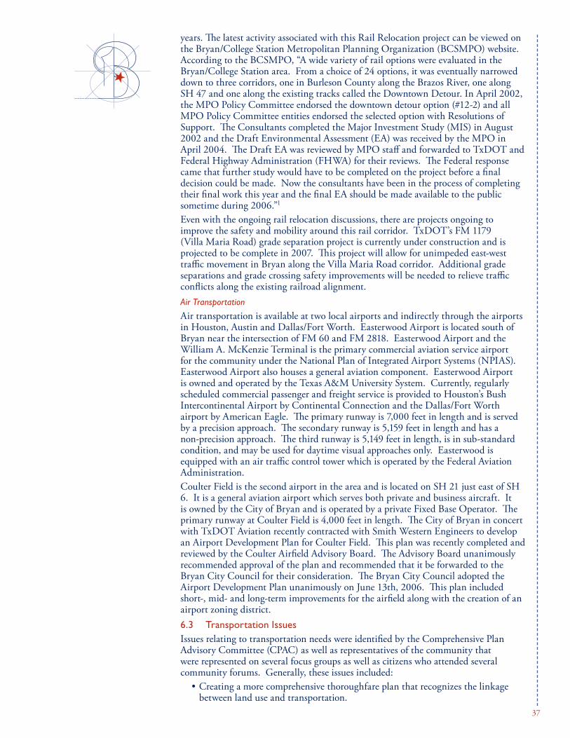
years.ThelatestactivityassociatedwiththisRailRelocationprojectcanbeviewedonthe Bryan/College Station Metropolitan Planning Organization (BCSMPO) website. According to the BCSMPO, “A wide variety of rail options were evaluated in the Bryan/CollegeStationarea.Fromachoiceof24options,itwaseventuallynarroweddowntothreecorridors,oneinBurlesonCountyalongtheBrazosRiver,onealongSH47andonealongtheexistingtrackscalledtheDowntownDetour.InApril2002,the MPO Policy Committee endorsed the downtown detour option (#12-2) and all MPOPolicyCommitteeentitiesendorsedtheselectedoptionwithResolutionsofSupport. The Consultants completed the Major Investment Study (MIS) in August 2002andtheDraftEnvironmentalAssessment(EA)wasreceivedbytheMPOinApril2004.TheDraftEAwasreviewedbyMPOstaffandforwardedtoTxDOTandFederal Highway Administration (FHWA) for their reviews. The Federal response came that further study would have to be completed on the project before a final decision could be made. Now the consultants have been in the process of completing their final work this year and the final EA should be made available to the public sometime during 2006.”1
Even with the ongoing rail relocation discussions, there are projects ongoing to improvethesafetyandmobilityaroundthisrailcorridor.TxDOT’sFM1179(VillaMariaRoad)gradeseparationprojectiscurrentlyunderconstructionandisprojectedtobecompletein2007.Thisprojectwillallowforunimpededeast-westtrafficmovementinBryanalongtheVillaMariaRoadcorridor.Additionalgradeseparations and grade crossing safety improvements will be needed to relieve traffic conflicts along the existing railroad alignment.Air Transportation
Air transportation is available at two local airports and indirectly through the airports inHouston,AustinandDallas/FortWorth.EasterwoodAirportislocatedsouthofBryan near the intersection of FM 60 and FM 2818. Easterwood Airport and the WilliamA.McKenzieTerminalistheprimarycommercialaviationserviceairportfor the community under the National Plan of Integrated Airport Systems (NPIAS). Easterwood Airport also houses a general aviation component. Easterwood Airport isownedandoperatedbytheTexasA&MUniversitySystem.Currently,regularlyscheduled commercial passenger and freight service is provided to Houston’s Bush IntercontinentalAirportbyContinentalConnectionandtheDallas/FortWorthairportbyAmericanEagle.Theprimaryrunwayis7,000feetinlengthandisservedbyaprecisionapproach.Thesecondaryrunwayis5,159feetinlengthandhasanon-precisionapproach.Thethirdrunwayis5,149feetinlength,isinsub-standardcondition, and may be used for daytime visual approaches only. Easterwood is equipped with an air traffic control tower which is operated by the Federal Aviation Administration.Coulter Field is the second airport in the area and is located on SH 21 just east of SH 6. It is a general aviation airport which serves both private and business aircraft. It is owned by the City of Bryan and is operated by a private Fixed Base Operator. The primaryrunwayatCoulterFieldis4,000feetinlength.TheCityofBryaninconcertwithTxDOTAviationrecentlycontractedwithSmithWesternEngineerstodevelopanAirportDevelopmentPlanforCoulterField.Thisplanwasrecentlycompletedandreviewed by the Coulter Airfield Advisory Board. The Advisory Board unanimously recommended approval of the plan and recommended that it be forwarded to the Bryan City Council for their consideration. The Bryan City Council adopted the AirportDevelopmentPlanunanimouslyonJune13th,2006.Thisplanincludedshort-, mid- and long-term improvements for the airfield along with the creation of an airport zoning district.6.3 Transportation IssuesIssues relating to transportation needs were identified by the Comprehensive Plan Advisory Committee (CPAC) as well as representatives of the community that were represented on several focus groups as well as citizens who attended several community forums. Generally, these issues included:
•Creatingamorecomprehensivethoroughfareplanthatrecognizesthelinkagebetween land use and transportation.

38
•Creatingabike/pedestrianfriendlycommunity.Integratingbikewaysandsidewalks into the plan and locating a funding source for these improvements.
•Improvingtheoperationoftrafficsignalization(timing,activationandpedestrian/bike operation).
•Increasingthecapacityofmajorintersectionswithdedicatedright-turnlanes.•Improvingeast-westtrafficmobilityinthecommunity.•IncreasingpedestriansafetybyprovidingpedestrianfriendlycrosswalksnearthemedicalareaandVillaMariaRoadandprovidetransitstopsinthemedicalarea(St.JosephRegionalHealthCenter).
•Facilitatingtransportationimprovements(vehicular,bikeandpedestrian)directedat the new high school and middle school areas.
•DecreasingrailroadnoiseinDowntownwitha“QuietZone”.•Improvingmaintenanceofourexistingroadsurfaces.•Minimizingtrafficimpactsonexistingneighborhoods.•Improvepublictransitopportunities.•ImplementingajointticketsystembetweenTAMU,BlinnandtheDistrictfor
joint ridership on these transit systems.
6.4 Future Transportation Plans
Thoroughfares
Over the past 15 years, the City of Bryan has seen a 1.5% annual increase in population growth. Accompanying this growth has been an increase in traffic throughout the community. With a continued growth at this rate, the City of Bryan could reach a population of approximately 100,000 by the year 2030. Also of note is the projected population for Brazos County of over 200,000 in the year 2030. In order to handle the transportation needs for a community of this projected size, the transportation needs must be planned well in advance of the growth. If not, a majority of the transportation corridors will be blocked by development making it extremely difficult and costly to retrofit good mobility. Transportation planning is also occurring statewide for future transportation corridors. One of the most recent planning ideas can be viewed at www.gulfcoaststrategichighway.org. This potential IH 14routewillskirtjustnorthofBryanandcouldbe incorporated into a northern outer loop. Other potential corridors include the two Trans-Texas CorridorProjects,TTC-35andTTC-69.TTC-35’sreasonable corridor locations place it running north and south, between the City of Bryan and the City ofAustin.TTC-69’sreasonablecorridorlocationsplace it between the City of Bryan and the City of Houston, running in a generally northeastern-southwestern direction. Transportation planning plays a vital role in the City of Bryan’s accessibility for goods and materials and thus has a direct impact on the community’s economic well being. City leaders should be monitoring transportation planning carefully and be contributing to these discussions where appropriate in an effort to encourage new route accessibility to Bryan.Good transportation planning begins with the basics of roadway spacing and creating an arterial grid system for the community in order to provide both north-south and east-west movement. Communities with good traffic mobility have followed these basics and have not allowed the major roadways to be compromised with discontinuity, inadequate right-of-way widths, or offset intersections. A healthy roadway grid system should consist of the following:

39
•Freeways–every6miles•SuperorMajorArterials–every3miles•MinorArterials–every1mile•MajorCollectors–every½mile
It is interesting to note when comparing the overall transportation systems of Houston, Tyler, and Austin how similar Bryan is to the Austin model. Houston and Tyler, although significantly different in population and size, have very similar transportation systems. These transportation systems consist of thoroughfares spaced in a good grid system and loop road(s). One of the shortfalls of Austin in its overall transportation system is its lack of a continuous loop around the city and lack of consistent grid spacing outside the central business district. Traffic has become bottlenecked on its major north-south corridor (IH 35) and development has occurred in the path of potential loop or alternate corridors. Bryan and College Station have experienced similar transportation problems with continued growth. SH6, being the major north-south corridor in the community, is carrying an ever-increasing number of vehicles. The area is fortunate however, in that the growth both east and west of SH6 has not yet eliminated the opportunity to plan for and develop a loop system around the community. In addition, it is important to realize that correct thoroughfare size, spacing and continuity are extremely important to the overall health of the thoroughfare system. For example, when arterials are not spaced correctly, residential and collector roadways carry volumes that surpass their design and citizen complaints regarding traffic congestion begin to occur.Good thoroughfare systems begin with good thoroughfare spacing and design, but it also follows a roadway hierarchy (residential-collector-arterial). These functional street classifications are based on the roles served by these different classes of streets andhighways.FromthecurrentB/CSUnifiedDesignGuidelines,thecriteriathatthe City of Bryan utilizes to define the various functional classes is listed in Table 6.1. In theory, residential streets connect to collectors and collectors to arterials. When the grid spacing is not adhered to and/or the hierarchy is not followed, residential streets will function as collectors. This occurs when residential streets are spaced in the place of a collector or connect directly to arterials. This creates a situation where residential streets carry the traffic volume that they were not designed to handle. Many of the citizen complaints regarding traffic (i.e. Carter Creek Parkway, Esther Street) can be directly attributed to this problem. In much the same way, collectors should not be interchanged with freeways because they will tend to function as arterials. To assure that development accommodates proper thoroughfare spacing and hierarchy, the City of Bryan Thoroughfare Plan has been significantly expanded. The grid system has been filled in to assure that development includes these thoroughfares andthesystemhasbeenexpandedintotheExtra-TerritorialJurisdiction(ETJ)to assure the thoroughfares outside the city limits are constructed. The City of Bryan Thoroughfare Plan, shown in Figures 6-2 and 6-3, illustrate the proposed thoroughfare system of freeways, arterials and major collector streets. Bryan’s thoroughfare system is currently comprised of existing streets and highways, some of which are constructed to their ultimate configurations and others that will require additional rights-of-way and wider pavement cross sections. The Thoroughfare Plan shows approximate alignments for planned thoroughfares to be dedicated and constructed with the platting of subdivisions or with the City’s

40
capital improvement program. The Thoroughfare Plan does not show future residential streets or minor collectors because these streets function principally to provide access and their future alignments may vary depending on development plans. This does not mean that minor collectors and residential streets are optional, only that there is flexibility based on trip generation rates of the proposed development and the internal handling of that traffic generated. These street alignments should be determined by the City and landowners as part of planning for development.Implementation of this thoroughfare system will occur over time as the city grows. Typically right-of-way acquisition and construction of these thoroughfares occurs as part of the platting process. The fact that a planned thoroughfare is shown does not represent a commitment to a specific time frame or exact location for construction.Bikeways/Sidewalks
The City of Bryan has great potential to increase bicycle transportation with its sizeable bicycling population and active bicycle advocacy groups. Bicycle routes, lanes and trails have the ability to provide links between residential areas and destinations throughout the city. As stated previously, there have been an increased number of cyclists on the roadway. Many collector and residential streets in Bryan could be retrofitted simply with striping or signage to help accommodate and encourage bicycle traffic.AplanforproposedbikewaysystemdevelopmentisshowninFigure6-4.Thisplanshows potential locations for on-street bike facilities and off-street bike paths which can be constructed along drainage ways and rail and utility corridors. On-street bikeways should be developed as bike routes or bike lanes, depending on existing conditions and design considerations. Planning and design for bikeways should conform to the current edition of The GuidefortheDevelopmentofBicycleFacilitiesbytheAmericanAssociationofState and Highway and Transportation Officials (AASHTO). In addition, bicycle considerations should be incorporated into planning and design policies, standards and guidelines. Items such as bicycle storage are essential to encourage bicycle use. Bicycle parking racks should be conveniently provided at all public buildings and private developers should be encouraged to provide bicycle parking at major destinations.In addition to bikeways, sidewalks are also a much requested infrastructure item throughoutthecity.Recentordinancechangeshaveresultedintherequirementandconstruction of sidewalks in newer subdivisions, but they are severely lacking in older areas throughout the city. Pedestrians which utilize mass transit and school children walking to school often have to walk on beaten paths or within the street to get to their destination. As a result, a plan for a proposed sidewalk system was created and is shown in Figure 6-5. TheCityofBryanshouldworkwithTxDOTtoidentifyfundingopportunitiesforimplementation of bicycle and pedestrian improvements shown in the Bikeway and SidewalkMasterPlans.TwopossiblefundingsourcesoutsideofnormalTxDOTfunding avenues include The Statewide Transportation Enhancement Program and SafeRoutestoSchoolsProgram.Inaddition,theCityshouldpartnerwithTxDOTto achieve the implementation of planned bicycle and pedestrian facilities along State Highways,Farm-to-MarketRoadsandotherState-maintainedroadways.Localresources should focus on implementing the lower cost measures to accommodate bicyclists and pedestrians, including signing of bicycle routes, designating shoulder lanes, striping bike lanes, and intersection treatments. Other sources of support and potentialpartnersforimplementingbicycleimprovementsinclude:BrazosValleyCyclists,TexasBicycleCoalition,andLeagueofAmericanBicyclists.

41Figure 6-2 Complete Thoroughfare Plan

42Figure 6-3 Thoroughfare Plan Inside City Limits and ETJ

43Figure 6-4 City of Bryan Hike and Bike Access Plan

44Figure 6-5 City of Bryan Sidewalk Master Plan

45
Table 6.1Street Classification Definitions
Alley: A minor right-of-way which provides a secondary means of vehicular access to abutting property and which is used primarily for vehicular traffic to the rear or side of properties which otherwise abut on a public street. Parking is not allowed on alleys.
Commercial Street: A street which primarily serves commercial or multi-family development. Commercial streets shall be built to at least Minor Collector standards.
Major Arterial Street: A street which carries high volume of vehicular traffic(inthegeneralrangeof20,000VPto60,000VP)andwhichisintended to move traffic in, out or around the City.
Minor Arterial Street: A street which carries high volumes of vehicular traffic(inthegeneralrangeof5,000VPto30,000VP)andwhichisintended to move traffic around the City.
Major Collector Street: A street which primarily serves vehicular traffic (inthegeneralrangeof5,000VPto10,000VP)fromresidentialstreetsandminor collectors to arterials. A collector may also provide very limited access to abutting properties if approved by the City.
Minor Collector Street: A street which primarily serves vehicular traffic (inthegeneralrangeof1,000VPto5,000VP)fromresidentialstreetstocollectors or arterials. A minor collector may also provide limited access to abutting properties if approved by the City. Additionally, the streets identified as collectors on the Thoroughfare Plan may be designed as minor collectors only if approved by the City.
Neo-Traditional Design (NTD) Residential Street: A street which primarily serves vehicular traffic to abutting single family residential properties where narrow, more curvilinear streets are desired. Parking is only allowed on one side of the street and block length is limited.
Residential Street: A street which primarily serves vehicular traffic to abutting residential properties. A residential may also provide limited access to commercial properties if approved by the City.
Rural Residential Street: AstreetintheETJoftheCitywhichprimarilyserves vehicular traffic to abutting residential properties. A rural residential may also provide limited access to commercial properties if approved at the time of platting by the City and County. Construction and maintenance of the rural residential streets are generally under the jurisdiction of the County.Ruralstreetsectionsareallowedinsidethecitylimitsinareaswithappropriatezoningandlotsize.Refertothelocalzoningordinanceforguidance.
Rural Collector Street:AstreetintheETJoftheCitywhichprimarilyserves vehicular traffic from residential streets to arterials. A rural collector may provide limited access to abutting residential properties if approved at the time of platting by the City and County. Construction and maintenance of the rural collectors are generally under the jurisdiction of the County.
Source: B/CS Unified Design Guidelines, Rev. 2006

46
6.5 Goals, Objectives and Action StatementsThe following goals, objectives and action statements were developed with input received from citizens to address transportation issues facing Bryan over the next twenty years.
GOAL #1: Provide a Safe, Efficient and Convenient Multi-Modal Transportation System
Objective A) Plan and develop a unified thoroughfare system linked to land use.Action Statement 1: Continue to refine the level of detail and extentions of
thoroughfaresintotheETJ.ActionStatement2: UpdatetheTransportationPlans(Thoroughfare,Sidewalk
and Bikeway Plans) annually.Action Statement 3: Create and/or update the Sidewalk and Bikeway Master Plans
and assure they are adopted as a subset to the Thoroughfare Plan so that they may be implemented in a similar manner.
ActionStatement4: ActivelypursuenewlegislationinconcertwithBrazosandsurrounding counties to allow these counties to be designated as high growth areas and allowing for the adoption county thoroughfare plans that require right-of-way dedication at the time of property development.
ActionStatement5 ReviewandupdatetheCityofBryanAccessManagementpolicy.
Action Statement 6: Establish design criteria for driveway radii, slopes and slope differential to allow access from high-speed roadways (40mph+)tooccuratreasonablespeeds.
ActionStatement7: Reviewandrecommendintersectiondesignguidelinesandappropriate right-of-way widths to provide exclusive right turn lanes on major thoroughfares.
Action Statement 8: Adopt a formal street closure policy and notification requirement.
ActionStatement9: WorkwithTxDOTtodevelopanaccessmanagementprojectalong Texas Avenue.
Action Statement 10: Improve access and mobility to the City’s west side and along existing east-west corridors.
ActionStatement11: WorkwithTxDOTtoexploresolutionstothetrafficproblemsintheBriarcrestDriveandSH6interchangeareaatpeakperiods (traffic backing up on to main lanes).
Action Statement 12: Continue to support the area traffic model.Action Statement 13: In cooperation with the MPO develop and adopt a Hazardous
Materials Transportation Plan for the Bryan-College Station area.
ActionStatement14: Reviewandmakerecommendationsfortransportationimprovements for the new high school and middle school locations.
ActionStatement15: ReviewandrecommendviabilityofadditionalEast-Westconnection.
Objective B) Foster interagency cooperationActionStatement1: ActivelypursueBryanprojectswiththeMPOandTxDOT.Action Statement 2: Find new avenues to encourage cooperation between parties
within the MPO.
Objective C) Encourage utilization of alternative modes of transportation including transit, bicycles and pedestrians.
ActionStatement1: Reviewandupdatecurrentordinancestoensurethatnewdevelopment provide sidewalks and bicycle accommodations with direct connections to residential, schools, commercial, and recreational areas and to transit stops.

47
Action Statement 2: Create a pedestrian and bike friendly community through the use of a Sidewalk/Bikeway Master Plan updated yearly to provide both new and retrofit sidewalk and bike facility links between neighborhoods, schools, parks and major shopping centers.
Action Statement 3: Establish a new sidewalk location away from the curb for streetswithaspeedlimitequaltoorgreaterthan40mph.
ActionStatement4: Installbike/pedestrianfriendlytrafficsignaldetection.Action Statement 5: Create a sidewalk capital improvement plan with funding and
timeframes to install sidewalks in existing developed areas. Prioritize implementation based on schools, existing beaten paths that are being used and popular bus stops based upon theDistrictridership,focusingonthefollowinglist:
• AlongCarterCreekParkway• AlongOldCollegeRoad• AlongSouthCollegeAvenue• AlongthoseportionsofEast29thpresentlywithoutsidewalks• Intheareaofthenewhighschool(OldRelianceRoadand
Austins Colony Parkway) and new middle school (Old Hearne Road)
Action Statement 6: Create a similar bikeway capital improvement plan to stripe and sign bike lanes and routes on existing thoroughfares that are being used as such.
ActionStatement7: Assurebikelanesarestripedandsignedonallappropriatenewthoroughfares as shown in the design guidelines. Establish guidelines to determine which type of bike facility should be installed on a new street.
ActionStatement8: Createpedestrian-friendlycrossingsintheSt.JosephRegionalHealthCenterareaandacrossVillaMariaRoad.
ActionStatement9: Researchanddevelopasidewalkfundfordeveloperstocontribute to when requesting a variance to not build sidewalks across their property.
Action Statement 10: Create new design guidelines for off-street paths and amenities.
Action Statement 11: Obtain public access easements in addition to public utility easements when warranted for the inclusion (current or future) of off street hike/bike paths.
Action Statement 12: Support regional efforts to improve public transportation.ActionStatement13: Researchtheabilityforjoint-ticketingandjoint-transitstops
betweenTAMU,BlinnandTheDistrict.ActionStatement14: Installtransitsheltersatmajorridershipstops.Action Statement 15: Encourage transit stop amenities with new developments that
might generate ridership.
Objective D) Develop and promote commercial and general aviation facilities and services.
ActionStatement: ImplementtheCoulterFieldAirportDevelopmentPlan.
Objective E) Provide and promote rail transportation to meet existing and future freight and industrial needs.
ActionStatement1: ContinueandexpandcommunicationswithUnionPacificinan effort to understand upcoming policy changes and needs for rail access by future industrial users.
ActionStatement2: Reviewandrecommendthecreationofarailroad“QuietZone”aroundDowntown.

48
Objective F) Promote neighborhood integrity through traffic calming while maintaining connectivity.
Action Statement: Implement a neighborhood traffic management policy that establishes guidelines to follow for groups of citizens to approach the City for assistance with creating solutions to neighborhood traffic concerns.
GOAL #2: Maintain and Rehabilitate the Transportation Network.
Objective A) Implement the multi-year street improvement program.Action Statement 1: Create a Pavement Management System to guide yearly street
improvement priorities. Action Statement 2: Fund the annual street improvement program.
Objective B) Expand, improve and maintain the thoroughfare system through the Capital Improvement Plan and other funding sources.
ActionStatement1: ImprovetheroutesbetweentheTraditionsDevelopment,DowntownBryanandTAMU.
Action Statement 2: Create and fund an annual sidewalk/bikeway capital improvement plan to incrementally add to the system in critical (schools, beaten paths) locations.
Action Statement 3: Implement the South College Improvement Plans.ActionStatement4: Createandfundanannualtrafficsignalcapitalimprovement
plan to add and improve existing traffic signal operations.