Embed Size (px)
Citation preview
04/18/23
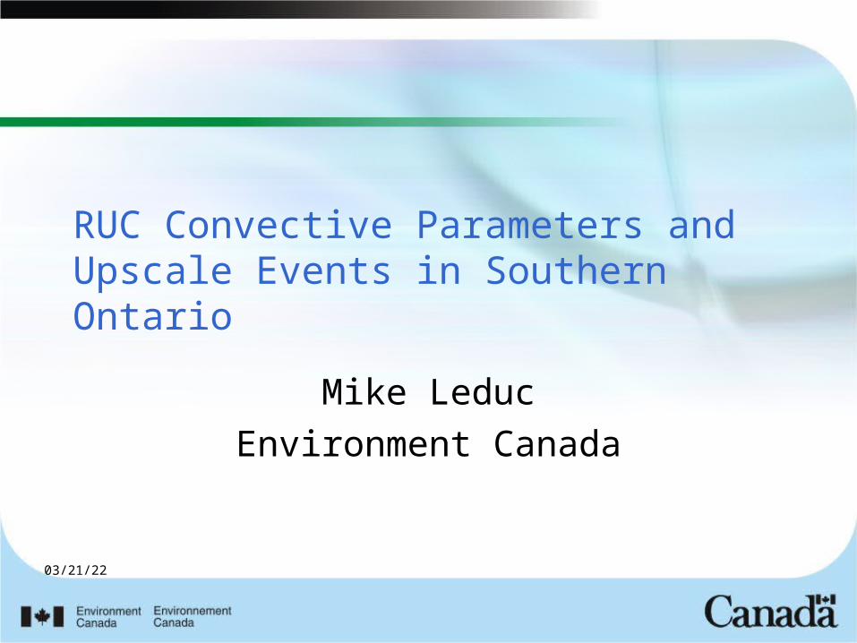
RUC Convective Parameters and Upscale Events in Southern Ontario
Mike LeducEnvironment Canada
04/18/23
Outline
• Motivation• Define Upscale Event• Hypothesis for RUC STP index and
upscale events• Preliminary (Partial) Results• SREF and STP
04/18/23
OSPC Severe Weather Program
• Challenges– Area of responsibility– Watches and warnings– Limited staffing flexibility– Message preparation software problems – Translation
• Fast Moving storms can overwhelm system if not anticipated soon enough.
04/18/23
Define Upscale Event
• Events that produce continuous damage reports for 3 hours or more moving quickly. Implies supercells or squall lines.
• (Apologies to Bob Johns and his definition of derecho)
• This threshold defines an event that severely taxes our warning system in Ontario.
04/18/23
Upscale Events
• As one would expect these upscale events usually associated with higher values shear helicity.
• Both Squall lines and supercell type events seemed to be associated with STP (significant tornado potential) >1
• How good would STP be in identifying all upscale events?
04/18/23
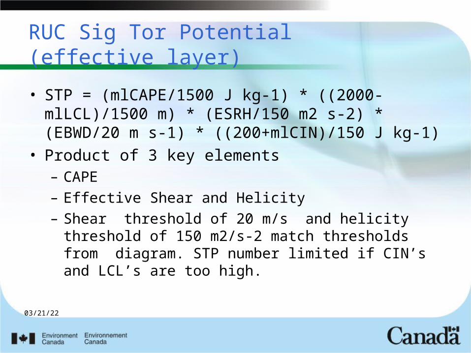
RUC Sig Tor Potential(effective layer)
• STP = (mlCAPE/1500 J kg-1) * ((2000-mlLCL)/1500 m) * (ESRH/150 m2 s-2) * (EBWD/20 m s-1) * ((200+mlCIN)/150 J kg-1)
• Product of 3 key elements– CAPE – Effective Shear and Helicity– Shear threshold of 20 m/s and helicity
threshold of 150 m2/s-2 match thresholds from diagram. STP number limited if CIN’s and LCL’s are too high.
04/18/23
• If we are using STP to estimate potential of upscale events then we are looking at situations where convection DOES initiate thus CIN not a factor.
• Great Lakes environment in summer fairly uniform values of LCL’s in bigger events. If we are looking for both bow echoes and supercells this height not important
• Given above – STP a function of CAPE Shear helicity.
04/18/23
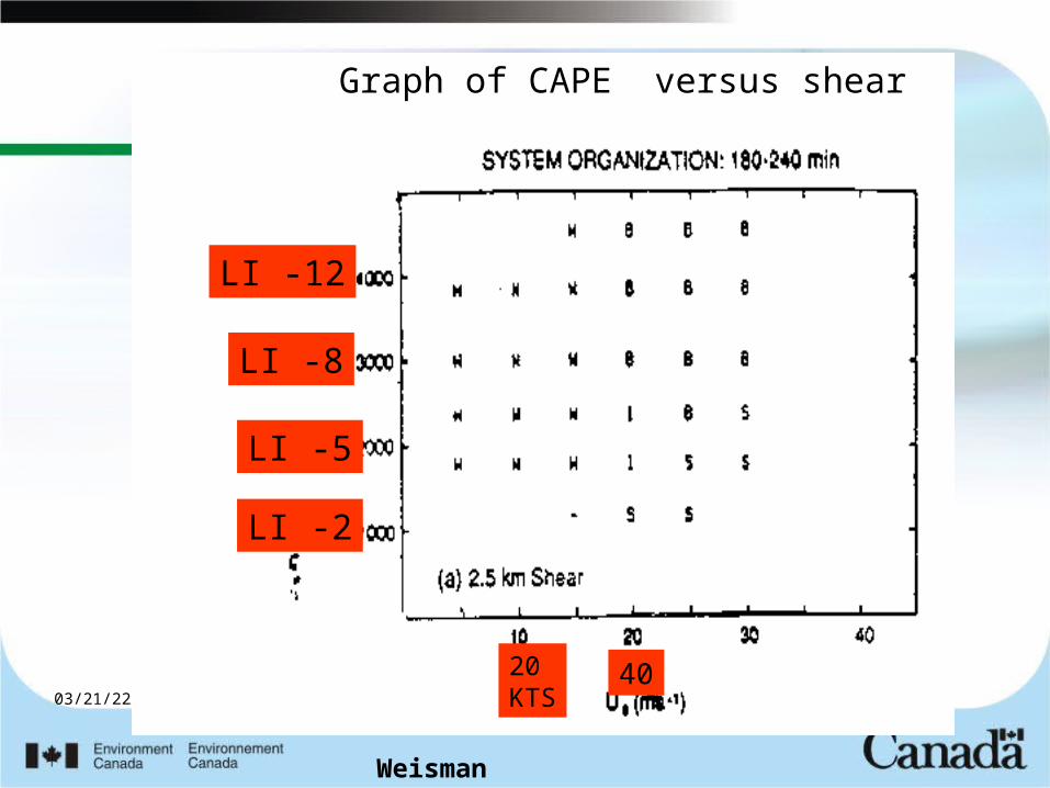
Graph of CAPE versus shear
LI -2
LI -5
LI -8
LI -12
20KTS
40
Weisman
04/18/23
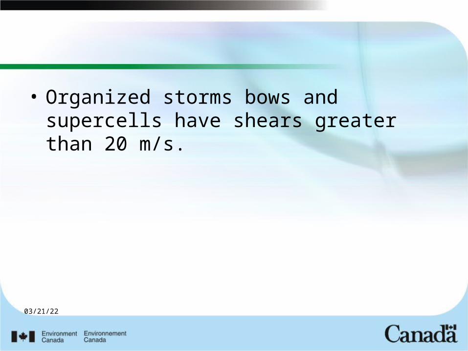
• Organized storms bows and supercells have shears greater than 20 m/s.
04/18/23
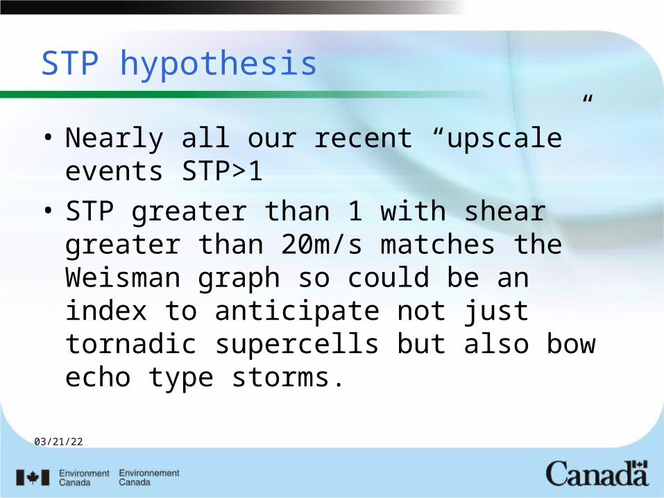
STP hypothesis
• Nearly all our recent “upscale” events STP>1
• STP greater than 1 with shear greater than 20m/s matches the Weisman graph so could be an index to anticipate not just tornadic supercells but also bow echo type storms.
04/18/23
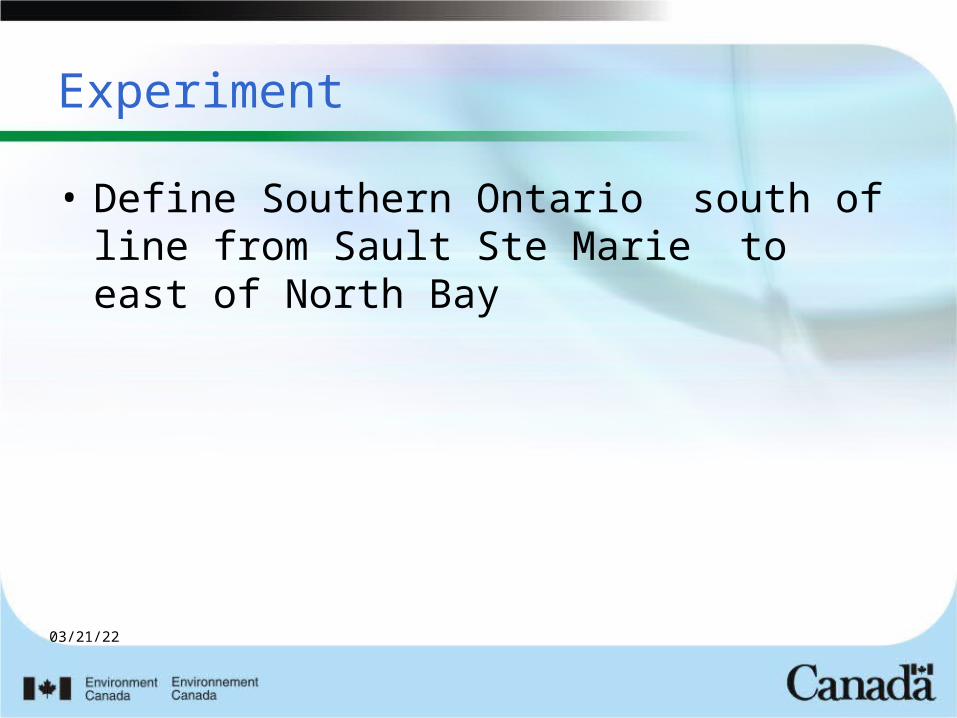
Experiment
• Define Southern Ontario south of line from Sault Ste Marie to east of North Bay

04/18/23
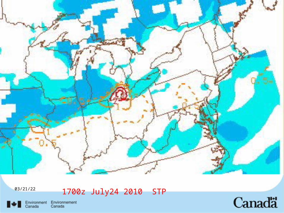
1700z July24 2010 STP
04/18/23
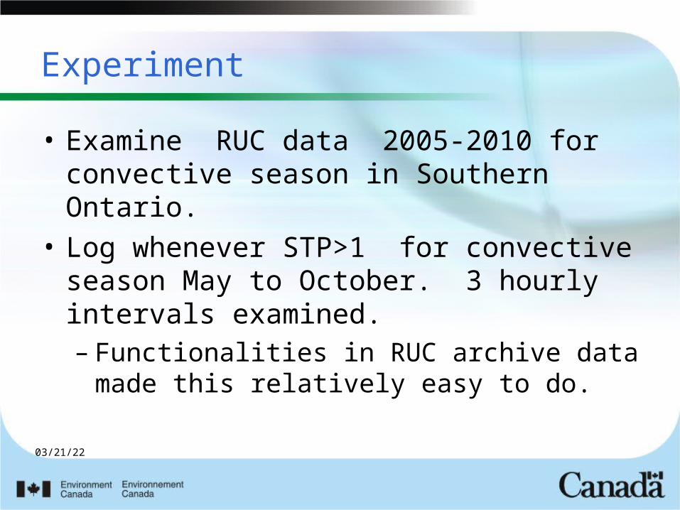
Experiment
• Examine RUC data 2005-2010 for convective season in Southern Ontario.
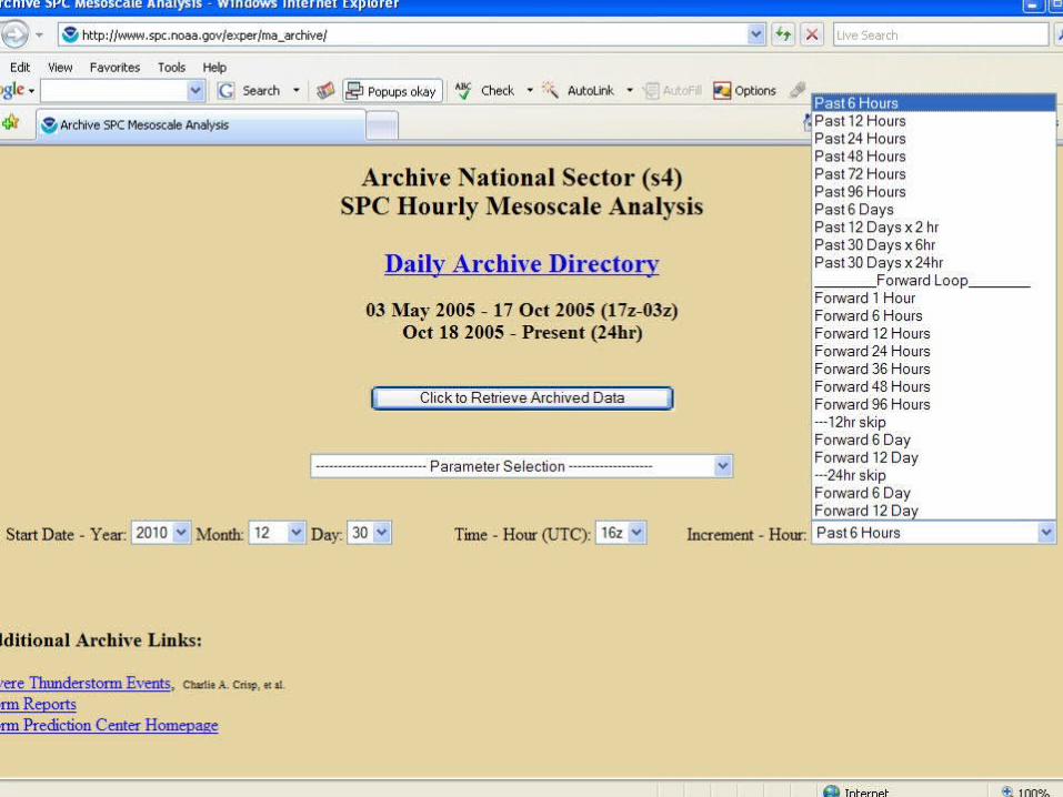
• Log whenever STP>1 for convective season May to October. 3 hourly intervals examined. – Functionalities in RUC archive data
made this relatively easy to do.
04/18/23
04/18/23
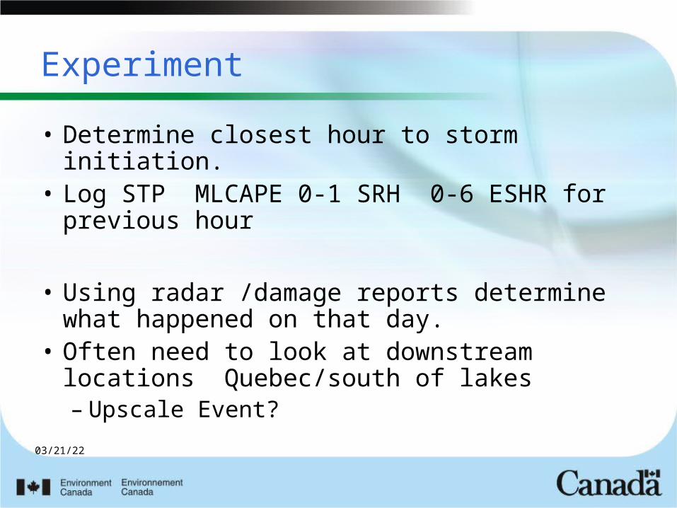
Experiment
• Determine closest hour to storm initiation.• Log STP MLCAPE 0-1 SRH 0-6 ESHR for
previous hour
• Using radar /damage reports determine what happened on that day.
• Often need to look at downstream locations Quebec/south of lakes– Upscale Event?
04/18/23
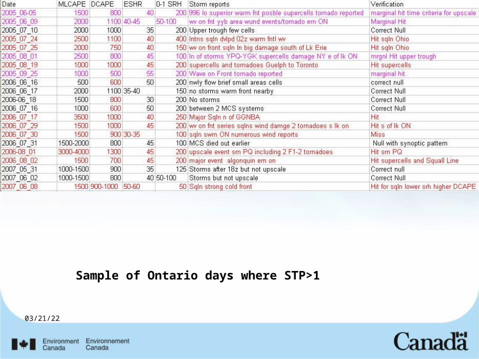
Sample of Ontario days where STP>1
04/18/23
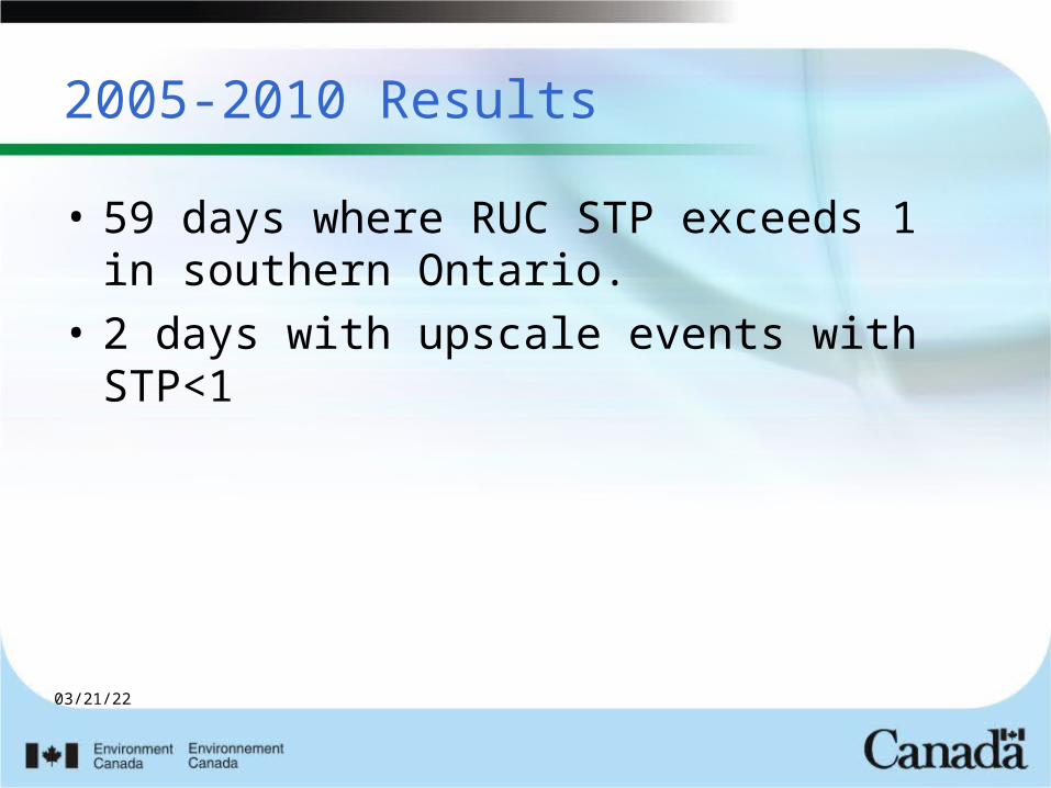
2005-2010 Results
• 59 days where RUC STP exceeds 1 in southern Ontario.
• 2 days with upscale events with STP<1
04/18/23
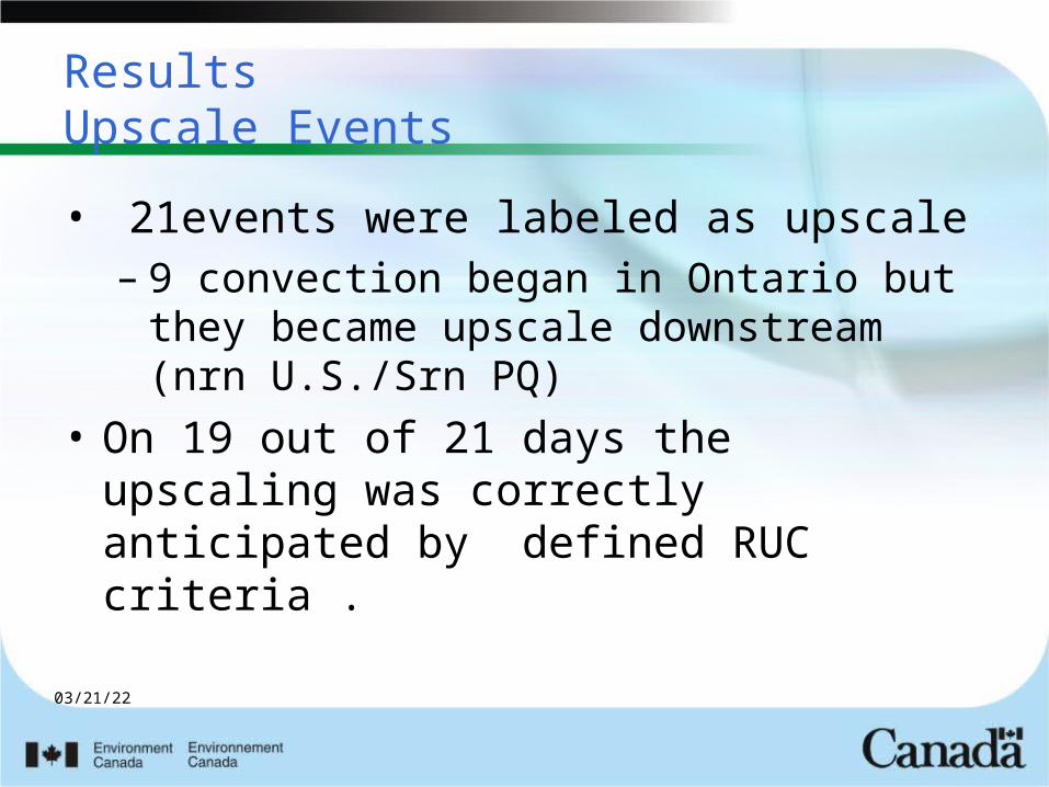
ResultsUpscale Events
• 21events were labeled as upscale– 9 convection began in Ontario but they
became upscale downstream (nrn U.S./Srn PQ)
• On 19 out of 21 days the upscaling was correctly anticipated by defined RUC criteria .
04/18/23
Marginal Events
• 9 Other days where RUC numbers predicted upscale – Multiple damage reports but did not
meet upscale definition.– 4 days with tornadoes.
04/18/23
The Other 31 days
• 9 storms were considered correct nulls STP >1 but shear was less than 40 knots.
• The rest were false alarms – For this study no consideration of
meteorology of situation
04/18/23
Preliminary Conclusions
STP>1 correctly nowcast 19 of 21 storms that went upscale.
Just by itself STP has a high FAR of detecting upscale, but combined with other factors could be less than 50 percent
04/18/23
Examples
Summer 2010
04/18/23
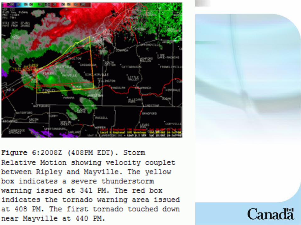
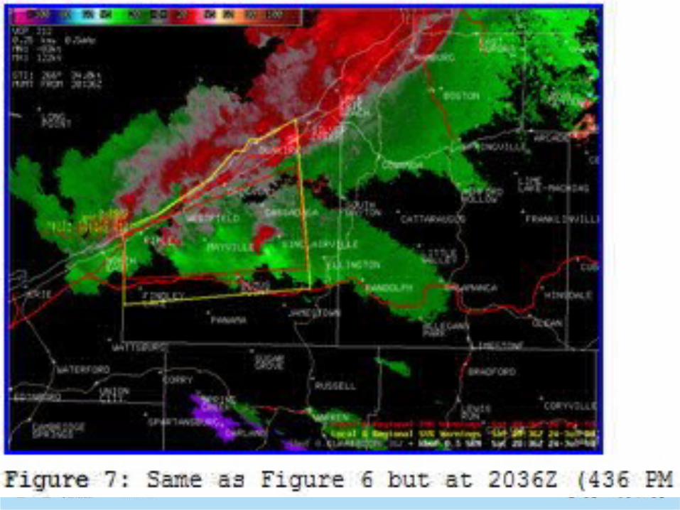
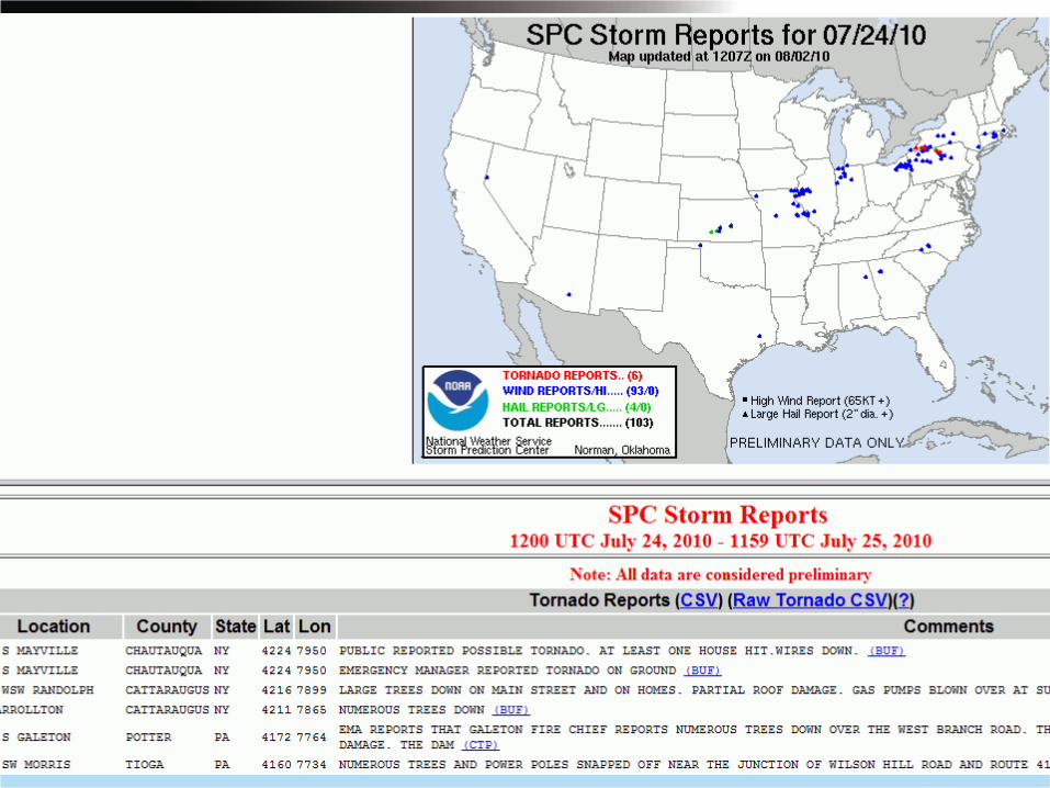
July 24 2010NY State
• http://www.erh.noaa.gov/buf/svrwx/100724/SouthernTierTornadoes.html
04/18/23
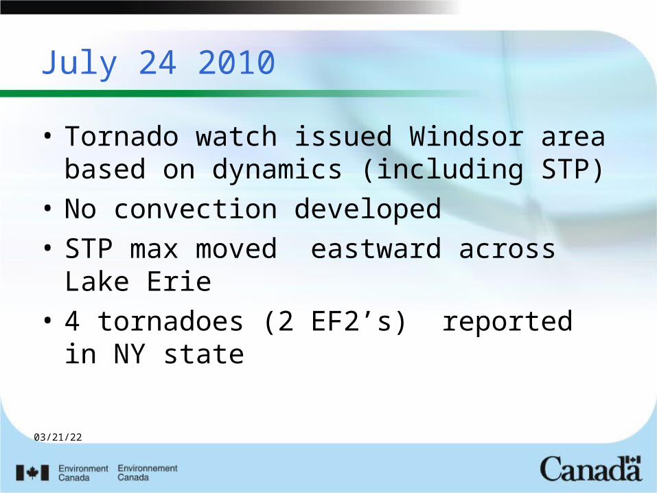
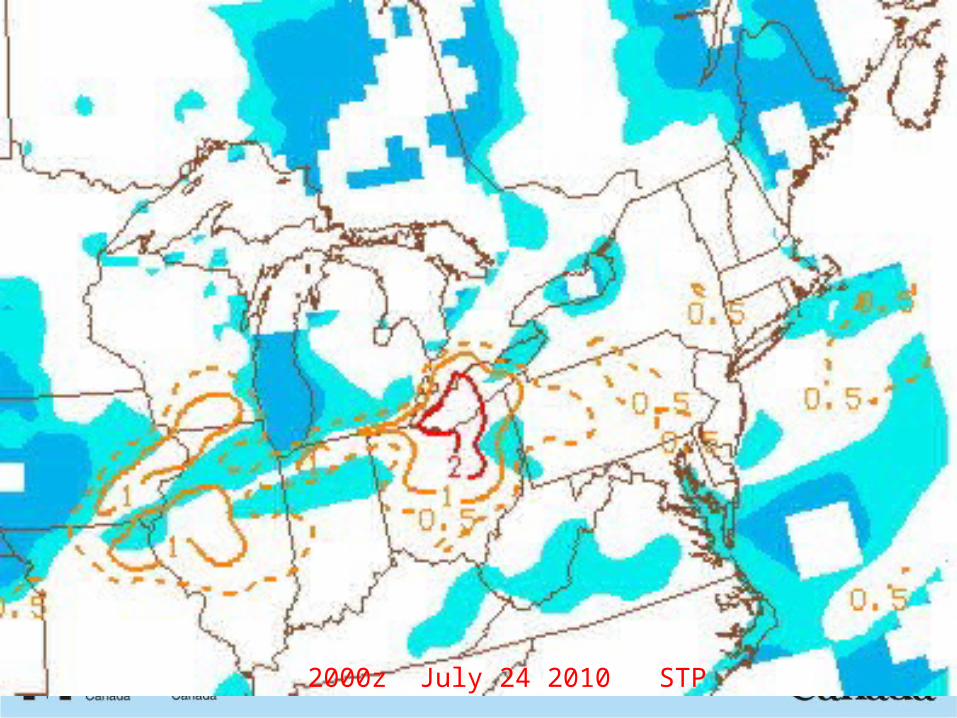
July 24 2010
• Tornado watch issued Windsor area based on dynamics (including STP)
• No convection developed• STP max moved eastward across Lake
Erie• 4 tornadoes (2 EF2’s) reported in NY
state
04/18/23
1700z July24 2010 STP
04/18/23
2000z July 24 2010 STP
04/18/23
04/18/23
04/18/23
04/18/23
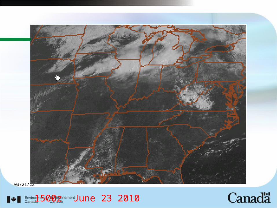
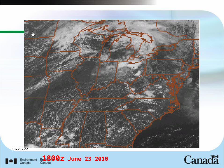
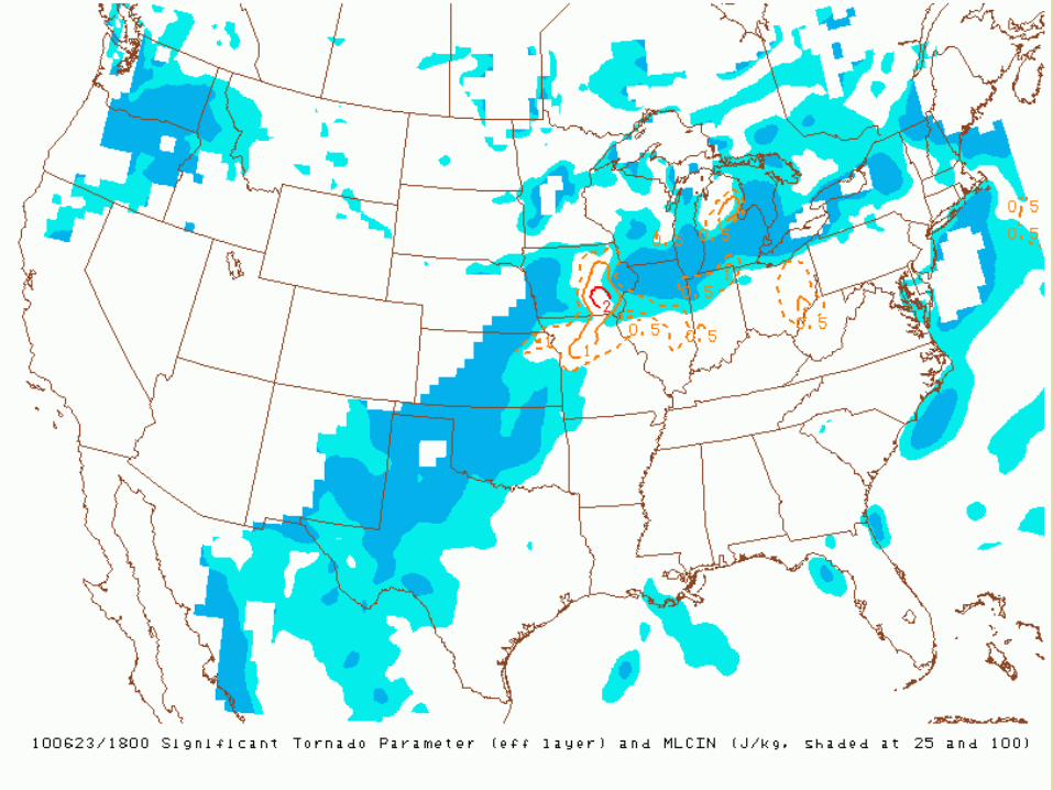
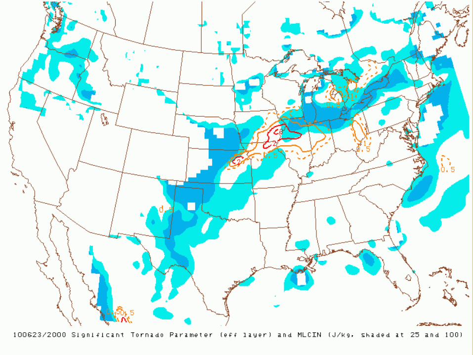
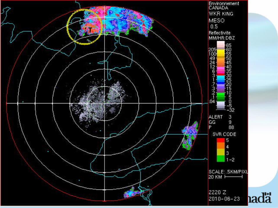
June 23 2010Tornados southeast of Georgian Bay
Tornado potential thought to be low because of presence of cloud shield from previous night MCS. Wind dynamics very good.
Small clearing area lower MI allowed enough heating to develop. STP index tracked this area into Ontario
2 EF2 tornadoes reported southeast of Georgian Bay
04/18/23
1500z June 23 2010
04/18/23
1800z June 23 2010
04/18/23
04/18/23
04/18/23
T
04/18/23
SREF (Short Range Ensemble Forecast) convective parameters
• Many examples from summer 2010 of STP quite accurately picking out upscale events up to 87 hours in advance.
• Worked particularly well in the Plains
04/18/23
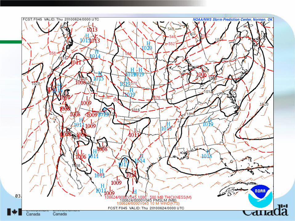
June 23 2010Georgian Bay
SREF 45 hr lead time
04/18/23

04/18/23

04/18/23
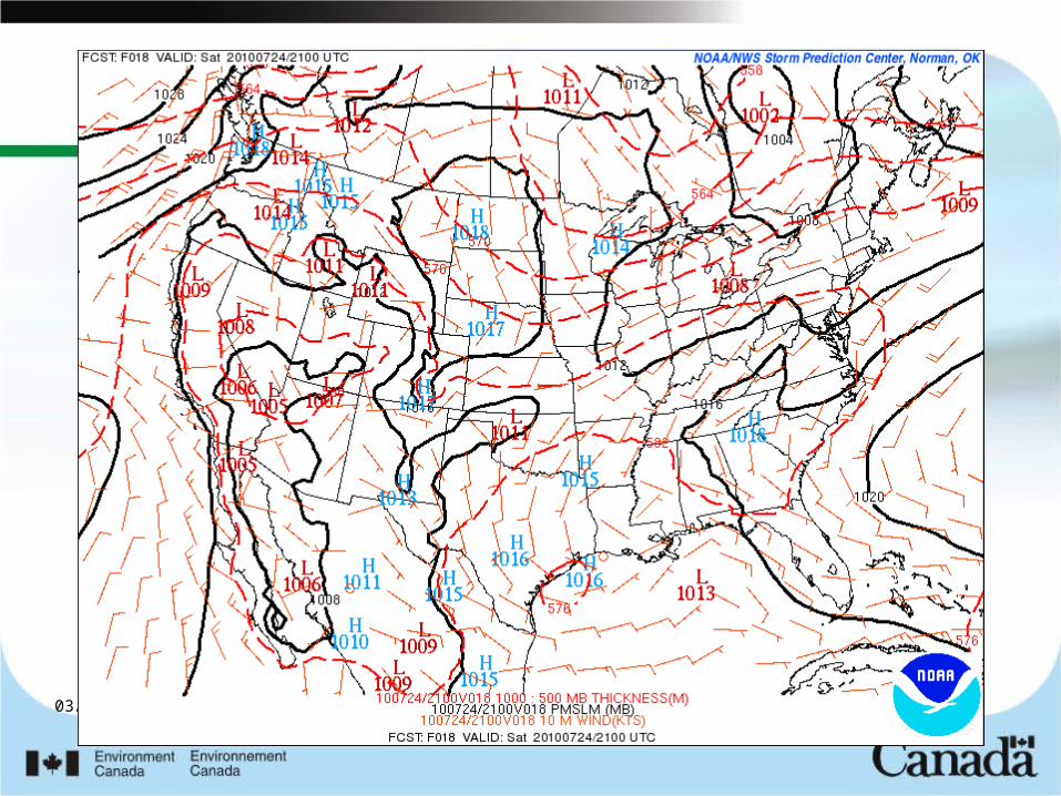
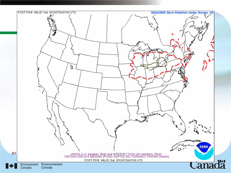
SREF and July 24 2010 Western NY
18 Hour Lead Time
04/18/23
04/18/23
04/18/23
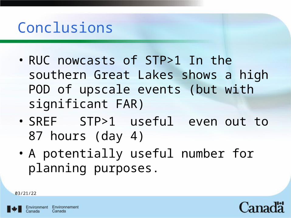
Conclusions
• RUC nowcasts of STP>1 In the southern Great Lakes shows a high POD of upscale events (but with significant FAR)
• SREF STP>1 useful even out to 87 hours (day 4)
• A potentially useful number for planning purposes.
04/18/23
THE END