Embed Size (px)
Citation preview
734-2584 REV 6-5-17
44
19
US-101 Mile M
arkerRoute Distance (in m
iles)
21
65
51
70
98
54
104
Elevation in Feet
750
500
250
Astoria
Seaside
CannonBeach
Tillamook
RockawayBeach
PacificCity
Neskowin
115
98104
121
128134
149
167
175
140
160
165
189
Pacific City
Neskowin
LincolnCity
DepoeBay
Newport
Waldport
Yachats
189
201
178 HecetaHead
Florence
Elevation in Feet
750
500
250
US-101 Mile M
arker
Route Distance (in miles)
189
212
235
274
288
Florence
Reedsport
WinchesterBay
North Bend
Coos Bay
Bandon
Langlois
189
201
223
247
276
293
178Heceta
Head
250
500
750
Elevation in Feet
US-101 Mile M
arker
Route Distance (in miles)
250
500
750
Bandon
Port Orford
Gold Beach
Pistol River
Brookings
274276
301
329
361
368
288 Langlois293
305
333
344 338
357
363
Elevation in Feet
US-101 Mile M
arker
Route Distance (in miles)
Parks and Amenities
........................2 mi. N of Bandon..................Bullards Beach
.....................*10 mi. N of Bandon.....................Seven Devils..............*14 mi. SW of Coos Bay.......................Cape Arago
...............*13 mi. SW of Coos Bay.....................Shores Acres
...............*12 mi. SW of Coos Bay.......................Sunset Bay
................*11 mi. SW of Coos Bay............Bastendorf Beach
............*3 mi. NW of North Bend....Bluebill Lake (2 areas)
................15 mi. N of North Bend...........Eel Creek (2 areas)
.....................8 mi. S of Reedsport.........William M. Tugman
.....................6 mi. S of Reedsport.......Umpqua Lighthouse
At Winchester Bay Harbor (4 areas)........Windy Cove/Salmon
....................9 mi. N of Reedsport......................Elbow Lake
....................9 mi. N of Reedsport...............Tahkenitch Lake
...................12 mi. N of Reedsport..........................Lost Lake
9 mi. S of Florence ...............................Carter Lake (2 areas)
........................7 mi. S of Florence.............Siltcoos (2 areas)
........................3 mi. S of Florence........Jessie M. Honeyman
*- Not located on US 101(NOTE: Distances are from city centers)
Camping
Hot Showers
Hiker-Biker Camping
Yurts & Cabins
Parks and Amenities
................................At Brookings.............................Azalea
....................2 mi. N of Brookings...................Harris Beach
....................2 mi. N of Brookings......Brookings Rest Area
....................4 mi. N of BrookingsBoardman (Whaleshead)
...................7 mi. N of Brookings.................Thomas Creek
..................7 mi. S of Gold Beach...............Cape Sebastian
..................4 mi. N of Gold Beach.....................Otter Point
..................7 mi. N of Gold Beach...........Geisel Monument
...................9 mi. N of Gold Beach.............Ophir Rest Area
...................6 mi. S of Port Orford........Humbug Mountain
.............................At Port Orford.....................Battle Rock
...............*9 mi. N of Port Orford....................Cape Blanco
........................5 mi. S of Bandon...........................Bandon
.....................1 mi. SW of Bandon........................Face Rock
*- Not located on US 101(NOTE: Distances are from city centers)
Camping
Hot Showers
Hiker-Biker Camping
Yurts & Cabins
Portland
0°F
100°
32°
70°
100°16°
41.2”Newport
0°F
100°
32°
70°
88°19°
72.4”
Grants Pass
0°F
100°
32°
70°
103°16°
31.1”
Eugene
0°F
100°
32°
70°
99°14°
49.4”
Astoria
0°F
100°
32°
70°
88°18°
66.4”
North Bend
0°F
100°
32°
70°
84°24°
63.3”
Portland
Astoria
Seaside
Tillamook
Albany
Corvallis
Salem
Dallas
McMinnville
St Helens
Coos Bay
North Bend
Eugene
Newport
Lincoln City
Florence
Bandon
Gold Beach
Brookings
Grants Pass
RoseburgCoquille
Rainier
Powers
Cave Junction
Sutherlin
Reedsport
Springfield
Cottage Grove
Junction City
Drain
Hillsboro
46°
45° 30'
124°
Lewis & ClarkNational & StateHistorical Parks
Ft. Clatsop &Visitor Center
TillamookForest Center
Saddle Mtn3,291
Mt Hebo
Cascade Head
Cape Kiwanda
Cape Lookout
Cape Meares
Kincheloe Point
Cape Falcon
Tillamook Head
3,154
Rogers Peak3,706
Spirit Mtn1,776
Neahkahnie Mtn
1,661
R.
L.
R.
Wils
on
Beaver
Sand Lake
Columbia
Cullaby Lake
Nehalem Bay
Tillamook Bay
River
Netarts Bay
Nestucca Bay
River
Lewis
Clark
Youngs
River
R.
Nehalem Salm onberry
Cr.
Miami
River
Kilc
his
Trask
Ti llamo ok
E. Cr.
Nestucca
Nestucca
N.
Necanicum
River
Jordan Cr.
R.
Big
and
River
Pa
ci
fi
c
Oc
ea
n
El. 1309
El. 784 Summit
El. 672 El. 752
SummitSummit
David Douglas Summit
16
49
19
20
7
2
4
59
12
4
4
14
1
2
3
5
5
4
2
3
11
4
2
6
12
5 1
10
10
13
8
9
4
8
8
4
10153
6
131
130
26
104
202
22
101
101
Saddle Mtn.
Oswald West
Cape Lookout
Van Duzer
Fort Stevens
Del Rey Beach
Ecola
Tolovana BeachArcadia Beach
Hug Point
Nehalem Bay
Manhattan Beach
Cape Meares
Oceanside Beach
Cape Kiwanda
Bob Straub
Neskowin Beach
Munson Creek
Clay Myers
Forest
Sunset Beach
Ilwaco
Altoona
Rosburg
Chinook
Hebo
Beaver
Netarts
Neskowin
Rockaway Beach
Bay City
Gearhart
Oceanside
Cannon Beach
Mohler
Wheeler
Nehalem
Garibaldi
Manzanita
Cloverdale
Pacific City
Elsie
Olney
Blaine
KnappaSvensenHammond
Brighton
Sandlake
Camp Rilea
Barview
Arch Cape
Fort Stevens
Seaside
Tillamook
Warrenton
Astoria
Trask
Hamlet
Necanicum Jct.
ODOT stronglyrecommends that riders
follow the route andavoid US-101 south
of this point.
ODOT stronglyrecommends that riders
follow the route andavoid US-101 north
of this point.
TUNNEL
42°
42° 30'
43°
124°
124°
S
Bennett Butte
Panther MtnHumbug Mtn
Edson Butte
Big Craggies
Bosley Butte3,432
Cape Ferrelo
Cape Sebastian
1,756
2,786
Vulcan Peak4,655
4,619
KLA
MA
TH M
OU
NTA
INS
2,187
3,316
Cape Blanco
Iron Mtn4,075
Pollywog Butte2,888
Chetco Peak
Coquille River
4,660
River
Cr.
Cr.
Fork
S.
Laws
onCol l
ier
Cr.
Wheeler
Bradley L.
Floras L.
Lobs
ter
HunterCr.
Big
TwomileCr.
Salm
on
Cr.
R.
Floras
Rogue
Fork
Cr.
N.
River
River
Cr.
Cr.
Euchre
Elk
River
Dry
Riv erSixes
CoquilleCr.
Cr.Fourmile
Cr.
Bear
Coqui
ll e
Pistol
Pa
ci
fi
c O
ce
an
Elk
Catc
hing
Cr.M.
Fo rk Coquille
R.
Myrtle
Cr.
Johnson Cr.
Fish
trap Cr.
Croft L.
Laurel L.
New L.
Chetco
R.
Chet
co
R.
Winc
huck R.
N. Fork Smith
R.
SummitEl. 1715
SummitEl. 712
44
35
28
11
6
6
3
714
1
4
16
4
4
3
9
17
1
4
1
8
8
5
5
3
42S
101
101
Bullards Beach
Cape Blanco
Geisel Monument
Cape Sebastian
Pistol River
Samuel H.Boardman
Harris Beach
Hoffman
Otter Point
Paradise Point
Port Orford Heads
Face Rock
PowersAlbert H.
Bandon
Hambug Mountain
Winchuck
Alfred A.Loeb
Tseriadun
Smith River
Ophir
Sixes
Agness
Powers
GaylordLanglois
Riverton
Broadbent
Wedderburn
Gold Beach
Port Orford
Pistol River
Harbor
Denmark
Illahe
Norway
Carpenterville
Bridge
Nesika Beach
Bandon
Coquille
Myrtle Point
Brookings
Bancroft
Prosper
0°F
100°
32°
70°
100°16°J MA M J J A S O N DF
Average MonthlyHighest Temp.
Hottest Temp.of the Month(30 -Year Avg)
Average MonthlyHigh Temp.
Average MonthlyLow Temp.
Average MonthlyLowest Temp.Coldest Temp.of the Month(30 -Year Avg)
Average AnnualColdest and
Hottest Temp.
4”
8”
16”
2”
J J JF A M A S O N DM
Weather Station DataPrecipitation bar graphs are plotted above for a set of weather stations across Oregon. There is one bar for each month, and the height of each bar is proportional to the total average precipitation during that month. The shading of the bars reflects the precipitation totals. The individual bar graphs can be read for the details of precipitation at individual stations, while the overall shape and color of the graphs illustrate the main precipitation gradients across the state.
44°
45°
44° 30'
124°
Alsea Bay Visitor Center
Saddle Bag Mtn
Heceta Head
Cape Perpetua
Yaquina Head
Cascade Head
Cape Kiwanda
Cape Foulweather
3,359
3,154
3,333Fanno Peak
Euchre Mtn2,446
Klickitat Mtn2,307
Saddle Mtn2,297
HermanPk.
2,082
Yaquina Bay
Big Cr.
Cr.
Cr.
Rock
L.
Sutton L.
River
Cr.
L.
Cr.
Rock
Cr.
Siletz Bay
Alsea Bay
L.
Yaquina Bay
Nestucca Bay
LakeDevils
Sile
tz
Woahink
Nestucca
Salmon
R.
Cr.
River
Big
Rock
Siletz
Cr.
Yaquina
Cr.Beaver
Fall
Elk
River
Fork
Alsea
Cr.
Mercer N.
S
River
Yachat sR.
R.Five
Cape Cr.
Tenmile
Fork
Siusla
wR.
Cr.
Dea d
woo
d
Lobster
Cr.
Cr.
Drift
Rock
R.
N.
Drift
Pa
ci
fi
c
Oc
ea
n
Ceda
r Cr.
Euch
re C
r.
Alsea R.
Cummins Cr.
Indian
Cr.
Siuslaw
R.
Lake
Cr.
El. 672
El. 752 Summit
El. 760Summit
Summit20
30
1634
2
6
7
1
5
5
2
2
3
5
5
10
9
2
6
20
1010
2
9
5
8
7
10
3
5
3
31 5
5
10
6
1
2
4
1
1
4
8
4
8
8
6
130
20
101 34
501
229
22
18
126
126
36
101Van Duzer
Devils Lake
Nelson
Heceta HeadLighthouse Viewpoint
Beachside
Cape Kiwanda
Bob Straub
Neskowin Beach
Roads End
D River
Gleneden Beach
Fogarty Creek
Boiler Bay
Rocky Creek
Otter Crest
Devil's Punchbowl
Beverly Beach
Agate Beach
South BeachLost Creek
Ona Beach
Seal RockDriftwood Beach
Smelt SandsYachats
Yachats Ocean Road
Neptune
Stonefield Beach
Muriel O. Ponsler
Carl G. Washburne
Darlingtonia
Ellmaker
Forest
Gov. Patterson
Yaquina Bay
Otis
Alsea
Walton
Harlan
Siletz
Tiernan
Cushman
Yachats
ElkCity
Waldport
Neskowin
Eddyville
Depoe Bay
Otter Rock
Lincoln Beach
Neotsu
Glenada
MapletonSwisshome
Tidewater
Seal Rock
Kernville
Cloverdale
South Beach
Pacific City
Gleneden Beach
Yaquina
Deadwood
Minerva
Logsden
Chitwood
Greenleaf
Nashville
RoseLodge
Burnt Woods
Lincoln City
Toledo
Florence
Newport
Heceta Beach
Reed
Triangle Lake
Alpha
Ona
ODOT stronglyrecommends that riders
follow the route andavoid US-101 north
of this point.
TUNNEL
TUNNEL
50250
2,000
1,000
75 miles
Hwy 42
RoseburgMyrtle PointCoquille
Bandon
50 miles250
500
Hwy 38
DrainElktonReedsportI-5
50 miles250
1,000
Hwy 126
Veneta
Cougar PassElev 769Mapleton
FlorenceEugene
US 20 Hwy 34
50 miles250
1,000
US 20
CorvallisPhilomath
NewportI-5
Pioneer Summit
50250
1,000
Hwy 18
US 101 McMinnville Newberg
Hwy 18 Hwy 99wSheridan I-5
75 miles
50250
1,000
2,000
75 miles
Hwy 6
North PlainsTillamook Portland
Summit,Elev 1,586 Hwy 6 US 26
50250
1,000
2,000
75 miles
North Plains Portland
US 101
Summit,Elev 1,309
Coast Ridge Summit,Elev 1,642
US 26
50250
1,000
75 miles
Ele
vati
on
in F
eet
US 30
PortlandScappoosePrescottAstoriaSt. Helens
L A N E
D O U G L A S
L I N N
J A C K S O N
CO
OS
C U R R Y
C L A C K A M A S
M A R I O N
JO
SE
PH
IN
E
P O L KLI
NC
OL
N
TI
LL
AM
OO
K
C L A T S O P
Y A M H I L L
BE
NT
ON
C O L U M B I A
W A S H I N G T O N M U L T N O M A H
KL
AM
AT
H
E
D
H
I
G
J
K
L
A
B
C
F
Portland
Albany
Corvallis
SalemDallas
McMinnville
St Helens
Eugene
Grants Pass
Medford
RoseburgCoquille
Coos Bay
North Bend
Newport
Astoria
Seaside
Tillamook
Lincoln City
Florence
Bandon
Gold Beach
Brookings
Rainier
Powers
CaveJunction
Ashland
Sutherlin
Reedsport
Springfield
Cottage Grove
Junction City
Drain
Oregon City
Hillsboro
US 26
Hwy 18
I-5
US
101
US 20
I-5
US 101
Hwy 42
Hwy 6
Hwy 126
Hwy 38
I-84
US 30
Pa
ci
fi
c
Oc
ea
n
US 26
Hwy 18
I-5
US
101
US 20
I-5
/ H
wy
99
US 101
US 30
Hwy 42
Hwy 126
Hwy 6
US
101
Hwy 38
19,7
00
8,800
14,800
6,70
0
21,400
7,800
19,8
00
5,200
14,8
00
10,0
00
2,60
0
15,700
4,00
08,
900
6,10
0
4,60
0
3,400
3,000
6,000
4,000
7,900
2,50
0
9,800
4,400
4,800
3,500
4,50
0
31
,100
<5,000
5,001-10,000
10,001-15,000
15,001-20,000
>20,000
Average Daily Traffic, 2009Thousands of Vehicles per Day
Portland
Astoria
Seaside
Tillamook
Albany
Corvallis
SalemDallas
McMinnville
St Helens
Coos Bay North Bend
Eugene
Newport
Lincoln City
Florence
Bandon
Gold Beach
Brookings
Grants PassMedford
RoseburgCoquille
Rainier
Powers
Cave JunctionAshland
Sutherlin
Reedsport
Springfield
Cottage Grove
Junction City
Drain
OregonCity
Hillsboro
Source: Atlas of Oregon, University of Oregon 2001
Newport
Eugene
North Bend
Portland
BendBurns
Grants PassLakeview
Crater Lake
Ontario
La GrandeArlington
Predominant wind direction during the months of June, July, and August.
Summer Wind Direction*
* Winter wind direction reverses in the Columbia River Gorge and coastal areas.
44°
43° 30'
43°
124°
1
Dean Creek Elk Viewing Area
Bennett Butte
Heceta Head
2,187
HermanPk.
2,082
Cape Arago
Coquille River
Cape Arago Light
Umpqua
River
S.
Cr.
Sutton L.
L.
L.
Mid
dle
Cr.
R.
Tahkenitch
Bradley L.
Floras L.
N. Tenmile L.
Eel L.
Tenmile L.
Coos Bay
SiltcoosL.
Woahink
Cr.
Big
Mercer N
Millicoma
R.
N.For
k
Paloose
S.Fork
SouthSlough
TwomileCr.
R.
Cr.
Floras
ForkCoquilleCr.
Hudson
Cr.Fourmile
Cr.
Bear
Coqui
ll e
Coquil
le
Coos
Cr.
Five
mile
Cape Cr.
Clear L.
Scholf ield
Pa
ci
fi
c
O
ce
an
L.
Benson Cr.
Johnson Cr.
N. Fo
rk
Millicoma
R.
R.
R.
Che
rry Cr
.
Elk Cr.
Cr.
Catc
hing
Cr.M.
Fo rk Coquille
R.
Myrtle
Cr.
Johnson Cr.
Fish
trap Cr.
Croft L.
Laurel L.
New L.
27
21
44
1751
10
3
1
2
3
10
4
7
6
11
7
11
6
6
3
714
5
9
11
3
5
3
5
3
2
4
42S
101
540
1
101
Umpqua Lighthouse
Cape Arago
Bullards Beach
Hoffman
Bolon Island
Heceta HeadLighthouse Viewpoint
Face Rock
PowersAlbert H.
William M. Tugman
Jessie M. Honeyman
Darlingtonia
Tideways
Conde B. McCullough
Sunset BayShore Acres
Seven Devils
Bandon
Powers
Gaylord
Cushman
Langlois
Riverton
Gardiner
Siltcoos
Lakeside
Broadbent
Charleston
Winchester Bay
Sumner
Denmark
Glenada
Allegany
Dunes City
Norway
Hauser
Dora
Bridge
Bandon
Coquille
North Bend
Myrtle Point
Florence
Reedsport
CoosBay
Bancroft
Prosper
Heceta Beach
Canary
TUNNEL
Camping
Hot Showers
Hiker-Biker Camping
Yurts & Cabins
...
(NOTE: Distances are from city centers)*- Not located on US 101
*10 mi. W of Astoria.....................Fort Stevens ....................
...............................At Pacific City.......................Bob Straub
...................1 mi. N of Pacific City..................Cape Kiwanda
...................5 mi. N of Pacific City.................Whalen Island.................*9 mi. N of Pacific City......................Sand Beach
.............*12 mi. SW of Tillamook..................Cape Lookout..................8 mi. SW of Tillamook......................Netarts Bay
.....................4 mi. S of Tillamook.....S Tillamook Rest Area................*11 mi. W of Tillamook........................Oceanside................*10 mi. W of Tillamook...................Cape Meares................*8 mi. NE of Tillamook...............................Kilchis
.....................2 mi. N of Garibaldi............................Barview
*3 mi. S of Manzanita Junction....................Nehalem Bay............10 mi. S of Cannon Beach....................Oswald West
..............5 mi. S of Cannon Beach......................Hug Point
..............3 mi. S of Cannon Beach..........................Arcadia
..............1 mi. S of Cannon Beach..............Tolovana Beach..........*2 mi. N of Cannon Beach..............................Ecola
.......................5 mi. SE of Seaside.................Klootchy Creek
.......................6 mi. N of Seaside ......................Cullaby Lake ...................*5 mi. SW of Astoria.....................Fort Clatsop
Parks and Amenities
*4 mi. NW of FlorenceSiuslaw Harbor Vista....... .................5 mi. N of FlorenceSutton Lake ..................... .......................6 mi. N of FlorenceSutton Lake (3 areas) ...... .......................
5 mi. N of FlorenceDarlingtonia .................... .......................13 mi. N of FlorenceHeceta Head.................... .....................
14 mi. N of FlorenceCarl G. Washburne.......... .....................
16 mi. N of FlorenceMuriel O. Ponsler ............ .....................
10 mi. S of YachatsRock Creek (2 areas)........ .......................
3 mi. S of YachatsNeptune .......................... .........................
2 mi. S of YachatsCape Perpetua................. .........................At YachatsYachats ............................ ...................................1 mi. N of YachatsSmelt Sands ..................... ........................6 mi. S of WaldportTillicum Beach ................. ......................
3 mi. S of WaldportBeachside......................... ......................
1 mi. S of WaldportGov. Patterson ................ ......................3 mi. N of WaldportDriftwood Beach............. .....................10 mi. S of NewportSeal Rock ......................... .....................8 mi. S of NewportOna Beach ....................... .......................7 mi. S of NewportLost Creek........................ .......................2 mi. S of NewportSouth Beach .................... .......................
Newport, N of Yaquina Bay BridgeYaquina Bay ....................1 mi. N of NewportAgate Beach .................... ......................7 mi. N of NewportBeverly Beach .................. ......................
8 mi. N of NewportDevil’s Punchbowl........... ......................10 mi. N of NewportOtter Crest Rest Area...... ....................
10 mi. N of NewportOtter Crest ....................... ....................2 mi. S of Depoe BayRocky Creek..................... ....................
At Depoe BayDepoe Bay........................ ...............................
1 mi. N of Depoe BayBoiler Bay......................... ....................
2 mi. N of Depoe BayFogarty Creek.................. ...................7 mi. S of Lincoln CityGleneden Beach................. ..................
..............................At Lincoln City.......................Devils Lake
..............................At Lincoln City.............................D River
.....................5 mi. S of Neskowin..............Neskowin Creek
................................At Neskowin..............Neskowin Beach
Parks and Amenities
*- Not located on US 101(NOTE: Distances are from city centers)
Camping
Hot Showers
Hiker-Biker Camping
Yurts & Cabins
0 2 4 8 Miles
0 2 4 8 Kilometers
U.S. Route 101 with at least 4’ of shoulder
U.S. Route 101 with lessthan 4’ of shoulder
Covered Bridge
Bureau of Land Management Campground
U.S. Forest Service Campground
Safety Rest Area
State Park with Reserved Campsites
State Park with Overnight Facility
State Park, Day Use Only
Pacific City Unincorporated Place
Cannon Beach Less than 2,500
Florence 2,500 to 10,000
Coos Bay 10,000 to 100,000
POPULATION
Locale or Site
Unincorporated Place
Incorporated Place
County Seat
COMMUNITIES
Mileage Between Towns and Junctions
Accumulated Mileage Between Stars
State Route Marker
U.S. Route Marker
Paved/Gravel Road
Main Access Route
Coastal Bike Route with at least 4’ of shoulder
Coastal Bike Route with less than 4’ of shoulder
Road Summit andElevation in Feet
Lighthouse
Visitor Center
Fish Hatchery
Wildlife Viewing area
34
42
SummitEl. 1500
The Oregon Coast Bike Route has been a popular bicycle route since 1982 when it was officially designated by the Oregon Transportation
Commission. Thousands of bicyclists enjoy the natural beauty of the Oregon Coast Bike Route annually. For the most part, it follows US Highway 101 as a shoulder bikeway. In several areas, the route departs from the main highway and follows county roads and city streets. These sections are closer to the ocean, are more scenic, and have lower traffic volumes and slower traffic speeds.
The total length of the signed bike route is 370 miles (595 km). It can be lengthened to 380 miles (610 km) by taking the alternate Three Capes Scenic Route. On average, most cyclists take six to eight days to tour the coast, by cycling 50 to 65 miles (80 to 105 km) per day. This is a reasonable rate, due to the mountainous nature of the coast: the total rise and fall is close to 16,000 feet (4900 m).
It is highly recommended that you cycle in a north to south direction, if your trip is planned between May and October, as the prevailing winds blow from the northwest. Most points of interest and viewpoints are on the ocean side. General shoulder widths are indicated as shown on the map legend.
Be sure to visit www.RideOregonRide.com for more information on where to ride, stay and eat on your trip. The Oregon Department of Transportation (ODOT) Pedestrian and Bicycle Program web site: http://www.oregon.gov/ODOT/HWY/BIKEPED/touring.shtml also has additional information and resources to enhance your experience.
www.RideOregonRide.com
Welcome to Oregon and Enjoy the Ride!
BIKE ROUTE SIGNING
The entire route has been signed. The sign (at right) is located at all intersections where the bike
route departs from the main highway, and at key locations along bypasses to guide cyclists through these areas. “BIKES ON ROADWAY” warning signs have been placed along some stretches of roadway where the shoulder is narrow; motorists are therefore forewarned of the possible presence of bicyclists.
WELCOMET O O R E G O N
OVERVIEW MAP (see reverse for detail maps)
CLIMATEOregon Coast summers tend to be cool and morning fog is common.
Rain tapers off in April reaching a low in July, picking up again in October. Regular, steady rain can be expected November thru March Winds in summer are predominantly from the NW and it is advisable to ride North to South to maximize tail winds. During the main summer bicycling season, temperatures rarely exceed the eighties, and can even be as cool as the mid-fifties. Winter storms can be severe with gale force winds and driving rain. We recommend you carry rain gear year round.
The best cycling experiences are usually from late August to early October, as the combination of moderate temperatures, north winds, low precipitation and reduced highway traffic creates nearly ideal conditions.
For up-to-date long-term weather forecasts, roadway conditions, and construction advisories , consult Trip Check: call 511 (toll free within Oregon) or 1-800-977-ODOT (6368) (toll free within Oregon) or 1-503-588-2941 (outside Oregon.) Or visit: www.tripcheck.com/
TRAFFIC VOLUME AND PROFILED ROUTES
Motor vehicle (and bicycle) traffic volumes vary greatly and generally are greater on state highways than on local roads. On the Coast they are highest in summer and in and around towns and cities. Traffic
volumes drop off significantly in winter. The map below shows average traffic volumes as a guide.
MAP LEGEND
2. PACIFIC CITY TO FLORENCE 96 MILES 4. BANDON TO BROOKINGS 83 MILES
1. ASTORIA TO PACIFIC CITY 93 MILES 3. FLORENCE TO BANDON 72 MILES
Distance and Elevation:1. Distance – Left column: Numbers represent the distance in miles of the main bike
route (no alternates) from the Washington to California state lines (Black Text).
Distance – Right column: Numbers represent the actual signed mile posts along Hwy 101 (Red Text).
2. Elevation: The vertical exaggeration makes grades appear to be steeper than they are. Use this information for general planning, such as determining daily trip lengths.
NOAA’s National Weather Service
PACIFIC TSUNAMI WARNING CENTERIf you are at the beach or near the ocean and you feel the earth shake, move immediately to higher ground. DO NOT wait for a tsunami warning to be announced. Stay away from rivers and streams that lead to the ocean as you would stay away from the beach and ocean if there is a tsunami. A tsunami from a local earthquake could strike some areas before a tsunami warning could be announced.
Copyright ODOT 2011The Oregon Department of Transportation Pedestrian and Bicycle Program Layout services provided by ODOTDesignMapping services provided by the InfoGraphics Laboratory, Department of Geography, University of Oregon
ODOT is an Equal Employment Opportunity and Affirmative Action Employer. This information can be made available in an alternative format by contacting ODOT Pedestrian and Bicycle Program at 986-3555. ODOT does not discriminate on the basis of disability in admission or access to our programs, services, activities, hiring, and employment practices. Questions: 1-877-336-6368 (EEO-ODOT).
OREGONCoast Bicycle Route MapOREGONCoast Bicycle Route Map
OD
OT
PED
ESTR
IAN
AN
D B
ICY
CLE
PR
OG
RA
M
The Astoria Megler Bridge over the Columbia River in Astoria, OR Reviewing the route along the way at one of many viewpoints
Enjoying the view along the scenic Oregon Coast Bike Route
* - Source: Atlas of Oregon, University of Oregon 2001
OTHER PUBLICATIONSMAPS
The Oregon DOT’s Pedestrian and Bicycle Program publishes the following maps:
OREGON STATE BIKE MAPOREGON COAST ROUTE BIKE MAPCopies may be obtained by writing, calling or visiting our website:
OREGON DEPARTMENT OF TRANSPORTATIONPedestrian and Bicycle Program4040 Fairview Industrial Drive, MS5Salem, Oregon 97302-1142(503) 986-3556http://www.oregon.gov/ODOT/HWY/BIKEPED/maps.shtml
GUIDE BOOKS
There are several excellent books available that will help you enjoy your trip more. They describe in detail the history, culture and natural
landmarks associated with the Oregon Coast.
BICYCLING THE PACIFIC COAST Tom Kirkendall & Vicky Spring Published by The Mountaineers
BICYCLING THE OREGON COAST Robin Cody Published by Umbrella books
WEBSITESThe internet sites listed below can provide you with additional
information to make your ride along the Oregon coast an enjoyable and well-informed one.
Bicycle Travel in Oregon: www.RideOregonRide.comTourism: www.traveloregon.comAstoria: www.el.com/to/AstoriaCannon Beach: www.el.com/to/cannonbeachTillamook: www.tillamookchamber.orgLincoln City: www.oregoncoast.orgNewport: www.discovernewport.comWaldport: www.ohwy.com/or/w/waldport.htmYachats: www.el.com/to/yachatsFlorence: www.el.com/to/florenceNorth Bend: www.scod.com/cities/northbendCoos Bay: www.scod.com/cities/coosbayBandon: www.bandon.comPort Orford: www.portorfordoregon.comGold Beach: www.el.com/to/goldbeachBrookings: www.brookings.or.us
OREGON WELCOME CENTERSASTORIA-WARRENTON CHAMBER OF COMMERCE(Open all year – seasonally 9am-5pm)111 West Marine DriveP.O. Box 176Astoria, OR 97103
BROOKINGS WELCOME CENTER(Open May – September; 9am-5pm)P.O. Box 6098Brookings, OR 97415Phone: 541-469-4117e-mail: [email protected]
TIPS FOR A SAFE RIDE
Please: ride carefully, be courteous to other roadway users, and follow the rules of the road.
In Oregon, bicyclists are required to follow the same rules as motorists insofar as they apply; ride with the normal traffic flow, as far to the right side of the roadway as is safe and prudent. Bicyclists may ride two abreast, but should only do so when it is safe and will not impede motor vehicle traffic.
When riding after dark, the bicycle or its rider must be equipped with a white light visible at least 500 feet to the front and a red light or reflector visible at least 600 feet to the rear, per Oregon law.
In addition to the above rules, we offer these suggestions:
• Wear reflectorized clothing. • Don’t ride in heavy fog. (In summer and fall, the fog usually lifts by
late morning.) • Wear a helmet. • Stop off the roadway. • Beware of strong wind gust on bridges: either ride on the roadway,
or walk on the sidewalk. • The two tunnels on the route and the Yaquina (Newport) and
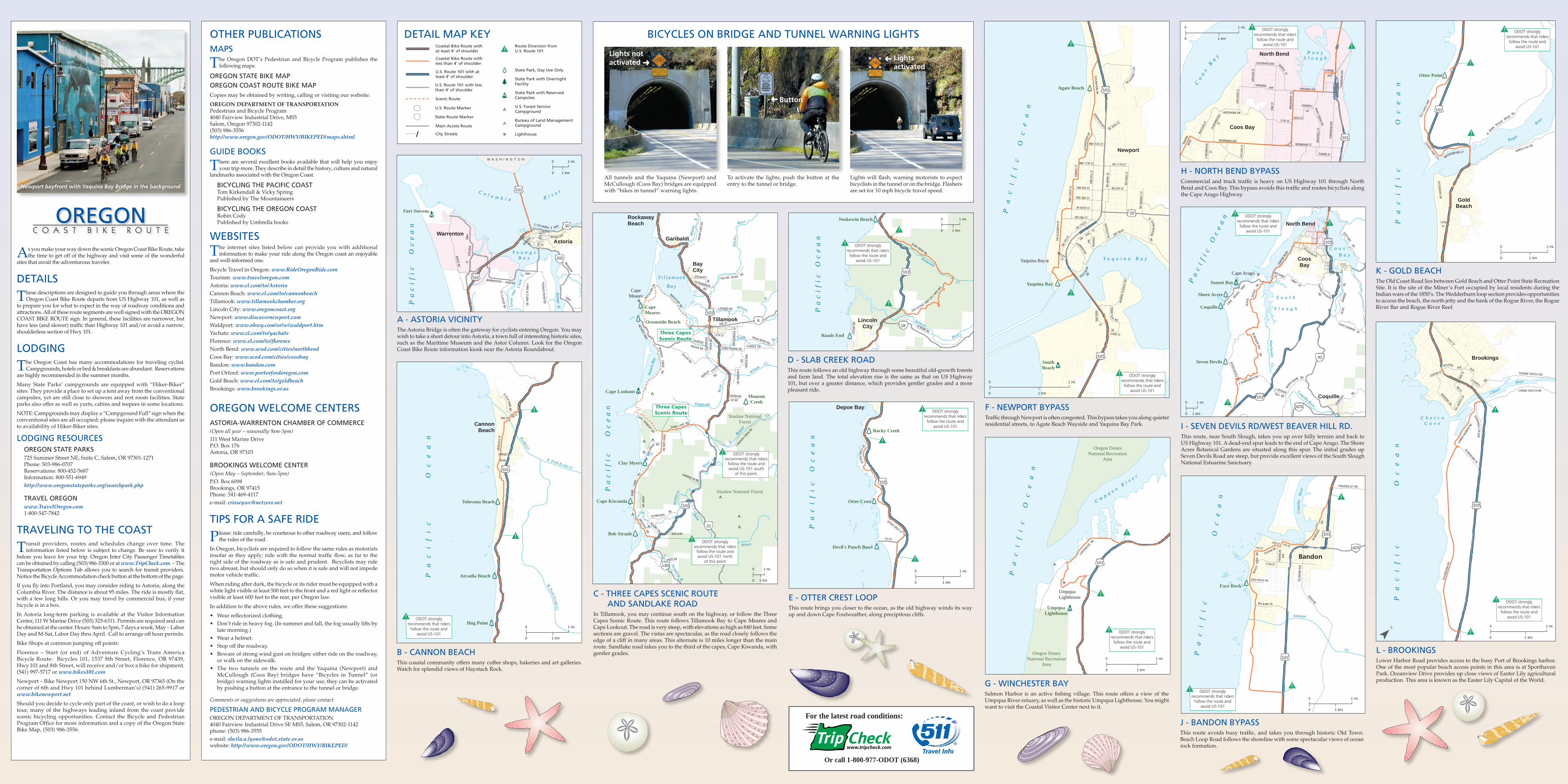
McCullough (Coos Bay) bridges have “Bicycles in Tunnel” (or bridge) warning lights installed for your use; they can be activated by pushing a button at the entrance to the tunnel or bridge.
Comments or suggestions are appreciated, please contact:
PEDESTRIAN AND BICYCLE PROGRAM MANAGEROREGON DEPARTMENT OF TRANSPORTATION4040 Fairview Industrial Drive SE MS5, Salem, OR 97302-1142phone: (503) 986-3555e-mail: [email protected]: http://www.oregon.gov/ODOT/HWY/BIKEPED/
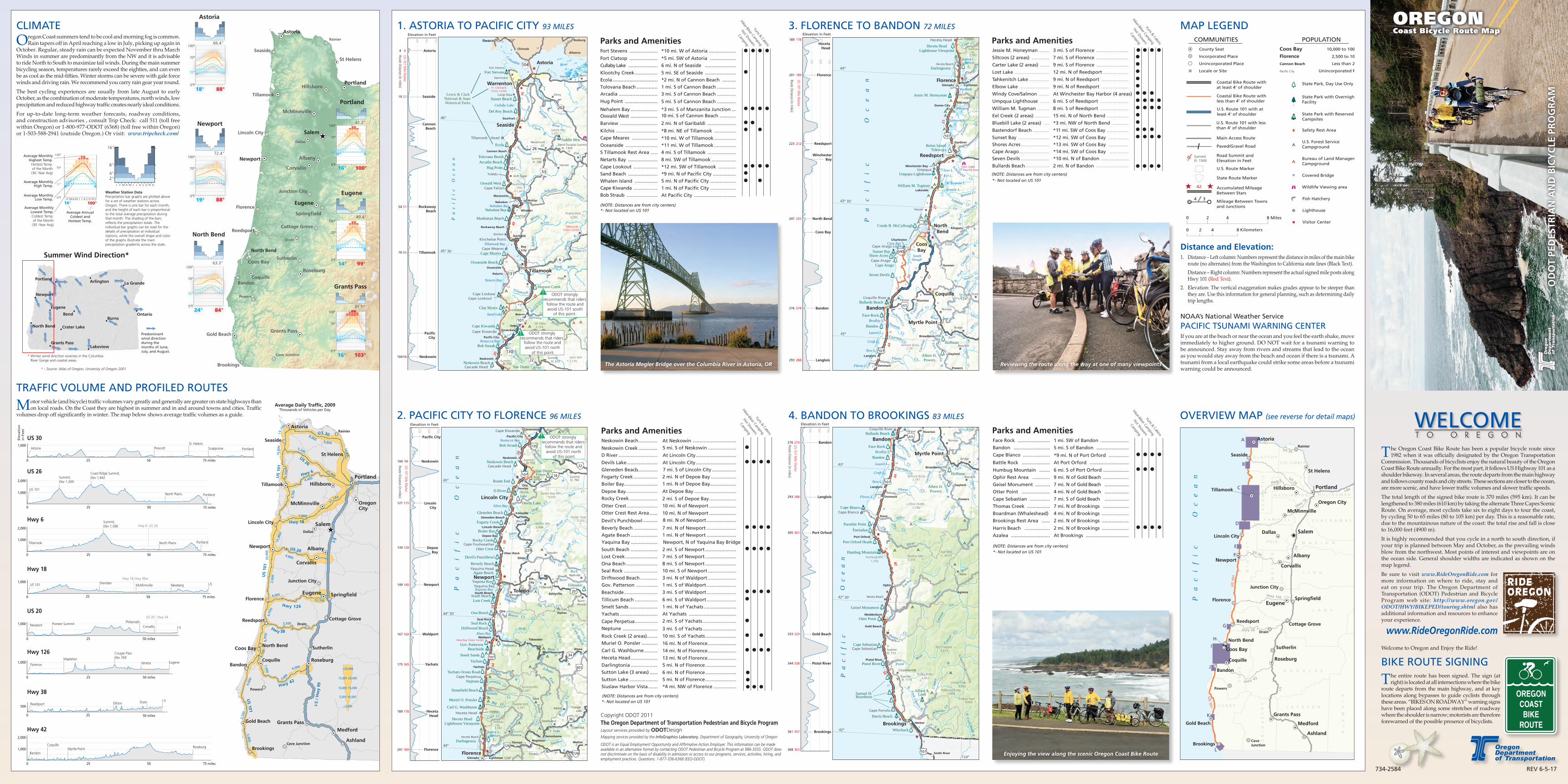
As you make your way down the scenic Oregon Coast Bike Route, take the time to get off of the highway and visit some of the wonderful
sites that await the adventurous traveler.
DETAILS
These descriptions are designed to guide you through areas where the Oregon Coast Bike Route departs from US Highway 101, as well as
to prepare you for what to expect in the way of roadway conditions and attractions. All of these route segments are well signed with the OREGON COAST BIKE ROUTE sign. In general, these facilities are narrower, but have less (and slower) traffic than Highway 101 and/or avoid a narrow, shoulderless section of Hwy 101.
LODGING
The Oregon Coast has many accommodations for traveling cyclist. Campgrounds, hotels or bed & breakfasts are abundant. Reservations
are highly recommended in the summer months.
Many State Parks’ campgrounds are equipped with “Hiker-Biker” sites. They provide a place to set up a tent away from the conventional campsites, yet are still close to showers and rest room facilities. State parks also offer as well as yurts, cabins and teepees in some locations.
NOTE: Campgrounds may display a “Campground Full” sign when the conventional sites are all occupied; please inquire with the attendant as to availability of Hiker-Biker sites.
LODGING RESOURCES OREGON STATE PARKS725 Summer Street NE, Suite C, Salem, OR 97301-1271Phone: 503-986-0707 Reservations: 800-452-5687 Information: 800-551-6949 http://www.oregonstateparks.org/searchpark.php
TRAVEL OREGON www.TravelOregon.com 1-800-547-7842
TRAVELING TO THE COAST
Transit providers, routes and schedules change over time. The information listed below is subject to change. Be sure to verify it
before you leave for your trip. Oregon Inter City Passenger Timetables can be obtained by calling (503) 986-3300 or at www.TripCheck.com – The Transportation Options Tab allows you to search for transit providers. Notice the Bicycle Accommodation check button at the bottom of the page.
If you fly into Portland, you may consider riding to Astoria, along the Columbia River. The distance is about 95 miles. The ride is mostly flat, with a few long hills. Or you may travel by commercial bus, if your bicycle is in a box.
In Astoria long-term parking is available at the Visitor Information Center, 111 W Marine Drive (503) 325-6311. Permits are required and can be obtained at the center. Hours: 9am to 5pm, 7 days a week, May – Labor Day and M-Sat, Labor Day thru April. Call to arrange off hour permits.
Bike Shops at common jumping off points:
Florence – Start (or end) of Adventure Cycling’s Trans America Bicycle Route: Bicycles 101, 1537 8th Street, Florence, OR 97439, Hwy 101 and 8th Street, will receive and/or box a bike for shipment. (541) 997-5717 or www.bikes101.com
Newport – Bike Newport 150 NW 6th St., Newport, OR 97365 (On the corner of 6th and Hwy 101 behind Lumberman’s) (541) 265-9917 or www.bikenewport.net
Should you decide to cycle only part of the coast, or wish to do a loop tour, many of the highways leading inland from the coast provide scenic bicycling opportunities. Contact the Bicycle and Pedestrian Program Office for more information and a copy of the Oregon State Bike Map, (503) 986-3556.
A - ASTORIA VICINITYThe Astoria Bridge is often the gateway for cyclists entering Oregon. You may wish to take a short detour into Astoria, a town full of interesting historic sites, such as the Maritime Museum and the Astor Column. Look for the Oregon Coast Bike Route information kiosk near the Astoria Roundabout.
DETAIL MAP KEY
Y o u n g sB a y
C o l u m b i a R i v e r
Pa
ci
fi
c
Oc
ea
n
Lew
is an
d Cl
ark
R.
Youngs R.
RIDGE RD
E COLUMBIA R HWY
7TH
S TDENVER
ST
8TH
ST
WARRENTON - ASTORIA
FT ST
EVEN
SHW
Y
HWY
NEHALEM
HWY
FT CLATSOP RD
LEWIS &
CLARKRD
YOUN
GS RIVER RD
AVEIRVING
Fort Stevens
WarrentonAstoria
101
101
30
202
W A S H I N G T O N 0 1 mi.
0 1 km
Coqu
ille
Rive
r
Pa
ci
fi
c
O
ce
an
Johnson
Cr.
BEAC
H LO
OP
RD
7TH ST
OCEAN DR
4TH ST 1ST ST
FRAN
KLI N
AVE
11TH ST
FILL
MO
R E A
VE
ROSA RDSEA B IRD LN
FACE ROCK DR
RIVE
RSID
E DR
PROSPER JCT RD
#!
#!
Face Rock
Bandon
42S
101
101
0 1 mi.
0 1 km
ODOT strongly recommends that riders
follow the route and avoid US-101
Pa
ci
fi
c
Oc
ea
n
Y a q u i n a B a y
OCEA
NV IEW
DR
NW 11TH ST NE 11TH ST
NW 6TH ST NE 6TH ST
NE
EADS
ST
NE
AVER
Y ST
NW
NYE
ST
NW 3RD ST
W OLIVE ST
SW 2ND ST
NE
HARN
EY S
T
SW E
L IZA
BETH
ST
NW
COA
ST S
T
SW 9TH
STSW 7TH ST
BAYLEY ST
SW 7
TH S
T
SE 32ND ST
NW 15TH ST
NE 20TH ST
SE JOHN MOO
RE
NA TE RLIN
DR
BAY BLVD
HATFIELD DR
HARBOR WY
CANYO
N
WY
A BA LON
E
ST
MAR
INE
SCIE
NCE
RD
FERRY SLIP
RD
SPRI
NG
ST
OCE
ANVI
EW D
R
NE H
ARN
EY
DR
EDENVIEW W
Y
RD
#!
#!
Yaquina Bay
Yaquina Bay
Agate Beach
Newport
101
101
20
SouthBeach
0 1 mi.
0 1 km
ODOT strongly recommends that riders
follow the route and avoid US-101
B - CANNON BEACHThis coastal community offers many coffee shops, bakeries and art galleries. Watch for splendid views of Haystack Rock.
C - THREE CAPES SCENIC ROUTE AND SANDLAKE ROADIn Tillamook, you may continue south on the highway, or follow the Three Capes Scenic Route. This route follows Tillamook Bay to Cape Meares and Cape Lookout. The road is very steep, with elevations as high as 840 feet. Some sections are gravel. The vistas are spectacular, as the road closely follows the edge of a cliff in many areas. This alternate is 10 miles longer than the main route. Sandlake road takes you to the third of the capes, Cape Kiwanda, with gentler grades.
D - SLAB CREEK ROADThis route follows an old highway through some beautiful old-growth forests and farm land. The total elevation rise is the same as that on US Highway 101, but over a greater distance, which provides gentler grades and a more pleasant ride.
E - OTTER CREST LOOPThis route brings you closer to the ocean, as the old highway winds its way up and down Cape Foulweather, along precipitous cliffs.
F - NEWPORT BYPASSTraffic through Newport is often congested. This bypass takes you along quieter residential streets, to Agate Beach Wayside and Yaquina Bay Park.
G - WINCHESTER BAYSalmon Harbor is an active fishing village. This route offers a view of the Umpqua River estuary, as well as the historic Umpqua Lighthouse. You might want to visit the Coastal Visitor Center next to it.
H - NORTH BEND BYPASSCommercial and truck traffic is heavy on US Highway 101 through North Bend and Coos Bay. This bypass avoids this traffic and routes bicyclists along the Cape Arago Highway.
I - SEVEN DEVILS RD/WEST BEAVER HILL RD.This route, near South Slough, takes you up over hilly terrain and back to US Highway 101. A dead-end spur leads to the end of Cape Arago. The Shore Acres Botanical Gardens are situated along this spur. The initial grades up Seven Devils Road are steep, but provide excellent views of the South Slough National Estuarine Sanctuary.
J - BANDON BYPASSThis route avoids busy traffic, and takes you through historic Old Town. Beach Loop Road follows the shoreline with some spectacular views of ocean rock formation.
K - GOLD BEACHThe Old Coast Road lies between Gold Beach and Otter Point State Recreation Site. It is the site of the Miner’s Fort occupied by local residents during the Indian wars of the 1850’s. The Wedderburn loop section provides opportunities to access the beach, the north jetty and the bank of the Rogue River, the Rogue River Bar and Rogue River Reef.
L - BROOKINGSLower Harbor Road provides access to the busy Port of Brookings harbor. One of the most popular beach access points in this area is at Sporthaven Park. Oceanview Drive provides up close views of Easter Lily agricultural production. This area is known as the Easter Lily Capital of the World.
P o n yS l o u g h
Co
os B
ay
COLORADO AVE
ARTH
UR S
T
OA K
ST
17TH ST16TH ST
BRUS
SELL
ST
SHER
MAN
AV E
CRO
C KE R
ST
WAS
SON
ST
NEWMARK ST
TOWER ST
EMPI
RE BL
VD
S M
ORR
I SO
N ST
NEWMARK AVE
BRO
ADW
AY
VIRGINIA AVE
FLORIDA
AVE
N M
ORRI
SON
ST
LAKESHORE DR
CROWELL
LN
SHER
I DAN
AV E
MAPLE ST
VIRGINIA AVE
PONY CREEK RD
LACL
AIR
ST
ST
#!North Bend
Coos Bay
101
0 1 mi.
0 1 km
ODOT strongly recommends that riders
follow the route and avoid US-101
Pa
ci
fi
c
Oc
ea
n
1ST ST
OTTER CREST LP
OTTE
R CR
EST
LP
#!
#!Rocky Creek
Devil's Punch Bowl
Depoe Bay
101
Otter Crest
0 1 mi.
0 1 km
ODOT strongly recommends that riders
follow the route and avoid US-101
Pa
ci f
i c O
ce
an
S o u t h
S l o u g h
C o o s B a y
Coquille River
Winchest er
Cr.
EMPI
RE B
LVD
WILSHIRE LN
OCEAN BLVD
D ST
EAST BAYDR
LIBBYLN SHING
LEH OUSE
RD
CAPE
ARAGO
HWY
SEVE
N
DEVI
LS RD
SEVEN DEVILS RD
E HUMPHREYS RD
E BEAVER HILL RD
NORT
H BANK
W BEAVER HILL
LN
OLIV
E BA
RBER
RD
FAIRV
IEW
RD
RD
RD
COOS-SUMNER
#!
#!
Coquille
Shore Acres
Sunset Bay
Cape Arago
Seven Devils
CoosBay
North Bend
Coquille
101
101
42
42S0 1 mi.
0 1 km
ODOT strongly recommends that riders
follow the route and avoid US-101
Pa
ci
fi
c O
ce
an
Neskowin
Cr
Salmon
River
SLAB CREEK RD
OLD SCENIC HWY 101 /
NFD
463
N BANK RD
LOG
AN R
D
#!
#!
Neskowin Beach
Roads End
LincolnCity
101
18
0 1 mi.
0 1 km
ODOT strongly recommends that riders
follow the route and avoid US-101
Pa
ci
fi
c
Oc
ea
n
Neta
rts B
ay
E. Bea
ver
Tillamook
Rive
r
Nestu
cca
Kilc
his
T i l l a m o o k
B a y
River
Mia
mi
R.
Wilson
R.
Trask
R.
Killam
Cr.
River
Cr.
Three
Rivers
L. Nestucca
R.
River
LONG PRAIRIE RD
BORBA RD
SAND LAKE RD
BLAINE RD
FARMER CR RD
FERRY DR
SAN
D LA
KE RD
OLDWOODS
RESORT DR
RD
JENCK RD
E BEA
VER CREE
K RD
SAND LAKE RD
MUNSON CR RD
BRICKYARD
RDS PRAIRIE RD
TRASK RIVER RDCHANCE RD
LATIMER RD
3RD ST
12TH ST
MCC
ORM
I CK
LP
EKLOFF RD
WHISKEY
CREEKRD
NETARTS HWY
TILL
AMO
OK
RIVE
R RD
GAL
LOW
AY RD
IRISH
RD
BROOTEN
CR EEK
RDBEWLEY
BURTON FRASER RD
DOUGHTY RDALDERBROOK RD
KILCHIS RIVER RD
BAYOCEAN
RD
MIA
MI L
AKE
RD
BAYSHOR
EDR
LOOKOUT
CAPE
RD
RD
#!
#!Bob Straub
Cape Kiwanda
Clay Myers
MunsonCreek
Cape Lookout
Oceanside Beach
CapeMeares
RockawayBeach
Garibaldi
BayCity
Tillamook101
6
101
22
130
Siuslaw National Forest
Siuslaw NationalForest
Three CapesScenic Route
Three CapesScenic Route
CapeMeares
ODOT stronglyrecommends that riders
follow the route andavoid US-101 south
of this point.
ODOT stronglyrecommends that riders
follow the route andavoid US-101 north
of this point
0 1 mi.
0 1 km
250
500
750
1015
255
200
THREE CAPESSCENIC ROUTE
Elevation Profile
(Alternate Route)
Pa
ci
fi
c
Oc
ea
n
U m p q u a R i v e r
LIGHTH
OUSERD
#!
#!UmpquaLighthouse
UmpquaLighthouse
101
Oregon DunesNational Recreation
Area
Oregon DunesNational Recreation
Area0 1 mi.
0 1 km
ODOT strongly recommends that riders
follow the route and avoid US-101
Pa
ci
fi
c
Oc
ea
n
Rogue
River
OCEAN
SIDE DR
10TH ST
COUNTY HWY 575
OLD
COAS
T HW
Y
N
BANK ROGUE
RIVER RD
WEDDERBURN LP JERRYS FLAT RD
#!
#!
Otter Point
101
GoldBeach
0 1 mi.
0 1 km
ODOT strongly recommends that riders
follow the route and avoid US-101
C h e t c oC o v e
Pa
ci
fi
c
Oc
ea
n
Chetco
River
EASY ST
DEL N
ORTE
LNOA
K ST
CENTER ST
W BENHAM
LN
OCEA
NVIE
W D
R
SHOPPING
C TR AVE
LOW
ER H
ARBO
R RD
RR ST
MEMORY LN
HILLSIDE
N BANK CHETCO RD
S BANK CHETCO RD
OLD
COUNTY RD
AVE
#!
#!
Brookings
101
0 1 mi.
0 1 km¯
ODOT strongly recommends that riders
follow the route and avoid US-101
OREGONC O A S T B I K E R O U T E
Bureau of Land Management Campground
U.S. Forest Service Campground
State Park with Reserved Campsites
State Park with Overnight Facility
State Park, Day Use Only
Main Access Route
Coastal Bike Route with at least 4’ of shoulder
Coastal Bike Route with less than 4’ of shoulder
Lighthouse
State Route Marker
U.S. Route Marker
City Streets
Scenic Route
Route Diversion fromU.S. Route 101
U.S. Route 101 with at least 4’ of shoulder
U.S. Route 101 with lessthan 4’ of shoulder
Or call 1-800-977-ODOT (6368)
For the latest road conditions:
Pa
ci
fi
c
Oc
ea
n
N. Fork Ecola Cr
W. Fork Ecola Cr
Ecola Cr.
3RD ST
SUNSET
BLVD
HEM
LOCK
ST
FIR ST
ECOLA PARK RD #!
#!
Tolovana Beach
Arcadia Beach
Hug Point
CannonBeach
101
0 1 mi.
0 1 km
ODOT strongly recommends that riders
follow the route and avoid US-101
Newport bayfront with Yaquina Bay Bridge in the background
BICYCLES ON BRIDGE AND TUNNEL WARNING LIGHTS
All tunnels and the Yaquina (Newport) and McCullough (Coos Bay) bridges are equipped with “bikes in tunnel” warning lights.
To activate the lights, push the button at the entry to the tunnel or bridge.
Lights will flash, warning motorists to expect bicyclists in the tunnel or on the bridge. Flashers are set for 10 mph bicycle travel speed.
Lights notactivated Ü
Lightsactivated
Button
Ü
Ü