Embed Size (px)
Citation preview
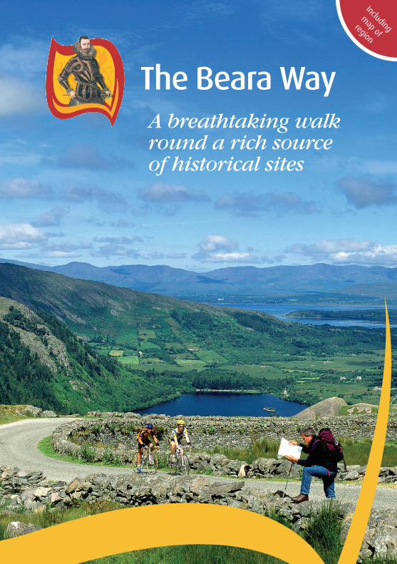
A breathtaking walk round a rich source of historical sites
Includingm
ap ofregion
Use our official guide to the Beara Way Walking Route to plan your walking holiday to this hill walkers' paradise. The Beara Way Walking Route is a walking circuit of the peninsula following side roads, boreens, bog roads and tracks, taking in all that is special about the place, including a variety of historical sites ranging from Ogham Stones to Wedge Graves, Stone Circles to ancient church sites. While there are a few stretches along the very edge of the Atlantic, one is never very far from the sea, even on the mountainous parts, and the route includes a thrill unique to Beara - a spin over the sea in a tiny cable car at Dursey Island.
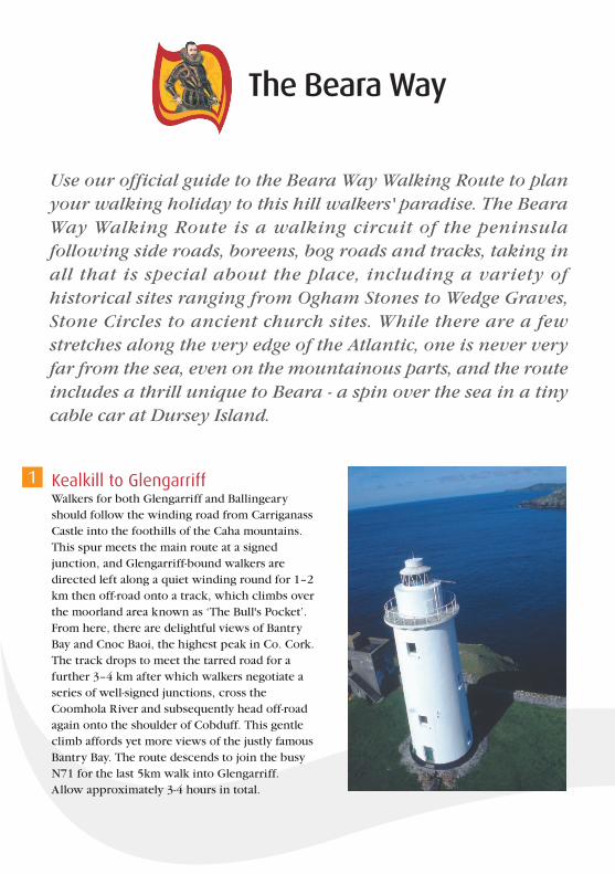
Kealkill to GlengarriffWalkers for both Glengarriff and Ballingeary should follow the winding road from Carriganass Castle into the foothills of the Caha mountains. This spur meets the main route at a signed junction, and Glengarriff-bound walkers are directed left along a quiet winding round for 1–2 km then off-road onto a track, which climbs over the moorland area known as ‘The Bull's Pocket’. From here, there are delightful views of Bantry Bay and Cnoc Baoi, the highest peak in Co. Cork. The track drops to meet the tarred road for a further 3–4 km after which walkers negotiate a series of well-signed junctions, cross the Coomhola River and subsequently head off-road again onto the shoulder of Cobduff. This gentle climb affords yet more views of the justly famous Bantry Bay. The route descends to join the busy N71 for the last 5km walk into Glengarriff. Allow approximately 3-4 hours in total.
1

Glengarriff to AdrigoleThe route takes walkers into Glengarriff Woods Nature Reserve. The route enters Coomerkane Valley and rises up to a height of 500m north of Sugarloaf Mountain; caution to be taken on this high mountain pass. The route reaches the public road close to Massmount on the Adrigole side. Without stops, allow 4-5 hours to complete this section. There are also great views of Bantry Bay and the Sheep’s Head Peninsula.
Adrigole to CastletownbereThis section is the longest on The Beara Way and takes 5-6 hours. Should you choose to leave the route earlier, numerous signed paths lead down to the R572. The walking route follows the length of Adrigole parish and then off road to pass along the foot of Hungry Hill and the Slieve Mishkish mountains. En route to Castletownbere, there are a number of archaeological features worth seeing including a cairn, a megalithic tomb, standing stones, fulacht fia (pre-historic cooking places) and a Mass Rock. There are stunning views of Adrigole Harbour, Berehaven and Bere Island.
Bere IslandThe walks on Bere Island are comprised of Ardnakinna Loop (3-4 hours) and a shorter East End Loop (1-2 hours). To complete both, allow 5-6 hours. Travelling in an anti-clockwise direction around the Ardnakinna Loop, there are fantastic views across to Berehaven and Dunboy Castle. At Ardnakinna lighthouse, the route turns inland but rises so that the walker can enjoy spectacular views of Bantry Bay and the Sheep’s Head Peninsula. The walk connecting the Ardnakinna and West End Loops traverses the central ridge of the island with breathtaking 360-degree views of Hungry Hill, Berehaven and Bantry Bay. The Ardnakinna Loop follows public roads with some short off-road sections. The walk passes through Rerrin Village and has great views of Hungry Hill.
Castletownbere to AllihiesThis 4-5 hour walk passes a number of archaeological sites and through a state forest as it climbs towards Knockgour. The views of Ballydonegan Bay, Cod’s Head and Garinish are stunning on the approach to the village of Allihies.
2 3
4 5
Kenmare Bay
Bantry Bay
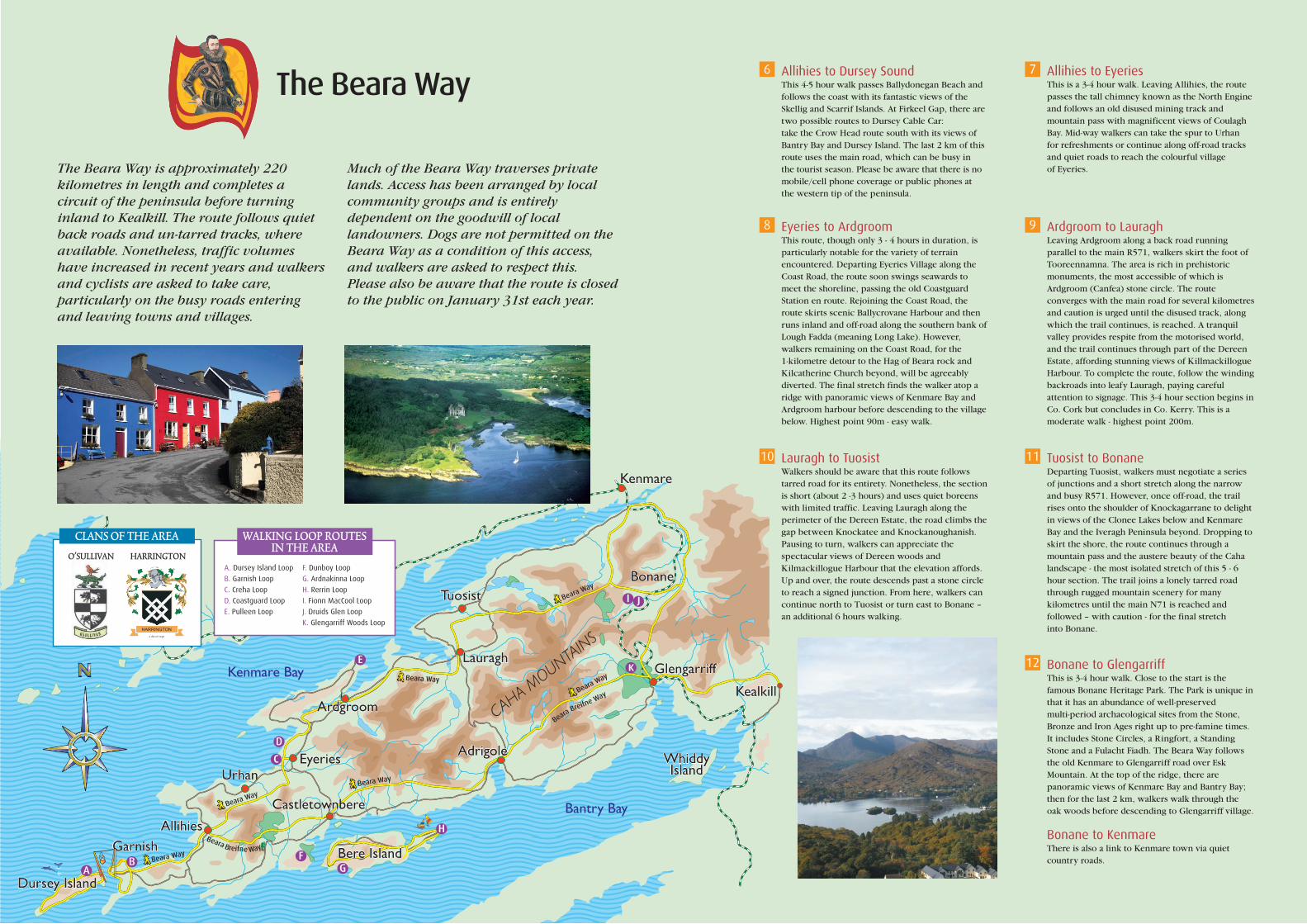
The Beara Way is approximately 220 kilometres in length and completes a circuit of the peninsula before turning inland to Kealkill. The route follows quiet back roads and un-tarred tracks, where available. Nonetheless, traffic volumes have increased in recent years and walkers and cyclists are asked to take care, particularly on the busy roads entering and leaving towns and villages.
Much of the Beara Way traverses private lands. Access has been arranged by local community groups and is entirely dependent on the goodwill of local landowners. Dogs are not permitted on the Beara Way as a condition of this access, and walkers are asked to respect this. Please also be aware that the route is closed to the public on January 31st each year.
Allihies to Dursey SoundThis 4-5 hour walk passes Ballydonegan Beach and follows the coast with its fantastic views of the Skellig and Scarrif Islands. At Firkeel Gap, there are two possible routes to Dursey Cable Car: take the Crow Head route south with its views of Bantry Bay and Dursey Island. The last 2 km of this route uses the main road, which can be busy in the tourist season. Please be aware that there is no mobile/cell phone coverage or public phones at the western tip of the peninsula.
6 Allihies to EyeriesThis is a 3-4 hour walk. Leaving Allihies, the route passes the tall chimney known as the North Engine and follows an old disused mining track and mountain pass with magnificent views of Coulagh Bay. Mid-way walkers can take the spur to Urhan for refreshments or continue along off-road tracks and quiet roads to reach the colourful village of Eyeries.
7
Eyeries to ArdgroomThis route, though only 3 - 4 hours in duration, is particularly notable for the variety of terrain encountered. Departing Eyeries Village along the Coast Road, the route soon swings seawards to meet the shoreline, passing the old Coastguard Station en route. Rejoining the Coast Road, the route skirts scenic Ballycrovane Harbour and then runs inland and off-road along the southern bank of Lough Fadda (meaning Long Lake). However, walkers remaining on the Coast Road, for the 1-kilometre detour to the Hag of Beara rock and Kilcatherine Church beyond, will be agreeably diverted. The final stretch finds the walker atop a ridge with panoramic views of Kenmare Bay and Ardgroom harbour before descending to the village below. Highest point 90m - easy walk.
8 Ardgroom to LauraghLeaving Ardgroom along a back road running parallel to the main R571, walkers skirt the foot of Tooreennamna. The area is rich in prehistoric monuments, the most accessible of which is Ardgroom (Canfea) stone circle. The route converges with the main road for several kilometres and caution is urged until the disused track, along which the trail continues, is reached. A tranquil valley provides respite from the motorised world, and the trail continues through part of the Dereen Estate, affording stunning views of Killmackillogue Harbour. To complete the route, follow the winding backroads into leafy Lauragh, paying careful attention to signage. This 3-4 hour section begins in Co. Cork but concludes in Co. Kerry. This is a moderate walk - highest point 200m.
9
Lauragh to TuosistWalkers should be aware that this route follows tarred road for its entirety. Nonetheless, the section is short (about 2 -3 hours) and uses quiet boreens with limited traffic. Leaving Lauragh along the perimeter of the Dereen Estate, the road climbs the gap between Knockatee and Knockanoughanish. Pausing to turn, walkers can appreciate the spectacular views of Dereen woods and Kilmackillogue Harbour that the elevation affords. Up and over, the route descends past a stone circle to reach a signed junction. From here, walkers can continue north to Tuosist or turn east to Bonane – an additional 6 hours walking.
10 Tuosist to BonaneDeparting Tuosist, walkers must negotiate a series of junctions and a short stretch along the narrow and busy R571. However, once off-road, the trail rises onto the shoulder of Knockagarrane to delight in views of the Clonee Lakes below and Kenmare Bay and the Iveragh Peninsula beyond. Dropping to skirt the shore, the route continues through a mountain pass and the austere beauty of the Caha landscape - the most isolated stretch of this 5 - 6 hour section. The trail joins a lonely tarred road through rugged mountain scenery for many kilometres until the main N71 is reached and followed – with caution - for the final stretch into Bonane.
11
Bonane to GlengarriffThis is 3-4 hour walk. Close to the start is the famous Bonane Heritage Park. The Park is unique in that it has an abundance of well-preserved multi-period archaeological sites from the Stone, Bronze and Iron Ages right up to pre-famine times. It includes Stone Circles, a Ringfort, a Standing Stone and a Fulacht Fiadh. The Beara Way follows the old Kenmare to Glengarriff road over Esk Mountain. At the top of the ridge, there are panoramic views of Kenmare Bay and Bantry Bay; then for the last 2 km, walkers walk through the oak woods before descending to Glengarriff village.
Bonane to Kenmare There is also a link to Kenmare town via quiet country roads.
12
Dursey IslandDursey Island
UrhanUrhan
TuosistTuosist
KenmareKenmare
BonaneBonane
WhiddyIsland
WhiddyIsland
Bere IslandBere IslandA
C
D
E
FG
H
WALKING LOOP ROUTESIN THE AREA
A. Dursey Island Loop
B. Garnish Loop
C. Creha Loop
D. Coastguard Loop
E. Pulleen Loop
F. Dunboy Loop
G. Ardnakinna Loop
H. Rerrin Loop
I. Fionn MacCool Loop
J. Druids Glen Loop
K. Glengarriff Woods Loop
EyeriesEyeries AdrigoleAdrigole
GarnishGarnishAllihiesAllihies
CastletownbereCastletownbere
ArdgroomArdgroom
LauraghLauragh
B
GlengarriffGlengarriff
KealkillKealkill
Beara Way
Beara Way
Beara Way
Beara Way
Beara Way
Beara Way
Beara Breifne Way
Beara Breifne Way
I J
K
The Beara-Breifne Way follows the fourteen-day
march taken by Donal O'Sullivan Beare and
one thousand supporters in 1603. The Way, the
longest in Ireland, runs almost the length of the
country and takes the walker and cyclist to
some of its most beautiful and least explored
areas; along the coast of the Beara Peninsula,
across six mountain ranges, along the banks of
the River Shannon and through the lake
regions of Roscommon and Leitrim. The
landscape contains an extraordinary variety of
heritage sites - prehistoric features, castle ruins
and religious and battle sites - many of which
bear witness to the march of four hundred
years ago.
The Beara-Breifne Way interlinks a series of
local ways. The local way on the Beara
Peninsula is called The Beara Way. It is
approximately 220km in length and completes
a circuit of breathtaking coastal and mountain
scenery, before turning inland to Kealkil.
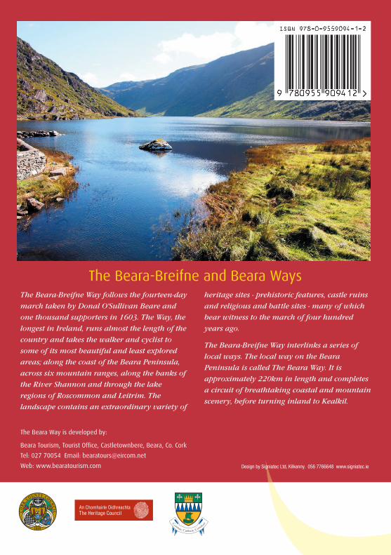
The Beara-Breifne and Beara Ways
The Beara Way is developed by:
Beara Tourism, Tourist Office, Castletownbere, Beara, Co. Cork
Tel: 027 70054 Email: [email protected]
Web: www.bearatourism.com Design by Signiatec Ltd, Kilkenny. 056 7766648 www.signiatec.ie