Embed Size (px)
Citation preview

~
SANTA FE IN THE INTERMOUNTAIN WEST. Colorado Rail Annual No. 23 Johnson Printing Co., 1998. 296 pages. Illustrations, Notes, Index. Cloth $49.95 Order from Colorado Rail Museum, P.O. Box 10, Golden, CO 80402-0010
This publication is similar to our Brand Books, in that it is produced by members of the Colorado Railroad Museum. They started this series of books in 1963 and most have been out of publication for years, just like our Brand Books.
This current book is about one of America's great railroads, the Atchison, Topeka and Santa Fe. The first chapter is about the Santa Fe's famous passage from Trinidad, Colorado, to Raton, New Mexico. It traces back to prehistoric times up to the early 1970's when the Santa Fe stopped running their famous passenger trains, such as the Super Chief.
The next chapter is about the operating practice of these locomotives, primarily in 1930 and 40's, when steam locomotives were king, with many fine pictures of these impressive Santa Fe locomotives. Many of these engines the author actually saw as a teenager out here in Southern California.
The next chapter is about La Junta, Colorado, which was primarily a railroad town from the 1880's to the 1950's. The Santa Fe had large shops, roundhouses and Division offices here during the steam era. There are maps detailing these facilities.
The final chapter deals with the history of the Santa Fe mainline across Northern Arizona, centered around the Nelson, Arizona area in the "good 01' days of steam." Here are the good times and the bad, right down to the present, about a great railroad and the Southwest.
Bob Kern
24
AND OTHER THINGS Published semi-annually, Western Legal
History contains stimulating and reflective articles, interviews and book reviews focused on the history of law in the American West and the Pacific Islands. Prominent authors in history, law, political science and other fields explore and illuminate the role that the law has played in the West, from precontact times to the present. Reprints of source documents, transcripts of oral histories of significant western judges and attorneys and photo essays complement the contributions by noted scholars.
Articles published in Western Legal History are abstracted and indexed in America: History and Life, Historical Abstracts, Legal Resources Index and Index to Legal Periodicals. Published by the Ninth Judicial Circuit Historical Society, Western Legal History is rapidly becoming the most important resource in legal history.
Subscriptions are $25.00 annually. For a limited time, Westerners who subscribe will receive the special theme issue "Western Water Law" plus 2 additional issues. To receive this special offer, you must identify yourself as a member of the Westerners and you must subscribe by September 30, 1999.
Subscriptions and checks should be mailed to the Ninth Judicial Circuit Historical Society, 125 South Grand Avenue, Pasadena, CA 91105.
The current exhibit at the Autry Museum of Western Heritage, "Powerful Images" is on the internet at http:/ / www.museumswest. 0 r g / gu ide / images/index/htm
The Eiteljorg Museum of American Indians and Western Art is one of the two museums east of the Mississippi River to display Western art and Native American artifacts. The Eiteljorg is located at 500 W. Washington Street, White River State Park, Indianapolis, IN 46204-2707. Web site http://www.eiteljorg.org
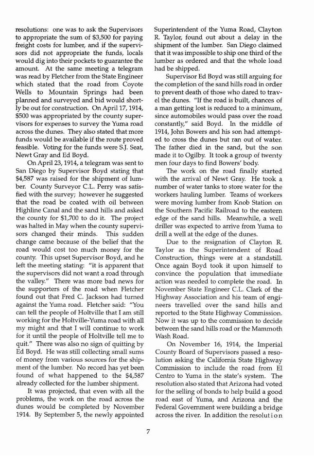
SPRING 1999 LOS ANGELES CORRAL NUMBER 215
Remains of the plank road today. Courtesy of the author.
A Brief History of the Plank Road of Imperial County
by Arash Hashemi 1998 Student Essay Award Winner
In the eastern Imperial Valley near the Arizona border lie the Algodones Dunes. Mexican citizens call the dunes La Palma de la Mano de Dios which means "The Hollow of God's Hand." Others call the dunes the American Sahara; the locals call them the "Sand Dunes." The dunes, located in the Colorado Desert, form a huge sand tract which stretches more than 40 miles in a northwesterly direction in the Imperial
Valley of Southern California. They are three to six miles wide and some are 200 to 300 feet high. The Sand Dunes are located in the Cahuilla Basin, a structural depression mostly under sea level, which includes the Imperial and Coachella Valleys. The lowest portion of the basin is the Salton Sea.
For early travellers the dunes created a monstrous challenge. In 1774, Juan Bautista
(Continued on page 3)

The Branding Iron THE WESTERNERS
LOS ANGELES CORRAL Published Quarterly in
Spring, Summer, Fall, Winter OFFICERS 1999 TRAIL BOSSES
RAYMOND J. PETER. .. ...... ... ........ ... ....... .... .. Sherift 5002 Stem Ave., Sherman Oaks, CA 91423
MICHAEL GALLUCCI... ....... .......... Deputy Sherif} 2567 Westridge Rd. LA, CA 90049
ERIC A. NELSON ... ........ ..... ........ ... .... ... Registrar ~J 3342 N. Lamer St. Burbank, CA 91504 Marks & Brands
WARREN M. THOMAS ..... ... ..... Keeper of the Chips 2206 Panorama Terrace, LA., CA 90039
ROBERT W. BLEW. ..... .......... ... .. Publications Editor 12436 Landale St., Studio City, CA 91604
ABRAHAM HOFFMAN ...... Past Sheriff Trail Boss
GLENN THORNHILL.. ........ Past Sheriff Trail Boss
APPOINTED OFFICERS
GARY TURNER. ...... : ........ .... .. ... ... .... Wrangler Boss
FRANK Q. NEWTON .... . .Daguerreotype Wrangler
RAMON G. OTERO ........ .... ............ Magic Lantern Wrangler
WILLIAM J. WARREN .... Historian/Representative
WILLIAM DAVIS .................. .... .. .............. Librarian
PATRICIA ADLER INGRAM .... ....... Membership Chairman
MSGR. FRANCIS WEBER..Editor, Brand Book 21
JOHN W. ROBINSON .... .... Editor, Brand Book 22
Addressfor Exchanges & Material Submitted for Publication:
The Publications Editor, Robert Blew 12436 Landale Street, Studio City, CA 91604
The Branding Iron solicits articles of 2,500 words or less, dealing with every phase of the Old West. Contributions from members and friends welcomed. Copyright © 1999 by the Westerners Los Angeles Corral Publication Design & Layout by Katherine Tolford
2
I ~ .: -~~ ~~-
~, . 7" . _
,~'1;/i.fff!'v
TIB MDITBLY llDUIfDUP JANUARY MEETING
Frank Wheat, author of California Desert Miracle, described the story of the passage of the California Desert Act of 1994 the day after the scheduled adjournment of Congress. It was a saga of dedicated volunteers, fortuitous happenings, surprises and good luck - some might say a miracle.
January Meeting Speaker Frank Wheat
Mr. Wheat, born and raised in Los Angeles, is a graduate of Pomona College and Harvard Law School. He is now retired from his law partnership but remains active serving as a trustee of the Earthjustice Legal Defense Fund, Anza-Borrego Foundation and the Ralph M. Parsons Foundation.
The battle to protect the desert's fascinating and fragile landscape started in 1967.
(Continued on page 14)
highest divorce rate in the world" by examining families in the American West from the 1870's to the present. Through chapters covering married life (courting, marrying, intermarrying separating, deserting, and divorcing) the author analyzes the "underlying factor" of divorce: "urbanization, industrialization, stress of modem life, men's and women's entry into the paid labor force, women's changing roles, and the gradual broadening of divorce laws and judicial decisions regarding divorce."
While this is an interesting study and perhaps representative of current historical thought, the author has not demonstrated the international aspect of this divorce rate, though she has provided adequate statistical evidence of the West's high divorce rate. Here lies another problem: the American West is not clearly defined. Defining the West as "west of the Mississippi River including Alaska and Hawaii," does not coincide with the statistical data provided making the subsequent correlation of data difficult.
Reflecting the current climate of political correctness, the author uses a confusing array of terms: Native American/Indians, Spanish-speaking/Spanish/ Chicana / Spanish-heritage/Hispanic. To add to this mix, the author often refers to all European Americans as Anglo.
. The author also interprets American laws regarding marriage, children and women's rights as the imposition of Anglo customs and laws rather than those of the United States Government. While a good case exists for this, she has totally ignored the differences between a literate society (resulting in detailed record keeping) and those cultures with oral traditions. While the focus is on all cultures found within the American West, the author has not accounted for their vast range nor for their relatively small numbers making it appear these minority cultures were in fact the majority. Furthermore, the author glosses over the government's need to codify these minority cultures and incorporate them into American culture and society.
Finally, the author's almost total reliance
23
upon anecdotal data, justified by the scarcity of information, makes for a series of individual experiences lacking a coherent organization.
However, this study is not without merit. For those seeking detailed information regarding Western families, this book with its lengthy notes is a rich source of information.
Jeanette Davis
JOURNAL OF AN EXPEDITION TO THE GRAND PRAIRIES OF THE MISSOURI, 1840, by William Fairholme, edited by Jack B. Tykal. Spokane: Arthur H. Clark Company, 1996. 187 pp. Illustrations, Bibliography, Index. Cloth, $29.50. Order from Arthur H. Clark Company, P.O. Box 14707, Spokane, WA 99214 (800) 842-9286.
This is the detailed journal of British Army officer William Fairholm's 5,000 mile hunting trip through the midwestern United States from the end of July through late November 1840. Mr. Tykal did an excellent job in publishing this manuscript from the Huntington Library and supporting it with background history, sketches of the participants and interesting and useful footnotes.
While the story of the buffalo hunting trip is the heart of the story it also includes fascinating additional information. There are descriptions of travel by Great Lakes steam boat, river steamer and even of a couple of rides on the pioneer railroads of the time. The hunting trip was made with animal transport which is well described. Its story of the terrifying prairie fire encountered at the end of their hunting expedition and its aftermath are fascinating.
However, Fairholm's hunting stories do seem to become somewhat redundant, and the book's lack of maps is also something of a fault.
I recommend this book to anybody interested in travel, hunting and general conditions in the midwest of 1840, before the prairies became crowded with "outsiders.'"
Konrad F. Schreier, Jr.

adventurism. That is what would sell. Stickeen was commercial. Actually, the story had already been published for children in July 1893 and was written by Emily Swett Parkhurst who had heard Muir tell it. Of Muir's own final draft in 1897, he said that this dog story "easily told, has been very hard to write." He had been telling the story for 15 years.
John Muir's 'Stickeen' and the Lessons of Nature is well-written and interesting. It contains Muir's original journal of 1880, Parkhurst's story, Muir's final draft before it was amended for publication, the notes from Muir's library and a well-done analysis of the mechanics of how Stickeen was written.
With this book, Ronald Limbaugh fills the informational need we have on the subject of Muir's Stickeen. But Limbaugh does not lose the real worth of the story by doing so. Stickeen, was not a true-life adventure but a parable on the goodness of animals and their importance to mankind.
Joseph Cavallo
THE SOUTHWEST AND THE AMERICAN IMAGINATION: The Writings of Sylvester Baxter. 1881-1889, edited by Curtis M. Hinsley and David R Wilcox. Tucson: University of Arizona Press, 1996. 268 pp. Illustrations, Notes, References Cited, Index. Cloth, $40; paper, $16.95. Order from University of Arizona Press, 1230 N. Park Avenue, Suite 102, Tucson, AZ 85719-4140. (520) 621-8656
The 1886-1889 Hemenway Southwestern Archaeological Expedition was an important foundation of Hohokam studies and the prehistory of the Zuni tribes of Arizona. But not unlike the forgotten Spanish expeditions of two centuries before, the last one hundred years has been an ongoing effort to redefine the value of this expedition. Much of that process has centered around the disparate collections at Harvard University, Brooklyn Museum and the Southwest Museum. In this first installment of a multivolume work, Curtis M. Hinsley and David R Wilcox bring
22
the Hemenway expedition to life, recreating the expedition's sense of discovery and awe that still resonates today.
The Hemenway expedition was the first southwestern archaeological trek of its type, cataloging various sites of prehistoric significance such as the Kingdom of Cibola, Casa Grande and the great cave at the Central Butte near Tempe, Arizona. The letters of expedition member Sylvester Baxter are clearly presented in this volume, highlighting the critical role of Frank Cushing, eccentric yet brilliant anthropologist, who proved to be the creative force behind the early success of the expedition. Baxter's letters capture the excitement of each archaeological find while cataloging the language, art and cultural traits of the Zunis in the surrounding Arizona desert. All of this activity occurred against the urgent backdrop of an encroaching westward movement, replete with railroads, towns and a late-nineteenth century populace that threatened to disturb tribes and prehistoric locale.
The Southwest in the American Imagination is a splendid initial entry on this landmark expedition, recounting lost correspondence and newly discovered documents, thereby creating an archaeological and anthropological lens for understanding these forgotten lands and people of the Southwest.
Ronald C. Woolsey
BUILDING AND BREAKING FAMILIES IN THE AMERICAN WEST, by Glenda Riley. Albuquerque: University of New Mexico Press, 1996. 204 pp. Illustrations, Notes, Index. Cloth, $35; paper, $17.95. Order from University of New Mexico Press, 1270 Lorna Blvd., Albuquerque, NM 87131-1951 (505) 277-0853
Building and Breaking Families in the American West is " ... a new kind of multicultural history by examining parallel institutions across a range of cultures in a specific region." Through cultural layering, the focus on disparate cultures, the author has attempted to explain what she calls " the
de Anza was unable to cross the dunes when Sebastian Tarabal, his guide, failed to recognize the trail he had blazed in 1773. They travelled by swinging west of the dunes and then into California, the only feasible route other than crossing the dunes. To get around the dunes, the Butterfield Overland mail route crossed into Mexico. The route followed a line of wells and then recrossed into the United States west of present day Calexico.
When settlers started to migrate to the Imperial Valley more roads were needed to deliver supplies to the increasing numbers. Later, a new invention, the "self propelled wagon" or the automobile, required even better roads. At first automobiles were very expensive and only a few people with high incomes could afford them. However, in 1905, Henry Ford introduced the "Model T," and by 1900 California had 44,120 cars. As soon as the average man was able to own a car, automobile clubs, such as the Automobile Club of Southern California founded in 1900, emerged. This "auto club" would later playa major role in the development of the plank road.
Roads were needed for farmers in the five farming towns of El Centro, Calexico, Holtville, Brawley and Imperial to ship their products to markets on both coasts. Much discussion centered on the need for a good road system. This was especially true for San Diegans who needed an outlet to the Imperial Valley and the east without passing through Los Angeles. San Diegans believed that a road should be built through the Imperial Valley and become part of a proposed transcontinental highway. People of San Diego were reminded about the warnings by County Surveyor S. L. Ward, who in 1901, advised them that they should build better relations with the people of Imperial Valley because Los Angeles merchants were becoming more and more attracted to the area. He warned that unless a good wagon road was extended east from San Diego, the trade of the valley would go to Los Angeles. With the completion of the transcontinental railroad Los Angeles had received two main
3
terminals while San Diego remained on a branch line. This left the city isolated in the lower southwest of the United States. The answer seemed to be the construction of roads and railroads to Yuma, Arizona. The first step was taken in 1910 to establish an auto road to the Imperial Valley. Ironically it was undertaken by Los Angeles, which sought to plan and build a road to the valley by way of San Bernardino and Mecca. San Diegans in response gathered donations from concerned citizens in the amount of $60,000 for a new road from the San Diego County line to the desert floor in Imperial Valley.
Meanwhile 84 delegates from California, Arizona and New Mexico of the Ocean to Ocean Highway Association met in 1910 in Phoenix. Arizona and New Mexico did not experience any conflict in selecting a route to Yuma. Los Angeles, however, wanted to go by the way of Salton Sea which would have isolated the main cities of the Imperial Valley from the road system. Yuma refused to be left out and on October 10, 1911, two men, Amos Adams and A.B. Ming, prepared a wagon with supplies in order to "spy out an All American Road from Yuma to California." After travelling to Ogilby, Glamis, Mammoth Wash and El Centro they met with the editor of the Brawley News, MD. Witter and Imperial County Supervisor RE. Willis in Brawley. The four men discussed how the continental highway should be built via the southern route. Witter and Willis liked the idea and agreed to work with the Yuma people for "better roads." At this point Colonel Ed Fletcher appeared. He was monumental in building the road across the valley and the Sand Dunes. He was a great fan and publicist for the National Highway and the Yuma-San Diego route; he felt this was the most efficient and easiest way to reach the Pacific from the Atlantic.
A race was planned to see whether the Los Angeles or San Diego route was the more efficient. The San Diego team consisted of Fletcher, F.B. Naylor and W. Jackson. A prize of $4,000 was raised of which $1,000 came from the citizens of Phoenix. The San

Diego entry was called the Tribune-Gazette, which was driven by Fletcher. The driver of the Los Angeles Examiner was given the privilege of picking any route he wanted. His choice was to race via Blythe to Phoenix. Fletcher started his journey by driving his air cooled Franklin model to El Centro. He had prearranged for a team of six horses to be stationed in the sand dunes to pull him out if his car got stuck. When he arrived at Yuma he crossed the Colorado River on the Pacific Railroad bridge. He arrived in Phoenix 19 1/2 hours later. The Los Angeles car never finished the race because it broke down. This event made Fletcher an avid supporter for a road across the sand hills. He wrote about the dunes .and the National Highway in his memoirs:
The hills between Holtville and Yuma forced all cars to go 46 miles further around by the way of Mammoth Wash and Niland, then follow the Southern Pacific Railroad to Yuma. With sand eight to ten inches deep, it was a grueling test as well as dangerous. Los Angeles papers urged construction of a National Highway via San Bernardino and Mecca to Yuma then east. San Diego was at the end of the trail and tourists had come in and out via the coast from Los Angeles to San Diego and back. The year 1912 was important in explor
ing problems of placing a solid road across the dunes. The first person who attempted to cross the sand dunes was Imperial County Supervisor Edwin E. Boyd. His road was an experimental one made from brush mats at a cost of $3,500. After a few heavy cars rode over the road they ground it into bits and pieces. People started to complain about how the county was wasting the taxpayers' money. The county was very young, having only been created from San Diego County in 1907, and did not have sufficient funds. However, a first step needed to be taken if the ultimate goal' was to be achieved. Boyd should be credited with taking the first step and starting the journey towards the "goal."
4
A second attempt was made by Fred Fuller in April 1912. He tried to cross the desert between Holtville and Yuma to "blaze" a trail for the Ocean to Ocean Highway. His attempt resulted in failure, but the people of San Diego completed a successful experiment which consisted of sending a car through Devils Canyon to EI Centro in seven hours and 50 minutes.
Yuma was not going just to sit and watch. In May 1912 a branch of the Highway Association was formed and the people of Yuma raised $1,000 for work on the end of the Transcontinental Highway, which needed to cross California. The road from Phoenix to Yuma was reported to be adequate which meant another section was added to the goal. It took eleven hours and ten minutes to get from Phoenix to Yuma over 206 miles of desert.
Meanwhile, construction was taking place on the road to Mammoth Wash which contained 3 1/ 2 miles of treacherous sand that stopped numerous cars. Charles Bigelow, with a force of men to build a roadbed of brush, straw and boards, was in charge of the repairs. This meant that San Diego had better hurry, or it would lose the race for the road through Imperial Valley, because Los Angeles was making plans to cover every foot of the road between Los Angeles and Yuma.
This did not mean that Imperial Valley people and Ed Fletcher would stand by the side and watch. On January 17, 1912, a "Good Roads Smoker" was held at the Hotel Oregon in EI Centro. A branch of the San Diego-Imperial Good Roads Association was formed, and each attendee was asked to contribute one dollar to be used for promotion purposes. By this time around 150 men were working at the western end of the valley on San Diego-Yuma Road. Everybody was encouraged by the Supervisor of the Fifth District, Ed Boyce, to get involved.
The fight over the route for the so called Ocean to Ocean Highway from Yuma west had reached a boiling point by February 1912. Los Angeles still favored the desert
in India, where her father died of cholera; the little girl was raised by others in India and England.
Her first marriage was in Ireland, but like those that followed did not last. The first chapter of the book details her numerous liaisons, intrigues and love affairs, while Eliza, now calling herself Lola Montez, invented a Spanish background for her theatrical dancing, by which she supported herself and later won an international reputation.
Her most famous affair was with the infatuated, pleasure-loving King Ludwig of Bavaria, who showered upon her a lavish residence, honors, cash and the title of Countess of Landsfeld, even while she was sharing her favors with a series of lovers in her residence in Munich.
In 1848 the debauched monarch was force to resign, and in 1851 Lola was booted out to Switzerland and later to New York. After some successes there and in Boston, she finally arrived by steamer in San Francisco in 1853.
In San Francisco she lived up to her reputation as a promiscuous lover, a marvelous dancer (especially for her Spider Dance) and a high-spirited woman whom it was not wise to cross. She did actually marry one of her lovers, at Mission Dolores, but the marriage did not last more than a month. Syphilis was hinted at in her petition for divorce. After some successes in the Mother Lode towns, she settled down in Grass Valley, becoming a "retired citizen," much to the dismay of the local clergy who sermonized against the "wicked and shameless dancer." But Lola soon tired of country life set out for other adventures, before finally succumbing to the syphilis that plagued her later life, dying in New York in 1861.
The biography that James Varley has written, based on extensive research in contemporary newspapers, is lively, full of names of famous and interesting people and of special importance to Californians.
There is an extensive bibliography and useful index, and the book has a score of illustrations, most of them contemporary
21
with Lola's life and exciting times. Raymund F. Wood
JOHN MUIR'S "STICKEEN" AND THE LESSONS OF NATURE by Ronald H. Limbaugh. Fairbanks: University of Alaska Press, 1996. 187 pp. Map, Illustrations, Notes, Appendix, Index. Cloth, $22.95 +$3.50 P /h. Order from University of Alaska Press, P.O. Box 756240, 1st Fl. Gruening, UAF, Fairbanks, Alaska 99775-6240. (888) 252-6657.
To those of us who love the writings of John Muir, stories of the mountains and the beauty of the wilderness, the story of Stickeen seems so appropriate, so exciting, almost unbelievable. Unfortunately, it is not the truth; it is just a story, but it is a great story. It's about a little dog who did exist but who was used as the canvas to paint a moral lesson for humanity.
Ronald Limbaugh has done what perhaps many of us would like to do. He searched out the details, the facts of the story of Stickeen and he researched in Muir's own personal library. He includes the list of 105 books, many containing Muir's handwritten notes.
Limbaugh's work is a nice companion volume to Stickeen and it is an analysis of the literate mind of the late 19th and early 20th centuries. The academic community of 100 years ago would belong to literary clubs and discussion groups for entertainment. They liked to hear storytelling or "explication" of ideas. John Muir had great charisma and a talent as a popular lecturer. He was a master storyteller, a wilderness oracle.
Muir's most frequently told story to small groups was Stickeen. Both children and adults alike remained on the edge of their seats, spellbound and would not leave until the story was finished. People who listened to him would report later that they were left emotionally drained and transfixed even if they had heard the story previously.
The literate mind of the time was given to hyperbole, imagination and emotional

Letters and Journal of William Dennison Bickham, edited by Randall E. Ham. Spokane: Arthur H. Clark Company, 1996. 286 pp. Maps, Illustration, Bibliography, Index. Cloth, $37.50. Order from Arthur H. Clark Company, P.O. Box 14707, Spokane, Washington, 99214 (800) 842-9286.
The challenge to the editor of primary source materials is to provide sufficient context to organize the reader's thoughts by providing the reference points essential to extract the maximum from the materials themselves. Mr. Ham has done an outstanding job of this. Although he gives the credit of bringing "to life the events, places and people about which he [William Bickham] wrote ... " to the original author, it is his introduction, prologue and epilogue which make the work of real value.
William Bickham left his native Cincinnati for California in March 1850; he returned four years later. During his stay, he recorded a personal journal intended for family members and wrote dispatches about his experiences for the Cincinnati Gazette.
His California sojourn was indeed varied. He spent substantial time in Murderers Bar and other mining camps seeking the fortune which eluded so many - including himself. He traveled to San Francisco and Sacramento as a delegate to the Whig Party Convention of 1851, witnessed San Francisco vigilante activity, obtained a not very interesting position as a customs inspector of the Port of San Francisco, observed several major fires which ravaged the City and ultimately returned to his occupation of newspaperman.
The book gives the reader an excellent, although often uneventful, insight into life in California during the Gold Rush period through the eyes of a 24 year old, single man on "the great adventure of his youth, the final burst of freedom before surrendering to the duties of family and career." Bickham writes well, although his subject matter is often not riveting. He succeeds in giving good descriptions of the events he experienced, of the people he encountered and his feelings toward both. His work should be of
20
particular interest to anyone seeking information on Ohio Argonauts. He seems to encounter friends and acquaintances from his home state at almost every turn. Biographical material about them is often included. Ham has also painstakingly researched census records and city directories to provide further information about each.
The book would have been enhanced by more maps and drawings. Notations stating how much time had elapsed between the various entries would have been very helpful.
Although dates are given, one is constantly required to backtrack to appreciate the chronology of the events described. More depth could have been given to Bicknell's job as a custom inspector. Exactly what his job consisted of is never really described.
Peter D. Pettler
LOLA MONTEZ: The California Adventures of Europe's Notorious Courtesan by James F. Varley. Spokane: Arthur H. Clark Company, 1996.266 pp. Illustrations, Notes, Bibliography, Index. Cloth, $29.50. Order from Arthur H. Clark Company, P.O. Box 14707, Spokane, WA 99214 (800) 842-9286.
Although the notorious dancer and actress of the 1850's, "Lola Montez" as she called herself, spent only about one-and-ahalf years in California, out of a life of 44 years her name is forever coupled with the Golden State and more particularly with the community of Grass Valley, even though she lived there but a few months. Given these facts, Californians are indebted to author J ames Varley for a well researched and interestingly written biography of the woman who brought about the downfall of the King of Bavaria.
Lola Montez was most likely born Eliza Rosanna Gilbert, in Limerick, Ireland, illegitimate daughter of an Ensign of a British regiment, who eventually married Eliza's fifteen year-old mother. Her early years were spent
Workers connecting six foot section of new open timber type of plank road with hook and eye bolts. Courtesy of Regional History Center, University of Southern California.
route by way of the Salton Sea, while San Diego favored the route by way of Holtville and EI Centro which they viewed as a more practical route. Governor Hiram Johnson appointed a State Highway Commission with A.B. Fletcher, a highway engineer, as director to study the routes. Meanwhile, a proposal was set forth by Supervisor Ed Boyd for a plank road which was deemed feasible for the dunes.
In May 1912, work on the road to Yuma was accelerated and a promise was made that it would not be long before the trip could be made in three or four hours. Twenty miles had already been completed, and within one week 38 more miles were to be built ready for travel. Supervisor Boyd took a trip on the new stretch of road that had reached the sand hills in June 1912.
After a meeting in Yuma of the San Diego, EI Centro, Holtville and Phoenix Auxiliaries to the Southern Highway Association at the beginning of 1913, it was reported that within two weeks engineers would start work to find a location for a bridge across the Colorado River to Yuma. A location was found which consisted of the
5
Old Penitentiary Hill on the Arizona side and the Army Barracks (Indian Hill) on the California side, a distance of 447 feet. It was also concluded that this was the only practical place where a bridge could be built within a short time and at a reasonable cost. The Federal Government, California and Arizona each donated $25,000 to the cause. The proposed road from Holtville to Yuma would cross the sand hills and connect with the bridge at Yuma.
After attending a Highway Commission meeting in Sacramento, Ed Fletcher had guaranteed to raise the estimated $25,000 needed to bring the plank road to life. Due to the certainty of the bridge across the Colorado River the sand hills route was now the cheapest solution to the question of which route to take.
San Diego promised to furnish 13,000 pieces of 2x12 inch Oregon Pine lumber. The lumber was to be shipped to San Pedro, California. Holtville had to pay freight to Ogilby, California, and lay the timber hammock fashion across the sand hills. Even a group of people from Yuma got involved in the project when L.W.

Car travelling over Plank Road; one of the turnouts apppears. Courtesy of Regional History Center, University of Sou them California
Alexander, Secretary of the Commerical Club, and County Assessor A.B. Ming, accompanied by Carl McStay, field representative of the Southern California Association of Good Roads, and Ed Boyd went out to the Holtville cutoff on November 13, 1917. While inspecting the work already done they heard about the donated lumber from the San Diego Chamber of Commerce. The Yuma Commercial Club (now known as the Yuma Chamber of Commerce) tried to get the Southern Pacific Railroad to lower the cost of the freight rate on the lumber.
The first plank road was started on February 13, 1915; not much is known about how it was built. It was built by free labor and maintenance was the duty of the travellers. The historical files of the Automobile Club of Southern California state the road was built of 2x8 inch planks laid side by side to make a 24 inch wide track. There existed two such tracks, which were laid down the width of an automobile's wheels and were fastened on a 4x6 tie. Fletcher wrote in his diary that: "The planks were two inches thick, 12 inches wide, and 12 feet long." Photos show that the tracks did in fact contain three boards side by side with the separated tracks being held together by what
6
appears to be 2x4 lumber. The one lane, six mile long road covered the worst of the sand dunes. At approximately every 1/4 of a mile a turnout existed which allowed cars to pass each other. If cars met each other in the middle, one of them would have to back up. This probably was the cause of many arguments on the road.
In the early days of 1914, the people of Yuma realized the important part they played in the Ocean to Ocean Highway. Harry Locke of Phoenix said:
When the new bridge is completed across the Colorado River, Yuma will be the gateway to all overland travel to the Pacific slope. When the highway is completed, Yuma will be greatly benefitted and is certain to grow by' leaps and bounds as a result. Travels were being made by the people
of the area to promote the ease and safety of the road. While California and Arizona were working diligently on the completion of the Transcontinental Road bridge across the Colorado River at Yuma, Supervisor Ed Boyd was also working hard to make the road a reality. By April 12, 1914, it was practically assured that Boyd's road would become a reality. A boosters' meeting adopted two
and bibliography into one section that enables the reader easily to see sources of information. If you prefer keeping the book on a shelf, you might want to consider taking down the names you run across and looking them up when you get home. Either way, this is a handy California reference book to have around.
If lugging the book around in your car doesn't appeal to you, try 1500 CALIFORNIA PLACE NAMES: Their Origin and Meaning, Bright's updating of the abridged 1000 California Place Names by Gudde. This handy book increases Gudde's work by a third and will let you know the background of place names from Abalone Point to Zzyzx. It sells for $12.95 paper, same publisher.
Abraham Hoffman
GOLD RUSH: A Literary Exploration edited by Michael Kowalewski. Berkeley: Heyday Books, 1997. 478 pp. Maps, Illustrations, Author, Index. Paper $18.48. Order from Heyday Books, P.O. Box 9145, Berkeley, CA 94709. (510) 549-1889
What is the proper image of the California Gold Rush? Publications that aim to answer that question usually fall into one of four categories: contemporary accounts, travel narratives, memoirs or interpretative history. Gold Rush, A Literary Exploration adds to all of these approaches; it is an ambitious anthology that unites a useful variety of original works to produce a kaleidoscope of images.
The editor, Michael Kowalewski, is an Associate Professor of English and American Studies at Minnesota's Carleton College; that duality enabled him to draw upon related literary sources for added perspective. He states, "Gold Rush aims to sample that panoply of anecdote, observation and artistic expression as a way of deepening our understanding of this complex historical phenomenon."
Five parts fulfill that mission. The first, an introduction, provides Kowalewski's viewpoints. His most distinctive conviction
19
holds that "The Gold Rush permanently altered the cultural adrenaline of the state." Many of the polyglot voices he selected echo that thought, but, unfortunately, the otherwise helpful annotation with each article does not include connections with his views.
The four other sections contain a multitude of primary sources and literary pieces. The 105 offerings are organized within phases - "Before the Gold Rush," "Getting There," "Gold Rush Life" and "Legacies." This multi-faceted collection in one book is impressive. Overall, many of the contributors are familiar names. They portray the influence of the Rush upon participants, upon California before, during and after, upon literature and upon the world.
Two surprises occur. First, Kowalewski chose excerpts that represent many authors' best writing. One such jewel is the vivid imagery phrased by the furtrapper, James Beckwourth, in describing the Sierra pass named for him. The second surprise stems from expressions by famed authors not usually associated with the Rush, e.g., exaggerated accounts published by Charles Dickens in his London newspaper.
However, this notable compilation raises two questions. First, why are those enriched by the miners absent? The legacies of Levi Strauss, James Irvine, Collis P. Huntington or James Lick have energized the "cultural adrenaline of the state," and, why were the best memoirs ignored? Dale Morgan, In The Pursuit of the Golden Dream, appraised many publications of this type. Based upon Morgan's analysis, Kowalewski selected two of the least of those and disregarded outstanding ones, especially Howard C. Gardiner's manuscript.
Yet Gold Rush with its 105 extracts enlightens our understanding of this paradoxical yet metamorphic episode in California history. It is a worthy but demanding work to read.
HankPanian
A BUCKEYE IN THE LAND OF GOLD: The
cided to compile information for his use. Over the years, the Gazetteer expanded and now after 32 years of collecting the information is available for the entire state. Over 50,000 entries cover all the geographic features of the state.
The book is divided into eleven multicounty regions. Each section begins with a map showing the area in relation to the entire state and short descriptions of each of the counties in that section. The features are listed alphabetically for the region. Each entry consists of a minimum of name, county, classification type (terms are defined starting on p. 1,493), location, including latitude and longitude, and the U. S. government quadrangle map on which it is found. Other entries give more information such as why named, historic and variant names.
Using the work is easy. Look up the desired feature in the alphabetical index which tells you the number of the part in which it is located. Then just look it up in the alphabetical listing in that part. If you know the county, there is a list that tells what part each county is located. For example, Poop Out Pass is in part 8 (South San Joaquin Valley Region) and Poop Out Pass is on p. 1,090. Checking many items from the index to the description and names to the index turned up no errors.
This tome can cover a gamut of uses from browsing for a few chuckles to serious geographical research. Anyone interested in California history or geography will find it useful, and it is a must for all libraries and serious collectors.
Robert W. Blew
CALIFORNIA PLACE NAMES: The Origin and Etymology of Current Geographical Names, by Erwin G. Gudde. Berkeley: University of California Press, 1998. 4th Edition, Revised and enlarged by William Bright. 468 pp. Cloth, $45. Order from University of California Press, 2120 Berkeley Way, Berkeley, CA 94720 (510) 643-0682.
In 1949 Erwin G. Gudde, a professor of
18
German at u.c. Berkeley, departed somewhat from Teutonic language study to create California Place Names tracing the creation and usage of the state's geographical names. Its success brought new editions in 1960 and 1969, the year of Gudde's death. Now William Bright, linguistics professor at the University of Colorado, Boulder, has brought out a revised and enlarged fourth edition of Gudde's famous reference work. bringing to the reader 150,000 place names in California-and that's not counting street names. Bright's work enhances rather than supplants the original study. He reprints Gudde's introduction to the second edition which Gudde succinctly stated the book's purpose: "To show when, how, and by whom these names were applied, to tell their meaning, their origin and their evolution, their connection with our national history, their relation to the California landscape and the California people-this is the purpose of the book."
That said, it should be noted that California Place Names's best use is not the way one uses a dictionary, encyclopedia or other typical reference work. This book belongs in your car, along with passengers interested in passing the time on a long trip by looking up the origins of the places you drive by. Sometimes you get surprised: Drive on I 40 planning to spend some recreation time at Laughlin, and you learn that the little spot on Historic 66, Amboy, is but the first of a series of railroad stations created in the 1880s by a locating engineer who named the seven stations eastward to Arizona in alphabetical order: Amboy, Bristol, Cadiz, Danby, Edson, Fenner, Goffs. A later effort added Homer, Ibex, and Klinefelter to the rail line. From the obscurity of these names you can proceed to the more familiar Daggett and Barstow-and you're still on just one road!
California's often picturesque and sometimes puzzling place names come alive when you use this book. Bright helps out with new material on place name pronunciation, especially names from California Indian languages. He also combines glossary
resolutions: one was to ask the Supervisors to appropriate the sum of $3,500 for paying freight costs for lumber, and if the supervisors did not appropriate the funds, locals would dig into their pockets to guarantee the amount. At the same meeting a telegram was read by Fletcher from the State Engineer which stated that the road from Coyote Wells to Mountain Springs had been planned and surveyed and bid would shortly be out for construction. On April 17, 1914, $500 was appropriated by the county supervisors for expenses to survey the Yuma road across the dunes. They also stated that more funds would be available if the route proved feasible. Voting for the funds were S.J. Seat, Newt Gray and Ed Boyd.
On April 23, 1914, a telegram was sent to San Diego by Supervisor Boyd stating that $4,587 was raised for the shipment of lumber. County Surveyor c.L. Perry was satisfied with the survey; however he suggested that the road be coated with oil between Highline Canal and the sand hills and asked the county for $1,700 to do it. The project was halted in May when the county supervisors changed their minds. This sudden change came because of the belief that the road would cost too much money for the county. This upset Supervisor Boyd, and he left the meeting stating: "it is apparent that the supervisors did not want a road through the valley." There was more bad news for the supporters of the road when Fletcher found out that Fred C. Jackson had turned against the Yuma road. Fletcher said: "You can tell the people of Holtville that I am still working for the Holtville-Yuma road with all my might and that I will continue to work for it until the people of Holtville tell me to quit." There was also no sign of quitting by Ed Boyd. He was still collecting small sums of money from various sources for the shipment of the lumber. No record has yet been found of what happened to the $4,587 already collected for the lumber shipment.
It was projected, that even with all the problems, the work on the road across the dunes would be completed by November 1914. By September 5, the newly appointed
7
Superintendent of the Yuma Road, Clayton R. Taylor, found out about a delay in the shipment of the lumber. San Diego claimed that it was impossible to ship one third of the lumber as ordered and that the whole load had be shipped.
Supervisor Ed Boyd was still arguing for the completion of the sand hills road in order to prevent death of those who dared to travel the dunes. "If the road is built, chances of a man getting lost is reduced to a minimum, since automobiles would pass over the road constantly," said Boyd. In the middle of 1914, John Bowers and his son had attempted to cross the dunes but ran out of water. The father died in the sand, but the son made it to Ogilby. It took a group of twenty men four days to find Bowers' body.
The work on the road finally started with the arrival of Newt Gray. He took a number of water tanks to store water for the workers hauling lumber. Teams of workers were moving lumber from Knob Station .on the Southern Pacific Railroad to the eastern edge of the sand hills. Meanwhile, a well driller was expected to arrive from Yuma to drill a well at the edge of the dunes.
Due to the resignation of Clayton R. Taylor as the Superintendent of Road Construction, things were at a standstill. Once again Boyd took it upon himself to convince the population that immediate action was needed to complete the road. In November State Engineer c.L. Clark of the Highway Association and his team of engineers travelled over the sand hills and reported to the State Highway Commission. Now it was up to the commission to decide between the sand hills road or the Mammoth Wash Road.
On November 16, 1914, the Imperial County Board of Supervisors passed a resolution asking the California State Highway Commission to include the road from El Centro to Yuma in the state's system. The resolution also stated that Arizona had voted for the selling of bonds to help build a good road east of Yuma, and Arizona and the Federal Government were building a bridge across the river. In addition the resolut ion

pointed out that unless the plans included a highway to the state line at Yuma, the state's system would be incomplete. The State of California included the sand hills road in the state system. An Imperial County official gave the road the nickname "the Boyd Road."
Returning from Sacramento, Boyd brought with him the news that $200,000 was promised for the construction of a concrete highway between EI Centro and Yuma via the sand hills. It was unclear when construction would start on the concrete road. Boyd speculated two years. However, the road was not built until the 1920's.
Boyd urged the people of the Valley to hurry the plank road because the San Diego Exposition was to be held in 1915 and travellers needed a better road. Boyd also stated that money was available for the shipment of the lumber and he did not know why it had not yet been shipped. A second chairman of the Yuma Road Committee, CW. Burton, resigned because of the committee's failure to order the planks waiting at the Port of San Diego. On December 11, 1914, the planks were ordered by the new committee. They advised that three miles of planks were to be laid cross-wise in the sand. It was also agreed that holes would be drilled at the end of each board, six inches from the butt, to allow bolting or wiring. Since the lumber belonged to San Diego they were given the right to salvage it when the state completed the concrete highway.
On March 10, 1915, a check was issued to the McCormack Lumber Company, Edward Fletcher, Trustee. The hauling contract was awarded to CL. Gillett and CG. Frisbie. Boyd predicted that it would cost $300 extra to smooth the sand before the planks could be laid. One hundred men in the Imperial Valley pledged one day a week to work on the road. Vaughn Azdehrian and ET. Hagg offered beef and said they would barbecue it free. Number 7 Water Company donated a big traction engine to cross the mesa and find soft spots.
On February 8, 1915, Ed Boyd had the Weekly Holtville Tribune publish the following
8
statement: All together now to task in laying the sand hill planks. Get your hammer in action. The lumber for the YumaImperial Valley Road is back up the sand hill, ready for you to build. Here is the plan of action. Three miles of lumber we are to lay then, [sic] is divided into five sections. Each of the five older towns in the Valley, Calexico, El Centro, Imperial, Brawley, and Holtville are to send a four horse team and six men should build one of the five sections in about 10 days . The road committee has the money raised by private subscription and an appropriation from the county supervisors to furnish you all the wholesome bar-b-que meat and other grub and feed for the stock. There will be no wages paid. The lumber is ready for you and the sooner (after Wednesday) you get it the sooner the road will be ready to use. Yuma has a big celebration March 15th to formally open the Yuma bridge to travel, and we want to open the road the same day by going to their celebration over the Ocean to Ocean Highway. For further information see Frank Reading, El Centro, A.M. Shenk, Calexico, or anybody in Holtville. On February 13, 1915, the first spike was
driven in construction of the plank road. A camp was established at Gray's Well, which was named after Holtville's Newt Gray, but the camp was called Camp Boyd. Different people took turns at driving the spikes; among them was California Lieutenant Governor J.M. Eshleman.
On February 17, 1915, Robert Goree, manager of Edgar Brothers, Calexico store, asked drivers to help "pack down" the road west of the sand hills. He thought that 50 automobiles going over the road twice would do the job. What kind of a traffic jam was created by all the drivers on the one lane dirt road?
February 20 saw the completion of a temporary road and people were already thinking of how to cash in on the new road.
as cultural evolution. It is a tale worth reading.
Gordon Morris Bakken
SAN BERNARDINO: The Rise and Fall of a California Community. by Edward Leo Lyman. Salt Lake City: Signature Books, 1996. 469 pp., Maps, Photos, Notes, Bibliography, Index. $24.95. Order from Signature Books 564 W 400 N., Salt Lake City, UT 84116-3411 (800) 356-5687.
In March 1851 a company of some 500 Mormon colonists, led by church apostles Amasa Lyman and Charles Rich and guided by wagon master Jefferson Hunt, departed Salt Lake City bound for Southern California. The caravan followed the western portion of the Old Spanish Trail "through sandy or rocky country, heartbreaking grades" and over "long dry stretches where scarcity of food and drink for the animals" threatened disaster. Early in June 1851 the weary Mormons crossed Cajon Pass and set up camp in lower Cajon Canyon. After a failed attempt to buy Rancho Santa Ana del Chino from owner Isaac Williams, Lyman and Rich successfully negotiated with the Lugo family to purchase a large portion of Rancho San Bernardino. The Mormons chose a mile-square inclined plain two miles east of lower Cajon Creek for their town, which they named San Bernardino. The industrious Latter-Day Saints set to work immediately to build a community from scratch. Thus was born one of Southern California's major population centers.
Through perseverance and hard work, Mormon San Bernardino prospered for several years. Lumber hauled down from the nearby San Bernardino Mountains and wheat grown on the plain became the economic mainstays, with Los Angeles buying all the Mormons could supply.
It was too good to last. The Mormon Era in San Bernardino history came to an abrupt end in the fall of 1857, when church leader Brigham Young recalled his faithful to Salt
17
Lake City. The ostensible reason for the recall was the Federal Government's dispute with the Mormons which resulted in President James Buchanan dispatching the U. S. Army to Utah in September 1857. More recent scholarship suggests there were other reasons contributing to the recall of the San Bernardino Mormons. Brigham Young and others of the Mormon hierarchy were disturbed by reports of dissension and moral decline among the San Bernardino brethren. "Intemperance and vice are steadily gaining ground in this place," reported a church leader. Young himself was quoted as saying, "Hell reigns there," and reportedly had written off the colony as a failure as early as April 1857, several months before the Federal threat to Utah developed. Most, but not all, of the San Bernardino Mormons heeded their leader's call and returned to Utah.
Edward Leo Lyman, college professor and descendent of apostle Amasa Lyman, covers all this in an exhaustive, thoroughly researched study of the short-lived Mormon community. It would be safe to say that his work is definitive. Lyman writes well and his book is highly recommended to all those with an interest in Mormon and/or Southern California history.
John W. Robinson
CALIFORNIA'S GEOGRAPHIC NAMES: A Gazetteer of Historical and Modern Names of the State, compiled by David L. Durham. Clovis: Word Dancer Press, 1998. 1,676 pp. Maps, Bibliography, Index. Cloth, $195. Order from Word Dancer Press, 8386 No. Madsen Ave., Clovis, CA 93611. (800) 497-4909.
Have yo~ ever wondered how many Dead Mans Gulches there are in the State? Where Black's Camp Ridge, Heriot's Place or Poop Out Pass are located? Or why Wounded Knee or Broken Rib Mountains are so named? The answers are now available.
David L. Durham, a career U. S. geologist who needed this type of information about the area to which he was assigned, de-

Author WILLIS OSBORNE has done more digging and was able to identify the unnamed person in the photograph on page 1 of Branding Iron 214. He was John Doggett, a popular radio personality in the early 1930s, who read the Sunday comics to children.
DR. DOYCE B. NUNIS, JR. delivered the keynote speech on the major forces that shaped Los Angeles in the first half of the twentieth century at the Los Angeles History Conference sponsored by the Historical Society of Southern California and held at the Autry Museum of Western Heritage. Among the audience were CHRISTIE BOURDET, SIG DEMKE, PAUL BRYAN GRAY, POWELL GREENLAND, JOE LESSER, BRAD MACNEIL and RAY PETER.
nan Tm: WESTIU BOOK TWL ... There is nothing so captivating as new knowledge - Peter Mere Latham
GERONIMO'S KIDS: A Teacher's Lessons on the Apache Reservation, by Robert S. Ove and H. Henrietta Stockel. College Station: Texas A & M University Press, 1997. 148 pp. Illustrations, Notes, Bibliography, Index. Cloth, $24.95. Order from Texas A & M University Press, Drawer C, College Station, TX 77843-4354 (800) 826-8911.
Robert S. Ove started his teaching career on the Mescalero. Apache Reservation near Whitetail, New Mexico, in the 1940s. He took his bride of three days on a train ride to the splendor of Sierra Blanca and the wild flowers of Dark Canyon. On the reservation, Robert Ove engaged the Chiricahua descen-
16
DIRECTORY CHANGES New Member
Ronald R. Gustafson 360 W. Las Flores Avenue,
Arcadia, CA 91007
Address Changes
Joseph H. Boyes, Jr. 9822 Coral Cove Circle
Huntington Beach, CA 92646-7503
Robert Kern 582 Clark st.
Upland, CA 91784
dants of Geronimo with the taught traditions of Euro-Americans. The experience taught him the culture of his students and the necessity of learning their culture to make learning relevant.
Commingled with Ove's recollections of a half century ago, historian Stockel provides a learned and directive narrative of the Apache experience. Her textured rendition of Apache history is an excellent setting for the important observations Ove and Stockel have about the reservation life of the Apache.
To understand the experience and the Apache, we learn of the kinship system and then meet the participants in Ove's two-year stint on the reservation. Short biographies of Robert Geronimo, Eugene Chihuahua, Levi Hosetosewit, Asa Dakiugie, Charles Istee, Evans Istee, Hugh Chee, Jasper Kanseah, Sr. and his family, Hugh Coonie, Solon Sombrero, Arthur Johnson and Delores Enjady give us more than scholarly generalization. The authors provide both personal as well as community context within the text of these lives.
For readers interested in the Apache in the twentieth century, this book will add to a story still being told. The reservation experience was one of tragedy and squalor as well
Workers laying planks. Courtesy Regional History Center, University of Southern California
George H. Johnson of Holtville and Charles Crombie of El Centro in Yuma on February 26, 1915, stated that they were going to establish a stage line from El Centro via Holtville to Yuma. Their journey had taken 5 1/2 hours in a Studebaker Six car. They found the plank road just fine and stated that it was like travelling over a concrete surface. After establishing their office they announced that they were expecting to make daily trips from El Centro to Yuma each way.
Fletcher reported on March 5 that 40,000 more feet of lumber was on its way to Imperial Valley and now the whole bad portion of the dunes could be planked. By March 11, 95% of the sand dunes were ready for travel. Harry Locke, the mapping engineer of the Borderland Route Book, began to promote the road by advising travellers via his soon to be published book to take the Yuma Road route. This route was shorter and more direct which made the Mammoth Wash Road obsolete.
Driving records were being established across the desert from Holtville to Yuma by the way of the sand dunes at the claimed speeds of 40 to 60 miles per hour. Boyd travelled from Holtville to Yuma in two hours and 55 minutes, crossing the dunes in 20
9
minutes which makes the above speeds seem exaggerated. To make passing easier on the route turnouts were constructed half a mile apart. Virgil Sam of Yuma broke Boyd's driving record by 33 minutes in a big Mitchell Racer Car. It took him five hours and 37 minutes reaching the same destination via the Mammoth Wash Road. Another man from Yuma claimed to have made the trip in two hours on his motorcycle.
On March 25, 1915, A.J. Eddy of Yuma made a trip to Holtville and El Centro with a couple of eastern automobile tourists and said this about the road:
That part of the plank road that is finished, is in excellent condition. There is no sand on the road to bother. There are about two more carloads of planking to be laid, to finish the road, which so far has proven a great success as an automobile thoroughfare. The people of EI Centro and Holtville are looking forward to the great bridge celebration and there will be a large crowd in Yuma during the celebration from the Imperial Valley. By March 29, 1915, most of the work on
the road was complete, except for several miles of planks that had to be nailed down.

When April 1 arrived, Ed Boyd had mixed emotions due to the fact that he had worked himself out of a job. The plank road to Yuma was completed and ready for travellers to use. Only about a mile of the road on the eastern side of the dunes had to be covered with clay and brush as a surface. The $6,000 that the county had provided for the Colorado Bridge had not been touched, and it was hoped that it would be used for maintenance of the road in the next two years.
Boyd was given credit for building the road. He had worked for three years to make his dream of an eastern outlet of the Imperial Valley come true. It was estimated that during this time he had used $2,000 to $3,000 of his own money. He also had lost two cars and numerous days, which he could have used for private profit. Boyd's many friends appreciated him and on April 3, 1915, surprised him with a new Ford automobile as a token for all work he had done. Boyd's old car was given to Newt Gray who had also worked tirelessly on the plank road.
Now that the plank road was complete, Gray saw a new opportunity to help the community and to make money at the same time. He decided to open a small store at the county well, where he sold gas, automobile parts, groceries and provided automobile repair service. However, on May 3,1915, he was arrested for violating Holtville's liquor ordinance. He had in his possession a gunny sack of 25 quarts of Maeir beer and twelve pints of whiskey. This was another service he provided to his customers.
On April 11, 1915, a group of 50 or more cars, headed to Yuma from Imperial Valley to celebrate the opening of the Colorado River Bridge. The bridge was nearing completion when on April 18, 1915, L.L. OdIe of the Yuma Indian Agency was the first to cross it in his car. It was estimated that it would take two more weeks until all the work was completed and the bridge was open to the general public. The Yuma bridge committee of the Yuma Commerical Club wanted a big electric sign for the bridge. It was advised by L.W. Alexander, Commerical Club president, that the sign should contain
10
the words "YUMA" and "OCEAN TO OCEAN HIGHWAY." It was estimated that the sign would cost $998 and would be ready in thirty days. When completed the sign was 192 feet long with the letters facing California and Arizona.
On April 17, a telegram to Holtville from the American Automobile Association of New York stated that the sand hills route had been approved by them. In May 1915, California Assemblyman RW. Willis reported that the state legislature had passed a bill allowing $100,000 for improvement of the sand hills road and the same amount for the Salton Sea Road.
On May 27, 1915, the great day had arrived for the Yuma Bridge (Colorado River Bridge). The bridge was officially open when the "Ocean-to-Ocean Highway" sign was turned on. The great crowd that had gathered to witness this historic event gave out a loud cheer. Among the many events scheduled as a part of the celebration were car races in the morning and horse races in the evening and a drill performance by Company D, 12th U.S. Infantry. In the parade of cars that followed, a Yuma business man won a cup for his decorated Cadillac which featured the word "YUMA" spelled out with light bulbs.
Hotel Arizona had been designated as the official headquarters of the celebration with over 500 registered guests. Late in the afternoon guests from California began to arrive. Among them were Lieutenant Governor John Eshleman and George A. Brook of the Los Angeles Chamber of Commerce. Also present was the Governor of Arizona, George W.P. Hunt. Before the lighting of the sign, the huge crowd sang the Star Spangled Banner and speeches were given by Governor Hunt and Lieutenant Governor Eshleman.
Now that the road was complete peoplE" used it on a regular basis. Colonel Fletchel even made a trip from Yuma to EI Centro in a Dodge stock touring car in three and a half hours. The driver of the car was a professional stock car driver named Nelson. All kinds of vehicles drove over the road, one
March Meeting Speaker Peter J. Blodgett
scope; a policy that has been followed to this day.
In the early years several important collections on agriculture, the Sutter papers, the United States-Mexican War, New Mexico land grants and western transportation were added.
The 1930s were difficult times for the Library as well as the country, but in the 1940s and 50s, additions were again made to the collection. One of the most important collections added was the Robert G. Cleland Collection. Two important collections were about water in California and California painters. One collection was the first outside of Utah about Mormons in the Southwest. Rodman Paul brought in papers on mining and the papers of Clarence King.
Literature has always be a major emphasis of the Library and W.H. Hutchinson's, Eugene Rhodes', Stuart Lake's papers and the scripts of the radio and television "Gunsmoke" have been added to the collection.
The Library will continue to build to its strengths and several collections and new fields are under consideration at this point. As the leading private research institution, it will continue to add materials to help its 2,000 yearly on site researchers and 2-3,000 inquirers to have access to its most valuable resources.
15
Corral Chips The Corral presented Mrs. Joanne Hale a
plaque recognizing her ten years service as the CEO of the Autry Museum of Western Heritage. The plaque reads: "The Los Angeles Corral of the Westerners recognizes Joanne Hale for her dedication in the promotion of Western History."
Representatives of the Corral: Arthur Clark, Robert Blew, Abraham Hoffman, Hugh Tolford, Bradford Macneil, Warren Thomas and Eric Nelson at the plaque presentation to Mrs. Joanne Hale. Photo courtesy of the Autry Museum of Western Heritage.

(Monthly Roundup continued from page 2) Russ Penny, State Director of the Bureau of Land Management, completed the first desert environment study in 1965. A bill based on this report was defeated in 1971.
Strong opposition to the protection plans came from Off Road Vehicle groups, mining interests, some desert residents and other groups interested in exploiting the desert's resources. During the 1970s. the Sierra Club became the major force in organizing efforts to protect the region.
The 1970s and 1980s were a period of some gains and some losses - mostly losses. However, the Federal Land Policy and Management Act of 1976, which directed the BLM to study land under its jurisdiction, and the founding of the California Desert Protection League in 1984 were two major steps forward.
In 1994, after much maneuvering, compromises and the usual political actions, plus the support of the California's two senators, Diane Feinstein and Barbara Boxer, the bill passed the House. Only three days remained to send it to the Senate in face of threats of a filibuster by Malcolm Wallop. A letter campaign by the Sierra-Students Club lead by a high school student and the support of retiring Senator George Mitchell enabled a cloture rule to pass and final enactment of the bill.
A selection of slides illustrating the new park areas created by the act and the beauties and grandeur of the areas provided a very informative and pleasing conclusion.
FEBRUARY MEETING Charles Hillinger, a roving reporter for decades for his column, "Charles Hillinger's America," regaled the Corral with stories of various characters and events he had encountered.
Hillinger was born in Evanston, Illinois, and grew up in the Chicago area. After graduating from UCLA, he went to work for the Los Angeles Times and became a traveling correspondent. Charles Kuralt stated that Hillinger was a direct spiritual descendent of Ernie Pyle.
14
February Meeting Speaker Charles Hillinger
Taking examples from his books, America and Hillinger's California: Stories from the 58 Counties, he described people and events he had encountered in his years of travel. Tucked in among the characters were little tidbits such as J.E Kennedy turning down a request to speak to the Seneca, New York, Commemoration of the beginnings of the Women's Movement to appear in Dallas. His description of the Shepherds Ball in Boise, Idaho, the largest Basque city in the United States, and Nevada's Library Book Mobile unit out of Elko that covers one-third of the state provided new insights into the Western scene.
A lively question and answer period provided more information and great entertainment.
MARCH MEETING Peter J. Blodgett, Curator of Western Historical Manuscripts, The Huntington Library, for the past thirteen years, discussed how the Huntington Library developed its collection of manuscripts relative to the West and its plans for the future.
The Huntington is a major depository of Trans-Mississippi documents. Apparently, Henry E. Huntington saw the importance of the area and started collecting. Among the first acquisitions were the journals of E. Gould Buffum in 1916. This set the pattern. A collection had to be unique and of wide
Hi hway Bridge Yuma, Arizona, crossing the Colorado connecting California and Arizona. The bridge was built jointly by the Sta~es of Arizona and California and the United States Government and cost $76, 500.00. Courtesy of Regtonal History Center, University of Southern California
even resembled an early version of a mobile home. It was a big Hudson Touring car arranged with bedding, camping utensils and an interior which resembled a house. The State of California sent five surveyors to survey a new road through the sand from Holtville to Yuma.
On February 9, 1916, the California Highway Commission reported that "Bids were being opened for the lumber with which the sand hills road was to be planked!" Finally on February 18, 1916, the bid of $25,000 from R.K. Kood Company of Los Angeles was accepted. It was reported that six miles of plank road would be built using 1.2 million feet of lumber. The road was to be eight feet wide and each individual section 16 feet long. Turnouts 16 feet wide were to be installed every 1,000 feet. The building of the new plank road was underway by March 16, 1916. Planks measuring 4x6 inches and 4x8 inches plus a large
11
number of bolts had arrived in Ogilby. The road's completion was the main agenda of the area because in March 1916 a group of travellers almost died in the desert due to the lack of water. After their car had stalled all of the men except one started to walk towards civilization; they fell by the wayside as they were overcome by thirst. A young El Centro couple found them and took them to Highline. The story of the men was passed on to the sheriff who found the single man almost unconscious in the desert. He had been digging for water in the sand with his bare hands.
After making a trip over the dunes in May, Supervisor E Shaw of Imperial County had this to say about the dunes: "I would not advise anyone to make the trip, although the road is fairly good we came in from the Well and Highline Ditch in 55 minutes." He further said that the laborers were laying 600 feet a day on the new planks and that it would

be completed in a month at most. He went on to say that the road was on 4x6 stringers and on this, 4x8 inch planks were bolted through 1 1/4 inch wide strap iron. The whole section was as solid as a piece of timber. The old planks were pulled up and used to layover all damp and soft places. On June 15, 1916, State Engineer Patch reported to Shaw that the new plank road was complete.
Today a modern, divided, multilane highway allows lines of passing motorists through the ever shifting Sand Dunes; it looks like any other freeway in the country.
However, not long ago travelling the sand dunes could have been an adventure. Many stories were told about travelling on the road. One great story was about a motorist, who after a sand storm, spotted a hat laying on the sand of the plank road. He stopped to pick it up and was surprised to find a man's head sticking above the sand. ''I'll get a shovel and dig you out," he said. "Better go back to town and hire a tractor," replied the buried man, "I am still at the wheel of my Model T." Even with the new paved road, nature sometimes reminds us of its powers. At times strong winds blow sand so hard that it can strip the paint off a car. Traffic slows down and plow trucks clean off the shifting sands.
On February 26, 1925, the plank road was blocked for a period of time by a party of motorists coming from Yuma to San Diego to celebrate the opening of the a stretch of pavement on the west side of the dunes. By mid 1925 the second plank road was rapidly deteriorating. A number of problems began to occur when traffic increased to about 30 cars a day. Cars would run off the road and get stuck. The turnouts were too short for two-way traffic on a one-way road. The road itself was also falling apart after 10 years of service and hardship. It was estimated that
12
$35,000 was spent annually to keep the plank road passable. Studies were then begun to determine the practicability of a paved road across the dunes. E.Q. Sullivan, a civil engineer, was called upon to see what he could do in planning a paved road. After months of studying he came up with a solution. His solution was to flatten the taller dunes to thirty-five feet, using them as piers and filling the low areas with sand and capping them with blacktop road. When completed the entire seven and a half mile road cost approximately $340,000. The pavement was six inches of asphalt concrete laid in two courses, a four inch base and a two inch surface. It was 30 feet wide, which allowed passing room for cars. The opening of the pavement road on August 11, 1926, marked the end of the plank road. Despite pleas from locals for preservation, the plank road began to disappear; a section was taken by the Ford Motor Company for display, another section was taken by the Automobile Club of Southern California for installation at its Los Angeles headquarters and another section was ripped up to make way for the American Canal. Countless parts went up in smoke as firewood for campers. Today only fragments remain, protected under the jurisdiction of the Bureau of Land Management, and the route is designated as an Area of Critical Environmental Concern. The State of California has also designated the remains of the road as a California Historical Landmark. In the early 1970s the Bureau of Land Management, the Imperial Valley Pioneer Historical Society, the California Off-Road Vehicle Association and Air Force personnel worked together to assemble a 1,500 foot section of the plank road from various locations in the dunes. Today these remains may be seen at the west end of Grays Well Road off Interstate 8.
Plaque commemorating the plank road. Courtesy of the author.
Suggested Reading
California Bureau of Land Management The Plank Road of Imperial County.
Finley, Eric J., The Old US 80 Highway Traveler's Guide, Phoenix to San Diego.
13
Rube, Johnny B., A Wooden Road Through the Hollow of God's Hand.
Tout, Otis B., The First Thirty Years.

(Monthly Roundup continued from page 2) Russ Penny, State Director of the Bureau of Land Management, completed the first desert environment study in 1965. A bill based on this report was defeated in 1971.
Strong opposition to the protection plans came from Off Road Vehicle groups, mining interests, some desert residents and other groups interested in exploiting the desert's resources. During the 1970s. the Sierra Club became the major force in organizing efforts to protect the region.
The 1970s and 1980s were a period of some gains and some losses - mostly losses. However, the Federal Land Policy and Management Act of 1976, which directed the BLM to study land under its jurisdiction, and the founding of the California Desert Protection League in 1984 were two major steps forward.
In 1994, after much maneuvering, compromises and the usual political actions, plus the support of the California's two senators, Diane Feinstein and Barbara Boxer, the bill passed the House. Only three days remained to send it to the Senate in face of threats of a filibuster by Malcolm Wallop. A letter campaign by the Sierra-Students Club lead by a high school student and the support of retiring Senator George Mitchell enabled a cloture rule to pass and final enactment of the bill.
A selection of slides illustrating the new park areas created by the act and the beauties and grandeur of the areas provided a very informative and pleasing conclusion.
FEBRUARY MEETING Charles Hillinger, a roving reporter for decades for his column, "Charles Hillinger's America," regaled the Corral with stories of various characters and events he had encountered.
Hillinger was born in Evanston, Illinois, and grew up in the Chicago area. After graduating from UCLA, he went to work for the Los Angeles Times and became a traveling correspondent. Charles Kuralt stated that Hillinger was a direct spiritual descendent of Ernie Pyle.
14
February Meeting Speaker Charles Hillinger
Taking examples from his books, America and Hillinger's California: Stories from the 58 Counties, he described people and events he had encountered in his years of travel. Tucked in among the characters were little tidbits such as J.E Kennedy turning down a request to speak to the Seneca, New York, Commemoration of the beginnings of the Women's Movement to appear in Dallas. His description of the Shepherds Ball in Boise, Idaho, the largest Basque city in the United States, and Nevada's Library Book Mobile unit out of Elko that covers one-third of the state provided new insights into the Western scene.
A lively question and answer period provided more information and great entertainment.
MARCH MEETING Peter J. Blodgett, Curator of Western Historical Manuscripts, The Huntington Library, for the past thirteen years, discussed how the Huntington Library developed its collection of manuscripts relative to the West and its plans for the future.
The Huntington is a major depository of Trans-Mississippi documents. Apparently, Henry E. Huntington saw the importance of the area and started collecting. Among the first acquisitions were the journals of E. Gould Buffum in 1916. This set the pattern. A collection had to be unique and of wide
Hi hway Bridge Yuma, Arizona, crossing the Colorado connecting California and Arizona. The bridge was built jointly by the Sta~es of Arizona and California and the United States Government and cost $76, 500.00. Courtesy of Regtonal History Center, University of Southern California
even resembled an early version of a mobile home. It was a big Hudson Touring car arranged with bedding, camping utensils and an interior which resembled a house. The State of California sent five surveyors to survey a new road through the sand from Holtville to Yuma.
On February 9, 1916, the California Highway Commission reported that "Bids were being opened for the lumber with which the sand hills road was to be planked!" Finally on February 18, 1916, the bid of $25,000 from R.K. Kood Company of Los Angeles was accepted. It was reported that six miles of plank road would be built using 1.2 million feet of lumber. The road was to be eight feet wide and each individual section 16 feet long. Turnouts 16 feet wide were to be installed every 1,000 feet. The building of the new plank road was underway by March 16, 1916. Planks measuring 4x6 inches and 4x8 inches plus a large
11
number of bolts had arrived in Ogilby. The road's completion was the main agenda of the area because in March 1916 a group of travellers almost died in the desert due to the lack of water. After their car had stalled all of the men except one started to walk towards civilization; they fell by the wayside as they were overcome by thirst. A young El Centro couple found them and took them to Highline. The story of the men was passed on to the sheriff who found the single man almost unconscious in the desert. He had been digging for water in the sand with his bare hands.
After making a trip over the dunes in May, Supervisor E Shaw of Imperial County had this to say about the dunes: "I would not advise anyone to make the trip, although the road is fairly good we came in from the Well and Highline Ditch in 55 minutes." He further said that the laborers were laying 600 feet a day on the new planks and that it would

When April 1 arrived, Ed Boyd had mixed emotions due to the fact that he had worked himself out of a job. The plank road to Yuma was completed and ready for travellers to use. Only about a mile of the road on the eastern side of the dunes had to be covered with clay and brush as a surface. The $6,000 that the county had provided for the Colorado Bridge had not been touched, and it was hoped that it would be used for maintenance of the road in the next two years.
Boyd was given credit for building the road. He had worked for three years to make his dream of an eastern outlet of the Imperial Valley come true. It was estimated that during this time he had used $2,000 to $3,000 of his own money. He also had lost two cars and numerous days, which he could have used for private profit. Boyd's many friends appreciated him and on April 3, 1915, surprised him with a new Ford automobile as a token for all work he had done. Boyd's old car was given to Newt Gray who had also worked tirelessly on the plank road.
Now that the plank road was complete, Gray saw a new opportunity to help the community and to make money at the same time. He decided to open a small store at the county well, where he sold gas, automobile parts, groceries and provided automobile repair service. However, on May 3,1915, he was arrested for violating Holtville's liquor ordinance. He had in his possession a gunny sack of 25 quarts of Maeir beer and twelve pints of whiskey. This was another service he provided to his customers.
On April 11, 1915, a group of 50 or more cars, headed to Yuma from Imperial Valley to celebrate the opening of the Colorado River Bridge. The bridge was nearing completion when on April 18, 1915, L.L. OdIe of the Yuma Indian Agency was the first to cross it in his car. It was estimated that it would take two more weeks until all the work was completed and the bridge was open to the general public. The Yuma bridge committee of the Yuma Commerical Club wanted a big electric sign for the bridge. It was advised by L.W. Alexander, Commerical Club president, that the sign should contain
10
the words "YUMA" and "OCEAN TO OCEAN HIGHWAY." It was estimated that the sign would cost $998 and would be ready in thirty days. When completed the sign was 192 feet long with the letters facing California and Arizona.
On April 17, a telegram to Holtville from the American Automobile Association of New York stated that the sand hills route had been approved by them. In May 1915, California Assemblyman RW. Willis reported that the state legislature had passed a bill allowing $100,000 for improvement of the sand hills road and the same amount for the Salton Sea Road.
On May 27, 1915, the great day had arrived for the Yuma Bridge (Colorado River Bridge). The bridge was officially open when the "Ocean-to-Ocean Highway" sign was turned on. The great crowd that had gathered to witness this historic event gave out a loud cheer. Among the many events scheduled as a part of the celebration were car races in the morning and horse races in the evening and a drill performance by Company D, 12th U.S. Infantry. In the parade of cars that followed, a Yuma business man won a cup for his decorated Cadillac which featured the word "YUMA" spelled out with light bulbs.
Hotel Arizona had been designated as the official headquarters of the celebration with over 500 registered guests. Late in the afternoon guests from California began to arrive. Among them were Lieutenant Governor John Eshleman and George A. Brook of the Los Angeles Chamber of Commerce. Also present was the Governor of Arizona, George W.P. Hunt. Before the lighting of the sign, the huge crowd sang the Star Spangled Banner and speeches were given by Governor Hunt and Lieutenant Governor Eshleman.
Now that the road was complete peoplE" used it on a regular basis. Colonel Fletchel even made a trip from Yuma to EI Centro in a Dodge stock touring car in three and a half hours. The driver of the car was a professional stock car driver named Nelson. All kinds of vehicles drove over the road, one
March Meeting Speaker Peter J. Blodgett
scope; a policy that has been followed to this day.
In the early years several important collections on agriculture, the Sutter papers, the United States-Mexican War, New Mexico land grants and western transportation were added.
The 1930s were difficult times for the Library as well as the country, but in the 1940s and 50s, additions were again made to the collection. One of the most important collections added was the Robert G. Cleland Collection. Two important collections were about water in California and California painters. One collection was the first outside of Utah about Mormons in the Southwest. Rodman Paul brought in papers on mining and the papers of Clarence King.
Literature has always be a major emphasis of the Library and W.H. Hutchinson's, Eugene Rhodes', Stuart Lake's papers and the scripts of the radio and television "Gunsmoke" have been added to the collection.
The Library will continue to build to its strengths and several collections and new fields are under consideration at this point. As the leading private research institution, it will continue to add materials to help its 2,000 yearly on site researchers and 2-3,000 inquirers to have access to its most valuable resources.
15
Corral Chips The Corral presented Mrs. Joanne Hale a
plaque recognizing her ten years service as the CEO of the Autry Museum of Western Heritage. The plaque reads: "The Los Angeles Corral of the Westerners recognizes Joanne Hale for her dedication in the promotion of Western History."
Representatives of the Corral: Arthur Clark, Robert Blew, Abraham Hoffman, Hugh Tolford, Bradford Macneil, Warren Thomas and Eric Nelson at the plaque presentation to Mrs. Joanne Hale. Photo courtesy of the Autry Museum of Western Heritage.

Author WILLIS OSBORNE has done more digging and was able to identify the unnamed person in the photograph on page 1 of Branding Iron 214. He was John Doggett, a popular radio personality in the early 1930s, who read the Sunday comics to children.
DR. DOYCE B. NUNIS, JR. delivered the keynote speech on the major forces that shaped Los Angeles in the first half of the twentieth century at the Los Angeles History Conference sponsored by the Historical Society of Southern California and held at the Autry Museum of Western Heritage. Among the audience were CHRISTIE BOURDET, SIG DEMKE, PAUL BRYAN GRAY, POWELL GREENLAND, JOE LESSER, BRAD MACNEIL and RAY PETER.
nan Tm: WESTIU BOOK TWL ... There is nothing so captivating as new knowledge - Peter Mere Latham
GERONIMO'S KIDS: A Teacher's Lessons on the Apache Reservation, by Robert S. Ove and H. Henrietta Stockel. College Station: Texas A & M University Press, 1997. 148 pp. Illustrations, Notes, Bibliography, Index. Cloth, $24.95. Order from Texas A & M University Press, Drawer C, College Station, TX 77843-4354 (800) 826-8911.
Robert S. Ove started his teaching career on the Mescalero. Apache Reservation near Whitetail, New Mexico, in the 1940s. He took his bride of three days on a train ride to the splendor of Sierra Blanca and the wild flowers of Dark Canyon. On the reservation, Robert Ove engaged the Chiricahua descen-
16
DIRECTORY CHANGES New Member
Ronald R. Gustafson 360 W. Las Flores Avenue,
Arcadia, CA 91007
Address Changes
Joseph H. Boyes, Jr. 9822 Coral Cove Circle
Huntington Beach, CA 92646-7503
Robert Kern 582 Clark st.
Upland, CA 91784
dants of Geronimo with the taught traditions of Euro-Americans. The experience taught him the culture of his students and the necessity of learning their culture to make learning relevant.
Commingled with Ove's recollections of a half century ago, historian Stockel provides a learned and directive narrative of the Apache experience. Her textured rendition of Apache history is an excellent setting for the important observations Ove and Stockel have about the reservation life of the Apache.
To understand the experience and the Apache, we learn of the kinship system and then meet the participants in Ove's two-year stint on the reservation. Short biographies of Robert Geronimo, Eugene Chihuahua, Levi Hosetosewit, Asa Dakiugie, Charles Istee, Evans Istee, Hugh Chee, Jasper Kanseah, Sr. and his family, Hugh Coonie, Solon Sombrero, Arthur Johnson and Delores Enjady give us more than scholarly generalization. The authors provide both personal as well as community context within the text of these lives.
For readers interested in the Apache in the twentieth century, this book will add to a story still being told. The reservation experience was one of tragedy and squalor as well
Workers laying planks. Courtesy Regional History Center, University of Southern California
George H. Johnson of Holtville and Charles Crombie of El Centro in Yuma on February 26, 1915, stated that they were going to establish a stage line from El Centro via Holtville to Yuma. Their journey had taken 5 1/2 hours in a Studebaker Six car. They found the plank road just fine and stated that it was like travelling over a concrete surface. After establishing their office they announced that they were expecting to make daily trips from El Centro to Yuma each way.
Fletcher reported on March 5 that 40,000 more feet of lumber was on its way to Imperial Valley and now the whole bad portion of the dunes could be planked. By March 11, 95% of the sand dunes were ready for travel. Harry Locke, the mapping engineer of the Borderland Route Book, began to promote the road by advising travellers via his soon to be published book to take the Yuma Road route. This route was shorter and more direct which made the Mammoth Wash Road obsolete.
Driving records were being established across the desert from Holtville to Yuma by the way of the sand dunes at the claimed speeds of 40 to 60 miles per hour. Boyd travelled from Holtville to Yuma in two hours and 55 minutes, crossing the dunes in 20
9
minutes which makes the above speeds seem exaggerated. To make passing easier on the route turnouts were constructed half a mile apart. Virgil Sam of Yuma broke Boyd's driving record by 33 minutes in a big Mitchell Racer Car. It took him five hours and 37 minutes reaching the same destination via the Mammoth Wash Road. Another man from Yuma claimed to have made the trip in two hours on his motorcycle.
On March 25, 1915, A.J. Eddy of Yuma made a trip to Holtville and El Centro with a couple of eastern automobile tourists and said this about the road:
That part of the plank road that is finished, is in excellent condition. There is no sand on the road to bother. There are about two more carloads of planking to be laid, to finish the road, which so far has proven a great success as an automobile thoroughfare. The people of EI Centro and Holtville are looking forward to the great bridge celebration and there will be a large crowd in Yuma during the celebration from the Imperial Valley. By March 29, 1915, most of the work on
the road was complete, except for several miles of planks that had to be nailed down.

pointed out that unless the plans included a highway to the state line at Yuma, the state's system would be incomplete. The State of California included the sand hills road in the state system. An Imperial County official gave the road the nickname "the Boyd Road."
Returning from Sacramento, Boyd brought with him the news that $200,000 was promised for the construction of a concrete highway between EI Centro and Yuma via the sand hills. It was unclear when construction would start on the concrete road. Boyd speculated two years. However, the road was not built until the 1920's.
Boyd urged the people of the Valley to hurry the plank road because the San Diego Exposition was to be held in 1915 and travellers needed a better road. Boyd also stated that money was available for the shipment of the lumber and he did not know why it had not yet been shipped. A second chairman of the Yuma Road Committee, CW. Burton, resigned because of the committee's failure to order the planks waiting at the Port of San Diego. On December 11, 1914, the planks were ordered by the new committee. They advised that three miles of planks were to be laid cross-wise in the sand. It was also agreed that holes would be drilled at the end of each board, six inches from the butt, to allow bolting or wiring. Since the lumber belonged to San Diego they were given the right to salvage it when the state completed the concrete highway.
On March 10, 1915, a check was issued to the McCormack Lumber Company, Edward Fletcher, Trustee. The hauling contract was awarded to CL. Gillett and CG. Frisbie. Boyd predicted that it would cost $300 extra to smooth the sand before the planks could be laid. One hundred men in the Imperial Valley pledged one day a week to work on the road. Vaughn Azdehrian and ET. Hagg offered beef and said they would barbecue it free. Number 7 Water Company donated a big traction engine to cross the mesa and find soft spots.
On February 8, 1915, Ed Boyd had the Weekly Holtville Tribune publish the following
8
statement: All together now to task in laying the sand hill planks. Get your hammer in action. The lumber for the YumaImperial Valley Road is back up the sand hill, ready for you to build. Here is the plan of action. Three miles of lumber we are to lay then, [sic] is divided into five sections. Each of the five older towns in the Valley, Calexico, El Centro, Imperial, Brawley, and Holtville are to send a four horse team and six men should build one of the five sections in about 10 days . The road committee has the money raised by private subscription and an appropriation from the county supervisors to furnish you all the wholesome bar-b-que meat and other grub and feed for the stock. There will be no wages paid. The lumber is ready for you and the sooner (after Wednesday) you get it the sooner the road will be ready to use. Yuma has a big celebration March 15th to formally open the Yuma bridge to travel, and we want to open the road the same day by going to their celebration over the Ocean to Ocean Highway. For further information see Frank Reading, El Centro, A.M. Shenk, Calexico, or anybody in Holtville. On February 13, 1915, the first spike was
driven in construction of the plank road. A camp was established at Gray's Well, which was named after Holtville's Newt Gray, but the camp was called Camp Boyd. Different people took turns at driving the spikes; among them was California Lieutenant Governor J.M. Eshleman.
On February 17, 1915, Robert Goree, manager of Edgar Brothers, Calexico store, asked drivers to help "pack down" the road west of the sand hills. He thought that 50 automobiles going over the road twice would do the job. What kind of a traffic jam was created by all the drivers on the one lane dirt road?
February 20 saw the completion of a temporary road and people were already thinking of how to cash in on the new road.
as cultural evolution. It is a tale worth reading.
Gordon Morris Bakken
SAN BERNARDINO: The Rise and Fall of a California Community. by Edward Leo Lyman. Salt Lake City: Signature Books, 1996. 469 pp., Maps, Photos, Notes, Bibliography, Index. $24.95. Order from Signature Books 564 W 400 N., Salt Lake City, UT 84116-3411 (800) 356-5687.
In March 1851 a company of some 500 Mormon colonists, led by church apostles Amasa Lyman and Charles Rich and guided by wagon master Jefferson Hunt, departed Salt Lake City bound for Southern California. The caravan followed the western portion of the Old Spanish Trail "through sandy or rocky country, heartbreaking grades" and over "long dry stretches where scarcity of food and drink for the animals" threatened disaster. Early in June 1851 the weary Mormons crossed Cajon Pass and set up camp in lower Cajon Canyon. After a failed attempt to buy Rancho Santa Ana del Chino from owner Isaac Williams, Lyman and Rich successfully negotiated with the Lugo family to purchase a large portion of Rancho San Bernardino. The Mormons chose a mile-square inclined plain two miles east of lower Cajon Creek for their town, which they named San Bernardino. The industrious Latter-Day Saints set to work immediately to build a community from scratch. Thus was born one of Southern California's major population centers.
Through perseverance and hard work, Mormon San Bernardino prospered for several years. Lumber hauled down from the nearby San Bernardino Mountains and wheat grown on the plain became the economic mainstays, with Los Angeles buying all the Mormons could supply.
It was too good to last. The Mormon Era in San Bernardino history came to an abrupt end in the fall of 1857, when church leader Brigham Young recalled his faithful to Salt
17
Lake City. The ostensible reason for the recall was the Federal Government's dispute with the Mormons which resulted in President James Buchanan dispatching the U. S. Army to Utah in September 1857. More recent scholarship suggests there were other reasons contributing to the recall of the San Bernardino Mormons. Brigham Young and others of the Mormon hierarchy were disturbed by reports of dissension and moral decline among the San Bernardino brethren. "Intemperance and vice are steadily gaining ground in this place," reported a church leader. Young himself was quoted as saying, "Hell reigns there," and reportedly had written off the colony as a failure as early as April 1857, several months before the Federal threat to Utah developed. Most, but not all, of the San Bernardino Mormons heeded their leader's call and returned to Utah.
Edward Leo Lyman, college professor and descendent of apostle Amasa Lyman, covers all this in an exhaustive, thoroughly researched study of the short-lived Mormon community. It would be safe to say that his work is definitive. Lyman writes well and his book is highly recommended to all those with an interest in Mormon and/or Southern California history.
John W. Robinson
CALIFORNIA'S GEOGRAPHIC NAMES: A Gazetteer of Historical and Modern Names of the State, compiled by David L. Durham. Clovis: Word Dancer Press, 1998. 1,676 pp. Maps, Bibliography, Index. Cloth, $195. Order from Word Dancer Press, 8386 No. Madsen Ave., Clovis, CA 93611. (800) 497-4909.
Have yo~ ever wondered how many Dead Mans Gulches there are in the State? Where Black's Camp Ridge, Heriot's Place or Poop Out Pass are located? Or why Wounded Knee or Broken Rib Mountains are so named? The answers are now available.
David L. Durham, a career U. S. geologist who needed this type of information about the area to which he was assigned, de-

cided to compile information for his use. Over the years, the Gazetteer expanded and now after 32 years of collecting the information is available for the entire state. Over 50,000 entries cover all the geographic features of the state.
The book is divided into eleven multicounty regions. Each section begins with a map showing the area in relation to the entire state and short descriptions of each of the counties in that section. The features are listed alphabetically for the region. Each entry consists of a minimum of name, county, classification type (terms are defined starting on p. 1,493), location, including latitude and longitude, and the U. S. government quadrangle map on which it is found. Other entries give more information such as why named, historic and variant names.
Using the work is easy. Look up the desired feature in the alphabetical index which tells you the number of the part in which it is located. Then just look it up in the alphabetical listing in that part. If you know the county, there is a list that tells what part each county is located. For example, Poop Out Pass is in part 8 (South San Joaquin Valley Region) and Poop Out Pass is on p. 1,090. Checking many items from the index to the description and names to the index turned up no errors.
This tome can cover a gamut of uses from browsing for a few chuckles to serious geographical research. Anyone interested in California history or geography will find it useful, and it is a must for all libraries and serious collectors.
Robert W. Blew
CALIFORNIA PLACE NAMES: The Origin and Etymology of Current Geographical Names, by Erwin G. Gudde. Berkeley: University of California Press, 1998. 4th Edition, Revised and enlarged by William Bright. 468 pp. Cloth, $45. Order from University of California Press, 2120 Berkeley Way, Berkeley, CA 94720 (510) 643-0682.
In 1949 Erwin G. Gudde, a professor of
18
German at u.c. Berkeley, departed somewhat from Teutonic language study to create California Place Names tracing the creation and usage of the state's geographical names. Its success brought new editions in 1960 and 1969, the year of Gudde's death. Now William Bright, linguistics professor at the University of Colorado, Boulder, has brought out a revised and enlarged fourth edition of Gudde's famous reference work. bringing to the reader 150,000 place names in California-and that's not counting street names. Bright's work enhances rather than supplants the original study. He reprints Gudde's introduction to the second edition which Gudde succinctly stated the book's purpose: "To show when, how, and by whom these names were applied, to tell their meaning, their origin and their evolution, their connection with our national history, their relation to the California landscape and the California people-this is the purpose of the book."
That said, it should be noted that California Place Names's best use is not the way one uses a dictionary, encyclopedia or other typical reference work. This book belongs in your car, along with passengers interested in passing the time on a long trip by looking up the origins of the places you drive by. Sometimes you get surprised: Drive on I 40 planning to spend some recreation time at Laughlin, and you learn that the little spot on Historic 66, Amboy, is but the first of a series of railroad stations created in the 1880s by a locating engineer who named the seven stations eastward to Arizona in alphabetical order: Amboy, Bristol, Cadiz, Danby, Edson, Fenner, Goffs. A later effort added Homer, Ibex, and Klinefelter to the rail line. From the obscurity of these names you can proceed to the more familiar Daggett and Barstow-and you're still on just one road!
California's often picturesque and sometimes puzzling place names come alive when you use this book. Bright helps out with new material on place name pronunciation, especially names from California Indian languages. He also combines glossary
resolutions: one was to ask the Supervisors to appropriate the sum of $3,500 for paying freight costs for lumber, and if the supervisors did not appropriate the funds, locals would dig into their pockets to guarantee the amount. At the same meeting a telegram was read by Fletcher from the State Engineer which stated that the road from Coyote Wells to Mountain Springs had been planned and surveyed and bid would shortly be out for construction. On April 17, 1914, $500 was appropriated by the county supervisors for expenses to survey the Yuma road across the dunes. They also stated that more funds would be available if the route proved feasible. Voting for the funds were S.J. Seat, Newt Gray and Ed Boyd.
On April 23, 1914, a telegram was sent to San Diego by Supervisor Boyd stating that $4,587 was raised for the shipment of lumber. County Surveyor c.L. Perry was satisfied with the survey; however he suggested that the road be coated with oil between Highline Canal and the sand hills and asked the county for $1,700 to do it. The project was halted in May when the county supervisors changed their minds. This sudden change came because of the belief that the road would cost too much money for the county. This upset Supervisor Boyd, and he left the meeting stating: "it is apparent that the supervisors did not want a road through the valley." There was more bad news for the supporters of the road when Fletcher found out that Fred C. Jackson had turned against the Yuma road. Fletcher said: "You can tell the people of Holtville that I am still working for the Holtville-Yuma road with all my might and that I will continue to work for it until the people of Holtville tell me to quit." There was also no sign of quitting by Ed Boyd. He was still collecting small sums of money from various sources for the shipment of the lumber. No record has yet been found of what happened to the $4,587 already collected for the lumber shipment.
It was projected, that even with all the problems, the work on the road across the dunes would be completed by November 1914. By September 5, the newly appointed
7
Superintendent of the Yuma Road, Clayton R. Taylor, found out about a delay in the shipment of the lumber. San Diego claimed that it was impossible to ship one third of the lumber as ordered and that the whole load had be shipped.
Supervisor Ed Boyd was still arguing for the completion of the sand hills road in order to prevent death of those who dared to travel the dunes. "If the road is built, chances of a man getting lost is reduced to a minimum, since automobiles would pass over the road constantly," said Boyd. In the middle of 1914, John Bowers and his son had attempted to cross the dunes but ran out of water. The father died in the sand, but the son made it to Ogilby. It took a group of twenty men four days to find Bowers' body.
The work on the road finally started with the arrival of Newt Gray. He took a number of water tanks to store water for the workers hauling lumber. Teams of workers were moving lumber from Knob Station .on the Southern Pacific Railroad to the eastern edge of the sand hills. Meanwhile, a well driller was expected to arrive from Yuma to drill a well at the edge of the dunes.
Due to the resignation of Clayton R. Taylor as the Superintendent of Road Construction, things were at a standstill. Once again Boyd took it upon himself to convince the population that immediate action was needed to complete the road. In November State Engineer c.L. Clark of the Highway Association and his team of engineers travelled over the sand hills and reported to the State Highway Commission. Now it was up to the commission to decide between the sand hills road or the Mammoth Wash Road.
On November 16, 1914, the Imperial County Board of Supervisors passed a resolution asking the California State Highway Commission to include the road from El Centro to Yuma in the state's system. The resolution also stated that Arizona had voted for the selling of bonds to help build a good road east of Yuma, and Arizona and the Federal Government were building a bridge across the river. In addition the resolut ion

Car travelling over Plank Road; one of the turnouts apppears. Courtesy of Regional History Center, University of Sou them California
Alexander, Secretary of the Commerical Club, and County Assessor A.B. Ming, accompanied by Carl McStay, field representative of the Southern California Association of Good Roads, and Ed Boyd went out to the Holtville cutoff on November 13, 1917. While inspecting the work already done they heard about the donated lumber from the San Diego Chamber of Commerce. The Yuma Commercial Club (now known as the Yuma Chamber of Commerce) tried to get the Southern Pacific Railroad to lower the cost of the freight rate on the lumber.
The first plank road was started on February 13, 1915; not much is known about how it was built. It was built by free labor and maintenance was the duty of the travellers. The historical files of the Automobile Club of Southern California state the road was built of 2x8 inch planks laid side by side to make a 24 inch wide track. There existed two such tracks, which were laid down the width of an automobile's wheels and were fastened on a 4x6 tie. Fletcher wrote in his diary that: "The planks were two inches thick, 12 inches wide, and 12 feet long." Photos show that the tracks did in fact contain three boards side by side with the separated tracks being held together by what
6
appears to be 2x4 lumber. The one lane, six mile long road covered the worst of the sand dunes. At approximately every 1/4 of a mile a turnout existed which allowed cars to pass each other. If cars met each other in the middle, one of them would have to back up. This probably was the cause of many arguments on the road.
In the early days of 1914, the people of Yuma realized the important part they played in the Ocean to Ocean Highway. Harry Locke of Phoenix said:
When the new bridge is completed across the Colorado River, Yuma will be the gateway to all overland travel to the Pacific slope. When the highway is completed, Yuma will be greatly benefitted and is certain to grow by' leaps and bounds as a result. Travels were being made by the people
of the area to promote the ease and safety of the road. While California and Arizona were working diligently on the completion of the Transcontinental Road bridge across the Colorado River at Yuma, Supervisor Ed Boyd was also working hard to make the road a reality. By April 12, 1914, it was practically assured that Boyd's road would become a reality. A boosters' meeting adopted two
and bibliography into one section that enables the reader easily to see sources of information. If you prefer keeping the book on a shelf, you might want to consider taking down the names you run across and looking them up when you get home. Either way, this is a handy California reference book to have around.
If lugging the book around in your car doesn't appeal to you, try 1500 CALIFORNIA PLACE NAMES: Their Origin and Meaning, Bright's updating of the abridged 1000 California Place Names by Gudde. This handy book increases Gudde's work by a third and will let you know the background of place names from Abalone Point to Zzyzx. It sells for $12.95 paper, same publisher.
Abraham Hoffman
GOLD RUSH: A Literary Exploration edited by Michael Kowalewski. Berkeley: Heyday Books, 1997. 478 pp. Maps, Illustrations, Author, Index. Paper $18.48. Order from Heyday Books, P.O. Box 9145, Berkeley, CA 94709. (510) 549-1889
What is the proper image of the California Gold Rush? Publications that aim to answer that question usually fall into one of four categories: contemporary accounts, travel narratives, memoirs or interpretative history. Gold Rush, A Literary Exploration adds to all of these approaches; it is an ambitious anthology that unites a useful variety of original works to produce a kaleidoscope of images.
The editor, Michael Kowalewski, is an Associate Professor of English and American Studies at Minnesota's Carleton College; that duality enabled him to draw upon related literary sources for added perspective. He states, "Gold Rush aims to sample that panoply of anecdote, observation and artistic expression as a way of deepening our understanding of this complex historical phenomenon."
Five parts fulfill that mission. The first, an introduction, provides Kowalewski's viewpoints. His most distinctive conviction
19
holds that "The Gold Rush permanently altered the cultural adrenaline of the state." Many of the polyglot voices he selected echo that thought, but, unfortunately, the otherwise helpful annotation with each article does not include connections with his views.
The four other sections contain a multitude of primary sources and literary pieces. The 105 offerings are organized within phases - "Before the Gold Rush," "Getting There," "Gold Rush Life" and "Legacies." This multi-faceted collection in one book is impressive. Overall, many of the contributors are familiar names. They portray the influence of the Rush upon participants, upon California before, during and after, upon literature and upon the world.
Two surprises occur. First, Kowalewski chose excerpts that represent many authors' best writing. One such jewel is the vivid imagery phrased by the furtrapper, James Beckwourth, in describing the Sierra pass named for him. The second surprise stems from expressions by famed authors not usually associated with the Rush, e.g., exaggerated accounts published by Charles Dickens in his London newspaper.
However, this notable compilation raises two questions. First, why are those enriched by the miners absent? The legacies of Levi Strauss, James Irvine, Collis P. Huntington or James Lick have energized the "cultural adrenaline of the state," and, why were the best memoirs ignored? Dale Morgan, In The Pursuit of the Golden Dream, appraised many publications of this type. Based upon Morgan's analysis, Kowalewski selected two of the least of those and disregarded outstanding ones, especially Howard C. Gardiner's manuscript.
Yet Gold Rush with its 105 extracts enlightens our understanding of this paradoxical yet metamorphic episode in California history. It is a worthy but demanding work to read.
HankPanian
A BUCKEYE IN THE LAND OF GOLD: The

Letters and Journal of William Dennison Bickham, edited by Randall E. Ham. Spokane: Arthur H. Clark Company, 1996. 286 pp. Maps, Illustration, Bibliography, Index. Cloth, $37.50. Order from Arthur H. Clark Company, P.O. Box 14707, Spokane, Washington, 99214 (800) 842-9286.
The challenge to the editor of primary source materials is to provide sufficient context to organize the reader's thoughts by providing the reference points essential to extract the maximum from the materials themselves. Mr. Ham has done an outstanding job of this. Although he gives the credit of bringing "to life the events, places and people about which he [William Bickham] wrote ... " to the original author, it is his introduction, prologue and epilogue which make the work of real value.
William Bickham left his native Cincinnati for California in March 1850; he returned four years later. During his stay, he recorded a personal journal intended for family members and wrote dispatches about his experiences for the Cincinnati Gazette.
His California sojourn was indeed varied. He spent substantial time in Murderers Bar and other mining camps seeking the fortune which eluded so many - including himself. He traveled to San Francisco and Sacramento as a delegate to the Whig Party Convention of 1851, witnessed San Francisco vigilante activity, obtained a not very interesting position as a customs inspector of the Port of San Francisco, observed several major fires which ravaged the City and ultimately returned to his occupation of newspaperman.
The book gives the reader an excellent, although often uneventful, insight into life in California during the Gold Rush period through the eyes of a 24 year old, single man on "the great adventure of his youth, the final burst of freedom before surrendering to the duties of family and career." Bickham writes well, although his subject matter is often not riveting. He succeeds in giving good descriptions of the events he experienced, of the people he encountered and his feelings toward both. His work should be of
20
particular interest to anyone seeking information on Ohio Argonauts. He seems to encounter friends and acquaintances from his home state at almost every turn. Biographical material about them is often included. Ham has also painstakingly researched census records and city directories to provide further information about each.
The book would have been enhanced by more maps and drawings. Notations stating how much time had elapsed between the various entries would have been very helpful.
Although dates are given, one is constantly required to backtrack to appreciate the chronology of the events described. More depth could have been given to Bicknell's job as a custom inspector. Exactly what his job consisted of is never really described.
Peter D. Pettler
LOLA MONTEZ: The California Adventures of Europe's Notorious Courtesan by James F. Varley. Spokane: Arthur H. Clark Company, 1996.266 pp. Illustrations, Notes, Bibliography, Index. Cloth, $29.50. Order from Arthur H. Clark Company, P.O. Box 14707, Spokane, WA 99214 (800) 842-9286.
Although the notorious dancer and actress of the 1850's, "Lola Montez" as she called herself, spent only about one-and-ahalf years in California, out of a life of 44 years her name is forever coupled with the Golden State and more particularly with the community of Grass Valley, even though she lived there but a few months. Given these facts, Californians are indebted to author J ames Varley for a well researched and interestingly written biography of the woman who brought about the downfall of the King of Bavaria.
Lola Montez was most likely born Eliza Rosanna Gilbert, in Limerick, Ireland, illegitimate daughter of an Ensign of a British regiment, who eventually married Eliza's fifteen year-old mother. Her early years were spent
Workers connecting six foot section of new open timber type of plank road with hook and eye bolts. Courtesy of Regional History Center, University of Southern California.
route by way of the Salton Sea, while San Diego favored the route by way of Holtville and EI Centro which they viewed as a more practical route. Governor Hiram Johnson appointed a State Highway Commission with A.B. Fletcher, a highway engineer, as director to study the routes. Meanwhile, a proposal was set forth by Supervisor Ed Boyd for a plank road which was deemed feasible for the dunes.
In May 1912, work on the road to Yuma was accelerated and a promise was made that it would not be long before the trip could be made in three or four hours. Twenty miles had already been completed, and within one week 38 more miles were to be built ready for travel. Supervisor Boyd took a trip on the new stretch of road that had reached the sand hills in June 1912.
After a meeting in Yuma of the San Diego, EI Centro, Holtville and Phoenix Auxiliaries to the Southern Highway Association at the beginning of 1913, it was reported that within two weeks engineers would start work to find a location for a bridge across the Colorado River to Yuma. A location was found which consisted of the
5
Old Penitentiary Hill on the Arizona side and the Army Barracks (Indian Hill) on the California side, a distance of 447 feet. It was also concluded that this was the only practical place where a bridge could be built within a short time and at a reasonable cost. The Federal Government, California and Arizona each donated $25,000 to the cause. The proposed road from Holtville to Yuma would cross the sand hills and connect with the bridge at Yuma.
After attending a Highway Commission meeting in Sacramento, Ed Fletcher had guaranteed to raise the estimated $25,000 needed to bring the plank road to life. Due to the certainty of the bridge across the Colorado River the sand hills route was now the cheapest solution to the question of which route to take.
San Diego promised to furnish 13,000 pieces of 2x12 inch Oregon Pine lumber. The lumber was to be shipped to San Pedro, California. Holtville had to pay freight to Ogilby, California, and lay the timber hammock fashion across the sand hills. Even a group of people from Yuma got involved in the project when L.W.

Diego entry was called the Tribune-Gazette, which was driven by Fletcher. The driver of the Los Angeles Examiner was given the privilege of picking any route he wanted. His choice was to race via Blythe to Phoenix. Fletcher started his journey by driving his air cooled Franklin model to El Centro. He had prearranged for a team of six horses to be stationed in the sand dunes to pull him out if his car got stuck. When he arrived at Yuma he crossed the Colorado River on the Pacific Railroad bridge. He arrived in Phoenix 19 1/2 hours later. The Los Angeles car never finished the race because it broke down. This event made Fletcher an avid supporter for a road across the sand hills. He wrote about the dunes .and the National Highway in his memoirs:
The hills between Holtville and Yuma forced all cars to go 46 miles further around by the way of Mammoth Wash and Niland, then follow the Southern Pacific Railroad to Yuma. With sand eight to ten inches deep, it was a grueling test as well as dangerous. Los Angeles papers urged construction of a National Highway via San Bernardino and Mecca to Yuma then east. San Diego was at the end of the trail and tourists had come in and out via the coast from Los Angeles to San Diego and back. The year 1912 was important in explor
ing problems of placing a solid road across the dunes. The first person who attempted to cross the sand dunes was Imperial County Supervisor Edwin E. Boyd. His road was an experimental one made from brush mats at a cost of $3,500. After a few heavy cars rode over the road they ground it into bits and pieces. People started to complain about how the county was wasting the taxpayers' money. The county was very young, having only been created from San Diego County in 1907, and did not have sufficient funds. However, a first step needed to be taken if the ultimate goal' was to be achieved. Boyd should be credited with taking the first step and starting the journey towards the "goal."
4
A second attempt was made by Fred Fuller in April 1912. He tried to cross the desert between Holtville and Yuma to "blaze" a trail for the Ocean to Ocean Highway. His attempt resulted in failure, but the people of San Diego completed a successful experiment which consisted of sending a car through Devils Canyon to EI Centro in seven hours and 50 minutes.
Yuma was not going just to sit and watch. In May 1912 a branch of the Highway Association was formed and the people of Yuma raised $1,000 for work on the end of the Transcontinental Highway, which needed to cross California. The road from Phoenix to Yuma was reported to be adequate which meant another section was added to the goal. It took eleven hours and ten minutes to get from Phoenix to Yuma over 206 miles of desert.
Meanwhile, construction was taking place on the road to Mammoth Wash which contained 3 1/ 2 miles of treacherous sand that stopped numerous cars. Charles Bigelow, with a force of men to build a roadbed of brush, straw and boards, was in charge of the repairs. This meant that San Diego had better hurry, or it would lose the race for the road through Imperial Valley, because Los Angeles was making plans to cover every foot of the road between Los Angeles and Yuma.
This did not mean that Imperial Valley people and Ed Fletcher would stand by the side and watch. On January 17, 1912, a "Good Roads Smoker" was held at the Hotel Oregon in EI Centro. A branch of the San Diego-Imperial Good Roads Association was formed, and each attendee was asked to contribute one dollar to be used for promotion purposes. By this time around 150 men were working at the western end of the valley on San Diego-Yuma Road. Everybody was encouraged by the Supervisor of the Fifth District, Ed Boyce, to get involved.
The fight over the route for the so called Ocean to Ocean Highway from Yuma west had reached a boiling point by February 1912. Los Angeles still favored the desert
in India, where her father died of cholera; the little girl was raised by others in India and England.
Her first marriage was in Ireland, but like those that followed did not last. The first chapter of the book details her numerous liaisons, intrigues and love affairs, while Eliza, now calling herself Lola Montez, invented a Spanish background for her theatrical dancing, by which she supported herself and later won an international reputation.
Her most famous affair was with the infatuated, pleasure-loving King Ludwig of Bavaria, who showered upon her a lavish residence, honors, cash and the title of Countess of Landsfeld, even while she was sharing her favors with a series of lovers in her residence in Munich.
In 1848 the debauched monarch was force to resign, and in 1851 Lola was booted out to Switzerland and later to New York. After some successes there and in Boston, she finally arrived by steamer in San Francisco in 1853.
In San Francisco she lived up to her reputation as a promiscuous lover, a marvelous dancer (especially for her Spider Dance) and a high-spirited woman whom it was not wise to cross. She did actually marry one of her lovers, at Mission Dolores, but the marriage did not last more than a month. Syphilis was hinted at in her petition for divorce. After some successes in the Mother Lode towns, she settled down in Grass Valley, becoming a "retired citizen," much to the dismay of the local clergy who sermonized against the "wicked and shameless dancer." But Lola soon tired of country life set out for other adventures, before finally succumbing to the syphilis that plagued her later life, dying in New York in 1861.
The biography that James Varley has written, based on extensive research in contemporary newspapers, is lively, full of names of famous and interesting people and of special importance to Californians.
There is an extensive bibliography and useful index, and the book has a score of illustrations, most of them contemporary
21
with Lola's life and exciting times. Raymund F. Wood
JOHN MUIR'S "STICKEEN" AND THE LESSONS OF NATURE by Ronald H. Limbaugh. Fairbanks: University of Alaska Press, 1996. 187 pp. Map, Illustrations, Notes, Appendix, Index. Cloth, $22.95 +$3.50 P /h. Order from University of Alaska Press, P.O. Box 756240, 1st Fl. Gruening, UAF, Fairbanks, Alaska 99775-6240. (888) 252-6657.
To those of us who love the writings of John Muir, stories of the mountains and the beauty of the wilderness, the story of Stickeen seems so appropriate, so exciting, almost unbelievable. Unfortunately, it is not the truth; it is just a story, but it is a great story. It's about a little dog who did exist but who was used as the canvas to paint a moral lesson for humanity.
Ronald Limbaugh has done what perhaps many of us would like to do. He searched out the details, the facts of the story of Stickeen and he researched in Muir's own personal library. He includes the list of 105 books, many containing Muir's handwritten notes.
Limbaugh's work is a nice companion volume to Stickeen and it is an analysis of the literate mind of the late 19th and early 20th centuries. The academic community of 100 years ago would belong to literary clubs and discussion groups for entertainment. They liked to hear storytelling or "explication" of ideas. John Muir had great charisma and a talent as a popular lecturer. He was a master storyteller, a wilderness oracle.
Muir's most frequently told story to small groups was Stickeen. Both children and adults alike remained on the edge of their seats, spellbound and would not leave until the story was finished. People who listened to him would report later that they were left emotionally drained and transfixed even if they had heard the story previously.
The literate mind of the time was given to hyperbole, imagination and emotional

adventurism. That is what would sell. Stickeen was commercial. Actually, the story had already been published for children in July 1893 and was written by Emily Swett Parkhurst who had heard Muir tell it. Of Muir's own final draft in 1897, he said that this dog story "easily told, has been very hard to write." He had been telling the story for 15 years.
John Muir's 'Stickeen' and the Lessons of Nature is well-written and interesting. It contains Muir's original journal of 1880, Parkhurst's story, Muir's final draft before it was amended for publication, the notes from Muir's library and a well-done analysis of the mechanics of how Stickeen was written.
With this book, Ronald Limbaugh fills the informational need we have on the subject of Muir's Stickeen. But Limbaugh does not lose the real worth of the story by doing so. Stickeen, was not a true-life adventure but a parable on the goodness of animals and their importance to mankind.
Joseph Cavallo
THE SOUTHWEST AND THE AMERICAN IMAGINATION: The Writings of Sylvester Baxter. 1881-1889, edited by Curtis M. Hinsley and David R Wilcox. Tucson: University of Arizona Press, 1996. 268 pp. Illustrations, Notes, References Cited, Index. Cloth, $40; paper, $16.95. Order from University of Arizona Press, 1230 N. Park Avenue, Suite 102, Tucson, AZ 85719-4140. (520) 621-8656
The 1886-1889 Hemenway Southwestern Archaeological Expedition was an important foundation of Hohokam studies and the prehistory of the Zuni tribes of Arizona. But not unlike the forgotten Spanish expeditions of two centuries before, the last one hundred years has been an ongoing effort to redefine the value of this expedition. Much of that process has centered around the disparate collections at Harvard University, Brooklyn Museum and the Southwest Museum. In this first installment of a multivolume work, Curtis M. Hinsley and David R Wilcox bring
22
the Hemenway expedition to life, recreating the expedition's sense of discovery and awe that still resonates today.
The Hemenway expedition was the first southwestern archaeological trek of its type, cataloging various sites of prehistoric significance such as the Kingdom of Cibola, Casa Grande and the great cave at the Central Butte near Tempe, Arizona. The letters of expedition member Sylvester Baxter are clearly presented in this volume, highlighting the critical role of Frank Cushing, eccentric yet brilliant anthropologist, who proved to be the creative force behind the early success of the expedition. Baxter's letters capture the excitement of each archaeological find while cataloging the language, art and cultural traits of the Zunis in the surrounding Arizona desert. All of this activity occurred against the urgent backdrop of an encroaching westward movement, replete with railroads, towns and a late-nineteenth century populace that threatened to disturb tribes and prehistoric locale.
The Southwest in the American Imagination is a splendid initial entry on this landmark expedition, recounting lost correspondence and newly discovered documents, thereby creating an archaeological and anthropological lens for understanding these forgotten lands and people of the Southwest.
Ronald C. Woolsey
BUILDING AND BREAKING FAMILIES IN THE AMERICAN WEST, by Glenda Riley. Albuquerque: University of New Mexico Press, 1996. 204 pp. Illustrations, Notes, Index. Cloth, $35; paper, $17.95. Order from University of New Mexico Press, 1270 Lorna Blvd., Albuquerque, NM 87131-1951 (505) 277-0853
Building and Breaking Families in the American West is " ... a new kind of multicultural history by examining parallel institutions across a range of cultures in a specific region." Through cultural layering, the focus on disparate cultures, the author has attempted to explain what she calls " the
de Anza was unable to cross the dunes when Sebastian Tarabal, his guide, failed to recognize the trail he had blazed in 1773. They travelled by swinging west of the dunes and then into California, the only feasible route other than crossing the dunes. To get around the dunes, the Butterfield Overland mail route crossed into Mexico. The route followed a line of wells and then recrossed into the United States west of present day Calexico.
When settlers started to migrate to the Imperial Valley more roads were needed to deliver supplies to the increasing numbers. Later, a new invention, the "self propelled wagon" or the automobile, required even better roads. At first automobiles were very expensive and only a few people with high incomes could afford them. However, in 1905, Henry Ford introduced the "Model T," and by 1900 California had 44,120 cars. As soon as the average man was able to own a car, automobile clubs, such as the Automobile Club of Southern California founded in 1900, emerged. This "auto club" would later playa major role in the development of the plank road.
Roads were needed for farmers in the five farming towns of El Centro, Calexico, Holtville, Brawley and Imperial to ship their products to markets on both coasts. Much discussion centered on the need for a good road system. This was especially true for San Diegans who needed an outlet to the Imperial Valley and the east without passing through Los Angeles. San Diegans believed that a road should be built through the Imperial Valley and become part of a proposed transcontinental highway. People of San Diego were reminded about the warnings by County Surveyor S. L. Ward, who in 1901, advised them that they should build better relations with the people of Imperial Valley because Los Angeles merchants were becoming more and more attracted to the area. He warned that unless a good wagon road was extended east from San Diego, the trade of the valley would go to Los Angeles. With the completion of the transcontinental railroad Los Angeles had received two main
3
terminals while San Diego remained on a branch line. This left the city isolated in the lower southwest of the United States. The answer seemed to be the construction of roads and railroads to Yuma, Arizona. The first step was taken in 1910 to establish an auto road to the Imperial Valley. Ironically it was undertaken by Los Angeles, which sought to plan and build a road to the valley by way of San Bernardino and Mecca. San Diegans in response gathered donations from concerned citizens in the amount of $60,000 for a new road from the San Diego County line to the desert floor in Imperial Valley.
Meanwhile 84 delegates from California, Arizona and New Mexico of the Ocean to Ocean Highway Association met in 1910 in Phoenix. Arizona and New Mexico did not experience any conflict in selecting a route to Yuma. Los Angeles, however, wanted to go by the way of Salton Sea which would have isolated the main cities of the Imperial Valley from the road system. Yuma refused to be left out and on October 10, 1911, two men, Amos Adams and A.B. Ming, prepared a wagon with supplies in order to "spy out an All American Road from Yuma to California." After travelling to Ogilby, Glamis, Mammoth Wash and El Centro they met with the editor of the Brawley News, MD. Witter and Imperial County Supervisor RE. Willis in Brawley. The four men discussed how the continental highway should be built via the southern route. Witter and Willis liked the idea and agreed to work with the Yuma people for "better roads." At this point Colonel Ed Fletcher appeared. He was monumental in building the road across the valley and the Sand Dunes. He was a great fan and publicist for the National Highway and the Yuma-San Diego route; he felt this was the most efficient and easiest way to reach the Pacific from the Atlantic.
A race was planned to see whether the Los Angeles or San Diego route was the more efficient. The San Diego team consisted of Fletcher, F.B. Naylor and W. Jackson. A prize of $4,000 was raised of which $1,000 came from the citizens of Phoenix. The San

The Branding Iron THE WESTERNERS
LOS ANGELES CORRAL Published Quarterly in
Spring, Summer, Fall, Winter OFFICERS 1999 TRAIL BOSSES
RAYMOND J. PETER. .. ...... ... ........ ... ....... .... .. Sherift 5002 Stem Ave., Sherman Oaks, CA 91423
MICHAEL GALLUCCI... ....... .......... Deputy Sherif} 2567 Westridge Rd. LA, CA 90049
ERIC A. NELSON ... ........ ..... ........ ... .... ... Registrar ~J 3342 N. Lamer St. Burbank, CA 91504 Marks & Brands
WARREN M. THOMAS ..... ... ..... Keeper of the Chips 2206 Panorama Terrace, LA., CA 90039
ROBERT W. BLEW. ..... .......... ... .. Publications Editor 12436 Landale St., Studio City, CA 91604
ABRAHAM HOFFMAN ...... Past Sheriff Trail Boss
GLENN THORNHILL.. ........ Past Sheriff Trail Boss
APPOINTED OFFICERS
GARY TURNER. ...... : ........ .... .. ... ... .... Wrangler Boss
FRANK Q. NEWTON .... . .Daguerreotype Wrangler
RAMON G. OTERO ........ .... ............ Magic Lantern Wrangler
WILLIAM J. WARREN .... Historian/Representative
WILLIAM DAVIS .................. .... .. .............. Librarian
PATRICIA ADLER INGRAM .... ....... Membership Chairman
MSGR. FRANCIS WEBER..Editor, Brand Book 21
JOHN W. ROBINSON .... .... Editor, Brand Book 22
Addressfor Exchanges & Material Submitted for Publication:
The Publications Editor, Robert Blew 12436 Landale Street, Studio City, CA 91604
The Branding Iron solicits articles of 2,500 words or less, dealing with every phase of the Old West. Contributions from members and friends welcomed. Copyright © 1999 by the Westerners Los Angeles Corral Publication Design & Layout by Katherine Tolford
2
I ~ .: -~~ ~~-
~, . 7" . _
,~'1;/i.fff!'v
TIB MDITBLY llDUIfDUP JANUARY MEETING
Frank Wheat, author of California Desert Miracle, described the story of the passage of the California Desert Act of 1994 the day after the scheduled adjournment of Congress. It was a saga of dedicated volunteers, fortuitous happenings, surprises and good luck - some might say a miracle.
January Meeting Speaker Frank Wheat
Mr. Wheat, born and raised in Los Angeles, is a graduate of Pomona College and Harvard Law School. He is now retired from his law partnership but remains active serving as a trustee of the Earthjustice Legal Defense Fund, Anza-Borrego Foundation and the Ralph M. Parsons Foundation.
The battle to protect the desert's fascinating and fragile landscape started in 1967.
(Continued on page 14)
highest divorce rate in the world" by examining families in the American West from the 1870's to the present. Through chapters covering married life (courting, marrying, intermarrying separating, deserting, and divorcing) the author analyzes the "underlying factor" of divorce: "urbanization, industrialization, stress of modem life, men's and women's entry into the paid labor force, women's changing roles, and the gradual broadening of divorce laws and judicial decisions regarding divorce."
While this is an interesting study and perhaps representative of current historical thought, the author has not demonstrated the international aspect of this divorce rate, though she has provided adequate statistical evidence of the West's high divorce rate. Here lies another problem: the American West is not clearly defined. Defining the West as "west of the Mississippi River including Alaska and Hawaii," does not coincide with the statistical data provided making the subsequent correlation of data difficult.
Reflecting the current climate of political correctness, the author uses a confusing array of terms: Native American/Indians, Spanish-speaking/Spanish/ Chicana / Spanish-heritage/Hispanic. To add to this mix, the author often refers to all European Americans as Anglo.
. The author also interprets American laws regarding marriage, children and women's rights as the imposition of Anglo customs and laws rather than those of the United States Government. While a good case exists for this, she has totally ignored the differences between a literate society (resulting in detailed record keeping) and those cultures with oral traditions. While the focus is on all cultures found within the American West, the author has not accounted for their vast range nor for their relatively small numbers making it appear these minority cultures were in fact the majority. Furthermore, the author glosses over the government's need to codify these minority cultures and incorporate them into American culture and society.
Finally, the author's almost total reliance
23
upon anecdotal data, justified by the scarcity of information, makes for a series of individual experiences lacking a coherent organization.
However, this study is not without merit. For those seeking detailed information regarding Western families, this book with its lengthy notes is a rich source of information.
Jeanette Davis
JOURNAL OF AN EXPEDITION TO THE GRAND PRAIRIES OF THE MISSOURI, 1840, by William Fairholme, edited by Jack B. Tykal. Spokane: Arthur H. Clark Company, 1996. 187 pp. Illustrations, Bibliography, Index. Cloth, $29.50. Order from Arthur H. Clark Company, P.O. Box 14707, Spokane, WA 99214 (800) 842-9286.
This is the detailed journal of British Army officer William Fairholm's 5,000 mile hunting trip through the midwestern United States from the end of July through late November 1840. Mr. Tykal did an excellent job in publishing this manuscript from the Huntington Library and supporting it with background history, sketches of the participants and interesting and useful footnotes.
While the story of the buffalo hunting trip is the heart of the story it also includes fascinating additional information. There are descriptions of travel by Great Lakes steam boat, river steamer and even of a couple of rides on the pioneer railroads of the time. The hunting trip was made with animal transport which is well described. Its story of the terrifying prairie fire encountered at the end of their hunting expedition and its aftermath are fascinating.
However, Fairholm's hunting stories do seem to become somewhat redundant, and the book's lack of maps is also something of a fault.
I recommend this book to anybody interested in travel, hunting and general conditions in the midwest of 1840, before the prairies became crowded with "outsiders.'"
Konrad F. Schreier, Jr.

~
SANTA FE IN THE INTERMOUNTAIN WEST. Colorado Rail Annual No. 23 Johnson Printing Co., 1998. 296 pages. Illustrations, Notes, Index. Cloth $49.95 Order from Colorado Rail Museum, P.O. Box 10, Golden, CO 80402-0010
This publication is similar to our Brand Books, in that it is produced by members of the Colorado Railroad Museum. They started this series of books in 1963 and most have been out of publication for years, just like our Brand Books.
This current book is about one of America's great railroads, the Atchison, Topeka and Santa Fe. The first chapter is about the Santa Fe's famous passage from Trinidad, Colorado, to Raton, New Mexico. It traces back to prehistoric times up to the early 1970's when the Santa Fe stopped running their famous passenger trains, such as the Super Chief.
The next chapter is about the operating practice of these locomotives, primarily in 1930 and 40's, when steam locomotives were king, with many fine pictures of these impressive Santa Fe locomotives. Many of these engines the author actually saw as a teenager out here in Southern California.
The next chapter is about La Junta, Colorado, which was primarily a railroad town from the 1880's to the 1950's. The Santa Fe had large shops, roundhouses and Division offices here during the steam era. There are maps detailing these facilities.
The final chapter deals with the history of the Santa Fe mainline across Northern Arizona, centered around the Nelson, Arizona area in the "good 01' days of steam." Here are the good times and the bad, right down to the present, about a great railroad and the Southwest.
Bob Kern
24
AND OTHER THINGS Published semi-annually, Western Legal
History contains stimulating and reflective articles, interviews and book reviews focused on the history of law in the American West and the Pacific Islands. Prominent authors in history, law, political science and other fields explore and illuminate the role that the law has played in the West, from precontact times to the present. Reprints of source documents, transcripts of oral histories of significant western judges and attorneys and photo essays complement the contributions by noted scholars.
Articles published in Western Legal History are abstracted and indexed in America: History and Life, Historical Abstracts, Legal Resources Index and Index to Legal Periodicals. Published by the Ninth Judicial Circuit Historical Society, Western Legal History is rapidly becoming the most important resource in legal history.
Subscriptions are $25.00 annually. For a limited time, Westerners who subscribe will receive the special theme issue "Western Water Law" plus 2 additional issues. To receive this special offer, you must identify yourself as a member of the Westerners and you must subscribe by September 30, 1999.
Subscriptions and checks should be mailed to the Ninth Judicial Circuit Historical Society, 125 South Grand Avenue, Pasadena, CA 91105.
The current exhibit at the Autry Museum of Western Heritage, "Powerful Images" is on the internet at http:/ / www.museumswest. 0 r g / gu ide / images/index/htm
The Eiteljorg Museum of American Indians and Western Art is one of the two museums east of the Mississippi River to display Western art and Native American artifacts. The Eiteljorg is located at 500 W. Washington Street, White River State Park, Indianapolis, IN 46204-2707. Web site http://www.eiteljorg.org
SPRING 1999 LOS ANGELES CORRAL NUMBER 215
Remains of the plank road today. Courtesy of the author.
A Brief History of the Plank Road of Imperial County
by Arash Hashemi 1998 Student Essay Award Winner
In the eastern Imperial Valley near the Arizona border lie the Algodones Dunes. Mexican citizens call the dunes La Palma de la Mano de Dios which means "The Hollow of God's Hand." Others call the dunes the American Sahara; the locals call them the "Sand Dunes." The dunes, located in the Colorado Desert, form a huge sand tract which stretches more than 40 miles in a northwesterly direction in the Imperial
Valley of Southern California. They are three to six miles wide and some are 200 to 300 feet high. The Sand Dunes are located in the Cahuilla Basin, a structural depression mostly under sea level, which includes the Imperial and Coachella Valleys. The lowest portion of the basin is the Salton Sea.
For early travellers the dunes created a monstrous challenge. In 1774, Juan Bautista
(Continued on page 3)