Embed Size (px)
Citation preview

l
PN-AA-K- 330
Zaire A Country Profile
June 1981
Office of Foreign Disaster Assistance Agenc;y for International Development
Washington. D.C. 20523

•
•
•
•
Zaire
(
)
\
CAMEROON
· Slna""h ...
'"
CHAD
o I CENTRAL AFRICAN EMPIRE
Bumh - .
CONGO "
lulftdl
ATLANTIC · G,b,I'
B,,,.,,I,, . Lt ....
~
• , lO s.; III Bud,.,. Mo~i_~ ..
!S021SO 0·77 (M1828) Mercator PrOJechon Se"1 1 13.200.000 Boundlry reprlu"tllhon I. not necuHI'II)" luthcmllhvi
.. Boud •
• l"tv ".,
POltllili
", 0110 ~ .. •
ANGOLA -~~·'l'" 1
· Sitv. Pan. \. H ....
R '.
'6
' Akin
.'
ZAMBIA
'. '.
,It ...
J
TANZANIA
--Railroad
Road
+ Airport

•
•
•
OFDA COUNTRY PROFILES: JULY 1981
AFRICA
Cape Verde Chad OJ Ibouti East Africa Regional Prof I-Ie Ethiopia Mali Mauritania Niger Sahel Transportation Survey Senegal Somal i a Uganda Upper Volta Zaire
ASIA
Bangl adesh Burma India Indonesia Malaysia Nepal Pakistan Phi Ilppines
CARIBBEAN
,CAR I COM Regional Prof I Ie Dominican Republic Haiti
LATIN AMERICA
Bolivia Chi Ie Ecuador EI Salvador Guatemala Honduras Nicaragua Peru
NEAR EAST
Turkey
SOUTH PACIFIC
Fiji Tonga Western Samoa
INDIAN OCEAN
Island Countries of the Indian Ocean

ZAIRE: A COUNTRY PROFILE
prepared for
The Office of U. S. Foreign Disaster Assistance Bureau for Private and Development Cooperation
~gency for International Development Department of State
Washington, D. C. 20523
by
Evaluation Technologies, Inc. Arlington, Virginia
under contract AID/SOD/PDC-C-0283
The profile on Zaire is one in a series designed to p'rovide baseline country data in support of the planning and relief operations of the Office of U. S. Foreign Disaster Assistance (OFDA). The content, scope, and sources have evolved over the course of the last three years, and no doubt wi II continue to do so. The relatively narrow focus is intentional. To avoid redundancy, some topics one mighT expecT to find in a "country prof il e" are not covered here.
If the information provided can also be useful to others in the disaster assistance and development communities, so much the better. Every effort is made to obtain current, reliable daTa; unfortunately It is not possible to Issue updates as fast as changes would warrant. A cautionary note, therefore, to the reader: statistics are Indicators at best, and if names and numbers matter, the bibliography wil I point to a current source.
We invite your comments and corrections. Address these and other queries to OFDA, AID, as given above.
July 1981
I I
•

TO:
COUNTRY PROF I LE USER Dear ______ _
Please use this form to note any changes, additions, corrections or suggestions you think would update and improve this country profile. Since our aim is to make these profiles as relevant as possible, your critique Is essential and very much wanted. Return comments to Lucy Drobot, OFOA
• Country Profl.les, Room 1262A.
NAME/OFF ICE: _________ _ PHONE: __ _ Oate: ___ _
TOPIC COMMENTS
ili

ZAIRE Contents
CONTENTS
List of Prof I I es ................................................................... .. Preface... .. • .. • .. • • • .. .. • .. • • .. .. .. • • • .. • • .. .. .. • .. • .. .. .. • .. .. .. • • • • .. .. • .. .. .. .. ... .. .. • .. .. .. t i Users' Feedback Sheet'..................................................................................... t i i
1 •
2.
3.
4.
General I nformatt on ............................................................ . 1.1 Geographic codes ...................................... 1.2 Country names •••••••••••••••••••••••••••••••••••••••••• 1.3 1.4 1.5 1.6 1.7
Official hoi idays •••••••••••••••••••••••••••••••••••••• Currency ••••••••••••••••••••••••••••••••••••••••••••••• Time zones ••••••••••••••••••••••••••••••••••• ' •••••••••• US mission and staff to Zaire •••••••••••••••••••••••••• Host missIon and staff in the United States ••••••••••••
1.8 Treaties and agreements •••••••••••••••••••••••••••••••• 1.9 Travel and visa information ........................... .. 1.10 Ethnic and social groups ••••••••••••••••••••••••••••••• 1 .13 Languages ......................................................................................... .. 1.12 Rei Iglons ................................................................... ..
Government •••••••••••••••••••••••••••••••••••••••••••••••••• 2.1 2.2 2.3 2.4
Nat t ana I government ••••••••••••••••••••••••••.•••••••••• Regional organization ••••••••.•••••••••••••••••••••••••• Recent events and currrent status •••••••••••••••••••••• Major government figures ••••••••••••••••••••••••••••••
Disaster Preparedness ••••••••••••••••••••••••••••••••••••••• 3.1 Host disaster plan ••••••••••••••••••••••••••••••••••••• 3.2 US mission plan •••••••••••••••••••• ; ••••••••••••••••••• 3.3 US disaster teams •••••••••••••••••••••••••••••••••••••• 3.4 US contacts •••••••••••••••••••••••••••••••••••••••••••• 3.5 InternatIonal organizations •••••••••••••••••••••••••••• 3.6 Host contacts •• , •••••••••••••••••••••••••••••••••••••••• 3.7 Environmental monitoring ••••••••••••••••••••••••••••••• 3.8 Med,i ca I resources' •••••••••••••••••••••••••••••••••••••• 3.9 Disaster types and history •••••••••••••••••••••••••••• ~ 3. 1 0 US vo lags •••••••••••••••••••••••••••••••••••••••••••••• 3.12 Other volags •••••••••••••••••••••••••••••••••••••••••••
Popu I atl on ••••••••••••••••••••••••••••••••••••••••••••••• " • 4.1 National populatIon •••••••••••••••••••••••••••••••••••• 4.2 Regional distribution .••••••••••••••••••••••••••••••••• 4.3 4.4
Population density as of 1970 •••••••••••••••••••••••••• Urban areas ••••••••••••••••••••••••••••••••••••••••••••
Iv
1-5 1 1 1 1 2 2 3 3 3 4 4 5
6-8 6 5 6 7
9-17 9 9 9
10 10 11 11 12 13 13 20
18-20 18 18 19
20

•
ZAIRE
5.
6.
7.
Health, Nutrition, and Hous i ng •••••••••••••••••••••••••••••• 5.1 Major 5.2 Vital
diseases ••••••••••••••••••••••••••••••••••••••••• stat t stt cs ...................................... .
5.3 Health facl Iities and services .••••••••.••••.••••••••.• 5.4 5.5 5.6 5.7 5.8 5.9
Drugs •••••••••••••••••••••••••.•••••••••••••••••••••••• Hea I th personne I ••••••••••••••.••••••••.••• " •••••••••.•
surnrnary ••••••••••••••••••••••••••••••••••••••••••• Diet Food & drink •••••••••.•••••••••••••••••.•••••••••••...• Food preparat I on ......... " ........................... . Nutritional def I ci encl es ••••••.••••••••.••••••.•.••••.•
5. 1 0 Hous 1 ng ••••••••••••••••••••••••••••••••••••••••••••••••
Economy ••••••••••••••••••••••••••••••••••••••••••••••••••••• 6.1 Overview of economy ••.•••••••••••••••••••••••••••••••.• 6.2 Recent trends and future prospects ••••••••••••••••••••• 6.3 GNP/GOP ............................................... . 6.4 6.5
Imports .•••••••••••••.••••••••••••••••••••••••••••••••• Exports •• ..............................................
Agriculture •.••••••••••••••••••••••.••••••••.•••••••••••••. 7.1 Overview of agricultural sector ••••••••••••••.•.•••••.• 7.2 7.3 7.4 7.5 7.6 7.7
Ecotypes ••••••••••••••••••••••.••••••••.•••••••••.••••• Product i on ................................................ . Current status ........................................... . Planting and harvesting dates •••••••••••••••••••••••••• Imports •••••••••••••••••••••••.••••••••••••••••••••••.• Exports .•••••••••••••.••••••••.•••••••••••••.••••••••••
8. Physical Geography ••...••...•...•••..••••.•........••..•••.. 8.1 Climate ............................................... . 8.2 Temperatures •••••••••.••••••••.••••••••.••••••••••••••• 8.3 Ralnfal I ..•••.•.•.•.•.••••••••...••••.•...••....••.••.• 8.4 Topography •••••••••••••••••••••••••••••.•••••••••••••••
• 8.5 .Land use ••••••••••.•••.••••••••.•••••••••••••.••••••••.• 8.6 Waterways .......•••••..•. ' •...••..••..•••.....•••.••..• 8.7 Mountai ns ••••••••••••.••••••••.••••••••••••••••••••••.• 8.8 VolcanIsm •••••••••••••••••••••••••••••••••••••••••••••• 8.9 Seismicity ••.•••••••••••••••••••••••••••••••.••••••••.•
9. Transportation and Logistics ••••••••••••••••••••••••••••••.• 9·. 1 Road network •••••••••.••••••••.•••••••••••••.•••••••..• 9.2 9.3 9.4 9.5 9.6 9.7
Vehicles ••••••••••••••••••••••••••••••••••••••••••••••• Railroad network ••••••••••••••••••••••••••••..••••••••• Ra I J carr i ers ..••.........•••.•...•..••.••....••..•. " • Ports ••..••..•.•••.••.••••••••..•.•..•••...•......•.•.• Shipping •••••••••••••.••••••••••••••••••••••••.•••••••• Airports ••••.••••••••.•••••••••••••••••••••••••••••••••
v
Contents
21-28 21 22 22 24 24 26 26 27 27 28
29-33 29 30 31 32 32
34-38 34 34 35 37 37 38 38
39-43 39 39 40 40 41 42 42 43
t3 , ,-
44-59 44 45 45 47 47 50 51

ZAIRE
10.
9.8 Personal 9.9 Aircraft
enTry enTry
requirements •••••••••.•••••••••••••••••• requirements ••••••••••••••••••.•••••••••
9.10 AIr carriers ...................... "_ •..•.••• _ .................. .. 9.11 Air distances ................................................................................ ..
Power an d Commun i cat i cns ...................................................................... .. 1 0 .. 1 E I ectr I c power ........ " ...................................................................... .. 10.2 Radio network .......................................... . 10.3 Television statIons •....•...•.••.....•.•...•....•.•.•.. 10.4 Telecommunications .................................... ..
ConTenTs
56 56 57 57
60-61 60 61 61 61
Bib 11 ography.. .. .. .. .. .. .. .... .. .. .. .. .. .. .. .. .. .. .. .. .. .. .. .. .. .. .. .. .. .. .. .. .. .. .. .. .. .. .. .. .. .. .. .. .. .. .... .. .. .... 62-65
vi
•

ZAIRE 1. General Information
1. General Information
1.1 Geographic Codes
AID standard 660 FIPS CG State regional AF
1.2 Country Names
Official Local Short
Republic of Zaire Republ Ique du Zaire Zaire
1.3 Official Holidays
New Year's Day Commemoration of Martyrs of
Independence Labor Day Anniversary of Movement
Populaire de la Revolution Anniversary of Zaire Currency,
Promulgation of Constitution, and Day of Fishermen
Independence Day Parents' Day Army Day Anniversary of the Regime
1 .4 Currency
January
January 4 May 1
May 20
June 24 June 30 August 1 November 17 November 24
10,000 Seng I = 100 Makuta = 1 ZalTe Zaires per US Dollar = 3.102 (March 1981)
1

ZAIRE 1. General Information
1.5 Time Zones
Kinshasa: EST + 6; GMT + 1 Lubumbashl: EST + 7; GMT + 2
1.6 US MIssion and Staff to Zaire (as of January 1981)
~mbassy of the United States 310 Avenue des Avlateurs, APO NY 09662 Kinshasa Tel: 25881-2-3-4-5-6 Te I ex: 386
Ambassador Deputy Chief of Mission Economic Section Commercial Section Political Section Consul, Consular Section Administrative Section. Regional Security Officer Agricultural Sect-ion
Agency for International Development Public Affairs Officer
Consulates:
Bukavu Mobute Ave., B.P. 3037, AFO NY 09662
Principal Officer Administrative Section
Lubumbashl 1029 Boulevard d'Loeac,
B.P. 1196, APO NY 09662
2
Robert B. Oakley Thomas E. McNamara A. Joseph WII Iiams, Jr. Leonard J. Lange Anthony S. Dalslmer Richard C. Hermann Warren E. Li ttre I, Jr. Wayne W. Alglre Wa Iter A. Stern
(resident In Abidjan) Norman L. Sweet Lewis W. Pate
Vacancy Larry Kozak

•.
ZAIRE
Consul General Economlc/Commerlcal Section Consu I, Consu I ar Sect I on Administrative Section Branch Publ-ic Affairs Officer (USICA)
1. General Information
Lewis R. MacFarlane Godfrey J. 011 lard John F. McCarthy I I I Jeanette Porpora Melvyn R. Brokenshlre, Jr.
1.7 Host Mission and Staff In the United States (as of February 1981)
Embassy of the Republic of Zaire 1800 New Hampshire Avenue, NW Washington, DC 20009 Phone: 234-7690, 7691, 7617
Ambassador Minister Counselor First Secretary Second Secretary Attache Defense and
Armed Forces Attache
1.8 Treaties and Agreements
Agricultural Commodities Agricultural Production Project Air Transport Defense Economic and Technical Cooperation Finance investment Guaranties Military Ass I stance Military Mission Peace Corps Remote Sensing Taxation
1.9 Travel and Visa Information
Kasongo Mutuale Juma Alfanl Mpango Nsita K. wa Yanga Gballl Gla Sikyaia wa Sikyaia
Col. Konziase Neto
Check with Department of State; travel to certain mining areas not feasible for economic reasons. Transit visa, valid up to 8 days, one-way, $2; roundtrip, $4. Temporary visa, valid 1-3 months; 1 entry $4, multiple
3

ZAIRE 1. General InformatIon
entrIes, $6; valId 6 months, 1 entry $6, multIple entrIes; $8. Exit and return visa, 1 entry $5, multIple entries $8; these 2 vIsas only granted In KInshasa. 1 photo requIred. Apply Embassy, Washington, DC 20009 or permanent MissIon to UN of RepublIc of Zaire, New York'10017. Check wIth the Embassy or Mission for specIfic requirements.
Yel low fever immunIzation required for those 1 year of age or older from Infected areas, arriving In or destined for that part of Zaire south of 10 0 S. GOZ recommends smallpox vacclnat,lon. Typhoid also recommended by GaZ. PolIo, typhus, and plague recommended by USPHS, as Is malarIa suppressant.
1.10 EthnIc and Social Groups
Though ZaIre's population comprIses over 200 tribes, five principal ethnIc types, can be IdentIfIed each physIcally and culturally distinct: Bantu, Hamlte, Sudanese, Nllote, and PIgmy. The 54 Bantu trIbes constItute an estimated 60-80% of the population and are distributed throughout the country. Major Savannah groups Include the Kongo, Luba, and Lunda; rainforest people are represented by the Ubangl, Mongo, and Ngala. Bantu (sedentary farmers) were the best positioned to benefit from Belgian contact; predominate In political life and professional classes. Fourteen Sudanese trIbes" of whIch the Zan de of the northern Haute-ZaIre regIon ar.e the largest, constItute at most 20% of the population; resIdent In the north and northwestern Savannahs, they are cattle raIsing pastoral Ists. Two smaller pastoral groups, the Nilotes (e.g., Alur) and the Hamites (e.g., TutsI), occupy the Eastern HIghlands. The AborIgInal Pygmies, who inhabIt rainforest areas In the northeast and northWest, stl II practIce a hunting-gatherIng culture.
1.11 Languages
French Is the offIcIal language, but working knowledge of the language Is confIned to the educated elIte. Because few women have been able to attend school, It Is seldom spoken In the home. Even use by men Is confined to those who have completed more than two years of primary school and fluency is unlIkely to be achIeved except by those who complete secondary educatIon. (As of 1974, only 12% of prImary students went on to secondary or 'unverslty levels.) LIteracy (In 1 of 4 AfrIcan languages) estImated at between 40 and 65%.
Over 200 prIncipal AfrIcan languages, each wIth as many as 20-30 dIalects, are spoken locally. Most belong to the Bantu language famIly;
4

ZAIRE 1. General Information
some are mutually Intel I iglble. To facilitate Inter-tribal contacts fourregional lingua francae have evolved: 1) Llngala, spoken from Klsanganl to Kinshasa and In the armed forces, is preferred by the present government; 2) Swahl II Is spoken In the East; 3) Klkongo In Bas-Zaire, and 4) Tschlluba In the South-Central area. Almost al I Zairians are fl-uent in one or more of the above. -
1.12 Religions
An estimated 40-50% of the population are Christian, but the majority stl II follow traditional African religious beliefs (mostly animistic). Official government policy discourages popular Interest in organized religion; religious ?chools and holidays have been abolished. The Roman Catholic Church Is the largest of the Christian sects (7.9 mil I ion members); the Church of Christ In Zaire (5 ml I I Ion members clalmed),purports to represent al I Protestant denominations, though the Kimbangist Church, an Independent African sect with between one and three mil lion members, is not Included. In the northeast a Muslim minority numbers about 150,000.
5

ZAIRE 2. Government
2. Government
2.1 National Government
Zaire Is an Independent Republic under a one-party system. The 1967 constitution established strong presidential control, which was extensively modified by amendments added In 1974. Though the incumbent, Mobutu Sese Seko, has tenure for life (Implicit) future presidents wll I be limited to a 5-year non-renewable term. Decisions of the Political Bureau of the Popular Movement of the Revolution (MPR) are now binding on both the executive and legislative councils; MPR's president Is concurrently president of the Republic. Creation of a National Executive Councl I, which combines the former cabinet with the Executive Council of the MPR (members now known as state commissioners), further demonstrates fusion of state and party institutions.
The National Legislative Council enacts laws under the guidance of the president and the MPR.- Members are elected by direct universal suffrage every five years from a slate drawn up by MPR Political Bureau.
The Judicial system consists of a supreme court, two courts of appeal, and regional tribunals.
2.2 Regional Organization
Eight regions* (formerly known as provinces) and the capital district of Kinshasa constitute the administrative divisions of the Republic; each Is headed by a presidentially-appointed regional commissioner. Regions In turn are diVided Into subregions (former districts) which are made up of localities. Local administrators are essentially synonymous with area leadership of MPR. In rural areas traditional chiefs have added roles of local administrator and MP~ branch leader to customary duties.
* Bandundu, Bas-Zaire, Equateur, Haut-Zalre, Kasal Occidental, Kasal Oriental, Kivu, Shaba.
2.3 Recent Events and Current Status (1981)
Potential for national disunity is Inherent In the discontinuity between tribal territories and national borders. Several major tribes have members living In two or more contiguous nations: the Kongo span Into' northwest Angola, Western Zaire, Cablnda, and Southwest Congo-Brazzaville;
6
ZAIRE 2. Government
the Zande InhabIt adjacent areas of ZaIre and Sudan; the Bemba are In Zaire and ZambIa; the Chokwe are found In Zaire and Angola; and the Alur, In ZaIre and Uganda.
Apparently tribal loyalties contrIbuted to the March 1977 invasion of Shaba region by "Katangan" ml Iltl-a. More than 1,500 strong, the self-identified Front for the National Liberation of the Congo (FLNC) occupied several settlements In the 011010 area along the Kasai RIver. Many of the Insurgents, as members of the Lunda-Ghokwe tribe, were able to InfIltrate the local populatIon. TheIr avowed aim of replacIng the Mobutu Regime with a "new socIal order" receIved Angolan, Cuban, and probably SovIet support. DespIte the Invaders extensIve experience and good supply lInes, Mobutu was able, wIth consIderable aId from Morocco, France, Egypt, Sudan, and the US, to contaIn the FLNC forces. By the end of May 1977, the last of the Invaders' strongholds, at Kapanga, had been captured.
In May 1978, a force of several thousand Katangan guerril las again launched an attack on Shaba from theIr base In Angola, this time occupying the minIng town of Kolwezl, Inhabited by both ZaIrIans and foreigners employed by GECAMINE~. Through the InterventIon of French and Belgian paratroopers, the town was recaptured, and a temporary Pan-AfrIcan peace keepIng force was Instal led In the region. An act of amnesty passed by the GOZ In June 1978, led to the repatrIation of some 160,000 ZaIrians, mostly from Angola; a Zaire-Angola reconcl I latlon was also effected.
President Mobutu's posItIon of power remaIns fIrmly entrenched. The hopes of many that an apparent trend toward pol itlcal lIberalizatIon (e.g., the popular electIon In 1977 of the LegIslatIve CouncIl and part of the PolItical Bureau) would contInue were dashed when, In a major speech before Pari lament In February 1980, Mobutu reIterated hIs ban on the creatIon of oppositIon partIes durIng hIs lifetIme. At the same time, he announced that henceforth all members of the PolItical Bureau would be appointed by him.
II legal parties include the exiled FLNC (based In Angola), the Part I pour la conscience Natlonale (PACONA) (an anti-Mobutlst party founded In 1977), and the MarxIst Partl Revolutionnalre du Peuple, In eastern ZaIre.
2.4 Major Government FIgures (as of June 19B1)
President ..••••...•.....•••.•.....•.•...•. Mobutu Sese Seke, Lt. Gen. 1st State Commlssloner •.••..••••.•••••.••. Nslnga Udjuu State CommIssIoner for
Agricultural & Rural Development •••.•.. Kamltatu Massambwa State CommIssIoner for CIvil Servlce •••••• Kllolo Musampa Lubemba
7

ZAIRE 2. Government
State Comm i'ss loner for Cu I ture & Arts ..... Sampassa Kaweta Mil ombe State Commissioner for Economy &
Industry •••••••••••.•••••••.•••••.••••• Pay Pay Wa Kasige State Commissioner for Energy ••••••••••••• Managa Dintoka Pholo State Commissioner for Environment,
Conservation & Tourlsm ••••••••••••••••• Mozagba Ngbuka Bamangwa State Commissioner for Finance & Budget ••• Namwlsl Ma Nkmol State Commissioner for Foreign Affairs
& I nt I. Cooperat ion .................... Bomboko Lokumba State Commissioner for Foreign Commerce ••• Mablka Kalanda State Commissioner for Government
Investment Holdings •••••••••••••••••••• Emony Mondanga State Commissioner for Higher Education
& Scientific Research ••••••••.••••••••• Wembi Kakese State Commissioner for Informatlon •••••••• Elebe Ma Ekonzo State Commissioner for Just!ce •••••••••••• lnonga Lokongo L'Ome State Commissioner for Labor & Social
Security ............................... Mbaya Ngang State Commissioner for Land Affalrs ••••••• Matadi Wamba State Commissioner for Mines •••••••••••••• Lwamba Katansi State Commissioner for Natl. Defense &
Veterans •••••.•••••••••••••.•.•••••••.• Mobutu Sese Seko" Lt. Gen. State Commissioner for Posts" Telephones
& Telecommunlcations ••••••••••••••••••• Tokwaulu Bolamba State Commissioner for Primary &
Secondary Educatlon .••••••••••••••••••• Atlwlya Maslkita State Commissioner for PUblic Health •••••• Kabasele Sengele, Dr. State Commissioner for Public Works
& Territorial Development •••••••••••••• Betyna Ngllase State Commissioner for Social Affalrs ••••• Babla Nzongbl Malobia State CommiSSioner for Sports & Lelsure ••• Kabamba Wa Odla State CommiSSioner for Territorial Admln •• Duga, Kugbe Taro State Commi'ssioner for Transport &
Communications ••••••••••••••••••••••••• Mushobekwa Kalimba Wa Katana
General Commissioner for Plannlng, •••••••• Bokana W'Ondangela
8

ZAIRE 3. Disaster Preparedness
3. Disaster Preparedness
3.1 Host Disaster Plan
Zaire has neither a national disaster plan nor a permanent disaster agency. Responsibility for handling relief operations Is usually assigned to an ad hoc special National Commission, the composition of which depends on the type of disaster. For example, during the 1978 Shaba incursion in Kolwezl, emergency relief activities were largely coordinated by the International Committee of the Red Cross (leRC) with the participation of the Zairian Red Cross. Responsibility for fol low-up assessment of longer term reconstruction needs fell to the Ministry of Plann'ing, assIsted by the Ministry of Rural Development. In general, the country1s response to disasters Is apt to be slow and disorganized at the outset.
3.2 US Mission Plan
The size of the country, poor infrastructure, lack of safe storage facilities, absence of GOZ disaster preparedness agencies, and the sheer variety of potential disaster types, all militate against specific relief/rescue plans. Therefore, the US Mission disaster plan outlines only general guidelines adapted to Zaire from AID Handbook No.8 on Foreign Disaster Relief. Mission plan Is on file at OFDA, State Dept., Washington, D.C.
3.3 US Disaster Teams
Mission Disaster Relief Team (MORT) Is composed of the Mission Disaster Relief Officer (MDRO), the USICA Information Officer, ,and a director responsible for coordinating al I US relief assistance in Zaire. The MDRO is the Assistant Director of USAID; the Deputy MDRO is the USAID Public Health Officer. The MORO designates survey and assessment teams as required, and keeps the Ambassador Informed about relief operations. In additIon, the Ambassador may convene the Mission DIsaster Relief Committee (MDRC) In exceptional situations to discuss policy Issues and other sensitive matters. The MDRC Is composed of the Ambassador, and the heads of USAID, Peace Corps, USICA, Zamlsh, and DAO.
9

ZAIRE 3. Disaster Preparedness
MDRT Responsibilities:
Medical Services: USAID Public Health Officer (See Section VII of U.S. Mission Plan)
Procurement, Transportation and Property Accountabi Ilty: JAO/GSO (See Section VI I)
Security: Regional Security Officer
Clerical and Typing: USAID Management Officer designate
Consular Affairs: Consular Officer
Public Information: USICA Information Officer
F'I sca I Matters: USA I D Contro I I er (Sect I on V I )
Survey and Assessment Operations: MDRO to designate responsibility as appropriate (Section V)
3.4 US Contacts
MDRO: Clifford Belcher, Publ ic Health Officer Alternate: Joseph W. Jacobs, Public Health Office
3.5 International Organizations
CARITAS: P.O. Box 3176, Kinshasa. Cable.CARITAS ZAIRE. No. 203 DIA Kinshasa. Tel: 30082
Red Cross: Red Cross SOCiety of the Republic of Zaire, 41 AVenue de la Justice, Kinshasa. Telex: Kinshasa 357. Tel: 31096
WCC: Egi Ise du Chris au Zaire, P.O. Box 3094, Kinshasa Cable: PROTESTANT, Kinshasa.
UNDP: Boulevard du 30 Juln, Kinshasa. Cable: UNDEVPRO, Kinshasa. Telex: 968-267
International Rescue Committee: Guest House - Ndola, Avenue'Flambeau 1991. Tel: 23490
10

ZAI RE 3. Disaster Preparedness
UNHCR: Tel 40400, 30555.
WHO: Tel 31063
3.6 Host Contacts
Bureau du President
Department of Planning
Department of Agriculture
Department of Public Health Hospital Mama Yemo
Office of Roads Mssr.Delllon Mssr. Baudoin (Dlr. Gen.)
Armed forces General Babia
General Elukl General Klkunda
Central Depot of Medicines and Pharmaceuticals (DCMPl
Railroads ONATRA SNCZ
3.7 Environmental Monitoring
Telephone
31311 31312
30521
30144 31157
30115 26711
32156 31978 30745
81833 (Home) 22482 (Off I cel
25667
25344 22402 26810
In 1972, the GOZ established within the Office of the Presidency a program for obtaining, processing, and using satel lite-derived Imagery. NASA's earth resources technology sate I lite and various meteorological satellites were to be used as sources. Dr. Sendwe Llungu, headed a lOman team charged with Implementing the program, with the assistance of
11
ZAIRE 3. Disaster Preparedness
Earthsat, a private U.S. firm •. Zairians are being trained In photo-interpretation and cartographic work In conjunction with the GOZ Department of Cartography Is underway. Receiving and processing facilities in Kinshasa are planned but, as of early 1976, most aspects of the project were stl I I In the planing stage and much of the work was being done by U.S. consultants.
The basic goal of the program Is to provide data for economic development. Priority sectors are agriculture, geology, hydrology, cartography. The central location of facilities In sub-Saharan Africa permits full coverage of 27 African nations and partial coverage of several more.
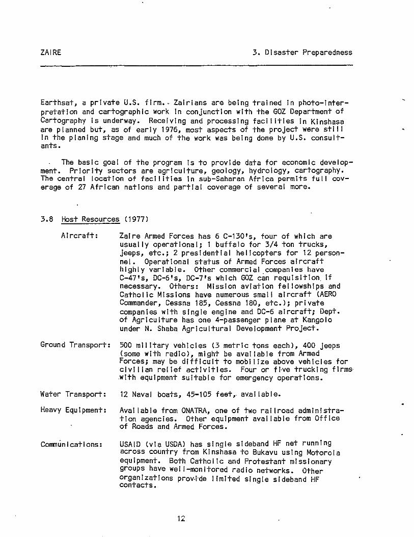
3.8 Host Resources (1977)
Aircraft: Zaire Armed Forces has 6 C-130's, four of which are usually operational; 1 buffalo for 3/4 ton trucks, jeeps, etc.; 2 presidential helicopters for 12 personnel. Operational status of Armed Forces aircraft highly variable. Other commercial companies have C-47's, DC-6's, DC-7's which GOZ can requisition, if necessary. Others: Mission aviation fellowships and Catholic Missions have numerous small aircraft (AERO Commander, Cessna 185, Cessna 180, etc.); private companies with single engine and DC-6 aircraft; Dept. of Agriculture has one 4-passenger plane at Kangolo under N. Shaba Agricultural Development Project.
Ground Transport: 500 military vehicles (3 metric tons each), 400 jeeps (some with radio), might be available from Armed Forces; may be difficult to mobilize above vehicles for civilian relief activities. Four or Hve trucking firms' ,with equipment suitable for emergency operations.
Water Transport: 12 Naval boats, 45-105 feet" aV,al lable.
Heavy Equipment: Available from ONATRA, one of two railroad administration agencies. Other equipment available from Office of Roads and Armed Forces.
Communications: USAID (via USDA) has single sideband HF net running across country from Kinshasa to Bukayu using Motorola eqUipment. Both Catholic and Protestant missionary groups have wei I-monitored radio networks. Other organizations prOY·i-de limited single sideband HF contacts.
12

•
ZAIRE 3. Disaster Preparedness
Pharmaceuticals: DCMP (Central Depot of Medicines and Pharmaceuticals) is the official GOZ supplier for al I health institutions, public or private. However, 'it is extremely unlikely that DCMP Is capable of meeting medical needs in an emergency situation; most private Institutions order medicines directly from abroad. DCMP has one light airplane and a fleet of trucks.
3.9 . Disaster Types and History
Zaire Is subject to epidemiCS, civil strife, border conflicts, earthquakes, and volcanic eruptions. Since 1960, disasters have Included civil strife from 1963-66, the Ebola fever epidemic In 1976, the eruption of the Nylragongo volcano in January 1977, a cholera epidemic In 1978, and droughtfamine In 1978-79'. In addition, continuous border conflicts/incursions create a virtuaily perma-nent·refugee problem, especially along the Angola, Burundi, and Uganda borders, The latest Incursion of Angolan rebels into Shaba occurred In May 1978. ('See also section 4.1 National Population and section 2.3, Recent Events and Current Status 1981.) .
Summary Disaster History'
Number Number Disaster Location Date Ki lied Victims
Earthquake N Kivu Province, Beni 3/20/66 24 3,024 Epidemic Equator Province 9/00/76 328 357 Volcanic Eruption Nyarangago Near Goma 12/23/76 38 10,000
3.10 US VOlags
Personnel Agency Inti/Local Programs
Afri Ca Inland Mission 76/several Ed; Med & PH; Comm; Women
AfriCa Inter-Mennonite 37/NA Comm; Ed; Food Prod Mission & Agr; Med & PH; Equip
& Mat Aid; Nutr; Women
Aid for International NA Med & PH Medicine
13 .

ZAIRE
Personnel Agency I nt I /Loca I
American Baptist Churches 77/3,752
American Leprosy Missions l/NA
American ORT Federation NA
Assemblies of God NA
Baptist World Relief NA
Paul Carlson Medical. Program 15/75
Catholic Medical Mission Board NA
Catholic Rei let Services - NA USCC
The Christian and Missionary Alliance 1/1
Christian Church (Disciples 35/NA of Christ)
Church World Service l/NA
Claret ian Fathers 13/1 3
Conservative Baptist Foreign Mission Society 12/20
Consolata Fathers 26!NA
Dam I on-Dutton NA Society for Leprosy Aid
14
3. Disaster Preparedness
Programs
CD; Ed; Food Prod & Agr; Med & PH; SW; Coops & Loans; Nutr
Med & PH; SW
Ed; Ec & Dev PI
Med & PH
Equip & Mat Aid; SW
Food Prod & Agr; Med & PH; Nutr; Pop & Fam Serv; SW
Equip & Mat Aid; Med & PH
Med & PH; SW
Ed; Equip & Mat Aid; Med & PH; SW; Youth
CHP; Ed; Food Prod & Agr; Med & PH; Women
CD; Ec & Dev PI; Equip & Mat Aid; Med & PH; Pop & Fam Serv
Ed; Equip & Mat Aid; Food Prod & Agr; Med & PH; Nutr; Women
Ed; Med & PH
Ed; Food Prod & Agr; Med & PH
Med & PH; SW

.,
ZAIRE
Personnel Agency Inti/Local
Direct RelI'ef FoundatIon NA
The EVangelIcal Covenant 26/NA Church of America
Evangelical Free Church of 41/26 AmerIca
Free Methodist Church of 8/NA North Amer I ca
General Conference Mennonite 26/NA Church
Grace Mission, Inc. 11/150
International Rescue NA Committee, Inc.
MAP International 2/28
Medical Benevolence Foundation NA
Medical Mission Sisters 81/NA (S.C.M.M.)
Mennonite Central Committee
Mennonite Economic Development Associates
Mil I H I I I Miss I onar I es
36/NA
3/3
59/440
15
3. Disaster Preparedness
Programs
Med & PH
CHP; Ed; Med & PH
Edi Med & PH; SWi Youth
Ed; EquIp & Mat Aid; Med & PH
Ed; Med & PH
Comm; CHP; Ed; Equip & Mat Aldi Food Prod & Agr; Med & PH; Pop & Fam Serv
Med & PH; SW; Women; Youth
Coops & Loans; Equip & Mat Aid; Food Prod & Agr; Med & PHi SW; Women; Youth
Equip & Mat Aid; Med & PH
Mad & PH; Women; Youth
CD; Ed; Equip & Mat Aid; Food Prod & Agr; Ind Dav; SW
Coops & Loans; Ed; Food
Prod & Agr; Ind Dev
CDi Ed; Food Prod & Agr; Med & PH

ZAIRE
Agency
Mission AvIatIon Fellowship
Personnel I nt I /Local
36/15
Missionary Sisters of Our Lady of 1/92 Africa
The Pathfinder Fund NA
Presbyterian Church in the US 71/NA
Sons of the Sacred, Heart 49/400
Salesians of St. John Bosco NA
The SalvatIon Army 291/NA
Seventh Day Adventist NA World ServIce
United Church Board for World 2/NA MinIstries
The United Methodist Church 48/NA
United MethodIst Committee NA. on Relief
United PresbyterIan Church NA in the US
MissIonary SIsters of Verona NA
White Fathers 240/NA
16
3. ~isaster Prepar~dness
Programs
Comm; CHP; Ed; Equip & Mat Aid
CD; Ed; Med & PH
Pop & Fam Serv; Women; Youth
Ed; Med & PH; Nutr; Pop & Fam Serv
Ed; Med & PH; SW
Ed; Food Prod & Agr; Med 8; PH; SW; Youth
Ed; Med & PH; SW; Women; Youth
EquIp & Mat Aid
CHP.; SW
Comm; CD; Ed; Food Prod & Agr; Med & PH; Nutr; Pop & Fam Serv; SW; Women; Youth
CHP; Med & PH; Nutr; SW; Youth
CD; SW
Ed; Food Prod & Agr; Mad & PH; Nutr; SW; Women
Ed; Food Prod & Agr; Mad & PH; Nutr; Women
•
ZAIRE
Agency
Wor I d Rehab 1'I I tat I on Fund, Inc.
World Rei jef
World Vision Rei lef Organ I zat i on
Worldwide Evangelization Crusade
Xaverian MissIonary Fathers
COrM! CD CHP Coop Ec & Dev PI Ed EquIp & Mat AId Food Prod & Ag Ind Dev Med & PH Nutr Pop & Fam Serv Pub & Bus Adm SW Women Youth
3. Disaster Preparedness
Personnel Inti/Local Programs
NA Ed; EquIp & Mat Aid; Med & PH
NA CHPj Equip & Mat Aid; Med & PH; SW
NA Equip & Mat Aid; Food Prod & Agr; Med & PH; Nutr; SW
several/NA Ed; Med & PH; Women
37/577 Ed; Med & PH
CommunIcations CommunIty Development ConstructIon, HousIng, PlannIng CooperatIves, CredIt UnIons, Loans Economic and Development Planning Education EquIpment and Materl'al AId Food ProductIon and AgrIculture IndustrIal Development MedIcine and Publ ic Health NutrItIon PopulatIon and Family Services PublIc and BusIness AdmInistration Social Welfare Women Youth
17

ZAIRE 4. Population
4. Population
4.1 National Population
The estimated mid-1978 population was 26.8 mil I Ion with an annual growth rate (1970-78) of 2.7%. The average density Is 8.4 persons per sq. km. and It Is expected to rise to 17.7 per sq. km. by the end of the century. In 1974, about 44% of the population was under 15 years of age; 74% of the population lived In rural areas (those with populations under 5,000), 26% In urban areas, but urbanization Is Increasing- at an overal I rate of'8.1%, because of high fertility and rural-urban migration. Kinshasa is expected to double Its 1974 population (1.7 million) by 1980. Population densities vary considerably: the rainforest and swamps of the central Zaire River Basin are sparsely settled, as are the plateaus and savannahs of the northwest. The Eastern Highlands and the Lake region have the highest densities.
An Influx of refugees In 1981 from neighboring countries has added an estimated 400,000 to the national population. Of these, some 215,000 Angolans make up the largest group. Others are Ugandans (100,000), Burundis (11,000), Rwandese (22,000), and Zambians (1,800).
4.2 Regional Distribution
Area Population Density Region (sq. km.) (J u I Y 1 st, 1976) (per sq. km.)
Bandundu 295,658 ·2,977 ,918 10. ° Bas-Zaire 53,920 1,741,080 32.2 Equateur 403,293 2,733,171 6.7 Haute Zaire 503,239 3,629,348 7.2 Kasal Occidental 156,967 2,817,717 17.9 Kasa i Oro! enta I 168,216 2,078,403 12.3 Kivu 256,662 3,906,160 15.2 Shaba (for-merly
Katanga) 496,965 3,239,431 6.5 Kinshasa (clty)* 9,965 2,443,876 245.2 Total 2,344,885 25,567,104 10.9
* Including the commune of Maluku
Source: Instltut National de la Statlstlque as cited In Europa, Africa South of the Sahara, 1980-81.
18

ZAIRE 4. Population.
4.3 Po~ul atlon Density as of 1970
Administrative Number of % Total Area Persons/ Division Inhabitants Population In km. sq. km.
Zaire, Total 21,637,876 100.0 2,344,885 9.2
Kinshasa Reglon* 1,308,361 6.1 2,016 649.0
Bas Zaire Region 1,519,039 7.0 61,869 24.6
Urban sub-region Matadl 110,436 0.5 110 1,004.0 Sub-region Bas Zaire 522,053 2.4 14,310 36.5 Sub-region Cataractes 886,550* 4.1 47,449 28.7
Bandundu Region 2,600,556 12'.0 295,658 8.8
Urban sub-region Bandundu 74,467 0.3 222 335.4 Urban sub-region Kikwit 111 ,960 0.5 200 559.8
'Sub-region Inongo 429,465 2.0 127,243 3.4 Sub-region Kwllu 1,370,454 6.3 78,019 17 .6 Sub-region Kwango 614,210 2.8 89,974 6.8
Equateur Region 2,431,812 11.2 403,293 6.0
Urban sub-region Mbandaka 107,910 0.5 460 234.6 Sub-region Equateur 340,823 1.6 103,443 3.3 Sub-region Tshuapa 466,286 2.2 132,957 3.5 Sub-region Mongaia 739,813 3.4 101,508 7.3 Sub-region Ubangl 776,980 3.6 64,925 12.0
Haut Zaire Region 3,356,419 15.5 503,239 6.7
Sub-region Kisanganl 229,595 1.1 1,910 120.2 Sub-region Haut Zaire 714,545 3.3 197,657 3.6 Sub-region Bas-Ueie 588,768 2.7 148,331 3.8 Sub-region Haut-Ueie 795,619 3.7 89,683 8.9 Sub-region Ituri 1,027,891 15.7 65,658 15.7
Ki vu Region 3,361,883 15.5 256.662 13.1
Urban Sub-region Bukavu 134,861 0.6 60 2,247.7 Sub-region Nord-Kivu 1,473,380 6.8 59,563 24.7 Sub-region Sud-Kivu 1,130,675 5.2 64,789 17.5 Sub-region Maniema 622,965 2.9 132,250 4.7
19

ZAIRE
Administrative Division
Number of Inhabitants
Shaba Region
Urban sub-region Lubumbashl Urban sub-region Llkasl Sub-region Tanganlka Sub-region Haut-Lomaml Sub-region Haut-Shaba Sub-region Lualaba
Kasai Oriental Region
Urban sub-region Mbujl-Mayl Sub-region Kablnda Sub-region Sankuru
Kasal OccIdental Region
Urban sub-region Kananga Sub-region Kasal Sub-region Lulua
2,753,714
318,000 146,394 696,363 602,368 394,316 596,273
1,872,231
256,154 1,118,725
497,352
2,433,861
428,960 833,468
1,171,433
% Total Population
12.7
1.5 0.7 3.2 2.8 1.8 2.8
8.7
1.2 5.2 2.3
11.3
2.0 3.9 5.4
4. Population
Area Persons/ In km. Sq. km.
495,965 5.5
747 235
135,028 108,204 131,443 121,308
168,216
64 63,821
104,331
156,967
378 95,631 60,958
425.7 523.0
5.2 5.6 3.0 4.9
11 • 1
4,002.4 17.5 4.8
15.5
1,134.8 8.7
19.8
* The area and population of Maluke, Kinshasa's only rural subdivision, were Included In the cataractes sub-region of Bas-Zaire.
Source: Administrative Census, 1970.
4.4 Urban Areas
Principal Towns (estimated population at July 1st, 1976)
Kinshasa (capital) ••••••••••• 2,443,876 Kananga (formerly Luluabourg) •• 704,211 Lubumbash i (Ell sabethvlll e) .... 451,332 Mbuji-MayJ •••••••••.••••••••••• 382,632 Klsanganl (Stanleyvllle) ....... 339,210
*' 1970 estimate
Bukavu (Costermanvil le) ••• 209,051* K i kw,t t ..... -...... ' ......... 172,450 Matadl .••..•••.•••.••••••• 162,396 Mbandaka(Coqullhatvllle) •• 149,118 Llkasl (Jadotvi lie) ....... 146,394*
Source: Europa, Africa South of the Sahara 1980-81.
20

ZAIRE 5. Health, Nutrition, and Housing
5. Health, Nutrition, and Housing
5.1 Major Diseases
Malaria -- Endemic in lowland areas; occurs In unstable epidemic form In the highlands up to 2,000 m.; virtually the entire population Is affected. Repeated cases are common; almost al I lowland chi Idren have had at least one attack before age 10. Statistical data on prevalence of Infection and mortality are lacking; control and treatment programs are fragmented, Inadequately funded and staffed. Chemoprophylaxis is confined to diplomatic and expatriate communities.
Trypanosomiasis -- At risk population (Eastern Bas Zaire and Equateur, Haut-Zalre, Kasal, and Northern Shaba provinces') approximately 6 mi II ion persons; 20,000 cases were under treatment at the end of 1971. The number of new cases appears to be declining but the area of endemicity Is growing. The problem of healthy carriers Is Increased by migration from rural areas. Treatment Is hampered by lack of effective drugs.
Onchocerciasis -- Endemic In many areas; Kasal province most heavily affected with a 100% Infection rate in some vii lages. Government vector eradication program was begun In 1974.
Measles -- One of four major causes of mortality in chi Idren under 5 years of age. An Inoculation campaign underway In 1974 had reached about ·40% of the 0-4 age group In Kinshasa; must extend to rural areas to be effectl ve.
Schistosomiasis -- Prevalent and may be spreading throughout the country; leading cause of mortality among infectious diseases in BasZaire. High infection rates In children. Significant levels of Infection are unlikely to decrease because of expense of prevention campaigns and cultural habits which foster infection (swImmIng and bathing In Infested areas) •
Tuberculosis -- Prevalent, particularly In overcrowded areas. MortalIty estImated at 10%; hIgh reinfectIon rates recorded.
SkIn dIseases -- Common throughout the country. ChIgger fleas and files, the prevalent Insect parasites (live under or on skin) often serve as entry route for secondary bacterial infection.' Cutaneous ulcers, apparently non-contagious, .are common In Infants and children.
Leprosy -- Common In the Equateur and Oriental regions; mld-1960 Infection rate of 1,500-2,000/ml Ilion population.
21

ZAIRE 5. Health, Nutrition, and Housing
HooKworm and other parasitic diseases -- Almost al I Zairians have at least one parasitic disease; multiple InfectIons are frequent. A hIgh Incidence of anemIa Is directly related to high hookworm Infection levels.
Typhoid -- Endemic with occasional epidemics. Highest levels occur during the dry season.
Yellow Fever -- Rare but, because of vector's presence, threat of outbreak Is real.
Dysentery and other diarrheal dl'seases are common to most of population.
5.2 Vital StatIstIcs
Birth rate (1978). Death rate (1978) Infant mortality (1978) -Life expectancy (1978)
* 80% of total deaths per year
46 per 1,000 popUlation 19 per 1,000 population 150 -200*/thousand lIve bIrths 46 years
5.3 Health FacIlItIes and Services
MedIcal FacIlities, 1974
~ Protestant CatholIc Government Private
Hosp Ital s 64 31 82 27 Dispensary/Maternity 74 184 20 * Dispensary 270 38 8 5 Sanitarium (TBl 2 2 Leprosar 1 um 9 1 5 TrainIng Schools 14 20 7 4
* Unknown
22
Totar
204 278 341
4 15 45

•
ZAIRE 5. Health, Nutrition, and Housing
The health situation has reportedly deteriorated In recent years, In part because of the general economic crisis affectl~g Zaire since the mid-1970's. The reasons cited by the Ministry of Health Incrude the scarcity of medical supplies In the interior, the closing down of numerous clinics for lack of medicines and usable equipment, and the fact that a large proportion of products shipped to clinics and training centers In the Interior never reach their destination.
Little current information on the status of hospitals Is avai lable except for Kinshasa'S Mama Yemo Hospital (see below). Data shown above were collected by Protestant Missions in 1974; their reliability Is questionable since collection methods are unknown. Descriptive material below was drawn from a number of reports by Zairian and foreign health teams (Syncrisls).
The Fonds Medical de Coordination (FOMECO), a division of the Medical Services Branch of the Office of the President, provides most health care in Kinshasa. Its ultimate objective Is the development and implementation of a national health care system, but to date its focus has been urban. It presently operates 2 hospitals, 3 maternal-chi Id health centers, a hospital ship, the Laboratory of the Institute of Tropical Medicine, and a nursing school. The major facility Is Mama Yemo, an l,aOO-bed "model" hosItal with six clinical services (Internal medicine, surgery, pedIatriCS, obstetrics and gynecology, community health, and diagnostics). Associated facilities Include an outpatient polyclinic.
FOMECO's hosp I ta I sh I p, Mama Mobutu, serves v I I I ages a long the Za Ire river and Its navigable tributaries. Twenty beds, 2 operating rooms, x-ray facilities, an "excellent radio system hookup," and a helicopter landing pad on the afterdeck are Its noteworthy features. FOMECO also supervises Bolobo hospital (200 km. upriver from Kinshasa), the model for rural community health care and preventive medicine.
The medical department of the Armed Forces administers a system of, 144 dispensaries, eight Infirmaries with a total of 120 beds, four hospitals with a total of 500 beds, and a health clt"nlc at Camp Kotolo -In Kinshasa.
Action Kusala, an Independent governmental organization, operates a rural development program in Kivu, concentrating on the UViraflzl-Baraka area. Facilities Include dispensaries at Bukavu and Uvlra, hospitals at Klrlngi and Flzl, and medical centers at Baraka and Uvlra.
Other Public Health System Hospitals:
Klsanganl Regional Hospital, a 700-bed facility with a separate pavilion for armed forces personnel and dependents, both entirely staffed by Zairians, serves Haut-Zalre. Also In Klsangani, the National University
23
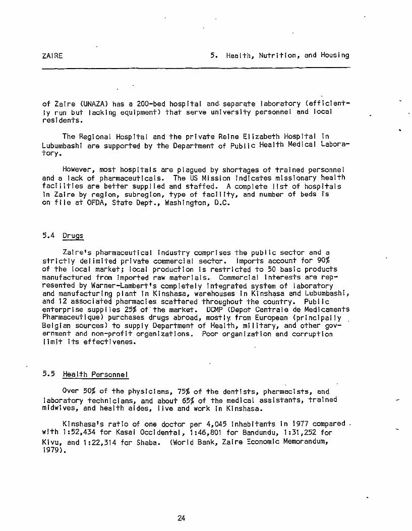
ZAIRE 5. Health, Nutrition, and Housing
of Zaire (UNAZA) has a 200-bed hospital and, separate laboratory (efficiently run but lacking equipment) that serve university personnel and local residents.
The Regional Hospital and the private Reine Elizabeth Hospital in Lubumbashi are supported by the Department of Public Health Medical Laboratory.
However, most hospitals are plagued by shortages of trained personnel and a lack of pharmaceuticals. The US Mission indicates missionary health facIlitIes are better supplied and staffed. A complete list of hospitals In Zaire by region, subregion, type of facility, and number of beds I's on file at OFDA, State Dept., Washington, D.C.
5.4 Drugs
Zaire's pharmaceutical industry comprises the public sector and a strIctly delimited private commercial sector. Imports account for 90% of the local market; local production Is restricted to 50 basic products manufactured fran imported raw materials., Commercial interests are represented by Warner-lambert's completely Integrated system of laboratory and manufacturing plant in Kinshasa, warehouses in Klnsh~sa and Lubumbashi, and 12 associated pharmacies scattered throughout the country. Publ,lc enterprise supplies 25% of'the market. DCMP (Depot Centrale de Medicaments Pharmaceutique) purchases drugs abroad, mostly. from European (principally Belgian sources) to supply Department of Health, military, and other government and non-profit organizations. Poor organization and corruption limit its effectivenes.
5.5 Health Personnel
Over 50% of the physiCians, 75% of the dentists, pharmacists, and laboratory technicians, and about 65% of the medical assistants, trained midwives, and health aides, live and work In Kinshasa.
Kinshasa'S ratio of one doctor per 4,045 inhabitants in 1977 compared with 1:52,434 for Kasal Occidental, 1:46,801 for Bandundu, 1:31,252 for KiVU, and 1:22,314 for Shaba. (World Bank, Zaire Economic Memorandum, 1979) •
24
•

ZAIRE 5. Health, Nutrition, and Housing
Health Personnel
Kinshasa Number !
Physicians Medical Assistants Dentists Dental Assistants
Trained Midwives Auxiliary Midwives Graduate Nurses Aux il i ary Nurses
339 62 21 3
224 205 574 884
Pharmacists 95 Pharmaceut i ca I
Preparers 19 Veterinarians Asst. Veterinarians
SanitatIon Technicians 10
Environmental Engineers 37
Auxiliary Technicians 2 Physi otherap Lsts 29
Laboratory Technicians
Radlol ogi ca I Technicians
Other Specific Specialities
Other Paramedical TechnicIans
Health AIdes
54
30
15 820
* NatIonality Unknown
41.4 66.7 77 .8 60.0
64.7 25.0 29.4 12.1
72.5
46.3
100.0
34.9 3.4
100.0
70.1
29.7
16.5 70.1
Nation-wide Number !
Nationality To-ZaIrIan Foreign tal
479 31
6 2
122 685
1,380 6,447
58.6 33.3 22.2 40.0
35.3 75.0 70.6 87.9
36 27.5
22 53.7 30 100.0
108 100".0
69 57
0.0
65.1 96.6 0.0
317 86
4 5
229 889 638
7,192
* 37 * *
10
104 59 24
23 29.9 55
81 70.3 * 4 100.0 2
76 83.5 83 349 29.9 1,169
501 7
23
117
1,316 139
*
* *
4
2
5
818 93 27
5
346 889
1,954 7,331
131
41 30
108
10
106 59 29
22 77
* 101
2 2
8 91 1,169
Note: Figures Include al I health personnel In both the public and private sectors. Estimated 75% of health care In rural areas provided by missionaries; effect of Zalrlzation may limit this source.
25

ZAIRE 5. Health, Nutrition, and Housing
An estimated 75% of the Zairian popuiation remains outside the formal health care delivery system, with access only to traditional medicai practitioners, who ascribe I liness to supernatural causes or witchcraft and cure with incantations and/or herbal remedies. If illness persists, the heaier (guerisseur) seeks out a witch who then places a curse to resolve the underlying social conflicts. GOZ's National Office of Research and Development is studying guerisseurs' methods to arrive at an objective evaluation of their efficiency and to persuade healers to cooperate with health care personnel.
5.6 Diet Summary
Southwest: manioc, mainly in the form of flour from fermented and sundried roots, is the dietary staple; corn, roasted or pounded and mixed with manioc flour, Is eaten in the rainy season.
Upper north: staples are cor.n and manioc In mixed flour or rice; plantain in central areas. Upper center and eastern forest: varied staple foods Include manioc, plantain, corn, rice. Eastern Highlands: diet is based on sweet potatoes, sorghum, mil let, plantains, and yams. South center and southeast savannah: staples are manioc and corn; sweet potatoes and soya are substitutes when manioc is not avai lable.
Urban diets: manioc, sometimes mixed with cornflour, is the basic food; rice when not too expensive; wheat flour is increasingly popular. Special groups: Botwas (pygmies) have diets consisting mainly of plantain, fruits, insects, game meat, honey, some sweet potatoes, and groundnuts.
In most areas, staples are accompanied by palm oil, manioc and other green leaves, fruit, vegetables, and groundnuts. Smal I amounts of meat and fish are consumed in some ,regions (Eastern Highlands, south center, and southeast savannah).
5.7 Food & Drink
Starches: manioc, sweet potatoes, plantains, rice, corn, mil let, and sorghum, yams, cocoyams. Wheat bread In large cities (Imported)
Pulses: dry beans (haricot), voandzla peas, groundnuts
Fats: palm 011, groundnut oil
26

ZAIRE 5. Health, Nutrition, and Housing
Animal Protein: fish, (locally fresh, otherwise smoked or dried), Insects, game, rarely eggs, milk (pastorallsts)
Fruit: mangoes, pineapple, sugarcane, papaya, banana
Vegetables: manioc leaves, eggplant, wi Id mushrooms, tomatoes, onions, cabbage
Condiments: peppers, sesame, salt, pumpkin seeds
Beverages: water, beer (brewed from manioc or grain), palm wine
Child's diet: breast fed untl I 18 months old, unless birth of younger-sibling Intervenes; supplementary starchy foods, begun at 6 months, become total diet untl I age 7 or 8, When more protein Is available.
5.8 Food Preparation
Most foods are boiled; cooking liquid Is thrown away. Most grains are processed Into flour or coarse meal, served as porridge or stiffer paste molded Into bal Is, with sauce of vegetables, 011, fish or meat if available. Carbohydrates may be fermented before cooking. Cooking Is usually done outdoors or in a separate hut.
5.9 Nutritional Deficiencies
Rare before Independence, malnutrition had become a serious problem even before the recent economic crisis which further reduced the buying power of much of the population. Growing population pressure In some regions (refugees a major reason) and environmental problems (soil erosion In parts of the country and the 1978 drought In Bas-Zaire) further concontributed to the deteriorating nutritional situation.
A World Bank report (Zaire Economic Memorandum, 1979.) cites recent ad hoc studies of three areas as an illustration:
Kivu: malnutrition 15% of the population Is (kwashiorkor prevalent).
especially serious affected, children Caloric Intake Is
27
In mountainous areas where 10-3-4 years of age most seriously 80-90% of minimum requirement.

ZAIRE 5. Health, Nutrition, and Housing
Kinshasa: malnutrition diagnosed In about 30% of hospitailzed chi Idreno One of every 5 children hospitalized in 1977 died, with malnutrition accounting for 30% of those deaths.
Bas-Zaire: acute malnutrition throughout the region; most severe in zones of Tshela and Lukula where affected population reached 26% and 21.1% of total respectively. Drought in 1978 exacerbated on-going nutritional problems such as chronic food shortages, socio-economic conditions, food habits, and density of population.
5.10 Housing
Traditionai Housing:
Smal I poorly ventiiated huts of varying size, and construction are the norm. Wai Is may be wood, mud, or reed; fioors are usuai Iy dirt, though some riverine tribes bui Id houses on sticks or on clay pedestals. Roofs are palm leaf or thatch. When they exist, windows are shuttered and never opened. Water and electric systems do not exist; even communal pit latrines are rare; pollution of fioors and yards with human and animal feces is common. Water Is usually obtained from nearby natural sources.
Note: In a traditional polygamous household, each ,wife and her smal I chi Idren have a separate hut; the father and older unmarried sons share a larger hut.
Urban Housing:
Urban construction materials: mud or masonary for wal Is and sheet metal for roofs. The basic housing pattern consists of a central main dweLl ing and secondary units or storage sheds, al I surrounded by a wal I. Large-scale rural-urban migration has led to the development of shanty towns without basic services. Publ ic housing benefits middle and upper income groups rather than the poor; a typical squatter house lacks glass windows, plumbing, and electricity. Potential advantages In an urban environment include: relatively low density and sandy soil suited to wei 1-digging and cesspool sanitation. The present organization of Department of Social Affairs does not appear conducive to large-scale improvements in the housing sector.
28

r
ZAIRE 6. Economy
6. Economy
6.1 Overview of Economy
Zaire's economy Is based on mining and agriculture; the former sector Is generally modernized, capital Intensive, and highly productive, though most minerals are processed out of the country; the latter, particularly since Independence and the decline of the Belgian plantation and paysannat systems, Is largely subsistence oriented. AgriCUltural growth rates have at best matched population growth rates. The Government has Invested heavily In the mining sector, though yields are stll I below pre-Independence production levels. Industry, mostly food and beverage processing, textiles, metal fabricating, and mechanical assembly plants, boomed In the 1960's, aided by GOZ IncentIves for foreign Investment and by the aval lability of'cheap power. Growth In the past 10-12 years has been at an annual rate of less than 3%, with a significant shift away from processing local materIals toward industries dependent upon imported goods. Development of tourism, potentially Important as a source of foreign exchange and employment, Is now under s~Udy by the GOZ.
The natural resource base incLudes extens i ve forests, fresh water fishing grounds, and approximately 16% of the world's hydropower potential, all stili largely untapped. At present, only subsoil resources have been developed: copper, zinc, lead, cobalt, cadmium, and manganese are mIned In Shaba, diamonds In the Kasal, and scattered depOSits of gold and tungsten bearing ores In the Eastern Highlands. Recently, offshore oil resources In the Zaire river estuary have been extensively exploited; deposits of Iron ore and methane gas reserves In Lake Kivu are potentially valuable.
The Shaba copper mines are the most Important aspect of Zaire's economy, accounting for over 60% of total export value. (Mining supplied 80% export value, 45-50% of government revenues, and 13-23% of GDP In early 1970'5.) MinIng consumes about 70% of all electricity produced (75% of demand located In Shaba) and the present transportat I on system was' deve loped largely to transport its products out of the country. The copper Industry relies heavily on Imported capital, IntermedIate goods, and on foreign personnel.
Subsistence agriculture, Including huntIng and fishing, was the basis for the traditional economy of Zaire. Under the Belgian administration, plantation agriculture, producing palm products, rUbber, robusta coffee, and cocoa as export crops, was developed; by 1959, 1,500 sq. mi. of cropland and 450 sq. mi. of forest and pasture lands were In use; 300,000' Africans constituted the labor force. Though many plantations were abandoned at Independence, most were again under cultivation by 1973, when they
29
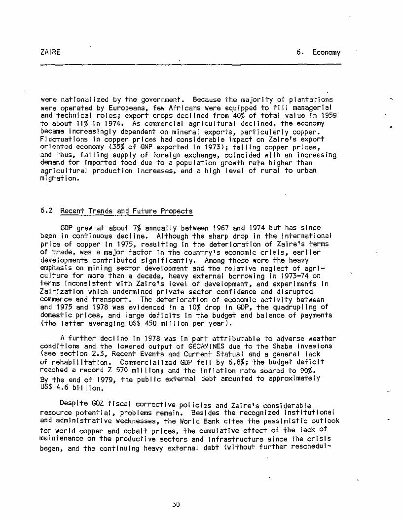
ZAIRE 6. Economy
were natIonalIzed by the government. Because the majorIty of plantatIons were operated by Europeans, few AfrIcans were equIpped to fIll managerIal and technIcal roles; export crops declined from 40% of total value In 1959 to about 11% In 1974. As commercial agricultural declIned, the economy became IncreasIngly dependent on mInerai exports, partIcularly copper. FluctuatIons In copper prices had consIderable impact on ZaIre's export oriented economy (35% of GNP exported In 1973); fal lIng copper prIces, and thus, fal lIng supply of foreign exchange, coincided wIth an Increasing demand for imported food due to a population growth rate hIgher than agrIcultural production Increases, and a high level of rural to urban migration.
6.2 Recent Trends and Future Propects
GDP grew at about 7% annually between 1967 and 1974 but has sInce be~n In continuous decline. Although the sharp drop in the international price of copper In 1975, resulting In the deterIoratIon of ZaIre's terms of trade, was a major factor in the country's economIc crIsIs, earlIer developments contrIbuted sIgnIfIcantly. Among these were the heavy emphasIs on mInIng sector development and the relative neglect of agrIculture for more than a decade, heavy external borrowing In 1973-74 on terms InconsIstent wIth ZaIre's level of development, and experIments In Zalrlzatlon whIch undermined prIvate sector confIdence and dIsrupted commerce and transport. The deterIoratIon of economic actIvIty between and 1975 and 1978 was evIdenced In a 10% drop In GOP, the quadrupling of domestIc prIces, and large defIcIts In the budget and balance of payments (the' latter averag I ng US$ 450 mi I lIon per year).
A further declIne In 1978 was In part attrIbutable to adverse weather condItIons and the lowered output of GECAMINES due to the Shaba InvasIons (see section 2.3, Recent Events and Current Status) and a general lack of rehab I I Itatlon. CommercIalIzed GDP fell by 6.8%; the budget defIcit reached a record Z 570 mIl lIon; and the Inflation rate soared to 90%. By the end of 1979, the publIc external debt amounted to approxImately US$ 4.6 bl'lllon.
DespIte GOZ fIscal correctIve pol icies and Zaire's consIderable resource potentIal, problems remaIn. BesIdes the recognIzed InstItutIonal and admInIstratIve weaknesses, the World Bank cItes the pessImIstIc outlook for world copper and cobalt prIces. the cumulative effect of the lack of maIntenance on the productIve sectors and Infrastructure sInce the crIsIs began, and the contInuing heavy external debt (wIthout further reschedul-
30
•

•
ZAIRE 6. Economy
lng, external debt service ratio could be 32% of projected export earnings In 1981-83) •
6.3 GNP/GOP
Provisional '1979 GNP at market prices: US million $7,020; 1979 per capita GNP: $260; GNP per capita (real) growth rate 1970-78: -2/2%. (Source: 1980 World Bank Atlas.)
Gross domestic product Agriculture Industry Services
Consumption Gross Investment Exports of GNFS Imports of GNFS
Gross national savings
National Accounts
Amount (million US$ at current prices)
1979
1/ 6,267.3 2,023.6 1,432.4 2,659.1
5,798.8 2/ 1,008.0 2/ 1,843.0 1,685.0
1,013.0 2/
Share of GOP at Market Prices (at current prices)
1979
100.0 32.3 22.9 42.4
87.9 2/ 15.3 2/ 29.4 26.9
16.2
1/ At market prices; components are expressed at factor cost and wll I not add due to exclusion of net Indirect taxes and subsidies.
2/ 1978.
Source: World Bank, Zaire: Kwanga-Kwllu Technical Assistance Project, May 1981.
31
(%)

ZAIRE 6. Economy
6.4 Imports
Despite a lack of reliable data on trade, it is evident that the volume of imports dropped sharply between 1974 and 1978 in response to the severe shortage of foreign exchange. A one-third cut In non-essential imports was not sufficient to prevent Imports of essential goods from falling below required levels. Lowered production due to shortages of imported Inputs In most sectors aggravated the supply situation which further fueled Inflation.
An import bill of about US $1.5 blll"ion in 1979 incl uded food imports valued at $268 million.
Principal Imports ( in' 000 Za ires)
Imports c. i • f • 1976 1977
Consumer goods 107,725 98,813 Food, drink, tobacco 57,665 52",731 Textiles, clothing 16,212 14,785
Energy 60,822 104,234 Primary manufactures
& semi-finished products. 140,696 128,369 Cap Ital goods 75,745 60,424 Others (i nc I • errors and 161,590 130,848
omissions)
Total 546,577 522,688
Sourcl?: Europa', Afrl ca South of the Sahara 1980-81.
6.6 Exports
1978
115,620 68,341 12,258 87,467
128,263 79,998
156,042
567,390
Since Independence, mineral exports, particularly copper, have dominated the balance of payments situation. The mining and mineral-processing Industry accounted for more than two-thirds of export earnings in 1977-79. Because government revenues and Investment in transportation, power and other services are dependent on performance of the copper Industry, the worldwide t.all in copper prices In 1974-75 ($from $3,000 to $l,OOO/ton) triggered a slowdown in Zaire's economy and limited the availability of foreign exchange.
32

•
ZAIRE 6. Economy
AgrIcultural products, coffee, palm products and rubber, had fal len from 40% of total exports at Independence to 10-15% In the early 1970's, due to reduced productIon capabIlIty on plantatIons and transport diffIcultIes.
Total export earnings In 1979' were about US $2 bll lIon.
PrinclEal eXEorts (In '000 Zaires)
EXEorts 1976 1977 1978
MIneraI products 654,728 617,077 716,865 Copper 326,511 324,291 322,656 Cobalt 98,622 93,045 180,703 ZInc 40,553 27,814 14,168 D I allXlnds 47,429 55,173 103,181 Cass I ter I te 16,701 23,117 23,677 Crude petroleum 92,119 66,700 38,000
AgrIcultural products 164,614 259,539 198,235 Coffee 103,066 165,538 138,190 Palm oil and kernels 14,956 19,754 9,772
IndustrIal products 7,849 4,166 5,500 Others 10,709 31,618 10,000*
Total 837,900 912,400 930,600
* EstImate
Source: Europa, Africa South of the Sahara 1980-81.
EEC countrIes are the prIncIpal trading partners, with the Belglum/ Luxembourg economic unIon accounting for the largest share of Imports and exports. USA Is an Important supplIer; both Japan and Italy have been rapidly IncreasIng their purchases from Zaire •

ZAIRE 7. Agriculture
7. Agriculture
7.1 Overview of Agricultural Sector
Half of Zaire's total area of 235 mil lion hectares is regarded as arable but only 1 to 4% is under cultivation. Agricultural production comprises two sub-sectors: plantation-based commercial monoculture (coffee, rubber, palm products) and smal I-scale subsistence farcmlng on trIbally-owned land. 70-75% of the population Is employed In agriculture, the great majority in the subsistence sector. In 1970, plantations employed 397,000 Zairians (1/3 of them part-time workers) on 1,700 farms over 30 hectares In size. Decl'Ines In production after Independence were extended by Zalrlzatlon in 1973 but, because almost al I export crops are produced on plantations, they continue as an crucial economic component. Subsistence agriculture is overwhelmingly traditional In land tenure and methods of cultivation. Family plots, averaging 0.4 hectares In size, are assigned by tribal chiefs. Since most cultivation Is of slash-and-burn type, al location of plot may change every 3-4 years. Land clearing and soil preparation are done by men; crop cultivation and marketing by women.
In terms of food crops, productivity In the traditional sector has apparently kept pace with population gr9wth (about 2.5% per annum). Generally, however, agricultural production has been adversely affected by government policies of Investment, taxat·ion, and commodity pricing. Transport and marketing facilitIes have been neglected: existing Infrastructure Is geared to moving export crops and minerals out of the country and not to Interconnecting regions; N-S connections are particularly poor. Skil led manpower Is scarce; extension service Is deficient in technicians and equipment.
7.2 Ecotypes
Four ecological zones differ In soils, rainfal I, use, and potential productivity.
Rainforest -- Predominates In central cuvette, covering 100 mil I Ion hectares. Largely untouched, Its sandy soils, though generally considered Infertl Ie, are In some areas used for subsistence agriculture.
Savannah -- Drier zones Nand S of rainforest (1200-1600 mm. rainfall). Present location of most cultivated land; substantial pr.oductlon of subsistence crops; opportunities for grazing now limited by tsetse Infestation. Large areas potentIally Irrigable at low cost.
34

ZAIRE 7. Agriculture
Highlands -- The country's most productive sol Is (volcanic origin) are located here, particularly along the eastern border. Intensively' tarmed, they are best suited to temperate zone crops and stockralslng.
River Bottom Lands -- Have high quality soils renewed by of alluvium; can be successfully farmed In permanent culture. water Is readily available at minimal cost.
7.3 Production
Crops
deposits Irrigation
Primary subsistence crops Include manioc, grown and eaten In most areas and the major source ot calories for two-thirds of the populatlon*; bananas and plantains, corn (the basic crop In the southwest), sorghum and mil let, especially In eastern regions, and sweet potatoes, yams, and cocoyams, the staple In North Kivu. Rice Is grown In several areas along the major rivers. Dry beans and voandzla peas are grown In many areas and are a staple'food for many eastern highland peoples. Groundnuts and all palms are widely grown as sources of tats.
Coffee, arabica In the eastern highlands and robusta In the wetter savannah areas, is the most Important export crop, fol lowed by palm 011 products, grown In equatorial and savannah zones, and rubber from central cuvette, especially the northwest. Before Independence, cotton was grown on the northern and southern savannahs, and it was a major export; however, 1972 yields were one-third 1959 levels, whl Ie exports were. less than 10%. Smal I quantities of sugar, cocoa, tea, and tobacco are grown as cash crops.
* Manioc production is currently threatened by an.epidemlc of three plant diseases, espeCially In Bas-Zaire and Bandundu. AID "Manioc Outreach" project, described In the 1979 ASS, addresses this problem.
Prlncl2al Croj!s ('000 metrl c tons)
ill§. 1977 1978
Wheat 2 3+ 5+ Rice (paddy) 212 237 202 Maize 510 515 487+ Oats 12* 12* 12* Millet 26 26 26*
35

ZAIRE 7. Agriculture
ill§. 1977 1978
Potatoes 33+ 33 34* Sweet potatoes and yams 306 307 313* Cassava (manioc) 12,130 12,300* 12,512* Pulses 148 150 153 Groun dn uts (I n shell) 319 330* 339* Seasame seed 4 3 3* Cottonseed 34+ 28* 26* Palm kernels 73.7 72* 72* Palm 011 178.1 175* 175* Cabbages 6* 6* 6* Tomatoes 36* 37* 38* Onions (dry) 9* 10* 10* Sugarcane 840 810* 820* Oranges 147* 150* 154*-Grapefruit 9* 9* 9* Avocados 23* 23* 24* Mangoes 160 163* 167* Pineapples 167 160 165* Bananas 318 319 321* Plantains 1,418 1,433 1,465* Coffee (green) 92 93* 95* Cocoa beans 5 5+ 5* Tea (made) 7 10+ 10* Tobacco (leaves) 13 13* 10* Kenaf 13* 13* 13* Cotton (lint) 12+ 9+ 8+ Natural rubber (dry weight) 27 27 27*
* FAO estimate.
+ Unofficial figure.
Source: FAO, Production Yearbook as- cited In Europa, Africa South of the Sahara 1980-81.
Forestry
With over half the country forested, reserves are vast; the timber potential Is virtually untapped, however. The principal exploited areas are the Mayombe forest, the Lake Mal-Ndome area, and the forest area In nObihwes:j:ern E~uateur between the Zaire and Ubangl rivers. Of the 500,000 cu c me ers 0 - wood commerc I a I I Y harvested annua I I-y in the I ate 1970' s about three-quarters was used domestically. '
36

ZAIRE 7. Agriculture
FisherIes
FIsh Is the most Important source of animal protein In the Zairian diet. The annual catch, estImated at 130,000 tons, Is weI I below the country's potential, and over 100,000 tons of fish (mostly salted) are Imported annually.
Livestock
The traditional herd Is found In the higher eastern regions (HautZaire and Kivu), above the range of the tsetse fly. Commercial operations, largely foreign owned before Zalrlzatlon, are located prlncipa'i Iy In Shaba and Kasal-Gccldental. Sheep and goats are raised by vi I lagers throughout the country; hogs mainly In Bandundu, Bas-Zaire, Kivu, and Kasal-Grlental.
7.4 Current status
With the exception of coffee, the volume of export crops has decreased since 1970. Food Imports, on the other hand, have risen rapidly •. Food shortages, resulting from Insufficient imports, low per capita domestic production, and an unreliable distribution system, have contributed to the high rate of Inflation and a growing Incidence of malnutrition.
Foodcrop production was generally down In 1979 due to uneven weather conditions. However, grain output rose from the 1918 level of 520,000 tons to 641;000 tons, the Increase mainly attributable to good·corn harvests. Manioc production, reduced In 1978 by drought and mealy bug Infestation, recovered In 1979 to its 1977 level of 12 million tons.
7.5 PlantIng and HarvestIng Dates
Crop
Wheat: Kivu Province Shaba Province
Millet Rice Sugarcane Sugar Potatoes Sweet potatoes
Planting
March - August June - October Whole year round Whole year round Ju I y - December Campaign begins July Whole year round Whole year round
37
Harvest I ng .
September - October
February - May
January - February ---

\
ZAIRE 7. Agriculture
Crop Planting Harvesting
Cassava Whole year round ---Dry beans Whole yea,r round January - March
Voandzou (Voandzela Subterranea) Whole year round May
Bananas Whole year round Palm kernals Whole year round January - March Groundnuts Whole year round February - May Cotton:
North area December - March South area June - September --
Sesame seed May Tung nuts Whole year round June Coffee Whole year round December Cacao ' Whole year round Dec,ember Tobacco April - July April Sisal Whole year round
7.6 Imports
The $300 mil I ion spent on agricultural Imports In 1979 represents about one-third of the country's' foreign exchange. Grain Imports Included 145,000 tons of wheat valued at $25 mil I Ion; 35,000 tons of rice worth $15 mil I ion; 130,000 tons of corn at $13 mil lion. Two-thirds of the rice Imports were on concesslonal terms, just under half from U.S. food aid programs. 65,000 tons of the wheat/flour Imports were P.L. 480 Title I supplies. Among other agrIcultural Imports were 60,000 tons of beef and pork worth $210 ml IlIon and dairy products valued at $5 mil lion.
7.7 Exports
Coffee exports of approximately 67,000 tons In 1978/79, 9% below the 1977/78· levei, brought $197.6 million in repatriated earnings. ThIs may represent only a portion of the 'actual coffee trade, however, since smuggl ing is widespread and even earnings from legitImate exports are not always reported.
38

~l1l!lroon '-,.
Gabon
Zaire --- IflIernatlOnal boundary
- --. ReglOl'l boundary
® NatIOnal capll:aJ
o ReglO!l capital
--- RaJk"oad
--- Rood
o , 1l,X) 2I;XlMlM 160 :260 I( ,~tef$
Republic
Equateur
'-- Ango
BOU N D"'R'\' RIEPR!SIENT ,o,TION 1.
N OT I'II!:CIl! ..... RILY .o,UTI10RITATIV.
)
Zambia

ZAIRE 8. Physical Geography
8. Physical Geography
8.1 Climate
Three climatic zones can be distinguished: equatorial, tropical, and highland.
Equatorial Zone: located roughly between 4°N latitude and 4°S latitude, but skewed to the north because of the greater northern land mass. It Is characterized by high rainfall, 50-80" <1300-2000mm) annually, distributed over a 10-12 month period, and by year-round warm temperatures, averaging 24°C with about 1°C annual variation. Humidity is always high at 65% or more. Within the equatorial zone, coastal lowlands are somewhat cooler and drier due to prevailing westerly winds off the Atlantic.
Tropical Areas: have wider temperature range than the Equatorial Zone. Ra i ny seasons" November through March south of the equator and Apr I I through October north of It, are hot and humid, whi Ie dry seasons are cooler with overcast skies but little or no rain. Temperatures range annually between 22-27°C In lowland areas and 24-26°C In the uplands. Ralnfal I averages between 1000-1600 mm. annually.
Highland: climate more nearly approaches temperate range. Temperatures range between 18°C and 24°C; ralnfal I averages between 1200-1800 mm. annually. Prevailing southwest winds In Shaba reglon.brlng greater seasonal variation; frosts may occur during dry season. Highland Lake area has humid mild climate. In general, humidity tends to Increase with elevation; constant mist prevails In some mountain and Alpine locations.
8.2 Temperatures ( . Fahrenheit)
Maximum/Minimum
Station Jan Apr Jul Oct Extreme , Kalemi 85 83 82 87 92
66 67 58 67 50
Kananga 85 86 85 85 94 68 68 63 68 57

ZAIRE
8.3
StatIon
Kisangani
KInshasa
Ralnfal'l
StatIon
Kal emi
Kananga
Kinshasa
Klsanganl
Jan
88 69 87 70
(Inches)
Jan Feb
'4.2 4.7
5.3 5.7
5.4 5.6
2.1 3.3
Mar
6.3
7.7
7.7
7.0
Apr
8.4
Apr
88 70 89 71
May
3.3
6.2 0.3
7.6 3.3
6.2 5.4
Jun
0.3'
0.1
0.8
4.5
Jul
84 67 81 64
Jul
0.1
0.1
0.5
5.2
RaInfall In Urban Areas
CIty Annual Rainfall (mm. )
Bandundu 1,667 Bukavu 1,324 Kananga 1,563 KIkwit 1,625 KInshasa 1,468 Kisangani 1,790 Lubumbash·I 1,286 Matadl 980 Mbandaka 1,684 Mbujl-Mayl 1,476
8.4 Topography
8. PhysIcal Geography
Oct Extreme
Aug
0.3
0.1
2.3
6.5
86 68 88 70
Sep
0.8
1.2
4.6
7.2
Oct Nov
2.8 7.9
4.7 8.7
6.5 9.1
8.6 7.8
Dry Season
June - August May - August May - August June - August June - September None AprIl - October May - October None May - August
97 61 97 58
Dec
6.3
5.6
8.9
3.3
37 mm. 188 mm. 130 mm. 36 111m. 38 !111)1.
89 mm. 73 mm.
120 mm.
Area: 2,343,950 sq. km.; bounded on the north by the Central AfrIcan EmpIre and the Sudan, on the east by Uganda, Rwanda, BurundI, and TanzanIa, on the south by ZambIa and Angola, and on the west by the AtlantIc Ocean, the Angolan Enclave of Cabinda, and the Congo People's RepublIc.
40

ZAIRE 8. Physical Geography
Located entirely within the tropics (between 4°N latitude and 13°S latitude approxImately), Zaire can be considered as havIng three topographIc zones: a central basin formed by the Zaire RIver and Its trIbutarIes, rInged by gradually rIsIng uplands on the north, east, and south, and separated from the north and east African watersheds by mountaIn ranges along the RIft Val ley whIch constItutes the eastern border. The vast sedImentary basin formed by the rIver constItutes almost half the area of the country and extends west and north Into the Congo People's RepublIc. The lowest elevations of the basIn are occupIed by rivers, swamps and, In the northwest marsh lakes, Tumba and Mai-Ndombe. Rainforest covers hIgher ground; average e I evat I on of th I s "centra I cuvette" is 1,300 ft.
Beyond the cuvette, plateaus extend north, south, and east. Generally, elevatIons are hIghest In the east, culmInatIng In the mountains of the Eastern HIghlands, whIch stretch almost 1,000 mi les N-S along the western arm of the AfrIcan RIft Valley, the floor of whIch Is occupied by lakes Mobutu Sese Seko (Albert), Idl Amln (Edward), KIvu, TanganyIka, and Mweru. In the north, plateaus reach 2,000-3,000' between Zaire and the NI Ie watersheds. South of the cuvette, terraced uplands rIse to the southwest, reachIng 5,000-6,000' In Shaba; in the southwest, the Crystal MountaIns, which run from Kinshasa southWard Into Angola, Intervene between the Congo basIn and the AtlantIc Coastal plaIn. Savannah vegetatIon predominates on the plateaus; upper slopes of mountaIns are forest or heath below the snow lIne (14,800').
8.5 Land Use
Although It Is generally belIeved that about half of ZaIre's total area (235,000 hectares) Is arable, estImates on the portIon actually under cultivatIon range between 1% and 4%. AccordIng to FAO estImates, about 10% Is In permanent pastures and slightly over 50% is In forests and woodlands.
Arable land
Land Use, 1977 ('000 hectares)
Land under permanent crops Permanent meadows and pastures Forests and woodland Other land Inland water
Total
41
5,630* 550*
24,803+ 120,000+ 74,877 7,781
234,541

ZAIRE 8. Physical Geography
* FAO estimate + Unofficial estimate
Source: FAO, ProductIon Yearbook as cited in Europa, Africa South of the Sahara 1980-81.
See also Agriculture Overview, section 7.1, Ecotypes, section 7.2, and Production section 7.3.
8.6 Waterways
The Zaire river system unifies the country geographically. Its central basin, 400,000 sq. miles In area or 44% of Zaire's total, is subdivided by several -navigable tributaries. Since the watershed is roughly centered on the equator and thus rainy seasons occur at opposite times In north and south, a relatively even water flow Is maintained throughout the year.
Major rivers within the Zaire watershed are:
Zaire: Originates as the Lualaba River In southern Shab-a near the Zambia border. Navigable from Bukama -In Shaba for 200 km. to Kongolo; from Klndu to Ubundi, from Kisanganl to Kinshasa, 1,725 km.; and from Matadl to the Atlantic.
Kasal: Navigable from the juncture with Zaire above Kinshasa to I lebo; main transport artery for mining region to Kinshasa.
Ubangl: Navigable to Banzyvil Ie.
The foJ lowing rivers are also at least par.tially nav-Igable: Lulonga, Busira, Tshuapa, Lake-Mal-Ndomde, Lukenle, Sankuru, Kwango, Kwi lu.
8.7 Mountains
The highest- elevations are found in the Eastern Highlands' Ruwenzori mountains between lakes Mobutu Sese Seko and Idl Amin Dada: the lowest passes and saddles are 3,900', several peaks exceed 15,000'. To the south, the Vlrunga Mountains' highest peak, Mt. Mikeno, reaches 14,587', while the Blue Mountains west of Lake Mobutu Sese Seko and the Kivu Mountains approach 6,500'. Average elevations of the region, which extends 1,000 miles along the eastern border and varies In width from 50 to 350 miles, fall between 3,000 and 7,500'.
42

ZAIRE 8. Physical Geography
The Southern Uplands comprise the gradually rising terraced plateaus south of the Congo basin. The greatest elevations occur In the Mltumbi Mountains In the southeast (4,000').
8.8 Volcanism
The Virunga Mountains, which extend 50 mi. E-W across the western branch of the East African rift system (between Lakes Idl Amin Dada and Kivu), contain Zaire's only active volcanoes, Nyamulaglra and Nylragongo, at the western end of the chain. Extensive lava flows have reached as far as Lake Kivu; major eruptions occurred In 1912, 1938, 1948, and 1977; bursts of activity appear to occur at· 10-12 year Intervals.
8.9 Seismicity
Seismic activity is centered In the western area of the Rift Val ley, which forms the eastern border with Uganda, Rwanda, Burundi, and Tanzania. Major faults extend westward from the Rift into the Lunda-Katanga tableland. The most recent severe earthquake occurred In Benl, Haut-Zalre region, In March 1966; the strongest tremor registered 6.3 on the Richter scale.
43

ZAIRE 9. Transportation and Logistics
9. Transportation and Logistics
9.1 Road Network
Zaire's transportation system Includes 15,000 km. of waterways; 5,000 km. of railway, most of It complementing waterways or bypassing non-navigable stretches of river; one major port and 70 river ports; and about 145,000 km. of roads, mostly primitive feeders to the rail/water system, except In the northWest, where they function as a trunk route. Thlrtythree airports without scheduled services provide the only fast transport across the country.
No comprehensive national' Inter-urban highway exists. Deterioration of roadways due to neglect since Independence has rendered them Inadequate for current requirements. 2,000 km. of roads are bitumen paved, the rest gravel or earth. No road Inventory Is available; Information on specific roads Is limited. Maintenance Is poor; many routes are Impassable. 260 ferries (105 motorized, 123 cable, and 32 canoe-rafts), operating out of 224 ferry sites (an additional 86 former sites are to be re-opened), constitute an Integral part of the network. 20,000 km. of priority roads connect the main centers of activity. Before 1978, nearly half of al I roads (those mak i ng up the ma I n network) were des·1 gnated "road,S of genera I Interest"; the remainder were known as "roads of local interest." A 1978 ordinance reclassified the network as fol lows: 20,000 km. of national roads, 40,000 km. of regional roads, carrying about 90% and 8% of total traffic respectively, and 85,000 km. of local interest roads. The Bureau of Roads, under the Ministry of Public Works, has the responslbi Iity for road planning, construction, and maintenance.
Road System
General Interest Local Interest
Region (km. Sq.) Paved Gravel 1/ 01 rt Total Dirt 1/
Bas Zaire 64,166 600 400 2,786 3,786 4,200 (Including KI nshasa)
Bandundu 295,059 220 400 11,684 12,304 13,600,
Kasal Oriental 170,642 130 300 3,255 3,685 4,100
44

ZAIRE 9. Transportation and Logistics
General Interest Local Interest
Region (km. sq.) Paved Gravel 1/ DI rt Total Dirt 1/
Kasal Occidental 153,240 23 100 3,359 3,482 3,800
Equateur 401,342 200 12,093 12,293 13,600
Haute Zaire 502,242 101 200 13,261 13,562 14,900
Kivu 258,545 350 300 7,077 7,727 8,400
Shaba 489,639 503 100 11,443 12,046 13,300
Total 2,334,875 1,927 2,000 64,958 68,885 76,000
1/ Rough estimates
Source: Appraisal Report of a Fourth Highway Project, May 3, 1979.
9.2 Vehicles
The vehicle fleet In 1975 (last year for which data are available) consisted of 184,000 units: 96,000 passenger cars, 70,000 trucks, 3,000 buses, 15,000 other types. Average vehicle density of about 7:1,000 Inhabitants varied considerably between regions: from 68:1,000 people in Kinshasa reg I on to 1.2 I n Kasa.l Occ I denta I. Average annua I growth rate of the vehicle fleet was 'about 9% from 1969 to 1975, an estimated 3% from 1975 to 1978.
The road haulage Industry in 1978 comprised one large firm (over 100' vehicles) and numerous small operators (many drlver-owners of a single vehicle). In addition, some government agencies operated large transport fleets. Inter-urban traffic Is dominated by the large company; small operators handle half of al I transport in Kinshasa, virtually al I that with I n rural areas. Transport servl ces deter lorated under "Za I r I zat Ion"; reinstatement of previous owners since 1976 has brought about some Improvement.
9.3 Railroad Network
Railroads, developed to complement navigable rivers, do not form an Interconnected network. The Societe Natlonale des Chenlens de Fer Zalrois
45

ZAIRE 9. Transportation and Logistics
(SNCZl, under the Department of Transport and Communications, was created in 1974 with the merger of five existing railway companies and, in 1979, had responsibility for all but the Klnshasa-Matadi rai Iway. SNCZ operates 4,6274 km. of main line single track and 100 km. of sidings In the following regions:
Southern Region
Sakanla-Tenke-Kamlna Tenke-Dllolo Total
Central Region
Kamlna-Ilbeo
Eastern Region
Kamina-Kabalo-Kalemi 'Kaba I o-K I ndu Ubundu-Klsanganl Total
Northern Region
Mungbere-Bumba Komba-Bondo Andoma-Tttu Ie Total
1,067 mm. gauge Is used In al I but mm.) and the northern region (600 mm.). 851 km. of track in the southern mining
855 km. 522 km.
1,377 km.
978 km.
720 km. 406 km. 125 km.
1,251 km.
868 km. 121 km. 32 km.
1,021 km.
the Ubundu-Klsanga region (1,000 Most motive power Is diesel though
region Is electrified.
There are 3 main axes In the country's ral I-river system: 1) the Vole Natlonale, carrying about 650,000 tons annually, extending from the economically Important Shaba region to the Atlantic by means of rail from Lubumbashl to I Ibo (1,575 km.l, the Kasal river from I lebo to Kinshasa (650 km.), and rail again from Kinshasa to Matadl (366 km.l; 2) the northwest axis, carrying 40,000 tons, connecting the Haut Zaire region to Kinshasa and Matadl; and 3) the north-south axis, carrying about 60,000 tons annually, jOining the other two networks by way of the Kivu region.
46

ZAIR~ 9. Transportation and Logistics
Three external rail routes link the Shaba region to the sea: the Benguela railway through Angola to Loblto; the Zambia-Rhodesia railway to Belra In Mozambique and to South Africa; the Tanzania-Zambia railway to Dar es Salaam. Although these alternate routes add flexibility to the transportation sector, political problems within and between neighboring countries render their use unreliable. The Trans~Afrlcan Railway will eventually pass across the 'upper Zaire region.
9.4 Rail Carriers
Societe Natlonale des Chemins de Fer Zalrols (SNCZ): Lumumbashl (Shaba); and B.P. 10.597 Kinshasa; administers sections, except river transport operated by ONATRA.
9.5 Ports
P.O.B. 297, all Internal
Matadl, 80 miles up the tidal section of the Zaire River, Is the most Important maritime port within the national territory, handling about 1.2 mil lion tons annually (1.5 mil lion capacity) In 1979; congestion at Matadl and physical difficulties of the site have resulted In plans for construction of a major deepwater port at Banana on the coast. At present, Boma, the third maritime port and terminus of Matadl-Klnshasa ral I line, handles most traffic for lower Zaire. In contrast, most of Matadi 's traffic comes from, or is destined for the Interior Zaire basin. 95% of cargo handl'ed at Matadl moves over the Matadl-Klnshasa ral I line, which provides a portage around the series of rapids between the Malebo pool of the Zaire River at Kinshasa and Its tidal portion. Kinshasa Is the most Important river port, handling more traffic than most ocean terminals In Africa. New facilities are planned at Klmpoko, 21 miles upstream. The most Important transshipment points between river, rail, and road transport are Kinshasa on the Zaire river and Ilebo on the Kasal; others Inc'lude Mbandaka, Kolemle, Ubundu, and Klndu. The Office Natlonale des Transportes (ONATRA) Is responsible for river transport and port operations.
River Ports
ONATRA operates 70 river ports and a river fleet of about 265,000 dead weight tons, carrying about one mil lion tons annually. In the mld-1970's the fleet Included over 700 barges, more than 100 tugs, and some 25-30 other powered craft. Though old, the fleet was reasonably well maintained. Operational Inefficiency, however, led to the loss of ONATRA's transport service monopoly, and p,lvate carriers are giving Increasing competition.
47

ZAIRE
Coordinates:
Accommodation:
Anchorage: .
Storage:
Pilotage:
Working Hours:
9. Transportation and Logistics
Banana
Lat. 60 01' S; long 120 25' E. At mouth of River Zaire.
The River Zaire can be entered directly from the sea without danger, vessels passing through deep water.
At low water, 5.5 m. on bar; 5.5 m. at anchorage off Custom House. Caution Is advised on entering Banana Creek, which is subject to very strong flood and ebb· t I des. .At entrance of Banana Creek a draft of no more than 5.18 m. Is allowed. Tidal range approx. 1.52 m. westerly currents of about 4 to 5 knots depending on season. Tankers discharge at anchor between Buoys No. 12 and 16 In the river .• No mooring buoy is available and It Is recommended to use both anchors with at least seven shackles of chain on each anchor. Main engine must remain standing by. Depth of Custom House pier', 5.18 m. L.W. Discharging and loading by ship's gear. One wharf length 75. m.
2,500 sq. m. of warehousing.
Compulsory. Ships bound for Boma and Matadi should wire ETA to Government pilot station 24 hours before arrival. Notice of ETA Is also to be given to the Harbor Master of Banana. Eight pilots available between Banana and Boma/Matadl and v.v. but no pilots available specifically for the short stretch from the sea buoy to the anchorage for tankers.
(Aut·hor I ties and pr I vate compan i es) : Weekdays: 08:00 to 12:00 and 14:30 to 17:00 hours; Saturday; 08:00 to 11:00 hours.
Discharge and/or loading of tanker.s wll I be carried out continuously during day/night and weekends.
48

ZAIRE
Coord I nates:
Accommodation:
Storage:
Cranes:
Bunkers:
Shiprepalrs:
Pilotage:
AI rport:
Coordinates:
Approach:
Boma
Lat. 5° 51' S; long. of the Zaire, 74. km. all the way.
9. Transportation and Logistics
13° 03' E. from mouth.
On the right bank River navigable
Depth in dredged channel below Boma 7.92 m. No bar. Vessels drawing 7.1 m. can navigate channels from 2 hours before to 2 hours after H.W., no restriction on lesser drafts. Navigation I imited to daylight hours. Three quays total ling 450 m. length, with 7.92 to 9.14 m. alongSide, can accommodate three ships of 128 m.
6,000 sq. m. of warehousing, 15,600 sq. m. of open storage.
Six 3-6 ton electric cranes.
None.
Govt. drydock cap. 1,800 metric tons; Govt. repair shop can deal with minor repairs. Second drydock, also 1,800 tons cap., owned by ONATRA (stevedores).
Compulsory for ships over 500 g.r.t.
3.2 km. from Port.
Matadl
Lat. 5° 49' S; long. 13° 31' E. On left bank of the Zaire, 133 km. from the mouth. Terminus for oceangoing steamers; terminus for rai lway connecting Lower Zaire with Pool Malebo.
Vessels have to pass the "Devll's Cauldron (5 km. before Matadi) where during the months of November December and January, the Zaire river has a current of 10 1/2 to 11 knots. Minimum speed for the vessels coming to Matadi therefore should be 12 1/2 to 13 knots during these months.
49

ZAIRE
Accommodation:
Storage:
Cranes:
Bunkers:
Shlprepalrs:
Pilotage:
Airport:
9.6 Shipping
Inland
9. Transportation and Logistics
Navigation on the Zaire River between Banana and Matadl Is limited to daylight hours; light buoys are placed alongside the river but sometimes adrift. Depth at ,entrance 9.14 m. Between Banana and Boma the permitted draft is 6.4 m. upstream, 6.7 m. downstream. Largest vessel: Ruys, 14,155 g.r.t.
10 piers of lengths 128-167 m. each.
79,200 sq. m. of warehousing 63,000 sq. m. of open storage.
One fixed 50-ton crane, 49 other cranes of 3-10 tons.
None.
Railway shop (minor).
Compulsory for ships over 500 g.r.t.
Tshimpl, 8 km. from Port (Planes DC4 Type).
Soc. Zairolse des Chemins de Fer des Grandes Lacs: services, Bubundu-Klndu and Kongolo-Malemba B'kula, Lake ices, Kamina-Klgoma-Kalundu-Moba-Mpulungu.
River Lualaba Tanganyika serv-
Zaire- Network: services on the 'Luapula- and Lake Mweru.
East African Railways and Harbors: services on Lake Mobutu Sese Seko.
Office National des Transports au Zaire (ONATRA): 177 Blvd. du 30 juln, B.P. 98, Kinshasa 1; Regd. Office B.P. 16,691, Kinshasa 1; operates 12,174 km. of waterways, 502 km. of railways and road, transport; controls ports of Kinshasa, Matadl, Boma, and Banana.
50

,
,
ZAIRE 9. Transportation and Logistics
Maritime
Compagnie Maritime Zalrolse S.A.R.L.: Bldg. U.Z.B., B.P. 9496, Kinshasa; member of UK/West Africa Lines (UKWAL) since January 1978; services to Antwerp, North Continental Range to East Africa, U.S.A., Mediterranean ports to West Africa, Japan, Hong Kong, and Singapore; fleet of 3 vessels of 12,000 d.w.t. and 7 vessels of 15,000 d.w.t.
Compagnie Maritime Beige runs a fortnightly passenger and cargo service from Antwerp to Matadl. Cargo liner services are also operated by Elder Dempster Lines and Palm Line.
9.7 Airports
Thirty-three airports are served by scheduled domestic services that link all major towns. Kinshasa, the main International airport, Is served by 13 International carriers, Lubumbashl by seven. About 150 minor airfields without scheduled services provide access to remote areas. Runways, buildIngs, and eqUipment are often In poor condition; shortages of trained personnel and absence of adequate meteorological and communications facilities limit efficiency of service (as of 1975). Realization of planned improvements should relieve problems. Air Zaire reportedly operates with little regard for schedules.
The two International airports can accommodate long-distance aircraft; four others (Mbandaka, Kananga, and military bases of Kamina and Kltona) are adequate for medium range jet traffic. An airport at Isiro and another at Rutshuro in the Kivu region were under construction In 1978.
Aerodromes
NB: For up-to-date Information consult latest Issue of Weekly International Notams, International Flight Information Manual, and/or leAD's Air Navigation Plan for approprIate region.
51

ZAIRE 9. Transportation and Logistics
BUKAVU/Micombero
Runwa:z: Characteristics
Eleva- Aircraft Location tion M/ slipe Alrcraft/ StrenQth Coord I nates Temp C NR/T:z:pe Length M CL (1000 kg)
03°19'S. 1717 17/35 0.55 FK27J B FK27J 28°49'E 22 N-Instr 1860 C AUW18
SW 13
Remarks: Alternate aerodromes: BUJUMBURAlBujumbura.
Aids: MD, MC. VFR only. No telex.
BUN I AlBun I·a
Runwa:z: Characteristics
Location Coord I nates
Elevation M/ Temp C
SI_%pe Aircraft/ NR/T:z:pe Length M CL
01°34'N 1233 10/28 n.a. FK27J B 30 0 13'E 23.4 Instr 1830 e
Remarks: Alternate aerodromes: GOMA/Goma.
Al ds: L, *1:., MD, Me, MT. YFR only. No telex.
GOMA/Goma
Runwa:z: Characteristics
Eleva-Location tlon M/ SIKpe Alrcraft/ Coord 1 nates Temp e NR/Type Length M CL
01°40'5 1545 18!36 n.a. FK27J B 29°14 'E 23.4 N-I nstr 1850 e
2300
52
Aircraft Strength (1000 kg)
FK27J AUW 18 SW 13
Aircraft Stren~h (j 000 g)
FK27J AUW 18 5W 8
Fuel/ l)ctane
n.a ..
Fuel/ octane
iDa
Fuel! Octane
100!JAI
,
,
-.,.'
,
ZAIRE . 9. Transportation and Logistics
Remarks: Alternate aerodromes: BUJUMBURA/Bujumbura, KIGALI/Kigal i. 2,600 m. runway for SW 25 planned. Completion date: i97S.
Aids: *L, MD (MC, MT; MS, MFD, MTX, MO planned). VFR only. No·telex.
KINDU/Kindu
Runwa~ Characteristics
Eleva- AIrcraft Location tlon M/ slipe Aircraft/ Strength Fuel/ Coordl nates . Temp C NR/T~pe Length M CL (1000 kg) Octane
02°56'S 497 18/36 n.a. B707-320C B B707-320C 100 25°54'E 26.4 I NSTR 2050 C AUW 115 JAI
18/36 1900 SW 20 INSTR
Remarks: Alternate aerodromes: BUJUMBURA/Bujumbura; no telex.
Aids: L, LSA (IS), LR, LTX, LB, LO, MD, L4, L5 (MC, MT, MS, MFD, MTX, MO p I a nned ) •
KiNSHASA/N 'Dj In
Runwa~ Characteristics
Eleva-Location tion M/ slpe Aircraft/ Coord I nates Temp C NR/Type Length M
04°23'S 309 07/25 0.127 B747-29 15°26'E 24 PA-l 3750
07/25 4700 PA-l
CL
A A
DCS-62 AUW 145 B747-29 AUW 327 SW 45
Fuel/ octane
1 OOJA 1
Remarks: Alternate aerodrome: BANGUI/M'Poko, BRAZZAVILLE/Maya Maya, DOUALA/ Douala, KITONA BASE, LIBREVILLE/Leon M'Ba, LUANDA/Luanda.
Aids: ILD (25-1), DME, VOR, L, LPA (07-1; 25-1), LR, LTX, LB, LO, MD, MG, MT, MTD, MS, MTX, MO, L4, L5, L9, (VA, LC, MFD-planned).
53

ZAIRE
KITONA BASE
Eleva-Location tlon M/ Coord I nates Tem~ C
05°55'S 120 12°26'E . 24
9. Transportation and ~oglstlcs
Runway Characteristics
Slo~e Alrcraft/ NR/Ty~e ! Length M
OS/23 0.0 8707-300B PA-l 2100 OS/23 2640 N-INSTR
CL
8 A
Aircraft Strength (1000 kg)
8707-300B AUW 95 SW 45
Fuel/ Octane
JAl
Remarks: Alternate aerodromes: KI NSHASA/N'DJ I I I; aerodrome closed to private traffic; no telex.
Aids: LSA (05; 23), LVA (23), LR, LTX, L8, LO, MD, MC, MT, MTX, MO, (MTD, MFD-planned), L4, L5, L9.
LUBUMBASHI/Luano
Location Coord I nates
11°35'S 27°31 'E
Elevation M/ Tem~ C
1307 25.4
Runway Characteristics
SI_%pe Alrcraft/ NR/Type Length M CL
08/26 PA-1 08/26 INSTR
0.8 DC8-63CF A 2700 A 2750
(31'50-p I an ned) (SW 45 1978)
Aircraft Strength (1000 kg)
DC8-63CF AUW 140 SW
Fuel/ Octane
100 JAl
Remarks: Alternate aerodromes: DAR-ES-SAtAAM/Dar-es-Salaam, LUSAKA/ Int'I., NDOLA/Ndolai no telex.
Aids: ILS (08-1), VOR" L, (PA08-II-planned), LSA (08), LVA (o8T), (VA26+-planned), LR, (LC, MS, MFD-planned), LTX, LB, LO, MD, MC, MT, MTD, MTX, MO.
l,

•
ZAIRE 9. Transportation and Logistics
MBANDAKA/Mbandaka
Runway Characteristics
Eleva- Aircraft Location tlon M/ slipe Aircraft/ Strensth Coordinates Temp C NR/Type Length M CL (1000 kS)
01°41'N 317 18/36 0.33 SE210-11R B SE210-11R 18°17'E 24.9 I NSTR 2045 B AUW 48
2200 *SW 17
Remarks: Alternate aerodromes: KINSHASA/N'Djlli; no telex. * B707-320C acceptable.
Fuel/ Octane
100 JAI
Aids: (ILS 18-1 - to have been completed In 1976), VOR, LSA (18; 36), LVA (36), LR, LTX, LB, LO, MD, MC, MT, MS, MFD, MIX, MO, L4, L9.
Abbreviations I NSTR Instrument Approach Runway N-INSTR Non-Instrument Runway PA I Precision Approach Runway Category I PA II Precision Approach Runway Category I I REG-NS Inti Non-Scheduled Air Transport, Regular Use REG-S International Scheduled Air Transport, Regular Use
Radio Aids ILs DME VOR RL
Instrument Landing System Distance Measuring Equipment VHF Omnl-Dlrectlonal Range Radio Locator
Llsht I ns A Ids CpA Precision Approach Lighting System LSA Simple Approach Lighting System LVA Visual Approach Slope Indicator System LAV Abbreviated Approach Slope Indicator System LR Runway Edge, Threshold & Runway End Lighting LC Runway Center Line Lighting LTD Runway Touchdown Zone Lighting LTX Taxiway Lighting LB Aerodrome or Identification Beacon LO Obstruction Lighting
55

ZAIRE 9. Transportation and Logistics
Marking Aids MD Runway Designation Markings MC Runway Center Line Markings MT Runway Threshold Markings MTD Runway Touchdown Markings MS Runway Sidestripe Markings MFD Fixed Distance Markings MTX Taxiway Center Line & Holding Position Markings MO Obstruction Markings
Runway Surface and Length H S
Additional L1 L2 L3 L4 L5 L6 L7 L8 L9
Hard Surface (numbers = ft. In hundreds) Non-Hard Surface (number = ft. in hundreds)
Li ghti ng Portable Runway Lights (electrical) Boundary Lights Runway Flood Lights Low Intensity Runway Lights Low Intensity Approach Lights High Intensity Runway Lights High Intensity Approach Lights Sequenced Flashing Lights Visual Approach Slope Indicator (VASI)
9.8 Personal Entry Requirements
Passport and visa required. A yel low fever certificate Is required from travelers from Infected areas, arriving In or destined for that part of Zaire south of 100 S; vaccination for yel low fever as wei I as for typhoid, Is recommended by the GOZ. (See also sedlon 1.9, Travel an'd Visa I nformat I on.)
9.9 Aircraft Entry Requirements
AI I private and non-scheduled commercial aircraft overflying or landing for commercial or non-commercial purposes must obtain prior permission from the Regie des Voies Aeriennes, B.P. 6574, Kinshasa/N'Dolo, Republic of Zaire (telegraphic address: CIVILAIR KINSHASA/TELEX: 21366) at least 3 working days prior to departure. AI I requests must include (a) name of aircraft operator, (b) aircraft type, nationality and registration marks, (c) radio identification, (d) complete route of flight in~ cluding dates and times of arrival and departure, (e) purpose of the
56
•
r

ZAIRE 9. Transportation and Logistics
flight, (f) number of passengers and type and amount of cargo, If landing for commercial purposes.
9.10 Air Carriers
Air Zaire: SARL: 4 ave. du Port, Kinshasa, B.P. 8552, Kinshasa, domestic services and International services to Angola, Burundi, Cameroon, the Central African Republic, Chad, Gabon, Guinea, the Ivory Coast, Kenya, Nigeria, Senegal, Togo, Uganda, Belgium, France, Greece, Italy, Spain, the United Kingdom; fleet of 3 DC-8, 2 DC-l0, 5 F-27, 3 Boeing 737, 1 Lear jet.
Societe Generale d'Allmentatlon (SGA): Ave. de I 'Uganda, B.P. 15-898, Kinshasa; operates cargo charter flights; fleet of 3 Canadair CL 44, DC-4, and 12 YS-ll A.
Zaire Aero Service, s.p.r.i.: Ave. des Batetela 4, B.P. 1445, Kinshasa; operates from N'dolo airport; services throughout Zaire and to Africa and Western Europe; fleet of 2 Piper Cherokee, 1 Cessna 411, 2 Fokker F27, 4 DC-4, 8 Viscount 757, 1 Boeing 707-320C.
The fol lowing foreign lines also provide services to Kinshasa:
Aeroflot (U.S.S.R.), Air Afrique (Ivory Coast), Alitalla, British Airways, Ethiopian Airlines, Iberia (Spain), KLM (Netherlands), Lufthansa (Federal Republic of Germany), Sabena (Belgium), SWlssalr, TAP (Portugal), and UTA (France).
9.11 Air Distances
Bukavu to: Statute M I I es
Goma •••••••••••••••• 61 Kallma ••••••••••••• 149 Ktgal i .....•......... 92 Klnshasa •.•.•.•..•. 937 Klsanganl •••••••••• 330 Lubumbashl ••••••••• 637 Manono ••••••••••.•. 348 Nal rob I ••••••.•.... 560 Punla •••••••••••••. 193 Tabora ••••••••••••. 326
57
Bunla to: Statute M I I es
IsIro •••••••••••••• ,195 K I sangan i ••.•••.•••• 356
Gama to:
Ka I em Ie •••••••••••• 290 Kananga •..••••••••. 551 K I ga I I •••••••••••••• 65 Ktndu •••••••••••••• 246
Klnshasa .••.••••••• 969

ZAIRE
Gema to: Statute M I I es
K t sang an i ••••• ' •.•• 319 Lubumbash I .•....... 695 Mbandaka ••••.•••••• 765 Mbujl Mayi ••••••••• 497
Kamlna to:
Kananga .•....•••..• 262 Kinshasa ••••••••.•• 719 Ko I wez 1 •••••••••••• 177 Lubumbash I ......... 262 Manono ••••••••••••• 193 Mbujl Mayl ••••••••• 205
Kinshasa to:
Addis Ababa •••••• 1,853 Bujumbura •••••••••• 961 Bukavu ...••........ 937 Dar-es-Sa I aam •••• 1, ,642 Goma ••••••••••••••• 969 KamIna ••••••••••••• 7-19 Kananga .•..•••••... 494 Kigali ••.•••••.•• 1,026 Kindu •••••••••••••• 728 Kisangani •••••••••• 752 Lagos ••...••••••. l,182 Libenge .••••.•••••• 597 Ll brev I I Ie ••••••••• 534 Ltsala ••••••••••••• 616 Lodja .•...•••.••••• 566 Luanda •••.••.•••••• 344 Lubumbashl ••••••••• 963 Lusaka ••••••.•••• 1 , 162 Matad i ............. 168 Mbandaka ••••••••••• 363 Moanda ••••••••••••• 237 Nalrobl .••••••••• 1,497 N'Dola ••••••••••• 1,079 Nlamey ••••••••••• 1,533 Nioki •••••••.••••.• 192 Pointe Nolre ••••••• 237 Port Harcourt •••••• 864 Sallsbury •••••••• l,411 Tshlkapa •••••••••.• 392
58
9. Transportation and Logistics
Kananga to: Statute M I I es
Kikwlt ••••••••.•••• 260 KIndu •••.•••••••••• 313 Ktnshasa ••••••••••• 494 Kongolo •••••••.•••• 314 Lubumbashl ••••••••• 524 M'Bandaka •••••••••• 502 Tshikapa •••••••••.• 121
Klndu to:
K"i nshasa ••• " •••••• 728 Klsanglan •••••••••• 244 Kongolo ••..•.•.•... 187 Lodua •••••••••••••• 172 Lubumbashl ••••••••• 508 Manono •••.••••.•••• 318 Mbujl May!. •••••••• 272 Punia •••••••••••••• 112
Klsanganl to:
Entebbe •••••••.•••• 504 Kongolo •••••••••••• 428 LJbenge •••••••••••• 50Q Lisala ••••••••••••• 275 Lubumbashl ••••••••• 850 Manono ••••••••••••• 560 Mbandaka ••••••••••• 477 Nai robi ••••••••••.• 821 N'Djamena •••••••• 1,064 Ngoma . .• -•••••••••• 1 ,1 39 Punia •••••••••••••• 152 Tabora ••••••••••••• 658
Lubumbash I to:
Bujumbura •.•••••••• 579 Bukavu .............. 637 Dar-es-Salaam •••••• 860 Entebbe •••••••••••• 871 Klsanganl •••••••••• 850 Lusaka ••••.•••••••• 266 Manono ••••.•••••••• 297 Mbala ••••..•••••••• 320 N'Dola •••.••••••••• 124
t
"

ZAIRE
Lumumbashl to: Statute Mi les
Sallsbury •••••••••• 499 Tabora ....•.•...•.. 580 Tshlkapa ••••••••••• 582
Mbandaka to:
Ltbenge ••.••••••••• 250 Llsala •••.•••••••.• 266 Kananga .•.••••••••• 502
9. Transportation and Logistics
59

ZAIRE 10. Power and Communications
10. Power and Communications
10.1 Electric Power
Zaire has the world's largest hydropower potential; known resources are approximately 100,000 MW, 40% of the estimated total for Africa. Hydropower Instal lations have gradually replaced thermal plants. By 1974, 95% of Instal led generating capacity, 1,100 MW, was hydroelectric. Three turbines, with a combined capacity of 477 MW, were Instal led In Aprl I 1978 as part of the ongoing Inga I I project (on Zaire river above Matadi). Most power from this phase wll I be routed via an 1,800 km. high power transmission line to Shaba for use in the mining sector. (Mining and processing consume about 70% of demand.) The next planned phase, Inga III, could add another 1,700 MW.
Though 22% of Za Ire's popu I at I on I, i ves I n urban areas where e I ectr 1-city is available, only 400,000 persons have access to electricity through 70,000 connections. Within the next decade, only 5% of the population can expect to make use of electric power. Demand In many towns has fal len because production facilities are Inadequate. Commitment of GOZ invest-, ment funds to Inga I I leaves few resources available for extension of local power supply. Major operating units are all government-owned.
Societe Natlonale D'Electrlclte (SNEL) is responsible for operating copper mining facilities, Inga hydroelectric project, and al I other public power facilities except for 39 towns presently (1976) supplied by REGIDESO, the state organization responsible for urban water and sewerage systems. SNEL Is expected to assume REGIDESO's responsibilities In the near future.
Hydroelectric plants are distributed as follows:
Shaba: 2 hydroelectric plants on Lua'iaba above' Luena of 248 and 108 MW, 1 of less than 10,000 kW; 2 plants on Lufira of 69 and 42 MW; 1 plant on Luvua of 10-30,000 kW; 1 plant near KalemI.e and one near Kamlna of 3-10,000 kW.
Kivu: 5 plants under 3,000 kW each; Bukavu has 1 plant in 10-30, 000 kW range.
Haute-Zaire: 1 3-10,000 kW plant and 1 under 3,000 kW plant near Bunla; one plant under 3,000 kW on Uele river. Klsanganl has one 10,000-30,000 kW plant.
Kasal East: Mbujl-Mayi has one plant In 3-10,000 kW range.
60

,
ZAIRE 10. Power and Communications
Bas-Zaire: One 350 MW, one 75 MW, one between 10,000 and 30,000 kW, one under 3,000 kW.
10.2 Radio Network
The main radio station Is In Kinshasa; regional stations are In Klsanganl, Lubumbashl, Bukavu, Bandundu, Kananga, Mbuji-Mayi, Matadl, Mbandaka, and Bunia. 130,000 radio receivers were In use In 1978.
La Volx du Zaire: Station Natlonale, B.P. 3171, Kinshasa-Gombe; government-owned; broadcasts a home service In French, Swahl II, Llngalo, Tshlluba, Klkongo.
10.3 Television Stations
There are television stations In Kinshasa and Lubumbashl; sets numbered approximately 7,500 In 1978.
- Zaire Television: B.P. 3171, Kinshasa-Gombe; government commercial station; broadcasts for 5 hours a day on weekdays and 10 hours a day at weekends.
10.4 Telecommunications
Postal, telephone, and telegraph services are government-owned; telegraph service Is good; telephone barely adequate. An estimated 35,000 telephones (0.1 per 100 population) were In use In 1980. A development program Is underway to Increase the number of lines to 60,000, half of them to be automatic. High frequency transmitters relay telephone signals between Kinshasa and provincial centers. A ground station at N'Sele Is used In International telephone and telegraph services. Public telex facilities are located In the main post offices In Kinshasa and Lubumbashl.
51

ZAIRE Bib I iography
Bib I lography
Africa Diary. Vol XX, No. 14, Aprl I 1-7, 1980. New Delhi: Africa Publications.
Africa Guide 1979. Graham Hancock, ed. Essex, England: World of Information, 1979.
AI len, Philip M. and Segal, Aaron. The Traveler's Africa. New York: Hopkinson and Blake, 1973.
American Council of Voluntary Agencies in Foreign Service. Assistance Information Clearing House. TAICH Country New York: TAICH, November 1979.
Technical Report: Za Ire.
Chi-Bonnardel Regine Van. The Atlas of Africa. New York: Free Press, 1973.
Europa. Africa South of the Sahara 1980-81. London: Europa Publications llmited, 1980.
Food and Agriculture Organization. World Crop Harvest Calendar. Rome: FAO, 1958.
Foreign Affairs: America and the World 1980. Vol. 59, No.3. New York: Council on Foreign Relations, Inc.
Hance, William A. The Geography of Modern Africa. 2nd. ed. New York: Columbia University Press, 1975."
Hull, Galen. "Zaire: Internationalizing the Shaba Conflict." Africa Report, Vol. 22, No.4, July-August 1977.
International Air Transport Association. Air Distances Manual. 4th. ed. London: lATA - International Aeradlo Ltd., May 1977.
International Civil Aviation Organization. Air Navigation Plan: AfrlcaIndian Ocean Region. 20th. ed. Montreal: ICAO, September 1976.
International Conference on Assistance to Refugees In Africa. Refugees In Africa: A Country by Country Survey, ICARA. Geneva: United Nations, April 9-10, 1981.
International Financial Statistics. Vol. XXXIV, No.5. Washington, D.C.: IMF, May 1981.
62
1

ZAIRE Bibliography
~ICROSS/Volags Steering Committee for Disasters. Basic Facts on Zaire. Geneva: LICROSS, 1978.
When Disaster Strikes and Help Is Needed: A Guide to National Disaster Preparedness In Disaster Prone Areas. Geneva: LICROSS, 1976.
May, Jacques M., M.D. The Ecology of Mal,nutrltlon In Middle Africa. New York: Hafner, 1965.
New Africa Yearbook 1980. London: IC Magazines, Ltd., 1980.
Political Handbook of the World. Arthur S. Banks, ed. New York: McGrawHi II, 1980.
Ports of the World 1980. John Rlethmuller, ed. London: Benn Publications LImited, 1980.
Agency for I nternatlonal Development. A.I ;D. Economic Data Book. Washington, D.C.: AID/SER/FM/SRD, updated as of January 1975.
____ • Annual Budget Submission, FY 1978, FY 1979. Washington, D.C.: A.I.D., 1976, 1977.
____ • Zaire Mission Disaster Relief Plan. Kinshasa, Zaire: USAID, October 1977.
U.S. Central Intelligence Agency. National Basic Intelligence Factbook. Washington, D.C.: CIA, January 1980.
Chiefs of State and Cabinet Members of Foreign Governments. Washington, D.C.: GPO, May 1981.
U.S. Department of Agriculture. Economics, Statistics, and Cooperatives Service. Agricultural Situation: Africa and West Asia. Review of 1979 and Outlook for 1980. Washington, D.C.: USDA, August 1980 • . ' Global Food Assessment, 1980. Washington, D.C.: USDA, July
1980.
~.s. Department of Commerce. Census Bureau. World Population 1975. Washington, D.C.: GPO, 1976.
Environmental Science Services Administration. Climates of the World. Washington, D.C.: GPO, 1972.
63

ZAIRE Bibliography
Zaire Economic Memorandum. The Zairian Economy: Current Situation and Constraints. Washington, D.C.: World Bank, October 19, 1979.
Zel reo KWanr,,_Kw.r I" Technl caJ Assl stance Project. Washington, D.C.: World Be
Worldmark Encyclopedia oj
Zaire: A Country Study. Amer i can Un i ver s I ty'
Date Completed: July 1981 Researched and Written By: Faye Henderson
65
lW York: Wi ley, 1976.
)relgn Area Studies. The '0, 1979.
'f

ZAIRE Bib I I ograp hy
U.S. Department of Health, Education and Welfare. Office of International Health. Syncrlsls Vol. XIV: Zaire. Washington, D.C.: HEW, 1975.
U.S. Department of Health and Human Services. Public Health Services. Center for Disease Control. Health Information for International Travel 1980. Washington, D.C.: GPO, 1980.
U.S. Department.of State. Background.Notes: Zaire. Washington, D.C.: GPO, June 1978. -
Country Fact Sheets. Washington, D.C.: FADRC, 1976.
Diplomatic List. Washington, D.C.: GPO, February 1981.
______ ~~~. Key Officers in Foreign Service Posts. Washington, D.C.: January 1981. , -
Treaties In Force. Washington, D.C.: GPO; January 1979.
GPO,
Visa Requirements of Foreign Governments. Washington, D.C.: GPO, January 1978.
U.S. Department of Transportation. Federal Aviation Administration. Internationai Filght Information Manual. Washington, D.C.: FAA, April 1978.
World Bank. Eastern Africa Regional Office.- The Economy of Zaire. Volumes I, II, III, IV. Washington, D.C.: IBRD, July 23, 1975.
The Manufacturing Sector of Zaire. Washington, D.C.: IBRD, October 29, 1979.
Staff Appraisal Report. Republic of Zaire: Fourth Highway Project. Washington, D.C.: IBRD, May 3, 1979.
Staff Appraisal Report. Zaire Smallholder Maize Project. Washington, D.C.: IBRD, May 2, 1980.
Staff Appraisal Report. Zaire SNCZ Railway Project. Washington, D.C.: IBRD, April 25, 1979.
WHO/IBRD Cooperative Program. Zaire: Water Supply and Sewerage Study. Volumes I and II. Washington, D.C.: IBRD, March 29, 1974.
1980 World Bank Atlas. Population, Per Capita Product, and Growth Rates. liashlngton, D.C.: IBRD, 1980.
,
64
/' , I
ZAIRE Bib Ilography
________ • Zaire Economic Memorandum. The Zairian Economy: Current Situation and Constraints. Washington, D.C.: World Bank, October 19, 1979.
________ • Zaire: Kwango-Kwilu Technical Assistance Project. Washington, D.C.: World Bank, May 6, 1981.
Worldmark Encyclopedia of Nations. 5th. ed. New York: Wiley, 1976.
Zaire: A Country Study. Irving Kaplan, ed. American University. Washington, D.C.:
Date Completed: July 1981 Researched and Written By: Faye Henderson
6S
Foreign Area Studies. The GPO, 1979.
\
;
{