Embed Size (px)
Citation preview
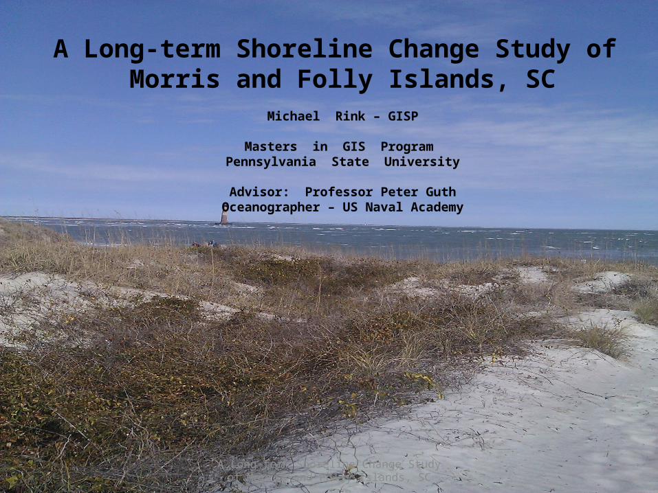
A Long-term Shoreline Change Study of Morris and Folly Islands, SC
A Long-term Shoreline Change Study of Morris and Folly Islands, SC
Michael Rink – GISP
Masters in GIS Program Pennsylvania State University
Advisor: Professor Peter GuthOceanographer – US Naval Academy

A Long-term Shoreline Change Study of Morris and Folly Islands, SC
Summary of Capstone ProjectPublic-domain data exists that spans a long-term shoreline record
New GIS tools now ensure an accurate comparison of historic vs. modern shoreline surveys
New technology exists that now lets researchers develop shoreline change regression analysis
A Long-term Shoreline Change Study of Morris and Folly Islands, SC
Outline•Introduction
•Available Spatial Data
•Access to Spatial Data
•Converting Spatial Data
•Analysis of the Spatial Data
•Conclusions
A Long-term Shoreline Change Study of Morris and Folly Islands, SC
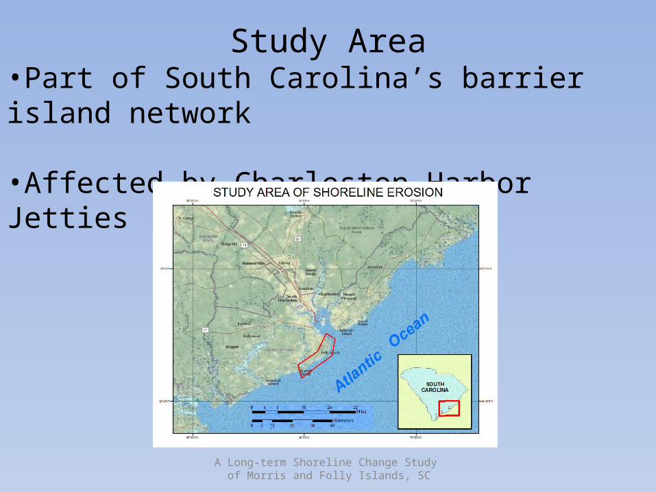
Study Area•Part of South Carolina’s barrier island network
•Affected by Charleston Harbor Jetties
A Long-term Shoreline Change Study of Morris and Folly Islands, SC
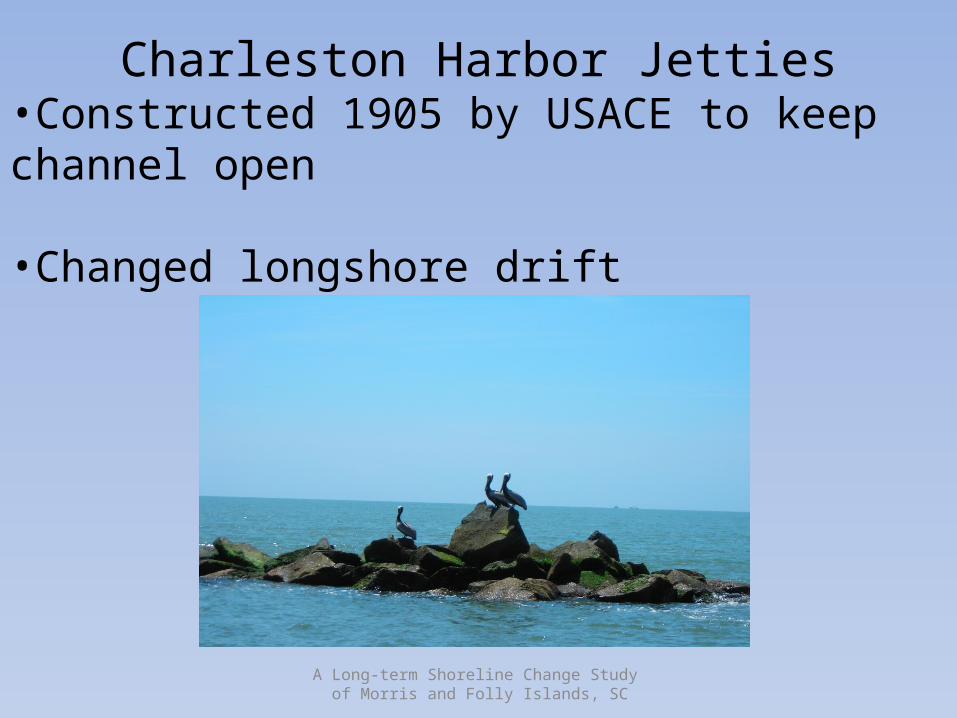
Charleston Harbor Jetties•Constructed 1905 by USACE to keep channel open
•Changed longshore drift
A Long-term Shoreline Change Study of Morris and Folly Islands, SC
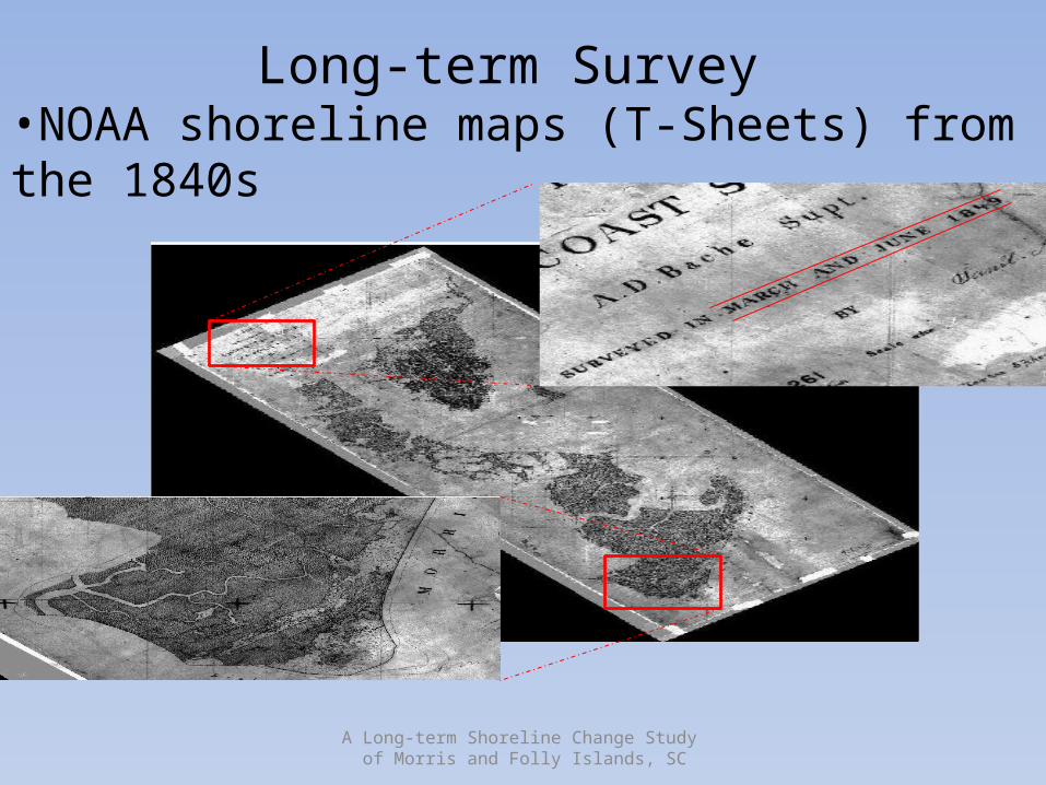
Long-term Survey •NOAA shoreline maps (T-Sheets) from the 1840s
A Long-term Shoreline Change Study of Morris and Folly Islands, SC
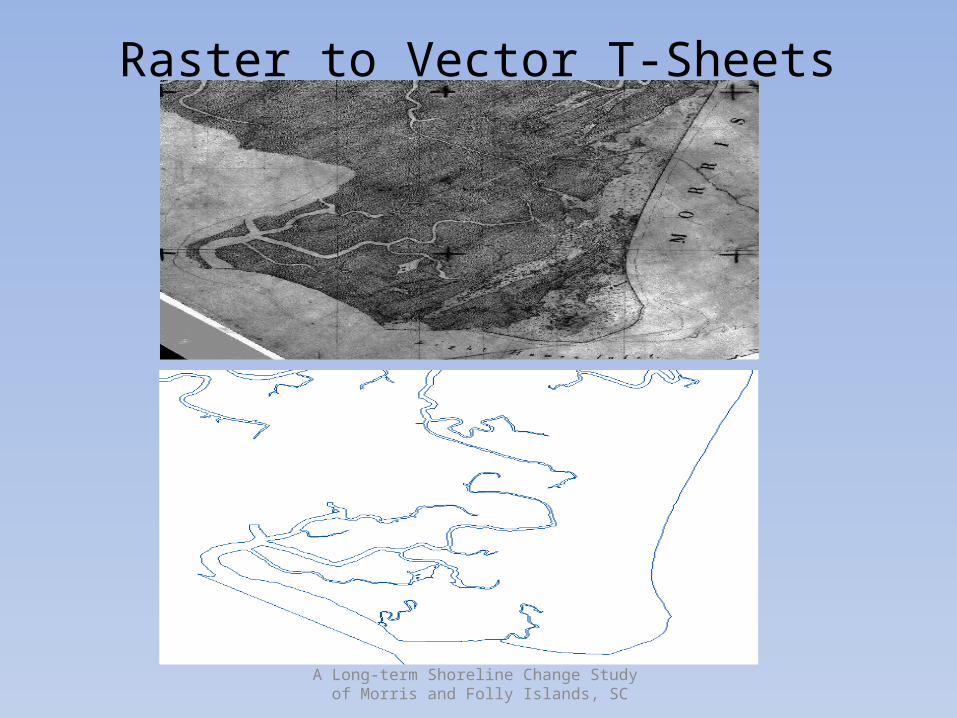
Raster to Vector T-Sheets
A Long-term Shoreline Change Study of Morris and Folly Islands, SC
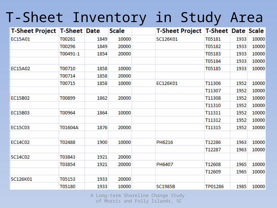
T-Sheet Inventory in Study Area
A Long-term Shoreline Change Study of Morris and Folly Islands, SC
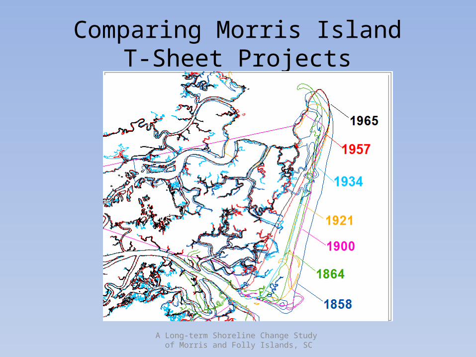
Comparing Morris IslandT-Sheet Projects
A Long-term Shoreline Change Study of Morris and Folly Islands, SC
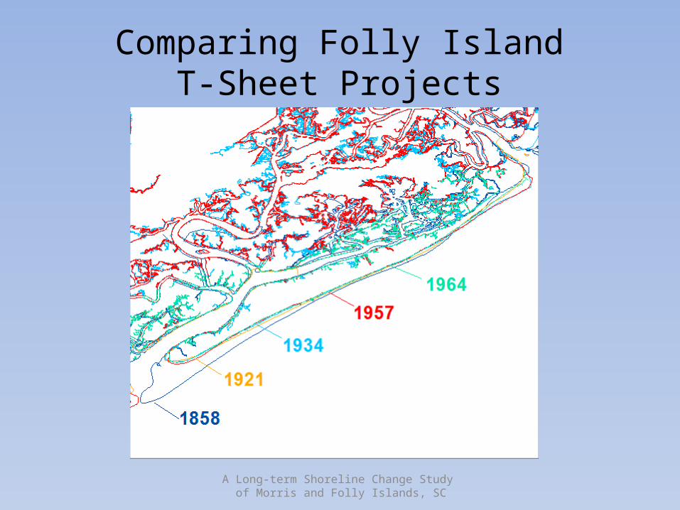
Comparing Folly IslandT-Sheet Projects
A Long-term Shoreline Change Study of Morris and Folly Islands, SC
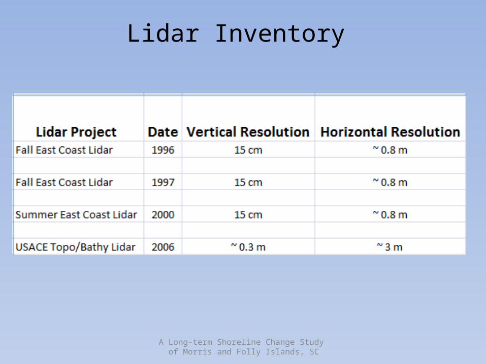
Lidar Inventory
A Long-term Shoreline Change Study of Morris and Folly Islands, SC
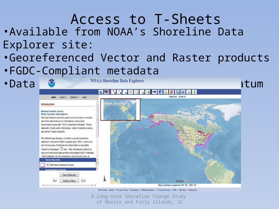
Access to T-Sheets•Available from NOAA’s Shoreline Data Explorer site: •Georeferenced Vector and Raster products•FGDC-Compliant metadata•Data are in Mean High Water tidal datum
A Long-term Shoreline Change Study of Morris and Folly Islands, SC
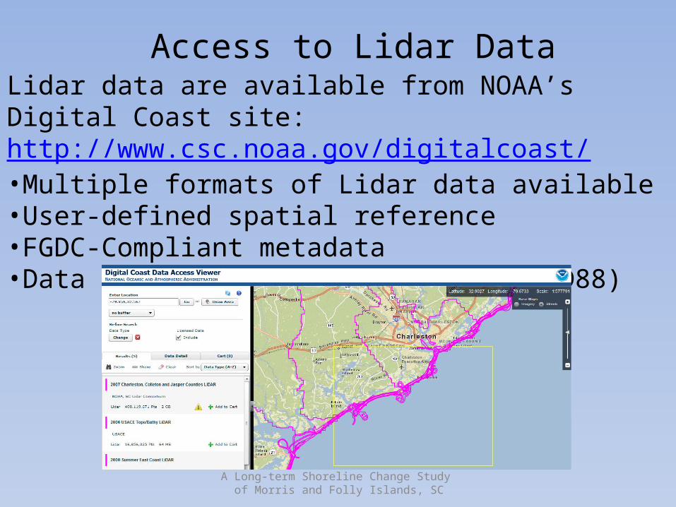
Access to Lidar DataLidar data are available from NOAA’s Digital Coast site: http://www.csc.noaa.gov/digitalcoast/•Multiple formats of Lidar data available•User-defined spatial reference•FGDC-Compliant metadata•Data are in orthometric datum (NAVD88)
A Long-term Shoreline Change Study of Morris and Folly Islands, SC
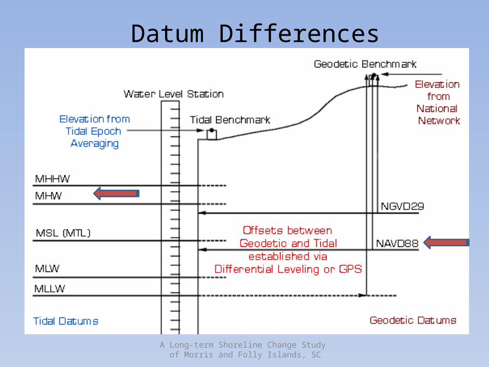
Datum Differences
A Long-term Shoreline Change Study of Morris and Folly Islands, SC
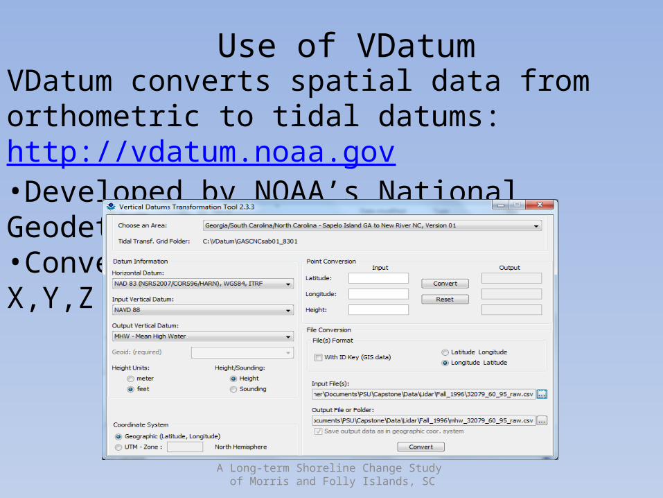
Use of VDatumVDatum converts spatial data from orthometric to tidal datums: http://vdatum.noaa.gov•Developed by NOAA’s National Geodetic Survey•Converts ASCII text files with X,Y,Z data
A Long-term Shoreline Change Study of Morris and Folly Islands, SC
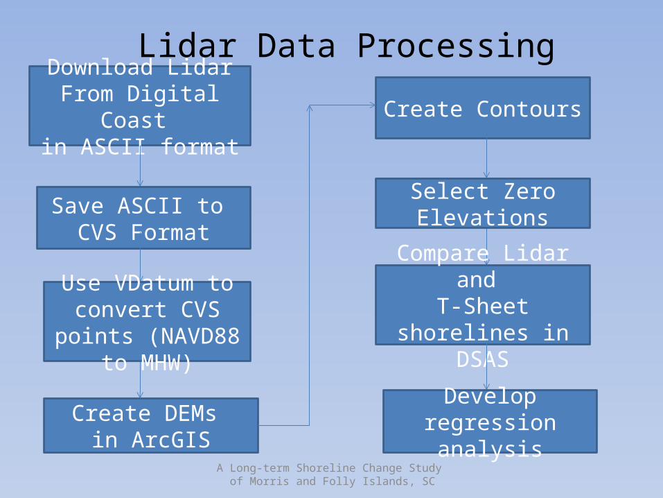
Download LidarFrom Digital Coast
in ASCII format
Save ASCII to CVS Format
Create DEMs in ArcGIS
Lidar Data Processing
Use VDatum to convert CVS points (NAVD88 to MHW)
Create Contours
Select Zero Elevations
Compare Lidar and T-Sheet shorelines in
DSAS
Develop regression analysis
A Long-term Shoreline Change Study of Morris and Folly Islands, SC
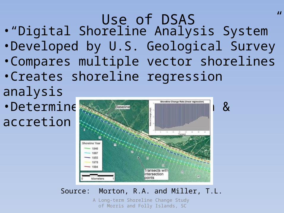
Use of DSAS•“Digital Shoreline Analysis System”•Developed by U.S. Geological Survey•Compares multiple vector shorelines•Creates shoreline regression analysis•Determines areas of erosion & accretion
Source: Morton, R.A. and Miller, T.L.
A Long-term Shoreline Change Study of Morris and Folly Islands, SC
ConclusionsRecent advances allow for shoreline change analysis:•spatial data rescue•long-term survey•free spatial data•datum conversion tools•GIS software for analysis•combining old and new technologies
Coastal resource managers can now predict shoreline change in their study area using free public data and GIS analysis tools.
A Long-term Shoreline Change Study of Morris and Folly Islands, SC
CitationsMorton, R.A. and Miller, T.L., 2005, “National Assessment of Shoreline Change: Part 2: Historical Shoreline Changes and Associated Coastal Land Loss Along the U.S. Southeast Atlantic Coast,” U.S. Geological Survey Open-File Report 2005-1401.
Thieler, E.R., Himmelstoss, E.A., Zichichi, J.L., and Ergul, Ayhan, 2009, Digital Shoreline Analysis System (DSAS) version 4.0 – An ArcGIS extension for calculating shoreline change: U.S. Geological Survey Open-File Report 2008-1278.
A Long-term Shoreline Change Study of Morris and Folly Islands, SC
Contact Information
Michael Rink [email protected]
843-278-0524 - Work