Embed Size (px)
Citation preview

A VECTOR AGENT APPROACH TO EXTRACT THE BOUNDARIES OF
REAL-WORLD PHENOMENA FROM SATELLITE IMAGES
Kambiz Borna Antoni Moore amp Pascal Sirguey
School of Surveying
University of Otago Dunedin New Zealand
11 Image Classification
What is the image classification
12 Methods
Supervised Classification Unsupervised Classification
A Pixel-based
based on spectral reflectance
A B
Based on slide by Jarlath OrsquoNeil Dunne
by Austin Troy and Weiqi Zhou 2008
12 Methods
The limitations of the pixel ndashbased classification
12 Methods
B Object-based classification
based on image object
Image-objects are groups of connected pixels that are supposed
to depict a homogeneous thematic meaning
B
C
by Austin Troy and Weiqi Zhou 2008
Based on slide by Jarlath OrsquoNeil Dunne
12 Methods
n
lcpt compactness
12 OBC Process
Object-based image classification process
Image segmentation Image Classification
The objects remain unchanged once they are created
Image objects have no direct relationship to real-world objects
That means
13 Limitations
we have a correct extraction and shaping of interest objects
may
131 Proposed Method
Moore et al (2011)
They are objects which can support a dynamic and irregular geometry
Geographical Vector Agents (VA)
3 1 Image Object Geometry in The
Context of The Vector Agent
Image object is automatically formed as a point in the pixel centre
A new point along four cardinal directions by a constant distance that is specified
by cell size
Rules
32 Image Objects Construction
and Evolution
4 Implementation
Based on a synthetic image
the growing process of two agent without negotiation
4 Implementation
Case1 negotiation between two vector agents including shrinking and growing process
4 Implementation
Case 2 negotiation between two vector agents including splitting process
4 Implementation
Case 3 negotiation between two vector agents including joining process
4 Implementation
Case 4 VAs are the goal oriented objects
Here they are initially defined to find the water and shadow
Water object eventually appears to be less likely than
shadow and VA merges under a single shadow object
Ikonos satellite image
4 Implementation
Case 5 VAs can use ancillary layer
Eg the sample regions including
ldquoardquo rdquobrdquo and rdquocrdquo have similar spectral
reflectance yet they have different
elevations
The same spectral reflectance
but in different level based on
a DEM layer
a
b
c
This research has highlighted some abilities of the VA to support a dynamic
geometry to image classification
41 Summary
Thank you for your attention
References
Baatz M and Schaumlpe A (2000) ldquoMultiresolution segmentation an optimization approach for high quality multiscale image segmentationrdquo In
Strobl J Blaschke T (Eds) Angewandte Geogr Informationsverarbeitung vol XII WichmannHeidelbergpp 12ndash 23
Baatz M Hoffmann C and Willhauck G (2007) rdquo Object-Based Image Analysis Spatial Concepts for Knowledge-Driven Remote Sensingrdquo
Springer pp29-42
Benenson I and Torrens P (2004) rdquo Geosimulation Automata-Based Modelling of Urban Phenomena Englandrdquo Wiley
Benz UC Hofmann PWillhauck G Lingenfelder I and Heynen M(2004) ldquoMulti-resolution object-oriented fuzzy analysis of remote sensing
data for GIS-ready informationrdquo ISPRS J Photogrammetry Remote Sensing 58 239ndash258Carlos M Fonseca and Peter J Fleming (1995)
Evolutionary Computation Springer
Bian L (1997)rdquo Multiscale Nature of Spatial Data in Scaling up Environmental Modelsrdquo in Scale in Remote Sensing and GIS Quattrochi DA and
Goodchild MF(Eds) Lewis pp13-27
Hay J Blashke TMarceau J and Bouchard A(2003) ldquoA comparison of three imageobject methods for the multiscale analysis of landscape
structurerdquo ISPRS Journal of Photogrammetry amp Remote Sensing 57 pp 327ndash345
Hay GJ Castilla G Wulder MA and Ruiz JR(2005) ldquoAn automated object-based approach for the multiscale image segmentation of forest
scenesrdquo International Journal of Applied Earth Observation and Geoinformation 7 pp 339ndash359
Hammam Y Moore A and Whigham P(2007) The dynamic geometry of Geographical Vector AgentsComputers Environment and Urban
Systems vol31 no5 pp 502-519
Gao J (2009)rdquoDigital Analysis of Remotely Sensed Imageryrdquo McGrow-Hill pp 434-435
Goodchild M(2001) ldquoIssues in spatially explicit modellingrdquo In D Parker T Berger amp S M Manson(Eds) Agent-based models of land-use and land-
cover change (pp 13ndash17) Irvine
Manson SM Sun S and Bonsal D(2012)rdquo Agent-Based Models of Geographical Systemsrdquo Springerpp125-141
Manson S M(2007)rdquo Does scale exist An epistemological scale continuum for complex humanndashenvironment systemsrdquo Geoforum Accepted in
press
Moore A(2011) ldquoGeographical Vector Agent Based Simulation for Agricultural Land Use Modellingrdquo in Advanced GeoSimulation Models
MarceauD and Benenson I (Eds) pp30-48
MacEachren A M Robinson A Hopper S Gardner S Murray R Gahegan M and Hetzler E(2005) ldquoVisualizing Geospatial Information
Uncertainty What We Know and What We Need to Know ldquo Cartography and Geographic Information Science Vol 32 No 3 2005 pp 139-160
Rouff CA Hinchey M Rash J Truszkowski W and GordonS D (Eds) (2006)rdquo Agent Technology from a Formal Perspectiverdquo Springer
Tian J and Chen DM (2007) ldquoInternational Journal of Remote Sensingrdquo ISSN 0143-1161 printISSN 1366-5901 online Taylor amp Francis
Torrens P and Benenson I(2003) Geographic Automata Systems International Journal of Geographic Information Science vol 10 no4 pp385-
412
Walsh S J Moody A Allen T R and Brown DG(1997) ldquoScale Dependence of NDVI and Its Relationship to Mountainous Terrainrdquo in Scale in
Remote Sensing and GIS Quattrochi DA and Goodchild MF(Eds) Lewis pp27-57
Yuan M Goodchild M F Cova T J (2007) ldquoTowards a General Theory of Geographic Representation in GISrdquo International Journal of
Geographic Information Science Volume 21 Pages 239-260

12 Methods
Supervised Classification Unsupervised Classification
A Pixel-based
based on spectral reflectance
A B
Based on slide by Jarlath OrsquoNeil Dunne
by Austin Troy and Weiqi Zhou 2008
12 Methods
The limitations of the pixel ndashbased classification
12 Methods
B Object-based classification
based on image object
Image-objects are groups of connected pixels that are supposed
to depict a homogeneous thematic meaning
B
C
by Austin Troy and Weiqi Zhou 2008
Based on slide by Jarlath OrsquoNeil Dunne
12 Methods
n
lcpt compactness
12 OBC Process
Object-based image classification process
Image segmentation Image Classification
The objects remain unchanged once they are created
Image objects have no direct relationship to real-world objects
That means
13 Limitations
we have a correct extraction and shaping of interest objects
may
131 Proposed Method
Moore et al (2011)
They are objects which can support a dynamic and irregular geometry
Geographical Vector Agents (VA)
3 1 Image Object Geometry in The
Context of The Vector Agent
Image object is automatically formed as a point in the pixel centre
A new point along four cardinal directions by a constant distance that is specified
by cell size
Rules
32 Image Objects Construction
and Evolution
4 Implementation
Based on a synthetic image
the growing process of two agent without negotiation
4 Implementation
Case1 negotiation between two vector agents including shrinking and growing process
4 Implementation
Case 2 negotiation between two vector agents including splitting process
4 Implementation
Case 3 negotiation between two vector agents including joining process
4 Implementation
Case 4 VAs are the goal oriented objects
Here they are initially defined to find the water and shadow
Water object eventually appears to be less likely than
shadow and VA merges under a single shadow object
Ikonos satellite image
4 Implementation
Case 5 VAs can use ancillary layer
Eg the sample regions including
ldquoardquo rdquobrdquo and rdquocrdquo have similar spectral
reflectance yet they have different
elevations
The same spectral reflectance
but in different level based on
a DEM layer
a
b
c
This research has highlighted some abilities of the VA to support a dynamic
geometry to image classification
41 Summary
Thank you for your attention
References
Baatz M and Schaumlpe A (2000) ldquoMultiresolution segmentation an optimization approach for high quality multiscale image segmentationrdquo In
Strobl J Blaschke T (Eds) Angewandte Geogr Informationsverarbeitung vol XII WichmannHeidelbergpp 12ndash 23
Baatz M Hoffmann C and Willhauck G (2007) rdquo Object-Based Image Analysis Spatial Concepts for Knowledge-Driven Remote Sensingrdquo
Springer pp29-42
Benenson I and Torrens P (2004) rdquo Geosimulation Automata-Based Modelling of Urban Phenomena Englandrdquo Wiley
Benz UC Hofmann PWillhauck G Lingenfelder I and Heynen M(2004) ldquoMulti-resolution object-oriented fuzzy analysis of remote sensing
data for GIS-ready informationrdquo ISPRS J Photogrammetry Remote Sensing 58 239ndash258Carlos M Fonseca and Peter J Fleming (1995)
Evolutionary Computation Springer
Bian L (1997)rdquo Multiscale Nature of Spatial Data in Scaling up Environmental Modelsrdquo in Scale in Remote Sensing and GIS Quattrochi DA and
Goodchild MF(Eds) Lewis pp13-27
Hay J Blashke TMarceau J and Bouchard A(2003) ldquoA comparison of three imageobject methods for the multiscale analysis of landscape
structurerdquo ISPRS Journal of Photogrammetry amp Remote Sensing 57 pp 327ndash345
Hay GJ Castilla G Wulder MA and Ruiz JR(2005) ldquoAn automated object-based approach for the multiscale image segmentation of forest
scenesrdquo International Journal of Applied Earth Observation and Geoinformation 7 pp 339ndash359
Hammam Y Moore A and Whigham P(2007) The dynamic geometry of Geographical Vector AgentsComputers Environment and Urban
Systems vol31 no5 pp 502-519
Gao J (2009)rdquoDigital Analysis of Remotely Sensed Imageryrdquo McGrow-Hill pp 434-435
Goodchild M(2001) ldquoIssues in spatially explicit modellingrdquo In D Parker T Berger amp S M Manson(Eds) Agent-based models of land-use and land-
cover change (pp 13ndash17) Irvine
Manson SM Sun S and Bonsal D(2012)rdquo Agent-Based Models of Geographical Systemsrdquo Springerpp125-141
Manson S M(2007)rdquo Does scale exist An epistemological scale continuum for complex humanndashenvironment systemsrdquo Geoforum Accepted in
press
Moore A(2011) ldquoGeographical Vector Agent Based Simulation for Agricultural Land Use Modellingrdquo in Advanced GeoSimulation Models
MarceauD and Benenson I (Eds) pp30-48
MacEachren A M Robinson A Hopper S Gardner S Murray R Gahegan M and Hetzler E(2005) ldquoVisualizing Geospatial Information
Uncertainty What We Know and What We Need to Know ldquo Cartography and Geographic Information Science Vol 32 No 3 2005 pp 139-160
Rouff CA Hinchey M Rash J Truszkowski W and GordonS D (Eds) (2006)rdquo Agent Technology from a Formal Perspectiverdquo Springer
Tian J and Chen DM (2007) ldquoInternational Journal of Remote Sensingrdquo ISSN 0143-1161 printISSN 1366-5901 online Taylor amp Francis
Torrens P and Benenson I(2003) Geographic Automata Systems International Journal of Geographic Information Science vol 10 no4 pp385-
412
Walsh S J Moody A Allen T R and Brown DG(1997) ldquoScale Dependence of NDVI and Its Relationship to Mountainous Terrainrdquo in Scale in
Remote Sensing and GIS Quattrochi DA and Goodchild MF(Eds) Lewis pp27-57
Yuan M Goodchild M F Cova T J (2007) ldquoTowards a General Theory of Geographic Representation in GISrdquo International Journal of
Geographic Information Science Volume 21 Pages 239-260

12 Methods
B Object-based classification
based on image object
Image-objects are groups of connected pixels that are supposed
to depict a homogeneous thematic meaning
B
C
by Austin Troy and Weiqi Zhou 2008
Based on slide by Jarlath OrsquoNeil Dunne
12 Methods
n
lcpt compactness
12 OBC Process
Object-based image classification process
Image segmentation Image Classification
The objects remain unchanged once they are created
Image objects have no direct relationship to real-world objects
That means
13 Limitations
we have a correct extraction and shaping of interest objects
may
131 Proposed Method
Moore et al (2011)
They are objects which can support a dynamic and irregular geometry
Geographical Vector Agents (VA)
3 1 Image Object Geometry in The
Context of The Vector Agent
Image object is automatically formed as a point in the pixel centre
A new point along four cardinal directions by a constant distance that is specified
by cell size
Rules
32 Image Objects Construction
and Evolution
4 Implementation
Based on a synthetic image
the growing process of two agent without negotiation
4 Implementation
Case1 negotiation between two vector agents including shrinking and growing process
4 Implementation
Case 2 negotiation between two vector agents including splitting process
4 Implementation
Case 3 negotiation between two vector agents including joining process
4 Implementation
Case 4 VAs are the goal oriented objects
Here they are initially defined to find the water and shadow
Water object eventually appears to be less likely than
shadow and VA merges under a single shadow object
Ikonos satellite image
4 Implementation
Case 5 VAs can use ancillary layer
Eg the sample regions including
ldquoardquo rdquobrdquo and rdquocrdquo have similar spectral
reflectance yet they have different
elevations
The same spectral reflectance
but in different level based on
a DEM layer
a
b
c
This research has highlighted some abilities of the VA to support a dynamic
geometry to image classification
41 Summary
Thank you for your attention
References
Baatz M and Schaumlpe A (2000) ldquoMultiresolution segmentation an optimization approach for high quality multiscale image segmentationrdquo In
Strobl J Blaschke T (Eds) Angewandte Geogr Informationsverarbeitung vol XII WichmannHeidelbergpp 12ndash 23
Baatz M Hoffmann C and Willhauck G (2007) rdquo Object-Based Image Analysis Spatial Concepts for Knowledge-Driven Remote Sensingrdquo
Springer pp29-42
Benenson I and Torrens P (2004) rdquo Geosimulation Automata-Based Modelling of Urban Phenomena Englandrdquo Wiley
Benz UC Hofmann PWillhauck G Lingenfelder I and Heynen M(2004) ldquoMulti-resolution object-oriented fuzzy analysis of remote sensing
data for GIS-ready informationrdquo ISPRS J Photogrammetry Remote Sensing 58 239ndash258Carlos M Fonseca and Peter J Fleming (1995)
Evolutionary Computation Springer
Bian L (1997)rdquo Multiscale Nature of Spatial Data in Scaling up Environmental Modelsrdquo in Scale in Remote Sensing and GIS Quattrochi DA and
Goodchild MF(Eds) Lewis pp13-27
Hay J Blashke TMarceau J and Bouchard A(2003) ldquoA comparison of three imageobject methods for the multiscale analysis of landscape
structurerdquo ISPRS Journal of Photogrammetry amp Remote Sensing 57 pp 327ndash345
Hay GJ Castilla G Wulder MA and Ruiz JR(2005) ldquoAn automated object-based approach for the multiscale image segmentation of forest
scenesrdquo International Journal of Applied Earth Observation and Geoinformation 7 pp 339ndash359
Hammam Y Moore A and Whigham P(2007) The dynamic geometry of Geographical Vector AgentsComputers Environment and Urban
Systems vol31 no5 pp 502-519
Gao J (2009)rdquoDigital Analysis of Remotely Sensed Imageryrdquo McGrow-Hill pp 434-435
Goodchild M(2001) ldquoIssues in spatially explicit modellingrdquo In D Parker T Berger amp S M Manson(Eds) Agent-based models of land-use and land-
cover change (pp 13ndash17) Irvine
Manson SM Sun S and Bonsal D(2012)rdquo Agent-Based Models of Geographical Systemsrdquo Springerpp125-141
Manson S M(2007)rdquo Does scale exist An epistemological scale continuum for complex humanndashenvironment systemsrdquo Geoforum Accepted in
press
Moore A(2011) ldquoGeographical Vector Agent Based Simulation for Agricultural Land Use Modellingrdquo in Advanced GeoSimulation Models
MarceauD and Benenson I (Eds) pp30-48
MacEachren A M Robinson A Hopper S Gardner S Murray R Gahegan M and Hetzler E(2005) ldquoVisualizing Geospatial Information
Uncertainty What We Know and What We Need to Know ldquo Cartography and Geographic Information Science Vol 32 No 3 2005 pp 139-160
Rouff CA Hinchey M Rash J Truszkowski W and GordonS D (Eds) (2006)rdquo Agent Technology from a Formal Perspectiverdquo Springer
Tian J and Chen DM (2007) ldquoInternational Journal of Remote Sensingrdquo ISSN 0143-1161 printISSN 1366-5901 online Taylor amp Francis
Torrens P and Benenson I(2003) Geographic Automata Systems International Journal of Geographic Information Science vol 10 no4 pp385-
412
Walsh S J Moody A Allen T R and Brown DG(1997) ldquoScale Dependence of NDVI and Its Relationship to Mountainous Terrainrdquo in Scale in
Remote Sensing and GIS Quattrochi DA and Goodchild MF(Eds) Lewis pp27-57
Yuan M Goodchild M F Cova T J (2007) ldquoTowards a General Theory of Geographic Representation in GISrdquo International Journal of
Geographic Information Science Volume 21 Pages 239-260

4 Implementation
Case 5 VAs can use ancillary layer
Eg the sample regions including
ldquoardquo rdquobrdquo and rdquocrdquo have similar spectral
reflectance yet they have different
elevations
The same spectral reflectance
but in different level based on
a DEM layer
a
b
c
This research has highlighted some abilities of the VA to support a dynamic
geometry to image classification
41 Summary
Thank you for your attention
References
Baatz M and Schaumlpe A (2000) ldquoMultiresolution segmentation an optimization approach for high quality multiscale image segmentationrdquo In
Strobl J Blaschke T (Eds) Angewandte Geogr Informationsverarbeitung vol XII WichmannHeidelbergpp 12ndash 23
Baatz M Hoffmann C and Willhauck G (2007) rdquo Object-Based Image Analysis Spatial Concepts for Knowledge-Driven Remote Sensingrdquo
Springer pp29-42
Benenson I and Torrens P (2004) rdquo Geosimulation Automata-Based Modelling of Urban Phenomena Englandrdquo Wiley
Benz UC Hofmann PWillhauck G Lingenfelder I and Heynen M(2004) ldquoMulti-resolution object-oriented fuzzy analysis of remote sensing
data for GIS-ready informationrdquo ISPRS J Photogrammetry Remote Sensing 58 239ndash258Carlos M Fonseca and Peter J Fleming (1995)
Evolutionary Computation Springer
Bian L (1997)rdquo Multiscale Nature of Spatial Data in Scaling up Environmental Modelsrdquo in Scale in Remote Sensing and GIS Quattrochi DA and
Goodchild MF(Eds) Lewis pp13-27
Hay J Blashke TMarceau J and Bouchard A(2003) ldquoA comparison of three imageobject methods for the multiscale analysis of landscape
structurerdquo ISPRS Journal of Photogrammetry amp Remote Sensing 57 pp 327ndash345
Hay GJ Castilla G Wulder MA and Ruiz JR(2005) ldquoAn automated object-based approach for the multiscale image segmentation of forest
scenesrdquo International Journal of Applied Earth Observation and Geoinformation 7 pp 339ndash359
Hammam Y Moore A and Whigham P(2007) The dynamic geometry of Geographical Vector AgentsComputers Environment and Urban
Systems vol31 no5 pp 502-519
Gao J (2009)rdquoDigital Analysis of Remotely Sensed Imageryrdquo McGrow-Hill pp 434-435
Goodchild M(2001) ldquoIssues in spatially explicit modellingrdquo In D Parker T Berger amp S M Manson(Eds) Agent-based models of land-use and land-
cover change (pp 13ndash17) Irvine
Manson SM Sun S and Bonsal D(2012)rdquo Agent-Based Models of Geographical Systemsrdquo Springerpp125-141
Manson S M(2007)rdquo Does scale exist An epistemological scale continuum for complex humanndashenvironment systemsrdquo Geoforum Accepted in
press
Moore A(2011) ldquoGeographical Vector Agent Based Simulation for Agricultural Land Use Modellingrdquo in Advanced GeoSimulation Models
MarceauD and Benenson I (Eds) pp30-48
MacEachren A M Robinson A Hopper S Gardner S Murray R Gahegan M and Hetzler E(2005) ldquoVisualizing Geospatial Information
Uncertainty What We Know and What We Need to Know ldquo Cartography and Geographic Information Science Vol 32 No 3 2005 pp 139-160
Rouff CA Hinchey M Rash J Truszkowski W and GordonS D (Eds) (2006)rdquo Agent Technology from a Formal Perspectiverdquo Springer
Tian J and Chen DM (2007) ldquoInternational Journal of Remote Sensingrdquo ISSN 0143-1161 printISSN 1366-5901 online Taylor amp Francis
Torrens P and Benenson I(2003) Geographic Automata Systems International Journal of Geographic Information Science vol 10 no4 pp385-
412
Walsh S J Moody A Allen T R and Brown DG(1997) ldquoScale Dependence of NDVI and Its Relationship to Mountainous Terrainrdquo in Scale in
Remote Sensing and GIS Quattrochi DA and Goodchild MF(Eds) Lewis pp27-57
Yuan M Goodchild M F Cova T J (2007) ldquoTowards a General Theory of Geographic Representation in GISrdquo International Journal of
Geographic Information Science Volume 21 Pages 239-260
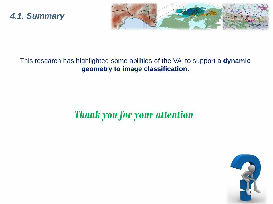


![[Go Baduk Igo Weiqi] [Cho Chikun, Otake Hideo, Takemiya Masaki] Weiqi Introductory Problem Collection (1320 Problems) [is~1](https://img.pdfslide.net/doc/110x75/55720efe497959fc0b8c87fd/go-baduk-igo-weiqi-cho-chikun-otake-hideo-takemiya-masaki-weiqi-introductory-problem-collection-1320-problems-is1.jpg)


![[Go Igo Baduk Weiqi] [Esp] Pernia, Horacio a - Nikkai](https://img.pdfslide.net/doc/110x75/5571f85c49795991698d417a/go-igo-baduk-weiqi-esp-pernia-horacio-a-nikkai.jpg)
![[Go Igo Baduk Weiqi] Les Mystères du Weiqi - La bibliographie du](https://img.pdfslide.net/doc/110x75/586bc6801a28abf4128c0298/go-igo-baduk-weiqi-les-mysteres-du-weiqi-la-bibliographie-du.jpg)


![[Go Igo Baduk Weiqi] [Esp] Fairbain, John - Tengen](https://img.pdfslide.net/doc/110x75/577cd1141a28ab9e789391b6/go-igo-baduk-weiqi-esp-fairbain-john-tengen.jpg)


![[Go Baduk Igo Weiqi] 30k-20k Study Book](https://img.pdfslide.net/doc/110x75/543e06b6b1af9f2b2b8b45b3/go-baduk-igo-weiqi-30k-20k-study-book.jpg)


![[Go Igo Baduk Weiqi] the Classics of Weiqi](https://img.pdfslide.net/doc/110x75/5528fc565503466b2e8b45b6/go-igo-baduk-weiqi-the-classics-of-weiqi.jpg)


![[Go Igo Baduk Weiqi] 30k-20k Study Book](https://img.pdfslide.net/doc/110x75/55246ec74a7959bc488b4748/go-igo-baduk-weiqi-30k-20k-study-book.jpg)


![[Go Igo Baduk Weiqi] the Breakthrough to Shodan](https://img.pdfslide.net/doc/110x75/55cf98fe550346d0339ae8bf/go-igo-baduk-weiqi-the-breakthrough-to-shodan.jpg)
