Embed Size (px)
Citation preview

A59 road safety, speed and enforcement issues
Western ParishesArea Committee 20 September 2010
Lancashire Constabulary & Lancashire County Council

Plan
• Introduce representatives
• Inform of community links
• Lancashire Partnership for Road Safety
• Questions
Representatives
• John McLaughlin, Lancashire Police, Traffic Management facilitator
• Nick Hughes, LCC Senior Road Safety Engineer
• Bill Dawson, LCC Principal Engineer, Traffic and Development Control
• Rachel Crompton, LCC Area South Public Realm Manager
Roles in speed & safety management
• Police – enforcement authority
• County Council – highway and traffic authority
Shared responsibilities for casualty reduction
Communities
• Direct enquiries to police on 08451-253545• Direct enquiries to LCC on 0845-053-0011• Through Councillors or Parish Clerks• Area Committee and PACT meetings
Also• School travel plans• Road safety education & training etc.
Partnerships between police & LCC
• Out of hours emergencies
• Between nominated officers on individual enquiries
• Traffic Liaison Meetings
• Lancashire Partnership for Road Safety
• Community policing teams
Lancashire Partnership for Road Safety (LPfRS)
The LPfRS was established in 2001 with the aim of contributing to the Government's 2010 road casualty reduction targets through a combination of enforcement, education and awareness-raising campaigns.
• Lancashire Constabulary, • Lancashire County Council,• Blackburn with Darwen Unitary Authority, • Blackpool Council,• Highways Agency, • Her Majesty's Court Service• Lancashire Fire & Rescue Service
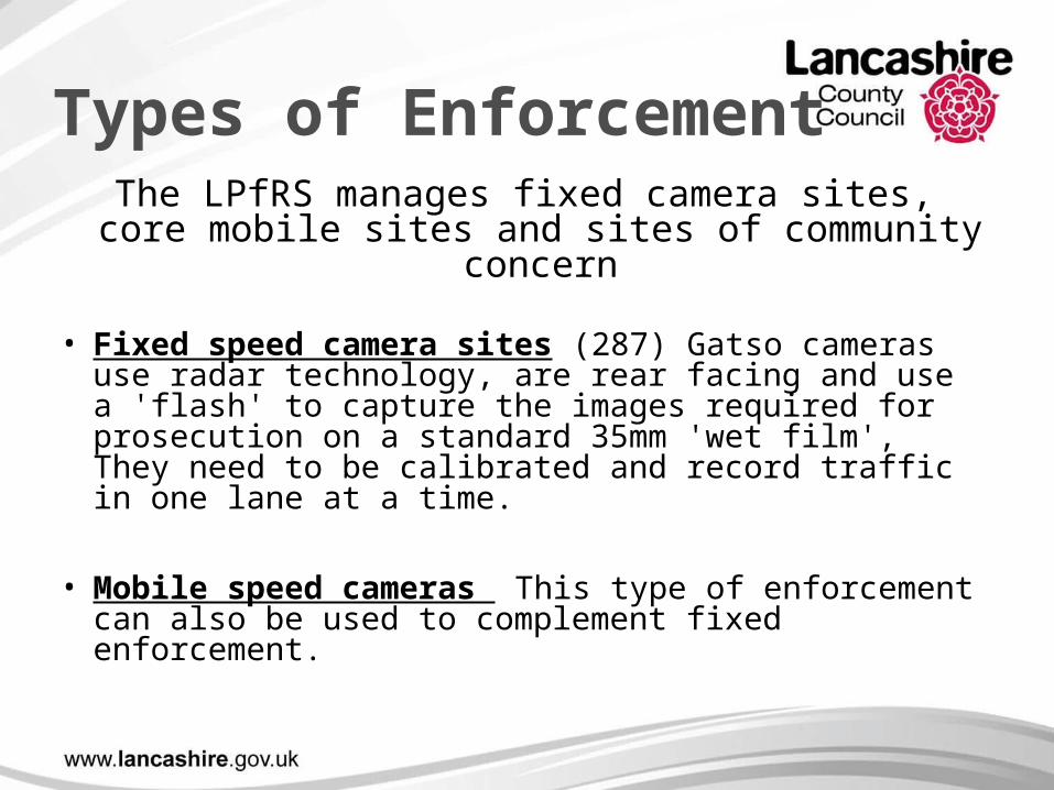
Types of Enforcement The LPfRS manages fixed camera sites, core
mobile sites and sites of community concern
• Fixed speed camera sites (287) Gatso cameras use radar technology, are rear facing and use a 'flash' to capture the images required for prosecution on a standard 35mm 'wet film', They need to be calibrated and record traffic in one lane at a time.
• Mobile speed cameras This type of enforcement can also be used to complement fixed enforcement.
Types of Enforcement cont.
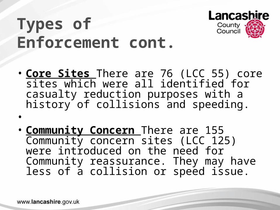
• Core Sites There are 76 (LCC 55) core sites which were all identified for casualty reduction purposes with a history of collisions and speeding.
• • Community Concern There are 155
Community concern sites (LCC 125) were introduced on the need for Community reassurance. They may have less of a collision or speed issue.
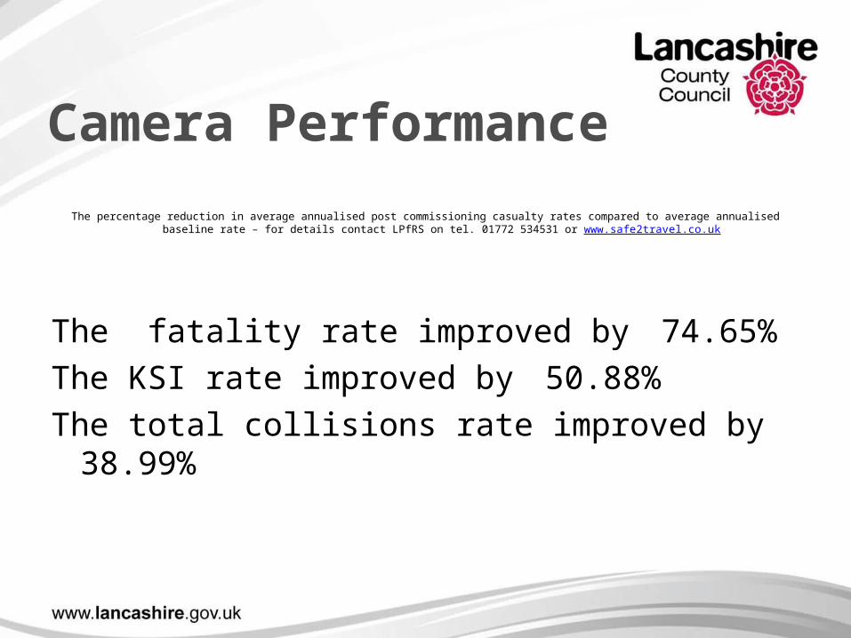
Camera Performance
The percentage reduction in average annualised post commissioning casualty rates compared to average annualised baseline rate – for details contact LPfRS on tel. 01772 534531 or www.safe2travel.co.uk
The fatality rate improved by 74.65%
The KSI rate improved by 50.88%
The total collisions rate improved by 38.99%
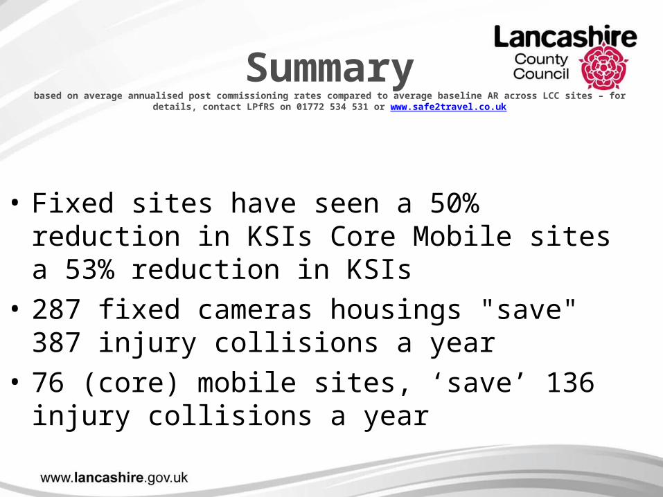
Summarybased on average annualised post commissioning rates compared to average baseline AR across LCC sites – for details, contact LPfRS
on 01772 534 531 or www.safe2travel.co.uk
• Fixed sites have seen a 50% reduction in KSIs Core Mobile sites a 53% reduction in KSIs
• 287 fixed cameras housings "save" 387 injury collisions a year
• 76 (core) mobile sites, ‘save’ 136 injury collisions a year
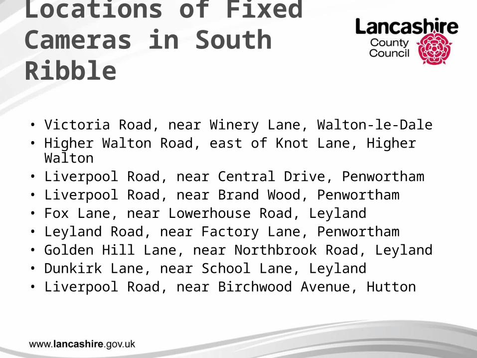
Locations of Fixed Cameras in South Ribble
• Victoria Road, near Winery Lane, Walton-le-Dale• Higher Walton Road, east of Knot Lane, Higher Walton• Liverpool Road, near Central Drive, Penwortham• Liverpool Road, near Brand Wood, Penwortham• Fox Lane, near Lowerhouse Road, Leyland• Leyland Road, near Factory Lane, Penwortham• Golden Hill Lane, near Northbrook Road, Leyland• Dunkirk Lane, near School Lane, Leyland• Liverpool Road, near Birchwood Avenue, Hutton
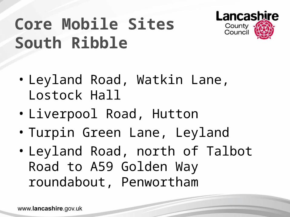
Core Mobile Sites South Ribble
• Leyland Road, Watkin Lane, Lostock Hall
• Liverpool Road, Hutton
• Turpin Green Lane, Leyland
• Leyland Road, north of Talbot Road to A59 Golden Way roundabout, Penwortham

Community Concern Sites, South Ribble
• West Paddock, Leyland, • Lindle Lane, Hutton, • Brindle Road, Bamber Bridge, • Dunkirk Lane, Leyland, • Croston Road, Farrington, • Cop Lane, Penwortham, • Duddle Lane, Walton-Le-Dale, • Marshalls Brow, Penwortham, • A676 Higher Walton Road, Higher Walton, • A677 Preston New Road, Salmesbury,

Questions
Contact details:
Lancashire Police
0845-1-253545
Lancashire County Council
0845-053-0011