Embed Size (px)
Citation preview

Access to and Add Value of Archived Data -
Methodology of Data Integration and Mining
for 1:1M Land Type Mapping of China
Prof. Liu Chuang
Prof. Shen Yuancen
Global Change Information and Research Center
IGSNRR/Chinese Academy of Sciences
PPF-WSIS Phase II, 14 November 2005, Tunis
1 China’s Scientific Data Sharing Program2 Opportunities and Challenges: Access to and Add Value of the Archived Data3 Methodology of Adding Value of Archived
Data4 Example:
1:1M Land Type Mapping of China
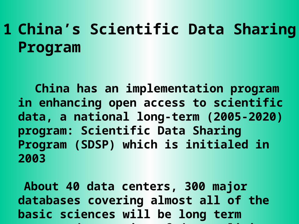
1 China’s Scientific Data Sharing Program
China has an implementation program in enhancing open access to scientific data, a national long-term (2005-2020) program: Scientific Data Sharing Program (SDSP) which is initialed in 2003
About 40 data centers, 300 major databases covering almost all of the basic sciences will be long term supported, a series of data policies and data standards will be established to meet the needs of open access to the archived data.

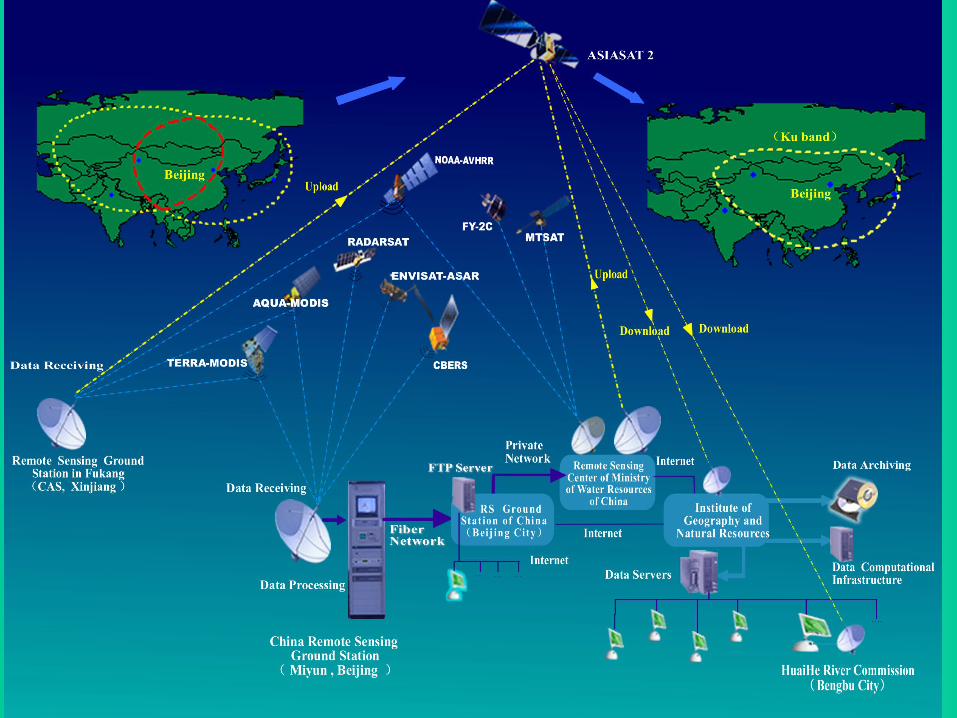
Besides, e-Government programs in agencies of China and e-Sciences program in CAS will promote the scientific data sharing program greatly. For example, the quick response system of water resources management system.
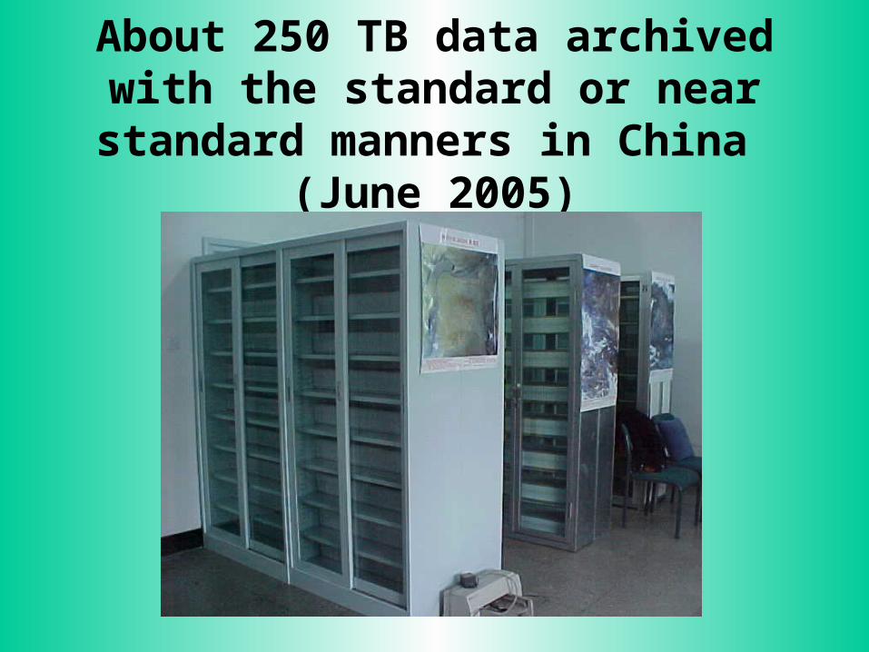
About 250 TB data archived with the standard or near standard manners in
China (June 2005)

2 Opportunities and Challenges: Access to and Add Value of the Archived Data
The progress makes great opportunities for scientists in research:
• the location of data• the way to access • free or low costs
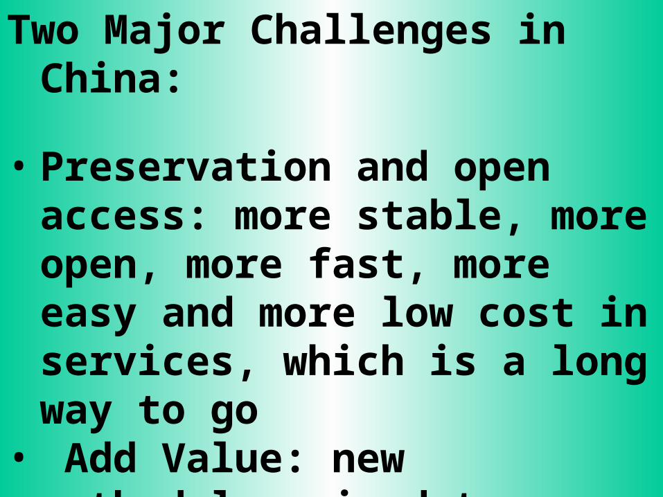
Two Major Challenges in China:
• Preservation and open access: more stable, more open, more fast, more easy and more low cost in services, which is a long way to go
• Add Value: new methodology in data integration and mining, which is a new way to be created
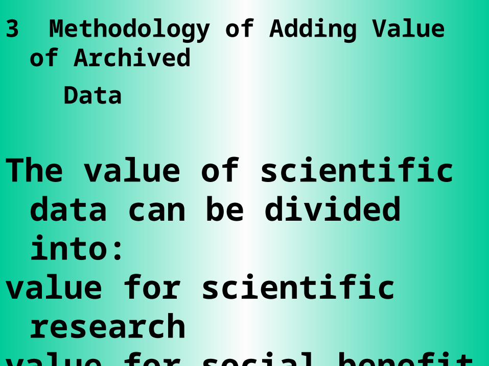
3 Methodology of Adding Value of Archived
Data
The value of scientific data can be divided into:
value for scientific researchvalue for social benefitvalue for economic income
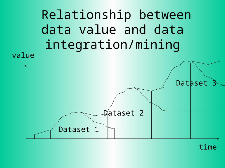
Relationship between data value and data integration/mining
Dataset 1
Dataset 2
Dataset 3
time
value

Reference Hierarchical Model for Data Integration and Data Mining
data model
knowledge
Data Selection
Data Integration
Object Simulating
Cal/Val
Compu
tatio
nal P
roce
ss
Distributed Information Infrastructure
Innovated Ideas/Society Needs
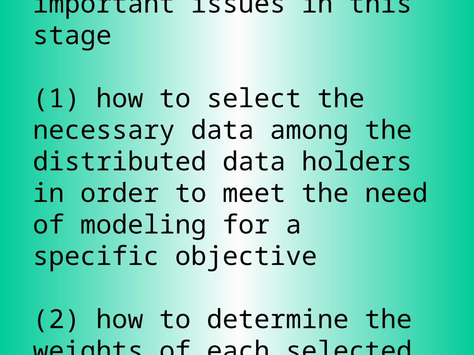
• Data Selection: two important issues in this stage
(1) how to select the necessary data among the distributed data holders in order to meet the need of modeling for a specific objective
(2) how to determine the weights of each selected datasets

• Data Integration: one issue, very difficult issue, in this stage has to be solved- making the selected datasets compatible
including data standard, termination, definition, format, unit, resolution, time period, method of capture the data ….
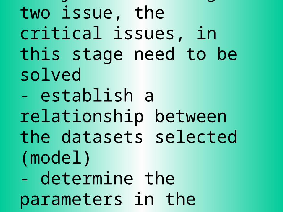
• Object simulating: two issue, the critical issues, in this stage need to be solved- establish a relationship between the datasets selected (model)- determine the parameters in the model

• Cal/Val for the new dataset: How the new dataset qualitycould be: - how quality is or what conditions the new dataset or knowledge could be high quality?- Are there any way to help the dataset quality enough?
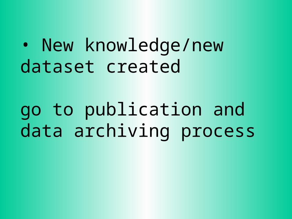
• New knowledge/new dataset created
go to publication and data archiving process

Reference Hierarchical Model for Data Integration and Data Mining
data model
knowledge
Data Selection
Data Integration
Object Simulating
Cal/Val
Compu
tatio
nal P
roce
ss
Distributed Information Infrastructure
Innovated Ideas/Society Needs
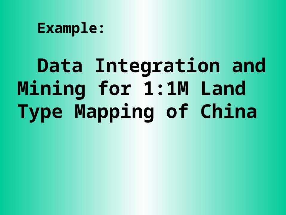
Example:
Data Integration and Mining for 1:1M Land Type Mapping of China
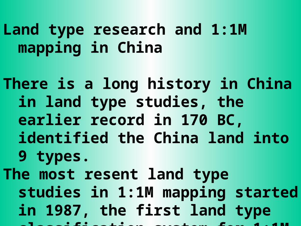
Land type research and 1:1M mapping in China
There is a long history in China in land type studies, the earlier record in 170 BC, identified the China land into 9 types.
The most resent land type studies in 1:1M mapping started in 1987, the first land type classification system for 1:1M mapping of China created in 1990 led by Prof. Zhao Songqiao. landtypeclaSytemChina.doc
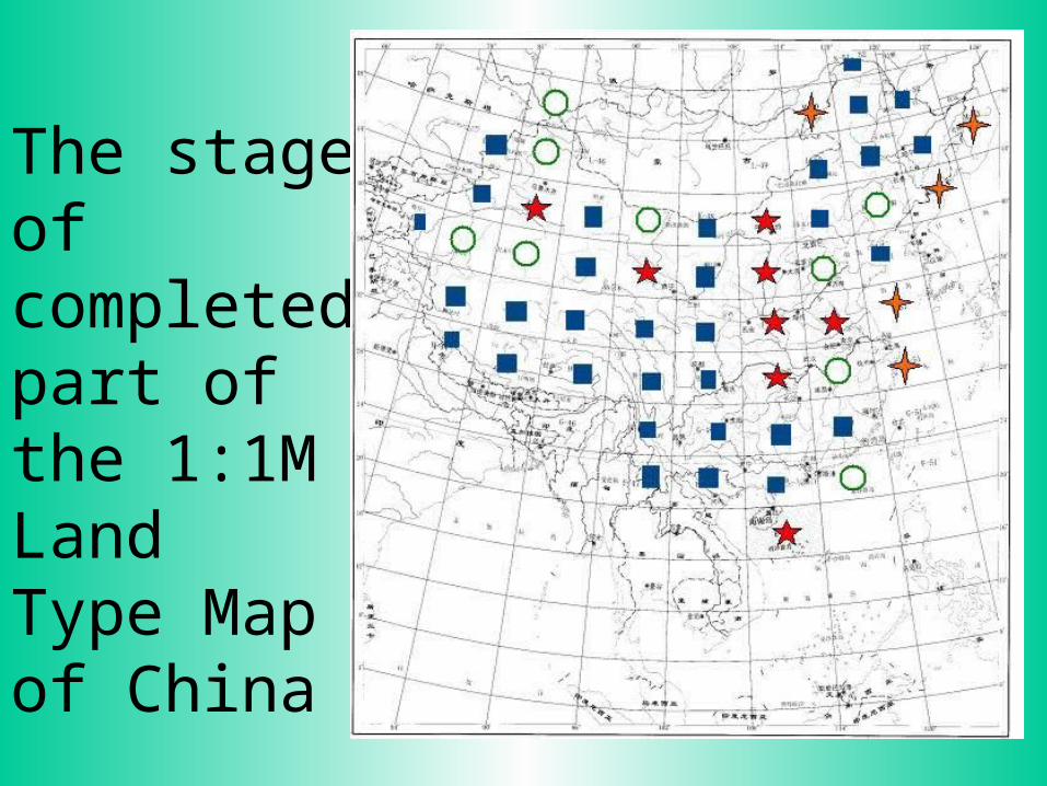
The stage of completed part of the 1:1M Land Type Map of China
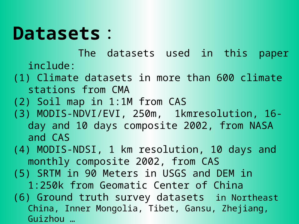
Datasets : The datasets used in this paper include:(1) Climate datasets in more than 600 climate stations from CMA(2) Soil map in 1:1M from CAS(3) MODIS-NDVI/EVI, 250m, 1kmresolution, 16-day and 10 days
composite 2002, from NASA and CAS(4) MODIS-NDSI, 1 km resolution, 10 days and monthly
composite 2002, from CAS(5) SRTM in 90 Meters in USGS and DEM in 1:250k from
Geomatic Center of China(6) Ground truth survey datasets in Northeast China, Inner Mongolia,
Tibet, Gansu, Zhejiang, Guizhou …(7) historical records including documentation and maps from CAS(8) yearbooks of agriculture and land use from Statistic Bureau of China
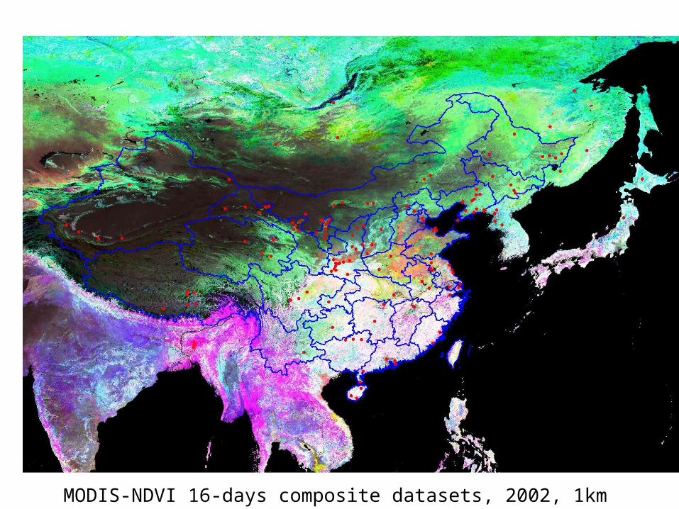
MODIS-NDVI 16-days composite datasets, 2002, 1km • Field sites
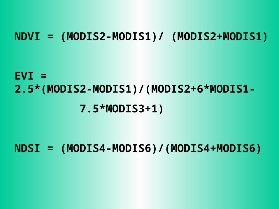
NDVI = (MODIS2-MODIS1)/ (MODIS2+MODIS1)
EVI = 2.5*(MODIS2-MODIS1)/(MODIS2+6*MODIS1-
7.5*MODIS3+1)
NDSI = (MODIS4-MODIS6)/(MODIS4+MODIS6)

- 2000
0
2000
4000
6000
8000
10000
1 2 3 4 5 6 7 8 9 10 11 12
Month
1000
0*ND
VI
Forest (Betula)
0 NDVI 0.83
Single peak
Location:
Far East Russia and Daxingan Mountain in Helongjian Province
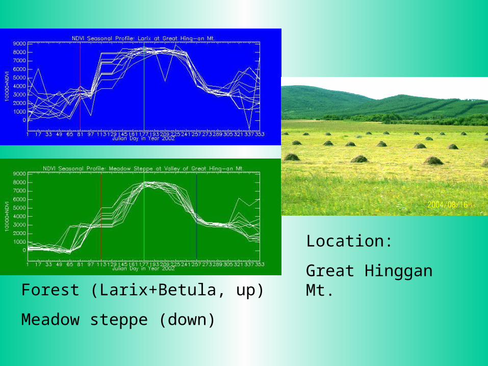
Location:
Great Hinggan Mt.Forest (Larix+Betula, up)
Meadow steppe (down)
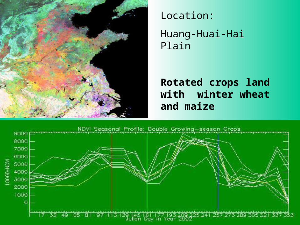
Location:
Huang-Huai-Hai Plain
Rotated crops land with winter wheat and maize
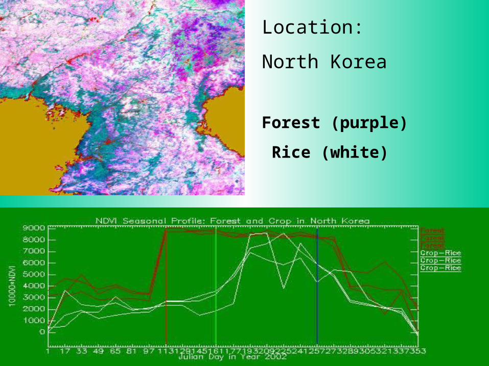
Location:
North Korea
Forest (purple)
Rice (white)
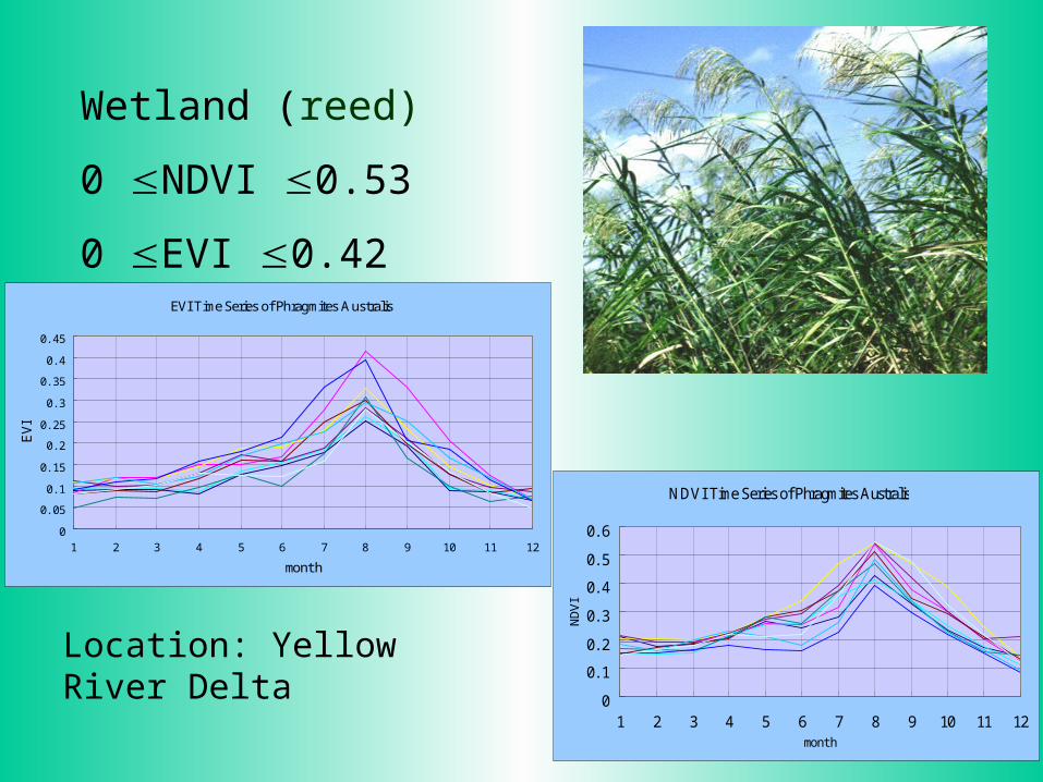
Wetland (reed)
0 NDVI 0.53
0 EVI 0.42
Location: Yellow River Delta
NDVI Time Series of Phragmites Australis
0
0. 1
0. 2
0. 3
0. 4
0. 5
0. 6
1 2 3 4 5 6 7 8 9 10 11 12month
ND
VI
EVI Time Series of Phragmites Australis
0
0. 05
0. 1
0. 15
0. 2
0. 25
0. 3
0. 35
0. 4
0. 45
1 2 3 4 5 6 7 8 9 10 11 12
month
EV
I
0
1000
2000
3000
4000
5000
6000
7000
8000
9000
J an. Feb. Mar. Apr. May. J un. J ul . Aug. Sep. Oct. Nov. Dec.Months
MODI
S_ND
VI*1
0000
0
1000
2000
3000
4000
5000
6000
7000
J an. Feb. Mar. Apr. May. J un. J ul . Aug. Sep. Oct. Nov. Dec.Months
MODI
S_EV
I*10
000
0
1000
2000
3000
4000
5000
6000
7000
J an. Feb. Mar. Apr. May. J un. J ul . Aug. Sep. Oct. Nov. Dec.Months
MODI
S_ND
VI*1
0000
0
500
1000
1500
2000
2500
3000
3500
4000
4500
J an. Feb. Mar. Apr. May. J un. J ul . Aug. Sep. Oct. Nov. Dec.Months
MODI
S_EV
I*10
000
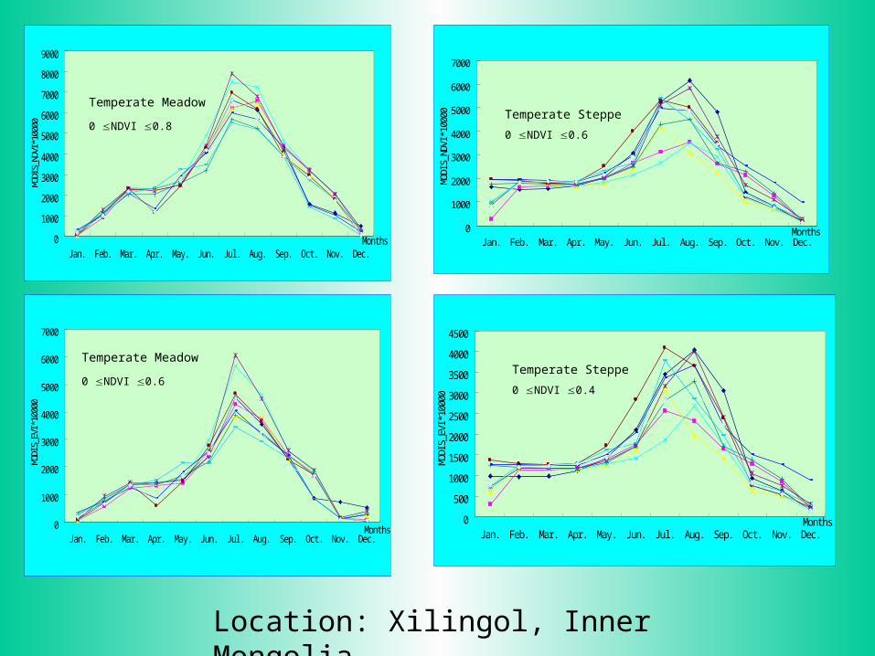
Temperate Meadow 0 NDVI 0.6
Temperate Meadow 0 NDVI 0.8
Temperate Steppe
0 NDVI 0.4
Temperate Steppe
0 NDVI 0.6
Location: Xilingol, Inner Mongolia
0
500
1000
1500
2000
2500
3000
J an. Feb. Mar. Apr. May. J un. J ul . Aug. Sep. Oct. Nov. Dec.Months
MODI
S_ND
VI*1
0000
0
500
1000
1500
2000
2500
J an. Feb. Mar. Apr. May. J un. J ul . Aug. Sep. Oct. Nov. Dec.Months
MODI
S_EV
I*10
000
0
500
1000
1500
2000
2500
3000
3500
4000
4500
5000
J an. Feb. Mar. Apr. May. J un. J ul . Aug. Sep. Oct. Nov. Dec.Months
MODI
S_ND
VI*1
0000
0
500
1000
1500
2000
2500
3000
3500
4000
J an. Feb. Mar. Apr. May. J un. J ul . Aug. Sep. Oct. Nov. Dec.Months
MODI
S_EV
I*10
000
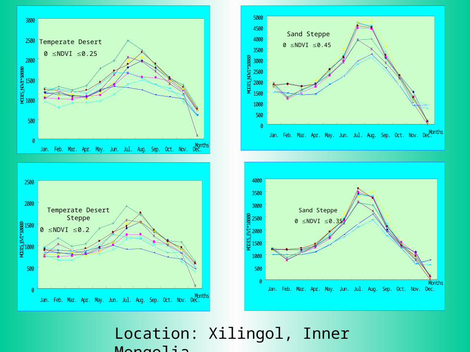
Temperate Desert
0 NDVI 0.25
Temperate Desert Steppe
0 NDVI 0.2
Sand Steppe
0 NDVI 0.45
Sand Steppe
0 NDVI 0.35
Location: Xilingol, Inner Mongolia
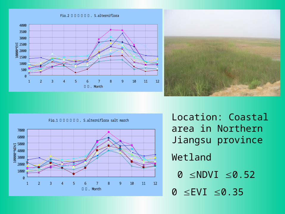
Location: Coastal area in Northern Jiangsu province
Wetland
0 NDVI 0.52
0 EVI 0.35
Fi g. 2 S. al terni fl ora互花米草盐沼,
0
500
1000
1500
2000
2500
3000
3500
4000
1 2 3 4 5 6 7 8 9 10 11 12
Month月份,
1000
0*EV
I
Fi g. 1 S. al terni fl ora sal t march互花米草盐沼,
0
1000
2000
3000
4000
5000
6000
7000
1 2 3 4 5 6 7 8 9 10 11 12
Month月份,
10
00
0*N
DV
I

Location:
Qinghai Province
Alpine Meadow
0
1000
2000
3000
4000
5000
6000
7000
8000
9000
1 2 3 4 5 6 7 8 9 10 11 12
al pi ne meadow, month
10
00
0*N
DV
I
0
1000
2000
3000
4000
5000
6000
7000
1 2 3 4 5 6 7 8 9 10 11 12
al pi ne meadow, month
10
00
0*E
VI
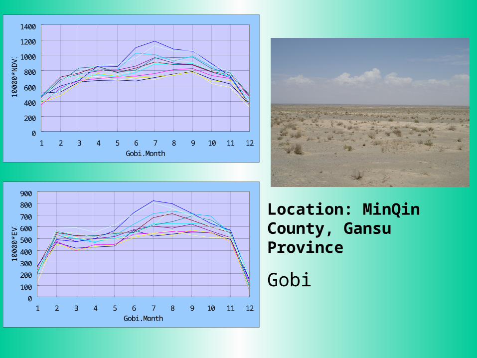
Gobi in arid region in northwestern China
0
200
400
600
800
1000
1200
1400
1 2 3 4 5 6 7 8 9 10 11 12Gobi , Month
10
00
0*N
DV
I
0
100
200
300
400
500
600
700
800
900
1 2 3 4 5 6 7 8 9 10 11 12Gobi , Month
10
00
0*E
VI
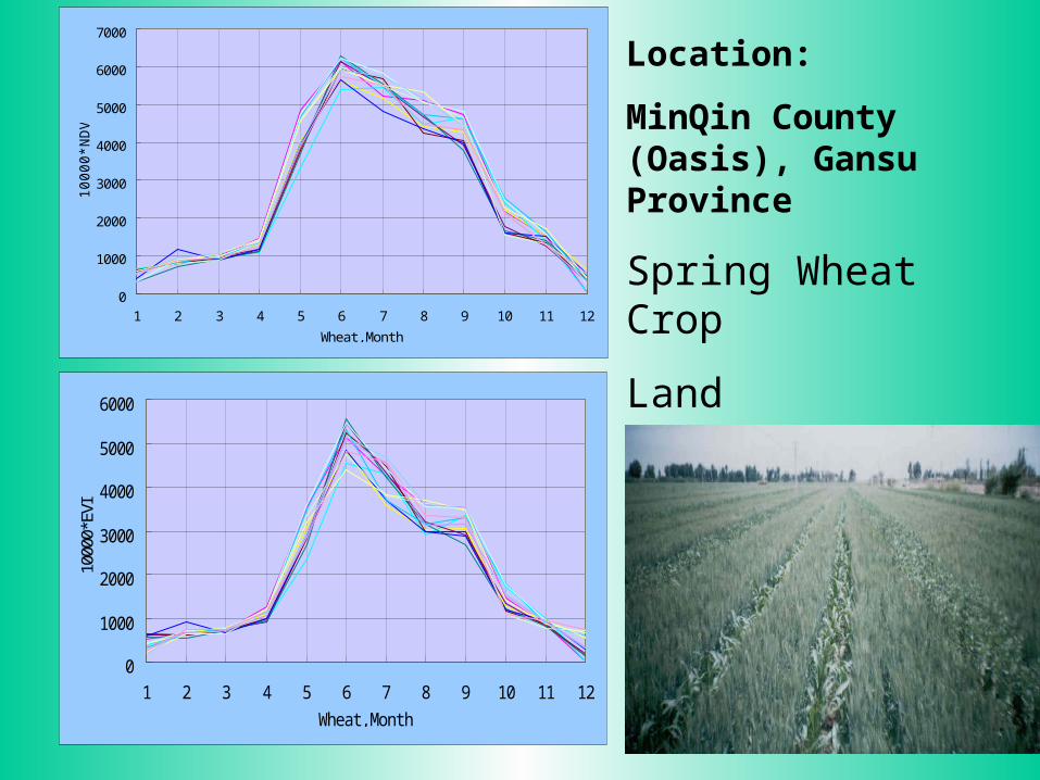
Location: MinQin County, Gansu Province
Gobi
0
1000
2000
3000
4000
5000
6000
1 2 3 4 5 6 7 8 9 10 11 12
Wheat , Month
1000
0*EV
I
0
1000
2000
3000
4000
5000
6000
7000
1 2 3 4 5 6 7 8 9 10 11 12
Wheat , Month
10000*N
DV
I
Location:
MinQin County (Oasis), Gansu Province
Spring Wheat Crop
Land
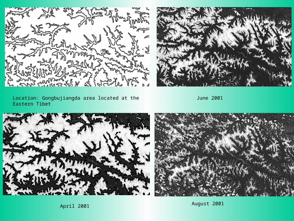
June 2001
April 2001
August 2001
Location: Gongbujiangda area located at the Eastern Tibet
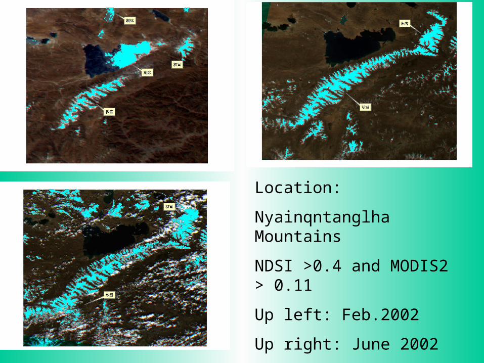
Location:
Nyainqntanglha Mountains
NDSI >0.4 and MODIS2 > 0.11
Up left: Feb.2002
Up right: June 2002
Down left: Sep. 2002

Conclusion:
The reference Hierarchical mode of data integration and mining is very important for innovated knowledge development, the computational science plays a critical role in the new methodology. The new methodology in data integration and mining will take China land type studies into a new milestone.

Thank you !