Embed Size (px)
Citation preview
C h a p t e r 4
Watershed Flow Regime Restoration Evaluaton Process Quality Gallon Accounting
System Protocol
Prepared with Funding from
The Great Lakes Protection Fund
September 2007
Study contact: Mark Mittag, P.E.
135 S. 84th Street, Suite 325 Milwaukee, WI 53214
(414) 272-2426 [email protected]
Contents
4. Quality Gallon Accounting System Protocol ................................................................4-1 Introduction..........................................................................................................................4-1 Conditions for Applying the Quality Gallon Accounting System ...............................4-2 Elements of the Quality Gallon Accounting System ......................................................4-3
Project Eligibility ....................................................................................................4-3 Project Quantification Requirements...................................................................4-8 Reporting ...............................................................................................................4-10
Summary.............................................................................................................................4-11 Recommendations for Future Research .........................................................................4-12
Appendixes
4A Quality Gallon Accounting System Terms 4B Project Prescreening Worksheet 4C Project Summary Worksheet
MKE\072600001 II
CHAPTER 4
Quality Gallon Accounting System Protocol
Introduction The purpose of the proposed Quality Gallon Accounting System (QGAS) protocol is to develop guidelines and performance standards for quantifying and verifying the flow regime-based ecosystem improvements resulting from implementing changes in water and land use management practices. These practices will be called best management practices (BMPs). The practical application of the accounting system is to qualify projects for recognized ecosystem improvements measured in units of gallons and Quality Gallons that would then be available for exchange, or simply to measure progress toward ecosystem restoration goals.
Initially, the QGAS is designed for implementation within a facilitated transaction process that leads to binding contracts between a project sponsor (that is, entity in need of verifiable ecosystem improvements) and a project owner (that is, public agencies, not-for-profit organizations, and land managers with qualifying projects). This facilitation process along with sample contracts is described in Chapters 5 Facilitating and Funding Stormwater Management for Ecosystem Improvement and 6 Ecosystem Improvement Transaction Example Contracts. However, the goal is that the accounting system be implemented by other means, including by a state or regional registry, for example. For the purposes of this protocol document, the term “registry” is used to represent the “place” where projects are reported. The development of these chapters along and other related documents1 occurred under a study to address Great Lakes flow regime-based ecosystem improvement projects. Chapters may be useful to users individually or collectively2.
The QGAS provides: 1) the scientific foundation for linking the projects to the ecosystem improvement targets; 2) a consistent basis for measuring progress toward the target; 3) a common metric for comparing the relative contributions of different flow restoration projects within the sub-watershed; and 4) a comparable basis for making project comparisons across watersheds. Specifically, this accounting system leads to common units of gallons and Quality Gallons within the sub-watershed so that projects can be compared on an equal footing. The gallons are designed to contribute equivalently to the hydrologic improvement, and the Quality Gallons are assumed to contribute similarly to additional important factors related to the aquatic ecology of the target waters in the sub-watershed. The gallon and Quality Gallons units also facilitate comparisons across sub-watersheds to support equivalence of transactions for the fair and predictable implementation of an
1 Executive Summary, Chapter 1: Watershed Flow Regime Restoration Evaluation Process, Chapter 2: Developing Stormwater BMP Quality Gallon Metric, Chapter 3: BMP Evaluation Process, Chapter 4: Quality Gallon Accounting System Protocol, Chapter 5: Facilitating and Funding Stormwater Management for Ecosystem Improvement, Chapter 6: Ecosystem Improvement Transaction Example Contracts, Chapter 7: Study Evaluation, Chapter 8: Study Communication Summary 2 The project team members (CH2M HILL in association with The Conservation Fund, Cook and Franke, Public Sector Consultants, and Stormtech) acknowledge the generous support from the Great Lakes Protection Fund as part of their Growing Water suite of research projects.
MKE\072600001 4-1
CHAPTER 4—QUALITY GALLON ACCOUNTING SYSTEM PROTOCOL
improvement standard despite the fact that the resultant ecosystem improvements are inherently unique to the respective watershed.
The elements of the QGAS can be generalized as establishing the baseline characterization and the target hydrologic conditions for the watershed. The baseline and target hydrologic conditions could be developed through a variety of means, such as hydrologic modeling, using historical flow gage information, and factors specific to the watershed. However once this method has been determined for the watershed, the specific protocols, guidelines, and performance standards for quantifying improvement will necessarily depend upon it. Comparison of values between watersheds would necessarily require that the same baseline approach be used in both watersheds. Chapter 1 Watershed Flow Regime Restoration Evaluation Process of this report describes the methods that were used for this study and could be applied to watersheds throughout the Great Lakes Basin to support the implementation of a single, uniform accounting system. To the extent that other watershed assessment methods are adopted, this system should be considered within the corresponding regional context and modified accordingly.
The conditions for applying the QGAS are listed in the next section, which is followed by the elements of the accounting system and the project quantification requirements. A glossary of terms is included in Appendix 4A. Templates for Project Prescreening and Project Summary Worksheets are provided in Appendix 4B and Appendix 4C, respectively.
Conditions for Applying the Quality Gallon Accounting System A number of actions would be necessary in order to apply the QGAS to a watershed. The following actions or procedures would have to occur in a watershed prior to implementing an accounting system:
• Watershed stakeholders meet minimum data and modeling requirements to develop both baseline and target conditions. Information is also available for quantifying progress toward the target. The minimum data requirements for implementing one flow restoration approach are described in Chapter 1 Watershed Flow Regime Restoration Evaluation Process.
• There is general stakeholder agreement about the watershed issues and ecosystem restoration targets. Hydrology is recognized as a limiting factor.
• Consensus exists at the watershed scale about what constitutes the water and land use management baseline from which improvements can be accrued, where the baseline includes any applicable land use laws and regulations.
• At the site-specific or landowner scale, establish a consensus about what contributes a net gain to the environment, which is defined as projects/practices that exceed the baseline, including applicable land use laws and regulations (for example, credits require going beyond compliance).
• For projects to qualify for ecosystem improvement credits, protective ordinances guiding new development and redevelopment that are consistent with preserving
MKE\072600001 4-2
CHAPTER 4—QUALITY GALLON ACCOUNTING SYSTEM PROTOCOL
hydrologic regime must be in place if the location of the new development has the potential to adversely impact the project.
Elements of the Quality Gallon Accounting System A land use or water management project must meet a specific set of criteria for gallons and quality gallons to be eligible for reporting and certification.3 The detailed Project Summary, which is submitted by the Project Owner for certification, will include a description of how the project meets the eligibility requirements. Alternatively, the Project Owner can first submit preliminary information about a project to determine if the project would be eligible for certification. Both eligibility requirements and a prescreening option are described in this section. Example Project Prescreening and Project Summary Worksheets are provided in Appendices 4B and 4C, respectively.
Project Eligibility Factors that influence establishing eligibility for inclusion within the QGAS include the following:
• Contribution to flow restoration target and relative contribution to watershed ecosystem restoration goals
• Project location
• Project ownership
• Project lifespan
• Project baseline qualitative characterization
• Project improvement requirements
• Prescreening process
These elements of project eligibility are further explained below.
Contribution to Target: Flow Duration Curve Influence Adoption of the flow restoration targets using the flow duration curve approach leads to the conclusion that any project that moves the observed flow duration curve towards the target condition flow duration curve is eligible for inclusion within the QGAS. Many types of stormwater management techniques can qualify for QGAS credit. The BMP effects relevant to controlling the flow duration curve are storage and infiltration. Storage BMPs primarily attenuate the peak flows for the higher flow portion of the flow duration curve. Infiltration BMPs will also provide some storage, but are expected to primarily benefit the base flow portion of the flow duration curve. Direct discharge for baseflow augmentation, such as a wastewater treatment plant discharge, can also be considered as a BMP to augment baseflows.
3 Eventually, the states may provide specific legislative guidance for registering projects, but the certification process is intended to perform the function of verifying compliance with the standards.
MKE\072600001 4-3
CHAPTER 4—QUALITY GALLON ACCOUNTING SYSTEM PROTOCOL
Typical storage BMPs include: stormwater wetlands, bioretention, sand filter, offline wet detention basin, inline wet detention basin, dry detention basin, rooftop runoff management, underground storage, and floodplain enhancement (restoring the floodplain to incised channels). Typical infiltration BMPs include: bioretention, infiltration devices, permeable pavement, and land use conversion.
Finally, preservation of undeveloped areas can also contribute to achieving the target by preventing flow regime changes from allowable development, which could increase percent imperviousness, reduce infiltration, and increase runoff. Preservation is beneficial to the flow regime because even with state-of-the-art stormwater management requirements, development does effect flow and water quality. Preservation consequently provides a more desirable flow regime and can be valued as a benefit. Further discussion of conservation benefits can be found in Chapters 1 Watershed Flow Regime Restoration Evaluation Process and Chapter 3 BMP Evaluation Process.
Project Location
Projects would be located in watersheds where there is a QGAS developed for restoration purposes.
Project Ownership
The purpose of including an ownership summary requirement is to promote transparency because it identifies the entity that is eligible to report the project, and includes details on any intended uses of the project (for example, sales, trading). Guidelines for the ownership summary are as follows:
• Owner(s) of fee title (that is, title of the land) underlying the project and any proportional shares if more than one owner is involved.
• If all or part of the Quality Gallons resulting from the project have been, or will be, sold or transferred to another party, identify the transferee and the amount transferred (or to be transferred).
Project Lifespan
Land conservation and BMPs can create both hydrologic and ecosystem benefits. For instance, by managing peak and base flows, project activities can lead to greater diversity of fish species, improved water quality, and stabilized stream banks. However, these benefits can be lost temporarily or permanently; if the land is disturbed after the project is completed. Therefore, easements and/or other guarantees such as contracts are needed to maximize and protect project benefits. Land conservation projects and some BMPs, such as detention ponds and stormwater wetlands, are amenable to protection by easements, including perpetual easements. However, other BMPs, such as green roofs and rain gardens, may require other types of guarantees and may have limited lifespans. The terms of the easement or other guarantee will affect the value of the project.
There are several ways to approach measuring and accounting for project lifespan. They include:
• Require that all BMPs have a perpetual easement
MKE\072600001 4-4
CHAPTER 4—QUALITY GALLON ACCOUNTING SYSTEM PROTOCOL
• Determine BMP value using economic principles of present worth, based upon the expected project lifespan
• Establish operation and maintenance procedures to sustain the benefits of the BMP
Determination of the BMP value utilizing economic present-worth principles requires specifying the discount rate and project lifespan. For projects that have perpetual easements associated with them, a net present value approach is not required. Projects with a shorter lifespan are assessed relative to perpetual projects. For example, assuming a 3 percent discount rate, projects with a 50-year lifespan would be worth 77 percent of a perpetual project that generated the same gallons and Quality Gallons; whereas a project with a 25-year lifespan would be worth only 52 percent of a perpetual project. Consequently, as an example, further discussion will focus upon managing lifespan uncertainty through perpetual easements as the preferred approach and reducing the value of BMPs when providing a perpetual easement is viewed as impractical. It is assumed that a perpetual easement implies that the BMP will be properly maintained.
Addressing BMP value when no easement is provided is an important issue that more jurisdictions are trying to manage. BMPs such as rain gardens and green roofs are dispersed BMPs that are often built in retrofit situations where no BMP previously existed. Consequently, there has been resistance to requiring easements for retrofit BMPs on individual private property. Approaches that have been considered to require BMP maintenance include covenants and landscaping ordinance requirements. An example draft covenant for maintaining a rain garden is included in Chapter 6 Ecosystem Improvement Transaction Example Contracts. Requiring an easement or similar device for a rain garden, however, has not become a general practice.
To address the lifespan of individual rain gardens within a rain garden program, extra gallons or Quality Gallons can be provided above that which would be necessary if a perpetual easement were used. For example, suppose that, on average, it is assumed that rain gardens will continue to provide full function for at least 50 years. Then, by implementing 20 percent more rain gardens than required, when rain gardens are no longer maintained or stop functioning for some reason (home addition, paving for basketball hoop, filled-in, etc.), there will be a greater chance that the rain garden program will still function as intended. In other words, only a portion of the gallons provided by a BMP program without perpetual easements would count towards the watershed’s flow regime restoration goal. For the purpose of an example, a value of 80 percent of the gallons or Quality Gallons provided by a BMP can be assigned to BMPs without a perpetual easement.
Where easements are provided, the terms of the easement or guarantee shall support the project activity. The purpose of the easement is twofold. The easement acts as a legal guarantee that the hydrologic regime can remain protected into perpetuity by requiring land management practices that support that end. If a natural disturbance resulted in the loss of storage and/or infiltration capacity, the easement terms would facilitate the restoration of the project and as a result, the hydrologic regime. The easement also facilitates environmental co-benefits to the extent that these are tied to the project.
MKE\072600001 4-5
CHAPTER 4—QUALITY GALLON ACCOUNTING SYSTEM PROTOCOL
Project Baseline Qualitative Characterization
As part of project initiation, there must be a qualitative characterization of the project’s baseline. The project baseline qualitative characterization is the current and long-term projection of the land and water management practices or activities that have occurred within a project’s physical boundaries in the absence of the project. Thus, the qualitative characterization will serve as the basis to quantify and forecast the project’s baseline flow regime condition and contribution. (See the Project Quantification Requirements section below for more details.)
Ultimately, the project activity will be assessed against this baseline to determine the project’s contribution to restoring the hydrology and the ecosystem. The following paragraphs provide the required framework for characterizing a project baseline, based on the project type.
Temporal Baseline A specific time should be determined within which projects are eligible. For example, a specific date may be the start of when projects would qualify. Protocol developers should decide whether or not to count historical projects. The length of time for counting the project should tie directly to the project guarantees for maintaining the project. The expectation is that unless BMPs are on residential lots, there will be a perpetual easement for the BMP.
Project Baseline Characterization Characterize a baseline according to regulatory land use context, existing practices, and/or land use change. The interpretation and application of these factors vary, depending on the project type. The general principle is that the Quality Gallons assigned to a project (that is, the “with” project condition) are calculated relative to the “without” project condition.
The baseline qualitative characterization will describe the management scenario that would occur over time, relative to the applicable statutes/regulations. It should include the assumption that the baseline characterization would represent a use of the land permitted by these identified laws and regulations. In addition, a project developer must identify the specific statutes and regulations/rules used to characterize the baseline. Finally, the project developer must show that no statues or regulations require the project.
Example Requirements for Land Conservation Projects There are two approaches for characterizing a baseline for a conservation project. One approach is based on local land use conversion trends, and the other is based on a site-specific immediate threat of conversion. Both approaches are valid but there are differences in the requirements. Land that is not expected to have a land use change would not be eligible for a conservation project.
If the project baseline is characterized by land use conversion trends, the following information could be the basis for the baseline characterization:
• Rate of conversion that is based on documented land use conversion trends
• Demonstration that no mandatory statutes or regulations requiring protection from conversion exist at the time the baseline is initiated
• Identification of the type of conversion, and demonstration that the threatened conversion is permitted by local zoning laws
MKE\072600001 4-6
CHAPTER 4—QUALITY GALLON ACCOUNTING SYSTEM PROTOCOL
If the chosen project baseline is an immediate site-specific conversion, it could be characterized with the following information:
• Objective documentation that clearly describes the specific threat of conversion that would take place in the project area in the absence of the project
• Objective information that indicates that the project area would have been converted within 5 years from the time of project initiation—one or more of the following documents could be provided:
− Copy of a bid to purchase the land from a developer
− Request for rezoning of the site to allow conversion filed with the County
• Documentation demonstrating that the estimated rate of conversion from undeveloped to the developed use is consistent with similar conversions that have occurred in the region within the last 5 years
• Demonstration that no mandatory statutes or regulations requiring protection from conversion exist at the time the project is initiated
• Demonstration that the threatened conversion is permitted by local zoning laws
Project Improvement Requirement
Only increments over the baseline can qualify as improvements. The purpose of this requirement is to facilitate project activities that lead to demonstrable benefits for the flow regime and target waters, relative to the project’s baseline. This section addresses what constitutes an improvement above the baseline condition. The Project Quantification Requirements section below explains the quantification of the gallons and quality gallons associated with the project activity.
Project Developers are required to describe their project activity and explain how it exceeds, or is additional to, the baseline qualitative characterization, including any mandatory statutes or regulations4 used to characterize the project baseline.
The amount of improvement provided by a project can have two parts: First, it will be initially assessed when the project is first reported to the Registry and second, if applicable, it will be assessed throughout the life of the project in the monitoring process (that is if applicable for some projects, the certifier will assess whether the project developer is maintaining the project). BMP maintenance is part of every project. Consequently, if maintenance is not provided, then a mechanism needs to be in place whereby maintenance can occur and the BMP provides the services promised as stated in the original plan. Such assurances can be provided in the form of third-party agreements or financial commitments, including trust funds and insurance.
Like the baseline characterization, this improvement assessment will depend on the project activity type. The same factors used to characterize the project baseline will serve as the basis for demonstrating that the project activity does indeed produce the desired flow regime improvements. For BMPs with perpetual easements, if at any time during the 4 This approach is known as regulatory additionality.
MKE\072600001 4-7
CHAPTER 4—QUALITY GALLON ACCOUNTING SYSTEM PROTOCOL
project’s lifespan, the project should cease to provide the intended flow moderation function, it would need to be fixed or a substitute project undertaken in accordance with the specified project assurance guarantees. For BMP programs without a perpetual easement, such as rain garden implementation programs on private residential properties, the project lifespan would not be part of a required inspection. However, it is recommended that the longevity of the BMPs be tracked over time to better ascertain the amount of conservancy that is needed for a residential BMP implementation program where no perpetual easement is provided.
Prescreening Process
A project developer may submit a preliminary project eligibility sheet to the Registry for prescreening. The prescreening process is designed to help ensure that proposed flow regime restoration projects will meet the eligibility criteria before the project is implemented and reported. Prescreening is based on the project eligibility criteria outlined in the previous subsections. A template for a Prescreening Project Worksheet is provided in Appendix 4B.
The prescreening worksheet would be submitted by the project developer to the Registry for prescreening. The Registry’s team would review the project information and issue a statement of project eligibility risk (low, medium, or high). Low risk indicates that the project would very likely meet the Registry’s reporting requirements. Medium risk indicates that the project will probably meet the Registry’s reporting requirements. High risk indicates that the project would likely not meet the Registry’s reporting requirements. This statement encourages the project developer to make modifications to the project accordingly.
Once the project developer receives a satisfactory prescreening statement (that is, the risk is acceptable), the project can be implemented and the benefits credited to the project developer.
Project Quantification Requirements This section provides guidance for quantifying the project baseline and the Quality Gallons, and meeting monitoring requirements. It is assumed that the flow restoration targets for the watershed have already been estimated, for example by using the flow duration curve approach as demonstrated in Chapter 1 Watershed Flow Regime Restoration Evaluation Process.
Provide Background Information on Project Area To begin the quantification process, the Project Owner must supply a general description of the activities and land use patterns that influence the project’s effectiveness. This information should help form the initial design of the project and be used in the certification process. Therefore, the following information will be included in the Project Summary:
• Project boundaries and acreage • Latitude/longitude or public land survey • Existing and proposed land cover and land use • Existing and proposed topography • Receiving water body • BMP tributary area
MKE\072600001 4-8
CHAPTER 4—QUALITY GALLON ACCOUNTING SYSTEM PROTOCOL
• Percent imperviousness • Soil type • Proposed BMP • Maintenance plan
This information could be provided in a brief document with supporting maps during the certification process. A template for a Project Summary form is provided in Appendix 4C.
Steps This section describes the steps and guidelines for quantifying the gallons and Quality Gallons from BMPs and land conservation. Performance standards are also included. The following process would evaluate the gallons and Quality Gallons available through a specific BMP. The evaluation process may be adjusted based upon the type of project (that is, BMP or land conservation) being evaluated. Example projects where these procedures have been applied are found in Chapter 3 BMP Evaluation Process.
Step 1. Review findings of watershed analysis to determine design criteria for projects/practices to establish the number of gallons that the project will contribute toward the watershed target.
Step 2. Review findings of watershed analysis to determine which of the quality adjustment multipliers apply to projects in this watershed. To the extent that the project developer has discretion over which type of BMP to build and where to place it, let the watershed priorities as reflected by the quality adjustment multipliers influence the decision.
Step 3. Evaluate the proposed project using the design criteria for estimating gallons and applying the quality multipliers to estimate the Quality Gallons. Conduct BMP hydrologic analysis (run-off, BMP volume, stage-storage discharge, etc., as applicable)
Size BMP to meet flow duration curve design standards (See Chapter 1 Watershed Flow Regime Restoration Evaluation Process).
Use standards to determine the gallon credit and apply a reduction if no perpetual easement is allowable and not provided. (See Chapter 1 Watershed Flow Regime Restoration Evaluation Process).
Qualitatively adjust gallons to Quality Gallons based on additional BMP benefits using the watershed-specific Table of Multipliers for BMPs. (See Chapter 2 Developing Stormwater BMP Quality Gallon Metric).
Monitoring
To accurately assess a BMP’s effectiveness, the project developer is obligated to provide and ensure the implementation of a monitoring plan consistent with producing the BMP performance measures. The monitoring plan will vary depending upon the project size and type of BMP. For small projects, monitoring can be limited to making sure that a rain garden still exists; while for large projects, a more detailed monitoring program can be appropriate.
The purpose of the monitoring process is to assess the project’s success with restoring a flow regime, thus confirming compliance with proposed project activity. This information is captured and assessed through the requirement for submitting an annual monitoring report
MKE\072600001 4-9
CHAPTER 4—QUALITY GALLON ACCOUNTING SYSTEM PROTOCOL
by the project developer to the Registry for a period of 5 years. To track long-term BMP function, inspections for certain highly valued BMPs may continue to occur at a 3-year interval. Additionally, a 3-year inspection interval for a small percentage of the implemented BMPs could provide valuable information on how well the devices function over time and whether adjustments in credits received or the amount of maintenance provided is warranted. A BMP inspection interval of 3 year is a common requirement of NPDES stormwater permits; therefore, this component can be folded into permit compliance.
The elements of an annual monitoring report would include:
• Written documentation of the project activities that are being carried out, as described in the project description
• Report of any disturbances to the BMP (for example, major storm events) that affect performance
• Documentation of the inspection and identification of maintenance needs with a plan to rectify any problems
• Documentation of land use changes to the area tributary to BMP and expected effect on BMP performance
Ultimately, this information is used to make adjustments to the project and gather information to improve future projects.
Reporting
Who is eligible to report projects?
Generally, the landowner or project developer will report the projects to a third party certifier for inclusion on a registry.
Reporting deadlines
Unless otherwise specified, projects shall be certified within 1 year of project completion. Pre-certification is encouraged.
Overview of the process to report projects
The six basic procedural steps to report a project are as follows:
1. Design the project
2. Complete the optional project prescreening process (submit a prescreening summary to the Certifier for prescreening; receive eligibility/prescreening determination from the Certifier)
3. Implement project (if not already established)
4. Implement the monitoring plan and provide information by the end of the first year
5. Report project activity
MKE\072600001 4-10
CHAPTER 4—QUALITY GALLON ACCOUNTING SYSTEM PROTOCOL
6. Certify project activity
7. Provide follow-on monitoring results as indicated in the monitoring plan
Certifying projects
Certification is the process used to verify that the gallons and quality gallons reported to the State or Registry have met a minimum quality standard and complied with the Quality Gallon Accounting System protocol. To assess project performance, project developers must certify that their project results initially with a yearly monitoring report. In addition, projects may be selectively inspected in 5-year intervals with the potential for adjustments to credit values received if warranted.
The certification process requires project developers to hire an approved third-party certifier to review and assess the reported data and confirm that it adheres to the QGAS protocol. This process helps ensure the consistency, credibility, and transparency of the gallon and Quality Gallon data reported across organizations, which, in turn enables the regulatory agencies to assess progress toward flow restoration targets and to adaptively manage toward the target in the future. In addition, the certification process provides confidence to the public that the reported information is accurate.
Thus, in addition to preparing the Project Summary, project developers are responsible for:
• Hiring a certifier
• Answering questions and supplying requested information to the certifier as they review the project developer’s monitoring report
• Discussing and understanding the certification documentation that the certifier prepares
The following discussion outlines core certification activities, and explains the steps that certifiers need to complete to certify a participant’s Gallons/Quality Gallons Report.
The certifier reviews applications. Certifiers would be approved by the State and/or its Registry (assuming one is established). The ability to provide certification could require the successful completion of a training workshop offered either by the State or State Registry. To be eligible for the training, potential participants would be expected to demonstrate experience in certifying and verifying financial data, technical data, environmental data, and/or environmental management systems. States may require a certifier to demonstrate that they have the means to accept financial liability for the activities they certify (for example, having certification insurance coverage). Finally, the certifier should have some mechanism in place to avoid a potential conflict of interest, such as not providing other services to the client for a period of time (for example, 3 years) before and after performing the certification.
Summary This Protocol document attempts to provide sufficient detail to implement the system, but does not intend to prescribe rules that are at the discretion of the implementing authority. In cases where the system does appear to have superseded such authority, it was deemed
MKE\072600001 4-11
CHAPTER 4—QUALITY GALLON ACCOUNTING SYSTEM PROTOCOL
necessary for the purpose of designing an implementable system. These rules can be modified to suit the needs of the rule-makers.
The QGAS provides:
• The scientific foundation for linking the projects to the ecosystem improvement targets;
• A consistent basis for measuring progress toward the target;
• A common metric for comparing the relative contributions of different flow restoration projects within the sub-watershed; and
• A comparable basis for making project comparisons across watersheds.
Specifically, this accounting system leads to common units of gallons and Quality Gallons within the sub-watershed so that projects can be compared on an equal footing. The gallons are designed to contribute equivalently to hydrologic improvement, and the Quality Gallons are assumed to contribute similarly to other factors important to the aquatic ecology of the target waters in the sub-watershed. The gallon and Quality Gallons units also facilitate comparisons across sub-watersheds to support the equivalence of transactions for the fair and predictable implementation of an improvement standard despite the fact that the resultant ecosystem improvements are inherently unique to the respective watershed.
Recommendations for Future Research As initially conceived, the primary driver for implementing this system is to serve as a requirement to improve the natural resources that are dependent upon the hydrology of the Great Lakes Basin—that is, improving the hydrology of the basin‘s watersheds in return for new or increased withdrawals from the surface and groundwater of the Great Lakes Basin. Although this driver failed to materialize due to legislative changes, the need to restore the hydrology remains. The present research turned toward investigating other drivers for restoration, which are discussed in Chapter 5 Facilitating and Funding Stormwater Management for Ecosystem Improvement. One of these drivers, State-sponsored programs for rewarding superior environmental performance, was viewed as a good opportunity to develop a prototype contract between developers that were willing to sponsor the implementation of stormwater BMPs which exceed current requirements. The Wisconsin Department of Natural Resources (WDNR) Green Tier program follows these principles. A recommended area for future research is to explore incentive based approaches to identify and remove barriers to flow regime BMP implementation.
Although this research was reasonably comprehensive in supporting the development of the foundation for systematically restoring hydrology according to the ecosystem improvement priorities of watershed stakeholders, there are still research gaps, which include:
• Incorporating a decision analysis module to elicit the preferences of the watershed stakeholders
• Combining flow restoration, habitat restoration, and water quality improvements into a single coherent ecosystem restoration framework that accounts for each of these goals
MKE\072600001 4-12
CHAPTER 4—QUALITY GALLON ACCOUNTING SYSTEM PROTOCOL
MKE\072600001 4-13
and how various BMPs and other conservation and restoration activities simultaneously contribute to multiple goals
• Developing an optimization model to order the improvement opportunities so as to reach a particular goal or combination of goals at least cost
Appendix 4A Quality Gallon Accounting System Terms
APPENDIX 4A
Quality Gallon Accounting System Terms
Baseflow: The flow in a river when there has not been a rainfall event for some time. The baseflow is primarily provided from groundwater flow into the river. Reduced infiltration leads to reduced baseflows. Infiltration BMPs and treated effluent discharges increase baseflow.
BMP project: A planned set of activities to increase stormwater storage and/or infiltration to improve the aquatic ecology in target waters of the sub-watershed.
BMP project baseline qualitative characterization: A long-term projection of the land management practices (or absence thereof) that would have occurred within a project’s boundaries in the absence of the project. Such baseline projections will be based on the policy guidance (provided by project type) in the BMP Project Protocol and serve as the basis for quantifying the project’s baseline.
BMP Project Protocol: The accounting system’s guide for the identification.
Certification: The process used to verify that a given project/practice has met the minimum quality standard and complied with the procedures and protocols for calculating and reporting gallons and quality gallons.
Conservation: Specific actions that prevent the conversion of a land use from an undeveloped land use to a developed land use (for example, residential or commercial development or agriculture). This activity is also a type of project that may be qualified.
Equity Share: Fractional percentage or share of an ownership interest.
Infiltration: The component of rainfall that flows into the ground instead of flowing as surface runoff to a receiving stream.
Flow Duration Curve: Graphical representation of the percentage of time a given flow is exceeded in a stream.
Gallons: The volume of water managed by a BMP for an ecological target flow design storm.
Headwaters: The higher end of a watershed where streams first form.
Net gain: Projects/practices that exceed the baseline characterization, including any applicable mandatory land use laws and regulations.
Peak flows: The maximum flow that occurs in a stream from a rain event.
Project Developer: An entity that undertakes a project activity, as identified in the BMP Project Protocol. A project developer may be an independent third party or the Project Owner.
MKE\072600001 4A-1
4A—QUALITY GALLON ACCOUNTING SYSTEM TERMS
MKE\072600001 4A-2
Project Owner: Entity, usually a private landowner or public agency, with an ecosystem improvement opportunity.
Project Sponsor: Entity with a need for an ecosystem improvement.
Quality Gallons: The volume of storage or infiltration that the BMP provides modified by all of the applicable ecosystem improvement multipliers.
Sub-Watershed: A division of a watershed that also drains to a single point of a river or stream. For the purposes of the QGAS, a subwatershed is the minimum accounting unit for which gallons and quality gallon targets are set.
Watershed: The area that drains to a single point of a river or stream. For the purposes of this study, a watershed corresponds to a major stream where ecosystem targets can be adequately defined and a stakeholder group would have meaningful representation. These two conditions implicitly define the size of the watershed since too small of a size would not be significant in terms of ecosystem targets. Similarly, too large of a watershed could involve different ecosystems (i.e. ecoregions) that could require widely different targets.
Appendix 4B Project Prescreening Worksheet
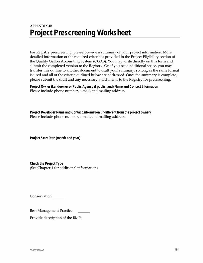
APPENDIX 4B
Project Prescreening Worksheet
For Registry prescreening, please provide a summary of your project information. More detailed information of the required criteria is provided in the Project Eligibility section of the Quality Gallon Accounting System (QGAS). You may write directly on this form and submit the completed version to the Registry. Or, if you need additional space, you may transfer this outline to another document to draft your summary, so long as the same format is used and all of the criteria outlined below are addressed. Once the summary is complete, please submit the draft and any necessary attachments to the Registry for prescreening.
Project Owner (Landowner or Public Agency if public land) Name and Contact Information Please include phone number, e-mail, and mailing address
Project Developer Name and Contact Information (if different from the project owner) Please include phone number, e-mail, and mailing address
Project Start Date (month and year)
Check the Project Type (See Chapter 1 for additional information)
Conservation
Best Management Practice
Provide description of the BMP:
MKE\072600001 4B-1
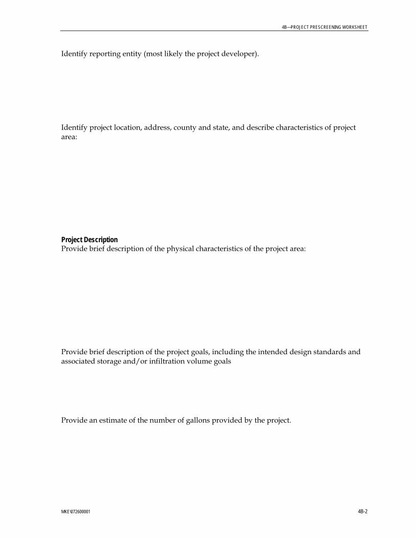
4B—PROJECT PRESCREENING WORKSHEET
Identify reporting entity (most likely the project developer).
Identify project location, address, county and state, and describe characteristics of project area:
Project Description Provide brief description of the physical characteristics of the project area:
Provide brief description of the project goals, including the intended design standards and associated storage and/or infiltration volume goals
Provide an estimate of the number of gallons provided by the project.
MKE\072600001 4B-2
4B—PROJECT PRESCREENING WORKSHEET
MKE\072600001 4B-3
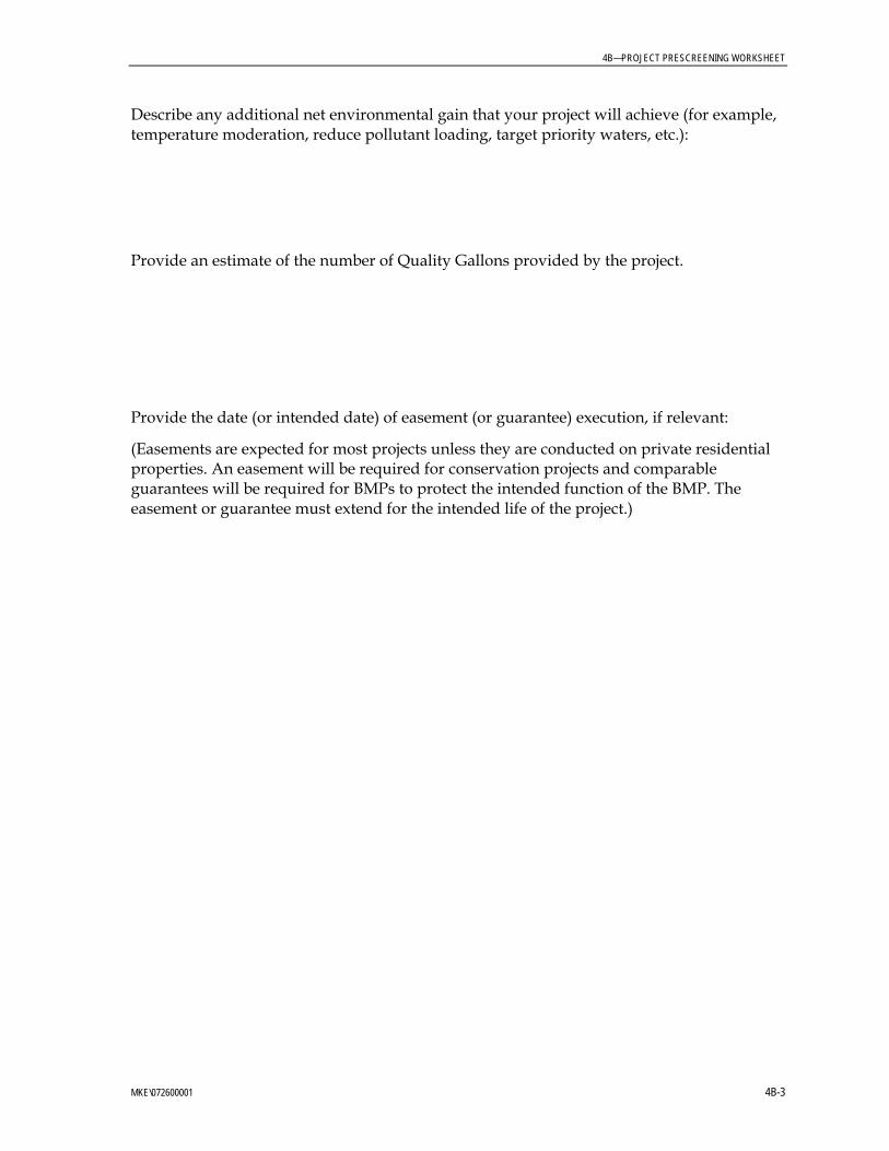
Describe any additional net environmental gain that your project will achieve (for example, temperature moderation, reduce pollutant loading, target priority waters, etc.):
Provide an estimate of the number of Quality Gallons provided by the project.
Provide the date (or intended date) of easement (or guarantee) execution, if relevant:
(Easements are expected for most projects unless they are conducted on private residential properties. An easement will be required for conservation projects and comparable guarantees will be required for BMPs to protect the intended function of the BMP. The easement or guarantee must extend for the intended life of the project.)
Appendix 4C Project Summary Worksheet
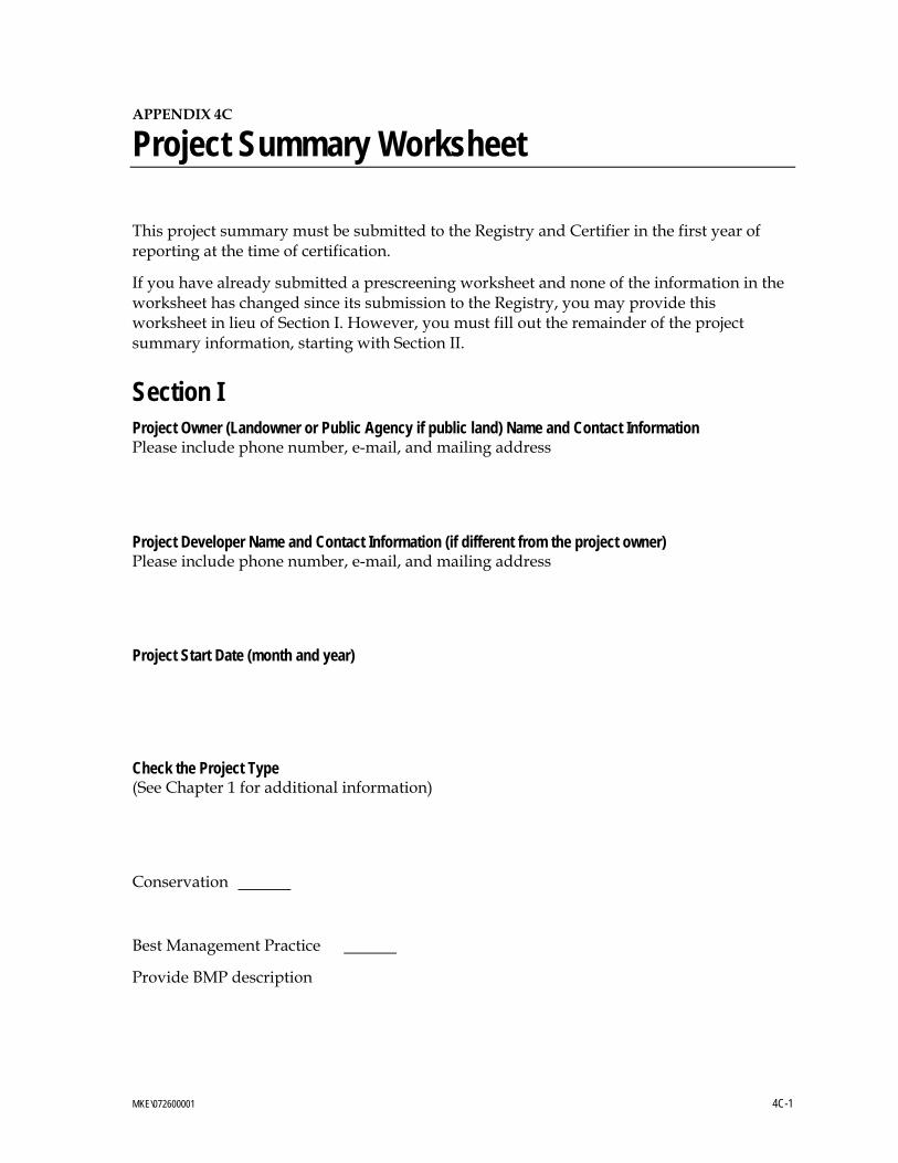
APPENDIX 4C
Project Summary Worksheet
This project summary must be submitted to the Registry and Certifier in the first year of reporting at the time of certification.
If you have already submitted a prescreening worksheet and none of the information in the worksheet has changed since its submission to the Registry, you may provide this worksheet in lieu of Section I. However, you must fill out the remainder of the project summary information, starting with Section II.
Section I Project Owner (Landowner or Public Agency if public land) Name and Contact Information Please include phone number, e-mail, and mailing address
Project Developer Name and Contact Information (if different from the project owner) Please include phone number, e-mail, and mailing address
Project Start Date (month and year)
Check the Project Type (See Chapter 1 for additional information)
Conservation
Best Management Practice
Provide BMP description
MKE\072600001 4C-1
4C—PROJECT SUMMARY WORKSHEET
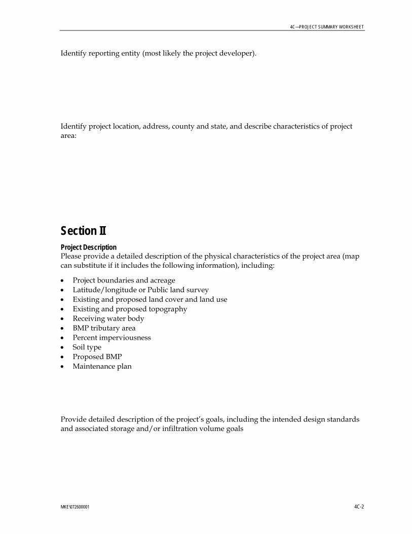
Identify reporting entity (most likely the project developer).
Identify project location, address, county and state, and describe characteristics of project area:
Section II Project Description Please provide a detailed description of the physical characteristics of the project area (map can substitute if it includes the following information), including:
• Project boundaries and acreage • Latitude/longitude or Public land survey • Existing and proposed land cover and land use • Existing and proposed topography • Receiving water body • BMP tributary area • Percent imperviousness • Soil type • Proposed BMP • Maintenance plan
Provide detailed description of the project’s goals, including the intended design standards and associated storage and/or infiltration volume goals
MKE\072600001 4C-2
4C—PROJECT SUMMARY WORKSHEET
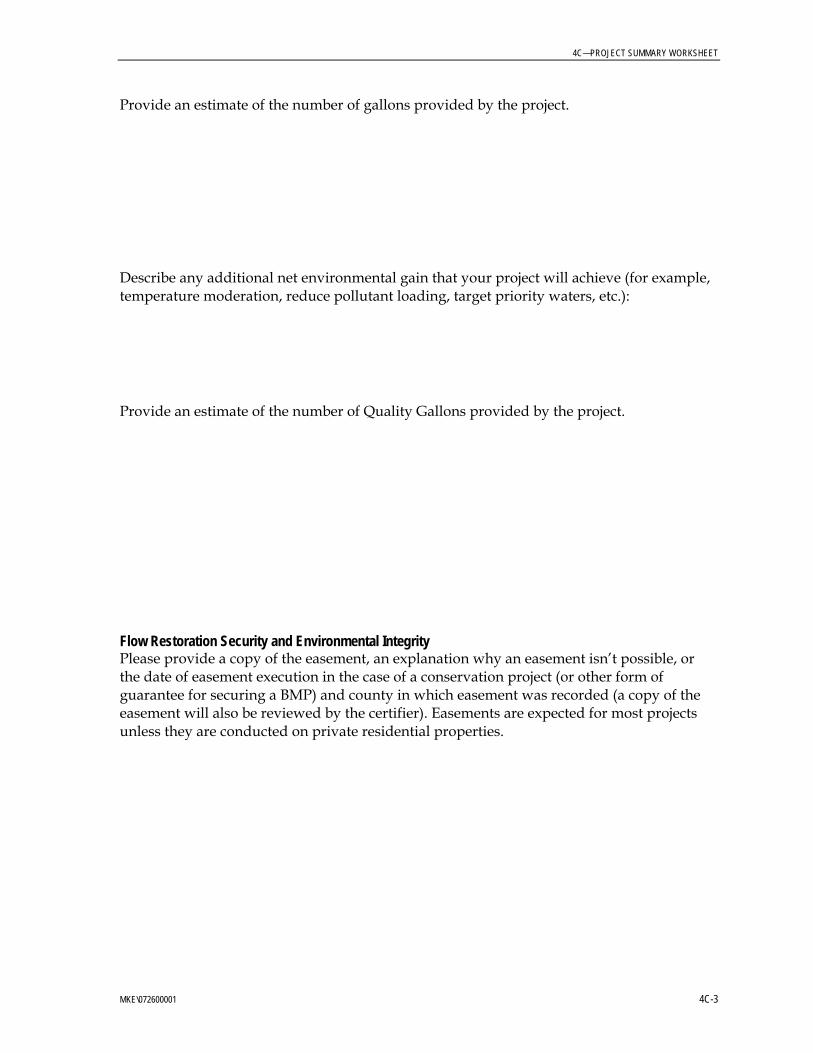
Provide an estimate of the number of gallons provided by the project.
Describe any additional net environmental gain that your project will achieve (for example, temperature moderation, reduce pollutant loading, target priority waters, etc.):
Provide an estimate of the number of Quality Gallons provided by the project.
Flow Restoration Security and Environmental Integrity Please provide a copy of the easement, an explanation why an easement isn’t possible, or the date of easement execution in the case of a conservation project (or other form of guarantee for securing a BMP) and county in which easement was recorded (a copy of the easement will also be reviewed by the certifier). Easements are expected for most projects unless they are conducted on private residential properties.
MKE\072600001 4C-3
4C—PROJECT SUMMARY WORKSHEET
MKE\072600001 4C-4
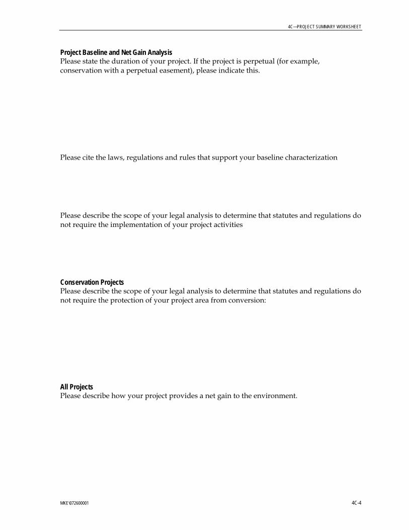
Project Baseline and Net Gain Analysis Please state the duration of your project. If the project is perpetual (for example, conservation with a perpetual easement), please indicate this.
Please cite the laws, regulations and rules that support your baseline characterization
Please describe the scope of your legal analysis to determine that statutes and regulations do not require the implementation of your project activities
Conservation Projects Please describe the scope of your legal analysis to determine that statutes and regulations do not require the protection of your project area from conversion:
All Projects Please describe how your project provides a net gain to the environment.