Embed Size (px)
DESCRIPTION
Time Life Re-design
Citation preview
AGE OF EXPLORATIONSCIENCE LIBRARY
GREAT AGES OF MAN
THE LIFE HISTORY OF THE UNITED STATES
TIME·LIFE LIBRARY OF ART
LIFE WORLD LIBRARY
LIFE NATURE LIBRARY
LIFE SCIENCE LIBRARY
TIME READING PROGRAM
INTERNATIONAL BOOK SOCIETY
------------------------
LIFE Pictorial Atlas of the World
The Epic of Man
The Wonders of Life on Earth
The World We Live In
The World’s Great Religion
The LIFE Book of Christmas
LIFE’S Picture History of Western Man
The LIFE Treasury of American Folklore
America’s Arts and Skills
300 Years of American Painting
The Second World War
LIFE’ S Picture History of World War II
Picture Cook Book
LIFE Guide to Paris
AGE OF EXPLORATION
GREAT AGES OF MANA History of the World’s Cultures
byJOHN R. HALE
andThe Editors of TIME-LIFE Books
TIME INCORPORATED, NEW YORK
THE AUTHOR: John R. Hale is chairman of the Department of History at the University of Warwick in England. For-merly a Fellow and Tutor at Jesus College, Oxford, he has taught at Cornell University. He is widely regarded as one of Britain’s leading Renaissance scholars. His publications include England and the Italian Renaissance, Machiavelli and Re-naissance Italy, The Evolution of British Historiography, and Renaissance, another book in the Great Ages of Man Series. THE CONSULTING EDITOR: Leonard Krieger, formerly Professor of History at Yale, now holds the post of University Professor at the University of Chicago. Dr. Krieger is the author of The German Idea of Freedom and Politics of Discre-tion, and co-author of History, written in collaboration with John Higham and Fehx Gilbert. THE COVER: An embel-lished map, drawn by French navigator-cartographer Guilliaume Ie Testu in 1556, shows the Cape of Good Hope above a misplaced Australia.
TIME-LIFE BOOKS
EDITOR
Norman P. Ross EXECUTIVE EDITOR
Maitland A. Edey TEXT DIRECTOR
Jerry Korn ART DIRECTOR
Edward A. Hamilton CHIEF OF RESEARCH
Beatrice T. Dobie Assistant Text Director: Harold C. Field
Assistant Art Director: Arnold C. Holeywell Assistant Chiefs of Research:
Monica O. Horne, Martha Turner
PUBLISHER Rhett Austell
General Manager: Joseph c. Hazen Jr. Planning Director: Frank M. White
Business Manage r: John D. McSweeney Circulation Director: Joan D. Manley Publishing Board: Nicholas Benton,
Louis Bronzo, James Wendell Forbes, John S. Wiseman
GREAT AGES OF MAN SERIES EDITOR: Joani Spadaro Editorial Staff for Age of Exploration: Assistant Editor: Carlotta Kerwin Text Editor: Ogden Tanner Picture Editor: Isabelle Rubin Designer: Jeremy Rojas Assistant Designer: Ladislav Svatos Staff Writers: Sam Halper, Peter Meyerson, Lucille Schulberg, John von Hartz Chief Researcher: Nancy Shuker Picture Research: Harriet Delihas Text Research: Susan Apple, Barbara Ballantine, Terry Drucker, Lea Guyer, Helen Isaacs, Carol Isenberg, Jeffrey Tarter, Rachal Tyrrell, Linda Wolfe EDITORIAL PRODUCTION Color Director: Robert L. Young Assistant: James J. COX Copy Staff: Marian Gordon Goldman,Rosalind Stubenberg, Dolores A. Littles Picture Bureau: Margaret K. Goldsmith, Barbara Sullivan Art Assistants: Douglas Graham, Anne Landry, Robert Pellegrini, David Wyland
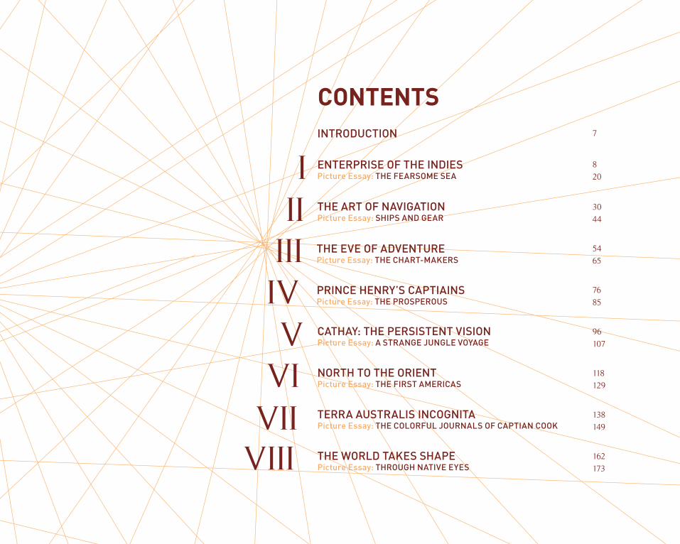
THE EVE OF ADVENTUREPicture Essay: THE CHART-MAKERS
PRINCE HENRY’S CAPTIAINSPicture Essay: THE PROSPEROUS
ENTERPRISE OF THE INDIESPicture Essay: THE FEARSOME SEA
THE ART OF NAVIGATIONPicture Essay: SHIPS AND GEAR
CATHAY: THE PERSISTENT VISIONPicture Essay: A STRANGE JUNGLE VOYAGE
NORTH TO THE ORIENTPicture Essay: THE FIRST AMERICAS
TERRA AUSTRALIS INCOGNITAPicture Essay: THE COLORFUL JOURNALS OF CAPTIAN COOK
THE WORLD TAKES SHAPEPicture Essay: THROUGH NATIVE EYES
I
CONTENTS
IIIIIIVV
VIVII
VIII
INTRODUCTION 7
8
20
30
44
54
65
76
85
96
107
118
129
138
149
162
173

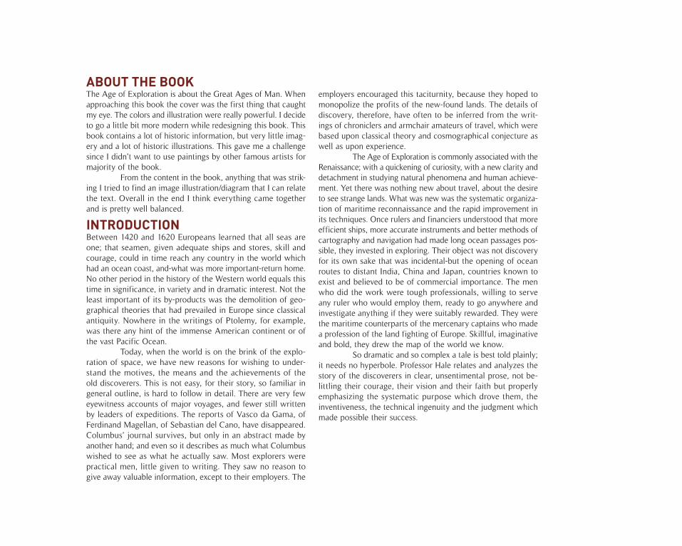
INTRODUCTIONBetween 1420 and 1620 Europeans learned that all seas are one; that seamen, given adequate ships and stores, skill and courage, could in time reach any country in the world which had an ocean coast, and-what was more important-return home. No other period in the history of the Western world equals this time in significance, in variety and in dramatic interest. Not the least important of its by-products was the demolition of geo-graphical theories that had prevailed in Europe since classical antiquity. Nowhere in the writings of Ptolemy, for example, was there any hint of the immense American continent or of the vast Pacific Ocean.
Today, when the world is on the brink of the explo-ration of space, we have new reasons for wishing to under-stand the motives, the means and the achievements of the old discoverers. This is not easy, for their story, so familiar in general outline, is hard to follow in detail. There are very few eyewitness accounts of major voyages, and fewer still written by leaders of expeditions. The reports of Vasco da Gama, of Ferdinand Magellan, of Sebastian del Cano, have disappeared. Columbus’ journal survives, but only in an abstract made by another hand; and even so it describes as much what Columbus wished to see as what he actually saw. Most explorers were practical men, little given to writing. They saw no reason to give away valuable information, except to their employers. The
employers encouraged this taciturnity, because they hoped to monopolize the profits of the new-found lands. The details of discovery, therefore, have often to be inferred from the writ-ings of chroniclers and armchair amateurs of travel, which were based upon classical theory and cosmographical conjecture as well as upon experience.
The Age of Exploration is commonly associated with the Renaissance; with a quickening of curiosity, with a new clarity and detachment in studying natural phenomena and human achieve-ment. Yet there was nothing new about travel, about the desire to see strange lands. What was new was the systematic organiza-tion of maritime reconnaissance and the rapid improvement in its techniques. Once rulers and financiers understood that more efficient ships, more accurate instruments and better methods of cartography and navigation had made long ocean passages pos-sible, they invested in exploring. Their object was not discovery for its own sake that was incidental-but the opening of ocean routes to distant India, China and Japan, countries known to exist and believed to be of commercial importance. The men who did the work were tough professionals, willing to serve any ruler who would employ them, ready to go anywhere and investigate anything if they were suitably rewarded. They were the maritime counterparts of the mercenary captains who made a profession of the land fighting of Europe. Skillful, imaginative and bold, they drew the map of the world we know.
So dramatic and so complex a tale is best told plainly; it needs no hyperbole. Professor Hale relates and analyzes the story of the discoverers in clear, unsentimental prose, not be-littling their courage, their vision and their faith but properly emphasizing the systematic purpose which drove them, the inventiveness, the technical ingenuity and the judgment which made possible their success.
ABOUT THE BOOKThe Age of Exploration is about the Great Ages of Man. When approaching this book the cover was the first thing that caught my eye. The colors and illustration were really powerful. I decide to go a little bit more modern while redesigning this book. This book contains a lot of historic information, but very little imag-ery and a lot of historic illustrations. This gave me a challenge since I didn’t want to use paintings by other famous artists for majority of the book.
From the content in the book, anything that was strik-ing I tried to find an image illustration/diagram that I can relate the text. Overall in the end I think everything came together and is pretty well balanced.

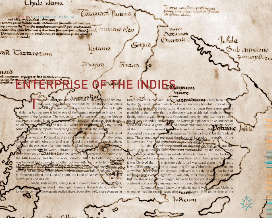
ENTERPRISE OF THE INDIES
The most dramatic and best known of all voyages of explora-tion was, of course, the one made by Christopher Columbus in 1492. This journey was spectacular not only for its length
and daring but because it led to one of the biggest surprises in history: the discovery of the Americas. The voyages of the Portuguese around the African coast were charting lands which were shown, however erroneous their shapes, on all the world maps of the day. But westward there were only myths and some fragmentary reports concerning a few islands in the Atlantic.
Several 15th Century maps showed a large, legendary island called Antillia far west of Portugal at the same latitude as Lisbon. Another map, which remained in obscurity until recently and is the subject of much debate, indicated the existence of a more northerly island known as Vinlanda, vaguely placed somewhere between Labrador and Massachusetts. But otherwise there were only the Madeiras and the Azores, discovered in the middle of the 14th Century, and the Canaries, found in 1402. In Columbus’ time it was believed that somewhere farther out was Atlantis, the fabled Fortunate Isles, seat of a vanished civilization mentioned by Plato and kept alive in the writings of medieval geographers. Irish folklore was full of Atlantic islands: St. Brendan’s Island, the Land of Youth, the Land of Fair Women, the islands of Weepers and of Hell.
Indeed, Irish monks, sailing in skin-covered boats called curraghs, had actually found an island in the Eighth Century. It was Iceland, and in the following century Norwegians settled there. Soon after 980, these pioneers in
turn discovered Greenland. The Norwegian colonizers may have been moved by that “go west” instinct which had seized on every hopeful rumor of more spacious lands beyond the horizon and was much stronger than reason; equally plausible is the theory that the discovery was accidental, made by vessels fleeing before a gale. In any case Greenland, possibly rather warmer in those times than it is today, and offering the Norwegian pioneers an abundance of open land and wild game, attracted considerable numbers of settlers. Some of them ultimately moved to Baffin Island and around 1000 A.D. others discovered the areas vaguely delineated as “Vinlanda Insula” on the Vinland map. These areas may represent the shores of Labrador, the mouth of the St. Lawrence River and perhaps the coast of Cape Cod.
But the discoveries pictured on the Vinland map were not fol-lowed up by settlement, and there is no evidence that by the 15th Century the existence of the American mainland was known in Europe. Certainly Columbus and his successors had never heard of it. Among learned men, it was believed that if a ship were able to sail westward across the Atlantic it would eventually come to Japan and China. Columbus, a chart-maker as well as an experienced seaman, believed to his dying day that he had reached those exotic kingdoms. It was only after many voyages by others that the staggering truth emerged: between Europe and Asia lay a vast new continent and a wholly unbargained-for ocean, the Pacific.
Columbus himself knew one Atlantic island well; that was Madeira, where he lived for several years after his marriage in 1479 to the sister of the
9
CHAPTER I: ENTERPRISE OF THE INDIES
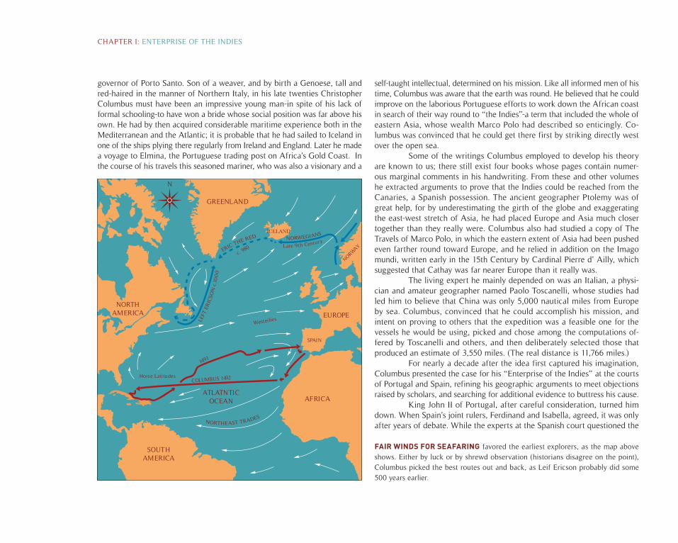
FAIR WINDS FOR SEAFARING favored the earliest explorers, as the map above shows. Either by luck or by shrewd observation (historians disagree on the point), Columbus picked the best routes out and back, as Leif Ericson probably did some 500 years earlier.
governor of Porto Santo. Son of a weaver, and by birth a Genoese, tall and red-haired in the manner of Northern Italy, in his late twenties Christopher Columbus must have been an impressive young man-in spite of his lack of formal schooling-to have won a bride whose social position was far above his own. He had by then acquired considerable maritime experience both in the Mediterranean and the Atlantic; it is probable that he had sailed to Iceland in one of the ships plying there regularly from Ireland and England. Later he made a voyage to Elmina, the Portuguese trading post on Africa’s Gold Coast. In the course of his travels this seasoned mariner, who was also a visionary and a
self-taught intellectual, determined on his mission. Like all informed men of his time, Columbus was aware that the earth was round. He believed that he could improve on the laborious Portuguese efforts to work down the African coast in search of their way round to “the Indies”-a term that included the whole of eastern Asia, whose wealth Marco Polo had described so enticingly. Co-lumbus was convinced that he could get there first by striking directly west over the open sea.
Some of the writings Columbus employed to develop his theory are known to us; there still exist four books whose pages contain numer-ous marginal comments in his handwriting. From these and other volumes he extracted arguments to prove that the Indies could be reached from the Canaries, a Spanish possession. The ancient geographer Ptolemy was of great help, for by underestimating the girth of the globe and exaggerating the east-west stretch of Asia, he had placed Europe and Asia much closer together than they really were. Columbus also had studied a copy of The Travels of Marco Polo, in which the eastern extent of Asia had been pushed even farther round toward Europe, and he relied in addition on the Imago mundi, written early in the 15th Century by Cardinal Pierre d’ Ailly, which suggested that Cathay was far nearer Europe than it really was.
The living expert he mainly depended on was an Italian, a physi-cian and amateur geographer named Paolo Toscanelli, whose studies had led him to believe that China was only 5,000 nautical miles from Europe by sea. Columbus, convinced that he could accomplish his mission, and intent on proving to others that the expedition was a feasible one for the vessels he would be using, picked and chose among the computations of-fered by Toscanelli and others, and then deliberately selected those that produced an estimate of 3,550 miles. (The real distance is 11,766 miles.)
For nearly a decade after the idea first captured his imagination, Columbus presented the case for his “Enterprise of the Indies” at the courts of Portugal and Spain, refining his geographic arguments to meet objections raised by scholars, and searching for additional evidence to buttress his cause.
King John II of Portugal, after careful consideration, turned him down. When Spain’s joint rulers, Ferdinand and Isabella, agreed, it was only after years of debate. While the experts at the Spanish court questioned the
CHAPTER I: ENTERPRISE OF THE INDIES
GREENLAND
Horse Latitudes
N
COLUMBUS 1492
SPAIN
NORWAY
ICELAND
NORTH AMERICA
SOUTH AMERICA
ATLATNTICOCEAN AFRICA
EUROPEWesterlies
1493
c. 980
matter of his argument, the Queen was convinced by his manner, which gave the impression of utter certainty. Other factors influenced her decision, to be sure, one of them being the insistence of Luis de Santangel, keeper of the King’s privy purse, who pricked her pride by offering to finance the expedi-tion himself. Another important consideration was Spain’s inability to gain any official part of the lucrative West African trade controlled by Portugal.
With royal backing, Columbus departed for Palos, a busy port in southwestern Spain, to obtain ships and crews. Two of the vessels, the Nina and the Pinta, were caravels about 70 feet long. The commander’s flag-ship, the Santa Maria, was somewhat larger, but inferior in sailing qualities to the other vessels. Recruiting crews and fitting out the ships occupied Columbus for about 10 weeks. Then, on the morning of August 3, 1492, Columbus attended early mass and went aboard the Santa Maria. Shortly before sunrise, the ships weighed anchor and quietly drifted out of the harbor on the ebb tide, for there was no wind. Once in the open sea, they caught a breeze and Columbus set the course, south by west. His first destination was the Canary Islands, which were on the latitude Columbus intended to sail along and from which he knew the winds blew to the west at that time of year.
The winds out of the Canaries indeed proved favorable, and blew even more steadily than he could have hoped for. One day the ships covered 182 miles, averaging almost eight knots, extremely good speed for sailing ships of any era. Columbus’ chief concern was the morale of his men. He was careful to make two reckonings of the distance covered: one which he kept to himself, and a deliberate underestimate which he announced to the crew. By minimizing the distance traveled, he hoped to guard against their panic at being so far into the unknown. Things went so well-no storms or long calms, no damage to the ships, plenty of food-that the voyagers’ very good luck became a cause of anxiety. Once they had all been longer at sea than ever before in their experience, the men were seized by one fear after another. The weather was fine: would it ever rain-or would they all die of thirst? The winds were steady: would they ever find winds to blow them home again-or did all the winds blow from the east in this unknown sea? After they struck the loose weed mat of the Sargasso Sea the sailors were haunted by the thought that the ships would get stuck and never get out. By October 10, nerves were at breaking point.
On the Santa Maria, after 30 days at sea, the crew demanded that Columbus turn back, and at last he promised to do so if they did not sight land within two or three days. It was enough. Two days later, at 2 a.m., October 12, the three ships were running easily before the trade winds under a moon
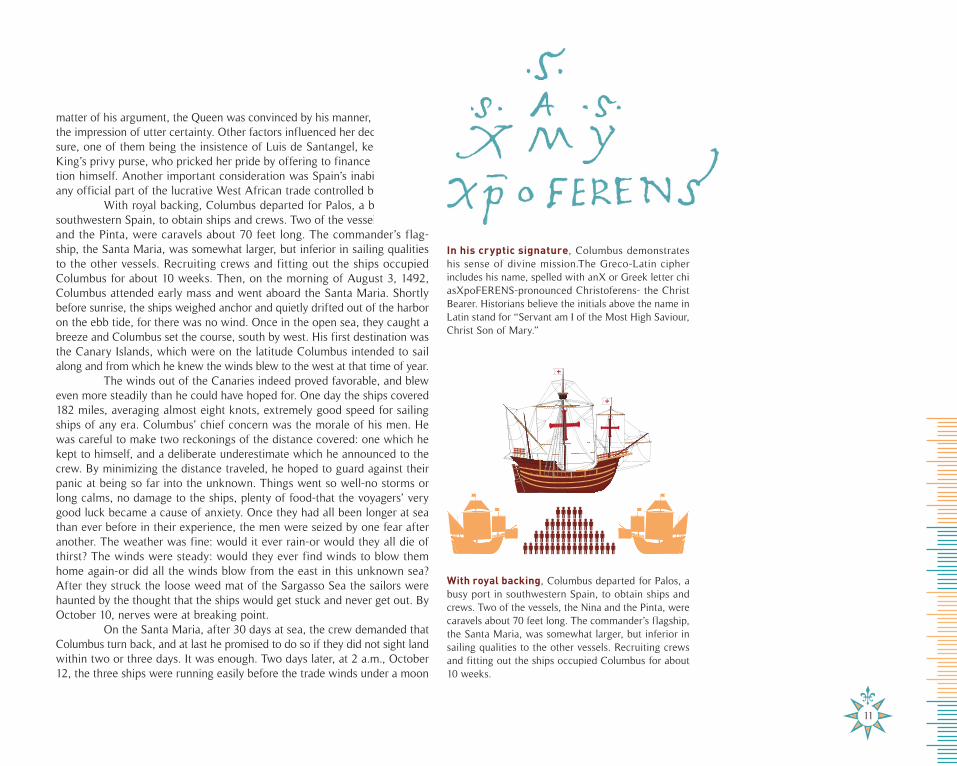
In his cryptic signature, Columbus demonstrates his sense of divine mission.The Greco-Latin cipher includes his name, spelled with anX or Greek letter chi asXpoFERENS-pronounced Christoferens- the Christ Bearer. Historians believe the initials above the name in Latin stand for “Servant am I of the Most High Saviour, Christ Son of Mary.”
11
With royal backing, Columbus departed for Palos, a busy port in southwestern Spain, to obtain ships and crews. Two of the vessels, the Nina and the Pinta, were caravels about 70 feet long. The commander’s flagship, the Santa Maria, was somewhat larger, but inferior in sailing qualities to the other vessels. Recruiting crews and fitting out the ships occupied Columbus for about 10 weeks.
NORTH AM ER ICA
BAHAMA ISLAN DS
SAN SALVAD ORCUBA
HISPAN IOLA
TR INID AD
MA RT INQUEDOMINI CAHONDUR AS
NI CARAGUA
JAMA ICA
PUERTO RICO
CARI BBEANSEA
COSTA RI CA
MA DEIR A
Pa lo s
Cadi z
N
FI RST VOYAGE
AZ OR ES
CANARY ISLA NDS
CAPE VERD EISLA NDS
SOUT H AM ER ICA
ATLATN TI COCEAN
AF RI CA
EUR
1492
1493
1496150
4
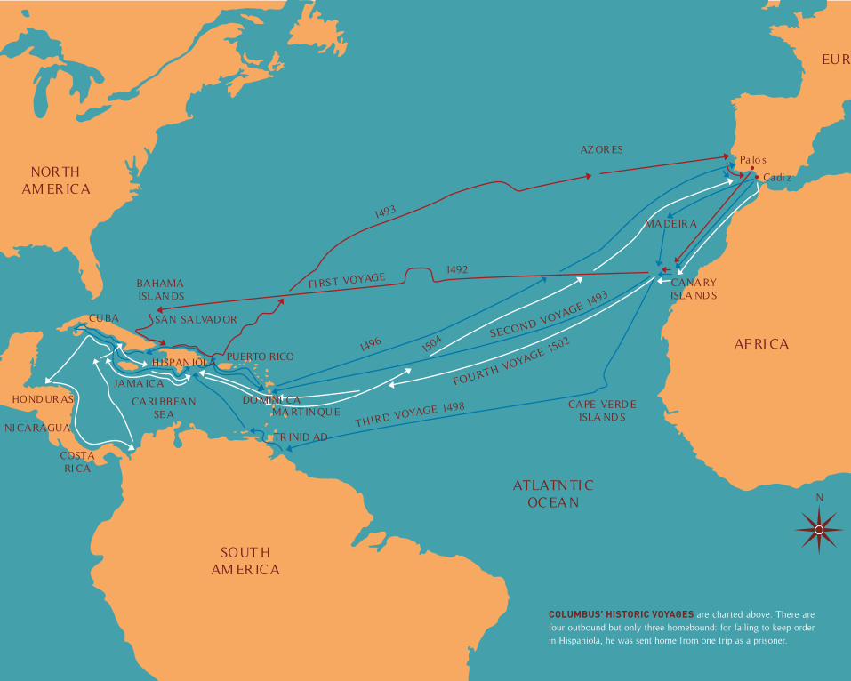
COLUMBUS’ HISTORIC VOYAGES are charted above. There are four outbound but only three homebound: for failing to keep order in Hispaniola, he was sent home from one trip as a prisoner.
OPE
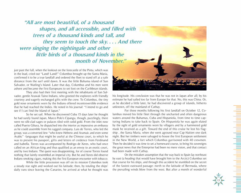
his longitude. His conclusion was that he was not in Japan after all; by his estimate he had sailed too far from Europe for that. No, this was China. Or, as he decided a little later, he had discovered a group of islands, hitherto unknown, off the mainland of Cathay.
For three months following his first landfall on October 12, Co-lumbus moved his little fleet through the uncharted and often dangerous waters around the Bahamas, Cuba and Hispaniola, from time to time cap-turing Indians to take back to Spain. On Hispaniola he was again elated by the sight of gold ornaments worn by villagers and by a hammered gold mask he received as a gift. Toward the end of this cruise he lost his flag-ship , the Santa Maria, when she went aground near Cap Haitien one dark night. But her timbers were salvaged to house the first European settlement in the New World, a fort which Columbus garrisoned with 40 crewmen. Then he decided it was time to set a homeward course, to bring his sovereigns the great news that the Enterprise had been no mere vision, and that contact had been made with Cathay.
On the mistaken assumption that the way back to Spain lay northeast by east (a heading that would have brought him to the Arctic) Columbus set that course for his ships, and through this accident he stumbled on the secret of the fastest eastward passage: north to the latitude of Bermuda, where the prevailing winds blow from the west. But after a month of wonderful
just past the full, when the lookout on the forecastle of the Pinta, which was in the lead, cried out “Land! Land!” Columbus brought up the Santa Maria, confirmed it to be a true landfall and ordered the fleet to stand off at a safe distance from the surf until dawn. It was the little Bahama island of San Salvador, or Watling’s Island. Later that day, Columbus and his men went ashore and became the first Europeans to set foot on the Caribbean islands.
They also had their first meeting with the inhabitants of San Sal-vador, gentle Arawak Taino Indians, who greeted the explorers with friendly courtesy and eagerly exchanged gifts with the crew. To Columbus, the tiny gold nose ornaments worn by the Indians offered incontrovertible evidence that he had reached the Indies. He noted in his journal: “I intend to go and see if I can find the Island of Japan.”
So he set sail. When he discovered Cuba 15 days later he thought he had surely found Japan, Marco Polo’s Cipangu, though, puzzlingly, there were no silk-clad sages or palaces tiled with solid gold. From the inlet now called Puerto Gibara, he dispatched into the interior as impressive an embassy as he could assemble from his ragged company. Luis de Torres, who led the group, was a converted Jew “who knew Hebrew and Aramaic and even some Arabic” -languages that might be useful at the Chinese court, to which he was to present his passport, gifts and letters of credence from Ferdinand and Isabella. Torres was accompanied by Rodrigo de Xeres, who had once called on an African king and thus qualified as an envoy to an exotic court, and by two Indians. The quest was disappointing, for of course Torres found nothing that faintly resembled an imperial city. But he and Xeres did observe Indians smoking cigars, making this the first European encounter with tobacco.
While the little procession was off on its mission Columbus took a steady star sight and worked out his latitude; then, by totaling the ships’ daily runs since leaving the Canaries, he arrived at what he thought was
13
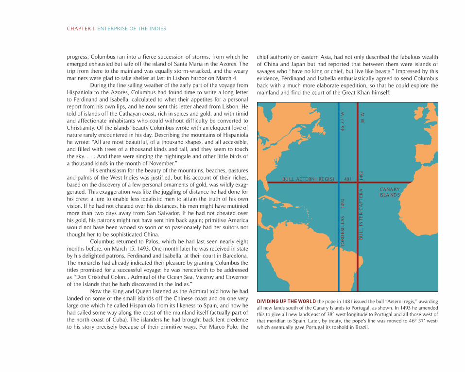
DIVIDING UP THE WORLD the pope in 1481 issued the bull “Aeterni regis,” awarding all new lands south of the Canary Islands to Portugal, as shown. In 1493 he amended this to give all new lands east of 38° west longitude to Portugal and all those west of that meridian to Spain. Later, by treaty, the pope’s line was moved to 46° 37’ west-which eventually gave Portugal its toehold in Brazil.
progress, Columbus ran into a fierce succession of storms, from which he emerged exhausted but safe off the island of Santa Maria in the Azores. The trip from there to the mainland was equally storm-wracked, and the weary mariners were glad to take shelter at last in Lisbon harbor on March 4.
During the fine sailing weather of the early part of the voyage from Hispaniola to the Azores, Columbus had found time to write a long letter to Ferdinand and Isabella, calculated to whet their appetites for a personal report from his own lips, and he now sent this letter ahead from Lisbon. He told of islands off the Cathayan coast, rich in spices and gold, and with timid and affectionate inhabitants who could without difficulty be converted to Christianity. Of the islands’ beauty Columbus wrote with an eloquent love of nature rarely encountered in his day. Describing the mountains of Hispaniola he wrote: “All are most beautiful, of a thousand shapes, and all accessible, and filled with trees of a thousand kinds and tall, and they seem to touch the sky. . . . And there were singing the nightingale and other little birds of a thousand kinds in the month of November.”
His enthusiasm for the beauty of the mountains, beaches, pastures and palms of the West Indies was justified, but his account of their riches, based on the discovery of a few personal ornaments of gold, was wildly exag-gerated. This exaggeration was like the juggling of distance he had done for his crew: a lure to enable less idealistic men to attain the truth of his own vision. If he had not cheated over his distances, his men might have mutinied more than two days away from San Salvador. If he had not cheated over his gold, his patrons might not have sent him back again; primitive America would not have been wooed so soon or so passionately had her suitors not thought her to be sophisticated China.
Columbus returned to Palos, which he had last seen nearly eight months before, on March 15, 1493. One month later he was received in state by his delighted patrons, Ferdinand and Isabella, at their court in Barcelona. The monarchs had already indicated their pleasure by granting Columbus the titles promised for a successful voyage: he was henceforth to be addressed as “Don Cristobal Colon... Admiral of the Ocean Sea, Viceroy and Governor of the Islands that he hath discovered in the Indies.”
Now the King and Queen listened as the Admiral told how he had landed on some of the small islands off the Chinese coast and on one very large one which he called Hispaniola from its likeness to Spain, and how he had sailed some way along the coast of the mainland itself (actually part of the north coast of Cuba). The islanders he had brought back lent credence to his story precisely because of their primitive ways. For Marco Polo, the
chief authority on eastern Asia, had not only described the fabulous wealth of China and Japan but had reported that between them were islands of savages who “have no king or chief, but live like beasts.” Impressed by this evidence, Ferdinand and Isabella enthusiastically agreed to send Columbus back with a much more elaborate expedition, so that he could explore the mainland and find the court of the Great Khan himself.
CHAPTER I: ENTERPRISE OF THE INDIES
BULL AETERN I RE GIS1 481
1494
1493
38 W
46 3
7’ W
TOR
DES
ILLA
S
BU
LL I
NTE
R C
AFT
ERA CANARY
ISLA NDS
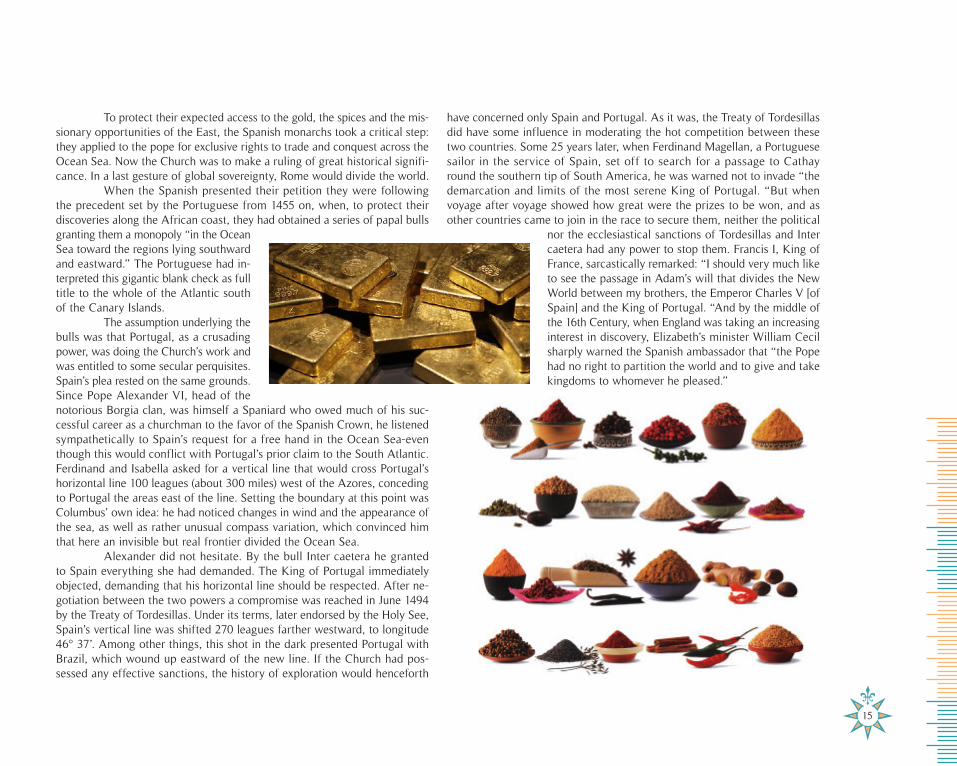
To protect their expected access to the gold, the spices and the mis-sionary opportunities of the East, the Spanish monarchs took a critical step: they applied to the pope for exclusive rights to trade and conquest across the Ocean Sea. Now the Church was to make a ruling of great historical signifi-cance. In a last gesture of global sovereignty, Rome would divide the world.
When the Spanish presented their petition they were following the precedent set by the Portuguese from 1455 on, when, to protect their discoveries along the African coast, they had obtained a series of papal bulls granting them a monopoly “in the Ocean Sea toward the regions lying southward and eastward.” The Portuguese had in-terpreted this gigantic blank check as full title to the whole of the Atlantic south of the Canary Islands.
The assumption underlying the bulls was that Portugal, as a crusading power, was doing the Church’s work and was entitled to some secular perquisites. Spain’s plea rested on the same grounds. Since Pope Alexander VI, head of the notorious Borgia clan, was himself a Spaniard who owed much of his suc-cessful career as a churchman to the favor of the Spanish Crown, he listened sympathetically to Spain’s request for a free hand in the Ocean Sea-even though this would conflict with Portugal’s prior claim to the South Atlantic. Ferdinand and Isabella asked for a vertical line that would cross Portugal’s horizontal line 100 leagues (about 300 miles) west of the Azores, conceding to Portugal the areas east of the line. Setting the boundary at this point was Columbus’ own idea: he had noticed changes in wind and the appearance of the sea, as well as rather unusual compass variation, which convinced him that here an invisible but real frontier divided the Ocean Sea.
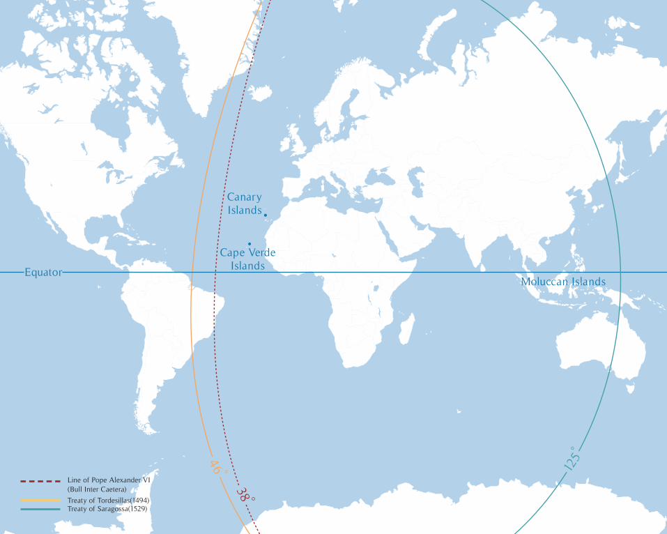
Alexander did not hesitate. By the bull Inter caetera he granted to Spain everything she had demanded. The King of Portugal immediately objected, demanding that his horizontal line should be respected. After ne-gotiation between the two powers a compromise was reached in June 1494 by the Treaty of Tordesillas. Under its terms, later endorsed by the Holy See, Spain’s vertical line was shifted 270 leagues farther westward, to longitude 46° 37’. Among other things, this shot in the dark presented Portugal with Brazil, which wound up eastward of the new line. If the Church had pos-sessed any effective sanctions, the history of exploration would henceforth
have concerned only Spain and Portugal. As it was, the Treaty of Tordesillas did have some influence in moderating the hot competition between these two countries. Some 25 years later, when Ferdinand Magellan, a Portuguese sailor in the service of Spain, set off to search for a passage to Cathay round the southern tip of South America, he was warned not to invade “the demarcation and limits of the most serene King of Portugal. “But when voyage after voyage showed how great were the prizes to be won, and as other countries came to join in the race to secure them, neither the political
nor the ecclesiastical sanctions of Tordesillas and Inter caetera had any power to stop them. Francis I, King of France, sarcastically remarked: “I should very much like to see the passage in Adam’s will that divides the New World between my brothers, the Emperor Charles V [of Spain] and the King of Portugal. “And by the middle of the 16th Century, when England was taking an increasing interest in discovery, Elizabeth’s minister William Cecil sharply warned the Spanish ambassador that “the Pope had no right to partition the world and to give and take kingdoms to whomever he pleased.”
15
46
38
125
Equator
Canary Islands
Moluccan Islands
Cape Verde Islands
Line of Pope Alexander VI (Bull Inter Caetera)
Treaty of Tordesillas(1494)Treaty of Saragossa(1529)
46
38
125
Equator
Canary Islands
Moluccan Islands
Cape Verde Islands
In 1493, however, Spanish property rights seemed fool proof and Columbus was at the highest point in his career. The pattern of his life was set: For the next 10 years he would journey between Spain and his newly discovered lands, always convinced that he was on the verge of the long-awaited meeting with the rulers of Cathay.
In September 1493, with the Spanish claim fairly staked, Columbus set off again to see what it consisted of. After 21 days of beautiful sailing weather he was back in the Antilles. This time his landfall was the most northern of the Windward Islands, to which he gave the name Dominica, from the Italian word for Sunday, the day on which he sighted it. Thence he sailed the glam-orous arc of the Leeward Islands, which curve northwest and west to Puerto Rico, naming them as they came in sight: Santa Maria de Guadalupe, Santa Maria de Monserrate (Mont-serrat), Santa Cruz (now called St. Croix) and many more—palm-fringed, their beaches blinding white, but with no Cathayan temple bells audible above the rhythmic sighing of the surf. Columbus moved quickly on to Hispaniola to inspect the tiny colony he had left behind at Navidad near Cap Hai-tien. He found that every man had been massacred by the natives—the first evidence that European settlers would have to battle to maintain their claims in this land across the sea.
Having established another settlement in Hispaniola, he then left in the Nina with two other ships on a continuation of what has been termed “the first West Indies cruise.” The account of Columbus’ physician, Dr. Chanca, conveys the atmosphere of a vacation trip. The weather was generally fair, the islands beautiful. The sailors saw their first hammock, ate their first yams. Everything was new, and much was wonderful. Dr. Chanca wrote with amazement about “trees bearing wool, of a sufficiently fine quality (according to the opinion of those who are acquainted with the art) to be woven into good cloth. . . . There are also cotton trees as large as peach trees, which produce cotton in the greatest abundance. We found trees producing wax as good both in color and smell as bees-wax and equally useful for burning, indeed there is no great difference between them.” On the other hand, “there were wild fruits of various kinds, some of which our men, not very prudently, tasted; and upon only touching them with their tongues, their countenances became inflamed, and such great heat and pain followed, that they seemed to be mad.” The “wool trees” were actually the wild cotton bushes known today as Sea Island cotton; the cotton trees were
the huge tropical trees whose fibers are now called kapok; the wax trees were one of several wax-producing palms; the stinging fruit was that of the manzanillo, or manchineel, tree, and its deadly poison was used by Carib Indians to tip their arrows.
There were simple local inhabitants whose customs startled the Europeans. For ceremonial occasions, in lieu of clothes, “both men and women paint themselves, some black, others white and various colors . . . they shave some parts of their heads, and in others wear long tufts of matted hair, which have an indescribably ridiculous appearance.” Some of the islanders
were cannibals, and Dr. Chanca saw human bones in their huts and “the neck of a man, undergoing the process of cooking.” While the doctor took his tourist notes, Columbus was still pressing his search for Cathay. This time he tried the south coast of Cuba, work-
ing his vessels westward along it—with a side trip in which he discovered Jamaica—until he came to Bahia Cortes, where the land begins to curve to the southwest.
At this point he stopped. His ships were leaking, his men were agitated by the old question: would they be able to get back? He was sure that he had reached the base of the Malay Peninsula. His own business lay farther north, in China, and he was convinced that the Great Khan could be found on another voyage.
The return trip, in the spring of 1496, was slow and arduous. In July, Columbus once more was received by Ferdinand and Isabella, to whom he gave the news that Cathay was within their grasp. Once more he extrapolated from a golden chain to a river of gold; once more he em-phasized how easy it would be to make the savages—whom Dr. Chan-ca had seen eating spiders and worms—into pious and noble Christians. In the course of his third and fourth voyages across the Atlantic, Columbus continued to make new discoveries. In May 1498 he left Spain for his third westward crossing, sailing much farther south than previously before heading west. He wanted to determine whether there was any basis in fact for the King of Portugal’s conviction that there were continental lands somewhere out in the ocean, south and east of the Spanish discoveries. If such lands existed, it was important for Spanish explorers to reach them first and publish a Spanish estimate of their location. No one could then calculate longitude accurately, and if the new lands could be placed within the Spanish sphere, the claim would be difficult to disprove later on.
17
Everything was new, and much was wonderful
Columbus’ landfall on his third voyage was Trinidad, another ad-dition to his list of discoveries. A few days later, his crew landed on a beach near the delta of the Orinoco. At first he still insisted that he was among islands. Then, as he continued to investigate the Gulf of Paria, and felt the full push of the Orinoco’s outlet against his ships, he changed his mind. No island could father a river with waters so vast. “I believe,” he wrote, “that this is a very great continent, which until today has been unknown.”
Then, denying his logical approach, he decided that this was not an entirely new continental mass he had reached but rather the threshold of the Earthly Paradise—the blessed domain whose whereabouts had been so earnestly debated by medieval geographers. Much as he longed to enter this enchanted realm, his sailors were grumbling and the supplies for the colony in Hispaniola were spoiling. So he turned north, leaving the further exploration of South America to other men.
One last voyage, his fourth, lay ahead for Columbus. He had already discovered the West Indies and the northern coast of South America—the Spanish Main. In the summer of 1502, he discovered Central America, touch-ing first at Honduras, which he assumed was part of the Malay Peninsula. By this time Vasco da Gama had rounded Africa and reached India, putting Portugal far ahead on the road to Marco Polo’s islands of spices and gold. So it was urgent that Columbus push south to find the strait that would give Spain equal access to those fabulous isles. Fighting adverse winds, the Admiral steered his fleet past Nicaragua and Costa Rica. In Panama he established a short-lived settlement at Belen. Then he continued on along the coast, but when he found the land trending southeasterly he stopped. The “Malay Peninsula” was larger than he had believed possible. This was the last of his discoveries.
He was back in Spain in 1504, and died two years later, 55 years old, utterly worn out, disgraced through the envy of rivals and by his inefficient record as a colonizer in Hispaniola. As an administrator he was fallible. But as a seaman, a leader, and an inspired hawker of brave ideas, this canny and mystical, practical and prophetic man was one of the great forces of history.
Nevertheless, the contradictions implicit in his thinking make Co-lumbus a magnificent puzzle. The ease with which he crossed an unexplored ocean and hit his target near the center time after time, and his ability not only as an instinctive deep-sea navigator but as a master of the shoals and reefs of inshore sailing—these stamp him as the greatest mariner of his day. The boldness with which he put into practice his idea that mariners could sail straight across the sea to Asia marks him as the most resolute theorist
of his age, for while others had agreed in principle, no one else had dared attempt the feat. But with all this seemingly modern determination to test a hypothesis, there was in Columbus a stubbornness—it must be China!—and a self-deception—all that gold!—that cannot be accounted for entirely by the geographical naivete that he inherited from the late-medieval world.
When, for example, he decided that the enormous volume of the Orinoco River could only issue from a continent, he was pursuing straight-forward cause-and-effect reasoning of the kind that might be expected from a “Renaissance mind.” But his subsequent declaration that the river flowed from the Earthly Paradise was far from empirical.
Some of his other conclusions were equally fuzzy. Sailing repeat-edly across the Atlantic, he had become convinced that he was going uphill when going west, downhill when returning home. After leaving the Azores for the Antilles, “the ships,” he noted, “went on rising smoothly towards the sky.” Moreover, the weather became progressively warmer from east to west, confirming his belief that his ships were being gently lifted toward the sun. It followed, therefore, that the earth was not round, as was commonly believed, but pear-shaped, “having a raised projection for the stalk.” The Terrestrial Paradise he placed “on the summit ... of the stalk of a pear.”
CHAPTER I: ENTERPRISE OF THE INDIES
If this and other instances made Columbus appear part thinker, part mystic, it is because he was at heart a poet with a poet’s faith in the existence of marvels that defies the bounds of logic. He loved the new theories about geography proclaimed by Italian scholars, and he had turned his back on the out-of-date, Jerusalem-centered maps of the Middle Ages. But he still believed that somewhere at the meeting of East and West was the Terrestrial Paradise, where man lived in heroic beauty and freedom, uncontaminated by Adam’s fall; he wanted to find the way both to Cathay and to Paradise, and, by his own standards, he did.
Columbus started the train of events that led to modern America. In his wake Spaniards and foreigners in Spanish service, prompted by the Admiral’s discoveries, set forth on successive journeys of reconnaissance. If the Spaniards had not explored America, others doubtless would have—but not so soon or so vigorously, and with vastly different consequences for the American continent and for Europe itself.
No other nation but Spain could have produced the conquistadors, those daring and ruthless soldiers of fortune. Without the conquistadors the Aztec and Inca empires would not have fallen so soon or so catastrophi-cally, and Europe would not have been flooded with the precious metals that
sluiced through Spain—a country that was ill equipped to use the wealth for constructive purposes. As a result of the almost unchecked flow of bullion, Europe experienced an economic revolution that was as important in deter-mining the fortunes of nations as the actions of kings or lesser statesmen. Without Spain’s dominance in the Caribbean, English seamen like Drake would not have been encouraged to try to intercept her treasure ships there, and thence take an increasing interest in the parts of America that were free from Catholic control. The power in Europe that Spain gained from her new possessions almost compelled the English to counteraction in the New World. Had Spain not become so threatening, there might have been no settlement in Virginia, no Pilgrim Fathers, no English-speaking North American colonies, no United States.
All this is speculation, but it is a fact that if Columbus had not ex-isted, and if the discovery had been made by another man, at another time, the whole of American history would be different. Not only the language in which this book is read, but the sentiments of its readers, the quality of the life they lead owes something to Columbus. This makes him, however accidentally, however indirectly, one of the most influential men who have ever lived. It may make him the most influential man of all, excepting only the leaders of world religions.
19
14921493
1498
1502
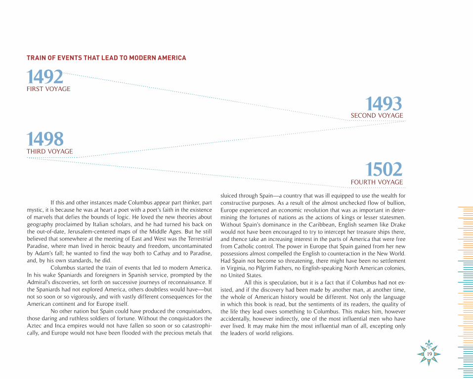
TRAIN OF EVENTS THAT LEAD TO MODERN AMERICA
FIRST VOYAGE
SECOND VOYAGE
THIRD VOYAGE
FOURTH VOYAGE

THE FEARSOME SEA
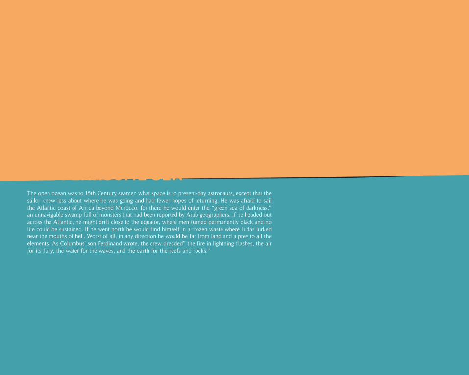
The open ocean was to 15th Century seamen what space is to present-day astronauts, except that the sailor knew less about where he was going and had fewer hopes of returning. He was afraid to sail the Atlantic coast of Africa beyond Morocco, for there he would enter the “green sea of darkness,” an unnavigable swamp full of monsters that had been reported by Arab geographers. If he headed out across the Atlantic, he might drift close to the equator, where men turned permanently black and no life could be sustained. If he went north he would find himself in a frozen waste where Judas lurked near the mouths of hell. Worst of all, in any direction he would be far from land and a prey to all the elements. As Columbus’ son Ferdinand wrote, the crew dreaded” the fire in lightning flashes, the air for its fury, the water for the waves, and the earth for the reefs and rocks.”
THE FEARSOME SEA
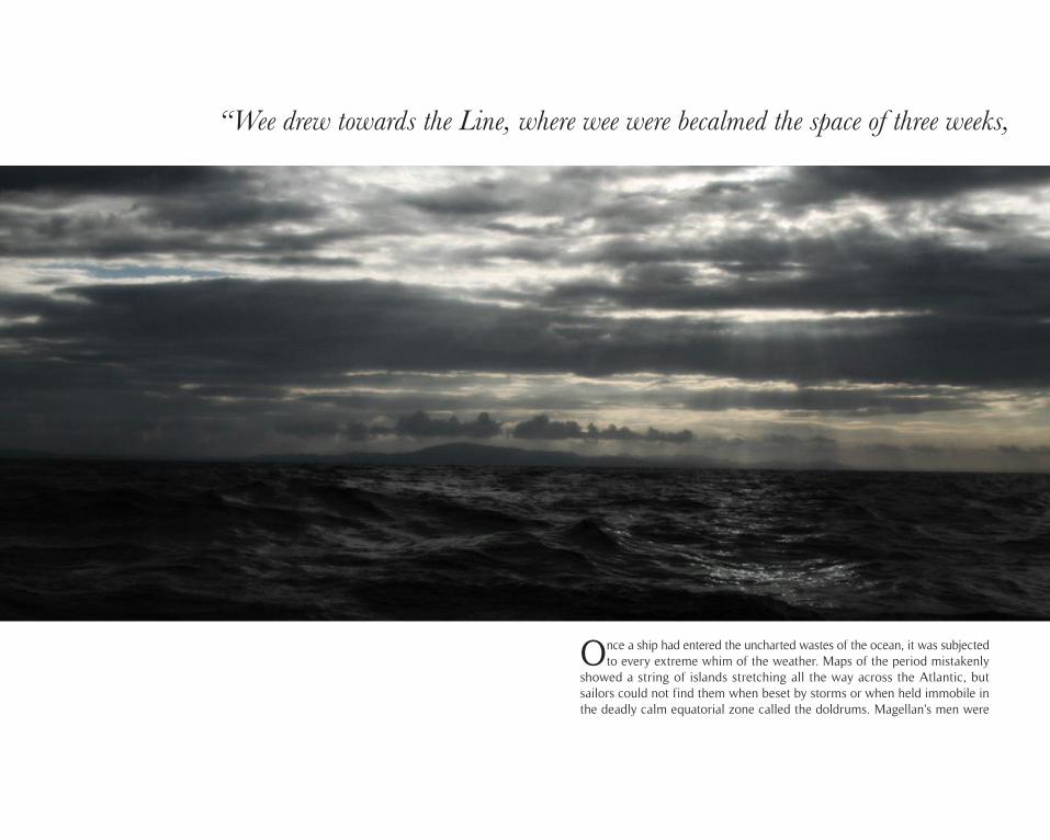
Once a ship had entered the uncharted wastes of the ocean, it was subjected to every extreme whim of the weather. Maps of the period mistakenly
showed a string of islands stretching all the way across the Atlantic, but sailors could not find them when beset by storms or when held immobile in the deadly calm equatorial zone called the doldrums. Magellan’s men were
“Wee drew towards the Line, where wee were becalmed the space of three weeks,
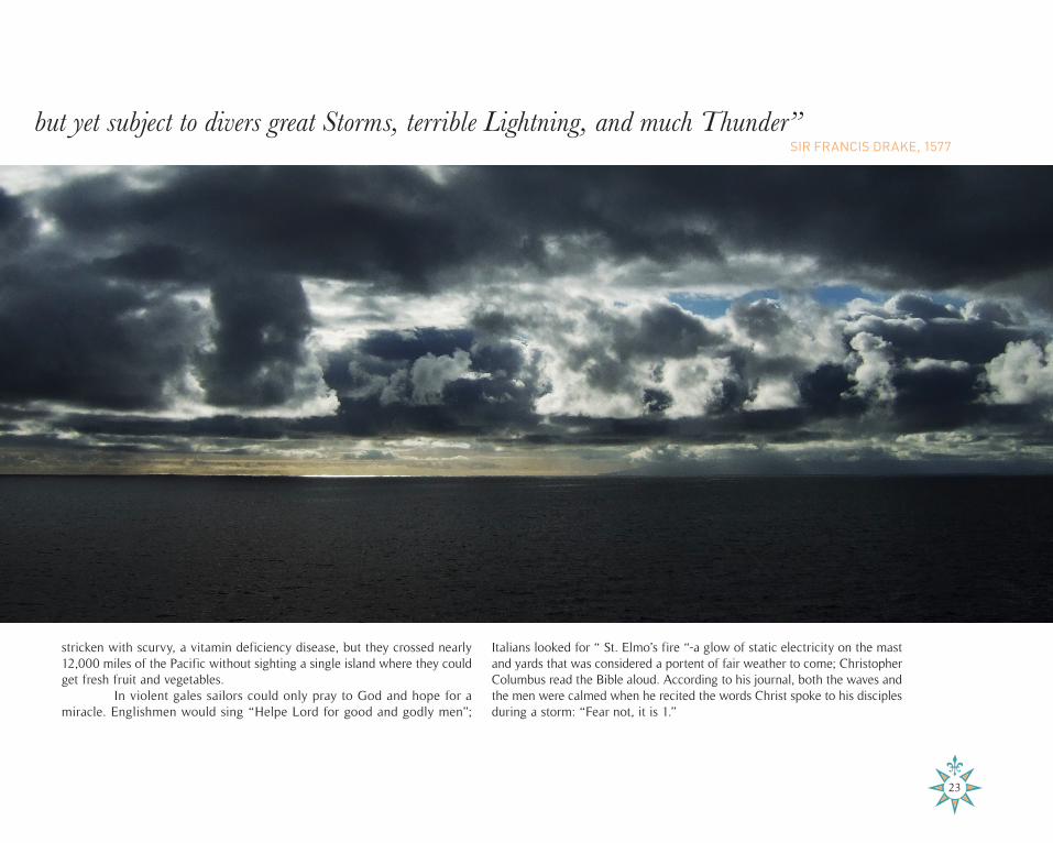
but yet subject to divers great Storms, terrible Lightning, and much Thunder”
stricken with scurvy, a vitamin deficiency disease, but they crossed nearly 12,000 miles of the Pacific without sighting a single island where they could get fresh fruit and vegetables.
In violent gales sailors could only pray to God and hope for a miracle. Englishmen would sing “Helpe Lord for good and godly men”;
Italians looked for “ St. Elmo’s fire “-a glow of static electricity on the mast and yards that was considered a portent of fair weather to come; Christopher Columbus read the Bible aloud. According to his journal, both the waves and the men were calmed when he recited the words Christ spoke to his disciples during a storm: “Fear not, it is 1.”
SIR FRANCIS DRAKE, 1577
“Wee drew towards the Line, where wee were becalmed the space of three weeks,
23

After southern routes to the Orient had been discovered, explorers looked unsuccessfully for a northern passage around Canada or Siberia. Even
though captains ordered logs, ropes and bedding to be tied over the gunwales, icebergs often bore through the padding and crushed the ships. Sailors some-times wielded pikes for days, fending off ice floes. Some bergs, according to Danish explorer Jens Munck, “stood firm on the sea bottom in more than 40 fathoms ·[240 feet)” while rising “quite twenty fathoms above the water.” Munck’s expedition of 1619 set out with a crew of 64 men. Three survived.
CAPTAIN JENS MUNCK, 1619
“If I had not succeeded in throwing a grapnel on to a large mass of ice,
by which I could turn the ship”, both the ship and we would
25
have been lost that day”
SIR MARTIN FROBISHER, 1578
“Through the darknesse and obscuritie of the foggie mist,
But God provided for us, opening the fogges that we might see”we were almost run on rocks and Islands before we saw them:
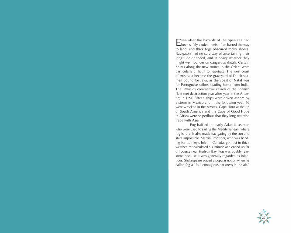
Even after the hazards of the open sea had been safely eluded, reefs often barred the way
to land, and thick fogs obscured rocky shores. Navigators had no sure way of ascertaining their longitude or speed, and in heavy weather they might well founder on dangerous shoals. Certain points along the new routes to the Orient were particularly difficult to negotiate. The west coast of Australia became the graveyard of Dutch sea-men bound for Java, as the coast of Natal was for Portuguese sailors heading home from India. The unwieldy commercial vessels of the Spanish fleet met destruction year after year in the Atlan-tic; in 1590 fifteen ships were driven ashore by a storm in Mexico and in the following year, 16 were wrecked in the Azores. Cape Horn at the tip of South America and the Cape of Good Hope in Africa were so perilous that they long retarded trade with Asia.
Fog baffled the early Atlantic seamen who were used to sailing the Mediterranean, where fog is rare. It also made navigating by the sun and stars impossible. Martin Frobisher, who was head-ing for Lumley’s Inlet in Canada, got lost in thick weather, miscalculated his latitude and ended up far off course near Hudson Bay. Fog was doubly fear-some because it was generally regarded as infec-tious; Shakespeare voiced a popular notion when he called fog a “foul contagious darkness in the air.”
“Through the darknesse and obscuritie of the foggie mist,we were almost run on rocks and Islands before we saw them:
27
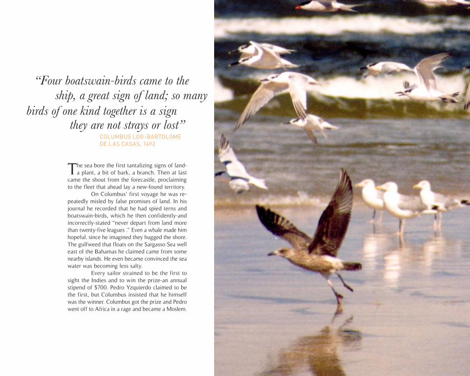
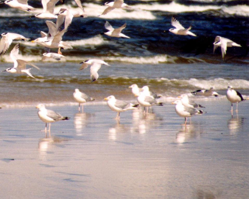
The sea bore the first tantalizing signs of land- a plant, a bit of bark, a branch. Then at last
came the shout from the forecastle, proclaiming to the fleet that ahead lay a new-found territory.
On Columbus’ first voyage he was re-peatedly misled by false promises of land. In his journal he recorded that he had spied terns and boatswain-birds, which he then confidently-and incorrectly-stated “never depart from land more than twenty-five leagues .” Even a whale made him hopeful. since he imagined they hugged the shore. The gulfweed that floats on the Sargasso Sea well east of the Bahamas he claimed came from some nearby islands. He even became convinced the sea water was becoming less salty.
Every sailor strained to be the first to sight the Indies and to win the prize-an annual stipend of $700. Pedro Yzquierdo claimed to be the first, but Columbus insisted that he himself was the winner. Columbus got the prize and Pedro went off to Africa in a rage and became a Moslem.
“Four boatswain-birds came to the
COLUMBUS LOG-BARTOLOME DE LAS CASAS, 1492
ship, a great sign of land; so manybirds of one kind together is a sign
they are not strays or lost”
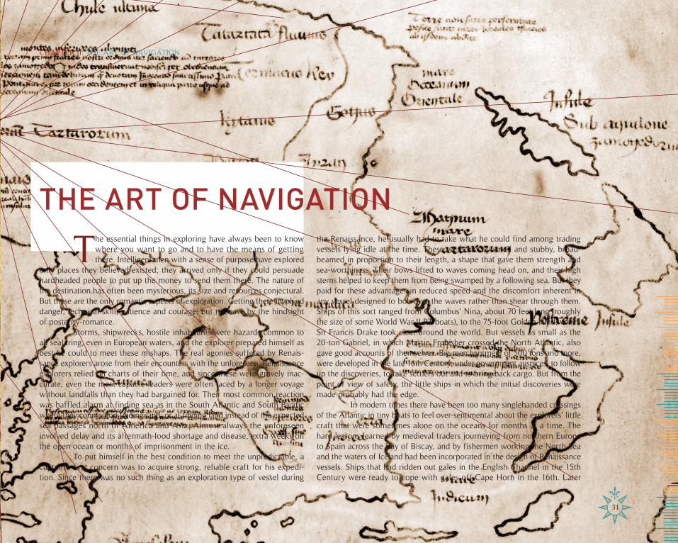
THE ART OF NAVIGATION
The essential things in exploring have always been to know where you want to go and to have the means of getting there. Intelligent men with a sense of purpose have explored
only places they believed existed; they arrived only if they could persuade hardheaded people to put up the money to send them there. The nature of the destination has often been mysterious, its size and resources conjectural. But these are the only romantic aspects of exploration. Getting there involved danger, technical skill, patience and courage, but not-save by the hindsight of posterity-romance.
Storms, shipwrecks, hostile inhabitants were hazards common to all seafaring, even in European waters, and the explorer prepared himself as best he could to meet these mishaps. The real agonies suffered by Renais-sance explorers arose from their encounters with the unforeseen. Renaissance explorers relied on charts of their time, and since these were gravely inac-curate, even the most capable leaders were often faced by a longer voyage without landfalls than they had bargained for. Their most common reaction was baffled alarm at finding sea-as in the South Atlantic and South Pacific where they counted on finding land; or at finding land instead of the expected sea passages north of America and Asia. Almost always the unforeseen involved delay and its aftermath-food shortage and disease, extra weeks on the open ocean or months of imprisonment in the ice.
To put himself in the best condition to meet the unpredictable, a captain’s first concern was to acquire strong, reliable craft for his expedi-tion. Since there was no such thing as an exploration type of vessel during
the Renaissance, he usually had to take what he could find among trading vessels lying idle at the time. These were mostly small and stubby, broad-beamed in proportion to their length, a shape that gave them strength and sea-worthiness. Their bows lifted to waves coming head on, and their high sterns helped to keep them from being swamped by a following sea. But they paid for these advantages in reduced speed and the discomfort inherent in any vessel designed to bob over the waves rather than shear through them. Ships of this sort ranged from Columbus’ Nina, about 70 feet long (roughly the size of some World War II PT boats), to the 75-foot Golden Hind, which Sir Francis Drake took clear around the world. But vessels as small as the 20-ton Gabriel, in which Martin Frobisher crossed the North Atlantic, also gave good accounts of themselves. Big merchantmen, of 500 tons and more, were developed in the late 16th Century, under government auspices, to follow up the discoveries, to take settlers out and to bring back cargo. But from the point of view of safety, the little ships in which the initial discoveries were made probably had the edge.
In modern times there have been too many singlehanded crossings of the Atlantic in tiny boats to feel over-sentimental about the explorers’ little craft that were sometimes alone on the oceans for months at a time. The hard lessons learned by medieval traders journeying from northern Europe to Spain across the Bay of Biscay, and by fishermen working the North Sea and the waters of Iceland had been incorporated in the design of Renaissance vessels. Ships that had ridden out gales in the English Channel in the 15th Century were ready to cope with gales off Cape Horn in the 16th. Later
31
CHAPTER II: THE ART OF NAVIGATION
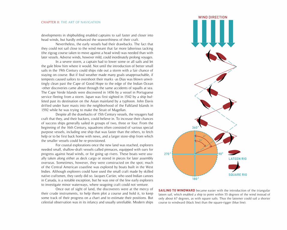
SAILING TO WINDWARD became easier with the introduction of the triangular lateen sail, which enabled a ship to point within 55 degrees of the wind instead of only about 67 degrees, as with square sails. Thus the lateener could sail a shorter course to windward (black line) than the square-rigger (blue line).
developments in shipbuilding enabled captains to sail faster and closer into head winds, but hardly enhanced the seaworthiness of their craft.
Nevertheless, the early vessels had their drawbacks. The fact that they could not sail close to the wind meant that far more laborious tacking (the zigzag course taken to move against a head wind) was needed than with later vessels. Adverse winds, however mild, could inordinately prolong voyages.
In a severe storm, a captain had to lower some or all sails and let the gale blow him where it would. Not until the introduction of better small sails in the 19th Century could ships ride out a storm with a fair chance of staying on course. But if foul weather made many goals unapproachable, if tempests caused sailors to overshoot their marks -as Dias was blown unwit-tingly clean past the Cape of Good Hope to the edge of the Indian Ocean -other discoveries came about through the same accidents of squalls at sea. The Cape Verde Islands were discovered in 1456 by a vessel in Portuguese service fleeing from a storm. Japan was first sighted in 1542 by a ship buf-feted past its destination on the Asian mainland by a typhoon. John Davis drifted under bare masts into the neighborhood of the Falkland Islands in 1592 while he was trying to make the Strait of Magellan.
Despite all the drawbacks of 15th Century vessels, the voyagers had craft that they, and their backers, could believe in. To increase their chances of success ships generally sailed in groups of two, three or four. From the beginning of the 16th Century, squadrons often consisted of various special purpose vessels, including one ship that was faster than the others, to fetch help or to be first back home with news, and a larger store-ship from which the smaller vessels could be re-provisioned.
For coastal explorations once the new land was reached, explorers needed small, shallow-draft vessels called pinnaces, equipped with oars for progress against head winds, or for going up rivers. These boats were usu-ally taken along either as deck cargo or stored in pieces for later assembly overseas. Sometimes, however, they were constructed on the spot; much of the Central American coastline was explored by boats built in the West Indies. Although explorers could have used the small craft made by skilled native craftsmen, they rarely did so. Jacques Cartier, who used Indian canoes in Canada, is a notable exception, but he was one of the few early explorers to investigate minor waterways, where seagoing craft could not venture.
Once out of sight of land, the discoverers were at the mercy of their crude instruments, to help them plot a course and hold it, to keep some track of their progress on a chart and to estimate their positions. But celestial observation was in its infancy and usually unreliable. Modern ships
SQUARE RIG
LATEEN RIG
WIND DIRECTION
55
67
180
360
270 90
CHAPTER II: THE ART OF NAVIGATION
pitch and roll, but their movement is trivial compared to the wallowing of a Renaissance vessel, and even today it takes some time to learn to get accurate sighting with a sextant. The early navigator had to brace himself against his ship’s wallowing motion while he aligned the coarsely graded sights of his astrolabe or his cross-staff with the sun or a star; then he had to hold the sight while it was read against the scale of degrees. These were processes that did not make for a high degree of accuracy.
The theory was there, worked out by astronomers ashore and made available for seamen in a host of manuals. There were tables that explained how to measure and translate the angle between the horizon and the North Star or the noonday sun into degrees of latitude, in order to determine how far north or south of the equator the ship was. But few mariners had the mathematical knowledge, let alone the mathematical imagination, to use the tables properly. Moreover, celestial observations depend on knowing the exact time and there was no clock suitable for use at, sea. Sailors relied on the half-hour or hourly sandglass until the mid-18th Century-and these, of course, had to be reset manually all during the voyage. During the 16th Century, methods of navigation were improved by men working in Seville, Lisbon and London, but the gap between theoretical knowledge and its ap-plication remained large, and so did the difference between the accuracy of observations made on land and at sea.
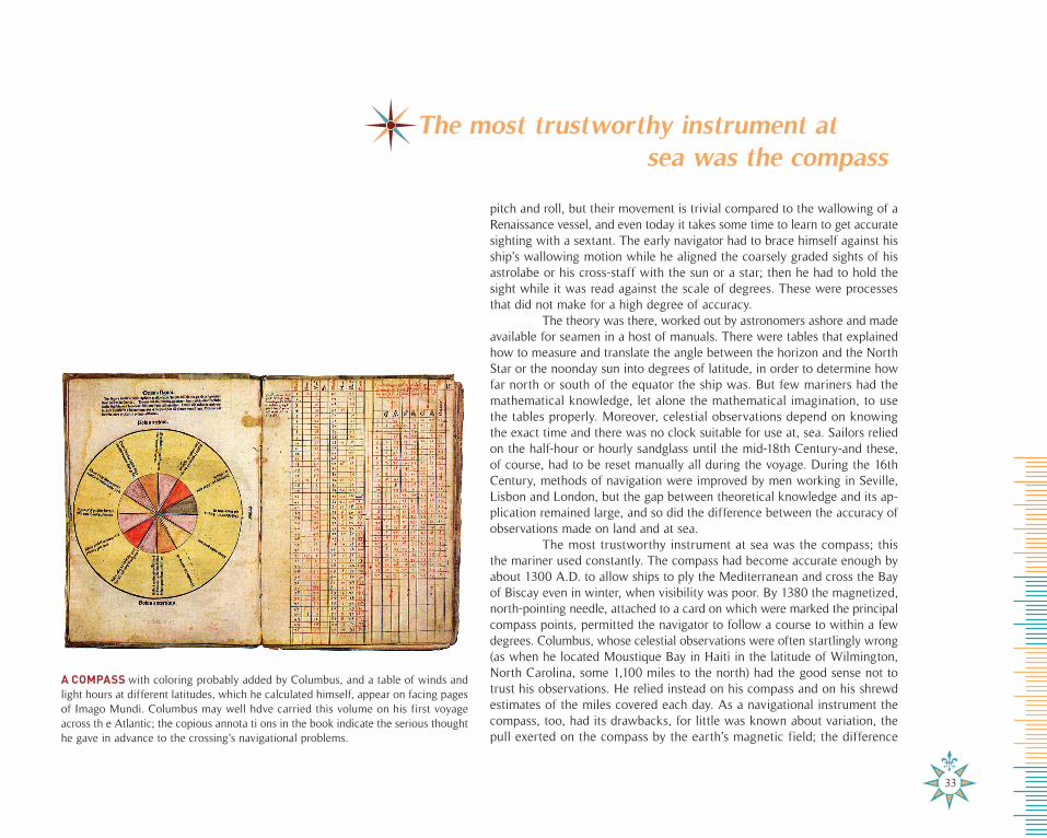
The most trustworthy instrument at sea was the compass; this the mariner used constantly. The compass had become accurate enough by about 1300 A.D. to allow ships to ply the Mediterranean and cross the Bay of Biscay even in winter, when visibility was poor. By 1380 the magnetized, north-pointing needle, attached to a card on which were marked the principal compass points, permitted the navigator to follow a course to within a few degrees. Columbus, whose celestial observations were often startlingly wrong (as when he located Moustique Bay in Haiti in the latitude of Wilmington, North Carolina, some 1,100 miles to the north) had the good sense not to trust his observations. He relied instead on his compass and on his shrewd estimates of the miles covered each day. As a navigational instrument the compass, too, had its drawbacks, for little was known about variation, the pull exerted on the compass by the earth’s magnetic field; the difference
A COMPASS with coloring probably added by Columbus, and a table of winds and light hours at different latitudes, which he calculated himself, appear on facing pages of Imago Mundi. Columbus may well hdve carried this volume on his first voyage across th e Atlantic; the copious annota ti ons in the book indicate the serious thought he gave in advance to the crossing’s navigational problems.
33
The most trustworthy instrument atsea was the compass
between the compass needle’s “north” and true north was worked out only by trial and error, voyage by voyage.
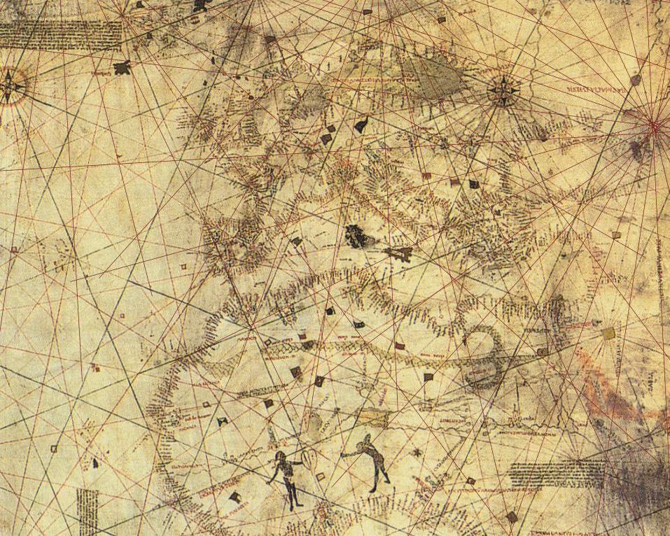
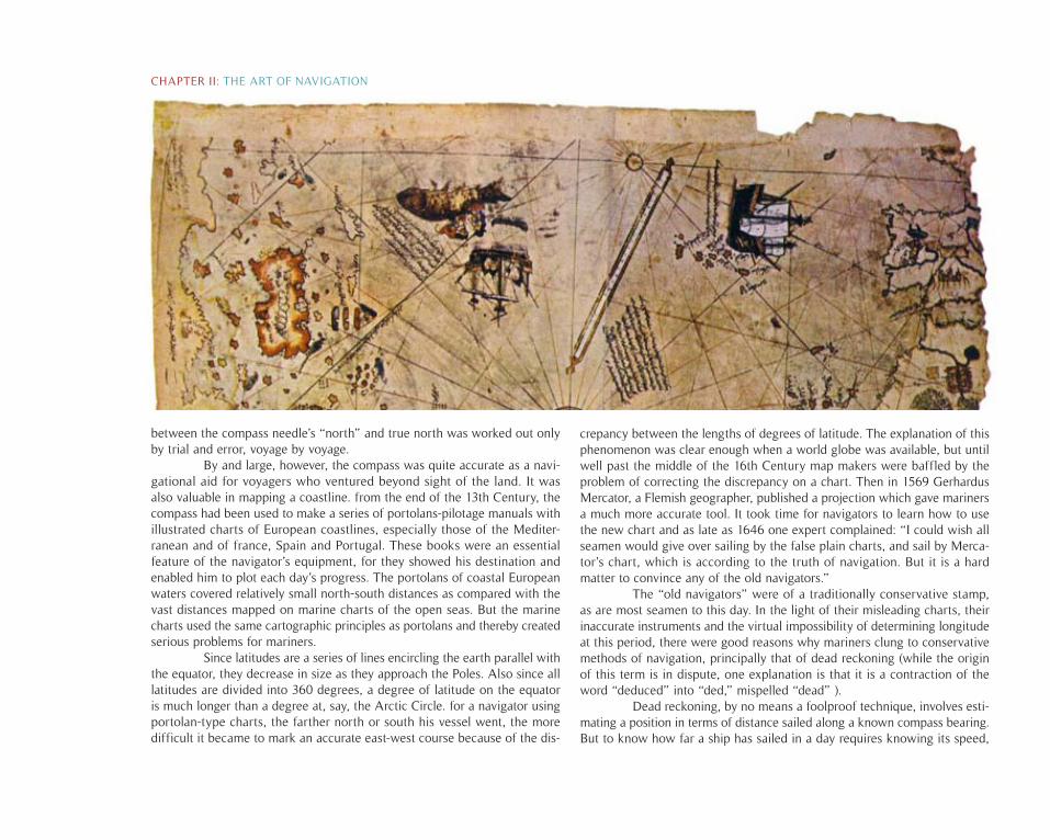
By and large, however, the compass was quite accurate as a navi-gational aid for voyagers who ventured beyond sight of the land. It was also valuable in mapping a coastline. from the end of the 13th Century, the compass had been used to make a series of portolans-pilotage manuals with illustrated charts of European coastlines, especially those of the Mediter-ranean and of france, Spain and Portugal. These books were an essential feature of the navigator’s equipment, for they showed his destination and enabled him to plot each day’s progress. The portolans of coastal European waters covered relatively small north-south distances as compared with the vast distances mapped on marine charts of the open seas. But the marine charts used the same cartographic principles as portolans and thereby created serious problems for mariners.
Since latitudes are a series of lines encircling the earth parallel with the equator, they decrease in size as they approach the Poles. Also since all latitudes are divided into 360 degrees, a degree of latitude on the equator is much longer than a degree at, say, the Arctic Circle. for a navigator using portolan-type charts, the farther north or south his vessel went, the more difficult it became to mark an accurate east-west course because of the dis-
crepancy between the lengths of degrees of latitude. The explanation of this phenomenon was clear enough when a world globe was available, but until well past the middle of the 16th Century map makers were baffled by the problem of correcting the discrepancy on a chart. Then in 1569 Gerhardus Mercator, a Flemish geographer, published a projection which gave mariners a much more accurate tool. It took time for navigators to learn how to use the new chart and as late as 1646 one expert complained: “I could wish all seamen would give over sailing by the false plain charts, and sail by Merca-tor’s chart, which is according to the truth of navigation. But it is a hard matter to convince any of the old navigators.”
The “old navigators” were of a traditionally conservative stamp, as are most seamen to this day. In the light of their misleading charts, their inaccurate instruments and the virtual impossibility of determining longitude at this period, there were good reasons why mariners clung to conservative methods of navigation, principally that of dead reckoning (while the origin of this term is in dispute, one explanation is that it is a contraction of the word “deduced” into “ded,” mispelled “dead” ).
Dead reckoning, by no means a foolproof technique, involves esti-mating a position in terms of distance sailed along a known compass bearing. But to know how far a ship has sailed in a day requires knowing its speed,
CHAPTER II: THE ART OF NAVIGATION
and the log line, a simple speed measuring device, did not come into general use until the late 1500s. Before that and, indeed, well after, mariners relied on their knowledge of how their vessel ran under different weather conditions, a knowledge gained by watching how rapidly patches of weed or pieces of flotsam fall astern. During the four-hour watches into which a ship’s working day has traditionally been divided, estimates of speed were made for each of the eight half-hours of a watch. With following winds, the totals gave a reasonable estimate of how far the ship had run during the day, though unsuspected currents could affect a judgment of speed, and also of direction.
With contrary winds, which made extensive tacking necessary, the dead-reckoning estimate became much more tricky. Traverse boards, on which successive changes of heading could be plotted, gave navigators some help in figuring how much forward progress had been made during the zigzag tacks. But even then practical experience was required to make the proper allowances for the leeway, or sideward slippage, on each zig and zag. All in all, it is not surprising that seagoing navigators-Ignoring a chorus of baffled vituperation from shore-based experts-trusted more to instinct shaped by knowledge of their own ship than to books written by landlubbers. At sea, as in love, it is often better to back a hunch than obey the books.
Generally speaking, a skilled mariner would “sail latitudes“; that is, he sailed south or north until celestial observation fixed his latitude, and then he headed east or west until he hit land. The technique was later summed up in the direction for sailing from Europe to the West Indies: “south till the butter melts, and then due west.” Given the uncertain state of knowledge, it is easy to understand why Vasco da Gama, although well stocked with charts and navigational instruments, devoted great pains to securing a pilot with personal knowledge of the Indian Ocean.
It is easy to understand, too, how much mariners depended on their observation of weed and flotsam and on the behavior of winds and fishes, for these were often their only indication that their landfall was near. Excerpts from the detailed instructions Pero de Queiros wrote for his Pacific voyage of 1606 indicate the importance of the signs: “If the sea appears greasy, with leaves of trees, grass, herbs, wood, branches, palm nuts, and other things which the waves carry from the shores and rivers send down when in flood, it is a sign of land being near.
If the birds that may be met with are piqueros, ducks, widgeons, gulls, estopegados, terns, sparrow-hawks, flamingos or siloricos, it is a sign that land is very near; but if there are only boobies so much care is not necessary, because these birds are found far from land.... If the sea is of any
other color than the ordinary one of the ocean where there is great depth, namely, dark blue, it is necessary to exercise care, and much more if at night the sea should be heard to make sounds greater than is usual.”
When a captain suspected, from one or another of these signs, that he was nearing land, he made constant use of the sounding line, a cord weighted with a lead plummet. With the line he could measure depths of as much as 200 fathoms (1 ,200 feet) and successive soundings would indicate whether the sea bottom was shelving up toward a coastline still over the horizon. In addition, the nature of the bottom could be examined from the fragments that lodged in a tallow-filled hole at the base of the lead weight. Careful records were kept of sounding depths and bottom samples, for these, together with graphic descriptions of landmarks sighted, would help a mari-ner to retrace his earlier voyage on a subsequent trip . In time, collections of navigators’ records were assembled into pilotage books, invaluable to the captain approaching a harbor he had never before visited.
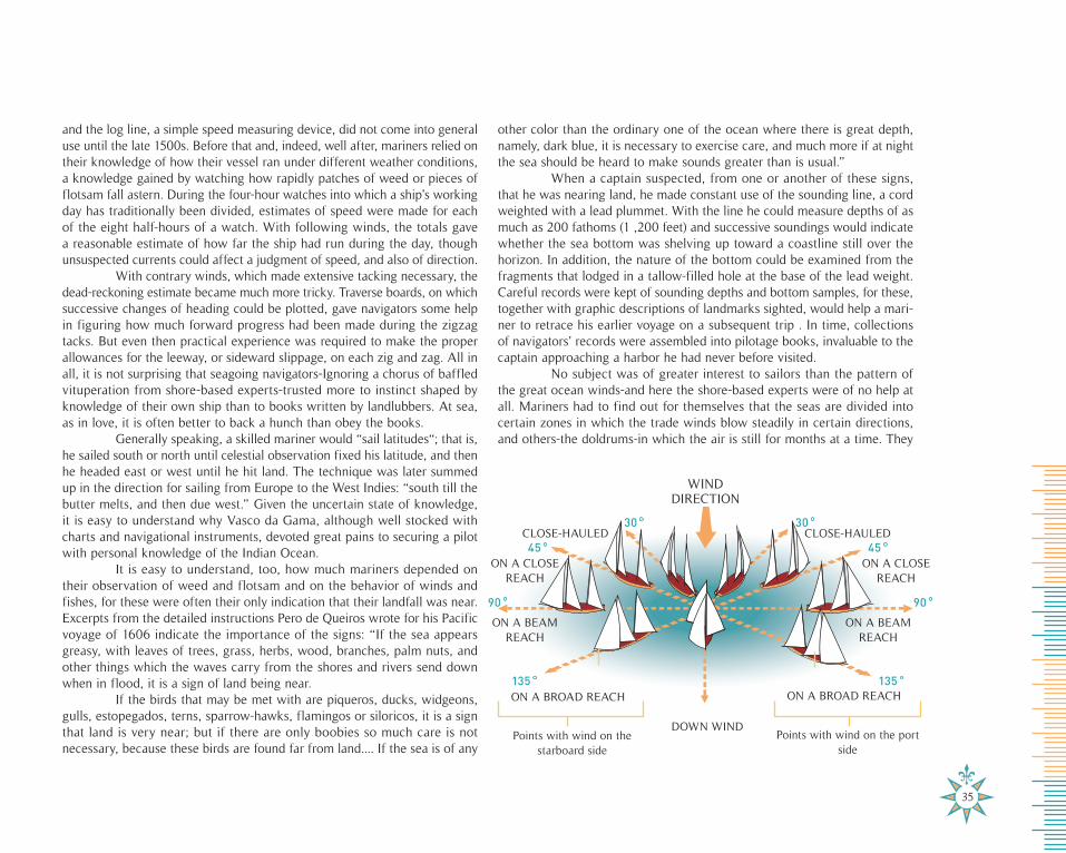
No subject was of greater interest to sailors than the pattern of the great ocean winds-and here the shore-based experts were of no help at all. Mariners had to find out for themselves that the seas are divided into certain zones in which the trade winds blow steadily in certain directions, and others-the doldrums-in which the air is still for months at a time. They
35
WIND DIRECTION
CLOSE-HAULED
ON A CLOSE REACH
ON A BEAM REACH
ON A BROAD REACH
DOWN WIND
ON A BEAM REACH
ON A BROAD REACH
CLOSE-HAULED
ON A CLOSE REACH
135
90
45
30
135
45
30
Points with wind on the starboard side
Points with wind on the port side
90
inaccurate instruments and the virtual impossibility of determining longitude at this period, there were good reasons why mariners clung to conservative methods of navigation, principally that of dead reckon-ing (while the origin of this term is in dispute, one explanation is that it is a contraction of the word “deduced” into “ ded,” mispelled “dead” ). Dead reckoning, by no means a foolproof technique, involves esti-mating a position in terms of distance sailed along a known compass bearing. But to know THE FEARSOME SEA in a day requires knowing its speed, and the log line, a simple speed measuring device, did not come into general use until the late 1500s. Before that and, indeed, well after, mariners relied on their knowledge of how their vessel ran under different weather conditions, a knowledge gained by watching how rapidly patches of weed or pieces of flotsam fall astern. During the four-hour watches into which a ship’s working day has tradition-ally been divided, estimates of speed were made for each of the eight half-hours of a watch. With following winds, the totals gave a rea-sonableestimate of how far the ship had run during the day, though
inaccurate instruments and the virtual impossibility of determining longitude at this period, there were good reasons why mariners clung to conservative methods of navigation, principally that of dead reckon-ing (while the origin of this term is in dispute, one explanation is that it is a contraction of the word “deduced” into “ ded,” mispelled “dead” ). Dead reckoning, by no means a foolproof technique, involves esti-mating a position in terms of distance sailed along a known compass bearing. But to know THE FEARSOME SEA in a day requires knowing its speed, and the log line, a simple speed measuring device, did not come into general use until the late 1500s. Before that and, indeed, well after, mariners relied on their knowledge of how their vessel ran under different weather conditions, a knowledge gained by watching how rapidly patches of weed or pieces of flotsam fall astern. During the four-hour watches into which a ship’s working day has tradition-ally been divided, estimates of speed were made for each of the eight half-hours of a watch. With following winds, the totals gave a rea-sonableestimate of how far the ship had run during the day, though
37
also had to learn that the zones change with the seasons. Slowly a map of the invisible winds was superimposed on the map of the coasts and islands.
The best route came to be seen not as a straight forward course between two points, but along the lengthy, curving corridors swept by the trades. From Spain to the West Indies ships followed the arc of the north-east trade wind which blew them from the Canaries to the Lesser Antilles in about a month. To return to Spain in winter, they beat their way north, against head winds, until past Bermuda, and then relaxed for the rest of the trip home on the endless belt of the westerlies.
Traffic patterns in the Indian Ocean were dictated by the seasonal reversal in direction of the monsoon, described by one traveler as “a path of wind that continues to blow for three or four months unceasingly, never letting up or changing. “To get from Europe to India a ship had to leave the Cape of Good Hope by early summer in order to be carried across by the southwest monsoon. This “summer monsoon” locked up all ships in the west coast harbors of India till late autumn. Then the “winter monsoon,” blowing from the northeast, released the waiting vessels and blew them back to Africa .
The discovery of the wind routes was a painfully slow process that was accomplished by ships thrusting and turning against the seemingly inexhaustible pressure of the moving air until at last the puzzle was solved. It was not until 1565, for example, that mariners who had vainly sought fa-vorable winds for an eastward passage from the East Indies discovered that they had to go as far north as the 42nd parallel to find them.
The learning process was further slowed by the reluctance of gov-ernments to publicize knowledge that might aid the mariners of rival nations. By imposing secrecy, governments also ensured that their own merchants, who wanted to trade in the new lands, would have to work through the Crown, and thus be subject to its financial control. King John II had initiated this policy in Portugal in the days of Henry the Navigator, and he made the betrayal of secrets of discovery punishable by death.
Nonetheless the stories, in whole or in part, always leaked out. Pilots and captains worked now for one government, now for another, and they took their information with them from job to job. Sailors and merchants gossiped in foreign ports, as expatriates always do. There was also a persistent clandestine traffic in charts; the Cantino chart of 1502, the earliest surviving record of Portuguese discoveries, was smuggled by Alberto Cantino to the Duke of Ferrara. Like all Italian princes, the Duke was alert to the threat posed to Italian domination of the spice trade by Da Gama’s circumnaviga-tion of Africa.
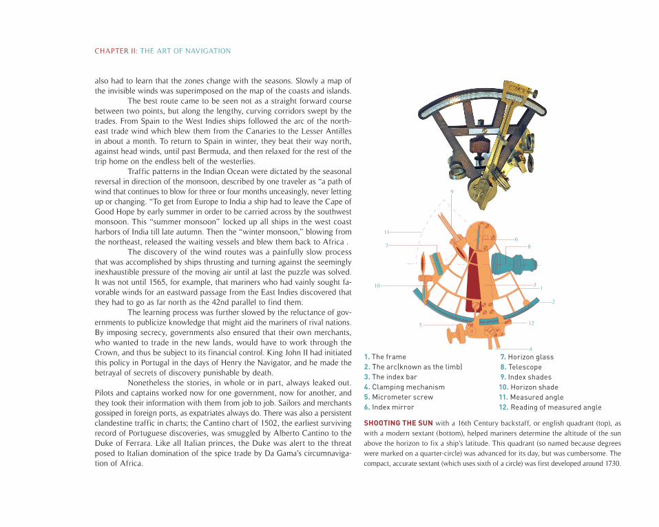
1. The frame2. The arc(known as the limb)3. The index bar4. Clamping mechanism5. Micrometer screw6. Index mirror
7. Horizon glass 8. Telescope 9. Index shades10. Horizon shade11. Measured angle12. Reading of measured angle
SHOOTING THE SUN with a 16th Century backstaff, or english quadrant (top), as with a modern sextant (bottom), helped mariners determine the altitude of the sun above the horizon to fix a ship’s latitude. This quadrant (so named because degrees were marked on a quarter-circle) was advanced for its day, but was cumbersome. The compact, accurate sextant (which uses sixth of a circle) was first developed around 1730.
68
12
7
11
9
2
10
4
5
31
CHAPTER II: THE ART OF NAVIGATION
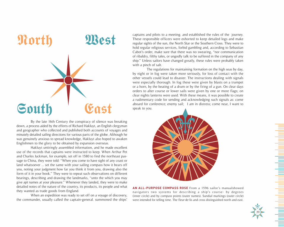
AN ALL-PURPOSE COMPASS ROSE From a 1596 sailor’s manualshowed navigators two systems for descr ibing a ship’s course- by degrees (inner circle) and by compass points (outer names). Sundial markings (outer circle)were intended for telling time. The fleur-de-lis and cross distinguished north and east.
By the late 16th Century the conspiracy of silence was breaking down, a process aided by the efforts of Richard Hakluyt, an English clergyman and geographer who collected and published both accounts of voyages and minutely detailed sailing directions for various parts of the globe. Although he was genuinely anxious to spread knowledge, Hakluyt also hoped to awaken Englishmen to the glory to be obtained by expansion overseas.
Hakluyt untiringly assembled information, and he made excellent use of the records that captains were instructed to keep. When Arthur Pet and Charles Jackman, for example, set off in 1580 to find the northeast pas-sage to China, they were told: “When you come to have sight of any coast or land whatsoever ... set the same with your sailing compass how it bears off you, noting your judgment how far you think it from you, drawing also the form of it in your book.” They were to repeat such observations on different bearings, describing and drawing the landmarks, “unto the which you may give apt names at your pleasure.” Whenever they landed, they were to make detailed notes of the nature of the country, its products, its people and what they wanted as trade goods from England.
When an expedition was ready to set off on a voyage of discovery, the commander, usually called the captain-general. summoned the ships’
North West
EastSouth
39
captains and pilots to a meeting. and established the rules of the journey. These responsible officers were exhorted to keep detailed logs and make regular sights of the sun, the North Star or the Southern Cross. They were to hold regular religious services, forbid gambling and, according to Sebastian Cabot’s order, make sure that there was no swearing, “nor communication of ribaldry, filthy tales, or ungodly talk to be suffered in the company of any ship.” Unless sailors have changed greatly, these rules were probably taken with a pinch of salt.
The regulations for maintaining formation on the high seas by day, by night or in fog were taken more seriously, for loss of contact with the other vessels could lead to disaster. The instructions dealing with signals were especially thorough. In fog these were given by blasts on a trumpet or a horn, by the beating of a drum or by the firing of a gun. On clear days orders to alter course or lower sails were given by one or more flags; on clear nights lanterns were used. With these means, it was possible to create a rudimentary code for sending and acknowledging such signals as: come aboard for conference; enemy sail; I am in distress; come near, I want to speak to you.
The captain-general also gave his captains sealed orders for rendez-vous in case they did lose one another. Queiros, for instance, on his voyage westward across the Pacific from Peru in 1606, told any captain who became separated to make for the hazily known island of Santa Cruz and wait there for three months. “If, by chance the other ships do not arrive,” the instruc-tions continued, “the captain, before he departs, is to raise a cross, and at the foot of it, or of the nearest tree, he is to make a sign on the trunk, to be understood by him who next arrives, and to bury a jar with the mouth closed with tar and containing a narrative of all that has happened and of his intentions.”This use of buried messages began early in the 16th Century, and it is not unlikely that it gave rise to many tales of mysterious maps and buried treasure, such as the one immortalized in Robert Louis Stevenson’s Treasure Island.
Under the best of circumstances it was hard to predict the length of voyages. Columbus on his fourth expedition took 21 days to come the 3,000 miles from Grand Canary to Martinique, but this was in exceptionally favorable weather. Magellan, going west, crossed the Pacific in 98 days; the eastward crossing could take as much as six months. Sir Francis Drake was at sea for 54 days between the Cape Verde Islands and Brazil, a distance of 1,600 miles. The trip from Lisbon to Goa, crossing well-charted seas and utilizing favorable winds, averaged seven months. An Italian traveler, writing in about 1600, assured his readers that in going around the world “ one does not put in more than sixteen and one half months of sailing.”
Conditions of life aboard during these lengthy voyages were ap-palling, not only by modern standards but by the standards of the time for life on shore. All the ships leaked; even with regular use of the pumps, water was constantly sloshing in the bilge which was further fouled by the casual sanitary habits of the age. Roaches and rats swarmed everywhere. No sleeping quarters were provided, save perhaps for the master and pilot: ordinary seamen slept on or below deck wherever they could find room.
There was no waterproof clothing. Explorers’ ships were less crowded than those that followed, for follow-up vessels were jammed with soldiers, settlers and merchants in addition to the crew. But the later travelers at least were following known routes and knew the duration of their voyage, within the limits imposed by wind and sea.
Sheer discomfort and stench probably did not mean much to those who were used to the sea as traders or fishermen. But the voyages of discovery created major problems in the way of food supply. In part this reflected the large number of men needed to handle the sails of the early exploring ves-sels and for whom stores of food that would last for the whole voyage had to be carried. But there were other factors that added to the difficulties: the tendency of grain and ship’s biscuit to become sour or to swarm with weevils ; the speed with which even the best-made wine or water casks sprang leaks under the continual lurching of the ship.
Food problems limited a captain’s ability to sail where he chose and induced him to proceed by indirect, island-hopping paths whenever he had a choice, rather than by more direct and often less dangerous courses. Sometimes the captains assumed great risks to ensure an adequate supply of food for their crews. For example, when John Davis was attempting to make a passage through the treacherous Strait of Magellan in 1591, he sent a landing party ashore in small boats with instructions to kill and salt the penguins which nested there, for the preserved meat would be a valuable supplement to the ship’s provisions on the journey’s next leg.
What a shortage of food could mean is grimly described in the remarkably detailed chronicle of Magellan’s Pacific crossing: “We ate only old biscuit reduced to powder, and full of grubs, and stinking from the dirt which the rats had made on it when eating the good biscuit, and we drank water that was yellow and stinking. We also ate the ox hides which were under the main-yard so that the yard should not break the rigging ... also the sawdust of wood, and rats.”
a black and putrid blood.
Horrific contemporary descriptions tell us what the disease waslike: “It rotted all my gums,” wrote one sufferer, “which gave out
CHAPTER II: THE ART OF NAVIGATION
Horrific contemporary descriptions tell us what the disease waslike: “It rotted all my gums,” wrote one sufferer, “which gave out
As this account indicates, the food not only ran short, but went bad. Shipboard menus consisted of dried or salted meat, salted fish, bis-cuit, rice, dried peas, cheese, onions, garlic, oil, vinegar, water and wine. From the evidence of the records, sea-men seem to have eaten about 3,500 calories a day, a perfectly adequate diet if it had been consistently avail-able. Men in the Renaissance ate meals we should think dull. They had little meat and their choice depended on the season rather than on any sense of connoisseurship. Eating at sea swung from frugality during voyages to glut-tonous orgies after making a landfall, a pattern that corresponded exactly to eating habits ashore. The differ-ence for the sailor lay in the terrible quality of the food during the times of scarcity: the putrefying water; the fresh food petering out after a few days; then a diet unhealthily salty; then a time when even salted and dried provisions turned into a slimy mess, undulating with worms.
On a long trip, sailors relied on rains to replenish the water supply. Pero de Queiros is notable for using a primitive furnace to distill fresh water from the ocean; generally, however, water was collected during rainstorms-in buckets or as it dripped from heavy mats hung from the rigging. But when the rains failed there was no other source; there are instances of crews that were reduced to drinking their own urine.
Disease was rife on long journeys, and with good reason. Sailors ate a minimum of fresh vegetables; they were cramped and crowded, infested with fleas and lice, often drenched for days on end. While clean salt water slipped below the keel and fresh air blew over the decks, the crew was all too likely to be literally rotting with scurvy.
The logbooks talk of various kind of fever, sometimes of plague; but scurvy, caused by vitamin C deficiency, was the occupational disease of deep-sea mariners. A voyage to India was considered favored if only one out
West African natives calledthe first Portuguese ships
great birds
41
of every five men died of scurvy. Though the disease is popularly associated with the tropics, it attacked seamen in sub-polar waters with equal virulence.
Horrific contemporary descriptions tell us what the disease was like: “It rotted all my gums,” wrote one sufferer, “which gave out a black and putrid blood. My thighs and lower legs were black and gangrenous, and I was forced to use my knife each day to cut into the flesh in order to release this black and foul blood. I also used my knife on my gums, which were livid and growing over my teeth..... When I had cut away this dead flesh and caused much black blood to flow, I rinsed my mouth and teeth with my urine, rubbing them very hard.... And the unfortunate thing was that I could not eat, desiring more to swallow than to chew.... Many of our people died of it every day, and we saw bodies thrown into the sea constantly, three or four at a time. For the most part they died with no aid given them, expiring behind some case or chest, their eyes and the soles of their feet gnawed away by the rats.”
We know less about the lighter side of life on board. Some men read, but little is known about the books they took along apart from a story of missionaries throwing chivalrous romances overboard and pressing religious tracts into the unwilling seamen’s hands instead. The ship ‘s musicians were doubtless employed to amuse the ship’s company as well as to give signals. In the late 16th Century, Crossing the Line (the equator) was already marked by the horseplay that continues to this day. But the more common antidotes to boredom were the forbidden gambling, a daily religious service and, on ships of Catholic countries, the celebration of feast days with some semblance of an actual feast, weather and stores permitting.
On first arriving at a strange land, it was important to make a good impression-usually compounded equally of threat and reassurance- on the inhabitants. So, if they had time and energy, the crew dressed their ship with banners, the musicians struck up, guns were fired and the captain appeared on deck in his best clothes, sword at side. Sometimes the voyagers had the advantage of being thought magical. Certain Caribbean Indians considered Columbus to be a god; West African natives called the first Portuguese ships great birds; Brazilian Indians believed that Magellan’s pinnaces were born from his ships when they were let down into the water, and that when they were alongside they were being suckled by their mothers.
At least at the outset, every effort was made to placate the local inhabitants for it was necessary to obtain food and information, and this could be done most efficiently if the natives were friendly. Beads and little jingling bells were handed out, European hats were exchanged for headdresses of
feathers or fur, chiefs were shown over the ships and regaled with European food. To gain information about objects of value, especially gold, natives were invited-or forced-on board. Sebastian Cabot instructed captains that prisoners were “to be well entertained, used, and appareled, to be set on the land to the intent that he or she may allure others to draw nigh to show the commodities, and if the person taken may be made drunk with your beer or wine, you may know the secrets of his heart.”
Attempts to make friends were not always successful. Columbus once ordered his young sailors to dance to the rhythm of a drum in order to attract some Indians who were lying some way off the ship in a large canoe. The Indians thought it was a war dance, however, and began shooting arrows.
Communication was the great difficulty. Sign language was some-times helpful, sometimes not. Pedro Alvares Cabral gained the impression that Brazil was an island in this way, and Alvise da Cadamosto turned back from West Africa in despair because he could not understand what the natives were trying to tell him. Voyagers to the Indian Ocean, an Arabic-speaking trading area, could take interpreters with them who had learned the language from Moors resident in Spain and Portugal. Elsewhere the natives were usually taught the language of their visitors, and it became a regular policy to take some of them home, forcibly if necessary, and train them as interpreters for later voyages. Other captives, after indoctrination, were returned to their own country for propaganda purposes. It was hoped that they would tell their chiefs about the wealth and power of Europe, the advantages of trading with it, and the dangers of resisting the demands of Europeans.
The Portuguese added a second measure: they dumped convicts (whose death sentences were commuted for this purpose) on newly discovered shores to learn the local language, plant European seeds and see whether European animals could flourish in new lands. Theoretically, the convicts were also to try to convert the natives to Christianity. The hope was that future voyages would find congenial outposts of Europe on the fringe of savage and exotic shores. The experiment was to some extent a success, and many ships’ companies were cheered to receive a familiar welcome after the dragging monotony of their voyage. More frequently, however, the involuntary castaway was found to have gone happily native rather than to have created a little bit of Europe in the wilds.
The discoverers usually returned to their ships at night, but some-times, while their ships were being overhauled, or to enjoy the hospitality of a trusted chief and his village, they slept on shore. There they discovered such disadvantages as mosquitoes. Weary sailors benefited, however, from fresh
CHAPTER II: THE ART OF NAVIGATION
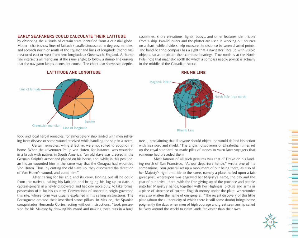
43
by observing the altitude of certain stars identified from a celestial globe. Modern charts show lines of latitude (parallels)measured in degrees, minutes, and seconds north or south of the equator-and lines of longitude (meridians) measured east or west from zero longitude at Greenwich, England. A rhumb line intersects all meridians at the same angle; to follow a rhumb line ensures that the navigator keeps.a constant course. The chart also shows sea depths,
coastlines, shore elevations, lights, buoys, and other features identifiable from a ship. Parallel rulers and the plotter are used in working out courses on a chart, while dividers help measure the distance between charted points. The hand-bearing compass has a sight that a navigator lines up with visible objects, so as to obtain their compass bearings. True north is at the North Pole; note that magnetic north (to which a compass needle points) is actually in the middle of the Canadian Arctic.
food and local herbal remedies, for almost every ship landed with men suffer-ing from disease or some wound received while handling the ship in a storm.
Certain remedies, while effective, were not suited to adoption at home. When the adventurer Philip von Huten, for instance, was wounded in a brush with natives in South America, “an old slave was dressed in the German Knight’s armor and placed on his horse, and, while in this position, an Indian wounded him in the same way that the Omagua had wounded Von Huten. Thus, by cutting the old slave up, they discovered the direction of Von Huten’s wound, and cured him.”
After caring for his ship and its crew, finding out all he could from the natives, taking his latitude and bringing his log up to date, a captain-general in a newly discovered land had one more duty: to take formal possession of it for his country. Conventions of uncertain origin governed this rite, whose form was usually explained in his sailing instructions. The Portuguese erected their inscribed stone pillars. In Mexico, the Spanish conquistador Hernando Cortes, acting without instructions, “took posses-sion for his Majesty by drawing his sword and making three cuts in a huge
tree ... proclaiming that if anyone should object, he would defend his action with his sword and shield. “The English discoverers of Elizabethan times set up the royal standard, or made piles of stones to warn later voyagers that someone had preceded them.
Most famous of all such gestures was that of Drake on his land-ing north of San Francisco. “At our departure hence,” wrote one of his companions, “our general set up a monument of our being there, as also of her Majesty’s right and title to the same, namely a plate, nailed upon a fair great post, whereupon was engraved her Majesty’s name, the day and the year of our arrival there, with the free giving up of the province and people unto her Majesty’s hands, together with her Highness’ picture and arms in a piece of sixpence of current English money under the plate, whereunder was also written the name of our general. “The recent discovery of this little plate (about the authenticity of which there is still some doubt) brings home poignantly the days when men of high courage and great seamanship sailed halfway around the world to claim lands far vaster than their own.
EARLY SEAFARERS COULD CALCULATE THEIR LATITUDE
LATTITUDE AND LONGITUDE RHUMB LINE
Line of latitude
Greenwich meridianLine of longitude
Equator
Rhumb Line
North Pole (true north)
Magnetic North
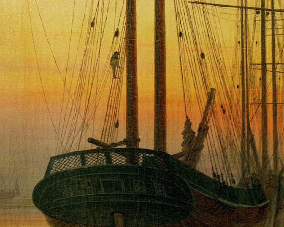
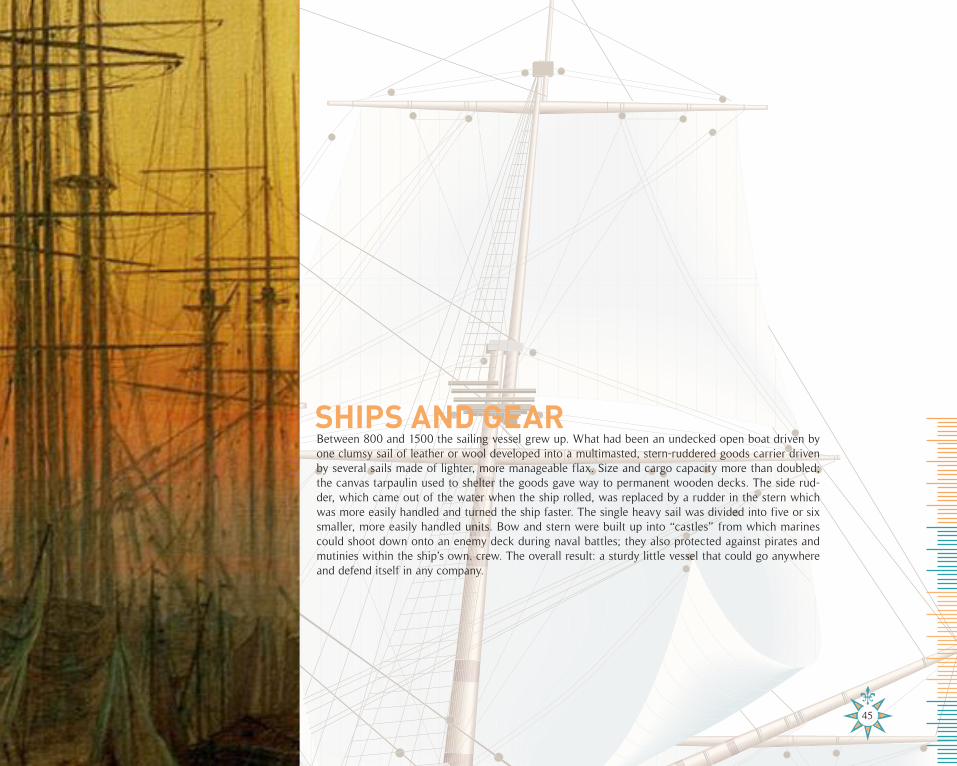
Between 800 and 1500 the sailing vessel grew up. What had been an undecked open boat driven by one clumsy sail of leather or wool developed into a multimasted, stern-ruddered goods carrier driven by several sails made of lighter, more manageable flax. Size and cargo capacity more than doubled; the canvas tarpaulin used to shelter the goods gave way to permanent wooden decks. The side rud-der, which came out of the water when the ship rolled, was replaced by a rudder in the stern which was more easily handled and turned the ship faster. The single heavy sail was divided into five or six smaller, more easily handled units. Bow and stern were built up into “castles” from which marines could shoot down onto an enemy deck during naval battles; they also protected against pirates and mutinies within the ship’s own. crew. The overall result: a sturdy little vessel that could go anywhere and defend itself in any company.
SHIPS AND GEAR
45
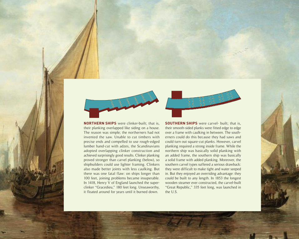
NORTHERN SHIPS were clinker-built; that is, their planking overlapped like siding on a house. The reason was simple; the northerners had not invented the saw. Unable to cut timbers with precise ends and compelled to use rough-edged lumber hand-cut with adzes, the Scandinavians adopted overlapping clinker construction and achieved surprisingly good results. Clinker planking proved stronger than carvel planking (below), so shipbuilders could use lighter framing. Clinkers also made better joints with less caulking. But there was one fatal flaw: on ships longer than 100 feet, joining problems became insuperable. In 1418, Henry V of England launched the super-clinker “Gracedieu,” 180 feet long. Unseaworthy, it floated around for years until it burned down.
SOUTHERN SHIPS were carvel- built; that is, their smooth-sided planks were fitted edge to edge over a frame with caulking in between. The south-erners could do this because they had saws and could turn out square-cut planks. However, carvel planking required a strong inside frame. While the northern ship was basically solid planking with an added frame, the southern ship was basically a solid frame with added planking. Moreover, the southern carvel types suffered a serious drawback: they were difficult to make tight and water seeped in. But they enjoyed an overriding advantage: they could be built to any length. In 1853 the longest wooden steamer ever constructed, the carvel-built “Great Republic,” 335 feet long, was launched in the U.S.
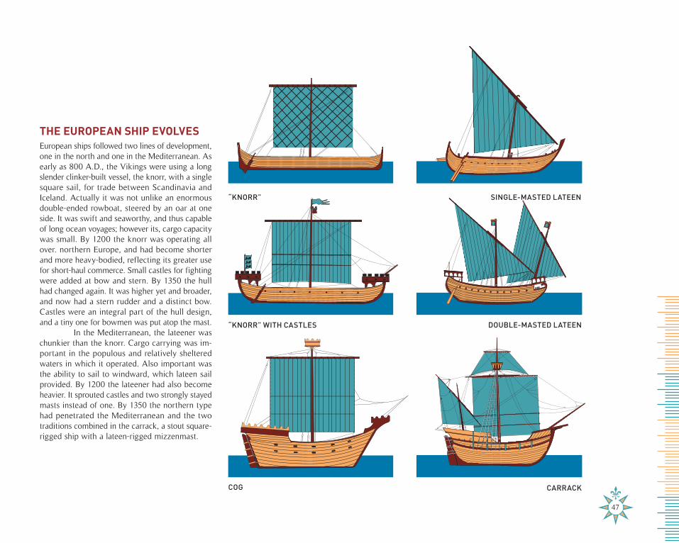
European ships followed two lines of development, one in the north and one in the Mediterranean. As early as 800 A.D., the Vikings were using a long slender clinker-built vessel, the knorr, with a single square sail, for trade between Scandinavia and Iceland. Actually it was not unlike an enormous double-ended rowboat, steered by an oar at one side. It was swift and seaworthy, and thus capable of long ocean voyages; however its, cargo capacity was small. By 1200 the knorr was operating all over. northern Europe, and had become shorter and more heavy-bodied, reflecting its greater use for short-haul commerce. Small castles for fighting were added at bow and stern. By 1350 the hull had changed again. It was higher yet and broader, and now had a stern rudder and a distinct bow. Castles were an integral part of the hull design, and a tiny one for bowmen was put atop the mast.
In the Mediterranean, the lateener was chunkier than the knorr. Cargo carrying was im-portant in the populous and relatively sheltered waters in which it operated. Also important was the ability to sail to windward, which lateen sail provided. By 1200 the lateener had also become heavier. It sprouted castles and two strongly stayed masts instead of one. By 1350 the northern type had penetrated the Mediterranean and the two traditions combined in the carrack, a stout square-rigged ship with a lateen-rigged mizzenmast.
“KNORR”
“KNORR” WITH CASTLES
COG
SINGLE-MASTED LATEEN
DOUBLE-MASTED LATEEN
CARRACK
THE EUROPEAN SHIP EVOLVES
47
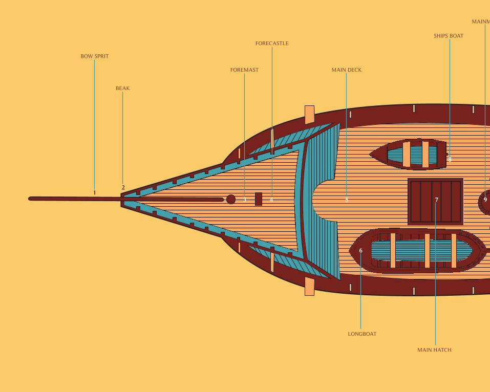
3 4 5 97
6
8
12
BOW SPRIT
BEAK
FOREMAST
FORECASTLE
MAIN DECK
LONGBOAT
MAIN HATCH
SHIPS BOAT
MAINMAST
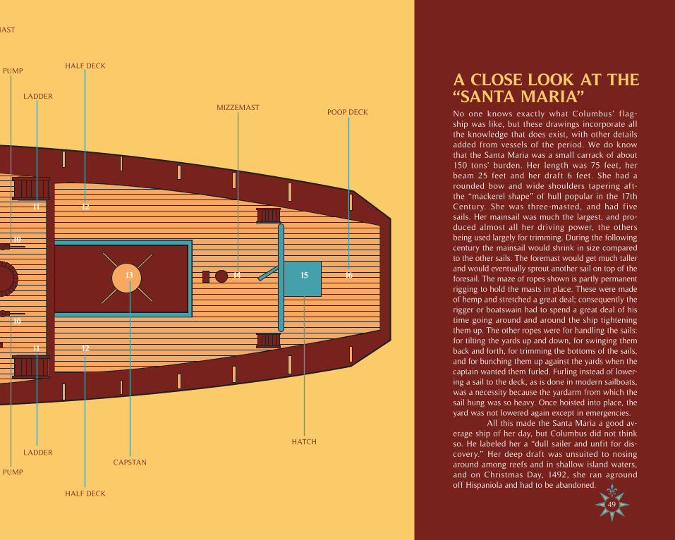
No one knows exactly what Columbus’ f lag-ship was like, but these drawings incorporate all the knowledge that does exist, with other details added from vessels of the period. We do know that the Santa Maria was a small carrack of about 150 tons’ burden. Her length was 75 feet, her beam 25 feet and her draft 6 feet. She had a rounded bow and wide shoulders tapering aft-the “mackerel shape” of hull popular in the 17th Century. She was three-masted, and had five sails. Her mainsail was much the largest, and pro-duced almost all her driving power, the others being used largely for trimming. During the following century the mainsail would shrink in size compared to the other sails. The foremast would get much taller and would eventually sprout another sail on top of the foresail. The maze of ropes shown is partly permanent rigging to hold the masts in place. These were made of hemp and stretched a great deal; consequently the rigger or boatswain had to spend a great deal of his time going around and around the ship tightening them up. The other ropes were for handling the sails: for tilting the yards up and down, for swinging them back and forth, for trimming the bottoms of the sails, and for bunching them up against the yards when the captain wanted them furled. Furling instead of lower-ing a sail to the deck, as is done in modern sailboats, was a necessity because the yardarm from which the sail hung was so heavy. Once hoisted into place, the yard was not lowered again except in emergencies.
All this made the Santa Maria a good av-erage ship of her day, but Columbus did not think so. He labeled her a “dull sailer and unfit for dis-covery.” Her deep draft was unsuited to nosing around among reefs and in shallow island waters, and on Christmas Day, 1492, she ran aground off Hispaniola and had to be abandoned.
A CLOSE LOOK AT THE “SANTA MARIA”
9 13 14 15 16
11
11
10
10
12
12
MAINMAST
PUMP
PUMP
LADDER
LADDER
HALF DECK
HALF DECK
CAPSTAN
MIZZEMAST
HATCH
POOP DECK
49
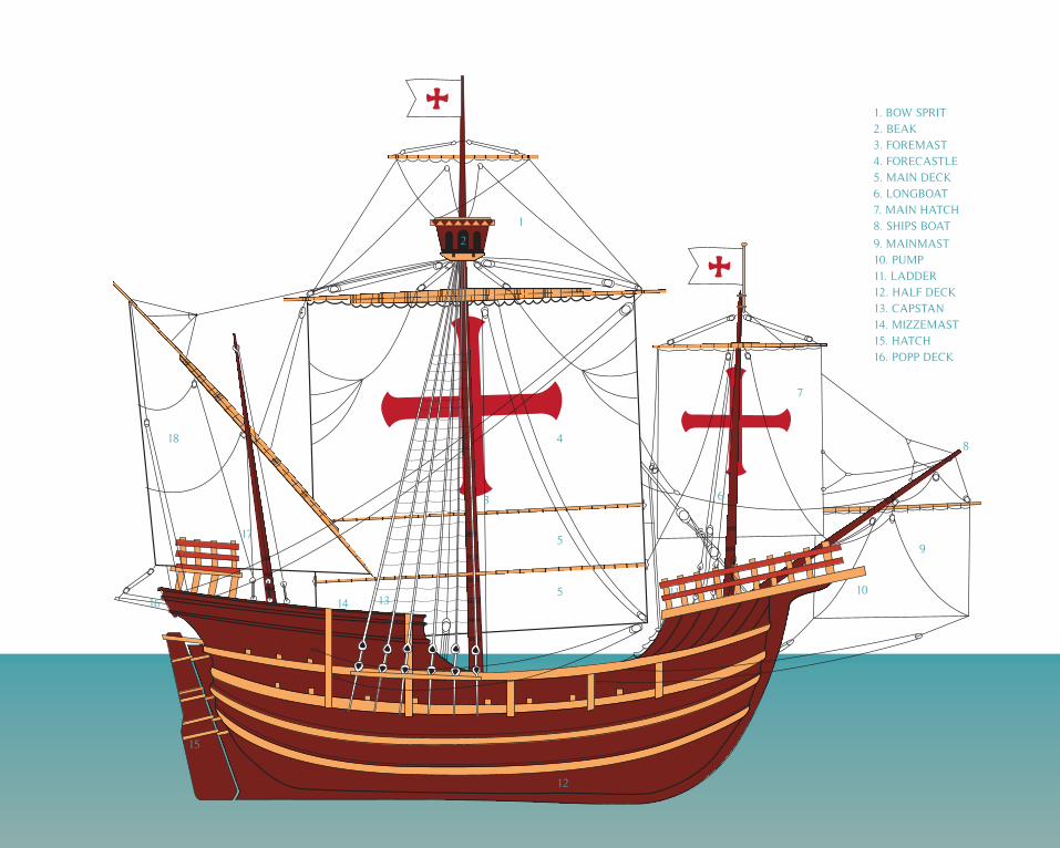
1. BOW SPRIT2. BEAK3. FOREMAST4. FORECASTLE5. MAIN DECK6. LONGBOAT7. MAIN HATCH8. SHIPS BOAT
9. MAINMAST10. PUMP11. LADDER12. HALF DECK13. CAPSTAN14. MIZZEMAST15. HATCH16. POPP DECK
1
4
5
3 6
7
8
9
105
18
17
2
1314
15
11
12
16
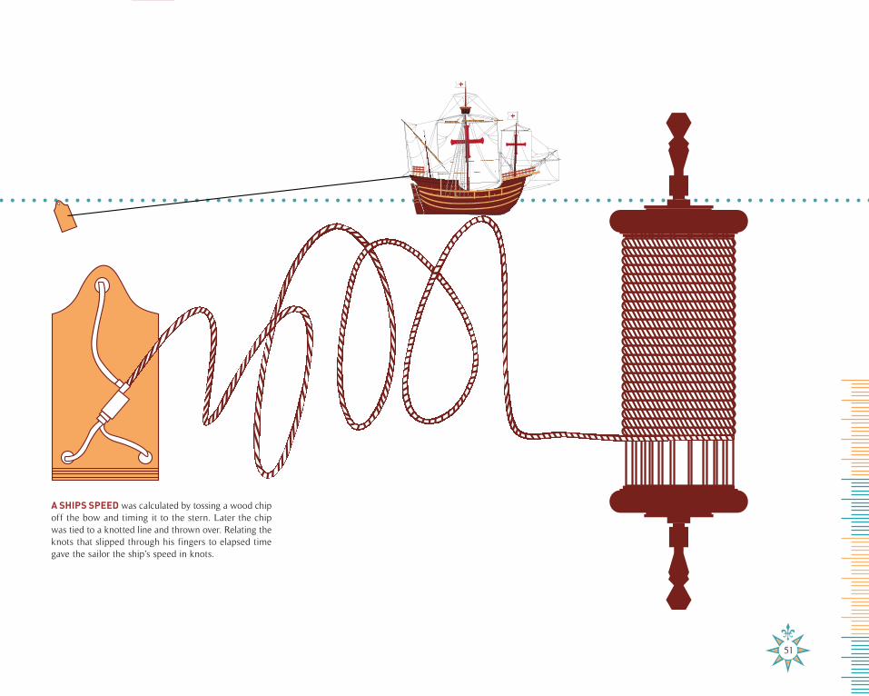
A SHIPS SPEED was calculated by tossing a wood chip off the bow and timing it to the stern. Later the chip was tied to a knotted line and thrown over. Relating the knots that slipped through his fingers to elapsed time gave the sailor the ship’s speed in knots.
51
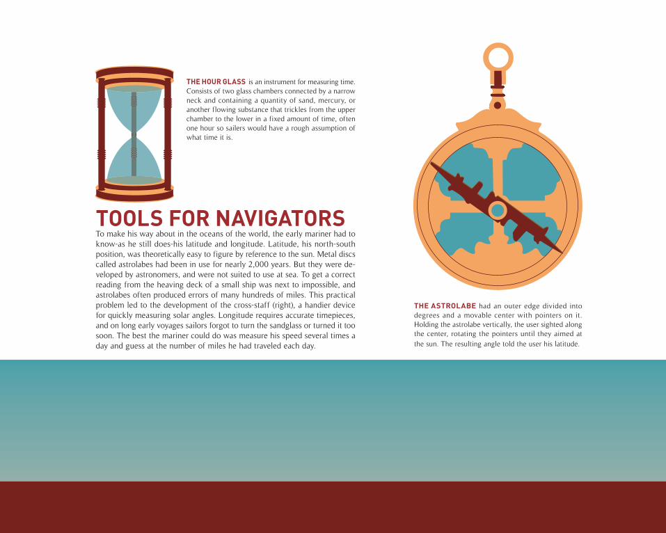
To make his way about in the oceans of the world, the early mariner had to know-as he still does-his latitude and longitude. Latitude, his north-south position, was theoretically easy to figure by reference to the sun. Metal discs called astrolabes had been in use for nearly 2,000 years. But they were de-veloped by astronomers, and were not suited to use at sea. To get a correct reading from the heaving deck of a small ship was next to impossible, and astrolabes often produced errors of many hundreds of miles. This practical problem led to the development of the cross-staff (right), a handier device for quickly measuring solar angles. Longitude requires accurate timepieces, and on long early voyages sailors forgot to turn the sandglass or turned it too soon. The best the mariner could do was measure his speed several times a day and guess at the number of miles he had traveled each day.
TOOLS FOR NAVIGATORS
THE ASTROLABE had an outer edge divided into degrees and a movable center with pointers on it. Holding the astrolabe vertically, the user sighted along the center, rotating the pointers until they aimed at the sun. The resulting angle told the user his latitude.
THE HOUR GLASS is an instrument for measuring time. Consists of two glass chambers connected by a narrow neck and containing a quantity of sand, mercury, or another flowing substance that trickles from the upper chamber to the lower in a fixed amount of time, often one hour so sailers would have a rough assumption of what time it is.
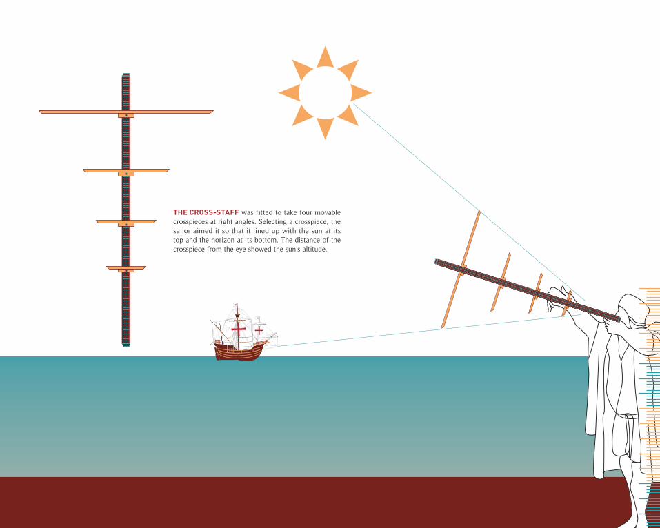
THE CROSS-STAFF was fitted to take four movable crosspieces at right angles. Selecting a crosspiece, the sailor aimed it so that it lined up with the sun at its top and the horizon at its bottom. The distance of the crosspiece from the eye showed the sun’s altitude.
ColophonArtist: Jeremy Rojas
Course: Advance Typography
Semester: Spring 2010
Instructor: Joani Spadaro
Fonts: Timeless, Din, and Baskerville
Paper: Natural Cougar Digital Choice Cover 65LB
Cover Paper: Enhanced Polar Matte Paper
Binding: Perfect Binding
Software: Photoshop, Illustrator, Indesign