Embed Size (px)
Citation preview

AIRLINE TRANSPORT PILOTS LICENSE
(030 00 00 00 - FLIGHT PERFORMANCE AND PLANNING)
First Issue 033-FP&MON-1 Sep 1999
JAR-FCLREF NO
LEARNING OBJECTIVES REMARKS
033 01 00 00 FLIGHT PLANS FOR CROSS-COUNTRY FLIGHTS FOR VFR FLIGHTS
033 01 01 00 Completing a navigation plan Given:033 01 01 01 Selection of routes, speeds, heights (altitudes) and alternate airfield
− Select a route and altitude taking the following criteria into account: a. VFR chart STUTTGART − Classification of airspace A – G
− Controlled airspace
− Uncontrolled airspace
(NO 47/6)
b. Performance data of BE-36 and Piper
− Prescribed outbound and inbound routes
− Restricted areas
− Weather situation
− Minimum safe altitudes
Seneca III or single/twinengine piston aircraft
c. Navigation plan form(Flightlog)
− Interpret, before every flight, the air traffic control information from AIP and NOTAMS obtained from AIS,for:
− Departure
− En route
− Destination
− Possible alternative fields
− Select and/or calculate the route, true air speeds, heights and alternate fields, taking into account:

AIRLINE TRANSPORT PILOTS LICENSE
(030 00 00 00 - FLIGHT PERFORMANCE AND PLANNING)
First Issue 033-FP&MON-2 Sep 1999
JAR-FCLREF NO
LEARNING OBJECTIVES REMARKS
− Prescribed outbound and inbound routes
− Restricted areas
− Weather situation
− Minimum safe altitudes
− Nav. Aids
− Conspicuous points
− Semi circular rules
− Calculate the minimum pressure altitude from MOCA, OAT and QNH − Calculate how many feet to climb after take off from an aerodrome to a given level − Find the frequency and ident of a nav. aid from the chart 033 01 01 02 Measurement of tracks and distances Use protractor and ruler
− Find the checkpoints Use Aeronautical − Calculate, or obtain from the chart, courses (tracks) and distances to fly Information Publication − Draw the intended route in the navigation chart considering: (AIP) − Restricted areas
− Danger areas
− Prohibited areas
− Other airspace restrictions

AIRLINE TRANSPORT PILOTS LICENSE
(030 00 00 00 - FLIGHT PERFORMANCE AND PLANNING)
First Issue 033-FP&MON-3 Sep 1999
JAR-FCLREF NO
LEARNING OBJECTIVES REMARKS
− Find the highest obstacle within a given distance either side of the track − Derive the following data from the chart and transfer to the navigation plan form: − Check points and/or turning points
− Distances in NM (using minutes of latitude along a meridian)
− True courses (tracks)
Use TAF, METAR and 033 01 01 03 Obtaining wind velocity forecast for each leg Significant weatherchart − Wind (SWC) − At aerodromes
− At cruising levels
− Visibility − Clouds and cloudbase − Meteorological hazards 033 01 01 04 Computation of headings, ground speeds, and time en-route from tracks, true airspeed and
wind velocities
− Apply the annual change to the charted value of the variation if applicable (not necessary if newestcharts are used)
Use Pocket calculator And/or mechanical slide
− Transfer the calculated variation to the flight plan form Computer e.g − Calculate the true air speed at given: Jeppesencalculator Airtour − Flight level Slide computer with aid of
AIRLINE TRANSPORT PILOTS LICENSE
(030 00 00 00 - FLIGHT PERFORMANCE AND PLANNING)
First Issue 033-FP&MON-4 Sep 1999
JAR-FCLREF NO
LEARNING OBJECTIVES REMARKS
− Temperature and instrument/position error of the airspeed indicator the pilots operatinghandbook
− Calculate the magnetic heading given: − The true course
− TAS and wind vector
− Calculate the ground speed given: − The true airspeed
− Course
− Wind speed and wind direction and/or (equivalent) wind component
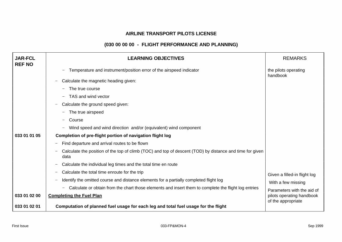
033 01 01 05 Completion of pre-flight portion of navigation flight log − Find departure and arrival routes to be flown − Calculate the position of the top of climb (TOC) and top of descent (TOD) by distance and time for given
data
− Calculate the individual leg times and the total time en route − Calculate the total time enroute for the trip Given a filled-in flight log − Identify the omitted course and distance elements for a partially completed flight log With a few missing − Calculate or obtain from the chart those elements and insert them to complete the flight log entries Parameters with the aid of 033 01 02 00 Completing the Fuel Plan pilots operating handbook
of the appropriate 033 01 02 01 Computation of planned fuel usage for each leg and total fuel usage for the flight

AIRLINE TRANSPORT PILOTS LICENSE
(030 00 00 00 - FLIGHT PERFORMANCE AND PLANNING)
First Issue 033-FP&MON-5 Sep 1999
JAR-FCLREF NO
LEARNING OBJECTIVES REMARKS
− Compute the planned total fuel usage for the flight by consulting the fuel usage tables and/or graphsfrom the pilots operating handbook in addition to the navigation plan for times enroute
aircraft and a completednavigation log of the flight
− Find the maximum distance to fly given appropiate data 033 01 02 02 Fuel for holding or diversion to alternate airfield − State the definition of the alternate and final reserve fuel and the requirements for aeroplanes with
reciprocating and turbine engines In accordance with JAR-OPS 1
− Define final reserve fuel − Obtain and calculate the final reserve fuel for holding − Obtain the fuel for flying from the destination to the alternate from the appropriate fuel table or graph 033 01 02 03 Reserves − Define the unforeseen items for which contingency fuel is to be carried − State and explain the requirements for contingency fuel for small aircraft as detailed in JAR-OPS − Calculate the contingency fuel
− State and/or explain the components of the reserve fuel
− Explain that additional fuel is required in special circumstances when the trip fuel, contingency fuel,alternate fuel and final reserve fuel are not sufficient for:
According to JAR OPS 1section 2 subpart D Criteria for contingency fuelwill be given in examquestions
− Holding at 1500 ft (450 m) above the airfield in ISA conditions
− An engine failure and/ or depressurisation at the critical point between alternates and/or destination
− Calculate the additional fuel if necessary

AIRLINE TRANSPORT PILOTS LICENSE
(030 00 00 00 - FLIGHT PERFORMANCE AND PLANNING)
First Issue 033-FP&MON-6 Sep 1999
JAR-FCLREF NO
LEARNING OBJECTIVES REMARKS
033 01 02 04 Total fuel requirements for flight − Calculate the block fuel for a flight including : − Taxi fuel depending on
− Aerodrome
− Type of aircraft
Preflight calculations inaccordance with AMC-OPS1.255
− Trip fuel
− Contingency fuel
− Alternate fuel
− Final reserve fuel
− Extra fuel at captains discretion
033 01 02 05 Completion of pre-flight portion of fuel log − Complete a fuel log which is presented with some of the elements missing, deriving those items from
fuel tables and/ or graphs or other appropriate data Given partly completedfuel log
033 01 03 00 Carry out flight monitoring and in-flight replanning 033 01 03 01 In-flight fuel computations − Calculate, in flight, the fuel quantities used and remaining at navigational checkpoints Indications of fuelmeters 033 01 03 02 Calculation of actual consumption rate given

AIRLINE TRANSPORT PILOTS LICENSE
(030 00 00 00 - FLIGHT PERFORMANCE AND PLANNING)
First Issue 033-FP&MON-7 Sep 1999
JAR-FCLREF NO
LEARNING OBJECTIVES REMARKS
− Calculate the actual consumption rate given: − The fuel used
− The flight time
− Compare the actual and the planned fuel consumption by means of calculation or flight progress chart − Compare the remaining fuel with the actual fuel to be used 033 01 03 03 Revision of fuel reserves estimates − Calculate the remaining fuel at a nav checkpoint taking into account the actual fuel flow and the fuel
used
033 01 03 04 In-flight replanning incase of problems − Perform in flight revision of the fuel plan, if necessary, by: − Selecting a new destination
− Selection of power settings to the old or a new destination
− Calculating a new time to a new destination with a new ground speed to be calculated with givenwind, TAS (true air speed) and course
− Check the current fuel state, fuel requirements and fuel reserves
Use pilots operatinghandbook
− Explain that, in the case of a flight revision, the commander has to check the traffic and the condition ofthe new destination airfield and its designated alternate. The commander must also check themeteorological conditions at new destination and designated alternate airfield before the decision tocontinue the flight to the new destination or alternate. The aircraft must be able to land with the finalreserve fuel

AIRLINE TRANSPORT PILOTS LICENSE
(030 00 00 00 - FLIGHT PERFORMANCE AND PLANNING)
First Issue 033-FP&MON-8 Sep 1999
JAR-FCLREF NO
LEARNING OBJECTIVES REMARKS
033 01 04 00 Radio communication and navigation aids − State the frequencies of the various means of Communication and Navigational aids Use Jeppesen chart or AIP 033 01 04 01 Communication frequencies and call signs for appropriate control agencies and in-flight
service facilities such as weather stations
− Find communication frequencies and call signs for appropriate control agencies and in-flight servicefacilities, flight information services, weather information stations, Automatic Terminal InformationService stations
033 01 04 02 Radio navigation and approach aids − On a route facility chart, locate the radio navigation aids and , from the symbols and other data shown,
determine:
− The type of facility/ service provided
− Frequency
− Identification
− Modulation (as appropriate)
033 02 00 00 ICAO ATC FLIGHT PLAN 033 02 01 00 Types of flight plan − Indicate the difference between the types of Flight Plan − Individual flight plan
− Repetitive flight plan (RPL)
033 02 01 01 ICAO flight plan

AIRLINE TRANSPORT PILOTS LICENSE
(030 00 00 00 - FLIGHT PERFORMANCE AND PLANNING)
First Issue 033-FP&MON-9 Sep 1999
JAR-FCLREF NO
LEARNING OBJECTIVES REMARKS
− Interpret the fixed format of an ICAO flight plan Use ICAO flight plan form
− State the reasons for a fixed format of an ICAO flightplan According DOC 4444 − Interpret the information to be given on the flight plan: − Aircraft identification − ICAO airline ident plus flight number
− Aircraft registration
− Flight rules
− Type of flight
− Number of aircraft ; wake turbulence category
− Communication- and nav equipment on board
− Departure aerodrome with 4 letter ident or ZZZZ and name in ”other information”
− Estimate Off Block Time (EOBT)
− Cruising speed
− Cruising level VFR or flight level
− Route with checkpoints, ATS routes, coordinates and/or bearing and range of a nav.aid and FIRboundary crossing points
− Destination aerodrome, EET, alternate aerodromes
− Other information REG/, SEL/, OPR/, STS/, TYP/, PER/, COM/, NAV/., DEP/, DEST/, ALTN/ andRMK/ DAT

AIRLINE TRANSPORT PILOTS LICENSE
(030 00 00 00 - FLIGHT PERFORMANCE AND PLANNING)
First Issue 033-FP&MON-10 Sep 1999
JAR-FCLREF NO
LEARNING OBJECTIVES REMARKS
− Endurance
− Persons on board
− Emergency equipment
− Aircraft colour and markings
− Define the concept of the repetitive flight plan 033 02 02 00 Completing the flight plan 033 02 02 01 Information for flight plan − Complete the Flight Plan using information from: − Navigation plan
− Fuel plan
− Operator’s records for basic aircraft information
− Mass and balance records
According to PANS RAC(DOC 4444) forms to beused as information for theflight plan should contain allrelevant information
033 02 03 00 Filing the flight plan According ICAO DOC 033 02 03 01 Procedures for filing − State the earliest and the latest time, prior to the estimated off block time , that a flight plan should be
filed with ATC for onward transmission on the Aeronautical Fixed Telecommunications Network (AFTN) 4444
− State the procedure, regarding the flight plan, if take-off is delayed 033 02 03 02 Agency responsible for processing the flight plan

AIRLINE TRANSPORT PILOTS LICENSE
(030 00 00 00 - FLIGHT PERFORMANCE AND PLANNING)
First Issue 033-FP&MON-11 Sep 1999
JAR-FCLREF NO
LEARNING OBJECTIVES REMARKS
− Name which ATC unit is responsible for: − Checking compliance with the format and data conventions
− Checking for completeness and accuracy
− Taking action, if necessary, to make it acceptable for ATC
− Indicate acceptance and/or changes to the operator
033 02 03 03 Requirements of the state concerning when a flight plan must be filed − State and explain that there are circumstances in which the flight plan must be filed earlier 033 02 04 00 Closing the flight plan 033 02 04 01 Responsibilities and procedures
− Define the responsibility in respect to closing the flight plan
− Indicate the time limit within which the flight plan should be closed
033 02 04 02 Processing agency − Name the agency responsible for processing the flight plan 033 02 04 03 Checking slot time − Define the concept slot time/ calculated take off time delivered by the Central Flow Management Unit
(CFMU)
033 02 05 00 Adherence to flight plan 033 02 05 01 Tolerances allowed by the stare for various types of flight plans

AIRLINE TRANSPORT PILOTS LICENSE
(030 00 00 00 - FLIGHT PERFORMANCE AND PLANNING)
First Issue 033-FP&MON-12 Sep 1999
JAR-FCLREF NO
LEARNING OBJECTIVES REMARKS
− State that there are differences between national regulations and practices and the internationalstandards for rules of the air (candidates are not expected to know these differences)
− List the publications where the differences can be found − List the subjects on which differences can occur 033 02 05 02 In-flight amendment of flight plan − List the items of the flight plan which, if necessary, can be changed or amended in the air: − State who is responsible for filing an amendment
− State to which ATC unit that amendment should be communicated
− Name the maximum divergence of time and/or speed from those given in the filed flight plan beforean in-flight amendment should be made
033 03 00 00 PRACTICAL FLIGHT PLANNING VFR Use navigation chart
033 03 01 00 Chart preparation Stuttgart, ruler and 033 03 01 01 Plot tracks and measure directions and distances − Find the checkpoints proctractor − Draw the intended route in the navigation chart taking into account: − Restricted areas
− Danger areas
− Prohibited areas
− Other airspace restrictions
Use AeronoauticalInformation Publication

AIRLINE TRANSPORT PILOTS LICENSE
(030 00 00 00 - FLIGHT PERFORMANCE AND PLANNING)
First Issue 033-FP&MON-13 Sep 1999
JAR-FCLREF NO
LEARNING OBJECTIVES REMARKS
− Find the highest obstacle for 5 NM either side of the track − Derive the following data from the chart and transfer to the navigation plan form: − Check points and/or turning points
− Distances in NM by measuring with meridian minutes
− Courses
033 03 02 00 Navigation plan Use flight log 033 03 02 01 Completing the navigation plan − Complete the flight log with the courses and distances as taken from a chart prepared with routes − Derive and calculate the headings using − Wind as provided
− TAS
− Course
− Variation
033 03 03 00 Simple fuel plans 033 03 03 01 Preparation of fuel logs showing planned values − Prepare fuel log showing the planned values for: − Fuel used on each leg considering temperature, distance, flight level and wind
− Fuel remaining at the end of a flight sector Use pilots operatinghandbook to obtain fuel

AIRLINE TRANSPORT PILOTS LICENSE
(030 00 00 00 - FLIGHT PERFORMANCE AND PLANNING)
First Issue 033-FP&MON-14 Sep 1999
JAR-FCLREF NO
LEARNING OBJECTIVES REMARKS
− Endurance based on fuel remaining and planned consumption rate at the end of a flight sector
033 03 04 00 Radio planning practice
033 03 04 01 Communications
− Find the frequencies and call signs of air traffic control agencies and facilities for in-flight services suchas weather information
Use navigation chart,appropiate pilots operating
033 03 04 02 Navigation aids − Find the frequencies and identifiers of en-route terminal navigation aids which can be used Handbook and AIP 033 04 00 00 IFR (AIRWAYS) FLIGHT PLANNING Use Jeppesen chart E(HI) 4
and E(HI) 5 for 033 04 01 00 Meteorological considerations CPL/ATPL examinations
and E(LO) 1\2 and 5\6 033 04 01 01 Analysis of existing patterns alongside possible routes − Analyse the weather chart, locate and name the different weather systems on the route such as warm
and cold fronts, occluded fronts, depressions, high pressure areas, hurricanes, thunderstorms Use charts for the airports:
Amsterdam, Paris CDG, 033 04 01 02 Analysis of winds aloft along prospective routes − Analyse the wind/ temperature for the relevant flight level(s), derive the estimated winds and
temperatures along the prospective route for each leg Madrid, London LHR,Zurich, Munich
033 04 01 03 Analysis of existing and forecast weather conditions at destination and possible alternates

AIRLINE TRANSPORT PILOTS LICENSE
(030 00 00 00 - FLIGHT PERFORMANCE AND PLANNING)
First Issue 033-FP&MON-15 Sep 1999
JAR-FCLREF NO
LEARNING OBJECTIVES REMARKS
− Analyse the TAF’s and METAR’s and determine the weather at the departure aerodrome, thedestination and the alternates considering the following elements:
Use TAF and Metars
− Wind
− Visibility
− Runway visual range
− Thunderstorms
use : - weather analysis, - weather depiction chart
- wind charts for differentlevels
− Precipitation
− Cloud base
− Temperature
033 04 02 00 Selection of routes to destination and alternates Use weather information
033 04 02 01 Preferred airways routings − Select the preferred airways using the following criteria: e.g significant weather − Optimum altitude/ flight level
− AIP standard routes
− Wind
− ATC restrictions
Charts, upper wind andupper temperature charts,AIP, Jeppesen charts
− Shortest distance
− Obstacles

AIRLINE TRANSPORT PILOTS LICENSE
(030 00 00 00 - FLIGHT PERFORMANCE AND PLANNING)
First Issue 033-FP&MON-16 Sep 1999
JAR-FCLREF NO
LEARNING OBJECTIVES REMARKS
− North Atlantic Track system (NAT)
− Westbound tracks A, B, C, D, E ,F. G or H
− Eastbound tracks Z, Y, X, W, V, U, T or S
− domestic routes − Define the concepts: − Minimum Time Track (MTT)
− Minimum Cost Track (MCT)
033 04 02 02 Extraction of tracks and distances from RAD/NAV chart − Extract the courses and distances from the radio-navigation chart Use Jeppesen charts 033 04 02 03 Frequencies and identifiers of en-route radio navigation aids − Find frequencies and identifiers of en-route radio-navigation aids from the navigation chart 033 04 02 04 Minimum en-route altitudes, minimum crossing and reception altitudes − Derive from the charts and explain the following minimum altitudes − The Minimum safe En-route IFR Altitude (MEA)
− The Minimum Obstacle Clearance Altitude (MOCA)
− The Minimum Off Route Altitude (MORA)
− The Minimum Sector Altitude (MSA)
According to the chartglossary of the JeppesenAirway manual
− The Maximum Authorized Altitude (MAA)

AIRLINE TRANSPORT PILOTS LICENSE
(030 00 00 00 - FLIGHT PERFORMANCE AND PLANNING)
First Issue 033-FP&MON-17 Sep 1999
JAR-FCLREF NO
LEARNING OBJECTIVES REMARKS
− The Minimum Descent Altitude (MDA)
− The Minimum Descent Height (MDH)
− The Minimum Crossing Altitude (MCA)
− The Minimum Holding Altitude (MHA)
033 04 02 05 Standard instrument departures (SIDs) and Standard arrival routes (STARs) − State the reasons why the SID and STAR charts show procedures only in a pictorial presentation style
which is not to scale
− Derive from the SID and STAR charts the following data: − Distances
− Courses
− Radials
− DME distances
− Frequencies and idents of nav aids and frequencies and call signs for communications
033 04 03 00 General flight planning tasks 033 04 03 01 Checking of AIP and NOTAM for latest airfield and en-route status information − Find information from NOTAM’s and AIP for: − Latest status at the airfield of − Nav. Aids

AIRLINE TRANSPORT PILOTS LICENSE
(030 00 00 00 - FLIGHT PERFORMANCE AND PLANNING)
First Issue 033-FP&MON-18 Sep 1999
JAR-FCLREF NO
LEARNING OBJECTIVES REMARKS
− Obstructions
− Special procedures due to maintenance, construction of new buildings
− Opening hours
− Changed frequencies − En-route status − Nav. Aids
− Changed frequencies
− Closed airways
− Activity of restricted, danger- and prohibited areas
033 04 03 02 Selection of altitudes or flight levels for each leg of the flight − Select altitudes and FL for each leg of the flight − Determine the altitude/FL at which the existent wind component gives the best fuel mileage when
mass, TAS and air distance are given
− Find the fuel mileage penalty when deviation occurs from optimum altitude − Select flight levels for each leg of the flight − Calculate true altitudes to ensure statutory minimum clearance is attained − Calculate minimum safe altitude for flight 033 04 03 03 Application of wind velocity on each leg to obtain heading and ground speeds

AIRLINE TRANSPORT PILOTS LICENSE
(030 00 00 00 - FLIGHT PERFORMANCE AND PLANNING)
First Issue 033-FP&MON-19 Sep 1999
JAR-FCLREF NO
LEARNING OBJECTIVES REMARKS
− Obtain heading (T) and ground speed from: − Wind vector
− Course on the chart
− True air speed
Use mechanical slidingcomputor or programmedelectronic calculator
033 04 03 04 Calculation of en-route times for each leg to the destination and to the alternate and
determination of total time en-route
− Calculate the en-route time for each leg to the destination and to the alternate − Calculate the total enroute time: − Using time per leg
− Using the total air distance
033 04 03 05 Completion of fuel plan − Complete the fuel plan by calculating the following: − Taxi fuel
− Tripfuel
− Contingency fuel
− Alternate fuel
According JAR-OPS
− Final reserve fuel
AIRLINE TRANSPORT PILOTS LICENSE
(030 00 00 00 - FLIGHT PERFORMANCE AND PLANNING)
First Issue 033-FP&MON-20 Sep 1999
JAR-FCLREF NO
LEARNING OBJECTIVES REMARKS
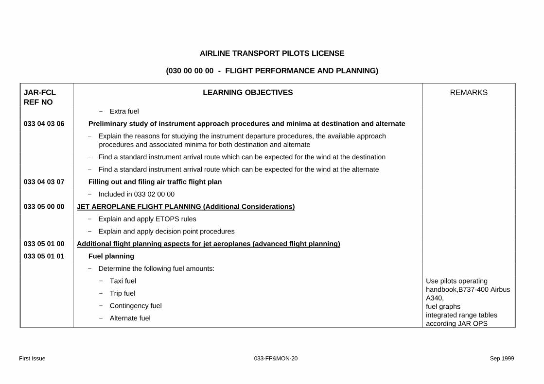
− Extra fuel
033 04 03 06 Preliminary study of instrument approach procedures and minima at destination and alternate − Explain the reasons for studying the instrument departure procedures, the available approach
procedures and associated minima for both destination and alternate
− Find a standard instrument arrival route which can be expected for the wind at the destination − Find a standard instrument arrival route which can be expected for the wind at the alternate 033 04 03 07 Filling out and filing air traffic flight plan − Included in 033 02 00 00 033 05 00 00 JET AEROPLANE FLIGHT PLANNING (Additional Considerations) − Explain and apply ETOPS rules − Explain and apply decision point procedures 033 05 01 00 Additional flight planning aspects for jet aeroplanes (advanced flight planning) 033 05 01 01 Fuel planning − Determine the following fuel amounts: − Taxi fuel
− Trip fuel
− Contingency fuel
− Alternate fuel
Use pilots operatinghandbook,B737-400 AirbusA340, fuel graphs integrated range tablesaccording JAR OPS

AIRLINE TRANSPORT PILOTS LICENSE
(030 00 00 00 - FLIGHT PERFORMANCE AND PLANNING)
First Issue 033-FP&MON-21 Sep 1999
JAR-FCLREF NO
LEARNING OBJECTIVES REMARKS
− Final reserve fuel
− Extra fuel for safety or economical reasons
− Take off fuel
− Block fuel
1subpart D, 1.255
− Compute the distance and/or fuel and/or time for an en-route climb − Calculate the fuel flow given the appropriate data − Calculate the air distance and fuel consumption for a given leg or route − State the reasons for parallel use of both ‘manual’ and ‘computer generated‘ flight plan − Explain that manual flight planning is used as a back up method for computerized flight planning − Differentiate between overhead-overhead and the climb-cruise-descent flight planning methods as
follows:
− Determine time and fuel for each phase of flight (climb, cruise, descent)
− Determine time and fuel in the en-route flight level overhead-overhead:, taking into account theadditionals for climb and descent
− Differentiate between fuel calculations with fuel flow against the integrated range procedure as follows: − Fuel flow procedure: Determination of the required trip fuel with an average fuel flow for the entire
flight
− Integrated range procedure: Determination of the required trip fuel by determining the trip fuel forspecified route sectors, using the nautical air miles flown in these sectors and the integrated rangetables

AIRLINE TRANSPORT PILOTS LICENSE
(030 00 00 00 - FLIGHT PERFORMANCE AND PLANNING)
First Issue 033-FP&MON-22 Sep 1999
JAR-FCLREF NO
LEARNING OBJECTIVES REMARKS
− Explain the principle of the reclearance procedure or ‘decision point’ as a mathematical method ofplanning
− Explain the two different methods of reclearance − Mass reclearance
− Fuel reclearance
− State the reason for implementing the reclearance flight plan when the difference between MinimumTake Off Fuel (MINTOF) and the (Allowable Take Off Fuel (ALLTOF) is equal or smaller less than theContingency fuel (CONT)
− Determine the first possible reclearance(decision) point (using the rule of thumb) , given flight plan and‘reclearance airport’
− Justify the fuel quantities at RECLPT − Justify the fuel quantities for the Minimum Take Off Fuel (MINTOF) − Calculate and enter the nav. data from the ‘reclearance point’ to the ‘reclearance airport’ − Calculate the fuel for the route from the reclearance point to the reclearance airport using the
integrated range table
− Calculate the trip fuel from departure to the reclearance airport − Calculate the minimum take off fuel (MINTOF) from departure to reclearance airport − Calculate the minimum take off fuel for reclearance − Determine the fuel amounts for a flight in accordance with the laid down ’isolated aerodrome’ procedure − Determine the fuel amounts for an Extended Range Twin engine Operations (ETOPS) flight

AIRLINE TRANSPORT PILOTS LICENSE
(030 00 00 00 - FLIGHT PERFORMANCE AND PLANNING)
First Issue 033-FP&MON-23 Sep 1999
JAR-FCLREF NO
LEARNING OBJECTIVES REMARKS
033 05 01 02 Computation of critical point (CP), point-of-equal time (PET), point of no return(PNR) and point-of-safe-return (PSR)
− Compute the distance to the critical point (point of equal time)
− Compute the time of point of safe return considering a given amount of final reserve
− Compute the distance of the point of safe return
Assume: - Wind does not change - Flight level does notchange
- In case of a computerflight plan, the EWC isshown in knots the samevalue but opposite sign
033 05 02 00 Computerised flight planning 033 05 02 01 General principles of present systems − State and describe the advantages and shortcomings of a computer navigation plan 033 06 00 00 PRACTICAL COMPLETION OF A FLIGHT PLAN (navigation plan/ flight log) 033 06 01 00 Extraction of data 033 06 01 01 Extraction of navigational data − Obtain the following navigation data from the planning charts, SID charts, STAR charts, instrument
approach and landing charts
− Courses
− Distances
− Waypoints
Use Jeppesen chart E(HI) 4and E(HI) 5 for CPL/ATPLexaminations.

AIRLINE TRANSPORT PILOTS LICENSE
(030 00 00 00 - FLIGHT PERFORMANCE AND PLANNING)
First Issue 033-FP&MON-24 Sep 1999
JAR-FCLREF NO
LEARNING OBJECTIVES REMARKS
− Bearings and ranges from beacons
− Co-ordinates
Use charts for the airports: Amsterdam, Paris CDG
− Variation
− Obstacle heights and elevations
− Classification of airspace
Madrid London LHR Zurich Munich
033 06 01 02 Extraction of meteorological data − Obtain and decode the following meteorological data − Wind at different and appropriate levels and position of the jetstream
− The presence of thunderstorms
− Cloud base and thickness of cloud layers
− Precipitation
− Temperatures at different levels
− Icing conditions
− Areas of CAT and other turbulence
Use - weather analysis, - weather depiction chart - wind charts for differentlevels
033 06 01 03 Extraction of performance data − From the performance data for the aircraft, determine − Top of climb

AIRLINE TRANSPORT PILOTS LICENSE
(030 00 00 00 - FLIGHT PERFORMANCE AND PLANNING)
First Issue 033-FP&MON-25 Sep 1999
JAR-FCLREF NO
LEARNING OBJECTIVES REMARKS
− Top of descent
− Fuel flow
− True air speed
− Time/ fuel/ distance for climb and descent
− Final reserve fuel
− Alternate fuel
− Find the short distance cruise altitude, given appropriate data 033 06 01 04 Completion of navigation flight plan − Calculate the following parameters to complete the flight plan (navigation plan) − The block fuel
− Total ground distance
− TAS given appropriate data
− Identify the time system in which time entries have to be made in operational flightplan forms − Define the time of departure − Define the arrival time 033 06 01 05 Completion of fuel plan − Obtain the following data − Time, distance and fuel to top of climb Use the fuel consumption

AIRLINE TRANSPORT PILOTS LICENSE
(030 00 00 00 - FLIGHT PERFORMANCE AND PLANNING)
First Issue 033-FP&MON-26 Sep 1999
JAR-FCLREF NO
LEARNING OBJECTIVES REMARKS
− Time, distance and fuel at cruise altitude
− Time, distance and fuel to top of descent
− Time, distance and fuel for descent
− Total time, distance and fuel to destination
tables and graphs of the B737-400, A330 orappropriate aircraft type
− Fuel required from destination to alternate for missed approach, climb to en-route altitude, cruisedescent, approach and landing
− Final reserve fuel
− Compute the TAS for en-route at a certain flight level with the aid of a graph or table − Calculate traffic load, estimated landing mass at alternate and maximum additional load 033 06 01 06 Computation of CP (critical point), including equi-fuel and equi-time points, and PET (point-of-
equal-time) and PNR (point-of-no-return) and PSR (point-of-safe-return)
− Included in 033 05 01 02
033 06 01 07 Completion of air traffic flight plan− Complete an air traffic flight plan for a given aircraft and flight, using the instructions contained in the
latest AIC, together with the nominated airways charts.


![Apple Pascal Operating System Reference Manual (1980)(Apple)[030-0100-00]](https://img.pdfslide.net/doc/110x75/543e3b10afaf9fa80a8b51dd/apple-pascal-operating-system-reference-manual-1980apple030-0100-00.jpg)