Embed Size (px)
Citation preview
THE SOUTHERN LIMITS OF AFRICA IN ANCIENT GEOGRAPHY
A V van Stekelenburg (University of Stellenbosch)
Hellenistic scientists were well aware of the fact that Africa had once in thenorth-west been connected to Europe and in the north-east had not always beenjoined to Asia. The concepts of geological time and of the horizontal movement ofcontinental plates were of course not within their reach, but their conclusions werenevertheless based on sound scientific observation and reasoning. Our mostimportant source for the history of ancient geography till Augustan times is theGeographia of Strabo, written between 9 and 5 B.C. and partly revis~ in A.D. 18-19 (Dilke 1985:62). Strabo quotes the physicist Strato of Lampsacus (died c. 270B.C.) on the existence of a submarine ridge between Spain and Morocco, and hestates that excavations on the Isthmus of Suez produced seasand and shells provingthat it had once been covered by a body of water that had formed a connectionbetween the Mediterranean and the Red Sea (1.3.4). These matters were of interestto Homeric commentators when they touched upon the wanderings of Odysseus andMenelaus, since the former was thought to have sailed through the strait at thePillars of Hercules into the Atlantic,l and the latter in the account of his travels toTelemachus had stated that his wanderings had taken him to the Ethiopians (Od. 4,81-86). Since Homer recognises two groups of Ethiopians "abiding both where thesun sets and where he rises" (Od. 1, 24), the eastern Ethiopians were considered bysome to be the inhabitants of India, and the western to be the African blacks livingon the southern shores of Africa. Homeric commentators argued the case for eitherof these two groups as hosts of Menelaus. A contemporary of Strabo, thegrammarian Aristonicus, had written a book On the Wanderings of Menelaus inwhich the problem was addressed of how Menelaus could have been able to reacheither India or the southern limits of Africa by ship (Strabo 1.2.31). There wereseveral possibilities. One was that Menelaus had travelled around Africa through thestrait at the Pillars of Hercules, which would have made him the first Europeanreputed to do so. Those who considered the Indians to be the Ethiopians visited byMenelaus, used the duration of Menelaus' voyage-eight years-as an argument tosupport their theory (ibid.). Another theory was that the Isthmus of Suez was at thattime still submerged so that Menelaus could have crossed it by ship. Strabo rejectsthis possibility on the grounds that in that case Odysseus could not have sailed intothe Atlantic, because the lowering of the level of the Mediterranean which hadresulted in the emergence of the Isthmus of Suez was supposed to have been causedby the breaking of the landbridge at the Pillars of Hercules .. Therefore, if Menelaus
1 On his voyage to the Ocean stream and the Cimmerians (Od. 10.506-510; 11.9-19, 639-640;12.1-2)
Akroterion 41 (1996) 58-73
SOUTHERN LIMITS OF AFRICA 59
had been able to sail from the Mediterranean into the Red Sea, Odysseus could nothave sailed from the Mediterranean into the Atlantic, and vice versa (ibid.).2
The division of the known world into continents probably originated in Ioniaduring the sixth century (Bunbury 1879:1.146). Homer knew nothing yet of such adivision.3 By the end of the sixth century the tripartite division must, however, havebeen accepted because it forms the base of Hecataeus' Periodos G~s, despite the factthat he describes Europe in one book and Asia- and Africa together in the second(Bunbury 1879:1.145-146; Thomson 1948:66). For many centuries afterwards thereexisted difference of opinion among geographers as to the true boundary betweenAfrica and Asia. Some argued for the Nile, others for the Red Sea.4 Herodotusscoffs at the former, at the same time making a case for the recognition of a fourthcontinent: the Egyptian Delta which, he argues, originated independently from theother continents as alluvial land (2.14-16). About the borderline between the twocontinents he states that "the only true boundary between Asia and Libya is formedby the frontiers of Egypt" ~In this he is supported by Strabo who refers to those whotook this frontier-the Red Sea-for a more natural border between the twocontinents as "the later" (17.1.5) and "more able" (1.2.28) geographers.Nevertheless he himself names the region between the Nile and the Red Sea as partof Arabia (17.1.21; 17.1.30) and he gives a description of this region in the sectiondealing with Arabia (16.4). So does Pliny the Elder (N.H. 6.178) who clearly stillconsiders the Nile as the dividing line between Africa and Asia (N.H. 3.3).
The ancient geographer set himself as a task to study and describe only theinhabited world or OtKOVP.SII1/. As Strabo states: "The geographer takes into hispurview only this our inhabited world (TaVT71ll P.Oll1/lI T1IlI Ka8' r,p.ii~OtKOVP.SII1/1I),5and its limits are marked off on the south by the parallel through theCinnamon-producing Country (Somalia) and on the north by the parallel through
2
3
4
5
A third theory, that there had been a man-made canal linking the Nile in northern Egypt with theRed Sea, Strabo rejects on historical grounds, because the first attempt to build such a canal hadbeen undertaken by King Necho c. 600 B.C. (Herod. 2.158; 4.39; Strabo 1.2.31 (wronglyattributing it to Sesostris); 17.1.25). The undertaking was finally completed under Ptolemy II(Slrabo 17.1.25; Diod. Sic. 1.33.1; Plin. N.H. 6.165-166). See W. H. Gross in Der KleinePauly, s. v. Kanal. Slrabo himself is of the opinion that Menelaus had merely reached Ethiopia'snorthern border with Egypt by sailing up the Nile (1.2.32).Homer does not mention Europe or Asia, and Libya is only named as a region of great fertilitywest of Egypt (Od. 4.85-86; 14.295). Libya would keep this meaning with a later extension toindicate the whole of Africa. Asia occurs only in 11. 2.461 as a local appelation: "the Asianmeadows on the banks of the Cayster". Europe is first found in the 'Homeric' Hymn to Apollo.The appellation refers there, however, to continental Greece as opposed to the Peloponnese andthe islands.Then named the Arabian Gulf. The name 'Red Sea' referred to the Gulf of Aden and the ArabianSea.Elsewhere he limits the geographer's field of study to "the known parts of the inhabited world"(2.5.5). Ptolemaeus gives similar definitions: Geogmphia imitatio est pictume totius partisterme wgnitae (Geog. 1.1); ... (terme) nostme habitabilis describere orbem (Geog. 1.2).
60 VANSTEKELENBURGIerne (Ireland)" (2.5.34).6 Since ancient geographers were only interested in theinhabited world, the degree of inhabitability played an important role in theirdeductions. Ancient geography was not restricted to the earth's surface and features,but included fields such as zoology, ethnology, and cultural anthropology. Inestablishing the degree of inhabitibility of a country or region these factors weretaken into account and inevitably Europe was normative here. Strabo therefore findsfault with those geographers who divide the oikoumene into three continents,because, as he says, "this threefold division indicates a division in three equal parts"(17.3.1). This conclusion, which would be a non sequitur to us, is onlyunderstandable in the light of the premises of ancient geography and the
lfeelings of
cultural superiority of its Graeco-Roman practitioners with regard to the rest of theworld and of Europe's superiority in the eyes of Greek and Roman geographers.
Strabo begins his general description of the three continents early in his work bysaying: "But I must begin with Europe, because it is both varied in form andadmirably adapted by nature for the development of excellence in men andgovernments, and also because it has contributed most of its own store of goodthings to the other continents." Among Europe's qualities through which it excelledover the other continents he names its largely temperate climate, its wealth inagricultural produce and minerals and its scarcity of wild animals (2.5.26). Strabo'snotions were shared by others. Pliny calls Europe "nurse of the race (Le. theRomans) that has conquered all the nations, and by far the loveliest portion of theearth, which most authorities, not without reason, have reckoned to be not a thirdpart, but half of the world" (N.H. 3.5). In the light of such prenotions Strabo'shesitation to give Africa the same status as Europe and Asia is understandable. Notonly, he says, may Africa be the smallest of the continents, but it is also "muchinferior in power, for the greater part of the interior and of its ocean-coast is desert,and it is dotted with settlements that are small, scattered, and mostly nomadic; andin addition to its deserts, its being a nursery of wild beasts drives people out evenfrom land that could be inhabited" (17.3.1).
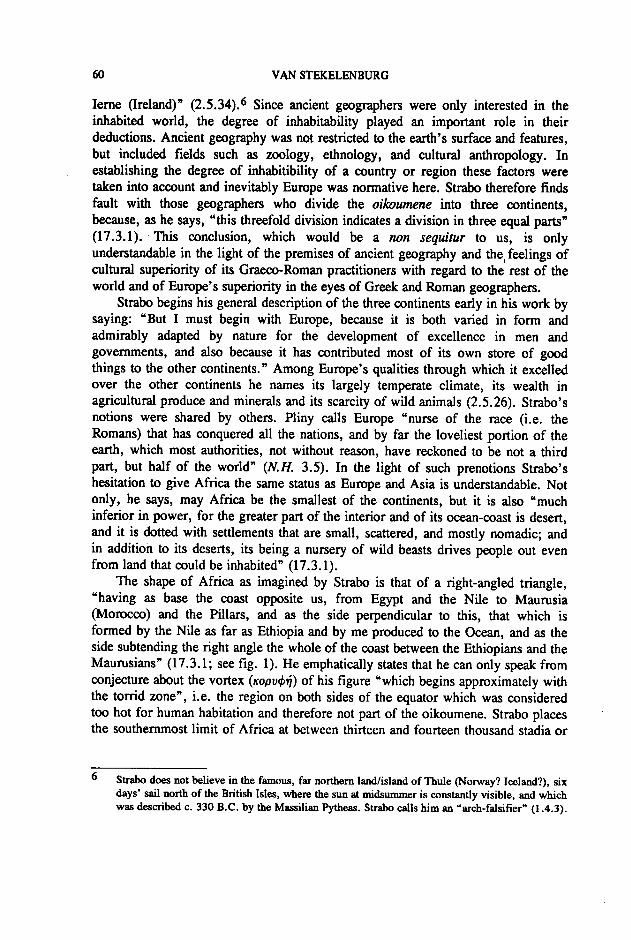
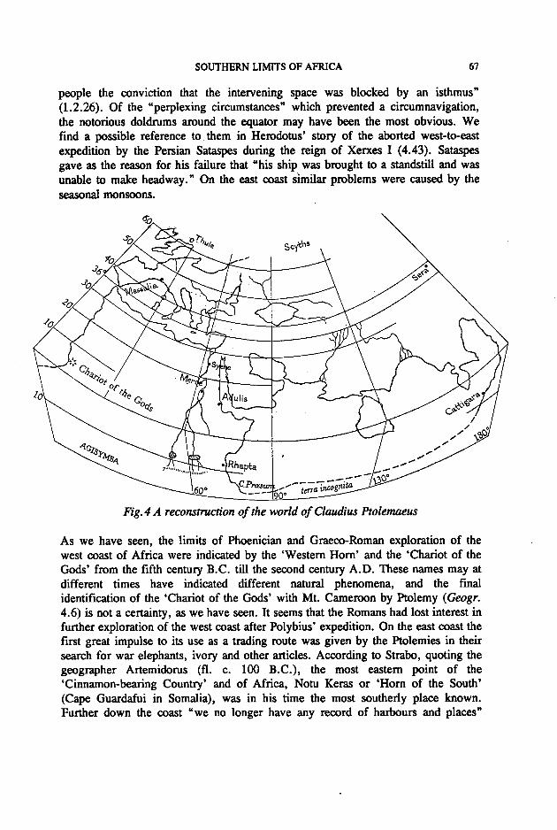
The shape of Africa as imagined by Strabo is that of a right-angled triangle,"having as base the coast opposite us, from Egypt and the Nile to Maurusia(Morocco) and the Pillars, and as the side perpendicular to this, that which isformed by the Nile as far as Ethiopia and by me produced to the Ocean, and as theside subtending the right angle the whole of the coast between the Ethiopians and theMaurusians" (17.3.1; see fig. 1). He emphatically states that he can only speak fromconjecture about the vortex (KOPV<p~) of his figure "which begins approximately withthe torrid zone", i.e. the region on both sides of the equator which was consideredtoo hot for human habitation and therefore not part of the oikoumene. Strabo placesthe southernmost limit of Africa at between thirteen and fourteen thousand stadia or
6 Strabo does not believe in the famous, far northern land/island of Thule (Norway? Iceland?), sixdays' sail north of the British Isles, where the sun at midsummer is constantly visible, and whichwas described c. 330 B.C. by the Massilian Pytheas. Strabo calls him an "arch-falsifier" (1.4.3).
SOUTHERN LIMITS OF AFRICA 61
c. 3000 km south of Alexandria (ibid. and 1.4.2). In calculating the maximumbreadth of Africa Strabo uses the distances worked out in the third century B.C. bythe great Alexandrian geographer Eratosthenes (1.4.2; 17.3.1). The most southerntown known in inland Africa in Eratosthenes' time was Meroe, capital of animportant Egyptianized Ethiopian civilization. From there to the parallel that definedthe southern limits of the oikoumene _and which ran through the'Cinnamon-producing Country' was, according to Eratosthenes, a distance of 3400stadia or 425 Roman miles or 752 km. (1.4.2). Strabo allows a maximum of onethousand stadia for the distance between the end of the oikoumene and the southernocean (17.3.1), which means that he imagines Africa to end 550 miles or close to1000 km south of Meme approximately on the 10th parallel running throughEthiopia and Somalia. This notion seems to have been widely held by Hellenisticand Roman geographers. It would only change with the expansion of the trade routesdown the east coast starting in the reign of Tiberius, Le. during Strabo's old age.The Elder Pliny, who could already have known better but relied much on outdatedsources, gives a distance of 5000 stadia or 625 miles as the one that "authorities arevirually all agreed on" for the distance from Meroe to the south coast (N.H. 6.196).
~:'-:.'",: .....:":~~(~~~:t~~.:'~~,~-
Fig.] The inhabited world according to Strabo
The notion that the end of Africa was to be found not very far south of Egypt wasstrengthened by the nature and the name of the people living there: the Ethiopians,which was the generic name for all the black people of Africa. Originally, however,the name 'Ethiopian' had nothing to do with Africa. The first Ethiopians were apurely mythological creation (Lesky 1959:29-35). They were the people living in

62 VAN STEKELENBURG
the extreme east, who had their faces scorched (aUh-O'll"8~) by the nearness of therising sun. They were credited with supra-normal qualities like extreme longevity(Herod. 3.23) and innocence (II. 1.423)-as were other people living at the edges ofthe world (Lesky 1959:32-33; Romm 1992:45-81). The Ethiopian ally of theTrojans, Memnon, son of Eos, naturally came from the east, and the Homeric gods,when they retreated to the Ethiopians for hecatombs of bulls and lambs (II. 1.423-424; Od. 1.22-25; 5.282), always went to the east (Lesky 1959:31). At a laterstage, but already before Homer's time, Ionian rationalism demanded the existenceof another nation of 'burnt-faces' in the west, scorched by the setting sun (Lesky1959:34-35). Hence these two nations form in Homer "the Ethiopiaps that aresundered in twain, the furthermost of men, abiding some where Hyperion sets andsome where he rises" (Od. 1.23-24). While India was not yet known, the Greeksbecame aware, and this also before Homer's time, of the existence of dark-skinnedpeople living to the south of Egypt, and these now became the third kind ofEthiopians, despite the inconsistency provided by their southern habitat. TheseEthiopians also occur in Homer, as the ones visited by Menelaus (Od. 4.81-86).Only from the sixth century onward and especially later as a result of Alexander'sexpedition, did the Greeks become acquainted with the dark-skinned people of Indiawho could now ftll the place of the original Ethiopians of the east (Bunbury1879:1.142).
Hellenistic geographers went to considerable length trying to reconcile all thesedifferent Ethiopians-of the east, the west and the south-with the geographicalrealities of their own time. The problems were legion for those who, like Strabo,took Homer seriously. While not going so far as to endow Homer with allknowledge, Strabo and others accepted as natural that the bard possessed vastknowledge of areas that belonged to poetry's domain, like generalship, rhetoric andgeography (1.2.3). He vehemently opposes Eratosthenes' declaration that poetry is"a fable-prating old wife, who has been peIlllitted to invent whatever she deemssuitable for purposes of entertainment" (ibid.). An important problem for Hellenisticgeographers and commentators of Homer alike was to decide what Homer meant bythe Ethiopians' being "sundered in twain". Strabo discusses the different possibilitiesbut decides for himself that Homer must have referred to the Red Sea as separatingthe Ethiopians living on the southern seaboards of Africa from those living in thesouthern regions of Asia (1.2.24-26).
The occurrence of Ethiopians in the south of Asia and of Africa seems to haveled to the notion that the southern regions of the two continents were in some wayconnected. So did the fact that elephant are found in both cOntinents (Arist. DeCaelo 2.14.298a). The mystery of the sources of the Nile also favoured thismisconception. Alexander the Great, when he first came to the Indus, was convincedthat it was the Nile (Arrian Anab. 6.1; Strabo 15.1.24) and Vergil describes the Nileas "the river that has swept unbroken down from the coloured Indians" (Georg.4.293),7 The perception that there existed a vast terra incognita connecting Africa
7 Pausanias connects the Nile with the Euphrates (2.5.2). cr. further Aeschylus Suppl. 284-286;Polybius 3.38.1; and Seneca Quaest. Nat. 5.10.2.

SOUTHERN UMITS OF AFRICA 63
and Asia, which turned the Indian Ocean into an inland sea, may have beenfurthered by the fact that Indian produce reached the Graeco-Roman. world viaemporia on the African coast of the Red Sea (Cary &Warmington 1963: 122).
Since the Ethiopians were "the furthermost of men" (Od. 1.23), the regionswhere they lived could not be far removed from the edge of the world. Thecalculations of the Hellenistic geographers with relation to the distance from Meroeto the shores of the ocean therefore neatly fitted their presumptions derived fromHomer's utterances. Now we must look at the deductions ancient geography derivedfrom knowledge empirically obtained with relation to the southernmost edges ofAfrica. The shore south of Egypt had not ever been seen by anybody. The westcoast, however, had already been explored by sailors for many centuries and, byStrabo's time, also the east coast. The furthest points reached by these explorerswere of importance for map-makers, because, as Strabo says, referring to caseswhere frontiers of the known oikoumene were prevented by intermediate stretches ofland from being navigated: "it will suffice to ftll out and complete the outline ... byjoining with a straight line the extreme points reached on the coasting voyages madeon both sides of the oikoumene" (2.5.5). The application of this principle in the caseof Africa resulted in the hypotenuse of Strabo's right-angled triangle, which wasformed by "the whole of the coast between the Ethiopians and the Maurusians"(17.3.1). Exploration of the east coast had by Strabo' s time indeed not proceededpast the 'Cinnamon-producing Country'. The beginnings of the supposed southernshore-line on the 10th parallel through Somalia is therefore in accordance with theinformation available in his day. It is different, however, with Strabo' srepresentation of the west coast. Even when we accept that Strabo's triangle is meantto resemble its geometric prototype only by approximation, it still means that Strabodoes not consider the west coast of Africa as having been explored in a southerlydirection very far. His description of the west coast is indeed almost totally limitedto Maurusia (Morocco). He mentions the Canaries (Isles of the Blest; 1.1.5; 3.2.13)and the fact that south of Maurusia "the western Ethiopians" are living (17.3.5),8but nothing more. Most strange is Strabo's silence about the expedition of Polybiusshortly after the destruction of Carthage, in which the Senegal River was probablyreached (Pliny N.H. 5.9; 6.199). Strabo knew Polybius' work well. He madeextensive use of Polybius' Histories, and his own historical work, which has notsurvived, was intended as a continuation of Polybius' work (11.9.3). NeverthelessStrabo remains silent about this unique Roman expedition down the west coast ofAfrica. Polybius was probably inspired by the famous voyage of the CarthaginianHanno c. 500 B.C. of whose account a Greek translation has survived.9 Hanno'sexpedition ended three days after seeing a high mountain called "Chariot of theGods" rOxTIIJ.CX Oew,,) by his interpreters. This mountain has been diversely
89
'Western' here as distinguished from the eastern Ethiopians south of Egypt.Geographici Graeci Minores, vol. 1.1-14; Cary & Warmington 1963:63-68; Thompson &Ferguson 1969:5-7.
64 VANSTEKELENBURG
identified as either Mt. Kakulima in Sierra Leone (Cary & Warmington 1963:67) orMt. Cameroon (Thompson & Ferguson 1969:6). Carthaginian traders were goingdown the coast regularly to at least the Senegal basin to exchange their products forgold (Hdt. 4.196). It is possible that the Romans, after the fall of Carthage, had aneye on this trade and therefore allowed Polybius his expedition.
The 'Chariot of the Gods' and the nearby cape called 'Western Horn' byHanno's Phoenicians, would remain the two beacons on the horizon of explorationdown the west coast during antiquity. In the middle of the second century ADClaudius Ptolemaeus seems to define the mountain clearly as Mt. Cameroon byplacing it almost correctly on a latitude of 5"N (Geog. 4.6). Ptolemy's,latitudes ofthe west coast are, however, in many cases incorrect. The mountain and the WesternHorn were probably also the ultimate points in a major geographical feat of Strabo'stime about which he is totally silent, the Map of Agrippa in the Porticus Vipsania inRome. This map of the oikoumene, engraved or painted on a wall, was a monumentto Roman imperialism and had probably been an initiative of Julius Caesar (Dilke1985:40-43; Harley & Woodward 1987:205-209). Its continuation had beenentrusted to Agrippa by Augustus, and though it had not been completed by the timeof the former's death, it must have been completed when Strabo was in Rome after14 A.D.I° The Elder Pliny uses it as a major source of geographical information,also naming the Promontorium Hesperium and the Oehima TheOnas the terminus ofexploration (5.10) while he optimistically thinks that here the halfway mark on thecircumnavigation of Africa has been reached (6.197).11
If Strabo ignores the data about the west coast which had been collected by histime, his interest and belief in reputed circumnavigations of Africa is not much morepositive. Of the earliest one known, by Phoenician sailors sent out by the Egyptianking Necho around 600 BC, he only says that Poseidonius says that Herodotusbelieves that it was accomplished (2.3.4). A similar indirect statement is made aboutthe claim to a circumnavigation by "a certain Magus" at the court of Gelo ofSyracuse (ibid.). Poseidonius had found these reports unsupported by testimony.Strabo then launches a lengthy attack on Poseidonius for doubting the veracity ofthese voyages while believing in the colourful adventures of a certain Eudoxus ofCyzicus from the second century, and his claims that he had found material proofthat ships from Cadiz regularly made west to east trips around Africa (ibid.).
Up to today the historicity of none of these reported circumnavigations has everbeen proved, and it probably never will (Cary & Warmington 1963:111-128). Ifthey took place they certainly did not result in any understanding about the extent
10 That Strabo visited or stayed in Rome after 14 A.D. is evident from his description of theMausoleum Augusti (5.3.8).
11 Pliny names the Cape first and then the mountain, as Hanno did, while Ptolemy gives a reversedorder. The many capes on the west coast naturally led to confusion. It seems that Pliny may herebe following Hanno and/or Polybius (I. Desanges in the Bude-edition of bk 5.1-46 in I.e.).Agrippa is, however, the source mentioned by Pliny for this section and it is unthinkable thatthe two beacons would not have occurred on his map.
SOUTHERN LIMITS OF AFRICA 6S
and course of Africa's coasts. None of these sailors left a route description such asthe (sketchy) one of Hanno. Of the circumnavigation by Necho's Phoenicians weonly know what Herodotus tells us (4.42): that the Phoenicians entered the oceanfrom the Red Sea, put in every autumn on the African coast to sow and harvest,reached the Pillars of Hercules in the third year and, what Herodotus does notbelieve, that they had the sun on their right-in the north-when they sailed aroundthe southern end of Africa. The reason why- Herodotus could not accept thisstatement about the position of the sun at midday was not because he thought itimpossible that the sun could ever be seen in the north anywhere in the world. InHerodotus' time the changes in the position of the sun when one travelled southwere well known. Herodotus had visited Elephantine (2.29) near the tropic ofCancer, where the sun is almost overhead during the summer solstice and south ofwhich the shadows sometimes fall 'the wrong way'. His disbelief of thePhoenicians' statement is therefore not a result of primitive incredulity, but stemsfrom the fact that he, like Strabo, could not believe that Africa stretched over theequator into the southern hemisphere.
There were, however, persons who could imagine an African continentcontinuing further and further southwards. One of these was Aristotle who in hisMeteorologica depicts a world with two parallel oikoumenai-one in the northernand one in the southern hemisphere-separated by the zone between the tropicswhich is too hot for habitation.12 He does not indicate whether he thinks thesouthern oikoumene contains human life, only that the winds in both zones mustmirror each other (2.5.362a-b). Earlier, Plato had Socrates say that outside theworld known to the Greeks there are probably a great many similar regions (PhaedoI09A-I11C). Strabo considers such theories plausible but, if these regions areinhabited, he says, they are certainly not inhabited by men such as exist in our ownoikoumene (2.5.13). This is all he wants to advance because, as he says, suchspeculation does not belong to the geographer's domain, but to that of anotherscience, i.e. philosophy (ibid.), thus drawing a line between the speculative and theempirical sciences. As a geographer he is only interested in that part of the world"which falls within our map" .
12 Strabo differs from Aristotle in that the latter believed the wliole region between the two tropicsto be uninhabitable, while Strabo reckons that less than half could not support human life(2.2.2).
66 VAN STEKELENBURG
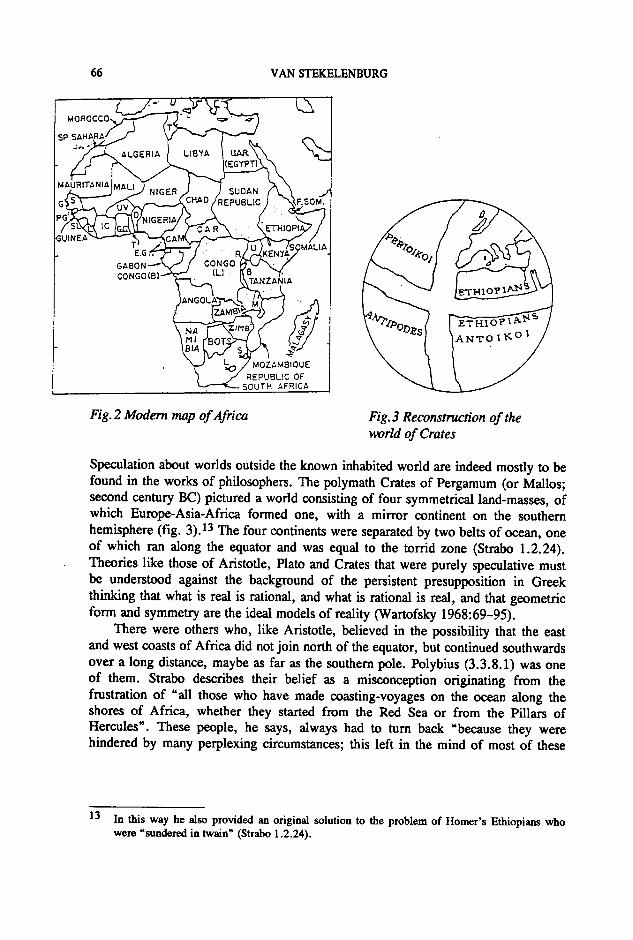
Fig.2Modem map of Africa Fig.3 Reconstruction of theworld of Crates
Speculation about worlds outside the known inhabited world are indeed mostly to befound in the works of philosophers. The polymath Crates of Pergamum (or Mallos;second century BC) pictured a world consisting of four symmetrical land-masses, ofwhich Europe-Asia-Africa formed one, with a mirror continent on the southernhemisphere (fig. 3).13 The four continents were separated by two belts of ocean, oneof which ran along the equator and was equal to the torrid zone (Strabo 1.2.24).Theories like those of Aristotle, Plato and Crates that were purely speculative mustbe understood against the background of the persistent presupposition in Greekthinking that what is real is rational, and what is rational is real, and that geometricform and symmetry are the ideal models of reality (Wartofsky 1968:69-95).
There were others who, like Aristotle, believed in the possibility that the eastand west coasts of Africa did not join north of the equator, but continued southwardsover a long distance, maybe as far as the southern pole. Polybius (3.3.8.1) was oneof them. Strabo describes their belief as a misconception originating from thefrustration of "all those who have made coasting-voyages on the ocean along theshores of Africa, whether they started from the Red Sea or from the Pillars ofHercules". These people, he says, always had to turn back "because they werehindered by many perplexing circumstances; this left in the mind of most of these
13 In this way he also provided an original solution to the problem of Homer's Ethiopians whowere "sundered in twain" (Strabo 1.2.24).
SOUTHERN LIMITS OF AFRICA 67
people the conviction that the intervening space was blocked by an isthmus"(1.2.26). Of the "perplexing circumstances" which prevented a circumnavigation,the notorious doldrums around the equator may have been the most obvious. Wefind a possible reference to them in Herodotus' story of the aborted west-to-eastexpedition by the Persian Sataspes during the reign of Xerxes I (4.43). Sataspesgave as the reason for his failure that "his ship was brought to a standstill and wasunable to make headway." On the east coast similar problems were caused by theseasonal monsoons.
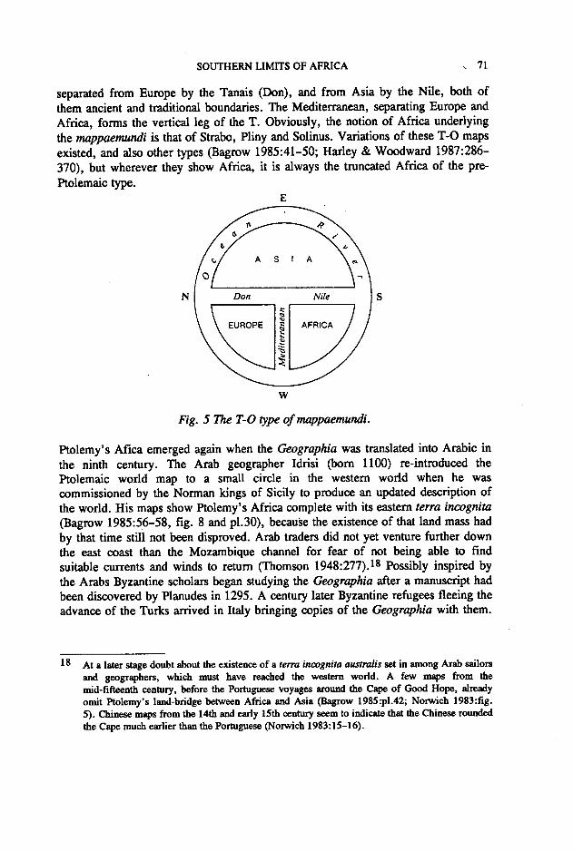
Fig. 4 A reconstruction of the world of Claudius Ptolemaeus
As we have seen, the limits of Phoenician and Graeco-Roman exploration of thewest coast of Africa were indicated by the 'Western Horn' and the 'Chariot of theGods' from the fifth century B.C. till the second century A.D. These names may atdifferent times have indicated different natural phenomena, and the finalidentification of the 'Chariot of the Gods' with Mt. Cameroon by Ptolemy (Geogr.4.6) is not a certainty, as we have seen. It seems that the Romans had lost interest infurther exploration of the west coast after Polybius' expedition. On the east coast thefirst great impulse to its use as a trading route was given by the Ptolemies in theirsearch for war elephants, ivory and other articles. According to Strabo, quoting thegeographer Artemidorus (fl. c. 100 B.C.), the most eastern point of the'Cinnamon-bearing Country' and of Africa, Notu Keras or 'Horn of the South'(Cape Guardafui in Somalia), was in his time the most southerly place known.Further down the coast "we no longer have any record of harbours and places"

68 VAN STEKELENBURG
(16.4.14). Ptolemaic produce must, though, have reached destinations more to thesouth, as coins found in Tanzania prove (Oliver-Mathew 1963:97). The trade herewas, however, directed via Arab merchants who controlled it "by ancient right" asan anonymous "Periplus of the Erythraean Sea" of the second half of the firstcentury A.D. says (GGM 1.270-271). The Arabs knew the secrets of the tradewinds and guarded them jealously. It was only during Strabo's old age or after hisdeath that a certain Hippalus, during the reign of Tiberius, discovered their pattern.Thereafter Graeco-Roman traders pushed southwards down the coast of Azania, asthe eastern regions of Kenya and Tanzania were known (Ptol. 4.7), exchangingcloth, glass, iron (for spear points), and a variety of other articles, for ivory, spices,tortoise-shell and slaves (Oliver-Mathew 1963:94-95). The Periplus naines Rhaptaas the last emporium. Ptolemy places Rhapta on the Rhaptus river at 70S (4.7). Itmay be identified as modern Pangani on the Rufu (Rhaptus!)-Pangani river slightlymore north of Zanzibar (Freeman-Grenville 1988:2.6). Eight degrees farther downPtolemy located the southernmost point ever named in ancient geography: Prason(Prasum) promontory, possibly Cape Delgado on the border between Tanzania andMozambique. The difference of eight degrees equals a distance of 4000 stadia or500 Roman miles or c. 885 kIn, which is approximately 300 kIn more than theactual distance between Pangani and Cape Delgado. Ptolemy's overestimation isprobably an unwanted result of his dependence on his source, Marinus of Tyre, whowrote earlier in the second century. Ptolemy had a lot to say about Marinus'tendency to exaggerate distances (1.9; 1.20; Dilke 1985:72-75; Harley &Woodward 1987:178-180). His own corrections were, however, often totallyinadequate. 14
Trade by Graeco-Roman merchants in Azania seems to have continued until inthe sixth century, though it became impeded by Persian dominance from the latefourth century onward (Oliver-Mathew 1963:98-99). A total of fifty-one coins,from Nero's reign till the early fourth century, has been found in the region(Freeman-Grenville 1962:21-24). One single coin of Constantine has been found inMadagascar. Rumours and reports about the existence of this large island to thesouth-east of Azania may have led geographers like Marinus and Ptolemy to believethat below Prasum the coast turned sharply eastwards to form the coastline of a vastte"a incognita connecting Africa with East Asia (Ptol. 7.3; 7.5 (see fig. 4)). Thusthe old vision of an Africa connected to Asia in the south was recreated and theIndian Ocean once more became an inland sea, only larger than before.
14 One of these was to have far-reaching consequence in the future. Marinus had calculated thelength of the oikumene along the parallel of Rhodes from the Canaries till the known easternlimits of China as 228° which Ptolemy connected to 180" (1.11-14; fig. 4) which is still far toohigh. The real figure is 126°. These erroneous ideas of the ancient geographers, and some addedmiscalculations of his own, led Columbus to beleive that the unexplored remainder of the globealong that same parallel from the Canaries to China was only 78° or 3 900 miles. This gave himthe confidence for his expedition which he otherwise might not have obtained (Thomson1948:333-339).

SOUTHERN UMITS OF AFRICA 69
Ptolemy was the last of the great geographers of antiquity. His work-in Latintranslations from the early 15th century onward (Dilke 1985:16Q-164)-formed apoint of departure for the cartographers and explorers of the Age of Discovery. Thevoyages of Bartolomeu Diasand Vasco da Gama put paid to Ptolemy's southernland-bridge between Africa and Asia. But undeniably the southern limits of theoikoumene had been vastly extended in the 150.years since Strabo. Ptolemy givesRhapta and Prasum a vast hinterland. If one could manage to get past 'man-eatingEthiopians' one would reach the Mountains of the Moon "from which the lakes ofthe Nile receive snow water" (4.8).15 Behind these Mountains of the Moon was "aregion of wide expanse" named Agisymba. The name Agysimba had in the past beenused to refer to the farthest region known to exist south of Tripolitania. ThisAgysimba had reportedly at some time in the past been reached by a Roman, JuliusMaternus, who had joined an expedition of the king of the Garamantes (Geog. 1.8).The travellers had gone south for four months, which means they can not havepenetrated further into Africa than Chad or Sudan. Nevertheless Marinus had usedthis expedition to place Agisymba south of the Equator nearly on the Tropic ofCapricorn. Ptolemy refused to follow Marinus here, but his corrections placedAgisymba and the sources of the Nile still far south of the Equator on the samelatitude as Rhapta. From the fifteenth till the nineteenth century, till the discoveriesof inter alia Lakes Victoria and Albert by Speke and others from 1857 onwards,Ptolemy's placing of the sources the Nile remained largely unchallenged. TheAfrikaner voortrekkers who found the source of the Nile near Nylstroom inNorthern Transvaal were therefore reacting to expectations arising from thePtolemaic tradition.
Ptolemy's Agisymba contains several mountain ranges carrying names likeDauchis and Ion. The longitudinal degrees on which Ptolemy positions thesemountains would have them as far as Angola. Though much of Ptolemy's mappinghere is partly based on incorrect calculations and partly the result of "a happy guessfrom the vaguest hearsay" (Thomson 1948:277) it does show that by the secondcentury A.D. at least some people in the ancient world were aware of the existenceof an African continent that differed greaty from the Africa imagined byEratosthenes and Strabo. They realised that Africa was a continent of vastdimensions stretching from the northern deep into the southern hemisphere.
Unfortunately after Marinus and Ptolemy the line of progress was broken. Theirwork did not become a stepping-stone for continued geographical research. Thefollowing generations hankered more for spiritual and religious revelation than forscience. A few compilations of Ptolemy's work were produced, but with theexception of that of Marcianus of Heraclea (about c. A.D. 400) they show a great
15 These sources of the Nile, though, of course, placed much too far to the south, may refer to theRuwenzori range or Mounts Kilimanjaro and Kenya, and Lakes Victoria and Albert. A garbledreport by a certain Diogenes from the late first century A.D. seems to have reached Marinus andthrough him Ptolemy (Geog. 1.9; 4.7; 4.8; Cary & Warmington 1963:214-215;Thomson &Ferguson 1969:34).

70 VAN STEKELENBURG
lack of insight (Thomson 1948:372-373). A few authors (e.g. AmmianusMarcellinus, Martianus Capella) glean geographical facts from Ptolemy, probablyobtained indirectly. More often than not he is, however, totally ignored andpreference is given to older sources with obsolute ideas, especially Pliny theElder,16 Solinus, the third century geographer whose work became authoritative inthe Middle Ages, wrote a rehash 'of Pliny's often sensational and phantasticdescriptions of countries and continents. His Africa ends where that of Pliny andStrabo has ended: slightly over 600 miles south of Meroe (Polyhistor 30.14).Martianus Capella's figures on the dimensions of Africa (6.703) are also taken fromPliny (6.208-209). We meet again with Strabo's right-angled tria.qgle in thedescription of Africa by Avienus (4th century): trina loco frons est (Descriptio orbis3.364).17 Other antiquated theories emerge again or simply persist, like that of theinhabitability of the torrid zone (Martianus Capella 6.602-607; Firmicus MaternusAstron. 1.4; Macrobius Somn. Scip. 2.8.3).
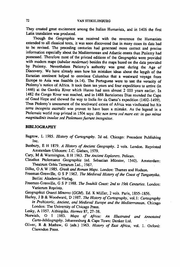
Clearly the image of the Africa of Marinus and Ptolemy, with its extension deepinto the southern hemisphere, had not succeeded in impressing itself on the minds ofthe Graero-Roman world of Late Antiquity. Historical developments also did notfavour this. The problems besetting the Roman Empire negatively affected thepotential for continued exploration of the African continent. Though North Africareached its height of Romanization in the third century it became more and moredetached from its southern hinterland. We hear no more of expeditions like those ofJulius Maternus and others related by Pliny and Ptolemy. The continuing trade downthe east coast was apparently too insignificant to establish wide-spread knowledgeabout Africa's southward extent, and it died out completely in the sixth century. Therise of Christianity was not advantageous to intellectual endeavour outside the realmof theology. Christian intellectuals had to subject the authority of the classics to thatof the Bible, which sometimes created uneasy predicaments. Since the Bible speaksof the "four comers" of the world, the earth cannot possibly be round. Though theglobe never dissapeared totally from intellectual thinking-witness Origen, Bede andDante-most Christian authors accepted the biblical flat earth as a revelation, or theysimply evaded the problem (Bagrow 1985:41-42; Thomson 1948:384-389). Themappaemundi that became most current in Medieval Europe provided the means toan ambivalent interpretation by being both round and flat. Most widespread were theso-called T-O maps based on the division of the world as described by Isidore ofSeville (7th century) in his Etymologiae (14.2.3; see fig. 5). Apart from theirimplied or potential flatness all the elements of these maps are classical: the island ofthe earth is surrounded by the Ocean; Asia, generally pictured at the top, is
16 The scant attention given to Ptolemy by contemporaries and later writers, and other factors,have led to discussion and controversy about the contents and the authorship of the eight booksof the Geographia as we know it. No Greek text of the work older than the thirteenth centuryexists (Harley & Woodward 1987:266-272;Bagrow 1985:34-35).
17 The Descriptio orbis was a paraphrase of the Periegesis of Ptolemy's contemporary DiogenesPeriegetes.
SOUTHERN LIMITS OF AFRICA , 71
separated from Europe by the Tanais (Don), and from Asia by the Nile, both ofthem ancient and traditional boundaries. The Mediterranean, separating Europe andAfrica, forms the vertical leg of the T. Obviously, the notion of Africa underlyingthe mappaemundi is that of Strabo, Pliny and Solinus. Variations of these T-O mapsexisted, and also other types (Bagrow 1985:41-50; Harley & Woodward 1987:286-370), but wherever they show Africa, it is always the truncated Africa of the pre-Ptolemaic type.
E
N s
w
Fig. 5 The T-O type ojmappaemundi.
Ptolemy's Afica emerged again when the Geographia was translated into Arabic inthe ninth century. The Arab geographer Idrisi (born 1100) re-introduced thePtolemaic world map to a small circle in the western world when he wascommissioned by the Norman kings of Sicily to produce an updated description ofthe world. His maps show Ptolemy's Africa complete with its eastern terra incognita(Bagrow 1985:56-58, fig. 8 and pI.30), because the existence of that land mass hadby that time still not been disproved. Arab traders did not yet venture further downthe east coast than the Mozambique channel for fear of not being able to findsuitable currents and winds to return (Thomson 1948:277).18 Possibly inspired bythe Arabs Byzantine scholars began studying the Geographia after a manuscript hadbeen discovered by Planudes in 1295. A century later Byzantine refugees fleeing theadvance of the Turks arrived in Italy bringing copies of the Geographia with them.
18 At a later stage doubt about the existence of a terra incognita australis set in among Arab sailorsand geographers, which must have reached the western world. A few maps from themid-fifteenth century, before the Portuguese voyages around the Cape of Good Hope, alreadyomit Ptolemy's land-bridge between Africa and Asia (Bagrow 1985:p1.42; Norwich 1983:fig.5). Chinese maps from the 14th and early 15th century seem to indicate that the Chinese roundedthe Cape much earlier than the Portuguese (Norwich 1983:15-16).
72 VAN STEKELENBURG
They created great excitement among the Italian Humanists, and in 1406 the firstLatin translation was produced.
Though the Geographia was received with the reverence the Humanistsextended to all classical texts, it was soon discovered that in many cases its data hadto be revised. The preceding centuries had generated more correct and preciseinformation especially about the Mediterranean and Atlantic coasts than Ptolemy hadpossessed. Therefore most of the printed editions of the Geographia were providedwith modem maps (tabulae modernae) besides the maps based on the data providedby Ptolemy. Nevertheless Ptolemy's authority was great during the Age ofDiscovery. We have already seen how his mistaken ideas about the lepgth of theEurasian continent helped to convince Columbus that a westward voyage fromEurope to Asia was feasible (n.14). The Portuguese were to test the veracity ofPtolemy's notion of Africa. It took them ten years and four expeditions to arrive (in1446) at the Gambia River which Hanno had seen almost 2 000 years earlier. In1482 the Congo River was reached, and in 1488 Bartolomeu Dias rounded the Capeof Good Hope and showed the way to India for da Gama's expedition (1492-1499).Thus Ptolemy's assessment of the southward extent of Africa was vindicated but histe"a incognita australis was proven to have been a mistake. As the legend in aPtolemaic world map printed in 1504 says: Hic non terra sed mare est: in quo miraemagnitudinis insulae sed Ptolemaeo fuerunt incognitae.
BmLIOGRAPHY
Bagrow, L 1985. History of Cartography. 2d ed. Chicago: Precedent PublishingInc.
Bunbury, E H 1879. A History of Ancient Geography. 2 vols. London. ReprintedAmsterdam-Uithoom: J.C. Gieben, 1979.
Cary, M &Warmington, E H 1963. The Ancient Explorers. Pelican.Claudius Ptolemaeus Geographia (ed. Sebastian Munster, 1540). Amsterdam:
Theatrum Orbis Terrarum Ud., 1967.Dilke, 0 A W 1985. Greek and Roman Maps. London: Thames and Hudson.Freeman-Grenville, G S P 1962. The Medieval History of the Coast of Tanganyika.
Berlin: Akademie-Verlag.Freeman-Grenville, G S P 1988. The Swahili Coast: 2nd to 19th Centuries. London:
Variorum Reprints.Geographici Graeci Minores (GGM). Ed. K Muller, 2 vols. Paris, 1855-1856.Harley, J B & Woodward, D 1987. The History of Cartography, voLl: Cartography
in Prehistoric, Ancient, and Medieval Europe and the Mediterranean. ChicagoLondon: The University of Chicago Press.
Lesky, A 1957. Aithiopika. Hermes 87, 27-38.Norwich, 0 I 1983. Maps of Africa: An Illustrated and Annotated
Carto-bibliography. Johannesburg & Cape Town: Donker Ud.Oliver, R & Mathew, G (eds.) 1963. History of East Africa, vol. 1. Oxford:
Clarendon Press.
SOUTHERN LIMITS OF AFRICA 73
Plinius 1967. Pliny: Natural History. English translation by H Rackham. London:Heinemann. (The Loeb Classical Library).
Romm, J S 1992. The Edges of the Earth in Ancient Thought. Princeton: PrincetonUniversity Press.
Strabo 1927. The Geography of Strabo. English translation by H L Jones. London:Heinemann. (The Loeb Classical Library) ..
Thomson, LA & Ferguson, J 1969. Africa in Classical Antiquity. Ibadan UniversityPress.
Thomson, J 0 1948. History of Ancient Geography. Cambridge: CambridgeUniversity Press.
Wartofsky, M W 1968. Conceptual Foundation of Scientific Thought: AnIntroduction to the Philosophy of Science. London: MacMillan.