Embed Size (px)
Citation preview
An Introduction to theAn Introduction to the
Hennepin CountyHennepin County GIS Technical Advisory Group
(eGTAG)
10/20/2009
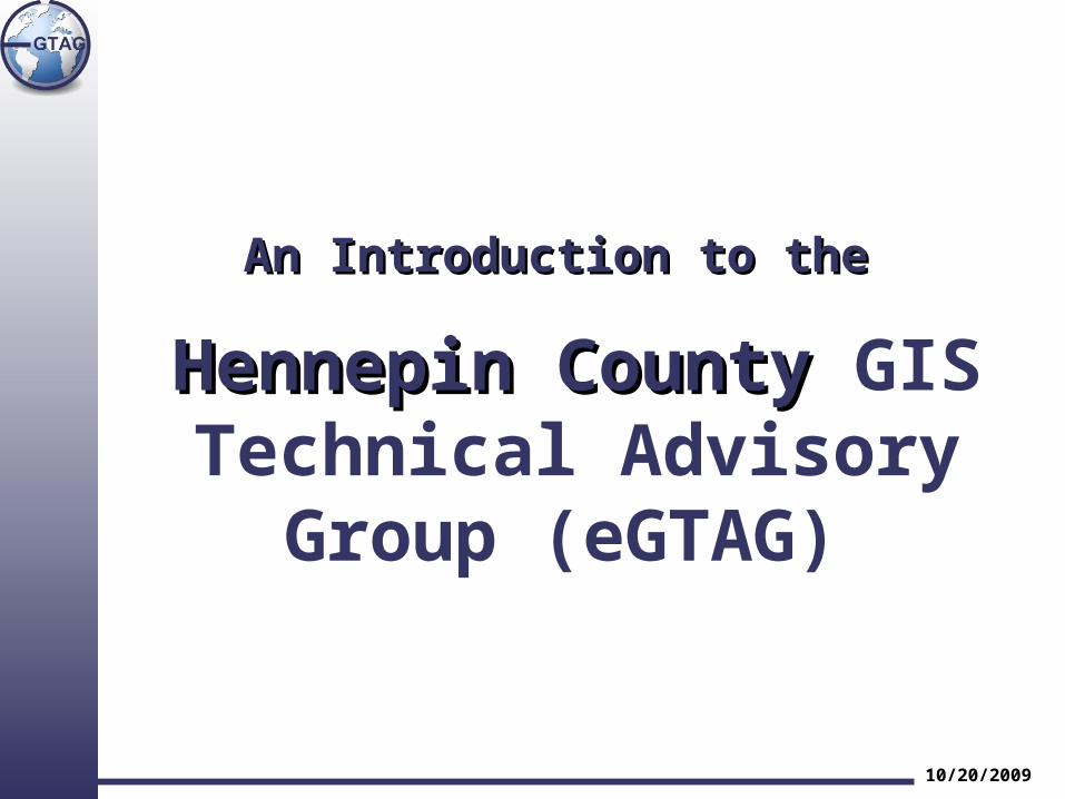
An Introduction to eGTAGAn Introduction to eGTAG
1.1. BackgroundBackground
2.2. CharterCharter
3.3. eGTAG role within Hennepin CountyeGTAG role within Hennepin County
4.4. Workflow ProcessWorkflow Process
5.5. Group CommunicationGroup Communication
6.6. Discussion TopicsDiscussion Topics
10/20/2009
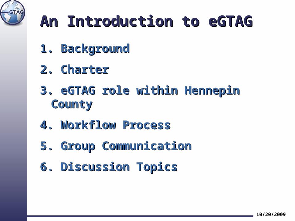
BackgroundBackground
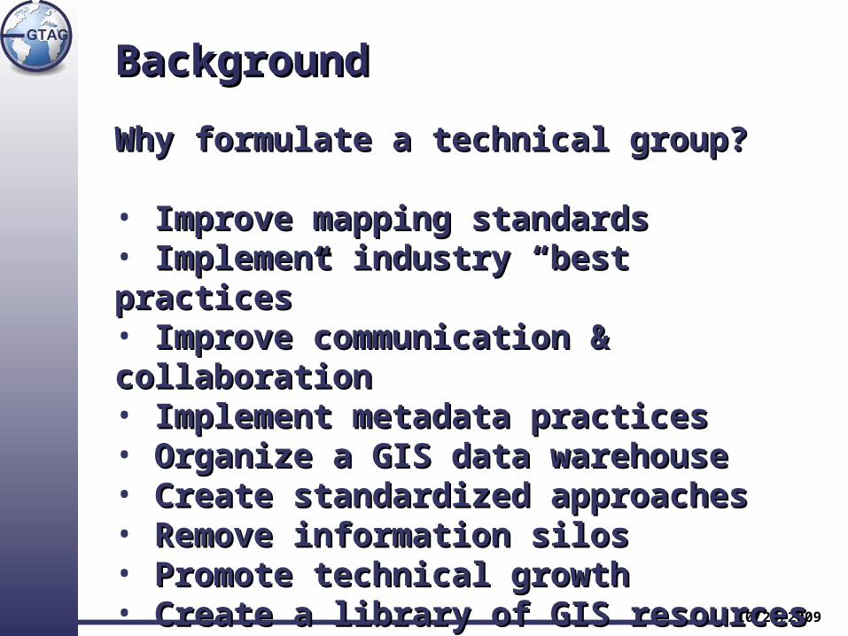
Why formulate a technical group?Why formulate a technical group?
““I was recently made aware of some GIS mapping services I was recently made aware of some GIS mapping services being performed by several Departments that use outdated being performed by several Departments that use outdated data and differing techniques. Additionally, these mapping data and differing techniques. Additionally, these mapping products were being done in multiple areas of the county products were being done in multiple areas of the county which may be unnecessarily duplicating effort and cost. I have which may be unnecessarily duplicating effort and cost. I have met with Scott Simmer, Manager of the GIS division, and asked met with Scott Simmer, Manager of the GIS division, and asked him to re-establish the GIS Users Group with an emphasis on him to re-establish the GIS Users Group with an emphasis on establishing comprehensive Hennepin County mapping establishing comprehensive Hennepin County mapping standards and policies as well as addressing other GIS needs.standards and policies as well as addressing other GIS needs. Also, I want to promote the use of the central GIS staff to Also, I want to promote the use of the central GIS staff to support departments throughout the county.”support departments throughout the county.”
From Richard Johnson County Administrator
10/20/2009
BackgroundBackground
10/20/2009
Why formulate a technical group?Why formulate a technical group?
• Improve mapping standardsImprove mapping standards• Implement industry “best practices”Implement industry “best practices”• Improve communication & collaborationImprove communication & collaboration• Implement metadata practicesImplement metadata practices• Organize a GIS data warehouseOrganize a GIS data warehouse• Create standardized approaches Create standardized approaches • Remove information silosRemove information silos• Promote technical growthPromote technical growth• Create a library of GIS resourcesCreate a library of GIS resources
BackgroundBackground
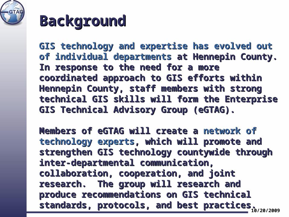
GIS technology and expertise has evolved out of GIS technology and expertise has evolved out of individual departmentsindividual departments at Hennepin County. In response at Hennepin County. In response to the need for a more coordinated approach to GIS to the need for a more coordinated approach to GIS efforts within Hennepin County, staff members with efforts within Hennepin County, staff members with strong technical GIS skills will form the Enterprise GIS strong technical GIS skills will form the Enterprise GIS Technical Advisory Group (eGTAG). Technical Advisory Group (eGTAG).
Members of eGTAG will create a Members of eGTAG will create a network of technology network of technology expertsexperts, which will promote and strengthen GIS , which will promote and strengthen GIS technology countywide through inter-departmental technology countywide through inter-departmental communication, collaboration, cooperation, and joint communication, collaboration, cooperation, and joint research. The group will research and produce research. The group will research and produce recommendations on GIS technical standards, protocols, recommendations on GIS technical standards, protocols, and best practices.and best practices.
10/20/2009
eGTAG ChartereGTAG Charter
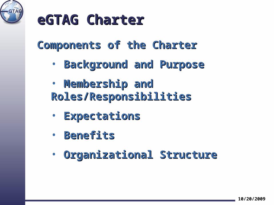
Components of the CharterComponents of the Charter
• Background and PurposeBackground and Purpose
• Membership and Roles/ResponsibilitiesMembership and Roles/Responsibilities
• ExpectationsExpectations
• BenefitsBenefits
• Organizational StructureOrganizational Structure
10/20/2009
eGTAG ChartereGTAG Charter
10/20/2009
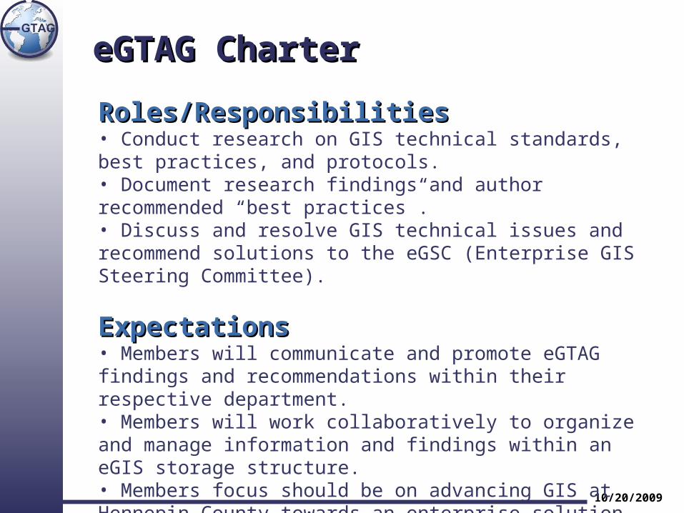
Roles/ResponsibilitiesRoles/Responsibilities• Conduct research on GIS technical standards, best practices, and protocols. • Document research findings and author recommended “best practices”. • Discuss and resolve GIS technical issues and recommend solutions to the eGSC (Enterprise GIS Steering Committee).
ExpectationsExpectations• Members will communicate and promote eGTAG findings and recommendations within their respective department. • Members will work collaboratively to organize and manage information and findings within an eGIS storage structure. • Members focus should be on advancing GIS at Hennepin County towards an enterprise solution.
eGTAG ChartereGTAG Charter
10/20/2009
Organizational StructureOrganizational Structure
• All recommendations are made by consensus. • When consensus can not be reached, issues are brought to the eGSC for resolution. • eGTAG does not make policy decisions and is accountable to the eGSC. • eGTAG recommendations that require changes to departmental workflows will not be decided by the eGTAG, but will be decided by the eGSC in collaboration with the affected department.
10/20/2009
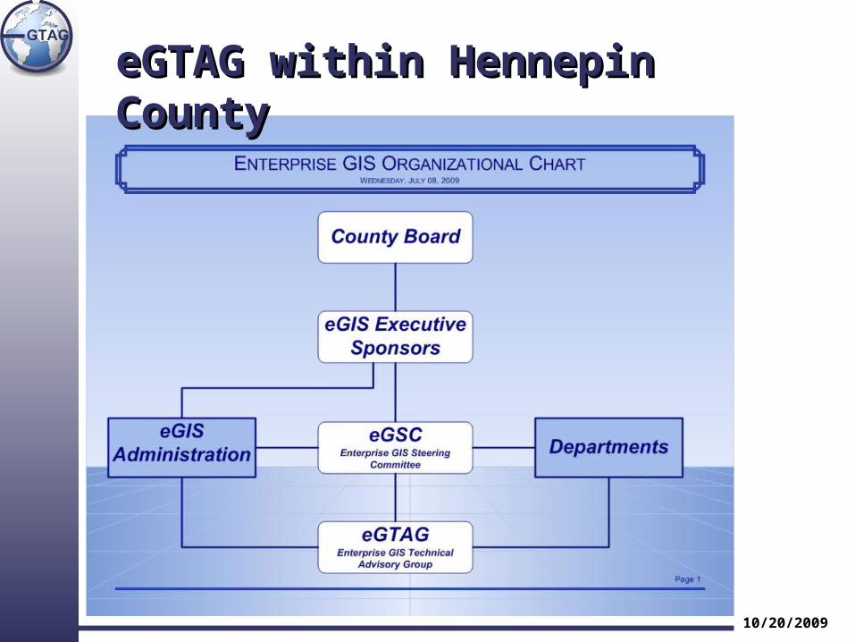
eGTAG within Hennepin CountyeGTAG within Hennepin County
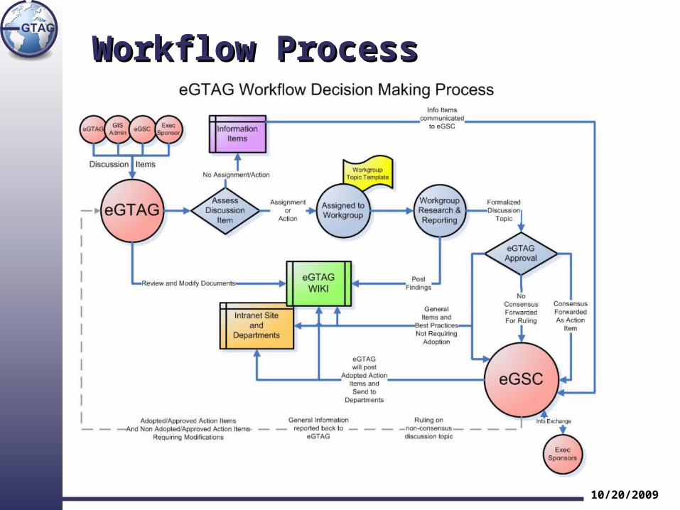
Workflow ProcessWorkflow Process
10/20/2009
Workflow Process & TermsWorkflow Process & Terms
eGTAG willeGTAG will research and produce research and produce recommendations on GIS technical standards, recommendations on GIS technical standards, protocols, and best practices.protocols, and best practices.
Best Practices – Proven and effective set of guidelines or methodology widely recognized and accepted within the GIS industry.
Standards - An established set of practices, rules, or required procedures accepted by eGTAG and formalized in a document.
Policy – Resource allocation such as funding is “not” set by eGTAG. Policy is set by GIS Steering Committee and approved by County Board when appropriate.
10/20/2009
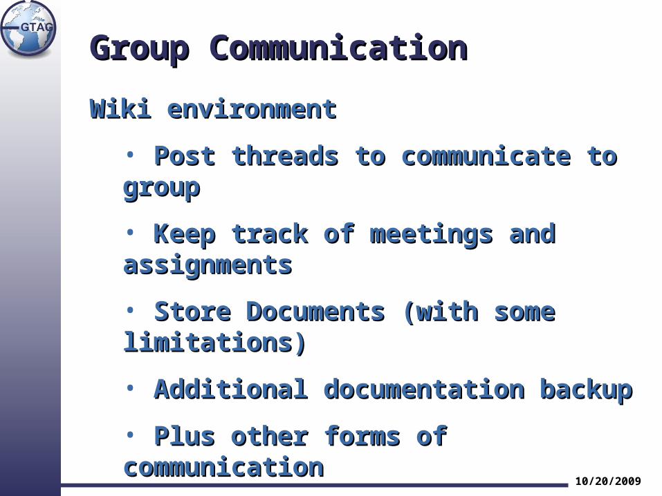
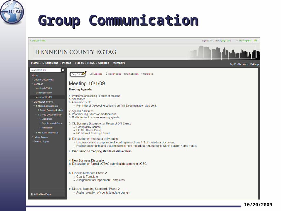
Group CommunicationGroup Communication
Wiki environmentWiki environment
• Post threads to communicate to groupPost threads to communicate to group
• Keep track of meetings and assignmentsKeep track of meetings and assignments
• Store Documents (with some limitations)Store Documents (with some limitations)
• Additional documentation backupAdditional documentation backup
• Plus other forms of communicationPlus other forms of communication
• eGIS.eGTAG group emaileGIS.eGTAG group email
10/20/2009
Group CommunicationGroup Communication
10/20/2009
Discussion TopicsDiscussion Topics
The first two topics are The first two topics are Mapping StandardsMapping Standards and and Metadata StandardsMetadata Standards..
• Easy yet important topicsEasy yet important topics
• Not as time consuming since some Not as time consuming since some resources have already been produced.resources have already been produced.
• Good for testing the waters of eGTAG.Good for testing the waters of eGTAG.
• Will be the first standards and best Will be the first standards and best practices sent up to eGSC.practices sent up to eGSC.
10/20/2009
Discussion TopicsDiscussion Topics
Mapping StandardsMapping Standards
The goal of the Mapping Standards Workgroup will The goal of the Mapping Standards Workgroup will be to promote the creation and distribution of be to promote the creation and distribution of consistent, high quality mapping products at consistent, high quality mapping products at Hennepin County. Not only will this address some of Hennepin County. Not only will this address some of the existing mapping issues, but it will provide a the existing mapping issues, but it will provide a better tool for decision making, reduce liability, and better tool for decision making, reduce liability, and create a trusted and easily identifiable product for create a trusted and easily identifiable product for Hennepin County. Hennepin County.
10/20/2009
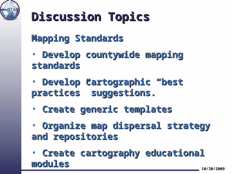
Discussion TopicsDiscussion Topics
Mapping StandardsMapping Standards
• Develop countywide mapping standardsDevelop countywide mapping standards
• Develop cartographic “best practices” Develop cartographic “best practices” suggestions.suggestions.
• Create generic templatesCreate generic templates
• Organize map dispersal strategy and Organize map dispersal strategy and repositoriesrepositories
• Create cartography educational modules Create cartography educational modules
10/20/2009
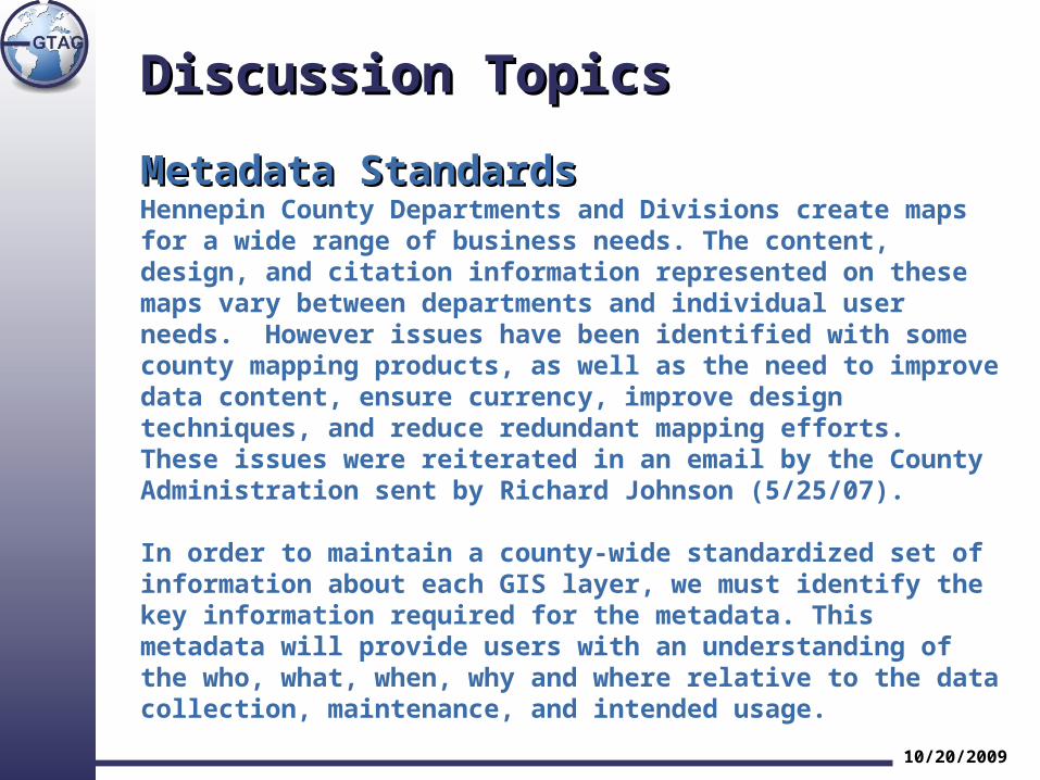
Discussion TopicsDiscussion Topics
Metadata StandardsMetadata StandardsHennepin County Departments and Divisions create maps for a wide range of business needs. The content, design, and citation information represented on these maps vary between departments and individual user needs. However issues have been identified with some county mapping products, as well as the need to improve data content, ensure currency, improve design techniques, and reduce redundant mapping efforts. These issues were reiterated in an email by the County Administration sent by Richard Johnson (5/25/07).
In order to maintain a county-wide standardized set of information about each GIS layer, we must identify the key information required for the metadata. This metadata will provide users with an understanding of the who, what, when, why and where relative to the data collection, maintenance, and intended usage.
10/20/2009
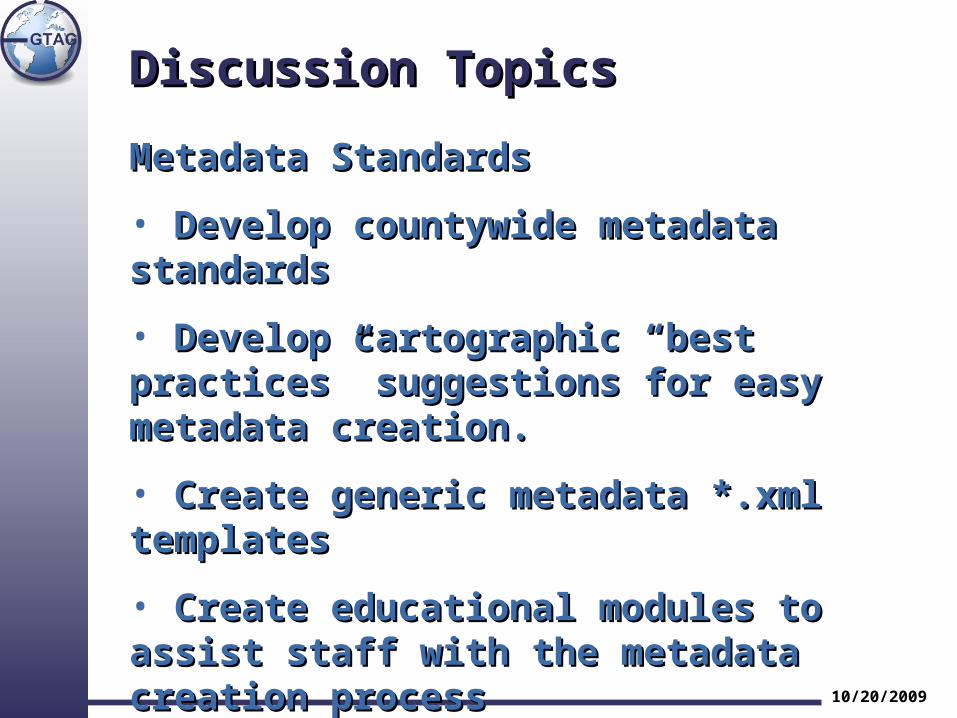
Discussion TopicsDiscussion Topics
Metadata StandardsMetadata Standards
• Develop countywide metadata standardsDevelop countywide metadata standards
• Develop cartographic “best practices” Develop cartographic “best practices” suggestions for easy metadata creation.suggestions for easy metadata creation.
• Create generic metadata *.xml templatesCreate generic metadata *.xml templates
• Create educational modules to assist staff Create educational modules to assist staff with the metadata creation process with the metadata creation process
10/20/2009
ConclusionConclusion
Any questions?Any questions?
Would you like HCGUG to post some of Would you like HCGUG to post some of our best practices?our best practices?
Thank you…Thank you…
Jay MeehlJay MeehlHennepin County GIS DivisionHennepin County GIS Division
10/20/2009