Embed Size (px)
Citation preview

APPENDIX A: SITE HISTORY AND LANDSCAPE ANALYSIS
This section provides an integrated understanding of the environmental and cultural context of the Spring Lake Park Reserve landscape to inform the planning process. It begins with an overview of the significance of the landscape, followed by a chronological narrative illustrated with graphics explaining the changes that have occurred to the physical landscape over time. Next, the existing condition of the landscape is evaluated in relation to the significant historic themes, and aspects of the landscape that potentially contribute to the historic significance of the property are clearly identified.
The inventory and analysis has been undertaken using a cultural landscape approach according to federal standards including A Guide to Cultural Landscape Reports: Contents, Process, and Techniques, The Secretary of the Interior’s Standards for the Treatment of Historic Properties with Guidelines for the Treatment of Cultural Landscapes, and other pertinent documents.1 This approach uses a foundation of historical documentation as a basis for understanding the evolution of significant landscapes. The site history builds on research conducted for the 2003 Spring Lake Park Reserve Master Plan.2
This document identifies potentially significant resources based on existing research for the master plan. There is a formal process for determining significance which has not occurred for resources within Spring Lake Park Reserve.
WHAT IS A CULTURAL LANDSCAPE?A cultural landscape is “a geographic area, including both cultural and natural resources and the wildlife or domestic animals therein, associated with a historic event, activity, or person or exhibiting other cultural or aesthetic values.”3 There are four general types of cultural landscapes, which are not mutually exclusive: historic sites, historic designed landscapes, historic vernacular landscapes, and ethnographic landscapes.
Historic Designed Landscape. A landscape that was consciously designed or laid out by a landscape architect, master gardener, architect, or horticulturist according to design principles, or an amateur gardener working in a recognized style or tradition. The landscape may be associated with a significant person(s), trend, or event in landscape architecture; or illustrate an important development in the theory and practice of landscape architecture. Aesthetic values play a significant role in designed landscapes. Examples include parks, campuses, and estates.
Historic Vernacular Landscape. A landscape that evolved through use by the people whose activities or occupancy shaped that landscape. Through social or cultural attitudes of an individual, family or a community, the landscape reflects the physical, biological, and cultural character of those everyday lives. Function plays a significant role in vernacular landscapes. They can be a single property such as a farm or a collection of properties such as a district of historic farms along a river valley. Examples include rural villages, industrial complexes, and agricultural landscapes.
Historic Site. A landscape significant for its association with a historic event, activity, or person. Examples include battlefields and presidential house properties.
Ethnographic Landscape. A landscape containing a variety of natural and cultural resources that associated people define as heritage resources. Examples are contemporary settlements, religious sacred sites and massive geological structures. Small plant communities, animals, subsistence and ceremonial grounds are often components.4
Terminology and approaches to support integration of Indigenous cultural values into mainstream evaluation and planning processes have been developing over the past several decades. The concepts of Traditional Cultural Property (TCP) and Indigenous Cultural Landscape (ICL) have been developed as approaches for thinking about landscapes more cohesively than earlier definitions of ethnographic landscapes.
The National Register of Historic Places (NRHP) recognizes Traditional Cultural Properties (TCP) as physical properties or places eligible for inclusion in the National Register if they are associated with the continuing cultural identity of a living community and retain integrity.5 The type of property and evaluation of integrity must meet the standard NRHP criteria (listed in the next section), which
DAKOTA COUNTY SPRING LAKE PARK MASTER PLAN UPDATEA-2 6.22.21
CULTURAL LANDSCAPE OVERVIEW AND ANALYSIS
Spring Lake Park Reserve includes both historic vernacular landscapes associated with early Euroamerican settlement, development of the town of Nininger, and local agriculture; and ethnographic landscapes (Traditional Cultural Properties and culturally sensitive sites) associated with living Indigenous communities.
WHAT IS THE NATIONAL REGISTER OF HISTORIC PLACES?The National Register of Historic Places (NRHP) is the United States government’s official list of districts, sites, buildings, structures, and objects (all called “properties”) worthy of preservation. The list is kept by the National Park Service.7
Significance is the meaning or value ascribed to a structure, landscape, object, or site based on the National Register criteria for evaluation. The National Register of Historic Places recognizes districts, sites, buildings, structures, and objects that fulfill at least one of four criteria of significance and possess integrity. Integrity is the ability of a property to convey its significance.8
Criterion A. Properties that are associated with events that have made a significant contribution to the broad patterns of our history; or
Criterion B. Properties that are associated with the lives of persons significant in our past; or Criterion C. Properties that embody the distinctive characteristics of a type, period, or method of construction, or that represent the work of a master, or that possess high artistic values, or that represent a significant and distinguishable entity whose components may lack individual distinction; or
Criterion D. Properties that have yielded, or may be likely to yield, information important in history or prehistory.9
can be difficult to reconcile with Indigenous values for cultural sites.
Indigenous Cultural Landscape (ICL) is a term used to address places that supported American Indian lifeways and settlements in the early 17th century, and is the terminology used in this report. The concept
“…recognizes and respects that Indian cultures lived within the context of their environment, although not in the stereotypical sense of living in harmony with the environment. American Indian peoples lived around major waterways within large, varied landscapes, with which they were intimately familiar. They used different parts of those landscapes in different ways: for food, medicine, and clothing procurement, for making tools and objects related to transportation and the household, for agriculture, and for settlements…. [T]o be effective in such a society, both men and women had to be familiar with very large areas of land and water, and be able to remember and travel to the appropriate places for gathering particular plants, acquiring stone for tools, or hunting particular species of animals.”6
In fall 2020, the Upper Sioux Community Tribal Historic Preservation Office conducted a Traditional Cultural Properties Survey for portions of the park.1 The survey identified TCPs and culturally sensitive areas within the boundaries of the park, and evaluated the cultural significance of known archaeological sites. A Traditional Cultural Property, as defined by the National Park Service, is a “property that is eligible for inclusion in the National Register of Historic Places (NRHP) based on its associations with the cultural practices, traditions, beliefs, lifeways, arts, crafts, or social institutions of a living community. TCPs are rooted in a traditional community’s history and are important in maintaining the continuing cultural identity of the community.”2 The 2020 survey defines culturally sensitive areas as “locations that contain elements of a TCP or have proximity to identified cultural properties.”3
1 Upper Sioux Community Tribal Historic Preservation Office, “Spring Lake Park Reserve Traditional
Cultural Properties Survey,” on file at Dakota County, November 9, 2020.
2 National Park Service, “Bulletin 38: Guidelines for Evaluating and Documenting Traditional Cultural
Properties” U.S. Department of the Interior, National Park Service, Interagency Resources
Division, 1.
3 Upper Sioux Community Tribal Historic Preservation Office, “Spring Lake Park Reserve Traditional
Cultural Properties Survey,” on file at Dakota County, November 9, 2020.
SITE HISTORY AND LANDSCAPE ANALYSIS 6.22.21 A-3
CULTURAL LANDSCAPE SIGNIFICANCE
POTENTIALLY SIGNIFICANT VERNACULAR LANDSCAPEAlthough there are currently no portions of the study area that are listed on the National Register of Historic Places, this framework can be used to evaluate the potential significance and integrity of historic resources within the park.
The McCarriel’s Mill site may be locally significant under Criterion A related to the local history of Nininger township. It is associated with early Euroamerican settlement patterns along the Upper Mississippi River, as well as the boom town of Nininger which existed within and adjacent to the study area. Following the decline of Nininger, the mill continued production under the McCarriel family until construction of Lock and Dam No. 2. The proposed period of significance associated with the McCarriel’s Mill Site is 1854 to 1932, beginning with construction of the mill and ending with its demolition following construction of Lock and Dam No. 2.
The McCarriel’s Mill site may also be significant under Criterion D. Due to the presence of extant and mapped historical structures at the mill site, it was estimated by a 2019 cultural resources literature review and assessment to possess moderate to high potential to contain intact post-contact archaeological resources that may be associated with historical use of the site.10
There are seven archaeological sites associated with early Indigenous occupation within the study area, and one post-contact archaeological site. The presence of a high concentration of archaeological sites, along with the location of the study area along the major water sources of the Mississippi River and Spring Lake, indicate that the study area possesses moderate to high potential to contain intact archaeological resources associated with Indigenous occupation and use.
Spring Lake Park Reserve also contains remnants of late 19th and early 20th century EuroAmerican agricultural development. These include a cluster of farm buildings dating from the early to mid-20th century at the former Schaar farm and a foundation possibly associated with the 1857-1858 Blakely property. Individual buildings that are retained from this period have been disconnected from their agricultural context by park development and efforts to restore prairie and oak savanna vegetation, and do not retain adequate integrity to be eligible for the National Register of Historic Places.
SIGNIFICANT ETHNOGRAPHIC LANDSCAPE (TRADITIONAL CULTURAL PROPERTIES AND CULTURALLY SIGNIFICANT SITES)Ethnographic significance of the landscape was reviewed by Tribal Historic Preservation Officers of associated Indigenous tribes and nations for inclusion in this plan. Ethnographic significance of the landscape was reviewed by Tribal Historic Preservation Officers of associated Indigenous tribes and nations for inclusion in this plan and supported by a Traditional Cultural Property (TCP) Survey conducted in portions of the park in fall 2020.
The landscape of Spring Lake Park Reserve is culturally significant as a place where the ancestors of today’s associated Indigenous communities lived and are buried.11 It is located within the upper Mississippi River valley regional center where people came together for ceremonies and events to reinforce communal ties and to forge alliances.12 The study area has adjacencies to significant historic village locations at Pine Bend and Grey Cloud Island, and the original location of Inyan Sa (Red Rock).
The park landscape may also be significant as a portion of the Bdote, an area surrounding the Mississippi and Minnesota river confluence that has deep
significance to many Dakota communities.13 Separate efforts are working to understand the significance of this place holistically.14
“[Mdewakanton] Dakota elders tell of the creation of humans occurring in our homeland of Minisota Makoce, but specifically at the place called Maka Cokaya Kin, or the Center of the Earth. This place is at Bdote, which means the joining or juncture of two bodies of water and in this instance refers to the area where the Minnesota River joins the Mississippi.” The significant area of the Bdote extends beyond the immediate area of the confluence, including the locations known today as Historic Fort Snelling, Mni Si (Coldwater Spring), Oheyawahi (Pilot Knob), Imnížaska (the white river bluffs), and several other significant sites along the Mississippi and Minnesota river corridors.
Traditional stories and natural landscape features are mutually supporting parts of existence in Dakota culture, rather than a distinction between “natural” and “cultural.” The interconnectedness of everything is Mitakuye Owasin. This includes the land, earth, rocks, sky, rivers, animals, plants, ancestors, and living descendants. All are one whole entity.
DAKOTA COUNTY SPRING LAKE PARK MASTER PLAN UPDATEA-4 6.22.21
CULTURAL LANDSCAPE SIGNIFICANCE
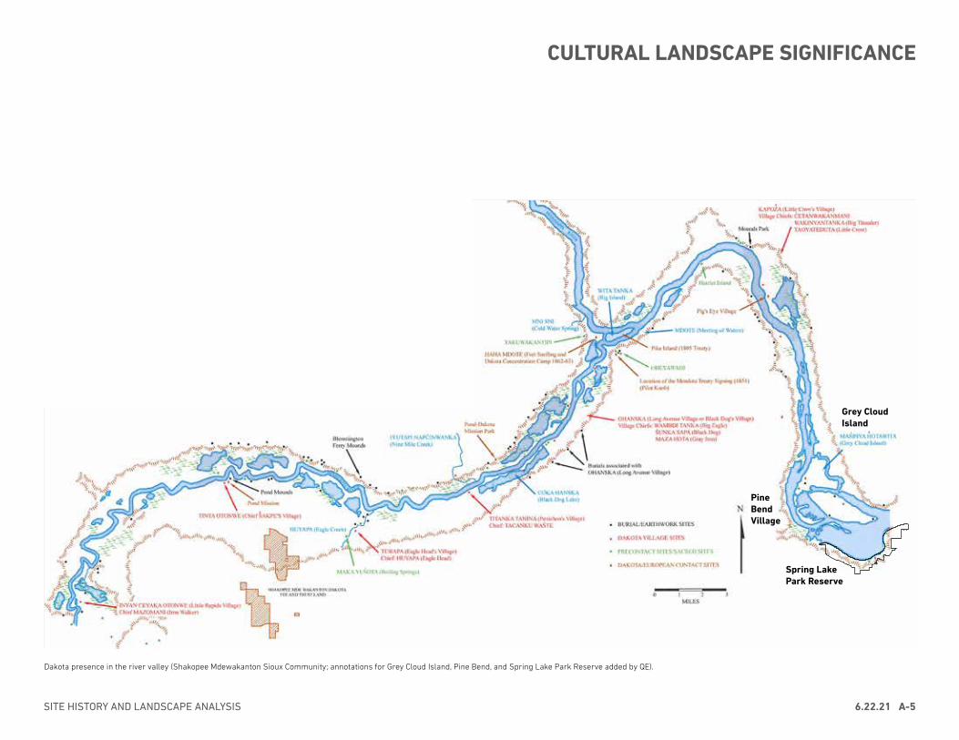
Dakota presence in the river valley (Shakopee Mdewakanton Sioux Community; annotations for Grey Cloud Island, Pine Bend, and Spring Lake Park Reserve added by QE).
Grey Cloud Island
Spring Lake Park Reserve
Pine Bend Village
SITE HISTORY AND LANDSCAPE ANALYSIS 6.22.21 A-5
CULTURAL LANDSCAPE SIGNIFICANCE
This section presents the physical evolution of the landscape of Spring Lake Park Reserve from its occupation and use by Indigenous peoples, through the establishment and abandonment of the boom town Nininger, the later construction of Lock and Dam No. 2, to present day. The site history is documented as a series of periods of development that describe changes to the physical landscape presented in narrative and graphic form. Although not meant to be a comprehensive historical account of social history, events that affected the formation of the landscape of the park are noted.
GEOLOGICAL FORMATIONThe study area is located within the Mississippi Valley Outwash region, a plateau of sedimentary rocks shaped by repeated glaciation and extensively eroded by the Mississippi River and its tributaries. The bedrock was formed during the Cambrian and Ordovician periods (570-438 million years ago), when the region was covered by a shallow sea. Sand silt, and clay deposited on the sea floor eventually compacted and cemented to form sandstone, shale, limestone, and dolomite. Between south St. Paul and Hastings, the bluffs are formed by the Ordovician Prairie du Chien Group, composed of a thick layer of Oneota Dolomite overlain by the sandstone and dolomite of the Shakopee Formation.15
The Upper Mississippi River Valley was carved by Glacial River Warren, a river of glacial meltwater from the retreating Superior Lobe of the last glaciation (approximately 2 million years ago to 10,000 BC). South of St. Paul, the Mississippi River valley widens substantially due to preglacial erosion. During the last glacial maximum (the farthest the glaciers advanced),this part of the river valley filled with sand and gravel deposits forming a broad level surface at an elevation of about 150 feet above the modern floodplain. Within the floodplain, sediment was deposited, forming wide terraces in this portion of the river valley with associated islands, sloughs, backwater lakes, and braided channels.16
Humans have lived within the area that would become Spring Lake Park Reserve for thousands of years, supported by the rich resources of the river, forest, and prairie landscape. Understanding of this vast time period is drawn from the oral history of the living communities and extant important sites associated with their ancestors, as well as the remnants left behind in the archaeological record. Based on differences in artifact styles, technology, and lifeways, archaeologists have classified the use and occupation of Spring Lake Park Reserve into the following time periods:• The PaleoIndian Tradition (ca. 10000-6000 BCE)• The Archaic Period (ca. 6000 – 1000 BCE)• The Woodland Period (ca. 1000 BCE – CE 1100)• The Late Precontact Stage (ca. CE 900 – 1650)• Contact with Early EuroAmerican Settlers (ca. 1650 – late 1840s)
While archaeologists employ various terminology and categorizations to the early inhabitants of the area, Dakota people simply call the earliest populations of Minnesota their ancestors. Four fires of the Seven Council Fires (Oceti Sakowin) make up the Dakota Nation (Oyate). “They include the Mdewakanton (Dwellers by Mystic Lake), the Wahpekute (Shooters of the Leaves), Wahpetunwan (Dwellers Among the Leaves), and the Sisitunwan (Dwellers by the Fish Campground).”17
Landscape changes during this period are illustrated on Historic Period Plan 1.
FIRST INHABITANTS, CA. 10,000-1000 BC10000-6000 BCE (Paleoindian tradition)Humans likely began occupying the region as the last glaciers retreated approximately 12,000 to 10,000 years ago, following the spread of plants and animals northward as the ice sheet melted. The newly revealed land was initially characterized by tundra, replaced by a boreal forest, followed by a short lived-pinch-birch-elm woodland that developed as the climate warmed.18 The people living in what would become Dakota County likely lived in small, mobile groups hunting megafauna such as mammoth, mastodon, or ancient bison.19
With the retreat of the glaciers, the climate became warmer and drier. By approximately 8,000 BCE, the ecosystem of southeastern Minnesota was dominated by forests comprised primarily of oak, maple, elm, and ash trees. These changes in climate precipitated changes in flora and fauna. Prairie expanded into east central Minnesota as the climate continued to warm over the next 2,000 years. By about 6000 BCE, the area now known as Dakota County was
DAKOTA COUNTY SPRING LAKE PARK MASTER PLAN UPDATEA-6 6.22.21
INDIGENOUS OCCUPATION AND USECA. 10,000 BCE - CE LATE 1840s
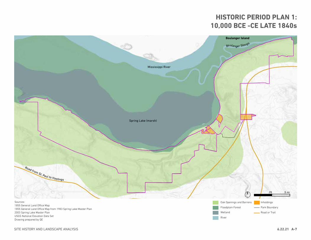
HISTORIC PERIOD PLAN 1: 10,000 BCE -CE LATE 1840s
Sources:1855 General Land Office Map1855 General Land Office Map from 1983 Spring Lake Master Plan2003 Spring Lake Master PlanUSGS National Elevation Data SetDrawing prepared by QE
Boulanger Slough
Spring Lake (marsh)
Mississippi River
Boulanger Island
.25 .5 mi
Road from St. Paul to Hastings
SITE HISTORY AND LANDSCAPE ANALYSIS 6.22.21 A-7
Oak Openings and Barrens
Floodplain Forest
Wetland
River
Park Boundary
Road or Trail
Inholdings
predominantly prairie, with deciduous forests occupying river valleys. Megafauna became extinct and were replaced by bison as the primary food source for local people; this was due in part to the expansion of the prairies which resulting in a corresponding expansion of the range of the bison herds.20 Although water levels in Spring Lake are not known during this period, lake levels fell regionally, resulting in substantial sand dunes spread in the nearby Anoka Sand Plain region.21
6,000-1,000 BCE (Archaic period)After approximately 6000 BCE, the climate once again became wetter and cooler. The forest expanded, pushing prairie regions to the southwest and reaching its approximate present-day extent between approximately 2500 and 1200 BCE. Although little is known about the people who inhabited the study area at this time, it is likely that as the climate changed dramatically during this period, the adaptive strategies of the people who lived here evolved as well. The people living in the region likely became more locally-oriented during this period, as evidenced by artifacts manufactured using less far-ranging raw materials, and more habitation sites. They took advantage of the wide range of plant and animal resources in the region through hunting, gathering, and fishing.22
People were likely living in at least two locations within what is now the park reserve during this time, both situated on bluffs overlooking Spring Lake. Artifacts present in these locations suggest that the landscape was used both in the summer and the fall. As described in the 2003 Master Plan, “The use of nets by the occupants of the Lee Mill Cave Site to catch fish points to a summer occupation of Spring Lake Park. The presence of acorns at the Ranelius Site indicates that people were also present in the park during the fall. During these times, the lake and especially the river would have provided not only consumables, but also places to bathe and to take refuge from the heat.”23 The water level in the lake is not known during this period. As a spring-fed waterbody draining into the Mississippi River, the water may have been high enough to have formed a lake, or low so that it appeared as a marsh, as was recorded during the 19th century.24
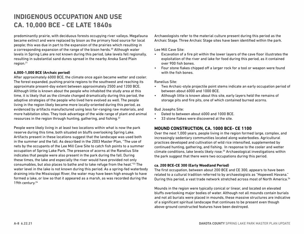
Archaeologists refer to the material culture present during this period as the Archaic Stage. Three Archaic Stage sites have been identified within the park.
Lee Mill Cave Site:• Excavation of a fire pit within the lower layers of the cave floor illustrates the
exploitation of the river and lake for food during this period, as it contained over 900 fish bones.
• Four stone flakes chipped off a larger rock for a tool or weapon were found with the fish bones.
Ranelius Site:• Two Archaic-style projectile point stems indicate an early occupation period of
between about 6000 and 1000 BCE.• Although little is known about this site, early layers held the remains of
storage pits and fire pits, one of which contained burned acorns.
Bud Josephs Site:• Dated to between about 6000 and 1000 BCE.• 33 stone flakes were discovered at the site.
MOUND CONSTRUCTION, CA. 1000 BCE- CE 1100Over the next 1,000 years, people living in the region formed large, complex, and increasingly sedentary communities located along waterbodies. Agricultural practices developed and cultivation of wild rice intensified, supplemented by continued hunting, gathering, and fishing. In response to the cooler and wetter climate conditions, lake levels likely rose.25 Archaeological investigations within the park suggest that there were two occupations during this period.
ca. 200 BCE-CE 300 (Early Woodland Period)The first occupation, between about 200 BCE and CE 300, appears to have been related to a cultural tradition referred to by archaeologists as “Hopewell Havana.” During this period, a vast trade network stretched across most of North America.26
Mounds in the region were typically conical or linear, and located on elevated bluffs overlooking major bodies of water. Although not all mounds contain burials and not all burials were placed in mounds, these massive structures are indicative of a significant spiritual landscape that continues to be present even though above-ground constructed features have been destroyed.
DAKOTA COUNTY SPRING LAKE PARK MASTER PLAN UPDATEA-8 6.22.21
INDIGENOUS OCCUPATION AND USECA. 10,000 BCE - CE LATE 1840s
ca. CE 300-CE 1100 (Middle and Late Woodland Period) The mounds within Spring Lake Park Reserve were likely constructed during the second period of occupation, between CE 300 and 1100.27 During this time, people in the area continued to follow similar lifeways, residing in permanent settlements supported by farming, hunting, and fishing.28
Previous studies have identified several sites within the park related to this period:
Sorg Site• People who lived at the Sorg Site sometime between 200 BCE and CE 300
left behind the remains of two hearths, clusters of limestone rocks, and many artifacts, indicating that they had either camped or set up a permanent settlement at this location.
• One hearth was formed of irregular limestone cobbles, was covered with charcoal and burned earth, and contained burned pieces of pottery. The second hearth consisted of a concentration of charcoal.
• The site also contained five clusters of limestone cobbles, which had not been burned. Unburned pieces of pottery were associated with three of these clusters.
• A partial pottery vessel, broken in place, was found with four natural beach cobbles.
• Possible post holes were identified, indicating that some type of structure may have been present.
• Artifacts dating to this period include bone tool fragments, one of which was from a harpoon; arrow points; scrapers; knives; modified cobbles and stone pieces from the manufacture of stone tools; and pieces of thick pottery. The pottery is buff to reddish brown in color.
• The people who lived at the Sorg Site in the late Woodland period between CE 300 and 1100 left behind similar types of remains, including a hearth and several artifacts.
Lee Mill Cave Site:• The layers of the Lee Mill Cave Site that date between 200 BCE and CE 300
contained one fire pit with powdery red burned limestone, ash, charcoal, and pieces of pottery.
• The pottery found in the fire pit was the only pottery from the early Woodland period at Lee Mill Cave. Though thicker, it is similar in general makeup and decorative technique to the pottery found at the Sorg Site from this period.
• Raccoon, beaver, muskrat, mollusk, fish, and turtle remains indicate a
continued reliance on aquatic animals and the predators of aquatic animals. The use of all of these animal resources continued into the later part of the Ceramic/Mound Stage, between CE 300 and 1100.
• It appears that toward the end of the early Woodland period, either the group residing at Spring Lake Park began to make a new kind of pottery, or two groups of people were living in the area.
• Stone tools found within early Woodland period layers in the cave include a knife, notched and stemmed arrow points, triangular arrow points, stemmed arrow points, scrapers, and a grinding stone.
• Archaeologists also discovered a small crevice in the cave wall that contained split butternut shells, stone flakes, and a piece of pottery. It is possible that these items washed in from an unexplored portion of the cave.
Bremer Village Site• Bremer Mounds and Bremer Village are located approximately one-quarter
mile apart on river terraces along the southeastern edge of Spring Lake.• Artifacts have been found across the entirety of the broad terrace above
Spring Lake, including a number of pit and hearth features, suggesting a series of habitation sites.
• Remains of the early Woodland period include thick pottery, side-notched arrow points, ridged and ovoid-shaped knives, scrapers, and ground sandstone pendants. The pottery was created from clay mixed with coarsely crushed rock. It was decorated by wrapping cords around a paddle that was then pressed upon the soft clay or by pressing grass into the soft clay.
• Remains of the middle/late Woodland occupation include thinner pottery, small triangular arrow points, ridged and pear-shaped knives, scrapers, gravers, drills, and a hammerstone, a stone used as a hammer to make other stone tools. The pottery was constructed using clay mixed with finely crushed rock and decorated with a cord-wrapped paddle. Most of the animal remains recovered from the site were from this occupation and consisted of just a few bird bones and deer teeth.
• Excavations revealed a series of twelve blackened circular areas that held charred wood, which may be post holes.
SITE HISTORY AND LANDSCAPE ANALYSIS 6.22.21 A-9
INDIGENOUS OCCUPATION AND USECA. 10,000 BCE - CE LATE 1840s

Bremer Mounds• Mound 1 was found to contain scattered small bone fragments in addition
to burials of various types and cremations. Only five pieces of pottery were found within this mound, none of which appeared to be associated with a particular burial. These were made from clay mixed with finely crushed rock and had been decorated using a cord-wrapped paddle. Also found within the mound were four small triangular arrow points and a possible bone bead.
• Mound 2 also contained scattered small bone fragments, but it did not hold any burials. Its only other contents were a pile of clamshells.29
Ranelius Site• Several early Woodland, Waubesa-type stemmed projectile point stems
indicate that the site was used ca. 200 BC-300 CE.• The prevalence of thin grit-tempered and shell-tempered pottery sherds and
small, side-notched and unnotched projectile points, suggests that the site primarily dates to the middle/late Woodland period.
ONEOTA USE AND OCCUPATION, CA. CE 900-1650Archaeologists identify occupants of the site during this period with the Oneota material culture. Oneota is not the name of a particular group of people, but rather is associated with a style of elaborately decorated globular pottery made of clay mixed with crushed shell prevalent during this time. To members of today’s Chiwere Siouan speaking tribes, including the Ioway, Otoe, Missouria, and Winnebago, they are ancestors. Scholars and tribal elders indicate that these groups split from a common ancestor.30
During this period, people in this region lived in larger permanent settlements on terraces above rivers, supported by agricultural cultivation within the floodplain, particularly corn, beans, and squash, and animals such as aquatic food sources and bison. Within the study area, sites associated with this time period appear to have been temporary, likely used as encampments during hunting or trade expeditions, rather than permanent settlements.31
Archaeologists have identified three sites associated with this time period within the study area.Lee Mill Cave Site• Oneota pottery (made with crushed shell) was found in the same
archaeological layers that produced late Woodland period pottery (made with crushed rock).
• A partial corncob was recovered from the site. The size and form of the kernel follicles on this cob indicated that the corn had been grown during the Oneota period. In addition to aquatic resources, the layers containing evidence of Oneota peoples at this site also produced woodchuck and rabbit bones.
Ranelius Site• In the 1950s, Johnson noted: “The second important discovery was a series
of very low mounds of earth placed in a spiral formation. This spiral was approximately 50 feet wide at its greatest diameter. The exact purpose of this spiral mound and its age are still not certain. We are quite sure that it is prehistoric and may represent a religious form of some sort. Pottery and stone tools found associated with the spiral are from the late prehistoric period and were used by a corn-raising, farming people.”
• There is no other recorded evidence of this mound formation, or Oneota period occupation of the Ranelius site.
Hamm Site• Excavation of the Hamm site located 56 stone flakes, one of which had been
used as a tool, and ten pieces of pottery made from clay mixed with crushed shell.32
CONTACT WITH EARLY EUROAMERICAN SETTLERS, CA. CE 1650-late 1840sHistorical documents and the archeological record have not identified villages or use sites between those associated with Oneota material culture and the 19th century.
Although not recorded within the study area, Dakota villages were located throughout the region during this time. Villages were generally situated near lakes and rivers to provide transportation and access to wild rice, and also moved seasonally to follow game animals and harvest winter plants. By the mid-17th century, agriculture was gradually supplanting hunting and gathering ways of life. The Dakota grew corn, and there is evidence of cultivation of squash, tobacco, and other crops during the 17th through 19th centuries within the region.33
By the late 1600s, French exploration and trading was common along the upper reaches of the Mississippi River. At the time of French contact, there were four primary Dakota groups within the region: Mdewakantons, Wahpekutes, Sissetons, and Wahpetons.34 The arrival of Euroamericans and other Indigenous tribes and
DAKOTA COUNTY SPRING LAKE PARK MASTER PLAN UPDATEA-10 6.22.21
INDIGENOUS OCCUPATION AND USECA. 10,000 BCE - CE LATE 1840s
nations to the area had a dramatic effect on the lives of the Dakota. This change brought conflict and disease, claimed lands, and depleted the Indigenous population and resources.35 A series of treaties in 1805, 1830, 1837, 1851, and 1858 transferred land rights from the Dakota to the U.S. through insincere promises and threats.36
Euroamerican explorers and settlers provided detailed descriptions of the landscape during this time. Just to the east of the study area, near the intersection of Lake St. Croix and the Upper Mississippi, painter George Catlin documented a landscape of sparsely treed bluffs rising over a wooded floodplain.37 The vegetation of the study area during this period would likely have been a mosaic of upland forest, savanna, and prairie on the bluff tops and slopes, with forest and wetland in the floodplain. The distribution of vegetation within the site depended on soils, topography, and especially fire, which is affected by topographic elements such as lakes, streams, and steep slopes that provide fire breaks. Fire was frequently used as a vegetation management tool by Indigenous peoples.38
1830sA group of Dakota people established a village on Grey Cloud Island. The village was located on the west end of the island, and included of a number of lodges, fields, and gardens. It was occupied until the autumn of 1837, when the village was relocated to Pine Bend. The next year, the former site of the village on Grey Cloud Island was taken over by the EuroAmerican
Mooers and Roberson families.39
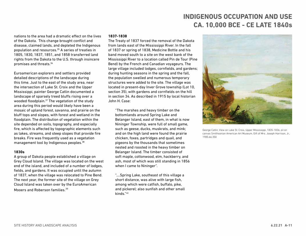
1837-1838The Treaty of 1837 forced the removal of the Dakota from lands east of the Mississippi River. In the fall of 1837 or spring of 1838, Medicine Bottle and his band moved south to a site on the west bank of the Mississippi River to a location called Pin de Tour (Pine Bend) by the French and Canadian voyageurs. The large village included lodges, cornfields, and gardens; during hunting seasons in the spring and the fall, the population swelled and numerous temporary structures were added to the site. The village was located in present-day Inver Grove township (Lot 10, section 35), with gardens and cornfields on the hill in section 34. As described in 1915 by local historian John H. Case:
“The marshes and heavy timber on the bottomlands around Spring Lake and Belanger Island, east of them, in what is now Nininger Township, were full of small game, such as geese, ducks, muskrats, and mink; and on the high land were found the prairie chicken, foxes, partridges and quail, and pigeons by the thousands that sometimes nested and roosted in the heavy timber on Belanger Island. The timber consisted of soft maple, cottonwood, elm, hackberry, and ash, most of which was still standing in 1856 when I came to Nininger”.
“....Spring Lake, southeast of this village a short distance, was alive with large fish, among which were catfish, buffalo, pike, and pickerel; also sunfish and other small kinds.”40
George Catlin, View on Lake St. Croix, Upper Mississippi, 1835-1836, oil on canvas Smithsonian American Art Museum, Gift of Mrs. Joseph Harrison, Jr., 1985.66.350
SITE HISTORY AND LANDSCAPE ANALYSIS 6.22.21 A-11
INDIGENOUS OCCUPATION AND USECA. 10,000 BCE - CE LATE 1840s
EuroAmerican settlers were drawn to the Spring Lake area due to financial opportunities provided by the Mississippi River as a power source for mills and transportation route for grain, lumber, and other goods. The first EuroAmerican settler at Spring Lake was Louis Belanger, who arrived in the late 1840s and built a log cabin on an island near the eastern end of the study area.41 Belanger was quickly followed by other land claims, and in 1854-1855 the Spring Lake Mill was constructed by Daniel W. Truax and John Blakely. After construction of the mill, the water level in Spring Lake rose, and would never be as shallow again as it was prior to 1855.42 New settlers knew the area as “Bluff Landing” or “Bassett’s Landing” referring to a trading post established just to the east of the study area.43
Dakota people continued to live at Pine Bend until another treaty signed in 1851 resulted in their forced relocation to a reservation. During this time, no villages are recorded within the land that currently comprises the park. Despite the exile of many Dakota individuals, former Nininger resident Minnie Lee indicated in a 1930 interview that Indigenous people were living in the general area of Spring Lake as late as the 1890s.44
Beginning in the 1850s, the landscape underwent a dramatic transition from oak savanna, prairie, mesic forest, and floodplain wetlands to plowed crop land. Early EuroAmerican farmsteads within the study area were typically planted in grains, including wheat, oats, and corn. These family farms were typically supported by small numbers of livestock and a vegetable plot to supplement limited farm income.45
Land investors Ignatius Donnelly and John Nininger, capitalizing on a prime location along the Mississippi River, platted the City of Nininger in the eastern portion of the study area in 1856. Nininger
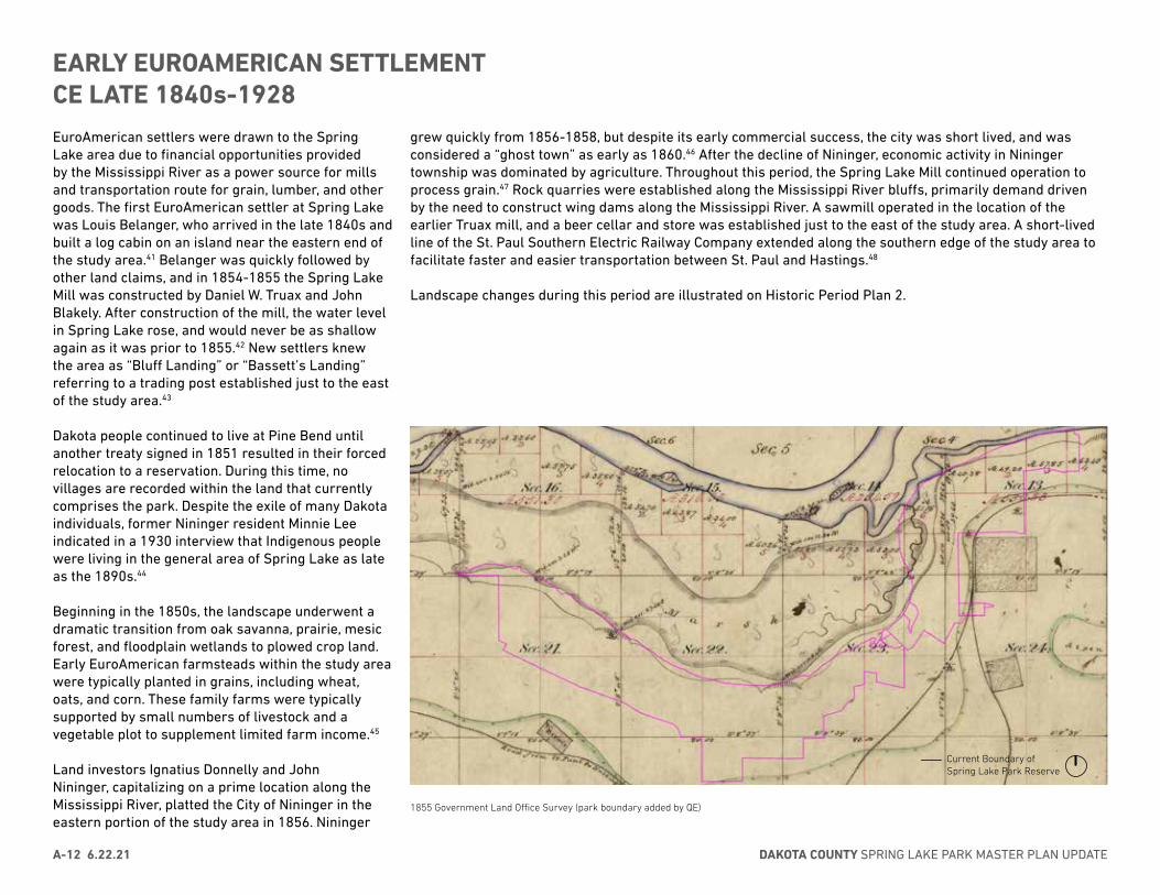
1855 Government Land Office Survey (park boundary added by QE)
grew quickly from 1856-1858, but despite its early commercial success, the city was short lived, and was considered a “ghost town” as early as 1860.46 After the decline of Nininger, economic activity in Nininger township was dominated by agriculture. Throughout this period, the Spring Lake Mill continued operation to process grain.47 Rock quarries were established along the Mississippi River bluffs, primarily demand driven by the need to construct wing dams along the Mississippi River. A sawmill operated in the location of the earlier Truax mill, and a beer cellar and store was established just to the east of the study area. A short-lived line of the St. Paul Southern Electric Railway Company extended along the southern edge of the study area to facilitate faster and easier transportation between St. Paul and Hastings.48
Landscape changes during this period are illustrated on Historic Period Plan 2.
Current Boundary of Spring Lake Park Reserve
DAKOTA COUNTY SPRING LAKE PARK MASTER PLAN UPDATEA-12 6.22.21
EARLY EUROAMERICAN SETTLEMENT CE LATE 1840s-1928
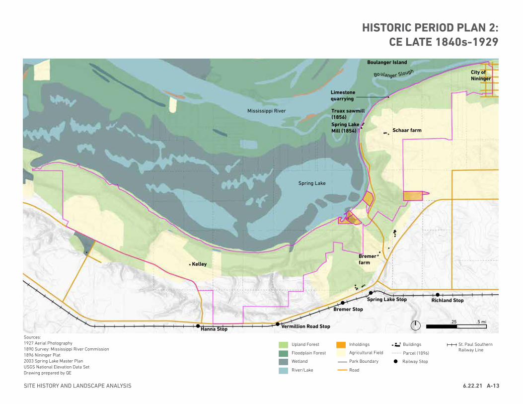
HISTORIC PERIOD PLAN 2: CE LATE 1840s-1929
.25 .5 mi
Boulanger Slough
.25 .5 mi
Spring Lake
BremerfarmKelley
Mississippi River
Spring Lake Mill (1854)
Truax sawmill (1856)
Schaar farm
City of Nininger
Boulanger Island
Sources:1927 Aerial Photography1890 Survey: Mississippi River Commission1896 Nininger Plat 2003 Spring Lake Master PlanUSGS National Elevation Data SetDrawing prepared by QE
Upland Forest
Floodplain Forest
Wetland
River/Lake
Agricultural Field
Park Boundary
Road
Buildings St. Paul Southern Railway Line
Parcel (1896)
Railway Stop
Inholdings
Limestone quarrying
SITE HISTORY AND LANDSCAPE ANALYSIS 6.22.21 A-13
Richland StopSpring Lake Stop
Bremer Stop
Vermillion Road StopHanna Stop
EARLY EUROAMERICAN ARRIVALS, late 1840s-1856Late 1840sLouis Belanger arrived at Spring Lake in the late 1840s. At this time, the water level was relatively low, creating a marshy lake with at least one island. Belanger built a log cabin on the island from which he sold wood to steamboats traveling along the river. He also claimed 160 acres near the western shore of the lake on higher ground, where he lived occasionally when the water rose until the early 1850s.49
1852Brothers Henry and Peter Caleff moved into the Spring Lake Park area to establish and trading post and shingle factory. They were joined by their father Jedidiah and sister Sarah later that year. The family sowed wheat on their claims.50
1853John Blakely settled near the intersection of Spring Lake and the Mississippi River. The foundation of Blakely’s original homestead could be seen in the park until ca. 1990, when it was filled in by the Parks Department. Like his neighbors, Blakely grew wheat.51
Early 1850sOther early land claims in the vicinity of Spring Lake included:• Daniel B. Truax and wife Lany (Countryman), who purchased Boulanger’s
high-ground claim in 1853 when Daniel’s cousin Elizabeth married Peter Caleff.52
• Daniel W. Truax, cousin to Daniel B. Truax• Samuel Truax• Poor family, who assisted the Caleffs at their shingle factory• Bassett family, farmers• Stone family, who claimed Boulanger island and much of the land in the
eastern portion of Section 13 T115N, R18W. The Stones ran first threshing machine in the area.53
A.H. Truax recalled numerous interactions between Indigenous people and new Euroamerican arrivals in the early 1850s. He noted the village at Pine Bend continued to be occupied, and the area around Spring Lake was a frequently used hunting area for ducks and deer; wild rice was also harvested.54
Fall 1854-Spring 1855Spring Lake Mill was constructed as a sawmill by Daniel W. Truax and John Blakely. After construction of the mill, the water level in Spring Lake rose, and would never be as shallow again as it was prior to 1855.55 The mill was converted to a flour and grist mill in 1856 by Foote and Greenfield.56
Oral histories of local residents contain numerous accounts of at least two roads extending between the Mill and the top of the bluff. The construction dates of these routes is unknown. As described by Carl Schaar,
“When I was a young boy, my sister, Luella, and I would walk on the old abandoned road directly west of our place to the old Lee or McCarriel Mill at Spring Lake. We often went fishing here with friends and relatives. We also went to Spring Lake on a well-traveled road south of our place which came down near the public access today. Many years ago, this road was used by farmers to go to the old McCarriel mill to have feed and flour ground. My father told me that people came from great distances and would stay overnight at McCarriels. This was during the horse and buggy days.”57
BOOMTOWN OF NININGER, 1856-18581856-1857John Blakely and Noah Reese constructed a sawmill at the mouth of Boulanger Slough over the winter of 1856-1857. It was sold to Daniel W. Truax in June of 1857, and became known as “Truax’s Mill.”58
1856After treaties in the 1830s and 1850s, formerly Dakota lands in the Minnesota Territory were opened to Euroamerican settlement. In anticipation of increasing emigration and land values, land speculation became common. Investors promoted new towns on the promise of future economic growth, typically based off of the proposed town’s location along a real or predicted transportation corridor such as a steamboat or railroad routes. One such new town was envisioned by Ignatius Donnelly and John Nininger. In 1856, Donnelly and Nininger purchased the claims of John Bassett, Peter Caleff, and Jesse Stone in Sections 13 and 18 to establish the city of Nininger.59 In a pamphlet produced to draw emigrants to the new city, Donnelly advertised both the beauty of the landscape and its proximity to major existing and potential transportation routes:
DAKOTA COUNTY SPRING LAKE PARK MASTER PLAN UPDATEA-14 6.22.21
EARLY EUROAMERICAN SETTLEMENT CE LATE 1840s-1928
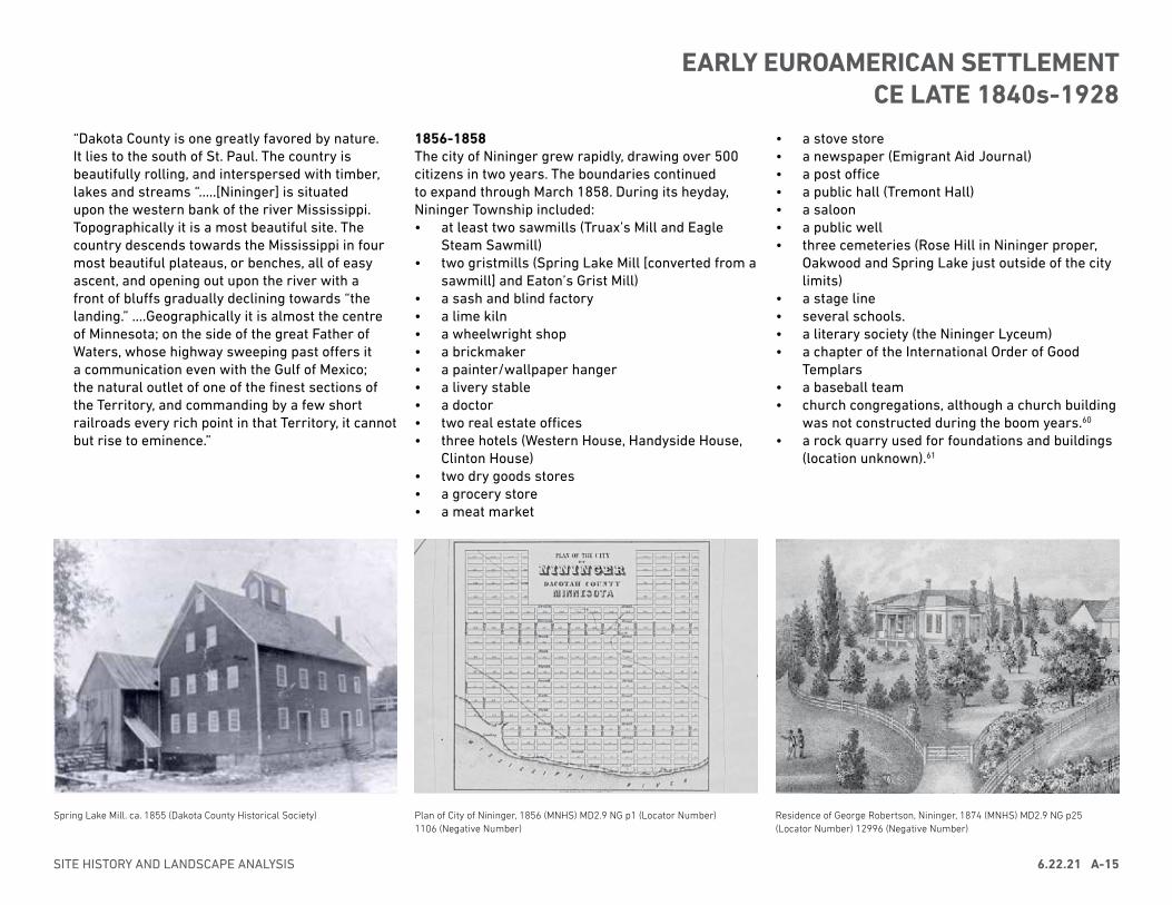
Plan of City of Nininger, 1856 (MNHS) MD2.9 NG p1 (Locator Number)1106 (Negative Number)
Spring Lake Mill. ca. 1855 (Dakota County Historical Society) Residence of George Robertson, Nininger, 1874 (MNHS) MD2.9 NG p25 (Locator Number) 12996 (Negative Number)
“Dakota County is one greatly favored by nature. It lies to the south of St. Paul. The country is beautifully rolling, and interspersed with timber, lakes and streams “.....[Nininger] is situated upon the western bank of the river Mississippi. Topographically it is a most beautiful site. The country descends towards the Mississippi in four most beautiful plateaus, or benches, all of easy ascent, and opening out upon the river with a front of bluffs gradually declining towards “the landing.” ....Geographically it is almost the centre of Minnesota; on the side of the great Father of Waters, whose highway sweeping past offers it a communication even with the Gulf of Mexico; the natural outlet of one of the finest sections of the Territory, and commanding by a few short railroads every rich point in that Territory, it cannot but rise to eminence.”
1856-1858The city of Nininger grew rapidly, drawing over 500 citizens in two years. The boundaries continued to expand through March 1858. During its heyday, Nininger Township included:• at least two sawmills (Truax’s Mill and Eagle
Steam Sawmill)• two gristmills (Spring Lake Mill [converted from a
sawmill] and Eaton’s Grist Mill)• a sash and blind factory• a lime kiln• a wheelwright shop• a brickmaker• a painter/wallpaper hanger• a livery stable• a doctor• two real estate offices• three hotels (Western House, Handyside House,
Clinton House)• two dry goods stores• a grocery store• a meat market
• a stove store• a newspaper (Emigrant Aid Journal)• a post office• a public hall (Tremont Hall)• a saloon• a public well• three cemeteries (Rose Hill in Nininger proper,
Oakwood and Spring Lake just outside of the city limits)
• a stage line• several schools.• a literary society (the Nininger Lyceum)• a chapter of the International Order of Good
Templars• a baseball team• church congregations, although a church building
was not constructed during the boom years.60 • a rock quarry used for foundations and buildings
(location unknown).61
SITE HISTORY AND LANDSCAPE ANALYSIS 6.22.21 A-15
EARLY EUROAMERICAN SETTLEMENT CE LATE 1840s-1928
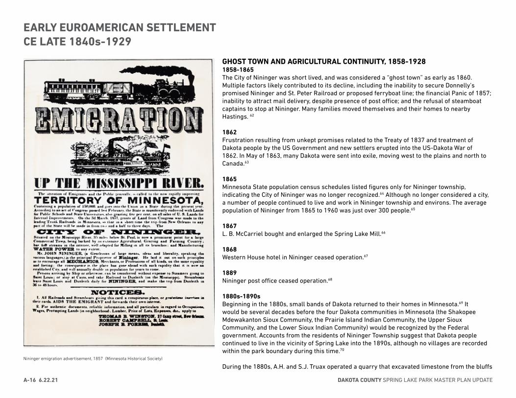
Nininger emigration advertisement, 1857 (Minnesota Historical Society)
GHOST TOWN AND AGRICULTURAL CONTINUITY, 1858-1928 1858-1865The City of Nininger was short lived, and was considered a “ghost town” as early as 1860. Multiple factors likely contributed to its decline, including the inability to secure Donnelly’s promised Nininger and St. Peter Railroad or proposed ferryboat line; the financial Panic of 1857; inability to attract mail delivery, despite presence of post office; and the refusal of steamboat captains to stop at Nininger. Many families moved themselves and their homes to nearby Hastings. 62
1862 Frustration resulting from unkept promises related to the Treaty of 1837 and treatment of Dakota people by the US Government and new settlers erupted into the US-Dakota War of 1862. In May of 1863, many Dakota were sent into exile, moving west to the plains and north to Canada.63
1865Minnesota State population census schedules listed figures only for Nininger township, indicating the City of Nininger was no longer recognized.64 Although no longer considered a city, a number of people continued to live and work in Nininger township and environs. The average population of Nininger from 1865 to 1960 was just over 300 people.65
1867L. B. McCarriel bought and enlarged the Spring Lake Mill.66
1868Western House hotel in Nininger ceased operation.67
1889Nininger post office ceased operation.68
1880s-1890sBeginning in the 1880s, small bands of Dakota returned to their homes in Minnesota.69 It would be several decades before the four Dakota communities in Minnesota (the Shakopee Mdewakanton Sioux Community, the Prairie Island Indian Community, the Upper Sioux Community, and the Lower Sioux Indian Community) would be recognized by the Federal government. Accounts from the residents of Nininger Township suggest that Dakota people continued to live in the vicinity of Spring Lake into the 1890s, although no villages are recorded within the park boundary during this time.70
During the 1880s, A.H. and S.J. Truax operated a quarry that excavated limestone from the bluffs
DAKOTA COUNTY SPRING LAKE PARK MASTER PLAN UPDATEA-16 6.22.21
EARLY EUROAMERICAN SETTLEMENT CE LATE 1840s-1929

1895 survey identifying vegetation, buildings, roads, and river soundings (Mississippi River Commission; park boundary added by QE)
above Spring Lake.71
1894A quarry operated by Martin and Ahern was present in the Nininger area; the exact location of this quarry is unknown.72
1900s-1920sA. J. Jeremy bought the five acre quarry lot belonging to John Peterson in 1894. He operated his sawmill on a continuous basis from the early 1900s until the 1920s, and rented the quarry to other operators.
The Jeremy sawmill was in the same location as the earlier Truax mill at the base of the bluff along Boulanger Slough. The sawmill was steam powered, and lumber was hauled on a track to the top of the bluff.73
1898Hastings Cycle Path constructed.74
1899Maria and Otto Schaar purchased approximately 150 acres atop the bluff at the eastern end of what is now Spring Lake Park Reserve. The family grew grains and raised dairy cattle.75
Group of people at quarry on A.J. Jeremy property, ca. 1910-1914 (Guelcher, 215).
Jeremy sawmill, early 1900s (Guelcher, 219).
Current Boundary of Spring Lake Park Reserve
SITE HISTORY AND LANDSCAPE ANALYSIS 6.22.21 A-17
EARLY EUROAMERICAN SETTLEMENT CE LATE 1840s-1929
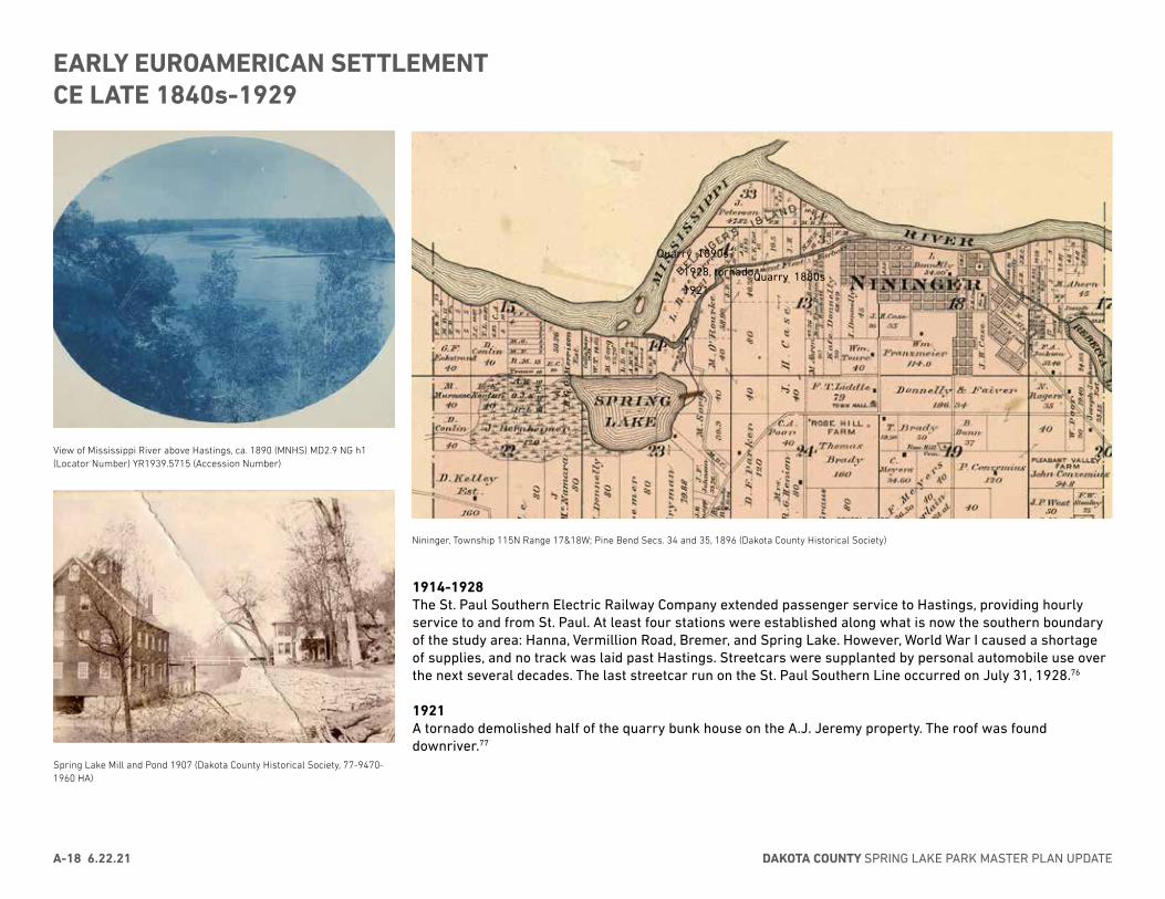
Nininger, Township 115N Range 17&18W; Pine Bend Secs. 34 and 35, 1896 (Dakota County Historical Society)
View of Mississippi River above Hastings, ca. 1890 (MNHS) MD2.9 NG h1 (Locator Number) YR1939.5715 (Accession Number)
Spring Lake Mill and Pond 1907 (Dakota County Historical Society, 77-9470-1960 HA)
Quarry 1890s-
1928, tornado
1921Quarry 1880s
1914-1928 The St. Paul Southern Electric Railway Company extended passenger service to Hastings, providing hourly service to and from St. Paul. At least four stations were established along what is now the southern boundary of the study area: Hanna, Vermillion Road, Bremer, and Spring Lake. However, World War I caused a shortage of supplies, and no track was laid past Hastings. Streetcars were supplanted by personal automobile use over the next several decades. The last streetcar run on the St. Paul Southern Line occurred on July 31, 1928.76
1921 A tornado demolished half of the quarry bunk house on the A.J. Jeremy property. The roof was found downriver.77
DAKOTA COUNTY SPRING LAKE PARK MASTER PLAN UPDATEA-18 6.22.21
EARLY EUROAMERICAN SETTLEMENT CE LATE 1840s-1929
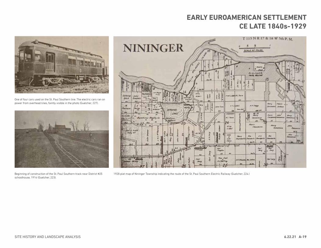
1928 plat map of Nininger Township indicating the route of the St. Paul Southern Electric Railway (Guelcher, 224.)
One of four cars used on the St. Paul Southern line. The electric cars ran on power from overhead lines, faintly visible in the photo (Guelcher, 227).
Beginning of construction of the St. Paul Southern track near District #25 schoolhouse, 1914 (Guelcher, 223).
SITE HISTORY AND LANDSCAPE ANALYSIS 6.22.21 A-19
EARLY EUROAMERICAN SETTLEMENT CE LATE 1840s-1929
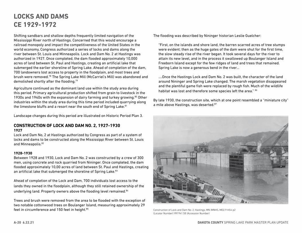
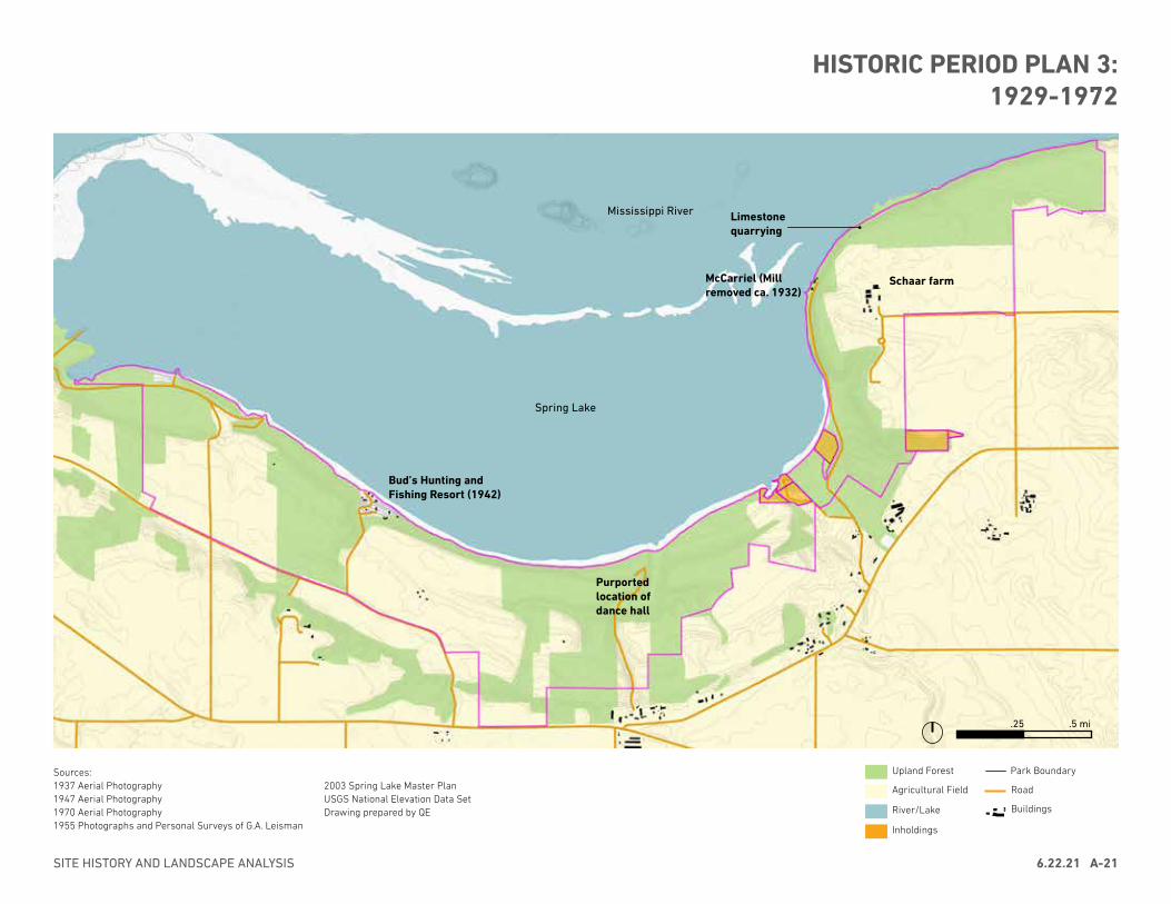
Shifting sandbars and shallow depths frequently limited navigation of the Mississippi River north of Hastings. Concerned that this would encourage a railroad monopoly and impact the competitiveness of the United States in the world economy, Congress authorized a series of locks and dams along the river between St. Louis and Minneapolis. Lock and Dam No. 2 at Hastings was authorized in 1927. Once completed, the dam flooded approximately 10,000 acres of land between St. Paul and Hastings, creating an artificial lake that submerged the earlier shoreline of Spring Lake. Ahead of completion of the dam, 700 landowners lost access to property in the floodplain, and most trees and brush were removed.78 The Spring Lake Mill (McCarriel’s Mill) was abandoned and demolished shortly after the flooding.79
Agriculture continued as the dominant land use within the study area during this period. Primary agricultural production shifted from grain to livestock in the 1930s and 1940s with the expansion of dairy farming and turkey growing.80 Other industries within the study area during this time period included quarrying along the limestone bluffs and a resort near the south end of Spring Lake.81
Landscape changes during this period are illustrated on Historic Period Plan 3.
CONSTRUCTION OF LOCK AND DAM NO. 2, 1927-19301927Lock and Dam No, 2 at Hastings authorized by Congress as part of a system of locks and dams to be constructed along the Mississippi River between St. Louis and Minneapolis.82
1928-1930 Between 1928 and 1930, Lock and Dam No. 2 was constructed by a crew of 300 men, using concrete and rock quarried from Nininger. Once completed, the dam flooded approximately 10,00 acres of land between St. Paul and Hastings, creating an artificial lake that submerged the shoreline of Spring Lake.83
Ahead of completion of the Lock and Dam, 700 individuals lost access to the lands they owned in the floodplain, although they still retained ownership of the underlying land. Property owners above the flooding level remained.84
Trees and brush were removed from the area to be flooded with the exception of two notable cottonwood trees on Boulanger Island, measuring approximately 29 feet in circumference and 150 feet in height.85
The flooding was described by Nininger historian Leslie Guelcher:
“First, on the islands and shore land, the barren scarred acres of tree stumps were evident; then as the huge gates of the dam were shut for the first time, the slow steady rise of the river began. It took several days for the river to attain its new level, and in the process it swallowed up Boulanger Island and Freeborn Island except for the few ridges of land and trees that remained. Spring Lake is now a generous bend in the river…
....Once the Hastings Lock and Dam No. 2 was built, the character of the land around Nininger and Spring Lake changed. The marsh vegetation disappeared and the plentiful game fish were replaced by rough fish. Much of the wildlife habitat was lost and therefore some species left the area.” 86
By late 1930, the construction site, which at one point resembled a “miniature city” a mile above Hastings, was deserted.87
Construction of Lock and Dam No. 2, Hastings, MN (MNHS, MD2.9 HS4 p2 (Locator Number) YR1941.58 (Accession Number)
DAKOTA COUNTY SPRING LAKE PARK MASTER PLAN UPDATEA-20 6.22.21
LOCKS AND DAMSCE 1929-1972
HISTORIC PERIOD PLAN 3:1929-1972
.25 .5 mi.25 .5 mi
Spring Lake
Mississippi River
McCarriel (Mill removed ca. 1932)
Schaar farm
Bud’s Hunting and Fishing Resort (1942)
Purported location of dance hall
Sources:1937 Aerial Photography1947 Aerial Photography1970 Aerial Photography1955 Photographs and Personal Surveys of G.A. Leisman
2003 Spring Lake Master PlanUSGS National Elevation Data SetDrawing prepared by QE
Upland Forest
Agricultural Field
River/Lake
Park Boundary
Inholdings
Limestone quarrying
SITE HISTORY AND LANDSCAPE ANALYSIS 6.22.21 A-21
Road
Buildings
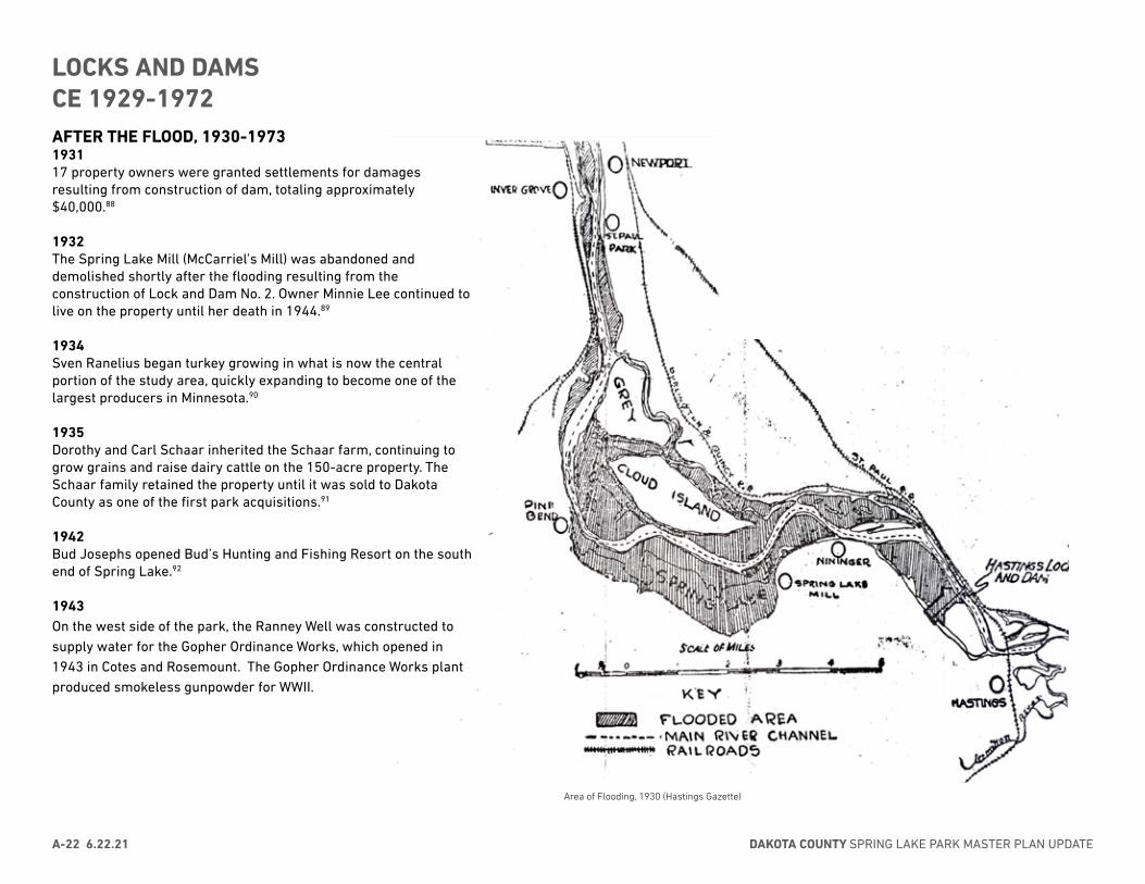
Area of Flooding, 1930 (Hastings Gazette)
AFTER THE FLOOD, 1930-1973193117 property owners were granted settlements for damages resulting from construction of dam, totaling approximately $40,000.88
1932The Spring Lake Mill (McCarriel’s Mill) was abandoned and demolished shortly after the flooding resulting from the construction of Lock and Dam No. 2. Owner Minnie Lee continued to live on the property until her death in 1944.89
1934 Sven Ranelius began turkey growing in what is now the central portion of the study area, quickly expanding to become one of the largest producers in Minnesota.90
1935Dorothy and Carl Schaar inherited the Schaar farm, continuing to grow grains and raise dairy cattle on the 150-acre property. The Schaar family retained the property until it was sold to Dakota County as one of the first park acquisitions.91
1942Bud Josephs opened Bud’s Hunting and Fishing Resort on the south end of Spring Lake.92
1943On the west side of the park, the Ranney Well was constructed to supply water for the Gopher Ordinance Works, which opened in 1943 in Cotes and Rosemount. The Gopher Ordinance Works plant produced smokeless gunpowder for WWII.
DAKOTA COUNTY SPRING LAKE PARK MASTER PLAN UPDATEA-22 6.22.21
LOCKS AND DAMSCE 1929-1972
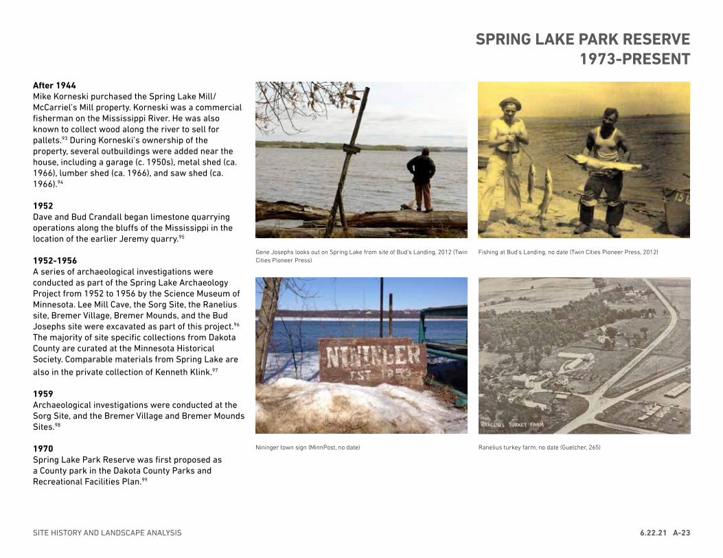
After 1944Mike Korneski purchased the Spring Lake Mill/McCarriel’s Mill property. Korneski was a commercial fisherman on the Mississippi River. He was also known to collect wood along the river to sell for pallets.93 During Korneski’s ownership of the property, several outbuildings were added near the house, including a garage (c. 1950s), metal shed (ca. 1966), lumber shed (ca. 1966), and saw shed (ca. 1966).94
1952Dave and Bud Crandall began limestone quarrying operations along the bluffs of the Mississippi in the location of the earlier Jeremy quarry.95
1952-1956A series of archaeological investigations were conducted as part of the Spring Lake Archaeology Project from 1952 to 1956 by the Science Museum of Minnesota. Lee Mill Cave, the Sorg Site, the Ranelius site, Bremer Village, Bremer Mounds, and the Bud Josephs site were excavated as part of this project.96 The majority of site specific collections from Dakota County are curated at the Minnesota Historical Society. Comparable materials from Spring Lake are also in the private collection of Kenneth Klink.97
1959Archaeological investigations were conducted at the Sorg Site, and the Bremer Village and Bremer Mounds Sites.98
1970Spring Lake Park Reserve was first proposed as a County park in the Dakota County Parks and Recreational Facilities Plan.99
Gene Josephs looks out on Spring Lake from site of Bud’s Landing, 2012 (Twin Cities Pioneer Press)
Nininger town sign (MinnPost, no date)
Fishing at Bud’s Landing, no date (Twin Cities Pioneer Press, 2012)
Ranelius turkey farm, no date (Guelcher, 265)
SITE HISTORY AND LANDSCAPE ANALYSIS 6.22.21 A-23
SPRING LAKE PARK RESERVE1973-PRESENT
Spring Lake Park Reserve was first proposed as a County park in the 1970 Dakota County Parks and Recreational Facilities Plan.100 Property acquisition for the new park began with the Carl and Dorothy Schaar property in 1973, and Park additions and boundary revisions continued through the 1970s and 1980s.101
As the park grew, the character of the landscape continued to evolve. Buildings and structures were removed, and extensive ecological restoration projects were undertaken to preserve and reintroduce approximately 200 acres of prairie and oak savanna on the bluff top throughout the length of the park.
1973292-acre Carl Schaar property was acquired by Dakota County. As part of the acquisition, the county agreed to use the Shaar name to describe that area as part of the whole park, and Carl and his wife remained on the property until 1979.102
1975Minnesota State Legislation passed the Metropolitan Parks Act establishing the Regional Park System. Spring Lake Park Reserve was given a regional designation.103
1976A total of 980 acres had been acquired for the park by this time.104
1978Dakota County began using a portable sawmill at the park to chip diseased Dutch Elm trees. Felled trees were used for fences, gates, planters, wood chips, firewood, sawdust, bridge blanking, pole barn beams and picnic table tops.105
1979Mississippi River barge channel was dredged and a rock structure constructed across e opening at the head of Spring Lake to relieve sedimentation in the barge channel.106
1980Park boundaries were revised as part of the Dakota County Long-Range Comprehensive Plan.107
1983A Master Plan was produced for the park, and additional boundary adjustments made.108
1993The archery range and Youth Group Camp were constructed.109
1995Th Bud Josephs site was excavated.110
2003A Master Plan was produced for the park reserve.111
2005-2007Schaar’s Bluff archaeological investigations were conducted and the Schaar’s Bluff Gathering Center was constructed .112
2010Archeological investigations were undertaken at the Ranelius site.113
2010Archeological investigations were undertaken at the Bremer Mounds.114
2017Mississippi River Greenway was constructed.
DAKOTA COUNTY SPRING LAKE PARK MASTER PLAN UPDATEA-24 6.22.21
SPRING LAKE PARK RESERVE1973-PRESENT
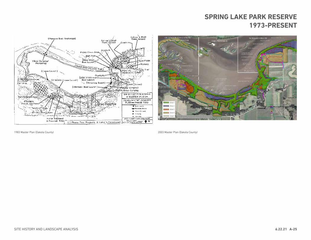
1983 Master Plan (Dakota County)
SECTION VII - DEVELOPMENT MASTER PLAN
7.4SPRING LAKE PARK RESERVE – DAKOTA COUNTY
Figure 7.2 – Development master plan overlaid on ecological protection zone map.
Development Plan Relative toEcological and CulturalProtection Strategy
The location for development relative to ecological and cultural resources was an important planning considerationthat significantly affected the master plan. By considering the park from this broader perspective, theinterrelationship between the ecological resources of the park and the development program can be exhibited. Asshown in figure 7.2, the development master plan overlaid on the ecological protection zones described in SectionV – Natural Resources Stewardship Plan illustrates the extent to which the master plan responds to preserving thenatural character of the land.
2003 Master Plan (Dakota County)
SITE HISTORY AND LANDSCAPE ANALYSIS 6.22.21 A-25
SPRING LAKE PARK RESERVE1973-PRESENT
This section presents an analysis of historic integrity for the cultural landscape. It identifies and documents those qualities and features that potentially contribute to historic character, retain integrity, and contribute to the significance of the landscape as related to the period(s) of significance. The landscape analysis is intended to guide design and inform treatment of significant aspects of the cultural landscape according to the United States Secretary of the Interior’s Standards for the Treatment of Historic Properties.
Integrity is the ability of the physical features of the landscape to convey the property’s historic significance, as evidenced by the survival of physical characteristics that existed during the property’s period of significance. To retain integrity, a landscape must convey a sense of its historic character and retain essential physical features that define why and when a property was significant.
The cultural landscape is documented and evaluated according to the following landscape characteristics: natural systems and topography; spatial organization; archaeological resources; vegetation; views; circulation; and buildings, structures, and small-scale features. The McCarriel’s Mill site was assessed separately.
At Spring Lake Park Reserve, archaeological sites include remnants, traces, or elements that exist from periods associated with Indigenous and early EuroAmerican use and occupation of the site. These include above-grade (visible) features and below-grade features identified by archaeological investigations.
Natural systems are those natural aspects that have influenced the development and physical form of the study area including the geology, river, streams, springs, and soils.
Topography is the three-dimensional configuration of the landscape surface, characterized by slope and orientation.
Spatial organization is the arrangement of elements that define and create space through the ground, vertical, and overhead planes, including topography, vegetation, natural systems, circulation, and buildings and structures.
Vegetation is native or introduced woodland, trees, shrubs, vines, ground covers, and herbaceous plants.
Views present a range of vision, natural or man-made.
Circulation includes features and materials that constitute systems of movement. Circulation may be comprised of vehicular routes such as roads and parking areas, and pedestrian routes such as trails, and railways.
Buildings and structures are three-dimensional man-made constructs such as pavilions, picnic shelters, and retaining walls.
Small scale features are human-scaled elements of the site that provide specific functions and include fences, gates, site furnishings, and signs.
Contributing features are elements of a landscape that date to the period(s) of significance and contribute to its historic significance. Potential periods of significance for the Spring Lake Park Reserve cultural landscape are:• Vernacular landscape of McCarriel’s Mill Site: CE 1854 to 1932• Ethnographic landscape associated with Indigenous occupation and use: ca.
6000 BCE to CE late 1840s
The following analysis identifies existing features within the landscape that potentially contribute to its historic significance.
DAKOTA COUNTY SPRING LAKE PARK MASTER PLAN UPDATEA-26 6.22.21
CULTURAL LANDSCAPE ANALYSIS
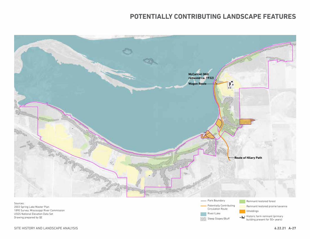
Sources:2003 Spring Lake Master Plan1890 Survey: Mississippi River CommissionUSGS National Elevation Data SetDrawing prepared by QE
Park Boundary
Potentially Contributing Circulation Route
Historic farm remnant (primary building present for 50+ years)
River/Lake
Steep Slopes/Bluff
Remnant/restored forest
Remnant/restored prairie/savanna
Inholdings
SITE HISTORY AND LANDSCAPE ANALYSIS 6.22.21 A-27
POTENTIALLY CONTRIBUTING LANDSCAPE FEATURES
Route of Hilary Path
Wagon Route
McCarriel (Mill removed ca. 1932)
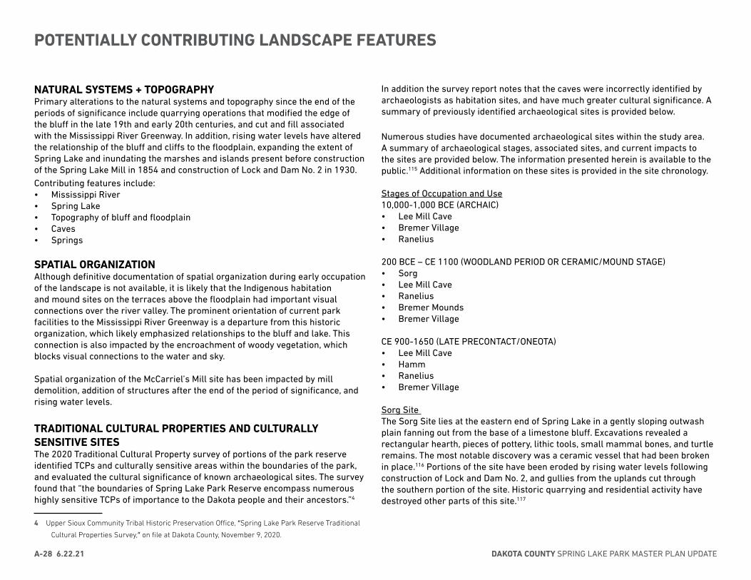
NATURAL SYSTEMS + TOPOGRAPHYPrimary alterations to the natural systems and topography since the end of the periods of significance include quarrying operations that modified the edge of the bluff in the late 19th and early 20th centuries, and cut and fill associated with the Mississippi River Greenway. In addition, rising water levels have altered the relationship of the bluff and cliffs to the floodplain, expanding the extent of Spring Lake and inundating the marshes and islands present before construction of the Spring Lake Mill in 1854 and construction of Lock and Dam No. 2 in 1930. Contributing features include:• Mississippi River• Spring Lake• Topography of bluff and floodplain• Caves• Springs
SPATIAL ORGANIZATIONAlthough definitive documentation of spatial organization during early occupation of the landscape is not available, it is likely that the Indigenous habitation and mound sites on the terraces above the floodplain had important visual connections over the river valley. The prominent orientation of current park facilities to the Mississippi River Greenway is a departure from this historic organization, which likely emphasized relationships to the bluff and lake. This connection is also impacted by the encroachment of woody vegetation, which blocks visual connections to the water and sky.
Spatial organization of the McCarriel’s Mill site has been impacted by mill demolition, addition of structures after the end of the period of significance, and rising water levels.
TRADITIONAL CULTURAL PROPERTIES AND CULTURALLY SENSITIVE SITESThe 2020 Traditional Cultural Property survey of portions of the park reserve identified TCPs and culturally sensitive areas within the boundaries of the park, and evaluated the cultural significance of known archaeological sites. The survey found that “the boundaries of Spring Lake Park Reserve encompass numerous highly sensitive TCPs of importance to the Dakota people and their ancestors.”4
4 Upper Sioux Community Tribal Historic Preservation Office, “Spring Lake Park Reserve Traditional
Cultural Properties Survey,” on file at Dakota County, November 9, 2020.
In addition the survey report notes that the caves were incorrectly identified by archaeologists as habitation sites, and have much greater cultural significance. A summary of previously identified archaeological sites is provided below.
Numerous studies have documented archaeological sites within the study area. A summary of archaeological stages, associated sites, and current impacts to the sites are provided below. The information presented herein is available to the public.115 Additional information on these sites is provided in the site chronology.
Stages of Occupation and Use10,000-1,000 BCE (ARCHAIC)• Lee Mill Cave• Bremer Village• Ranelius
200 BCE – CE 1100 (WOODLAND PERIOD OR CERAMIC/MOUND STAGE)• Sorg• Lee Mill Cave• Ranelius• Bremer Mounds• Bremer Village
CE 900-1650 (LATE PRECONTACT/ONEOTA)• Lee Mill Cave• Hamm• Ranelius• Bremer Village
Sorg Site The Sorg Site lies at the eastern end of Spring Lake in a gently sloping outwash plain fanning out from the base of a limestone bluff. Excavations revealed a rectangular hearth, pieces of pottery, lithic tools, small mammal bones, and turtle remains. The most notable discovery was a ceramic vessel that had been broken in place.116 Portions of the site have been eroded by rising water levels following construction of Lock and Dam No. 2, and gullies from the uplands cut through the southern portion of the site. Historic quarrying and residential activity have destroyed other parts of this site.117
DAKOTA COUNTY SPRING LAKE PARK MASTER PLAN UPDATEA-28 6.22.21
POTENTIALLY CONTRIBUTING LANDSCAPE FEATURES
Lee Mill Cave The Lee Mill Cave Site is 75 feet above the Mississippi River in a limestone bluff at the eastern end of Spring Lake. Lee Mill Cave was carved out by water seeping down from the blufftop and eroding the limestone.118 Excavations uncovered two hearths and two middens, with a large number of lithic tools and pottery shards. Small and large mammal bones, bird bones, fish bones, clam shell fragments, turtle remains, and a single piece of maize were also unearthed. A small number of human remains were recovered from the site, some of which were associated with a rock fall.119 As indicated in the 2018 Phase 1 Dakota County Archaeological Survey, rock falls, erosion, recreational activities, and archaeological investigations have destroyed much of the site. However, the cave extends far into the bluff, and the inner cave may be undisturbed.120
Hamm SiteThe Hamm site overlooks the shore of Spring Lake near Hamm’s Bay in the western end of the park, and may extend into the lake. Archaeological investigations uncovered lithic debitage and shell-tempered pottery sherds. Near the edge of a terrace along Spring Lake, the site has been impacted by erosion. Intact below-grade deposits may still exist.121
Ranelius siteThe Ranelius site is on a peninsula-like terrace overlooking the southern shore of Spring Lake. Numerous features consistent with habitation have been unearthed at the site, including projectile points, end scrapers, pottery sherds, and bone and groundstone tools.122 The site has been disturbed by excavations but is otherwise largely intact.123
Bremer MoundsThis site is a pair of mounds on a terrace overlooking the southern shoreline of Spring Lake. One mound is linear and the other is conical/ovoid in shape. Above-ground features of the conical mound were mostly destroyed by excavations in the 1950s. Although the linear mound has been disturbed, its form is still visible on Lidar imagery and in-person.124
Bremer VillageBremer Mounds and Bremer Village are about one-quarter mile apart on river terraces along the southeastern edge of Spring Lake. The village site is located on a terrace 50 feet lower in elevation than the mounds, adjacent to the edge of Spring Lake.125
Shovel testing in 2011-2014 found that debris is not consistently deposited across the terrace, suggesting a series of camp sites. Pottery found at the site indicate Initial (Middle) and Terminal (Late) Woodland and Late Pre-contact (Oneota) occupations, with the Terminal Woodland being the most common.126
Due to its position only a few feet above Spring Lake, the site has experienced erosion, particularly on its north side. The village may have extended into the area that is now submerged. The southern portion of the site has also been disturbed by construction of the Mississippi River Greenway (MRGW).127
Bud Joseph’s Site (21DK043)The Bud Joseph’s/Bud’s Landing Site is located on a terrace and outwash area on the shoreline of Spring Lake.128 The site yielded 33 flakes of lithic scatter. Local residents also report finding Woodland sherds in the lake adjacent to the site.129 The site likely was impacted by development of Bud’s Landing resort and nearby residences. It has also been damaged by erosion; a gully cuts through the site.130
Spring Lake Park Bluff (21DK088)The Spring Lake Park Bluff site is on a terrace 100 feet above the shore of Spring Lake. Findings consisted of 11 pieces of Prairie du Chien chert debitage scattered over less than one acre.131 The site is in a relatively undisturbed wooded area and is likely intact.132
Traditional Cultural Properties and culturally sensitive sites, including those that encompass previously identified archaeological sites, contribute to the significance of the cultural landscape.
VEGETATIONPrior to Euroamerican settlement, vegetation within Spring Lake Park Reserve was characterized by a mosaic of upland forest, savanna, and prairie on the bluff tops and slopes, with forest and wetland in the floodplain. As EuroAmerican settlers arrived, fire management of prairies and oak savanna on the blufftop ceased, and the blufftop and floodplain were converted to agricultural fields, with forest retained in areas of steep slopes. The vegetation patterns present today reflect successional regrowth of woody vegetation following the conversation of farm and resort land to park in the 1970s, with an overlay of areas of native plant community restoration. Extensive efforts have taken place over the past several decades to restore prairie and oak savanna to the blufftop.
SITE HISTORY AND LANDSCAPE ANALYSIS 6.22.21 A-29
POTENTIALLY CONTRIBUTING LANDSCAPE FEATURES
BUILDINGS, STRUCTURES + SMALL SCALE FEATURESExisting buildings, structures, and small-scale features are described in detail in the Existing Park Conditions section of this chapter. Although no buildings remain, several Indigenous village sites have been identified. Post-holes at the Sorg site and Bremer Village site suggest a structure in this location. Above- and below-ground remnants of features from this period were damaged or destroyed by agriculture and mining, although subsurface features may still be intact.Several remaining late-19th and early-20th century buildings from the Schaar farm do not retain integrity as part of the cultural landscape. The Schaar family purchased the 150-acre property at the east end of the park in 1899 and grew grain and raised dairy cows. The milkhouse and silo date to the mid-1940s.
A foundation possibly associated with the 1857-1860 Blakely property is near the McCarriel’s Mill site. The structure is disconnected from its historic context and does not retain integrity.
MCCARRIEL’S MILL SITEExisting ConditionThis site at the base of Schaar’s bluff occupies 1.5 acres with three standing structures and a boat. The 2019 Cultural Resources Literature Review and Assessment provides a detailed description of existing site conditions.
AnalysisThe 2019 Literature Review and Assessment indicated that all standing structures at the McCarriel’s Mill Site appear to retain sufficient integrity to be evaluated for eligibility in the NHRP. The age of the boat is not known. Potentially contributing features include:• House foundation (1860)• “Icehouse” (ca. 1860-1907)• “Fish Pond” (before 1936)• Retaining wall (ca. 1860-1907)
Although today’s vegetation types differ from the periods of significance, extensive efforts have restored prairie and oak savanna to the blufftop. Potentially contributing features include:• Remnant/restored prairie and savanna/oak openings
• Remnant/restored mesic forest/oak forests
VIEWSExisting views are described in detail in the Existing Park Conditions section of this chapter. Woody vegetation was sparse on the blufftop during early use and occupation when the vegetation was characterized by prairie or oak savanna, allowing expansive views of Spring Lake, the river valley, and the sky. Today, views are restricted by encroaching woody vegetation, with select points providing views of the River or sky. Locations of key views during Indigenous use and occupation are not known, and existing viewpoints do not correspond to recorded village or mound sites.
Views related to the McCarriel’s Mill site have been modified due to flooding from Lock and Dam No. 2.
CIRCULATIONTwo known historic routes are evident within the study area landscape. A road remnant connects from Schaar’s bluff to the McCarriel’s Mill site. It is steep and heavily eroded, with limited stacked stonework supporting the road grade. The route is documented on the 1855 Government Land Office survey. Hilary Path, which connects from Mississippi Trail (MN 42) to the base of the bluff at the eastern end of the park, follows a route which is evident as early as the 1980s Mississippi River Commission map and 1896 plat of Nininger Township.
During Indigenous use of the site and early EuroAmerican settlement, water routes would have been and important mode of transportation. Today, the park does not provide river or lake access.
Features that potentially contribute to the vernacular landscape of McCarriel’s Mill include:• Road remnant (Wagon Trail) from Schaar’s Bluff to McCarriel’s Mill Site• Route of Hilary Path
DAKOTA COUNTY SPRING LAKE PARK MASTER PLAN UPDATEA-30 6.22.21
POTENTIALLY CONTRIBUTING LANDSCAPE FEATURES
Primary SourcesBureau of Land Management. “Survey of Township 115 North Range 18 West of 5th Mer. 1853-1854.” General Land Office Records. On file at Minnesota Historical Society, https://umesc.usgs.gov/rivers/upper_mississippi/reach_1/pool_2/p2_gis_data.html#lcu
Catlin, George. View on Lake St. Croix, Upper Mississippi, 1835-1836. Oil on canvas. Smithsonian American Art Museum, Gift of Mrs. Joseph Harrison, Jr., 1985.66.350
Dakota County Parks Department Files 1983 Master Plan Property Acquisition documents Correspondence Newspaper articles
Dakota Historical Society Collections Early landowners maps Photograph collections Hastings Gazette newspaper articles
Minnesota Department of Natural Resources Aerial Photograph Collection Minnesota Historical Society Collections Dakota County, 1896 Plat Maps Dakota County, 1916 Plat Maps Ignatius Donnelly Papers (online collections) John H. Case Papers (online collections) U.S. Army Corps of Engineers St. Paul District (online collections) U.S. Army Corps of Engineers St. Paul District (online collections) Minnesota Office of the State Archaeologist Archaeological Site Form #21DK0043, Bud Josephs/Bud’s Landing Archaeological Site Form #21-DK-0005, Bremer Mound
Mississippi River Commission. “Survey of Pool No. 2.” https://umesc.usgs.gov/rivers/upper_mississippi/reach_1/pool_2/p2_gis_data.html#lcu
Truax, A.H. “Old Settler Recalls Early Days in Hastings.” Hastings Gazette (February 3, 1921).
US Engineer Office, St Paul Minnesota. Continuous Survey, Pool No. 2. 1938.
Secondary Sources106 Group, Ltd. Cultural Resources Literature Review and Assessment for the McCarriel’s Mill Site at Spring Lake Park Reserve. Dakota County Parks Department, 2019.
106 Group, Ltd. Spring Lake Park Interpretive Report Final. 2005.
Adams, Amanda S. Phase I Archaeological Survey for the Proposed Schaar’s Bluff Cultural Center at Spring Lake Park Reserve, Nininger Township, Dakota County, Minnesota. The 106 Group Ltd. Submitted to Dakota County Parks Administration, 2005.
Anderson, Gary C, and Alan R. Woolworth. Through Dakota Eyes: Narrative Accounts of the Minnesota Indian War of 1862. St. Paul: Minnesota Historical Society Press, 1988.
Anfinson, John O., Thomas Madigan, Drew M. Forsberg, and Patrick Nunnally. River of History: A Historic Resources Study of the Mississippi National River and Recreation Area. National Park Service, 2003.
Ball, David, Rosie Clayburn, Roberta Cordero, Briece Edwards, Valerie Grussing, Janine Ledford, Robert McConnell, Rebekah Monette, Robert Steelquist, Eirik Thorsgard, and Jon Townsend, A Guidance Document for Characterizing Tribal Cultural Landscapes. Bureau of Ocean Energy Management, Pacific OCS Region, National Oceanic and Atmospheric Administration, Office of National Marine Sanctuaries, Makah Tribe, Confederated Tribes of Grand Ronde Community of Oregon, Yurok Tribe, and National Marine Sanctuary Foundation, 2015. https://www.boem.gov/2015-047/.5.
Beacham, Deanna (Weapemeoc), The Indigenous Cultural Landscape of the Eastern Woodlands: A Model for Conservation, Interpretation, and Tourism, (Proceedings, George Wright Society Conference on Parks, Protected Areas and Cultural Sites, New Orleans, Louisiana, 2011), 4, http://www.georgewright.
org/1108beacham.pdf.
SITE HISTORY AND LANDSCAPE ANALYSIS 6.22.21 A-31
BIBLIOGRAPHY
Birnbaum, Charles A., and Christine Capella Peters, The Secretary of the Interior’s Standards for the Treatment of Historic Properties with Guidelines for the Treatment of Cultural Landscapes. Washington DC: Department of the Interior, National Park Service, 1996.
Brauer and Associates, Ltd. Spring Lake Park Reserve Master Plan. Dakota County, MN: Dakota County Planning Department, 2003. https://www.co.dakota.mn.us/parks/About/ParkMasterPlans/Documents/SpringLakeParkMasterPlan.pdf.
Brink, Douglas A. “The Survey of Grey Cloud Island, Washington County Minnesota: An Archaeological Approach.” The Minnesota Archaeologist 32 no. 1 and no. 2, (1973).
Brainard, Dudley. “Nininger, a Boom Town in the Fifties.” Minnesota History 13, no. 2 (1932): 127–151. http://collections.mnhs.org/MNHistoryMagazine/articles/13/v13i02p127-151.pdf
Case, John Higley, and Minnesota Historical Society. Historical notes of Grey Cloud Island and its vicinity. St. Paul, Minn.: Published by The Society, 1915. Pdf. Retrieved from the Library of Congress, <www.loc.gov/item/19002000/>.
Coleman, Nick and John Camp. “The Great Dakota Conflict” St. Pioneer Press Dispatch, 1987.
Elden, Johnson, and P. S. Taylor. “Spring Lake Archeology: The Lee Mill Cave” in Science Bulletin No. 3, part 2, St. Paul, Minnesota: The Science Museum of the St. Paul Institute, 1956.
Fleming, Edward, James Almendinger, Joshua Anderson, Taylor Brehm, Jasmin Koncur, and Jason Ulrich. An Archeological Survey of Dakota County, Minnesota. Department of Anthropology and Saint Croix Watershed Research Station: Science Museum of Minnesota, 2018.
Fleming, Edward P. and Travis Hager. “Archaeological Investigations at the Ranelius Site (21DK04), Dakota County, Minnesota 1954-1955 and 2000.” The Minnesota Archaeologist 69 (2010):53-96.
Foster, Lance M. The Indians of Iowa. Iowa City, Iowa: University of Iowa Press, 2009.
Guelcher, Leslie A. The History of Nininger... More Than Just a Dream: An Ilustrated History of Nininger Township by the Nininger Chapter of the Dakota County Historical Society. Stillwater, Minnesota: The Croixside Press, 1982.
Harrison, Christina. Phase 1 Archaeological Review for the Mississippi River Regional Trail: Spring Lake Park Segment, Nininger Township and the City of Rosemount, Dakota County, Minnesota. Minneapolis, MN: Archaeological Research Services for Dakota County Parks and Open Space, 2011.
Harrison, Christina. Before the Fort: Native American Presence at the Confluence of the Mississippi and Minnesota Rivers. Minneapolis Park and Recreation Board, 2002.
Jenson, P. S. “The Bremer Village and Mound Site.” Master’s thesis, University of Minnesota, Minneapolis, 1959.
Johnson, Donald W. Report of Geophysical Investigations of the Ranelius Site (21DK04), Dakota County, MN. Report prepared for the Science Museum of Minnesota, St. Paul, 2010.
Johnson, Elden and P. S. Taylor. “Spring Lake Archeology: The Lee Mill Cave.” in Science Bulletin No. 3, part 2. St. Paul, Minnesota: The Science Museum of the St. Paul Institute, 1956.
Johnson, Elden and Vincent Oster. Minnesota Archaeological Site Form, Bremer Mound (21DK005). Minnesota Office of the State Archaeologist, 2010.
Johnson, Elden. Spring Lake Archaeology: The Sorg Site. The Science Museum of the St. Paul Institute, 1959.
Koenen, Bruce. Minnesota Archaeological Site Form, Bremer Mound (21DK005). Minnesota Office of the State Archaeologist, 2010.
Leisman, Gilbert A. “Spring Lake Archeology, The Vegetation of the Spring Lake Area.” in Science Bulletin No 3, Part 4. St. Paul, Minnesota: The Science Museum of the St. Paul Institute, 1959.
Mather, David. Fort Snelling Historic District, Update of National Register of
Historic Places Documentation. Draft project outline dated March 24, 2015.
DAKOTA COUNTY SPRING LAKE PARK MASTER PLAN UPDATEA-32 6.22.21
BIBLIOGRAPHY
Meyer, Roy W. History of the Santee Sioux: United States Indian Policy on Trial. Lincoln, Nebraska: University of Nebraska Press, 1967.
Nienow, Jeremy. Archaeological Literature Review for the Mississippi River Trail Project. Dakota County Historical Society, 2013.
Nunpa, Chris Mato, Phd, and Dave Larsen, Dakota elder, Bdote Memory Map, bdotememorymap.org.
Page, Robert R., Cathy A. Gilbert, and Susan A. Dolan, A Guide to Cultural Landscape Reports: Contents, Process, and Techniques. Washington, DC: U.S. Department of the Interior, National Park Service, Cultural Resource Stewardship and Partnerships, Park Historic Structures and Cultural Landscapes Program,
1998.
Porter, Valentine Mott, ed. “Journal of Stephen Watts Kearny” Missouri Historical Society Collections 3, no. 2 (April 1908): 103-111
Summit Envirosolutions, Inc. and Two Pines Resource Group, LLC. The Cultural Meaning of Coldwater Spring: Final Ethnographic Resources Study of the Former U.S. Bureau of Mines Twin Cities Research Center Property, Hennepin County, Minnesota National Park Service, Mississippi National River and Recreation Area, June 2006.
Umbanhowar, Jr. Charles E. “Charles A. Geyer Agricultural Botanical Survey of 1838–1839: A Comparison of the Composition of Minnesota Prairies Then and Now.” Ecological Rest 32 (March 2014): 16-27.
U.S. Department of the Interior, National Park Service, American Indian Liaison Office, National Register of Historic Places, Traditional Cultural Properties: A Quick Guide for Preserving Native American Cultural Resources, https://www.nps.gov/history/TRIBES/Documents/TCP.pdf.
U.S. Department of the Interior, National Park Service, “Guidelines for Evaluating and Documenting Traditional Cultural Properties,” National Bulletin 38 (Patricia L. Parker and Thomas F. King, 1998 rev).
U.S. Department of the Interior, National Park Service, “How to Apply the National Register Criteria for Evaluation,” National Register Bulletin 15 (1990). https://www.nps.gov/subjects/nationalregister/upload/NRB-15_web508.pdf
Warner, George E., C. M. Foote, Edward D. Neill, and J. Fletcher Williams. History of Dakota County and the City of Hastings, Including the Explorers and Pioneers of Minnesota. Minneapolis: North Star, 1881. https://archive.org/details/mn-dakota-1881-neill/page/n12.
Webb, T., III, E. J. Cushing, and Herb E. Wright, Jr.. “Holocene Changes in the Vegetation of the Midwest,” in H. E. Wright, Jr., ed., Late Quaternary Environments of the United States,Volume 2: The Holocene, 142-165. Minneapolis: University of Minnesota Press, 1983. https://www.jstor.org/stable/10.5749/j.ctttt09b.
Westerman, Gwen and Bruce White. Mni Sota Makoce: The Land of the Dakota. St. Paul, Minnesota: The Minnesota Historical Society, 2012.
Wilson, Waziyatawin Angela. What Does Justice Look Like? The Struggle for Liberation in Dakota Homeland. St. Paul, Minnesota: Living Justice Press, 2008. Wilson, Waziyatawin Angela. In the Footsteps of Our Ancestors: The Dakota Commemorative Marches of the 21st Century St.Paul, Minnesota: Living Justice Press, 2006.
SITE HISTORY AND LANDSCAPE ANALYSIS 6.22.21 A-33
BIBLIOGRAPHY
1 Robert R. Page, Cathy A. Gilbert, and Susan A. Dolan, A Guide to Cultural Landscape Reports:
Contents, Process, and Techniques (Washington, DC: U.S. Department of the Interior, National Park
Service, Cultural Resource Stewardship and Partnerships, Park Historic Structures and Cultural
Landscapes Program, 1998); and Birnbaum and Peters, The Secretary of the Interior’s Standards
for the Treatment of Historic Properties with Guidelines for the Treatment of Cultural Landscapes,
3-5.
2 Brauer and Associates, Ltd. Spring Lake Park Reserve Master Plan (Dakota County, MN: Dakota
County Planning Department, 2003).
3 Charles A. Birnbaum, “Protecting Cultural Landscapes: Planning,Treatment and Management
of Historic Landscapes,” Preservation Brief 36 (US Department of the Interior, National Park
Service, 1994).
4 Birnbaum, Preservation Brief 36.
5 Patricia L. Parker and Thomas F. King, “Guidelines for Evaluating and Documenting Traditional
Cultural Properties,” National Register Bulletin 38 (U.S. Department of the Interior, National Park
Service, 1998 rev); and National Park Service, “Traditional Cultural Properties: A Quick Guide for
Preserving Native American Cultural Resources,” (U.S. Department of the Interior, National Park
Service, American Indian Liaison Office, National Register of Historic Places), accessed October
2019, https://www.nps.gov/history/TRIBES/Documents/TCP.pdf.
6 Deanna Beacham (Weapemeoc), The Indigenous Cultural Landscape of the Eastern Woodlands:
A Model for Conservation, Interpretation, and Tourism, (Proceedings, George Wright Society
Conference on Parks, Protected Areas and Cultural Sites, New Orleans, Louisiana, 2011), 4,
accessed October 2019, http://www.georgewright.org/1108beacham.pdf.
7 www.nps.gov/subjects/nationalregister/index.htm.
8 National Park Service, National Register Bulletin 15: How to Apply the National Register Criteria
for Evaluation (Washington, DC: US Department of the Interior, National Park Service, 1995), 44.
9 National Park Service, “How to Apply the National Register Criteria for Evaluation,” National
Register Bulletin 15 (U.S. Department of the Interior, National Park Service, 1990), 2.
10 106 Group, Ltd., Cultural Resources Literature Review and Assessment for the McCarriel’s Mill
Site at Spring Lake Park Reserve (Dakota County Parks Department, 2019).
11 TENXTEN and Quinn Evans, Meeting Notes from Site Tour with Tribal Historic Preservation
Officers, October 18, 2019; attended by representatives of Prairie Island Indian Community, Lower
Sioux Indian Community, Upper Sioux Community, Shakopee Mdewakanton Sioux Community.
Archaeological investigations evidencing use of this location over the past 8,000 years by
Indigenous peoples are summarized in Fleming et al., An Archaeological Survey of Dakota
County.
12 Bdote Memory Map, Dr. Chris Mato Nunpa, Phd and Dave Larsen, Dakota elder, accessed
November 2018 as part of the Indian Mounds Regional Park Cultural Landscape Study, http://bdotememorymap.org/.
13 The term Bdote (also rendered as Mdote or Mendota, meaning “confluence”), is used by some
Dakota groups to describe where the rivers meet. Documentation of the importance of the Bdote
to Indigenous Peoples is part of the oral history of many communities. Published sources include:
Gary Clayton Anderson and Alan R. Woolworth, Through Dakota Eyes: Narrative Accounts of the
Minnesota Indian War of 1862 (St. Paul, Minnesota: Minnesota Historical Society Press, 1988);
Roy W. Meyer, History of the Santee Sioux: United States Indian Policy on Trial (Lincoln, Nebraska:
University of Nebraska Press, 1967); Gwen Westerman and Bruce White, Mni Sota Makoce: The
Land of the Dakota (St. Paul, Minnesota: The Minnesota Historical Society, 2012); Waziyatawin
Angela Wilson, What Does Justice Look Like? The Struggle for Liberation in Dakota Homeland (St.
Paul, Minnesota: Living Justice Press, 2008); Waziyatatawin Angela Wilson, In the Footsteps of Our
Ancestors: The Dakota Commemorative Marches of the 21st Century (St.Paul, Minnesota: Living
Justice Press, 2006); Nick Coleman and John Camp, The Great Dakota Conflict (St. Paul, Minnesota:
Pioneer Press Dispatch, 1987). Further documentation supports the long-time association of
Indigenous Peoples with the area: Valentine Mott Porter, ed., “Journal of Stephen Watts Kearny”
Missouri Historical Society Collections 3, no. 2 (April 1908): 103-111; Christina Harrison, Before
the Fort: Native American Presence at the Confluence of the Mississippi and Minnesota Rivers
(Minneapolis Park and Recreation Board, 2002); John O. Anfinson, Thomas Madigan, Drew M.
Forsberg, and Patrick Nunnally, River of History: A Historic Resources Study of the Mississippi
National River and Recreation Area (National Park Service, 2003); Summit Envirosolutions, Inc. and
Two Pines Resource Group, LLC. The Cultural Meaning of Coldwater Spring: Final Ethnographic
Resources Study of the Former U.S. Bureau of Mines Twin Cities Research Center Property,
Hennepin County, Minnesota (National Park Service, Mississippi National River and Recreation
Area, June 2006); David Mather, Fort Snelling Historic District, Update of National Register of
Historic Places Documentation (Draft project outline dated March 24, 2015)
14 The term Bdote (also rendered as Mdote or Mendota, meaning “confluence”), is used by some
Dakota groups to describe where the rivers meet. Documentation of the importance of the
Bdote to Indigenous Peoples is part of the oral history of many communities. Published sources
include: Gary Clayton Anderson and Alan R. Woolworth, Through Dakota Eyes: Narrative Accounts
of the Minnesota Indian War of 1862 (St. Paul, Minnesota: Minnesota Historical Society Press,
1988); Roy W. Meyer, History of the Santee Sioux: United States Indian Policy on Trial (Lincoln,
Nebraska: University of Nebraska Press, 1967); Gwen Westerman and Bruce White, Mni Sota
Makoce: The Land of the Dakota (St. Paul, Minnesota: The Minnesota Historical Society, 2012);
Waziyatawin Angela Wilson, What Does Justice Look Like? The Struggle for Liberation in Dakota
Homeland (St. Paul, Minnesota: Living Justice Press, 2008); Waziyatatawin Angela Wilson, In
the Footsteps of Our Ancestors: The Dakota Commemorative Marches of the 21st Century (St.
Paul, Minnesota: Living Justice Press, 2006); Nick Coleman and John Camp, The Great Dakota
DAKOTA COUNTY SPRING LAKE PARK MASTER PLAN UPDATEA-34 6.22.21
ENDNOTES
Conflict (St. Paul, Minnesota: Pioneer Press Dispatch, 1987). Further documentation supports
the long-time association of Indigenous Peoples with the area: Valentine Mott Porter, ed.,
“Journal of Stephen Watts Kearny” Missouri Historical Society Collections 3, no. 2 (April 1908):
103-111; Christina Harrison, Before the Fort: Native American Presence at the Confluence of
the Mississippi and Minnesota Rivers (Minneapolis Park and Recreation Board, 2002); John O.
Anfinson, Thomas Madigan, Drew M. Forsberg, and Patrick Nunnally, River of History: A Historic
Resources Study of the Mississippi National River and Recreation Area (National Park Service,
2003); Summit Envirosolutions, Inc. and Two Pines Resource Group, LLC. The Cultural Meaning of
Coldwater Spring: Final Ethnographic Resources Study of the Former U.S. Bureau of Mines Twin
Cities Research Center Property, Hennepin County, Minnesota (National Park Service, Mississippi
National River and Recreation Area, June 2006); David Mather, Fort Snelling Historic District,
Update of National Register of Historic Places Documentation (Draft project outline dated March
24, 2015)
15 Anfinson, River of History, 24.
16 Anfinson, River of History, 22, 24.
17 Waziyatawin, What Does Justice Look Like?, 20.
18 Fleming et al., An Archaeological Survey of Dakota County, 9.
19 Fleming et al., An Archaeological Survey of Dakota County, 34; page 11 indicates there are 4
known sites (outside of SLPR) in DC where either mammoth or mastodon remains have been
found.
20 Fleming et al., An Archaeological Survey of Dakota County, 37.
21 Anfinson, River of History, 41; and T. Webb III, E. J. Cushing, and Herb E. Wright, Jr.. “Holocene
Changes in the Vegetation of the Midwest,” in H. E. Wright, Jr., ed., Late Quaternary Environments
of the United States 2: The Holocene (Minneapolis: University of Minnesota Press, 1983), 142-165,
accessed October 2019, https://www.jstor.org/stable/10.5749/j.ctttt09b.
22 Fleming et al., An Archaeological Survey of Dakota County, 37; and Anfinson, River of History, 41-
42.
23 Brauer and Associates, Ltd., Spring Lake Park Reserve Master Plan, 6.6.
24 Brauer and Associates, Ltd., Spring Lake Park Reserve Master Plan, 6.6.
25 Brauer and Associates, Ltd., Spring Lake Park Reserve Master Plan, 6.8; and Fleming et al., An
Archaeological Survey of Dakota County, 8.
26 Brauer and Associates, Ltd., Spring Lake Park Reserve Master Plan, 6.8.
27 Brauer and Associates, Ltd., Spring Lake Park Reserve Master Plan,, 6.8.
28 Brauer and Associates, Ltd., Spring Lake Park Reserve Master Plan, 6.8.
29 Brauer and Associates, Ltd., Spring Lake Park Reserve Master Plan, 6.6-6.7
30 Lance M. Foster, The Indians of Iowa (Iowa City, Iowa: University of Iowa Press, 2009).
31 Brauer and Associates, Ltd., Spring Lake Park Reserve Master Plan, 6.9.
32 Brauer and Associates, Ltd., Spring Lake Park Reserve Master Plan, 6.9.
33 Westerman and White, Mni Sota Makoce, 34-36.
34 Anfinson et al., River of History, 57.
35 Waziyatawin, What Does Justice Look Like?, 21-23.
36 Waziyatawin, What Does Justice Look Like?, 29-32; Meyer, History of the Santee Sioux, 25;
Westerman and White, Mni Sota Makoce, 140-143.
37 Webb et al., “Holocene Changes in the Vegetation of the Midwest,” 162-163; and Gilbert A.
Leisman, “Vegetation of the Spring Lake Area,” in “Spring Lake Archaeology,” Science Bulletin
Number 3, Part 4 (1959), 1.
38 Webb et al., “Holocene Changes in the Vegetation of the Midwest,” 162-163; and Gilbert Leisman,
“The Vegetation of the Spring Lake Area,” in Spring Lake Archaeology, 1.
39 John Higley Case and Minnesota Historical Society, Historical notes of Grey Cloud Island and
its vicinity (St. Paul, Minn.: Published by The Society, 1915), 3, retrieved from the Library of
Congress, www.loc.gov/item/19002000/; and Douglas A. Brink, “The Survey of Grey Cloud Island,
Washington County Minnesota: An Archaeological Approach,” The Minnesota Archaeologist 32, no.
1 and no. 2, (1973).
40 Case and Minnesota Historical Society, Historical notes of Grey Cloud Island and its vicinity.
41 Brauer and Associates, Ltd., Spring Lake Park Reserve Master Plan, 6.10.
42 Brauer and Associates, Ltd., Spring Lake Park Reserve Master Plan, 6.10.
43 Leslie A. Guelcher, The History of Nininger... More Than Just a Dream: An Illustrated History of
Nininger Township by the Nininger Chapter of the Dakota County Historical Society (Stillwater,
Minnesota: The Croixside Press, 1982), 85.
44 Brauer and Associates, Ltd., Spring Lake Park Reserve Master Plan, 6.10.
45 Guelcher, The History of Nininger, 32.
46 Brauer and Associates, Ltd., Spring Lake Park Reserve Master Plan, 6.11.
47 Brauer and Associates, Ltd., Spring Lake Park Reserve Master Plan, 6.12.
48 Brauer and Associates, Ltd., Spring Lake Park Reserve Master Plan, 6.13.
49 Brauer and Associates, Ltd., Spring Lake Park Reserve Master Plan, 6.10].
50 Brauer and Associates, Ltd., Spring Lake Park Reserve Master Plan, 6.10.
51 Brauer and Associates, Ltd., Spring Lake Park Reserve Master Plan, 6.10.
52 Brauer and Associates, Ltd., Spring Lake Park Reserve Master Plan, 6.10.
SITE HISTORY AND LANDSCAPE ANALYSIS 6.22.21 A-35
ENDNOTES
53 Brauer and Associates, Ltd., Spring Lake Park Reserve Master Plan, 6.10.
54 A.H. Truax, “Old Settler Recalls Early Days in Hastings.” Hastings Gazette, February 3, 1921.
55 Brauer and Associates, Ltd., Spring Lake Park Reserve Master Plan, 6.10
56 Guelcher, The History of Nininger, 87.
57 Guelcher, The History of Nininger, 252; quote is from Carl Schaar.
58 Guelcher, The History of Nininger, 85.
59 Brauer and Associates, Ltd., Spring Lake Park Reserve Master Plan, 6.10.
60 Brauer and Associates, Ltd., Spring Lake Park Reserve Master Plan, 6.11
61 Guelcher, The History of Nininger, 213..
62 Brauer and Associates, Ltd., Spring Lake Park Reserve Master Plan, 6.11.
63 Coleman and Camp, The Great Dakota Conflict; Anderson and Woolworth, Through Dakota
Eyes. This is a brief summary of complex events; for more information, see also http://www.
usdakotawar.org/; Westerman and White, Mni Sota Makoce.
64 Brauer and Associates, Ltd., Spring Lake Park Reserve Master Plan, 6.11.
65 Guelcher, The History of Nininger, 213.
66 Guelcher, The History of Nininger, 87.
67 Brauer and Associates, Ltd., Spring Lake Park Reserve Master Plan,6.12.
68 Brauer and Associates, Ltd., Spring Lake Park Reserve Master Plan,6.12.
69 Coleman and Camp, The Great Dakota Conflict; Anderson and Woolworth, Through Dakota Eyes.
70 Brauer and Associates, Ltd., Spring Lake Park Reserve Master Plan, 6.11.
71 Guelcher, The History of Nininger, 214.
72 Guelcher, The History of Nininger, 214.
73 Guelcher, The History of Nininger, 219.
74 Hastings Gazette, 1898.
75 Guelcher, The History of Nininger, 222-226; and SLPR interpretive signage, accessed October
2019.
76 Guelcher, The History of Nininger, 222-226.
77 Guelcher, The History of Nininger, 216.
78 Brauer and Associates, Ltd., Spring Lake Park Reserve Master Plan, 6.13-6.14; “Dam Site Soon to
be Deserted,” Hastings Gazette, 1930.
79 106 Group, Ltd., Cultural Resources Literature Review and Assessment for the McCarriel’s Mill
Site, 8.
80 Brauer and Associates, Ltd., Spring Lake Park Reserve Master Plan, 6.15.
81 Brauer and Associates, Ltd., Spring Lake Park Reserve Master Plan, 6.15.
82 Brauer and Associates, Ltd., Spring Lake Park Reserve Master Plan, 6.13.
83 Brauer and Associates, Ltd., Spring Lake Park Reserve Master Plan, 6.13.
84 Brauer and Associates, Ltd., Spring Lake Park Reserve Master Plan, 6.13.
85 Brauer and Associates, Ltd., Spring Lake Park Reserve Master Plan, 6.13.
86 Brauer and Associates, Ltd., Spring Lake Park Reserve Master Plan, 6.14.
87 “Dam Site Soon to be deserted” Hastings Gazette, November 28, 1930.
88 “Landowners in dam area awarded $39433 damages,” Hastings Gazette, February 27, 1931.
89 106 Group, Ltd., Cultural Resources Literature Review and Assessment for the McCarriel’s Mill
Site, 8.
90 Guelcher, The History of Nininger, 264.
91 Guelcher, The History of Nininger, 222-226; SLPR interpretive signage, accessed October 2019;
and Charles Lowery, letter to Carl Schaar, October 26, 1973, on file at Dakota County Parks.
92 Brauer and Associates, Ltd., Spring Lake Park Reserve Master Plan,6.15.
93 106 Group, Ltd., Cultural Resources Literature Review and Assessment for the McCarriel’s Mill
Site, 8.
94 106 Group, Ltd., Cultural Resources Literature Review and Assessment for the McCarriel’s Mill
Site, 8; and 1953 and 1967 aerial photographs.
95 Brauer and Associates, Ltd., Spring Lake Park Reserve Master Plan, 6.15.
96 Elden Johnson and P. S. Taylor, “Spring Lake Archeology: The Lee Mill Cave” in Science Bulletin
No. 3, part 2. St. Paul, Minnesota: The Science Museum of the St. Paul Institute, 1956
97 Fleming et al., An Archaeological Survey of Dakota County, 25, 73.
98 Bruce Koenen, Minnesota Archaeological Site Form, Bremer Mound (21DK005) (Minnesota Office
of the State Archaeologist, 2010); and P. S. Jenson, “The Bremer Village and Mound Site” (Master’s
thesis, University of Minnesota, Minneapolis, 1959).
99 Brauer and Associates, Ltd., Spring Lake Park Reserve Master Plan, 2.1.
100 Brauer and Associates, Ltd., Spring Lake Park Reserve Master Plan, 2.1
101 Brauer and Associates, Ltd., Spring Lake Park Reserve Master Plan, 2.1; Memorandum, Dakota
County Parks Director, May 25, 1976.
102 Memorandum, Dakota County Parks Director, May 25, 1976.
103 Brauer and Associates, Ltd., Spring Lake Park Reserve Master Plan, 2.1.
DAKOTA COUNTY SPRING LAKE PARK MASTER PLAN UPDATEA-36 6.22.21
ENDNOTES
104 Memorandum, Dakota County Parks Director, May 25, 1976.
105 Yvonne Macko, “Sawmill Recycles Diseased Trees,” Dakota County Tribune, July 20, 1978; and
“County Continues with Plans for Tree Disposal System,” Hastings Gazette, May 11, 1978.
106 William G. Westall, Memorandum regarding Technical Assistance to Local Interests - C.F.
Industries - Mississippi River, R.M. 823 .8, July 31, 1979, on file Dakota County Parks.
107 Brauer and Associates, Ltd., Spring Lake Park Reserve Master Plan, 2.1.
108 Brauer and Associates, Ltd., Spring Lake Park Reserve Master Plan, 2.1.
109 RVK Architects, Floor Plan - Outdoor Classroom and Archery Shelter, 1993; RVK Architects,
Floor Plan - Youth Retreat Center, 1993; Barb Schmidt, Memorandum regarding Approval of an
Amendment to the Spring Lake Park Reserve Master Plan and Development of a Youth Group
Camp in the Park, January 26, 1993, on file Dakota County Parks.
110 Elden Johnson and Vincent Oster, Minnesota Archaeological Site Form, Bremer Mound (21DK005)
(Minnesota Office of the State Archaeologist, 2010).
111 Brauer and Associates, Ltd., Spring Lake Park Reserve Master Plan.
112 Amanda S. Adams, Phase I Archaeological Survey for the Proposed Schaar’s Bluff Cultural Center at Spring Lake Park Reserve, Nininger Township, Dakota County, Minnesota (The 106 Group Ltd.
Submitted to Dakota County Parks Administration, 2005).
113 Fleming and Hager. “Archaeological Investigations at the Ranelius Site (21DK04), Dakota County,
Minnesota 1954-1955 and 2000,” Minnesota Archaeologist 69 (2010).
114 Koenen, Minnesota Archaeological Site Form, Bremer Mound (21DK005).
115 Fleming et al., An Archaeological Survey of Dakota County.
116 Fleming et al., An Archeological Survey of Dakota County, Minnesota, 82-84
117 Fleming et al., An Archeological Survey of Dakota County, Minnesota, 84.
118 Johnson and Taylor, “Spring Lake Archeology: The Lee Mill Cave; and Johnson, Spring Lake
Archaeology: The Sorg Site.
119 Fleming et al., An Archeological Survey of Dakota County, Minnesota, 85-87.
120 Fleming et al., An Archeological Survey of Dakota County, Minnesota, 86.
121 Fleming et al., An Archeological Survey of Dakota County, Minnesota, 88.
122 Fleming et al., An Archeological Survey of Dakota County, Minnesota, 88-89.
123 Fleming et al., An Archeological Survey of Dakota County, Minnesota, 88.
124 Fleming et al., An Archeological Survey of Dakota County, Minnesota, 90.
125 Johnson and Taylor, “Spring Lake Archeology: The Lee Mill Cave; and Johnson, Spring Lake
Archaeology: The Sorg Site
126 Fleming et al., An Archeological Survey of Dakota County, Minnesota, 91-92.
127 Fleming et al., An Archeological Survey of Dakota County, Minnesota, 92.
128 Johnson and Taylor, “Spring Lake Archeology: The Lee Mill Cave; Johnson, Spring Lake
Archaeology: The Sorg Site.
129 Fleming et al., An Archeological Survey of Dakota County, Minnesota, 118.
130 Fleming et al., An Archeological Survey of Dakota County, Minnesota, 118.
131 Christina Harrison, Phase 1 Archaeological Review for the Mississippi River Regional Trail:
Spring Lake Park Segment, Nininger Township and the City of Rosemount, Dakota County,
Minnesota (Minneapolis, MN: Archaeological Research Services for Dakota County Parks and Open
Space, 2011).
132 Fleming et al., An Archeological Survey of Dakota County, Minnesota, 145-146.
133 Brauer and Associates, Spring Lake Park Reserve Master Plan, 6.8.
134 Brauer and Associates, Spring Lake Park Reserve Master Plan, 6.8.
135 National Park Service, “The Secretary of the Interior’s Standards for the Treatment of Historic
Properties and Guidelines for the Treatment of Cultural Landscapes,” accessed August 2020,
https://www.nps.gov/tps/standards/fourtreatments/landscape-guidelines/index.htm
SITE HISTORY AND LANDSCAPE ANALYSIS 6.22.21 A-37
ENDNOTES
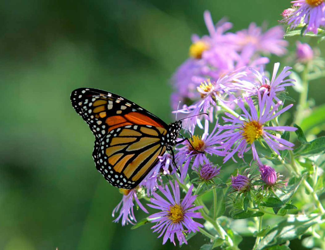

APPENDIX B - COMMUNITY ENGAGEMENT 6.22.21 B-1
APPENDIX B:COMMUNITY ENGAGEMENT
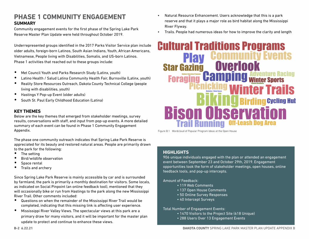
DAKOTA COUNTY SPRING LAKE PARK MASTER PLAN UPDATE APPENDIX BB-2 6.22.21
PHASE 1 COMMUNITY ENGAGEMENT SUMMARYCommunity engagement events for the first phase of the Spring Lake Park Reserve Master Plan Update were held throughout October 2019.
Underrepresented groups identified in the 2017 Parks Visitor Service plan include older adults, foreign-born Latinos, South Asian Indians, Youth, African Americans, Vietnamese, People living with Disabilities, Somalis, and US-born Latinos.Phase 1 activities that reached out to these groups include:
• Met Council Youth and Parks Research Study (Latinx, youth)• Latino Health / Salud Latina Community Health Fair, Burnsville (Latinx, youth)• Reality Store Resources Outreach, Dakota County Technical College (people
living with disabilities, youth)• Hastings Y Pop-up Event (older adults)
• South St. Paul Early Childhood Education (Latina)
KEY THEMESBelow are the key themes that emerged from stakeholder meetings, survey results, conversations with staff, and input from pop-up events. A more detailed summary of each event can be found in Phase 1 Community Engagement Appendix.
The phase one community outreach indicates that Spring Lake Park Reserve is appreciated for its beauty and restored natural areas. People are primarily drawn to the park for the following:• The setting• Bird/wildlife observation• Space rental• Trails and archery
Since Spring Lake Park Reserve is mainly accessible by car and is surrounded by farmland, the park is primarily a monthly destination for visitors. Some locals, as indicated on Social Pinpoint (an online feedback tool), mentioned that they will occasionally bike or run from Hastings to the park along the new Mississippi River Trail. Other comments included:• Questions on when the remainder of the Mississippi River Trail would be
completed, indicating that this missing link is affecting user experience.• Mississippi River Valley Views. The spectacular views at this park are a
primary draw for many visitors, and it will be important for the master plan update to protect and continue to enhance these views.
• Natural Resource Enhancement. Users acknowledge that this is a park reserve and that it plays a major role as bird habitat along the Mississippi River Flyway.
• Trails. People had numerous ideas for how to improve the clarity and length
BirdingPicnicking
CampingPlay
Biking
Star GazingOutdoor Education Programs
Off-Leash Dog Area
Community Events
Winter Sports
Cultural Traditions Programs
Winter TrailsForaging
Overlook
Bison ObservationCycling Hub
Medative / Silent Space
Trail Running
Climate Resilience
Adventure Racing
Figure B.1 Wordcloud of Popular Program Ideas at the Open House
HIGHLIGHTS906 unique individuals engaged with the plan or attended an engagement event between September 23 and October 29th, 2019. Engagement opportunities took the form of stakeholder meetings, open houses, online feedback tools, and pop-up intercepts.
Amount of Feedback: • 119 Web Comments • 137 Open House Comments • 50 Online Survey Responses • 40 Intercept Surveys
Total Number of Engagement Events: • 1470 Visitors to the Project Site (618 Unique) • 288 Users Over 13 Engagement Events
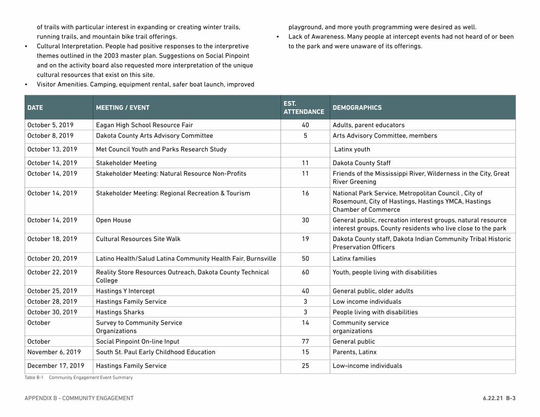
APPENDIX B - COMMUNITY ENGAGEMENT 6.22.21 B-3
DATE MEETING / EVENTEST. ATTENDANCE
DEMOGRAPHICS
October 5, 2019 Eagan High School Resource Fair 40 Adults, parent educators
October 8, 2019 Dakota County Arts Advisory Committee 5 Arts Advisory Committee, members
October 13, 2019 Met Council Youth and Parks Research Study Latinx youth
October 14, 2019 Stakeholder Meeting 11 Dakota County Staff
October 14, 2019 Stakeholder Meeting: Natural Resource Non-Profits 11 Friends of the Mississippi River, Wilderness in the City, Great River Greening
October 14, 2019 Stakeholder Meeting: Regional Recreation & Tourism 16 National Park Service, Metropolitan Council , City of Rosemount, City of Hastings, Hastings YMCA, Hastings Chamber of Commerce
October 14, 2019 Open House 30 General public, recreation interest groups, natural resource interest groups, County residents who live close to the park
October 18, 2019 Cultural Resources Site Walk 19 Dakota County staff, Dakota Indian Community Tribal Historic Preservation Officers
October 20, 2019 Latino Health/Salud Latina Community Health Fair, Burnsville 50 Latinx families
October 22, 2019 Reality Store Resources Outreach, Dakota County Technical College
60 Youth, people living with disabilities
October 25, 2019 Hastings Y Intercept 40 General public, older adults
October 28, 2019 Hastings Family Service 3 Low income individuals
October 30, 2019 Hastings Sharks 3 People living with disabilities
October Survey to Community Service Organizations
14 Community service organizations
October Social Pinpoint On-line Input 77 General public
November 6, 2019 South St. Paul Early Childhood Education 15 Parents, Latinx
December 17, 2019 Hastings Family Service 25 Low-income individuals
Table B-1 Community Engagement Event Summary
of trails with particular interest in expanding or creating winter trails, running trails, and mountain bike trail offerings.
• Cultural Interpretation. People had positive responses to the interpretive themes outlined in the 2003 master plan. Suggestions on Social Pinpoint and on the activity board also requested more interpretation of the unique cultural resources that exist on this site.
• Visitor Amenities. Camping, equipment rental, safer boat launch, improved
playground, and more youth programming were desired as well.• Lack of Awareness. Many people at intercept events had not heard of or been
to the park and were unaware of its offerings.
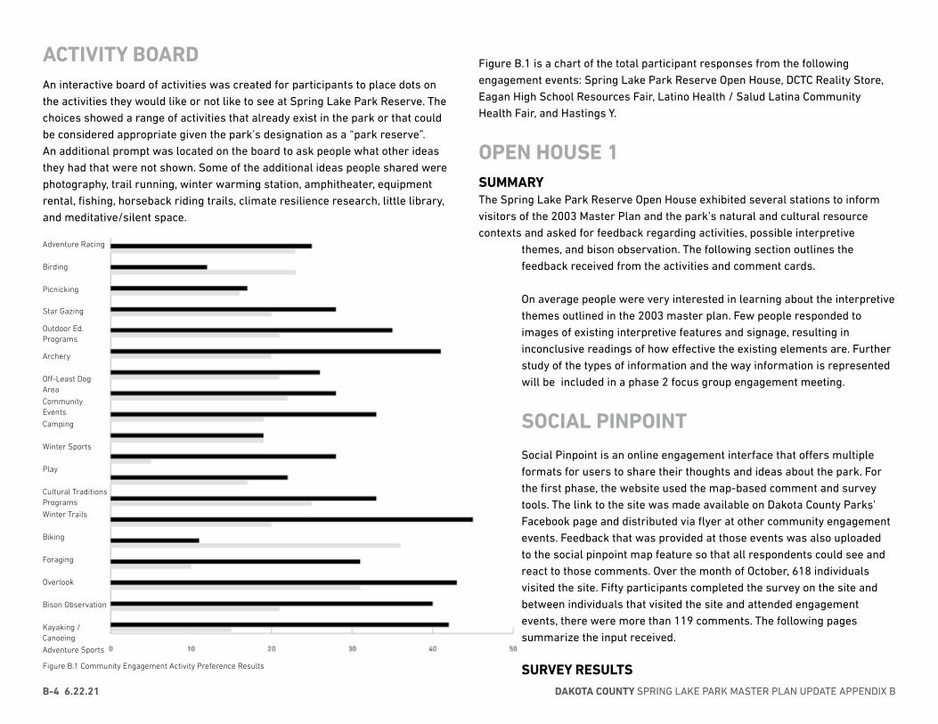
DAKOTA COUNTY SPRING LAKE PARK MASTER PLAN UPDATE APPENDIX BB-4 6.22.21
ACTIVITY BOARD An interactive board of activities was created for participants to place dots on the activities they would like or not like to see at Spring Lake Park Reserve. The choices showed a range of activities that already exist in the park or that could be considered appropriate given the park’s designation as a “park reserve”. An additional prompt was located on the board to ask people what other ideas they had that were not shown. Some of the additional ideas people shared were photography, trail running, winter warming station, amphitheater, equipment rental, fishing, horseback riding trails, climate resilience research, little library,and meditative/silent space.
Figure B.1 is a chart of the total participant responses from the following engagement events: Spring Lake Park Reserve Open House, DCTC Reality Store, Eagan High School Resources Fair, Latino Health / Salud Latina Community Health Fair, and Hastings Y.
OPEN HOUSE 1SUMMARYThe Spring Lake Park Reserve Open House exhibited several stations to inform visitors of the 2003 Master Plan and the park’s natural and cultural resource contexts and asked for feedback regarding activities, possible interpretive
themes, and bison observation. The following section outlines the feedback received from the activities and comment cards.
On average people were very interested in learning about the interpretive themes outlined in the 2003 master plan. Few people responded to images of existing interpretive features and signage, resulting in inconclusive readings of how effective the existing elements are. Further study of the types of information and the way information is represented will be included in a phase 2 focus group engagement meeting.
SOCIAL PINPOINTSocial Pinpoint is an online engagement interface that offers multiple formats for users to share their thoughts and ideas about the park. For the first phase, the website used the map-based comment and survey tools. The link to the site was made available on Dakota County Parks’ Facebook page and distributed via flyer at other community engagement events. Feedback that was provided at those events was also uploaded to the social pinpoint map feature so that all respondents could see and react to those comments. Over the month of October, 618 individuals visited the site. Fifty participants completed the survey on the site and between individuals that visited the site and attended engagement events, there were more than 119 comments. The following pages summarize the input received.
SURVEY RESULTS
Adventure Racing
Birding
Picnicking
Star Gazing
Outdoor Ed. Programs
Archery
Off-Least Dog Area
Community Events
Camping
Winter Sports
Play
Cultural Traditions Programs
Winter Trails
Biking
Foraging
Overlook
Bison Observation
Kayaking / Canoeing
Adventure Sports
Figure B.1 Community Engagement Activity Preference Results
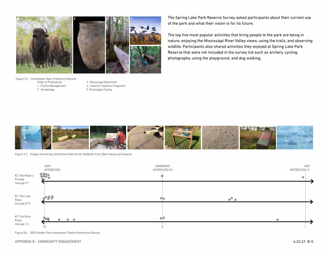
APPENDIX B - COMMUNITY ENGAGEMENT 6.22.21 B-5
The Spring Lake Park Reserve Survey asked participants about their current use of the park and what their vision is for its future.
The top five most popular activities that bring people to the park are being in nature, enjoying the Mississippi River Valley views, using the trails, and observing wildlife. Participants also shared activities they enjoyed at Spring Lake Park Reserve that were not included in the survey list such as archery, cycling, photography, using the playground, and dog walking.
#3: The River RisesAverage 7.6
#2: The Lake RisesAverage 8.75
#2: The Waters ProvideAverage 9.7
10 5 1
VERY INTERESTED
NOT INTERESTED (1)
SOMEWHAT INTERESTED (5)
Order of Preference:1. Prairie Management2. Archeology
Figure 2.2 Interpretive Topic Preference Results
1 2 3 5
4
3. Mississippi Movement4. Cultural Traditions Programs5. Mississippi Flyway
Figure 2.3 Images of existing interpretive features for feedback from Open House participants
Figure B.4 2003 Master Plan Interpretive Theme Preference Results
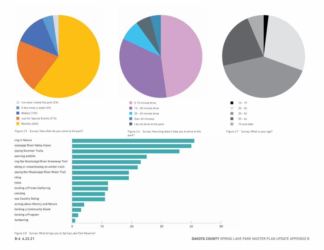
DAKOTA COUNTY SPRING LAKE PARK MASTER PLAN UPDATE APPENDIX BB-6 6.22.21
Figure 2.5 Survey: How often do you come to the park?
Monthly (60%)
Just for Special Events (21%)
Weekly (13%)
A few times a week (4%)
I’ve never visited the park (2%)
Figure 2.8 Survey: What brings you to Spring Lake Park Reserve?
Figure 2.6 Survey: How long does it take you to drive to the park?
I do not drive to the park
Over 45 minutes
30 - 45 minute drive
15 - 30 minute drive
5-15 minute drive
Figure 2.7 Survey: What is your age?
75 and older
55 - 64
35 - 54
20 - 34
10 - 19

APPENDIX B - COMMUNITY ENGAGEMENT 6.22.21 B-7
Why is Spring Lake Park Reserve a special place for you?
Due to its size, habitat, and proximity to the Mississippi, it supports a great variety and number of birds and other wildlife.
Enjoy the birds along the Mississippi River Flyway
The beautiful prairie with many native MN plants.
The habitat is wonderful for birding.
I love the spring wildflowers and the summer prairie flowers. I also love walking down in the archery area in the winter.
It is great being out in nature and still being in a metropolitan area.
It is so beautiful, and it provides a nice hike for my family.
It’s one of the most beautiful parks I know of! I love the scenic views, variety of trails, option to have bonfires, and also bring people there for photoshoots!
Its so beautiful! Can’t wait for the prairies to continue to mature and to see more woodland restorations.
Scenery
Scenic, quite. Not crowded.
Every so often my family brings out dog and he absolutely loves being outside. We also will occasionally go on picnics and snowshoeing. For school dances my friends and I will go and take group pictures out there because it is so pretty.
Great archery range.
Ski trails are not too difficult and good length for me, convenient entrance locations, quiet park with good views and access to Mississippi, variety of hiking/biking trails.
It is absolutely beautiful to hike, bike and snowshoe!
I got married at the gathering center in October 2018. I chose the venue for the beautiful view of the river and fall colors. The gathering center was perfect for a small, relaxed reception.
I love the views and riding my bike through the park.
I got married there.
We enjoy getting outside to walk and take hikes while enjoying he beautiful river view
I’m getting married there in May!
It is nice to walk the dogs in the woods on cold windy days, as the trees provide enough cover to enjoy some of the colder winter days.
It is a special place.
I love exercising, using the hiking trails/paths. My husband I were to be married here so we love reminiscing on the day it was “supposed” to be.
It’s not. We (come) once or twice a year. It would be nice to see a place pad for the kids out there, if there was a splash pad like our neighboring communities, we would go every nice day.
We love the views of the Mississippi River from above and enjoy kayaking and biking in the area.
We go out of our way to go on family bike rides on the trail. It offers excellent views of the river and riparian habit, and the playground is great!
We love the variety of hiking trails.
The views and miles of bike trails.
The park is so big that even if it is busy you can still enjoy the peacefulness of the River Valley.
It’s my favorite place to bike from Hastings.
It’s close to my house and beautiful.
This is one of our favorite places to go with our kids to play on the playground equipment and walk around trails or bring a picnic. The things we wish were different are that there were bathroom facilities closer to the playground since when some kids have to go, they usually can’t wait that long or if you need to change a diaper, you have to drive or walk to the bathroom facility since changing them in a port-o-potty is not ideal. Also some kids are afraid of the port-o-potty. It would also be fun to have an interactive kid trail where they go on a scavenger hunt or have different pitstops with a featured animal along the way or something.
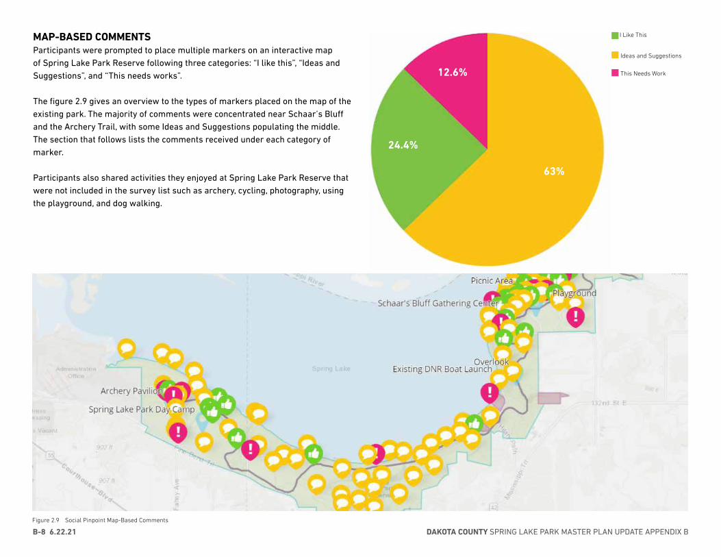
DAKOTA COUNTY SPRING LAKE PARK MASTER PLAN UPDATE APPENDIX BB-8 6.22.21
Figure 2.9 Social Pinpoint Map-Based Comments
I Like This
Ideas and Suggestions
This Needs Work
63%
24.4%
12.6%
MAP-BASED COMMENTSParticipants were prompted to place multiple markers on an interactive map of Spring Lake Park Reserve following three categories: “I like this”, “Ideas and Suggestions”, and “This needs works”.
The figure 2.9 gives an overview to the types of markers placed on the map of the existing park. The majority of comments were concentrated near Schaar’s Bluff and the Archery Trail, with some Ideas and Suggestions populating the middle. The section that follows lists the comments received under each category of marker.
Participants also shared activities they enjoyed at Spring Lake Park Reserve that were not included in the survey list such as archery, cycling, photography, using the playground, and dog walking.

APPENDIX B - COMMUNITY ENGAGEMENT 6.22.21 B-9
I LIKE THIS(UP VOTES, DOWN VOTES)
The park is great for dog walking. My elderly parents roll here. The visitor center is classy and user oriented. (DCTC)
The park building is nice. I have not been to the park in over a year. It is hard to get there with the CR42 construction. (Y)
I love cross country skiing in this park. There is plenty of mileage for me! (Y)
My kids love the bike path, I like the walking trails, my kids use the Y Camp. (Y)
We like picnicking - we have used every pavilion in the park. (Y)
We enjoy the park. We walk there. (Y)
I love the rustic part of the park and my kids love the playground. (Y)
I love the nature - flowers, butterflies, foliage
I used to cross country ski in the park, I’m 86 and don’t do that anymore. I go to Florida now! (Y)
I’ve biked to the park from Hastings and been to the park for picnics. It is very nice. (Y)
I went to a grad party at the park and another time just because it is a nice place. (Y)
I love the design details in the park, for example the map on the ground near the Gathering Center. (DCTC)
I like to ski at the park (Y)
We come to the park for family reunions, our kids and grandkids have had their senior pictures taken here, we held my mom’s 80th birthday in the park. (Y)
I love that the Gathering Center is open for water and restrooms (Y)
We mostly bike and hike at the park. (Y)
I ride my bike in the park. Minnesota does a great job with the parks and that is one of the reasons I moved here. If we don’t play on the land now, we wont have it in the future. (Y)
We love coming here to hike. More hiking would be great! (1,0)
We have enjoyed geocaching in this park. Please keep it open to additional geocaches.
I hope the cross country skiing will stay and will not be lost in the name of progress. The trail has already been encroached by the bike trail and the snow shoes. There is plenty of bike trails and not enough ski trails!!
We walked the trails in the park about ten years ago (EH)
Our scout troop went there last weekend (EH)
We picnic here and walk. The park is gorgeous and fun to be in (EH)
Our kids go to Camp Spring Lake
We got married here (EH) (1,0)
We love the solitude of the park (EH) (1,0)
The Y Camp really appreciates not having the bike path connect right into camp. It cuts down on the strangers entering camp while campers are there. By sending the path into the field, we can usually catch bikers and direct them away from camp while campers are there.
We love our space for the YMCA Day Camp that is run on this property. We are looked at as an example of what a day camp should look like within the association of the Y- lots of trees, paved paths, climate controlled building, good communication between Y & County, and lots of nice field space.
(1,0)
Great archery range (3,1)
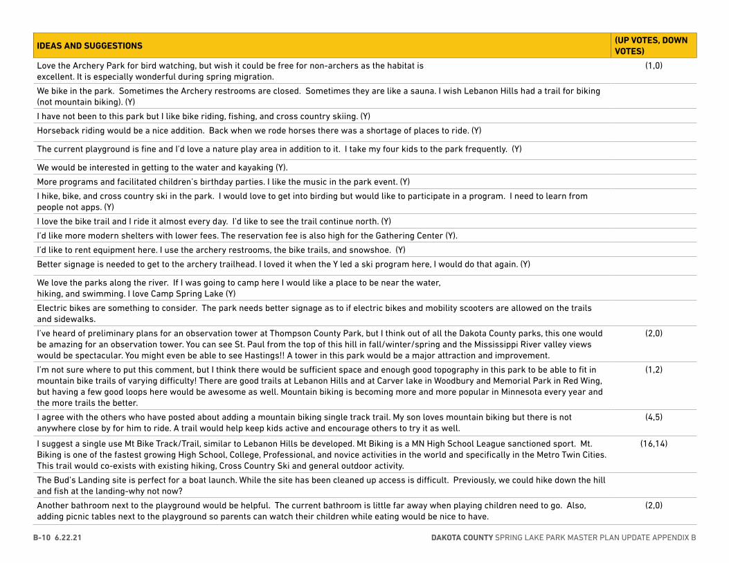
DAKOTA COUNTY SPRING LAKE PARK MASTER PLAN UPDATE APPENDIX BB-10 6.22.21
IDEAS AND SUGGESTIONS(UP VOTES, DOWN VOTES)
Love the Archery Park for bird watching, but wish it could be free for non-archers as the habitat is excellent. It is especially wonderful during spring migration.
(1,0)
We bike in the park. Sometimes the Archery restrooms are closed. Sometimes they are like a sauna. I wish Lebanon Hills had a trail for biking (not mountain biking). (Y)
I have not been to this park but I like bike riding, fishing, and cross country skiing. (Y)
Horseback riding would be a nice addition. Back when we rode horses there was a shortage of places to ride. (Y)
The current playground is fine and I’d love a nature play area in addition to it. I take my four kids to the park frequently. (Y)
We would be interested in getting to the water and kayaking (Y).
More programs and facilitated children’s birthday parties. I like the music in the park event. (Y)
I hike, bike, and cross country ski in the park. I would love to get into birding but would like to participate in a program. I need to learn from people not apps. (Y)
I love the bike trail and I ride it almost every day. I’d like to see the trail continue north. (Y)
I’d like more modern shelters with lower fees. The reservation fee is also high for the Gathering Center (Y).
I’d like to rent equipment here. I use the archery restrooms, the bike trails, and snowshoe. (Y)
Better signage is needed to get to the archery trailhead. I loved it when the Y led a ski program here, I would do that again. (Y)
We love the parks along the river. If I was going to camp here I would like a place to be near the water, hiking, and swimming. I love Camp Spring Lake (Y)
Electric bikes are something to consider. The park needs better signage as to if electric bikes and mobility scooters are allowed on the trails and sidewalks.
I’ve heard of preliminary plans for an observation tower at Thompson County Park, but I think out of all the Dakota County parks, this one would be amazing for an observation tower. You can see St. Paul from the top of this hill in fall/winter/spring and the Mississippi River valley views would be spectacular. You might even be able to see Hastings!! A tower in this park would be a major attraction and improvement.
(2,0)
I’m not sure where to put this comment, but I think there would be sufficient space and enough good topography in this park to be able to fit in mountain bike trails of varying difficulty! There are good trails at Lebanon Hills and at Carver lake in Woodbury and Memorial Park in Red Wing, but having a few good loops here would be awesome as well. Mountain biking is becoming more and more popular in Minnesota every year and the more trails the better.
(1,2)
I agree with the others who have posted about adding a mountain biking single track trail. My son loves mountain biking but there is not anywhere close by for him to ride. A trail would help keep kids active and encourage others to try it as well.
(4,5)
I suggest a single use Mt Bike Track/Trail, similar to Lebanon Hills be developed. Mt Biking is a MN High School League sanctioned sport. Mt. Biking is one of the fastest growing High School, College, Professional, and novice activities in the world and specifically in the Metro Twin Cities. This trail would co-exists with existing hiking, Cross Country Ski and general outdoor activity.
(16,14)
The Bud’s Landing site is perfect for a boat launch. While the site has been cleaned up access is difficult. Previously, we could hike down the hill and fish at the landing-why not now?
Another bathroom next to the playground would be helpful. The current bathroom is little far away when playing children need to go. Also, adding picnic tables next to the playground so parents can watch their children while eating would be nice to have.
(2,0)
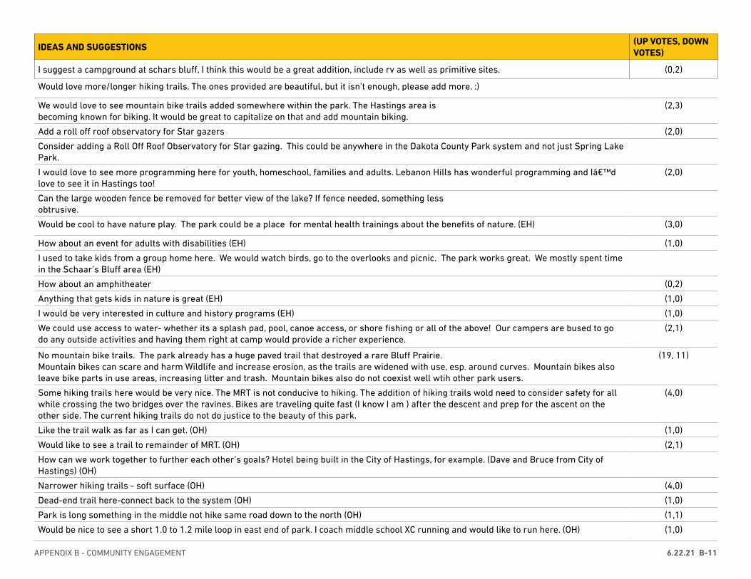
APPENDIX B - COMMUNITY ENGAGEMENT 6.22.21 B-11
IDEAS AND SUGGESTIONS(UP VOTES, DOWN VOTES)
I suggest a campground at schars bluff, I think this would be a great addition, include rv as well as primitive sites. (0,2)
Would love more/longer hiking trails. The ones provided are beautiful, but it isn’t enough, please add more. :)
We would love to see mountain bike trails added somewhere within the park. The Hastings area is becoming known for biking. It would be great to capitalize on that and add mountain biking.
(2,3)
Add a roll off roof observatory for Star gazers (2,0)
Consider adding a Roll Off Roof Observatory for Star gazing. This could be anywhere in the Dakota County Park system and not just Spring Lake Park.
I would love to see more programming here for youth, homeschool, families and adults. Lebanon Hills has wonderful programming and I’d love to see it in Hastings too!
(2,0)
Can the large wooden fence be removed for better view of the lake? If fence needed, something less obtrusive.
Would be cool to have nature play. The park could be a place for mental health trainings about the benefits of nature. (EH) (3,0)
How about an event for adults with disabilities (EH) (1,0)
I used to take kids from a group home here. We would watch birds, go to the overlooks and picnic. The park works great. We mostly spent time in the Schaar’s Bluff area (EH)
How about an amphitheater (0,2)
Anything that gets kids in nature is great (EH) (1,0)
I would be very interested in culture and history programs (EH) (1,0)
We could use access to water- whether its a splash pad, pool, canoe access, or shore fishing or all of the above! Our campers are bused to go do any outside activities and having them right at camp would provide a richer experience.
(2,1)
No mountain bike trails. The park already has a huge paved trail that destroyed a rare Bluff Prairie. Mountain bikes can scare and harm Wildlife and increase erosion, as the trails are widened with use, esp. around curves. Mountain bikes also leave bike parts in use areas, increasing litter and trash. Mountain bikes also do not coexist well wtih other park users.
(19, 11)
Some hiking trails here would be very nice. The MRT is not conducive to hiking. The addition of hiking trails wold need to consider safety for all while crossing the two bridges over the ravines. Bikes are traveling quite fast (I know I am ) after the descent and prep for the ascent on the other side. The current hiking trails do not do justice to the beauty of this park.
(4,0)
Like the trail walk as far as I can get. (OH) (1,0)
Would like to see a trail to remainder of MRT. (OH) (2,1)
How can we work together to further each other’s goals? Hotel being built in the City of Hastings, for example. (Dave and Bruce from City of Hastings) (OH)
Narrower hiking trails - soft surface (OH) (4,0)
Dead-end trail here-connect back to the system (OH) (1,0)
Park is long something in the middle not hike same road down to the north (OH) (1,1)
Would be nice to see a short 1.0 to 1.2 mile loop in east end of park. I coach middle school XC running and would like to run here. (OH) (1,0)
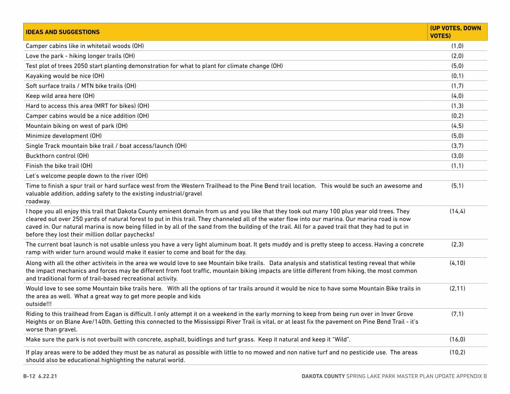
DAKOTA COUNTY SPRING LAKE PARK MASTER PLAN UPDATE APPENDIX BB-12 6.22.21
IDEAS AND SUGGESTIONS(UP VOTES, DOWN VOTES)
Camper cabins like in whitetail woods (OH) (1,0)
Love the park - hiking longer trails (OH) (2,0)
Test plot of trees 2050 start planting demonstration for what to plant for climate change (OH) (5,0)
Kayaking would be nice (OH) (0,1)
Soft surface trails / MTN bike trails (OH) (1,7)
Keep wild area here (OH) (4,0)
Hard to access this area (MRT for bikes) (OH) (1,3)
Camper cabins would be a nice addition (OH) (0,2)
Mountain biking on west of park (OH) (4,5)
Minimize development (OH) (5,0)
Single Track mountain bike trail / boat access/launch (OH) (3,7)
Buckthorn control (OH) (3,0)
Finish the bike trail (OH) (1,1)
Let’s welcome people down to the river (OH)
Time to finish a spur trail or hard surface west from the Western Trailhead to the Pine Bend trail location. This would be such an awesome and valuable addition, adding safety to the existing industrial/gravel roadway.
(5,1)
I hope you all enjoy this trail that Dakota County eminent domain from us and you like that they took out many 100 plus year old trees. They cleared out over 250 yards of natural forest to put in this trail. They channeled all of the water flow into our marina. Our marina road is now caved in. Our natural marina is now being filled in by all of the sand from the building of the trail. All for a paved trail that they had to put in before they lost their million dollar paychecks!
(14,4)
The current boat launch is not usable unless you have a very light aluminum boat. It gets muddy and is pretty steep to access. Having a concrete ramp with wider turn around would make it easier to come and boat for the day.
(2,3)
Along with all the other activiteis in the area we would love to see Mountain bike trails. Data analysis and statistical testing reveal that while the impact mechanics and forces may be different from foot traffic, mountain biking impacts are little different from hiking, the most common and traditional form of trail-based recreational activity.
(4,10)
Would love to see some Mountain bike trails here. With all the options of tar trails around it would be nice to have some Mountain Bike trails in the area as well. What a great way to get more people and kids outside!!!
(2,11)
Riding to this trailhead from Eagan is difficult. I only attempt it on a weekend in the early morning to keep from being run over in Inver Grove Heights or on Blane Ave/140th. Getting this connected to the Mississippi River Trail is vital, or at least fix the pavement on Pine Bend Trail - it’s worse than gravel.
(7,1)
Make sure the park is not overbuilt with concrete, asphalt, buidlings and turf grass. Keep it natural and keep it “Wild”. (16,0)
If play areas were to be added they must be as natural as possible with little to no mowed and non native turf and no pesticide use. The areas should also be educational highlighting the natural world.
(10,2)
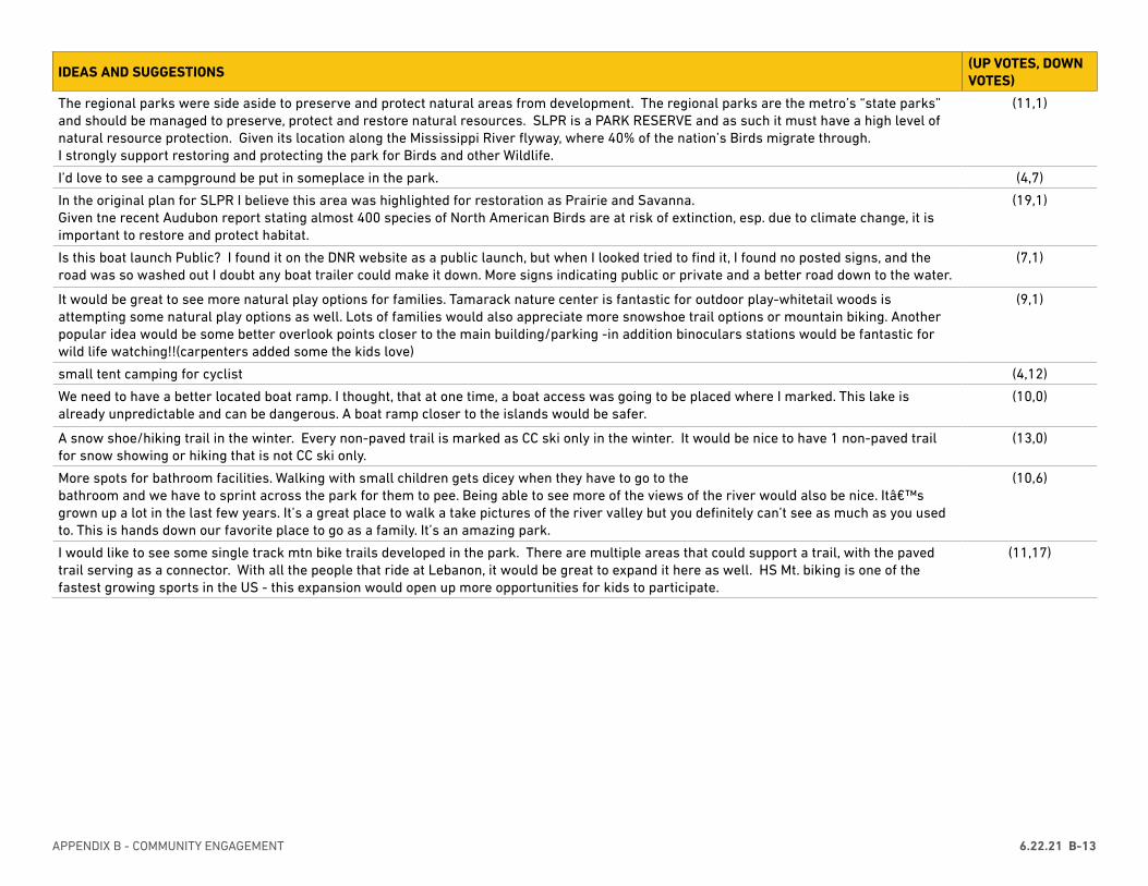
APPENDIX B - COMMUNITY ENGAGEMENT 6.22.21 B-13
IDEAS AND SUGGESTIONS(UP VOTES, DOWN VOTES)
The regional parks were side aside to preserve and protect natural areas from development. The regional parks are the metro’s “state parks” and should be managed to preserve, protect and restore natural resources. SLPR is a PARK RESERVE and as such it must have a high level of natural resource protection. Given its location along the Mississippi River flyway, where 40% of the nation’s Birds migrate through. I strongly support restoring and protecting the park for Birds and other Wildlife.
(11,1)
I’d love to see a campground be put in someplace in the park. (4,7)
In the original plan for SLPR I believe this area was highlighted for restoration as Prairie and Savanna. Given tne recent Audubon report stating almost 400 species of North American Birds are at risk of extinction, esp. due to climate change, it is important to restore and protect habitat.
(19,1)
Is this boat launch Public? I found it on the DNR website as a public launch, but when I looked tried to find it, I found no posted signs, and the road was so washed out I doubt any boat trailer could make it down. More signs indicating public or private and a better road down to the water.
(7,1)
It would be great to see more natural play options for families. Tamarack nature center is fantastic for outdoor play-whitetail woods is attempting some natural play options as well. Lots of families would also appreciate more snowshoe trail options or mountain biking. Another popular idea would be some better overlook points closer to the main building/parking -in addition binoculars stations would be fantastic for wild life watching!!(carpenters added some the kids love)
(9,1)
small tent camping for cyclist (4,12)
We need to have a better located boat ramp. I thought, that at one time, a boat access was going to be placed where I marked. This lake is already unpredictable and can be dangerous. A boat ramp closer to the islands would be safer.
(10,0)
A snow shoe/hiking trail in the winter. Every non-paved trail is marked as CC ski only in the winter. It would be nice to have 1 non-paved trail for snow showing or hiking that is not CC ski only.
(13,0)
More spots for bathroom facilities. Walking with small children gets dicey when they have to go to the bathroom and we have to sprint across the park for them to pee. Being able to see more of the views of the river would also be nice. It’s grown up a lot in the last few years. It’s a great place to walk a take pictures of the river valley but you definitely can’t see as much as you used to. This is hands down our favorite place to go as a family. It’s an amazing park.
(10,6)
I would like to see some single track mtn bike trails developed in the park. There are multiple areas that could support a trail, with the paved trail serving as a connector. With all the people that ride at Lebanon, it would be great to expand it here as well. HS Mt. biking is one of the fastest growing sports in the US - this expansion would open up more opportunities for kids to participate.
(11,17)
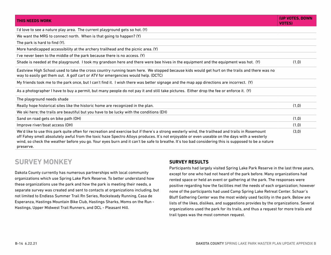
DAKOTA COUNTY SPRING LAKE PARK MASTER PLAN UPDATE APPENDIX BB-14 6.22.21
THIS NEEDS WORK(UP VOTES, DOWN VOTES)
I’d love to see a nature play area. The current playground gets so hot. (Y)
We want the MRG to connect north. When is that going to happen? (Y)
The park is hard to find (Y).
More handicapped accessibility at the archery trailhead and the picnic area. (Y)
I’ve never been to the middle of the park because there is no access. (Y)
Shade is needed at the playground. I took my grandson here and there were bee hives in the equipment and the equipment was hot. (Y) (1,0)
Eastview High School used to take the cross country running team here. We stopped because kids would get hurt on the trails and there was no way to easily get them out. A golf cart or ATV for emergencies would help. (DCTC)
My friends took me to the park once, but I can’t find it. I wish there was better signage and the map app directions are incorrect. (Y)
As a photographer I have to buy a permit, but many people do not pay it and still take pictures. Either drop the fee or enforce it. (Y)
The playground needs shade
Really hope historical sites like the historic home are recognized in the plan. (1,0)
We ski here; the trails are beautiful but you have to be lucky with the conditions (EH)
Sand on road gets on bike path (OH) (1,0)
Improve river/boat access (OH) (1,0)
We’d like to use this park quite often for recreation and exercise but if there’s a strong westerly wind, the trailhead and trails in Rosemount off Fahey smell absolutely awful from the toxic haze Spectro Alloys produces. It’s not enjoyable or even useable on the days with a westerly wind, so check the weather before you go. Your eyes burn and it can’t be safe to breathe. It’s too bad considering this is supposed to be a nature preserve.
(3,0)
SURVEY MONKEY Dakota County currently has numerous partnerships with local community organizations which use Spring Lake Park Reserve. To better understand how these organizations use the park and how the park is meeting their needs, a separate survey was created and sent to contacts at organizations including, but not limited to Endless Summer Trail Rn Series, Rocksteady Running, Casa de Esperanza, Hastings Mountain Bike Club, Hastings Sharks, Moms on the Run - Hastings, Upper Midwest Trail Runners, and DCL - Pleasant Hill.
SURVEY RESULTSParticipants had largely visited Spring Lake Park Reserve in the last three years, except for one who had not heard of the park before. Many organizations had rented space or held an event or gathering at the park. The responses were positive regarding how the facilities met the needs of each organization; however none of the participants had used Camp Spring Lake Retreat Center. Schaar’s Bluff Gathering Center was the most widely used facility in the park. Below are lists of the likes, dislikes, and suggestions provides by the organizations. Several organizations used the park for its trails, and thus a request for more trails and trail types was the most common request.
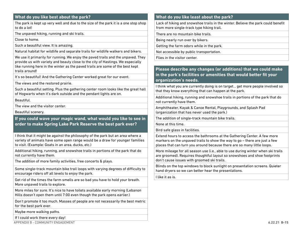
APPENDIX B - COMMUNITY ENGAGEMENT 6.22.21 B-15
What do you like best about the park?The park is kept up very well and due to the size of the park it is a one stop shop to do a lot!
The unpaved hiking, running and ski trails.
Close to home.
Such a beautiful view. It is amazing.
Natural habitat for wildlife and separate trails for wildlife walkers and bikers.
We use it primarily for running. We enjoy the paved trails and the unpaved. They provide us with variety and beauty close to the city of Hastings. We especially like running here in the winter as the paved trails are some of the best kept trails around!
It’s so beautiful! And the Gathering Center worked great for our event.
The views and the restored prairie.
Such a beautiful setting. Plus the gathering center room looks like the great hall of Hogwarts when it’s dark outside and the pendant lights are on.
Beautiful.
The view and the visitor center.
Beautiful scenery.
What do you like least about the park?Lack of hiking and snowshoe trails in the winter. Believe the park could benefit from more single-track type hiking trail.
There are no mountain bike trails.
Being nearly run over by bikers.
Getting the farm odors while in the park.
Not accessible by public transportation.
Flies in the visitor center.
Please describe any changes (or additions) that we could make in the park’s facilities or amenities that would better fit your organization’s needs.I think what you are currently doing is on target… get more people involved so that they know everything that can happen at the park.
Additional hiking, running and snowshoe trails in portions of the park that do not currently have them.
Amphitheater, Kayak & Canoe Rental, Playgrounds, and Splash Pad (organization that has never used the park.)
The addition of single-track mountain bike trails.
None at this time.
Bird safe glass in facilities.
Extend hours to access the bathrooms at the Gathering Center. A few more markers on the unpaved trails to show the way to go – there are just a few places that can turn you around because there are so many little loops.
More mileage for all season use (i.e., able to use during winter when ski trails are groomed). Requires thoughtful layout so snowshoes and shoe footprints don’t cause issues with groomed ski trails.
Blinds on the top windows to block sunlight on presentation screens. Quieter hand dryers so we can better hear the presentations.
I like it as is.
If you could wave your magic wand, what would you like to see in order to make Spring Lake Park Reserve the best park ever?
I think that it might be against the philosophy of the park but an area where a variety of animals have some open range would be a draw for younger families to visit. (Example: Goats in an area, ducks, etc.)
Additional hiking, running, and snowshoe trails in portions of the park that do not currently have them.
The addition of more family activities, free concerts & plays.
Some single-track mountain bike trail loops with varying degrees of difficulty to encourage riders off all levels to enjoy the park.
Get rid of the times the farm smells are so bad you have to hold your breath. More unpaved trails to explore.
More miles for sure. It’s nice to have toilets available early morning (Lebanon Hills doesn’t open them until 7:00 even though the park opens earlier.)
Don’t promote it too much. Masses of people are not necessarily the best metric for the best park ever.
Maybe more walking paths.
If I could work there every day!
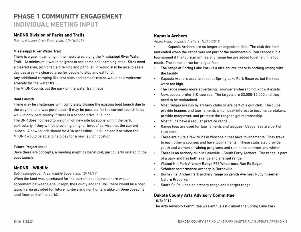
DAKOTA COUNTY SPRING LAKE PARK MASTER PLAN UPDATE APPENDIX BB-16 6.22.21
MnDNR Division of Parks and Trails Rachel Henzen, Area Supervisor, 10/16/2019
Mississippi River Water Trail There is a gap in camping in the metro area along the Mississippi River Water Trail. At minimum it would be great to see some boat camping sites. Sites need a cleared area, picnic table, fire ring and pit toilet. It would also be nice to see a day use area – a cleared area for people to stop and eat lunch.Any additional camping like tent sites and camper cabins would be a welcome amenity for the water trail.The MnDNR points out the park on the water trail maps.
Boat LaunchThere may be challenges with completely closing the existing boat launch due to the way the land was purchased. It may be possible for the current launch to be walk in only, particularly if there is a second drive in launch. The DNR does not need to weigh in on new site locations within the park, particularly if they will be providing a higher level of service that the current launch. A new launch should be ADA accessible. It is unclear if or when the MnDNR would be able to help pay for a new launch location.
Future Project InputOnce there are concepts, a meeting might be beneficial, particularly related to the boat launch.
MnDNR – WildlifeBob Fashingbauer, Area Wildlife Supervisor, 10/14/19When the land was purchased for the current boat launch, there was an agreement between Gene Joseph, the County and the DNR there would be a boat launch area provided for future hunters and non hunters alike on Gene Joseph’s land (now part of the park).
PHASE 1 COMMUNITY ENGAGEMENTINDIVIDUAL MEETING INPUT
Kaposia ArchersAdam Heinz, Kaposia Archers, 10/15/2019• Kaposia Archers are no longer an organized club. The club declined and ended when the range was not part of the membership. You cannot run a tournament if the tournament fee and range fee are added together. It is too much. The same is true for league fees.• The range at Spring Lake Park is a nice course, there is nothing wrong with
the facility.• Kaposia Archers used to shoot at Spring Lake Park Reserve, but the fees
were too high.• The range needs more advertising. Younger archers to not know it exists.• Now, people prefer 3-D courses. The targets are $3,000-$5,000 and they
need to be maintained.• Most ranges are run by archery clubs or are part of a gun club. The clubs
provide leagues and tournaments which peak interest to become caretakers, provide manpower, and promote the range to get membership.
• Most clubs have a regular practice range.• Range fees are used for tournaments and leagues. Usage fees are part of
club dues.• There are quite a few clubs in Wisconsin that have tournaments. They travel
to each other’s courses and have tournaments. These clubs also provide youth and women’s training programs and run in the summer and winter.
• There is an archery club in Lakeville – South Forty Archers. The range is part of a park and has both a range and a target range.
• Walnut Hill Park Archery Range 999 Wilderness Run Rd Eagan,• Schaffer performance Archery in Burnsville.• Burnsville Archer Park archery range on Zenith Ave near Rudy Kraemer
Nature Preserve.• South St. Paul has an archery range and a target range.
Dakota County Arts Advisory Committee10/8/2019The Arts Advisory Committee was enthusiastic about the Spring Lake Park

APPENDIX B - COMMUNITY ENGAGEMENT 6.22.21 B-17
Reserve Master Plan, interested in providing input and feedback throughout the year long planning process, and interested in how they could start preparing now to integrate art into future park improvement projects at Spring Lake Park. In addition they expressed interest in expanding art in he parks, mentioned that arts and parks are an opportunity to engage and strengthen a stronger community connection, and the arts and parks collaboration provides opportunities for new partnerships.
Dakota County Soil and Water Conservation District10/2019 From an SWCD perspective, addressing the gully stabilization(s) is an important part of the natural resource management planning process. We have talked about including the gully erosion in the plan before as a means to plan and budget.
Hastings Family Service10/28/2019Maddie Milliren, Program and Administrative Assistant Hastings Family Service provides a variety of emergency and supportive services to persons in Independent School District 200. Services include a food shelf, a thrift store, transportation for grocery shopping, meals on wheels, emergency assistance, and school supplies.Some of the barriers for to visiting Spring Lake Park Reserve are awareness, transportation, and cost. Incentives to attend/participate – for example a free meal or a free program will draw people.Events or outings for older adults living in Oakridge Court, Rivertown Court or Mississippi Terrace may be interested in events at the park if transportation is provided. In the Summer, transportation is provided to meals served at Our Savior’s Lutheran Church. It is very popular and the older adults love the event because it is mixed ages with many children in attendance.Potential ways to reach people through Hastings Family Service are a paper survey or comment box in the lobby. December would be a good time to seek input as there is a lot of traffic for the North Poll Room for Christmas shopping and the Adopt a Family program. The holiday event is December 11-13 and December 17-19. People will be more likely to participate if there is an incentive.
Other organizations that Dakota County Parks could consider reaching out to include:
• The Equity Board – Derrick Jaeger with the YMCA is on the board• Our Savior’s Lutheran Church• Lewis House & Outreach Services – 360 Communities• Library • Sparks Program (coordinated by Hastings YMCA)Barriers to accessing parks: • Lack of awareness. • Hastings YMCA could be a potential spot to promote, they let HFS come
advertise their offerings. • Could print fliers to be included in the lobby or in food bags. They use short,
concise, colorful fliers which they have found to be effective. • Transportation. • Especially for isolated populations such as seniors. • Hastings Family Service provides transportation for medical rides. • If transportation was provided from senior living facilities (for example, Oak
Ridge Manor, Rivertown Courts, Mississippi Terrace), people would likely participate. They provided transport to the meals at Our Saviors and seniors participated. They enjoyed getting out and interacting with youth.
• Downtown Hastings could also be an accessible spot to travel from. • Currently there is a circular public transport on Tuesday. Could talk to them
about getting Spring Lake Park Reserve added as a stop. • Cost is a barrier to participation • Could consider giving out free tickets (for candlelight events for example)
then people would be more likely to attendand it is a good way for people to get involved.
• Promotion• It would be helpful for people to have a motive to entice them go such as free
food or a meal • Ways to engage people in the projects: • Not a lot of luck with online surveys typically • Could put out on a board or a survey box for submissions in the waiting area • Biggest season is the winter holidays – many people come to the North Pole
Room to do shopping – Dakota County could set-up a both, more effective if staff are present. Could also bring hot cocoa and cookies. Dates would be December 11-13 & 17-19. Dakota County could staff for 2-4 hours and then leave self-guided boards for people to engage in.
• Main way to communicate with clients is by putting fliers in food bags • People meet with staff one-on-one before going into the food shelf • Other organizations Dakota County should reach out to:
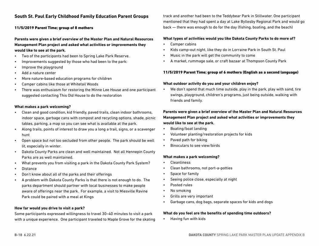
DAKOTA COUNTY SPRING LAKE PARK MASTER PLAN UPDATE APPENDIX BB-18 6.22.21
South St. Paul Early Childhood Family Education Parent Groups
11/5/2019 Parent Time; group of 8 mothers
Parents were given a brief overview of the Master Plan and Natural Resources Management Plan project and asked what activities or improvements they would like to see at the park.• Two of the participants had been to Spring Lake Park Reserve.• Improvements suggested by those who had been to the park:• Improve the playground• Add a nature center • More nature-based education programs for children• Camper cabins like those at Whitetail Woods• There was enthusiasm for restoring the Minne Lee House and one participant
suggested contacting This Old House to do the restoration
What makes a park welcoming?• Clean and good condition, kid friendly, paved trails, clean indoor bathrooms,
indoor space, garbage cans with compost and recycling options, shade, picnic tables, parking, a map so you can see what is available at the park.
• Along trails, points of interest to draw you a long a trail, signs, or a scavenger hunt
• Open space but not too secluded from other people. The park should be well lit, especially in winter.
• Dakota County Parks are clean and well maintained. Not all Hennepin County Parks are as well maintained.
• What prevents you from visiting a park in the Dakota County Park System?• Distance• Don’t know about all of the parks and their offerings• A problem with Dakota County Parks is that there is not enough to do. The
parks department should partner with local businesses to make people aware of offerings near the park. For example, a visit to Miesville Ravine Park could be paired with a meal at Kings
How far would you drive to visit a park?Some participants expressed willingness to travel 30–40 minutes to visit a park with a unique experience. One participant traveled to Maple Grove for the skating
track and another had been to the Teddybear Park in Stillwater. One participant mentioned that they had spent a day at Lake Byllesby Regional Park and would go back — there was enough to do for the day (fishing, boating, and the beach)
What types of activities would you like Dakota County Parks to do more of?• Camper cabins• Kids camp-out night, like they do in Lorraine Park in South St. Paul• Music in the park will get the community to come• A market, rummage sale, or craft bazaar at Thompson County Park
11/5/2019 Parent Time; group of 6 mothers (English as a second language)
What outdoor activity do you and your children enjoy? • We don’t spend that much time outside, play in the park, play with sand, tire
swings, playground, children’s programs, just being outside, walking with friends and family.
Parents were given a brief overview of the Master Plan and Natural Resources Management Plan project and asked what activities or improvements they would like to see at the park.• Boating/boat landing• Volunteer planting/restoration projects for kids• Paved path for biking• Binoculars to see view/birds
What makes a park welcoming?• Cleanliness• Clean bathrooms, not port-a-potties• Space for family• Seeing police close, especially at night• Posted rules• No smoking• Grills are very important • Garbage cans, dog bags, separate spaces for kids and dogs
What do you feel are the benefits of spending time outdoors?• Having fun with kids

APPENDIX B - COMMUNITY ENGAGEMENT 6.22.21 B-19
• No noise, quiet, peaceful, relaxing• Meeting new people• Visiting new places• Exercise like walking• Trying new activities, like kayaking, with kids• The kids are closer to nature• Mental health• Time to rest and take a break while the kids are playing on the playground
What prevents you from visiting a park in the Dakota County Park System?• Time• I don’t know about the parks• Don’t know about all of the parks and their offerings
How far would you drive to visit a park?• Point Douglass Park: the water is clean, there is a large area that isn’t too
deep for the kids to play, there are a lot of families, but it is not too crowded• Anywhere there is nice sand• One participant mentioned that she would travel two hours to go to a park
but then would want to stay two days. She had taken a day trip to Forestville/Mystery Cave State Park and enjoyed visiting the cave and the historic village.
• There was discussion about where to stay if you spent two days at a park: camper cabins (only if they are really clean), hotel with a pool.
Hastings SharksDate: October 31, 2019
Attendees: • Ray Kennedy – Hastings Sharks - Head Coach • Lil Leatham – Dakota County Parks - Senior Planner • Anna Ferris – Dakota County Parks - Outreach Coordinator
About the Hastings Sharks: • The Sharks are a Special Olympic team based out of Hastings • The athletes are ages 8 and up and participate in a variety of sports• Participation has a positive impact on athletes in a variety of ways, socially,
physically, and improving their health
Spring Lake Park Reserve Master Plan Update • The Sharks don’t currently use the park at all • There are four major events per year: swimming, basketball (summer
sports), downhill skiing and snowboarding (winter sports). Those two winter sports are not accessible to all athletes and this year the Special Olympics are adding snowshoeing as a winter sport.
• Last year, to bridge the gap during the winter and provide an option for keeping active, the Hastings Sharks worked with Hasting Community Education to coordinate a Friends and Fitness program. As part of this program they went snowshoeing at Carpenter Nature center twice and about 12 athletes participated. Carpenter provided equipment for this experience. It was a very positive experience.
• There is potential to get families more involved in the parks • Nature-based fitness stations along trails, such as benches made of tree
trunks to do sit-ups, would be a great addition.
Awareness and Promotion Plan: • A good way to get the word out would be to send information to the Heads of
Delegation of the different Special Olympics teams in the county • Messaging –“Improve your health” is messaging that resonates. Some people
might not intuitively connect time outdoors with health. • Some athletes use social media and some don’t; the Sharks have a Facebook
page (younger people tend not to use Facebook) • Events
» Hastings Police has done events focused on building relationships with people with disabilities. Special Olympics also participates in the Polar Plunge in Burnsville.
» Accommodations for events could include early opens » Busy events can be challenging because there can be potential for running
and getting lost in the crowd » Sometimes closed-in spaces can be beneficial as it is easier to keep track
of people » Helpful information to know ahead of time would be the number of
expected participants at an event and what will be available
Spring Lake Park Reserve as a potential practice venue for the Sharks: • The snowshoeing season will be December–February with the competition
taking place in February.

DAKOTA COUNTY SPRING LAKE PARK MASTER PLAN UPDATE APPENDIX BB-20 6.22.21
• The number of athletes would be around 10–15 • It is very important for there to be equipment available for the athletes to
use, especially at the beginning, before they have their own snowshoes. • Race lengths are 25, 50, 100, and 200 meters; however it is not important
that trails be measured to those lengths for training. When they need to do time trials, they can bring equipment to measure and mark the lengths (for example, removable flags).
• The best times for practice would be weekends, during late morning or midday; too early or late in the day it could be too cold
• They would be open to practicing at Schaar’s Bluff or Camp Spring Lake • They would be interested in a private outdoor education program to teach
snowshoeing to coaches and athletes
Continued engagement in the SLPR Masterplan and Awareness and Promotion Plan: • Dakota County staff could come to the first practice to talk to athletes and
parents • Other contacts we should connect with:
» Special Olympics teams in West Saint Paul and Apple Valley/Eagan » Ray can provide points of contact.
Pop-up at Hastings Family ServiceDate: December 17, 2019Approximately 25 people provided input
• We love the park and we take pictures there. My son had a photography class through school and that is how we discovered the park
• Spring Lake Park Reserve is one of my favorite parks. I’ve been there for receptions and I planted a tree there in my husband’s honor. I love the gathering center.
• I love the trails, this is my favorite park.• Longer natural surface trails• Bison would be so cool• I love the park for the scenic view and picnicking. It is a great place for kids.• I went for a walk in the park once.• I go to the park for snowshoeing, hiking, the playground when the kids were
little, we’d love to be able to rent a wheelchair - we took my Dad and he couldn’t walk far.
• Hiking• I’d like to see a campground. There really isn’t any place near Hastings.• I ‘d like to camp at the park. I’m a gardner. I have picnicked at the park, used
the play area, enjoyed the cliffs, been on walks in the park.• I’d like to see a playground near a place to go fishing. I did fish in the park
once.• Many people don’t know about this park. It is a great place to take family
pictures.• I’d like to see a fire tower and get a platform over the river• We’d love to see more pollinators. We love the wildflowers, we cross country ski and
there is plenty of mileage. I like the park just the way it is.
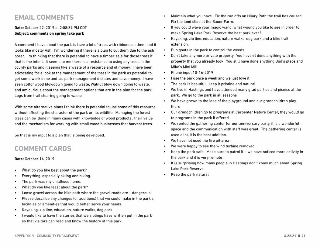
APPENDIX B - COMMUNITY ENGAGEMENT 6.22.21 B-21
EMAIL COMMENTSDate: October 22, 2019 at 2:08:39 PM CDTSubject: comments on spring lake park
A comment I have about the park is I see a lot of trees with ribbons on them and it looks like mostly Ash. I’m wondering if there is a plan to cut them due to the ash borer. I’m thinking that there is potential to have a timber sale for those trees if that is the intent. It seems to me there is a resistance to using any trees in the county parks and it seems like a waste of a resource and of money. I have been advocating for a look at the management of the trees in the park as potential to get some work done and as park management dictates and save money. I have seen cottonwood blowdown going to waste, Walnut blow down going to waste, and am curious about the management options that are in the plan for the park. Logs from trail clearing going to waste.
With some alternative plans I think there is potential to use some of this resource without affecting the character of the park or its wildlife. Managing the forest trees can be done in many cases with knowledge of wood products , their value and the mechanism for working with small wood businesses that harvest trees.
So that is my input to a plan that is being developed.
COMMENT CARDSDate: October 14, 2019
• What do you like best about the park?• Everything, especially skiing and biking.• The park was my childhood home.• What do you like least about the park?• Loose gravel across the bike path where the gravel roads are – dangerous!• Please describe any changes (or additions) that we could make in the park’s
facilities or amenities that would better serve your needs.• Kayaking, zip line, education, nature walks, dog park• I would like to have the stories that we siblings have written put in the park
so that visitors can read and know the history of this park.
• Maintain what you have. Fix the run offs on Hilary Path the trail has caused. Fix the land slide at the Bauer Farm.
• If you could wave your magic wand, what wound you like to see in order to make Spring Lake Park Reserve the best park ever?
• Kayaking, zip line, education, nature walks, dog park and a bike trail extension.
• Pub goats in the park to control the weeds.• Don’t take anymore private property. You haven’t done anything with the
property that you already took. You still have done anything Bud’s place and Mike’s Mini Mill.
• Phone input 10-16-2019 • I use the park once a week and we just love it. • The park is beautiful, keep it pristine and natural • We live in Hastings and have attended many grad parties and picnics at the
park. We go to the park in all seasons• We have grown to the idea of the playground and our grandchildren play
there• Our grandchildren go to programs at Carpenter Nature Center, they would go
to programs in the park if offered• We rented the gathering center for our anniversary party, it is a wonderful
space and the communication with staff was great. The gathering center is used a lot, it is the best addition.
• We have not used the fire pit area• We were happy to see the wind turbine removed• Keep the park safe. Make sure to patrol it ~ we have noticed more activity in
the park and it is very remote• It is surprising how many people in Hastings don’t know much about Spring
Lake Park Reserve.• Keep the park natural
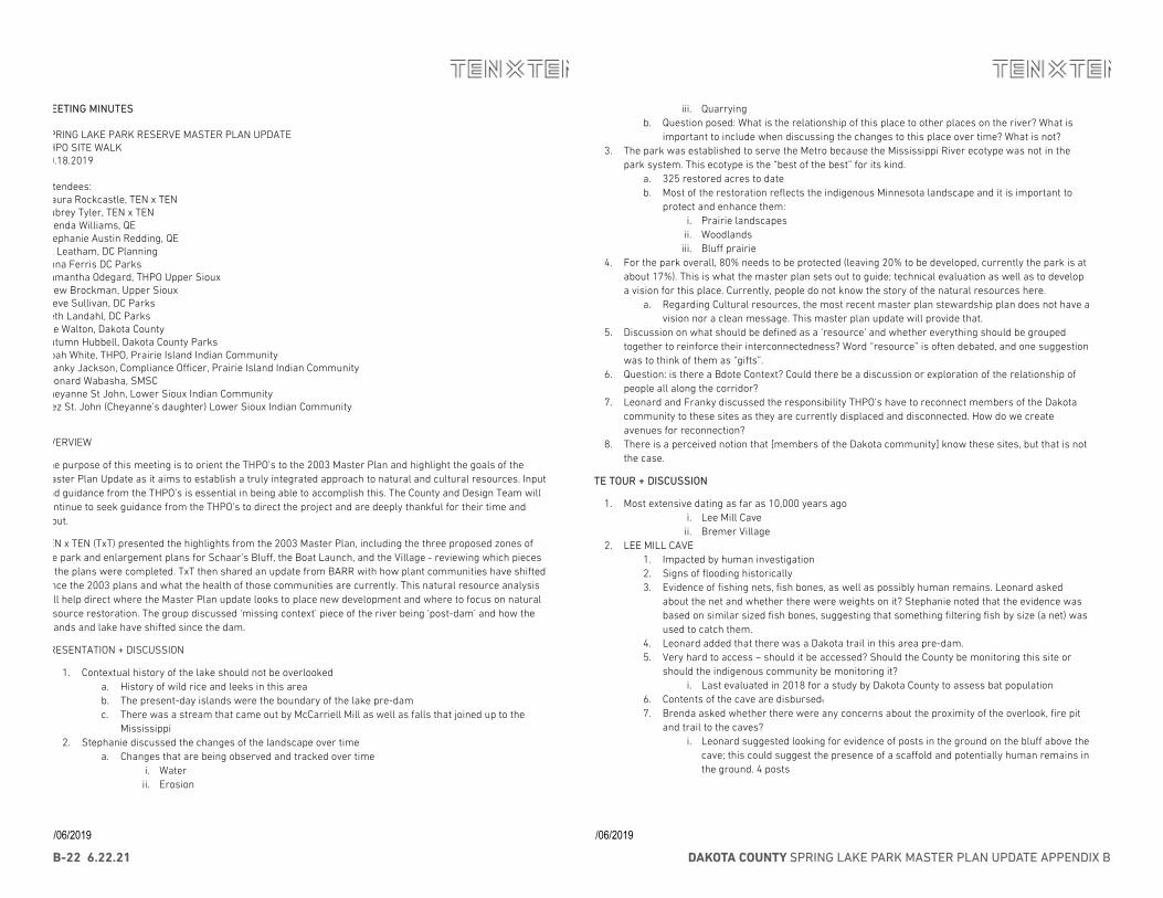
DAKOTA COUNTY SPRING LAKE PARK MASTER PLAN UPDATE APPENDIX BB-22 6.22.21
11/06/2019
MMEEEETTIINNGG MMIINNUUTTEESS SPRING LAKE PARK RESERVE MASTER PLAN UPDATE THPO SITE WALK 10.18.2019 Attendees: Maura Rockcastle, TEN x TEN Aubrey Tyler, TEN x TEN Brenda Williams, QE Stephanie Austin Redding, QE Lil Leatham, DC Planning Anna Ferris DC Parks Samantha Odegard, THPO Upper Sioux Drew Brockman, Upper Sioux Steve Sullivan, DC Parks Beth Landahl, DC Parks Joe Walton, Dakota County Autumn Hubbell, Dakota County Parks Noah White, THPO, Prairie Island Indian Community Franky Jackson, Compliance Officer, Prairie Island Indian Community Leonard Wabasha, SMSC Cheyanne St John, Lower Sioux Indian Community Inez St. John (Cheyanne’s daughter) Lower Sioux Indian Community
OVERVIEW
The purpose of this meeting is to orient the THPO’s to the 2003 Master Plan and highlight the goals of the Master Plan Update as it aims to establish a truly integrated approach to natural and cultural resources. Input and guidance from the THPO’s is essential in being able to accomplish this. The County and Design Team will continue to seek guidance from the THPO’s to direct the project and are deeply thankful for their time and input.
TEN x TEN (TxT) presented the highlights from the 2003 Master Plan, including the three proposed zones of the park and enlargement plans for Schaar’s Bluff, the Boat Launch, and the Village - reviewing which pieces of the plans were completed. TxT then shared an update from BARR with how plant communities have shifted since the 2003 plans and what the health of those communities are currently. This natural resource analysis will help direct where the Master Plan update looks to place new development and where to focus on natural resource restoration. The group discussed ‘missing context’ piece of the river being ‘post-dam’ and how the islands and lake have shifted since the dam.
PRESENTATION + DISCUSSION
1. Contextual history of the lake should not be overlooked a. History of wild rice and leeks in this area b. The present-day islands were the boundary of the lake pre-dam c. There was a stream that came out by McCarriell Mill as well as falls that joined up to the
Mississippi 2. Stephanie discussed the changes of the landscape over time
a. Changes that are being observed and tracked over time i. Water ii. Erosion
11/06/2019
iii. Quarrying b. Question posed: What is the relationship of this place to other places on the river? What is
important to include when discussing the changes to this place over time? What is not? 3. The park was established to serve the Metro because the Mississippi River ecotype was not in the
park system. This ecotype is the “best of the best” for its kind. a. 325 restored acres to date b. Most of the restoration reflects the indigenous Minnesota landscape and it is important to
protect and enhance them: i. Prairie landscapes ii. Woodlands iii. Bluff prairie
4. For the park overall, 80% needs to be protected (leaving 20% to be developed, currently the park is at about 17%). This is what the master plan sets out to guide; technical evaluation as well as to develop a vision for this place. Currently, people do not know the story of the natural resources here.
a. Regarding Cultural resources, the most recent master plan stewardship plan does not have a vision nor a clean message. This master plan update will provide that.
5. Discussion on what should be defined as a ‘resource’ and whether everything should be grouped together to reinforce their interconnectedness? Word “resource” is often debated, and one suggestion was to think of them as “gifts”.
6. Question: is there a Bdote Context? Could there be a discussion or exploration of the relationship of people all along the corridor?
7. Leonard and Franky discussed the responsibility THPO’s have to reconnect members of the Dakota community to these sites as they are currently displaced and disconnected. How do we create avenues for reconnection?
8. There is a perceived notion that [members of the Dakota community] know these sites, but that is not the case.
SSIITTEE TTOOUURR ++ DDIISSCCUUSSSSIIOONN
1. Most extensive dating as far as 10,000 years ago i. Lee Mill Cave ii. Bremer Village
2. LEE MILL CAVE 1. Impacted by human investigation 2. Signs of flooding historically 3. Evidence of fishing nets, fish bones, as well as possibly human remains. Leonard asked
about the net and whether there were weights on it? Stephanie noted that the evidence was based on similar sized fish bones, suggesting that something filtering fish by size (a net) was used to catch them.
4. Leonard added that there was a Dakota trail in this area pre-dam. 5. Very hard to access – should it be accessed? Should the County be monitoring this site or
should the indigenous community be monitoring it? i. Last evaluated in 2018 for a study by Dakota County to assess bat population
6. Contents of the cave are disbursed. 7. Brenda asked whether there were any concerns about the proximity of the overlook, fire pit
and trail to the caves? i. Leonard suggested looking for evidence of posts in the ground on the bluff above the
cave; this could suggest the presence of a scaffold and potentially human remains in the ground. 4 posts
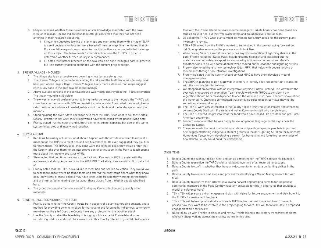
APPENDIX B - COMMUNITY ENGAGEMENT 6.22.21 B-23
11/06/2019
8. Cheyanne asked whether there is evidence of star knowledge associated with the cave (similar to Wakan Tipi and Indian Mounds bluff)? QE confirmed that they had not seen anything in their research about this.
i. Cheyanne suggested looking at star maps and overlaying them with a map of SLPR to see if decisions on location were based off the star map. She mentioned that Jim Rock would be a good resource to discuss this further as he has led tribal trainings on this subject. The team needs further direction from the THPO’s in order to determine whether further inquiry is recommended.
ii. Lil noted that further research on the cave could be done through a parallel process but isn’t currently able to be funded with the current project budget.
3. BREMER VILLAGE + MOUNDS
1. The village site is an extensive area covering whole terrace along river. 2. The Bremer Village site on the terrace along the lake and the bluff (Ranelius site) may have
been part of one large village. Bremer Village is likely more extensive than maps suggest, each study done in the area reveals more findings.
3. Above-surface portions of the conical mound was mostly destroyed in the 1950’s excavation. The linear mound is still visible.
4. There was an overall preference not to bring the large group to the mounds, the THPO’s will come back on their own with GPS and revisit it at a later date. They noted they would like to return with others who are knowledgeable about the plants and the landscape around the mounds.
5. Standing along the river, Steve asked for help from the THPO’s for what to call these sites? Clearly “Bremer” is not what this village would have been called by the people living here.
6. Franky stated that the natural and cultural elements are not separate but part of the same system integrated and intertwined together.
4. BUD’S LANDING
1. Ken Klink has many artifacts – what should happen with those? Steve offered to request a meeting for the THPO’s to meet Ken and see his collection. He even suggested they ask him to return them. The THPO’s said , they don’t want the artifacts back, they would prefer that the County take over them for an interpretive center or museum in the Park to teach people more about their people and ways of life.
2. Steve noted that last time they were in contact with Ken was in 2005 to assist with the archaeological study. Apparently for the 2018 MRT Trail study, Ken was difficult to get a hold of.
3. Franky noted that the THPO’s would like to meet Ken and see his collection. They would love to hear more about where he found them and offered that they could share what they know about how some of those objects may have been used. He said they were not ethnocentric and are interested in hearing stories about these places from the other people who lived here.
4. The group discussed a “cultural center” to display Ken’s collection and possibly other materials.
5. GENERAL DISCUSSION DURING THE TOUR: 1. Franky asked whether the County would be in support of a planting/foraging strategy and a
method for providing permits to allow for harvesting and foraging by indigenous community members on the site? Does the County have any protocols for this at other sites?
2. Has the County studied the feasibility of bringing wild rice back? Prairie Island is re-introducing wild rice and could be a resource in this. Franky offered to give Dakota County a
11/06/2019
tour with the Prairie Island natural resource managers. Dakota County has done feasibility studies on wild rice, but the river water levels and pollution levels are too high.
3. QE asked the THPO’s what plants might be missing here, they asked for the current plant inventory to review.
4. TEN x TEN asked how the THPO’s wanted to be involved in this project going forward but didn’t get guidance on what the process should look like.
5. While driving Sam O. asked if the county has any documentation of lightning strikes in the park. Franky noted that David Macki has done some research and published but the materials are not widely accepted for endorsed by indigenous communities. Macki’s hypothesis has to do with correlation between mound burial locations and lightning strikes.
6. Franky also noted there is new technology (lidar, GPR) that helps with understanding of mound sites through non-intrusive investigations.
7. Franky indicated that the county should contact MIAC to have them develop a mound management plan.
8. The SHPO is planning to do a statewide inventory to identify sites and materials associated with the mounds (similar to Iowa)
9. We stopped at an overlook with an interpretive wayside (Button Factory). The view from the overlook is obscured by vegetation. Team should work with THPOs to consider if any vegetation should be removed/pruned to open the view and if so, how. Leonard spoke about the water spirit. Cheyenne commented that removing trees to open up views may not be something she would support.
10. The THPOS were very interested in the County’s Bison Reintroduction Project and offered to connect County Staff with Prairie Island Indian Community staff who handle bison.
11. The THPOS offered insight into what the land would have looked like pre-dam and pre-Euro-American settlement.
12. Leonard mentioned that he was happy to see indigenous language on the signs near the Gathering Center.
13. Cheyenne made the point that building a relationship with indigenous people is important. She suggested brining indigenous student groups to the park, getting SLPR on the Minnesota Humanities Center tours, developing a permit for harvesting and foresting as examples of how Dakota County could build the relationship.
ACTION ITEMS
1. Dakota County to reach out to Ken Klink and set up a meeting for the THPO’s to see his collection. 2. Dakota County to provide the THPO’s with a full plant inventory of all restored landscapes. 3. Dakota County to confirm whether they have any documentation or data on lighting strikes in the
park. 4. Dakota County to evaluate next steps and process for developing a Mound Management Plan with
MIAC. 5. Dakota County to confirm their interest in allowing harvest and foraging permits for indigenous
community members in the Park. Do they have any protocols for this in other sites that could be a model or reference here?
6. TEN x TEN will prepare a draft engagement plan with dates for future engagement and distribute it to the THPO’s for review and feedback.
7. TEN x TEN will follow up individually with each THPO to discuss next steps and hear from each person how they want to be involved in the project going forward. TxT will then formulate a proposed engagement plan for review.
8. QE to follow up with Franky to discuss and review Prairie Island’s oral history transcripts of elders who talk about walking across the shallow waters in this area.
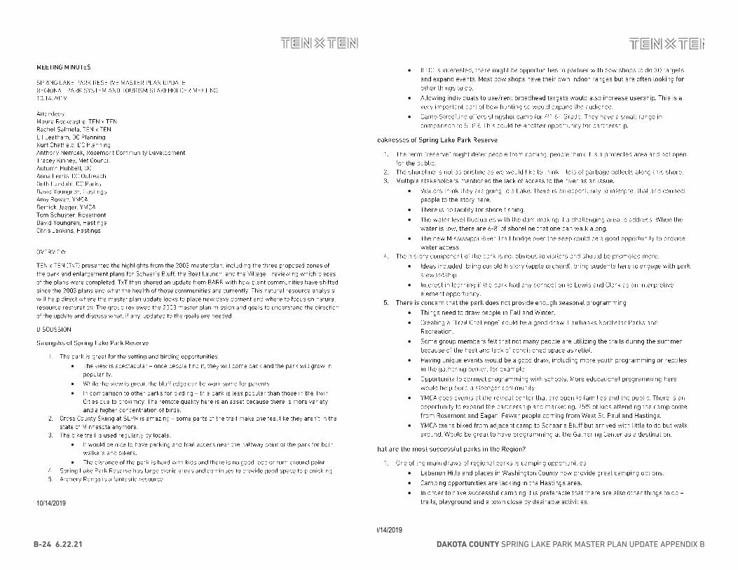
DAKOTA COUNTY SPRING LAKE PARK MASTER PLAN UPDATE APPENDIX BB-24 6.22.21
10/14/2019
•
• •
•
•
10/14/2019
•
•
•
•
• •
•
•
•
• •
•
•
•
•
•
• • •
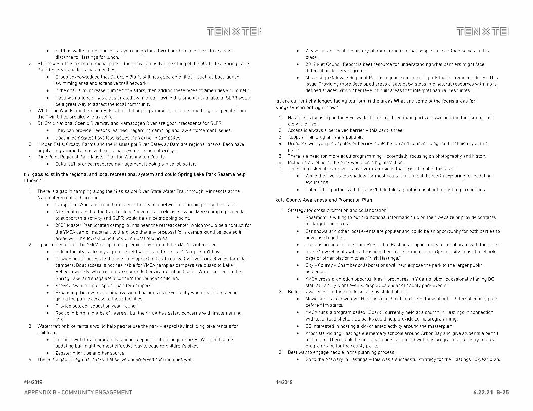
APPENDIX B - COMMUNITY ENGAGEMENT 6.22.21 B-25
10/14/2019
•
•
• •
• •
•
• •
•
• •
• •
• •
•
•
10/14/2019
•
•
•
•
•
•
•
• •
•
•
•
•
• •
•
DAKOTA COUNTY SPRING LAKE PARK MASTER PLAN UPDATE APPENDIX BB-26 6.22.21
10/14/2019
• •
•
•
•
10/14/2019
•
•
•
•
•
•
APPENDIX B - COMMUNITY ENGAGEMENT 6.22.21 B-27
10/14/2019
• •
•
• •
•
•
• • •
10/14/2019
• •
•
•
•
• • •
•
DAKOTA COUNTY SPRING LAKE PARK MASTER PLAN UPDATE APPENDIX BB-28 6.22.21
10/14/2019
•
•
•
▪
•
•
• •
•
•
•
•
10/14/2019
•
•
•
•
•
•
•
• • •
•
• •
APPENDIX B - COMMUNITY ENGAGEMENT 6.22.21 B-29
10/14/2019
•
• • •
•
•
• •
• •
•
10/14/2019
•
•
• •
• •
DAKOTA COUNTY SPRING LAKE PARK MASTER PLAN UPDATE APPENDIX BB-30 6.22.21
02/05/2020
MMEEEETTIINNGG MMIINNUUTTEESS SPRING LAKE PARK RESERVE MASTER PLAN UPDATE THPO LISTENING SESSION 02 02.05.2020 Attendees: Maura Rockcastle, TEN x TEN (TxT) Rachel Salmela, TxT Aubrey Tyler, TxT Stephanie Austin Redding, Quinn Evans Architects (QE) Lil Leatham, Dakota County (DC) Planning Autumn Hubbell, DC Planning Kurt Chatfield, DC Planning Joe Walton, DC Natural Resources Anna Ferris, DC Parks Samantha Odegard, Upper Sioux THPO Franky Jackson, PIIC compliance Officer Leonard Wabasha, SMSC Drew Brockman, Upper Sioux Community Cheyanne St. John, Lower Sioux THPO OVERVIEW The purpose of this listening session was to review the findings from the Phase 1: Research & Vision, share an update on the working draft concepts and interpretive themes for feedback from the THPO’s. The County and Design Team shared the full draft of the Cultural Landscape portion from the draft Chapter 3: Existing Conditions to ensure the level of detail and language reflects the THPO’s direction and are thankful for their time and input.
Quinn Evans (QE) presented the key maps and period plans used in the Cultural Landscape section. TEN x TEN (TxT) then shared the working draft of the vision and guiding principles for the park. Together TxT and QE highlighted the key outstanding questions and action items from the Site Walk in October 2019. TxT then shared some process drawings that explained the concept framework considerations, desired programs to be introduced to the park, and two working concepts for discussion. These diagrams were intended to spark conversation about priorities and preferences before the Design Team continues to a higher level of detail. The group also discussed the beginning organizing framework for the interpretive themes and how it might expand.
CCuullttuurraall LLaannddssccaappee SSiiggnniiffiiccaannccee::
1. QE discussed the sections of the cultural landscape summary that need more feedback from the THPO’s, especially in determining the following:
• Determine what level of detail is appropriate to show on public documents regarding mound and village sites.
a) Leonard noted that many of the mound site locations are already public knowledge, but it would be best for the public plan documents to not highlight their locations.
b) The group discussed the difficulty of drawing a boundary around “habitation sites” as the activities associated with habitation likely occurred across the site and this term might reduce the importance of the cultural significance from a non-indigenous perspective. The recommendation was made that all accessible shoreline should be considered likely areas of concentrated habitation.
02/05/2020
i. The presence of culturally significant plants along the water’s edge create the case for a more extensive “habitation area” – including lotus (lily), arrow aram, and wild rice.
• Based on the research completed by QE to date, there is no evidence of indigenous community activity on these sites between 1650 and 1840. What sources should QE pursue to close this gap.
a) The THPO’s noted the oral history component is missing here and feels necessary to help explain the presence of indigenous people here between 1650 and 1840.
i. QE has reached out to Prairie Island for oral interviews and will follow up again to obtain the most relevant interviews.
b) A TCP Survey might be important to do to fully understand where all the important sites are.
i. The available literature and writing are out but will need to be looked at much more carefully; cannot just rely on archaeology reports.
ii. Samantha was a strong advocate for the importance of the TCP Survey which could be completed in roughly a week over the summer depending on the number of people they can find to assist.
iii. Lil will follow up to discuss timeline and cost for completing a TCP Survey. c) Samantha asked the question if the changing water levels due to the lock and dam
might be the reason there is no archeological evidence for this period of time. i. Stephanie agreed that this is very possible and would need further
investigation and consideration of the impacts in the context of the master plan.
ii. This question sparked a conversation around general erosion concerns on the site. Leonard recommended that DC reach out to coordinate with Brad Perkel from the Army Corps Saint Paul District Office for this issue.
• Given that no areas in the park are listed on the National Registrar of Historic Places, the wording “potentially contributing” has been used to discuss areas of cultural significance.
a) Leonard noted the work “potential” is problematic since these sites are still significant to indigenous communities.
2. QE shared the list of “Cultural Landscape Treatment Considerations” as another item where the THPO’s feedback would be particularly helpful.
• Under the General category, the following recommendations were made: a) The group agreed that adding erosion control considerations would be important to
protect cultural artifacts that may still be near the shoreline. b) The THPO’s are interested in being involved in the Bison conversation and would
like to share resources for grant funding to help bring bison to the park. The group also encouraged DC staff to visit the Prairie Island Bison herd and get a tour with Paul Dressen.
• Under the Archaeological Sites category, the following recommendations were made: a) Language should be more inclusive to insure other tribal communities, including
those outside the state of Minnesota, are being considered in the treatment proposals.
b) Number 6 “Working with associated Indigenous communities and the MIAC to develop a mound management plan for Bremer Mounds.” A mound management plan should be limited to the mounds that are already known. The creation of a mound management plan is a long process and should not hold up planning efforts for this master plan but is recommended to be completed in the next 5 years.
APPENDIX B - COMMUNITY ENGAGEMENT 6.22.21 B-31
02/05/2020
c) Number 7 “Explore opportunities for artifacts collected from the site to be donated to a museum or interpretive center. Consider if there can be integration with a county-wide awareness and promotion plan.” Since there are artifacts that are currently in private collections the THPO’s would prefer the language be softer to provide space for artifacts potentially being loaned.
i. The THPO’s suggested any new archeological artifacts found in the park should be under the control of the Prairie Island community.
ii. The need to consider policies for ownership of cultural materials should be included in the management portion of the master plan.
• Under the Vegetation category, the group confirmed that Cheyanne is a good point of contact for identifying precedents and educational opportunities for culturally significant plants.
a) The Lower Sioux Cultural Plant App was mentioned as good reference. There was interest in bringing this App to Spring Lake Park Reserve.
DDrraafftt VViissiioonn aanndd GGuuiiddiinngg PPrriinncciipplleess::
1. TxT read through the latest version of the draft update to the vision and guiding principles for the park and asked the THPO’s if the update reflected their world-view, felt inclusive, if anything was missing or was being prioritized incorrectly from their perspective.
• Franky stated that the vision felt good and captured “the rich cultural history of the area.”
• Cheyanne asked if there was still a plan to create a “cultural significance” mission statement. a) As one of the goals for this master plan to is make the natural and cultural assets more
integrated, there is no current plan to have a separate mission statement. The Design Team is open to crafting language as part of the introduction to the interpretive themes that can capture anything the THPO’s feel is missing or not fully being communicated.
• Samantha asked if any upland areas were truly untouched ‘reserve’ areas or if the entire park had been farmed.
a) Joe shared that because the earliest photographs are from 1927, it is hard to know if they are truly untouched but there that the quality of the understood has served as an indicator that some areas were not farmed.
b) The group suggested that high quality natural resource areas should be included in the “cultural significance” plans.
i. Maura confirmed that the natural resource quality maps, being developed by BARR, are being used as an underlay for consideration in all the concepts.
OOuuttssttaannddiinngg QQuueessttiioonnss aanndd AAccttiioonn IItteemmss::
1. “How should the theme of “Homeland” be present in the park?” TxT asked the THPO’s if this theme should stand out on its own or be embedded in other broader themes.
• The group did not respond directly to this question. During the discussion about interpretive themes the group was happy with the proposed framework, which suggests “homeland” will likely be integrated as a sub-theme.
2. “What is the desired level of public knowledge/interaction with mound and village sites?”
• The group confirmed that a Mound Management Plan should in part of the park’s long-term management plan and that the County should partner with MIAC.
• Some group members felt that because creating a Mound Management Plan with MIAC is a long process, Leonard would be a good interim resource because of how the mounds are managed at Shakopee. Leonard expressed a strong preference for the County to work with MIAC.
02/05/2020
• Melissa Serta is the person at MIAC would is responsible for the whole state of Minnesota and the group encouraged Dakota County to begin the inquiry process soon since completing the Mound Management Plan would be ideal in the next 5 years.
• Maura asked the group if the master plan should wait to suggest interpretation of any sites until the Mound Management Plan is completed.
a) Franky did not think it was necessary to wait. There is a respectful way to do interpretation that would not need to wait for the management plan recommendation, partly because the location of the content in relationship to the actual sites is relevant.
3. “Which specific plant communities should be interpreted or reintroduced here?
• The group discussed the Lower Sioux list of Culturally Significant Species and the Prairie Island Community Plant lists as good resources to cross check the list of plants already within the park against.
• The group felt including a sign or interpretation to inform visitors that Dakota people are still connected to these places and plants, showing we are alive and well, would be good.
• Leonard noted that it might be detrimental to place signs about specific plants
• TxT will add obtaining the resources noted above to the list of action items. 4. “Are there successful examples of other agency’s approach to permitted foraging Dakota County should
reach out to?”
• The group did not suggest any examples or contacts during the meeting. This question will remain on the list of action items.
PPrrooggrraamm CCoonnssiiddeerraattiioonnss::
1. TxT shared the list of key programs to be considered in the development plan with the group and flagged specific questions the Design Team had about particular programs.
• FFeessttiivvaall GGrroouunnddss: Generally, the idea of having event spaces with stage areas appealed, if the footprints were sensitively located.
a) The group thought if festivals occurred during Pow-Wow times there could be dance exhibitions or other related events.
b) Leonard asked about Dakota County’s ability to have proper security for events over 1,000 people.
• MMoouunnttaaiinn BBiikkiinngg: The THPO’s were not opposed to including mountain biking if it did not have a negative impact on the landscape. They agreed to hold any judgement until further technical study was completed.
• NNaattuurraall TTrraaiillss: Prairie Island has a hiking club that would be interested in coming here to hike. a) Various indigenous communities have healthy lifestyle programs that could use more
destinations like Spring Lake Park Reserve.
• RRiivveerr OOvveerrllooookkss: Franky mentioned that Grey Cloud Island would be a feature to orient. The group believed that the Schilling Mound site is located on the island.
• MMiillll SSiittee IInntteerrpprreettaattiioonn: The group felt that if interpretation at the Mill Site was done respectfully, there were no significant concerns with its proximity to the caves.
a) Franky suggested the opportunity to have an overlook that looks down on the Mill Site and noted that the physical proximity of interpretive language/information to the site is irrelevant.
• Cultural Interpretation: Multiple members felt there was on opportunity to hold educational tours on the site.
a) The park could be included in the Minnesota Humanities Sacred Sites Tour. This would be a good site for educators to learn more about the history.
DAKOTA COUNTY SPRING LAKE PARK MASTER PLAN UPDATE APPENDIX BB-32 6.22.21
02/05/2020
b) The group voiced a preference for interpretation to be embedded in pavement instead of signage.
c) The group also discussed technology to help people access interpretive information. Cheyanne shared her experience working with the Cultural Plant App and virtual reality tours to reach broader demographics.
• Bison: The THPO’s were very interested in the bison feasibility study and mentioned the inter-tribal bison coop. This organization offers support and resources to non-tribal organizations as well and is based in Rapid City.
a) The group mentioned how reintroducing bison would bring back other plant species, expanding interpretive opportunities.
2. Water access was also discussed in more depth.
• All access is currently planned as low impact (canoes and kayaks) as the lake is shallow. 3. Leonard asked if there is anywhere in the park that might have clay.
• Joe was unsure as most of the park is sandy loam and loamy sand. It is possible to find out, and Dakota County was open to exploring this question further.
DDrraafftt CCoonncceeppttss::
1. TxT shared two draft concepts based on three initial framework ideas – zones, loops, and parallel paths. Generally, the group did not have a strong preference for or against either option.
2. Option 1 comments included the following:
• There was concern for the extent of disturbance for the restored prairie areas. a) TxT explained that this was more suggestive of the quantity of program to be added at
this end of the park but that they are currently working with Dakota County to understand the constraints around adding program to the prairie restoration areas. If any paths are added to these areas, they would be mown not hard surface.
3. Option 2 comments included the following:
• The trail currently drawn through the mound area is problematic. a) TxT asked how the Design Team should think about appropriate distances from mounds
as the plan is developed. i. The THPO’s stated MIAC would help determine the appropriate offset from the
mounds but asked if there was a way topography could be used more to avoid the mounds.
• The group did not comment on the extent of new trail being added to the park in this option. 4. The group asked how foraging would be integrated in the park.
• The best methods for allowing special use permitting is still under study and will remain on the action item list, to accompany these meeting minutes.
IInntteerrpprreettiivvee TThheemmeess::
1. TxT asked the group to confirm if the guidelines used to determine the interpretive themes felt appropriate and for feedback on the themes themselves.
• The group felt the interpretation should be inclusive of Dakota heritage but also represent a diverse set of communities. This strategy would help the public preserve this place differently.
• Overall the group though the guidelines and themes were a strong starting point to continue to develop.
• The group was excited to talk about the methods and types of features that would be used for interpretation at this park.
a) Technology was of interest to the group.
02/05/2020
i. Lil and Autumn discussed how Dakota County has proposed this in other master plans and have received positive feedback on the idea from the public.
b) Physical objects and sound are important for creating engaging interpretation and should be considered as the plan develops.
2. Comments were made regarding some of the subthemes listed.
• Under “Gifts of the Land” – Cheyanne made the suggestion that instead of ecologists restoring the land, “healing the land” might be better wording.
a) Maura mentioned how this subtheme could include ideas of climate change and how the land is evolving.
• The group mentioned it was important to explain “Why this area?” a) The confluence of the rivers, Bdote, and extensive trail network connect this site to the
region and beyond.
• Cheyanne asked if the idea of storytelling was just at a concept level or if there were specific stories that had already been identified.
a) The group suggested this might be an opportunity to incorporate star maps and knowledge.

APPENDIX B - COMMUNITY ENGAGEMENT 6.22.21 B-33
PHASE TWO COMMUNITY ENGAGEMENT
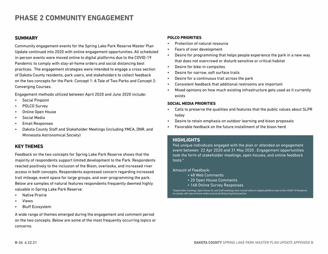
DAKOTA COUNTY SPRING LAKE PARK MASTER PLAN UPDATE APPENDIX BB-34 6.22.21
PHASE 2 COMMUNITY ENGAGEMENT
SUMMARY
Community engagement events for the Spring Lake Park Reserve Master Plan Update continued into 2020 with online engagement opportunities. All scheduled in-person events were moved online to digital platforms due to the COVID-19 Pandemic to comply with stay-at-home orders and social distancing best practices. The engagement strategies were intended to engage a cross section of Dakota County residents, park users, and stakeholders to collect feedback on the two concepts for the Park: Concept 1: A Tale of Two Parks and Concept 2: Converging Courses.
Engagement methods utilized between April 2020 and June 2020 include: • Social Pinpoint• POLCO Survey • Online Open House• Social Media• Email Responses• Dakota County Staff and Stakeholder Meetings (including YMCA, DNR, and
Minnesota Astronomical Society)
KEY THEMES
Feedback on the two concepts for Spring Lake Park Reserve shows that the majority of respondents support limited development to the Park. Respondents reacted positively to the inclusion of the Bison, overlooks, and increased river access in both concepts. Respondents expressed concern regarding increased trail mileage, event space for large groups, and over-programming the park. Below are samples of natural features respondents frequently deemed highly valuable in Spring Lake Park Reserve:• Native Prairie • Views• Bluff Ecosystem
A wide range of themes emerged during the engagement and comment period on the two concepts. Below are some of the most frequently occurring topics or concerns.
POLCO PRIORITIES • Protection of natural resource• Fears of over development• Desire for programming that helps people experience the park in a new way
that does not overcrowd or disturb sensitive or critical habitat• Desire for bike-in campsites• Desire for narrow, soft surface trails• Desire for a continuous trail across the park• Consistent feedback that additional restrooms are important • Mixed opinions on how much existing infrastructure gets used as it currently
exists
SOCIAL MEDIA PRIORITIES • Calls to preserve the qualities and features that the public values about SLPR
today• Desire to retain emphasis on outdoor learning and bison proposals• Favorable feedback on the future installment of the bison herd
HIGHLIGHTS946 unique individuals engaged with the plan or attended an engagement event between 22 Apr 2020 and 31 May 2020 . Engagement opportunities took the form of stakeholder meetings, open houses, and online feedback tools.*
Amount of Feedback: • 48 Web Comments • 20 Open House Comments • 168 Online Survey Responses *Stakeholder meetings, Open House #2, and Staff meetings were moved online to digital platforms due to the COVID-19 Pandemic to comply with stay-at-home orders and social distancing best practices
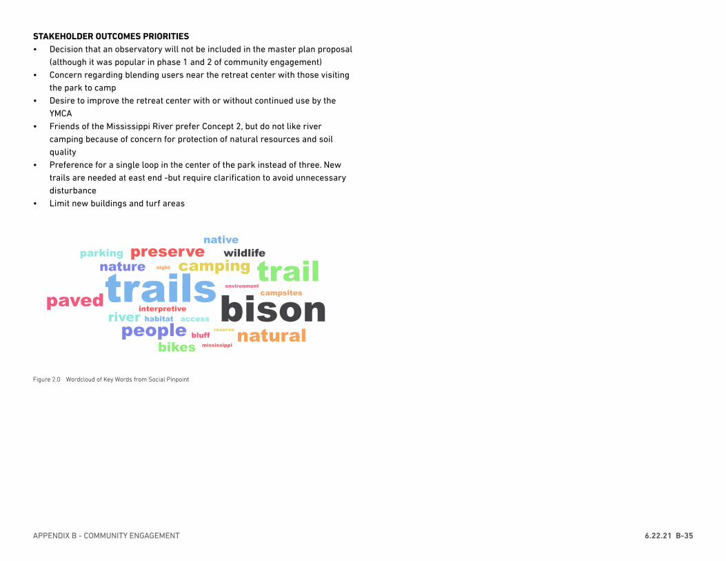
APPENDIX B - COMMUNITY ENGAGEMENT 6.22.21 B-35
STAKEHOLDER OUTCOMES PRIORITIES • Decision that an observatory will not be included in the master plan proposal
(although it was popular in phase 1 and 2 of community engagement)• Concern regarding blending users near the retreat center with those visiting
the park to camp• Desire to improve the retreat center with or without continued use by the
YMCA• Friends of the Mississippi River prefer Concept 2, but do not like river
camping because of concern for protection of natural resources and soil quality
• Preference for a single loop in the center of the park instead of three. New trails are needed at east end -but require clarification to avoid unnecessary disturbance
• Limit new buildings and turf areas
trailsbisontrail
naturalpeoplepaved
campingpreserve
river
bikes
natureparking
nativewildlife
bluff
interpretive
campsites
accesshabitat
night
environment
reserve
mississippi
Figure 2.0 Wordcloud of Key Words from Social Pinpoint
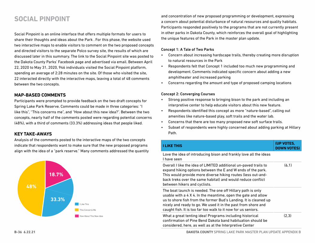
DAKOTA COUNTY SPRING LAKE PARK MASTER PLAN UPDATE APPENDIX BB-36 6.22.21
SOCIAL PINPOINT
Social Pinpoint is an online interface that offers multiple formats for users to share their thoughts and ideas about the Park . For this phase, the website used two interactive maps to enable visitors to comment on the two proposed concepts and directed visitors to the separate Polco survey site, the results of which are discussed later in this summary. The link to the Social Pinpoint site was posted to the Dakota County Parks’ Facebook page and advertised via email. Between April 22, 2020 to May 31, 2020, 946 individuals visited the Social Pinpoint platform, spending an average of 2:28 minutes on the site. Of those who visited the site, 22 interacted directly with the interactive maps, leaving a total of 48 comments between the two concepts.
MAP-BASED COMMENTSParticipants were prompted to provide feedback on the two draft concepts for Spring Lake Park Reserve. Comments could be made in three categories: “I like this”, “This concerns me”, and “How about this new idea?”. Between the two concepts, nearly half of the comments posted were regarding potential concerns (48%), with a third of comments (33.3%) addressing ideas that people liked.
KEY TAKE-AWAYSAnalysis of the comments posted to the interactive maps of the two concepts indicate that respondents want to make sure that the new proposed programs align with the idea of a “park reserve.” Many comments addressed the quantity
10.4%
8.3%
10.4%
22.9%
31.3%
16.7%
How About This New Idea?I Like ThisThis Concerns Me
48%
18.7%
33.3%I Like This
This Concerns Me
How About This New Idea
and concentration of new proposed programming or development, expressing a concern about potential disturbance of natural resources and quality habitats. Participants responded positively to the programs that are not currently present in other parks in Dakota County, which reinforces the overall goal of highlighting the unique features of the Park in the master plan update.
Concept 1: A Tale of Two Parks• Concern about increasing hardscape trails, thereby creating more disruption
to natural resources in the Park• Respondents felt that Concept 1 included too much new programming and
development. Comments indicated specific concern about adding a new amphitheater and increased parking
• Concerns regarding the amount and type of proposed camping locations
Concept 2: Converging Courses• Strong positive response to bringing bison to the park and including an
interpretive center to help educate visitors about this new feature.• Respondents identified this concept as more “nature-based”, calling out
amenities like nature-based play, soft trails and the water lab.• Concerns that there are too many proposed new soft surface trails.• Subset of respondents were highly concerned about adding parking at Hillary
Path.
I LIKE THIS(UP VOTES, DOWN VOTES)
Love the idea of introducing bison and frankly love all the ideas I have seen
Overall I like the idea of LIMITED additional un-paved trails to expand hiking options between the E and W ends of the park. This would provide more diverse hiking routes (less out-and-back treks over the same habitat) and would reduce conflict between hikers and cyclists.
(6,1)
The boat launch is needed. The one off Hillary path is only usable with a 4 X 4. In the meantime, open the gate and allow us to shore fish from the former Bud’s Landing. It is cleaned up nicely and ready to go. We used it in the past from shore and caught fish. It is too far too walk to it now for us seniors.
What a great tenting idea! Programs including historical confirmation of Pine Bend Dakota band habituation should be considered, here, as well as at the Interpretive Center
(2,3)
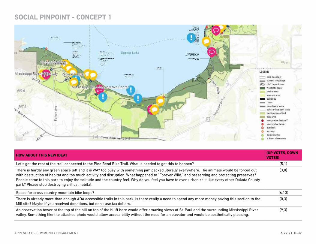
APPENDIX B - COMMUNITY ENGAGEMENT 6.22.21 B-37
SOCIAL PINPOINT - CONCEPT 1
HOW ABOUT THIS NEW IDEA?(UP VOTES, DOWN VOTES)
Let’s get the rest of the trail connected to the Pine Bend Bike Trail. What is needed to get this to happen? (5,1)
There is hardly any green space left and it is WAY too busy with something jam packed literally everywhere. The animals would be forced out with destruction of habitat and too much activity and disruption. What happened to “Forever Wild,” and preserving and protecting preserves? People come to this park to enjoy the solitude and the country feel. Why do you feel you have to over-urbanize it like every other Dakota County park? Please stop destroying critical habitat.
(3,0)
Space for cross country mountain bike loops? (6,13)
There is already more than enough ADA accessible trails in this park. Is there really a need to spend any more money paving this section to the Mill site? Maybe if you received donations, but don’t use tax dollars.
(0,3)
An observation tower at the top of the hill on top of the bluff here would offer amazing views of St. Paul and the surrounding Mississippi River valley. Something like the attached photo would allow accessibility without the need for an elevator and would be aesthetically pleasing.
(9,3)
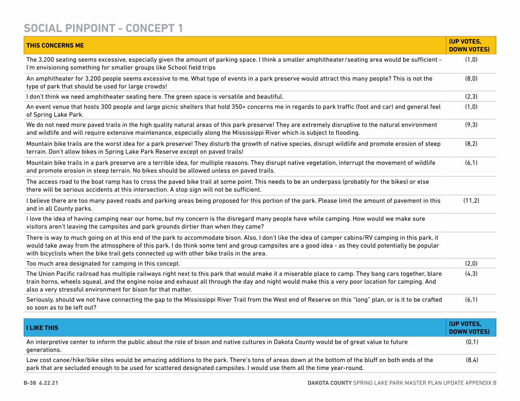
DAKOTA COUNTY SPRING LAKE PARK MASTER PLAN UPDATE APPENDIX BB-38 6.22.21
SOCIAL PINPOINT - CONCEPT 1THIS CONCERNS ME
(UP VOTES, DOWN VOTES)
The 3,200 seating seems excessive, especially given the amount of parking space. I think a smaller amphitheater/seating area would be sufficient - I'm envisioning something for smaller groups like School field trips
(1,0)
An amphitheater for 3,200 people seems excessive to me. What type of events in a park preserve would attract this many people? This is not the type of park that should be used for large crowds!
(8,0)
I don’t think we need amphitheater seating here. The green space is versatile and beautiful. (2,3)
An event venue that hosts 300 people and large picnic shelters that hold 350+ concerns me in regards to park traffic (foot and car) and general feel of Spring Lake Park.
(1,0)
We do not need more paved trails in the high quality natural areas of this park preserve! They are extremely disruptive to the natural environment and wildlife and will require extensive maintenance, especially along the Mississippi River which is subject to flooding.
(9,3)
Mountain bike trails are the worst idea for a park preserve! They disturb the growth of native species, disrupt wildlife and promote erosion of steep terrain. Don’t allow bikes in Spring Lake Park Reserve except on paved trails!
(8,2)
Mountain bike trails in a park preserve are a terrible idea, for multiple reasons. They disrupt native vegetation, interrupt the movement of wildlife and promote erosion in steep terrain. No bikes should be allowed unless on paved trails.
(6,1)
The access road to the boat ramp has to cross the paved bike trail at some point. This needs to be an underpass (probably for the bikes) or else there will be serious accidents at this intersection. A stop sign will not be sufficient.
I believe there are too many paved roads and parking areas being proposed for this portion of the park. Please limit the amount of pavement in this and in all County parks.
(11,2)
I love the idea of having camping near our home, but my concern is the disregard many people have while camping. How would we make sure visitors aren’t leaving the campsites and park grounds dirtier than when they came?
There is way to much going on at this end of the park to accommodate bison. Also, I don’t like the idea of camper cabins/RV camping in this park, it would take away from the atmosphere of this park. I do think some tent and group campsites are a good idea - as they could potentially be popular with bicyclists when the bike trail gets connected up with other bike trails in the area.
Too much area designated for camping in this concept. (2,0)
The Union Pacific railroad has multiple railways right next to this park that would make it a miserable place to camp. They bang cars together, blare train horns, wheels squeal, and the engine noise and exhaust all through the day and night would make this a very poor location for camping. And also a very stressful environment for bison for that matter.
(4,3)
Seriously, should we not have connecting the gap to the Mississippi River Trail from the West end of Reserve on this “long” plan, or is it to be crafted so soon as to be left out?
(6,1)
I LIKE THIS(UP VOTES, DOWN VOTES)
An interpretive center to inform the public about the role of bison and native cultures in Dakota County would be of great value to future generations.
(0,1)
Low cost canoe/hike/bike sites would be amazing additions to the park. There’s tons of areas down at the bottom of the bluff on both ends of the park that are secluded enough to be used for scattered designated campsites. I would use them all the time year-round.
(8,4)
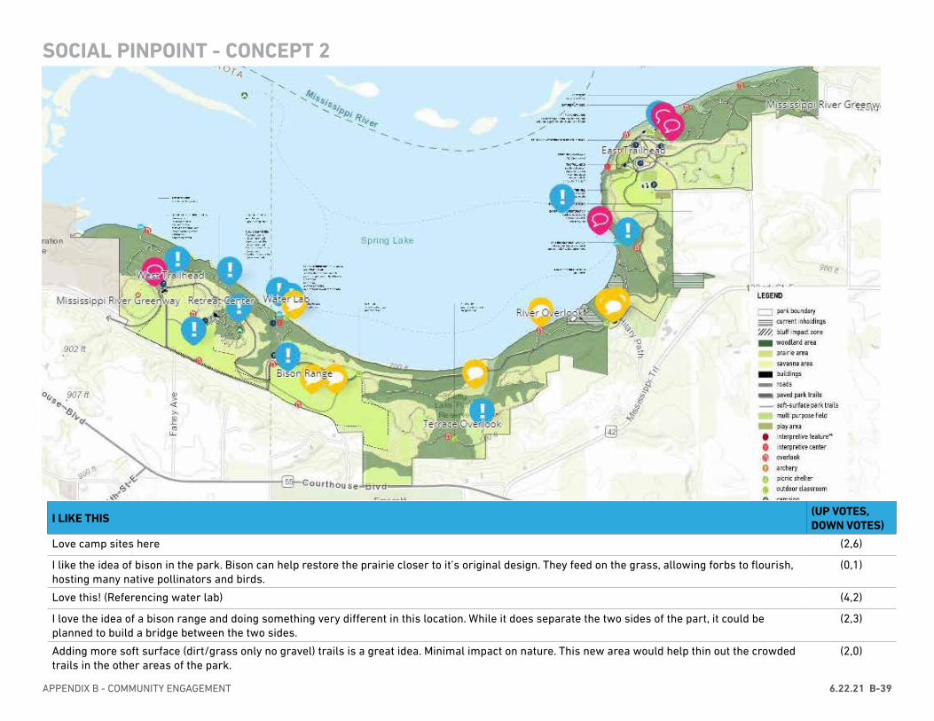
APPENDIX B - COMMUNITY ENGAGEMENT 6.22.21 B-39
SOCIAL PINPOINT - CONCEPT 2
I LIKE THIS(UP VOTES, DOWN VOTES)
Love camp sites here (2,6)
I like the idea of bison in the park. Bison can help restore the prairie closer to it’s original design. They feed on the grass, allowing forbs to flourish, hosting many native pollinators and birds.
(0,1)
Love this! (Referencing water lab) (4,2)
I love the idea of a bison range and doing something very different in this location. While it does separate the two sides of the part, it could be planned to build a bridge between the two sides.
(2,3)
Adding more soft surface (dirt/grass only no gravel) trails is a great idea. Minimal impact on nature. This new area would help thin out the crowded trails in the other areas of the park.
(2,0)
DAKOTA COUNTY SPRING LAKE PARK MASTER PLAN UPDATE APPENDIX BB-40 6.22.21
IDEAS AND SUGGESTIONS(UP VOTES, DOWN VOTES)
Same comment as I made on Concept 1 about intersection of boat ramp road and the bike trail. This needs to be an underpass, a simple stop sign will not work.
(1,0)
Not at all a fan of having Bison. Paying for fencing and the continual cost of raising this herd is not money well spent. Recently moved from our hobby farm in Scott County, north of Lonsdale, where we lived only a few miles away from multiple Bison ranches. Saw them daily from my car. Not really a big deal.
(2,2)
Wait... You guys just finished ripping up the prairie to install this paved trail, and now you’re proposing to re-route it so the bison can use this space? (I assume that’s the plan -- I can’t imagine allowing bikes & bison to co-mingle.) That seems like rather poor planning and use of tax dollars.
(3,1)
I like soft surface tails in the park preserve, but I believe this concept is showing too many. All trails through natural areas of the highest quality are disruptive to the natural vegetation and wildlife. Paved trails are especially disruptive, but even too many soft surface trails may be detrimental. Please involve the County’s Natural Resource Specialists in determining the right amount of trails and best locations.
(4,2)
ANOTHER TRAIL TO RUIN MORE BEAUTIFUL UNTOUCHED FOREST?!?! Really?! You guys have ruined enough of this perfect park! (9,8)
Seems the local land/home owners are not on board with this idea, plus parking lots consume a lot of land. I would serious rethink this idea. (2,1)
ABSOLUTELY NOT! We don’t need any kids sitting in our driveway! People don’t even stop for our driveway as is! (6,2)
A parking lot so kids can hangout here at night without anyone knowing?!?! NO!!! This is the most horrible idea ever! (6,4)
SOCIAL PINPOINT - CONCEPT 2
HOW ABOUT THIS NEW IDEA?(UP VOTES, DOWN VOTES)
I want to encourage children to be active explorers with open ended means of exploring and moving their bodies and hopefully getting dirty! I hope a plan will research great nature play spaces (Discovery Hollow at Tamarack Nature Center comes to mind) and not just put in brown colored climbers found at traditional playgrounds.
(2,0)
Tetherball? Low cost simple addition to an otherwise park meant for children under 10. (3,1)
Let’s ecoscape this park. Bison, yes! Bison interpretive facility: Yes! Soft scaping: Yes! No to trail bikes in this particular park. Let’s show an example of how Dakota County minimizes human impact, engages people in the importance of wild spaces, educates, facilitates hands-on learning.
(9,4)
Please consider if an off-street connection to the Pine Bend Bluffs Trailhead is possible. The traffic level and condition of the road named “Pine Bend Trail” presents some challenges to cyclists near the CF site.
(1,0)
I LIKE THIS(UP VOTES, DOWN VOTES)
We’d be excited for river access, camping, and restoration and education opportunities. (1,0)
I love that trails would remain soft. Adding Bison is awesome! The water lab for kids/adults also looks inviting and fascinating. The rest stop has an unusual look, but the color would draw me in to explore it. I really like concept 2. Our natural parks are the best part of Minnesota.
(5,2)
Love this. We need more nature-based play areas. (2,0)
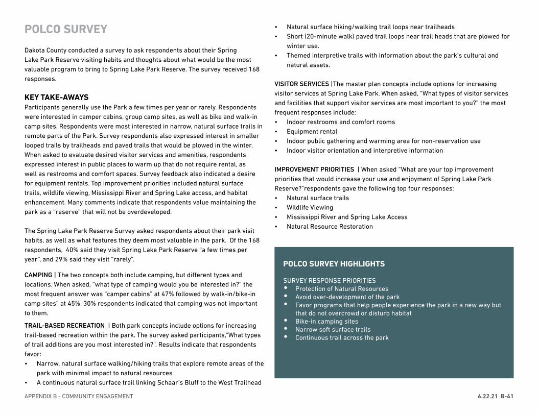
APPENDIX B - COMMUNITY ENGAGEMENT 6.22.21 B-41
POLCO SURVEY
Dakota County conducted a survey to ask respondents about their Spring Lake Park Reserve visiting habits and thoughts about what would be the most valuable program to bring to Spring Lake Park Reserve. The survey received 168 responses.
KEY TAKE-AWAYSParticipants generally use the Park a few times per year or rarely. Respondents were interested in camper cabins, group camp sites, as well as bike and walk-in camp sites. Respondents were most interested in narrow, natural surface trails in remote parts of the Park. Survey respondents also expressed interest in smaller looped trails by trailheads and paved trails that would be plowed in the winter. When asked to evaluate desired visitor services and amenities, respondents expressed interest in public places to warm up that do not require rental, as well as restrooms and comfort spaces. Survey feedback also indicated a desire for equipment rentals. Top improvement priorities included natural surface trails, wildlife viewing, Mississippi River and Spring Lake access, and habitat enhancement. Many comments indicate that respondents value maintaining the park as a “reserve” that will not be overdeveloped.
The Spring Lake Park Reserve Survey asked respondents about their park visit habits, as well as what features they deem most valuable in the park. Of the 168 respondents, 40% said they visit Spring Lake Park Reserve “a few times per year”, and 29% said they visit “rarely”.
CAMPING | The two concepts both include camping, but different types and locations. When asked, “what type of camping would you be interested in?” the most frequent answer was “camper cabins” at 47% followed by walk-in/bike-in camp sites” at 45%. 30% respondents indicated that camping was not important to them.
TRAIL-BASED RECREATION | Both park concepts include options for increasing trail-based recreation within the park. The survey asked participants,“What types of trail additions are you most interested in?”. Results indicate that respondents favor:• Narrow, natural surface walking/hiking trails that explore remote areas of the
park with minimal impact to natural resources• A continuous natural surface trail linking Schaar’s Bluff to the West Trailhead
• Natural surface hiking/walking trail loops near trailheads• Short (20-minute walk) paved trail loops near trail heads that are plowed for
winter use.• Themed interpretive trails with information about the park’s cultural and
natural assets.
VISITOR SERVICES |The master plan concepts include options for increasing visitor services at Spring Lake Park. When asked, “What types of visitor services and facilities that support visitor services are most important to you?” the most frequent responses include:• Indoor restrooms and comfort rooms• Equipment rental• Indoor public gathering and warming area for non-reservation use• Indoor visitor orientation and interpretive information
IMPROVEMENT PRIORITIES | When asked “What are your top improvement priorities that would increase your use and enjoyment of Spring Lake Park Reserve?”respondents gave the following top four responses: • Natural surface trails• Wildlife Viewing• Mississippi River and Spring Lake Access• Natural Resource Restoration
POLCO SURVEY HIGHLIGHTS
SURVEY RESPONSE PRIORITIES• Protection of Natural Resources• Avoid over-development of the park • Favor programs that help people experience the park in a new way but
that do not overcrowd or disturb habitat• Bike-in camping sites• Narrow soft surface trails• Continuous trail across the park

DAKOTA COUNTY SPRING LAKE PARK MASTER PLAN UPDATE APPENDIX BB-42 6.22.21
POLCO SURVEY
7/15/2020 Polco
https://polco.us/n/admin/content/00a394ba-a449-4083-bf5a-947171c1e3b1/report 2/10
How oen do you visit the park?
28%
40%
18%
14%
1%
The master plan concepts include options for camping in the park. What type of camping would you beinterested in?
47%
31%
46%
28%
30%
The master plan concepts include options for increasing trail-based recreation within the park. Whattypes of trail additions are you most interested in?
35%
56%
61%
39%
16%
15%
24%
3%
A Rarely
B A few times per year
C Monthly
D Weekly
E Daily
A Camper cabins
B Canoe-in camp sites
C Walk-in/bike-in camp sites
D Group camp sites
E Camping is not important to me
A Short (20-minute walk) paved trail loops near trail heads that are plowed for winter use
B A continuous natural surface trail linking Schaar’s Bluff to the West Trailhead
C Narrow, natural surface walking/hiking trails that explore remote areas of the park with minimal impact
D Natural surface hiking/walking trails loops near trailheads
E Increased cross country ski trail mileage
F Increased snow shoe trail mileage
G Themed interpretive trails with information about the park’s cultural and natural assets
H Trail-based recreation is not important to me
7/15/2020 Polco
https://polco.us/n/admin/content/00a394ba-a449-4083-bf5a-947171c1e3b1/report 3/10
The master plan concepts include options for increasing visitor services at Spring Lake Park. Whattypes of visitor services and facilities that support visitor services are most important to you?
38%
16%
28%
66%
42%
17%
What are your top improvement priorities that would increase your use and enjoyment of Spring LakePark Reserve?
49%
27%
20%
33%
34%
41%
20%
27%
6%
16%
6%
If you selected "other" in the previous question, please tell us more about your improvement prioritiesfor the park.I would like water access for canoes but limit the amount of motor boat traffic. The eagle viewing is great at this park when it'squiet/peaceful. Please try to limit disturbing the vegetation along the shoreline. Thanks!
A Indoor public gathering and warming area for non-reservation use
B Four-season spaces for private events and meetings
C Indoor visitor orientation and interpretive information
D Indoor restrooms and comfort rooms
E Equipment rental (for example, bikes, kayaks, snowshoes, cross-country skis)
F These visitor services are not important to me
A Natural surface trails
B Paved biking trails
C Snowshoe and cross-country ski trails
D Natural resource restoration
E Mississippi River/Spring Lake access (for example, boat launch or picnic area by the water)
F Wildlife viewing
G Play and nature play
H Camping
I Community events
J Picnicking
K Other
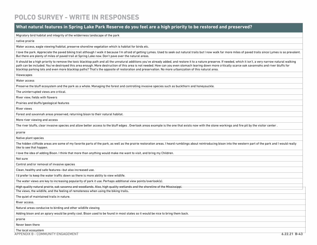
APPENDIX B - COMMUNITY ENGAGEMENT 6.22.21 B-43
What natural features in Spring Lake Park Reserve do you feel are a high priority to be restored and preserved?
Migratory bird habitat and integrity of the wilderness landscape of the park
native prairie
Water access, eagle viewing/habitat, preserve shoreline vegetation which is habitat for birds etc.
I love the park. Appreciate the paved biking trail although I walk it because I’m afraid of getting Lymes. Used to seek out natural trails but I now walk far more miles of paved trails since Lymes is so prevalent. But there are plenty of miles of paved trail at Spring Lake now. Don’t pave over the natural areas.
It should be a high priority to remove the toxic blacktop path and all the unnatural additions you’ve already added, and restore it to a nature preserve. If needed, which it isn’t, a very narrow natural walking path can be included. You’ve destroyed this area enough. More destruction of this area is not needed. How can you even stomach tearing down more critically scarce oak savannahs and river bluffs for blacktop parking lots and even more blacktop paths? That’s the opposite of restoration and preservation. No more urbanization of this natural area.
Viewscapes
Water access
Preserve the bluff ecosystem and the park as a whole. Managing the forest and controlling invasive species such as buckthorn and honeysuckle.
The uninterrupted views are critical.
River view, fields with flowers
Prairies and bluffs/geological features
River views
Forest and savannah areas preserved, returning bison to their natural habitat.
More river viewing and access
The river bluffs, clear invasive species and allow better access to the bluff edges . Overlook areas example is the one that exists now with the stone workings and fire pit by the visitor center .
prairie
Native plant species
The hidden cliffside areas are some of my favorite parts of the park, as well as the prairie restoration areas. I heard rumblings about reintroducing bison into the western part of the park and I would really like to see that happen.
I love the idea of adding Bison. I think that more than anything would make me want to visit, and bring my Children.
Not sure
Control and/or removal of invasive species
Clean, healthy and safe features--but also increased use.
I’d prefer to keep the water traffic down so there is more ability to view wildlife.
The water views are key to increasing popularity of park it use. Perhaps additional view points/overlook(s).
High quality natural prairie, oak savanna and woodlands. Also, high quality wetlands and the shoreline of the Mississippi.The views, the wildlife, and the feeling of remoteness when using the biking trails.The quiet of maintained trails in nature.
River access.
Natural areas conducive to birding and other wildlife viewing
Adding bison and an apiary would be pretty cool. Bison used to be found in most states so it would be nice to bring them back.
prairie
Never been there
The local ecosystem
POLCO SURVEY - WRITE IN RESPONSES
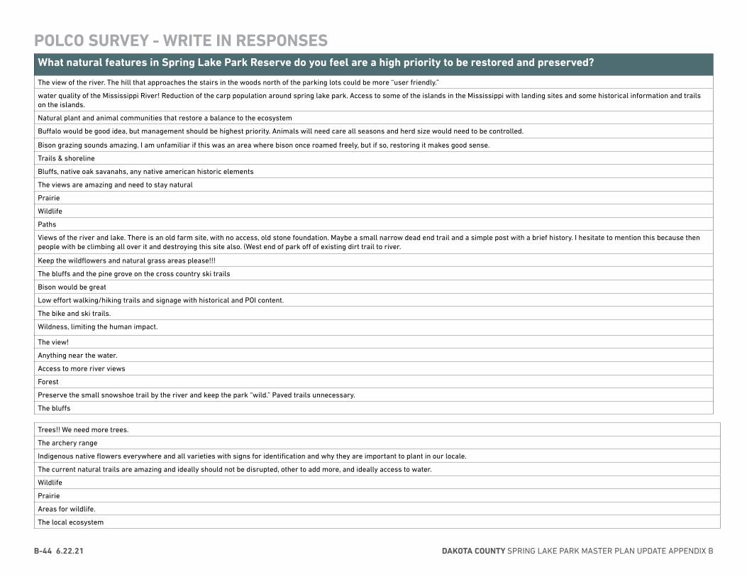
DAKOTA COUNTY SPRING LAKE PARK MASTER PLAN UPDATE APPENDIX BB-44 6.22.21
What natural features in Spring Lake Park Reserve do you feel are a high priority to be restored and preserved?
The view of the river. The hill that approaches the stairs in the woods north of the parking lots could be more “user friendly.”
water quality of the Mississippi River! Reduction of the carp population around spring lake park. Access to some of the islands in the Mississippi with landing sites and some historical information and trails on the islands.
Natural plant and animal communities that restore a balance to the ecosystem
Buffalo would be good idea, but management should be highest priority. Animals will need care all seasons and herd size would need to be controlled.
Bison grazing sounds amazing. I am unfamiliar if this was an area where bison once roamed freely, but if so, restoring it makes good sense.
Trails & shoreline
Bluffs, native oak savanahs, any native american historic elements
The views are amazing and need to stay natural
Prairie
Wildlife
Paths
Views of the river and lake. There is an old farm site, with no access, old stone foundation. Maybe a small narrow dead end trail and a simple post with a brief history. I hesitate to mention this because then people with be climbing all over it and destroying this site also. (West end of park off of existing dirt trail to river.
Keep the wildflowers and natural grass areas please!!!
The bluffs and the pine grove on the cross country ski trails
Bison would be great
Low effort walking/hiking trails and signage with historical and POI content.
The bike and ski trails.
Wildness, limiting the human impact.
The view!
Anything near the water.
Access to more river views
Forest
Preserve the small snowshoe trail by the river and keep the park “wild.” Paved trails unnecessary.
The bluffs
Trees!! We need more trees.
The archery range
Indigenous native flowers everywhere and all varieties with signs for identification and why they are important to plant in our locale.
The current natural trails are amazing and ideally should not be disrupted, other to add more, and ideally access to water.
Wildlife
Prairie
Areas for wildlife.
The local ecosystem
POLCO SURVEY - WRITE IN RESPONSES
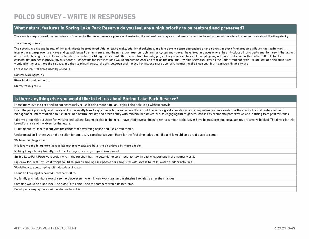
APPENDIX B - COMMUNITY ENGAGEMENT 6.22.21 B-45
What natural features in Spring Lake Park Reserve do you feel are a high priority to be restored and preserved?
The view is simply one of the best views in Minnesota. Removing invasive plants and restoring the natural landscape so that we can continue to enjoy the outdoors in a low impact way should be the priority.
The amazing views!
The natural habitat and beauty of the park should be preserved. Adding paved trails, additional buildings, and large event space encroaches on the natural aspect of the area and wildlife habitat/human interactions. Large events always end up with large littering issues, and the noise/business disrupts animal cycles and space. I have lived in places where they introduced biking trails and then seent the fall out of the parks having to close them for habitat restoration, or filling the deep ruts they create from from digging in. They also tend to lead to people going off those trails and further into wildlife habitats,causing disturbance in previously quiet areas. Connecting the two locations would encourage wear and tear on the grounds. It would seem that leaving the upper trailhead with it’s info stations and structures would give the urbanites their space, and then leaving the natural trails between and the southern space more open and natural for the true roughing-it campers/hikers to use.
Forest and natural areas used by animals.
Natural walking paths
River banks and wetlands.
Bluffs, trees, prairie
POLCO SURVEY - WRITE IN RESPONSES
Is there anything else you would like to tell us about Spring Lake Park Reserve? I absolutely love the park and do not necessarily relish it being more popular. I enjoy being able to go without crowds.
I visit the park primarily to ski, walk and occasionally bike. I enjoy it as is but also believe that it could become a great educational and interpretive resource center for the county. Habitat restoration and management, interpretation about cultural and natural history, and accessibility with minimal impact are vital to engaging future generations in environmental preservation and learning from past mistakes.
take my grandkids out there for walking and talking. Not much else to do there. I have tried several times to rent a camper cabin. Never have been successful because they are always booked. Thank you for this beautiful area and the ideas for the future.
I like the natural feel to it but with the comfort of a warming house and use of rest rooms.
Under question 1, there was not an option for pop-up/rv camping. We went there for the first time today and I thought it would be a great place to camp.
We love the playground
It is lovely but adding more accessible features would are help it to be enjoyed by more people.
Making things family friendly, for kids of all ages, is always a great investment.
Spring Lake Park Reserve is a diamond in the rough. It has the potential to be a model for low impact engagement in the natural world.
Big draw for local Boy Scout troops to utilize group camping (30+ people per camp site) with access to trails, water, outdoor activities.
Would love to see camping with electric and water
Focus on keeping it reserved... for the wildlife.
My family and neighbors would use the place even more if it was kept clean and maintained regularly after the changes.
Camping would be a bad idea. The place is too small and the campers would be intrusive.
Developed camping for rv with water and electric
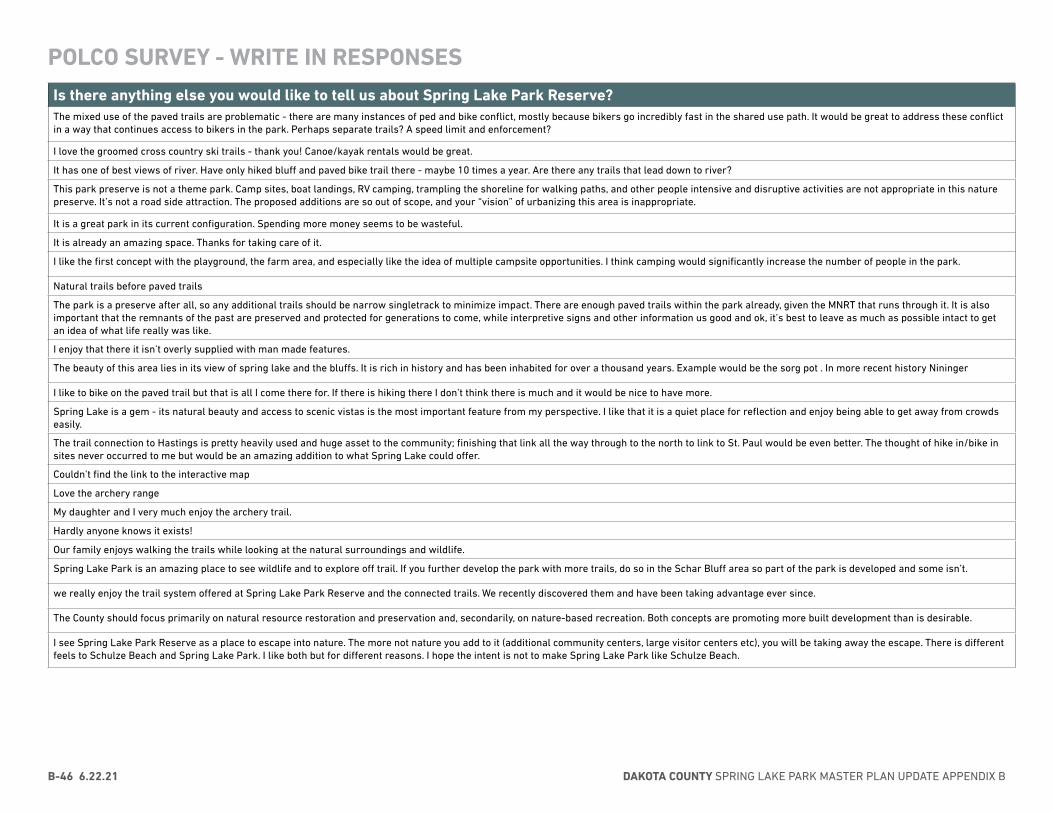
DAKOTA COUNTY SPRING LAKE PARK MASTER PLAN UPDATE APPENDIX BB-46 6.22.21
Is there anything else you would like to tell us about Spring Lake Park Reserve? The mixed use of the paved trails are problematic - there are many instances of ped and bike conflict, mostly because bikers go incredibly fast in the shared use path. It would be great to address these conflict in a way that continues access to bikers in the park. Perhaps separate trails? A speed limit and enforcement?
I love the groomed cross country ski trails - thank you! Canoe/kayak rentals would be great.
It has one of best views of river. Have only hiked bluff and paved bike trail there - maybe 10 times a year. Are there any trails that lead down to river?
This park preserve is not a theme park. Camp sites, boat landings, RV camping, trampling the shoreline for walking paths, and other people intensive and disruptive activities are not appropriate in this nature preserve. It’s not a road side attraction. The proposed additions are so out of scope, and your “vision” of urbanizing this area is inappropriate.
It is a great park in its current configuration. Spending more money seems to be wasteful.
It is already an amazing space. Thanks for taking care of it.
I like the first concept with the playground, the farm area, and especially like the idea of multiple campsite opportunities. I think camping would significantly increase the number of people in the park.
Natural trails before paved trails
The park is a preserve after all, so any additional trails should be narrow singletrack to minimize impact. There are enough paved trails within the park already, given the MNRT that runs through it. It is also important that the remnants of the past are preserved and protected for generations to come, while interpretive signs and other information us good and ok, it’s best to leave as much as possible intact to get an idea of what life really was like.
I enjoy that there it isn’t overly supplied with man made features.
The beauty of this area lies in its view of spring lake and the bluffs. It is rich in history and has been inhabited for over a thousand years. Example would be the sorg pot . In more recent history Nininger
I like to bike on the paved trail but that is all I come there for. If there is hiking there I don’t think there is much and it would be nice to have more.
Spring Lake is a gem - its natural beauty and access to scenic vistas is the most important feature from my perspective. I like that it is a quiet place for reflection and enjoy being able to get away from crowds easily.
The trail connection to Hastings is pretty heavily used and huge asset to the community; finishing that link all the way through to the north to link to St. Paul would be even better. The thought of hike in/bike in sites never occurred to me but would be an amazing addition to what Spring Lake could offer.
Couldn’t find the link to the interactive map
Love the archery range
My daughter and I very much enjoy the archery trail.
Hardly anyone knows it exists!
Our family enjoys walking the trails while looking at the natural surroundings and wildlife.
Spring Lake Park is an amazing place to see wildlife and to explore off trail. If you further develop the park with more trails, do so in the Schar Bluff area so part of the park is developed and some isn’t.
we really enjoy the trail system offered at Spring Lake Park Reserve and the connected trails. We recently discovered them and have been taking advantage ever since.
The County should focus primarily on natural resource restoration and preservation and, secondarily, on nature-based recreation. Both concepts are promoting more built development than is desirable.
I see Spring Lake Park Reserve as a place to escape into nature. The more not nature you add to it (additional community centers, large visitor centers etc), you will be taking away the escape. There is different feels to Schulze Beach and Spring Lake Park. I like both but for different reasons. I hope the intent is not to make Spring Lake Park like Schulze Beach.
POLCO SURVEY - WRITE IN RESPONSES
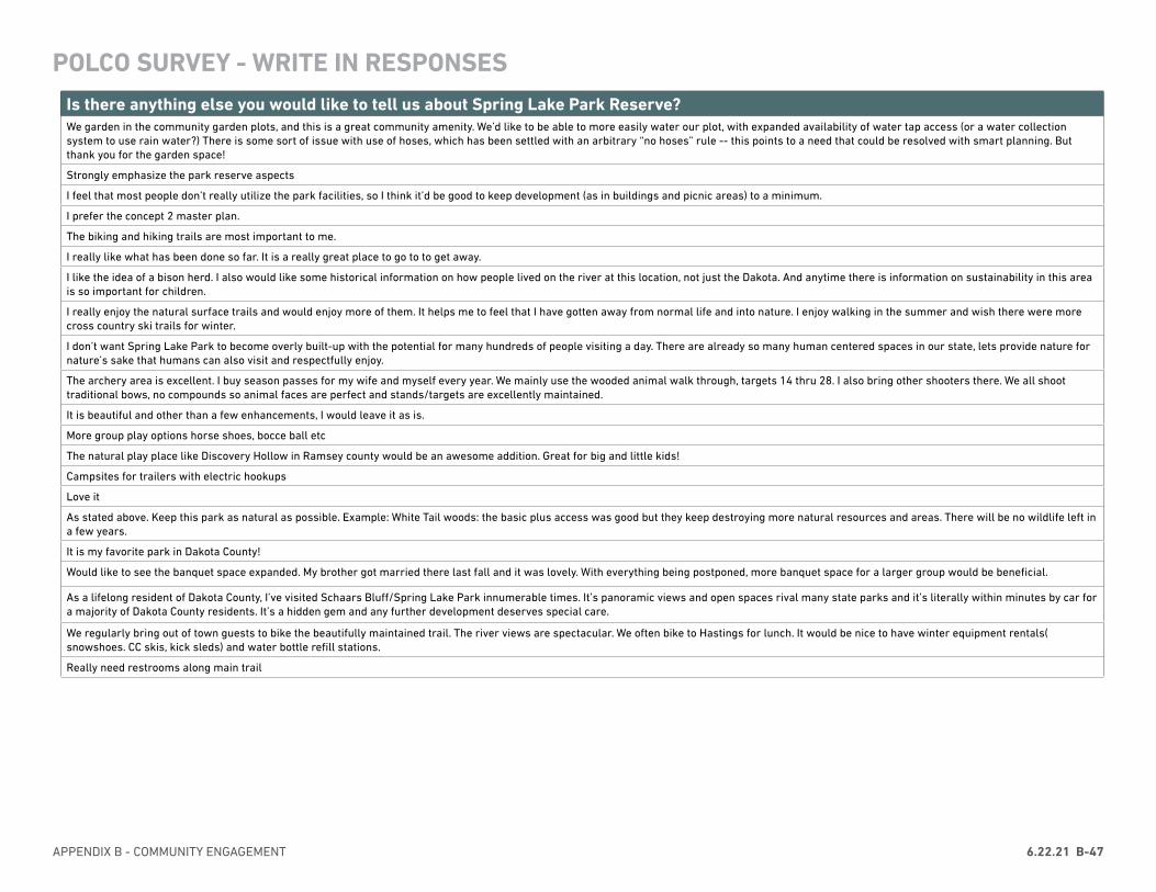
APPENDIX B - COMMUNITY ENGAGEMENT 6.22.21 B-47
Is there anything else you would like to tell us about Spring Lake Park Reserve? We garden in the community garden plots, and this is a great community amenity. We’d like to be able to more easily water our plot, with expanded availability of water tap access (or a water collection system to use rain water?) There is some sort of issue with use of hoses, which has been settled with an arbitrary “no hoses” rule -- this points to a need that could be resolved with smart planning. But thank you for the garden space!
Strongly emphasize the park reserve aspects
I feel that most people don’t really utilize the park facilities, so I think it’d be good to keep development (as in buildings and picnic areas) to a minimum.
I prefer the concept 2 master plan.
The biking and hiking trails are most important to me.
I really like what has been done so far. It is a really great place to go to to get away.
I like the idea of a bison herd. I also would like some historical information on how people lived on the river at this location, not just the Dakota. And anytime there is information on sustainability in this area is so important for children.
I really enjoy the natural surface trails and would enjoy more of them. It helps me to feel that I have gotten away from normal life and into nature. I enjoy walking in the summer and wish there were more cross country ski trails for winter.
I don’t want Spring Lake Park to become overly built-up with the potential for many hundreds of people visiting a day. There are already so many human centered spaces in our state, lets provide nature for nature’s sake that humans can also visit and respectfully enjoy.
The archery area is excellent. I buy season passes for my wife and myself every year. We mainly use the wooded animal walk through, targets 14 thru 28. I also bring other shooters there. We all shoot traditional bows, no compounds so animal faces are perfect and stands/targets are excellently maintained.
It is beautiful and other than a few enhancements, I would leave it as is.
More group play options horse shoes, bocce ball etc
The natural play place like Discovery Hollow in Ramsey county would be an awesome addition. Great for big and little kids!
Campsites for trailers with electric hookups
Love it
As stated above. Keep this park as natural as possible. Example: White Tail woods: the basic plus access was good but they keep destroying more natural resources and areas. There will be no wildlife left in a few years.
It is my favorite park in Dakota County!
Would like to see the banquet space expanded. My brother got married there last fall and it was lovely. With everything being postponed, more banquet space for a larger group would be beneficial.
As a lifelong resident of Dakota County, I’ve visited Schaars Bluff/Spring Lake Park innumerable times. It’s panoramic views and open spaces rival many state parks and it’s literally within minutes by car for a majority of Dakota County residents. It’s a hidden gem and any further development deserves special care.
We regularly bring out of town guests to bike the beautifully maintained trail. The river views are spectacular. We often bike to Hastings for lunch. It would be nice to have winter equipment rentals( snowshoes. CC skis, kick sleds) and water bottle refill stations.
Really need restrooms along main trail
POLCO SURVEY - WRITE IN RESPONSES
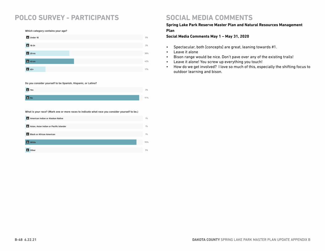
DAKOTA COUNTY SPRING LAKE PARK MASTER PLAN UPDATE APPENDIX BB-48 6.22.21
POLCO SURVEY - PARTICIPANTS SOCIAL MEDIA COMMENTSSpring Lake Park Reserve Master Plan and Natural Resources Management PlanSocial Media Comments May 1 – May 31, 2020
• Spectacular, both [concepts] are great, leaning towards #1.• Leave it alone• Bison range would be nice. Don’t pave over any of the existing trails!• Leave it alone! You screw up everything you touch!• How do we get involved? I love so much of this, especially the shifting focus to
outdoor learning and bison.
7/15/2020 Polco
https://polco.us/n/admin/content/00a394ba-a449-4083-bf5a-947171c1e3b1/report 9/10
Most of the suggestion here will only damage the park. Itisone of the most beautiful pars in the metro. DO NOT DESTROY IT.
Hey Fake News Coronavirus freaks, it's time to open the bathrooms and the playground at Spring Lake Park reserve. Coronavirus isfake news and you know it. You public sector mooches are just using it as an opportunity to sit on your tuckus and collect a paycheck.Some of us actually work for a living and would like to have access to the things our taxes pay for.
This master planning process presents a rare opportunity to create a truly destination-level hiking experience here. The ruggednessand high-quality natural communities would draw people at a regional level if a large new trail system is developed. I would urge youto be ambitious and go big on the trails!
Those of us that enjoy hiking and solitide in a non-urbanized environment would appreciate a natural rustic surface hiking trail acrossthe park from end-to-end away from crowds and nearest to the river as much as possible. Include ample steep sections of trail, sincewe do not have enough trails in the county with a steep trail experience. Backpack campsites off the trail in places isolated from thesounds of civilization would be greatly appreciated.
Beautiful Park
I love this park.
Love spending time there as is.
Which category contains your age?
0%
3%
38%
42%
17%
Do you consider yourself to be Spanish, Hispanic, or Latino?
3%
97%
What is your race? (Mark one or more races to indicate what race you consider yourself to be.)
1%
1%
1%
95%
5%
A Under 18
B 18-24
C 25-44
D 45-64
E 65+
A Yes
B No
A American Indian or Alaskan Native
B Asian, Asian Indian or Pacific Islander
C Black or African American
D White
E Other
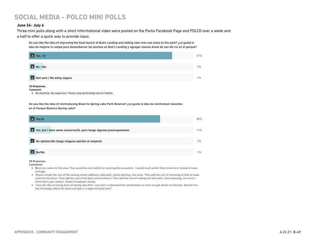
APPENDIX B - COMMUNITY ENGAGEMENT 6.22.21 B-49
APPENDIX DRAFT 19SPRING LAKE PARK RESERVE MASTER PLAN & NRMP UPDATE
7/8/2020 Polco
https://polco.us/n/admin/content/8985a0b8-e8a2-4b06-9bd9-6d718059dd6f/report 2/3
Do you like the idea of improving the boat launch at Bud’s Landing and adding new river use areas to the park? ¿Le gusta la idea de mejorar la rampa para desembarcar las lanchas en Bud's Landing y agregar nuevas áreas de uso del río en el parque?
87%
9%
4%
Do you like the idea of reintroducing Bison to Spring Lake Park Reserve? ¿Le gusta la idea de reintroducir bisontes en el Parque Reserva Spring Lake?
80%
14%
2%
5%
Dakota County Parks Department is exploring the idea of camping in the west side of the park. What types of camping would you be interested in? Please check all that apply. El Departamento de Parques del Condado de Dakota está considerando la idea de poner lugares para acampar en el lado oeste del parque. ¿Qué tipo de campamento le interesaría? Por favor marque todas los que correspondan.
41%
59%
59%
47%
24%
A Yes / Sí
B No / No
C Not sure / No estoy seguro
A Yes/Sí
B Yes, but I have some concerns/Sí, pero tengo algunas preocupaciones
C No opinion/No tengo ninguna opinión al respecto
D No/No
A Cabins / Cabinas
B Canoe-in campsites / Sitios de acampar que solo son accesibles por canoa
C Walk-in/bike-in campsites / Sitios de acampar que solo son accesibles en bicicleta o caminando
D Group campsites / Sitios de acampar para grupos
E Camping in this park is not important to me / Acampar en este parque no es importante para mí
23 REsponses
23 Responses.Comment:
• No blacktop. No expansion. Please stop destroying natural habitat.
59 Responses.Comments:
• Bison are native to this area. They would be very helpful to restoring the ecosystem. I would much prefer them to be here instead of cows and pigs.
• Please include the cost of the existing recent additions, bike path, native planting, rest areas. Then add the cost of removing all that to make room for the bison. Then add the cost of the bison and enclosure. Then add the cost of redoing the bike path, native planting, rest areas. I think that's your answer. Waste of taxpayer money.
• I love the idea of seeing bison at Spring Lake Park. I just don't understand the ramifications or have enough details on the plan. Would it be like minneopa where the bison are kept in a large enclosed area?
17 Responses.Comments:
• Camping is not appropriate for this area. It's next to a rail yard and next to an industrial park.• I didn't see a choice for RV camping. We'd love to be be able to use our Travel trailer with electric hook ups
PHASE 2 COMMUNITY ENGAGEMENTSOCIAL MEDIA & POLCO MINI POLLS
June 24- July 6Three mini polls along with a short informational video were posted on the Parks Facebook Page and POLCO over a week and a half to offer a quick way to provide input.
Attachment A
SOCIAL MEDIA - POLCO MINI POLLS
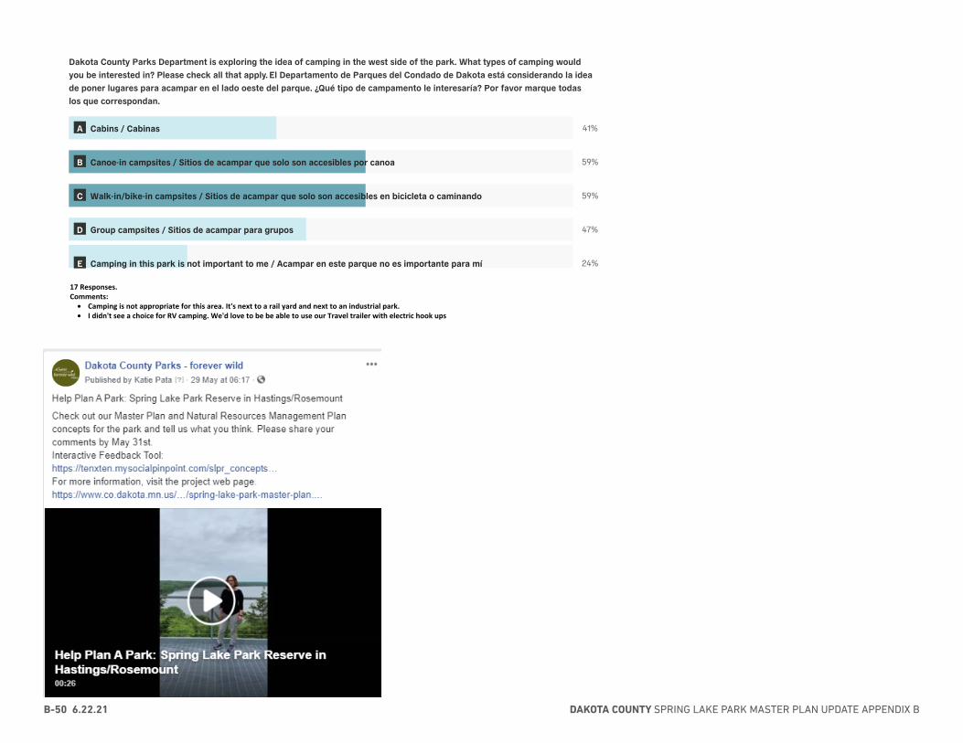
DAKOTA COUNTY SPRING LAKE PARK MASTER PLAN UPDATE APPENDIX BB-50 6.22.21
APPENDIX DRAFT 19SPRING LAKE PARK RESERVE MASTER PLAN & NRMP UPDATE
7/8/2020 Polco
https://polco.us/n/admin/content/8985a0b8-e8a2-4b06-9bd9-6d718059dd6f/report 2/3
Do you like the idea of improving the boat launch at Bud’s Landing and adding new river use areas to the park? ¿Le gusta la idea de mejorar la rampa para desembarcar las lanchas en Bud's Landing y agregar nuevas áreas de uso del río en el parque?
87%
9%
4%
Do you like the idea of reintroducing Bison to Spring Lake Park Reserve? ¿Le gusta la idea de reintroducir bisontes en el Parque Reserva Spring Lake?
80%
14%
2%
5%
Dakota County Parks Department is exploring the idea of camping in the west side of the park. What types of camping would you be interested in? Please check all that apply. El Departamento de Parques del Condado de Dakota está considerando la idea de poner lugares para acampar en el lado oeste del parque. ¿Qué tipo de campamento le interesaría? Por favor marque todas los que correspondan.
41%
59%
59%
47%
24%
A Yes / Sí
B No / No
C Not sure / No estoy seguro
A Yes/Sí
B Yes, but I have some concerns/Sí, pero tengo algunas preocupaciones
C No opinion/No tengo ninguna opinión al respecto
D No/No
A Cabins / Cabinas
B Canoe-in campsites / Sitios de acampar que solo son accesibles por canoa
C Walk-in/bike-in campsites / Sitios de acampar que solo son accesibles en bicicleta o caminando
D Group campsites / Sitios de acampar para grupos
E Camping in this park is not important to me / Acampar en este parque no es importante para mí
23 REsponses
23 Responses.Comment:
• No blacktop. No expansion. Please stop destroying natural habitat.
59 Responses.Comments:
• Bison are native to this area. They would be very helpful to restoring the ecosystem. I would much prefer them to be here instead of cows and pigs.
• Please include the cost of the existing recent additions, bike path, native planting, rest areas. Then add the cost of removing all that to make room for the bison. Then add the cost of the bison and enclosure. Then add the cost of redoing the bike path, native planting, rest areas. I think that's your answer. Waste of taxpayer money.
• I love the idea of seeing bison at Spring Lake Park. I just don't understand the ramifications or have enough details on the plan. Would it be like minneopa where the bison are kept in a large enclosed area?
17 Responses.Comments:
• Camping is not appropriate for this area. It's next to a rail yard and next to an industrial park.• I didn't see a choice for RV camping. We'd love to be be able to use our Travel trailer with electric hook ups
PHASE 2 COMMUNITY ENGAGEMENTSOCIAL MEDIA & POLCO MINI POLLS
June 24- July 6Three mini polls along with a short informational video were posted on the Parks Facebook Page and POLCO over a week and a half to offer a quick way to provide input.
Attachment A
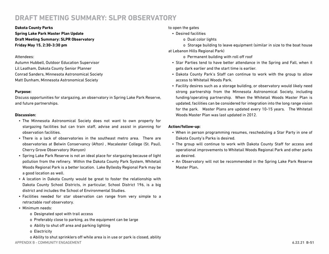
APPENDIX B - COMMUNITY ENGAGEMENT 6.22.21 B-51
DRAFT MEETING SUMMARY: SLPR OBSERVATORYDakota County Parks Spring Lake Park Master Plan Update Draft Meeting Summary: SLPR ObservatoryFriday May 15, 2:30-3:30 pm
Attendees: Autumn Hubbell, Outdoor Education SupervisorLil Leatham, Dakota County Senior Planner Conrad Sanders, Minnesota Astronomical SocietyMatt Dunham, Minnesota Astronomical Society
Purpose: Discuss opportunities for stargazing, an observatory in Spring Lake Park Reserve, and future partnerships.
Discussion: • The Minnesota Astronomical Society does not want to own property for
stargazing facilities but can train staff, advise and assist in planning for observation facilities.
• There is a lack of observatories in the southeast metro area. There are observatories at Belwin Conservancy (Afton) , Macalester College (St. Paul), Cherry Grove Observatory (Kenyon)
• Spring Lake Park Reserve is not an ideal place for stargazing because of light pollution from the refinery. Within the Dakota County Park System, Whitetail Woods Regional Park is a better location. Lake Byllesby Regional Park may be a good location as well.
• A location in Dakota County would be great to foster the relationship with Dakota County School Districts, in particular, School District 196, is a big district and includes the School of Environmental Studies.
• Facilities needed for star observation can range from very simple to a retractable roof observatory.
• Minimum needs: o Designated spot with trail access o Preferably close to parking, as the equipment can be large o Ability to shut off area and parking lighting o Electricity o Ability to shut sprinklers off while area is in use or park is closed, ability
to open the gates• Desired facilities
o Dual color lights o Storage building to leave equipment (similar in size to the boat house at Lebanon Hills Regional Park) o Permanent building with roll off roof
• Star Parties tend to have better attendance in the Spring and Fall, when it gets dark earlier and the start time is earlier.
• Dakota County Park’s Staff can continue to work with the group to allow access to Whitetail Woods Park.
• Facility desires such as a storage building, or observatory would likely need strong partnership from the Minnesota Astronomical Society, including funding/operating partnership. When the Whitetail Woods Master Plan is updated, facilities can be considered for integration into the long range vision for the park. Master Plans are updated every 10-15 years. The Whitetail Woods Master Plan was last updated in 2012.
Action/follow-up:• When in person programming resumes, rescheduling a Star Party in one of
Dakota County’s Parks is desired.• The group will continue to work with Dakota County Staff for access and
operational improvements to Whitetail Woods Regional Park and other parks as desired.
• An Observatory will not be recommended in the Spring Lake Park Reserve Master Plan.
DAKOTA COUNTY SPRING LAKE PARK MASTER PLAN UPDATE APPENDIX BB-52 6.22.21
DRAFT MEETING SUMMARY: YMCA RETREAT CENTER/CAMP SPRING LAKEDakota County Parks Spring Lake Park Master Plan Update Draft Meeting Summary: YMCA Retreat Center/Camp Spring LakeMonday May 18, 2020 2:00 to 3:00 pm
Attendees: Steve Sullivan, Dakota County Parks DirectorBeth Landahl, Visitor Services Manager Lil Leatham, Dakota County Senior Planner
Overview: Dakota County Staff went over new ideas for the park with focus on the west end of the park and Camp Spring Lake Retreat Center. Discussion about the advantages and disadvantages of the ideas explored and using the master plan as a catalyst for discussion about the future of the Y and County partnership were discussed.
Discussion: • Concept 1 separates permitted (Fahey Ave.) and general uses (Fischer Ave.).
Public camping is located NW of the Retreat Center. • Concept 2 includes camper cabins and public walk in and group sites from the
Retreat Center Drive.• Both concept assume use of the shower and restroom facilities at the Retreat
Center. • If camping facilities are built, Dakota County would want to operate them at
high occupancy and would need to have the sites occupied enough to cover operating costs.
• From the Y perspective, sharing use of the restrooms would be very hard, but not impossible. Indoor restrooms are preferred, but the camp could potentially only use port-a-potties. This is done at some other sites.
• The door between the shower/restroom building does lock, which would allow for separation.
• In the summer, the Y uses the buildings for campers until 3:30 pm, staff 4:30 pm daily except Thursdays when the building is in use until 9:00 pm.
• Blending of audiences, youth and general public increases the potential for conflicts.
• From the Y perspective, Concept 1, with greater separation of uses is preferable. That said, if camper cabins were built, the Y would be interested in integrating
these facilities into their programming. • From both the Y and Dakota County perspectives, it is hard to think about the
Retreat Center as anything but a Y space during the summer. Mixing of camp and general use would be difficult and it would be easy for people to get confused about the uses and access to spaces.
• Since, Dakota County and the Y do not have a long-term plan together, the Master Plan needs to position the Retreat Center as an asset with or without the Y partnership. The Master Plan will set a vision for the Retreat Center -how it can be improved and will have some discussion about future partnership with the Y.
• There are several ideas proposed that, if implemented, could be game changers for the park. For example, the introduction of bison and how the park is optimized for the interface of the public and bison.
• New ideas for the west end of park bring many new outdoor education opportunities: bison, river use, cultural landscape, the Mississippi River Greenway Trail. From the Y perspective, all of the these improvements would be amazing.
• Further discussion between Dakota County and the Y are needed about long term partnership opportunities. The hope is that the Master Plan can set the overall direction for the future and recommend further discussion between the two organizations.
Follow-up/Next Steps• In the preferred plan, separating uses as shown in Concept 1 is important.
General camping use should not share a restroom/shower building with the Y. The Master Plan should recommend a new camping-oriented restroom/shower building or provide a lesser level of service with pit toilets and water pumps. If there isn’t a long-term relationship with the Y, the existing building could be used. The Maser Plan needs to allow both scenarios to happen.
• The Y will have internal discussion about what their essentials for a high-quality program: place to use for inclement weather, office, and restrooms. A letter to Dakota County providing feedback on two things would be helpful: 1) what the Y sees as essential for them to continue Camp Spring Lake as a high quality program and 2) if there is interest from the Y in long term commitment to Camp Spring Lake.
• Dakota County and the Y should schedule a follow-up meeting for June /July to further clarify the vision for the Retreat Center and Camp Spring Lake.
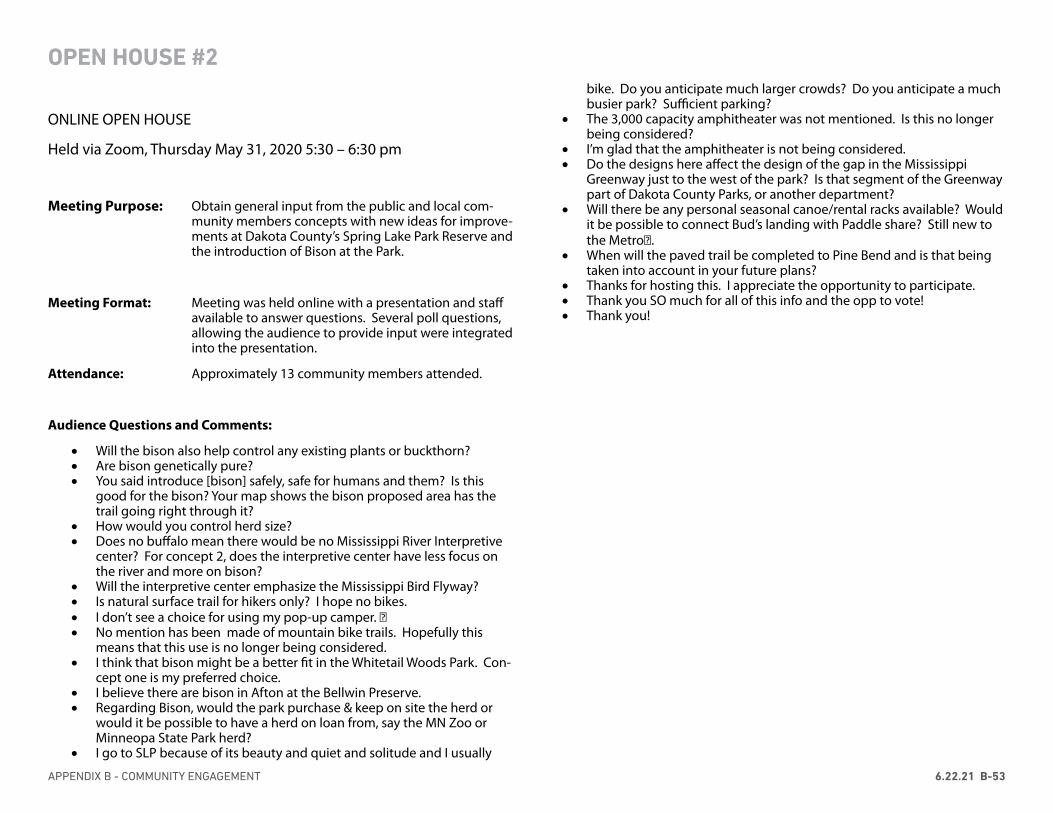
APPENDIX B - COMMUNITY ENGAGEMENT 6.22.21 B-53
OPEN HOUSE #2
ONLINE OPEN HOUSE
Held via Zoom, Thursday May 31, 2020 5:30 – 6:30 pm
Meeting Purpose: Obtain general input from the public and local com-munity members concepts with new ideas for improve-ments at Dakota County’s Spring Lake Park Reserve and the introduction of Bison at the Park.
Meeting Format: Meeting was held online with a presentation and staff available to answer questions. Several poll questions, allowing the audience to provide input were integrated into the presentation.
Attendance: Approximately 13 community members attended.
Audience Questions and Comments:
• Will the bison also help control any existing plants or buckthorn?• Are bison genetically pure?• You said introduce [bison] safely, safe for humans and them? Is this
good for the bison? Your map shows the bison proposed area has the trail going right through it?
• How would you control herd size?• Does no buffalo mean there would be no Mississippi River Interpretive
center? For concept 2, does the interpretive center have less focus on the river and more on bison?
• Will the interpretive center emphasize the Mississippi Bird Flyway?• Is natural surface trail for hikers only? I hope no bikes.• I don’t see a choice for using my pop-up camper. 😊• No mention has been made of mountain bike trails. Hopefully this
means that this use is no longer being considered.• I think that bison might be a better fit in the Whitetail Woods Park. Con-
cept one is my preferred choice.• I believe there are bison in Afton at the Bellwin Preserve.• Regarding Bison, would the park purchase & keep on site the herd or
would it be possible to have a herd on loan from, say the MN Zoo or Minneopa State Park herd?
• I go to SLP because of its beauty and quiet and solitude and I usually
bike. Do you anticipate much larger crowds? Do you anticipate a much busier park? Sufficient parking?
• The 3,000 capacity amphitheater was not mentioned. Is this no longer being considered?
• I’m glad that the amphitheater is not being considered.• Do the designs here affect the design of the gap in the Mississippi
Greenway just to the west of the park? Is that segment of the Greenway part of Dakota County Parks, or another department?
• Will there be any personal seasonal canoe/rental racks available? Would it be possible to connect Bud’s landing with Paddle share? Still new to the Metro😊.
• When will the paved trail be completed to Pine Bend and is that being taken into account in your future plans?
• Thanks for hosting this. I appreciate the opportunity to participate.• Thank you SO much for all of this info and the opp to vote!• Thank you!
DAKOTA COUNTY SPRING LAKE PARK MASTER PLAN UPDATE APPENDIX BB-54 6.22.21
OPEN HOUSE #2
APPENDIX B - COMMUNITY ENGAGEMENT 6.22.21 B-55
OPEN HOUSE #2
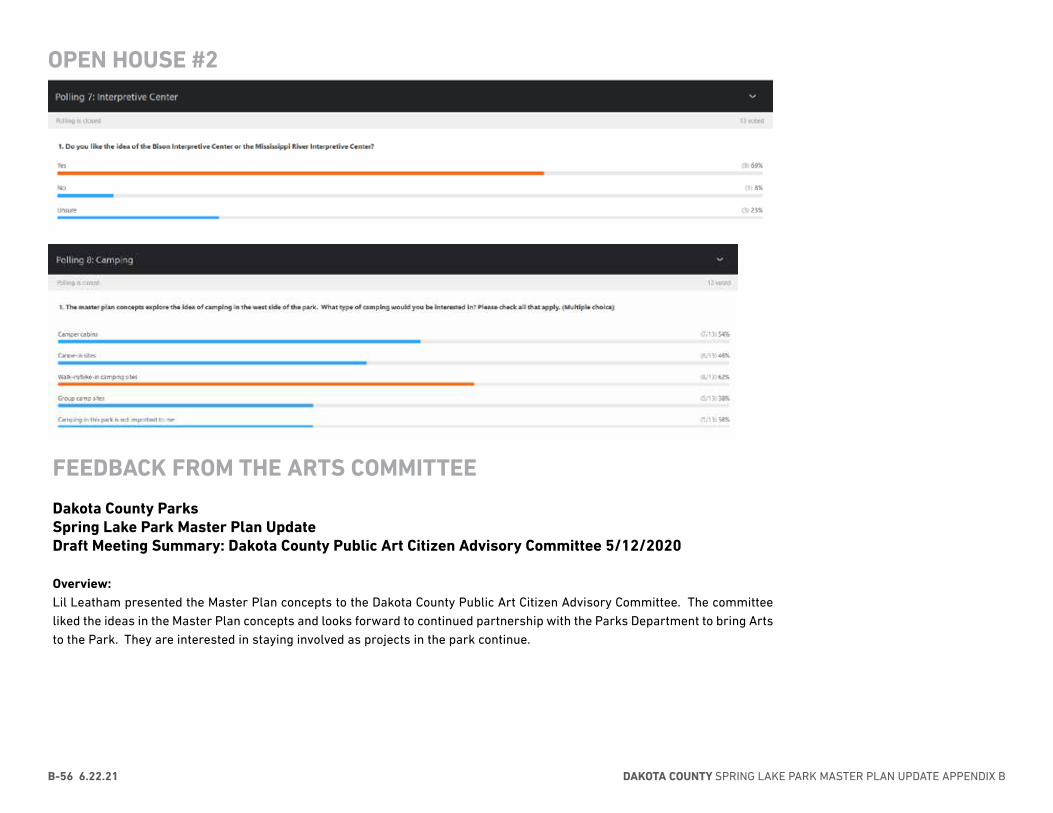
DAKOTA COUNTY SPRING LAKE PARK MASTER PLAN UPDATE APPENDIX BB-56 6.22.21
FEEDBACK FROM THE ARTS COMMITTEE
Dakota County Parks Spring Lake Park Master Plan Update Draft Meeting Summary: Dakota County Public Art Citizen Advisory Committee 5/12/2020
Overview: Lil Leatham presented the Master Plan concepts to the Dakota County Public Art Citizen Advisory Committee. The committee liked the ideas in the Master Plan concepts and looks forward to continued partnership with the Parks Department to bring Arts to the Park. They are interested in staying involved as projects in the park continue.
OPEN HOUSE #2
APPENDIX B - COMMUNITY ENGAGEMENT 6.22.21 B-57
Dakota County Parks Spring Lake Park Master Plan Update Draft Meeting Summary: MnDNR Staff 5/13/2020
Attendees: Steve Sullivan, Dakota County Parks DirectorLil Leatham, Dakota County Senior Planner Rachel Henzen, MnDNRMetro Area SupervisorBob Fashingbauer, MnDNR Wildlife ManagerTim Pharis, MnDNR Assistant Wildlife Manager
Overview: Staff and organizational introductions. Lil Leatham provided and overview of the concepts to the group. Discussion focused on the boat launch locations and camping. Overall, MnDNR staff present are supportive of a new boat launch at Bud’s landing and camping in the park.
Discussion: • The existing boat launch at Hilary Path is dangerous, shallow, and far from the
WMA/waterfowl hunting area• Spring Lake Park is best known for late season Mallard hunting, the best
hunting location is close to the islands, so Bud’s landing makes an ideal site for a boat launch.
• For the hunting, a very basic launch is needed: 10 pull in/pull out 14’ parking spaces for boat trailers. The launch would need to meet AIS stormwater standards and there is a preference for the launch to be paved (asphalt)
• If space is limited, there could be a boat launch and then additional parking up to ¼ mile away.
• A restroom or port-a-potty is needed. About 60% of MnDNR launches have toilets and it cuts down on trash
• If Dakota County is interested in a river use area for the general public, additional parking will be needed. Some of this parking could be further away as well.
• There are serval locations in the State with boat drop off areas and the main parking lot before the boat launch – Chub Lake
• DNR boat launches are open 24 hours, but there is no overnight parking. • If people are going to access island camping from Bud’s landing, designated
parking spaces will be needed for overnight use.
MEETING SUMMARY DNR MEETING ON CAMPING + BOAT LAUNCH• Island camping should be reservable and through paddlers who access from
the river or from the park. • Closing the existing boat launch on Hilary Path may not be completely straight
forward. More research is needed as to how that land was purchased/the launch is established. If a new launch is created at Bud’s landing, it may be possible to make the existing launch carry-in only and close the road.
• The DNR is interested in a partnership with Dakota County for a new boat launch but timing of any funding is uncertain. Funding usually comes from gas tax revenue which will be very limited due to COVID 19. DNR does not typically reimburse project partners if the County wants build the launch before DNR funding is available. Kent Skaar would need to be involved in any discussion
• Master Plan should establish the vision for a future MnDNR partnership.• County and DNR can work together on the master plan language• To honor Bud, it would be nice if the launch could be named Bud’s Landing• There are several new waterfowl groups, and the Delta waterfowl group
outside of Hastings• It is anticipated that the Master Plan will be adopted by the County Board in
January 2021Action/follow-up:
• Lil will follow up with Bob on contact information for the Delta waterfowl group• By August - Lil/Rachel will research if the current boat launch can be closed
or not • This summer, when Dakota County is writing the Master Plan Document, Lil
will coordinate with DNR Staff on mutually acceptable language regarding the possibility to close the old launch and DNR/Dakota County partnership for a new boat launch at Bud’s Landing
DAKOTA COUNTY SPRING LAKE PARK MASTER PLAN UPDATE APPENDIX BB-58 6.22.21
Dakota County Parks Spring Lake Park Master Plan Update Draft Meeting Summary: Critical Area RulesFriday May 15, 2020 3:30-4:30 pm
Attendees: Steve Sullivan, Dakota County Parks DirectorKurt Chatfield, Dakota County Planning Manager Lil Leatham, Dakota County Senior Planner Dan Petrik, Land Use Specialist MnDNR
Overview: Dakota County Staff went over new ideas for the park with focus on elements that might be impacted by the Critical Area Rules: overlooks, camping, trails, river use areas at Bud’s Landing and the mill site.
Discussion: • There is nothing in the Master Plan concepts that is of concern regarding the
Critical Area Rules. Some of the elements suggested will require a variance, for example, restrooms.
• Nininger Township would have to make the decision about granting a variance. • The MnDNR does not always comment on variances.• Generally, it is best to minimize impact to the shoreline and bluff, minimize
grading and restore as much as possible.
MEETING WITH DNR CRITICAL AREA STAFF
APPENDIX B - COMMUNITY ENGAGEMENT 6.22.21 B-59
LISTENING SESSION WITH TRIBAL HISTORIC PRESERVATION OFFICERS
06/12/2020
MMEEEETTIINNGG MMIINNUUTTEESS
SPRING LAKE PARK RESERVE MASTER PLAN UPDATE
THPO LISTENING SESSION 2
06.12.2020
Attendees:
Maura Rockcastle, TxT Rachel Salmela, TxT Aubrey Tyler, TxT Emma Froh, TxT Lil Leatham, DC Planning Kurt Chatfield, DC Planning Autumn Hubble, DC Natural Resources Anna Ferris, Dakota County Steve Sullivan, Dakota County Joe Walton, Dakota County Samantha Odegard, Upper Sioux THPO Leonard Wabasha, SMSC Drew Brockman, Upper Sioux Community Cheyanne St. John, Lower Sioux THPO
OVERVIEW
The purpose of this meeting with the THPO’s is to review the two final concepts, building on their feedback from the last listening session, share community and stakeholder engagement outcomes, and discuss the direction for the preferred concept.
NATURAL RESOURCES OOVVEERRVVIIEEWW
11.. Rachel shared the first draft of the target plant communities, which shows delineated plant communities and forests. It is what is being used to help develop the natural resource management plant. This map will help identify how to restore or move these plant communities or how to bring them up to Schaar's Bluff.
aa.. Joe explained that this map has is the result of extensive analysis of existing conditions (topography, soils, geology, etc.) and “boots on the ground” surveying. For all NRMPs, his team uses this method to determine the communities that fit best with the existing areas. The irregular shapes indicate that these assigned communities respond to the landscape. The intent is to blur strong boundaries to give the communities a naturalistic feel.
bb.. Steve noted that because Spring Lake is a park reserve, no less than 80% is to be naturalized while providing opportunities for recreation. DC has a two-fold mission: to provide nature-based recreations but also to be stewards of the land, meaning it is their responsibility to enhance the landscape to the state that the land is telling them it wants to be.
22.. Rachel reiterated that the planning team is always referencing this target plant community map when refining the master plan concepts so that we may test the experiential qualities know that these plant communities are defining features of the park.
06/12/2020
33.. Rachel reviewed the plant species list generated by field surveys and transects. She zoomed in to the map to show the areas where samples have been taken to create the list. The colors correspond to the yellow and pink color codes which species were found where and whether the species were found in situ or introduced as part of the restoration efforts. Rachel asked if this is the right type of information for THPOs to be reviewing to give us feedback about which species to highlight in interpretation or which species should be included in new restoration efforts.
a. Cheyanne confirms that this list is very detailed and very thoughtful response to the request from the listening session in February (the right level of information that was desired).
CCOONNCCEEPPTT OOVVEERRVVIIEEWW
1. Rachel presented a summary of concepts to date.
2. CONCEPT 1
a. A Tale of Two Parks: Concept 1 emphasizes the two ends of the park that have a strong identity. Schaar's Bluff is defined by trails and the West end by the retreat center and archery. The overarching goal was to connect the park to its river identity and redefine the western portion to be about Mississippi river discovery while avoiding the center of the park because it is where some of the significant sites are. A single trail would help protect the center of the park.
3. CONCEPT 2
a. Concept two has a different approach than concept one in that it focuses on the secondary soft surface trail. Ensuring a continuous route from one end of the park to another. This concept works on building identity into the park though a series of nodes.
b. Concept two includes the bison range idea, which occupies a significant amount of space on the west end of the park and aligns with the existing prairie restoration. This concept is considering other locations DC might be able to showcase experimental restoration techniques on the east end of the park.
4. Comments
a. Given the large amount of content provided here, Cheyanne asked that the presentation be submitted to the THPO’s so that they can review in more detail and provided more detailed feedback.
i. ACTION ITEM: TxT to send this presentation for comment.
IINNTTEERRPPRREETTAATTIIOONN 5. Rachel presented high level interpretation approach for both concepts and asked whether there were
any comments on the different layout implied in the concepts or thoughts on the interpretive themes and stories that would be helpful to incorporate.
6. Overarching theme: The Changing River
a. Importance of Place
b. Gifts of the Land
c. Kinship and Connection
DAKOTA COUNTY SPRING LAKE PARK MASTER PLAN UPDATE APPENDIX BB-60 6.22.21
06/12/2020
i. All themes are still in development and will be expanded more on in the text of the masterplan. Rachel asked the group if there are other stories that they would like to see incorporated into the subthemes.
ii. Option 1: Concentrated nodes there could be themed trails that could be named in a clear and intuitive way. Each end of the park would have one or two loops in one theme category. Everything would always connect back to the river.
iii. Option 2 is testing if it makes sense to have the stories or themes as one continuous story. Determining where there could be smaller segments of ‘trailheads’ (not necessarily structures). Option two is exploring key intersections having rest stops that helps a visitor understand the stories of the park. Either of these ideas (loops or one longer story) could be worked into either trail configuration.
iv. Rachel asked the group - from an experiential standpoint, does anyone have a strong preference to ensure that a visitor has a probably to encounter a sampling of each theme in the high-use areas or whether it is ok to have the stories play out across the site along the continuous trail.
7. Comments
a. Cheyanne noted that partnerships with urban indigenous youth or other organizations was an important thing to consider and incorporate. She noted that she thought that Medicine Bottle had a location in the southeast corner – this would be a great opportunity to incorporate that into the historical information, work with the THPO offices on a project like that, and also with the urban Dakota community.
b. The THPO’s did not provide guidance specific to the questions asked.
i. ACTION ITEM: TxT to provide a list of questions for specific guidance in the PDF to help the THPO’s focus their time. Perhaps we intersperse
PPRROOGGRRAAMMMMIINNGG 8. Rachel presented a programming summary, outlining the current direction for a program list. They
key takeaways across all platforms indicated that respondents desired to limit development in the park, protect the natural features, retain an emphasis on outdoor learning and nature-based recreation, and increase river access. Key concerns included the quantity of increased trail mileage (paved especially), event space for larger groups, and over-programming of the park. The engagement indicated positive feedback on both concepts but generally more positive feedback on Concept 2 – most likely because it read as having a lighter touch regarding development and because of the popularity of the continuous soft surface trail.
9. Rachel then presented the program rundown list that will likely be included in the final version of the conceptual master plan. She asked for specific feedback on the list,
a. Sam - I like the direction and the Bison Range. Only question I have so far is middle section of the park and the trails moving through there. Lil reached out to discuss with Sam and Drew and next steps for a cultural survey in this area. Sam noted that they might find that some existing resources that conflict both with elements being proposed as well as existing elements that might need to be rerouted at a later date.
10. Maura also clarified that the idea of a “Water Lab” would be very light touch. This would be the new water “node.” She thought that the name “Water Lab” does not feel quite right as the final name. Because we’ve talked a lot as a group about the park’s relationship with the river, she would like to
06/12/2020
find a better name that connects more strongly to natural / cultural resources of SLPR. She noted that direct feedback from the community potential names would be helpful.
11. Rachel presented a site-wide diagram that overlaid culturally significant sites with high-quality plant communities. She asked for direct feedback about the level of sensitivity regarding bringing trails down to significant sites. She brought up the Ranelius site as an example of a place that people are already drawn to and that DC is interested in highlighting with trails and interpretive content.
a. Sam: Village sites are a little different, but more sensitive sites such as burial grounds or prayer sites should not be places that are advertised or highlighted. We understand that there might be people wandering to these sites because they can a good river view, but there are things we can do to discourage the majority of folks from getting close to those sites such as letting the vegetation grow thick or downing trees. At the very least, we don’t want to advertise sensitive areas.
b. Rachel: We’ve updated the plan to show the discussion during our site walk the fact that the habitation zone likely spanned the entire lower terrace. Does that feel appropriate? Should we extend it?
i. Steve noted that while it is important to acknowledge cultural significance along the river, we do want to bring people to the river.
ii. Sam: This whole area of significance is the entire Mississippi, which extends well beyond the bounds of the park. She does not have concerns about boat access at the river in a village site, but burial sites or prayer sites need to be avoided. She wants to ensure that access is developed in a way that does not adversely impact significant areas. Of course, previously disturbed sites like Bud’s Landing would be a good place to locate access points. She supports kayaking, canoeing, trails and providing public access to the river and through the park.
iii. TxT noted that our intent would be to design these amenities in a way that respects the cultural significance of this site. If anything is proposed within the culturally significant “hatched” zone, it should be responsive to that context compared to other Parks in the DC system – the cultural significance of this place should be felt.
c. Upper Sioux has been asked to prepare a cultural survey (TCP). May not be completed before the MP is finished, preliminary conversations.
d. Lil confirmed that end of this year is goal for finishing the MP, we can talk more about this, but Sam noted that we have a gap in work right now and we could be out there quickly. TxT confirmed it would be very valuable to have the results of the cultural survey embedded in the planning work.
ENLARGEMENTS 12. East, Schaar’s Bluff Plan
a. Rachel presented the update for this area and asked for specific feedback on the proposed trail extending beyond the Mill site along the river, given the proximity to the caves and known cultural significance of that area.
i. Schaar's Bluff:
1. Picnic layout will shift more towards what is shown in concept one
2. Negotiating parking and play issues and access
APPENDIX B - COMMUNITY ENGAGEMENT 6.22.21 B-61
06/12/2020
a. TxT to put Cultural Significance Chapters back in top of inbox for THPO’s as well as this presentation for comment.
b. THPO’s to provide review on this presentation within a two-week period.
06/12/2020
3. All trails shown are very much so under review and will be refined using the feedback received during engagement.
b. Sam suggested we stop the trail at the Mill site and not encourage people to walk further
north along the river, closer to the cave sites.
i. ACTION ITEM: TxT team heard conflicting information about this comment, they will ask again to confirm.
13. West Enlargement Plan
a. Interpretive center will reflect concept 1 at Fischer Ave
b. DC is still internally reviewing camping
c. Drew asked what utility work would be required to support these new programs?
i. DC confirmed they have hired another consultant to do schematic design for Bison and will continue to share plans as they develop.
ii. DC noted that a self-composting or vault toilet, fencing, electrical and water will all be necessary to support the Bison Interpretive Center
iii. DC offered to include Drew as a stakeholder involved in that process, especially as it might affect their survey work. Drew and Sam confirmed their interest in both guiding the MP as well as being involved as a long-term stakeholder engaged in the park.
iv. Steve confirmed that they would fold Upper Sioux in the planning process for the Bison interpretation and planning. Sam noted that Prairie Island being closer and working with Bison on their own property would be the best primary contact for this work and they will defer to them and provide their support.
14. NEST STEPS
a. Rachel presented outstanding action items for DC and THPO’s.
i. Are there alternative steps that should be taken to get comments and feedback from this group and Prairie Island in particular?
ii. Sam noted that Prairie Island is still shut down and closed, and likely will not be accessible in the near future for consultation on this project.
iii. Sam suggested that Minneopa in Mankato for Bison herd consultation if Prairie Island is not available during this process. Lil confirmed that the DC Staff member who is leading the Schematic Design process for the Bison has visited both Prairie Island and Minneopa as part of that effort.
iv. Next meeting in end of August. TxT will select date and time and send invite to block time.
v. Draft Cultural Significance Chapter – comments. Sent in January for February meeting, as well as one month ago.
1. ACTION ITEMS:
DAKOTA COUNTY SPRING LAKE PARK MASTER PLAN UPDATE APPENDIX BB-62 6.22.21
From: [redacted]Sent: Tuesday, March 10, 2020 11:12:00 AMTo: Leatham, Lil <[email protected]>Subject: RE: Trails in Spring Lake Park Reserve
Hello,
My name is [redacted] I am a resident of the Hastings area. Myself and some other Hastings residents who also enjoying mountain biking would like you to consider including some singletrack style trails in the new master plan for SLPR. We believe that the area of the park near Pine Bend Trail has some areas that would be excellent for this type of trail. It is an area of the park that appears to generally have minimal use by other park users. There is already an existing parking area, and with the paved bike trail nearby it would make a great connector to other parts of the park, Hastings, and further up river once the paved trail is completed. With the steadily increasing popularly of mountain biking I believe it would be a mistake to not atleast consider this as on option for the park. I know that there are a group of Hastings residents, and I am sure many Dakota County residents that would agree with me and be willing to support this idea.Please let me know your thoughts on this, and what I/we can do to help insure that we don’t miss this opportunity.
Thank you,
From: Leatham, Lil <[email protected]>Sent: Tuesday, March 10, 2020 11:12:00 AMTo: [redacted]Subject: RE: Trails in Spring Lake Park Reserve
Thank you for your interest in mountain biking trails in Spring Lake Park Reserve and the master planning process. The project team is currently in the process of preparing 2 alternative concepts for the park. It is anticipated that the concepts will be available for community review and comment this spring – in April and May. Community input will inform creation of a preferred concept and phasing, which should be available for public review this Fall. Though the concepts are
EMAIL + LETTER COMMENTSstill being developed, at this point, staff is not recommending mountain biking trails in Spring Lake Park Reserve due to the park’s regional designation as a Park Reserve, high quality natural resources, numerous sensitive cultural sites, and erodible soils. The County Board will ultimately make decisions regarding what activities are included in the master plan.
Kind regards,Lil Leatham, PLA, ASLASenior Planner
APPENDIX B - COMMUNITY ENGAGEMENT 6.22.21 B-63
From: [redacted]Sent: Wednesday, May 6, 2020 1:28 PMTo: Leatham, Lil <[email protected]>Subject: Park changes
Hello,I only have two questions?Are the cross country ski trails going to remain in the park?Does the plan protect for overcrowding?Thanks.Sent from my iPad
From: Leatham, Lil <[email protected]>Sent: Wednesday, May 6, 2020 3:13:00 PMTo: [redacted]Subject:RE: Park changes
Yes, the cross country ski trails will remain and additional mileage is being considered, please comment on the online app if you have suggestions for the trails or would like to see more mileage. Thank you for brining up overcrowding. At this time, the plan does not specifically address this, but it will be a consideration as we move from concepts to a preferred plan. Thank you for your comments and interest in the park.
Kind regards,Lil Leatham, PLA, ASLASenior PlannerPhysical Development AdministrationP 952-891-7159W www.dakotacounty.usA 14955 Galaxie Avenue, Apple Valley, MN 55124
EMAIL + LETTER COMMENTS
DAKOTA COUNTY SPRING LAKE PARK MASTER PLAN UPDATE APPENDIX BB-64 6.22.21
From: Leatham, LilSent: Monday, May 11, 2020 10:37:34 AM To: [redacted]Subject: Dakota County Is Seeking Input on Spring Lake Park Reserve Master Plan and Natural ResourcesManagement Plan
Dakota County is developing a Master Plan and Natural Resources Management Plan for Spring Lake Park Reserve, a 1,200-acre park along the banks of the Mississippi River near Hastings. The plan will define a long-range vision for the park and be a guide for County investment over the next 10 years. The planning process will include natural resources management, recreation development, visitor services and interpretation. After collecting initial input last fall, two concepts with ideas for potential improvements have been developed for consideration. We are now seeking feedback that will be used to develop a preferred concept for the park. You can participate in the following ways: Go to the Spring Lake Park Reserve Master Concepts webpage to view and provide input on the concepts through May 25. Attend the online open house to learn about the concepts and ask questions. Thursday, May 21, from 5:30–6:30 p.m. Join with this link. For additional information about the project, visit the Master Plan webpage. Please share this information with others who may be interested. If you have questions or would like to discuss other ways to participate in the planning process, please contact me at [email protected].
Kind regards,Lil Leatham, PLA, ASLASenior PlannerPhysical Development AdministrationW www.dakotacounty.usA 14955 Galaxie Avenue, Apple Valley, MN 55124
From: [redacted]Sent: Monday, May 11, 2020 10:37:34 AMTo: Leatham, LilSubject: Re: Dakota County Is Seeking Input on Spring Lake Park Reserve Master Plan and Natural ResourcesManagement Plan
EMAIL + LETTER COMMENTSLil,
Thank you for sharing this with me. As you know, I have been advocating for any future development of Spring Lake Parkto include additional natural surface hiking trails for a long time. When compared to other types of development... low impact, low initial cost, low cost of ongoing maintenance, highly desirable with so many demographics - you can’t go wrong. Ireally like where the Concept 2 plan is headed. Please know that I am always available to discuss and consult as needed. I am a lifelong resident of Hastings, have been going to Spring Lake Park since I was a child, brought my daughter there when she was a child, am actively involved in trail building and maintenance with the Superior Hiking Trail Association as a volunteer crew leader, am the race director of the states most popular trail running events and am a designer and field technician for Critical Connections Ecological Services based out of Stillwater Minnesota.
Thank You,Rocksteady RunningEndless Summer Trail Run Serieshttps://www.estrs.com/
APPENDIX B - COMMUNITY ENGAGEMENT 6.22.21 B-65
May 15, 2020
Dear Ms. Leatham:
Thank you for the opportunity to comment on the Spring Lake Park Reserve master plan concepts. Friends of the Mississippi River (FMR) is a non-profit organization with a mission to engage community members and other stakeholders to protect, restore and enhance the Mississippi River and its watershed in the Twin Cities Region. We represent thousands of people in themetropolitan area who care deeply about the river, including a growing membership of over 2,700 people and more than 3,200 volunteers and 2,000 advocates engaged each year.
Uniquely valuable park Spring Lake Park is a particularly special riverfront site. Among the things that make it unique:• It is the only Dakota County park located along the Mississippi River.• It has a variety of native plant communities, most of which were classified by the DNR
as high biodiversity significance.• It has unique plant species found at few, if any, other sites in Dakota County.• It is connected to hundreds of acres of largely undeveloped land, creating a rare
corridor of natural land along the Mississippi River that is important pathway for wildlife movement.
• The river is a migration corridor for hundreds of migratory bird species. Sites along the river such as Spring Lake Park are vital resting and nesting sites for birds. Because of these features and the fact that this is designated as a park reserve, FMR supports prioritizing the protection of the native plant communities and their inhabitants, and keeping this park as wild as possible.
Preferred conceptsOverall we prefer Concept 2, which includes bison and a somewhat lesser level of development. We support the addition of bison to the park; they are a very important, and generally absent, component of native prairies. A herd will draw new visitors to the park, and we encourage careful planning about how to accommodate increased traffic without causing ecological damage.In concept 2, we are opposed to adding bike/cart campsites, and the associated trails, along the river at the west end. The area depicted is a largely intact oak forest on a slope next to the river with highly erodible soils; it should not be developed. The campsites could also create more impediments for wildlife that are likely to use the area by the river as a transit corridor.
EMAIL + LETTER COMMENTSTrail networkWe are concerned about the wildlife and provide corridors for invasive species, potential erosion and other issues. We suggest fewer new trails in the middle section of the park than are shown in Concept 2 -- one loop would be adequate. We also strongly oppose the expansion of trails and overlooks in fragile bluff areas. Such trails appear to be proposed, most notably at the east end of the park which shows a new trail right on the bluff’s edge. The existing trail network in that area is more than adequate and does not merit expansion. We suggest that any new trails should be soft-surface. Paved walkways and parking areas should be porous.
Buildings and structuresGiven Spring Lake Park’s uniquely pristine natural state, we feel that additional development should be kept to a minimum to retain the wild feel of the park. We would not support adding large interpretive centers or other large structures. Additional buildings should be scaled back and located in areas that are already disturbed. Many of the visitor features, such as picnic shelters and trail rest areas, appear overbuilt in the examples shown. We encourage reducing new structures to only what is truly necessary, and emphasizing low rooflines, natural building materials and colors, etc. The parking area and picnic shelter on Hilary Path seem like examples of unnecessary building. Is there evidence to support this area as a desired, popular destination within the park? We suggest avoiding new turfgrass lawn area, but instead demonstrate to the public how to have pollinator-friendly plants and lawns. Again, thank you for the opportunity to comment on these concept plans. We look forward to participating in the rest of the planning process. If you’d like to discuss anything, please don’t hesitate to contact Karen Schik at 651-222-2193 x15 or [email protected] partnership,
Karen Schick Colleen O’Connor TobermanSenior Ecologist River Corridor Director

DAKOTA COUNTY SPRING LAKE PARK MASTER PLAN UPDATE APPENDIX BB-66 6.22.21
From: [redacted]Sent: Wednesday, May 27, 2020 8:58 AM To: Planning <[email protected]>Subject: I support the Land Conservation Plan
Dear Office of Planning,
I am especially fond of Spring Lake Park for the amazing vistas over the river, the diversity of habitat, and the abundance of migratory birds. I also love that the park is large enough, and long enough, that it’s not hard to get away from the more heavily visited areas and have a quiet nature experience. The connection of Spring Lake Park to other natural areas is one of the reasons why it is so important. Greenway corridors are vital for the movement of plants and animals across the landscape. The ever increasing pressures that humans put on the landscape make it more important than ever to protect remaining natural areas and expand on them. One of the most important ways to help reduce carbon in the atmosphere and offset the effects of the warming climate is by increasing the amount of plant cover. And native vegetation is especially vital for protecting the pollinators that help to supply us with food. Thank you for the leadership that Dakota County has shown in natural resource protection. Please continue by supporting the Dakota County Parks Plan.
Sincerely,[redacted]
EMAIL + LETTER COMMENTSFrom: [redacted]Sent: Tuesday, May 19, 2020 12:27:58 PMTo: Ferris, AnnaSubject: RE: Spring Lake Park Reserve Master Plan Update
Hi Anna- Hopefully Dakota County received my email on May 11.- I pasted my May 11 message below that I sent to “[email protected]” and Mike Slavik.- Are you any relation to Terry Ferris, former horticulture prof at UW-River Falls? I would like to thank you for all of your good and diligent work in protecting land throughout Dakota County. My students have been reading The Sixth Extinction by Elizabeth Kolbert during this school year. They are coming to understand the plight of life on planet Earth and the need to put protections in place. I would like to encourage you to continue to protect special places in Dakota County and even expand the amount of land under protection. Reason no. 1 My field biology students have the opportunity to study special places in the Hastings vicinity. They visit the white pine forest and black ash seepage swamp at Pine Bend Scientific and Natural Area, the alder thicket at Lebanon Hills Regional Park, the maple-basswood forest at Hastings SNA, and the floodplain forest at the Vermillion River bottoms. They survey fish and benthic macroinvertebrates in the Vermillion River. They monitor wetland quality at Lake Rebecca. I would offer that the chance for students to immerse themselves in the study of unique and special places is invaluable. Reason no. 2 My wife and I need time to disconnect from our chaotic and frenetic world. The Dakota County park and trail system offers opportunities to relax, decompress, and find precioussolitude. We look forward to the completion of the Mississippi River Trail and the expansion of protected corridors throughout the County. Reason no. 3 My wife and I have a grandson. In a time of climate change and loss of critical habitat, we worry about what type of Earth our grandson will inherit. It is perhaps more important than ever to protect and manage the special places that remain in our degraded and mistreated Earth. It is my opinion that we need to act now.
APPENDIX B - COMMUNITY ENGAGEMENT 6.22.21 B-67
Leatham, LilSubject: Re: Spring Lake Park Reserve Master Plan UpdateDate: Wednesday, May 27, 2020 10:02:22 AM
Good morning [redacted],Thank you for your email and your interest in protecting these special places in Dakota County. I appreciate you sharing the multifaceted ways that these places are important and connected to your life and work. Your comments will be considered as the project team develops the preferred long term plan and natural resource recommendations for Spring Lake Park Reserve. In addition, your input will be shared with the Dakota County Commissioners. I have looped in Lil Leatham, the Project Manager for this effort. Please feel free to reach out to her if you have any questions or further suggestions. To the best of my knowledge, I am of no relation to Terry Ferris. My Ferris side is originally from the Boston area (though I grew-up in Minnesota), so the majority of my relatives live out there.Wish you wellness,AnnaAnna FerrisOutreach Coordinator
DAKOTA COUNTY SPRING LAKE PARK MASTER PLAN UPDATE APPENDIX BB-68 6.22.21
From: Thomas E. Casey, Attourney at LawSent: May 31, 2020To: Dakota County Planning Office VIA E-MAILY ONLY [email protected]: RE: Spring Lake Park Reserve – Comments to “Concept Frameworks”
Dear Planning Office,
I represent Sustainable Earth Advocates (SEA), a Minnesota non-profit corporation organized in 2008 for the purposes, in part, of ensuring that our natural resources are protected from unnecessary and ecologically damaging development.
It has come to SEA’s attention that Dakota County is planning more development on Spring Lake Park Reserve. In this effort, Dakota County has offered, for public comment, a 21- page document containing “Concept Frameworks #1 and #2.”
Please consider SEA’s comments to the “Concept Frameworks” as preliminary, subject to revision as more information is provided.
Park Natural Resources Must Be Preserved
During the May 21, 2020 planning meeting, Dakota County staff stated that metropolitan “park reserves” are subject to an 80% - 20% formula. That is, 80% of the land is preserved for natural resource purposes; 20% is allocated for recreational uses. Staff stated, at present, 12% of the land is managed for recreational uses. The Metropolitan Council’s 2040 Regional Parks Policy Plan (updated November, 2018) states: “… regional park implementing agencies are required to manage at least 80% of the park reserve as natural lands that protect the ecological functions of the native landscape. [Page 18; emphasis added.] “… at least 80% of each park reserve should be managed as wild lands that protect the
ecological functions of the native landscape. [Page 43; emphasis added.] It appears that Dakota County is determined to reach 20% for recreational uses, even though the 2040 Regional Parks Policy Plan does not require 20%. Dakota County Planning Office
Unfortunately, in many metropolitan “park reserves”, the “ecological functions” of the 80% natural areas are diminished when they are sliced into smaller ecological units by incompatible horse trails, paved bike trails, cross-country ski trails, hiking trails, etc. Often times, these trails are constructed in close proximity to each other, diminishing the quietude of each recreational user. Moreover, “park reserves” are very susceptible to political pressure by organized recreation groups, who
EMAIL + LETTER COMMENTSdemand that their hobby be allowed in the park. For example, “single track” mountain bike trails slice up natural habitat, damaging its “ecological function. Furthermore, these “single track” trails are not compatible with people on foot, who would be distracted from enjoying nature by having to be constantly on the lookout for fast-moving cyclists. SEA appreciates that there is no intent, at least at this time, to build mountain bike trails in this park reserve. ‘
However, the pressures on Spring Lake Park Reserve are similar. There is demand for overnight camping, watercraft rentals, and access to the park islands. An interpretative center (with bison and/or the Mississippi River, as possible themes) is being considered – more dollars unnecessarily taken away from conservation and restoration of natural resources.
SEA Tentatively Supports Concept #2 – With Modifications.
If SEA had to choose between the two “Concepts”, SEA would support “Concept #2” because this Concept appears to have less adverse impacts to the “ecological functions” of the park reserve. However, SEA recommends reducing the adverse impacts more by deleting the following development from “Concept #2”:
The Mill Site (river use area and interpretive site)- Custom picnic shelter (20ppl)- Interpretation- ADA accessible trail loop
Expanded Trail Loops- Overlooks- Rest-stop- Small Trailheads with Parking at Fisher Ave and Hilary Path-Boat access camping on Spring Lake Islands
Bud’s Landing River Use Area with Water Lab- Small watercraft boat launch- Access road with boat trailer parking- Small picnic shelter (20ppl)
Improved Existing Archery Range. Instead remove the existing stands and allow archery from the ground only.Bison Interpretive Center (Fahey Ave)
- Park information- Indoor interpretive exhibit space
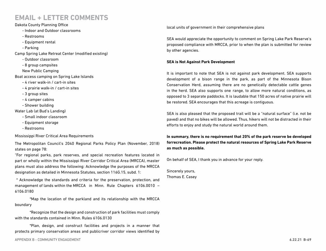
APPENDIX B - COMMUNITY ENGAGEMENT 6.22.21 B-69
Dakota County Planning Office- Indoor and Outdoor classrooms- Restrooms- Equipment rental- Parking
Camp Spring Lake Retreat Center (modified existing)- Outdoor classroom- 8 group campsitesNew Public Camping
Boat access camping on Spring Lake Islands- 4 river walk-in / cart-in sites- 4 prairie walk-in / cart-in sites- 3 group sites- 4 camper cabins- Shower building
Water Lab (at Bud’s Landing)- Small indoor classroom- Equipment storage- Restrooms
Mississippi River Critical Area Requirements
The Metropolitan Council’s 2040 Regional Parks Policy Plan (November, 2018) states on page 78: “For regional parks, park reserves, and special recreation features located in part or wholly within the Mississippi River Corridor Critical Area (MRCCA), master plans must also address the following: Acknowledge the purposes of the MRCCA designation as detailed in Minnesota Statutes, section 116G.15, subd. 1:
* Acknowledge the standards and criteria for the preservation, protection, and management of lands within the MRCCA in Minn. Rule Chapters 6106.0010 – 6106.0180
*Map the location of the parkland and its relationship with the MRCCA boundary
*Recognize that the design and construction of park facilities must comply with the standards contained in Minn. Rules 6106.0130
*Plan, design, and construct facilities and projects in a manner that protects primary conservation areas and publicriver corridor views identified by
EMAIL + LETTER COMMENTSlocal units of government in their comprehensive plans
SEA would appreciate the opportunity to comment on Spring Lake Park Reserve’s proposed compliance with MRCCA, prior to when the plan is submitted for review by other agencies.
SEA is Not Against Park Development
It is important to note that SEA is not against park development. SEA supports development of a bison range in the park, as part of the Minnesota Bison Conservation Herd, assuming there are no genetically detectable cattle genes in the herd. SEA also supports one range, to allow more natural conditions, as opposed to 3 separate paddocks. It is laudable that 150 acres of native prairie will be restored. SEA encourages that this acreage is contiguous.
SEA is also pleased that the proposed trail will be a “natural surface” (i.e. not be paved) and that no bikes will be allowed. Thus, hikers will not be distracted in their efforts to enjoy and study the natural world around them.
In summary, there is no requirement that 20% of the park reserve be developed forrecreation. Please protect the natural resources of Spring Lake Park Reserve as much as possible.
On behalf of SEA, I thank you in advance for your reply.
Sincerely yours, Thomas E. Casey
DAKOTA COUNTY SPRING LAKE PARK MASTER PLAN UPDATE APPENDIX BB-70 6.22.21
From: [redacted]Sent: Monday, May 18, 2020 2:23 PMTo: Leatham, Lil <[email protected]>Subject: Spring Lake Park Reserve
Hi,I’m [redacted], and am the Chairman of Pine Bend Cemetery Assn. My input into the Master Plan of Spring Lake Reserve would be, not to forget the Historical Marker which was setting on 52 and 117th Street, Inver Grove Heights. I have all the history of the area.Thank you,
From: Leatham, LilSent: Monday, May 18, 2020 4:33:00 PMTo: [redacted]Subject: RE: Spring Lake Park Reserve
Thank you for your interest in Spring Lake Park Reserve. I believe the marker you are referring to has been reconstructed near the Pine Bend Trailhead along the Mississippi River Greenway. I’ve attached a photo.
Kind regards,Lil Leatham, PLA, ASLASenior PlannerPhysical Development AdministrationP 952-891-7159W www.dakotacounty.usA 14955 Galaxie Avenue, Apple Valley, MN 55124
EMAIL + LETTER COMMENTS
APPENDIX B - COMMUNITY ENGAGEMENT 6.22.21 B-71
From: Dakota County WebmasterSent: Sunday, May 31, 2020 5:20 PMTo: [redacted]Subject: New Comments from the External Parks Website: Suggestion
Reason for Contact:SuggestionComment:I love all of the habitat restoration work and bike path that now goes through Spring Lake Park Reserve. Are there any plans to create additional hiking/trail running trails? I am wondering whether this might be a possibility for the area between the West Trailhead and the Schaar’s Bluff trailhead. It would be great to have low impact trails (dirt paths in woods, mowed paths through prairie) that add up to around 10 miles at the park.
From: Leatham, LilSent: Monday, June 1, 2020 9:53:00 AMTo: [redacted]Subject: RE: New Comments from the External Parks Website: Suggestion
Ms. [redacted],Thank you for your suggestion. The Dakota County Parks Department is currently working on a Master Plan and Natural Resources Management Plan for spring Lake Park Reserve. The master plan will include a long-range vision for the park and a 10-year plan to guide future decisions about park activities, capital investment and natural resource restoration. The Natural Resources Management Plan will address restoration priorities and provide near-term management recommendations forthe natural areas in the park. We are currently evaluating ideas for future improvements to the park, and yes, one of these ideas is to expand the natural surface trail network within the park. Your suggestion will be considered asthe project team develops the Draft Master Plan and Draft Natural Resources Management Plan. In addition, your suggestion, along with comments submitted from others, will be distributed to the Dakota County Board. There will be another opportunity for community review and comment on the draft Master Plan and Natural Resources Management Plan this fall. Please visit the project webpage if you would like to review the concepts. There you will find a link to an interactive website that will allow you to review and comment on the concepts. Don’t delay,
EMAIL + LETTER COMMENTS
the official comment period ended yesterday, May 31, but it is still active as of this morning. There is also a survey (this will be open through June 10). If you have any other questions about the project, suggestions for future improvements, or would like to discuss other ways to participate in the planning process, don’t hesitate to contact me.Kind regards,
Lil Leatham, PLA, ASLASenior PlannerPhysical Development AdministrationP 952-891-7159W www.dakotacounty.usA 14955 Galaxie Avenue, Apple Valley, MN 55124
DAKOTA COUNTY SPRING LAKE PARK MASTER PLAN UPDATE APPENDIX BB-72 6.22.21
Comments on Dakota County Spring Lake Park PlanWe are the Hastings Environmental Protectors (HEP), a local citizens’ group founded in 2005 whose mision is to preserve, protect and restore Hastings area natural environments. With this mission in mind, we would very much like to provide input on the Dakota County Spring Lake Park Plan. We support the following for the Park:
• a future for Spring Lake Park that continues to honor the connection of people
and the Earth, respecting the peoples who came before us, the river that
shapes the land, and the native biota that inhabits the park preserve.
• development of the park only if it is implemented in a manner that contributes
to individuals and groups having an enhanced experience in a natural
environment while preserving sensitive resources.
• introduction of bison as a way to restore and enhance the native prairie.
• increased access to the Mississippi River that allows people to enjoy the river
and all of its natural amenities in an undeveloped environment.
• a limited number of additional soft trails that should be developed to minimize
forest fragmentation and disruption of flora and fauna, managed to control
erosion, and limited to activities such as hiking, cross-country skiing and
nature study.
• creation of a nature play area that focuses on exploitative, open-ended, creative
play using natural materials rather than traditional playground equipment.
• campground development that is limited in size and number of campsites
and that prioritizes walk-in and canoe tent camping rather than recreational
vehicles.
• a limited number of additional facilities or event spaces that would be used
primarily for nature interpretation, education or recreation, and not for events
that bring large groups to the park for activities unrelated to those above.
EMAIL + LETTER COMMENTS PHASE 2 LISTENING SESSIONS WITH TRIBAL HISTORIC PRESERVATION OFFICERS
Listening sessions were held with Tribal Historic Preservation officers on August 28, 2020 and November 24, 2020.

APPENDIX B - COMMUNITY ENGAGEMENT 6.22.21 B-73
PHASE THREE COMMUNITY ENGAGEMENT
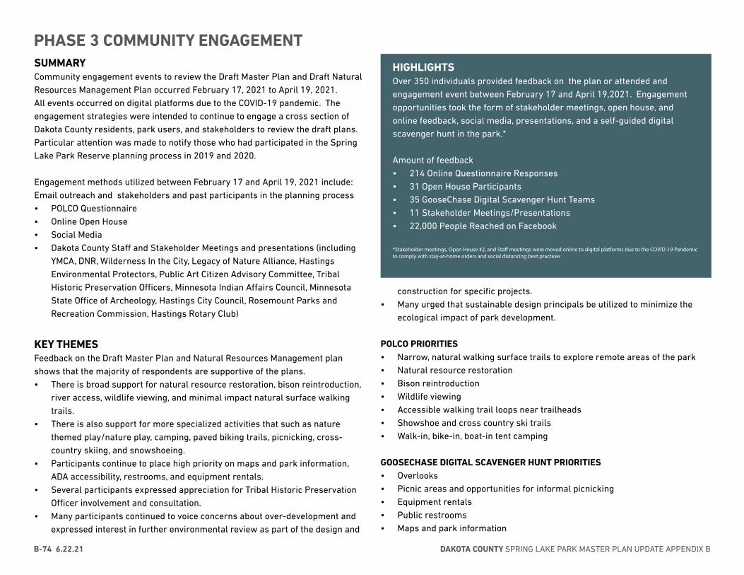
DAKOTA COUNTY SPRING LAKE PARK MASTER PLAN UPDATE APPENDIX BB-74 6.22.21
construction for specific projects. • Many urged that sustainable design principals be utilized to minimize the
ecological impact of park development.
POLCO PRIORITIES • Narrow, natural walking surface trails to explore remote areas of the park• Natural resource restoration• Bison reintroduction• Wildlife viewing• Accessible walking trail loops near trailheads• Showshoe and cross country ski trails• Walk-in, bike-in, boat-in tent camping
GOOSECHASE DIGITAL SCAVENGER HUNT PRIORITIES• Overlooks• Picnic areas and opportunities for informal picnicking• Equipment rentals• Public restrooms• Maps and park information
SUMMARYCommunity engagement events to review the Draft Master Plan and Draft Natural Resources Management Plan occurred February 17, 2021 to April 19, 2021. All events occurred on digital platforms due to the COVID-19 pandemic. The engagement strategies were intended to continue to engage a cross section of Dakota County residents, park users, and stakeholders to review the draft plans. Particular attention was made to notify those who had participated in the Spring Lake Park Reserve planning process in 2019 and 2020.
Engagement methods utilized between February 17 and April 19, 2021 include:Email outreach and stakeholders and past participants in the planning process• POLCO Questionnaire• Online Open House• Social Media• Dakota County Staff and Stakeholder Meetings and presentations (including
YMCA, DNR, Wilderness In the City, Legacy of Nature Alliance, Hastings Environmental Protectors, Public Art Citizen Advisory Committee, Tribal Historic Preservation Officers, Minnesota Indian Affairs Council, Minnesota State Office of Archeology, Hastings City Council, Rosemount Parks and Recreation Commission, Hastings Rotary Club)
KEY THEMESFeedback on the Draft Master Plan and Natural Resources Management plan shows that the majority of respondents are supportive of the plans. • There is broad support for natural resource restoration, bison reintroduction,
river access, wildlife viewing, and minimal impact natural surface walking trails.
• There is also support for more specialized activities that such as nature themed play/nature play, camping, paved biking trails, picnicking, cross-country skiing, and snowshoeing.
• Participants continue to place high priority on maps and park information, ADA accessibility, restrooms, and equipment rentals.
• Several participants expressed appreciation for Tribal Historic Preservation Officer involvement and consultation.
• Many participants continued to voice concerns about over-development and expressed interest in further environmental review as part of the design and
PHASE 3 COMMUNITY ENGAGEMENT
HIGHLIGHTSOver 350 individuals provided feedback on the plan or attended and engagement event between February 17 and April 19,2021. Engagement opportunities took the form of stakeholder meetings, open house, and online feedback, social media, presentations, and a self-guided digital scavenger hunt in the park.*
Amount of feedback• 214 Online Questionnaire Responses• 31 Open House Participants• 35 GooseChase Digital Scavenger Hunt Teams• 11 Stakeholder Meetings/Presentations• 22,000 People Reached on Facebook
*Stakeholder meetings, Open House #2, and Staff meetings were moved online to digital platforms due to the COVID-19 Pandemic to comply with stay-at-home orders and social distancing best practices
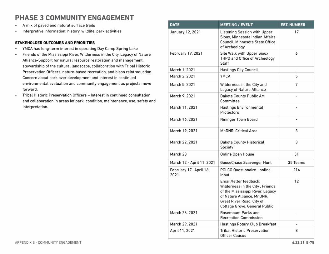
APPENDIX B - COMMUNITY ENGAGEMENT 6.22.21 B-75
DATE MEETING / EVENT EST. NUMBER
January 12, 2021 Listening Session with Upper Sioux, Minnesota Indian Affairs Council, Minnesota State Office of Archeology
17
February 19, 2021 Site Walk with Upper Sioux THPO and Office of Archeology Staff
6
March 1, 2021 Hastings City Council -
March 2, 2021 YMCA 5
March 5, 2021 Wilderness in the City and Legacy of Nature Alliance
7
March 9, 2021 Dakota County Public Art Committee
-
March 11, 2021 Hastings Environmental Protectors
-
March 16, 2021 Nininger Town Board -
March 19, 2021 MnDNR, Critical Area 3
March 22, 2021 Dakota County Historical Society
3
March 23 Online Open House 31
March 12 - April 11, 2021 GooseChase Scavenger Hunt 35 Teams
February 17 -April 16, 2021
POLCO Questionaire - online input
214
Email/letter feedback: Wilderness in the City , Friends of the Mississippi River, Legacy of Nature Alliance, MnDNR, Great River Road, City of Cottage Grove, General Public
12
March 26, 2021 Rosemount Parks and Recreation Commission
-
March 29, 2021 Hastings Rotary Club Breakfast -
April 11, 2021 Tribal Historic Preservation Officer Caucus
8
• A mix of paved and natural surface trails• Interpretive information: history, wildlife, park activities
STAKEHOLDER OUTCOMES AND PRIORITIES • YMCA has long-term interest in operating Day Camp Spring Lake• Friends of the Mississippi River, Wilderness in the City, Legacy of Nature
Alliance-Support for natural resource restoration and management, stewardship of the cultural landscape, collaboration with Tribal Historic Preservation Officers, nature-based recreation, and bison reintroduction. Concern about park over development and interest in continued environmental evaluation and community engagement as projects move forward.
• Tribal Historic Preservation Officers – Interest in continued consultation and collaboration in areas Iof park condition, maintenance, use, safety and interpretation.
PHASE 3 COMMUNITY ENGAGEMENT
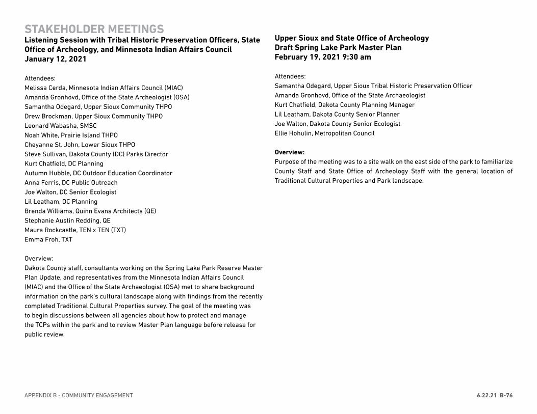
APPENDIX B - COMMUNITY ENGAGEMENT 6.22.21 B-76
STAKEHOLDER MEETINGSListening Session with Tribal Historic Preservation Officers, State Office of Archeology, and Minnesota Indian Affairs CouncilJanuary 12, 2021
Attendees:Melissa Cerda, Minnesota Indian Affairs Council (MIAC)Amanda Gronhovd, Office of the State Archeologist (OSA)Samantha Odegard, Upper Sioux Community THPODrew Brockman, Upper Sioux Community THPOLeonard Wabasha, SMSCNoah White, Prairie Island THPOCheyanne St. John, Lower Sioux THPO Steve Sullivan, Dakota County (DC) Parks DirectorKurt Chatfield, DC PlanningAutumn Hubble, DC Outdoor Education CoordinatorAnna Ferris, DC Public OutreachJoe Walton, DC Senior EcologistLil Leatham, DC PlanningBrenda Williams, Quinn Evans Architects (QE)Stephanie Austin Redding, QEMaura Rockcastle, TEN x TEN (TXT)Emma Froh, TXT
Overview:Dakota County staff, consultants working on the Spring Lake Park Reserve Master Plan Update, and representatives from the Minnesota Indian Affairs Council (MIAC) and the Office of the State Archaeologist (OSA) met to share background information on the park’s cultural landscape along with findings from the recently completed Traditional Cultural Properties survey. The goal of the meeting was to begin discussions between all agencies about how to protect and manage the TCPs within the park and to review Master Plan language before release for public review.
Upper Sioux and State Office of Archeology Draft Spring Lake Park Master Plan February 19, 2021 9:30 am
Attendees: Samantha Odegard, Upper Sioux Tribal Historic Preservation OfficerAmanda Gronhovd, Office of the State ArchaeologistKurt Chatfield, Dakota County Planning ManagerLil Leatham, Dakota County Senior Planner Joe Walton, Dakota County Senior EcologistEllie Hohulin, Metropolitan Council
Overview: Purpose of the meeting was to a site walk on the east side of the park to familiarize County Staff and State Office of Archeology Staff with the general location of Traditional Cultural Properties and Park landscape.
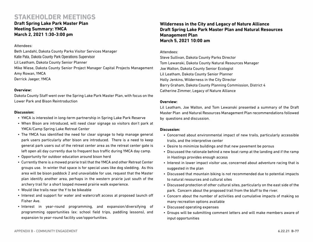
APPENDIX B - COMMUNITY ENGAGEMENT 6.22.21 B-77
STAKEHOLDER MEETINGSDraft Spring Lake Park Master Plan Meeting Summary: YMCAMarch 2, 2021 1:30-3:00 pm
Attendees: Beth Landahl, Dakota County Parks Visitor Services ManagerKatie Pata, Dakota County Park Operations Supervisor Lil Leatham, Dakota County Senior Planner Mike Wiese, Dakota County Senior Project Manager Capital Projects Management Amy Rowan, YMCADerrick Jaeger, YMCA
Overview: Dakota County Staff went over the Spring Lake Park Master Plan, with focus on the Lower Park and Bison Reintroduction
Discussion: • YMCA is interested in long-term partnership in Spring Lake Park Reserve• When Bison are introduced, will need clear signage so visitors don’t park at
YMCA/Camp Spring Lake Retreat Center• The YMCA has identified the need for clear signage to help manage general
park users particularly after bison are introduced. There is a need to keep general park users out of the retreat center area as the retreat center gate is left open all day currently due to frequent bus traffic during YMCA day camp.
• Opportunity for outdoor education around bison herd• Currently there is a mowed prairie trail that the YMCA and other Retreat Center
groups use. In winter that space is for special uses like dog sledding. As this area will be bison paddock 2 and unavailable for use, request that the Master plan identify another area, perhaps in the western prairie just south of the archery trail for a short looped mowed prairie walk experience.
• Would like trails near the Y to be bikeable• Interest and support for water and watercraft access at proposed launch off
Fisher Ave.• Interest in year-round programming, and expansion/diversifying of
programming opportunities (ex: school field trips, paddling lessons), and expansion to year-round facility use/opportunities.
Wilderness in the City and Legacy of Nature Alliance Draft Spring Lake Park Master Plan and Natural Resources Management PlanMarch 5, 2021 10:00 am
Attendees: Steve Sullivan, Dakota County Parks Director Tom Lewanski, Dakota County Natural Resources ManagerJoe Walton, Dakota County Senior EcologistLil Leatham, Dakota County Senior Planner Holly Jenkins, Wilderness in the City DirectorBarry Graham, Dakota County Planning Commission, District 4Catherine Zimmer, Legacy of Nature Alliance
Overview: Lil Leatham, Joe Walton, and Tom Lewanski presented a summary of the Draft Master Plan and Natural Resources Management Plan recommendations followed by questions and discussion.
Discussion: • Concerned about environmental impact of new trails, particularly accessible
trails, and the interpretive center• Desire to minimize buildings and that new pavement be porous• Discussed the rationale behind a new boat ramp at the landing and if the ramp
in Hastings provides enough access• Interest in lower impact visitor use, concerned about adventure racing that is
suggested in the plan• Discussed that mountain biking is not recommended due to potential impacts
to natural resources and cultural sites• Discussed protection of other cultural sites, particularly on the east side of the
park. Concern about the proposed trail from the bluff to the river.• Concern about the number of activities and cumulative impacts of making so
many recreation options available• Discussed operating expenses• Groups will be submitting comment letters and will make members aware of
input opportunities
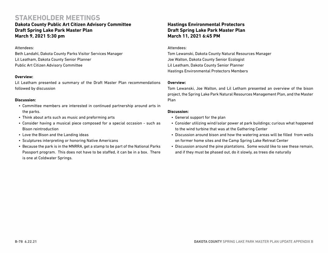
DAKOTA COUNTY SPRING LAKE PARK MASTER PLAN UPDATE APPENDIX BB-78 6.22.21
Hastings Environmental ProtectorsDraft Spring Lake Park Master Plan March 11, 2021 6:45 PM
Attendees: Tom Lewanski, Dakota County Natural Resources ManagerJoe Walton, Dakota County Senior EcologistLil Leatham, Dakota County Senior Planner Hastings Environmental Protectors Members
Overview: Tom Lewanski, Joe Walton, and Lil Letham presented an overview of the bison project, the Spring Lake Park Natural Resources Management Plan, and the Master Plan
Discussion: • General support for the plan• Consider utilizing wind/solar power at park buildings; curious what happened
to the wind turbine that was at the Gathering Center• Discussion around bison and how the watering areas will be filled from wells
on former home sites and the Camp Spring Lake Retreat Center• Discussion around the pine plantations. Some would like to see these remain,
and if they must be phased out, do it slowly, as trees die naturally
STAKEHOLDER MEETINGSDakota County Public Art Citizen Advisory CommitteeDraft Spring Lake Park Master Plan March 9, 2021 5:30 pm
Attendees: Beth Landahl, Dakota County Parks Visitor Services ManagerLil Leatham, Dakota County Senior Planner Public Art Citizen Advisory Committee
Overview: Lil Leatham presented a summary of the Draft Master Plan recommendations followed by discussion
Discussion: • Committee members are interested in continued partnership around arts in
the parks.• Think about arts such as music and preforming arts• Consider having a musical piece composed for a special occasion - such as
Bison reintroduction• Love the Bison and the Landing ideas• Sculptures interpreting or honoring Native Americans• Because the park is in the MNRRA, get a stamp to be part of the National Parks
Passport program. This does not have to be staffed, it can be in a box. There is one at Coldwater Springs.
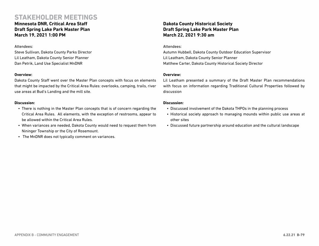
APPENDIX B - COMMUNITY ENGAGEMENT 6.22.21 B-79
Dakota County Historical Society Draft Spring Lake Park Master Plan March 22, 2021 9:30 am
Attendees: Autumn Hubbell, Dakota County Outdoor Education SupervisorLil Leatham, Dakota County Senior Planner Matthew Carter, Dakota County Historical Society Director
Overview: Lil Leatham presented a summary of the Draft Master Plan recommendations with focus on information regarding Traditional Cultural Properties followed by discussion
Discussion: • Discussed involvement of the Dakota THPOs in the planning process• Historical society approach to managing mounds within public use areas at
other sites • Discussed future partnership around education and the cultural landscape
STAKEHOLDER MEETINGSMinnesota DNR, Critical Area StaffDraft Spring Lake Park Master Plan March 19, 2021 1:00 PM
Attendees: Steve Sullivan, Dakota County Parks DirectorLil Leatham, Dakota County Senior Planner Dan Petrik, Land Use Specialist MnDNR
Overview: Dakota County Staff went over the Master Plan concepts with focus on elements that might be impacted by the Critical Area Rules: overlooks, camping, trails, river use areas at Bud’s Landing and the mill site.
Discussion: • There is nothing in the Master Plan concepts that is of concern regarding the
Critical Area Rules. All elements, with the exception of restrooms, appear to be allowed within the Critical Area Rules.
• When variances are needed, Dakota County would need to request them from Nininger Township or the City of Rosemount.
• The MnDNR does not typically comment on variances.
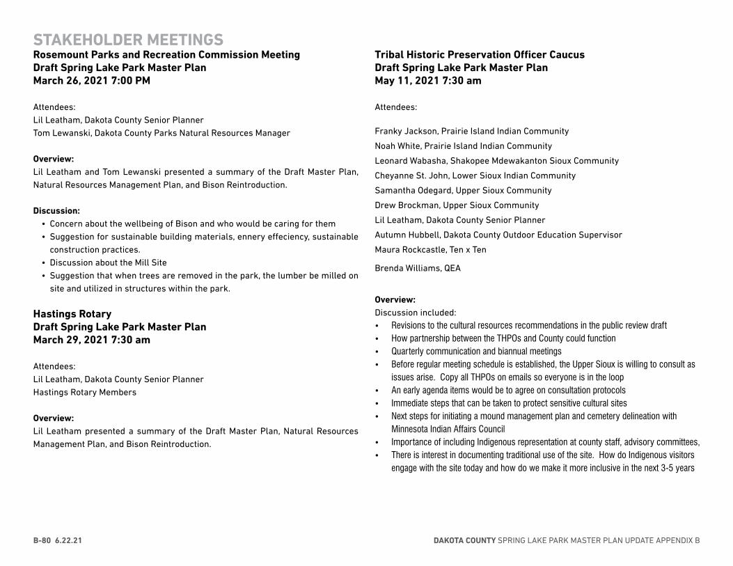
DAKOTA COUNTY SPRING LAKE PARK MASTER PLAN UPDATE APPENDIX BB-80 6.22.21
Tribal Historic Preservation Officer CaucusDraft Spring Lake Park Master Plan May 11, 2021 7:30 am
Attendees:
Franky Jackson, Prairie Island Indian Community
Noah White, Prairie Island Indian Community
Leonard Wabasha, Shakopee Mdewakanton Sioux Community
Cheyanne St. John, Lower Sioux Indian Community
Samantha Odegard, Upper Sioux Community
Drew Brockman, Upper Sioux Community
Lil Leatham, Dakota County Senior Planner
Autumn Hubbell, Dakota County Outdoor Education Supervisor
Maura Rockcastle, Ten x Ten
Brenda Williams, QEA
Overview: Discussion included:• Revisions to the cultural resources recommendations in the public review draft• How partnership between the THPOs and County could function• Quarterly communication and biannual meetings• Before regular meeting schedule is established, the Upper Sioux is willing to consult as
issues arise. Copy all THPOs on emails so everyone is in the loop• An early agenda items would be to agree on consultation protocols• Immediate steps that can be taken to protect sensitive cultural sites • Next steps for initiating a mound management plan and cemetery delineation with
Minnesota Indian Affairs Council• Importance of including Indigenous representation at county staff, advisory committees, • There is interest in documenting traditional use of the site. How do Indigenous visitors
engage with the site today and how do we make it more inclusive in the next 3-5 years
STAKEHOLDER MEETINGSRosemount Parks and Recreation Commission MeetingDraft Spring Lake Park Master Plan March 26, 2021 7:00 PM
Attendees: Lil Leatham, Dakota County Senior Planner Tom Lewanski, Dakota County Parks Natural Resources Manager
Overview: Lil Leatham and Tom Lewanski presented a summary of the Draft Master Plan, Natural Resources Management Plan, and Bison Reintroduction.
Discussion: • Concern about the wellbeing of Bison and who would be caring for them• Suggestion for sustainable building materials, ennery effeciency, sustainable
construction practices. • Discussion about the Mill Site • Suggestion that when trees are removed in the park, the lumber be milled on
site and utilized in structures within the park.
Hastings Rotary Draft Spring Lake Park Master Plan March 29, 2021 7:30 am
Attendees: Lil Leatham, Dakota County Senior PlannerHastings Rotary Members
Overview: Lil Leatham presented a summary of the Draft Master Plan, Natural Resources Management Plan, and Bison Reintroduction.
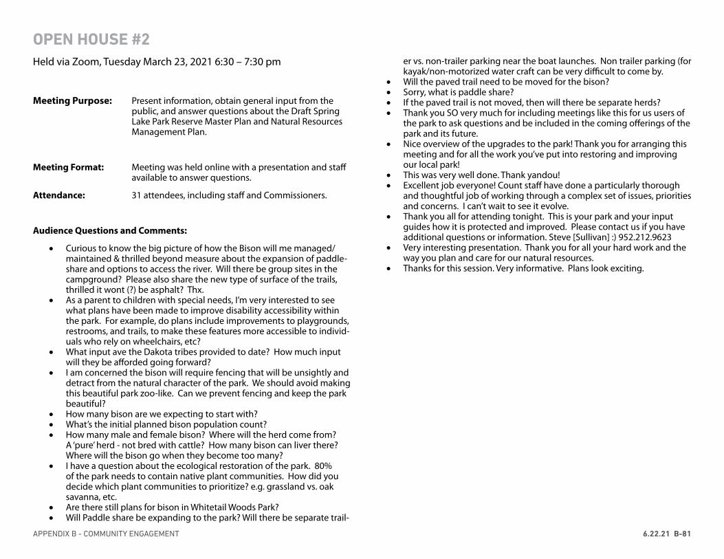
APPENDIX B - COMMUNITY ENGAGEMENT 6.22.21 B-81
OPEN HOUSE #2Held via Zoom, Tuesday March 23, 2021 6:30 – 7:30 pm
Meeting Purpose: Present information, obtain general input from the public, and answer questions about the Draft Spring Lake Park Reserve Master Plan and Natural Resources Management Plan.
Meeting Format: Meeting was held online with a presentation and staff available to answer questions.
Attendance: 31 attendees, including staff and Commissioners.
Audience Questions and Comments:
• Curious to know the big picture of how the Bison will me managed/maintained & thrilled beyond measure about the expansion of paddle-share and options to access the river. Will there be group sites in the campground? Please also share the new type of surface of the trails, thrilled it wont (?) be asphalt? Thx.
• As a parent to children with special needs, I’m very interested to see what plans have been made to improve disability accessibility within the park. For example, do plans include improvements to playgrounds, restrooms, and trails, to make these features more accessible to individ-uals who rely on wheelchairs, etc?
• What input ave the Dakota tribes provided to date? How much input will they be afforded going forward?
• I am concerned the bison will require fencing that will be unsightly and detract from the natural character of the park. We should avoid making this beautiful park zoo-like. Can we prevent fencing and keep the park beautiful?
• How many bison are we expecting to start with?• What’s the initial planned bison population count?• How many male and female bison? Where will the herd come from?
A ‘pure’ herd - not bred with cattle? How many bison can liver there? Where will the bison go when they become too many?
• I have a question about the ecological restoration of the park. 80% of the park needs to contain native plant communities. How did you decide which plant communities to prioritize? e.g. grassland vs. oak savanna, etc.
• Are there still plans for bison in Whitetail Woods Park?• Will Paddle share be expanding to the park? Will there be separate trail-
er vs. non-trailer parking near the boat launches. Non trailer parking (for kayak/non-motorized water craft can be very difficult to come by.
• Will the paved trail need to be moved for the bison?• Sorry, what is paddle share?• If the paved trail is not moved, then will there be separate herds?• Thank you SO very much for including meetings like this for us users of
the park to ask questions and be included in the coming offerings of the park and its future.
• Nice overview of the upgrades to the park! Thank you for arranging this meeting and for all the work you’ve put into restoring and improving our local park!
• This was very well done. Thank yandou!• Excellent job everyone! Count staff have done a particularly thorough
and thoughtful job of working through a complex set of issues, priorities and concerns. I can’t wait to see it evolve.
• Thank you all for attending tonight. This is your park and your input guides how it is protected and improved. Please contact us if you have additional questions or information. Steve [Sullivan] :) 952.212.9623
• Very interesting presentation. Thank you for all your hard work and the way you plan and care for our natural resources.
• Thanks for this session. Very informative. Plans look exciting.

DAKOTA COUNTY SPRING LAKE PARK MASTER PLAN UPDATE APPENDIX BB-82 6.22.21
EMAIL + LETTER COMMENTS
Beth Landahl Dakota County Parks 14955 Galaxie Ave Apple Valley MN 55124 Beth: Thank you for including us in the strategic plan for Spring Lake and your participation in ongoing discussions about our partnership. As part of the Spring Lake strategic plan process, the YMCA of the North would like to express our interest in entering into a long-term contract with Dakota County to operate Day Camp Spring Lake. We have operated Day Camp Spring Lake over the last 8 summers and it is our intent to collaborate with Dakota County to offer nature based programming for the residents of Dakota County into the future. We have existing long-term partnerships with other agencies where we offer Day Camp programming and would be happy to bring those to the table as examples of how this has worked. As we have discussed over the years, a long-term contract gives the YMCA the ability to more effectively plan and assist the county in the improvement and development of the camp in effort to reach more youth and provide a broader experience. We look forward to continued conversations on a long-term contract and assisting with the Spring Lake strategic plan. Derrick Jaeger Executive Director Hastings YMCA 651-319-8005
From: [Redacted] Sent: Friday, September 25, 2020 2:43 PM To: Planning <[email protected]> Subject: Bison
I am a Hastings resident and I am very excited about the idea of introducing bison to Spring Lake Park Reserve. I just visited Minneopa for the first time last week and loved seeing the bison (both far away and up close). A friend of mine is concerned about fences and taking away biking/hiking trails, but from what I could tell, it seems that there will still be plenty of biking/hiking trails (some parts re-routed), and fencing doesn't bother me if it keeps the bison and humans safe, and we can still see the bison.
Thanks for this great plan to enhance the prairie experience right here in Hastings!
[Redacted]
From:To:Subject:Date:Attachments:
[Redacted]Leatham, LilRe: Draft Spring Lake Park Reserve Master Plan and Natural Resources Management Plan Thursday, April 29, 2021 7:32:17 PMimage001.png
A few years back I had to sell my fishing boat and took up shore fishing .Back then we could access Bud's Landing by parking by the gate at the top of the hill and walk down to the lake. We were able to shore fish-even caught some fish. Very peaseful. Very few visitors. Now, after some clearing and making improvements to the road down, you moved the gates way up to the trail. For me, at eighty four years old, this is now a trip too far. Why can't you make the site accessible again? Will I get to go again in my lifetime?Access to the lake at the DNR Hillary Path site is a mess. We have tried other shore fishing sites around the metro with poor results.
Your plans for the future are great-you have done a super job already.
[Redacted]
APPENDIX B - COMMUNITY ENGAGEMENT 6.22.21 B-83
EMAIL + LETTER COMMENTS
From: Zoff, Carol (DOT)To: Leatham, LilSubject: RE: Draft Spring Lake Park Reserve Master Plan and Natural Resources Management PlanDate: Thursday, March 25, 2021 4:53:13 PMAttachments: image001.png
image007.pngGRR Logo.png
WARNING: External email. Please verify sender before opening attachments or clickingon links.
Good afternoon Lil, Thank you for the invitation to review and comment on the Spring Lake Park Plans. I have had the pleasureof participating in a couple of earlier visioning and convening efforts because of the park serving as intrinsicresource for the Great River Road and Mississippi River Trail. It is with great pleasure I have witnessed thethoughtful development, management and use of this land, and these plans are further evidence of a futurethat keeps improving. Thanks you to all who contributed to this. Please see my comments below and let me know if you wish to discuss or need more information. I note andappreciate mention of the Mississippi River Trail, and ask the following highlighted suggestions beconsidered to include the 10-state Great River Road scenic byway as part of the plans’ context.
Master PlanP4 and other maps including Co Rd 42: Please add Great River Road Pilot’s Wheel logo on Co Rd 42 likeshown on the state map below. Shrink to fit and/or screen (image file attached)
VISION STATEMENTSpring Lake Park Reserve showcases the ecological and cultural integrity of theland and river to provide a regional destination where visitors can experience the integralrelationship between humans and the landscape P3 The park has long served as an important intrinsic resource for the 10-state Great River Road scenicbyway travelers. It is a destination within the Mississippi National River and Recreation Area (MNRRA) due toits natural history, cultural significance, wildlife watching, and family-friendly activities. The park is alsosituated along the southern most segment of the Mississippi River State Water Trail, from Minneapolis toHastings. P61 add to chart: Abutting Park, Great River Road , Co. Rd. 42 - designated All-American Road, Initiated1938 P70: #2 – related to potential partners, the Mississippi River Parkway Commission of Minnesota is a goodally related to some of these key considerations and other strategies in the plans. National Scenic Bywayfunds from FHWA are expected to be restored in the near future, which Dakota County have been successfulapplicant of previously. While no guarantee, including references in the plans to the byway described abovewill help strengthen grant applications. Interpretation: the plan is very strong. If there is content developed that considers the entire Mississippi
River, tying to the Great River Road can help folks traveling all ten states to relate this site to the whole. Atone point the County placed two panels at the old swing bridge rest stop off Concord. 6 other panels onDakota County are near the Sibley House in Mendota too.
Natural Resource Plan: I didn’t have time to review this in detail, but do suggest adding the Pilot’s Wheel
on maps and if appropriate mention the Great River Road to help strengthen potential grant applications.“Benefitting the Great River Road traveler …” “Safeguarding and enhancing Great River Roadnatural/cultural/scenic/historic/archeological/recreational resources..” Here are the anticipated eligible project types:
The 23 USC 162(c) outlines the 8 eligible project types for NSBP grants.1. An activity related to the planning, design, or development of a State or Indian tribe scenic
byway program.2. Development and implementation of a corridor management plan to maintain the scenic,
historical, recreational, cultural, natural, and archaeological characteristics of a bywaycorridor while providing for accommodation of increased tourism and development of relatedamenities.
3. Safety improvements to a State scenic byway, Indian tribe scenic byway, National ScenicByway, All-American Road, or one of America's Byways to the extent that the improvementsare necessary to accommodate increased traffic and changes in the types of vehicles using thehighway as a result of the designation as a State scenic byway, Indian tribe scenic byway,National Scenic Byway, All-American Road, or one of America's Byways.
4. Construction along a scenic byway of a facility for pedestrians and bicyclists, rest area,turnout, highway shoulder improvement, overlook, or interpretive facility.
5. An improvement to a scenic byway that will enhance access to an area for the purpose ofrecreation, including water-related recreation.
6. Protection of scenic, historical, recreational, cultural, natural, and archaeological resources inan area adjacent to a scenic byway.
7. Development and provision of tourist information to the public, including interpretiveinformation about a scenic byway.
8. Development and implementation of a scenic byway marketing program. Congratulations on both plans and best wishes as you move forward with adoption and implementation. Sincerely, Carol
Carol Zoff, PLAPrincipal Landscape Architect, SupervisorEnvironmental Planning and Design UnitOffice of Environmental StewardshipMinnesota Department of Transportation395 John Ireland Blvd., Mail Stop 686, St. Paul, MN [email protected] (612) 449-0754
DAKOTA COUNTY SPRING LAKE PARK MASTER PLAN UPDATE APPENDIX BB-84 6.22.21
From:To:Subject:Date:
Walton, Joseph[Redacted] ; Leatham, Lil; Lewanski, TomRE: Thanks again for your presentation last night to HEP Friday, March 12, 2021 12:13:46 PM
[Redacted],
I’m glad you enjoyed the presentation last night, and that you are happier with the final draft of the Master Plan. Thanks very much for your feedback and allowing us to present to HEP. HEP is a very good group and it’s always good to run this type of plan by you all.
It’s good to know that we described the aquatic vegetation situation correctly about Spring Lake. It’s a sad situation that the turbidity is so high in this stretch of the river that it precludes submerged macrophytes from growing. 20+ miles downstream is how long it takes for it to slow down and clear out. Ugh. On a related note, a brief survey for wild rice was done last fall by one of our consultants and he found a couple spots near the islands where it was still persisting. I was very pleasantly surprised to hear that. We would like to work with the Army Corps to be able to perhaps build some islands to slow down the flow and get some areas on the leeward side of the islands that might be suitable for aquatic vegetation growth. Or perhaps to draw down the lake periodically to allow veg to express and sediments to firm up. But this is just in the beginning stages of conversation. Maybe some day.
Thanks again,Joe
From: [Redacted]Sent: Friday, March 12, 2021 11:26 AMTo: Walton, Joseph <[email protected]>; Leatham, Lil<[email protected]>; Lewanski, Tom <[email protected]> Subject: Thanks again for your presentation last night to HEP
WARNING: External email. Please verify sender before opening attachments or clicking onlinks.
Joe, Lil and Tom,Just wanted to thank you again for taking the time to present to our group. Your presentation wasvery informative and captured the essence of the plan. After reading through the plans and hearingyour presentation, I think the current plan is excellent and very well thought out, something you allshould be proud of. I had my doubts over the extent of development in the park after the originaldraft you presented to us last year, but the final version has allayed those fears.
On another note, as a retired aquatic biologist with the Minnesota DNR, I couldn’t help but notice
your reference on pg. 28 of the Natural Resources Plan to the “Aquatic vegetation surveys completed by the EPA’s Environmental Monitoring and Assessment Program, 2006-2008, documented the absence of submerged aquatic vegetation at the sites sampled in Spring(Lake?)Park”. I was supervisor of the DNR team that did the submersed aquatic vegetation surveys for EPA in Spring Lake and can personally attest to the absence of aquatic vegetation, having participated in much of that field sampling. Your description of Spring Lake and the Mississippi River in that stretch is right on. The turbidity impairment from the Minnesota River persists all the way down to the 20+ mile Lake Pepin, where much of the fine sediment settles out as the river slows down, which results in greatly improved water transparency and abundant submersed aquatic vegetation all the way downstream into northern Iowa.
[Redacted]Chair of HEP’s Habitat Workgroup
Virus-free. www.avast.com
Note: This email and its attachments may contain information protected by state or federallaw or that may not otherwise be disclosed. If you received this in error, please notify thesender immediately and delete this email and its attachments from all devices.
EMAIL + LETTER COMMENTS
This message may be from an external email source.Do not select links or open attachments unless verified. Report all suspicious emails to Minnesota IT Services SecurityOperations Center.
From: Henzen, Rachel (DNR)To: Leatham, LilSubject: RE: Draft Spring Lake Park Reserve Master Plan and Natural Resources Management PlanDate: Thursday, March 18, 2021 9:09:02 AMAttachments: image007.png
image008.pngimage009.pngimage010.pngimage011.png
WARNING: External email. Please verify sender before opening attachments or clickingon links.
Lil,I skimmed through the Draft Master Plan and I agreed with the statements regards the current DNRboat landing and the potential future boat landing. I also appreciated the opportunity for islandcamping in the river. Looks like some exciting opportunities moving forward. Thanks, Rachel HenzenArea Supervisor | Division of Parks and Trails
Minnesota Department of Natural Resources1200 Warner RoadSt Paul, MN 55106651-259-5875Email: [email protected]
From: Leatham, Lil <[email protected]> Sent: Monday, March 15, 2021 4:13 PMTo: Leatham, Lil <[email protected]>Subject: Draft Spring Lake Park Reserve Master Plan and Natural Resources Management Plan
APPENDIX B - COMMUNITY ENGAGEMENT 6.22.21 B-85
From:To:Subject:Date:Attachments:
Leatham, Lil[Redacted]RE: Master Plan for Spring Lake Park Reserve Friday, March 26, 2021 12:08:00 PM image001.png
[Redacted],Thank you for taking the time to review the Spring Lake Park Natural Resources Management Plan. Your comments and suggestions will be considered along with other public input in revisions to the Draft Plan. We anticipate bringing the revised plan to the County Board this spring.Kind regards,
Lil Leatham, PLA, ASLASenior Planner
Physical Development AdministrationP 952-891-7159W www.dakotacounty.usA 14955 Galaxie Avenue, Apple Valley, MN 55124
From: [Redacted] Sent: Friday, March 26, 2021 11:21 AMTo: Leatham, Lil <[email protected]> Subject: Master Plan for Spring Lake Park Reserve
The Natural Resource Management Plan has false statements included regarding the Mississippi River Greenway Master Plan. I was extensively involved with the public review, comments and process of the initial project for the Greenway trails constructed throughout Spring Lake Park Reserve. I had my horse boarded at a property that was taken by eminent domain for the construction of these new trails and the destruction of fragile river bluffs, endangered dry bluff prairies, 200 foot wide swaths of mature forest.
The Mississippi River Greenway was established to avoid high quality habitat
and to minimize the impact on the land. Based on the due diligence, the multi-purpose trail is consistent with an approved master plan and an informed County Board-selected alignment, accommodates park access to people of all abilities, and serves diverse and year-round recreation opportunities.The above statement is on page 67 of the updated master plan and should be removed as it is false. Please have the truth written into the public records as this was not done in past projects.
Many times the County did not have public comments or open houses for public review, especially when updates were snuck in. If there were comments from the public and the DNR, they were ignored as the public comments overwhelmingly disagreed with the millions of dollars spent, the eminent domain, and the alignment of these trails which could have been much less invasive on the land. Bike trails in Minnesota, when the weather only allows a few months out the year for this type of recreation is a huge waste of public tax and any funding or amendments. The cost for the projects far exceeded what could have been constructed along already existing roads versus going through delicate conservation and established wildlife habitat.
I have been out in this area several times at different times of the year since these trails were completed, and the public use is very light and at times non existent. I felt this would be the case and have proved it to be true.
Choosing to construct an additional massive transportation project in a sensitive ecological setting once again will prove to be negligent on the part of our Dakota County Commissioners and Park staff.
A concerned and disappointed citizen of Dakota County - [Redacted]
EMAIL + LETTER COMMENTS
DAKOTA COUNTY SPRING LAKE PARK MASTER PLAN UPDATE APPENDIX BB-86 6.22.21
From:To:Subject:Date:Attachments:
Leatham, Lil[Redacted]RE: Draft Spring Lake Park Reserve Master Plan and Natural Resources Management Plan Wednesday, March 24, 2021 9:51:58 AMimage001.png
[Redacted],Thank you for the comments. I do think the tent sites, which are intended to be walk-in/bike-in/boat-in would be reservable. I’m afraid that I’m responsible for the non-covid signs. I am trying to increase awareness that we have a planning project going on. The planning related signage will come down after April 4!
Lil
From:[Redacted]Sent: Thursday, March 18, 2021 2:00 PMTo: Leatham, Lil <[email protected]>Subject: Re: Draft Spring Lake Park Reserve Master Plan and Natural Resources Management Plan
Thanks for including me on the plan comment stream Lil. Such a wonderful project with a plan for generations, folding geographic, cultural, historic and utilitarian awareness as a base for future use decisions.
I do think the Reserve is the future spillover site for what will be the overpacked Lebanon Hills park. As such, I'm surprised no plans included the "reservable" camping, tents and tin housing spots. I'm not advocating, just observing.
I have a current use complaint, which you can send to the right channels if you like. In the last year, temporary signage has proliferated in Spring Lake Reserve, to the point where it is so distracting that it diminishes the beauty and serenity to be found. It's like what Lady Bird Johnson's trashy signage law would have been meant to ban on our highway system, albeit in the park. Ok, some will say the Covid brought them out, or bison plan advocation, but why not just placed at the entrances to walking,biking, sking pathways instead of all over the place?
Ah, the user's comments and issues. Thanks for your work for the County.
[Redacted]
In a message dated 3/17/2021 4:37:32 PM Central Standard Time, [email protected]:
From:To:Subject:Date:Attachments:
[Redacted]Leatham, LilRE: Feedback on Spring Lake feedback Wednesday, March 24, 2021 3:49:52 PM image001.png
Well, I just did exactly what I did this morning (through an e-mail link to the website) and now it’s working fine. Thanks for getting back to me. We live in Rosemount so Lebanon Hills is really our “backdoor” park, but we love Spring Lake too and I think having bison there would be very exciting. We feel we’re really fortunate to live in Dakota County.
[Redacted]
From: Leatham, Lil <[email protected]> Sent: Wednesday, March 24, 2021 3:28 PMTo: [Redacted]Subject: RE: Feedback on Spring Lake feedback
[Redacted],Thanks for letting me know – can you tell me where you accessed the incorrect links – they seem to be correct on the website. Did you link directly from an email or social media? If so, would you mind telling me where so I can correct it.
Thank you,
Lil Leatham, PLA, ASLASenior Planner
Physical Development AdministrationP 952-891-7159W www.dakotacounty.usA 14955 Galaxie Avenue, Apple Valley, MN 55124
EMAIL + LETTER COMMENTS
From: Atkins, JoeTo: Leatham, LilSubject: FW: Spring LakeDate: Monday, April 5, 2021 10:05:27 AM
Good morning, Lil. I am forwarding some constituent feedback regarding SLP, in case he did notsubmit it through the webpage.Joe
From: [Redacted]Sent: Monday, April 5, 2021 9:12 AMTo: Atkins, Joe <[email protected]> Subject: Spring Lake
WARNING: External email. Please verify sender before opening attachments or clicking onlinks.
Good Morning,
This is a comment on the Spring Lake Park Master Plan.
1. A strong emphasis on restoring the park and weed control including buckthorn is important. Thatis in the plan.2. One Launch area is enough. Protect the rest of the riverfront in a natural state - restore.3. Avoid all development ideas that look like the mess created by the massive mess that is the trailwest of Schaars bluff. This development method results in destructive, ugly, and a lightly used wasteof taxpayer money.4. Hilary Path should be a part of the River Access plan.5. Keep in mind that the pandemic has shown how important and popular the natural areas are andtrails are and over developed and lightly used investments are not.
Note: This email and its attachments may contain information protected by state or federallaw or that may not otherwise be disclosed. If you received this in error, please notify thesender immediately and delete this email and its attachments from all devices.
APPENDIX B - COMMUNITY ENGAGEMENT 6.22.21 B-87
EMAIL + LETTER COMMENTS
From: Zac DockterTo: Leatham, LilSubject: RE: Draft Spring Lake Park Reserve Master Plan and Natural Resources Management PlanDate: Friday, March 26, 2021 12:33:52 PMAttachments: image001.png
WARNING: External email. Please verify sender before opening attachments or clickingon links.
Hi Lil,Great master plan and very exciting for Dakota County and all the surrounding communities! A fewthoughts on my end:
1. Love the buffalo prairie. Unique feature that will bring people to understand the prairieecosystem that was in place prior to European settlement. Blue Mound State Park is a primeexample of prairie-ranging buffalo drawing people from far and wide.
2. Love that you are including some camping. I believe we have a shortage of campingopportunities in the southeast metro so this is encouraging. I have been working withWashington County to also include hike-in camp sites at Cottage Grove Ravine Regional Parkso this would be a nice complement to bring more opportunities to the growing number ofcampers in our world.
3. Always glad to see a focus on expanding playground areas. It is my belief that these playstructures pull young parents and children to parks that they may not otherwise visit. Andonce they are in the park, they are more likely to discover the open spaces, trails andinterpretive areas. The playgrounds can really build our base of parks and trails advocates!
4. All the interpretive opportunities are awesome. Good work!5. We have been working on a water trail in Cottage Grove for quite some time. We launched
our paddle share program last year and even with COVID had nearly 1,000 rentals! Peoplewant to get on the water. It would be good at some point to combine efforts to create alarger system of water trails over this entire floodplain area.
Great job and very impressive outreach efforts. I look forward to seeing the final plan develop! Zac DockterParks & Recreation DirectorCity of Cottage Grove8635 W Pt Douglas Rd SouthCottage Grove, MN [email protected]
PO Box 211453, Eagan, MN 55121 651-271-1257 www.wildernessinthecity.org [email protected]
DATE: April 4, 2021 TO: Ms. Lil Leatham, Senior Planner, Dakota County Parks
Mr. Joseph Walton, Senior Ecologist, Dakota County Parks CC: Dakota County Board of Commissioners RE: Comments for Spring Lake Park Reserve Natural Resources Management Plan and Master Plan Dear Ms. Leatham and Mr. Walton, Thank you for the opportunity to comment on the Spring Lake Park Reserve Natural Resources Management Plan and Master Plan.
We appreciate your recognition that the innate natural qualities of Spring Lake Park Reserve provide a strong foundation for public enjoyment and enrichment. These same qualities also provide a unique opportunity to protect a natural environment for its intrinsic values— biodiversity, preservation of our natural heritage, open space, scenery, and respite from the built environment.
Following our comprehensive review of both the NRMP and the Master Plan, we are concerned that these valuable natural qualities could be exceedingly compromised in pursuit of certain development concepts described in the Master Plan. To help ensure that these intrinsic values are preserved and enhanced for future generations of people and wildlife, we offer the following comments and suggestions.
We support the Natural Resources Management Plan, and generally support the Master Plan with recommendations that follow.
The NRMP guides the way to restoring the diversity of habitat types and native plant species which will provide wildlife with critical food, shelter, and space they need to thrive in the park. This is of utmost importance especially considering the parks location in the Mississippi Flyway -- an international migration corridor which provides critical habitat for untold numbers of migrating birds. We recognize the Master Plan is written with a goal to minimize impacts to SLPR natural areas, however there is no guidance or measurement as to what that means, and that is an inherent concern.
To ensure the Master Plan is implemented in a manner that does not further diminish the parks ecological potential, and to best achieve the publics expectations for this park, we urge ongoing community engagement as it is implemented in years ahead.
Several concepts for proposed development areas were identified and described in the Master Plan. For each concept it is noted that “park improvements will occur with further study, tribal consultation, and monitoring”. We are grateful for the relationship with the tribal communities, and strongly encourage ongoing engagement with other stakeholders as well throughout the planning stages as concepts are considered for implementation.
DAKOTA COUNTY SPRING LAKE PARK MASTER PLAN UPDATE APPENDIX BB-88 6.22.21
PO Box 211453, Eagan, MN 55121 651-271-1257 www.wildernessinthecity.org [email protected]
Meaningful community engagement as this plan is implemented cannot be overstated enough -- this is an ongoing gap in the overall development of regional parks, and that needs to change.
Lacking meaningful engagement, we witnessed the extensive damage done to SLPR from construction of the Mississippi River Greenway, which was unlike anything envisioned by the community and we cannot make that mistake again. Related to that construction project, page 67 of the NRMP inaccurately states the Mississippi River Greenway “was established to avoid high quality habitat and to minimize the impact on the land. Based on due diligence, the multi-purpose trail is consistent with an approved master plan…” We request this section be deleted or revised to accurately reflect the extensive construction that caused irreversible damage to the ecology of this park, which was not consistent with the approved master plan.
Master Plan development concepts of particular concern are noted below.
Schaar’s Bluff River Access and Use Area
This concept proposes a connection between Schaar’s bluff and the river. This area is defined by steep terrain with some of the most erodible soil in the park. As such, we strong discourage this concept due to the irreversible damage it would cause to the bluffs. Additionally, we are concerned that opening up this area to unrestricted public access threatens the preservation of sensitive traditional cultural properties and unique plant communities. Visitation to these sensitive areas should be monitored through programming rather than made available to anyone at any time.
This river area is further conceptualized for recreation use following relocation of the existing DNR launch. Instead, we strongly advocate for restoration of this area following relocation of the DNR launch. The goal to increase access to the river will be accommodated with development of the additional planned river use area in the lower part of the park. Two river use areas, as currently proposed, will ultimately diminish the very resources we should be conserving and will further stretch already limited funding for operations and maintenance of the park.
Mississippi River and Bison Interpretive Center
We do not support construction of new buildings, roadways, and parking lots adjacent to the bison range. This concept would diminish core habitat and visitors experience in a Natural setting. The proposed indoor exhibition space could instead be incorporated into the buildings at Schaar’s Bluff.
Reintroduction of Bison
We support the reintroduction of Bison as a means to naturally heal and restore the landscape and appreciate the time and effort that has already gone into this approach. The humane treatment and care for this keystone species is of great importance and in that regard, concerns have been expressed as to what will happen as the herd outgrows the space. To address those concerns it will be important to provide an ongoing and transparent dialogue with the public as the Bison are managed in years ahead.
PO Box 211453, Eagan, MN 55121 651-271-1257 www.wildernessinthecity.org [email protected]
Lower Park River Landing Use Area
The proposed expansion of “Bud’s Landing” and additional river use amenities should incorporate porous surfaces rather than increasing asphalt surfaces and follow best practices for LEED certification. In addition, night lighting in this area and throughout the park should be eliminated or minimized in accordance with Audubon Society guidelines.
Nature-based Recreation
A broad scope of recreation trends is described in the Master Plan; however, it fails to emphasize Nature-based recreation opportunities which reflect visitor’s expectations for this park. Examples should include passive recreation including birding and wildlife viewing, nature photography, meditation, and natural resource education opportunities. Events such as races or music conflict with visitors experience in Nature and also have negative impacts on wildlife and therefore should not be pursued in this setting. While this park is for everyone, it is not for every form of recreation.
Preserving the integrity of SLPR’s natural features and cultural assets will help ensure the vision intended by the stakeholders and public is realized. We recognize that community engagement was extensive while developing the NRMP and Master Plan and we appreciated the opportunities to participate in that process. However, most people agree implementation of the master plan is where the details come into play, and therefore community engagement must continue as this plan is implemented in years ahead. It will take more time, but in the end, working together will assure the park meets its full potential.
Thank you for your consideration.
Sincerely,
Holly Jenkins, Director Wilderness in the City
EMAIL + LETTER COMMENTS
APPENDIX B - COMMUNITY ENGAGEMENT 6.22.21 B-89
EMAIL + LETTER COMMENTS
1
April 3, 2021
TO: Lil Leatham, Master Plan Project Manager Joe Walton, Natural Resources Management Plan Project Manager Via email: [email protected], [email protected]
RE: Comments to the Spring Lake Park Reserve Natural Resources Management Plan and Master Plan
Dear Ms. Leatham and Mr. Walton,
The Legacy of Nature Alliance (LONA) brings together organizations and individuals with a uniting mission, “to ensure ecosystems are restored and preserved within the metropolitan regional parks system and throughout the entire region to provide high-quality habitat for wildlife, and year-round Nature-based opportunities to inspire the next generation of environmental stewards.” LONA is comprised of 25 organizations from across the metro region with thousands of others on mailing and contact lists. Thank you for the opportunity to comment on the draft Spring Lake Park Reserve (SLPR) Natural Resources Management Plan and the Master Plan. Natural Resources Management Plan Spring Lake Park Reserve contains some of the highest quality remaining natural space in Dakota County, and is an important segment of the critical Mississippi River Flyway. As such, we support and strongly urge your approval of the Natural Resources Management Plan to guide future management of this valuable park reserve and important habitat. We greatly appreciate the completed and proposed restoration of the degraded ecotypes such as Oak Savanna and Prairie in SLPR. In addition, as identified in both the Natural Resource Plan and the Master Plan, the cultural significance of SLPR offers additional guidance. We are grateful for the partnership between the county and tribal communities. As we look to the future, we urge these two important elements – Nature and Cultural Heritage – be at the forefront when decisions are made.
2
SLPR Master Plan The Master Plan seeks to integrate human use into this Nature-based park. The cultural landscape overview, history of the site, and natural resource inventory are well documented, informative, and educational. To help ensure the development concepts proposed in the Master Plan accommodate human use without further diminishing the natural environment, we offer the following comments and recommendations: We support the reintroduction of a keystone Prairie species, Bison. Bison will help establish a diverse, resilient, and sustainable Prairie ecosystem and enhance park visitor experience. The reintroduction will provide opportunities to view and learn about Bison, the Prairie ecosystem and the strong historical relationship that Bison has with Indigenous culture. We do request that the Bison reintroduction be performed with both ecological and humane sensibilities. Bison density, for example, the number of Bison in the area should not exceed the carrying capacity of the habitat provided and density should be managed as humanely as possible. With appropriate density, the Bison may not need treatment with pesticides such as ivermectin or prophylaxis with antibiotics. Most pharmaceuticals are not bound and retained in the body, but rather excreted through urine and feces. Ivermectin for example, will likely pass through into the dung which can then affect Dung Beetles or, the ivermectin can be taken up by plants impacting foraging birds, insects and mammals. Antibiotics pass through in urine disturbing microbiotic communities. We do not support construction of a new building, parking lot and restrooms in the Bison area. Instead, we recommend incorporating the concepts for the “Mississippi River and Bison Interpretive Center” within the Schaar’s Bluff area near the main park entrance. This will provide interactive displays in a popular area of the park and also preserve core habitat in the center of the park. Recreation trends –The master plan describes a broad array of recreation activities, however it neglects to emphasize this park reserve’s focus for Nature-based recreation. As such, many of the emerging activities described, such as adventure racing, would be inappropriate due to (1) negative impacts on the ecology of the park and (2) conflicts with those visiting the park for its Nature-based offerings. To minimize future conflicts, we recommend removing this language and instead strengthen the emphasis on low-impact, Nature-based recreation. We also suggest reconsideration of whether an amphitheater is appropriate for a Nature-based park reserve. If the “amphitheater” is intended to provide a rustic gathering area for Nature talks, that would be appropriate. However, if the amphitheater is intended as a music venue, that is inappropriate primarily due to noise and construction impacts. Noisy human activities such as music and even volleyball are disruptive to the quiet many people (and animals) desire and need. We do not support constructing a trail connection between upper Bluff and River use areas. The bluffs area and their geology are important component of the park; they are also fragile. Trail construction impacts due to the steep topography will be considerable. These areas often contain rare features such as dry Bluff Prairies which have already been severely compromised by construction of the MRG. As the draft SLPR Natural Resource plan states, “The steeper areas [of the park] were mostly spared from overgrazing and cropping, therefore today these areas are in the best condition, ecologically.” These areas were identified as having high
DAKOTA COUNTY SPRING LAKE PARK MASTER PLAN UPDATE APPENDIX BB-90 6.22.21
3
biodiversity by the Minnesota Biological Survey. The bluffs should be preserved and not further degraded. To further protect this valuable natural environment, we urge the following as standard practice:
Eliminate night lighting; this is a critical flyway for migratory birds and as noted in the draft Natural Resource plan, the park is important habitat to mammals some of which are nocturnal,
Do not use salt and other chemicals for snow and ice removal, Construct any new or hard surface trails with porous materials. Require any new buildings meet LEED certification standards and maintain a small footprint.
Human uses over the course of decades have damaged this natural area and now, park space. We have an opportunity to allow this landscape to heal which is a benefit to birds, pollinators, wildlife and people. When concepts in the Master Plan conflict with goals of the Natural Resource Management Plan, we urge decisions prioritize the natural environment which is Spring Lake Park Reserve’s greatest asset. Implementation of the plan through a natural resource lens will provide the greatest benefit to park users today and, for future generations. Thank you for your thoughtful consideration of these comments. Sincerely, The Legacy of Nature Alliance Audubon Chapter of Minneapolis Bloomington Natural Resources Stewardship Initiative Bush Lake Chapter of the Izaak Walton League Cedar-Isles-Dean Neighborhood Association Environmental Friends of Veterans Memorial Park Friends of Cullen Nature Preserve & Bird Sanctuary Friends of Lake Hiawatha Friends of Roberts Bird Sanctuary Kids for Saving Earth Lakeville Friends of the Environment Lower Phalen Creek Project Minnesota Citizens for the Protection of Migratory Birds Minnesota Herpetological Society Nature South St. Paul Pollinator Friendly Alliance Sierra Club, Forest & Wildlife Stewards Urban Bird Collective Wilderness in the City Women Observing Wildlife-MN CC: Steve Sullivan, Dakota County Parks Director, via email, [email protected]
Dakota County board of Commissioners, via email, [email protected]
EMAIL + LETTER COMMENTS
1
March 15, 2021
Dear Ms. Leatham: Thank you for the opportunity to comment on the draft Spring Lake Park Reserve master plan and natural resources management plan (NRMP). Friends of the Mississippi River (FMR) is a non-profit organization with a mission to engage community members and other stakeholders to protect, restore and enhance the Mississippi River and its watershed in the Twin Cities Region. We represent thousands of people in the metropolitan area who care deeply about the river, including a growing membership of over 2,700 people and more than 3,200 volunteers and 2,000 advocates engaged each year. Uniquely valuable park Spring Lake Park is a particularly special riverfront site. Among the things that make it unique:
• It is the only Dakota County park located along the Mississippi River. • It has a variety of native plant communities, most of which were classified by the DNR as
high biodiversity significance. • It has unique plant species found at few, if any, other sites in Dakota County. • It is connected to hundreds of acres of largely undeveloped land, creating a rare corridor
of natural land along the Mississippi River that is important pathway for wildlife movement. At the same time, the park represents a crucial refuge from surrounding agricultural and industrial land uses.
• The river is a migration corridor of global significance for hundreds of migratory bird species. Sites along the river such as Spring Lake Park are vital resting and nesting sites for migratory birds.
Because of these features and the fact that this is designated as a park reserve, FMR supports prioritizing the protection of the native plant communities and their inhabitants, and keeping this park as wild as possible.
APPENDIX B - COMMUNITY ENGAGEMENT 6.22.21 B-91
EMAIL + LETTER COMMENTS
4
2
Positive master plan elements We appreciate several elements of the draft master plan, including:
• Engagement with tribal communities and a commitment to improved interpretation and better protection of Traditional Cultural Properties
• The addition of bison to the park • Expansion of river access and river-oriented activities and programs • Addition of equipment rental, which broadens access to recreation • Expansion of winter recreation trails and facilities • Attention to accessibility needs for visitors with differing abilities and needs • Limiting large outdoor event spaces to the farm area, where the land is already degraded • Redesign of the Upper Park picnic shelters and playground • Planned protection and management of park-adjacent lands
Our recommendations for changes and improvements are discussed below and summarized at the end of the letter. Level of development poses environmental concerns We are concerned that the master plan promotes new development across too many areas of the park. The master plan and NRMP seem to hold two things in tension: the desire to offer as many recreational opportunities as possible, and the recognition that this park reserve is a fragile and important natural area. The ultimate development concepts fail to appear different from other metro-area parks in their scale and intensity. A park reserve should function differently from other regional parks. This draft plan does not accomplish that. While the plan notes that the park will be increasing from 12 to 15 percent developed, that doesn’t fully address where development goes. The linear nature of the park makes it both especially important to wildlife as a migratory corridor, and especially vulnerable to disturbance because there is not that much area that can be set away from human activity. With development proposed across the entire linear park, few areas are left fully naturalized. New trails and facilities across the park further fragment wildlife habitat and travel corridors. Every new trail serves to cut off and isolate wildlife populations, especially for very small animal species that won’t cross trails. The same is true for some plant species. The draft NRMP itself acknowledges that a recent trail expansion in the park “came at a cost to the site’s natural resources, by disturbing and bisecting habitat, opening up forests, and placing barriers for animal movement. The trail also can act as a conduit for invasive species.” Yet confusingly, the draft master plan also proposes adding more trails despite these well-documented harms. A recent study by the Swiss Ornithological Institute shows that fewer birds and fewer bird species are present along trails, even when the trails have been there for decades. This park is part of an
3
Important Bird Area designated by Audubon Society; the needs of birds and other wildlife should be prioritized. This will require some areas of the park to remain undisturbed refuges. All expansions of trails or facilities should undergo an environmental assessment before any final decisions are made, and the county should remain genuinely open to changing its plans if significant environmental impacts are identified. We also suggest avoiding new turfgrass lawn areas, but instead demonstrating to the public how to have pollinator-friendly plants and lawns, including in gathering and recreational spaces as much as possible. Trail network Trails, even those designed and built to high standards, can have significant ecological impacts. In addition to habitat fragmentation discussed above, increased trails also create more “edge areas” that are less amenable to plants and animals and create corridors that facilitate the spread of invasive species. (This issue is noted in the plan as an existing challenge in the middle area of the park.) Given the harm that trails can pose to wildlife, we evaluate proposed trails through the lens of, “Does this increase access to important areas of the park? Does that increased access outweigh the potential negative impacts of a new trail?” We hope to see Dakota County apply the same criteria. It is unclear from the plan how many new trails are proposed in fragile bluff areas. We agree with the plan’s statement that “ravines, steep slopes, and bluffs pose severe constraints on development and are best left undisturbed.” FMR is always concerned about the expansion of bluff trails and encourages that they be built only when necessary—for instance, for access down to the river in limited locations. (The Mississippi River Greenway is an example of a trail that had a significant negative impact on the bluff; this type of construction should not be repeated.) For reasons stated previously (i.e. wildlife impacts, increased invasive species), we also do not support the proposed addition of any new trails along the forested areas flanking the river. The plan to add overlooks also needs further review: where will these overlooks be placed and how will they be constructed? Will tree removal be necessary, and if so, is that merited? Any new trails should be soft-surface except where broader accessibility is required. Paved walkways and parking areas should be porous, particularly given the risks that stormwater runoff poses to bluffs. While we support the expansion of winter uses on existing trails, we are confused by the separation between the two classic ski loops in the Upper Park. These trails would be much more functional if they were connected. Excellent signage is also needed wherever different groomed trail uses
DAKOTA COUNTY SPRING LAKE PARK MASTER PLAN UPDATE APPENDIX BB-92 6.22.21
EMAIL + LETTER COMMENTS
4
intersect to prevent walking/snowshoeing damage to ski trails that quickly render the trails unusable and deter skiers from purchasing ski passes. Buildings and structures Given Spring Lake Park’s uniquely pristine natural state, we feel that additional development should be kept to a minimum to retain the wild feel of the park. New buildings should be scaled back and located in areas that are already disturbed. The addition of bison to the park (which FMR has supported) will draw significantly increased visitor traffic and offer new opportunities for education and programming. We are concerned about the impacts of adding so much other new development on top of what will already be added to support bison-focused visitorship. We recommend eliminating proposed new campgrounds in forested corridors next to the river. Should campsites remain in the plan, they should be reduced in number and concentrated in one area away from the bluffs. Campsites in the forest along the river will bring an increase in weed species, litter, and tree and plant damage. Campers will tend to wander throughout the bluff area, gathering firewood (even if not allowed), turning over rocks and woody debris, trampling vegetation and causing other disturbances to wildlife and habitat. The NRMP notes that the existing trails and campground are a source of invasive species spread and habitat disturbance: “The largest patch of garlic mustard in the park has established in the area of the campground." The island campsites are less concerning, given that floodplain areas are more adapted to ongoing disturbances. However, litter, human waste, and invasive species spread are still risks that should be thoroughly addressed in future planning. We also recommend eliminating the group bunkhouses at the retreat center, in the interest of having less development at the park. We also suggest reconsideration of the tree canopy walk; without more detail in the plan, it is hard to assess the impact of this. Many of the other visitor features, such as the trail rest areas, appear overbuilt in the examples shown. We encourage reducing new structures to only what is truly necessary for visitor comfort and accessibility, and emphasizing low rooflines, natural building materials and colors, etc. Park visitors come to see and experience nature, not to be boxed by with walls and roofs. Natural Resources Management Plan recommendations The NRMP should give greater emphasis to wildlife population declines. For example, page 56 mentions that "grassland birds have been in decline." This is true, but an understatement. Some
5
populations have declined over 50% in the last 50 years. The crisis needs to be stated more strongly as it emphasizes the need for grassland restoration (of which the county has been doing an excellent job). Likewise for pollinators (page 58) with some populations, like the rusty patched bumble bee, declining almost 90% in the last 20 years. These are indicators of deeply concerning wildlife declines and demonstrate the urgent need to protect and expand habitat. We also suggest a greater emphasis on research as part of the restoration process. Since the park has large areas to restore, it would be very valuable to compare different restoration methods and strategies in different areas, helping to inform the science for other practitioners. Summary of recommendations We recommend the following in the master plan:
• Maintain significant portions of the park as undeveloped, contiguous habitat. • Conduct an environmental assessment of all proposed new trails or facilities. • Reduce or eliminate proposed trail expansions, particularly on bluffs and in forest corridors
along the river. • Reduce new structures to only what is truly necessary for visitor comfort and accessibility;
emphasize low-impact design. • Carefully assess the proposed new river overlooks and tree canopy walk for environmental
and scenic impacts; eliminate these features if the impacts might be significant. • Eliminate the proposed new campgrounds in forested corridors next to the river. Should
campsites remain in the plan, they should be reduced in number and concentrated in one area away from the bluffs.
• Eliminate the proposed group bunkhouses at the retreat center. • Connect the proposed classic ski trails (on existing trails) to each other.
In the NRMP:
• Strengthen the level of urgency regarding wildlife population declines and the need for habitat protection and restoration.
• Place a greater emphasis on research as part of the land restoration process. • Avoid new turfgrass lawn areas and impermeable paved surfaces.
Again, thank you for the opportunity to comment on these plans. FMR values its relationship with Dakota County Parks and we look forward to continuing as your partner in protecting and enhancing the Mississippi River and its surroundings. We hope to see a revised master plan that recognizes Spring Lake Park Reserve’s important role as the county’s only park reserve and manages it a way that preserves that distinction.
APPENDIX B - COMMUNITY ENGAGEMENT 6.22.21 B-93
EMAIL + LETTER COMMENTS
6
If you’d like to discuss anything, please don’t hesitate to contact Colleen O’Connor Toberman at 651-222-2193 x29 or [email protected]. For the river,
Colleen O’Connor Toberman Karen Schik River Corridor Director Senior Ecologist
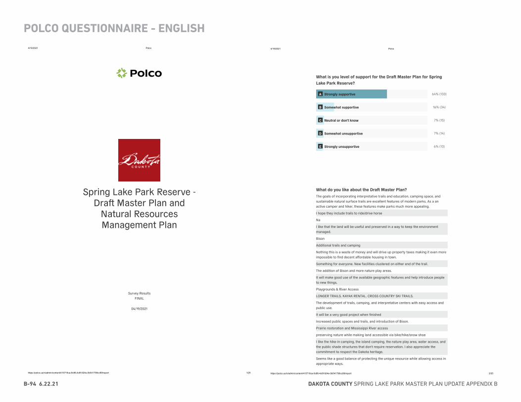
DAKOTA COUNTY SPRING LAKE PARK MASTER PLAN UPDATE APPENDIX BB-94 6.22.21
POLCO QUESTIONNAIRE - ENGLISH4/19/2021 Polco
https://polco.us/n/admin/content/415716ca-9c86-4c6f-924e-0b541799cc99/report 1/25
Spring Lake Park Reserve -Dra� Master Plan and
Natural ResourcesManagement Plan
Survey ResultsFINAL
04/19/2021
4/19/2021 Polco
https://polco.us/n/admin/content/415716ca-9c86-4c6f-924e-0b541799cc99/report 2/25
What is you level of support for the Dra Master Plan for SpringLake Park Reserve?
64% (133)
16% (34)
7% (15)
7% (14)
6% (13)
What do you like about the Dra Master Plan?The goals of incorporating interpretative trails and education, camping space, andsustainable natural surface trails are excellent features of modern parks. As a anactive camper and hiker, these features make parks much more appealing.
I hope they include trails to ride/drive horse
Na
I like that the land will be useful and preserved in a way to keep the environmentmanaged.
Bison
Additional trails and camping
Nothing this is a waste of money and will drive up property taxes making it even moreimpossible to find decent affordable housing in town.
Something for everyone. New facilities clustered on either end of the trail.
The addition of Bison and more nature play areas.
It will make good use of the available geographic features and help introduce peopleto new things.
Playgrounds & River Access
LONGER TRAILS. KAYAK RENTAL. CROSS COUNTRY SKI TRAILS.
The development of trails, camping, and interpretative centers with easy access andpublic use.
It will be a very good project when finished
Increased public spaces and trails, and introduction of Bison.
Prairie restoration and Mississippi River access
preserving nature while making land accessible via bike/hike/snow shoe
I like the hike-in camping, the island camping, the nature play area, water access, andthe public shade structures that don't require reservation. I also appreciate thecommitment to respect the Dakota heritage.
Seems like a good balance of protecting the unique resource while allowing access inappropriate ways.
A Strongly supportive
B Somewhat supportive
C Neutral or don't know
D Somewhat unsupportive
E Strongly unsupportive
APPENDIX B - COMMUNITY ENGAGEMENT 6.22.21 B-95
POLCO QUESTIONNAIRE - ENGLISH
4/19/2021 Polco
https://polco.us/n/admin/content/415716ca-9c86-4c6f-924e-0b541799cc99/report 3/25
Focus on restoration of natural areas
It will make the park more useful, it should have been done ages ago. A specially whenthe saw mill was there.
I like the addition of natural surface narrow hiking trails while still keeping the naturalcharacter of Spring Lake Park Reserve.
I think it is great to see an effort being made to return the park to its natural state,before colonization.
bison
Bison
River access
The re-introduction of the Bison
Reintroducing the Bison to the Park.
That white people will get to hunt them when there’s too many
It is very comprehensive. I love the idea to re-introduce bison to Spring Lake Park
Love the idea of Bison.
I like that bison are being considered - makes sense as a natural benefit for the landand ecosystem as well as a draw for the public. The addition of trails and new parkinfrastructure sounds great as well! I'd love to go snowshoeing on trails at SLP.
Help with nature preservation.
Additional trail mileage, development for river access, a staffed trailhead building.
Any improvements to the park to make it a better natural place is good.
Bison and access to the Mississippi!
Bison reintroduced
The bison
Canoe launch and canoe rentals
Love it.
Not very much
Bison, additional trails and river access
I very much like the restoration of animal life, like the buffalo.
The possible re-introduction of Bison
Good for a new boat launch, the other boat launch is horrible, why isn't the roadmaintained? Kids will like the nature center. Camping is good, want rv parking too. Likethe paved trail, connect to the west paved trail.
Enhancing the natural beauty and providing increased access to amenities.
I like the proposals for unpaved trails and natural areas.
Bringing in Bison to help with the vegetation, walk-in camping, trails, rentals withoffice, more restrooms.
There is not much to like about this plan. It’s very poor.
Bison reintroduction
It is an ambition plan that is context sensitive and serves many users of the park.
Bison reintroduction
All seasons and age groups with many activities and plans, including buffaloes
Improvements will draw more people to enjoy
Nothing.
Emphasis on restoration and it seems to have taken indigenous cultural history intoconsideration
I love the addition of camping (especially the possibility of island sites!), moreoverlooks on the west end of the park, and the mindful integration of natural
4/19/2021 Polco
https://polco.us/n/admin/content/415716ca-9c86-4c6f-924e-0b541799cc99/report 4/25
preservation and recreation.
The proposed so� surface trails, access to the river with trails alongside it to viewwildlife and watercra� rental
I love the integration for nature restoration and having people interact with it.
Buffalo, island camping, river access
Money issues are too great now!
Return to natural state; return of the bison in coming years
Unaware it exists
I like that it takes into account how people affect the land and ways to help minimizethat with letting people experience the area
continued improvements
Return of Bison, expanded trails, riverfront access, additional new camp sights
I do not live in Dakota county
I like the hike-in camping, the island camping, the nature play area, water access, andthe public shade structures that don't require reservation. I also appreciate thecommitment to respect the Dakota heritage.
Meets a diverse audience's needs
So many options for recreation, great contemporary vision, preservation of greenspace, open and accessible
Maintenance aspects
Thorough and supported by ample public input
A well thought-out idea that includes the communities input.
Bison
I like the return of Bison, and enhancing access & restoring a more natural state, alongwith the educational aspects proposed.
Nothing
2 items, Mississippi River access and additional trails.
Equipment rental, natural play are, river access, bike path, camping
I love the idea of bringing back the Bison... Certainly would get the park hugeincreases in attendance.
The focus on preserving the natural beauty while making the park accessible andusable.
Hike in campsites, bison prairie
The addition of more hiking trails and water access
Put money towards something else
I think it shows a lot of vision. I love the fact that it has features that kids will be ableto use and enjoy. Fishing dock, outdoor classroom, BISONS!
mult-use
More opportunities for all ages to use the park. Very good use of the park.
Emphasis on hiking and passive ways to experience this significant natural space
so� surface trails and restoration of native plant communities
Bison, dedicated ecological areas, protecting key species
reintroduction of bison
The strong focus on ecological restoration of native plant communities, the way theplan honors indigenous peoples and perspectives, the recognition of the adverseimpacts of the paved bike and walking trail that bisects the park, and the focus onnatural resource management and protection.
Reintroducing bison
DAKOTA COUNTY SPRING LAKE PARK MASTER PLAN UPDATE APPENDIX BB-96 6.22.21
POLCO QUESTIONNAIRE - ENGLISH4/19/2021 Polco
https://polco.us/n/admin/content/415716ca-9c86-4c6f-924e-0b541799cc99/report 5/25
I find the river land access and island camping really interesting.
more trails, natural surface trails, bike-in sites, winter use
Nature play areas, camping, expanded accessibility to trails.
Bison reintroduction
Introducing Bison, increased wintertime usage of trails, attention to maintenance offragile ecosystem. Thank you for engaging with Tribal interests, attending toaccessibility needs.
River access
Bringing bison back, river access for kayaks and canoes, camping, hiking trails
BISON! also the fishing and boat access. Love the vision for expanded camping.
I love the Mississippi River access for residents! I also love reintroducing wildlife likebison.
I strongly support the restoration aspect of this plan, as well as the additional trailsand overlooks. While I support expanding the educational value of the park, I primarilylike the idea of the Prairie Lab. I also think a nature play area is a good idea.
Reintroduction of buffalo
Bison, and paddle access to river
Engagement of tribal communities and planned protection of park adjacent land.
Dislike plans for more development stop
Keeping trails maintained and adding moe trails.
Engagement with tribal communities, addition of bison, expansion of river access andriver-oriented activities/programs, limiting large outdoor event spaces to the farmarea, planned protection and management of lands adjacent to the park
More activities and traila
Engagement with tribal communities
Emphasis on collaboration with indigenous people; return of bison; educationalopportunities
Well thought out in terms of balancing resource development and habitatrestoration/protection, sensitivity to cultural impacts and plans to highlight areas ofhistorical/cultural significance, good analysis of needs and proposals forinterpretation.
Everything about it.
Reintroduction of bison
focusing on the Native roots of the park, having areas that are tactical
Consultation with tribal communities and Reintroduction of Bison
I LOVE the reintroduction of bison, the consultation and partnership with Dakotapeoples, and the interpretive emphasis on connections between people and land! Andcreating more opportunities for people to learn about the park with the outdoorclassroom and equipment rentals. This is wonderful.
The variety of experiences, the importance of Dakota input, the respect for the space.
The integration of cultural history, resource management and access.
Love the reintroduction of Bison! Also I agree with expanding recreational and playopportunities for the park.
Looks like it a great place to be able to bring my kids someday.
This plan allows us to use natural resources without abusing them.
More finished park plan
Tribal mention and eventual involvement.
Inclusive of Native American history, camp sites, pathways for biking walking skiing(4season use), Bison! Prairie restoration and interpretive kiosks.
4/19/2021 Polco
https://polco.us/n/admin/content/415716ca-9c86-4c6f-924e-0b541799cc99/report 6/25
The access to water and interpretive sites
I don't utilize the park
It’s comprehensive and inclusive.
attention to Dakota Heritage and Geologic history
That it seeks the public's input.
The water access site and introduction of bison are cool concepts.
The reintroduction of the Buffalo, increased connection/access to the Mississippi Rivervia increased boat launches, rentals(hopefully a continuation of PaddleShare w alonger water route option from the Metro to Spring Lake), increased funding for prairierestorations, expanded camping, education center for school field trips.
I like the thought of outdoor classrooms, a fishing dock, interpretive centers
I like both the naturalist approach and the educational tenor to the plan.
Sensitivity to Traditional Cultural Sites, seeking input from the Dakota People, andintroduction of Bison to the park.
The camping opportunities.
The level of inclusion for park users spans age ranges and cultural backgrounds.
Reintroducing bison is definitely interesting.
Very comprehensive log term plan including various activities for all ages
Adding interactive elements, connections to the River, long-range sustainability, addingbison
Improving 4 season accessibility. Celebrating the rich heritage and history of the area.Improve the trails for hiking and skiing.
Access to the river. Hike-in/bike-in campsites.
the continued improvement of the park system
Opening the Gathering Center to the public, access to the river, nature-based playareas, Bison!, camping, boat rentals, and close collaboration with the Dakota people.
That we have a park.
Emphasis on preserving natural areas and heritage
bison
It includes not just environmental issues, but also social and human interactions.
Access to the River/lake
Balanced approach to both land and user needs
Additional parking for Buds Landing launch
I am a huge fan of any plan that would bring Buffalo back.
Bison
I really like the idea of the warming house for winter sports use, we cross country skifrequently and that would be an excellent addition. The prairie lab is a wonderful idea,as well.
I like the inclusion of a small boat launch (to put my canoe in!), the island camping, theoutdoor classroom & viewing platform, and the focus on keeping the park natural.
The commitment to restore the natural prairie lands
That there is a plan to improve exitisting facilities
Camping, more accessibility, & bison!
Preservation and variety of opportunities for many interests.
I like the renovation of the boat launches and bike trails
Natural and sustainable elements of the improvements proposed
Bison returning and additional camping.
broad spectrum of consideration
APPENDIX B - COMMUNITY ENGAGEMENT 6.22.21 B-97
POLCO QUESTIONNAIRE - ENGLISH
4/19/2021 Polco
https://polco.us/n/admin/content/415716ca-9c86-4c6f-924e-0b541799cc99/report 7/25
Has a playground.
I'm glad Dakota County sees the potential to continue to enhance that park. It is abeautiful site. I like the planned access to the river and kayak rental, as well.
Most of it
The great balance between usability and sustainability
Attention paid to all aspects of the proposed park - restoration of the prairie -protection of natural resources
Carry in access to Spring Lake WMA, bison returning, connecting park, interpretivetrails
restoration work, bison
More Trails, more natural space management, making Spring Lake Park more of adestination
I like that you are looking to include the Dakota people in the planning and looking tokeep it a natural place for people to appreciate with its past and future.
Returning it to its original state.
I don’t live in Dakota County
I love the park and I love the area. I am most excited about the addition of bison to thearea.
The bison!
Wide ranging improvements focused on access and diversity
Utilizing an area that is very versatile and broad in its potential.
That in honors and restores indigenous culture and natural habitat and ecosystems.
Possibility of having Buffalo roaming in the future
Are there any changes to Dra Master Plan that you would like tosee made?I am concerned by not finding any information about funding in the plan. All of therepeats of "when funding becomes available" sounds to me like an excuse to start theproject, not have funding, and then raise taxes because "oops, we couldn't finish." Iwould prefer a completed plan that can tell residents what to expect up front.
Ride/Drive horses. Overnight electric camping.
Y ees
No
Not crazy about the bison.
Only do what maintenance HAS TO BE done. This is a waste of money and will drive upproperty taxes making it even more impossible to find decent affordable housing intown.
Please work towards connecting this trail to Pine Bend Bluff!
For child friendly winter activities like a sledding or tubing location
More clarity on the river access. How do you get to it?
WILL THERE BE MORE PAVED BIKING TRAILS.
Yes. I’m very concerned about the addition of Bison to a very small area that is soclose to high public use.
no
4/19/2021 Polco
https://polco.us/n/admin/content/415716ca-9c86-4c6f-924e-0b541799cc99/report 8/25
No
No
I would like the plan to include something about no dogs being allowed on areas thatare being restored. Dogs have the capacity to destroy natural areas and it isdevastating. I would also like to see a few areas that are designated as dog free forhumans that would like to hike and relax without having to worry about stepping indog feces, bags filled with feces, or being bit by a dog. Although ordinances indicatethat people need to pick up a�er their dog and keep them on a leash, a lot of peopledon’t follow the ordinances. Unfortunately, this puts humans and nature in danger.
Don't mess with the landing and lake!! We don't want to lose hunting area!!!
Some RV camp spots made
The Dra� Master Plan options currently show too much development. The plan shouldemphasize opportunity to enjoy natural landscape without contruction that takes awayfrom natural beauty. Keeping bison should not be part of the plan because fencing willdiminish the wide-open feel of the park, and also require more contruction for therecreational trail. Also the Master Plan should include trail connection for theMississippi River Regional Trail.
n/a
less winding/looping pathways--disturbs nature. Human presence on serpentinepathways will disturb all kinds of wildlife.
Add mountain bike trails
No.
No
No, I think the planners have done a tremendous job.
To add revenue, create an area for professional pictures can be taken, like weddings.
Staffing these new areas needs to be addressed. If these changed are made there willbe an increase for onsite presence and that is not addressed. If there will be hikein/paddle in camping do those customers check in, where can they purchase firewood,if renting equipment what hours will the building be operated and staffed, willincreased customers due to rentals degrade sensitive trail areas further.
No
Seems like a lot of spending on new buildings that may not get much use and need tobe maintained. Focus more on natural amenities and access.
No.
Spend less money
More ambitious, more bison range, less human range. I don't know enough aboutbison, but I have to assume they'd like some water access.
More river overlook positions.
Bison take up a lot of space, seems like a waste of government money to be puttinginto livestock. People will be crowding to see them and the roads back there arepretty crappy.
I do not like the idea of having bisons at the park. Please consider having the prairiearea for flowers, insects, and birds. Promote bird watching and insect educationinstead.
More handicapped accessible trails and restrooms.
Yes. Leave the park alone. This plan is mostly destruction to wildlife areas. Remove theriver access as the water is not safe. Do not subject bison to this tiny area where it’smore like a small zoo than their natural habitat.
More natural trails
I see no plan to expand the cross country ski trails.
DAKOTA COUNTY SPRING LAKE PARK MASTER PLAN UPDATE APPENDIX BB-98 6.22.21
POLCO QUESTIONNAIRE - ENGLISH4/19/2021 Polco
https://polco.us/n/admin/content/415716ca-9c86-4c6f-924e-0b541799cc99/report 9/25
It would be great to somehow see the bison without having to peer through a 7 foottall chain link fence in high quality view shed areas. Perhaps similar to what you mightsee in an immersive zoo experience. Or perhaps a viewing platform with optics ofsome kind.
Not substatially--increased bike access is always nice, but might need moreconnections outside of the park area.
No
Yes. Delete it.
Is it sufficient for a natural preserve? I'd like more explanation of how the naturalresources management plan will effectively mitigate the environmental impact ofhuman activities. Is park recreation even compatible with a natural preserve?
I would like to see the possibility of an observation tower accelerated. It was good tosee it included but I think this is probably one of the better spots in Dakota County foran elevated viewpoint and it would be an awesome addition.
Tree top camping
Postpone
no
Unknown
no
No campground
More cross country ski trails
add restrooms along the main trail
no
No
I'd prefer more natural designs, wood, stone, for the various buildings and shelters.The stark modern angular shapes don't fit the landscape.
No
Bison reintroduction?
None
No, looks great.
no
Leave the area alone. The bike path has caused water drainage problems already andthe future disruption of the area will do the same. Introducing bison is insane. You willneed containment fencing and sooner or later some will get out.
How are the areas with bison and trail going to be managed? How much room aregiven to the bison? What happens when the herd is too big? Or they become moreaggressive during mating? Is seems like a small area and it’s made even smaller withtrails going through it - an invitation for people to get hurt when they exercise poorjudgement around the bison.
Nope.
No
n/a
No
Stop
I would like to see more emphasis on ski and snowshoe rental in the winter.
no
Eliminate visitor amenities (event space) that would give the park reserve thecharacter of a wedding venue and minimize its importance as a significant wildlifecorridor and cultural resource. Reconsider overlooks that might impact the integrity of
4/19/2021 Polco
https://polco.us/n/admin/content/415716ca-9c86-4c6f-924e-0b541799cc99/report 10/25
the bluff. Minimize developed structures and intrusions of new trails that furtherfragment the habitat.
limit impacts to sensitive areas, reduce development and camping and fragmentationof native ecosystems (leave some areas without trails, camping, development).Camping will likely lead to more trampling of sensitive plants and invasive speciesspread.
No
no
More emphasis on mitigating adverse impact of proposed infrastructuredevelopments. In addition, the Natural Resource Management Executive Summaryneeds to provide greater recognition of and emphasis on the importance of the parkas habitat for birds, especially during spring and fall migration, but also during thebreeding season and in winter. Specifically, Spring Lake Park Reserve is part of theMississippi River Twin Cities Important Bird Area as designated by the NationalAudubon Society and the MN DNR. This fact should be highlighted in both executivesummaries, as it will help enhance opportunities to obtain ecological restorationgrants in the future. More information about this IBA and the IBA program can beobtained from MN Audubon or from Ms. Kristin Hall with MN DNR, Division ofEcological and Water Resources (Kristen used to work for MN Audubon).
No
I'm disappointed that mountain biking is not included in the dra� master plan.
bike specific single track trails and winter use of these trails (fat bike)
no.
Increase amount of bison to be reintroduced and time table for the reintroduction aswell as adding multiple viewing platforms around where the herd will be.
Keep significant portions of the park undeveloped to better protect this pristine area.Reduce the development by minimizing the building structures and disruption aroundthe bluff area in particular. The expanded campsites will be detrimental to this reserve.We love this park; please keep it WILD!
Larger area for Bison to roam
Yes. Remove the parking lots,, camp sites, unnecessary expansions, and bison fromthe plan. Leave this park alone.
No
Opportunity for at least two fishing piers.
No
I don't fully support the expansion of camping, specifically the group bunkhouses. Thisis the only part of the plan that I disagree with.
Right now, I like the park due to that it doesn't seem so crowded, i wonder with allthese improvements, will it be over-run?
I think there might be too much development. It's supposed to be a preserve not arecreational park.
No campground
No bison, terrible waste of money and in our pandemic world people need more spaceto recreate rather than be fenced out of portions of the park.
Keep significant portions undeveloped (keeping in mind this is a RESERVE), reducetrail expansions, while conducting environmental assessments on all proposed newtrails and facilities. Reduce new structures to those absolutely necessary, employinglow-impact design. Eliminate proposed campgrounds in forested areas near the river,and reduce the number of campsites if retained in the plan, placing them in non-bluffareas. Eliminate the proposed bunkhouses. Connect ski trails. .
That there is one...and the integration of wildlife
Mountain bike trails
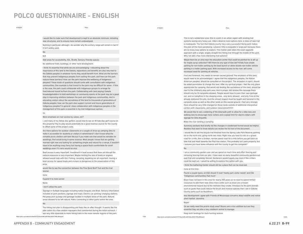
APPENDIX B - COMMUNITY ENGAGEMENT 6.22.21 B-99
POLCO QUESTIONNAIRE - ENGLISH
4/19/2021 Polco
https://polco.us/n/admin/content/415716ca-9c86-4c6f-924e-0b541799cc99/report 11/25
I would like to make sure that development is kept to an absolute minimum, includingnew structures, and to ensure more remain undeveloped.
Nothing in particular although I do wonder why the archery range will remain in tact ifit isn't widely used.
No
N/A
Add areas for accessibility, ASL, Braille, Sensory friendly spaces
No additional trails, buildings, or other hard development.
I think it's essential that while we are acknowledging + educating about theimportance of this land to the Dakota, reparations and benefits are also returned tothe Dakota peoples in whatever forms they would benefit from. What are the barriersthat may prevent Indigenous peoples from visiting this park, and how can the parkreduce these barriers? How can the park improve the wellbeing of Indigenouspeoples? These kinds of questions should come with consultation with Indigenouscommunities. One example is that transit to the park may be difficult for some-- if thisis the case, the park could collaborate with Indigenous groups to arrange forfree/reduced transit to/from the park. Collaborating with (and paying) Dakotaknowledgeholders to hold workshops or community events at the park may be a goodstep in improving relations between the park and Indigenous communities. And ineducating visitors about the sacredness of this land to thousands of generations ofDakota peoples, how can the park also support current and future generations ofIndigenous peoples? In general: close collaboration with Indigenous peoples in themanagement of this park is essential in my (not Indigenous) opinion.
no
More emphasis on river access by canoe, etc?
I, and many of my fellow disc golfers, would love to see an 18 hole disc golf course onthis property! Pay-to-play would potentially be a good revenue source for the countyto offset some of the project costs.
Are there options for outdoor classrooms or a couple of drive-up camping sites tomake it accessible for students or visitors in wheelchairs? I don't know what therentable picnic shelters will look like but if you make one that would be rentable forweddings, that would bring in some revenue. Most people I know that are gettingmarried right now are looking for something simple and natural for a venue. It wouldn'thave to be anything crazy fancy but having a space that's comfortable for smallweddings even if it rains would be nice.
Boat access is very important. Investment in boat access that does not disrupt thenatural resources is very important. Maybe limiting the size of boats or enginesallowed would help with this. Fishing, canoeing, kayaking are all important. Having aboat access for speed boats and cruisers is dangerous to the preservation of thisarea.
would like to see the connection between the Pine Bend Bluff Trail and this trailsooner.
none
Expand it to more acres!
None
I don't utilize the park
Signage in multiple languages including native tongues, and Brail. Sensory informationincluded at park pavilions, signage and maps. Electric car parking/ charging stations.Pet poop pick up bags and garbage located in multiple areas of the park. Naturalareas allowed to be le� natural. Paths connecting to other parks within the area.
No
The hiking trail plan is disappointing and feels like an a�er-thought. It seems like theplan caters to a few random naysayers that commented during the initial outreach. Isee very little downside to more hiking trails in the more remote regions of the park.
4/19/2021 Polco
https://polco.us/n/admin/content/415716ca-9c86-4c6f-924e-0b541799cc99/report 12/25
This is not a wilderness area, this is a park in an urban region with existing trailsystems seeing very heavy use. Hikers deserve more options here, 6 miles of new trailis inadequate. The fact that Dakota county has a very successful hiking park makesthis plan all the more perplexing. Lebanon Hills is enjoyable in large part because thereare so many loop options to explore. This master plan takes the exact oppositeapproach with a single, largely straight-line hiking trail through the middle of the park.Why not add a few more interesting trail options?
Would there be an area near the education center that could be planted for & set upfor maple syrup collection? Will there be any type of bee lab? Kindly have ampleparking for non-trailer parking by the boat launch or allow double non-trailer vehicleparking in a trailer parking spot. With increased access to the river, will comeincreased need for parking all vehicles.
First and foremost, this needs to remain sacred ground! The ancestors of this land,would need to be acknowledged. I agree that the indigenous peoples, the NativeAmerican peoples, should be consulted on this project. The ancestors in spirit, shouldbe asked permission to change this land. A�er my spiritual prayer, I feel the only placeappropriate for camping, that would not destroy the sacredness of this land, should benext to the children's play park area. And in prayer, did receive the message thereshould only be 10 campsites allowed. People would have to pack their own garbageout, and no campfires in the sleeping areas , only tents allowed , and only Fires at thealready stationed fire pits. And the utmost respect must be taught and honored in thecampsite areas as well as the other lands on this sacred ground. I feel very stronglythere should be very little changed on these lands outside of additional interpretivecenters with classrooms, and outdoor classrooms!!!!!!!!!!
We would like to see a widening of the bike/walk path to allow for a bike lane andwalking lane to encourage more visitors and a speed limit for electric bikers withsignage for bike etiquette.
Make the river landing a certainty.
Summary sections that briefly list the changes in condensed format would be helpful.Readers that want to know details can review the full text of the document.
I would like to see the bicycle trail finished from the Spring Lake Park Reserve parkinglot on the north end, going north two miles. Right now you have to ride on a gravelroad for a mile, then a broken, narrow paved road for a mile before you get back onbike trail and head towards the Pilot Gas station. This probably isn't park property, butI assume you have some influence with the county to get this complete?
No
I am a community garden user and we spend so much time and effort fencing andremoving fencing from our plot. I have seen so many beautiful community gardens outeast that are completely fenced. Gardeners would happily pay more if the critterscould be kept out. I would be willing to explore this option with you.
I think the Gathering Center should still be a place that can be reserved.
none at this time
Found a couple typos, on ES2 should it read "meets park visitor needs" and ES4"Indigenous communities that must."
Bison have not been in this area for nearly 200 years so no need to spend limitedresources to add them now. Once more cattle such as bison are a knownenvironmental hazard due to the methane they create. Introduce to the park animalssuch as goats that could reduce the brush and invasive species that I see in DakotaCounty parks such as Buckthorn.
less development- agree with Friends of Mississippi concerns about wildlife and nativeplant habitat- shoreline
Nope!
Do we really need the prairie study area? Bisons are a nice addition but are theyessential they are also a very stubborn animal to manage.
Keep both landings for duck hunting season.
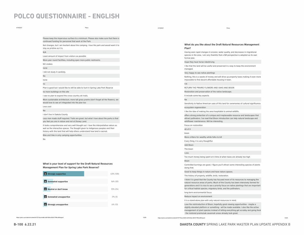
DAKOTA COUNTY SPRING LAKE PARK MASTER PLAN UPDATE APPENDIX BB-100 6.22.21
POLCO QUESTIONNAIRE - ENGLISH4/19/2021 Polco
https://polco.us/n/admin/content/415716ca-9c86-4c6f-924e-0b541799cc99/report 13/25
Please keep the impervious surface to a minimum. Please also make sure that there iscontinued funding for personnel that work at the Park.
Not changes, but I am hesitant about the camping. I love the park and would want it tostay as pristine as it is.
N/A
Least amount of impact from visitors as possible
More year round facilities, including open more public restrooms
NO snakes
none
I did not study it carefully.
No
none
no
Plan is good but I would like to still be able to hunt in Spring Lake Park Reserve
no more buildings on this site
I see no plan to expand the cross country ski trails.
More sustainable architecture, more tall grass prairie (don't forget all the flowers), wewould love to see art integrated into the plan too
Less cost
No
I don’t live in Dakota County
Less man made stuff required. Trails are great, but what I love about the parks is thatyou feel you are in nature and not at Disney Land.
It looks comprehensive and very well thought out. I love the interpretative nature aswell as the interactive spaces. The thought given to indigenous peoples and theirhistory with this land that will help others understand how land is sacred.
Bike and hike in only camping opportunities
No
What is your level of support for the Dra Natural ResourcesManagement Plan for Spring Lake Park Reserve?
63% (128)
16% (32)
12% (24)
2% (5)
6% (13)
A Strongly supportive
B Somewhat supportive
C Neutral or don't know
D Somewhat unsupportive
E Strongly unsupportive
4/19/2021 Polco
https://polco.us/n/admin/content/415716ca-9c86-4c6f-924e-0b541799cc99/report 14/25
What do you like about the Dra Natural Resources ManagementPlan?Having seen rapid changes in erosion, water quality, and decreases in migrationalspecies in the area, I am very thankful that a NR perspective is adopted as its ownformal plan.
Hope they have horse ride/driving
I like that the land will be useful and preserved in a way to keep the environmentmanaged.
Very happy to see native plantings
Nothing, this is a waste of money and will drive up property taxes making it even moreimpossible to find decent affordable housing in town.
n/a
RETURN THE PRAIRIE FLOWERS AND OAKS AND BISON
Restoration and preservation of the native landscape.
It include some key aspects
Na
Sensitivity to Native American uses of this land for ceremonies of cultural significance.
ecosystem regeneration
I like the idea of making the area hospitable to animal wildlife.
offers strong protection of a unique and irreplaceable resource and landscapes thatattract pollinators. I've read that Bison introduction can help natural landscape andwildflower maintenance. Will be interesting.
Focus on restoration
All of it
bison
More critters for wealthy white folks to kill
Every thing, it is very thoughtful.
Add Bison
The bison
Love.
Too much money being spent at A time at when taxes are already too high
Bison
Controlled burnings are good, I figure you'll attract some interesting species of plantsdoing that.
Good to keep things in nature and have nature spaces.
The history of property, wildlife, birds, restoration.
I think it is great that the County has focused more of its resources to managing thenatural resource areas of parks. Much of the County has been intensively farmed forgenerations and it is nice to see a priority focus on native plantings that are importantfor critical habitat species, migratory birds, and the pollinators.
long-term environmental focus
Reduce impact on environment
It is a stand-alone plan with only natural resources in mind.
Love the reintroduction of Bison, hopefully good viewing opportunities - maybe aslightly elevated platform or something - will be made available. I also like the activemanagement of plant species instead of letting everything get scrubby and going feral- the restored prairie/oak savannah areas already look great.
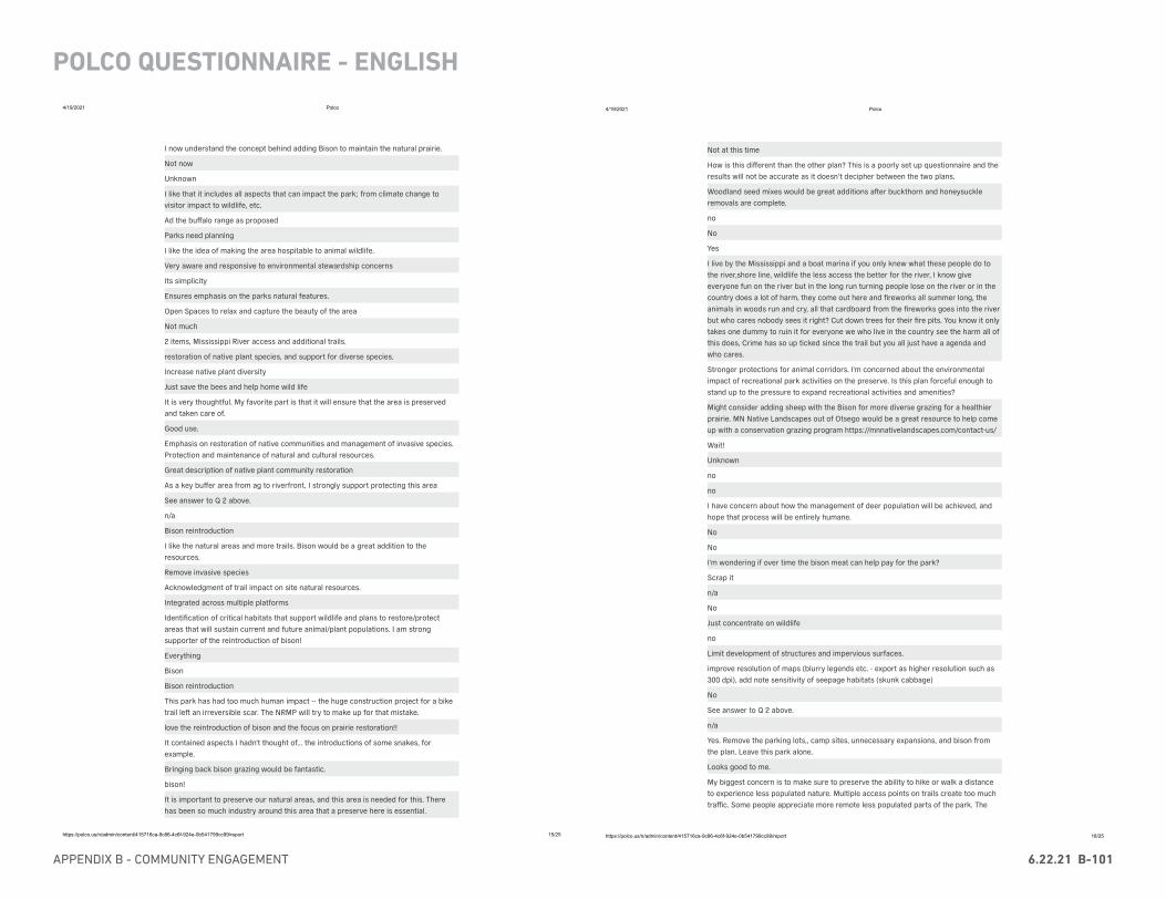
APPENDIX B - COMMUNITY ENGAGEMENT 6.22.21 B-101
POLCO QUESTIONNAIRE - ENGLISH
4/19/2021 Polco
https://polco.us/n/admin/content/415716ca-9c86-4c6f-924e-0b541799cc99/report 15/25
I now understand the concept behind adding Bison to maintain the natural prairie.
Not now
Unknown
I like that it includes all aspects that can impact the park; from climate change tovisitor impact to wildlife, etc.
Ad the buffalo range as proposed
Parks need planning
I like the idea of making the area hospitable to animal wildlife.
Very aware and responsive to environmental stewardship concerns
Its simplicity
Ensures emphasis on the parks natural features.
Open Spaces to relax and capture the beauty of the area
Not much
2 items, Mississippi River access and additional trails.
restoration of native plant species, and support for diverse species.
Increase native plant diversity
Just save the bees and help home wild life
It is very thoughtful. My favorite part is that it will ensure that the area is preservedand taken care of.
Good use.
Emphasis on restoration of native communities and management of invasive species.Protection and maintenance of natural and cultural resources.
Great description of native plant community restoration
As a key buffer area from ag to riverfront, I strongly support protecting this area
See answer to Q 2 above.
n/a
Bison reintroduction
I like the natural areas and more trails. Bison would be a great addition to theresources.
Remove invasive species
Acknowledgment of trail impact on site natural resources.
Integrated across multiple platforms
Identification of critical habitats that support wildlife and plans to restore/protectareas that will sustain current and future animal/plant populations. I am strongsupporter of the reintroduction of bison!
Everything
Bison
Bison reintroduction
This park has had too much human impact -- the huge construction project for a biketrail le� an irreversible scar. The NRMP will try to make up for that mistake.
love the reintroduction of bison and the focus on prairie restoration!!
It contained aspects I hadn't thought of... the introductions of some snakes, forexample.
Bringing back bison grazing would be fantastic.
bison!
It is important to preserve our natural areas, and this area is needed for this. Therehas been so much industry around this area that a preserve here is essential.
4/19/2021 Polco
https://polco.us/n/admin/content/415716ca-9c86-4c6f-924e-0b541799cc99/report 18/25
Not at this time
How is this different than the other plan? This is a poorly set up questionnaire and theresults will not be accurate as it doesn’t decipher between the two plans.
Woodland seed mixes would be great additions a�er buckthorn and honeysuckleremovals are complete.
no
No
Yes
I live by the Mississippi and a boat marina if you only knew what these people do tothe river,shore line, wildlife the less access the better for the river, I know giveeveryone fun on the river but in the long run turning people lose on the river or in thecountry does a lot of harm, they come out here and fireworks all summer long, theanimals in woods run and cry, all that cardboard from the fireworks goes into the riverbut who cares nobody sees it right? Cut down trees for their fire pits. You know it onlytakes one dummy to ruin it for everyone we who live in the country see the harm all ofthis does, Crime has so up ticked since the trail but you all just have a agenda andwho cares.
Stronger protections for animal corridors. I'm concerned about the environmentalimpact of recreational park activities on the preserve. Is this plan forceful enough tostand up to the pressure to expand recreational activities and amenities?
Might consider adding sheep with the Bison for more diverse grazing for a healthierprairie. MN Native Landscapes out of Otsego would be a great resource to help comeup with a conservation grazing program https://mnnativelandscapes.com/contact-us/
Wait!
Unknown
no
no
I have concern about how the management of deer population will be achieved, andhope that process will be entirely humane.
No
No
I'm wondering if over time the bison meat can help pay for the park?
Scrap it
n/a
No
Just concentrate on wildlife
no
Limit development of structures and impervious surfaces.
improve resolution of maps (blurry legends etc. - export as higher resolution such as300 dpi), add note sensitivity of seepage habitats (skunk cabbage)
No
See answer to Q 2 above.
n/a
Yes. Remove the parking lots,, camp sites, unnecessary expansions, and bison fromthe plan. Leave this park alone.
Looks good to me.
My biggest concern is to make sure to preserve the ability to hike or walk a distanceto experience less populated nature. Multiple access points on trails create too muchtraffic. Some people appreciate more remote less populated parts of the park. The
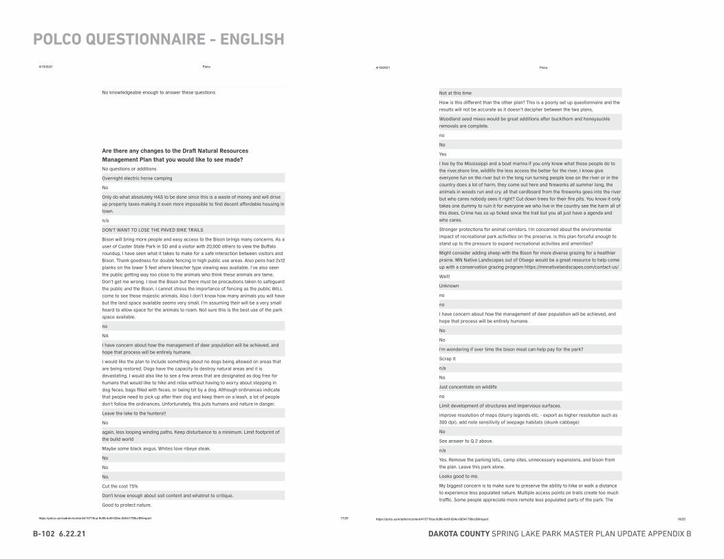
DAKOTA COUNTY SPRING LAKE PARK MASTER PLAN UPDATE APPENDIX BB-102 6.22.21
POLCO QUESTIONNAIRE - ENGLISH4/19/2021 Polco
https://polco.us/n/admin/content/415716ca-9c86-4c6f-924e-0b541799cc99/report 17/25
No knowledgeable enough to answer these questions
Are there any changes to the Dra Natural ResourcesManagement Plan that you would like to see made?No questions or additions
Overnight electric horse camping
No
Only do what absolutely HAS to be done since this is a waste of money and will driveup property taxes making it even more impossible to find decent affordable housing intown.
n/a
DON'T WANT TO LOSE THE PAVED BIKE TRAILS
Bison will bring more people and easy access to the Bison brings many concerns. As auser of Custer State Park in SD and a visitor with 20,000 others to view the Buffaloroundup, I have seen what it takes to make for a safe interaction between visitors andBison. Thank goodness for double fencing in high public use areas. Also pens had 2x12planks on the lower 5 feet where bleacher type viewing was available. I’ve also seenthe public getting way too close to the animals who think these animals are tame.Don’t get me wrong. I love the Bison but there must be precautions taken to safeguardthe public and the Bison. I cannot stress the importance of fencing as the public WILLcome to see these majestic animals. Also I don’t know how many animals you will havebut the land space available seems very small. I’m assuming their will be a very smallheard to allow space for the animals to roam. Not sure this is the best use of the parkspace available.
no
NA
I have concern about how the management of deer population will be achieved, andhope that process will be entirely humane.
I would like the plan to include something about no dogs being allowed on areas thatare being restored. Dogs have the capacity to destroy natural areas and it isdevastating. I would also like to see a few areas that are designated as dog free forhumans that would like to hike and relax without having to worry about stepping indog feces, bags filled with feces, or being bit by a dog. Although ordinances indicatethat people need to pick up a�er their dog and keep them on a leash, a lot of peopledon’t follow the ordinances. Unfortunately, this puts humans and nature in danger.
Leave the lake to the hunters!!
No
again, less looping winding paths. Keep disturbance to a minimum. Limit footprint ofthe build world
Maybe some black angus. Whites love ribeye steak.
No
No
No.
Cut the cost 75%
Don't know enough about soil content and whatnot to critique.
Good to protect nature.
4/19/2021 Polco
https://polco.us/n/admin/content/415716ca-9c86-4c6f-924e-0b541799cc99/report 18/25
Not at this time
How is this different than the other plan? This is a poorly set up questionnaire and theresults will not be accurate as it doesn’t decipher between the two plans.
Woodland seed mixes would be great additions a�er buckthorn and honeysuckleremovals are complete.
no
No
Yes
I live by the Mississippi and a boat marina if you only knew what these people do tothe river,shore line, wildlife the less access the better for the river, I know giveeveryone fun on the river but in the long run turning people lose on the river or in thecountry does a lot of harm, they come out here and fireworks all summer long, theanimals in woods run and cry, all that cardboard from the fireworks goes into the riverbut who cares nobody sees it right? Cut down trees for their fire pits. You know it onlytakes one dummy to ruin it for everyone we who live in the country see the harm all ofthis does, Crime has so up ticked since the trail but you all just have a agenda andwho cares.
Stronger protections for animal corridors. I'm concerned about the environmentalimpact of recreational park activities on the preserve. Is this plan forceful enough tostand up to the pressure to expand recreational activities and amenities?
Might consider adding sheep with the Bison for more diverse grazing for a healthierprairie. MN Native Landscapes out of Otsego would be a great resource to help comeup with a conservation grazing program https://mnnativelandscapes.com/contact-us/
Wait!
Unknown
no
no
I have concern about how the management of deer population will be achieved, andhope that process will be entirely humane.
No
No
I'm wondering if over time the bison meat can help pay for the park?
Scrap it
n/a
No
Just concentrate on wildlife
no
Limit development of structures and impervious surfaces.
improve resolution of maps (blurry legends etc. - export as higher resolution such as300 dpi), add note sensitivity of seepage habitats (skunk cabbage)
No
See answer to Q 2 above.
n/a
Yes. Remove the parking lots,, camp sites, unnecessary expansions, and bison fromthe plan. Leave this park alone.
Looks good to me.
My biggest concern is to make sure to preserve the ability to hike or walk a distanceto experience less populated nature. Multiple access points on trails create too muchtraffic. Some people appreciate more remote less populated parts of the park. The

APPENDIX B - COMMUNITY ENGAGEMENT 6.22.21 B-103
POLCO QUESTIONNAIRE - ENGLISH
4/19/2021 Polco
https://polco.us/n/admin/content/415716ca-9c86-4c6f-924e-0b541799cc99/report 19/25
forest bathing experience is different. More wildlife can be spotted in remote areas.People need to be willing to go the extra mile to explore solitude.
Place a greater priority on habitat protection and restoration, using this as anopportunity to conduct research on land restoration processes. No addition ofturfgrass or impermeable surfaces.
No... continue to vett in the community
More of an emphasis on native grassland restoration.
None
No
N/A
Page 67 states "The Mississippi River Greenway was established to avoid high qualityhabitat and to minimize the impact on the land. Based on the due diligence, the multi-purpose trail is consistent with an approved master plan and an informed CountyBoard-selected alignment, accommodates park access to people of all abilities, andserves diverse and year-round recreation opportunities." This is rewriting history andshould be corrected or removed. A more accurate statement would reflect the CountyBoard ignored the alignment that was in the approved 2003 master plan, they ignoredthe public input and the DNR, and instead blew up fragile river bluffs, removedendangered dry bluff prairie, cleared 200-�. wide swaths of mature forest, and tookaway private property by eminent domain. The County had acquired millions of dollarsin federal transportation grants, and that was their rationale for this project.
Just the clarity of the charts. They were unreadable. And this grammatical error: "deerhave become far to overabundant". Should be too, not to!
Didn't see as much emphasis on birds and bird migration as I would have expected
No
I would like the white pine trees which make up most of the species in the pine standsto remain. Granted other species like norway, scotch and jack pines are not natural tothe area but native white pine is found along the St. Croix and S.E. minnesota so atsome time in the past some may have grown around Spring Lake park area. Also it is agood bird shelter in winter. It is desirable to have a stand of green while skiing in thewinter. I think there is great possibility that as the older trees die and the stand thinssomewhat the white pine will regenerate along with other deciduous species. Itcertainly would not hurt to leave those stands and assess their viability sometime say15 years in the future. If they die out in the future so be it. Last fall , I have seen somewhite pine natural reproduction in and around the pine stands
no - except for the trail connection to Pine Bend Trail
none
Volunteer opportunities
None
I don't utilize the park
Park area expanded as land becomes available.
No
Opportunities for volunteers to assist w prairie restoration of all suitible stages.
Bison would not be happy on this land anymore.
Bison reintroduction in close proximity to the Twin Cities metro and adjacent towns issomewhat concerning. Irresponsible behavior by unsupervised minors in the park is aconcern for the specific area. The tendency for well-intentioned park visitors approachand feed wildlife in locations such as Fort Snelling State Park may ultimately become aconcern in this area as well.
No
It hope there are some good trail opportunities.
none at this time
4/19/2021 Polco
https://polco.us/n/admin/content/415716ca-9c86-4c6f-924e-0b541799cc99/report 20/25
See above less hardscape improvements, keep landscape passive,
Nope!
A prioritization plan, what is a needed non negotiable based on science, like evasivespecies removal and erosion control va what is nice (nature themed play ground,prairie lab)
Keep the landing from Hilary road, will be necessary to have both landings duringduck season
Please keep the impervious surface to a minimum. Please also make sure that there iscontinued funding for personnel that work at the Park.
Yes. Please consider implementing a lawn-mower cleaning protocol to minimize thetransport of non-native weed seeds from one park to another along the regional biketrail, unless you already have this in place. One non-native plant that benefits fromlawn mower seed transport is the bird’s foot trefoil.
Not at this time
No snakes
none
none
NO
None that I can think of now.
no more buildings and construction. we have enough of that. noise, light, and footprintreduction. we do not need to let humans into areas to "explore remote park areas withminimal impact". Think deeply about the unintended consequences of good intentions,please. RE: bison. A good idea but consider their unintended impacts on other wildlifeas well as their well being.
No, I really like what you have
Lower cost
No
I don’t live in Dakota County
no
Regenerative farming and gardening space, infrastructure, and support to help bringback and teach indigenous farming and gardening.
What are your top five improvement priorities that would increaseyour use and enjoyment of Spring Lake Park Reserve?
52% (107)
59% (120)
53% (109)
60% (122)
37% (76)
A Natural resource restoration
B Bison reintroduction
C Wildlife viewing
D Narrow, natural walking surface trails to explore remote parkareas with minimal impact
E Accessible walking trail loops near trailheads
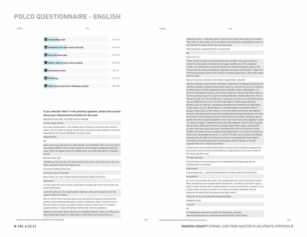
DAKOTA COUNTY SPRING LAKE PARK MASTER PLAN UPDATE APPENDIX BB-104 6.22.21
POLCO QUESTIONNAIRE - ENGLISH4/19/2021 Polco
https://polco.us/n/admin/content/415716ca-9c86-4c6f-924e-0b541799cc99/report 21/25
23% (47)
36% (73)
22% (45)
31% (63)
8% (17)
17% (35)
19% (38)
If you selected "other" in the previous question, please tell us moreabout your improvement priorities for the park.Ride/drive horse trails. Overnight electric camping
Archery range, fishing
Don't add anything new in. Just maintain what is there at a minimum cost to the taxpayers. This is a waste of money and will drive up property taxes making it even moreimpossible to find decent affordable housing in town.
KAYAK RENTAL
NA
keep some areas truly natural in which people are not allowed. That is the only way totruly enable wildlife to thrive. Paths should not wind through ecologically importantareas. Places for people, places for wildlife and a very small intersection in betweenthe two.
Mountain bike trails
I already use the park alot. The biking trail thru the park is one of the best in the TwinCities...well done! Keep up the good work.
Consistent Staffing of the park
Access to river for canoeing
More options for river overlook positions along the length of the park.
Boat launch
As many quiet and natural areas as possible for people with hectic lives to relax andrestore themselves.
Leave the park as is. It’s a quiet sanitary right now and you’re trying to turn it intoLebanon which is a shame.
Now is not the time to increase government spending for feel-good entertainmentprojects. Government spending due to covid is ballooning. Now is the time to try tohold onto what you have. You simply cannot continue to raise taxes for frivolousprojects while our roads and highways deteriorate. Stop the expansion.
Adding an observation tower would be an incredible addition! I grew up in Wisconsin,where observation towers on high points in State Parks and County Parks are
F Paved biking trails
G Snowshoe and cross-country ski trails
H Play and nature play
I Walk-in, bike-in, boat-in tent camping
J Community events
K Picnicking
L Other, please describe in following question
4/19/2021 Polco
https://polco.us/n/admin/content/415716ca-9c86-4c6f-924e-0b541799cc99/report 22/25
relatively common - especially where I lived in Door County where there are 3 towers.They make for great views, are an attraction, and really give a geographical context topark location to visitors better than any map could.
need restrooms (compost toilets) out along trails
NA
Leave it as it is
Priority should be given to maintaining the wild character of the park reserve toprotect its unique plant communities and support wildlife use of this importantcorridor. Any development should be minimal and should be limited to areas of thereserve that are already developed or degraded and away from the bluff. I support thecomments provided experts at the Friends of the Mississippi River in their letter datedMarch 15, 2021.
Natural resources restoration and habitat fragmentation reduction
Specific emphasis on bird habitat restoration, especially for breeding bird species andmigratory species in greatest conservation need (e.g., some of the current or potentialbreeding species include Loggerhead Shrike, Bobolink, Eastern Meadowlark, LarkSparrow, Grasshopper Sparrow, and Henslow's Sparrow). Spring Lake Nature Reservehas the potential to become a premier birding destination. While birding from time totime at the park over the past 30+years, I have seen rare and very uncommon speciessuch as Ruffed Grouse (rare in the Twin Cities Metro), Golden Eagle, MountainBluebird, and Lark Sparrow; breathtaking migrations of hundreds of Canada Geese,Tundra Swans, and Am. White Pelicans; many Bald Eagles and Sandhill Crane; 9species of sparrows in a few minutes in one small section of the park and adjacentfarmland; breeding Great Horned Owls; breeding Red-breasted Nuthatches (one if thefive southern-most breeding records for this species since 2000); impressive springwarbler and other songbird migrations; and a near record-late spring migration recordfor Lapland Longspur. Collaborative Saw-whet Owl migration research with CarpenterNature Center staff could be done to a greater extent. More regular, intensive birdsurveys of the park could yield some remarkable bird records and provide criticalbaseline information for your ecological restoration efforts. If you want to contact me,email me at: [email protected], or call 612-719-5324. Dave Zumeta, PhD, RetiredExecutive Director, MN Forest Resources Council, Ornithology and Forest HabitatConsultant to the Minneapolis Park and Recreation Board, member of the MNImportant Bird Area Technical Committee.
I would love to see mountain biking trails in the park. Not a trail like at Lebanon Hillsthat weaves back and forth around itself, but a natural point to point trail, similar tothe hiking trail there now.
Off leash dog area
This park does not need expansion and mislabeling destructive expansion as“improvement” is unethical.
Boat access!
Less development.....please! And eradication of invasive species like buckthorn.
No buffaloes
No more cross country ski trails!!!! They already take over most of the park in winter.More snowshoeing and unpaved winter hiking trails. I am hiking at the park 5 days aweek in winter and the ratio of walkers/hikers to cross-country skiers is about 2-1. Andin these times of trying to provide for as many as possible, remember that noteveryone can afford skis but everyone has feet to walk :)
Would like to see mountain bike trail opportunities
Indigenous input
Disc golf
NA
#1. Paddleshare expansion & rentals #2. Restoration-volunteeropps.#3.Camping(Group, too)#4.Non-asphalt trails!!#5. Comm Events
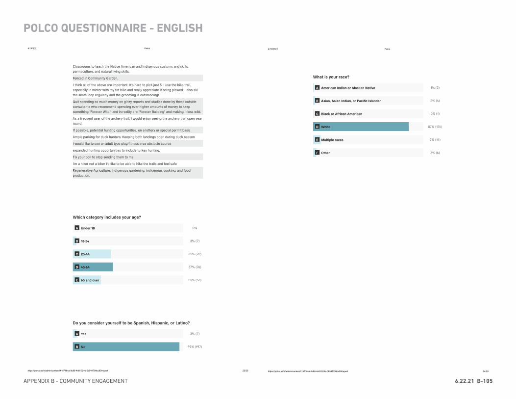
APPENDIX B - COMMUNITY ENGAGEMENT 6.22.21 B-105
POLCO QUESTIONNAIRE - ENGLISH
4/19/2021 Polco
https://polco.us/n/admin/content/415716ca-9c86-4c6f-924e-0b541799cc99/report 23/25
Classrooms to teach the Native American and Indigenous customs and skills,permaculture, and natural living skills.
Fenced in Community Garden.
I think all of the above are important. It's hard to pick just 5! I use the bike trail,especially in winter with my fat bike and really appreciate it being plowed. I also skithe skate loop regularly and the grooming is outstanding!
Quit spending so much money on glitzy reports and studies done by these outsideconsultants who recommend spending ever higher amounts of money to keepsomething "Forever Wild " and in reality are "Forever Building" and making it less wild.
As a frequent user of the archery trail, I would enjoy seeing the archery trail open yearround.
If possible, potential hunting opportunities, on a lottery or special permit basis
Ample parking for duck hunters. Keeping both landings open during duck season
I would like to see an adult type play/fitness area obstacle course
expanded hunting opportunities to include turkey hunting.
Fix your poll to stop sending them to me
I'm a hiker not a biker I'd like to be able to hike the trails and feel safe
Regenerative Agriculture, Indigenous gardening, indigenous cooking, and foodproduction.
Which category includes your age?
0%
3% (7)
35% (72)
37% (76)
25% (53)
Do you consider yourself to be Spanish, Hispanic, or Latino?
3% (7)
97% (197)
A Under 18
B 18-24
C 25-44
D 45-64
E 65 and over
A Yes
B No
4/19/2021 Polco
https://polco.us/n/admin/content/415716ca-9c86-4c6f-924e-0b541799cc99/report 24/25
What is your race?
1% (2)
2% (4)
0% (1)
87% (176)
7% (14)
3% (6)
A American Indian or Alaskan Native
B Asian, Asian Indian, or Pacific Islander
C Black or African American
D White
E Multiple races
F Other
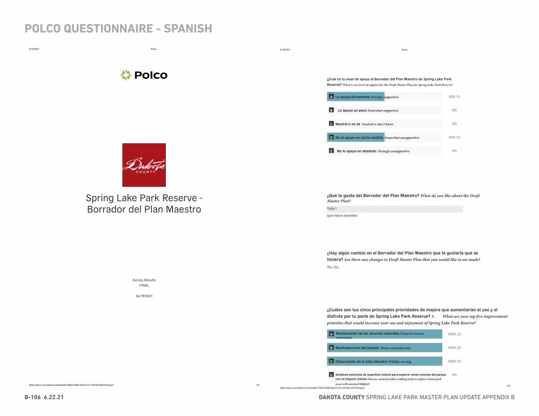
DAKOTA COUNTY SPRING LAKE PARK MASTER PLAN UPDATE APPENDIX BB-106 6.22.21
POLCO QUESTIONNAIRE - SPANISH4/19/2021 Polco
https://polco.us/n/admin/content/abc72952-b296-4e22-b101-a9195c228730/report 1/5
Spring Lake Park Reserve -Borrador del Plan Maestro
Survey ResultsFINAL
04/19/2021
4/19/2021 Polco
https://polco.us/n/admin/content/abc72952-b296-4e22-b101-a9195c228730/report2/5
¿Cuál es tu nivel de apoyo al Borrador del Plan Maestro de Spring Lake Park
Reserve? What is you level of support for the Draft Master Plan for Spring Lake Park Reserve?
50% (1)
0%
0%
50% (1)
0%
¿Qué te gusta del Borrador del Plan Maestro? What do you like about the Draft Master Plan?
Todo !
que habra bisontes
¿Hay algún cambio en el Borrador del Plan Maestro que te gustaría que se hiciera? Are there any changes to Draft Master Plan that you would like to see made?
No No
¿Cuáles son tus cinco principales prioridades de mejora que aumentarían el uso y el disfrute por tu parte de Spring Lake Park Reserve? 3. What are your top five improvement priorities that would increase your use and enjoyment of Spring Lake Park Reserve?
100% (2)
100% (2)
100% (2)
0%
A Lo apoyo firmamente Strongly supportive
B Lo apoyo un poco Somewhat supportive
C Neutral o no sé Neutral or don’t know
D No lo apoyo en cierta medida Somewhat unsupportive
E No lo apoyo en absoluto Strongly unsupportive
A Restauración de los recursos naturales Natural resource restoration
B Reintroducción del bisonte Bison reintroduction
C Observación de la vida silvestre Wildlife viewing
D Senderos estrechos de superficie natural para explorar zonas remotas del parque con un impacto mínimo Narrow, natural surface walking trails to explore remote park
areas with minimal impact

APPENDIX B - COMMUNITY ENGAGEMENT 6.22.21 B-107
POLCO QUESTIONNAIRE - SPANISH
4/19/2021 Polco
https://polco.us/n/admin/content/abc72952-b296-4e22-b101-a9195c228730/report 3/5
0%
0%
50% (1)
50% (1)
50% (1)
50% (1)
0%
0%
Si seleccionaste “Otras” en la pregunta anterior, dinos más sobre tus prioridades con respecto a mejoras para el parque. If you selected "other" in the previous question, please tell us more about your improvement priorities for the park.
¿Qué categoría incluye tu edad Which category includes your age?
0%
0%
50% (1)
50% (1)
0%
E Circuitos accesibles para caminar cerca de los puntos de partida de los senderos Accessible walking loops near trailheads
F Senderos pavimentados para bicicletas Paved biking trails
G Senderos para raquetas de nieve y esquí de fondo Snowshoe and cross-country ski trails
H Juegos y actividades en la naturaleza Play and nature play
IAcampe con acceso a pie, en bicicleta y en barco Walk-in, bike-in, boat-in tent camping
J Eventos comunitarios Community events
K Picnics Picnicking
L Otras, descríbelas en la siguiente pregunta Other, please describe in following question
A Menos de 18 Under 18
B 18-24
C 25-44
D 45-64
E 65 o más 65 and over
4/19/2021 Polco
https://polco.us/n/admin/content/abc72952-b296-4e22-b101-a9195c228730/report 4/5
¿Te consideras español, hispano o latino? Do you consider yourself to be Spanish, Hispanic, or Latino?
100% (2)
0%
¿Cuál es tu raza? What is your race?
50% (1)
0%
0%
50% (1)
0%
0%
A Sí Yes
B No No
AIndígena americana o nativa de Alaska American Indian or Alaskan Native
B Asiática, indio asiática o isleña del Pacífico Asian, Asian Indian, or Pacific Islander
C Negra o afroamericana Black or African American
D Blanca White
E Múltiples razas Multiple races
F Otra Other
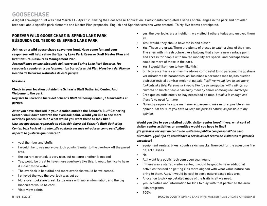
DAKOTA COUNTY SPRING LAKE PARK MASTER PLAN UPDATE APPENDIX BB-108 6.22.21
GOOSECHASEA digital scavenger hunt was held March 11 - April 12 utilizing the Goosechase Application. Participants completed a series of challenges in the park and provided feedback about specific park elements and Master Plan proposals. English and Spanish versions were created. Thirty-five teams participated.
FOREVER WILD GOOSE CHASE IN SPRING LAKE PARK BÚSQUEDA DEL TESORO EN SPRING LAKE PARK
Join us on a wild goose chase scavenger hunt. Have some fun and your responses will help refine the Spring Lake Park Reserve Draft Master Plan and Draft Natural Resources Management Plan. Acompáñanos en una búsqueda del tesoro en Spring Lake Park Reserve. Tus respuestas ayudarán a perfeccionar los borradores del Plan Maestro y del Plan de Gestión de Recursos Naturales de este parque.
Missions
Check in your location outside the Schaar’s Bluff Gathering Center. And Welcome to the park! Registra tu ubicación fuera del Schaar’s Bluff Gathering Center. ¡Y bienvenidos al parque!
After you have checked in your location outside the Schaar’s Bluff Gathering Center, walk down towards the overlook point. Would you like to see more overlook places like this? What would you want these to look like? Una vez que hayas registrado tu ubicación fuera del Schaar’s Bluff Gathering Center, baja hacia el mirador. ¿Te gustaría ver más miradores como este? ¿Qué aspecto te gustaría que tuvieran?
• yes! the river and bluffs• I would like to see more overlook points. Similar to the overlook off the paved
trail.• the current overlook is very nice, but not sure another is needed• Yes, would be great to have more overlooks like this. It would be nice to have
it closer to the water.• The overlook is beautiful and more overlooks would be welcomed.• I enjoyed the way the overlook was set up• More over looks are great. Large ones with more information, and the big
binoculars would be cool!• Vista view points
• yes, the overlooks are a highlight. we visited 3 others today and enjoyed them all.
• Yes I would, they should have the island closer• Yes. These are great. There are plenty of places to catch a view of the river.
The sites with infrastructure like a balcony that allow a new vantage point and access for people with limited mobility are special and perhaps there could be more of these in the park.
• Yes. I would like them to look like this!• Si!! Nos encantaría ver más miradores como este! En lo personal me gustaría
ver miradores de barandales, así los niños o personas más bajitas pueden disfrutar más al admirar mejor el paisaje. Yes!! We would love to see more lookouts like this! Personally, I would like to see viewpoints with railings, so children or shorter people can enjoy more by better admiring the landscape.
• Creo que es suficiente y no hay necesidad de más. I think it is enough and there is no need for more.
• No estoy segura hay que mantener el parque lo más natural posible en mi opinión. I’m not sure you have to keep the park as natural as possible in my opinion.
Would you like to see a staffed public visitor center here? If yes, what sort of visitor center activities or amenities would you hope to find? ¿Te gustaría ver aquí un centro de visitantes público con personal? En caso afirmativo, ¿qué tipo de actividades o servicios del centro de visitantes te gustaría encontrar? • equipment rentals: bikes, country skis, snacks, firewood for the awesome fire
pit, art classes• No• All I want is a public restroom open year round• If there was a staffed visitor center, it would be good to have additional
activities focused on getting kids more aligned with what value nature can bring to them. Also, it would be cool to see a nature based play area.
• A location to pick up detailed maps of the trails is all we need.• yes! activities and information for kids to play with that pertain to the area.
kids programs• 100%
APPENDIX B - COMMUNITY ENGAGEMENT 6.22.21 B-109
GOOSECHASE
• Not necessarily.• gift shop. info center• not required• poster of fish in river• “Equipment rental would be great
Staff-led programming to learn from the park would be a bonus”• Yes, I would love to see this available. I learned more during the last multi
county hunt about the park than I did in the 10+ years I’ve lived in Hastings. It would be helpful to have someone there to show what activities are all available.
• Not necessarily staffed, but a clear map with all the trails and features would be nice. Being able to go on the roof of the center would be amazing.
• only if you have things to offer like snow shoe rental, s’mores kits, firekits etc. things for residents to use while visiting the park
• Si claro!! Tal vez podría ver días destinados : 1-Con información, 2-exposiciones de animales, 3- venta de comida, 4- renta de equipo (mino culares), 5- Eventos familiares (bingo) Yes of course!! Maybe I could see designated days: 1-With information, 2-animal exhibitions, 3- sale of food, 4- equipment rental (minors), 5- Family events (bingo)
• no creo que hay necesidad I don’t think there is a need• Educativos para los niños cómo hablar de plantas hacer prometía con
semillas., habrá el tipo de tierra y después caminar para entrar los diferentes tipos en el parque etc. Educational for children, how to talk about plants, make promised with seeds, there will be the type of soil and then walk to enter the different types in the park etc.
What is the most important feature you would like to see in a new playground? ¿Cuál es el elemento más importante que te gustaría ver en un nuevo parque infantil?• a zipline that has a seat with a buckle for people with disabilities and/or
young kids and a rope with a disk for older, more stable kids/adults. and a baby bucket swing!
• Bigger and longer zipline• A sphere like the one at Bridle Ridge Park in Eagan.• more beef, merry go round
• climbing wall for adults, natural play area• no kids, but would be nice to see adult workout activities, like outdoor gyms
or workout stations, see Denverbroncos.com under stadiums• Merry go round• Nothing, it looks great.• more swings• More nature play areas like white tail• Adaptive equipment• closer restrooms• Big slide and monkey bars, nature play area• Something like a zipline that they have at other parks.• my child does not like the chain walk way, adding another zip line there
would be nice.• Sin duda los columpios!! Llantas, Resbaladillas, un lugar para escalar,
tirolesa (zipline). Without a doubt the swings !! Tires, Slides, a place to climb, zipline.
• No tengo hijos entonces no se me hace necesario pero tal vez algo para que jueguen con agua. I don’t have children so it’s not necessary for me, but maybe something for them to play with water.
• Creo que algo donde los niños puedan escalar como un muro de rocas algo así. I think something where kids can climb like a rock wall something like that.
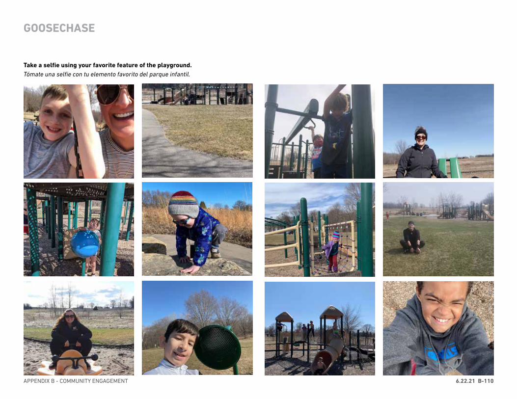
APPENDIX B - COMMUNITY ENGAGEMENT 6.22.21 B-110
GOOSECHASE
Take a selfie using your favorite feature of the playground. Tómate una selfie con tu elemento favorito del parque infantil.
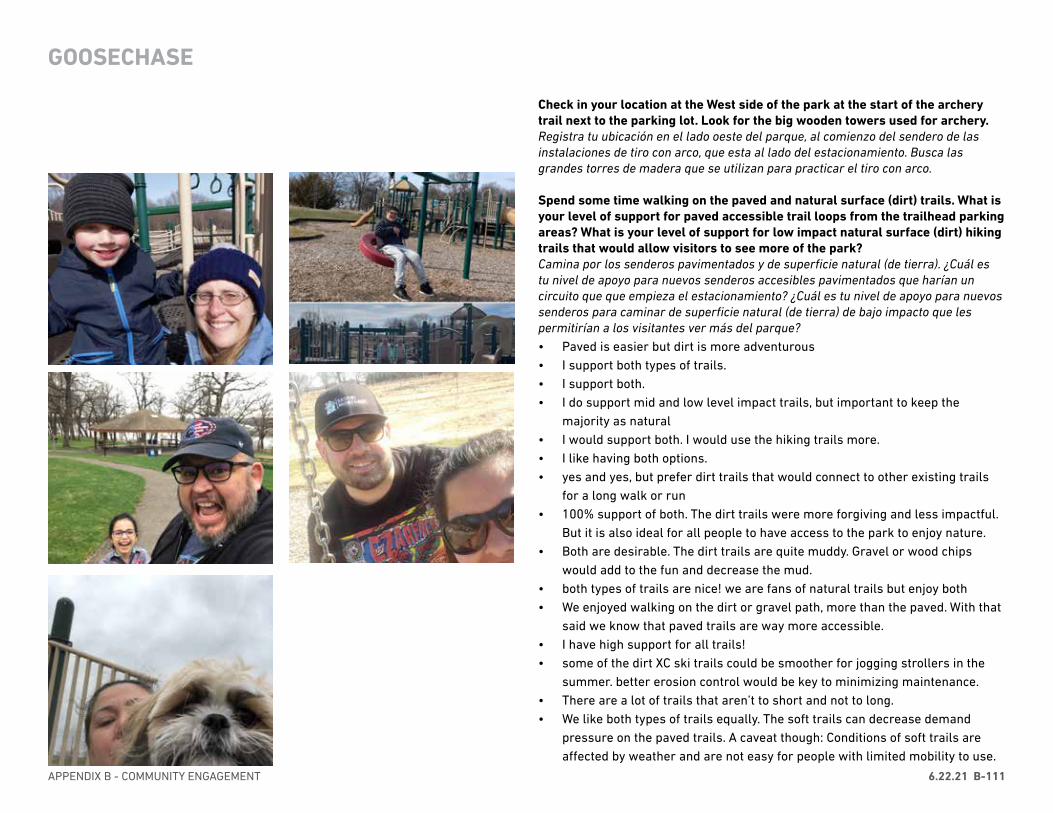
APPENDIX B - COMMUNITY ENGAGEMENT 6.22.21 B-111
Check in your location at the West side of the park at the start of the archery trail next to the parking lot. Look for the big wooden towers used for archery. Registra tu ubicación en el lado oeste del parque, al comienzo del sendero de las instalaciones de tiro con arco, que esta al lado del estacionamiento. Busca las grandes torres de madera que se utilizan para practicar el tiro con arco.
Spend some time walking on the paved and natural surface (dirt) trails. What is your level of support for paved accessible trail loops from the trailhead parking areas? What is your level of support for low impact natural surface (dirt) hiking trails that would allow visitors to see more of the park? Camina por los senderos pavimentados y de superficie natural (de tierra). ¿Cuál es tu nivel de apoyo para nuevos senderos accesibles pavimentados que harían un circuito que que empieza el estacionamiento? ¿Cuál es tu nivel de apoyo para nuevos senderos para caminar de superficie natural (de tierra) de bajo impacto que les permitirían a los visitantes ver más del parque?• Paved is easier but dirt is more adventurous• I support both types of trails.• I support both.• I do support mid and low level impact trails, but important to keep the
majority as natural• I would support both. I would use the hiking trails more.• I like having both options.• yes and yes, but prefer dirt trails that would connect to other existing trails
for a long walk or run• 100% support of both. The dirt trails were more forgiving and less impactful.
But it is also ideal for all people to have access to the park to enjoy nature.• Both are desirable. The dirt trails are quite muddy. Gravel or wood chips
would add to the fun and decrease the mud.• both types of trails are nice! we are fans of natural trails but enjoy both• We enjoyed walking on the dirt or gravel path, more than the paved. With that
said we know that paved trails are way more accessible.• I have high support for all trails!• some of the dirt XC ski trails could be smoother for jogging strollers in the
summer. better erosion control would be key to minimizing maintenance.• There are a lot of trails that aren’t to short and not to long.• We like both types of trails equally. The soft trails can decrease demand
pressure on the paved trails. A caveat though: Conditions of soft trails are affected by weather and are not easy for people with limited mobility to use.
GOOSECHASE
DAKOTA COUNTY SPRING LAKE PARK MASTER PLAN UPDATE APPENDIX BB-112 6.22.21
The paved trails see use conflicts between walkers and bikers.• More access is always welcome.• The more trails in general, and the more paved trails, the better. Families
with small children in strollers as well as people in wheelchairs would greatly appreciate more paved trails.
• nice mix of trails for all abilities• Excelentes senderos!! Muy atendidos, Limpios y tranquilos los disfrutamos
mucho. Sin duda alguna estaremos regresando! Excellent trails !! Very well cared for, clean and quiet we enjoyed them a lot. We will definitely be coming back!
• depende de donde este localizado porque creo que si ayudaría para mantener el distanciamiento social. It depends on where it is located because I think that if it would help to maintain social distancing
• Mi nivel de apoyo es alto para pavimentar los caminos. My level of support is high for paved trails.
When entering the west side of the park look for the closed gate. The prairie on the other side is where Bison may be reintroduced. Take a picture of your team pretending to be bison. Al entrar en el lado oeste del parque, busca el portón cerrado. La pradera del otro lado es donde se podria reintroducir el bisonte. Toma una foto de tu equipo simulando ser bisontes.
GOOSECHASE

APPENDIX B - COMMUNITY ENGAGEMENT 6.22.21 B-113
GOOSECHASE
What sounds do you hear? As you move throughout the park, notice how these sounds change. What part of the park is the quietest?¿Qué sonidos oyes? A medida que te desplazas por el parque, observa cómo cambian estos sonidos. ¿Qué parte del parque es la más silenciosa?
• Leaves crunching and squelching. Squirrels scampering.• Leaves, cars, bugs. Deep in the wooded area is quietest• the wind, children• rustling wind through the trees and far away movement.• Wind blowing through the trees, birds singing.• The west trailhead and trail to west trailhead was the quietest part we
visited. Once away from the noise of traffic and people we could hear birds, rustling leaves and grasses. Very nice!
• Wind in the trees, leaves rustling, water rushing in the river, seagulls squawking, small airplanes overhead, kids playing (at the playground), birds chirping. The quietest was when we were on the dirt trail in the woods.
• Wind and trees rustling and birds• Not many birds today. A lot of Terns by the water.• people, birds, planes. trails are the quietest• The wind of the river! But we walked the path back into the cedar trees and
was a lot quieter (except for the dog barking at the house)• Birds chirping• stone stairs thru ravine on the far east side of park.• I hear my feet rubbing against the dirt, I hear the road.also the wind and river• Birds, motors, wind, and people. The area by the bridge is pretty quiet.• The wind rustling through the brush.• It’s quite windy today so all we can hear is the wind. The deeper we go
between trees, the quieter it gets because there’s less wind. So the quietest part today was the most wooded area - not sure of its name.
• sound of barge and people talking• En realidad nos tocó un día muy tranquilo y callado, en cuanto a sonidos
naturales, se podía apreciar el sonido del aire, el agua y alguna ave. La gente se escuchaba feliz disfrutando de su familia, caminando, en el parque , volando papalote e incluso nos tocó ver que tenían prendida una fogata. Actually we had a very calm and quiet day, in terms of natural sounds, you could appreciate the sound of air, water and some birds. People were happy enjoying their family, walking, in the park, flying kite and we even had to see that they had a bonfire lit.
• Todo estaba muy silencioso porque no escuche muchos pájaros. Everything was very quiet because I did not hear many birds.
• Pájaros, viento, el tren, el crujido cuando caminas el las hojas cecas, mis niños hablando. Birds, wind, the train, the rustle when you walk on the mint leaves, my children talking,
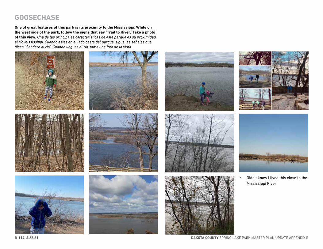
DAKOTA COUNTY SPRING LAKE PARK MASTER PLAN UPDATE APPENDIX BB-114 6.22.21
One of great features of this park is its proximity to the Mississippi. While on the west side of the park, follow the signs that say ‘Trail to River.’ Take a photo of this view. Una de las principales características de este parque es su proximidad al río Mississippi. Cuando estés en el lado oeste del parque, sigue las señales que dicen “Sendero al río”. Cuando llegues al río, toma una foto de la vista.
GOOSECHASE
• Didn’t know I lived this close to the Mississippi River

APPENDIX B - COMMUNITY ENGAGEMENT 6.22.21 B-115
It would help me try archery or use the archery trail more if _______(fill in the blank) Me ayudaría a probar el tiro con arco o a utilizar más las instalaciones de tiro con arco si _______ (rellena el espacio en blanco con tu opinión).
GOOSECHASE
• Supiera los horarios y el costo por el instructor. I knew the schedules and the cost for the instructor
• hubiera donde renta el equipo . A place for equipment rental
Based on your visit to the park today, name two things you’d be interested in learning more about. Basado en su visita al parque hoy, mencione dos cosas sobre las que estaría interesado en aprender más.• more history of the area including recent history (downed wood in lake area,
man-made barrier in river for example), what types of waterfowl should we expect to see at the lake
• The history of the area and the native plants and wildlife• “Different birds to look for.
More about it’s history.”• How would entering bison affect the visitor experience?• Would be interested in learning more about the animals in the park and the
different types of trees within the park.• The Native American involvement and in the water is a very large concrete
type of structure that seems to be protecting something but I don’t know its purpose
• potential camping and visitor center• I would love to see more information (and work) done to restore the prairie.
Maybe a way (safe) down to the river to physically connect it.• Archery and Raptors• archery and bison• What fish live in the river and what animals live in the forest
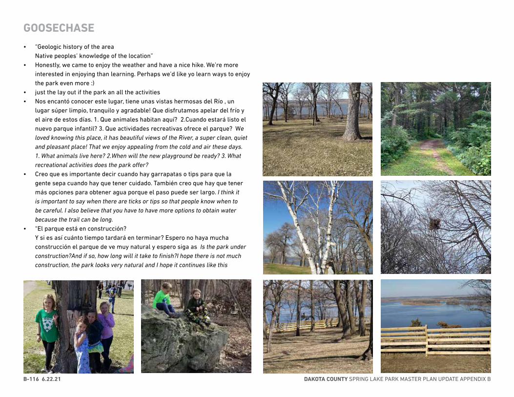
DAKOTA COUNTY SPRING LAKE PARK MASTER PLAN UPDATE APPENDIX BB-116 6.22.21
• “Geologic history of the area Native peoples’ knowledge of the location”
• Honestly, we came to enjoy the weather and have a nice hike. We’re more interested in enjoying than learning. Perhaps we’d like yo learn ways to enjoy the park even more :)
• just the lay out if the park an all the activities• Nos encantó conocer este lugar, tiene unas vistas hermosas del Río , un
lugar súper limpio, tranquilo y agradable! Que disfrutamos apelar del frío y el aire de estos días. 1. Que animales habitan aquí? 2.Cuando estará listo el nuevo parque infantil? 3. Que actividades recreativas ofrece el parque? We loved knowing this place, it has beautiful views of the River, a super clean, quiet and pleasant place! That we enjoy appealing from the cold and air these days. 1. What animals live here? 2.When will the new playground be ready? 3. What recreational activities does the park offer?
• Creo que es importante decir cuando hay garrapatas o tips para que la gente sepa cuando hay que tener cuidado. También creo que hay que tener más opciones para obtener agua porque el paso puede ser largo. I think it is important to say when there are ticks or tips so that people know when to be careful. I also believe that you have to have more options to obtain water because the trail can be long.
• “El parque está en construcción? Y si es así cuánto tiempo tardará en terminar? Espero no haya mucha construcción el parque de ve muy natural y espero siga as Is the park under construction?And if so, how long will it take to finish?I hope there is not much construction, the park looks very natural and I hope it continues like this
GOOSECHASE
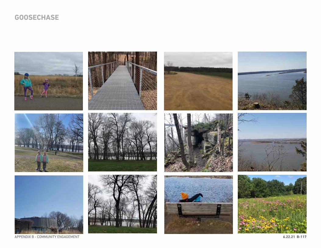
APPENDIX B - COMMUNITY ENGAGEMENT 6.22.21 B-117
GOOSECHASE
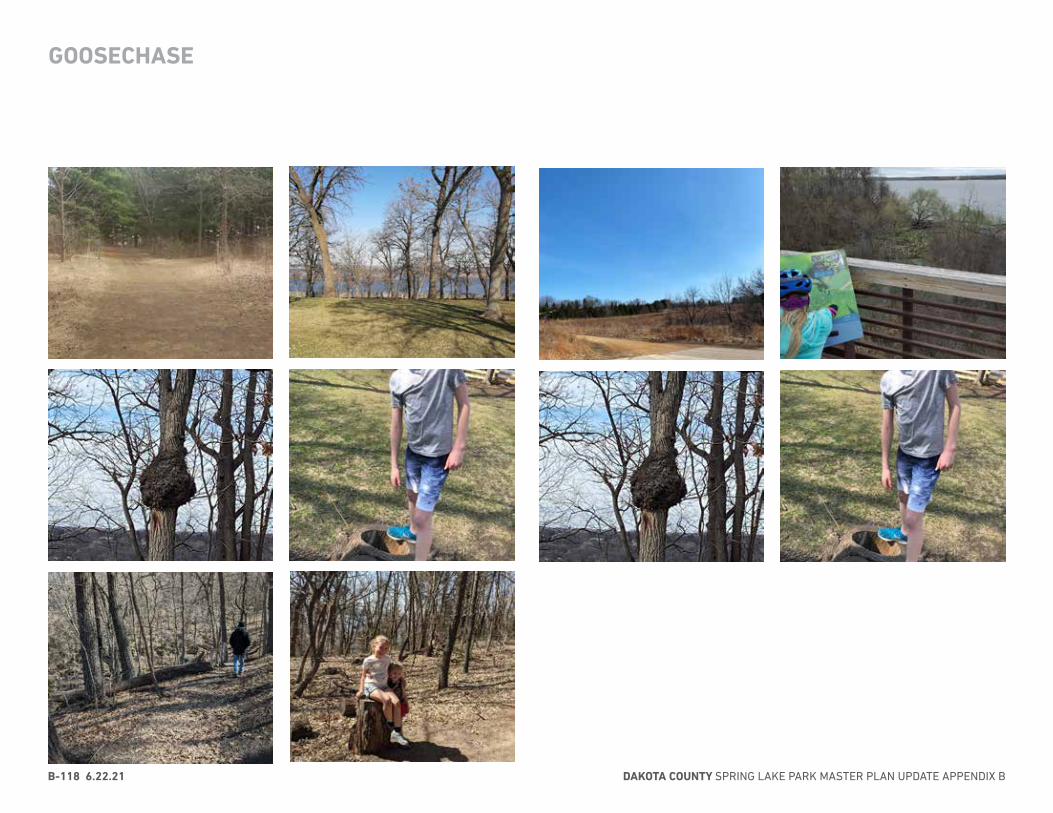
DAKOTA COUNTY SPRING LAKE PARK MASTER PLAN UPDATE APPENDIX BB-118 6.22.21
GOOSECHASE
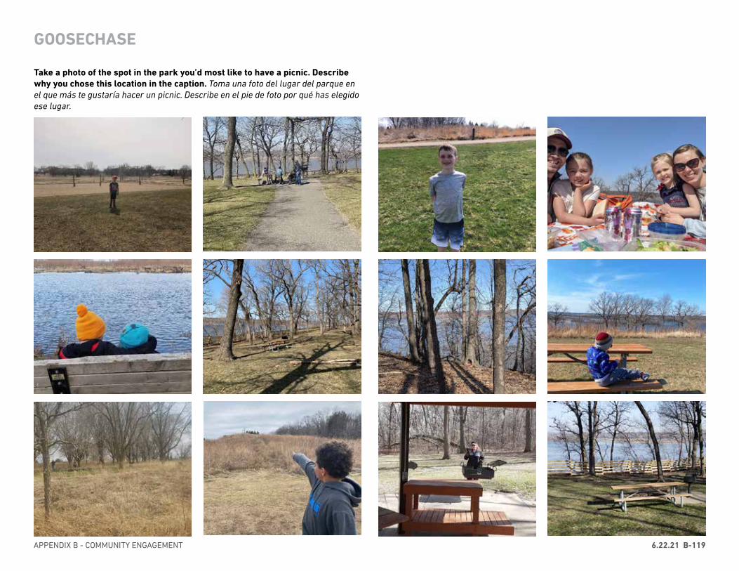
APPENDIX B - COMMUNITY ENGAGEMENT 6.22.21 B-119
GOOSECHASE
Take a photo of the spot in the park you’d most like to have a picnic. Describe why you chose this location in the caption. Toma una foto del lugar del parque en el que más te gustaría hacer un picnic. Describe en el pie de foto por qué has elegido ese lugar.
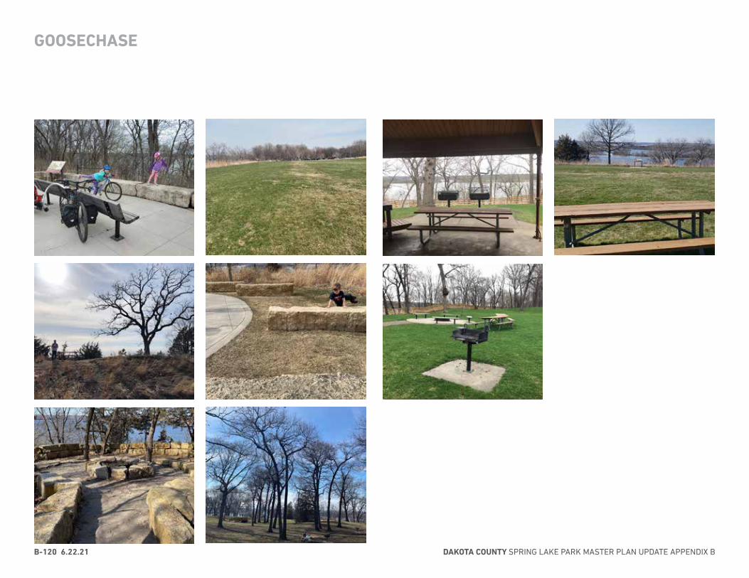
DAKOTA COUNTY SPRING LAKE PARK MASTER PLAN UPDATE APPENDIX BB-120 6.22.21
GOOSECHASE
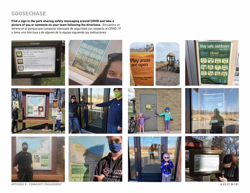
APPENDIX B - COMMUNITY ENGAGEMENT 6.22.21 B-121
Find a sign in the park sharing safety messaging around COVID and take a picture of you or someone on your team following the directions. Encuentra un letrero en el parque que comparta mensajes de seguridad con respecto al COVID-19 y toma una foto tuya o de alguien de tu equipo siguiendo las indicaciones.
GOOSECHASE
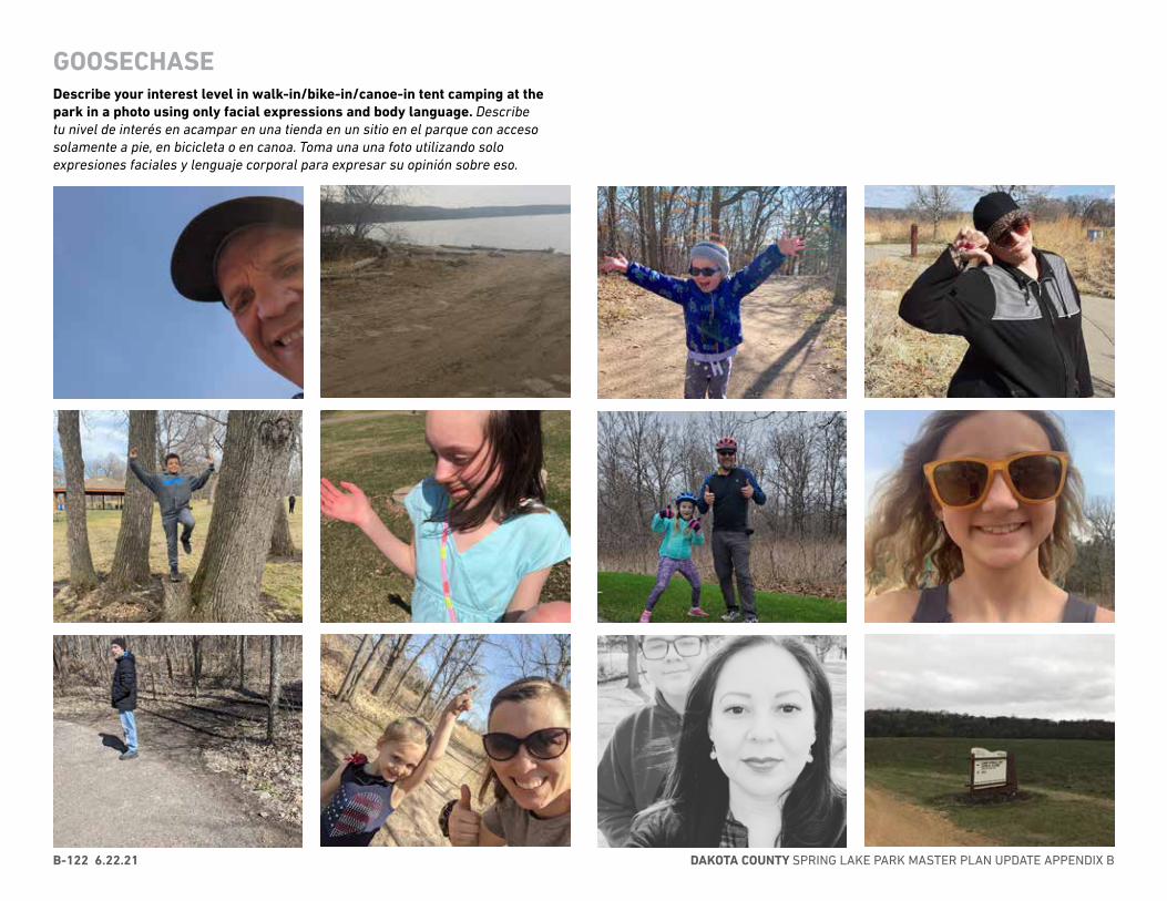
DAKOTA COUNTY SPRING LAKE PARK MASTER PLAN UPDATE APPENDIX BB-122 6.22.21
Describe your interest level in walk-in/bike-in/canoe-in tent camping at the park in a photo using only facial expressions and body language. Describe tu nivel de interés en acampar en una tienda en un sitio en el parque con acceso solamente a pie, en bicicleta o en canoa. Toma una una foto utilizando solo expresiones faciales y lenguaje corporal para expresar su opinión sobre eso.
GOOSECHASE
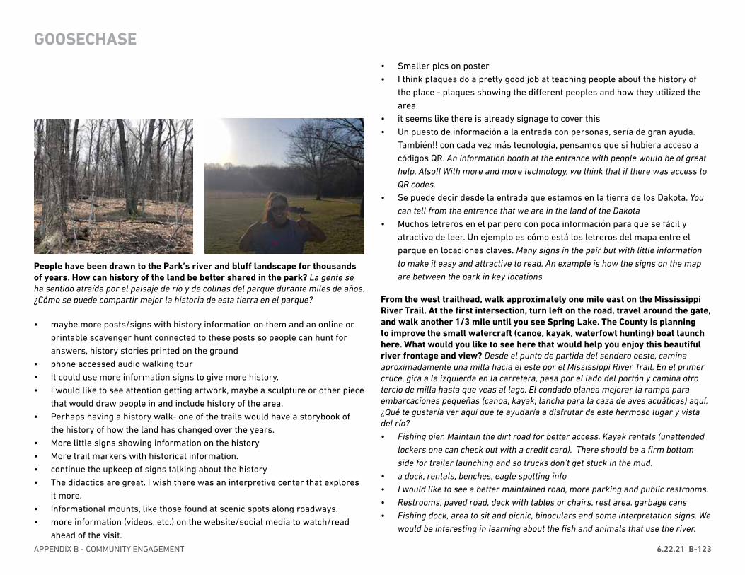
APPENDIX B - COMMUNITY ENGAGEMENT 6.22.21 B-123
• Smaller pics on poster• I think plaques do a pretty good job at teaching people about the history of
the place - plaques showing the different peoples and how they utilized the area.
• it seems like there is already signage to cover this• Un puesto de información a la entrada con personas, sería de gran ayuda.
También!! con cada vez más tecnología, pensamos que si hubiera acceso a códigos QR. An information booth at the entrance with people would be of great help. Also!! With more and more technology, we think that if there was access to QR codes.
• Se puede decir desde la entrada que estamos en la tierra de los Dakota. You can tell from the entrance that we are in the land of the Dakota
• Muchos letreros en el par pero con poca información para que se fácil y atractivo de leer. Un ejemplo es cómo está los letreros del mapa entre el parque en locaciones claves. Many signs in the pair but with little information to make it easy and attractive to read. An example is how the signs on the map are between the park in key locations
From the west trailhead, walk approximately one mile east on the Mississippi River Trail. At the first intersection, turn left on the road, travel around the gate, and walk another 1/3 mile until you see Spring Lake. The County is planning to improve the small watercraft (canoe, kayak, waterfowl hunting) boat launch here. What would you like to see here that would help you enjoy this beautiful river frontage and view? Desde el punto de partida del sendero oeste, camina aproximadamente una milla hacia el este por el Mississippi River Trail. En el primer cruce, gira a la izquierda en la carretera, pasa por el lado del portón y camina otro tercio de milla hasta que veas al lago. El condado planea mejorar la rampa para embarcaciones pequeñas (canoa, kayak, lancha para la caza de aves acuáticas) aquí. ¿Qué te gustaría ver aquí que te ayudaría a disfrutar de este hermoso lugar y vista del río?• Fishing pier. Maintain the dirt road for better access. Kayak rentals (unattended
lockers one can check out with a credit card). There should be a firm bottom side for trailer launching and so trucks don’t get stuck in the mud.
• a dock, rentals, benches, eagle spotting info• I would like to see a better maintained road, more parking and public restrooms.• Restrooms, paved road, deck with tables or chairs, rest area. garbage cans• Fishing dock, area to sit and picnic, binoculars and some interpretation signs. We
would be interesting in learning about the fish and animals that use the river.
People have been drawn to the Park’s river and bluff landscape for thousands of years. How can history of the land be better shared in the park? La gente se ha sentido atraída por el paisaje de río y de colinas del parque durante miles de años. ¿Cómo se puede compartir mejor la historia de esta tierra en el parque?
• maybe more posts/signs with history information on them and an online or printable scavenger hunt connected to these posts so people can hunt for answers, history stories printed on the ground
• phone accessed audio walking tour• It could use more information signs to give more history.• I would like to see attention getting artwork, maybe a sculpture or other piece
that would draw people in and include history of the area.• Perhaps having a history walk- one of the trails would have a storybook of
the history of how the land has changed over the years.• More little signs showing information on the history• More trail markers with historical information.• continue the upkeep of signs talking about the history• The didactics are great. I wish there was an interpretive center that explores
it more.• Informational mounts, like those found at scenic spots along roadways.• more information (videos, etc.) on the website/social media to watch/read
ahead of the visit.
GOOSECHASE

DAKOTA COUNTY SPRING LAKE PARK MASTER PLAN UPDATE APPENDIX BB-124 6.22.21
• a dock and picnic tables or benches. restrooms.• It’s so beautiful, we would love to canoe with our kids. It would have to be
easily accessible.• I don’t boat, especially on that wild river• Un guía! Personal del parque A guide! Park staff• un lugar donde puedo rentar una canoa o kayak a place where I can rent a
canoe or kayak• En este momento no tengo ideas At this moment I have no ideas
Check out the project website (attached link), read the executive summaries for the Master Plan and The Natural Resources Management Plan and give us your feedback by filling out the questionnaire. Type “Done” in this mission when you’ve completed the questionnaire! Revisa el concepto de largo plazo del plan maestro del parque (enlace adjunto), y danos tu opinión rellenando el cuestionario. ¡Escribe “Done” (Listo) en esta misión cuando hayas completado la encuesta!• ¡ Listo ! • Done• Done• ¡ Listo ! 😃😃😃• Done• Done•
GOOSECHASE

APPENDIX C: REGIONAL BENCHMARKING
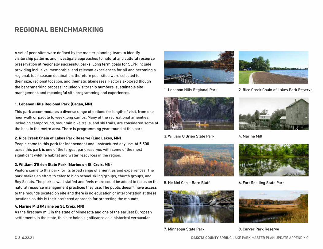
2. Rice Creek Chain of Lakes Park Reserve1. Lebanon Hills Regional Park
3. William O’Brien State Park 4. Marine Mill
5. He Mni Can – Barn Bluff 6. Fort Snelling State Park
7. Minneopa State Park 8. Carver Park Reserve
DAKOTA COUNTY SPRING LAKE PARK MASTER PLAN UPDATE APPENDIX CC-2 6.22.21
A set of peer sites were defined by the master planning team to identify visitorship patterns and investigate approaches to natural and cultural resource preservation at regionally successful parks. Long term goals for SLPR include providing inclusive, memorable, and relevant experiences for all and becoming a regional, four-season destination; therefore peer sites were selected for their size, regional location, and thematic likenesses. Factors explored though the benchmarking process included visitorship numbers, sustainable site management, and meaningful site programming and experiences.
1. Lebanon Hills Regional Park (Eagan, MN)
This park accommodates a diverse range of options for length of visit, from one hour walk or paddle to week long camps. Many of the recreational amenities, including campground, mountain bike trails, and ski trails, are considered some of the best in the metro area. There is programming year-round at this park.
2. Rice Creek Chain of Lakes Park Reserve (Lino Lakes, MN)People come to this park for independent and unstructured day use. At 5,500 acres this park is one of the largest park reserves with some of the most significant wildlife habitat and water resources in the region.
3. William O’Brien State Park (Marine on St. Croix, MN)Visitors come to this park for its broad range of amenities and experiences. The park makes an effort to cater to high school skiing groups, church groups, and Boy Scouts. The park is well staffed and feels more could be added to focus on the natural resource management practices they use. The public doesn’t have access to the mounds located on site and there is no education or interpretation at these locations as this is their preferred approach for protecting the mounds.
4. Marine Mill (Marine on St. Croix, MN)As the first saw mill in the state of Minnesota and one of the earliest European settlements in the state, this site holds significance as a historical vernacular
REGIONAL BENCHMARKING
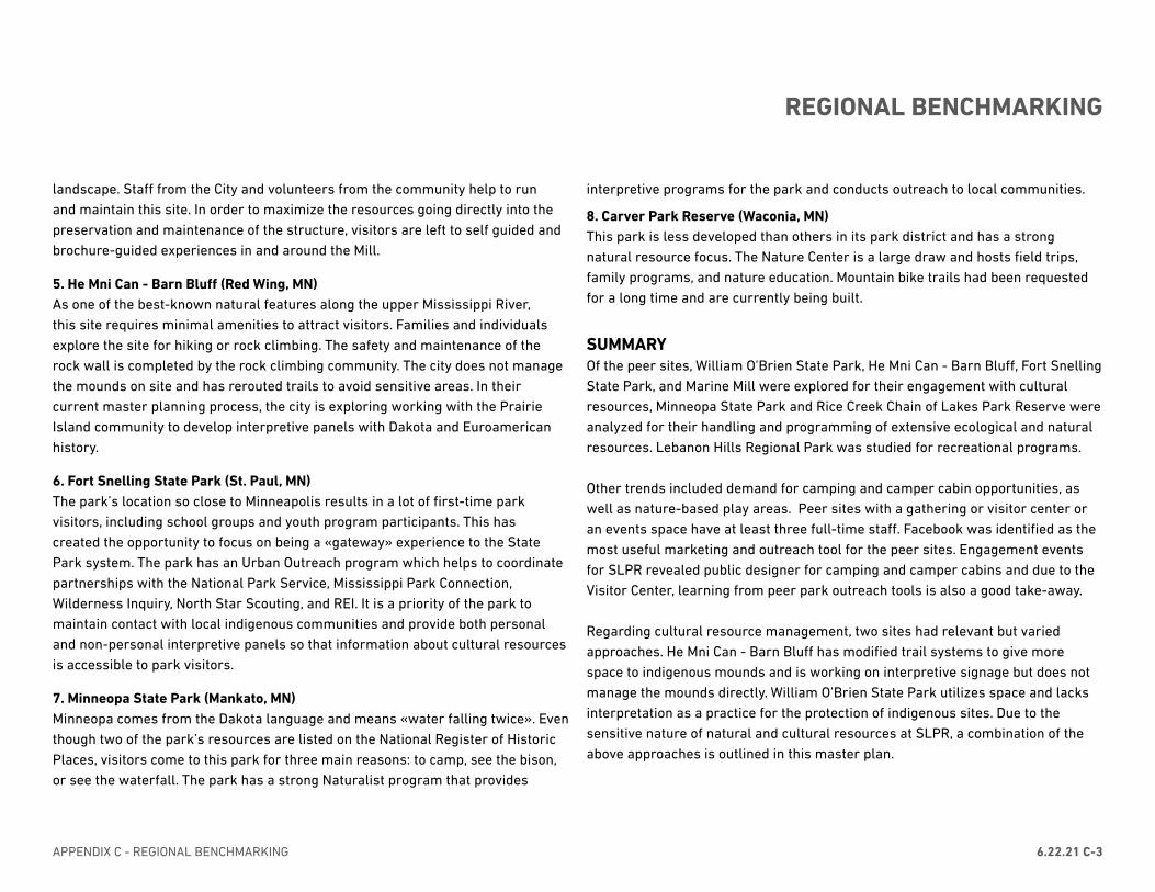
APPENDIX C - REGIONAL BENCHMARKING 6.22.21 C-3
landscape. Staff from the City and volunteers from the community help to run and maintain this site. In order to maximize the resources going directly into the preservation and maintenance of the structure, visitors are left to self guided and brochure-guided experiences in and around the Mill.
5. He Mni Can - Barn Bluff (Red Wing, MN)As one of the best-known natural features along the upper Mississippi River, this site requires minimal amenities to attract visitors. Families and individuals explore the site for hiking or rock climbing. The safety and maintenance of the rock wall is completed by the rock climbing community. The city does not manage the mounds on site and has rerouted trails to avoid sensitive areas. In their current master planning process, the city is exploring working with the Prairie Island community to develop interpretive panels with Dakota and Euroamerican history.
6. Fort Snelling State Park (St. Paul, MN)The park’s location so close to Minneapolis results in a lot of first-time park visitors, including school groups and youth program participants. This has created the opportunity to focus on being a «gateway» experience to the State Park system. The park has an Urban Outreach program which helps to coordinate partnerships with the National Park Service, Mississippi Park Connection, Wilderness Inquiry, North Star Scouting, and REI. It is a priority of the park to maintain contact with local indigenous communities and provide both personal and non-personal interpretive panels so that information about cultural resources is accessible to park visitors.
7. Minneopa State Park (Mankato, MN)Minneopa comes from the Dakota language and means «water falling twice». Even though two of the park’s resources are listed on the National Register of Historic Places, visitors come to this park for three main reasons: to camp, see the bison, or see the waterfall. The park has a strong Naturalist program that provides
interpretive programs for the park and conducts outreach to local communities.
8. Carver Park Reserve (Waconia, MN)This park is less developed than others in its park district and has a strong natural resource focus. The Nature Center is a large draw and hosts field trips, family programs, and nature education. Mountain bike trails had been requested for a long time and are currently being built.
SUMMARYOf the peer sites, William O’Brien State Park, He Mni Can - Barn Bluff, Fort Snelling State Park, and Marine Mill were explored for their engagement with cultural resources, Minneopa State Park and Rice Creek Chain of Lakes Park Reserve were analyzed for their handling and programming of extensive ecological and natural resources. Lebanon Hills Regional Park was studied for recreational programs.
Other trends included demand for camping and camper cabin opportunities, as well as nature-based play areas. Peer sites with a gathering or visitor center or an events space have at least three full-time staff. Facebook was identified as the most useful marketing and outreach tool for the peer sites. Engagement events for SLPR revealed public designer for camping and camper cabins and due to the Visitor Center, learning from peer park outreach tools is also a good take-away.
Regarding cultural resource management, two sites had relevant but varied approaches. He Mni Can - Barn Bluff has modified trail systems to give more space to indigenous mounds and is working on interpretive signage but does notmanage the mounds directly. William O’Brien State Park utilizes space and lacks interpretation as a practice for the protection of indigenous sites. Due to the sensitive nature of natural and cultural resources at SLPR, a combination of the above approaches is outlined in this master plan.
REGIONAL BENCHMARKING

APPENDIX D: DEVELOPED AREA METHODOLOGY

APPENDIX D - DEVELOPED AREA METHODOLOGY 5.20.21 D-2
The percent of land developed in Spring Lake Park Reserve is calculated as follows:
Percent Developed =(Total Developed Area/Total Upland Area) × 100 “Total Upland Area” is all of the parcels comprising the Park Reserve, excluding property not owned by Dakota County, public road rights-of-way, National Wetland Inventory (NWI) wetlands types 3-7 that are greater than 2.5 acres, and property within a 10-foot buffer of streams indicated by the “Streams centerline” data provided by the MnDNR.
“Total Developed Area” is the sum of all developed areas of the Park Reserve, excluding development occurring on parcels not owned by DC, public road rights-of-way, National Wetland Inventory (NWI) wetlands types 3-7 greater than 2.5 acres, and within a 10-foot buffer of streams indicated by the “Streams centerline” data provided by the MnDNR.
The extent of developed areas depends on the type of land use and is defined below:• Facilities (Areas such as buildings, paved and unpaved parking areas, picnic
grounds, recreation areas, and maintenance areas)• The entire maintained turf area• Park Roads, buffered 25 ft from centerline• Park Trails (impervious surface and natural surface), buffered 10 ft from
centerline
• Public Utilities (where GIS information is available)